Monarch butterfly on milkweed in Mrs. Gulch’s landscape July 17, 2021.
FromNational Public Radio (Michael Levitt and Christopher Intagliata):
Every year, monarch butterflies from all over the western U.S. migrate to coastal California, to escape the harsh winter weather. In the 1980s and ’90s, more than a million made the trip each year.
Those numbers have plummeted by more than 99% in recent years.
“The last few years we’ve had less than 30,000 butterflies,” biologist Emma Pelton said. “Last year, we actually dropped below 2,000 butterflies. So really an order of magnitude change in a short time period.”
Pelton works with the Xerces Society for Invertebrate Conservation and says pesticides and habitat loss play a role in that decline.
But this year, the numbers are starting to pick up. Biologists and volunteers across California have already counted more than 100,000 monarchs.
Richard Rachman is the coordinator for the Xerces Society’s annual Thanksgiving monarch count in Los Angeles County, and has been buoyed by the numbers.
Managing water collected from the mountain snow’s spring runoff has plenty of challenges — and will become more complex in the future due to climate change.
“As water planners, we prefer to see predictable weather patterns,” said Nathan Elder, water supply manager at Denver Water. “Unfortunately, every year is different and with climate change we’re seeing more variability and that makes it tougher to manage our water supply.”
That challenge may be most acute during runoff season, that critical — and brief — window of time when snow melts, flows into streams and fills reservoirs. Climate change may lead to changes in runoff timing that, in turn, require more nimble reservoir operations.
What’s happening?
Since the 1960s, average temperatures in Colorado have increased 2.5 degrees, according to the Colorado Water Conservation Board. That change is manifesting in significant ways.
“We’re seeing more swings between wet and dry years, more variation in year-to-year stream runoff and earlier runoff,” said Laurna Kaatz, climate program manager at Denver Water. “We’re also expecting to see more extreme weather events like extreme heat and enhanced drought, but we could also see more intense rainstorms and flooding especially if heavy rain falls on top of a lot of snow.”
Timing is everything
The timing of the snow runoff in Summit County, which is home to Dillon Reservoir, provides an example of how climate change impacts not only water collection but also recreation and flooding.
Rapid snowmelts caused by rain falling on snow could lead to a greater risk of flooding below Dillon Dam.
During a gradual runoff, Denver Water can take steps to minimize the risk of flooding below the dam, however, if there are more instances of warm weather combined with rain falling on snow, large amounts of water can fill Dillon quickly and send water through the dam’s overflow spillway. This scenario can lead to high water levels on the Blue River through Silverthorne.
“We do our best to minimize high flows out of our reservoirs, but if there is a fast runoff, we can only do so much and there’s a greater chance for flooding downstream if there’s a major rain-on-snow event,” Elder said.
Changes in runoff and precipitation also impact when Dillon Reservoir fills — or doesn’t fill — which plays a role in boating season and water levels for the Dillon and Frisco marinas.
The timing of the runoff also impacts Denver Water’s ability to make the most of its water rights.
“Later runoff allows us to use our water rights to match higher customer demand during the summer watering season,” Elder said. “Early runoff means we have to let some water go downstream before we can put it to use on the Front Range. This also impacts how much water we can store for times of drought.”
When Dillon Reservoir is full, water flows down its overflow spillway into the Blue River. Photo credit: Denver Water.
Extreme weather events
Colorado has seen several big swings in weather over the last 20 years, suggesting the kind of uncertainty that may be more pronounced as climate change intensifies and the resulting complexity in managing the snow runoff.
Most recently, the winter of 2017-2018 was exceptionally dry across the state but was followed by above average snow in 2018-2019.
The years 2012 through mid-2013 were another period of drought, followed by record flooding in September 2013. Two wet years followed in 2014 and 2015.
The dramatic weather turnaround in 2002 and 2003 is another example of how extreme weather impacts Denver Water’s water supply and planning.
Those years marked a major period of drought. In 2003, Denver Water was preparing to have water restrictions and Dillon Reservoir was more than half empty and critically low. But in March 2003, the Front Range and central mountains got hit with a major snowstorm that filled Denver Water’s reservoirs.
“A drought could last one year or several and then be followed by big snow years,” Elder said.
“We could get most of our water for the year from one or two big storms, so we have to be prepared for these situations.”
Swings in weather patterns and extreme events could have Denver Water planning for drought conditions with watering restrictions for customers and end up with a surplus of water after a big storm.
Cheesman Reservoir during the 2002 drought. Photo credit: Denver Water.
Planning for climate uncertainty
Denver Water has relied primarily on historical weather patterns and data to plan for how much water it will collect from mountain streams. Now the utility is incorporating climate change into its long-range preparation through scenario planning.
“One component of scenario planning involves creating a variety of potential climate scenarios instead of simply assuming patterns will stay the same over the next 50 to 100 years,” said Jeff Bandy, a water resource manager at Denver Water. “This approach helps us plan for potential changes in climate and evaluate our system’s reliability.”
Denver Water takes data from global climate models and uses the information to create various outcomes on streamflow and precipitation in its water collection system.
The planning team develops scenarios that include variables such as warmer temperatures, more precipitation and shifts in timing of precipitation, all of which result in changes to volume and timing of runoff in Denver Water’s watersheds.
“We evaluate the scenarios and determine if future infrastructure projects or operational changes are needed,” Bandy said.
Denver Water collects water from 4,000 square miles in Colorado’s central mountains and foothills. With such a large area, getting accurate and timely information about weather and streamflow conditions is critical to water supply management.
“We use a lot of different data sources to manage and forecast water supply and a lot of these data sources are based off historical climate data,” Elder said. “With a changing climate, the current data sources are no longer as reliable as they used to be. This makes it more difficult to manage our reservoirs.”
In preparation for more weather extremes and variability, Denver Water has begun investing in new technology to get a more accurate picture of the snowpack above Dillon.
Looking to the south from a plane above Dillon Reservoir in June 2019, during an Airborne Snow Observatory flight to gather data on the snowpack above the reservoir for Denver Water. Photo credit: Quantum Spatial.
“In April 2019 we used NASA’s Airborne Snow Observatory, which uses a plane, to measure snowpack over the mountains in our watershed,” Elder said. “The more we know about the snow, water content and runoff, the better decisions we can make when it comes to managing our water supply for our customers and the communities where our reservoirs are located.”
Nathan Elder, Denver Water’s manager of water supply, tracks a variety of factors to keep tabs on the snowpack and water supply. Photo credit: Denver Water.
What can customers do?
The best way communities can be prepared for the impacts of climate change is to use water wisely.
“Our water supply is vulnerable to climate and our customers play a major role in how we manage our system,” Elder said. “That’s why we always ask our customers to be efficient with their water all year long and even in wet years.”
Water is a limited resource in Colorado so climate change will impact communities on both sides of the Continental Divide.
“Climate change means water change and that’s important to us all,” Kaatz said. “So, it’s our goal at Denver Water to make sure we’re thinking about it and actively preparing for the changes we’re going to experience.”
Brad Udall: Here’s the latest version of my 4-Panel plot thru Water Year (Oct-Sep) of 2021 of the Colorado River big reservoirs, natural flows, precipitation, and temperature. Data (PRISM) goes back or 1906 (or 1935 for reservoirs.) This updates previous work with @GreatLakesPeck.
Two and a half years after signing a deal aimed at averting a damaging crisis along the Colorado River, water officials from California, Arizona and Nevada are discussing plans to take even less water from the shrinking river and leave it in Lake Mead in an effort to prevent the reservoir from falling to dangerously low levels.
Representatives of water agencies from the three states said they are firming up the details of a deal that would leave an additional 500,000 acre-feet of water in the reservoir next year, and the same amount again in 2023 — about double the quantity of water used annually by Las Vegas and the rest of southern Nevada.
For California, the deal would mean participating in water reductions prior to Lake Mead reaching levels that would otherwise trigger mandatory cuts.
The talks took on urgency this summer after federal projections showed growing risks of Lake Mead falling to critically low levels, despite plans for mandatory cutbacks throughout the Southwest that the states agreed to in 2019.
With the reservoir in a first-ever shortage and those cuts still insufficient, water management officials settled on a goal of together leaving half a million acre-feet of additional water in the reservoir instead of sending it flowing to farms, cities and tribal lands. The stored water would be roughly as much as 1.5 million average single-family households use in a year.
“We’ve got to stabilize the lake with this plan,” said Tom Buschatzke, director of the Arizona Department of Water Resources. He said representatives of California, Arizona and Nevada developed the framework of the deal within about two months after they saw projections showing growing risks of Lake Mead dropping to lows that would trigger much larger water reductions in all three states.
“I think coming together in that short a period of time is indicative of urgency we’re feeling to do more,” Buschatzke said. “If the lake keeps falling, cuts are going to be deeper and deeper and deeper. So I think it’s indicative of the risks.”
The deal would nearly double the reductions in planned water deliveries next year among the three states beyond those already planned under the 2019 agreement, called the Drought Contingency Plan. This new proposal, dubbed the 500+ Plan, would partially involve securing money to pay some water users to voluntarily relinquish water.
The water would come from various sources, including farmers who would be paid for leaving portions of their land dry, tribes that would contribute water supplies, and water agencies that would leave some water in Lake Mead instead of taking it out as planned.
Negotiations on the details are continuing, and officials from California and Arizona said they hope to have the overarching agreement ready to be signed next month at [the Colorado River Water Users Association] conference in Las Vegas.
Arizona has pledged $40 million toward the deal. Board members of the Southern Nevada Water Authority are scheduled to consider approving up to $20 million in contributions this week.
The board of the Metropolitan Water District of Southern California is scheduled to consider the proposed agreement next month…
If the details of the proposal come together as planned, 500,000 acre-feet of water over two years would translate into water levels about 16 feet higher in Lake Mead…
For now, the talks have focused on lining up funds and water for two years. But Buschatzke said it’s intended to be a five-year plan, lasting until the current agreement expires at the end of 2026, by which time the states will need to have negotiated new rules for dealing with shortages.
If the winter were to bring heavy snow to the Rocky Mountains, it could still help ease the shortages. But the region’s water managers said they’ve decided to plan for more of the dismal runoff they’ve seen in the watershed during the past two years of extreme heat and parched conditions.
Bill Hasencamp, MWD’s manager of Colorado River resources, said if such extreme dryness persists for another year or two, then Mead could end up at such low levels that cuts would become “unmanageable.”
[…]
When Buschatzke testified in a congressional hearing on the Colorado River last month, he noted that snowpack in the Colorado River Basin peaked at 89% of average this year, but runoff in the watershed was only 33% of average.
“This phenomenon is likely the result of the hotter and drier conditions caused by climate change,” Buschatzke said in his written testimony. “This trend is one that water managers must take into account as we plan for the future of the Colorado River.”
[…]
Since 2000, the Colorado River has been ravaged by a series of mostly dry years, which have been compounded by the heating of the planet with the burning of fossil fuels. In that time, the flow of the Colorado River has declined nearly 20% below the 20th century average.
Scientists have estimated that about half the decrease in runoff in the watershed since 2000 has been caused by unprecedented warming. And this heat-driven aridification is projected to significantly worsen as temperatures continue to climb.
Brad Udall, a water and climate scientist at Colorado State University, recently likened the planned water reductions under the existing deal to a parachute — one that is too small and being opened too close to the ground…
Given the alarming declines in the river’s reservoirs, the flaw with the parachute analogy is that the end of the story would put the parachutist safely on the ground, Udall said.
“We’re landing on the edge of a cliff, if you will. And there’s still further to fall. We need another parachute here,” Udall said.
Hopefully that next parachute will be ready well before 2027, he said, when the existing rules expire, and the Southwest needs to have long-term plans in place for adapting to a hotter, drier watershed and a river that yields less water.
Lake Mead behind Hoover Dam. Lake Mead last month [May 2021] fell to its lowest level since the Hoover Dam was built in 1936. The shoreline has dropped 45 meters since the reservoir was last full in 2000. Photo by Ken Neubecker via American Rivers
Already, there is not enough water flowing through the Colorado River to meet all of the demands on the watershed, which spans seven U.S. states and crosses into Mexico. And as the climate changes, scientists warn that those who depend on the watershed should plan to receive even less water each year…
Already, the Lower Colorado River Basin states that rely on Lake Mead — Arizona, California and Nevada — have been meeting to discuss and find funding for a program that would keep more water in the reservoir in an attempt to stave off further shortages and cuts. That plan would keep about 500,000 acre-feet in the reservoir next year and in 2023…
The states came together to develop the plan as part of a consultation clause in an existing 2019 agreement, known as the Drought Contingency Plan. That plan builds off of a set of operating guidelines for the river, approved in 2007 and set to expire in 2026. At the same time that water officials from the seven Colorado River states tackle near-term issues, they are all positioning to negotiate a new set of guidelines.
The Colorado River is governed by a series of overlapping laws, contracts, compacts and agreements, including the guidelines. Working within these structures, the states face a major challenge — to reduce use on the river and prepare for the worst-case scenario of a future with far less water to go around. Next month, water officials from across the basin are set to meet in Las Vegas to discuss that challenge and other issues facing the river.
John Entsminger, the general manager of the Southern Nevada Water Authority, said he is “cautiously optimistic” that the states will be able to find a way to lower use “because of the structures we’ve already put in place.” He noted that if Lake Mead were to hit 1025 feet above sea level, current agreements would already trigger cuts of about 1.3 million acre-feet of water.
The Nevada Independent spoke to Entsminger about the negotiations and how dry of a future Colorado River water officials should plan for. Our conversation has been edited for clarity and length.
What do you see as the greatest challenge facing the Colorado River moving forward?
I hate to be obvious, but the biggest challenge for the river is we have a lot less water than people have legal entitlements.
How does that play into discussions around management as they’re evolving right now?
It makes the interstate and international discussions much more difficult, because really what you’re ultimately doing is negotiating to divide up a far smaller pie than what was believed to be the case in the 20th century.
Brad Udall: Here’s the latest version of my 4-Panel plot thru Water Year (Oct-Sep) of 2021 of the Colorado River big reservoirs, natural flows, precipitation, and temperature. Data (PRISM) goes back or 1906 (or 1935 for reservoirs.) This updates previous work with @GreatLakesPeck.
You mentioned not that long ago, testifying in Congress, that “the river community is far from a consensus about how dry of a future to plan for.” What are some of the differing opinions right now? And where are people on establishing that baseline of what the future looks like for the river?
I was on a panel at the University of Colorado Law School within the last six weeks or so. And a couple people on the panel were asked that question of how dry a future should we be planning for, and I said I thought an 11 million acre-feet annual flow of the river is probably a good place to start based upon what I’ve heard from folks like Jonathan Overpeck and Brad Udall and other smart climate scientists.
But there were some folks on that panel that threw out a number of 13 to 14 million acre-feet, which, frankly, is quite a bit more water than the average of the last 20 years. So I think just from that exchange, you can see that there isn’t currently a consensus on what sort of worst-case scenario should we be planning for, as we negotiate operating guidelines for post-2026.
Let’s take that number, 11 million acre-feet. What would it mean in terms of water use to get to that number?
As a basin (seven states plus the country of Mexico), we’re currently using about 14 [million acre-feet]. So it would mean finding a way to cut current uses by three million acre-feet and not add any new uses, at least without retiring a commensurate amount of existing uses.
Knowing how hard it is to reduce use, that sounds like a very big challenge. Do you think that’s an achievable goal?
That’s the amount of water that Mother Nature gives us. We don’t really have a choice whether or not to achieve it. You have to find a way to live within the amount of water that nature actually gives you.
Signing ceremony for the Colorado River upper and lower basin Drought Contingency Plans. Back Row Left to Right: James Eklund (CO), John D’Antonio (NM), Pat Tyrell (WY), Eric Melis (UT), Tom Buschatzke (AZ), Peter Nelson (CA), John Entsminger (NV), Front Row: Brenda Burman (US), and from DOI – Assistant Secretary of Water and Science Tim Petty. Photo credit: Colorado River Water Users Association
The Colorado River is a vital lifeline for the arid U.S. Southwest. It supplies water to seven states, Mexico, 29 Indian reservations and millions of acres of irrigated farmland. The river and its tributaries support 16 million jobs and provide drinking water to Denver, Salt Lake City, Albuquerque, Las Vegas, Los Angeles, San Diego, Phoenix and Tucson – in all, 40 million people.
These rivers also course through several of the world’s most iconic national parks, including the Grand Canyon in Arizona and Canyonlands in Utah. Today millions of people visit the Colorado River Basin to fish, boat and explore.
Southwestern states, tribes and Mexico share the Colorado’s water under the century-old 1922 Colorado Compact and updates to it. But today, because of climate change and rapid development, there is an enormous gap between the amount of water the compact allocates to parties and the amount that is actually in the river. With users facing unprecedented water shortages, the compact is hopelessly inadequate to deal with current and future realities.
I have studied water resource development for 35 years and written extensively about Native American waterrights and the future of America’s rivers. As I see it, the compact rests on three fundamental errors that now plague efforts to develop a new vision for the region. I believe the most productive way forward is for states and tribes to negotiate a new agreement that reflects 21st-century realities.
The Colorado River and its tributaries drain parts of seven Western states and 29 Indian reservations. Climate.gov
Flawed data and allocations
The compact commissioners made two fatal blunders when they allocated water in 1922. First, they appraised the river’s volume based on inaccurate data that wildly overestimated it. Actual annual historic flows were far below what was needed to satisfy the dictates of the compact.
There is evidence that the commissioners did this purposefully: Reaching an agreement was easier if there was more water to go around. This strategy guaranteed that the compact would allocate more water than was actually in the river, a situation now referred to as the “structural deficit.”
Second, the compact allocated water in fixed amounts rather than percentages of the river’s actual flow. That approach would be viable if river flow were constant and the agreement were based on sound science. But the Colorado’s flow is highly variable.
The compact divided the river artificially into an Upper Basin (Wyoming, Colorado, Utah and New Mexico) and a Lower Basin (Arizona, Nevada and California), and allocated 7.5 million acre-feet of water to each basin. An acre-foot is enough water to cover an acre of land to a depth of one foot, or about 325,000 gallons.
In 1944, a treaty allocated an additional 1.5 million acre-feet to Mexico, for a total of 16.5 million acre-feet. However, actual flow has typically been below that amount. River volume at the time of the compact was about 18 million acre-feet per year, but the 20th-century average was closer to 14.8 million acre-feet. And then things got much worse.
Drought and climate change have pushed the Colorado River to a crisis point.
In the past 20 years, climate change has further reduced the Colorado’s volume. A “megadrought,” now in its 21st year, has reduced flows by nearly 20%, and studies predict that it will fall 20% to 35% or more by midcentury. In late August 2021, Lake Mead, the nation’s largest reservoir, was just 35% full. Lake Powell, the second-largest U.S. reservoir, was less than 30% full.
That month, the Bureau of Reclamation declared an official shortage, which will force Arizona, Nevada and Mexico to make significant cuts in water use. In short, the original fixed allocations are no longer anchored in reality.
In my view, a much better approach would be to allocate water among the states and tribes in percentages, based on a five-year rolling average that would change as the river’s flow changes. Without such a shift, the compact will merely perpetuate a hydrological fallacy that leads water users to claim water that does not exist.
No Native participation
Beyond these errors, the compact also rests on a fundamental injustice. The 30 tribal nations in the Colorado River Basin are the river’s original users, and their reservations encompass huge swaths of land. But they were completely left out of the 1922 allocations.
Tribes have gone to court to claim a share of the Colorado’s water and have won significant victories, beginning with the landmark 1963 Arizona v. California ruling, in which the U.S. Supreme Court recognized water rights for five Indian reservations in the Colorado River Basin. The tribes continued to press their claims through numerous negotiated settlements, starting in 1978 and continuing to this day. They now have rights to over 2 million acre-feet of water in the Lower Basin and 1.1 million acre-feet in the Upper Basin. And 12 tribes have unresolved claims that could total up to 405,000 acre-feet.
Currently, however, tribes are not drawing all of their water because they don’t have the pipelines and other infrastructure that they need to divert and use it. This allows non-Indian communities downstream to use the surplus water, without payment in most cases. I believe a new compact should include tribes as equal partners with states and give them meaningful and significant roles in all future negotiations and policymaking in the basin.
[More than 140,000 readers get one of The Conversation’s informative newsletters.Join the list today.]
I see these discussions as an excellent opportunity to discard the compact’s unworkable provisions and negotiate a new agreement that responds to the unprecedented challenges now affecting the Southwest. As I see it, an agreement negotiated by and for white men, based on egregiously erroneous data, in an age when people drove Model T cars cannot possibly serve as the foundation for a dramatically different future.
In my view, the 1922 compact is now an albatross that can only inhibit innovation. Eliminating fixed rights to water that doesn’t actually exist could spur members to negotiate a new, science-based agreement that is fairer, more inclusive and more efficient and sustainable.
City Council calls for local control rules in big land projects could delay approval of Northern Water’s Northern Integrated Supply Project by a year.
Fort Collins has placed new barriers in front of Northern Water’s $1.1 billion plan to build a dam and pipeline network along the Cache la Poudre River, further slowing a decades-long project backed by 15 growing Front Range communities and water districts.
City government put a hold on the kind of pipeline and infrastructure work Northern Water needs for its Northern Integrated Supply Project, saying Fort Collins will pause for a year to write new regulations under state “1041” permitting laws that encourage local control of big land use projects. Fort Collins’ planning commission had rejected a NISP pipeline proposal through city open space last summer, but Northern Water’s board overrode the decision, as is allowed by state law.
Northern Water says it has already complied with local approval protocols, including receiving 1041 approval from surrounding Larimer County, and will study its options if Fort Collins tries to force NISP through a newly created layer of planning.
“We think that we’ve completed” the city’s Site Plan Advisory Review process, which was the standard before Fort Collins started talking about creating 1041 rules, Northern Water spokesman Jeff Stahla said. “We’re really going to take a close look at exactly what was passed by the city council.”
Placing a hold on new projects and asking staff to create a 1041 process for the first time was not meant to target Northern Water specifically, though it will likely delay their Fort Collins projects, city council member Kelly Ohlson acknowledged. A new group of city council members taking office after spring elections learned Fort Collins could use the state’s 1041 law to influence projects rather than just react to them, Ohlson said…
Mayor Jeni Arndt said the new tier of local regulations should not make a big difference in Northern Water’s decadeslong pursuit of final project approvals. Northern Water wants to build two big reservoirs northwest and east of Fort Collins, and connect them to the Poudre and the South Platte River through a series of pipelines and ditches.
Arndt said city leaders have narrowed down their interests in creating a 1041 review process to two areas for now: water projects and development that impacts natural areas.
“I don’t feel like that’s an evil volley against them,” Arndt said. “It’s not tit for tat. We have some legitimate concerns about our natural areas and parks.”
Conservation groups that have battled NISP and its complex water engineering for years are happy to see a new bump in the road for Northern Water, which says it expects to receive a final federal-level permit from the U.S. Army Corps of Engineers any month now. Opponents have filed suits and protested local government approvals since portions of NISP were first conceived in the 1980s. In July, they focused on the Fort Collins planning body’s decision whether to approve project pipelines buried in city park land and right of way…
A delay from Fort Collins to pursue more local control rules follows Northern Water’s success in September getting Larimer County approval for another key element of the project: moving U.S. 287 east over a ridge, north of Ted’s Place, to create the dam basin where Glade Reservoir will store Cache la Poudre water.
Northern Integrated Supply Project (NISP) map July 27, 2016 via Northern Water.
Overall, the northern supply project will build Glade and another new reservoir northeast of Greeley, Galeton, that will store South Platte River water. Some of the new supply will be delivered in the Cache la Poudre channel, while other transfers will be made by a series of pipelines and ditches.
Northern Water says the project will bring much-needed supply to 80,000 more residents in more than a dozen growing communities that have signed up for the water. The water agency says storing Cache la Poudre water in Glade during higher runoff allows them to supply a steady stream for wildlife and recreation through Fort Collins at times when the river otherwise runs nearly dry.
Opponents say NISP takes water from wildlife and scenic rivers, and encourages sprawling growth in communities that could do more to conserve water.
Cumulative precipitation (brown line) and average temperature (red line) for all 20-month, January–August periods since 1895. The current drought coincided with record-low precipitation and near-record high temperatures. NOAA Climate.gov, adapted from original by the NOAA Drought Task Force. Photo of low water levels in Lake Powell on August 13, 2017, by Flickr user Edwin van Buuringen, used under a Creative Commons license.
In the mid-2000s, seven states, the federal government and Mexico negotiated critical rules for the Colorado River that established how to divvy up its water in a severe drought like it is now facing.
Thirty Native American tribes — with rights to roughly a quarter of all the water in the river — were shut out of those talks.
Tribes want to make sure that doesn’t happen again. The effort offers new challenges for the seven Colorado River basin states and the Biden administration, which has repeatedly pledged to be more inclusive in regulatory efforts that affect Native Americans.
“It is fair to say that tribes were not involved in the negotiation of the 2007 guidelines,” said Anne Castle, a former Interior assistant secretary for water and science during the Obama administration. “Tribes will have a seat at the table this time in the negotiation of the next set of rules. The question is what does that look like? And that hasn’t been worked out yet.”
The 2007 guidelines expire in 2026 and determine how shortages are allocated across the basin. The Colorado River, which serves 40 million Americans, is currently in the grips of a more than 20-year “megadrought,” and federal officials declared a shortage for the first time in August, which means Arizona, Nevada and Mexico will see cuts to their deliveries next year…
The river’s declining flows due to climate change and drought have put a premium on tribal water.
Negotiations over new operating guidelines are just now getting underway. There is widespread agreement that they will be tougher than the last round because the basin will be grappling with a river that is drying up. Simply put, there is less water to go around.
From the 2018 Tribal Water Study, this graphic shows the location of the 29 federally-recognized tribes in the Colorado River Basin. Map credit: USBR
Tribes have rights to at least 3.2 million acre-feet of river water and, by some estimates, 1 million to 1.5 million acre-feet of it is currently unused. An acre-foot is roughly 326,000 gallons, about as much as a Los Angeles family of four uses in a year.
That’s led to a rush to build out capacity for tribes to meaningfully contribute to the negotiations.
Unused tribal water could provide an important buffer for cities like Phoenix, for example, if agreements are penned to fairly compensate the tribes.
There is also a push for more widespread recognition that tribes may have better ideas for how to use the river.
“You have a group of at least 30 tribal sovereigns in the Colorado River basin who have lived sustainability there for thousands of years,” Daryl Vigil, water administrator for the Jicarilla Apache Nation, said at recent conference hosted by the Getches-Wilkinson Center for Natural Resources, Energy and the Environment at the University of Colorado.
“We are having these conversations about sustainability and resiliency, why aren’t we talking to those people who are still here who have been resilient and have lived sustainably?” Vigil said.
Changes in landscaping regulations for new Colorado Springs developments are on the horizon, the latest effort to curtail the use of water-thirsty lawns as drought continues to grip the West and pressure the Colorado River, the source of up to 70 percent of the city’s water supply.
The rules would reduce the amount of turf a residential lot would be allowed to have to minimize use of the city’s water supply on landscaping.
Part of Retool COS, a revamp of all city regulations governing development, the turf restrictions could be adopted as early as next May.
But those rules won’t affect existing sprawling lawns and high water-using plants. Officials hope the use of tiered water rates and education will encourage property owners to reduce demand, which already has happened.
As the consequences of severe drought become more apparent, Colorado Springs residents should recognize the condition of the state’s rivers has a direct impact on them, says Colorado Springs Utilities spokesperson Natalie Eckhart…
West Drought Monitor map October 26, 2021.
Drought in the West has spanned 20 years, and on Oct. 18, the Bureau of Reclamation released its Two-year Probabilistic Projections that updated modeling for inflows at Lake Powell and Lake Mead, fed by the Colorado River, showing the reservoirs are at risk of reaching critically low levels…
The Bureau of Reclamation study removed the wet period of the 1980s from the calculations and “further underscores the possible dire drought conditions that the [Colorado] Basin may experience in the next two years and the need for immediate action to bolster resiliences going forward,” the Water for Colorado Coalition said in a release. The coalition is made up of nine organizations — including The Nature Conservancy, Conservation Colorado, Trout Unlimited and Western Resource Advocates — that work to ensure the state’s rivers support those who depend on them.
The study and projections illustrate “the grim state of hydrology in the Basin and offers an impetus for urgent collaborative action,” the coalition said.
“The Colorado River is in trouble, and under the status quo there is uncertainty as to how the River system will continue to support thriving economies, communities, and river systems within the state, let alone the 40 million people, trillion dollar economic market, diverse cultures, and myriad fish and wildlife habitats that rely on it.”
The coalition urged water users to incorporate all the tools available to “increase preparedness and resilience to climate change,” including voluntary conservation efforts, forest management and restorative agricultural practices to boost soil health and reduce loss of water…
For Colorado Springs Utilities, the need to monitor and conserve water is a pragmatic one, not being located on a river system but rather relying heavily on transmountain supplies, most notably from the Colorado River.
About 50 percent of the city’s water supply comes from the Colorado River Basin. That portion rises to 70 percent with reuse, a method that allows for additional use of previously used water. For example, once water is used for domestic purposes, it’s treated and reused in the city’s non-potable system.
“We take the risks very seriously and employ a number of mitigation strategies,” Colorado Springs Utilities Board Chair Wayne Williams says via email.
Among those:
• Diversifying Colorado River sources by acquiring and developing rights from various other sources, including share agreements with lower Arkansas River Valley agricultural users.
• Expanding the current infrastructure to allow for more storage. Utilities has spent millions of dollars in recent years repairing and upgrading dams at its reservoirs for maximum storage potential. It secured the equivalent of a third of the city’s supply by inking a storage contract at Pueblo Reservoir and building the Southern Delivery System pipeline to Colorado Springs, which became operational in 2016. It’s also in the planning and research stage of building a new reservoir in the White River National Forest in Eagle County to perfect water rights owned by the city and Aurora since the 1950s.
• Reducing per capita water consumption through efficiency and conservation measures. Data show the average use per person in Colorado Springs dropped from 139 gallons per day in 2000 to 82 gallons per day this year, Springs Utilities spokesperson Jennifer Kemp says. Moreover, of that 139 gallons some 20 years ago, 60 percent went for outdoor use, while outdoor use today comprises only 41 percent of total usage per person.
• Exploring more uses for the city’s non-potable water supply.
• Researching the feasibility of incorporating recycled water into the domestic supply.
Now, the city’s Retool COS land use code proposes to incorporate “recognized water conservation principles” into development requirements to conserve water.
The proposal calls for reducing consumption through use of xeriscape concepts and “standards for the selection, installation, and maintenance of organic soil amendments and plant materials, and the conservation of indigenous plant[s].”
Those steps will, in turn, reduce mowing and fertilization requirements of limited turf areas, preserve species habitat, and curtail air, water and noise pollution, Retool COS says.
Specifically, the proposed code change would apply to all single-family and two-, three- and four-family residential projects by limiting turfgrass to no more than 25 percent of the portion of the lot not covered by a primary or accessory structure or a driveway, patio, deck or walkway.
Also, no contiguous area of less than 100 square feet could be planted with high-water-use turfgrass or other landscaping with spray irrigation. This provision’s intent is to minimize pockets of high water turf outside of the “tree lawn” — that space between a detached sidewalk and street curb, Planning Supervisor Morgan Hester says in an email…
Past efforts have included education about plants and their individual watering needs, and tiered rate structures that increase the per-unit cost of water based on levels of usage. Simply put, the more water you use, the higher the price, or the less water you use, the lower your bill will be.
Few in the American West have been spared the effects of the region’s long-standing drought, but on the frontlines of the sere conditions are those who work most closely with the land — farmers, ranchers and other agricultural producers. San Miguel County created a program, Payment for Ecosystem Services (PES) that compensates landowners for implementing practices in “drought resilience and other soil health improvement projects,” according to the county’s Parks and Open Spaces page n the county website. The Board of County Commissioners (BOCC) got an update from the department’s director, Janet Kask, and contractor Chris Hazen, on their efforts to enlist landowners in the forward-thinking program.
The county was awarded a grant from the Colorado Water Conservation Board to enhance the PES program, Kask explained…
The pilot program is seeking six partners and is currently in earnest talks with several interested landowners. Hazen, an independent contractor with The Terra Firm, is spearheading the administration of the CWCB grant in order to “continue with our soil health initiative,” Kask said…
While talks with landowners are ongoing, Kask and Hazen reported there have been delays.
“We’re disappointed that we haven’t had the landowner commitments that we initially set out to have,” Kask told the commissioners Wednesday. “We were looking at a total of six this year, but just based on active conversations Chris has had with certain landowners, some of them are on hold and hesitant to join and we do have somebody who’s almost ready to go, but waiting for their USDA number. There are some criteria that the landowners need to meet and adhere to on our end.”
Norwood farmers Tony and Barclay Daranyi of Indian Ridge Farm are closest to qualifying as of Wednesday. Other participants close to being green-lighted are the owners of Laid Back Ranch and of Lizard Head Wilderness Ranch, Hazen said…
Some of the practices the county is looking for in property being proposed for participation includes cover crops, intensive till to no-till or strip till, improved fertilizer management, conservation cover /cropland conversion, forage and biomass planting/convert cropland to grass/legume/biomass, convert cropland to permanent grass/legume cover, windbreaks, nutrient management, and other practices as called out by the Natural Resource Conservation Service…
Some hiccups in meeting the goal of six participants include delays in submitting a USDA number, mapping challenges, the pandemic and other delays.
The CWCB grant totals $34,646, with the county matching at $34,646 for a total of $69,293.
For more information, contact Hazen at The Terra Firm 970-708-1221, with questions or to schedule a meeting to identify partnership opportunities.
FromThe Grand Junction Daily Sentinel (Dennis Webb):
A rapids-loving, odd-looking native fish found locally in the Colorado River is now officially considered to be at a reduced risk of extinction.
The U.S. Fish and Wildlife Service on Friday said it has reclassified the humpback chub from endangered to threatened under the Endangered Species Act, thanks to significant progress made by conservation and recovery efforts of federal agencies, states, tribal entities and private partners.
“It’s a major milestone that we feel very proud of,” Kevin McAbee, acting director of the Upper Colorado River Endangered Fish Recovery Program, told The Daily Sentinel. “We believe that it demonstrates the collaborative conservation efforts that we’ve been undertaking with our partners over the last three-decades-plus are working. It’s really something that we’ve been working towards for many years and we’re just very excited about it.”
[…]
Feeding on insects, crustaceans and plants, the humpback chub can live 20 to 40 years, grow up to 19 inches long and produce up to 2,500 eggs per year. A warm-water species, it is uniquely adapted to live in the turbulent whitewater found in rivers’ rocky canyon areas, according to the Fish and Wildlife Service. Its namesake, fleshy lump behind its head evolved to make it harder to be eaten by predators, and large, curved fins let it stay in place in swift currents.
These traits have helped it survive in the Black Rocks area of the river in western Mesa County and in Westwater Canyon just across the Utah border, where the Fish and Wildlife Service says the most recent estimates indicate there are populations of 430 and 3,300 adults, respectively. The Westwater Canyon population has been growing and the Black Rocks numbers are stable, but a large number of juveniles may boost the Black Rocks population in the future.
Other stable populations exist at the Desolation/Gray canyons area on the Green River in Utah and Cataract Canyon on the Colorado River in Utah. The Grand Canyon is home to the largest number of fish, including an estimated 12,000 in a core area in the Little Colorado River and the Colorado River around their confluence…
Globally, the fish exists only in that handful of core population areas. Another population in Dinosaur National Monument appears to have died out. McAbee said the Westwater and Black Rocks populations combined are the largest population upstream of Lake Powell, making them the home of the largest combined population in the world of humpback chub outside of the Grand Canyon, and an important core population just downstream of Grand Junction…
Two multi-stakeholder efforts, the Upper Colorado River program and Glen Canyon Dam Adaptive Management Program, have worked to try to help recover the species. In the Upper Colorado River, these efforts have included protecting river flows; managing and removing predatory, nonnative fish; and installing and operating fish passage structures where dams otherwise can impede fish travel.
Water-release measures involving upstream reservoirs have helped manage river flows to benefit the fish despite drought conditions that largely have prevailed over the last two decades. The Fish and Wildlife Service concluded that current river flows and temperatures are largely adequate despite climate change, so it doesn’t put the fish at immediate risk of extinction, which would mean it’s endangered. But the agency found that uncertainty about the possible severity of future water-supply declines poses a threat to the fish in the future, so it is likely to become endangered in the foreseeable future — the criteria for determining that it is threatened…
Another uncertainty surrounds the future of conservation efforts in the Upper Colorado River Basin because the recovery program there currently is scheduled to expire in 2023…
“However, commitment to continue the decades-long partnership is strong, as demonstrated by ongoing efforts to extend the partnership beyond 2023,” the Fish and Wildlife Service says in its final rule on the fish’s downlisting…
A further challenge for the program that the Fish and Wildlife Service is monitoring is the status of its funding.
Federal hydropower revenue that has helped support the program is threatened because falling reservoir levels are jeopardizing hydropower generation.
New State Park Builds on Polis Administration’s Historic Levels of Direct Investment in Our Outdoors & Lands
Today Governor Jared Polis announced a partnership among Colorado Parks and Wildlife, the U.S. Forest Service (White River National Forest), and Eagle Valley Land Trust (EVLT) to create Colorado’s 43rd State Park at Sweetwater Lake. The partners are now working to develop a long-term management plan to improve recreational facilities and maintain the unique character of the area. This is the second State Park created under the Polis administration, with Fishers Peak in Trinidad officially opening almost a year ago.
“Sweetwater Lake is simply gorgeous, and has great potential for even more recreational opportunities like a campground,” said Governor Polis. “This is the first of its kind partnership in Colorado to create a state park on U.S. Forest Service land, and we look forward to working with our partners and Coloradans with the ultimate goal of adding Sweetwater Lake to Colorado’s world-class state park system for fun, conservation, education, and to support job growth for the region.”
Jacque Buchanan, Deputy Regional Forester, U.S. Forest Service, Jessica Foulis, Executive Director, Eagle Valley Land Trust, Dan Gibbs, Executive Director, Colorado Department of Natural Resources, Jeannie McQueeney, Eagle County Commissioner, and Representatives Dylan Roberts & Perry Will spoke at the event.
The White River National Forest acquired the 488-acre Sweetwater Ranch in Garfield County on August 31, 2021, through a federal Land and Water Conservation Fund (LWCF) purchase. The area had been identified among the top 10 priority LWCF purchases nationwide to increase public recreation opportunities as well as to protect the area’s important wildlife habitat, cultural and scenic values. This LWCF purchase followed the acquisition of the property in 2020 by The Conservation Fund, which was made possible by a loan from Great Outdoors Colorado and local fundraising efforts such as the “Save the Lake” Campaign organized by EVLT.
“Sweetwater Lake has tremendous ecological and cultural values and outstanding opportunities for recreation. This partnership allows the White River National Forest to incorporate the local expertise of the Eagle Valley Land Trust and the recreation management and wildlife expertise of Colorado Parks and Wildlife to best serve visitors to the area,” said Rocky Mountain Regional Forester Frank Beum.
The acquisition of the 488-acre Sweetwater ranch property significantly increases the existing public access to the lake. However, very little infrastructure is currently in place to facilitate public recreation. Improved facilities, including a new boat launch, will be available to the public by June 1st, 2022. Additional buildout will follow the completion of a long-term plan, in consultation with the public, for expanding and managing the recreational opportunities at Sweetwater Lake while preserving the unique, relatively undeveloped nature of the property.
“Sweetwater Lake is a hidden gem, both as a destination and gateway to the Flat Top Wilderness. The partnership formed to protect and manage this unique landscape is an extension of the state and federal commitment to shared stewardship, which the Governor and U.S.D.A. initiated in 2019,” said Dan Gibbs, Executive Director, Colorado Department of Natural Resources.”
This summer, Governor Polis was proud to sign several pieces of legislation that provide more opportunities for Coloradans to go out and recreate, as well as key measures to protect the state’s outdoor beauty, and provide sustainable funding for the outdoors. The Keep Colorado Wild Pass bill, signed by Governor Polis in June, creates an optional low-cost state park and public lands pass, cutting the current cost by half or more by 2023. The new pass will make outdoor recreation opportunities more accessible while increasing the state’s ability to conserve, plan and invest in our public lands for the long term. Governor Polis also signed into law the Outdoor Equity Grant Program in June, which will increase access and opportunities for underserved youth and their families to enjoy Colorado’s outdoors.
“Colorado Parks and Wildlife is excited to modernize facilities, and provide updated and sustainable recreational services through this partnership. Our main priority is to conserve the unique character of the area while improving access to this incredible property,” said CPW Director Dan Prenzlow.
“The conservation of Sweetwater Lake is the realization of a community vision decades in the making. EVLT is looking forward to closely coordinating with the Forest Service and Colorado Parks and Wildlife as we move forward with plans for Sweetwater Lake,” said Jessica Foulis, Executive Director, Eagle Valley Land Trust.
Colorado is home to more than 22 million acres of public lands, ranging from wetlands to forests, canyon landscapes to mountain lakes. Governor Polis is a strong supporter of Colorado’s outdoors and has fulfilled his pledge to double the amount of publicly accessible land trust enrolled in the Public Access Program.
Here are photos of the lake. View the press conference here.
The White River National Forest took ownership of the oasis adjacent to the Flat Tops Wilderness this summer after securing $8.5 million from the Land and Water Conservation Fund. Two years ago, The Conservation Fund and the Eagle Valley Land Trust joined to buy the property from a Denver investment group, with a plan to transfer it over to the national forest.
The White River is the eighth owner of the parcel in the last few decades. The remote acreage has been eyed by wealthy investors for development of golf courses, a private community of luxury homes and even a water bottling plant.
Adrienne Brink first visited Sweetwater Lake as a 19-year-old in 1969 on a backcountry horseback trip. She returned a few years later with her husband and bought the horse packing outfitter. They bought the Sweetwater Resort — some cabins, a restaurant, a boat launch and a campground, in the mid 1980s. They’ve been running trips — with a permit from the White River National Forest — and hosting visitors ever since. In that time, she’s seen six owners come and go, not counting the two conservation groups or the Forest Service.
Those investors had big dreams. She’s got maps they sketched of golf courses in meadows where she grazes her horses. The water-bottling planners — “really nice guys,” she said — left her unable to irrigate those meadows as they studied flows from the spring where they hoped to collect water to sell under the name “Vaspen.”
But none of the big dreamers ever made any progress. They never invested in the property. They never even put a shovel to dirt…
Colorado and the Forest Service created a “shared stewardship” agreement in 2019, with a memorandum of understanding that provided the framework for the state and Forest Service to work with local communities, tribal partners and a host of other agencies “to work collaboratively to accomplish mutual goals, further common interests and effectively respond to the challenges facing the communities, landscapes, natural resources and cultural resources of the state.”
That program has led the state and Forest Service to map wildfire hazards and possible mitigation strategies. And now it’s led to a new state park. Dan Gibbs, the director of Colorado’s Department of Natural Resources, said he’s working with the Bureau of Land Management on a similar shared stewardship agreement…
The new park — which has not been officially named but Gibbs said would likely include a nod to the White River National Forest — is a blueprint for state and federal cooperation in expanding Colorado’s state parks. The effort to protect Sweetwater Lake included the towns of Gypsum and Eagle, Eagle and Garfield counties and local residents who led the “Save the Lake” effort to raise local dollars for the transfer to public ownership. The Conservation Fund has given the Eagle Valley Land Trust more than $1 million for the Sweetwater Lake Stewardship & Equity Fund, which will help fund improvement and improve access for underprivileged communities…
The Conservation Fund was first to galvanize the movement to protect Sweetwater Lake after an investment group that took control of the property from the stalled water-bottlers listed the property in 2017 for $9.3 million. The group joined with the Eagle Valley Land Trust and Great Outdoors Colorado and then gathered support from diverse boards of county commissioners, town councils and local residents in addition to state and federal land managers in the effort to protect Sweetwater Lake from yet another developer with big plans.
“It just came so close to being lost to development and being a private high-end resort community,” Spring said. “We were hopeful we would get to his point.”
States in the Colorado River Basin are adjusting to the reality that their rights outstrip the available water by nearly one-third, state and tribal leaders told a congressional panel Friday.
The situation is likely only to worsen as the climate changes, leaving states and tribes in competition for their most vital resource.
Representatives from the seven Western states — Arizona, Colorado, Nevada, New Mexico, California, Utah and Wyoming — that depend on the river for drinking water and irrigation said at a U.S. House Natural Resources subcommittee hearing that they are preparing for a future where the river and their entitlements do not match.
GET THE MORNING HEADLINES DELIVERED TO YOUR INBOX
State officials and lawmakers emphasized how serious the situation was, but offered few solutions during Friday’s hearing — the first of two the panel plans to hold on the drought in the Colorado Basin — beyond general appeals to conservation and collaboration.
States and tribes in the basin are legally entitled to 15 million acre-feet of water per year, with another 1.5 million going to Mexico, but only about 12.4 million has flowed in an average year over the last two decades.
The deficit is the result of a years-long drought that was tied to climate change, U.S. Rep. Jared Huffman, a California Democrat who chairs the House Subcommittee on Water, Oceans and Wildlife, and others said.
“After more than two decades of drought with no end in sight, it’s clear — to most of us at least — that climate change is fundamentally altering the Colorado River,” Huffman said. “It’s decreasing the amount of water available from this key river.”
Ranking Republican Cliff Bentz, of Oregon, said the shortage in the Colorado River Basin could soon be the reality elsewhere.
“This situation the Colorado’s facing is so reflective of what we’re going to be seeing all over the West,” Bentz said, adding that whatever solution was reached could be “a template of some sort.”
Arizona Democrat Raul Grijalva, chairman of the full Natural Resources Committee, called for “a comprehensive initiative” to plan for lower water levels in the basin.
States preach cooperation
Representatives from the states testified about the challenges the shortfall created, and how they were preparing for a more dire future, though they offered few specific solutions.
“Drought and climate change are presenting challenges that are likely to increase over time,” Tom Buschatzke, the director of Arizona’s Department of Water Resources, said.
Buschatzke said the choice was either to cut each state’s water allocation or to conserve use. Arizona was focused on conservation, he said. Partnerships with tribes, neighboring states and other entities would help, he added.
John Entsminger, the general manager of the Southern Nevada Water Authority, said collaborative, regional projects like a water recycling partnership between his agency and one in Southern California, would be needed to deal with the lower water flows.
“We have a simple but difficult decision to make,” he said. “Do we double down on the promises of the last century and fight over water that simply isn’t there, or do we roll up our sleeves and deal with the climate realities of this century?”
Rebecca Mitchell, director of the Colorado Water Conservation Board, said water shortages were forcing “heart-breaking” decisions for the state’s farmers, ranchers and tribal communities.
Some residents had decided to sell multi-generational family farms, she said.
“These decisions have significant psychological, sociological and economic impacts to the communities,” she said.
John D’Antonio, the state engineer for New Mexico, said the partnership between states, tribes and the Mexican government had worked for nearly a century and called for that to continue, even as water levels drop.
“Any future decision-making process should consider science, legal and policy aspects concurrently,” he said. “I am confident that all seven Basin states will strive to employ a fact-based approach that considers that holistic vision.”
Bentz said the ideas of collaboration and conservation sounded good, but raised doubt about what those ideas could do on their own.
Saying he could pose the same question to anyone who had testified, he asked Mitchell how much water conservation measures could save in her state.
Colorado’s water conservation plan could conserve 400,000 acre-feet, Mitchell said, though she said that included areas outside the Colorado River Basin.
Tribal rights
Amelia Flores, chairwoman of the Colorado River Indian Tribes, told the panel that her government lacked full rights to its share of the water. More than 70 miles of the river runs through the tribes’ lands in Arizona and California.
While the tribes are allowed to divert water for their own purposes, they may not lease it to other communities, a right other tribes enjoy, Flores said. A bill to allow the Colorado River Indian Tribes the same right would help their neighbors, she’s said.
“Without the right to lease our water, we can do little to directly assist communities in Arizona,” she said. “We are simply requesting the right to decide for ourselves how best to use our water.”
SUPPORT NEWS YOU TRUST.
Colorado Newsline is part of States Newsroom, a network of news bureaus supported by grants and a coalition of donors as a 501c(3) public charity. Colorado Newsline maintains editorial independence. Contact Editor Quentin Young for questions: info@coloradonewsline.com. Follow Colorado Newsline on Facebook and Twitter.
Many Indian reservations are located in or near contentious river basins where demand for water outstrips supply. Map courtesy of the Bureau of Reclamation.
The West’s dire drought issues took a national stage on Friday, as a roster of prominent Western water experts from the region testified in front of the U.S. Congress.
Water decision-makers representing seven states and two tribes within the Colorado River basin spoke about drought in a virtual hearing held by the Committee on Natural Resources’ subcommittee on water, oceans and wildlife.
This week’s hearing, and a similar set of testimonies in front of the U.S. Senate last week, comes at a time of crisis for water in the West. More than two decades of drought are straining the region’s supplies, and forecasts predict a hotter, drier future due to climate change. Declining levels in Lake Mead, the nation’s largest reservoir, have forced mandatory cutbacks for some users and projections indicate that more will be necessary in the next few years…
As leaders are faced with the challenge of allocating the steadily shrinking resource, many called for collaboration and additional funding for new and improved infrastructure. Some flatly said the only viable path forward includes major reductions in usage…
Becky Mitchell, director of the Colorado Water Conservation Board, touched on the sprawling effects of a drought currently touching 90% of the state, including shortages threatening the livelihoods of farmers, and increasingly frequent and devastating wildfires. She also highlighted the heavy impacts the drought had on the Ute Mountain Ute tribe, where an agriculture-dependent economy has been challenged by shortages.
Tribal leaders advocated for greater acknowledgement and respect for tribal sovereignty. Darryl Vigil, water administrator of the Jicarilla Apache Nation, urged the federal government to formalize a process for tribal participation in water negotiations.
“We have experience and knowledge developed over many hundreds of years of sustainable and adaptive living,” Vigil said. “We understand the importance of honoring the very things that keep us alive, that feed us and quench our thirst.”
He explained that tribes have senior water rights to at least 25% of the current natural flow of the Colorado River, and said they have historically been “excluded from decision-making or consulted” only after decisions have been made.
“It is my sincere hope that the attention and action of this committee represents the beginning of a new chapter in the management of the Colorado River,” Vigil said. “A chapter in which tribes are treated with the same dignity, respect and responsibility as the other sovereigns in the basin.”
Amelia Flores, chairwoman of the Colorado Indian River Tribes, emphasized the need for new water infrastructure that would allow tribes to use it more efficiently. That group is Arizona’s largest single user of water from the Colorado river – but is unable to use its full allocation. Flores highlighted proposed legislation that would allow the tribes to lease water to other users.
Projection of Lake Mead end-of-December reservoir elevations. The colored region, or cloud, for the hydrology scenario represents the minimum, 10th percentile, 90th percentile, and maximum of the projected reservoir elevations. Solid lines represent historical elevations (black), and median projected elevations for the scenario (yellow). Dashed gray lines represent important elevations for operations, and the vertical line marks the adoption of the 2019 Drought Contingency Plans. Graphic credit: Bureau of Reclamation
Brad Udall: Here’s the latest version of my 4-Panel plot thru Water Year (Oct-Sep) of 2019 of the #coriver big reservoirs, natural flows, precipitation, and temperature. Data goes back or 1906 (or 1935 for reservoirs.) This updates previous work with @GreatLakesPeck
The Colorado River Basin encompasses seven U.S. states and supplies water to 40 million people. Over the past two decades, the basin has experienced record-setting heat and some of the driest years ever recorded, which have combined to sap the river of water at unprecedented rates. The largest reservoirs on the river have dropped to alarmingly low levels in recent months, forcing Western water managers to rethink how they operate in the face of scarcity.
Last month, federal officials sounded the alarm by declaring the first-ever water shortage in the basin. The U.S. Bureau of Reclamation cited “historic drought,” climate change, and low levels of runoff from the Rocky Mountains as reasons for the continued decline of Lake Mead…
Lake Mead low elevation. Photo credit: Department of Interior via ensia
With every foot that Lake Mead falls, the basin comes closer to triggering substantial cutbacks for certain water users along the river. The first round of reductions, which will take effect next year, will primarily impact farmers in central Arizona. But if lake levels continue to decline, future cutbacks could impact the 30 Native American tribes with lands in the basin…
Many Indian reservations are located in or near contentious river basins where demand for water outstrips supply. Map courtesy of the Bureau of Reclamation.
Indigenous nations have recognized rights to more than one-fifth of the basin’s annual supply — more than a trillion gallons, or nearly enough to cover an area the size of Connecticut in a foot of water. That allocation is likely to increase in the future, because 12 of the tribes in the Colorado River Basin are still engaged in the decades-long process of resolving their water rights claims, according to the Water & Tribes Initiative, a coalition of tribal representatives, water rights attorneys and academics.
Tribal water rights differ from state-based rights in several ways. Unlike a state or irrigation district, a tribe’s right to water dates back at least as early as the creation of its reservation. Despite having federally reserved water rights, tribal claims were largely ignored until the 1960s, when the U.S. Supreme Court adopted standards allowing tribes to have their rights quantified, a form of legal recognition that identifies the amount of water to which users hold rights.
But even for tribes that have resolved their rights, some face significant barriers to fully using their water, including a lack of necessary infrastructure, funding challenges, and limited legal options to put their water to use outside their reservations through leases or other arrangements.
If a tribe does not (or cannot) use all the water it is entitled to, it doesn’t go unused; thirsty cities and agricultural fields downstream from reservations siphon off the surplus, but with no compensation for the tribe…
Tribes with substantial diversion rights may remain unscathed by the initial reductions, with some even in the position to contribute water back into the system. But other tribes are less fortunate; in addition to unrecognized water rights, deteriorating infrastructure, and water insecurity issues, some tribes could face cutbacks to their water supply as early as 2023.
Whether a tribe is flush with mainstream flows or struggling to access clean drinking water, every tribe in the basin must navigate the complicated legal landscape that governs water rights on the Colorado.
Much of the water that flows through the Colorado River starts as snowpack in the southern Rockies. The snowmelt produced in spring then flows into tributaries in states like Utah, Wyoming, and Colorado. These states are part of the Upper Colorado River Basin: The lands fed by waters of the Colorado River system were divided into an upper basin and a lower basin during the negotiations for the 1922 Colorado River Compact. The so-called “law of the river” is an amalgamation of interstate compacts, statutes, regulations, court decisions, an international treaty, and the seminal 1964 U.S. Supreme Court decree in Arizona v. California, which enabled several tribes to quantify their rights.
In Utah, one of those tributaries — the Green River — flows through the lands of the Ute Indian Tribe, which had a portion of its water rights quantified in the 1920s but is still litigating unresolved claims. Because the Ute tribe has not fully resolved nor developed those rights, much of the tribe’s water goes unused and flows toward Lake Powell, the second-largest reservoir on the Colorado River.
Lake Powell Pipeline map via the Washington County Water Conservancy District, October 25, 2020.
Despite the declining water levels at the lake, the state of Utah is forging ahead with a proposed $2 billion pipeline that would pump water from Lake Powell to largely non-Native communities near St. George — 140 miles away, in southwestern Utah. Critics blasted the proposal, citing the state’s failure to recognize the tribe’s water entitlements, its refusal to conduct meaningful tribal consultation and, more generally, its antiquated approach to water development in the Western U.S.
The Ute Indian Tribe has a pending lawsuit challenging the project, arguing that the pipeline would obstruct the tribe’s efforts to fully develop its water rights. (The Ute Indian Tribe declined a request to be interviewed for this article, citing the ongoing litigation.)
[…]
Battling for water rights is more than just a struggle for adequate water resources; it’s a fight for better health.
Tribes with unresolved water rights must undertake a convoluted settlement process to have their share of the river quantified. And while every tribe is legally entitled to enough water to satisfy their on-reservation needs, having unquantified rights poses additional challenges for those tribes, according to Bidtah Becker, an associate attorney with the Navajo Tribal Utility Authority.
The Navajo Nation has extensive water rights in both the upper and lower basins, but the tribe’s claims in the state of Arizona remain unquantified. Proposed settlements negotiated by the tribe a decade ago never materialized. In the coming years, court proceedings are scheduled to resolve the water rights of the Navajo, as well as the neighboring Hopi Tribe.
Becker said tribes without recognized water rights often face challenges in securing funding for water infrastructure projects, especially in areas where substantial water pipelines and other facilities would be required. The lack of adequate water infrastructure has long plagued the Navajo Nation, where residents are 67 times more likely than other Americans to live without access to running water…
Installing pipe along the Navajo-Gallup Water Supply Project. Photo credit: USBR
As tribes with unresolved rights fight to settle their claims, the basin-wide shortage is forcing all stakeholders on the river to find ways to conserve water. That scarcity is likely to make striking a deal even more challenging than it has been in the past…
[Pam] Adams is one of the chief liaisons between the tribes and Reclamation, an agency under the Department of the Interior. Acknowledging the persistent challenges faced by tribes seeking settlements in the past, Adams said resolving all outstanding tribal claims is a priority among the department’s leaders, including Interior Secretary Deb Haaland, who is a member of the Laguna Pueblo. Clarifying the rights of each tribe also gives greater certainty to other stakeholders in the basin, Adams said, adding, “It’s best for everyone to get them settled and this administration is certainly very supportive of that.”
The Bureau of Reclamation is currently building a 300-mile-long pipeline that will supply water from the San Juan River to portions of the Navajo Nation and Jicarilla Apache Nation. Becker said projects like the Navajo-Gallup Water Supply Project are significant steps, but that more needs to be done to address the lack of water security in Native American communities…
Screen shot from episode of “Tom Talks” April 2020.
Members of the Gila River Indian Community, or GRIC, irrigate thousands of acres south of Phoenix. With a population of more than 13,000 living on the reservation, the tribe traces its roots to ancient cultures that built expansive networks of irrigation canals to support large villages along the waterway. These days, the farmlands are fed by a new stream. The Central Arizona Project, or CAP, completed in the 1990s, is a 330-mile-long canal that conveys Colorado River water from Lake Havasu, on the California border, to central and southern Arizona…
Because the CAP has some of the lowest-priority rights on the river, the canal is subject to the first round of reductions next year. The basin-wide Drought Contingency Plan established a three-tiered system for imposing reductions in the lower basin based on the level of Lake Mead. Under a Tier 1 shortage (which is triggered when the elevation of Lake Mead falls below 1,075 feet), CAP water supplies will be cut by 30 percent — reductions that will primarily impact farmers in places like Pinal County.
The five tribes that draw from the CAP have some of the highest-priority rights on the canal, which largely buffers them from the initial round of cutbacks. If Lake Mead were to fall below 1,025 feet in elevation, the lower basin would enter a Tier 3 shortage, at which point Arizona’s diversion rights would be reduced by roughly 45 percent compared to the canal’s current supply…
Even if continued declines were to trigger a Tier 3 shortage — the direst scenario envisioned in the 2019 Drought Contingency Plan — water deliveries to the Gila River Indian Community would be largely the same, according to Jason Hauter, a tribal member who represents the GRIC as an attorney…
But a Tier 3 shortage is far from the worst-case scenario, because declining streamflows could push the level of Lake Mead below the 1,025-foot mark — a situation left unaddressed by the Drought Contingency Plan. While the chances of Lake Mead reaching critically low levels seemed remote when planning efforts began, projections released by Reclamation last month indicate there is a 66 percent chance the reservoir falls below 1,025 feet by 2025.
Falling below that level would trigger additional cutbacks, which would likely include curtailing tribal water deliveries from the CAP. And, because tribes on the CAP are allowed to lease their water rights directly to municipalities, future reductions to tribal water could also impact the water-supply holdings of cities and towns throughout central Arizona.
If Lake Mead were to fall below 900 feet, it would elicit the disaster scenario known as “dead pool,” in which water would no longer flow through Hoover Dam, cutting off the lower basin and shutting down a hydroelectric plant that provides electricity for millions of people in the Southwest.
Stephen Roe Lewis, governor of the Gila River Indian Community, said via email that the tribe is committed to working with other stakeholders in the basin to avoid that fate.
But, as hydrological conditions in the basin continue to worsen, deeper cuts seem inevitable…
Wheat fields along the Colorado River at the Colorado River Indian Tribes Reservation. Wheat, alfalfa and melons are among the most important crops here. By Maunus at English Wikipedia, CC BY-SA 3.0, https://commons.wikimedia.org/w/index.php?curid=47854613
For thousands of years before the first concrete dams were built on the Colorado, the Mojave people — or AhaMacav, which means “people of the river” — maintained large settlements on either side of the surging stream. In 1865, the U.S. government lumped members of the Mojave and Chemehuevi tribes together to form the Colorado River Indian Tribes, or CRIT, which later came to include Navajo and Hopi families.
The CRIT’s water rights were quantified as part of Arizona v. California, the series of U.S. Supreme Court cases beginning in the 1930s that dealt with water disputes between the two states. Along with confirming the rights of the five mainstream tribes in the lower basin, the case also established the standard of determining tribal entitlements based on a tribe’s “practicably irrigable acreage.”
The tribe’s history of agriculture, including an 80,000-acre irrigation project built by the Bureau of Indian Affairs, enabled the CRIT to secure annual diversion rights of more than 700,000 acre-feet, the largest entitlement of any tribe in the basin. Although the CRIT uses a large portion of its water for farming and agriculture, much of its entitlements in both Arizona and California go unused — a fortunate fact for farmers in central Arizona.
The tribe has employed a number of creative approaches to generate revenue using its reserved water rights, including discontinuing certain existing water uses on tribal land, and using the water that is conserved to prop up levels in Lake Mead.
The tribe has agreed to fallow a portion of its historically irrigated farmland over the next three years, conserving a total of 150,000 acre-feet of water that will be left in Lake Mead. For its help in minimizing cutbacks for lower-priority users — such as agriculture served by the CAP — the tribe is receiving $38 million, mostly from the state of Arizona.
Margaret Vick, an attorney for the CRIT, said that although the tribe is well-positioned to contribute conservation water, its ability to benefit from other types of off-reservation uses are limited. Unlike tribes with water settlements, she said, the CRIT’s decreed water rights generally prohibit the tribe from directly leasing its water to off-reservation users. The tribe proposed federal legislation last year that would allow it to market some of its Arizona allocation, but the bill hasn’t been introduced in Congress, Vick said.
From the 2018 Tribal Water Study, this graphic shows the location of the 29 federally-recognized tribes in the Colorado River Basin. Map credit: USBR
Although the CRIT’s water rights are quantified and it has enough water to contribute to Mead, the tribe has historically suffered from a lack of funding for necessary infrastructure — something that is often negotiated as part of a water settlement, Vick said. According to the Tribal Water Study, parts of the federal irrigation project were built in the late 1800s, and suffer from “design limitations and simple aging problems,” such as unlined canals and deteriorating gates.
Weiner, the attorney for the Quechan tribe, said that while each tribe is in a different situation, they generally agree on the need for more flexibility in the legal framework that governs the river…
Despite the challenges facing tribes in the basin, tribal leaders and water managers see opportunities for solutions that would help alleviate some of the water-supply pressures on non-Native stakeholders while enabling the tribes to benefit from their water. And, regardless of the water management decisions that are made going forward, the tribes want a seat at the table.
Tribal leaders often lament the lack of tribal consultation that occurs when federal or state governments make decisions that impact tribal resources. Secretary Haaland has emphasized the importance of tribal engagement during her time leading the Interior Department, but the level of tribal involvement in the basin’s next round of drought planning remains to be seen.
Noting the importance of cooperation between basin stakeholders, Becker, the attorney for the Navajo Tribal Utility Authority, said the ongoing shortage should also serve as a reminder that water is not simply a commodity, but a vital substance on which our survival depends.
OCTOBER 1 is a date virtually every farmer in the San Luis Valley’s ag-rich Subdistrict 1 has circled on their calendar. It’s when farm managers across Special Improvement District No. 1 of the Rio Grande Water Conservation District will go to their center pivot sprinkler and read their flow meter, and then record that number with the subdistrict’s program manager, Marisa Fricke.
The reading will tell the farm operator how many acre-feet of water they’ve used this irrigation season, and the total of all the meter readings that Fricke records will determine the next steps in the urgent efforts to replenish the shallowest aquifer in the Valley, the unconfined aquifer of Subdistrict 1.
“It’s the ‘hold your breath’ couple of months,” said Fricke, as she navigates her SUV through the subdistrict on a recent fall morning and gives lessons on the state of the Rio Grande. “Everything is riding on it.”
The number she’s looking for is 240,000-acre-feet of water or less. Remember that figure.
The last days of the potato harvest. Photo credit: The Alamaosa Citizen
The Valley’s Most Lucrative Corridor
Subdistrict 1 came into being in 2006 to “take action to help restore a balance between available water supplies and current levels of water use.” Remember, the unconfined aquifer had lost an estimated 1 million acre-feet of water to the changing climate from 2002 to 2004, and now efforts to replenish it have become vital to the Valley’s way of life, its $340 million annual ag economy, its growing tourist economy, and the quality of life, particularly in Alamosa, Saguache and Rio Grande counties where the boundaries of Subdistrict 1 largely lie.
Rio Grande River Basin via the Colorado Geologic Survey
It’s the biggest land subdivision in the San Luis Valley, with 3,000 water wells. When you think about Subdistrict 1, think of Coors and barley. Think about the Valley as the fifth-largest producer of potatoes in America. Think about lucrative ag contracts with Walmart and Safeway. Collectively the cash crops in the subdistrict are valued at approximately $400 million, said Fricke. Think about the farming communities of Center and Sargent and Mosca. Think about the Gator Farm, and the hot springs at the Sand Dunes Swimming Pool in Hooper. All of these attributes of the Valley reside in the Rio Grande Water Conservation District’s Subdistrict 1, and collectively they show what a devastating blow it would be to the Valley if the state of Colorado were to ever shut down wells in the subdistrict.
The state hinted at such a drastic step as recently as 2018 and 2019, when State Engineer Kevin Rein sounded the alarms about the importance of reducing groundwater withdrawals during a drought season and concerns about bringing the aquifer to sustainable levels by 2031. That’s what’s been agreed upon and what a state court-approved water plan calls for.
Subdistrict 1 program manager Marisa Fricke looks at a water meter. Photo credit: The Alamosa Citizen
ENTER Marisa Fricke. After she receives the October flow meter readings from approximately 310 farms in Subdistrict 1, she will analyze the figures and draft a report to the State Engineer and Colorado Water Resources Division on the status of the unconfined aquifer. Her report will tell the state the total amount of groundwater pumped out and the amount of surface water diverted and re-charged through ponds and irrigation ditches.
She’ll get around 1,800 meter readings in October, and she’ll then calculate how much groundwater was pumped, minus the amount of surface water that was diverted in. The net balance will reveal the amount of water that was truly over pumped from the aquifer.
She will also convey that it’s been yet another dry year in 2021 for the San Luis Valley, compounding an even drier 2020. Without consistent snowpack and summer monsoon seasons, the surest way the unconfined aquifer gets restored is through voluntary conservation efforts put in place by the Rio Grande Water Conservation District. Those efforts include:
A Conservation Reserve Enhancement Program (CREP) that pays producers to not use their well for 15 years.
Paying farmers not to plant a field.
Purchasing acres of farmland and retiring the water wells on that land.
Creating water credits so farmers who return more water to the aquifer than they took out can sell credits to other farmers who need more water for their fields.
All of these items will show up in Fricke’s report. “We are trying everything,” she said.
The odd thing is the unconfined aquifer, because of its unique hydrology and recharge decree, adds little injury to the Rio Grande Basin itself. The change in climate, though, means the aquifer struggles to restore itself naturally and farmers then must shoulder more of the burden.
“In my lifetime, I’ve seen the climate changes,” said Fricke, an Alamosa High and Adams State graduate. She was raised in Alamosa county, knows farming, understands the agricultural life of the San Luis Valley, and worries about what’s to come.
“Everyone is very concerned,” she said.
Nine years left to 2031
The subdistrict basically has nine years left to recover 864,000 acre-feet of water, maybe. If Rein determines that it has become evident that the goal to return the unconfined aquifer to a sustainable level by 2031 can’t be met, then the state could take action sooner.
Now you understand the importance of October 1. In 2020, 247,000 acre-feet of water was pulled out of the aquifer. While this year hasn’t been as dry, 2021 certainly has not been a good year for precipitation in the San Luis Valley, and the forecast for October, November and December shows a probability of more of the same – dry and little moisture, which likely translates into an earlier spring runoff in 2022 if snow arrives late in the winter.
This is how the changing climate affects the situation, and why the conservation efforts in Subdistrict 1 are critical to the Valley’s ag and farming industry. The Rio Grande Water Conservation District has purchased another 11 wells this year in an effort to retire groundwater and will offer the same program again in 2022.
Fricke will litter her report to the state with these types of facts to show all the work being done to preserve the aquifer. She describes the next few months as “the worst stress ever.” But then she smiles and flexes her determination to prove to the state that the water plan is working.
Asked what would be a good figure for 2021, she paused, gave it some thought, and said 240,000 acre-feet or less would signal some relief.
Asked when she’ll know, she turned and said, “December we’ll know the numbers.”
At its regular meeting held on Thursday, Sept. 23, the Pagosa Springs Town Council unani- mously approved two resolutions which approved $150,000 in matching funds needed for grants for river improvement projects in the San Juan River along Yamaguchi South Park and a portion of the river northeast of town.
Planning Director James Dickhoff presented the resolutions to the council, beginning with Resolution 2021-13, supporting submitting grant applications to the Colorado Water Conservation Board for recreational and ecological enhancement of the San Juan River adjacent to Yamaguchi South Park.
With this resolution, the council approved $96,000 of matching funds needed for the grant.
Town Manager Andrea Phillips explained in an email to The SUN that the council approved those funds to be taken out of the reserves for the 2021 budget.
“However, due to the timing of the grant application and notification, it may need to be included in next year’s budget instead. This would require additional council action in the future,” Philips wrote.
Dickhoff noted during the meeting that the total budget for the project along Yamaguchi South Park is $664,720 and the grant application is for $498,540.
Dickhoff explained that the Upper San Juan Watershed Enhancement Partnership ( WEP) has been working on identifying projects that are eligible for grant funding from the Colorado Water Conservation Board.
He noted that the town will administer the grant, if awarded, with help from the WEP…
The initial proposal presented by Dickhoff was structured in a fashion that contemplates the project over three years.
However, the council determined that it would have a stronger application for the funds if the entire amount of matching funds from the town is committed up-front…
Dickhoff explained that a total of $166,180 in matching funds is need- ed for the grant to be awarded.
Along with the $96,000 committed from the council, the WEP will also be requesting funds from other local entities.
He explained that WEP is planning on requesting $22,500 from the tourism board, $30,000 from Archuleta County, $10,000 from the Southwest Water Conservation District, $3,000 from Trout Unlimited, $750 from Friends of the Upper San Juan, $750 from Weminuche Audubon, $1,500 from the Nature Conservancy and $2,500 from Great Outdoors Fund…
The second resolution presented by Dickhoff during the meeting was Resolution 2021-14, supporting grant applications to the Colorado Water Conservation Board for recreational and ecological enhance- ments of the San Juan River upstream of town.
Dickhoff explained that the WEP is also assisting the town with this grant application as well, and that Trout Unlimited would be the entity to administer the grant “on behalf of the community.”
With the resolution, the council unanimously approved $56,000 in matching funds to be taken from the town’s 2022 budget and is contingent upon Trout Unlimited being approved for the grant.
Dickhoff explained that this grant is for river cleanup projects along the section of the San Juan River stretching from Bob’s LP to the Running Iron Ranch…
Dickhoff indicated that the WEP will also be presenting this opportunity to the other entities for requests for matching funds.
He explained that the WEP is planning on requesting $86,859 from the RESTORE Colorado Grant; $300,000 from the Bureau of Reclamation Watersmart Program; $22,500 from the tourism board; $30,000 from Archuleta County; $10,000 from the Southwest Water Conservation District; $3,000 from Trout Unlimited; $750 from Friends of the Upper San Juan; $750 from the Weminuche Audubon; $1,500 from the Nature Conservancy at $1,500 and $2,500 from the Great Outdoors Fund.
Agenda documentation on the topic also indicates funding being requested from the San Juan Water Conservancy District.
A powerful sprinkler capable of pumping more than 2,500 gallons of water per minute irrigates a farm field in the San Luis Valley June 6, 2019. Credit: Jerd Smith via Water Education Colorado
THE Colorado Water Conservation Board handed out roughly $2.8 million last week to five projects in the San Luis Valley, including a first-of-its kind conservation easement program aimed at protecting the region’s groundwater.
San Luis Valley Groundwater
Colorado Open Lands garnered $1.4 million for a voluntary conservation easement program, which would reduce groundwater pumping while allowing for continued agricultural use. The management plans accompanying the easements would draw on the experience of the Natural Resources Conservation Service. The total cost of the project is $8.2 million, the majority of which will come from the NRCS.
The Rio Grande Headwaters Restoration Project will use part of a recently awarded state grant to replace the Billings Ditch’s diversion structure and head gate, which are currently prone to debris and sediment buildup. Top photo: Daniel Boyes, program manager for restoration project, and Rick Davie and Steve Vandiver, both of whom sit on restoration project’s board, at the Ehrowitz Ditch, which will have the gravel push-up dam shown here replaced with a more efficient structure. It’s one of five irrigation ditches that will get improved diversions. Photos courtesy Rio Grande Headwaters Restoration Project. Photo credit: The Alamosa Citizen
CWCB granted $818,030 to the Rio Grande Headwaters Restoration Project for work on the Anaconda, Independent No. 2, Knoblauch, Ehrowitz, and Billings ditches. The project would improve diversions for the respective ditches, all of which are in Rio Grande County, while also including fish and boat passage. Work crews would also restore 3,960 linear feet of stream bank and enhance aquatic habitat through willow planting, channel and stream bank shaping, and the installation of rock clusters.
Farmer Erin Nissen with some of her cattle. Under Subdistrict 1’s fallowed field program, she is still able to utilize the land for grazing. Photo credit: Luna Anna Archey/High Country News
The board awarded $163,406 to the Rio Grande Water Conservation District to develop an in-basin water marketing strategy to secure the roughly 16,000 acre-feet needed by the Subdistricts to offset stream depletions. The program’s managers are eyeing tools such as temporary water leases or rotational fallowing toward that end. The Rio Grande Basin Cooperative Project, as the effort is known, also received $212,105 from the U.S Bureau of Reclamation, and roughly $163,000 from three other funders toward the $425,511 project cost.
Fig. 2. Mexican Land Grants in Colorado and New Mexico. The Baumann map depicted here mislabels these Mexican land grants as “Spanish”. Source: Paul R. Baumann 2001. SUNY-Oneonta.
The Sangre de Cristo Acequia Association received $24,500 to hold seminars around irrigation, soil health and cropping in 2022. Funds would also go toward developing a stakeholder group to implement projects and the association’s hosting of the Congreso de Acequias.
San Luis People’s Ditch spanning the long lot system
Colorado Master Irrigator, a nonprofit educational group, received $414,875 to expand trainings on water and energy conservation and other efficiency practices across the state. Part of those funds will focus on expanding offerings into the San Luis Valley through a partnership with the Colorado Ag Water Alliance and Subdistrict No. 1.
All of the funding for the Valley projects came from the Colorado Water Plan Grant Program. State lawmakers and Governor Jared Polis gave the grant program a boost in spring with $15 million from the state’s General Fund.
Rio Grande River Basin via the Colorado Geologic Survey
Yampa River. Photo credit: Yampa River Integrated Water Management Plan website
FromThe Steamboat Pilot & Today (Gene Hinkemeyer):
Did you know the Colorado Department of Natural Resources calls for 80% of prioritized rivers to be covered by a stream management plan by 2030? Yes, that includes our Yampa River Basin.
The Yampa-White-Green Basin Roundtable — YWG BRT — is one of nine grassroots water policy roundtables throughout Colorado working to develop locally driven, collaborative solutions to water supply challenges. The YWG BRT has been working on an integrated water management plan for the past several years.
The overall goal of the integrated water management plan is to use science, data and community input to build a healthy, productive water future in the Yampa basin for all water users. A committee of volunteers selected by and reporting to the YWG BRT coordinates the project.
Over the past two years, the integrated water management plan has focused on four geographic segments in the basin: upper, middle and lower main stem of the Yampa and the Elk River. Stakeholder interviews were conducted of agricultural, environmental/recreational and municipal/industrial water stakeholders in the basin. Interviews were conducted to learn about stakeholder’s operation and diversion infrastructure, water and riparian land management related concerns and opportunities for improvement.
Diversion assessments were also conducted to identify, evaluate and recommend multibenefit projects. The diversion infrastructure assessment report, which can be found at http://YampaWhiteGreen.com, represents the findings of the structures assessed. The primary goal of the diversion assessments was to gain an understanding of infrastructure used for diversions and to identify locations where infrastructure improvements could provide multiple benefits to the river and water users. These assessments evaluate opportunities that could benefit the structure owner(s), fish passage, recreational boating and overall river health.
So, what do we do with all this information? The integrated water management plan volunteer committee organized three focus areas around key topics to learn more and help identify projects for future work: ag infrastructure; riparian habitat/wetland/natural bank stability; and flows/shortages. A few projects are already in the works, with other projects to begin later this year.
The ag infrastructure work group has identified an initial set of agricultural diversion infrastructure projects that the integrated water management plan hopes to support and fund starting in 2022. Using data collected from interviews, the riparian focused work group has identified landowners with concerns related to erosion, bank stability and riparian habitat. Follow up interviews over the next few months are planned to better characterize their concerns and learn more about potential solutions.
Additional work has been completed, including a remote assessment that provided geomorphic, hydrological and ecological context for the integrated water management plan planning effort. This broad characterization applies remote sensing and GIS-based tools and techniques to assess moderate-resolution data sets across watershed and planning segment scales to identify and map trends and characteristics in physical and biological functions within the basin. Field assessments are underway to ground truth and verify the remote assessment findings.
A fluvial hazard mapping project is also in progress to delineate areas vulnerable to sediment and debris impacts spurred by rainfall or rapid snowmelt. As a final product, these maps can be used to inform land use planning, stream interventions and to identify and prioritize the conservation or restoration of natural geomorphic floodplains, wetlands and river corridors within the basin.
The integrated water management plan volunteer committee has been busy and continues to work hard on community driven plans for the Yampa Basin. We can only be successful with input and ideas from all stakeholders. If you would like to learn more, please visit our website, http://YampaWhiteGreen.com/iwmp.
Gena Hinkemeyer is segment coordinator of the Yampa-White-Green Basin Roundtable.
Lake Mead low elevation. Photo credit: Department of Interior via ensia
Water authorities in the Western U.S. don’t know what the future will bring, but they are working collaboratively and with scientific rigor to make sure they’re prepared for anything.
September 27, 2021 — Editor’s note: This story is part of a four-part series — “Hotter, Drier, Smarter: Managing Western Water in a Changing Climate” — about innovative approaches to water management in the U.S. West and Western tribal nations. The series is supported by The Water Desk , an independent journalism initiative based at the University of Colorado Boulder’s Center for Environmental Journalism. You can read the other stories in the series, along with more drinking water reporting, here.
In a thirsty Western United States that has become increasingly vulnerable to extreme weather events, rampant wildfires and years of unprecedented drought, those at the helm of the region’s water agencies are accelerating their plans to grapple with climate change.
“The Western United States — especially the 40 million people who use the Colorado River — we’re in the bullseye of climate change,” says Cynthia Campbell, water resource management advisor for the City of Phoenix. “This is not a conceptual conversation anymore. We’re in full-on adaptation.”
With that reality comes the need to plan around the future of water for the people and wildlife who call the Colorado River Basin home.
“You can’t just plan for one future.” –Carly Jerla
But, says Carly Jerla, an operations research analyst for the United States Bureau of Reclamation’s Lower Colorado Region, “you can’t just plan for one future.”
As climate change casts its shadow over water resources in the Western U.S., water authorities must navigate uncertainty in the form of the many possible futures in front of them. Those futures almost certainly hold more of what climate change has already brought — rising temperatures, changes in precipitation, shifts in snowpack, longer and more severe droughts, more frequent flooding — plus people’s responses to those changes. Taken together, these fateful forecasts go into climate projections: models that explore an array of possible future climate conditions or scenarios.
Today, planning agencies are working together to diversify the technology they’re using and integrate scientific research into local and regional adaptation strategies in an effort to be rigorous in their analysis of the uncertainty.
Adapting to climate change “shouldn’t be scatter-shot,” Campbell says. “It can actually be more scientific.”
Mix of Solutions
Although local regulations vary among Western water agencies, the inclusion of climate projections into authorities’ planning processes has become all but universal. Grappling with uncertainty requires water managers to account for supply and demand challenges that are (and will be) driven by climate change, says Jerla, who is currently stationed at the University of Colorado Boulder. On the supply side, she explains, are factors such as higher temperatures, precipitation and snowpack changes, and droughts and flooding. Shifts in demand, meanwhile, are from things like rising evapotranspiration rates in agriculture and impacts to residential irrigation.
A longtime expert on modeling applications and planning operations for the Lower Colorado Region, Jerla was the study manager for the Bureau of Reclamation’s Colorado River Basin Water Supply and Demand Study. The assessment was completed in 2012, and its technical foundations helped guide climate adaptation policies. The research, which occurred under the umbrella of the agency’s larger Basin Study Program, quantified water imbalances through 2060 and suggested potential strategies for mitigation and adaptation.
The Colorado River Compact divided the basin into an upper and lower half, with each having the right to develop and use 7.5 million acre-feet of river water annually. (Source: U.S. Geological Survey via The Water Education Foundation)
The study identified shortfalls between projected supplies and projected demand in the Colorado River Basin by looking at a range of possible future climatic scenarios and analyzing many possible outcomes, according to Jerla. One particular scenario, called a downscaled general circulation model (GCM), forecasted that as the climate continues to warm, the mean natural flow of the Colorado River at Lees Ferry, Arizona — significant because it’s the point that separates the river’s Upper and Lower Basin, and from which water allocations for the Basin states are determined depending on river measurements — would decrease by about 9% over the next 50 years, alongside longer, more frequent droughts.
“One of the things that this opened our eyes to is the importance of communicating the uncertainty with respect to future outcomes, especially when you’re looking 50 years in the future,” Jerla says.
In addition to examining these scenarios, she and her colleagues evaluated adaptation and mitigation strategies that might reduce supply and demand imbalance. One important conclusion, according to Jerla, was the notion that water agencies would need to diversify their portfolios to include a variety of mechanisms like water reuse, desalination and increased water transfers to urban areas.
“There was no one solution that was going to be a fix-it,” Jerla says. “It has to be a mix of stakeholders involved.”
A Critical Period
The next few years will be a critical policy planning period for Western water agencies, culminating in the particularly pivotal year of 2026. The drought contingency plans for the Upper and Lower Basins of the Colorado River, which have helped further the understanding that the status quo is no longer sustainable, will expire that year and likely undergo significant changes. In the plans, first approved by Congress in 2019, the seven Colorado River Basin states committed to protect the water levels of Lake Powell and Lake Mead — the human-made reservoirs that store Colorado River water and serve the basin states — through various conservation mechanisms.
Not only will the Colorado River Drought Contingency Plan expire in 2026, so too will the 2007 Colorado River Interim Guidelines for Lower Basin Shortages and Coordinated Operations for Lake Powell and Lake Mead, as well as the terms of the International Boundary and Water Commission’s Minute 323 — an updated “implementing agreement” of the Mexican Water Treaty of 1944 that established U.S.-Mexico protocols for collaborative management of the Colorado River. Experts agree that new negotiations on the interim guidelines, as well as between the U.S. and Mexico on a new Minute, will be instrumental in shaping collaborative water management for the future, which will no doubt involve serious consideration of climate change projections.
This animation shows a comparison of Lake Mead water levels from 2000 to 2015. Images by Joshua Stevens, using Landsat data from the U.S. Geological Survey, courtesy of NASA Earth Observatory (public domain)
“In the Colorado River Basin, we’ve been at work really since the Interim Guidelines for Powell and Mead Operations, since 2007, slowly building and adding to our operational decisions, planning efforts, policies — all with a mind toward more flexibility, enhanced resiliency, preparing for the challenges ahead, building science into the activities,” Jerla says.
For the Colorado River, Jerla and her colleagues have been making projections about relevant reservoir elevations through 2025, as they know what the operational guidelines will be until 2026. Generating such projections and sharing them with their local and regional partners remains crucial in order to help stakeholders understand what water reductions they might need to make.
Jerla says she is confident in the “robust set of policies” in place through 2026, which specify the water reductions that both U.S. states and Mexico will need to implement when the basins reach specified levels. Although she acknowledges the “dismal hydrology” that the region will likely encounter for the next five years, Jerla expresses hope that through “the spirit of cooperation the basin will come together.”
A Collaborative Approach
Beyond 2026, once new guidelines are in place, Jerla says she envisions more collaborative decision-making, more incorporation of science and more involvement from area tribes and Mexico as the region embraces new action plans for coping with a drier future.
While the Bureau of Reclamation has taken responsibility for many of the climate modeling efforts and continues to work collaboratively with local programs, it is the states that “have the most primary responsibility for allocating and receiving the water in their own state,” with their own sets of water laws and systems, Jerla explains. Down another level, she adds, local government authorities, urban municipalities, water councils and water associations employ the state regulations to manage water supplies on a local level. As a federal body, the Bureau’s role is to facilitate agreements across state boundaries — a process that has largely gone smoothly through mutual consensus.
“All the states have interests and priorities. The Colorado River ties us together.” –Amy Ostdiek
“All the states have interests and priorities,” says Amy Ostdiek, deputy section chief at the Colorado Water Conservation Board, a cohort appointed by the governor to represent each major Colorado basin and relevant state agencies. “The Colorado River ties us together.”
As demands have continued to shift, the Colorado River Basin states have been “negotiating and renegotiating,” with a keen interest in furthering collaborative solutions, Ostdiek says. The Bureau of Reclamation, she explains, has always played a key role in this process, but planning occurs at the state level.
Individual states are now implementing the commitments made in the 2019 Drought Contingency Plan. Upper Basin states, which sit upriver from the Lower Basin states and are therefore responsible for not depleting the flow of the Colorado River, are focused on planning for a future with less water. Colorado itself sits at the headwaters of the river and is exploring options such as temporary compensated reduction of use, in which water users could get paid for using less water, Ostdiek explains.
West Drought Monitor map September 21, 2021.
Internally, state water agencies also have individual programs that focus on a sustainable future, such as the 2015 Colorado Water Plan. The Water Plan was Colorado’s first such program and in its first five years funded more than 241 water projects, such as infrastructure improvements, irrigation efficiency measures and engagement projects like taking science teachers on a five-day trip of the Rio Grande to show them various water issues facing Colorado. Set to be updated in 2022, the Water Plan builds upon previous supply planning and projects how much water the state will need in the future, according to Megan Holcomb, climate change risk management specialist at the Colorado Water Conservation Board.
A recent pilot initiative of the Water Conservation Board, the Future Avoided Cost Explorer (FACE:Hazards), aims to anticipate Colorado’s economic impacts from flood, drought and wildfires in 2050. The study, funded predominantly by the Federal Emergency Management Agency, according to Holcomb, paired four population scenarios (ranging from current population to high growth) with three climate scenarios (current, moderate and more severe change). The authors then discussed actions that Coloradans could take to reduce economic impacts from these hazards, as well as the relative cost associated with each action.
“If we can quantify what impacts from climate change will be without any action, then we have a baseline to say why resilience investments are worthwhile now,” Holcomb says.
Another internal Coloradan water program that takes climate change into account is the Drought Task Force, which is able to recommend mitigation measures as necessary statewide. While the governor makes the ultimate decision regarding these measures, the Task Force involves representatives from departments of natural resources, public safety and agriculture, among others.
Moving forward, both Ostdiek and Holcomb say that operational flexibility and a willingness to adopt creative solutions will be key to coping with climate change in water planning. Due to Colorado’s unique headwater position — which already limits how much Colorado River water the state is entitled to each year — Holcomb argues that Colorado needs to be particularly creative about water rights by furthering innovative tools like water leasing, which allows water rights holders to lease their water to other users.
Collaboration and scientific rigor are key, all these experts agree, to making sure the region is as prepared as possible for any future that may present itself.
“We can all acknowledge that we need to be able to share within the state as well,” she says.
At the other end of the Colorado River Basin, water officials in Phoenix, Arizona, are recognizing that some 40% of the city’s water supply may be in jeopardy due to climate change, according to Campbell from Phoenix Water.
That’s one reason, Campbell explains, planners in Arizona are observing shifts in the flow pattern of the Colorado River that are the direct result of climate change. She and her colleagues are strategizing how they might replace the supplies that are in jeopardy — looking at exact times and places where reductions can be made through “targeted demand management.”
For example, Campbell suggests, a project could work to reduce the amount of water used by cooling towers at a power plant by studying the precise impact of changing the water used by certain towers. Such adaptation tactics, according to Campbell, would have a much more significant impact than, for example, shutting off the water while brushing teeth — a practice that, while good for conservation, is “not going to yield the type of water we’re talking about.”
And because the amounts of water experts are talking about are not set in stone, dealing with that uncertainty will continue to be a critical responsibility of water agencies going forward. Collaboration and scientific rigor are key, all these experts agree, to making sure the region is as prepared as possible for any future that may present itself.
Editor’s note: The main image is courtesy of the U.S. Department of the Interior. The original can be found here.
The dry bed of the Arkansas River near the Santa Fe Trail crossing at Cimarron, Kansas. The Ogallala aquifer groundwater levels in much of western Kansas started dropping in the 1950s as pumping increased, according to the Kansas Geological Survey. File Photo / Max McCoy
Due to a number of reasons including this year drought conditions, water supply is becoming a major concern in western Kansas.
Agriculture-heavy western Kansas is substantially supported by the Ogallala Aquifer, one of the world’s largest aquifers. But water-intensive crops and farming are putting incredible pressure on it. Groundwater levels in the Ogallala have been on the decline ever since irrigation began. The state water plan warns that if irrigation and pumping continue at this rate, some regions may see themselves out of water in as little as 20 years.
“For agriculture, the impact on farming is increasing costs to pump water from a continuously lowering groundwater level,” Elmer Ronnenbaum, general manager at Kansas Rural Water Association, told The Center Square. “At some point, the aquifer will either not yield sufficient water for irrigation or the costs associated with pumping water from so deep will make irrigation no longer feasible.”
While funding for groundwater management remains an issue, there are a few solutions being implemented.
“Practical solutions include Intensive Groundwater Use Control Areas (IGUCA) and Local Enhanced Management Areas (LEMA),” Ronnenbaum said. “Another solution that has been floated in recent years is an aqueduct to transport water to southwest Kansas from the Missouri River in northeast Kansas, but generally has been deemed too costly and is opposed by neighboring states and local (northeast Kansas) residents.”
Two LEMAs have already been established in Northwest Kansas Groundwater Management District (GMD) No. 4, which appears to have slowed water level declines over just a few years. A third LEMA was just implemented in Western Kansas GMD No. 1.
Kansas farmers will continue to farm, but with limited water supply, some may have to shift their focus to continue to be profitable.
“Advances in technology have allowed some irrigators to keep irrigating with less yield of water but comes at a cost to change,” Ronnenbaum said. “Some farmers will have to switch to dryland crops or crops with lower irrigation water use requirements as the aquifer declines in their areas. For example, cotton requires half the amount of irrigation water but currently is nearly as profitable as corn.”
The Ogallala aquifer, also referred to as the High Plains aquifer. Source: National Oceanic and Atmospheric Adminstration
The U.S. Bureau of Reclamation (Reclamation) shared alarming news this year about the unprecedented conditions on the Colorado River. The agency, which oversees federal water management across 17 western states, publishes some pretty wonky information, even for those of us who regularly interface with this agency and rely on its analyses.
However, in June, Reclamation shared its new, five-year projections for the Colorado River Basin. It shares these projections a few times every year to assist drought management within the Basin. This time, the news was big: the water situation on the Colorado River is worse than folks anticipated when adopting the shared shortage agreements called the Colorado River Drought Contingency Plans (DCPs) adopted in 2019.
To jump to the conclusion: Reclamation’s projections signal that we urgently need to do more than the DCPs envisioned because of the increasingly hot and dry conditions in the basin. Reclamation has continued to revise its projections throughout this shockingly dry spring, resulting in really dire projections for water storage and distribution. In other words, less water for people, and less water in streams that benefit birds, fish, and a robust recreational economy.
We’ve arrived at the time when the limits of the Colorado River are being reached.
What does this mean for birds? Birds rely on the riparian habitats of the Colorado River and its tributaries, and aquatic birds have come to rely on the big reservoirs on the river, too. Surveys of aquatic birds at Lake Powell have documented dabbling ducks, diving species, shorebirds, and more. American Coot and Western Grebe are common. Gadwall, Common Goldeneye, Redhead, and Green-winged Teal have also been observed. The habitats created by Lake Powell have existed for less than 60 years and can change with the lake level, which can affect birds.
Colorado River Basin Plumbing. Credit: Lester Doré/Mary Moran via Dustin Mulvaney and Twitter
You may recall that the main reservoirs on the highly-plumbed Colorado River—Lake Powell and Lake Mead—sometimes “equalize” in water accounting flows. Lake Powell is the receiving reservoir from the Upper Basin states (Wyoming, Colorado, Utah, and New Mexico) meaning that it stores water that runs downstream from these states. Lake Mead is the distributing reservoir for the Lower Basin states (Arizona, Nevada, and California) and Mexico meaning that water deliveries to each of these places comes from available water in this lake (and legal water rights, of course). The amount of water in Lake Mead—the largest reservoir in the country—determines how much water a state has available for its Colorado River water users.
Reclamation projects that Lake Mead water levels are, for the first time ever, so low that they will require cuts in water Lower Basin water deliveries, operating in a Tier 1 shortage. And the agency says there is a greater than 99 percent chance of this shortage continuing into 2022 and a high risk (greater than 80 percent probability) that Lake Mead will remain under shortage operations for at least the next five years, perhaps with even more aggressive cuts.
Severe drought conditions are also triggering an emergency response with the release of water from reservoirs further upstream to address declining water levels at Lake Powell and protect the ability of the Glen Canyon Dam to generate hydropower. Representatives from Reclamation and the Upper Basin states just announced they will release water from Flaming Gorge and other reservoirs.
If we have another bad water year, elevations at Lake Mead could even be lower than before Lake Powell was created. It’s getting to the bottom for both of these reservoirs.
Why does this matter? These unprecedented and exceptional drought conditions are a signal to all of us to take steps to ensure the river flows long into the future and address water security for people and wildlife. Climate change is here and the entire Colorado River Basin is in crisis.
We have a very limited window to begin implementing innovative tools that are at our disposal in order to adapt to and mitigate climate change. In addition to reductions in carbon emissions and other large-scale solutions for our planet, Audubon continues to focus on federal and state investments in climate resilient strategies that will help stabilize water supplies and better assist economic sectors and ecosystems adapt to changing conditions. Future water projections by Reclamation – and future agreements on the Colorado River – need to account for climate extremes.
The effects of prolonged drought and climate change affect everyone in the basin. Our ways of life are at stake—millions of acres of farmland and ranches, urban and rural communities, recreation on rivers and lakes, our economies, as well as incredible bird life. Our work is more urgent and more difficult.
The Blue River in Silverthorne on Nov. 28, 2020. The state has designated this section of the river a “gold medal” status based on the size and abundance of trout. Photo credit: John Herrick/Aspen Journalism
FromThe Summit Daily via The Sky-Hi News (Lindsey Toomer):
The Blue River Watershed Group has completed the first phase of its Blue River Integrated Water Management Plan with the help of partner Trout Unlimited. The organizations have been working on the project for a couple of years now to gather information on the health status of the river.
Richard Van Gytenbeek, Colorado River Basin outreach coordinator with Trout Unlimited, said the project is a way to bring all stakeholders relating to Blue River water use together. He said the watershed group taking the lead on this project will ensure it is a continuously evolving document…
Kendra Fuller, executive director of the Blue River Watershed Group, said the first phase of the project was meant to gather information about the current and future uses of the river, looking at what kinds of data has already been collected. She said the second phase — which is currently underway — will mostly be to fill in the gaps of information that couldn’t be found in the first phase. The final phase will be implementing actionable steps to maximize benefits for all Blue River users, as well as protect the water as a resource.
The biggest information gap found in the initial phase is that the watershed group hasn’t determined why there are declining fisheries between the town of Silverthorne and Green Mountain Reservoir. Fuller said the second phase aims to find answers by looking at a comprehensive picture of the health of the river.
Researchers will look at geomorphology — the study of the shape and flow of the river — macroinvertebrates, algae and water temperature to connect all the dots of the river’s ecosystem, Fuller said…
Van Gytenbeek said completing Phase 1 of the plan allowed them to get a good baseline of information to start determining what factors are causing what problems in the river…
Varying ecosystems
When splitting the Blue River into its three reaches, the key issues with each section are clear and unique to each portion of the watershed…
The first reach, which goes from around Hoosier Pass to the Dillon Dam, has seen some water quality issues due to a history of mining in the area. Fuller said while some restoration work has been done, there is still a lot more to do. She said fish surveys show that the fishery in this area isn’t great because of the mining and water-quality issues, and macroinvertebrate communities have been impacted, too.
While the biggest concern in the second reach from Silverthorne to Green Mountain Reservoir is the decline in fisheries, Fuller said this reach is heavily influenced by the Dillon Dam, including how and when water is released. She said this stretch of river used to be classified as a gold medal fishery, but the status was removed in 2016 because there were no longer enough fish to qualify. The loss of the gold medal status affects the river as a tourist attraction for fishing.
Fuller said the primary concern with the third reach of the Blue River, which goes from Green Mountain Reservoir until its confluence with the Colorado River, is high water temperatures. She said it has enough water to support the fish habitat but the temperatures have been exceeding the state’s temperature standards.
Further north, the river also has issues with streamflow changes based on how much water is being released from the Green Mountain Reservoir dam. Fuller said the amount of water released from the dam fluctuates greatly throughout the day and has an impact on the river’s ecosystem downstream, also creating safety issues for recreation if there are huge rises and falls in the water level…
Looking to the future
Another potential issue for Blue River streamflows is the fact that some Front Range water users have more water rights than they are using, Fuller said…
Fuller said it’s inevitable that local rivers will get lower due to a variety of factors like climate change and evolving Front Range water rights. Because of this, it’s essential to make sure our water is properly cared for as the Summit community continues to grow, she said.
The Dolores River, below Slickrock, and above Bedrock. The Dolores River Canyon is included in a proposed National Conservation Area. Photo: Brent Gardner-Smith/Aspen Journalism.
A draft bill that proposes to create the 45,455-acre Dolores River National Conservation Area and a 10,828-acre special management area would prohibit certain activities but also protect existing uses.
The proposed special land designations are in Dolores and San Miguel counties in Southwest Colorado. The bill was drafted by U.S. Sen. Michael Bennet in cooperation with the two counties. A 45-day comment period began Monday. The draft has not been introduced in the Senate.
Generally, the NCA stretches about 61 miles along the Lower Dolores River corridor on Bureau of Land Management land from Bradfield Bridge to Little Gypsum Bridge.
It also would include the side drainages of Summit and McIntyre Canyons, which are southwest and northwest of Slick Rock.
What is allowed?
New mining, new roads and commercial timber harvesting would be prohibited, as well as new large dams. Motorized vehicles would be restricted to existing routes.
Large-scale water development outside the NCA would not be allowed if it diminished the scenic, recreational, and fish and wildlife values of the NCA.
Valid existing mining leases would be allowed. Water rights, grazing rights, private property rights would not be affected, according to bill language.
According to the bill, the purpose of the Conservation Area is to “conserve, protect and enhance the native fish, whitewater boating, recreational, scenic, cultural, archaeological, natural, geological, historical, ecological, watershed, wildlife, educational and scientific resources.”
If passed, a management plan must be drawn up within three years for the long-term protection, management and monitoring of the NCA.
Water Rights: The NCA designation and special management area do not include a water right.
According to the draft bill, water rights would be protected and operations of McPhee Reservoir would not be affected by the NCA. McPhee Reservoir would continue to operate under the Bureau of Reclamation and Dolores Water Conservancy District.
The NCA would allow the construction of small diversion dams or stock ponds. It also would allow for new minor water developments or modification of existing structures.
The NCA would not affect any existing water resource facility, including irrigation and pumping facilities, reservoirs, water conservation works, canals, ditches, pipelines, wells, hydropower projects, power lines, water diversion, storage and carriage structures. It also would not impede access to facilities for operation, maintenance, repair or replacement…
McPhee dam releases: Managed releases from McPhee Dam for whitewater boating and native fish populations would not be affected by the NCA, according to the bill.
For 10 years, boaters, fishery managers and water managers have improved cooperation on how best to manage limited releases for various recreation and ecological benefits. The bill calls for that to continue.
It also would require the Bureau of Reclamation to prepare and make publicly available a report that describes any progress with respect to the conservation, protection and enhancement of native fish in the Dolores River.
The NCA would not “alter or diminish” operations of the Dolores Project, which includes McPhee Dam, according to the draft bill. It would not affect treaty rights of the Ute Mountain Ute Tribe.
Ponderosa Gorge, Dolores River. Boating is popular on the Lower Dolores River, which is being considered as a National Conservation Area. Photo credit RiverSearch.com.
Wild and Scenic River: If the bill is passed, the BLM would drop a section of the Dolores River’s eligibility status for federal designation as a National Wild and Scenic River designation.
A designation of wild and scenic rivers can include a federally reserved water right. Water and county officials have advocated to eliminate the eligibility for a wild and scenic river because of concerns that upstream McPhee Reservoir could be eyed as a potential source for the water right.
Mining: The NCA preserves valid existing leases for mining within the boundaries, and leases may be extended. No new mining patents or leases would be allowed.
Grazing: Grazing and trailing permits would continue under current BLM and Forest Service rules.
Private Land: The NCA protects reasonable and feasible access to any private property that is located within or adjacent to the NCA. It would not impact county zoning designations.
Roads: The NCA would not impact county roads, their use or maintenance. The popular Dolores River Road, which travels along the river from the Dove Creek Pump Station, would not be affected. The bill states the road would not be improved beyond its existing primitive condition. No new or temporary roads would be constructed, and motorized vehicles must stay on designated routes, with exceptions for administrative or emergency purposes.
Wildfires: The NCA allows for control of wildfire, insects and disease.
Utilities: Right of ways, operations and maintenance would not be impacted by the NCA. New utility permits and right-of-ways would be allowed.
Ponderosa Gorge: The proposed NCA includes the popular Ponderosa Gorge, an 18-mile stretch of the river canyon popular with boaters.
The gorge will be managed in a manner that maintains its wilderness character. No new roads would be allowed, and motorized vehicles or equipment would be prohibited, with exceptions for public safety.
Commercial timber harvests in Ponderosa Gorge would be prohibited, with exceptions for ecological restoration.
Advisory Council: An 11-person Dolores River National Conservation Area Advisory Council would be created as part of the bill. The council would advise the Secretary of Interior on the preparation, implementation and monitoring of the management plan.
Two members will represent agricultural water user interests, and two will represent conservation interests. Two others will represent recreation interests, including one specifically for whitewater boating.
Dolores County, San Miguel County and the Ute Mountain Ute tribe each will have one representative. One member will be a grazing permit holder within the NCA, and another will be a private landowner that owns land in the immediate proximity to the NCA.
Council members must be residents of Dolores, San Miguel, Montezuma, Montrose or La Plata County. Terms will be for five years. Advisory meetings will be open to the public and be noticed.
Confluence of the Little Colorado River and the Colorado River. Climate change is affecting western streams by diminishing snowpack and accelerating evaporation. The Colorado River’s flows and reservoirs are being impacted by climate change, and environmental groups are concerned about the status of the native fish in the river. Photo credit: DMY at Hebrew Wikipedia [Public domain]FromKUER (Lexi Peery):
The razorback sucker fish could be downlisted from an endangered species to threatened in the next year or so, according to the U.S. Fish and Wildlife Service. This week, environmental groups sent the agency a letter in opposition to the move.
The letter argues the razorback sucker is still in trouble, despite recoveries it’s made in the last 30 years, which is when it was first listed as federally endangered. The fish is native to the Colorado River, which is facing historic shortages due to the west’s megadrought…
The USFWS proposed a change in the fish’s status because they said its situation has improved and threats to it have been reduced. Though, they said it will need to be continually managed.
The letter from environmentalists was submitted as a public comment on the reclassification process. A spokesperson for the USFWS said they received around 35 comments.
Jen Pelz, Wild Rivers program director at the conservation group WildEarth Guardians, said it’s “irresponsible” to downlist the species now.
“Until the ecosystem that they live in can support self-sustaining populations, we believe that those species should maintain their endangered status, which is the highest protection under the law,” she said.
The humpback chub, another Colorado River native fish, could also be downlisted. The USFWS proposed a reclassification last year.
A scenic lake in western Colorado is poised to become the public destination admirers have long envisioned.
That’s after the announcement of Sweetwater Lake entering the U.S. Forest Service portfolio.
A recent press release promised wildlife protection and new recreation access to the 488 acres in a remote pocket between Garfield and Eagle counties, backdropped by Flat Tops Wilderness. Previously, the shores had been privately held and feared to be in the crosshairs of development.
“Save the Lake” was the fundraising campaign waged by Eagle Valley Land Trust. Last year, in partnership with The Conservation Fund, the lake was saved to the tune of $7.1 million.
Now, thanks to millions of more dollars from the Land and Water Conservation Fund, Sweetwater Lake has been transferred to White River National Forest. After decades-long shortages, Congress’s move to fully restore that fund last summer was seen as critical for federal land managers to take control of the lake.
Liz Gardener remembers how some people worried that a new water-saving landscaping concept could alter Denver’s image as the Emerald City of the Plains. “We have to keep it green,” they warned.
The concept “is green,” replied Gardener, a former Denver Water conservation officer who so enjoyed gardening that she’d changed her name to reflect that passion. “But it’s also red and yellow and purple.”
Spurred by the droughts of the late 1970s, a task force led by Denver Water employees had set out to create a new kind of gardening, one that would counteract the effects of a growing population on Denver’s water supply. One novel idea was a landscaping technique that prioritizes water conservation.
In 1981, Denver Water adopted the concept and named it “xeriscape landscaping,” or xeriscaping.
“Nancy [Leavitt] came up with the term,” Gardener recalls. “She had a background in botany and biology, and she knew about xeros.” The Greek word means “dry,” and Leavitt thought to combine it with “scape.” But others immediately said, “People are going to hate that word,” she remembers. They worried that “xeri,” similar to “zero” in pronunciation, would be equated only with rocks and cacti — gardens that didn’t need water at all.
People don’t always see the connection between water supply and water demand, Gardener continues. And they often have different perceptions of what makes a beautiful garden — especially if they previously lived in lush places that receive more than Denver’s 14.5 inches of rain a year.
But over the past forty years, xeriscaping has inspired a cultural shift in Colorado. The practice has become part of the city’s ecosystem, enshrined in ordinances and included in planning documents, and can be credited with helping decrease Denver water usage even as the city’s population has exploded over the past four decades.
Xeriscape was not an easy sell in the early days, however, and its confusing name was only part of the problem…
Xeriscape has served as “a powerful teaching methodology,” says Kelaidis. It illustrates how thoughtful planning can conserve water, which leads to conversations about where the water comes from and why it’s important to be prudent with its use…
The seven principles of xeriscape take into consideration how a garden might most efficiently use water. For example, families may choose to keep a portion of their yard covered in grass. But they can plan to irrigate the lawn so that runoff water hydrates other plants instead of trickling into the street. They can also plant flowers, shrubs and trees that need less water to begin with…
Along with Denver Water, the Denver Botanic Gardens, Colorado State University and the Associated Landscape Contractors of Colorado have worked to get the principles of xeriscape out through books, seminars, demonstration gardens and plant cultivation…
Mrs. Gulch’s Blue gramma “Eyelash” patch August 28, 2021.
The Denver Botanic Gardens has one of a number of demonstration gardens meant to connect these concepts and create a blueprint for ways to garden beautifully yet consciously. When people first enter the grounds, the plants and design reflect European and coastal environments, but farther down the pathways are more native and drought-tolerant gardens. “People end up saying, ‘Hey, these are beautiful, too,’” says Kelaidis.
But a sizable portion of those native plants weren’t available when xeriscaping principles were first adopted forty years ago. “Many of these plants were out there, but they’re kind of rangy and look a little scruffy,” Kelaidis explains.
So Kelaidis personally brought back native plants such as “red birds in a tree” and a hardy form of Arizona cypress from Cookes Peak, New Mexico, as well as the Pawnee Buttes sand cherry that grows northeast of Denver. He also traveled to similar semi-arid and steppe regions around the world, such as South Africa, where he found the “ice plant.” Kelaidis explains that while some believe in only cultivating native species, there are many garden flowers that originated in steppe regions, including lilacs, bearded irises, peonies and the Persian rose.
Kelaidis and others at the DBG also teamed up with CSU, as well as local nurseries, garden centers and gardening professionals, to create Plant Select in 1997. The nonprofit helps to educate gardeners and sell and distribute plants that grow well in high plains and intermountain regions. In addition to finding species with beautiful blooms and textures, Plant Select cultivates plants that can better handle fluctuations in temperature, lack of water and different kinds of soil; many are also more pest-resistant.
Although Plant Select caters primarily to Colorado, it also provides plants to out-of-state retailers in Wyoming, Montana, Texas, Oregon, New Mexico, South Dakota, Nebraska, Utah and California.
According to Plant Select’s Demonstration Garden Survey Summary in 2020, seven of its 24 gardens were watered three times a week, seven were watered bi-weekly, and seven were watered once a week. “They’re always coming out with new native varieties, with a new list of plants that are adaptable to the Colorado environment,” says Phil Steinhauer, president of the Associated Landscape Contractors of Colorado board of directors. “They’re marketing it so that people are asking for it.”
[…]
The more water-wise gardening there is, the more xeriscaping becomes normal — which is exactly what proponents hoped for when they coined the concept forty years ago.
Still, there is work to be done. Xeriscaping gets a boost every time there is a drought cycle, such as the years from 1999 to 2003. But afterward, the demand recedes.
A center-pivot sprinkler near Wray, Colo. Photo/Allen Best
Click here to read the report (Neal T. Graham, Gokul Iyer, Mohamad I. Hejazi, Son H. Kim, Pralit Patel & Matthew Binsted). Here’s the abstract:
Governance measures such as restrictions on groundwater pumping and adjustments to sectoral water pricing have been suggested as response strategies to curtail recent increases in groundwater pumping and enhance sustainable water use. However, little is known about the impacts of such sustainability strategies. We investigate the implications of such measures, with the United States (U.S.) as an example. Using the Global Change Analysis Model (GCAM) with state-level details in the U.S., we find that the combination of these two governance measures can drastically alter agricultural production in the U.S. The Southwest stands to lose upwards of 25% of their total agricultural production, much of which is compensated for by production increases in river basins on the east coast of the U.S. The implementation of future sustainable water governance measures will require additional investments that allow farmers to maximize production while minimizing water withdrawals to avoid potentially detrimental revenue losses.
From the Environmental Defense Fund (Christopher Kuzdas):
In June, a portion of my neighborhood in Flagstaff, Arizona, was put on pre-evacuation notice due to a nearby wildfire. A few weeks later, storms dumped heavy rains over a burn scar from a 2019 fire that caused destructive floods through parts of town. So far, this summer has been our third-wettest monsoon season on record, a complete contrast from our two driest monsoon seasons on record in 2019 and 2020.
These extremes are just a few local examples of the havoc that climate change is causing around the world. Here in the West, we are now in uncharted territory with the first-ever shortage declaration on the Colorado River.
What the shortage declaration means
The U.S. Bureau of Reclamation recently confirmed the Colorado River will be operated under never-before-used shortage rules, called a “tier 1” shortage, starting in 2022.
Under the rules defined by the 2019 Drought Contingency Plan (DCP), other agreements and the river’s operating guidelines, Arizona will absorb the brunt of this shortage. About one-third less water will flow through the Central Arizona Project canal to the Phoenix and Tucson areas, primarily impacting farmers. Nevada and Mexico will also see mandatory but smaller water cuts.
Though overused and overallocated, the Colorado River still provides water for 40 million people in the United States, Mexico and 30 Native American tribes. Water use across the Colorado River Basin has been unsustainable for years, and it was set up to be that way, going back to the 1922 Colorado River Compact that divided up the river. But climate change is now magnifying and accelerating problems in the basin. Photo credit: The Environmental Defense Fund
Even more concerning are water supply projections for 2023 and beyond.
Bureau of Reclamation projections forecast Lake Mead could fall close to a threshold where there are no rules outlining additional water cuts to avoid a crash to dead pool — when no water can flow out of Hoover Dam. This risk of an acceleration in plummeting water levels — which also jeopardizes water levels in Lake Powell — has prompted basin state representatives to initiate meetings to discuss additional actions that might be needed if water levels in Lake Mead fall below 1,020 feet.
It will get hotter and drier
This unprecedented situation offers a glimpse into our future. Warming scenarios from the latest IPCC report suggest that we could exceed 2 degrees Celsius of warming around midcentury, with more than 5 degrees by the end of the century, in the absence of action to curb carbon emissions.
Brad Udall: Here’s the latest version of my 4-Panel plot thru Water Year (Oct-Sep) of 2019 of the #coriver big reservoirs, natural flows, precipitation, and temperature. Data goes back or 1906 (or 1935 for reservoirs.) This updates previous work with @GreatLakesPeck
Why does this matter for the Colorado River? Colorado River flows are highly sensitive to warming, and aridification caused by climate change is already reducing the water flowing in the river. With each additional 1 degree Celsius (1.8 degrees Fahrenheit) of warming, the Colorado River’s average flow drops by 9.3%, according to the U.S. Geological Survey. Colorado River flows could be up to one-third less than the current average within a generation, unless meaningful and immediate reductions in carbon emissions are achieved.
The outlook for the Colorado River is overwhelming. But what our future looks like is still our choice. We can, and should, choose to pursue a just transition to a basin with significantly less water. While in no way comprehensive, below are four ways to get started on that path.
1. Reconcile water demand with our climate reality.
Reconciling demands with our climate reality, at the very least, will involve updating river operating rules, scaling up conservation programs and shifting away from outdated expansionism.
The rules that determine how we balance supply and demand, and the underlying rights and agreements that collectively determine who gets how much water and when, will play a major role in how we transition to a basin with less water.
River operating rules have become more flexible to some extent as they evolved through new agreements like the DCP. However, current river operating rules still don’t account for the full suite of climate change impacts, especially those impacts under more dire climate scenarios. While river operating rules are already a focus of discussion, updating them will require thoughtful leadership, as well as attention to climate and other social and environmental considerations.
Scaling up conservation programs such as system conservation in the Lower Basin and demand management in the Upper Basin will also play an important role. If not for water conserved in Lake Mead, a “tier 1” shortage would have occurred years ago. Our challenge moving forward will be expanding the scale and impact of these programs, and in the Upper Basin, moving much faster to do so.
To fully reconcile demands with our climate reality, we must also finally shift away from legacy expansionism and boosterism that still show up through unnecessary project proposals like the Lake Powell Pipeline. We can do more with less.
Lake Mead water levels have dropped to a record low. Overall water use must also go down, and it must go down significantly to meet our climate reality. Photo: Chris Richards/Flickr (CC BY-NC-ND 2.0) via Audubon
2. Address long-standing inequities.
Long-standing inequities should be addressed to ensure water security for all. Two of the many considerations are inclusive decision-making and fully recognizing tribal water rights.
Inclusive and transparent processes to make decisions are essential to developing solutions that account for multiple values and goals. In the past, decision-making was often exclusive and responded primarily to a narrow set of private interests. That is changing.
From the 2018 Tribal Water Study, this graphic shows the location of the 29 federally-recognized tribes in the Colorado River Basin. Map credit: USBR
For example, Arizona’s DCP process included some tribes and conservation groups, and the process would not have been successful without the leadership of the Gila River Indian Community and the Colorado River Indian Tribes. More diversity at the table enables more creativity and better solutions.
Although the Colorado River Basin’s 30 sovereign Native American tribes have unique rights and claims to a significant portion of the Colorado River’s flow, not all are using their water for several reasons. Those reasons include aging or inadequate infrastructure; limited funding; and significant legal, policy and administrative barriers.
Overcoming such barriers to accessing Colorado River water and confirming and fulfilling tribal water rights will be critical for many tribes to achieve goals such as meeting basic water needs and securing livelihoods. Addressing those barriers is a step toward dealing with long-standing inequity and should be a priority for policymakers.
3. Take a whole-portfolio approach.
A whole-portfolio approach includes new watershed-focused actions to support communities in adapting to and mitigating the steadily compounding risks and extremes of climate change. The recently published Ten Strategies for Climate Resilience report describes a suite of local and watershed-scale projects to do just that, including forest health and restoration, naturally distributed storage, regenerative agriculture and new crop markets.
A whole-portfolio approach also necessitates adequate management and planning for our other water supplies. However, that’s not fully possible across a large part of the basin without changes in state-level water law and policy. For example, Arizona, which makes up almost half the landmass of the Colorado River Basin, already depends on groundwater for 40% of its annual water supply and will only become increasingly dependent on groundwater as Colorado River flows shrink. Arizona does not manage groundwater across most of the state, and local rural communities have little to no power to do so.
Changing this free-for-all approach to groundwater in rural Arizona is critical if we hope to have a water-secure future for all people in the basin.
4. Lead on climate.
More warming means less water in the Colorado River Basin. How much water dries up depends on how fast we can get off fossil fuels. Across the basin, and globally, freshwater agendas must start including actions to stop heating the planet. Climate leadership is water leadership.
The road ahead is difficult. But what our shared future looks like in the Colorado River Basin is our own choice. Let’s choose to collectively pursue a just transition to a basin with less water.
Click here for all the inside skinny and to register:
AT THE END OF A UNIQUE WATER YEAR, COMES A UNIQUE WATER SEMINAR.
Water year 2021 was a wake-up call for water users across the Western Slope of Colorado. Extreme or exceptional drought conditions persisted for months as dry soils and historic high temperatures lowered streamflow. Agricultural users faced impossible choices while local municipalities dealt with aging water infrastructure in the wake of devastating wildfires. Downstream, Lake Powell dominated national headlines with plummeting levels, and the Drought Contingency Plan played a role years earlier than most expected.
Yet many of the stories which came out of this incredibly difficult year were ones of innovative solutions and never-before-seen partnerships. Collaborative projects upgraded irrigation infrastructure, increased streamflow, and even delisted 66 river miles from the Impaired Waters list.
Setting historic precedents in hydrology, 2021 also did much to highlight the ability of water users to reach across their differences in order to build a future for West Slope water together.
Wake-up Call on the Colorado River is a seminar which will face the harsh economic and environmental realities of this past year, along with a study of practical solutions and future collaboration.
Sweetwater Lake, Garfield County, Colorado. Photo credit: Todd Winslow Pierce with permission
The 77-acre Sweetwater Lake and more than 400 acres surrounding it could be open to the public if a conservation plan shifts the property into the White River National Forest. (Provided by The Conservation Fund via The Colorado Sun)
The lake and the 488 acres around it, adjacent to the Flat Tops Wilderness, will now be protected from residential developers and saved for public access.
Historic Sweetwater Lake, above the Colorado River in Garfield County, just got new owners — and they’re here to protect it.
The White River National Forest completed its acquisition Tuesday [August 31, 2021] of the lake and the 488 acres surrounding it adjacent to the Flat Tops Wilderness, marking a victory in conservationists’ efforts to protect the pristine oasis from residential developers and save the area for the public to fish, boat, swim and camp.
The deal will protect wildlife habitat and create new recreational access, a spokesman for the White River National Forest said in a news release. The Conservation Fund bought the lake and surrounding land last year to stop potential development while the Forest Service waited for funding from the federal Land and Water Conservation Fund to make a purchase…
While the land is largely open to the public, some ranch buildings and cabins will be off-limits until the Forest Service completes its evaluation and long-term management plan for the area, Fitzwilliams said.
Tuesday’s acquisition was years in the making. Two years ago, the Conservation Fund and the Eagle Valley Land Trust linked up in an effort to buy the property from a Denver investment group and deed it to the White River National Forest, which has long pined for the Sweetwater Lake Ranch…
Last summer, the land trust organized a fundraising campaign to raise $3.5 million to bolster the Land and Water Conservation Fund application — which asked for $8.5 million in funding.
The White River National Forest’s request for funding to permanently protect Sweetwater Lake was granted in November 2020.
Shasta Dam, north of Redding in California, is the only dam in the state a UC Davis study identified as being capable of replicating natural cold-water patterns for aquatic species. (Ron Lute/cc BY-NC 2.0)
Knowing where cold water is likely to stay cold is critical for conservation. But “cold” is more than just a number on a thermometer. Dams do not adequately support cold-water ecosystems.
Dams poorly mimic the temperature patterns California streams require to support the state’s native salmon and trout — more than three-quarters of which risk extinction. Bold actions are needed to reverse extinction trends and protect cold-water streams that are resilient to climate warming, according to a study published in the journal PLOS ONE by the University of California, Davis.
The study helps identify where high-quality, cold-water habitat remains to help managers prioritize conservation efforts.
“It is no longer a good investment to put all our cold-water conservation eggs in a dam-regulated basket,” said lead author Ann Willis, a senior staff researcher at the UC Davis Center for Watershed Sciences and a fellow for the John Muir Institute of the Environment. “We need to consider places where the natural processes can occur again.”
Joe Proudman / UC Davis on the Little Shasta River, outside of Montague, Calif. on May 19, 2017.
The uncommon cold
Understanding where cold water is likely to stay cold is critical for conservation. But “cold” is more than just a number on a thermometer. The term represents the many factors that combine to create cold water capable of supporting aquatic ecosystems.
Water managers deliver cold water from reservoirs to streams to support aquatic life. But Willis said this assumes that all cold water is the same — akin to giving blood to another person without understanding their blood type and health status.
While previous studies have suggested that dams can be operated to achieve ideal temperatures, few tested that hypothesis against the temperature patterns aquatic ecosystems need.
The UC Davis study assessed stream temperature data from 77 sites in California to model and classify their “thermal regimes,” or annual temperature patterns. It found the state’s reservoirs do not adequately replicate natural thermal patterns, making them incapable of supporting cold-water species effectively.
“I’m an engineer; I thought we could operate ourselves into success, but the science doesn’t support that,” Willis said. “It’s not a question of whether we remove a dam, but which dam, and how we need to restructure how we manage water. Or we need to be willing to take responsibility to be the generation that says, ‘OK, we’re letting this ecosystem go extinct.’”
West Drought Monitor August 24, 2021.
What about the drought?
Drought often tempts people to double-down on hard-infrastructure solutions for water storage.
“We falsely equate dams with water security,” Willis said. “More storage does not mean more water. A giant, empty refrigerator doesn’t help you if you’re starving. The same is true for water.”
Of California’s 1,400 dams, only one very large and highly engineered dam — Shasta — stood out in the study as replicating natural cold-water patterns.
The study does not suggest removing all dams. However, considering removing “deadbeat dams” where there are critical ecosystems could help restore natural processes and support fish, people and biodiversity amid climate warming.
Mill Creek, a spring-fed creek that flows from the base of Mt. Lassen to the Sacramento Valley, is an important cold-water stream. (Ann Willis/UC Davis)
Cold comfort
Key cold-water conservation candidates include streams highly influenced by groundwater, such as in the Cascade Range, and places where water easily infiltrates the soil, such as Northern California’s Feather River.
“Classifying these streams and understanding their thermal regimes is an effective way to focus our time and money on the places most likely to make a difference,” Willis said.
The study’s co-authors include Ryan Peek and Andrew Rypel of the UC Davis Center for Watershed Sciences.
Funding for this research was provided by internal support from the UC Davis Center for Watershed Sciences and the John Muir Institute of the Environment.
The rising sun illuminates the desert landscape near Channel Island at the head of Virgin Canyon in Lake Mead in the Lake Mead National Recreation Area on the Arizona-Nevada border (Photo from Arizona). Photo by Colleen Miniuk-Sperry via American Rivers
Colorado officials plan to measure use more precisely and pay farmers to send more to Lake Powell
As federal authorities impose the first-ever mandatory cuts in how much water Arizona, Nevada and Mexico take from the Colorado River, the states higher up the river face rising pressure to divert less.
That has Colorado officials embarking on an effort to install measuring devices across the Western Slope to precisely account for just how much farmers, ranchers and cities siphon out. The state is also developing a program to pay farmers, cities and industries to use less of their allotted shares of river water so that more could be banked in Lake Powell to meet the state’s legal downriver obligations to California, Arizona and Nevada.
All of this comes after the summer’s emergency draw-down of Blue Mesa Reservoir near Gunnison and other federal reservoirs to leave more water in the 1,450-mile river.
Monday’s [August 16, 2021] declaration by the U.S. Bureau of Reclamation orders Arizona to cut the water it draws from Lake Mead by 18% (512,000 acre-feet), Nevada by 7% (21,000 acre-feet) and Mexico by 5% (80,000 acre feet). The cuts must begin next year.
The feds also declared that Colorado and its upper basin neighbors (Wyoming, Utah and New Mexico) will be allowed to deliver a little less water next year to Lake Powell, reducing the amount measured at the top of the Grand Canyon from 8.23 million acre-feet to 7.43 million acre-feet. That’s because shrinking mountain snow, drought and heat are depleting headwaters, authorities said.
Brad Udall: Here’s the latest version of my 4-Panel plot thru Water Year (Oct-Sep) of 2019 of the #coriver big reservoirs, natural flows, precipitation, and temperature. Data goes back or 1906 (or 1935 for reservoirs.) This updates previous work with @GreatLakesPeck
Still, average annual flows of water in the Colorado River Basin have decreased by 19% since 2000, federal records show. And water levels in the Lake Powell and Lake Mead have been falling steadily for years as 40 million people tap the river. This year’s record low levels (both about a third full) triggered the declaration.
New projections unveiled by federal hydrologists that the river basin will dry out faster than previously expected may trigger additional cuts before 2025 based on states’ agreed-on operating procedures.
“It’s all connected, one river system, and we’re just in different points of pain,” said Taylor Hawes, Colorado River program director for The Nature Conservancy.
Scott Hummer, water commissioner for District 58 in the Yampa River basin, checks out a recently installed Parshall flume on an irrigation ditch in this August 2020 photo. Compliance with measuring device requirements has been moving more slowly than state engineers would like. CREDIT: HEATHER SACKETT/ASPEN JOURNALISM
Colorado Division of Water Resources director Kevin Rein met with ranchers and farmers around western Colorado last month seeking guidance on how best to install flumes and other devices to measure how much water they divert…
Meanwhile, Colorado Water Conservation Board officials have scheduled a working session this month to consider expansion of pilot program efforts to pay farmers, cities and industries to use less water, which analysts have said could cost the state hundreds of millions.
Board director Rebecca Mitchell, who also represents Colorado in negotiating with other states over the river’s water, said headwaters users “understand the risks and vulnerabilities we face due to severe drought and a potentially hotter and drier future.”
FromColorado Politics (Marianne Goodland) via The Colorado Springs Gazette:
On Monday the bureau announced the first-ever shortage on the Colorado River basin, meaning limitations on water supplies for three states (Arizona, Nevada and California) and Mexico, beginning in January 2022 and continuing for the entire year.
The levels at Lake Mead have been flirting with that 1,075-foot level going back to 2014.
According to the Bureau of Reclamation, both Lake Mead and Lake Powell, the two largest reservoirs on the Colorado River, have been over-appropriated for years. Up until now, the imbalance has been managed and demands met as a result of “the considerable amount of reservoir storage capacity in the Colorado River system.” That includes the dozens of reservoirs in Colorado that feed into the Colorado River.
Water from the Colorado, which begins in Rocky Mountain National Park, is divided up among seven states and Mexico and governed by a 1922 compact that divides the states into upper basin and lower basin regions. The upper basin states are Colorado, Utah, New Mexico and Wyoming, and water is “banked” for those states in Lake Powell.
Delph Carpenter’s original map showing a reservoir at Glen Canyon via Greg Hobbs
The lower basin states — Arizona, Nevada and California — rely on the river‘s waters when it reaches Lake Mead, and the hydropower generated by Hoover Dam…
The lower basin states will feel the first impacts of the bureau’s Monday announcement. Arizona is expected to lose 18% of its share from the Colorado, or 512,000 acre-feet of water. According to the Associated Press, that’s about 8% of the state’s total water use…
Nevada will lose about 7% of its allocation, or 21,000 acre-feet of water. But it will not feel the shortage because of conservation efforts and alternative sources of water, the AP reported Monday.
California holds more senior water rights than either of the two states, so its allocation will be spared, at least for now. Mexico will lose 80,000 acre-feet, about 5% of its allocation from the Colorado.
In a statement Monday, bureau officials said the Upper Basin experienced an exceptionally dry spring in 2021, with April to July runoff into Lake Powell totaling just 26% of average, and that’s even despite near-average snowfall last winter. Total Colorado River system storage today is 40% of capacity, down from 49% at this time last year, the bureau stated…
…22 years of drought along the Colorado have meant other reservoirs — not just Lake Mead and Lake Powell — are also being tapped. Last month, the bureau announced it would draw down water from two reservoirs in Colorado and one in Utah, in order to keep Lake Powell, which includes the Glen Canyon Dam, and its hydropower headed to Nevada, going.
The bureau intends to siphon 36,000 acre-feet from Blue Mesa Reservoir in Gunnison County beginning in August. It will draw 20,000 acre-feet from Navajo Reservoir, on the Colorado-New Mexico border in southwestern Colorado. Flaming Gorge Reservoir, in Utah, will send 125,000 acre-feet later this year.
All that water will raise Lake Powell’s levels by 3 feet.
According to the Bureau of Reclamation, on Monday, Lake Mead’s elevation was 1,067.8 feet (35% of capacity). Lake Mead dropped below 1,071.6 feet on June 8, the lowest elevation on record since the lake first filled in the late 1930s…
But the entire Colorado River basin system is struggling, according to a May Bureau of Reclamation draft report on reservoir operations.
At the beginning of water year 2021 (Oct. 1, 2020), the Colorado River’s total system storage was 48% of capacity, the bureau draft report said. As of Sept. 30, total system storage is expected to be at 41% of capacity.
Taylor Hawes, Colorado River program director for The Nature Conservancy, said in a statement Monday the Tier 1 shortage declaration did not come as a surprise.
“The Colorado River has witnessed a steady decline in flows since 2000 that impacts communities, agriculture, industry and the health of our rivers in the region. Even as flows decreased, our demand reductions have not kept pace,” Hawes said.
“The Colorado River can be a model for resiliency and sustainability, but not without a concerted and significant effort by stakeholders in the region.”
Becky Mitchell is director of the Colorado Water Conservation Board and Colorado’s commission for the Upper Basin states. She told Colorado Politics in a statement that “Colorado and the other Upper Basin states understand the risks and vulnerabilities we face in the Colorado River system due to severe drought and a potentially hotter and drier future.”
[…]
Also on Monday, governors of 10 Western states, including Colorado, sent a request to the Biden administration to issue a drought disaster declaration for the 10 states, which would allow the states to tap into resources from the Federal Emergency Management Agency.
The U.S. government announced its first-ever water shortage declaration for the Colorado River on Aug. 16, 2021, triggering future cuts in the amount of water states will be allowed to draw from the river. The Tier 1 shortage declaration followed the U.S. Bureau of Reclamation’s forecast that the water in Lake Mead – the largest reservoir in the U.S., located on the Arizona-Nevada border – will drop below an elevation of 1,075 feet above sea level, leaving less than 40% of its capacity, by the end of 2021.
The declaration means that in January 2022 the agency will reduce water deliveries to the Lower Colorado River Basin states of Arizona and Nevada and to Mexico, but not to California – yet.
The Colorado River Basin drains seven western states. The Lower Basin is more heavily developed than the Upper Basin and consumes more water. USGS
Arizona will lose the most water: 512,000 acre-feet, nearly a fifth of its total Colorado River allocation of 2.8 million acre-feet. Nevada will lose 21,000 and Mexico 80,000. An acre-foot is enough water to cover an acre of land, which is roughly the area of a football field, to a depth of one foot – about 326,000 gallons.
Central Arizona farmers are the big losers in this first round of cuts. The cities are protected because they enjoy the highest priority in Arizona for water delivered through the Central Arizona Project, a 330-mile canal from the Colorado River. From my experience analyzing Western water policy, I expect that this declaration won’t halt growth in the affected states – but growth can no longer be uncontrolled. Increasing water supply is no longer a viable option, so states must turn to reducing demand.
Conservation remains the low-hanging fruit. Water reuse – treating wastewater and using it again, including for drinking – is also viable. A third option is using pricing and trading to encourage the reallocation of water from lower-value to higher-value uses.
Interstate collaboration
The Colorado River Basin states have formally negotiated who can use how much water from the Colorado River since they first inked the Colorado River Compact in 1922. In 2007 they negotiated interim shortage guidelines that specified how much each state would reduce its use depending on the elevation of Lake Mead. A series of subsequent agreements included Mexico, increased the scale of reductions and authorized the secretary of the Interior, ultimately, to impose truly draconian cuts.
California does not take a cut until the level in Lake Mead drops even lower. But that could happen as soon as 2023. The water level is dropping partly because of the Western drought but also because of the shape of Lake Mead, which was created by damming Boulder Canyon in 1936.
Like most Western river canyons, Boulder Canyon is wide at the rim and narrow at its base, like a martini glass. As its water elevation drops, each remaining foot in the lake holds less water.
Lake Mead, the largest U.S. reservoir, has lost 5 trillion gallons of water in the past 20 years.
Lake Mead feeds Hoover Dam, one of the largest hydroelectric generating facilities in the country. The plant produces electricity by moving water through turbines. When Lake Mead is high, Hoover Dam’s generating capacity is more than 2,000 megawatts, which produces enough electricity to supply some 450,000 average households in Nevada, Arizona and California.
But the plant has lost 25% of its capacity as Lake Mead has dropped. If the water level declines below about 950 feet, the dam won’t be able to generate power.
Sending water south
The Upper Basin states – Colorado, Wyoming, Utah and New Mexico – will also suffer.
That’s because the Colorado River Compact obligates the Bureau of Reclamation to release an annual average of 8.23 million acre-feet from Lake Powell, the nation’s second-largest reservoir, which extends from southern Utah into northern Arizona.
The Bureau of Reclamation predicted in mid-July that runoff into Lake Powell for 2021 will total just 3.23 million acre-feet, or 30% of average. To make up for this shortfall, the bureau will release more water from three Upper Basin reservoirs: Flaming Gorge in Utah, Blue Mesa in Colorado and Navajo on the Colorado-New Mexico border.
The ultimate problem facing the Colorado River Basin states is simple. There are more water rights on paper than there is water in the river. And that’s before considering the impact of climate change and evaporation loss from Lakes Mead and Powell.
The urgency of the Tier 1 shortage declaration has generated wild-eyed proposals to import water from far-flung places. In May 2021, the Arizona legislature passed a bipartisan resolution calling on Congress to study a pipeline from the Mississippi River that would augment the Colorado River. Space does not permit me to elaborate all the obstacles to this idea, but here’s a big one: the Rocky Mountains.
Similarly, the city of St. George in southwest Utah has proposed building a 140-mile pipeline from Lake Powell to augment its supply. St. George has some of the highest water consumption and lowest water prices in the country.
According to data released on Aug. 12, 2021, from the 2020 Census, Phoenix was the fastest-growing large city in the U.S. AP Photo/Ross D. Franklin
The gospel of growth still motivates some cities. Buckeye, Arizona, on the west side of Phoenix, has a planning area of 642 square miles, which is larger than Phoenix. The city has approved 27 housing developments that officials project will increase its population by 800,000 people by 2040. Yet its water supply depends on unsustainable groundwater pumping.
Other communities have faced reality. In early 2021 Oakley, Utah, east of Salt Lake City, imposed a construction moratorium on new homes, sending shivers up the spines of developers across the West.
Enabling farmers to be more efficient
The Tier 1 declaration gives states and local communities reason to remove barriers to transferring water. Market forces are playing an increasingly critical role in water management in the West. Many new demands for water are coming from voluntary transfers between willing sellers and desperate buyers.
Water markets threaten rural communities because farmers cannot hope to compete with cities in a free market for water. Nor should they have to. Water remains a public resource. I believe the states need a process to ensure that transfers are consistent with the public interest – one that protects the long-term viability of rural communities.
As the West enters an era of water reallocation, most of the water will come from farmers, who consume more than 70% of the region’s water. Cities, developers and industry need only a tiny fraction of that amount for the indefinite future.
What if municipal and industrial interests created a fund to help farmers install more efficient irrigation systems instead of simply flooding fields, a low-tech approach that wastes a lot of water? If farmers could reduce their water consumption by 5%, that water would be available to cities and businesses. Farmers would continue to grow as much food as before, thus protecting the stability of rural communities. This could be a win-win solution to the West’s water crisis.
More than 50 people ranging from legislative aides to state department heads participated in an on-the-ground opportunity to learn about the extreme drought in Northwest Colorado during this week’s Drought Impacts Tour in the Yampa and White River Basins.
On two warm, hazy days, state and local leaders conversed during bumpy bus rides and educational stops at ranches, lakes and the Yampa River in Routt and Moffat counties. During the tour, participants and educators discussed many aspects of drought impacts such as agricultural livelihood, recreation, tourism, wildlife, water, wildfires and forest management.
“I have been learning way more than I ever expected on this drought tour. Hearing directly from ranchers and the things that they are experiencing is truly eye-opening and wonderful,” said Becky Bolinger, Ph.D., assistant state climatologist who works at the Colorado State University Colorado Climate Center. “We do know that the climate is warming, and with that warming climate, we are experiencing more frequent droughts, more severe droughts. These are things that all Coloradans are going to have to deal with.”
Bolinger said a key point people need to realize is how to make the connection between climate science information and residents’ own changes in work practices, especially in agricultural and tourism businesses. Bolinger said the facts of the shifting climate need to translate into changes in business practices and seasonal offerings in order to prepare for a warmer, drier future in Colorado.
“Knowing that they are already prepared by improving their management practices and other things to mitigate the impacts but also to adapt, hopefully it’s not always going to be this doom and gloom situation when we are talking about climate change,” Bolinger said.
The atmospheric scientist said Coloradans should focus on “always working on actionable solutions and getting through this together.”
The tour was organized by the Colorado Drought Task Force, which includes directors of multiple state departments such as natural resources and agriculture. The task force operated in past times of drought and was activated again by the governor in 2020. Task force information listed online (http://cwcb.colorado.gov/drought) notes that water year 2020 concluded as the 12th warmest water year on record in Colorado since 1895 and the third driest water year on record, trailing only 2002 (driest) and 2018 (second driest)…
Gov. Jared Polis joined for part of the tour on Wednesday in Moffat County including a picnic at Loudy-Simpson Park south of Craig…
One message from the tour is that drought-related financial assistance and grant opportunities are broad and plentiful at this time. Leonard encouraged agencies, nonprofits and agricultural producers to review funding options found at http://cwcb.colorado.gov/drought-assistance.
For example, the Colorado Department of Agriculture is promoting new stimulus funding available as of July 1, including $2.5 million to expand market opportunities for funding for Colorado Proud producers, $5 million to expand agricultural efficiency and soil health initiatives, $30 million for agricultural revolving loan and grant programs including for individual farmers and ranchers, and more than $1.8 million for agriculture drought resiliency activities that promote the state’s ability to anticipate, prepare for, mitigate, adapt to or respond to drought.
The CWCB Agricultural Emergency Drought Response Program has a $1 million fund available on a rolling basis that provides immediate aid for emergency augmentation water during drought years in the form of loans or grants.
Residents who would like to share drought-related impact stories with state leaders can contribute to Colorado Drought Stories via the interactive website http://engagecwcb.org/agricultural-task-force.
Here’s the release from the Bureau of Reclamation (Patti Aaron and Becki Bryant):
The Bureau of Reclamation today released the Colorado River Basin August 2021 24-Month Study. This month’s study projections are used to set annual operations for Lake Powell and Lake Mead in 2022. Releases from these massive reservoirs are determined by anticipated reservoir elevations.
General map of the Colorado River Basin, depicting the Upper and Lower Basins, and the Grand Canyon ecoregion. Map credit: ResearchGate
Most of the flow of the Colorado River originates in the upper portions of the Colorado River Basin in the Rocky Mountains. The Upper Basin experienced an exceptionally dry spring in 2021, with April to July runoff into Lake Powell totaling just 26% of average despite near-average snowfall last winter. The projected water year 2021 unregulated inflow into Lake Powell—the amount that would have flowed to Lake Mead without the benefit of storage behind Glen Canyon Dam—is approximately 32% of average. Total Colorado River system storage today is 40% of capacity, down from 49% at this time last year.
Given ongoing historic drought and low runoff conditions in the Colorado River Basin, downstream releases from Glen Canyon Dam and Hoover Dam will be reduced in 2022 due to declining reservoir levels. In the Lower Basin the reductions represent the first “shortage” declaration—demonstrating the severity of the drought and low reservoir conditions.
“Like much of the West, and across our connected basins, the Colorado River is facing unprecedented and accelerating challenges,” said Assistant Secretary for Water and Science Tanya Trujillo. “The only way to address these challenges and climate change is to utilize the best available science and to work cooperatively across the landscapes and communities that rely on the Colorado River. That is precisely the focus of the White House Interagency Drought Working Group—a multi-agency partnership created to collaborate with States, Tribes, farmers and communities impacted by drought and climate change to build and enhance regional resilience.”
“Today’s announcement of a Level 1 Shortage Condition at Lake Mead underscores the value of the collaborative agreements we have in place with the seven basin states, Tribes, water users and Mexico in the management of water in the Colorado River Basin,” said Reclamation Deputy Commissioner Camille Touton. “While these agreements and actions have reduced the risk, we have not eliminated the potential for continued decline of these critically important reservoirs. Reclamation is committed to working with all of our partners in the basin and with Mexico in continuing to implement these agreements and the ongoing work ahead.”
Plans that have been developed over the past two decades lay out detailed operational rules for these critical Colorado River reservoirs:
Based on projections in the study, Lake Powell will operate in the Mid-Elevation Release Tier in water year 2022 (October 1, 2021 through September 30, 2022), and Lake Mead will operate in its first-ever Level 1 Shortage Condition in calendar year 2022 (January 1, 2022 through December 31, 2022).
Lake Powell Mid-Elevation Release Tier: The study projects Lake Powell’s January 1, 2022, elevation to be 3,535.40 feet – about 165 feet below full and about 45 feet above minimum power pool. Based on this projection, Lake Powell will operate in the Mid-Elevation Release Tier in water year 2022. Under this tier, Lake Powell will release 7.48 million acre-feet in water year 2022 without the potential for a mid-year adjustment in April 2022.
Lake Mead Level 1 Shortage Condition: The study projects Lake Mead’s January 1, 2022, elevation to be 1,065.85 feet – about 9 feet below the Lower Basin shortage determination trigger of 1,075 feet and about 24 feet below the drought contingency plan trigger of 1,090 feet. Based on this projection, Lake Mead will operate in a Level 1 Shortage Condition for the first time ever. The required shortage reductions and water savings contributions under the 2007 Colorado River Interim Guidelines for Lower Basin Shortages and Coordinated Operations of Lake Powell and Lake Mead, 2019 Lower Basin Drought Contingency Plan and Minute 323 to the 1944 Water Treaty with Mexico are:- Arizona: 512,000 acre-feet, which is approximately 18% of the state’s annual apportionment
– Nevada: 21,000 acre-feet, which is 7% of the state’s annual apportionment
– Mexico: 80,000 acre-feet, which is approximately 5% of the country’s annual allotment
In July 2021, drought operations to protect Lake Powell were implemented under the Upper Basin Drought Response Operations Agreement which project releasing up to an additional 181,000-acre feet of water from upstream initial units of the Colorado River Storage Project to Lake Powell.
Relying on the best available scientific information to guide operations, investing in water conservation actions, maximizing the efficient use of Colorado River water and being prepared to adopt further actions to protect the elevations of Lake Powell and Lake Mead remains Reclamation’s priority and focus.
Lake Mead. Photo: Chris Richards/Flickr (CC BY-NC-ND 2.0) via Audubon
The U.S. Bureau of Reclamation today announced that 2022 will bring unprecedented water shortages to Arizona, Nevada and the Republic of Mexico. The shortage determination follows release of a forecast of water supply in the Colorado River’s reservoirs, indicating that levels continue precipitous decline.
While last year’s snowpack was decent, extraordinarily warm temperatures through the spring meant that by the time the snow melted and flowed into Colorado River reservoirs much of it had evaporated, and the year’s water supply was only 32% of the 30-year average. Since 2000, the decline in Colorado River reservoir elevations has been dramatic, and scientists studying climate change tell us there is no end in sight.
As we watch climate change impacts unfold before our eyes, we worry about the birds and other wildlife that depend on Colorado River (and tributary) habitats. We worry about the communities that rely on Colorado River water supply. We also worry about how decision-makers will respond, because in a crisis, environmental resources will be at risk.
Graphic via Audubon
In recent years, the U.S. and Mexican federal governments and states that share the Colorado River have adopted shortage rules (2007 Interim Guidelines, Minute 323, Colorado River Drought Contingency Plans). That is important, because it allows water users to plan ahead for dry times with some predictability, even in extraordinary drought. Arizona, Nevada and Mexico all have known the 2021 shortage is coming. On a short-term basis, they have plans to mitigate the shortages. Arizona, which will take by far the biggest cuts, will employ diverse strategies including temporarily buying water from willing sellers (funded by Arizona taxpayers and philanthropies), increased water releases from in-state reservoirs, and increased groundwater pumping.
These are good strategies for the short-term, but what about 2023 and beyond? Historically, water management was based on the premise that drought would be followed by wet years. Climate change means we can no longer make that assumption. Good short-term solutions may not be sustainable: Will public and philanthropic funds remain available over the long term? Local reservoirs will need to be refilled with Colorado River water, so what happens once they are emptied? How long can water users rely on fossil groundwater before that resource is threatened as well?
A recent report from Audubon and conservation partners suggests that we need to start investing now in solutions for the long term, including improving forest health, wetlands restoration, and regenerative agriculture. These practices improve soil health such that over time more of the snowpack will translate into water supply as well as improved resilience of the entire watershed.
Good planning and robust investments can help minimize the pain of Colorado River water shortages, and are critical to maintaining reliable water supplies for people and nature alike. It is reassuring that the United States and Mexico have held fast to their commitments to provide a small volume of water to the Colorado River Delta, and the river has been flowing to the sea this summer.
The Colorado River is due for new operating rules in 2026, and Audubon will be working hard to ensure that the results are designed for the 21st century, starting with a process that includes all stakeholders, including Native American tribes with Colorado River water rights and environmental interests. Our goals include a new management framework that stabilizes reservoirs as the water supply declines, robust public investment in long-term strategies to improve the water supply and the basin’s resilience, measures that ensure tribes benefit from their water rights, and that decision-makers do not raid the last drops of water supporting habitats Colorado River habitats.
“deeper levels of shortage are likely in the next few years… additional reductions to CAP water users are likely to occur pursuant to the DCP. Such reductions would include impacts to CAP water currently available to some central AZ municipalities and tribes.” #AZWater#CORiverhttps://t.co/NFHTtB0cNp
Director Buschatzke of @azwater notes that another key trigger has been reached: Lake Mead is projected to hit 1030’. This requires AZ, CA and NV to reconvene to decide what additional steps they will take to keep Mead from falling below 1,020’. #CORiver#AZWater
Due to the low levels of water, the federal government has declared a Tier 1 water shortage in the Colorado River for the first time ever. This declaration reduces the amount of water that Arizona, Nevada and Mexico can claim from the river.
“The Tier 1 shortage declaration highlights the challenges facing the Colorado River Basin; however, this did not come as a surprise,” says Taylor Hawes, The Nature Conservancy’s Colorado River Program Director. “The Colorado River has witnessed a steady decline in flows since 2000 that impacts communities, agriculture, industry, and the health of our rivers in the region. Even as flows decreased, our demand reductions have not kept pace.”
The declaration not only reduces the amount of water available for cities, but it will likely restrict water supplies for farmers. Some farmers may be forced to sell cattle, switch to different crops, or use groundwater from wells.
Colorado River Hit Hard by Climate Change
The Colorado River provides drinking water for more than 40 million people, hydroelectric power to meet the needs of over 7 million people, and water for 30 Native American Tribes. It irrigates around 5 million acres of fields that supply vegetables to the entire world and supports a thriving $26-billion recreation and tourism economy, as well as a wide variety of wildlife.
But climate change is hitting the Colorado River hard. The West has been in the grip of a drought for over 20 years that scientists believe is the worst in a thousand years, and the river is starting to feel the pinch. Its flows are powered by snowmelt in the Rocky Mountains, and as precipitation declines across the region, the river’s supply has dwindled too. Higher year-round temperatures also mean that the water evaporates faster while water use increases. These challenges make it harder and harder to balance the needs of people and the fish and wildlife that depend on healthy, flowing rivers.
“The Colorado River can be a model for resiliency and sustainability but not without a concerted and significant effort by stakeholders in the region,” Says Hawes. “While stakeholders have been developing solutions and adapting to a drier future, we must all accelerate the pace. We need short term solutions to stabilize the system while also working on longer term solutions. These include reducing water use across sectors, modernizing infrastructure, improving forest health, enhancing natural infrastructure, using technology to bolster groundwater levels, and improving stream and river health.”
Already, water levels in Lake Powell and Lake Mead, the two major reservoirs that store the Colorado River’s water, are down to 34% of their capacity and may soon drop too low to spin the hydroelectric turbines in their dams. Some smaller reservoirs began emergency releases in summer 2021 to prop up water levels in these lakes.
The situation is serious, but there’s plenty we can do to improve it. We know that the West will continue to get hotter and drier due to climate change. By proactively working together and planning for this future, we can share the Colorado River’s water equitably among all those who need it, including nature. We can use water more efficiently in our homes and businesses, improve agricultural irrigation infrastructure, adopt innovative water sharing approaches, and plant crops that use less water. With proper planning, the river will have enough water for fish and animals as well as people.
“Water issues are complex and require partnership and collaboration,” says Hawes. “The Nature Conservancy has worked in the Colorado River Basin for 20 years and appreciates the critical importance of partnerships in charting a sustainable and resilient future. However, the river system has changed more quickly than we have adapted. We must accelerate our efforts and think more broadly and creatively than ever before to chart a sustainable course. We must work together, testing ideas, sharing knowledge and investing in both short-term and long-term solutions in order to have the greatest impact in a short amount of time. This approach is our best path forward to minimize more future shortages on the river.”
With our contacts in the region and our history of bringing diverse stakeholders together, TNC is ideally situated to broker agreements that keep the Colorado River healthy. In Colorado, we developed the Yampa River Fund, a compact in which downstream users pay to protect the health of their water supply near its source. In Arizona, we developed a groundwater recharge system and helped farmers switch to water-efficient crops. We helped Mexicali, Mexico, invest in wastewater treatment solutions to leave more water available for nature. We are supporting policies at local, regional, and national levels that safeguard water supplies in the arid West.
Las Vegas has reduced its water consumption even as its population has increased. (Source: Southern Nevada Water Authority)
Here’s a release from the Southern Nevada Water Association (Bronson Mack):
Low water levels in Lake Mead prompted the federal government today to issue a water shortage declaration on the Colorado River, which will reduce the amount of water Southern Nevada will be allowed to withdraw from Lake Mead beginning in January 2022.
Combined with existing water reductions outlined in the Drought Contingency Plan, the declared shortage will cut Southern Nevada’s annual water allocation of 300,000 acre-feet from Lake Mead—the source of 90 percent of the community’s supply—by a total of 21,000 acre-feet (nearly 7 billion gallons of water) in 2022.
“During the past two decades, Southern Nevada has taken significant steps to prepare for these cuts, including constructing Intake 3 and Low Lake Level Pumping Station and storing unused water in reserve for our community’s future use,” said Southern Nevada Water Authority (SNWA) General Manager John Entsminger. “But water conservation remains our most effective management tool, and now is the time for all of us to redouble our conservation efforts in order to remain ahead of the curve and continue protecting the investments we have all made in our community.”
Entsminger said Southern Nevada must continue to reduce outdoor water consumption—which accounts for about 60 percent of the region’s overall water use—by following mandatory seasonal watering restrictions, replacing unused grass landscapes with drip-irrigated trees and plants through the SNWA’s Water Smart Landscapes rebate program (WSL), and preventing and reporting water waste (water flowing off a property into the gutter) to local water utilities.
“Southern Nevada has the capability, the obligation, and the need to be the most water-efficient community in the nation,” Entsminger said. “We already safely treat, recycle and return indoor water use back to Lake Mead, so conserving the water we use outdoors will help us achieve that goal and ensure our long-term sustainability.”
While the shortage declaration is the first of its kind, it is not the first time Southern Nevada was required to reduce its water use in response to drought conditions and a hotter, drier climate. When the drought was first declared in 2002, Southern Nevada was using more than its legal entitlement of 300,000 acre-feet of Colorado River water. However, the community’s commitment to conservation led to a 23 percent decline in water use since 2002 despite the addition of nearly 800,000 new residents.
But conservation progress has stalled in recent years. As an example, only about half of single-family households comply with the year-round seasonal watering restrictions, which limits the number of days landscapes can be watered each season. If every water user diligently followed these restrictions each season, Southern Nevada could save more water than is being cut under the shortage conditions.
In addition, tens of millions of gallons go to waste each year as poor irrigation practices result in water flowing off properties. Reporting this waste to local water utilities helps educate property owners about the issue and gives them an opportunity to correct it. However, those that continue to waste water receive a violation and a water-waste fee.
“In the face of this unprecedented shortage, we must step-up our commitment to conservation,” Entsminger said. “These efforts are imperative to assure our community’s long-term economic success—and history has shown that they work.”
For information on what you can do to conserve water, including SNWA conservation programs, seasonal watering restrictions, and preventing and reporting water waste, visit http://snwa.com.
A longer walk from the dock to the water is in store for boaters at the Elk Creek marina, Blue Mesa Reservoir. Blue Mesa is being drawn down to feed critically low Lake Powell, as continued dry weather and rising demand deplete the Colorado River. (Courtesy photo/National Park Service) via the Montrose Daily Press
The federal government declared a water shortage on the Colorado River for the first time since a compact between seven river basin was inked a century ago, with major 2022 water delivery cutbacks for Arizona and a lesser amount for Nevada and the nation of Mexico.
But water resource experts warned Coloradans not to be smug about far-away troubles in Arizona, where central state farming methods and production will take a big hit. The duty of Upper Colorado River Basin states to continue delivering set quotas of water under the treaty is one of the next big climate change battles in the West, and it will force changes here at home.
“The announcement today is a recognition that the hydrology that was planned for years ago, that we hoped we would never see, is here today,” Camille Touton, deputy commissioner for the Bureau of Reclamation, said at a news conference bringing together officials from all the compact states.
“It’s really a threshold moment,” said Bart Miller, healthy rivers program director for the nonprofit Western Resource Advocates. “They are words a water manager doesn’t like hearing: unprecedented, never done this before. That short-term response is a good one, but the longer term response might be most interesting.”
At the news conference Monday, the U.S. Bureau of Reclamation officially announced what its previous reports had warned was coming: Drought and climate change have drained so much water from the Lower Basin compact states’ main pool, Lake Mead, that the most junior rights on the lower river must be suspended until supplies are restored.
“They will not be delivered the water,” said Tom Buschatzke, director of Arizona Department of Water Resources. “They will physically not have the water, and they will have to figure out how to deal with the ramifications of that outcome.”
Arizona, with primarily junior water rights for its Central Arizona Project canals that take farm water into the desert, will lose more than 500,000 acre-feet from its projected allotment for 2022. That’s about 18% of the state’s usual allotment from the Colorado River.
Nevada will lose 21,000 acre-feet, or about 7% of its planned 2022 allotment; Mexico, which has a treaty with the U.S. over Colorado River water, will lose 80,000 acre-feet, or about 5% of its annual total.
Though the 22-year drought in the West prompted years of contingency planning for the river that delivers water to 40 million people, failing snowpack and dry soils that drink up runoff have forced federal regulators to speed their efforts…
Earlier this summer, another contingency move triggered by the drops at Mead and Powell included partial draining of Blue Mesa Reservoir near Gunnison to help refill Powell and keep its pool above the minimum level needed for generating hydroelectric power. Federal regulators also moved water down to Powell from Flaming Gorge Reservoir on the Wyoming-Utah border, and Navajo Reservoir straddling the Colorado-New Mexico border.
All the compact states will have to contribute to solutions as the drought continues, federal and state officials warned.
“We also recognize the very real possibility that the hydrology that was planned for years ago may not be the worst that the basin may see in the future,” Touton said…
There are a few ways Colorado and federal water managers are working on to leave more water in the river, Miller said:
Improving the efficiency of agriculture — which uses 85% of the water available in Colorado — through fixing canals and ditches and moving to drip irrigation when possible. Capital costs could be funded in part by the infrastructure bill on the verge of passage by Congress, some of which was earmarked for water projects.
Changing crops to those that take less water. Arizona gets criticized for using Colorado River water to irrigate cotton, alfalfa and other high-water crops in an arid climate, but most of western agriculture takes place in a high desert. Colorado farmers could switch from alfalfa and other fodder to rye or other crops.
Letting water go through “demand management.” Cities have been drying up farms for their water rights for decades, raising the anger of rural Colorado. Demand management, by contrast, can rent the water from farmers for a set number of years in a given period, without drying up the land or the water rights entirely. Renting the water takes big money, though, another possible use of infrastructure stimulus.
City water conservation. Front Range cities have come a long way providing household water to millions of new residents without taking more water overall, Miller said, but those efficiency gains are slowing. Still, the cities could make additional trims: Las Vegas spends large amounts buying up lawn grass and paying homeowners to keep low-water or zero-water plantings.
“There’s still more there,” Miller said.
The Roaring Fork River (left) joins with the Colorado River in downtown Glenwood Springs. CREDIT: HEATHER SACKETT/ASPEN JOURNALISM
FromColorado Public Radio (Michael Elizabeth Sakas):
What does this water shortage mean for Colorado? Nothing, legally.
Lake Mead stores water for the states in the lower Colorado River basin — that’s Nevada, Arizona and California. Because Lake Mead has dropped below 1,075 feet, the U.S. Bureau of Reclamation can mandate water cuts in Arizona and Nevada…
Currently, Colorado and this group of states are complying with the water-sharing agreement. The upper basin is not legally at fault for the low levels in Lake Mead.
“When we hear a shortage declaration, that definitely causes angst,” said Becky Mitchell, director of the Colorado Water Conservation Board. “But I do feel like it’s a call to action both in the upper basin and the lower basin.”
Mitchell said all of the states in the Colorado River basin are working to manage “this very precious resource,” so that federal emergency actions like this are rare.
The official shortage declaration in the lower-basin states does add pressure to renegotiations of the Colorado River’s existing management guidelines, which are set to expire in 2026.
“It is much easier to make decisions in times of plenty,” [Rebecca] Mitchell said. “But the decisions are more important in times like now, and they have a greater impact.”
Aerial photo – Central Arizona Project. The Central Arizona Project is a massive infrastructural project that conveys water from the Colorado River to central and southern Arizona, and is central to many of the innovative partnerships and exchanges that the Gila River Indian Community has set up. Public Domain, https://commons.wikimedia.org/w/index.php?curid=326265
But additional cuts affecting more people may be coming more quickly than anticipated until now, officials said at a news conference called to make the formal announcement of the river’s first shortage declaration.
The shortage declaration by the bureau will reduce deliveries to the Central Arizona Project by roughly one-third, or 512,000 acre-feet.
Besides farmers, these cuts will also affect some Indian tribes, “excess water” deliveries to parties who normally buy water that other users don’t have contracts for and recharge of CAP water into various underground storage basins.
The cuts for Arizona, Nevada and Mexico together will be about 613,000 acre-feet, although California will have no cuts in 2022. An acre-foot is enough water to cover a football field one-foot deep with water. The cuts were all prescribed by the 2019 drought contingency plan, an agreement among the seven Colorado River Basin states including Arizona that sought to prop up Lakes Mead and Powell by gradually reducing the states’ take of that water when reservoirs declined to low enough elevations.
But Arizona’s water chief indicated at the news conference that to keep already ailing Lake Mead from falling too low, the three Lower Colorado River Basin states including Arizona will need to take additional water-saving actions beyond what’s already planned. That additional action is legally required under the three-state drought contingency plan, because the latest bureau forecast says it’s possible that Mead could drop to close to critically low levels by June 2023.
The state representatives have already started meeting to discuss possible future cuts, Tom Buschatzke, Arizona Department of Water Resources director, told the news conference without providing much more detail.
“The tools we have to achieve the goal are conserving more water in Lake Mead and reducing water use,” Buschatzke said. “This is a serious turn of events, not a crisis…
…at a separate news conference held after the one held by officials, a group of environmentalists and the head of a huge Southern California irrigation district blasted as grossly inadequate the efforts of federal and state officials to respond to declines in Colorado River flows that have drastically lowered its reservoirs’ water levels since 2000.
They said that despite the much-touted drought plan the basin states approved in 2019, the states and feds really don’t have a long-term plan to bring the river into balance between how much water people use and how much nature provides.
Spray irrigation on a field in the Imperial Valley in southern California. This type of irrigation is a lot better than the extremely water inefficient type of flood irrigation that is popular in this region. Still, in the high temperatures of this desert region a lot of the water evaporates, leaving the salts, that are dissolved in the colorado River water that is used, on the soil.
“This is not the time for small steps, this is a time for large ones,” said J.C. Hamby, director of the Imperial Irrigation District, headquartered in El Centro, California, near Yuma. “This is a tremendous problem that requires tremendous solutions, bold solutions, to respond to the continued drawdown on Powell and Mead.”
The drought contingency plan is only a plan to manage reservoir levels, not to truly adapt to long-term declines in river flows triggered by climate change and the accompanying warming weather, added Zachary Frankel, director of the Utah Rivers Council.
“There is not a climate plan for the Colorado River, it’s just the federal government and states watching the reservoir levels drop,” Frankel said.
The bureau’s CAP cuts for 2022 will take away about 60 percent of the Pinal farmers’ current CAP supplies of about 250,000 acre feet a year, said Paul Orme, a Phoenix attorney representing four Central Arizona irrigation districts. In 2023, the Pinal farmers’ share of CAP will shrink to zero, as prescribed by the 2019 drought plan, he said…
The latest bureau forecast for the end of 2022 is more dire still. The most likely lake level then will be barely above 1,050 feet, the bureau’s monthly 24-month study said. If Mead drops below 1,050 feet at the end of any calendar year, additional cuts kick in, affecting some Phoenix-area cities, Indian tribes and some industrial users, although Tucson wouldn’t be affected.
Arizona, Nevada and Mexico would lose a total of 613,000 acre-feet under that scenario, although California would lose no Colorado River water unless the lake drops below 1,045 feet…
But the bureau’s latest forecast also predicts that under the worst case climate scenario, Lake Mead could hit 1,030 feet by June 2023. If a forecast predicts the lake will fall that low within the next two years, the drought contingency plan requires the basin states to start meeting and find additional water use cuts to keep Mead.
The purpose of such cuts would be to keep Mead from dropping to 1,020 feet or below. The 1,020 foot level is five feet below the lowest level now planned for in the drought contingency plan, a level that would for the first time require cuts to Tucson’s CAP supply of 144,000 acre-feet…
The environmentalists and Hamby, however, said the reservoirs’ continued declines shows that it’s folly for Upper Basin states such as Utah and Wyoming to keep pushing to build more water diversion projects such as the Lake Powell pipeline. It would take 86,000 acre-feet a year of water — almost as much as Tucson Water customers use in a given year — from the lake to fast-growing St. George, Utah.
Lake Powell Pipeline map via the Washington County Water Conservancy District, October 25, 2020.
Cuts to Colorado River apportionments announced Monday by the U.S. Bureau of Reclamation triggered a new flood of protests against St. George’s Lake Powell Pipeline project, the largest proposed diversion of additional water from this river that serves the needs of 40 million people throughout the West.
“St. George is not going to get their pipeline,” said Robin Silver, a founder of the Center for Biological Diversity and a former Phoenix emergency-room physician, in a press conference hosted by environmental groups on Monday afternoon following the one held by the Bureau of Reclamation. “Whether they’re listening or not, they’re going to have no choice. But it’d be nice if they were listening so we could all figure out how to get out of this fix.”
The Lake Powell Pipeline is the Washington County Water Conservancy District’s (WCWCD) solution to the current rate of population growth outpacing its estimation of the local water supply. The project, which has been pursued by the state since the 1990s, would transport up to 28 billion gallons of water per year — enough to support around 150,000 households — from the Colorado River at Lake Powell 140 miles through the desert in a buried pipeline to Sand Hollow Reservoir for use by future St. George residents.
Despite the long history of the project and the $40 million the state of Utah has already spent on feasibility and environmental studies for it, however, the current megadrought has created a region-wide political climate where additional diversions from the Colorado River are becoming increasingly controversial.
Colorado River February 2020. Photo: Abby Burk via Audubon Rockies.
The declaration of a shortage by the U.S. Bureau of Reclamation has been anticipated for months and was triggered by the spiraling decline of Lake Mead, which stores water used by Arizona, Nevada, California and Mexico…
West Drought Monitor map August 10, 2021.
Federal water managers said the first shortage declaration shows how severe the drought has become and how climate change is having serious effects on the river…
“The Bureau of Reclamation cannot control the hydrology. And we also recognize the very real possibility that the hydrology that was planned for years ago may not be the worst that the basin may see in the future,” Touton said. “This may also mean that additional actions will likely be necessary in the very near future.”
[…]
The cuts will be the largest to date on the river, shrinking the flow of water through the 336-mile Central Arizona Project Canal, which for more than three decades has supplied Arizona’s growing desert cites and vast stretches of farmlands.
Farmers in part of central Arizona will face major cutbacks in water deliveries next year, and they’re preparing for the supplies to be entirely shut off in 2023. The reductions will force growers in Pinal County to leave some fields dry and unplanted, while the state is providing funds to help local irrigation districts drill wells to pump more groundwater.
“The cutbacks are happening. The water’s not there,” said Will Thelander, whose family has been farming in Arizona for three generations. “We’ll shrink as much as we can until we go away. That’s all the future basically is.”
[…]
The announcement from the Bureau of Reclamation, which is based on projected reservoir levels over the next two years, also shows that even bigger cuts are possible in 2023 and 2024, meaning some Arizona cities could begin to see their water deliveries slashed as well.
The level of Lake Mead is projected to end the year at an elevation of 1,065 feet, putting the river’s Lower Basin in what’s called a tier-one shortage. The government’s estimates show the reservoir is likely to continue to fall in subsequent years toward lower-level shortages that would bring larger cuts.
The reductions are taking effect under a 2019 agreement called the Drought Contingency Plan, which was aimed at reducing the risks of Lake Mead falling to critical lows. But as extreme heat and unrelenting drought have persisted across much of the watershed, the levels of the Colorado’s largest reservoirs have fallen faster than had been expected.
“There’s no doubt that climate change is real. We’re experiencing it every day in the Colorado River Basin and in other basins in the West,” Assistant Secretary for Water and Science Tanya Trujillo said. “I think the best strategy for planning is to think about a broad range of scenarios and a broad range of potential hydrology, and to work closely with our partners in the basin to try to think through all of those scenarios.”
The 2019 drought agreement included a backstop provision that called for the states to reconvene to consider additional measures, if necessary, to guard against the risk of Lake Mead falling to critically low levels below the elevation of 1,020 feet. Tom Buschatzke, director of the Arizona Department of Water Resources, said the state’s officials have begun to meet to discuss options with representatives of California and Nevada.
While they haven’t yet determined exactly what additional actions they may take, Buschatzke said, the possible steps include reducing the amounts taken from Lake Mead and conserving water in the reservoir…
Representatives of Nevada and California echoed that willingness to cooperate.
“We must adapt to the new reality of a warmer, drier future,” said John Entsminger of the Southern Nevada Water Authority. “While the future is sobering, we are in this together.”
[…]
With Lake Mead projected to continue dropping, water researchers have also warned that the cuts agreed to under the 2019 agreement now are insufficient to deal with the severity of the situation, and that the region will soon need bigger efforts to adapt.
“We’re in an all-hands-on-deck situation. And we have to figure out how we get along with less Colorado River water coming into the state,” said Sarah Porter, director of the Kyl Center for Water Policy at Arizona State University. “I would say that everything’s on the table. How do we continue to have our cities and our economy and quality of life and prosperity on significantly less Colorado River water?”
Porter said the rapid declines of the river’s reservoirs show that the 2019 drought deal won’t be enough and that Arizona and neighboring states need to “figure out strategies to make sure that the Colorado system can stay functional” over the next several years…
Growers in Pinal County have said they may have to stop irrigating about a third of the area’s farmlands, leaving them dry and fallow…
Growers in Pinal County have known for years that their supply of CAP water would eventually be cut off, with a 2004 settlement outlining a schedule of decreasing water deliveries between 2017 and 2030. But the 2019 shortage agreement and the deteriorating conditions at Lake Mead have meant that Pinal farmers will lose their supply of Colorado River water much sooner…
Brad Udall: Here’s the latest version of my 4-Panel plot thru Water Year (Oct-Sep) of 2019 of the #coriver big reservoirs, natural flows, precipitation, and temperature. Data goes back or 1906 (or 1935 for reservoirs.) This updates previous work with @GreatLakesPeck
Water’s retreat has accelerated
The Colorado River provides water for cities, tribal nations and about 4.5 million acres of farmland from Wyoming to the U.S.-Mexico border. About 70% of the water diverted from the river in the U.S. is used for agriculture, flowing to fields of hay and cotton, fruit orchards and farms that produce much of the country’s winter vegetables.
The watershed has been hit by one of the driest 22-year periods in centuries. Scientists describe the past two decades as a megadrought worsened by climate change, and say long-term “aridification” of the Colorado River Basin will require the region to adopt substantial changes to adapt to getting less water from the river.
In 2000, Lake Mead was nearly full. Since then, the water level in the reservoir has fallen about 147 feet, leaving a growing “bathtub ring” of minerals coating the rocky shores. The water’s retreat has accelerated over the past year during months of severe drought and extreme heat…
Arizona and Nevada took less water from the river in 2020 and 2021 under the agreement among Lower Basin states, and Mexico has been contributing water agreed under a separate accord to help the levels of Lake Mead.
California agreed to start taking cuts at a lower trigger point (1,045 feet) if the reservoir continues to fall — which the latest projections show could occur in 2024.
When the deal was signed, some of the states’ representatives described the agreement as a temporary “bridge” solution to lessen the risks of a crash and buy time through 2026, by which time new rules for sharing shortages will need to be negotiated and adopted.
Atmospheric CO2 at Mauna Loa Observatory August 7, 2021.
Climate change ‘is making us face this reality quicker’
The deal wasn’t intended to prevent a shortage, which managers of water agencies have been expecting for the past few years. But the shortage has arrived sooner than officials and observers had hoped.
“We are in unprecedented territory,” said Haley Paul, policy director for the National Audubon Society in Arizona…
“In the end, hydrology is catching up to us and climate change is here and we’re hitting this new threshold,” Paul said. “Climate change is making us face this reality quicker than we would have otherwise. And we have no other choice but to learn to live with this smaller river.”
Scientific research has shown that the Colorado River watershed is sensitive to the higher temperatures caused by climate change, which intensify dry conditions and evaporate more moisture from the landscape. In a 2018 study, researchers found the river’s flow since 2000 had dropped 19 percent below the average of the past century, and that about half of the trend of decreasing runoff was due to unprecedented warming in the river basin.
Paul said the shortage might spur more water-efficiency innovation on top of what’s already been done, or more cultivation of crops that require less water.
“Does this shift how we farm? Both in the crops and the traditional ways of farming?” Paul said. “I think that it’s an opportunity for sure.”
One such crop is guayule, a shrub that tire manufacturer Bridgestone has been paying some farmers to grow while researching the crop as a new source of natural rubber for tires. Thelander said he’s one of two growers in his area who are experimenting with guayule, which requires much less water than cotton or alfalfa.
Dixon said he thinks there’s still a future for agriculture in Arizona if farmers make water-saving changes, like switching to drip irrigation, planting less water-intensive crops and improving management of watersheds. Dixon said he already has drip irrigation installed on some of his cotton fields, which he leases to another farmer, and plans to convert the remaining 120 acres to a drip system to save more water.
A canal delivers water to Phoenix. Photo credit: Allen Best
Cities face no cutbacks for now
Under a shortage, Arizona faces the largest reductions of any state.
Arizona gets about 36% of its water from the Colorado River, while other sources include groundwater and rivers such as the Salt and Verde. The state next year will lose 18% of its supplies from the Colorado River.
Arizona’s plan for dealing with the shortages involves deliveries of “mitigation” water to help temporarily lessen the blow for some farmers and other entities, as well as payments for those that contribute water. The state and CAP officials approved more than $100 million for these payments, with much of the funds going to the Colorado River Indian Tribes and the Gila River Indian Community for water they contributed…
The river’s shrinking flows have coincided with warnings from experts about insufficient water supplies for some of Arizona’s growing cities and suburbs.
Porter and fellow ASU researcher Kathleen Ferris said in a recent report that Arizona doesn’t have adequate measures in place to sustain groundwater, and that the state’s existing laws have allowed for unsustainable over-pumping in many areas. They said state leaders should reform the groundwater rules to safeguard these finite water reserves.
The state’s water agencies have for years been storing some imported Colorado River water in underground aquifers with the aim of using these reserves in the future when needed. The water has flowed into a network of basins, where the water has soaked down to recharge aquifers. The reductions in deliveries through the CAP Canal, however, have eliminated water that would have been available for replenishing groundwater…
Managers of the Arizona Department of Water Resources have also sought to halt approvals for new development dependent on groundwater in Pinal County.
In 2019, the agency’s officials said their data showed the county doesn’t have enough groundwater to provide for all of its planned subdivisions over the coming decades. And during a meeting this June, Deputy Director Clint Chandler laid out the agency’s position: “The days of utilizing native groundwater for development in Pinal are over. It’s done.”
He said ADWR won’t approve new “assured water supply” applications for development reliant on groundwater in Pinal. Those who want to develop in Pinal, he said, “will need to bring their own, non-groundwater supplies.”
In Pinal and other areas, new subdivisions have often been built on former agricultural land. Porter said farmers in Pinal have been “waking up to the fact” that if they heavily draw down the groundwater in the years to come, that could lead to long-term declines in the value of their land…
A new approach to managing the river?
The sorts of struggles that farmers are facing in Pinal could soon spread to other parts of the Southwest.
Paul said dealing with the new reality on the Colorado River will require looking at a wide range of short-term and long-term approaches for adapting to less water, and also examining in detail how severe the shortages might become as negotiations move forward on plans for new rules after 2026…
And while this summer’s monsoon rains have brought flooding and a burst of green vegetation in the Arizona desert, much of the Colorado River watershed remains in an extreme drought.
To address the chronic water deficit on the Colorado River, managers of water agencies have been discussing a variety of other possible steps, such as investing in more wastewater recycling and desalination, and scaling up programs that pay farmers to temporarily leave some fields dry.
But critics have argued that the Colorado River needs to be managed differently as climate change and drought take a worsening toll on the watershed…
“You have this largest reservoir in the nation going empty. There is more water coming out than there is going in,” said J.B. Hamby, vice president of California’s Imperial Irrigation District, which holds the largest single water entitlement on the river.
“Things like continued sprawl, demands for new sources of water being taken from this declining stream, which is the Colorado River, does not make sense when we’re dealing with what could be potentially catastrophic,” Hamby said.
He said everyone needs to recognize the Colorado River is now in “an era of limits” that requires everyone along the river to understand that water use must be limited. He and others stressed that the water level at Lake Mead has been getting closer to 895 feet, a point called “dead pool” at which water would no longer pass at Hoover Dam.
Graphic via the Arizona Department of Water Resources and the Central Arizona Project
Here’s a release from the Arizona Department of Water Resources and the Central Arizona Project:
The Colorado River Basin continues to experience drought and the impacts of hotter and drier conditions. Based on the Jan. 1 projected level of Lake Mead at 1,065.85 feet above sea level, the U.S. Secretary of the Interior has declared the first-ever Tier 1 shortage for Colorado River operations in 2022.
This Tier 1 shortage will result in a substantial cut to Arizona’s share of the Colorado River – about 30% of Central Arizona Project’s normal supply; nearly 18% of Arizona’s total Colorado River supply; and less than 8% of Arizona’s total water use. Nearly all the reductions within Arizona will be borne by Central Arizona Project (CAP) water users. In 2022, reductions will be determined by Arizona’s priority system – the result will be less available Colorado River water for central Arizona agricultural users.
While Arizona will take the required mandatory reductions under a Tier 1 shortage, the reductions to CAP water users will be partially mitigated by resources that have been set aside in advance for this purpose.
“The 2019 Drought Contingency Plan put in place agreements and Arizona water users have taken collective action to mitigate reduced CAP water for affected municipalities, tribes and CAP agriculture,” said Ted Cooke, general manager, Central Arizona Project. “These DCP near-term actions will provide relief from reductions that will occur in 2022 as a result of a Tier 1 shortage.”
Given the recent intensification of the drought, deeper levels of shortage are likely in the next few years. As impacts of drought persist, additional reductions to CAP water users are likely to occur pursuant to the DCP. Such reductions would include impacts to CAP water currently available to some central Arizona municipalities and tribes.
The near-record low runoff in the Colorado River in 2021 significantly reduced storage in Lake Powell. The reduction in storage, combined with projections for future months, has triggered provisions of the 2019 Drought Contingency Plan designed to protect critical elevations in Lake Powell and Lake Mead through additional collective actions.
“ADWR and CAP are working collaboratively with Arizona stakeholders and the Basin States to deploy more adaptive measures consistent with the Drought Contingency Plan and associated agreements,” said Tom Buschatzke, director, Arizona Department of Water Resources. “At the same time, ADWR and CAP will continue to work with partners within Arizona and across the Basin to develop and implement longer-term solutions to the shared risks we all face on the Colorado River now and into the future.”
Buschatzke continued, “We in Arizona have acted and will continue to act to protect the water resources of our state and of the Colorado River system overall.”
From the Colorado Conservation Tillage Association via The Sterling Journal-Advocate:
The Colorado Conservation Tillage Association will offer certified crop adviser credits for 29 sessions at the High Plains No-Till Conference on Aug. 24-25 in Burlington. One continuing education credit for licensed qualified supervisors, certified operators, and private applicators will also be available.
Geared toward supporting producers in the High Plains region, this year’s event will take place at the Burlington Community and Education Center. Joni Mitchek, CCTA Coordinator, said the crop adviser credits approved include seven in Nutrient Management, three in Soil and Water Management, one in Integrated Pest Management, 15 in Crop Management, and three in Professional Development.
“We are excited to be able to offer this selection of credits and educational sessions for this year,” Mitchek said. “Whether attendees would like to learn more about cover crops and grazing management or carbon markets and estate planning, there will be a great slate of speakers to hear from throughout the conference.”
Among the speakers scheduled to present at the event are keynotes Alejandro Carrillo, Loran Steinlage, and Dr. James White. Carrillo specializes in adaptive grazing in brittle environments, while Steinlage is a no-till producer from Iowa, and Dr. White is a professor of plant biology at Rutgers University.
Other highlights for the High Plains No-Till Conference include an ag-specific trade show, outdoor equipment display, and Beer & Bull Social. A full schedule and more information about the High Plains No-Till Conference can be found online at http://www.HighPlainsNoTill.com.
Online registration is available through Aug. 20, and walk-ins are welcome for the event. The $180 registration fee includes lunches, snacks, and access to all sessions and the trade show for both days.
Additional questions may be directed to Joni Mitchek at 1-833-466-8455 or coordinator@highplainsnotill.com.
Officials in Lower Colorado River Basin states want to slow the decline of Lake Mead’s water levels over the next few years by paying Southern California farmers not to plant crops.
It’s not a plan that Bill Hasencamp, manager of Colorado River resources for the Metropolitan Water District of Southern California, considers a “drought buster,” but it will reduce lake level decline by up to 3 feet over the next three years, he said.
The Southern Nevada Water Authority, Metropolitan Water District of Southern California and Central Arizona Water Conservation District have all approved an agreement for the plan. The U.S. Bureau of Reclamation has not yet signed the agreement, but Hasencamp said additional water is already being saved in the Palo Verde Irrigation District in Southern California.
The program comes as the Lower Colorado River Basin braces for the first federally declared water shortage in Lake Mead, a determination that should come Monday when the Bureau of Reclamation releases water level projections.
Under existing river agreements, Nevada, Arizona and Mexico will take cuts to their allocations of water next year…
The farms of the Palo Verde Valley draw water from the Colorado River. Visual: Dicklyon / Wikimedia Commons
Building on existing program
The new agreement between the federal government and water agencies in California, Nevada and Arizona builds on a 2004 agreement between the Metropolitan Water District and Palo Verde Irrigation District.
The original agreement allows the water district to pay farmers in the Palo Verde Irrigation District to temporarily not plant crops on portions of land. Water saved by not irrigating that farmland is then made available for urban use in Southern California.
Because the Metropolitan Water District’s water reserves are so high, the existing program is now operating at the minimum level outlined in the agreement, Hasencamp said.
That presented an opportunity to use the remaining capacity of the program to benefit Lake Mead. Hasencamp said he approached the other agencies participating in the program in May.
The Metropolitan Water District will continue to get water from Palo Verde at the minimum level outlined in the original agreement, but the difference between that and the total water savings under the new agreement will be banked in Lake Mead to slow the decline of water levels.
The federal government will pay for half of the program cost under the new agreement, with the three water districts splitting the rest.
Officials estimate the program could keep up to 180,000 acre-feet — equal to 60 percent of Nevada’s annual river water allocation — in the lake…
Lower Basin cooperation
Part of the significance of the agreement is the Palo Verde Irrigation District’s willingness to contribute some of its water to Lake Mead, said Chuck Cullom, manager of Colorado River programs for the Central Arizona Project…
Palo Verde will not contribute any more water than the maximum amount that was outlined in the original 2004 agreement.
Lawn sizes in Castle Rock are sharply limited to save water, with some homeowners opting to use artificial turf for convenience and to help keep water bills low. Oct. 21, 2020. Credit: Jerd Smith, Fresh Water News
Conservation groups want more “cash for grass” and other plans to acquire new water by saving it. But Denver and Aurora, among others, say there’s only so much to cut before a new dam is needed.
Conservation groups applaud water savings efforts like Aurora’s. What they want is far, far more of the same.
They point to reports required by the state water conservation board showing many large agencies on the Front Range cutting back spending and personnel dedicated to water conservation since 2013, at the same time those water departments press to build massive dam complexes for new water they say they desperately need.
Large water agencies like Denver Water and Aurora Water say they do have ongoing conservation efforts they take seriously, but that fast population growth on the Front Range overwhelms potential savings and they need new water storage…
It would be much better for Colorado’s environment, the conservation groups respond — not to mention cheaper — to acquire water by using less of it, rather than spending billions of dollars on dams and diversions of Western Slope water.
And yet, several projects are on the drawing board:
A map prepared by Aurora Water that shows a potential 500-acre adjustment to the Holy Cross Wilderness boundary near the potential Whitney Reservoir on lower Homestake Creek. The map as current as of July 16, 2019.
Aurora wants to team up with Colorado Springs to build Whitney Reservoir and divert more of Homestake Creek over the Continental Divide to the Front Range
Denver Water wants to expand Gross Reservoir above Boulder to hold more Fraser River water diverted from the Colorado River Basin
U.S. Highway 287 runs through the future site of Glade Reservoir. The Larimer county Board of County Commissioners approved the 1041 Land Use Permit for NISP in September, 2020. Photo credit: Northern Water
Northern Water has a $1 billion proposal to dam more Cache la Poudre River water for more than a dozen northern suburbs and cities
All of those would be unnecessary, the conservationists say, if the agencies doubled down on water-saving efforts that cut deeply into household use in the years after the devastating 2002 Front Range drought…
“We know that water in the West is increasingly in short supply and will only become more so as climate change results in worsening drought conditions and water shortages. The answer can’t simply be to pull every last drop of water out of our rivers,” said Juli Slivka, policy director at Wilderness Workshop, which is among the groups fighting any new dams on Homestake Creek.
Some of the bigger water agencies on the Front Range respond that conservation remains a primary goal, despite the falloff in their spending evident in annual reports required by the Colorado Water Conservation Board.
Aurora’s population will grow by hundreds of thousands of people by 2050, said Aurora Water spokesman Greg Baker. The agency focuses intensely on conservation to expand its water supply, Baker said, through programs like the smart meters and rebates to property owners who remove thirsty lawns, and with Prairie Waters, the largest potable water recycling system in the state.
But that growth, highly visible on Aurora’s eastern edge at the Highlands or Painted Prairie, means stretching existing water use is not enough for future supply, he added. Acquisition of new water must continue. The agency just spent about $17,000 an acre-foot for 500 acre-feet of farm water in the South Platte River Basin, Baker said.
“That’s more than we could find through conservation right now, unless we took such draconian measures — you know, say we banned all outdoor water use,” he said.
Denver Water, serving 1.5 million customers as the largest water agency in Colorado, said it is proud of conservation efforts launched after the wakeup call of the 2002 drought, achieving its goal of a 22% cut in per capita water use in a campaign from 2007 to 2016. Since then, said Denver Water’s manager of demand planning Greg Fisher, some resources have shifted to the concept of “efficiency” — focusing less on absolute cuts to everyone’s use, and instead consulting with larger customers and homeowners to ensure they are using only the water they actually need…
Denver Water’s officially reported tally of its conservation work fell from 36 full- and part-time staff and a budget of $8 million in 2013 — the first year of required reporting — to five full-time staffers and $1.5 million in spending in 2019, the last full year before the pandemic shut down many field services. Denver’s peak of conservation staffing, at 40 in 2016, was the same year the agency said it achieved the long-set goal of 22% per capita reductions in use.
Denver Water says daily water use fell from 211 gallons per person in 2011, before another severe drought began in 2013, to 165 gallons a day in 2016. Since then, Fisher said daily use has declined to about 140 gallons. In the years since the 2002 drought, Denver Water’s annual overall use has gone down, even as the customer base has climbed by hundreds of thousands.
Lawn and plant irrigation still takes up by far the largest part of residential water use on Colorado’s Front Range. (Screen shot, Denver Water website)
The Denver agency says the state conservation reports are partially misleading because they ask for too narrow a classification of spending that ends up cutting water use. For example, Fisher said, Denver Water is spending more money on staff time helping local agencies rewrite green building codes to require more efficient water use…
Aurora’s conservation staffing has changed less dramatically, from 15 full-time and 13 contract positions in 2013, to a total of about 24 positions now, officials said. The emphasis has shifted over the years, Baker said. Most home and building owners have long since swapped out older toilets for efficient models, and individual homeowner irrigation audits are not as productive as broader efficiency programs…
Environmental conservation groups opposed to diverting water from Western Slope rivers are especially focused this year on Boulder County’s Gross Reservoir, where Denver Water wants to raise the dam by 131 feet at a cost of $464 million. A higher dam would allow Denver to bring over more of the water it owns in the Fraser River, part of the Colorado River Basin west of the Continental Divide. Denver also says it needs more water storage on the northern end of the Front Range in case changing climate patterns and wildfire runoff threaten water collection in the southern South Platte River basin, where most of its available water is collected…
Multiple environmental groups have sued to stop Gross Reservoir and sought to scrap it during the local permitting process. Boulder County held the power over a key construction permit Denver Water needs this year. Now Denver Water has asked a federal court to take over jurisdiction for the permit because the agency believes Boulder County Commissioners have already demonstrated their intent to block it…
Aurora Water says it is one of the few Colorado utilities that is doing exactly that [paying cash for grass], with its “water-wise landscape” payments. Aurora will design a homeowner’s low-water garden for free, and pay material costs up to $3,000 for 500 square feet — even more for a zero-water landscape, Baker said…
Denver Water says it offers everything from low-water “garden-in-a-box” kits, to rebates for installing the kind of smart controllers Aurora promotes, to training for landscapers…
Building storage, though, must remain a part of the water acquisition mix, both Denver and Aurora argue. As the system has gotten more efficient through conservation, Denver Water said, possible future gains diminish. In the 2002 drought, Denver said, its short-term restrictions cut water use 30%. After years of conservation work, similar restrictions in the 2013 drought — for a significantly larger customer base — cut water use only 20%.
“We are reaching the edges of supply,” Hartman said.
With a limited budget, growing needs, drought and an ever-present demand for water, the city’s Department of Parks, Recreation and Cultural Services is taking steps to reduce its “water footprint.”
In recent years, the department has replaced some Kentucky bluegrass with native grasses in parks and on medians; native grasses are more drought-resistant and need less water.
Replacing grass with artificial turf on heavily-used athletic fields is another strategy being used, as well as xeriscaping (natural landscaping) and other landscaping to replace grass in some areas.
Parks & Rec also is investing more in technology to water grass more efficiently by monitoring water usage and reducing waste.
The department spent $515,000 in 2019 and 2020 on replacing irrigation systems, and expects to spend $150,000 this year; but nearly two-thirds of its present systems are 30 years old or more and replacing those outdated systems will cost an estimated $6.7 million — a process that will take 60 years with current funding levels.
That situation is partly why the department will ask voters in November to approve a slight sales tax increase to pay for a backlog of maintenance and other needs.
Parks & Rec also plans to build or upgrade parks that incorporate some or all of these amenities. Examples are the newer Venezia Park on the city’s northeast side, and the current renovation of Panorama Park on the southeast side.
The city budgeted around $4.7 million for parks watering in 2020 and used 98% of that amount, although some areas needed more than the amount of water allocated; this year’s usage is expected to fall below the budgeted amount of $4.4 million because of wetter weather…
The rising sun illuminates the desert landscape near Channel Island at the head of Virgin Canyon in Lake Mead in the Lake Mead National Recreation Area on the Arizona-Nevada border (Photo from Arizona). Photo by Colleen Miniuk-Sperry via American Rivers
Here’s a guest column from Bruce Babbit that’s running on AZCentral.com:
It’s too soon to tinker with key parts of the Colorado River Compact. For now, our best bet may be to temporarily extend the Drought Contingency Plan.
Lake Mead is disappearing. It has already fallen more than 146 feet since 2000.
Last week the Bureau of Reclamation forecast that it will likely drop another 42 feet in the next five years, drawing the lake surface down to a level barely sufficient to generate power and release water for downstream water users in California and Arizona.
To manage this decline and stabilize the lake is not rocket science. Cities and farms are simply taking more water out of Lake Mead than is coming in from the Colorado River. The lake is like a bank account: on average, you can only take out as much as is being deposited by the Colorado River.
We’ll need all of DCP’s cuts to stabilize Lake Mead
When the current drought began in 2000, the three Lower Basin states that take water from the lake (Arizona, California and Nevada) suddenly awakened to the problem. After several years of difficult negotiations, they agreed on a Drought Contingency Plan (DCP) that, with previously agreed cuts, would bring the lake into balance.
Hoping the drought would lift before too long, the DCP negotiators agreed to spread the cuts over coming years in response to changing lake levels. However, as the drought continues and intensifies, the Drought Contingency Plan is looking more like a Drought Certainty Plan.
It now appears that the full schedule of DCP reductions will be needed to bring the lake into balance at approximately 1,025 feet of elevation. The next reduction begins in 2022, a further cut is likely in 2023 with even deeper remaining cuts likely to occur by 2026, the year in which the current DCP will expire.
By that time the states that share the Colorado River must reach a new agreement. Their first task will be to decide whether still more reductions beyond the present DCP will be necessary in a new “DCP Plus.” It will be a close call, for the existing DCP schedule may be enough to bring the lake into balance, albeit at a very low level.
The negotiators will then face a newly emerging problem – the threat that the Colorado River might run so low, there will not be enough inflow to stabilize the lake, even with the full agenda of DCP reductions.
It works if we keep getting the minimum flow
So far Arizona and the Lower Basin states have managed through the drought by counting on a steady average minimum of at least 7.5 million acre feet of new water released annually from upstream reservoirs into Lake Mead. This minimum flow “guarantee” is contained in Article III(d) of the Colorado River Compact, the basic law governing the river.
This combination of a guaranteed minimum inflow from upstream reservoirs, paired with scheduled DCP reductions, makes it possible to plan with some confidence for Central Arizona Project (CAP) deliveries.
The Central Arizona Project aqueduct will not run dry and disappear alongside the ancient Hohokam canals. It will continue to deliver water up from the river to the Phoenix and Tucson areas.x
As long as the scheduled DCP cuts are carried out, and as long as the minimum anticipated inflow guaranteed by Article III(d) remains in place, the CAP should deliver into the future an average of about 40% less than the delivery forecast in 2020.
As its shoreline shrinks, Lake Mead will be a smaller lake, but it should hold steady at a level sufficient to generate power and deliver water through its outlets. And it will remain a beautiful and inviting National Recreation Area.
A warming climate could upend the law of the river
However, there is an elephant in the room. It is called human caused global warming.
As the climate continues to warm, rising temperatures cause more of the runoff from rain and melting snow to both evaporate and soak into drying soils before reaching the Colorado River.
If these predictions hold, there will come a point at which the guaranteed Article III(d) flows into Lake Mead could so severely limit water use in the Upper Basin states of Colorado, Utah, New Mexico and Wyoming that the entire law of the river, including the Colorado River Compact, will be up for discussion and reconsideration.
We have not reached that point.
More studies are necessary and the predictive power of science is still evolving. The natural drought cycle that exists apart from global warming may lift. The Upper Basin states have yet to curtail any of their water uses in order to send flows to the Lower Basin.
For now, it might be smart to extend DCP
It is, therefore, too soon to be tinkering with Article III(d) or other provisions of the Colorado River Compact.
From the vantage point of today, the best alternative for a new agreement in 2026 will be to extend the existing DCP for another 10 years.
The negotiators will surely need to make adjustments to the amount and timing of DCP reductions. And there is certainly some flexibility to simultaneously adjust the amount and timing of the Upper Basin’s releases to the Lower Basin.
The Colorado River is a magnificent and wildly unpredictable resource. Managing it will always require our ongoing vigilance and commitment to working together to create fair and equitable outcomes.
Bruce Babbitt is is a former Arizona governor and former U.S. Secretary of the Interior. Reach him at brucebabbitt2000@yahoo.com.
High up on Colorado’s Independence Pass, a narrow, winding road weaves through the evergreens and across mountain streams, up and over the Continental Divide at more than 10,000 feet. At one point that road crosses a canal.
It’s easy to miss if you’re not looking for it, but that canal is part of water infrastructure that makes life on Colorado’s Front Range possible.
The state has a geographical mismatch between where water shows up and where much of the population has settled.
“Wherever you are in this state, you’re either at the source of the drinking water supply, you’re in the middle of the drinking water supply, or you’re at the end of the tap,” said Christina Medved, outreach director at Roaring Fork Conservancy. “So on the Western slope, we are at the source of the water.”
About 80% of Colorado’s water falls on the western side of the state. Much of it is high-mountain snow and rain that eventually trickles down into streams and rivers like the ones on Independence Pass.
But about 80% of Colorado’s people live on the east side of the mountains. Because of gravity, that water doesn’t flow to them naturally. Instead, Colorado’s heavily-populated Front Range relies on a massive plumbing system to keep drinking water flowing to its taps.
Colorado transmountain diversions via the State Engineer’s office
For a century and a half, engineers have carved up the mountains with tunnels and canals that pipe water across the state through trans-mountain diversions. Some of that infrastructure is nestled near the high-alpine headwaters of the Roaring Fork River, which eventually flows through Aspen and Glenwood Springs on its way to the Colorado River. Near Lost Man reservoir, a dam and tunnel create a juncture between water that will follow that natural path westward to the Colorado, and water that will be diverted eastward through the mountains and onto cities such as Colorado Springs.
A tunnel through the mountains draws in water that will pass through two reservoirs and the Arkansas River on its way to the southern portion of the Front Range. Water diverted from the Colorado River basin, through trans-mountain diversions, makes up 60 to 70% of the water used by Colorado Springs. Denver, Greeley, Fort Collins and smaller municipalities on the Front Range also rely heavily on Western Slope water.
And these kinds of set ups aren’t confined to Colorado. Similar systems bring water to big cities all across the region. Salt Lake City, Albuquerque and Los Angeles rely on canals and tunnels to ship faraway water into their pipes. New ones are in the works on the Front Range and in southern Utah.
But these systems aren’t without critics.
Water from the Roaring Fork River basin heading east out of the end of the Twin Lakes Tunnel (June 2016), which is operated by the Twin Lakes Reservoir and Canal Co., a member of the Front Range Water Council. Photo: Brent Gardner-Smith/Aspen Journalism
“When you first learn about it, the concept of a trans-mountain diversion is crazy,” said Andy Mueller, general manager of the Colorado River Water Conservation District. “It seems wrong. It seems antithetical to the health of the river. And I have to say all of that’s true.”
His organization was set up in the 1930s to oppose these diversions and ensure that there is enough water for people on the Western side of the state…
The issue is, contemporary environmental values aren’t written into the West’s water law. Instead, water use is defined by regulations written when Colorado first became a state in the 1800s. The rules say that if you have rights to use water, it doesn’t matter if you want to use it hundreds of miles away from its source – even if that requires miles of cross-mountain plumbing to do so.
Colorado Drought Monitor map July 13, 2021.
At this moment, there is less water to pull from in every part of the state. The Front Range escaped from drought after steady spring rains, but those high-mountain areas that usually provide a dependable source of water for all of Colorado are experiencing a different fate. The western slope is deep in the second year of drought conditions, leaving snowpack and river flows lower than they should be.
Mueller thinks that only sharpens the need for the Front Range to curtail its water use. Although they retain the legal right to use a certain amount of water, he’s asking them to use less – which he says will promote the health of rivers and their ecosystems west of the divide.
The ditch that moves water from Lost Man Reservoir to Grizzly Reservoir and then under the Divide to the South Fork of Lake Creek and the Arkansas River.
On the Front Range, those on the receiving end of diversions say they are listening to their western counterparts when they put up distress signals during particularly critical times. They also say deliberate conservation work is paying off in the longer term. Nathan Elder, water supply manager for Denver Water, said over the past two decades, per capita water use in his district is down by 22%.
“Everyone in Colorado needs to decrease their use,” he said…
Amid tension between demands for water on both sides, exacerbated by extreme drought conditions, is the fact that there is not much of an alternative. Colorado’s water system is built to accommodate the fact that the majority of its people and the majority of its water are far from each other. Without fundamental changes to the bedrock of water law, those asking for water will have to work within a system built on trans-mountain diversions…
Some contingency planning – within the reality of a diversion-centric system – is already in place. In Colorado Springs, which receives some of the flow diverted from the top of Independence Pass, re-use practices are helping the city get more mileage out of the water it’s apportioned.
Graphic credit: Water Education Colorado
Abby Ortega, water resources manager for Colorado Springs Utilities, said reused water accounts for 26% of the city’s total portfolio and the city relies heavily on storage to get through dry years like this one.
Brad Udall: Here’s the latest version of my 4-Panel plot thru Water Year (Oct-Sep) of 2019 of the #coriver big reservoirs, natural flows, precipitation, and temperature. Data goes back or 1906 (or 1935 for reservoirs.) This updates previous work with @GreatLakesPeck
But climate change threatens to increase the frequency and intensity of droughts, which has water managers on edge and looking more intently at ways to maximize what’s available.
“Every water planner in the state has some worry with the rapidly declining hydrology on the Colorado river,” Ortega said.
The images that define this drought are etched into the creek beds and hillsides of Summit County, their importance drawn out by experienced eyes that know how the land should look.
For one Summit County rancher whose operations cover vast swaths near Wyoming, the emblem might be the bare creek that’s never run dry this early, or the grass last year that grew so dry and brittle it blew away with the wind.
For a dairyman in Hoytsville, it might be the yellowing field that’s next to a still-green one, the result of hard choices after irrigation water was cut off earlier than in memory.
For a South Summit rancher and water official, it might be the hay they’re harvesting at almost half the yield of what it should be, or the low reservoirs that just keep emptying.
That official, Dave Ure, speaking just after a tour of waterworks facilities in Summit County, put the situation in stark terms.
“We are in the worst drought in the state of Utah’s history right now, and the only thing compared to it is the droughts back in 1895 and 1933,” Ure said.
The Ures have been in South Summit for 135 years. Dave Ure is a former politician and current trustee of the Weber Basin Water Conservancy District, which oversees many of the water sources in Summit County.
Ure said water will still flow from household taps, contending that the situation isn’t close to threatening culinary water, at least for those who are connected to a larger municipal system. Water will be diverted from agriculture users long before that happens, Ure said.
But that doesn’t mean the impacts will be confined to farmers and ranchers. Food prices can be expected to go up, Ure said, and wildfire risk will likely remain elevated. The drought might change the landscape itself, possibly hastening a trend of developing farmland into subdivisions.
Those impacts remain on the horizon, for now, but the impacts on farmers and ranchers are already here…
[Jeff] Young traced the current shortages to last summer. He said the 2019-2020 winter provided good water, but that it stopped raining in June and didn’t start snowing until November. A summer and fall without water was something he hadn’t seen before…
The dryness persisted into the winter, and even though there was a below-average snowpack, the season total was not devastating. But the drought was waiting underneath, with soils as dry as had ever been measured.
Ure said there is normally about 500,000 acre-feet of runoff water in the entire Weber Basin catchment area…
Young said the higher-elevation springs on the ranch are still producing, but that the lower areas are bone dry. He said the drought was already beginning to affect the underground aquifers.
Earlier this season, he went to the creek to fix what he thought was a problem with the water-capturing infrastructure.
“I was naive. I thought I had to fix the diversion, but there was nothing to get,” he said…
The Browns have water stored in a reservoir dug by their ancestors in 1883. But that reservoir was down significantly this year, and once that water is used, their fields will no longer be irrigated.
They won’t be able to grow as much feed for their cattle as they normally can, meaning they’ll have to buy it.
Hay prices have skyrocketed, they said, driven up by the lack of supply as well as the number of people who are in the market for feed.
Mike Brown flipped his phone over and showed a social media post from a friend asking if anyone had hay for sale…
With the drought forcing ranchers across the region to sell off portions of their herds, animals don’t fetch the same prices they once did.
All three said they had or were planning to sell significant portions of their stock.
Mike Brown said he has to call days ahead to reserve an appointment to send animals to slaughter. The packing plants are full, he said.
Liquidating the stock might get the ranchers out of debt, but it might not raise enough capital to restart a ranching or farming operation after the drought passes.
Moving the animals comes with transportation costs and the added challenge of finding areas unaffected by the drought, which stretches across much of the West…
Challenges to come
There aren’t many small ranching operations left in Summit County, Ure and others said, and this drought might just drive them out.
Young said it would likely change who’s in the ranching business, possibly opening the door to larger agriculture operations.
Ranchers could also opt to sell to housing developers…
Farmland that may have been profitable might not be so now, and the real estate market is red hot. Ure said he’d heard of several recent transactions in the Kamas area in which land sold for “outrageous prices.”
Summit County Councilor Chris Robinson, who owns or co-owns hundreds of thousands of acres in Utah and elsewhere, including Ensign Ranches, said one silver lining of what he called the “megadrought” is that it’s putting the appropriate level of scrutiny on water use…
Ure predicted that over the course of the summer, governments would start announcing water-conservation regulations. Some options include reducing the amount of grass installed in new development and incentivizing a switch to drought-resistant landscaping.
Young, Ure and Mike and Glen Brown agreed that if the drought persisted into next year, it would compound the problem to perhaps unmanageable levels.
Navajo Tribal Utility Authority is asking its customers to get into the habit of conserving the water they pay for and use.
NTUA, the tribal utility enterprise that restricted the amount of water its water-loading stations could take, stated on Wednesday asking its consumers to get into the habit of conserving water.
The reasons: drought and extreme weather events…
While a few areas in the Navajo Nation received nearly an inch of rain, much of the reservation received less than half an inch of precipitation, despite some places getting a heavy downpour, according to data from the Colorado Basin River Forecast Center.
On June 27, water levels in some NTUA tanks dropped 2 feet, Kontz said, because some water-loading station customers are filling their 100- to 200-gallon water tanks repeatedly throughout the day. He said NTUA found one customer took 6,000 gallons of water in two days. The significant drop in water levels prompted the water restriction to be issued.
Kontz said the water-loading stations are connected to the main water supply that provides water to its other water customers with water piping. The over-usage by water-loading station customers caused the water pressure to homes and businesses to drop.
The restriction, Kontz said, has been helping tank levels to recover.
NTUA has approximately 39,000 customers and has 18 water-loading stations that serve an unknown number of additional customers who do not have access to a piped water system.
The tribal utility company provides water for communities along the San Juan River, from Fruitland, N.M. to Teec Nos Pos, Arizona. Those communities get water from the City of Farmington. The city issued a water shortage advisory and sent a letter to NTUA on May 27, informing them it would encourage its customers to reduce their water usage by 10%.
Chris Sypher, the community works director for the City of Farmington, said on June 7, the city uses up to 16 million gallons of water a day, and NTUA has access to up to 6 million gallons of water for its reservation customers during the summer…
NTUA manages and operates the domestic, public water systems providing water for human consumption throughout the Navajo Nation. The Navajo Nation Water Resources Department oversees livestock wells and windmills.
NTUA recommends minimizing water usage by not washing parking lots or driveways, using potable water for construction purposes, watering lawns or gardens less than three times per week, and hauling less than 500 gallons – of potable water for remote home cistern systems – per day.
NTUA also recommends homeowners check for leaky faucets, leaky toilets, turn off the water while brushing their teeth, and taking fewer or shorter showers.
View atop Mount Royal overlooking the town of Frisco, CO and Lake Dillon. Photo credit: Ndebel Creative Commons Attribution-Share Alike 4.0
Here’s a guest column from Melissa Sherburne that’s running in The Colorado Sun:
We all have a choice to either engage in efforts to help combat the loss of biodiversity and climate change, or watch from the sidelines.
Because we love our public lands and want to protect them for future generations, the Frisco Town Council recently unanimously passed a resolution that states that we stand with President Biden, U.S. agencies, members of Congress, state and local officials, and others in support of science-based, locally-led conservation efforts that help the country achieve the goal of protecting 30% of our country’s lands and waters by 2030, commonly referred to as 30×30.
These efforts are a part of the administration’s America the Beautiful vision for how the United States can work collaboratively to conserve and restore the lands, waters, and wildlife that support and sustain our country and create jobs and strengthen the economy.
Melissa Sherburne. Photo credit: Town of Frisco
Last month, the world’s leading biodiversity and climate experts released an important peer-reviewed report that emphasizes the importance of looking at the loss of biodiversity and climate crises as one problem rather than tackling each individually. The report authors warn that if we don’t take this approach and instead try to solve these problems in isolation, we do so at our peril.
I am very encouraged that the 30×30 goal contained in the America the Beautiful vision does just what scientists are recommending by acknowledging that we have to address the loss of nature and climate change together. If we can restore whole ecosystems, then they will, in turn, cheaply and quickly absorb the carbon emissions that are the root cause of climate change and are wreaking havoc on the planet.
30×30 can ensure that we preserve a healthy network of biodiversity and protect our natural areas while not only helping to offset climate change, but also protect and restore more public lands that are foundational to our way of life, health, and economies in mountain communities like Frisco.
Local governments know how important it is to set attainable and forward-looking goals. Achievable targets can make small differences in the near term, and more significant impacts over the long term.
Making decisions about finite resources like lands and waters and climate change can be overwhelming, but they are so important because they have lasting impacts. We have to ensure that we are stewards for future generations.
I am proud that the Town of Frisco is committed to conserving our lands and waters. In 2020, we worked with Colorado Open Lands to place a permanent conservation easement on 10.88 acres in the Meadow Creek wetlands and also restored 0.41 acres of wetlands. This effort grew out of the need to restore and preserve a new wetlands area because we lost wetlands during the Frisco Bay Marina’s 2019 “Big Dig” project.
Because of this conservation easement, the land is protected from development allowing community members and visitors the opportunity to enjoy these lands for recreation and rejuvenation well into the future.
Because Frisco is surrounded by public land, we must continue to work in partnership with community partners, the U.S. Forest Service, Summit County, and Denver Water to protect natural resources and wildlife habitat, encourage human-powered recreation, and mitigate wildfire risk.
I would like our town to engage in more regional conservation efforts like Summit Safe Passages, which works to create safer roads for wildlife and people by building wildlife crossing structures across roads to reduce wildlife related collisions, ensure healthy wildlife populations and save taxpayers money.
We all have a choice to either engage in efforts to help combat the loss of biodiversity and climate change, or watch from the sidelines. I am grateful that President Biden has chosen the former by setting forth an inclusive and locally-led America the Beautiful conservation vision that includes the 30×30 goal — a way for us to collaborate and achieve results for natural resource protection at a national scale.
We and future generations will benefit if local, state, tribal governments, and local communities like Frisco can collaborate more frequently to achieve science-based voluntary landscape scale conservation.
Melissa Sherburne is a council member for the Town of Frisco, a board member for High Country Conservation Center, and a planning and public lands consultant with a master’s degree in Environmental Management degree from Duke University and a bachelor’s in Environmental Studies from the University of Colorado Boulder.
Despite a stubborn, 20-year drought and reservoirs whose supplies are below normal, Colorado communities remain split on whether to impose permanent outdoor watering restrictions, according to a Fresh Water News analysis of local watering rules.
According to the analysis, which examined rules in 15 cities representing the state’s different geographies and major population centers, eight of the cities surveyed have enacted permanent restrictions. Seven cities have not, opting instead to enact variable, temporary watering rules each year.
But when communities do impose permanent rules, rather than adjusting them each spring depending on snowpack and reservoir levels, significant savings occur, with some communities seeing reductions of more than 40 percent in peak summer water demand, according to a recent study by Alliance for Water Efficiency, a nonprofit representing water and wastewater utilities across North America.
Those kinds of statistics helped Steamboat Springs last spring make the move to permanent water restrictions. Steamboat limits customers to watering their lawns three days per week based on the last digit of their address — even numbers can water on Sundays, Tuesdays and Fridays, while odd numbers can water on Mondays, Thursdays and Saturdays. The new rules also limit outdoor watering to between 6 p.m. and 10 a.m.
After years of variable outdoor watering rules that fluctuated depending on drought conditions, Steamboat Springs residents embraced the new permanent schedule right away, according to Kelly Romero-Heaney, the city’s former water resource manager who earlier this month became Assistant Director for Water at the Department of Natural Resources.
“Coloradans are ready to take this step,” said Romero-Heaney. “There really is no reason to water irrigated sod every day, unless it’s getting heavy use like you would see at a soccer field or a community park. It just makes perfect sense. We also recognize that it’s not fair for us to say to the Front Range utilities, ‘You need to conserve more, you need to conserve more, that’s your problem,’ if we’re not conserving ourselves. We wanted to lead by example.”
For its permanent watering rules, Steamboat Springs drew inspiration from the handful of other Colorado cities — both on the Front Range and in the mountains — that have made outdoor watering rules the norm, instead of the exception.
Some city and utility leaders say the watering rules help residents to permanently change their outdoor watering behaviors, given the aridification of the West and the accelerating pace of climate change. Others continue to monitor drought conditions throughout the summer months and adjust their watering rules depending on the current severity.
Permanent watering rules have indeed helped some Colorado cities reduce their outdoor water use, which can represent as much as half of all domestic water use. Castle Rock, for example, has seen a 20 percent reduction in per-person, per-day water use since enacting its permanent watering rules in 1985.
But city leaders also view permanent watering rules as just one tool in a broader water conservation toolbox, along with education and outreach, water-wise landscape and fixture incentives, tiered rate structures, and strict enforcement measures.
Conservation experts agree, noting that permanent watering rules aren’t a silver bullet and that there’s no one-size-fits-all approach to water supply and demand management.
“You can’t prescribe a blanket strategy across every water provider typically,” said Bill Christiansen, director of programs for the Alliance for Water Efficiency. “It’s not fair to say a certain strategy would work for every water provider. You have to do what makes sense for your area.”
Why watering rules?
In the broadest sense, watering rules — both permanent and temporary — help utilities manage peak demand, the period of time when water use is the highest. In most communities, peak demand occurs during the summer, when residential and commercial customers water their lawns and gardens. These rules help ensure that utilities have enough supply to meet the needs of their customers. During drought, when water supply is low, many communities enact or tighten watering rules to help lower the demand for water.
“Outdoor water use can often represent a very large percentage of a water provider’s portfolio, and the capacity of a system is built to meet peak water use,” Christiansen said. “If outdoor water use can be reduced, it can be a very effective way to reduce water consumption. It can also be very helpful if a community is facing the need to expand their capacity — they can lower that peak and avoid or downsize any capacity or expansion projects. That can save ratepayers a lot of money if a large investment can be avoided.”
In a recent study, the alliance found that mandatory watering restrictions of all kinds lead to significant decreases in water demand. Some cities involved in the study saw up to a 42 percent reduction in peak monthly demand. Meanwhile, voluntary watering restrictions produced no statistically significant difference in water demand.
When comparing permanent versus temporary watering rules, the study found that water demand rebounded after cities lifted temporary drought restrictions, while cities that made watering restrictions permanent saw very low levels of rebound. Strong messaging and enforcement, as well as drought surcharges, were also important for reducing demand.
“Increasing rates is often the most effective tool for achieving water savings,” according to the study.
“New” water supply for development
Some growing Colorado cities view permanent watering rules and other conservation measures as a “new” source of water, because these measures help buy them more time before they have to seek out other, often costly new water supplies in advance of future development.
That’s been the case for Aurora since 2002, when the city first enacted its permanent rules limiting residents to watering no more than three days a week and, from May 1 to Sept. 30, to watering before 10 a.m. and after 6 p.m.
But watering rules are just one piece of the puzzle in Aurora. The city also has a tiered rate structure, enforcement measures for violators and many financial incentives for water-conserving landscaping and devices; Aurora also re-uses much of its water through its innovative Prairie Waters system. These and other conservation efforts appear to be working, too. Since the early 2000s, Aurora’s water use has declined 36 percent, resulting in some of the lowest per-person water use on the Front Range.
“Aurora is not fully developed,” said Marshall Brown, general manager of Aurora Water. “We’ve got water supplies that are conservatively or easily able to meet the demand of our existing population. But we do have to continue to acquire supplies to meet future growth and demands that we know are coming our way. So with that, probably the easiest water supply we have is to extend our existing supplies. That’s the least costly option for us.”
“Sustained nutrition”
Other city leaders view permanent watering rules as a way to change their residents’ and businesses’ behaviors. Instead of flip-flopping between various watering schedules and rules throughout the summer, residents simply adapt to the new norm and move forward.
That was one big reason Thornton adopted permanent watering rules in March, where watering is limited to three days per week between 6 p.m. and 10 a.m. At the same time, the city also updated its code to include beefed-up enforcement measures for leaks and other water-wasting behaviors.
“Planning for drought is one thing — we’ve got these short-term strategies where we reduce demand or grab extra water, but one of the real strains on all of our systems is the aridification of the region,” said Emily Hunt, deputy infrastructure director for Thornton Water, which also has a tiered rate structure and various water-wise incentive programs. “We’re becoming progressively drier and warmer and that’s a challenge to plan for. We have to be able to rely on consistent behavior change from our customers and just a consistent ethic and not this, ‘Oh, we’re in a drought we’re in an emergency,’ like the crash-dieting approach. We need more of a sustained nutrition approach.”
The same is true for Colorado Springs, which enacted its permanent watering rules in January 2020. After years of messaging and education around droughts, the city’s customers immediately adapted to the new watering rules, said Julia Gallucci, water conservation supervisor for Colorado Springs Utilities.
“We started communication on May 1 and by the first week in July, we could see by usage that the majority of our customers were all watering no more than three days a week, which was really encouraging,” Gallucci said.
In the first year under the new rules, Colorado Springs saw a 1 percent reduction in commercial irrigation and a 4 percent to 5 percent reduction in residential irrigation, Gallucci said. Those initial numbers were right on target with the city’s goal of contributing 11,000 to 13,000 acre-feet to its supply through conservation over the next 50 years through the watering rules and other measures.
“This is one of the best ways to implement a water conservation ethic across the community, because instead of being really mindful of drought in drought years, we’re mindful of it year after year,” Gallucci said. “Unlike drought response, when you’re trying to manage a dearth in water supply for a shorter period of time, these are planning well out into our future. It was kind of amazing how quickly and supportively our community responded to our water-wise rules last year.”
Storage questions
Of course, if cities are conserving water for future use, they need to have somewhere to store it, Gallucci pointed out. Water storage projects can be expensive and unpopular among some residents, but they’re an important piece of the equation.
“Conservation can only contribute so much to supply,” Gallucci said. “If you use none, you’ll have all of that to use later. But when you curb your water use by 5 percent each year, you have to have the storage to keep that additional water to use later on. Conservation and storage is this really careful and important balance in Colorado. Every large provider is considering different ways to expand their storage as a form of taking care of their supply.”
That’s the main reason Durango has not enacted permanent watering rules, according to Jarrod Biggs, the city’s assistant utilities director.
“We did a pretty thorough and thoughtful evaluation of this when we were developing our drought management plan,” Biggs said. “It seems like a rational exercise, it drives conservation. But we’re a surface supply city, we don’t have significant reservoir space to speak of and so if we enact watering restrictions, we’re just letting the water go by us. There’s the old adage that canals move water in space and reservoirs move water in time. We don’t have enough of that time machine in the City of Durango and we’ve built our policies around that.”
That’s not to say that Durango encourages residents to use water needlessly. In fact, the city has some “pretty punitive” tiered pricing for heavy users, Biggs pointed out. In the meantime, Biggs is pursuing other ways to boost supply in Durango, including using water from Lake Nighthorse, part of the Animas-La Plata Project.
“I’ve got a two-pronged approach,” Biggs said. “Let’s push and strive and discuss and encourage conservation because that will push out the investment that we need to make in additional water supplies, but at the same time, let’s pursue those investments in water supplies because we know they’ll only be more expensive in the future.”
The City of Boulder also continues to make outdoor watering decisions each spring, looking at drought indicators and the city’s water supply status after May 1. Instead of permanent watering rules, the city relies on tiered water prices, customized water budgets for customers, and incentives and education to encourage conservation.
“So far, while current conditions are drier than normal, our snowpack and reservoir levels are looking sufficient enough to not require restrictions,” said Kim Hutton, Boulder’s water resources manager. Still, she said, “Due to drier conditions, we continue to encourage water customers to use water efficiently.”
Looking ahead
Since Colorado communities are at different points in their water conservation journey and are facing their own unique challenges, the path forward will look different for every city.
Some communities are installing automated metering infrastructure systems, which they hope will help water users track and better manage their water use in real-time. Others are providing grants to homeowners’ associations and working with developers to encourage more water-friendly landscaping in neighborhoods.
But according to conservation experts, even those cities with the most robust water-saving initiatives underway must keep working, as a good water year here and there isn’t likely to alleviate the West’s long-term drought.
“All the strategies we have at our disposal for water conservation and efficiency fall along a spectrum,” says Waverly Klaw, director of resilient communities and watersheds for the Sonoran Institute, a Tucson-based conservation organization. “It’s important to keep moving in the same direction of greater and greater water savings. Some communities might have permanent watering schedules and that’s great, and that will save them a certain amount of water, but they should continue to look forward and look at additional opportunities and strategies to go beyond that. One tool or strategy doesn’t solve the whole problem.”
Sarah Kuta is a freelance writer based in Longmont, Colorado. She can be reached at sarahkuta@gmail.com.
Birdsong fills the air on a sunny May morning along Severance’s cottonwood-lined main street – but it’s soon drowned out by the roar of a backhoe.
The former farm town is replacing crumbling old water lines that serve a rapidly growing population. Severance, which is about an hour’s drive north of Denver, has seen its population double in the past five years, as home buyers thwarted by soaring prices in larger Front Range cities look for more affordable options.
“(We’re) a very quickly growing community in northern Colorado, I think a really good community, but definitely have seen a lot of growth,” said the town’s community development director, Mitch Nelson.
One of the biggest challenges Severance faces as its population climbs toward 8,000 is securing enough water for continued growth.
That wasn’t something Severance had to worry about just a decade ago. Now, as drought strains much of the state and tens of thousands of newcomers move to the bustling Front Range each year, places like Severance are thinking about growth – and water usage – in ways they never have before.
“In the past, the town’s future goals, from a land use standpoint, weren’t discussed alongside water conservation,” Nelson said. “That was the first step.”
As growing towns compare their existing water supplies to the needs of the new residents and businesses coming their way, they expect they’ll need more water. But figuring out where this new water will come from is the question. Large cities on the Front Range have senior water rights and long-established supplies, whereas small towns like Severance usually don’t.
Screenshot of the Colorado-Big Thompson Project boundaries via Northern Water’s interactive mapping tool , June 5, 2019.
Severance gets its water from the Northern Weld County Water District, which in turn draws on the Colorado-Big Thompson project. The CBT, as it’s called, delivers water to more than 1 million Front Range residents each year. That water comes from the state’s Western Slope, where snowmelt in the headwaters of the Colorado River is diverted through a tunnel through the Continental Divide.
However, the cost of one unit of CBT water is approaching $65,000, double the cost just a few years ago, thanks to rapidly escalating demand and shrinking supplies due to a 20-year drought. A unit, which is enough to serve two average households in northern Colorado for one year, sold for $1,500 in 1990.
The burgeoning costs mean that towns have a financial incentive to conserve their existing water instead of simply trying to buy more. Lindsay Rogers, the Colorado Basin program manager for the WaterNow Alliance, says the choice is obvious…
Conserving water also is cheaper for homeowners; their rates don’t have to be increased to cover expensive new water sources. But conservation alone can’t meet all of a town’s future needs, Nelson said.
“You have to do both,” he said. “You have to acquire the potable water because that is what people use to drink, and reduce the usage of water for irrigation.”
That reduction in irrigation water is mostly going to happen in new developments, as Severance and similar towns work to integrate water planning into their land use planning.
Making growth water-smart from the start provides more bang for the buck…
Colorado towns can get help with planning from the state, and through such nonprofits as the Babbitt Center, the WaterNow Alliance and the Sonoran Institute. Severance participated in WaterNow’s training last winter and will get ongoing support from the group’s experts. In January, town officials approved an updated comprehensive plan.
The final plan, which will guide Severance’s land use code, incorporates water conservation throughout and is in line with state objectives for water planning. The plan identifies such opportunities as adopting water-efficient regulations for landscaping, requiring developers to secure their own water supplies for new subdivisions, and working with the Northern Weld County Water District to develop a fee structure that will encourage conservation…
Other small Front Range towns, such as Frederick, Johnstown and Evans, have created similar maps and plans. They’ve implemented water efficiency improvements and passed conservation ordinances. And they’ve bought out farms to use the water rights for more subdivisions.
Nelson said Severance is trying to avoid that.
“I think the goal is to maintain those historic uses and not dry this area up,” he said, “but allow for small scale farming all the way up to the standard agriculture operations we’ve seen historically.”
The Ella Ditch, in the Crystal River Valley, placed a call for the first time ever during the drought-stricken summer of 2018. That meant the Town of Carbondale had to borrow water from the East Mesa Ditch under an emergency water supply plan. Photo credit: Brent Gardner-Smith/Aspen Journalism
Officials say back-up water supply plan will not affect Wild & Scenic designation
Representatives from the Colorado River Water Conservation District say their efforts to develop a solution to a water shortage on the Crystal River will probably include natural fixes before a dam and reservoir and that the plan should not impact a future Wild & Scenic designation.
Staff from the Glenwood Springs-based Colorado River Water Conservation District presented some preliminary findings of a study of a back-up water supply plan, known as an augmentation plan, to Pitkin County commissioners [June 22, 2021]. They said their preference is to find and develop natural infrastructure like aquifer recharge or wetlands restoration before proposing a dam and reservoir.
Water could be diverted and stored in an underground aquifer during peak flows and then be allowed to slowly seep back into the river when it’s needed. Restoring wetlands can raise the water table throughout the valley floor, creating a sponge that holds water.
River District staff said they would absolutely not consider storage on the main stem of the Crystal — any potential small reservoir would be on a tributary — and that whatever solutions they come up with shouldn’t affect the long-held goal of some residents to get a federal Wild & Scenic designation to protect the free-flowing nature of the river.
River District Director of Government Relations Zane Kessler said the River District is working with environmental groups like American Rivers to find a solution to the shortage.
“We see a real opportunity to do something cool here and think outside the box,” he said. “I don’t know that natural infrastructure could take care of all of it, but we want to prioritize that first and look at opportunities.”
The Crystal River in August 2018 was running at 8 cfs near the state fish hatchery. Colorado River Water Conservation District staff said a study of a back-up water supply will look at natural infrastructure before dams and reservoirs to address a water shortage. CREDIT: HEATHER SACKETT/ASPEN JOURNALISM
Water shortage
The River District, along with Rifle-based West Divide Water Conservancy District, undertook the study, paid for by a state grant, to examine a problem that became evident during the summer of 2018: that in dry years there may not be enough water for both irrigators and residential subdivisions.
“2018 was a wake-up call for water users on the Crystal,” Kessler said.
That August, the Ella Ditch, which irrigates land south of Carbondale, placed a call on the river for the first time ever. That meant that junior water rights holders upstream were supposed to stop taking water so that the Ella Ditch, which has water rights dating to 1902, could receive its full amount. Under Colorado’s prior appropriation system, those with the oldest water rights have first use of the river.
The Colorado Division of Water Resources did not enforce the call by turning off water to homes, but instead told water users they must work together to create a basin-wide augmentation plan.
Most junior water rights holders have augmentation plans, which allows them to continue using water during a call by replacing it with water from another source, like releasing it from a reservoir. The problem on the Crystal is that several residential subdivisions don’t have augmentation plans.
Until water users come up with a permanent solution, DWR has said it may not allow outdoor water use when a senior call is on as a temporary fix. Water managers expect once-rare calls by irrigators to become more frequent as rising temperatures result in less water in streams.
Sprinklers irrigate land on the east side of the Crystal River (in foreground) in August 2018, one of its driest years in recent history. A call by a downstream senior water rights holder during the drought of 2018 illustrated a long-simmering problem: several subdivisions in the Crystal River Valley don’t have back-up water plans. CREDIT: HEATHER SACKETT/ASPEN JOURNALISM
Demand quantification
River District staff presented the first step in the study: a demand quantification or putting numbers on the amount of water needed for different uses throughout the year.
Engineers found 90 structures — many of them wells for in-house water use — that take water from the river system and which would need to be included in the augmentation plan. These 90 structures deliver water to 197 homes, 80 service connections in Marble, nearly 23 irrigated acres, Beaver Lake and Orlosky Reservoir in Marble, 16,925 square-feet of commercial space, plus some water for livestock.
In order for these water users to keep taking water during a downstream call by an irrigator, they would have to replace about 113 acre-feet of water in the Crystal River per year. The amount of extra flow that would need to be added to the river is small — just .58 cubic feet per second during July, the peak replacement month.
Some commissioners asked if simply using less water — instead of creating a new supply of water — especially by irrigators on the lower Crystal, could solve the problem.
“I’d love to see an analysis of the conservation opportunities,” said Commissioner Kelly McNicholas Kury. “What can we do that’s not taking the water out, but preserving it in the stream?”
River District General Manager Andy Mueller acknowledged there may be more “aggressive” irrigators on the Crystal, but that in addition, climate change is decreasing the amount of water available. He said he wants the River District to work more closely with Pitkin County to find conservation opportunities.
“I think those types of opportunities require identifying the potential for them but then developing relationships with the water users,” Mueller said.
Tuesday’s meeting was a chance for board members from both organizations, which have not historically seen eye to eye on water issues, to work together and ask questions. Next steps include public outreach and education, coordinating with water managers and eventually developing a basin-wide augmentation strategy.
“We are going to continue to evaluate alternatives and try to get some additional expertise in the realm of natural infrastructure or aquifer recharge,” Kessler said. “We are going to do our best to make sure that this effort aligns with the Wild & Scenic values that the community supports.”
Aspen Journalism covers water and rivers in collaboration with The Aspen Times. For more go to http://www.aspenjournalism.org.
Pagosa Country is still in a voluntary drought stage, according to a June 21 press release from the Pagosa Area Water and Sanitation District (PAWSD) Manager Justin Ramsey.
To avoid entering the next drought stage, PAWSD has asked for home and business owners to voluntarily implement an odd/ even irrigation schedule. The odd/ even schedule means that houses and businesses with odd numbered addresses will water on odd numbered days of the month and even numbered addresses will water on even numbered days of the month.
“Compliance with this voluntary schedule would all but guarantee that there would be adequate supply for the entire system without the need to implement further restrictions,” Ramsey notes in the press release.
Ramsey explains in his press release that water use increases by up to 300 percent in the summer versus winter, putting a strain on PAWSD’s ability to deliver water throughout the entire 70-square-mile service area…
River report
According to the U.S. Geological Survey (USGS), the San Juan River was flowing at a rate of 322 cfs in Pagosa Springs as of 9 a.m. on Wednesday, June 23.
Based on 85 years of water records at this site, the average flow rate for this date is 1,030 cfs.
The highest recorded rate for this date was in 1941 at 4,040 cfs. The lowest recored rate was 32.1 cfs, recorded in 2002.
As of 9 a.m. on Wednesday, June 23, the Piedra River near Arboles was flowing at a rate of 170 cfs.
Based on 58 years of water records at this site, the average flow rate for this date is 732 cfs.
The highest recorded rate for this date was 2,160 cfs in 1979. The lowest recorded rate was 16.8 cfs in 2002.
Colorado Drought Monitor map June 22, 2021.
Drought report
According to the National Integrated Drought Information System (NIDIS), as of June 15, 100 percent of Archuleta County remains in a moderate drought stage.
The NIDIS website notes that under a moderate drought stage dry-land crops may suffer, rangeland growth is stunted, very little hay is available and risk of wildfires may increase.
The NIDIS website also notes that 99.36 percent of the county is in a severe drought stage.
According to the NIDIS, under a severe drought stage, the fire season is extended.
Our second annual Walk FOR the Canal is back and registration is now live!
Join anytime, anywhere. Walk, bike, run or roll on or off the Canal from August 1 – October 10 as we come together to raise much-needed funds for our 71-mile linear park.
All registered participants will receive a High Line Canal map and a bandana to show your support while on the Canal.

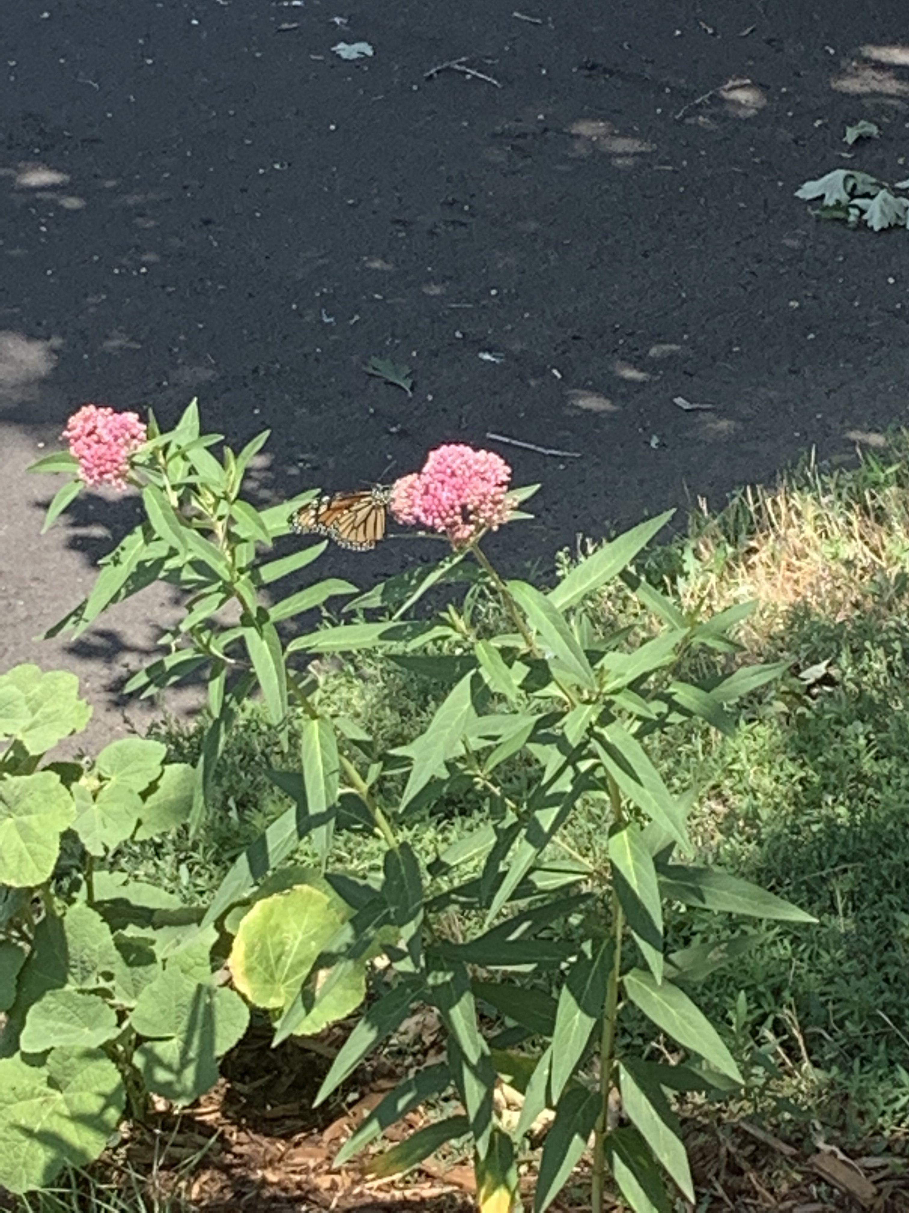

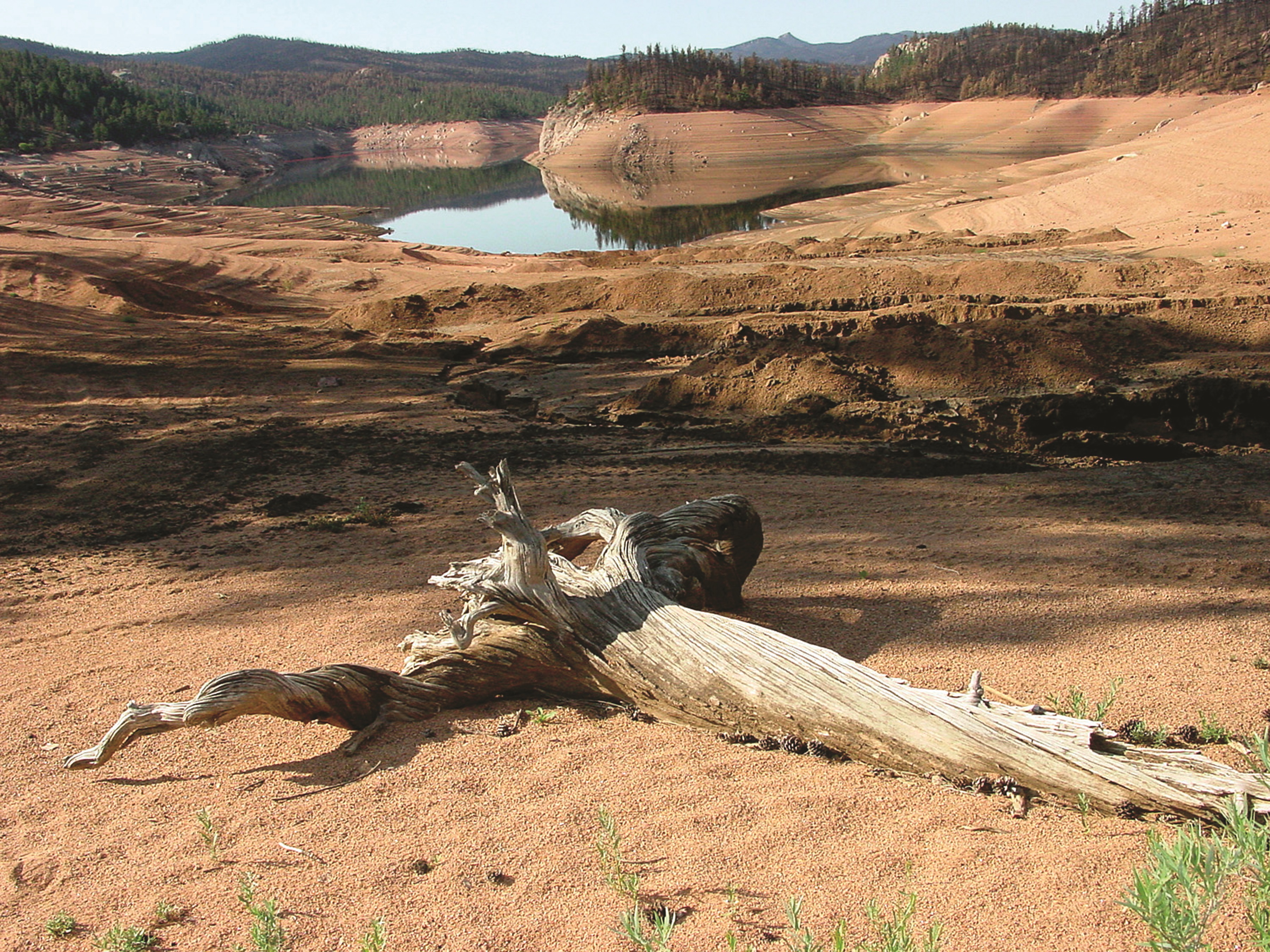


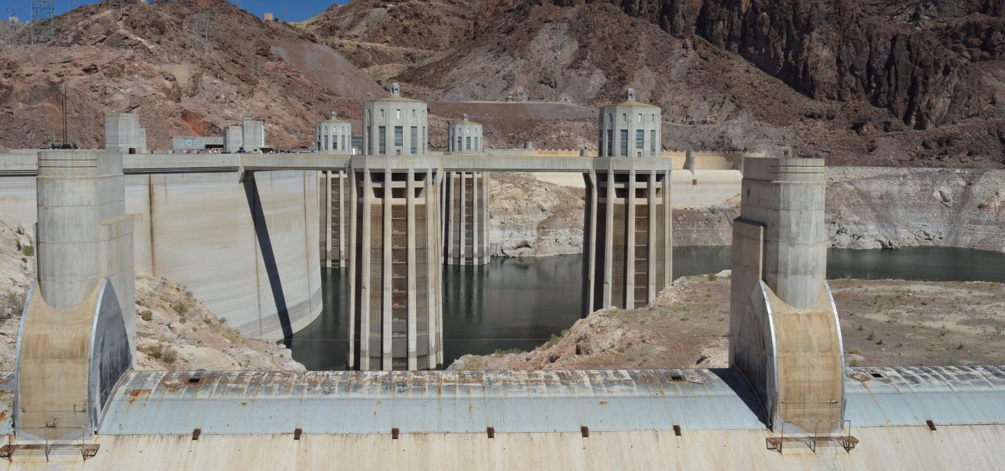

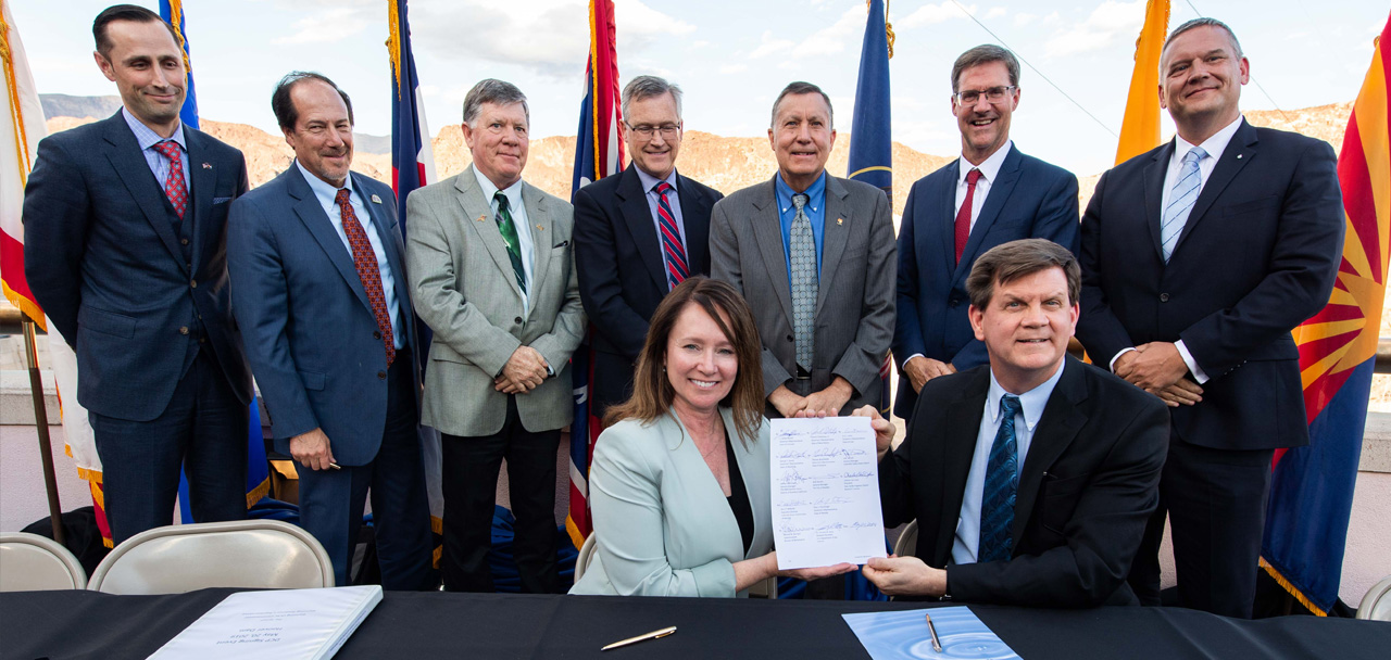
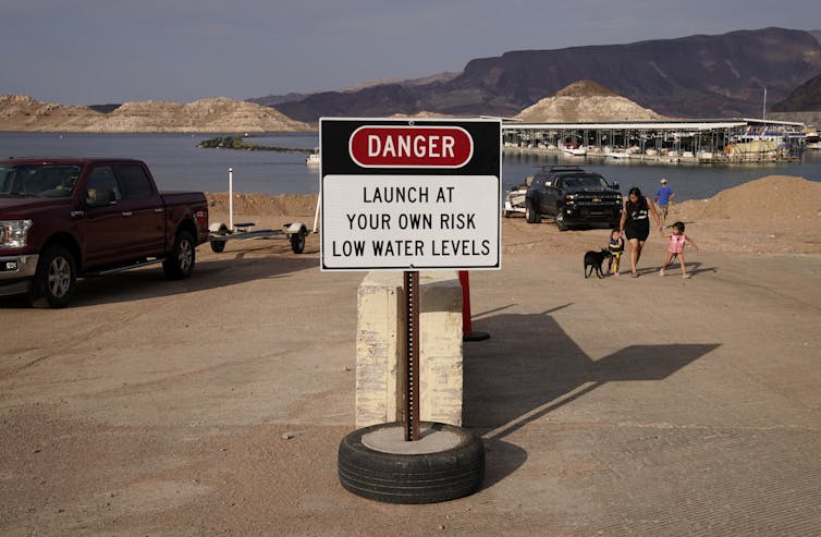
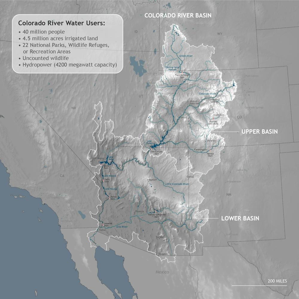


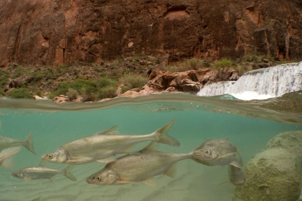


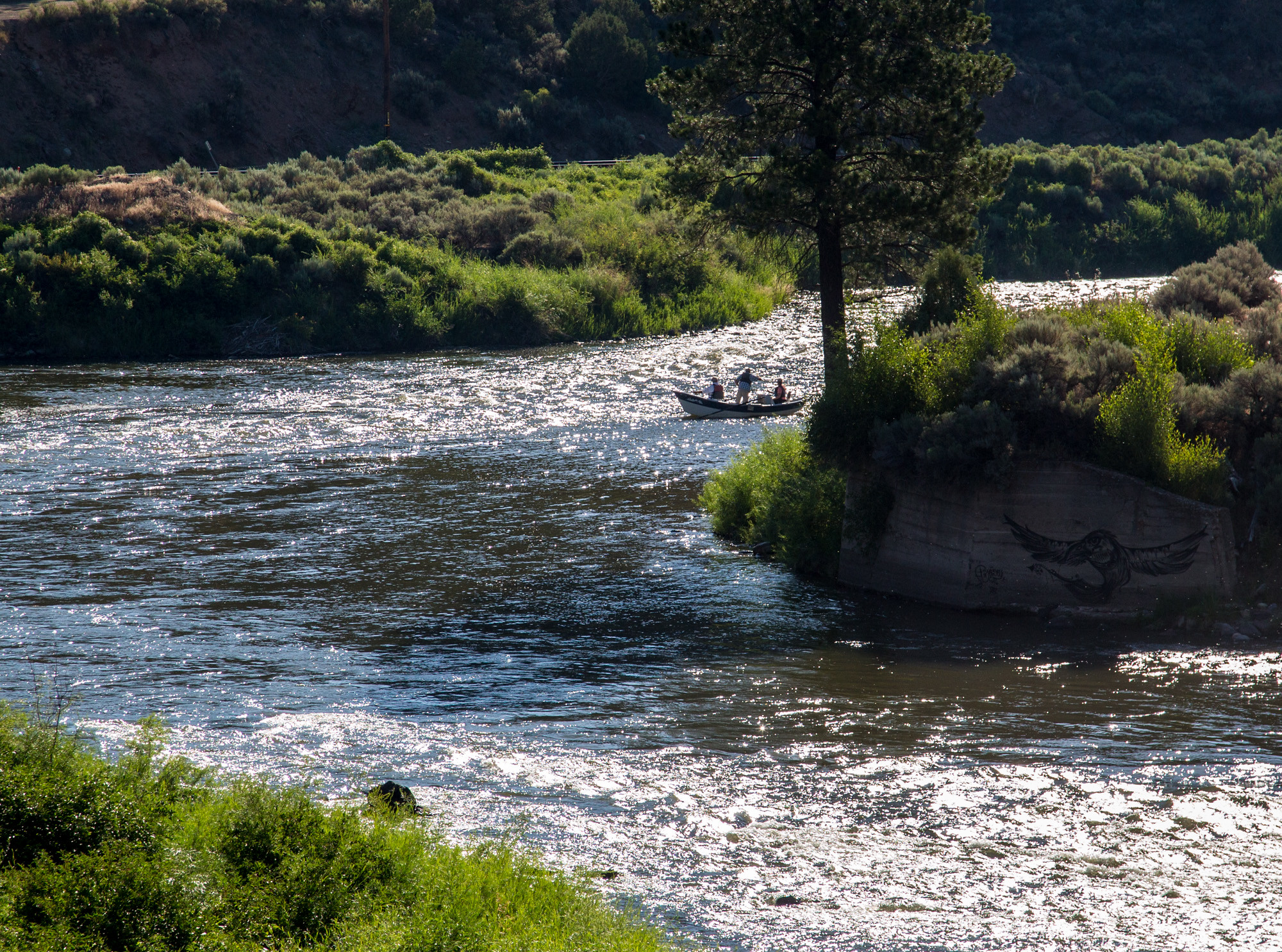

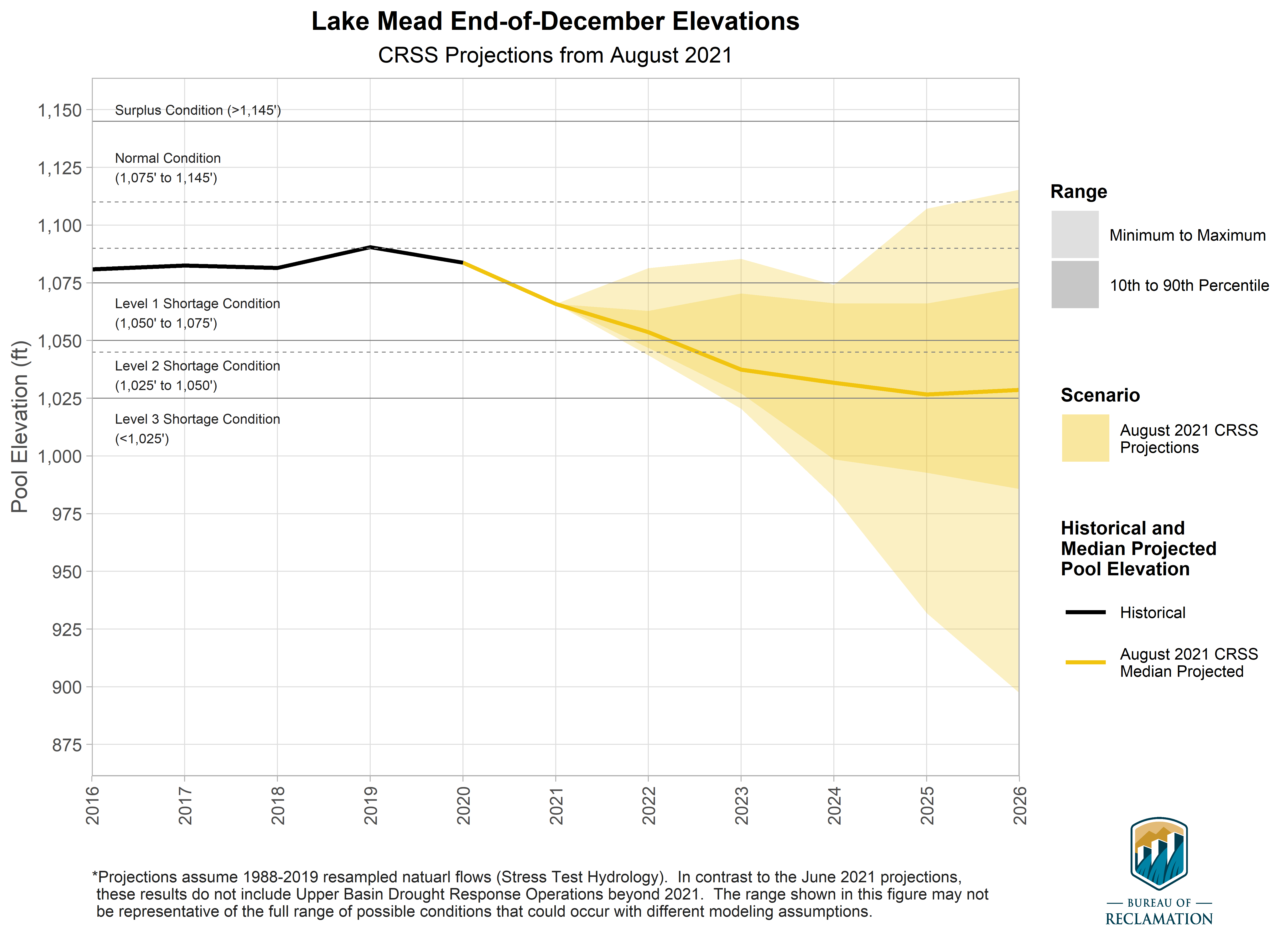


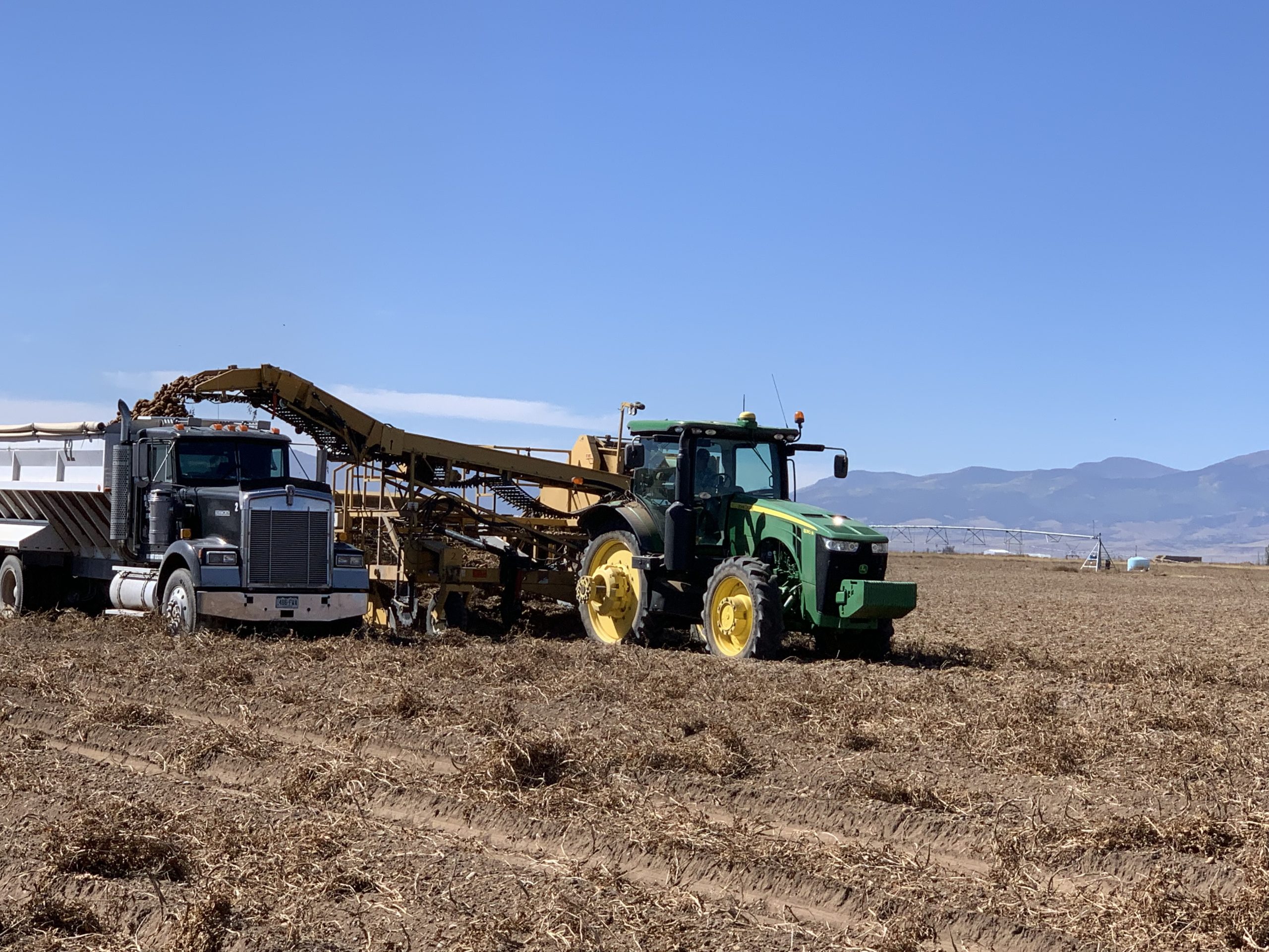

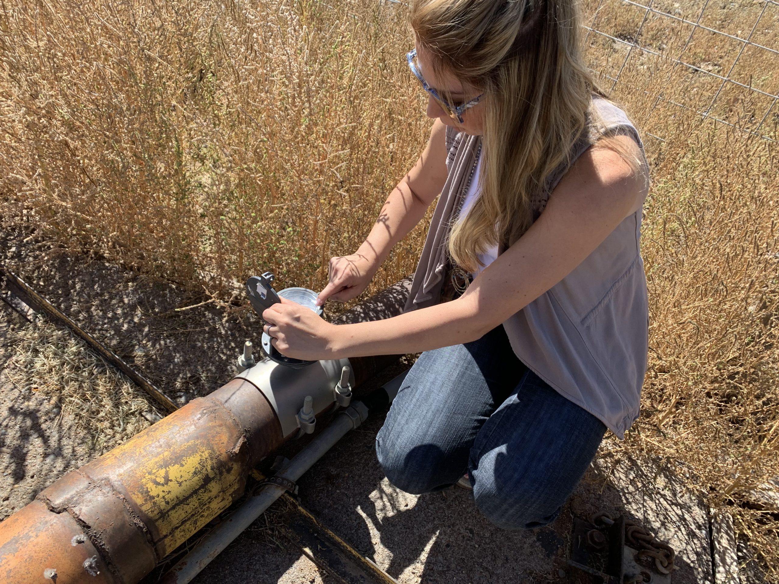


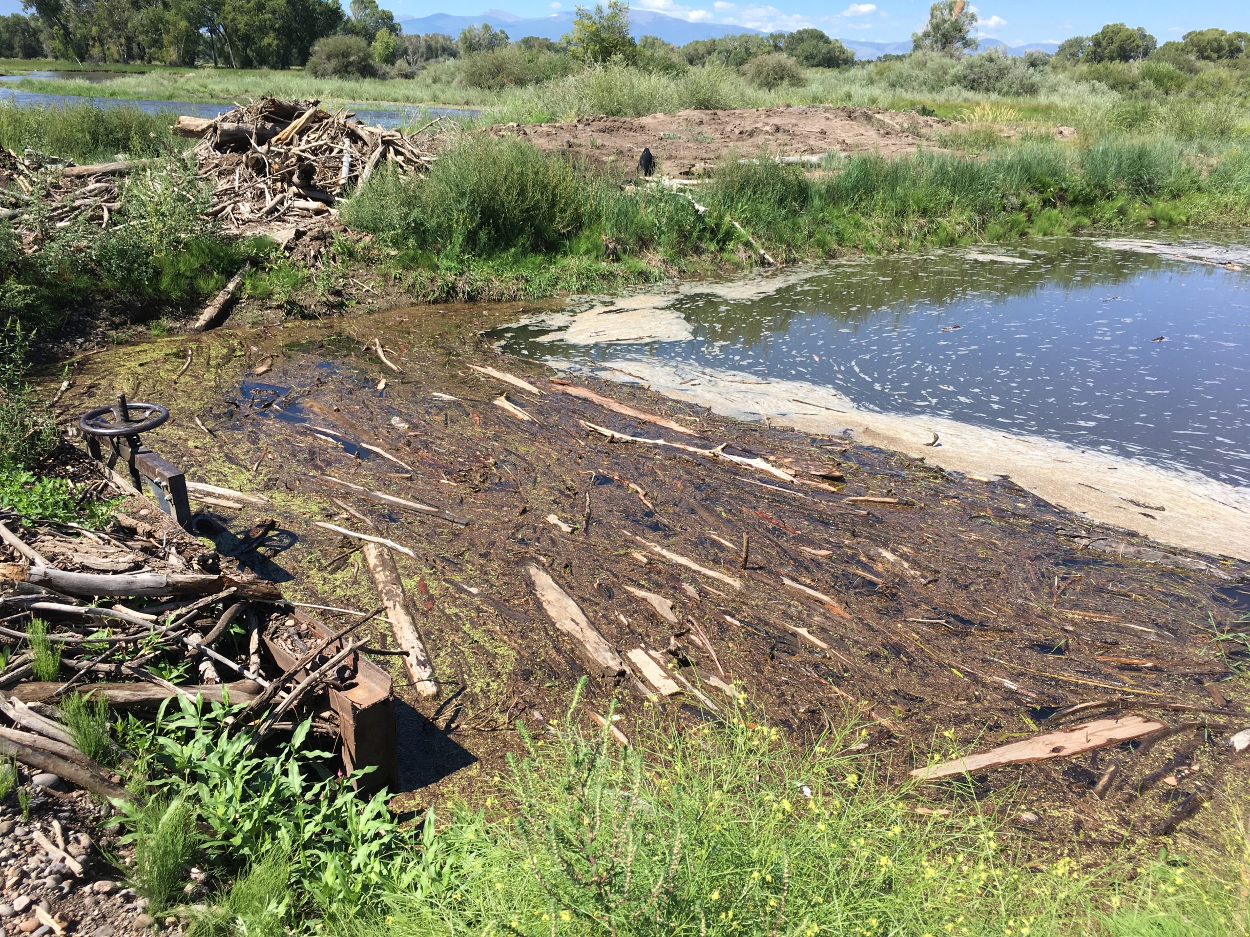


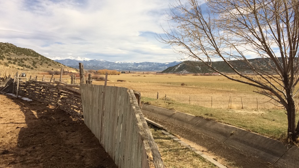


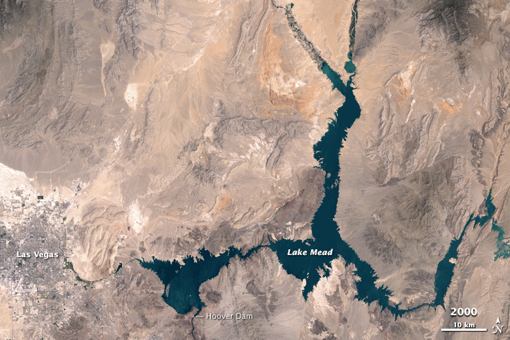
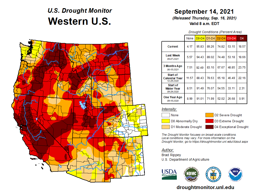


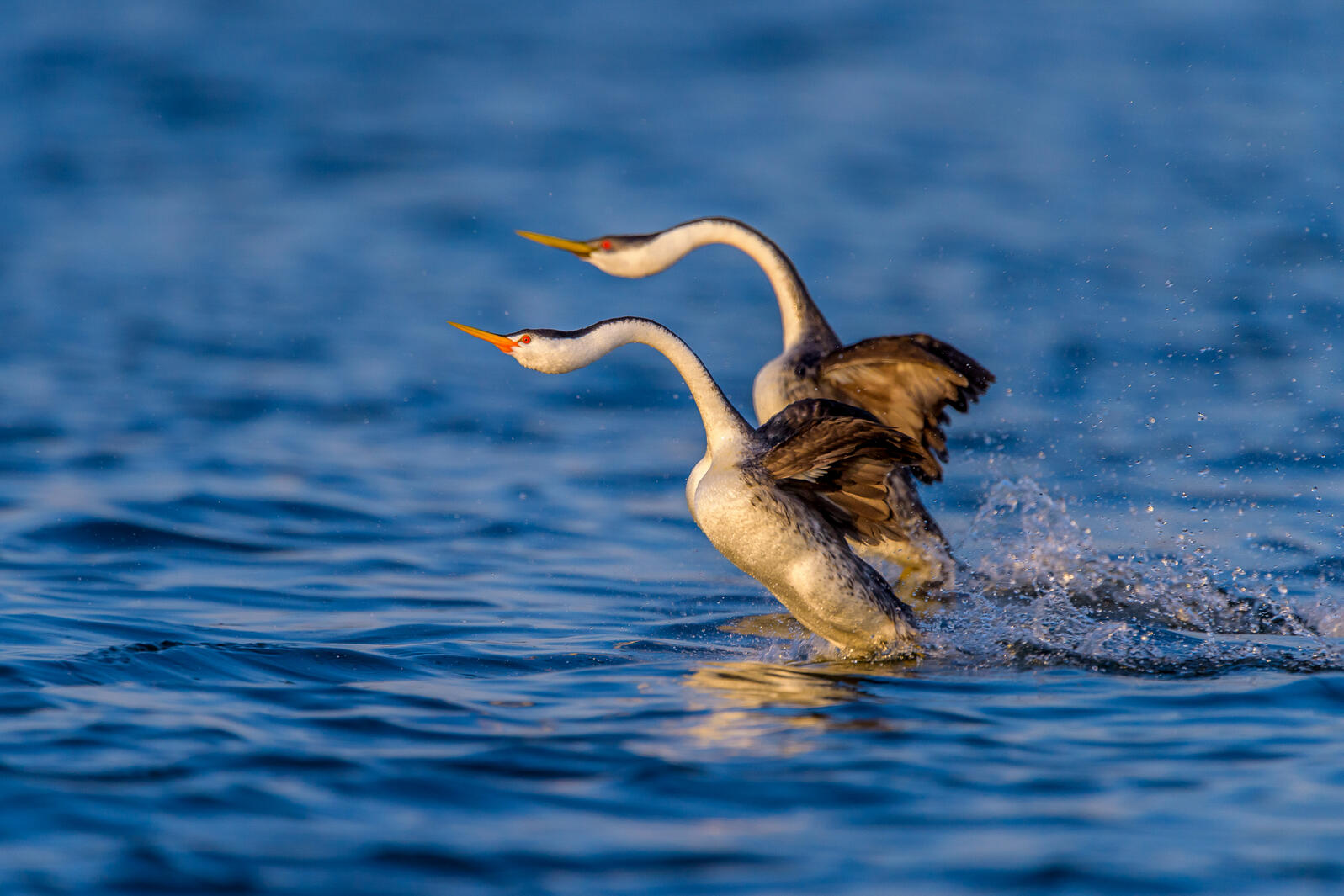


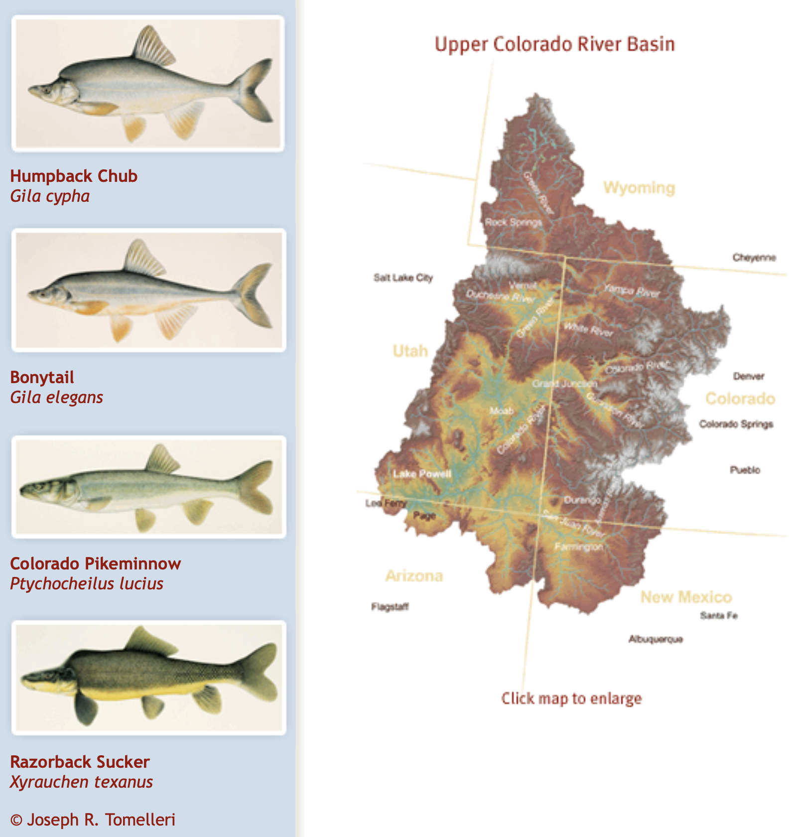


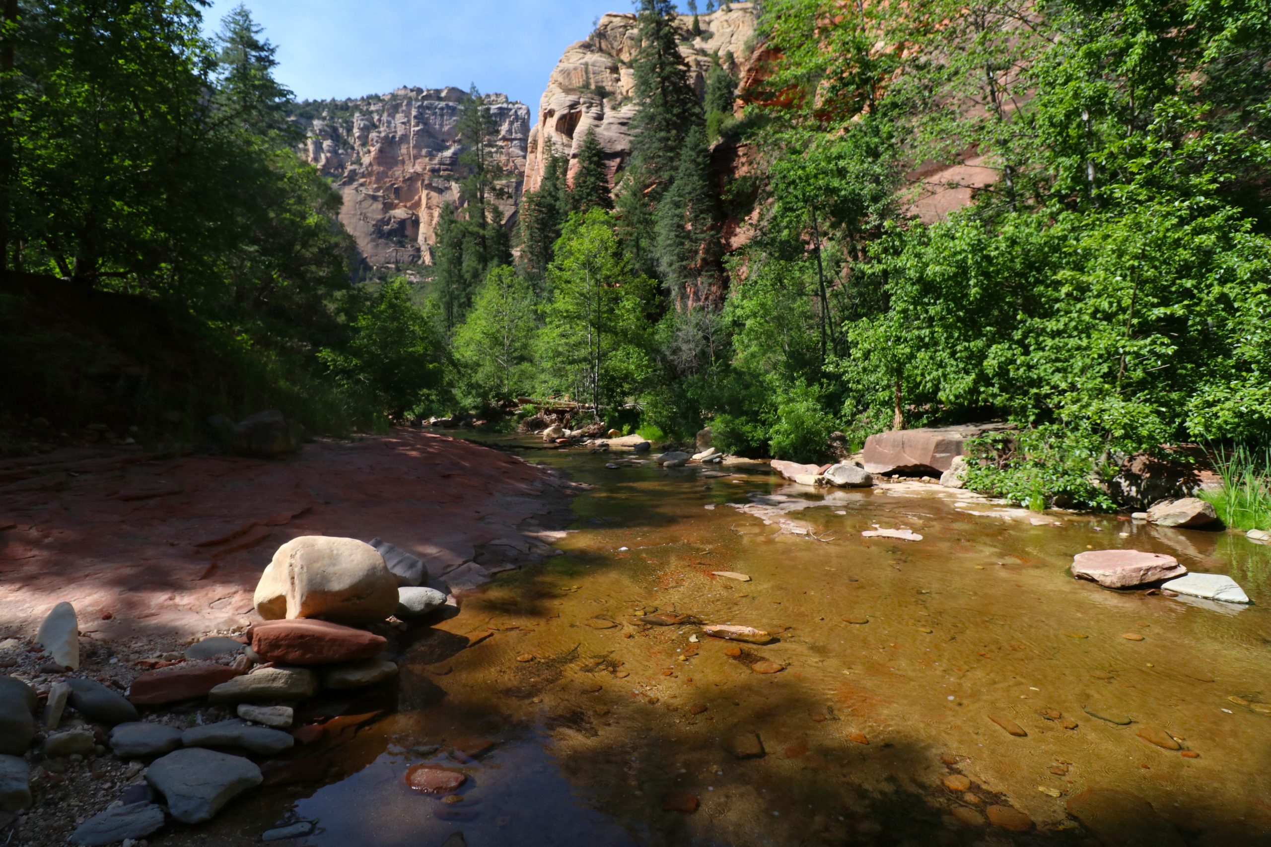


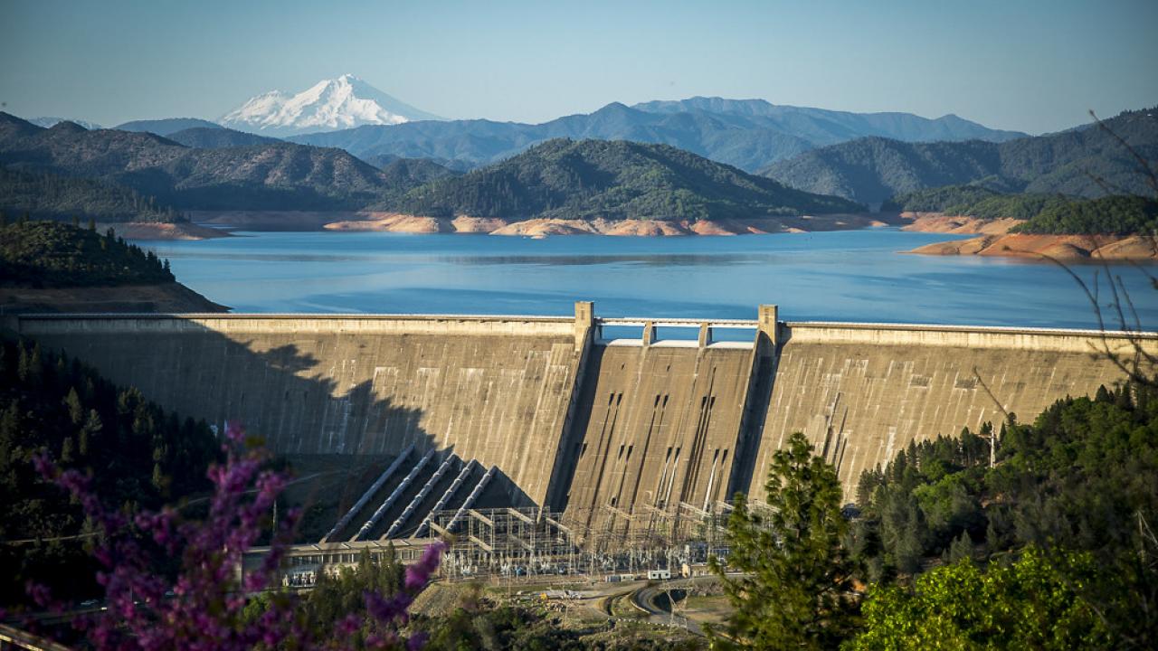
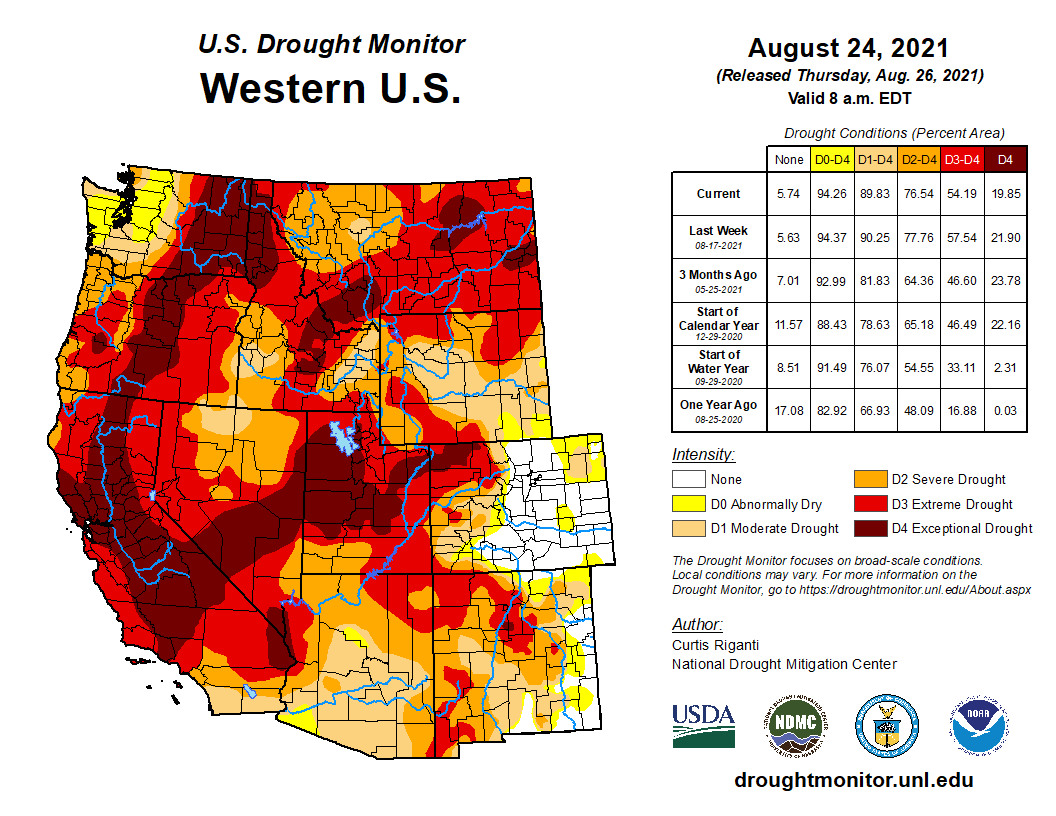
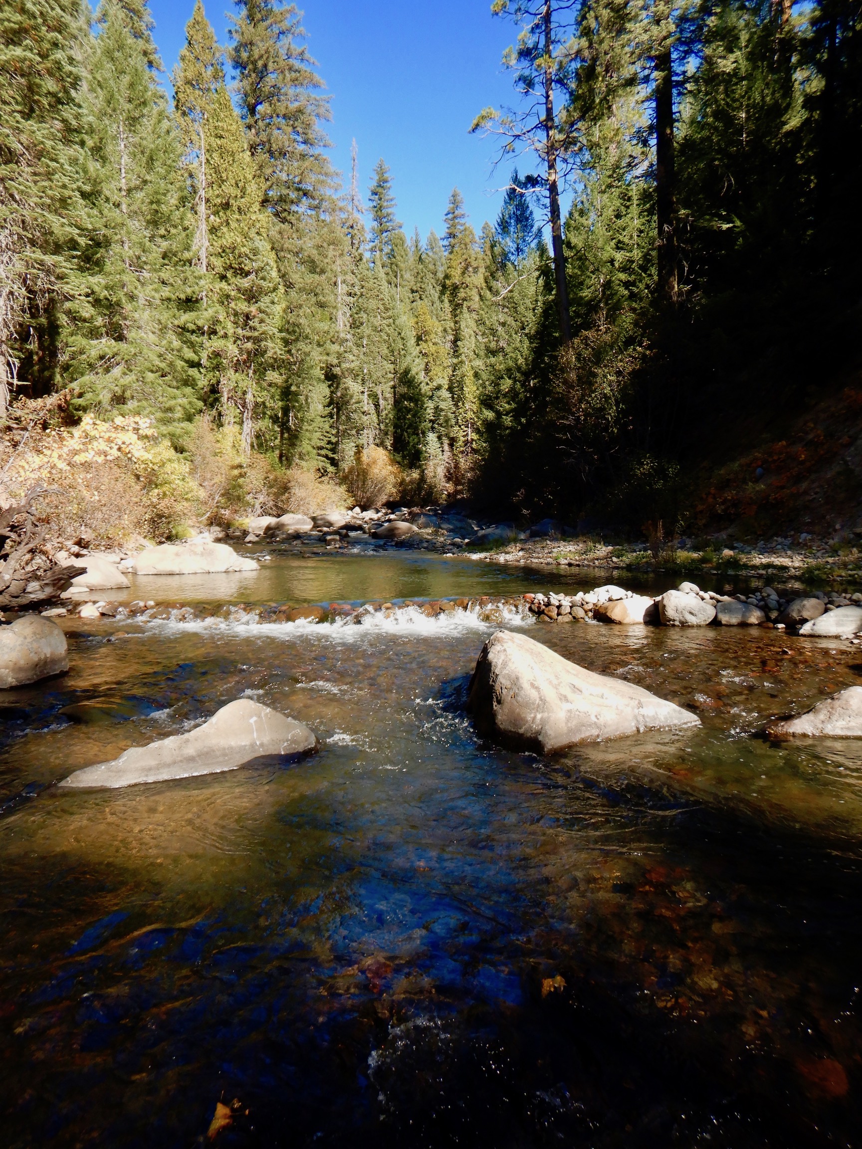
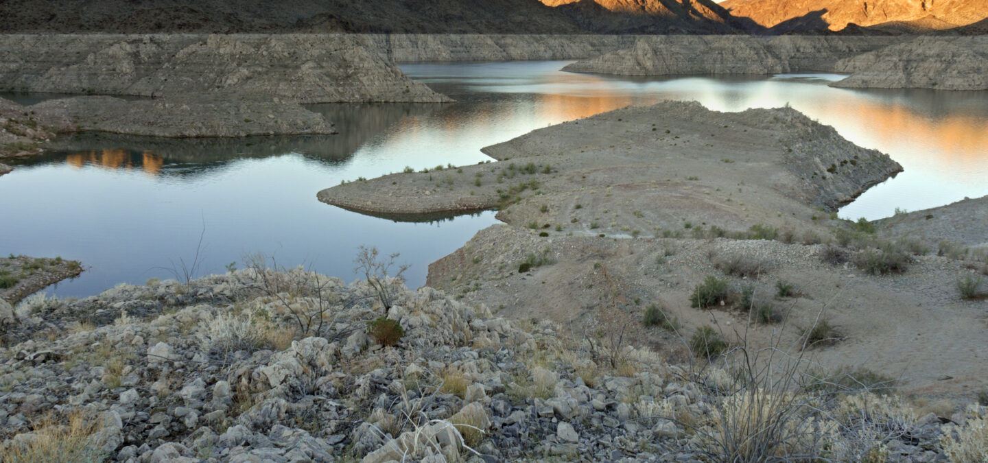


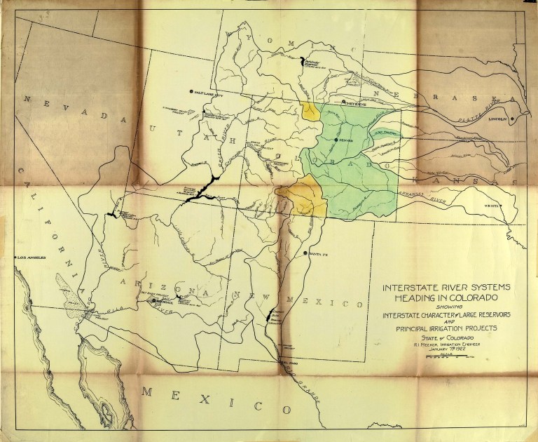
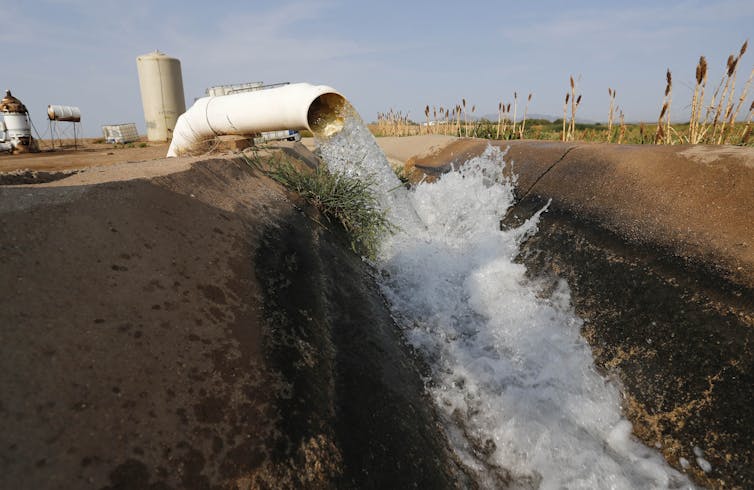
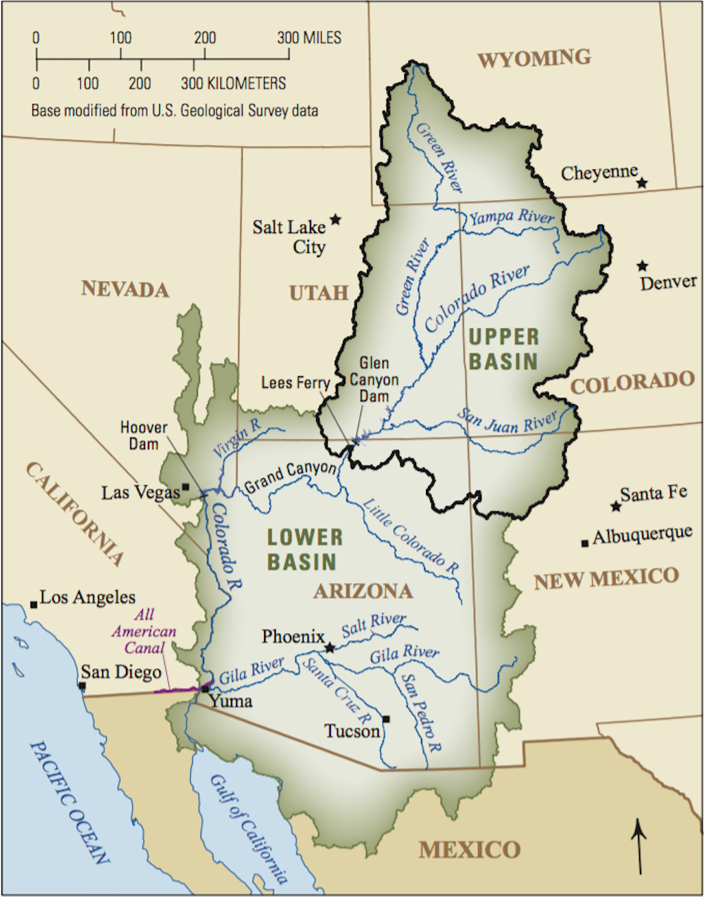
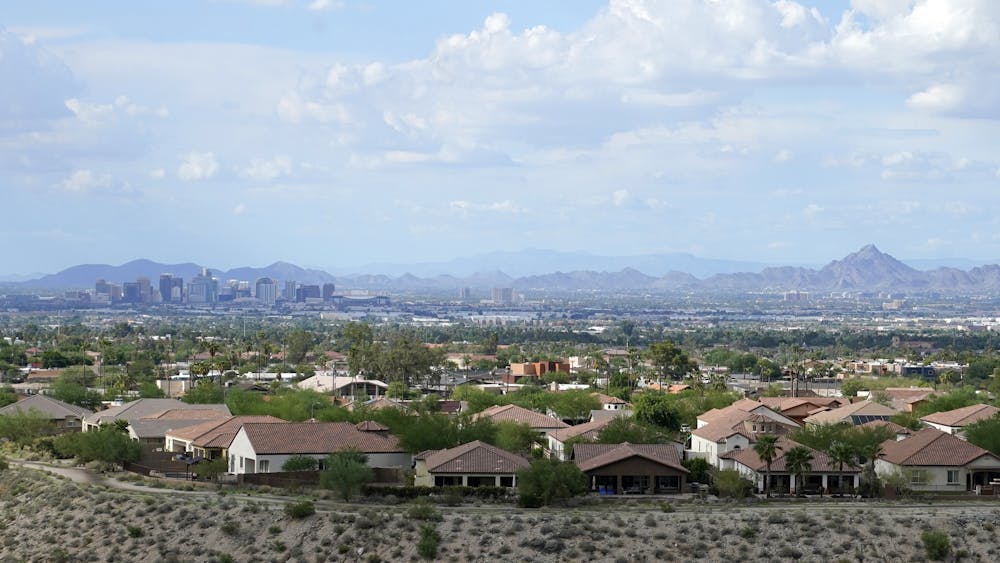


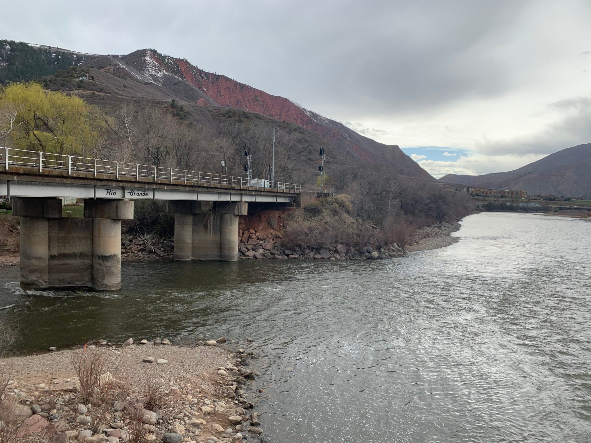

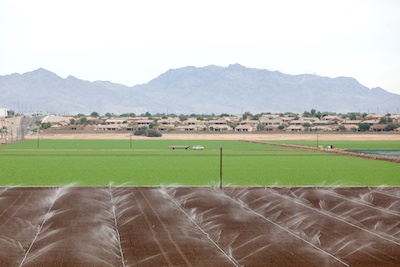

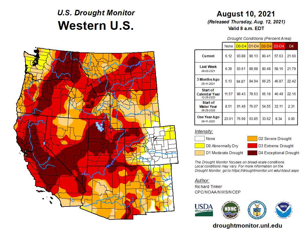
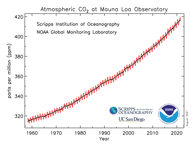
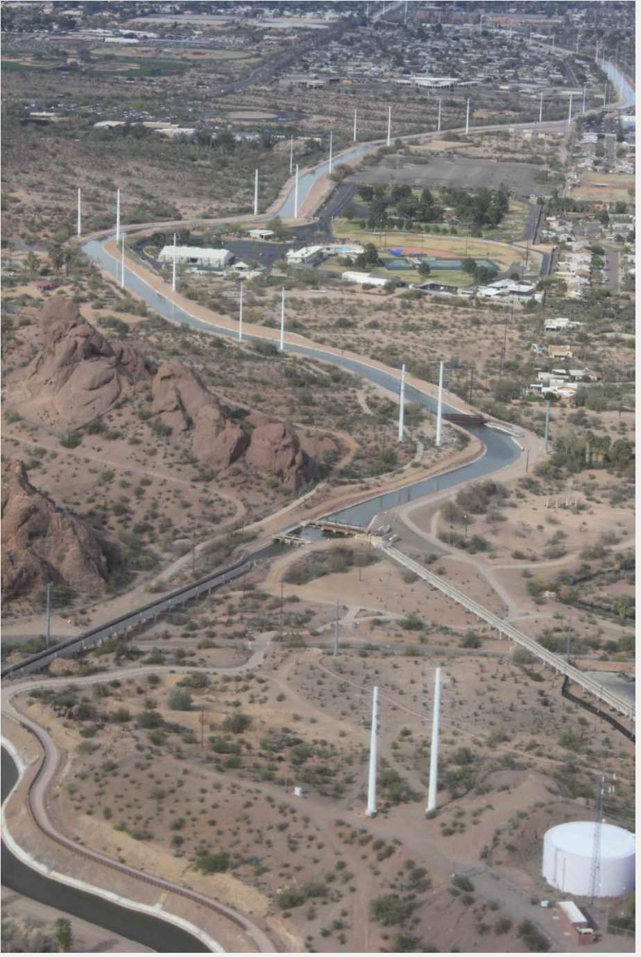

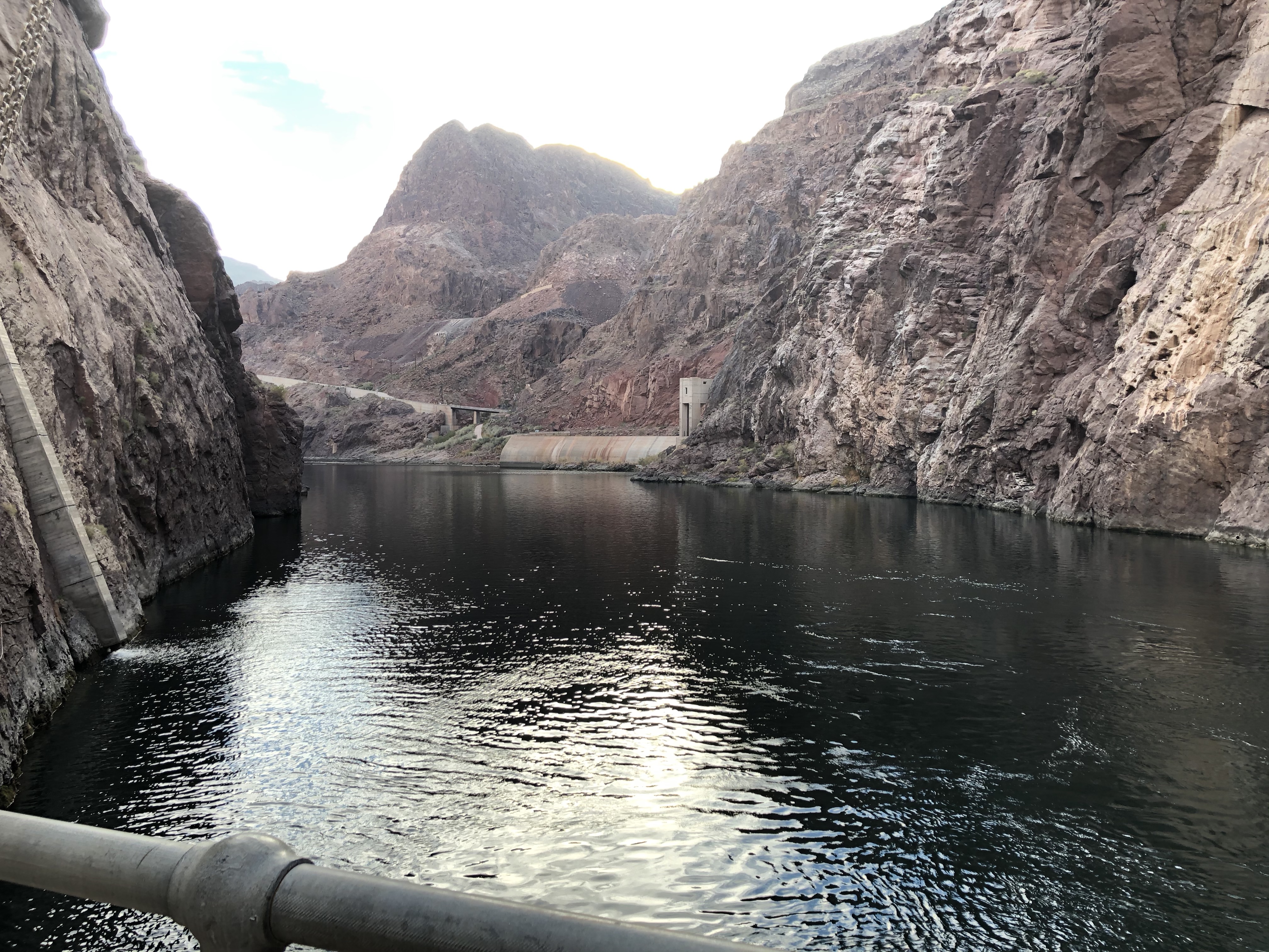


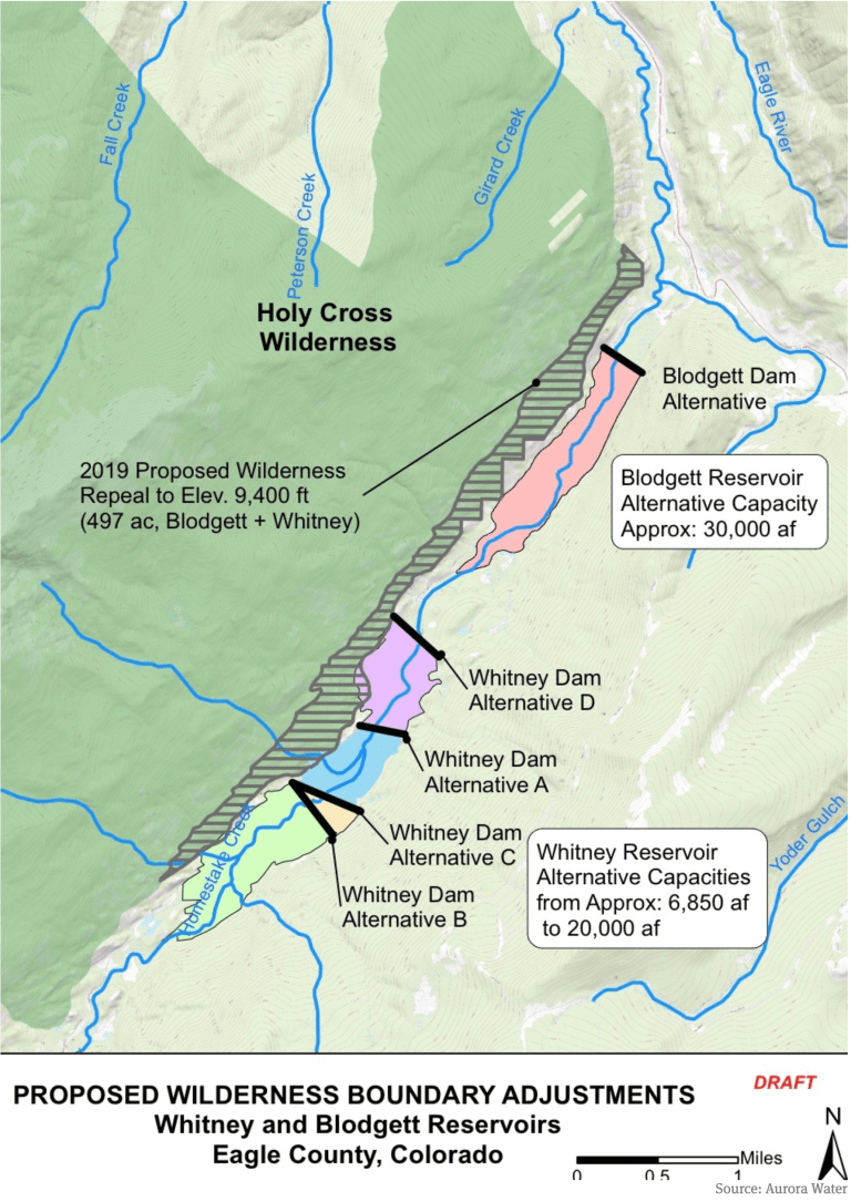


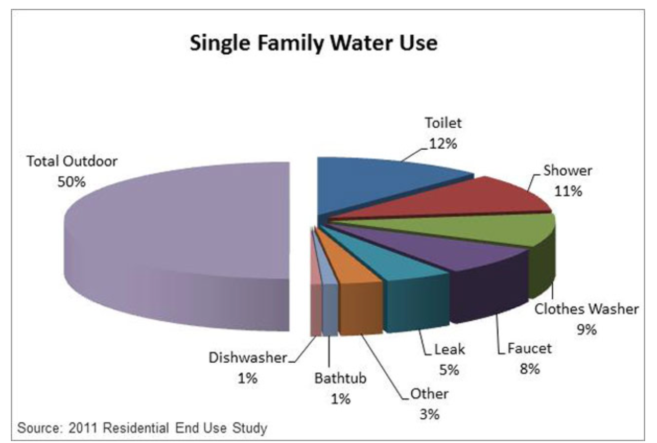

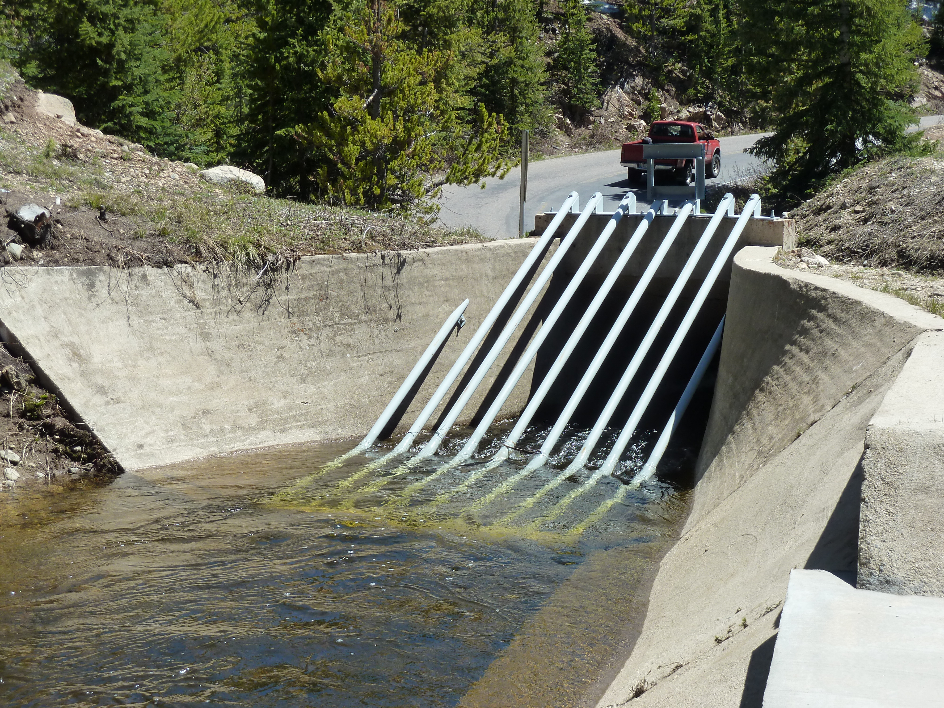


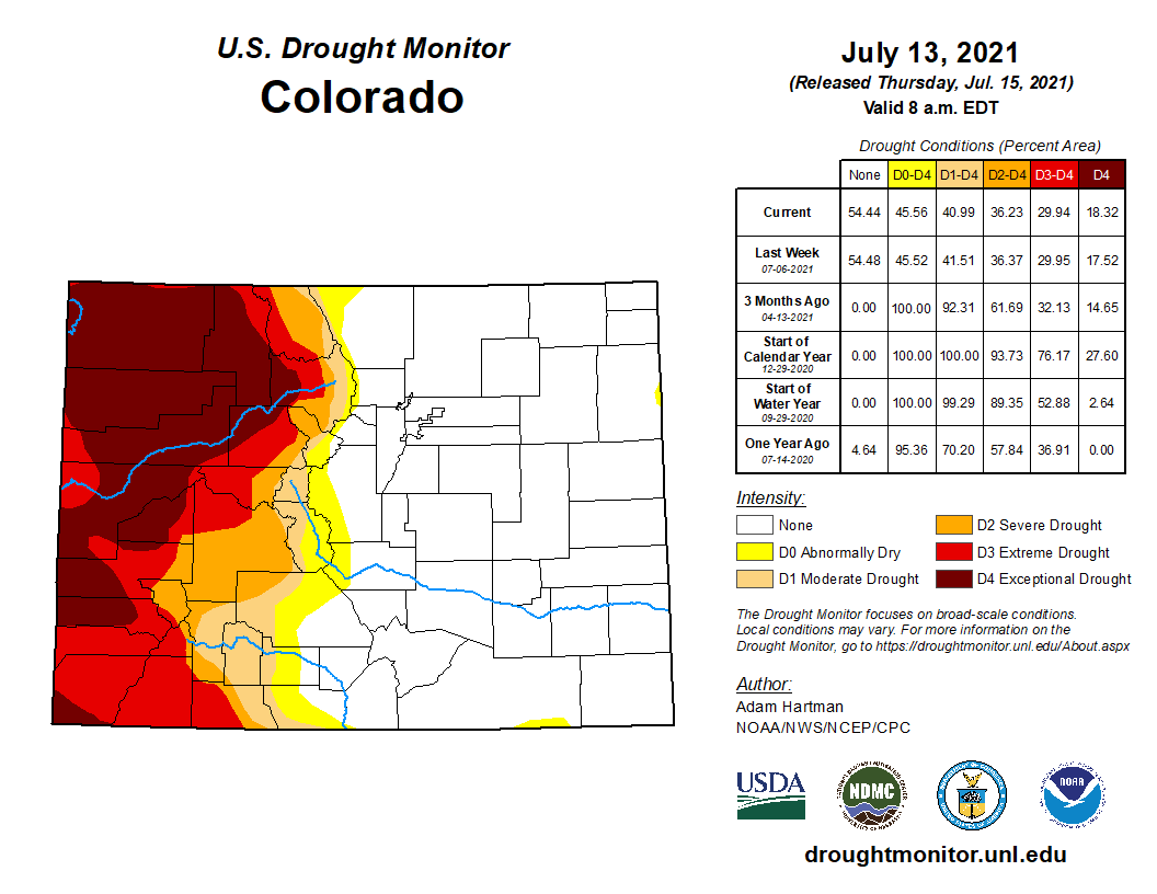
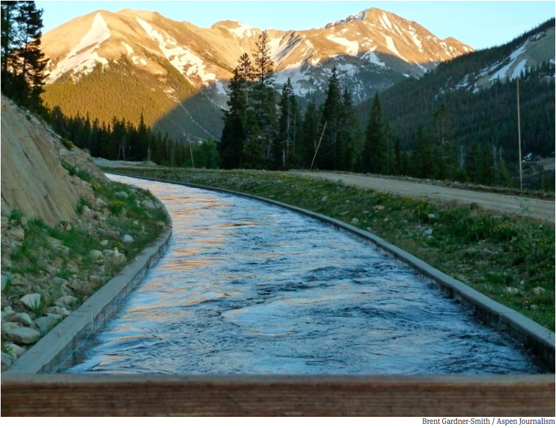


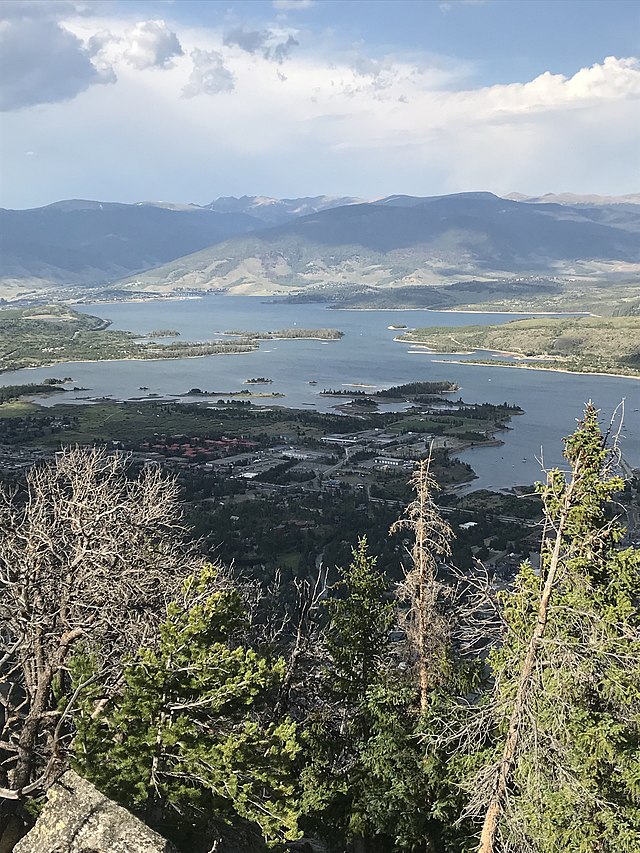

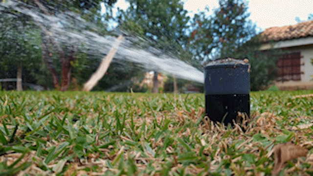
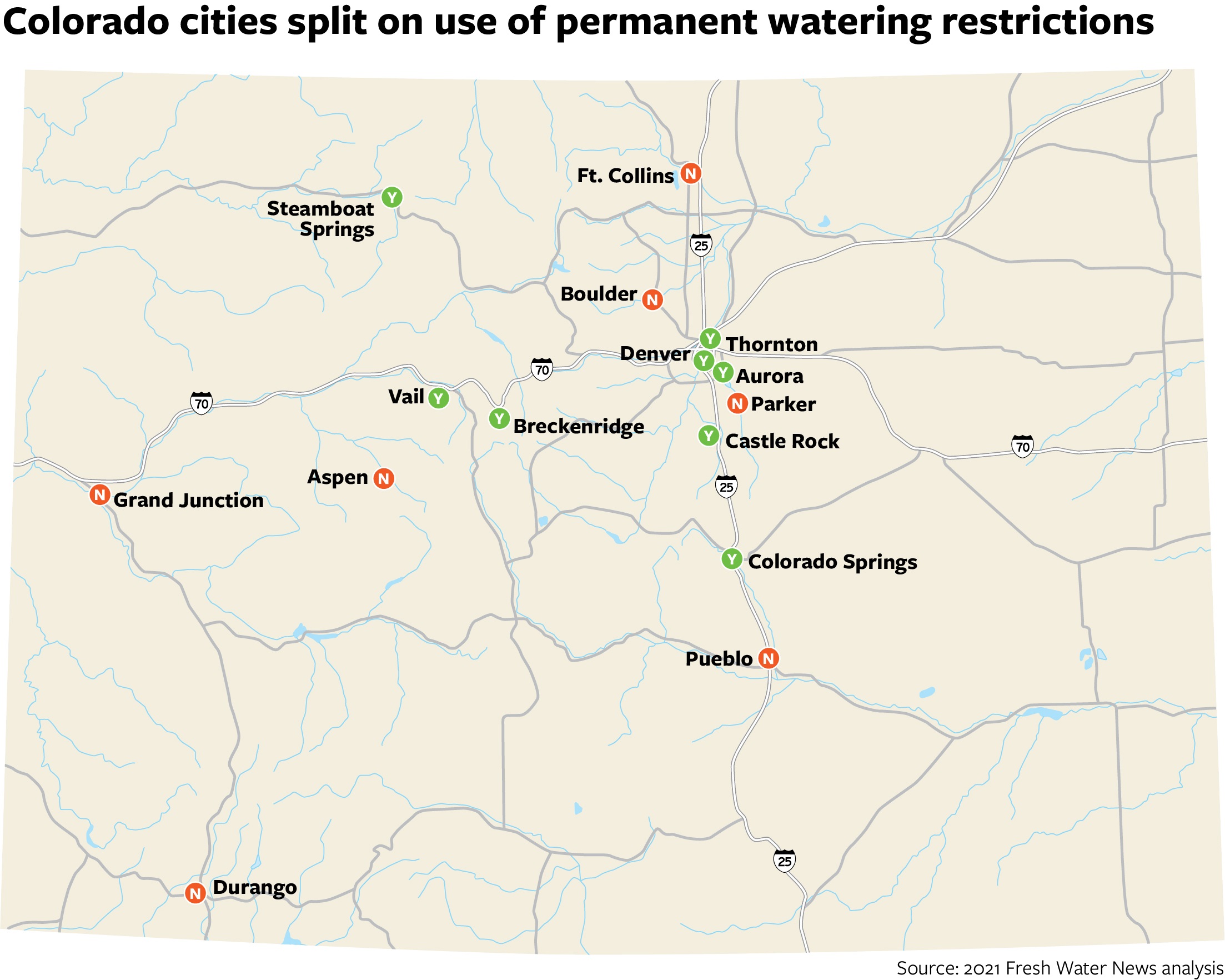

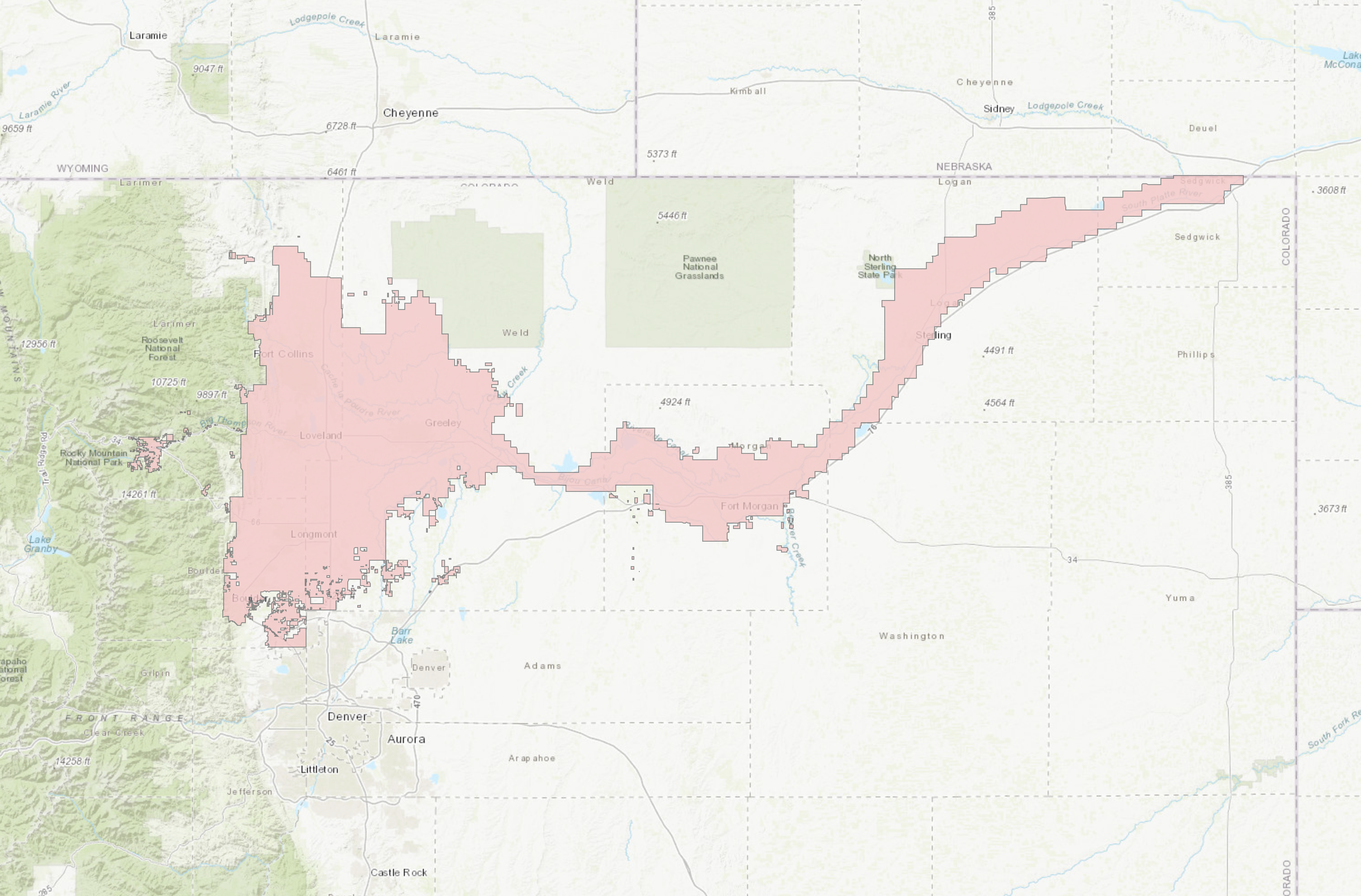
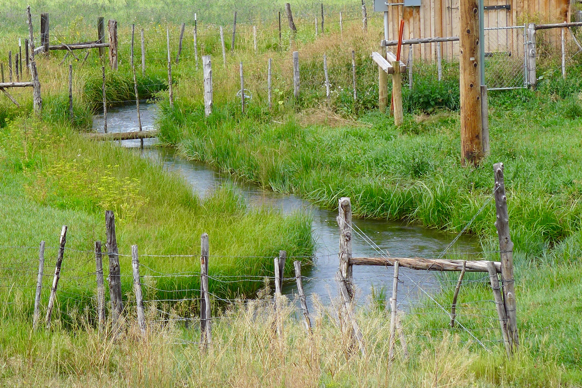
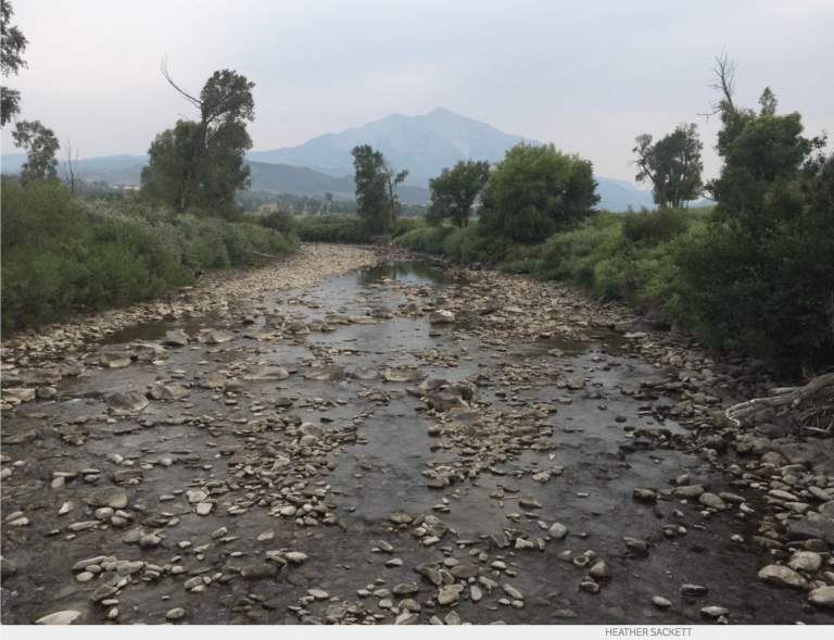
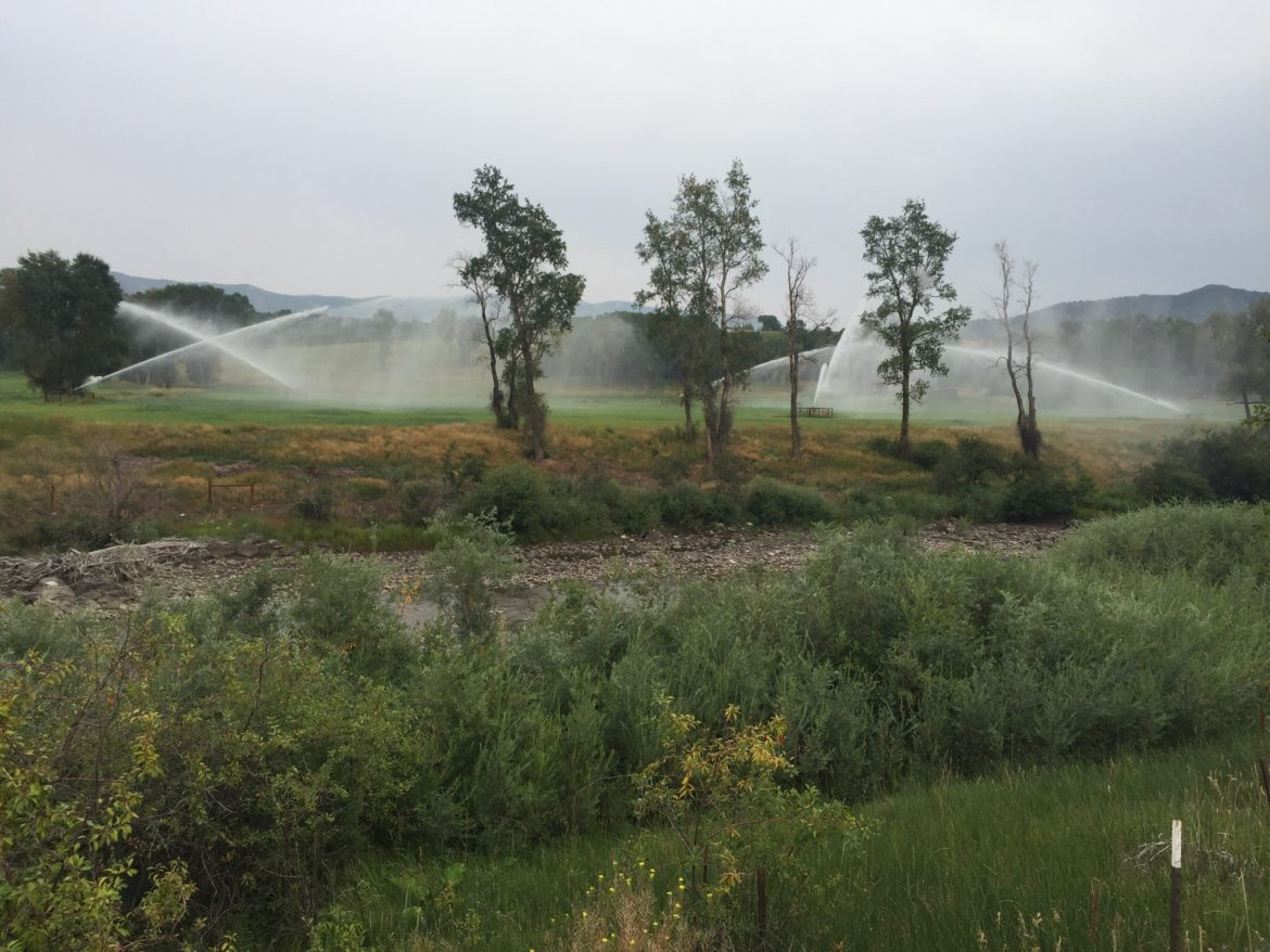
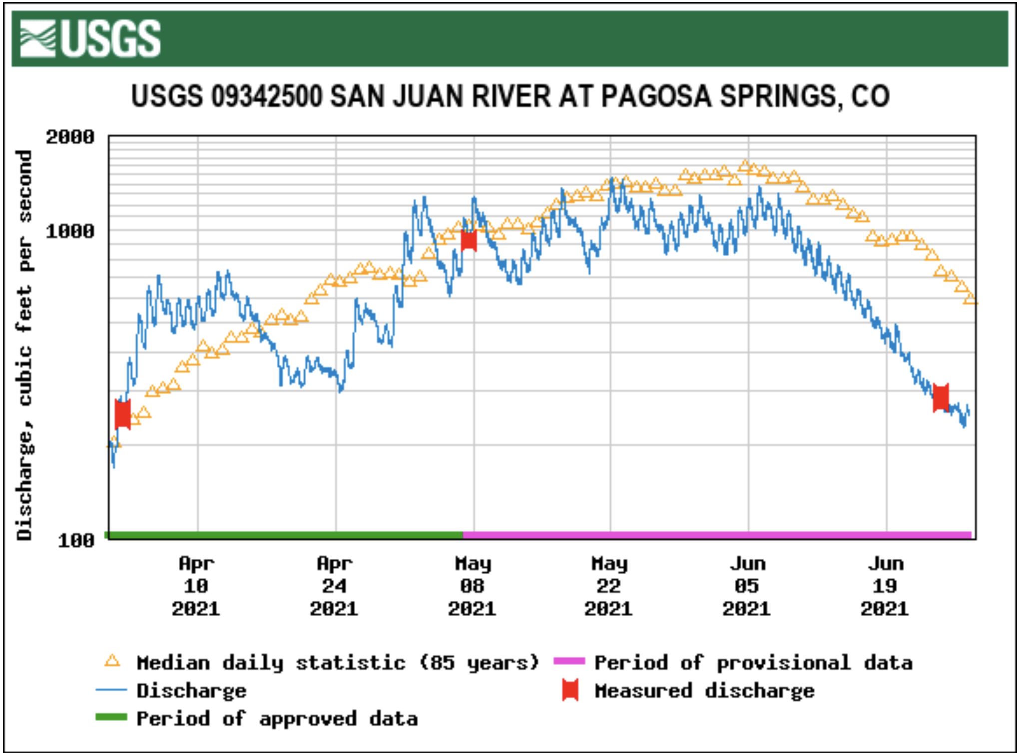


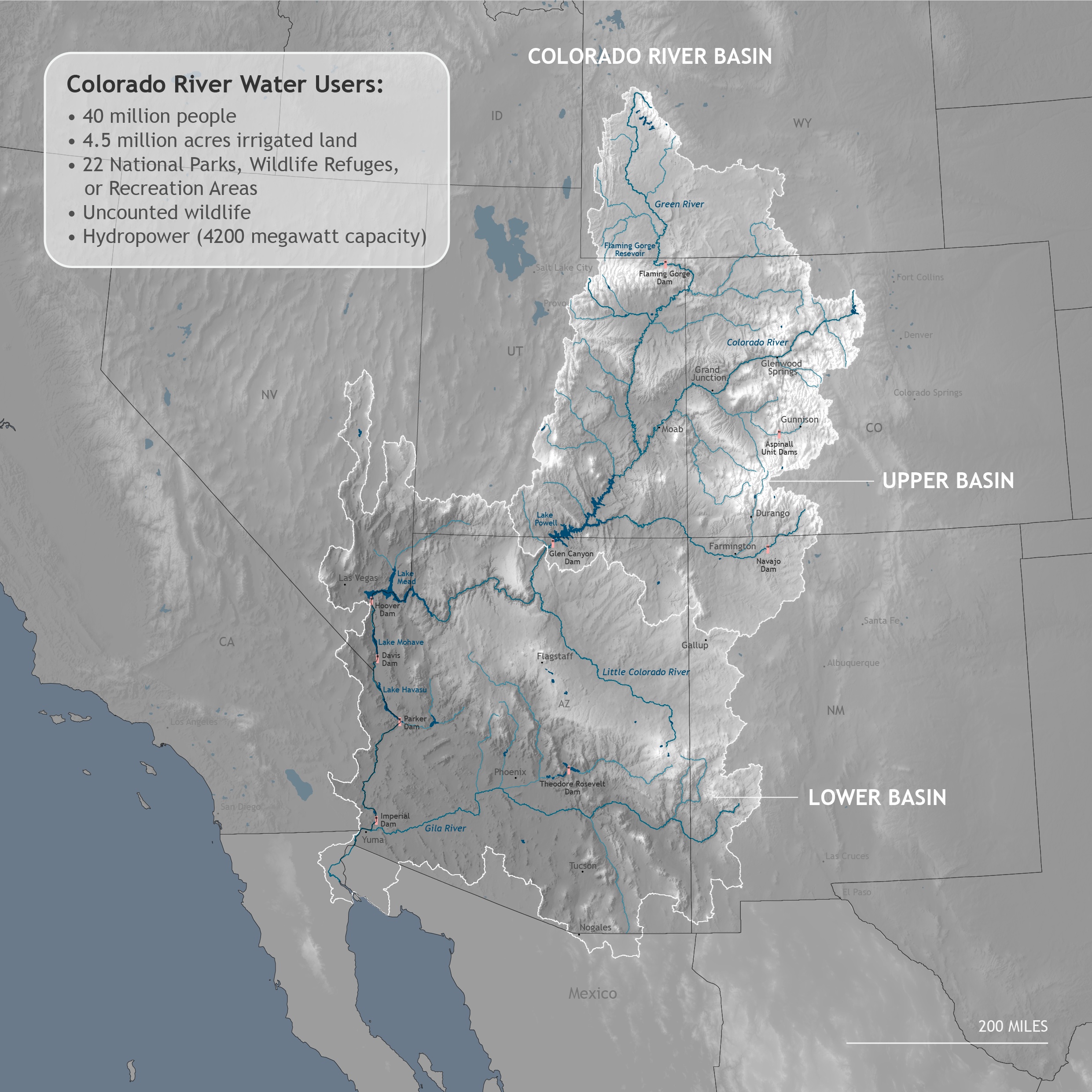