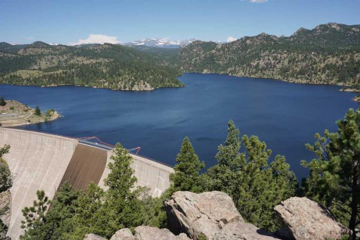
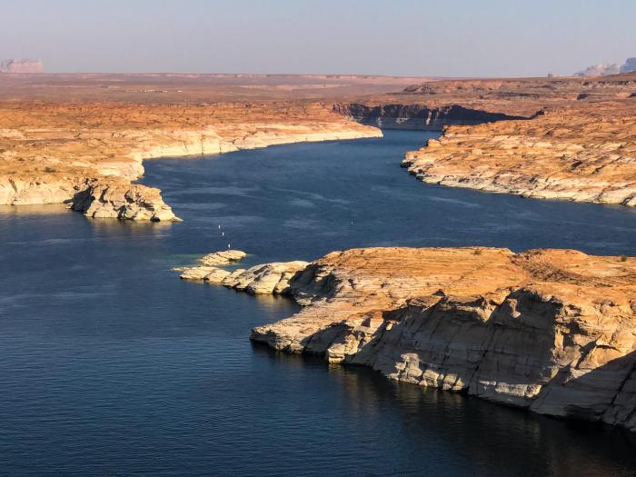
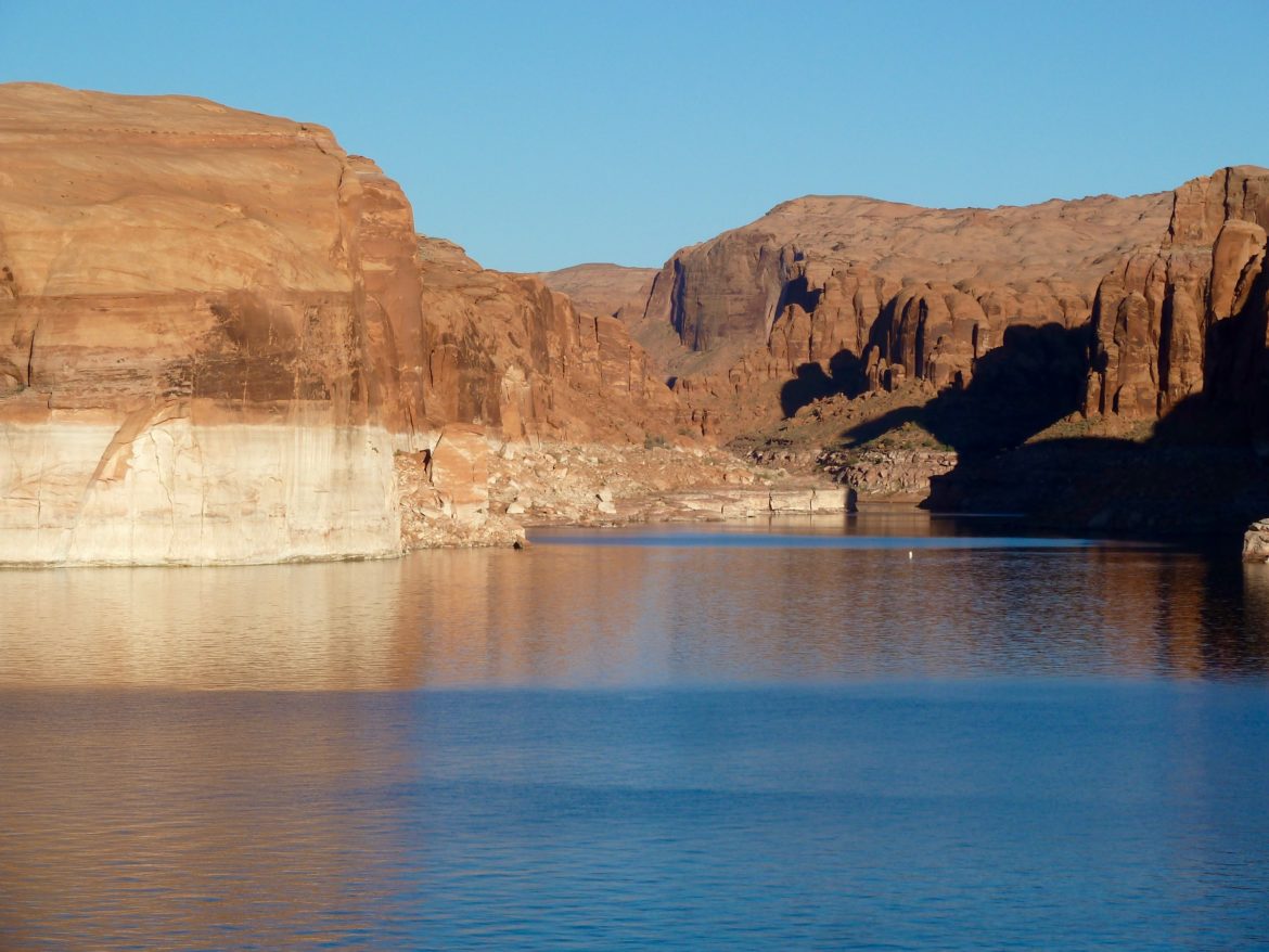
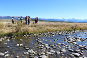
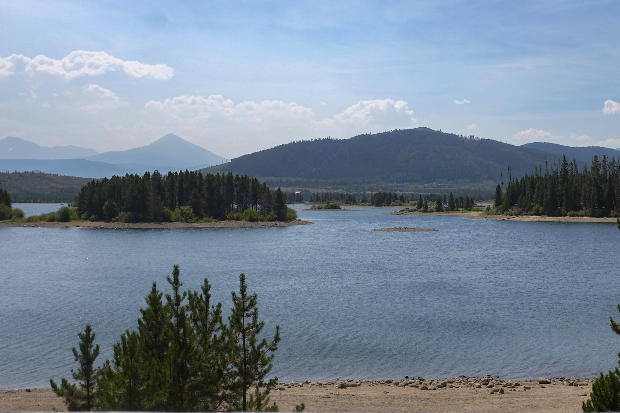
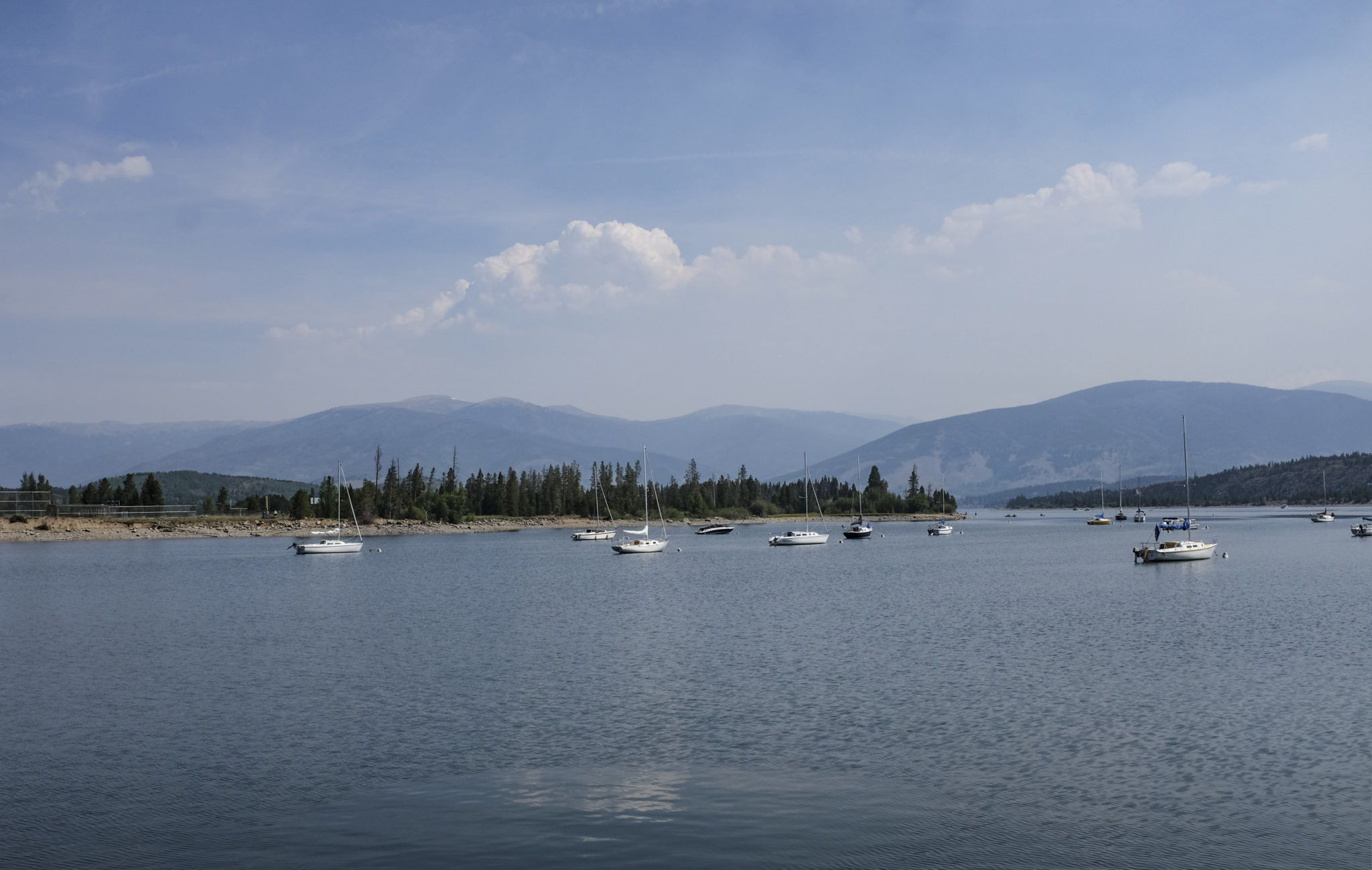
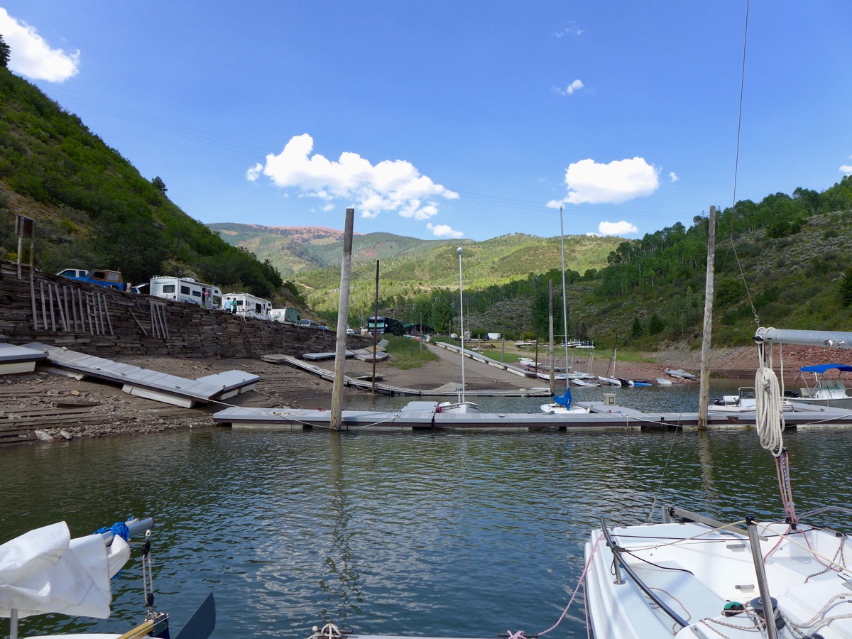
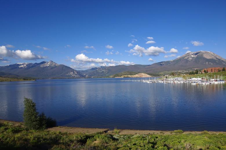
Boaters at Cedar Springs Marina on Flaming Gorge Reservoir. The reservoir’s levels are expected to drop 2 feet a month under an emergency release of water designed to keep Lake Powell’s hydropower system operating. July 22, 2021 Credit: Jerd Smith
John Rauch and his family have operated the Cedar Springs Marina here since 1986. But three weeks ago, when the federal government suddenly ordered millions of gallons of water to be released from Flaming Gorge Reservoir down the Green River to Lake Powell, Rauch wasn’t prepared.
“It was a total gut punch,” he said on a recent hot, sunny morning. As visitors trekked down to rent his pontoon boats, and others slid their fishing craft into the reservoir, Rauch and his employees were already planning which boat docks and ramps would have to be relocated to keep them afloat. The reservoir is projected to drop as much as 2 feet a month through the fall as water is released.
Drought has plagued the Colorado River Basin for 20 years, but it hit crisis proportions this summer, pushing lakes Powell and Mead to historic lows and triggering, for the first time, emergency releases of water from Utah’s Flaming Gorge, Colorado’s Blue Mesa, and New Mexico’s Navajo reservoirs.
All told, 181,000 acre-feet of water are to be sent to Lake Powell by the end of December. Powell has dropped so low that its hydropower plants, which supply millions of homes with electricity and generate revenue for such things as a critical Colorado River endangered species program, may stop operating as early as next year if water levels continue to drop as they have been. The U.S. Bureau of Reclamation estimates there is a 3 percent chance of this occurring next year and a 29 percent chance of this occurring in 2022. But given the speed of the Powell’s decline, no one wants to risk a hydropower shutdown.
Savings accounts
Since their construction in the 1960s these reservoirs, known as Reclamation’s Colorado River Storage Project reservoirs, have acted as a giant savings account, helping ensure that if a crisis erupted on the river, the Upper Colorado River Basin states of Colorado, Wyoming, Utah and New Mexico would have enough water on hand to fulfill their legal obligation to deliver water to Nevada, Arizona and California, known as the Lower Basin states.
Credit: Chas Chamberlin
Colorado’s Blue Mesa Reservoir, part of the Aspinall Unit, is already low, at just 43 percent of capacity as of last month. Fed by the Gunnison River, a major tributary of the Colorado, the reservoir is tourism hot spot on Colorado’s West Slope.
Kathleen Curry, a former Colorado lawmaker, sits on the Colorado River District Board. She said she understands the need for the releases, but she said the changes in the shoreline at Blue Mesa aren’t going unnoticed.
“It’s taking residents and visitors by surprise, just because I don’t think anyone was expecting it,” she said.
The releases come under a special Upper Basin Drought Contingency Plan approved by Colorado, Wyoming, Utah and New Mexico in late 2018. A similar drought plan is in place for the Lower Basin, and they have been cutting back withdrawals from Lake Mead for the past two years.
Still the river system is drying out. And water leaders in Colorado are deeply worried that their carefully protected savings account is going to dry up too quickly to solve the Colorado River’s long-term problems.
Will it work?
“I understand and support the necessity of the Secretary [of the Interior] taking this action,” said Jim Lochhead, CEO of Denver Water. “The major concern I have is that Reclamation says the 181,000 acre-foot release will raise Lake Powell three feet. But I don’t know that they can even show that. I don’t know that they have accounted for transit losses and other losses.
“It’s important when these releases are made that they are accounted for, that we know where this water is going. If it doesn’t actually get down to [Lake Powell] to accomplish what it was designed to do, we should have kept it in that savings account,” Lochhead said.
Becki Bryant, a spokesperson for the U.S. Bureau of Reclamation’s Upper Colorado River region, said the agency is working to create a hydropower buffer in Lake Powell and believes the releases are adequate to accomplish that. But Reclamation is not yet doing the kind of precise tracking and accounting known as water “shepherding,” to ensure flows make it downstream, that Lochhead is requesting.
On Aug. 1, Lake Powell’s elevation stood at 3,553.8 feet above sea level. The action point, or so-called target elevation is 3,525. When that point came close in July, Reclamation moved quickly to order the emergency releases.
Powell’s hydropower plant stops generating power when it drops to 3,490 feet in elevation, according to Reclamation.
“Reclamation expects the additional release of water will be sufficient to protect Lake Powell’s target elevation through 2021. That target elevation provides a 35-vertical-foot buffer designed to minimize the risk of dropping below the minimum power pool elevation of 3,490 feet, and balances the need to protect the infrastructure at Powell’s Glen Canyon Dam.
“Shepherding water would be beneficial but is challenging on many levels for Colorado River Basin states,” said Bryant via email.
Bleak forecasts
Bryant said Reclamation will continue to consult with the Upper Basin states as it monitors reservoir levels and weather forecasts. Should conditions deteriorate further, the agency could examine whether to declare the releases futile and stop them, as it is allowed to do under the 2018 Drought Contingency Plan.
The water being released is so-called “system water,” meaning that it isn’t owned by a particular user.
Held by the federal government for the benefit of the Upper Basin states, the amounts of water specified in the release plan are jaw-dropping: 125,000 acre-feet from Flaming Gorge; 36,000 acre-feet from Blue Mesa; and 20,000 acre-feet from Navajo. An acre-foot of water is enough to cover one acre of land to a depth of 12 inches.
If that same amount of water were going to cities, it would be enough to serve more than 362,000 homes for one to two years. If going to farms, it could irrigate more than 113,000 acres, depending on the crop.
If the historic, 20-plus-year drought cycle doesn’t end soon, refilling those reservoirs is going to be difficult. And that has water managers worried.
“My level of concern is quite high,” said Becky Mitchell, director of the Colorado Water Conservation Board, the state’s lead water planning and policy agency. She also sits on the four-state Upper Colorado River Basin Commission, which advises Reclamation on river issues.
“And I can’t tell yet if [the releases] are going to do the trick,” she said. “But we have to respond to the levels in Powell.”
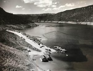
Cedar Springs Marina near Dutch John, Utah, on Flaming Gorge Reservoir in the early 1960s. In a first, emergency releases are being made under the 2018 Upper Colorado River Basin Drought Contingency Plan. Photo courtesy of the Rauch family.
Legal reckoning?
Under the 1922 Colorado River Compact, Colorado and the other Upper Basin states must deliver 7.5 million acre-feet (maf) [per year, 75 maf per 10 years] of water to the Lower Basin on a 10-year running average. Right now, the Upper Basin is delivering roughly 9.2 maf, Mitchell said, meaning that there is still time to help the system come back into balance before the Lower Basin states could legally call for more water than they currently receive.
Lake Powell is the Upper Basin’s largest storage pool on the system and is designed to be the four Upper Basin states’ major source of protection. Because of their legal obligations, Colorado water users are closely monitoring this year’s plunge in Powell, with the threat to hydropower production being seen as a dangerous antecedent to a compact call.
“That the system continues to deteriorate is concerning,” Lochhead said.
Roughly half of Denver Water’s supplies are derived from water rights it owns on the Colorado River system. While one portion of its portfolio dates back to 1921, and would therefore trump a 1922 compact call, several other rights were established later, meaning the utility might have to stop pulling from those water sources if Colorado were forced to cut back in order to meet compact obligations.
Other Front Range water providers, who also have Colorado River rights, are even more vulnerable, including the Pueblo-based Southeastern Colorado Water Conservancy District.
Southeastern’s rights date only to 1957.
Contingency v. reality
Lee Miller, Southeastern’s attorney, said the Colorado River crisis remains a long-term problem for his agency.
The rapid deterioration this year, however, is prompting everyone to rethink how much time they have to balance the massive river system as drought and a warming climate, as well as population growth, continue to sap its flows.
“Both the Upper and Lower Basin have now had to initiate elements of their drought contingency plans. When we passed it a couple of years ago everyone thought, “It’s good to have a contingency plan.’ But I don’t think anyone thought we would have to use the plans this quickly. It’s gone from being a contingency to being a reality, and that’s concerning.”
Back up at Flaming Gorge, John Rauch is watching the levels drop and making his own contingency plans.
“We are planning for the worst,” Rauch said. “For the foreseeable future, the outlook is dry. If it ends up that by the end of all of this that the reservoir becomes a river channel, we will be down there at water’s edge selling worms.”
Jerd Smith is editor of Fresh Water News. She can be reached at 720-398-6474, via email at jerd@wateredco.org or @jerd_smith.
Lawn sizes in Castle Rock are sharply limited to save water, with some homeowners opting to use artificial turf for convenience and to help keep water bills low. Oct. 21, 2020. Credit: Jerd Smith, Fresh Water News
Conservation groups want more “cash for grass” and other plans to acquire new water by saving it. But Denver and Aurora, among others, say there’s only so much to cut before a new dam is needed.
Conservation groups applaud water savings efforts like Aurora’s. What they want is far, far more of the same.
They point to reports required by the state water conservation board showing many large agencies on the Front Range cutting back spending and personnel dedicated to water conservation since 2013, at the same time those water departments press to build massive dam complexes for new water they say they desperately need.
Large water agencies like Denver Water and Aurora Water say they do have ongoing conservation efforts they take seriously, but that fast population growth on the Front Range overwhelms potential savings and they need new water storage…
It would be much better for Colorado’s environment, the conservation groups respond — not to mention cheaper — to acquire water by using less of it, rather than spending billions of dollars on dams and diversions of Western Slope water.
And yet, several projects are on the drawing board:
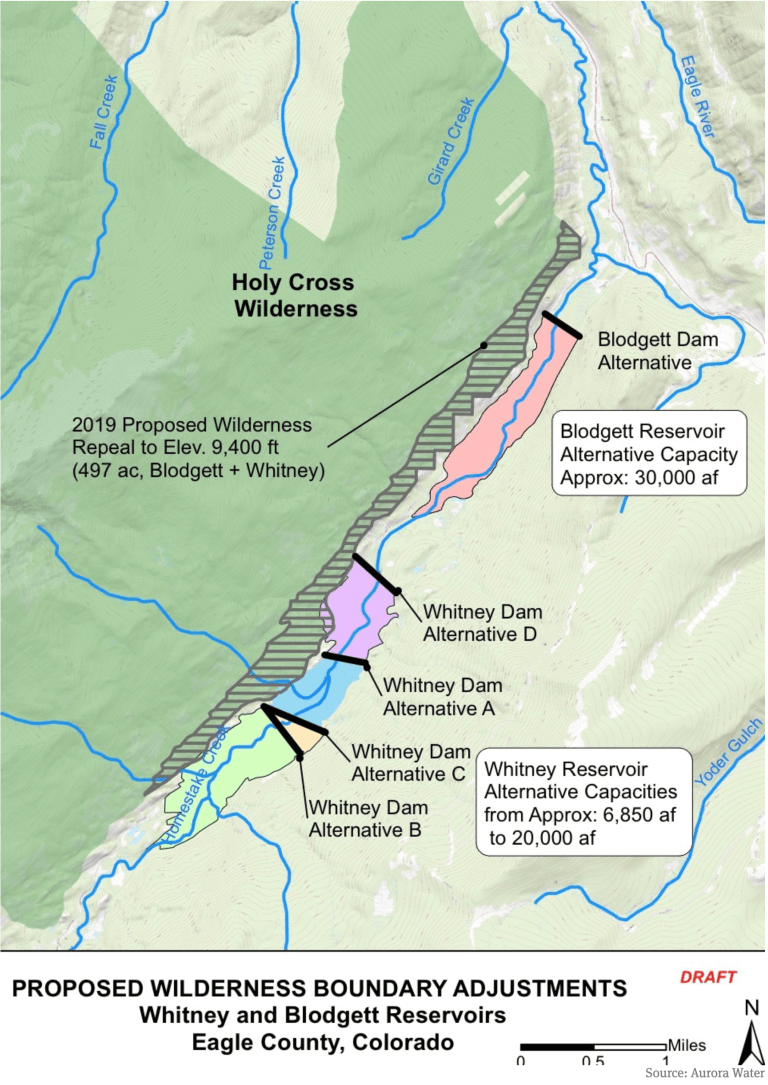
A map prepared by Aurora Water that shows a potential 500-acre adjustment to the Holy Cross Wilderness boundary near the potential Whitney Reservoir on lower Homestake Creek. The map as current as of July 16, 2019.
Aurora wants to team up with Colorado Springs to build Whitney Reservoir and divert more of Homestake Creek over the Continental Divide to the Front Range
Denver Water wants to expand Gross Reservoir above Boulder to hold more Fraser River water diverted from the Colorado River Basin
U.S. Highway 287 runs through the future site of Glade Reservoir. The Larimer county Board of County Commissioners approved the 1041 Land Use Permit for NISP in September, 2020. Photo credit: Northern Water
Northern Water has a $1 billion proposal to dam more Cache la Poudre River water for more than a dozen northern suburbs and cities
All of those would be unnecessary, the conservationists say, if the agencies doubled down on water-saving efforts that cut deeply into household use in the years after the devastating 2002 Front Range drought…
“We know that water in the West is increasingly in short supply and will only become more so as climate change results in worsening drought conditions and water shortages. The answer can’t simply be to pull every last drop of water out of our rivers,” said Juli Slivka, policy director at Wilderness Workshop, which is among the groups fighting any new dams on Homestake Creek.
Some of the bigger water agencies on the Front Range respond that conservation remains a primary goal, despite the falloff in their spending evident in annual reports required by the Colorado Water Conservation Board.
Aurora’s population will grow by hundreds of thousands of people by 2050, said Aurora Water spokesman Greg Baker. The agency focuses intensely on conservation to expand its water supply, Baker said, through programs like the smart meters and rebates to property owners who remove thirsty lawns, and with Prairie Waters, the largest potable water recycling system in the state.
But that growth, highly visible on Aurora’s eastern edge at the Highlands or Painted Prairie, means stretching existing water use is not enough for future supply, he added. Acquisition of new water must continue. The agency just spent about $17,000 an acre-foot for 500 acre-feet of farm water in the South Platte River Basin, Baker said.
“That’s more than we could find through conservation right now, unless we took such draconian measures — you know, say we banned all outdoor water use,” he said.
Denver Water, serving 1.5 million customers as the largest water agency in Colorado, said it is proud of conservation efforts launched after the wakeup call of the 2002 drought, achieving its goal of a 22% cut in per capita water use in a campaign from 2007 to 2016. Since then, said Denver Water’s manager of demand planning Greg Fisher, some resources have shifted to the concept of “efficiency” — focusing less on absolute cuts to everyone’s use, and instead consulting with larger customers and homeowners to ensure they are using only the water they actually need…
Denver Water’s officially reported tally of its conservation work fell from 36 full- and part-time staff and a budget of $8 million in 2013 — the first year of required reporting — to five full-time staffers and $1.5 million in spending in 2019, the last full year before the pandemic shut down many field services. Denver’s peak of conservation staffing, at 40 in 2016, was the same year the agency said it achieved the long-set goal of 22% per capita reductions in use.
Denver Water says daily water use fell from 211 gallons per person in 2011, before another severe drought began in 2013, to 165 gallons a day in 2016. Since then, Fisher said daily use has declined to about 140 gallons. In the years since the 2002 drought, Denver Water’s annual overall use has gone down, even as the customer base has climbed by hundreds of thousands.
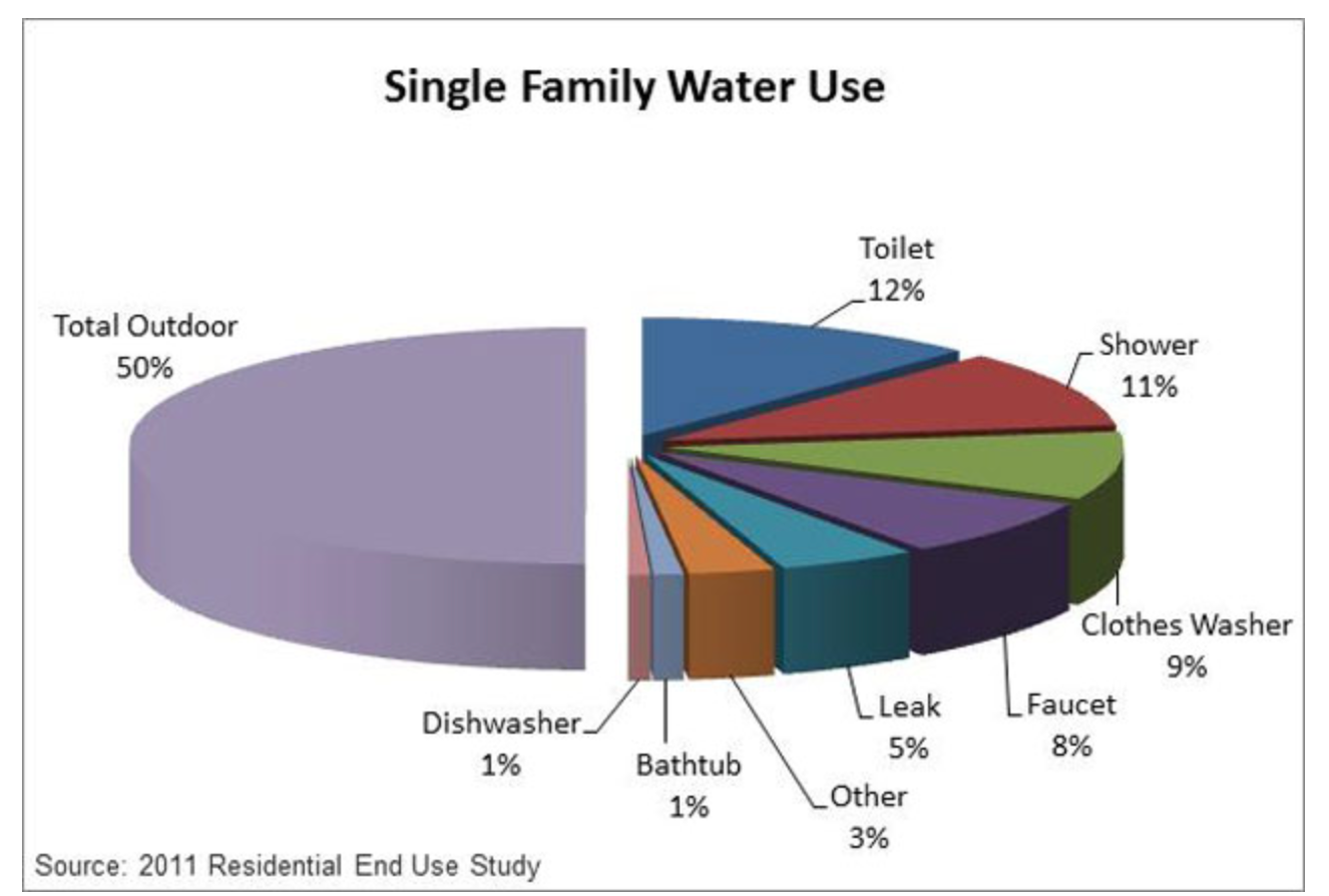
Lawn and plant irrigation still takes up by far the largest part of residential water use on Colorado’s Front Range. (Screen shot, Denver Water website)
The Denver agency says the state conservation reports are partially misleading because they ask for too narrow a classification of spending that ends up cutting water use. For example, Fisher said, Denver Water is spending more money on staff time helping local agencies rewrite green building codes to require more efficient water use…
Aurora’s conservation staffing has changed less dramatically, from 15 full-time and 13 contract positions in 2013, to a total of about 24 positions now, officials said. The emphasis has shifted over the years, Baker said. Most home and building owners have long since swapped out older toilets for efficient models, and individual homeowner irrigation audits are not as productive as broader efficiency programs…
Environmental conservation groups opposed to diverting water from Western Slope rivers are especially focused this year on Boulder County’s Gross Reservoir, where Denver Water wants to raise the dam by 131 feet at a cost of $464 million. A higher dam would allow Denver to bring over more of the water it owns in the Fraser River, part of the Colorado River Basin west of the Continental Divide. Denver also says it needs more water storage on the northern end of the Front Range in case changing climate patterns and wildfire runoff threaten water collection in the southern South Platte River basin, where most of its available water is collected…
Multiple environmental groups have sued to stop Gross Reservoir and sought to scrap it during the local permitting process. Boulder County held the power over a key construction permit Denver Water needs this year. Now Denver Water has asked a federal court to take over jurisdiction for the permit because the agency believes Boulder County Commissioners have already demonstrated their intent to block it…
Aurora Water says it is one of the few Colorado utilities that is doing exactly that [paying cash for grass], with its “water-wise landscape” payments. Aurora will design a homeowner’s low-water garden for free, and pay material costs up to $3,000 for 500 square feet — even more for a zero-water landscape, Baker said…
Denver Water says it offers everything from low-water “garden-in-a-box” kits, to rebates for installing the kind of smart controllers Aurora promotes, to training for landscapers…
Building storage, though, must remain a part of the water acquisition mix, both Denver and Aurora argue. As the system has gotten more efficient through conservation, Denver Water said, possible future gains diminish. In the 2002 drought, Denver said, its short-term restrictions cut water use 30%. After years of conservation work, similar restrictions in the 2013 drought — for a significantly larger customer base — cut water use only 20%.
“We are reaching the edges of supply,” Hartman said.
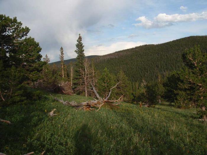
Denver Water conveying stunningly scenic parcels to Forest Service as part of Gross Reservoir Expansion Project.
It’s been getting crowded on the trails, open spaces and forests along the Front Range, especially since COVID-19 sent lock-down weary residents bursting into the backcountry in an eager search for safe, socially distanced outdoor recreation.
That newfound enthusiasm for backcountry adventure isn’t expected to fade any time soon.
But now, thanks to an agreement between the U.S. Forest Service and Denver Water, explorers will have just a sliver of additional elbow room.
Open meadows and mixed forest are common among the parcels Denver Water is conveying to the U.S. Forest Service. Photo credit: Denver Water.
Denver Water is in the process of conveying 539 acres of wetlands, meadows and forests in Gilpin County to the Forest Service to be managed for public use.
The remote acreage, near the east portal of the Moffat Tunnel, protects ecologically precious lands near two wildly popular wilderness areas (Indian Peaks and James Peak) and the Arapaho and Roosevelt national forests. The land also complements a larger landscape protection effort in the region assembled by The Conservation Fund.
“Denver Water is thrilled to be a part of this landscape preservation effort,” said Jim Lochhead, the utility’s CEO/Manager. “This region near these precious wilderness areas is an environmental gem and one much loved by Coloradans, especially many within our service area.
“Ensuring its permanent protection is an outcome we are proud to be a part of, and we appreciate our partnership with the Forest Service and the Conservation Fund in putting this all together,” he said.
Denver Water agreed to provide the land for its ecological value and public use as part of a sweeping agreement with the Forest Service to offset environmental impacts associated with the expansion of Gross Reservoir to the east of the area.
It’s one of several steps Denver Water has already taken to complete so-called “mitigation” projects years ahead of the expansion work.
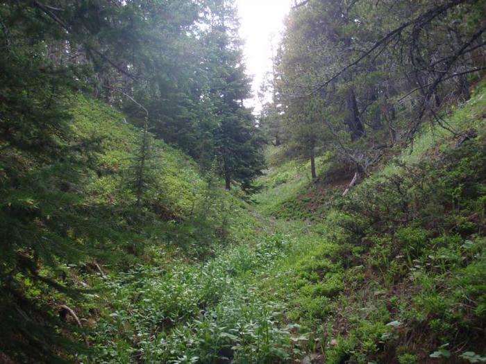
Seasonal creeks like this one funnel spring runoff into established waterways and lend the landscape a lush character. Photo credit: Denver Water.
The lands being conveyed are part of what’s known as the Toll Property, the name derived from a ranching family that owned the land for 120 years.
Denver Water’s contribution, scattered across 11 parcels, is part of a much larger agreement, according to reporting in the Boulder Daily Camera. A much larger area of 3,334 acres remains in the Toll family’s private ownership, but with a perpetual conservation easement to prevent development.
An additional 823 acres also were acquired by the Forest Service.
The entire land protection project creates a significant buffer, separating the adjacent James Peak Wilderness to the west from rural development and urban areas to the east, as described in a summary by The Conservation Fund.
These parcels in the Mammoth Gulch area look southwest toward the Continental Divide. Photo credit: Denver Water.
It also helps protect a four-mile stretch of the upper portion of South Boulder Creek, a key part of Denver Water’s supply.
The landscape is familiar not only to backpackers. Train aficionados know the area as part of the route taken by Amtrak’s California Zephyr, between Denver and San Francisco.
Public hearings set for August and September are canceled
Last September (2020), Denver Water submitted an Areas and Activities of State Interest (1041) application to Boulder County Community Planning & Permitting (CPP) for its Gross Reservoir Expansion project.
Since that time, CPP requested additional information from Denver Water. On June 29, 2021, the CPP Director acknowledged Denver Water’s intent to not provide additional requested information, and determined the 1041 review will move to public hearings.
Denver Water filed a lawsuit against the county in July 2021. The lawsuit alleges that the county does not have the authority to regulate the project because the project requires a permit from the Federal Energy Regulatory Commission. Because of the lawsuit, on July 26, Denver Water’s attorney requested that the CPP Director place the 1041 application on hold, and CPP Director Dale Case granted the request the next day, July 27.
Consequently, public hearings that were set for August and September have been canceled.
“It makes sense to have the court resolve the legal issues about whether Boulder County can proceed before conducting hearings on the 1041 review,” said Case. “We have already devoted significant time and resources to processing Denver Water’s application, and it would take even more county resources to proceed with public hearings.”
The Areas and Activities of State Interest (1041) application for the expansion of Gross Reservoir is a request to store an additional 77,000 acre-feet total of water, which includes increasing the dam height by approximately 131 feet, the dam length by approximately 790 feet, and the spillway elevation by approximately 126 feet; quarry operations to obtain aggregate needed for construction; construction of a temporary concrete batch/production plant and an aggregate processing plant; permanent road improvements to Gross Dam Road from State Highway 72 to Gross Reservoir; temporary road improvements to FS359 (Winiger Ridge Road) and FS97 (Lazy Z Road); and the relocation of the Miramonte Multi-Use Trail.
Tackling the challenges surrounding climate change and water supply will require collaboration and creative thinking, Colorado’s top water leaders and senior federal officials agreed Thursday.
More than a dozen state officials and water leaders from across the state met at Denver Water’s Operations Complex with Department of the Interior Secretary Deb Haaland to discuss the impacts of climate change, the ongoing drought across the Colorado River Basin and how leadership and collaboration at every level will be needed to help address it.
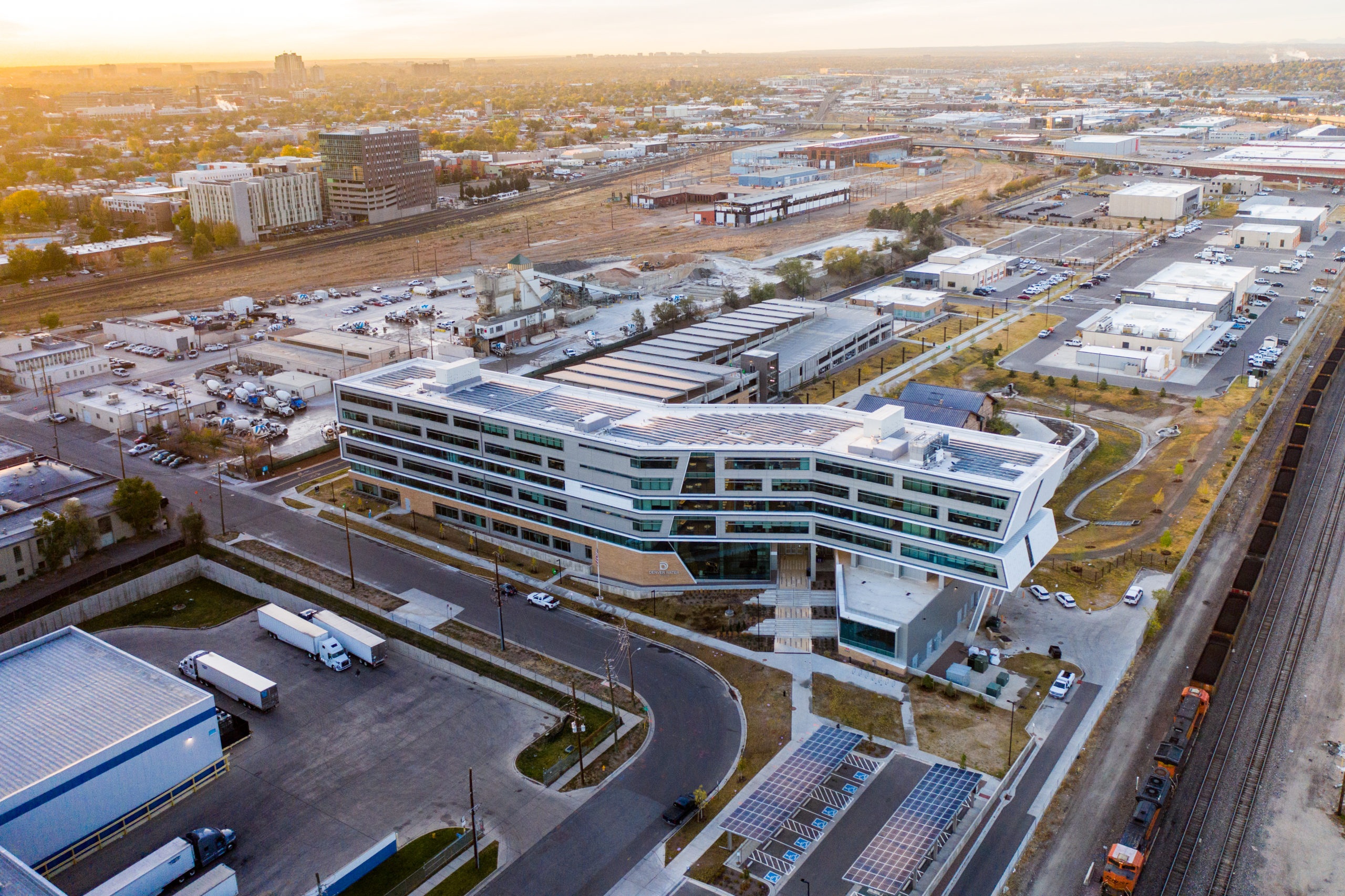
After the discussion, Jim Lochhead, Denver Water’s CEO/Manager, welcomed the group — which included Interior’s Assistant Secretary for Water and Science Tanya Trujillo, Colorado Congresswoman Diana DeGette, Rebecca Mitchell, director of the Colorado Water Conservation Board, and Colorado Commissioner of Agriculture Kate Greenberg — to a news conference at the utility’s Administration Building, completed in 2019, that is itself a demonstration of the future of water and water efficiency in an urban setting.
Graphic via SustainableWater.com.
Lochhead said the roundtable also included a discussion of the investments Denver Water is making in watershed health, through its From Forests to Faucets program that includes partners at the state and federal level, water conservation, resiliency and sustainability.
Haaland said she was glad to tour “this beautiful building” and praised the roundtable for bringing a wide range of people together for a thoughtful and important discussion…
Greenberg said it meant a lot to the people working across Colorado’s agriculture sector to know issues surrounding climate change were “top of mind” at both the state and federal level…
Attendees at the water leaders’ roundtable discussion were:
Deb Haaland, Secretary of the U.S. Department of the Interior.
Tanya Trujillo, Assistant Secretary for Water and Science, U.S. Department of Interior.
Davis Raff, Chief Engineer, U.S. Bureau of Reclamation.
Carly Jerla, Senior Water Resources Program Manager, U.S. Bureau of Reclamation.
Diana DeGette, U.S. Representative for Colorado’s First Congressional District.
Colorado Gov. Jared Polis.
Colorado Lt. Governor Dianne Primavera.
Kate Greenberg, Colorado Commissioner of Agriculture.
Dan Gibbs, Executive Director, Colorado Department of Natural Resources.
Rebecca Mitchell, Director, Colorado Water Conservation Board.
Jim Lochhead, CEO/Manager, Denver Water.
Christine Arbogast, representing Colorado Water Congress.
Peter Fleming, General Counsel, Colorado River Water District.
Jim Broderick, Executive Director, Southeastern Colorado Water Conservation District.
Ken Curtis, General Manager, Dolores Water District Manager (retired).
Steve Wolff, General Manager, Southwest Water Conservation District.
Jennifer Pitt, Colorado River Program Director, National Audubon Society
Denver Water is planning to expand Gross Reservoir in Boulder County. The additional storage capacity will create more balance in the utility’s storage and give water planners more flexibility in their operational strategy. Photo credit: Denver Water.
Denver Water today [July 14, 2021] filed a lawsuit in U.S. District Court against Boulder County, asserting the county is overreaching its authority and jeopardizing a federally ordered reservoir expansion critical to a safe and secure water supply for one quarter of the state’s population while risking long-planned benefits for the West Slope environment.
BACKGROUND
For nearly two decades, Denver Water has conducted an exhaustive and comprehensive planning and permitting process at the direction and oversight of six federal and state regulatory agencies. That process culminated last year in a final order to commence expansion of Gross Reservoir from the Federal Energy Regulatory Commission, which has final authority over the expansion project because Gross Reservoir occupies federal lands specifically designated for hydropower production.
For years, Denver Water has also attempted good faith efforts to work with Boulder County to secure county permits, including through two attempts at an intergovernmental agreement, robust engagement with county staff and neighbors, and participation in a local land-use review known as the “1041 process.” Unfortunately, Boulder County has been unreceptive and is using the 1041 process to frustrate the project, extending and delaying its review to the point that it is now placing the entire project at risk.
DENVER WATER STATEMENT ON NEED FOR THE PROJECT
It is hard to overstate the importance of the expansion of Gross Reservoir to the future of the Denver region. It will offer crucial protection to the utility’s water supplies from the urgent threat of catastrophic wildfire and prolonged drought — the same forces that nearly 20 years ago combined to threaten Denver Water’s ability to ensure drinking water to its customers.
This risk to clean water supplies is even higher today, in an era of rapid climate change and increasing periods of extreme weather. Last year’s record wildfire fire season, which generated the three largest forest fires in Colorado history, only just missed triggering major impacts to Denver Water’s supplies. Water providers to the north haven’t been as lucky, unable to treat some supplies running black and brown with ash produced by the Cameron Peak fire. Denver Water must act now to mitigate these risks.
The Gross Reservoir expansion conforms in every way to benchmarks in Colorado’s Water Plan, a plan developed through statewide and bottom-up guidance from eight major river basins over two years and published in 2015. That plan calls for increasing the capacity of existing reservoirs as a key element in creating 400,000 acre-feet of additional storage in the state by 2050.
The State of Colorado, in comments to the U.S. Army Corps of Engineers, expressed its support for the Gross Reservoir expansion and has identified it specifically as fitting within the kind of project defined as necessary in Colorado’s Water Plan: “A significant portion of Colorado’s future needs will be met with the implementation of projects and planning processes that the local water providers are currently pursuing, including the Moffat Collection System Project” (aka Gross Reservoir expansion).
The reservoir expansion also addresses the significant need for additional supplies in the metro region, as referenced in the Water Plan’s 2019 technical update. That update projected metro Denver demand will increase by 134,000 acre-feet to 280,000 acre-feet by 2050 against a 2015 baseline and the area likely will experience a supply shortfall, even accounting for the Gross Reservoir expansion and other water projects, a drop in per-capita use, and further conservation and reuse.
DENVER WATER STATEMENT ON DEVELOPMENT OF THE PROJECT
Denver Water’s diligent and earnest work to build partnerships across the Continental Divide, conduct significant and ongoing environmental mitigation for the project and work closely with regulators since the early 2000s has earned the project the support of major environmental groups, Grand County and each of the last five governors of Colorado. The Colorado Department of Public Health and Environment concluded the project would result in net water quality improvement on both sides of the Continental Divide.
The dam, when built in the 1950s, was designed to be raised. In the 1980s, amid discussion of the Two Forks project southwest of Denver (later vetoed by the EPA) a coalition of environmental groups recommended the expansion of Gross Reservoir as a viable, environmentally stable project. “We feel that additional capacity at Gross Reservoir is an environmentally acceptable and cost-effective way of increasing the overall yield of the system,” the coalition wrote. It included representatives of the Sierra Club, the Environmental Defense Fund and Trout Unlimited, among several other groups.
Denver Water also worked industriously with local governments and citizen groups on the West Slope to address the impacts that putting more water in an expanded Gross Reservoir would have on streams in Grand County. Those talks, often intense, and spanning half a decade, resulted in the Colorado River Cooperative Agreement in 2013, an unprecedented cooperative effort involving 18 signatories and 40 partner organizations that began a new era of collaboration and conflict-resolution between Denver Water and the West Slope.
Expanding Gross Reservoir locks in a key component to that agreement: Denver Water would place a geographic limit on its service area, putting to rest fears the utility would continue to expand its reach to an ever-sprawling suburban ring. The utility also agreed to several measures that would provide more water to West Slope rivers, towns and ski areas and invest in improvements to aquatic habitat. The landmark concord also affirmed that with the Gross Reservoir expansion, Denver Water would benefit from more flexibility in its system, and it would use that flexibility to address stream flow and stream temperature concerns more nimbly and readily in Grand County.
Additionally, Denver Water worked with the cities of Boulder and Lafayette to establish an environmental pool in Gross Reservoir to provide additional water in South Boulder Creek during low-flow periods. Water in that pool would also supplement supplies for those two cities. Many of these commitments, however, depend on the project going forward and are therefore in jeopardy through Boulder County’s actions.
As planning for the expansion moved ahead, the utility undertook a proactive strategy to reduce demand. It deployed a water recycling facility to reduce its dependence on West Slope water supplies, embarked on a conservation program renown nationally for its success — cutting per capita water use by 22% between 2007 and 2016 — and has now undertaken direct efforts at water efficiency that pinpoint savings opportunities at the individual customer level. These are only a sample: The utility remains committed to innovation to drive further savings and expand water reuse as a core part of its strategy, work that will continue to be essential even with an increase in storage at Gross Reservoir.
In short, the effort to build civic and regulatory support for the Gross Reservoir expansion has been persistent, inspired and earnest. The future of the region, its access to clean, safe drinking water, protection of its urban tree canopy and environment, and its economic development rest in large part on the ability of Denver Water to protect water supplies from emerging threats, develop a climate-resilient system and remain prepared for the demands that will result from continued growth within its service area in metro Denver.
DENVER WATER STATEMENT ON BOULDER COUNTY’S PROCESS
Boulder County is endangering the project through delays, repeated and expanding requests for information — information demands that duplicate the already completed federal permitting process in which Boulder County participated — the potential for months of additional hearings and the fact that two of the county’s three commissioners have already publicly stated their opposition to, and desire to stop, the expansion project.
Further, the county’s land use director informed Denver Water on June 29 that the utility — despite over nine months of diligent and painstaking work to respond to Boulder County’s ever-expanding queries — failed to provide sufficient information to county agencies about the project, setting the project up for failure and rendering further involvement with the 1041 process futile.
These actions also put engineering and construction deadlines at risk, threaten to disrupt FERC-ordered timelines and risk other permits and actions necessary for successful completion of the project. A project of this size and complexity requires extensive preplanning, substantial resources and a highly skilled design and construction team. Delays resulting from Boulder County’s refusal to timely process the 1041 application add substantial costs and cause permitting, procurement and logistical issues that seriously disrupt Denver Water’s ability to execute the project.
In summary, the actions of a single local jurisdiction, Boulder County, threaten to derail and undermine a federally permitted and state supported project vital to a safe and secure water supply for one-quarter of Colorado’s population. This presents an unacceptable risk to a critical project spanning nearly 20 years and involving intensive review by environmental agencies at the federal and state levels and the engagement of dozens of organizations and communities across the metro area and the West Slope.
For that reason, Denver Water must seek relief in federal court. The complaint further details Denver Water’s attempts to work with Boulder County, the reasons that federal law preempts Boulder County’s claimed authority over the FERC-licensed expansion project, and the basis for Denver Water’s request that the court prevent Boulder County from further delaying and derailing the project.
Colorado Parks and Wildlife has asked anglers to voluntarily avoid fishing on the Colorado River between Kremmling and Rifle — and more voluntary closures could be coming.
The closure is in effect until further notice with a possibility of a mandatory emergency closure to all fishing if conditions worsen…
Heat, drought and low water levels are contributing to elevated water temperatures in much of Colorado, depleting oxygen levels and leaving trout vulnerable. Trout are cold-water fish that function best in 50-60 degree waters. When temperatures exceed 70 degrees, they often stop feeding and become more susceptible to disease.
As the aquatic biologist for CPW’s Hot Sulphur Springs office, Jon Ewert has seen already seen the local impact to the fishery firsthand. After a number of public reports of fish mortality along the Colorado River, he recently floated from Radium to Rancho del Rio to verify the issue. On that float, he counted 15 fish carcasses…
River flows have been exceptionally low this year.
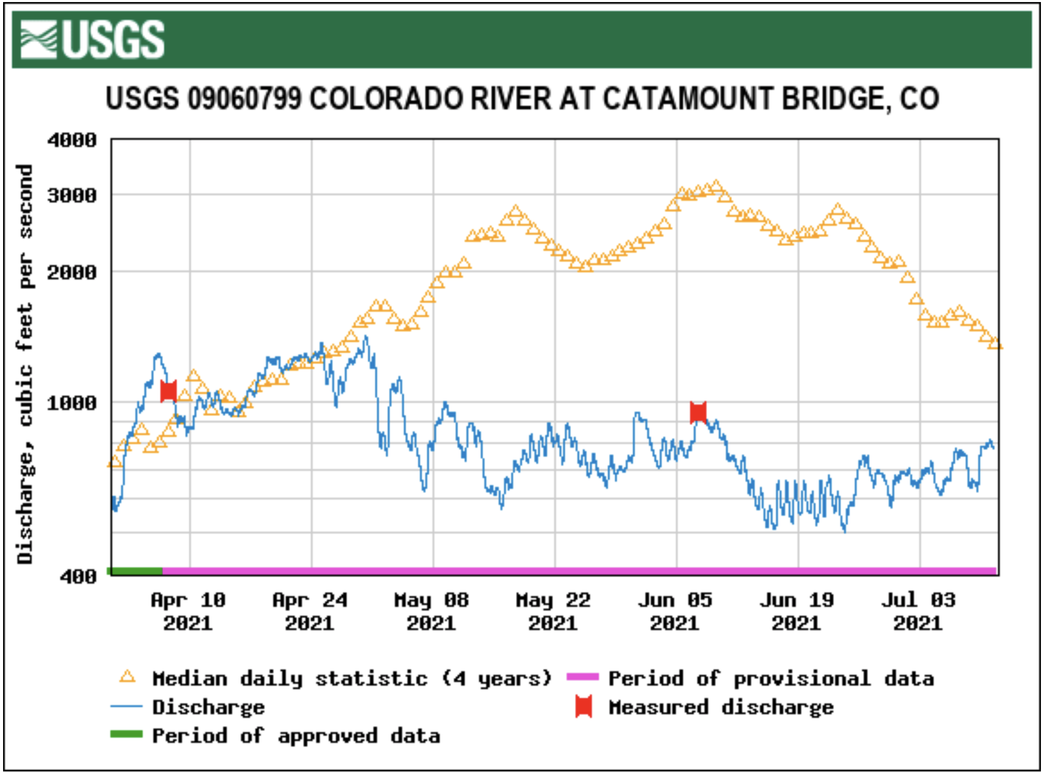
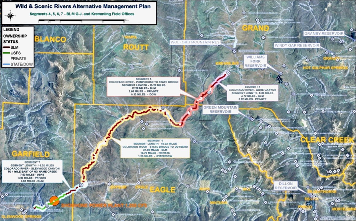
The USGS gauge on the Colorado River at Catamount Bridge has been measuring 600-700 cfs, less than half what is historically expected there. The USGS gauge on the Colorado River near Dotsero is running at 1,250 cfs, down from an expected 3,000-4,000 cfs.
Mixed with high temperatures, these conditions spell disaster for the fishery. And it’s not just the Colorado River downstream from Kremmling.
According to Ewert, temperatures for other river sections in Grand are also edging toward dangerous levels for fish…
Ewert explained that these types of voluntary closures on rivers are not unheard of, but the extent of the closures might be…
Around 60% of Grand County’s water is diverted, mostly to the Front Range, with the Denver metro area receiving about 20% of its water from Grand.
In early June, temperatures were already spiking to 70 degrees on the Colorado River near Kremmling. Grand County coordinated with the Colorado River District, Denver Water, Northern Water and other partners to boost water levels where possible…
Denver Water estimated that by early July it will have voluntarily foregone collecting around 11,000 acre-feet of water from Grand County…
Northern Water said it has bypassed more than 6,000 acre-feet or about 2 billion gallons of water this year that has been sent downstream in the Colorado River…
Representatives of the Grand County Learning By Doing Cooperative Effort, the partnership of Front Range and West Slope water stakeholders, said that coordination is underway to release additional flows to mitigate temperatures.
While these voluntary efforts by those with water rights in Grand are helping, the sharp contrast in water use is hard to ignore for those invested in the health of the county’s rivers.
“Here’s what really breaks my heart: The Front Range water diverters filled their reservoirs … they continued to divert as much water as they did in a wet year,” [Kirk] Klanke said. “They don’t seem to feel they have any more wiggle room to leave a little more water in the river …
“Now we’re at the mercy of senior water right calls downstream. As I watch my guide friends become unemployed, I watch Kentucky bluegrass be watered on the Front Range. It’s hard to swallow.”
Denver Water cuts back on some of its West Slope supplies to help struggling streams.
The Colorado River is hurting.
The struggles of the river’s largest reservoirs, Lake Mead and Lake Powell, have been well documented over the last decade as drought has ravished the West.
The story, however, starts more than 500 miles upstream in Grand County, Colorado.
The county is filled with streams that make up the beginning of the mighty Colorado’s journey in the mountains north of Grand Lake. Around 60% of the water in Grand County is diverted from these streams and used for agricultural and municipal water supply, mostly on the Front Range.
That includes the Denver metro area, which receives about 20% of its water from Grand County, where Denver Water has water rights dating back to the 1920s. Most of the water is captured in rivers and streams around Winter Park when mountain snow melts in the spring.
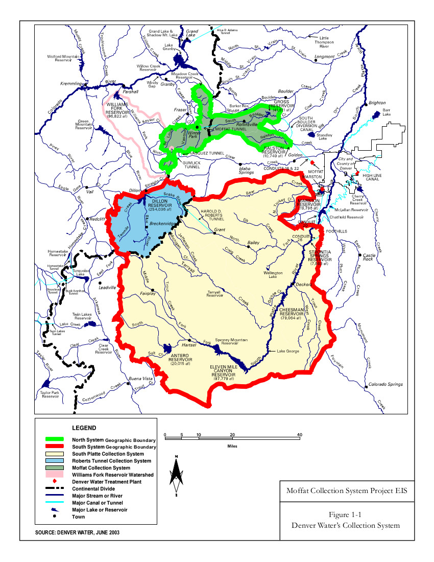
Rivers and creeks in Grand County are part of Denver Water’s North Collection System. Water flows through the Moffat Tunnel, under the Continental Divide, to Gross and Ralston reservoirs. Image credit: Denver Water.
But, after a lackluster runoff season on the West Slope combined with dry soils from the past year, the hot, dry conditions in early June meant the high-country rivers and streams needed help.
Denver Water responded by voluntarily reducing diversions from several Grand County creeks and coordinating with the Colorado River District, Grand County, Northern Water and other Learning By Doing partners to adjust operations, where possible, to help boost water levels in some of the more troubled areas.
“While our primary responsibility is to make sure we’re supplying water to 1.5 million people in the metro area, we’re always looking for opportunities to help improve conditions on the rivers, to help the aquatic environment, recreation and communities they flow through,” said Nathan Elder, Denver Water’s manager of water supply.
By reducing diversions, Denver Water foregoes collecting a portion of water it is legally entitled to collect for its water supply in exchange for improving streams and tributaries along the Colorado River.
The Fraser River flows below a Denver Water diversion structure in Grand County in June 2021. Denver Water voluntarily released around 11,000 acre-feet of water from streams in the county from June 6 through early July in 2021 to improve aquatic habitat downstream. Photo credit: Denver Water.
It started with a plea for help
On June 5, the Colorado River District asked Denver Water for help after reporting extremely low water levels and critically high water temperatures on the Colorado River. The river district reported conditions were creating unhealthy habitat for fish and aquatic insects.
“When the email came in Saturday morning, we were in a position to quickly respond and reduce the amount of water we were pulling from several Grand County creeks,” Elder said.
Denver Water has continued making operational adjustments since that email.
The utility estimates that by early July it will have voluntarily foregone collecting around 11,000 acre-feet of water from Grand County to help keep more water in the Colorado and Fraser rivers. That’s roughly enough water to supply over 44,000 residences for one year.
“It has been helpful to hear directly from stakeholders in Grand County, including Trout Unlimited and ranchers along the river, on where we may be able to truly help the river, the community and the environment with our operational adjustments,” Elder said.
“With help from the West Slope, we’ve been able to target specific areas and send some beneficial water downstream.”
This includes adjusting water releases from Williams Fork Dam twice a day in a way that also benefits the Colorado River.
For example, when releasing water from the dam, Elder and his team try to time the flows, so the water reaches the river in Kremmling — an area prone to higher river temperatures — during hotter times of the day.
The higher water level helps to cool down the water, which is better for the aquatic environment.
Warm temperatures and low water levels create unhealthy conditions for fish in Colorado streams. Denver Water worked with the Colorado River District to send cooler water downstream in June to help lower temperatures on the Colorado River near Kremmling. Photo credit: Denver Water.
Position to help
The wet spring conditions along the Front Range boosted water supplies in Denver Water’s South Platte River collection system, which drastically reduced customers’ demand for water across the metro area — where Denver Water serves a quarter of the state’s population.
In fact, from January to May, Denver Water’s customer water use hit a 50-year low across the metro area, despite nearly 600,000 more people in its service area since 1970. That includes years in which the metro area was on mandatory drought restrictions.
“Some of the low use may be due to COVID-19 impacts on business and obviously a wet, cool spring helped,” said Greg Fisher, demand manager for Denver Water.
“It’s a great sign that our customers really understand efficient water use and let Mother Nature do the watering for them when possible.”
This wet spring on the Front Range also helped provide additional flexibility on how Denver Water collected and distributed water across its collection system during the spring snow runoff.
“We were able to turn off the Roberts Tunnel in April, which helped bring water levels up in Dillon Reservoir for boating,” Elder said.
“The conditions also enabled us to send more water down the Blue River below Dillon Dam to help improve fish habitat around Silverthorne instead of sending the water to the Front Range.”
Denver Water uses the Roberts Tunnel to bring water from Dillon — the utility’s largest reservoir — under the Continental Divide to the Front Range.
But flexibility like this is not always possible, especially with the myriad threats Denver’s water system is facing.
“Between the rising temperatures, changes to the timing of spring runoff, extreme fire behavior and half a million more people expected in the metro area by 2040, our ability for flexible operations is decreasing in a time when we need it the most,” said Elder.
“We must take an ‘all-in’ approach that includes conservation, water reuse and development of new water supplies so we can continue to maximize the benefits of a large system.”
Wet conditions in the metro area during the spring of 2021 reduced demand for water for irrigation. The lower demand gave Denver Water more flexibility to fill its reservoirs and provide additional water for environmental benefits on the West Slope. Photo credit: Denver Water.
More flexibility
According to Elder, hot, dry weather conditions highlight the benefits of having a large water collection system, as it provides the water planning team more flexibility in its operational playbook.
Denver Water relies on a network of reservoirs to collect and store water. The large collection area provides flexibility for collecting water as some areas receive different amounts of precipitation throughout the year. Image credit: Denver Water.
The vision for the Gross Reservoir Expansion Project, which is in its final steps of permitting, is an example of how additional water storage can really help streams in times of drought.
“As part of the Gross Reservoir Expansion, some of the voluntary things we’re doing this year — like leaving more water in the Grand County rivers — will become required annual operations for us,” said Elder.
Denver Water is planning to expand Gross Reservoir in Boulder County. The additional storage capacity will create more balance in the utility’s storage and give water planners more flexibility in their operational strategy. Photo credit: Denver Water.
That’s because Denver Water is one of 18 partners who signed the Colorado River Cooperative Agreement in 2013, ushering in a new era of cooperation between the utility and West Slope stakeholders, all with the vested interest in protecting watersheds in the Colorado River Basin.
As part of that agreement, a process called “Learning by Doing” was created, which has helped the utility stay better connected on river conditions in Grand County. The partnership is a collection of East and West Slope water stakeholders who help identify and find solutions to water issues in Grand County.
“Denver Water has been part of Grand County for over 100 years, and we understand the impact our diversions have on the rivers and streams,” said Rachel Badger, environmental planning manager at Denver Water.
“Our goal is to manage our water resources as efficiently as possible and be good stewards of the water — and Learning By Doing helps us do that.”
That’s because Denver Water is one of 18 partners who signed the Colorado River Cooperative Agreement in 2013, ushering in a new era of cooperation between the utility and West Slope stakeholders, all with the vested interest in protecting watersheds in the Colorado River Basin. As part of that agreement, a process called “Learning by Doing” was created, which has helped the utility stay better connected on river conditions in Grand County. The partnership is a collection of East and West Slope water stakeholders who help identify and find solutions to water issues in Grand County. “Denver Water has been part of Grand County for over 100 years, and we understand the impact our diversions have on the rivers and streams,” said Rachel Badger, environmental planning manager at Denver Water. “Our goal is to manage our water resources as efficiently as possible and be good stewards of the water — and Learning By Doing helps us do that.”
Storage tanks at Denver Water’s new, state-of-the-art water treatment plant taking shape.
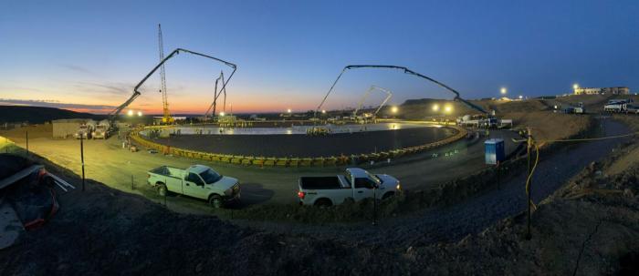
The work started in the dark, at 2:30 a.m., continued through the dawn and lasted until noon on Friday, May 14.
Loaded concrete trucks trundled onto the site of the Northwater Treatment Plant, along Highway 93 north of Golden. A truck arrived every four minutes, delivering concrete that was pumped, then smoothed into place by an army of about 100 workers.
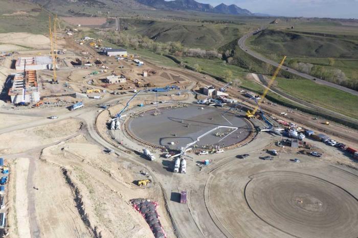
They shaped the round, concrete floor of what will be the first of the new treatment plant’s two water storage tanks. The tanks will hold clean, treated water to be delivered into Denver Water’s distribution system that sends safe drinking water 1.5 million people every day.
Placing the concrete floor for the first of two 10-million-gallon water storage tanks at the new Northwater Treatment Plant started at 2:30 a.m. on Friday, May 14, and continued through noon that day. Photo credit: Denver Water.
“It’s a big milestone day. Each tank can hold 10 million gallons of water — and to put that in perspective, that’s 15 Olympic-sized swimming pools,” said Bob Mahoney, Denver Water’s chief engineering officer.
“The project is going very well. It’s ahead of schedule and — in addition to pouring the floor of the new treated water reservoir — the overall project is about 38% complete.”
More than 100 concrete trucks were needed to deliver 1,400 cubic yards of concrete for the base of the storage tank. Photo credit: Denver Water.
A look at the numbers behind the work:
23 feet, the height of the storage tank when finished, although most of it will be buried underground.
300-plus feet, the diameter of the tank, longer than a football field.
1,400 cubic yards of concrete were needed for the floor of the tank.
145 concrete trucks delivered the concrete.
100 workers were involved with the concrete placement.
The first of two 10-million-gallon water storage tanks begins to take shape. Photo credit: Denver Water.
The new, state-of-the-art water treatment plant, being built next to the utility’s Ralston Reservoir, is expected to be complete in 2024 and will be capable of cleaning up to 75 million gallons of water per day. Concrete for the floor of the second water storage tank is expected to be put in place July 2, weather permitting.
The Northwater Treatment Plant is part of Denver Water’s $600 million North System Renewal effort, which includes a new pipeline to carry water from the new plant and upgrades at the old Moffat Treatment Plant built in Lakewood in the 1930s.
About 100 workers were involved in the project, getting the concrete into the forms and smoothing it out to dry. Photo credit: Denver Water
The concrete work in mid-May drew a steady stream of curious onlookers, including workers building the new plant — and those who will run it when it’s finished.
“I had to come out. I really wanted to see how they do this,” said Nicole Babyak, a water treatment plant supervisor at Denver Water.
“The team and I, we’ve been involved in this project for years. We’re going to be running the plant and have seen parts of the facility being built from the ground up, but I haven’t seen a large concrete pour like this yet. It’s so neat to be here while they’re pouring the first tank.
“It’s just so cool.”
Denver Water’s new, state-of-the-art Northwater Treatment Plant is being built between Ralston Reservoir, seen in the distance on the left, and Highway 93, seen on the right. Photo credit: Denver Water.
Denver Water’s collection system via the USACE EIS
FromColorado Public Radio (Michael Elizabeth Sakas):
The National Weather Service said Denver has seen its wettest start to a year since 1983.
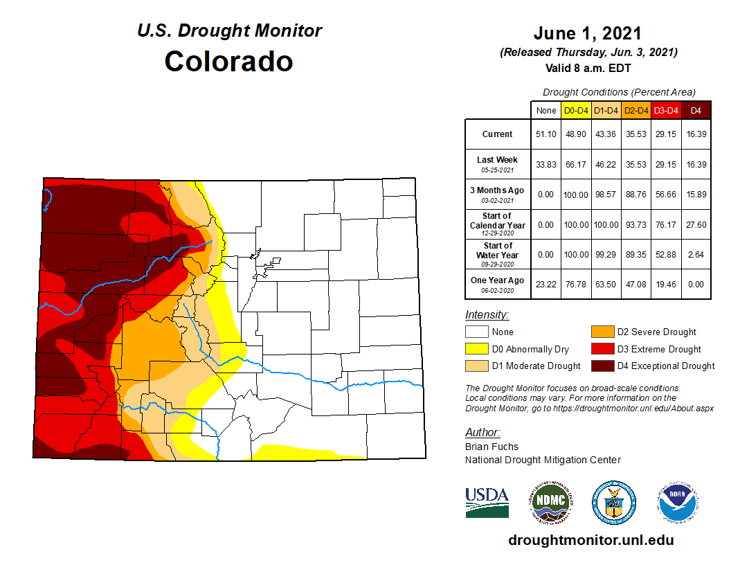
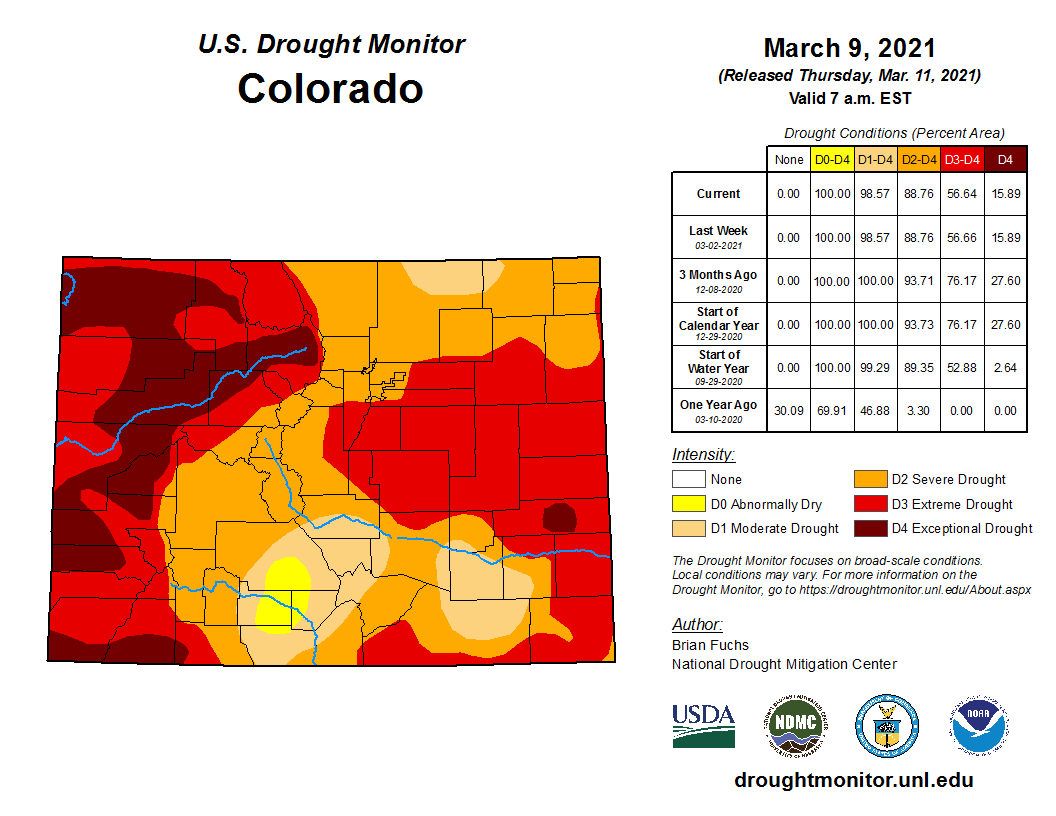
All that rain has made significant improvements to Colorado’s drought map. Three months ago, nearly the entire state was in a moderate drought or worse. Now that’s just 43 percent.
But the map shows a tale of two Colorados. While above-average rain has brought relief to the eastern half of the state, the West Slope is in a terrible drought.
Colorado Drought Monitor map June 1, 2021.
“Half of Denver Water’s supply comes from that West Slope side,” said Nathan Elder, manager of water supply at Denver Water.
So while those who live in Denver and the Front Range might be thinking, “What drought?”, Elder says it’s important to understand that water conservation is still needed, especially since half the city’s system exists in areas that are historically dry…
Elder says he expects reservoirs in the South Platte system will fill…
Elder says peak flows into Dillion reservoir will be about half of what’s normal. But overall, Denver’s reservoirs are 89 percent full, which Elder says is average for this time of year.
Gathered around the campfire one evening during a rafting trip many years ago, the conversation was about classroom education of river guides. I remember it well almost 40 years later because I cracked a joke that got a round of laughter.
To make the educational experience complete, I said, somebody should throw a pail of cold water over those assembled to make it like a real river trip.
That memory was provoked by a recent visit to the Headwaters River Journey, a water-focused exhibit-slash-museum that occupies the ground floor of the Headwaters Center in Winter Park. It doesn’t leave you shivering like you just fell into a cold mountain stream. It does intend for visitors to gain an appreciation for mountain water and the consequences of its loss, in the case of the Fraser Valley to the benefit of metropolitan Denver.
Colorado has 25 ditches, tunnels, and other conveyances that ferry water over and through the Continental Divide, from the Western Slope where 80% of water originates, mostly in the form of snow, to the Front Range cities and the farms beyond, where 85% of Coloradans live. No place has been dewatered so severely as the Fraser Valley, where Winter Park is located.
Diversions that began in 1936 have resulted in 60% of the water from the Fraser Valley being diverted to metropolitan Denver. That percentage will increase to more than 80% if a long-contemplated project by Denver Water gets realized.
Headwaters River Journey seeks to deliver an appreciation for the natural environment of the Fraser and other mountain valleys and the cost to these ecosystems. It does so with an abundance of hands-on experiences.
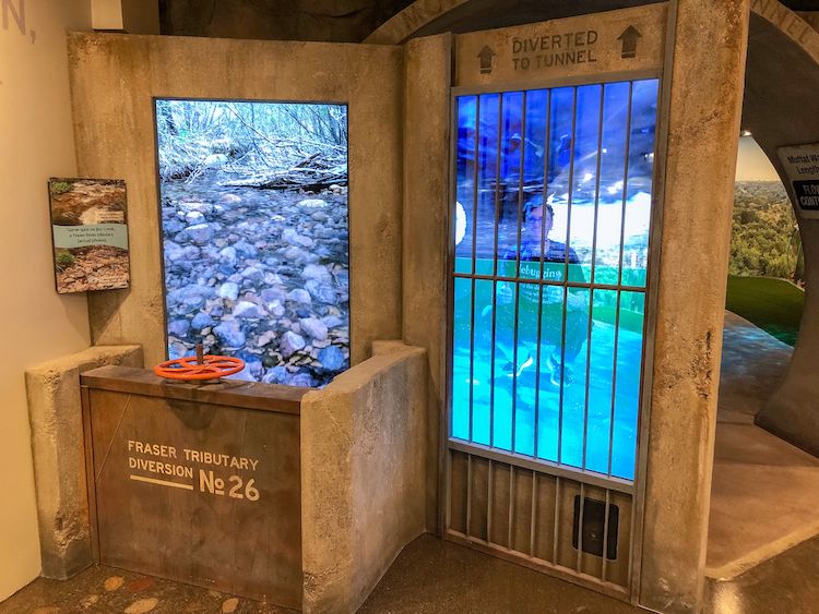
One exhibit allows a literal hands-on demonstration of depletion of Jim Creek, one of the sources of metropolitan Denver’s water, as levels rise in Moffat Tunnel pipeline. Photo/Headwaters Center via The Mountain Town News
The hands-on learning is literal in an exhibit about Denver Water’s diversion from Jim Creek. The creek originates on the flanks of James Peak, across from the Winter Park ski area, meandering through a glacial-carved valley to a confluence with the Fraser River. Or, what’s left of the creek.
The exhibit has you lay hands on an operating wheel that is used to raise or lower a headgate at a diversion point. As you crank the red wheel, as if to divert water into a diversion ditch, a screen on the left shows water levels in the creek dropping. More cranks yet reveal cobbles, a creek nearly without its water. A panel on the right shows corresponding water levels rising in the water pipe in the Moffat Tunnel used by Denver to deliver water to South Boulder Creek, just one relatively minor hump away from Denver’s suburbs.
This was not news to me. I once lived in that valley, proudly wearing a “Dam the Denver Water Board” (as the water agency was formerly called) bumper sticker on my car. Now, I live on the receiving end of that water, in the Denver suburb of Arvada. Here, 78% of water for this city/suburb of 120,000 people comes through the Moffat Tunnel from Jim Creek and myriad other creeks in the Fraser Valley. More yet comes from the adjacent but far more remote Williams Fork Valley, two more tunnels away.
The plumbing before the water arrives at my garden hose is vast, complex, and expensive. The legal system for administration of Colorado’s water may be more byzantine yet.
Headwaters doesn’t dive deep on the history, legal system, or the plumbing. It’s more like a chapter in Colorado Water 101. It is geared to someone who knows relatively little about water.
Still, someone like myself, who has written about Colorado water off and on for more than 40 years, the exhibits can fill in gaps. One of my gaps is biology. One exhibit showed the life stages of stoneflies, an important component of the aquatic ecosystem. Through an interactive exhibit, I swam along a river bottom somewhat like a trout might, looking for food.
Another interactive experience allowed me to flap my arms as if a condor, flying over the geography from Berthoud Pass northward to Longs Peak and west along the Rabbit Ears Range. If a museum can be this much fun for an older guy, I wonder what it would be like to be a 10-year-old.
My companion, Cathy, was most touched by two exhibits that triggered her memories of living for almost 30 years in a very small mountain town in a house above the confluence of a creek and river.
One was a line of the life to be found along a mountain creek, from the bugs to the four-legged critters. She says it was a lovely reminder of “all the friends that I miss” now that she lives, sometimes with regret, a citified life.
The other was a wall-sized video immersion at the beginning of the exhibit that shows the changing of the seasons from one vantage point of a mountain slope. As the snow fell, there was a whoosh of chilled air. As the snow melted, there was the sound of water drops falling.
Colorado’s population has grown rapidly since the early 20th century, as the Headwaters Center exhibit graphically points out. Photo/Allen Best
The exhibit is the creation of Bob and Suzanne Fanch, owners for the last 20 years of the 6,000-acre Devil’s Thumb Ranch, which is 7 or 8 miles down the valley —and, perhaps not incidentally, just below some of Denver Water’s diversions on Ranch Creek. It’s one of the nation’s most high-end cross-country ski destinations.
Kirk Klancke, a neighbor of the Fanches on Ranch Creek and an active member of Trout Unlimited and other water-related causes, describes himself as a technical advisor.
The Fanches, he explains, got the bug for interactive exhibits after visiting a museum in Iceland. “What a great educational tool, and the Fanches have always been interested in the future of the Fraser River,” he says.
The vision was distilled by Suzanne, he says, in a discussion. She took the message from a Trout Unlimited movie about the plight of the river that was called “Tapped Out.” A Boulder couple, Chip and Jill Isenhart, who have a company called ECOS Communications, designed the exhibits.
“We are natural history and environmental storytellers, and our team of content experts and designers has been doing this for more than 30 years in Colorado,” says Chip Isenhart.
“Our passion is partnering with mission-driven clients like the Fanches, and they have done an amazing job creating a world-class exhibit in Grand County.”
Isenhart says the primary task in creating the exhibit was to connect the dots between the Fraser River and the Front Range residential water use. To do this, he and his team needed to see the story through the eyes of the locals.
“We would go out on the river with Kirk Klancke, and folks from CPW, and meet frustrated anglers due to fishing closures at 1 p.m. due to river temperatures being so high from the lack of water,” says Isenhart. “And at the same time we also got to work closely with Front Range water interests to make sure our story was balanced. That was very, very important to ECOS and the Fanches and Trout Unlimited, as this issue is beyond complicated. It’s actually fairly easy to paint a picture that’s more sensational than accurate.”
Once ECOS had the essentials of the story figured out, they set out to create a variety of fun, changeable, and—they hoped—memorable interactive experiences to tell that story.
One of my memories is of the bathroom stall. No opportunity for educational storytelling was missed.
See Headwaters River Journey for hours and location. Photo credit: Allen Best/The Mountain Town News
The take-home message of Headwaters River Journey is about personal responsibility.
“It’s taking the knowledge you’ve learned and actually making a difference using that knowledge and being a participant, rather than a spectator,” says Klancke. “That is what this museum is designed to do.”
The ideal audience would be somebody who lives in metropolitan Denver, a beneficiary of the exported water, or more broadly somebody from the Front Range. As such, it might better be located in Golden, for example, or even along the Platte River near downtown Denver. It was located in Winter Park, at least in part, because the municipality provided the 6 acres of land. Plus, there is an additional benefit. Immediately outside the backdoor of the exhibit is an illustration of beavers, willows and a braided mountain river.
But Isenhart says the exhibit can have value for remote learning, especially for classrooms along the Front Range. “That’s hopefully one of the next steps,” he reports.
I had intended to visit the exhibit in March 2020, on the way back to Denver after a trip to Craig. I was a bit late, and hence the curtain of covid descended the next week. My trip was delayed by 13 months.
It was worth the wait, though. Headwaters River Journey exceeded my expectations. And I’d go back again for a refresher.
This is from Big Pivots, an e-journal that tracks the energy and water transitions in Colorado and beyond. To get copies, go to http://BigPivots.com.
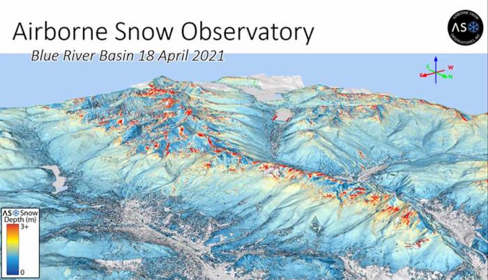
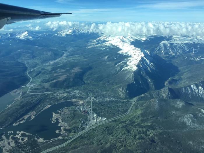
The mountain ranges above Dillon Reservoir, seen through the lens of the data collected by sophisticated equipment onboard a plane that flew over the Blue River Basin to measure the amount of water frozen in the snow above Denver Water’s largest reservoir. Image credit: Airborne Snow Observatory Inc.
New generation of high-tech snow measurements feeds Denver area’s water supply models.
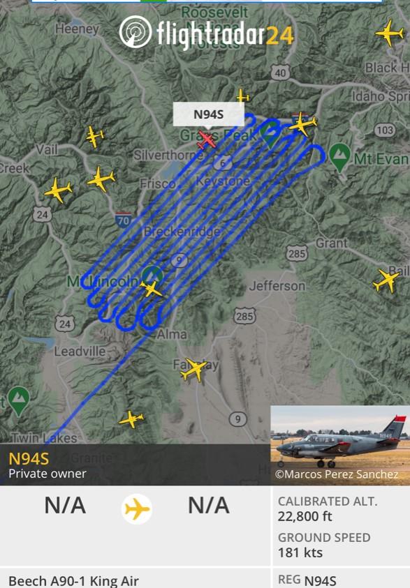
On April 18, a Beech A90-1 King Air stuffed with sophisticated equipment took off from Gunnison’s regional airport and soared over the mountains above Dillon Reservoir.
The flight occurred toward the end of the 2020-21 snow season, a nail-biter that has seen streaks of unusually warm, sunny days — and record-breaking heat in early April — broken by waves of storms and inches of snow that extended the ski season at some resorts.
In the air for three hours, the plane cruised above 20,000 feet, flying back and forth across the 335 square miles of high-country snow drifts that make up the Blue River Basin. Snow melting off high peaks and tumbling down the basin’s creeks ultimately ends up in Dillon Reservoir and the Blue River below Denver Water’s dam.
And as the Airborne Snow Observatories Inc. plane crisscrossed the sky, lidar equipment it carried shot beams of light at the snow below, capturing reflections from its frozen surface and measuring its depth. The company grew out of a seven-year research effort by NASA’s Jet Propulsion Laboratory.
Reams of data collected during the flight provide Denver Water with an assessment of the amount of water frozen in the snow.
Those calculations will in turn feed the utility’s forecast of the amount of water expected to flow into the largest reservoir in the utility’s system that 1.5 million people rely on for drinking water.
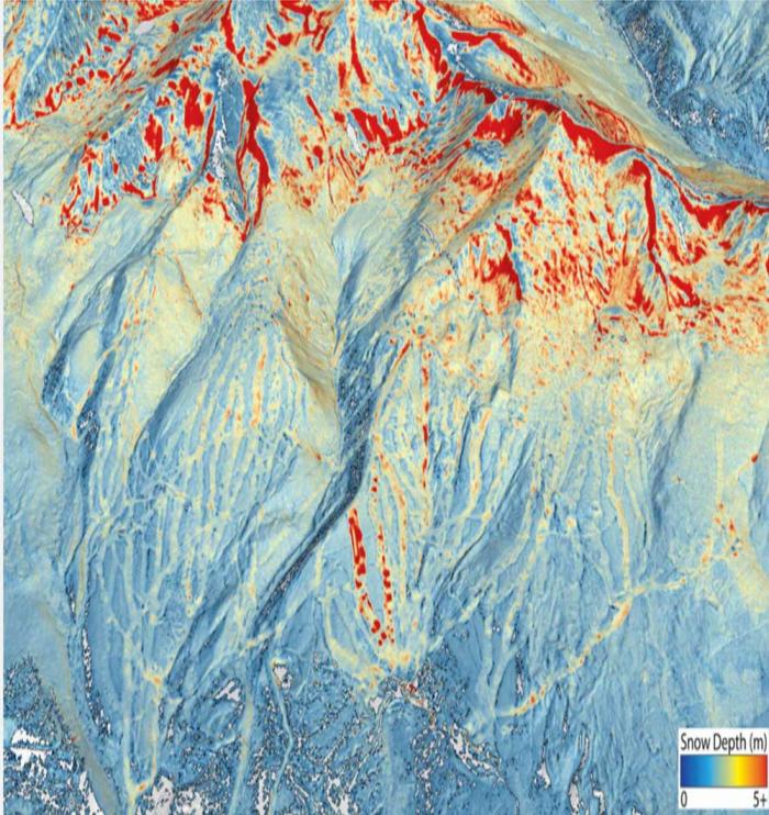
Red splashed across the mountains in the Blue River Basin show where the snow was the deepest in mid-April. The line of dots down the mountain is a ski run at Breckenridge Ski Resort where snow-making machines have added snow to the ground. Image credit: Airborne Snow Observatory.
“About 80% of Denver Water’s supply comes from snowpack and we want to be able to forecast spring runoff as accurately as possible,” said Nathan Elder, Denver Water’s manager of water supply.
“Getting more and better information improves accuracy and that helps us know if we have to go on watering restrictions, or what the impacts of runoff will be on the environment and recreation, how we should manage and move our water resources,” he said.
The mid-April flight was timed to be at or close to the peak of the season’s snowpack. It was the first of two flights Denver Water commissioned to collect data over the Blue River Basin this season.
Information from the first flight indicated there were normal amounts snow in the middle and lower elevations, but less than expected at higher elevations, Elder said.
“That’s important to know, because where the snow is on the mountain will dictate when it starts melting for the runoff,” Elder said.
A second flight in late May or early June will collect information about how much snow might be lingering at the highest elevations.
he flight path of a plane tasked with collecting data on the snowpack above Dillon Reservoir in mid-April, as it flew a pattern back and forth across the Blue River Basin. Photo credit: Denver Water.
That’s important because by then, snow at the four SNOTEL measurement sites in the basin, perched at about 11,000 feet, will have already melted away, leaving the utility and other snow watchers blind to water that might still be frozen in place at higher elevations — or may have already melted away.
“Based on the measurements and history we have, we can overpredict the amount of water in the snow or underpredict. Either way has consequences for how we operate our system, and is something we want to avoid,” Elder said.
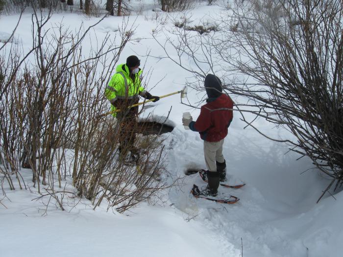
Historically, Denver Water and other water watchers gather information about snowpack and water supplies by looking at data from SNOTEL sites scattered across the mountains, including four in the Blue River Basin area, and information collected by crews snowshoeing to remote locations. Information collected during the season is compared to historical data.
But Elder compares the SNOTEL measurement spots to pixels in a TV screen.
“If you have four sites in the Blue River Basin, imagine watching TV and you have four pixels for the entire screen – you won’t be able to tell what’s going on. And if the pixels are in a line across the middle, like the SNOTEL sites are all between 10,500 and 11,400 feet, you can’t see anything above or below that line,” Elder said.
Throw in additional layers of uncertainty in shifting weather patterns due to climate change, and the confidence in data collected the same way it’s been done for decades starts to slide.
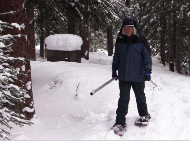
Denver Water caretaker Per Olsson snowshoes through the woods to access snow-measuring sites. Olsson retired from Denver Water in 2018 after 26 years of service. Photo credit: Denver Water.
“What we see now isn’t the same as what we’ve seen in the past. You can’t base today’s forecast on yesterday’s data, conditions are changing,” Elder said.
Gathering data on the snowpack by flying above it started in California and Colorado in 2013 and has occurred occasionally in various river basins across Colorado for several years, as utilities and others have had money available to commission flights.
Denver Water flew two flights above the Blue River Basin in 2019, then skipped 2020 amid the pandemic.
But several Colorado water utilities and entities are looking at the possibility of banding together to coordinate future flights, sharing costs and also sharing the data that comes from the flights.
“When Denver Water did the first Airborne Snow Observatory flights in 2019, we found incredible value from the information and we started to tell the story of those pilot flights at conferences,” said Taylor Winchell, a water resource engineer at Denver Water who works on climate change adaptation and water supply planning issues.
“There’s a lot of interest, but there also are a lot of questions about the cost, the information, timing – when do you fly – and where those flights might be the most useful,” Winchell said.
Information collected from the flights is another tool to be integrated into the wealth of information that exists about Colorado’s snowpack, and how it might change in coming years, he said.
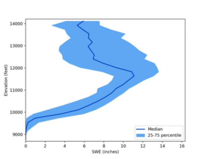
How many inches of water were frozen in the snow in mid-April? The shaded blue band shows how the amount of water changed as you go from 9,000 feet to 14,000 feet on the mountains above Dillon Reservoir. Image credit: Airborne Snow Observatory.
In April, the Colorado Water Conservation Board gave $45,000 to fund the Colorado Airborne Snow Observatory Expansion Plan, allowing the group to work through all the questions.
“This project isn’t designed to pay for the flights, but to create a plan for developing a sustainable operation in Colorado with consistent flights, across many watersheds, every year, with costs and information shared – similar to the California program,” Winchell said.
The planning team includes Denver Water, Northern Water, Dolores Water Conservancy District, Airborne Snow Observatories Inc. (a company that grew out of the NASA-led pilot flights in California) and Lynker, which specializes in water resources planning and analysis.
Winchell said the planning process is expected to get a diversity of water perspectives across Colorado, spanning state and federal agencies, agriculture and recreation interests, water providers, cities, researchers, environmental groups and Native American tribal groups.
“Airborne snow flights have benefits for everyone who is involved in water management,” Winchell said. “We’re trying to make sure all perspectives are included in developing this program.”
Looking to the south from a plane above Dillon Reservoir in June 2019, during an Airborne Snow Observatory flight to gather data on the snowpack above the reservoir for Denver Water. Photo credit: Quantum Spatial.
Kevin Foley, president of Performance Tours Rafting, said Friday, May 14, that recent reports he has received from Denver Water indicate the organization is likely to prioritize filling the Dillon Reservoir.
“What we are being told is, right now, the reservoir is low and snowpack is below average, so their model this year going to be more fill and spill,” Foley said.
Each spring and summer, Denver Water determines how much water it will release into the Blue River north of the Dillon Dam based on how much water is needed in different locations throughout an intricate network of water systems and reservoirs that service water users.
Foley said current conditions and a low water level in Dillon Reservoir point to Denver Water filling the reservoir with any new snow or rain in the coming weeks, rather than diverting flows downstream into the Blue River.
Foley said he will find out more from Denver Water at a meeting next week, but as of now, he said it’s unlikely there will be an extended season on the Blue…
The Class 2 to 3 Blue River stretch, which usually takes just over an hour for commercial trips, runs 5 to 6 miles from a U.S. Forest Service put-in at Hammer Bridge through Boulder Canyon down to a take-out at Columbine Landing. Foley said Performance Tours and KODI Rafting’s cutoff for the stretch is usually 500 cfs, signaling when they can start and stop. He said the best rafting on the Blue is at 1,000 cfs.
The commercial rafting season on the Blue is notoriously fickle, sometimes very short at just a couple of weeks in dry years to up to two months of rafting in wet seasons…
Foley said drainages down on the Arkansas River near Buena Vista are looking much better than the Blue. He credited the voluntary flow management program on the Arkansas that enables commercial companies to raft on good, augmented flows deep into summer. Trips out of Buena Vista have been operating for some commercial companies since May 1.
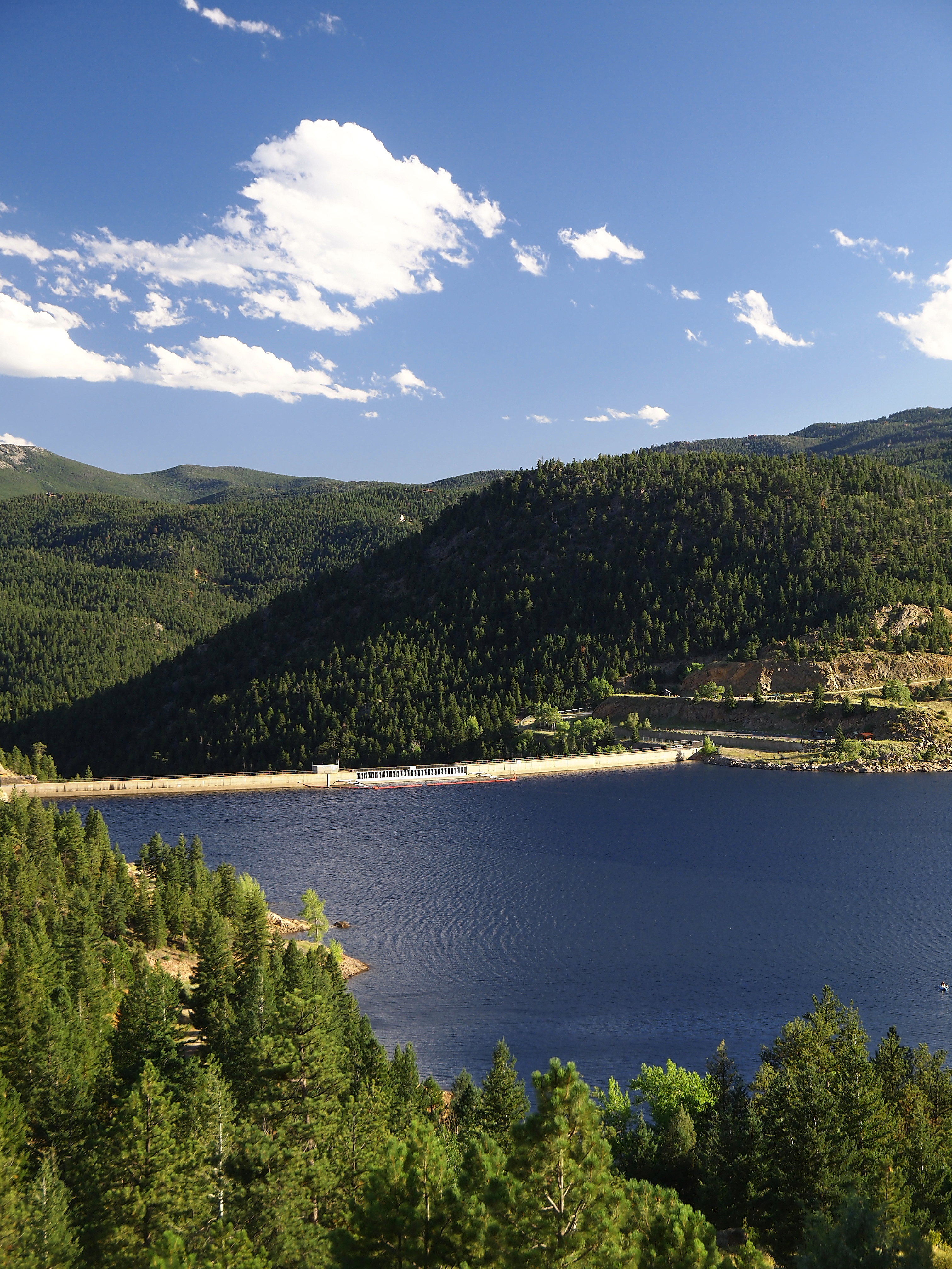
Gross Reservoir — The Gross Reservoir Expansion Project will raise the height of the existing dam by 131 feet, which will allow the capacity of the reservoir, pictured, to increase by 77,000 acre-feet. The additional water storage will help prevent future shortfalls during droughts and helps offset an imbalance in Denver Water’s collection system. With this project, Denver Water will provide water to current and future customers while providing environmental benefits to Colorado’s rivers and streams. Photo credit: Denver Water
Here’s the release from Wild Earth Guardians (Jen Pelz):
Coalition stays the course in fight to halt construction of tallest dam in Colorado history
A coalition of conservation groups filed a notice of appeal today in the Tenth Circuit Court of Appeals seeking to halt Denver Water’s proposed expansion of Gross Dam in Boulder County and to protect sustainable flows in the Colorado River. The appeal challenges the dismissal by the lower court and asks the appeals court to order review of the merits of the case to ensure the health of the Colorado River, its native and imperiled species, and communities across Colorado that will be negatively impacted by the project…
The conservation coalition, including Save The Colorado, The Environmental Group, WildEarth Guardians, Living Rivers, Waterkeeper Alliance, and the Sierra Club, originally filed suit on December 19, 2018, in the federal district court of Colorado. The groups’ litigation sought to halt Denver Water’s expansion of Gross Reservoir in Boulder County and prevent an additional diversion of water from the Colorado River through its Moffat Collection System due to violations of federal environmental laws including the Clean Water Act, Endangered Species Act, and the National Environmental Policy Act. The project would triple the storage capacity of Gross Reservoir and the dam would become the tallest dam in the history of Colorado.
On March 31, 2021, the district court dismissed the coalition’s case finding that it was not before the proper court because the Federal Power Act provides the federal court of appeals with sole authority over hydropower licensing by the Federal Regulatory Commission.
“Given the climate, water and biodiversity crises upon us, we need to be restoring river ecosystems, not destroying them,” said Jen Pelz, Wild Rivers Program Director at WildEarth Guardians. “This battle against the powerful water institution is not over and we will continue to fight for water and climate justice by working to reform this broken system of laws and policies.”
“The Sierra Club opposes the Gross Reservoir expansion because of the massive environmental damage it would cause,” said Rebecca Dickson, Chair of the Sierra Club-Indian Peaks Group. “If this project proceeds, hundreds of thousands of trees will be chopped down, countless habitats destroyed, and yet another waterway will be diverted from its natural course to the Front Range. On top of this, immeasurable amounts of greenhouse gasses will be released into the atmosphere during the construction and transportation process.”
“Denver Water’s plan to build the tallest dam in Colorado history will hurt the 40 million people in seven states and two countries who depend on the Colorado River for their water supply,” said Daniel E. Estrin, general counsel and advocacy director at Waterkeeper Alliance. “The basin is slowly dying a proverbial ‘death by a thousand cuts’ as its communities and ecosystems face a water crisis driven by unsustainable demand, prolonged drought, and runaway climate change. We stand with our fellow conservation groups in continuing to oppose this misguided and reckless water grab.”
“The expansion of Gross Dam is a shortsighted response to a long-term problem,” said Beverly Kurtz the President of The Environmental Group. “Denver Water should lead the way in finding sustainable solutions to the challenge of water scarcity, rather than destroying pristine areas of western Boulder County and further threatening the Colorado River with an antiquated dam proposal. Recent data confirm that predicted shortages of water in the Colorado River Basin due to climate change are happening even sooner than expected. Building a bigger dam does not increase the amount of water available. The District Court needs to hear the merits of our case rather than establishing a dangerous precedent by deferring authority to FERC and the federal court of appeals.”
“The year of decision, to not divert more water from the Colorado River, came and went about twenty years ago,” said John Weisheit, conservation director of Living Rivers in Moab, Utah. “We know this is true because the development of contingency planning agreements to avoid water shortages began in 2014 and the urgency to resolve this threat still remains. Yet the contradictions and absurdities to also develop a suite of diversion projects in the Colorado River Basin also remains. If the basin’s water managers will not even adapt to the hydrology they accept, how could they possibly adapt to the hydrology of the future? Our lawsuit is an appeal to accept the truth that the Colorado River has nothing left to give.”
Gross Reservoir — The Gross Reservoir Expansion Project will raise the height of the existing dam by 131 feet, which will allow the capacity of the reservoir, pictured, to increase by 77,000 acre-feet. The additional water storage will help prevent future shortfalls during droughts and helps offset an imbalance in Denver Water’s collection system. With this project, Denver Water will provide water to current and future customers while providing environmental benefits to Colorado’s rivers and streams. Photo credit: Denver Water
A federal judge has thrown out a legal action from multiple environmental organizations seeking to halt the expansion of a key Denver Water storage facility, citing no legal authority to address the challenge.
“This decision is an important step,” said Todd Hartman, a spokesperson for Denver Water. “We will continue working earnestly through Boulder’s land-use process and look forward to beginning work on a project critical to water security for 1½ million people and to our many partners on the West Slope and Front Range.”
The expansion of Gross Reservoir in Boulder County is intended to provide additional water storage and safeguard against future shortfalls during droughts. The utility currently serves customers in Denver, Jefferson, Arapahoe, Douglas and Adams counties. In July 2020, the Federal Energy Regulatory Commission gave its approval for the design and construction of the reservoir’s expansion. The project would add 77,000 acre-feet of water storage and 131 feet to the dam’s height for the utility’s “North System” of water delivery.
FERC’s approval was necessary because Denver Water has a hydropower license through the agency, and it provided the utility with a two-year window to start construction.
A coalition of environmental groups filed a petition in U.S. District Court for Colorado against the U.S. Army Corps of Engineers and the U.S. Fish and Wildlife Service, seeking to rescind those agencies’ previous authorizations for the project. They argued the agencies inadequately considered the environmental impact of expansion…
…Denver Water pointed out that under federal law, appellate courts, not district-level trial courts, are responsible for hearing challenges to FERC approvals. By challenging the environmental review process that led to the project’s go-ahead, the government argued, the environmental organizations raised issues “inescapably intertwined with FERC’s licensing process.”
On Wednesday, U.S. District Court Judge Christine M. Arguello agreed that the groups’ challenge was indeed wrapped up in the FERC approval.
“[W]here a party does not challenge a FERC order itself, but challenges another agency order that is inextricably linked to the FERC order, the FPA’s exclusive-jurisdiction provision applies and precludes this Court from exercising jurisdiction,” she wrote in dismissing the case.
The Daily Camera reports that Boulder County’s approval is the final step for the expansion project.
Water Quality Operations crew member Nick Riney delivers water into a sample bottle secured by colleague Tyler Torelli. The pair will fill several bottles, including some that they’ll drive back to Denver Water’s laboratory in southwest Denver for testing. Photo credit: Denver Water.
They snowshoed through a campground hidden under soft drifts, stepped carefully to the banks of the Middle Fork of the Williams Fork River, then broke the ice to find free-flowing water.
Nick Riney and Tyler Torelli worked efficiently, dipping a long-poled scoop into the waterway and filling several pint-sized plastic bottles with samples of the cold, clear stream.
Sturdy even in finger-pinching cold, the two set up a make-shift lab on the back end of the Sno-Cat, pulled equipment out of chubby metal suitcases and ran field tests right on the spot. Twenty degrees and snowfall aren’t the ideal working conditions for most, but these guys consider it a “pretty good office” all the same.
And their work on a mid-February day in Grand County gave Denver Water’s Water Quality Operations team an early look at how last summer’s Williams Fork Fire, which burned nearly 15,000 acres northeast of Silverthorne, might have affected the water flowing through the area.
See and hear what’s required to do this work:
By sampling water as it pours through the mountains, long before it reaches any reservoirs or treatment plants, Denver Water can understand what’s happening on the landscape. Samples that veer from typical readings could indicate unexpected pollution, echoes of old mining activity or, increasingly, the impacts of forest fires.
Understanding those impacts helps prepare water quality experts for potential impacts to reservoirs or treatment processes.
The field test results came back in a healthy range, with no indication yet that a significant amount of sediment left by the summer of record fires in Colorado had ended up in the water.
Riney and Torelli prepare to run field tests on water samples using portable equipment set up on the back edge of their Sno-Cat. The field tests can analyze the turbidity of the samples, offering clues as to the impacts of wildfire. Photo credit: Denver Water.
“That’ll change,” Riney said, as the winter turns to spring and melting snow and monsoons more readily pull soil and ash from the scorched hillsides to the east of the tributary.
“But right now, this water is clean. Turbidity is low. We like to see that,” he said. “We’ll keep tracking these spots every month and try to understand just how much damage this fire did to the landscape.”
To be sure, the burned lands around the Williams Fork River don’t present a risk to Denver’s drinking water, primarily because this water travels to an “exchange” reservoir, where it will be sent down the Colorado River to make up for other West Slope water that is diverted to the Front Range.
Even so, understanding the impacts of the fire on water quality is important, allowing Denver Water and its partners, including the U.S. Forest Service, to take steps to prepare for, and reduce, those effects.
Denver Water recently began making monthly treks to this high-country stream to monitor a wetland protection project nearby. The utility has long made quarterly trips to the area as part of its broader field-testing program to track water quality across its mountain watershed.
A topographic map showing the area targeted by water sampling crews in mid-March. This area in the Arapaho National Forest is north of Silverthorne and east of Highway 9. Photo credit: Denver Water.
As part of that work, Water Quality Operations crews visit eight counties and collect samples from 77 locations. It’s work that’s distinct from the testing that goes on at reservoirs, water treatment plants and within the distribution system that bring water to household taps.
To collect samples from the Middle Fork stream, Riney and Torelli towed a Sno-Cat up and over Ute Pass Road off Highway 9, turned south in County Road 30 and went to work near Sugarloaf Campground.
“This sampling work keeps us well attuned to what’s happening in our watershed and can at times serve as an early warning for issues we may need to be watching out for further downstream,” said James Berrier, water quality monitoring supervisor at Denver Water. “We want to understand, is this just a temporary issue or something that could have a longer-term impact?”
Sampling teams measure for an array on indicators. In the field, they look at temperature, pH (which measures acidity), conductivity (which helps determine salt levels), turbidity and dissolved oxygen, which is an important factor for aquatic life.
Other water samples are transported back to Denver Water’s laboratory at the Marston Treatment Plant in southwest Denver (which will be moving in the future to its new home at Denver’s emerging National Western Center). Tests there include measuring for fluoride, chloride, nitrates, E. coli, nutrients and dissolved metal.
A Sno-Cat helps Water Quality Operations crews access stream sections that are far from roadways, moving quickly over deep snow to eliminate longer walks on snowshoes. On this day, Denver Water crews were northeast of Silverthorne and just west of the Byers Peak Wilderness Area. They were about to head toward Sugarloaf Campground, a destination indicated on the nearby signage. Photo credit: Denver Water.
Samples collected a few months from now may shed light on how much damage the Williams Fork fire did to the land.
Burned Area Emergency Response teams with the U.S. Forest Service have initially concluded that the fire did varying levels of damage. Their assessments found 23% of the area suffered high-intensity burn, while 40% was unburned or experienced low-intensity fire.
Burn levels also can show up in water quality, through indicators such as ash, sediment, metals and other signatures.
“Soil erosion modelling predicts that post-fire erosion rates are generally very low (close to pre-fire conditions) in areas with minimal fire impacts on ground cover and soils. However, rates of erosion increase dramatically … in moderate and high soil burn severity areas, especially on steeper slopes,” according to the response team’s December 2020 assessment.
Denver Water has already accumulated significant expertise and partnerships related to wildfire impacts. Collaborative efforts include From Forests to Faucets, a team approach from Denver Water, the Forest Service, the Natural Resources Conservation Service and the Colorado State Forest Service.
he Williams Fork River, lined by snow-covered banks. Photo credit: Denver Water.
These agencies, together with local groups, address overgrown forests on the front end with tree-thinning projects and repairing landscapes damaged by the kind of intense fires that dramatically slow the recovery of soils and vegetation.
“We have experience, unfortunately, with the havoc that wildfires and their aftermath can wreak on our water quality,” Berrier said, referencing major fires in the late 1990s and early 2000s that put enormous strain on reservoirs and treatment on the south end of Denver Water’s collection system, challenges that the utility is still working to overcome today.
“Tracking impacts to the water once the fires are out is a key step in getting our arms around what might be in store in the years to come.”
Doors across the Denver metro area opened to a scene like this as the city’s fourth-biggest snowstorm on record officially dumped 27.1 inches at Denver International Airport. Photo credit: Denver Water.
Weekend blizzard a bounty for Denver, farmers and foothills, but not a drought-buster.
The weekend storm that brought heaps of badly needed wet snow to Denver, the foothills and the plains is an important boost to water supplies, but doesn’t appear to be a full-fledged “drought-buster.”
To put it in terms of a much-anticipated upcoming college basketball tournament: The weekend’s water results were like winning the first-round of March Madness. A nice thrill, but still a few wins short of a title.
Snow, snow, so much snow, everywhere you looked. Photo credit: Denver Water.
But let’s stay optimistic for a moment. The storm was a big victory, and here are a few reasons why:
It’s a big recharge for soil moisture across the Denver region, and will mean a big boost for lawns and landscapes in the metro area. Overall, the storm was officially the fourth-largest ever for Denver, with an official snow depth of 27.1 inches as recorded at Denver International Airport. That’s not too far behind the 30.4 inches that fell in November 1946, which sits in third place, and the memorable pileup of March 2003, at 31.8 inches.
Blizzard? Bah! It’s playtime! Hardy Denverites head out for some urban cross-country skiing during the March 2021 blizzard. Photo credit: Denver Water.
For Denver Water, the storm was especially helpful to Gross Reservoir in its North System, where surrounding areas clocked in at 20 to 30 inches. Some of Denver Water’s lower reservoirs, including Marston, Chatfield and Ralston also will reap rewards.
The moisture content of the snow was unusually high, giving everyone more bang for the buck. In short, a single storm brought the same level of water some places would typically get in a month or even two months. One Denver-based meteorologist said Monday that, with this storm, Denver has recorded 4.24 inches of liquid this year, the wettest start to a calendar year on record.
The suburbs northwest of Denver clocked in at 24 inches of snow before the sun came out and the melting commenced. Photo credit: Denver Water.
Farms and water users in northeast Colorado will benefit, and that’s a benefit to Denver Water. That’s because with downstream reservoirs on the South Platte filling, it will allow Denver Water to access its water rights sooner, without having to pass as much water down the river right away.
“All in all, this was an extremely helpful storm,” said Nathan Elder, water supply manager for Denver Water.
“We see benefits all around. While it wasn’t a drought-busting storm — it didn’t hit the West Slope hard and didn’t get into the upper South Platte region — it’s a great recharge for Denver and the foothills and puts us in a much better place than we were a week ago.”
A rain gauge at Water Supply Manager Nathan Elder’s house registers the amount of water in the snow about halfway through the March 2021 blizzard. Photo credit: Denver Water.
Even so, caveats remain.
Despite the windfall, Denver Water’s collection system remains below average for snowpack, at 94% in the Colorado River Basin and 97% in the South Platte.
And Colorado is coming off a very dry year, with a dry spring and a monsoon-less summer compounding an ongoing deficit in soil moisture.
That matters because thirsty soil gets first dibs on melting snow. Water must replenish the ground before it slides down the hills and winds up in streams, rivers and reservoirs.
It’s a snow dragon? More than two feet of snow transformed landscapes before skies cleared following the March 2021 blizzard. Photo credit: Denver Water.
That means Denver Water, along with water utilities across Colorado, will keep watching the skies for more storms to keep us wet through the rest of March and April, a period that is generally a good bet for snow and rain. Areas along the Continental Divide and upper reaches of the West Slope — the headwaters — sorely need a wet spring.
The message to customers: Enjoy the bounty, but don’t let down your vigilance. Residents will need to continue being smart about irrigation. Denver Water’s standard summer watering rules take effect May 1, with watering limited to three days a week, and no watering between 10 a.m. and 6 p.m.
And it’s still possible further watering limits could be in play, depending on how the next several weeks play out.
Clearing a path through the snow after the March 2021 blizzard. Photo credit: Denver Water.
A spike in temperatures that rapidly depletes the snowpack, for example, could have an impact on how we use water this summer.
For now, it’s certainly a storm worth enjoying and appreciating, while keeping it in a healthy context.
As a March Madness coach might say, “We’re excited as heck to make the tournament … but we’re still facing an uphill climb.”
Thank you, Mother Nature. We appreciate and value your gift. Photo credit: Denver Water.
This weekend’s snowstorm will likely translate to significant drought relief for portions of Colorado, while others remain mired in drier than average conditions.
The National Weather Service estimates that areas of Colorado’s northern Front Range and northeastern plains received between 2 and 4 inches of liquid water in the form of heavy, wet snow, with some localized areas receiving more than 4 inches.
Snow that blanketed the northern Front Range and northeastern plains will provide two to three inches of liquid water when it melts. Some localized areas are seeing even higher amounts ranging from four to five inches of water held in the snow, said Colorado’s assistant state climatologist Becky Bolinger…
The city of Burlington, for example, recorded nearly three inches of precipitation in 72 hours over the weekend. In a normal year, Burlington averages a total of 2.78 inches for the period of November through March…
Much of Colorado’s Front Range has been locked in severe drought since August 2020. Bolinger expects the next U.S. Drought Monitor, released weekly on Thursdays, to show a contraction of severe drought on the Front Range and northeastern plains.
The Western Slope, the part of the state in the most need of added moisture, is unlikely to see any drought relief from this storm, Bolinger said.
As Colorado digs out from the recent blizzard, each heavy shovel full of snow proves the storm brought plenty of moisture. But is it enough to free the state from its drought conditions?
Russ Schumacher, the Colorado state climatologist, said the answer largely depends on location. The brunt of the storm hit east of the Continental Divide, dumping around two feet of snow in the Foothills and Eastern Plains. Meanwhile, preliminary snowfall reports show only a few inches accumulated on the Western Slope.
Colorado’s drought conditions had improved ahead of the storm. After record dry weather over the summer and fall, snowpack levels had inched toward normal throughout the winter, but western Colorado continued to miss out on the snowfall. According to the U.S. Drought Monitor, about 16 percent of the state faced the most extreme category of “exceptional drought” as of last week. The entirety of the area was west of the Continental Divide.
Colorado Drought Monitor March 9, 2021.
Karl Wetlaufer, a hydrologist from the Natural Resource Conservation Service, said the weekend storm brought the entire state to 91 percent of its median snowpack for mid-March.
Wetlaufer said soil conditions could also affect Colorado’s downstream water users. Last year’s dry weather left the ground so parched it could absorb large amounts of snowmelt. Wetlaufer said that could decrease runoff levels by as much as 20 percent, meaning the recent snow could stay in Colorado rather than flowing down the Colorado River to Las Vegas or Los Angeles.
The recent snowstorm also likely won’t change a longer trend toward drier weather in the Southwestern U.S. A 2020 study in Science suggests the region is experiencing its worst “megadrought” since the 1500s due to global climate change. Any shift against the pattern would require a series of far wetter winters across the region…
Nevertheless, Schumacher said it’s hard to see the recent storm as anything other than good news.
“It may not be enough to get us out of the drought completely, but it’s going to be a big help,” Schumcher said.
Any snow is welcome snow in moisture-starved Colorado, but even two feet is too little to bring us out of the drought. Almost the entire state is in some stage of drought and more than half the state is in a severe or exceptional drought.
“What we’re going to see from this week is a possible incremental improvement from those really bad drought categories to not-as-bad drought categories,” said Assistant State Climatologist Beck Bolinger.
The biggest beneficiaries, she says, will be crops on the eastern plains and lawns in the Denver metro area. Denver is now 20 inches of snow above normal for this date and the city has already received four and a quarter inches of liquid.
That is well above the average. The snow could also help delay wildfires on the Front Range.
However, Bolinger says, it still may not stop cities from imposing watering restrictions, and more than a dozen are considering doing so. She says it’s not only about how much snow falls, but where it falls.
“Our water municipalities are closely focused on what’s happening west of the divide in terms of replenishing water supplies that we rely on,” she said.
The problem, she says, is the Western Slope didn’t get as much snow. Western basin averages, she says, are still 10-20% below normal.
Even an average snowpack in the mountains may not be enough says Ben Livneh with the Cooperative Institute for Research in Environmental Sciences (CIRES) at the University of Colorado Boulder.
“The landscape is dry. When the snow melts, the first thing it has to do, it has to recharge some of that dryness, some of that deficit before it can runoff and become part of the water supply.”
Winter Storm Xylia accomplished, for the most part, what all the talk was about, becoming the largest two-day storm on record for Denver and the fourth-biggest snowstorm since 1881. Dumping heavy, wet accumulations up and down the Front Range over the weekend, the blizzard halted traffic on the interstates, knocked out power to thousands, and hit a few places especially hard – including 27.1 inches at Denver International Airport, 40 inches near Red Feather Lakes, and 30.8 inches for Cheyenne, Wyo.
Here in Chaffee County, it was a stout storm, but as of Monday morning it was sunny, the lower areas were melting down significantly and Highway 285 was mostly dry through the mid-county after plowing efforts.
The great news was that, according to Open Snow, Monarch Ski Area received a beastly 24 inches (11 on Saturday and 13 Sunday) – the same total as Wolf Creek. Further west, Telluride took bragging rights from the storm with 27 inches. Elsewhere it was hit or miss: Mid-Vail reported a scant 6.
Xylia delivered some good gains to the state’s snowpack. Portions of the Arkansas River Basin – which includes Chaffee County – saw some of the biggest action from the storm, putting the basin’s snowpack at 99 percent of average, compared to 90 percent recorded March 11.
Westwide SNOTEL basin-filled map March 16, 2021 via the NRCS.
According to the USDA’s SNOTEL water snow-equivalent reporting systems, the Upper Rio Grande basin is now at 104 percent compared to 98 percent. Percentages in Colorado’s other basins include: South Platte, 97 (was 87); North Platte, 96 (was 90); Yampa and White, 91 (was 88); Upper Colorado, 88 (was 84); Gunnison, 85 (was 81); and the southwest mountains including the San Miguel, Dolores, Animas and San Juan river basins, 81 (were 78).
During deep freezes, our crews keep on fixing, plowing, ice breaking, measuring, sampling and caretaking.
Cold weather makes for harder work, so when we experienced one of the coldest weeks of the last 30 years Denver Water crews did just that: worked harder.
Last week dam supervisors, water quality trackers and pipe fixers pushed right on through the artic blast to keep the water stored, safe and moving in our system amid the harsh elements that wreaked havoc on so many across the country.
A challenge many homeowners also faced as personal pipes froze and broke as the polar plunge ensued.
Here’s a photo journey highlighting some of our dedicated and can-do colleagues doing their part to blow kisses at the Winter Warlock:
Frosty valves at dams make for a laborious day of icebreaking
On those super-cold weeks like last week, it’s common for ice to build up around valves. That means dam workers need to spend hours breaking ice off the valves, otherwise they could be damaged during operation. Said Andy Skinner, dam supervisor at Gross Reservoir: “I broke the ice away from a valve at night, and it was covered again just a few hours later. At these temperatures, it’s a twice-a-day operation.”
Denver Water staff work through the elements, like recent below zero temperatures, to ensure 1.5 million people continue receiving the high-quality drinking water they expect. Photo credit: Denver Water.
Emergency Services – It takes tough folks to find and stop the flow when a water main breaks in frozen temperatures
Members of Denver Water’s Emergency Services team, like Keegan May in this photo, are the utility’s first responders. They help shut off the water so crews can start their work to repair pipe breaks. (Read, “Breaking point: Temperature swings tough on water pipes,” to learn more about how the ups and downs of winter weather in Colorado impact water mains across Denver.)
But turning off the water flowing through underground pipes can be much more complex than shutting off the water in a house.
This image shows May, a utility tech at Denver Water, working through inches of ice created by below-freezing temperatures to find a shut-off valve.
Keegan May, utility tech at Denver Water, chisels through inches of ice to access a water shut-off valve during a water main break. Photo credit: Denver Water.
On this cold, winter day in 2019, once the cover was located, Denver Water’s crew chiseled through the ice. Then they used a mallet to loosen the cover. Only then could they access the underground shut-off valve to stop the flow of water and begin to make repairs.
Clean water – critical year-round
Thirty inches of snow and finger-freezing temps don’t stop our field crews from their appointed rounds. Last week a crew from Water Quality Operations gathered their monthly water samples on the Williams Fork River northeast of Silverthorne.
One tributary stream was frozen over, so Nick Riney smashed through it with his shovel and worked with his colleague Tyler Torelli to scoop out water samples for testing, including assessments they conducted in the field using analytical equipment they set up on the back end of a Sno-cat. All this effort helps Denver Water understand what’s happening on the landscapes across 4,000 square miles of watershed and keeps the utility informed about any changes in high country water chemistry that we’ll be collecting, storing and ultimately cleaning to our high standards before distributing through the metro area.
Each year, Denver Water collects more than 35,000 samples and conducts nearly 70,000 water quality tests. These efforts continually confirm that your drinking water is safe and meets or exceeds federal and state requirements. Photo credit: Denver Water.
Surveying the snow
Our crews also strap on the snowshoes for frequent high elevation treks to take snow measurements, part of our multi-pronged efforts to get a read on the snowpack levels in our collection system in preparation for spring runoff.
Our surveying team braves the cold as well, heading to all points of our system to get elevation readings for a wide variety of projects, including recalibrating gauges at remote reservoirs. Pictured here was a Sno-Cat trip our surveyors took just a year ago to Meadow Creek Reservoir northeast of Fraser.
Matt O’Malley, Denver Water survey technician, prepares to set up survey equipment near Meadow Creek Reservoir. Photo credit: Denver Water.
Running the plows to keep everything running
Denver Water facilities from the mountains, to the foothills and plains all need to keep the roadways open so workers can do their thing unblocked 24/7.
One of many challenging plowing jobs can be found at Strontia Springs Reservoir where staff not only has to keep clear the 6.5-mile service road that is Waterton Canyon, they need to plow the feeder roads leading to the dam – and the top of the dam itself.
Plowing a 660-foot path across top of the dam is not for anyone with a fear of heights. The dam is 299 feet above the river. Slow and steady is the name of the game as there is no room for wrong turns or slipping.
And sometimes it’s just overcoming the cold itself
One of the coldest spots in Colorado and, indeed at times, the country: Antero Reservoir, on the high South Park plain, near Fairplay. Twice in the last two years, the site has drawn media attention for its bone-grinding readings around 50 below. Two caretakers save their inside work for those dates, but can’t avoid the daily duties outside, when as one of them, Eric Hibbs, puts it, “you can just see the cold, settled in there.” What does he do in face of Yukon-like conditions? “Put on a little heavier jacket.”
And sometimes it’s just overcoming the cold itself One of the coldest spots in Colorado and, indeed at times, the country: Antero Reservoir, on the high South Park plain, near Fairplay. Twice in the last two years, the site has drawn media attention for its bone-grinding readings around 50 below. Two caretakers save their inside work for those dates, but can’t avoid the daily duties outside, when as one of them, Eric Hibbs, puts it, “you can just see the cold, settled in there.” What does he do in face of Yukon-like conditions? “Put on a little heavier jacket.” Photo credit: Denver Water
Amid dry soils and struggling snowpack in Denver Water’s collection area, longer-term Colorado River challenges also loom large.
Denver Water’s supply managers are closely attuned to the dry weather, lagging snowpack and poor soil moisture in its mountainous collection area that could mean heightened efforts to conserve water this summer.
At the same time, the utility is closely engaged with a more persistent and growing long-term challenge: a drying trend across the seven-state Colorado River Basin.
The Colorado River, which feeds into Lake Powell, begins its 1,450-mile journey in Rocky Mountain National Park near Grand Lake, Colorado. Denver Water gets half of its water from tributaries that feed into the Colorado River. Some of these tributaries include the Fraser River in Grand County and the Blue River in Summit County. Photo credit: Denver Water
The two issues go hand-in-hand.
While early snowpack has been underwhelming, a few recent storms brought us closer to average in the two nearby basins that matter most to Denver Water: The South Platte and the Colorado.
Even so, the long-running drought across the southwestern United States persists. And earlier this year, a new warning was triggered after updated projections from the U.S. Bureau of Reclamation suggested poor inflows to Lake Powell could put the reservoir at a level low enough to take new steps.
In short, the BOR said Lake Powell — the massive storage vessel that serves as the bank account for the upper basin states of Colorado, New Mexico, Wyoming and Utah — is at risk of falling below an elevation of 3,525 feet in 2022.
That’s important to Denver Water and many Colorado water users as a century-old law requires states in the upper basin to send a certain allotment out of Lake Powell each year to the lower basin states of Arizona, California and Nevada.
Under major agreements developed between the federal government and the seven states in 2019 called drought contingency plans, Reclamation’s projection initiates a planning process with water leaders across the upper basin states to address ways to avoid further elevation declines in Powell.
This is a trigger point to say, “Hey, it’s time to ramp up our monitoring and planning, to be ready to address the potential further decline in reservoir levels,” explained Rick Marsicek, planning manager for Denver Water. “This was a metric, developed to ensure the upper basin states focus harder on next steps should Lake Powell be at risk of hitting that level.”
Lake Powell ended the 2020 “water year” at an elevation of 3,596 feet above sea level. That is 104 feet below what is considered Powell’s full capacity. The “water year” is a term used by the U.S. Geological Survey to measure the 12-month hydrologic cycle between Oct. 1 and Sept. 30. The October start date is used to mark when snow begins to accumulate in the mountains. Photo credit: Denver Water
Planners focused on 3,525 feet as a trigger point, so as to have time to act before Lake Powell falls another 35 feet, which would threaten its ability to send enough water through turbines to generate hydropower, another important element of Powell’s operations. Hydroelectricity at the dam provides power to more than 5 million customers.
It’s an initial step toward drought contingency plans, which could be triggered as early as 2022 in the Upper Basin. The lower basin’s DCP was triggered last year, when projected shortages in Lake Mead, the other gargantuan Colorado River reservoir — a sister of sorts to Powell — required Arizona and Nevada to pull smaller amounts from supplies stored there.
Signing ceremony for the Colorado River upper and lower basin Drought Contingency Plans. Back Row Left to Right: James Eklund (CO), John D’Antonio (NM), Pat Tyrell (WY), Eric Melis (UT), Tom Buschatzke (AZ), Peter Nelson (CA), John Entsminger (NV), Front Row: Brenda Burman (US), and from DOI – Assistant Secretary of Water and Science Tim Petty. Photo credit: Colorado River Water Users Association
All of this movement comes amid other developments important to Denver Water and water interests throughout Colorado.
The state of Colorado is working with water providers and users across the state to gauge the potential of a “demand management” plan. Such a plan would compensate water users to temporarily and voluntarily conserve water that would flow instead to Lake Powell as a deposit in a sort of bank account. Such a “pool” of water would maintain critical water levels in Lake Powell and could later be released if necessary to assure Colorado River Compact compliance.
Water users kicked off a study related to demand management in 2020. Irrigators in the Kremmling area fallowed some parcels as part of a detailed study on how high-elevation farmland would respond should water be left off the land in some growing seasons.
At the same time, the basin states, in partnership with the federal government, are beginning to dig into a new set of guidelines to help manage river supplies that must be complete in 2026, when an existing set of interim guidelines is set to expire. These guidelines co-exist with the 1922 Colorado River Compact and numerous other agreements that make of the “law of the river,” which split the river between the two big basins and the country of Mexico.
Closer to home, Denver Water and other metro area and Front Range water providers are coordinating in preparation for a year when they may have to toughen summer watering restrictions to address a dry winter and spring. It’s too early yet to know for sure how supplies will look, but the meetings that kicked off this month are an effort to get ahead of the situation and see where watering and conservation messages can be aligned to help the public understand the potential need to reduce outdoor irrigation between May and October.
“There is a lot happening, and that’s a good thing,” Marsicek said. “Far better to overplan and overprepare than to simply hope for the best. We’ve had drought years before, and we have a long-term drought now in the Colorado River Basin. By working together and planning not just for a hot summer, but for a drier long-term future, we can meet this challenge with our eyes wide open.”
High-tech device ‘swims’ through Denver Water pipelines looking for trouble spots.
How do you inspect a water pipeline buried several feet underground and far too small to safely walk through?
In some cases, you send in a tool specifically designed to go with the flow and collect data along the way.
In the fall of 2020, Denver Water tested a somewhat unusual looking, high-tech device called a PipeDiver to inspect several miles of buried pipeline.
The PipeDiver is a state-of-the-art piece of equipment operated by Pure Technologies, a division of Xylem Inc., a company that specializes in pipeline monitoring and assessments for clients around the world. The company has been using the tool for inspections since 2010.
“We have about 3,000 miles of pipes in the metro area and we take a proactive approach toward monitoring their condition,” said Devin Shable, an engineer at Denver Water. “We have several methods to inspect our pipelines, but this was our first time using the PipeDiver.”
Workers from Pure Technologies carefully insert the PipeDiver into a water pipeline. Photo credit: Denver Water.
Denver Water used the PipeDiver to inspect two pipelines, a 3.7- mile stretch of pipe in Centennial that runs under open space, University Boulevard, East Dry Creek Road and Colorado Boulevard. The other inspection was on a 2-mile stretch of pipe under West Alameda Avenue and West Bayaud Street in Denver’s Baker and Valverde neighborhoods. The pipelines range in size from 30 to 36 inches in diameter.
Over time, pipelines can deteriorate, leading to leaks and ruptures. Many sources of stress from inside and outside the pipe can take a toll on a pipeline’s condition. These sources include soil type, how the soil interacts with the pipe, age, pipe material and how the pipe was constructed.
“Based on problems we’ve had on other pipelines of similar age and conditions, we wanted to do a thorough assessment of these two pipelines to see if there are any issues,” Shable said. “Proactive inspections are a critical part of our operations to prevent pipe breaks.”
Shable said buried pipelines are challenging to inspect for many reasons.
A Pure Technologies worker checks the balance of the PipeDiver in a pool before inspection. Photo credit: Denver Water.
First off, exterior inspections of pipelines would be costly and very disruptive to the community, as they would require large excavations to expose long exterior sections of pipe for inspection.
As for inspecting a pipe from the inside, some pipes are too small for a person to walk through. Even if a pipe is large enough, there are many safety and logistical challenges to overcome before allowing someone to perform an internal “manned” inspection.
Another challenge is that traditional “manned” inspections require draining a pipe, which can lead to lengthy disruptions in water service to customers.
The PipeDiver solves many of these issues.
“One of the biggest benefits of the PipeDiver is that we can leave a pipeline in service while we do the condition assessment,” said Brian Hext, project manager for Pure Technologies. “This tool can be more convenient for water utilities.”
The PipeDiver allows water utilities to keep a pipeline in service during an inspection. Photo credit: Denver Water.
But using the PipeDiver to inspect a buried pipeline still requires extensive planning, coordination and proper execution.
“Each time we do an inspection, we have to custom build the PipeDiver for the specific type and size of the pipe,” Hext said. “For Denver Water, we used two different PipeDivers for the two pipelines.”
The PipeDivers used for the Denver Water inspections look like 10-foot-long, mini-submarines made of several tube-like canisters that contain the electronics systems.
The articulated sections of the PipeDiver allow it to bend around sharp turns in the pipeline, much like the joint at the middle of a “bendy bus” allows it to weave through city streets.
On the front of the PipeDiver is a special nose that helps guide it through valves inside the pipeline. About 24 flexible, flower-like plastic petals stick out of each section to keep the device centered in the pipe as it moves along.
The PipeDiver is equipped with either ultrasonic or electromagnetic technology to inspect concrete or metallic pipes. Photo credit: Pure Technologies.
One of the PipeDivers used in Denver Water’s inspections was equipped with high-definition cameras on the tail to capture images inside the pipe.
“We like to joke that it looks a little bit like a prehistoric fish,” Hext said. “It does not have a motor and simply uses the flow of the water to move through the pipe.”
Crews must carefully assemble, test, balance and disinfect the device before each inspection.
Maintaining safe water quality is critical during the inspection process. In addition to an extensive cleaning and disinfection process for the PipeDiver, Denver Water had a water quality operations expert on hand to run tests during the inspection to ensure the utilities’ safe drinking water standards were not impacted by the inspection.
Once the PipeDiver is put together, the Pure Technologies team inserts it into an access point in the pipeline. The devices are equipped with GPS technology so crews can keep track of them as they float through the pipe.
After the PipeDiver completes its route, crews use custom-designed nets to catch the device and pull it out of the pipe.
The PipeDiver goes through several rounds of disinfection before being inserted into the pipeline. Photo credit: Pure Technologies.
To inspect pipes made of metal, such as cast iron, the PipeDivers are fitted with ultrasonic technology while electromagnetic technology is used to inspect pipes made of concrete.
“What we’re looking for with the concrete pipe are the wires wrapped around the pipe that help hold it together,” Hext said. “If those wires break, it can cause the pipe to burst.”
This photo is an example of a prestressed concrete cylinder pipe with wire damage. Photo credit: Denver Water.
The ultrasonic technology used for metallic pipes measures the thickness of the pipe and areas of corrosion.
“If we find a place where the thickness is less than what it should be, we pinpoint that location as a potential issue,” he said.
“As with any new inspection technique, there was a learning curve that we had to work through to complete the inspection with the PipeDiver tool,” Shable said.
Denver Water crews worked with the Pure Technologies team to open all the valves in the pipeline, to give the PipeDiver a clear path through the pipe sections it was inspecting. Another challenge involved adjusting the flow of water through the pipes to ensure the PipeDiver moved at the optimal speed for data collection.
Denver Water crews adjust valves and the flow of water for the inspection. Photo credit: Denver Water.
Following the inspection, Pure Technologies will analyze the data from the inspections and then send reports with the findings to Denver Water.
“The inspection went well and the PipeDiver did its job,” said Luke Switzer, field team leader with Pure Technologies. “We should be able to get some good data to help Denver Water make informed decisions down the road.”
In addition to using the PipeDiver, Denver Water’s proactive approach to assessing pipelines includes “manned” inspection techniques and real-time pipeline monitoring equipment.
Manned inspections require draining the water from the pipeline to allow for an inspector to walk through and assess the pipe.
Denver Water used the PipeDivers for the first time during two inspections in 2020. Photo credit: Denver Water.
Real-time monitoring equipment, used on some sections of important pipelines, includes the use of acoustic fiber optic monitoring systems (read a TAP story about that technology here) and equipment designed to detect pressure changes and leaks.
Data from inspections also helps in the planning process of prioritizing when pipes should be replaced. This is important because replacing large water pipelines is expensive. For example, a project to replace 2,205 feet of pipeline in north Denver in 2020 cost nearly $4 million dollars.
Denver Water uses inspection data as well as other factors including number of leaks, breaks, maintenance projects and outages to collect a full picture of a pipelines’ overall health.
Once all the information is compiled, the utility decides if small “targeted” repairs are needed or if certain sections need to be repaired to maintain a desired level of pipeline reliability.
If those options are not deemed to be cost effective, then full replacement of the entire pipeline may be needed.
“Having a good understanding of the condition of the pipe allows us to make decisions about the timing of replacement and allows us to push expensive projects out into the future,” Shable said. “The inspections help inform our decisions on what we need to address today and what we need to plan for down the road.”
Aurora Water, the city’s water utility, will co-chair the regional group.
Spokesperson Greg Baker said it’s still too early to tell whether Aurora Water’s vast network of reservoirs and sources will lose enough water to trigger use restrictions in city limits. So far, dry soils, low snowpack and extreme drought conditions in much of the state aren’t painting the picture of a summer flush with water…
Colorado Drought Monitor January 26, 2021.
The utility and others are banking on big snow-makers hitting the mountains in the spring, which tremendously benefit water networks in high river basins…
Currently, Aurora Water has about two years of water supply stored in various reservoirs and facilities. The utility usually hopes for a three-year supply in storage, and low levels may trigger restrictions, Baker said.
Aurora Water would make a decision to restrict water usage in April, Baker said. Until then, water managers have their fingers crossed for big storms in April and May, which can make the difference between a flush and lean water year for Front Range suburbanites.
The water utility last cut water usage in April 2013, according to Baker. That September, the bizarre “1,000-year flood” clobbered Front Range communities in Boulder, Jamestown and Lyons.
Baker noted that, with climate change, extreme weather events are more commonplace.
“You have extreme drought followed by extreme precipitation,” he said. “So managing that is a bigger challenge.”
From top left, Andy Mueller, Bob Wolff, Jim Lochhead, Brad Wind, Marshall Brown, Earl Wilkinson, Seth Clayton, Kevin Lusk, James Broderick. (Provided photos via The Colorado Sun)
FromThe Colorado Sun (Andy Mueller, Bob Wolff, Jim Lochhead, CEO, Brad Wind, Marshall Brown, Earl Wilkinson III, Seth Clayton, Kevin Lusk, James Broderick):
We may not always agree on the particulars of water policy and water use in the Centennial State, but we all recognize the importance of the Colorado River to our statewide economy and our Colorado way of life. The Colorado River is arguably the single most important natural resource to the State of Colorado. It powers economies on both sides of the Continental Divide. It provides food and fiber to the nation and the world from both sides of the Divide. And its fate will determine our own.
Colorado’s constitution and our state’s laws have long recognized one simple truth: The waters that originate in our great state are the property of the public. The people of Colorado have the right to appropriate and use that water for beneficial uses, such as municipal, irrigation, industrial and recreation. Long excluded from the list of beneficial uses of water is holding water for speculation. Our state supreme court has ruled unconstitutional any scheme that “would encourage those with vast monetary resources to monopolize, for personal profit rather than for beneficial use…”
Recently we have seen a series of articles and opinion pieces discussing and even advocating for the potential influx of financial capital from out of state investment funds to buy water from Colorado’s vibrant farms and ranches with the apparent aim of “solving” Colorado’s drought problems.
This is not the first time we have seen venture capital eyeing our state’s water resources. This time around, however, the investors and their representatives are posturing to portray themselves as the only solution to a climate change driven reduction in the flows of our rivers. We have come together to set the record straight on this misguided concept.
Uncompahgre River Valley looking south
Our organizations and the water users we represent are working collaboratively with the State of Colorado to examine solutions to the threat of water shortages brought on by a changing climate and prolonged overuse of the River’s water by downstream states. Together, we are exploring a multi-faceted effort to secure our state’s water supply and protect irrigation for food product, our thriving communities and the environment that depend on this water. Among these approaches is the feasibility of a proposed “demand management” program to temporarily compensate water users in Colorado and other Upper Basin states to reduce their use of water to assure that we are able to meet our obligations under the Colorado River Compact.
Demand management is complex. It is controversial. But we are approaching these conversations in good faith because we recognize that we must work together to protect the economies and livelihoods supported by the Colorado River throughout the entire state. Since solutions to our water challenges must be undertaken for the benefit of the state as a whole, these efforts must be led by the state. The Colorado Water Conservation Board articulated a set of guiding principles for this process in November 2018, principles with which we agree.
One thing is clear. There is no place for private for-profit interests in this process. Moreover, private sector entities do not have the legal ability or authority to manage water across state lines or through federally owned reservoirs. This can be done only by the states and the federal government. Colorado state government has a long history of opposing interstate marketing and transfers of water by private interests, and that opposition should continue.
The introduction of private investors in our statewide water planning efforts will only serve to further exacerbate the water divisions that exist between our urban areas and our irrigated agricultural communities on both sides of the Continental Divide. Our state must stand strong together to protect our Colorado way of life.
Andy Mueller, general manager of the Colorado River District
Bob Wolff, president, Southwestern Water Conservation District
Jim Lochhead, CEO, Denver Water
Brad Wind, general manager, Northern Water
Marshall Brown, general manager, Aurora Water
Earl Wilkinson III, chief water services officer, Colorado Springs Utilities
Seth Clayton, executive director, Pueblo Water
Kevin Lusk, president, Twin Lakes Reservoir and Canal Co.
James Broderick, executive director, Southeastern Colorado Water Conservancy District
Colorado Rivers. Credit: Geology.com
FromThe Durango Herald (Jonathan Romeo) via The Cortez Journal:
In recent weeks, much attention has been focused on an issue not new to officials in the water world: private interests or hedge funds purchasing water rights from agricultural communities and diverting that water to cities.
An open letter from almost 10 water officials from across the state, including the local Southwestern Water Conservation District, lashes out against the practice, saying, “waters that originate in our great state are the property of the public.”
“The people of Colorado have the right to appropriate and use that water for beneficial uses, such as municipal, irrigation, industrial and recreation,” the letter, sent Thursday, says.
The open letter is largely in response to a Jan. 3 article in The New York Times called “Wall Street Eyes Billions in the Colorado’s Water,” which says private investors may become more of a force in the political water world.
The article cites several examples of private investors purchasing water rights from ranches, and then diverting it to cities to feed new developments or subdivisions in drought-strapped places.
Several private equity owners argue the practice could be one of the solutions to curb the impacts of climate change that has resulted in drought and less available water throughout the West.
In one stance, Greenstone, a private investment firm, bought most of the water rights in Cibola, Arizona, and then sold the rights to a suburb of Phoenix known as Queen Creek, 175 miles away.
“One of the things I think we’ve learned over time is that a resource like water is best allocated through kind of a combination of market forces and regulatory oversight,” Grady Gammage, a spokesman for Greenstone, said in the article…
The practice has been more common in urban areas along the Front Range or near Phoenix, and the issue hasn’t reared its head quite yet in Southwest Colorado, according to several water officials interviewed for this story.
Robert Genualdi, Colorado Division of Water Resources Division 7 engineer, which covers Durango, said there are several key distinctions why the hedge funds of Wall Street haven’t set their sights on local waterways.
For one, in most places along the Front Range where it is happening, the waterways are over-appropriated and there is not enough water to go around to serve new developments or subdivisions.
As a result, entities looking for water for urban areas seek out farm and ranch owners who may be interested in selling their rights. Then, the developers use that water for their projects and let the farms go fallow, known as “buy and dry.”
On the other hand, most waterways in the region, like the Animas River, are not over-allocated, meaning water rights can still be bought, Genualdi said.
“In our corner of the state, it’s probably not as prevalent as it might be in other parts of the state because of the water availability down here,” he said.
Also, Genualdi pointed out that much of the water is stored in Bureau of Reclamation projects – like Vallecito, Lake Nighthorse and McPhee reservoirs – which bring some level of federal protections against the practice.
“Those projects were built for specific things, so it’s more of a task to get water use changed,” he said. “You’d have to go to Congress for a change.”
While not currently an issue in Southwest Colorado, efforts should be made to prepare for private interests in water, said Amy Huff, a water attorney recently appointed to the Southwestern Water Conservation Board…
Mike Preston, former manager for the Dolores Water Conservancy District, said several water districts in the region have set up restrictions for people to sell off to private companies.
“They’ve done what they can to protect themselves,” he said. “That water is all tied up to the land.”
Ed Tolen, general manager of the La Plata Archuleta Water District, said his water right holders shouldn’t have to worry because it’s all domestic water use, not for irrigation.
But still, he said there is concern among the agricultural community that some ranchers and farmers may have to send their water to lower basin states to meet water compacts…
“One thing is clear. There is no place for private for-profit interests in this process,” the open letter said. “Colorado state government has a long history of opposing interstate marketing and transfers of water by private interests, and that opposition should continue.”
Water from the Colorado River flows through the Grand Valley Irrigation Company’s canal near Palisade, shown in a file photo. Photo credit: Brent Gardner-Smith/Aspen Journalism
The calls came in shortly after the story in The New York Times announced Wall Street was on the prowl for “billions in the Colorado’s water.”
“Can you help us? How do we get started?” wondered the New York financiers, pals of Andy Mueller, the manager of the Colorado River Water Conservation District.
“My response was really that if you want to invest in Colorado, you might want to look at something other than water,” Mueller said. “There is nothing to see here.”
The national story raised hackles across Colorado. It defined agriculture as a “wrong” use of Colorado River water and detailed a growing swarm of investors eager to inject Wall Street’s strategies into the West’s century-old water laws. The idea of private investment in public water has galvanized the state’s factious water guardians…
Population growth and persistent drought exacerbated by climate change are stressing the Colorado River, which supports 40 million people in seven states and Mexico and irrigates some 5.5 million acres of crop land. Now, the increasingly parched communities along the 1,450-mile river can add an additional threat: speculation.
It’s rare to see Front Range water managers like Denver Water and Northern Water joining counterparts on the Western Slope. Heck, neighbors on the Western Slope don’t often agree over agricultural, municipal, recreation and tourism-based uses of water. But everyone involved in the perpetual tug-of-war over Colorado water is ready to fight Wall Street investors eyeing “billions” in the state’s most precious resource.
“We have different interests and we have different things we use water for on the Western Slope,” Martha Whitmore, the Ouray County board member on the Colorado River Water Conservation District Board, said during the board’s quarterly meeting last week. “but the one thing we are really unified on … is we don’t want this to be a New York hedge fund’s new thing.”
Water law requires beneficial use
Colorado has some of the toughest laws to prevent profiteering on water in the West, anchored in a nearly 160-year-old state water law that requires users to put their rights to beneficial use. That definition has expanded from irrigation and home taps to include snowmaking, protecting wildlife and even kayaking in a whitewater park. Beneficial use does not include making money.
Even with the state’s strict law preventing a gold rush on water, an 18-member Anti-Speculation Law Work Group created by Colorado lawmakers last year is studying how to give the law preventing water profiteering even more teeth.
A view of the popular Pumphouse campground, boat put-in and the upper Colorado River. Photo credit: Brent Gardner-Smith/Aspen Journalism
Jim Lochhead, the head of Denver Water, agrees with water managers around the state that institutionalized private investment in water “is inherently a problem for the entire state of Colorado.”
[…]
The Law of the River could be upended by Wall Street investors buying up and fallowing farmland for water rights, or even worse, buying agricultural water and holding it unused until it makes them rich, like some kind of water-logged bitcoin bros. (Which, by the way, is illegal under Colorado law that doesn’t really allow the sale of actual water as much as the right to use water for beneficial use.)
But, in a way, that buy-and-dry scenario is already part of Colorado’s water landscape. Cities like Aurora and Pueblo often buy water rights to support growth. And more of that is coming. The Colorado River Drought Contingency Plan — part of a historic water management agreement inked in 2019 by federal officials and leaders in seven states — aims to cut water use, by, in part, paying farmers and ranchers and other water users to temporarily suspend their water rights.
Details on the controversial “demand management” element of the drought contingency plan are still being hammered out. But the prospect of water speculation has led to calls for all types of safeguards of public water in a demand-management market.
There is a big difference between investors who likely would be moving water from farms to cities willing to pay big and water districts trying to temporarily secure water rights to bolster supplies, said Taylor Hawes, who directs The Nature Conservancy’s Colorado River Program.
Demand management is about conserving water and “creating water security, which is a public good,” said Hawes, who earlier this month published a letter in Western Slope Colorado newspapers along with the the national Family Farm Alliance and Trout Unlimited urging partnerships among often-contentious Colorado River users “to find durable solutions that make economic sense for water users and rural communities, as well as cities.”
“Demand management should be more of a guided market not a free market,” Hawes said in an interview. “It needs to have sideboards and restrictions, and one of those restrictions needs to be that it is serving the public good, to make sure we have water security for the future and that we can adapt to the changing climate.”
[…]
Mueller, with the Colorado River District, led a spirited discussion last week with his board, detailing specific issues with the increasing call for private investment in water. He warned that eroding trust in government institutions could sway more people toward a revamp of Colorado laws that would increase the role of market forces.
“The demand-management market needs to focus on rules and regulations and structures that protect our communities and if it can’t be done, the program should go away,” Mueller said.
Mueller, who has many issues with the New York Times article, says the article may “help make our case” as a launching point to rally not just water managers, but state residents, around the need to protect water.
Private, profit-driven investment in Colorado River water might not respect agricultural roots of communities that exist because of the river. But the eye of Wall Street might help champion the case for drought management and it’s share-the-pain plan to spread potential cuts. Mueller said the threat of speculators moving into Colorado’s water market could help convince residents about the need for big, climate-adapting changes in how water is conserved and protected in the state…
Most of the angst over Wall Street is coming from a group called Water Asset Management, a New York investment firm that has spent more than $16 million over the past few years buying more than 2,000 acres of farmland in the Grand Valley. The company is the largest landowner in the influential Grand Valley Water Users Association, which operates the 55-mile Government Highline Canal and 150 miles of irrigation pipe and ditches that water more than 23,000 acres of farmland.
It’s safe to say that Water Asset Management has succeeded where all others have failed: The fund has found a way to get Front Range and Western Slope water users in quick and easy agreement.
And advising the investment firm is James Eklund, the former director of the state’s top water protector, the Colorado Water Conservation Board. Eklund spent years as the state’s representative on the Upper Colorado River Commission, helping to draw up the drought contingency plan that, among many things, creates a pool of water for Upper Basin states inside Lake Powell that serves as the upper state’s own bank within the larger bank.
Eklund bristles at the notion that the WAM group is angling to take over that bank of Upper Basin water in Lake Powell.
“You can’t do that now and you could not do that before the Drought Contingency Plan and you can’t do it in the future. Because the Law of the River forbids it,” he said. “If we allow private accounts in Lake Powell, we will undo the benefits of the bargain of the 1922 compact.”
Water Asset Management buys farms, pays for upgrades that increase the efficiency of water used in irrigating crops and then leases the property back to the farmer, Eklund said.
The firm’s investment fund “develops and markets the water assets while our farming operators manage the farming operations of the properties, mitigating agriculture risk,” reads the firm’s website details of its Water Property Investor Fund.
The group is not trying to flip water. If it was, it would have already sold the water rights it has, Eklund said. The group wants to invest in agriculture in the Western United States, he said…
Across Colorado, water managers agree with at least of one of Eklund’s ideas: It is time to work together. But not necessarily with his group. A host of water managers across the state have been meeting, amiably, to discuss how best they can form a united front to stop Wall Street speculation on public water.
“The coming together of all these different interests is a recognition that the challenges we face on the Colorado River are already complex enough. So, so complex,” said Hawes with the Nature Conservancy. “The last thing we need is Wall Street getting in the middle of this as we try to work out the solutions which are going to be really really difficult to do.”
Disclaimer: I work for the City of Thornton and I am quoted in this article.
As drought conditions intensify across Colorado, at least 14 cities in the Denver metro area say they will join forces to warn residents of looming water shortages and the need to cut back use this spring.
Denver Water’s Jason Finehout said a metro drought coordination effort would help ensure a consistent message on reducing water use in what is shaping up to be another alarmingly dry year.
“Right now 14 cities have signed up, but I expect that number to grow,” Finehout said.
Finehout said Denver Water would likely not decide until March whether to impose tough watering restrictions, but other participating communities, such as Thornton, are likely to move ahead.
Thornton’s John Orr said the city planned to implement restrictions sooner rather than later in order to prepare for what is likely to be a water-short year.
“Our team recommends that we treat this as a start to a multi-year drought,” Orr said. “We’re trying to be cautious.”
Orr’s comments came at the Jan. 21 meeting of the state Drought and Water Availability Task Force.
Last year was the state’s second-driest calendar year on record, according to the Colorado Climate Center, leaving soils ultra dry. That is worrisome to weather trackers and water utilities, because the soil is likely to absorb much of the water coming out of this year’s snowpack.
Colorado basin-filled SNOTEL snowpack map January 27, 2021 via the NRCS.
Statewide Basin High/Low graph January 26, 2021 via the NRCS.
Right now snowpack statewide is at 78 percent of normal, according to the Natural Resources Conservation Service, and stored water supplies are also below average. Last year reservoirs stood at 107 percent of average at this time, but are now at just 82 percent of average.
“2020 was a doozy of a year,” said Peter Goble, climate specialist at the Colorado Climate Center. “And we just continue to fall farther and farther behind,”
In November the state announced it would activate a statewide emergency municipal drought response plan for only the second time in its history, citing the deteriorating water forecasts. The agricultural portion of the plan had already been activated over the summer.
Colorado Drought Monitor January 19, 2021.
Colorado has experienced four severe droughts since 2000, but the trend has intensified with the drought of 2018 barely lifting before 2020 brought searing temperatures and dry weather again.
Few expect this year to be any different. “My personal demeanor has gone from cautious to concerned,” said Swithin Dick with the Centennial Water and Sanitation District, which serves Highlands Ranch and which is a member of the new drought group. The district’s water reservoirs stand at 55 percent of capacity, a benchmark that is 25 percent lower than normal for this time of year, he said.
Denver Water will partner with Aurora Water to lead the coordinated drought communications response effort, Finehout said, with the first meeting tentatively scheduled for early February.
Jerd Smith is editor of Fresh Water News. She can be reached at 720-398-6474, via email at jerd@wateredco.org or @jerd_smith.
The Bureau of Reclamation’s dire projections for Colorado River Basin reservoirs for the first time triggers drought contingency planning across seven basin states.
The dry 2020 and the lack of snow this season has water managers in seven states preparing for the first time for cutbacks outlined in drought contingency plans drafted two years ago.
A sobering forecast released this week by the Bureau of Reclamation shows the federally owned Lake Mead and Lake Powell — the nation’s two largest reservoirs and critical storage for Colorado River water and its 40 million users — dipping near-record-low levels. If those levels continue dropping as expected, long-negotiated agreements reached by the seven Colorado River Basin states in 2019 will go into effect, with water deliveries curtailed to prevent the federal government from stepping in and making hard water cuts.
The Bureau of Reclamation’s quarterly report was dire, showing Lake Powell at 42% of capacity and downriver’s Lake Mead at 40% capacity. And there’s not much water coming.
“Right now inflows across the basin are well below average. In fact we are setting records for what is in the stream today,” said Dave Kanzer, deputy chief engineer with the Colorado River Water Conservation District, presenting the bureau’s latest forecasts to the district’s board last week.
The bureau’s January report showed the impacts of a warming, drying climate peaking last year. The period from April to December was among the driest stretches ever recorded in the Southwest, with current conditions mirroring 2002, 2012, 2013 and 2018, four of the five driest years recorded in the Colorado River Basin. The bureau forecasts three scenarios for the next 24 months. Those three projections detail a most probable result, a best-case scenario and a worst-case situation.
Snowpack conditions right now in the mountains that feed the Colorado River and eventually fill Lake Powell are perilously close to the worst-case scenario. The bureau report shows the 2021 inflow into Lake Powell most likely will land around 53% of normal, but could end up as bad as 33% of normal.
The bureau expects the Utah reservoir will finish 2021 at 35% of capacity. If things get worse and follow that worst-case projection, the water level at Lake Powell could drop below a critical level — 3,525 feet above sea level — in early 2022 and that would threaten the ability of Glen Canyon Dam to generate electricity…
The “bathtub ring” at Lake Powell evidences lower flows coming into the reservoir. According to preliminary data from the Bureau of Reclamation, the total inflow into Lake Powell for the 2020 water year was about 6 million acre-feet, just 55% of average. Photo credit: Brent Gardner-Smith/Aspen Journalism
If the reservoir falls below that 3,525-foot elevation level, the Glen Canyon Dam will be unable to deliver hydro-electricity to more than 3 million customers and the federal government could lose as much as $150 million a year in revenue from selling that electricity. Any projection that the reservoir is headed toward that critical threshold gets water managers in all seven basin states ready for drought-response operations that spread the pain of water cuts across every region of the Colorado River Basin.
Jim Lochhead has helmed Denver Water for half of this prolonged drought. He’s seen good years like 2011 — really the last decent year for water in Colorado — and bad years, like 2013…
But with the lack of snow this season and snowpack in all but one of the state’s seven major river basins below median levels, Lochhead said he is “certainly very concerned about the supply outlook.”
[…]
Kanzer, in his report to the Colorado River district board last week, said soil conditions are very dry across Western Colorado. So the state can’t blizzard itself out of this drought hole.
“Even if we did get a good spring we would not get much benefit because all of the moisture would go into the soil and not run off,” Kanzer said.
The Shoshone hydro plant in Glenwood Canyon, captured here in June 2018, uses water diverted from the Colorado River to make power, and it controls a key water right on the Western Slope. Photo credit: Brent Gardner-Smith/Aspen Journalism
It has been a rough year for operations at the Shoshone hydropower plant in Glenwood Canyon.
First, ice jammed the plant’s spillway in February, damaging equipment that required repair. The plant came back online in July but was able to generate electricity for only a few weeks before the Grizzly Peak Fire burned down its transmission lines.
According to the plant’s owner, Xcel Energy, the electricity impacts of the outages at the 15-megawatt generating station have been minimal, and the utility expects the plant to go back online this week. But while the electric grid can manage without the plant, the outage presents a much bigger threat to the flows on the Colorado River because the plant has senior water rights dating to 1902.
This means that any water users upstream with junior rights — which includes utilities such as Denver Water that divert water to the Front Range — have to leave enough water in the river to meet the plant’s water right of 1,250 cubic feet per second when the plant is running. When the Shoshone makes a call, the water makes its way through the plant’s turbines and goes downstream, filling what would otherwise often be a nearly dry section of river down toward Grand Junction.
A Shoshone call keeps the river flowing past the point where it would otherwise be diverted, supporting downstream water uses that would otherwise be impossible on this stretch of river. But when the plant is down, as it has been for most of 2020, that call is not guaranteed.
The Grand River Diversion Dam, also known as the “Roller Dam”, was built in 1913 to divert water from the Colorado River to the Government Highline Canal, which farmers use to irrigate their lands in the Grand Valley. Photo credit: Bethany Blitz/Aspen Journalism
“Historically, what the Shoshone plant has done is kept a steady baseflow, which makes it easier for irrigators down here to be able to divert their own water right,” said Kirsten Kurath, a lawyer for the Grand Valley Water Users Association, which represents agricultural water users. “When the river goes up and down, it takes a lot of operational effort.”
The Shoshone water right also supports important nonconsumptive water uses. It provides critical flows needed for fish habitat and supports a robust whitewater-rafting industry in Glenwood Canyon. When the river drops too much below 1,250 cfs, it can create for a slow and bumpy ride.
Glenwood Canyon/Colorado River. Photo credit: Allen Best/The Mountain Town News
“Customers get off and think, ‘Ugh, it would have been more fun to go to Disneyland,’ ” said David Costlow, the executive director of the Colorado River Outfitters Association. “Much lower and you are really scraping down that river and at some point you just pull the plug.”
The nearly year-long outages at Shoshone have many on the river worried. When the plant is down for repairs or maintenance, it does not make its call on the river allowing users upstream — including those that pipe water to the Front Range — to begin diverting. The Shoshone call can be the difference between the water remaining on the Western Slope or being diverted to the Front Range. Long outages, such as this one, reveal the vulnerability of the water on which so many rely.
“It’s a critically important component to the way that the Colorado main stem water regime has developed over more than a century now,” said Peter Fleming, the general counsel for the Colorado River Water Conservation District. “It’s sort of the linchpin or the bottom card.”
Water interests on the Western Slope have made some headway in recent years to maintain the status quo on the river even when Shoshone is down. Most of the major junior water-rights holders upstream of the plant — including Denver Water, Aurora and the Colorado Big Thompson Project — have signed on to the Shoshone Outage Protocol (SHOP). When the protocol goes into effect, as it has this year, these diverters have agreed to manage their diversions as if the Shoshone Plant — and the call — was online.
The agreement has been in operation for about a decade, helping to maintain flows during periods where the plant has undergone repairs or maintenance. The agreement was formalized in 2016 with a 40-year term. While the outage protocol has staved off major drops in the Colorado River flow over the years, the agreement is not as secure as water users that rely on Shoshone’s flows would prefer.
“SHOP is the best alternative that we have right now, but it doesn’t completely restore the flows,” said Kurath. “And one of the other problems right now is that it’s not permanent.”
For water users downstream of Shoshone, SHOP has three major issues. First, it is only guaranteed for 40 years, which for water planners is considered a short time frame. Second, the agreement does not include every upstream diverter, meaning that it doesn’t completely restore the flows to the levels where they would be if the Shoshone plant were on. Third, the agreement allows some of its signatories to ignore SHOP under certain water-shortage scenarios.
Despite the drought this year, the conditions never reached a point where SHOP’s signatories were able to opt out of the protocol, so the agreement went into effect when river levels dropped. But even though SHOP worked this year, the long outages at the Shoshone plant highlight the uncertainty of the plant’s future.
“We’ve always been nervous about it,” Fleming said. “It’s an aging facility, it doesn’t produce a ton of power, and we don’t know how long it’s going to be a priority to maintain and operate.”
The River District has been working to negotiate a more permanent solution for the Shoshone water rights for years. They have considered everything — from trying to buy the Shoshone plant outright to negotiating with diverters on the river to make something such as SHOP permanent.
The Shoshone outages have given these efforts renewed importance. In a recent board meeting of the River District, Fleming said that resuming talks with Denver Water that had stalled during the pandemic is a top priority.
While Fleming would not elaborate on the specifics of the ongoing negotiations, all options have the potential to impact many water users on the river — even those who aren’t at the negotiating table.
“We don’t approach this like we have water rights that we don’t have,” Costlow said. “But our business depends on water, and it depends on water levels that make water fun.”
This story ran in the Nov. 13 edition of The Aspen Times.
Rate changes are needed to help pay for Denver Water’s Lead Reduction Program, officials said.
Denver Water has been notifying Littleton residents of rate increases, which are set to begin Jan. 1.
Most residents can expect rate increases of less than 70 cents if they use water at similar volumes to 2020, the agency said.
Roman lead pipe — Photo via the Science Museum
The rate changes will help Denver Water pay for its Lead Reduction Program. The agency has sent letters to hundreds of Littleton homes — those built between 1983 and 1987 — to warn of possible lead contamination. The water does not contain lead, but the homes may have lead solder between copper pipes that could contaminate the water.
To protect customers from lead in drinking water, Denver Water raised the pH of the water in March to reduce corrosivity, and the agency will be replacing all customer-owned lead service lines over the next 15 years, officials said.
Community members can now share comments about Denver Water’s Gross Reservoir expansion project proposal, which is being reviewed by Boulder County.
Although a postcard sent to property owners near Gross Reservoir said public comment about the proposed expansion project should be in by Oct. 14, county staff clarified that community members can comment at any point until the Boulder County Board of Commissioners makes a final decision.
The current Oct. 14 deadline is for referral agencies and even that may be pushed if enough agencies request an extension. If an extension is granted, a new postcard will be sent to property owners, according to Boulder County.
While Boulder County spokesman Richard Hackett said it’s helpful to have community comments in early, he stressed there is no official deadline or cutoff. Some adjacent property owners, such as Timberline Fire Protection District, also are referral agencies on the project, which Hackett said is part of the explanation for the postcard’s wording.
No public meetings or hearings have been scheduled yet, but the county will announce them to its Gross Reservoir Expansion Project news list. People who want to receive emailed or text messaged notifications can sign up at here.
Meanwhile, community members can submit questions or written comments to grossreservoir@bouldercounty.org.
Gross Reservoir — The Gross Reservoir Expansion Project will raise the height of the existing dam by 131 feet, which will allow the capacity of the reservoir, pictured, to increase by 77,000 acre-feet. The additional water storage will help prevent future shortfalls during droughts and helps offset an imbalance in Denver Water’s collection system. With this project, Denver Water will provide water to current and future customers while providing environmental benefits to Colorado’s rivers and streams. Photo credit: Denver Water
Gross Reservoir — The Gross Reservoir Expansion Project will raise the height of the existing dam by 131 feet, which will allow the capacity of the reservoir, pictured, to increase by 77,000 acre-feet. The additional water storage will help prevent future shortfalls during droughts and helps offset an imbalance in Denver Water’s collection system. With this project, Denver Water will provide water to current and future customers while providing environmental benefits to Colorado’s rivers and streams. Photo credit: Denver Water
The Boulder County Community Planning and Permitting Department’s review of a planned expansion of Gross Reservoir in western Boulder County is underway, officials announced Thursday.
This is the latest in a years-long dispute between Boulder County and Denver Water, who owns and operates the reservoir and dam. A Boulder District Court judge in December 2019 affirmed the county’s right to require that Denver Water go through its 1041 land use review process in order to expand the reservoir…
“Denver Water put in a request to determine if the expansion project would be exempt from our land use code,” Boulder County spokesperson Richard Hackett said.
However, the water utility company in July dismissed that appeal soon after the Federal Energy Regulatory Commission granted approval for Denver Water to continue with design and construction after the county told the company it would not conduct the review while the litigation was ongoing. The regulatory commission’s approval stipulates that project construction begin within two years. The project in 2017 received the other permit it needed from the U.S. Army Corps of Engineers…
No public meetings or hearings have been scheduled yet, but the county will announce them to its Gross Reservoir Expansion Project news list. People who want to receive emailed or text messaged notifications can sign up at here. Hackett said the agencies reviewing the application have until Oct. 14 to return initial comments, although the county has the right to extend that deadline due to extenuating circumstances caused by the coronavirus.
In the meantime, community members can submit questions or written comments to grossreservoir@bouldercounty.org. There is no deadline for doing so. Comments will be accepted until the Boulder County Board of Commissioners makes a decision.
Denver Water’s collection system via the USACE EIS
Members of Learning By Doing tour the Fraser Flats on Sept. 27, 2016. Photo credit: Denver Water
Here’s a guest column from Stacy Chesney that’s running in The Sky-Hi Daily News:
When it comes to collaboratively managing water supplies on the West Slope, Denver Water understands that we must walk the talk.
When talking about our new era of doing business, Denver Water’s CEO/Manager Jim Lochhead regularly cites that “instead of platitudes, politics or parochialism, you need to sit down and work together.”
And that is exactly what has happened since the signatories of the Colorado River Cooperative Agreement sat down on Sept. 26, 2013, to put the new framework into action that ultimately benefits water supply, water quality, recreation and the environment on both sides of the Continental Divide.
From it came the Learning By Doing cooperative effort to maintain and enhance the aquatic environment in Grand County, which has already seen huge successes in the Fraser Flats River Habitat work, stream sampling programs and the removal of 2,500 tons of traction sand from Highway 40 before it could impact water quality and trout habitat downstream in the Fraser River.
We’re also aware that dry and hot summers, like we saw in 2018 and are experiencing again this year, bring added stress to the fisheries, environment and ultimately the entire communities of Grand and Summit counties.
When the rivers are low, talking the talk also becomes imperative.
Water efficiency is always top of mind for the Denver metro area, and during times like this, conservation dominates our communication channels. If you live on the West Slope, you may not see Denver Water’s communications about efficiency, but we are focusing on conservation measures and fostering appreciation for our source water where it matters: our customers.
We know that using less water means more water can be kept in the reservoirs, rivers and streams that fish live in and Coloradans enjoy. And ultimately, Denver Water’s customers are answering that call despite enduring what is turning out to be one of the hottest and driest years on record.
Overall, residents of the Denver metro area are using less water than they did in other summers when it was similarly hot and dry. We see them being cautious and judicious with their water use and adjusting based on the weather. In fact, Denver Water customers cut their water use in half in a matter of days when it snowed earlier in September.
This is nothing new though. After the 2002 drought, Denver Water’s conservation campaign led to our per-person reduction goal of 22% from pre-drought levels — one that we’ve continued to maintain since 2016. We’ve taken that momentum and are now working directly with our customers, sending water use reports along with rebates and tips to inefficient users on how to better use water wisely.
We also continue to evolve everything we do, from leading the way with new water reuse solutions, to upgrading our Water Shortage Plan – developed with feedback from our partners at Trout Unlimited, Grand County and other Learning By Doing stakeholders.
Denverites value where their water comes from. We live in this great state because of communities like Grand and Summit counties that provide resources precious to all of us. This benefit was made even more valuable because of the pandemic this year – a reality that we don’t take for granted and continually stress to the 1.5 million people we serve.
Stacy Chesney is Denver Water’s director of public affairs.
Denver Water’s collection system via the USACE EIS
Low water levels Aug. 18 at Dillon Reservoir expose sand rings around the lake’s islands. The reservoir, which is the largest in the system supplying Denver Water’s customers, is about 94% full. Photo credit: Lindsay Fendt/Aspen Journalism
Amid one of the hottest summers on record for Colorado, Dillon Reservoir is 94% full, nearly 5 feet below its capacity. The reason is a complex combination of past weather patterns, current water-use habits and recent changes to the lakebed.
For most of the summer, Dillon Reservoir has been down about 4 1/2 feet. This low elevation is noticeable from the shore, but the drop in water level is less pronounced than it has been in other dry years. Around this time in 2018, Dillon Reservoir’s elevation was dropping an inch daily and was down about 11 feet by Labor Day.
Dillon Reservoir is no normal mountain lake. The man-made reservoir is one of the largest sources of drinking water for Denver. Usually in late June, Denver Water holds back water that flows into Dillon Reservoir from the Blue River basin and stores the water until it’s needed along the Front Range. In late summer, Denver Water typically begins piping water out of Dillon Reservoir via the Roberts Tunnel, a 23-mile pipe that runs under the Continental Divide and into the North Fork of the South Platte River. From there, the water flows down toward Strontia Springs Reservoir, where it’s delivered to Denver Water’s customers.
In most normal water years, managers at Denver Water are able to fill the reservoir to its 257,000 acre-foot capacity in the spring, and recreation along the reservoir is usually best when it’s full. This year, unseasonably warm spring weather created dry soil that absorbed much of the moisture from melting snow before it reached rivers. Wind and low precipitation in May also contributed to a lackluster runoff season. Denver Water was able to fill Dillon Reservoir to 244,000 acre-feet of water, about 95% of its capacity. The reservoir levels have hovered around that number ever since late June.
“You know, 95% seems like it would be pretty full, but in the past, at this point, we would be moving docks and boat ramps would be unusable,” Frisco Bay Marina General Manager Tom Hogeman said. “But other than tightening cables on docks to adjust for different water levels, we haven’t had to move anything.”
Sailboats anchor offshore Aug. 18 at Dillon Reservoir. It has been a busy summer at the lake for recreation, and the Frisco Bay Marina already has brought in 18% more revenue than last year, with a month left to go before boating season is over. Photo credit: Lindsay Fendt/Aspen Journalism
Big dig
The operational changes for the marina are due to an excavation of the lakebed in 2019. That spring, the lake was at historic low levels after the 2018 drought. The town of Frisco and Denver Water took advantage of the dry lakebed and rolled out heavy digging machines to excavate areas near the shore. The $4 million project moved more than 85,000 cubic yards of dirt, deepening the area around the marina and lengthening the beach.
The “Big Dig,” as the project was dubbed by the town of Frisco, was designed to improve navigation for boaters and lengthen the boating season by making the parts of Dillon Reservoir that are more desirable for recreation less prone to elevation fluctuations. The project is one of the main pillars of the Frisco Bay Marina Master Plan, a long-term blueprint for projects to expand recreation and tourism on Dillon Reservoir.
The reservoir, already a significant source of tourism for Summit County, has seen a bump in visitors this year. The increase is likely the result of the COVID-19 pandemic, which has increased demand for outdoor recreation across the High Country. The marina this year has already brought in 18% more revenue than last year, and there is still a month left before boating season is over.
Last summer, the changes from the lakebed excavation were less noticeable because healthy snowpack from the previous winter filled the reservoir. With water levels down again, Hogeman said it’s clear that the project was a success.
“That has really paid off,” he said. “We are in a better position to deal with these smaller fluctuations. Before, our slip holders would have to adapt to their boats being in different places at different times of the year depending on water levels. Now we’ve just got an improved level of consistency.”
While the lake excavation helped to ward off problems from small water-elevation drops, a more severe drop would still threaten recreation at Dillon Reservoir. According to the U.S. Drought Monitor, the entire state is currently at some level of drought for the first time in eight years. Both Summit County, where Dillon Reservoir is located, and Denver County, where the lake’s water is used, have a mix of moderate and severe drought within their borders.
This level of drought has been manageable this year for Denver Water partly because of the 2018-19 winter. Snowstorms that winter left snowpack levels at about 104% of normal all the way through April 2019, and the reservoir filled to capacity last summer.
According to Nathan Elder, the manager of water supply for Denver Water, that extra water was a big help when this spring-runoff season produced less water than normal.
“We had a really great water supply year last year, and we came into this year roughly 5% above normal (storage at Dillon),” he said. “We pretty much maintained that until late June.”
The storage boost was also helped along somewhat by water use — or lack thereof — in Denver. The city is experiencing one of its hottest years on record, with 65 days seeing temperatures hit at least 90 degrees, a number that is second only to 2012. Despite the heat, water use is only 11% above the five-year average, and Denver Water has not had to implement any restrictions beyond its normal summer watering guidelines.
According to Elder, residential water use has gone up, but with many businesses closed due to the pandemic, commercial water use has dropped significantly.
“Our customers, despite it being hot and dry, (have) been pretty good with usage this year,” Elder said. “We haven’t seen the use that we would expect for these types of temperatures.”
Inflows Aug. 18 into Dillon Reservoir have slowed as drought expands through Colorado. However, storage in the reservoir was above average following the 2018-19 winter. Photo credit: Lindsay Fendt/Aspen Journalism
Tunnel maintenance
Unusually, Dillon Reservoir will have another chance to fill this year. Typically, Denver Water pulls water from the lake using the Roberts Tunnel through the end of the year, but the tunnel will be undergoing about two months of maintenance this fall. That project will cut off Denver from Dillon Reservoir and require Denver Water to rely heavily on Cheesman Reservoir, which draws water primarily from the South Platte River basin, on the Front Range.
This will give Dillon Reservoir an extra chunk of time to bolster its reserves, but only if it rains. According to Elder, forecasters are not predicting a very rainy September. Without a large amount of carryover storage going forward, next year’s levels at Dillon Reservoir will depend on snow from this winter. Although the lake avoided a drought disaster this year, a prolonged dry period could change that.
“The worst-case scenario is that the reservoir doesn’t fill again next year,” Elder said. “So hope for rain.”
Aspen Journalism is a local, nonprofit, investigative news organization covering water and rivers in collaboration with the Summit Daily News and other Swift Communications newspapers. For more, go to AspenJournalism.org.
Denver Water’s collection system via the USACE EIS
Sailboats dock at the Aspen Yacht Club marina in 2018. Levels in Ruedi Reservoir are projected to be down to about 84,500 acre-feet around Sept. 1, which could reduce access to the club’s boat ramp. Photo credit: Brent Gardner-Smith/Aspen Journalism
Ruedi Reservoir is feeling the effects of an unusual water year, with less water for endangered fish and with low reservoir levels predicted for late summer and fall.
“This year was a strange year,” Tim Miller, a U.S. Bureau of Reclamation hydrologist who manages operations at Ruedi, said at an annual public meeting about reservoir operations held virtually Wednesday. “For most of the year, it seemed like we were doing well, we thought we would get a fill on the reservoir. However, things really turned around in late spring and early summer.”
At the meeting convened by the Bureau of Reclamation, Miller said the reservoir, which holds just over 102,000 acre-feet of water, topped out at 96,750 acre-feet this year — about 5,000 acre-feet short of filling. That means there is 5,000 acre-feet less water available this season to boost flows downstream for endangered fish in what’s known as the “15-mile reach” of the Colorado River near Grand Junction.
As reservoir levels continue to drop over the next month, Aspen Yacht Club members may not be able to access the boat ramp over Labor Day weekend. By Sept. 1, reservoir levels are predicted to be down to about 84,500 acre-feet and the surface to be at an elevation of 7,747 feet, which is 19 feet lower than when it’s full.
“After Sept. 1, it’s going to be dicey,” Miller said of accessing the private marina’s boat ramp. The U.S. Forest Service boat ramp will still be accessible at those levels, he said.
Bruce Gabow of the Aspen Yacht Club said that when water levels are 13 feet below full, the club’s docks become grounded and inoperable. He said that most years, boats are taken out of the reservoir by mid-September, but with water levels dropping sooner this year, many will need to go before the end of August.
“Everyone has kind of been expecting it, but they will be bummed out,” he said of the club’s members.
Ruedi Reservoir is currently 92% full, at 94,065 acre-feet. It topped out on July 17 at 96,914 acre-feet. In 2018, the reservoir also didn’t fill, topping out at 92,650 acre-feet, according to Miller.
Each spring, Miller must decide how much water to release from Ruedi and when to release it to make room for inflow from snowmelt. Those decisions are based on streamflow forecasts from the Colorado Basin River Forecast Center and the Natural Resources Conservation Service, as well as the Bureau of Reclamation’s statistical forecasts.
This year’s unusual conditions made for tricky forecasting, leading some to question whether more and better data collection is needed, instead of relying primarily on snow telemetry, or SNOTEL, data. These automated remote sensors collect weather and snowpack information in remote watersheds, but they provide only a snapshot of a specific location. Each of the three forecasting agencies over-predicted Ruedi inflow for the months of April, May and June.
Usually, the amount of runoff closely mirrors snowpack. And with snowpack in the Roaring Fork River basin slightly above normal, as measured by SNOTEL sites, it seemed that is where runoff would also end up. But parched soils from a dry fall sucked up some of the moisture before it made its way to streams and eventually the reservoir. Miller also suspects that a high rate of sublimation — where snow goes from a frozen state to vapor, skipping the liquid phase — may have also played a role.
“To do our statistical forecast, it’s 90% snowpack only,” Miller said. “We had some different variables this year.”
By the end of May, Miller realized inflow projections were too high and began scaling back releases. Ruedi also did not participate in Coordinated Reservoir Operations this year. In the annual CROS, which began around May 29, water managers from across the state aimed to enhance peak spring runoff by releasing water from reservoirs at the same time. The peak flows have ecological benefits, especially for fish in the 15-mile reach.
“It was pretty much a last-minute declaration we couldn’t do CROS,” Miller said.
This photo from August 2018 shows low water levels at the Aspen Yacht Club docks at Ruedi Reservoir. The reservoir missed filling by 5,000 acre-feet in 2020 because of low runoff. Photo credit: Brent Gardner-Smith/Aspen Journalism
Better data?
April Long, executive director of Ruedi Water & Power Authority, suggested that water managers should explore other ways of collecting data in addition to SNOTEL information to improve forecast accuracy. The city of Aspen and Denver Water have experimented with LiDAR technology — which analyzes the reflection of laser light to create detailed three-dimensional maps — to track the depth of mountain snowpack, providing a more complete picture of the water contained in that snowpack.
“With this year of unexpected results from our snowpack and the way it melted off, I have concern that with climate change and climate variability, we are going to see more uncertainty,” Long said in a follow-up interview with Aspen Journalism. “I wonder how much benefit we could gain if we knew a little more.”
This map shows the snowpack depth of the Maroon Bells in spring 2019. The map was created with information from NASA’s Airborne Snow Observatory, which will help water managers make more accurate streamflow predictions. Jeffrey Deems/ASO, National Snow and Ice Data Center
A flight from NASA’s Airborne Snow Observatory in 2019 gathers data about the snowpack above Dillon Reservoir on a flight. Information gathered from the flight helped Denver Water manage reservoir operations. Photo courtesy of Quantum Spatial
Editor’s note: This story has been updated to reflect the date Ruedi storage peaked in 2020.
Aspen Journalism is a local, investigative, nonprofit news organization that collaborates on coverage of water and rivers with The Aspen Times and other Swift Communications newspapers. This story ran in the Aug. 7 edition of The Aspen Times.
“We are committed to working closely with the Boulder County community to ensure safety, be considerate neighbors and retain open, two-way communication channels during this construction project,” Jeff Martin, program manager for the Gross Reservoir Expansion Project, said in a recent statement…
At the same time, Denver Water has its own case with Boulder County, which initially denied the utility’s request to be exempt from a local review of its plan. A Boulder district judge ruled in December that Denver Water must go through the county’s review process. Denver Water has appealed that decision through the Colorado Court of Appeals and must file an opening brief by Aug. 4.
This means that ultimately county officials could have a say over approval of the expansion. Boulder County Deputy Attorney David Hughes said they have that power thanks to a series of Colorado statutes referred to as 1041 Regulations.
Boulder County could also request another hearing from the Federal Energy Regulatory Commission. But Hughes declined to say whether his office will do so.
After receiving that federal approval, Denver Water said it plans to finish the design phase of the expansion next year, followed by four years of construction.
“The FERC order is an important advance for the project,” a Denver Water spokesman said in an email to CPR News. “From here, related to legal matters, we’ll need to take some time to evaluate our options and the appropriate next steps.”
Old cottonwoods line the banks and trails of the historic Highline Canal, which is being converted into an ultra modern stormwater system even as its trail systems continue to serve metro area residents. July 21, 2020 Credit: Jerd Smith via Water Education Colorado
Infrastructure built more than a century ago still endures, but some of Colorado’s old irrigation ditches have been repurposed to meet the moment. The High Line Canal—a 71-mile-long former irrigation conveyance turned greenway and stormwater filtration tool—winds its way through the Denver metro area as an artery of infrastructure boasting a story of adaptation.
The canal, built in the 1880s to move irrigation water, was purchased by Denver Water in the 1920s. But the metro area changed around it. By the 1960s, people were sneaking onto the service road alongside the ditch and using it as a walking trail, says Harriet Crittenden LaMair, executive director of the High Line Canal Conservancy, a nonprofit working to preserve, protect and enhance the canal.
By the 1970s, municipalities and special districts began negotiating with Denver Water to allow residents to legally enjoy the tree-lined trail. While this opened the canal up to public enjoyment, it also divided it through a series of leases and use agreements. “[The public] saw it as a greenway but it was being cared for as a utility corridor,” Crittenden LaMair says.
Highline Canal trail map. Credit: Google maps via Water Education Colorado
So sparked the development of a working group, and eventually the Highline Canal Conservancy, to create a larger, unified vision for the waterway. “In urban areas, people are rethinking the uses of old infrastructure that has outlived its original purposes,” Crittenden LaMair says. “Parks advocates are working with utilities and thinking, ‘Wow, what additional benefits can be seen from this infrastructure?’”
With the public using the trail as a recreational resource, Denver Water has been weaning customers off of water delivered through the canal, having them instead rely on more efficient conveyances. While there are still a few dozen customers receiving water via the High Line Canal, they will switch to different sources within the next few years. In the meantime, the canal will capture and filter stormwater. “It’s amazing that parts of the actual infrastructure built in the 1880s can be used, with modifications, for stormwater management,” Crittenden LaMair says.
The Conservancy’s 15-year plan for the canal, completed in 2018, comes with a price tag of more than $100 million in improvements, including the stormwater management infrastructure, underpasses, interpretive signage, and more. Work will be incremental, but four individual stormwater projects are already underway to filter runoff before it makes its way to receiving streams, helping municipalities and special districts meet their stormwater discharge permitting requirements.
A rendering of the High Line Canal shows people recreating along the greenway and the canal itself operating as a green infrastructure system to manage stormwater. Credit: High Line Canal Conservancy via Water Education Colorado
That stormwater benefit is even lessening the new infrastructure that some developments and cities would have had to build, says Amy Turney, director of engineering for Denver Water and the utility’s stormwater lead on the High Line Canal work. “As development and roadway projects get designed close to the canal, developers and cities are realizing that using the canal is a better option than having to build new detention ponds and storm sewers.’”
Work on the High Line Canal hasn’t been without its challenges. Public perception has been high on that list with people cherishing the canal as a recreational greenway while the utility was using the canal as a piece of water delivery infrastructure.
“We had a maintenance road that turned to a path and [neighbors] didn’t want maintenance trucks anymore. There’s been no shortage of public ownership. This is their backyard—literally,” Turney says. But it will be worthwhile in the end. “The long-term success of the infiltrated stormwater helping the greenway prosper and improving receiving stream health is a legacy for us, as well as an amenity throughout the Denver metro area that thousands enjoy every year. We’re really proud of it,” she says. “Anyone who hears about this and cares about water gets excited about how we are saving water, and simultaneously using water for the best purposes.”
Caitlin Coleman is the Headwaters magazine editor and communications specialist at Water Education Colorado. She can be reached at caitlin@wateredco.org.
The Gross Reservoir Expansion Project will add 77,000 total acre feet — 72,000 for Denver Water use and 5,000 for an environmental pool that provides additional water for South Boulder Creek during low-flow periods — nearly tripling reservoir capacity.
[On July 17, 2020], the Federal Energy Regulatory Commission ordered Denver Water to proceed with design and construction to expand Gross Reservoir in Boulder County.
Seventeen years ago, Denver Water began the federal environmental permitting process that lead to approvals by the Colorado Department of Public Health and Environment and U.S. Army Corps of Engineers in 2016 and 2017.
“Obtaining the Federal Energy Regulatory Commission order to move forward with the Gross Reservoir Expansion Project brings a comprehensive 17-year federal and state permitting process — one that involved nearly 35 agencies and organizations — to a close,” said Denver Water CEO/Manager Jim Lochhead. “This order directs Denver Water to move ahead with construction to meet mandated milestones and timelines.”
“Expanding Gross Reservoir is a critical project to ensure a secure water supply for nearly a quarter of the state’s population. The project provides the system balance, additional storage and resiliency needed for our existing customers as well as a growing population. We are seeing extreme climate variability and that means we need more options to safeguard a reliable water supply for 1.5 million people in Denver Water’s service area,” Lochhead said.
The design phase of the Gross Reservoir Expansion Project is expected to wrap up by mid-2021 and will be followed by four years of construction. The project involves the raising of the existing 340-foot-tall Gross Dam by an additional 131 feet, which will increase the capacity of the reservoir by 77,000 acre-feet, and includes 5,000 acre-feet of storage dedicated to South Boulder Creek flows that will be managed by the cities of Boulder and Lafayette.
“We are committed to working closely with the Boulder County community to ensure safety, be considerate neighbors and retain open, two-way communication channels during this construction project,” said Jeff Martin, program manager for the Gross Reservoir Expansion Project. “We will continue to seek community input on topics such as traffic control plans, hauling traffic schedules, tree removal plans, and other construction-related activities.”
The FERC order, along with the permitting conditions put in place by CDPHE and the Corps, further commits Denver Water to implement environmental improvements by putting in place measures evaluated in the environmental assessment issued in February 2018.
The project relies on the expansion of an existing footprint — without the placement of a new dam, reservoir or diversion structure; it also benefits from an original design that anticipated eventual expansion. Increasing the capacity of Gross Reservoir was a specific and formal recommendation from the environmental community as an alternative to construction of the proposed Two Forks Reservoir in the 1980s.
Denver Water has committed more than $20 million to more than 60 different environmental mitigation and enhancement projects that create new habitat and flow protections to rivers and streams on both sides of the Continental Divide as a result of the Gross Reservoir Expansion Project. According to Colorado officials, those commitments will have a net environmental benefit for the state’s water quality.
This project has earned the support of major environmental groups including Colorado Trout Unlimited, The Greenway Foundation and Western Resource Advocates; local, state and federal elected officials (including Colorado’s last five Governors); and major business and economic development groups, among others.
An expanded Gross Reservoir is critical to Denver Water’s multi-pronged approach — including efficient water use, reuse and responsibly sourcing new storage — to improve system balance and resiliency while contributing to water security for the more than 1.5 million people in the Denver metro area.
The FERC regulates the production of hydropower in the United States. As a Federal Power Act project dating back to 1954, expanding Gross Reservoir required the FERC’s approval of Denver Water’s application to amend its hydropower license. This approval and order carry the force of law and are the final federal authority over the reservoir project.
A view of the popular Pumphouse campground, boat put-in and the upper Colorado River. The BLM and Forest Service recently approved an alternative management plan that acts as a workaround to a federal Wild & Scenic designation. Photo credit: Brent Gardner-Smith/Aspen Journalism
Participants in a 12-year process to establish protections for a stretch of the upper Colorado River are calling the finished product — which amounts to a workaround of a Wild and Scenic River designation — a success.
Last month, the Bureau of Land Management and the U.S. Forest Service formally approved the “Amended and Restated Upper Colorado River Wild and Scenic Stakeholder Group Management Plan.” The plan lays out a blueprint for protecting the “outstandingly remarkable values,” or ORVs, of the Colorado River from Kremmling to Glenwood Springs, with an emphasis on recreational floatboating and fishing.
The ORVs must either be a unique, rare or exemplary feature located on the river or shoreline; contribute to the functioning of the river ecosystem; or owe their existence to the presence of the river. The plan seeks to balance these ORVs with water development and use by Front Range water providers and Western Slope water users.
To ensure protection of the ORVs, the plan includes voluntary cooperative measures that the participants could take, such as the strategic timing of reservoir releases, enhancing spring peak flows and agreements with water users to acquire water rights, which would be used to preserve the natural environment.
The plan includes a provision that addresses two big uncertainties that would lead to more transmountain diversions from the Colorado River: Denver Water’s Moffat Collection System Project and the Northern Colorado Water Conservancy District’s Windy Gap Firming Project. The “poison pill” provision would allow any stakeholder to withdraw support for the plan if those projects — which are still in the permitting phase and mired in litigation, and which would provide a combined 48,000 acre-feet of water for the Front Range — negatively impact streamflows, especially for boating.
Six interest groups — conservation/environment/fishing; local government; recreational floatboating; state interests; Front Range water users; and Western Slope water users — have been working on crafting the plan since 2008. The Eagle River Watershed Council has been involved as a stakeholder since 2013, said executive director Holly Loff.
“It’s really exciting, and what a huge collaborative effort this has been, and I can’t really think of other situations that have been larger in scope and larger in the number of collaborators and all with very diverse interests — and we found a way to make it work,” Loff said. “It’s an amazing feat, really.”
The scenic, and sometimes wild, Rodeo Rapid, one of the few rapids on the upper Colorado River between Pumphouse and Dotsero. Photo credit: Brent Gardner-Smith/Aspen Journalism
Opposition to W&S
The alternative management planning process came about after the BLM in 2007 found that 54 miles of the upper Colorado River from Gore Canyon to just east of No Name Creek in Glenwood Canyon possessed enough ORVs that they were eligible for a federal Wild & Scenic River designation. Created by an act of Congress in 1968, the National Wild and Scenic Rivers System seeks to preserve rivers with outstandingly remarkable scenic, recreational, geologic, fish and wildlife, historic and cultural values in a free-flowing condition.
There are two ways that a river can be designated as Wild & Scenic: The secretary of the Interior can designate a river if a state governor requests it or Congress can designate a river, usually after a land-use agency conducts a study to see whether it’s eligible.
Designation as Wild & Scenic brings protection from development. For example, new dams cannot be constructed on the designated stretch and federal water-development projects that might negatively affect the river are not allowed.
But the possibility of federal government involvement and potential restrictions on water development on the upper Colorado doesn’t sit well with some groups. Municipal water providers such as Denver Water and Northern Water divert water from the Colorado’s headwaters to Front Range cities.
“A lot of members of the water community find the idea of a Wild & Scenic designation kind of frightening and prohibitive,” said Colorado Water Conservation Board Stream and Lake Protection Section Chief Linda Bassi. “It would prevent potentially new reservoirs along a Wild & Scenic river (and) certain types of structures, and that is why the water community has typically been a little leery of Wild & Scenic designation.”
In 2009, the Colorado General Assembly established the Wild and Scenic Rivers Fund. Despite what its name suggests, the fund is not dedicated to establishing Wild & Scenic designations of rivers, but to avoiding the federal designation through “work with stakeholders within the state of Colorado to develop protection of river-dependent resources as an alternative to wild and scenic river designation.”
The Upper Colorado River Wild and Scenic Stakeholder Group has been the recipient of money from the state fund, which is allocated up to $400,000 a year and administered by the Colorado Water Conservation Board. According to a CWCB memo from May, when staff reviews requests for these funds, they evaluate whether projects will promote collaboration among traditional consumptive water interests, including irrigation, and non-consumptive interests, including recreation and the environment, and whether the project will still enable Colorado to fully use water it is allocated.
“If we tried to go through designation, we don’t know if it would have ever made it past the state of Colorado,” said Kay Hopkins, outdoor recreation planner for the White River National Forest. “The state would have had to be supportive of our determination.”
Despite its renowned river rafting, fishing and scenic beauty, which contribute to the recreation-based economy of many Western Slope communities, Colorado has just 76 miles of one river — the Cache La Poudre — designated as Wild & Scenic. That’s less than one-tenth of 1% of the state’s 107,403 river miles.
Instead of a federal designation, the CWCB considers its instream-flow program to be a primary tool in the effort to protect ORVs. Instream flows are in-channel water rights aimed at preserving the natural environment to a reasonable degree. As a part of the alternative management plan process, the CWCB secured three instream-flow rights that date to 2011 on the upper Colorado River — from the confluence of the Blue River to Piney River; from Piney River to Cabin Creek; and from Cabin Creek to the confluence with the Eagle River.
Bassi, who runs the state’s instream-flow program, has participated in the state interests group since planning began in 2008.
“Those flow rates are designed primarily to meet the needs of fish,” Bassi said. “But they will help to maintain flows that provide for some levels of boating experiences.”
This map shows a stretch of the upper Colorado River, between Kremmling and Glenwood Springs, that is subject to a new framework designed to protect ecological and recreational values, in balance with the needs of water users on the Western Slope and Front Range. Graphic credit: Upper Colorado River Wild and Scenic Stakeholder Group
Pragmatic Discussions
The Forest Service and BLM approval of the alternative management plan means that the stretch of the upper Colorado River has been deferred from Wild & Scenic eligibility. But if the plan fails or any of the stakeholders enact the “poison pill” provision, the river could revert to being considered for eligibility, meaning it would once again be up for federal scrutiny, something some stakeholders want to avoid.
“That is the hammer behind the long-term commitments,” said Rob Buirgy, coordinator for the stakeholder group.
Eagle County Commissioner and Colorado River Water Conservation District Board member Kathy Chandler-Henry believes the strength of the alternative management plan is the input of its many participants.
“My first thought was the alternative management plan must be a lesser system of protection, but in my mind, it has not turned out to be that way because there are so many players at the table,” she said. “It doesn’t seem like a lesser process. It seems like a more publicly engaged process.”
Loff was more pragmatic.
“I don’t think (the alternative management plan) is better, but I don’t know that this group ever would have agreed to a standard Wild & Scenic designation. I don’t think that would have happened at all,” she said. “I think it’s better that we have this.”
Aspen Journalism is collaborating with the Aspen Times and other Swift Communications newspapers on coverage of water and rivers. This story was published online and printed in the Aspen Times on July 11, 2020.
Humpback chub are one of four federally endangered fish species that rely on habitat in the 15-Mile Reach of the Colorado River. Humpback chub photo credit US Fish and Wildlife Service.
FromThe Grand Junction Daily Sentinel (Dennis Webb):
Recent abundant flows of Colorado River water between Palisade and the Gunnison River confluence during another spring runoff season weren’t entirely the work of Mother Nature.
They also were the product of a coordinated, voluntary effort by operators of upstream reservoirs to coordinate releases of water into the river to bolster peak flows in that stretch of river and aid in the recovery of endangered fish.
This was the 12th coordinated release since the first one occurred in 1997, and the fifth one in the last six years. The coordinated releases occur as conditions warrant and allow each year, to flush out fine sediment in gravel beds that serve as spawning habitat for rare fish. They also improve habitat for insects and other macroinvertebrates that fish feed on…
The upper Colorado River and its tributaries in Colorado, Utah and Wyoming are home to four endangered fish. Don Anderson, a U.S. Fish and Wildlife Service employee who serves as the instream flow coordinator for the Upper Colorado River Endangered Fish Recovery Program, a public-private partnership, said that what’s known as the 15-Mile Reach of the Colorado River between the Palisade area and the Gunnison River confluence is primarily used by two of the endangered fish, the razorback sucker and Colorado pikeminnow. But a third endangered species, the bonytail, sometimes makes use of the stretch. And a fourth, the humpback chub, which favors deep, rocky, fast-flowing stretches in places such as Westwater Canyon downstream, also indirectly benefits from water releases primarily aimed at bolstering flows in the 15-Mile Reach.
The 15-Mile Reach experiences less of a spring runoff peak than some other parts of the Colorado River because of Grand Valley irrigation diversions just upstream. The goal of this year’s coordinated releases was to achieve daily flows averaging at least 12,900 cubic feet per second upstream at Cameo, an amount that was nearly achieved on some days last week. At times during a couple of days flows exceeded 13,000 cfs, Michelle Garrison, senior water resource specialist for the Colorado Water Conservation Board, told entities involved in the coordinated release program in a conference call Wednesday. She said the effort was a success, and Anderson agreed. He told participants that without getting hung up on exact numbers, flows at that level, which meant peak flows of about 12,000 cfs in the 15-Mile Reach, do good work for the endangered fish and their habitat.
The effort involved in part coordinated releases by the Bureau of Reclamation from Green Mountain Reservoir, Denver Water from Williams Fork Reservoir, and the Colorado River District from Wolford Mountain Reservoir. The Northern Colorado Water Conservancy District also was a participant.
“Man, you guys did a nice job of coordinating as well as you possibly could with the water you had available,” Anderson told reservoir operators…
The coordinated releases can have benefits far beyond the 15-Mile Reach. Anderson said this year’s coordinated releases helped downstream in the Moab area by topping off flows into a wetland that is a potentially valuable razorback sucker nursery. Also, Utah state wildlife officials have reported concerns about seeing smallmouth bass, which prey on endangered fish, possibly spawning for the first time below Westwater Canyon. The coordinated releases may have helped combat that due to the higher and faster flows, cooler water temperatures and increased water turbidity.
Coordinated runoff flows are just one water-delivery effort targeting the 15-Mile Reach. Each year releases of dedicated endangered fish water are made to boost low flows in the reach later in the summer. Also, releases sometimes are made around early April to supplement flows in the reach after irrigation diversions have begun but before the river levels gain from spring runoff. This year was the first year such releases occurred after stored water was specifically held over from last year with the primary goal of possibly serving that purpose.
The Fish and Wildlife Service says various recovery efforts appear to be working, with scientific analysis showing the razorback sucker and humpback chub could be reclassified as threatened under the Endangered Species Act.
This map shows the 15-mile reach of the Colorado River near Grand Junction, home to four species of endangered fish. Water from Ruedi Reservoir flows down the Fryingpan River and into the Roaring Fork, which flows into the Colorado River in Glenwood Springs. Map credit: CWCB
Dillon Reservoir in Summit County is the largest reservoir in the Denver Water system, holding more than 257,000 acre-feet of water when it’s full. With two outlets — the Blue River and Roberts Tunnel — Denver Water officials say it’s complicated to operate. Photo credit: Denver Water via Aspen Journalism
Denver Water officials increased the release of water from Dillon Reservoir into the Blue River to about 400 cubic feet per second in the first week of May as inflow held steady at about 500 cfs through Monday, May 11. The latter number is expected to steadily rise as spring runoff picks up.
The current forecast from the National Oceanic and Atmospheric Administration’s Colorado River Basin Forecast Center estimates as of May 11 that there is 146,000 acre-feet of water — in the form of snowmelt — that will flow into Dillon Reservoir through July 31. There’s currently 17,500 acre-feet of space in the reservoir, according to Denver Water, so about 128,500 acre-feet will flow out of the reservoir either to the Blue River or Roberts Tunnel by July 31, with an estimated 13,000 acre-feet through the tunnel.
All of these complex calculations are the first steps in a delicate dance Denver Water performs each spring to balance public safety with Denver’s water needs, recreation, hydroelectric demands and obligations to downstream senior water-rights holders.
“Dillon is our biggest reservoir and one of our more complicated to operate,” said Nathan Elder, water resources manager for Denver Water. “Most of our other reservoirs only have one outlet, but Dillon’s got both the outlet to the Blue and the outlet to the Roberts Tunnel, which provides water to the East Slope and down the North Fork (of the South Platte River) to Strontia Springs Reservoir and then to our customers.”
The Roberts Tunnel, finished in 1962 about the same time the old town of Dillon was relocated to its current spot and the Dillon Dam was built, is a 23-mile concrete conduit that diverts water from the Blue River basin on the Western Slope to the South Platte Basin on the Front Range to supply more than 1.4 million Denver Water customers.
Colorado transmountain diversions via the State Engineer’s office
This system is what’s known as a transmountain diversion — one of many that bring water from the Colorado River basin on the west side of the Continental Divide to the state’s population center on the Front Range. What it’s not, Elder said, is a way to avoid dangerous spring-runoff flooding.
“We can’t use Roberts Tunnel as a flood-control option,” he said. “So we’re very careful about the amount of water we take from the West Slope over to the East Slope. And when we use the Roberts Tunnel, we can only take it over to the East Slope if it’s put towards the demand. We can’t just dump it over there to prevent flooding or high flows below Dillon.”
The 2014 Colorado River Cooperative Agreement places a 400,000 acre-foot limit on Blue River water stored in existing or future Denver Water storage facilities on the Front Range.
There are more than 1,000 properties in regulatory floodplains in Summit County, according to the Federal Emergency Management Agency, and quite a few of them are along the Blue as it makes its way northwest through Silverthorne and toward its confluence with the Colorado River near Kremmling.
The Blue River travels north-northwest through Dillon Reservoir to its confluence with the Colorado River near Kremmling. Each spring Denver Water performs a delicate balancing act to accommodate flows from snowpack runoff. Photo credit: Denver Water via Aspen Journalism
Snowpack melting
This time of year, as snowpack begins to melt into local tributaries — the Blue, Snake River and Tenmile Creek all feed Dillon Reservoir from the south — Elder and his team closely monitor snowmelt forecasts and weather reports to coordinate with local officials to prevent flooding.
“Denver Water has worked with the town over the years to release water from Dillon Reservoir at rates between 50 cfs and 1,800 cfs,” said Tom Daugherty, Silverthorne’s director of public works. “They have done a very good job of doing that. Denver Water attends our local meetings concerning snowmelt runoff and inform us of what they expect.”
FEMA designates 2,500 cfs as a 10-year flood level just below Dillon Dam, while 3,350 cfs there would be a 100-year flood level. The amount of runoff pouring into the reservoir varies widely, depending on weather conditions and snowpack, from a low inflow of 410 cfs in the drought year of 2012 to a high of 3,408 cfs in 1995.
The amount of snowpack on the Front Range and rate of melting due to high temperatures or rain events also impacts when Denver Water turns on the Roberts Tunnel and how much water it takes out of Dillon Reservoir. The Blue River Decree dictates that Denver Water needs to keep as much water on the Western Slope as possible and can take water only to meet demand.
“Last year was a good example of that,” Denver Water spokesman Todd Hartman said. “We had so much snowpack on the Front Range that we just didn’t need the Roberts Tunnel water and couldn’t take it because of that demand issue.”
That resulted in higher flows on the Blue below the dam last runoff season.
“It got up to around 1,900 cfs, and we didn’t actually turn on the Roberts Tunnel until the second week in August last year,” Elder said. “That’s after everything on the East Slope filled, and we started dipping into that storage and streamflow dropped off on the East Slope.”
This year, there’s a similarly healthy snowpack above the reservoir and also decent snowpack on the Front Range, but temperatures have been higher and the spring runoff season hasn’t been nearly as wet and cool as last year.
“We have a Snotel (snow telemetry) site on top of Hoosier Pass, which is extremely important for monitoring that basin and for forecasting, and it’s still at 121% of normal right now,” Natural Resources Conservation Service hydrologist Karl Wetlaufer said in early May. “It looks like it did actually have a net accumulation through April and is just really just starting to turn around and melt out now over the last few days with this warm weather.”
The Natural Resources Conservation Service produces snowmelt forecasts used by Denver Water, which also taps into the National Oceanic and Atmospheric Administration forecast center.
Based on information from Snotel sites, snowpack above Dillon Reservoir peaked at 127% of normal. The forecast center’s inflow outlook for Dillon Reservoir is 104% of average, and the forecast from the Natural Resources Conservation Service was 107% of average.
The first priority for Denver Water is to fill the reservoir to meet customer needs, but it also tries to minimize high flows out of the reservoir via the Blue River and maintain water levels so that the Frisco and Dillon marinas can operate from June through Labor Day. Elder said the minimum operating level for both Dillon and Frisco marinas is 9,012 feet in elevation.
The goal, Elder said, is to get the reservoir to that level or higher by June 12. On May 11, the surface level of the water in the reservoir was at 9,010 feet. The reservoir is full when the elevation of the water, as measured on the dam, is 9,017 feet, which is 257,304 acre-feet of water. At 9,010 feet, the reservoir is holding about 236,232 acre-feet of water.
Release too much and too early — to avoid high flows and flooding downstream — and Denver Water runs the risk of missing the chance to fill Dillon for use by its customers later in the summer season as well as keep the reservoir full for a long boating season. And then there are the downstream hydroelectric factors and calls by senior water-rights holders.
An inspection team leaving the 23-mile Roberts Tunnel east portal in Park County in 2016. The tunnel, which diverts water from the Blue River to the Front Range is inspected every five years. Photo credit: Denver Water via Aspen Journalism
Senior water rights
While the Blue River Decree does not have a volumetric limit on how much water Denver Water can take out of Dillon Reservoir through the Roberts Tunnel to meet its customer needs, the Roberts Tunnel right is from 1946 and is junior to Green Mountain Reservoir and Shoshone Power Plant rights, which limit the ability of Denver Water to divert. The Roberts Tunnel right is for 788 cfs, which is not a storage right but instead a direct-flow right.
So if Green Mountain gets toward the end of its fill season and hasn’t filled and Dillon has diverted, then Denver Water owes water to Green Mountain. Green Mountain Reservoir, located on the Blue River in northern Summit County, was created specifically to compensate the Western Slope for diversions to the Front Range as part of the Colorado-Big Thompson Project.
Then on the Colorado River in Glenwood Canyon, well downstream from where the Blue feeds the Colorado at Kremmling, there’s Xcel Energy’s Shoshone Generating Station hydroelectric plant — which has one of the most senior water rights on the main stem of the Colorado River. A 1902 right draws 1,250 cfs of water downstream to meet the plant’s needs. During dry times of the year, such as late summer, the power plant often places a “call” on the river, meaning junior diverters upstream — including Denver Water — must stop diverting so that Shoshone can get its full allocation of water.
Elder said Denver Water wants to fill Dillon Reservoir quickly enough each spring before any potential Shoshone call. If a call came before Dillon was full, Denver Water would have to release water from Williams Fork Reservoir in order to keep water in Dillon Reservoir. However, Williams Fork can hold only 96,000 acre-feet of water.
“We want (both reservoirs) to fill quick enough that we fill both before that Shoshone power plant call comes on and before the senior call comes on the river, but not too quick that we fill before peak runoff where we get in those high-flow situations,” Elder said. “So it’s a real balancing act there. You’re balancing elevations for marinas, downstream water rights, filling the reservoir safely and then also any potential releases you may need to make from Roberts Tunnel.”
Aspen Journalism, a 501(c)(3) nonprofit organization supported by its donors and funders, covers water and rivers in collaboration with the Summit Daily News and other Swift Communications newspapers. This story ran in the May 17 edition of the Summit Daily.
FromThe Grand Junction Daily Sentinel (Dennis Webb):
A 2016 agreement is helping protect Colorado River flows downstream of Glenwood Canyon despite ice jams from the Colorado River shutting down the Shoshone Hydropower Plant in the canyon.
Jim Pokrandt, spokesman for the Colorado River District, a tax-funded agency serving counties within the river basin in western Colorado, said the problem at the plant occurred around March 1. Xcel Energy, the plant’s owner, says it won’t be using Colorado River water at the plant until it is repaired.
The plant’s operations are watched closely by the water community because it has one of the oldest water rights on the river in western Colorado — a 1902 right to 1,250 cubic feet of water per second.
That right has limited the ability of Front Range water users with more junior rights to divert Colorado River water. It helps keep water flowing down-river not just to the plant, but further downstream because the plant’s water use is nonconsumptive, benefiting municipal and agricultural water users, recreational river users and the environment.
However, the river district and regional water users have worried about the potential impacts on the river and water users whenever the aging plant is out of service and not calling for water under its senior right, such as when it requires maintenance.
To address that concern, reservoir operators including the river district, Denver Water and the U.S. Bureau of Reclamation agreed in 2016 to cooperate to maintain river flows at levels mimicking Shoshone’s normal operation, with certain exceptions.
Modified reservoir operations to mimic those flows are now in effect, and will remain so until snowmelt runoff causes the river flow to exceed the current outage protocol target of 1,250 cubic feet per second.
Pokrandt said that among the benefits of protecting flows, more water in the river means lower concentrations of total dissolved solids in the river due to dilution, reducing the need for water treatment by municipal water providers that rely on the river.
Kirsten Kurath, an attorney who represents the Grand Valley Water Users Association, a party to the 2016 agreement, said a big benefit of the Shoshone flows is maintaining flows in what’s known as the 15-mile reach of the Colorado River in Mesa County. Efforts to protect endangered fish in the river focus in part on maintaining adequate flows in that stretch of the river, upstream of the Gunnison River confluence…
While Grand Valley irrigators also have senior water rights on the river, Kurath said the Shoshone water smoothes out the river’s flows, making it easier for irrigators to plan and making water diversions more efficient than when flows are lower. “Everybody downstream always benefits as you keep water in the river,” she said.
The Orchard Mesa Irrigation District and Grand Valley Irrigation Co. are among other parties to the 2016 deal. As of late Monday afternoon, Xcel hasn’t yet said how long the power plant may be out of commission. According to the river district, Xcel has said that the COVID-19 outbreak is complicating repair plans…
The current outage agreement is in effect for 40 years. The river district says it and its West Slope partners are exploring ways to permanently protect the river flows.
Shoshone Hydroelectric Plant back in the days before I-70 via Aspen Journalism
Shoshone Falls hydroelectric generation station via USGenWeb
The penstocks feeding the Shoshone hydropower plant on the Colorado River in Glenwood Canyon. Photo credit: Brent Gardner-Smith/Aspen Journalism
The Shoshone plant and boat ramp on the Colorado River. Photo credit: Brent Gardner-Smith/Aspen Journalism
The blown-out penstock in 2007 at the Shoshone plant. Photo credit: Brent Gardner-Smith/Aspen Journalism
Shoshone hydroelectric generation plant Glenwood Canyon via the Colorado River District
Xcel truck at Shoshone plant. Photo credit: Brent Gardner-Smith/Aspen Journalism
Number of days the Shoshone outage protocol, or ShOP, was in effect, and stages of the agreement.
City of Aspen Utilities Director Tyler Christoff and Operations Manager Justin Forman check for anchor ice formation at the city’s Maroon Creek diversion. Colorado water managers have said there is no risk to water supplies from COVID-19 and therefore no need to stock up on bottled water. Photo credit: Heather Sackett/Aspen Journalism
Municipal water providers in Aspen, Vail, Steamboat and other communities say there is no threat from COVID-19 in their water supplies and that people do not need to hoard bottled water — provided that the employees who operate the various water plants can still come to work.
And yet, two weeks into Colorado’s crisis, you still see people exiting the state’s grocery stores with shopping carts brimming with multipacks of 4-ply Charmin or Angel Soft toilet paper. And buried under the TP, you’ll spot the 48-bottle cartons of Arrowhead or Fiji water.
Toilet paper aside, water systems operators around the state — including ski towns, which are among the hardest-hit areas for the novel coronavirus pandemic — do not understand why people think they need to stock up on bottled water.
“Aspen Water provides safe, high-quality water that exceeds all stringent state and federal drinking-water regulations,” said City of Aspen spokeswoman Mitzi Rapkin. “Aspen’s water-treatment methods use filtration and disinfection process which remove and inactivate viruses.”
The same is true for Front Range water utilities.
“We have wastewater-treatment facilities that work above and beyond the standards devised for us, so there is no worry that water would be impacted by COVID-19,” said Ryan Maecker, spokesman for Colorado Springs Utilities, where surrounding El Paso County is second only to Denver in the number of confirmed COVID-19 cases in the state.
Those drinking-water standards, established by the Safe Drinking Water Act in 1974, are enforced by the U.S. Environmental Protection Agency and Colorado Department of Public Health and Environment.
“The water is treated and it’s disinfected, which takes care of all viruses,” said Linn Brooks, general manager of Eagle River Water and Sanitation District in eastern Eagle County, which has the third-highest number of confirmed COVID-19 cases in the state.
Officials say water should be the least of anyone’s concerns during the growing outbreak, which has prompted an unprecedented statewide stay-at-home order and has seen most nonessential businesses and schools shut down.
“No, there are no water shortages. No, municipal water is not a vector for COVID-19,” said Zach Margolis, utility manager for Silverthorne Water & Sewer in Summit County.
According to the U.S. Centers for Disease Control and Prevention, the coronavirus is thought to spread in the following manner: “Mainly from person-to-person between people who are in close contact with one another (within about 6 feet) … through respiratory droplets produced when an infected person coughs or sneezes. These droplets can land in the mouths or noses of people who are nearby or possibly be inhaled into the lungs.”
Michelle Carr, distribution and collection manager for the City of Steamboat Springs Water and Sewer, attended a CDC webinar on the topic of COVID-19 and drinking-water systems.
“It said that the coronavirus is essentially very susceptible to our disinfection processes, and that while our disinfection process targets bacteria, bacteria is less susceptible than this virus,” Carr said. “So, the fact that we’re treating for killing bacteria means that we should adequately be taking care of the COVID virus.”
Buying bottled water during the ongoing pandemic makes no sense, she said.
“Our water is completely safe to drink,” Carr said. “I don’t anticipate that there will ever be an issue where we’re spreading COVID-19 through the treated potable water system. The bottled water is completely unnecessary.”
Brooks won’t speculate on why people are hoarding toilet paper, but she does have a theory regarding the stockpiling of bottled water.
“I think (people) see communications on how to isolate at home, how to prepare to a shelter in place, how to deal with emergencies, and those instructions almost always tell you to get bottled water,” said Brooks, adding that some people inexplicably prefer to drink bottled water all the time. “I don’t particularly understand that because our water here is so great, and (bottled water) certainly has an environmental impact.”
The approximately 10-acre-foot Leonard M. Thomas reservoir holds water diverted from Castle and Maroon creeks and serves as a holding pond to settle water before it is sent into the city’s water treatment plant. Colorado water providers have said there is no direct threat to water supplies from COVID-19. Photo credit: Jordan Curet/Aspen Daily News via Aspen Journalism
Staffing concerns
Various municipal, county and state emergency declarations have been enacted, covering water systems, but officials say those mostly just allow them to apply for state and federal funds or obtain additional equipment if necessary. Most water providers and wastewater-treatment operators are planning for staff shortages and doing everything they can to keep their staff healthy.
“We are not aware of any specific threats to our water system,” said Aspen’s Rapkin. “We have taken proactive measures to isolate our operations staff in order to continue to provide this critical community resource.”
Brooks agrees that staffing is the biggest concern as the virus spreads.
“Our biggest risk is absenteeism of our operators,” she said. “But, that being said, we can run with a pretty lean crew even if we got into some pretty significant absenteeism, as long as it doesn’t hit everyone at once, which we don’t think is likely at all.”
Eagle River Water and Sanitation District, which treats and provides water for users from East Vail to Wolcott along Interstate 70, took steps to mitigate against absenteeism early on.
“We knew that that was going to be our biggest risk and that protecting our employees was the most important thing that we could do. That’s our highest priority — to keep our staff healthy,” said Brooks, who added that any staffer with a symptom of any kind must stay home from work and not return until they have been free of symptoms for 72 hours.
Even if smaller mountain utilities were to be hit suddenly by a COVID-19 outbreak and get into staffing problems, other water-systems operators would step in to help. A cooperative venture among all utilities across the state and codified with intergovernmental agreements dictates that if a utility needs assistance, others will provide aid.
“So, if there’s somebody that has a plant failure, and we have staffing, we will send our staffing to them,” City of Aurora Water Department spokesman Greg Baker said during a call with other Aurora and Colorado Springs water officials. “I know Colorado Springs has been heavily involved in (mutual assistance) as well, so that should really not be a major concern.”
The desire to hoard bottled water, on the other hand, escapes officials.
“The bottled-water hoarding is a phenomenon we do not understand, because we bring safe, high-quality drinking water to your house,” Baker said. “We deliver it for a half a penny a gallon, so why are people going out and buying water? We do not understand that at all.”
Also, all the plastic is an environmental issue, Baker said, and transporting it around the state or out of state in bottles removes local water from Aurora’s extensive reuse system for irrigation and agriculture.
“So, whenever people take bottled water and start shipping it out, you’re kind of losing that reusable component, and that impacts our culture because we’re so used to reusability. So that hurts us there,” Baker said. “It also hurts us through the fact that, frankly, we have some of the highest-quality water in the state, and why do you need it in a bottle? It’s as irrational as the toilet-paper hoarding.”
Aspen Journalism collaborates with The Aspen Times and other Swift Communications newspapers on coverage of water and rivers. This story ran in the March 28 editions of The Aspen Times and the Vail Daily.
The Colorado Water Conservation Board, the primary water-policy agency for the state, met last week in Westminster, and afterward I had dinner with a friend. The friend, who has long worked in the environmental advocacy space, spoke of some matter before the board, and added this: “Twenty years ago this conversation never would have happened.”
Water politics in Colorado have undergone a Big Pivot. As the century turned, environmental issues had made inroads into the conversation, but water development remained a dominant theme. Then came the drought of 2002, which more or less changed everything. So has the growing realization of how the changing climate will impact the already over-extended resources of the Colorado River.
Instead of a deep, deep bucket, to be returned to again and again, the Colorado River has become more or less an empty bucket.
Jeff Tejral. Photo via The Mountain Town News
Those realizations were evident in a panel discussion at the Colorado Water Congress about water conservation and efficiency. Jeff Tejral, representing Denver Water, spoke to the “changes over the last 20 years” that have caused Denver Water and other water utilities to embrace new water-saving technology and altered choices about outdoor water use.
Denver Water literally invented the word xeriscaping. That was before the big, big drought or the understandings of climate change as a big, big deal. Twenty years ago, the Colorado Water Congress would never have hosted panels on climate change. This year it had several.
Tejral pointed to the growth in Denver, the skyscrapers now omnipresent in yet another boom cycle, one that has lifted the city’s population over 700,000 and which will likely soon move the metropolitan area’s population above 3 million. That growth argues for continued attention to water efficiency and conservation, as Denver—a key provider for many of its suburbs—has limited opportunities for development of new supplies. “The other part of it is climate change,” he said. “That means water change.”
Denver Water has partnered with a company called Greyter Water Systems on a pilot project involving 40 homes at Stapleton likely to begin in June or July. It involves new plumbing but also water reuse, not for potable purposes but for non-potable purposes. John Bell, a co-founder of the company, who was also on the panel, explained that his company’s technology allows water to be treated within the house and put to appropriate uses there at minimal cost.
“It makes no sense to flush a toilet with perfectly good drinking water, and now with Greyter, you don’t have to,” he said.
For decades Denver has had a reuse program. Sewage water treated to high standards is applied to golf courses and other landscaping purposes. Because of the requirements for separate pipes—always purple, to indicate the water is not good for drinking—its use is somewhat limited.
A proposal has been moving though the Colorado Department of Public Health rule-making process for several years now that would expand use of greywater and set requirements for direct potable reuse. The pilot project at Stapleton would appear to be part of that slow-moving process.
Greyter Water Systems, meanwhile, has been forging partnerships with homebuilders, the U.S. Department of Defense, and others in several small projects.
“It seems like 40 homes in Colorado is a small step,” said Tejral, “but a lot of learning will come out of that, which will open the door for the next 400, and then the next 4,000.”
Colorado transmountain diversions via the State Engineer’s office
There are limits to this, however, as water cannot be recycled unless it’s imported into a basin. Water users downstream depend upon releases of water from upstream. Water in the South Platte River Basin is estimated to have 6 or 7 uses before it gets to Nebraska.
In the Eagle River Valley, the streams gush with runoff from the Gore and Sawatch ranges, but there can be pinches during years of drought. That area, said Linn Brooks, who directs the Eagle River Water and Sanitation Districts, has a population of between 35,000 and 60,000 between Vail and Wolcott, “depending where we are during our tourist year.”
Water efficiency programs can make a big difference in what flows in the local creeks and rivers. Brooks pointed to 2018, a year of exceptionally low snowfall. New technologies and policies that put tools into the hands of customers reduced water use 30% during a one-month pinch, resulting in 8 cubic feet per second more water flowing in local creeks and rivers. During that time, Gore Creek was running 16 cfs through Vail. It flows into the Eagle River, which was running 25 cfs. “So saving 8 cfs was really significant,” she said.
Many of Eagle Valley’s efficiency programs focus on outdoor water use. That is because the water delivery for summer outdoor use drives the most capacity investment and delivery expenses. “Really, that is the most expensive water that we provide,” Brooks said.
Tap fees and monthly billings have been adjusted to reflect those costs. One concept embraced by Eagle River Water and Sanitation is called water budgeting. “Our hope is that water budgeting will continue to increase the downward trend of water use per customer that we’ve had for the last 20 years for at least another 10 years,” she said.
Linn Brooks. Photo via The Mountain Town News
Eagle River also has tried to incentivize good design. The district negotiates with real estate developers based on the water treatment capacity their projects will require. “That is a way to get them to build more water-efficient projects, especially on the outdoors side,” explained Brooks. “When we execute these agreements, we put water limits on them. If they go over that, we charge them more for their tap fee. That can be a pretty big cost. We don’t like to do that, but we have found that in those few cases where new developments go over their water limits, we have gone back to them and said, we might have to reassess the water tap fees, but what we really want you to do is stay within your water budget.” That tactic, she added, has usually worked.
In this concept of water budgeting, she said, “I don’t think we have even begun to scrape the surface of the potential.”
Outdoor water use has also been a focal point of efforts by Northern Colorado Water Conservancy District, the agency created to deliver water to customers from the trans-mountain diversion at Grand Lake. Municipalities from Broomfield and Boulder north to Fort Collins and Greeley, even Fort Morgan, get water from the diversion.
Frank Kinder was recently hired away from Colorado Springs Utilities to become the full-time water efficiency point person for Northern. Part of the agency’s effort is to introduce the idea that wall to wall turf need not be installed for a pleasing landscape. Instead, Northern pushes the idea of hybrid landscapes and also introduces alternatives for tricky areas that are hard to irrigate. The ultimate goal falls under the heading of “smiles per gallon.” Some of the district’s thinking can be seen in the xeriscaping displays at Northern’s office complex in Berthoud.
Kevin Reidy, who directs water conservation efforts for the Colorado Water Conservation Board, said the Colorado Water Plan posited a goal of reducing water use by 400,000 acre-feet. Don’t get caught up in that precise number, he advised. “It’s really about trying to figure out a more stable water future for our cities,” he said.
Readers might well be confused by an agency named “water conservation” having an employee with the title of “water conservation specialist.” The story here seems to be that the word conservation has changed over time. In 1937, when the agency was created, water conservation to most people meant creating dams and other infrastructure to prevent the water from flowing downhill. Now, conservation means doing as much or more with less.
On why Eagle River Water takes aim at outdoor use
The amount of water used outdoors is generally twice that used for indoor purposes, and only about 15% to 40% of water used outdoors makes its way back to local waterways.
None of this water is returned to local streams through a wastewater plant. Most of the water is consumed by plant needs or evaporation; what is leftover percolates through the ground and may eventually make its way to a local stream.
— From the Eagle River Water website
This was originally published in the Feb. 18, 2020, issue of Big Pivots.
The action filed to the Colorado Court of Appeals raised several issues to be addressed by the higher court, including whether Boulder District Court Judge Andrew Macdonald erred in his Dec. 27 decision by concluding Boulder County had not exceed it jurisdiction, abused its discretion or misapplied the law in determining it had regulatory control over the project.
“While we appreciate the district court’s consideration, we respectfully disagree with the conclusion and have decided to exercise our right to further review by the court of appeals,” Denver Water spokesman Travis Thompson said in a statement.
“The Gross Reservoir Expansion Project is a vital component of developing a more secure, reliable drinking water supply for a quarter of the state’s population,” he added. “In the face of the uncertainties of climate change that bring more frequent and extreme droughts and precipitation events, we’ve come together with partners on both sides of the divide to ensure the project benefits the environmental health of our entire state.”
[…]
Gross Dam enlargement concept graphic via Denver Water
Denver Water, which serves 1.4 million customers in the Denver metro area, but none in Boulder County, had planned to start construction in 2019 on what would be the largest construction project in Boulder County history, raising Gross Dam by 131 feet to a height of 471 feet, and increasing the capacity of the reservoir by 77,000 acre-feet.
Strontia Springs Dam spilling June 2014 via Denver Water
FromThe Associated Press (Tammy Webber) via The Colorado Sun:
In Australia’s national capital of Canberra, authorities are keeping a wary eye on burning forests and bushland, hoping a new water treatment plant and other measures will prevent a repeat of water quality problems and disruption that followed deadly wildfires 17 years ago.
There have not yet been major impacts on drinking water systems in southeast Australia from the intense fires that have burned more than 40,000 square miles (104,000 square kilometers) since September. But authorities know from experience that the biggest risks will come with repeated rains over many months or years while the damaged watersheds, or catchment areas, recover.
And because of the size and intensity of the fires, the potential impacts are not clear yet.
“The forest area burned in Australia within a single fire season is just staggering,” said Stefan Doerr, a professor at Swansea University in England who studies the effects of forest files on sediment and ash runoff. “We haven’t seen anything like it in recorded history.”
The situation in Australia illustrates a growing global concern: Forests, grasslands and other areas that supply drinking water to hundreds of millions of people are increasingly vulnerable to fire due in large part to hotter, drier weather that has extended fire seasons, and more people moving into those areas, where they can accidentally set fires.
More than 60% of the water supply for the world’s 100 largest cities originates in fire-prone watersheds — and countless smaller communities also rely on surface water in vulnerable areas, researchers say.
When rain does fall, it can be intense, dumping a lot of water in a short period of time, which can quickly erode denuded slopes and wash huge volumes of ash, sediment and debris into crucial waterways and reservoirs. Besides reducing the amount of water available, the runoff also can introduce pollutants, as well as nutrients that create algae blooms.
What’s more, the area that burns each year in many forest ecosystems has increased in recent decades, and that expansion likely will continue through the century because of a warmer climate, experts say.
Most of the 25,000 square miles (64,000 square kilometers) that have burned in Victoria and New South Wales have been forest, including rainforests, according to scientists in New South Wales and the Victorian government. Some believe that high temperatures, drought and more frequent fires may make it impossible for some areas to be fully restored…
Very hot fires burn organic matter and topsoil needed for trees and other vegetation to regenerate, leaving nothing to absorb water. The heat also can seal and harden the ground, causing water to run off quickly, carrying everything in its path.
That in turn can clog streams, killing fish, plants and other aquatic life necessary for high-quality water before it reaches reservoirs. Already, thunderstorms in southeast Australia in recent weeks have caused debris flows and fish kills in some rivers, though fires continue to burn…
…climate change has affected areas such as northern Canada and Alaska, where average annual temperatures have risen by almost 4 degrees (2.2 degrees Celsius) since the 1960s, compared to about 1 degree (0.55 degrees Celsius) farther south. As a result, the forested area burned annually has more than doubled over the past 20 to 30 years, said Doerr, from Swansea University.
Although there might be fewer cities and towns in the path of runoff in those areas, problems do occur. In Canada’s Fort McMurray, Alberta, the cost of treating ash-tainted water in its drinking-water system increased dramatically after a 2016 wildfire.
In the Western U.S., 65% of all surface water supplies originate in forested watersheds where the risk of wildfires is growing — including in the historically wet Pacific Northwest. By mid-century almost 90% of them will experience an increase — doubling in some — in post-fire sedimentation that could affect drinking water supplies, according to a federally funded 2017 study…
Denver Water, which serves 1.4 million customers, discovered “the high cost of being reactive” after ash and sediment runoff from two large, high-intensity fires, in 1996 and 2002, clogged a reservoir that handles 80% of the water for its 1.4 million customers, said Christina Burri, a watershed scientist for the utility.
It spent about $28 million to recover, mostly to dredge 1 million cubic yards (765,555 cubic meters) of sediment from the reservoir.
Since then, the utility has spent tens of millions more to protect the forests, partnering with the U.S. Forest Service and others. to protect the watershed and proactively battle future fires, including by clearing some trees and controlling vegetation in populated areas.
Utilities also can treat slopes with wood chips and other cover and install barriers to slow ash runoff. They purposely burn vegetation when fire danger is low to get rid of undergrowth…
Eventually, some communities might need to switch their water sources because of fires and drought. Perth, on the western coast, has turned to groundwater and systems that treat saltwater because rainfall has decreased significantly since the early 1970s, said Sheridan of University of Melbourne.
A court ruling from the end of 2019 determined Denver Water officials must obtain an additional permit for the Gross Reservoir Expansion Project — a project that Arvada is depending on so it can continue developing land…
Arvada has a contract to purchase raw water from the reservoir and, in return, is sharing the cost of the project with Denver Water…
Denver Water is one of two sources through which Arvada obtains its water, with the other being Clear Creek, said Jim Sullivan, the city’s former director of utilities.
In total, the city has the rights to roughly 25,000 acre-feet of water, with about 19,000 of that provided through its existing contract with Denver Water, he said.
“We have a comprehensive plan that shows what the city limits will eventually grow to” by 2065, when an estimated 155,000 people will live in Arvada, Sullivan said. This plan would require approximately 3,000 additional acre-feet of water, which will be provided by the expansion project.
If the project was canceled, the city would need to halt development until it could secure alternate resources, Sullivan said.
Those other resources “have been harder and harder to come by,” said Arvada water treatment manager Brad Wyant. Other entities have already laid claim to the other major water supplies in the area, he and Sullivan said.
“The next big water project will be some kind of diversion of water from the Western Slope to the Denver area,” Sullivan said. This would be a major endeavor and “there’s nothing even on the horizon at this point,” he said, making the success of the Gross project a necessity for Arvada development.
So far, the city has contributed about $3 million to the project, with plans to contribute about $100 million by 2030.
The contributions are funded through Arvada Water’s capital improvement budget, which consists of one-time tap fees that customers pay when they first connect to the Arvada Water system. Resident’s bimonthly water billing funds ongoing operations and will not be used for the Gross project, Sullivan said.
Denver Water has estimated the project will cost a total of $464 million.
An innovative water-sharing partnership between Denver Water, Aurora Water and water utilities that serve the south metro area has won national recognition.
The WISE Partnership, WISE being short for Water Infrastructure and Supply Efficiency, recently brought home a “Community Water Champion Award” from WateReuse, a national organization that advances the use of recycled water.
The award marks another sign of success for a project that showcases sustainability on multiple fronts.
WISE not only provides a way for Denver and Aurora to reuse water supplies, it also creates a dependable supply for 10 water providers that serve the south metro region.
That more dependable supply, in turn, reduces pressure to pull more water from the Colorado River, conserves dwindling groundwater supplies south of Denver and diminishes the need for metro area utilities to buy agricultural water in the South Platte River Basin, which can lead to drying up farmland if the water is diverted…
The unusual nature of the WISE project may have helped it capture the national award.
Awards typically recognize a specific facility, such as a water recycling plant, or a technology. WISE includes such features, but also leverages the power of a regionwide partnership to make it all work.
WateReuse described the award this way: “This innovative regional partnership for a sustainable water future will reduce groundwater reliance and bolster renewable water supplies to the South Metro area, while maximizing existing water assets belonging to Aurora and Denver Water.”
WISE works by pulling water that Denver and Aurora have a legal right to reuse from the South Platte River near Brighton. That water is then pumped via pipeline back upstream to Aurora for a series of treatment steps before distribution to project partners…
Simply put, the project’s benefits accrue this way:
Denver Water develops a new water supply by being able to use Aurora’s Prairie Waters system and a new revenue stream by selling unused water to the south metro area water providers.
Aurora Water benefits by selling unused water and putting unused treatment and pipeline capacity to use while receiving revenue that helps keep its water rates down.
The South Metro Water Supply Authority receives a permanent renewable water supply, helping to reduce its reliance on nonrenewable groundwater.
Denver’s water supply today
The city of Denver has gotten its water from the utility Denver Water since 1918. Today, the utility’s coverage area is larger than the city limits of Denver, covering surrounding suburbs like Lakewood and Littleton. This includes about 1.4 million people who use an average of 65 billion gallons of treated water per year…
Most of this water goes to Denver homes and apartment buildings, and a whopping 40 percent of it winds up being used outdoors on lawns and other landscaping.
Denver Water’s collection system via the USACE EIS
Denver water map
The map shows the system Denver Water uses today to collect water and transfer it to homes in the metro area. In any given year, about 52 percent of the water that finds its way into Denver’s taps comes from the South Platte River. The Fraser River and Williams Fork River together make up 20 percent of the water supply and the final 28 percent comes from the Blue River.
These last three rivers are all part of the Colorado River system, and that water needs to be transferred to Denver under the Continental Divide. Water geeks call this type of water conveyance trans-mountain diversions. There are 24 main tunnels that bring about 400,000 acre-feet of water from the West Slope to the Front Range and provide water for both the growing cities and the robust agricultural industry on the Front Range.
Colorado transmountain diversions via the State Engineer’s office
While these diversions have been common over the last century, they’ve become controversial in the last few decades of drought on the Colorado River. There is debate as to whether the Colorado River system can sustain many more large diversions.
On the map, you can see Denver has two major trans-mountain conveyance systems.
Workers pose for a photo in the Moffat Water Tunnel in this 1930 photo.
Moffat Tunnel: This old railroad tunnel was the first trans-mountain diversion to feed the city of Denver. The tunnel transfers water directly from the Fraser River under the divide and into South Boulder Creek where it eventually ends up in Gross Reservoir in Boulder County. From there, the water is diverted through a canal to Ralston Reservoir, which provides water to the Moffat Water Treatment Plant.
The Williams Fork River also puts water into the Moffat Tunnel, but its journey is even more complicated. Before any Williams Fork water even reaches the Moffat Tunnel, it is first diverted into the Gumlick Tunnel, under Jones Pass then back over the divide again through the Vasquez Tunnel. The Vasquez Tunnel empties near Winter Park where the Moffat Tunnel is. By the time this water reaches Denver, it has passed under the Continental Divide three times.
Harold D. Roberts Tunnel: The Roberts Tunnel was built in 1952 to bring water to Denver from Dillon Reservoir, which sits at the confluence of the Blue River, Snake River and Ten Mile Creek. This large reservoir is Denver Water’s largest, representing 37.1 of the utility’s total storage capacity.
The tunnel diverts water directly from the reservoir and pipes it under the divide. The 23-mile-long tunnel sits 4,000 feet underground at some points. The pipe itself is ten feet in diameter. This water empties into the North Fork of the South Platte River and runs down the main stem of the river.
Cheesman Dam spilling June 2014 via Tim O’Hara
South Platte River Water: Most of Denver’s water supply is drawn straight out of the South Platte River. There are three stems to the river (South, Middle and North), which all converge just south of Denver. Along the river are a number of reservoirs. When the river is running high, the reservoir’s dams hold back some of the water so it can be used later on by the city. These storage reservoirs, which can be found all over the state, let water managers capture the high levels of spring runoff and distribute it well into the summer.
Water from the South Platte is eventually diverted through a series of pipelines to the Marston Reservoir, which is treated at the Marston Water Treatment Plant and sent to city customers.
Ducks patrol the South Platte River as construction workers shore up bank. Oct. 8, 2019. Credit: Jerd Smith
In a seven-page ruling, Boulder District Judge Andrew Macdonald stated that based on evidence placed on the record by both sides in the controversy, he found Boulder County “did not exceed its jurisdiction or abuse its discretion, or misinterpret or misapply the law,” when it asserted its permitting authority.
That authority, Boulder County has maintained, is established by State House Bill 1041, passed by the Legislature in 1974, which allows local governments to review and regulate matters of statewide interest through a local permitting process.
Denver Water challenged that authority by filing suit in Boulder District Court in April of this year, claiming what it termed a “zoned law exemption” which it asserted excused it from having to pass through the county process. Denver Water’s complaint claimed the zoning at the reservoir that existed at the time of the passage of the 1041 legislation — officially known as the Activities and Areas of State Interest Act — permitted its planned activities.
Additionally, the suit stated Boulder County commissioners had exceeded their jurisdiction and/or abused their discretion at a March 14 hearing at which they unanimously upheld Land Use Director Dale Case’s finding that the county review process must apply to Denver Water.
Macdonald’s ruling struck down Denver Water’s claim to an exemption based on prior zoning.
“There is nothing on the record that Denver Water had any well-established development rights to expand Gross Dam and Gross Reservoir prior to May 17, 1974,” he ruled. “Any prior contemplated expansion projects cannot be determined to be well-established development rights because the proposed Expansion Project is essentially an entirely new construction project.”
[…]
In an email Friday night, Denver Water spokesman Travis Thompson said, “As we continue to follow the process of determining the appropriate permitting methods, we will review the order and evaluate our next steps. No matter the path forward, we remain committed to considering input from Boulder County and from community members to minimize and mitigate the impacts of the Project.”
An additional hurdle remains for the project. Denver Water is still waiting for a final decision by the Federal Energy Regulatory Commission on a hydropower licensing amendment that Denver Water needs in order to go forward with its planned expansion of the reservoir.
Denver Water’s collection system via the USACE EIS
U.S. EPA Region 8 approved a variance under the Safe Drinking Water Act for Denver Water. This variance will allow Denver Water to implement a Lead Reduction Program Plan (LRPP) as an alternative to treating for the corrosion of lead and copper with orthophosphate. EPA believes that Denver’s LRPP will provide health benefits and will be as protective in lowering the lead levels as the requirements under the Lead and Copper Rule. Under the LRPP, Denver will implement a holistic lead management strategy that requires an accelerated lead service line replacement schedule, provides filters to customers, and controls corrosion through pH/alkalinity adjustments. Additionally, Denver Water will develop a comprehensive lead service line inventory and conduct an extensive community outreach campaign. This variance is effective for an initial period of three years and may be extended if Denver Water demonstrates that that LRPP can be effectively implemented and results in reductions to lead in drinking water.
Concurrent with this action, EPA is asking for comments on the potential criteria for how the Agency will determine whether to extend this variance for up to an additional twelve years. EPA is accepting public comments on these criteria and on EPA’s interpretation of the statutory standard for future variance requests. See the Federal Register notice in the docket for specific questions on which EPA is seeking feedback.
Denver Water will expedite the removal of lead pipes from homes across the metro area after the Environmental Protection Agency granted approval Monday.
The public agency will launch the program in 2020 and expects it to take 15 years and cost $500 million to complete. Officials estimate there are between 64,000 and 84,000 lead service lines in the system.
High lead exposure can lead to kidney and brain damage as well as developmental issues for children. Homes built prior to 1951 are more likely to have lead service lines, according to Denver Water…
Denver Water proposed the program to the EPA in July. Without the approved plan, it would take 50 years to remove the lead pipes, Lochhead said.
Denver Water has committed to remove at least 4,500 lines annually under an agreement with the EPA and the Colorado Department of Public Health and Environment.
The idea for the program came soon after the state ordered Denver Water to do orthophosphate treatment in its water supply in March of 2018. The treatments are used to reduce lead and copper in water that’s delivered to peoples’ taps.
“That did not cure the overall cause of the problem, which is the lead service lines,” Lochhead said. “Orthophosphate treatment, being a nutrient, creates water quality and environmental issues in the water supply as well as costing more than simply going in and removing them.”
Denver Water worked with federal and state agencies to develop this alternative approach. It will be funded through water rates, bonds, new service fees and hydropower generation. The company said it will also look for funding through loans, grants and partnerships.
For decades, the Fraser River has struggled with low flows, rising stream temperatures, sediment build-up, plummeting fish populations and degrading aquatic habitats due in large part to Front Range water diversions that drain 65% of the river.
But after years of heated negotiations — and the formation of a partnership between environmentalists, Grand County officials and Front Range water diverters — some stretches of the Grand County tributary of the Colorado River have started to show improvement.
Some are heralding the success as the beginning of a new era of collaboration between historically fraught Front Range and Western Slope water stakeholders…
Proponents of the collaboration have rejoiced at the results of the work, saying that it’s the first time that major Front Range water diverters have participated in meaningful river restoration projects, and have taken responsibility for damage done to Colorado’s rivers. The partnership, dubbed the Grand County Learning By Doing Cooperative Effort, or LBD, includes the two biggest water utilities in the state, Denver Water and Northern Water, as well as Trout Unlimited, Grand County officials and Colorado Parks and Wildlife.
The partners celebrated their first success in 2018: the completion of a $200,000 restoration project called the Fraser Flats Habitat, which rehabilitated a mile of the river near Tabernash by narrowing the streambed to increase the river’s depth and velocity, to improve the aquatic ecosystem.
A winter wonderland in Winter Park, Colorado, near the west portal of the Moffat Tunnel, which delivers water from the Fraser and Williams Fork River basins, under the Continental Divide and on to the Moffat Treatment Plant in Lakewood, Colorado. Photo credit: Denver Water. (Photo taken in winter of 2016-2017.)
For decades, the Fraser River has struggled with low flows, rising stream temperatures, sediment build-up, plummeting fish populations and degrading aquatic habitats due in large part to Front Range water diversions that drain 65% of the river.
But after years of heated negotiations — and the formation of a partnership between environmentalists, Grand County officials and Front Range water diverters — some stretches of the Grand County tributary of the Colorado River have started to show improvement.
Some are heralding the success as the beginning of a new era of collaboration between historically fraught Front Range and Western Slope water stakeholders. But with future restoration projects being contingent on two new water diversion projects that will siphon even more water from the Fraser to the Front Range, some worry that the efforts might only be a mirage.
“They’re basically putting a Band-Aid on the issue, they’re not helping the underlying cause of the problem, which is that too much water is being taken out of a river to meet human needs,” said Jen Pelz, wild rivers program director for the organization WildEarth Guardians.
Proponents of the collaboration have rejoiced at the results of the work, saying that it’s the first time that major Front Range water diverters have participated in meaningful river restoration projects, and have taken responsibility for damage done to Colorado’s rivers. The partnership, dubbed the Grand County Learning By Doing Cooperative Effort, or LBD, includes the two biggest water utilities in the state, Denver Water and Northern Water, as well as Trout Unlimited, Grand County officials and Colorado Parks and Wildlife.
The partners celebrated their first success in 2018: the completion of a $200,000 restoration project called the Fraser Flats Habitat, which rehabilitated a mile of the river near Tabernash by narrowing the streambed to increase the river’s depth and velocity, to improve the aquatic ecosystem.
Kirk Klancke, pictured Aug. 21, 2019, in front of the Fraser Flats area, was the visionary for the restoration efforts that improved fish habitat along the 1-mile stretch of the Fraser River. The efforts, which were partially funded by Denver Water, involved narrowing parts of the river to create deeper channels and faster flows. (Matt Stensland, Special to The Colorado Sun)
Seeing the river flowing again brought tears to the eyes of Kirk Klancke, president of the Colorado headwaters chapter of Trout Unlimited and longtime resident of Grand County.
“It was like I was looking at a completely different river,” said Klancke, who has been an integral part of the collaborative. “In the 48 years I’ve lived in Grand County, it was the first time that I saw the river actually looking healthier.”
“We’ve got the most heavily diverted county in Colorado, about 300,000 acre-feet a year comes out of Grand County. The next highest competitor is Pitkin County, with 98,000… We consider ourselves ground zero. If we can’t save the rivers in Grand County, every river in Colorado is doomed.”