Flood damage Big Thompson Canyon September 2013 — photo via Northern Water
From the Estes Park Trail-Gazette (David Persons):
In spite of what has been reported recently about the work which will likely start in late spring or early summer and last for two years or more, CDOT officials say there are just too many moving parts to say with any certainty just how long the $129 million project will take and how it will impact area residents and businesses.
“We honestly do not know a lot of these answers as the team is working to determine a lot of these variables,” said Jared Fiel, CDOT’s Communication Manager for Region 4. “The big thing to realize is that we have extensive outreach planned for the entire corridor in advance of any of the work starting.
“We will be having public meetings with both residents and businesses as well as a telephone town hall format for users of the corridor such as part-time residents, commuters, etc.”
When asked about the two-year construction time frame, Fiel said it will probably be two years.
“We are working at determining the actual scope and extent of the work to be done,” Fiel said. “Some of our early estimates for some aspects of the job proved to be too low, mainly based on logistics, meaning (as an example) if we are blasting rock in one place, we need to have a location on the corridor that needs that aggregate so we don’t have to pay more to have it shipped out, only to be brought back in later.”
Some have reported that the project will be done in stages.
“Again, probably,” Fiel said. “With the size and extent of this work, we will probably need to do different stages. How those stages (or construction packages) work, when they will happen, and if there will be overlap, are all to be determined.”
[…]
One thing that will almost definitely occur is the rerouting of Front Range (Fort Collins and Loveland) traffic to U.S. Highway 36 in Lyons as the major route to Estes Park, adding an extra half-hour of driving time.
“When construction begins in earnest, that is probably going to be a good idea,” Fiel said. “We will have detours available when (and if) we need to do any road or lane closures. We will also communicate this far in advance of any work going on.”
The section of U.S. 34 from Loveland to Estes Park, that winds through the narrows of the Big Thompson Canyon and past several smaller communities like Drake, was heavily damaged by the September 2013 flood event.
During the flooding, watershed runoff combined with flows released from Lake Estes Dam, and surges from debris dam breaches, produced huge flow surges that exceeded a 500-year flood event. As a result, the canyon section sustained widespread, massive damage.
Major sections of roadway were washed away completely, along with access bridges and retaining walls. In the narrows, much of the roadway and grade were undermined, washing out the pavement from below and exposing the wall support structures.
Temporary repairs were completed and the highway was reopened to traffic in both directions on Thursday, November 11, 2013. CDOT and its contractors worked from both the east and west ends of the canyon to assess and repair the damage and restore local access as quickly as possible. Emergency repairs were extensive and included removing debris, re-establishing shoulders and embankments, replacing damaged asphalt, filling washed out sections with concrete fill, repairing local access structures, and repairing damaged drainage structures.
After a couple years of doing research and design work, CDOT is ramping up for the permanent repair and/or rebuilt of U.S. 34. CDOT has named Kiewit Infrastructure Co. to serve as the Construction Manager/General Contractor (CM/GC) for this project.
Permanent repairs will include removing and replacing much of the temporary asphalt, embankment fill, and temporary channel protection; as well as re-vegetating, replacing guardrails, and repairing fencing. Some of the roadway sections that were not destroyed, but experienced flood water overtopping the roadway, will be analyzed and possibly replaced, according to information on CDOT’s website.
Click here to read the newsletter. Here’s an excerpt:
Snow accumulation season looks promising
Colorado’s 2016 snowpack is off to a good start. Most of the state’s river basins have above normal snowpack, and more importantly, above normal snow water equivalent readings. Northern Water monitors two river basins for forecasting – the Upper Colorado and the South Platte – which are at 99 percent and 105 percent of average, respectively, as of Jan. 14, 2016. Colorado’s statewide snowpack is 104 percent of average.
Precipitation in the mountains over the next few months will help determine the 2016 water supply. The National Oceanic and Atmospheric Administration is predicting a higher probability of above average precipitation for Colorado over the next three months. Beginning in February Northern Water will release monthly streamflow forecasts and which will be available here.
Construction on U.S. 34 permanent repairs in Big Thompson Canyon could come as early as spring, and initial estimates show it could cost much more than anticipated.
The total corridor project cost is set at $129 million, which comes from the $450 million of federal money allocated to all 2013 flood repairs, according to Colorado Department of Transportation spokesman Jared Fiel.
CDOT Project Leader James Usher spoke to the Board of Larimer County Commissioners Tuesday morning about the project and education planned for residents — town meetings are planned for Loveland and Estes Park a month prior to construction, though no firm dates have yet been set. Agency officials will also host a telephone town hall, neighborhood meetings and update residents and business owners via a newsletter.
Engineers initially split the construction plans into 10 segments to be completed in packages, or phases, Fiel said, which could include several segments at a time.
They estimated that the first package, east of Idylwilde, would cost about $15 million, but the price estimates from the industry came in closer to $40 million, Usher said. That phase would cover about 150,000 cubic yards of rock work.
The main reason the price came in so high, Usher said, is because all the material that would be generated for repairs was going to have to be trucked in and out of the canyon.
But Usher said the project team is looking at potential solutions and reducing some of those risks, which will lead to a significant price drop…
Usher said CDOT is aiming to minimize the inconvenience to the public and residents along the corridor while maximizing safety.
Much of the design work was completed in the past six months, he said, and now the focus is on prioritizing work while conducting public outreach. The project itself could take about two years.
From the Estes Park Trail-Gazette (David Persons):
It’s been over two years since the September 2013 flood ravaged the Fish Creek area, washing away roads, destroying homes and property, and making a mess of miles of water and sewer lines.
It also destroyed Scott Ponds, a wildlife and recreation area that is a big part of the quality of life for those who live in the nearby Carriage Hills subdivision.
The flood waters actually caused the dam on the lower, or eastern-most pond (Carriage Hills No. 2) to be breached, sending an additional surge of water that resulted in significant damage along the creek area below the dam.
Since then, local officials and residents have worked closely together on a resiliency plan for the Fish Creek area and a plan to restore the Scott Ponds.
Throughout 2015, plans moved forward to that end.
First, the town hired consultant Cornerstone Engineering and Surveying, Inc. in May to begin a public process to design repairs to the dams and/or ponds.
Then it obtained funding for the project. The town was awarded a $925,000 conditional Community Development Block Grant for Disaster Recovery by the Colorado Office of Emergency Management. It requires the completion of the project within one year. The award also was partnered with another grant of $146,000 for river restoration near the Fall River power plant.
Public input was then sought in early July. The general consensus was to repair the dams rather than restore the area as a wildlife/wetlands natural area.
The Estes Park Town Board agreed with residents in mid-July and authorized town staff to move forward with plans to restore the dams. An additional public review of the plans was held in August.
In late August, the Scott Ponds dams restoration project went out to bid. That’s when the project was dealt a serious setback, or as Estes Park Public Works Director Greg Muhonen called it, “a complicated twist.”
Muhonen, addressing the Estes Park Town Board in early November, told the trustees that problems had arisen with the two companies that had submitted bids — Kelly Trucking of Golden and Dietzler Construction of Berthoud.
Muhonen said that both companies submitted bids over budget. Muhonen said Public Works staff worked with Kelly officials to reduce the scope of the project to a level that would meet the state engineer’s requirements and also meet the town’s grant funding amount. However, Kelley Trucking officials notified the town on Nov. 4 that it was withdrawing from the project due to budget constraints, redesign plan approval, and a postponed construction start date.
From the Fort Collins Coloradoan (Jacy Marmaduke):
Thirteen gallons: It’s the volume of a standard kitchen trash bag, a 6-minute shower or a little more than a full tank of gas for a compact car.
And it’s the crux of Fort Collins Utilities’ vision for the city’s water use come 2030.
Average daily water use was 143 gallons per person in 2014. Utilities wants to reduce that to 130 gallons per person, a 9 percent cut, over the next 15 years.
The water saved would fill 2 1/2 Olympic-size swimming pools in just a year…
Conservation strategies laid out in a document released this month could affect your water bill, your lawn or even your toilet. And utilities staff hope a wide range of methods will prepare the community for inevitable dry spells in a semi-arid region vulnerable to unpredictable climate patterns.
“My colleague likes to say, instead of one silver bullet, there’s lots of little silver BBs,” said Liesel Hans, water conservation program manager with Fort Collins Utilities. “There’s a lot of ways to fit our goal, and it doesn’t have to be a one size fits all.”
Utilities is seeking feedback on its water efficiency plan update through Jan. 15. After resident and City Council review, the department will start making changes on a rolling basis in the coming months and years.
There are some big goals in the plan update, including:
Requiring more efficient plumbing and irrigation fixtures for re-developed homes and businesses.
Changing water rates to encourage conservation.
Increasing use of the online “Monitor My Use” tool, which shows users how much water they’re using on a daily, monthly and yearly basis. This helps customers see what time of day they’re using the most, among other features.
Revamping and spreading the Xeriscape Incentive Program, which pays residents to re-do their lawns with plants that conserve water.
Offering more rebates to businesses that conserve water.
Providing more education to increase community water literacy.
The strategies and their timelines are purposely vague because the department wants to hear what people think of them before deciding which ones to implement. And the plan targets residential and business use because both make up gluttonous portions of the water-use pie: Businesses account for 39 percent of water use in the district; homes account for 47 percent.
Utilities will “look at a wide range of options” for changing rates, Hans said, which could include changing the fixed rate, the variable rates or both…
Graphs of Fort Collins Utilities’ water demand over time tell a gripping story. Demand increased steadily as more people and businesses moved in during the 1990s. By 2000, the city was using more than 200 gallons per person per day to meet an annual demand of more than 10 billion gallons. That level of demand would fill Horsetooth Reservoir in about five years.
Then came the 2002 drought. Some people, including then-Gov. Bill Owens, called it Colorado’s worst drought in 350 years.
Fort Collins saw about 9 inches of rain that year, about 6 inches less than normal.
The historic drought got the city thinking about water conservation, Hans said. It wasn’t long before the utilities department switched to a “conservation-oriented” rate structure, so people who use more water pay a higher rate.
That change and other conservation efforts have helped the department cut use per person and in total. In 2014, annual demand was about 7 billion gallons, a 30 percent reduction from 2000 demand even as the city’s population swelled by 25 percent.
But progress has plateaued, Hans said, so her department hopes new methods — and a goal more ambitious than the original 2030 target of 140 gallons per person each day — will help galvanize next-level conservation.
A lot of the strategies involve building on existing programs that identify water leaks in homes, show residents how to more efficiently water their lawns, set efficiency goals for businesses and teach children and adults why water conservation matters.
Conservation fans say the 2030 water use goal is made more achievable by what seems to be an ingrained value for many in Fort Collins.
“We live in a semi-arid desert,” said Brian Werner, spokesman for the Northern Water Conservancy District — the agency that facilitates close to one-third of Fort Collins Utilities’ water supply.
“From Day 1, settlers realized you had to supplement what Mother Nature gave you if you wanted to grow crops. We were very conservation-oriented from the get-go.”
Julie Kallenberger, water education and outreach specialist for Colorado State University’s Water Center, added Colorado’s headwaters state status fosters more of a conservation-oriented mindset.
“Water becomes more of a topic because people understand how important it is,” she said. “I came here in ’02, and I immediately noticed it.”
From the Estes Park Trail Gazette (David Persons):
The Estes Park Town Board approved on Tuesday night a professional services contract and a design-build contract to the FlyWater/Otak team for the Fall River hydroplant and upper Fish Hatchery reaches stabilization project.
The Fall River channel and stream banks between the Rocky Mountain National Park boundary and downstream of the western-most Fish Hatchery Bridge (Project Reach) experienced significant damage as a result of the 2013 flood and now pose a public safety hazard.
This damage included the loss of fish habitat, damage to the channel, significant bank erosion, and areas of considerable deposition. Approximately 100 feet of the historic 30-inch iron penstock connecting the Cascade Dam and the Hydroplant was exposed due to stream bank erosion.
The proposed project work consists of approximately 3,250 linear feet of stream bank stabilization and channel restoration along a reach of Fall River. The project reach is defined by 2,700 feet from the Hydroplant Museum going west to the border of Rocky Mountain National Park and 550 feet going east of the Hydroplant Museum defined as the Upper Fish Hatchery reach. These contract agreements include finalizing the remaining portion of the design and completing all construction work.
Estes Park Environmental Planner Tina Kurtz explained to the board that the $300,000 two-phase project will be funded in two ways.
Kurtz said a CDBG-DR grant for $150,000 is pending the Environmental Assessment which should be completed later this month. The funding request is expected to be granted in December. An additional grant for $150,000 from Colorado Senate Bill 14-179 requires a 1-to-1 match. The CDBG-DR grant would be considered that match…
Later on Tuesday night, the town board voted to reallocate $780,000 in the CDBG-DR grant from the Scott Ponds and put it toward the Fall River hydroplant and upper Fish Hatchery reaches stabilization project.
The Larimer County Commission on Monday put the brakes on floodway regulations that focused on a Laporte neighborhood but that would have been felt county-wide.
The Laporte neighborhood, known as Cottonwillow, led a push to reform floodway regulations after residents learned stringent re-build rules cut resale values of their home to a quarter of their value, if they were able to secure an offer at all. Several of those residents lined the public seating at a non-voting work session for the county commissioners Monday.
“I want to make sure we know what we’re getting into here,” Commissioner Tom Donnelly said, regarding the regulations, which would have impacted canyon communities and county riverbank residents. “That we’re not pushing the balloon in here to see it bulge out over there.”
Donnelly was the only commissioner physically present. Commissioner Steve Johnson was attending another meeting on child welfare and Commissioner Lew Gaiter was called into the meeting.
The commission amended the county land use code earlier this year to allow property owners in floodways — areas where floods are expected to be most severe — to rebuild in cases where their buildings are substantially damaged by non-flood activities. But two of the three members balked at further action that would essentially create different tiers and regulations of floodway.
A proposal to classify floodways based on severity of anticipated flooding, one that took into account depth and flow speeds, would remove up to 93 percent of properties in a Laporte neighborhood that bumps against the Poudre River.
…consistently hot temperature and little rain put the big drain on in late summer, as farmers called for more irrigation water. The reservoir on Friday was 61 percent of capacity, which is 125 percent of the average for Oct. 16.
Northern Water spokesman Zach Allen said what all that means is the reservoir is in good shape heading out of the agricultural irrigation season.
High reservoir levels at the end of 2014 coupled with a wet spring meant farmers diverted less water from the reservoir during the spring and most of the summer, water resources manager Sarah Smith said. That allowed for an excellent boating season for most of the summer.
Irrigation reservoirs, like Horsetooth, generally fill up in spring with rain and snowmelt. As summer progresses, they are drawn down as farmers’ need for irrigation increases.
While Horsetooth is doing well, the Poudre River is flowing more slowly than usual for this time of year. On Friday at the mouth of the Poudre Canyon, the river was flowing 74.6 cubic feet per second. The average for this time of year is 92 cfs.
Slower flows are likely due to the dry weather and lack of rainfall during the last several months, Smith said.
From email from the Northern Colorado Water Conservancy District:
Northern Water’s Fall Water Users Meeting will be held Tuesday, Nov. 10 at the Riverside Cultural Center, 3700 Golden St., Evans, CO starting at 8 a.m.
The meeting is a forum to discuss the current water situation and water-related issues, the water year, the Northern Integrated Supply Project and the Windy Gap Firming Project.
Other items on the agenda include the Granby Hydropower Plant project, Northern Water’s water management system and an update from the U.S. Bureau of Reclamation.
Dan Haley, the new CEO of the Colorado Oil and Gas Association, will be the luncheon speaker.
The afternoon session starts at 1:30 p.m. and will feature the screening of the documentary film The Great Divide. The 90-minute film documents the history of water development in Colorado from the Ancient Puebloan cultures to present day.
Go to the November Calendar page to register for the meeting online by Tuesday, Nov. 3. If you are unable to register online, please call our registration line at 970-622-2220. Please provide the name(s) of those who will be attending and the organization represented, if applicable. If you register and you later find you cannot attend, please cancel your reservation by calling us at 970-622-2220
Colorado-Big Thompson Project Map via Northern Water
From the Big Thompson Watershed Forum via the Estes Park Trail-Gazette:
The Big Thompson Watershed Forum (The Forum) will have its 14th Watershed Meeting, “FROM FLOOD TO FUTURE ~ RISING FROM MUD AND ASHES” on Thursday, September 24, 2015.
The Big Thompson River watershed, an area encompassing over 900 square miles, provides drinking water to numerous cities in northern Colorado including Berthoud, Estes Park, Fort Collins, Fort Morgan, Greeley, Loveland and Milliken. The Big Thompson River watershed is vital to more than 800,000 people, as it carries water from the Colorado-Big Thompson Project (C-BT) to be used for residential, commercial, agricultural, ranching, recreation, and wildlife habitat purposes.
We will welcome several great speakers and professionals with on-the-ground experience, research, and tales from the 2013 Big Thompson River flood. We will also be presenting the findings and results from our major water quality report and answering the question…. “is our water getting better or is it getting worse?” The assessment and presentation will discuss the findings from 15 years of data from the Forum’s most recent water quality analysis of the Big Thompson River and its major tributaries, and pre and post-flood water quality monitoring results.
Panels & Topics for 2015…
Your River & Who Runs It ~ Functionality & Monitoring in the C-BT System
Big Thompson Watershed Forum, Northern Water, U.S. Bureau of Reclamation
The 2013 Flood ~ Impacts on Operations & Infrastructure
City of Loveland, Northern Water, Larimer County
From Flood to Future ~ Rising from Mud and Ashes
AloTerra Restoration, Big Thompson Conservation District, City of Loveland, Colorado Parks & Wildlife, Colorado Water Conservation Board, U.S. Forest Service, U.S. Geological Survey
2015 State of the Watershed Water Quality Report
Big Thompson Watershed Forum, Hydros Consulting
The watershed meeting will be held at the Fireside Café, Group Publishing Building, Loveland, CO from 8:00 a.m. to 4:00 p.m. The cost is $50 per person and includes a continental breakfast, snacks, drinks, and Italian theme buffet lunch. Cash or check at the door please. Seating is limited. For additional details and to register, please contact Zack Shelley at 970-613-6163 or zshelley@btwatershed.org.
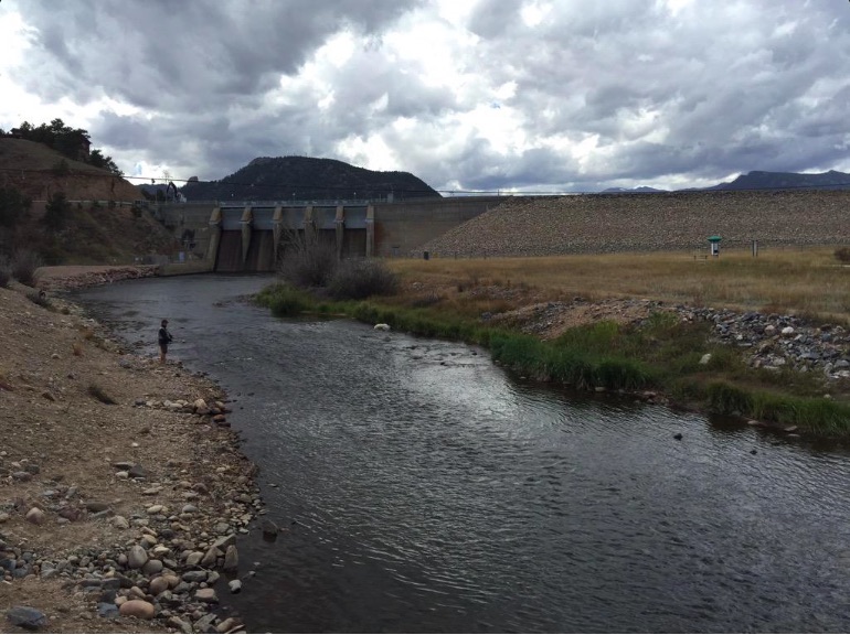
Fly fishing below Olympus Dam (Colorado-Big Thompson Project) September 17, 2015 via the Bureau of Reclamation
Evans Colorado September 2013 via TheDenverChannel.com
FromThe Denver Post via the Loveland Reporter-Herald (Joey Bunch/John Aguilar):
As Colorado hits the two-year mark since a historic deluge swelled rivers and creeks to overflowing, killing 10 and causing nearly $4 billion in damage across 24 counties, frustration is a theme for a surprisingly large group of folks still dealing with the storm’s aftermath. Hundreds of mobile home park residents in Evans, a city of 20,000 south of Greeley, are unable to return to communities that have been effectively scraped off the map.
The major access road into Glen Haven is still being put back together, causing repeated daily hour-long delays that result in unending headaches for locals and drive away tourist traffic headed to or from nearby Estes Park.
Only three of 17 homes in James town destroyed by a manic James Creek have been completely rebuilt, and a part of the population has relocated or hasn’t yet moved back to the tiny mountain town.
And then there are the dozens of Lyons residents, locked in a seemingly endless bureaucratic arm-wrestling match with town officials over attempts to get permits to rebuild their homes.
They confronted town leaders at a public meeting earlier this month demanding a more streamlined process for evaluating and approving their engineering and hydrology plans so they can move forward.
“We’ve spent a lot of money on this project, and we haven’t laid a shovel in the ground,” said Kitty Wang, who with her husband has lived in Lyons for 13 years and still awaits a floodplain development permit for a new house. “It’s a nightmare we keep trying to wake up from.”[…]
Molly Urbina, the state’s chief recovery officer, acknowledged that despite the billions spent to make repairs and provide compensation to victims of Colorado’s most costly natural disaster, problems remain.
The state, she said, has not forgotten about those still suffering.
“When we talk about disasters, we talk about a marathon, not a sprint,” Urbina said. “We continue to coordinate with local communities to assess and evaluate needs and priorities and to advocate for additional resources.”
Some of those resources have come from groups like Foothills United Way in Boulder County, which has raised $4.9 million in donations and spent about $363,000 for mental health services. The charity still sits on nearly $2 million to help cover the costs of at least 333 open cases in Colorado’s hardest-hit county…
Urbina said estimating costs for a disaster the size of the 2013 floods, which destroyed 1,852 homes and 203 businesses and created more than 18,000 evacuees over a five-day period starting Sept. 10, 2013, is a “complex, long-term process.”
“We understood that this would evolve as recovery priorities and projects became more clear,” she said.
The dynamic nature of the floods’ impact has played out in dramatic fashion since the one-year anniversary, with the cost of rebuilding in Colorado swelling by a third to nearly $4 billion.
The $1 billion spike, Urbina said, reflects the fact that initial cost estimates done in the months following the flood were rough. In the past year, more detailed estimates of what it would cost to fully repair and restore roads and watersheds in the state were made.
Specifically, watershed recovery master plans performed over the last year revealed that the true cost of improving flood-impacted watersheds would amount to some $600 million.
Last February, Gov. John Hickenlooper announced $56.9 million will come from a federal program to help restore stream corridors and prevent future flooding.
The remainder of the increased cost estimate since last year — around $400 million — came about as the result of detailed design and engineering work, which more clearly outlined the cost of building roadways that can better withstand future flooding, Urbina said.
Work will begin soon to redesign U.S. 36 from Estes Park to Lyons at an estimated cost of $50 million.
Also, individuals and local governments have found damage they initially didn’t know about or thought private insurance would cover, according to the Colorado Resiliency and Recovery Office…
A new normal is also being pieced together in Evans, where the Eastwood Village and Bella Vista mobile home parks were turned from once-vibrant low-income neighborhoods to empty, weed-choked lots by the floods. It’s not certain what will happen to the two properties, though Bella Vista’s owner is working with the city to re-establish itself at the same spot on 37th Street.
Here’s a look at several survivors from Isa Jones and Pam Mellskog writing for the Longmont Times-Call via the Loveland Reporter-Herald.
Meanwhile the Big Dam repairs are nearly complete. Here’s a report from Saja Hindi writing for the Loveland Reporter-Herald. Here’s an excerpt:
Crews are putting the finishing touches on repairs to the Nelson Big Dam and expect to have them completed in the next few weeks.
The masonry arch dam, built in 1895, is located west of Loveland’s water treatment plant, and was significantly damaged in the September 2013 flood.
The dam diverts raw water to the city’s water treatment plant, provides drinking water for the Johnstown water treatment plant, and irrigates about 20,000 acres of farmland in Larimer and Weld counties.
The Consolidated Home Supply Ditch and Reservoir Co. owns the 60-foot-plus dam, which didn’t suffer major damages in the 1976 flood, but the 2013 waters left a lot of damage.
The dam is also identified as a Colorado Historic Civil Engineering Landmark, so crews had to make sure not to change the historic aspects of the dam substantially. That included using stones from the same quarry as the original stones.
Crews are working on Phase II of repairs now, according to Home Supply board member Gary Gerrard, which encompass the pointing or refacing of the dam (grouting stones on the face of the dam), a need caused by years of erosion. Once that’s completed, he said, crews will close the gate.
The dam was operational April 1, 2014, in time for the spring runoff, and repairs continued while it was in use, aside from taking a break in the winter months…
Some of the repairs after the flood damaged the dam, Gerrard said, included restoring the crest elevation, mitigating future flood effects by strengthening the dam with concrete abutments and installing a new spillway that configures water to go around instead of on top and updating to 21st century technology such as an automatic gate that fluctuates with river flow.
Because the flood damaged the dam’s main gate, the company was also able to replace other gates not damaged by the flood that were almost unusable and rusting because they were first put in 1915.
Funding for the repairs came from the city of Loveland, the Home Supply board, the Colorado Water Conservation board and the Federal Emergency Management Agency. The city committed to paying 50 percent of the costs not covered by federal and state grants. The conservation board committed to covering uncovered costs through long-term low-interest loans.
The total cost of repairs, Gerrard said, is about $3 million. Of that, $2.2 million is expected to be covered by federal aid.
Gerrard said the entities were able to keep costs low through “the methods of construction and the ability we had to be able to make decisions in the field, and the cooperation we had from all the entities to react to the things we found out in the field.”
Because officials could make decisions quickly, there weren’t a lot of construction holdups, he said.
“That’s the main thing to reach out for help. They (Larimer County Long Term Recovery Group) connect you with the people you need (Loveland Housing, in particular). We had volunteers from Lyons, Minnesota, Wisconsin, Florida,” said Aleta.
Today, the Hammond’s have a little less privacy. The flood took out about half the trees and bushes along this road. And what was a pasture with a barn now looks like an outcropping of rocks.
That creek that once rushed with danger is nearly dry, but the family’s gratitude is overflowing.
People lost their homes, a few lost their lives. So we were very, very fortunate,” said Aleta…
The state repositioned U.S. 36 and Little Thompson River to prevent a tragedy like this from ever happening again.
The Hammonds say they still have work to do on their property, like foundation work, and cleaning off grit inside tools and motorcycles.
From the Loveland Reporter-Herald (Jessica Benes):
Where the Little Thompson River used to be 70 feet wide in places, it was blasted to 300 yards, according to Gordon Gilstrap of the Little Thompson Watershed Restoration Coalition.
The September 2013 flood devastated areas along Front Range rivers and streams, and while not nearly as many houses were lost on the Little Thompson River, landowners still are recovering from the deluge that destroyed vegetation, wildlife habitat and landscapes.
Some landowners along the Little Thompson call it “the forgotten river.”
“It’s been an interesting journey,” said Gilstrap, who helped set up the Little Thompson Watershed Restoration Coalition after the flood. “The Little Thompson has been an unknown river because no county or state roads run along it for any distance. It is all privately owned.”
Deirdre Daly, president of the coalition, said that because the river isn’t in a town or county that is leading the charge for river repair, the restoration has been almost entirely driven by the people who live on it…
The Little Thompson headwaters come in from several areas but are mostly above Big Elk Meadows below Estes Park, separate from the Big Thompson.
“It was a small working river,” Gilstrap said. “It provides drinking water to Big Elk Meadows and Pinewood Springs, irrigation to a lot of farmland. It has always been a small, quiet little river.”
The water pushed woody debris down the river, knocking out everything for hundreds of feet on both sides of the river.
Gilstrap said the land along the river was heavily wooded, with a lot of wildlife habitat, especially in the Big Elk Meadows, Pinewood Springs and Blue Mountain areas. Much of that habitat area was lost.
The number of homes lost in the flood was small — two to four — but there was a lot of other damage such as water in basements, homes partially damaged and agricultural fields that were made useless with sediment and garbage debris accumulation.
“A lot of agricultural equipment was lost, and the irrigation ditches took a real hit,” Gilstrap said. “An interesting fact most people don’t know is the Little Thompson was the river that shut down every county bridge between Big Elk Meadows and Milliken — seven public bridges and many other private bridges — so it cut off Northern Colorado from southern Colorado.”[…]
Watershed coalition
Gilstrap helped found the Little Thompson coalition in December 2013, starting with nothing. The group had no money and no knowledge of how to run a coalition.
“Thanks to an amazing group of volunteers that stepped forward to be a part of it, we established the Little Thompson coalition as one of the most effective coalitions in Colorado,” Gilstrap said.
With grant funding, the coalition oversaw the successful completion of a master plan for the watershed, started having meetings, published an active website and Facebook page and coordinated volunteer projects.
“We secured over $1.2 million in government and private-sector grants with a potential of $3 plus million to come,” he said.
The coalition also was able to hire a full-time watershed coordinator, Keith Stagg, and assistant coordinator. Erin Cooper, this summer to oversee grant raising and volunteers, which meant the hard workers such as Gilstrap who had volunteered so much of their time were able to step back.
“We all learned together (at the beginning),” Gilstrap said. “We even learned to say ‘fluvial geomorphic transition’ and other big words like that.”
He said there were two reasons for their success: the volunteers who stepped forward to be on committees while also working day jobs, and support from the state and counties involved.
“Everyone worked together, and that spirit is ongoing more than ever. The volunteers came in from everywhere and did the dirtiest, grungiest work imaginable and were happy as can be if you gave them water and cookies,” he said.
Work still to be done
One of the big problems the river still faces is sediment.
Gilstrap said the Big Thompson River has a rock base, while the Little Thompson has more of a soil base.
When the flood swept down the river from just below Estes Park, sediment traveled down, blocking irrigation canals and changing the bed of the river.
One of the private bridges in Berthoud — called the Green Monster bridge by locals — used to have a space large enough to walk under, and now a person can barely crawled under because of all the new sediment. Julie Moon used to walk her horse beneath the bridge.
“That all plugs up irrigation ditches, rechannels the river,” Gilstrap said. “It’s a long-term fight to understand what will happen with the sediment, how to fight it, how to do restoration so we don’t aggravate the problem.”
He said there is still a lot of farmland with sediment covering valuable cropland.
Natural Resources Conservation Service representatives walked the river and filled out disaster survey reports to define the work to be done. The restoration work will carry on for the next five or more years, he said. The river is also being analyzed for flood and fire resiliency, to be more resilient the next time a flood passes through.
“We’re trying to think during restoration how we can bounce back from them more quickly and not put people in as much peril,” Gilstrap said.
Stagg said the silver lining of the flood is that people are aware of the need for resiliency.
“Everyone wants to see the system put together,” he said.
Gilstrap said wildlife is coming back, and the coalition is looking at revegetation options to establish more wildlife habitat. They plan to use willow cuttings and other “ecotypical” seeds from Daly’s property and neighbors’ to vegetate other areas along the river with native plants.
Finding funding
Major sources of grants for restoration work has come from the U.S. Department of Housing and Urban Development, and from the Emergency Watershed Protection Program through USDA.
Gilstrap said a new round of grant funding from several sources will deliver possibly $47 million across Colorado, and he believes the Little Thompson might see $2 million to $3 million of that. Stagg and Cooper were hired through funding jointly from the state Department of Local Affairs and the Colorado Water Conservation Board.
“We’re one of (several) watersheds that received funding for professional staff,” Stagg said.
Each year, the coalition will receive grants and work on different pieces of the restoration project for many years to come.
“We will get a couple projects done in each round. Each year we will go find another source of money, and do a little bit of project as the years go on,” Daly said.
The Little Thompson even has a “Little Thompson Watershed” sign posted near the headwaters.
“We’ve never had that before,” Daly said. “Before, the river was there and hidden by trees and no one knew what river it was.”
It has been two years since the catastrophic Colorado floods of 2013. The outstanding visitation and tax revenue numbers from this summer suggest that most guests could not guess that the recovery is ongoing.
We’ve come a long way in those two years, but much work remains…
The impact in places like downtown Estes Park and Lyons will be substantial, as flood insurance premiums could skyrocket for some businesses.
In addition, Larimer County Commissioner Tom Donnelly announced to Glen Haven residents that $2 million in federal money is being allocated for restoration of bridges and roads in Larimer County.
Under existing federal regulations, money could not be allocated to privately owned roads or bridges that exist in much of rural Larimer County. The presence of second homes in many of these areas was also a barrier to obtaining any federal assistance. Cooperation among our Congressional delegation and Larimer County officials was necessary to obtain an exception to federal rules, which were not designed with our region in mind.
Cooperation has been another key to getting us back on track. No one person or organization can take all the credit. For example, the Fish Creek Road restoration requires cooperation among the town, county, Upper Thompson Sanitation District and Estes Valley Recreation and Park District. The United Way created a unique fund that delivered over $1 million in grants to local businesses for flood recovery. Mountain Strong for Nonprofits evolved from community members who banded together to help their neighbors. Crossroads Ministries received and distributed substantial assistance.
The Community Foundation of Northern Colorado provided grant monies to a host of local recovery efforts, including a grant to Estes Park EDC and the Town of Estes Park for a flood recovery coordinator. Through that program, Estes Park EDC assisted over 50 businesses in successfully obtaining $1.9 million in Recover Colorado business grants.
Our dedicated staffing and partnership with Larimer SBDC greatly benefited local businesses. As of this summer, over 60 percent of the statewide Recover Colorado grants had come to Estes Park, Glen Haven, Drake and southwest Larimer County.
For Estes Park EDC, assisting local businesses is always a top priority, but this was just the first step. The recent completion of the NEO Fiber Consulting plan for competitive broadband is a major step toward addressing both the cost and speed of local Internet services. Assuming the plan goes forward, it will greatly benefit both our residents and guests, our existing businesses and businesses to come.
Finding long-term resources for resiliency is another key. Two weeks ago, we received good news. After receiving an application from Larimer County, the Colorado Economic Development Commission accepted Southwest Larimer County as an Enterprise Zone. Thus provides local businesses with the opportunity to obtain a number of different tax credits designed to expand and support your business. We are an Enterprise Zone because census data revealed that Estes Park is lagging the state in population growth.
In 2013, we spoke about the 28 percent decline in 35 to 44 year old residents that occurred between the 2000 and 2010 Decennial Censuses. The 2012 Census data estimated that we have lost 46 percent of our 35 to 44 year olds since 2010. The loss of working age families can be attributed to less workforce housing availability and fewer year-round job opportunities compared to Front Range communities.
The flood has exacerbated such concerns, as demonstrated by the large number of job ads that continued to appear in July and August. The size of this population decline threatens funding for our schools, due to long-term declines in enrollment.
Later this fall, Avalanche Consulting will meet with the Town Board to present a regional economic development strategy for the Estes Park region. There will also be public meetings to discuss the plan and its implementation. The plan combines the results of extensive community meetings and outreach earlier this year with the experience of a national consulting firm.
This summer has been a record year for tax revenues. Despite our successes, the recovery is ongoing. Long-term resiliency against future events is an important goal. With leadership and collaboration, we ensure we remain a vibrant, multi-generational community in the decades to come.
The storm that upended the lives of thousands of Front Range residents almost two years ago was nearly unprecedented for the area, so much so that it largely confounded the best efforts of those charged with forecasting its scope and impact.
But the lessons learned from the 2013 event could go a long way toward ensuring that should a similar storm strike this area — and in a changing global climate, it could — the forecasting community would be better prepared for it.
Those are key findings from “The Great Colorado Flood of 2013,” a paper accepted for publication soon by the Bulletin of the American Meteorological Society. It is one of the most comprehensive analyses to date on a memorable storm that may only have the September 1938 flood as close precedent in the past century for the Boulder area.
The 71-page paper features no fewer than 26 contributing authors, representing the University of Colorado, Colorado State University, the National Center for Atmospheric Research, the National Oceanic and Atmospheric Administration and CU’s Cooperative Institute for Research in Environmental Sciences…
Colorado behaving like the tropics
The record-breaking dimensions of the 2013 storm were born of a confluence of climatological factors, including a significant tropical influence flowing into a charged atmosphere flush with water vapor, over a landscape that was already well saturated.
Recapping the way the system had set up, the paper states: “The large-scale atmospheric pattern that supported persistent heavy rainfall in northern Colorado during 10-16 September 2013 consisted of a blocking ridge over the Canadian Rockies and a slow-moving, cutoff, upper-level cyclonic circulation to its south over the western U.S. The blocking anticyclone assisted in keeping the western-U.S. cutoff circulation in place for several days, and to the east and southeast of this circulation, moist air was transported northward and westward toward the Front Range in Colorado.”
That’s far different from the usual variety of flood-prone events for which most local forecasting models are geared — such as a slow-moving thunderstorm that might camp out over a localized river basin, like that which triggered the tragic Big Thompson flood of 1976.
And just as the tuning of a musical instrument can be adjusted for the music it is expected to play, the forecasting tools of the National Weather Service are calibrated for conditions they expect to see — not the outlier that invaded Colorado two years ago.
“Weather forecasting models are tuned to observe the weather in the entire United States year-round, and they are tuned to typical weather, not atypical weather,” Friedrich said.
“Then, because the models didn’t forecast the rain correctly, the radars didn’t measure the rain correctly, and that had trickle-down so the hydrological forecast was basically lagging, due to the incorrect input data. And the reason the radars did not observe it correctly was the nature of the storm. It was very tropical.”
Weather blogger Bob Henson stated in an email, “This paper reiterates how challenging it is to accurately predict and measure heavy rain and flooding. This was a Colorado storm that behaved like a tropical downpour, from the microphysics within the clouds to the phenomenal rainfall they produced.”
Meteorologist Matt Kelsch, a co-author on the report, said atmospheric models are always evolving, using past storms as guidance.
“When a storm occurs that is so far removed from the historic experience, our forecasts, both computer and human, struggle,” Kelsch said. “The modeled atmosphere leading up to the second week of September 2013 was strongly suggesting an unusually wet period — but not 12 to 20 inches.”
As bad as things were for the 24 Colorado counties socked by more than $2 billion in damage, Henson said it could have been worse.
“We are lucky to have far better modeling and observing technology at hand than we had in 1976, when the Big Thompson flood took almost everyone by surprise and killed more than 100 people,” he said. “Neither humans nor models fully anticipated the scope and power of the 2013 disaster, but we knew heavy rains could affect a wide area, and we had much better tools for responding quickly and saving lives when the threat materialized.”
The paper concludes by offering the hope that new research weather forecast models such as NOAA’s High Resolution Rapid Refresh model could improve precipitation forecasts, and that new generations of spatially continuous hydrological models could produce better information on timing and location of floods — presuming that more accurate rainfall estimates and forecasts are available to feed into those models.
The storm was such that it stretched historical superlatives in the moment, and some endure. Most notably, the paper supports the contention that in some pockets in a corridor stretching from Boulder northwesterly toward the St. Vrain, Little Thompson and southern half of the Big Thompson watersheds, rain fell during one 24-hour period at a clip qualifying as a 1,000-year-rain — meaning that in any given year there is a 1-in-1,000 chance of it occurring.
“We don’t have the data to say otherwise,” Gochis said. “It’s all a fit to what you have seen before. Otherwise, you’re just kind of extrapolating.”
Gochis added, “If we had 1,000 years of data, we could have a lot more confidence in saying that. …
“I don’t really like that (1,000-year) term. The flood was definitely unprecedented in its scale — not just in local amounts, but in its widespread extent.”
‘Do we know what actually fell?’
Many might be surprised to know that even now, two years later, it still isn’t known exactly how much rain came down.
“Do we know what actually fell? No, but we certainly have a very good estimate, much better than what we would have had even 15 years ago,” Kelsch said. “The struggle is in low-population mountainous areas. Low-population areas have fewer rain-gauge reports, and mountainous areas have less radar-based measurement of what is happening between the cloud and the ground. This was most apparent in parts of northwestern Boulder and western Larimer counties.”
Friedrich noted in an interview last week that a question that remains prominent in her mind is “whether this is an outlier event and whether these types of events might occur more often. Is this a response to climate change? Is this something we might experience in the near future?
While noting that there is not yet enough data to draw a solid conclusion, she referred to a paper published in June by NCAR distinguished senior scientist Kevin Trenberth. The Trenberth paper, published in the journal Nature Climate Change, didn’t assert that climate change caused the 2013 flood, but that it likely enhanced its severity.
The 2013 storm was extraordinary, Trenberth said, as demonstrated by the fact that records were “not just broken but smashed.”
“And yet we are seeing more and more of these sorts of things around the U.S. and around the world,” he said. “They are hard to connect because every one is different; the atmosphere has infinite variety, and the weather never repeats. But climate change is altering the odds.”
Currently, hurricanes in the east Pacific and a record-breaking El Niño boosting sea-surface temperatures over large areas are examples of the Earth’s natural variability which, coupled with climate change, “puts us outside the previous experience,” Trenberth said.
“There are many phenomena involved in all these different events, but the environment in which they occur has changed to make the extremes more extreme — the rainfalls heavier, and the droughts hotter and drier and with wildfire a consequence,” he said.
Whatever the future might hold, Gochis said the fact that “Boulder, itself, didn’t receive a lot of catastrophic damage” suggests much of its floodplain planning and flood strategizing has paid dividends — and should continue to, in the face of future events.
Gochis was less sanguine about other areas of concern, mentioning as an example the restoration of foothills roadways.
“Transportation corridors were put back where they were,” Gochis said. “I think we’re still vulnerable there. But to make them more flood resilient would take a lot of money.”
Plume of subtropical moisture streaming into Colorado September 2013 via Weather5280
Map of the Colorado-Big Thompson Project via Northern Water Click here to read the newsletter. Here’s an excerpt:
<blockquoteThe Northern Water Board of Directors set 2016 water assessments during an Aug. 6, 2015 public hearing. Assessments for open-rate irrigation contracts increased from $10.90 per acre-foot unit to $17.60, and assessments for open-rate municipal, industrial and multipurpose contracts increased from $30.50 per acre-foot unit to $35.90.
The Board followed its general rate-setting objectives, which are outlined in its 2014 forward guidance resolution. Among other objectives, the resolution proposed a 2-year step increase in assessments beginning in 2016, and moving irrigation assessments towards a cost-of-service based rate. Both of these objectives are represented in the 2016 assessments.
The Board will consider forward guidance that provides an estimated range for 2017 and 2018 water assessments at its Sept. 3 Planning and Action meeting.
For information on water assessments, please contact Sherri Rasmussen at 970-622-2217.
The annual remembrance service for victims of the 1976 Big Thompson Canyon Flood will be held at 7 p.m. Friday next to the Big Thompson Canyon Volunteer Fire Department station a mile east of Drake on U.S. Highway 34.
This year’s event will honor firefighters, law enforcement officers and other emergency services workers who responded to the disaster. The flash flood hit July 31, 1976, taking the lives of 144 people and causing hundreds of millions of dollars in damage.
The program will include speakers, music and light refreshments. Participants are welcome to bring a chair and a snack to share.
I was backpacking in the Flat Tops Wilderness that week with Mrs. Gulch. Monsoon drizzle in between downpours pushed us to hole up in Steamboat Springs to get a room at a place with a hot tub.
I called my mother the night of July 31 to check in. She asked, “Johnny, are you anywhere near the Big Thompson? There’s been a terrible flood.”
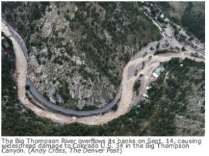
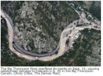
The Big Thompson River September 14, 2013 via The Denver Post
Here’s the release from the Bureau of Reclamation (Tyler Johnson):
The Bureau of Reclamation has awarded a contract totaling nearly $1.5 million to Lillard and Clark Construction Company Inc., Denver, for repair to the Big Thompson Diversion Structure, an element of the Colorado-Big Thompson project that was damaged during the September 2013 flood, known as one of the worst natural disasters in Colorado history.
“Reclamation is addressing the infrastructure damage that occurred during the 2013 Colorado River flooding,” said Reclamation Commissioner Estevan López, while announcing today’s $1,457,570 contract award. “This work will ensure the project’s continued reliability.”
Big Thompson Diversion Structure, located 8.5 miles west of Loveland, Colorado, in Larimer County, requires removal and restoration of flood-damaged concrete areas, installation of a precast concrete building, repair and replacement of electrical systems, gates, gear boxes, electric motors and other rehabilitation tasks. The work is expected to begin in April 2015.
The Colorado-Big Thompson project spans approximately 250 miles in Colorado. It stores, regulates and diverts water from the Colorado River on the western slope of the Continental Divide to the eastern slope of the Rocky Mountains, providing supplemental water to irrigate about 720,000 acres of land for municipal and industrial uses, hydroelectric power and water-oriented recreation opportunities. Major features of the project include dams, dikes, reservoirs, power plants, pumping plants, pipelines, tunnels, transmission lines, substations and other associated structures. The Northern Colorado Water Conservancy District apportions water used for irrigation to more than 120 ditches and 60 reservoirs. Eleven communities receive municipal and industrial water from the project. Electric power produced by six power plants is marketed by the Western Division of the Pick-Sloan Missouri Basin Program.
From the Loveland Reporter-Herald (Kenneth Jessen):
In 1975, a Colorado dam inspector hiked the half-dozen miles to the Lawn Lake dam and reported that it was in need of a thorough inspection after the snow melted. Another inspector reported two years later that the dam was in fair condition and suggested that its owners make repairs.
On Aug. 8, 1978, a third inspector reaffirmed the marginal rating for the dam and recommended that it be observed when the reservoir was full.
The caulking between the outlet pipe and the release valve started to allow water to trickle along the outer surface of the pipe. Once a small channel had eaten into the earthen dam under pressure, it rapidly expanded.
On July 15, 1982, the Lawn Lake dam failed catastrophically. The release of water was heard by campers along the Roaring River. One man below the dam was swept to his death in the churning water.
The wall of water forced large boulders down 2,500 vertical feet to Horseshoe Park acting as battering rams. The forested banks of Roaring River where scoured away in a landslide of thousands of tons of material.
Much of the impact of the flood was absorbed by the broad expanse of Horseshoe Park. An alluvial fan quickly formed at the mouth of Roaring River. The debris was pushed across Horseshoe Park damming the Fall River and forming a shallow lake.
Fortunately, Steve Gillette was collecting trash at the Lawn Lake trailhead. It was 6:23 a.m. when he sighted the flood coming toward him and alerted park officials.
In an interview with the Loveland Reporter-Herald, he described the noise like that of a plane crashing. Gillette said that it looked like a mudslide of the type you see in the movies.
The vast volume of water poured into Fall River and picked up finely divided glacial silt in the process.
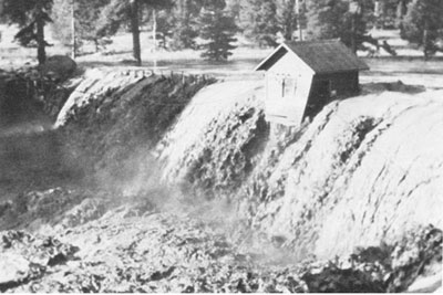
Below Horseshoe Park was the Cascade Dam. The force of the water first backed up behind the dam, and then suddenly toppled the 17-foot high structure at 7:42 a.m. This amplified the intensity of the flood and a wall of water raced through the Aspenglen Campground killing two people.
The mud and water coursed through motels and restaurants, then hit downtown Estes Park. The entire width of Elkhorn Avenue became a river of mud-filled water combined with a great deal of debris. It did an extraordinary amount of damage as entire inventories for the summer tourist season were washed away or ruined.
State inspectors were partially to blame along with the Park Service. Much of the responsibility, however, had to be borne by owners of the dam, the Farmers Irrigation Ditch & Reservoir Co. Its 16 stockholders became worried about legal action, but they were protected by their corporation.
National flood insurance covered only 20 property owners out of some 275 affected by the flood.
High-profile trial lawyer Gerry Spence was hired by Estes Park property owners to represent their interests. He quickly concluded that the entire assets of the ditch company consisted of little more than their $1.4 million insurance policy. This money was turned over to the court system to be disbursed.
Immunity against lawsuits was evoked by both the federal government and the state of Colorado. Damages topped $30 million, which ultimately had to be absorbed by businesses and individuals.
Low interest rate loans were made available. Other federal assistance included unemployment payments, temporary housing, up to $5,000 for out-of-pocket living expenses and food stamps. However, very little compensation was received by anyone financially injured by the Lawn Lake flood.
Less than 10 cents on the dollar was paid to flood victims, forcing the permanent closure of many businesses.
The Lawn Lake disaster became the perfect opportunity for the Park Service to dismantle selected dams.
Lost Lake dam was dismantled followed by the Pear, Sandbeach and Bluebird dams. Spared were Lily, Sprague, Snowbank and Copeland.
From the Town of Estes Park via the The Estes Park News:
To ensure continued high-quality utility services and plan for future upgrades through capital improvement projects, the Town of Estes Park periodically reviews the cost of providing services as well as projected revenue – the rates paid by customers. The Town’s public water utility is a cost-based entity that relies solely on user fees to operate. Costs and revenues must be balanced in order to maintain operations and keep utilities in line with ever-increasing federal standards. The Town’s Water Division is capable of serving Estes Park on the busiest day of summer. Yet like water utilities across the U.S., it is facing rising operational costs, aging infrastructure and increasingly stringent regulatory requirements.
Several upcoming public meetings will include water rate discussions. Visit http://www.estes.org/boardsandmeetings for dates and complete meeting details:
• March 10: Town Board study session to review rate study results and options
• March 24: Town Board meeting review draft rate plan
• April 28 (tentative): Final public hearing and potential adoption of new rates
The last time a water rate study was conducted, the Town opted to keep rates lower than recommended by the study in order to assist residents and businesses through the national economic downturn. Therefore, the Town has not completed a large capital project since replacing 600 feet of water main under Virginia Avenue in 2012. Funding capital infrastructure projects requires multiple years of savings, and postponement means they will cost more in the future. The following water system improvements are needed:
1. Establishment of secondary water sources for the Town’s two water treatment plants to ensure water treatment plants are not shut down due to problems with source water.
2. The Town’s system has grown and inherited older, private water distribution systems such as the one serving Carriage Hills. In 2014, the water crew repaired 27 leaks throughout the system, most caused by older pipes resting on shifting granite in acidic soil. Approximately 50 miles of the Town’s pipes need to be replaced to meet today’s standards. This costs $500,000 to $1 million per mile depending on blasting, excavation and road replacement costs.
3. The Federal Safe Drinking Water Act, Clean Water Act, and Colorado Department of Public Health and Environment regulations have a direct influence on the operations and maintenance of distribution system and treatment facilities. For example, to meet the Surface Water Treatment Rules the Town uses enhanced treatment methods, which increase operating costs. Past rate increases funded the $8.25 million upgrade at Marys Lake Water Treatment Facility for membrane filtration in order to prepare for more stringent standards in the future.
For more information on the water rate study, please contact the Utilities Department at 970-577-3587.
Colorado-Big Thompson Project east slope facilities FromBizWest (Steve Lynn):
Prices of Colorado-Big Thompson water have reached an all-time high, selling for nearly three times more than just two years ago.
Shares of the water went for more than $26,000 apiece at an auction Jan. 23, according to Berthoud-based Northern Colorado Water Conservancy District, the equivalent of $52,000 an acre foot. An acre foot equals 326,000 gallons, enough water to serve 2.5 households annually.
The water was bought for industrial and municipal uses, said Brian Werner, spokesman for the district. The identity of the buyer has not yet been disclosed.
The high prices are likely to cause concern in the agricultural world, where farm water traditionally has been lower priced. Residential homebuilders also are likely to feel the squeeze, as fees for new water taps rise.
“It’s fairly expensive water these days, if you can find it,” Werner said. “Some people can’t even find it.”[…]
Built originally in the 1930s to serve the region’s massive irrigated agriculture economy, shares in the C-BT gradually have been acquired by fast-growing cities and energy companies. Now the water is largely owned by cities, and leased back to farmers or others who seek to use it on a temporary annual basis.
How much water is associated with each share in the system changes each year and is based on how much water is derived from snowpacks and precipitation. This year, a share of water equals six-tenths of an acre foot since the Northern Water Board of Directors declared a 60 percent quota last April, meaning water-rights owners can use only 60 percent of the resource they own.
The high prices for water come despite record levels of water storage in October in the district’s reservoirs, which span Northern Colorado and the Boulder Valley.
“Storage remained high throughout this year and through the winter,” Werner said.
As of Jan. 1, Colorado-Big Thompson had 665,000 acre feet of water in storage, 45 percent above normal, Werner said.
The higher levels stemmed from above-average snowpack, increased precipitation and less water delivered to water users. Flooding in September 2013 also replenished groundwater supplies in many areas.
Higher water storage may mean more water available to rent, but it may not affect water-rights prices, said Tom Cech, director of One World One Water at Metropolitan State University.
“The price of (Colorado-Big Thompson) water and other water rights in the region are directly tied to demand such as from energy development, water for fracking purposes, and then urban development,” Cech said. “Those are the two big drivers.”
Fracking involves pumping millions of gallons of water under high pressure deep underground to free oil and gas from dense shale formations. As energy companies benefit from the water, Cech said, agriculture has faced increasing challenges because of the high water prices.
“Irrigated agriculture is generally short of adequate water supplies,” he said. “In the wet years, there’s enough, but you always have the dry years around the corner.”
Slowing energy development because of lower oil prices could temper high water prices in the next year or so, he said. Oil and natural-gas drilling permits approved in Weld County remained flat during the third and fourth quarters amid falling oil prices, according to the Colorado Oil and Gas Conservation Commission.
Urban development, however, has shown no signs of abating. The population of Weld and Larimer counties is expected to grow from 580,000 to more than 1 million people by 2040.
“You have to have water supplies for the new residents, so developers and municipalities have to go out and acquire more water rights,” he said. “That should drive the price of water up.”
Developers in Northern Colorado cities such as Greeley already face higher tap fees when they have to rely on Colorado-Big Thompson water.
\If developers do not have water to supply their developments, they instead pay cash to use Greeley’s supply. Here also, rates have skyrocketed, with Greeley charging $25,000 per share in recent months, nearly triple the $9,000 per share it was charging in October 2012, according to Eric Reckentine, the city of Greeley’s deputy director of water resources.
Mike DiTullio, district manager for the Fort Collins-Loveland Water District, said the higher prices are making new homes increasingly expensive. He said he closed a deal in January for 200 units of Colorado-Big Thompson water – for about $5 million, at $25,000 per share.
The higher water prices will not affect rates of existing residential customers, DiTullio said. Instead, new homeowners and developers will foot the bill. The water district serves about 16,000 customers in Larimer County.
“That increase in raw water costs is paid for by new houses,” he said. “There’s no such thing as affordable housing in Larimer and Weld counties.”
From the Estes Park Trail Gazette (David Persons):
The job of creating a master plan for the recovery and future flood mitigation of the heavily-damaged Fish Creek corridor wasn’t going to be easy.
And, it hasn’t been. It’s been hard work by a lot of well-meaning professionals and concerned individuals.
But, as it almost always is with any significant flood mitigation plan, some parts are going to rub some people the wrong way.
Count many of those living at or near Scott Ponds in the Carriage Hills subdivision on the upper reaches of Fish Creek as suitably rubbed.
When they found out that the current draft of the Fish Creek Resiliency (Master) Plan included a recommendation to remove the two dams (and related ponds) south of Scott Avenue and restore the area to historic beaver ponds, they quickly spoke out.
“I chose this (home) because of the location,” said Joe Holtzman, 1130 Scott Avenue. His home overlooks the northernmost of the Scott Ponds, the one whose dam failed and contributed greatly to a surge during the September 2013 flood.
“I’m a 50-year flyfisherman. I love it here. I have had over 250 elk go through by backyard. I’ve had numerous deer and a plethora of birds. I have seen osprey plucking fish out of those ponds. I’ve even seen bald eagles here.”
Now, he fears, he may lose all that if the Scott Ponds are removed.
Holtzman said he wasn’t aware of the recommendation to remove the ponds – one of five high priority projects recommended – until November when there was an open house presented by a representative of Walsh Environmental, the firm that has been tasked to oversee and complete the Fish Creek Master Plan.
Once completed, the Fish Creek Resiliency Plan will provide recommendations for numerous projects that may be undertaken when funding is available. If funding becomes available, for each project there will be another opportunity for public participation during the design process, town officials say.
They also point out that the master plan is just a draft and not complete yet.
“The Fish Creek master plan is still being reviewed, and even the final document will be just a recommendation from a resiliency standpoint,” said Estes Park Public Information Officer Kate Rusch. “There will be more public involvement before anything happens at Scott Ponds.”[…]
Although town officials are on record saying they would like to repair the dam as part of flood restoration work, they won’t be allowed to restore it to its former state. The state now requires that repairs and designs of dam replacements must meet current state regulations. And, that means a lot more money.
Holtzman believes that a better idea would be to reduce the size and depth of the ponds which would require a smaller dam.
He and his neighbors will get a chance to voice that opinion on Jan. 26, when the town holds a public meeting to discuss the Fish Creek Resiliency (Master) Plan. The meeting will be held at 6 p.m. at the Estes Park Event Center, 1125 Rooftop Way, at the Fairgrounds at Stanley Park…
Shafer did praise the formation of the Estes Valley Watershed Coalition, which was formed from residents in the Fall River and Fish Creek areas. The coalition, which has two voting members from the Fall River area, two from the Fish Creek area, two from the Black Canyon area, and two from the Big Thompson River area, and three at-large members will seek grants and other funding once the Fish Creek Resiliency (Master) Plan has been adopted.
Shafer said the coalition, working as a non-profit under the umbrella of the Estes Valley Land Trust, should be able to secure the needed funding to implement the plan.
Among the many funding sources available for the coalition are the Colorado Water Conservation Board; Colorado Healthy Rivers Fund; Colorado Watershed Restoration Grant; Colorado Department of Local Affairs (DOLA); Colorado Drought and Flood Response Fund; Colorado Department of Public Health and Environment; Colorado Watershed Assembly; Basin Roundtables; and the El Pomar Foundation.
From the Loveland Reporter-Herald (Pamela Johnson):
The plan for the South Platte Basin, which covers all of Northern Colorado including tributary Big Thompson River, was discussed Tuesday at a public meeting in Loveland.
Members of the roundtable asked for public input on their plan to protect and balance all the interests in Colorado water within the law and the water rights structure.
The plan so far calls for creating new, multiuse projects that pull water from diverse sources, expanding conservation and reuse of water, exploring the use of groundwater and aquifer storage and stopping the old practice of “buy and dry” up agricultural water and land.
Livermore resident Zach Thode urged the board to delve beyond what they have already studied and, through a regional innovation group, offered to help.
“We have to come up with new ideas, or we will always end up in the same place,” said Thode. “I don’t see anything new and exciting in here. I don’t think this is steering us away from the path that we were already on. I encourage you to look at innovation.”
Eastern Colorado resident Gene Kammerzell offered one suggestion for a new path: Make sure landscapers adequately prepare soil before installing trees, grasses and plants. This simple act, said the man who serves on a groundwater coalition, could cut municipal water use by 20 percent.
Members of the roundtable encourage additional public comment before the final plan in completed by April 17. More information on the plan, future public meetings and how to comment is available online at http://www.southplattebasin.com.
It’s been more than 15 months since Boulder County was wracked by historic rainfall that caused area creeks to jump their banks, and, in some cases, create new channels entirely, resulting in extensive damage to homes and infrastructure along the way.
Following an exhaustive public process, Boulder County officials announced earlier this month that they have finalized post-flood master plans for three local creeks: Fourmile, Left Hand and the St. Vrain.
The plans are meant to be comprehensive guides outlining how best to restore and stabilize the watersheds for each body of water, including recommendations for bank stabilization, debris removal, re-vegetation and even channel realignment on public and private properties.
While many of the individual projects contained in the plans are not funded, charting them out is expected to give stakeholders, especially municipalities, a leg up in securing the money needed.
“If we identify the improvements in the plans it makes it much more likely they will be funded by grants coming from the state and federal government,” Boulder County Transportation Director George Gerstle said.
Gerstle’s was among many county departments, including Land Use, Open Space, and Health and Environment, that contributed to drafting the master plans, but he credited the property owners and other groups concerned with the county’s environment with spurring the process forward.
“Though we lead the efforts it really was a coalition of all the property owners and all of the interest groups that really made this possible,” he said. “It was a pretty intensive effort by a lot of people to put together, but I think some pretty great documents have come out of it.”
The county also employed the services of engineering consulting firm Michael Baker for the process.
Naturally, there are many property owners who want to get to work on when the county’s various creeks and streams pass through their land, and Gerstle said the master plans are an important tool to make sure all work that is done has the entire watershed in mind.
“A lot of property owners want to do something to stabilize the creek and this provides guidance on how to do it while maintaining the environmental integrity,” he said. “One thing we learned is we can look at (the creeks) bit by bit, we have to see how it all works together.”
A creek of particular importance is the St. Vrain.
Gerstle pointed out that the stream completely changed its traditional alignment just west of Longmont, leading to heavy damage in the city. The master plan outlines steps to put it back in its channel and keep it there in a way the respects the natural environment.
Dale Rademacher, Longmont’s general manager of public works and natural resources, said he appreciated the opportunity for collaboration presented by the master planning process and the way it looked at the St. Vrain as a whole from it origins near the Great Divide down to it confluence with Boulder Creek.
“We’re pretty happy with the outcome. This is a foundational document necessary to go forward for state and federal funding and we think it serves that purpose pretty well,” he said.
Rademacher highlighted one project in the St. Vrain plan that he said could be underway next month. It involves creation of an overflow channel for Heron Lake that would direct flood waters away from Airport Road, an important street that still has flood barriers sitting alongside it just in case.
Rademacher said the Heron Lake project is intended to “intercept flood flows that may come through the area again,” and protect property nearby. He said the project, which is the subject to an intergovernmental agreement between city and county officials, is expected to cost around $700,000 and is being put out to bid within the next week with construction hopefully beginning in January.
The Big Thompson River September 14, 2013 via The Denver Post From the Loveland Reporter-Herald (Saja Hindi):
The 60-foot-plus Nelson Big Dam, just west of Loveland’s water treatment plant, suffered major damage in the 2013 flood, and crews are in the process of not only reconstructing it, but making the dam more durable than it was before.
The dam was built in 1895 after a flood the year before destroyed another dam nearby. It supplies water from the Big Thompson River that irrigates about 20,000 acres of farmland in Larimer and Weld counties, most of the drinking water for the Johnstown treatment plant and diverts raw water for the city of Loveland to its treatment plant.
The dam, built on 15 feet of sand and gravel on the old river bed, cost $11,000 to complete at the time, and is considered a historic landmark, with its masonry stone arch shape.
“When people see it, they don’t really realize it’s not just a little retaining wall in the river. It’s a pretty big structure,” said Gary Gerrard, a board member for the Consolidated Home Supply Ditch and Reservoir Co…
Although the 1976 flood didn’t have a major impact on the dam, the 20,000 cubic feet per second of water flow going over the dam during the 2013 flood proved to be too much. To put it in perspective, Gerrard said average flows in September are typically around 100 to 200 cubic feet per second. Witnesses said the heavy water flow carried a lot of debris and large objects that struck and damaged the top of the dam.
Home Supply hired Gerrard Excavating to not only reconstruct the dam but to also complete deferred maintenance, unrelated to the flood — such as replacing the mortar between the rocks, which has eroded, and gate repairs — and constructing an additional spillway to mitigate future floods.
The Loveland City Council approved contributing funding to the dam repairs, and FEMA has also obligated funds. According to Gerrard, the cost of the project is between $2 million and $2.5 million.
Larry Howard, city senior civil engineer, said the city agreed to split the cost in half with the company of non-reimbursed flood repairs and maintenance (excluding projects on the dam that are only the company’s).
“The city has been just a great partner throughout the whole thing,” Gerrard said.
The dam is not only important to the city for its water diversion, but Howard said it’s also where the city has developed its treatment processes over the years. While Loveland has other sources of water, such as the Green Ridge Glade Reservoir, the dam is their main source of raw water.
With more than 5-feet of the dam knocked off as well as some of the stones from the arch, crews had their work cut out for them.
Immediately after the flood, Gerrard, who is also the project’s construction manager, said the goal was to fill all the reservoirs and move the river. Then, crews built concrete abutments, or concrete structures on both sides of the dam to hold the arch secure.
“The first thing was to get the repairs made to the dam,” Howard said. “That work began last winter after the flooding and was carried on throughout the winter.”
Construction took a hiatus when flows became too high to allow for work in the spring, but work was continued on the arch during the summer months. After Aug. 1, construction was underway to fill in the rest of the crest with concrete and the stone portion was repaired.
Howard said the project is unique in that stone construction is rarely seen anymore.
“The goal from the beginning was to maintain the historical appearance of the dam, and I think we’ve been able to do that,” he said.
To replace some of the stones, crews were able to get more stones from the Arkins quarry, on North County Road 27, which is where the original stones were from.
Crews added the new spillway, which is electronically controlled and is brand new technology, Gerrard said.
“We’re excited to see that work,” he said. “Once that was completed and the rest of the arch was complete, we moved into the Home Supply system,” which included repairing gates and deferred maintenance.
The reservoirs, he said, were filled early this year, making it easier to manage the river for construction and not diversion.
Flood-related repairs are planned to be completed this winter, and then re-mortaring between rocks will begin.
Keep Grand Lake Blue. If you’re a resident of Grand County, you’ve probably seen those words pasted proudly to someone’s bumper. To the uninitiated, it seems like an innocuous, if not benevolent, goal. But to some Grand Lake fisherman, the issue is far from clear…
…a recent study by Brett Johnson, a professor in CSU’s department of fish, wildlife and conservation biology.
The study found that “pumping from Shadow Mountain Reservoir has an “enriching effect that should be beneficial to Grand Lake’s fish populations.”[…]
In 2008, the Colorado Water Quality Control Commission set in motion a process to develop a clarity standard for Grand Lake.
Most of the solutions proposed so far would include bypassing Grand Lake, eliminating the influx of dirty, nutrient rich water from Shadow Mountain Reservoir.
In turn, Johnson postulates this could result in declines in sport fish growth and production.
During the Nov. 20 meeting, Katherine Morris, Grand County’s water quality specialist, raised some concerns with Johnson’s study, namely that the nutrient sources that Johnson identified were primarily cyanobacteria.
Cyanobacteria are less edible than phytoplankton, and when they die in large quantities, they can be toxic.
Johnson has conceded that pumping cyanobacteria into Grand Lake wouldn’t be a good idea, Morris said.
Cyanobacteria are currently the primary producers in both Grand Lake and Shadow Mountain Reservoir.
“If we weren’t pumping the wrong nutrient ratio into Grand Lake, that might not be a problem,” Morris said.
Grand County will be issuing a rebuttal to the study, Morris said.
The message about northern Colorado’s water resources was decidedly positive Wednesday at Northern Water’s annual year-in-review meeting at the Hilton in Fort Collins. Wet weather from spring and summer continued momentum started by 2013’s floods and replenished reservoirs to some of their highest levels on record, the conservancy district reported.
“We are in one of the best positions we’ve been in a long time,” said Andy Pineda, water resources department manager for Northern Water.
The Colorado-Big Thompson project has the highest storage levels on record, said Brian Werner, Northern Water’s communications director.
As of Nov. 1, Granby, Carter and Horsetooth reservoirs held over 700,000 acre feet. At the same time in 2012, a notable drought year for Colorado, the same three reservoirs hovered around half of current levels.
“We’ve known for quite a while that this is one of the best water years we’ve ever had. Anytime you’re at those kinds of numbers, you’re feeling pretty good about next year,” Werner said.
Pineda said storage levels began to climb with Colorado’s massive floods in 2013. Since then, snowpack has remained high and rainfall has stayed consistent.
“Because the year was so good and the rivers produced well, there was less pressure on our water in storage. So, we have the ability to carry that over to the future. We start off the year without having to worry about filling those reservoirs,” Pineda said.
“Even if it is dry, it’s going to have to be one of those extraordinary dry years, which I don’t see right now, in order for us to not get through that year. From what we’ve got in the system right now, we have a comfortable two-year supply.”
Division 1 engineer Dave Nettles explained that water abundance has also relieved pressure on the South Platte.
“We are under a free river in basically the whole basin right now. If you want water in the South Platte Basin right now, you can take it. We have plenty of water,” he said, in sharp contrast to the messaging in 2012.
Lower pressure on the river should provide farmers the opportunity to ease off of groundwater resources.
“Generally wells and pumps are supplemental. With abundant surface supplies, there is probably going to be less reliance on that. It will also give those farmers using those wells the opportunity to do some recharge,” Pineda said.
Going into winter, Pineda forecast some El Niño weather that could bring more moisture to Colorado and possibly to drought-stricken California.
More Northern Colorado Water Conservancy District coverage here.
On Aug. 27, the Colorado-Big Thompson Project was at its highest level in history for that date, said Brian Werner with Northern Water. Lake Granby was at its second highest level for Aug. 27, only beaten by Aug. 27, 1984.
“I tell people ‘you cant give away water this year,’” Werner said.
Looking at rainfall in Grand County, this year’s precipitation is somewhat deceiving. Precipitation is still below that for a normal year to date for Grand County, according to Accessweather Inc. Historically, the county has had around 7.78 inches of precipitation by this time in a normal year, though this year it has only seen about 5.58 inches.
So what’s keeping Lake Granby so full? For the answer, one needs to look across the Continental Divide.
Lake Granby, as part of the Colorado-Big Thompson Project, is actually a reservoir for Front Range water users. Water is pumped through Lake Granby, Shadow Mountain Reservoir and Grand Lake, where it flows through the Alva B. Adams Tunnel to Estes Park.
This year, an unusually wet summer on the east side of the Divide has kept Front Range reservoirs full, leaving little recourse for water in Lake Granby. Couple that with increased snowpack on the West Slope and a clarity study that has kept flows through Alva B. Adams tunnel minimal, and what’s left is a swollen lake Granby, said Kara Lamb with the U.S. Bureau of Reclamation.
“We’ve run the East Slope of the Colorado Big Thomson Project largely on East Slope water most of the year,” Lamb said.
Lamb said she wasn’t sure, but she didn’t believe the Alva B. Adams Tunnel had been run at its full capacity of 550 cubic feet per second at all this year.
Gasner said the last year he could remember Lake Granby being at a comparable level at this time was 2011, but Lamb confirmed that there’s more water in the reservoir this year.
“Even though we were spilling in 2011 at this time, the volume of water is actually higher in this year than it was in 2011,” Lamb said.
Because of the way the spill gates at Lake Granby are situated, the lake can spill even at lower water levels.
Strong monsoon season
Earlier this summer, weather forecasters with the National Oceanic and Atmospheric Administration in Boulder believed a strong El Niño was in the works, meaning a wetter summer and drier winter for the Grand County area.
Surface water temperatures in the Pacific Ocean that are sustained above average, commonly referred to as an El Niño event, can have strong effects on weather patterns in Colorado.
Though climate models have changed and a strong El Niño is less certain, climate forecasters still saw an above average monsoon season across the Front Range, said Todd Dankers, a forecaster with NOAA in Boulder.
“We’ve had one of these better monsoon type seasons here for the summer,” Danker said. “We’ve been picking up good amounts of rain, and you can’t really pin that on El Niño.”
Dankers said surface temperatures in the Pacific haven’t been following through the model of a strong El Niño that climate models predicted at the beginning of the summer.
Rather, they’ve been dropping toward normal in recent months.
“We were thinking this pattern we’re in now, it’s been able to tap into a little bit of Hurricane Maria,” Dankers said. “That is contributing some moisture to the showers that we’re going to see.”
Some of the monsoon moisture coming into Colorado has also come from the subtropical Pacific, he said.
“It’s kind of the best monsoon pattern that we’ve seen in the last few years,” he said.
Winter outlook
Though forecasters have been able to pin recent moisture to events in the Gulf of Mexico and the Pacific, looking farther out, the view becomes much less clear.
A strong El Niño is still possible, Dankers said, which could mean a drier winter in the mountains.
Though right now, the outlook for the mountains is “unsettled,” with the possibility of drier weather moving into the Front Range.
“These long-term ridges and troughs shift every six or eight weeks,” Dankers said. “In the next week or two, we may see a big shift to a drier, warmer pattern that could persist for another five or six weeks.”
Northern Colorado Water Conservancy District moved to triple the yearly assessment for agricultural users by 2018, beginning with a 9 percent increase this year, though North Poudre Irrigation Co. users will be largely unaffected.
“It’s a fairly significant increase for agricultural users,” said Northern spokesman Brian Werner. “But we’ve been dipping into our reserves the last couple of years, and the board felt that we had to take a more fiscally responsible path.”
The Northern board in June set the 2015 assessment for a per acre-foot unit of Colorado Big-Thompson water at $30.50 for municipal and industrial users, up from $28, and $10.90 for agricultural users, up from $10. The board also approved a plan in which the rates will rise in 2018 to $53.10 for municipal and industrial and $30.20 for farmers.
The increase does not affect subject-to-change contracts or fixed-rate contracts, established between the creation of the water district in 1937 and 1959, when the district went to open rates. Today only one third of the district’s shares have a fixed-rate contract, which pay only a $1.50 a year assessment, but that includes all 40,000 C-BT shares owned by North Poudre Irrigation Company.
“We’ve really wrestled with these fixed-rate contracts,” Werner said, noting that while attorneys have been asked to take a long look at whether they could be changed, some fixed-rate contract holders have already threatened suit if the board takes such action.
At any rate, the hit on agriculture changes a long-held emphasis at Northern Water of trying not to price farmers and ranchers out of the market.
“We’ve always been focused on ability to pay, but now we are moving to more cost-of-service,” Werner said, noting the board attempted to come somewhere in between. “More than two thirds of our shares are now owned by municipal and industrial users, and they are yelling about why they are taking the brunt of the costs.”
Taking into consideration only the assessment cost, Werner said, the water is fairly inexpensive for agriculture, moving from about 6 cents per 1,000 gallons to about 16 cents through 2018. But after next year, the steep incline begins for farmers and ranchers, as in 2016 the rate will increase 61 percent, followed by a 61 percent raise in 2017.
And that may be just the tip of the iceberg, as the district’s future plans reveal a rate change through 2023 in which municipal and industrial users could be assessed more than $100 per acre foot and agriculture, $80…
For Colorado agriculture, however, the fastest growing cost is most probably water. A share of C-BT, with an average yield of 0.7 acre feet, is now selling for between $20,000 and $25,000, compared to $9,500 in January 2013, Werner said.
More Northern Colorado Water Conservancy District coverage here.
The 38th remembrance service for the flood of 1976 will take place at 7 p.m. Thursday, July 31 at the memorial site at the Volunteer Fire Department, 1461 W. U.S. 34, one mile below from Drake.
The service will feature music, three scholarship awards and a speaker who worked for search and rescue in the flood, who had to rescue himself and survive the most recent flood.
There will be a dedication of the bronze memorial, sculpted by George Walbye, which will be placed at the site in memory of Evelyn Starner and Patty Goodwine, who were killed in the September 2013 flood.
For details, call Barb at 667-6465.
Here’s an Allen Best column from The Denver Post that ran last fall after the flooding in the Front Range canyons:
The recent rainfall along the Front Range was phenomenal, by some estimates a 1,000-year event in terms of duration, volume and area. But the flooding?
Not so much, at least as measured by an obelisk along Boulder Creek in downtown Boulder.
Human memories about weather are unreliable. During many years living in Vail, how often did I hear that the latest powder storm was absolutely the best ever? Plenty. Flooding is like that, too, but maybe in reverse.
The turquoise obelisk in Boulder provides a better measure against long-term memory loss. Located near the Broadway bridge, it provides benchmarks for flood levels. The water this year lapped against the 50-year marker. Above it are others: 100 years, 500 years and, much higher yet, Big Thompson, a reference to the giant flood in that canyon between Loveland and Estes Park in 1976.
I was at the Big Thompson disaster. I was living in Fort Collins then and was among scores of young men (sorry, women, those were different times) with strong backs who could be summoned in case of forest fires. My only fire was at an old sawmill site in the foothills. The joke was that one of us had set the fire because we were so desperate for minimum-wage work.
Then came July 31. It was hot that night in Fort Collins. It hadn’t rained a drop.
I was living above Gene’s Tavern, just two blocks from the Larimer County Courthouse. When the call came, I was at the sheriff’s office almost immediately. It was 9 p.m.
Being among the first at the command center at the Dam Store west of Loveland, near the mouth of Big Thompson Canyon, I was assigned to a pickup dispatched to look for people in the water near the turnoff to Masonville. Already, the river was out of its banks. From the darkness emerged a figure, dripping and confused. “I went fishing at Horsetooth (Reservoir) and was driving home and then there was all this water,” he sputtered. He was befuddled. So were we.
Our leader decided we’d best get out of there. From what I saw the next morning, that was an excellent decision. Water later covered the road there, too. I spent the night at the Dam Store as the water rose. Helicopters were dispatched, but there was little that could be done. Our lights revealed picnic baskets, beach balls and propane bottles bobbing in the dark, roiling water that raced past us, but never any hands summoning help.
In the morning, we found those hands. The bodies were stripped of clothing and covered with mud. The first I saw was of a woman who we guessed was 18, not much younger than I was then. This thin margin between life and death was startling in my young eyes.
Eventually, 144 people were declared victims of the flooding that night (although one turned up alive in 2008 in Oklahoma).
Estes Park got some rain, but not all that much. The larger story was partway down the canyon, in the Glen Haven and Glen Comfort areas, where the thunderstorm hovered. In just a few hours, it dropped 10 to 14 inches of water.
Downstream in the canyon, just above the Narrows, some people were unaware that anything was amiss until they went outside their houses and saw the water rising in their yards. It hadn’t even rained there. One cabin I saw a few days later was stripped of doors and windows but stood on its foundations, a mound of mud 5 or 6 feet high in the interior. I seem to recall a dog barking as we approached, protecting that small part of the familiar in a world gone mad.
At the old hydroelectric plant where my family had once enjoyed Sunday picnics, the brick building had vanished. Only the turbines and concrete foundation remained. In a nearby tree, amid the branches maybe 10 or 15 feet off the ground, hung a lifeless body.
The river that night carried 32,000 cubic feet per second of water at the mouth of the canyon, near where I was stationed. It happened almost instantaneously — and then it was gone. It was a flash flood.
This year, the flows peaked at 10,000 cfs, but were more sustained and, according to reports, the damage inexplicably greater in portions of the canyon. There were horrors, too, but this year there was time for warnings.
After the 1976 flood, rain gauges were sprinkled in the foothills of the Front Range, up to 7,500 feet in elevation, where most heavy summer rains occur. That telemetrically transmitted information alerts police chiefs and sheriffs to flooding potential. That warning system may have saved lives this year.
Where does volume of this flood fit into the context of flooding in the last 150 years? That answer will have to wait. Many rain gauges were swept away, so peak flows will have to be calculated during field visits by U.S. Geological Survey personnel. That will take several weeks.
One more banner of comparison was 1965, when rivers and creeks from Castle Rock to Lamar to Fort Morgan flooded.
The flood that swept through Littleton and Denver created a mess, but led to the rethinking of the South Platte River as an asset rather than industrial afterthought.
East of Denver and Colorado Springs, the same storms transformed Bijou Creek from a lifeless expanse of sand into an angry, snarling mass of water. At Fort Morgan, after entering the South Platte River, it nearly submerged the arches of the Rainbow Bridge. This year’s flooding, according to several eyewitness accounts, didn’t even come close.
We’ve had other floods, too. Even in the midst of the Dust Bowl, there were giant floods in eastern Colorado, both on the South Platte and in the Republican River.
My guess is that this flood will be the most damaging ever in Colorado history. Part of this is due to how broad the inundation was, from Colorado Springs to Wyoming. Population growth is also part of the story. Colorado now has 5.2 million people, almost double that of 1970, most of us crowded between Castle Rock and Wellington, a good many in the foothills, those areas so vulnerable to fires but also flooding.
This flood once again points to the importance of land-use planning. Where you put sewer plants does matter. You can’t anticipate every natural disaster, but floods have an element of predictability.
Boulder has had big floods before, most notably in 1894. It also had the direct lesson of Big Thompson and the local influence of Gilbert White, who died in 2006. “Floods are ‘acts of God,’ but flood losses are largely acts of man,” he had said. Boulder has muddy feet, but the consequences would have been much worse had the city not taken his advice and removed structures from along the creek to the west and resized bridges to accommodate more water. The obelisk is in his honor.
John Pitlick, a hydrologist at the University of Colorado, says the flood this year peaked at about the 50-year marker on the obelisk.
In one of his classes, he also noted that rainfall and flooding aren’t one and the same. “It is possible from a statistical analysis to be a 1,000-year rain, but you don’t necessarily have a 1,000-year flood.”
In other words, context matters entirely. Had the water fallen in a shorter time, such as it did in the Big Thompson in 1976, Boulder’s story almost assuredly would have been different. “We might have seen a catastrophe,” he says.
That leaves us in something of a no-man’s land, as Pitlick puts it.
This year’s floods were a big deal but, aside from individual losses, not catastrophic to Colorado. What lessons do you draw for future flood planning? That’s the question for communities along the Front Range in months ahead.
A Big Thompson River master planning meeting will be held at 6-8 p.m. Thursday, July 31, at the Thompson School District Administration Building, 800 S. Taft Ave.
The third in a series of meetings held to look at options for river restoration after last September’s flood, the session will present preliminary recommendations for restoration of the river and design plans.
Stakeholders will get the chance to offer feedback.
From the Fort Collins Coloradoan (Ryan Maye Handy):
Horsetooth Reservoir gets its water from a network of Western Slope reservoirs fed by mountain snowmelt. Water is usually pumped up from Lake Granby to Shadow Mountain Reservoir, where gravity eventually pulls it down through the 13-mile Adams Tunnel and into a couple of more reservoirs before it reaches Horsetooth.
Back in 1951, hundreds of people came to the reservoir to mark the event — it was a long-awaited milestone for farmers and cities along the Front Range, who had survived decades of drought.
The shuttling of Western Slope water into Horsetooth and the Poudre River is a system that Northern Colorado has been reliant on for decades. In Northern Colorado, the plea for more water started in the Great Depression, when a devastating drought plagued the western and central United States.
The federal government agreed to come to the aid of Colorado’s farmers and in the late 1930s began building the Colorado-Big Thompson project. Today, the C-BT project supplies Fort Collins with 65 percent of its water.
I was 4 months and 16 days old at time. I don’t remember the event. More Colorado-Big Thompson Project coverage here.
Colorado-Big Thompson Project Map via Northern Water
From the Fort Collins Coloradoan (Ryan Maye Handy):
The Northern Colorado Water Conservancy District will increase the cost of its water step-by-step over 2016 and 2017, which will mean 28 percent cost increase per year for cities like Fort Collins.
The district’s board came to a decision about the rate increases on July 11, after months of considering the best way to hike prices to balance out the district’s budget. The board initially considered a more than 40 percent increase in 2016, but decided to compromise with cities and other water users concerned that such drastic increases would harm their finances.
Fort Collins Utilities, which now gets the bulk of its water from the district, says that in the short term customers’ utility rates will not be affected…
For 2015, allotment prices for cities were set at $30.50 per acre foot, up from $28. While that cost will only increase for cities over the next few years, irrigators will face a 61 percent increase in allotment costs in 2016 and 2017.
Fort Collins Utilities directly owns 18,855 units in addition to about 14,000 units it leases from the North Poudre Irrigation Co. But, in terms of actual use for 2014, the city has used 14,900 acre feet of water since Nov. 1, when the water year begins.
After the High Park Fire, Utilities became even more reliant on C-BT water since the Poudre River, the city’s other water source, was filled with fire and flood debris. This year, the city gets about 65 percent of its water from Northern Water, and 35 percent from the Poudre.
From the Loveland Reporter-Herald (Jessica Maher):
Costs are expected to increase every year until 2018, when municipal and industrial C-BT users will be charged $53.10 per unit and agricultural users will be charged $30.20 per unit. That represents a nearly 90 percent increase for municipalities and 202 percent increase for agricultural users.
The city of Loveland owns 12,118 units of C-BT water, 5,112 of which are fixed at a rate of $1.50 per unit that will not change.
The increase for Loveland’s remaining 7,006 open-rate units will cost the city about $176,000 more by 2018. Loveland Water and Power staff will budget for the increase in the coming years, senior water resources engineer Larry Howard said.
“It’s real money, but it’s not something that’s devastating to the utility or something,” Howard said.
Next year, rates are set to increase by 9 percent. That’s a manageable increase that will not require rate increases for Loveland Water and Power customers, Howard said.
Whether customers will see an impact from the increase in future years is not known.
“When we do our cost of service study next year, the cost increase will be taken into account, along with any other changes in our costs,” Utility Accounting Manager Jim Lees said.
The city of Loveland’s primary two sources of water are the Green Ridge Glade Reservoir and water diverted directly from the Big Thompson River at the Big Dam.
“We generally rely on those each year and then start filling in with C-BT and Windy Gap water,” Howard said. “It depends on the year and how much we need.”
Depending on conditions year to year, the city rents C-BT water to farmers, so Howard said that could help to absorb the cost of the rate increases over the next few years.
Brian Werner, Northern Water’s public information officer, said that the increases are the result of a comprehensive study that started last year.
“The cost of doing business is going up,” Werner said. “Our management has charged us with looking at where we can control costs.”
A number of share holders in the Colorado-Big Thompson Project — the largest water-supply project in northern Colorado — will see assessment costs sharply increase during the next few years, the Northern Colorado Water Conservancy District board recently decided.
Although the numbers aren’t set in stone and are subject to change, the board on Friday approved a general outline that over time increases open-assessment fees for municipal and industrial water users from $28 this year to $53.10 by 2018, and increases those fees for agricultural users from $10 this year to $30.20 per unit by 2018.
The increases won’t apply to those who own fixed-assessment C-BT shares. Those who bought shares before 1959 and still own those shares still pay a fixed assessment of $1.50 per unit. The majority of the city of Greeley’s C-BT shares, for example, are fixed-assessment shares, and won’t be impacted by the changes, according to Brian Werner, public information officer with Northern Water.
The recently approved uptick for open assessments was made to keep up with the always-increasing expenses at Northern Water, Werner said, noting that the uptick in wildfire-mitigation efforts, water-quality measures and overall regulation, among other expenses, are making it more and more pricey to deliver water from the C-BT’s high-mountain reservoirs to its users across northern Colorado.
“It’s just another example of how water is getting more and more expensive. There’s no getting around it,” Werner said, noting that, despite Northern Water continuing its efforts to reduce operating costs, the increase in open assessments was needed.
Increases in water costs are nothing new for users in the state, particularly in northern Colorado, where rapid population growth along the Front Range, large ag use and increased oil-and-gas production have sharply increased demand for water.
And as supplies have tightened, prices have skyrocketed.
In January 2013, the price of a water unit in the C-BT Project was about $9,500. Now it’s well over $20,000 per unit.
But while costs are increasing, Northern water officials stress that, in the global picture, C-BT users are still getting a good deal on good water.
Werner noted that 1,000 gallons of water is still being delivered to C-BT share holders “for pennies.”
The C-BT Project collects and delivers on average more than 200,000 acre feet of water each year (about 65 billion gallons). Most of this water is the result of melting snow in the upper Colorado River basin west of the Continental Divide. The project transports the water to the East Slope via a 13.1-mile tunnel beneath Rocky Mountain National Park.
C-BT water flows to more than 640,000 acres of irrigated farm and ranch land and 860,000 people in portions of eight counties within Northern Water boundaries, according to Northern Water data.
More Northern Colorado Water Conservancy District coverage here.
Ash and silt pollute the Cache la Poudre River after the High Park Fire September 2012 From the Fort Collins Coloradoan (Ryan Maye Handy):
With Colorado’s water year at its mid-July end and many Northern Colorado reservoirs still flush with the bounty of a plentiful water year, water woes of years past have turned into discussions of how the state will store water in the future.
In the coming months, the Army Corps of Engineers will release an updated study on the Northern Water Conservancy District’s proposal to expand its water storage capacity near Fort Collins. The Northern Integrated Supply Project would build Glade Reservoir northwest of the city, bringing a new reservoir larger than Horsetooth Reservoir to the area.
Before the release of the study reignites the battle over the potential environmental impacts of expanding Northern Colorado’s water storage capacity, we look at where Fort Collins gets the water that provides the basis for everything from the natural resources residents enjoy to the craft beer they drink…
Before the High Park Fire, which burned more than 87,000 acres of the Poudre watershed, Fort Collins Utilities split its water sources between the project and the river. But the Poudre’s water has since become filled with fire and flood debris, which prompted a total shutdown of river water for Fort Collins customers.
Time and the September 2013 floods have cleaned out the river, but the city is still mostly reliant on the C-BT project for more than 60 percent of its water each year.
Fundamentally, snowmelt fills the many reservoirs in the C-BT project. The Northern Colorado Water Conservancy District, which helps manage the project, delivers a certain amount of water to cities like Fort Collins as well as farmers and irrigators — all of whom own hundreds or thousands of acre-feet of the project’s water…
Here’s a look at where our water comes from.
THE WESTERN SLOPE
The water that feeds Colorado — and a vast swath of the nation — begins its downward flow from the Continental Divide high in the Rocky Mountains. In order to harness water that otherwise would flow to the Pacific Ocean, water managers created a vast network of reservoirs, tunnels and canals to reroute Western Slope water to Colorado’s more populous Front Range.
LAKE GRANBY
For Fort Collins, and much of the northern Front Range, this is where it all begins. Snowmelt fills this Western Slope reservoir, and the water from it is pumped to Shadow Mountain Reservoir. From there, it’s literally all downhill — gravity pushes water through five reservoirs until it gets to Horsetooth Reservoir, southwest of Fort Collins. This year, due to above-average snowpack, Lake Granby soon will spill over its banks. It can hold up to 540,000 acre-feet of water.
HORSETOOTH RESERVOIR
Horsetooth was built along with the Colorado-Big Thompson Project and is a fraction of the size of Lake Granby — it holds about 156,000 acre-feet of water. This is where Fort Collins will get most of its C-BT water, which has traveled through the 13-mile Adams Tunnel, under U.S. Highway 34, and through several reservoirs. Fort Collins Utilities has its only operational water treatment plant at Horsetooth. In 2014, Fort Collins gets about 65 percent of its water from the C-BT project.
THE CACHE LA POUDRE RIVER
The Poudre River typically provides Fort Collins with 50 percent of its water. But after the High Park Fire polluted the river, Fort Collins has been forced to shut down its Poudre River sources, sometimes for months. The upper part of the river is considered “wild and scenic” — a federal designation. It is also one of the few remaining dam-free rivers in Colorado. In 2014, Fort Collins gets about 35 percent of its water from the Poudre.
CARTER LAKE
Carter Lake is one of many reservoirs that make up the Colorado-Big Thompson Project. Some of Fort Collins’ water can come from this reservoir, but not frequently. Other reservoirs in the system include Grand Lake, Mary’s Lake, Lake Estes and Flatiron Reservoir, to name just a few.
FORT COLLINS
Treated water coming into Fort Collins comes from a plant near Horsetooth Reservoir. Since Nov. 1, the city has used about 9,700 acre-feet of water from the Colorado-Big Thompson Project, and about 5,200 acre-feet from the Poudre River. Before the High Park Fire, the city typically split its water use between the two sources but has since had to use more C-BT water.
Meanwhile, Northern is looking at big rate increases to coverage operations. Here’s a report from Steve Lynn writing for the Northern Colorado Business Report. Here’s an excerpt:
Under current projections, rates for Colorado-Big Thompson Project water could rise from $28 to more than $100 per unit for municipal users and from $10 to $80 per unit for agricultural users by 2023, according to documents from the Northern Colorado Water Conservancy District…
The extra money is needed because Northern Water’s expenses have outpaced its revenue in three of the last four years. Property taxes, which have remained flat since the recession, make up more than half of Northern Water’s revenue, while water-rate revenue accounts for about 20 percent of its funding.
The agency has coped, up until now, by drawing from cash reserves to fund its operations. Reserve funds are partly intended to help stabilize revenue but are not a sustainable funding approach in the long term, according to Northern Water.
The agency’s board is expected to decide on short-term rate hikes through 2018 this month. These potential hikes to $52.70 for municipal users and $32.20 for irrigation users would represent the largest dollar increase in Northern Water’s history, although the district has seen similar, double-digit percentage increases in the past.
“In the early 1980s, there were several years with double-digit increases, similar to what we are looking at now,” Northern Water spokesman Brian Werner said.
The rate hikes are essential to maintain infrastructure, according to Northern Water, and experts believe they will lead to additional water conservation. But the higher prices will put pressure on farmers…
Northern’s customers receive water under two types of contracts: fixed and open rate. The new rate hikes apply to those customers who buy open-rate water. In June, Northern Water board members raised the open-rate assessment 9 percent for next year. The 2015 rate for cities will increase to $30.50 per unit while the agricultural rate will rise to $10.90 per unit. Fixed-rate assessments based on decades-old contracts will remain $1.50 per acre foot.
Roughly two-thirds of Northern’s water is delivered via open-rate contracts, while one-third is governed by fixed-rate agreements…
Northern Water isn’t the only water district that has had to raise water rates. The Greeley-based Central Colorado Water Conservancy District, which supplies water to areas of Weld, Adams and Morgan counties, also has passed rate-assessment increases in recent years and plans to meet this month to consider additional rate hikes.
“Our organization is looking at future (operations and maintenance costs) and how do we keep our finances up,” Central Water Executive Director Randy Ray said. “You’ve got regular operations costs like labor, electricity and gasoline for vehicles. Then you also have deferred maintenance.”
The rate increases come as the nation faces challenges from deteriorating water infrastructure, which will cost more than $1 trillion over the next 25 years to fix in order to maintain current water service levels, according to a report from the American Society of Civil Engineers. Customers will pick up the tab mostly through higher water bills.
Similarly, users of Colorado-Big Thompson Project water will pay higher water bills as a result of the increased rate assessments. Increased revenue from the assessments will help fund Northern Water’s operations and maintenance budget, which accounts for almost half of the water district’s expenses. Northern Water says it needs to make major upgrades to water delivery infrastructure, much of which was built more than 60 years ago.
Tom Cech, director of One World One Water Center at Metropolitan State University of Denver, said higher expenses and a rising population have pressured water supplies, leading to elevated costs. He noted, however, that investments in water infrastructure are critical to maintaining water delivery systems.
“Look at all the investments that water providers did 100 years ago in our water system: new reservoirs, delivery systems and so forth,” he said. “That’s just the process of keeping up with the costs and population growth.”
The Northern Board did pass an increase. Here’s a report from Steve Lynn writing for the Norther Colorado Business Report. Here’s an excerpt:
The board of directors for Colorado’s largest water wholesaler Friday passed a historic water-rate hike in terms of dollars, representing a 202 percent increase for agricultural users and 90 percent for municipal users from 2014 through 2018.
Customers of the Northern Colorado Water Conservancy District receive water units under two types of contracts: open rate and fixed. By 2018, the open-rate assessment for a unit of water from the Colorado-Big Thompson Project will cost $30.20 for agricultural users, up from $10 this year, and $53.10, up from $28, for municipal users.
Fixed-rate assessments based on decades-old contracts will remain $1.50 per acre foot.
Board members unanimously approved a steep rate hike for the open-rate assessments, though Colorado-Big Thompson Project water users had requested a smoother transition of increases over time. The rate hike through 2018 represented the largest dollar increase in the public water district’s 77-year history, though the water district’s board members has passed similar percentage increases in the past.
The steeper rate hikes will help Northern Water more quickly achieve a balanced budget, said Jerry Gibbens, project manager and water resources engineer for Northern Water. The water district’s expenses have outpaced its revenue in three of the last four years, but Northern Water expects to reach a balanced budget by fiscal 2017 through the rate hikes.
Based on decades-old contracts, the fixed-rate assessments remained the same, a point of contention among some water users who pay the higher open-rate assessments and contend that Northern Water should raise the fixed-rate assessments.
Northern Water’s board agreed to look into how it could adjust the fixed rates in the future, but the agency has indicated that it may not be able to do so because they are set “contractually in-perpetuity.”
In June, the board decided to raise 2015 open-rate assessments to $30.50 per unit while the agricultural rate will rise to $10.90 per unit.
Under current projections, rates for Colorado-Big Thompson Project water could increase to more than $100 per unit for municipal users and to $80 per unit for agricultural users by 2023, according to Northern Water documents.
Board members did not decide on increases after 2018, but they plan to set rates annually as well as make projections of rate adjustments two fiscal years in advance.
More Northern Colorado Water Conservancy District coverage here.
Flooding along the Cache La Poudre River damaged nearly two dozen homes and businesses in Greeley last week, and according to officials at the Northern Colorado Water Conservancy District, the Poudre River does not have any dams or reservoirs specifically for flood control. But there is an effort underway to change that.
The Poudre River is full of melted snow — so much so right now that levels are well above average in Larimer and Weld counties, spilling over banks, and flooding homes and businesses.
“We could fill a reservoir in a year like this,” Brian Werner with the Northern Colorado’s Water Conservancy District said.
He points out farmers’ irrigation dams inside the Poudre Canyon, but says water cannot be diverted to those to prevent flooding. He says there is no reservoir along the river because the idea was unpopular in the past.
“I think the general public is more aware when they see these flows and saying, ‘Boy, couldn’t we just store a little bit of that?’ Which is what this proposal does,” Werner said.
Northern Water wants to build two reservoirs off stream that could store water during high flow times. Planners estimate the project would cost $500 million, including $40 million to re-route Highway 287 to make room for Glade Reservoir, and build a smaller one north of Greeley…
But the federal approval process is moving slowly.
“We’ve been working on this in some form for over 20 years, taking some of the flood flows here on the Poudre and storing it,” Werner said.
They do expect to get some news on the status of studies being conducted on the project by the end of this year. It’s unlikely building would start before 2018.
From the Fort Collins Coloradoan (Ryan Maye Handy):
Several of the reservoirs that feed Northern Colorado are full, or approaching overfull, said Brian Werner, a spokesman for the Northern Colorado Water Conservancy District, which helps manage the reservoirs. Carter Lake, southwest of Loveland, is full, and Lake Granby near Rocky Mountain National Park is about to overflow, Werner added.
“We wouldn’t have guessed that in a million years a year ago,” Werner said Tuesday. Only a month ago, it was fifty-fifty if the reservoir would spill. “Now it looks like it will spill.”
Horsetooth is just 2 feet shy of being full, the highest the reservoir has been in late May and early June in the past six years.
The reservoir can hold enough to submerge 156,735 football fields in a foot of water. As of June 3, Horsetooth was holding 154,480 acre-feet of water, putting it around 98.5 percent full, said Zach Allen, a spokesman for Northern Water.
But what happens if Horsetooth does get full? The answer, Werner said, is basically “nothing.”
“We can control all the inflows to Horsetooth,” he said. Flatiron Reservoir and the Big Thompson River feed Horsetooth, and Northern Water controls all the outflows and inflows to the reservoir; Horsetooth’s water level can’t get higher than Northern Water wants it to, Werner said…
Lake Granby, on the other hand, is fed with snowmelt straight from the mountains. It’s levels are uncontrollable, and it could spill over any day now, Werner said.
“You can’t control what nature is going to do” with Granby, he added…
Northern Water for years has pursued an expansion of its water storage capacity to take advantage of plentiful water years. The Northern Integrated Supply Project would build a reservoir larger than Horsetooth northwest of Fort Collins. The proposal has drawn opposition from environmental groups and is in a yearslong federal review of its potential environmental impacts expected to be released late this year…
Much of Northern Colorado’s snowpack, around 200 percent of normal levels after an early May snow, has yet to melt, which brings the potential for much more water to come down from the mountains in the coming weeks.
From email from Reclamation (Kara Lamb):
We have seen the water level at Green Mountain Reservoir rise to the spillway gates as snow melt runoff inflows continue to come into the reservoir. As a result, we were able to increase the release from the dam to the Lower Blue River by 300 cfs today [June 9], using the spillway.
We are now releasing 1800 cfs to the Lower Blue.
From email from Reclamation (Kara Lamb):
The weekend went pretty smoothly for runoff here on the east slope of the Colorado-Big Thompson Project. Thunderstorms boosted runoff to the Big Thompson River slightly with inflow into Lake Estes peaking early this morning around 721 cfs. But this is still a downward trend.
As a result, outflow through Olympus Dam to the Big Thompson Canyon dropped today down to about 125 cfs. As we move into the rest of the week, visitors to and residents of the canyon will continue to see nightly flows rise with snow runoff, enhanced some by rain runoff, just as they have seen for the past week.
Deliveries to the canal that feeds Horsetooth Reservoir have brought Horsetooth back up to full. Its water level elevation has been fluctuating within the top foot of its storage between 5429 and 5430 feet. With it back up near 5430, we have curtailed the canal to Horsetooth and increased the return of Big Thompson River water to the canyon at the canyon mouth using the concrete chute. By 5 p.m. this evening the chute should be running around 300 cfs.
The drop off in snowmelt runoff inflows will allow us to begin bringing some Colorado-Big Thompson Project West Slope water over again using the Alva B. Adams Tunnel. We anticipate the tunnel coming on mid-week and importing somewhere between 200-250 cfs.
Once the tunnel comes back on, we will also turn the pump to Carter Lake back on, probably on Wednesday of this week. Carter’s water level elevation dropped slightly during runoff operations. It is around 95% full. Now that Horsetooth is basically full, Carter will receive the C-BT water. Turning the pump back on to Carter means residents around and visitors to the reservoir will see it fill for a second time this season.
Pinewood Reservoir, between Lake Estes and Carter Lake, is seeing a more typical start to its summer season. It continues to draft and refill with power generation as it usually does this time of year. This is also true for Flatiron Reservoir, just below Carter Lake and the Flatiron Powerplant. Both are expected to continue operating this way through June.
That is the plan we anticipate the East Slope of the C-BT to follow the rest of this week, June 9-13. We will post information if there is a major change; but as it stands now, I do not plan on sending an update again until next Monday. The state’s gage page is always available for those wishing to continue watching the water on a daily basis.
Word on the street this spring was that Blue Mesa Reservoir would be bursting at its banks this summer. Predictions were based on official and unofficial reports of above-normal river flows. However, a 2012 Environmental Impact Statement (EIS) has changed how local dams are operated in wet years, in deference to endangered fish species downstream. This new operational protocol will preclude the reservoir from filling this year.
“The reservoir is now only scheduled to reach a maximum storage of around 80 percent capacity in 2014,” said Upper Gunnison River District manager Frank Kugel. The U.S. Bureau of Reclamation (BOR) began blasting water through Blue Mesa Dam last week, with simultaneous releases happening at Morrow Point and Crystal Reservoirs, a trifecta of water storage and management that makes up what’s known as the Aspinall Unit.
The Record of Decision (ROD) states, “The EIS modifies the operations of the Aspinall Unit to provide sufficient releases of water at times, quantities, and duration necessary to avoid jeopardy to endangered fish species and adverse modification of their designated critical habitat while maintaining and continuing to meet authorized purposes of the Aspinall Unit.”
Given this new norm of operations adapted by the bureau during wet years, will Blue Mesa ever fill again?
“That’s a valid question, since the reservoir often does not fill in dry years due to lack of supply, and now with the Aspinall EIS, it will have trouble filling in wet years,” said Kugel.
“We all signed onto this because we agreed it’s important to save these fish,” said Colorado Fish and Wildlife Aquatic Species coordinator Harry Crocket.
According to the BOR’s website, an update written by hydraulic engineer Paul Davidson, unregulated inflow to Blue Mesa is 126 percent of normal this year, April through July. That’s 850,000 acre-feet of water entering the lake during the runoff months. “This sets the senior Black Canyon Water Right call for a one-day spring peak flow of 6,400 cfs, the Aspinall 2012 ROD target at a 10-day peak flow of 14,350 cfs… Reclamation plans to operate the Aspinall Unit to meet both the water right and ROD recommendations,” said Davidson.
The Colorado pike minnow, bonytail chub, humpback chub and razorback sucker are the fish that stand to benefit. The big flows are expected to improve the fishes’ critical habitat, at a time when the fish will be looking to spawn. Water will inundate otherwise shallow or dry riverbank areas, creating calm, sheltered spots for hatchlings, and heavy flows will wash the larvae into those areas.
The Gunnison River, said Crocket, was “mostly omitted” from the EIS as critical habitat. However, he said, “Historically, it was home to at least a couple of these species.”
“It’s a highly migratory fish,” Crocket said of the Colorado pike minnow. “It’s adapted to this big river system.”
It’s a system irrefutably changed by humans. Critical habitat for the Colorado pike minnow includes 1,123.6 miles of river, to include stretches of the Green, Yampa and White rivers, from Rifle to Glen Canyon, and the Yampa River to its confluence with the Colorado River.
“They [US Fish and Wildlife] did designate critical habitat [from the mouth of the Gunnison] to the Uncompahgre confluence [at Delta],” Crocket said.
The Colorado pike minnow called the Gunnison River home through the 1960s. “After that,” said Crocket, “it blinked out. It’s not been possible for it to be re-colonized.” A new fish passage at the Redlands structure, two miles upriver from the Gunnison-Colorado River confluence at Grand Junction, allows fish to make their way around the barrier and upstream, marking the first time in more than 100 years for those downstream fish to gain passage to the Gunnison.
Meanwhile, upstream, a form of collateral damage resulting from the big water releases at Blue Mesa worries Fish and Wildlife personnel. The number of fish sucked into and blown out through the dam is staggering. The technical term for this is entrainment.
“Bigger water years mean more water through the dam, and more fish entrained,” said Gunnison area Colorado Fish and Wildlife aquatic biologist Dan Brauch. “Certainly, loss of kokanee with those releases is a concern.”
Water levels and snowpack are 121 percent of normal, with as much as 40 percent yet to melt at some higher elevation areas, according to Snotel data…
Snow water equivalent at the Fremont Pass Snotel site, the headwaters of the Eagle River, had 15.1 inches of snow water equivalent on Friday morning still to melt and run into the river. It hit 17 inches on March 18 and kept piling up until May 17 when it peaked at 25.6 inches. It usually doesn’t melt out until June 18, Johnson said.
Streamflow on the Eagle River in Avon may have peaked on May 30, when the daily mean discharge was 4,110 cubic feet per second, which was 249 percent of median for that date. Thursday’s daily mean discharge was 3,650 cfs, 197 percent of normal for Wednesday.
Gore Creek in Lionshead may have peaked June 4.
“Having 20 to 40 percent of the total snowpack remaining in higher elevations in the Colorado Basin is good overall. It should help sustain streamflows through the month,” [Diane Johnson] said…
Copper Mountain still has 4.1 inches of snow water equivalent. That would normally be melted out by now, Johnson said…
Reservoir storage in the state is running 95 percent of normal and 62 percent of capacity. That, however, depends on where you are.
Colorado-Big Thompson Project Map via Northern Water
From the Fort Collins Coloradoan (Ryan Maye Handy):
Without changes to its water rates, Northern Water’s expenses are on track to exceed its revenue in 2015. At its monthly meeting on Thursday, the board reviewed a study it commissioned to outline options for future water-rate hikes.
Northern Water released the rate study on Tuesday, and several water district managers and lawyers asked the board on Thursday to postpone its decision until they had more time to review the massive document.
The board also postponed a decision to set the water rates for 2015, which will likely increase by 9 percent for all stakeholders…
Northern Water plans to raise the cost of Colorado-Big Thompson or CB-T shares, which many districts rely on for most of their water. Regardless of the board’s ultimate decision, water rates will increase for Fort Collins Utilities, which gets about half of its water from the Big Thompson. Utilities costs for Fort Collins customers will not be affected, a city official previously said.
The rate study, done by CH2MHill in Denver, came up with three options for rate changes, all of which would double or triple the costs of water for farmers and cities alike.
At its Thursday meeting, the board eliminated one option, which would keep the existing rate system.
In June, the board will decide between the two remaining options, which could turn out to be drastically different after 10 years, according to CH2MHill’s research:
• One option could mean a sharp increase in water rates. For municipalities and industrial clients, at most, one unit of CB-T water would jump from $28 per acre foot to $51.90 per acre foot by 2016. For irrigators, this increase would bump the cost from $10 to $18.70 per acre-foot.
• The other model would likely mean a more gradual increase. By 2016, this option would bump municipal and industrial rates to $49.10 and irrigation rates to $20.90 per acre foot.
Only those who own fixed-rate contracts would escape the proposed changes. Fixed-rate allotments were created in 1957 and set at $1.50 per acre-foot. The city of Fort Collins owns 6,052 fixed-rate units among its 18,885 total units of CB-T water.
Several water district managers asked the board to reconsider the fixed-rate contracts and allow them to absorb some of the costs of modern water operations.
Dennis Jackson, who worked on the rate study for CH2MHill, cautioned that a volatile economy could drastically change some of the study’s findings. While a strong economy would make rate hike unnecessary, a weaker economy would likely mean more increases in the future, he told the board.
“If for some reason the economy were to stall, and if we had conditions that were sluggish and not as forecasted, assessments would need to be higher, 15 to 20 percent higher,” Jackson said.
More Northern Colorado Water Conservancy District coverage here.
Colorado-Big Thompson Project east slope facilities
From email from Reclamation (Kara Lamb):
You’ve likely noticed the water level at Pinewood dropping again. While this is typical for this time of year (Pinewood often fluctuates for power generation), we’ll be going a little lower, back to the 6560 foot level seen last month. The reason is the same: more canal maintenance downstream of the reservoir.
We are anticipating we’ll hit the 6560 elevation on Tuesday, April 29. Water level elevations will begin going up again on Wednesday the 30th, and the reservoir should be close to full again by next weekend, May 3.
From email from Reclamation (Kara Lamb):
The weather front coming in over the weekend is probably raising some questions for folks. I want to reassure you all that we do not anticipate any major changes at Olympus Dam or Lake Estes as a result of this weekend’s forecast.
The reservoir’s water level has dropped down to about 85% of full. We will continue sending some of the inflow from the Big Thompson River to the Olympus Tunnel and on over to Horsetooth and Carter. We will continue releasing about 40 cfs through the dam on down to the canyon.
Colorado-Big Thompson Project east slope facilities
From email from Reclamation (Kara Lamb):
We are in the process of filling both Horsetooth and Carter Lake. Currently, Horsetooth is roughly 80% full at an elevation of 5414 feet above sea level. This is its average water elevation high mark for the beginning of the summer season in a typical year. But, this is not a typical water year and Horsetooth’s water elevation is projected to continue going up.
Similarly, Carter Lake is 90% full at a water level elevation of about 5749 feet. Like Horsetooth, it is projected to continue filling. At this time, we are anticipating Carter will fill, hitting its highest water level elevation for the season by mid-May. Horsetooth will likely hit its highest water level elevation for the season by late June.
Flood damage Big Thompson Canyon September 2013 — photo via Northern Water
From the Loveland Reporter-Herald (Jessica Maher):
Leaning over a map of the post-flood Big Thompson River in the Loveland High School cafeteria on Saturday, John Giordanengo asked Glen Haven residents to point to their properties.
Then the million-dollar question: How do you think the river should be restored?
The first of what’s expected to be a series of master planning meetings hosted by the Big Thompson River Restoration Coalition focused on gathering input to that very question, as well as explaining the numerous factors that are involved in its answer.
The coalition, chaired by Giordanengo, has grown to include hundreds of stakeholders, nonprofit groups, local businesses and government entities, representatives of which were available Saturday to meet one on one with property owners.
“As we’re turning gears toward long-term recovery, us being able to coordinate on meaningful restoration will impact the river for years to come, including where you live,” Giordanengo told meeting attendees.
In an hour-long presentation, about 70 people were introduced to the early stages of a master plan for the entire river corridor, which is being developed by Fort Collins-based Ayres Associates.
It started with an analysis of the kind of damage that occurred during September’s historic flood, including bank erosion, channel shifting, flanking of bridges, loss of hillsides and massive sediment deposition.
“Our master plan effort will be largely focused on looking at these different types of damage and do what we can to mitigate and reduce the risk of those types of damage,” said John Hunt with Ayres Associates.
From the Fort Collins Coloradoan (Ryan Maye Handy):
Northern Water, which manages water stored throughout a massive system of linked reservoirs in Northern Colorado, set its annual water quota at 60 percent, despite customer requests to receive 70 percent of their full potential water allotment.
Since 1957, Northern Water has issued the water quotas, which dictate the amount of water from the Colorado-Big Thompson and Windy Gap projects that will flow to cities, industrial complexes and farmers in Northern Colorado. The city of Fort Collins typically gets half of its water from the Colorado-Big Thompson Project, and has been particularly dependent on the system after High Park Fire debris polluted the Poudre River.
Fort Collins was among customers who lobbied Northern Water for a 70 percent quota on Wednesday, during a stakeholders meeting held to discuss this year’s quota. Despite those requests, Water Resources Manager Andy Pineda recommended that Northern Water’s board opt for a 60 percent quota.
A few factors went into Pineda’s recommendation, including Colorado’s above-average snowpack, high reservoir levels, and the general absence of drought in Northern Colorado. Spring runoff this year is expected to release an extra 100,000 acre feet of water down area streams and rivers, which should limit the region’s need for supplemental water from the Colorado-Big Thompson.
Pineda’s opinion was not shared by all. A few farmers asked the board for a 70-100 percent quota to help them plan for the growing season. Fort Collins wanted 70 percent to help offset troubles with Poudre River water quality. There is also a chance that Lake Granby reservoir will spill over this June, and a few stakeholders were concerned that water would be wasted with a reduced quota.
Map of the Colorado-Big Thompson Project via Northern Water
From the Northern Colorado Business Report (Steve Lynn):
City officials, farmers and industry representatives Wednesday urged the Northern Colorado Water Conservancy District to significantly raise the amount of water the district allocates from the Colorado-Big Thompson Project this year…
The meeting comes as Colorado-Big Thompson Project reservoirs contain an average amount of water. Officials say that water storage will swell with higher than average snowpack in the Colorado and South Platte river basins.
Farmers such as Steve Shultz, who farms corn, sugar beets and other crops, advocated a 100-percent quota at Wednesday’s meeting. Shultz said he needed the added water to finish his crops later in the growing season when he runs out of other water supplies.
“We still depend on that late season storage water,” he said.
Beth Molenaar, water resources engineer for the city of Fort Collins, said the city would support a quota of at least 70 percent this year because it has received multiple requests from farmers to rent water. The city rented very little water to farmers last year because of shorter supply of water related to poor Cache la Poudre River water quality caused by fires. Fort Collins gets about half of its water from the Poudre River and the other half from the Colorado-Big Thompson Project.
Much to their relief, Northern Colorado Water Conservancy District officials aren’t in the same predicament now that they were a year ago. During presentations on Wednesday, Northern Water personnel — tasked with overseeing the Colorado-Big Thompson Project, the largest water-supply project in the region — explained how they now have nearly enough water to meet full quotas for two years.
Since the C-BT Project went into use in 1957, the Northern Water board has set a C-BT quota every April to balance how much water could be used through the upcoming growing season and how much water needed to stay in storage for future years. In nearly all years, the board can set a quota of 100 percent, although it rarely does, and still have some in storage for the next year.
That wasn’t at all the case a year ago. Snowpack in the mountains and reservoirs were so low that a quota of 87 percent would have depleted everything in the C-BT system. It was only the second time in the 57-year history of the project that the board had been so limited in the quota it could set. The board last year settled on a 60 percent quota, falling short of the historic average of about a 70 percent quota.
“The outlook is much brighter this year,” said Andy Pineda, water resources manager for Northern Water, referring to his numbers, some of which showed snowpack in the South Platte Basin, as of April 1, rivaling that of 2011 — one of the best snowpack years on record (although a sizeable chunk of that year’s historic snowpack came after April 1).
As part of Wednesday’s meeting, C-BT shareholders and the public — about 225 people altogether — provided input as to what they think the quota should be set at this week. While good snowpack typically calls for a low C-BT quota (the C-BT was built to serve as a supplemental supply, with high quotas usually set in dry years, Northern Water officials stress) the majority of input from the crowd called for the typical 70 percent quota. Agricultural users said that while there’s plenty of snowmelt expected to fill their irrigation ditches this spring, they’d still like to see a higher quota set to make sure water is still available later on — especially if things turn dry in the middle of the growing season, in July or August.
Water officials from the city of Fort Collins and other communities also asked for a 70 percent quota on Wednesday — not to meet their own needs, but because they’re getting a lot of inquiries from farmers in the region wanting to rent extra water this year. A number of city officials said in recent days they’re waiting to see where the quota is set before deciding how much water they’ll have to lease to farmers this year. Most cities leased little or no water to ag users last year, forcing some farmers to cut back on how much they planted.
A 70 percent quota means that for every acre-foot of water a C-BT shareholder owns, they’ll get 70 percent of an acre-foot to use throughout the year. An acre-foot is about 326,000 gallons of water.
While cities and ag users were seeing eye-to-eye at this year’s water users meeting, it was a different story in 2013. Last year, farmers wanted a quota of 70 percent, stressing that with little snowpack in the mountains at the time, they would need the supplemental C-BT water to get them though the growing season. But cities, for the most part, wanted the quota set at 50-60 percent, worried about using too much water in storage last year, because of the shortages and uncertainty.
A 10 percent difference in the C-BT water quota amounts to about 31,000 acre-feet of water — or about 10 billion gallons.
More Northern Colorado Water Conservancy District coverage here.
Map of the Colorado-Big Thompson Project via Northern Water
From the Northern Colorado Business Report (Steve Lynn):
Revenue increased about $10.5 million for the year ended Sept. 30 primarily because Berthoud-based Northern Water received nearly $9 million from Front Range water entities, including Denver Water, Aurora Water and the Pueblo Board of Water works, for water releases from Granby Reservoir.
Northern Water provides water to portions of eight Colorado counties with a population of 860,000 people and serves more than 640,000 acres of irrigated farm and ranch land.
Last year, Northern Water completed several contracts and agreements related to the Upper Colorado River Endangered Fish Recovery Program. The goal of the program is to recover four unique fish species listed as endangered under the Federal Endangered Species Act.
Because they divert water from the Colorado River, Northern Water and other water users have made a permanent commitment to release 10,825 acre-feet of water annually. Northern Water releases more than 5,400 acre feet from the Granby Reservoir to support the project. An acre foot equals 326,000 gallons and is enough to serve 2.5 households annually.
The one-time compensation paid to Northern Water for the project came this year, according to the annual report. Northern Water’s expenses for the project came in previous years, said John Budde, financial services department manager for Northern Water…
Northern Water ended 2013 with $241.6 million in assets compared with. $231.4 million in assets in 2012. The organization also had $26.5 million in liabilities last year compared with $29 million in liabilities the prior year.
The organization had expenses of $29.2 million in 2013, down from $31.2 million in 2012.
More Northern Colorado Water Conservancy District coverage here.
Here’s the release from Colorado State University (Jennifer Dimas):
The Cache la Poudre River is life-blood for Northern Colorado. In recognition of its importance to the area, the community is invited to the first Poudre River Forum, 10 a.m. – 4:30 p.m. on Saturday, Feb. 8 at The Ranch Events Complex in Loveland. The forum, “The Poudre: Working River/Healthy River,” will focus on all of the river’s stakeholders, representing perspectives from agricultural, municipal, business, recreational and environmental backgrounds. Topics to be discussed include:
• The water rights of agricultural and municipal diverters;
• Where the water in the Poudre comes from and what it does for us;
• Ecological factors such as flow, temperature, fish and sedimentation.
The forum will feature presentations and dialogue, including remarks by State Supreme Court Justice Greg Hobbs about how the Poudre itself was the site of early conflict and cooperation leading to the development of the doctrine of prior appropriation in the West, and how water law has evolved in recent years.
Following the event, a celebration of the river will be held until 6 p.m. with refreshments and jazz by the Poudre River Irregulars.
The enormity and severity of devastation caused by September’s flood bewildered us. Buildings were reduced to barely recognizable heaps of mud-caked rubble. Others, their foundations ripped from under them by the raging waters, dangled precariously from washed out banks 20 to 30 feet above the river bed, itself scoured down to raw cobble and bedrock. Bridges were collapsed or swept away; massive cottonwood trees lay uprooted and strewn about like splintered matchsticks. It was heartbreaking.
Yet, in the midst of this overwhelming ruin and gloom, the beginnings of recovery and restoration were already evident. After all, the highway had been miraculously rebuilt in less than three months. And though it will take considerable time, the river corridor itself, its wild and scenic riparian habitat and superb fishery will ultimately be restored to its former world-class status.
While much of the actual reconstruction work will be directed by the Army Corps of Engineers, other government agencies and their contractors, the cooperation of all the folks who own properties abutting the river is essential to the process of reclaiming the aesthetic and dynamic health of the river and its wildlife, restoring the fishery, and mitigating future possible flood damage.
It is an expensive, complicated, bureaucratic process and not the sort of thing the average person is prepared to undertake on his or her own, so it’s in the best interest all riverfront landowners to become involved while the required agency permits governing recovery and restoration projects have been authorized and the heavy equipment is in place rather than initiate them on their own after the fact. In other words — landowners need to act now.
But not to worry. A group of concerned community members, citizens, nonprofits, state and local agencies is standing by to assist landowners enhance the river corridor next to their properties, help them develop long range plans to restore the infrastructure, fishery, and natural areas along the river and make their properties more resilient to future flooding events. Known as the Big Thompson River Restoration Coalition, they have assembled a Rapid Assessment Team of technical advisers to analyze the condition of river corridor properties in order to raise funds for restoration work.
The coalition is urging all 579 riverfront landowners affected by the flood to take advantage of this service by allowing their advisers permission to access and analyze their properties for them. The service is free, but it is imperative that landowners sign on as soon as possible so that recommendations for any projects can be coordinated with government and fundraising agencies while the permits are still active and work crews are in place.
If you own property in the Big T corridor you’re encouraged to go to http://www.bigthompsonriver.org and click on “Information for Landowners” in the banner at the top of the page, download the Best Management Practices document and complete the permissions form on page 6. Please pass this along to any out of state Big T landowners you might know.
You can also find the Big Thompson River Restoration Coalition online at facebook.com/BigThompsonRiverRestoration
“It’s little bites at a time; that’s all you can do,” said Clifton DeWitt, a captain with the Glen Haven Area Volunteer Fire Department. “You’ve got to realize you can’t do it all at once.”
While giving a tour Thursday on roads still accessible only by four-wheel-drive or all-terrain vehicle, he pointed out some of those little bites, such as a propane truck making deliveries for the first time since the flood and excavators repairing private roads…
“The real need of Glen Haven is these private back roads,” said Dwayne Ballard, who lives just east of town on County Road 43.
“The biggest challenge is still access,” agreed Fire Chief Jason Gdovicak. “Where’s the money going to come from, and who’s going to fix the roads?”
Right now, who’s fixing the roads is Kitchen & Co. Excavators of Estes Park. Glen Haven residents Tim Sterkel and his son, Travis, have been working on the roads since the first days after the flood, using company equipment that happened to be in the community.
At first, Estes Park Light and Power contracted with the company to scratch out roads so crews could get in and restore electricity.
On Thursday, the Sterkels were being paid by a homeowner to repair the road past his house and reclaim his driveway and front yard, which had been scoured away by the North Fork of the Big Thompson River and replaced with piles of debris…
In another step forward, the Glen Haven Fire Department on Thursday accepted the gift of a new four-wheel-drive Chevy pickup with snowplow for use in the community.
Gdovicak’s aunt, who lives in Ohio, got the attention of Chevrolet executives in Detroit, and they connected with the 18 dealerships in Denver and Northern Colorado to arrange for the donation, according to Mark Heinz, Chevrolet’s district sales manager…
The brand-new fire station wasn’t quite completed when the flooding hit, but it was quickly pressed into service. In the absence of the town hall, which was one of many buildings destroyed by floodwaters, the fire station has become a community gathering place and communications hub.
Gov. John Hickenlooper today recognized the ongoing flood recovery and progress to help communities rebuild from the September floods. The devastation impacted 24 counties, more than 28,000 individuals and more than 2,000 square miles. This Friday, Dec. 20., marks 100 days since the flooding started.
“Colorado united to help communities large and small deal with the floods,” Hickenlooper said. “When the water first started rising we witnessed people helping one another to safety. Now, they are helping one another rebuild the homes, roads, schools and businesses that make up their communities. The cooperation among our federal partners, the National Guard, state agencies and local communities has been critical to the success of all the phases of the recovery efforts. We are thankful to be 100 days past this historic disaster, and we remain committed to ongoing efforts toward permanent recovery.”
The governor and his extended family will spend Christmas in Estes Park to help support local businesses in the area impacted by the flooding.
“Estes Park is a Colorado treasure and was deeply affected by the floods,” Hickenlooper said. “We hope everyone this holiday season supports small businesses in our state’s tourist destinations and Colorado communities hit by the disaster.”
Here is an update of completed and ongoing recovery efforts 100 days since the flooding began:
The Colorado Department of Transportation (CDOT) opened all 27 flood-impacted state roadways before the Dec. 1 deadline. Most roads are in a temporary condition and require permanent repairs in the future. CDOT crews will continually monitor and assess the condition of the highways, especially prior to, during, and after storms. Additional temporary repairs may be necessary to help maintain the safety of the roads through the spring thaw. Motorists are strongly advised to obey posted speed limits, and to drive with extra care, as the temporary roadways can be narrow, are prone to rockfall, and may feature temporary alignments. CDOT has $450 million allocated in funding with $53 million used to date.
The federal government continues to be a critical partner in on-going flood-recovery efforts. The Federal Emergency Management Agency (FEMA) has obligated $27.2 million in Public Assistance funding to 233 projects from 20 flood-impacted counties. FEMA has approved $58.3 million in funding for Individual Assistance approved for 16,437 individuals in 11 flood-impacted communities. 28, 342 people have applied for individual assistance; and 91 percent of these homes have been inspected. The U.S. Small Business Administration has loaned $89.9 million to date to 1,930 homeowners and 278 businesses. The National Flood Insurance has made payments of $55.7 million to more than 1,863 claims.
The U.S. Housing and Urban Development Secretary Shaun Donovan announced $62.8 million in Community Development Block Grant Disaster Recovery (CDBG-DR) funds to assist in long-term recovery efforts. We are currently completing our overall state-wide damage assessment across housing, economic development and infrastructure which will then help us better understand where we must allocate these dollars to those areas most in need. A process to distribute the funds will be communicated in early 2014.
Mile High United Way of Denver was approached by the State of Colorado to accept funds raised by United Ways of Colorado and distribute them to local United Way agencies. So far, $7.3 million has been raised and approximately $2.8 million from both the United Ways of Colorado Flood Recovery Fund and other locally-raised funds has been distributed to the counties hit the hardest by the Colorado floods and their United Way agencies. Those agencies include United Way of Larimer County, Foothills United Way (Boulder County), United Way of Weld County and Catholic Charities of the Diocese of Pueblo. United Way agencies are run independently of each other with a Board of Directors providing oversight. United Way distributes funds to disaster survivors based on national best practices of providing financial support to individuals with the most needs in partnership with what survivors received from FEMA programs and insurance agencies. Immediate needs of families and individuals are being met on an as-needed, ongoing bases through an application process at their local United Way. Families and individuals can meet with a case worker to discuss what support they have already received through FEMA or insurance, and how United Way can assist. At the same time, an overall assessment of community needs is also being addressed by committees comprised of local business, neighborhood groups, individuals and other stakeholders to ensure long-term community needs are also identified.
Less than 60 days ago, there were 479 families receiving Transitional Sheltering Assistance. As of Dec. 15, the final five families have moved into FEMA Manufactured Housing Units or a rental situation.
Long-term ongoing recovery efforts continue in flood-impacted communities. There are 834 personnel from FEMA, CDOT and the Office of Emergency Management working closely together to address the ongoing needs of flood-impacted Coloradans. A total of $822 million has been allocated, with $312 million used to date including. There are 17 long-term recovery committees formed for local planning and rebuilding efforts and specific task forces for issues such as repairing ditches and streams. Also, 100 percent of the 207 flood-impacted dams have been inspected.
Local water providers say repairs to flood-damaged infrastructure — needed to be complete by this spring to deliver water to farmers for the growing season — are on schedule so far. Following September’s historic flood, a number of representatives from irrigation ditches, reservoir companies and other water providers were reporting damage along their systems — ditches, dykes, gravel pits, canals, head gates and other diversion structures that need repairs, or even to be rebuilt.
For the Central Colorado Water Conservancy District — based in Greeley, providing augmentation water for more than 1,100 irrigation wells in Weld, Morgan and Adams Counties, covering 56,900 acres — the damages occurred at four sites and added up to about $1.8 million. But already the district is about half done, with work at two sites complete, according to Randy Randy, executive director of Central Water. He added that he believes the rest of the work could be done by Feb. 1.
“Overall things are looking pretty good, and we feel pretty fortunate,” he said.
Similar optimism was expressed by Frank Eckhardt — chairman of the board for the Western Mutual and Farmers Independent irrigation companies, which, combined, deliver water to about 15,000 acres of farm ground in the LaSalle/Gilcrest areas. Eckhardt said Western Mutual Ditch had about $100,000 in damage — about 400 feet of ditch bank that had been washed out. Already it’s been repaired, he added, although some more minor touching up will be needed in the future.
Other local ditch board representatives were confident their work would be done in time.
Across the board, Weld County seems to be in better shape than its neighbors to the west, according to Sean Cronin, executive director of the St. Vrain and Left Hand Water Conservancy District in Longmont. Cronin — who also serves as chairman for the South Platte Roundtable, a group of water experts from the region who meet throughout the year to address to region’s water issues — said water providers in Weld and farther upstream had more time to take precautionary measures before the floodwaters arrived, helping minimize some of the damage. He added that the floodwaters had more room to spread out once they made it to the plains, meaning they weren’t carrying the same intense pressure in Weld as they did in Boulder County, where the velocity wiped out much more infrastructure.
Cronin said the St. Vrain and Left Hand Water Conservancy District — which encompasses about 80,000 acres, mostly in Boulder County, but stretches a little into western Weld — so far is looking at about $20 million in damages, and the assessment process still isn’t complete, he added.
While there’s much more work to be done in his neck of the woods, he said work is coming along, and it’s too early for anyone to be worrying about the work not getting done in time.
While the work is coming along, Cronin, Eckhardt, Ray and others expressed uncertainty about how much of the cost of their repairs would be coming out of shareholders’ pockets. Each expressed uncertainty about whether they’d be reimbursed by Federal Emergency Management Agency dollars, or in some cases whether certain repairs would be covered by insurance.
“That’s been the toughest part. We’re still not sure how much we’re going to be paying out-of-pocket for it,” said Eckhardt, who farms corn, sugar beets, onions, beans and wheat near LaSalle, and noted that Western Mutual has so far paid for its repairs with money it had saved up and also by increasing its assessment fees for shareholders by about $50 per water unit, although he and others are hoping FEMA will eventually pitch in. “But at least we know we can get water on our fields. That’s the main thing.”
On Wednesday, the town leaders officially kicked off the town’s long-term recovery process, which aims to have a restoration plan together by early March.
Mayor Julie Van Domelen and town administrator Victoria Simonsen acknowledged that it was a short timeline for something so big. But there wasn’t a lot of choice. The town needs to have its priorities set soon, Van Domelen said, so that it can take advantage of funding options while they’re still around…
More than 300 people showed up to the kickoff, with most staying to become part of one of the seven recovery groups, tasked with building a piece of the overall picture. The groups for housing, stream planning, and parks and recreation drew the heaviest participation — in some cases, more than 50 volunteers — but business, infrastructure, human services, and the arts, culture and historic preservation groups were far from ignored…
The groups will start to meet in January and must create their draft actions by the end of the month. By the end of February, all the groups have to integrate their actions into a single united plan, to go before the planning commission and town Board of Trustees by March…
…while the town had plenty of successes to cheer Wednesday night — water restored to the Apple Valley lines and soon to be chlorinated, the possibility of reopening US 36 through town by Christmas, and the return of most of the residents — the picture remains sobering. The flood wiped out 178 houses and 43 mobile homes, about 20 percent of Lyons’ housing stock. Two months of sales tax revenue was lost while the entire town was evacuated and next year’s budget expects to see that revenue down by 40 percent. The parks, once one of Lyons’ biggest draws, are now in rubble; one person said Bohn Park had become a “moonscape.”
Moffat Collection System Project/Windy Gap Firming Project via the Boulder Daily Camera
From the Glenwood Springs Post Independent (Hannah Holm):
Denver can take a little more water from the Colorado River’s headwaters to increase the reliability of its system, but won’t develop any new transmountain diversions without West Slope agreement and will help repair damage from past diversions.
Those are some of the key provisions in the Colorado Cooperative Agreement between Denver Water and 42 West Slope water providers and local governments from the Grand Valley to Grand County.
The Colorado Cooperative Agreement covers a whole suite of issues related to Denver’s diversion of water from the Fraser and Blue River drainages, tributaries to the Colorado River. In October, with little fanfare, this historic agreement received its final signatures and was fully executed. It took five years of mediation and nearly two years of ironing out the details with state and federal agencies, against a backdrop of decades of litigation, to get to this point.
According to material from the Colorado River District’s latest quarterly meeting, the agreement, “is the direct result of Denver Water’s desire to expand its Moffat Tunnel transmountain water supply from the Fraser River in Grand County and to enlarge Gross Reservoir in Boulder County.” This project is expected to divert, on average, approximately 18,000 acre feet/year of water beyond the average of 58,000 acre feet/year it already diverts, which amounts to about 60% of the natural flow in the Fraser River at Winter Park.
Under the agreement, the West Slope parties agreed not to oppose the increased Moffat Collection System diversions, and Denver Water agreed not to expand its service area and not to develop new water projects on the West Slope without the agreement of the resident counties and the Colorado River District. The agreement also includes dozens of other provisions designed to limit water demands in Denver and address water quality and flow conditions in the Colorado River and its tributaries. Here’s a sampling:
Denver will contribute both water releases and several million dollars for a “learning by doing” project to improve aquatic habitat in Grand County. The project will be managed by representatives from Denver Water, Grand County, Colorado Parks and Wildlife, Trout Unlimited and other water users.
Denver will not exercise its rights to reduce bypass flows from Dillon Reservoir and its collection system in Grand County during droughts unless it has banned residential lawn watering in its service area.
Diversions and reservoirs operated by both Denver Water and West Slope parties will be operated as if the Shoshone hydroelectric power plant in Glenwood Canyon were calling for its (very senior) water right, even at times when the plant is down. This is important for recreational and environmental flows in the river, as well as for junior water users downstream from plant.
Denver Water will pay $1.5 million for water supply, water quality or water infrastructure projects benefiting the Grand Valley, and $500,000 to offset additional costs for water treatment in Garfield County when the Shoshone call is relaxed due to drought conditions.
A similar agreement is under development between West Slope entities and Northern Water, which currently diverts about 220,000 acre feet/year of water from the Upper Colorado River to the Front Range through the Colorado Big Thompson Project. Like the Colorado Cooperative Agreement, the Windy Gap Firming Project Intergovernmental Agreement trades West Slope non-opposition to increased transmountain diversions for mitigations to address the impacts of both past and future stream depletions.
Both the Colorado Cooperative Agreement and the Windy Gap Firming Project Intergovernmental Agreement have been hailed as models of cooperation. Meanwhile, East Slope – West Slope tensions continue to mount over how the Colorado Water Plan, currently under development, should address the possibility of additional diversions of water from the West Slope to meet growing urban demands on the Front Range. These agreements demonstrate that such tensions can be overcome, but also that it could take more time than allowed by the 2015 deadline Gov. Hickenlooper has set for completion of the Colorado Water Plan.
Full details on the Colorado Cooperative Agreement can be found on the River District’s website, under “features” at http://www.crwcd.org/. More information on the Colorado Water Plan can be found at http://coloradowaterplan.com/.
More Colorado River Cooperative Agreement coverage here.
New supply development concepts via the Front Range roundtables
Here’s the text from the recently approved draft of the white paper:
Introduction
The Colorado River Basin is the “heart” of Colorado. The basin holds the headwaters of the Colorado River that form the mainstem of the river, some of the state’s most significant agriculture, the largest West Slope city and a large, expanding energy industry. The Colorado Basin is home to the most-visited national forest and much of Colorado’s recreation-based economy, including significant river-based recreation.
Colorado’s population is projected by the State Demographer’s Office to nearly double by 2050, from the five million people we have today to nearly ten million. Most of the growth is expected to be along the Front Range urban corridor; however the fastest growth is expected to occur along the I-70 corridor within the Colorado Basin.
Colorado transmountain diversions via the State Engineer’s office
Here’s an article about the white paper approved last week by the Colorado Basin Roundtable, from Brent Gardner-Smith writing for Aspen Journalism. Click through and read the whole article. Here’s an excerpt:
“Don’t goddamn come here any more,” was the way Lurline Curran, county manager of Grand County, summed up the roundtable’s position just before the group voted to approve a white paper it has been working on for months.
“We’re trying to tell you, Front Range: Don’t count on us,” Curran said. “Don’t be counting on us to make up all the shortages.”
The actual paper crafted by the Colorado roundtable states its case in a more diplomatic fashion, but it is still blunt.
“The notion that increasing demands on the Front Range can always be met with a new supply from the Colorado River, or any other river, (is) no longer valid,” the position paper states…
“There is going to have to be a discussion and plan for developing a new West Slope water supply,” the South Platte roundtable stated in a June memo directed to Committee.
Together, the South Platte, Metro and Arkansas roundtables are pushing that discussion. They’re asking the state to preserve the option to build “several” 100,000 to 250,000 acre-foot projects on the Green River at Flaming Gorge Reservoir, the lower Yampa River, and/or the Gunnison River at Blue Mesa Reservoir…
On Nov. 25, the members of the Colorado River roundtable clearly wanted to inform the Committee that they don’t support the idea of new Western Slope projects.
Jim Pokrandt, a communications executive at the Colorado River District who chairs the Colorado roundtable, said the group’s paper, directed to the Committee, was “an answer to position statements put out by other basin roundtables.”
The Committee’s eventual analysis is expected to shape a draft statewide Colorado Water Plan, which is supposed to be on the governor’s desk via the Committee and the Colorado Water Conservation Board in 12 months.
And while there has been a decades-long discussion in Colorado about the merits of moving water from the Western Slope to the Front Range, the language in the position papers, and the roundtable meetings, is getting sharper as the state water plan now takes shape.
“It’s not ‘don’t take one more drop,’ but it is as close as we can get,” said Ken Neubecker, the environmental representative on the Colorado roundtable, about the group’s current position.
The paper itself advises, “the scenic nature and recreational uses of our rivers are as important to the West Slope as suburban development and service industry businesses are to the Front Range. They are not and should not be seen as second-class water rights, which Colorado can preserve the option of removing at the behest of Front Range indulgences.”
That’s certainly in contrast to the vision of the South Platte, Metro and Arkansas basin roundtables, which in a draft joint statement in July said that the way to meet the “east slope municipal supply gap” is to develop “state water projects using Colorado River water for municipal uses on the East and West slopes.”[…]
The white paper from the Colorado roundtable states that “new supply” is a euphemism for “a new transmountain diversion from the Colorado River system.”
“This option must be the last option,” the paper notes.
Instead of new expensive Western Slope water projects, the paper calls for more water conservation and “intelligent land use” on the Front Range.
It goes on to note that Front Range interests are actively pursuing the expansion of existing transmountain diversions — many of which are likely to be blessed by the Committee because they are already in the works.
It says the Western Slope has its own water gap, as the growing demands of agriculture, energy development, population growth and river ecosystems are coming together in the face of climate change.
It calls for reform to the state’s water laws, so it is easier to leave water in Western Slope rivers for environmental reasons, and it rejects the Front Range’s call to streamline the review process for new water projects.
“Streamlining as a means of forcing West Slope acquiescence to any new supply project ‘for the good of the state’ is unacceptable,” the paper states.
Finally, the document advises the state not to endorse or get behind a Western Slope water project unless it “has been agreed to by the impacted counties, conservancy districts and conservation districts from which water would be diverted.”
More IBCC — basin roundtables coverage here. More Colorado Water Plan coverage here.
Johnny Olsen oversaw much of the repairs for the Colorado Department of Transportation.
“When you think about it and you drive it, you won’t see it because they did such an amazing job. But about 60 percent of our roadway was lost,” he said.
In some ways the repaired road looks better than it did before—both lanes completely accessible and fully paved. But alongside the road you can see just how destructive the floodwaters were. Homes like this one are still severely damaged…
In Estes Park, Mayor Bill Pinkham says business has been slow at his end of the canyon, too. That’s despite the state paying to keep Rocky Mountain National Park open during the government shut down. For now, Pinkham is focusing on the positive—and the future.
“The restaurants are open, the stores are open, and we’re ready to celebrate the holidays,” he said.
During this morning’s ceremony Hickenlooper and other local leaders painted part of a yellow stripe on the road. The highway reopening is especially welcome news for Estes Park, which is hoping to boost visitations during the Thanksgiving holiday weekend.
About a dozen town administrators and a few volunteers packed up the maps that covered the library bookshelves and moved them back to [Lyons] Town Hall, which underwent extensive cleanup and repairs following flooding in September.
“It feels like a little normalcy to us, or at least a baby step toward that,” said Arianne Powell, who is in charge of accounts payable and customer service for the town of Lyons.
During the past two months, the original Town Hall building, 432 Fifth Ave., got new carpet and tile, Sheetrock and paint. Construction was being completed when employees arrived with boxes at 8 a.m. Thursday.
In a symbolic gesture during a day full of symbolism, the mayors of Loveland and Estes Park hugged at Thursday’s ceremony celebrating the opening of the vital U.S. 34 link between the cities.
Despite the bitter cold and falling snow, the mood was upbeat for the event outside the Big Thompson Canyon Volunteer Fire Department station in Drake.
With “Love Don’t Die” by Colorado band The Fray providing the soundtrack, scores of highway workers celebrated, officials gave speeches and Gov. John Hickenlooper helped paint the final stripes down the middle of the highway that was rebuilt after September’s flood…
With U.S. 34 running through Loveland up to Estes Park, Loveland mayor Gutierrez said his city considers itself the gateway to Rocky Mountain National Park. He thanked everyone responsible for reopening that gateway.
“When people start driving this road, they are not going to be impressed,” he said, “because they will not have seen what you started with.”
What the Colorado Department of Transportation, contractor Kiewit Infrastructure and many local subcontractors started with was an 18-mile stretch of canyon roadway that needed repair or rebuilding on 70 percent of its length.
To drivers getting their first look at the rebuilt road, the new temporary U.S. 34 looks much like the old highway – paved the entire way, with passing lanes and shoulders in places.
“To get this done in 10 weeks is amazing,” said [Governor Hickenlooper], who pledged in the first days after the flood that the state would build temporary roads on every destroyed highway route.
Big Thompson Canyon Fire Department Chief Bill Lundquist, one of the last canyon residents to be evacuated by helicopter, said those who braved the snow to drive on U.S. 34 Thursday will never really know what it looked like. To him, that’s a testament to the swift and high-quality work performed by road construction crews.
We flew out up over Drake and through the canyon, and we really thought it was going to be a year before we got back here,” said Lundquist, 54. “But they put this highway back together in two months. It’s so important to have it back. What it really means to most people in this community is that they can go home. That’s big.”
Lundquist added that, before the highway reopened, his department had trouble responding to even the smallest of incidents.
“We’ve got to cover our district, and this highway is essential to that. Even if we had a house fire, the only way we could fight it would be with buckets from a helicopter,” he said.
The highway’s reopening is equally vital to local businesses. Many of the ones lucky enough to have survived the flood have still been on life support for the last two months.
It’s still several months away, but Northern Colorado Water Conservancy District officials already know they’ll have a better water situation for next year’s growing season than they did this year. Northern Water’s Colorado-Big Thompson Project, which is the region’s largest water-supply project, took in far more water than normal during September and October, thanks to the abundance of moisture that fell on the region.
The C-BT’s four West Slope reservoirs (there are 12 reservoirs all together, stretching from the West Slope to the Front Range foothills) took in about 31,000 acre-feet of water during those two months. That’s the second-best water intake for those four reservoirs (which make up about half of the C-BT’s total storage capacity) during September and October in the 56-year history of the project, according to Andy Pineda, the Water Resources Department manager at Northern Water, who spoke at Northern Water’s Fall Water Users Meeting on Wednesday. That recent abundance of moisture leaves the C-BT’s collective reservoir levels much better than they’ve been in recent months, and that’s good news for the region.
C-BT water flows to more than 640,000 acres of irrigated farm and ranch land, and to about 860,000 people in portions of eight counties in north and northeast Colorado, according to Northern Water numbers. Since the C-BT Project went into use in 1957, the Northern Water board has set a quota every year in April to balance how much water in the system could be used by cities and farmers through the growing season and how much water needed to stay in storage for future years. In nearly all years, the board can set a quota of 100 percent — although it rarely does — and still have at least some water in storage for the following years. However, this past April, a quota of 87 percent would have depleted everything in the C-BT Project’s reservoirs. C-BT reservoir levels were historically low after stored water had been used heavily to get through the 2012 drought. Additionally, snowpack in the mountains was limited at the time. The only other year the board had been so limited in setting its April quota was in 2003 — following the historic drought year of 2002.
But next April, the Northern Water board won’t face such a predicament. Pineda said Wednesday the Northern Water board right now could set a quota of 108 percent before depleting the system — and that’s before snow rolls into the mountains this winter and spring. That snow will eventually melt and dump even more water into the reservoirs.
Each year, winter and spring snowpack plays the biggest role in determining how much water will be available for farmers and cities during the next growing season. The historic average for the C-BT quota has been just above 70 percent. A 70 percent quota means that for every acre-foot of water a C-BT shareholder owns, they’ll get 70 percent of an acre-foot to use throughout the year. An acre-foot is approximately 326,000 gallons of water.
Last year, with supplies limited, the Northern Water board set its quota at a below-average 60 percent.