
From The Colorado Springs Gazette (R. Scott Rappold):
For the second year in a row, heavy winds out of the south and west have coated the mountains – the source of Colorado Springs’ water – with a layer of reddish-brown dust from the deserts of Utah, Arizona and New Mexico. The dust absorbs heat from sunlight and melts the snow more quickly.
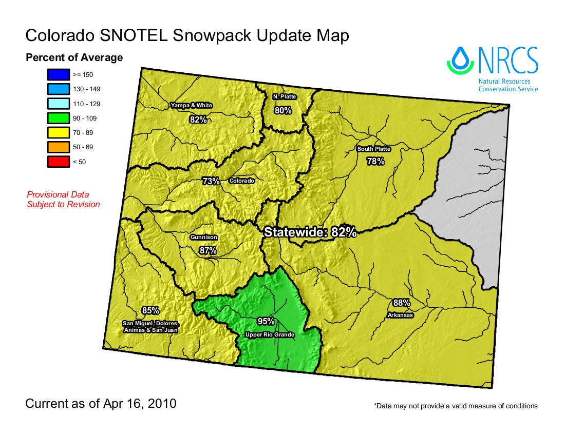
Snowpack in the Arkansas River Basin, 107 percent of average three weeks ago, was at 87 percent Friday. The Upper Colorado River Basin dropped from 78 to 73 percent of average in the same period. At the same time, river levels are rising. The flow of the Arkansas River near the mouth of the Royal Gorge doubled in the past week, from 400 cubic feet per second to 800. In southwest Colorado, melting snow combined with a fresh storm caused flooding fears for this weekend.
“The combination of the dust being on the surface (of the snow) and the warm air temperatures, we’re getting a pretty good surge,” said Kimberly Buck, assistant to the director of the Center for Snow and Avalanche Studies in Silverton…
[Colorado Springs] Utilities has reservoir space available to capture the runoff, he said. Utilities’ storage was at 79 percent of capacity at the end of March…
…there was good news in the forecast. A spring snowstorm Friday was expected to drop up to a foot in southwest Colorado and a few inches in the central mountains, enough to cover the dust.