Fryingpan-Arkansas Project update: Releases from Ruedi Reservoir falling

A picture named fryingpanarkansasproject.jpg

From email from Reclamation (Kara Lamb):

Inflows to Ruedi Reservoir have started to drop off. As a result, today [June 22] we will start decreasing releases from the dam to the lower Fryingpan River.

The first change will be made this evening around 6 p.m. We will decrease by 50 cfs. The resulting release from the dam will be about 673 cfs.

With the Rocky Fork still contributing upwards of 60 cfs, the gage below Ruedi Dam has been reading around 783 cfs. After the change this evening, it will read closer to 730 cfs.

I have a new graphic of reservoir fill timing on the website. I’m having a little Internet glitch, right now, but should have the updated website available later tonight or first thing in the morning.

Once the updated site is live, you will notice I have included some information towards the bottom of the page regarding upcoming public meetings. Although the schedule is not firm yet, it looks like we will be having our annual Ruedi Operations Public Meeting on Wednesday, July 13. At this meeting, we will give a quick overview of this year’s run-off and look towards the projections for Fryingpan flows in late summer and early fall.

Also, it is most likely we will host another public meeting on Thursday, July 28 as part of our public involvement process under the National Environmental Policy Act for a draft Environmental Assessment on Ruedi’s participation in the Upper Colorado River Endangered Species Recovery Program. I’ll have more details on that meeting as we get closer to firming up the date and the draft EA. But, if all scheduling goes as planned, both meetings will be at the Basalt Town Hall, starting at 7 p.m. So, please mark your calendars.

From email from Reclamation (Kara Lamb):

We are diverting a full Boustead Tunnel from the upper Fryingpan Basin to Turquoise Reservoir on the Fryingpan-Arkansas Project–around 900 cfs.

We continue to balance Fry-Ark, and other project, imports with native inflow at Turquoise Reservoir. As a result, we are releasing approximately 265 cfs–all native snow-melt run-off from local mountains we have to pass downstream–from Sugarloaf Dam to Lake Fork Creek.

There are currently some municipal exchanges going on that have adjusted the releases from Twin Lakes to Lake Creek. On June 22, releases from Twin Lakes Dam dropped to about 192 cfs. Currently, no Fryingpan-Arkansas Project water is being released to Lake Creek. Once the municipal exchanges are completed, Fry-Ark project releases will resume. As a result, we anticipate that releases from Twin Lakes to Lake Creek will be back to over 600 cfs by noon on Friday, June 24.

More Fryingpan-Arkansas Project coverage here.

Conservation: Vail watering restrictions

A picture named watersprinkler.jpg

From the Vail Daily:

The regulations prohibit outdoor water use on Mondays and require customers to adhere to an odd/even watering schedule on Tuesday through Sunday. Also, watering must occur before 10 a.m. or after 4 p.m. to minimize losing water to evaporation. Property owners may water up to three days per week; those with a street address ending in an odd number can water on Tuesday, Thursday and Saturday. Those, with a street address ending in an even number may water on Wednesday, Friday and Sunday.

More conservation coverage here.

Water Center at Mesa State College: Call for abstracts for the October 31 ‘Upper Colorado River Basin Water Forum’

A picture named coloradoriverbasincgs.jpg

From email from the Water Center at Mesa State College (Hannah Holm):

The Water Center at Mesa State is planning a one-day Upper Colorado River Basin Water Forum on October 31. I’ve attached the call for abstracts for the event…

We’re more interested in fresh ideas than polished projects, and this is intended to be primarily a networking event: No keynote speaker, just people sharing ideas and making connections. We’d love to have practitioners as well as academics present, and we’re interested in shining the spotlight on research people feel needs to be done as well as projects already completed.

More Colorado River basin coverage here.

Municipal Deliveries of Colorado River Basin Water: New Report Examines 100 Cities and Agencies

A picture named coloradoriverbasin.jpg

Here’s the release from the Pacific Institute:

The Pacific Institute’s Municipal Deliveries of Colorado River Basin Water documents population and water delivery information and trends for 100 cities and agencies that deliver water from the Colorado River basin. Since 1990, the number of people in the United States and Mexico who use Colorado River basin water has increased by more than 10 million – but their overall per capita water use declined by an average of at least one percent per year from 1990 to 2008.

The new report provides – for the first time – real numbers on the extraordinary population growth among cities that depend on water from the basin and on changing water delivery rates by these cities. The report documents the substantial water-efficiency gains made over the past twenty years by agencies delivering water from the Colorado River basin – even by agencies and cities such as Flagstaff that already had relatively low per capita delivery rates in 1990.

Download the full report here.

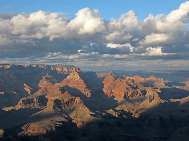
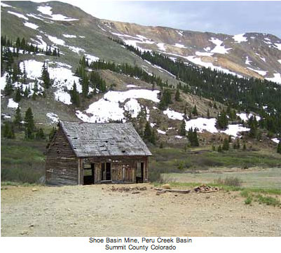
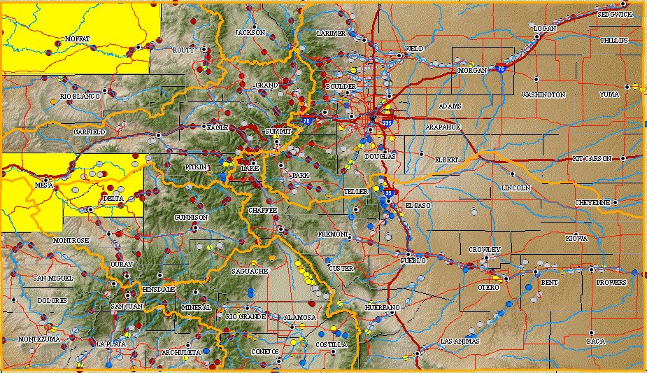
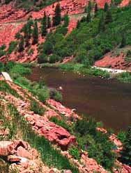
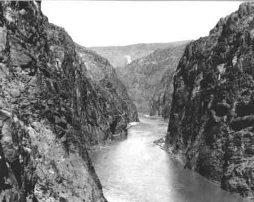
Water taken from streams and rivers and pumped from the ground within the nearly quarter-million-square-mile Colorado River basin now meets some or all of the needs of almost 35 million people, including fast-growing cities within the basin such as Las Vegas and Phoenix and St. George, Utah. Some cities, especially in Arizona and Utah, have more than tripled in size since 1990. But more than 70% of the people receiving such water live outside the basin, in cities such as Cheyenne, Denver, and Albuquerque to the east and Salt Lake City, Los Angeles, San Diego, and Tijuana to the west of the basin.

From 1990 to 2008, total municipal water deliveries from the Colorado River basin increased by more than 600,000 acre-feet, at a rate much slower than population growth. In fact, the new study shows that if water deliveries had increased at the same rate as population growth, they would have grown by almost two million acre-feet – assuming that much additional water was even available for delivery.

From 1990 to 2008, per capita water delivery rates declined dramatically in Albuquerque (38%); Southern Nevada (31%); Phoenix (30%); and San Diego County (29%). Southern California agencies delivered 4% less water in 2008 than they had in 1990, despite delivering water to almost 3.6 million more people. In fact, 28 water agencies in five different states delivered less water in 2008 than they had in 1990 despite population growth in their service areas, evidence that water deliveries do not simply track population.

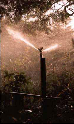
Municipal deliveries – which include deliveries to the residential, commercial, industrial, and institutional sectors, but do not include deliveries to agriculture, energy producers, or mining – comprise about 15% of total Colorado River use (agriculture uses more than 70%). But as the fastest-growing sector, municipal use drives demands for additional water supplies and places pressure on a river system that is over-allocated and facing a supply-demand imbalance, as well as the prospect of long-term declines in run-off due to climate change.

Municipal Deliveries of Colorado River Basin Water shows that projecting future water demands should take into account the successes achieved in cities where there are many examples of water conservation in practice that could be adopted or emulated by the less water efficient providers.

The Pacific Institute has also posted the data used for the report, available as a spreadsheet here.

Data were generally reported by the agencies themselves. Email crbwater [at] pacinst.org if you have any corrections to the data, or would like any additional information.

More coverage from Joe Hanel writing for The Durango Herald. From the article:

The Pacific Institute report, to be released today, shows cities in the Colorado River Basin saved 2 million acre-feet a year compared with their per-person consumption rates in 1990. “That’s a huge amount of water, so that’s a lot of savings for the system,” said Michael Cohen, author of the report…

Durangoans use an average of 209 gallons of water a day, above the 2008 Colorado average of 176 gallons. The Durango City Council adopted a water-efficiency plan Monday night with the goal of further reducing waste in the system…

The Colorado River serves as the main water supply in the Southwestern United States, from Denver to Los Angeles. The U.S. Bureau of Reclamation found this year that the average demand on the river has begun to exceed the average supply. Farms still consume 70 percent of the river’s water, but cities present the fastest-growing demand, the report says. The basin’s population has boomed to 33.5 million, an increase of 10 million since 1990, according to the report. But the increase in water use was far below the population increase, and some cities – including Los Angeles and Albuquerque – used less total water in 2008 than in 1990, despite growing populations.

More coverage from Gary Harmon writing for The Grand Junction Daily Sentinel. From the article:

“This is a significant achievement, demonstrating that water demand can be successfully delinked from growth,” study author Michael Cohen of the Oakland, Calif.,-based Pacific Institute wrote in its report: “Municipal Deliveries of Colorado River Basin Water.” While the notion that water can be used more efficiently is not a new one, the study illustrates there is plenty of room for improvement, said Gigi Richard, director of the Water Center at Mesa State College.

“There is the potential for leaps and bounds of water savings” through more efficient use of water, Richard said. “I think we still have a long way to go” to make maximum use of water…

Had water agencies from the Front Range of Colorado to the Pacific Coast delivered water to their customers in 2008 at the same rate they were in 1990, they would have piped about 8.5 million acre-feet into homes and businesses. Instead, the amount delivered was about 6.5 million acre-feet…

Cohen, who began his study in August, carefully avoided trying to draw policy conclusions. “I’m trying in this report to be unbiased,” he said. “I hope other people use the data and draw their own conclusions.” The study, however, “certainly raises the question” as to how much water remains in the Colorado River for appropriation, he said.

More conservation coverage here.

Runoff news: Grand County streams expected to peak (again) this week

A picture named granbyreservoirreleases062011

From the Sky-Hi Daily News (Tonya Bina):

Adding to flows will be increases from Lake Granby, which should top out at 2,400 to 2,500 cubic feet per second (cfs) by Monday to keep pace with runoff. “We’re on our way up to 2,500 cfs,” said Kara Lamb, spokesperson for the Bureau of Reclamation, which owns the Colorado-Big Thompson water delivery system. About 430 cfs will be released through the dam gates, the rest by way of the spillway, she said. As of Thursday, Lake Granby releases were up to 1,400 cfs, a large increase over the day before.

Meanwhile Willow Creek flows, which peaked last week, should see 960 cfs out of Willow Creek Dam. Especially at the confluence of the Colorado River and Willow Creek, flooding is expected for low-lying areas next week. “We’re not willing to say we’re past all ideas of flooding,” said Northern Colorado Water Conservancy District spokesperson Brian Werner, although due to mild June temperatures, 2011 has been an “ideal water runoff year,” he said.

Northern’s forecast was that 400,000 acre feet (an acre foot is enough to cover one acre with one foot of water) would run into Lake Granby this year — considered an all time record. So far, about 150,000 acre feet of that has made it to the lake. And at Lake Irene near the Continental Divide in Rocky Mountain National Park, measurements this week showed an equivalent of 21 inches of water in the snowpack, whereas about 5 inches would be considered normal…

On the main stem of the Colorado River, water forecasters are predicting the Kremmling gauge to show a secondary peak of about 9,000 cfs during the June 24-25 weekend…

Meanwhile, Denver Water has decreased its diversions through the Moffat Tunnel, meaning more water is flowing in the Fraser River. “But we’re not planning on turning (Moffat diversions) off,” said Denver Water’s Manager of Raw Water Supply Bob Steger, on Thursday. On Monday, June 13, water being diverted to Gross Reservoir through the tunnel was at a rate of 800 cfs, but by Thursday, that rate had dropped to a goal of about 400 cfs…

According to water forecasters, the Fraser River will remain at about 1,100 cfs, then peak next week at about 1,700 cfs.

Jim Dyer departs from the Arapahoe County Water and Wastewater Authority

A picture named acwwaeccvdeal.jpg

From The Denver Post (Karen Crummy):

It’s unclear whether Dyer resigned or was fired as the Arapahoe County Water and Wastewater Authority continues to grapple with the fallout from problems with the deal first revealed by The Denver Post in March. Two board members recently resigned because of conflicts of interest. Dyer declined to discuss the circumstances surrounding his sudden departure May 31 as government-relations director. But he left two weeks after The Post requested 4 1/2 months of Dyer’s e-mails to and from a number of individuals, including Robert Lembke, head of the United Water and Sanitation District…

Lembke and United are an integral part of the water deal, in charge of building a reservoir and delivering water rights to the ACWWA. Lembke is considered a divisive figure in Colorado water, using the power of his special district to buy and sell water up and down the Front Range.

Click through for more details and to read some of Dyer’s email correspondence.

More ACWWA coverage here.

The Pueblo Board of Water Works is looking at micro-hydropower to offset electrical operating costs

A picture named microhydroelectricplant.jpg

From The Pueblo Chieftain (Chris Woodka):

The water board spends about $2.2 million on electricity each year, or about 7 percent of its $30 million budget. Energy costs could increase by $1.2 million annually with proposed rate increases, said Terry Book, deputy executive director. The water board has a 20-year-old plan to retrofit its water line from Pueblo Dam for hydroelectric generation, but it was not economical to build it in the past. The cost to install it in 1990 was $4 million, and the price of selling it to the power company at the time wasn’t high enough to make a deal worthwhile. Hydro would generate only 0.3-1.2 megawatts of electricity, which would only supply a fraction of the water board’s needs.

The water board also could look at solar panels and wind generation.

More Pueblo Board of Water Works coverage here.

The Colorado River District board ‘April 2011 News Summary’ is hot off the press

A picture named coloradoriverbasincgs.jpg

Jim Pokrandt from the River District was kind enough to forward the summary. Here’s a preview:

The Colorado River District Board of Directors awarded nearly $250,000 in financial assistance to a variety of water projects at its April Board meeting.

More Colorado River basin coverage here.

Green Mountain Reservoir operations update: 750 cfs in the Blue River below the dam

A picture named greenmountainreservoir.jpg

From email from Reclamation (Kara Lamb):

Starting today [June 19], we’ll be doing a little work on one of the hydro-electric generating units at the Green Mountain Power Plant on Green Mountain Dam. As a result, releases from the dam to the Lower Blue began cutting back late last night/early this morning. By early afternoon today (June 19) we anticipate having releases down to around 750 cubic feet per second.

Releases are scaling back in 100 cfs increments. The first change was at 10 p.m. last night, then 1 a.m. this morning, and again this morning at 6 a.m. Early this afternoon, when the unit is removed from service for maintenance, we will drop the last 100 cfs. That last change will leave about 750 cfs going through the other generating unit and flowing down the Lower Blue.

Right now, we are estimating the work will complete by Wednesday. Once the unit is returned to service, we will start ramping releases up again. However, with new snow in the mountains lately, we are not yet sure how high the releases will go later this week. I will update you once we have a better idea.

As for the reservoir, it is currently at a water level elevation of 7930 feet. That’s about 20 feet down from full. The reservoir has been filling pretty steadily for the last two weeks. It has gone up half a foot since midnight.

More Colorado-Big Thompson coverage here.

Energy policy — nuclear: Secretary Salazar places Grand Canyon off limits to uranium mining for the time being, hopes for a 20 year ban

A picture named grandcanyonfromgrandviewpoint01242009nps.jpg

Here’s a release from the Environmental Working Group (Lauren Pagel/Leeann Brown):

The Obama administration today took an emergency measure to bar new mining claims on a 1-million-acre area around the Grand Canyon until December. At that time, administration officials indicated they hope to come up with a more comprehensive solution to protect one million acres around Grand Canyon National Park from new mining claims for the next 20 years.

The million-acre area has been off limits to mining for the past two years. That moratorium, issued by Interior Secretary Ken Salazar is set to expire July 20.

“The 26 million Americans who rely on the Colorado River for drinking water have some breathing room,” said EWG senior counsel Dusty Horwitt. “Now we need to work to ensure the Interior Department follows through” with a permanent ban on new mining claims.

“This decision will help protect our most famous natural landmark and the lifeblood of the Southwest,” Horwitt said. “Congress must ensure that this land is permanently put off-limits to new mining claims.”

“The Grand Canyon is an American icon and part of a water network that provides the most basic need of a vast area of the Southwest,” said Lauren Pagel, policy director of Earthworks, an international mining reform organization. “The Canyon and the Colorado River deserve permanent protection from uranium mining.”

A study by Environmental Working Group and Earthworks published last week called uranium mining near the park “a gamble with our most treasured national park and the drinking water for 26 million Americans” who rely on Colorado River water.

Thirty-five hundred uranium mining claims lie within the protected area. The White House cannot legally nullify existing claims, but barring new claims makes mining on existing claims more difficult.

Sixty-one of these claims are held by Karen Wenrich, a mining industry consultant whose analysis of mining impacts on the Colorado river was used by the Bureau of Land Management in an environmental impact analysis released earlier this year. The BLM relied on Wenrich’s research to downplay risks to the river, but did not disclose Wenrich’s status as a claimholder or that she stood to make $225,000 by selling her claims to a uranium mining company if the Interior Department left the million-acre area open to new claims.

EWG and Earthworks’ recent report highlighted this conflict of interest in addition to other concerns surrounding mining in the area, including the fact that foreign companies hold hundreds of claims near the park. Under the current mining law, written in 1872, companies do not have to pay any royalties to the U.S. government for mining on public lands.

More coverage from David O. Williams writing for the Colorado Independent. From the article:

Speaking at Grand Canyon National Park today, Interior Secretary Ken Salazar announced a 20-year ban on new uranium mining claims as the “preferred alternative” in an ongoing federal review of hardrock mining on the 1 million acres of public lands surrounding the Grand Canyon.

Salazar immediately issued a “temporary emergency withdrawal” through December of this year as the U.S. Bureau of Land Management prepares an environmental impact statement on mining around the Grand Canyon that’s expected to be released this fall.

Other alternatives include leaving all 1 million acres open to new mining claims, withdrawing 300,000 acres, withdrawing 650,000 acres or withdrawing the full 1 million acres.

In announcing the full withdrawal as the preferred alternative, Salazar cited water quality concerns and the economic benefit of the more than 4 million visitors a year and $3.5 billion in tourism and outdoor recreation spending in the Grand Canyon region of northern Arizona.

More nuclear coverage here and here.

Runoff/precipitation news: A beautiful rain up and down eastern Colorado

A picture named 3dayrainfallmetrodenverudfcd06212011

Click on the thumbnail graphic to the right for a screen shot of the rainfall out of yesterday’s end of spring rainstorm in the Denver Metro area from the Urban Drainage and Flood Control District. Rainfall near Gulch Manor (Little Dry Creek at 64th) was nearly an inch.

Pueblo County received good moisture as well, ending 26 days without precipitation. Here’s a report from Gayle Perez writing for The Pueblo Chieftain. From the article:

The National Weather Service reported approximately 0.94 of an inch of rain fell at the Pueblo Memorial Airport by Monday afternoon from a storm that brought much-needed moisture to the region. The last time Pueblo had any measurable precipitation was May 24. That’s when 0.04 of an inch of rain was reported at the airport. A trace of rain was reported June 1 and again June 17…

North of Pueblo there was 0.80 inches of rain reported, while 0.60 was reported in University Park and 0.38 inches in Pueblo West, according to weather spotters.

Here’s the link to the precipitation reports from the Community Cooperative Rain Hail and Snow Network.

More coverage from Chris Woodka writing for The Pueblo Chieftain. From the article:

“We’ve had anywhere from 0.8 to 1.5 inches along the ditch,” said Manny Torrez, superintendent of the Fort Lyon Canal, which stretches 113 miles from La Junta to Lamar. “It’s the first big rain we’ve had since last July over such a big area.” Coupled with the third week of a big runoff in the Arkansas River as snow melts — levels have been above 3,000 cubic feet per second at Avondale — the rain is a welcome relief…

On the High Line Canal, which irrigates farms in Pueblo and Otero counties, rain measured 1-2 inches Monday, helping to offset dry conditions, said Superintendent Dan Henrichs…

The call on the Arkansas River was at the Colorado Canal’s 1890 appropriation date on Monday, a relatively junior water right, and releases from Pueblo Dam were increased to reflect more water coming into the system upstream. Flows in the Arkansas River at Parkdale still are hovering around 3,500 cfs, where they have been for the past two weeks. High-water advisories for Pine Creek, the Numbers and the Royal Gorge continued this week for rafters in the Arkansas Headwaters Recreation Area…

“We got 2 inches of new snow last night,” said Roy Vaughan, the Bureau of Reclamation’s manager for the Fryingpan-Arkansas Project. “There is still a lot of snow on both sides in the deep valleys and on the northern slopes. There is still quite a bit up there.” So far, the Fry-Ark Project has brought more than 39,200 acre-feet of water across the Continental Divide, about 40 percent of what is ultimately expected this year.

From 9News.com (Brooke Thacker):

[Monday] Sections of the Cherry Creek bike path in downtown Denver are closed off due to high water. The Creek is swollen with water and is overflowing onto its banks in places. On Monday morning, the City of Denver sent out crews to clear debris out of drains such as trash, branches and tree limbs.

A picture named southplatteatdenverhydrograph06212011

Much of the rainfall in the Denver Metro area runs off into the storm sewer system and ends up in the South Platte River. Click on the thumbnail graphic to the right for a hydrograph of the the South Platte at Denver gage from the Colorado Division of Water Resources.

From The Greeley Tribune:

Because of recent heavy rains, the National Weather Service has issued a flood advisory for Poudre River in the Greeley area and South Platte River near Kersey. The advisory is in effect until Wednesday afternoon for the South Platte and Saturday afternoon for the Poudre.

From the Associated Press via The Denver Post:

The National Weather Service is warning of minor flooding after advisories were issued for rivers in northern and central Colorado. The flood advisories were issued for the Cache La Poudre, South Platte, the Colorado, the North Platte, Eagle and Elk rivers.

Durango: City council adopts new water management plan to raise efficiency in the system

A picture named fountainpavementdrawing.jpg

From The Durango Herald (Jordyn Dahl):

According to information provided by the Department of Public Works, Durango has seen more efficient water delivery. While the population has increased by more than 40 percent in the last 30 years, the city treated the same amount of water in 2010 as it did in 1980. But water is consumed in Durango at a total rate of 209 gallons per capita daily, which is higher than the Colorado average.

The Water Efficiency Management Plan was originally developed in the fall of 2010, and city staff members say the plan will not directly affect the city’s 2011 budget. Eventually, implementation of the plan will cost about $75,000 a year.

The first step will be a systemwide audit to determine how to conduct new meter testing and develop more efficient repair and installation activities.

More infrastructure coverage here.

Drought news: Governor Hickenlooper requests drought assistance for Baca, Prowers and Otero counties

A picture named usdroughtmonitor06142011

From the Colorado Independent (Scot Kersgaard):

“Colorado’s southern counties are experiencing significant drought resulting in failed grain crops as well as the loss of forage for livestock,” the governor’s letter said. Baca, Crowley and Otero counties asked Hickenlooper to seek the federal assistance and be declared primary drought disaster areas. The declaration, if approved, would allow farmers and ranchers to apply for emergency loans if they are unable to obtain credit elsewhere.

More drought coverage from The Pueblo Chieftain. From the article:

Emergency grazing of Conservation Reserve Program acreage has been approved for eight Southern Colorado counties: Baca, Otero, Crowley, Kiowa, Prowers, Bent, Pueblo and Las Animas. “This authorization provides relief for many Colorado livestock producers who have suffered through severe drought conditions,” said Trudy Kareus, state executive director of the Colorado Farm Service Agency. “The drought has depleted hay supplies and affected the growth of hay and pasture in parts of Colorado. Many livestock producers cannot maintain their current herds without implementation of . . . emergency grazing,” Kareus said. Emergency grazing is allowed through Sept. 30.

The authorization calls for participants to leave at least 25 percent of each field or contiguous reserve program fields ungrazed for wildlife, or graze not more than 75 percent of the stocking rate. And all livestock must be removed by the end of this grazing period.

Energy policy — nuclear: Energy Fuels plans to spend $1 million over the next 18 months in preparation to process uranium at the proposed Piñon Ridge Mill

A picture named pinonridgesite.jpg

From The Grand Junction Daily Sentinel (Gary Harmon):

Energy Fuels Resources Inc. will spend about $1 million during the next 18 months on mines, drilling and other activities aimed at getting ready for feeding ore to the mill, the company said. “Energy Fuels is quietly assembling an impressive array of properties on the Colorado Plateau,” Energy Fuels President and Chief Executive Officer Steven P. Antony said.

While pursuing construction of the $150 million mill, Energy Fuels is taking steps to ascertain the value of its current holdings and seek new sources of uranium and vanadium, possibly in other mines that Energy Fuels might consider acquiring. “Our ultimate goal is to bring these proven and formerly producing mines back into production and process the material at the Pinon Ridge Mill,” Antony said.

Plans include drilling, resource verification and the preparation of technical reports to reflect the size and grade of resources in compliance with Canadian reporting standards, company spokesman Gary Steele said…

Meanwhile, it is seeking U.S. Environmental Protection Agency approval of a state air-quality permit and construction of the tailings impoundment.

More coverage Katharhynn Heidelberg writing for the Montrose Daily Press. From the article:

“What we’re doing is acquiring more property that has uranium, that might eventually be made into mines in the future, in Southwest Colorado and southeastern Utah,” said spokesman Curtis Moore on Friday. “We’re not increasing any mill capacity.”

The proposed Piñon Ridge mill’s permits and licenses allow for 500 tons per day of uranium and vanadium to be processed. Although Energy Fuels wants to expand mine properties by acquiring leases and mineral rights, the mill itself is not expanding, Moore said. “The mill cap of 500 tons per day, that’s what we’re permitted for. That’s not changing,” he said.

More nuclear coverage here and here.

Energy policy — coalbed methane: Water Court Division Seven judge dismisses BP America and others applications

A picture named nontributarycoalbedmethane.jpg

From the Associated Press via The Denver Post:

The Durango Herald reports BP America Production Co. and others had sought claims to nontributary groundwater, which isn’t considered connected to surface streams. Water Judge Gregory Lyman said last month that state law gives landowners the right to such water under their property, so companies need landowners’ consent first.

More coalbed methane coverage here and here.

Runoff news: Summit County cancels voluntary evacuation order for Montezuma, Peru Creek water levels falling

A picture named perucreekbasin.jpg

From The Denver Post:

Minor issued the evacuation order after a partially blocked culvert threatened to flood homes on Montezuma Road at Peru Creek, according to the sheriff. The creek dropped between two and three feet last night [June 17], said Tracy LeClair, spokeswoman for the Summit County Sheriff’s Department.

FIBArk Festival recap: Flying Ligers win raft rodeo

A picture named hooliganrace.jpg

From The Mountain Mail (Kevin Hoffman):

A panel of judges chose the best rafts loosely based on spectator reaction and criteria such as biggest flip and most creative pirating attempt. The Ligers were steered by Boulder residents Gary Lacy, Spencer Lacy and Shane Sigle along with Mark Poindexter of Austin, Texas. The crew had several passengers throughout the tournament, but Spencer Lacy won the crowd’s attention with several flips off the raft into the wave…

In second place the Black Sheep, a Raft Masters guide known as B.L., captained his boat solo. Two unidentified men steering a green craft aptly called the Leprechaun took third place in the event.

Click through for a photo of the event.

More whitewater coverage here.

CWCB: Next board meeting will be in Walden on July 12-13

A picture named northpark.jpg

Here’s the meeting notice from the Colorado Water Conservation Board:

Notice is hereby given that a meeting of the CWCB will be held on Tuesday July 12, 2011, commencing at 8:00 a.m. and continuing through Wednesday, July 13, 2011. This meeting will be held at the Antlers Inn, in Walden Colorado…

Complete information about these activities can be found on CWCB’s Website:
http://www.cwcb.state.co.us.

More CWCB coverage here.

Rio Grande River basin: Alamosa and parts of Conejos and Costilla counties are in extreme drought, the remainder of Costilla and parts of Conejos, Rio Grande and Saguache counties are in severe drought

A picture named usdroughtmonitor06142011

From The Pueblo Chieftain (Matt Hildner):

Valley snowmelt peaked on Wednesday and the region’s stream flows are dropping, while windy and dry conditions continue…

Federal agricultural officials, meanwhile, are considering whether to request a disaster designation that would make valley producers eligible for relief funds and other programs.

The U.S. Drought Monitor lists Alamosa and parts of Conejos and Costilla counties as being in extreme drought. The remainder of Costilla and parts of Conejos, Rio Grande and Saguache counties are in severe drought, according to the monitor. Kevin Reeves, executive director of Alamosa County’s Farm Service Administration office, said he and other FSA officials were seeking to set up a joint meeting of the valley’s county emergency boards. Those boards, which include other FSA and federal land management personnel, would have to send a request for the designation to the state FSA office, which would then be forwarded to the governor. The governor, in turn, would have to request the designation from the U.S. secretary of agriculture.

Arkansas River basin: The Woodmoor Water and Sanitation District hopes to buy the JV Ranch in El Paso County and change the shares to municipal use

A picture named arkansasriverbasin.jpg

From The Pueblo Chieftain (Chris Woodka):

The Northern El Paso County district would purchase the 3,500 [acre] JV Ranch southeast of Fountain for $25 million-$31 million, with the final price dependent on how much water is available through a Water Court decree. The application for the decree has not been filed. Water rights on the ranch would total 2,500-3,500 acre-feet annually, and would include Calhan Reservoir, a 70-acre storage site with a 1909 decree. The purchase would complement its other plans to buy water on three ditches in the Lower Arkansas Valley, which have been announced over the past two years, not replace them, according to a letter to customer by manager Jessie Shaffer…

This week, a trial date for June 2013 was set in Division 2 Water Court for Woodmoor’s application to exchange water rights it is attempting to purchase in the Lower Ark Valley…

The trial will come after the Pueblo Board of Water Works rejected Woodmoor’s attempt to negotiate a settlement through stipulations before the Water Court referee, which is a common way to settle water cases in the state. Water board members and staff argued that the removal of water from the Arkansas River basin to a water system that enters another basin is too serious an issue to compromise on.

More Arkansas River basin coverage here.

Runoff news: Heavy rain has Peru Creek running high

A picture named perucreekbasin.jpg

From TheDenverChannel.com (Wayne Harrison):

Sheriff’s officials said heavy rains Friday prompted warnings to residents to be ready to leave. Sheriff’s spokeswoman Tracy LeClair said Peru Creek has been running high with melting snow and the area is getting heavy rain. LeClair said the sheriff’s office will decide whether mandatory evacuations are necessary. Montezuma in central Colorado is about eight miles east of the Keystone resort and about 10,000 feet in elevation.

From the Delta County Independent (Kathy Browning):

“In the state of the river address with plotted snow pack for the North Fork, we are down below our peak snow pack. . . We are down far enough that even if it turned really hot or rained, we wouldn’t have any problems here,” [Paonia mayor Neal Schwieterman] explained. “Now the snow packs on Grand Mesa and above Crested Butte are nowhere near having the peak [snow pack] being drained off. Delta has more issues. Based on our potential for flooding, we are pretty sure we are beyond it up here.”[…]

Mike Owens, Hotchkiss public works director, also agrees there is no danger in Hotchkiss of flooding. The river is running well below levels back in the 1990s when equipment was placed on the Highway 92 bridge to lift out debris from the water.

From the Summit Daily News (Janice Kurbjin):

Silverthorne, Dillon, Buffalo Mountain, Mesa Cortina and Dillon Valley are all partners in the [Joint Sewer Authority’s Blue River Waste Water Treatment Plant]…

This year’s high flows didn’t affect the plant’s ability to treat water, but officials were keeping a close eye on inflow and infiltration levels to make sure it wouldn’t exceed capacity. At the same time, they were taking a look at the 80 to 100 miles of sewer line and manholes to identify cracks, holes and joints that needed fixing to prevent groundwater from entering the system and overflowing its capacity. “We don’t know it until the water’s high,” [Silverthorne utilities manager Zach Margolis] said, explaining that high groundwater tables allow officials to see the problems that aren’t otherwise visible…

In addition to spot fixes, the clay pipes installed in the 1970s have been almost entirely relined, he added.

From the Summit Daily News (Janice Kurbjin):

The FIBArk Whitewater Festival takes place Thursday through Sunday in and around Salida, where boaters gather for races, freestyle competitions, live music and beer from New Belgium Brewery and more. The Pine Creek race is the first competition for the weekend. Because commercial rafting cutoff for the section is at 1,200 cubic feet per second and as of Wednesday it was running at about 3,000 cfs, officials decided to move it downstream. “Safety first,” FIBArk Board president Samantha Lane said. “We might scare everyone away if we held it in Pine Creek because it’s so big.”

Southern Delivery System update: Colorado Springs Utilities is at odds with some of the landowners along the route

A picture named sdspreferredalternative.jpg

From NewsFirst5.com (David Ortiviz):

The billion dollar pipeline project will transfer water from the Pueblo Dam to Colorado Springs, Fountain, Security and Pueblo West. The issue–the pipeline will intersect more than a hundred properties. Land owners are being compensated, but some say they’re not being offered enough money. “I’m not going to let them bully me and take my property and give me peanuts for it,” said [Lavetta Kay]. Kay was offered $5,300 for her easement, however she wants triple that amount. Kay points out land owners won’t be able to build any permanent structures above the pipeline. “(Realtors) said my property won’t be able to be sold. It’s stigmatized,” said Kay…

Rummel says they’ve reached an agreement with most property owners, but they’re at an impasse with about ten of them like Kay who think they’re being ripped off. Rummel says SDS will still get to use the land through eminent domain. “The court will come in decide what we should pay these property owners and they will be compensated,” said [Janet Rummel, a spokesperson for SDS].

More coverage from NewsFirst5.com (David Ortiviz):

Construction is underway on a massive underground pipeline designed to meet future water needs in Southern Colorado…

From the reservoir the pipeline will run north through Pueblo West up to Colorado Springs. Phase one, which includes pump stations and a water treatment plant should be finished by 2016…

Phase two of the project is to build two new reservoirs in El Paso County. Rummel says construction on the reservoirs should start around 2020. Although it’s a lengthy and expensive project, Rummel says it gives communities a reliable water system for years to come. “It’s really an investment in our future, for future generations,” said Rummel.

More Southern Delivery System coverage here and here.

Colorado-Big Thompson Project update: 1400 cfs and rising in the Upper Colorado River below Lake Granby

A picture named coloradobigthompsonmap.jpg

From email from Reclamation (Kara Lamb):

The gates at Granby Dam have been cracked open above the spillway so that water is pushing over the spillway. While the reservoir is still about 20 feet down from full, water is pushing over the spillway gates because the lip of those gates is also about 20 feet down from a full water elevation.

Consequently, we are seeing releases to the Colorado River below the dam steadily increase as run-off inflow increases. As the run-off inflow comes up, we are seeing the original plan we at Reclamation and Northern Water introduced back in April materialize.

We had originally forecasted that releases from Granby could get as high as 2500 cfs–and that is what we anticipate will happen come the top of next week, around Monday or Tuesday June 20 and 21. Today, releases from Granby Dam got upwards of 1400 cfs. They will continue to increase through the weekend.

Inflows to Shadow Mountain Reservoir, which releases to Granby, and other inflows to Granby, are on the rise. They bump up especially at night, when melted snow that has traveled down from high mountain elevations reaches the reservoirs. Today, Shadow Mountain was releasing about 2600 cfs.

Willow Creek Reservoir, whose drainage basin sits at a slightly lower elevation, has possibly seen its snow melt run-off peak (although I wouldn’t say that is certain). Inflow to the reservoir has dropped off since last week when it was as high as 1300 cfs. It is now steadily bypassing about 960 cfs of run-off inflows.

Next week, when Granby’s releases reach their high mark, the Colorado River below its junction with Willow Creek will likely have flows upwards of 3300 cfs.

From email from Reclamation (Kara Lamb):

Just a quick note that elevations are still on the rise for Horsetooth Reservoir, which will be above its average water level elevation for the coming Father’s Day weekend. And, Carter Lake remains full!

Fryingpan-Arkansas Project update: 850 cfs in the Fryingpan River below Ruedi Reservoir

A picture named fryingpanarkansasproject.jpg

From email from Reclamation (Kara Lamb):

Last night [June 15], we saw inflows to Ruedi Reservoir bump up. As a result, we increased releases today. The increases were in 50 cfs increments, one at noon and one in just a few minutes. The total 100 cfs increase will put the discharge from the reservoir at about 775 cfs. With another 75 cfs still coming down the Rocky Fork, flows by the Ruedi Dam gage should soon read about 850 cfs.

More Fryingpan-Arkansas Project coverage here.

Runoff news: Many eyes are still on the Cache la Poudre, there is a lot of water yet to come off

A picture named fortcollinsflood07281997

From The Greeley Tribune (Sharon Dunn):

With 60 percent of the snowpack still pinched into the mountains up the Poudre Canyon, there’s always the chance of something going wrong. If the mountains receive a lot of rain, for example, state water officials have said, “all bets are off.”

Local officials are paying heed to such concerns. “We respect what this can do,” said Joel Hemesath, public works director for Greeley. “Snow is a dangerous thing, and rain on snow, things can change real quick. We’re not letting our guard down by any means and we’re not going to empty the sandbags.”[…]

At the mouth of the canyon, water levels have only slightly risen in the past couple of days. On Thursday, the river registered 2,860 cubic feet per second, not quite as high as last week, but up since Monday’s low. The slowing flows prompted state water officials to declare the Poudre had peaked. Cooler-than-expected temperatures and a tight snowpack have made runoff slower than officials had expected. Even if extra water comes down, Poudre River water commissioner George Varra said, local irrigation ditches that should be running at full speed could help ease off 1,800 cubic feet per second…

“We look at both Upper Colorado and Poudre (basins), and from both we figured we’ll have somewhere around 400,000 acre feet of runoff this year, and it’s run off roughly 150,000 acre feet so far.”

Arkansas Valley Conduit: Most communities have signed on the bottom line for the project environmental impact study

A picture named arkansasvalleyconduitproposed.jpg

From The Pueblo Chieftain (Chris Woodka):

Nearly all potential water users in the Arkansas Valley Conduit project have signed memorandums of understanding to participate in the Environmental Impact Study for the project…

Two of the communities, Valley Water and Lamar, have yet to sign agreements, but are expected to do so at future meetings, said Phil Reynolds, project manager. The agreements define how local matching costs of the EIS will be shared, based on projected use of the conduit…

The EIS also includes an excess-capacity master contract that would allow long-term temporary storage in Lake Pueblo for some of the conduit participants and 12 other water providers in the Arkansas River basin. All of the excess-capacity MOUs have been signed.

More Arkansas Valley Conduit coverage here and here.

Arkansas Valley Super Ditch: The IBCC and CWCB are watching closely to see if alternative ag transfers can be a model for the South Platte Basin as well

A picture named arkbasinditchsystem.jpg

From The Pueblo Chieftain (Chris Woodka):

John Stulp, Gov. John Hickenlooper’s water adviser, said a proposed trial lease by the Super Ditch to El Paso County water users next year is a better way to test the proposal than state legislation proposed this year. “HB1068 was shot down in short order, and for good reason because it wasn’t well vetted,” Stulp said. “The sponsors have thought of a way to do it without going to the Legislature.”

“The rest of the state is looking to this part of the state to see how the lease-fallowing program works,” Stulp said. Stulp, along with Colorado Water Conservation Board Executive Director Jennifer Gimbel, addressed the Southeastern Colorado Water Conservancy District board at its monthly meeting Thursday…

He praised the Arkansas Basin Roundtable, one of nine set up in 2005 when the IBCC was formed, for showing leadership at the state level. Among its accomplishments was the formation of a Flaming Gorge pipeline task force in conjunction with the Metro Roundtable. The task force will meet June 29 to decide how the state should proceed on two proposals to build a Flaming Gorge pipeline. The pipeline is the brainchild of Fort Collins entrepreneur Aaron Million. A Colorado-Wyoming Coalition, led by Parker Water and the South Metro Water Supply Authority is doing its own study about whether to pursue a Flaming Gorge pipeline. “We’ll look at the pros and the cons, but it’s an appropriate time to get that started,” Stulp said.

More Arkansas Valley Super Ditch coverage here.

Pueblo: The board of water works releases 2011 testing data

A picture named waterfromtap.jpg

From The Pueblo Chieftain (Chris Woodka):

“The report that was mailed to customers shows only the tests where we found something in the water,” said Don Colalancia, manager for water quality and treatment. “We do thousands of tests throughout the year.”[…]

Testing found traces of barium, fluoride, nitrates, nitrites and selenium in the water, at levels well below the federal standards. Turbidity, trihalomethanes, haloacetic acids, sodium and microscopic particles also were measured, and again to be well below acceptable levels…

The report also lists sources of water. Pueblo gets all of its water supply from Lake Pueblo, which is fed by the Arkansas River and its tributaries to the west.

More water treatment coverage here.

Runoff news: The snowmelt flooding risk is dropping across Colorado

A picture named flooddsscwcb06162011

From the Vail Daily (Scott N. Miller):

A cool, wet May has turned into a sunny, but not hot, June. Even downvalley temperatures have gone into the 80s only a few times, and nights have been relatively cool. That’s kept the annual snowmelt running at a decent, but not destructive pace…

This spring has been a pleasant change from last year in Vail, when less snow melted faster, causing flooding in town. With last year in mind, combined with the knowlege that temperatures can, and do, climb into the 90s in Vail some summers, Miller said firefighters are doing daily checks of parts of Gore Creek…

Minor flooding is forecast for the Colorado River at Dotsero for Friday, due primarily to the fact that Granby Reservoir is going to release water so it can continue to accept melting snow.

From Steamboat Today (Jack Weinstein):

The Weather Service’s office predicts the Elk River near Milner will exceed the 7.5 foot flood stage and reach 7.9 feet by 6 a.m. Friday. It previously was forecast to reach the moderate flood stage of 8.5 feet. The Yampa River at the Fifth Street Bridge downtown is expected to reach 6.6 feet, down from the earlier prediction of 6.7 feet. Flood stage at that location also is 7.5 feet…

Aldis Strautins, a hydrologist with the Weather Service’s office in Grand Junction, said area rivers and streams could run high through the month because of snowpack in the surrounding mountains. The Tower measuring site at 10,500 feet on Buffalo Pass was reporting 138 inches of snow containing 67.5 inches of water Monday. Strautins said the day’s historical snow water equivalent average for that site is 29.2 inches.

H.R. 2018: The Clean Water Cooperative Federalism Act of 2011

A picture named everglades.jpg

From the Colorado Independent (Virginia Chamlee):

Rep. Jon Mica, R-FL, has introduced the “Clean Water for Cooperative Federalism Act of 2011″ (.pdf), a bill that aims to “amend the Federal Water Pollution Control Act to preserve the authority of each State to make determinations relating to the State’s water quality standards, and for other purposes.” In other words, Mica’s bill would rewrite the Clean Water Act — removing the EPA’s authority to object to state-approved permits and revise state water quality standards.

The bill would also limit the agency’s authority to veto dredge-and-fill permits, which some conservationists argue could be a threat to public health.

Among its provisions, the bill would remove the EPA’s authority to object to state-approved permits under the National Pollutant Discharge Elimination System, which was put in place to manage discharges of pollutants into waterways. The EPA would also lose the ability to revise state water quality standards, an especially controversial measure considering the agency’s much-touted numeric nutrient criteria, a set of standards that aim to enhance pollution regulations in Florida waterways. The criteria are revered by environmentalists and abhorred by state lawmakers and industry heads who’d prefer not to increase costs simply for the sake of the environment.

More coverage from Stacy Detwiller writing for American Rivers. From the article:

Specifically, the bill attacks the shared responsibility between the states and the federal agencies for clean water. This careful balance allows states to take most of the responsibility for clean water programs, but ensures that the Environmental Protection Agency (EPA) has sufficient oversight to make sure citizens in all states have similar access to clean and safe water. As an example, the bill removes the EPA’s authority to object to state-approved permits under the National Pollutant Discharge Elimination System (NPDES), which was put in place to manage discharges of pollutants into our water. The EPA would also lose its ability to revise state water quality standards when those standards fail to protect clean water without approval from the states.

The bill also takes away EPA’s authority to veto dredge and fill permits [PDF] issued by the Army Corps of Engineers when a proposed activity would discharge dredge or fill materials into our rivers, lakes, and streams. Activities like mountaintop removal mining, for instance, where the tops of mountains are blown off to expose coal seams and the surrounding valleys and streams are filled with discarded rubble, would no longer be subject to veto by the EPA. This veto authority is scarcely used – it has only been employed 13 times. But when EPA does use this authority, it’s to stop projects that harm people and clean water.

Here’s the GovTrack link.

More H.R. 2018: The Clean Water Cooperative Federalism Act of 2011 coverage here.

Arkansas Valley Super Ditch update: Caitlin Canal shareholders queue up to lease 500 acre-feet of water in pilot program to run in 2012

A picture named arkbasinditchsystem.jpg

From The Pueblo Chieftain (Chris Woodka):

The pilot project would sell 500 acre-feet of water through a lease agreement to the Pikes Peak Regional Water Authority. Under the agreement, water would be delivered to Lake Pueblo, where it could be used for exchanges or for direct use through the Fountain Valley Conduit. Fountain has made a firm commitment to take water, but other members of the El Paso County group including Donala and Security are interested in participating as well, said Curtis Mitchell, conservation and supply manager for Fountain. Water would sell at $500 per acre-foot, allowing the shareholders to retain ownership of the water right.

More Arkansas Valley Super Ditch coverage here and here.

Conservation: Lawn irrigation analysis kits available for rent

A picture named watersprinkler.jpg

From The Pueblo Chieftain (Chris Woodka):

“If you don’t know how to program your sprinkler system, one of the studies I’ve seen shows a net gain of water used,” Perry Cabot, an education outreach coordinator for CSU, told the Lower Arkansas Valley Water Conservancy District board Wednesday.

Instead, water systems that can be programmed could be used to prevent applying more water than necessary to lawns, Cabot said. CSU has a kit available through Pueblo County Cooperative Extension (583-6566) that allows sprinkler system owners to measure how much water their sprinklers apply to the lawn in a cycle. The Lawn Irrigation System Analysis kits can be rented for $10 under the pilot program. Using the measurement information, consumers can go online and tap into a program that will provide an optimum watering schedule based on local weather patterns.

Cabot, along with Anne Casey of the state Extension program, obtained a $46,000 grant from the Colorado Water Conservation Board to take the lawn watering analysis a step further.

More conservation coverage here.

Aspinall Unit update: 2,100 cfs in the Black Canyon and Gunnison Gorge

A picture named blackcanyoninnercanyonnps.jpg

From email from Reclamation (Dan Crabtree):

Blue Mesa Reservoir has filled to about elevation 7491 ft leaving 28 ft or 242,000 ac-ft to fill. At the current rate of inflow and outflow, it would take over a month to fill the reservoir. As a result, after assessing the latest April through July forecast and the current runoff rates into the Aspinall Unit, Reclamation has decided to further reduce releases from the Aspinall Unit in order to slightly accelerate the fill of Blue Mesa Reservoir. This release reduction will begin on Friday, June 17th, continue through the weekend, and result in a Gunnison River flow of about 2,100 cfs through the Black Canyon and Gunnison Gorge.

More Aspinall Unit coverage here.

Colorado-Big Thompson update: Granby Reservoir is spilling, 920 cfs total into the Upper Colorado River

A picture named granbyreservoirreleases062011

From email from Reclamation (Kara Lamb):

Just a quick note to say we’re up to about 950 cfs out of Granby Dam. We are releasing about 430 cfs through the dam. The remaining 520 cfs is coming over the spillway.

More Colorado-Big Thompson Project coverage here.

Restoration: Should there be a ‘Good Samaritan’ exemption to the Clean Water Act?

A picture named coloradomineralbeltwikipedia.jpg

From The Durango Herald (Karen Frantz):

U.S. Sens. Mark Udall and Michael Bennet, both Democrats, want to ensure the rules protect so-called good Samaritan groups willing to participate in cleanup efforts. Specifically, the senators are asking the EPA for clarification about whether groups would need to get a Clean Water Act permit for cleanup projects to avoid liability, as well as other questions about the extent to which groups are protected…

Animas River Stakeholders Group member Peter Butler said the letter asks the right questions. “If EPA answers the questions thoroughly, it will hopefully end the debate as to whether or not an amendment to the Clean Water Act is necessary to limit liability enough for Good Samaritans to feel comfortable to clean up draining mines,” he said in an e-mail.

He also said it was significant that Boxer signed the letter because her staff had not been supportive of the need for good Samaritan legislation in the past and she chairs the committee such a bill would go through.

More water pollution coverage here.

More Good Samaritan exemption coverage here.

Snowpack news: The current snow water equivalent for the South Platte River Basin is near the daily maximum but it has dropped to under 10 inches

A picture named swehilosp06152011

Here’s the link to the National Resource Conservation Service webpage where you can select a graph of the Basin Hi/Low Snowpack Summary for your basin of interest.

NIDIS Weekly Climate, Water and Drought Assessment Summary of the Upper Colorado River Basin

A picture named wyutcoprecip06142011

Here are this week’s notes from the Colorado Climate Center. Here’s an excerpt:

Since 
the
 beginning
 of 
June,
 much 
of 
the 
UCRB 
and
 surrounding 
areas 
have
 been 
fairly 
dry
…A 
few
 localized
 regions 
received
 isolated 
storms
 last 
week,
 resulting 
in 
higher 
accumulations — parts 
of 
northern
 CO
 and southeast 
WY 
have 
received
 over 
half
 an
 inch 
of 
precipitation.
 
Northeast 
UT 
and
 Southeast 
CO 
also 
saw
 around
a 
quarter 
to 
half 
an 
inch 
of 
precipitation. 

Most 
of 
the 
UCRB
 and 
eastern 
plains 
of 
CO 
have 
only
 received
 around
 a
 tenth 
of 
an 
inch 
or 
less 
of 
moisture 
for 
the 
month.

More Colorado River basin coverage here.

It’s official: Denver Water top-notch — utility takes second in national taste test

A picture named waterfromtap.jpg

Here’s the release from Denver Water (Stacy Chesney):

Denver Water placed second in a taste test among water utilities across the nation at the American Water Works Association’s annual Best of the Best Water Taste in Washington, D.C. The event, composed of regional winners from water-tasting competitions across North America, was part of AWWA’s Annual Conference and Exposition.

“We are proud Denver Water placed so highly in this national taste test,” said Ken Pollock, superintendent of water treatment for Denver Water. “Our mission is to provide our customers with high-quality water and excellent service. This honor reflects the dedication and commitment that Denver Water employees have to high-quality water.”

A panel of experts rated each water system on its flavor characteristics. Judges included Dr. Russell Ford, deputy director of drinking water infrastructure for CH2M Hill and vice chair of AWWA’s Taste and Odor Committee; Monique Durand, engineer at Hazen and Sawyer, P.C., and member of the Taste and Odor Committee; Dr. Andrea Dietrich, professor of civil and environmental engineering at Virginia Tech and past chair of the Taste and Odor Committee; and Neal Augenstein, reporter for Washington, D.C.’s WTOP Radio. Top honors went to the Greenville Water System, of the city of Greenville, South Carolina.

Denver Water moved on to the national competition after placing first in a taste test among water utilities in Colorado, Wyoming and New Mexico at the AWWA Rocky Mountain Section’s annual conference at Keystone Resort in Colorado last September.

More coverage from The Denver Post (Mitchell Byars). From the article:

“It’s pretty exciting to be able to represent Denver at a utility level,” said Melissa Elliott, the director of public affairs for Denver Water and a volunteer with AWWA who was at the competition in D.C.

Denver Water won a regional competition among Colorado, Wyoming and New Mexico water utilities to get to the national competition, which featured 24 competitors from around the country.

More Denver Water coverage here.

Runoff news: Cache la Poudre flows are dropping, snowmelt flooding risk is dropping as well

A picture named cherrycreekflood08031933castlewooddamfailure.jpg

From The Greeley Tribune (Sharon Dunn):

Officials on Tuesday decided the Poudre River reached its peak last week and should ease off from here on — a stark contrast to earlier concerns that the high mountain snowpack would send a torrent of water down the mountain, flooding city streets and riverside trails.

“Unless there’s a rain event up there, it sure looks to me like we’ve peaked and we’re on our way down,” said George Varra, the Poudre River water commissioner. “But there’s still a lot of snow up there. What I’m hearing was that the snow was so hard it’s just taking a lot of warm days to start bringing it down. It was really packed, almost like an ice cube. That’s the main reason why we haven’t had this big river.”

The National Weather Service on Tuesday pulled a flood advisory for the Greeley area that it had previously issued through this afternoon. Water levels in Greeley, which peaked above 8 feet last week, were slowly going back down and expected to reach 7.5 feet by Sunday; 9 feet is considered a flood by National Weather Service standards…

Treste Huse, a hydrologist with the National Weather Service in Boulder, said though there is still about 60 percent of the snowpack left in the Cache La Poudre Basin, the early melt-off was much easier than officials expected. The snowpack is still 109 percent of the seasonal normal, which usually occurs in the latter part of April, Huse said. “It is generally, a lot (left) is above 10,000 feet. Snowpack at lower elevations is gone.”

A second wave, though it could be big, will likely not be as much of a threat, Varra said. Varra said next week, four major irrigation ditches should be running full speed, taking as much as 1,800 cubic feet per second off the Poudre. As of Tuesday morning, the Poudre registered a daily high of 2,670 cfs at the mouth of the Poudre Canyon, down from highs above 3,300 cfs last week.

Restoration: Should there be a ‘Good Samaritan’ exemption to the Clean Water Act?

A picture named big5tunnel.jpg

From The Pueblo Chieftain (Chris Woodka):

U.S. Sens. Mark Udall and Michael Bennet, along with chairwoman of the Senate Environment and Public Works Committee Sen. Barbara Boxer of California, sent a letter to the EPA Administrator Lisa Jackson asking her to clarify the EPA’s ability to facilitate “Good Samaritan” cleanups of abandoned hard-rock mines. Good Samaritans are third-party groups that have no connection to or responsibility for the mining activities or resulting pollution but, nevertheless, they want to clean up these sites to mitigate damage to crucial watersheds and public health. The Government Accountability Office estimates that there are roughly 160,000 abandoned hard-rock mines in the twelve Western states and South Dakota, with 7,300 in Colorado…

The senators request that the agency update its administrative tools to clarify existing liability protections and improve outreach to Good Samaritan groups to promote more cleanups. The letter also lists specific questions, based on concerns the senators have heard from Good Samaritans, about the extent to which EPA believes existing administrative tools provide liability protection.

More water pollution coverage here.

More Good Samaritan exemption coverage here.

Colorado-Big Thompson Project update: 400 cfs in the Big Thompson below Olympus Dam

A picture named olympusdamrelease062011

A picture named granbyreservoirreleases062011

From email from Reclamation (Kara Lamb):

You’ve probably noticed that throughout the weekend and for the last several days, we’ve been decreasing releases from Olympus Dam to the Big Thompson River. This is because we have been receiving a little more “priority water” into the Colorado-Big Thompson system.

When our junior east slope water rights, priority water, come into play for the C-BT, we decrease, or even turn off, imports from the west slope and collect the east slope run-off at Olympus Dam. So, instead of sending it all over the dam, we run it through our power generation system and deposit it into Horsetooth Reservoir. As a result, the release from Olympus to the Big Thompson has dropped to about 400 cfs…

Tonight [June 14], we’ll drop it again to about 375 cfs.

From email from Reclamation (Kara Lamb):

Just a quick update on what we are releasing from the collection system of the Colorado-Big Thompson Project.

We are up to about 773 cfs from Granby Dam. About 343 cfs is coming over the spillway; the 430 cfs is still being released through the dam.

But we have seen inflows to both Willow Creek and Shadow Mountain drop off in the last 24 hours. Willow Creek has dropped to about 954 cfs. Shadow Mountain is now releasing 2150 cfs.

Click on the thumbnail graphics above for screen shots of Ms. Lamb’s photos of the Olympus and Granby releases from this week.

More Colorado-Big Thompson Project coverage here.

Fryingpan-Arkansas Project update: 750 cfs in the Fryingpan River below Ruedi Reservoir

A picture named ruedidam.jpg

From email from Reclamation (Kara Lamb):

As you all have likely heard, snow pack continues to hang on, yet inflows to Ruedi remain consistent with little change–around 1300 cfs for the last two weeks.

The reservoir is filling quickly. It is currently at an elevation of 7745 feet. As a result, we’re increasing releases again today, June 14, and tomorrow, June 15. Changes will be in 50 cfs increments at noon and again each day at 6 p.m.

With flows from the Rocky Fork running around 75 cfs, the gage below Ruedi Dam will read 650 cfs by this evening. Tomorrow, by evening, the gage will read 750 cfs.

More Fryingpan-Arkansas Project coverage here.

Runoff news: It looks the runoff may have peaked across the state

A picture named glenwoodwave.jpg

From The Aspen Times (John Stroud):

The one factor that could push river levels even higher is if temperatures get hot enough this week to significantly increase the pace of the remaining high country snowmelt, according to Aldis Strautins, a hydrologist with the National Weather Service in Grand Junction.

“We have seen the rivers come back down a little bit, and things seem to have stabilized as far as the flood threat,” Strautins said Monday.

“We are looking at the snowpack levels, and we’re still indicating that we have some up there yet,” he said. “A warming trend toward the middle of this week may bring river levels back up, but we’re not expecting to see a crest quite as high as what we saw last week.”

On Tuesday, June 7, the Colorado River at Glenwood Springs rose to 25,640 cubic feet per second (cfs) and a depth of 10.8 feet…

The Roaring Fork River at Glenwood Springs, just above the confluence with the Colorado, crested at a little more than 8,100 cfs and 6.8 feet on June 7. The Roaring Fork on Monday was running at 5,880 cfs and just shy of 6 feet…

With about 27 percent of the snowpack in the Colorado River Basin yet to come down, it’s not out of the question that there could be a new peak. “We’re about three-quarters melted out at the sites we’re monitoring,” said Mike Gillespie, snow survey supervisor for the National Resources Conservation Service. “So, we are past the majority of the snowmelt, but we’ve still got some snow up there. By next week, we should be pretty much melted out at those sites.”

Officials are expecting Colorado River levels to remain above normal for the next few weeks, with some fluctuation depending on temperatures and weather patterns.

Meanwhile, here’s the runoff event of the week, Geese surf the Glenwood Wave.

Colorado River basin: Can the Colorado River Compact survive the predicted water short future?

A picture named coloradoriverbasin.jpg

From the Colorado Independent (Alan Best):

[Douglas Kenney], director of the law school’s Western Water Policy Program, last winter released the first part of a several-tiered study of challenges to administration of the river. Obscured by drought that had left Lake Mead, near Las Vegas, reduced to its lowest level since 1938, demand had quietly crept up and overtaken supply during the last decade, he said. Despite occasional wet years such as the current one, climate-change projections foresee significantly hotter temperatures and perhaps a 9 percent decline in water volume during coming decades, according to the newest study issued this spring by the U.S. Bureau of Reclamation…

Some people believe earlier spring, warmer temperatures, and the extended drought of the last decade are harbingers of what lies ahead. “For those of us on the ground, trying to manage supplies, the reality is that things are changing,” said Jim Lochhead, chief executive of Denver Water. “We need to deal with them, because that’s the reality.” Denver, he added, already has a climate scientist on its staff, to help identify its supply-side options…

Summing up the conference, Don Ostler, of the Salt Lake City-based Upper Colorado River Commission, again stressed the perception that the 1922 compact has been proven to be flexible. But, he added, it will needed to be even more flexible because, “you haven’t seen nothing yet.”

More Colorado River basin coverage here.

USGS Study Finds Recent Snowpack Declines in the Rocky Mountains Unusual Compared to Past Few Centuries

A picture named plowingsnowtrailridge.jpg

From the Colorado Independent (David O. Williams):

U.S. Interior Secretary Ken Salazar, a former Colorado senator, issued this statement on the USGS report:
“This scientific work is critical to understanding how climate change is affecting western water supplies,” Salazar said. “It helps land managers adapt to changing conditions on the ground, assists water managers with planning for the future, and gives all of us a better understanding of the real impacts that carbon pollution is having on our resources and our way of life.”

The news is apparently nearly as bad in the southern Rockies. A separate report recently produced by the U.S. Bureau of Reclamation in conjunction with seven states that rely on the Colorado River Basin (including Colorado), found water supplies in the basin may decline by up to 20 percent by the middle of this century. That’s produced a lot of hand wringing by water policymakers over the future of the 1922 Colorado River Compact, as chronicled today by veteran water reporter Allen Best of Mountain Town News.

More Colorado River basin coverage here.

Restoration: Should there be a ‘Good Samaritan’ exemption to the Clean Water Act?

A picture named coloradoworstabandonedminesacidminedrainagedp.jpg

From the Associated Press via The Denver Post:

U.S. Senators Mark Udall and Michael Bennet are asking the Environmental Protection Agency to clarify the EPA’s ability to help unaffiliated groups that want to clean up abandoned hardrock mines. The third-party groups have no connection to or responsibility for the mining activities or resulting pollution but want to clean up these sites to mitigate damage to watersheds and public health, but they’re worried about legal liability.

More water pollution coverage here.

More Good Samaritan exemption coverage here.

Fryingpan-Arkansas Project update: 475 cfs in the Fryingpan River below Ruedi Reservoir

A picture named fryingpan.jpg

From email from Reclamation (Kara Lamb):

Run-off into Ruedi Reservoir has really started to come up the last few days. As a result, we are increasing the release from the dam by 100 cfs [June 13]. It will be done in two 50 cfs increments.

The first change was about an hour ago, raising the release from Ruedi to the lower Fryingpan from around 375 to 425. With the Rocky Fork’s current contribution of around 75 cfs, there is about 500 now flowing down the ‘Pan past the Ruedi gage.

Our second change will be around 6 p.m. tonight. That will bump the release from the dam from 425 to 475 cfs. With the Rocky Fork continuing to run at this current level, the Ruedi gage below the dam should wind up reading close to 550 cfs by this evening.

More Fryingpan-Arkansas Project coverage here.

Runoff/snowpack news: Water providers in the lower basin states are all smiles for a change

A picture named coloradoriverhooverdam.jpg

From the Albuquerque Journal (John Fleck):

Parched New Mexico won’t see much of that water [ed. northern Rocky Mountain snowpack] directly. Most of it fell to the north of the watersheds that feed the San Juan and Rio Grande, New Mexico’s two largest rivers. But we will nevertheless benefit in important ways, [Estevan López, head of the New Mexico Interstate Stream Commission] said, as the extra water from this year’s snowpack buys time to work on long-term problems in the Colorado Basin.

The problem for the past decade has been drought on the river system that supplies a significant amount of the water supplies used by seven Western states, including New Mexico. For us, the San Juan River, a tributary, supplies drinking water to Albuquerque and Santa Fe via the San Juan-Chama project. The San Juan also supplies water to meet the Navajo Nation’s water rights, as well as irrigating farms in the state’s northeastern corner.

The question lingering throughout the conference is how reliable that supply might be in the long run, for us as well as the six other U.S. states and Mexico that also rely on the Southwest’s largest river system. And if the Colorado gets less reliable – if, in the long run, it has less water to offer even as we keep growing and trying to use more of it – who will take the hit? Whose share of the limited resource will be reduced? A new federal study released in conjunction with the conference forecast that the Colorado could have 9 percent less water on average by 2050 as a result of climate change, with persistent drought growing more common…

And that is where the real benefit to New Mexico in the giant snowpack lies, López said. “This big snowpack in the basin has bought us some time to work on those issues.”

From The Denver Post (Analisa Romano):

Michael Lewis, who manages water data at the U.S. Geological Survey’s Water Science Center in Lakewood, said cooler temperatures over the weekend have resulted in a steadily melting snowpack instead of a dramatic peak, as was expected last week. Snowpack is still about 239 percent of the average for this time of year, which means rivers could flow at higher levels into the first week of July or longer in some areas, Lewis said…

Meanwhile, restrictions on inner tubes and air mattresses will remain in place for the Colorado River until June 24, and the Yampa and Poudre rivers until early July, officials said. Because of less dramatic water flow this week, Clear Creek and Boulder Creek do not have any restrictions in place.

From the Associated Press (Cristina Silva):

The [Lower Basin states] can thank the heavy and, in some cases, unprecedented snowpack in Wyoming, Utah and Colorado. The ripe June sun is sending snowmelt into the Colorado River, its tributaries and Lake Mead, the nation’s largest reservoir located outside Las Vegas. “This is obviously really welcome, great news,” said Jeffrey Kightlinger, CEO of the Metropolitan Water District of Southern California, which serves 19 million people. “It’s been a godsend.”

The water comes at a crucial time for the Southwest. After 10 years of receding water levels that threatened a regional water shortage, this year’s melting snows are expected to grow Lake Mead, the chief source of water for the three states and Mexico, by 40 feet or more. The jubilation in California, Arizona and Nevada is not a case of wishing neighbors ill, only the reality of nature’s polarizing impact in the water-poor West. Brutal, prolonged winters in the north produce robust, life-giving water flows in the south…

Roughly 96 percent of Mead’s water comes from melted snow in the upper Colorado River basin states: Colorado, Utah, New Mexico and Wyoming. By November 2010, the water in the reservoir had fallen to 1,081 elevation feet, a historic low and a mere six feet above the point that would trigger a large reduction of Arizona and Nevada’s share of the Colorado River. If that trend had continued, Arizona and Nevada could have had to begin water rationing this year. That outlook changed during late winter as snowstorms blanketed Western mountains from the Rockies to the Sierra Nevada. By June, there was more cumulative snow than ever in the upper basin states that feed into the Colorado River, said Kevin Werner, a hydrologist for the National Weather Service’s Colorado Basin River Forecast Center. As a result, Lake Mead is expected to grow to up to 1,126 feet by December. At full stage, the lake registers at more than 1,200 elevation feet. For public water utilities, the engorged river will buy officials more time to plan for the possibility of a future without Lake Mead, a nightmarish prospect across the Southwest. Some researchers believe long-term drought, climate change and an ever increasing demand for water could leave the lake dry by 2021.

Judge O. John Kuenhold announces his retirement from the bench

From the Valley Courier (Julia Wilson):

Kuenhold first appeared in the Valley in 1969 as a Vista volunteer. “I had hair then; I wore it in a ponytail,” he said. “I was sent here for training. Then, with other volunteers, we opened the Colorado Rural Legal Services office.”[…]

Kuenhold saw law as a way to right the wrongs in society. “I thought if I went into law I could help people,” Kuenhold said. “It was the time of [Martin Luther King, Jr.] and (President John) Kennedy. I wanted to do good for my country. Law seemed to be the best way to use the skills and gifts I’d been given.”[…]

Two of his cases had unexpected bonuses. A water case led not only to his interest in the Valley water interests, but also to his status as the premiere water judge in Colorado. The second case led to a hobby: flying.

Here’s a short bio from the Colorado Judicial Performance website. Good luck Judge Kuenhold.

More water law coverage here.

Energy policy — nuclear: Judge Roger Hyatt denies CDPHE and Cotter, Corp’s motion to dismiss lawsuit over Lincoln Park/Cotter Mill superfund site cleanup

A picture named cottercontamination.jpg

From the Colorado Independent (David O. Williams):

Colorado Citizens Against ToxicWaste (CCAT) filed a lawsuit last year trying to get the state to compel Cotter Corp. to establish an aggressive cleanup plan at the EPA Superfund site and provide twice as much in financial assurance to back the project.

The Colorado Department of Public Health and Environment (CDPHE) and Cotter both asked the court to dismiss the case, questioning CCAT’s legal standing. On Friday, District Court Judge Robert Hyatt rejected that motion.

“After considering all of Plaintiffs allegations in the complaint to be true this Court finds a sufficient showing that the Plaintiff is entitled to relief and the Motion to Dismiss under Rule 12(b)(5) is DENIED,” District Court Judge Robert Hyatt wrote.

“Instead of telling us that we don’t have an interest in the radioactive contamination of our water and air, the department ought to be working with the public to protect our environment and health. It is regrettable that CDPHE has taken Cotter’s side to keep Colorado citizens out of the decision process,” said Sharyn Cunningham, a CCAT co-chair whose own well water was contaminated by the Cotter Mill.

More coverage from Tracy Harmon writing for The Pueblo Chieftain. From the article:

Cotter Corp. has agreed to increase the cleanup bond to $20.8 million from $14.7 million this month to cover the cost of decommissioning the entire mill when it closes. The state estimates the cleanup will cost about $43.7 million, while Cotter estimates it would be $23.2 million.

More nuclear coverage here and here.