Lincoln Park/Cotter Mill: Public comments sought on proposal to reduce the frequency of groundwater monitoring

cottergroundwatercontaminationlocation.jpg

From The Pueblo Chieftain (Tracy Harmon):

Public comment is being sought on a Cotter Corp. uranium mill proposal seeking to reduce the frequency of groundwater monitoring on 11 new wells. The state health department has preliminarily approved the request and will take public input before making a final decision. Cotter Corp. Mill Manager John Hamrick indicated more than a year’s worth of sampling has been amassed on 11 new wells, which were dug in late 2011 to help establish the extent of groundwater contamination.

“Once we’ve established 12 months of measurements, we generally move to quarterly sampling as we do with all the other wells,” Hamrick explained.

The mill and a portion of the neighboring Lincoln Park community have been an EPA Superfund site since 1988 due to uranium and molybdenum contamination in groundwater and soils. Groundwater is not used by residents in the contaminated area of Lincoln Park as they all have been connected to the city water supply.

Hamrick said the average uranium value for each of the new monitoring wells is below the Colorado Groundwater Quality Standard. Only three wells have exceeded the standard for uranium — one six times, another twice and the third just once. The average molybdenum concentration for most of the new wells also was below the state standard and only three wells have exceeded that standard out of 115 samples.

The state health department reviewed the request as did the Cotter Community Advisory Group. Regulators feel, “Significant baseline data” has been collected to allow for quarterly monitoring instead of monthly, said Jennifer Opila, unit leader for the state heath department’s radioactive materials division.

Public comment will be accepted Monday through Sept. 13. Comments can be sent to Warren Smith, community involvement manager, via email at warren.smith@state.co.us or by calling 303-692-3373.

More nuclear coverage here and here.

Drought news: The latest Monthly Briefing from the Western Water Assessment is now available #COdrought

westernusdroughtmonitor08062013.jpg

Click here to to the dashboard. Here’s an excerpt:

Highlights

Short-term drought conditions have eased considerably over the region after a wet July, with lesser improvements in long-term drought conditions.

July precipitation was above average over most of the region; Colorado and Utah were wetter overall than Wyoming.

Observed April through July runoff was boosted only marginally by the monsoon moisture, and still ended up well below average in most basins.

At the end of July, reservoirs across the region were generally lower than at this time last year, and almost all were below the long-term average.

The NOAA CPC seasonal climate outlooks show equal chances for wet or dry conditions for the region through November, except for a wet tilt for far northern Wyoming for August.

Drought news: Rural New Mexico water suppliers are on the ropes in some locations #NMdrought #COdrought

usdroughtmonitor08062013.jpg

From the Associated Press (Susan Montoya Bryan) via The Denver Post:

State officials have been fielding a steady stream of phone calls and emails from the managers of community drinking water systems around the state as drought refuses to give up its grip on New Mexico. The managers are looking to the state for help as they work to avert a crisis. Water levels are still dropping, aging infrastructure is being pushed to its limits and federal funding is growing more scarce. In all, the state has identified nearly 300 drinking water systems that are considered vulnerable. Many of them depend on a single source of water and have no backup plan if conditions worsen.

“We really have been experiencing calls for assistance and notifications of water shortages and outages throughout the state in a way that we haven’t seen in recent drought years,” Danielle Shuryn of the New Mexico Environment Department said during a conference call.

Just last month, tens of thousands of gallons of water had to be trucked to the town of Magdalena after the community’s sole operating well failed, leaving about 1,000 residents and several businesses without water.

A coalition of government agencies and nonprofit organizations is now trying to help water system operators prepare so they don’t become the next Magdalena. The groups have teamed up to help communities with engineering work to identify backup water sources, monitor existing sources and develop emergency plans in the event of a water outage.

An initial round of letters will be sent to 290 community water systems determined to be at the greatest risk, but Shuryn said the state plans to make the program open to any interested water system.

With drought putting pressure on supplies, small communities around New Mexico are seeing wells filling with silt and failing, said Matt Holmes, executive director of the New Mexico Rural Water Association, a partner in the project.

“There are a lot of factors and I think the drought is sort a stressor. That adds an additional stress, and it might be the straw that breaks the camel’s back,” Holmes said. “In many of these communities where we see these water shortages, it’s really infrastructure problems that are the core failure.”

Another goal of the collaboration is public education. Despite a heavy dose of monsoonal rains in July, state officials said the drought is far from over. New Mexico still leads the nation when it comes to the worst and most widespread drought conditions.

“A larger view of this work is to encourage mindful use of water, water conservation and how we can be more efficient with this limited resource,” said Morgan Nelson, a policy analyst with the department.

Colorado River Basin: ‘You can’t go to court…you don’t have time to go to court’ — Pat Mulroy #ColoradoRiver

drylakemead.jpg

From the Las Vegas Review Journal (Henry Brean):

“This is as much an extreme weather event as Sandy was on the East Coast,” she said, referring to the deadly and destructive storm that hit the United States in fall 2012. “Does a drought not rise to the same level as a storm? The potential damage is just as bad.”

Mulroy’s comments come as the Colorado wraps up another disappointing water year and approaches another grim milestone: By the end of August, the total amount of water stored on the river is expected to reach its lowest point since Glen Canyon Dam was finished and Lake Powell began to fill in 1966.

In the coming days, federal regulators are expected to announce plans to slash the annual release of water from Powell, a move that will accelerate the decline of Lake Mead.

The reservoir east of Las Vegas is now expected to shrink almost 25 feet over the next year to a record low, with Lake Powell not far behind. By fall 2014, the surface of Lake Mead could drop to 1,075 feet above sea level, triggering the first federal shortage declaration on the river and prompting water supply cuts for Nevada and Arizona.

At this point, Mulroy said, it will take “a major, Noah’s Ark-type event in the next week” to change the upcoming announcement by the U.S. Bureau of Reclamation, which oversees the coordinated operation of the two reservoirs. “I’m very worried. I’m expecting the worst,” she said…

Under normal conditions, Lake Powell releases at least 8.23 million acre-feet of water a year downstream to Lake Mead for use by Nevada, Arizona, California and Mexico. This year’s release is almost sure to be cut to 7.48 million acre-feet to slow the decline of the upstream reservoir.

“This is the first time ever that has happened,” Mulroy said…

The Las Vegas Valley depends on the river for 90 percent of its drinking water supply. That water is drawn from Lake Mead using two intake pipes that could stop working if the reservoir drops far enough.

The surface of Lake Mead already has fallen more than 100 feet since the current drought descended on the Colorado River in 2000.

But even in an average year, the river does not carry enough water to fill the allocations parceled out decades ago to the seven states and Mexico.

The expected cut to Lake Powell’s release for the coming year creates a 1.5 million acre-foot math problem for Mead, which is supposed to deliver 9 million acre-feet of water each year to Nevada, Arizona, California and Mexico.

The dire situation is forcing Mulroy and other water managers along the river to consider entirely new strategies to protect lake levels and squeeze more water out of the stricken river.

One short-term option is to pay farms in Arizona and California to temporarily fallow fields and use water that would normally go for irrigation to prop up Lake Mead.

Already, California, Nevada and Mexico are banking as much unused water as they can in Mead, adding about 10 vertical feet to the reservoir so far that wouldn’t otherwise be there…

Almost anything they do will require money, and that’s where the federal government can lend a hand, Mulroy said. After all, the Colorado supplies water to more than 30 million people across a region that produces roughly a quarter of the nation’s gross domestic product, she said. “This isn’t just a Las Vegas problem.”[…]

Meanwhile, the authority is rushing to complete a new third intake capable of drawing water from one of the deepest parts of the lake. Mulroy said she expects the $817 million project to be finished and online by the end of 2014 — because it has to be. If conditions on the river worsen, Intake No. 1 could be out of commission by spring of 2015…

One thing is clear, Mulroy said: It will take the creativity, cooperation and shared sacrifice of all Colorado River water users to make it through this crisis. All the old divisions must be set aside.

“You can’t go to court. You don’t have time to go to court. You’ll be sucking air (through your intakes) before that gets done,” she said. “Now is not the time to rattle sabers. It’s a time to roll up your sleeves and work as collaboratively as you can.”

More Colorado River Basin coverage here and here.

Colorado Water Trust: ‘The instream flow water rights on the Fraser River are often water-short’ — Christine Hartman

eisenhowerfishing.jpg

From the Glenwood Springs Post Independent (Christine Hartman):

Summer is flying by, and the Colorado Water Trust’s “Request for Water” projects are sailing ahead along with it.

After CWT made our Request for Water this spring, asking water rights owners to offer their water for lease to benefit streams, our projects team went to work screening the 19 official offers we received. Below you can see details of three projects that are in place, adding water to their local stream systems.

CITY OF ASPEN/ROARING FORK RIVER

For decades, large water diversions have reduced the amount of water flowing in the upper Roaring Fork River; only a fraction of the native flow reaches the City of Aspen.

To begin exploring long-term streamflow solutions for the Roaring Fork, the City of Aspen is leading local efforts this year by using one of its senior water rights to benefit flows through a critical reach of the Roaring Fork River. On June 10, the Aspen City Council authorized a nondiversion agreement with the Colorado Water Trust to bypass some water that Aspen would otherwise divert from this reach of the Roaring Fork.

STAGECOACH RESERVOIR/YAMPA RIVER

On July 16, the Upper Yampa Water Conservancy District signed a contract to lease 4,000 acre feet of water in Stagecoach Reservoir to CWT for the second year in a row. CWT is working with Upper Yampa; Colorado Parks and Wildlife; Catamount Development, Inc.; and the Colorado Water Conservation Board on planning releases to provide environmental benefits to the Yampa River. In coordination with CWT, Upper Yampa began releasing water from Stagecoach Reservoir at a rate of 30 cfs on Tuesday, July 23, to bolster streamflows in the Yampa.

WINTER PARK RANCH W&S/FRASER RIVER

The amount of water flowing in the heavily negotiated Fraser River has long been a topic of statewide concern. The instream flow water rights on the Fraser River are often water-short because they are junior to other rights on the stream.

After hearing about CWT’s pilot Request for Water program in 2012, the board of directors for Winter Park Ranch Water and Sanitation District saw an opportunity to lease some of the District’s water rights to supplement streamflows in St. Louis Creek and the Fraser River and pursued a local project to benefit their home river. This short-term lease was approved by the State Engineer’s Office on June 6, 2013, accepted by CWCB Assistant Director Tom Browning on June 11, and ratified by the CWCB Board of Directors on July 16 at their meeting in Alamosa.

To learn more about the Colorado Water Trust’s work to use market approaches to benefit streams, visit http://www.coloradowatertrust.org.

More instream flow coverage here.

Colorado Foundation for Water Education radio program ‘Connecting the Drops’

Drought news: Colorado Water Trust water is flowing in the Yampa River #COdrought

usdroughtmonitorcolorado07302013.jpg

usdroughtmonitor07302013.jpg

From Steamboat Today (Tom Ross):

The Yampa River in Steamboat Springs, bolstered by a conservation lease of 4,000 acre-feet of water stored upstream in Stagecoach Reservoir, was flowing at healthier levels Tuesday than it did during the drought of 2012 when a similar lease was in place.

#The U.S. Geological Survey reported Friday morning that the Yampa below the Fifth Street Bridge was flowing at 126 cubic feet per second compared with about 95 cfs on Aug. 6, 2012. Tuesday’s flows still were below the median level for the date of 159 cfs. The record Aug. 6 high flow was recorded at 488 cfs in 1983. The record low was 22 cfs in 1934.

#The conservation lease between the Upper Yampa Water Conservancy District, owner and operator of Stagecoach Reservoir, and the Colorado Water Trust was expected to add about 26 cfs to the flows in the Yampa. This summer marks the second straight year the lease has been in place, and it has drawn national attention…

The Geological Survey also reported Stagecoach was releasing 72 cfs Tuesday morning, and a few miles downstream, Lake Catamount was releasing 25.4 cfs from its spillway and another 76.8 cfs from its outlet.

#The river was picking up another 10.5 cfs from Walton Creek where it enters the Yampa near the intersection of U.S. Highway 40 and Walton Creek Road. And Fish Creek was recharging the Yampa with another 5 cfs where it enters the river not far from the intersection of U.S. 40 and Pine Grove Road.

#The conservation releases began July 23 this summer, significantly later than in 2012 when the supplemental flows began June 28. This summer’s release came at a time when much of the hay irrigation season was done.

Arkansas River Basin: ‘…good whitewater conditions should continue through at least mid-August’ — CPW

arkansasriverbasin.jpg

Here’s the release from Colorado Parks & Wildlife (Randy Hampton):

Recent heavy rains in the mountain valleys surrounding the Arkansas Headwaters Recreation Area and a continued release of water as part of the Voluntary Flow Management Program have boosted water flows for whitewater boating on the Arkansas River. The rains have recharged the local drainages, and good whitewater conditions should continue through at least mid-August.

“Lake County, the headwaters for the Arkansas River, has been enjoying afternoon and evening rainstorms this past month” said Rob White, AHRA park manager for Colorado Parks and Wildlife. “That translates into very good conditions for rafting, kayaking and other types of whitewater boating all along the Arkansas River. This is good news for anglers as well, as water temperatures have remained cool providing less stressful conditions on the fishery.”

The Voluntary Flow Management Program is a cooperative effort, crafted in the 1990s for the Arkansas River by what is now Colorado Parks and Wildlife, Colorado Trout Unlimited, the Southeastern Colorado Water Conservancy District, the Colorado Department of Natural Resources and the Arkansas River Outfitters Association.

Running 152 miles from the alpine highlands below Leadville to the open prairies above Pueblo, the AHRA encompasses Colorado’s widely diverse geology, topography and history. The breadth of these resources, along with six campgrounds and a number of established recreation sites along the Arkansas River, provides vast opportunities for outdoor recreation, including whitewater boating, fishing, camping, hiking, mountain biking and watching wildlife. Set against a spectacular vista of mountains and open country, the AHRA is one of America’s premier recreation rivers. Additional information on the AHRA is available on the park’s webpage.

The AHRA is managed through a cooperative effort between the Bureau of Land Management and Colorado State Parks. Formed in 1989, this partnership allows agencies to provide visitors with recreation opportunities and care for significant natural resources of the upper Arkansas River valley.

Colorado Parks and Wildlife manages 42 state parks, more than 300 state wildlife areas, all of Colorado’s wildlife, and a variety of outdoor recreation. For more information go to http://cpw.state.co.us

More Arkansas River Basin coverage here and here.

Adaptive Management Work Group to Meet in Flagstaff, Ariz., on Colorado River Topics, August 29-30 #ColoradoRiver

glencanyondamdischargetomsmart.jpg

Here’s the release from the US Bureau of Reclamation (Lisa Iams):

The Bureau of Reclamation announced that the Adaptive Management Work Group will meet on August 29 – 30, 2012 in Flagstaff, Ariz., to address topics related to the Glen Canyon Dam Adaptive Management Program. The AMWG committee provides a forum for discussion of topics related to the operation of Glen Canyon Dam and ongoing monitoring of resource conditions downstream of the dam.
A number of agenda items will be covered during the two-day meeting including Colorado River Basin hydrology and operations, implementation of high flow release experimental protocols, non-native fish control implementation, progress on the Long-Term Experimental and Management Plan Environmental Impact Statement, and budget topics for the current and coming years.

The AMWG is a federal advisory committee appointed by the Secretary of the Interior with representatives from federal agencies, Colorado River Basin states, Native American Tribal governments, environmental groups, recreation interests, and contractors for federal power from Glen Canyon Dam. The Secretary receives recommendations on how to best protect downstream resources and balance river operations through the varied stakeholder interests represented by the AMWG.

The meeting will be held at the Radisson Woodlands Hotel, 1175 West Route 66, Flagstaff, Ariz. The meeting will begin on August 29 at 9:30 a.m. and conclude at 5:00 p.m. The meeting will run from 8:00 a.m. until 2:00 p.m. on August 30. For more information on the Adaptive Management Work Group meeting, please visit our website.

More Colorado River Basin coverage here and here.

Engaging photo essay about people, water, & energy along the #ColoradoRiver: what is the right balance?

Upper Animas River: ‘It’s always been a heavily mineralized area’ — Bev Rich

silverton.jpg

Here’s Part III of The Durango Herald’s (Chase Olivarius-Mcallister) series on the mining legacy in Silverton. Here’s an excerpt:

After Sunnyside Gold Corp. shut down operations at American Tunnel in 1991, Silverton executed a bittersweet pirouette: With mining, its main industry, seemingly done for, the town focused on selling its mining history to tourists. Today, thousands of visitors pour into Silverton every summer, disembarking from the Durango & Silverton Narrow Gauge Railroad to tour mines, shop or playfully pan for gold.

Meanwhile, Silverton’s abandoned mines gush toxic metals into Cement Creek, among the largest untreated mine drainages in Colorado. In turn, the metal pollution in Cement Creek is choking off the Upper Animas River’s ecosystem.

Steve Fearn, a Silverton resident and a co-coordinator of the Animas River Stakeholders Group, said the people of Silverton want mining to return. This desire, he said, partly accounts for why many residents oppose federal involvement in the cleanup of Cement Creek. In the view of mining companies, a Superfund site designation would make Silverton’s metal mines infinitely less attractive, he said.

Bev Rich, chairwoman of the San Juan County Historical Society and San Juan County treasurer, is the daughter of a miner, and she married one. She said it isn’t surprising that many people in Silverton look on Sunnyside Gold, the last mine to close there, with nostalgia for the good days, not anger about the mine drainage. And she said while Silverton’s eagerness to see a resumption of mining might confound outsiders, they don’t have first-hand knowledge of Silverton’s past. On the pay scale, tourism jobs can’t compete with mining work. “It was $60 or $70 an hour towards the end,” she said about the wages Sunnyside once paid.

She also said she doesn’t believe metal concentrations in Cement Creek are a problem chiefly created by mining pollution. “I look at it as mineralization. It’s always been a heavily mineralized area,” she said, an observation repeated by Rich’s fellow Silvertonians Fearn and San Juan County Commissioner Peter McKay…

Stakeholders co-coordinator Bill Simon said mining could certainly return to Silverton “if the price was right.” But he noted that while demand for metal has grown with the globalization of manufacturing, mining officials in the 21st century have, on the global scale, tended to continue to seek out the conditions that made mining so profitable in Silverton in the 19th and early 20th centuries: places with little regulation, where metals, like human life, are cheap and abundant.

More Animas River Watershed coverage here and here.

Denver Botanic Gardens: Colorado Water Garden Society will host its annual Water Blossom Festival Aug. 10

denverbotanicgardens.jpg

From the Castle Rock News-Press:

The Colorado Water Garden Society will host its annual Water Blossom Festival from 10 a.m. to 1 p.m. Aug. 10 at Denver Botanic Gardens, with experts on hand to answer questions and tours of water features with Jim Arneill at 10:20 and 11:30. The CWGS is celebrating its 30th anniversary, after being founded at DBG as the first water gardening society in the world. Former aquatic collection curator Joe Tomochik will be on hand with stories about those many years before he retired, when the position transitioned to Tamara Kilbane. At 1 p.m., Joe Mascarenas will give a program on photographing water plants in the Plant Society Building. Festival admission is free, but one must pay garden admission, unless a member.

Interbasin Compact Committee meeting recap: ‘The next step is to walk across the divide’ — James Eklund

flattops.jpg

From The Pueblo Chieftain (Chris Woodka):

While supportive of a statewide water plan, state water leaders are concerned whether it can be completed in the next two years and meet the sometimes conflicting needs they have been struggling with since 2005.

The Interbasin Compact Committee Tuesday heard details about how the plan will be created from James Eklund, director of the Colorado Water Conservation Board. The plan will build on the activities of the IBCC and basin roundtables over the past eight years.

Last month, Front Range roundtables met jointly to develop a position paper, while similar efforts are underway among Colorado River groups.

“The next step is to walk across the divide,” Eklund told the IBCC. “If basins can get together and list their priorities, they can work together to find what they can agree on.” Easier said than done.

Some members of the IBCC felt the timeline — a draft by 2014 leading to a plan by the end of 2015 — is too short to provide anything but a framework for more discussion.

Legislative support also is needed. “After all the time and effort to develop this thing, is it going to be effective if we don’t have buy-in from the state Legislature?” asked Jeris Danielson, a former state engineer who represents the Arkansas River basin on the IBCC.

State Sen. Gail Schwartz, a Snowmass Village Democrat who chairs the Senate ag committee, said lawmakers are searching for permanent sources of funding for projects of all sizes. That drew questions about whether the state plan would lock in funding choices. “What will and won’t be funded creates heartburn for the roundtables,” said Travis Smith, an irrigation district manager from the Rio Grande basin and a CWCB member.

Other committee members raised questions about environmental protection and enhancement, rather than mitigation of damage, and water quality. “We have to start from a common base of understanding,” Eklund said.

From The Greeley Tribune (Eric Brown):

It was a milestone of sorts Tuesday when 25 water experts from all corners of Colorado came together to collectively push forward proposed solutions they feel are needed to avoid looming supply shortages. Members of the Interbasin Compact Committee expressed support for “low risk” and “no risk” water solutions regarding agriculture, conservation, water reuse, storage and other issues, and that plan will be passed on to the Colorado Water Conservation Board as part of its efforts in creating the comprehensive state water plan recently requested by Gov. John Hickenlooper.

However, IBCC members couldn’t push forward solutions at Tuesday’s meeting for one key area: new supply, which could have the biggest implications for northeast Colorado and its massive agriculture industry, according to some in attendance. If new reservoirs and other water projects aren’t constructed in the near future, the Front Range’s rapidly growing cities will be left to continue buying water rights from farmers and taking that land out of production, according to Eric Wilkinson, general manager of the Berthoud-based Northern Colorado Water Conservancy District. “Agriculture will be the sacrificial lamb,” said Wilkinson, whose district oversees the Colorado-Big Thompson Project — the largest water-supply project in northern Colorado — among other projects. “We don’t have a lot of time.”

The IBCC is made up of members from each of the state’s eight river basin roundtables and one roundtable from the Denver metro area, along with state water officials. The roundtables, consisting of various water experts from those respective regions, have been meeting for eight years, discussing solutions for their own basin’s water issues and statewide future shortages as well.

According to IBCC members, Tuesday marked the first time the IBCC came together to agree on and pass forward a comprehensive plan that addresses water issues for the entire state. The report will be used in drafting the state water plan that Hickenlooper requested through an executive order in May. The governor wants a draft report by the end of next year, and the state’s Colorado Water Conservation Board is depending on input from the IBCC to get it done.

There’s still a long way to go, IBCC members acknowledged Tuesday, with higher-risk solutions still needing to be discussed and agreed upon down the road. New supply still needs to be addressed as well. And compromising on some aspects is difficult, because each of the basin’s issues vary from one another and require different solutions.

Tuesday’s talks focused on developing incentives for water reuse, conservation, alternative water-transfer methods and education efforts, among many other topics. Even those discussions on “low risk” and “no risk” solutions became contentious at times, with disagreements over the language of those proposals.

The planned five-hour meeting went for six hours.

When IBCC members were asked to express their degree of support for their comprehensive package of solutions, only 25 percent “strongly supported” it, while the other 75 percent voted that it was simply a plan “they could live with.”

When the discussions came to new supply, the group agreed to approach the CWCB with more questions, rather than taking forward any proposed solutions. New supply has long been “the hardest nut to crack,” as one IBCC member described it during the meeting.

About 80 percent of the people in Colorado reside on the Eastern Slope’s Front Range, while about 80 percent of the state’s water originates on the Western Slope. Because of that, Front Range water users have grown dependent on diverting some of their water from the Western Slope’s river basins, tunneling it across the Continental Divide. And many on the Eastern Slope say more of those projects will be needed to meet the needs of the growing Front Range. Without new water-supply projects, farmland will continue drying up as cities look for more of the resource.

The 2010 Statewide Water Supply Initiative forecasted that Colorado could see 500,000 to 700,000 acres of irrigated farmland dry up by 2050.

While Eastern Slope water users want more new-supply projects, those on the Western Slope have been reluctant. The Colorado River basin, for example, is already stretched thin, due its complex water agreements with downstream states.

Earlier this year, the Colorado River was declared ‘America’s Most Endangered River’ by American Rivers, an advocacy organization, due to its limited water supply and growing populations. Western Slope water officials expressed those concerns Tuesday.

Despite a lack of progress on the critical new-supply talks, Jim Yahn, manager of the North Sterling Irrigation District and a representative on the IBCC for the South Platte basin roundtable, said he was pleased with Tuesday’s meeting. “It was probably the most productive meeting we’ve had,” he said. “It was frustrating not to get more done on new supply, but overall it was a huge step in the right direction.”

John Stulp, Gov. John Hickenlooper’s special adviser on water, agreed. “We certainly made some progress today.”

More Statewide Water Plan coverage here. More IBCC — Basin Roundtables coverage here.

Drought news: ‘You have to be tough in this country. The weather is harsh’ — Burl Scherler #COdrought

usdroughtmonitorcolorado07302013.jpg

usdroughtmonitor07302013.jpg

From the Associated Press (Catharine Tsai) via The Denver Post:

Exceptional drought conditions and untimely freezes that have left some southeast Colorado winter wheat fields with nothing to harvest also have limited the certified seed supply for next season. The Colorado Wheat Research Foundation works with certified seed growers of varieties developed by Colorado State University and predicts there should be enough seed available if farmers get in touch with dealers early. “It’s going to be very tight,” said Darrell Hanavan, the foundation’s executive director.

Certified seed is sold by growers authorized to raise new varieties that have patent-like protections. Customers usually are allowed to save some seed after the harvest to replant in their own fields, but it’s illegal for them to resell the seed to others.

This year, some farmers didn’t have enough of a harvest for grain, let alone seeds.

Certified seed growers in northeast Colorado, which got a little more moisture than southeast Colorado this season, have been fielding calls from southeast Colorado, western Kansas, and the panhandles of Nebraska, Oklahoma and Texas to see if they have surplus certified seeds they can sell.

Dan Anderson, a certified grower near Haxtun, said his supply is already about 70 percent sold. “We’ll still have some to sell, but most of the time, we’ve never been this far sold out this early,” he said. “Most of it has gone to local customers. They know the problems further south of here, so they’re speaking for seed earlier this year.”

Kansas, the nation’s top winter wheat producer, dealt with exceptional drought on the state’s western side. However growers in the central part of the state fared better and should be able to supply their counterparts in western Kansas with seeds, said Eric Fabrizius, associate director of the Kansas Crop Improvement Association.

About 43 percent of Colorado winter wheat is grown from certified seed, while the rest is from seed that farmers saved from previous harvests, Hanavan said. There are about 40 certified growers statewide, Hanavan said.

Burl Scherler of Sheridan Lake is among the few in southeast Colorado. Scherler estimates he harvested about 20 percent of his total acres this summer, but only about half was good enough for seed he could sell. Those acres yielded about one-third of the normal, he estimated. “We ended up with probably less than 6 to 7 percent of what we sold last year,” he said.

He is working to secure seed from northern Colorado for his customers, but it could be 20 to 30 percent more expensive than usual to cover expenses. There won’t be nearly enough for everyone either. “I’ve got enough for 25 percent of what I needed,” Scherler said.

“It’s just disappointing. It’s like working all year and not getting a check,” said Scherler, who said crop insurance will help keep him afloat. “You have to be tough in this country. The weather is harsh.”

Meanwhile, here’s a report about the drought in the southwestern US from the Los Angeles Times (Julie Cart) titled, “New Mexico is the driest of the dry.” Here’s an excerpt:

Across the West, changes in the climate are taking a toll. Almost 87% of the region is in a drought…

nowhere is it worse than in New Mexico. In this parched state, the question is no longer how much worse it can get but whether it will ever get better — and, ominously, whether collapsing ecosystems can recover even if it does.

The statistics are sobering: All of New Mexico is officially in a drought, and three-quarters of it is categorized as severe or exceptional. Reservoir storage statewide is 17% of normal, lowest in the West. Residents of some towns subsist on trucked-in water, and others are drilling deep wells costing $100,000 or more to sink and still more to operate.

New Mexico drought
The American West is experiencing a devastating drought, but no state is more parched than New Mexico. The entire state is officially in drought, and scientists, farmers and ranchers are trying to figure out how to cope with this new dry reality.
Wildlife managers are hauling water to elk herds in the mountains and blaming the drought for the unusually high number of deer and antelope killed on New Mexico’s highways, surmising that the animals are taking greater risks to find water.

Thousands of Albuquerque’s trees have died as homeowners under water restrictions can’t afford to water them, and in the state’s agricultural belt, low yields and crop failures are the norm. Livestock levels in many areas are about one-fifth of normal, and panicked ranchers face paying inflated prices for hay or moving or selling their herds.

The last three years have been the driest and warmest since record-keeping began here in 1895. Chuck Jones, a senior meteorologist with the National Weather Service in Albuquerque, said even the state’s recent above-average monsoon rains “won’t make a dent” in the drought; deficits will require several years of normal rainfall to erase, should normal rain ever arrive.

Salida: New wastewater treatment plant grand opening August 15

salidacolorado.jpg

From The Mountain Mail (Casey Kelly):

Salida Wastewater Treatment Plant Manager Randy Sack sent a letter to nearby residents July 19 apologizing for an odor coming from the plant at the time, stating the smell was caused by “a couple” of incomplete projects that are being wrapped up at the plant. He said he had heard complaints from “a couple people” about the smell, yet he also heard from other residents that they didn’t notice any odor coming from the plant. He said it’s normal for some smell to come from a wastewater treatment plant. City Administrator Dara MacDonald said Monday the city had also received complaints abut the smell “several weeks ago,” around the time the letter was sent to nearby residents. Sack said Monday that the odors have “diminished a lot” since the letter was sent to residents in July. He said he is still waiting for parts for the inspection hatch on the plant’s digester.

MacDonald and Sack said they both hoped the project would be complete in time for the city’s scheduled grand opening for the plant from 10 a.m. to 12:30 p.m. Aug. 15. “They’re completing the projects as quickly as they can,” MacDonald said.

As previously reported in The Mountain Mail, the total cost of the Wastewater Treatment Plant upgrade project is $17.6 million. The project is being financed through a $12.1 million loan from the U.S. Department of Agriculture, a $1.35 million Department of Local Affair grant (with matching funds from the city) and a $2.6 million USDA loan the city received in 2009.

The term of the loan is 40 years with an interest rate of 2.5 percent, below the market rate, City Finance Director Jan Schmidt said Monday. At the time financing was originally approved, the interest rate was set at either 3.25 percent or the rate in effect at the time of the loan’s closing, whichever was lower. When the loan closed in February, the city secured the lower 2.5-percent interest rate.

MacDonald said in April when the city adjusted sewer rates, it was done in anticipation of the facility upgrade and the debt service that would come along with it. She said then that revenue from the city’s sewer enterprise fund is projected to cover the cost of the annual payments, along with the plant’s operation and annual maintenance costs.

The city is required to make a minimum payment of $480,405 each year, but it can make higher payments to lower the amount of total interest paid over the life of the loan. If the city makes only the minimum payments, it will pay $7.1 million in interest over the life of the loan. Schmidt suggested at a February city council meeting that the city make payments of $542,844, which assumed the previous higher interest rate, which would have the city paying off the loan 8 years earlier and saving nearly $2.5 million in interest. Council will decide each year during the annual budget process whether to pay the minimum or the higher annual payment. She said the city is scheduled to make its first annual payment of $542,844 in September.

More wastewater coverage here and here.

Charlie Meyers SWA Stream Habitat Enhancement Project

charliemeyersstatewildlifeareafieldandstream.jpg

Here’s the release from Colorado Parks and Wildlife:

Colorado Parks and Wildlife will begin work enhancing stream habitat on the Charlie Meyers State Wildlife Area starting today August 5.

Anglers are advised that instream construction will occur Mondays through Thursdays, 6:30 a.m. to 3:00 p.m. through October 3 of this year. Heavy equipment will be actively operating in the river channel and along river banks. During these hours, river waters may become muddy (turbid) and fishing may be affected in the immediate vicinity and downstream of construction activities. There will be no instream construction activities Fridays through Sundays.

River channel and trout habitats are being restored for approximately 1.5 miles along the South Platte River. The upstream boundary is a posted property boundary marker (end of the improved habitat reach). The downstream boundary is the County Road 59 bridge crossing. This project will continue for two years from August to October 2013 and July to October 2014.

Alternative angling opportunities include two miles of the South Platte River below Spinney Mountain Reservoir Dam and the South Platte River below County Road 59 bridge to ElevenMile Canyon Reservoir.

This project was proposed by Colorado Parks and Wildlife, and is funded jointly by Colorado Parks and Wildlife and Park County Land and Water Trust Fund Board, and is permitted by the U.S. Army Corps of Engineers. Project cooperators include Aurora Water Department, Cheyenne Mountain Chapter of Trout Unlimited, Colorado Department of Corrections, Colorado State Parks, Denver Water, and the Park County Land and Water Trust Fund Board.

Patience during the habitat construction period will be most appreciated.

More restoration/reclamation coverage here.

Hail wipes out some northern Colorado crops

hailstonesyumacounty0609.jpg

From The Greeley Tribune (Eric Brown):

Many farmers are playing the wait-and-see game to better understand how this weekend’s hail storm impacted their still-growing corn, sugar beets, onions and dry beans. But Weld County’s produce growers already know that a lot of damage was done.

Mike Hungenberg, with Hungenberg Produce north of Greeley, said one of his cabbage fields that was about ready for harvest was “mowed to the ground” by Saturday’s hail, and estimates the damage to that field alone was about a $450,000-$500,000 loss.

Corn, sugar beets, onions and beans won’t be harvested until closer to fall and are still in growth stages that could allow them time to recover from this weekend’s barrage of hail, local farmers said Monday morning.

That’s not the case for some of the area’s produce, much of which is farther along in its maturity.

Dave Petrocco, who operates Petrocco Farms out of Brighton, said the hail destroyed 80 percent of the crops at his four farms in the Greeley area — about 650 acres total.

Like Hungenberg, Petrocco estimates the damage done to his crops — squash, green beans, peppers, lettuce and others — will add up into the hundreds of thousands of dollars.

Adding to their frustration is that insurance isn’t available for many of those crops, or is too expensive in some cases. When a hail storm rolls though and destroys fields of produce, it often results in a total loss. No insurance check will be coming in the mail to help those farmers recoup some of their thousands of dollars in input costs. “It’s certainly discouraging,” Petrocco said of the hail damage he recently suffered.

Hungenberg, whose business is widely known for its carrot production, said some of his carrot fields were also hit by the hail but that crop can recover. “Harvest of those carrots just might be set back about six weeks,” he noted.

Similarly, Weld County’s many growers of corn, sugar beets, onions and dry beans say the maturity of those crops was impacted, and yields might be diminished some in the long run.

If those fields can bounce back, farmers say the anticipated delay in crop maturity means they’ll need a long, dry fall to make sure they have enough time to harvest everything before frosts come along.

Comment period for the proposed Piñon Ridge uranium mill open until September 13, public hearing August 13

conventionaluraniummill.jpg

From The Watch (Gus Jarvis):

A public comment period is open until Sept. 13 on a proposal to build a uranium mill in the West End of Montrose County, with a public hearing set for Aug. 13, from 6-9 p.m., at the Nucla Moose Lodge.

Energy Fuels, Inc., the Canadian mining company proposing to build the first uranium processing mill in the U.S. in 30 years, submitted its construction plan and decommissioning funding plan for the proposed Pinon Ridge mill to the Colorado Department of Public Health and Environment in May. The two plans are in accordance with the Radioactive Materials License Energy Fuels received in April.

If it is approved and built, Energy Fuels plans to operate the uranium/vanadium mill at a rate of 500 tons per day. Energy Fuels’ Construction Plan for the mill is a detailed outline for building and operating the mill facility, administration building, ore stockpile pads, tailings cells, evaporation ponds and surface water control features.

According to the construction plan, Energy Fuels plans to begin State Hwy. 90-access construction in the third quarter of 2015, with the mill’s detailed engineering completed by the first quarter of 2016. The company hopes to begin construction on the mill in early 2016. Mechanical completion of the mill and its commissioning is expected early 2017. During the main period of the mill’s construction, it is expected that approximately 200 people will be employed on the project.

Energy Fuels’ Decommissioning Funding Plan contains the cost estimate for decommissioning the mill, a description of the timing and method for assuring decommissioning funds and a certification by Energy Fuels that funding for decommissioning will be provided in the amount declared in its materials license.

This plan also provides a cost estimate for the long-term care fund and proposes a time of payment based on the import of uranium ore to the project site.

Both plans are available at http://colorado.gov/CDPHE. Hard copies can be viewed at the Nucla Public Library and at the Montrose County Planning and Development office.

From the Associated Press via the The Denver Post:

The Colorado health department is accepting public input on a Toronto-based energy company’s plan to build what would be the first new uranium mill in the United States in more than 30 years.
Representatives with Energy Fuels Resources Corp. said Friday the company has filed documents with the Colorado Department of Public Health and Environment outlining a construction plan for the Pinon Ridge mill on 880 acres in western Colorado’s Montrose County. The company wants to transform uranium ore into uranium oxide, which would then be sent out of state to be turned into fuel for nuclear reactors.

The mill is expected to process 500 tons a day of uranium and vanadium, which is used in steel alloys and high-tech batteries.

Energy Fuels also has submitted a plan to fund maintenance and surveillance of the site after it is decommissioned and turned over to the state or the Department of Energy. The company was granted a radioactive materials license for the proposed mill in April.

Project leaders hope to begin construction of the mill at the beginning of 2016, to begin stockpiling ore later that year and to begin processing it in 2017.

Energy Fuels, which announced plans for the mill in 2007, will primarily process ore from mines in Gateway, Colo., and La Sal, Utah, according to CDPHE documents.

Colorado originally authorized the mill in 2011, but the decision prompted appeals from a handful of activist groups. A Denver judge eventually invalidated that license after finding that the state did not hold formal public hearings. Following new hearings, the license was granted anew this year.

Colorado’s public health department has scheduled a meeting in Nucla on Aug. 13 to gather comment on the plans for construction and funding for decommissioning. It will accept input by email, mail or fax until Sept. 13.

More Piñon Ridge uranium mill coverage here and here.

Kerber Creek cleanup annual Celebration of Success recap

kerbercreekproject.jpg

From the Valley Courier (Lauren Krisansky):

The project held its annual Celebration of Success in Bonanza yesterday with a number of land use agency representatives and a crew of south central Kansas Boy Scouts coming off a week long hitch working to improve the creek that is slowly recovering from the poisonous aftermath of once upon a time mining operations. The six youth and their two leaders installed 600 feet of waddles – straw fiber rolls used to prevent erosion, sediment and storm water run-off – on Carol and John Wagner’s creek side property. They also performed maintenance work on the upstream Superior Mill Site that included erosion protection and fence repair…

The project is comprised of 16 partners including the BLM; the United States Forest Service; the U.S. Fish and Wildlife Service; the Natural Resources Conservation Service; Trout Unlimited; the Colorado Department of Public Health and Environment; the Rio Grande Watershed Conservation and Education Initiative; and the Bonanza Stakeholders’ Group, which represents the interests of Kerber Creek watershed private landowners.

Since 2008, the Office of Surface Mining’s Western Hardrock Watershed Team/AmeriCorps Volunteer in Service to America Program (OSM/VISTA) has provided a full-time staff member to serve as the project’s watershed coordinator. This year’s volunteer, Trevor Klein, however, marks the last to serve due to a shift in priorities…

So far, the project has treated more than 60 acres of mine waste deposits, restored more than 4,000 feet of stream bank and raised $2 million in grant funding. The efforts have improved the Kerber Creek’s aquatic ecosystem, enabling the fish populations to stabilize, and the work has received six major awards at regional, state and national levels.

More restoration/reclamation coverage here.

‘…the mountain opens like a wound, oozing a sticky, white, webbed lattice over red ground’ — The Durango Herald

bonitamineacidminedrainageanimasriverstakeholdersgroup.jpg

Here’s Part I of The Durango Herald’s series on cleaning up Cement Creek written by (Chase Olivarius-Mcallister). Click here for the photo gallery. Here’s an excerpt:

At Red and Bonita Mine, the mountain opens like a wound, oozing a sticky, white, webbed lattice over red ground. There, especially after heavy rains, toxic amounts of metal gush out from within the mountain and bleed into Cement Creek. Peter Butler, co-coordinator of the Animas River Stakeholders Group and chairman of the Colorado Water Quality Control Commission, said Cement Creek is one of the largest untreated mine drainages in the state of Colorado…

Like all great earthly calamities, the environmental problem posed by Cement Creek – daunting, scientific and indifferent to protest – becomes human – legal, social, financial and technological – as soon as the focus moves to solutions. In this three-day series, The Durango Herald explores what has been done about this environmental hazard, possible ways forward, and what cleaning up Cement Creek might mean to Silverton, town motto: “The mining town that never quit.”[…]

For much of the 1990s, scientists took heart that the metals flowing into the Animas from Cement Creek were diluted by the time the water reached Bakers Bridge, a swimming hole for daredevils about 15 miles upriver of Durango. But between 2005 and 2010, 3 out of 4 of the fish species that lived in the Upper Animas River beneath Silverton died. According to studies by the USGS, both the volume of insects and the number of bug species have plummeted. And starting in 2006, the level of pollution has overwhelmed even the old bellwether at Bakers Bridge: USGS scientists now find the water that flows under Bakers Bridge carries concentrations of zinc that are toxic to animal life.

Bill Simon, co-coordinator of the Animas River Stakeholders Group, said cleaning up the environmental damage wrought by mining remains the unfinished business of previous centuries. “Getting anyone to pay is notoriously difficult,” he said. He noted that without robust regulation, it was common practice from the 1870s on for mining companies to take what they could and then go broke, abscond or incestuously merge with other mining entities, leaving the future to foot the bill…

What keeps them working together? Simon, a longtime coordinator of the stakeholders group, said, “There is this overwhelming feeling: Let’s spend the money on the ground rather than in litigation.”[…]

For a while, it appeared that the stakeholders’ collaborative effort to clean up Cement Creek was working: After Sunnyside Gold Corp. stoppered American Tunnel with the first of three massive concrete bulkheads in 1996, declining water flow from the site meant less metal pollution in Cement Creek. But Butler said that in 2004, the bulkheads stopped functioning like a cork in a wine bottle. Instead, they started working like a plug in a bathtub: Water, prevented from exiting the mountain through American Tunnel, rose up within the mountain until it reached other drainage points, namely, the Red and Bonita, Gold King and Mogul mines. Since then, Butler said, data shows that most metal concentrations in Cement Creek have “easily doubled” their pre-bulkhead amounts. He said as a result, the recent environmental damage done to the Animas has far outpaced gains made in other stakeholders group cleanup efforts, like the remediation of Mineral Creek, another Animas River tributary…

Though federal budget cuts have seriously diminished the EPA and gutted its Superfund monies, the EPA says the mine drainage in Silverton has gotten so bad it may yet pursue a Superfund listing. And without federal intervention, even stalwarts of the Animas River Stakeholders Group say it’s not clear there will ever be enough money to clean up Cement Creek.

Here’s Part II. Here’s an excerpt:

According to Bill Simon, a co-coordinator of the Animas River Stakeholders Group, an organization that has tried since 1994 to ensure the Animas River’s water quality, the science behind the cleanup is comparatively simple: A limestone water-treatment plant would do the trick. The catch with this technology, he said, is that it’s expensive. The U.S. Environmental Protection Agency estimates it would cost between $12 million to $17 million to build and $1 million a year to run – in perpetuity.

Sunnyside Gold Corp. was the last mining company to operate in Silverton. Bought in 2003 by Kinross Gold Corp., an international mining conglomerate that generated billions in revenue last year, Sunnyside denies all liability for cleaning up Cement Creek. Sunnyside officials argue the state released it from liability in an agreement that partly depended on its building the American Tunnel bulkheads. These are the same bulkheads that, according to government scientists, are causing unprecedented amounts of metal to leak from mines higher up the mountain and flow into Cement Creek. The toxic cargo in turn flows into the Animas River.

Larry Perino, Sunnyside’s representative in Silverton, said the company has offered the EPA a $6.5 million settlement – an offer the EPA is mulling. In return for the money, Perino said Sunnyside is merely asking the EPA to reiterate that it is not liable for all damage going forward…

If Sunnyside wants the EPA to release it from liability, at $6.5 million the EPA probably isn’t biting.

“$6.5 million is a starting point,” said Mike Holmes, the EPA’s Denver-based remedial project manager for Region 8, which includes Silverton. The EPA could turn to the Superfund, a designation that gives the agency broad powers to clean up sites contaminated with hazardous substances and force responsible parties to pay for the cleanup.

Perino said Sunnyside vehemently opposes Cement Creek becoming a Superfund site, noting the people of Silverton oppose it, and that the designation likely would undermine Silverton’s economy and Sunnyside’s collaborative work with the Animas River Stakeholders.

Peggy Linn, the EPA’s Region 8 community involvement coordinator, said if Silverton would support the EPA designating upper Cement Creek a Superfund site, making it easier for Colorado Gov. John Hickenlooper to sign off on the designation, the agency might have a limestone water-treatment plant up and running within five years…

And using about $8 million from government grants and in-kind donations, the group has managed significant environmental progress, including the cleanup of Mineral Creek. It has also lobbied U.S. Sen. Mark Udall and U.S. Rep. Scott Tipton to push Congress for good Samaritan legislation. This would protect “vigilante” environmentalists from taking on liability for the sites they try to reclaim.

During Animas River Stakeholders meetings, there is a lot more talk about exciting emerging technologies that might address the mine drainage into Cement Creek cheaply than there is hot talk about holding Sunnyside’s feet to the fire.

An exception is Todd Hennis, owner of the Gold King Mine, who places the blame on Sunnyside and who is frustrated by others’ complacency on the subject. Metals draining out of Gold King Mine have increased tremendously since Sunnyside placed bulkheads into the American Tunnel. During a recent stakeholders meeting in Silverton Town Hall, Hennis lambasted the environmental record of Kinross Gold Corp., the mining conglomerate that owns Sunnyside. He said the only solution was for Sunnyside to remove the bulkheads from American Tunnel and pay for Cement Creek’s cleanup…

Asked how personal tensions with Hennis were affecting the Animas River Stakeholders, co-coordinator Simon acknowledged, “we’ve all had our problems with Todd.” He said he did not like discussing it. “I think when Todd enters it, the conversation becomes kind of cheap and trite. We’ve all committed our lives to this thing.”

More Animas River watershed coverage here and here.

The Huerfano County Water Conservancy District scores Huerfano River water rights via purchase of the Camp Ranch

huerfanoriver1.jpg

From the Huerfano World Journal:

The Huerfano County Water Conservancy District has contracted to purchase the thousand-acre Camp Ranch in Huerfano County, together with its senior water rights on the Huerfano River, for a total purchase price of $1.85 million. Closing of the purchase is expected by early next year, after district lawyers and engineers ensure that the water rights meet the district’s needs…

The district anticipates the use of the water rights in a Huerfano River Basin Regional Plan for Augmentation to be filed with the Water Court for Division 2. The plan would allow the continuance of junior water uses within the basin that are otherwise at risk of being curtailed due to water rights administration under the Colorado prior appropriation doctrine.

Until now the district has provided augmentation water on a temporary basis using leased water rights. With the current drought, however, water users on the Huerfano River faced the real prospect of being shut down by the state. “The water rights now under contract provide a solution, being a strong basis for a permanent, court-approved water augmentation plan that will work during the driest of years,” said Kent Mace, HCWCD Board president. “Credit goes to the Huerfano County voters who approved a mill levy increase in 2012, thus making this purchase possible. It will not only provide reliable augmentation water, but it will also serve to keep Huerfano County water in Huerfano County.” Having found a solution to the most pressing water problem on the Huerfano River, the district will now focus on the Cucharas River Basin.

In a letter to the district, Division Water Engineer Steve Witte enthusiastically supported “the district in its efforts to develop the regional augmentation plan through acquisition of senior water rights.”

More Arkansas River Basin coverage here and here.

Moab uranium mill tailings cleanup includes 200 million gallons of groundwater #ColoradoRiver

moabtailingscleanupsite.jpg

From The Grand Junction Daily Sentinel (Gary Harmon):

The cleanup of a uranium mill-tailings pile along the Colorado River in Utah has removed 200 million gallons of contaminated groundwater as well, officials said. In removing about one-third of the 16 million-ton pile, the Moab, Utah, uranium mill tailings removal project also extracted the contaminated groundwater. The groundwater contained more than 785,000 pounds of ammonia and 3,900 pounds of uranium.

The project in 2003 installed a collection system aimed at removing water from the pile using eight extraction wells. The extracted groundwater is pumped to a lined four-acre pond on top of the tailings pile and sent to forced-air evaporators. The extraction system “efficiently and cost-effectively protects the river, which is a drinking-water source for millions of downstream users,” Donald Metzler, federal project director, said. “We intercepted it before it got to the river.”

The uranium is stored in the bottom of the evaporation pond, where it will remain unless he can find a market for it, Metzler said. If he can’t, it eventually will be buried in the disposal cell, Metzler said.

More than 38 percent of the tailings pile, which was left over from the Cold War, has been taken by rail to a disposal site below the Book Cliffs near Crescent Junction, 30 miles north of the river.

Removal of the entire pile and the contaminated groundwater is expected to be complete in 12 years.

High concentrations of ammonia can harm endangered fish in the Colorado River.

Project officials estimate that removal of the contaminated water from the 130-acre site has cost less than 10 cents per gallon of water removed.

More nuclear coverage here and here.

Udall, Tipton Introduce Legislation to Further Help Private Groups Clean Abandoned Mines, Protect Colorado Water

coloradoworstabandonedminesacidminedrainagedp.jpg

Here’s the release from Senator Udall’s office:

In an effort to speed the cleanup of abandoned mines throughout Colorado, Senator Mark Udall and Congressman Scott Tipton introduced bipartisan legislation today to give Good Samaritan groups additional binding legal safeguards they need to remediate the sites and keep Colorado’s streams and water clean. There are more than 7,000 abandoned hard rock mine sites located in Colorado and thousands more throughout the West.

“Runoff from abandoned mines throughout Colorado and the West threaten our water quality, wildlife and local economies. This common-sense, bipartisan legislation will further unleash so-called Good Samaritan groups and allow them to help address this problem,” Udall said. “A policy the EPA unveiled last year as a result of my leadership took a step in the right direction. This bill is the logical next step to speed the cleanup of these mines and address their toxic runoff.”

“It’s a good thing for all of us when mining companies and local conservation groups want to make an effort to cleanup abandoned mine pollution. This is something that the federal government should be encouraging, not restricting by putting up hurdles to those willing to do the needed work,” Tipton said. “We’re looking to provide momentum to these important efforts by removing existing hurdles that discourage Good Samaritan groups from cleaning up Colorado’s abandoned mines and providing our communities and environment with a valuable service.”

The Udall-Tipton bill, which Sen. Michael Bennet is co-sponsoring, is similar to legislation Udall introduced in 2009. The Udall-Tipton bill would:

  • Create a new program under the Clean Water Act to help promote the Good Samaritan efforts of those who have no legal responsibility for abandoned hard rock mines by allowing them to qualify for cleanup permits.
  • Provide some liability protections for those who complete volunteer cleanups of abandoned mine sites pursuant to pre-approved restoration plans.
  • Allow the EPA, state government or tribal governments to issue permits for cleanups.
  • From The Grand Junction Daily Sentinel:

    A measure that would insulate individuals and organizations hoping to clean up abandoned mines was introduced Thursday by U.S. Rep. Scott Tipton, R-Colo., and U.S. Sen. Mark Udall, D-Colo.

    The measure would offer binding legal protections for “Good Samaritans” and aid in the cleanup of more than 7,000 abandoned hard-rock mines in Colorado and thousands more throughout the West.

    The bill, which U.S. Sen. Michael Bennet, D-Colo., is co-sponsoring, is similar to legislation Udall introduced in 2009.

    It would establish a program under the Clean Water Act to help promote the Good Samaritan efforts of those who have no legal responsibility for abandoned hard-rock mines by allowing them to qualify for cleanup permits.

    It also would offer some liability protections for those who complete volunteer cleanups of abandoned mine sites pursuant to approved restoration plans.

    The Environmental Protection Agency, state government or tribal agencies could issue cleanup permits under the legislation.

    More Good Samaritan mine cleanup coverage here. More water pollution coverage here and here.

    Cache la Poudre River: Fort Collins Utilities tour recap

    cachelapoudrehighparkpollutionusdaseptember2012.jpg

    From the North Forty News (Dan MacArthur):

    Sponsored by Fort Collins Utilities Services, the July tour took participants through forests scorched by the High Park Fire to learn about the special challenges of treating water laden with ash and sediment flowing from charred slopes.

    From there it moved to the top of Cameron Pass, where the Upper Cache la Poudre River watershed begins. A stop at the Gateway Natural Area on the return trip offered the opportunity to identify the microscopic bacteria in the river that could make one dance a more frantic jig were they not intercepted before flowing from our taps.

    “Basically the reason (Fort Collins) was founded was water,” explained Clyde Greenwood. The utility and water supply supervisor serves as the utility’s resident historian.

    Greenwood said Fort Collins was fortunate in that there were no mines in the Poudre Canyon watershed. A watershed is the territory that drains into a body of water.

    “Fort Collins is a unique town with pristine water,” he said…

    Fort Collins takes half of its water from the Colorado-Big Thompson project’s Horsetooth Reservoir. The other half comes from the Poudre. As a result of quality problems caused by the fire, water supply engineer Adam Jokerst said last year the city took no water from the Poudre for 100 days and depended solely on Horsetooth. This helped the city avoid water restrictions, but reduced the amount of reservoir water it could carry over to this year.

    This year, last-minute heavy snows in the high country, the availability of more C-BT water, and the ability to once again take water from the Poudre allowed the city to avoid restrictions, he said.

    The main problem plaguing the city’s water supply, he said, is the lack of flexibility with limited reservoir space. “We kind of live from year to year. If we get storage, our system is pretty robust.”

    More Cache la Poudre River watershed coverage here and here.

    Senate Passes Tipton’s Bipartisan Hydropower Legislation

    microhydroelectricplant.jpg

    Here’s the release from US Representative Scott Tipton’s office:

    Rep. Scott Tipton’s (CO-03) Hydropower and Rural Jobs Act (H.R. 678) is heading to the President’s desk for a signature after passing the Senate today. Sen. Mark Udall (D-CO) provided bipartisan support for the legislation as a co-sponsor of the Senate companion (S. 306) carried by Sen. John Barrasso (R-WY). The bill, which would create rural jobs by expanding the production of clean renewable hydropower, passed the House with overwhelming bipartisan support earlier this year.

    “This is a victory for all of the communities in Colorado and throughout the U.S. that will benefit from this clean, affordable source of energy and the jobs hydropower production will create. I want to thank my colleagues over in the Senate for joining us in taking action to encourage responsible energy development and putting into place an important piece of an all-of-the-above domestic energy plan,” Tipton said. “By streamlining the regulatory process and providing the opportunity for expedited hydropower production in canals and conduits that have already undergone environmental analysis, we will free up the potential to generate enough power for a million homes in Colorado alone, and create new jobs in the process. I encourage the President to swiftly sign this responsible energy and jobs legislation into law.”

    “Just as water makes the West as we know it possible, hydropower plays an important role in supplying our country with clean, renewable energy. I am proud the Senate stood with me and passed these important, bipartisan bills that will unleash the potential of hydropower on waterways across Colorado and throughout the country,” Udall said. “We still have work to do to achieve true energy self-reliance, but these bills help move the ball down the field.”

    By eliminating duplicative environmental analysis on existing manmade Bureau of Reclamation conduits (pipes, ditches, and canals) that have received a full review under the National Environmental Policy Act (NEPA), H.R. 678 streamlines the regulatory process and reduces administrative costs for the installation of small hydropower development projects within those conduits. In doing so, the bill encourages increased small hydropower development, which will create new rural jobs in Colorado, add clean, affordable electricity to the grid to power homes and communities, modernize infrastructure, and supply the federal government with additional revenues.

    The Hydropower and Rural Jobs Act has been endorsed by the Family Farm Alliance, the National Water Resources Association, the Colorado River District, and the American Public Power Association, among others.

    “This bill facilitates low cost, clean, renewable hydropower installations in canals and conduits across the arid west,” said Chris Treese of the Colorado River District. “Colorado River District applauds Congressman Tipton for his leadership and determination on this milestone legislation.”

    The Congressional Budget Office (CBO) has reported that H.R. 678 has no cost to taxpayers, and returns revenues to the treasury. The Interior Department has identified at least 28 Bureau of Reclamation canal sites in Colorado, and 373 nationwide, that could be developed for hydropower purposes.

    From The Grand Junction Daily Sentinel (Gary Harmon):

    Two measures aimed at encouraging the use of pipes and ditches to generate electricity are awaiting President Barack Obama’s signature.

    One of the measures, H.R. 678 by U.S. Rep. Scott Tipton, R-Colo., would ease the process for such projects on conduits administered by the U.S. Bureau of Reclamation. The Interior Department has identified at least 28 Bureau of Reclamation canal sites in Colorado, and another 373 across the country that potentially could be developed to generate hydroelectricity.

    A similar measure allowing development of hydropower systems on projects administered by the Federal Energy Regulatory Commission by U.S. Rep. Diana DeGette, D-Colo., also won Senate approval on Thursday.

    “By streamlining the regulatory process and providing the opportunity for expedited hydropower production in canals and conduits that have already undergone environmental analysis, we will free up the potential to generate enough power for 1 million homes in Colorado alone, and create new jobs in the process,” Tipton said in a statement.

    Both measures are being supported by U.S. Sen. Mark Udall, D-Colo.

    The measures present a “significant opportunity” to organizations to boost revenues by generating electricity, said Chris Treese, spokesman for the Colorado River Water Conservation District, which supported the measures.</blockquoteL

    More hydroelectric coverage here and here.

    Alex Davis to manage Colorado Parks and Wildlife water rights portfolio

    alex-davis_150_184_80_c1.jpg

    Here’s the release from Colorado Parks and Wildlife:

    Colorado water expert Alex Davis is returning to public service as the head of the Colorado Parks and Wildlife water unit. Davis, one of Colorado’s leading water attorneys, will begin her new position on Aug. 8.

    “I’m looking forward to returning to the public sector,” Davis said. “While my recent work in private sector law and consulting has been extremely rewarding, working in water resource management is where I can make the biggest difference.”

    Colorado Parks and Wildlife is the largest holder of water rights in Colorado, managing more than 100 reservoirs for recreation and water.

    “The agency portfolio of water is expansive and important,” said Rick Cables, Director of Colorado Parks and Wildlife. “It’s critically important that the agency be able to manage its water holdings not only for wildlife and recreation but also in ways that can benefit agricultural interests, recreational outfitters and municipal water providers.”

    Davis has an extensive background in Colorado water and water law. She headed the InterBasin Compact Committee from 2009 to 2010. She also served as the Assistant Director for Water at the Colorado Department of Natural Resources for almost five years and as an Assistant Attorney General for Water in the Colorado Office of the Attorney General for many years.

    Davis is a graduate of the University of Colorado Law School and was admitted to the Colorado State Bar in 1994. She has served on the Upper Colorado River Commission, Colorado Ground Water Commission, Colorado Water Conservation Board, Western States Water Council, South Platte Task Force, and many other boards and committees.

    “We would be hard pressed to find someone more imminently qualified to manage the largest water portfolio in the state than Alex Davis,” said Chad Bishop, Assistant Director for Wildlife and Natural Resources. “She has the vision and skills to do this job for the benefit of wildlife, outdoor recreation and Colorado’s citizen’s as a whole.”

    Colorado Parks and Wildlife manages 42 state parks, more than 300 state wildlife areas, all of Colorado’s wildlife, and a variety of outdoor recreation. For more information go to cpw.state.co.us

    Aspinall Unit operations update: 550 cfs in Black Canyon

    fogfilledblackcanyonofthegunnisonnps.jpg

    From email from Reclamation (Erik Knight):

    Due to the continuance of precipitation throughout the Gunnison River basin, flows in the lower Gunnison River, as measured at the Whitewater gage, have remained above the Aspinall Unit ROD baseflow target of 890 cfs. Scattered rainfall is forecast to occur over the basin during the next week, which will hopefully keep streamflows at or above their current levels.

    Therefore, in order to conserve some storage in the Aspinall Unit, releases from Crystal Dam shall be decreased by 50 cfs (from 1,600 cfs to 1,550 cfs) at 8:00 am, Saturday, August 3rd. This will bring flows in the Gunnison River through the Black Canyon down to around 550 cfs.

    Weekly Climate, Water and Drought Assessment of the Upper Colorado River Basin #ColoradoRiver

    wyutcopreciptiationjuly1to282013ccc.jpg

    Click on the thumbnail graphic for the July 1 to July 28 precipitation map. Click here to read the current assessment. Click here to go to the website from the Colorado Climate Center.

    Drought news: Comments being accepted for state drought plan revision #COdrought

    usdroughtmonitorcolorado07302013.jpg

    usdroughtmonitor07302013.jpg

    From The Durango Herald (Joe Hanel):

    Colorado was just the third state in the country to come up with a statewide drought plan. Former Gov. Richard Lamm requested it to be written, in response to dry years in the late 1970s. The state kept the plan, even though the next two decades were wetter than average.

    The last decade, however, has been a much different story. Eight of the last 11 years have been drier than usual, including 2002, which ranked as the driest year in Colorado’s recorded history. The Colorado Water Conservation Board updates its drought plan every three years, and the latest revision is due this fall. The board is soliciting public comment on the 700-plus-page document.

    The plan specifies what state agencies and local governments should do to prepare for a drought, respond to one when it starts and monitor its effects.

    As of this month, 100 percent of Colorado still is suffering from some level of drought, which has blanketed the state since the summer of 2012. It’s mildest in the Front Range foothills and worst on the southeastern plains, which are in the throes of an “exceptional drought” – the worst category, according to the U.S. Drought Monitor.

    Although it’s common for parts of Colorado to be in a drought, it’s rare for it to affect the whole state, according to the drought plan.

    The Drought Mitigation and Response Plan is available for review on the Water Conservation Board’s website, cwcb.state.co.us.

    From The Grand Junction Daily Sentinel (Melinda Mawdsley):

    The rainfall total for July was one for the record books. According to the National Weather Service, Grand Junction received 1.37 inches of rain in July, making it the 12th-wettest July on record dating back to 1893. The 30-year average for July is just 0.61 inches.

    The National Weather Service is located near Grand Junction Regional Airport, and meteorologist Joe Ramey said rainfall totals were “very variable across the valley and western Colorado.”

    Despite the above-average rainfall in July, Darren Starr, manager of streets, storm water and solid waste for Grand Junction, said his department is on schedule with its summer projects, particularly its chip seal program. “In years past, we always allot for rain-out days, but we haven’t used one this year,” he said. The city dealt with flooding in July but certain areas often flood after heavy storms, he said.

    As wet as July was, however, Grand Junction is behind its average for yearly rainfall through the first seven months. The 30-year rainfall average through July is 4.87 inches. After a below-average February and March and a “very dry” June, the city has received 4.79 inches of rain this year, Ramey said.

    “Even though we have had a wet July, we had a very dry spring and early summer,” he added. “We are officially still in a drought. Yes, our vegetation is doing well in the short-term, but . . . go look at the reservoirs. We do not have stored water.”

    Joe Burtard, spokesman for the Ute Water Conservancy District, echoed Ramey. Ute Water relies heavily on snowmelt to build its water supply, so July rainfall, although helpful to keep moisture in the air and lower temperatures, didn’t significantly alter that supply. Burtard said Ute Water customers used 368 million gallons of water in July when 1.37 inches of rain fell compared to 360 million gallons in June when 0.01 inches fell. Those numbers were from Ute Water’s treatment plant and excluded Wednesday, Burtard said.

    A bump in moisture is typical in July thanks to what’s commonly called the monsoon season. The monsoon is essentially a seasonal shift in wind direction, Ramey said. From September through early summer, the winds typically blow west to east. However, during the monsoon, winds often blow south to north, bringing in moisture from the sub-tropical regions. When the winds shift back in September, Grand Junction benefits from storm systems generated in the Pacific, as well as those in sub-tropical regions, resulting in the wettest months of our calendar year. “July is a fairly wet month on average, but August, September and October are wetter yet on average,” Ramey said.

    As August begins today, rain’s in the forecast. August’s average rainfall in Grand Junction is 0.94 inches. September is traditionally the wettest month with an average rainfall of 1.71 inches.

    As an aside, the wettest July on record in Grand Junction was in 1929 with 2.72 inches of rain.

    Costs for managing the Colorado River on the upward swing #ColoradoRiver

    coloradoriverbasin.jpg

    From the Las Vegas Sun (Andrew Doughman):

    Managing the Colorado River will cost billions of dollars over the next 50 years, according to the panel of experts at the Council of State Governments West conference.

    Demand for the Colorado River’s water exceeds supply, meaning governments will likely have to spend from $4 billion to $7 billion to ensure a stable water supply in Nevada, Arizona, California, Utah, Colorado, Wyoming and New Mexico.

    Federal government experts see population growth in these states as increasing demand for water. The billions of dollars would be put toward increasing supply — through re-use, importation, or desalination of water — and decreasing demand through conservation in residences, industry and agriculture…

    “Wetter winters and drier springs, summers and falls,” said Kelly Redmond, deputy director and regional climatologist at the Western Regional Climate Center. “Basically around the Earth, the wet get wetter and the dry get drier.”

    More Colorado River Basin coverage here and here.

    Chatfield Reservoir Storage Reallocation Reports available for public review

    chatfieldreservoirace.jpg

    Here’s the release from the US Army Corps of Engineers (Gynn Jarrett):

    In accordance with the National Environmental Policy Act of 1969, as amended, the U.S. Army Corps of Engineers has prepared a Final Feasibility Study / Environmental Impact Statement for the Chatfield Reservoir Storage Reallocation, Littleton, Colo.

    The final report identifies and compares four main alternatives and outlines in detail the preferred alternative for reallocating storage space in the Chatfield Reservoir for joint flood control- conservation purposes, including storage for municipal and industrial water supply, agriculture, environmental restoration and recreation and fishery habitat protection and enhancement. The National Environmental Policy Act of 1969 requires the Corps to assess and report the socio-economic and environmental effects of reallocating storage for these purposes.

    “Extensive coordination with Colorado Department of Natural Resources, the project sponsor, and water providers occurred throughout this project to complete the final report. Representatives from federal, state, local governments and nongovernmental groups such as the Sierra Club and Audubon Society as well as members of the public provided substantial input into the development of this project and provided comments on the draft report. This input was taken into consideration to prepare the final document,” said Gwyn Jarrett, project manager.

    The public is encouraged to review the final report and environmental impact statement during the open comment period from Aug. 2, 2013 to Sep. 1, 2013.
    BACKGROUND: Population growth within the Denver, Colo., metropolitan area continues to create a demand on water providers. Colorado’s population is projected to be between 8.6 and 10.3 million in 2050. The Statewide Water Supply Initiative, commissioned by the State Legislature, estimates that by 2050, Colorado will need between 600,000 and 1 million acre-feet/year of additional municipal and industrial water. There is also a strong need for additional water supplies for the agricultural community in the South Platte Basin as thousands of acres of previously irrigated land has not been farmed in recent years due to widespread irrigation well curtailments.

    The purpose and need of the Chatfield Reservoir Storage Reallocation Study is to increase availability of water, sustainable over the 50-year period of analysis, in the greater Denver area so that a larger proportion of existing and future (increasing) water needs can be met.

    The final Chatfield Reservoir Storage Reallocation Feasibility Study Report and Environmental Impact Statement is available for viewing at: http://cdm16021.contentdm.oclc.org/cdm/ref/collection/p16021coll7/id/10 and in hardcopy at the following locations:

  • Highlands Ranch Library, 9292 Ridgeline Blvd., Highlands Ranch, CO 80129, (303) 647-6642
  • Colorado Water Conservation Board, 1313 Sherman Street, Room 721, Denver, CO 80203, (303) 866-3441
  • Columbine Library, 7706 West Bowles Avenue, Littleton, CO 80123, (303) 235-5275
  • ‎Lincoln Park Library, 919 7th Street, Suite 100, Greeley, CO 80631, (970) 546-8460
  • Aurora Public Library, 14949 E. Alameda Parkway, Aurora, CO 80012, (303) 739-6600
  • U.S. Army Corps of Engineers, Tri-Lakes Project Office, 9307 S. Wadsworth Blvd., Littleton, CO 80128
  • Written comments should be sent to: U.S. Army Corps of Engineers, Omaha District; CENWO-PM-AA; ATTN: Chatfield Reservoir Storage Reallocation FR/EIS; 1616 Capitol Avenue; Omaha, NE 68102-4901. Comments can also be emailed to: chatfieldstudy@usace.army.mil.

    Comments must be postmarked or received no later than Sep. 1, 2013.

    More Chatfield Reservoir coverage here and here.

    Colorado River Basin: Will the 2007 Shortage Sharing Agreement kick in next year? #ColoradoRiver

    uppercoloradoriverbasinstatesultimatum09011925denverpost.jpg

    From MSN News (Bob Berwyn):

    The U.S. Bureau of Reclamation will release a 24-month projection for Lake Powell storage levels in early August. Those numbers will help determine whether cutbacks kick in, but some water managers in the basin are already preparing for the worst…

    The last two years rank among the driest on record in the Colorado River Basin. Flows into Lake Powell, which is on the border of Arizona and Utah, have only been about one-third of average…

    Even with a return to average precipitation and river flows, water levels in Lake Powell could affect power generation over the next few years, leading to higher electricity prices, according to Eric Kuhn, director of the Colorado River Water Conservation District…

    The cuts are mandated by a 2007 agreement that anticipated water shortages in the Colorado River.

    “The bottom line is, the 2007 guidelines were major progress — people could agree on reservoir levels where things are out of the normal, and we’ve hit that,” Kuhn told MSN News. With the overall climate picture shading toward drier conditions, water managers need to be very cautious in planning for the next few years and beyond, he added.

    In a July 1 memo that outlines what the looming shortages could mean for the region, Kuhn wrote that several more dry years would lead to even greater cuts in water deliveries to the arid Southwest. He said there also would be huge impacts to hydropower generation at the Hoover Dam, on the border of Arizona and Nevada.

    More Colorado River Basin coverage here and here.

    Statewide water plan: ‘…no one is wise enough to say what we’ll need 40 years from now’ — Mike King

    coloradoriveraboveshadowmountain.jpg

    From The Pueblo Chieftain (Chris Woodka):

    Just as a river serves many uses, state water planners see an opportunity to meet many needs with a state water plan. “Everything is on the table,” said Mike King, Colorado Department of Natural Resources executive director. “There are no thumbs-up or thumbsdown, and no one is wise enough to say what we’ll need 40 years from now.”

    That means agricultural needs, projects to bring water into the state, environmental protection and quality of life issues will be given equal weight with the elephant in the room: municipal water supply.

    The governor’s order, signed in May, seeks to prevent sacrificing agriculture and the environment to fill the needs of growing cities. “We’re trying to develop a unified vision for Colorado,” King said. “Talking about water on a statewide basis has been a quagmire.”

    King, along with Alan Hamel, chairman of the Colorado Water Conservation Board, and CWCB Director James Eklund met with The Pueblo Chieftain editorial board Thursday to discuss the upcoming water plan.

    King said a task force on the Flaming Gorge project failed to weigh in on the benefits or harm the project might cause because it lacked any clear direction from the governor or any other political leaders. While the current direction is calling for more conservation, sharing water resources and getting current projects built, the new plan will map how new storage can be built and how agriculture can be preserved, King said. There could even be guidelines to use in looking at bringing in more water from the Colorado River, he added. “I think the plan even will look at new supply and the need to preserve the ag economy,” Hamel added. “I’m excited about the opportunity we have today.”

    Gov. John Hickenlooper has ordered the CWCB and other state agencies to develop the plan by late 2014. It would be Colorado’s first comprehensive blueprint developed by the people in the state. Eklund said it would build on the basin roundtable and Interbasin Compact Committee process started in 2005 to get grass-roots consensus about what is needed. The CWCB will take a more active role in developing water leasing pilot projects under HB1248, which was passed this year, Eklund added.

    There is a sense of urgency. “If we can’t do this now, we might as well quit talking about it and let water Darwinism take its course,” King said.

    More Statewide Water Plan coverage here.

    ‘Back then, we used computer punch cards’ — Bruce Smith

    measuringwithweir.jpg

    From The Mountain Mail (Joe Stone):

    Salida resident Bruce Smith recently retired as Colorado Division of Water Resources district water commissioner after 40 years with the division, including 34 years as commissioner in the Upper Arkansas River Valley.

    The Division of Water Resources, also known as the Office of the State Engineer, administers Colorado water rights, and as the Division 2 (Arkansas River Basin) District 11 (headwaters to Salida) commissioner, Smith oversaw two deputy commissioners and approximately 1,400 water rights.

    He said he knows of only one other commissioner in the state who has done the job longer; in fact, he said, “When I started, river calls came by postcard. Now, with the Internet, people want (river) calls administered instantly.”

    Colorado water rights are administered according to the Prior Appropriation System, which dictates when water can be used based on water-right seniority – “first in time, first in right.”

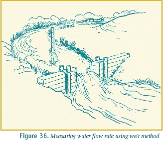
    Water commissioners work within their respective districts to ensure the system is followed, enforcing Colorado water laws and decrees, sometimes by cutting off an irrigator’s water in order to meet a call on the river by the holder of a senior water right. Senior rights holders file river calls with the division engineer when they fail to receive all of the water they have been decreed. A call on the river is essentially a request for the division engineer to curtail all upstream water rights junior to the calling right until the senior right is satisfied.

    Once the division engineer’s office receives a river call, it becomes the responsibility of the local water commissioner to ensure the call is met by curtailing water diversions by junior rights holders.

    Smith said a typical day as water commissioner starts with a check of real-time gauges to see if the river is rising or falling.

    The next order of business is to go to calling rights holders’ ditches to see how much water they have. “To put a call on the river, (rights holders) have to take all available water at their headgates,” Smith explained. If the calling ditches really are low, Smith said the water commissioner must then figure out how much water is needed to meet the call, based in part on how much the river is rising or dropping.

    Smith said it then becomes a matter of shutting irrigation headgates of junior upstream water rights to try to get enough water to the calling ditch.

    If the calling ditch still does not receive its decreed amount of water, Smith said, “you go out and do it again” until the ditch receives its decreed amount.
    “It takes up to 3 days to get a dropping river set,” Smith said. “Sometimes you have to cut off three to five times as much water as the calling ditch needs” because of factors like evaporation.

    “I always tried to be fair – hit a medium ground – and give people the benefit of the doubt,” Smith added.

    Smith said he grew up around water. His father was deputy state engineer, but Smith planned to be a teacher and earned his education degree at the University of Northern Colorado.

    While attending college in the early ’70s, Smith said, he took a job filling in for the Laramie River water commissioner. The job helped pay for college and gave Smith his start working for the State Engineer’s Office.

    But Smith still had no plans to pursue a career in water until discovering that he could not land a job as a teacher. At that point, Smith accepted a deputy commissioner position on the Cache La Poudre River, where he worked until 1979. “Back then, we used computer punch cards,” he said.

    Even after accepting the job as District 11 commissioner, Smith said, the state provided no supplies for years. “I didn’t have a state truck for 15 years. But since I was using my own truck, I took the kids with me a lot, which was great for them growing up.” Smith said “the kids” – Don, 36, and Erik, 34 – still talk about those experiences.

    The downside back in those days, Smith said, was all the phone calls at home.
    “Before cell phones,” Smith recalled, “I had an answering machine. I would get home in the evening, play messages and have to go back out. And for 5 years I didn’t finish a video with my kids without getting a water phone call.”

    During the ’80s, Smith said, he would make a weekly trip through Bighorn Sheep Canyon to deliver an old 5¼-inch floppy disk to the Division Engineer’s office in Pueblo. “The first time I did that, the disk got corrupted. Eventually, I started making three disks. One would usually make it, but something in the canyon would corrupt those disks.”

    Smith also recalled the first time he made the trip up the steep, rocky jeep trail to Boss Lake. “I went up with Doc Hutchinson in the back of his truck,” Smith said with a look of dismay. “Later, people would tell me, ‘Nobody rides with Doc up there.’”

    Overall, Smith said he thinks he had the best commissioner job in the state here in the Upper Ark Valley. “I’ve had a lot of fun. I definitely have mixed feelings about retiring.”

    Colorado Division of Water Resources coverage here and here.

    The latest United Water newsletter is hot off the presses

    acwwaeccvdeal.jpg

    Click here to read the newsletter.

    More South Platte River Basin coverage here.

    Big Thompson Flood — July 31, 1976 — remembered

    bigthompsonflood073176.jpg

    From the Loveland Reporter-Herald:

    Residents of the Big Thompson Canyon and others who remember the July 31, 1976, flood there gathered at the flood memorial Wednesday night for an annual memorial service. The flood happened after a thunderstorm stalled over the area and dumped more than a foot of rain. Pounding rain caused a wall of water to roar through the canyon, 19 feet high in places.

    It destroyed homes, businesses, U.S. 34 and, worst of all, took 139 lives. Six more people were never found.

    More Big Thompson River flood coverage here and here.

    Drought news: Denver Water draws down Chatfield Reservoir to help fulfill downstream obligations #COdrought

    usdroughtmonitor07232013.jpg

    usdroughtmonitorcolorado07232013.jpg

    From 9News.com (Marty Coniglio):

    Rain and average July temperatures have helped bring reservoir levels up, but even more moisture is needed. Stacy Chesney of Denver Water reports that total reservoir storage is 94 percent of the average. But water managers are aiming to decrease water use by 10 percent in an attempt to completely fill as many storage facilities as they can…

    Chatfield Reservoir has generated a lot of interest by being so low. Denver water manages 40 Percent of the water in that lake, while the Army Corps of Engineers controls 60 percent of the water to be used exclusively for recreation. This year, senior water rights holders downstream from the Front Range have needed a lot of water and Denver Water has used Chatfield to fulfill that legal obligation.

    From the Vail Daily (Scott N. Miller):

    It seems like July has been a wet month, but it actually wasn’t much more moist than July 2012, when the region was gripped in drought. Still, everything from streamflows to fire danger is better off this year than last, thanks, still, to a wet April and May…

    …this summer is notably better than last summer, despite the fact that June of this year was virtually as dry as June of 2012. The SnoTel snow and rain measurement site on Vail Mountain recorded just 0.1 inch of precipitation in June, just a few drops better than 2012, when that site received no measurable precipitation at all between May 24 and July 1. The same site has recorded just a half-inch more rain in July than it did in 2012.

    But that site is up to about 24 inches of precipitation recorded for the current “water year,” which starts in October, a significant improvement over the 20 inches recorded at the site at the end of July 2012.

    From the Arizona Daily Sun (Eric Betz):

    The Glen Canyon Dam shook to its very foundations as engineers scrambled to find ways to hold back the waters of the fast melting and massive Colorado snowpack. It was July 15, 1983, and there were concerns the dam would not stand the force of the swelling Lake Powell. Below, at Lees Ferry, streamflow gauges recorded more water than at any point since the dam was erected. The dam held, but large-scale reconstruction was required to repair the washed away rebar and concrete. It was 30 years ago this week that Lake Powell reached the highest level in its history. But those days seem hopelessly far off.

    This year, the combined storage of Lakes Powell and Mead — and the total system storage of all 10 major reservoirs in the Colorado River Basin — is expected to reach its lowest point since Lake Powell was filled.

    Lakes Powell and Mead are projected to hit just 45 percent of their combined capacity this water year, according to the most recent 24-month Bureau of Reclamation study. Hydrologists define a water year as starting on Oct. 1 and ending Sept. 30.

    Based on the most recent numbers, the Bureau of Reclamation will release roughly two times more water from Lake Powell than the Colorado River will provide to it for the current period. The projections also indicate that next year Lake Powell will [be operated under the 2007 Shortage Sharing Agreement]…

    While the combined storage system will hit the lowest point in history, Lake Powell’s elevation was significantly lower in 2005 following a prolonged period of drought. “We’ve been seeing it for about two months,” said Katrina Grantz, a hydraulic engineer for Glen Canyon Dam. “It’s just barely below what we saw as the combined 2005 period … It’s of concern; I wouldn’t say alarming.”

    “Since 2005, we’ve recovered quite a bit, but we’ve had two back-to-back dry years,” she added.

    From The Colorado Springs Gazette (Jesse Byrnes):

    Colorado Springs residents and businesses used 600 million gallons of water July 22-28, compared to 963 million gallons for the same week last year. It was also 6 degrees cooler and the city got .08 inches more rain for the same time frame.

    The lowest water consumption point of the summer came a week earlier, July 15-21, when households used only 556 million gallons of water after getting drowned in more than 2 inches of rain. Until then, residents were using about 600-700 million gallons of water per week.

    Colorado Springs has gotten 4.51 inches of rain for July, 1.89 inches above normal for the month, according to the National Weather Service in Pueblo…

    The city needs to save as much as possible during summer months – when people typically use more water – because it has collected as much from snow runoff as it can expect to see this year, city officials say. As of July 28, Colorado Springs was at 57.1 percent in its water system storage compared to 61.4 percent at the same time last year. The normal system storage level is 84.8 percent.

    Two bills targeting forest health and rural economies (via timber harvesting) clear the US House Natural Resources Committee

    hewlettfire5162012.jpg

    From The Pueblo Chieftain (Chris Woodka):

    Legislation that would improve forest health and assist rural economies advanced Wednesday in the U.S. House of Representatives. Two bills were combined to reduce the threat of wildfire and to increase timber harvest revenues to schools and other local services cleared the House Natural Resources Committee.

    U.S. Rep. Scott Tipton, R-Colo., is the sponsor of HR818, which sets priorities to reduce fuels in forests in order to reduce the risk of fire. Tipton’s bill directs the Forest Service to prioritize hazardous fuels reduction projects proposed by governors, affected counties and tribes.

    The other bill, HR1526, sponsored by U.S. Rep. Doc Hastings, R-Wash., addresses the shortfall in county revenue for schools and critical services caused by lack of timber harvest. It requires the Forest Service to produce at least half of the sustainable annual yield of timber required under law since 1908 and to share 25 percent of those receipts with rural counties.

    To expedite locally based healthy forest projects, the Hastings-Tipton package builds on the positive streamlining procedures implemented under the bipartisan Healthy Forests Restoration Act of 2003. “Our package would allow greater state and local involvement in wildfire prevention on federal lands in order to expedite hazardous fuels reduction projects and reduce litigation,” Tipton said. In 2012, 9.3 million acres burned, while only about 200,000 acres of timber were harvested. Several of the most destructive fires were in Colorado.

    This year, fires again struck the state, including the Black Forest and Royal Gorge fires and numerous other blazes in the Arkansas and Rio Grande watersheds. “Time is of the essence and we cannot afford to wait for more fires and more devastation before Congress acts,” Tipton said.

    From The Durango Herald (Joe Hanel):

    The bill also sets mandates for the Forest Service to produce higher timber harvests and to share its revenues with rural school districts.

    Tipton said his bill will help prevent forest fires, bring back rural jobs and funnel more timber royalty money to schools.

    “We have fallen short of the benefits that can be provided to our classrooms, our communities and the ecosystem, and we should return to active forest management,” Tipton said.