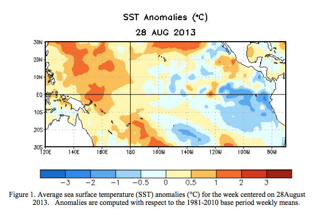
Click here to read the discussion. Here’s an excerpt:
Most model forecasts continue to predict ENSO-neutral (Niño-3.4 index between -0.5°C and 0.5°C) into the Northern Hemisphere spring 2014.

Click here to read the discussion. Here’s an excerpt:
Most model forecasts continue to predict ENSO-neutral (Niño-3.4 index between -0.5°C and 0.5°C) into the Northern Hemisphere spring 2014.
Click here to read about the conference and register.
From The Watch (Samantha Wright):
In Ouray, National Weather Service recorder Karen Risch reported, “Historically, we should be at 15.28 inches for the calendar year, and we are currently at 15.10. We have made up 2.5 inches in last two months. It has been a pretty dramatic turnaround.” The month of July typically brings 2.13 inches of precipitation to Ouray, Risch said, compared to 3.28 inches in 2013. August’s average is 2.33 inches, compared to 3.58 inches this year.
But those figures tell only part of the story. The National Weather Service measures annual accumulated precipitation in two ways – by calendar year and by water year. The water year is measured annually from October through September. And a month shy of the conclusion of the 2012-13 water year, Ouray is still four inches below average. While the town’s historical annual precipitation per water year is 23.05 inches, Ouray has received only 19.19 inches of precipitation so far for the current water year. In short, “We are nowhere near making up from last year’s drought,” Risch said…
Forecaster Jim Daniels out of the National Weather Service’s Grand Junction office said that a similar story is unfolding across the region, with above-average monsoonal rainfall in July and August helping to bring accumulation to near-normal to slightly above-normal levels for this calendar year…
Weather observers at the Montrose Airport measured 2.08 inches of rainfall in July, and 1.29 inches in August, considerably up from the average monthly levels of .83 inches and .88 inches, respectively. Total precipitation for the calendar year so far, measured at the same location from January through August 2013, is 6.02 inches, compared to an average of 4.65.
Ridgway, like Ouray, is still slightly below average for the calendar year, with an accumulated total of 10.18 inches of precipitation from January through August, compared to an average of 11.31.

From the Summit Daily News (Breeana Laughlin):
Governor John Hickenlooper sent an executive order in May calling for river basin roundtable groups throughout the state to come up with plans to resolve gaps in the water supply by December 2014. Each of these documents will come together to form the Colorado Water Plan. “We don’t have enough water is the bottom line,” said Summit County commissioner Karn Stiegelmeier. “Each group has identified gaps and unmet needs for agriculture and municipalities, as well as non-consumptive uses — which includes the environment and recreation.”
Stiegelmeier sits on the Colorado Basin Roundtable, which represents Summit County water interests, among others…
The county commissioner said her group is also working to make sure other roundtable group’s plans don’t infringe on the Colorado Basin Roundtable plan. “Because we are the target, we are also going to try to be productive in resolving the state’s gaps,” she said. “Otherwise, they have the political power to do what is most scary to us — streamlining approval processes — which would take away local control over water projects. That’s our biggest concern.”
In addition to the Colorado Basin Roundtable, the county commissioner sits on the Northwest Colorado Council of Governments (NWCCOG) Water Quality and Quantity Committee. This group strives to bring individual governments and agencies together to speak with a unified voice on water issues. It includes members from Summit, Grand, Gunnison, Pitkin and parts of Park County, as well as cities and water sanitation groups within these counties. “It started as an effort to get county and municipal governments on the same page to be a stronger advocate to keep water on the West Slope, and mitigate the damage from trans-mountain diversions,” said Torie Jarvis, co-director at the NWCCOG Water Quality and Quantity Committee. This group has been focused on the implementation of the Colorado Water Plan, and has developed a number of principles to represent the interests of stakeholders on the West Slope.
More Colorado Water Plan coverage here.
From the Summit County Citizens Voice (Bob Berwyn):
An extended monsoon season lifted August precipitation in Breckenridge to well above average, as weather-watcher Rick Bly tallied 4.22 inches of water for the month. The average rainfall for August is 2.26 inches; August 2013 was the wettest August since 1984. “We had a good month for precipitation,” Bly said, adding that the rainfall often came at night, when it’s even more beneficial because it has a chance to sink into the ground before evaporating.
All in all, the 2012 water year has been up and down, with a “desperately dry October and November, according to Bly, followed by a so-so early winter and a gangbusters spring, with drought-busting snows in April and May. Last month’s rainfall also pushed the year-to-date total to above average, at 19.38 inches compared to the average 16.83 inches. Even if September ends up being very dry, Breckenridge will end up the water year (Oct. 1 – Sept. 30) above average, he said…
Precipitation in August was also above average in Dillon, where weather observers with Denver Water tallied 2.13 inches for the month (average 1.77 inches). There was measurable precipitation on all but 12 days of the month at the Dillon site, with 0.34 inches on Aug. 5, the wettest day of the month.