
Click here to read the current assessment. Click here to go to the website. Click here for the archives.

Click here to read the current assessment. Click here to go to the website. Click here for the archives.
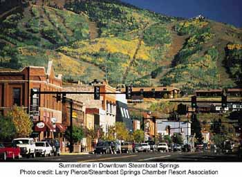
From Steamboat Today (Matt Stensland):
The work is taking place along 210 feet of the Yampa River at the Dr. Rich Weiss Park located next to the Rabbit Ears Motel.
The park is quite popular, especially during the summer months as tubers take to the Yampa. People often will gather at the park’s Hippy Dip, an area where the natural warm water utilized at the Old Town Hot Springs drains into the river…
Craig Robinson, the Howelsen Hill and open space facilities supervisor for the city of Steamboat Springs, said one of the goals of the project is to fix an existing rock wall and its foundation.
#“The whole rock wall has been slowly falling into the river,” Robinson said. “We have some safety concerns.”
Existing access points to the river also are in bad shape and eroding. One access point will be built next to the Yampa River Core Trail bridge. Access points also are going in on either side of the Hippy Dip.
Ecological Resource Consultants and Nordic Excavating have been contracted to do the work.
The work is being paid for mainly with a $300,000 grant from Great Outdoors Colorado, which is funded by lottery proceeds. The city committed $15,000 in matching grant funds…
No kayaking water feature improvements are being done as part of the project, but Robinson said the city continues to work closely with the Friends of the Yampa group on future projects.


From The Canyon Courier (Stephen Knapp):
Granted, the violent spectacle of Cactus Jack’s awash in a white-capped brown torrent, coupled with YouTube videos of pedestrian bridges being bullied down the middle of Upper Bear Creek Road, tend to make a body fretful. But reports of the dam’s impending demise have been greatly exaggerated at least once per generation for nearly 100 years, and they’re no more valid today than they were in 1934, when creek flows soared to more than 4,600 cubic feet per second (cfs), or in 1957, when they rose to 1,640 cfs, or last month when the canyon roared with up to 1,325 cfs. Fact is, when the sun finally burns out some 5 billion years from now, Evergreen Dam may still be here to mark the occasion.
“It’s not going anywhere,” says Evergreen Metropolitan District general manager Gerry Schulte. “It doesn’t really matter how much water is in Bear Creek. It has no real effect on the dam.”
To understand why, consider first the dam’s purpose. Unlike, say, Bear Creek Lake Dam, which is intended to catch and contain floodwaters, the Evergreen Lake Dam was designed by the engineers of Denver Mountain Parks simply to provide a static 900-acre-foot reservoir (about twice its current storage) for the dual purposes of aquatic recreation and visual appreciation. Because it’s always at capacity, adding more water at the top doesn’t meaningfully increase its load.
“It’s a flow-through dam, which means water coming into the lake just flows out again over the top of the dam,” Schulte explains. “Water flows into the tub, water flows out of the tub. It doesn’t make any difference to the tub.”
Now consider the Evergreen Dam’s construction. Begun in 1926 and completed the following year, it is of that breed sometimes referred to as a “gravity” dam, meaning that its own colossal weight makes it impervious to just about anything nature can throw at it. Engineers poured a whopping 12,000 cubic yards of concrete into its long central barricade and two monstrous 52-foot abutments, creating a tidy mass that tips the scales at something very near 39 million pounds of rock-hard resolution and was, at the time, considered proof against flows in excess of 50,000 cfs. And that seemed to be good enough for most folks until 1973, when moderate rains conspired with rapid spring snowmelt to dump water into Bear Creek at a punishing rate of 1,480 cfs, inspiring residents to suddenly notice three long cracks in the dam’s face. By the time the Big Thompson flooded three years later, folks were looking to the dam’s new steward — the fledgling Evergreen Metropolitan District — for reassurance…
Under normal circumstances, about 2 inches of water flows over the top of Evergreen Dam. Last month that flow topped out at 17 inches.

From the Loveland Reporter-Herald (Jessica Maher):
In a resolution added to Tuesday’s special meeting of the Loveland City Council, councilors voted unanimously to authorize negotiations with Kiewit Corp., the contractor selected by the Colorado Department of Transportation for the U.S. 34 reconstruction project.
The agreement will include demolishing and disposing of the Idylwilde Dam. The silt, sand, cobbles and boulders now located behind the dam would go to Kiewit for much-needed project material.
Loveland Water and Power Director Steve Adams said he worked last week with the U.S. Army Corps of Engineers, the Federal Energy Regulatory Commission (FERC) and the U.S. Forest Service to fast track approvals needed to move forward with negotiations.
“We felt like this is an opportunity that presents itself to us and we wanted to take advantage of it,” Adams said. “We feel like the dam has been compromised — it was compromised in its reconstruction by a quarter of it not being anchored to bedrock — and this was even more evidence to us that the dam should be removed for safety purposes and also to help the reconstruction effort.”[…]
The Idylwilde Dam went online in 1925 and was at that time the power plant for the city. It generates about 900 kW, which is now a fraction of what Loveland Water and Power now produces, and the facility was used in recent years to help reduce the city’s costs when the Platte River Power Authority hit its peak demand.
The dam area represents about 100,000 cubic yards that contractor could use to help reconstruct the highway, according to Adams, who said the city has been in contact with Kiewit Corp officials.
From the Longmont Times-Call (Tony Kindelspire):
Longmont homeowners will see an increase in their average monthly utility bills of about 12 1/2 percent starting Dec. 1, according to votes passed Tuesday night by the Longmont City Council. Primarily because of stormwater and parks and greenway maintenance fee increases, Longmont residents’ utility fees will soon be $153 a month, up from $136 a month. The Longmont City Council voted unanimously to increase stormwater fees to $13.60 a month, which is nearly double what was proposed by the city’s public works and natural resources department. That increase — ironically — included flood control measures on stretches of the St. Vrain River.
Dale Rademacher, director of public works and natural resources, said the preliminary cost estimate of total damage to the river is about $80 million.
Barbara McGrane, the business manager for the public works department, told council that the city originally had planned $470,000 in capital projects for 2014. Post-flood, that figure is now about $3.6 million, she said. Federal Emergency Management Agency funds will reimburse the city for a portion of the needed repairs, but how much remains to be seen, McGrane said.
“We don’t really know yet what FEMA is going to want us to do with the river, but the riverbed repairs — big dollars,” McGrane said.
From The Denver Post (Electa Draper):
Garbage day after the Colorado floods is turning apocalyptic. The potential volume of flood debris is mind-blowing, given preliminary estimates of more than 1,800 homes destroyed and more than 16,000 damaged and full of soggy ruins.
State regulators are working on waivers for safety and environmental standards at landfills so they can handle the toxic mounds of refuse heaped in city drop-off sites and piled in debris fields along creeks and rivers.
Earlier this week, traffic leading to dumps, including two in Erie, was so heavy that haulers pulled out of long lines in frustration with wait times.
“It’s been wild,” said Dan Gudgel, division manager for Waste Connections, which runs the Erie landfills. “We’ve had a tremendous amount of rain here — 15 to 20 inches — and we drive on soil. We struggled Monday, but now we’re going full-bore.”
Heaps of ruined possessions are an immediate threat to public health, but they also are constant reminders of the disaster and are among the biggest obstacles to economic recovery and a restored sense of well-being, FEMA spokesman Jerry DeFelice said.
“At the forefront of recovery is debris removal,” DeFelice said.
FEMA reformed policies for helping communities with the high cost of cleanup after Hurricane Sandy, now offering reimbursement along a sliding scale for speedy removal — in excess of 75 percent of eligible costs.
“The idea is to give communities incentives to plan for disaster cleanup,” DeFelice said.
The Colorado counties so far eligible for this type of FEMA assistance are those hardest hit — Adams, Boulder, Larimer and Weld — among 17 flooded counties. The volume of refuse the cleanup will generate is impossible to estimate, Colorado Department of Public Health and Environment officials said.
Waste Connections — which operates the adjacent Denver Regional and Front Range landfills in Erie — has sent out several hundred 30- to 40-cubic-yard roll-off trash containers to storm- wrecked communities. A half dozen other companies have placed hundreds more containers.
The huge debris-filled bins are due back soon, perhaps at the end of this week, Gudgel said.
“The order of magnitude here is unreal. I couldn’t begin to guess at an amount,” Gudgel said. “I worked back east, with debris from tornadoes and ice storms, but this is unbelievable.”
It’s also impossible to determine the health risks of muck-coated possessions, including some contamination by raw sewage and now mold.
Hard-hit homeowners vouch that the yuck factor is off the charts.
“There are a lot of people who are going to be involved with this (cleanup),” said Roger Doka, CDPHE’s solid-waste permitting unit leader. “We are meeting with our water quality, hazardous waste and air pollution divisions and with local governments.”
Flood-damaged furnishings and other possessions on private property are the responsibility of the property owner, said Colorado Office of Emergency Management spokeswoman Micki Trost.
But with whole houses collapsed into waterways, propane tanks hissing down fast-moving creeks and unidentifiable objects bobbing along or deposited along stream banks, local governments aren’t sure when they’ll get on top of this mountain of debris.
Larimer County hasn’t had a break in disaster-generated debris since the 2012 High Park fire, county
Mark Taylor helps neighbors unload flood-damaged belongings Wednesday at a dump in Boulder, where residents started to clean up from last week’s massive flooding. (RJ Sangosti, T he Denver Post)
recovery manager Suzanne Bassinger said. Residents there were given three years from the date of the fire’s containment, June 30, 2012, to remove charred materials from their properties. Fire debris has been washing down creeks for months in post-fire flooding previous to last week’s catastrophic flooding in northeastern Colorado.
“We’ve never really had any let-up,” Bassinger said.In Boulder County, emergency managers are still focused on evacuating people and using resources to carve routes to stranded communities.
“You are asking ‘the recovery question.’ We’re still trying to get our hands around that,” Boulder Office of Emergency Management spokesman Ben Pennymon said.
Managers from different departments are beginning to form a team to coordinate cleanup, he said.
But Boulder residents already are dumping around the clock into containers at 21 collection sites — even burying and surrounding them with trash. Crews are working around the clock to haul full containers away but are struggling to keep up.
The state health department is working to develop waivers that will allow landfills to accept some amounts of typically prohibited materials, such as asbestos-contaminated construction debris, Doka said.
“Every landfill has the right of refusal for materials,” Doka said. “But they all are positioning themselves to accept flood debris. I’ve contacted all of the landfills in the area to ask about air space — or how much room they have. They all say they have adequate space.”
Yet it could turn out that some landfill operators will have to excavate additional cells, he said.
Gudgel said the Erie landfills have room — including a new $2.5 million cell (a large hole for waste lined with clay and plastic and graded so fluids drain out). Work began on it earlier this summer and could be completed in a few weeks.
The Erie landfills have a remaining life expectancy of 40 years, he said, and he doesn’t think the flooding will significantly diminish that.
“We’ve got room,” Gudgel said.

From KUNC (Jackie Fortier):
“The fact of the matter is an over 40 thousand gallon release of petroleum products to surface water is a very significant amount of release, but you have to put it into perspective,” Gunderson said. “It happened at a time when the flows were a couple hundred times greater than what is normal, a tremendous volume of water.”
“Some of the hydrocarbon could be diluted by just the tremendous volume of water, some of it, the water was moving very rapidly so much of it moved downstream. And then the other factor is that at least the lighter hydrocarbons with that much movement of water churning it around, those hydrocarbons would end up vaporizing into the air relatively quickly,” Gunderson said.
He adds they weren’t just looking for oil and gas pollutants.
“Needless to say a spill like that is very alarming but it occurred at a time when the volume of water was just totally overwhelming. So we did not detect any volatile organic compounds. We certainly found high levels of E. coli. The volume of raw sewage that was lost during the flood really was far greater than the volume of hydrocarbons that were spilled,” Gunderson said.
The highest E. coli rates were found in the Boulder Creek and Big Thompson River watersheds. Gunderson says municipal water lines are safe, but that people with wells in affected areas should get them tested.

From the Imperial Valley Press (Antoine Abou-Diwan):
The Imperial Irrigation District Board of Directors approved some changes to the district’s pilot water apportionment program Tuesday, eliminating some of its penalties. The board adopted the pilot Equitable Distribution Plan in April to help the district better manage its share of water from the Colorado River amid concerns over a possible drought and the greater scrutiny it brings from other water users that depend on the river.
The district has to pay back nearly 155,000 acre-feet of water in 2014, water that it ordered in excess of its allotment in 2011 and 2012. Under the Colorado River Compact, the district can order a small amount of water more than its allotment under the law. However, the record-low elevation at Lake Mead obligates the district to repay the entire 2012 overrun next year under the federal inadvertent overrun and payback policy.
The pilot EDP apportions to all eligible farmers 5.45 acre-feet of water per eligible acre per year. It also allows farmers to group their fields into “farm units” to easily transfer unused water from fields that need less than 5.45 acre-feet to fields that need more. It also allows farmers to trade unused water among each other through a water clearinghouse.
To discourage water-hoarding and the possibility of a water underrun, the program had a “take-or-pay” requirement in which farmers would have had to pay a balance for their unused water at the end of the year. The board waived that requirement Tuesday.