The Conejos River is the largest tributary to the Rio Grande River in Colorado. The Conejos and its tributaries Los Pinos and Rio San Antonio irrigate about 100,000 acres in the south end of the San Luis Valley and pay a significant portion of the Rio Grande Compact. With some of the oldest water rights in the state and basin, this water has been subject to many changed uses and modifications over time.
In 1928-38 when the Rio Grande Compact commission studied the flows of the rivers in order to calculate a compact arrangement with New Mexico, Texas, and Mexico, the system was already completely appropriated. The only method of irrigation at the time was flooding. Whether for the meadow, the vegetables or the grain and alfalfa fields, flooding was the only method used, or even contemplated.
With the unique physical properties of the Conejos basin, the flooding of fields filled the shallow aquifer with both run off and percolation. This building of the aquifer built a large amount of sub surface water that benefitted irrigators down gradient from where the earlier irrigation water was applied. These subsequent irrigators were able to apply less water to their crops, and gained the benefit of their crop’s roots being in contact with the ground water longer.
This method of irrigation also provided another benefit. The irrigation water diverted from the Conejos and filling the unconfined aquifer, caused return flows which also paid a large percentage of the Conejos’ portion of the compact. Irrigators used the water and paid compact with a large portion of this same water through return flows.
Over time, farm land was leveled, irrigation moved from flooding to sprinklers, and weather patterns trended towards drier winters diminishing sufficient supplies. As the efficiency of water application methods continued to improve, return flows decreased, so more water had to be left in the river channel to pay the compact. With this necessity of leaving pristine water in the channel, it became increasingly difficult for water users to depend on enough water for the entire season. Compounding this issue were years of significantly less than average snowfall. More adapting and changing were necessary.
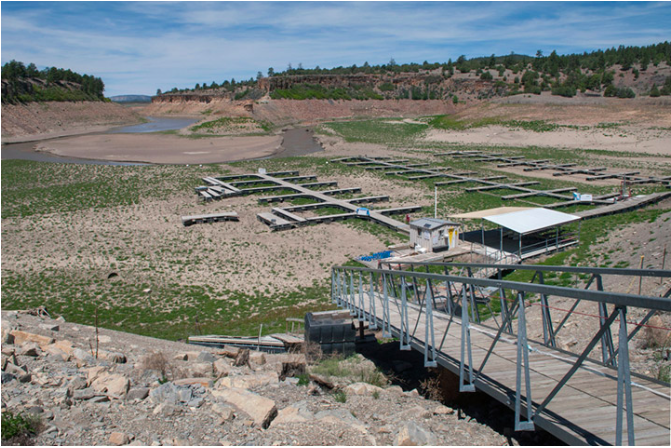
In 1969 the Rio Grande Compact was being administered more strictly. This change in water management brought about the need for accurate accounting and measurement of the waters within the river. Water users were now experiencing curtailments to diversions in order to meet the compact. This curtailment meant that some water users were experiencing less water than historically available. Issues arose around how to make sure that those curtailed were in fact impacted to the least degree possible. This required a lot of time and effort from the DWR’s river commissioners. Also In 1991, The Conejos Water Conservancy District bought exclusive rights to the Operations and Maintenance to Platoro Reservoir. This change brought an opportunity to district water users to utilize the reservoir to store and re-release their water later in the growing season. With the opportunity to use reservoir water to offset some of the compact administra- tion issues, this development also brought the challenge of tracking this retimed water throughout the system.
In order to be proactive and solution minded, water users on the Conejos developed a strategy by first recognizing the issues they faced. First off, there was not an efficient way of tracking the different types of water in the river. It was very difficult to accurately and efficiently know where the different types of water were at all times, much less separate out the native from the reservoir from the Compact head gate by head gate. Secondly there were large inefficiencies with the infrastructure used for getting the water out of the river in priority, and allowing optimal use of both native and the reservoir water to diminish reliance on ground water. Finally, there needed to be a way to mitigate the effects of inaccurate forecasting of snowpack and insufficient stream flows . Water users felt that addressing these issues would help individual water users make better informed decisions on their farm’s water budget for a given year.
GAUGING
In 2012 to overcome some of the first of these challenges, 72 river diversions were fitted with a nearly live ability to “see” what was being diverted. Stilling wells were constructed and fitted with measurement and recording devices that transmitted wirelessly through an entirely new telemetry network that was built to transmit this information. The data is recorded, collected, and stored off site and available to administrators and water users through a secure password. This system also allowed the DWR river commissioners to be very specific with the use of their time and miles for regulating the diversions . With the new system, administrators are now able to make sure that the correct water amounts are being either diverted or passed through to the compact or other water users in priority.
AUTOMATING
The second proposal was to work in conjunction to the gauging/measurement of the diversions. Four of the largest water diversions on the Conejos System were automated. This effort regulates the water to the correct amount for each of these head gates. The automation was able to ensure that these diversions were able to both receive their correct amount of water and not “absorb” the diurnal effect of the river. By correcting the flows at these largest diversions water that should go down river to either another priority or the compact was available. The automation also saved countless hours of regulating and re-adjusting these head gates throughout the day. Because of the tremendous positive impacts of automation, the district is currently automating three more structures along the Conejos with plans for more being drawn up at this time.
PREDICTING
Finally , to help mitigate the “Mother Nature” component , the district is looking at bettering the methodology of both measurements and forecasting for the basin. Currently, the DWR uses reports from NRCS that are based on snotel sites, manual snow course measurements, and the NRCS’ own forecasting to predict total stream flows for both the Rio Grande and the Conejos. The input data are the foundation of the NRCS’ predictions. The problems however are that the number of measured sites is insufficient , their coverage is not complete, and in the case of the Conejos basin, they only represent about 35 percent of the watershed. With both winter inaccessibility to many areas for manual snow surveys, and USFS wilderness restrictions , a large portion of sub drainages simply are not measured.
With a partnership with CWCB, (Colorado Water Conservation Board) NCAR (National Center for Atmospheric Research) NOAA, (National Oceanic and Atmospheric Administration) NWS, (National Weather Service) and NSSL, (National Severe Storms Laboratory) the district has installed six additional “snotel lite” stations, flow gauges on tributary streams, and one radar truck!
The new measurement sites are placed on boundaries with the USFS wilderness areas and will ground truth what the radar truck is seeing . Since the radar has the ability to scan across both the wilderness and inaccessible areas of the basin, the concept is that water users will be able to refine the data used to predict actual snow levels down to the sub basin level.
The flow gauges on the tributaries will allow water administrators to calibrate how much of the system’s water is generated on the respective tributary’s sub basin. Then for an example; if a tributary is significantly higher or lower than the forecast pre supposed, immediate corrections to the compact curtailment can be made. This action will help refine the calculations necessary to administer the compact on a daily basis. This timely correction to compact administration will allow Valley water users to more fully use Colorado’s share of the water.
The Conejos Water Conservancy District does not have all the answers, and may not even yet have the right questions. The district does however, have a desire to place as many pieces in the water puzzle as it can.
Nathan Coombs is the director of the Conejos Water Conservancy District in Manassa.