Click here to read the report. Here’s an excerpt:
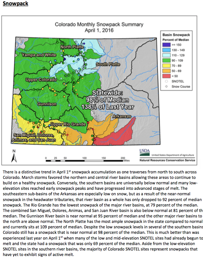
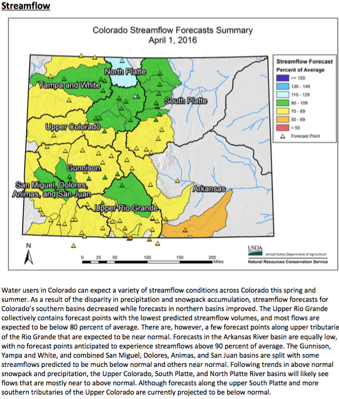
The beginning of March started off slow on the heels of a poor February but precipitation slowly ramped up, first in the northern half of the state then eventually working the wetter weather pattern throughout much of Colorado’s mountains. Unfortunately by the time the wet weather had impacted the southern mountains it was too little, too late, and also too warm. In some mountain locations, March precipitation was between 50 and 65 percent of normal and at lower elevations fell in the form of rain instead of snow. Snowpack at the lower elevations of the southern mountains have experienced snowpack melt since the beginning of March. The Dolores and San Juan River basins as a whole gained little additional snowpack since February 1, where the losses in snowpack at lower elevations nullified the accumulations at the higher elevations. Fortunately the northern portion of the state not only avoided the dry, warm weather but made considerable improvements beyond March 1 snowpack levels. Peak snowpack typically occurs in early to mid-April for much of Colorado, which means streamflows will likely begin to crescendo in the near future. This month’s forecasts are near normal in the Upper Colorado, North and South Platte watersheds but slightly below to below normal in all other basins.