From The Denver Post (Bruce Finley):
Big snow is expected to buffet Colorado mountains Monday through Tuesday morning – up to 28 inches according to the National Weather Service – serenaded with wind gusts reaching 70 miles per hour on high ridges.
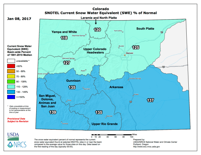
It’s the latest of several recent snowstorms that have raised snowpack to 125 percent of average in the South Platte River Basin, the main water source for metro Denver and northeastern Colorado food production.
But snow in Denver will keep melting. Weather Service meteorologists say metro area temperatures may reach 60 degrees Monday and that residents should expect highs around 50 degrees through midweek. Winds still will be blowing down through the foothills at speeds of 35 mph and greater.
For the mountains, storm warnings were issued Sunday for Monday through Tuesday morning. The heaviest snow will fall west of the Continental Divide, with some spreading to the east, meteorologist Kyle Fredin said.
“We’ve had three or four of these and this is another good one. It’s a little moister, more in the way of snowfall. But for driving – dangerous conditions in some instances,” Fredin said.
Snow’s been pelting the western states from Montana south, and some of the water-stressed West Coast regions may benefit.
“It is coming straight off the Pacific Ocean,” Fredin said, “and in California it is starting to fill reservoirs.”

