
From The Grand Junction Daily Sentinel (Dennis Webb):
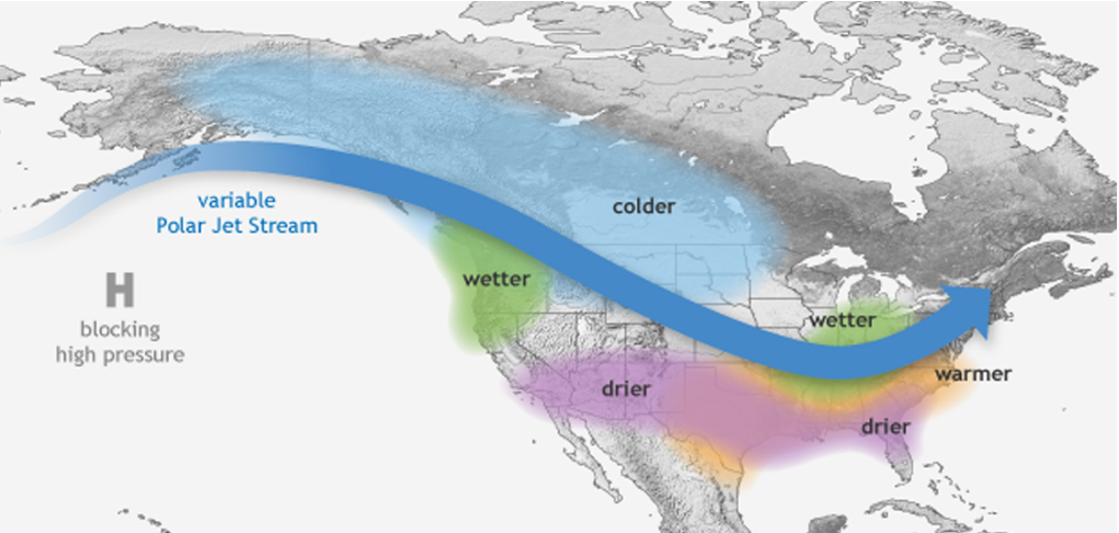
If at least one thing is becoming clear, it’s that a weak La Niña pattern is beginning to set up. La Niñas occur when surface-level ocean temperatures cool in the equatorial Pacific Ocean. Their opposite, El Niños, are associated with warming temperatures there.
In Colorado, La Niñas typically result in good snow years in the northern mountains, whereas El Niños tend to benefit southern Colorado…
Dennis Phillips, a meteorologist with the National Weather Service in Grand Junction, agrees that a La Niña, although not an overly strong one, is shaping up, which should mean good snow in the northern mountains.
But he noted that uncertainties involved in predicting the effects of La Niñas and El Niños, especially in Colorado. With La Niñas typically bringing more moisture to more northern states out West, and El Niños doing the same for southwestern states, “the problem with Colorado is we’re right in the middle of the country,” Phillips said.
While La Niñas typically boost snow in northern Colorado, and El Niños in southern Colorado, the actual dividing line can be dictated by where weather ridges or troughs set up in the Pacific Ocean, Phillips said.
He said what are called “atmospheric river events” also contribute to what happens in Colorado. These usher in subtropical or tropical moisture caught up in the jetstream from the central Pacific, a phenomenon that used to be referred to as the Pineapple Express, he said. While last winter was a La Niña winter, atmospheric river events contributed to the whole state having a good snow year, rather than just the northern part, he said.
Here’s the link to Klaus Wolter’s long-term forecast from the last Colorado Water Conservation Board Water Availability Task Force Meeting.
