As an antidote to the report of minus-88 degree weather in the Siberian outpost of Oymyakon earlier this month, we give you this: The temperature in a settlement just to its east was an astonishing 126 degrees warmer two weeks later.
The mercury in Omolon, Russia, reached its highest January temperature ever recorded Monday: a relatively toasty 38.4 degrees.
But the warmth flooding east Siberia and parts of the Arctic may, in turn, displace the frigid air that is normally pooled there sending it surging south into the north central and Northeastern U.S. through mid-February.
What’s causing the Siberian warm spell?
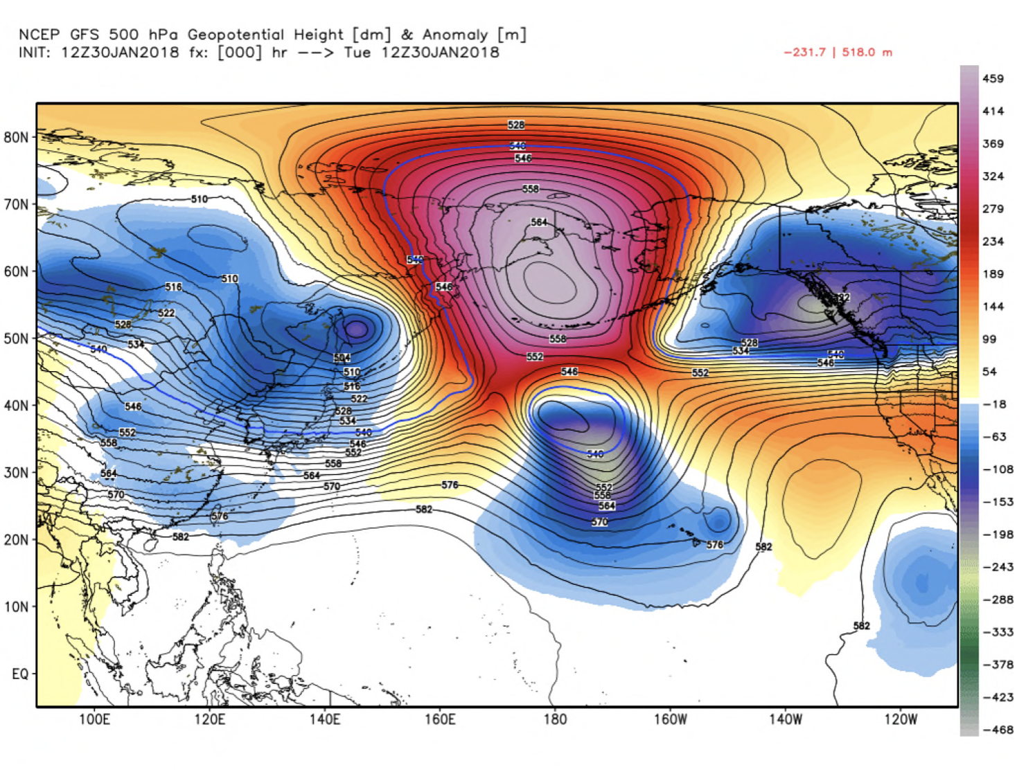
The mild weather over east Siberia can be traced to the development of an enormous, bulging zone of high pressure over eastern Russia (see top image). Mashable science editor Andrew Freedman called it “one heckuva monster” on Twitter.
Underneath this high pressure zone, models show temperature differences from normal exceeding 50 degrees over a broad area. Weather.US meteorologist Ryan Maue tweeted that these temperature anomalies are “off the charts.”
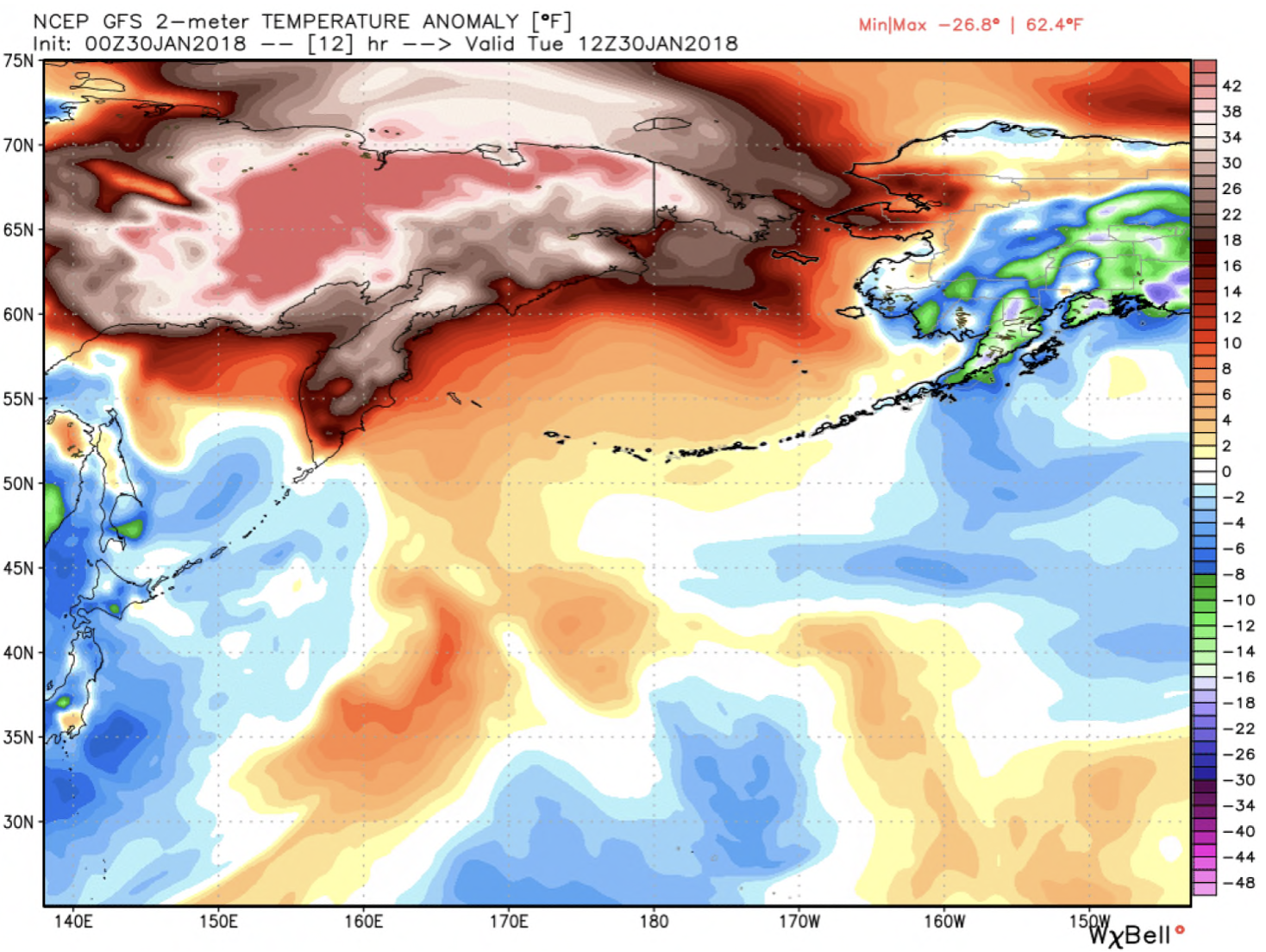
Temperature difference from normal simulated by the GFS model on Tuesday over eastern Russia and western Alaska. (WeatherBell.com)
The Arctic seas, surrounding this region, including the East Siberia, Bering and Chukchi have historically low amounts of ice, which is likely intensifying this warm pattern.
The decline in Arctic sea ice has also been linked to similar temperature spikes observed near the North Pole in recent years, when temperatures have surged to the melting point on repeated occasions even in the midst of winter.
A study in the journal Nature concluded the loss of sea ice “is making it easier” for weather systems to transport heat poleward.