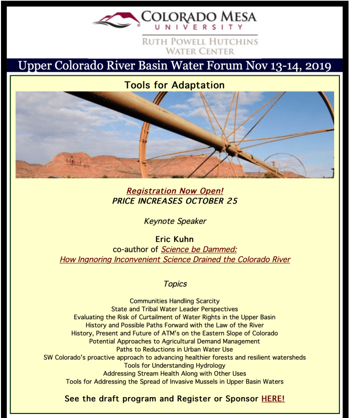
Here’s the release from the AWWA — Rocky Mountain Section:
The water has been tasted, the water has been tested and the winner of the “Best of the Rocky Mountain Section” water taste test has been announced! City of Fort Collins took first place with a panel of veteran judges and media reporters evaluating water appearance, quality, order, and taste, of course. Competition was stiffer this year with 15 municipalities, from Wyoming, Colorado and New Mexico, competing for the title of the best drinking water in the mountain west during the 2019 annual conference of the Rocky Mountain Section of the American Water Works (RMSAWWA) in Keystone, Colorado. You can learn more about the winner, City of Fort Collins Utility, by visiting http://www.fcgov.com. Second place was awarded to Aurora Water, Colorado with the City of Cheyenne Board of Public Utilities, Wyoming coming in third.
City of Fort Collins will now go on to represent the mountain west in the national “Best of the Best” water taste test at the American Water Work Association’s Annual Conference and Exposition (ACE20) in Orlando, Florida, June 14-17, 2020. Over 11,000 water professionals across the country will gather at ACE20 where the best-tasting tap water in North American will be declared.
The RMSAWWA is the regional section for the AWWA, which is the largest non-profit, science-based organization in the world for drinking water professionals. The RMSAWWA covers Wyoming, Colorado and New Mexico and has over 2,400 members, representing water utilities, engineering consultants and water treatment specialty firms.
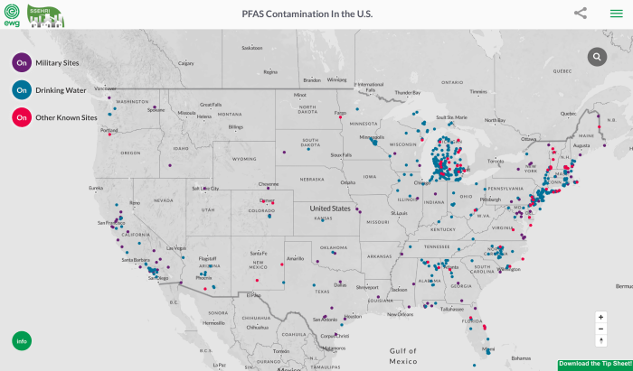
A Congressional PFAS Task Force and other members of Congress signed a letter on September 3 asking congressional leadership finalizing the National Defense Authorization Act of 2019 to keep the House of Representative and Senate provisions addressing per- and polyfluoroalkyl substances (PFAS) contamination and cleanup. In total, a bipartisan group of 162 members of the House of Representatives signed the letter.
As members of Congress return from the August recess, differences between the House and Senate versions of the National Defense Authorization Act, the defense spending authorization bill, will be negotiated this month.
Circle of Blue reports the White House issued a veto threat in July against the House bill, which designates PFAS as hazardous substances under federal law and requires the military to discontinue the use of fluorine firefighting foams by 2025.
Despite some differences, both bills set a timetable for the U.S. Environmental Protection Agency to establish a national drinking water standard for perfluorooctanoic acid (PFOA) and perfluorooctane sulfonate (PFOS).
The September 3 letter notes that among the Senate and House provisions included in the Authorization Act are items relating to groundwater that would:
Require groundwater and drinking water quality monitoring for PFAS
Require reporting of industrial discharges of PFAS
Accelerate PFAS cleanups at military facilities through the use of cooperative agreements
Designate PFAS as “hazardous substances” under the Comprehensive Environmental Response, Compensation, and Liability Act, also known as the Superfund law
Require permits for PFAS discharges under the Clean Water Act
Require the EPA to set a sufficiently protective drinking water standard for PFAS compounds
Require the Department of Defense to treat and clean PFAS-contaminated water used for agricultural purposes.
La Tuna fire September 2017 photo credit StrangeSounds.com
Click here for all the inside skinny from the USDA:
The Wildfire and Hurricane Indemnity Program Plus (WHIP+) will provide disaster payments to producers to offset losses from hurricanes, wildfires, and other natural disasters. WHIP+ is specifically targeted to losses of crops, trees, bushes, and vines that occurred in the 2018 and 2019 calendar years.
WHIP+ builds upon the 2017 Wildfire and Hurricane Indemnity Program (2017 WHIP) to include new programs for both milk losses due to adverse weather conditions and losses to on-farm stored commodities.
Enrollment for WHIP+ will begin on September 11, 2019.
Here’s the release from the Bureau of Reclamation (Peter Soeth):
The Bureau of Reclamation announced it has selected Joyce Harris as the senior advisor for information assurance, industrial control systems. Harris will serve as the lead on intergovernmental initiatives and requirements associated with cybersecurity of facilities and systems related to hydropower delivery.
“Attacks against critical infrastructure systems are on the rise, increasing the risks to Reclamation’s water and power systems throughout the West,” said Director of Information Resources Karla Smiley. “Joyce has the necessary experience and background to lead this new office dedicated to protecting these critical networks.”
Harris is currently Reclamation’s chief information security officer where she leads Reclamation’s information technology and industrial control system cybersecurity program including personnel, budget, policy enforcement, incident response and security awareness. She also leads a staff of highly technical cybersecurity specialists.
After several years in the private sector, she began her federal career with the Bureau of Land Management in 2007 as an information technology security specialist before joining Reclamation in 2010 to perform a similar role and serve as the North American Electric Reliability Council Critical Infrastructure Program compliance manager. In this position, she led internal security assessments, advised senior management on security issues, performed incident response activities, and led external audit activities.
Harris graduated from Metropolitan State University of Denver [Go Roadrunners!], Summa Cum Laude, with a Bachelor of Arts in Computer Information Systems/Political Science/Public Administration.
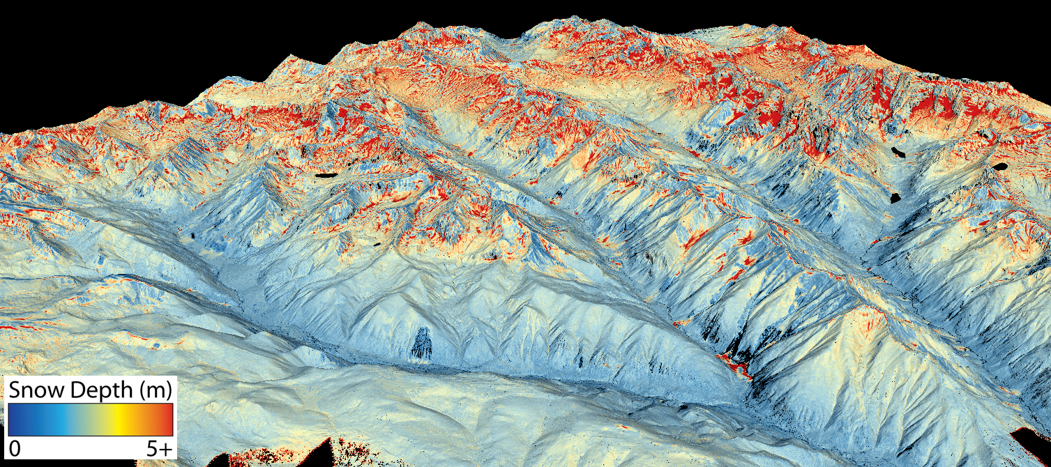
This map shows the snowpack depth of Castle and Maroon valleys in spring 2019. The map was created with information from NASA’s Airborne Snow Observatory, which will help water managers make more accurate streamflow predictions. Jeffrey Deems/ASO, National Snow and Ice Data Center
As a changing climate renders streamflow predictions less accurate, water managers are turning to new technologies for a clearer picture of what’s happening in their basin’s snowpack.
Graphic via the Juan Chacon Free Software and Education Project here.
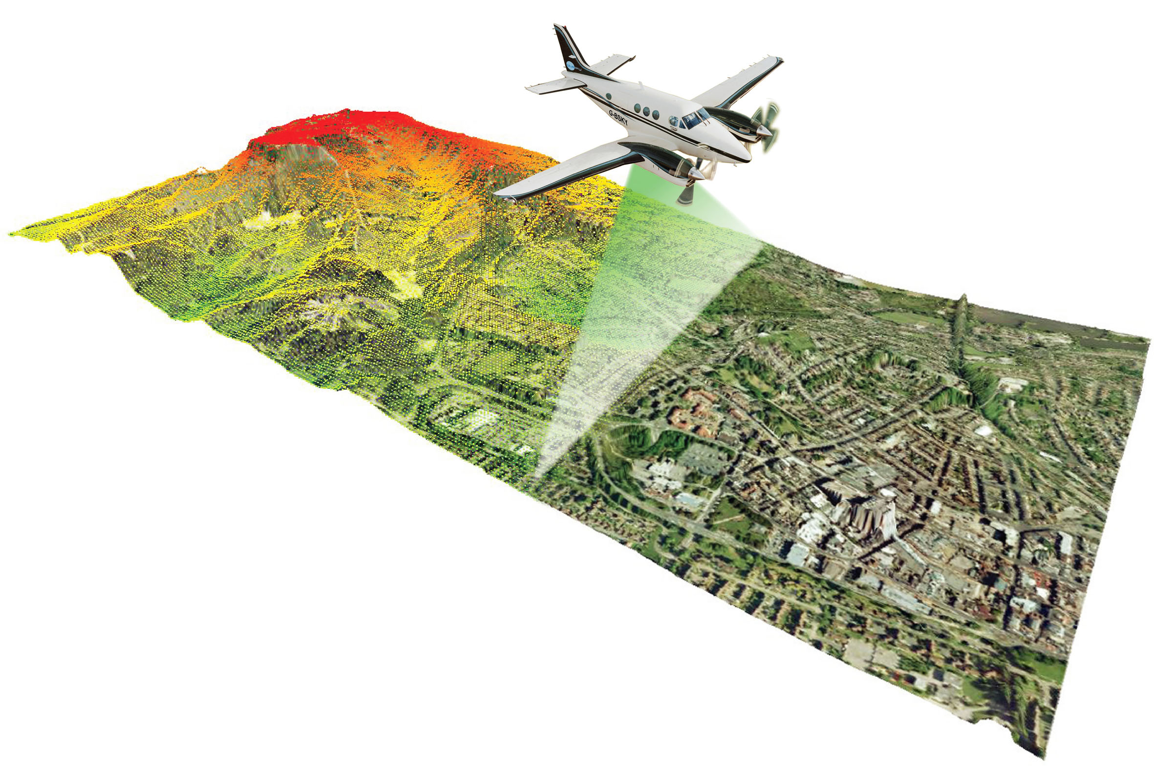
The city of Aspen last spring became the latest water provider in western Colorado to use remote-sensing lasers from airplanes to map the snowpack in the surrounding watershed. On April 7 and June 10, planes equipped with LiDAR, which stands for light detection and ranging, flew over the mountains surrounding Castle and Maroon creeks, measuring the depth of the snow and how much water it contained.
The snow from Castle and Maroon valleys eventually becomes Aspen’s municipal water supply as it trickles downstream. Knowing how much snow is left and where that snow is located can help Aspen’s water managers better plan for spring runoff.
“The information (that the flights) were able to share with us shows us so much information about where the snow collects and some of the runoff patterns,” said Margaret Medellin, the manager of Aspen’s Utilities Portfolio. “It’s a more sophisticated way of looking at the water content in our snow.”
The flights were conducted by NASA’s Airborne Snow Observatory, or ASO, an initiative co-founded by Jeffrey Deems, a research scientist at the National Snow and Ice Data Center at the University of Colorado where the data will be archived and distributed. Last month in Steamboat Springs, Deems gave a presentation on mapping mountain snowpack at Colorado Water Congress.
“It removes a good portion of the uncertainty,” Deems said in a separate interview. “The better we can manage the system, the more everybody benefits and is less in conflict.”
Streamflow forecasts — used by irrigators, water managers, federal and state agencies, and other entities — are based primarily on data collected from snow-telemetry, or SNOTEL, sites. These automated, remote sensors collect weather and snowpack information in Colorado’s mountainous watersheds.
But SNOTEL sites provide just a snapshot, often not telling the whole story, which leads to inaccurate streamflow forecasts.
When conditions at SNOTEL sites start to creep outside of “normal” historic data due to climate-warming effects — early-spring melting, dust on snow, warm winter temperatures, fires and beetle-kill — the forecasting models can begin to lose accuracy. By mapping an entire watershed, ASO flights paint a more complete picture of the state of the snow.
“As the past becomes less of a good guide to the future, we really need to know in greater precision and accuracy what the current state of the snowpack is,” Deems said. “The folks who are making the decisions on how to manage our water infrastructure — whether that’s a ditch, a dam or a headgate — they need the best forecast possible so they can make the correct decision at the right time.”
This map shows the snowpack depth of the Maroon Bells in spring 2019. The map was created with information from NASA’s Airborne Snow Observatory, which will help water managers make more accurate streamflow predictions. Jeffrey Deems/ASO, National Snow and Ice Data Center
Avalanches and hydrology
The LiDAR mapping also has the potential to help water managers better understand extreme weather events such as the historic avalanche activity this past March. One of Deem’s LiDAR mapping photos showed mountain tops that were scoured and devoid of snow, and valleys and avalanche paths that contained deep piles — the result of huge avalanches. An unanswered question is whether this snow melted out sooner (because it slid to a lower elevation) or later (because avalanche debris is denser and more compact).
“It may actually have delayed melt into the runoff season,” Deems said. “It’s not something we can say definitively what the effect is, but for the first time, the data set may actually allow us to test that and get a better handle on how hydrology and avalanches interact.”
Denver Water, which provides water to 1.4 million people on the Front Range, last spring used ASO flights to see how much snow remained in the mountains surrounding Dillion Reservoir, its largest storage pool. Data from a June 24 flight showed that although the SNOTEL sites at about 11,000 feet were melted out, there was still 114,000 acre-feet of water in the snowpack above. Denver Water increased its outflows from Dillon Reservoir to make room for the coming snowmelt.
“That ended up being about half our seasonal runoff,” said Nathan Elder, Denver Water’s manager of water supply. “(ASO) is the next thing in snow measurement. We haven’t had an advancement like this since the late ’70s, when they started putting in SNOTEL sites.”
A flight from NASA’s Airborne Snow Observatory gathers data about the snowpack above the reservoir on a June 24 flight. Information gathered from the flight helped Denver Water manage reservoir operations. Photo courtesy of Quantum Spatial
Costly technology
While innovative and useful, the technology is expensive. Over the past three years, the Colorado Water Conservation Board has spent $1.9 million on the Watershed Forecasting Partnership Program, with nearly $519,000 spent on ASO flights, according to Chris Arend, communications director for the Department of Natural Resources. The Castle and Maroon creek watersheds were mapped as an offshoot of a multiyear program in the Upper Gunnison River Basin.
A good approach, Deems said, would be for multiple local agencies to pitch in and share the cost, since each flight on the specially equipped plane can cost tens of thousands of dollars. For a small municipality such as Aspen, it’s just not worth it.
“It’s really hard to fund or justify funding big efforts like that,” Medellin said. “We are really excited about the data, but we have to think: Is this something we can really afford in this community? Right now, it seems like the benefit wouldn’t justify the costs.”
Editor’s note: Aspen Journalism collaborates with The Aspen Times on coverage of water and rivers. For more, go to aspenjournalism.com.
Note: Coyote Gulch caught up with Jeffrey Deems at the conference to ask him about measuring density or snow water equivalent. He told me that they get it from SNOTELs and that the technology will not replace them. In fact, he said that we need many more installed in the snow courses.
SNOTEL Site via the Natural Resources Conservation Service