Waters of the United States jurisdiction changed — The Monte Vista Journal

The headwaters of the Rio Grande River in Colorado. Photo: Brent Gardner-Smith/Aspen Journalism

From The Monte Vista Journal (Trey Spaulding):

Jan. 23, 2020, the Environmental Protection Agency (EPA) Administrator Andrew Wheeler announced the improved definition for “waters of the United States” (WOTUS) with the Navigable Waters Protection Rule. “ The Navigable Waters Protection Rule ends decades of uncertainty over where federal jurisdiction begins and ends. For the first time, EPA and the Army Corps of Engineers are recognizing the difference between federally protected wetlands and state protected wetlands. It adheres to the statutory limits of the agencies’ authority. It also ensures that America’s water protections – among the best in the world – remain strong, while giving our states and tribes the certainty to manage their waters in ways that best protect their natural resources and local economies.”

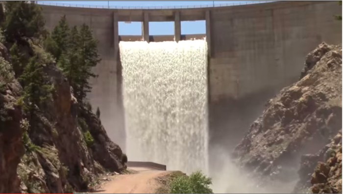
In March 2014, the Obama administration released a regulation that would assert Clean Water Act jurisdiction over nearly all areas including those with undiscernible connections to water resources and man-made conveyances. Specifically, the Obama WOTUS rule expanded agency control over 60 percent of the country’s streams and millions of acres of wetlands that were previously non-jurisdictional. In September 2019, the Trump administration, EPA and Army Corps of Engineers repealed the controversial 2015 WOTUS rule and proposed a new Clean Water rule clarifying which level of government, federal or state, would oversee water features and dry land that is sometimes wet.

The revised WOTUS definition identifies four clear categories of waters that are federally regulated under the Clean Water Act: the territorial seas and traditional navigable waters; perennial and intermittent tributaries; certain lakes, ponds and impoundments; and wetlands that are adjacent to jurisdictional waters. The final action also details what waters are not subject to federal control, including features that only contain water in direct response to rainfall; groundwater; many ditches, including most farm and roadside ditches; prior converted cropland; farm and stock watering ponds; and waste treatment systems.

Leaders of the National Potato Council (NPC) welcomed the announcement that the U.S. Environmental Protection Agency (EPA) finalized its proposed rule defining the Waters of the United States (WOTUS) rule with the Navigable Waters Protection Rule. EPA’s action also defines what waters are not subject to federal control, including most farm and roadside ditches, prior converted cropland, and farm and stock watering ponds.

“Potato farmers are committed to protecting the nation’s waters,” said Britt Raybould, President of the National Potato Council. “However, the imposition of unnecessary federal burdens, such as regulating ditches on private farms that are generally dry throughout the year, undermines that overall mission by creating uncertainty and increasing costs. EPA’s newly issued rule avoids those negative outcomes and provides increased clarity regarding the responsibilities of farmers under the Clean Water Act in protecting our nation’s surface water resources.”

[…]

Contrastingly, Jill Hunsaker Ryan, executive director, Colorado Department of Public Health and Environment stated, “The EPA’s announcement today is alarming as it puts our precious waters at risk. Every Coloradan, and so many others from neighboring states, are dependent on Colorado’s healthy waterways. At the department, regardless of what happens at the federal-level, we’ll always be committed to the health of our waters. Healthy waters mean healthy Coloradans,” said Jill Hunsaker Ryan, executive director, Colorado Department of Public Health and Environment.

“In the absence of federal leadership, we are going to do everything possible to protect streams and wetlands in Colorado. It’s sad that we have to step up in contrast with our federal government on something so basic as protecting our water, but we must. The rollback removes huge swaths of Colorado’s waters from federal jurisdiction, waters used by 19 states and Mexico. It’s estimated that almost 70 percent of our Colorado Waters could be impacted by this rule. Additionally, the change will impose significant burdens upon the State of Colorado,” said Patrick Pfaltzgraff, director, Water Quality Control Division.

Earlier in the year, the Colorado Department of Public Health and Environment, Colorado Department of Natural Resources, and Colorado Department of Agriculture collectively rebuked the EPA’s proposed rule change.

Breckenridge scores $10 million grant for Goose Pasture Tarn Dam improvements

Goose Pasture Tarn Dam. Photo credit: NextDoor.com

From The Summit Daily (Sawyer D’Argonne):

The Federal Emergency Management Agency awarded a $10 million grant to the state of Colorado last week to help fund modifications to the Goose Pasture Tarn Dam.

The funds come as part of FEMA’s Pre-Disaster Mitigation Grant Program, which is meant to help minimize the risks of possible dam failures…

The dam — south of Breckenridge proper and north of Blue River — is classified as “high hazard” by the state, a categorization that has little to do with its condition but rather the potential loss of human life and property in the event of any type of failure. According to FEMA, a failure likely would impact more than 2,000 residences and businesses in the Breckenridge area below the dam, along with major damage to roadways and the community’s existing water supply.

The dam does need some work to help put the minds of Breckenridge residents at ease. The need for upgrades began to emerge in 2015, during a high moisture year when town-run monitoring stations started to see significant rising water levels, according to Steve Boand, a state hazard mitigation officer with the Colorado Division of Homeland Security and Emergency Management. As a result, stakeholders decided to implement reservoir storage restrictions in 2016.

Breckenridge also moved forward in seeking federal funding to address concerns. The $10 million from FEMA will cover more than half the costs of the project. The rest already has been budgeted as capital improvements by Breckenridge, Boand said. The work on the dam is scheduled to begin later this year and will lower the spillway by 4 feet to help protect the dam and everyone in its path…

Construction on the project will begin later this year and is scheduled to be completed sometime in 2022, though Boand said it could take until 2023. Breckenridge will lower water levels in the reservoir during construction seasons to facilitate the work.

January 2020 #Drought Update — @CWCB_DNR

From the Colorado Department of Natural Resources (Megan Holcomb/Tracy Kosloff):

2019 Calendar Year in Review: 2019 followed one of Colorado’s warmest, driest years on record with a severe drought in southwest Colorado. This drought (of 2018) was followed by a cold, wet 2019 spring and 150% of normal snowpack that helped clear the state of drought by June 2019. The 2019 monsoon season, however, was nearly absent and September 2019 was the hottest September on record. The dry 2019 October set much of the state below normal for the 2020 Water Year. These early deficits can still be made up, particularly with snowpack running slightly above normal to date. This, however, does not guarantee an above average runoff given our dry soils.

  • The 90-day Standardized Precipitation Index (SPI) from October 22 – January 19 shows geographically distributed average and slightly below average precipitation statewide.
  • According to the U.S. Drought Monitor, released January 15, D0 (abnormally dry), D1 (moderate drought), and D2 (severe drought) collectively cover 53% of Colorado. 35% of the state is under D3 (extreme) and D4 (exceptional) drought.
  • The long term ENSO forecasts are trending toward neutral conditions remaining for spring and summer 2020, while losing El Niño conditions. This could mean reduced​ odds of SW Colorado spring moisture.
  • NOAA’s Climate Prediction Center shows warmer than average temperature outlooks February through April for the SW half of the state, and normal precipitation outlooks for the entirety of the state.
  • Reservoir storage remains near to above normal (86 to 124% of average) in all major basins and is 109% of average statewide. This time last year reservoirs were 81% of average statewide.
  • Water providers and water users did not report any unusual impacts or concerns at this time.
  • Colorado Drought Monitor January 28, 2020.

    U.S. Army Corps of Engineers and Bureau of Reclamation: A Joint Commitment to the Nation’s Water Infrastructure — @USBR

    The Folsom Dam Auxiliary Spillway project is an approximately $900-million cooperative effort between the U.S. Army Corps of Engineers and the U.S. Department of the Interior, Bureau of Reclamation.

    Here’s the release from the Bureau of Reclamation (Peter Soeth and Major Kimberly Farmer Mendez):

    The U.S. Army Corps of Engineers and the Bureau of Reclamation recently released The State of the Infrastructure: A Joint Report by the Bureau of Reclamation and the U.S. Army Corps of Engineers. The two agencies have a long history of collaboration to construct, operate and maintain the nation’s crucial water-related infrastructure.

    National water-related infrastructure provides water supply, hydroelectric power generation, navigation, flood control, recreation and other benefits. Combined, the Army Corps and Reclamation oversee and manage more than 1,200 dams, 153 hydroelectric power plants, over 5,000 recreation areas, 25,000 miles of navigable waterways and tens of thousands of miles of canals and other water conveyance infrastructure. Those facilities provide enough water for 130 million people and irrigation for 10 million acres of farmland. And, combined hydroelectric power plants generate renewable electricity for 10 million homes.

    “Millions of people rely on this infrastructure for their water, their food, and their electricity,” said Department of the Interior Assistant Secretary for Water and Science Tim Petty, Ph.D. “This partnership is important; it helps us coordinate attention and resources to ensure that infrastructure is robust and well-maintained. I appreciate the partnership between Reclamation and the Army Corps and look forward to continued success moving forward.”

    The partnership between the Army Corps and Reclamation brings together a wide array of resources that serve to enrich public services as well as water resource management and environmental protection. The agencies regularly assess the health, safety and sufficiency of existing infrastructure and continually work to upgrade aging infrastructure and construct new projects to meet the needs of families, farms and communities.

    “This report provides visibility to the public on the vast and diverse federal portfolio of water-related infrastructure our agencies maintain and their value to the safety and economic prosperity of the nation” said Assistant Secretary of the Army (Civil Works) R.D. James. “This is a great example of how the Army Corps’ partners and collaborates with other agencies on water-related infrastructure by sharing challenges, best practices and strategies to utilize resources to most efficiently and effectively maintain this critical infrastructure”.

    Affordable power production, reliable water supply, navigation, flood risk reduction, and recreation have a positive impact on the Nation’s economy and are a daily way of life for countless Americans. The rigorous and systematic maintenance programs both agencies use ensure these precious water-related resources will be available for years to come.

    Ongoing attention to the Nation’s water-related infrastructure will provide maximum value to the American people. The Army Corps and Reclamation are jointly committed to the management and maintenance of this critical infrastructure both today and in the future.

    The report is available at http://www.usbr.gov/infrastructure.

    Scientists Discover Alarming Warm Water Under [#Thwaites] Glacier — H2O Radio @H2OTracker #ActOnClimate #KeepItInTheGround

    From H2O Radio:

    A team of scientists has made an alarming discovery of warm water beneath the so-called “doomsday glacier” in Antarctica. In January, a team of researchers from the International Thwaites Glacier Collaboration drilled a 2000-foot hole into Thwaites Glacier, which sits on the western edge of the continent and, for the first time, measured water temperatures more than two degrees Celsius above freezing. The discovery is leading to concerns that the glacier could collapse and raise sea levels nearly a meter, perhaps overwhelming populated areas.

    From the British Antarctic Survey:

    Teams from the US and UK have successfully completed scientific fieldwork in one of the most remote and hostile areas of West Antarctica – coinciding with the 200th anniversary of the discovery of the continent. This research will help scientists determine whether Thwaites Glacier may collapse in the next few decades and affect future global sea-level rise.

    Thwaites Glacier, covering 192,000 square kilometers (74,000 square miles) an area the size of Florida or Great Britain, is particularly susceptible to climate and ocean changes. Over the past 30 years, the amount of ice flowing out of Thwaites and its neighbouring glaciers has nearly doubled. Already, ice draining from Thwaites into the Amundsen Sea accounts for about four percent of global sea-level rise. A run-away collapse of the glacier would lead to a significant increase in sea levels of around 65cm (25 inches) and scientists want to find out how quickly this could happen.

    The ice front of Thwaites Glacier in West Antarctica. Photo credit: David Vaughan via the British Antarctic Survey.

    Five dedicated teams of scientists and engineers have been working on Thwaites Glacier for the last two months in below freezing temperatures and extreme winds. Two of these teams have used hot water to drill between 300 and 700 metres through the ice to the ocean and sediment beneath. The MELT team drilled two places beneath the glacier using hot water, including within two kilometres of the grounding zone, the area where the glacier meets the sea. The TARSAN team drilled at two locations about 30 kilometres further out on the floating shelf to explore the oceanographic conditions beneath the ice and the GHC team drilled four bedrock cores using a Winkie drill.

    It’s the first time scientists have drilled through Thwaites Glacier in Antarctica. Photo credit: British Antarctic Survey

    At the grounding zone site a series of instruments were fed through the borehole – including the small yellow under-ice robot, Icefin, which collected data on how the glacier interacts with the ocean and the underlying sediments. In mid- January, Icefin swam nearly two kilometres from the drill site, right up to the Thwaites grounding zone, to measure, image, and map the melting and dynamics at this critical part of the glacier. Another team (THOR) also extracted five metre-long cores of soft sediment by lowering a metal tube through the two holes in the ice and driving it into the muddy sediment below. This will reveal the past history of the glacier.

    Lead scientist for Icefin, Dr Britney Schmidt from Georgia Institute of Technology in Atlanta, who’s still working in Antarctica, says:

    “We designed Icefin to be able to access the grounding zones of glaciers, places where observations have been nearly impossible, but where rapid change is taking place. To have the chance to do this at Thwaites Glacier, which is such a critical hinge point in West Antarctica, is a dream come true for me and my team. The data couldn’t be more exciting.”

    The MELT team test the Icefin robot before deployment through the borehole. Photo: David Vaughan via the British Antarctic Survey

    Dr Keith Nicholls, an oceanographer from British Antarctic Survey and the UK lead on the MELT team says:

    “We know that warmer ocean waters are eroding many of West Antarctica’s glaciers, but we’re particularly concerned about Thwaites. This new data will provide a new perspective of the processes taking place so we can predict future change with more certainty.”
    Dr Paul Cutler, who manages the International Thwaites Glacier Collaboration (ITGC) at the US National Science Foundation, says:

    “Thwaites Glacier is extremely remote, with only a handful of people setting foot on it until this year. This has been our first season of land-based fieldwork to get a deeper understanding of this important yet under-studied glacier. It’s amazing to think we’ve only now drilled in this remote region some 200 years after the continent was first sighted.”
    UK Science Minister Chris Skidmore says:

    “This is an exciting achievement by our researchers. We are leading the fight against climate change and UK researchers are at the forefront of investigating the impact of rising temperatures in Antarctica. The Government is making significant investments toward their vital work such as the impact of glaciers melting on future sea-level rise.”

    Over 100 scientists and support staff are participating in the 2019/20 field season on Thwaites Glacier, which is situated some 1600 kms from both the UK’s Rothera Research Station and the US Antarctica Program’s (USAP) station of McMurdo.

    Hot water drilling requires the team to melt snow in large rubber tanks. Photo credit: David Vaughan via the British Antarctic Survey

    The ITGC aims to improve future predictions of global sea-level rise from Thwaites Glacier in West Antarctica through a better understanding of the present and past context of ice-sheet dynamics. The project is a collaboration between the US and UK over five years at a cost of $50 Million.

    Notes to Editors:

    The ITGC research teams have worked in Antarctica from November 2019 with fieldwork taking place until March 2020. Most researchers will travel through the US McMurdo research station, and then eastward to camps located near the Antarctic coast. The logistics are primarily hosted by the US Antarctic Program (USAP).

    This austral summer is the second of four field seasons. Five of ITGC’s eight research projects will be deployed in Antarctica focusing on different aspects of the glacier and its environment. This season’s expeditions will undertake work for several ITGC projects: Geological History Constraints on the Magnitude of Grounding-Line Retreat in the Thwaites Glacier System (GHC), Thwaites-Amundsen Regional Survey and Network Integrating Atmosphere-Ice-Ocean Processes (TARSAN), Melting at Thwaites grounding zone and its control on sea level (MELT), Thwaites Interdisciplinary Margin Evolution—The Role of Shear Margin Dynamics in the Future Evolution of Thwaites Drainage Basin (TIME) and Thwaites Offshore Research (THOR).

    Teams are staged at an existing camp on the ice called West Antarctic Ice Sheet Divide (WAIS Divide) while equipment is moved and surveys of surface conditions on Thwaites Glacier are conducted. Moving from WAIS Divide to six smaller research camps allows scientists to use a range of methods to investigate the region. The MELT team comprising glaciologists and engineers used hot water jets to drill through the ice at several sites, allowing them to deploy a suite of instruments, including the robotic AUV/ROV Icefin, to look at how the glacier interacts with the ocean and the underlying sediments. MELT and TARSAN are surveying the region using ice-penetrating radar and active seismic profiles. TARSAN is also using hot water jets to drill through the ice. They are also deploying multisensory stations called AMIGOS to study the ocean circulation underneath the floating ice shelf and the weather patterns to study the environmental factors that influence the structural stability ice shelf. MELT and TARSAN are surveying each region using ice-penetrating radar and active seismic profiles which provide key information on the shape of the ice and the ocean basin. A THOR researcher has retrieved a sediment core from beneath the ice through the holes drilled by the MELT and TARSAN teams.

    Two teams representing the project GHC have been working in the Hudson Mountains and at Mt Murphy, where they are collecting rocks and using radar to collect data on past ice surface elevation changes. The team in the Hudson Mountains will identify suitable sites for subglacial bedrock drilling to take place the following season. The Mt Murphy team have used radar and have drilled through the ice to collect rock samples that were covered by the ice sheet. A team representing TIME have been based at the Eastern Shear Margin inland from the coast, where they have used radar and passive seismics to survey the bed under the glacier at its eastern border.

    This week, a research cruise set off from Chile on USAP’s Nathaniel B. Palmer, a US icebreaker bound for the Amundsen Sea, remaining in the area until March 2020. The expedition will support the THOR and TARSAN projects, which will survey and collect sediment cores from the seabed and tag seals to acquire ocean current and temperature data. The scientists will not set foot on the glacier itself, but rather will study the output of the glacier and the ocean that it flows into—the sediments it drops to the ocean floor, the water temperatures under the glacier and more—in order to reconstruct the history of glacier changes in the area and to improve the reliability of the ice sheet models that are used to predict future sea level change.

    http://www.thwaitesglacier.org

    Locals learn snow science during Marble class — The Aspen Times #snowpack #runoff

    Map of the Roaring Fork River drainage basin in western Colorado, USA. Made using USGS data. By Shannon1 – Own work, CC BY-SA 4.0, https://commons.wikimedia.org/w/index.php?curid=69290878

    From The Aspen Times (Maddie Vincent):

    On Sunday, a group of roughly a dozen locals took part in this snow science method as well, collecting core samples and learning about how snowpack contributes to watersheds during a “field trip for adults” in the Marble area.

    Led annually by the Roaring Fork Conservancy and United States Department of Agriculture Natural Resources Conservation Service officials for the past six years, the daylong, hands-on snow science education course has aimed to help locals see snow as integral to our ecosystems year-round, not just as a recreational benefit in the winter, according to Megan Dean, director of education for Roaring Fork Conservancy…

    …[Megan] Dean said the Roaring Fork watershed contributes about 11% of the water that goes into the Colorado water basin, mostly because the valley’s mountains capture and hold a great deal of water via snow…

    After Dean touched on geographic climate trends and key snow science definitions — like the snow water equivalent, which is the actual amount of water in a given volume of snow — soil conservationist Derrick Wyle jumped in to talk snowpack data.

    According to Wyle, who works with the USDA’s Natural Resources Conservation Service, snowpack, precipitation, temperature and other climatic conditions are collected consistently throughout the winter season at NRCS SNOTEL sites…

    So far this year, Wyle said historic and current data for the Colorado water basin show snowpack is about average for this time of year, with a “coin flip chance” of being above or below average for the whole season…

    Karl Wetlaufer (NRCS), explaining the use of a Federal Snow Sampler, SnowEx, February 17, 2017.

    During the second half of the Sunday field trip on McClure Pass, Wyle and Dean showed the group both how to look at snow depth, density and the snow water equivalent manually using a [Federal Snow Sampler] and by digging a snow pit, and how the McClure Pass SNOTEL station works to collect the same data on its own.

    From small measurements to big picture graphs and newer technology to traditional scientific methods, Wyle and Dean aimed to give the group a snow science crash course and to help put the snowpack numbers they may hear in passing or see online into perspective.

    First look under Thwaites Glacier and Kamb Ice Stream — Georgia Tech University #ActOnClimate

    Icefin robot. Credit: Rob Robbins

    From Georgia Tech University (Michelle Babcock). Be sure to click through for the photo gallery:

    Georgia Tech scientists get first look deep under Antarctica’s Thwaites Glacier and Kamb Ice Stream

    An international team including scientists from Georgia Tech captured new images and first-of-its-kind data from deep beneath an Antarctic glacier, which will help scientists to better understand the impact of one of Antarctica’s fastest changing regions and its impact on future sea level rise.

    Their work will be featured as part of a special report on BBC World News on Tuesday, Jan. 28, in celebration of the 200th anniversary of the discovery of Antarctica.

    Stationed in Antarctica for the last two months, the MELT (Melting at Thwaites grounding zone and its control on sea level) team, part of the International Thwaites Glacier Collaboration, deployed ocean instruments and cored sediments to gather data on one of the most important and hazardous glaciers in Antarctica. The MELT team included Georgia Tech scientists who used an underwater robot named Icefin to navigate the waters beneath Thwaites Glacier and collect data from the grounding zone – the area where the glacier meets the sea.

    Dr. Britney Schmidt, lead scientist for Icefin and associate professor in Georgia Tech’s School of Earth and Atmospheric Sciences, said the new data represented several firsts for her team, as well as for science as a whole.

    “We designed Icefin to be able to finally enable access to grounding zones of glaciers, places where observations have been nearly impossible, but where rapid change is taking place,” said Schmidt, a co-investigator on the MELT project. “We’re proud of Icefin, since it represents a new way of looking at glaciers and ice shelves. For really the first time, we can drive miles under the ice to measure and map processes we can’t otherwise reach. We’ve taken the first close-up look at a grounding zone. It’s our ‘walking on the moon’ moment.”

    Located in a remote part of Antarctica, where few scientists have ever ventured, the team battled sometimes hostile weather, extreme winds, and temperatures below -22 degrees Fahrenheit to get close enough to the Antarctic coastline for Icefin to reach the grounding zone.

    In these trying conditions, the MELT team used hot water to drill through up to 2,300 feet – nearly a half mile – of ice to get to the ocean and the seafloor below. On Jan. 9 and 10, Icefin swam more than a mile from the drill site to the Thwaites grounding zone, to measure, image, and map the glacier’s melting and gather other important data that scientists can use to understand the changing landscape and conditions. Not only did the team put one Icefin robot down the borehole at Thwaites Glacier, but they did it with a second Icefin vehicle in collaboration with Antarctica New Zealand near the grounding zone of Kamb Ice Stream, part of the Ross Ice Shelf.

    Thwaites Glacier, which covers an area the size of Florida, is particularly susceptible to climate and ocean changes. Thwaites melting accounts for about 4 percent of global sea level rise, and the amount of ice flowing out of Thwaites and its neighbouring glaciers has nearly doubled in the past 30 years, making it one of Antarctica’s most rapidly changing regions.

    Dr. Keith Nicholls, an oceanographer from British Antarctic Survey and UK lead on the MELT team, said Icefin’s exploration of sediment and other conditions in the Thwaites grounding zone will help scientists determine how this region will change in the future and what kind of impact on sea level rise we can expect from these changes. The MELT team also deployed radars and oceanographic sensors, conducted seismic studies and took sediment cores from beneath the glacier, and deployed two moorings through the ice that will record ocean and ice conditions for the coming year to monitor changes at Thwaites.
    “We know that warmer ocean waters are eroding many of West Antarctica’s glaciers, but we’re particularly concerned about Thwaites,” he said. “This new data will provide a new perspective of the processes taking place, so we can predict future change with more certainty”

    The MELT project is funded by the International Thwaites Glacier Collaboration (ITGC), a collaboration between the U.S.’s National Science Foundation and the UK’s Natural Environment Research Council.

    From left, (1) Icefin image of sediment laden ice at the grounding zone of Thwaites Glacier, Antarctica. (2) Icefin view of the grounding zone of Thwaites Glacier, Antarctica, in less than one meter of water. (3) Icefin image of sediments and rock in the ice at the grounding zone of Thwaites Glacier, Antarctica.

    “To have the chance to do this at Thwaites Glacier, which is such a critical hinge point in West Antarctica, is a dream come true for me and my team. The data couldn’t be more exciting,” Schmidt said. “And exploring the grounding zones of two different glaciers in the same season is incredible.”

    Brittney Schmidt and Andy Muller retrieve Icefin after a test dive.

    In addition to the MELT project, Schmidt is the Primary Investigator for the RISE UP (Ross Ice Shelf and Europa Underwater Probe) project, which also had team members from Georgia Tech deployed in Antarctica this season. RISE UP is a NASA-funded project that developed Icefin from a prototype to a full-fledged underwater vehicle and aims to develop technology for future missions to Jupiter’s moon Europa.

    Both the MELT and RISE UP teams spent time at McMurdo Station, Antarctica conducting research, before simultaneously deploying to more remote areas. Antarctic logistics for both projects were supported by the National Science Foundation, under the United States Antarctic Program.

    RISE UP‘s work at Kamb Ice Stream came as part of a collaboration with two projects supported by Antarctica New Zealand: the NZARI Ross Ice Shelf Programme led by Dr Christina Hulbe of the University of Otago, and the NZ Antarctic Science Platform’s Antarctic Ice Dynamics project, led by Dr Huw Horgan of Victoria University.

    RISE UP team members deployed along with the New Zealand hot water drilling and science teams to study the Kamb Ice Stream – a river of ice – on the Ross Ice Shelf in Antarctica. Their goal was to explore and map areas near the grounding zone to better understand its flow and the surrounding environment. Icefin’s work at Kamb Ice Stream will continue next season as part of Dr. Horgan’s project.

    “We now have, effectively, a transect of conditions from the front of the Ross Ice Shelf to the grounding line,” sadi Christina Hulbe of the Ross Ice Shelf Programme, which finished its final year of field work in late December. “In addition to Icefin’s work, we’ve installed our third ice-anchored mooring, collected cores for sedimentary and microbiological analysis, we’ve imaged the ice optically and using radar, and made high resolution observations of ocean conditions.”

    The RISE UP team completed three dives with Icefin, and team member Ben Hurwitz, a graduate student at Georgia Tech who works on Icefin’s technology, said the season was wildly successful, adding the team was “excited to share what we found in the coming months.”

    Notes on the projects:

    The International Thwaites Glacier Collaboration: http://www.thwaitesglacier.org

    The MELT Project is lead by Keith Nicholls , an oceanographer with the British Antarctic Survey (BAS), and Dr. David Holland, an applied mathematician (with a background in fluid dynamics) at New York University, with co-leads Dr. Eric Rignot from the University of California at Irving, Dr. John Paden with George Mason University, Dr. Sridhar Anandakrishnan out of Pennsylvania State University, and Dr. Britney Schmidt at the Georgia Institute of Technology.

    RISE UP’s field work at Kamb Ice Stream came as part of two science projects funded by Antarctica New Zealand and the Victoria University of Wellington Science Drilling Office. The other research partners involved on the project are: The University of Otago, Victoria University, University of Canterbury and University of Waikato, NIWA and GNS Science from NZ and the ROSETTA project and Universty of California, Santa Cruz in the US.

    #SanJuanRiver Headwaters Project (Dry Gulch Reservoir) update

    Dry Gulch Reservoir site. Credit The Pagosa Daily Post

    From The Pagosa Sun (Chris Mannara):

    A recap of the current agree- ment between the Pagosa Area Water and Sanitation District (PAWSD) and the San Juan Conser- vation District (SJWCD) regarding Running Iron Ranch, San Juan River Headwaters Project (formerly known as Dry Gulch Reservoir) and various leases on the property were topics of discussion by both boards at a joint work session on Jan. 23.

    The property is jointly owned by PAWSD and SJWCD, PAWSD Manager Justin Ramsey explained, and there is also an agreement with the Colorado Water Conservation Board (CWCB) that includes terms for both entities to abide by.

    There is an ongoing 15-year lease with the Weber family on the property; that lease expires on Jan. 3, 2023, Ramsey added…

    The purchase of the property was made via a $9.2 million loan that PAWSD has with the CWCB and a $1 million grant that the SJWCD received.

    However, in 2015, the property was appraised for about $4.5 mil- lion, he explained…

    Park Ditch included with the prop- erty, specifically 9.1 cubic feet per second (cfs), Ramsey noted…

    PAWSD’s loan with the CWCB was restructured in 2016 and, with that restructuring, the loan was broken into two parts, “Loan A” and “Loan B.”

    Loan A was described by Ramsey as the “planning period,” which en- compasses 20 years — from Sept. 23, 2016, to 2036 — on how PAWSD and the SJWCD will move forward with a project on the property.

    The amount for Loan A is $4.2 million and PAWSD is paying that off with a 1.75 percent interest rate.

    After that planning period ends, PAWSD will go into an “optional extended planning period,” or Loan B.

    “We can extend it for another 20 years and then we’ll start paying on the remaining $4.5 million, but it’s deferred for 20 years,” Ramsey said, noting the loan would be deferred from 2036 to 2056. “We’re not pay- ing anything on it, so it’s a fairly sweet deal at this point.”

    Loan B’s interest rate will be for 3.5 percent, Ramsey added later.

    According to PAWSD Director of Business Services Aaron Burns, the current remaining balance for Loan A is $3.35 million.

    Since the restructured agree- ment, the annual payment on Loan A is $256,000, Burns noted…

    Weber leases

    There are four separate par- cels of property that encompass the Running Iron Ranch prop- erty, Ramsey explained, noting that those four parcels have been leased to the Weber family.

    One parcel is 68.11 acres, an- other is 5.49 acres, one is 40 acres and the final one is 552.73 acres, according to Ramsey.

    Additionally, there is a sand and gravel lease on that property, Ramsey noted.

    “When the property was pur- chased, we went into a 15-year lease agreement with the Webers, the regional owners of the ranch. It was four different agreements for a $1 a year,” he said. “I think we got $60 out of this and not just $15.”

    The lease agreement is from Jan. 3, 2008, to Jan. 3, 2023, according to Ramsey.

    Additionally, the lease agree- ment can be extended via written consent from both the landlord and the tenant, and Ramsey explained that if it is extended the lease should be more for $1 a year.

    The lease agreement also states that the Webers kept 18 acres of retained property that PAWSD has to provide access to, Ramsey noted, adding later that a legal access easement to the retained property has been provided.

    Other requirements under the lease with the Webers is that PAWSD has to provide irrigation to the retained property, but this expires if the Webers no longer own the property.
    Both districts also have to pay all fees associated with the Park Ditch and the Webers get use of the water, Ramsey explained.

    “We promised that we won’t interfere with their development of that retained property if they are going to develop something in the future,” Ramsey said. “At this point, I have heard nothing of anything being developed out there.”

    One thing the Webers have to do is comply with all applicable laws, including environmental laws, Ramsey noted.

    “It’s kind of nice that the state oversees that,” he said. “So, it made me feel much more comfortable that I learned of that.”

    If the lease with the Webers ends, the Webers are obligated to restore the premises and take other actions required by applicable min- ing laws and regulations, Ramsey explained.

    The Webers must also remove all personal property and improve- ments at the conclusion of the lease, he added later.

    According to Ramsey, the Webers are interested in extending the lease.

    #Snowpack news: #SanJuan River watershed SWE = 95% of normal

    Westwide SNOTEL basin-filled map February 2, 2020 via the NRCS.

    From The Pagosa Sun (Chris Mannara):

    Hatcher Lake is currently 3 inches from full, or 99.07 percent full. Last week it was 1 inch from full.

    Stevens Lake is 27 inches from full, or 91.96 percent full. Last week it was 32 inches from full.

    Lake Pagosa went from being 5 inches from full to 2 inches from full this week.

    Village Lake remains full, while Lake Forest remains 3 inches from full.

    Total diversion flows remain at 4.5 cubic feet per second (cfs), with the West Fork diversion still contribut- ing 3 cfs and the Four Mile diversion remaining at 1.5 cfs.

    Snow water equivalency (SWE) is currently at 17.7 inches. Last week it was 16.4 inches.

    The SWE median has also in- creased, by 0.6 inches, going from 16.3 inches to 16.9 inches this week.

    This week, SWE data is 104.7 percent of median; last week it was 100.6 percent of median.

    Precipitation has increased 1.9 inches since last week, going from 16.6 inches to 18.5 inches this week.

    The precipitation average in- creased as well, going from 18.9 inches to 19.9 inches.

    Precipitation data is currently 93 percent of median; last week it was 87.8 percent of median.

    From The Pagosa Sun (Chris Mannara):

    Even with light snowfall ex-perienced last week, local basins have seen a 7 percent decrease in snowpack totals, according to the Natural Resources Conservation Service (NRCS).

    The San Miguel, Dolores, Animas and San Juan River basins have a collective snowpack total this week of 108 percent of median. Last week, that total was 115 percent of median.

    This week, the Upper San Juan site is 95 percent of median. Last week, it was 104 percent of median.

    The Wolf Creek summit dropped 4 percent from last week, going from 96 percent of median to 92 percent of median this week.

    The National Weather Service’s local forecast for Pagosa Springs does not list a chance of snow through Sunday. Wolf Creek Pass has the same forecast.

    At the Upper Rio Grande Basin, a 6 percent decrease was reported as totals fell from 115 percent of median to 109 percent of median this week.

    The Arkansas River Basin saw a slight decrease from last week, go- ing from 113 percent of median to 112 percent of median this week.

    Snowpack totals have remained at 114 percent of median at the Yampa and White River basins.

    A 2 percent decrease was re- ported at the Laramie and North Platte River basins as snowpack totals dropped from 108 percent of median to 106 percent of median.

    Last week, the South Platte River Basin was 114 percent of median. This week, it is 111 percent of me- dian.

    The Upper Colorado River Ba- sin’s snowpack totals have stayed at 109 percent of median since last week.

    A 3 percent decrease was re- corded at the Gunnison River Basin as snowpack totals went from 108 percent last week to 105 percent of median this week.

    #Palisade studying sewer options, upgrades #water facility software — The Grand Junction Daily Sentinel

    Palisade is just east of Grand Junction and lies in a fertile valley between the Colorado River and Mt. Garfield which is the formation in the picture. They’ve grown wonderful peaches here for many years and have recently added grape vineyards such as the one in the picture. By inkknife_2000 (7.5 million views +) – https://www.flickr.com/photos/23155134@N06/15301560980/, CC BY-SA 2.0,

    From The Grand Junction Daily Sentinel (Dan West):

    The Town of Palisade is moving forward with a study exploring solutions to either replace its aging sewer plant with a new facility or pump the waste to the Clifton Sanitation District, Town Administrator Janet Hawkinson said.

    The town’s current plant uses lagoons and is situated on the east side of Riverbend Park. Those lagoons must be decommissioned, Hawkinson said.

    The town, utilizing grant money awarded by the Department of Local Affairs, tasked an engineering firm to study the amount of waste the town produces, the cost to install a new plant and the cost to send the waste to Clifton…

    The cost of a new Palisade sewer plant would likely be much more expensive than sending the waste to Clifton, Hawkinson said.

    The study will be completed in approximately six weeks, Hawkinson said, at which point the Board of Trustees will need to weigh in on the next steps in the process.

    Water treatment upgrades

    Not to be confused with its sewer plant, Palisade’s water treatment plant is getting an upgrade after the Board of Trustees voted to spend nearly $40,000 to upgrade its computer systems.

    Hawkinson said the water treatment plant is a newer facility, which uses advanced safety features as well as solar power in its design. Since the facility is newer much of it is computerized, Hawkinson said, and needed updates to its software.

    Greg Felt appointed to #Colorado #Water #Conservation Board — The Ark Valley Voice @CWCB_DNR

    From The Ark Valley Voice (Jan Wondra):

    Greg Felt via his Facebook page February 2020.

    Chaffee County Commissioner Greg Felt has been appointed by Governor Jared Polis to serve on the Colorado Water Conservation Board; a three year term of office effective February 12, 2020 to February 12, 2023. According to Felt, the appointment represents a shift from what has traditionally been a Front Range focus.

    “The Front range gets more attention than we do. But what has been happening is a recognition and an understanding that these upper basins of our major river systems of the state are where the big, forested watersheds are,” said Felt earlier this week. “A lot of those are like ours – not in the best of health and at risk for wildfire. We need to focus more attention on those challenges, as we’ve done through the Envision process here.”

    Felt’s viewpoint; that our water infrastructure is dependent upon a healthy forest. “The forest is our greatest reservoir [of water] of all and if we don’t give it some attention, all the dams, and pipelines and ditches aren’t going to be nearly as effective. Watershed health is becoming a big part of the picture.”

    While he sees progress ahead, Felt says there are challenges. “How do we achieve those greater goods, without compromising the property? There are trade-offs – what are we willing to do to protect what we value? It will take some creative thinking – getting folks involved who aren’t purely part of the institutions of water management.”

    Felt, who still faces Colorado Senate confirmation, says that the role he is taking on is only possible because of the great mentorship he has received over the past several years. “I think I been fortunate to have some great mentors in this field. People like Terry Skanga, Ken Baker and Jim Broderick down at Southeastern [Colorado Water Conservancy] – Alan Hamel of Pueblo board of Waterworks – without their help and guidance I don’t think I’d be at the point where I’m ready to try this. It takes a long time to learn this stuff, and it’s important that we keep passing on the knowledge.”

    […]

    Three appointments were made to the CWCB. Felt is unaffiliated. Also reappointed to the CWCB were Celene Nicole Hawkins of Durango, Colorado, a resident of the San Miguel-Dolores-San Juan drainage basin and a Democrat, and Heather Renae Dutton, a Republican of Del Norte, Colorado, representing the Rio Grande drainage basin.

    First steps taken in developing Cow Creek pipeline and reservoir — the Watch

    Map of the Gunnison River drainage basin in Colorado, USA. Made using public domain USGS data. By Shannon1 – Own work, CC BY-SA 4.0, https://commons.wikimedia.org/w/index.php?curid=69257550

    From the Watch (Tanya Ishikawa):

    Ouray County is hoping to develop new and existing water rights on a major tributary of the Uncompahgre River, so water can be stored in a proposed reservoir and transported through a ditch or pipeline for temporary storage in Ridgway Reservoir. The county partnered with the Ouray County Water Users Association, a group representing ranchers with water rights, and Tri-County Water Conservancy District, the operator of Ridgway Reservoir and Dam, to apply for new and augmented water rights Dec. 30, 2019.

    The three partners are jointly seeking the right to divert surface water from Cow Creek up to 20 cubic feet per second and store 25,349.15 acre feet, which is equal to 8.26 billion gallons, in a yet-to-be-built reservoir. The water rights application also requested the right to exchange up to 30 cubic feet per second of water from Cow Creek for water from other locations within Tri-County’s water rights holdings around Ouray County.

    The water rights application was made after the completion of a water supply study commissioned by the Ouray County Stream Management & Planning Steering Committee, a group including the three partners and other local stakeholders that was organized as an effort to understand local water supply conditions after the droughts of 2012 and 2018.

    “Our challenge is that during dry years the Uncompahgre Valley Water Users Association with its members’ senior rights puts a call on water from the Uncompahgre River (UVWUA), which means a lot of our users in Ouray County don’t have the water they need. This water rights application is essentially an augmentation plan, to alleviate the results of a call from UVWUA. It would help us add some water supplies where we don’t have them by retiming flows and releases, moving water and storing it in years when we have lots of water, and using it in years without water,” said Marti Whitmore, attorney for the Ouray County Water Users Association, who was formerly the attorney for the county and has long been involved in water rights law.

    The plan is to take water from Cow Creek without impacting the water that belongs to current water rights holders. Beyond that basic premise, much about the proposed projects is yet to be determined. The exact location of the pipeline or ditch, as well as the design and management of the reservoir, still need to be researched and negotiated with various stakeholders, including private and public property owners.

    The main use for the water rights would be to supplement irrigation of 100,300 acres of mostly hay pastures, but the water rights application also lists other prior uses as domestic, municipal, industrial and flood control, and new uses as storage, flow stabilization, augmentation, exchange, aquifer recharge, reuse, commercial, piscatorial, streamflow enhancement, aquatic life, and hydropower generation and augmentation.

    The water storage is a right owned by Tri-County, which was approved sometime in the 1950s as Ram’s Horn Reservoir, and decreed to be located in the vicinity of Ramshorn Gulch and Ramshorn Ridge northwest of Courthouse Mountain in the Cimarron Range. The Ridgway Reservoir was selected as the preferred alternative, and the smaller reservoir was never developed.

    The proposed reservoir is on Uncompahgre National Forest land, but not within the wilderness area. Though on public land, the reservoir would not be publicly accessible for any uses such as recreation due to a stipulation made during a previous water rights case about the project. The pipeline or ditch would be located somewhere north of the reservoir, connecting flow from a point on Cow Creek to the Ridgway Reservoir to the west.

    The cost and funding for the projects had not been determined yet, Whitmore said.

    While no timeline has been set for the projects, the partners hope to have the water rights application successfully completed in 2020, after which other steps in the process from design to funding and federal permitting will begin, she added…

    Ken Lipton has been a member of the Ouray County Stream Management and Planning Steering Committee, as well as a local rancher and former board member of the Uncompahgre Watershed Partnership, a nonprofit with a purpose of protecting the watershed in the county.

    “The projects are necessary to prevent total loss of irrigation and stock water during extreme drought,” he said. “The bottom line is a reduced chance that there will be calls on our ditches during extreme droughts. However, I don’t think this will totally guarantee that no calls will occur.”

    The #UncompahgreRiver Watershed in Ouray County The Basics & A Little Bit More — Uncompahgre Watershed Partnership

    From email from the Uncompahgre Watershed Partnership

    The Uncompahgre River Watershed in Ouray County is a first-of-its-kind publication that provides answers about water quality, supply and other features of the Uncompahgre River, its tributaries and the water sources in Ouray County. Just published by the Uncompahgre Watershed Partnership (UWP), a 501(c)(3) nonprofit with a mission of protecting and improving watershed resources, the booklet is available for free online (http://www.uncompahgrewatershed.org/links/) and soon at public facilities and businesses around Ridgway and Ouray.

    To determine the most valuable content to include in the compact booklet, UWP gathered input from around the county through various stakeholder outreach activities for many months in 2019. In February, UWP representatives will be presenting the watershed booklet at meetings of the Ouray City Council, Ouray County Board of Commissioners and Ridgway Town Council, and delivering copies to businesses, schools, libraries and other locations with an interest in sharing the useful information with their patrons.

    “I know it was a lengthy production process and carefully written project after many months of research. Both my husband and I read it and found the information useful and interesting,” said Sue Hillhouse, a committee member for the Ouray County Community Fund, which provided the primary funding for the booklet. “We are proud to have been a part in making this possible. We look forward to its distribution and use.”

    UWP used information garnered from its first six years of work on researching, monitoring, analyzing, and reporting on watershed conditions to produce the guide. The nonprofit produced a watershed plan in 2013, with 143 pages of geography, history, geology, data, maps, and other detailed information. Since then, UWP volunteers have taken water samples around the watershed for various projects, including the Colorado River Watch, a citizen scientist program collecting monthly samples at several sites coordinated through Colorado Parks & Wildlife.

    UWP also pulled information from its various public meetings and collaborative projects, such as three mine remediation projects completed in 2017. The partnership is preparing to participate in two additional mine remediation projects in 2020 and 2021, the Governor Basin Restoration Project and a restoration project at the historic Atlas Mill that adds to work done previously. Both projects are identified on the centerfold map in the new watershed booklet.

    “I’m thrilled with what our little nonprofit and our partners have accomplished. I’m most excited about the progress made towards cleaning up Governor Basin. In 2017, all we knew was that Governor Basin had very poor water quality and large mine waste piles. To make the project a reality, we’ve dug through heaps of information to better understand everything from land ownership to sediment chemistry, and together with our partners, secured more than $220,000 in commitments to restore that sensitive, high alpine area,” said UWP Technical Coordinator Ashley Bembenek in her message in the nonprofit’s annual report (available at http://www.uncompahgrewatershed.org/2019-annual-report/).

    To help the public better understand the legacy of abandoned mines in the San Juan Mountains and their impact on the watershed, UWP is organizing its annual Winter Tour of the Red Mountain Mining District, a snowshoe or Nordic ski trip to historic sites including the Yankee Girl Mine. The tour will be guided by Ouray County Historical Society Curator and author Don Paulson. The popular tour is already fully reserved with a waiting list started. However, a second snowshoe and skiing tour has been scheduled for March 7 that still has openings. On that date, wildlife biologist Steve Boyle will guide a group from Ironton Park on Red Mountain Pass to discover animal tracks and winter wildlife.

    Map of the Gunnison River drainage basin in Colorado, USA. Made using public domain USGS data. By Shannon1 – Own work, CC BY-SA 4.0, https://commons.wikimedia.org/w/index.php?curid=69257550

    2019 #COleg SB19-181: New well integrity rules make #Colorado a leader in [oil and gas] well safety for workers and neighbors — Environmental Defense Fund #ActOnClimate #KeepItInTheGround

    Directional drilling from one well site via the National Science Foundation

    From the Environmental Defense Fund (Adam Peltz):

    The state of Colorado is poised to adopt some of the nation’s most sophisticated and protective regulations designed to prevent its 60,000 oil and gas wells from leaking or exploding.

    Colorado has a history of leading on oil and gas regulatory issues to reduce risks to families, workers and the environment, including the nation’s first regulations to address climate-damaging methane emissions from the industry in 2014. In the wake of the 2017 Firestone tragedy and the passage of a major oil and gas reform bill (SB 181) in 2019, the state has undertaken a whole slate of rule modernizations. Well integrity, for which rules have not been updated since 2008, is up next.

    Ensuring that wells do not leak or explode is a top priority for any oil and gas agency. For the Colorado Oil and Gas Conservation Commission updating well integrity rules will not only reduce risks for oil and gas workers in the state, but will also help protect the 500,000 Coloradans who live within a mile of an oil or gas well in the state. Since 2016, COGCC records show around 40 well integrity incidents, including significant blowouts in Hudson and Berthoud in 2017. And that figure is likely an underreporting given how difficult it can be to determine whether a leak is occurring deep underground.

    Leaks from oil and gas wells can contaminate aquifers or release methane into the atmosphere. In the most serious cases, methane can migrate into homes and pose explosion risks. Oil and gas well blowouts are dramatic fluid releases that can endanger workers, residents and the environment. They occur most often during drilling, but are possible during any phase of a well’s multidecade lifespan. Major blowouts in recent years have rocked Ohio, Oklahoma, the Gulf of Mexico and California’s Aliso Canyon.

    Importantly, history shows us that smarter and better rules really work. A year after Texas adopted new well integrity regulations, including many similar policy recommendations from EDF, blowouts in Texas fell by 40% and injuries from blowouts fell 50%.

    Over the last year, a stakeholder coalition that included EDF and operators representing more than 90% of the production in Colorado has been working to develop a joint set of proposed rule revisions, based on a peer review by the State Oil and Gas Regulatory Exchange, that protect workers, the environment and residents, and take into account the needs of the state’s energy businesses.

    The COGCC’s proposed rule, which will be voted on in late February, reflects all of the coalition’s recommendations, and EDF strongly supports its passage (Colorado environmental groups are also broadly supportive of the rulemaking, and EDF supports the tweaks they seek to the definition of protected water). It addresses essentially all of the potential regulatory gaps flagged by the peer review, reduces specific risks related to Colorado’s oil and gas wells identified in the technical literature, and adheres closely to EDF’s Model Regulatory Framework on well integrity. In other words, it would bring Colorado to the head of the class on well integrity regulation nationwide.

    Some highlights include:

  • Regular monitoring of every well in the state for leakage risks.
  • Improved criteria for cement placement, quality and testing.
  • New safety controls during hydraulic fracturing.
  • More comprehensive efforts to prevent frac hits.
  • Better plugging protocols.
  • New emergency response planning requirements.
  • Overall, there are dozens of new improvements, and many of them clearly demonstrate national leadership. EDF is excited that Colorado is getting ready to adopt such a strong rule developed in a collaborative, science and risk-based manner. Other states may find much to replicate in both process and substance, and this rulemaking establishes strong momentum in Colorado’s stead for the next rounds of rule upgrades required under SB 181.

    As forests burn in #Colorado and around the world, drinking #water is at risk — The Colorado Sun #ActOnClimate #KeepItInTheGround

    Strontia Springs Dam spilling June 2014 via Denver Water

    From The Associated Press (Tammy Webber) via The Colorado Sun:

    In Australia’s national capital of Canberra, authorities are keeping a wary eye on burning forests and bushland, hoping a new water treatment plant and other measures will prevent a repeat of water quality problems and disruption that followed deadly wildfires 17 years ago.

    There have not yet been major impacts on drinking water systems in southeast Australia from the intense fires that have burned more than 40,000 square miles (104,000 square kilometers) since September. But authorities know from experience that the biggest risks will come with repeated rains over many months or years while the damaged watersheds, or catchment areas, recover.

    And because of the size and intensity of the fires, the potential impacts are not clear yet.

    “The forest area burned in Australia within a single fire season is just staggering,” said Stefan Doerr, a professor at Swansea University in England who studies the effects of forest files on sediment and ash runoff. “We haven’t seen anything like it in recorded history.”

    The situation in Australia illustrates a growing global concern: Forests, grasslands and other areas that supply drinking water to hundreds of millions of people are increasingly vulnerable to fire due in large part to hotter, drier weather that has extended fire seasons, and more people moving into those areas, where they can accidentally set fires.

    More than 60% of the water supply for the world’s 100 largest cities originates in fire-prone watersheds — and countless smaller communities also rely on surface water in vulnerable areas, researchers say.

    When rain does fall, it can be intense, dumping a lot of water in a short period of time, which can quickly erode denuded slopes and wash huge volumes of ash, sediment and debris into crucial waterways and reservoirs. Besides reducing the amount of water available, the runoff also can introduce pollutants, as well as nutrients that create algae blooms.

    What’s more, the area that burns each year in many forest ecosystems has increased in recent decades, and that expansion likely will continue through the century because of a warmer climate, experts say.

    Most of the 25,000 square miles (64,000 square kilometers) that have burned in Victoria and New South Wales have been forest, including rainforests, according to scientists in New South Wales and the Victorian government. Some believe that high temperatures, drought and more frequent fires may make it impossible for some areas to be fully restored…

    Very hot fires burn organic matter and topsoil needed for trees and other vegetation to regenerate, leaving nothing to absorb water. The heat also can seal and harden the ground, causing water to run off quickly, carrying everything in its path.

    That in turn can clog streams, killing fish, plants and other aquatic life necessary for high-quality water before it reaches reservoirs. Already, thunderstorms in southeast Australia in recent weeks have caused debris flows and fish kills in some rivers, though fires continue to burn…

    …climate change has affected areas such as northern Canada and Alaska, where average annual temperatures have risen by almost 4 degrees (2.2 degrees Celsius) since the 1960s, compared to about 1 degree (0.55 degrees Celsius) farther south. As a result, the forested area burned annually has more than doubled over the past 20 to 30 years, said Doerr, from Swansea University.

    Although there might be fewer cities and towns in the path of runoff in those areas, problems do occur. In Canada’s Fort McMurray, Alberta, the cost of treating ash-tainted water in its drinking-water system increased dramatically after a 2016 wildfire.

    In the Western U.S., 65% of all surface water supplies originate in forested watersheds where the risk of wildfires is growing — including in the historically wet Pacific Northwest. By mid-century almost 90% of them will experience an increase — doubling in some — in post-fire sedimentation that could affect drinking water supplies, according to a federally funded 2017 study…

    Denver Water, which serves 1.4 million customers, discovered “the high cost of being reactive” after ash and sediment runoff from two large, high-intensity fires, in 1996 and 2002, clogged a reservoir that handles 80% of the water for its 1.4 million customers, said Christina Burri, a watershed scientist for the utility.

    It spent about $28 million to recover, mostly to dredge 1 million cubic yards (765,555 cubic meters) of sediment from the reservoir.

    Since then, the utility has spent tens of millions more to protect the forests, partnering with the U.S. Forest Service and others. to protect the watershed and proactively battle future fires, including by clearing some trees and controlling vegetation in populated areas.

    Utilities also can treat slopes with wood chips and other cover and install barriers to slow ash runoff. They purposely burn vegetation when fire danger is low to get rid of undergrowth…

    Eventually, some communities might need to switch their water sources because of fires and drought. Perth, on the western coast, has turned to groundwater and systems that treat saltwater because rainfall has decreased significantly since the early 1970s, said Sheridan of University of Melbourne.