I missed posting about the 20th Anniversary of Coyote Gulch last year. Click the link to see the original post where I changed the name of the blog: https://radio-weblogs.com/0101170/2002/03/29.html
I apologize for the look on the linked post. I was using Radio Userland software and the company ceased operation in 2009. The former owner was able to get Automattic to host the blogs but many of the files were lost.
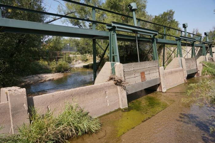
When Denver’s early settlers built the High Line Canal back in the 1880s, little did they know what the future would hold for the 71-mile man-made waterway that stretches from Waterton Canyon southwest of Littleton all the way to Aurora.
The High Line Canal was originally designed to deliver irrigation water to farmers on the dry plains of Denver. While Denver Water still owns and uses the canal to deliver irrigation water to customers, the canal corridor also has grown into a recreational asset and an ecological resource for the metro area.
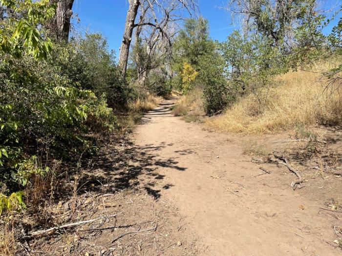
On the recreational side, each year around 500,000 people walk, run and ride the canal’s 71-mile maintenance road that also serves as a popular trail. As an ecological resource, some sections of the canal structure itself are now being used for stormwater management.
The High Line Canal is an irrigation ditch built in the 1880s. Denver Water still uses the canal to deliver irrigation water to customers when conditions allow. Photo credit: Denver Water.
The evolution of the public’s use of the canal for recreation and stormwater management, along with its original role as a water delivery method, is one of the reasons why Denver Water and regional partners, including cities, counties, park and flood districts and stormwater management entities, have partnered with the High Line Canal Conservancy. The nonprofit organization’s mission is to preserve, protect and enhance the 71-mile canal in partnership with the public.
Denver Water plays an active role in the ongoing discussions about the canal’s future as it continues to serve its High Line customers. Because the canal has a junior water right and experiences high seepage and evaporation losses over large distances, Denver Water is looking for more reliable and efficient ways to deliver water to some of the High Line customers.
The High Line Canal in operation in May 2021. The canal is an inefficient means of delivering water long distances. It can get clogged with debris and loses 60% to 80% of its water to the ground due to seepage. Photo credit: Denver Water.
“As the canal’s role in the metro area evolves, Denver Water is committed to making sure it remains a beneficial asset to the community,” said Jeannine Shaw, Denver Water’s former government relations manager. “That’s why in 2020, the Denver Water Board of Commissioners approved an historic $10 million pledge to the High Line Canal Conservancy to invest in the long-term care and maintenance of the canal corridor.”
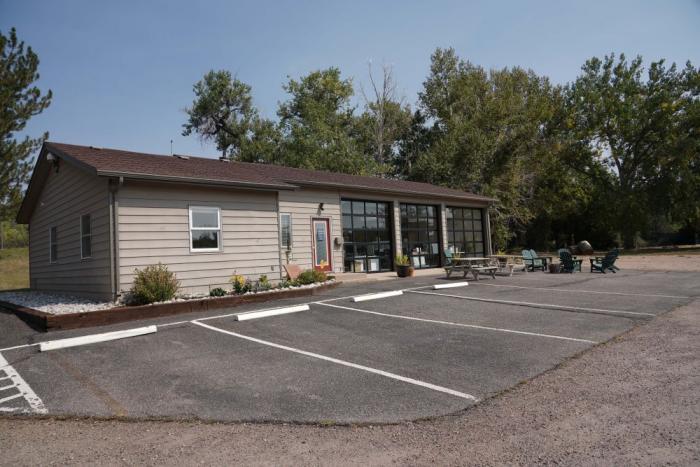
Included in the pledge is a piece of property and an office building located adjacent to the canal in Centennial for the Conservancy to use as its new headquarters.
The High Line Canal Conservancy’s new headquarters is located along the canal in Centennial. Denver Water provided the building to the nonprofit as part of a financial pledge in 2021. Photo credit: Denver Water.
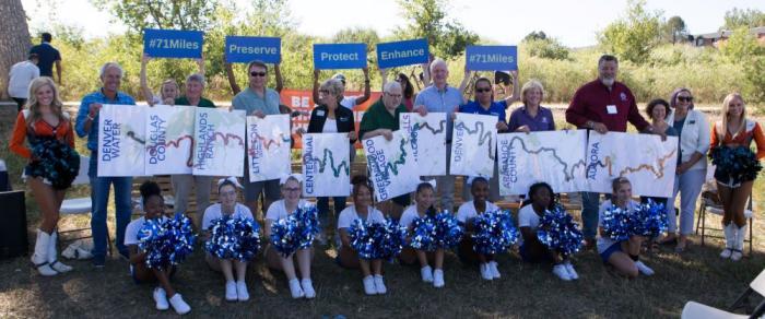
As part of this evolution, the Conservancy, Denver Water and canal stakeholders are creating a new management structure called the Canal Collaborative to formally connect the regional partners as they guide the future of the canal.
Representatives from the Canal Collaborative pose with supporters for a picture to celebrate their work. Photo credit: High Line Canal Conservancy.
“The collaborative helps us do more together than any one entity can do alone,” said Suzanna Fry Jones, senior director of programs and partnerships for the High Line Canal Conservancy. “The collaborative management structure will ensure this treasured resource is preserved, protected and enhanced as a regional legacy for future generations.”
The formalized structure will benefit citizens and the environment along all 71 miles of the canal as it winds its way through Denver as well as Adams, Arapahoe and Douglas counties.
The Canal Collaborative includes the High Line Canal Conservancy, Denver Water, Arapahoe and Douglas counties, the cities of Aurora, Denver, Cherry Hills Village, Greenwood Village and Littleton, the Highlands Ranch Metro District, the Mile High Flood District, the Southeast Metro Stormwater Authority and South Suburban Parks and Recreation.
“The collaborative is important because we need to have a group that brings together all of the jurisdictions so we can hear from each one of those entities and their communities about what’s most important to them,” said Nancy Sharpe, Arapahoe County Commissioner for District 2, which includes Centennial, Greenwood Village, a portion of Aurora and unincorporated central Arapahoe County.
The Conservancy was formed in 2014 and has developed “The Plan for the High Line Canal,” which lays out guidance for repurposing the corridor along with over 100 recommendations for new projects.
Here’s a look at some of the developments along the canal in recent years.
Ecological resource
Under the new Stormwater Transformation and Enhancement Program, High Line Canal partners are looking at ways to allow and move stormwater through areas of the canal to improve water quality and manage local flooding in the South Platte River Basin. This is in addition to the canal’s existing irrigation delivery purposes.
Stormwater is any rain and snow that eventually flows off any impervious surface and into the canal.
Several structures have been built in or on the side of the canal to help manage the flow of stormwater through the channel.
The new structures that are located on the side of the canal help improve drainage on city streets and collect debris and trash before water enters the canal.
The structures being built inside the canal also help catch and stop debris and trash from flowing down the channel. They also temporarily slow down and detain water to filter out sediment.
These structures are designed to improve water quality before the water reaches receiving streams. Moving stormwater through the canal could provide an additional 100 days that the canal could be wet in some parts of the channel, which would benefit vegetation along the corridor while also enhancing the recreational user experience.
“Often times across the country, old utility and railroad corridors become degraded once their primary uses have been reduced, so we’re happy to see areas of the High Line Canal being maximized and transformed into green infrastructure,” Shaw said.
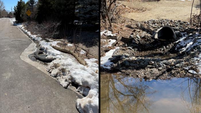
The City of Littleton built a stormwater management system on Windemere Street. Snow and rain drain through a grate on the street and into a pipe that flows into the High Line Canal. Photo credit: Denver Water.
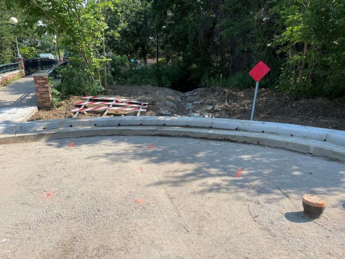
The City and County of Denver built four “drive-through forebays” at the end of several streets next to the High Line Canal across from Eisenhower Park. Before the structures were built, stormwater would flow uncontrolled and unfiltered into the canal. The forebays act as pre-treatment structures that will slow water down and allow sediment and trash to settle onto the street before entering the canal. Photo credit: Denver Water.
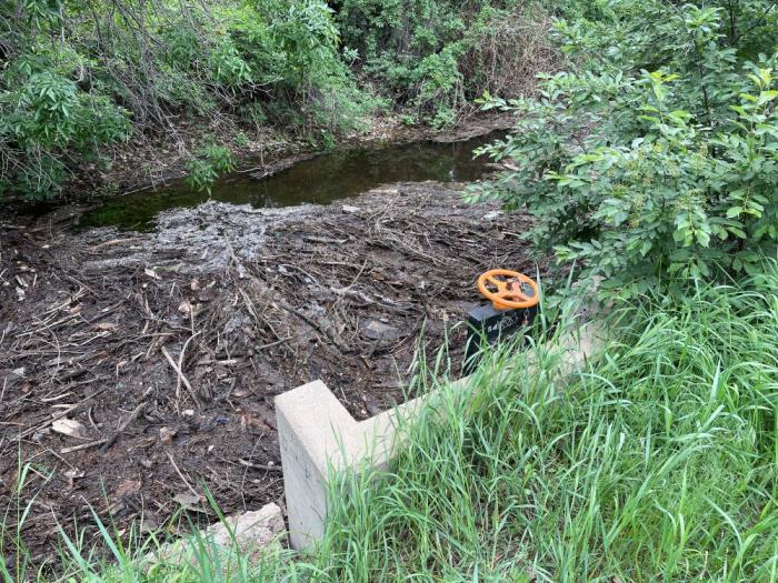
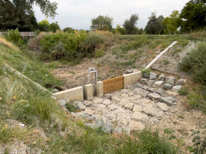
The City and County of Denver built three concrete structures called water quality berms in the canal. This structure in the canal at Wellshire Golf Course will control the flow of water and catch trash and debris, making it easier to remove while providing cleaner water. Photo credit: Denver Water.
A new water quality berm with a headgate in the High Line Canal at Eisenhower Park in Denver. The berm temporarily detains stormwater to promote filtration of sediment before water passes through to improve water quality in the canal’s receiving streams. Photo credit: High Line Canal Conservancy.
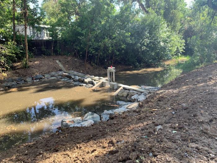
When the High Line Canal is not in operation, gates are fully opened at stream crossings. This allows stormwater that’s been filtered in the canal to go into receiving streams such as Big Dry Creek at deKoevend Park in Centennial. Big Dry Creek eventually flows into the South Platte River. Photo credit: Denver Water.
Along with Littleton and Denver, stormwater projects are also being implemented in Centennial, Douglas County and Greenwood Village with additional projects in progress. Learn more about the Stormwater Transformation and Enhancement Program in this video.
Denver Water and its regional partners also are exploring other opportunities to allow the canal structure to be used. In areas where it has adequate stormwater capacity the canal could provide additional benefits to the neighboring communities and their surrounding environment to improve water quality in the South Platte River basin.
“As we navigate the evolving future for the lands the High Line Canal irrigates, Denver Water is excited to further the work with our regional partners to find additional utility for this cherished resource,” Shaw said.
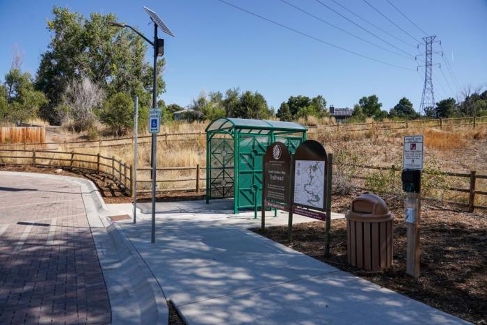
The High Line Canal in September 2021, near the South Quebec Way trailhead in southeast Denver. The canal is dry most of the year when not in operation for irrigation deliveries. Moving stormwater through the channel improves water quality and could add an additional 100 days when the canal could be wet in some parts of the canal. Photo credit: Denver Water.
Tree canopy health
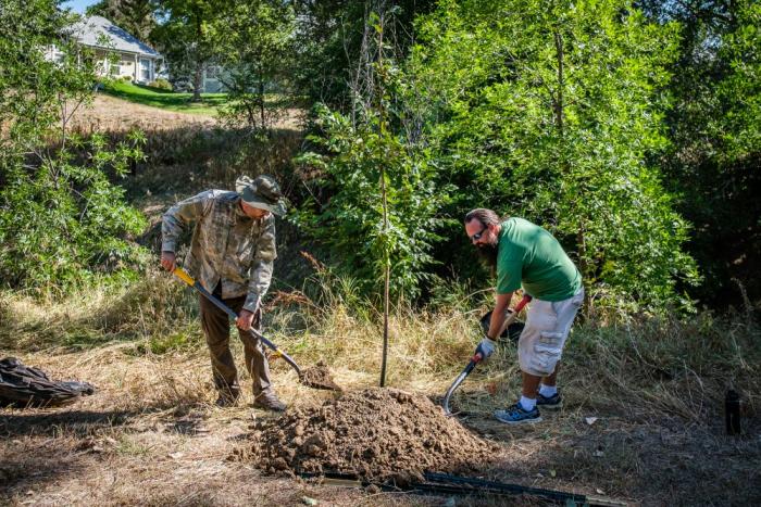
There are more than 23,000 mature trees along the High Line Canal, but many are at the end of their life span. The Conservancy is working with Denver Water and regional partners to remove dead trees and trim others to improve overall tree health and safety along the canal’s recreational trail.
To maintain the canal’s urban forest, the Conservancy’s Plan recommends planting 3,500 new trees by 2030. The species of trees being planted will be more drought tolerant than many of the old cottonwood trees currently along the canal.
In the fall of 2021, the Conservancy, along with the support of local volunteers and The Park People, planted 175 new, drought-tolerant trees. Photo credit: High Line Canal Conservancy.
Trail improvements
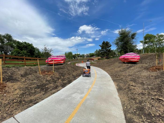
A major goal of the Conservancy and the Canal Collaborative is to make it easier, safer and more fun to walk or ride on the canal’s recreational trail. The Conservancy is working with local jurisdictions to add new pedestrian bridges, trailheads, underpasses, mile markers and wayfinding signs.
A biker rides through the new underpass that goes under South Colorado Boulevard and East Hampden Avenue next to Wellshire Golf Course in south Denver. The project provides a critical connection to allow safe passage under two busy streets, resulting in easier trail access and encouraging more users. The collaborative project was funded by the City and County of Denver, Cherry Hills Village and Arapahoe County along with funds from the federal government. Photo credit: Denver Water.
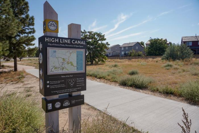
A new sign along the High Line Canal trail in Aurora installed in 2021 provides a map to help trail users navigate the corridor. Photo credit: Denver Water.
Arapahoe County Open Spaces opened a new trailhead on South Quebec Way in southeast Denver. The site includes parking, a bathroom, a trash can and a trail map. Adding new trailheads is major goal of the High Line Canal Conservancy to improve access and facilities for the public. Photo credit: Denver Water.
Canal Improvement Zones
Under The Plan, the Conservancy has worked with the community and jurisdictional partners to identify nine Canal Improvement Zones. These are locations where residents asked for trail enhancements to increase physical activity, foster community connections and create access points to nature.
Many of the sites are in diverse neighborhoods where the canal corridor has been historically under-utilized and lacked investment.
Enhancements may include pedestrian bridges, improved trail access, benches, signs, gathering spots and play areas.
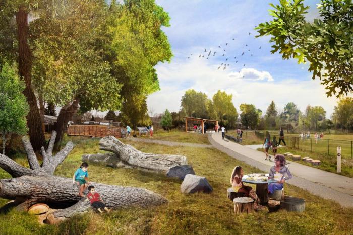
The first location to see new projects is the Laredo Highline neighborhood in Aurora, thanks to a $180,000 grant from the Colorado Health Foundation and an additional $180,000 from Arapahoe County.
A rendering of enhancements to the High Line Canal trail in Aurora’s Laredo Highline neighborhood. The enhancements include a new pedestrian bridge to improve trail access and new play and seating areas. Image credit: High Line Canal Conservancy.
“I grew up in the Laredo Highline neighborhood and the canal has always helped bring the community together,” said Aurora resident Janak Garg. “We’re really looking forward to the new bridge and other improvements coming to the neighborhood.”
Janak Garg and his family stand at the spot where a new pedestrian bridge will be built across the canal in Aurora’s Laredo Highline neighborhood. Photo credit: Denver Water.
New mile markers
A very noticeable and welcome improvement to the trail is the addition of new mile markers. In the past, there were a variety of mile markers with different mileage from each jurisdiction, which made it confusing for hikers and bikers.
Now there are new Colorado red sandstone mile markers that line the trail from start to finish, paid for through donations by the Conservancy’s founding partners.
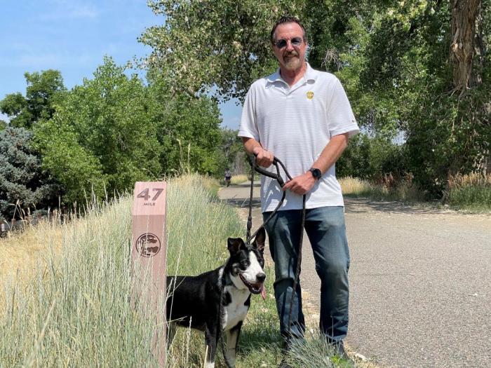
Most of the markers have a quote or message from the founding partners, like Al Galperin who lives near the South Quebec Way Trailhead, whose message reads: “Be the reason someone smiles today.”
“I hope it brings a little bit of extra joy to people on the trail,” Galperin said. “It’s nice to be able to help out and see all the new features coming to the canal.”
Al Galperin and his dog Brody stand next to one of the new mile markers along the High Line Canal trail. Galperin is one of the High Line Canal Conservancy’s Founding Partners who made a donation to help fund the mile marker project. Photo caption: Denver Water.
“It’s inspiring to see all these improvements and we’re excited for the future of the canal,” Shaw said. “The Conservancy and all of the partners are doing a great job leading the way and working with Denver Water and the community.”
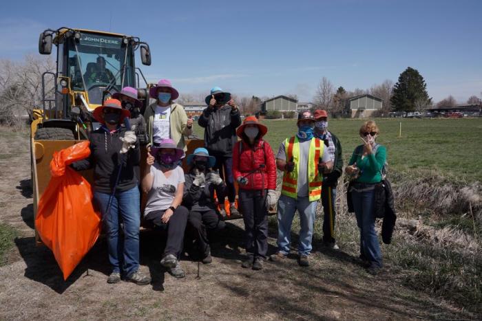
Denver Water crews participate with volunteers to help clean up the canal in Aurora in April 2021. Photo credit: Denver Water.
Visit highlinecanal.org to sign up for monthly emails for information on events throughout the year. The website also provides information about history of the canal, new projects and volunteer opportunities.
Republican River in Colorado January 2023 near the Nebraska border. Photo credit: Allen Best/Big Pivots
Click the link to read the article on the Big Pivots Website (Allen Best):
Climate scientists issue their latest, stern warning while farmers in Colorado’s Republican River Basin grapple with how to be sustainable
The International Panel on Climate Change this week [March 20, 2023] issued its latest report, warning of a dangerous temperature threshold that we’ll breach during the next decade if we fail to dramatically reduce emissions. A Colorado legislative committee on the same day addressed water withdrawals in the Republican River Basin that must be curbed by decade’s end.
In both, problems largely created in the 20th century must now be addressed quickly to avoid the scowls of future generations.
The river basin, which lies east of Denver, sandwiched by Interstates 70 and 76, differs from nearly all others in Colorado in that it gets no annual snowmelt from the state’s mountain peaks. Even so, by tapping the Ogallala and other aquifers, farmers have made it one of the state’s most agriculturally productive areas. They grow potatoes and watermelons but especially corn and other plants fed to cattle and hogs. This is Colorado without mountains, an ocean of big skies and rolling sandhills.
Republican River farmers face two overlapping problems. One is of declining wells. Given current pumping rates, they will go dry. The only question is when. Some already have.
More immediate is how these wells have depleted flows of the Republican River and its tributaries into Nebraska and Kansas. Those states cried foul, citing a 1943 interstate compact. Colorado in 2016 agreed to pare 25,000 of its 450,000 to 500,000 irrigated acres within the basin.
Colorado has a December 2029 deadline. The Republican River Water Conservation District has been paying farmers to retire land from irrigation. Huge commodity prices discourage this, but district officials said they are confident they can achieve 10,000 acres before the end of 2024.
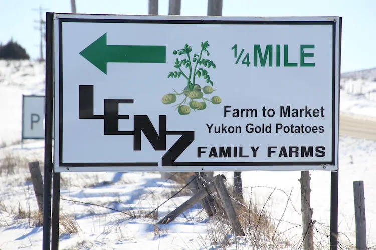
Rod Lenz and siblings moved to the Republican River Basin in 1974 to take advantage of new technology that allowed them to draft the then-vast stores of the Ogallala and other High Plains aquifers. Top, the main stem of the Republican River flows into Nebraska augmented by water from special wells and a pipeline constructed at a cost of $60 million. January 2023 photos/Allen Best
Last year, legislators sweetened the pot with an allocation of $30 million, and a like amount for retirement of irrigated land in the San Luis Valley, which has a similar problem. Since 2004, when it was created, the Republican River district self-encumbered $156 million in fee collections and debt for the transition.
It’s unclear that the district can achieve the 2030 goal. The bill unanimously approved by the Colorado House Agriculture, Water and Natural Resources Committee will, if it becomes law, task the Colorado Water Center at Colorado State University with documenting the economic loss to the region – and to Colorado altogether – if irrigated Republican River Basin agriculture ceases altogether. The farmers may need more help as the deadline approaches.
This all-or-nothing proposition is not academic. Kevin Rein, the state water engineer, testified that he must shut down all basin wells if compact requirements are not met. The focus is on the Republican’s South Fork, between Wray and Burlington.
Legislators were told that relying solely upon water that falls from the sky diminishes production 75 to 80 percent.
In seeking this study, the river district wants legislators to be aware of what is at stake.
Rod Lenz, who chairs the river district board, put it in human terms. His extended-family’s 5,000-acre farm amid the sandhills can support 13 families, he told me. Returned to grasslands, that same farm could support only two families.
An “evolution of accountability” is how Lenz describes the big picture in the Republican River Basin. “We all knew it was coming. But it was so far in the future. Well, the future is here now.”
Much of the agricultural production in the Republican River Basin supports livestock sectors, including this dairy near Holyoke. Photo/Allen Best
The district has 10 committees charged with investigating ways to sustain the basin’s economy and leave its small towns thriving. Can it attract Internet technology developers? Can the remaining water be used for higher-value purposes? Can new technology irrigate more efficiently?
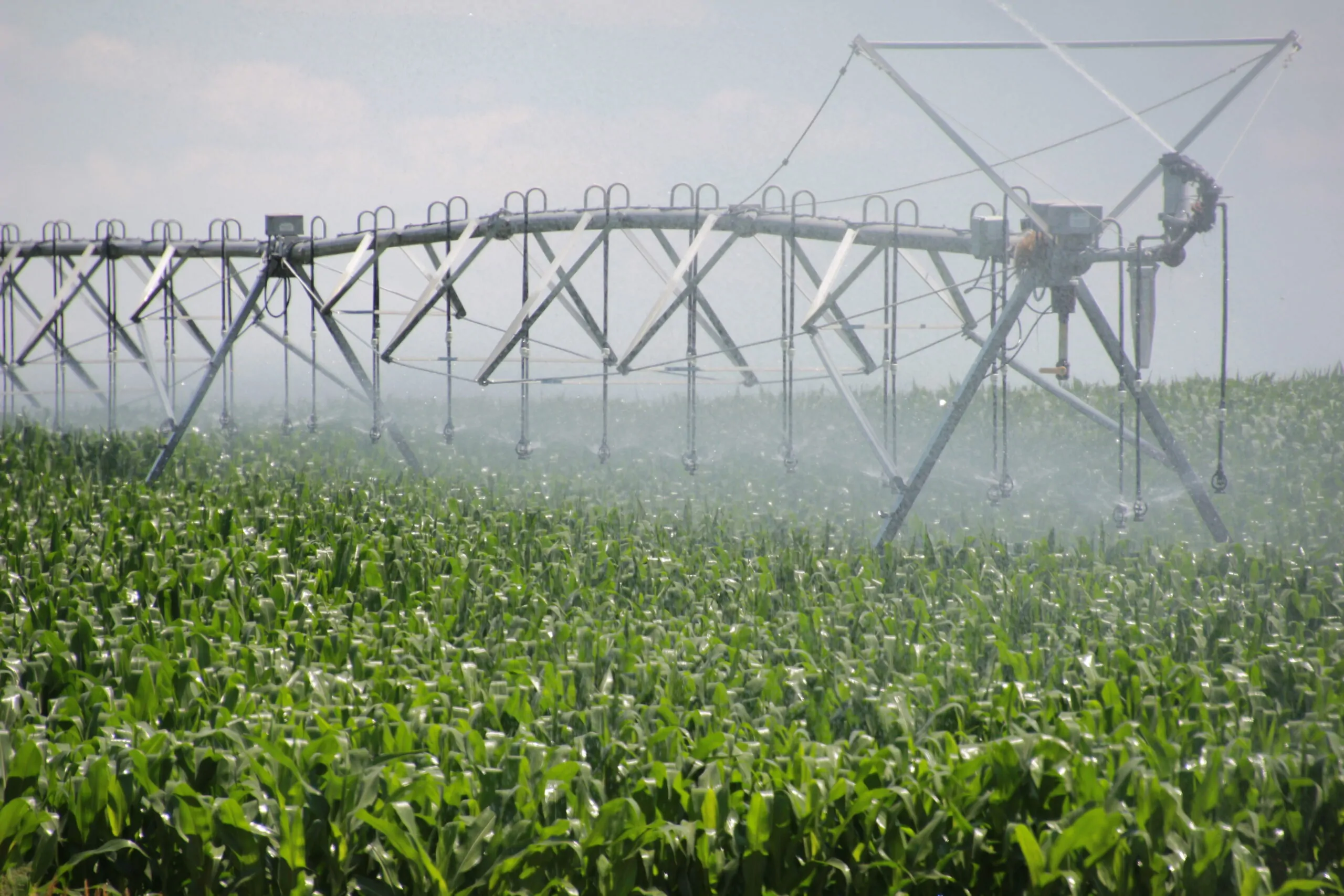
“We do know we must evolve,” Lenz told me. The farmers began large-scale pumping with the arrival of center-pivot sprinklers, a technology invented in Colorado in 1940. They’re remarkably efficient at extracting underground water. Aquifers created over millions of years are being depleted in a century. Now, they must figure out sustainable agriculture. That’s a very difficult conversation.
The Republican River shares similarities with the better-known and much larger Colorado River Basin. The mid-20th century was the time of applying human ingenuity to development of water resources. Now, along with past miscalculations, the warming climate is exacting a price, aridification of the Colorado River Basin.
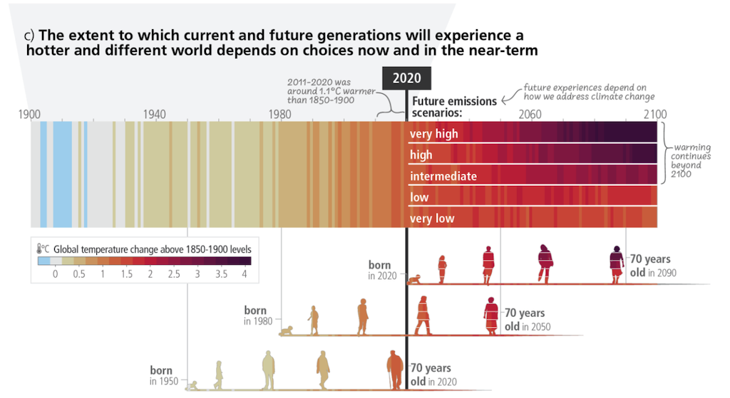
Observed (1900-2020) and projected (2021-2100) warming relative to pre-industrial temperatures (1850-1900). Projections relate to very low emissions (SSP1-1.9), low emissions (SSP1-2.6), intermediate emissions (SSP2-4.5), high emissions (SSP3-7.0) and very high emissions (SSP5-8.5). Temperatures are colour-coded from the pre-industrial average (blue-grey) through to current warming of 1.1C (orange) and potentially more than 4C by 2100 (purple). Source: IPCC (2023) Figure SPM.1
Globally, the latest report from climate scientists paints an even greater challenge. To avoid really bad stuff, they say, we must halve our greenhouse gas emissions by 2030. They insist upon need for new technologies, including ways to suck carbon out of the atmosphere, that have yet to be scaled.
We need that evolution of accountability described in Colorado’s Republican River Basin. We need a revolution of accountability on the global scale. [ed. emphasis mine]
Yuma and adjoining counties routinely rank among Colorado’s top producers of corn. Photo/Allen Best