
Click the link to read the article on The Land Desk website (Jonathan P. Thompson):
April 3, 2026
The News: The Trump administration is formally proposing to revoke the Biden-era ban on new oil and gas leases within the 10-mile buffer zone around Chaco Culture National Historical Park in northwestern New Mexico. The Bureau of Land Management is accepting public comments for just seven days, with the input period ending April 7.
The Context: When President Theodore Roosevelt wielded the brand new Antiquities Act in 1907 to create Chaco Canyon National Monument, he drew the boundaries around what is now known as “downtown Chaco,” a handful of structures including the 800-room Pueblo Bonito, constructed between the 9th and 12th centuries by ancestors of today’s Pueblo people.
That was merely the center of the Chacoan world, however, which extended over 100 miles outward into the Four Corners region. No one knows if this was a political empire, a religious or cultural society, or a school of architecture, but it is clear that the dozens of Chacoan outliers or “great houses,” along with thousands of smaller sites, shrines, and architectural features with unknown function, did not exist in isolation. They were part of a cultural tapestry woven into the natural landscape. The national monument, in other words, was vastly incomplete, which is especially concerning given that it lies in would become one of the nation’s most heavily drilled oil and gas fields.
That’s not to say that Chacoan sites are devoid of protections. The park itself is off-limits to all oil and gas development. Pierre’s Site and several other outliers are part of the Chaco Culture Archaeological Protection Sites Program, and all sites on federal land are shielded by the Archaeological Resources Protection Act and Section 106 of the National Historic Preservation Act, which requires oil companies to conduct a cultural inventory of all land in the path of development. If the surveyors happen upon a “significant” site, the well pad or road or pipeline must be relocated, if possible, at least 50 to 100 feet away, a process known as “identify and avoid.” Tribes are supposed to be consulted in these cases, as well, though their concerns aren’t always considered.
But “identify and avoid” misses a great deal.
“Even though agencies try to mitigate the impact, it isn’t enough because you’ve literally destroyed the context in which those things exist,” Theresa Pasqual told me several years ago when I was writing about Indigenous resistance to drilling around Chaco. She is the former director of Acoma Pueblo’s Historic Preservation Office, and a descendant of the Pueblo people who occupied the Four Corners region for thousands of years. “Most of our pueblos are still transmitting their migration history through oral means. So when you have development that begins to impact many of these sites — that range in size from the grandeur of Chaco Canyon or Mesa Verde to very small unknown sites that still remain un-surveyed and unknown to the public — they are literally destroying the pages of the history book of the Pueblo people.”
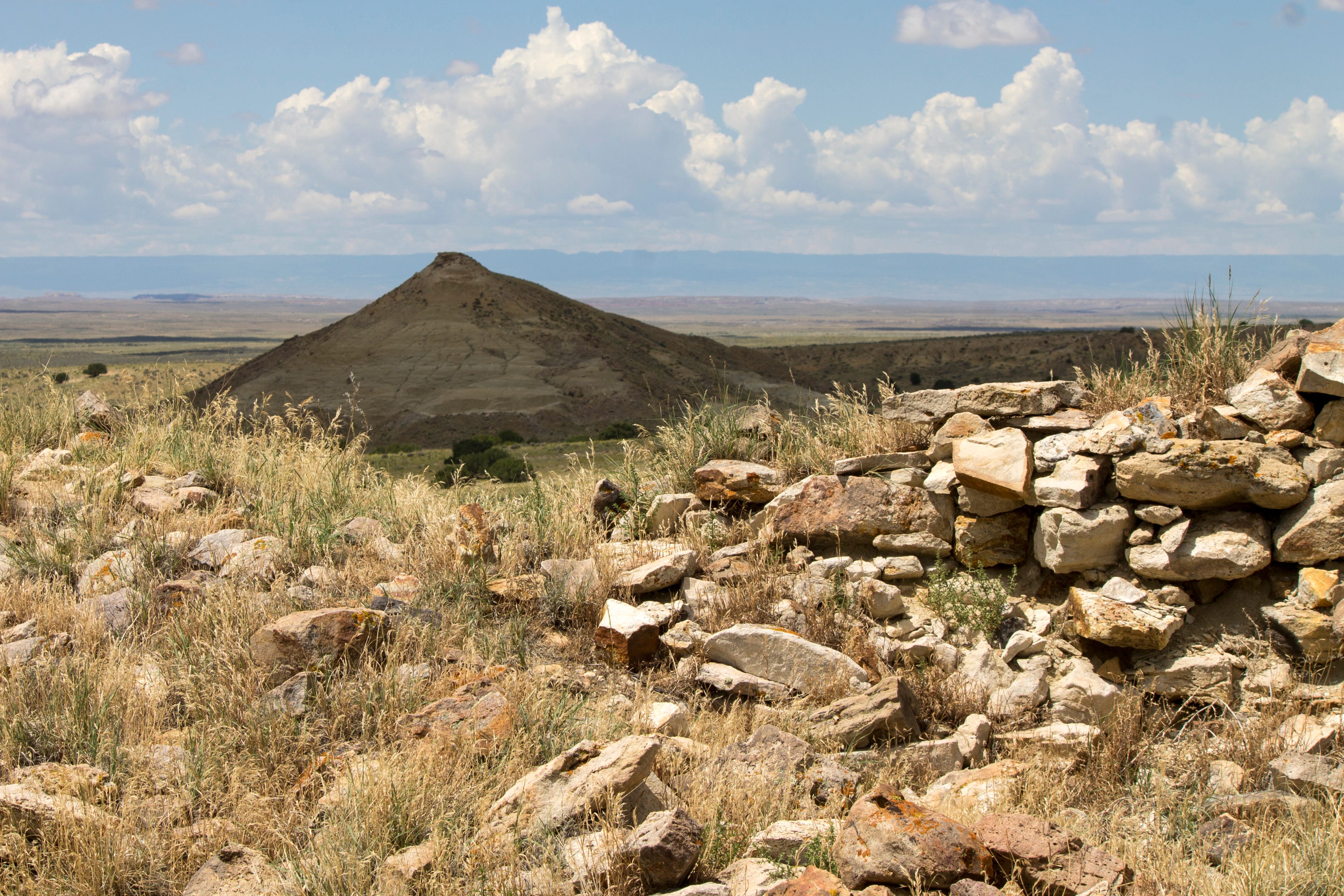
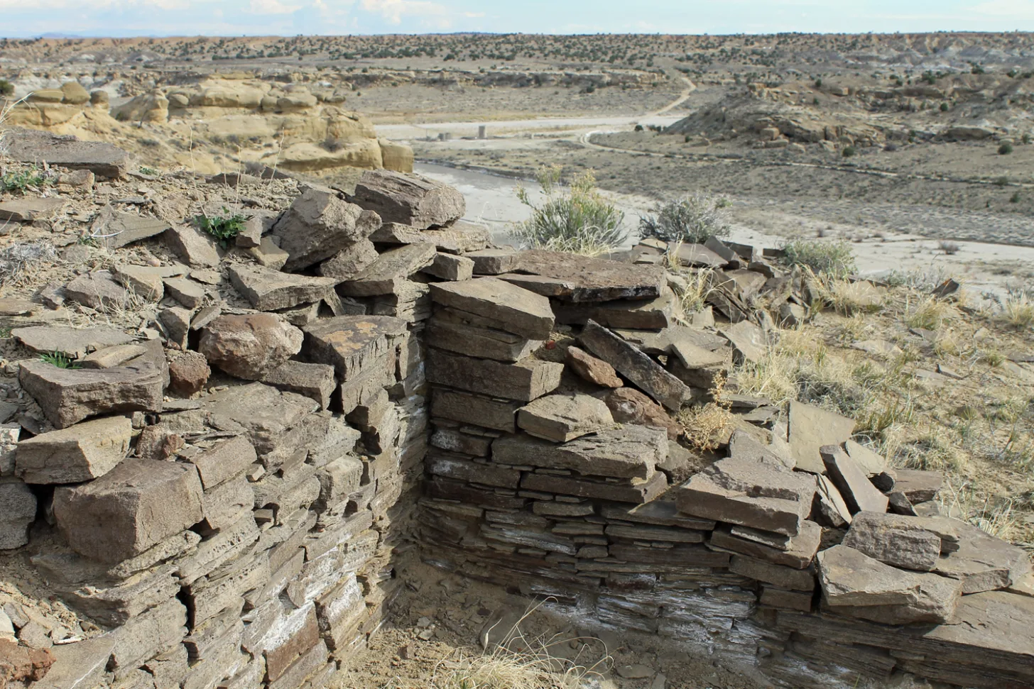
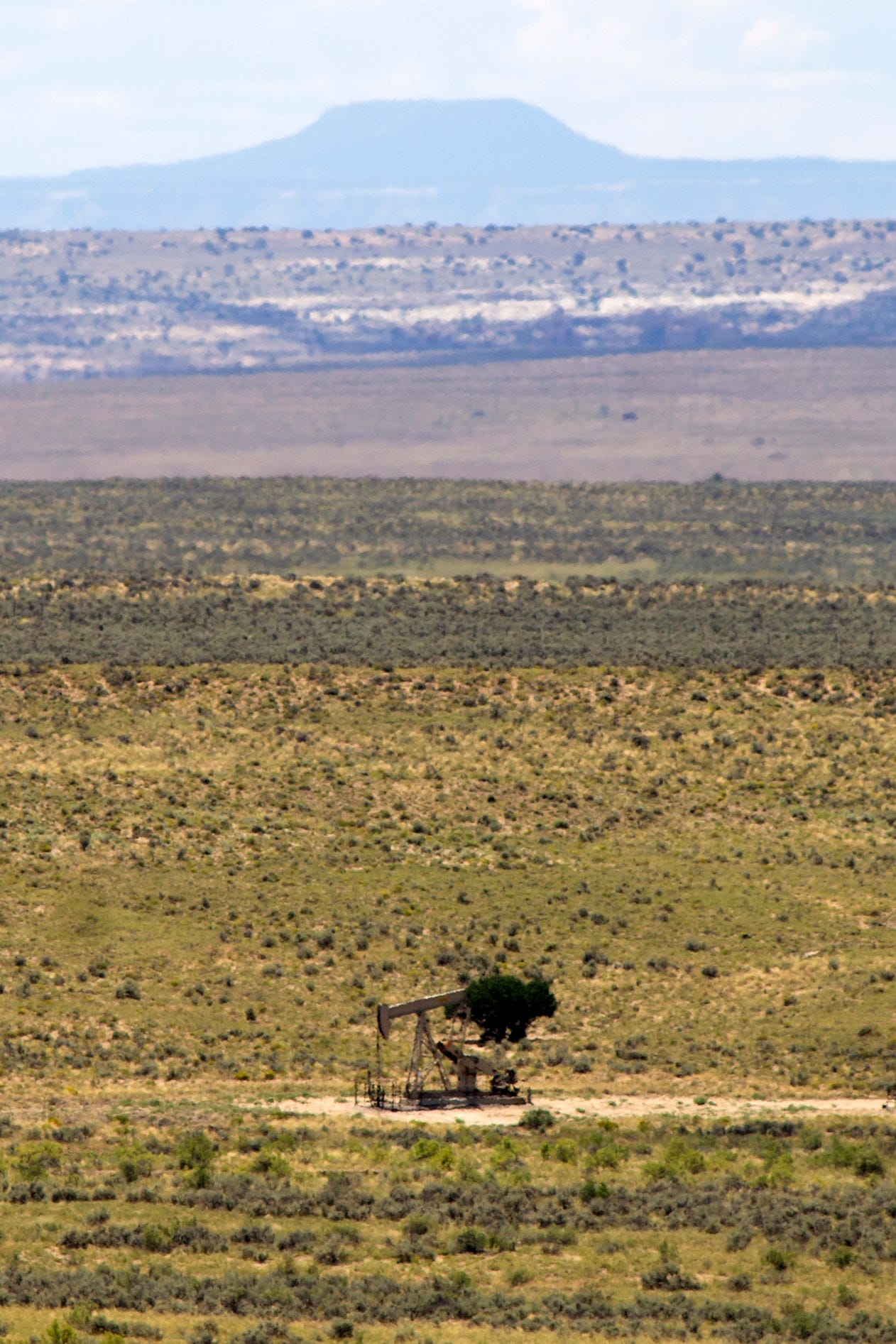
Pierre’s Site, a Chacoan great house about nine miles north of the park’s boundary, illustrates this concept. The site is made up of a collection of thick-walled stone structures built among and in harmony with distinctive shale and sandstone buttes and bluffs. That “page,” or the structures and their immediate surroundings, has been kept intact by the aforementioned protections. But a cluster of well pads, along with pumpjacks, tanks, and associated infrastructure sit less than a half-mile away, and they are visible — and their whir-pop-whir sounds audible — from the site. They not only affect the way one experiences Pierre’s, but also have surely erased some of the important context.
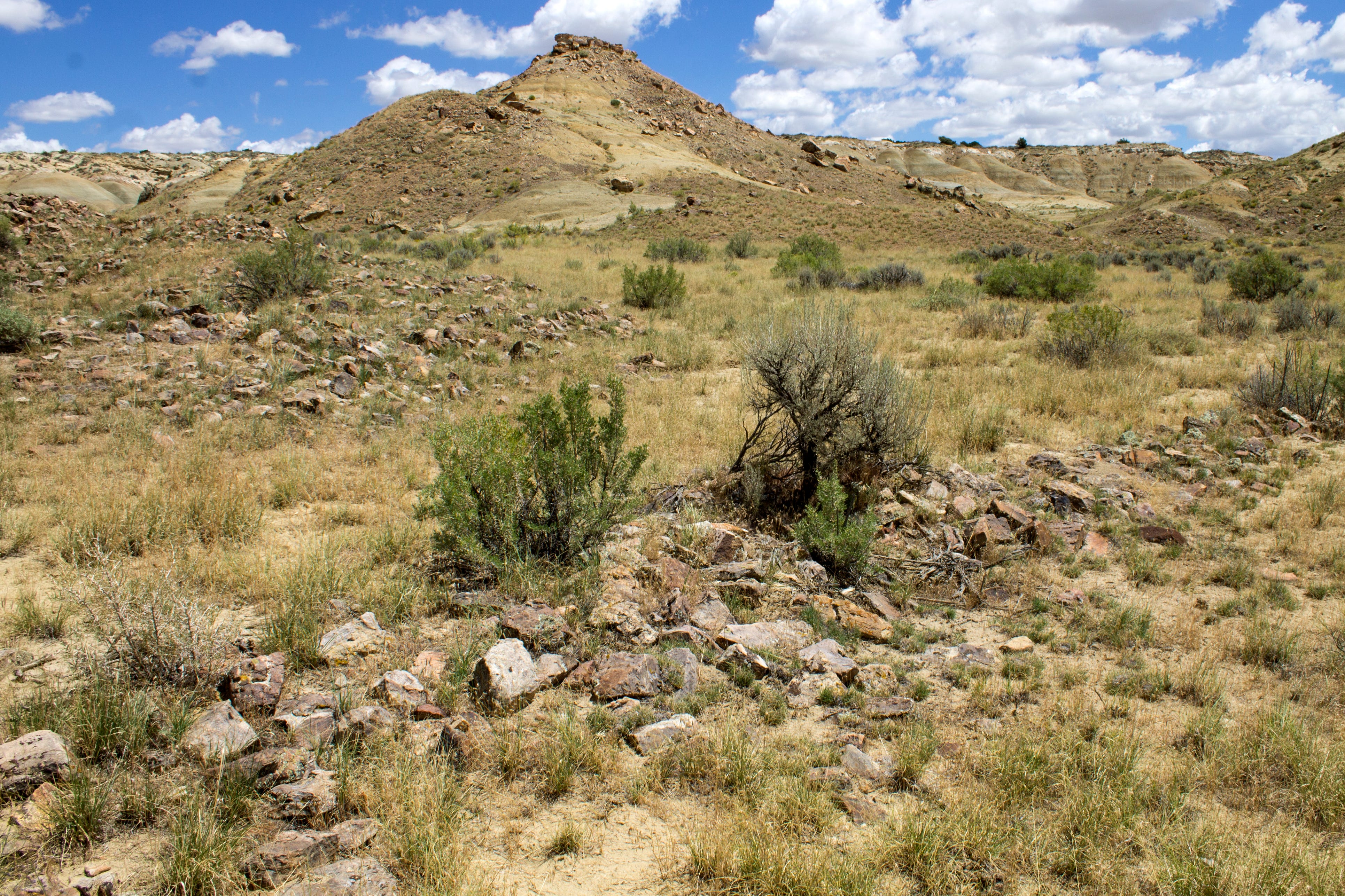
Pierre’s lies along the Great North Road—the most prominent and visible of several such “roads” in the region—an architectural feature that stretches directly north of Chaco Canyon for 30 miles or more. It may have been a symbolic path through time, connecting old worlds with new, or a reminder of the power Chaco-central wielded over its outliers, or a giant arrow pointing people to a holy place. Chaco scholar Paul Reed calls it “a landscape monument on a large scale.” Yet little effort has been made to protect it. Oil field roads and pipelines cross it in dozens of places, and workers have bulldozed well pads right on top of it, erasing the subtle signs that it was ever there. If something so significant can get plowed under, how many more subtle features—shrines, corn fields, plant-gathering sites, ceremonial areas, flint-knapping spots—have been destroyed indelibly?
It was with the greater context in mind that in 2023, after years of consideration, public meetings, and analysis, President Joe Biden signed Public Lands Order 7923, which withdrew about 336,000 acres of public land from oil and gas leasing for 20 years. Tribal nations with ties to the cultural landscape, environmental advocates, and archaeologists had sought the withdrawal to provide a buffer zone around the national historical park and to add a layer of protection to the associated sites within 10 miles of the park’s boundaries.
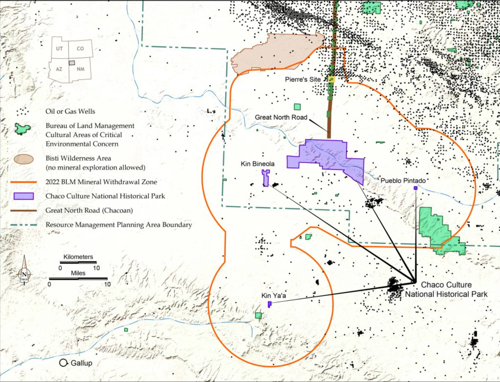
The withdrawal was incomplete, in that it still covered only a tiny slice of the greater Chaco landscape. Several significant outliers, along with about 20 miles of the Great North Road, remained unprotected. Chaco is also in the middle of what’s known as the Checkerboard, a hodgepodge of land ownership and jurisdictions, which complicates the withdrawal, since it only applies to BLM land. The Checkerboard lies within the Navajo Nation’s borders, but it is not reservation land, and it includes Bureau of Land Management land, state lands, private lands, and Indian allotments, which exist in a sort of limbo between private, tribal, and federal land.
The Navajo Nation initially supported the withdrawal, but when tribal leadership changed, so did its stance. In response to pressure from allotment owners within the buffer zone, who worried that their royalties from drilling would be threatened, the Buu Nygren administration turned against the buffer. While leasing is still allowed on those allotments within the withdrawal area, an oil and gas company is less likely to drill there because they can’t “pool” the allotment resources with those of neighboring federal parcels.
Project 2025, the right wing’s playbook for the Trump administration, directly called for the Chaco buffer zone’s elimination, and Interior Secretary Doug Burgum has been toying with the idea for the last year. Finally, on the last day of March, the administration opened a one-week public comment period, on the proposal to either revoke the buffer zone altogether, or to reduce it to a five-mile radius around the park, which would leave out Pierre’s and other significant sites.
The All Pueblo Council of Governors, Indigenous and environmental advocates, archaeology groups, and New Mexico’s congressional delegation all pushed back on the Trump administration’s move and called for the current buffer zone to be retained.
To give your two cents on the proposal, go to the BLM’s project page. [ed. emphasis mine]
***
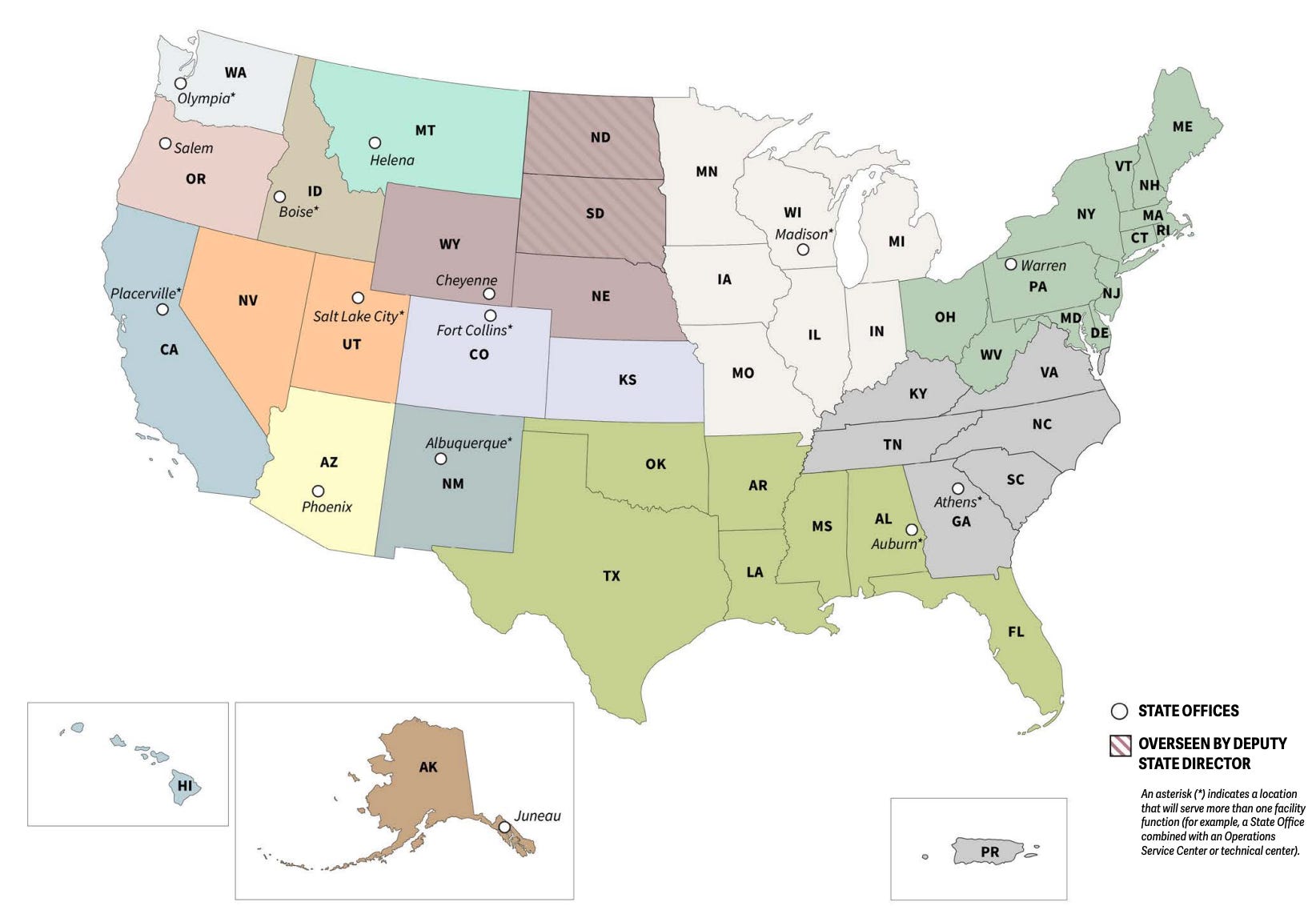
The Trump administration announced it will move the U.S. Forest Service headquarters from Washington, D.C., to Salt Lake City as part of a “sweeping restructuring of the agency to move leadership closer to the forests and communities it serves.” The shake-up includes:
- Moving about 260 employees from Washington HQ to Salt Lake City, and shuffling around another 2,600 staffers;
- Eliminating its region-based organizing structure and shifting it to one centered around 15 state-level offices. This will include shuttering regional offices, some of which will be retained for other purposes;
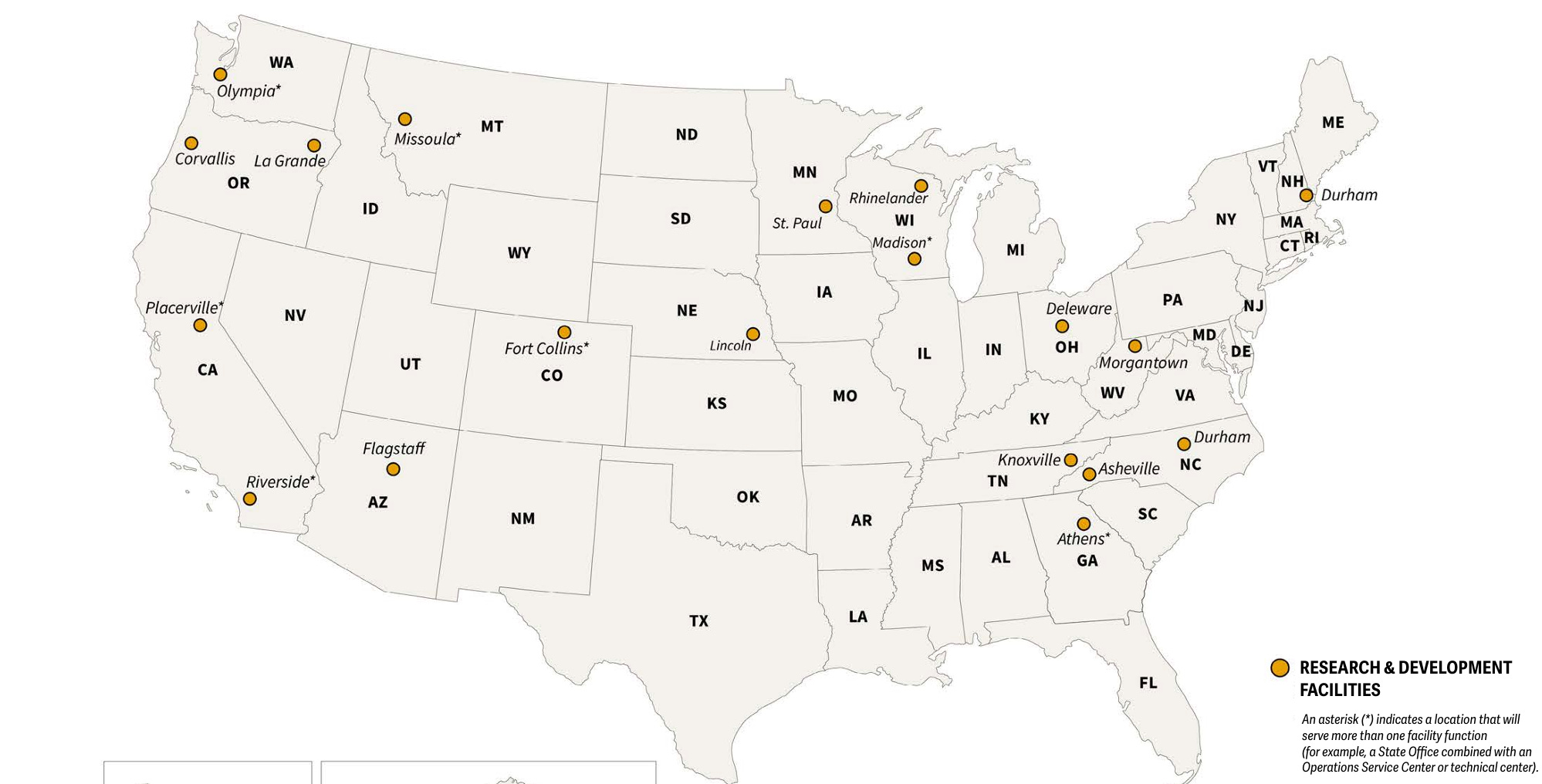
- Closing 57 research and development stations, while retaining 20, eight of which are in Western states;
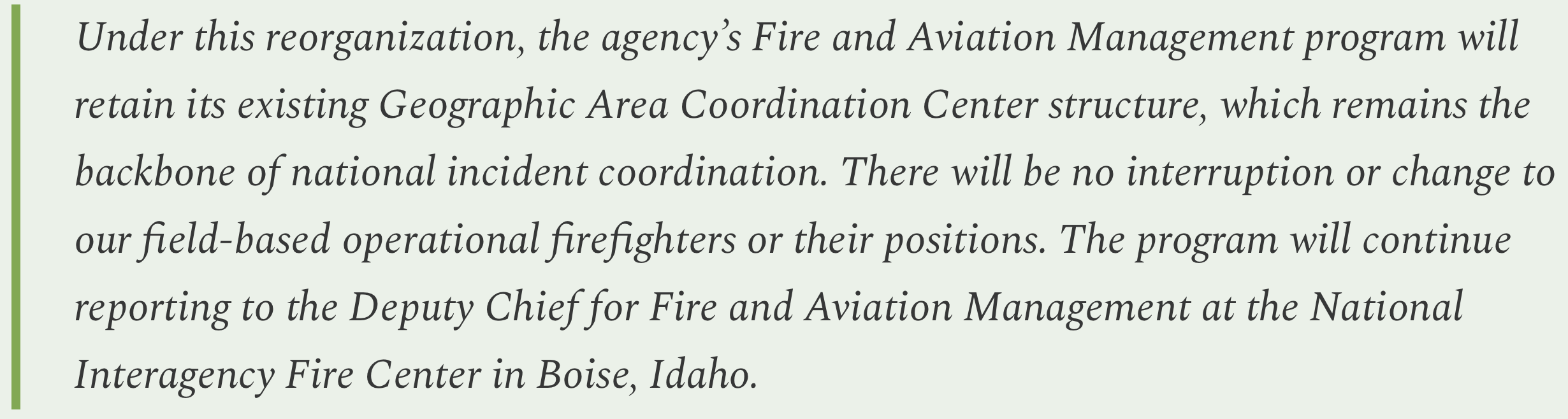
- As for firefighting, a Forest Service press release noted:
Administration officials say the overhaul is aimed at making the agency, which is a branch of the U.S. Agriculture Department, more nimble and efficient. Yet it has not provided an analysis of how such a vast restructuring would accomplish those goals, or how much money it would save. It comes about a year after the so-called “Department of Government Efficiency,” or DOGE, fired about 3,400 Forest Service employees, or more than 10% of the agency’s total workforce.
It’s all part of a larger departmental overhaul designed to “bring the USDA closer to its customers,” according to a USDA memorandum from last year. Customers? Do they mean the extractive industries? The American people? Or what? Either way, it seems like strange terminology for a government agency to be using.
In reality, as Christine Peterson reports in High Country News, the overhaul is doing little except sowing confusion and concern among agency staffers and observers.
As I’ve written here before, I don’t see moving public land agencies out of Washington to be an unmitigated disaster in and of itself. And contrary to some takes, it won’t automatically lead to wholesale clearcutting of the West’s forests. Forest Service and BLM higher-ups don’t need to be close to Capitol Hill or the White House to do their jobs, especially in the Zoom age. And it wouldn’t hurt to get the Forest Service Chief or the BLM Director out on the landscapes they oversee a bit more often, where perhaps they can see the consequences of projects or policies they may sign off on. Utah may be a questionable location, given the state’s leaders hostility toward public land management, but Salt Lake City is a fairly progressive place, and the likes of Sen. Mike Lee will have just as much access to agency leaders in D.C. as they would in SLC.
That said, if such a move is not done correctly, it can be disastrous. Take Trump’s first-term relocation of the Bureau of Land Management’s headquarters to Grand Junction, Colorado, in 2019. That led to a de facto agency housecleaning; many senior staffers chose to resign or move to other agencies rather than uproot their lives and families and move across the country, and only a handful of workers ended up in the Colorado office, which shared a building with oil and gas companies. A vast storehouse of institutional knowledge and expertise was lost, and virtually nothing was accomplished.
We’re likely to see the same sort of dynamic playing out with this move, even though SLC is larger, more cosmopolitan, and has a bigger airport than GJC. Plus, the USFS overhaul is far more than a mere HQ move. Shuttering nearly 60 research and development facilities, many of which are tied to universities or colleges, will have a major impact, even if their functions and staff are moved elsewhere. Ditto with the regional-to-state office shuffle (the point of which is what, exactly?).
And, this is all happening as the administration makes a push to return the Forest Service to its timber plantation era, which ran from the 1950s through the ’80s. During that time, logging companies harvested 10 billion to 12 billion board-feet per year from federal forests, while for the last 25 years, the annual number has hovered below 3 billion board-feet. Now, Trump, via his Immediate Expansion of American Timber Production order, plans to crank up the annual cut to 4 billion board-feet by 2028. How? By declaring an “emergency” that allows the agency and logging companies to bypass environmental laws. Never mind that the infrastructure and demand don’t necessarily exist to carry out this plan.
Rollins issued a memo last year declaring that the threat of wildfires, insects and disease, invasive species, overgrown forests, the growing number of homes in the wildland-urban interface, and more than a century of rigorous fire suppression have contributed to what is now “a full-blown wildfire and forest health crisis.” And she expanded the “emergency situation” acreage from 67 million acres under Biden, to almost 113 million acres, or 59% of all Forest Service lands, opening it up to streamlined forest “management,” aka timber operations.
🥵 Aridification Watch 🐫
I’m calling it: The Dolores River in Dolores reached peak spring runoff of 1,090 cubic feet per second on March 26. If this holds (and, yes, there is a chance that April showers will bring big May flows), then it will be the earliest peak on record by far. This is more an indication of how intense and unusual the end-of-March heat wave was than of how scant the snowpack was. It was the fourth lowest peak flow on record, behind 2002, 1977, and 2018.

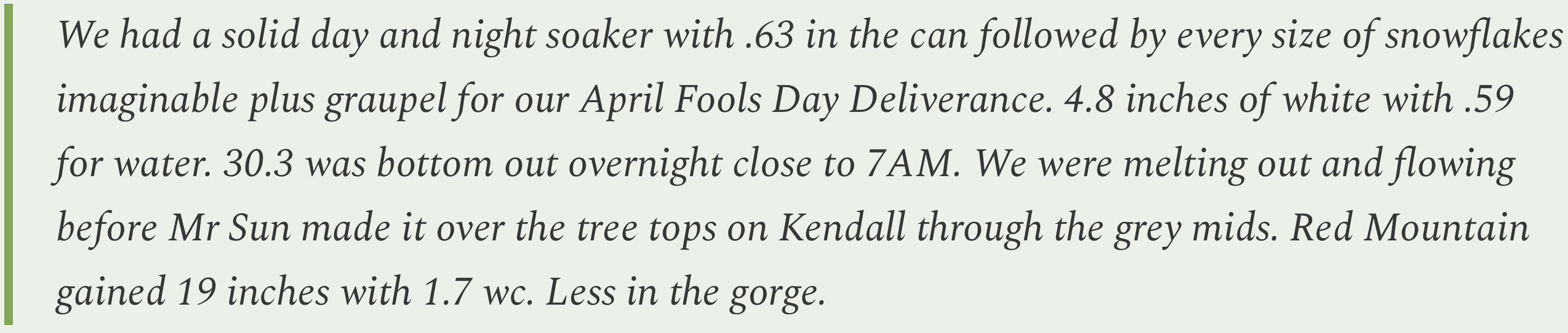
Silverton, Colorado’s weather watcher Fred Canfield reports on a welcome burst of moisture at the high country burg in early April, writing:
Parting Cheeseburger Query
Four years ago, I asked you kind readers (or at least the ones that were around back then), for your recommendations on the best independent bookstores and green chile cheeseburgers in the West so I could add them to the Land Desk Green Chile Atlas. I know, it’s kind of weird to combine the two, and I apologize to all vegan booksellers that this pairing may offend (but I will add that vegan burgers are included, too).
Now I figured I’d come back and not only remind you that the Atlas exists, but also ask for updates, new book or green chile-related finds. So fire away!