Dangling money, the developers at Renewable Water Resources — which counts former Gov. Bill Owens as a principal — contend that because the urban Front Range is the richest part of the state, it has the potential to give the most to the poorest.
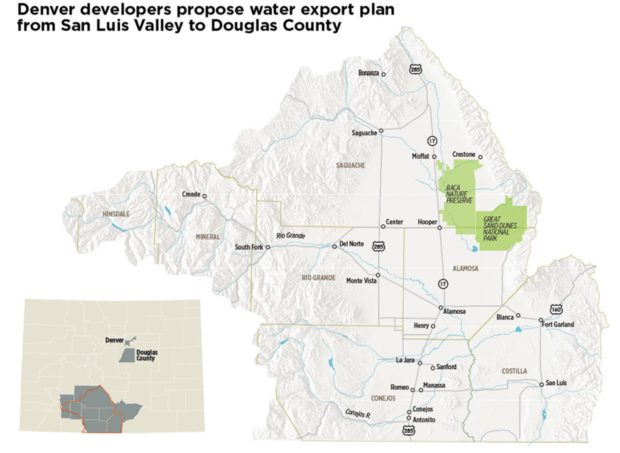
They envision pumping 22,000 acre-feet per year from 14 wells drilled 2,000 feet deep at the foot of the Sangre de Cristo mountains, building a pipeline costing $250 million to $600 million, and then pumping water at least 40 miles northward over Poncha Pass toward Front Range cities.
“We need between 300,000 acre-feet and 500,000 acre-feet of new water for the Front Range. The question is: Where’s that going to come from?” said Sean Tonner, managing partner of Renewable Water Resources.
“We can take it out of the Colorado River, but we know what the stresses are there. The Poudre River? The Arkansas? The South Platte is already the most over-appropriated river. Folks are looking at moving water from the Mississippi River back to Colorado,” he said. “These are the lengths people are looking to for adding water.”
Exporting San Luis Valley water would be “fairly easy” compared with other options, Tonner said…
The San Luis Valley retort? “There is no win-win,” said Cleave Simpson, manager of the Rio Grande Water Conservation District and a farmer, who has been traveling statewide to make the case against this trans-basin diversion of water…
The intensifying water battle here reflects the rising tensions and inequities across the arid western United States, where water and control over water looms as a primary factor of power. Thirsty Castle Rock, Parker, Castle Pines and other south metro Denver suburbs, where household incomes top $110,000 and development has depleted the groundwater, can marshal assets that dwarf those of farmers in the San Luis Valley, where families’ average income is less than $35,000…
State officials in Denver say they will study Renewable Water Resources’ proposal once the developers file it at the state water court in Alamosa.
“We’ll have to have a perspective of being open to anything,” said Colorado Department of Natural Resources director Dan Gibbs, declining to take a position…
A Renewable Water Resources diagram provided to The Denver Post presented details of a water-siphon project that would begin near Moffat on a company-owned ranch with 14 wells spaced 1 mile apart. A pipeline, 24 inches to 32 inches in diameter, would convey no more than 22,000 acre-feet of water per year northward at least 40 miles over Poncha Pass to Salida, and also to a point west of Fairplay, Tonner said.
San Luis Valley water then could be diverted into the Arkansas River, the Eleven Mile Reservoir used by Colorado Springs and the upper South Platte River that flows into a series of Denver Water reservoirs, he said.
The exported valley water purchased by south Denver suburbs ultimately would be stored in the newly enlarged Chatfield Reservoir southwest of Denver and Parker’s Rueter-Hess Reservoir, still barely half full. Suburban water users would pay the cost of the pipelines, Tonner said, and Renewable Water Resources would use $68 million raised from investors to purchase water rights in the valley — rights to pump 32,000 acre-feet of water for irrigation. But the developers would export no more than 22,000 acre-feet a year. The difference would mean a net gain for the aquifer…
At least 40 farmers have inquired about selling water rights, some of them meeting with former Gov. Owens and other Renewable Water Resources officials. Tonner also declined to identify those farmers…
The ethics of siphoning water away from low-income areas toward the richest parts of the state would have to be considered as part of the state’s water project planning process, said Rebecca Mitchell, director of the Colorado Water Conservation Board.
“That is definitely something that has to be looked at. Is that the way we want to grow as a state? Is that what the value structure is?” Mitchell said. “There are cases where those (trans-basin diversions) can be win-win. But without the buy-in of the local community, there are going to be struggles.”
In recent months, Renewable Water Resources’ principals have been working quietly in the valley, meeting with farmers and proposing the creation of a $50 million “community fund” and possibly other payments. Just the annual interest income from such a fund could exceed Saguache County’s current budget, Tonner said.
By paying farmers for a portion of their water rights, Renewable Water Resources could help them stay on their land, perhaps growing different crops that require less water such as hemp, and infuse the valley with the $50 million and possibly other payments while also retiring wells to ensure a net gain of water in the aquifer.
The 2015 rule expanded the types of waterways that can receive federal protection under the Clean Water Act. Now, WOTUS will go back to it’s form before 2015. A member of the local Sierra Club disagrees with the decision. “Would allow people to pollute much more easily, there’s no longer a permit requirement, and because of that they can carry on activities without the government oversight,” said Jim Lockhart, the Conservation Chair of the Pikes Peak Group of the Sierra Club.
Lockhart said the 2015 rule defined what waterways should be protected more specifically, and now he’s interested to see what the new definition will be. “Rescinded the rule and promised new definitions, they could have waited and created the new definitions and then let the public see them and then let the public decide,” said Lockhart.
EPA Administrator Andrew Wheeler said the new definition will come in December, and would mean farmers, landowners, and businesses will spend less time and money determining whether they need a federal permit.
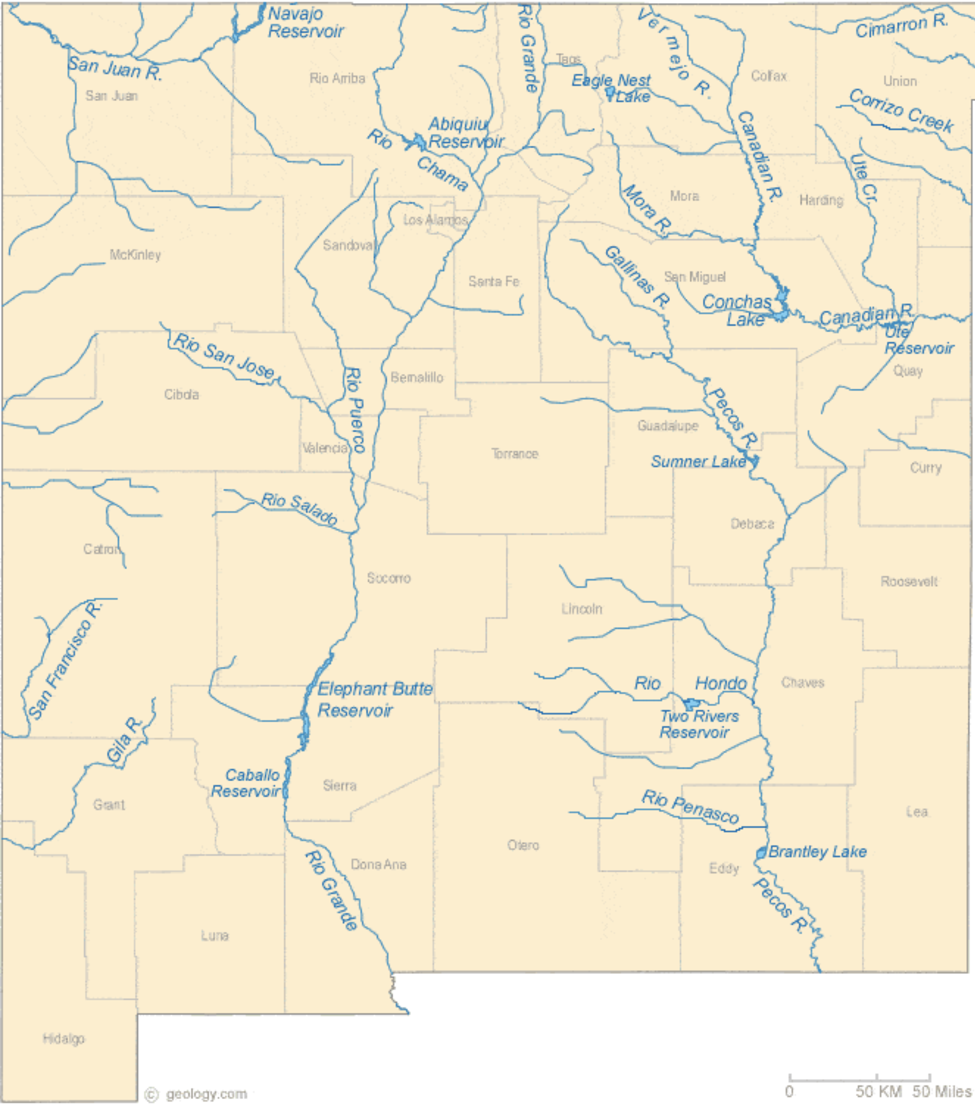
Arizona Rivers Map via Geology.com.
FromThe Cronkite News (Kailey Broussard) via KOAA.com:
…while some welcomed the end of the “Waters of the United States” rule, environmental groups warned that the change would mean virtually no environmental protection for the nation’s waterways – particularly in the West.
“We know where we are going, and that is going to be a world where wetlands, especially in the arid West, get almost no protection,” said Brett Hartl, government affairs director for the Tucson-based Center for Biological Diversity.
A 2018 report by the center estimated that more than 3,000 U.S. watersheds would lose Clean Water Act protections under the replacement plan proposed by the Trump administration. That, in turn, could accelerate the extinction of more than 75 endangered species, the report said.
Critics of the Obama-era rule – known as WOTUS – disagree, saying the full range of federal pollution regulations does more than enough to protect waterways…
In the meantime, federal officials are developing and presenting a new plan. That process has garnered more than 621,000 comments on the federal regulations website…
…Sandy Bahr, president of the Sierra Club’s Grand Canyon chapter, said the EPA is “not being honest” about the change’s impact. WOTUS protected arterial waterways, she said, by protecting the less-obvious waters.
“If you take a very narrow view of that and say, ‘Oh, only waters that are navigable,’ then you’re not even going to be protecting those navigable waters,” she said.
Bahr and others have pointed to the San Pedro River, a ribbon-like stream that meanders some 140 miles through southern Arizona and part of Mexico. The stream’s limited navigability means it most likely would not receive protection under the repeal.
“You can talk about these things in the abstract, but when you look at what is happening on the ground already, we’re struggling to protect rivers like the San Pedro River, which is so important ecologically and economically,” Bahr said. “Something like this rollback makes it so much more difficult to do.”
Hartl said that, except for the Colorado River, the change would mean most of Arizona would not be protected. A map included with the center’s study showed much of the Southwest losing Clean Water Act protection without WOTUS…
Meanwhile, Bahr is certain the proposed rule will be challenged.
“We need to have the most stringent requirements possible to protect what we have left because we have lost so much,” she said.
A wetland area along Homestake Creek. Photo credit: Brent Gardner-Smith/Aspen Journalism
FromThe Grand Junction Daily Sentinel (Dennis Webb):
Another Obama administration environmental rule is now history, as the Environmental Protection Agency on Thurday finalized its repeal of a 2015 rule expanding waterway and wetlands protections.
The 2015 “Waters of the United States” rule had support from environmentalists but faced criticism from agricultural and other interests…
Its action restores regulations that were in place prior to the 2015 rule, ending inconsistent regulations in different states as a result of various court actions on that rule. EPA Administrator Andrew Wheeler said in a news release that the action Thursday “fulfills a key promise of President Trump” and sets the stage for a second EPA action, a new waters of the U.S definition “that will provide greater regulatory certainty for farmers, landowners, home builders, and developers nationwide.”
[…]
…the conservation group Western Resource Advocates said the EPA actions will significantly weaken protections for thousands of miles of waterways and millions of acres of wetlands across the West. It said the EPA’s efforts aim to remove protections for rivers and streams that flow intermittently after rain or snow, and its proposed new definition threatens Western water supplies.
It says the EPA estimates that in Colorado and Utah alone, more than 5 million people receive drinking water from public systems relying at least in part on intermittent, ephemeral or headwater streams.
“This assault on the Clean Water Act makes it more important than ever for local lawmakers and water leaders to enact state-level policies that protect our rivers and our communities,” Robert Harris, a senior staff attorney for the group, said in a statement.
As an increasing number of communities across the country continue to grapple with contamination of per- and polyfluoroalkyl substances (PFAS) in drinking water sources, U.S. Senator Tom Carper (D-Del.), top Democrat on the Environment and Public Works Committee (EPW), reacted to a breakthrough moment in this afternoon’s U.S. House of Representatives Committee on Oversight on Government Reform (OGR) Subcommittee on Environment hearing, in which two major chemical manufacturers announced their support for policies that would clarify polluter liabilities and clean up contaminated sites.
Just one day after members from the U.S. House of Representatives and U.S. Senate returned to Washington this week to negotiate PFAS provisions to be included in theNational Defense Authorization Act for Fiscal Year 2020 (NDAA) – and, just days after the Office of Management and Budget (OMB) warned Congressional leaders about the president’s “strong” opposition to those provisions – today, chemical manufacturers DuPont de Nemours, Inc. and The Chemours Company announced their support for policies that are currently being negotiated for inclusion in NDAA. The companies signaled their support for setting a national drinking water standard, enhancing public awareness of chemical releases and designating legacy PFAS as “hazardous substances” under the Superfund law to ensure contaminated sites are cleaned up.
“This is a breakthrough moment on PFAS solutions. It should send a clear message to the president and any member of Congress who might still have some misplaced concerns about potential regulatory burdens associated with PFAS solutions, including declaring some PFAS chemicals as hazardous substances under the Superfund law,” Senator Carper said. “Some of the companies that would be regulated under these policies have now publicly declared their support for them – that’s consequential, and I commend them for their constructive engagement on the legislation being considered by Congress.”
[…]
The measures supported by these two companies include measures added to the Senate version of the NDAA by Senators Carper, Shelley Moore Capito (R-W.V.) and EPW Chairman John Barrasso (R-Wyo.), including requirements that EPA set a national primary drinking water standard for some legacy PFAS chemicals and require PFAS manufacturers to report environmental releases of PFAS as part of Toxic Release Inventory releases.
In today’s hearing, the companies also declared their support for designating some legacy PFAS as hazardous substancesunder the Superfund law. Senator Carper’s bill, the PFAS Action Act of 2019, would mandate EPA within one year of enactment declare per- and polyfluoroalkyl substances (PFAS) as hazardous substances eligible for cleanup funds under the EPA Superfund law, and also enable a requirement that polluters undertake or pay for remediation. The legislation currently has 43 cosponsors and its companion bill in the U.S. House of Representatives, authored by Rep. Debbie Dingell (D-Mich.), was approved unanimously by the House as part of the House NDAA in July.
Chris Woodka is with the Southeastern Colorado Water Conservancy District. He said part of the reason we’re seeing more water systems violate water standards is that federal and state standards have changed. They are now accounting for even more minute quantities of contaminants.
He said water from wells can be especially affected because, “shallow wells in the alluvial aquifer are high in organic contaminants, nitrate and selenium.”
“Deeper wells often have elevated levels of radioactive materials,” he said. “And nearly all of the communities east of Pueblo take water from wells.”
Some communities have responded by using water filters. Las Animas and La Junta have both installed large reverse osmosis membrane systems to remove contaminants from the water supply. Woodka said that has improved the taste and appearance.
But, he said, even after filtration, radium and uranium can still remain in the water at low levels.
And then there’s the cost.
“Those communities still face tremendous expense in disposing of the waste from the treatment processes,” Woodka said, “which can only be reduced by adding more clean water.” And extra water, let alone clean water, is hard to come by in a drought-prone state like Colorado. But there is one possible solution that’s been in the works for decades.
It’s called the Arkansas Valley Conduit.
Arkansas Valley Conduit Comanche North route via Reclamation
The U.S. Bureau of Reclamation describes the conduit as a “bulk water supply pipeline designed to meet existing and future municipal and industrial water demands in the Lower Arkansas River Basin.”
It would include about 230 miles of buried pipeline, a water treatment facility, and water storage tanks. Water would be routed to six counties – Pueblo, Otero, Crowley, Bent, Kiowa and Prowers – and would serve an estimated 50,000 people.
The project was first approved in 1962. Some work was completed in the early 1980’s, but the actual conduit has yet to come to completion. Woodka said that’s mainly because of cost.
“[These] communities could never afford to build [the conduit] themselves.” Woodka explained.
Congress passed a law in 2009 that reduced the amount of money local governments would have to pitch in for the project. Woodka said that finally made the construction of the conduit feasible.
But it’s still a $500 million project.
“The main problem that we’ve run into,” said Woodka, ”has been getting adequate federal appropriations to start building it. He said they are working on ways to lower the overall costs of the project.”
Woodka said lawmakers at the state and national level have been “extremely active” in promoting this project on both sides of the political spectrum…
[Republican State Senator Larry Crowder] said the key now is for residents to get involved.
“We’re getting the cities involved, we’re getting the people in the cities involved to send letters to Senator Gardner, Senator Bennet and Congressmen Buck and Tipton,” he said, “to make sure that they are aware of how the people feel about it.”
WE are offering a FREE bus tour on Friday, November 8, 2019 to anyone interested in learning more about the districts operations. The tour will begin at Island Grove Regional Park’s east parking lot and will return around 4:00 pm. We will visit the completed Geisert Reservoir, Pioneer Reservoir, Northern Water’s Galeton Reservoir, and our new Walker Project site near Wiggins. Breakfast snacks and lunch will be provided. Dress appropriately for the weather!
Urban water broker builds $22 million reservoir to boost development and agricultural land
The desire to expand housing, commerce and other development around metro Denver and on arid high plains once deemed inhospitable has driven an innovative urban water broker to build a $22 million reservoir on a ranch 70 miles east of the city along the South Platte River.
Water siphoned from the river through a pipeline this summer has filled about a third of this 5,500-acre-foot — or 1.8-billion-gallon — 70 Ranch Reservoir. It’s the latest new storage in an expanding network of reservoirs that United Water and Sanitation District president and ranch owner Bob Lembke is installing to meet rising demands from Front Range suburbs hooked on dwindling groundwater.
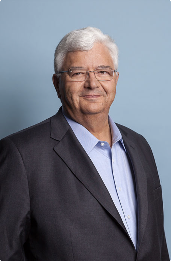
Bob Lembke. Photo credit: United Water
The reservoir that Lembke built near his private 13,000-acre 70 Ranch, purchased in 2003, took three years to complete, the largest synthetically lined reservoir west of the Mississippi River. It reflects growing impatience with constraints that could limit development along Colorado’s booming Front Range.
Others in northeastern Colorado also are planning, and seeking funds, to build much larger reservoirs that, like this one, would capture South Platte water otherwise bound for Nebraska. Lembke has been able to avoid red tape — and has left critics asking questions — by working with wealthy water-poor suburbs, building on land he owns and using former gravel pits off the main channel of the river.
“We’d like to try to enhance the economic development. I’m a native. I grew up in Arapahoe County. As a native Coloradan, jobs for my kids, and eventually my grandkids, are important,” Lembke said in a recent interview in his headquarters suite at the Denver Tech Center.
“If you look at Denver, they’ve done a wonderful job planning for their water. But outside of the Denver service area? There’s a lot of challenges in how to get water and economic growth in these areas not served,” Lembke said…
“We have tens of thousands of acre-feet of water that, without storage, will leave the state — to no economic value here in Colorado. We can accommodate a great deal of quality growth. … I am a problem solver. I like to tackle difficult problems. Providing water increases the value of land that otherwise did not have water,” he said…
“Whether on the South Platte River, the Colorado River or the Yampa River, we’re not in favor of converting agricultural water use to municipal use,” said Andy Mueller, manager of the Colorado River District, which represents western Colorado communities.
The new 70 Ranch Reservoir northeast of Denver “brings up questions,” Mueller said. “Is it water to support new growth? Or is it water to support the existing population that is dependent on groundwater?”
The hedge fund investors purchasing land and water rights in western Colorado typically seek double-digit returns, Mueller said. “They believe there’s monetary value there for their investors. We’d say that’s speculation. How do we make sure there is not emerging speculation by outside investors who may not have community values? How do we help farmers and ranchers stay in business?”
Colorado leaders for decades have declined to regulate population growth and development. But the growing private interests in water, perhaps reviving the role private financiers played developing water systems in the 19th and early 20th centuries, has piqued concerns.
“Because traditionally in the West we have the mind-set that water is the property of the people, we are concerned when water is being controlled and distributed by a private corporation that may have very different interests from the collective group of people who are affected by the use of that water,” said Anne Castle, formerly the top federal water official in the Obama administration, now a senior fellow at the University of Colorado Law School’s Getches-Wilkinson Center for Natural Resources, Energy and the Environment.
For an urban water broker to buy agricultural land and install a reservoir “is all perfectly legal and allowable,” Castle said. “But it does make us nervous because we tend to think governmental entities will have some accountability to the people to recognize the different kinds of values people put on water. We just don’t have that assurance with a private corporation.”
Lembke in his role as president of United Water and Sanitation also serves as president of the Weld Adams Water Development Authority, which owns and operates the 70 Ranch Reservoir. He pointed out that these so-called special-use districts are governmental groups…
SIEP Project location map via United Water and Sanitation
Denver-based water attorney David Robbins called Lembke “a very smart man. He is an entrepreneur. He is filling a niche.”
The 70 Ranch site also is used for experiments in drip irrigation, aimed at using water more efficiently to grow plants where otherwise vegetation might not survive…
Lembke now is installing other reservoirs — including two that he would own privately — as part of a network that when completed would store about 30,000 acre-feet for supplying water to suburbs, agriculture, industry and other development along Colorado’s Front Range.
He has built, or is in the process of building, four reservoirs upriver from the 70 Ranch at high-growth locations along the South Platte: in Milliken (12,000 acre-feet), between Commerce City and Brighton (3,500 acre-feet), east of Lochbuie (4,000 acre-feet) and in Fort Lupton (5,000 acre-feet).
These will supply businesses and housing developers in each booming area “to help them achieve their goals for economic growth and development” using surface water from the river rather than by pumping from over-tapped underground aquifers, Lembke said.
“Everything has got a finite limit,” he said. “But if we use water intelligently, we have the potential for long-term growth in this region.”
70 Randh Reservoir: Partnering with the Platte River Water Development Authority, this facility will be used to store water for the support of 70 Ranch’s cattle and farming operations as well as provide storage for local agricultural and municipal water providers. Photo credit: 70 Ranch
The Colorado Court of Appeals ruled companies must reclaim uranium mines that sit idle for more than 10 years
Recent images of the Van 4 uranium mine show a dark rig towering above a sagebrush and juniper mesa. Beside the scaffolding sit piles of loose white rocks and two metal buildings, one of which drips insulation from its ruptured ceiling. The site is one of western Colorado’s active uranium mines. But it looks deserted.
The operator, Piñon Ridge Mining, LLC, a subsidiary of Western Uranium & Vanadium Corp., is waiting for the price of uranium to rebound before firing up the mine again. The last time that happened was 30 years ago.
Just how long mines like the Van 4 should be allowed to remain open — but idle — has long been a point of contention in Colorado between environmentalists and mine owners.
Environmentalists argue the site should have been cleaned up and restored to sagebrush scrub decades ago.
But the Colorado Mined Land Reclamation Board, an eight-member panel appointed by the governor that enforces the state’s mining laws, has allowed mining companies to delay tearing down their operations by granting mine owners reclamation exemptions, known as “temporary cessation” permits.
This delay has frustrated environmental advocates. They see the unremediated sites as threatening wildlife habitat, water quality and a new West End economy based on recreational opportunities. They believe companies have relied on temporary cessation permits to sidestep environmental regulations requiring them to close and clean their all-but-shuttered mining operations.
And last week, the Colorado Court of Appeals agreed with them.
The court ruled state regulatory board “abused its discretion” by granting two five-year temporary cessation permits to Piñon Ridge Mining, which owns the Van 4 site. After 10 years of sitting idle, the court said, the Van 4 operation must be terminated and the owner must fully comply with reclamation requirements, restoring the site closer to its natural condition.
Phone messages left for the operator of the Van 4 mine seeking a response to the ruling were not returned Wednesday. But the president of the Colorado Mining Association argued it’s important to consider national security risks when deciding whether to close mines.
The court’s opinion could have far-reaching consequences. Owners of the state’s 29 active uranium mines — 16 of which have been granted temporary cessation permits, according to state data — may have to begin tearing down rigs and buildings and testing for radiation. The state does not yet know how many mines are past due for reclamation, according to the court’s interpretation. But it knows there are several.
“Those sites will very likely need to be reclaimed in accordance with this order,” said Ginny Brannon, director of the Division of Reclamation, Mining and Safety.
The state estimates the federal Department of Energy holds about $14.5 million in bonds that companies front to ensure resources are available to restore closed mining operations.
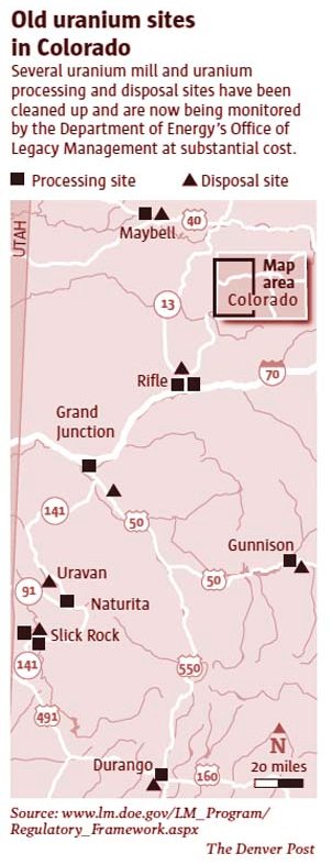
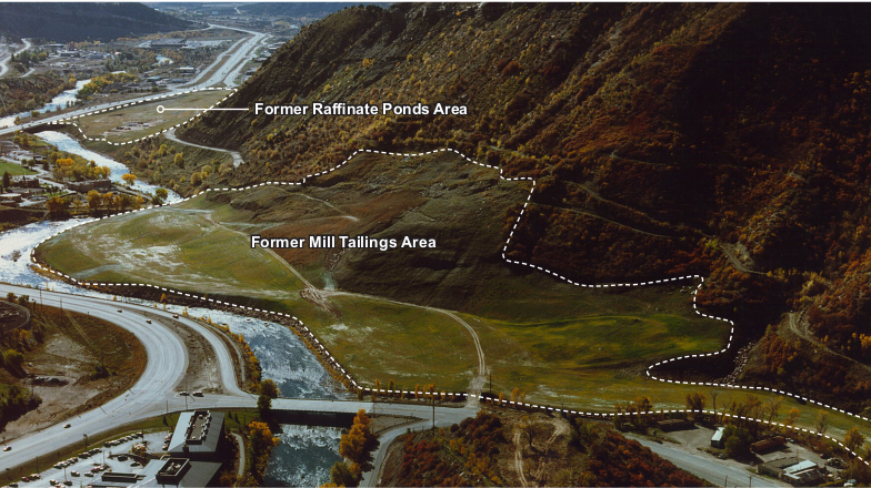
View of Durango, CO, Remediated Processing Site (1991) via US Department of Energy.
Radioactive material used for roads, foundations, landscaping in mid-1900s
It turns out more than 100 properties in Durango were missed during a massive, multi-million dollar cleanup in the 1980s of radioactive waste that was once used for the construction of homes, buildings and roads.
Now, more than three decades later, the state of Colorado’s health department says these hot spots that slipped through the cracks need to be cleaned up.
“We’re now looking to raise the awareness of this potential issue in Durango,” said Tracie White, a remediation program manager for the Colorado Department of Public Health and Environment. “It’s been on our radar for a while, and we’ve been laying the groundwork. Now, it’s coming into place.”
A cheap and easy material
Durango is no stranger to the issues left behind from the town’s legacy with uranium mining.
In the 1940s, the U.S. government built a mill on the northeast side of Smelter Mountain, now the Durango Dog Park, to reprocess uranium tailings for sale to the Manhattan Project, which produced the world’s first atomic bomb.
After extracting uranium, though, what’s left behind is a gray, sand-like waste product that can be filled with radioactive components, like radium and radon. In Durango, this pile grew to 1.2 million cubic yards, enough to fill nearly 400 Olympic-size swimming pools.
Over the years, people freely used the uranium mill tailings in construction around town, said Duane Smith, a local historian and former Fort Lewis College professor. It was as easy as driving your truck up to the waste pile and taking a load…
The uranium tailings were a cheap, easy material to work with and were used for the foundation of buildings and homes, driveways and roads, including sections of Camino del Rio. The radioactive waste was even used as a substitute for sand in gardens and sandboxes.
The practice went unchecked until the tailings became a major public health concern in the 1970s, which prompted Congress to pass the “Uranium Mill Tailings Radiation Control Act” in 1978 to tackle the 24 worst uranium sites around the country.
Durango ranked in the top four.
In the 1980s, the U.S. Department of Energy estimated 122,000 cubic yards of radioactive waste had been used in and around Durango homes, businesses, public buildings, roads and parks, and that it would take years and millions of dollars to remove it all.
Greg Hoch, the city of Durango’s longtime planning director, now retired, said federal government officials went up and down Durango streets surveying for hot spots. In the end, most of the high-risk sites were removed and cleaned up, he said…
But properties were missed, not just evidenced by this recent announcement from the state health department. In 1997, it was discovered that even more hot spots beneath Durango homes and streets remained contaminated by tailings, a discovery that “unsettled” the city at the time, according to The Durango Herald archives.
Records identify 115 properties at risk
This time around, the Colorado Department of Public Health and Environment is trying to spread the word that uranium mill tailings contamination potentially still exists on about 115 properties in and around Durango, but at this point, it’s still a bit of a guessing game.
White, with the state health department, said surveys in the 1980s estimated approximately 915 properties in Durango were believed to have the uranium waste byproduct. While most were cleaned up, there has always been an understanding that some likely escaped the effort, she said.
Recently, however, CDPHE was able to home in on which properties may still pose a risk after records from the 1990s were digitized.
“Now that the records are more easily accessible and searchable, we are able to identify properties that may still have tailings remaining,” White said.
Health officials suspect properties have been passed over for a number of reasons: tailings could have been relocated, properties could have been partially but not fully cleaned or, in some cases, the homeowner at the time refused to take part in the project.
Home buyers and sellers are not required to test for radon or uranium issues. However, if a seller is aware of an issue, he or she would legally have to share that information, said John Wells with the Wells Group.
But ultimately, state health officials can’t say for sure whether there’s a contamination problem until crews can conduct gamma radiation surveys. And in yet another wrinkle, that cannot happen until a disposal site is secured to take the waste – and there’s no telling when that will happen.
It’s one example of the financial burden this region still bears from the pollution, despite the $50 million the Air Force has spent on cleanup around Peterson.
“There are 60,000 stories just like this and they’re happening at the kitchen sink in every Fountain, Widefield and Security home,” Clark said of the communities whose water was tainted by the foam.
The foundation, as well as the nearby Security Water District, have sued the Air Force over the chemicals. District general manager Roy Heald said they had to find a new source of water for their customers, a complicated process which involved the construction of a mile-long pipeline to buy water from Colorado Springs. The cost of the pipeline and the first two years of water set the district back $6 million…
In 2018, the Air Force stepped in to cover the district’s water costs until the construction of a new treatment facility was completed. The Air Force will also pay for the facility. Still, Heald said it’s unclear what the ongoing long-term costs will be for the district when it comes to the new facility. It will be needed as long as the contamination remains in the groundwater, which could essentially be forever…
As of this June, $357 million has been spent on PFAS cleanup around 22 Air Force installations nationwide. It’s a lot of money that many who live near the sites say barely touches on the full problem…
There’s disagreement even between government agencies about what concentration of PFAS is safe for humans. A division of the Centers for Disease Control and Prevention found that levels should be set seven to 10 times lower than the EPA’s health advisory.
Genna Reed, the lead PFAS researcher for the Union of Concerned Scientists, has said the Department of Defense “misrepresented the scope of this issue in order to avoid having to pay.”
The Air Force would not grant an interview for this story, but states on the PFAS website it established that “protecting human health is our priority.”
Reed said the Department of Defense has limited which PFAS chemicals it tests for in groundwater and only releases data when the results are above the higher EPA threshold.
“Community members who have been exposed to this chemical and were not told of its release are being the ones left with the burden of paying for this contamination and paying to find out how much is in their water and also to find out how much is in their blood,” Reed said.
Rosenbaum said the full blood panel to test for PFAS chemicals costs about $700 — out of reach for many living near Peterson AFB.
Rosenbaum has organized a local clean water coalition to go after grants to test residents’ blood and water. She’s frustrated they have to do that work themselves.
“There’s absolutely no reason for our communities to go into debt over another water contamination that we didn’t cause,” she said.
The Platte River is formed in western Nebraska east of the city of North Platte, Nebraska by the confluence of the North Platte and the South Platte Rivers, which both arise from snowmelt in the eastern Rockies east of the Continental Divide. Map via Wikimedia.
Momentum is building in Colorado to create new reservoirs to draw more water from the South Platte River, reducing the flow into Nebraska. Nebraska officials should monitor this situation closely, now and in coming years, to make sure the water volume continues to meet the requirements under a 1923 South Platte River agreement between the two states.
Maintaining a proper flow in the Platte River — formed by the confluence of the South Platte and North Platte Rivers in western Nebraska — is crucial to our state’s agriculture, hydropower and long-term metropolitan water sources for Omaha and Lincoln.
Colorado apparently has considerable room at present to make further diversions and still remain in compliance. “In many years, more water is passing that gauging station at the state line than needs to” under the agreement, Colorado State Engineer Kevin Rein says.
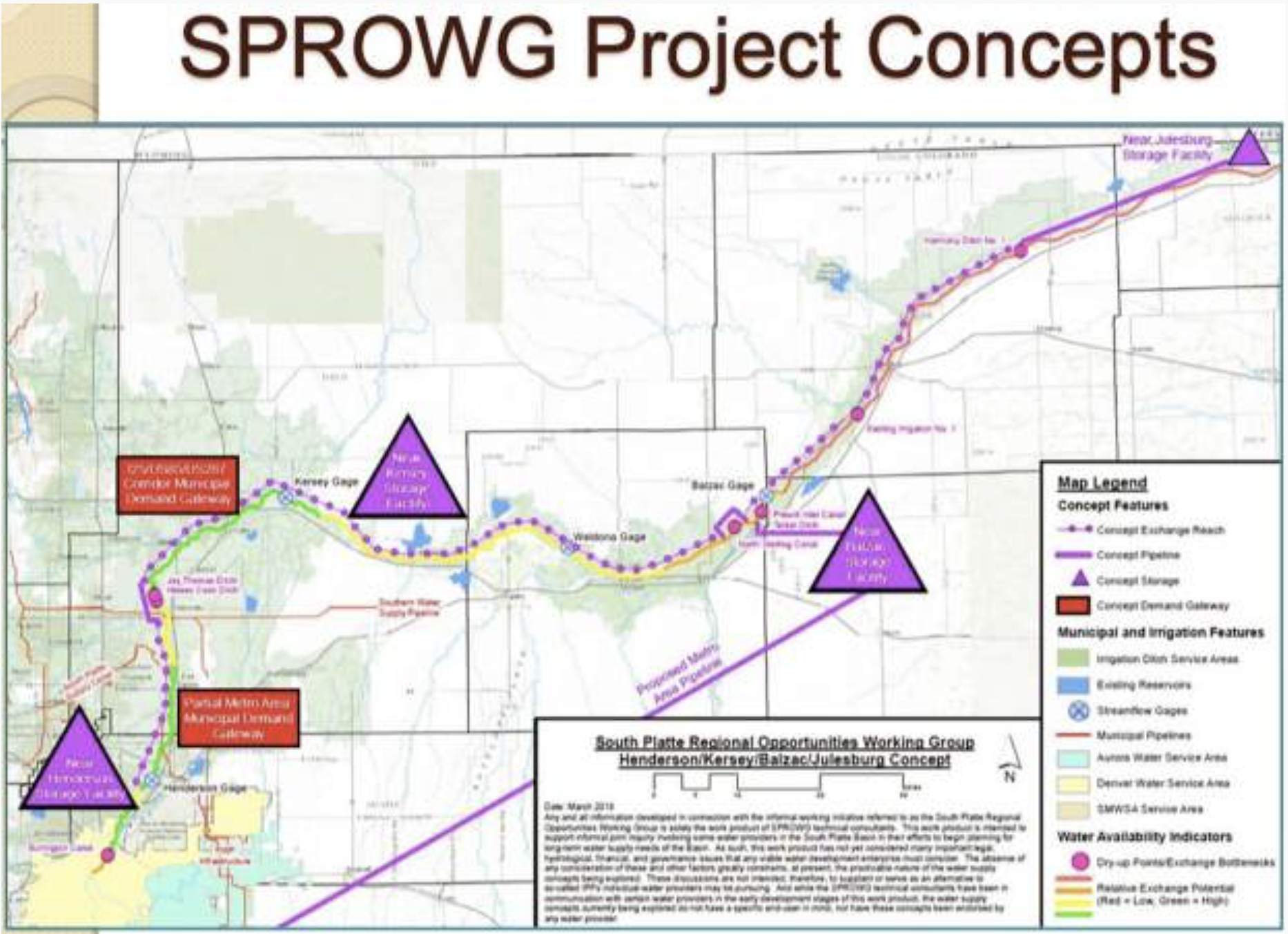
A group called the South Platte Regional Opportunities Working Group, or SPROWG, is proposing to store 175,000 acre-feet of water in a series of reservoirs on the South Platte River, from north of Denver to the Morgan County line. The project also includes a long pipeline to pump water from the river back to the metro area to be cleaned and re-used. Graphic credit: CWCB via Aspen Journalism
The proposed reservoirs, to serve Front Range urban residents, would keep about 150,000 acre-feet of water in Colorado, the Denver Post reports. That’s about half of the estimated amount that Colorado lawmakers claim their state can legally divert on average each year under the 1923 agreement. For comparison: When full, Nebraska’s Lake McConaughy has a capacity of 1.74 million acre-feet.
A 1993 study of Nebraska water history by the University of Nebraska-Lincoln stated, “Some Nebraskans may still bemoan that the state gave away too much water to Colorado in the South Platte Compact of 1923, but it was a voluntary agreement.”
The tremendous metro growth in Colorado’s Front Range is spurring the call for new reservoirs. Urban groundwater levels are declining in the face of dramatically increased demand. Meanwhile, agricultural producers in Colorado’s South Platte River basin support reservoir creation as a way to safeguard their own groundwater from urban diversion. Officials in western Colorado are in favor, saying the South Platte water could reduce the current allocation of western Colorado water to the Front Range via tunnels. Supportive, too, are Colorado water-policy officials, who included the South Platte reservoir concept in their 2015 State Water Plan.
In short, a wide-ranging set of powerful urban and rural interests in Colorado have come together to press for more South Platte water. “We owe it to our state, to our water users and our farmers to capture as much water as we can” out of the South Platte, said Joe Frank, manager of Colorado’s Lower South Platte Water Conservancy District.
Nebraskans can take heart that strong legal protections are in place to safeguard the significant water volume the state receives via the North Platte River, a vital irrigation source. The river supplies Lake McConaughy, for example, with its wide-ranging irrigation and groundwater recharge role for more than half a million acres in the Platte River valley, plus hydropower generation and recreation.
The U.S. Supreme Court issued a decree in 1945 setting out a legal framework for interstate water allocation along the North Platte. In 2001, Nebraska and Wyoming reached a settlement on sharing North Platte water after 15 years of legal wrangling. The agreement essentially froze Wyoming’s water use at the 2001 level and stipulated that groundwater hydrologically connected to the North Platte be included. The settlement created a committee — of federal, Nebraska, Wyoming and Colorado officials — to work out future disagreements.
“In contrast to the meager and seasonal administrative execution of provisions contained in the South Platte Compact,” a 2006 UNL analysis stated, “administrative actions in the North Platte River watershed are extensive and occur year-round.”
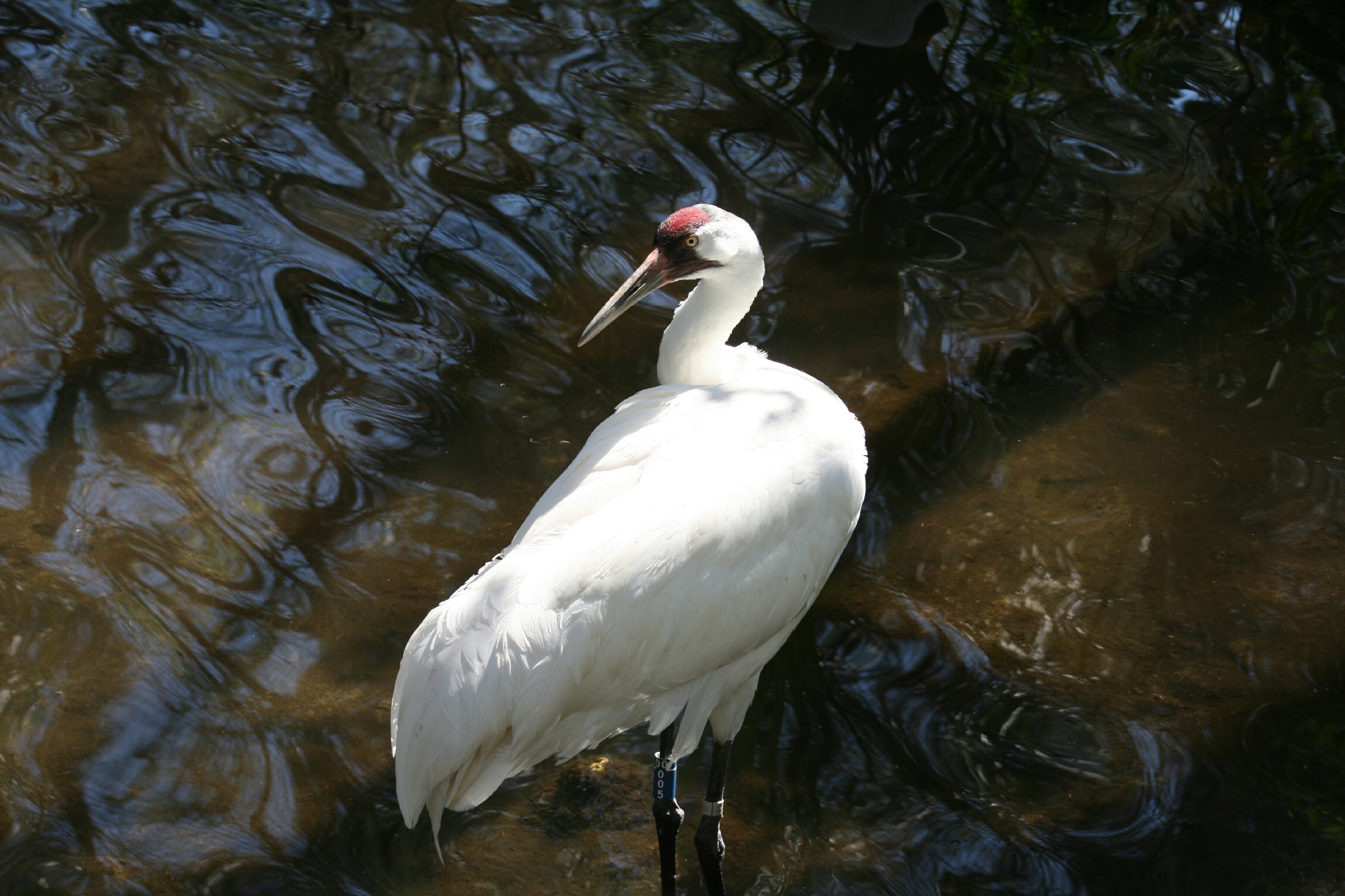
Nebraska may have future legal leverage regarding the South Platte if any Colorado diversions raise environmental concerns, such as negative effects on protected animal species. Two examples: sandhill cranes and whooping cranes, which congregate in great numbers annually in central Nebraska.
The proposed South Platte reservoirs are “one of those rare solutions that really is good for both rural Colorado and folks who live in the Denver metro area,” a Colorado state senator stated. Evidently so, but on this side of the border, Nebraskans need to remain watchful and assertive to ensure our state’s rights are recognized and safeguarded to the full extent of applicable law.
Platte River photo credit US Bureau of Reclamation.
Sean Tonner with Renewable Water Resources (RWR), who is peddling a water export plan he says is finding support among farmers and ranchers in the Valley, presented his plan to the town of Saguache last month during a town board meeting.
A former chief of staff for Gov. Bill Owen, who supported the plan, Tonner also worked with former State Senator Greg Brophy and other government officials on the project. Currently Tonner owns the 11,500-acre Gary Boyce ranch, purchased from Boyce’s wife following his death. He also leases grazing land in the same area. Tonner says he will retire the water rights for 3,000 of those acres.
He also said he could possibly retire the water rights to, for example, North Star Farms, and other area farms and ranches.
Tonner claims less than two percent of the annual confined aquifer recharge — 500,000 acre-feet — is needed by the Front Range. Farmers could sell all or a portion of their water rights to RWR for twice the going amount. A total of $60 million has been set aside to procure water rights.
Already enough Saguache County farmers and ranchers have agreed to sell their water rights to satisfy the proposed 22,000 acre-feet project, Tonner reported. The plan is said to be able to retire more than 30,000 acre-feet, reducing the overall usage from the Basin. This would presumably lessen the pressure on existing rivers and streams now providing water to the Front Range.
A pipeline along Highway 285, restricted to a 22,000-acre-foot capacity, would carry the water up over Poncha Pass into Chaffee County and from there it would eventually make its way into the Platte River. There would be no adverse impact on wildlife, Tonner claims.
The project would create a $50 million community fund for the county that could be used for a variety of purposes including education, law enforcement, tourism, economic development, conservation and other worthy cause. The county would manage the fund. Just the interest would generate $3-4 million annually, twice the amount of the county’s sales tax grants.
The board just happened to have a resolution on its agenda that evening to oppose the export plan, and following Tonner’s presentation, informed him of the upcoming vote. But before the vote was taken, a guest in the crowd asked to speak. He had flown in all the way from California just to attend the meeting.
Opposition to the plan
Case Vandereyk. addressing Tonner, announced that he was the owner of North Star Farms and told those attending the meeting he had “no interest” in selling his water rights and was basically opposed to the plan. “I never talked to anyone about selling my water rights,” he concluded. His statement was met with resounding applause from the audience.
In his first appearance in the Valley following the 2018 election, Attorney General Phil Weiser cautioned Valley residents to view RWR’s proposals to pump water from the Valley “very skeptically” citing legal, economic, and ecological concerns. Former Secretary of the Interior Ken Salazar, whose family has farmed in the Valley for generations, also strongly opposes the plan.
Cleave Simpson, with the Rio Grande Water Conservation District, formally opposes the plan and has stated that no matter what farmers and ranchers are offered for their water, he believes they will not sell.
Later on in the meeting, following Tonner’s presentation, the Saguache Town Board passed a resolution opposing the water transport project.
Colorado transmountain diversions via the State Engineer’s office
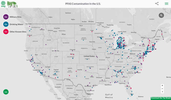
PFAS contamination in the U.S. via ewg.org FromKOAA.com (Tyler Dumas):
A [new] groundwater treatment facility is going to be built just north of the existing one.
The facility will be paid for by the Air Force and will be built by the Army Corps of Engineers. The project is part of the agreement reached to protect Fountain’s water from contamination from Peterson Air Force Base in 2016.
Desalination and water purification research, like this being undertaken at the Brackish Groundwater National Desalination Research Facility in Alamogordo, New Mexico, will help communities treat impaired or otherwise unusable water. Photo credit: Bureau of Reclamation
Here’s the release from the Bureau of Reclamation (Peter Soeth):
The Bureau of Reclamation announced that 30 projects will receive $5.1 million from the Desalination and Water Purification Research Program to develop improved and inexpensive ways to desalinate and treat impaired water.
“We are awarding grants to a diverse group of projects to reduce the cost, energy consumption and environmental impacts of treating impaired or otherwise unusable water for local communities across the country,” said Reclamation Commissioner Brenda Burman. “This funding is a direct result of the Trump Administration’s commitment to increase water supply and delivery through improved technology.” Twenty-five awards are for laboratory-scale projects, which are typically bench scale studies involving small flow rates. They are used to determine the viability of a novel process, new materials or process modifications. Awards are limited to $150,000.
Five projects are selected as pilot-scale proposals, which test a novel process at a sufficiently large-scale to determine the technical, practical and economic viability of the process. Awards are limited to $400,000 and no more than $200,000 per year.
Types of projects funded include modeling, testing new materials such as nanomaterials, and improvements on known technologies such as distillation and electrodialysis. Projects are funded in the following states:
Prior to mining, snowmelt and rain seep into natural cracks and fractures, eventually emerging as a freshwater spring (usually). Graphic credit: Jonathan Thompson
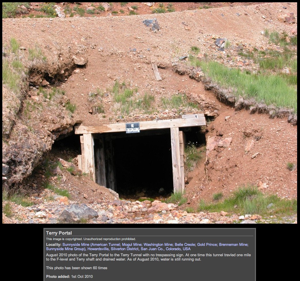
Sunnyside Gold Corp. is refusing to carry out work ordered by the Environmental Protection Agency as part of the Superfund cleanup of mines around Silverton.
“Enough is enough,” Kevin Roach, with Sunnyside Gold, wrote in an email to The Durango Herald. “EPA has a clear conflict of interest and has wrongfully targeted SGC (Sunnyside Gold Corp.) … (and) SGC will no longer be a pawn in this never-ending science project.”
In June, the EPA ordered Sunnyside Gold to install five groundwater wells and two meteorological stations at mining sites around the headwaters of the Animas River as part of the investigation into the Bonita Peak Mining District Superfund site…
Sunnyside Gold has denied any responsibility but has been willing to work with the EPA in limited ways during the past three years. On Tuesday, however, Roach sent a letter to EPA staff saying Sunnyside Gold “declines to undertake the work,” arguing the company no longer has any liability for mining pollution issues in the Animas River watershed.
Peterson said Wednesday morning that EPA has not yet received the complete letter from Sunnyside Gold…
In 1996, Sunnyside Gold entered an agreement with the state of Colorado to install three plugs to stem the flow of acid drainage out of the American Tunnel, which served as the transportation route for ore, as well as mine runoff, from the Sunnyside Mine to facilities at Gladstone, north of Silverton.
By 2001, however, it was thought the water had backed up and reached capacity within the Sunnyside Mine network. Now, several researchers and experts familiar with the basin believe water from the Sunnyside Mine pool is spilling into adjacent mines, like the Gold King.
Sunnyside Gold, which was purchased by international mining conglomerate Kinross Gold Corp. in 2003, has adamantly denied that its mine pool is the cause of discharge from other mines, saying there is no factual evidence for the assertion.
Much of the work EPA ordered Sunnyside to do, however, seeks to gain more insight into the issue. EPA, too, intends to drill into the American Tunnel this month to better understand groundwater conditions in the area.
Earlier this year, Sunnyside Gold called for the EPA to be recused from leading the Superfund cleanup, arguing it is a conflict of interest for the agency to do so after it caused the blowout at the Gold King Mine in August 2015.
EPA’s Peterson said at the time the agency “will continue to require the company to take actions to ensure that financial responsibility for cleanup is not shifted to taxpayers.”
Henry, Colo.: As the sun sets at the Colorado Farm Brewery, a light breeze plays over a deep green rye field that borders the patio. As they do most Thursday nights, nearly two dozen people have wandered into this scenic, rural bar 250 miles southwest of Denver to relax and visit with neighbors.
The brewery is part of a 300-acre farm which grows grains and hops, and which also operates a malting company. Wayne Cody, the farm’s 61-year-old patriarch, has just come in from hours of work, roasting malt, examining fields, and preparing to plant buckwheat the next day.
As he visits with customers, it’s clear that most people in this bar tonight know that something almost unholy is in the works here in the San Luis Valley.
A well-connected metro Denver water developer, backed by former Colorado Governor Bill Owens, Front Range real estate interests, and absentee ranchers who themselves control huge amounts of water here, is proposing to export millions of gallons of water out of this drought-stricken, scrappy place for delivery to fast-growing Douglas County.
Sean Tonner, who once served as deputy chief of staff for Owens, is leading the group, which has proposed spending $118 million to acquire water from the farmers here. That sum includes a $50 million community fund to help bolster the poverty-stricken region.
Tonner’s company, known as Renewable Water Resources, is at least the fourth in a stream of developers who’ve beaten a path to this remote region in the past 50 years, intent on harvesting its water. All, up until now, have been decisively turned back.
In February, at a water conference in Alamosa, just up the road from Henry, a man suggesting that Tonner’s proposal had merit was booed.
The proposal to bring water from the San Luis Valley to the metro area would require a pipeline of more than 200 miles. Credit: Chas Chamberlin
Former U.S. Senator Ken Salazar’s family has farmed here for generations. Salazar also spoke at the conference and reassured the 200-plus people in the packed auditorium that no water would ever flow out of the valley into the metro area.
“Over my dead body,” he said to cheers and applause.
In a minute
For Wayne Cody, it isn’t nearly that clear cut. He and his sons, an energetic, muscular lot, are pouring everything they have, including beer, into saving their family farm.
Cody’s grandparents bought the farm in the 1930s, and the family has grown alfalfa profitably, then raised dairy cows, again profitably, for some 80 years. But as farm costs rose, and dairy prices dropped, they turned to a new industry, brewing, with Coors and others as customers.
In 2008, they started the Colorado Malting Company and last year they opened the Colorado Farm Brewery on County Road 12 South. Its custom beer snifters urge guests to “Drink Like A Farmer.”
Until a corporate malting company entered the valley two years ago, the Cody clan was selling 1 million pounds of malt a year, but they haven’t been able to compete well with the big operation, and so this year they have contracts to sell just 600,000 pounds of malt, Wayne Cody said.
Last month, the family laid off a full-time and part-time employee. Still they’re pushing ahead, hoping to make inroads into California’s malt market.
In the interim, the notion of selling some of their water each year to generate additional cash has a certain appeal.
“I would hate to see the water leave the valley,” Cody said, “but would I sell some? In a minute.”
Unequivocally no
Eight miles north, in Alamosa, Cleave Simpson runs the Rio Grande River Water Conservation District, an agency created by state law in 1967 to manage the Rio Grande River. It serves roughly 1,000 farm entities in the valley. Simpson and others are deeply worried about the export plan because the valley’s water supplies are already under severe stress.
The region’s sprawling farm economy is supported by the Rio Grande River and a giant underground aquifer, a sort of bathtub that is refilled by snowmelt and runoff.
But the aquifer has been over-pumped and hasn’t been able to refill itself for decades, thanks largely to the giant thirst of the valley’s thriving potato industry. It is the second-largest potato growing region in the United States.
A stubborn 19-year drought, that broke at least temporarily this year, and a warming climate that is causing declines in western rivers are compounding the problem.
So depleted is the aquifer that the state has ordered the valley to bring water levels back up to where they were prior to 2000, or face a massive shut down of farm wells in 2030.
It wasn’t always like this. When farmers began drilling powerful irrigation wells into the aquifer in the 1950s, subsurface water was thought to be so plentiful that they could irrigate their fields almost endlessly. But as modern hydrology caught up with pumping technology, it became clear that there was a close connection between the aquifer and flows in the river, and that the pumping was harming the aquifer, the river, and other farmers’ water rights in the river.
Soon, the Rio Grande Basin was under legal fire. Eventually the courts determined that the farmers of the San Luis Valley were overusing their fair share.
Still, bringing the aquifer back into balance is no small task. To get it done, valley farmers are voluntarily taxing themselves, and using those revenues to pay other farmers to reduce their pumping and fallow fields. But last year’s drought stripped the Rio Grande River of much of its water, and forced the farmers to pump heavily to protect their crops, wiping out much of the water their voluntary conservation program had placed underground in the prior seven years.
ource: Rio Grande River Water Conservation District. Credit: Chas Chamberlin
Now, even in a good water year like this one, the valley must pay back the water it has overused in the past so that the Rio Grande can be made whole as it flows south to irrigate fields in New Mexico and Texas and refill reservoirs for the citizens and farmers of those states.
It is a bitter reality in the San Luis Valley, one that makes the notion of outsiders taking even more water out of the depleted region particularly painful to many of its farmers and water officials.
“This basin is just highly over-appropriated,” Simpson said. “There are way more decrees for water rights than can be delivered in any one year. We have water rights that haven’t been able to draw from the river in 20 years. Likewise the groundwater system is also over-appropriated.”
Tonner and his team made a presentation to the district’s board in January, asking that the district support its export proposal and help manage the $68 million water purchasing effort.
That’s big money down here. But the district’s board said no. Unequivocally no.
Simpson and other water leaders here believe that most farmers will oppose any Front Range deal to export San Luis Valley water, no matter the dollar figures involved.
Town by town
Tonner is not discouraged.
Since last October, he’s been traveling the mountain passes and dusty two-lane highways that link the San Luis Valley to the Front Range, bringing his 11-slide PowerPoint presentation to the tiny towns of the valley, from Saguache to Moffat to Crestone.
His plan: To buy 22,000 acre-feet of water, a purchase that would dry up roughly 10,000 acres of farm fields and provide enough water for some 44,000 urban homes annually.
He also proposes paying more farmers to fallow enough land to forego the use of another 30,000 acre-feet of water, allowing it to remain in the vast, complex underground water system. According to RWR’s math, even after their 22,000 acre-foot export, ensuring that 30,000 acre-feet is no longer pumped means an 8,000 acre-foot net gain for the system.
Tonner’s Renewable Water Resources is only the latest company to attempt this controversial task. Three others have tried since the 1980s. Tonner was involved with an earlier effort that stalled out due to a ranch owner’s death. Tonner and his backers came back and bought that ranch and are now moving forward with RWR.
RWR says it has raised $28 million from private investors to help fund the deal, but documents on file with the U.S. Securities and Exchange commission indicate that $750,000 has been raised. Tonner said those figures are out of date and that the rest of the money will come once the company has signed a deal with an “end user” in Douglas County.
He says no agreement has been signed yet, but that the end user would need to sell enough bonds to pay the farmers, RWR, and the cost of the massive well fields, pipeline and delivery system that will be needed to bring the water up Highway 285 and across to the Front Range. How much money is that? Tonner estimates construction costs of more than $600 million, depending on the final route of the proposed pipeline.
Tonner said he has signed sale agreements from roughly 40 farmers and that more than 100 farmers have approached him about selling their water. Tonner declined to identify them, citing the tensions in the valley and the potential for public backlash. Wayne Cody is not among them.
But Jerry Berry, a local ranch manager in the town of Moffat who has an ownership interest in RWR, did agree to talk about the proposal.
“This is an 8,000 acre-foot net gain. How does that not benefit the aquifer? You have to be open minded enough to see where the true benefits are. $50 million in a trust fund that they can use for economic growth is more than that water would ever produce agriculturally,” Berry said.
Berry, who is on the local school board, said he believes RWR is looking for a deal that benefits all parties. “I’ve done business with these guys. They are reputable. If it’s not a win-win for everybody they won’t do it.” Other developers, says Berry, have gone straight to water court without seeking community input.
And they’ve all been defeated there.
Having fought off water-hungry invaders before, the San Luis Valley, aided by such powerful politicians as Salazar and former U.S. Senator Tim Wirth, among others, and such powerful environmental groups as The Nature Conservancy, has established a long list of protections that will make any kind of a water export proposal difficult to execute.
Backers would have to prove that the exports don’t harm other users on the Rio Grande River and that they would not harm the aquifer itself. The plan would also have to demonstrate that it would not diminish the groundwater that maintains the Great Sand Dunes National Park and other conserved areas.
Still farmers are entitled to sell their water rights under Colorado law, even if their neighbors disagree.
Insatiable thirst
In his quest to protect the farmers in his district, Simpson too has been traveling the state and in February briefed Colorado’s Interbasin Compact Committee, a group created in 2005 under Colorado state law to facilitate cooperation between river basins.
Jeris Danielson, a former Colorado water regulator who sits on the IBCC, said the RWR proposal exemplifies a long-standing problem in Colorado — how to protect the state’s individual river basins, while ensuring the seemingly endless thirst of the Front Range, whose South Platte and Arkansas basins are also stretched beyond capacity can be satisfied.
“The problem is the six-county sucking chest wound called the metro area,” said Danielson, who represents the Arkansas River Basin on the IBCC. “That’s where all of the people are moving. So how do we solve this problem?”
Transbasin diversions (TBDs), which move water from one river basin to another, are not new in Colorado. More than two dozen pipelines have been harvesting West Slope water and delivering it to the drier Front Range for nearly 150 years, often leaving some of the state’s most scenic, fragile mountain areas and wetlands forever altered.
However, they have become so controversial, and expensive, that no new ones have been built since the 1980s. And Governor Jared Polis, when he was campaigning last summer, said he would do everything in his power to stop any newly proposed TBD.
But that doesn’t address Colorado’s urban thirst. The Front Range needs roughly 300,000 acre-feet of water by 2050 to stave off shortages, according to the Colorado Water Plan. In Douglas County, the number is smaller but the problem is more urgent. Douglas County, along with parts of El Paso and Elbert counties, relies on an aquifer that, unlike the one in the San Luis Valley, cannot renew itself. And aquifer levels are dropping. Cities such as Castle Rock rely on the aquifer for roughly 70 percent of their water, and though they have acquired some surface water rights and they operate a water recycling plant, they still need more fresh water to ensure they don’t drain their own underground supplies.
Will new surface water come from the San Luis Valley? That’s not clear yet.
“RWR has presented to us,” said Castle Rock Director of Utilities Mark Marlowe. “But it’s not part of our long-term plan at this point.”
Tonner said RWR has talked with several major water districts in Douglas County, including Castle Rock and Parker and, very early on, Colorado Springs. But he says he’s not ready to identify the lead water district in the deal thus far.
Marlowe says it isn’t Castle Rock, but that the city might be interested in the plan if the price was right and if there was local support for the proposal in the San Luis Valley.
Colorado Springs said it has not met with RWR and it will not participate under any circumstances, planning instead to pull more water from places such as the Colorado River, where it already has some supplies.
$50 million worth of indifference
Jason Anderson is a Saguache County Commissioner. If this export plan becomes a reality, the well field and pipeline for the project would be built within his district. Saguache is one of the poorest counties in Colorado, with a median household income of $34,765, according to the U.S. Census Bureau.
Across the Continental Divide, in Douglas County, that figure is $111,000. The chasm between rich and poor isn’t lost on anyone in the San Luis Valley.
“It seems like every five years or so, the Front Range tries to figure out how to tap our water,” Anderson said. “I’m trying to keep an open mind because some of the folks in the proposal are from Saguache County. On the other hand, I haven’t had many folks speak to me in a positive manner about the plan.”
So far, Anderson said, the proffered $50 million community development fund, which might be used to support food banks and new industry, hasn’t swayed public opinion, despite the region’s poverty.
“That $50 million doesn’t seem to be playing much of a role in anyone’s decision down here,” he said.
But a look at Front Range water prices makes clear why there is so much pressure to find more and sell it on the Front Range. RWR says it is willing to pay double the market price for an acre-foot of San Luis Valley farm water. That’s roughly $2,000-plus 3,000.
That same acre-foot of water piped east across the mountains would easily sell for ten times that. And in some communities, $30,000 an acre-foot is a blue-light special.
RWR’s Tonner says his backers are now examining whether they can create an additional financial incentive for farmers that could include a sort of annual royalty payment in addition to the economic development fund.
“Look,” said Tonner, “I’ve had some people say we should pay them $1 billion for their water. That’s not going to happen. But we are trying to put some bones on a proposal that would include an annual royalty payment.”
Tonner said he would go public with his plan in six months and begin making presentations to the public water roundtables in the San Luis and in metro Denver.
Once it starts
Among locals, though, there is a much bigger concern than the cash behind the deal. The worry is that if another pipeline is built to the metro area, it will be only the first in a series of urban water exports that sooner or later will permanently strip the region of its agricultural economy and its proud farm culture.
“There is a reality that when you take the water that is being used in the San Luis Valley and open up a 22,000 acre-foot spigot — I can guarantee in 20 years it opens up to 220,000 acre-feet,” Salazar said in February at the Alamosa water conference. Salazar did not respond to requests for comment for this article.
Tonner says his backers have agreed that they will insert into any eventual water court decree an absolute limit of 22,000 acre-feet on their export plan. But that would not necessarily limit others from using the same pipe to export more water, said David Robbins, an attorney who represents the Rio Grande Water Conservation District.
“I don’t care what RWR says, no one is going to build a pipeline out of the valley and simply take 22,000 acre-feet. That is absurd. You would have to be so insanely naïve as to believe in the tooth fairy. Once it starts, it never stops,” Robbins said.
Saving a farm
Out in Henry, the Cody family has grown accustomed to hard work and risk. In recent weeks, they’ve unveiled a new lager and brought in beer steins to sell. It’s not clear that any of this will sustain the farm.
But if selling a small portion of their water and deriving an annual royalty payment from it could help, Wayne Cody might consider such a proposal.
“Everything we’ve done here is to save this farm,” he said. “Selling some of the water is the most profitable thing I could do.”
Clarification: An earlier version of this article failed to make clear that 22,000 acre feet of water is enough to serve roughly 44,000 urban homes annually.
Jerd Smith is editor of Fresh Water News. She can be reached at 720-398-6474, via email at jerd@wateredco.org or @jerd_smith.
Learn the history of ground water administration and get up to date on the new rules and regulations for ground water, at a timely presentation by Colorado’s top water official, State Engineer Kevin Rein. “The State’s Role in the Rio Grande Basin: Our Shared Water Future” will be held on Monday, July 15 at 7 pm, in Adams State University’s McDaniel Hall, Room 101. The event is free and open to the public.
Given the ever-increasing pressures on the water supply in the San Luis Valley and across Colorado, the State Engineer will provide background on the role of the State Engineer and the Division of Water Resources in administering the waters of the State. He’ll present an overview of history of ground water administration in Colorado and a hydrogeologic explanation of how wells deplete streams.
Mr. Rein will then address the State’s emerging role in the Rio Grande Basin, with the court approval of groundwater rules and regulations in March. (See: https://rgwcd.org/images/RGWCD/Decree_Case_No_15CW3024.pdf for the full text of the court ruling.) He will also discuss his letter of December 2018 to the Rio Grande Water Conservation District about efforts to restore the Valley’s aquifers and DWR’s obligations to administer the Subdistrict #1’s Plan of Water Management. (See: https://alamosanews.com/article/letter-to-the-editor-state-engineer-issues-warning.) There will be time for questions and answers as well.
The Adams State University Salazar Rio Grande del Norte Center is hosting the presentation as part of its new Water Education Initiative. They aim to bring relevant and useful information to ASU’s students and faculty and the local community about critical issues related to water in the San Luis Valley, its past and current management, and community-based approaches to sustainable water use for the future.
Parking for this free event is available in the parking lot off 1st St. just to the east of McDaniel Hall, open to the public after 5 p.m. For more information, contact Rio de la Vista, Director of the Salazar Rio Grande del Norte Center, at 719-850-2255 or riodelavista@adams.edu.
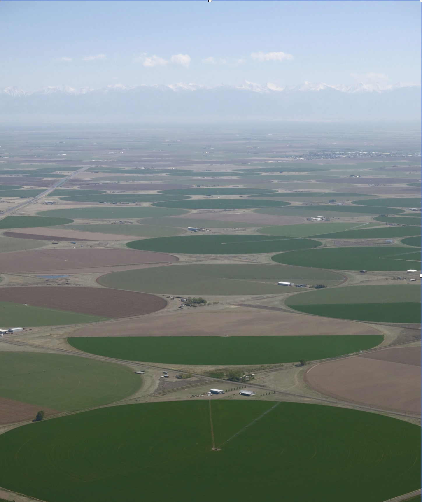
Aerial view of the San Luis Valley’s irrigated agriculture. Photo by Rio de la Vista.
On April 7, 2016, the Environmental Protection Agency proposed adding the “Bonita Peak Mining District” to the National Priorities List, making it eligible for Superfund. Forty-eight mine portals and tailings piles are “under consideration” to be included. The Gold King Mine will almost certainly be on the final list, as will the nearby American Tunnel. The Mayflower Mill #4 tailings repository, just outside Silverton, is another likely candidate, given that it appears to be leaching large quantities of metals into the Animas River. What Superfund will entail for the area beyond that, and when the actual cleanup will begin, remains unclear. Eric Baker
Click here to read the report. Here’s the introduction:
The Bonita Peak Mining District Superfund Site (Site) is located in southwestern Colorado. The Site consists of 48 historic mines or mining-related sources where ongoing releases of metal- laden water and sediments are occurring within the Mineral Creek, Cement Creek, and Upper Animas River drainages in San Juan County. Drainages within the Site contain over 400 abandoned or inactive mines, where large- to small-scale mining operations occurred. San Juan County is comprised of 10 historic mining districts (Colorado Geological Survey 2017). Historic mining districts within the Mineral Creek, Cement Creek, and Upper Animas River drainages include Animas, Animas Forks, Cement Creek, Eureka, Ice Lake Basin, and Mineral Point. Hereafter, the term “mining districts” or “Site” is used to refer to the mining districts within these three drainages. This document is a baseline human health risk assessment (HHRA) for the mining districts. The purpose of this document is to characterize the potential risks to humans, both now and in the future, from exposures to contaminants that may be present in the mining districts, assuming that no steps are taken to remediate the environment or to reduce human contact with contaminated environmental media. The mining districts are primarily used by humans for recreational, occupational, and tribal purposes. The receptor populations of interest for the risk assessment included campers, hikers, hunters, recreational fishermen, all-terrain vehicle (ATV) guides, ATV recreational riders, and county road workers. An addendum to this risk assessment will be developed to evaluate tribal exposures once the necessary exposure data are available.
The results of this assessment are intended to help inform risk managers and the public about current and potential future health risks to humans that may occur as a result of exposure to mining-related contaminants due to recreational and occupational activities, and to help determine if there is a need for action to protect public health at the Site. Site managers will also consider the results of the ecological risk assessment and any regulatory requirements in determining appropriate remedial actions for the Site. As appropriate, discussions and recommendations on how to manage potential risks will be provided in the Feasibility Study. The identification of remedial action levels, which will guide future remediation efforts, will be provided in the Record of Decision.
The methods used to evaluate risks in this HHRA are consistent with current guidelines for human health risk assessment provided by the U.S. Environmental Protection Agency (EPA) for use at Superfund sites (EPA 1989, 1991a, 1991b, 1992, 1997, 2002a, 2002b, 2002c, 2004, 2009a).
Despite findings, agency says cleanup remains a priority
A new study has found no serious risk to human health stemming from mines included in a Superfund site around Silverton, according to the Environmental Protection Agency.
“This is a good news story,” said Christina Progess, Superfund remedial project manager. “And it’s a really important milestone for the project that paints a more full picture in terms of what cleanup work needs to be done.”
[…]
As part of the Superfund process, the EPA must evaluate the risks contamination slated for cleanup has on human health. In the case of Bonita Peak, exposure to mine waste through incidental ingestion and inhalation stood as the highest possibilities for people who visit the area.
But, for the most part, the study showed there doesn’t seem to be much risk to human health…
“Overall, there’s a lot of good news in here,” Progess said. “It doesn’t impact the local tourism industry, and folks working out in the district aren’t at risk from a human health standpoint. But (the study) also helps us highlight there are some areas that people come in contact with it.”
While Superfund sites with clear and significant human health risks receive priority within the EPA for funding, Progess said she doesn’t expect the study’s findings to affect Bonita Peak.
“Bonita Peak has always been and continues to be one of the administration’s top priority Superfund sites in the nation,” she said. “I don’t anticipate (funding) being a concern.”
In April, the EPA released a study assessing risks to aquatic habitats, which showed that in areas where water had low pH and elevated metals, fish and other aquatic life populations were highly impaired or nonexistent.
The study helped EPA identify four areas where the agency would like to improve water quality in the Animas River watershed to the point where restoration of aquatic life could be achievable.
Click here to read the report. Here’s the abstract:
Groundwater pumping has caused marked aquifer storage declines over the past century. In addition to threatening the viability of groundwater-dependent economic activities, storage losses reshape the hydrologic landscape, shifting groundwater surface water exchanges and surface water availability. A more comprehensive understanding of modern groundwater-depleted systems is needed as we strive for improved simulations and more efficient water resources management. Here, we begin to address this gap by evaluating the impact of 100 years of groundwater declines across the continental United States on simulated watershed behavior. Subsurface storage losses reverberate throughout hydrologic systems, decreasing streamflow and evapotranspiration. Evapotranspiration declines are focused in water-limited periods and shallow groundwater regions. Streamflow losses are widespread and intensify along drainage networks, often occurring far from the point of groundwater abstraction. Our integrated approach illustrates the sensitivity of land surface simulations to groundwater storage levels and a path toward evaluating these connections in large-scale models.
Groundwater movement via the USGS
Typical water well
Artesian well Dutton Ranch, Alamosa 1909 via the Crestone Eagle
The plains around DIA were parched by the scorching 2012 drought, although groundwater pumping along the South Platte River enabled some farms to continue irrigating — photo by Bob Berwyn
The High Plains Aquifer provides 30 percent of the water used in the nation’s irrigated agriculture. The aquifer runs under South Dakota, Wyoming, Nebraska, Colorado, Kansas, Oklahoma, New Mexico and Texas.
Groundwater pumping is causing rivers and small streams throughout the country to decline, according to a new study from researchers at the Colorado School of Mines and the University of Arizona.
“If you pump near a stream you’re going to change the amount of water that flows through the stream, because some of that stream water is going to basically get pulled to the well instead of flowing down the stream,” said Reed Maxwell, hydrologist at Colorado School of Mines and the study’s co-author.
Maxwell says his new study with hydrologist Laura Condon at the University of Arizona goes broad, quantifying the effect of pumping across the country.
“What we found is that we have actually depleted streams quite a bit,” Maxwell said.
The study finds that since the 1950s groundwater pumping has caused some stream flows to decline upwards of 50 percent. Some streams have disappeared from the surface altogether, seeping underground to refill pumped groundwater, the study finds.
Declines are particularly stark in portions of the Colorado River basin and on the Great Plains, Maxwell said.
Using a computer model, researchers were able to envision what rivers across the U.S. would’ve looked like without widespread groundwater pumping, which took hold in the 1950s.
Water and wheat — foundations of life for millennia. In the American Southwest’s arid Sonoran Desert, water flows across Arizona from more than 300 miles away to quench the thirsts of more than four million people and sustain the food, economy, and livelihoods they rely on every day. Join us as we explore the thoughts of three visionaries in Tucson who are creating and growing a circular economy of water, forging a sustainable future for a city that could have gone in another direction. And nearly did.
We hear from third-generation farmer Brian Wong, who grows a variety of low-water and heat tolerant organic heritage wheat in the arid plains northwest of Tucson, and Don Guerra of Barrio Bread, who bakes 1,000 loaves of artisanal bread per day using local and indigenous wheat varieties. Brian and Don are bound together by water and the City of Tucson’s ability to provide it to them, and their community. Lastly, we hear from Tim Thomure, director of Tucson Water — a visionary working to build and sustain a thriving city in the Sonoran Desert.
American Rivers is deeply involved with a number of efforts across Arizona to help sustain the lives of millions of people across the state, ensure the viability of a thriving economy in the desert, as well as protect the vital lifeline for the entire region, the Colorado River.
Join us as we explore these ideas, and others, across the Southwest. For more information about this work, please see our Lower Colorado River page, and follow us to keep in touch with what is going on across this important region of the country.
Perfluorinated compounds, commonly known as PFAS, turned up in levels exceeding recommended federal standards in the aquifer underneath the Air Guard base, said the consultant’s report.
But while the contamination appears to be moving toward city drinking wells on Tucson’s south side, the pollution doesn’t pose any immediate health risk to water users, Tucson Water officials say…
That’s because PFAS pollution already detected on the south side is being routed to a treatment plant that’s cleaning it up, and because the city drinking wells nearest the Air Guard base already are shut down.
The newly discovered contamination was widespread, tainting eight monitoring wells across the base and at least one more well at the base’s northern boundary, the report found. Sampling for the report was done from January through March 2018…
The pollutant concentrations ranged from nearly 70 times the EPA’s recommended health advisory level at a well at the base’s northern boundary, to just above the EPA advisory farther south on the base, said the report.
Another monitoring well contained about 30 times the EPA health advisory level of 70 parts per trillion, the consultant’s study found…
Measurable levels of PFAS compounds turned up in soil samples collected on 14 locations on the Guard base, but exceeded recommended health limits only at one of those locations, the report said…
At the same time, Tucson Water officials note that the nearest city wells, lying 1.5 to 2.7 miles northwest of the base, are already out of service because of previously discovered contamination from PFAS, trichloroethylene and 1,4-dioxane.
Polluted water from those wells is being funneled to a south-side treatment plant known as the Tucson Airport Remediation Project.
There, it’s being treated so thoroughly that the compounds are no longer detected as the water leaves the plant to be served to people in the downtown area and just north and south of there…
The ADEQ said it doesn’t have the legal authority to require the Guard base to clean up the contamination on its site.
That’s because the EPA has no formal drinking water limit for PFAS compounds and because Arizona law doesn’t allow the state to have more stringent environmental regulations than the federal government has.
From the Associated Press via Colorado Public Radio:
The EPA said it will drill into the American Tunnel next month to measure water levels and investigate how the passage is connected to other shafts.
The agency is looking for ways to stop or treat contaminated water pouring into rivers from old mine sites in the Bonita Peak Superfund area north of Silverton…
The EPA said it would follow strict safety guidelines when drilling the test well into the American Tunnel.
On April 7, 2016, the Environmental Protection Agency proposed adding the “Bonita Peak Mining District” to the National Priorities List, making it eligible for Superfund. Forty-eight mine portals and tailings piles are “under consideration” to be included. The Gold King Mine will almost certainly be on the final list, as will the nearby American Tunnel. The Mayflower Mill #4 tailings repository, just outside Silverton, is another likely candidate, given that it appears to be leaching large quantities of metals into the Animas River. What Superfund will entail for the area beyond that, and when the actual cleanup will begin, remains unclear. Eric Baker
At an Arvada fire station, Polis signed into law House Bill 1279, which bans certain kinds of foam used in firefighting training. Such foam contains so-called “forever chemicals” that have contaminated drinking water in El Paso County and elsewhere…
The foam contaminated Fountain’s water supply, and it has since installed filters to deal with problem…
HB 1279 bans Class B firefighting foams that contain “intentionally added” per- and polyfluoroalkyl substances, also known as PFAS. Such chemicals were used for decades at Peterson Air Force Base in Colorado Springs and have been found in the nearby Widefield aquifer, which serves Security, Widefield and Fountain.
The foam was sprayed on the ground and used in a firefighting training area that was flushed into the Colorado Springs Utilities treatment system, which was ill-equipped to remove the chemicals. The effluent ended up in Fountain Creek, which feeds the Widefield aquifer.
The Air Force since has replaced that foam with a new version that the military says is less toxic, though it still contains perfluorinated chemicals.
Pond on the Garcia Ranch via Rio Grande Headwaters Land Trust
In Salida, Polis signed House Bill 1264, which is intended to resolve some of the long-standing problems with the state’s conservation easement program.
Landowners say the Colorado Department of Revenue revoked tax credits awarded to those who entered into conservation easements with land trusts, with more than 800 credits revoked from the 4,000 granted in the program’s first 15 years.
HB 1264 is intended to make the program more transparent, with a warning to landowners that easements are in perpetuity. The bill also requires the Division of Conservation Easements, within the Department of Regulatory Agencies, to set up a committee to determine how to repay those tax credits.
The committee is to hold its first hearing June 25, an addition to the bill made by Sen. Jerry Sonnenberg, R-Sterling.
Legislative leaders in both parties are to appoint the committee members, and lawmakers say they intend to include representatives for those who have been denied tax credits as well as other program critics.
Colorado Governor Jared Polis chose the banks of the Arkansas River in Salida as the ideal location to sign an unprecedented nine bills into law on Monday morning, June 3. The location underscored both the importance of these bills to Colorado’s rural and recreation economies, as well as highlighting Colorado’s growing preference for collaboration to get things done…
SB19-221 – CO Water Conservation Board Construction Fund Project
This bill sponsored by Donovan and Roberts, is focused on the funding of Colorado water conservation board projects, and assigns an appropriation to protect those projects…
SB19-186 – Expand Agricultural Chemical Management Program Protect Surface Water
Another bill sponsored by Donovan, Catlin, Coram and including Rep. Jeni Arndt, seeks to protect Colorado surface water from contamination by the expansion of agriculture chemical management plans.
The U.S. Air Force has been sued after confirmation of PFAS contamination at Lake Holloman, near the Holloman Air Force Base in New Mexico. Photo credit: J.M. Eddins Jr./U.S. Air Force
From the High Country News (Paige Blankenbuehler):
Polyfluoroalkyl chemicals exist in furniture, waterproof makeup and clothing, nonstick cookware, popcorn bags, the foam used to extinguish petroleum fires (which is different from the slurry used across the West to fight wildfires), and countless other items. Known collectively as PFAS, this class of chemicals contains more than 5,000 different compounds that are often called “forever chemicals” because they take so long to break down in the environment. PFAS chemicals are an omnipresent, if largely invisible, part of daily life.
Yet numerous studies have linked exposure to them to cancer, thyroid disease, weakened childhood immunity and other health problems, according to the Centers for Disease Control and Prevention. A 2007 study published in the journal Environmental Health Perspectives estimated that PFAS are in the blood of 98% of Americans.
Because the Environmental Protection Agency does not regulate PFAS chemicals, states are left not only to research and track them, but also to develop regulations to clean up already dangerous levels of pollution. And, according to recent data from the Social Science Environmental Health Research Institute at Northeastern University and the Environmental Working Group, the West isn’t doing a great job.
Bill Walker, with the Environmental Working Group, a nonprofit environmental advocacy organization, says that, by and large, Western states are lagging far behind, not only in PFAS regulations, but also in monitoring. “The scope of this problem is growing — not because our exposure to PFAS chemicals is growing, but because we’re finally becoming aware of the persistence of these compounds in our lives,” said Walker. “Because there is so little action from the EPA on this, addressing this crisis falls to the states.”
People can be exposed to PFAS chemicals through household cooking items, or simply by eating popcorn out of the bag after microwaving it. But the greatest source of concern involves military bases, fire departments and airports, where the chemicals are used for extinguishing petroleum fires. That leaves high levels of PFAS chemicals in close proximity to public drinking-water sources. According to recent data compiled by EWG and the Social Science Environmental Health Research Institute at Northeastern University, 610 areas in 43 states have confirmed PFAS contamination. The researchers estimate that the drinking water of approximately 19 million people is tainted.
In the West, PFAS contamination has been confirmed in water supplies in Alaska, Arizona, California, Colorado, Idaho, New Mexico, Oregon, Utah, Washington and Wyoming. But only Colorado, California, Oregon and Washington regulate the chemicals, and among those, only California requires that public water systems monitor their levels.
Most Western states are already facing the consequences of contamination: Municipal water managers are scrambling to address high PFAS levels in drinking water, even as communities experience their health impacts, such as higher rates of kidney and testicular cancers. Still, very few have passed laws that track or regulate dangerous PFAS levels. “Northeastern states are ahead of most other states in monitoring and tracking this contamination,” said Phil Brown, the project director of Northeastern University’s PFAS monitoring project. “But in reality, if you look for it, you’ll find it most everywhere.”
Industry representatives say that while they support more oversight, a “one-size-fits-all” regulation for the class of chemicals goes too far. On May 22, the Senate Committee on Environment and Public works held a hearing to discuss appropriate legislation for addressing PFAS contamination. PFAS “play a central role in American life and not all are dangerous to public health,” said Kimberly Wise White, a toxicologist for the American Chemistry Council, an industry trade group that advocates for manufacturers of PFAS chemicals. “All PFAS are different; they have different hazard profiles. Some are not water-soluble, for example. It is not scientifically appropriate to regulate as one class.”
Advocates for stronger regulations, however, say that the EPA isn’t doing nearly enough to monitor the problem. And many disagree with White’s suggestion that the chemicals should be regulated on an individual basis, which would allow manufacturers to continue to make money from potentially dangerous chemicals. “The EPA’s current guidelines do not include a commitment to set a drinking water standard, even for a subset of PFAS chemicals that even manufacturers agree are dangerous,” said Suzanne Novak, an attorney for Earthjustice, an environmental advocacy organization.
Meanwhile, ever more Western communities are discovering troubling levels of PFAS in their water. Last month, the water district for the town of Security, Colorado, and the local Pikes Peak Community Foundation filed a $17 million lawsuit against the U.S. Department of Defense for PFAS contamination from Peterson Air Force Base, near Colorado Springs, Colorado. Shortly after that, the Centers for Disease Control identified the area as part of an upcoming study on the impacts of long-term exposure to high levels of PFAS in drinking water, with research due to begin this fall. New Mexico’s attorney general, too, has sued the U.S. Air Force after confirming PFAS contamination at Lake Holloman, on the westernmost edge of White Sands National Monument.
“PFAS chemicals are one of the most complex groups of pollutants out there,” said Chris Higgins, a professor at the Colorado School of Mines, who is researching the effects of exposure in El Paso County. “Once they are in the groundwater, it’s really hard to stop the spread, and treating them is even more difficult.”
Paige Blankenbuehler is an assistant editor for High Country News. Email her at paigeb@hcn.org.
Holloman Lake 2008 via the New Mexico Environment Department
FromThe New Mexico Political Report (Laura Paskus):
New Mexico officials find themselves stonewalled by the United States military over water contamination from two U.S. Air Force bases in the state.
In early May, New Mexico Attorney General Hector Balderas and New Mexico Environment Department (NMED) Secretary James Kenney sent a letter to the U.S. Air Force over contamination, this time at Holloman Lake.
Previously, groundwater tests at Cannon Air Force Base in Clovis and Holloman Air Force Base in Alamogordo showed high concentrations of PFAS, or per and polyfluoroalkyl substances.
Even in small amounts, exposure to these toxic, human-manufactured chemicals increases the risk of testicular, kidney and thyroid cancer and problems like ulcerative colitis and pregnancy-induced hypertension. PFAS include perfluorooctanoic acid (PFOA) and perfluorooctane sulfonate (PFOS).
In response to the groundwater contamination, New Mexico issued notices of violation against the military in late 2018 and again earlier this year. The state also filed a complaint in federal district court, asking a judge to compel the Air Force to act on, and fund, cleanup at the two bases.
But New Mexico is also a defendant in a separate case. After NMED issued a notice of violation against Cannon, the Air Force sued New Mexico, challenging the agency’s authority to compel PFAS cleanup under its state permit…
Moving up the food chain
PFAS’s move through the groundwater, and they’re persistent, which means they stick around for a long time. They also move up the food chain, accumulating more and more within each species.
Scientists have found PFOS in fish-eating birds, even those in remote marine locations. And in Michigan—another state grappling with PFAS contamination from military bases—scientists found PFOS in the muscle of deer living near the former Wurtsmith Air Force Base. That state issued a “do not eat” advisory for deer harvested within that area.
Holloman Lake is also considered an important area for birds, including migrating ducks. According to the Audubon Society’s website, the lake is the most important area in the Tularosa Basin for shorebirds like Wilson’s phalarope and snowy plovers.
“The bottom line is that you’ve got a wetland complex that provides wintering and migratory bird habitat to thousands of shorebirds and waterfowl each year that is potentially contaminated by a bioaccumulating toxic chemical, that’s not a good thing,” said Jonathan Hayes, executive director of Audubon New Mexico. “Holloman Lakes is also one of a dozen or so sites in the state that are frequented by snowy plover, a species in drastic decline over much of its range and one that is likely to ingest toxic chemicals as they feed on aquatic invertebrates which make up the bulk of their diet.”
In addition to birdwatching, waterfowl hunting is allowed within certain areas at Holloman Lakes. Although the New Mexico Department of Fish and Game issues hunting permits and sets hunting season rules, the responsibility for closing the area to hunting would lie with Air Force officials.
Meanwhile, Balderas and Kenney are still waiting to hear back from the Air Force.
“We have not received a response to the letter sent by NMED and the Office of the Attorney General on May 9,” said NMED’s public information officer, Maddy Hayden. “We are also unaware of any actions the Air Force has taken in the interim to protect the public from exposure to PFAS at Lake Holloman.”
Prior to mining, snowmelt and rain seep into natural cracks and fractures, eventually emerging as a freshwater spring (usually). Graphic credit: Jonathan Thompson
FromThe Associated Press (Dan Elliott) via The Denver Post:
The work includes dredging contaminated sediment from streams and ponds, diverting water away from tainted mine waste piles and covering contaminated soil at campgrounds.
The agency first outlined the plan last June and finalized it Thursday.
This summer’s work is aimed at reducing the volume of toxic heavy metals that escape from mining sites and into rivers while the EPA searches for a more comprehensive solution under the Superfund program…
The Gold King is not on the list of 23 sites chosen for this summer’s work. The EPA installed a temporary treatment plant below the Gold King two months after the spill, and it’s still cleaning up wastewater flowing from the mine.
Two of the 23 sites are campgrounds, and three are parking areas or places where people meet for tours. The EPA plans to cover contaminated rocks and soil at those sites with gravel or plant vegetation to reduce the chance of human exposure and keep contaminants from being kicked into the air.
Besides the dredging work, the EPA will dig ditches and berms to keep rain, melting snow and mine wastewater from reaching piles of contaminated waste rock and carrying pollutants into streams.
The initial project will cost about $10 million and take up to five years, the agency said.
The EPA said last year the initial cleanup would include 26 sites. But three mines were removed from the list because work will be done there later.
Ventucci Farm pumpkin harvest back in the day. Photo credit: Facebook.com
Here’s a report from Tom Dart that’s running in The Guardian. Click through and read the whole thing. Here’s an excerpt:
In Colorado Springs, businesses are suing the military for perfluorinated compounds, which some are calling ‘Agent Orange 2.0’
Over the last 80 years, much of the land surrounding Venetucci Farm was sold to the US army to establish the base now known as Fort Carson, and today it is hemmed in by highways. Still, with its 200 acres of fields, farmhouse and big red barn, it is a beloved institution in Colorado Springs. As the only community urban farm left in the sprawling city, it is a valuable resource, educating thousands of children about agriculture, sustainability and healthy eating and known above all for its annual pumpkin giveaways.
The autumn pumpkin event has taken place for decades, and a local brewer still makes Venetucci Pumpkin Ale, but now the pumpkins are bought elsewhere. The produce is no longer available for public consumption because farming activities have stopped. In 2016, irrigation water was found to be contaminated with elevated levels of perfluorinated compounds (PFCs).
The foundation that runs the farm has joined forces with a local water district to sue the US air force, alleging that toxic chemicals used in firefighting foam at a nearby base have tainted the water, perhaps for decades, prompting health worries and causing economic losses.
Similar concerns have been raised about dozens of other bases across the country. But the problem is not limited to areas close to military installations.
PFCs and related human-made chemicals, more generally known as per- and polyfluoroalkyl substances (PFAS), have been virtually unregulated since at least the 1950s. As well as at industrial sites, airports and bases, PFAS have long been used in household products thanks to their grease- and stain-resistant properties. They are everywhere: from fast-food packaging to carpets and furniture, water-repellent clothing and non-stick cookware such as Teflon.
The extraordinary resilience that led to them being dubbed “forever chemicals” no longer seems such a boon. As more becomes known about their widespread presence in the environment and the potential health risks, activists are urging state and federal regulators take action to increase oversight and even ban PFAS outright.
Click here to go to the USGS website. Here’s an excerpt:
When a drought hits and little or no rain has fallen in a long time, you might expect small streams and even larger rivers to just dry up, right? In many cases, they don’t. Streamflow might lessen to a trickle or so, but water continues to flow. How is that possible? Read on to find out how “base flow”, which is water seeping into the stream from groundwater, helps keep water in streams during droughts.
The High Plains Aquifer provides 30 percent of the water used in the nation’s irrigated agriculture. The aquifer runs under South Dakota, Wyoming, Nebraska, Colorado, Kansas, Oklahoma, New Mexico and Texas.
Click here to snag a copy to read (Erin M.K. Haacker, Kayla A. Cotterman, Samuel J. Smidt, Anthony D. Kendall, David W. Hyndman). Here’s the abstract:
We use an 82-year record of water table data from the High Plains Aquifer to introduce a new application of segmented regression to hydrogeology, and evaluate the effects of droughts, crop prices, and local groundwater management on groundwater level trajectories. Across the High Plains, we find discernable regional cycles of faster and slower water table declines. A parsimonious Classification And Regression Tree (CART) analysis details correlations between select explanatory variables and changes in water table trajectories, quantified as changes in slope of well hydrographs. Drying relative to prior-year conditions is associated with negative changes in slope; in the absence of drying conditions, steep declines in commodity price are associated with positive changes in hydrograph slopes. Establishment of a groundwater management area is not a strong predictor for change in water table trajectories, but more wells tend to have negative changes in around the time of management areas are formation, suggesting that drought conditions are associated with both negative deflections in water table trajectory and enactment of management areas. Segmented regression is a promising tool for groundwater managers to evaluate change thresholds and the effectiveness of management strategies on groundwater storage and decline, using readily available water table data.
From the Environmental Working Group (Monica Amarelo):
The known extent of contamination of American communities with the toxic fluorinated compounds known as PFAS continues to grow at an alarming rate, with no end in sight. As of March 2019, at least 610 locations in 43 states are known to be contaminated, including drinking water systems serving an estimated 19 million people.
The latest update of an interactive map by EWG and the Social Science Environmental Health Research Institute, at Northeastern University, documents publicly known pollution from PFAS chemicals nationwide, including public water systems, military bases, military and civilian airports, industrial plants, dumps and firefighter training sites. The map is the most comprehensive resource available to track PFAS pollution in the U.S.
The last time the map was updated, in July 2018, there were 172 contaminated sites in 40 states. This update draws from new data sources, so it is not directly comparable with the previous edition. But clearly, the crisis is spreading, and the new data may represent just the tip of a toxic iceberg.
PFAS chemicals, used in hundreds of consumer products, have been linked to weakened childhood immunity, thyroid disease, cancer and other health problems. PFOA, formerly used to make DuPont’s Teflon, and PFOS, formerly in 3M’s Scotchgard, have been phased out in the U.S., but manufacturers have replaced them with chemically similar, largely untested compounds that may be no safer. According to the Centers for Disease Control and Prevention, PFAS chemicals contaminate the blood of virtually all Americans.
“The Environmental Protection Agency has utterly failed to address PFAS with the seriousness this crisis demands, leaving local communities and states to grapple with a complex problem rooted in the failure of the federal chemical regulatory system,” said Ken Cook, president of EWG, which has studied these compounds for almost two decades. “EPA must move swiftly to set a truly health-protective legal limit for all PFAS chemicals, requiring utilities to clean up contaminated water supplies.”
“The updated map shows that PFAS contamination is truly a nationwide problem, impacting millions of Americans in hundreds of communities,” said Phil Brown, a professor of sociology and health sciences at Northeastern University and director of the Social Science Environmental Health Research Institute. “Leaders in many communities and states are doing great work to raise awareness about PFAS and push for cleanup, but this is a national crisis demanding national action. The EPA should act more quickly to evaluate all PFAS chemicals and restrict their use, and polluting industries should be held responsible.”
Michigan has 192 sites on the map, reflecting a testing program more comprehensive than anywhere else. It reinforces the fact that PFAS chemicals are everywhere – when you look for them, you find them. California has 47 known contamination sites and New Jersey has 43.
The map also shows contamination of 117 military sites, including 77 military airports, a legacy of the Pentagon’s 50-year history of using PFAS-based firefighting foam.
There are no legally enforceable limits for PFAS chemicals under the federal Safe Drinking Water Act. The EPA’s non-binding health advisory level for drinking water is 70 parts per trillion, or ppt, for PFOA and PFOS, separately or in combination.
Last year the federal Agency for Toxic Substances Disease Registry proposed safe levels that roughly translate to 7 ppt for PFOS and 11 ppt for PFOA. Based on the best available science and emerging evidence of harm from the entire class of these chemicals, EWG is today proposing drinking water and cleanup standards for all PFAS chemicals as a group at 1 ppt. This is a health-based level that will fully protect public health for the most vulnerable populations, and does not depend on economic or political considerations.
From the Republican River Water Conservation District via The Julesberg Advoacate:
In an effort to increase the surface water flows in the Republican River system, the Republican River Water Conservation District has recently purchased and leased multiple surface water rights on both the North Fork and South Fork Republican Rivers. By keeping the surface water in the river, the RRWCD is greatly enhancing the ability of the State of Colorado to stay in compliance with the Republican River Compact. Due to the extensive efforts of the RRWCD and the Colorado State Engineer’s office, Colorado will be in compliance with the Compact in 2019.
This will be the first year since the Final Settlement Stipulation was signed in 2002, that Colorado will be in compact compliance.
In the Annual Compact accounting 60% of all surface diversions are treated as depletions to the flows of the rivers and those depletions must be replaced through the Compact Compliance Pipeline. This requires considerably more water than off-setting comparable groundwater pumping. Last week, the RRWCD purchased the Hayes Creek Ditch and the Hayes Creek Ditch #3 surfacewater rights on a tributary of the North Fork Republican River. Some of these water rights were diverted each year, and the RRWCD was required to off-set those diversions with additional pumping from the compact compliance pipeline.
The RRWCD also purchased and leased a total of 27.5 cubic feet per second of surface water rights formerly owned by the Hutton Foundation Trust. Significant diversions on the South Fork have impacted Colorado’s efforts to come in to compliance with the Compact. As part of the Compact accounting there are tests for State Wide compliance and tests for each sub-basin. When calculating the sub-basin non-impairment test, additional diversions on the South Fork can contribute to a failure to meet the Compact non-compliance. By purchasing the surface water rights, the RRWCD can insure that the water will stay in the stream and will be measured at the state-line gage and again at the compact gage near Benkelman, NE.
After years of legal conflict, all entities can stop litigation because by purchasing these surface water rights, all legal actions by the Hutton Foundation Trust or by CPW, Inc. will be terminated. By purchasing the South Fork surface water rights, the RRWCD will not have to operate the Compact Compliance pipeline an additional 17 days that would be required to off-set the amount of water these rights would otherwise be entitled to divert.
The Republican River Compact Administration (RRCA) has approved the operation and accounting for the Compact Compliance Pipeline. As part of getting this approval, Colorado agreed to voluntarily retire up to 25,000 acres in the South Fork Focus Zone (SFFZ) by 2029. Colorado is pursuing 10,000 retired irrigated acres in the SFFZ by 2024 and an additional 15,000 retired irrigated acres by 2029.
Drying up the acres formerly irrigated by these surface water rights will contribute to the total of retired irrigated acres in the SFFZ, but Colorado is still far from the 10,000 acres to be retired by 2024.
The RRWCD continues to offer supplemental contracts for CREP and for EQIP conservation programs. The District offers increased annual payments for acres retired in the South Fork Focus Zone.
Currently the FSA, NRCS, the State of Colorado and the RRWCD are waiting for the USDA to publish the Rules and Regulations for the 2018 Farm Bill. As soon as the rules and regulations are published, producers can start applying for these conservation programs.
The consensus of the RRWCD Board is that by completing these purchases, it improves the ability to secure compact compliance now and into the future.
The RRWCD also approved a Water Use Fee Policy during the quarterly Board meeting on April 25th in Yuma. The Water Use Fee Policy includes a fee for junior surface water right diversions, and it modifies the annual fee for municipal and commercial wells. A copy of the fee policy is available on the RRWCD website at http://www.republicanriver.com.
If you have any questions please contact Rod Lenz, RRWCD President, 970-630-3265, Deb Daniel, RRWCD General Manager, 970-332-3552 or contact any RRWCD Board member.
This month marks the 10th anniversary of the first rail shipment of radioactive tailings from the “Pile” near the banks of the Colorado River, with an estimated 9.5 million tons buried 30 miles away.
The U.S. Department of Energy announced that roughly 6.5 million tons of the uranium mill tailings remain.
In February, the government began a stepped-up schedule of removal, doubling weekly train shipments to Crescent Junction, where the disposal cell is located.
Each train can haul up to 144 containers and carry approximately 4,700 tons of mill tailings.
The accelerated schedule added 23 new employees to the project, which sits on 480 acres near the west bank of the river. The tailings cover 130 acres.
Once the site is fully remediated, community leaders say it could be home to numerous amenities such a trails, an outdoor event center, a community park or a welcome center.
The mill was built in 1956 outside Moab and closed in 1984. The site is monitored continuously for groundwater contamination and with air monitors. A portion of the site has been contoured to protect against flood events.
Moab tailings cleanup site
Colorado River at Moab aerial
Moab tailings site with Spanish Valley to the south
Groundwater levels during 2018, on average, rose slightly or remained about even throughout most of western and central Kansas, according to preliminary data compiled by the Kansas Geological Survey.
“By and large, 2018 was a good year for groundwater levels,” said Brownie Wilson, KGS water-data manager. “Virtually all levels in south-central Kansas wells were up along with a good portion of those in northwest Kansas, and although southwest Kansas saw a few decline areas in the usual spots, they were not as great as in years past.”
The KGS, based at the University of Kansas, and the Kansas Department of Agriculture’s Division of Water Resources (DWR) measure more than 1,400 water wells in Kansas annually. Most of the wells are drilled into the High Plains aquifer, a network of water-bearing rocks underlying parts of eight states and the state’s most valuable groundwater resource.
Ninety percent of the collected data comes from wells tapping the aquifer. The other wells are drilled into other aquifers underlying the High Plains aquifer and shallow aquifers adjacent to surface-water sources, such as the Arkansas River. Most of the 1,400 wells have been measured for decades.
In Kansas, the High Plains aquifer comprises three individual aquifers—the widespread Ogallala aquifer that underlies most of the western third of Kansas, the Equus Beds around Wichita and Hutchinson, and the Great Bend Prairie aquifer around Pratt and Great Bend.
Water levels in the Ogallala aquifer are influenced mainly by the amount of water withdrawn each year, which in turn is affected by the rate and timing of precipitation. Recharge, or water seeping down from the surface, adds little groundwater to the Ogallala. In central Kansas, however, recharge has more of an impact because the Equus Beds and Great Bend Prairie aquifer are shallower and average precipitation in that part of the state is higher.
Most of the wells in the network monitored by the KGS and DWR are within the boundaries of the state’s five Groundwater Management Districts (GMDs), which are organized and governed by area landowners and local water users to address water-resource issues.
In Southwest Kansas GMD 3, average levels dropped .39 feet. Although down, the change was less than in 17 of the last 20 years when levels fell between .5 and 3.5 feet annually. A rise of .05 feet in 2017 was the only positive movement during that time.
For the second summer in a row, water flowed for a time from the Colorado state line to Garden City. The river, which interacts with its adjacent shallow alluvial aquifer, has been mainly dry in western Kansas for decades.
Wells monitored in GMD 3 are drilled into the Ogallala aquifer except in a few areas where they draw from the deeper Dakota aquifer. The district includes all or part of Grant, Haskell, Gray, Finney, Stanton, Ford, Morton, Stevens, Seward, Hamilton, Kearny and Meade counties.
Western Kansas GMD 1 experienced a slight drop of .18 feet following a slight gain of .07 feet in 2017. The GMD includes portions of Wallace, Greeley, Wichita, Scott, and Lane counties, where the majority of wells are drilled into the Ogallala aquifer.
“West central was basically unchanged as a whole but the average is bookended by declines in Wallace County and rises in Scott County,” Wilson said.
Northwest Kansas GMD 4 had an average increase in water levels of .26 feet following a rise of .38 feet in 2017. GMD 4 covers Sherman, Thomas, Sheridan and parts of Cheyenne, Rawlins, Decatur, Graham, Wallace, Logan and Gove counties. Groundwater there is pumped almost exclusively from the Ogallala aquifer and shallow alluvial sources associated with streams. Besides being influenced by precipitation, water-level results in part of GMD 4 were tied to crop loss.
“Some producers south of the Goodland to Colby area got hailed out early in the 2018 growing season,” Wilson said. “With hail damaged crops and higher precipitation rates in the eastern portion of GMD 4, wells there had less declines or even slight recoveries.”
Big Bend GMD 5 had an average increase of 1.21 feet following an increase of .30 feet in 2017. The GMD is centered on the Great Bend Prairie aquifer underlying Stafford and Pratt counties and parts of Barton, Pawnee, Edwards, Kiowa, Reno and Rice counties.
Equus Beds GMD 2, a major source of water for Wichita, Hutchinson and surrounding towns, experienced a gain of 1.35 following a 1.93-foot decline in 2017. The GMD covers portions of Reno, Sedgwick, Harvey and McPherson counties.
The KGS measured 581 wells in western Kansas and DWR staff from field offices in Stockton, Garden City and Stafford measured 223, 260 and 357 wells in western and central Kansas, respectively. Measurements are taken annually, primarily in January when water levels are least likely to fluctuate due to irrigation.
The Ogallala Water Coordinated Agriculture Project brings together 70 researchers, along with specialists and students based at seven universities and two USDA research locations…
OWCAP involves research, demonstration and education. The University of Nebraska-Lincoln’s Water Resources Field Laboratory near Brule is one of the research sites.
The TAPS competition at North Platte is also part of OWCAP. TAPS stands for Testing Ag Performance Solutions. A highly respected and innovative program, TAPS is made up of miniature corn and grain sorghum “farms,” where individuals and teams make decisions such as when and how much to irrigate, and how much nitrogen fertilizer to use. Participants earn awards for efficiency and profitability.
UNL water management specialist Daran Rudnick is an active member of the OWCAP research team. He worked with other educators at the West Central Research and Extension Center at North Platte to implement TAPS three years ago.
OWCAP is about identifying and promoting practices that conserve water and prevent water pollution, said OWCAP Manager Amy Kremen, who is also a water expert at Colorado State University.
Sharing ideas is an important part of OWCAP. For example, TAPS is now expanding in coordination with Oklahoma State University to offer a sprinkler-irrigated corn competition at Guymon, Oklahoma, this year.
OWCAP participants in Texas have something to share, too. The Natural Resources Conservation Service and North Plains Groundwater Conservation District there have implemented a master irrigator program that involves intensive training and certification. Now other states are considering implementing similar programs, Paulman said. Programs like that help increase adoption of water conserving practices, he said.
OWCAP has also resulted in research projects that each span three or more states, Kremen said. That “helps us to draw broader conclusions” about the potential of water conservation practices.
Those practices include making effective use of soil moisture sensors and aerial photography to inform irrigation and fertilizer decisions, carefully timing irrigation based on crop growth stages, using university-supported irrigation scheduling tools, and transitioning successfully to dryland…
OWCAP has also resulted in publication of over 50 peer-reviewed journal articles and other reports, which are available at ogallalawater.org.
Kremen said the OWCAP team is on track to complete its USDA-NIFA funded work within the next two years. Team members are the lead organizers for a summit to take place in early 2020 in Amarillo, Texas. There, water management leaders from throughout the region will share their experiences and findings in hopes of benefiting agricultural producers and communities throughout the region.
High Plains in eastern Colorado. Photo credit Bob Berwyn.
Center pivot sprinklers in the Arikaree River basin to irrigate corn. Each sprinkler is supplied by deep wells drilled into the High Plains (Ogallala) aquifer.
Attendees at the first Ogallala Aquifer Summit, April 9 and 10, 2018, Garden City, Kansas, were broken into diversified focus groups by the organizers to better hash out issues that affect all eight states that sit above the aquifer. (Journal photo by Jennifer M. Latzke.)
The High Plains Aquifer provides 30 percent of the water used in the nation’s irrigated agriculture. The aquifer runs under South Dakota, Wyoming, Nebraska, Colorado, Kansas, Oklahoma, New Mexico and Texas.
The Ogallala aquifer, also referred to as the High Plains aquifer. Source: National Oceanic and Atmospheric Adminstration
Renewable Water Resources (RWR) managing partner Sean Tonner made his water export presentation to an overflow crowd at the Saguache Road and Bridge Building [April 9, 2019] evening, but nearly all those attending made it clear they were not receptive to the plan.
Tonner opened the discussion by telling county residents the plan is “still in the formation stages and has years to go.” He said he has already held 150 meetings to explain the project.
A former chief of staff for Gov. Bill Owen, who supported the plan, Tonner also worked with former State Senator Greg Brophy and other government officials on the project. Currently Tonner owns the 11,500-acre Gary Boyce ranch, purchased from Boyce’s wife following his death. He also leases grazing land in the same area.
Tonner claims less than two percent of the annual confined aquifer recharge — 500,000 acre-feet — is needed by the Front Range. Farmers could sell all or a portion of their water rights to RWR for twice the going amount. A total of $60 million has been set aside to procure water rights.
Already enough Saguache County farmers and ranchers have agreed to sell their water rights to satisfy the proposed 22,000 acre-feet project, Tonner reported. The plan is said to be able to retire more than 30,000 acre-feet, reducing the overall usage from the basin. This would presumably lessen the pressure on existing rivers and streams now providing water to the Front Range.
A pipeline along Highway 285, restricted to a 22,000-acre-foot capacity, would carry the water up over Poncha Pass into Chaffee County and from there it would eventually make its way into the Platte River. There would be no adverse impact on wildlife, Tonner claims.
The project would create a $50 million community fund for the county that could be used for a variety of purposes including education, law enforcement, tourism, economic development, conservation and other worthy cause. The county would manage the fund. Just the interest would generate $3-4 million annually which is twice the amount of the county’s sales tax grants, he pointed out.
Commissioners question Tonner
Citizens were asked to listen only during the meeting, although there was one uninvited comment by longtime water consultant Chris Canaly. Commissioners then offered their responses to Tonner’s plan, beginning with Jason Anderson.
Anderson asked Tonner if he had researched the plan to see if any communities in either Colorado or nationwide had ever benefited from water exportation. Tonner could not answer the question, although he told Anderson he is familiar with the history of similar projects.
J. Anderson also challenged Tonner’s statement that there is one to two billion acre-feet of water in the aquifer beneath the Valley, some of it below sea level. “We have a guess about what’s down there, but no one really knows,” Anderson told Tonner, echoing the opinions of several water exports who have advised the county. “And they estimate that all this water is connected, so where are the benefits, say, for Alamosa and Costilla counties?”
RWR replied that the benefit would lie in a lessening of the burden of water replacement. Commissioner Ken Anderson challenged Tonner on his definition of Front Range, reminding him that the San Juans are the higher front range. K. Anderson said he also had questions about the model RWR is using.
Commissioner Jason Anderson then asked Tonner what the county would do about the promised money for the community fund if there is another recession. RWR replied there would likely be another economic downturn, but said he thought it “is pretty bad when we have the ability to solve problems with renewable resources we are not going to use” and fail to do so.
This brought a united protest from the crowd, who denied the county’s water resources are “renewable.” Anderson reminded attendees that Tonner had a right as a Saguache County resident to voice his opinion whether they agreed with his ideas or not.
Despite its designation as a desert, the Coachella Valley is blessed with water. The very names associated with the most prominent places and businesses in the desert, such as the Oasis Hotel, Mineral Springs Hotel, Deep Well, Indian Wells, Palm Springs, Snow Creek, and Tahquitz River Estates, all conjure up pretty images of water.
But the early story of desert water is more utilitarian than picturesque: it quite literally can be seen as a history of ditches.
More than a century ago a prescient and patient few understood that water was the most precious of all resources in such an arid region. Hydrology was the purview of engineers, and the first way to move water was in ditches. The most famous Southern California water scheme, made to ensure a reliable water supply for burgeoning Los Angeles, came at the cost of turning a once fertile pasture surrounding a lake situated 200 miles away from LA into a dust-polluting salt flat the size of San Francisco. But here in the natural desert, there were visionaries thinking about using local water and building their own infrastructure to deliver it.
As early as 1830, the local Cahuilla people brought water from Tahquitz Creek to their village by simple ditches constructed for irrigation. The flow was seasonal and subject to diversion and clogging. Those at the end of the line seldom got water.
In 1887, early white settler John Guthrie McCallum formed the Palm Valley Water Company and began the construction of a stone-lined irrigation ditch to traverse what is variously reported as 16, 17, or 19 miles of desert between the San Gorgonio Pass and Palm Springs to carry the flow of the Whitewater River (whatever the actual distance, it was an astonishing accomplishment).
McCallum also developed the waters of Chino Canyon for irrigation, and hoped to prosper by raising figs, grapes, olives and apricots earlier than coastal farmers. There were unauthorized diversions of the sluice and many disputes — exacerbated by a flash flood that destroyed the canal — followed by more than a decade of drought during which most of any civilization in the Coachella Valley perished. By 1905, when the drought finally ended, actual lack of water and legal disputes over water rights left very few Cahuilla and even fewer white settlers in the region…
In 1927, Alvah Hicks acquired the Palm Valley Water Company with a loan from Mr. O’Donnell, reorganized it and changed its name to the Palm Springs Water Company. Hicks sourced water from Snow Creek and Falls Creek, each with their own conduits, while presumably improving water pressure up the hill. Alvah’s sons Harold and Milton Hicks took over the stewardship of the company from their father, expanding pipelines and supplies. Alvah prided himself on building for future capacity and his sons carried on that forward-thinking practice. Therefore, in addition to the flumes, wells were drilled to tap into the aquifer — the vast lake beneath the valley floor. Ironically, abundant water had been just below the ground for millennia — a legacy of the prehistoric Lake Cahuilla that had once inundated much of the valley…
[P.T] In 1927, Stevens formed the Whitewater Mutual Water Company and supplied irrigation water from the Whitewater River for residential and agricultural use. He had his own system of pipes and ditches that would divert the river, while allowing for intermittent flow from the river. Tom O’Donnell owned shares in Whitewater, which irrigated his golf course…
At the south end of the Coachella Valley, there was an even more ambitious ditch-digging project, rivaled only by Mulholland’s Los Angeles aqueduct. Starting in 1900, the California Development Company constructed hundreds of miles of irrigation ditches and canals to bring water from the Colorado River to the arid desert and create fertile farmland out of the Salton sink. At first the effort worked, but it lasted for only a few years until the silt-laden Colorado water clogged the canal.
After a prodigious rainfall in 1905, a breach in the walls of the canal caused the entirety of the river to flow into the sink for the next two years while workers frantically worked on repairs. This tinkering with nature resulted in the Salton Sea.
Agua Caliente Reservation in 1928. Photo credit Wikipedia.
Local water agencies have pumped so much water from aquifers to supply homes, farmland and resorts in the Coachella Valley that the land is sinking. The Agua Caliente Indian Reservation, created in 1876, runs in a checkerboard pattern in the area of Palm Springs. (Image credit: Tim Roberts Photography / Shutterstock)
Coachella Valley. Graphic credit USGS.
Coachella Valley photo credit the Water Education Foundation.
Blowing Alkali Dust at Owens Lake, California. Photo credit: Eeekster (Richard Ellis) via Wikimedia
Farm, farm workers, Mt. Williamson in background, Manzanar Relocation Center, California. Photo credit Ansel Adams circa 1943 via Wikimedia.
The first Metropolitan Water District Board of Directors’ meeting in Pasadena, December 1928. Photo via the Metropolitan Water District of Southern California.
Spray irrigation on a field in the Imperial Valley in southern California. This type of irrigation is a lot better than the extremely water inefficient type of flood irrigation that is popular in this region. Still, in the high temperatures of this desert region a lot of the water evaporates, leaving the salts, that are dissolved in the colorado River water that is used, on the soil.
A map of the Aqueduct route from the Colorado River to the Coastal Plain of Southern California and the thirteen cities via the Metropolitan Water District of Southern California.
Salton Sea shoreline screen shot of drone video June 11, 2016. Credit Palm Springs Desert Sun.
A public hearing on the proposed new water use fee policy will be held during the Republican River Water Conservation District Board of Director’s regular quarterly meeting next week in Yuma.
The meeting will be Thursday, April 11, in the banquet room at Quintech, 529 N. Albany St., beginning at 10 a.m.
The public hearing on the proposed water use fee policy will be at 1 p.m.
The new water use fee policy establishes and corrects water use fees for non-groundwater irrigation use in accordance with the Republican River Compact Administration accounting procedures and reporting requirements. It includes fees for all water uses, including junior surface water rights “as each water use affects compact compliance” according to the meeting release from the RRWCD.
It states that the policy is intended to provide a fair and equitable fee structure for all types of water use and consumption. The fees are set at a level to fund the necessary programs of the RRWCD “intended to meet the statutory responsibilities and limitations of the District.” It will not impact water use that was decreed or permitted earlier than December 31, 1942, prior to the Republican River Compact.
Water users that have a decreed plan for augmentation that replaces depletions will not be assessed a fee for that water use and consumption.
General public comment will be heard immediately following the public hearing on the proposed policy.
Among the presentations to be made at the April 11 meeting is one by Margaret Lenz regarding the Yuma County Conservation District soil moisture monitoring program.
The board will discuss and vote on sending comments regarding the new proposed WOTUS Rule. It also will discuss and vote on an agreement to offer well owners who are required to provide an augmentation plan to another river basin.
It will receive reports from the general manager, the compact compliance pipeline operator, from chairmen fo the RRWCD committees, the RRWCD’s engineer, federal and state lobbyists and legal counsel. The board also will receive a report by the State Engineer’s Office and discuss South Fork Water Rights.
For further information concerning the April 11 meeting, please contact RRWCD General Manager Deb Daniel at 332-3552 or email her at deb.daniel@rrwcd.com.
Scott Hummer shows off a fish passage at a North Poudre Irrigation Company diversion structure. His agency worked with Fort Collins Natural Areas and Colorado Parks and Wildlife to include a fish passage when the irrigation company replaced a diversion structure on the Poudre River that was destroyed by the 2013 floods. Work was completed [in February 2016]. (Pamela Johnson / Loveland Reporter-Herald)
Colorado Water Stories – Learning from our past, reimagining our future
Friday, April 19th
7:30 am to 5:30 pm
Mount Vernon Canyon Club
24933 Club House Circle
Golden, CO 80401
Come join us for an informative day of Colorado water stories and discussions. Speakers will include:
Amy Beatie (Deputy Attorney General for Natural Resources and the Environment)
Becky Mitchell (Director of the Colorado Water Conservation Board)
Interactive presentation on conflict resolution by Todd Bryan
Stories from retired State and Division Engineers, moderated by KUNC reporter Luke Runyon
This year’s conference will cover a range of topics from both a technical and policy perspective, including a deep-drill into ASR, geophysical applications, and how Coloradans are reimagining the river. The day will end with happy hour and a silent auction to benefit the AWRA Colorado and CGWA scholarship programs.
Officials will hear confirmation from the county’s emergency management manager on Wednesday that contaminated water recently released from the Gold King Mine did not adversely impact water quality downstream in the Animas River.
San Juan County Emergency Manager Mike Mestas will speak about the mine’s status in his presentation to the San Juan Water Commission during its monthly meeting at 9 a.m. Wednesday at the San Juan Water Commission Office Building, 7450 E. Main St. in Farmington.
The presentation will serve as an update for county water commissioners on the Gold King Mine spill of 2015, and what has happened since then.
The mine, near Silverton, Colorado, created concerns for water quality this winter when storms and avalanche danger cut off access to the facility that treats water draining from the mine.
The facility also lost power at that time, causing untreated water to bypass the plant and drain into Cement Creek for 48 hours.
Thursday, April 4, 2019 – 4:00 p.m. – 9:00 p.m. (Dinner Served) Friday, April 5, 2019 – 8:30 a.m.-4:30 p.m. (Continental Breakfast and Lunch Served)
Offered for 12 General CLE Credits
The Volume 22 Water Law Review Symposium will take place April 4 and 5, 2019, at the University of Denver Sturm College of Law. We are dedicating this symposium to the 50th Anniversary of the 1969 Water Rights Determination and Administration Act. The symposium will be slightly different from years past. The symposium and the spring issue will work in tandem, with select topics and papers from the symposium being published in a “spring plus” issue.
The theme for the symposium is the past, present, and future of the 1969 Act. The past section includes topics related to the history of the 1969 Act, the Act’s implementation, and some of the major changes and decisions that have shaped the current state of water law in Colorado. The present section focuses on current programs and major issues and questions that practitioners are grappling with. The future portion looks at issues that Colorado and the water community might encounter as we head into the next 50 years of water law.
This celebration of the 1969 Act is organized and made possible by the generosity and support of the Sturm College of Law, the Colorado Supreme Court, and Colorado Bar Association CLE.
Thursday, April 4 – 4:00 p.m. – 6:00 p.m.
Locaton: The Sie Building: Josef Korbel School of International Studies – Maglione Hall
Pioneers of the Act
This panel leads off celebrating pioneers and key provisions of the 1969 Act.
Panel: Ken Wright, David Harrison, Bill Hillhouse, Jim Witwer, and Justice Greg Hobbs (Moderator)
6:15 – Dinner
7:00 – 9:00 p.m.
Vignettes About Practicing Under the Act
This panel continues the celebration with vignettes from water professionals who spent a career interacting with the statutory scheme.
Panel: Dick Wolfe, Carolyn Burr, David Robbins, and Kole Kelley (Moderator)
Friday, April 5
Location: DU Sturm College of law Room 165
8:30 a.m. – Welcome and Opening Remarks
Kole Kelley, Dean Bruce Smith, and Professor Tom Romero II
9:00 a.m.
Integrating Groundwater and Surface Water
This panel discusses the integration of ground water and surface water. Steve Leonhardt will discuss plans for augmentation under the 1969 Act; Andy Jones and Tom Cech will discuss the well crisis along the South Platte; and Bill Paddock will discuss the implementation of the 1969 Act in Division 3, with David Robbins (Moderating)
10:25 – Break
10:35 a.m.
How About the Environment?
This panel will discuss the environmental considerations handled under the 1969 Act. Linda Bassi will discuss instream flow rights; Dan Luecke will be discussing National Environmental Policy Act and the Two Forks veto; and Trisha Oeth and Jen Mele will be discussing the intersection between water quality and water rights. Amy Beatie (Moderating)
Noon – Lunch
1:00 p.m.
Engineering a Water Case and Ethical Considerations
This panel will discuss the ethical considerations of dealing with water engineers, how to engineer a water case, and the ethical considerations engineers go through while handling a water case.
Panel: Mark Palumbo, Steve Wittie, Cristy Radabaugh, Joe Tom Wood, and Kevin Rein (Moderating/Participant)
2:45 p.m. – Break
3:00 p.m.
The Future of Water Law and the Pro Se Party
This panel is composed of five people that all have very different perspectives. For the future of water, the panel will discuss the day-to-day workings of the water court process (from Referee Susan Ryan’s perspective), ways to improve the process for engineers on the witness stand (from Eric Harmon’s perspective), the pro se party and what water law looks like from the law student perspective (from Lindsey Ratcliff’s perspective), the water law professor’s perspective (from Professor Tom Romero II’s perspective), and the beginning practitioner perspective (from Whitney Phillip’s perspective). Referee Susan Ryan (Moderating/ Participant)
Adjourn – 4:30 p.m.
REGISTER NOW!
For questions, please contact
Kole Kelley at kkelley19@law.du.edu
Yesterday, EPA released preliminary water quality sampling data related to the temporary shutdown of the interim water treatment plant at the Bonita Peak Mining District Superfund site at Gladstone (Colorado). EPA’s analysis confirms that there were no adverse impacts to downstream drinking water or agricultural users associated with the short-term shutdown of the plant based on data that indicate minimal to no changes in water quality at sampling points downstream of Silverton in Durango. There were no observed impacts to aquatic life. Any impacts to aquatic life would be limited to the Animas River near Silverton.
The water treatment plant went offline on the evening of 14 March due to extreme weather conditions resulting in a power surge that tripped critical circuit breakers at the facility. The same weather event triggered an avalanche and several snow slides across the county road and prevented access to the plant. After a period of less than 48 hours, EPA brought plant back online and resumed normal operations on the afternoon of 16 March.
“EPA appreciates the efforts of our partners in San Juan County Colorado and the water plant operators for working quickly to minimise the length of time the facility was out of operation and limit any localised impacts to water quality,” said EPA Regional Administrator Doug Benevento.
“During and after the treatment plant shutdown, real time measurements of turbidity, pH and electrical conductivity from sondes in the Animas River provided no indication that downstream water users would be adversely impacted,” said New Mexico Environment Department Chief Scientist Dennis McQuillan.
“EPA’s laboratory test results confirm the interpretation of real time sonde data.”
EPA collected water samples at four locations along the Animas River from Cement Creek to Durango from 15 – 21 March. A preliminary analysis of the sampling data from 15 – 20 March shows a measurable elevation of metals concentrations, particularly copper, at the confluence of Cement Creek and the Animas River, about six miles below Gladstone. Levels of metals were slightly elevated at a location on the Animas River approximately one mile south of Silverton.
Heavy metal concentrations in the Animas River at two sampling locations in Durango were well within the range of concentrations previously observed when the treatment plant is operating. The detections of low concentrations of metals in the Animas River may be associated with the temporary closure of the plant, but they may also be related to several other factors that should be considered when evaluating these data.
These include snow and avalanche debris being deposited in Cement Creek, the Animas River and local waterways which potentially introduced metals containing soils and sediments. There is also the potential for the ongoing rain and runoff at lower elevations to mobilise metals containing sediments from the 416 fire at locations below the confluence of Hermosa Creek and the Animas River.
Preliminary data can be viewed at https://response.epa.gov/GladstoneWTP. Data from samples collected on 21 March will available on this website later this week.
The New Mexico Environment Department wants to withdraw from a federal lawsuit challenging Obama-era protections for waterways and wetlands across the country.
The department filed a motion Thursday, saying the positions taken in the lawsuit are inconsistent with its stance on proposed revisions to the water rule that were issued last month by the U.S. Environmental Protection Agency.
The department says the proposed definition for waterways that would be protected under the rule would exclude most of New Mexico’s waters.
Environment Secretary James Kenney says all water in New Mexico – from the Rio Grande to groundwater and seasonal streams – must be afforded legal protections.
Combined with the effects of climate change, the state argues that New Mexico’s waters may become more intermittent and therefore even less protected under the proposed rule.
Local plants vow to minimize coal-ash contamination to meet new EPA rules; report finds cases much worse in other states
Since federal regulations kicked in a few years ago, coal-fired power plants are required to monitor and publicly report what happens to the residue from burning coal and determine whether chemicals are seeping from the coal-ash disposal sites into the groundwater.
But the reporting process is inconsistent between facilities and the data collected is often complicated to interpret. So a group of environmentalists culled the data from 265 coal-fired power plants or ash dumps, including seven in Colorado, and found 91 percent had unsafe levels of one or more chemicals in nearby groundwater.
“This is only the beginning of the end,” said Abel Russ, a senior attorney for The Environmental Integrity Project, which published the report as part of a collaboration between the Sierra Club, Earthjustice and other environmental organizations. “If it’s gradually leaking and if you don’t do anything about it now, future generations will have to deal with it. And it’s not any one chemical but a bunch. Most had four different chemicals (contaminating groundwater). The coal-ash rule and our report are looking at drinking water standards, but there’s the whole fish and wildlife (ecosystem) that this doesn’t address.”
The Pentagon is reportedly lobbying for a more lenient standard for cleaning up toxic chemicals used for decades in firefighting foam that have been found in drinking water in southern El Paso County and around the country.
Even if the Pentagon is successful, the Air Force appears unlikely to get off the hook for cleaning up the contaminated Widefield aquifer serving tens of thousands of residents south of Colorado Springs, state health officials said.
The Defense Department’s push to revise safety standards comes as it faces billions of dollars in cleanup costs tied to its decades-long use of a firefighting foam laced with per- and polyfluoroalkyl substances. The chemicals, known as PFAS, are tied to cancer, liver disease and low infant birth weight.
The lobbying appears aimed at influencing the Environmental Protection Agency’s groundwater cleanup standard — a level at which cleanup would be required of polluters.
In a report to Congress, the Pentagon said an appropriate level is 380 parts per trillion, the New York Times reported. It’s at least five times what the EPA says could be harmful to people, and dozens of times higher than another federal agency says is toxic to people.
At that level, the military could avoid paying to clean up many contaminated sites across the nation, said David Andrews, senior scientist for the Washington D.C.-based Environmental Working Group, an advocacy group.
“Even if it’s the same number of sites, the amount of cleanup you’re doing at each site would be drastically reduced,” Andrews said. “The likely impact is that DoD is really trying to pass on the responsibilities and the cost for cleaning up this contamination. Which is dreadful.”
In a statement, the Pentagon said it takes its cleanup responsibility “seriously.”
“DOD is not seeking a different or weaker cleanup standard but wants the standard risk-based cleanup approach that is based on science and applies to everyone,” the statement said.
Still, one of Delaware’s Democratic U.S. senators, Tom Carper, claimed in a letter to the EPA that the Defense Department is currently only cleaning up sites where groundwater readings exceed 400 parts per trillion, and only removing the chemicals to 70 ppt. The Pentagon was joined by NASA and the Small Business Administration in lobbying for more relaxed standards, the senator said.
The Pentagon report only referenced two PFAS varieties — PFOA and PFOS — even though thousands of other varieties are known to exist. The report was issued last year, and reported Thursday by The New York Times, along with Carper’s letter.
The Defense Department’s maneuvering is expected to have little impact on cleanup operations around Peterson Air Force Base, Colorado health officials say.
State regulations would still force the Air Force to clean up the tainted Widefield aquifer to a more stringent standard that is in line with the EPA’s current health advisory, according to Kelly MacGregor, a Colorado Department of Health and Environment spokeswoman.
The state’s Water Quality Control Commission voted unanimously in April to adopt a site-specific groundwater quality standard of 70 ppt for the same two chemicals — PFOA and PFOS — combined.
Even without the state standard, the aquifer’s contamination downstream from the base is so bad that cleanup efforts around Peterson would likely go unaffected by the Pentagon’s lobbying.
Seven wells drilled about three years ago in the Widefield aquifer showed PFOS at levels of 400 ppt or greater. One well drilled at the Colorado Springs Airport found the chemical at 1,600 ppt.
Neither the state’s adopted groundwater standard, nor lobbying efforts in Washington, D.C., touch on the thousands of other types of chemicals, also called perfluorinated compounds.
For communities affected by use of the foam, such as Security, Widefield and Fountain, that could be a significant problem, Andrews said.
For example, another type of chemical called PFHxS is often associated with use of the firefighting foam. And no other type of perfluorinated compound was as common in drinking water samples taken from Security or Fountain wells as PFHxS, nor present at such high levels, according to EPA drinking water data.
A couple of other chemicals were reported as frequently in wells serving Widefield. But again, none were as consistently high as PFHxS.
It also has been found in the drinking water of dozens of other water districts across the country, EPA results show. The federal Agency for Toxic Substances and Disease Registry says it could cause liver damage and a decreased ability to respond to vaccines.
Several other types of PFAS also have raised health concerns while being found in water systems across the country.
“Really we’d like to see the EPA and the DoD focusing on reducing the total PFAS contamination … shifting into high gear and taking responsibility for cleaning up all of this contamination,” Andrews said.
A group of county residents is appealing to those concerned about water issues in the county to attend an important water meeting March 12 at 6:30 p.m. at the Road and Bridge Building in Saguache, 305 3rd Street, to sit in on a discussion with commissioners regarding water export plans.
The meeting is styled as “a listening work session,” meaning no public comment or questions will be allowed. The guest speaker is Sean Tonner, who will host a water export proposal presentation…
The water plan, apparently in the works for the past several years, was officially announced during a Rio Grande Water Conservation meeting in Alamosa, the Valley Courier reported Dec. 7, 2018…
Background
While some of those proposing the plan are newly arrived players, the proposal is not. The plan first emerged in the late 1980s with Maurice Strong’s Arizona Land and Cattle Co. and Stockmen’s Water. After reorganizing as AWDI, the new version of the plan was opposed and defeated in the early 1990s by the Rio Grande Water District and Valley citizens.
Originally AWDI, backed by then Baca Ranch owner Gary Boyce — also owner of numerous other water rights — presented a plan to pump 200,000 acre-feet of water annually from the underground aquifer. They claimed there would be no impact on the environment or existing water users. The application was later amended to 60,000 acre-feet annually, (approximately twice the amount consumed yearly by the City of Pueblo).
The new version of the water transport plan was most recently run past Saguache County Commissioners in 2014, prior to the death of Baca Ranch owner Gary Boyce. The entity then proposing the water was Sustainable Water Resources (SWR), now retitled as Renewable Water Resources (RWR). The new company is a mix of the previous organization and new members, a media advisor for the group said Tuesday.
Rio Grande River Basin via the Colorado Geologic Survey
It’s been nearly three years since the U.S. Air Force acknowledged that toxic chemicals from Peterson Air Force Base contaminated groundwater under the city of Security, forcing it to stop using well water that served its 19,000 customers.
This week, Security officials and the Pikes Peak Community Foundation answered with a federal lawsuit in Denver asking for nearly $19 million in damages from ongoing contamination.
What’s causing it isn’t in doubt. A military firefighting foam that contains perfluorinated chemicals has been seeping into groundwater south of Peterson AFB since 1970 and has contaminated the underlying Widefield and Windmill Gulch aquifers.
Air Force officials confirmed the contamination in an August 2016 study, and the Security Water District stopped using its 24 groundwater wells the following month. Then, it began buying water through the Southern Delivery System pipeline from Pueblo Reservoir.
Despite the 2016 Air Force study, the lawsuit says the federal government rejected a claim for damages last year, forcing Security and the Pikes Peak foundation, a nonprofit charity, to sue for damages.
The water district has itemized $15.5 million in losses and expenses related to finding a new water supply for the community.
The foundation, which owns Venetucci Farms in El Paso County, is asking for $3.1 million in damages for losing access to water suitable for growing crops.
The lawsuit gives a detailed account of how Air Force officials used the firefighting foam at Peterson AFB since 1970. It was used mostly in training, though the Air Force also sprayed contaminated water over the base’s golf course. It was also poured into the Colorado Springs city sewers…
On Wednesday, representatives from the Defense Department testified before a House subcommittee about the extent of the problem. They said the foam’s chemicals have been found in more than 560 public and private water systems nationally.
FromThe New Mexico Political Report (Laura Paskus):
On Tuesday, New Mexico Attorney General Hector Balderas and the New Mexico Environment Department (NMED) filed a complaint in federal district court, asking a judge to compel the Air Force to act on, and fund, cleanup at the two bases near Clovis and Alamogordo.
“We have significant amounts of PFAS in the groundwater, under both Cannon and Holloman Air Force bases,” NMED Secretary James Kenney told NM Political Report.
PFAS, or per and polyfluoroalkyl substances, are toxic, human-manufactured chemicals that move through groundwater and biological systems. Even in small amounts, exposure to PFAS increases the risk of testicular, kidney and thyroid cancer and problems like ulcerative colitis and pregnancy-induced hypertension.
“We want the groundwater cleaned up in the shortest amount of time possible, and we think at this point litigation is our best and fastest approach,” Kenney said. NMED and the New Mexico Department of Health are continuing to collect groundwater samples, and the two agencies are also working closely with the state’s Department of Agriculture. “As soon as we have those results, which should be in the next couple of weeks, we will determine the best way [to engage with the community],” he said. That could mean public meetings or roundtable discussions in the communities.
“I personally understand: It’s a bit scary, if you’re in those areas, to know there’s a groundwater issue and [to wonder], ‘How am I affected?” Kenney said. “We need to get some scientific data to get the answers to those questions.”
Groundwater tests at Cannon Air Force Base near Clovis showed concentrations of PFAS exceeding 26,000 nanograms per liter, or more than 300 times the federal lifetime drinking water exposure limit. In off-base wells, including those that supply drinking water to dairies, levels ranged from 25 to 1,600 nanograms per liter. The human health advisory for a lifetime drinking water exposure to PFAS is 70 parts per trillion, or 70 nanograms per liter. At Holloman, contamination levels in some wells were 18,000 times the federal health advisory for PFAS.
A federal judge has denied a motion to dismiss claims brought by state, federal and local governments and private entities related to damages caused by the Gold King Mine spill.
U.S. District Court Judge William P. Johnson denied the motion on Feb. 28 by the U.S. Environmental Protection Agency, its contractors and mining companies…
New Mexico, Navajo Nation and Utah, along with residents in Aztec and on the Navajo Nation, have filed lawsuits for environmental damages and tort claims against the federal agency and its contractors and mining companies since May 2016.
The defendants requested that the court dismiss claims, arguing sovereign immunity barred the litigation.
The two states and the tribe are seeking to recover the costs of their responses to the spill under the Comprehensive Environmental Response, Compensation and Liability Act.
New Mexico officials commended the latest court decision.
James Kenney, secretary for the environment department, said the state will continue to hold the defendants responsible for the environmental and economic harms caused by the spill.
Among damages the state is seeking on its behalf and for agricultural and recreational operations is more than $130 million in lost income, taxes, fees and revenues…
Navajo Nation President Jonathan Nez said the tribe is pleased with the judge’s decision.
Bipartisan bill would designate PFAS chemicals as hazardous substances under our environmental protection laws
U.S. Senators Michael Bennet (D-CO) and Cory Gardner (R-CO), with a bipartisan group of colleagues, today introduced legislation that would mandate the Environmental Protection Agency (EPA), within one year of enactment, declare per- and polyfluoroalkyl substances (PFAS) as hazardous substances eligible for cleanup funds under the EPA Superfund law, and also enable a requirement that polluters undertake or pay for remediation.
“It is inexcusable that the Trump administration continues to delay action to address PFAS contamination across the country,” Bennet said. “This bipartisan bill will ensure contaminated sites are cleaned up and resources are available to communities in Colorado so they have access to safe drinking water. Passing this measure is one of many steps we must take to address this public health threat with the urgency it requires.”
“This bipartisan legislation will allow EPA to pursue polluters responsible for PFAS contamination and provide the communities remediation options through Superfund,” Gardner said. “PFAS contamination is a serious issue facing our communities and we need to act quickly to address this challenge. I will continue working to make sure Coloradans have access to clean and safe drinking water.”
In May 2018, former Environmental Protection Agency (EPA) Administrator Scott Pruitt announced that EPA would propose designating PFOA and PFOS, two specific PFAS chemicals, as “hazardous substances” through one of the available statutory mechanisms, including CERCLA Section 102. Nearly a year later, on February 14, 2019, EPA released its long-anticipated PFAS Action Plan. The plan included another commitment by EPA to make that designation for PFOA and PFOS, but did not identify the available statutory mechanism it would use, nor how long the designation process would take to complete.
Clear and swift action from Congress to list PFAS as hazardous substances under CERCLA would advance the action already proposed by EPA, enabling the agency to protect human health and the environment in an expeditious manner.
Bennet’s reaction to the EPA’s plan, and his record of two years of work to address PFAS in Colorado and across the country, is available HERE.
In addition to Bennet and Gardner, original cosponsors include U.S. Senators Tom Carper (D-DE), Shelley Moore Capito (R-WV), Gary Peters (D-MI), Thom Tillis (R-NC), Debbie Stabenow (D-MI), Marco Rubio (R-FL), Jeff Merkley (D-OR), Jack Reed (D-RI), Lisa Murkowski (R-AL), Jeanne Shaheen (D-NH), Richard Burr (R-NC), and Joe Manchin (D-WV). U.S. Representative Debbie Dingell (D-Mich.) led the introduction of companion legislation in the House of Representatives earlier this Congress.
The senators’ PFAS Action Plan for 2019 comes after the Environmental Protection Agency was criticized by environmental groups and affected residents for not going further in its plan for addressing the chemicals.
The bipartisan legislation — Bennet is a Democrat, Gardner a Republican — mandates the EPA declare all perfluoroalkyl and polyfluoroalkyl substances, man-made compounds also known as PFAS, as “hazardous substances” within one year of the bill’s passage. The designation would clear the way for the EPA to use Superfund money to clean up contaminated sites, while opening the door for the government to sue polluters for cleanup costs.
“It seems like a positive step,” said Meghan Hughes, a spokeswoman for the Colorado Department of Public Health and Environment. “It really could be a driver for PFAS groundwater investigations and contaminations (cleanups) across the state.”
[…]
The legislation does not address any other aspect of the EPA’s oversight of those chemicals, such as whether the agency should regulate the chemicals in a similar fashion as lead, cyanide and mercury.
Should it pass, it’s impact on southern El Paso County — where the drinking water of tens of thousands of Security, Widefield and Fountain residents was tainted — remained unclear Friday.
The Air Force is in the midst of a yearslong process to address the chemicals that is similar to the federal Superfund program, due to the decadeslong use of a firefighting foam containing the toxic chemicals at Peterson Air Force Base that was detected in groundwater.
The Air Force is still investigating the contamination — a process that was expected to take years. And any cleanup steps — such as removing the chemicals from the Widefield aquifer — have not been announced, nor has money been allocated for such cleanup efforts.
In the meantime, water districts serving Security, Widefield and Fountain have spent millions of dollars installing treatment systems and piping in water from elsewhere to remove the chemicals from residents’ tap water to nondetectable levels.
Two other communities in Colorado — in Boulder and Adams counties — also have discovered the chemicals in their drinking water. Both contamination sites were near fire departments that used the same toxic firefighting foam that was a mainstay at Peterson Air Force Base, according to the Colorado Department of Public Health and Environment.
This image was taken during the peak outflow from the Gold King Mine spill at 10:57 a.m. Aug. 5. The waste-rock dump can be seen eroding on the right. Federal investigators placed blame for the blowout squarely on engineering errors made by the Environmental Protection Agency’s-contracted company in a 132-page report released Thursday [October 22, 2015]
Is it a conflict of interest for the Environmental Protection Agency, responsible for the Gold King Mine spill, to lead the Superfund cleanup of mine pollution around Silverton? The last company to operate a mine in Silverton, which is also possibly on the hook for cleanup costs, seems to think so.
Sunnyside Gold Corp. on Monday sent a letter to the acting inspector general for the EPA, Charles Sheehan, asking the EPA be investigated for its part in the Superfund site and ultimately be recused as the lead agency in the cleanup.
“The conflict of interest is clear,” Kevin Roach, director of reclamation for Sunnyside Gold, wrote in an email to The Durango Herald. “EPA caused the Gold King spill, which led to the Superfund listing, and resulted in the EPA being a defendant in multiple lawsuits.”
[…]
Roach said the “conflict” has made the EPA incapable of cleaning up the site in an “even-handed” manner.
When Army Staff Sgt. Samuel Fortune returned from Iraq, his body battered by war, he assumed he’d be safe.
Then the people around him began to get sick. His neighbors, all living near five military bases, complained of tumors, thyroid problems and debilitating fatigue. Soon, the Colorado health department announced an unusually high number of kidney cancers in the region. Then Mr. Fortune’s wife fell ill.
The military, it turned out, had been leaching toxic chemicals into the water for decades.
Mr. Fortune felt “stabbed in the back,” he said. “We give our lives and our bodies for our country, and our government does not live up to their end of the deal.”
That was 2016. Since then, the Defense Department has admitted that it allowed a firefighting foam to slip into at least 55 drinking water systems at military bases around the globe, sometimes for generations. This exposed tens of thousands of Americans, possibly many more, to per-and polyfluoroalkyl substances, a group of man-made chemicals known as PFAS that have been linked to cancers, immune suppression and other serious health problems.
Though the presence of the chemicals has been known for years, an announcement last week from the Environmental Protection Agency for the first time promised regulatory action, a significant acknowledgment of the startling scope of the problem that drew outrage from veterans and others living in contaminated communities.
Acting administrator Andrew Wheeler said that the agency would begin the process of potentially limiting the presence of two of the compounds in drinking water, calling this a “pivotal moment in the history of the agency.”
The admission drew some praise, but many said that it was not enough and that millions of people would keep ingesting the substances while a regulatory process plods along. “It should have been called an inaction plan,” said Judith Enck, a former E.P.A. regional administrator appointed by President Barack Obama.
While the military has used the chemicals extensively, it is far from the only entity to do so, and in recent years, companies like DuPont have come under fire for leaching PFAS into water systems.
All told, 10 million people could be drinking water laced with high levels of PFAS, according to Patrick Breysse, a top official at the federal Centers for Disease Control. Mr. Breysse has called the presence of the chemicals “one of the most seminal public health challenges” of the coming decades.
The residents of Fountain, a mountain-flanked suburb of Colorado Springs, were told of the contamination by local officials who had been required by the E.P.A. to test the water for the substances, a step toward possible regulation. Soon dozens of communities from New York to Washington State discovered their drinking water was also polluted with PFAS.
Many people began demanding that state and military officials test their blood for the chemicals, hoping to learn the extent of their presence in their bodies.
The military has started an expensive cleanup effort that has involved shifting entire municipalities to new water sources and assessing toxic plumes that continue to spread for miles.
Maureen Sullivan, the military’s deputy assistant secretary for environment, said the government had moved “aggressively” to tackle the problem, assessing cleanup duties and looking for alternatives to the firefighting foam, a version of which the military still uses.
“I’m proud of what the Department of Defense has done in the past two-plus years,” she said.
But frustration persists. The military never alerted all of the people who drank polluted water, meaning some are still in the dark. When asked how many people were affected by contamination, Ms. Sullivan said she “couldn’t hazard a guess.”