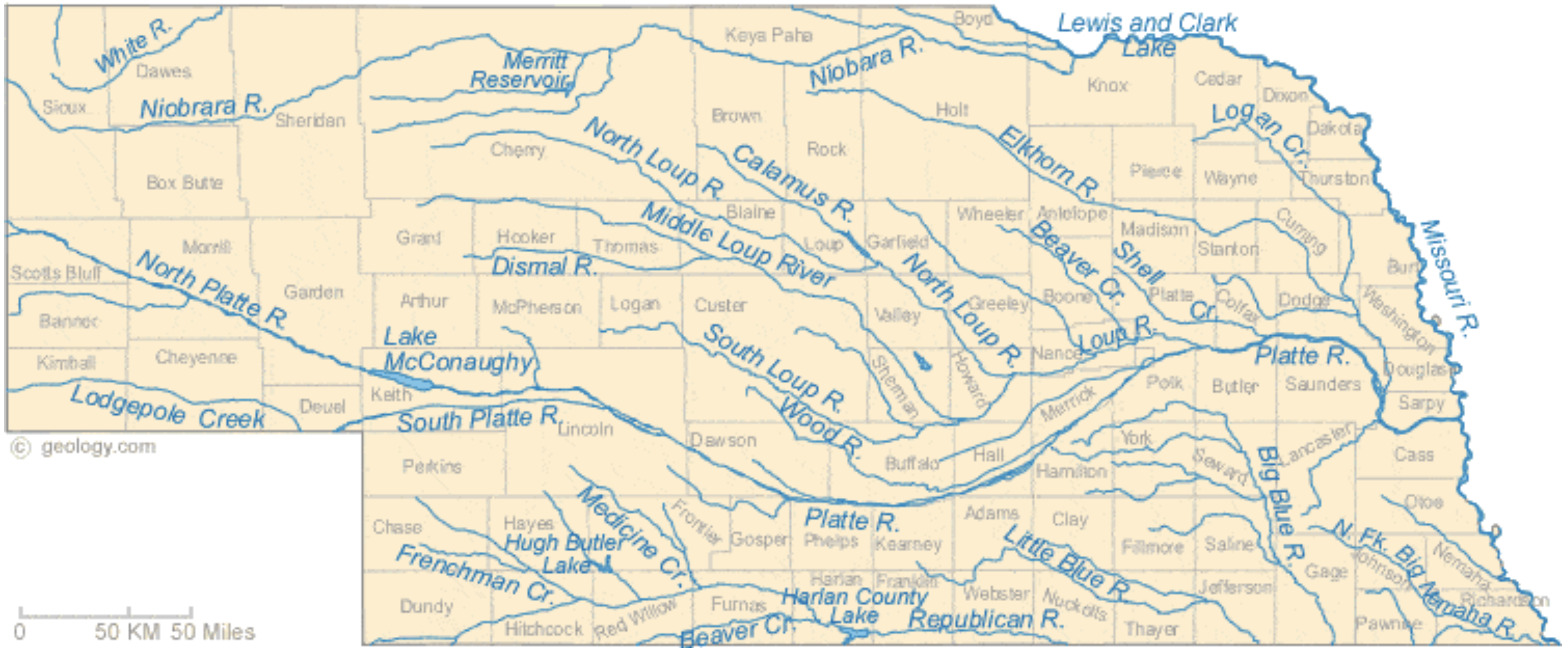
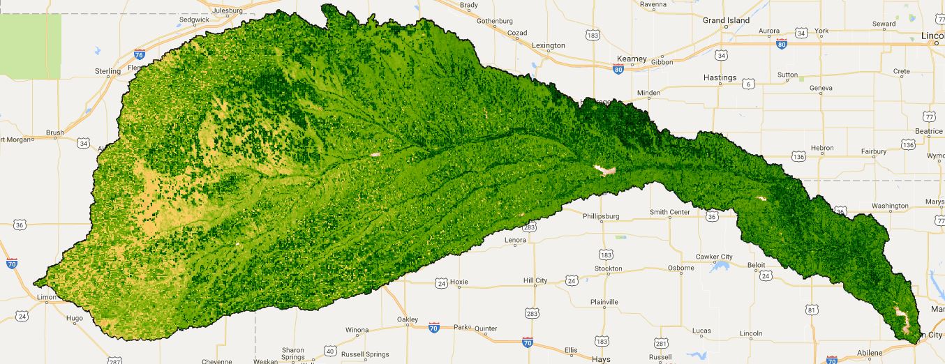
Nebraska Rivers Shown on the Map: Beaver Creek, Big Blue River, Calamus River, Dismal River, Elkhorn River, Frenchman Creek, Little Blue River, Lodgepole Creek, Logan Creek, Loup River, Medicine Creek, Middle Loup River, Missouri River, Niobrara River, North Fork Big Nemaha River, North Loup River, North Platte River, Platte River, Republican River, Shell Creek, South Loup River, South Platte River, White River and Wood River. Nebraska Lakes Shown on the Map: Harlan County Lake, Hugh Butler Lake, Lake McConaughy, Lewis and Clark Lake and Merritt Reservoir. Map credit: Geology.com
Water is a contradiction for Western Nebraska. It’s both seemingly abundant, yet simultaneously finite and scarce.
A new film by a local award-winning documentary filmmaker explores this contradiction and tells the story of water in the Panhandle, from the founding of the numerous irrigation and natural resources districts that line the North Platte valley, to the legal fights surrounding the regulation, distribution and control of that water.
Insight Creative Independent Productions Executive Producer and Director Becky McMillen’s “Rising Water,” was originally designed to be a web series, and viewers will get a first peek at it when the film premiers at the Legacy of the Plains Museum in Gering on Saturday, March 2, at 1 p.m. The screening of the documentary is in conjunction with The Smithsonian’s Museum on Main Street the Water/Ways” exhibit, which is open now until April 13 at Legacy.
“Everyone knows how to use YouTube, and they’ve gotten used to web series,” McMillan said. “They’re used to watching short pieces.”
In essence, each of the segments of the film is a self-contained documentary which covers a different facet of the story of our water, she said.
The hour and fifteen minute feature is the product of more than three solid years of work, with much of the footage and information gathered over a greater period of time. McMillen said that her father, Udell Hughes Sr., helped her with much of the technical research for the film. It also contains material gathered during production of McMillen’s last major project, “River of Time: Wyoming’s Evolving North Platte River,” a half-hour program which premiered on Wyoming PBS in November 2012.
“We’ve been sort of building up towards this film,” she said. “A lot of my historical research was actually done at Legacy of the Plains.”
The film contains interviews with managers of irrigation districts, farmers, UNL researchers and footage from public hearings concerning water issues.
“I knew that I needed to talk about the Ogallala Aquifer, but it took me a while to understand that issue,” McMillen said.
So she consulted UNL research hydrogeologist Jim Goeke, who is known as “Mr. Water.” Goeke researched the aquifer and arguably knows more about the water under our feet than any other human being.
McMillen said she was surprised by how candid Goeke.
“He gave me courage to address issues that probably weren’t very popular and won’t be very popular,” she said. “We have sucked so much water out of the aquifer and I’ve been watching the Pumpkin Creek battle for years, but lost track of it.”
The challenge for McMillen was to tie together the surface water and ground water portions of the story.
And it was a lawsuit over the little western Nebraska stream that became a big State Supreme Court case.
In 2009 The Spear T Ranch settled with more than a dozen upstream ranchers and farmers in a dispute between irrigators feuding over water in Pumpkin Creek.
“I was thinking about Pumpkin Creek, but I didn’t have any visuals,” she said. “I’d filmed a meeting of farmers years ago, but the camera went south on me and there was no way I could recover the footage.”
Then synchronicity struck. McMillen’s bookkeeper was from the Spear T Ranch, and the family over time had saved all of the newspaper clippings about the fight.
“That helped me tie it all together,” McMillen said. “You just have to be able to listen and when you hear something say ‘What was that?’”
And the hunger for investigative work is what fuels most of her projects.
“I have to tell myself to stop, take notes and check things out,” she said. “I hear stories all the time and I’d love to go chase them, but I have to be responsible and pay my bills.”
McMillen said a lot of the project has been self-funded because she couldn’t kick the habit once a lead seemed promising.
Newspapers also provided McMillen a window into the issues. As the “first draft of history,” clippings are featured at prominent portions of the film.
“The Star-Herald is in a lot of these stories that I brought back from the past,” she said. “There was so much information that really help me understand what was going on at the time.”
Another portion of the film is spent exploring contamination concerns, especially the 2015 fight against a Colorado company who sought permission to use an abandoned oil well in Sioux County as a wastewater disposal site. Sioux County landowners eventually won their appeal and state lawmakers reformed the process in which permits are granted.
“I documented almost everything, and there is a lot of that in there, along with newspaper clippings” she said. “The physical thing is really important, because I couldn’t have told any of this story without the work of reporters from back in the 1800s on to the present day.”
And those are the little things, McMillen said.
“I saw articles where they hung effigies of law makers because they were going to shut the water off,” she said. “There’s always a fight about water. One guy will say ‘I was here first,’ and another guy will say, ‘hey I need that.’ And just because you were here first doesn’t mean you get to have all of it.”
And over the course of making the film McMillen said that she’s learned that there needs to be change to protect and preserve not only the Valley’s greatest gift, but the way of life for Farmers and Ranchers who live here.
“We’re going to have to look beyond what we’re calling ‘traditional practices,’” she said. “We can continue on the same track that we have been. We can’t keep expanding and still be able to sustain that.”
It was her discussions with farmers that drove home the point for her.
“I think we need to look at it as growing food,” she said. “I would like us to grow more food that doesn’t have to be shipped, because we’re going to have to address climate change and reverse it.”
And at the same time, caution needs to be exercised when employing solutions, she said.
“What we think are the solutions are not always the best way of doing things,” she said. “We can’t just blindly forge ahead just because we think it’s a good idea. At the time we’re looking at sustainable energy, we’re also wanting to put it in places that will never be the same.
“We need to work within the infrastructure we already have and not go to condemning land so that we can use it for transmission lines or wind farms. There is plenty of space for that without tearing up areas that can’t be returned to their natural state.”
Ogallala Aquifer. This map shows changes in Ogallala water levels from the period before the aquifer was tapped to 2015. Declining levels appear in red and orange, and rising levels appear in shades of blue. The darker the color, the greater the change. Gray indicates no significant change. Although water levels have actually risen in some areas, especially Nebraska, water levels are mostly in decline, namely from Kansas southward. Image credit: Nation Climate Assessment 2018
The Ogallala Aquifer underlies parts of Colorado, Kansas, Nebraska, New Mexico, Oklahoma, South Dakota, Texas, and Wyoming. From wheat and cows to corn and cotton, the regional economy depends almost exclusively on agriculture irrigated by Ogallala groundwater. But according to the Fourth National Climate Assessment (NCA4), producers are extracting water faster than it is being replenished, which means that parts of the Ogallala Aquifer should be considered a nonrenewable resource.
This map shows changes in Ogallala water levels from the period before the aquifer was tapped to 2015. Declining levels appear in red and orange, and rising levels appear in shades of blue. The darker the color, the greater the change. Gray indicates no significant change. Although water levels have actually risen in some areas, especially Nebraska, water levels are mostly in decline, namely from Kansas southward.
In the early twentieth century, farmers converted large stretches of the Great Plains from grassland to cropland. Drought and stress on the soils led to the 1930s Dust Bowl. Better soil conservation and irrigation techniques tamed the dust and boosted the regional economy. In 2007, the market value from the Ogallala region’s agricultural products totaled roughly $35 billion. However, well outputs in the central and southern parts of the aquifer are declining due to excessive pumping, and prolonged droughts have parched the area, bringing back Dust Bowl-style storms, according to the NCA4. Global warming is likely to make droughts across the Ogallala region longer lasting and more intense over the next 50 years.
The Agriculture chapter of NCA4 describes the risks and opportunities for resilience across the Ogallala region:
“Recent advances in precision irrigation technologies, improved understanding of the impacts of different dryland and irrigation management strategies on crop productivity, and the adoption of weather-based irrigation scheduling tools as well as drought-tolerant crop varieties have increased the ability to cope with projected heat stress and drought conditions under climate change. However, current extraction for irrigation far exceeds recharge in this aquifer, and climate change places additional pressure on this critical water resource.”
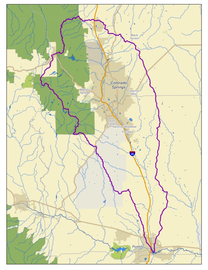
The Fountain Creek Watershed is located along the central front range of Colorado. It is a 927-square mile watershed that drains south into the Arkansas River at Pueblo. The watershed is bordered by the Palmer Divide to the north, Pikes Peak to the west, and a minor divide 20 miles east of Colorado Springs. Map via the Fountain Creek Watershed Flood Control and Greenway District.
The Environmental Protection Agency on Thursday unveiled its long-awaited plan for tackling the toxic chemicals contaminating the Widefield aquifer, immediately coming under fire from environmental groups and some El Paso County residents for not going far enough.
The agency said it would begin the yearslong process of setting a safe drinking water limit for two types of perfluoroalkyl and polyfluoroalkyl compounds by year’s end, while studying the toxicity of other varieties and taking steps to strengthen groundwater cleanup measures across the nation.
Environmental groups across the nation and residents in southern El Paso County criticized the plan for not going far enough to protect them and millions of other Americans whose drinking water sources contain the man-made chemicals.
The plan does nothing to hasten the implementation of a drinking water standard, and it largely ignores all but a couple of types of the chemicals — including those found most commonly in bloodstreams of Security, Widefield and Fountain residents.
Doug Benevento, the EPA’s regional administrator, said the agency is doing all it can to address the toxic chemicals as quickly as legally possible.
“We get it’s frustrating, because people want something done now,” Benevento said.
“And what we are required to do though under the Safe Drinking Water Act is a scientific process — and there’s an economic portion of it too — that we’re required to go through before we make a final determination. And we’re in that process right now.”
The substances, also known as PFAS, are man-made chemicals used for decades in a military firefighting foam, including at Peterson Air Force Base. They also were used in myriad nonstick household products, such as carpet cleaners, Teflon products and fast-food wrappers.
Also called perfluorinated compounds, they have been linked to several health ailments, including cancer, liver disease and high cholesterol.
Specifically, the EPA’s new 72-page plan calls for proposing a “national drinking water regulatory determination” later this year for the two best-known types of perfluorinated compounds, PFOA and PFOS.
Such determinations are considered an opening step for regulating the chemicals and setting a maximum contaminant level — similar to what exists for such chemicals as lead, cyanide and mercury.
Still, it could take three to five years before the chemicals are regulated, said Bob Benson, an EPA toxicologist.
The U.S. Environmental Protection Agency will announce on Thursdays limits on how much toxic chemicals from cookware and carpeting are allowed in drinking water.
The agency will announce a plan to control a group of chemicals known as PFAS that are linked to cancer, liver and thyroid damage, and other health and fetal effects. The substances, which include PFOA and PFOS, are found in non-stick cookware, stain-resistant carpeting and other manmade materials.
Acting administrator Andrew Wheeler will make the announcement at 9 a.m. EST (1400 GMT)…
An EPA statement about Thursday’s announcement did not mention a specific level for the substances.
ABC News Live interviewed Wheeler on Wednesday and reported that drinking water systems around the country will be tested for the chemicals at lower levels than an earlier round of testing in 2012.
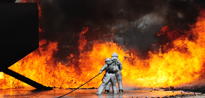
Photo via USAF Air Combat Command
This announcement will be good (but too late) news for the folks in this article by Faith Miller that’s running in the Colorado Springs Independent:
For Steve Patterson, any decision the Environmental Protection Agency makes around whether to regulate toxic PFASs (per- and polyfluoroalkyl substances) in drinking water is too little, too late.
That’s apparent when he counts off the family members who he believes have already fallen victim to the Air Force firefighting foam that leached into drinking water sources in Fountain, Security-Widefield and the Stratmoor neighborhood of southeast Colorado Springs for decades.
At least 10 of Patterson’s family members and in-laws, including his father, sister, uncle, cousin and niece, have died from different kinds of cancer. A dozen or so more family members are battling cancer. And recently, his 14-year-old grandson required a kidney transplant.
Not all of these people are related by blood, so it’s unlikely that the high occurrence of disease, predominantly kidney- and colon-related, is purely genetic. But Patterson’s family members share at least one deadly risk factor: They all spent years in an area contaminated by chemicals which, according to a recent report in Politico, the EPA doesn’t plan to limit in drinking water.
“We have a huge family, and it’s only the ones out here [in Stratmoor, Fountain, Security-Widefield],” Patterson says. “Now the ones that live in town, they’re not having that problem. And so that’s how I know it has to be connected.”
[…]
Evidence that drinking water in the Fountain and Security-Widefield areas was contaminated with the toxic chemicals began to emerge in 2015, and the affected water districts changed sources or added treatment systems to filter out the chemicals. The EPA issued a drinking water advisory limit of 70 parts per trillion (ppt) for PFASs in May 2016.
But prior to those changes, some groundwater wells in the area had tested at PFAS levels several times that limit. And some of the approximately 65,000 residents had, like Patterson’s family, been exposed to the chemicals for many years.
Patterson’s skeptical that the government will do anything to help longtime residents who’ve suffered still-unknown consequences from the PFAS chemicals that leached into their drinking water.
“It’s not that we’re looking for money. We’re looking for like, who’s going to take care of me?” Patterson says. “I mean, what is it in my system … what is the government going to do to fix it and help us?”
In December, initial results from a study by the Colorado School of Public Health and Colorado School of Mines showed that Security-Widefield and Fountain residents who had lived in the area for at least three years before 2015 had higher-than-normal levels of three PFAS chemicals in their blood.
Study participants had blood levels of one toxic compound, PFHxS, that were about 10 times as high as U.S. population reference levels. They had about twice as much PFOS, another chemical in the PFAS group, as the general population. Previous studies have linked this chemical to thyroid hormone effects in humans.
And levels of the chemical PFOA — which human studies have linked to cancer — were 40 to 70 percent higher than U.S. reference levels.
As public awareness of widespread PFAS contamination grew (the Air Force has identified approximately 200 sites in the U.S. where the firefighting foam may have been released), anger spread among residents, who called for the Air Force to pay to fix the damage. The EPA drew ire, too, when Politico reported in May 2018 that it had sought to cover up a study by the Centers for Disease Control and Prevention that indicated safe levels of PFAS could be as low as 12 ppt.
On April 7, 2016, the Environmental Protection Agency proposed adding the “Bonita Peak Mining District” to the National Priorities List, making it eligible for Superfund. Forty-eight mine portals and tailings piles are “under consideration” to be included. The Gold King Mine will almost certainly be on the final list, as will the nearby American Tunnel. The Mayflower Mill #4 tailings repository, just outside Silverton, is another likely candidate, given that it appears to be leaching large quantities of metals into the Animas River. What Superfund will entail for the area beyond that, and when the actual cleanup will begin, remains unclear. Eric Baker
The Bonita Peak Mining District Superfund site, which includes 48 mining-related sites around Silverton, is one of six Superfunds nationwide to be part of the study, referred to as an “adaptive management” strategy.
“We are really excited about this for Bonita Peak,” said Christina Progess, Superfund remedial project manager.
In May 2017, then-EPA administrator Scott Pruitt formed a task force to think about ways to speed up Superfund cleanups, which in some cases can take decades to complete.
A month later, the task force recommended an “adaptive management” strategy that would improve and accelerate the process. Government agencies have used adaptive management since at least the 1970s, but the task force’s move made it formal for EPA.
Kate Garufi, an environmental engineer for EPA who is also chairwoman of the adaptive management task work force, said that some Superfund sites are large and complex, and it can take years to formulate a long-term cleanup plan.
“When you look at Superfund, it’s historically been very linear with a site investigation, evaluating alternatives, selecting a decision and implementing it, which can take a very long time,” she said.
Adaptive management, however, allows the EPA to target quicker projects year to year while a comprehensive solution is investigated, Garufi said.
“We’ll be able to take early actions and see those benefits while we continue to evaluate the entire basin,” she said.
The strategy made perfect sense for Bonita Peak, Progess said, which at 48 individual mining sites across the entire headwaters of the Animas River Basin is one of the larger and more complicated Superfund sites in the country.
As part of the adaptive management, Bonita Peak will be part of the 12-month study, which will set various goals and engage the local community.
“Because we are so early in the investigative process at Bonita Peak, adaptive management will help us set those goals and how to achieve them,” Progess said…
In June 2018, the EPA released a “quick action” plan for cleanup work at 26 mining sites over the next five years to be conducted while the agency comes up with a more long-term, comprehensive strategy to address mine pollution around Silverton.
The plan met resistance from local groups and individuals who say the plan fails to first quantify the benefits and goals that would result from the action plan, which would cost millions of dollars to clean up sites considered smaller contributors of pollution.
Thomas said the adaptive management will help refine that plan. She said a final decision, called an interim Record of Decision, could be issued within the next month or so.
On Wednesday, Thomas also addressed the concern that the partial government shutdown, which lasted 35 days, would cause the EPA to lose a summer season’s worth of work at Bonita Peak.
“Of course everyone here at EPA was dismayed about government shutdown, and it’s good to get back to work,” Thomas said. “Clearly there have been some impacts to the work we were all doing, but we’re doing our best to make sure we can take advantage of a full summer season.”
FromThe Grand Junction Daily Sentinel (Charles Ashby):
Hard rock mines would have to find the money up front to show they have the ability to assure that any water supplies are protected from contamination under a bill that won preliminary approval in the Colorado House on Wednesday.
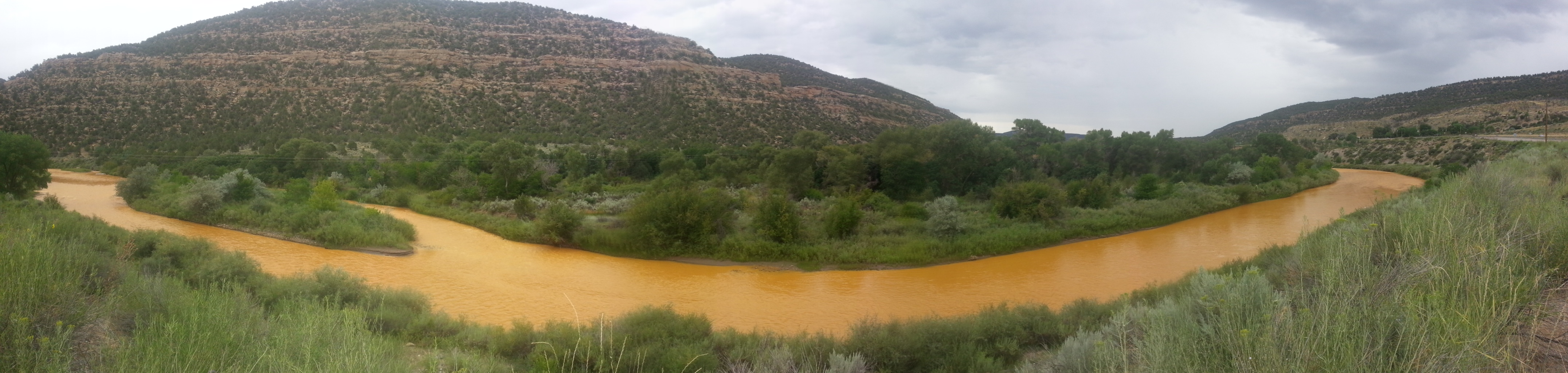
The measure, HB19-1113, stems from issues with abandoned mines throughout the state that have led to contamination of Colorado’s water supplies, not the least of which was the dramatic spill in the Animas River from the long-closed Gold King Mine in 2015.
While the measure doesn’t address similarly abandoned mines, one of its sponsors said it is an attempt to prevent future mishaps with active mines.
“Up until now, people can self-bond,” said Rep. Barbara McLachlan, D-Durango. “They can put the money down and promise that they will pay to clean up the water after their mining operations are finished. In many, many cases they go bankrupt before they can actually clean up the mine, and you the taxpayers are left with the bill of cleaning it up.”
Under current law, mining companies can submit audited financial statements to show they have the financial wherewithal to deal with any environmental issue from their operations, and can handle proper reclamation when those operations cease.
But several companies either have walked away without doing any reclamation or went out of business and had no way to pay for the cleanup. As a result, there are more than 23,000 abandoned mines in the state, according to the Colorado Geological Survey.
The bill, which requires a final House vote before heading to the Senate, would eliminate the audited statement and require new mining permits to include sufficient bonds to handle reclamation costs. Active mines that used audited statements to get their permits would have a year to establish a bond.
McLachlan, who introduced the bill with Rep. Dylan Roberts, D-Avon, pointed to the Summitville Mine in the San Luis Valley as an example. That closed gold mine became a Superfund site because of environmental damage in the 1980s from byproducts that leaked into the Alamosa River.
“Summitville is one we’re going to be starting to pay $2.2 million,” McLachlan said. “This company went in and they showed all the paperwork saying they had the money to clean this up, but by the time the mine was done, they went bankrupt and we the taxpayers have to pay.”
Supporters of the measure say the Colorado Mining Association no longer opposes the bill, but some lawmakers still questioned it.
While Rep. Marc Catlin, R-Montrose, said the state should support more mining in Colorado, if for no other reason than to stop supporting questionable mining practices in other countries, Rep. Kimmi Lewis, R-Kim, said she opposes the measure because one mining company asked her to do so.
“That one independent business owner who owns that mine, I’m going to stand with them,” she said. “And I’m going to remind you all … how much we need those small independent business owners.”
Summitville Mine superfund site
Acid mind drainage Cement Creek watershed
Commodore waste rock superfund site Creede
California Gulch back in the day
One of the many smelters that once operated in the Pueblo area. Photo credit: Environmental Protection Agency
San Juan Smelter Durango via
Workers pose in front of the Boston and Colorado Smelter at Argo Photo Colorado Historical Society
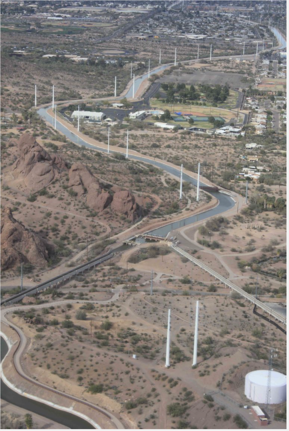
A canal delivers water to Phoenix. Photo credit: Allen Best
Here’s a report from Jim Robbins writing for Yale 360. Click through and read the whole article and to check out the photo gallery (from Ted Wood). Here’s an excerpt:
Once criticized for being a profligate user of water, fast-growing Phoenix has taken some major steps — including banking water in underground reservoirs, slashing per-capita use, and recycling wastewater — in anticipation of the day when the flow from the Colorado River ends. Fourth in a series.
The Hohokam were an ancient people who lived in the arid Southwest, their empire now mostly buried beneath the sprawl of some 4.5 million people who inhabit modern-day Phoenix, Arizona and its suburbs. Hohokam civilization was characterized by farm fields irrigated by the Salt and Gila rivers with a sophisticated system of carefully calibrated canals, the only prehistoric culture in North America with so advanced a farming system.
Then in 1276, tree ring data shows, a withering drought descended on the Southwest, lasting more than two decades. It is believed to be a primary cause of the collapse of Hohokam society. The people who had mastered farming dispersed across the landscape.
The fate of the Hohokam holds lessons these days for Arizona, as the most severe drought since their time has gripped the region. But while the Hohokam succumbed to the mega-drought, the city of Phoenix and its neighbors are desperately scrambling to avoid a similar fate — no easy task in a desert that gets less than 8 inches of rain a year.
“We are fully prepared to go into Tier 1, 2, and 3 emergency,” said Kathryn Sorensen, Phoenix’s water services director, referring to federally mandated cutbacks of Colorado River water as the levels of Lake Mead, the source of some of the city’s water, continue to drop. And what of the dreaded “dead pool,” the point at which the level in the giant man-made lake falls so low that water can no longer be pumped out?
“I can survive dead pool for generations,” says Sorensen, pointing to a host of conservation and water storage measures that have significantly brightened the city’s water outlook in an era of climate change and drought.
These days, Phoenix’s alternative water supplies are not dependent on the Colorado. But there’s a caveat. Phoenix may have enough water to secure its near-term future, but it still needs to build $500 million of infrastructure to pipe it to northern parts of the city that now rely on Colorado River water. And Phoenix may need the water sooner than it planned. “You could hit dead pool in four years,” Sorensen said. “That’s worst case.”
Many cities and towns in the Southwest — including Los Angeles, San Diego, and Albuquerque — are trying to figure out solutions to a dwindling Lake Mead, the key reservoir on the Colorado. One of the most ambitious efforts is a new $1.35 billion, 24-foot-wide tunnel — the so-called Third Straw — that Las Vegas drilled at the very bottom of Lake Mead to function like a bathtub drain. Las Vegas gets 90 percent of its water from the Colorado via the lake, which is located just east of the gambling and tourist mecca. In 2000, as the lake’s level dropped, the city placed a second, deeper straw to replace the original outtake. As the region moved into its second consecutive decade of drought and lake levels continued to drop, Las Vegas officials got more nervous and the third straw was completed in 2015; it should continue to siphon off water unless the lake dries up completely.
In Arizona, the modern equivalent of the Hohokam irrigation system is the 17-foot-deep and 80-foot-wide concrete aqueduct called the Central Arizona Project, which carries water from the Colorado River to Phoenix, Tucson, and elsewhere. It was a feat of engineering when it was finished in 1993, snaking across the sere desert landscape for 336 miles as it pumps water up 2,900 feet in elevation. So much power is needed to flush this water along its route that the massive coal-fired Navajo Generating Plant was built to provide it.
Supplying enough water to sustain a city this size in the desert has long been controversial, and as Phoenix and its neighbors continue their unrelenting sprawl — Arizona’s population has more than tripled in the past 50 years, from 1.8 million in 1970 to 7.2 million today — the state has often been regarded as the poster child for unsustainable development. Now that Colorado River water appears to be drying up, critics are voicing their “I told you so’s.”
That’s a bad rap though, at least for Phoenix, according to Sorensen. The city is prepared to carry on with business as usual even if the last of the Colorado River water evaporates into the desert sky, depriving Phoenix of 40 percent of its water supply. City officials have been busy planning for this eventuality, and much of the responsibility for that has fallen to Sorensen.
Gila River watershed. Graphic credit: Wikimedia
As she stands behind her large desk on the 9th floor of the municipal building in the heart of downtown Phoenix, surrounded by windows that look out on glass office towers gleaming in the desert sun, Sorensen deftly handles questions about the city’s water future. On her desk sits a crystal ball, a joke gift that she says she wishes was real. She’s proud of the work she has done since she was appointed in 2013 — before that she served four years as head of Mesa, Arizona’s water department — although she admits it has been a challenge.
The Phoenix Water Services Department is one of the nation’s largest, with 1.5 million customers spread out across 540 square miles. It maintains 7,000 miles of water lines and 5,000 miles of sewer lines.
The Salt River is the single biggest source of water for metro Phoenix, and provides about 60 percent of its needs. It is a large desert river, some 200 miles long, that begins at the confluence of the snow-fed White and Black rivers, is joined by a series of perennial, spring-fed streams, and then meets the Verde River east of Phoenix.
Just after the turn of the 20th century, the first of four dams was constructed on the Salt for a growing Phoenix, and today those reservoirs are Phoenix’s main water supply. However, Phoenix’s north side gets only Colorado River water, and should that source dry up one day, constructing infrastructure to connect north Phoenix to new sources of water would cost a half-billion dollars. Funding for such a project would hardly be a fait accompli; in late December, the Phoenix City Council rejected a water rate increase to pay for the infrastructure expansion. The Salt and Gila rivers also may someday be severely impacted by climate change. “They could be affected by a mega-drought,” said Andrew Ross, a sociology professor at New York University and author of Bird on Fire: Lessons from the World’s Least Sustainable City. “They are in the bullseye of global warming, too.” Perennial streams could dry up and snowfall in Arizona’s White Mountains could dwindle, as it has done in the Rockies, further depriving the rivers of a steady supply of water.
Beyond the Salt River, Phoenix has undertaken some innovative water strategies. Among the first of these was the Arizona Water Bank. California is entitled to 4.4 million acre-feet of water a year from the Colorado, but because Arizona was not using its full allotment of 2.8 million acre-feet, its excess water was being slurped up by a perpetually thirsty California. So the water bank, a unique system of underground storage, was created in 1996 as a way to store Colorado River water that the state couldn’t use, rather than letting it flow through to California. It turned out to be a prescient move, but not for the reason it was created. In that era, few people foresaw the crash of the Colorado River system.
Arizona has since created seven water banks, largely in empty underground aquifers. A series of large pools has been built above the aquifers and, as water is pumped into them, it slowly leaches through a layer of gravel and rock and fills the aquifer. So far the water banks have cost the state $330 million, storing 3.6 million acre-feet in 28 sites across three counties — more than a year’s worth of Colorado River water.
One of the largest water banks is 40 miles west of Phoenix near the tiny town of Tonopah, Arizona. The nearly $20 million facility has 19 infiltration basins covering more than 200 acres. It was constructed alongside the Central Arizona Project canal, and a pipe delivers 300 cubic-feet-per-second of Colorado River water a day to fill the basins.
In addition, other aquifers underneath Phoenix are brimming with 90 million acre-feet of water, some natural and some pumped in — enough to last the city for years. One problem is that much of it is contaminated, both from natural sources of arsenic and chromium and from the city’s many Superfund sites, which include manufacturing sites polluted by industrial solvents and unlined landfills that contain hazardous waste. But Sorensen dismisses the cleanup challenges as surmountable. “As long as the contamination isn’t nuclear, we can fix it,” she says. “What matters here is that the water is wet.”
Phoenix also recycles almost every bit of wastewater that journeys through its system. The vast majority of it — more than 20 billion gallons of recycled water a year — goes to cool the Palo Verde Nuclear Power Plant. Another 30,000 acre-feet is traded to an irrigation district as gray water to use on agricultural fields and the district, in turn, sends potable water from the Salt River to the city.
And the city is working on “toilet-to-tap” technology aimed at someday making sewage water so clean it will be drinkable. The technology for recycling wastewater into drinking water exists, but is only used in a few places, including San Diego. Arizona says it will play a role in its water supply some day — if, that is, the city can sell the idea to consumers.
Desalinization of seawater has long been floated as a possibility for Arizona, and much of the U.S. Southwest, and officials say it too will be part of Arizona’s water mix — someday. The process, which forces water through an extremely fine filter, is energy-intensive, extremely expensive, and a major environmental problem because of the waste it generates. Nonetheless, Arizona sits on top of 600 million acre-feet of brackish water, and officials have also considered treating water from the Gulf of California, nearly 200 miles to the southwest.
For now, though, Phoenix appears to have positioned itself well for a new era of drought. Sorensen credits the people of Phoenix for adapting to the desert by using far less water per capita. “We’ve decoupled growth from water,” she said. “We use the same amount of water that we did 20 years ago, but have added 400,000 more people.” In 2000, Some 80 percent of Phoenix had lush green lawns; now only 14 percent does. The city has done this by charging more for water in the summer. Per capita usage has declined 30 percent over the last 20 years. “That’s a huge culture change,” Sorensen says.
In fact, the decoupling of water from growth through conservation has taken place throughout the Lower Colorado Basin. “Actual municipal water use across the basin, with the exception of Utah, is declining, even as population rises,” said John Fleck, director of the University of New Mexico Water Resources Program. “Albuquerque has built its long-range plan around conserving more than its demand for decades to come, and Las Vegas’ demonstration of its ability to use less water is stunning.”
But while Phoenix and Las Vegas are pursuing conservation strategies as a partial solution to the withering of the Colorado River, others entities in the region aren’t. Much of conservative Arizona is in denial about what the potential drying of the West may mean, if they recognize it at all. “We’re just starting to acknowledge the volatile water reality,” said Kevin Moran, senior director of western water for the Environmental Defense Fund. “We’re just starting to ask the adaptation questions.” Ross, of New York University, argues that the biggest problem for Arizona is not climate change, but the denial of it, which keeps real solutions — such as reining in unsustainable growth or the widespread deployment of solar energy in this sun-drenched region — from being considered. “How you meet those challenges and how you anticipate and overcome them is not a techno-fix problem,” he said, “It’s a question of social and political will.”
So, for now, Arizona’s rampant growth continues. To the west of Phoenix a new tech city is emerging. Mt. Lemmon Holdings, a subsidiary of computer magnate Bill Gates’s investment firm, Cascade Holdings, has plans to built a “smart city,” for example, on the outskirts of Phoenix near the town of Buckeye. The new city, on 24,000 acres — about the same size as Paris — would have infrastructure for self-driving cars, hi-tech factories, and high-speed public wi-fi.
Meanwhile, the so-called Sun Corridor — 120 miles of Sonoran Desert between Phoenix and Tucson — is seen as the state’s next burgeoning megalopolis. It’s one of the fastest-growing regions in the country and its population of more than 5.5 million — anchored by Phoenix in the northwest and Tucson to the southeast — is expected to double by 2040.
And what about the water for this growth? Under state law, a developer must prove it has a 100-year supply for any new housing development. The primary solution for that has been for the Central Arizona Groundwater Replenishment District to fill or replenish aquifers where growth is planned — and the source for that is the precarious Colorado River water.
This slideshow requires JavaScript.
The reality, though, is that all of these well-intentioned measures may fall far short of being able to cope with a full-blown climate crisis. Someday the desert may reclaim what has been built here — as it did with the Hohokam.
Whether that unfolds remains to be seen. By Ross’s reckoning, the withering of Arizona will not be uniform, and those most affected will be the people least able to find alternatives, such as impoverished communities in South Phoenix.
“The well-resourced communities in the northeast are well set up,” for a drier future, said Ross. “And there are communities like South Phoenix that have been poisoned for decades that are not. It’s obvious who is going to suffer the most when the shortage really hits.”
“Here, we are all looking at Cape Town in shock,” said Taylor Hawes, of the Nature Conservancy’s Colorado River program, referring to the crisis last year when that South African city appeared on the brink of running out of water. “We’re not that far from that if things go south.”
Here’s a report from Laura Paskus writing for the New Mexico Political Report. Here’s an excerpt:
The groundwater below Holloman Air Force Base near Alamogordo tested positive for hazardous chemicals—and the contamination levels are more than 18,000 times higher than what the federal government says is safe.
A November 2018 site inspection report provided to the New Mexico Environment Department (NMED), and obtained by NM Political Report this week, details the contamination. Currently, the state is trying to understand the extent of the problem and what might be done.
According to the report, in 2016, the U.S. Air Force identified 31 potential release sites at Holloman. Two years later, in 2018, contractors tested five areas to determine if PFAS were present in soil, sediment, ground or surface water. PFAS, or per- and polyfluoroalkyl substances, are a class of human-made chemicals, and include perfluorooctanoic acid (PFOA) and perfluorooctane sulfonate (PFOS).
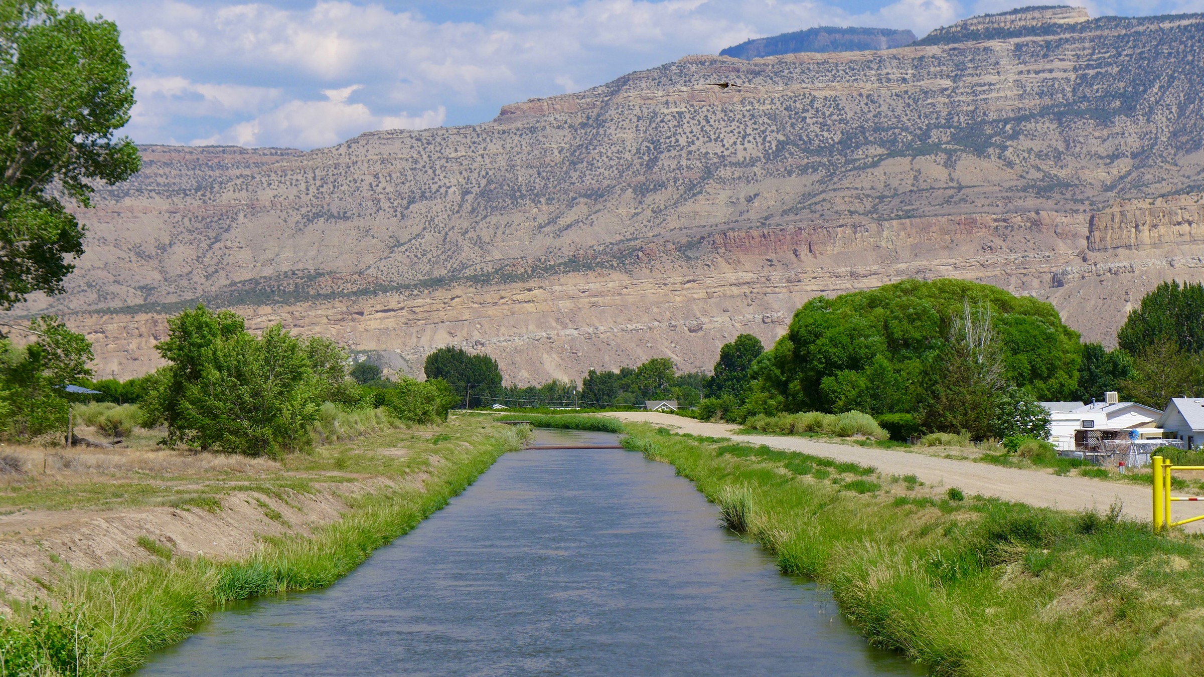
The Government Highline Canal, in Palisade. The Government Highline Canal near Grand Junction. The Grand Valley Water Users Association, which operates the canal, has been experimenting with a program that pays water users to fallow fields and reduce their consumptive use of water. Photo: Brent Gardner-Smith/Aspen Journalism
Here’s a report from Jim Robbins writing for Yale 360. Click through to view the great photo gallery from Arizona:
Communities along the Colorado River are facing a new era of drought and water shortages that is threatening their future. With an official water emergency declaration now possible, farmers, ranchers, and towns are searching for ways to use less water and survive. Third in a series.
From the air, the Grand Valley Water Users Association canal — 10 feet wide and 8 feet deep — tracks a serpentine 55-mile-long path across the mountain-ringed landscape of Mesa County, Colorado. It’s a line that separates parched, hard-baked desert and an agricultural nirvana of vast peach and apple orchards and swaying fields of alfalfa.
The future of this thin brown line that keeps the badlands of the Colorado desert at bay, however, is growing more uncertain by the day.
Since 2000, the snow that blankets the Colorado Rockies each winter — the source of most of the river’s water — has tapered off considerably. Last year it was less than half of normal. So far, the farmers here have gotten their share of water, but this year could bring the first emergency declaration by water administrators. That would mean that some “junior” water users — those whose allocations came later — may have to forego their share in favor of senior users.
The nearly two decades of low snowpack is being called a drought, and tree rings show it’s the most severe in over 1,200 years. The term drought, however, implies it will end someday. But there are serious questions about whether this is a drought or a permanent drying of the West due to a changing climate.
Few doubt that things are building toward crisis. Last year junior water users on the Yampa River, a tributary to the Colorado, were forced to face the new reality when officials ordered them to stop taking their allocated water and allow it to flow to senior users downstream. In places, the river channel was dry; fishing and float trips were also halted.
As things get tighter throughout the Colorado River Basin, irrigators, who control 80 percent of the water on the river, fully expect others to come looking for their water. One place that has been preparing a strategy to try and head off a raid on its water is in Mesa County in western Colorado.
“There is not an active attack on our water at this time,” said Mark Harris, general manger of the Grand Valley Water Users Association and a farmer himself, as we walked along a row of peaches in a sea of orchards near Palisade, Colorado. “But we do have a huge target on our back. The crisis will require draconian measures that will savage ag. If municipalities run out of sanitary water or fire water, those steps are going to have to be taken.”
Bicycling the Colorado National Monument, Grand Valley in the distance via Colorado.com
The Grand Valley Water Users Association was founded in 1905 as part of the U.S. Bureau of Reclamation. It operates the canal, as well as 150 miles of pipe and open ditch that carry water to a little more than 23,000 acres of land. Without water to service this network — and with only 9 annual inches of precipitation — a new dust bowl could be in the offing.
Water law in the West is based on something called the Prior Appropriation Doctrine, or “first in time, first in line.” While water is a public asset, rights to it were promised to those who came West to homestead, ranch, and grow crops in the late 19th and early 20th centuries. They have the most senior rights, and these are considered private property rights, enshrined in law. The rights of cities and towns are usually junior to these senior rights, and junior users stand to lose out first if cutbacks are mandated. However, cities and towns have considerable political and economic heft, especially in metropolitan areas in the Lower Basin, such as Phoenix, Las Vegas, and Los Angeles. The fear is that the policy of “first in time, first in line” could be discarded in a time of emergency and replaced with one that adheres to a different adage — “water flows uphill toward money.”
The water that many farmers and ranchers use on the Colorado is now cheap. Senior users like those in the Grand Valley pay from $25 to $50 for an irrigated acre for the season. A hundred acres of, say, alfalfa, the single largest crop along the river, needs up to 2 feet of water per acre. Water to irrigate for the season then, would cost the farmer about $2,500 to $5,000. The net profit from the hay is about $300 an acre, so the farmer would make about $30,000 on the 100 acres after costs.
Roller Dam near Palisade. Photo credit: Hutchinson Water Center
Currently water is selling on the open market for about $200 to $250 an acre-foot for a season, well above what farmers in the Grand Valley are paying. The rules of the Grand Valley Water Users Association do not permit separating water from the land; but if the exigencies of the drought were to cause the rules to change, on today’s market the value of the water from those 100 acres would be worth about $40,000 for a season. In that case, farmers could make more money selling their water rights than by continuing to farm. And if the crisis were to deepen and junior users such as the city of Denver were to lose their water and needed to look elsewhere, the lease price of an acre-foot for the season could go as high as $1,000, some experts say. That would mean farmers could make $100,000 annually by selling their water rights and fallowing their 100 acres.
“We don’t want an unfettered free market for water,” said Harris. “That would be a disaster,” with a range of unintended consequences.While many farmers could do well financially in the advent of a crisis, those who continued farming would see their neighbors start to disappear as farms and ranches were abandoned. And if the crisis was prolonged or permanent, and more and more water was siphoned off to cities, it could threaten the very existence of farming communities around the basin.
It’s happened on a large scale before — most famously in California in the Owens River north of Los Angeles in the early 1900s, as depicted in the fictional 1974 film “Chinatown.” William Mulholland, head of the Los Angeles Department of Power and Water, secretly began buying up ranch and farmland with water rights along the Owens River in the eastern Sierras. Officials then built an aqueduct and piped that water to Los Angeles to fuel the city’s growth. The Owens Valley is now mostly arid.
Beyond the impact on the rural social fabric, dewatering agricultural areas in the Colorado Basin would cause other serious problems, from reducing food security, to less open space if the land were developed for housing, which would release the carbon sequestered in farm fields and eliminate wildlife habitat.
That’s why places like the Grand Valley are taking unprecedented measures. “It’s time for preparation,” said Harris. “Preparation not panic, it’s a delicate balance.”
The Grand Valley Water Users Association has partnered with The Nature Conservancy, which is taking a lead role in helping agricultural interests find ways to survive the future, here in Mesa County and elsewhere in the Colorado River Basin.
In the last several years, an array of projects has been initiated around the basin — from western Colorado, to central and southern Arizona, to the upper Green River of Wyoming, to the borderlands of Mexico — to try to find solutions and, if they work, scale them up all along the Colorado. The Nature Conservancy, for example, has helped create a water bank here in the Grand Valley. Under a two-year pilot program, some farmers are paid to fallow their land — not grow anything on it — and leave the water they would have used in the river.
So far, Grand Valley farmers have fallowed 2,200 acres, which has enabled them to leave 6,000 acre-feet of water flowing in the Colorado. They were compensated for the loss of their crops, plus paid a premium for participating. Saving that water also helped the local irrigation district meet its obligations under the Endangered Species Act to protect fish by keeping more water in the river.
Grand Valley Irrigation Canal. Photo: Brent Gardner-Smith/Aspen Journalism
“We created a contract between all these states and Mexico that the hydrology doesn’t support,” said Taylor Hawes, head of the Colorado River program for The Nature Conservancy, referring to the 1922 Colorado River Compact which governs the allocation of water. “Ag and the environment will be the big losers if things continue, so we’re creating a more flexible system that adapts to the reality of our hydrology. Our goal is that whatever solutions we come up with for people also work for nature.”
The states of the compact are also working to find solutions. The Upper Basin states — Utah, New Mexico, Colorado, and Wyoming — have instituted a multi-faceted conservation program that tests ways to reduce water use, including fallowing land with compensation, irrigating crops with less water, and cutting back on municipal water use. The Lower Basin states — Nevada, Arizona, and California — are funding a host of initiatives; the city of Needles, California, for example, was given $500,000 to tear up sod at the city golf course and install drought-tolerant landscaping.
The Lower Basin states are also working on a Drought Contingency Plan. As drought conditions continue to worsen, they are coming up with ways to voluntarily give up hundreds of thousands of acre-feet of water to keep Lake Mead, the key reservoir on the Colorado, above crisis levels. This would avoid the imposition of an officially declared emergency, which would force these states to make even larger cuts.
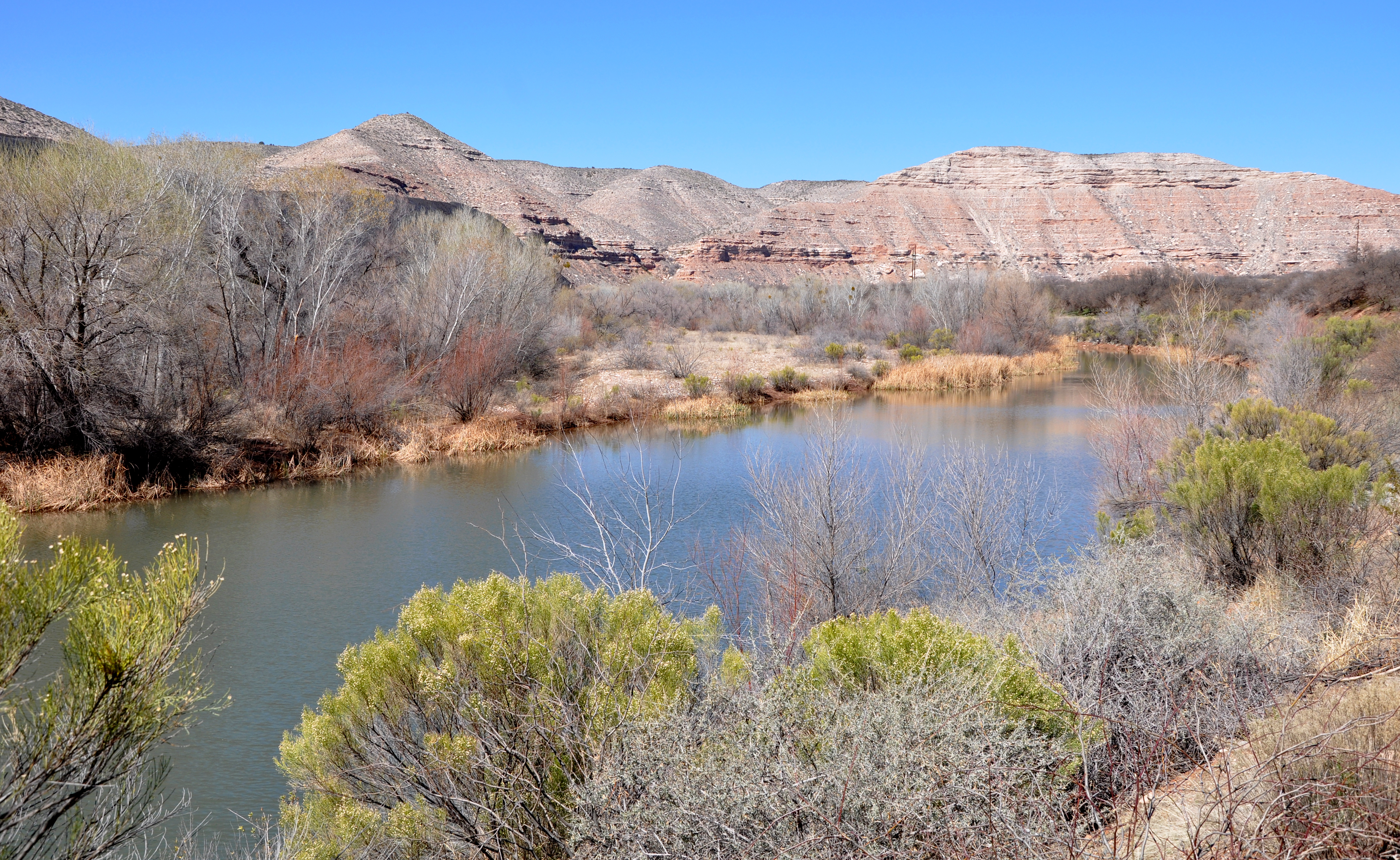
In Arizona’s Verde Valley, between Phoenix and Flagstaff, a different approach is being used. The Verde River is small, but a rare perennial desert river, borne of mountain springs in Arizona’s central highlands — a true oasis. It’s a tributary to the Salt River, which flows into the Gila River and on to the Colorado. It’s hard to overestimate the importance of desert rivers like this to biodiversity — 90 percent of all wildlife in deserts is found within a mile of a river. It’s also a critical water source for metro Phoenix.
A decade ago, The Nature Conservancy’s Kim Schonek came to the Verde Valley to work with local farmers to improve the river’s flow. The meandering, cottonwood tree-lined river is home to several endangered species, including the southwestern willow flycatcher and the loach minnow and spike dace, desert fish that are adapted to natural flows.
The project’s goal is to keep the flows no lower than at least 30 cubic feet per second or so, about a third of its natural level, but high enough to protect species. “We’re trying to re-establish the natural flow regime to the Verde,” says Schonek. “At that level, you have water in all your riffles and no stagnant pools, and that’s good for fish.”
The Nature Conservancy raised money from Coca-Cola, PepsiCo Recycling, Boeing, and other companies in Phoenix, as well as the city itself, all of which get water from the Verde and who have a stake in a more secure supply. With this funding, they are doing things such as updating irrigation technology to keep more water in the river.
Some of the fixes were simple. There were old-fashioned hand-cranked headgates along the river that farmers used to open or close by turning a wheel on top. Notoriously inefficient, the whole flow of the river was often diverted, and sections were inadvertently dried up for miles. The cantankerous headgates have been replaced with $40,000 electronic ones that neither the farmers nor the ditch companies could afford on their own.
Verde River near Clarkdale along Sycamore Canyon Road. Photo credit: Wikimedia
“I used to have to go out at 2 in the morning and close that gate,” said Claudia Hauser, whose family has the largest agricultural holdings in the valley and has partnered with The Nature Conservancy to conserve water. “Now I can do it from the house with my phone.”
Other strategies have been more challenging. The Hausers are part of an experiment to swap out 144 acres of alfalfa and replace it with barley. Not only does barley use about half the water of alfalfa, it uses that water in the spring when the flows are high and doesn’t take water out of the river during critical summer periods. The Nature Conservancy has also raised money to build a small barley malting facility, Sinagua Malt, to get the malt ready for beer brewers. Local breweries have snapped up this malt and use it for their beer, and the fact that it is helping save the Verde has become a marketing point. “It’s the essence of naturalism and conservation that truly excites this brewery!” the Arizona Wilderness Brewing Company boasts on its homepage.
Zach and Heather Hauser — part of the same Verde Valley farm family as Claudia — have also removed a field of alfalfa that was nourished by flood irrigation and replaced it with a higher value pecan orchard, using micro-jets that spray water in a circle around each tree. It was paid for by one of the project’s corporate donors. It not only saves a good deal of water, it’s better for the orchard than flooding and creates a more uniform crop. “Alfalfa is a huge issue for the West,” says Schonek, “because so much is grown and it takes so much water.”
The funding has also allowed the Hausers to install drip irrigation to raise their watermelons and their locally-renowned sweet corn — so good, it’s said, that many people eat it raw — with a lot less water.
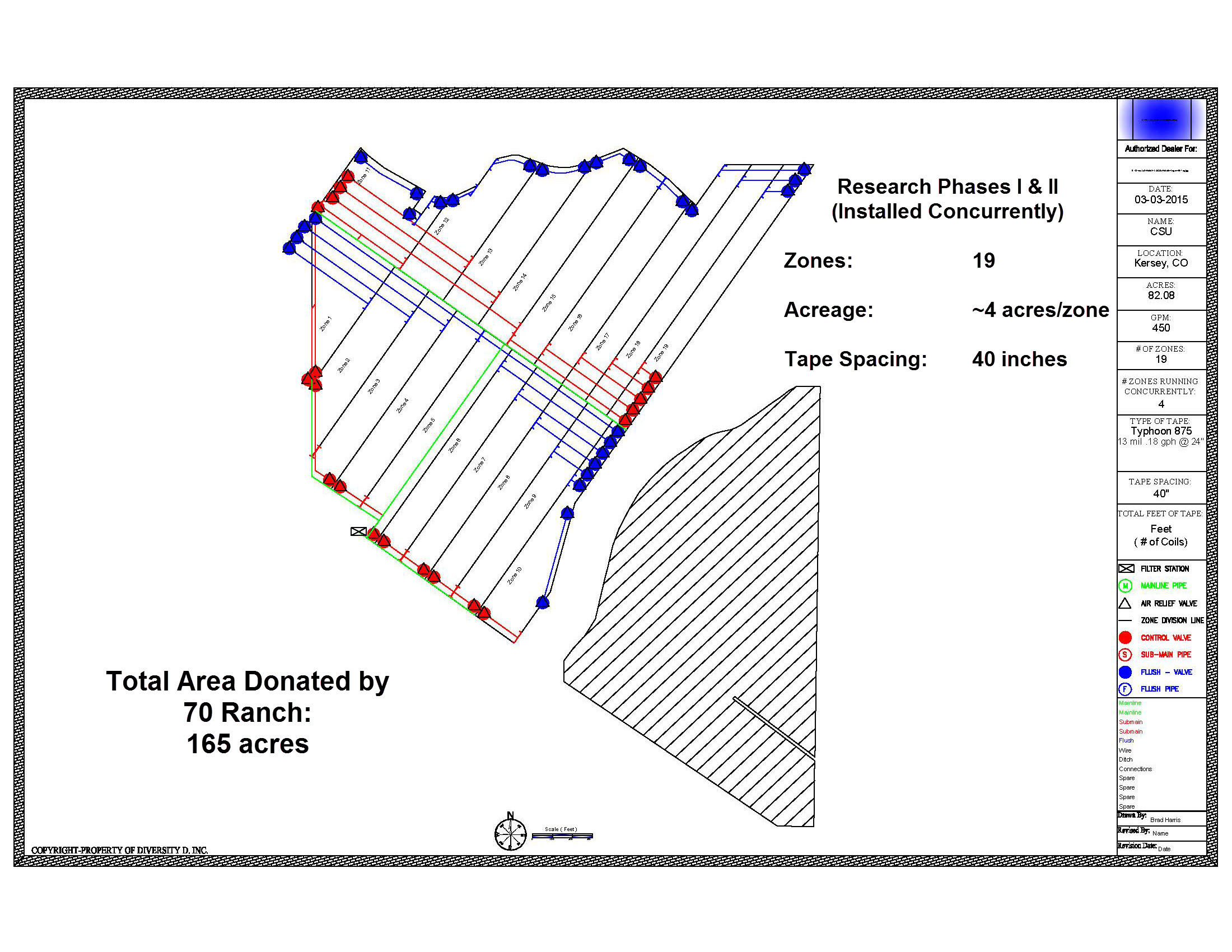
SIEP Project design via United Water and Sanitation
The city of Phoenix, which sources water from the Salt and the Verde, is contributing to these conservation initiatives. It pays for forest thinning to prevent wildfires so the river won’t be inundated with post-fire ash and mud and become unusable for the city’s water supply.
The efforts here are paying off. “We floated the river all year this year,” said Schonek, noting the increase in the flow from the conservation measures. “You couldn’t have done that five years ago.”
Groundwater, too, is an issue that environmentalists are looking to address along the Colorado and its tributaries. The Nature Conservancy has a groundwater-focused project in southern Arizona to protect the San Pedro, the longest undammed free-flowing river in the Southwest and home to an astonishing array of biodiversity: nearly 400 bird species, several dozen reptile and amphibian species, 84 mammal species, including jaguars, and a suite of terrestrial and aquatic endangered species. The San Pedro — one of only two major rivers that flow north out of Mexico into the United States — flows into the Gila, a major tributary to the Colorado.
Groundwater pumping for homes and farms are reducing the San Pedro’s flows so that some sections of the river have dried up, which is impacting biodiversity. Among other strategies, The Nature Conservancy has, with partners, purchased properties that capture stormwater runoff and funnel it into zones where it can seep into the ground and recharge groundwater supplies.
“The important thing now,” said Hawes of The Nature Conservancy, “is to look for innovative ways to reduce demand and learn to live within our water budget.”
What happens to part of a river network affects all of it.
On Dec. 11, the Trump administration announced plans to cut back the number of wetlands and creeks protected under the Clean Water Act, which regulates water pollution in the U.S. The new rules would leave about half the nation’s wetlands and all of its ephemeral streams — those waterways, common in the West, that flow only after rainfall or snowmelt — without federal safeguards.
The proposed guidelines, which will almost certainly face years of lawsuits, are a stark departure from how previous administrations have interpreted the act — and a sharp divergence from research on how to protect clean water. The Environmental Protection Agency and the Army Corps of Engineers argued that the new rules were informed by science. But the agencies did not conduct a new scientific assessment of which waterways the Clean Water Act should cover; instead, they relied on a comprehensive report prepared by the EPA in 2015. That report, on how streams and wetlands are connected to downstream waters, highlights the importance of the very waterways the new guidelines would leave unprotected.
High Country News recently caught up with Ellen Wohl, a river researcher and professor at Colorado State University who served on the scientific review committee for the 2015 EPA report, to find out how scientists view the new guidelines.
High Country News: Does this proposed rule match what researchers know is important for protecting clean water?
Ellen Wohl: Absolutely not. It’s diametrically opposed to how the scientific community understands rivers as ecosystems, and river function.
Most of us, when we think about rivers, we think of the type of river that we would fish or boat on, or really big rivers; we don’t think of the river that we could jump across. But if you spread your hand and you look at it, and you say, ‘I don’t care about the little stuff, so I’m going to cut off the first two joints of every finger,’ and you’ve got a palm and some stubs left, your hand’s not going to be very functional.
Wohl said that when scientists study streams, they don’t just consider the main channel; they think of “the entire river network.”
It’s the same thing with a river network. Those small streams, which constitute 70 to 80 percent of the total channel length in any river network, are critical to the functioning of the whole system. Any spot on a particular river is connected to what’s underneath the ground, it’s connected to what’s on the adjacent hill slopes, it’s connected to what’s up- and downstream.
HCN: Can you give me an example?
EW: Nitrate pollution is a big, big issue around the world, including much of the Western U.S. One effect of having too much is the big dead zones … off the near-shore area of most major rivers. We have reduced the ability of rivers to process that nitrate, to take it up biologically and keep it from just flowing downstream.
A lot of that nitrate uptake occurs in the little rivers. Rivers can take up nitrate if they are physically complex, (if they have) secondary channels, abandoned channels, a floodplain, floodplain wetlands. So if you bury them, if you pave them, if you channelize them, if you dewater them — if you do all the things that you cannot do as much if they’re protected under the Clean Water Act — you lose all that.
HCN: The new rule would strip protections from wetlands that don’t have a surface connection to a protected river or lake — that are only connected via groundwater, for example. Does it make sense to treat wetlands that have a surface connection differently than ones that don’t?
EW: Scientifically, no. They’re disconnected in the ways we can see on the surface, but there are subsurface connections. They don’t sit there in isolation like some special creation; they are integral to the functioning of the whole watershed and the river network. Those disconnected surface wetlands are vital ecologically for a wide variety of organisms, from migratory birds to the communities that live (there) year-round, and they are not disconnected in the ways that matter.
HCN: Is there a specific place or landscape you could point to where these little streams and subsurface connections are particularly important?
EW: Pawnee National Grasslands. It’s what all of eastern Colorado would look like without irrigation: It’s shortgrass prairie, bunchgrasses, small sagebrush, prickly pear cacti. Many of the channels are intermittent (streams with sections that are sometimes dry), so they’ll have what the biologists call refuge pools, places that retain water throughout the year.
The plains fish … are mostly small-bodied fish. They’re “super fish” in that they can survive things that kill a lot of other fish: very high water temperatures, low dissolved oxygen. They’re tough, but they can’t survive desiccation. So, if you lose protection for some of these small channels, the refuge pools will dry up — and that will be the end of these species.
HCN: Do you see any reason for hope?
EW: I’d like to get people to think about rivers in a broader sense, of not just the pretty streams that we do whitewater rafting and trout fishing on, but as the whole river network. They are an integrated ecosystem, and they’re important. Is there reason for hope? I see evidence that people are starting to think that way more.
HCN: Like what?
EW: The regional example I’ve used is the Pacific Northwest. They have a very different attitude toward rivers than anywhere else in the U.S., and I think it’s because of the focus on salmon. They get it — a salmon can’t survive without a watershed. It needs to migrate upstream, it needs spawning habitat, it needs rearing habitat. They’ve made the connection between a particular fish that everybody is excited about and the whole watershed.
Even though there are these national rules, and even if they go into effect, there are things you can do locally to protect your local river. If people feel strongly about this, I would encourage them to become active in, or form, local watershed groups. Then you get the immediate benefits of a clean, healthy river. So adopt a river, and care for it.
This interview has been edited for clarity and length.
Emily Benson is an assistant editor at High Country News, covering Alaska, the Pacific Northwest and the Northern Rockies. Email her at emilyb@hcn.org or submit a letter to the editor.
The plains around DIA were parched by the scorching 2012 drought, although groundwater pumping along the South Platte River enabled some farms to continue irrigating — photo by Bob Berwyn
Update: From email from Division One (Corey DeAngelis):
Hope all is well with you! We extended our job posting for the Division 1 Assistant Division Engineering position until 02/05/2019 at 5:00 pm.
We have an opening for our DWR Division 1 Assistant Division Engineer position in Greeley, Colorado…The position is open through 01/11/2019, 5:00 pm
Description of Job
This position assists the Division Engineer in performing functions and duties as specified by state statute and to carry out duties and orders of the State Engineer within the geographical area of Water Division One. The position must direct the day to day management of work unit’s involvement in the water court; must guide and direct the allocation and distribution of water; must enforce compliance with decrees, statutes, permits, rules and regulations, and compacts; must resolve disputes concerning water rights and use; must complete and review technical studies related to water resources engineering and water rights administration; and must inform, disseminate information to, and counsel water users, professionals and staff regarding water use, water rights, water allocation and state statutes pertaining to water use. This position will assist the Division Engineer, as assigned, directing and overseeing administration and compliance of Division 1 Ground Water Measurement and Use Rules.
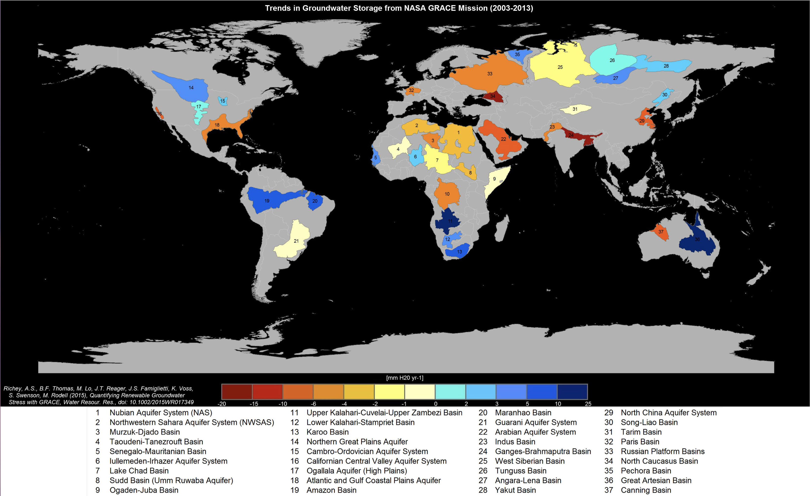
Groundwater – fresh water cached underground in soil and between rocks – takes much longer to respond to temperature changes than surface water, the researchers point out.
We rely on rain to keep groundwater stocked up, which means areas seeing hotter weather and less rainfall are going to be lighting the fuse for a future ‘timebomb’ in which water supplies can’t keep up with demand. The time delay potentially makes these ‘hidden’ shortages even more dangerous.
“Our research shows that groundwater systems take a lot longer to respond to climate change than surface water, with only half of the world’s groundwater flows responding fully within ‘human’ timescales of 100 years,” says one of the team, Mark Cuthbert from Cardiff University in the UK.
“This means that in many parts of the world, changes in groundwater flows due to climate change could have a very long legacy. This could be described as an environmental timebomb because any climate change impacts on recharge occurring now, will only fully impact the baseflow to rivers and wetlands a long time later.”
In areas more sensitive to climate change – so wet and humid spots like the Amazon and central Africa – the effects on groundwater could be seen within just 10 years, the new study says. In dry and arid regions it could take much longer.
Using readings taken in the field as well as data models, the team estimated that for nearly half the groundwater supplies on the planet, it might take 100 years or more to for levels to replenish or become balanced again.
In some places – such as under the Sahara – we know that groundwater supplies are still responding to climate change 10,000 years ago, when the area was much wetter.
Martha Gomez-Sapiens, a monitoring team member and postdoctoral research associate in the UA Department of Geosciences, stands on a riverbank next to willows and cottonwoods that germinated as a result of the pulse flow. (Photo: Karl W. Flessa/UA Department of Geosciences)
The restoration site is one of three south of the U.S.-Mexico border, in the riparian corridor along the last miles of the Colorado River. There, in the delta, a small amount of water has been reserved for nature, returned to an overallocated river whose flow has otherwise been claimed by cities and farms.
Although water snakes through an agricultural canal system to irrigate the restoration sites, another source is increasingly important for restoring these patches of nature in the delta’s riparian corridor: groundwater.
Scientists who monitor restoration in the delta wrote in a November 2018 report that a shallow water table, one with higher groundwater levels, is essential to the survival of riparian vegetation in the broad expanses of the delta.
“The trees, the cottonwoods and willows, they need to be connected to the groundwater directly,” said Osvel Hinojosa-Huerta, a scientist at the Cornell Lab of Ornithology who has worked to restore pockets of the delta for over 20 years with the non-profit Pronatura Noroeste. “They have shallow roots so the groundwater level is very important to their survival.”
But groundwater levels have declined, much like the river’s surface flows that once flowed into the Gulf of California. Some of the declines may be due to drought, some to overpumping and some to the loss of agricultural runoff as farmers become more efficient.
Historically, so much water poured into the aquifer that it overflowed, creating a vast wetland, said Eloise Kendy, a scientist at the Nature Conservancy who worked on the 2018 study.
Now, researchers warn that a groundwater “depletion zone,” where levels have dropped too far to support riparian vegetation, is extending both upriver and downriver from an area near the border. Such zones are created when the groundwater pumped out exceeds what is replaced, either naturally or through artificial recharge.
“If (groundwater levels) continue to go down there’s not going to be enough water to fulfill the restoration objectives,” Hinojosa-Huerta said, while stressing there’s currently still “amazing opportunities for restoration” in key areas in of delta.
Although restoration efforts in the delta have shown progress, habitat within the riparian corridor is more and more vulnerable to declining groundwater levels, according to a 2017 report that assessed the vulnerability and sustainability of the region under different scenarios.
When groundwater levels are deeper, trees like cottonwoods need more time to sink their roots into the water table, which means they’ll need to be irrigated for longer, Hinojosa-Huerta said. In some cases, they’ll have to be irrigated forever.
The document says the county’s current water supply is about 146,000 acre-feet per year, but demand is expected to increase to about 160,000 acre-feet per year by 2040 and 206,000 acre-feet per year by 2060…
The plan, prepared by Englewood-based engineering firm Forsgren Associates Inc., makes a variety of recommendations for closing the gap, including monitoring groundwater well levels, exploring ways to reuse water, finding new water sources and considering changes to the county’s land use approval process.
The county is home to more than 21,300 permitted groundwater wells and roughly 70 water providers, from small districts to municipal departments, according to the plan.
Water providers in once rural parts of the county, such as Monument, face mounting concerns about how to ensure that residents have enough water as the population continues to rise.
The primary water source for areas that are not served by Colorado Springs Utilities is the Denver Basin. Experts say it’s hard to pinpoint the rate at which water levels are falling in the system of aquifers, which were filled by precipitation over many years.
By 2060, the county’s current annual supply would be enough to serve a little more than half of the projected population, according to the plan. More residents could potentially be served by Denver Basin groundwater, but only if it’s still economical to pump, the plan states.
Per state law, county commissioners generally decide if there’s sufficient water to serve a new development during final platting, the stage of the land use approval process in which lots are created, said Mark Gebhart, deputy director of the county Planning and Community Development Department.
But the plan suggests that the county consider changing its rules so that determination can be made earlier, such as when a preliminary plan or zoning change is approved, to help ensure that new developments are planned with water supply in mind.
The plan also recommends that the county re-evaluate a subdivision regulation that requires developers to prove that they have a 300 years’ supply of water. The requirement, three times as stringent as a state standard that requires proof of 100 years’ supply, could be waived if developers agree to conservation-minded practices, such as reuse of captured wastewater to offset demands, the plan suggests…
The plan also advises that the county encourage water providers to find more reliable water sources that are replenished regularly by precipitation, rather than deep groundwater sources that are slow to recharge. One possibility might be importing water from the Arkansas River, the plan states.
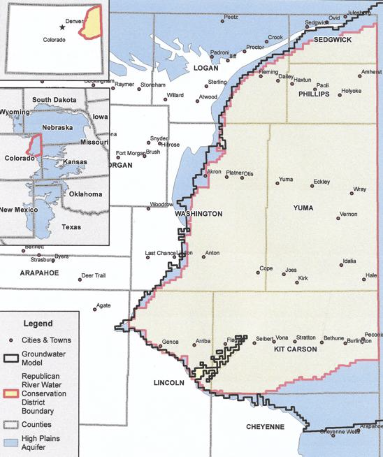
The Office of the State Engineer has filed the proposed Republican River Compact Water Use Rules with Water Court Division 1 in Greeley.
The filing was made last Friday, January 11.
The process for developing the rules included several public meetings with a special advisory committee. It was comprised of volunteers representing users and interests throughout the Republican River Basin. The meetings took place within the basin, and the last one was last August.
As drafted, the rules allow the state to administer surface water and groundwater wells for compliance with the 1942 Republican River Compact.
It includes the state engineer’s ability to curtail wells, which means issuing a cease and desist.
However, Deb Daniel, the general manager for the Republican River Water Conservation District, noted that wells that are within the Republican River Domain and have an augmentation plan are protected from curtailment.
That means all wells located with the Republican River Water Conservation District are protected, due to the district’s augmentation efforts such as the compact compliance pipeline, purchasing surface water rights, and providing financial incentives for well owners to voluntarily retire their wells, such as through CREP and EQIP conservation programs.
However, the Republican River Domain boundary is different than the RRWCD boundary, so there are some wells that currently are not protected from the potential curtailment. There is legislation currently before the Colorado State Legislature that will expand the RRWCD’s boundary to including all of the Republican River Domain.
Division 1 Water Court will have to rule on the proposed rules before they go into effect.
Well owners can make filings for or against the proposed rules with the water court. The case number is 2019CW 3002.
One can learn more about the rules at the Colorado Division of Water Resources website, http://water.state.co.us.
From the San Luis Valley Water Conservancy District via The Monte Vista Journal:
The San Luis Valley Water Conservancy District (SLVWCD) is seeking farmers for a pilot project in 2019 to cost-share on the purchase and installation of soil moisture probes. The project will include soil mapping and placement of probes that will give farmers immediate access to soil moisture data in their fields through an online portal and smartphone app. The goal of the effort is to determine if this data can help farmers with their irrigation decisions and lead to water conservation.
The project is open to farmers in parts of Alamosa, Conejos, Rio Grande and Saguache counties. The SLVWCD will contribute up to $2,000 per quarter section of land. The financial cost to the farmer will vary, depending on the selected vendor. Farmers are allowed to leverage other incentive programs such as RCPP to meet their cost-share requirement.
Participating farmers will select a vendor who is able to complete detailed soil mapping of each field. The vendor will then install soil moisture probes in accordance with the recommendations from the soil mapping. The vendor will also provide software that will allow farmers to access real-time weather information and soil moisture data from either a cell-phone application or a web-site portal.
Participants will be required to share the following data with the SLVWCD: The Water District Structure Identification (WDID) of the well or diversion structure used to irrigate the field; the annual quantity of water applied in water years 2013-2018 by the WDID structure and other water sources; the quantity of water applied on a minimum of a monthly basis for any year(s) enrolled in the pilot program; and soil mapping and soil moisture probe data.
At the end of the program’s first year, the average water application data will be compared to 2013-2018 in an effort to determine if use of the soil moisture probes improved water conservation.
Funding for the project was provided by the San Luis Valley Conservation and Connection Initiative and the Colorado Water Conservation Board Colorado Water Plan Grant Program.
To apply for the program contact Matt at the SLVWCD at 589-2230 or matt@slvwcd.org by Feb, 28.
Roundtable member Judy Lopez and her boss Sarah Parmar with Colorado Open Lands (COL) talked with the Roundtable members on Tuesday about providing more options for farmers and ranchers considering conservation easements on their properties. The Roundtable is a group of San Luis Valley residents representing a variety of water uses throughout the Valley.
Parmar said COL has protected half a million acres across the state through conservation easements. “Conservation easements are still the only permanent tool to keep land and water in agriculture,” she said.
Parmar explained that conservation easements originated on the East Coast, and when they were introduced in Colorado, “water was an afterthought.” The focus was on land protection. However, as they evolved, conservation easements also focused on protecting the water rights associated with the land, not allowing the water rights to be sold but requiring them to remain in their historical use, Parmar explained.
Up to this point, conservation easement agreements were very restrictive regarding water use, she said. To meet current conditions and needs, however, COL brought together a team to look at more flexibility with water rights under conservation easements while still protecting the investment of those funding such easements. The efforts began with the South Platte Roundtable, which was concerned that about one third of irrigated land and water would be transferred to municipal use by 2050 through “buy and dry” purchases. “Buy and dry is the easiest way for municipalities to get water,” Parmar said.
To prevent permanent loss of the water, COL began looking at ways in which property owners could lease their water rights for a certain number of years, like seven out of 10, to municipalities like Castle Rock, while retaining some agricultural use of the water. During the years their water was going to municipalities, farmers could fallow their land, deficit irrigate, irrigate for less than a full season or use a crop that used less water, Parmar explained.
Parmar said South Platte Basin water users who were surveyed on the issue were interested in the concept, with nearly 60 percent saying they would be interested in a lease situation.
Parmar said their choices were to preserve the water rights through conservation easements or sell them off entirely, the latter being more profitable. A leasing option provided farmers and ranchers with another alternative, she said. The water would remain with the land but could be involved in a long-term lease with a municipality, which would give that municipality some assurances as well, Parmar explained.
Parmar said attorneys working with COL have developed easements that would accomplish these goals and meet IRS codes for conservation easements and the tax benefits associated with them.
Lopez said the way this would likely work in the San Luis Valley would be agriculture-to-agriculture leasing, not agriculture-to-municipality leasing. This might help with some of the challenges facing the Valley now from water export threats to state regulations, she said. It might also allow some folks to keep their properties that might not have been able to, she added.
Lopez said the water portions of conservation easements would be evaluated on a case-by-case basis.
Roundtable member Ronda Lobato asked about the possibility of changing existing conservation easements. Parmar said she did not think that was out of the realm of possibility. She said there are about two million acres under conservation easements through various organizations across the state, a lot of it in the San Luis Valley.
Roundtable member Mike Gibson was very opposed to changing existing conservation easements. He said the roundtable had approved funding for conservation easements on the basis the water would stay on the land and be used for historical purposes. He said the people who entered those agreements for their land also did so with the understanding the water would remain protected, and to change that would affect other factors like habitat.
Roundtable Chairman Nathan Coombs, who is the manager of the Conejos Water Conservancy District, said he understood that conservation easements already in place were created with some options off the table, but with the current situation in the Rio Grande Basin, it might be time to look at more flexibility.
The outstanding issues, some of which are proving contentious, range from developers’ concerns about securing future water supplies to lining up funding for Pinal County farmers to drill wells and begin to pump more groundwater.
A disagreement has also flared up over the terms of an “offset” provision that involves leaving water in Lake Mead to boost the levels of the dwindling reservoir.
These complications will force more talks geared toward achieving a consensus as the state Legislature begins session Monday and starts working on legislation that would authorize Arizona’s participation in a Drought Contingency Plan, or DCP, with Nevada and California.
Gov. Doug Ducey has called for the parties to quickly wrap up a deal, saying that with a critical shortfall imminent on the river, “we cannot kick the can any further.”
But at a meeting of the state’s steering committee Tuesday, the to-do list still appeared long. And several members of the committee voiced pointed disagreements on provisions that have yet to be finalized.
Last month, federal Reclamation Commissioner Brenda Burman set a Jan. 31 deadline for Arizona and California to finish their agreements and sign on. She said if the states fail to meet that deadline, the federal government will get involved and step in to prevent reservoirs from falling to critically low levels…
[Tom Buschatzke] and other water managers began the meeting Tuesday with an overview of where water levels stand in the river’s main reservoirs. Lake Powell is now 41 percent full, while Lake Mead is 39 percent full, just above a level that would trigger a first-ever declaration of a shortage.
They also reviewed a list of issues that have yet to be resolved, some of which relate to concerns of farmers in Pinal County, who have the lowest priority and face the biggest cuts in water deliveries.
The farmers had expressed worries about taking especially large cuts in the scenario of a more serious “tier 2” shortage at Lake Mead, and Tucson city officials have proposed to help in that scenario by providing the farmers up to 35,000 acre-feet of water per year for two years. (An acre-foot is 325,851 gallons, enough to cover a football field with a foot of water.)
“We believe it’s a prudent thing to do to give the certainty to Pinal agriculture that they’re seeking on volume in the first three years,” said Timothy Thomure, director of Tucson Water. He said city officials will help finish the Colorado River deal while presenting no risks to the city.
To make the deal possible, the city would ask that water credits in the Tucson groundwater management area be transferred to the city in exchange for credits it would get in Pinal County.
He said Tucson is also asking for reforms affecting how treated sewage effluent figures in the state’s framework of water laws. One of the changes, Thomure said, would be to eliminate a 2025 “sunset” provision on water agencies’ ability to get storage credits for effluent. The city is also seeking more long-term storage credit when effluent is used to replenish groundwater.
Buschatzke called it a “very creative proposal” and said he expects more talks will be needed to work out the specifics…
Representatives of developers have been pressing for a provision conditionally granting them a certain amount of water — 7,000 acre-feet per year — for the first three years of a shortage. Ted Cooke, general manager of the Central Arizona Project, supported the idea and said this provision for an additional water supply would go away if the Drought Contingency Plan is signed.
As the developers have proposed it, the conditional water supply would be included to backstop a larger deal that’s already set to free up more water for future development — just in case the plan isn’t signed in the end.
In that larger $95 million deal, the council of the Gila River Indian Community agreed last month to sell up to 33,185 acre-feet annually to the Central Arizona Groundwater Replenishment District for 25 years starting in 2020 — enough to supply more than 99,000 homes based on the average water use in the area. The transfer would take effect once Arizona signs the Colorado River deal.
That Gila River Indian Community’s water deal was welcomed by developers because it secures water supplies for more growth into the 2030s, said Spencer Kamps, vice president of legislative affairs for the Home Builders Association of Central Arizona.
“But having said that, like everybody around the table, we’re seeking certainty. And there is uncertainty on the DCP plan going through the legislative process,” Kamps said. “My members are seeking certainty as it relates to investment from, you know, our corporate offices.”
He said developers want to be sure that when a shortage is triggered “that there is a reliable supply.”
“The concern from us is the uncertainty if anything were to happen, obviously, moving forward with the DCP plan, and it wasn’t satisfactory to either the governor or whomever,” Kamps said. “And I think that’s a reasonable request, to ensure that development can move forward regardless of the conditions on the lake during this 7-year program.”
The developers’ proposal was firmly opposed by Buschatzke, who said adding that amount of water for three years would upset the “delicate balance” that has been negotiated in the plan. Buschatzke also said: “I’m not sure where that water would come from.”
Cynthia Campbell, a water adviser for Phoenix, called the developers’ proposal “unthinkable” and said the city won’t support it.
“We don’t have enough water to go around for all the contract holders,” Campbell said. “Why would you start talking about adding new parties to the dole? That’s crazy.”
Gov. Stephen Roe Lewis of the Gila River Indian Community said he thought the issue of future water supplies for development had been dealt with already. He said the council’s resolution approving the water deal is “self-executing” once Arizona signs the Drought Contingency Plan. He offered to consult with his council and send a letter clarifying the point.
Donald Pongrace, a lawyer for the Gila River Indian Community, said after the meeting that the developers’ proposal “would create a precedent of providing water out of priority that we and all other CAP contract holders would find objectionable.”
Lewis’ offer of sending a letter to clarify that the signing of the Colorado River agreement will trigger the water transfer should be sufficient to resolve the issue, Pongrace said, though he said it’s “unnecessary and somewhat insulting to the community’s integrity and overall participation in the process.”
[…]
Another issue that drew opposition from Lewis and Buschatzke was a proposal by CAP officials regarding the “offset” component of Arizona’s plan, which involves deducting some water supplies from a Lake Mead storage account and replacing those supplies on paper with water from other sources.
Originally the idea had been a water exchange between CAP and Salt River Project, but CAP officials have instead proposed an alternative in which their agency would keep the stored water in their account. Pongrace said that’s likely a nonstarter for the Gila River Indian Community because it would give the CAP board discretion to use the water as it sees fit, and potentially take the water out.
“It’s basically calling something conservation that isn’t,” Pongrace said. “It’s the equivalent of financial gimmickry, and we will not accept it.”
Despite the disagreements and the short timetable for drafting legislation, Cooke and Buschatzke both expressed optimism about finishing a deal.
“We’re going to work on things between now and when the legislature starts, and we’re going to work on things after the legislature starts,” Cooke said. “I think we’re closer than we’ve ever been, and I think we’re in closure range, definitely.”
Cooke said CAP and state water officials will work with legislative staffers to draft the package of legislation, and the idea is to keep it simple. The legislation is to include a resolution approving Arizona’s participation in the Drought Contingency Plan together with California and Arizona, as well as other measures outlining funding for the plan and several other changes that will be necessary to make it work.
An Arizona committee looking for ways to divvy up cuts from the Colorado River water supply says it has about a handful of issues to settle…
Farmers, cities, tribes, home builders, state agencies and others on the committee met Tuesday. Their goal is to save up to 700,000 acre-feet of water over seven years.
The Arizona Daily Star reports that farmers in Pinal County want more water and certainty in funding for groundwater wells.
Homebuilders also want extra water until a deal with a tribe is finalized.
Two Arizona water utilities remain at odds over water stored in Lake Mead.
The Arizona Legislature must approve the complex plan.
From the Republican River Water Conservation District (Tim Davis) via The Julesberg Advocate:
The Republican River Water Conservation District (RRWCD) acting through its Water Activity Enterprise (RRWCD-WAE) will again partner with NRCS to encourage water conservation and provide incentives to producers that voluntarily implement water conservation measures.
Since the Ogallaa Aquifer Initiative (OAI) sunset with the end of the 2014 Farm Bill, the RRWCD will partner with NRCS through the Environmental Quality Incentives Program (EQIP) to help producers transition from irrigated to drylands agriculture or grassland. The RRWCD founding will augment NRCS funding to producers that voluntarily agree to permanently retire irrigation wells and convert the irrigated cropland to drylands farming or grazing land.
NRCS will provide approximately two hundred fifty dollars ($250.00) per acre to producers that enroll in the permanent water retirement program. The RRWCD will provide additional incentives of between six hundred ($600.00) and one thousand five hundred dollars ($1,500) per acre depending on the location of the well within the District boundary.
Additional conservation practices may be appropriate on the converted acts. These practices will provide substantial water conservation and will help sustain the life of the aquifer. Recent research has suggested that in some cases higher capacity wells can reduce water consumption by as as much as twenty percent (20%) with little or no effect on the overall profitability…
Water conservation measures such as weather stations, soil moisture monitoring and conversion from sprinkler irrigation to a more efficient irrigation system can contribute substantially to prolonging the life of the quiver, while maintaining a strong irrigated agricultural economy. The EQIP program also provides these additional voluntary incentive based tools that all producers can use to prolong the life of this aquifer.
The RRWCD has consulted with groundwater management districts, the Water Preservation Partnership, and others to develop strategies to assist producers through financial incentives to voluntarily reduce water consumption. Several surveys distributed throughout the District to producers have indicated that voluntary, incentive based programs were preferred over regulatory water restrictions. It is important that each and every irrigated agriculture producer evaluate their individual irrigation practices to determine if they can help reduce the impact on the aquifer by implementing one or more of these conservations practices.
The deadline for application for EQIP is January 18, 2019 so please contact your local NRCS office at https://www.nrcs.usda.gov/wps/portal/nrcs/site/co/home/ or the RRWCD office in Wray, Colorado, at 970-332-3552 as soon as possible if you wish to apply for conservation funding through this program.
The Republican River Water Conservation District Board of Directors will have a public hearing on the proposed new water use fee policy during its regular quarterly meeting, Thursday, January 10, in Burlington.
The meeting will be held at the Burlington Community and Educational Center, 340 S. 14th St., beginning at 10 a.m.
The public hearing on the proposed new water use fee policy will be at 1 p.m.
RRWCD General Manager Deb Daniel said the proposed policy would not change the fee for irrigation, while municipal and commercial wells would have a minimal reduction in the fee per acre feet pumped.
Junior surface water right fees would be based on comparing the impact on compact compliance of diversions of surface water for irrigation as compared to the impact of groundwater withdrawals.
Daniel said the proposed policy addresses the fees charged by the RRWCD for compact compliance, based on the impact each type of use and consumption has on the determination of Colorado’s compliance with the Republican River Compact as determined by the RRCA Accounting Procedures.
Public comment will be heard immediately following the water use fee public hearing.
Besides the regular reports, the board will hear a presentation from Mark Lengel about concerns on the South Fork. The board also will discuss South Fork Water Rights.
For more information, please contact Daniel at 332-3552 or email her at deb.daniel@rrwcd.com.
The [CAP] board voted to authorize up to $5 million during its monthly board meeting on Thursday. At that meeting, officials from the Central Arizona Project and the Arizona Department of Water Resources also shared that Ducey would request $5 million in his executive budget.
The $10 million put forward Thursday would help match $15 million the federal government is kicking in for building pumps, wells, and other structures that farmers could use to tap into groundwater. The federal funds were given on the condition that local entities in Arizona match it, Suzanne Ticknor, water policy director for the Central Arizona Project, told the board.
The additional funding comes at a critical time for Arizona. It has until the federally set deadline of January 31 to agree on a plan to deal with looming shortages on the Colorado River. One of the major concerns with that plan has been that it requires farmers to rapidly transition from surface water to groundwater, a process with a hefty price tag.
Pinal County irrigation districts initially estimated that the groundwater infrastructure would cost $30 million to $35 million to build. On Thursday, it turned out that projected costs had been revised to as much as $50 million…
Brian Betcher, the general manager for the Maricopa Stanfield Irrigation and Drainage District, explained that in its initial cost analysis, the district had looked at brand-new wells generating water 11 months of the year. Members realized that farmers really use water only about seven months each year, starting around April.
“We missed that in the analysis,” Betcher said at Thursday’s meeting.
But, he and others were quick to point out, farmers in Pinal County were not the only ones who might use those new pipes, pumps, and wells to pull water from below ground. The Central Arizona Project and other users could also use them, though they’re only allowed to recover water they had previously stored underground…
The funds that the CAP board authorized — almost unanimously — would come from ad valorem taxes, which the board is authorized to levy on property owners in Maricopa, Pima, and Pinal Counties. Board members made that funding contingent upon other groups’ helping to match federal funding, and upon the development of a program that includes infrastructure for recovering stored groundwater.
The sole dissenting vote came from Jennifer Martin, one of the board’s new members, who said she was concerned about the negative consequences of increasing groundwater pumping. In parts of Arizona, groundwater over-pumping has caused land to sink and giant fissures to open up in the ground.
The $5 million Ducey pledged would be in addition to $30 million he committed in November to Arizona’s Drought Contingency Plan, which would not count toward the federal matching program for groundwater. That $30 million would go toward paying water users to leave water in Lake Mead, the reservoir on the Colorado River that supplies Arizona, in order to prevent it from dropping to catastrophically low levels.
The Drought Contingency Plan spells out how Arizona cities, tribes, industries, and farmers will share cuts amounting to at least 512,000 acre-feet from the 2.8 million acre-feet of water they take from the Colorado River each year. (An acre-foot is about 326,000 gallons.) Those cuts are expected to start in 2020, when the Bureau of Reclamation gives the Colorado River a 57 percent of falling into shortage.
The plan weans farmers, who gave up their rights to Colorado River water in the 2004 Water Settlement Act, off of that surface water and onto groundwater instead. According to the plan, farmers will need to pump 16,500 acre-feet of groundwater in 2022, the last year they’ll still receive some Colorado River water. The following year, their pumping will increase to 70,000 acre-feet.
The governor’s office also supports repurposing a groundwater withdrawal fee to go toward groundwater infrastructure, said Tom Buschatzke, director of the Arizona Department of Water Resources, during Thursday’s meeting. The withdrawal fee is paid by farmers in Pinal County and generates about $1.2 million a year.
Arizona has six weeks to finalize its plan to deal with looming shortages on the Colorado River. Otherwise, the federal government will step in.
At a major water conference in Las Vegas last week, Bureau of Reclamation Commissioner Brenda Burman told the Colorado Basin states that they needed to get it together by January 31…
Last year, the Bureau of Reclamation pushed states to finish their plans by the end of the month and spell out how they will deal with cuts to their supply of Colorado River water. The Upper Basin states of Colorado, New Mexico, Utah, and Wyoming have already done so.
Of the Lower Basin states, only Nevada has settled on a plan. Arizona and California have not…
If they don’t finalize their plans by the end of January, the Department of Interior will ask states to recommend actions that it could take before August 2019. That is the soonest Interior would declare a shortage that would lead to cuts in states’ supply of Colorado River water.
“If Arizona doesn’t act, it seems to me that the other six states, or the Lower Basin, will sit down with the Secretary and put together a secretarial order of administering cuts to Arizona,” said former Arizona Governor Bruce Babbitt, who served as Secretary of the Interior under President Bill Clinton. “That’s never a good idea.”
Here are some of the key issues that Arizona has to figure out, or else:
Number one: Who will sign for Arizona?
The board of the Central Arizona Project, which operates the 336-mile canal bringing water from Lake Mead to Maricopa, Pima and Pinal counties in central Arizona, has insisted it should be able to co-sign. It has an elected, 15-member board representing those three counties, and it has set aside $60 million to help pay for the Drought Contingency Plan.
Not so fast, says the Arizona Department of Water Resources, which represents the state and is currently the signing designee.
This turf war, which goes back decades, won’t be resolved in the next six weeks. But the CAP board, the Department of Water Resources, and the Bureau of Reclamation have been working on an agreement that will satisfy CAP’s demands…
Number two: Where will the money come from to help Pinal County farmers?
If a shortage is declared on the Colorado River, Arizona will lose at least 512,000 acre-feet of the 2.8 million acre-feet of water it takes from the river each year. One of the groups that stands to lose the most water, and first, is farmers in Pinal County.
As drought negotiations lurched through the fall, the question loomed of how to compensate farmers for the water they would lose. For several different reasons, no one could agree.
But the plan that was proposed November 29 offered a solution that most Arizona water negotiators could get behind. In a best-case scenario, for the first two years of the Drought Contingency Plan, farmers would receive water that CAP had stored in Lake Mead. That water would be phased out starting in 2022, to be replaced by groundwater…
Number three: The legal stuff
Water might be fluid, but in Arizona, moving it from one place to another is not simply a matter of putting it in a pipe and letting it flow. A ridiculously complex legal framework governs what water can go where and for what and to whom.
For example, Arizona takes surface water directly from the Colorado River. Much of that is used immediately, but some of it is stored below ground. Not all users are legally allowed to store water underground. Those who do can receive credits to withdraw the same amount of water in the future.
This system is so complex that not even the state’s own drought negotiators are clear on how all of this will be worked out. What is clear, however, is that Arizona’s Drought Contingency Plan will require some legislative changes, because part of the way the plan would compensate farmers and other users, including cities and tribes, is through an exchange of credits.
Pinal County agricultural districts were hoping that some cities could be persuaded to store some of their water in Pinal County, Orme said. But those cities wanted to be sure they could store water in the Pinal area and still receive credit in their own areas.
Arizona’s Water Banking Authority, which holds credits in all areas, could facilitate that exchange, but “that requires some legislation,” Orme said.
Another needed law change has to do with a statutory definition called WaterBUD, which is shorthand for “Water that cannot reasonably Be Used Directly.” It essentially prohibits users from taking Colorado River water and storing it underground in order to obtain credits if the water could have been used right away. The mitigation plan put forward in November would require a partial repeal of WaterBUD.
Otondo said she would love to see the legislature vote on the Drought Contingency Plan at the beginning of session, in mid-January. “But I just don’t see the language being there and all the details hashed out.” She hoped things would be clearer after Christmas.
Fryingpan-Arkansas Project via the Southeastern Colorado Water Conservancy District
Here’s the release from the Southeastern Colorado Water Conservancy District (Chris Woodka):
Southeastern District approves $22.3 million budget
The Southeastern Colorado Water Conservancy District Board of Directors Thursday approved a $22.3 million budget for 2019 that includes payments for the Fryingpan-Arkansas Project, support for the Arkansas Valley Conduit and the anticipated opening of a hydroelectric generation plant at Pueblo Dam.
Most of the budget comprises pass-through payments to the U.S. Bureau of Reclamation.
Fry-Ark Project costs total $8 million, which includes $1.46 million for repayment and $6.54 million for operation and maintenance. An amendment to the repayment contract this year established a fixed rate of repayment, and a maintenance fund for the project. The project includes Pueblo Dam, Twin Lakes, Turquoise Lake and a Western Slope collection system that brings water from the Colorado River basin into the Arkansas River basin.
Fountain Valley Authority payments total $5.36 million. The Fountain Valley Authority includes Colorado Springs, Fountain, Security, Widefield and Stratmoor Hills. Its water supply comes from Pueblo Dam through a pipeline constructed in the 1980s.
The District also will pay $272,382 on behalf of participants in the Excess Capacity Master Contract at Pueblo Reservoir. The contract was established in 2016 to allow participants to store water in the reservoir when space is available.
The budget projects $350,000 for spending in support of the Arkansas Valley Conduit. Reclamation has $6.8 million available for AVC-related activities as well.
The $20.3 million hydroelectric plant at Pueblo Dam is expected to come online in early 2019. The plant is nearing completion and was financed with a $17.3 million loan from the Colorado Water Conservation Board, and a $3 million loan from the District’s Enterprise Fund. Power will be sold to the city of Fountain and Fort Carson through Colorado Springs Utilities. Revenues are expected to total $900,000 in 2019.
The District mill levy for the coming year will by 0.944 mills, which is not substantially different from previous years. The District covers parts of nine counties from the Arkansas River headwaters to the Kansas state line.
Click here to read the report. Here’s the executive summary:
Executive Summary
In response to the Gold King Mine (GKM) release on August 5, 2015, EPA mobilized field crews to sample water, sediment, and biological data from river segments impacted by the plume. Rivers downstream of the GKM release included the Animas River near Silverton, CO to its confluence with the San Juan River in Farmington NM, and the San Juan River from the Animas confluence to Lake Powell in Utah. A detailed examination of the water chemistry and sediment data collected from the Animas and San Juan rivers is presented in the EPA ORD report Analysis of the Transport and Fate of Metals Released from the Gold King Mine in the Animas and San Juan Rivers (EPA/600/R-16/296).
In this report, EPA presents its analysis of available biological data collected from the Animas and San Juan rivers to assess how the aquatic life responded to the GKM release. Biological communities provide a measure of water quality and aquatic habitat quality by responding to extreme events, such as the GKM release, and integrating stressors over time. Data gathered for this analysis include the EPA near-term (post-GKM release fall 2015) and long-term (fall 2016) biological monitoring of 30 locations, as well as biological data collected by federal, state, and tribal partners. The sampling and analysis approach was designed to evaluate potential changes in the species compositions, population abundance, and the concentration of metals in the tissue by comparing the post-GKM release data to the pre- release conditions.
Cement Creek aerial photo — Jonathan Thompson via Twitter
The upper Animas River immediately below the confluence with Cement Creek experienced the highest metal concentrations, the greatest number of water quality standards excursions, and the greatest deposition of GKM sediment, during and immediately following the GKM release. A significant increase in copper and decreases in manganese concentration were observed in benthic macroinvertebrate tissue in the near-term 2015 samples. Although these conditions existed, the pre- and post-GKM release analyses did not reveal any clear changes in the aquatic community. The lack of a biological response is largely because the aquatic life in this section of the river has been impacted for decades by legacy contamination from historic mine ore processing and ongoing acid mine drainage contamination. The sensitive macroinvertebrate and fish species that would be expected to respond to the GKM release were already extirpated from the upper reaches of the Animas River.
In the middle Animas River, we also did not observe a clear loss of, or change in the more sensitive macroinvertebrate and fish taxa that start to appear as one moves away from the concentrated historic mining operations in the headwaters. Our review of the Animas River adult fish population data collected by Colorado Parks and Wildlife near Durango agrees with existing state analyses, reports, and press releases that concluded fish were not exposed to acutely toxic concentrations in 2015. Naturally reproducing fish species (suckers and sculpin) and trout fry continue to be found in the Animas River at pre-release abundance levels weeks after and a year following the GKM release, however small bluehead suckers less than <200 mm were not observed in the 2016 data. The lack of a substantial biological response in this section of the river can be attributed to dilution of the plume, the dominant form of the metals was particulate rather than dissolved, and exposure duration was short, which resulted in fewer excursions of water quality standards.
Our analysis of fish tissue data collected by New Mexico Department of Game and Fish showed that many metals were significantly elevated in bluehead sucker and flannelmouth sucker liver and speckled dace muscle tissue samples collected in weeks after the GKM release in the lower Animas River. The degree of metal accumulation in liver differed by species, sampling location, and among the metals, with aluminum, cadmium, lead and manganese exhibiting the greatest concentrations. Cadmium and mercury in liver tissue and selenium in muscle were greater in the San Juan than in the Animas. When fish were sampled the following spring and fall in 2016, the concentration of metals in muscle/filet samples were similar to pre- release concentrations and were low throughout both rivers. For the most part, the elevated liver concentrations in 2015 did not translate to elevated muscle concentrations. Metal concentrations in muscle tissue never triggered human health consumption advisories. There were no fish population data available from this section of the Animas River to help us understand if the metal concentrations in fish tissue were sufficiently high to adversely affect the fish populations.
By the time the GKM plume reached its confluence with the San Juan River, total metal concentrations had declined by three orders of magnitude from what they were when the plume entered the Animas because of the combined effects of the dilution, chemical reactions, and deposition. The excursions of aquatic life water quality criteria in the San Juan were limited to metals that are also naturally high in the sediment and water.
The U.S. Fish and Wildlife Service fish population data for the San Juan River show that fish abundance in 2015 and 2016 was generally within pre-release levels. The exception to this was the abundance of bluehead sucker, flannelmouth sucker, and speckled dace in the middle reaches of the San Juan River. These species had historically low abundance in this area in both 2015 and 2016. The razorback sucker, Colorado pikeminnow and channel catfish, however, had high abundance in 2015 and 2016, which are potential predator/competitor species. We cannot conclude that changes in the physical (i.e., release from the Navajo dam resulting in a short duration of increased flow) and chemical conditions in the San Juan River during and after the plume contributed to changes in species abundance as, the aquatic life water quality criteria excursions were limited and the flow increase was similar to a moderate-sized storm event. It is as plausible that a combination of ecological (increase of predator/competitor species) and physical interactions, and/or fisheries management actions (stocking of razorback and pikeminnow), contributed to the observed changes.
With respect to metals accumulated in biota one-year post-GKM release, metal concentrations measured in benthic macroinvertebrate tissue and fish tissue generally track the gradient of concentrations measured in sediment and water through the watershed. The highest metal concentrations in tissue were typically observed in the upper Animas and the lowest concentrations were observed in the San Juan. Localized high metal concentrations were observed in the post-release tissue data; however, the location at which the high concentrations were observed was not consistent among years highlighting the high intra- and inter- site variability in tissue concentrations. In fall 2016, many metals were elevated in benthic macroinvertebrate tissue when compared to the pre-release concentration; however, the high concentrations were also observed in the upstream and tributary samples suggesting that something other than the GKM release contributed to the concentration change. Likely explanations include differences in sample collection methodologies between years and taxonomic differences between sampling locations. A comparison of pre- and post-GKM fish muscle data among data provider showed similar concentrations that did not exceed human health consumption screening advisory levels.
The EPA 2016 sampling was the first effort to obtain biological data that covered the entire Animas and San Juan rivers in a single sampling event with consistent sampling methods. Our ability to conduct a watershed-scale analysis of data collected by all partners was limited by the different sampling and analytical methods and revealed the need for a consistent sampling approach. This was especially true for studies focusing on bioaccumulation of metals. Future watershed-scale monitoring efforts should include the development of consistent sampling methods when an objective is to compare results to data collected from other areas of the watershed.
The EPA last week released a “Biological Response Report” that shows the agency’s analysis of the Gold King Mine spill…
Based on data from before and after the spill, the EPA “concluded there was no measurable changes to fish populations and bottom-dwelling organisms” after the Gold King Mine blowout.
The EPA said aquatic life in the river near Silverton had already been killed off from decades of legacy contamination from historic mine ore processing and ongoing acid mine drainage contamination.
In Durango, where aquatic life does exist, populations were not affected because the spill had been diluted, the metals were not toxic and the time of exposure was relatively short, the EPA said.
The EPA said that while some fish accumulated metals after the mine release, water quality returned to normal when samples were taken the next spring.
The study highlights what many researchers in the watershed have known for some time: The Gold King Mine spill’s tangible effect on the environment has been relatively small.
Just days after the Aug. 5, 2015, spill, Colorado Parks and Wildlife placed more than 100 hatchery fish along the Animas River. None of the fish died.
In August, San Juan Basin Public Health released the results of a three-year water-quality study, also finding the Gold King Mine spill had no lasting impacts.
Mountain Studies Institute, which has extensively monitored the river since the spill, has long maintained aquatic life had not been seriously affected. Recently, the group released a study that showed the 416 Fire runoff was by far more impactful.
This image was taken during the peak outflow from the Gold King Mine spill at 10:57 a.m. Aug. 5. The waste-rock dump can be seen eroding on the right. Federal investigators placed blame for the blowout squarely on engineering errors made by the Environmental Protection Agency’s-contracted company in a 132-page report released Thursday [October 22, 2015]
Drilling deeper wells may not be a good long-term solution to compensate for increasing demands on groundwater, report UA hydrologist Jennifer McIntosh and colleagues.
The U.S. groundwater supply is smaller than originally thought, according to a new research study that includes a University of Arizona hydrologist.
The study provides important insights into the depths of underground fresh and brackish water in some of the most prominent sedimentary basins across the U.S.
The research by scientists from the University of Saskatchewan, the UA and the University of California, Santa Barbara was published Nov. 14 in Environmental Research Letters.
“We found that potable groundwater supplies in the U.S. do not go as deep as previously reported, meaning there is less groundwater for human and agricultural uses,” said Jennifer McIntosh, a University of Arizona Distinguished Scholar and professor of hydrology and atmospheric sciences.
Drilling deeper wells may not be a good long-term solution to compensate for increasing demands on groundwater.
“We show that there is potential for contamination of deep fresh and brackish water in areas where the oil and gas industry injects wastewaters into – or in close depth proximity to – these aquifers,” McIntosh said. “These potable water supplies are already being used up from the ‘bottom up’ by oil and gas activities.
“Groundwater is the primary source of domestic water supply for about half of the people living in the U.S. About 40 percent of all of the water used in the U.S. for irrigated agriculture comes from groundwater,” McIntosh said. “In Tucson, Arizona, about half of our drinking water comes from groundwater.”
Many rural areas in Arizona and other parts of the U.S. rely exclusively on groundwater for both agricultural and domestic use, she said.
To find out how deep potable groundwater extends, the scientists analyzed water chemistry data from the U.S. Geological Survey for 28 key sedimentary basins in the U.S. and looked at the correlation between water well depths and the depth to the transition between fresh and brackish water.
Until now, the focus has been on monitoring dropping water tables, said lead author Grant Ferguson, principal investigator of the University of Saskatchewan-led Global Water Futures project.
In parts of the western U.S. known to geologists as the Basin and Range Province, fresh groundwater extends down an average of 3,400 feet, McIntosh said. The province includes Nevada, southern Arizona and New Mexico, and extends into parts of California, Utah, Oregon and Idaho.
The new research found the average depth of transition from fresh to brackish groundwater in the U.S. overall is about 1,800 feet, which contradicts previous studies suggesting that fresh groundwater extends down to 6,500 feet.
Especially in parts of the eastern U.S., the team found the transition from fresh to brackish water occurs at less than 1,000 feet. In such regions, drilling deeper wells is not a long-term solution to the need for additional fresh water, the team wrote.
“There are a number of cases where potentially you could go a kilometer or so deep for fresh groundwater, but there are other areas of the United States where in maybe a maximum of 200 or 300 meters you would run into saline groundwater – essentially you would be done in terms of water resources,” said Ferguson, an associate professor at the University of Saskatchewan in Saskatoon, Canada.
In addition, the injection of water, chemicals or sand that occurs with hydraulic fracturing, or “fracking,” or the injection of wastewater may drive waters containing hydrocarbons into adjacent areas that contain potable water.
Co-author Debra Perrone, assistant professor of environmental studies at the University of California, Santa Barbara, said, “In some basins, injection wells are installed shallower than the transition from fresh to brackish water.”
Addressing how much separation between groundwater resources and oil and gas activities is needed to protect groundwater will require additional research, the team writes.
Based on their findings for the U.S., the authors suggest the amount of fresh groundwater available globally may also be less than previously thought. They note that an estimated more than five billion people live in water-scarce areas, many of which rely on groundwater and where, in some cases, significantly more water has been taken out of a groundwater basin than is coming in.
The authors studied the U.S. because the needed data was more readily available than in Canada or other countries.
The research paper by Ferguson, McIntosh, Perrone and Scott Jasechko of the University of California, Santa Barbara, “Competition for shrinking window of low salinity groundwater,” is available here: http://iopscience.iop.org/article/10.1088/1748-9326/aae6d8/meta
The Natural Sciences and Engineering Research Council of Canada, the U.S. National Science Foundation, the Canada First Research Excellence Fund and the W. M. Keck Foundation funded the research.
The news came as the heads of two big water agencies, the Arizona Department of Water Resources (ADWR) and the Central Arizona Water Conservation District (CAWCD), presented a plan to water stakeholders in hopes of pushing the group closer to a resolution.
Arizona needs to finalize an internal drought deal so that it can enter into an agreement with the other Colorado River Basin states…
“I fully endorse this plan, the state endorses this plan,” said ADWR Director Tom Buschatzke at Thursday’s meeting of the DCP Steering Committee. He said Ducey himself will “advocate strongly” to make sure the $30 million budget request gets passed.
Buschatzke also acknowledged several items still need to be worked out.
The plan builds on an earlier, three-year proposal from the CAWCD board put forward in case something longer could not garner support.
This new proposal takes the state through 2026, when an existing set of drought guidelines expires and will need to be renegotiated. The plan now on the table provides specific amounts of water and money to “mitigate” Pinal County farmers, cities, and Native American tribes for water they will lose under the DCP, although the mitigation volumes will decrease as the plan goes on.
“This is a bridge from having no shortage to having one, and then the new future — whatever that might be — after 2026,” said Ted Cooke, general manager of the CAWCD. “The mitigation program will be done by the end of 2025.”
The water for mitigation will largely come from 400,000 acre-feet of CAWCD water currently being stored in Lake Mead. Many stakeholders say using that for mitigation is against the intention of the drought plan in the first place. But Thursday’s framework creates a “Lake Mead Offset” component to make up for those drawdowns.
Money for the plan includes:
$60 million from the CAWCD.
$30 million state appropriation proposed in Gov. Ducey’s upcoming budget.
$8 million from a collection of non-governmental organizations in the Water Funders Initiative.
$20 million to $30 million in federal money already required under existing programs.
An unspecified amount of money, from both federal coffers and Central Arizona irrigation districts, for a groundwater infrastructure program for Pinal County farmers.
But Rob Anderson, with the Home Builders Association of Central Arizona, said, “we think that economic development is an important message and that having nothing in there for developer mitigation is an issue.”
He noted a separate but related water agreement between CAWCD’s groundwater replenishment arm and the Gila River Indian Community appears stalled without approval from the Gila River council. That agreement is important to homebuilders and developers, as more water for replenishment means groundwater can be pumped out by new housing developments. Gila River Gov. Stephen Roe Lewis told stakeholders at Thursday’s meeting that he would work hard to get that agreement passed if the new DCP proposal moves forward.
Paul Orme, who represents Pinal County irrigation districts, was concerned about the lack of firm funding for groundwater infrastructure projects, among other things.
Groundwater storage trends for Earth’s 37 largest aquifers from UCI-led study using NASA GRACE data (2003 – 2013). Of these, 21 have exceeded sustainability tipping points and are being depleted, with 13 considered significantly distressed, threatening regional water security and resilience. Credits: UC Irvine/NASA/JPL-Caltech
A recent NASA study was performed to track global freshwater trends from 2002 to 2016 by collecting from the NASA Gravity Recovery and Climate Experiment. James Famiglietti, of the NASA Jet Propulsion Laboratory in California, explained, “What we are witnessing is major hydrologic change. We see for the first time a very distinctive pattern of the wetland areas of the world getting wetter, in the high latitudes and the tropics, and the dry areas in between getting drier. Within the dry areas, we see multiple hotspots resulting from groundwater depletion.” One of the areas that has been most affected is Antarctica, where 10% of its glaciers are in retreat.
According to those involved with the study, there is “clear human fingerprint” on the global water cycle. NASA has a first-of-its-kind satellite, showing that over 30 parts of the globe show dramatic depletion of fresh water. “This report is a warning and an insight into a future threat. We need to ensure that investment in water keeps pace with industrialisation and farming. Governments need to get to grips with this,” said Jonathan Farr, a senior policy analyst at the charity WaterAid. Farr says, “We have been solving the problem of getting access to water resources since civilisation began. We know how to do it. We just need to manage it, and that has to be done at a local level.”
Both the climate crisis and human activity are the two main factors causing water scarcity today, calling upon greater action and better water management by humans before the issue gets worse.
The sediment study will begin this month to collect historical and recent data on metal concentrations.
The Utah Department of Environmental Quality, the U.S. Geological Society, the National Park Service and the U.S. Bureau of Reclamation are all part of the collaborative effort.
According to the agencies, the monthlong project will extract cylindrical, long-core samples at multiple locations along the river deltas entering Lake Powell.
Scientists say the cores should reveal how flash floods, historic mining in the Upper Animas River, mine remediation activities, and spring runoff affects the timing, mass and concentration of metals deposited into the lake.
“This study will help us understand whether human activities such as mining in the San Juan River watershed have impacted or pose a risk to the important recreational, aquatic life, and cultural resources of the San Juan River and Lake Powell,” said Erica Gaddis, director of the Utah Division of Water Quality. “This project is a great example of applying science to inform water resources management.”
The survey will assess the concentration and distribution of metals at Lake Powell, including arsenic, cadmium, copper, mercury and lead.
Concentrations could affect water quality, human health and aquatic life, especially as drought continues to drag down the level of the lake. The lake is a critical component of a system that provides drinking water to 40 million people in the Southwest.
“This is the first study to collect and characterize sediment through the full thickness of the San Juan and Colorado river deltas,” said Scott Hynek, a scientists with the U.S. Geological Survey. “Drilling long cores of sediment will allow USGS scientists to analyze metal concentrations from before the Glen Canyon Dam was constructed through the present day.”
In 1982, the Army Corps of Engineers released the Plains Ogallala Aquifer Regional Resources Study, which detailed for the first time (in any official capacity) the cost and opportunity related to the construction of a 360-mile concrete aqueduct beginning at the Missouri River in the Northeastern part of Kansas and ending in Utica – traveling nearly three-quarters of the way across the state. This aqueduct would deliver approximately 3.4 million acre-ft (AF) of water annually (1 acre-ft = 325,851 gallons) to parched farmers and communities. In turn, the canal would require 15 pumping stations in order to rise nearly 1,750 ft in altitude to reach its ultimate, Utica reservoir.
The cost? $18 billion up-front with an estimated $1 billion in annual ongoing expenses ($400 million in operational costs and $600 million in interest).
The costs are exorbitant – resulting in a $470/AF price of new water for farmers who, according to a 2013 report by the US Department of Agriculture, currently pay approximately $47/AF for off-farm purchased water. Can an agricultural industry with shrinking margins due to increased competition and international trade tariffs handle a 10x increase in water prices?
And yet, there remains something romantic about the Great Kansas Aqueduct. Arizona has its 336-mile Central Arizona Project; California has its 701-mile State Water Project; why shouldn’t Kansas have its Great Kansas Aqueduct? After all, as the Kansas Aqueduct Coalition has stated, “With sedimentation reducing water storage in the East, and the Ogallala being rapidly depleted in the West, Kansas stands to lose more than 37 percent of its water in 50 counties across the state by 2062, or an annual shortfall of 1.86 million acre-feet.”
Thirty-six years after this project was first conceived in full, though, shovels and backhoes remain in their sheds as the Ogallala aquifer drops nearly two feet per year in some counties due to groundwater over pumping. If groundwater withdrawals continue at current rates, most of southwest Kansas will exhaust its water reserves within 25 to 50 years. One tends to think that in times of yesteryear, individuals would have begun construction on this project in February of 1982, begging for forgiveness later. But the time of unbridled infrastructure construction has passed and Kansas continues to stress its water resources.
As one sits and considers the need for the Great Kansas Aqueduct, three questions come to mind: 1) does the Great Kansas Aqueduct solve a problem? Yes – it would increase water supplies for Western Kansas. 2) would it solve the problem for generations? Yes – it would likely be operational for decades. And 3) would it be cost-effective? Unfortunately, not. While the volume of water delivered to Western Kansas may increase, very few people would actually be able to afford it. In fact, the $18 billion estimated to build the Great Kansas Aqueduct does not even include the legal, economic, and ethical costs inherent to initiating eminent domain and forcibly removing people in the way of the canal off of their land.
From the Associated Press via The Sante Fe New Mexican:
The study will provide information about how mining affects the lake and the fish that live in it. Researchers will test for levels of arsenic, cadmium, copper, mercury and lead…
[The Utah Division of Water Quality] will join the U.S. Geological Society, the National Park Service and the U.S. Bureau of Reclamation on the project.
“This is the first study to collect and characterize sediment through the full thickness of the San Juan and Colorado river deltas,” said Scott Hynek, a scientist with the U.S. Geological Survey.
Preliminary findings of the study are expected in 2020.
Map shows current water district boundary in red, proposed boundary in black. Blue area shows the Ogallala Aquifer. (Courtesy Republican River Water Conservation District)
[Deb Daniels] told the commissioners her district is working with the Colorado legislature to redraw the boundaries of the RRWCD after it was discovered two years ago that the district’s borders didn’t match the Republican River’s drainage basin. That basin’s northwest border matches the South Platte’s southeast border, although experts differ on exactly where the dividing line is.
The problem, Daniels said, is that there are wells in the southern area of the Republican basin that aren’t covered by the conservation district’s augmentation plan. That plan is necessary in order for Colorado to be in compliance with a 1943 water compact with Nebraska and Kansas that allocates water from the Republican River among the three states…
Several hundred wells, mostly in Cheyenne and Kit Carson counties, have been found to be depleting the river aquifer, and so need to be brought into the RRWCD. Those well owners will then have to pay the per-acre fees to help pay for Colorado’s augmentation plan.
Daniels said there are a few wells in Logan County that now are part of the Lower South Platte’s augmentation plan that would be taken into the Republican district, but because those wells already are covered by an augmentation plan, they wouldn’t be charged the Republican district’s fees.
Joe Frank, contacted at the LSPWCD office after the meeting, said changing the Republican district’s boundary wouldn’t affect Lower’s boundary, as there is a narrow strip of property between the two district boundaries.
“Right now we’re in a fact-finding mode, but we will make a recommendation to the legislature before the bill comes up next year,” Frank said.
The Sterling City Council — and those attending their regular Tuesday night meeting — got a lesson on Colorado water law and Sterling’s water supply this week.
Alan Curtis, a water attorney with White & Jankowski LLP, which has represented the city for 39 years, explained the basic tenets of Colorado’s water laws before getting into Sterling’s water rights and the pro-active approach the city has directed them to take in water cases. Curtis noted that over the past four decades, Sterling has taken part in over 180 water court cases and has gone to trial in only three, all of which ended with favorable outcomes for the city. Right now the city is involved in six pending cases…
Water engineers Jon George and Kristina Wynne of Bishop-Brogden Associates Inc. also spoke, giving an overview of the city’s existing water supply and augmentation plan. Wynne explained that in 2014, they developed a long-range plan to project the city’s future water needs. However, the last several years the city has not used as much water as projected, and she suggested that it would be appropriate to revise the long-range plan to make it more accurate going forward.
The three experts had some suggestions for projects the council should consider in the near future, including construction of a storage reservoir for augmentation.
They also noted that the city’s wastewater recharge pond represents an unknown. It has been an integral part of the city’s augmentation to offset its water use in the past, but for the past year the city has not been able to discharge wastewater to the pond because of violations of public health standards. If the city is unable to resume pumping to the recharge pond, it may need to develop other augmentation resources.
Here’s the release from Aurora Water (Greg Baker):
Water rights purchase provides environmental benefit
Aurora Water has finalized the purchase of water rights associated with the London Mine, located near Alma, in Park County. 1,411 acre feet (af) of water has been acquired at price of $22,000 per af, with additional costs of $2 million for an option to acquire additional water rights as they are developed and $1M for an easement. An acre foot of water is 325,851 gallons, enough water to serve 2.5 households on average. The seller of the rights is MineWater Finance, LLC and No Name Investors, both Colorado companies. The total value of this initial purchase is $34,042,000. The sellers are confident that the source of the rights could ultimately result in additional water that Aurora has the exclusive option to purchase for $21,500 per acre foot.
The source of this water is from a basin that is recharged from snowmelt on London Mountain. A geologic fault contains the water underground and prevents it from discharging into South Mosquito Creek, a tributary of the South Platte River. This water is pumped from the basin to a water tunnel in the London Mine and from there, discharged into South Mosquito Creek, which is upstream of Aurora’s Spinney Mountain Reservoir. Since this water is not naturally connected to the streams, it is decreed under Colorado Water Law as non-tributary. This has special meaning as this water is fully reusable and can be recaptured utilizing Aurora’s Prairie Waters system, a potable reuse system.
Aurora Water has been a national leader in water efficiency, including an acclaimed Prairie Waters water reuse system, and a nationally recognized water conservation program. Water acquisition is still necessary to meet future demands.
“Looking for new water supplies in the arid west requires innovative thinking,” said Marshall Brown, Director for Aurora Water. “This is a supply that historically has not been tapped by water providers, but the easier supplies are gone.”
The environmentally positive aspects of purchase have resulted in praise from organizations such as the Boulder-based Water Resource Advocates (WRA).
“New water supplies in Colorado are extremely limited and, at the same time, nearly 2,000 miles of streams in Colorado are polluted by mines,” Laura Belanger, Water Resources and Environmental Engineer with WRA stated. “We commend Aurora Water for taking a leadership role in finding this inventive and environmentally beneficial solution to meeting its customers’ water needs.”
Aurora Water completed substantial due diligence prior to this initial closing. Additional water rights under the option provision will be purchased as they are adjudicated and decreed through Colorado’s Water Courts.
Aurora Water is only purchasing the water rights. MineWater will continue to be responsible for the mine property, wells and associated permits. Questions regarding the mining operations, including the permits, should be directed to the MineWater contact listed above.
Click here to read the London Mine Purchase and Sale Agreement Fact Sheet.
Click here to read the mine water attachments to the release.
From 1874 until the 1940s, the London Mine was one of the top-producing gold mines in the state. It also produced lead, silver and zinc. In 1991 the mine eventually closed, but a fault within the mountain created a natural reservoir, one that fills with snowmelt.
In the nearly three decades since the mine has been closed, the state health department and U.S. Environmental Protection Agency have had their eye on the mine and its previous owners. In 2009, 2011 and 2013 CDPHE cited the mine for violating the discharge permit. A treatment plan for the mine was created, but it failed. And in 2016 CDPHE slapped the owner previous to MineWater with a $1.1 million fine.
Water officials and MineWater have studied the water, and will continue to do so, to make sure it’s a safe source.
MineWater, which has completely reworked the plumbing of the mine, will still continue its operations and hold all mine permits. Aurora water is only purchasing the water rights.
FromThe Glenwood Springs Post Independent (Thomas Phippen):
The Hot Springs Connection held its inaugural meeting in Glenwood Springs Wednesday through Friday. Organized by [Vicky] Nash, who founded tourism data marketing firm Resort Trends Inc., the aim of the conference was to gather owners and operators to share knowledge and build a network to help each other.
“The group really wants to form an industry association so they have a network of people they can communicate with. We’re going to start that process,” Nash said. She plans to work with association managers to begin the process of setting up the board and bylaws.
Nash will also move forward with a website to list every hot springs resort in North America. The site will likely have a buy-in for resorts to add additional information beyond a basic listing on the site.
“Why reinvent the wheel? Someone said that yesterday, and it’s true. We’re all dealing with similar issues,” Mike Sommer, who is assisting South Dakota hot springs owner Kara Hagen renovate a resort that has been defunct since the 1940s.
Each place where heated water bubbles up to the surface is an opportunity for something unique.
In Glenwood Springs, that variety exists in a few square miles — from the sulfuric vapor of the Yampah caves, which the Los Angeles Times once described as something out of Dante’s “Inferno,” to the largest hot springs pool in North America filled with water from the Yampah that functions as a community gathering place, to the aesthetic soaking pools in view of the Colorado River at Iron Mountain.
HOT TOWN TOUR
The owners of the three principal hot springs resorts in Glenwood — the Hot Springs Pool, Iron Mountain Hot Springs and the Yampah Spa and Vapor Caves — led the attendees through the back-end of their businesses to show how the mineral-rich water gets from the ground to the guests.
The diversity is good for the industry because it limits how much each resort competes with another, but it also means there are numerous ways to design and create the thermal springs resort, and that can be daunting for the newcomer…
LOBBYING SUPPORT
One thing Seibel hopes to see from an association of thermal springs owners is help in educating the public, and even lawmakers, about hot springs.
Legislators are “putting out laws that are very restrictive, but they don’t understand what is happening,” Seibel said.
Each state has different laws, and a trade association could help owners navigate the regulations, he said.
The big pool at Glenwood Hot Springs and the family pool at Iron Mountain must be chlorinated. Colorado statutes require water to be treated unless it completely cycles through a pool in two hours or less — as the 16 hotter soaking pools at Iron Mountain are set up to do.
At the Glenwood Hot Springs pool, manager Brian Ammerman told the group about the challenges of keeping the big million-gallon pool of water at a consistent 92 degrees.
Each hour, the operators take the temperature of the gravity-fed filter tanks and calculate how hot the water needs to be to keep the pool at the desired temperature. “You open up a little cold, a little hot, it’s all feel,” Ammerman said.
Voters in the Central Colorado Water Conservancy District passed a bond issue worth $48.7 million 57.99 percent to 42.01 percent, according to preliminary election results.
Central’s boundaries stretch through parts of Weld, Adams and Morgan counties and serve about 550 farmers who operate about 1,000 irrigation wells. But thousands of people live and vote in the district.
The Yes for Water campaign helped sway those voters, and in a statement sent Tuesday night to The Tribune, officials said they were pleased with the passage of Ballot Question 7E.
“Issue 7E’s passage demonstrates our region’s commitment to supporting family farms and our agricultural economy, providing water storage and resources now and in the future, and protecting and maintaining our rural way of life,” according to the statement.
The bond issue represents a property tax increase of about $22.80 per year for a home valued at $500,000.
Those taxes will go toward paying off debt for a variety of projects, including more lined reservoir storage near Fort Lupton, Greeley and Kersey to increase the district’s holdings by 25 percent, allow the district to buy more water rights and help construct a massive artificial recharge project in Wiggins near the Weld and Morgan county line.
While the EPA initially encouraged people and businesses to file claims for financial losses, the agency backtracked in January 2017, saying it was legally protected from any damages associated from the spill.
The states of New Mexico and Utah, as well as the Navajo Nation, filed lawsuits seeking compensation. New Mexico is seeking $130 million, Utah is seeking $1.9 billion, and the Navajo Nation is seeking $130 million.
Over the summer, the EPA, through the Department of Justice, filed similar requests to dismiss the claims, arguing the agency is protected from litigation under federal law.
The motion filed Thursday argues the same point in seeking to dismiss a lawsuit that represents about 300 individual members of the Navajo Nation who claim a cumulative of $75 million in damages…
The Department of Justice’s motion argues the EPA is protected under the Federal Tort Claims Act, which gives federal agencies a “discretionary function exemption.”
The EPA was acting according to the Comprehensive Environmental Response Compensation and Liability Act by evaluating the mine for remediation and preventing environmental pollution of the Animas River watershed when the inadvertent release occurred, the motion states.
The motion states that so far, the EPA has spent $29 million on past and continuing efforts to address mine pollution in the Animas River watershed, including building a temporary water treatment plant and designating the area as a Superfund site.
The stage was set for a blowout at the Gold King Mine years before the EPA became involved in the situation.
With the plugging of the American Tunnel, many researchers and experts of the mine district around Silverton believe the waters of the Sunnyside Mine pool backed up, causing the Gold King Mine to discharge mine wastewater…
The lawsuit on behalf of Navajo members says the spill, which carried arsenic and lead, prevented them from using water for their crops and care for their animals, as well as personal use…
Ferlic said a hearing Monday will brings together her clients, the states of Utah and New Mexico, as well as the Navajo Nation, to set a date to discuss the motions to dismiss.
Now, fears and frustration over water quality and contamination have become a potent election-year issue, burbling up in races from the fissured bedrock here in Wisconsin to chemical-tainted wells in New Hampshire to dwindling water reserves in Arizona. President Trump’s actions to loosen clean water rules have intensified a battle over regulations and environmental protections unfolding on the most intensely local level: in people’s own kitchen faucets.
In Wisconsin and other Midwestern states where Republicans run the government, environmental groups say that politicians have cut budgets for environmental enforcement and inspections and weakened pollution rules. In Iowa, for example, the Republican-led Legislature dismissed a package of bills that would have blocked any new large-scale hog operations until the state cleaned up its nitrogen-laden rivers and streams.
There are no precise water-quality surveys of the galaxy of private wells that serve 43 million people in the United States, but sampling by the United States Geological Survey has found contamination in about one of every five wells.
Few water-quality rules regulate those wells, meaning there is no water company to call, no backup system to turn to, and often no simple way to cure the contamination. In Flint, lead-tainted water prompted a public health emergency that led to a criminal investigation.
Homeowners say they are forced to choose between installing expensive filtration systems, spending thousands to dig deeper wells, ignoring the problem or moving.
A group called the South Platte Regional Opportunities Working Group, or SPROWG, is proposing to store 175,000 acre-feet of water in a series of reservoirs on the South Platte River, from north of Denver to the Morgan County line. The project also includes a long pipeline to pump water from the river back to the metro area to be cleaned and re-used. Graphic credit: CWCB via Aspen Journalism
Conceptual project would capture and store flows before they cross into Nebraska.
Colorado is expected to add 3 million new residents by 2050, and many of them will likely settle along the northern Front Range. That growth will spur a massive mismatch between water supply and demand—a gap of roughly 500,000 acre-feet per year by midcentury, according to Colorado’s Water Plan. Since 2015, a group of Front Range water providers called the South Platte Regional Opportunity Working Group (SPROWG) has been looking for ways to bridge that future gap through collaborative multi-purpose water projects, without diverting more water from Colorado’s Western Slope or drying up eastern Colorado farmland in the process.
“[This is] about making our water systems as efficient as we possibly can, and then seeing how large the remaining supply gap is and what the next steps will be,” says Lisa Darling, executive director of the South Metro Water Supply Authority, a member of SPROWG, and president of Water Education Colorado’s board.
Along with South Metro, SPROWG includes representatives from Denver Water, Aurora Water, the Northern Colorado Water Conservancy District, the St. Vrain and Left Hand Water Conservancy District, the North Sterling Irrigation District and the Lower South Platte Water Conservancy District. The group is seeking to capitalize on a surplus of untapped reusable water in the lower South Platte River near the Nebraska border, which accumulates there through return flows from the Denver Metro area and farms upstream. According to the South Platte Storage Study, an effort funded by the Colorado legislature and completed in early 2018, Colorado sent an annual median volume of 293,000 acre-feet more water to Nebraska than the South Platte River Compact requires between 1996 and 2015. SPROWG aims to enable the reuse and exchange of more of that water before it leaves the state.
“The central problem is that [future] demand will largely materialize in growing communities located roughly along the north-south axis of Interstate 25, while data and modeling tell us that available water supplies in the basin generally occur much further downstream where the river traverses the plains,” says Doug Robotham, a consultant who helped initiate SPROWG and facilitates the group’s discussions.
The conceptual project that SPROWG is now pursuing would remedy that mismatch through the creation of about 175,000 acre-feet of new water storage in three locations: 50,000 acre-feet near Henderson, 100,000 acre-feet downstream near Kersey, and 25,000 acre-feet further east near Snyder. The concept could also involve the construction of a pipeline from the Snyder-area reservoir back to the South Platte River north of Denver. This would enable the storage, reuse and exchange of several types of water, including native South Platte River flows in wet years, and legally reusable water supplies. Reusable supplies include transbasin diversion water, unconnected well water, and other sources imported into the South Platte system.
SPROWG’s analysis suggests the concept would generate 54,600 acre-feet of dependable “firm yield” every year. That’s only about one-tenth of the South Platte Basin’s looming water supply gap, but Joe Frank of the Lower South Platte Water Conservancy District says the concept would have added benefits for farmers and ranchers in eastern Colorado.
“It provides a viable alternative to buy and dry that has and continues to threaten lands within our boundaries,” says Frank. The economies of many eastern Colorado towns are dependent on irrigated agriculture and will suffer if acres are removed from production by cities acquiring agricultural water to support growth, Frank says.
Much research remains before SPROWG’s concept solidifies into an actual water project. SPROWG partners recently received $155,000 in funding from the Metro and South Platte Basin roundtables, and at press time they were waiting on approval for an additional $195,000 from the Colorado Water Conservation Board’s Water Supply Reserve Account. Over the next year, they’ll use those funds, together with $120,000 of their own money, to hone in on which municipal, agricultural and recreational water users could benefit from the SPROWG concept. They’ll also study how the concept would be funded and governed, and the exact size and location of the proposed storage facilities and water reuse pipeline.
Click here to read the whole issue of Headwaters and while you are there become a member and support water education in Colorado.
Sprinklers irrigate land on the east side of the Crystal River (in foreground), which is facing one of its driest years in recent history. Low flows on the Crystal have spurred action from the state, including curtailment and a call for instream flows. Photo credit: Heather Sackett via Aspen Journalism
Small programs can go a long way to save water and help farmers survive the coming shortages on the Colorado River. These should be the next focus for policymakers now wrestling with drought contingency plans.
Recently, policymakers in the states that share the Colorado River have made headlines for their progress toward developing a drought contingency plan. This plan is intended to keep water levels in the river’s two major reservoirs, lakes Mead and Powell, from falling too low to keep water flowing to all the people and farms that rely on it. Within Colorado and the other upstream states, the plan also seeks to preserve the ability to produce hydropower at Glen Canyon Dam and fulfill legal obligations to the downstream states.
There is significant concern that water use cuts may be required if ongoing drought makes it difficult to keep honoring those obligations. Regional water leaders have strongly advocated that any use cuts to protect reservoir levels should be voluntary, temporary and paid for.
This matters to farmers such as [Tom] Kay, because they don’t want to be legally required to cut their water use. It also matters to communities like Hotchkiss, because their economies depend on farms using water to grow crops. So a drought contingency plan that prevents a crisis in the big reservoirs and avoids legally required water use cuts would be good for Kay and good for Hotchkiss, as well as for many others in Colorado and the rest of the upstream states.
However, what about when water delivery cuts are mandated by nature rather than laws and policies? When the snow doesn’t come, and you aren’t downstream from a big reservoir, or your reservoir is already tapped out, you sometimes have to make do with less, regardless of how good your water rights are or what the policy documents say. That was the case for many irrigators this past year, and is likely to be the case more often in the future as temperatures continue to warm.
When there is simply less water to go around, infrastructure investments such as the cost-share program that helped Kay buy his sprinklers can make the difference between viability and non-viability for farms and ranches and their rural communities. There are lots of scattered programs that can help with this, some focused on water quality and habitat improvements, and others focused on irrigation efficiency. They’ve brought millions of dollars to rural communities and done a lot of good. But some programs have also suffered from excessive red tape and poor planning.
As policymakers are working to keep Lake Powell and Lake Mead functioning, it would be worth sparing some time to also think about the programs supporting drought resilience in headwaters communities, and how to make them more effective.
The district, which has boundaries that stretch through parts of Weld, Adam and Morgan counties, serves about 550 farmers who operate about 1,000 irrigation wells. As part of the ballot question, proposed through Central’s Groundwater Management Subdistrict, the district is planning for long-term projects officials said would give farmers and ranchers a reliable source of water, even during drought conditions.
According to the district, taxpayers living in a $500,000 home would pay $1.90 per month or $22.80 per year.
If approved, the money would go three places:
Construction of 5,000 acre-feet of additional reservoir storage near Fort Lupton, Greeley and Kersey.
Purchasing additional senior water rights, including those currently leased by the district.
Construction of the Robert W. Walker Recharge project in Wiggins, near the Weld and Morgan county line.
In September, executive director Randy Ray said the recharge project, the biggest of the three, would claim $15 million of the funding to divert water from the South Platte River and send flows to groundwater basins about 5 miles away from the river. Officials said the storage would increase drought resiliency for the district’s water users.
A class action lawsuit against 3M, DuPont, and Chemours was filed this week on behalf of everyone in the United States who has been exposed to PFAS chemicals. The suit was brought by Kevin Hardwick, an Ohio firefighter, but “seeks relief on behalf of a nationwide class of everyone in the United States who has a detectable level of PFAS chemicals in their blood.” Hardwick is represented by attorney Robert Bilott, who successfully sued DuPont on behalf of people in West Virginia and Ohio who had been exposed to PFOA from a plant in Parkersburg, West Virginia.
In addition to 3M, DuPont, and its spinoff, Chemours, the suit names eight other companies that produce the toxic chemicals, which are used to make firefighting foam, nonstick cookware, waterproof clothing, and many other products. While much of the litigation around PFAS has focused on PFOA and PFOS, this suit targets the entire class of PFAS chemicals, including “the newer ‘replacement’ chemicals, such as GenX.”
Rather than suing for cash penalties, the suit seeks to force the companies to create an independent panel of scientists “tasked with thoroughly studying and confirming the health effects that can be caused by contamination of human blood with multiple PFAS materials.” Such a panel would parallel the C8 Science Panel, which was created by the earlier class action litigation in West Virginia. That panel, overseen by epidemiologists approved by lawyers from both sides in the suit, found six diseases to be linked with PFOA exposure, including testicular cancer and kidney cancer.
“With multiple PFAS chemicals now contaminating the blood of people all over this country, it should be possible to build upon and expand the C8 Science Panel model to encompass a comprehensive, nationwide investigation of the impact of multiple PFAS chemicals,” Bilott said in a press release.
Critically, the settlement creating the C8 Science Panel stipulated that DuPont was unable to contest the links found by the C8 Science Panel in court, which helped lead to multiple verdicts in which the company was held liable. To date, DuPont has paid more than $1 billion in penalties as a result of the earlier PFOA litigation. The primary goal of the new lawsuit is the creation of a national study that would be similarly binding.
“The hope is it would go a long way to resolving the PFAS crisis by providing scientific answers that everybody involved would commit to,” said Bilott in an interview. “Otherwise there’s the potential for endless litigation and fighting over the meaning of the science.”
Early next year Colorado lawmakers will consider a bill that expands the Republican River Water Conservation District, helping the district pay for a program that ensures the state delivers enough water to Kansas and Nebraska to meet its legal obligations.
Colorado has spent millions of dollars battling lawsuits over the problem and earlier this year agreed to pay Kansas and Nebraska another $4 million in damages.
Last week, the Colorado General Assembly’s Water Resources Review Committee recommended a bill that would redraw the boundary of the Republican River district to include several hundred additional wells whose pumping is reducing the flow of the river.
The bill would allow the district to assess the same fee on those well owners that it does on all irrigators in the district in order to pay for a pipeline that transports additional water to the river.
Photo credit from report “A Preliminary Evaluation of Seasonal Water Levels Necessary to Sustain Mount Emmons Fen: Grand Mesa, Uncompahgre and Gunnison National Forests,” David J. Cooper, Ph.D, December 2003.
The restoration of a unique wetland on Mt. Emmons is wrapping up this summer season. This special wetland—specifically called an iron fen—was designated in 1999 as a Natural Area by the state of Colorado because of the unusual chemical makeup of the water and soils that provide an ideal ecosystem for rare carnivorous plants and unusual dragonflies. The iron fen has likely been around for about 8,000 years, according to fen expert and senior research scientist and professor at Colorado State University Dr. David Cooper.
According to a report compiled for the Coal Creek Watershed Coalition by Dr. Cooper, “Where perennial ground water discharges to saturate wetlands all year, dead plant leaves, stems and roots only partially decompose and accumulate to form peat soils, and these ecosystems are fens.”
What makes the Mt. Emmons fen unique is that it contains a pyrite-rich bedrock and talus, characteristic of only a few fens in the region. When the pyrite oxidizes it produces sulfuric acid, “which, when dissolved in water, forms a strong acid that can leach ions from the rock, including iron,” Cooper states.
According to Colorado Parks and Wildlife, “Mount Emmons and a few other iron fens in the southern Rocky Mountains … are rich in mineral ions (especially iron and sulfur) but have a very low pH, which results in an unusual flora,” including small orchids and one of only four populations of roundleaf sundew in Colorado. Roundleaf sundew is a carnivorous plant that lures insects into a sticky trap, then digests its meal with enzymes before unfurling its trap once again.
The Grand Mesa, Uncompahgre, and Gunnison National Forests District (GMUG), along with the Army Corps of Engineers and Coal Creek Watershed Coalition, are working to restore the iron fen to pre–wagon road days, which runs parallel with Kebler Pass. The iron fen is located to the north of Kebler Pass Road on Mt. Emmons, and spans 15.1 acres across a sloping hillside.
The dewatering of the fen is mostly being caused by water being diverted into a historic ditch away from the old wagon road. According to Ashley Hom, a hydrologist for the GMUG Forest Service, “Without that ditch the water would destabilize the hillside,” which poses a risk for Kebler Pass Road.
In 2015 a storm on Kebler Pass dumped rain on top of snow, causing “substantial surface flow” across the fen, down the hillside and onto the road, which prompted emergency action by the National Forest personnel to widen the ditch between Kebler Pass Road and the fen, according to the Mt. Emmons restoration and mitigation plan.
While the ditch helped stabilize the hillside by diverting water out of the ground, it also resulted in significant dewatering of the iron fen. This issue is what prompted the restoration project through the GMUG Ranger District, which began in fall 2016.
“The goal of this project is to restore the surface and groundwater hydrology, along with the native vegetation, on the portion of the Mt. Emmons iron fen that was impaired by the emergency action that extended portions of the historic ditch… and included construction of a rockery wall, spillway, culverts, and rip-rap on Kebler Pass Road to protect the road yet allow for natural surface and sub-surface water flow from the fen,” according to the restoration and mitigation plan.
There is still some work to be done, states Hom, including more ditch work, planting, feeding and monitoring in the area, which will resume this summer.
Eight monitoring wells have been placed in the fen, four above the ditch and four below the ditch, and hydrologists will monitor the ground water levels in the wells, and the restoration “will be considered successful if [the wells] below the ditch show the water table depth there to be decreasing or rising closer to the surface,” according to the restoration and mitigation plan.
The plan states that “restoring the presence of a shallow water table within the area should provide for fen-like hydrology,” which will, in turn, restore historic vegetation to the iron fen below the ditch.
“Overall the rehabilitation of the drainage ditch within the Mt. Emmons iron fen appears to be successful. Ground water levels have already risen to within 30 centimeters of the surface and water table levels below the ditch are within at least 15 centimeters of those above the ditch,” according to the GMUG watershed team.
There have been many agencies involved in the restoration of this unique swath of wetland, including the Army Corps of Engineers, which permitted the project, and the Coal Creek Watershed Coalition that allocated $45,000 for phases 1 and 2 of the restoration and mitigation project.
You can follow progress of the project and direct questions to Ashley Hom at the Gunnison Ranger District, (970) 642-4406 or ashleyhom@fs.fed.su.
Historical storage Elephant Butte Reservoir as of September 26, 2018 via Water Data for Texas.
From the New Mexico Political Report (Laura Paskus):
The Rio Grande Compact, which divides water among Colorado, New Mexico and Texas was signed in 1938. And New Mexico’s water laws today are still based on codes that the territorial legislature passed in 1907.
But as the climate changes and warmer temperatures affect the state’s rivers, reservoirs and aquifers, the same tactics and strategies that may have helped New Mexicans weather dry times over the past century won’t keep working. And perhaps no place in the state offers such a stark reminder of that fact than the reservoir behind this dam. After a dry winter and hardly any snowmelt this spring, Elephant Butte Reservoir is at three percent capacity, storing 58,906 acre feet of water as of September 24.
Historically, people tend to listen to what they want to hear, rather than what they need to hear: What they need to hear is that our laws do not reflect hydrology and our hydrology is changing for the worse, and if we do not manage it, it will manage itself,” says Phil King, an expert on hydrology and the relationship between surface and ground water in southern New Mexico. “I would much rather correct the system ourselves through management than let nature do it’s cold, hard reality fix,” adds King, a professor of civil engineering at New Mexico State University and a consultant to the Elephant Butte Irrigation District, or EBID.
Stopping the ‘death spiral’
EBID serves about 8,000 farmers in the Rincon and Mesilla valleys in southern New Mexico, from Arrey to the border town of Santa Teresa. If you’ve eaten chile from Hatch or pecans from Mesilla, fed alfalfa to your horses or poured milk from a New Mexico dairy into your coffee, you’ve consumed water that EBID’s farmers divert from the Rio Grande and Elephant Butte or pump from the aquifer.
For roughly a century, EBID farmers have supplemented irrigation water with groundwater. Without it, they would not have survived the drought of the 1950s. But they pumped during the wet years, too, including throughout the 1980s and ‘90s. Then, beginning around 2003, about four years into the Southwest’s current drought period, pumping ramped up even more.
That’s a problem, especially in the Rio Grande Valley, where river water recharges the groundwater, and pumping water from the aquifer makes it even thirstier for river water.
With both the surface water and the groundwater strained, the system suffers a double-whammy, King says. That causes a positive feedback or what King calls a “death spiral.”
Even though scientists, engineers, hydrologists and farmers know the two are intertwined within the same system, in New Mexico, groundwater and surface water are managed separately. King calls that “hydrological folly.”
“We’ve got some major rethinking to do with New Mexico water law: Status quo is not an option,” he says. “I think what people need to understand is we are facing conditions that mankind has not faced here before.”
And the only way to reverse that death spiral is to use less water.
The drying riverbed of the Middle Rio Grande near the Bosque del Apache National Wildlife Refuge on April 4, 2018. Photo credit: USBR
Hoping to avoid the wholesale shut down of agricultural wells in the San Luis Valley that occurred in the South Platte, water users here developed their own plan of action, Rio Grande Water Conservation District General Manager Cleave Simpson explained during “A Tale of Two Rivers” Monday night at Adams State.
Simpson spoke about the Rio Grande Basin’s groundwater journey while CSU Director of the Colorado Water Institute Reagan Waskom spoke about the South Platte Basin.
Attendees at the September 17 talk asked Simpson if local efforts were going to be enough, especially in light of drought and generally warmer conditions in recent years.
He responded that if voluntary efforts to reduce water consumption are not successful, the state will force the issue, because local water users — at least those in the basin’s first water management sub-district — are mandated to bring the aquifer levels back up to a certain level in a specified amount of time.
That clock is ticking, he said.
In its eighth year of operation Sub-District #1, sponsored by the water district Simpson manages, is required by legislation to bring the Rio Grande Basin’s aquifer up to a more sustainable level in 20 years, which means it has 12 years remaining on that mandate, Simpson explained.
The sub-district concept was born as a way to self govern water use in the basin, he said. The various sub-districts throughout the basin focus on “communities of interest,” Simpson said.
The first sub-district, which will soon have several sister sub-districts throughout the basin, covers about 3,000 irrigation wells involving about 300 landowners. They have used many methods to reduce their consumption, repair their wells’ injuries to surface water users and to meet their aquifer sustainability mandate, Simpson said.
He said the first sub-district has invested $8 million in fallowing projects and $6 million in acquiring and drying up parcels irrigated by groundwater…
He said, however, that speaking personally and not as the district manager, he believed a lot more acreage would need to be taken out. He said of the approximately 500,000 irrigated acres currently in the San Luis Valley, he believed 100,000-150,000 irrigated acres could no longer be supported with the dwindling water supply and aquifer sustainability mandate, unless farmers found a crop that used half the consumptive volume of water they are now using.
“There’s social consequences for taking 100,000 acres out of production in the Valley,” Simpson said.
Waskom added that the South Platte Basin is different in that it is not as agriculturally dependent as the Rio Grande Basin. While the Valley’s economy is still largely dependent on agriculture, the South Platte has more diversity such as oil/gas, growth and commercial enterprises. Losing cropland in the South Platte is not as crucial as it is in the San Luis Valley, he said.
“It’s different here. You need to think about that as a community, what your future looks like,” he said…
Simpson said that while groundwater users in the Rio Grande Basin must replace their injurious depletions to surface rights, just as in the South Platte, one major difference in the requirements between the two basins is the obligation in this basin to “create and maintain a sustainable aquifer … unique requirements … Nowhere else in the state are well owners held to that standard.”
That requirement must be met 20 years from the formation of the first sub-district, which is now eight years into that timeline, Simpson said. He added that while there is flexibility on how to get there, “where you have to get to is clearly well defined.”
He pointed to the downward trends in stream flows, specifically on the Rio Grande at the Del Norte gauge where for the first time since flows have been measured at that gauge (1890 forward), the river has gone 10 years without reaching the 700,000 acre-foot annual flow and about 20 years without hitting 800,000 acre feet. The annual flow this year is about 285,000 acre-feet.
Simpson added, “It’s probably not fair to call it a drought anymore. It’s climate. It’s just where we are, natural or man made, it’s just where we are at.”
Simpson also referred to the unconfined aquifer study the district has undertaken since 1976, which is generally the same area covered by the first sub-district. The aquifer remained fairly steady prior to 2002 and in that drought year alone lost 400,000 acre feet volume of water in that study area, Simpson said.
The first sub-district through its varied efforts of fallowing and conservation recovered about 350,000 acre feet, Simpson added. Experiencing three or four years of close to average flows helped. This year has presented more of a challenge, Simpson added, and he expected a decline in the aquifer storage area of about 200,000 acre feet.
Central’s Board places GMS bond measure on November 2018 ballot
The Board of Directors of the Central Colorado Water Conservancy District placed a bond question for the Groundwater Management Subdistrict on to the 2018 ballot. Central’s board and management stated this measure is important to start planning the next steps to secure water rights and build storage for the region. The projects in the bond include:
Construction of 5,000 acre-feet of additional reservoir storage—which will increase Central’s holdings by 25 percent—in the Fort Lupton and Greeley/Kersey areas.
Construction of the Robert W. Walker Recharge Project, a large project at the Weld and Morgan county lines that will divert water from the South Platte River and send those flows to groundwater recharge basins as far as 5 miles from the river. This will increase drought resiliency for water users in the District. Central was awarded $1.5 million in state and federal grants for the estimated $15 million project.
Purchase of several senior water rights that are becoming available for the District’s portfolio, including the purchase of water currently being leased by Central, which will ensure this water stays in the community to be used by local farms and businesses.
To review the ballot language, click here. Please contact Central’s office if you have any questions.
Randy Ray said every local water manager remembers years like 2002 and 2012.
“That’s one thing water managers don’t forget: the dry years. We always forget about the wet ones, except for the catastrophic floods,” said Ray, executive director of the Central Colorado Water Conservancy District. “How did their water supplies react to the dry years?”
Water officials try to answer when they look toward the future of their systems. That’s why the Central Colorado Water Conservancy District will place a $48.7 million bond question on the ballot this November in an effort to address priorities that, officials said, would help the district plan for droughts such as the ones that ravaged this part of the state in 2002 and 2012. Another drought currently bakes portions of the state this year, as well.
Central’s boundaries stretch through parts of Weld, Adams and Morgan counties and serve about 550 farmers who operate about 1,000 irrigation wells…
The recharge project, the biggest of the three, would claim an estimated $15 million of the funding in an effort to divert water from the South Platte River and send flows to groundwater basins about 5 miles away from the river. Officials said that would create storage to increase drought resiliency for the district’s water users.
For Ray, the recharge project is a solution to problems years in the making.
“It’s complicated, but then again, it’s simple,” he said. “If you want to pump groundwater, you’ve got to replace it. We’re just simply putting water in the aquifer to offset pumping and generate additional supplies that we can count on.”
Recharge projects, which have been in use for decades, exploded in the late 1990s, as strict regulations for well pumping required water users to replace the groundwater they pumped. They work by diverting water to a pond and allowing it to seep into the ground, and eventually, back to the river.
At the Walker Recharge Project, which is named after a former district president, officials plan to divert the water from the South Platte River when it’s flowing at a high level to ponds along a plateau as far as 5 miles away.
The district purchased the land for the project in 2015 after it became clear to Central officials that the district can’t rely on leasing reusable water from Thornton, Aurora, Longmont and Westminster sewer discharge plants the way it has in the past.
Because the population in those cities is growing, Ray said, city officials are more reluctant to give their extra water supplies away. Water managers in those cities remember dry years such as 2002 too.
Plus, Ray said, the district views the projects as better financial investments.
“It’s like renting a house,” Ray said. “The landowner is getting the equity, and you’re just basically paying their mortgage.”
Ray said the other main projects outlined in the ballot question — the reservoir storage and additional senior water rights — also will play a role in helping the district rely less on water leases from cities. The gravel pit reservoir storage, he said, would help the district divert water from the river quickly when water levels are high for additional storage.
But Ray said the biggest selling point for the bond issue is agriculture.
“That’s our big campaign, our big message to our constituents, preserving irrigated agriculture in the county,” Ray said.
By purchasing additional senior water rights, he said, the district could help slow a trend called “buy-and-dry,” in which cities buy water rights from farms.
“So, when one of those cities purchases those water rights, they retire the land, and it’s got to go back to a dry land setting, which has a lot of negative associations with that,” Ray said. “The economy dries up and the tax bases go away.”
If Central takes over that water right, Ray argued, farmers would still have access to groundwater to irrigate a portion of the farmland.
“If you’re 80 years old, 70 years old, that farm and its water rights are your 401(k),” Ray said. “We want to be an alternative to these beautiful senior water rights in Weld County being transferred to Denver, Arapahoe, Douglas counties and reside here under the management of the water conservancy district.”
The Palmer Lake Board of Trustees last week unanimously passed the ordinance, which requires that developers drill wells to serve properties outside the service area, Town Administrator Cathy Green said.
However, developers may still build within the service area and connect to existing water mains, Green said.
The town provides water to nearly 1,000 households and businesses. An engineering services company has found the municipal water supply can support about 80 more taps.
In late July, the town implemented Stage 2 water restrictions — preventing residents from watering their lawns and washing their cars — due to a broken pump on one of its wells and abnormally low reservoir levels.
But the town is finishing the installation of a new pump on the well, so the emergency restrictions will be lifted soon, Green said.
Normal year-round restrictions, which require Palmer Lake residents to water their lawns only on certain days of the week, will remain in place, she said.
After completing its final PFAS Community Engagement event in Leavenworth, Kansas, on Sept. 5, the EPA plans to prepare its PFAS management plan and release it by the end of the year.
The first community engagement event was in Exeter in June, with follow-ups in Horsham, Pennsylvania, Colorado Springs, Colorado, Fayetteville, North Carolina and an event for tribal representatives in Spokane, Washington.
The EPA said, “The Community Engagement events and the input the agency has received from the docket for public comments have been incredibly informative and will be used, along with perspectives from the National Leadership Summit to develop a PFAS management plan for release later this year.”
[…]
While the EPA says one of its actions will be to evaluate the need for a MCL for PFAS that may change its current level of 70 parts per trillion that is a health advisory…
Many environmental groups are calling for lower levels that have already been established by other states.
Storm drain and open channel improvements between the East Rail Line (38th & Blake Station) and the South Platte River (Globeville Landing Outfall), Stormwater detention/conveyance between the East Rail Line (38th & Blake Station) and Colorado Blvd, (Montclair Basin) Stormwater detention/ conveyance immediately east of Colorado Blvd. (Park Hill Basin).
Old Denver pulsed with H2O, water that snaked through the creeks and irrigation canals crisscrossing Colorado’s high prairie before 150 years of urban development buried most of them or forced them into pipes.
New Denver wants those waterways back.
City leaders are ramping up what they describe as a massive, restorative “daylighting” of buried water channels wherever possible — cutting through pavement and re-engineering old streams and canals to create up to 20 miles of naturalistic riparian corridors. Hundreds of millions of dollars have been committed. Eventual costs are expected to top $1 billion over several decades. This work reflects increased interest worldwide in harnessing water and natural processes to make cities more livable.
Starting in 1858 with the discovery of gold in Colorado’s mountains, Denver developers focused on filling in creeks to make way for the construction of railroads, streets, smelters and housing — all laid out across a grid imposed on the natural landscape. The 184-page Green Infrastructure Implementation Strategy that Mayor Michael Hancock’s administration issued this summer reverses that approach with an inventory of high-priority projects aimed at — to the extent that booming growth and development will allow — reopening and revitalizing waterways.
“It is like undoing history,” project manager Patrick Riley said last week along a newly formed 1,000-foot stretch of Montclair Creek — already attracting geese as big trucks beeped and contractors in neon green vests re-contoured the urban terrain.
The Montclair Creek project marks Denver’s most ambitious and controversial daylighting so far, a $298 million revival of a waterway that flows 9 miles from high ground at Fairmount Cemetery (elevation 5,485 feet) under the north half of the city. Work crews are excavating and rerouting water, digging holes for ponds, and planting native grasses and perennials in four areas: the 130-acre City Park Golf Course, the Park Hill Golf Course, a 1.2-mile greenway along 39th Avenue, and a landscaped “outfall” through a 5-acre Globeville Landing park near the South Platte River (elevation 5,274 feet) west of the Denver Coliseum.
City engineers say that, by reconstructing the urban landscape where possible, they’ll slow down water, filter it through vegetation to remove contaminants, control storm runoff and nourish greenery to help residents endure the climate shift toward droughts and rising temperatures…
While a lack of open land and neighborhood resistance can limit daylighting of long-squelched creeks and canals, increasing volumes of storm runoff — the result of the paving of more and more of the city — require action.
The U.S. Army Corps of Engineers has supported daylighting, recognizing that pipes and concrete channels typically can’t handle surges the way natural creeks and floodplains once did before development…
Other projects in the works:
— Re-exposing a southern branch of Montclair Creek that flows under an area extending from City Park across Colorado Boulevard and eastward along Hale Parkway.
— A $77 million removal of concrete and widening of the Weir Gulch that runs through southwestern Denver from South Sheridan Boulevard to the South Platte River.
— A $26 million revitalization of Harvard Gulch in south-central Denver.
— The $249 million enhancement of the South Platte, reshaping and widening river banks between Sixth and 58th avenues, to create an ecosystem healthy enough for trout to reproduce through Denver.
— Converting portions of the 71-mile High Line Canal irrigation system, built in 1883 and owned by Denver Water, into a greenway and refuge.
— Other waterway projects that city officials are discussing involve naturalistic re-engineering of concrete trapezoidal channels in Montbello, flood-prone gullies in Globeville, the southwestern Sanderson Gulch, and buried channels citywide where alluvial sediment indicates creeks once flowed before settlers arrived.
Denver innovations include installing an ultraviolet water-cleaning station at the Montclair Creek outfall to boost natural processes in zapping chemical contaminants, an expanding array from antibiotics to antidepressants, before water reaches the South Platte.
Along Brighton Boulevard north of downtown, city crews also built 56 cement boxes, designed to hold native grasses and flowers in a replaceable soil mix that includes ground-up newspaper, to filter runoff water so that less pollution reaches the South Platte…
Dealing with floods by trying to funnel more and more runoff into culverts and pipelines has become increasingly costly and ineffective, city officials said. A recent city study estimated that dealing with worsening storms by installing more pipelines would cost taxpayers $1.4 billion.
But it’s unclear whether a new approach of embracing waterways will be cheaper in the long run.
As work crews neared completion of the Montclair Creek outfall by the South Platte, project manager Riley said recreational benefits and a need for places “where water could percolate out naturally” — rather than costs — are driving this push that has unified support from city leaders.
“You have to do what is right for the health of rivers. That’s part of the health of the city,” Riley said. “You are going to see a return to natural processes.”
The California Court of Appeal for the Third Appellate District has issued an important decision declaring that California’s powerful public trust doctrine applies to at least some of the state’s overtaxed groundwater resources. The court’s opinion also rejects the argument that California’s Sustainable Groundwater Management Act (SGMA) displaces the public trust doctrine’s applicability to groundwater resources.
The Court of Appeal’s opinion in Environmental Law Foundation v. State Water Resources Control Board decides two key issues of first impression for California water law: first, whether the public trust doctrine applies to California’s groundwater resources; and, second, if it does, if application of that doctrine has been displaced and superseded by the California Legislature’s 2014 enactment of SGMA. A unanimous appellate panel answered the first question in the affirmative, the second in the negative.
The facts of the Environmental Law Foundation are straightforward and undisputed: the Scott River is a tributary of the Klamath River and itself a navigable waterway located in the northwestern corner of California. The Scott River has historically been used by the public for recreational navigation and serves as essential habitat for migrating salmon listed under the Endangered Species Act.
Critically, there are groundwater aquifers adjacent to the Scott River in Siskiyou County that are hydrologically connected to the surface flows of the Scott River. Local farmers and ranchers in recent years have drilled numerous groundwater wells and pumped ever-increasing amounts of groundwater from those aquifers. As a direct result, the surface flows of the Scott River have been reduced, at times dramatically. Indeed, in the summer and early fall months, the Scott River has in some years been completely dewatered due to the nearby groundwater pumping. The adverse effects on both the Scott River’s salmon fishery and recreational use of the river have been devastating.
Environmental groups and the Pacific Coast Federation of Fishermen’s Associations, relying on California’s venerable public trust doctrine, initially responded to this environmental crisis by petitioning Siskiyou County and the State Water Resources Control Board to take administrative action to limit groundwater pumping in the Scott River watershed. Both the Board and the County declined to do so.
Plaintiffs responded by filing suit, arguing that groundwater resources that are interconnected with the surface water flows of the Scott River are subject to and protected by the state’s public trust doctrine. Siskiyou County disputed that claim, arguing that the public trust doctrine is wholly inapplicable to groundwater and that the country has no duty to limit groundwater pumping, even in the face of the resulting environmental damage to the Scott River ecosystem. (The Board, by contrast, eventually reconsidered its position, ultimately adopting plaintiffs’ view that groundwater resources interconnected with surface water flows are indeed subject to the public trust doctrine.)
The trial court concluded that the public trust doctrine does apply to the groundwater resources of the Scott River region. While the litigation was pending there, however, the California Legislature enacted SGMA, which for the first time creates a statewide system of groundwater management in California, administered at the regional level. Siskiyou County seized upon that legislation to argue that even if the public trust doctrine would otherwise apply to the County’s groundwater resources, the doctrine was automatically displaced and made inapplicable to groundwater as a result of SGMA’s allegedly “comprehensive” statutory scheme. The trial court rejected this backstop argument as well, and the County appealed.
The Court of Appeal’s decision today resoundingly affirms the trial court on both issues. On the threshold public trust claim, the justices rely heavily on the California Supreme Court’s landmark public trust decision, National Audubon Society v. Superior Court. In National Audubon, the Supreme Court held that the public trust doctrine, a foundational principle of California natural resources law, fully applies to the state’s complex water rights system. Specifically, National Audubon found that the City of Los Angeles’ diversion of water from the non-navigable, freshwater streams flowing into Mono Lake, which were reducing the lake level and causing environmental damage to the lake ecosystem, could be limited by state water regulators under the public trust doctrine.
The court in the Environmental Law Foundation concluded that the rationale and holding of National Audubon are fully applicable to the facts of the Scott River case. Rejecting the County’s argument that extractions of groundwater should be treated differently from the diversions of surface water that were found in National Audubon to be causing environmental damage to Mono Lake, the Court of Appeal declares:
“The County’s squabble over the distinction between diversion and extraction is…irrelevant. The analysis begins and ends with whether the challenged activity harms a navigable waterway and thereby violates the public trust.”
Accordingly, the Environmental Law Foundation court concludes that the public trust doctrine fully applies to extractions of groundwater that adversely affect navigable waterways such as the Scott River.
A “get well soon” balloon floats in the contaminated waters of the Animas River flowing through Durango on Monday afternoon August 10, 2015 — photo The Durango Herald, Shane Benjamin
The study looked at 200 river-water samples and almost 200 sediment samples, as well as more than 100 private wells from Durango to Silverton, testing for 13 different heavy metals and other possible contaminants, the health department said.
Some findings, according to San Juan Basin Public Health:
Water quality, except in Cement Creek, is better than the minimum standards set to protect aquatic life and human uses.
Additional sampling performed as part of this study revealed that natural variability in river flows produces occasional “spikes” in certain metals that may have been missed in less-frequent sampling.
Sediment in the Animas River, including beach sediment at six popular Durango recreation sites, poses no risk to human health if common-sense precautions are followed.
About one-quarter of Animas Valley drinking water wells had naturally-occurring bacteria present, and all wells should receive filtration or treatment.
About 5 percent of Animas Valley wells had more serious contamination from heavy metals, nitrates or other forms of bacteria. Heavy metal contamination in these wells arises from the natural geology of the Animas Valley aquifer.