Protect Your Groundwater Day, September 4, 2018

Click here for all the inside skinny from WellOwner.org:

Protect Your Groundwater Day (September 4, 2018) provides an opportunity for people to learn about the importance of groundwater and how the resource impacts lives. Your involvement and passion during the week is what makes PYGWD so successful, and we have put together free marketing materials to help guide you through the event.

#AnimasRiver: “We’ve got years’ worth of investigations to do” — Rebecca Thomas #GoldKingMine @EPA

On April 7, 2016, the Environmental Protection Agency proposed adding the “Bonita Peak Mining District” to the National Priorities List, making it eligible for Superfund. Forty-eight mine portals and tailings piles are “under consideration” to be included. The Gold King Mine will almost certainly be on the final list, as will the nearby American Tunnel. The Mayflower Mill #4 tailings repository, just outside Silverton, is another likely candidate, given that it appears to be leaching large quantities of metals into the Animas River. What Superfund will entail for the area beyond that, and when the actual cleanup will begin, remains unclear.
Eric Baker

From The Durango Herald (Jonathan Romeo):

Project to clean nearly 30 mines in 5 years has drawn criticism

The Environmental Protection Agency will not release public comments before it makes a final decision on a proposed plan to clean up 26 mine sites over the next five years in the Superfund area near Silverton.

In June, the EPA released the proposed plan, which identified quick action projects the agency wants to take while it comes up with a long-term plan for improving water quality in the upper Animas River. The proposed plan is expected to cost about $10 million.

“We’ve got years’ worth of investigations to do,” Rebecca Thomas, the EPA’s project manager, said in a previous interview. “These early actions are not intended to be a final remedy. They’re no-brainer activities to help get the water clean and reduce the amount of loading.”

The release of the plan kicked off a 30-day public comment period, which was extended another month in response to requests by the public. The comment period ended Wednesday.

When The Durango Herald asked EPA officials to review public comments, spokeswoman Cynthia Peterson said the public comments and the EPA’s response won’t be made available for review until the EPA makes a final decision.

“All significant comments, and EPA’s responses to those comments, will be compiled in a responsiveness summary. The responsiveness summary will be included in the final decision document – the Interim Record of Decision. The Interim Record of Decision will be published once the agency has had a chance to review and consider all comments received.”

Withholding of public feedback and the agency’s replies until after a final decision is made is in contrast with other comment periods the EPA has held. In 2015, for example, comments were posted in real time for the listing of the Superfund site.

“In some instances, such as federal rule-makings, comments can be made available in real time,” Peterson wrote. “However, significant comments on a site-specific Record of Decision are released in a responsiveness summary with the decision document.”

This image was taken during the peak outflow from the Gold King Mine spill at 10:57 a.m. Aug. 5. The waste-rock dump can be seen eroding on the right. Federal investigators placed blame for the blowout squarely on engineering errors made by the Environmental Protection Agency’s-contracted company in a 132-page report released Thursday [October 22, 2015]

From The Durango Herald (Jonathan Romeo):

Despite ash flows and mine waste, the river is resilient

It’s been a rough couple of years for the Animas River.

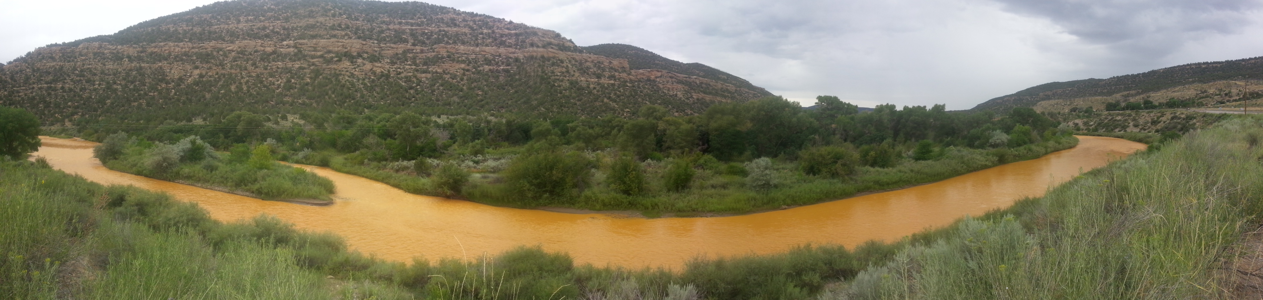
This weekend marks three years since the river, which runs through the heart of Durango, endured a massive mine waste spill from a blowout at the Gold King Mine. The waterway turned an electric orange and gained international attention.

The Aug. 5, 2015, spill brought to the forefront the longstanding issue of toxic metals leeching into the Animas River from legacy mining in its headwaters around Silverton.

This year has been an especially vicious dagger into the Animas.

A winter that never showed up in the San Juan Mountains resulted in one of the lowest snowpack years in recorded history. Then, through spring and early summer, extreme drought tightened its stranglehold on Southwest Colorado.

The Animas River saw its third lowest peak flow in more than 100 years of recorded history, and one of its earliest, hitting a high of about 1,000 cubic feet per second in May. Typically, the river peaks at about 4,700 cfs in early June.

Fish and other aquatic life were already stressed from low flows and high water temperatures when ash runoff from the 416 Fire burn scar came tumbling down north of Durango.

The dark-chocolate colored waters suffocated fish, which desperately washed ashore seeking oxygen. Though an official population survey won’t be conducted until this fall, it’s estimated thousands of fish died.

A raw sewage spill last week at Santa Rita Park was an extra twist of the dagger.

A river without fish
For some perspective, it’s likely aquatic life is either all but gone or dramatically depleted through the entire 126-mile stretch of the river from the headwaters in Silverton, down through Durango to the Animas’ confluence with the San Juan River in Farmington.

In recent years, the river from Silverton to Bakers Bridge (about 15 miles north of Durango) has been basically considered a dead zone because of toxic metal-loading from leeching mines.

The ash flows during the month of July killed most of the fish in the river through Durango. Even the most tolerant species – carp – was found dead along the river’s banks.

Fish in this stretch of the Animas River have been unable to reproduce because of a combination of factors, such as high water temperature and mining pollution. The fish that do live in the river are stocked by Colorado Fish and Wildlife.

The Southern Ute Indian Tribe declined to comment about how fish are doing in the Animas through tribal lands. Attempts to reach a biologist with New Mexico Fish and Game were unsuccessful. The Animas, however, has all but dried up before it reaches the San Juan River.

“It’d be unusual if everything was dead, but it’s probably to the point where it’s virtually that way,” said Jim White, an aquatic biologist for Colorado Parks and Wildlife.

But despite the onslaught of doom and gloom, there is reason to be optimistic: Rivers are resilient, and steps are finally being taken to make significant strides in the cleanup of the Animas River.

Improving water, habitat
After the Gold King Mine spill, for instance, the Environmental Protection Agency (which triggered the blowout while working at the inactive mine) declared a long-awaited Superfund listing, which will clean up nearly 50 mining sites around the Animas River headwaters.

Already, a temporary water-treatment plant built in 2015 has shown improvement in water quality downstream, said EPA spokeswoman Cynthia Peterson, though it’s too soon to know its effect on aquatic life…

While ash flows have decimated fish populations, research has shown aquatic species rebound quickly after wildfires, said Scott Roberts, an aquatic biologist for Mountain Studies Institute.

El Paso County: Hearing delayed on class-action suit over tainted water

Widefield aquifer via the Colorado Water Institute.

From The Colorado Springs Gazette (Tom Roeder):

A hearing to determine whether 7,000 southern El Paso County residents can act as a class to sue chemical manufacturers over tainted water in the Widefield aquifer has been delayed.

David McDivitt, whose firm is representing the plaintiffs, said it could be fall before the issue is decided. If the federal court allows a class-action suit, the plaintiffs could argue their case as a group, rather than suing the chemical companies one at a time…

The suit, which targets chemical giant 3M and other manufacturers of a firefighting foam used by the Air Force, claims the firms knew or should have known that the foam contained harmful perfluorinated compounds. The chemical companies have denied the allegations.

The Air Force, which used the foam at Peterson Air Force Base, is not named in the suit, even though studies have shown the chemicals sprayed at the base wound up in the aquifer. The federal government is largely immune from lawsuits over the actions of the military.

The lawsuit has survived initial efforts to have it dismissed but remains years from resolution.

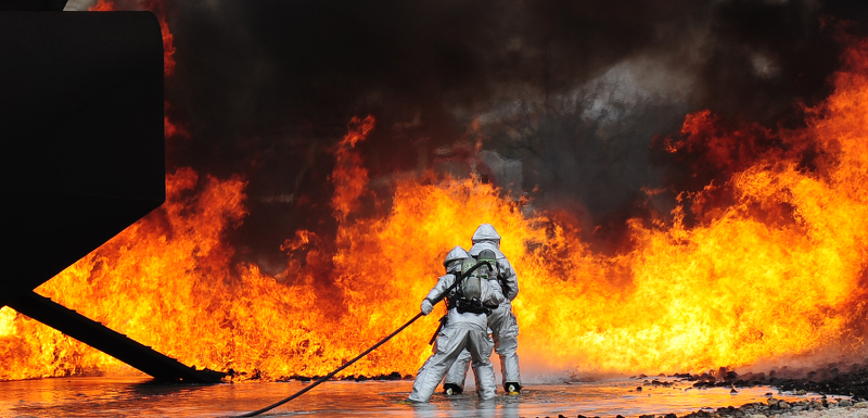
Photo via USAF Air Combat Command

From The Colorado Springs Gazette (Tom Roeder/Jakob Rodgers):

The acronyms read like a helping of toxic alphabet soup: PFOA, PFOS, PFNA, PFHpA.

They number in the thousands — each representing a different compound with the same chemical foundation as those contaminating the aquifer beneath Security, Widefield and Fountain.

But as the number of those chemicals known to researchers grows, a central question about the federal government’s plans for protecting residents from those chemicals remains unresolved.

Will the EPA widen its approach and focus on the thousands of perfluorinated compounds as a group? Or will federal regulators continue addressing only one or two at a time — part of a lengthy process that experts and clean water advocates say could last for decades, if not longer?

At meetings last week in Colorado Springs, advocates gave the EPA an earful about the agency playing “whack-a-mole” with the chemical — chasing down each variation for its own set of regulations.

“The solution is to regulate perfluorinated compounds as a family to protect our families,” the Sierra Club’s Fran Silva-Blayney told EPA bosses at their Wednesday gathering in town.

Perfluorinated compounds entered the local lexicon in 2016, when testing revealed that drinking water for thousands of households in southern El Paso County exceeded an EPA health advisory for the chemicals due to contamination in the Widefield aquifer. Millions of other Americans were affected, too.

Testing later identified a likely source for the local contamination: firefighting foam used for decades at Peterson Air Force Base that spread into the aquifer after it was sprayed on the ground in training exercises.

Since then, two other communities in Colorado have discovered the compounds in their drinking water. One site, in western Boulder County, appears to have been fouled by the same toxic firefighting foam, according to the Colorado Department of Public Health and Environment.

Requests to approach all the perfluorinated chemicals as a group — and to regulate them with enforceable drinking water standards — were among the most prevalent voiced to the EPA regulators who visited Colorado Springs on Tuesday and Wednesday during the third stop of a nationwide listening tour.

They echoed similar requests made during the agency’s previous two stops in New Hampshire and Pennsylvania, said William Cibulas Jr., acting director of the Agency for Toxic Substances and Disease Registry’s division of toxicology and human health services…

For years, the EPA has chosen a narrower route — issuing a health advisory for the two best-known types of chemicals on that list, but withholding judgment on thousands of others. Both chemicals — perfluorooctane sulfonate, or PFOS, and perfluorooctanoic acid, or PFOA — were found in the Widefield aquifer.

In recent months, the EPA has doubled down on that course — voicing a desire to possibly stiffen regulations on those same two chemicals, while possibly developing baseline toxicity values for two others.

At a meeting Wednesday, residents and clean water advocates said that the agency can’t afford to continue addressing the chemicals one by one…

Jennifer McLain, the EPA’s deputy director of groundwater and drinking water, said the agency was trying to take a broad-based approach to oversight of the chemicals. Still, details aren’t expected until the agency’s release of a management plan for the toxic chemicals, which is due by the end of the year.

“It’s not possible to do everything chemical by chemical, but it is also important to study some of these important chemicals one by one,” McLain said. “It’s something that we see as being necessary for the future of our understating — is to have an understanding of how these chemicals behave in classes, as well as getting a deep understanding of some of the specific chemicals we’re finding in the environment.”

The number of such chemicals — also known as per- and polyfluoroalkyl substances, or PFAS — is unknown, said Christopher Higgins, a Colorado School of Mines chemist who has studied the chemicals. Some scientists have estimated as many as 3,000 or 5,000 exist.

They’re all man-made. But the vast number of products that they have been used in — and the complex chemistry used in making them — have complicated researchers’ efforts to make a final count.

And some of the chemicals change in the environment — often into versions federal officials say appear most threatening to human health…

The American Chemistry Council, which represents chemical manufacturers, opposes a group-based approach to regulation. The chemicals’ properties vary widely, along with their uses and benefits, said Jon Corley, a spokesman for the organization. He argued that not all such chemicals require “risk-based regulation,” and that lumping them together would ignore their vast differences.

“We don’t think that would be based on good science,” Corley said.

Still, some experts say anything less than addressing the chemicals as a group will only prolong the risks Americans face. At a time when thousands of other such chemicals are known to exist, the rationale for keeping a narrow focus is questionable at best, they say.

“They’re all chemically so much alike that you’d expect one to act like the other in a biological setting,” said Dr. Paul Brooks, a West Virginia physician who led the nation’s only large-scale study of a community whose water was contaminated by the chemicals.

Navajo farmers and ranchers file civil suit against @EPA and 8 private entities over #GoldKingMine spill #AnimasRiver

The orange plume flows through the Animas across the Colorado/New Mexico state line the afternoon of Aug. 7, 2015. (Photo by Melissa May, San Juan Soil and Conservation District)

From The Farmington Daily Times (Noel Lyn Smith):

The civil complaint states that plaintiffs in New Mexico, Utah, Arizona and Colorado were forced to stop using water from the San Juan River for crop irrigation, livestock watering and household purposes due to contamination from mine waste released on Aug. 5, 2015.

Group members claim crop harvests were lost due to the lack of irrigation and that livestock were unable to graze or drink water from the river. In addition, several ranchers sold livestock at a reduced price due to a decline in the animals’ quality.

The 114-page complaint was filed Aug. 3 in U.S. District Court of New Mexico. It seeks approximately $75 million in damages.

Along with the federal agency, the complaint lists as defendants Environmental Restoration LLC, Kinross Gold Corp., Kinross Gold USA Inc., Sunnyside Gold Corp., Gold King Mines Corp., Weston Solutions Inc., Salem Minerals Inc. and San Juan Corp., which the document describes as either EPA contractors or mine owners…

Kate Ferlic, lead attorney for the plaintiffs, said in a press release today that farmers and ranchers used various resources to try to save their crops and livestock, but to no avail.

“They trucked in water, they hand-carried gallons of water down long dirt roads, some even tried to use their tap water. The spill was a very real crisis for the Navajo people,” Ferlic said.

She added that while each of the 295 plaintiffs filed administrative claims with the EPA, the agency still has not acted on those requests…

Navajo Nation President Russell Begaye and tribal council Speaker LoRenzo Bates weighed in on the litigation in the press release.

Begaye said the spill was a disaster for the tribe and tribal members.

“The San Juan River has enormous cultural and spiritual significance for our nation in addition to its practical and economic importance. It is our lifeblood. Most of the farmers and ranchers have lived and farmed on these lands for generations,” the president said.

Bates said the spill resulted in farmers being unable to irrigate crops, causing a loss of the harvest, which is the sole source of income for many people.

While some farmers could save their crops by using other sources of water, a stigma developed about water contamination and crops grown in the area, resulting in people not purchasing produce from farmers, he added.

“Our people endured clear and significant losses, and I look forward to the court doing them justice by ordering the EPA and the other responsible parties to pay up for those losses,” Bates said.

Burlington: Republican River Compact Use Rules meeting, Monday, August 13, 2018

Downtown Burlington (2014) via Wikipedia.

From The Yuma Pioneer:

A public meeting will be held in Burlington on Monday to go over the state engineer’s Republican River Compact Use Rules.

The meeting will be 10 a.m. at the Burlington Community and Education Center, 340 S. 14th St. State Engineer Kevin Rein and staff will provide updates involving the rule making.

An advisory committee of volunteers met with the State Engineer’s Office monthly for a while to provide input. The committee has not met in quite some time as the state worked on various issues.

Republican River Water Conservation District General Manager Deb Daniel explained the formulation of these “basin rules” came about as the Republican River Domain is larger than the RRWCD boundaries.

The RRWCD was created through legislation in the Colorado Legislature early last decade, to assist the State of Colorado in coming up with ways to help bring the state into compliance with the 1942 Republican River Compact.

Well owners within the RRWCD pay an assessment fee annually to help fund augmentation efforts, such as the creation of the compact compliance pipeline located at far east edge of Yuma County right by the state line with Nebraska. Many wells also have been retired through the CREP program, and surface water rights purchased — all in an effort to get the State of Colorado in compact compliance.

Most of the wells located within the domain but outside the RRWCD are located south of Burlington and down into Cheyenne County.

The wells owners have not been subjected to the assessment fee, but Daniel explained the wells still are factored into compact compliance. Those wells do not have an augmentation plan.

Eventually, when these new rules are put into place with the Water Court, there possibly could be forced curtailment unless an augmentation plan is put in place. The wells could be brought into the RRWCD, and pay the annual assessment fee.

Daniel said efforts to have a bill carried in the Colorado Legislature to change the RRWCD boundaries to match the Republican River Domain have not come to fruition.

Any interested parties are invited to attend Monday’s public meeting.

@EPA PFAS “community engagement” hearing recap

Widefield aquifer via the Colorado Water Institute.

From TheDenverChannel.com (Lance Hernandez):

Residents who live in Fountain Valley southeast of Colorado Springs are asking the Environmental Protection Agency to regulate the perflourinated compounds which have contaminated their drinking water supplies.

The requests came during a two day “community engagement” event sponsored by the EPA.

“I think this is a big deal,” said Fran Silva-Blayney of the Sierra Club’s Fountain Creek Water Sentinels. “It’s a big deal in terms of bringing public awareness to the issue and in terms of the EPA recognizing that we need to take regulatory action.”

Silva-Blayney said the community wants the EPA to set “maximum contaminant levels.”

[…]

The contamination in the public water supplies of Fountain, Security and Widefield came from firefighting foam, which was used for decades at Peterson Air Force Base.

Health Impact

Several residents and former residents raised questions about the health impact of long-term exposure.

“My father died of kidney cancer last year,” said Mark Favors, a member of the Fountain Valley Clean Water Coalition.

Favors told Denver7 that he was born and raised in the valley, and then moved to New York eight years ago.

“My cousin was here yesterday,” he said. “His grandson, at 14 years of age, had to have a kidney replaced, a transplant last year.”

“We would really like to know, do we have hereditary cancers, or do we have environmental cancers?” said Liz Rosenbaum, who founded the Fountain Valley Clean Water Coalition.

“Summit was amazing”

Rosenbaum said she is encouraged by what’s going on.

“The community wants to be more actively involved,” she said, adding that it’s a way to stay informed.

“When you’re scared, you get angry,” she said, “and if you know what’s going on, you can develop solutions and ideas.”

State health officials say they don’t know yet how widespread the contamination problem is in Colorado.

So far, contamination has been found during tests of public wells in the Fountain Valley, Commerce City and at a fire station on Sugar Loaf Mountain in Boulder County.

“We’re in the initial stages of identifying potential sources in the state,” said Kristy Richardson, an environmental toxicologist with the Colorado Department of Public Health and Environment. “We’re looking at all those sources that have been used in industry and manufacturing.”

Advisory limit

The EPA’s advisory limit for Perfluorooctanesulfonic acids (PFOs) and PFAS is 70 parts per trillion.

Residents who attended the EPA’s meetings would like to make it a regulatory standard and much tougher than 70 ppt.

“We have a health advisory for two substances, in a family of 3,000… so we don’t know if we’re removing all of them,” Richardson said. “Residents are very concerned about getting them out (of the water) and making sure they’re not exposed to them anymore.”

From KRCC.org (Jake Brownell):

The Colorado Springs meeting was the third of four community forums scheduled across the country this summer, each hosted by the EPA, to collect feedback from people on the ground dealing with PFAS contamination.

“Understanding and addressing emerging contaminants such as PFAS is difficult, but critically important,” explained Doug Benevento, administrator of EPA Region 8, which includes Colorado and other western states. “The experiences and perspectives shared by state and local officials as well as community groups today, in addition to the numerous members of the public, will be invaluable as EPA develops a plan to manage PFAS.”

PFAS contamination is a growing concern among public health and water management professionals nationwide, with at least 40 states experiencing some form of contamination, according to the Environmental Working Group. The EPA says it has identified the issue as a high priority, and is in the process of developing new rules to regulate contamination levels in drinking water…

“We need regulatory infrastructure in order to, number one, compel investigation and clean up, but also to promote a more consistent approach to addressing PFAS nationwide,” Tracie White of the Colorado Department of Public Health and Environment told EPA officials Wednesday.

Her concern was echoed by members of the public and by those responsible for managing affected drinking water systems, who urged the EPA to establish a legally-binding Maximum Contaminant Level, or MCL, for the chemicals.

“Health advisories have the same connotations and effect as maximum contaminant levels, but none of the support that an MCL provides,” said Brandon Bernard, water manager for Widefield Water and Sanitation.

For their part, EPA officials didn’t say whether an MCL would be forthcoming, but said the agency is looking at a range of options to regulate the chemicals, including listing them as “Hazardous Substances” under the Comprehensive Environmental Response, Compensation, and Liability Act, otherwise known as Superfund. Jennifer McLain, deputy director of the agency’s Office of Groundwater and Drinking Water, said she couldn’t give a timeline for any future regulatory decisions, but stressed that the agency is “moving as quickly as possible.”

Over the course of the two day forum, residents of Security, Widefield, and Fountain also shared their experiences with contamination in the area. Liz Rosenbaum, who has lived in Security and Widefield for 15 years, spoke on behalf of the grassroots group, Fountain Valley Clean Water Coalition…

Many community members also said that they feel they’ve been left out of important discussions about the future of their drinking water, and haven’t been treated as stakeholders in the process.

Still, Rosenbaum said the community forum was a good first step, and that she was encouraged by the dialogue that took place. Going forward, she said she hopes the conversation can continue, so that the “community feels more connected in decision making processes” as the EPA and other agencies work to address the issue of PFAS contamination here in El Paso County and nationwide.

From The Colorado Springs Gazette (Jakob Rodgers):

Over and over, residents and clean water advocates implored the Environmental Protection Agency on Tuesday evening to set enforceable drinking water standards for the toxic chemicals contaminating their water — and at tighter levels than the agency currently deems acceptable.

Their pleas came during the EPA’s third stop in a nationwide tour meant to help its leaders create a management plan for the toxic chemicals, called perfluorinated compounds. It marked the first opportunity in more than two years for people affected by the toxic chemicals to sound off to the EPA on the contamination of their drinking water.

Many argued that the EPA’s response was past due.

His voice cracking, Mark Favors, 49, listed several family members who drank the water most of their lives and have since died, many from kidney cancer. He read the obituary of one, Shelton Lee King, a retired master sergeant who served in Vietnam and died in 2012 of kidney cancer…

The EPA’s current process for regulating chemicals does not call for instituting any new drinking water standards for perfluorinated compounds until 2021.

Jennifer McLain, the agency’s deputy director in charge of groundwater and drinking water, said the agency is trying to accelerate that process, though she gave no timeline for when that might happen.

“We are working as quickly as we can,” McLain said.

So far, the EPA has only committed to evaluate the need for an enforceable drinking water standard for the two best-known types of perfluorinated compounds: perfluorooctane sulfonate, or PFOS, and perfluorooctanoic acid, or PFOA.

The EPA also is seeking to propose that those two chemicals be classified as “hazardous substances,” easing the process for seeking Superfund cleanup funding. And it is seeking to develop groundwater cleanup recommendations for both chemicals.

In addition, the agency is working to set toxicity levels for two other types of perfluorinated compounds. Neither was included in a different agency’s recent list of possibly dangerous chemicals.

The EPA’s management plan is due out by the end of the year.

From Colorado Public Radio (Anne Marie Awad):

Water managers for the El Paso County communities of Security, Widefield, Stratmore Hills, and Fountain have been working to rid their drinking water systems of Perfluorinated Chemicals since 2016. The contamination, discovered that year, traces back to firefighting foam used at nearby Peterson Air Force Base.
“Fifty years from now, 100 years from now, the Widefield Aquifer will still be contaminated if we don’t figure out a way to clean it,” said Fran Silva-Blayney, chair of the Sierra Club Fountain Creek Water Sentinels. “Is remediation even possible?”

Silva-Blayney was one of a handful of community stakeholders invited to speak at a listening session organized by the Environmental Protection Agency. Her comments and others carried the same message: the EPA isn’t doing enough.

“We are past the point of evaluating, proposing and recommending,” Silva-Balyney said. “People’s lives have been compromised. It’s time to regulate, enforce and remediate.”

In a statement, EPA Regional Administrator Doug Benevento said the community listening session would “inform our path forward in addressing PFAS in communities here in Colorado Springs and across the country.” Regulations are under consideration that would create an enforceable drinking water standard for two of the most common PFCs — mainly PFOS and PFOA.

Right now, EPA has an advisory in place, which isn’t enforceable. Water districts in the area have chosen, voluntarily, to make sure drinking water has no more than 70 parts per trillion of the chemicals. The agency could also classify certain PFCs as hazardous, and they’re developing groundwater cleanup recommendations if contamination is found.

#Colorado agrees to $2 million payment to #Kansas to benefit the South Fork of the Republican River

South Fork of the Republican River

From the Associated Press via KOAA.com:

Colorado has agreed to pay Kansas $2 million in a settlement resolving claims regarding Colorado’s past use of water under the Republican River Compact.

Kansas Gov. Jeff Colyer said in a news release Friday that the settlement is an investment in the basin to ensure a better future for Kansas water users…

Under the provisions of the settlement , Kansas agreed to pursue “a good faith effort” to spend the money Colorado paid for the benefit of the South Fork of the Republican River Basin within Kansas.

Colorado also agreed to pursue an effort to spend an additional $2 million by 2027 in the basin within Colorado.

@EPA seeks to dismiss #GoldKingMine lawsuits — @HighCountryNews #AnimasRiver

Cement Creek photo via the @USGS Twitter feed

From The High Country News (Jodi Peterson):

BACKSTORY

On Aug. 5, 2015, Environmental Protection Agency workers at the long-abandoned Gold King Mine near Silverton, Colorado, accidentally released 3 million gallons of acidic water. The orange plume, laden with iron, zinc, cadmium and arsenic, flowed into the Animas River, then on into New Mexico and Utah (“Silverton’s Gold King Reckoning,” HCN, 5/2/16). Those two states and the Navajo Nation filed lawsuits seeking to recoup millions of dollars in cleanup costs from the EPA.

Cement Creek aerial photo — Jonathan Thompson via Twitter

FOLLOWUP

In late July, the EPA filed a motion to dismiss the combined lawsuits. The agency says that court intervention is unnecessary because it’s already working on cleaning up the mess — the Gold King and 47 other mine sites got Superfund status in 2016. The EPA ran out of room for storing the sludge waste from water treatment, and in mid-June, workers began moving it to a controversial new site northeast of Silverton. Critics say that location endangers fish, and in early July, a sludge truck crashed, spilling 9 cubic yards into a creek. The EPA is still working on a long-term cleanup plan for the Superfund sites in the Upper Animas watershed.

Stanford study reveals the changing scope of Native American groundwater rights – and opportunities for better freshwater management

Aqua Caliente Reservation in 1928. Photo credit Wikipedia.

From Stanford University (Josie Garthwaite):

Stanford researchers map out groundwater at stake in the wake of a court decision that bolsters Native American rights to the precious resource across an increasingly arid West.

California’s Coachella Valley may be ground zero for a new chapter in water rights for Native American tribes, according to a new Stanford study published in the journal Science.

Local water agencies have pumped so much water from aquifers to supply homes, farmland and resorts in the Coachella Valley that the land is sinking. The Agua Caliente Indian Reservation, created in 1876, runs in a checkerboard pattern in the area of Palm Springs. (Image credit: Tim Roberts Photography / Shutterstock)

Better known for lush golf courses, glittering pools, a popular music festival and temperatures topping 120 degrees, this inland desert is also home to the Agua Caliente Band of Cahuilla Indians, which has fought since 2013 for federal courts to affirm its right to groundwater beneath its reservation. Lower courts ruled in the tribe’s favor, and in late 2017 the U.S. Supreme Court denied an appeal.

Observers immediately recognized that the decision could set a powerful precedent for tribal groundwater claims, which have suffered murky legal status for more than 100 years. But how much groundwater is at stake as tribes assert this newly bolstered right – and where these claims may clash with nontribal users in an increasingly arid West – remained uncharted until now.

Sizing up water rights

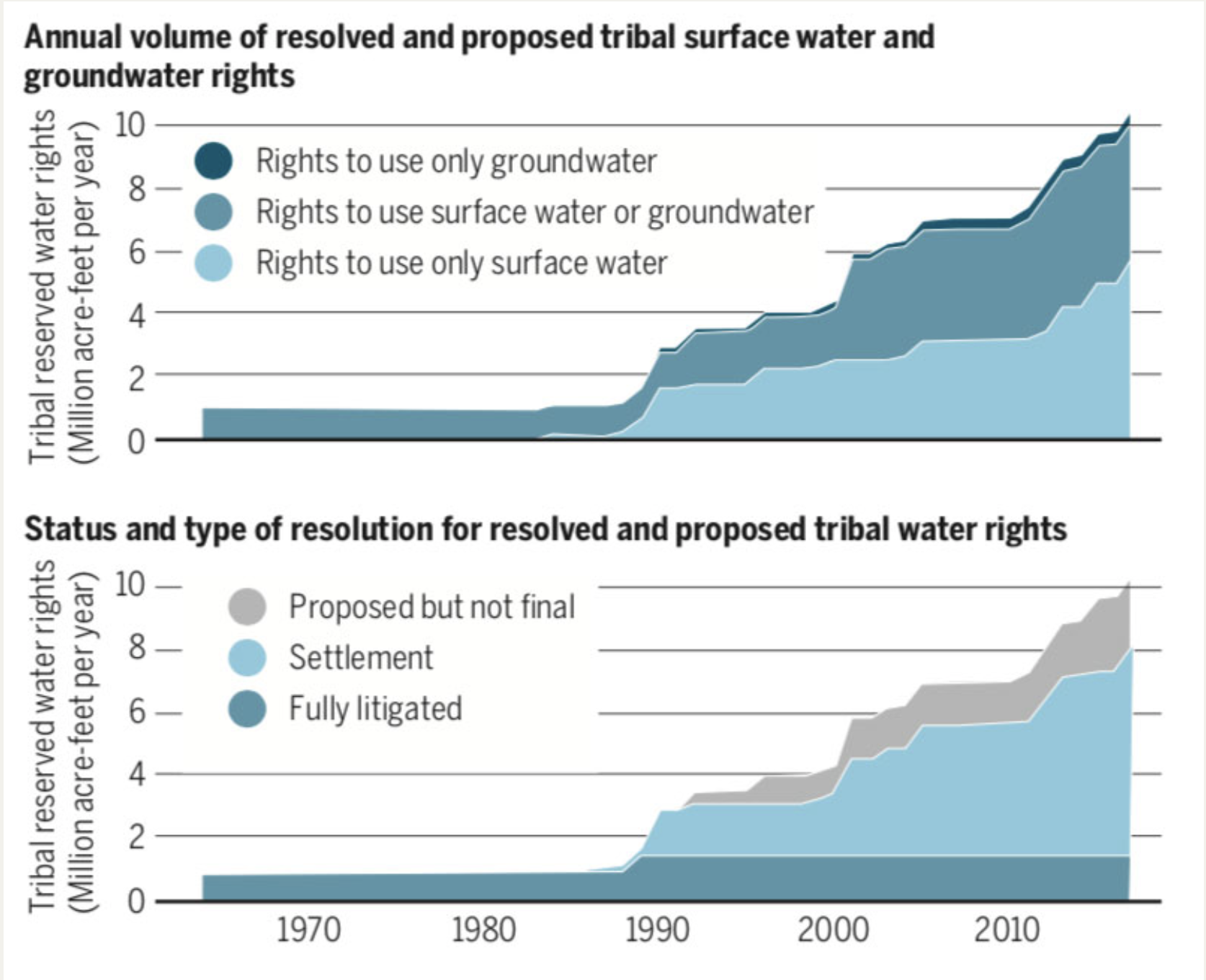
The study reveals that court decrees and settlements have resolved or proposed rights for tribes in western states to use more than 10.5 million acre-feet of surface water and groundwater annually. To put that in perspective, this would be nearly enough water to irrigate all of the alfalfa, almond and rice fields in California for a year. “It’s a major volume,” said lead author Philip Womble, a PhD student in environment and resources in the Stanford School of Earth, Energy & Environmental Sciences (Stanford Earth).

Most unresolved Native American claims to groundwater exist in areas where there’s reason to believe major aquifers could yield significant amounts of groundwater, including in some places where nontribal wells already dot the landscape and increased pumping by tribes might disrupt their production. (Image credit: Philip Womble)

Before the Agua Caliente ruling, the study shows, tribal rights exclusively for groundwater made up a small portion – 4 percent – of all tribal freshwater rights in 17 western states. Now, more tribes will likely seek to resolve their rights to control and use water from the aquifers beneath their land, according to Womble and his co-authors, who include Water in the West executive director and Woods Institute of the Environment professor Leon Szeptycki, as well as Water in the West non-resident fellows Debra Perrone and Rebecca Nelson.

This shift comes at a time when questions of who owns the aquifer and how they can use the water holds increasing urgency, as western states face the likely prospect of demand outstripping the supply of legally available freshwater in most western watersheds by 2030.

“Indigenous communities in several countries have struggled to gain rights to their natural resources,” said study co-author Steven Gorelick, a professor of Earth system science at Stanford Earth and director of the Global Freshwater Initiative. Almost half of all homes on Native American land lack adequate access to drinking water or waste disposal facilities, compared to less than 1 percent for U.S. homes overall. The Agua Caliente ruling, Gorelick said, “is a very important step forward in restoring balance to those injured Native American tribes.”

Competing for a precious resource

In the Coachella Valley, the Agua Caliente tribe has for decades purchased water from local agencies, which have pumped so much water from the region’s aquifers that the land is sinking. Now, as the next phase of Agua Caliente’s lawsuit unfolds in federal court, the tribe is seeking to have judges put a number on its groundwater rights, establishing how much water it can pump from the Coachella Valley aquifer – potentially before most other users are entitled to a single drop.

Before the Agua Caliente ruling in late 2017, tribal rights exclusively for groundwater made up a just 4 percent of all tribal freshwater rights in 17 western states. (Image credit: Philip Womble)

Today, the study shows, fewer than 60 tribes in the western U.S. have this level of legal certainty around their rights to fresh water from any source – whether from lakes and rivers on the surface, or from aquifers underground. Many more tribes have unresolved rights: According to the study, as many as 236 tribes in the western U.S. have lands with groundwater rights that have not been finally quantified in court or in settlements. In all, the research suggests, tribes control at least some water from so many aquifers across the West that any plan to sustainably manage water in the region would be incomplete without considering their role.

These unresolved groundwater claims span large swaths of Arizona, Oklahoma, South Dakota and Utah, and smaller clusters can be found in all other western states except Colorado. Most of them exist in areas where there’s reason to believe major aquifers could yield significant amounts of groundwater, including in some places where nontribal wells already dot the landscape and increased pumping by tribes might disrupt their production.

Ripple effects for laws and markets

“Court disputes usually focus on the specific facts of a given case,” said Womble, who specializes in water policy in the Emmett Interdisciplinary Program in Environment and Resources (E-IPER) at Stanford Earth. He is also an attorney. His team has captured a bigger picture that could help inform decisions about groundwater management throughout the U.S. and in other countries that recognize indigenous community water rights, including Australia, Canada, Chile and New Zealand.

“Even though a U.S. court decision clearly isn’t binding in another country,” Womble said, “it could provide a persuasive precedent that courts confronting this issue in other nations might look to.” Historically, he said, courts in Canada and Chile have adopted some terminology and approaches from U.S. water law.

Already, Gorelick added, the study results suggest that the creation of market-based systems for renting water rights could work to indigenous communities’ advantage. “With this ruling,” he said, “Native American tribes with higher priority rights are now in the driver’s seat to potentially benefit from participating in water markets.”

Steven Gorelick is also Stanford’s Cyrus Fisher Tolman Professor and a senior fellow at the Woods Institute for the Environment. Additional co-authors are from the University of California, Santa Barbara, the University of Washington Law School and Harvard Law School.

The research was funded by the Switzer Foundation and the Stanford Interdisciplinary Graduate Fellowship.

Understanding Falling Municipal Water Demand in a Small City Dependent on the Declining Ogallala Aquifer: Case Study of Clovis, New Mexico

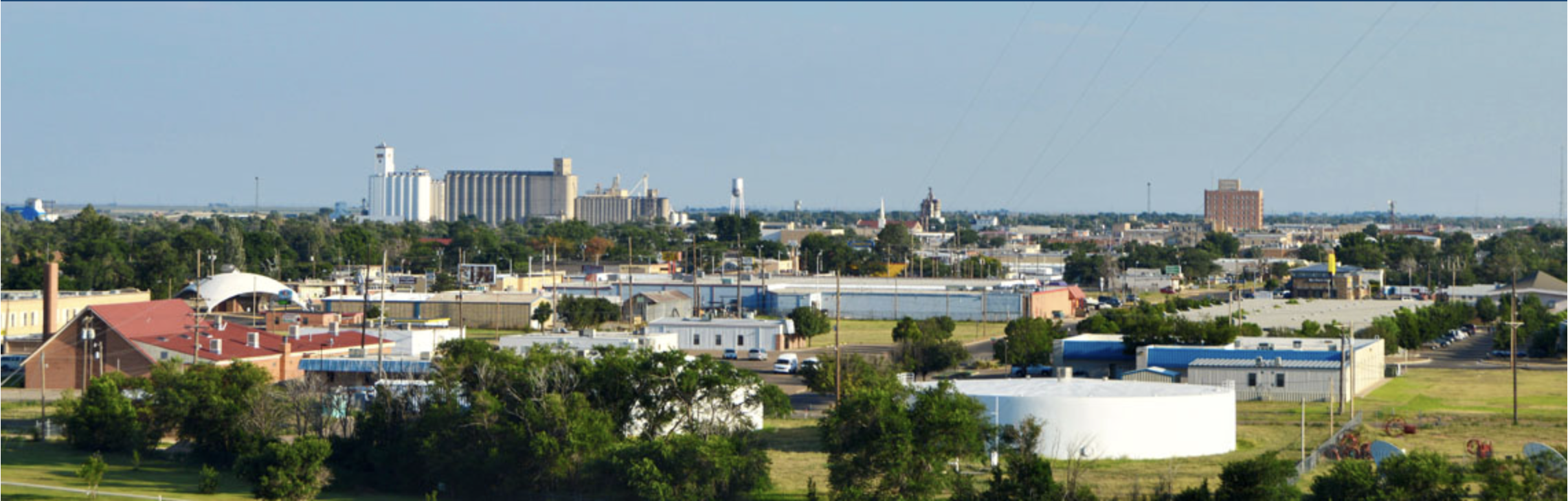
Clovis, New Mexico. Photo credit: Clovis and Curry County Chamber of Commerce

Here’s the abstract from WorldScientific.com:

Municipal water demand has declined over the past several decades in many large cities in the western United States. The same is true in Clovis, New Mexico, which is a small town in arid eastern New Mexico, whose sole water source is from the dwindling southern Ogallala Aquifer. Using premises-level monthly panel data from 2006 to 2015 combined with climate data and additional controls, we apply a fixed effects instrumental variable approach to estimate municipal water demand. Results indicate that utility-controlled actions such as price increases and rebates for xeriscaping and water saving technology have contributed to the decline. Overall water demand was found to be price inelastic and in the neighborhood of −0.50; however, premises receiving toilet and washing machine rebates were relatively more price inelastic and premises receiving landscaping rebates were more price elastic, though still inelastic. In addition, the average premises receiving its first toilet rebate reduced water use by 8.4%, washing machine rebates lowered use by 9.2%, and the average landscaping rebate reduced water use by less than 5.0%. From the utility’s perspective, and assuming a 5.0% discount rate, levelized cost analysis indicates that toilet rebates are 34% more cost effective than washing machine rebates and nearly 800% more cost effective than landscaping rebates over their respective lives per volume of water conserved. While this research focuses on Clovis, estimation results can be leveraged by other small to mid-sized cities experiencing declining supplies, confronting climate change, and with little opportunity for near-term supply enhancement.

#GoldKingMine: @EPA motion hopes to kill the lawsuit from the #NavajoNation, #Utah, and #NewMexico #AnimasRiver

This image was taken during the peak outflow from the Gold King Mine spill at 10:57 a.m. Aug. 5. The waste-rock dump can be seen eroding on the right. Federal investigators placed blame for the blowout squarely on engineering errors made by the Environmental Protection Agency’s-contracted company in a 132-page report released Thursday [October 22, 2015]

From Colorado Public Radio (Grace Hood):

The U.S. Environmental Protection Agency wants a federal court to toss a lawsuit filed by Utah, New Mexico and the Navajo Nation seeking the repayment of cleanup costs for a mine spill in Colorado that polluted rivers in three states.

The EPA said in a motion Wednesday that the court doesn’t need to intervene because crews are already working on the cleanup of water contaminated with heavy metals that was accidentally released from an EPA-monitored mine.

“Granting any relief in New Mexico, within the Navajo Nation, or in Utah would conflict and interfere with EPA’s exclusive jurisdiction over its on-going response action activities and cleanup remedies,” the federal government said in court documents filed in U.S. District Court in Albuquerque.

Utah is seeking for $1.9 billion in damages from the EPA. The Navajo Nation filed a claim for $162 million, and the state of New Mexico is seeking $130 million.

@WaterLawReview: Crisis on the High Plains: The Loss of America’s Largest Aquifer – the Ogallala

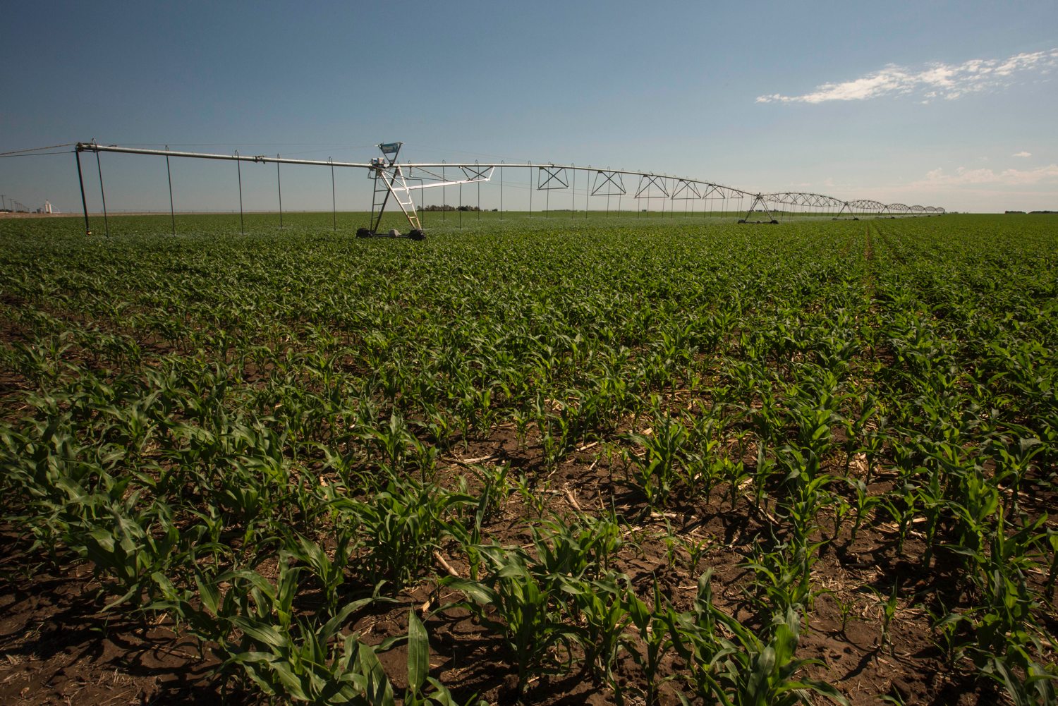
Center pivot sprinklers in the Arikaree River basin to irrigate corn. Each sprinkler is supplied by deep wells drilled into the High Plains (Ogallala) aquifer.

From the University of Denver Water Law Review (Jeremy Frankel):

The grain-growing region in the High Plains of America—known as America’s breadbasket—relies entirely on the Ogallala Aquifer. But long term unsustainable use of the aquifer is forcing states in the region to face the prospect of a regional economic disaster. As the High Plains states reach the verge of a major crisis, the states have taken different approaches to conservation with varying results.

The Ogallala Aquifer supports an astounding one-sixth of the world’s grain produce, and it has long been an essential component of American agriculture. The High Plains region—where the aquifer lies—relies on the aquifer for residential and industrial uses, but the aquifer’s water is used primarily for agricultural irrigation. The agricultural demands for Ogallala water in the region are immense, with the aquifer ultimately being responsible for thirty percent of all irrigation in the United States. The Ogallala Aquifer has long been unable to keep up with these agricultural demands, as the aquifer recharges far slower than water is withdrawn.

Aside from the obvious agricultural ramifications from the Ogallala’s depletion, recent studies have shown that groundwater depletion also has a severe effect on freshwater ecosystems in the region. Each state has had to confront the issue in their own way, but the depletion of the aquifer has become severe enough to warrant the attention of the federal government as well. At the state level, the focus has been on maintaining an orderly depletion of the aquifer rather than developing a plan for sustainable use. However, some states have achieved some level of success in slowing down the aquifer’s depletion. Kansas, for example, has recently achieved mild success by adopting a program that put conservation in the hands of the State’s farmers. On the other hand, Nebraska has seen more success than Kansas by being tougher on farmers and exercising its enforcement powers. The federal government has also set up financial and technical assistance for farmers who commit to conservation and is funding large-scale pipeline projects to bring in water to the more desperate areas of the High Plains.

@EPA To Hold PFAS Community Engagement in Colorado Springs

Photo via USAF Air Combat Command

Here’s the release from the Environmental Protection Agency:

Starting on Tuesday, August 7, 2018, the U.S. Environmental Protection Agency (EPA) will hold the third PFAS community engagement event in Colorado Springs, Colorado. This two-day public event allows EPA to hear directly from Colorado communities, Mountain West states, and local and tribal partners about their experiences with PFAS.
WHAT: Colorado Springs PFAS Community Engagement

WHEN: Tuesday, August 7, 2018: Listening Session
4:00 PM MST — 10:00 PM (MST)
Wednesday, August 8, 2018: Working Session
9:45 AM — 12:00 PM (MST)
WHERE: Hotel Eleganté Conference & Event Center
2886 S. Circle Dr.
Colorado Springs, CO 80906

The Colorado community engagement event will consist of two sessions — a public listening session and PFAS working session — to hear from the public; provide tools to assist states, tribes, and local communities in addressing challenges with PFAS in the environment; and understand ways EPA can best support the work that’s being done at the state, local, and tribal level.

Both days are open to the public and press. If you are interested in attending the event, please register here: https://www.epa.gov/pfas/forms/pfas-community-engagement-colorado-springs-co. Those interested in speaking should also select the option to speak while registering.

Background

PFAS is a group of man-made chemicals that have been widely used in everyday products since the 1940s. But PFAS compounds also can enter the environment, raising concerns about the potential environmental and health risks.

Addressing PFAS is a national priority. At the National Leadership Summit in Washington, D.C. in May, EPA announced the following four-step action plan:

  • EPA will initiate steps to evaluate the need for a maximum contaminant level (MCL) for PFOA and PFOS. We will convene our federal partners and examine everything we know about PFOA and PFOS in drinking water.
  • EPA is beginning the necessary steps to propose designating PFOA and PFOS as “hazardous substances” through one of the available statutory mechanisms, including potentially CERCLA Section 102.
  • EPA is currently developing groundwater cleanup recommendations for PFOA and PFOS at contaminated sites and will complete this task by fall of this year.
  • EPA is taking action in close collaboration with our federal and state partners to develop toxicity values for GenX and PFBS by this summer.
  • EPA has conducted similar engagements with communities impacted by PFAS in New Hampshire and Pennsylvania, and will be headed to North Carolina next month. These events are critical to understand ways the Agency can best support the work that’s being done at the state, local, and tribal levels. Using information from the National Leadership Summit, community engagement events, and public input provided by the docket, EPA plans to develop a PFAS Management Plan for release later this year.
    To learn more about PFAS, please visit: http://www.epa.gov/pfas

    Perfluorinated compounds found in Adams County groundwater wells

    Graphic vis the National Institutes of Health

    From The Colorado Springs Independent (Faith Miller):

    Tests showed perfluorinated compounds, or PFCs, in certain groundwater wells that supply drinking water to north metro Denver, the Colorado Department of Public Health and Environment announced July 12. PFCs are toxic chemicals used in a variety of products, including firefighting foam, that have contaminated water supplies near military bases around the world — including in El Paso County.

    So far, South Adams County Water and Sanitation District officials have detected PFCs in 12 municipal wells along Quebec Parkway near Interstate 270, The Denver Post reports. Those wells supply water to 50,000 residents across 65 square miles.

    The District’s water system manager is quoted in the Post’s article as saying that the wells’ PFC levels ranged from 24 parts per trillion (ppt) to 2,280 ppt. That’s up to 32 times higher than the Environmental Protection Agency’s current acceptable limit for PFCs, which is 70 ppt. A study released June 20 by the Agency for Toxic Substances and Disease Registry suggests that safe drinking water should contain less than 12 ppt.

    “We are working with our partners at EPA and local governments to address this issue and protect public health,” Ron Falco, safe drinking water program manager for the Water Quality Control Division, is quoted in the CDPHE’s statement.

    South Adams County Water and Sanitation shuts down 3 wells citing PFC pollution

    Typical water well

    From 9News.com (Allison Sylte):

    A news release about the contamination was distributed on Friday morning. This comes after the South Adams County Water and Sanitation District found perfluorinated compounds (commonly known as PFCs) in water samples from certain shallow groundwater wells. These chemicals are known to pose significant health risks if people are exposed to them – especially expectant mothers and young children.

    Now, the Environmental Protection Agency, Colorado Department of Public Health and the Environment, and the Tri-County Health Department are working to find the source of the contamination.

    However, health officials say the water distributed to the 50,000 customers in the South Adams County Water and Sanitation District is safe after three wells with the highest concentration of the PFC chemicals were shut down earlier this month. This means the district is taking 40 percent of its water supply from Denver rather than the usual 20 percent.

    The concern now, according to South Adams County Water and Sanitation District Water Systems Manager Kipp Scott, are private wells and the people who use them – which is what prompted the advisory to the public in the first place.

    “When we find something that is of a concern like this, we notify the health department,” Scott said. “The concern is, we are treating for that chemical here and removing it to levels below the health advisory, but the concern is with other people that maybe using wells that are not on our system and supplied water by our district.

    Scott said some wells tested positive for PFCs in May. When that happened, they tested the treatment process – and results took five weeks to come back. Next came contact with the health department.

    Brian Hlavacek, the director of environmental health at the Tri-County Health Department, issued a statement to 9NEWS that said:

    “Tri-County Health Department is working closely with EPA, CDPHE and SACWSD to identify the extent and source of contamination. TCHD is working to identify private drinking water wells in the initial area of investigation in order to sample for PFC’s. Sampling could begin as early as next week as we identify any wells. Residents who receive their water from a private drinking water well, are near this area, and are concerned about PFC levels can call Tri-County Health Department at 303-288-6816 or email questions to ehwater@tchd.org.”

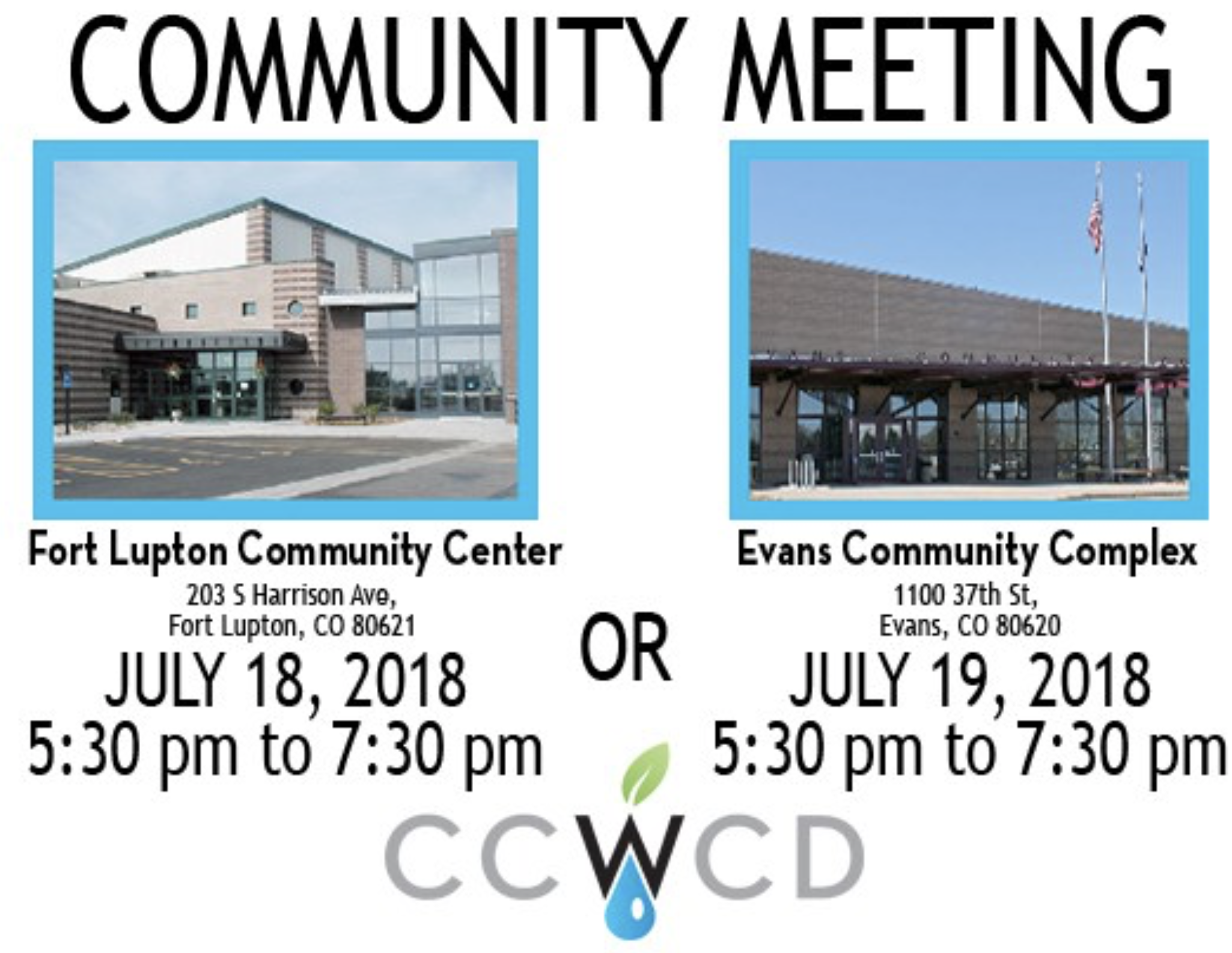
    @CentralCOWater community meetings, July 18, 19

    Click here to register.

    #AnimasRiver: Truck hauling sludge from the Cement Creek water treatment plant crashes and spills into Cement Creek

    From The Associated Press via The Colorado Springs Gazette:

    The driver wasn’t severely injured, but about 9 cubic yards of waste sludge spilled into the creek.

    The sludge is a byproduct of a U.S. Environmental Protection Agency treatment plant that is cleaning up water draining from the inactive Gold King mine. The EPA has said the sludge is not hazardous.

    Authorities say it doesn’t appear the truck spilled any fuel.

    @USGS: Water Use Across the United States Declines to Levels Not Seen Since 1970

    Here’s the release from the USGS (Mia Drane-Maury, Cheryl Dieter):

    Reductions in water use first observed in 2010 continue, show ongoing effort towards “efficient use of critical water resources.”

    Water use across the country reached its lowest recorded level in 45 years. According to a new USGS report, 322 billion gallons of water per day (Bgal/d) were withdrawn for use in the United States during 2015.

    This represents a 9 percent reduction of water use from 2010 when about 354 Bgal/d were withdrawn and the lowest level since before 1970 (370 Bgal/d).

    “The downward trend in water use shows a continued effort towards efficient use of critical water resources, which is encouraging,” said Tim Petty, assistant secretary for Water and Science at the Department of the Interior. “Water is the one resource we cannot live without, and when it is used wisely, it helps to ensure there will be enough to sustain human needs, as well as ecological and environmental needs.”

    Total water withdrawals by State, 2015 [1 Bgal/d = 1,000 million gallons per day].

    In 2015, more than 50 percent of the total withdrawals in the United States were accounted for by 12 states (in order of withdrawal amounts): California, Texas, Idaho, Florida, Arkansas, New York, Illinois, Colorado, North Carolina, Michigan, Montana, and Nebraska.

    Total water withdrawals by category and by State from west to east, 2015 [1 Bgal/d = 1,000 million gallons per day].

    California accounted for almost 9 percent of the total withdrawals for all categories and 9 percent of total freshwater withdrawals. Texas accounted for about 7 percent of total withdrawals for all categories, predominantly for thermoelectric power generation, irrigation, and public supply.

    Florida had the largest share of saline withdrawals, accounting for 23 percent of the total in the country, mostly saline surface-water withdrawals for thermoelectric power generation. Texas and California accounted for 59 percent of the total saline groundwater withdrawals in the United States, mostly for mining.

    “The USGS is committed to providing comprehensive reports of water use in the country to ensure that resource managers and decision makers have the information they need to manage it well,” said USGS director Jim Reilly. “These data are vital for understanding water budgets in the different climatic settings across the country.”

    For the first time since 1995, the USGS estimated consumptive use for two categories — thermoelectric power generation and irrigation. Consumptive use is the fraction of total water withdrawals that is unavailable for immediate use because it is evaporated, transpired by plants, or incorporated into a product.

    “Consumptive use is a key component of the water budget. It’s important to not only know how much water is being withdrawn from a source, but how much water is no longer available for other immediate uses,” said USGS hydrologist Cheryl Dieter.

    The USGS estimated a consumptive use of 4.31 Bgal/d, or 3 percent of total water use for thermoelectric power generation in 2015. In comparison, consumptive use was 73.2 Bgal/d, or 62 percent of total water use for irrigation in 2015.

    Water withdrawn for thermoelectric power generation was the largest use nationally at 133 Bgal/d, with the other leading uses being irrigation and public supply, respectively. Withdrawals declined for thermoelectric power generation and public supply, but increased for irrigation. Collectively, these three uses represented 90 percent of total withdrawals.

  • Thermoelectric power decreased 18 percent from 2010, the largest percent decline of all categories.
  • Irrigation withdrawals (all freshwater) increased 2 percent.
  • Public-supply withdrawals decreased 7 percent.
  • Trends in total water withdrawals by water-use category, 1950-2015.

    Trends in total water withdrawals by water-use category, 1950-2015.

    A number of factors can be attributed to the 18 percent decline in thermoelectric-power withdrawals, including a shift to power plants that use more efficient cooling-system technologies, declines in withdrawals to protect aquatic life, and power plant closures.

    As it did in the period between 2005 and 2010, withdrawals for public supply declined between 2010 and 2015, despite a 4 percent increase in the nation’s total population. The number of people served by public-supply systems continued to increase and the public-supply domestic per capita use declined to 82 gallons per day in 2015 from 88 gallons per day in 2010. Total domestic per capita use (public supply and self-supplied combined) decreased from 87 gallons per day in 2010 to 82 gallons per day in 2015.

    The USGS is the world’s largest provider of water data and the premier water research agency in the federal government.

    Testing plan for PFCs in the works in W. Boulder County

    From The Boulder Daily Camera (Charlie Brennan):

    Local, state and federal officials told residents in the western Boulder County area served by the Sugarloaf Fire Protection District they will meet soon to create a plan for future testing, as needed, for perfluorinated compounds in area well water.

    Those intentions were shared with about 50 homeowners in the Sugarloaf area who attended a Tuesday evening board meeting of the Sugarloaf district at its Station 2.

    The session was attended by, in addition to the concerned residents, representatives of the Environmental Protection Agency, the Colorado Department of Public Health and Environment, Boulder County Public Health and the fire protection district.

    Inquiries by homeowners, according to county health department spokeswoman Chana Goussetis, included questions about “type B” firefighting foam, which has been discussed as a potential cause of the well contamination; how to select a lab for testing of private well water; recommendations for reverse osmosis filters to make water safe; and future testing plans…

    Representatives from all of the agencies will meet soon to create a plan, “which will include where additional sampling is needed,” Goussetis wrote in an email. “This will involve looking closely at the geology of the area to identify homes that most likely will be impacted.”

    […]

    Well water at both Stations 1 and 2 have now been tested, and they each tested positive for perfluoroocatanaic acid (PFOA) and perfluorooctane sulphate (PFOS) at levels far exceeding the EPA’s advisory level of 70 parts per trillion.

    That prompted the district to test wells of 10 homeowners living within 1,300 feet of Station 1.

    Sugarloaf volunteer John Winchester said that of those 10, six had no detectable PFCs, and the other four had “various” levels. He said specific data would not be released out of respect for homeowners’ privacy.

    However, the Boulder County Health Department has said that only one of the 10 showed levels above the EPA advisory levels. That homeowner has not returned calls from the Camera seeking comment on the situation.

    Goussetis on Wednesday reported that no other homeowners to date have been found to have wells showing contamination above the EPA advisory level. However, she added, there may be homeowners who had ordered tests whose results are not yet known.

    Future testing, she said, “will likely” also include homes near Station 2, due to the levels of PFCs already detected there.

    County health officials are recommending that mountain area residents test their well water not only for PFCs, but also for heavy metals, E. coli and other bacteria to fully understand the status of their water.

    Meanwhile a report finds that PFCs are more toxic than originally thought. Here’s a report from Ellen Knickmeyer writing for The Associated Press via The Colorado Springs Gazette. Here’s an excerpt:

    The chemicals are called perfluoroalkyl and polyfluoroalkyl. They were used in such goods as fire-suppressing foam, nonstick pans, fast-food wrappers, and stain-resistant fabric and carpet, but are no longer used in U.S. manufacturing. Water sampling has found contamination in water around military bases, factories and other sites.

    Exposure at high levels is linked to liver damage, developmental problems and some forms of cancer, among other risks.

    A draft of the report, by the Department of Health and Human Services’ toxicology office, had set off alarms within the Trump administration earlier this year. A January email from a White House official, released under the Freedom of Information Act, referred to the findings as a “potential public relations nightmare.”

    The draft went under months of government review before Wednesday’s publication, but the key finding — that the chemicals are dangerous at specific levels much lower than previously stated — was not changed.

    The EPA, which scheduled a series of hearings on the chemicals, said last month that it would move toward formally declaring the two most common forms of PFAS as hazardous substances and make recommendations for groundwater cleanup, among other steps.

    U.S. manufacturers agreed in 2006 to an EPA-crafted deal to stop using one of the most common forms of the chemical in consumer products.

    The findings will likely lead state and local water systems with the contaminant to boost filtering.

    “The more we test, the more we find,” Olga Naidenko, a science adviser to the Environmental Working Group nonprofit, said Wednesday.

    Fountain to bring USAF supplied filters online in distribution system

    Widefield aquifer via the Colorado Water Institute.

    From KRDO.com (Scott Harrison):

    Four filters supplied by the Air Force will allow Fountain residents this week to resume using groundwater that was found to be contaminated by firefighting chemicals more than two years ago.

    Two filters were tested [June 18, 2018] and the other two are scheduled to be in operation next month.

    The test had to be stopped, however, after the filtering system produced too much pressure, ruptured some seals and sprang a leak.
    “We’ll try again (Tuesday),” said Curtis Mitchell, director of Fountain Utilities. “We only have one more set of seals, so we want to make sure we figure out what caused the problem before we risk rupturing the other seals.

    Since the contamination from a firefighting foam at Peterson Air Force Base was discovered in the fall of 2015, the city stopped using water from its underground aquifer and began using surface water from the Pueblo Reservoir.
    The filters cost around $700,000 to reduce the amount of the three most dangerous chemicals to well below levels deemed safe by the U.S. Environmental Protection Agency.

    The filtering agent is a sandy, charcoal-like material that is inserted into the tanks.

    But, according to research last year by the Colorado School of Mines, the same filters didn’t do well in reducing the levels of more than two dozen other chemicals.

    “We know that customers will choose to use bottled water for drinking and cooking, as they have been,” Mitchell said. “But we want them to know we’ve tested the filtering system and the water is safe.”

    City officials estimate that only 15 percent of the city’s water usage will come from the aquifer on peak days, and that groundwater is needed to supplement the surface water supply.

    Many residents remain skeptical about the water quality, fearing that they’ve been exposed to the contamination for years.

    From KOAA.com:

    City leaders say the water is now safe to drink, with a new process called Granular Activated Carbon (GAC) which gets rid of any PFC’s found in the water.

    ‘We did laboratory testing a week ago,’ said Fountain Utilities Dir. Curtis Mitchell, ‘the results came back non-detect, so now we’re comfortable that we can provide safe drinking water in addition to the surface water that we use from pueblo reservoir to our customers.’

    Still, a majority of the water will come from the Pueblo Reservoir.

    Additionally, the city will test the water every week for the entire lifespan of the water facility.

    More facilities are on the way, but Mitchell says that’s about 2 years out.

    #AnimasRiver: @EPA requests comments for interim plan for SW #Colorado mine clean up

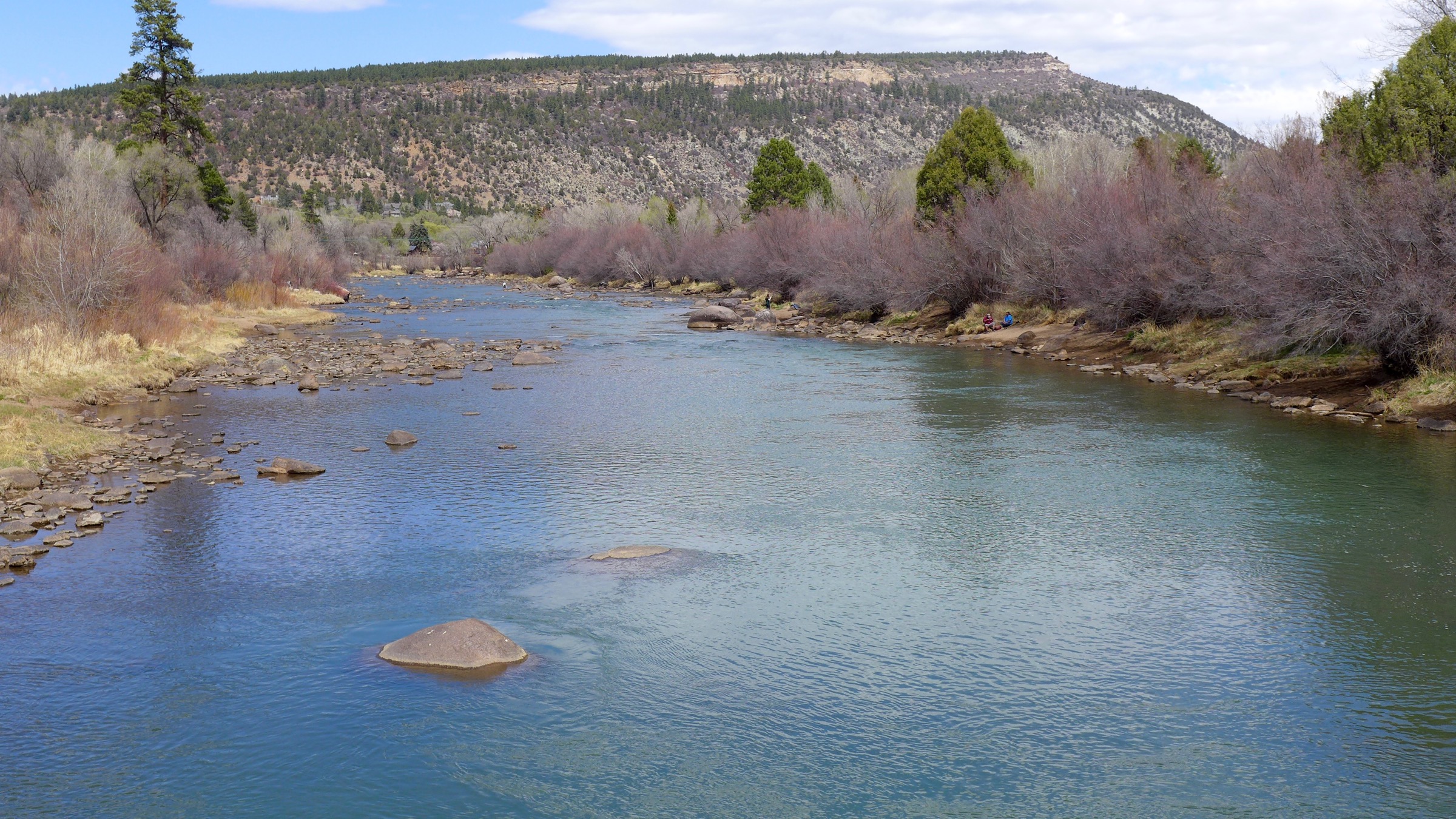
    The Animas River in Durango, in Apri, 2018. Photo: Brent Gardner-Smith/Aspen Journalism

    From The Associated Press (Dan Elliott):

    The interim plan concentrates on controlling or removing contaminants at 26 sites including campgrounds, mine waste piles, ponds and rivers. It will cost about $10 million and take up to five years, the agency said.

    Five of the locations are recreation sites where people could be exposed to arsenic or lead, the agency said.

    “EPA is interested in expediting cleanup so that we can show improvements in water quality wherever possible,” said Christina Progess, manager of the Superfund project…

    The Gold King is not on the list of 26 sites chosen for interim work. The EPA said that’s because a temporary treatment plant was installed two months after the spill and is cleaning up wastewater from the mine.

    The Superfund cleanup will eventually cover 48 mining sites, but the EPA said it chose 26 for interim work to reduce human and environmental risks while a long-term solution is studied.

    The EPA said the 26 sites have elevated levels of aluminum, cadmium, copper, iron, lead or zinc.

    Two of the recreation sites on the list are campgrounds and three are parking areas or locations where people meet for tours, the EPA said. The plan calls for covering mine waste piles and contaminated soil with gravel or plant growth to reduce human exposure and keep the contaminants from being kicked into the air.

    The other work includes dredging contaminated sediment from streams and from ponds near mine openings, and digging ditches and berms to keep water from flushing contaminants out of waste piles and into streams.

    The EPA is seeking public comment on the plan. The deadline for comments is July 16.

    Fountain Creek: U.S. Sen. Bennet introduces amendment to Pentagon budget bill that would appropriate $9 million for PFC mitigation

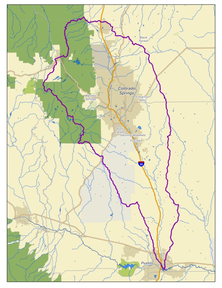
    The Fountain Creek Watershed is located along the central front range of Colorado. It is a 927-square mile watershed that drains south into the Arkansas River at Pueblo. The watershed is bordered by the Palmer Divide to the north, Pikes Peak to the west, and a minor divide 20 miles east of Colorado Springs. Map via the Fountain Creek Watershed Flood Control and Greenway District.

    From The Colorado Springs Gazette (Tom Roeder):

    Bennet’s amendment would provide as much as $9 million to reimburse water utilities in Security, Widefield and Fountain for what they laid out in 2016 after learning their drinking water contained unsafe levels of perfluorinated chemicals from toxic firefighting foam released by Peterson Air Force Base.

    “This builds on years of our work with the Air Force to address … contamination and is long overdue for the local water authorities who worked to provide safe drinking water to Colorado residents,” Bennet said in an email. “We’ll continue to push for its inclusion in the defense bill.”

    Security Water and Sanitation District would get up to $6 million to pay for a pipeline it installed to pump clean Pueblo Reservoir water to its more than 19,000 customers.

    “That’s something we have been working for and hoping for,” said district General Manager Roy Heald.

    Southern El Paso County water districts began piling up bills in May 2016 after tests of water from the aquifer revealed contamination levels up to 30 times more than the maximum recommended by the U.S. Environmental Protection Agency.

    Districts’ officials assumed the Air Force would pay to fight the contamination and were shocked when the military refused to pay the bill. The Pentagon concluded it couldn’t reimburse the districts without authorization from Congress.

    That’s where Bennet’s amendment comes in. The brief measure piggybacks on a similar move to reimburse towns where water contamination came from National Guard bases and expands it to include active-duty posts including Peterson.

    Bennet got support from Colorado Republican U.S. Sen. Cory Gardner, who signed on as a co-sponsor.

    Heald said the senators have worked for months to figure out a fix for the utilities’ financial woes.

    “They have both been here to talk to us directly about these issues,” he said.

    But Heald isn’t counting the federal cash just yet. The provision for the money is a tiny part of the massive National Defense Authorization Act, a bill that sets spending across the military and includes hundreds of policy tweaks and changes.

    With $716 billion at stake, lawmakers are expected to fight for weeks over every word the bill contains.

    Bennet will need Senate approval, which seems likely with bipartisan support. But then he will have to fight with House lawmakers who signed off on their version of the defense bill, which doesn’t contain the water money.

    Meanwhile U.S. Rep. Scott Tipton is pushing the EPA to keep their lawsuit active to get relief for Pueblo County from Fountain Creek stormwater. Here’s a report from Pam Zubeck writing for The Colorado Springs Independent. From the article:

    U.S. Rep. Scott Tipton, R-Cortez, has joined plaintiffs in the EPA’s lawsuit against the city of Colorado Springs in urging EPA chief Scott Pruitt to stay the course in the Clean Water Act litigation…

    Here’s Tipton’s letter, the latest salvo in the dispute:

    Dear Administrator Pruitt,

    I am writing in regard to the lawsuit the Environmental Protection Agency (EPA) and Colorado Public Department of Public Health an Environment (CDPHE) have filed against the City of Colorado Springs, Colorado. The lawsuit was filed on November 9, 2016, pursuant to Sections 309(b) and (d) of the Federal Water Pollution Control Act and the Colorado Water Quality Control Act.

    The City of Colorado Springs’ failure to control stormwater has led to decades of discharge that is not in compliance with state and federal clean water laws. The stormwater has led to sediment buildup in Fountain Creek and created significant problems for downstream communities, especially for Pueblo, Colorado, which is in my Congressional District.

    Recent reports that the EPA may re-enter negotiations with the City of Colorado Springs raise questions about the future of the lawsuit and the ability of the EPA to provide long-term certainty to downstream communities that their upstream neighbors are complying with clean water laws.

    The long history of stormwater negotiations between Colorado Springs and downstream water users has not yielded positive, lasting results for communities like Pueblo. While I have been encouraged by the commitment demonstrated by Colorado Springs Mayor John Suthers to solve the long-standing problem, the lawsuit was filed by both the EPA and the CDPHE for a reason. It is imperative that the EPA work to permanently protect the water quality for communities downstream from Colorado Springs.

    If you have any questions or wish to discuss this issue further, please do not hesitate to contact me.

    Colorado Springs Mayor John Suthers has said he’d rather spend money on stormwater projects than litigation, but the city’s failure to fix its drainage system over the years has instilled distrust in downstream communities.

    Voters approved a stormwater fee last fall that kicks in on July 1 but litigants in the lawsuit question if the $17 million a year for 20 years will be adequate to reduce flooding and mitigate sediment in Fountain Creek.

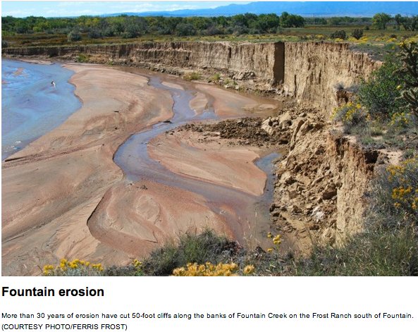
    Fountain Creek erosion via The Pueblo Chieftain

    CU Denver to begin testing blood of residents exposed in Widefield Aquifer PFCs pollution

    Widefield aquifer via the Colorado Water Institute.

    From The Denver Post (Bruce Finley):

    …this week, a University of Colorado Denver public-health study funded by the National Institutes of Health will begin testing the blood of 200 residents, The Denver Post has learned.

    No government agency has systematically investigated health impacts of the contamination. This area of southern El Paso County is among the most populated of more than 70 places where PFCs detected at levels up to hundreds of times higher than an EPA health advisory limit are spreading from military bases that used firefighting foam containing the chemicals.

    Municipal firetrucks also carry the foam and PFCs are used in consumer products, including fast-food wrappers. They have emerged as one family in a widening array of synthetic chemicals detected in water that cannot be removed easily due to molecular structures…

    Neither the Colorado Department of Public Health and the Environment nor the EPA has been monitoring PFC levels in the Fountain Creek watershed. Tests done more than a year ago showed contamination at levels far above the EPA health advisory limit.

    CDPHE officials last week welcomed the EPA visit and said they’re pushing the Air Force to move faster into a planned 2019 “remedial investigation” phase that would include tracking the spread of PFCs in groundwater beyond the military base and airport.

    The CU public health study will focus on people exposed to PFCs between 2012 and 2016, study leader John Adgate said. “We recruited more than 200 people from Security/Widefield/Fountain who will be coming to our temporary clinic for the blood draws.”

    Air Force civil engineers last week provided their latest data to The Post from an “expanded site investigation” on Peterson Air Force Base and the adjacent Colorado Springs airport. They’ll drill 21 new wells to measure PFC contamination of groundwater.

    The testing found PFCs at levels exceeding the EPA health limit contaminating 42 municipal water supply wells, which were shut down, with seven now back in use after the installation of treatment systems. (Fountain and Security stopped using wells for water supply, shifting to water diverted from the Arkansas River. Widefield bought and installed new water-cleaning systems to filter out contamination.)

    Air Force officials said they have found 37 private wells with water containing elevated PFCs…

    Meanwhile, Colorado Springs attorney Mike McDivitt, with colleagues in Denver and New York, has filed a second massive lawsuit in federal court, seeking funds from PFC manufacturers for medical monitoring. A federal judge is expected Aug. 2 to rule on whether an earlier lawsuit can proceed as a class action.

    @EPA finds place near Silverton to store #GoldKingMine sludge #AnimasRiver

    The EPA’s wastewater treatment plant near Silverton, Colorado, on Thursday, Oct. 16, 2015 — photo via Grace Hood Colorado Public Radio

    From The Durango Herald (Jonathan Romeo):

    EPA officials announced last week that the agency has entered an agreement with a property owner who owns the Kittimac Tailings, a historic mine waste pile about six miles northeast of Silverton along County Road 2.

    The EPA built a $1.5 million temporary water treatment plant north of Silverton in October, three months after the agency triggered the Gold King Mine blowout, which sent a torrent of mine waste down the Animas and San Juan rivers.

    Since, the water-treatment plant has been treating and removing potentially toxic metals out of water that continues to discharge from the Gold King Mine. In April, the EPA said the mine was still leaking 450 gallons a minute.

    The water treatment plant adds lime to the mine wastewater to raise the pH of the water so that dissolved metals become solid and can settle in settling ponds – a highly effective process.

    The process, however, generates a lot of sludge. EPA has said an estimated 4,600 cubic yards of sludge is generated a year.

    The agency had been storing this sludge waste product – which is considered non-hazardous – at the site of the water treatment plant in an area known as Gladstone, about six miles north of Silverton along County Road 110.

    The EPA announced this spring, however, room was running out at Gladstone for the sludge…

    Scott Fetchenheir, a San Juan County commissioner and former miner, said Wednesday local residents are pleased to learn the EPA found a better solution to the sludge waste issue.

    “I think it’s a good idea,” he said. “But it’s almost like this big experiment.”

    The EPA has said it will mix the Gold King Mine sludge with mine tailings located at Kittimac.

    The EPA believes this will reduce high water content of the sludge, and will allow more efficient management, while at the same time immobilize heavy metals found in the tailings pile…

    The EPA said it is conducting a bench-scale testing of the sludge and tailings mixture to ensure the maximum reduction of metals leaching from the tailings. The agency plans to conduct a pilot test of this transfer process for one week in mid-June.

    The Kittimac tailings pile for years has been used illegally by dirt bikers and ATVers who have disregarded “no trespassing” signs to ride on the mine waste that looks like a pile of sand. Now that the EPA is using the site, access will be more guarded, Tookey said…

    While the short-term problem of where to put the sludge is temporarily solved, Fetchenheir said there remains the larger, more complicated matter at hand: what to do for long-term treatment of the mines draining into Cement Creek, a tributary of the Animas River considered the worst polluter in the headwaters.

    While lime treatment plants are effective, they are also expensive to operate ($1 million a year) and have to be run in perpetuity. The EPA has yet to release its plan for long-term treatment options.

    “It’s hugely open-ended,” Fetchenheir said. “The true hope is some new technology arrives that removes metals without generating a huge amount of sludge. But I haven’t seen anything like it.”

    For now, the EPA said it will transfer the sludge via truck using the County Road 110 bypass. The agency said it hopes to reduce negative impacts, such as noise and dust suppression.

    After the pilot test in June, the EPA will resume transferring the sludge to the Kittimac tailings after the tourist season, around early fall, for a duration of about five weeks.

    Some folks in SW #Kansas are pushing the “Great Canal of Kansas”

    Kansas Aqueduct route via Circle of Blue

    From the Kansas News Service. (Ben Kuebrich) via the Hillsboro Free Press:

    Great Canal of Kansas

    Clayton Scott also uses the latest water technology on his farm in Big Bow. Yet he said that just using water carefully won’t be enough.

    He thinks any pumping limits severe enough to preserve the aquifer would dramatically cut back the region’s harvest. That would push up local grain prices, and without cheap grain, livestock feed yards would close, and meatpacking plants would follow.

    At its core, the western Kansas economy is built on irrigation.

    A 2015 study calculated that losses in irrigation could cost some 240,000 Kansans their jobs and wipe out $18.3 billion of yearly economic activity, or about 10 percent of the state economy.

    Scott and others in the region have their eyes on a more drastic solution to the water problem. Kansas could invest in a 360-mile series of canals and pumping stations to bring in water from the Missouri River.

    He knows it sounds extreme, but Arizona has already built a similarly sized aqueduct. The Central Arizona Project diverts water from the Colorado River and there’s been extensive research into building a similar canal across Kansas.

    “Arizona looked at their situation and decided, ‘We have no other choice,’ ” Scott said. “They estimate almost a trillion dollars of benefit to the economy of Arizona.”

    Arizona’s aqueduct has always been controversial. The federally funded canal remains at the center of multi-state disputes of water usage.

    Experts say that a generation later, the legal and regulatory hurdles of building a long-distance canal through Kansas only look more daunting.

    Water from the Colorado River is channeled through Arizona, much the way some people think it should be diverted from the Missouri River across Kansas.

    Pricey pipeline

    Still, Kansas and surrounding states have been considering aqueducts for a long time. A 1982 study came up with a plan to bring water from the Missouri River to a reservoir near Utica, Kansas, but nothing ever came of it. At the time, though, losing the Ogallala seemed like a distant prospect.

    In 2011, while western Kansas was in a drought and farmers struggled to pump enough water to keep their crops alive, the Missouri River was flooding. Scott says that sparked renewed interest in a canal.

    “It’s a long-term solution,” Scott said. “We can harvest the high flows of water off of the eastern rivers and bring them out here into the western High Plains, offset the droughts … and bring things into more of a balance.”

    In 2015, the Kansas Water Office and the U.S. Army Corps of Engineers re-assessed that 1982 study. The agencies estimated that, depending on the capacity of the canal, it would now cost between $5 billion and $20 billion to build.

    Because the water would have to be pumped uphill as it goes west, it could take more than $500 million a year in energy costs alone, for the largest-capacity canal. With interest costs from construction, the yearly tab could exceed $1.5 billion.

    At the time, the head of the water office said, “this thing we studied is unlikely to happen.” The costs would simply run too steep.

    A canal project would have other barriers. Although the Missouri river sometimes floods, it also experiences lows, and levels would have to be maintained to permit barge traffic. There would also be challenges displacing people in the path of the aqueduct. While a highway can be redirected to avoid a town, a canal’s path is more constrained by topography.

    At the same time, environmental issues could come both from taking water from the Missouri and in the path of any aqueduct. Upstream and downstream states on the waterway already tangle over how to manage the water. An effort to siphon away water would further complicate the situation.

    Scott knows the project would be massive, and massively controversial, but that’s why he’s talking about it now—before the Ogallala runs dry.

    An uncertain future

    At a conference in April, Kansas Secretary of Agricul­ture Jackie McClaskey said public support for an aqueduct is unlikely unless farmers show first that there’s no other way to water their crops.

    “Until we can show people that we are utilizing every drop of water in the best way possible, no one outside of this region is going to invest in a water transfer project,” McClaskey said.

    Clayton Scott says he isn’t looking for the rest of Kansas to bail out the farmers out west.

    Scott imagines the canal would be a federal project, similar to Arizona’s aqueduct. Water users would repay the costs of construction and maintenance through a water use fee.

    He also contends that an aqueduct could help a broader region.

    Scott says an aqueduct could extend out to Colo­rado’s Front Range to supply booming cities such as Denver and Colorado Springs that draw water off of the dwindling Colorado River. If they drank from Kansas’ aqueduct instead, that would leave more water to trickle down the Colorado, which extends out into water-starved southern California.

    A canal, advocates contend, could supply water at a fraction of the price that southern California farmers pay now and help alleviate shortages in that region.

    Scott’s interest in water transfer is common in southwest Kansas but far from universal. For example, Roth isn’t convinced.

    “It’s impractical and it’s one heck of a distraction,” Roth said. “Right now we need to concentrate on local conservation with what we do have, what we can do right now.”

    Ray Luhman, Northwest Water district manager, thinks the state should consider all options, including channeling water across the state.

    “The conversation needs to be had,” Luhman said. “But to, let’s say, mortgage your future on a project maybe 20 to 30 years from completion? We also need to look to something in the interim.”

    Ben Kuebrich reports for High Plains Public Radio in Garden City and the Kansas News Service, a collaboration of KMUW, Kansas Public Radio, KCUR and HPPR covering health, education and politics.

    A private water well on Sugar Loaf Fire Protection District property has tested positive for elevated levels of PFCs

    From Colorado Public Radio (Grace Hood):

    Sugar Loaf said it drilled the well near Fire Station 1 in March 2017 and voluntarily tested the water in April 2018. It found levels, particularly of PFOS, to be 10 times above the Environmental Protection Agency’s health advisory levels.

    A second sample was submitted to confirm test results, which it expects to have soon.

    Boulder County Environmental Health Division Manager Joseph Malinowski said the county notified nearby residents and is in the process of testing well water for PFCs at approximately 10 homes within 1,300 feet of the volunteer fire station.

    “At this time it’s difficult to say how far the plume may have spread. It may just be contained to the fire department’s property itself. That’s part of what we’re trying to do is doing water testing to see if we have some other contaminated wells nearby,” Malinowski said.

    Boulder County has advised the homeowners not to drink their well water until they see test results.

    “We have multiple firefighters that live near the station. We are the community,” said Sugar Loaf Chief Andrew Goldman. “We’re moving as quickly as we can”

    […]

    Right now in Boulder County, Van Dyke said that the scope of the contamination remains an open question. Key to the findings will be water well samples taken from the about 10 nearby homes. But it could take weeks to get data.

    The Central Colorado Water Conservancy District’s latest newsletter is hot off the presses

    Recharge pond

    Click here to read the newsletter. Here’s an excerpt:

    Central’s Board Considering Bond Proposal

    Central Colorado Water Conservancy District, through its Groundwater Management Subdistrict, is reviewing a potential bond question for voters in 2018. Although the proposal is in its earliest stages, Central’s board and management believe it’s important to start discussing the next steps to secure both water storage and water rights for the region.

    Central’s 10-year outlook includes the development of additional reliable water supplies, including storage projects, recharge projects and senior water rights. A portion of the GMS water supply has been leased from municipal water supplies; however, as municipalities grow and can use these excess supplies, GMS will have less and less certainty that these leases will be available in the future. Additionally, as the buy and dry of irrigated lands downstream of the Denver area continue, agricultural water needs from groundwater will increase.

    The possible bond projects for GMS may include 5,000 acre-feet of additional reservoir storage—which will increase Central’s holdings by 25 percent—in the Fort Lupton and Greeley/Kersey areas. The bonds may also help construct a very large recharge project near the Weld and Morgan county line named the Robert W. Walker Recharge Project. The Walker Project will divert surface and groundwater at the rate of 100 cubic feet per second from the South Platte and divert those flows to recharge basins as far as five miles from the river. In addition, Central is looking at the purchase of several senior water rights that are becoming available for the district’s portfolio. This includes the purchase of waters currently being leased by Central, which will ensure this water stays in the community to be used by local farms and businesses.

    Over the coming months, Central will be reviewing different policy decisions as it builds a potential GMS bond proposal. This process will continue community outreach and communications efforts in order to get critical feedback to understand the public’s support for Central’s water-management efforts. If you have any questions about GMS and this project, please contact the Central offices at (970) 330-4540.

    WISE water arrives in Castle Rock; join the celebration June 8 — @crgov

    WISE System Map via the South Metro Water Supply Authority

    Here’s the release from the Town of Castle Rock:

    For years, Castle Rock Water has made providing long term, renewable water a priority. Now, a major milestone has been reached and the first drops of WISE water are headed to Town. Join the celebration to help commemorate this accomplishment and take a look at what’s coming up next for water in Castle Rock.

    The fun-filled family celebration will be from 4:30 to 6:30 p.m. Friday, June 8. Bring the kids, sunscreen and a great attitude to Gemstone Park, 6148 Sapphire Pointe Blvd., to join the festivities and celebrate the WISE water partnership.

    After stakeholders officially cut the ribbon, the community is invited for a festival full of games, food trucks, bump soccer, bounce houses, a foam party, giant bubbles, water colors and more. Plus, get a chance to meet the Most Hydrated Man in Castle Rock.

    Learn more about the celebration at http://CRgov.com/WISEWater.

    The celebration will help mark more than 9 years of planning and $50 million in infrastructure to help ensure the community’s strong water future. When the WISE partnership was created, many communities in Colorado were faced with a drought. With limited, non-renewable resources, communities knew they needed to come up with a plan. Regional water providers saw the opportunity to partner in a solution and share in the expense to buy, transport and treat renewable water.

    The WISE partnership is an arrangement between Denver Water, Aurora Water and 10 other south metro water providers to import renewable water. Castle Rock is the southernmost community partner.

    Castle Rock Water finished the last piece of infrastructure – connecting a pipeline from Outter Marker Road to Ray Waterman Treatment Plant – in late 2017. The first drops of imported WISE water came to Town in late April.

    Follow the entire journey for WISE water with the Most Hydrated Man at http://CRgov.com/WISEWater.

    Native Waters at Risk: Learning to Listen

    On April 7, 2016, the Environmental Protection Agency proposed adding the “Bonita Peak Mining District” to the National Priorities List, making it eligible for Superfund. Forty-eight mine portals and tailings piles are “under consideration” to be included. The Gold King Mine will almost certainly be on the final list, as will the nearby American Tunnel. The Mayflower Mill #4 tailings repository, just outside Silverton, is another likely candidate, given that it appears to be leaching large quantities of metals into the Animas River. What Superfund will entail for the area beyond that, and when the actual cleanup will begin, remains unclear.
    Eric Baker

    From Stanford University: Water in the West (Sibyl Diver):

    In 2015, 3 million gallons of drainage water came rushing out of the Gold King Mine near Silverton, Colorado, spewing 190 tons of heavy metals and other contaminants into a tributary of the Animas River, which flows into the San Juan River. The U.S. Environmental Protection Agency (EPA), which had been doing some excavation of the passage leading into the mine during an investigation at the site, had triggered pressurized water stored behind a plug at the mine portal. The damage was significant, taking a heavy toll on one community in particular: the Navajo Nation.

    “When the spill occurred, it was economically devastating to the region, which is the bread basket of the Navajo Nation,” said Karletta Chief, Assistant Professor of Soil, Water, and Environmental Sciences at the University of Arizona. “It also had a traumatic impact on people. They view the river as the male deity of the Navajo homeland. Seeing it turn yellow really devastated the people.”

    Indigenous Knowledge and Water Science

    Chief, a hydrologist and a member of the Navajo Nation herself, has spent her career integrating rigorous scientific study with Indigenous knowledge to address urgent water quality problems. Raised in a remote community of Black Mesa, Arizona, where she often served as a translator for her family, Chief went on to receive undergraduate and master’s degrees from Stanford and a PhD from the University of Arizona. Her work on the Navajo Nation on water issues has earned her a place in Stanford’s Multicultural Alumni Hall of Fame.

    “I grew up in a tribal community where we were taught to just listen to elders,” says Chief. “When I came to Stanford I had to unlearn that. You were expected to debate your issue, and we are trained to do that as western scientists. You want to interject. A lot of times this is for good reason. Scientists are curious and interested. But it’s important to sit back and just listen.”

    Working closely with Navajo Nation community members, Chief focuses on spill response, water quality testing, and supporting local decision-making on key water resource issues.

    Water quality is an important issue for the Navajo people, yet access to clean water is a real challenge. More than 8,000 homes on the Navajo reservation do not have access to potable water. Navajo people on the reservation travel an average of 24 miles each way to haul their drinking water. Groundwater contamination and depletion on native lands from mining activities is also a serious concern.

    After the Gold King Mine spill, many local Navajo farmers either couldn’t irrigate their fields due to the closure of irrigation intakes or chose not to for fear of contamination. As a result, crop yields were seriously impacted. As many as 2,000 Navajo farmers and ranchers are estimated to have been affected by the spill. Chief, who has been an active force in understanding the Gold King Mine disaster and its impacts, developed a study with tribal members on short-term exposure to mining contaminants.

    Typical environmental assessment methodologies do not adequately account for the social and cultural impacts of mining nor integrate Indigenous ways of knowing. “The elders gave us guidance and asked us to incorporate the fundamental Diné (Navajo) philosophy of hózhó,” Chief explains. Sa’ah Naaghái Bik’eh Hózhóón has to do with harmony, restoration, and healing, as well as following the Navajo approach to problem solving.

    “I don’t think the EPA considered traditional knowledge in their approach,” says Chief. “In ours, we did this through listening sessions and allowing people to talk and write down their experiences. We had the help of the traditional cultural experts and elders that were involved when we were writing the proposal. This is important because it raises the need to have more accurate ways to do these risk assessments, particularly with Indigenous communities where they use rivers in many more ways than recreation. They revere the river in spiritual ways.”

    Community-engaged research also requires communicating scientific findings back to communities in a language and format that is accessible. “When we reported back, we needed the help of cultural experts to make sure that we were doing that effectively,” says Chief. The goal for this work is to support tribal members in using research to make their own assessments, draw their own conclusions, and determine how to heal their community and environment. “Not everyone has gone back to farming,” explains Chief. “But [the research] has definitely helped in answering some questions.”

    Communicating the details of spill response to non-English speakers was a challenge. When the Navajo language lacked a word to describe a water contaminant like manganese, Chief and her team worked with traditional knowledge holders and medicine people to name the element. The community outreach “really helped in terms of people understanding what we’re doing and the results that we share; coming back to restoring harmony and healing for the people as a result of this traumatic event,” explained Chief.

    To share their results, Chief’s team participated in teach-ins organized by community environmental organizations. They broadcasted their findings over radio forums in Navajo language and presented at various chapter meetings, representing different parts of Navajo Nation.

    More recently, Chief has co-organized a conference on Indigenous perspectives on water, with community leaders taking a prominent role. Chief has also developed short 1-2 minute videos that can be streamed in the waiting rooms of hospitals. “When you’re engaging tribes, not everybody is the same. There are different sectors of the tribal community that need to be considered,” says Chief. “It is not always the young people. There are health experts and elders. It is not always the tribal leaders.”

    “I am still learning about how to report back to the community,” Chief explains. “There is such a large number of people in different sectors of the Navajo population, so it is a really daunting task to reach out to everybody.”

    Responding to the Gold King Mine Spill

    Chief is continuing her community-based research with tribal partners. This includes the Navajo Gold King Mine Exposure Project, a household-level biomonitoring initiative to investigate biological accumulation of toxins in community members over time. Initial findings have shown no significant evidence of long-term health impacts from the spill, although the research team did find slightly elevated arsenic levels for Navajo people compared to the general U.S. population. It remains to be seen what these results will look like as time goes on.

    Recent investigation by the EPA has also detected elevated lead levels at sites near the mine up to 100 times higher than the danger level for wildlife. There are approximately 5,105 abandoned mines in Colorado, 3,989 in New Mexico, 10,697 in Utah, and 24,183 in Arizona.

    “It’s a sleeping giant, and a wake-up call for everybody to act quickly on stabilizing the area and reducing risk in the future,” cautions Chief. “There are thousands of abandoned mines in the region and the risk of a spill like this is really high.”

    In 2016, about one year after the Gold King Mine disaster, the EPA added the Bonita Peak Mining District as a Superfund site. The district is made up of 48 mining-related sites including Gold King.

    Although the EPA has declared Superfund cleanups a priority the Gold King Mine cleanup remains lingering in the study stages. Meanwhile, the legal fight for fair compensation for the Navajo Nation continues. A ruling in the United States District Court for the District of New Mexico against Environmental Restoration, LLC. (the contract company that excavated the mine and caused the spill) upheld the Nation’s claims of negligence and also upheld their right to seek punitive damages. All of which harkens back to the importance of Chief’s meaningful engagement with Indigenous knowledge in her research. The issue in seeking damages for the Navajo is keeping accurate records and receipts, which may not fully reflect their losses in terms of the cultural importance of the river and surrounding lands.

    Chief’s next project supported by a million dollar grant through the National Science Foundation (NSF) Research Traineeship program is to develop a new training program at the University of Arizona. The program, which is currently accepting applications for graduate students, will include learning the fundamentals of energy and water efficiency and a project-based class working with Indigenous communities. The emphasis is on interdisciplinary thinking to encourage “a holistic view of problem solving that is needed to bring water to Native American communities,” says Chief.

    One of the principles that the program will cover is the importance of understanding the diversity of Native American tribes. “Across hundreds of tribal communities, they are diverse in many ways,” Chief explains. “Within a tribal community, there are many more ways that the tribal community is diverse. It’s not one size fits fit all. So, when scientists are working with tribal communities it’s important to remember that. We need to make sure that we do not apply other tribal experiences to the tribes we’re working with,” says Chief. “More and more it is really about listening, and especially working with grassroots organizations that are the movers and shakers.”

    New #Colorado rules prompt Garfield County to update septic system rules

    Septic system

    From the Glenwood Springs Post Independent (Jon Nicolodi):

    Garfield County is revising its onsite wastewater treatment system regulations following new regulations put forth by the state. Does this impact you? Considering the consequences of a poorly maintained onsite wastewater treatment system, and with approximately 3,500 out of about 17,000 housing units in Garfield County relying on onsite wastewater treatment systems, the answer could be “yes.”

    Some homeowners like septic systems because they don’t have a regular sewage bill from their municipality. Instead, they must properly maintain their system, but they have control, and more ownership, of what goes into their system and how much and how regularly they have to pay for maintenance. By only flushing human waste and toilet paper, by properly disposing of chemicals, and by using a compost collection service or backyard system to break down cooking grease and other food waste, all maintenance is preventative. With care and preventative maintenance, septic system owners can save in the long run.

    Septic systems go astray, however, when they aren’t cared for. Septic system leakage isn’t a foreign concept to health and environment officials. Toilet water leaking into the ground untreated might make its innocent way down through hundreds of feet of soil before being neutralized by the soil microbes. More likely, the wastewater will leak into a nearby stream, creating algal blooms and wreaking havoc on the balance of water quality in the ecosystem.

    If your home isn’t connected to a public sanitary sewer system, you may be utilizing a private drinking water well. This water source may be near your septic system. Phosphorus, nitrogen and bacteria aren’t exactly the constituents of quality drinking water.

    The Colorado Department of Public Health and Environment’s Water Quality Control Division adopted Regulation 43 nearly a year ago, and counties have until June 30th of this year to adopt versions of this regulation that are at least as stringent as the state’s. Among other items, the regulation specifies the categories and type of material installed in and around the leach field, and it requires additional inspection of systems to ensure that they meet industry standards.

    Septic systems should be inspected at least every three years, and typically pumped free of their settled solids every three to five years. Contact your local county officials to learn what you have on your site, and to learn who to call for a quality service provider. Be thoughtful about what you put down the drain and how much you use your garbage disposal. Mark the free hazardous waste collection day at the local landfill on your calendar. Practice water conservation by installing high-efficiency toilets, shower heads and laundry machines. Take one more step to being considerate of your local streams, and of your own and your community’s drinking water supply.

    @NASA: Twin Spacecraft to Weigh in on Earth’s Changing Water

    Here’s the release from NASA (Steve Cole, Alan Buis):

    A pair of new spacecraft that will observe our planet’s ever-changing water cycle, ice sheets, and crust is in final preparations for a California launch no earlier than Saturday, May 19. The Gravity Recovery and Climate Experiment Follow-On (GRACE-FO) mission, a partnership between NASA and the German Research Centre for Geosciences (GFZ), will take over where the first GRACE mission left off when it completed its 15-year mission in 2017.

    GRACE-FO will continue monitoring monthly changes in the distribution of mass within and among Earth’s atmosphere, oceans, land and ice sheets, as well as within the solid Earth itself. These data will provide unique insights into Earth’s changing climate, Earth system processes and even the impacts of some human activities, and will have far-reaching benefits to society, such as improving water resource management.

    “Water is critical to every aspect of life on Earth – for health, for agriculture, for maintaining our way of living,” said Michael Watkins, GRACE-FO science lead and director of NASA’s Jet Propulsion Laboratory (JPL) in Pasadena, California. “You can’t manage it well until you can measure it. GRACE-FO provides a unique way to measure water in many of its phases, allowing us to manage water resources more effectively.”

    Illustration of the NASA’s Gravity Recovery and Climate Experiment Follow-On (GRACE-FO) spacecraft, which will track changes in the distribution of Earth’s mass, providing insights into climate, Earth system processes and the impacts of some human activities. GRACE-FO is a partnership between NASA and the German Research Centre for Geosciences.
    Credits: NASA/JPL-Caltech

    Like GRACE, GRACE-FO will use an innovative technique to observe something that can’t be seen directly from space. It uses the weight of water to measure its movement – even water hidden far below Earth’s surface. GRACE-FO will do this by very precisely measuring the changes in the shape of Earth’s gravity field caused by the movement of massive amounts of water, ice, and solid Earth.

    “When water is underground, it’s impossible to directly observe from space. There’s no picture you can take or radar you can bounce off the surface to measure changes in that deep water,” said Watkins. “But it has mass, and GRACE-FO is almost the only way we have of observing it on large scales. Similarly, tracking changes in the total mass of the polar ice sheets is also very difficult, but GRACE-FO essentially puts a ‘scale’ under them to track their changes over time.”

    At the Harris facility at Vandenberg Air Force Base in California, one of the twin GRACE-FO satellites is integrated with the multi-satellite dispenser structure that will be used to deploy the satellites during launch.
    Credits: Airbus

    A Legacy of Discoveries

    GRACE-FO will extend the GRACE data record an additional five years and expand its legacy of scientific achievements. GRACE chronicled the ongoing loss of mass from the Greenland and Antarctic ice sheets and mountain glaciers. That wealth of data shed light on the key processes, short-term variability, and long-term trends that impact sea level rise, helping to improve sea level projections. The estimates of total water storage on land derived from GRACE data, from groundwater changes in deep aquifers to changes in soil moisture and surface water, are giving water managers new tools to measure the impact of droughts and monitor and forecast floods.

    GRACE data also have been used to infer changes in deep ocean currents, a driving force in Earth’s climate. Its atmospheric temperature profile data, derived from measurements of how signals from the constellation of GPS satellites were bent as they traveled through the atmosphere and received by antennas on the GRACE satellites, have contributed to U.S. and European weather forecast products. GRACE data have even been used to measure changes within the solid Earth itself, including the response of Earth’s crust to the retreat of glaciers since the last Ice Age, and the impact of large earthquakes.

    According to Frank Webb, GRACE-FO project scientist at JPL, the new mission will provide invaluable observations of long-term climate-related mass changes.

    “The only way to know for sure whether observed multi-year trends represent long-term changes in mass balance is to extend the length of the observations,” Webb said.

    An Orbiting Cat and Mouse

    Like its predecessors, the two identical GRACE-FO satellites will function as a single instrument. The satellites orbit Earth about 137 miles (220 kilometers) apart, at an initial altitude of about 305 miles (490 kilometers). Each satellite continually sends microwave signals to the other to accurately measure changes in the distance between them. As they fly over a massive Earth feature, such as a mountain range or underground aquifer, the gravitational pull of that feature tugs on the satellites, changing the distance separating them. By tracking changes in their separation distance with incredible accuracy – to less than the thickness of a human hair – the satellites are able to map these regional gravity changes.

    A global positioning system receiver is used to track each spacecraft’s position relative to Earth’s surface, and onboard accelerometers record non-gravitational forces on the spacecraft, such as atmospheric drag and solar radiation. These data are combined to produce monthly maps of the regional changes in global gravity and corresponding near-surface mass variations, which primarily reflect changes in the distribution of water mass in Earth’s atmosphere, oceans, land and ice sheets.

    In addition, GRACE-FO will test an experimental Laser Ranging Interferometer, an instrument that could increase the precision of measurements between the two spacecraft, by a factor of 10 or more, for future missions similar to GRACE. The interferometer, developed by a German/American instrument team, will be the first in-space demonstration of laser interferometry between satellites.

    “The Laser Ranging Interferometer is an excellent example of a great partnership,” said Frank Flechtner, GFZ’s GRACE-FO project manager. “I’m looking forward to analyzing these innovative inter-satellite ranging data and their impact on gravity field modeling.”

    GRACE-FO will be launched into orbit with five Iridium NEXT communications satellites on a commercially procured SpaceX Falcon 9 rocket from Vandenberg Air Force Base in California. This unique “rideshare” launch will first deploy GRACE-FO, then the Falcon 9 second stage will continue to a higher orbit to deploy the Iridium satellites.

    GRACE-FO continues a successful partnership between NASA and Germany’s GFZ, with participation by the German Aerospace Center (DLR). JPL manages the mission for NASA’s Science Mission Directorate in Washington.

    For more information on GRACE-FO, visit:

    https://www.nasa.gov/gracefo

    DoD: At least 126 bases report water contaminants linked to cancer, birth defects

    Photo via USAF Air Combat Command

    From the Military Times (Tara Copp):

    The water at or around 126 military installations contains potentially harmful levels of perfluorinated compounds, which have been linked to cancers and developmental delays for fetuses and infants, the Pentagon has found.

    In a March report provided to the House Armed Services Committee, the Pentagon for the first time publicly listed the full scope of the known contamination. The Defense Department identified 401 active and Base Closure and Realignment installations in the United States with at least one area where there was a known or suspected release of perfluorinated compounds.

    These included 36 sites with drinking water contamination on-base, and more than 90 sites that reported either on-base or off-base drinking water or groundwater contamination., in which the water source tested above the Environmental Protection Agency’s acceptable levels of perfluorooctane sulfonate or perfluorooctanoic acid, also known as PFOS and PFOAs.

    The man-made chemicals, which can be used to make items heat or water resistant, are found in everyday household, food and clothing items, even take-out food wrappers.

    At military bases, however, they are concentrated in the foam used to put out aircraft fires.

    Maureen Sullivan, deputy assistant secretary of defense for environment, safety and occupational health, said DoD has already made safety changes at affected bases, including installing filters and providing bottled water to families living there. It has also released the full list of installations, reported in a lengthy chart attached toward the end of the congressional report, and will be working with the Centers for Disease Control next year on a study of the potential long-term effects of exposure.

    Air Force Secretary Heather Wilson was asked about the exposure this week on Capitol HIll, where she was testifying about the service’s fiscal 2019 budget needs.

    “It’s an issue not just in New Hampshire, but at military installations across this country,” said Sen. Jeanne Shaheen, D-New Hampshire. “We have 1,500 people who have been tested with elevated levels in the Portsmouth area, who are anxious about their future and their children’s future. And I know there are many people throughout the Air Force and our other military installations who share that concern.”

    In all, 25 Army bases; 50 Air Force bases, 49 Navy or Marine Corps bases and two Defense Logistics Agency sites have tested at higher than acceptable levels for the compounds in either their drinking water or groundwater sources. Additionally, DoD tested 2,668 groundwater wells both on and in the surrounding off-base community and found that 61 percent of them tested above the EPA’s recommended levels.

    In 2016 the EPA established a new, lower guideline for acceptable levels of PFOS or PFOA levels in water supplies: no more 70 parts per trillion. While the EPA did not make the guidelines enforceable, DoD decided to test all of its locations and work toward complying with the new standards.

    It won’t be a quick fix, Sullivan said.

    The first target for the department was to address the 36 direct drinking water sources that are contaminated and “cut off that human exposure as soon as possible,” Sullivan said. DoD was only able to do that quickly at the 24 locations where it manages the water supply. At those locations it has installed filters at the water source or inside base housing, relocated water usage to another well, or provided alternate drinking water, such as water bottles, for personnel, Sullivan said.

    For the other 12 drinking water sources, provided either by a contracted vendor or through the local utility, it’s a harder fix, because the EPA’s guidelines are not enforceable. For example, commercial airports and industrial sites also use the foam, which could impact a municipality’s drinking water, but it will be up to that municipality to determine if it will test and make fixes to comply with the EPA’s guidelines, Sullivan said.

    “It’s up to the owner of that system to make a decision on what they’re going to do,” Sullivan “So we’re on a fine line of trying to provide drinking water to our folks when we’re buying it from somebody else.”

    In those cases the department is working with the vendors or utilities on a solution, and providing bottled water or filters as needed, Sullivan said.

    Each base should have its water information posted, Sullivan said. Families with any concerns should be able to go to the base’s restoration program manager — an on-site point person tasked with addressing environmental cleanup issues ― with their questions.

    DoD has already spent $200 million studying and testing its water supply, and also providing either filters, alternate wells or bottled water to address contamination.

    For the groundwater sources, both on-base and off-base, however, cleanup will take years to address, Sullivan said. Those groundwater sites will be added to the department’s long list of environmental cleanup responsibilities it has at each of its more than 2,900 facilities around the world, and will prioritize that cleanup based on risk. Sullivan estimates the groundwater perfluorinate cleanup will add about $2 billion to the $27 billion previously identified cleanup projects for which the department is responsible.

    The services are also phasing out the firefighting foam they use and working on replacements that do not contain perfluorinated compounds, Sullivan said.

    Drinking water impacts cited by Mining and Land Board in denial of El Paso County gravel mine permit

    Mexican Spotted Owl photo credit US National Park Service.

    From The Colorado Springs Gazette (Rachel Riley):

    The Mined Land Reclamation Board voted 3 to 2 to deny Transit Mix Concrete’s application for a permit for the proposed Hitch Rack Ranch quarry following more than 10 hours of testimony at a two-day hearing in Colorado Springs.

    The decision is a major blow for the company and a victory for nearby residents and environmental groups, who have argued the proposed quarry off Colorado 115 could threaten the area’s groundwater and wildlife habitat, including that of the threatened Mexican spotted owl…

    The state’s Division of Reclamation, Mining and Safety allows applicants to ask for reconsideration, and the courts may offer other avenues for the company.

    Driven by concerns that mining could disrupt the fragile underground system of rock cracks that holds the area’s water supply, board members John Singletary, Jill Van Noord and Bob Randall voted to deny the application. During deliberations ahead of the vote, Randall said there were no guarantees that mining wouldn’t impact groundwater that supplies residents’ wells and those impacts could “be difficult to minimize.”

    Karin Utterback-Normann and Forrest Luke voted to approve the application, saying that they believe Transit Mix met or exceeded state requirements related to assessing the quarry’s potential effects.

    Lauren Duncan and Tom Brubaker recused themselves from the decision.

    After the board’s vote, opponents shook hands and hugged one another…

    Transit Mix initially applied for a permit from the state in 2016. The board rejected that by the same vote as it did the second, 3-2, citing some of the concerns raised by neighboring residents – the threat to water and wildlife habitat.

    The state board also found that the company hadn’t proved it had the legal right to access Little Turkey Creek Road, which serves as the only access for a group of residents.

    After the board denied its first application, Transit Mix filed a petition for reconsideration to the state Mining Division, arguing that opponents improperly presented new evidence at the application hearing.

    The company later withdrew that petition and filed another, with the 4th Judicial District Court in Colorado Springs, asking a judge to review the board’s decision. The board, as well as more than 90 individuals and organizations who objected to the initial proposal, were named as defendants.

    Quarry foes have called the lawsuit an attempt by Transit Mix to intimidate opponents and scare them into silence.

    Earlier this month, Transit Mix attorneys filed a motion to dismiss the lawsuit. Liz Titus, an attorney representing Transit Mix, testified that the company wanted to avoid the “procedural quagmire” that might occur if the board approved its second application, but the court invalidated the board’s denial of its first application.

    Transit Mix submitted a second application to the state in the fall, reducing the size and life of the proposed quarry and moving the operation south of Little Turkey Creek Road.

    More than 500 letters of objection and about 150 letters of support were filed with the state’s Mining Diviison, which recommended that the board approve the application.

    Project opponents include the El Pomar Foundation and the Nature Conservancy, which manages the Aiken Canyon Preserve neighboring the quarry site. Both organizations have been deeded pieces of land along the quarry’s proposed boundaries that are destined to one day become preservation areas.

    The company publicized new offers in exchange for approval of the quarry, winning endorsements from several Colorado Springs City Council members and state legislators. Transit Mix said it would close and reclaim the Pikeview Quarry, an unsightly scar on the foothills of northwest Colorado Springs, if it was able to open the new mine. The company also announced earlier this month that, if it got permission to mine the Hitch Rack Ranch, it would sell the Pikeview property to the city at a discounted rate so that a “world-class” mountain bike park could be built on the land.

    When asked about the bike park proposal on Thursday, Cole said: “Pikeview has another 10 to 20 years of life left, and there’s no indication that Transit Mix would close it without another source of aggregate.”

    Here’s a backgrounder from Pikes Peak Trout Unlimited (Michele White):

    In early 2016, Transit Mix submitted an application with the Division of Mined Land Reclamation Board to develop a new quarry on the Hitch Rack Ranch. This historic ranch is known for 1,200-acres of prime mountain wilderness bordered by the Nature Conservancy’s Aiken Canyon and also bordered by the protected landscape of the Ingersoll Ranch. Therefore, the initial application faced opposition from the conservancy, from the trustees of the Ingersoll estate, and from homeowners along Highway 115.

    The Colorado State Land Board owns the mineral rights beneath the Hitch Rack Ranch and had already issued a mineral lease to the Transit Mix Company for exploration purposes, which is their legal right. Subsequently, the Division of Mined Land Reclamation (DMLR) initially recommended that Transit Mix be automatically be granted approval for submitting a mining plan.

    Opponents to this quarry were able to successfully present their argument (included impacts upon wildlife, threatened and endangered species, traffic on Highway 115, impacts on neighborhoods, road access, safety issues, and possible degradation of water quality and availability) and stop the quarry at that time. Therefore, a year ago, DMLR Board denied Tranist Mix permission to open the quarry.

    Transit Mix requested the board to reconsider citing the objectors’ lack of evidence in support of their statements. The result is that the original application has been augmented to address the local concerns and the mine plan is currently under renewed judicial review.

    Enter Pikes Peak Trout Unlimited

    In September, 2017, Kris McCowen, Chairman of the Highway 115 Citizens Advisory Committee, contacted David Nickum, of Colorado Trout Unlimited, to enlist TU’s support in opposing the quarry. Nickum forwarded the documents for review to Pikes Peak Trout Unlimited.

    NOTE: Pikes Peak Trout Unlimited is not against mining and Transit Mix has a history of successfully mining aggregate at other quarries within the bounds of specified regulations.

    In November, 2017, PPTU President, Allyn Kratz, and V.P. of Government Affairs, Michele White, reviewed the documents in support of the mine plan and made a recommendation to the PPTU board that we, as a chapter, write a letter in opposition of the quarry based on its location and the adverse impact on trout population in Little Turkey Creek.

    In December, 2017, PPTU wrote a letter to Ms. Amy Eschberger of Colorado Division of Mining and Safety stating that in our professional opinion, the site is too sensitive an area to operate a mine near trout habitat. The quarry operation and its footprint, as proposed in the application, is remiss in addressing the trout population. Another adverse discovery is the geologic hazards at the proposed site. Michele White is a certified professional geologist with an extensive background in evaluating mining proposals. Her evaluation of the drilled core logs and regional structures (faults) precludes positive support of the quarry at this location.

    From KOAA.com (Bill Folsom):

    There is now a major barrier to the proposed quarry at the old Hitch Rack Ranch on the southwest side of El Paso County. With a close vote three to two vote the Colorado Mined Land Reclamation Board (CMLRB) denied a mining permit for the quarry.

    Transit Mix wants to close a current quarry on the northwest side of Colorado Springs and open a new one on the old ranch property. It is private property and owners want to go ahead with the deal. There are also some business and political leaders who believe this is good for the local economy.

    Neighbors, environmentalist and other political leaders are strongly opposed. Their list of reasons include, the scar it would create on the mountainside, environmental impact on wildlife, traffic safety, and the potential threat to fragile ground water.

    In the end, just one issue influenced the vote. The board said they had too many questions about the threat to ground water.

    Hitch Rack Ranch quarry proposed site via Pikes Peak Trout Unlimited.

    2018 #COleg: HB18-1199 (Aquifer Storage-and-recovery Plans)

    From The Telluride Daily Planet (Don Coram):

    Most people do not realize that managing water in the West represents a larger effort than putting a man on the moon.

    The wells, reservoirs and ditches needed to direct water for both agriculture and municipal uses have been a major accomplishment of mankind. Many forget that the land we live on was once abandoned by civilizations because of drought. To secure the future of water in the West, there is much more work to be done.

    I am happy to be introducing legislation this year that both directs funds to the advancement of water projects in Colorado, and legislation that would allow for aquifer storage and recovery — two major components in the immediate future for Colorado water.

    For years we have been drilling wells and pulling water out of the aquifers bellow us. In states like California and Texas, the aquifers have been overused, leading to compaction. This compaction destroys one of our most important natural resources. Colorado needs to work toward saving these natural reservoirs so that we can use them in the future.

    Rep. Marc Catlin, of Montrose, and I began a very important bill when he introduced HB 18-1199. This bill is referred to as the aquifer recovery and storage bill here at the capitol. What it creates is a process for the Ground Water Commission to approve aquifer storage and recovery plans. This is very important to offsetting how much water we are pulling from our wells and it will help avoid the compaction and eventual collapse of our aquifers in Colorado.

    HB18-1199 was signed by the governor on April 9.

    Above the ground, Rep. Jeni Arndt, of Fort Collins, and I have been hard at work trying to fund water resources projects in Colorado. SB18-218 appropriates $36 million from the Colorado Water Conservation Board construction fund or the Department of Natural Resources to fund projects such as satellite monitoring systems, water forecast programs and the continuation of watershed restoration programs.

    The advancement of these projects allows us to have more control over water resources in the state of Colorado, allowing for us to control our own future. This year’s water forecasts are grim and are concerning to many. It is important — even in years when we are fortunate to have adequate water — that we continue to plan and build for the worst. Appropriating these funds will allow us to continue to do so. It will allow our cities to grow, our farmers to farm, mines to mine and our rivers to flow.

    Water is very important for the Western Slope. Multiple states, millions of people and another nation rely on us being responsible with our water. This is why we work so hard to bring legislation to further our water interest, and we thank you for the opportunity to make this happen.

    Air Force working toward innovative groundwater cleanup solution

    The team responsible for the development of the enhanced contact electrical discharge plasma reactor, a novel method for degrading poly- and perfluoroalkyl substances (PFASs). Professors Selma Mededovic Thagard and Thomas Holsen with Nicholas Multari and Chase Nau-Hix (shaved head), pose in the CAMP lab, October 6, 2017.

    From Schriever Air Force Base (Shannon Carabajal):

    The Air Force is working closely with leading academic researchers to solve a global challenge: cleaning groundwater contaminated with Perfluorooctane Sulfonate and Perfluorooctanoic Acid, known as PFOS and PFOA.

    The Air Force Civil Engineer Center’s Broad Agency Announcement program began the charge toward finding better, faster and more sustainable solutions for cleaning groundwater contaminated with PFOS and PFOA in 2011. Since then, AFCEC has awarded more than $7 million in contracts for innovative technologies to better understand and remediate the two chemicals, said Monique Nixon, AFCEC BAA coordinator.

    PFOS and PFOA are two manmade chemicals found in many products around the world, including firefighting foam formerly used by the military and commercial airports to combat petroleum-based fires. The chemicals were also used widely in many water and stain-resistant products including nonstick cookware, stain-resistant fabric and carpet, and food packaging.

    “Most people have been exposed to (PFOS and PFOA),” according to the Environmental Protection Agency, and researchers are beginning to study long-term health effects. The EPA issued a provisional short-term health advisory for the chemicals in 2009, followed by a drinking water health advisory in 2016.

    Though EPA health advisories are non-enforceable and non-regulatory, AFCEC is aggressively identifying, responding to and preventing future drinking water contamination at Air Force bases around the country. As regulations and standards evolve, the team’s goals may eventually expand to include groundwater cleanup, a much bigger endeavor requiring a different approach.

    Currently, the Air Force primarily uses granular activated carbon filters to clean drinking water contaminated with the chemicals. Though the filters are very effective, there are drawbacks, said Cornell Long, team lead for AFCEC’s PFOS and PFOA response team.

    “Carbon filtration systems transfer (the compounds) from one medium – the water — to another — the carbon filter — so there is still the challenge of managing and disposing of the filter media. One of the Air Force’s goals is to find a technology that destroys PFOS and PFOA to the basic elements or at least to safe, simple compounds,” Long said.

    The BAA program seeks to identify that technology. Ongoing work includes a project by the Colorado School of Mines focused on using a high-pressure membrane filtration system in combination with a photochemical process designed to destroy the chemicals.

    Another project showing promise is new technology developed by researchers at Clarkson University which cleans contaminated water using an electrical discharge plasma. The process requires no chemical additions, produces no waste, and destroys and breaks PFOS and PFOA down into less toxic products that either remain in the water, or are released into the atmosphere as harmless gases, according to Selma Mededovic Thagard, an associate professor with Clarkson University’s Wallace H. Coulter School of Engineering.

    “Our system is ready to be scaled up; it’s nearly finished and it’s one of the most effective and efficient technologies available today for the treatment of PFOS and PFOA,” she said, adding that there’s still some work to be done before the technology can be introduced to the public.

    As projects continue advancing, the Air Force moves closer to identifying a permanent solution and the resulting technology could benefit many communities and organizations.

    When projects yield promising results, results are shared through presentations, trainings, manuscripts and websites. Additionally, through technology transfer efforts, program managers learn about the tools available and how they can be implemented.

    The BAA program funds research into sustainable environmental solutions. The competition is full and open, with no restrictions on the type or size of firms eligible for award. For more information, visit http://www.afcec.af.mil/Home/Environment/Technical-Support-Division/Environmental-Restoration-Technical-Support-Branch/BAA/.

    UNM: “New Mexico Water: What Our Next Leaders Need to Know,” May 17, 2018

    An acequia along the Las Trampas in northern New Mexico is suspended on a trestle. (Eddie Moore/Albuquerque Journal)

    From the University of New Mexico Center for Water and the Environment:

    Following the 2018 gubernatorial election, New Mexico will have new leaders of its resource management agencies. Other important water developments in the state include: 1) New administration at the City of Albuquerque; 2) Major shifts in federal policies & implementation; 3) Evolution of legal issues, especially interstate lawsuits; and 4) Financial challenges for our agencies and programs. This conference will feature presentations on water & environmental challenges facing the state by former senior state and federal managers. Each speaker has a long history of high level experience working on NM water issues. Speakers include:

    Speakers include:

    Presentations by federal water managers:

    · Ron Curry – Former Administrator, EPA Region VI (former NMED Secretary)
    · Estevan Lopez – Former Bureau of Reclamation Commissioner (former ISC Director)
    · John D’Antonio – Currently with US Army Corps of Engineers (former NM State Engineer)
    · Hilary Tompkins – Former Solicitor for the Dept. of Interior (former Chief Counsel to Gov. Richardson)

    Presentations by state water managers:

    · Scott Verhines – Former NM State Engineer
    · Ryan Flynn – Former Secretary of NM Environment Department
    · Amy Haas – Former Acting Director & former General Counsel, NM Interstate Stream Commission
    · Tanya Trujillo –Former General Counsel, NM Interstate Stream Commission & Past Director of Colorado River Board of California
    Concluding remarks: Mike Connor, Former Deputy Secretary, Department of Interior

    Registration (includes lunch and parking):

    Early registration – extended to Sunday, April 29: General – $30, Full time students – $10

    Late registration (after April 29): General – $50, Full time students – $20

    To Register with Credit Card:

    Register online by clicking HERE. (scroll to the bottom of the page)

    To Register with Check or Purchase Order:

    Complete this form and send, along with payment, to cwe@unm.edu.

    Tentative Program

    #RioGrande: Changes in winter temperature, increases in springtime temperature, and decreased streamflow

    Map of the Rio Grande watershed, showing the Rio Chama joining the Rio Grande near Santa Fe. Graphic credit WikiMedia.

    From The New Mexico Political Report (Laura Paskus):

    For more than a decade, researchers have explained that warming will affect water supplies in the southwestern United States. Now in a new paper, hydrologist Shaleene Chavarria and University of New Mexico Earth and Planetary Sciences Professor David Gutzler show climate change is already affecting the amount of streamflow in the Rio Grande that comes from snowmelt.

    “We see big changes in the winter and early spring,” said Chavarria. “Big changes in winter temperature, increases in springtime temperatures and decreases in streamflow.”

    The paper, recently published in the Journal of the American Water Resources Association, is based on her graduate work in the Earth and Planetary Sciences Department.

    Snowpack is the main driver of the Rio Grande’s flows in the Upper Basin of New Mexico, explained Chavarria, who examined annual and monthly changes in climate variables and streamflow volume in southern Colorado for the years 1958 through 2015.

    She found that flows have diminished in March, April and May. And not only is snowpack decreasing, snowpack melts earlier as temperatures continue to rise.

    This means flows have increased in the late winter and early spring and decreased later in the season, when farmers need it most for irrigating crops and orchards. The paper points out that as temperatures continue warming and streamflows drop during the growing season, more people will rely on groundwater pumping, further depleting already-stressed aquifers.

    “One thing that we that we really need to keep in mind is that conditions in the basin are changing—we know from the paleoclimatic records, and stories from the past—and we have projections of what could happen in the future,” she said. “We need to take those together and we need to prepare because ultimately what we do today and in the coming years is going to affect future generations—mainly our children and our grandchildren, so we need to take care of what we have now.”

    Like many in New Mexico, Chavarria’s community—and its forests and watershed—have been affected by climate change…

    Her co-author and graduate adviser, David Gutzler, has worked on climate change issues in the southwestern United States for more than 20 years.

    The state is now about three degrees warmer than it was during the 1970s, he said, and those changes are seen in extremes. Winters aren’t as cold, and more summer days are very hot, even by New Mexico standards. That warming trend over time is different from variability, or year to year changes.

    “New Mexico is a variable climate so for millennia we have seen wet periods and dry periods on the order of decades,” he said. “What’s not so normal, by historical standards, is how warm it’s been.”

    The takeaway for policymakers, he said, is that snowpack is becoming a less reliable source of streamflow in New Mexico’s rivers. Even in snowy years, the region’s warmer springs melt the snowpack faster and earlier than in the past.

    Here’s the abstract from the paper:

    Observed streamflow and climate data are used to test the hypothesis that climate change is already affecting Rio Grande streamflow volume derived from snowmelt runoff in ways consistent with model‐based projections of 21st‐Century streamflow. Annual and monthly changes in streamflow volume and surface climate variables on the Upper Rio Grande, near its headwaters in southern Colorado, are assessed for water years 1958–2015. Results indicate winter and spring season temperatures in the basin have increased significantly, April 1 snow water equivalent (SWE) has decreased by approximately 25%, and streamflow has declined slightly in the April–July snowmelt runoff season. Small increases in precipitation have reduced the impact of declining snowpack on trends in streamflow. Changes in the snowpack–runoff relationship are noticeable in hydrographs of mean monthly streamflow, but are most apparent in the changing ratios of precipitation (rain + snow, and SWE) to streamflow and in the declining fraction of runoff attributable to snowpack or winter precipitation. The observed changes provide observational confirmation for model projections of decreasing runoff attributable to snowpack, and demonstrate the decreasing utility of snowpack for predicting subsequent streamflow on a seasonal basis in the Upper Rio Grande Basin.

    Here’s a report about Santa Fe’s preparation for this season from Julie Ann Grimm writing for the Santa Fe Reporter:

    Groundwater wells that have mostly been resting on the city’s west side since the construction of a Rio Grande diversion are likely to get put back into action this summer.

    Dismal snowpack and low rainfall so far this spring mean water in the river is scarce.

    These have long been the plans in Santa Fe, where officials decided in the early 2000s to build a massive infrastructure project to draw water off the river. The Buckman Direct Diversion went online in 2011, becoming a fourth source in the water supply portfolio for Santa Fe’s homes and businesses, along with two well fields and the Rio Grande. Since the reservoirs on the smaller Santa Fe River are also low due to the drought conditions, that leaves the wells.

    The city’s policy is to “minimize groundwater use in years when surface water availability is limited—like this year,” reads a memo from water utility staff to diversion board managers late last month explaining the plan.

    City Water Division Director Rick Carpenter tells SFR he doesn’t anticipate a supply problem this season.

    “Those wells have all been resting and the water levels are coming up. Two examples that I can give are two Buckman wells that have recovered so much that they have gone artesian, which means that the water is coming out of them, we don’t even have to pump them,” he says. “So the aquifer is recovered. That is always what we had hoped for. If we do have to pump the wells all summer, we should be fine.”

    Most of the water drawn each year at the Buckman is technically water piped into the Rio Grande over the continental divide from the San Juan River in Colorado to the Chama River in New Mexico. And that—coupled with availability of other water to carry it, and additional water from local reservoirs—has been able to meet the majority of demand in recent years. Not so for this summer.

    The memo contemplates two operational scenarios: one in which the diversion is shut down for three months, and one in which it draws just enough water to stay open.

    Conservation education and restrictions in the city have led to water use generally declining over the past two decades. Officials say the city would likely need about 10,000 acre-feet this year, and given the surface water shortage, just over half that is expected to now come from the wells. During July and August, more water would be produced from wells than any other source.

    Recap of the first Ogallala Water Summit

    From The Hutchinson News (Chance Hoener):

    When early explorers Zebulon Pike and Francisco de Coronado came upon the High Plains, they described it as a desert — an impossible region to farm.

    Irrigation changed that. It allowed residents to pull water from the Ogallala Aquifer, and grow crops nearly anywhere. The first irrigation wells in Kansas were drilled east of Garden City in 1908.

    The Ogallala is a massive, underground sponge, spanning from South Dakota and Wyoming, down through the High Plains to west Texas and New Mexico. Over 27,000 of the total 35,000 wells with active water rights in Kansas overlie the Ogallala, with 87 percent used for irrigation.

    But decades of pumping water out, with little return, has taken its toll.

    After 110 years of drilling and draining, the world’s largest aquifer is drying up.

    The Ogallala is the primary source of water for western Kansas farms, ranches and some communities, but projections indicate several areas that will go dry within 25 to 50 years at current usage rates. Some regions in Haskell County may have a decade or less…

    The Ogallala Aquifer Summit was organized by Colorado State University’s Ogallala Water CAP Program — a coordinated agriculture project funded by the United States Department of Agriculture – National Institute of Food and Agriculture. The summit brought together scientists, government agents and producers from the eight states situated over the Ogallala to discuss shared challenges and current initiatives to preserve the aquifer.

    Conversations between states had a rocky start, partly because they were spurred out of litigation regarding the Republican River basin along the Colorado, Nebraska and Kansas borders. The conflict led to monthly meetings of the Republican River Compact Administration — comprised of one member from each state — to change the approach and improve water management.

    “No offense to those that are here, but I’m just excited to come to an interstate water conference that doesn’t have more lawyers than it does farmers and ranchers,” Kansas Secretary of Agriculture Jackie McClaskey said to applause from the summit crowd.

    Nebraska Natural Resources Program Director Jesse Bradley and Colorado Commissioner of Agriculture Don Brown joined McClaskey for the first panel of the summit, discussing the cultivation of interstate conversations.

    Brown joked that the whole problem was Nebraska’s fault — Nebraska native Frank Zybach invented center pivot irrigation while living in Colorado — and Bradley fired back that ‘you always blame the upstream state.’

    She credits interstate conversations regarding the Republican River as a critical factor for changing the tone of the discussion. Instead of fighting over the water, the group is now working together to preserve water.

    “The biggest way we learned this lesson is from the complete 180 we’ve done on the Republican River discussions,” McClaskey said. “In July 2014, we started meeting month-to-month and created a true, long-term agreement, and are using those lessons to expand to all the states.

    “Now, I would call my colleagues from Nebraska and Colorado friends, which may not seem like a big deal, but it’s a lot easier to solve a problem with a friend than with an enemy.”

    Down ‘The River Of Lost Souls’ With Jonathan Thompson — Colorado Public Radio

    From Colorado Public Radio (Nathan Heffel). Click through to listen to the interview:

    A new book puts the Gold King Mine spill within the long history of mining and pollution in Southwest Colorado.

    Jonathan Thompson will be at the Book Bar tonight. I wonder if Denver is a bit of a shock to his system even though he’s a sixth-generation Coloradan?

    I am so happy to finally get to finally meet Jonathan. His new book, River of Lost Souls, is an important read. Understanding the industrialization of our state over the years will help us chart a less destructive course.

    I loved the passages where Jonathan reminisces about spending time around the Four Corners and in the San Juans. He transports you to those times in your life spent next to the river or exploring what sights the land has to offer. He connects you to the Four Corners in a way that only a son of the San Juans could.

    Cement Creek aerial photo — Jonathan Thompson via Twitter

    Community groups help ease the anxiety of a superfund listing

    One of the many smelters that once operated in the Pueblo area. Photo credit: Environmental Protection Agency

    From The Durango Herald (Jonathan Romeo):

    The Colorado Smelter processed silver and lead for 25 years before it closed in 1908, leaving behind a toxic footprint that spilled out into the surrounding neighborhoods of Pueblo in southeastern Colorado.

    However, it wasn’t until more than a century later that an inspection found lead and arsenic levels posed a risk to residents. An early study area included more than 1,900 potentially affected homes.

    The need for a cleanup project was clear, but the community of Pueblo was torn.

    Some residents were truly worried about the health effects from lead and arsenic poisoning, while others felt the problem was overblown and a major cleanup project would further strain the community’s struggling economy.

    With seemingly no other options, it became apparent the only true path to cleaning up this legacy of pollution was through the Environmental Protection Agency’s hazardous cleanup project – Superfund.

    One of the community’s demands from the outset was to have a seat at the table with the EPA and other partners at key moments of decision-making, so the community could guide that process from its perspective.

    The people of Pueblo accomplished that by creating, through the EPA’s process, a Community Advisory Group made up of a variety of interested people, residents, landlords, environmental groups and locally elected officials.

    ‘A need to get diverse interests together’

    The situation in Pueblo is eerily similar to Silverton’s and its connection to hard-rock mining, which defined the community a century ago but ultimately left behind a complicated mess.

    The small mountain town north of Durango, with a population of about 600, largely opposed a Superfund listing for two decades, fearing it would deter future mining in the region and adversely affect tourism.

    However, the path toward a Superfund designation became inevitable after the August 2015 Gold King Mine spill, when an EPA-caused mine blowout released a torrent of waste into the Animas and San Juan rivers, turning them orange.

    One of the major selling points in getting Silverton’s support for the Superfund listing was a promise from the EPA that the community, filled with old miners with extensive institutional knowledge, would have a seat at the table.

    Scott Fetchenheir, a geologist, former miner and San Juan County commissioner, said that since the Bonita Peak Mining District Superfund was declared in fall 2016, the EPA has made good on this promise…

    How CAGs work
    For a CAG to be formed, a community simply needs to let EPA employees know they are interested in creating a group.

    Then, it’s really up to the residents to decide how many people are in the group (the average CAG has about 15 people) and how often they want to meet.

    “It’s community driven, and EPA wouldn’t want to influence how a CAG might organize or represent itself,” said Cynthia Peterson, an EPA spokeswoman who works with the Superfund site near Silverton.

    Kristi Celico, an organizer and facilitator for CAGs throughout the country, says the groups are usually effective in walking the line of the variety of demands coming from a community.

    “It helps put all those people in a room to help bridge those interests,” she said. “It’s a slow, painful process, but I’ve set up hundreds of (CAGs), and nine out of 10 times, it has a huge impact over time.”

    Southwestern Water Conservation District annual seminar draws ~200 folks

    No Name Rapid, Class V, mile 10, Upper Animas River, Mountain Waters Rafting.

    From The Durango Herald (Patrick Armijo):

    The Missionary Ridge Fire in 2002 and the Gold King Mine spill in 2015 brought home just how painful disruptions in the water cycle from drought to human-made hazards can be.

    Cathy Metz, director of Parks and Recreation for the city of Durango, voiced that message Friday before about 200 people at the Southwestern Water Conservation District’s annual Water Seminar at the DoubleTree Hotel.

    Both the 72,000-acre fire and the spill that tinted the river orange with mine wastewater put the brakes on the whitewater rafting and river recreation economy, which, she said, was estimated in a 2006 study to bring in $19 million annually to Durango’s economy…

    Even after the blaze, which destroyed 56 homes and killed a firefighter, the watersheds got hit again after rains funneled debris from the denuded burn area into streams, creeks and rivers.

    She noted the snowpack this year remains dangerously similar to conditions in 2002.

    On Friday, snowpack in the Dolores, San Miguel, Animas and San Juan river basins was at 44 percent of the 30-year average, according to Colorado SNOTEL.

    In August 2015, the city again suffered a blow to its water economy when an Environmental Protection Agency subcontracted crew breached the Gold King Mine, sending 3 million gallons of mine wastewater laced with heavy metals into the Animas River.

    “The thing we learned from the spill,” Metz said, “is that this had been occurring for a hundred years, but we didn’t pay attention to it because it wasn’t obvious to us.”

    The spill, painful as it was, led to action to begin cleaning the legacy of 19th-century hard-rock mining in the San Juan Mountains that still threatens Southwest Colorado’s watersheds.

    A Superfund site, Bonita Peak Mining District, has been established to begin cleanup of mine waste…

    Lake Nighthorse, the latest enhancement to quality of life in Southwest Colorado, also directly depends on the health of the water cycle, Metz said.

    Recreation on the reservoir, which is about 2 miles southwest of downtown Durango, is expected to generate $12 million annually for Durango’s economy, she said. On Sunday, opening day, she said, the lake attracted 800 people, overburdening the parking lot.

    Federal judge consolidates #GoldKingMine lawsuits

    This image was taken during the peak outflow from the Gold King Mine spill at 10:57 a.m. Aug. 5. The waste-rock dump can be seen eroding on the right. Federal investigators placed blame for the blowout squarely on engineering errors made by the Environmental Protection Agency’s-contracted company in a 132-page report released Thursday [October 22, 2015]

    From The Albuquerque Journal (Maggie Shepard):

    A federal judge has centralized four of the lawsuits stemming from the Gold King Mine spill for hearing before a federal court in Albuquerque against the wishes of the state of New Mexico and the Navajo Nation.

    Three of the suits were already seated in New Mexico, including those brought by New Mexico, residents of New Mexico and the Navajo Nation. The fourth suit was brought by the state of Utah, which hoped to delay a decision on running all of the lawsuits through the same federal judge.

    The New Mexico residents, part of the McDaniel lawsuit, told the U.S. Judicial Panel on Multidistrict Litigation they supported the centralization, according to the panels order issued Wednesday.

    “Given the apparent complexity of the factual issues, as well as the potential for significant tag-along activity” centralization is warranted, federal Judge Sarah Vance, chair of the panel, wrote in the order.

    The lawsuits target Environmental Restoration LLC, the company working on contract with the Environmental Protection Agency at the Gold King Mine near Silverton, Colo., in 2015 when the mine’s containment system burst and flooded the Animas River with more than 3 million gallons of toxic wastewater, including more than 500 tons of heavy metals.

    The company sought to have all of the lawsuits streamlined through one jurisdiction.

    But New Mexico and the Navajo Nation had hoped “informal coordination and cooperation” would suffice to keep the lawsuits moving…

    The order says the four lawsuits will be heard before Chief Judge William P. Johnson’s federal court in Albuquerque in order to streamline the lawsuits by avoiding “duplicative, complex discovery” and “eliminate the potential for inconsistent ruling on sovereign immunity, government-contractor immunity, and other issues.”

    Colorado’s legislature has approved legal action against the company and federal government, but an official lawsuit has not been filed.

    2018 #COleg: HB 18-1301 would update the Colorado Mined Land Reclamation Act, or CMLRA

    Colorado abandoned mines

    From The Durango Telegraph (Tracy Chamberlin):

    In an effort to prevent the remnants of hard-rock mining from tainting the region’s waterways in the future, Rep. Barbara McLachlan, D-Durango, along with co-sponsors Reps. Dylan Roberts, D-Eagle, and Jeni Arndt, D-Fort Collins, introduced HB 18-1301 last week.

    Conservation groups, like San Juan Citizens Alliance and Conservation Colorado, lauded the bill’s introduction.

    “It’s simple: our drinking water should be clean,” Kristin Green, water advocate for Conservation Colorado, said in a press release. “That’s why (this bill) is so critical. Our state’s mining laws are in dire need of an update.”

    The bill is meant to be just that – an update to the Colorado Mined Land Reclamation Act, or CMLRA. Under the act, mining companies are required to reclaim and clean up the land they mine, but those same protections don’t extend to water quality. This new bill, which only applies to new mining permits, would make water as much of a priority as land is under the CMLRA.

    First, it would require water quality – including treatment and monitoring – be a part of the calculations used to determine how much funding in the form of bonds needs to be set aside for cleanup. The bill also eliminates self-bonding, which is when the bond is backed only by the mining company itself. The concern with self-bonding is if the company goes bankrupt, Colorado taxpayers would be stuck with the bill. Finally, HB 18-1301 requires mining companies submit a plan for water-quality treatment and set an end date for operations.

    “These common-sense updates to existing policy would move Colorado toward a more sustainable and responsible mining future,” Marcel Gaztambide, Animas Riverkeeper for the San Juan Citizens Alliance, said in a press release.

    The next step for the bill is review by the Colorado House Agriculture, Livestock and Natural Resources Committee on Mon., April 2.

    CDPHE seeks volunteers who were exposed to Widefield aquifer pollution

    Widefield aquifer via the Colorado Water Institute.

    From KOAA.com (Jessica Barreto):

    Investigators with the Colorado School of Public Health and the Colorado School of Mines are looking for volunteers who were exposed to tainted water in the Fountain, Security and Widefield area back in 2015…

    “The compounds are persistent so they are still in people’s bodies, likely if they were exposed,” said Dr. John Adgate, principal investigator at the Colorado School of Public Health.

    In order to know for sure, for their sake and the sake of those affected, researchers will need to look at blood samples.

    “It’s important for individuals because they’ll get to know what their body burden is, what their levels are,” Dr. Adgate added.

    Investigators will use those blood samples to see whether immune function, liver function and cholesterol levels changed because of the previous exposure to those chemicals.

    These blood samples, along with samples from private wells in Fountain and Security, will also help researchers figure out how long the contamination was occurring prior to 2015.

    Liz Rosenbaum, founder of the Fountain Valley Clean Water Coalition, says it’s important the community learn more about these possible health effects.

    “We need to be aware of what we’ve been exposed to, potential health effects later on in our lives so we can deal with it so it’s not a surprise,” she said.

    A $275,000 grant from the National Institute of Environmental Health Sciences is helping fund the study.

    Right now, researchers need more than 200 volunteers to sign up and they plan to follow up with 50 volunteers again the following year so see how these compounds are changing over time…

    Volunteers will also have to fill out a questionnaire and they’ll receive a gift card for participating.

    In order to qualify for this study you must meet the following criteria:

  • be 18 years old or older
  • live within the affected area for at least 3 years
  • be a non-smoker (tobacco and marijuana within the past 12 months)
  • cannot be pregnant
  • cannot have certain serious chronic diseases like cancer, diabetes or lupus
  • You can find out out how sign up for the study here.

    @Ogallala_water: Ogallala Aquifer Summit April 9-10, 2018

    High Plains aquifer water-level changes, predevelopment (about 1950) to 2015. Figure 1 from USGS SIR 2017-5040.(Public domain.)

    Click here for all the inside skinny and to register.

    2018 #COleg: Legislation aims to prevent new mining operations from polluting #Colorado waterways

    Acid mine drainage. Photo credit: University of Colorado

    From The Denver Post (Bruce Finley):

    Colorado lawmakers on Tuesday took a step toward preventing future mining disasters while acknowledging that contamination of waterways from old mining sites continues each day.

    They rolled out legislation, immediately opposed by industry, that would require mining companies to make reclamation plans that include an end date for water treatment to remove pollution. Proponents say this would force a responsible assessment, before mining begins, of how best to minimize harm.

    The bill also would force companies to post better financial assurance to cover costs of cleanup…

    “This bill is an important, yet moderate, step forward in addressing Colorado’s mining woes. If it were to pass, there would certainly still be more work to do,” Conservation Colorado water advocate Kristin Green said. “Even moderate policy such as this by no means has a clear path to the governor’s desk. ….. This bill will not solve our existing problems, but it works to ensure the problem is not getting worse.”

    […]

    A state requirement that companies submit reclamation plans specifying an end date for when water-cleaning no longer would be necessary is aimed at preventing perpetual treatment as a remedy. The bill also would require companies posting financial assurance bond money to include costs of protecting water, to reduce taxpayer vulnerability. And the bill would eliminate “self-bonding.” Colorado remains one of seven states where companies can self bond, or cover themselves, without posting recoverable assets.

    Resistance to drilling grows on the Navajo Nation — @HighCountryNews

    Official National Park Service map for Chaco Culture National Historic Park. Photo credit: Wikimedia

    From The High Country News (Jonathan Thompson):

    Indigenous activists try to quell a rising tide of oil and gas exploration in Chaco Canyon.

    Editor’s note: On March 1, the Interior Department canceled the sale of oil and gas leases that would have impacted the Chaco Canyon area. The department received hundreds of protests of the sale, before it was cancelled. This story explores the fight of organizers trying to halt that sale and others like it.

    On the warm, pre-monsoon night of July 11, 2016, fire broke out among a cluster of six newly drilled oil wells near the small Navajo community of Nageezi, New Mexico. The residents of nearby homes fled to the highway, where they watched huge curdling balls of orange flame boil up into the vast bowl of dark sky above their corner of the Greater Chaco Region.

    When someone texted Kendra Pinto, who lives several miles away, she raced to join the frightened spectators and watched, stunned, as the conflagration engulfed all of WPX Energy’s equipment, setting off a series of explosions that shook the earth and sent up thick clouds of burnt hydrocarbons.

    “I saw the flames … black smoke streaking into the sky,” Pinto told me as we sat in the dappled shade of a small cottonwood outside the Counselor Chapter House just over a year later. Wearing denim shorts, a tank top and beaded earrings, she recalled how, in the years before the fire, she had gotten involved in the effort to rein in oil and gas development, joining a ragtag group of regional and local environmentalists, archaeologists and tribal officials working to protect the Navajo communities of Nageezi, Lybrook and Counselor, and the millennia-old cultural landscape that radiates out from Chaco Culture National Historic Park.

    Like her grandmother before her, Pinto, who is in her early 30s, grew up here, in an area of bone-white sandstone cliffs, fragrant piñon and juniper forest, sagebrush and sensuous, deep-purple and gray badlands, a landscape that Georgia O’Keeffe once described as “a beautiful, untouched lonely-feeling place — part of what I call the Far Away.” The surrounding San Juan Basin had seen successive natural gas frenzies since the 1920s, but this part of it had mostly been spared in more recent times, its oil deposits thought to be tapped out. Then, around 2012, high oil prices and drilling and fracking advances sparked new interest in the Chaco region. First came the landmen with their leases and promises of fat checks, at least for those who owned land allotments and mineral rights. Then drill rigs and fracking apparatus sprang up in the places where Pinto’s grandmother had gathered herbs and piñon nuts. And Pinto watched sadly as a steady stream of tanker trucks kicked up plumes of dust on the once-quiet caliche roads.

    Then the fire erupted in 2016, burning for four days and consuming 36 tanks of crude oil and produced wastewater. No one died in the fire; it didn’t even significantly hinder production. Yet it left a lasting scar on the collective psyche of the people around here, Pinto said. And it injected a sense of urgency into her community: “That’s when I said, ‘They can’t treat us this way.’ ”

    Pinto had been inspired by other causes that summer, particularly the effort led by five tribes, including the Navajo Nation, to save the area known as Bears Ears in southeastern Utah. And she had traveled to one of the Standing Rock resistance camps in North Dakota, where she and her comrades hoped to stop a crude oil pipeline from crossing Lake Oahe. Pinto dreamed of bringing some of that activist energy back to the Chaco struggle, which some media outlets touted as the “next Standing Rock.”

    Chaco, however, is far more complicated than those other fights. Though the threats to the environment and communities from energy development are arguably greater here than at Standing Rock or Bears Ears, Chaco has not attracted the same kind of attention. There are no movie stars or major politicians going to jail for blocking the tanker trucks’ paths, no outdoor gear corporations pouring money into slick videos to stop the battalions of drill rigs from overrunning Indigenous homelands.

    Yet that hasn’t discouraged the Chaco resistance. If anything, this scrappy, underfunded, sometimes shaky alliance is gaining momentum, forging its own way through a thicket of complicated relationships that stretch back hundreds of years and that have always favored industry, even under the most progressive administrations in Washington, D.C.

    To understand what’s going on in the Greater Chaco Region, you have to start with the land, 2,000 square miles of high desert located in the hydrocarbon hot spot known as the San Juan Basin. Because of the pattern of land ownership — a hodgepodge of federal, tribal, state, private and Indian allotment land — it’s called the Checkerboard, but it’s actually more chaotic, like a patchwork quilt stitched together by a nearsighted drunkard. It is that way by design, the outcome of a century-long systematic land grab.

    After the Pueblo people moved on from the communities and structures they had built and lived in for hundreds of years, the Diné, or Navajo, moved into the Four Corners country, establishing a 40,000-square-mile homeland bounded by four sacred peaks. At the heart of this civilization was Huerfano Peak, within the Chaco region and just a dozen miles north of Nageezi.

    The Spanish and then Mexican colonizers who appeared centuries later were not gentle; they attacked Navajo homes and kidnapped thousands of Navajo and other Native American children and held them as slaves. But it wasn’t until the white American miners, ranchers, settlers and soldiers arrived that any concerted effort to rob the Diné of their land began. And when that happened, it was brutal.

    In 1863 Kit Carson, then serving as a field commander for the U.S. Army, led troops across Navajo country, slaughtering sheep and goats, hacking down peach orchards and torching cornfields, starving the people into surrender. Army troops then forced some 9,000 survivors on the infamous “Long Walk” to Bosque Redondo in southeastern New Mexico, a barren swath of alkali dirt that was more concentration camp than reservation. Brig. Gen. James Carleton, who planned Carson’s campaign, laid out the rationale for the killing and oppression in 1864: “By the subjugation and colonization of the Navajo tribe, we gain for civilization their whole country, which … by far the best pastoral region between the two oceans, is said to abound in the precious as well as the useful metals.”

    Bosque Redondo was a disaster — captives fell ill and died and mass incarceration cost the federal government dearly. So in 1868, the Indian Peace Commission sent Lt. Gen. William Tecumseh Sherman to come up with a solution. After listening to a Navajo leader named Barboncito wax eloquently about his people’s existential yearning for their homeland, Sherman decided to let the Navajo people go.

    The rectangular reservation laid out in the Treaty of 1868 was only about one-eighth the size of the original homeland. It included very little arable land and left out important religious sites. Though the treaty ordered the people to live only on the reservation, Sherman’s instructions to the headmen were more ambiguous, and perhaps muddled in translation. But the message the Navajo received was simple: You are free to go home.

    So hundreds of families returned to the land beyond the reservation’s eastern boundary, an area now known as the Greater Chaco Region. Federal officials on the ground repeatedly urged the president to extend the reservation boundaries to encompass this land and the holy sites. But New Mexico politicians, pressured by white stockmen hungry for more land, successfully lobbied against them. As a concession, the feds eventually suggested that individual Navajos claim 160-acre plots on the public domain under the 1887 General Allotment Act. Typically, this law was applied to reservation land, where tribal members got first dibs on parcels before the rest of the reservation was opened up to homesteading — an insidious form of land grab that fractured tribal communities.

    Here in Chaco, however, the Navajos competed head-to-head with white homesteaders to hold on to tiny parcels of their own homeland. And the game was rigged: If a family was away at summer herding camp when the Indian agent came to their winter hogan to process an allotment claim, they lost the opportunity to file. And when Navajos did make claims, white homesteaders managed to get them nullified by alleging that they weren’t making the proper “improvements” on the land in question.

    As a result, untold numbers of Navajo people ended up living as “unauthorized occupants” on public domain land in the Chaco region, considered squatters on their own ancestral territory. Over time, the Navajo Nation acquired much of those lands through purchases and swaps, and today the descendants of those earlier occupants live on tribal (albeit not reservation) land. Those parcels share boundaries with some 4,000 disparate Indian allotments covering a total of 600,000 acres, which themselves are scattered against a backdrop of federal Bureau of Land Management acreage. Allotments are “private,” but are in federal trust indefinitely, and cannot be sold, gifted or willed to anyone. When the original allottee dies, ownership — along with mineral rights — are divided up, or fractionated, between all of his or her heirs.

    Today, jurisdiction over oil and gas development on this fractured landscape is as confounding as the surface ownership patterns. Most of the tribal land is “split estate,” meaning the Navajo Nation owns the surface, but the federal government controls — and gets royalties from — the oil and gas underneath. The allottees receive royalties from extraction of minerals under their lands, but all leases must go through the Bureau of Indian Affairs. Because today’s oil wells can extend two or more miles horizontally, the oil they extract is often a combination of allotment and federal minerals — known as a unit or pool. That means multiple agencies are involved in permitting and oversight.

    “It’s a real problem, because when you don’t know who’s in charge it leads to a total lack of accountability,” Pinto says. “Who’s really watching the oil companies and oilfield workers?”

    TThe official answer to Pinto’s question is: The Farmington Field Office of the BLM, which sits at the top of this jurisdictional layer cake. Though the agency has no say over leasing of allotment or tribal lands, it does handle permitting on those lands, along with leasing and permitting of all federal lands and minerals. It is currently working on a new environmental analysis of drilling in the Chaco region, due out next year, but right now it’s still operating under a plan that’s 15 years old, a fact that concerns people like Pinto.

    The 2003 plan — an analysis of the impacts caused by full-field development — was created under George W. Bush, when the always-porous line between industry and regulatory agencies in the New Mexico energy patch was more of a sieve. Natural gas prices were skyrocketing, and industry was eager to drill for coalbed methane on the mostly federal land north of the Checkerboard. The feds were just as eager to hand it over to them. Steve Henke, then-BLM district manager, issued a plan that opened the door to 9,942 new wells. (Henke was later caught accepting golf tickets and other gifts from local energy companies. He left the BLM in 2010 and promptly became president of the New Mexico Oil and Gas Association, the advocacy group for the industry’s big players.)

    Soon thereafter, oil companies started poking around in the Gallup play, the oil-bearing shale formation in the Chaco region, south of the old natural gas hotspots. Acknowledging that the horizontal drilling and multi-stage hydraulic fracturing required here would be far more intensive than anything the region had seen before, the BLM in 2014 launched a multi-year process to amend the 2003 plan for Chaco-specific development. Around the same time, Henke, on behalf of the state oil and gas group, donated $800,000 to the state BLM office to hire more staff in order to speed permitting. Henke then wrote to his Farmington colleagues, urging them not to “run from the 2003 document nor to ignore the job you are doing on site specific analyses.”

    It appears that the BLM heeded Henke’s request. Since 2010, the field office has leased out more than 50,000 acres and issued more than 500 drilling permits, mostly in the Chaco area. In early 2017, the BLM leased 842 acres on four parcels, despite the fact that development could affect 314 cultural features and a mesa known as Sis Naateel, home of Navajo deities, a sacred spring and ceremonial deer-hunting grounds. This March, the BLM planned to lease 25 additional parcels covering nearly 4,500 acres around Chaco, in an area where more than 90 percent of the land is already leased.

    Agency officials told me that since the 2003 plan specified “no geographical horizon,” and denying permits to leaseholders would be a “violation of property rights,” the BLM could continue to permit thousands of new wells on a case-by-case basis before it hits the limit — with or without the new analysis.

    “I don’t think the Farmington BLM is making the decisions; industry is,” said Mike Eisenfeld of the San Juan Citizens Alliance, who is perhaps the only professional environmentalist residing in Farmington. “They are being manipulated. And under Trump, it will be exacerbated. They’ll try to lease everything.”

    On a hot day last August, as thunderheads raced across the sky like schooners, former Navajo Nation tribal council delegate and citizen watchdog Daniel Tso, wearing boots, a big silver belt buckle, wire-rimmed glasses and a straw cowboy hat, his gray hair pulled back in a traditional bun, showed me how these industry-friendly practices played out on the ground. My little car was clearly no match for the rain-slicked roads, so I hopped into his truck and we ventured into the sagebrush ocean south of Nageezi.

    Soon, we reached one of the new wells permitted under the 2003 plan. The Cyclone Rig No. 32, a hulking baby-blue beast, loomed over low hills and a doublewide home about 600 feet away. Like a retro-sci-fi monster, the rig can “walk” across a drill pad, and just days after Tso and I visited, the two dozen workers here set a world drilling-speed record, churning through 8,370 feet of shale in just 24 hours.

    It’s a supersized version of a scene that has played out thousands of times over the last century in the San Juan Basin, where no one is immune to the effects of oil and gas extraction. Shiny distilling columns loom over a Catholic cemetery near Bloomfield, pumpjacks grace the Farmington golf course sand traps, and the horse track sits next to a Superfund site. It is all part of a grand transaction between the communities and industry. Locals live with the industrialization of their neighborhoods. In return, oil and gas companies pay royalties and taxes and provide jobs, which result in better infrastructure, reduced economic inequality, low property taxes, and, at least in Farmington, three Starbucks, two Walmart Supercenters and a baseball team called the Frackers. It’s a lopsided transaction, especially when the booms bust, but a transaction nonetheless.

    Down here in the Chaco Region, however, the deal feels more like outright theft. Oil companies still pay taxes and royalties and employ people, but nearly all the cash generated by the wells is, like the oil they extract, piped far away. Tax revenues on drilling and production go to Santa Fe, then get redistributed statewide to communities that have the resources to pursue them. Rig and fracking crews are often contractors, based in Wyoming, Texas or Colorado. They’ll stay and eat in Farmington or Bloomfield, not here, where there are no hotels or grocery stores, not even a laundromat.

    This WPX Energy well, like the nearby ones that blew up in 2016, is on Navajo allotment land, and is targeting oil in the 12,800-acre West Lybrook pool, a mingling of federal and allotment minerals. About 900 people share ownership of the 35 allotments in this pool. In order for the oil companies to secure leases, a majority of each allotment’s owners must sign off. “When the landman or his liaison shows up and says, ‘Sign on the line and you’ll get a fat check,’ and when you’ve got 60 to 80 percent unemployment, you say, ‘Sure,’ ” Tso said.

    Terms of allotment leases are not public. But if rates are on par with those on nearby federal lands, then a single allotment could bring in a signing bonus of $480,000 or more, which would then be divided equally between the owners. Because many allotments are highly fractionated, each owner might only get a few thousand dollars, though a lease can yield a hefty chunk of change if the owners are few. Once the wells start producing, the allottees receive royalty checks, too. According to state records, WPX Energy grossed some $30 million from the allotment portion of the West Lybrook pool in 2016, and paid out an average of $4,680 per allottee — some got a lot less, others more. While the checks will increase along with oil prices, they will also decrease over time as production diminishes.

    Even on the lower end, the payments can make a big difference. A grandmother may, for the first time in her life, get a floor in her home that isn’t dirt, a roof that doesn’t leak, electric lights, a vehicle that can navigate the rutted roads. Yet allotment checks are as likely to be sent to Albuquerque or Phoenix mailboxes as to ones in Lybrook or Nageezi. And even if it’s the latter, the cash doesn’t linger locally. That’s because, unlike in Farmington or Aztec, there’s no economic infrastructure to capture the wealth and benefit the community as a whole.

    An allottee family might live next door to one living on tribal land. Both will bear the burden of hosting a nearby well, yet only the allottee will receive any benefits. “It creates a system of haves and have-nots,” said Gloria Chiquito, whose parents are allottees. “It’s separating families. … Families are fighting one another.” Stories abound of grandchildren swindling grandparents, of envy-fueled burglaries, violence — even murder.

    Despite the economic incentives, some allottees are among the most outspoken opponents of development. Residents worry about livestock drinking out of unfenced waste pits, speeding trucks hitting animals, and the ubiquitous moon dust that rises into the air behind vehicles and settles on every nearby surface. People near wells complain about burning eyes, scratchy throats, dizziness and nausea — symptoms associated with prolonged exposure to low levels of benzene and hydrogen sulfide, which occur naturally in oil and natural gas and can seep into the air during every step of extraction and processing, even from tanker trucks.

    Tso and I followed a stream of those trucks along dusty roads in the direction of the spectacular pueblos of Chaco Canyon, some 15 miles distant. We saw men in grimy coveralls wrestling with giant drillbits, and orange flares burning off methane, nitrogen and other byproducts from recently drilled wells. One tanker stopped, the door swung open and the driver hopped out of the truck, long black hair spilling out from under her hardhat. She looked Navajo; Tso said that locals are often hired as truck drivers because they know the roads. She yanked at a valve on the back of her rig, releasing a thick stream of liquid onto the side of the road.

    We arrived at another roaring complex of tanks and pipes, a fracking job in process. A smell like that of a hot, dirty car engine wafted on the air as the workers pumped millions of gallons of nitrogen gel and water, along with tons of sand and a soup of chemicals, miles into the earth at pressures so high that it shattered the rock, freeing the oil that had been locked inside there for millions of years.

    I tried to imagine what this place looked like a thousand years ago, when it was populated by a society of Pueblo farmers and hunters and thinkers and builders. And I wondered what future archaeologists would make of all this. Will they puzzle over the practical applications of this byzantine assemblage of tanks? Or theorize that it was a monument — perhaps a memorial — to an insatiable hunger for a resource that by then will be long tapped out?

    When President Theodore Roosevelt wielded the brand-new Antiquities Act in 1907 to create Chaco Canyon National Monument, he drew the boundaries around what is now known as “downtown Chaco,” a handful of structures including the 800-room Pueblo Bonito, constructed between the ninth and 12th centuries by ancestors of today’s Pueblo people. That was merely the center of the Chacoan world, however, which extended over 100 miles across the Four Corners region and is represented by more than 200 outliers, or great houses, that share architectural traits with Pueblo Bonito. No one knows if this was a political empire, a religious or cultural society, or simply a school of architecture. But it’s clear that outliers — along with thousands of smaller sites, shrines and architectural features, their functions still unknown — did not exist in isolation. They were part of a vast cultural tapestry woven into the natural landscape.

    On a cloudless, scorching August afternoon, I made my way to the Pierre’s Site outlier, about 10 miles north of the park’s boundary, by car and then on foot via a maze of oil-patch roads. It was a surreal and lonely journey, my only companions pumpjacks bobbing up and down in the sea of sage and a small herd of horses, their manes shiny in the sun.

    Once there, I climbed onto the “Acropolis,” an aptly named flat-topped butte upon which three of the structures in the complex sit. Unlike the buildings in Chaco Canyon, these haven’t been excavated or stabilized, so at first glance they appear to be amorphous piles of rock. But, on closer inspection, the outlines of old walls, kivas and rooms became visible, like the curves of a body under a thick blanket.

    Various layers of protection cover Chacoan sites. The park itself is off-limits to all oil and gas development. Pierre’s Site and several other outliers are part of the Chaco Culture Archaeological Protection Sites Program, and all sites on federal land are shielded by the Archaeological Resources Protection Act and Section 106 of the National Historic Preservation Act, which requires oil companies to conduct a cultural inventory of all land in the path of development. If the surveyors happen upon a “significant” site, the well pad or road or pipeline must be relocated, a process known as “identify and avoid.”

    Thanks to these laws, the major structures at Pierre’s Site have remained unmarred by development. The ambience has not. Ruth Van Dyke, a professor of anthropology at Binghamton University, cataloged the impacts of oil and gas development on the sound- and view-scapes at Pierre’s. “I found that, despite the due diligence agencies have exercised to protect the ground footprint of Pierre’s, there have been significant impacts,” she wrote. Twelve pumpjacks are visible from the Acropolis. When I was there, the whir-pop-pop-whir of the machines was irritatingly audible, affirming Van Dyke’s observation: “Rather than a sacred landscape and part of a UNESCO World Heritage Site, the Pierre’s community had the feeling of an industrial park.”

    The drilling threatens more than aesthetics. Taking cues from their Native American colleagues, archaeologists are increasingly going beyond analyzing just the material remains of cultures. Rather, they are, as Van Dyke puts it, trying “to understand an ancient sense of place … particularly sensory dimensions of place.” That’s not easy when machinery is noisily grinding away all around you.

    Meanwhile, “identify and avoid,” the only real protection for a vast majority of sites, is hardly comprehensive. “That’s how ancient landscapes get fragmented,” says Paul Reed, a longtime Chaco scholar. For a pipeline, the inventory follows a narrow swath along the right of way, and nothing else. The project is steered to avoid disturbing ancient structures, but it could still end up bisecting a village, says Reed, or plowing through an ancient cornfield or networks of “other super-subtle things going on that are part of understanding that landscape.”

    Pierre’s lies along the Great North Road, which stretches directly north of Chaco Canyon for 30 miles or more. It may have been a symbolic path through time, connecting old worlds with new, or a reminder of the power Chaco-central wielded over its outliers. Reed calls it “a landscape monument on a large scale.” Similar “roads” appear all over the Chaco world. A cultural inventory could easily miss segments that aren’t readily apparent, or other features that appear to be natural but served a cultural function, like a stone monolith that served as a shrine.

    “Even though agencies try to mitigate the impact, it isn’t enough, because you’ve literally destroyed the context in which those things exist,” says Theresa Pasqual, former director of Acoma Pueblo’s Historic Preservation Office, and a descendant of the Pueblo people who occupied the Four Corners for thousands of years. “Most of our pueblos are still transmitting their migration history through oral means. So when you have development that begins to impact many of these sites — that range in size from the grandeur of Chaco Canyon or Mesa Verde to very small unknown sites that still remain un-surveyed and unknown to the public — they are literally destroying the pages of the history book of the Pueblo people.”

    “We need to go beyond ‘identify and avoid,’ ” Reed says. “But we’re not gonna draw a big circle around everything and say, ‘No more development.’ ” It’s simply too late for that here. So Reed and his allies, including the National Parks Conservation Association and Pueblo tribal leaders, asked the BLM to implement a master leasing plan for the area, an approach introduced by the Obama administration to bring more public input into what had been a “sight-unseen” leasing process. The proposal would put about a half-million acres directly surrounding the park, along with the rest of the Great North Road, off-limits to future leasing. Existing leases in the protection zone could still be developed, but only on the condition that quiet, darkness and viewsheds are preserved.

    But such a plan is not on the table for the current administration. And it has its own drawbacks: It wouldn’t apply to allotment lands, so even more development could be pushed onto the Navajo communities of Lybrook, Nageezi and Counselor. That prospect has unearthed old tensions — between advocates for the past and those fighting for modern-day residents — that echo those from the original designation of the Chaco monument, when Navajos who lived there were evicted and had their allotments cancelled.

    But Marissa Naranjo, co-founder of the Diné-Pueblo Youth Solidarity Coalition, emphasizes that despite divisions, the fight to save ancestral Pueblo homelands and the fight to protect current Navajo homelands are one and the same. “It’s not just about protecting cultural resources,” says Naranjo, a community organizer from Santa Clara Pueblo, east of the Navajo Nation. Like Pinto, she’s part of what may be the most vital branch of the Chaco movement: young, Native American women. “The attack on our homelands necessitates solidarity with the Diné. They are the caretakers of that land. They are on the front lines every day, dealing with health and social impacts. … That whole landscape connects us.”

    Last August, prior to our oil-patch tour, Tso invited me to the front lines to witness the “power base” of the movement firsthand. It was neither a protest camp nor the headquarters of an environmental group, simply a regular meeting of the Ojo Encino Chapter.

    Chapters were introduced to the Navajo Nation in 1927, four years after the federal government, needing a sole entity to sign off on oil leases on tribal land, instituted the centralized tribal government that endures today. But they hark back to the pre-Long Walk days, when the tribe was divided into units of a dozen or more families, each governed by naataanii, or headmen.

    Today, there are 110 chapters, the most local political subdivision of the Navajo Nation. The Ojo Encino meeting was similar to many county meetings I’ve attended, except for the kids selling meat-and-potato burritos, fry bread and sno-cones from a window in the back. And while the officers ran the meeting, the entire audience voted on every action item, from a resolution to approve college scholarships to requests by residents to get solar panels installed at their homes.

    Like many rural Western county commissioners, who feel that D.C. bureaucrats ignore their concerns, members of far-flung chapters feel invisible to the tribal government in Window Rock, Arizona. “The people out here are the same as the people in Tuba City or Kayenta,” said Chapter President George Werito, a slim man with a ready smile in a red Ojo Encino Day School Braves shirt. “But they (the Navajo Nation leaders) don’t even know where we are. They give us no help.”

    Hoping to amplify their chapters’ individual voices, the Ojo Encino, Torreon and Counselor chapters came together to form the Tri-Chapter alliance in 2014 at the height of the oil boom. Drilling has hit Counselor hard, and Torreon and Ojo Encino may be next. “It’s coming this way, so we’ve got to get ready for it,” Werito said.

    Ultimately, they’d like to bring all the chapters in the region together to create legally binding regulations — greater setbacks from homes, impact fees for fixing roads, a more equitable system of revenue sharing — on oil and gas development. Getting Window Rock’s backing, however, hasn’t been easy. Fossil fuels have long been the Navajo Nation’s prime source of income, and though it receives very little revenue from oil development on the Checkerboard because of the land-use mishmash, many delegates are leery of opposing drilling or coal mining.

    Looming threats may change their tune, however. The Department of Interior’s evisceration of environmental protections that “burden domestic industry” could hit Chaco and the surrounding San Juan Basin — home to 40,000 oil and gas wells and the Four Corners Methane Hot Spot — especially hard. On the chopping block are new hydraulic fracturing regulations, master leasing plans and the land-use designation that keeps rigs off much of the Great North Road. If the 2016 well pad fire was the spark that ignited the Chaco resistance, then the Trump administration’s drive to achieve “energy dominance” is like gasoline, further enflaming the broad-based effort.

    Still, this is no Standing Rock. The issues here are more nuanced, the beauty and intrinsic value of the San Juan Basin of a harsher, more subtle sort than the serpentine canyons of the Bears Ears area. The Chaco movement is unlikely to ever explode onto the national stage, but that’s just fine with its leaders.

    “I was very inspired by the energy, that momentum, at Standing Rock,” says Naranjo. “But we also realize that this movement to protect Chaco is very, very different. That (Chaco’s) entire landscape is sacred. There are outlier sites, prayer sites; it’s alive, it’s active. We’ve been very careful not to initiate an occupation movement there because that would be extremely disrespectful to our ancestors there.”

    With so many wells already in place, the coalition is focusing not on shutting down industry, but on fighting new leases and ensuring compliance and enforcement of regulations. Last year, Pinto testified before Congress in favor of keeping the Obama-era methane rule that would have reduced emissions, not only of the potent greenhouse gas, but also benzene, volatile organic compounds and hydrogen sulfide. It would have also yielded more royalties for the federal government and the allottees. The Senate agreed to keep the rule in place, but Interior Secretary Ryan Zinke is now trying to scrap it.

    Late last year, the National Congress of American Indians joined the All Pueblo Council of Governors, the entire New Mexico Democratic congressional delegation, and even Navajo Nation President Russell Begaye in calling for a moratorium on all new leases in the Chaco region, at least until the new environmental analysis is complete. And in January, a coalition of environmental groups filed a formal protest against the March lease sale, joining more than 400 others in speaking out against it, including Acoma Pueblo, the Tri-Chapter alliance and the Nageezi Chapter. In March, the Interior Department cancelled the sale, citing “uncertainty about cultural impacts.”

    The chapters have been one of the most significant, and unique, components of the movement. “This has always been a group effort,” Tso said, as he stood up before the Ojo Encino audience and, in Navajo and English, summarized resolutions supporting air-quality and health-impact monitoring in the oil patch. Pinto and others have been sampling air near facilities, and a coalition of affected chapters launched a Hozhoogo Na’adah assessment — a Diné-centered research model — to gain a more holistic understanding of how residents are affected by oil and gas development.

    Tso talked about the Church Rock spill of 1979, about 80 miles west of here, where a uranium mill tailings dam busted, sending 1,100 tons of radioactive tailings and toxic effluent into the Rio Puerco of the West, contaminating countless water wells on the southern portion of the Checkerboard. “We don’t want that to be our story,” he said. Both resolutions passed resoundingly.

    After the meeting adjourned, as I picked at the crumbs of alkaan — a sweet and smoky corn and flour cake that someone had brought — I considered what I had just witnessed. This is no explosive movement, scoring dramatic, if temporary, victories. It’s a slow and rumbling and lasting upswelling of protest truly rooted in the land, led by the people who call this place home. “There is a constant effort and movement to protect those places,” Pasquale says. “And while they may seem small and incremental, they do lead to larger movements to protect these places that are important not just to the Pueblo people, but all of the people, all of the public, because it belongs to the greater story of all of us, of all of the human race.”

    As I turned to leave, I caught a glimpse of a poster hanging on the wall. It portrayed a young Navajo woman wearing a squash-blossom necklace and a gas mask: “Don’t Just Walk In Beauty,” the bold lettering said. “Protect It! Hózhó (Beauty) Starts With You.”

    Jonathan Thompson is a contributing editor at High Country News. He is the author of the new book, River of Lost Souls: The Science, Politics, and Greed Behind the Gold King Mine Disaster.

    Notice of Rulemaking – Artificial Recharge Extraction outside of the Designated Basins — DWR

    Denver Basin aquifer map

    Here’s the notice from the Colorado Department of Water Resources (Tracy Kosloff):

    NOTICE OF PUBLIC RULEMAKING HEARING

    RULES AND REGULATIONS FOR THE PERMITTING AND USE OF WATERS ARTIFICIALLY RECHARGED INTO THE DENVER BASIN AQUIFERS AND NONTRIBUTARY GROUNDWATER AQUIFERS (2 CCR 402-11)

    The short title for these rules and regulations is “Artificial Recharge Extraction Rules,” and they apply to groundwater outside of the Designated Basins.

    Rulemaking Hearing Information

    Date: Tuesday, May 1, 2018
    Start Time: 8:00 a.m.
    Location: Room 814, 1313 Sherman Street, Denver, CO 80203

    Background

    Section 37-90-137(9)(d), C.R.S. directs the State Engineer to conduct rulemaking for the extraction of water artificially recharged into the nontributary Denver Basin aquifers. The Denver Basin Extraction Rules (2 CCR 402-11) were finalized in 1995. House Bill 17-1076 amended section 137(9)(d) to direct the State Engineer to promulgate rules that apply to the permitting and use of water artificially recharged into nontributary groundwater aquifers outside of the Denver Basin by July 1, 2018.

    The State Engineer’s approach is to modify the existing Denver Basin Extraction Rules to add nontributary aquifers outside of the Denver Basin (this does not include designated groundwater).

    For additional information about the rulemaking process, the hearing, or to access the proposed rules, please visit DWR’s website at

    http://water.state.co.us/DWRDocs/Rules/Pages/ArtificialRechargeRules.asp

    The DWR is enforcing well rules in the Upper Yampa River

    Yampa River Basin via Wikimedia.

    From Steamboat Today (Tom Ross):

    When the Stagecoach Property Owners Association was informed by the Colorado Division of Water Resources in summer 2017 that it was temporarily suspending the issuance of well permits in unincorporated Stagecoach, 18 miles south of Steamboat Springs, it caused a significant amount of distress.

    Some homeowners in Stagecoach get their domestic water from the Morrison Creek Water and Sanitation District, but many others, with lots of 1 to 2 acres, rely on water wells.

    With 2,300 platted building lots and only 400 of them developed, people were concerned that the moratorium might become permanent and de-value their properties. With the arrival of spring, most of those worries have been resolved, Stagecoach Property Owners Association President John Troka said.

    Since last summer, the Colorado Division of Water Resources has studied the circumstances that led to the moratorium. Decades ago, neither property owners in some rural subdivisions here nor the Routt County Planning Department had been submitting water supply plans to the Colorado Division of Water Resources for its review and approval.

    In the interim, the Yampa River above Steamboat Springs, as well as the entire length of the Elk River, have become over-appropriated, placing homeowners in rural subdivisions where they depend on wells for domestic water temporarily in limbo.

    However, the Division of Water Resources studied the situation through autumn 2017, and State Engineer and Director of the Division Kevin G. Rein reached a solution intended to honor the rights of senior water rights holders and do as little harm as possible to people living in rural subdivisions. He sent his findings to Routt County Planning Director Chad Phillips in a lengthy memo dated Feb. 1.

    Troka thinks the Division’s findings worked out as well as they could have for Stagecoach property owners.

    “We put our lawyers on notice,” Troka said. “(The Division) could have drawn a hard line. This was a positive outcome for us. People in originally platted subdivisions out there can relax. Owners will be allowed to drill a well.”

    What they won’t be able to do is irrigate their yards or gardens, nor will they be able to provide water to livestock. These restrictions will protect the rights of those senior water rights holders.

    That’s not a big deal in Stagecoach where the large majority of people have natural yards, and as Troka pointed out, the property owners association rules forbid horses.

    However, the story varies around the upper Yampa Valley. But for the present, there are far less concerns, because the Yampa in that stretch is not yet over-appropriated.

    Say goodby to Green Acres?

    Stagecoach wasn’t the only neighborhood in Routt County where rural subdivisions were confronted last summer with the suspension of well permitting. The same process was being applied to long-standing subdivisions in the upper Yampa Valley above Steamboat Springs and in the Elk River Valley.

    The rub has to do with the fact that the waters in the Yampa River above the kayak feature in downtown Steamboat Springs, known as Charlie’s Hole, and the Elk River basin have been deemed over-appropriated. There’s no more water in the streams and rivers that isn’t spoken for.

    The second issue is the Division’s recognition last year that there are rural subdivisions in Routt County in those watersheds where the Division has discovered that it never had the opportunity to review “water supply plans” required of many new subdivisions, depending on when they were approved. That means the potential to harm senior water holders was never adequately considered.

    Routt County Planning Director Chad Phillips described the situation in a memo to the Board of County Commissioners.

    “The regulations required an applicant wanting to subdivide land to provide proof of a dependable and potable water supply,” Phillips wrote. “The regulations laid out several ways an applicant could prove this. During the ’70s, ’80s and ’90s, staff did not send a referral to the Division for their covenants … because it was not required by the regulations.”

    Kevin G. Rein, state engineer and director of the Division of Water Resources, wrote in his agency’s finding that in spite of the lack of the required water supply plans, the division will continue to issue well permits in the affected subdivisions “under limited conditions.”

    The good news is that the division will resume issuing well permits in over-appropriated areas. The concerning news, for some, is that in certain cases the new permits will be limited to providing water for use within the home only. Using the water outside the home to water gardens or horses won’t be permitted, unless the property owners are able to arrange a contract leading to an “augmentation plan,” which would offset an outdoor use with stored water, for example, from another basin.

    Division 6 water engineer Erin Light said the application of the Division’s findings varies from subdivision to subdivision.

    And Rein’s memo to Phillips contains eight different scenarios about how Rein’s findings will be applied in different rural subdivisions, varying with circumstances like the layout of the subdivision and the configuration of the lots.

    Rural property owners can read Rein’s findings for various categories of rural subdivisions in the appendixes at the bottom of his letter to Routt County, which is embedded in the online version of this news story.

    @EPA orders Sunnyside Gold Corporation to conduct groundwater investigation at Bonita Peak Mining District Superfund site

    On April 7, 2016, the Environmental Protection Agency proposed adding the “Bonita Peak Mining District” to the National Priorities List, making it eligible for Superfund. Forty-eight mine portals and tailings piles are “under consideration” to be included. The Gold King Mine will almost certainly be on the final list, as will the nearby American Tunnel. The Mayflower Mill #4 tailings repository, just outside Silverton, is another likely candidate, given that it appears to be leaching large quantities of metals into the Animas River. What Superfund will entail for the area beyond that, and when the actual cleanup will begin, remains unclear.
    Eric Baker

    Here’s the release from the Environmental Protection Agency (Andrew Mutter/Libby Faulk):

    The U.S. Environmental Protection Agency (EPA) today issued a unilateral administrative order to Sunnyside Gold Corporation to conduct groundwater investigation activities at the Bonita Peak Mining District Superfund Site (BPMD) in San Juan County, Colo. Sunnyside Gold is a current owner and past operator of the Sunnyside Mine in the BPMD.

    “EPA remains committed to advancing the investigation and cleanup of historic mining impacts in the Bonita Peak Mining District,” said EPA Regional Administrator Doug Benevento. “The assessment of groundwater in the area is a fundamental step in identifying effective cleanup options for the site and improving water quality in the upper Animas River watershed.”

    EPA issued the order to Sunnyside Gold Corporation to conduct a remedial investigation of the Bonita Peak Groundwater System, designated as Operable Unit 3, within the larger BPMD. EPA is ordering the company to complete this work so the agency can identify surface water impacts from the groundwater system, assess the condition of existing bulkheads associated with the groundwater system, determine the hydrological interconnection of the various underground mine workings, and evaluate potential cleanup options at this portion of the site.

    It is anticipated that the RI will be conducted as an iterative fashion using adaptive management principles to identify opportunities for early or interim response actions as information and data is developed during the RI.

    EPA’s order requires this work to begin in 2018, with some identified items being completed by the end of the year. The company has an opportunity to request a conference with the EPA to discuss the order before it becomes effective.

    Additional background:

    The BPMD became a Superfund site on Sept. 9, 2016, when it was added to the National Priorities List. The site consists of historic and ongoing releases from mining operations in three drainages: Mineral Creek, Cement Creek and Upper Animas, which converge into the Animas River near Silverton, Colorado. The site includes 35 mines, seven tunnels, four tailings impoundments and two study areas where additional information is needed to evaluate environmental and human health concerns.

    On Dec. 8, 2017, EPA Administrator Scott Pruitt named the BPMD to a list of 21 Superfund sites across the nation which are receiving his immediate and intense attention.

    For more information, please visit: http://epa.gov/superfund/bonita-peak.

    From The Denver Post (Bruce Finley):

    Figuring out where contaminated water flows through a maze of mining tunnels and natural cracks has emerged as a primary challenge for moving forward in one of the most ambitious toxic mining clean ups attempted in the West.

    Sunnyside’s properties are included in the 48-site Bonita Peak Mining District cleanup launched in 2016 after the Gold King Mine spill that was accidentally triggered on Aug. 5, 2015 by EPA contractors investigating a collapsed portal…

    Local officials have raised concerns that EPA officials are studying the problem to death without getting the actual clean up done.

    The EPA on Thursday issued “a unilateral order” to Sunnyside, owned by Canada-based Kinross Corp., “to begin investigation of the Bonita Peak groundwater system,” said Rebecca Thomas, the Superfund project manager.

    “We need to understand how water moves through the mining system — not only the man-made structures, the adits and stopes, but also how it moves through natural faults and fissures,” she said. “This is so we can understand how best to improve water quality in the tributaries of the Animas River.”

    Sunnyside Gold Corp. will review the order, reclamation operations director Kevin Roach said.

    “Sunnyside is not the cause of water quality issues in the Animas River and its activities in the area, including spending $30 million on reclamation over the past 30 years, have resulted in less metals in the Animas basin than would have otherwise been the case,” Roach said. “We are hoping that our remaining assets can be efficiently utilized in timely, proven and effective solutions to improve water quality rather than pointless studies or litigation.”