They can track feral animals, survey invasive species, check fencelines and photograph rare plants on the highest, steepest cliffs. In doing so, the Nature Conservancy’s newest conservation workers float like butterflies over the native forest.
“Drones are revolutionizing the way conservation can be conducted, and for far less than the cost of a helicopter or sending in ground teams,” said Alison Cohan, the Conservancy’s director for Maui Nui forest programs.
Unmanned aerial vehicles—drones—are performing jobs that would otherwise be time-consuming, dangerous and, in some cases, impossible. And with every passing week, wildland managers are identifying new applications for this remarkable technology.
Like herding—using drones as airborne sheepdogs to move feral animals out of areas where they threaten native plant communities. Or taking drones out over the ocean to assess the health of coral reefs. Or flying up the side of a tall native palm to inspect flowers and fruit, to confirm it is a new find or an endangered species.
“We started thinking about this years ago, but the technology wasn’t there yet,” said Trae Menard, director of forest conservation for The Nature Conservancy of Hawai‘i.
FAA CERTIFICATION
Menard led the Hawai‘i program into the world of drones. At first, the batteries didn’t last long enough. They were far too expensive. And they didn’t have first-person viewing—the ability for the operator to see what the drone is seeing in real time.
About two years ago, those matters had been largely resolved. Drones were cheaper, you could view their imagery on an iPad or a cell phone, they were linked with cameras of superb quality, and they had enough power to do real work. But the Federal Aviation Administration (FAA) ruled that to use a drone for non-recreational purposes would require a pilot’s license.
“We would have needed pilots on staff,” said Melinda Ching, the Conservancy’s senior regional attorney.
Ching worked with the mainland law firm Morrison & Foerster, which in turn worked with the FAA to develop a special certification for conservation drone operators—detailed enough to ensure public safety, but you didn’t need to know how to fly a full-size plane.
“Morrison & Foerster has a whole team that does aviation law. We were able to influence regulations for small commercial operations and to develop a remote pilot certification. The Nature Conservancy’s examples of conservation use were cited in the commentary on the new rule,” Ching said.
MULTIPLE USES
The Conservancy’s Hawai‘i forest program operates drones from three of its offices—Kaua‘i, Maui Nui and Hawai‘i—and in just six months to a year of use, their value has become apparent. Shalan Crysdale, the Conservancy’s Hawai‘i Island director for forest conservation, listed a few of his drone applications:
● Assessing the effectiveness of a mountain slope to serve as a natural barrier against pigs by flying a drone out over the edge to measure its steepness.
● Gathering close-up imagery of suspect incipient weeds in remote areas, specifically vines in Ka‘ū that appeared to be banana poka or bitter melon, but were proven to be native hoi kuahiwi, or Smilax melastomifolia.
● Identifying endangered plant species in remote areas, such as Pritchardia lanigera, a rare loulu palm, in Ka‘ū preserve.
● Mapping trails and village sites within lava fields along the Hīlea coast at Kawa Bay.
“Shalan has also used drones to make a video for a grant proposal,” Menard said. “We realized that this could be an outreach tool, a way to bring the forest to the people.”
Maui Nui’s Cohan said her teams have used drones to check on the effectiveness of herbicide treatment on invasive Monterey pine, Mexican weeping pine and Sugi pine. Those weedy trees often grow on steep slopes that are too dangerous to access regularly on foot.
“We are able to fly these areas to do pre-and post-treatment comparisons—to monitor the dieback,” she said.
Drones are used on several islands to scout possible fenceline routes for natural geological barriers where fences can terminate. And once fences are in place, the drones can check their condition—to see whether pigs or deer have breached the wire mesh, or whether trees have fallen and damaged the fences.
LOWER COSTS, INCREASED SAFETY
At the Conservancy’s Kānepu‘u Preserve on Lāna‘i, drones are used to check on whether deer have managed to gain entry to the state’s best remaining natural assemblage of dryland forest, with its mature stands of native ebony (lama) and olive (olopua) sandalwood (‘iliahi) and Hawaiian gardenia (nā‘ū).
And if deer are observed, Cohan said, the buzzing drones can be used to drive them out of the protected forest area. “We can do this work at far less cost and with greater safety than traditional helicopter and ground operations,” she said.
Lucas Behnke, the natural resource manager for Kaua‘i, is one of the Conservancy’s certified drone pilots. He was licensed in September 2016.
“The drone changes the angle from which we can observe the environment,” he said. “That perspective is the most exciting part about drones.”
Of course, it’s not all good. Drones can also cause problems.
“They make a lot of noise. They clearly can affect invasive ungulates (hooved animals like goats, pigs and deer), but they also have the potential to affect bird behavior,” Behnke said. “We need to be careful.”
That said, drones have the potential to allow researchers to regularly fly the forest and create images that map changes over time—seasonal changes, changes in weed invasion, changes in forest composition, even progression of diseases through the landscape.
The Conservancy’s drone corps is anxious to hook up forward-looking infrared capacity to the drones—perhaps to identify the presence of invasive ungulates under the canopy. With the help of heat-sensors, drones could also potentially identify remnant hot spots after forest fires have been largely extinguished, Menard said.
MARINE APPLICATIONS
The Conservancy’s Hawai‘i marine program is also experimenting with drones. Community-based Program Manager Manuel Mejia and Fellow Bert Weeks are testing whether a drone called the “aquacopter” can be used to detect coral bleaching and the regrowth of invasive algae on patch reefs in O‘ahu’s Kāne‘ohe Bay.
The aquacopter can be programmed to land on water and uses a camera on its underbelly to capture underwater photos and video as it moves from point to point along a pre-determined flight path. “If we are successful, the aquacopter could substantially reduce the long man hours normally required for surveying,” Weeks said. “Another potential application is using the cameras to create 3-D models of the reefs.”
As Conservancy staff continue to identify new uses of existing drones, the drones themselves are getting better. The expectation is that engineering advances will create drones that are smaller, lighter and have a longer battery life.
“It’s powerful. A new frontier,” said Menard. “It’s changing the way we do conservation.”
A coalition of local government agencies that formed to prevent an invasive mussel contamination at McPhee Reservoir can claim victory in its first year.
A test in October showed no sign of the dreaded quagga or zebra mussels, which proliferate rapidly and can attach in suffocating layers to irrigation and municipal infrastructure.
“With the help of the community, we have avoided contamination and protected our water source,” Ken Curtis, an engineer with the Dolores Water Conservancy District, said during a recent community meeting to gather public comment.
The success is credited to stringent new rules that require all motorized and trailered boats to go through mussel inspection stations at either the House Creek or McPhee boat ramps during open hours. Mussels are carried in standing water of engines and ballasts.
Restricted access changed the culture of McPhee access.
The program, authorized in 2008, has faced cutbacks in recent years just as mussels and their larvae are increasingly being found on boats entering Colorado reservoirs.
According to Doug Krieger, aquatic section manager for the Colorado Division of Parks and Wildlife (CPW), about a half million inspections are done every year at Colorado’s 80 reservoirs. The state was able to declare itself mussel-free in January, but that victory was short-lived, according to Krieger, when mussel larvae were detected in August at Green Mountain Reservoir in Summit County. Seven other Colorado reservoirs that previously detected mussel larvae have since been declared mussel-free, including Pueblo Reservoir, which had the worst problem in the state with mussel larvae between 2008 and 2011.
Unfortunately, the inspection program at Green Mountain has been cut back about 35 percent, Krieger told the committee, due to funding cuts. That means a shorter inspection season and shorter hours for those inspections. And that can lead to boaters who avoid inspections, whether putting in boats on private land around the reservoir or at the public ramps when inspections aren’t available.
At the same time, the discovery of mussel larvae at the reservoir means boats entering and exiting the reservoir are now subject to what Krieger called “high-risk” inspections and decontamination.
Green Mountain isn’t the only reservoir that has seen mussel activity; Krieger said there were seven other reservoirs this year with mussel detection.
Boats at state reservoirs are inspected and decontaminated, if necessary, at no charge, Krieger told Colorado Politics. Mussel larvae can attach itself to anything that gets wet, whether it’s the boat, anchors and anchor ropes, fishing gear, boat trailers or outboard or inboard engines. In one case, in southwestern Colorado, a boat came in heavily contaminated with mussels and their larvae, and it took weeks to completely decontaminate the boat, according to Doug Vilsack, the legislative liaison for the Department of Natural Resources. But because there’s no basis in law to recoup those costs, the boat owner was charged nothing for that decontamination.
The bill the committee decided to sponsor Tuesday would do two things: require boaters to obtain a stamp for their boats, and allow the division to recoup the costs of decontaminating boats that come in with mussels or their larvae.
The Western Governors’ Association on Thursday sent a letter urging Interior Secretary Ryan Zinke to put in place by spring 2018 controls to prevent the spread of zebra and quagga mussels.
The governors are asking that federal agencies conduct mandatory inspections and decontamination of boats leaving infected water bodies.
The governors say they’re particularly concerned about the mussels reaching the Columbia River Basin, Lake Tahoe, and the Colorado River Basin above Lake Powell.
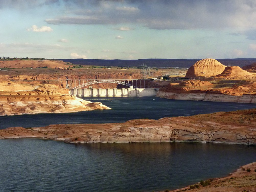
While Lake Powell entered 2002, when this photo was taken, with a pretty healthy amount of water stored, by 2004 the bathtub rings had expanded as drought deepened. Photo/U.S. Bureau of Reclamation.
FromCronkite News (Kianna Gardner) via the Arizona Daily Sun:
The adult quagga mussel finding [on March 3, 2013], coming less than a year after [veligers] were first spotted, marked the end of more than a decade of attempts to keep the invasive species from taking over Lake Powell and cued the beginning of a new fight.
Experts deem it impossible to entirely eradicate the mussels from Lake Powell, a tourist destination that spans Utah and Arizona. The mussels latch on to the walls of Glen Canyon Dam and the hundreds of boats skimming the lake’s waters. If the mussels could not be removed from the lake, the experts concluded, at least they might contain the threat to keep it from spreading to other waters.
Clumps of quagga mussels damage the dam’s water flow, undercut an ecosystem for other aquatic species, cling to boat engines and cost millions of dollars to handle.
“It was a huge responsibility and honor to try and protect this lake. It is still a huge responsibility and honor to contain the quagga mussels here,” said Colleen Allen. She holds a distinctive title as a leader in the quagga mussel incursion: aquatic invasive species coordinator for Glen Canyon National Recreation Area.
The quagga mussel, a freshwater mollusk that likely was unwittingly brought into Lake Powell by boat, have proven to be a small but mighty foe. Less than three years after finding that mussel, the invasion had spread throughout most of the 186 miles of Lake Powell. Today, quagga mussels can be found in every canyon crevice, Glen Canyon officials said.
Click here for all the inside skinny and to register:
On Tuesday, October 24th, from 12:00 pm – 1:00 pm, the Colorado Water Congress and the Colorado Foundation for Water Education will host a webinar on the threat of aquatic nuisance species, specifically zebra and quagga mussels, to our waterways and delivery systems in Colorado.
Aquatic nuisance species continues to be a hot topic for the water community, but we need to reach beyond our own network when communicating about this looming threat to our pristine waterways. Join us to learn about the threat these invasive mussels pose, and how Colorado is working to educate the public and our policy makers so we can maintain healthy waterways and infrastructure.
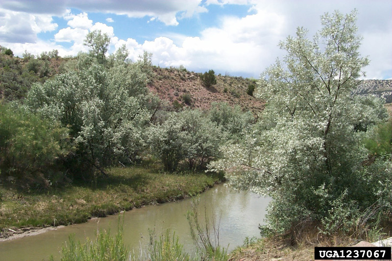
Mountain Studies Institute and Southwest Conservation Corps continue to wage war against the Russian olive, an invasive species that chokes out native trees and degrades the quality of the watershed.
Last year, MSI was awarded a $195,000 grant from the Colorado Water Conservation Board and an additional $52,000 from Colorado Parks and Wildlife for a three-year Russian olive-removal project.
Removal efforts continued Saturday morning at Animas Valley Elementary and Christ the King Lutheran Church with two saw crews from SCC, and help from Durango Daybreak Rotary Club.
MSI’s Amanda Kuenzi said the project specifically targets Russian olive trees on private land…
Originally introduced for ornamental landscaping, the plants are native to East Asia and Russia, and consume nearly 75 gallons of water per day.
They are considered a “List B noxious weed,” which requires local governments to manage their spread under Colorado state law…
“Russian olive reduce wildlife habitat, interfere with nutrient cycling and outcompete native species,” Kuenzi said. “The wetlands have been deteriorating in the West because of irrigation practices and water storage. We have to protect these important ecosystems.”
She said crews will be working on removal efforts through mid-November with about 60 private landowners throughout the Animas River Valley.
On Saturday, the Rotary Club collected wood from the removal effort for its firewood-distribution project.
Click here for all the inside skinny and to register:
The South Platte Forum was initiated in 1989 to provide an avenue for a timely, multi-disciplinary exchange of information and ideas important to resource management in the South Platte River Basin. Its stated mandates are:
to enhance the effective management of natural resources in the South Platte River Basin by promoting coordination between state, federal and local resource managers, and private enterprise, and
to promote the interchange of ideas among disciplines to increase awareness and understanding of South Platte River Basin issues and public values.
The Platte River is formed in western Nebraska east of the city of North Platte, Nebraska by the confluence of the North Platte and the South Platte Rivers, which both arise from snowmelt in the eastern Rockies east of the Continental Divide. Map via Wikimedia.
Nearly every member of Colorado’s congressional delegation has signed a letter to the Trump administration asking for help with the emerging crisis of tiny invasive mussel larvae found in Green Mountain Reservoir…
“We urge you to respond rapidly, deploy available resources and work with the state and local communities to prevent this initial detection from growing into a full infestation,” the delegation wrote to Interior Secretary Ryan Zinke. “A rapid response is critical during the window of opportunity immediately after the detection of invasive species.”
The letter, dated Thursday, was signed by Sens. Cory Gardner and Michael Bennet, as well as Reps. Diana DeGette, Scott Tipton, Doug Lamborn, Jared Polis, Ed Perlmutter and Mike Coffman.
Rep. Ken Buck, a Weld County Republican, did not sign the letter.
“As a headwater state that is currently free of adult invasive mussels, the detection of invasive mussel larva poses a tangible threat to our economy,” the letter said. “The Department of Interior has recognized the importance of preventing invasive mussel infestations in western headwater states, such as Montana where larva was identified in late 2016 and resources were deployed to the Columbia River Basin.”
Zinke is from Montana.
Colorado Parks and Wildlife spokesman Mike Porras said his agency has drawn more than 100 samples from Green Mountain Reservoir since the larvae were detected. “All of these samples have come back negative for all aquatic nuisance species including quagga mussels.”
[…]
Tiny mussel larvae, known as veligers, have been found in Colorado before. Lake Pueblo, for instance, tested positive for them in 2007, 2008, 2009 and 2011.
Biologists, however, have never found an adult zebra or quagga mussel in any Colorado lake or reservoir.
Lake Powell, which straddles Utah and Arizona, has been ravaged by a mussel infestation since veligers were detected in late 2012 and four adult mussels were found on a boat that had been pulled for service in March 2013.
Boats and other watercraft can quickly spread the invasive species. Colorado wildlife officials have said the veligers found in Green Mountain Reservoir likely hitched in on a boat that had been in water outside the state.
State lawmakers during the past legislative session cited the threat of invasive mussels as one reason why they voted down a proposal to allow sea planes on Colorado’s bodies of water, saying they could act as long-range vehicles for the species.
Platte River photo credit US Bureau of Reclamation.
Whooping Cranes
Pallid sturgeon
Least tern
Piping plover
Here’s the release from the US Bureau of Reclamation (Brock Merrill):
The Bureau of Reclamation is preparing an environmental assessment (EA) for the Platte River Recovery Implementation Program, Proposed First Increment Extension. Reclamation, working with the states of Wyoming, Colorado, and Nebraska, water users, and environmental and conservation organizations, proposes to extend the First Increment of the basin-wide, cooperative Recovery Implementation Program by 13 years. Reclamation is doing this to meet its obligations under the Endangered Species Act.
The purpose of this action is to continue implementing projects that provide additional water, in order to accomplish the following:
Reduce flow shortages in the Platte River aimed at conforming with U.S. Fish and Wildlife Service target flows
Continue land management activities necessary to provide habitat for target threatened and endangered species
Continue integrated monitoring, research, and adaptive management, in order to assess the progress of the program and inform future management decisions
Reclamation will hold four public scoping meetings during the 45-day scoping period to gather information from other agencies, interested parties, and the public on the scope of alternatives for the EA. The public is encouraged to attend the open house EA scoping meetings, to learn more about the proposal and to assist Reclamation in identifying issues.
The public scoping meetings on the EA are scheduled as follows (All meetings will be held 6:00 – 8:00 p.m.):
October 4, 2017, at Goshen County Fair Grounds, 7078 Fairgrounds Road, Torrington, Wyoming
October 5, 2017, at The Ranch Events Complex, 5280 Arena Circle, Loveland, Colorado (Located in the Larimer County Conference Center; park in Lot B)
October 11, 2017, at Hotel Grand, 2503 S. Locust Street, Grand Island, Nebraska
October 12, 2017, at Platte River Recovery Implementation Program Executive Director’s Office, 4111 4th Avenue, Suite 6, Kearney, Nebraska
At each meeting, the public will have the opportunity to provide written input on resources to be evaluated, significant issues or concerns, and potential alternatives.
Written comments are due by close of business November 2, 2017. Members of the public may submit written comments at the public scoping meetings, via email to platteriver@usbr.gov, or by mail to:
Bureau of Reclamation
Attention: Brock Merrill
P.O. Box 950
Torrington, WY 82240
Here’s the release from Colorado Parks and Wildlife (Lauren Truitt):
Monitoring finds Evidence of Quagga Mussel Larvae in Green Mountain Reservoir
State and federal officials have confirmed the presence of invasive quagga mussel larvae, known as veligers, in Green Mountain Reservoir located in Summit County along Hwy 9 between Silverthorne and Kremmling.
On Aug. 18, as part of a state and federal initiative to monitor aquatic nuisance species in the state, specialists with the Bureau of Reclamation first confirmed the presence of the veligers, initially through microscopic analysis followed by DNA testing. An independent laboratory contracted by Colorado Parks and Wildlife confirmed Reclamation’s findings. It is unknown if the veligers were dead or alive at the time of detection.
CPW immediately increased monitoring of the reservoir for all life stages of quagga mussels. Through a partnership with the Denver Aquarium, CPW’s volunteer ANS scientific scuba dive team surveyed the reservoir last Friday and did not find any evidence of invasive mussels. No adult zebra or quagga mussels have ever been found in Green Mountain Reservoir or anywhere in the state of Colorado, although eight different reservoirs in Colorado have been temporarily suspect or positive for mussel veligers since 2008.
“Although this is very troubling, it’s important to keep in mind that the reservoir is not considered infested, a designation given only to bodies of water that have extensive and reproducing adult populations,” said Elizabeth Brown, invasive species coordinator for CPW. “At this point, Green Mountain Reservoir is only considered ‘suspect,’ not positive. A body of water can be considered ‘positive’ only after a second independent specimen collection is obtained and the genetics confirmed by two independent laboratories, which has not yet occurred.”
Officials are most concerned about the possibility that the presence of veligers could eventually lead to a major infestation. This would put the reservoir’s hydroelectric power generation, water quality, drinking water delivery and recreation at risk.
“This is an unfortunate discovery, and something we have been working very hard to prevent,” said CPW Director Bob Broscheid. “It shows why we need a robust inspection program. As more and more people move to or visit Colorado and use our water resources for boating, we must continue to work hard to prevent the spread of these harmful invasive species. We cannot overstate how serious this is.”
All ballast boats, inboard and inboard/outboard engines must have a green seal in between launches or decontamination may take place prior to launching. Boaters are encouraged to inspect their own boat between every use and make sure it is clean, drained, and dry.
The State of Colorado requires boats to be professionally inspected if:
a boat has been in any body of water that is positive, or suspect for ANS
a boat has been in any body of water outside of Colorado
a boat will be entering any water body where inspections are required
Officials are unsure how the veligers entered the water but suspect a boat that visited an infested body of water in another state may have become contaminated, then launching illegally into Green Mountain Reservoir.
“This situation demonstrates the importance of following the law and going through the required inspection and decontamination process upon entering and exiting bodies of water,” said Reid DeWalt, Assistant Director Wildlife and Natural Resources with CPW. “We could face the possibility of a very harmful infestation that could cause severe damage to the reservoir and its infrastructure.”
The watercraft inspection and decontamination station at Green Mountain Reservoir is operated by the Heeney Marina and funded by a partnership between CPW and the U.S.Forest Service. The station has now begun implementing containment protocols which means that every boat has to be inspected when exiting the reservoir and will be issued a seal and blue receipt. If a boater leaving Green Mountain Reservoir intends to launch in a different water body, their boat must be decontaminated before launching by a certified professional.
Cooperation with Colorado’s mandatory inspection and decontamination program has proven successful to stop the movement of harmful invasive species, such as quagga mussels, into new waters. Public awareness and participation is the best weapon in the prevention of invasive species. Invasive mussels severely endanger our water supply for drinking water, hydropower, agriculture, recreation and natural resources.
“It is everyone’s responsibility to take care of our natural resources,” said Karn Stiegelmeier, Summit County Commissioner. “This news is certainly difficult to hear with the amount of effort and diligence we have put into the ANS program on the reservoir. We will continue working alongside our partners to make sure we educate residents and visitors of the importance of decontamination of boats before and after they are on a body of water. This can be prevented, but we need everyone’s participation.”
Boaters are reminded to take the simple precaution of making sure that they clean, drain, and dry their boat every time they go boating. Due to financial constraints the state does not have additional inspectors that can be sent to assist with boat inspections at Green Mountain. Going into a holiday weekend state and federal officials are asking for the public’s help to prevent invasive species.
“We know this is an extra step for those who have come out to enjoy recreating on the lake, but staying vigilant has proven to be effective throughout Colorado,” said JT Romatzke, NW Region Manager with CPW. “We need to make sure we are balancing our recreation with the integrity of our water resources.”
At first, they look like a mirage on the edge of the horizon of southern Colorado’s broad and sweeping San Luis Valley. Then, as you rumble south down Highway 17 through Moffat and the other barely-holding-on valley towns, their wave-like ridges reveal a unique reality.
Finally, as you turn east and head into the Great Sand Dunes National Park and Preserve, mountains of sand tower almost 800 feet over you and the valley floor.
“A piece of Arabian desert transplanted into this plain,” wrote Dr. Friedrich Adolph Wislizenus, in his remembrance of an 1848 expedition to northern New Mexico.
But this isn’t the Arabian Peninsula. Nor is it the coast. These dunes were created in this landlocked valley by prevailing winds that pick up sand and deposit it in the shadow of the Sangre De Cristo mountains. The 30-square-mile dune field offers a view unlike any other in Colorado.
“I would rather go three days around, than travel once more over the sand hills with a wagon,” Wislizenus wrote more than 150 years ago, a thought echoed by many hikers since then.
These days, most visitors will play in the cool water of adjacent Medano Creek before they climb up one or two dunes. Few venture up into the mountains on the eastern side of the dunes. And it’s there the park is investing in an ambitious project that’s symbolic of how land managers are approaching one of their biggest long-term issues: climate change.
Largely Unscathed — So Far
Earlier this summer, President Barack Obama declared that climate change is the biggest issue the 100-year-old National Park Service now faces. The effects of warmer temperatures at places like Rocky Mountain National Park are clear — once-clear lakes are now warm enough to sprout algae blooms, for example.
In Colorado’s other national parks, the effects are more subtle: warmer temperatures are complicating already difficult climbs at the Black Canyon of the Gunnison. And in Mesa Verde, scientists wonder if the changing climate is affecting the stability of ancient Pueblo ruins.
Sand Dunes appears largely unscathed — so far. The park’s average annual air temperature has held steady around 42 degrees Fahrenheit (or 6 degrees Celsius) for more than 100 years.
The annual air temperature at the Great Sand Dunes National Park and Preserve has held fairly steady since 1895. Courtesy National Park Service via Colorado Public Radio.
A recent study looked at pikas, a tiny rodent-like mammal that lives on mountain peaks and can die from overheating after just a few hours at eight national parks across the West. Researchers concluded there’s “encouraging evidence” the small mammal will be able to survive at the Sand Dunes.
But one climate model from the National Park Service says that unless the world’s carbon emissions drop by 40 to 70 percent, temperatures at the park could rise by up to 9 degrees by 2100.
Under those scenarios, invasive plants like leafy spurge could move in, streams and creeks could run dry, and wildfires could become more frequent. That has staff at the Sand Dunes thinking hard about how they can help the park adapt to a warming climate.
Which brings us to trout.
Kevin Terry, a project coordinator for Colorado Trout Unlimited, holds up a Rio Grande cutthroat trout at Upper Sand Creek Lake.
One of the park’s current projects is the restoration of the native Rio Grande cutthroat trout to the Sand Creek watershed, which tumbles down the Sangres to the north side of the dunes. Fred Bunch, resource management specialist at the park, said the park has spent about $120,000 on it so far, and plans to spend about double that before it’s all said and done.
But Bunch said the money, which comes from visitor fees, Sand Dunes is spending on the trout project is worth it. It’s park service policy to restore native species. And the Sand Creek watershed, wildlife officials believe, is an ideal place for the fish now — and they hope it will be decades from now as well.
Elevation An Ally
“It’s all a function of elevation,” Bunch said. “Higher elevation streams may be a great area for habitat for the Rio Grande cutthroat as we see this climatic variability.”
Andrew Todd, a research biologist for the U.S. Geological Survey in Lakewood, has been collecting data for the Sand Creek project for a few years now. He developed his interest in fish years ago as a kid when his dad would take him and his siblings fishing near Aspen.
For some reason, Todd said, they would always catch a ton of fish. Finally, 10 years ago, his dad ‘fessed up.
“He’d make sure we were on the water right after the stocking truck came through,” Todd said. “So our whole childhood fishing experience was based on a lie.”
These days, Todd is devoted to the plight of the Rio Grande cutthroat. The state fish of New Mexico is native to that state and southern Colorado. It was decimated first by miners who overfished it in the 19th century, then by the invasive rainbow, brook and brown trout the miners brought in as replacements.
“Over time, your cutthroat trout population will lose out,” Todd explained. “They interbreed with rainbow trout and they don’t compete well with brown and brook trout.”
Today, the Rio Grande cutthroat exists only in 10-15 percent of its historic range. It’s so rare, in fact, that the Center for Biological Diversity, an Arizona-based environmental group, sued the federal government last month because they want the fish to be protected under the Endangered Species Act.
Taylor McKinnon, public lands campaigner for the Arizona group, said he supports the NPS-led project. He just wants more projects like it.
“This lawsuit is necessary because the fish, despite efforts from a lot of people, is continuing to decline,” McKinnon said. “Endangered Species Act protections will compel a more vigorous recovery program, a more coordinated recovery program. And it will provide the agencies the resources they need to get the job done.”
The surviving fish are mostly relegated to small rivers in the Rio Grande basin. Those isolated populations are particularly susceptible to the effects of climate change — droughts and wildfires can erase them in short order.
Wildlife officials got a scare earlier this summer during the Hayden Pass Fire about 60 miles north of the Sand Dunes. They were worried that another rare cutthroat trout that only lives in one small location in that area actually went extinct because of the fire.
It turns out the fish survived, but that wildfire made the stakes clear.
“If you have a really small stream, just one stream, [with] no tributaries, and it burns you could lose that entire population,” Todd said.
That’s not the case at Sand Creek, where nearly the entire watershed is on public land. The area they are trying to restore isn’t just one small piece of water. It’s a whole self-contained system, from snowmelt-fed lakes to where the creek seeps underground on the valley floor.
“You could potentially have a fire in there that burned a good portion of the watershed,” Todd said. “As long as it doesn’t burn the whole thing, you’re well buffered against things like wildfire.”
If the project is successful, Todd said that Sand Creek and its tributaries would make up one of the largest cutthroat trout watersheds in the state.
The water temperature data Todd has collected so far shows promise for the Rio Grande cutthroat. Up at the top of the mountain range, Todd said the sun actually warms Sand Creek quite a bit. But as it falls below treeline, and its colder tributaries dump into it, it gets really, really cold.
And that’s just how the trout like it.
“Our standard for cutthroat trout is around 17 degrees [Celsius],” Todd said. “In Sand Creek, where it hits the sand it’s about 12 or 13 [Celsius]. So we’ve got a good 4- or 5-degree buffer before we start to butt up against temperatures here that would preclude trout from being here.”
Water temperatures rise more slowly than air temperatures, Todd said. So even if climate change pushes air temperatures to the higher end of the park’s estimates, the trout could theoretically still survive.
If that kind of change takes place, the Sand Dunes will have “many other problems” to deal with, he surmised.
Killing Many Fish To Save A Few
Eventually, Colorado Parks and Wildlife will remove all the non-native fish from the watershed using a natural pesticide called rotenone. It kills only fish and leaves other wildlife unharmed.
After the creek, its tributaries and the nearby lakes are cleared and restocked with Rio Grande cutthroat, the fish will need about three years to recover. That means anglers who fish the drainage will have to look elsewhere for awhile.
“It’s the consequence of restoring,” said John Alves, Colorado Parks and Wildlife’s senior aquatic biologist for the southwest region. “There’s drainages nearby that also have trout.”
It’s possible that CPW could apply rotenone in stages; a waterfall halfway up the creek provides a natural barrier. So once the top half is cleared, they don’t need to worry about non-natives in the lower part invading again.
It’s also very difficult to reach Sand Creek, which helps keep out “bucket biologists” — anglers bent on undoing the government’s work by dumping non-native fish back into a cleared waterway.
“When you go in and you try to reclaim it for the natives, not everyone is always on board,” Todd said.
The whole idea of killing off a watershed is off-putting to at least one angler. Phil Armstrong has fished there for more than decade and said while he can appreciate the desire to restore a native fish, he’s disheartened by the “heavy-handed tactics” the state will use.
“Nothing natural is left in this state. People have been everywhere. Mining has been everywhere,” he said. “We’re only taking human intervention steps to get to some approximation of that. We don’t know what that watershed was like a hundred years ago.”
Andrew Todd concedes that point. He doesn’t have proof that Sand Creek historically held Rio Grande cutthroat. But philosophical arguments aside, Todd said the important thing is to strike a balance between native and non-native fish.
“We need to decide what level of biodiversity we want to protect,” Todd said. “It’s one of the prettiest fish in Colorado. And I think it’s worth preserving.”
The project is something of a sequel for the NPS’ Fred Bunch. The park restored Rio Grande cutthroat to Medano Creek using similar tactics back in the 1980s and 90s. Bunch said he’s excited to expand anglers’ chances of catching a native trout even more — especially given that their dollars are paying for the Sand Creek project.
“If this species is restored to 12 miles of prime habitat, that is a huge victory,” he said.
Bunch said he wants anglers to be able to count on a “consistent experience” at the park and preserve. With the climate forecasted to be anything but consistent, what the National Park Service does now, in southern Colorado and elsewhere across the country, faces its real test in the decades to come.
Sandy: This shot of the Great Sand Dunes National Park in southern Colorado is another which came out on top in the crop of 2015 images
Native westslope cutthroat trout swim in the north fork of the Flathead River in northwestern Montana. However, cutthroat trout populations are threatened by hybridization from mating with rainbow trout. Photo credit Jonny Armstrong/USGS via National Public Radio.
There’s an unplanned experiment going on in the northern Rocky Mountains. What’s happening is that spring is arriving earlier, and it’s generally warmer and drier than usual. And that’s messing with some of the fish that live there.
The fish is the iconic cutthroat trout. It’s a native North American fish that thrives in cold, small streams. Explorer Meriwether Lewis of Lewis and Clark Expedition fame was among the first European-Americans to catch this spangly, spotted fish. He used deer spleen as bait.
It’s relative rarity now makes it a favorite for catch-and-release anglers. But biologists have now found that it’s in danger. The much more common rainbow trout is invading cutthroat streams and mating with the native fish. Ecologist Clint Muhlfeld says that creates hybrids.
“It jumbles up the genes that are linked to the locally adapted traits that these fish have evolved with,” says Muhlfeld, who’s with the U.S. Geological Survey and the University of Montana’s Flathead Lake Biological Station.
Those traits have allowed cutthroats to survive through millennia in cold northern streams. And cold streams were thought to protect them from rainbows, which prefer warmer water.
But climate change is warming many high-altitude streams, and they frequently have less water, another change that favors rainbows. So they’re moving in.
Muhlfeld says that when rainbows and cutthroats breed, the resulting hybrids are feeble — “less fit,” in biological terms. “They don’t survive as well as the native fish,” he says. And hybrids that do survive continue to make more hybrids; there’s no going back to making cutthroats again.
Writing in the journal Global Change Biology, Muhlfeld and a team of scientists from several research institutions studied fish in hundreds of locations in the northern Rockies. Hybridization was widespread. It was most common in places where fish and game departments have introduced rainbow trout, a practice that goes back to the 19th century.
Some states are trying to solve the problem by getting rid of rainbow trout. That might not please some anglers, but Muhlfeld says the cutthroat species could disappear otherwise.
“There are so many places around the world where you can go catch a rainbow trout,” he says; it’s been introduced all over the world. “There’s very few places where you can actually go and catch a native fish that’s been around for thousands and thousands of years.
“Extinction is permanent. Once the native genomes and adaptive traits are gone, they are gone forever.”
Agreement includes largest native trout restoration in Colorado history
The U.S. Forest Service this week finalized a litigation settlement that will allow the Water Supply and Storage Company, a northern Colorado ditch company, to continue to use Long Draw Reservoir on the Arapaho-Roosevelt National Forests, and will launch a large-scale native trout restoration program for the Cache la Poudre river headwaters within the Forests, including the Neota and Comanche Peaks Wilderness Areas, as well as in Rocky Mountain National Park.
Completion of all project elements is expected to take more than 10 years, but when completed will provide for a connected “metapopulation” of trout across the watershed – the largest such restored native trout habitat in Colorado. The native trout restoration project will span more than 40 miles of connected river and multiple lakes, as well as Long Draw Reservoir itself. To protect the watershed from invasion by non-native species, fish barriers will be established on the Grand Ditch and on the mainstem Cache la Poudre below its confluence with La Poudre Pass Creek. Within the watershed, temporary barriers will also be installed to enable fishery biologists to complete restoration of native trout one section of the basin at a time. After installing temporary barriers, biologists will remove non-native fish from the upstream areas. Once the areas are confirmed to be free of non-native trout, they will be re-stocked with native greenback cutthroat trout. Work will be done in collaboration with the USDA Forest Service, Rocky Mountain National Park, the U.S. Fish and Wildlife Service, Colorado Parks and Wildlife, and Colorado Trout Unlimited.
Under the settlement, a trust will be established with $1.25 million from the Water Supply and Storage Company for purposes of funding these restoration activities. Colorado Trout Unlimited will serve as the Trustee, while the U.S. Forest Service will be the lead agency for project implementation.
David Nickum, executive director of Colorado Trout Unlimited, issued the following statement:
“The settlement finalized today is a great example of how open dialogue and a spirit of cooperation can yield conservation solutions. After years of litigation and debate, the U.S. Forest Service, National Park Service, Water Supply and Storage Company, and Trout Unlimited have agreed to launch a collaborative restoration project for Colorado’s state fish, the greenback cutthroat trout, which will be the largest native trout restoration effort in Colorado history.
“Over the next decade, we will be restoring a true Colorado native to the Cache la Poudre headwaters in spectacular alpine wilderness within both Rocky Mountain National Park and the Arapaho and Roosevelt National Forests. The watershed will be a stronghold for native trout, helping secure this piece of Colorado’s natural heritage for generations to come.
“We are pleased that settlement efforts enabled all the parties to find a solution for the area’s natural resources that meets federal stewardship responsibilities, respects the operating needs and challenges of long-standing water users, and achieves meaningful benefits for Colorado’s environment and the millions of residents of and visitors to our state who enjoy it.”
Keith Amen, president of the Water Supply and Storage Company said:
“We are pleased to have concluded the terms necessary for us to obtain a thirty year easement agreement for the continued operation of Long Draw Reservoir, a very valuable resource that contributes a great deal to the local, state and national economies.”
The effort to restore Colorado River cutthroat trout in Hermosa Creek dates back to the early 1990s when wildlife managers used a natural waterfall on the creek’s east fork as a protective barrier.
Colorado Parks and Wildlife cleared out non-native species of trout – specifically brook, brown and rainbows – using a short-lived, organic poison known as rotenone. And in their place, it released Colorado River cutthroat trout, giving the waterway to the native fish for the first time in probably 100 years.
The magnitude of the cutthroat’s loss has never been truly quantified, but its range – which once spanned Colorado, New Mexico, Utah and Wyoming – was dramatically reduced, mostly because of habitat loss, overharvesting and competition with non-native species.
Clay Kampf, a fisheries biologist for the San Juan National Forest, said the best estimates show the Colorado River cutthroat trout is now found in about 14 percent of its historic natural habitat.
Facing the possibility of the U.S. Fish & Wildlife Service listing the Colorado River cutthroat trout as “endangered,” which would bring a host of restrictive protections, Colorado, Utah and Wyoming entered a three-state agreement to lead an aggressive reintroduction program.
“It works well for both parties,” said Jim White, an aquatic biologist with Colorado Parks and Wildlife. “This way, the states and local groups have more say in where and how to manage these fish. And it benefits the (Fish & Wildlife Service) because their resources are stretched pretty thin.”
[…]
In the last decade, the state of Wyoming has restored more than 60 miles of Colorado River cutthroat habitat, with most of that occurring in the upper Green River drainage by the town of Big Piney.
There, Mark Smith of the Wyoming Game and Fish Department said the population has been struggling since reintroduction. The fish haven’t spawned early enough, he said, which means they don’t grow big enough to survive winter.
“The turnaround hasn’t been as quick as we would have hoped, but we’re getting there,” Smith said. “We’re certainly making gains and going in the right direction.”
In Utah, the program has been wildly successful, with hundreds of miles of streams restored with their native species of trout, said Randy Oplinger of the Utah Division of Wildlife Resources.
Oplinger said Utah has been the most ambitious of the three states, likely because of the fact many projects are located on federal lands managed by agencies open to large-scale restoration efforts.
This year alone, the department plans to restore 75 miles of cutthroat habitat within the Colorado River basin. And Oplinger said trout populations tend to fair well throughout the river system…
Hermosa project close to completion
Once a final barrier is constructed this summer on Hermosa Creek, just below its confluence with the east fork, an effort to dedicate more than 23 miles solely to the cutthroat trout will almost be complete.
Two decades ago, Hermosa Creek was recognized as an ideal place for a restoration project because of the creek’s outstanding water quality and because of its easy accessibility through Forest Service Road 578, which runs behind Purgatory Resort.
After the waterfall near Sig Creek Campground was used as a natural blockade from non-native intrusion in the early 1990s, two more human-made barriers were built in 2007 and 2013.
This summer, the U.S. Forest Service will begin construction on the final barrier at the Hermosa-east fork confluence to safeguard the waters above the blockade for the Colorado River cutthroat.
CPW’s White said that in the segments of the creek that have already been repopulated with cutthroat, population trends are encouraging. He said a recent sweep a few years ago found about 400 to 600 fish per mile.
“Populations above 400 fish per mile are usually ranked in the good to excellent category,” White said. “We’ve seen natural reproduction … very shortly after that project on the main stem (of Hermosa) was completed.”
Protecting the cutthroat
With a successful stretch of river returned to its native species, wildlife managers are expecting Hermosa Creek to get a lot of use from excited anglers.
As a result, a strict catch-and-release policy is on that section of river, White said, and there are other measures, such as habitat improvement and limiting bank erosion, that the agencies can take to protect the fish…
The quest to set right altered habitats continues to have strong cultural and ecological justifications, said Noah Greenwald of the Centers for Biological Diversity.
“We’re taking away what makes places like Colorado unique and special,” he said. “And we’re likely impacting other species when we replace a native with a non-native. It’s part of this larger extinction crisis.”
The Hermosa Creek restoration project is a coordinated effort between the U.S. Forest Service and Colorado Parks and Wildlife, as well as Trout Unlimited, which in total have spent more than a $1 million, Kampf said.
It will take a few more years for the waters upstream of the forthcoming barrier to carry only cutthroats, as non-natives still need to be removed, but Kampf said it will be worth the wait.
As local anglers, conservationists and wildlife managers get ready to celebrate another milestone in the restoration of Colorado River cutthroat trout to the upper reaches of Hermosa Creek, it is easy to forget that the effort, which dates back to the early 1990s, has its detractors.
Some local residents, and many long-time summer visitors to the popular area tucked behind Purgatory, think all the fuss over the fish – one of three native Colorado subspecies of trout named for the distinctive crimson slashes found on each side of the lower jaw – has ruined a fine local fishing hole.
From a short-term point of view, they have a point. The periodic poisoning of the creek to remove non-native trout, the building of barriers to keep non-natives downstream, the stocking of cutthroats and the rules against taking them for the frying pan have sent those seeking a stringer of fish further downstream, or elsewhere.
In 1992, the Colorado Division of Wildlife applied rotenone above the waterfall on the East Fork; not long after, Colorado River cutthroat were planted in the stream and the fish, estimated to occupy less than 15 percent of its original range on the tributaries of the Green and Colorado rivers, had a toehold in Hermosa headwaters once again.
It was an important step in the effort to keep the U.S. Fish and Wildlife Service from listing the fish as an endangered species, and mirrored similar restoration efforts on the fish’s native range in Utah and Wyoming.
Since then, barriers have been built and the process repeated on the main stem upstream of Hotel Draw. With the pending completion this summer of a barrier at the confluence of the East Fork and the main stem, the native-cutthroat-only stretch will soon comprise the largest continuous stretch of Colorado River cutthroat habitat in the state.
It has been an impressive effort, and like its supporters, we are confident of its future success. Those who remain unimpressed may benefit from a history lesson:
The same mining and population boom that decimated the cutthroat nearly extirpated Colorado’s elk. In 1912, elk from Wyoming were reintroduced to the state in the same Hermosa Creek drainage. The area remains, as the Denver Post noted in an article three years ago, “a hunter’s paradise, where trophy elk still die of old age.”
That story, and the Hermosa area’s more recent protected status, bode well for another rebounding native.
The Platte River is formed in western Nebraska east of the city of North Platte, Nebraska by the confluence of the North Platte and the South Platte Rivers, which both arise from snowmelt in the eastern Rockies east of the Continental Divide. Map via Wikimedia.
High Plains in eastern Colorado. Photo credit Bob Berwyn.
The plains around DIA were parched by the scorching 2012 drought, although groundwater pumping along the South Platte River enabled some farms to continue irrigating — photo by Bob Berwyn
Map of the South Platte River alluvial aquifer subregions — Colorado Water Conservation Board via the Colorado Water Institute
South Platte River Basin via the Colorado Geological Survey
The South Platte Master Plan is a study of flood mitigation and recovery possibilities along 130 miles of the South Platte River from the Morgan-Weld county line to the Nebraska State Line. Authorized and funded by the Colorado Department of Local Affairs, the plan will suggest ways to make the river more “flood resilient,” both to handle the flooding as it occurs, with minimal damage to property and structures, and to quickly recover from a flood in the aftermath.
Five big problem areas were identified in the evaluation, according to Brian Murphy, project director for CDM Smith of Denver, the contractor on the flood study. They were the amount of sediment the floods of 2013 and 2015 deposited in the study area, basically clogging the river and making flooding worse; uncontrolled water in ditches and canals, which can back up and cause damage to structures, homes, and fields; the railroad railroad right of way southwest of Messex, which contains the river along the northwest shoreline but worsens flooding on the opposite shoreline; the hunting lands along the river that provide game habitat but also blocks water flow during a flood, causing the water to spread out into neighboring cropland; and the washed-out headgates of the Henderson-Smith and Lowline ditches, which essentially turn those ditches into another channel of the river.
Stakeholders attending the meeting may have gotten some ideas of how to tackle those challenges from a 90-minute presentation by Jerry Kenny, executive director of the Platte River Recovery Implementation Program. That program comes from an agreement among Colorado, Nebraska, Wyoming, and the U.S. Department of the Interior to preserve habitat for whooping cranes, least terns, piping plovers and pallid sturgeons, four species on the endangered species list. The program maintains water at an adequate level along an 80-mile stretch of the Platte River the Nebraska cities of Lexington and Grand Island in an area call the Big Bend Area.
Kenny’s description of challenges faced in maintaining habitat for those four species brought home to the stakeholders how the river system has been affected by settlement all along its length. For instance, sediment – mostly sand – that once washed downstream past what is now Sterling and settled in the Big Bend area to create habitat for those species no longer makes it that far. Instead, repeated diversion of the river for irrigation reduces and slows down the water flow during what was once rapid spring runoff, depositing the sediment here.
That problem is exacerbated by Lake McConaughy on the North Platte near Ogallala, which traps sediment that once drifted down into Big Bend.
Kenny told the meeting that some of the challenges have been met by practices in all three of the states that have increased stream flow in the Platte River. Most notable in Colorado is the Tamarack Recharge Project near Crook, in which water is pumped into small reservoirs when there is no irrigation demand on the river, and allowed to seep back into the river so more water is available downstream.
Kenny also showed the group slides of off-stream water storage projects that have been used to create wetlands and much-needed sand islands in the project area. Presumably, some of those ideas could be used to mitigate flooding and provide some off-channel water storage in the South Platte basin as well.
After the meeting Morgan County Commissioners Jim Zwetzig and Laura Teague said they are encouraged by the “collaborative effort” shown in the PRRIP agreements…
Project manager Brian Murphy said one of the biggest challenges, once ideas and practices are identified, will be finding the dollars to do it. The PRRIP get about half of its funds from the federal government, and there is tremendous incentive in the form of a mandate to save endanger species. There is no such incentive, other than reducing unpredictable costs of recover, in flood mitigation.
“The big question is, what are the things that can bring dollars to fund this project,” Murphy said. “What are the drivers? There’s been a lot of discussion of duck habitat, open space, trails, and I think it’s going to come down to those things.”
On a more positive note, he said, the PRRIP process has broken new ground when working with the federal permitting process. Some of the techniques that project uses, such as tilling riparian areas to keep vegetation down, are considered agricultural, and so don’t need federal permits.
Monday’s meeting was the third since the plan was introduced to the public in February.
A coalition of ranchers and environmentalists, politicians and bureaucrats, and Jimmy-Buffett-loving river recreationalists came together Friday to learn about a quiet scourge overtaking the banks of the Yampa River known as the leafy spurge.
The plant itself looks innocent enough, with little yellow flowers that turn entire sections of river bank into a sea of green and yellow. But the demure-looking weed is extremely aggressive and invasive, and has wreaked havoc in states like Montana and North Dakota, where more than 2 million acres of ranch land have been put out of production due to the noxious weed.
Formed in 2015, the Yampa River Leafy Spurge Project brought together partners in Routt and Moffat counties to tackle the growing infestation, which first took root more than 40 years ago…
The problem has eluded an effective solution for decades, as the conditions unique to river banks challenge all variety of treatments from chemical to biological to mechanical.
The result is that debate continues about how to deal with the destructive plant, and for now, officials have focused on keeping the infestation from spreading…
The project received $30,000 in funding from the Colorado Department of Agriculture in 2016; Moffat and Routt counties each received $10,000 to fund projects to target infestations, and $10,000 went to landowner education and outreach.
Additional county and federal funds also flow towards containment efforts on private, county and federal lands, but for a weed that sends roots as deep as 60 feet down and is able to broadcast its seeds up to 30 feet, as well as send them downriver, available resources have been outmatched.
“For our economy’s sake, from a recreational standpoint, an agricultural standpoint and an environmental standpoint, it’s a big issue,” said Todd Hagenbuch with Natural Resources Conservation Services.
Proposed Hermosa Creek watershed protection area via The Durango Herald
Here’s the release from the San Juan National Forest:
Construction activities will begin in the Hermosa Creek Special Management Area on Monday, July 10, 2017 to erect a fish-migration barrier on Hermosa Creek as part of the ongoing Colorado River Cutthroat Trout Reintroduction Project. Trail users and visitors to the area should expect to encounter delays and closures until October 1, 2017. The barrier is being installed on the main stem of Hermosa Creek downstream of its confluence with the East Fork of Hermosa Creek. About one-half mile of the Hermosa Creek Trail from its northern trailhead must be widened to allow heavy equipment to access the construction site. The trail widening is temporary and will be rehabilitated to the extent possible. Tree removal is expected to be minimal.
Throughout the construction project, trail users traveling in both directions may encounter temporary delays of up to one hour. Short-term closures lasting up to a full day are also possible, especially when heavy equipment is being moved in and out of the area. No more than four days of closures are expected during the three-month project, but construction schedules are subject to changing conditions. Public notices will be posted when trail closures are expected. The project is not expected to affect fishing, because flows will be bypassed above the construction site; however, some sedimentation is expected downstream. The barrier represents the final and most important phase of the Hermosa Creek Colorado River Cutthroat Trout Reintroduction Project, which began almost 30 years ago. The goal is to protect native cutthroat trout above the barrier from non-native fish located downstream.
For more information, please contact the Columbine Ranger District at 970 884-2512 or Clay Kampf at 970-884-1403.
Installed last September, a net designed to keep non-native, predatory fish at Elkhead Reservoir from entering the Yampa River appears to be fulfilling its purpose, though it may be too soon to tell.
This spring, Colorado Parks and Wildlife conducted its first count of the two species of concern, northern pike and smallmouth bass, in the stretch of water between the net and the spillway, where water leaves the reservoir and enters Elkhead Creek, which feeds into the Yampa.
“In our first sample this spring, we didn’t see any indication that the net was failing,” said CPW Aquatic Biologist Tory Eyre.
The count was taken before the reservoir filled with spring runoff and water began spilling over the spillway. Another count taken this fall, after the reservoir is done spilling, will give biologists an even better idea of how the net is working.
“This is a big spill year,” Eyre said. “When it’s spilling, it can suck trees and other debris through, damaging the net.”
Officials are hoping the net, made of a sturdy polyethylene mesh, will hold up to any debris that gets swept its way, and divers will check and clean the net once a year.
The net is one piece of a multi-pronged approach to protect four species of endangered fish in the Yampa River, the humpback chub, bonytail, Colorado pikeminnow and razorback sucker…
The net will hopefully keep the predatory fish contained, but with so many factors affecting the species, biologists won’t necessarily be able to determine the precise impact of the net on endangered fish populations…
The life span of the $1.2 million net is only estimated at about seven years, Eyre said, which is why CPW is also hoping to check northern pike and smallmouth bass populations through its new, annual Elkhead Reservoir Fishing Classic.
Upper Colorado River Endangered Fish Recovery Program
McPhee Reservoir is seeing increased use this summer because of decreased opportunities for motorized boating on other Southwest Colorado reservoirs that have been closed to guard against the introduction of aquatic nuisance species, according to the San Juan National Forest.
And to accommodate boaters during the July Fourth holiday, the inspection station for the House Creek boat ramp will extend its hours to 6 a.m. to 8 p.m. Friday through Tuesday, the forest said in a news release.
The inspection station at the more crowded McPhee boat ramp will remain open seven days a week from 6 a.m. to 8 p.m. All other access points to McPhee Reservoir have been gated to prevent uninspected boats from entering the reservoir.
McPhee is one of a few reservoirs in Southwest Colorado with mussel inspection stations that allow for motorized boating, public affairs specialist Ann Bond said in the news release.
The McPhee boat ramp has seen an 85 percent increase in inspections this summer from last year, Bond said.
“Because of the increased usage, parking areas and boat ramps are experiencing congestion, especially on weekends,” she said. “The U.S. Forest Service urges visitors to use parking areas and ramps as efficiently as possible to lessen congestion.”
The Forest Service encourages boaters to prep their craft before launching to reduce time at the ramp and to follow traffic signs to ensure safety for all visitors. Boaters who park vehicles without trailers are asked to use overflow parking areas to leave the larger parking areas available for trailers. Weekday users will find less crowded conditions.
Weekend users are encouraged to use the House Creek boat ramp, which is often less crowded.
Inspection stations are working smoothly, with previously inspected boats carrying documentation and tags moving through the process within 10 minutes. Boats that have not been cleaned, drained and dried – and require decontamination procedures – are urged to enter inspection stations during weekdays, because the decontamination process takes more time.
For more information, contact Tom Rice at 970-882-6843.
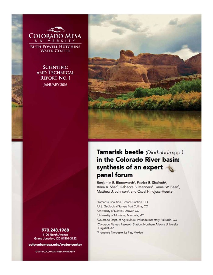
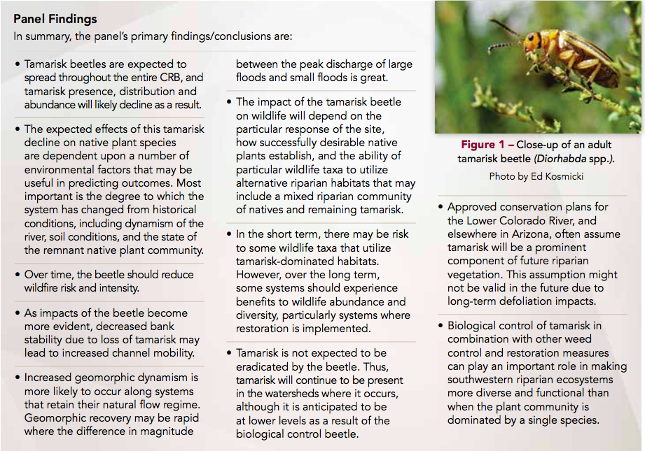
Exotic beetles released by the U.S. government to kill exotic trees along the upper Colorado River have munched a destructive path into central Arizona, officials have confirmed, proving to be more mobile and resilient than predicted.
The tamarisk leaf beetle now threatens the endangered southwestern willow flycatcher and other birds that have adapted to the non-native tamarisk that grows so thick along some of the region’s rivers. The beetles can strip a tree of its leaves, ruining it as a home for the birds.
Arizona environmentalists and biologists worry the beetle’s June 8 discovery in Wickenburg dooms many of the remaining flycatchers. Salt River Project has invested millions of dollars and 2,400 acres in mandated habitat protections throughout the Gila River drainage as a condition of raising Lake Roosevelt and displacing old nesting areas.
Some people, like suburban Buckeye’s mayor, are cheering the prospect of a natural thinner for the shrubby tamarisks crowding the Gila River, where thickets of the trees are blamed for flood and fire risks.
But no one knows how much farther the beetles will spread if they find new paths into the Gila River drainage area, which stretches north and east on the Verde and Salt Rivers and south on the Santa Cruz and San Pedro rivers.
An Arizona biologist found beetles and their larvae living in tamarisks on the Hassayampa River, a Gila tributary west of metro Phoenix. The insects had previously moved south from Utah’s Virgin River to Lake Mead and then down the lower Colorado. From there they moved east along the Bill Williams River and its tributaries.
Now they’re within striking distance of the heart of what remains of flycatcher country.
“All it takes is one boat that is infested with the species that goes in the water body and infests the water body. Once they get in the water body there is really nothing to do to get rid of them,” said Robert Walters, CPW invasive species specialist.
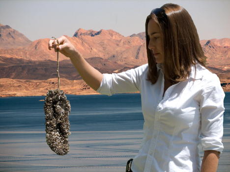
It is Zebra and Quagga Mussels that the crews are trying to get rid of. The boat they worked on came from Lake Powell, an infected body of water, and the mussels are apparent in many places that the boat has been in in the water.
“If these were to get into one of these water, the cost would impact everyone not just the users of the water but people using the electricity and facilities,” Walters said.
Colorado and New Mexico both are aggressively inspecting boats before they hit the water this season. It’s to prevent all the trouble the mussels could cause in pipes and infrastructure, even eventually killing native fish.
CPW said money spent inspecting and decontaminating boats is a drop in the bucket compared to fighting mussels after they take hold.
“We couldn’t do this without the participation of the boat owners,” Walters said.
The key is clean, drain and dry. All boat owners are encouraged to do that every time they take the boat out of the water. For boats in infected waters, both states require disinfection services, which is available at many major waterways.
New Mexico has rules in places that:
Require all watercraft arriving from out of state must receive an inspection prior to launch.
All watercraft when on a New Mexico roadway must have their boat plugs pulled.
Inspections stations for 2017 can be found at:
Navajo Reservoir (Pine and Sims Ramps)
Conchas Reservoir (Main entrance)
Ute Lake (North Ramp & Logan Park Marina)
Elephant Butte Reservoir (Marina del Sur)
Any NMDGF office (Monday through Friday, 8 a.m. to 5 p.m.)
Click here to read the report. Here’s the executive summary:
Executive Summary
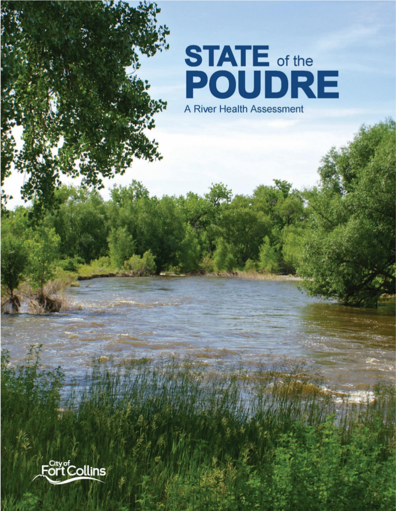
The purpose of this first State of the Poudre River (SOPR) is to provide a description of the current health of the Cache la Poudre River (Poudre) from approximately Gateway Natural Area to I-25. The Poudre is a complex natural system that has been altered by nearly two centuries of human influence. This has resulted in dramatic changes to the physical structure of the river, water quantity and quality, floodplain, forests, and wildlife communities. The human footprint continues to expand, placing additional pressure (or stresses) on the river ecosystem and the natural processes that sustain it. This river health assessment provides the City of Fort Collins with a new tool to track trends and benchmark progress towards its vision of sustaining a healthy and resilient Cache la Poudre River.
While the Poudre flows 126 miles from its headwaters to its confluence with the South Platte near Greeley this study focuses on a 24-mile reach from the lower canyon through Fort Collins. The study area was divided into four zones (Canyon, Rural, Urban, and Plains) and further into 18 study reaches based on natural changes on the landscape and human influences.
Overall Grade: For the 24-mile study area the Poudre River received an overall grade of C. This grade indicates the even though the Poudre has been altered and degraded by a suite of local and system wide stresses that impair its health, it continues to support basic elements of a functioning river ecosystem.
The framework for this baseline assessment includes nine indicators of river health which are informed by 25 indicator-specific metrics. Collectively these provide a thorough evaluation of how well the system is functioning. Metrics grades are developed by collecting and incorporating many types of data, which were then translated into an A-F grading system. Indicator and metric numerical scores and their corresponding letter grades were calibrated to categorical definitions relating to degree of functionality or impairment.
Recommended ranges developed for each metric (as established in the River Health Assessment Framework, City of Fort Collins, 2015) and were developed based on the City’s concept of working towards a functioning river ecosystem. The recommended ranges consider the contemporary real- world context and reasonable expectations for future change and the potential for improvement. They should, however, be used as a guide and aspiration rather than a directive. Also, when interpreting results for a comprehensive scientific assessment such as this, it is important to consider that uncertainty and variability exists across scientific disciplines, data sources, and river reaches. The methods and grading guidelines provide an explicit description of the analytical approaches used and can help the reader understand this variability.
This report is structured to allow the reader to understand the project approach (Sections 1 and 2) followed by identification of potential influences, or stressors, on river health in Section 3. The health assessment scores (Section 4) reveal the ramifications these anthropogenic stressors are having on ecosystem condition. Results indicate there is considerable variability across aspects of river health as scores vary widely (from A to F) at smallest unit of measurement (metrics scores by reach). In Section 5, the focus shifts to an overview of river health, describing the link between stressors and degree and type of impairment for each of the four zones. Poudre River health indicator grades for each zone are compared to the ranges recommended in the City’s Poudre River Health Assessment Framework (2015)—to highlight areas where there is the greatest gap between the City’s goals for the river and today’s conditions. This section also includes an analysis of the causes of impairment and explores which problems are tractable to practical solutions. Section 6 looks toward the potential future applications and improvements for the project.
In their first-ever health assessment of a 24-mile stretch of the Poudre River, a group of Fort Collins water experts awarded the river an overall grade of a C.
In other words, the river is functional, the assessment’s authors said. But it could, and should, be better.
City officials aspire to a B grade for the river, which would mean the assessed stretch is considered “highly functional.”
The report was put together by a group of ecologists and resource managers from the city’s natural areas and utilities departments, Colorado Parks and Wildlife and several consulting firms. The goal was to develop a tool city officials can use to benchmark progress toward a healthier river.
The study focused on the Poudre from the lower canyon near Gateway Natural Area to Interstate 25 and used an A-F grading system. The spotlight was on six key indicators of river health:
Flows, the primary driver of river health
Sediment, a natural component of rivers that can be harmful if amounts are too much or too little
River channel, including shape, width and depth
Water quality
Aquatic life
Riparian corridor, including riverside forests, wetlands and grasslands
The overall grade of C “indicates that even though the Poudre has been altered and degraded by a suite of local and system-wide stresses that impair its health, it continues to support basic elements of a functioning river ecosystem,” the report states.
The river’s lower canyon zone fared better than the urban, rural and plains zones, scoring an overall B-minus with high marks for riparian corridor health, water nutrients and land and channel erosion. The canyon zone scored poorly on habitat connectivity and water temperatures, the latter because warming water temperatures represent risks for aquatic life.
The river’s urban zone earned a C grade with high marks for water nutrients, trout population and land erosion. The urban zone failed in riparian corridor health, habitat connectivity and river flows.
Overall, river flows were an issue for most of the 24-mile stretch.
“The Poudre is characterized by major changes in flow volumes and timing,” the report states. “Reductions have significantly altered peak and base flows, the effects (of) which are exacerbated the further one travels downstream. Diversions also cause unnatural fluctuations in flow volume, which likely affects critical habitat and reproductive needs of fish and insects in the river.”
Northern Pike graphic via The Hook and Hackle Company.
Here’s the release from Colorado Parks and Wildlife:
A cash-based incentive offered by Colorado Parks and Wildlife and the Colorado Water Conservation Board encouraging anglers to catch northern pike at Green Mountain Reservoir resumes this year on May 25. Initiated in 2016, the reward program encourages anglers to participate directly in ongoing efforts to remove the illegally introduced predators from the reservoir.
CPW biologists say the presence of the predatory fish in Green Mountain is a significant concern. In addition to the potential impacts to fish in the reservoir, if they escape and take up residency downstream in Gold Medal sections of the Blue and Colorado rivers, sportfishing opportunities for trout could see negative consequences. If the predatory fish eventually reach federally listed critical habitat in the Colorado River, they would prey upon the state’s endangered native fishes – the Colorado pikeminnow, humpback chub, razorback sucker and bonytail.
“Northern pike are aggressive predators with big appetites and if their population continues to grow in Green Mountain Reservoir, that will likely have profound impacts to local fisheries in the future,” said CPW’s Jon Ewert, aquatic biologist from Hot Sulphur Springs. “This is beneficial in several ways. Anglers can catch a predatory fish and earn some money, it helps us protect fishing here, and helps with our native fish recovery efforts as well.
According to the Upper Colorado River Endangered Fish Recovery Program, the presence of predators like northern pike and smallmouth bass in native fish critical habitat significantly increases the difficulty of delisting the endangered fishes.
“We all have an interest in making sure our waters are managed appropriately and we encourage the angling public to stay involved,” said Ewert. “We had excellent response last year, and we expect anglers will be eager to take advantage of this opportunity again this year.”
To participate, anglers must bring their northern pike to the Heeney Marina along with their driver’s license and fishing license.
CPW will keep fish heads for analysis, returning the body of the fish to the anglers. Anglers not wishing to keep northern pike can donate their catch to the Marina for later distribution.
Anglers are encouraged to catch and keep as many smallmouth bass and northern pike as they desire, unless special regulations are in effect on specific waters.
For more information, contact CPW’s Hot Sulphur Springs office at 970-725-6200, or Heeney Marina at 970-724-9441
To report illicit stocking or any other illegal wildlife activity anonymously, anglers can call Operation Game Thief at 877-265-6648.
On Thursday, the U.S. Forest Service announced the ban of motorized boats on Lemon Reservoir, which joins two other Southwest Colorado lakes – Totten and Narraguinnep – that were closed this year because of the threat of invasive species…
While some Southwest Colorado lakes offer a boat inspection, the Forest Service said the resources are unavailable to fund and staff an aquatic nuisance species inspection station at Lemon Reservoir.
Motorized boats in recent years have become significant transmitters of invasive species – such as the New Zealand mud snail, Asian carp and rusty crayfish, among other plants and animals – into uninfected waters.
But the main culprits, microscopic zebra and quagga mussels, can quickly infest a waterway, clog reservoir infrastructure and endanger other aquatic life. Costs to treat an infestation, the Forest Service said, are expensive.
According to the Forest Service, the decision to close Lemon Reservoir to motorized boat use was made after local irrigators, recreationists, the Bureau of Reclamation, Colorado Parks and Wildlife, La Plata County commissioners and the city of Durango showed significant support…
The city of Durango pulls its main water supply from the Florida River, out of a reservoir downstream of Lemon Dam. If mussels were introduced into Lemon Reservoir, it wouldn’t take long for the city to feel the impact, Salka said…
According to the water district’s website, releases from Lemon Dam, about 14 miles northeast of Durango, provide irrigation water for nearly 19,500 acres.
The Forest Service said a barrier and sign will be installed at the Miller Creek boat ramp, and the closure will be enforced by the agency seven days a week.
Invasive aquatic species, and finding the money for inspections, are increasingly becoming a problem in Southwest Colorado.
At Vallecito Reservoir, a popular boating and fishing destination 20 miles northeast of Durango, the boating season this summer was in jeopardy when Colorado Parks and Wildlife said it was unable to fund an inspection station…
As a result, businesses and community members dependent on the tourism dollars generated from lake users raised $10,500 to help cover operating costs for the inspection station, Beck said.
The effort was set to raise more, Beck said, when CPW last week said it could cover the remaining $43,500 needed to fund a full season of operation, which starts May 1.
Beck added that managers were forced to close boat access on the north end of the Vallecito Lake after several incidents where people illegally put their boats into the reservoir.
Beck said launching a boat illegally could result in a $75 fine, but the agency has “tried not to bite down that way.”
[…]
He said CPW proposed a bill in the state Legislature this year that would require boaters to purchase a $25 aquatic nuisance species sticker that would fund an inspection station program throughout the state.
FromThe Grand Junction Daily Sentinel (Dennis Webb):
A Colorado Supreme Court ruling last year eliminated severance tax revenues for Colorado Parks and Wildlife’s aquatic nuisance species program, forcing the end of inspections at some sites, CPW says.
As a result, CPW has agreed to close Harvey Gap Reservoir northwest of Silt to watercraft normally requiring such an inspection, due to the agency’s inability to conduct inspections there for species such as invasive zebra and quagga mussels. Hand-launched vessels exempt from the inspections still will be allowed there, including rafts, kayaks, belly boats, float and inner tubes, canoes, windsurfer boards, paddle boards and sailboards.
Hand-launched boats with electric motors will be allowed there, but gas- or diesel-powered engines will be prohibited because they are more at risk of hosting invasive species. The boat ramp will remain closed and all boats must be carried from parking lots or roads.
Meanwhile, the Cortez Journal reports that Totten and Narraguinnep reservoirs in southwest Colorado will be closed to all boating because of concerns among authorities responsible for those sites about possible infestation due to a lack of inspections.
The funding situation also helped prompt CPW this year to pass new regulations subjecting all watercraft, including those exempt from inspection requirements, to a “clean, drain and dry” requirement between each launch. The agency also requires boat operators to pull water drain plugs and remove plants from boats and other equipment upon leaving the water and before leaving the parking area…
CPW says it has coordinated a successful mandatory statewide inspection and decontamination program since 2008, preventing an infestation in the state. The agency says that’s of not just statewide but national importance, because the other primary way mussels can spread is by downstream travel.
The agency says oil and gas severance tax revenues are a primary source of money for the aquatic nuisance species program, but those revenues were eliminated by last year’s court ruling.
In that ruling, the state’s high court overturned the Colorado Court of Appeals and sided with BP America Production Co., finding that a company’s cost of capital is a proper severance tax deduction when claiming deduction costs associated with natural gas transportation and processing.
The decision affected not only BP but other energy producers that have been able to seek refunds on tax payments, reportedly resulting in an impact of tens of millions of dollars to the state. It also means they’re able to pay less in taxes going forward.
CPW’s efforts to shore up its aquatic nuisance species program may be in for some help soon. On Thursday the state Senate unanimously gave final approval to Senate Bill 259, which among other actions would provide $2.45 million to the agency’s aquatic nuisance species fund on the parks and outdoor recreation side, and another $1.2 million to the program’s fund on the wildlife side.
The measure still awaits action in the House, where state Rep. Bob Rankin, R-Carbondale, is its main sponsor.
Earlier this year, CPW also suggested to lawmakers that an aquatic nuisance species fee be assessed on boats, at an amount of $15 for nonmotorized boats, $25 for motorized boats for Colorado residents, and $50 for out-of-state motorized boats.
Meanwhile, CPW said in its release that it “has allocated internal funds and worked with a broad partnership group to raise funds for the 2017 boating season and find sustainable funding solutions.”
It says it has sought help from partners including municipal water providers, irrigation and water districts, federal and state agencies and counties that would share the risk if infestation occurred.
Those partners have provided nearly $1 million in assistance so far.
However, the existing funding shortfall means inspections may be reduced at some stations, and a few lower-risk waters that previously had inspections won’t have stations in operation this year unless the state and its partners are able to find new funding.
Harvey Gap Reservoir is owned by Farmers Irrigation Co. and the Silt Water Conservancy District operates and maintains the reservoir and associated irrigation water delivery infrastructure. CPW leases the reservoir surface and manages its fishery as well as area trails and day-use areas.
CPW restricted boat use at the reservoir at the request of the water district…
Local CPW spokesman Mike Porras said the funding situation remains fluid. He said in northeast Colorado some bodies of water were able to keep inspection stations after local water districts agreed to fund them for the short term. Porras recommends that before trying to go boating at any specific location, people call that location or check the agency’s website, http://www.cpw.state.co.us, to see what restrictions may apply.
Here’s a report about Vallecito Reservoir from Carole McWilliams writing in The Pine River Times. Here’s an excerpt:
Boating access at Vallecito and other Colorado lakes might be threatened by state budget issues.
Jim Schank from the Vallecito Sporting and Conservation Association told the Times, “There’s no money for zebra mussel inspections on lakes in the area.”
The Colorado Department of Parks and Wildlife has been in charge of inspections to prevent introduction of invasive zebra and quagga mussels into clean lakes. People bring boats that have been in infested water, such as Lake Powell, and the mussels can reproduce prolifically and clog pumps, pipes, and other structures.
The Sporting and Conservation Association took over operation of the Vallecito marina two summers ago after the previous private operator pulled out and no other private operator wanted to take it over…
Park and Wildlife “will match what we raise,” Schank said. “Right now it would be Friday to Sunday to have the boat ramp open. There are a lot of people here that rely on that.”
He urged people to contact state legislators about this.
Durango Parks and Wildlife Office spokesman Joe Lewandowski told the Times his department isn’t definite what sort of match DPW might provide…
DPW is working with irrigation, water, and recreation districts around the state to find a solution, Lewandowski said. “Vallecito isn’t the only lake affected. It’s lakes all over the state. … It’s a pretty major problem throughout the state. We’re as concerned about it as anybody else, to make sure recreation stays open.”
Pine River Irrigation District Superintendent Ken Beck told the Times that there have been a series of meetings with the Sporting and Conservation Association, DPW and other entities. “We’re trying to generate a fundraising campaign and let folks know that the money we received from CPW has dried up… It took 21 reservoirs out of funding for boat inspections.”
He continued, “Last year we had around $48,000 to fund recreation” at Vallecito. PRID budgets dam operation and maintenance functions separate from recreation. Beck noted that Vallecito is an irrigation project. In the past, PRID shareholders have made it clear they don’t want their assessments used to subsidize recreation.
The goal is to get $48,000 for this year if local fundraising can bring in $24,000, and hope DPW can match it, Beck said.
He is sending solicitation letters to individuals and entities that could be affected by a lack of boating access.
“We’ll continue to meet,” Beck said. “We’ll fund it and have the lake open. If we don’t receive anything, there will be significant impacts.”
“We have a clean reservoir now,” he said, but noted there have been boats at Vallecito that tested positive for the mussels. “We were able to decontaminate them before they went in the water. … It’s a lot easier to prevent infestation than to remediate. That could get really expensive.”
The Montezuma Valley Irrigation Co. on Tuesday retreated from its boating ban at Narraguinnep Reservoir and agreed to allow some hand-launched, non-motorized watercraft.
The revised ban still includes motorized and trailered boats, including jet skis. Such watercraft can carry water from infected lakes in the engines, bilges and ballasts, according to the MVIC.
The specific list of nine non-motorized boats that are allowed on the lake include kayaks, canoes, rafts, belly boats, windsurfer boards, sailboards, float tubes, inner tubes and paddle boards.
“The board is in agreement on allowing those crafts,” Gerald Koppenhafer, president of the MVIC board, said on Tuesday.
Totten Lake, which is owned by the Dolores Water Conservancy District, also recently banned boating, but is also expected to allow the specific list of non-motorized boats, general manager Mike Preston said on Tuesday.
“The intention of our board is to be consistent with MVI and allow the exempted watercraft,” he said…
The boating ban triggered an outcry from the boating community, and generated complaints to the Montezuma county commission. Dozens of comments for and against the policy were posted on The Journal’s Facebook page.
McPhee Reservoir allows all types of boating, but trailered and motorized watercraft can only enter the lake through two boat inspection stations at the McPhee boat ramp and the House Creek boat ramp. The list of nine, hand-launched boats can launch from anywhere. Funding is available for boat inspection stations at McPhee but not other area lakes.
Irrigation companies and lake managers are trying to prevent the invasive mussel from entering Colorado waterways. Once a lake becomes contaminated with the mussels, they cannot be eliminated and cause damage to irrigation infrastructure, including dams, municipal systems and power plants. Mitigating a mussel contamination year-to-year also dramatically increases operation costs.
A decision is pending on how to prevent a mussel contamination at Groundhog Reservoir, which also is owned by MVIC.
The Dolores Water Conservancy District board voted unanimously on Thursday to close Totten Lake to all boating to prevent contamination by non-native quagga and zebra mussels…
The Totten closure follows a boating ban on Narraguinnep Reservoir, enacted last week by the privately owned Montezuma Valley Irrigation Co., which also cited the mussel threat.
“To prevent a mussel contamination, and to be consistent with MVIC’s decision, the board voted to prohibit all boating on Totten,” said DWCD general manager Mike Preston.
The boating ban on the two lakes is for all non-motorized and motorized, and includes kayaks, canoes, stand-up boards, windsurfers, oar boats, rafts and jet-skis. Fishing at the popular lake will be allowed from the shore.
“There was a lot of debate on our board about possible exceptions, but the board decided that to be clear, and best protect our irrigators, the ban will be to all boating,” said MVIC manager Brandon Johnson.
A boating closure order for Totten is being drawn up in cooperation with the Colorado Parks and Wildlife, which manages the fishery. A locked gate on the boat ramp will be installed soon. Narraguinnep already has a locked gate installed. Violators at Totten and Narraguinnep will be issued tickets by Parks and Wildlife and the Montezuma County Sheriff’s Office.
Boat inspection stations are effective at preventing a mussel contamination in lakes. But there is no funding for inspection stations at Totten or Narraguinnep, so managers say their only other option is to close them to boating because the contamination risk is too great.
The Dolores Water Conservancy District is also tightening up boating access on McPhee this year to better prevent the mussels from entering the regional irrigation reservoir.
Boating is still allowed at McPhee because there is funding for boat inspections. But access for motorized and trailered watercraft is only allowed during the season through two boat inspection stations at the McPhee and House Creek boat ramps.
When the stations are closed, newly installed locked gates will prevent lake access. In the past, boats could still launch when the inspection stations were closed.
To accommodate boaters who return to the ramps after the boat stations are locked, one-way spike strips will be installed this season to allow boaters to exit the lake after hours.
“We made that concession to prevent boaters from becoming stranded on the lake,” said McPhee engineer Ken Curtis.
McPhee managers adopted the state standard for preventing the mussel that requires trailered and motorized boats to be inspected, but allows non-motorized, hand-launched craft to enter the lake anywhere without inspection.
In general, non-motorized kayaks, canoes, rowboats, stand-up boards, and windsurfers pose less of a risk or contaminating a waterway with mussels.
However, mussels on a boat from an infected lake can be transported to another waterway.
All boats and their motors should be cleaned, drained and dried before entering a waterway and after leaving a waterway.
MVIC also owns Groundhog Reservoir, and is considering closing it to boating. A decision is expected soon.
The permanent boating ban went into effect Tuesday, said Brandon Johnson, general manager of the Montezuma Valley Irrigation Co., which owns the reservoir.
“We can’t afford to get the mussel in there because of the damage they cause to our infrastructure,” he said. “We had to take drastic action against this threat because we’re in the irrigation business, not the recreation business.”
Mussels from infected lakes, including Lake Powell, can travel in standing water of boats and contaminate other lakes, clogging pipes, valves and canals.
“If they get in there, we can’t deliver water to our stockholders, costs will increase to mitigate them, and they will get into side rolls and pipes,” Johnson said.
The Narraguinnep ban is for all boats, motorized and non-motorized, and includes jet skis, fishing boats, row boats, kayaks and canoes. Colorado Parks and Wildlife would enforce the ban and issue tickets.
Whether paddle boards and windsurfing would be allowed is not clear. “The board decided on a boating ban,” Johnson said. “Whether those two are boats is up to the enforcement agencies.”
MVIC also owns Groundhog Reservoir and is evaluating whether it will close that lake to boating, Johnson said.
Boating could possibly continue at Narraguinnep if there were a boat inspection program, he said, but the irrigation company cannot afford it.
“Recreation is the responsibility of Colorado Parks and Wildlife,” Johnson said.
Parks and Wildlife operates local boat inspection programs, including for McPhee Reservoir, to check for the mussel and decontaminate boats.
But CPW spokesman Joe Lewandowski said the agency does not have the funding to add more boat inspection programs.
“We’re scrambling for funding for the lakes where we do have inspection stations. They are costly to operate,” he said…
McPhee Reservoir is also restricting access to the lake beginning this year to prevent a mussel contamination. Boat ramps at McPhee and House Creek will be gated, and trailered boats can launch only when boat inspection stations are open.
The McPhee boating restriction does not include hand-launched, non-motorized boats such as canoes, kayaks, rafts, windsurfers and paddle boards. Non-motorized, hand-launched boats are free to launch anytime from anywhere on McPhee. However, all boat owners should make sure to clean, drain and dry all boats before and after entering any waterway to avoid invasive species contamination.
The board discussed the issue at its Thursday board meeting and will revisit contributing to the $300,000 program at its March 2 meeting.
The inspections are to prevent invasive mussels from getting into the water via boats. If these mussels get into the water, which is used for drinking and agriculture through the region, they can affect aquatic life as well as the infrastructure that stores and moves the water.
Previously, Colorado Parks and Wildlife paid for all the inspections statewide at a cost of $4.5 million, but the agency lost its funding this summer due to a Colorado Supreme Court decision that changed the face of oil and gas severance taxes.
The parks agency is working on legislation for new fees to cover the program as soon as 2018, but the funding for this summer is up in the air.
Stakeholders proposed a three-way split of the total $300,000 cost at the two reservoirs. Larimer County agreed to pay one third from its parks fees, Colorado Parks and Wildlife agreed to pay one third from its reduced budget, and officials with both agencies had hoped Northern Water would kick in the final piece.
After its meeting Thursday, the board released the following statement: “The Northern Water board was briefed … regarding the funding challenges for ongoing boat inspections on the reservoirs associated with the Colorado-Big Thompson Project. Following significant discussion, the board directed staff to continue discussions with the various aquatic nuisance species (ANS) stakeholders. It is likely staff will provide a related resolution and a 2017 ANS funding plan to the board at its March planning and action session.”
Map of the Colorado-Big Thompson Project via Northern Water
It may still be peak ski season, but the time for boating is right around the corner and local officials are at a loss for how to keep up an invasive species prevention program at Green Mountain Reservoir with funding reserves currently bone dry…
Green Mountain, located on the northern end of the county along the Blue River, is considered a relatively high-priority site because of its proximity to the Front Range, and, as a result, large volumes of boaters. It’s why Summit County administrators are ramping up efforts to find financial resources and maintain area boat inspections on the U.S. Bureau of Reclamation-owned reservoir and curb these critters’ arrival…
Green Mountain is much smaller scale, with annual inspection costs that run upwards of $80,000. From 2009-14, the U.S. Forest Service fully funded these watercraft review and decontamination measures based out of the Heeney Marina, but the federal agency was forced to eliminate the program in 2015 due to slashed budgets. Colorado Parks and Wildlife stepped up and paid for the aquatic nuisance species prevention efforts in 2015 and 2016, but recently ran into diminished allocations as well and had to pull out of Summit and focus reserves on only extremely high-risk CPW waters this upcoming summer…
For its part, the Bureau of Reclamation acknowledges awareness of this growing problem, but does not itself conduct or organize recreation or related facilities on the bodies of water it possesses. Instead, it merely authorizes approved activities as managed by partner agencies, such as Larimer County at both Horsetooth Reservoir and Carter Lake in Northern Colorado, and therefore expects those entities to cover these associated costs.
CPW still intends to provide training to staff at Green Mountain’s Heeney Marina in 2017, and do its best to assist with monitoring at a reduced rate. The state agency is also presently in discussions with the Forest Service, as well as other organizations, to see what amount of collaboration might be possible to continue the nuisance species prevention programming in future years.
Meanwhile, at a governmental level, the idea of a bill this legislative cycle requiring a permit in the form of a vessel sticker, say, at a cost of $5 per kayak and $25 per larger boat, has been floated. But as of yet, no one in the General Assembly has stepped up to sponsor such a proposal, even as summer fast approaches.
Photo credit Upper Yampa River Water Conservancy District.
Here’s a report from a tour of Stagecoach Dam from Matt Stensland writing for Steamboat Today. Click through for the cool photo of the drain system from inside the dam. Here’s an excerpt:
It is a careful balancing act at the Stagecoach Dam, where electricity is generated for homes, fish habitat is managed and water is stored for a time when cities, ranchers and industry need it.
Behind the steel door, mineralized sludge covers the concrete walls and incandescent bulbs dimly light the narrow corridor.
These are the guts of the Stagecoach Dam southeast of Steamboat Springs, and it can be a little unnerving knowing that at the other side of the wall, 9,360 pounds of pressure push against each square foot of concrete.
Water drips from the ceiling and falls from drain pipes that collect water from the seeping concrete.
“All dams get water into them,” said Kevin McBride, adding that not having a system to drain the water would create pressure and put the dam’s integrity at risk…
“It’s pretty much paradise here,” said Blankenship, who most recently worked at a coal mine and previously worked in the power house of the USS Enterprise for the U.S. Navy.
Rogers has an electrical engineering degree from the Colorado School of Mines.
In addition to monitoring the integrity of the dam, they oversee the hydroelectric power plant, which was named the John Fetcher Power Plant in 1997. He pushed to make electricity generation part of the dam design.
“I think John was a natural conservationist and to have this capability in a project that size and not do it was a bad thing,” said McBride, referring to Fetcher, who died in 2009 at age 97 after being recognized as one of the state’s water leaders.
Above the loud turbine in the power house sits a sign warning people not to stand underneath. That is because above, there is a large, weighted steel lever that will come crashing down if the power generated at the plant needs to immediately come off the grid.
On Tuesday afternoon, the electrical turbine was generating upwards of 500 kilowatts. The system can generate as much as 800 kilowatts, but generation is limited by the amount of water that is flowing into the reservoir.
“The generation, it fluctuates wildly,” said Andi Rossi, the water district’s engineer. “If the flows get too low, we shut down for power generation. In a big wet year, we’ll make a lot of power.”
The water district had been selling the power to Xcel Energy, but Yampa Valley Electric Association began buying the power last year for six cents per kilowatt hour. In 2016, YVEA paid more than $230,000 for the 3.85 million kilowatt hours generated at the dam. That is enough energy to power about 355 homes.
Power generation varies and is dependent on runoff. During the drought year of 2002, only 1.85 million kilowatt hours was produced. When there was abundant snowfall in 2011, 4.7 million kilowatt hours was produced. Since 1999, an average of 3.8 million kilowatt hours has been made each year…
A tower of concrete in the reservoir beside the dam has three gates that allow different temperatures of water to be mixed and sent through a pipe under the dam toward the generator.
From there, the water is either sent through the generator or through a pipe called a jet flow, which shoots water out of the power plant and helps oxygenate the water for fish habitat in the section of river in front of the dam known as the tailwaters.
The area is an angler’s delight and can only be accessed by snowmobile from the Catamount area or by hiking along a county road from Stagecoach State Park.
“It’s phenomenal,” Colorado Park and Wildlife fish biologist Billy Atkinson said.
With improvements by Parks and Wildlife to the river habitat, the area has thrived for fishing, partly because of the dam and reservoir. Relatively warm water released from the dam keeps the section of river from freezing over, and the water from the reservoir is rich in nutrients for the fish.
“The system is very productive,” Atkinson said.
In 2016, 25 percent more people visited the section of river, and 4,000 trout were measured per mile.
Not all tailwaters below dams in Colorado are experiencing similar success.
“It depends on the dam and the operations of the dam,” Atkinson said.
A Colorado Water Conservation Board proposal, sent to state lawmakers last week, recommends the stream-saving action to meet state environmental and economic goals. It remains unclear who would enforce the community watershed plans.
But there’s little doubt streams statewide are strained by thirsts of a growing population expected to double by 2060, according to state officials. And a Denver Post look at the latest water quality data found that 12,975 miles of streams across Colorado (14 percent of all stream miles) are classified as “impaired” with pollutants exceeding limits set by state regulators.
Creating local watershed plans to save streams is essential, said James Eklund, the CWCB director and architect of the year-old Colorado Water Plan. Eklund pointed to low-snow winters and drought in California’s Sierra Nevada, where 2015 snowpack at 5 percent of average forced a declaration of a state of emergency requiring 25 cuts in urban water use.
“When our Colorado mountain snowpack drops below 60 percent of average, we get nervous. If it happens in the Sierras, it can happen in the Rockies,” he said. “We need to protect certain streams before a crisis. We have got to get on this quickly.”
No single agency oversees waterway health. State natural resources officials monitor flow levels in streams and rivers. They run a program aimed at ensuring sufficient “in-stream flow” so that, even during drought, streams don’t die.
Meanwhile, the Colorado Department of Public Health and Environment sets standards on maximum levels of pollutants that people and companies are allowed to discharge into waterways. In 2015, only 51.6 percent total stream and river miles in Colorado met quality standards, and 30.1 percent of lake surface acres met standards, according to a CDPHE planning document.
“If stream flows are low, there is less dilution in the stream to handle the addition of pollutants through permitted discharges,” CDPHE water quality director Pat Pfaltzgraff said in responses sent by agency spokesman Mark Salley.
Yet CDPHE officials do not make recommendations to natural resources officials about water flows necessary to improve stream health.
The health department has made separate “watershed plans.” CDPHE officials “are considering broadening the division’s watershed plans to include ecosystem health that might be more consistent with stream management plans.”
Pfaltzgraff declined to discuss stream health…
CWCB chairman Russ George supported the push to create local watershed plans, to include detailed maps covering every stream.
“Every stream and tributary needs to be inventoried. … It should have been done a long time ago,” George said in an interview last week.
“We have kind of hit the population and demand place where we have to do it. We didn’t have to do it for the first part of history because the population was small and there wasn’t the impact of all the issues we are getting into now,” he said.
The CWCB voted unanimously last month to ask lawmakers to approve $5 million a year for up to five years to launch local stream planning.
Basin roundtable boundaries
The plans are to be developed within the eight river basin “roundtable” forums that Colorado has relied on for addressing water challenges. These groups draw in residents with interests in stream health who helped hash out the Colorado Water Plan, which was finalized last year and calls for statewide cuts in per person water use by about 1 percent a year.
Conditions along Colorado streams vary, said Bart Miller, healthy rivers program director for Boulder-based Western Resource Advocates. “There are plenty of streams that have problems.”
While state natural resources officials run the program aimed at keeping at least some water in heavily tapped streams, survival in a competitive environment is complex. Leaving water in streams for environmental purposes often depends on timing, when the mountain snowpack that serves as a time-release water tower for the West melts, the amount of snowpack, and needs of cities, pastures and farms.
Collaborative local forums to find flexibility to revive streams “is a great approach.” However, state officials eventually may have to play a central role converting plans into action, Miller said.
“The state should help both in funding the planning but also in implementing the plans,” he said. “We have a lot of work to do. This matters because this is about ‘the Colorado brand.’ Everyone depends on healthy rivers.”
The roundtable forums in communities draw in diverse stakeholders from cattlemen to anglers.
Irrigators and other water users west of Aspen already have created a “stream management plan,” for the Crystal River, seen as a model local effort. Their planning included an assessment of watershed health that found significant degradation above the confluence with the Roaring Fork River. They set a goal of reducing the estimated 433 cubic feet per second of water diverted from the river by adding 10 to 25 cfs during dry times. They’re developing “nondiversion agreements” that would pay irrigators to reduce water use when possible without hurting agriculture, combined with improving ditches and installation of sprinkler systems designed to apply water to crops more efficiently.
Enforcement of plans hasn’t been decided. “We’d like to see more enforcement” of measures to improve stream health, Rocky Mountain Sierra Club director Jim Alexee said. “We definitely think there’s room to do more. We also want to be respectful of the governor’s watershed process.”
Colorado has no history of relying on a central agency to enforce water and land use, CWCB chairman George pointed out.
“When you have a system designed to have everybody at the table, what you’re doing is recognizing there is a finite resource that is shared by everybody. And impacts are shared by everybody statewide. In order to keep from having some force dominate in ways that would not account for all statewide impacts, you need to diffuse the conversation into all areas. That is what roundtables do,” he said.
“When you do that, you’re going to get a better statewide result over time. … It is a process that is designed to get as many interests into the decision-making as you can. … It gets harder, of course, as the supply-demand makes pinches. For the rest of our lives, it is going to be that way.”
Two years ago, a partnership between La Plata County Open Space and Southwest Conversation Corps removed Russian Olive, along with two other invasive species – tamarisk and Siberian elm – from more than 300 acres of the Animas River valley.
However, lands targeted during that project focused only on property owners who had placed their land under a conservation easement. There remained the need to address other landowners in the valley, Mountain Studies Institute’s Amanda M. Kuenzi said.
As a result, MSI applied, and was awarded, a $195,000 grant from the Colorado Water Conservation Board and an additional $52,000 from Colorado Parks and Wildlife for a three-year project to remove invasive plants from Bakers Bridge to the New Mexico line.
This week, crews from Southwest Conservation Corps embarked on the first leg of the project: a three-week effort on about 15 properties in the Animas Valley, including James Ranch and the Zink farm.
This fall’s removal, Kuenzi said, also serves as a pilot project aimed to garner interest from adjacent landowners.
“We really hope to get property owners who haven’t been involved to get aggressive on this,” Kuenzi said.
Kuenzi said because of diligent past efforts from Animas Valley landowners, as well as the city of Durango, among other entities, the presence of Russian olive and other invasive species isn’t nearly as problematic as in neighboring communities.
“If you go to Farmington, the Russian olive is wall to wall,” she said. “But we’ve worked on the problem here for decades, and that’s why our area isn’t overwhelmed. Still, we need to nip this problem in the bud so future generations don’t have to deal with it.”
Indeed, Cathy Metz, parks and recreation manager with the city of Durango, said the city has strategically fought Russian olive and other non-native plants on its property for years.
“We still have an ongoing monitoring situation, but we really don’t have many remaining on city property,” she said. “But certainly, we really advocate for collaborative effort to remove these species just because they are so invasive.”
Megan Graham, spokeswoman for La Plata County, said Russian olive is not on the list of weeds the county targets, but that the issue may be a topic of conversation later this month.
Russian olives are considered a “List B noxious weed,” which requires local governments to manage and limit their spread under Colorado state law.
Regardless, work carried out this week by Southwest Conservation Corp’s eight-person crew aims to cut down the plant. They then drop riparian-safe herbicide on the root so the plant doesn’t grow back.
“The hard part is really trying to spot all of them,” crew leader Alyssa Engdahl said while scouring the Zink property Wednesday. “And, of course, the thorns.”
The project next year will be four months, with the aim of extending into the Florida River watershed, a tributary of the Animas. The effort as a whole, Kuenzi said, largely depends on the community’s response.
“We really need all landowners’ participation to make this program a success and to ensure the health of our watershed for years to come,” she said.
A plan is being considered by local, state and federal agencies to close the McPhee and House Creek boat ramps with locked gates during times when boat inspectors are absent. The new management strategy would go into effect in 2017.
Currently, there are no gates at the boat ramps, and trailered boats can launch after hours when boat inspection stations are unattended.
“It is important to fill the inspection gaps, because the problems and expense of mussel contamination are severe,” said Mike Preston, general manager of the Dolores Water Conservancy District, which manages irrigation at McPhee reservoir…
Their presence causes damage and vastly increases maintenance costs long-term. They negatively impact the lake’s sport fishery by filtering the water and competing for food.
McPhee is considered an at-risk lake for the mussels because of its proximity to Lake Powell and Lake Mead, both of which are heavily contaminated with the mussel…
Locals know about the problem, and understand the importance of draining and drying their boats, Preston said.
“The worry is a visitor arrives with an infected boat that slips through. It just takes one,” he said.
DWCD, the Bureau of Reclamation, San Juan National Forest, and Colorado Parks and Wildlife signed a memorandum last week to share long-term costs and management for the proposal to improve the McPhee boat inspection program. The program currently costs $85,000 per year to run.
McPhee’s two boat inspection stations typically analyze between 8,000 and 12,000 trailered boats per year since 2009, and the numbers have increased in the past two years.
This year at McPhee, the number of boats needing decontamination went up 40 percent, managers said.
The new plan would limit access for the public such as for boaters wanting to put on early in the morning, or late evening, before and after the boat inspection stations are open. Access during shoulder seasons would also be reduced because inspections stations are open less.
From the Loveland Reporter-Herald (Pamela Johnson):
Specialists with the Larimer County Department of Natural Resources and Colorado Parks and Wildlife carried 269 greenback cutthroat trout in backpacks — protected in small plastic bags filled with water — about 2.5 miles to a section of Sand Creek.
There, they placed the fish in the waters and let them swim free — an effort to reintroduce Colorado’s state fish into its native region, the Platte River Basin, and to study whether they will thrive in a unique stream versus non-native brook trout…
The greenbacks made their way onto the endangered species list until, several decades ago, researchers discovered what they thought were a population of this species. Efforts to revive and reintroduce the species led to the fish being downgraded to a threatened species by 1978.
But genetics, which have improved in the past 15 years, proved experts wrong. These fish were not genetically pure greenback cutthroat trout.
A colony of fish in Bear Creek near Colorado Springs, however, was discovered within the past five years and is believed to be the only one left in the state.
Genetic testing by researchers from Colorado Parks and Wildlife, University of Colorado and Colorado State University compared these fish to samples that were collected in the 1860s and preserved at the Smithsonian Institution and Harvard Museum and proved that they were in fact, pure greenback cutthroat trout, Kehmeier explained.
Fish biologists have since been conserving and growing the population of this fish to put them back into their native habitat.
Populations have been introduced into Zimmerman Lake on top of Cameron Pass and Rock Creek in South Park and now into Sand Creek on Larimer County’s Red Mountain Open Space. This fall, more will go into Sand Creek, a small 3-mile stretch that is sustained by spring inputs and rainfall, as well as into Herman Gulch in Clear Creek.
Larimer County had hoped to reintroduce the greenback cutthroat trout into Sand Creek and included that as a goal in its plan for the open space.
And recently, the timing was right because there were extra fish available at the Colorado Parks and Wildlife hatchery near Salida.
So, together, the county and state agencies put fish into the middle third of Sand Creek.
But first, they delivered an electrical shock to the one-mile middle section of the stream and removed all the nonnative brook trout to create a setting in which to study the fish. (The 875 trout they removed were donated to the Rocky Mountain Raptor Center for lunches and dinners.)
The first release, on July 21, involved putting yearlings that were about 5 inches long into one section of the water.
The second release, in September, will put fish into a section of the river in which brook trout still exist as well as the stretch that was recently stocked. These 1,000 fish will be 1-month old.
Then, biologists will study the population for years to come and see how the greenback cutthroat trout survive. And in about three years, time will reveal whether the fish not only survive but also are able to reproduce and thrive.
How an ambitious tamarisk removal project on the San Miguel River set the precedent for future restoration work.
TAMARISK: A THREAT TO THE RIVER
The free-flowing San Miguel River extends for 80 miles from high-alpine headwaters above Telluride, to a desert confluence with the Dolores River near the Utah border. The area is marked by Cottonwood forests with understory of willows and skunkbrush sumac and supports an array of wildlife such as great blue heron, American dipper, black swift, river otter, beaver, black bear, and mountain lion.
In 2005, a watershed-scale conservation plan developed by the Conservancy and partners identified the invasion of non-native species specifically tamarisk, Russian olive, and Chinese elm as the highest threat to the riparian vegetation along the San Miguel River.
Tamarisk replaces native vegetation, and accumulates high concentrations of salts in the soil, threatening plant and animal species and local economy dependent on the river and riparian systems. Removing tamarisk and other nonnative woody plants from riparian corridors improves water quantity and quality, and restores the health of native vegetation.
AN AMBITIOUS GOAL
In response to this, the Conservancy designed a restoration plan and set an ambitious goal of making the San Miguel the first tamarisk-free river system in the Western United States, something that had never been tried before. Working with community members, landowners, the Bureau of Land Management and local government officials, the Conservancy educated stakeholders on the benefits of the project for the river ecosystem and garnered support from almost everyone in the watershed.
Starting in 2007, the project took seven years to complete. While not reaching the goal of a fully tamarisk-free river system, the woody invasive species abundance is drastically reduced in all of the areas that were treated. Analysis done in 2014 has shown that the removal work was a success and minimal continued management is needed.
A MODEL FOR RIPARIAN RESTORATION
“This comprehensive project was a first of its kind in the western United States and has become a model for large scale riparian restoration,” said Terri Schulz, director of landscape science and management for The Nature Conservancy in Colorado.
Efforts have expanded to projects on the Dolores River and prompted the establishment and expansion of groups such as the Tamarisk Coalition. By thinking about this work in the context of the whole watershed, the Conservancy was able to reach out to a wide variety of partners to provide leadership and manpower to the project and to grow the capacity for this work moving beyond the San Miguel watershed.
As the Conservancy plans for future restoration efforts, the tamarisk removal project on the San Miguel River provides an outline for how to successfully work together with communities, landowners and the government to complete projects and reach largescale conservation goals.
The tournament is hosted by CPW, and it is offering over $6,000 in prizes, but the effort is part of the Upper Colorado River Endangered Fish Recovery program.
To prevent further federal involvement, the recovery program was formed in 1988 to provide endangered species act compliance and keep water development projects closer to the local level.
Three states — Colorado, Utah and Wyoming — along with a multitude of federal agencies and private organizations formed the recovery program to help improve fish populations of the endangered humpback chub, Colorado pikeminnow, razorback sucker and ponytail.
The program’s actions are dictated by the U.S. Fish and Wildlife Service, but it still provides an important buffer between state and federal government.
If the program fails and is dissolved, an individual who draws water from the Yampa River would have to justify their use and provide evidence that their use does not impact endangered fishes — a task the recovery program currently completes.
Sherman Hebein, CPW’s senior aquatic biologist for the northwest region, said his organization is hosting the tournament at Elkhead and offering serious prizes because it is important to engage the public in the effort to control non-natives.
Elkhead Reservoir is home to nonnative northern pike and smallmouth bass, making it a popular fishery for anglers from across Colorado.
But the same nonnatives that attract anglers to the reservoir eat the four fish the recovery program is trying to save.
“The objective of this tournament is to suppress these fish, smallmouth bass and northern pike, to reduce the impact of those fish on the Yampa River,” Hebein said.
Hebein said protecting these fish easily approaches philosophical debate but genetic diversity is an important thing to protect.
“A lot of people ask what’s so important about these four fish species… don’t they live somewhere else?” he said. “These fish don’t live anywhere else… These fish are the true natives of the Colorado River Basin… If we don’t recover them here, they won’t be anywhere else.”
Until humans have a better understanding of DNA and what makes us tick, it is crucial to preserve all iterations of life, Hebein said.
“Until we can figure that out, we really need to conserve the DNA of all these living organisms because we don’t know how to make it,” he said.
But some are still opposed to a tournament that would potentially reduce the fishery in Elkhead Reservoir.
Steve Smith, Craig local and longtime Elkhead angler, had a sign posted in protest of the tournament at the turn off to the launch ramp.
“This is one of the closest lakes that we can fish,” he said. “It’s been holding it’s own for crappie or pike or bluegill but now they want to eliminate or lower the number of smallmouth or pike.”
Despite their differences, Smith and CPW officials were able to interact with respect. Smith understands that CPW has objectives to complete and CPW officials understand Smith’s passion for his hometown fishery.
Hebein said CPW is not out to kill the fishery, like many locals believe.
“We’re here to turn this lake into a far better fishery but to do that we have to suppress the numbers of big predators,” he said.
Hebein and CPW spokesman Mike Porras both said that without their efforts, Endangered Species Act compliance would be out the window and federal intrusion into local affairs would be even greater.
“Every water user would be compelled to deal with a Section 7 consultation with the (U.S. Fish and Wildlife Service) on how their use of water would not impact the endangered fish,” he said. “That’s a lot of work and a lot of paperwork and that’s the reason behind why the recovery program has been such a valuable thing.”
Out of all the anglers interviewed by the Craig Daily Press on Saturday, only one was from Craig, and a gentleman from the Denver area joined him
The rest of the fishermen were from Grand Junction, Eagle or Rifle.
The tournament ends on June 19 with daily prizes for smallest, biggest and most fish caught. Catching a fish with a tag enters anglers into a raffle for big prizes, with the top prize being a new boat.
“The sooner that we can recover the endangered fish, the sooner we can have some more freedom,” said Hebein. “I’d like to encourage everyone to think about the recovery program and the value it has presented in everyone’s lives. How can we get together, recover the fish and move on from there?”
Upper Colorado River Endangered Fish Recovery Program
With boating season poised to kick off on Memorial Day weekend, it’s time to become vigilant over aquatic nuisance species — ANS, for short. These non-native troublemakers often physically change local ecosystems by altering traditional food chains, damage water infrastructure and degrade water quality, as well as limit fishing and recreational opportunities.
In Colorado, the main threat is zebra and quagga mussels, two freshwater species that are closely related and originated in Western Europe and Eastern Asia. These critters seek out dark and discreet crevices and clefts and fasten themselves to the underside of boats for protection.
Last year was a record year in the state for the number of boats found to possess these mussels by Colorado Parks and Wildlife (CPW), the agency charged with most recreation, fish and wildlife management. By this same time in 2015, inspectors discovered three boats with the nuisance species and pinpointed 24 by the end of the season.
“It’s a real threat,” said Robert Walters, invasive species specialist for CPW. “In 2016, we’ve already intercepted five watercraft coming into the state with confirmed zebra and quagga mussels, so we’re on pace to exceed what we did last year.”
This particular invasive species removes major quantities of plankton, which act as food for juvenile fish, and other nutrients from the water. On top of that, if zebra and quagga mussels then go undetected and a boat encrusted with them launches into a different body of water and unintentionally transfers them, it is practically impossible to remove them permanently once they occupy it.
At many well-attended boating spots throughout the state, CPW relies exclusively on boater education programs through prevention campaigns and instructive signage to offset ANS issues. There are other locations, though, that are considered high-priority or high-risk due to their proximity to the Front Range.
On the White River National Forest, there are just three reservoirs that are considered at heightened risk from these invasive species entering the water from boaters. Those are Dillon Reservoir, Ruedi Reservoir near Basalt in the Aspen-Sopris Ranger District and the Green Mountain Reservoir on the northern end of Summit County along the Blue River.
Denver Water, which manages Dillon Reservoir, pays for boat inspectors before vessels launch if they’ve been out of state or for residents if they’ve been in local, known infected water. Inspectors at the Ruedi and Green Mountain have in the past been financed by a combination of U.S. Forest Service regional dollars that get split up among the many districts, in addition to CPW funding.
But, as annual Forest Service budgets continue to dwindle — the White River had a general allocation of $31 million five years ago and for 2016 is operating on just $18 million — the local districts have had to make difficult choices and purge maintaining reserves for nonessential programs such as invasive species prevention. The Ruedi still has some funding streams to keep its program running, but Green Mountain has been less fortunate.
“As we’ve declined in our funding, we’ve had to prioritize what we do at the forest level,” said Bill Jackson, Dillon district ranger. “So what do we fund — seasonal employees, people, other programs or (invasive species)? Those are tough decisions to make, and some people think (infestation) is inevitable or don’t think that it’s money well spent.”
The predicament is, however, that without proper prevention measures, the cost of potential mussel contamination can be much, much higher. On some multiuse reservoirs around the country — Green Mountain is also the location of the Green Mountain Dam — maintenance can skyrocket where these problem species land because they can cause water treatment, irrigation and power generation facility snags.
“If there were quagga and zebra mussels in there,” said County Commissioner Karn Stiegelmeier, “it would cost millions and millions of dollars annually. There is a huge, very expensive problem with them in Lake Powell, for instance, and a lot of Arizona reservoirs.”
[…]
Pueblo Reservoir is the only one in the state known to have the quagga mussel, though those spotted have only been in a developmental larval stage known as a veliger. While not yet pervasive, the goal remains to avert this problem in other favorite, yet susceptible, sites for boating such as Green Mountain.
“It’s just the veligers that have been detected,” Mike Porras, CPW’s public information officer, said of Pueblo Reservoir. “The inspections are critical to help keep our waters from becoming infested.”
Stiegelmeier, along with the Dillon Ranger District and CPW, are optimistic they can locate the necessary dollars to keep up mandatory inspections before boats launch into Green Mountain Reservoir. They are looking to the Bureau of Reclamation, which owns and manages the dam there, to take on the burden of these costs, while also still searching for other proceeds.
“We are doing our best to find money for these programs,” said Jackson. “If the funding doesn’t come through, then, like other locations, we’ll have to rely on educating boaters, signs and really getting the word out through websites and social media. Otherwise, we’ll just have to close the area to boating, and we don’t want to do that.
“We haven’t given up and we’re still beating the bushes for help,” he added, “and still looking at options here in Summit County. We’re doing what we can.”
It rained so much in 2015, that you would expect another stampede of tumbleweeds by this time.
But that hasn’t happened.
There’s not a whole lot of rolling and tumbling going on.
“We’ve seen less, but we’ve had a lot in the pastures,” said Gary Walker, whose 63,000acre ranches border Fort Carson in northern Pueblo County. “My biggest problems are from Fort Carson and the prairie dog towns.”
Walker thinks a combination of more moisture, the timing of the rains and grazing contributed to a decline in the Russian thistle, the primary tumbleweed culprit.
Typically, the plants can grow up to 5 or 6 feet before breaking off and blowing in the wind. During the drought of 2011-13, they clogged ditches, skirted up against fences and blew into piles across most of Southeastern Colorado. In some areas, there were stacks up to the eaves of houses.
But there has been a lull this year.
“We’ve seen some, but with the winds we’ve had in recent weeks haven’t created the big piles we were seeing,” said Bruce Fickenscher, rangeland specialist for Colorado State University Extension. “In Crowley County, we mowed them and grazed them more. There have been some places where the weeds blow in, but they’re staying put, more than in the past few years.”
Walker said the plants grew with deeper roots, and also credits more cattle with cropping them closer to the ground earlier.
“In the past, when we were moving more cattle, there were fewer tumbleweeds,” Walker said. “When we get back to a more normal deal, we’ll be able to graze more cattle.”
But the natural conditions also play a role.
“By and large, it’s because of the way the rains came and the size of them,” Fickenscher said. “The weeds provided some protection for the native plants underneath. With Russian thistle and kochia, the taproot is deep and brings nutrients up.”
As long as the moisture continues, the tumbleweeds might not be as big a problem.
“We’re sitting better this year than we have been in a while,” Fickenscher said. “After a couple years of rain, we have more moisture in the subsoil.”
The crest of the dam across the Fryingpan River that forms Ruedi Reservoir, which can hold 102,373 acre-feet of water. Photo courtesy Bureau of Reclamation.
BASALT – Anglers, and almost certainly fish, can sense how much water is running down a river at any given time.
Last summer and fall, for example, some fly-fishermen who regularly wade in the Fryingpan River below Ruedi Reservoir thought there was too much water flowing out of the reservoir, as the river was running at 275 to 300 cubic feet per second. At that level, the river can be hard to cross in places.
Flows were up in the Fryingpan last year because a record amount of water was being released from Ruedi for the benefit of the 400 or so remaining Colorado pikeminnow living in 15 miles of the Colorado River between Grand Junction and Palisade.
Yet there still wasn’t enough water in the river for the pikeminnow last summer, despite a total 24,412 acre-feet of water released from Ruedi and sent down the Fryingpan, Roaring Fork and Colorado rivers. The “fish water” sent out of Ruedi last summer and fall may have helped the native fish struggling to survive in the heavily depleted Colorado River, but it still wasn’t enough on many days in August, September and October to reach the target flow level of 1,240 cfs set by biologists.
The same water sent downstream to make ancient fish in the Colorado River happier made veteran anglers on the Fryingpan River crankier. A similar scenario may play out again this summer, as up to 27,412 acre-feet of “fish water” is poised to be released from Ruedi this year to benefit the fish in the Colorado. On its way down, the water could cause late summer and early fall flows to rise again in the Fryingpan to 250, 300 or 350 cfs.
A graph from USFWS showing the flow target of 1,240 cfs in 15-mile last August, September and October, actual flow in blue, and what flow would have been without releases of fish water from various upstream reservoirs. In short, the fish water helps meet the target flows, but it is still not enough. Source: USFWS
Experienced anglers
“My perfect flow for the ‘Pan, where everything is gravy, dry-fly fishing is perfect, and older people can get around, is 220 cfs,” said Marty Joseph, manager of Frying Pan Anglers. “Three hundred cfs is on the high side, especially for the older guys.”
A big part of “wadability” is “crossability,” or whether someone can get across the river to fish a better hole without the water rising above their waist and sweeping them off their feet.
“There are a lot of spots on the river, especially where I like to fish, where its crossable at 250 cfs with a client,” Joseph said. “But at 300 cfs, you can’t cross at that same spot.”
Last year’s flow, especially the steady 300 cfs that ran down the ‘Pan in late September and early October, caught the attention of many of his regular clients.
“We do get most of our experienced guys at the end of season, and a lot of them are older, and a lot of them are very particular, and they’ve been coming here for 10 or 15 years, and then all of a sudden they see this hike in the flows, and they’re having trouble with that,” Joseph said.
Frustrating flow
At least 10 of his clients wrote letters to him complaining about the high flows, and those letters recently were sent to the Colorado Water Conservation Board, which has a role in sending fish water out of Ruedi.
“We enjoyed our time at Taylor Creek cabins again this fall,” wrote one client to Frying Pan Anglers, “but, I should let you know that fishing was not very good attributed to the very high flows (300 cfs) in the Frying Pan (sic) River. These flows prevented us from wading in many areas of the river we are accustomed to fish. This was disappointing and frustrating.”
Frying Pan Anglers is one of the two larger fly-fishing guide services in Basalt. The other is Taylor Creek Fly Shops.
An economic analysis commissioned in 2014 by the Roaring Fork Conservancy found that anglers spend $3.3 million a year on fly-fishing trips to Basalt, factoring in their total spending from fishing equipment to guides to lodging.
A survey included with the analysis found that “wadeable flows on the river” was the second highest concern of visiting anglers after “insect hatches.” Of those surveyed, 37 percent said they would spend more days on the Fryingpan if the number of days when the river was flowing over 250 cfs was reduced.
But the flow levels out of Ruedi could be going up in the future.
A view of Ruedi Reservoir showing the face of the dam, the spillway, the building that houses a hydropower plant, and an overflow outlet just above it. The pool just below the outlets often has the biggest fish on the river lurking within it.
Water flavors
There are three types of water released each summer and fall from Ruedi, a major storage reservoir for the Colorado River Basin opened in 1968 with a capacity of 102,373 acre feet. The first is a base flow, which in the absence of other water is 110 cfs. On top of that can be a fairly steady flow of “fish water” released at a rate that has varied over the last five years from 100 to 189 cfs. Last year, the flow rate of the fish water from Ruedi did not go above 175 cfs.
And on top of the layer of fish water can be a relatively thin layer of “contract water.” That’s water released in accordance with contracts the federal Bureau of Reclamation, which built the reservoir, has with 30 different owners. These pools of stored water are not often released, but the contracts do range from as little as 15 to much as 12,000 acre feet and collectively total 39,000 acre feet, so there is potential for significant future releases.
The dam manager working for the Bureau of Reclamation looks for the sweet spot on the Fryingpan and tries to deliver enough fish and contract water to meet demands while also keeping the river at a level that works for anglers. But that may be harder to do in the future, as there is more fish water than ever in Ruedi, and all of the available contract water has been sold, which means more people may call for it to be released, especially in the late summer and fall.
A map showing the location of the 15-mile reach.
Sweet spot
Officials with the U.S. Fish and Wildlife Service value water in Ruedi because it only takes two days for it to get to the critical reach where the pikeminnows and other endangered fish enjoy “feeding, breeding and sheltering.”
Over the years, officials have developed a pool of 15,412.5 acre feet of fish water in Ruedi. Then last year, the Colorado Water Conservation Board gave Fish and Wildlife another pool of water by leasing 12,000 acre feet from Ute Water Conservancy District, a water provider in Grand Junction.
Ute Water bought 12,000 acre feet of water in Ruedi in 2013 for $15.6 million to use as a back-up supply. It’s the biggest pool of contract water in the reservoir. And rather than leave it there, Ute Water entered into a lease with the CWCB to use it as fish water in 2015.
The CWCB, in coordination with Fish and Wildlife, then released 9,000 acre feet of the 12,000 acre-foot pool in September and October. It would have released more if not for its self-imposed limitation of flows not to exceed 300 cfs.
Ute Water plans to lease 12,000 acre feet to the CWCB again this year to send down the Fryingpan River and on to the Colorado River to benefit the fish. Between the existing 15,412.5 acre feet of fish water in Ruedi, that could bring up releases to 27,412.5, which the ancient native fish might appreciate.
Danielle Tremblay of Colorado Parks and Wildlife holding a Colorado pikeminnow collected on the Colorado River in Grand Junction. An apex predator in the Colorado, pikeminnows used to be found up to six feet long and weighing 100 pounds.
Big, old fish
The Colorado pikeminnow, which is considered an indicator species for ecosystem health in the 15-mile reach, “evolved as the main predator in the Colorado River system,” states a 1999 programmatic biological opinion, or PBO, that guides recovery efforts for the fish.
“It is an elongated pike-like fish that during predevelopment times may have grown as large as 6 feet in length and weighed nearly 100 pounds,” the PBO states.
One pikeminnow with a radio tag was tracked swimming up the Colorado River nearly 200 miles from Lake Powell to the 15-mile reach above Grand Junction between April and September 1982, a year of very high flows.
Another endangered fish, the humpback chub, likes to live in deep fast-moving water. About 1,800 to 1,900 wild native chub are still making a go of it in the Black Rocks and Westwater sections of the Colorado, downstream from Loma.
Two other species, the razorback sucker and bonytail, have had a tougher time over the years, although hatchery-bred suckers are now said to be doing fairly well.
A razorback sucker fresh from the Colorado River.A graph, courtesy of the Colorado River District, showing the releases of fish water in 2015 from four Western Slope reservoirs: Green Mtn, Ruedi, Wolford and Granby. The graph shows that flows from Ruedi, in blue, were fairly steady last summer and fall.
Of AF and CFS
To make up for low flows in the Colorado where the fish live, a total of 1.3 million acre feet of water since 1998 has been sent downstream from regional reservoirs. Of that total, 329,032 acre feet came out of Ruedi and flowed down the Fryingpan. On its way, the water has apparently helped, not hurt, the trout stream, but it has compromised wadability.
Complaints about flow levels have been recognized in previous environmental reviews on the impacts of storing and releasing fish water in Ruedi. And the benchmark to try and hit was 250 cfs.
But a recent modeling effort by Colorado Parks and Wildlife suggested 300 cfs was also an acceptable wadability level, and that level was used last year to guide releases on the Fryingpan.
“We have done some surveys in the past, and using modeling, came up with 300 to 350 cfs is where you significantly lose wadablity in the river,” said Kendall Bakich, a wildlife aquatic biologist with Colorado Parks and Wildlife. “But angler experience is a little different than what a model can say, so that’s where that 300 target came from.”
But on March 21, after reading the letters to Frying Pan Anglers, officials from the CWCB and the Fish and Wildlife Service said at a meeting in El Jebel that they will try to keep releases to the 250 cfs level this summer.
“Our board said that staff should work with the Bureau of Reclamation and angling interests to try and accommodate to the extent practicable angling concerns so that releases of water under the water lease agreement shall not cause the flows to exceed 250 cfs,” said Ted Kowalski, a section chief of the CWCB, referring to the CWCB’s recent approval of renewing the lease with Ute Water for the 12,000 acre feet of water.
It’s not a firm cap, though, and if necessary to meet the goals of the endangered fish program, releases could go to 300 cfs, and the river to 350 cfs after tributary flow is factored in.
Joseph at Fryingpan Anglers said the fishing wasn’t bad at 300 cfs, and that experienced guides can still find good spots to wade with clients. But Joseph has his concerns.
“My worry is this year they say 300 is acceptable and next year it’s going to be 350, and two, four, five years, it is going to 400 cfs,” Joseph said. “They’re slowly just going to keep moving on it.”
That’s also a concern of some local officials.
“One of the fears that we’ve had from the very beginning here, and one these days it’s going to come true, its that the Fryingpan is going to be converted from a gold medal trout fishery, with a occasional high releases, to a sluiceway that does basically nothing but deliver water downstream,” said Mark Fuller, the director of the Ruedi Water and Power Authority, which recently sent comments on the issue to the CWCB.
Personnel from U.S. Fish and Wildlife Service electrofishing on the Colorado River. The results from monitoring fish populations on the Colorado between Rifle and Lake Powell is now of regional interest.
Fish Patrol
Fuller and regional water managers understand the value of working to keep the endangered fish alive in order to avoid enforcement of the Endangered Species Act.
“The 500-pound gorilla in the room is the PBO,” said Larry Clever, general manager of Ute Water, referring to the 1999 programmatic biological opinion.
The PBO requires that progress be made on sustaining the endangered fish. If not, an extensive environmental reviews known as “section 7 consultations” may be required under the ESA for all new or improved water projects on the upper Colorado River system.
“If those four endangered fish don’t make it, everybody has a section 7, for everything,” Clever said. “And, oh, we did one on a pipeline expansion. It cost $2.4 million. If the PBO goes south, we’re all in trouble.”
A USFWS employee holding a smallmouth bass, caught via electrofishing, that just swallowed a native bluehead sucker. Non-native fish eating young native fish is a big obstacle to developing healthy populations of native fish.
The Upper Colorado River Endangered Fish Recovery Program has been managing regional efforts to see what can be done for the fish both in the spring, when peak flows of at least 15,660 cfs are important to the fish, and in the late summer and early fall.
The goal is to stabilize populations through a variety of methods, including river flows, removing predatory non-native fish that eat young native fish and improving native fish passage around diversion dams.
As the 2016 runoff season approaches, water managers up and down the Colorado River are poised to again coordinate, via a weekly conference call, the release of fish water from reservoirs in the upper Colorado River basin.
They’ll do so for the sake of the remaining 400 adult Colorado pikeminnows, and their optimistic offspring, who desire at least 810 cfs of water in the fall, if it is a dry year, and 1,260 cfs if it is a normal year.
And for visiting anglers, they’ll also work to keep flows in the Fryingpan near 250 cfs.
Editor’s note: Aspen Journalism and the Aspen Daily News are collaborating on coverage of rivers and water. The Daily News published this story on Sunday, March 27, 2016.
The Tamarisk Coalition announces they recently received two grants on the behalf of the Desert Rivers Collaborative that will greatly help their cause. Tamarisk officials say grants from the Colorado Water Conservation Board and the Bacon Family Foundation, totaling more than $200 thousand, will allow the coalition to continue streamside restoration efforts in the Grand Valley.
It is projected that approximately 70 acres of additional riverside habitat will be restored, thanks to $175 thousand from the Colorado Water Conservation Board and $30 thousand from the Bacon Family Foundation. The funding will be used to pay different crews and contractors to use native plantings for re-vegetation and remove tamarisk, an invasive plant from the Eurasia region, as well as Russian olive, a thorny shrub and small tree that have overtaken a lot of riverside area.
In addition, the funding will tremendously aid in reducing wildfire risk and improving river function, soil conditions, and water quality, and ultimately improve our local habitat for fish and wildlife.
“The overall goal is to improve riparian health here in the Grand Valley, and it’s a continuation of projects that have been going on for several years,” says Shannon Hatch with the Tamarisk Coalition.
Funding from the Bacon Family Foundation will also allow the hiring of an intern to assist with project mapping, maintenance efforts, data management, technical assistance, community outreach, and engagement.
Click here to read the report. Here’s the executive summary:
In 2001, the U.S. Department of Agriculture approved the release of a biological control agent, the tamarisk beetle (Diorhabda spp.), to naturally control tamarisk populations and provide a less costly, and potentially more effective, means of removal compared with mechanical and chemical methods. The invasive plant tamarisk (Tamarix spp.; saltcedar) occupies hundreds of thousands of acres of river floodplains and terraces across the western half of the North American continent. Its abundance varies, but can include dense monocultures, and can alter some physical and ecological processes associated with riparian ecosystems.
The tamarisk beetle now occupies hundreds of miles of rivers throughout the Upper Colorado River Basin (UCRB) and is spreading into the Lower Basin. The efficacy of the beetle is evident, with many areas repeatedly experiencing tamarisk defoliation.
While many welcome the beetle as a management tool, others are concerned by the ecosystem implications of widespread defoliation of a dominant woody species. As an example, defoliation may possibly affect the nesting success of the endangered southwestern willow flycatcher (Empidonax traillii extimus).
In January 2015, the Tamarisk Coalition convened a panel of experts to discuss and present information on probable ecological trajectories in the face of widespread beetle presence and to consider opportunities for restoration and management of riparian systems in the Colorado River Basin (CRB). An in-depth description of the panel discussion follows.
The panel concluded that as the tamarisk beetle moves into the Lower Colorado River Basin (LCRB), the selection of management actions to support a transition to a healthy riparian system will depend on the unique suite of characteristics of each sub-basin and the goals of basin managers.
The panel emphasized the importance of basin-specific planning, the necessity of monitoring and inventorying to inform management, and that adaptive management practices will be essential for success relative to varying goals. The panel developed a framework to assist managers in selecting appropriate management strategies and identified future research needed to further inform restoration approaches and management decisions.
2014 Tamarisk leaf beetle distribution map via the Tamarisk Coalition
Just because there hasn’t been as much talk about tamarisk lately doesn’t mean the invasion is over. Now, talk has begun again, but the message has changed.
Eradication is out; control is in.
While tamarisks, or saltcedars, are watergulpers, a fully grown tree uses only about 20 gallons a day, not 200 gallons as mistakenly was often reported in the past.
And trees should be taken out for a reason, and with a plan, not just because they are bad invaders.
Those messages have been conveyed twice in the last week by the Tamarisk Coalition to area conservancy districts. Based in Grand Junction, the group incorporated in 2002. The group works with other organizations to improve habitat, not just wipe out saltcedars.
“In a nutshell, what we do is help people restore rivers. We’re focused on that,” Stacy Beaugh, executive director of the Tamarisk Coalition, told the Southeastern Colorado Water Conservancy District board last week. “You can’t just cut them down and walk away.”
She assured the Southeastern board, which took the lead in earlier tamarisk removal programs for the Arkansas Valley, that Southeastern Colorado remains a high priority.
A few days later, the Lower Arkansas Valley Water Conservancy District heard from Rusty Lloyd, program director with the Tamarisk Coalition.
Lloyd explained that the group no longer is concerned with completely removing the trees, many of which were purposely planted for erosion control. But it supports efforts to remove pockets of the plant where possible and natural controls such as beetles to knock back the numbers.
“The beetle can weaken the plants, and some plants don’t come back,” Lloyd said. “It seems to be doing its job, but it’s sporadic.”
Lloyd said there are water quantity and quality benefits from removing tamarisk, but the purpose for any program should look at other issues such as improving wildlife habitat. A plan should be in place to replace tamarisk with more beneficial species.
“There are lots of invasive species we are concerned with,” Lloyd said. “We don’t blindly advocate people tearing out plants. You need to have a purpose.”
Past efforts to remove tamarisks have not always worked and sometimes cleared the way for other invasive species to take hold.
“We learn as much from our failures as we do from our successes,” Lloyd said.
Tamarisk
Tamarisk leaf beetle
Tamarisk leaf beetles at work
2014 Tamarisk leaf beetle distribution map via the Tamarisk Coalition
A workshop next month will look at repelling invaders from area waterways.
Specifically, tamarisk, Russian olives, elms and other introduced plants to riparian areas that detract from natural vegetation and habitat.
The seventh annual Arkansas River Watershed Invasive Plant Partnership Workshop will be held Oct. 5-6 at the Pueblo Convention Center, 320 Central Main St. Activities begin at 9:30 a.m. Oct. 5. A $20 fee covers lunch on both days, snacks and a field trip.
Topics in the classroom will include setting goals for restoration, case studies on restoration, seeding, weed management and two field site visits to view recent restoration work. The field trip will feature equipment demonstration and a discussion on how to use native materials for revegetation.
Tamarisk
From email from the Ditch and Reservoir Company Alliance (John McKenzie):
Hello DARCA Members –
I am attaching the finalized agenda for our workshop and float trip on Sep 24-25. We are in the process of opening up participation to non-DARCA members so please register this week to secure a spot. You may go to the DARCA website to register and will need the code, 6JILB409. (Look under the Workshops tab)
Will see some of you in a couple of weeks.
If you have any questions, please give me a call.
Regards,
John McKenzie
Executive Director
Ditch and Reservoir Company Alliance
1630A 30th St., #431
Boulder, CO 80301
Colorado National Monument from the Colorado River Trail near Fruita September 2014
From the Grand Junction Free Presss (Shannon Hatch):
Have you noticed anything missing in the Grand Valley lately? Perhaps you’ve been out biking on the Colorado Riverfront Trail, walking along Connected Lakes, playing disc golf at Matchett Park, rafting the Colorado River, or driving along Monument Road and thought — hmmm — something is different here. I think there used to be more trees. Why did someone remove them? Is something going to take their place?
Recently, a number of organizations and individuals, including Colorado Parks & Wildlife, City of Grand Junction, Mesa County, Natural Resources Conservation Service, Tamarisk Coalition, and various private landowners have been undertaking a variety of riverside restoration projects along the Colorado River and its associated washes, from Palisade to Fruita. Much of this work is being completed under the umbrella of the Desert Rivers Collaborative (DRC), a public-private partnership dedicated to improving habitat along the Colorado and Gunnison Rivers in Mesa and Delta counties.
One of the main focal points of the DRC is the management of invasive plant species, including tamarisk (also known as salt cedar) and Russian olive, which can degrade the ability of areas along rivers and streams to provide essential habitat and resources for humans and wildlife alike. Tamarisk and Russian olive’s dense growth patterns can block access for recreation and agriculture, create hazards for river runners, invade popular campsites, channelize waterways, and, in the case of tamarisk, facilitate increased wildfires. Both species displace native vegetation, which negatively impacts fish and wildlife habitat, and water usage by these plants can also be substantial, most notably in areas where these species displace less thirsty plants, such as sagebrush and rabbitbrush.
Visually, as many of you may have noticed, initial removal of tamarisk and Russian olive can be quite dramatic. Due to the scope and densities of infestations, heavy equipment is often utilized to mulch trees across large acreages, leaving behind areas that some have likened to a “bomb blast” zone. And then there’s the issue of secondary weeds: some of our valley’s finest — including kochia, whitetop, Russian thistle, cheatgrass and perennial pepperweed — take a liking to these recently disturbed sites, often setting up shop in high-density.
Restoring habitat along rivers and streams is typically a multi-staged event, with initial removal merely the first act. In addition to on-going monitoring and maintenance, treatment of tamarisk and Russian olive resprouts, secondary weed spraying, and revegetation with native plants are also key components, and ones that often require a phased approach. For example, in order to avoid damage to desired plant species, revegetation activities may need to be put on hold until completion of herbaceous weed spraying, a process that can last several growing seasons.
Fortunately, landowners and managers in the Grand Valley are no strangers to the hard work and ongoing attention that these projects require. And thanks to more flexible grant funding, managers are now able to better plan for the myriad steps, often required over a multi-year time frame, needed to achieve restoration success. ˆ
As an example, 24 acres of tamarisk and Russian olive were treated at the Connected Lakes Section of James M. Robb Colorado River State Park in the winter of 2013. Resprouts and secondary weeds were sprayed at various stages in 2014. Revegetation with native plants, including grasses, forbs, cottonwoods, willows, and various shrubs, occurred earlier this year, with monitoring and maintenance an ongoing priority. In a testament to the importance of monitoring, Pete Firmin, park manager, noted that 15 cottonwood trees were lost in a single weekend to beaver activity, prompting changes in how the trees were protected. Pete also noted that “patience and planning are important in restoration work. Throughout the process we encourage the public to visit these sites and talk with the area manager about the ongoing plans for the land.”
While some of your favorite areas in town may currently be looking a bit bare, rest assured that restoration actions to improve these riparian habitats for the betterment of the community are underway. The legacy of invasive species impacts can’t be erased overnight, but with time, great improvements in the structure, function, accessibility, and enjoyment of these areas can be realized.
If you are interested in touring local restoration sites up-close and personal, consider joining Tamarisk Coalition on their annual Raft-the-River trip on Aug. 23. Rimrock Adventure guides and hand-picked local river experts will provide an informative, fun float down the Colorado River with après dinner, drinks, live music, and prizes to boot. For more information on the raft trip or to learn more about local restoration projects, please contact Tamarisk Coalition at 970-256-7400 or visit http://www.tamariskcoalition.org.
Shannon Hatch is restoration coordinator for the Tamarisk Coalition. This is part of a series of articles coordinated by the Water Center at Colorado Mesa University in cooperation with the Colorado and Gunnison Basin Roundtables to raise awareness about water needs, uses and policies in our region. To learn more about the basin roundtables and statewide water planning, and to let the roundtables know what you think, go to http://www.coloradomesa.edu/WaterCenter. You can also find the Water Center at http://www.Facebook.com/WaterCenter.CMU or http://www.Twitter.com/WaterCenterCMU.
From the Colorado Springs Post Independent (Pam Zubeck):
Because of the plant’s resistance to heat and drought, the Army Corps of Engineers used it in the mid-19th century to stabilize riverbanks against erosion. Then, during the severe drought of the 1930s on the Great Plains, farmers deployed it and its companion, invasive Russian olive, to provide windbreaks.
In the decades since, the story has shifted. Tamarisk, which can grow to 20 feet tall, has proliferated with a vengeance, colonizing thousands of miles of riparian corridors in the West, including those along the Front Range. It guzzles water, squeezes out any competitors, and sterilizes wetlands by leaving soils parched with salinity — hence its other name, saltcedar.
Besides being hard to destroy, a single plant’s blossoms produce thousands of seeds, which easily take root. Tamarisk, by one account, has multiplied 150-fold in just 100 years and now occupies up to 1.5 million acres in the western United States.
Even as water resources are taxed amid drought conditions, this ever-spreading exotic drinks freely via taproots that can reach 50 feet into the ground. One analysis put its consumption of water along the Arkansas River between Pueblo and the Kansas state line as enough to serve 376,000 people annually.
The body of research on the plant is massive and growing. Many have taken up the cause of eradication: government agencies, nonprofits and thousands of volunteers, as well as scientists and researchers, including a Colorado College botany professor and his students. Congress even adopted a law in 2006 ordering the Interior and Agriculture departments to get involved, though significant funding was never allocated.
Some new strategies for controlling tamarisk — including deployment of an insect, which has grown controversial due to its destruction of habitat for an endangered species — show promise. But the war on tamarisk is far from over, and warming temperatures due to climate change could help it spread farther by creating hospitable conditions in new areas.
Its role as villain may be relatively new, but tamarisk has fully embraced the part by being very hard to vanquish.
According to the Global Invasive Species Database, there are three varieties of tamarisk on Earth: tamarix aphylla (shrub), tamarix parviflora (tree) and tamarix ramosissima (tree, shrub). The last type prevails in the American West, in a spread the database refers to as “a massive invasion.”[…]
Eradication efforts began on the local level sporadically in the 1940s, but didn’t get traction on a wider scale until the 1990s, when a project on the Rio Grande River south of Albuquerque was undertaken.
About 15 years ago, the Tamarisk Coalition was formed. Today it works with more than 100 partners to restore riparian lands overrun with tamarisk through education and removal projects.
Some of those were undertaken along the Dolores and Colorado rivers with the help of Troy Schnurr, a ranger with the Bureau of Land Management in Grand Junction. The stretch Schnurr and others worked on isn’t accessible by heavy equipment, so crews had to raft down the river, work by hand with chainsaws and apply herbicides to stumps.
The project covered 25 miles and took 15 years.
“It can be overwhelming when you start,” Schnurr says. “There’s a lot of repair work, reseeding, replacement because the tamarisk has been there so long. That plant’s gonna be around for quite a while.”
Shelly Simmons, assistant district forester with the Colorado State Forest Service, explains it like this.
“What happens is resprouting,” she says. “Tamarisk has an aggressive root system. Once it does get established, you’re going to have to watch it for five years and treat it for regrowth. It’s rare if you get 100 percent control the first time you try to control it.”
Simmons works with volunteers, land owners and various agencies, including conservation districts, attacking tamarisk in the Purgatoire basin, Chico Creek, Fountain Creek, Huerfano Creek and the main stem of the Arkansas River.
“There’s been a lot of workshops in the Lower Arkansas Valley over the years,” she says. “We focus on riparian restoration, so we’ve had a lot of land managers and land owners attend those workshops. If a landowner feels they have the equipment and the means, they can undertake projects on their own land.” That was the case in an area along the Arkansas east of Pueblo and south of Highway 50, where tamarisk was cut and piled into heaps several years ago…
The act did result in a peer-reviewed assessment of tamarisk, though, completed in 2010 by the U.S. Geological Survey. That assessment puts a lot of stock in saltcedar leaf beetles (Diorhabda elongata), citing a study area in Nevada that showed a 65 percent mortality rate in saltcedar five years after the beetle was unleashed there. The beetles “consume saltcedar leaves, depleting root energy reserves until they are exhausted and the plant dies,” the assessment says.
These beetles came to Colorado about a decade ago, Beaugh says. Initially imported from Asia where the plant originated, the beetles are collected from areas on the Western Slope, where they’re well-established, and housed at the Palisade Insectary, run by the Colorado Department of Agriculture’s Biological Pest Control Program. From there, they’re shipped around the state, including to the Arkansas River corridor and Fountain Creek.
They arrive in cardboard jugs that resemble ice cream containers. Simmons says workers perch the cartons amid tamarisk bushes, and simply open the lids. The beetles, 1,500 per jug, crawl out and go to work. About 10,000 beetles are released per site, Simmons says, ideally “where tamarisk trees are younger and more succulent.”
A Colorado Agriculture Department newsletter says the beetle had settled into the Arkansas Basin by 2012, where some sites have been defoliated multiple times and up to 60 percent of the target tamarisk trees have been killed. The state has taken to calling the beetle “a valuable management tool.”
It also lies at the heart of the CC professor’s latest research. Heschel wants to know how the beetle affects tamarisk’s consumption of water; data to date suggest that in some cases, a tamarisk plant under siege only gets more aggressive.
“When the beetle attacks tamarisk,” Heschel says, “tamarisk tends to increase its water use to compensate for getting attacked.”
The study, which includes one site just south of the Fountain Creek Regional Park Nature Center, also looks at whether tamarisk that survive the beetle attack somehow become even heartier and more thirsty. “Is that what we’re accidentally doing?” Heschel says. “I don’t know the answer to that.”[…]
Southwestern Willow flycatcher
Use of the beetle, however, is being curtailed in some other states due to its potential to destroy habitat for the endangered southwestern willow flycatcher. In September 2013, the Center for Biological Diversity, and the Maricopa Audubon Society, in Arizona, filed a lawsuit against the U.S. Department of Agriculture, alleging the beetles were destroying the songbird’s nesting areas. The lawsuit, according to the Los Angeles Times, accused the department’s Animal and Plant Inspection Service of failing to protect the flycatcher, which nests in tamarisk thickets. The case is pending before a federal judge.
Robin Silver with the Center for Biological Diversity says while the lawsuit points to problems in Utah, Arizona and Nevada, the beetles also have invaded nesting areas in southwest and south central Colorado. “[Federal agriculture officials] said, ‘Don’t worry, because the native plants will come back,'” Silver says. But he argues that “unless you change the hydrology, you’ll end up with nothing” in the way of vegetation after tamarisk has been removed. “The only chance you have,” he says, “is to get out ahead of the beetles and change some of the hydrology for plant recovery. [Officials] don’t want to do that because it costs money.”
Patrick Shafroth, a research ecologist with the USGS at the Fort Collins Science Center, agrees that restoration is crucial in determining what vegetation comes next in the context of tamarisk control. As stated in a 2011 paper by USGS and other researchers about consequences of using the beetle, “Conditions in many areas now occupied by tamarisk have been so altered anthropogenically that recolonization by native willows and cottonwoods is unlikely without intensive restoration efforts.”
Considering the sky-high cost and massive efforts to restore large areas affected by the beetle, the paper says, “widespread tamarisk mortality will likely result in a net loss in riparian habitat for at least a decade or more.”[…]
And then there’s the wild card of climate change. Despite all attempts to rid rivers and streams of tamarisk, the hearty plant could get a leg up from rising temperatures. While Shafroth considers the question of climate change’s influence “uncertain,” the 2010 USGS assessment and other scholarly works say it could foster tamarisk’s proliferation, given that it thrives in hot, dry weather, and parts of Colorado remain in moderate to severe drought conditions.
From the assessment: “Further expansion of saltcedar northward (and to higher elevations) is likely to occur due to climate warming.”
All of which makes Shafroth wonder if this scoundrel of the West is a cause, or merely a symptom, of the real problem.