
Click the link to read the article on the Big Pivots website (Allen Best):
December 12, 2025
New ‘book’ explores the evolving thoughts about an increasingly dire situation
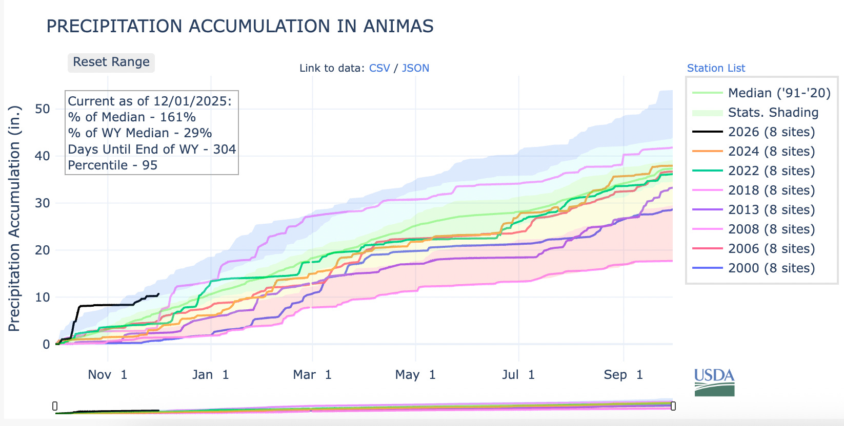
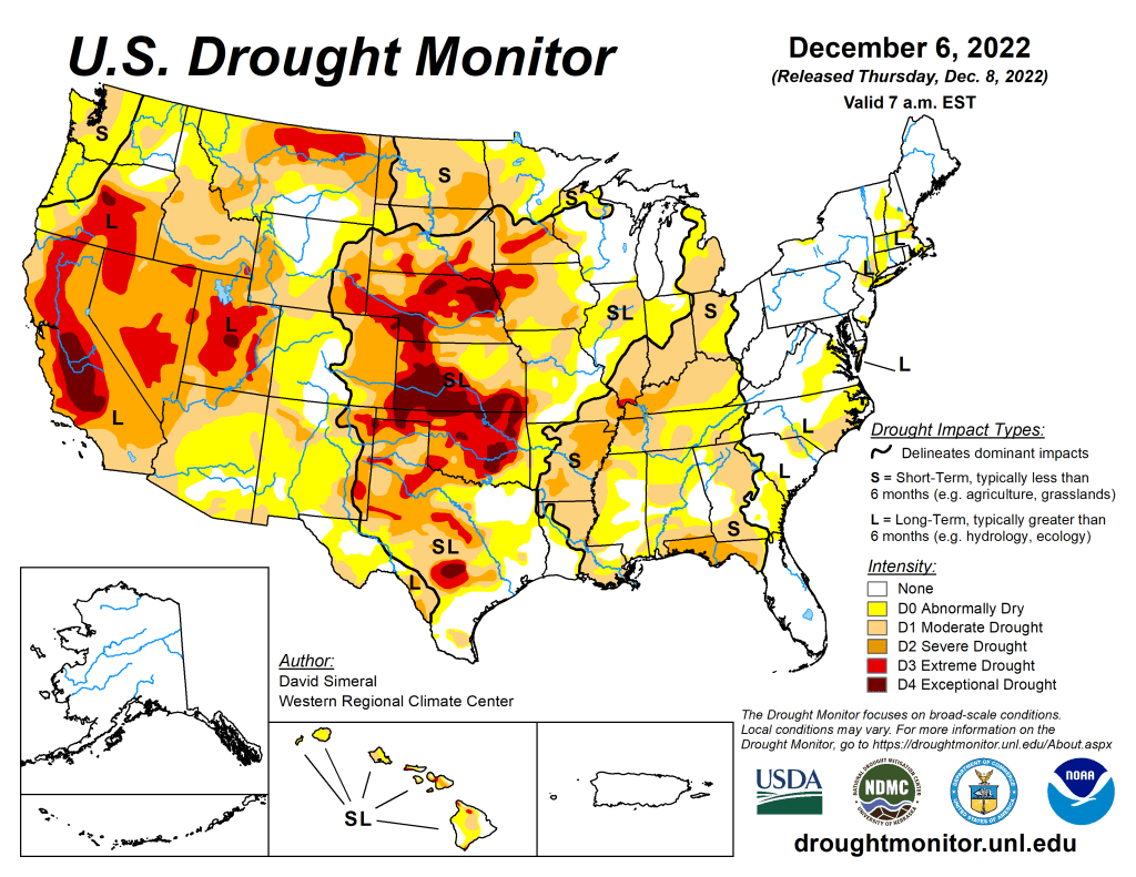
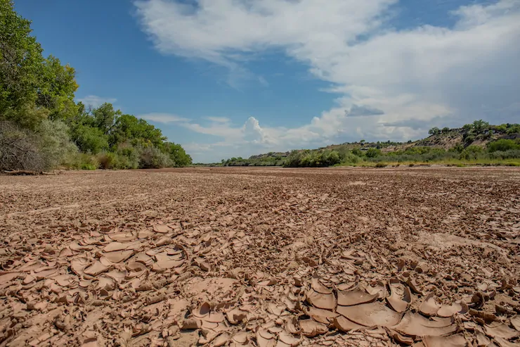
To put that into perspective, the Colorado River Compact assumed an average 16.5 million acre-feet at that site, Lees Ferry. The river this century has produced far less. Since 2020, the river flows have declined even more, to an average of 10.8.

Might it get worse?
“Dancing With Deadpool,” a new product from the Colorado River Research Group, delivers the short answer.
“Another year or two of low inflows and we will completely blow through the cushions provided by reservoir storage,” says the document’s executive summary. The word “crisis” litters the 64-page production. It has eight chapters written by 22 authors from Colorado and three other Colorado River Basin states.
The Colorado River has fascinated journalists since at least the 1980s. Then, the river was still delivering water to Mexico’s Sea of Cortez but troubles were evident on the horizon. The river now, except for specially engineered releases from upstream dams, disappears entirely after crossing into Mexico.
Since 2022, the Colorado River had become a national story. Empty seats at the annual Colorado River Water Users Association conference in Las Vegas have disappeared, press credentials harder to secure.
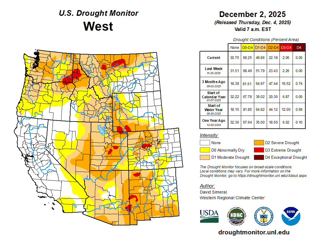
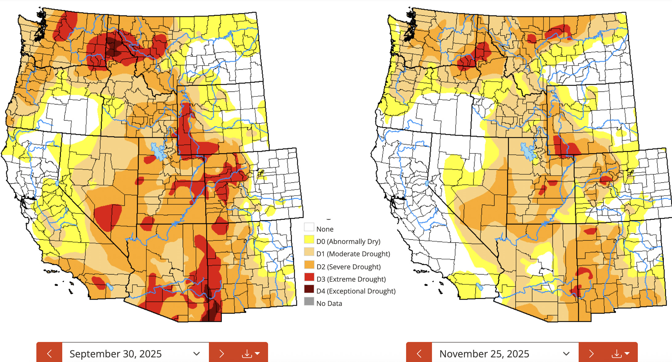
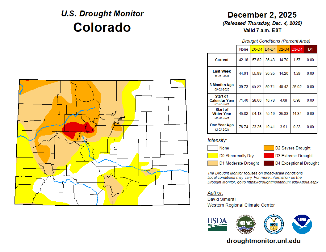
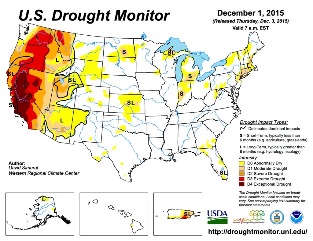
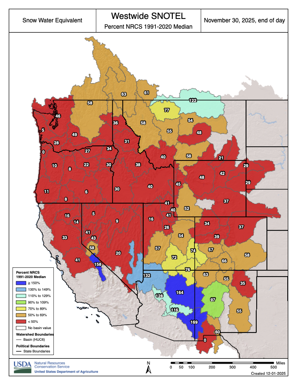
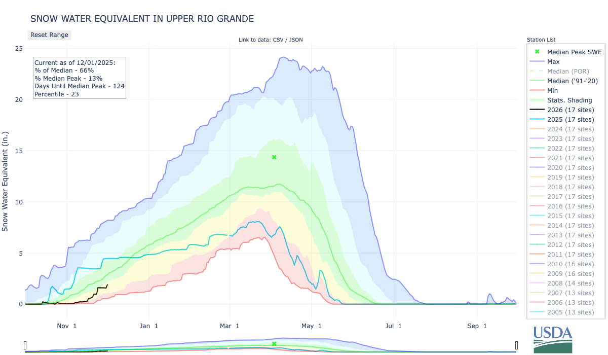
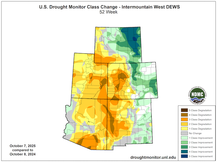
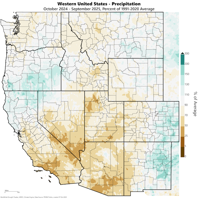
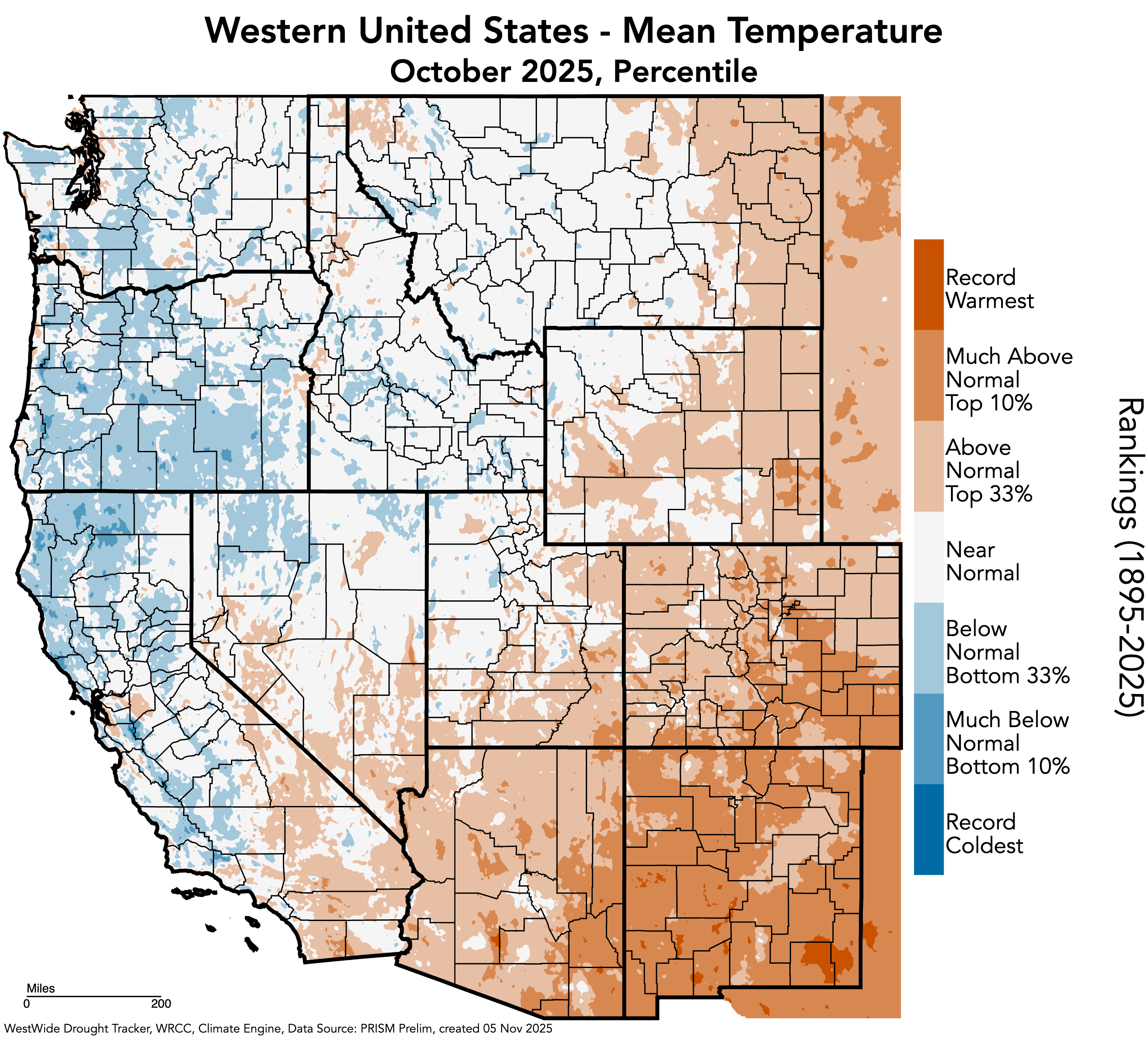
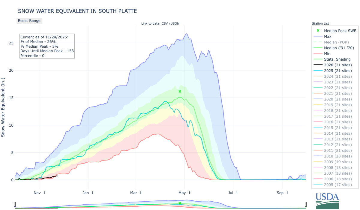
The tension even in the last year has grown. The river runoff this year was only 55% of long-term average. The seven basin states remain at an impasse about solutions proportionate to the problem.
“We have now entered a new era: Dancing with Deadpool,” says the report.
Deadpool is the point at which reservoirs can release no water. In 2022, that moment seemed imminent as sandstone walls of Glen Canyon were exposed directly to sunlight after being submerged since shortly after Lake Powell began filling. Then a miracle winter arrived, water levels in the two big reservoirs, Powell and Mead, rose once again, the emergency receded.
Now the crisis is back — and looming larger.
You can scare yourself to death with what-ifs, but we may need something akin to a miracle to avoid full-blown crisis. We cannot have another winter and then runoff like 2002-2003. Or, as several authors point out, runoff like we had in 2025.
As it is, we need another miracle winter, something akin to what diehard Denver Broncos fans remember as “the drive” in a 1987 playoff game. John Elway led his football team 98 yards down the field in Cleveland to tie the game with 37 seconds left. They won in OT.
Brad Udall and Jonathan Overpeck warn against too much optimism. Mother Nature can be stingy. She has been in the past, with one drought period as long as 80 years during the last 2,000 years. Now, the evidence grows that our monkeying with Mother Nature has produced this drought.

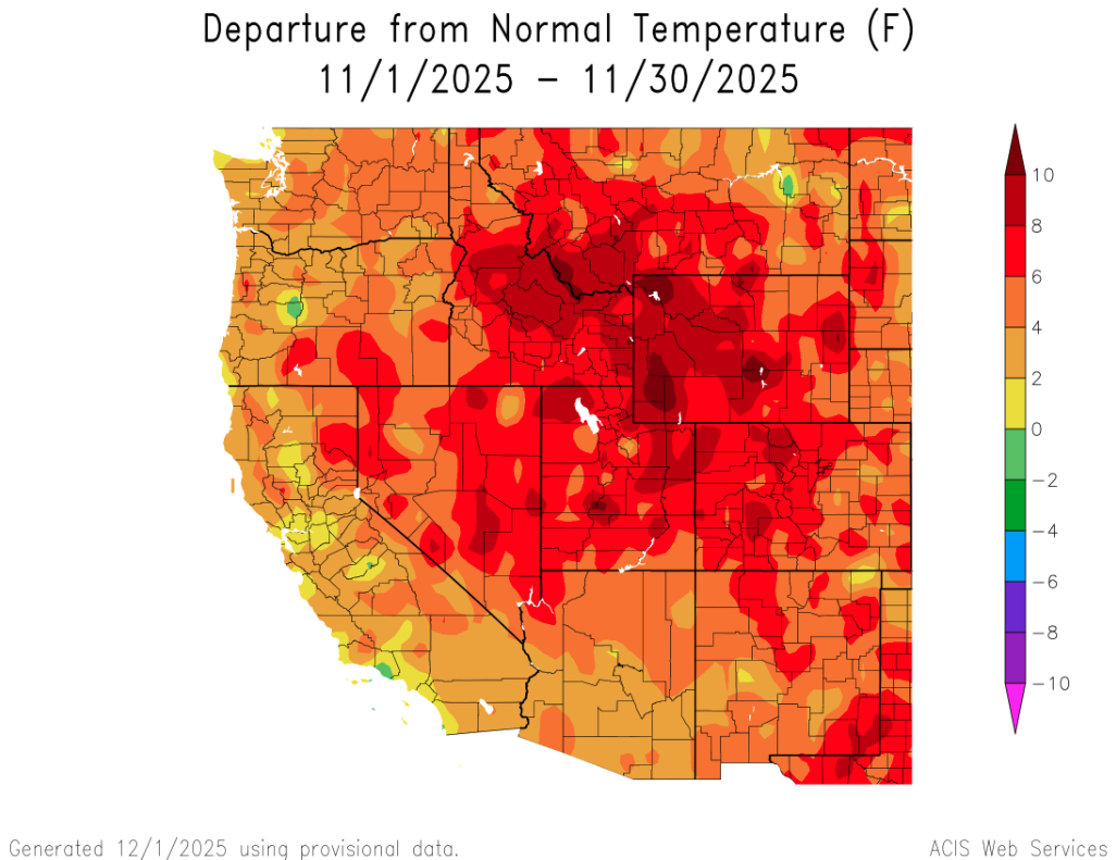
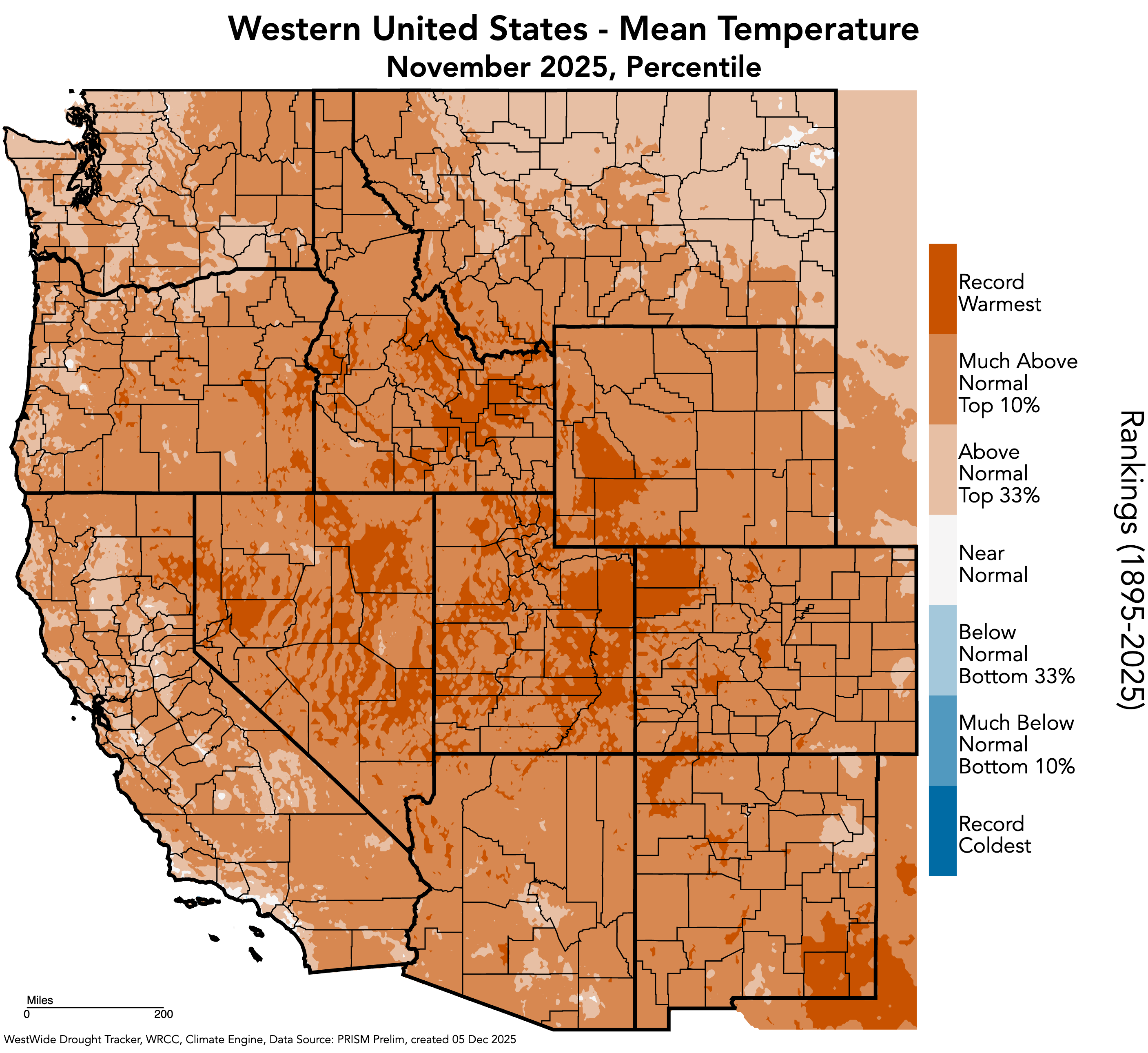
In 2017, Udall and Overpeck issued the results of their study that showed that warming alone was responsible for roughly half of the reduced natural flows of the Colorado River, at that point 17%. They delivered a new phrase: “hot drought” as distinguished from “dry drought.” The warmer temperatures were robbing the Colorado River Basin of water.
Precipitation in the basin has also declined 7% in the 21st century, as compared to the 20th century. In their chapter, Udall from Colorado State and Overpeck now at the University of Michigan (but with a summer cabin in San Miguel County), cite two new studies that together provide evidence “suggesting” complicity of humans. Greenhouse gases explain the declined precipitation, too.
As science is never 100%, Udall and Overpeck use cautious language. The studies, they say, “strongly suggest we are in for extended dry periods in the Colorado headwaters in the decades ahead.”
If there is less water, then isn’t the solution simple? Use less!
Easy to say. And for the last 20 years, efforts have been made to nibble away at uses. Cities have been working to make less water-intensive urban landscapes popular. But the far larger story lies in agriculture.
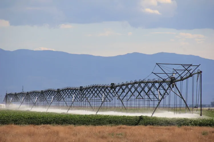
In Colorado and the three upper basin states, for example, about 70% of all the Colorado River water (after trans-basin diversions for irrigation are accounted for) goes to agriculture. How can ag use less water?
Two of the chapters work on this. A trio of academics from Wyoming and one from Colorado take aim specifically at the upper basin states. “The relevant questions are not whether or when cuts will happen, but how deep will they go, how will they be distributed, and how well can the consequences be mitigated?” they ask.
The four upper-basin researchers argue that evidence already exists for success. With creativity and collaboration, they say, farmers and ranchers can sustain crop and livestock production even as water becomes scarce. They get into the details, talking about adjustments of cow-calf operation, for example, to reduce water-dependent needs. They call for more research into limited irrigation, crop switching and other practices.
Two other academics, both from Arizona State, take a somewhat broader view, acknowledging the challenge.
“In a landscape of poor choices, in a failing river system in which all solutions are deeply unpopular to some or other powerful constituency, potentially harmful to one community or another or inordinately expensive and founded on unreliable funding, it is at least worth considering another option,” write Kathryn Sorensen and Sarah Porter.
They see cuts of up to 4 million acre-feet in the basin annually being necessary. Again, that’s about 25% of what those who created the Colorado River Compact expected would be annual flows for the seven basin states.
How to get there? They introduce a new concept, “economic water productivity,” a measure of the value of water. Instead of buy and dry programs, they see need for a federally financed effort to pivot uses through incentives to reduce water use on those agricultural lands.
Similar buy-down of high-volume irrigated agriculture is underway in two groundwater depletion areas in Colorado, the San Luis Valley and the Republican River Basin. Some federal money is providing help in the latter basin. They contend federal money will be needed, and lots of it, to pay for this big pivot in the Colorado River Basin. That, they say, would be fitting, because it was federal money that financed the infrastructure for this hydraulic empire.
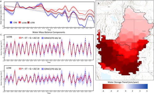
As for groundwater, that part of the Colorado River story has been generally overlooked. A study released several months ago found that nearly two-thirds of storage — both surface and groundwater — lost from 2002 to 2024 in the Colorado River actually came from groundwater depletion, mostly in Arizona.
Whoa!
“Simply shifting unsustainable surface water uses to unsustainable groundwater uses does nothing to address the core mismatch of supplies and demands,” observes Doug Kenney, who directs the Western Water Policy Program at University of Colorado Law School.
Other contributors dissect the complexities of what would seem to be simple, common sense solutions. For example, Eric Kuhn, the former general manager of the Colorado River District, works through the concept of water sharing among the states based on a percentage basis. The Colorado River Compact divides water between the upper and lower basins, a mistake in retrospect although even in 1922, when it was adopted, there had been an argument for using a percentage.
Later, when the upper-basin sates adopted a compact among themselves, they did use a percentage basis.
Kuhn goes deep into the history, as he has done with book-writing (“Science be Dammed,” 2019, with John Fleck) to sort through the thinking of this idea over the last century. It came up again earlier this year as the seven basin states tried to figure out how to share the river given the changed realities. The states, however, could not agree on what percentages should be used for sharing. It may have been just too much of a transformational change for some states to accept, he says.
However, the idea may come back if the stalemate between the upper and lower basins of the Colorado River ends up in the federal courts. Or failing that, what exactly would federal intervention look like? That’s an impolite question, but one of those what-ifs that must be wondered about. (For the record, the water people I know seem to have high regard for people in the Department of Interior in charge of looking after the Colorado River).
The large story here is that the states, with enormous aid from the federal treasury, created the infrastructure and expectations of water that no longer exists and, as per the studies of scientists, will almost certainly not return within the lifetimes of any of us. What, then, should be the federal role in defining the future balance? Once again, might the dismantling of Glen Canyon Dam be such a wild idea after all?
Thoughts in this book will likely be part of the conversations next week in Las Vegas when representatives of the seven basin states gather, as they always do, at the Colorado River Water Uses Association conference. Might a hallway conversation lead to a breakthrough?
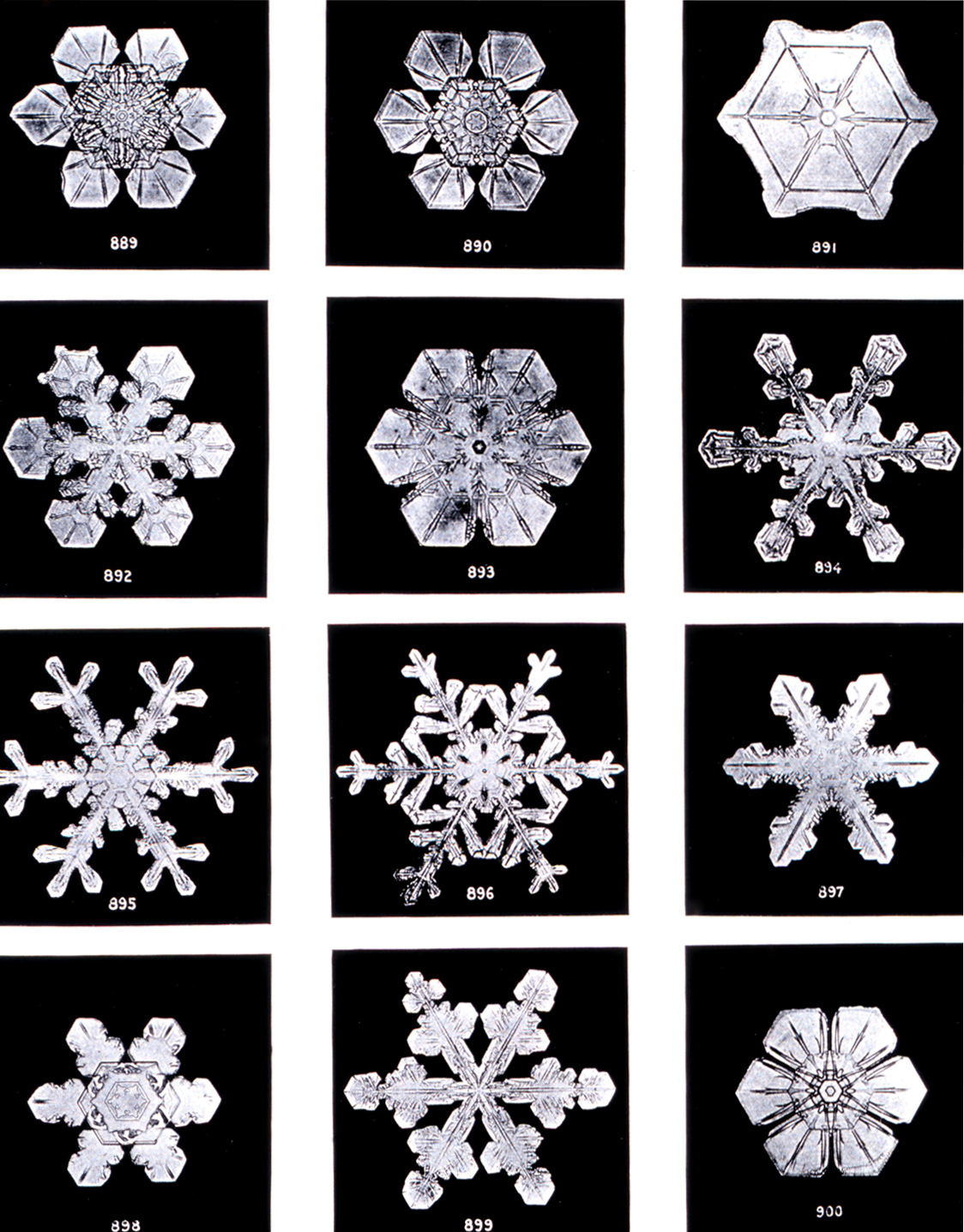
Like huge snowstorms in the Rockies and then cool temperatures during runoff, there might be miracles, but I wouldn’t count on it. This deadpool dance might end sooner than anybody actually likes.


