The city has already bought some water rights to begin this compliance process.
Alamosa City Attorney Erich Schwiesow told the council Wednesday night that staff has estimated it could take $3.5 million to comply with the rules…
The ordinance provides an outside limit to the terms of the financing of $3.7 million principal, $5.6 million total payment, and maximum annual payment of $375,000.
The $5.6 million is based on 5 percent interest over a 15-year repayment period.
Schwiesow said this ordi-ALAMOSA city council this week set boundaries on how much it will spend on its efforts to comply with new water rules from the state.
The council approved on first reading and scheduled for a March 1st public hearing an ordinance setting $3.7 million as the upper limit of what the city will finance to pay for water rights and associated expenses to bring the city into compliance with new groundwater rules.
Under the new rules, well owners (including municipalities ) must make up for their negative effects to surface water rights as well as providing means to replenish the San Luis Valley’s aquifer to more sustainable levels. nance for financing for the water project including the acquisition of water rights. It does not mean the city will be spending that much, but it means the city will not spend more than that, he explained.
The city will be working with UMB Bank to set up the financing . Alamosa Councilman Charles Griego said he hoped local banks would be involved. City Manager Heather Brooks said UMB Bank would shop around for the best rates, and Schwiesow added that the city council would ultimately approve whatever bank UMB Bank brought back to the council for financing. UMB Bank essentially serves as a broker for the city, he explained. In another water related matter of a different nature, the council on Wednesday approved its first budget amendment for the year in part to cover the costs of replacing failing equipment in the city’s wastewater treatment facility. The city will transfer $250,000 from the Enterprise Debt Fund to the water treatment department to replace ultraviolet equipment that is part of the last disinfection phase at the wastewater plant…
Alamosa Public Works Director Pat Steenburg added that when the plant was constructed 19 years ago, it had two UV systems. One of those quit working five or six years ago and the other is “on its last leg.” There are no parts even available for it now, he added.
The total transfer from the Enterprise Debt Fund was for $383,000, which included the $250,000 for the UV equipment as well as water department operations including $33,000 to add a technician to backfill existing staff.
The budget amendment also includes interdepartmental transfers to cover the cost of a drone purchase for the city, which all departments from IT to fire will be able to utilize.
Southern San Luis Valley water users took charge of their future on Tuesday as they became the third group to form a water management sub-district of the Rio Grande Water Conservation District.
The sponsoring district board unanimously accepted petitions for its latest subdistrict , which encompasses 141 wells covering 170 parcels of land in Conejos County.
The sub-districts are designed to provide an alternative to individual well regulation by grouping wells in geographic or hydrological areas of the San Luis Valley (Rio Grande Basin), which as a group replaces its injurious depletions to surface water rights. Sub-districts are also beginning to repair long-term depletions to the Valley’s aquifer system caused by well pumping.
Sub-district participants pay fees, which are used to buy water and/or provide incentives to reduce pumping. In the sub-district presented on Tuesday, participants will be assessed fees per well and per acre foot of water.
Rio Grande Water Conservation District (RGWCD) Program Manager Amber Pacheco presented to the sponsoring district board on Tuesday petitions representing 141 of a potential 198 wells in Sub-district #3. Nathan Coombs and LeRoy Salazar, who were part of the group that formed the subdistrict , were also present for the petition presentation to the RGWCD board.
Pacheco told the board staff and working group members had been working on this third sub-district for many months. Once they had information from the groundwater model, which determines depletions, the group was able to move forward.
Pacheco said the group was very successful in persuading well owners to join the sub-district , which is an “opt-in” sub-district . People had to choose to join. The first sub-district , on the other hand, was drawn up to cover a specific geographical area in the Valley’s closed basin region, and the work group then had to gather petitions from at least 51 percent of the landowners and 51 percent of the land.
Pacheco said efforts were made to contact every well owner in the Conejos subdistrict to give them the opportunity to join the subdistrict . Only one well owner, whose address was in Florida, did not respond at all, and another did not want to be involved. Both of those wells had not been used in a while.
Four other well owners opted out, not because they were against the sub-district but because they had other plans for their properties, and 21 wells belonging to governments such as towns or school districts indicated they would like to contract with the sub-district but could not participate directly, Pacheco explained.
She added a number of well owners decided to move their wells to exempt status so they would not fall under the groundwater rule process, for example downgrading them to stock or domestic wells, and a couple of well owners planned to seek abandonment of their wells.
All of the irrigation wells in the third sub-district are included, however, Pacheco said.
After receiving the petitions , RGWCD staff verified ownership and legal descriptions before presenting them to the board.
“It’s a massive undertaking ,” said RGWCD General Manager Cleave Simpson who commended the staff who completed that process. He also commended the residents who have been working on this for some time.
“The people have been great to work with,” Pacheco added.
RGWCD Attorney David Robbins said the process now is to file the petitions with the district court in Conejos County (because that is where the land lies in this subdistrict ) and seek the court’s approval for the sub-district’s formation. The court must hold a hearing no less than 60 days and no more than 90 days after receiving the petitions , he added. Individuals with questions or challenges against the sub-district formation may express those to the court.
“With our participation basically 100 percent, we would hope we wouldn’t see much of a protest to the formation of the sub-district ,” Pacheco said.
If there are no challenges, the court will enter an order forming the sub-district , and a board of managers can then be appointed and a plan of management prepared, Robbins explained.
That plan will be submitted to the state engineer’s officer for approval.
The first sub-district , which is one of the largest and most complicated, has been in operation for a few years now, and the second sub-district in the alluvium of the Rio Grande was officially formed in March of this year and is currently working on its plan of water management.
Pacheco said progress is also being made in sub-districts in the San Luis Creek, Saguache and Alamosa/La Jara areas. She said the goal is to have the remainder of the sub-districts in front of the court by early next year.
RGWCD staff has been meeting with entities such as the towns of La Jara and Saguache and the East Alamosa Water & Sanitation District to discuss their options for contracting with sub-districts . Discussions are also occurring with federal agencies.
The shallow aquifer leaned on heavily by farmers in the San Luis Valley is up 58,000 acre-feet over last year at this time.
The news delivered by Rio Grande Water Conservation District Engineer Allen Davey marks the third straight year the aquifer has gained.
“The last three years have seen a significant change in direction,” he told the district’s board Tuesday.
Davey, as he has in previous years, credited gains to the reduction in groundwater pumping by well owners in Subdistrict No. 1, which takes in 163,000 irrigated acres in the north-central part of the San Luis Valley.
The subdistrict, which was implemented four years ago, assesses a combination of fees on its members that aim to reduce pumping and also pay to fallow farm ground.
Groundwater pumping was expected to be 238,000 acre-feet, according to the subdistrict documents, although a final tally won’t come until later in the year.
Landowners in the subdistrict have also fallowed 14,245 acres of ground since 2013 through the U.S. Department of Agriculture’s Conservation Reserve Enhancement Program.
The program pays farmers to either permanently retire ground or fallow for 15 years.
Davey also said Mother Nature has cooperated by providing decent snowpack.
“If we can just get in that cycle where we’re average, we have a good future ahead of us,” he said.
The shallow aquifer, also known as the unconfined aquifer, recharges from stream flow and from the return flows that follow surface-water irrigation by farmers.
Once stream flows dwindle in late summer, farmers typically rely on groundwater to finish their crops.
The shallow aquifer has recovered by nearly 250,000 acre-feet since 2013.
The aquifer would have to recover by another 350,000 acre-feet to meet the goals laid out in the subdistrict’s management plan.
Although the liquid that attorneys argue about evaporates quickly, legal battles around water do not.
Rio Grande Water Conservation District Attorney David Robbins, who has been on the forefront of many of those battles over the years, updated the water district board this week on several ongoing cases of water litigation.
One of the most significant cases revolves around the groundwater rules promulgated by the state engineer about a year ago. About 30 responses were filed to the rules, some for them and some objecting to portions of the rules.
The Division of Water Resources staff has been trying to work with objectors to resolve their concerns short of trial. However, if the objections cannot be resolved, they will go to trial in January of 2018.
Colorado Division of Water Resources Division 3 Engineer Craig Cotten said, “We have met with all of the objectors at least once, most multiple times. We are working out stipulated agreements, getting closer on some of those. We will be continuing to work with those people and see if we can come up with agreements.”
Cotten said the goal is not to need the eight-week trial presently scheduled for early 2018. Robbins said the judge asked parties objecting to the rules to file notices stating specifically what they objected to, such as the model or data the rules rely upon. The parties have done that, he said, and now the state has the opportunity to respond.
Robbins said some objectors are working out stipulated agreements with the state, which will resolve their concerns short of trial. For example, water users with wells in the confined aquifer system in the Alamosa-La Jara and Conejos Response Areas, who objected to the sustainability criteria in the rules, are working out a stipulated agreement with the state. Robbins said he did not think the RGWCD would have any reason to object to the stipulation but he has asked for the documentation.
“The groundwater rules/regulations case is moving along. Judge Swift is doing a good job herding the cats. The state continues to work hard to try to resolve some of the objections so they can winnow it down to people who have concerns they want to pursue before the court,” Robbins said.
Robbins is also monitoring other ongoing cases such as:
• Bureau of Land Management augmentation plan for wells at the Blanca Habitat Area, which could potentially impact flows on the Rio Grande and Conejos Rivers and for which BLM must identify replacement sources for those impacts;
• A Saguache Creek area individual augmentation plan for which Robbins questions the sufficiency of replacements for depletions;
• The City of Alamosa change of water rights case related to the golf course, which is pending information review;
• A case south of the Rio Grande and west of Alamosa revolving around the question of whether recharge replacement can carry over from year to year;
• The Santa Maria Reservoir change case to provide reservoir water for replacement for plans of water management such as those set up in the RGWCD’s subdistricts , and for which a trial is scheduled in April 2017, with James Werner the sole objector remaining;
• Three cases proposing to move water around to provide replacements for well depletions , including one for the City of Alamosa;
• The Texas vs. New Mexico /Colorado compact compliance case, which is being overseen by a special master who has indicated he will deny a motion to dismiss the case;
• Center for Biodiversity’s suit against the U.S. Fish and Wildlife Service to list the Rio Grande Cutthroat Trout as endangered, a case in which the RGWCD has not become involved but is considering whether it should, favoring the opinion of the Fish and Wildlife Service that the trout is not endangered.
RGWCD Board Member Bill McClure cautioned against the district spending dollars and time on cases that were already well represented by other agencies. Robbins agreed and said that is why he had not recommended that the district become directly involved in the Rio Grande Cutthroat Trout suit, as the US Fish and Wildlife Services is already handling it.
Colorado will end the year with a credit in Rio Grande Compact accounting.
Colorado Division of Water Resources Division 3 Engineer Craig Cotten told the Rio Grande Water Conservation District board on Tuesday it appears both the Rio Grande and Conejos River systems will end 2016 on the plus side, with the Rio Grande reflecting about 7,000 acre feet credit at this point and the Conejos River system less than 1,000 acre feet credit.
“We try to over deliver just slightly so there’s no issue with downstream states,” Cotten said.
Colorado must deliver water to New Mexico and Texas according to the Rio Grande Compact. Cotten explained that the annual flow on the Rio Grande this year will be about 670,000 acre feet, which is not a bad water year, especially considering some of the previous dry years in the Rio Grande Basin.
He said that of the 670,000 acre feet, the Rio Grande would owe 190,800 acres feet or about 28 percent, to its downstream neighbors through the Rio Grande Compact . The river has met that obligation and then some, Cotten added. At this point, it appears the Rio Grande will have over-delivered about 7,000 acre feet.
There are currently zero curtailments on Rio Grande users and slight if any curtailments since the beginning of September.
The Conejos River system came closer to its obligation without sending too much extra downstream, according to Cotten.
The annual index flow on the Conejos system will be about 280,000 acre feet, of which about a third, or 95,400 acre feet, was obligated to downstream states.
“We will be close on the Compact delivery, within 1,000 acre feet,” Cotten told the Rio Grande Water Conservation District board on Tuesday. “We are close to where we want to be on the Conejos.”
Southern San Luis Valley water users took charge of their future on Tuesday as they became the third group to form a water management sub-district of the Rio Grande Water Conservation District.
The sponsoring district board unanimously accepted petitions for its latest subdistrict, which encompasses 141 wells covering 170 parcels of land in Conejos County.
The sub-districts are designed to provide an alternative to individual well regulation by grouping wells in geographic or hydrological areas of the San Luis Valley (Rio Grande Basin), which as a group replaces its injurious depletions to surface water rights. Sub-districts are also beginning to repair long-term depletions to the Valley’s aquifer system caused by well pumping.
Sub-district participants pay fees, which are used to buy water and/or provide incentives to reduce pumping. In the sub-district presented on Tuesday, participants will be assessed fees per well and per acre foot of water.
Rio Grande Water Conservation District (RGWCD) Program Manager Amber Pacheco presented to the sponsoring district board on Tuesday petitions representing 141 of a potential 198 wells in Sub-district #3. Nathan Coombs and LeRoy Salazar, who were part of the group that formed the subdistrict, were also present for the petition presentation to the RGWCD board.
Pacheco told the board staff and working group members had been working on this third sub-district for many months. Once they had information from the groundwater model, which determines depletions, the group was able to move forward.
Pacheco said the group was very successful in persuading well owners to join the sub-district , which is an “opt-in” sub-district. People had to choose to join. The first sub-district, on the other hand, was drawn up to cover a specific geographical area in the Valley’s closed basin region, and the work group then had to gather petitions from at least 51 percent of the landowners and 51 percent of the land.
Pacheco said efforts were made to contact every well owner in the Conejos subdistrict to give them the opportunity to join the subdistrict. Only one well owner, whose address was in Florida, did not respond at all, and another did not want to be involved. Both of those wells had not been used in a while.
Four other well owners opted out, not because they were against the sub-district but because they had other plans for their properties, and 21 wells belonging to governments such as towns or school districts indicated they would like to contract with the sub-district but could not participate directly, Pacheco explained.
She added a number of well owners decided to move their wells to exempt status so they would not fall under the groundwater rule process, for example downgrading them to stock or domestic wells, and a couple of well owners planned to seek abandonment of their wells.
All of the irrigation wells in the third sub-district are included, however, Pacheco said.
After receiving the petitions, RGWCD staff verified ownership and legal descriptions before presenting them to the board.
“It’s a massive undertaking,” said RGWCD General Manager Cleave Simpson who commended the staff who completed that process. He also commended the residents who have been working on this for some time.
“The people have been great to work with,” Pacheco added.
RGWCD Attorney David Robbins said the process now is to file the petitions with the district court in Conejos County (because that is where the land lies in this subdistrict) and seek the court’s approval for the sub-district’s formation. The court must hold a hearing no less than 60 days and no more than 90 days after receiving the petitions , he added. Individuals with questions or challenges against the sub-district formation may express those to the court.
“With our participation basically 100 percent, we would hope we wouldn’t see much of a protest to the formation of the sub-district ,” Pacheco said.
If there are no challenges, the court will enter an order forming the sub-district , and a board of managers can then be appointed and a plan of management prepared, Robbins explained.
That plan will be submitted to the state engineer’s officer for approval.
The first sub-district , which is one of the largest and most complicated, has been in operation for a few years now, and the second sub-district in the alluvium of the Rio Grande was officially formed in March of this year and is currently working on its plan of water management.
Pacheco said progress is also being made in sub-districts in the San Luis Creek, Saguache and Alamosa/La Jara areas. She said the goal is to have the remainder of the sub-districts in front of the court by early next year.
RGWCD staff has been meeting with entities such as the towns of La Jara and Saguache and the East Alamosa Water & Sanitation District to discuss their options for contracting with sub-districts. Discussions are also occurring with federal agencies.
1869 Map of San Luis Parc of Colorado and Northern New Mexico. “Sawatch Lake” at the east of the San Luis Valley is in the closed basin. The Blanca Wetlands are at the south end of the lake.
A San Luis Valley consulting firm is undertaking a study of wetlands and riparian habitat that state and federal wildlife officials hope will help their management efforts in the face of climate change and pending groundwater regulation.
The $228,000 project by Wetland Dynamics will look at past and present wetland habitat across the valley, agency capacity in managing that habitat on their respective jurisdictions and the needs of 35 species.
Jenny Nehring, a partner at Wetland Dynamics, said the agencies have a good understanding of what they manage inside their boundaries but the study will make it easier for them to collaborate.
“A valleywide perspective of how these wetlands function as a whole to provide resources for wildlife is not well understood,” she told the Rio Grande Basin roundtable earlier this week. “This effort will help us determine where we have information gaps regarding changes in historic habitats and populations.”
The information they gather will include a look at how wetlands have changed in the valley since its permanent settlement in the 1850s.
Missoula, Mont.-based Intermountain West Joint Venture is partnering with Wetland Dynamics and will analyze historic survey and land records from the U.S. General Land Office.
The General Land Office oversaw the public domain from its creation in 1812 until it was folded into the U.S. Bureau of Land Management in 1934.
The analysis will also include satellite photos that were taken every 16 days between 1984 and now.
That time interval will help determine how wetlands habitat changes between seasons, Nehring said.
The final report, due in 2019, would include information for 35 species, detailing how, when and what type of habitat they use and whether the water source undergirding their habitat is secure.
It would also detail the water held by landuse and wildlife agencies and any limitations on the use of that water — a key piece of information for determining how agencies can work together.
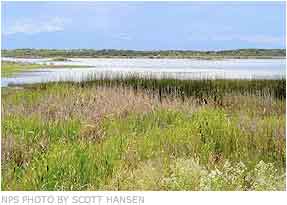
Every March, thousands of Sandhill cranes stop in #GreatSandDunes National Park & Preserve on their way to their northern breeding grounds. The fields and wetlands of #Colorado’s San Luis Valley provide excellent habitat for these majestic #birds. With the dunes and mountains nearby, they dance and call to each other. It’s one of nature’s great spectacles. Photo @greatsanddunesnps by #NationalPark Service.
Just one example of the importance of water use can be found at the Monte Vista National Wildlife Refuge, where U.S. Fish and Wildlife officials use groundwater to provide the roosting pools for the roughly 20,000 sandhill cranes that come through the valley in late winter.
Likewise, the Bureau of Land Management uses groundwater to supplement the Blanca Wetlands Recreation Area east of Alamosa that hosts migrating shore and songbirds.
The agencies that are partnering on the project and contributing manpower include the BLM, USFWS, the National Resource Conservation Service, National Park Service and Colorado Parks and Wildlife.
But it could also help land trusts and state wildlife officials who work with private landowners.
“Really what it’s going to do is help us be better partners,” said Rick Basegoitia, area wildlife manager for CPW’s valley office.
Here’s the release from Stanford University (Ker Than):
A new computer algorithm developed at Stanford University is enabling scientists to use satellite data to determine groundwater levels across larger areas than ever before.
Researchers from Stanford’s School of Earth, Energy & Environmental Sciences have used satellite data and a new computer algorithm to gauge groundwater levels in Colorado’s San Luis Valley agricultural basin. (Image credit: Flickr)
The technique, detailed in the June issue of the journal Water Resources Research, could lead to better models of groundwater flow. “It could be especially useful in agricultural regions, where groundwater pumping is common and aquifer depletion is a concern,” said study coauthor Rosemary Knight, a professor of geophysics in the Stanford School of Earth, Energy & Environmental Sciences.
Knight and her colleagues recently applied the algorithm to determine groundwater levels across the entire agricultural basin of Colorado’s San Luis Valley. As a starting point, the algorithm uses data acquired using a satellite technology called Interferometric Synthetic Aperture Radar, or InSAR, to calculate changing groundwater levels in the San Luis Valley between 1992 and 2000.
InSAR satellites use electromagnetic waves to monitor tiny, centimeter-scale changes in the elevation of Earth’s surface. The program was initially developed in the 1980s by NASA to collect data on volcanoes, earthquakes and landslides, but Knight and her colleague Howard Zebker, a professor of geophysics and of electrical engineering at Stanford, have in recent years adapted the technology for groundwater monitoring.
The Stanford scientists, led by former postdoctoral scholar Jessica Reeves, had previously shown that changes in surface elevation could be correlated with fluctuations in groundwater levels. However, they were only able to do so for a relatively small area because they had to manually identify and analyze high-quality pixels in InSAR satellite images not covered by crops or other surface features that could obscure elevation measurements.
The new algorithm, developed by Jingyi “Ann” Chen, a Stanford postdoctoral researcher in Knight’s group, automates this previously time-consuming pixel selection process. “What we’ve demonstrated in this new study is a methodology that allows us to find high-quality InSAR pixels in many more locations throughout the San Luis Valley,” said Chen, who is first author of the new study.
Chen’s algorithm also goes a step further by filling in, or interpolating, groundwater levels in the spaces between pixels where high-quality InSAR data are not available. Interpolation is a form of averaging, but it requires high-quality InSAR data from places that are located near monitoring wells where groundwater levels are already known in order to calibrate the link between the InSAR data and groundwater levels. In the previous work led by Reeves, only three monitoring wells were “co-located” with high-quality InSAR pixels. Using the new algorithm, that number increased to 16.
As a result, the team was able to calculate surface deformations – and, by extension, groundwater levels – for the entire agricultural basin of the San Luis Valley, an area covering about 4,000 square meters – or about five times greater than the area for which groundwater levels were calculated in the prior study. What’s more, the team members were able to show how groundwater levels in the basin changed over time from 2007 to 2011 – the years when InSAR data that could be analyzed by the algorithm were available.
“Jessica showed that there was useful information in the InSAR-derived deformation, and Ann has made the technique for extracting that information reliable and practical,” Zebker said.
Having a continuous map of deformation in the San Luis Valley led to the team discovering that there is a delay between the time when groundwater is pumped out of an aquifer and when the ground sinks, or subsides, in response to the water removal. These time lags might be useful indicators of the geological properties of an aquifer, said Knight.
“In a sand aquifer, there is no time lag between when the water is pumped out and the ground surface deforms,” Knight said. “However, if clay is present, it will take much longer to deform in response to pumping, so there will be a detectable time lag.”
The next step, Zebker said, is to take the information about groundwater levels and aquifer characteristics extracted from InSAR satellites and incorporate it with data from other sources to develop improved models of groundwater flow.
“The goal is to take into account the full water budget,” Zebker said. “This means accounting for water recharge such as rainfall and for discharge sources such as evaporation and runoff.”
Artesian well Dutton Ranch, Alamosa 1909 via the Crestone Eagle FromThe High Country News (Paige Blankenbuehler):
The San Luis Valley in southern Colorado is an 8,000-square-mile expanse of farmland speckled with potato, alfalfa, barley and quinoa fields between the San Juan and Sangre de Cristo mountain ranges. Only about 7 inches of rain fall each year in the San Luis Valley. But while farmers and ranchers can’t depend on moisture above ground, they make up the difference beneath it. The valley is underlain by a vast aquifer, which is punctured by more than 6,000 wells that pump water onto the valley’s crops and supports the livelihoods of 46,000 residents.
For generations, the aquifer provided enough water to sustain the arid farming community. But beginning in 2002, a multi-year drought shrunk the nearby streams and water table. Farmers and ranchers began to notice the falling levels of the Rio Grande and the rapidly draining aquifer. Some wells throughout the valley abruptly stopped working.
The aquifer dwindled so much that the Closed Basin Project, a Bureau of Reclamation pumping effort that had long met downstream water diversions and delivered flows to the Rio Grande River to maintain the Alamosa National Wildlife Refuge, failed to convey enough water to the valley’s farms and ranches. “We operate in a highly over-appropriated system,” says Cleave Simpson, manager of the Rio Grande Water Conservation District, the main water management entity in the San Luis Valley. “Agriculture had overgrown and far outstretched water supply.”
Without change, state water regulators could shut off thousands of wells. So the valley’s farmers and ranchers, unlike other agriculture communities in the West, did something nearly unprecedented: They decided not to ignore the problem.
In 2006, the Rio Grande Water Conservation District and San Luis Valley water users created the sub-district project, an innovative solution for solving water problems. The plan would charge farmers and ranchers $75 per acre-foot for the groundwater they pumped, and in turn use the funds to pay farmers to fallow portions of their fields, limiting demand on the water supply, as High County News reported in 2013. The experiment began at sub-district 1, the valley’s largest of six sub-districts, which sits at the heart of the San Luis Valley in aptly named Centre, just west of the Great Sand Dunes National Park.
Center-Pivot and Acequia Farms. The green belts along the Río Culebra and tributaries in San Acacio, San Luis, Chama, Los Fuertes and other unmarked villages are the principal acequia farm bottomlands in Costilla County. The center-pivot circles are concentrated in the Blanca-Ft. Garland vicinity to the N and the Mesita-Jaroso vicinity due W and SW of the acequia bottomlands. Source: Google Maps (screenshot).
Today, four years into the operation of the project after it launched in 2012, the aquifer is rebounding. Water users in sub-district 1 have pumped one-third less water, down to about 200,000 acre feet last year compared to more than 320,000 before the project. Area farmers have fallowed 10,000 acres that once hosted thirsty alfalfa or potato crops. Since a low point in 2013, the aquifer has recovered nearly 250,000 acre-feet of water. By 2021, the sub-district project plans to fallow a total of 40,000 acres, unless the ultimate goal of rebounding the aquifer can be reached through other conservation efforts, like improving soil quality and rotating to more efficient crops.
The plan’s proponents say it provides a template for groundwater management in other arid communities whose agricultural economies are imperiled by drought. “The residents of the valley know that they are in this together, and that the valley has overgrown the water available to us,” says Craig Cotten, Almosa-based division engineer for the Colorado Division of Water Resources. “This is a water user-led solution, which makes it unique. I really think this can be a model.”
Crucially, the plan is state-mandated, which requires everyone to either participate in a district, fallow their fields or work with water engineers to develop their own augmentation plans, which in turn need to be approved by state water courts. Those choices — paying premiums for groundwater or scaling down operations significantly — have been tough for farmers. Nevertheless, Simpson says the valley’s water users have gotten on board. “It’s not comfortable but most everyone has really come forward,” Simpson says. “It’s a bit of a paradigm shift for farmers who are individualistic and don’t typically work together — but by necessity they realize that we will bankrupt ourselves if we continue to stretch our water resource.”
But water users in the San Luis Valley have also gone beyond the call of duty, says Heather Dutton, manager of the San Luis Valley Water Conservancy District. While the SLVWCD helps include users in its augmentation plan as an alternative to joining the sub-district project, Dutton says that few water users have gone that route. That’s partly because farmers and ranchers themselves have helped create the sub-district rules, through participating in public meetings and getting involved with the board of managers. “This has been a good exercise in self-governance,” Dutton says. “It’s been a success story in people coming together and trying things that my grandpa’s era would have thought were crazy.”
Although sub-district 1 has proved a success, the broader sub-district project remains in its fledging stages. In March, Colorado District Court in Rio Grande County mandated that sub-district 2, a cluster of a hundred or so wells between Monte Vista and Del Norte, unroll as phase two of the program. The second district is currently forming a board of managers to develop official rules for farmers and ranchers within the territory. The Rio Grande Water Conservation District is still working with valley residents to implement the remaining four sub-districts.
Still, the project’s first phase has been encouraging for residents. Patrick O’Neill grew up in Central California’s San Joaquin Valley and first came to the San Luis Valley in 1998 to work as an intern at Agro Engineering, a consulting company. Though he later returned to his family farm in California, he came to feel that the Central Valley, built on its own wasteful groundwater use, was not sustainable. He returned to the San Luis Valley in 2005, where he now owns Soil Health Services in Alamosa and works with area farmers and ranchers to improve soil health. “I chose this place in a very deliberate way for my home because there’s potential for putting our water system back into balance,” O’Neill says. “People here are much more conscious of how much water they are using.”
1869 Map of San Luis Parc of Colorado and Northern New Mexico. “Sawatch Lake” at the east of the San Luis Valley is in the closed basin. The Blanca Wetlands are at the south end of the lake, via Wikipedia.
Finding out where the San Luis Valley’s wetlands and irrigated acreage used to be could help determine where they should be in the future.
Chronicling that history to chart a future course is one of the focuses of a proposed watershed assessment project that Wetland Dynamics is seeking funding for. How those wetlands relate to wildlife habitat is another big component.
Cary Aloia and Jenny Nehring of Wetland Dynamics made an initial presentation and request for $37,000 to the Rio Grande Roundtable this week. The formal presentation and decision will be made next month. The project total is $164,000.
Although no one objected to the project, it sparked discussion about whether or not the roundtable should fund a project through an individual business, rather than a nonprofit organization, as previous funding requests have been made.
Aloia and Nehring said they were simply cutting out the middleman, and the costs for the project would probably increase $4,000-10 ,000 if it had to go through a nonprofit, which would take its portion and then contract with Wetland Dynamics to perform the work.
Colorado Water Conservation Board (CWCB) Program Manager Craig Godbout said individuals and businesses are not eligible for statewide account funds, but individual roundtables have discretion with regard to basin-allocated funds.
“There are no restrictions that I am aware of on what type of entity can be awarded basin accounts,” Godbout said.
Wetland Dynamics is seeking funds allocated to the Rio Grande Basin.
Funding for water projects around the state through CWCB and the basin roundtables is derived from severance tax revenues.
Nehring said this project will provide a Valleywide perspective about how drought and other changes have affected the wetlands that provide habitat to a variety of wildlife. She said several agencies and groups are monitoring their portion of the picture, but this would encompass the entire Valley and bring those agencies and groups together.
Aloia added that this project meets many of the environmental , recreational, agricultural and water administration goals of the roundtable.
She explained that this project will be completed by two entities: Intermountain West Joint Venture, which already has funding in place to provide historic and current wetland and agricultural uses in the Valley through its GIS model (and has completed similar projects in other parts of the western U.S.); and Wetland Dynamics, which will coordinate the project and bring everyone together to identify priority species, future water delivery projects and the best way to use water and land to benefit habitat.
“We are working cooperatively and collaboratively,” Aloia said.
Nehring said historical information is available as far back as the 1870’s through General Land Office surveys, which can be coupled with imagery captured from 1984 to the present. She said this information will show how wet areas in the Valley have ebbed and flowed through the years.
This information will help determine where habitats still exist and areas that can be targeted for conservation.
Nehring said Intermountain West Joint Venture will begin its work next month and will complete its part of the project in 18-24 months. Wetland Dynamics plans to complete its portion next year and will spread the $37,000 over a two-year period.
Aloia said there is a great deal of information, but it is in different places and with different agencies.
“We need to compile all of that,” she said.
Then priority species lists will be compiled and habitat areas identified for those species. All of the groups will then be able to cooperatively manage their water better to serve those habits, Aloia explained.
Brian Sullivan, wetlands program coordinator for Colorado Parks and Wildlife, said the department sees many benefits for this project and is firmly behind it. For example, it will provide information on the quantity and quality of wetlands for wildlife habitat and will help justify financial investments in the basin, he said.
Sullivan said Colorado Parks and Wildlife has pledged $46,000 towards this project, and he urged the roundtable to also support it. He said this project would be a great tool, “and you can’t have too many tools in the tool box.”
Kevin Terry, Rio Grande project coordinator for Trout Unlimited, added his endorsement of the project. One of the benefits , he said, would be consolidation of data in one place where it would be accessible to the different agencies.
Aloia said another outgrowth of the project will be identification of knowledge gaps, which can be the basis for future projects.
“It will highlight things we still don’t know,” she said. “It’s really a stepping stone for future projects.”
It will identify, for example , places where there could be restoration projects in the future to help bring back water resources that were present historically but are no longer present, she explained.
The information gathering and assessment will encompass the Valley floor up to 8,500 feet. Roundtable member Ed Nielsen said this sounds like a good project, but he believed it needed to encompass the mountains and headwaters too. He said it seems fragmented at this point.
Nehring said this a joint venture, and Intermountain West Joint Venture is setting the scope of this project. Aloia added that agricultural use, which is a key component of this project, is centered on the Valley floor.
Sullivan explained that the focus is on the irrigated landscape, which is where the biggest changes in wetlands have occurred.
Former Rio Grande Roundtable Board Chairman Mike Gibson said he personally had a problem with the roundtable funding an individual entity, because requests in the past have come through nonprofit organizations or state agencies. He said it had nothing to do with Wetland Dynamics, but he was concerned about the roundtable losing control over how money is administered and spent if the roundtable starts funding individual entities. He said he believed the roundtable had more oversight over projects going through nonprofit groups.
“I have a real concern,” he said.
Roundtable member Travis Smith said this is a worthy project, but it sounded like the roundtable needed to clarify some protocol issues.
“This application is about shared partnerships and getting agencies to talk to each other about water resources,” Smith said.
Roundtable member Dale Pizel said this seemed like a good project and he would hate for it not to be conducted simply because the roundtable had never funded projects through individual businesses before.
“If we need to have that discussion, let’s have it,” he said.
Roundtable member Judy Lopez agreed the discussion needed to be held. She also agreed this was a good project but was taking the roundtable into uncharted territory.
She asked if Billy Bob’s Excavating came in with a request for river restoration funding, would the roundtable fund it?
Pizel said if it fit with the roundtable’s goals, he did not have a problem funding “Billy Bob.” He said every project needs to have oversight to make sure it is performed correctly and fiscally responsibly.
Lopez said she did not think anyone had a doubt about how fiscally responsible Wetland Dynamics would be, but the roundtable needed to determine if it wanted to open this door and decide who could go through it. She said Aloia and Nehring are people of integrity, and this project meets many of the roundtable’s goals.
Godbout said his office requires reports and specific information, and he reviews that information carefully. He said he makes sure that the invoices match the work completed.
Roundtable member Rio de la Vista said, “So there is some oversight I think we can feel good about.”
Roundtable member Ron Brink said he was apprehensive about opening the gates to this type of funding.
Roundtable Chairman Nathan Coombs said, “The door can be opened. Just because it has not been opened doesn’t mean we shouldn’t. We should look at the project on its merits, if it accomplishes our goals.”
Although a trial for new groundwater regulations in the San Luis Valley isn’t set until January 2018, State Engineer Dick Wolfe said his staff is working toward settlements to avoid that court date.
Wolfe told a Thursday meeting of the Rio Grande Compact Commission that efforts to compromise with the 30 objectors in the case have been underway for a few months.
“I’m very optimistic we’re going to be successful working through those issues with those other objectors in hopes to reach stipulation with all of those objectors and hopefully avoid going to trial,” he said.
Wolfe’s office submitted rules to the valley’s water court in September.
They were the first attempt by the state to issue comprehensive groundwater rules for the valley since the 1970s, when a previous effort never reached implementation.
The rules governing the roughly 4,500 highcapacity irrigation wells that tap into the valley’s two large aquifers require users to join a subdistrict, have an augmentation plan, or at least a temporary water supply plan.
The aim of the rules is to mitigate the impact of groundwater pumping on the valley’s streams and rivers, which are hydraulically connected to the aquifers in varying degrees. The objections to the rules cover a number of issues but many question the use of the state’s Rio Grande Decision Support System, a computer model that’s used in the calculation of stream loss caused by pumping.
But even if the rules do end up at trial, working toward settlements now can still pay off, Wolfe said.
“Even if we don’t ultimately get to an agreement with all those objectors we hope to at least limit the number of objectors so ultimately that would have to go to trial and the number of issues we would have to litigate,” he said.
Rules changing the way well owners operate in the San Luis Valley will go to trial in 2018.
Rio Grande Water Users Association Attorney Bill Paddock told that group of water users during their annual meeting on Thursday that a trial date has been set to hear objections to the rules, which the state filed last fall. The court has scheduled the trial to begin on January 2, 2018.
One of the reasons for setting the trial so far out is the amount of time the trial could take. The judge has scheduled up to eight weeks for the trial, Paddock said.
He reminded the group that 30 statements of opposition were filed in response to the state’s groundwater rules for the Rio Grande Basin, which encompasses the San Luis Valley. About half of those “statements of opposition” were in favor of the rules and about half against. The only method to voice support for the rules was to file a “statement of opposition.”
The groundwater rules focus on protecting senior water rights, promoting sustainability and upholding the state’s Rio Grande Compact with downstream states. The rules require wells in the basin to make up for the injuries they have caused surface water rights or face the possibility of being shut down.
Paddock said the objections to the rules range from concerns about the irrigation season, which is specified as part of the rules, to challenges about how the state plans to determine and enforce the sustainability requirement that is part of the water rules.
Paddock said the sustainability issue was likely the strongest piece of the legal challenge. The state is requiring water users to bring the confined, or deeper, aquifer back to the level it was during the period of 1978-2000 , but the state does not have enough data to determine what those levels should be, so it will be collecting further data to enforce that portion of the rules.
Paddock said some water users, such as those in the Alamosa/La Jara area defined in the rules, have not changed how much they have pumped since that 1978-2000 period, while other areas of the Valley have experienced dramatic changes in pumping since that time.
“That’s going to be the biggest issue,” Paddock said.
He said the state would begin negotiating with objectors to see if it can work out some of their concerns short of trial. He said he was optimistic a number of issues people have raised could be resolved simply through those negotiations or as legal questions decided by the judge.
If that is the case, the courts will not be looking at an eight-week trial but something less than that, possibly 4-6 weeks, Paddock said.
“On the confined aquifer sustainability issue, there is likely to be a trial,” he said, “and if that’s the issue it’s likely to be a 4-6-week trial because of the complexity of the problem and the number of expert witnesses who will have to testify.”
Pond on the Garcia Ranch via Rio Grande Headwaters Land Trust
The second groundwater management subdistrict in the San Luis Valley cleared an initial hurdle earlier this week.
Rio Grande County District Court Judge Pattie Swift approved the formation of Subdistrict No. 2, although the finalization of a water management plan remains.
There were no protests or objections filed with the court, according to Swift’s order.
The subdistrict lies roughly along the Rio Grande between Alamosa and Del Norte, and only includes landowners who volunteered to join.
It takes in 230 groundwater wells. As with its larger predecessor — Subdistrict No. 1 in the north-central part of the valley — the primary goal is to mitigate the impacts of groundwater pumping on surface water users.
The valley’s groundwater is hydraulically connected in varying degrees to the region’s streams and rivers, meaning that pumping can cause losses to surface water users.
The subdistrict’s parent organization, the Rio Grande Water Conservation District, is seeking to organize as many as four other subdistricts around the valley.
The mechanisms used to raise funds from members have yet to be determined, but the subdistrict’s annual revenue will not exceed $4 million in 2014 dollars.
The subdistrict’s petition for formation included a draft water management plan, but it will be subject to public hearing and approval of the Colorado Division of Water Resources before it can be finalized.
Should objectors remain after those steps, the subdistrict’s water management plan could also be subject to water court review.
Pond on the Garcia Ranch via Rio Grande Headwaters Land Trust
The Court for Water Division No. 3 is expected to set a trial date later this month for the proposed state groundwater rules in the San Luis Valley.
That trial date may not come until 2017, according to a draft case management order filed with the court Friday, but a long window before the trial may help State Engineer Dick Wolfe with his goal of coming to an agreement with objectors before trial.
To date, 29 parties have filed comments, although at least three of them did so in support of the rules.
The rules would cover the roughly 4,500 wells that draw off either of the valley’s two major groundwater bodies.
The unconfined aquifer is the shallower of the two and is recharged both by streamflow at the valley’s edge and by return flows from irrigation.
The confined aquifer is recharged mainly by streamflows on the valley rim, sits beneath the unconfined aquifer and holds artesian pressure.
Both are hydraulically connected, in varying degrees, to stream flows in the valley, meaning that groundwater pumping can injure surface water users.
The rules are designed to protect surface water users and restore aquifer levels by requiring groundwater users to either join a groundwater subdistrict, create an augmentation plan, or create a substitute water supply plan.
All three would require the mitigation of pumping impacts as determined by a staterun computer model that simulates the behavior of the valley’s groundwater.
Comments were filed by 21 parties at the end of November, although the court extended the comment period because of problems noticing the rules in the north end of the valley.
Many of those comments focused on whether the state’s groundwater model was sufficient for the rules.
Since then eight others have also weighed in.
As with previous objectors, there were two protestors among the latest group who argue that the rules only be approved to the extent that the groundwater model is accurate. Other objections focus on the proposed process the engineer’s office would use to set an irrigation season. The subdistrict operating under the Trinchera Water Conservancy District has also entered a protest, calling for the rules to allow it to submit a groundwater management plan. While the valley’s existing subdistrict and the four other proposed ones would all operate under a groundwater management plan, Trinchera is unique in that it is the only subdistrict not operating under the umbrella of the Rio Grande Water Conservation District.
Trinchera is in Costilla County, which is not a part of the Rio Grande district.
The state law that allows for the creation of conservancy districts does not make clear whether Trinchera can create a groundwater management plan.
Complying with the state groundwater rules will not be painless or cheap for the City of Alamosa.
The city, like hundreds of well owners throughout the San Luis Valley, will have to comply with the recently filed state groundwater rules for the Rio Grande Basin.
City staff and legal counsel Erich Schwiesow have already been preparing for the inevitable compliance.
Well owners who must comply with the groundwater rules must join a water management sub-district or submit their own augmentation plans to the water court. The city of Alamosa is submitting an augmentation plan that will detail how the city plans to comply with the rules so it can continue pumping water from its wells for municipal use.
Schwiesow updated the Alamosa city council during a recent work session on the compliance process, and City Manager Heather Brooks updated the council on the compliance cost.
Brooks estimated the city’s cost to comply with the rules would be about $2.1 million. The rules require those who are pumping water from wells which constitutes the city’s water supply to replace the injuries their well pumping causes to surface water rights and to help restore the basin’s underground aquifer system. In Alamosa’s case, Schwiesow said the city must repair injuries to three rivers in the Valley, the Rio Grande, Conejos and Alamosa Rivers.
The city does not yet possess enough water rights to make up for its calculated injuries and sustainability obligations, so city staff members are currently negotiating for one water purchase that would help take care of that problem but may need to make more than one water purchase.
“We are looking for surface water and we are looking for groundwater,” Schwiesow said.
Brooks said the purchase the city is currently negotiating would be for surface water rights, but finding groundwater to help the city meet its sustainability obligations might be more difficult.
“We’ve been looking. There’s just not a lot out there,” she said.
The cost of the water rights is part of the $2.1 million compliance cost, with other portions including legal fees and possible water storage costs. Brooks said initial estimates were much higher than that, at about 3 million.
Bringing that cost down, Schwiesow and Brooks told the council, is the fact the city will receive credit for its accretions, the water it puts back into the system from the wastewater treatment plant. In fact the city has surplus accretion credits of 800 acre feet annually it is offering for bid starting at $250 an acre foot for a five-year lease. See the city’s web site at http://cityofalamosa.org/ultimate-auction/augmentation-credit/
Schwiesow explained that the city has made an application in the water court to exchange the accretion credits it has below Alamosa farther upstream on the Rio Grande and Conejos Rivers to cover depletions the city is obligated to replace on those two rivers.
How much the city will have to replace is determined by a groundwater model that predicts how the pumping of certain groups of wells, designated in “response areas ,” affects surface streams, Schwiesow explained. Alamosa is in the Alamosa/La Jara Response Area, he said.
He also gave a hydrology lesson to the city council about how water melting from snow in the mountains recharges the San Luis Valley’s aquifer system and how the water under the Valley floor is divided by clay into unconfined (more shallow) and confined (deeper) aquifers , but there is connectivity between the aquifers. The city’s potable water wells are located in the deeper confined aquifer ranging in depth from 1,400-1,700 feet, according to Alamosa Public Works Director Pat Steenburg. The city has a total of seven wells.
Schwiesow also gave the council a water history lesson about priority being given to water rights on the basis of when they were first granted, with older rights having more seniority. Groundwater rights are very junior, he explained, because the wells were drilled long after water rights were granted to those using the surface streams. However, the state has not administered the wells in the past under the priority system, and a prior attempt to do so failed. The state was successful , however, in issuing moratoriums on drilling new wells both in the confined and unconfined aquifers, Schwiesow explained to the council.
Last fall the state promulgated rules requiring the junior groundwater rights to replace depletions they are causing to surface streams, and although filed, those rules are not yet in effect, pending challenges being resolved in court, Schwiesow added.
Councliman Charles Griego asked about how soon the city had to come into compliance with the state water rules. Schwiesow said the city has to be in a sub-district or have an augmentation plan or substitute supply plan within a year after the rules are finally approved by the court.
Griego asked why the city was in such a hurry to put the augmentation plan together now if the legal process could take years before the rules are finally approved.
“Because it takes time,” Schwiesow said, “and we want to be ahead of the curve. If we wait until the rules are approved, we can’t get it done in a year. It’s a long process.”
He added, “We can’t just sit here and wait until the court cases are over.”
The council talked about the role of the weather and climate in the basin’s diminished aquifer levels and how important it is to emphasize conservation measures with city water customers. Brooks said city staff is looking at ways the city itself can conserve water, perhaps implementing more xeriscaping for example.
“We could do a better job in the conservation piece,” said Councilor Jan Vigil.
Instead of denying or ignoring the problem, [San Luis Valley] farmers are facing the fact that agriculture has outgrown its water supply. They admit they must live within new limits, or perish. Determined to avoid state intervention, they’ve created an innovative irrigation market, charging themselves to pump and using that money to pay others to fallow their land. Thousands of acres have come out of production, and their sights are set on fallowing tens of thousands more.
Brian Brownell is among those cutting back. When I visited last September, the valley’s potato harvest was in full swing, and dust clouds over fields where farmers were exhuming spuds were visible from miles away. Dust also levitated above a field on Brownell’s farm, but nothing was being harvested. Instead, the Sudan grass he’d planted was being hacked to pieces and tilled into the soil. He’d received $96,000 for putting 480 of his 1,680 acres into this “green manure” instead of a more water-hungry and profitable commercial crop.
“Everybody’s pumping too much water,” he said. His gray sideburns bristled on tanned skin, and his lips curved down in thought. “People have to start to buy in to the community thing, instead of ‘me,’ ‘my farm,’ ‘my deal.’ ”
This time, farmers are scrambling to save local agricultural not from outsiders who covet their water, but from themselves.
“It’s only going to work,” said Brownell, “if everybody does something to save the water.”
The San Luis Valley’s 8,000 square miles are flat as plywood, hemmed in by the San Juan Mountains to the west, and to the east by the Sangre de Cristos, a dramatic wall of serrated peaks edged by sand dunes that seem plucked from a North African desert. The valley’s 46,000 residents live in scattered small towns, beneath lonely willows and cottonwoods, and around highway outposts where a few stores merit a mark on a map. It’s a tough place to live, and attracts some unconventional folks: The valley is home to hot springs (and a communal kitchen) frequented by nudists, an alligator farm, a community of 1,500 with 23 spiritual centers, and a UFO watchtower unimpaired by light pollution, where camping costs $10 a night.
But mostly, there are farms — big ones. The center-pivot sprinklers here are among the most tightly packed in the world, and their hulking aluminum spines give the valley floor the illusion of topography. The annual harvest — largely potato, barley and alfalfa — is worth some $300 million, and without it, a number of the towns probably wouldn’t exist. There are no mines, no ski resorts, no gas wells. Alamosa, the biggest town at 8,937 residents, boasts a small college and a hospital. Almost everything else — the fertilizer and tractor dealers, the Safeway, the county governments and K-12 schools — is supported primarily by money from the fields.
At a more basic level, everything runs on irrigation water. From the 1850s, when Hispanic settlers dug the first ditches, until the 1950s, most of that water was diverted from the Rio Grande and its tributaries and flooded onto fields. Then, drought and technological innovation spurred a well-drilling boom. Groundwater nursed crops through dry years and the late season, when rivers shrank. Soon, center-pivot sprinklers were hooked up to wells, watering crops evenly and efficiently all season long, and many farmers started irrigating exclusively with wells, using river water merely to recharge the aquifer. Marginal land became profitable, crop yields — and water consumption — grew, and large-scale commercial agriculture came into its own.
For decades, the Colorado Division of Water Resources, also called the State Engineer’s Office, granted well permits as generously as dentists dispense toothbrushes, ignoring basic hydrology. The water in the ground and the rivers was connected, and voracious well-pumping could lower streamflows — a serious problem, since the river water was already claimed. Following the logic of prior appropriation — the Westwide system that gives priority to those with the oldest water rights — wells that were connected to streams should only pump after older river irrigators are sated. But the opposite happened. In the late ’60s, the state clamped down on river irrigators to comply with the Rio Grande Compact, which requires Colorado to leave water in the river for Texas and New Mexico. Well owners, meanwhile, pumped happily away.
In 1975, the State Engineer tried to phase out a slew of wells, but a court encouraged a softer approach. Wells were drilled in the valley’s “closed basin,” where streams don’t drain to the Rio Grande. They sipped gingerly from a high water table, “salvaging” what would otherwise evaporate and piping it to the river. The Closed Basin Project seemed like a win-win: Wells kept pumping, river irrigators got water, and regulators backed off. It produced less water than expected, but the ’80s and ’90s were so wet that few people cared. Mother Nature bought rounds for everyone.
For the second year in a row, water ocials have seen a recovery in one of the aquifers that farmers lean on heavily in the San Luis Valley.
The unconfined aquifer, which is the shallower of the valley’s two major groundwater bodies, saw its volume increase by 119,000 acre-feet.
That bump follows an increase of 71,000 acre-feet from the year before.
“If these last couple of years could just continue, it would be wonderful,” said Allen Davey, an engineer for the Rio Grande Water Conservation District. “We’ve seen significant recovery.”
The district maintains a network of monitoring wells in the north-central part of the valley and has kept track of the shallow aquifer’s levels since 1976.
The last two years have marked a reversal from a 13-year run that saw the shallow aquifer drop by more than a million acre-feet due to drought and over-pumping…
Davey credited the improvements of the last two years to eorts by Subdistrict No. 1 to reduce pumping.
The subdistrict, which lies in the north-central part of the valley, levies a fee on its members for pumping to raise money for land fallowing and also to pay for damages pumping causes to surface water supplies.
Davey cited pumping records from 2000 that showed well pumping withdrew 391,000 acrefeet from the shallow aquifer. He expects that figure to come in at around 230,000 acre-feet this year.
Some subdistrict members also enrolled in the federal Conservation Reserve Enhancement Program, which pays farmers to fallow their land.
So far, 5,854 acres of land had been fallowed under the program. There were 109 wells associated with that acreage that pumped roughly 10,000 acre-feet annually.
The volume of the shallow aquifer would have to improve by roughly another 700,000 acre-feet to meet the management objectives laid out by the subdistrict.
With the cooperation of “Mother Nature” and San Luis Valley irrigators, aquifer levels in the Rio Grande Basin are improving.
Rio Grande Water Conservation District (RGWCD) Program Manager Rob Phillips , who oversees the water district’s first sub-district , reported to the board on Tuesday that the unconfined aquifer generally in the area encompassed by the subdistrict had recovered by 119,469 acre feet between September 2014 and September 2015. That is the largest recovery in the unconfined aquifer storage in that area since 2007.
RGWCD District Engineer Allen Davey added, “We have seen significant recovery.”
He said the aquifer has had a couple of good years, which hopefully will continue.
The recovery is encouraging , given that this area of the aquifer has declined by more than one million acre feet since a long-term monitoring study began in 1976.
“We have just seen great recovery this last couple of years,” Davey said. “The runoffs haven’t been really above average, but it’s just been great recovery.”
At least some of that recovery can be attributed to farmers and ranchers in Subdistrict #1 who are reducing the amount of water they pump or paying for water to make up for their depletions.
Davey said irrigators in the area encompassed by Subdistrict #1 were pumping an estimated 391,000 acre feet of water in 2000. Estimated pumping this year in that same area is 230,000 acre feet, he said.
One of the methods the sub-district has used to motivate irrigators to cut down on their pumping is to promote the Conservation Reserve Enhancement Program (CREP) and add sub-district incentives on top of the normal CREP payments to encourage farmers to enroll in CREP.
Phillips said 16 new CREP contracts are in place for the 2016 fiscal year, with 10 of those involving permanent groundwater retirement. These new contracts involve 36 wells that would otherwise be pumping 2,900 acre feet a year, Phillips explained.
Davey said he attributed the aquifer recovery to two reasons: reduced pumping; and “some cooperation from Mother Nature.”
Colorado Division of Water Resources Division 3 Engineer Craig Cotten said the weather service’s forecast for the next few months and even longer calls for above average precipitation for this area.
“Hopefully that will come true and we will have a good year,” he said.
Cotten said the basin snowpack as of January 14 was 112 percent of normal, including both the Sangre de Cristo and San Juan Mountains . (Fred Bunch, Great Sand Dunes National Park & Preserve, said the Medano snowpack was 157 percent of average on Tuesday.)
“If we can keep that up through the end of the snowpack season, we should have a really good year,” Cotten said.
Two years in a row the annual flows on the Rio Grande were close to the long-term average, Cotten added, with 2015 ending up with 665,000 acre feet annual index flow, which is the first time in quite a few years the river has had an above average flow . The long-term average is 650,000 acre feet. The Rio Grande more than met its Rio Grande Compact obligations and actually over delivered water to downstream states in 2015, Cotten said. The Rio Grande wound up the year with 8,700 acre feet credit. The Conejos River system, which is also included in the compact with New Mexico and Texas, had a slight deficit in what it owed, under-delivering about 1,400 acre feet. However, the compact incorporates the two river systems so in total the state of Colorado ended 2015 with a Rio Grande Compact credit.
San Luis Valley Groundwater
San Luis Valley. In this perspective, S is on top. Costilla County is along the edge of the southeastern side of the Valley between the Sangre de Cristo sub-range known as the Culebra Mountains (on the E) and the Rio Grande (on the W); upper left quadrant within SLV on this map. Source: http://geogdata.scsun.edu.
The northern end of Colorado’s San Luis Valley has a raw, lonely beauty that rivals almost any place in the North American West. Photo/Allen Best
The country’s second largest potato producing region, is in its 18th year of drought in 2020. The San Luis Valley in Colorado is known for its agriculture yet only has 6-7 inches of rainfall per year. San Luis Lake via the National Park Service
The country’s second largest potato producing region, is in its 18th year of drought in 2020. The San Luis Valley in Colorado is known for its agriculture yet only has 6-7 inches of rainfall per year. San Luis Valley via National Geographic
Early winter along the Rio Grande on the Gilmore Ranch via the Rio Grande Initiative
Artesian well Dutton Ranch, Alamosa 1909 via the Crestone Eagle
Click here to read the first article in Ruth Heide’s series about responses to the San Luis Valley groundwater rules.
Here’s the second article in Ruth Heide’s series about the responses to the San Luis Valley groundwater rules running in the Valley Courier:
Some well users in the San Luis Valley are asking the water court to reject a portion of the Rio Grande Basin groundwater rules regarding sustainability .
In its statement of opposition to the rules, SLV Confined Aquifer Sustainability, Inc. (CAS), a group founded in 2014 and representing water users with wells in the confined aquifer system in the Alamosa-La Jara and Conejos Response Areas, asked the court to reject the section of the rules regarding sustainability on the basis that section is “arbitrary, confiscatory, inconsistent with Colorado statutes and the Colorado Constitution, speculative, and unsupported by sound science and existing data.”
CAS members were part of the group assisting the state engineer in developing the rules and commended the state engineer for the process he followed in including many diverse interests and groups. CAS supported much of the rules but had concerns about some portions.
“These response areas face significant challenges in meeting the proposed rules,” the group’s response stated. “Not only must they replace injurious well depletions to multiple streams; they are presented with onerous sustainability requirements that may not be achievable.”
One of the objectives of the rules is to bring artesian pressures back (and maintain them) to the level they were between 1978 and 2000, and CAS argued that there is not enough data from that time period to know reliably what the pressure levels were then.
CAS argued the information regarding that time period was incomplete, limited or nonexistent.
The state plans to gather data from monitoring wells from the present forward in order to estimate pressure levels from 1978-2000 , and CAS supported the data collection as useful but stated, “attempting to determine the pressure levels that existed between 1978 and 2000 on the basis of data from 2015 forward cannot provide reliable results.”
Many of the monitoring wells did not exist before this year, “and the reliability of the data to be gathered is untested,” CAS argued. “It is and will be unknown how these monitoring wells can be used in determining and protecting sustainability until they have been in operation for a longer time.”
The state plans to conduct a 10-year study of these new monitoring wells, and CAS argued that any cutbacks on well usage before the 10 years were up would “result in the taking of vested property rights without compensation.”
The only pressure levels that could be relied on at this time, CAS argued, are the ones in existence before this year, so the state engineer should only focus on preserving and improving the pressure levels of 2015.
CAS argued that the state engineer does not have the information he needs to promulgate the sustainability rules at this time, so the court should reject that portion of the rules.
CAS also argued that the rules maintain the confined aquifer can be controlled by limiting withdrawals when there are other factors that can affect aquifer pressures such as climate, geologic conditions, inflows and outflows and the location of withdrawals.
CAS stated, “The pressure levels within the confined aquifer system during the period of 1978 through 2000, upon which the sustainability provisions of the proposed rules are based, may be impossible to restore through curtailment of withdrawals from confined aquifer wells without an improvement in climatic conditions and water supply.”
Other complaints the group had with the groundwater rules included:
the method used to estimate groundwater withdrawals , which CAS argued was inaccurate and would deprive well owners of their legitimate property rights;
requirements differing for confined aquifer wells depending on where they are located in the basin, which CAS argued was a violation of state statute (” aquifers of the same type in the same water division shall be governed by the same rules regardless of where situated);
the confined aquifer system wells were inappropriately grouped and that wells outside a given response area could still affect aquifer pressures within that response area;
the rules should have allowed for a sub-district for the confined aquifer wells in the basin, as a group, which CAS stated retired Chief District/Water Judge O. John Kuenhold had required when the sub-district process began
under the rules, estimated reduction in water withdrawals for confined aquifer irrigators would be disproportionately high, for example approximately 35 percent in the Conejos Response Area, contrary to state statute standards that “any reduction in underground water usage required by such rules shall be the minimum necessary to meet the standards “” CAS stated in its protest to the rules that 35 percent reduction would not be the minimum required to meet the standards and senior water rights would be protected and sustainability standards met by a reduction of much less than 35 percent.
time limits for complying with the 1978-2000 sustainability requirement are too short and too “onerous.” Rather than a 10-year time frame as set in the rules, CAS argued a 20-year time frame would be more appropriate.
Here’s the third article in Ruth Heide’s series about the responses to the San Luis Valley groundwater rules running in the Valley Courier:
While some well users objecting to the Rio Grande Basin groundwater rules argue they went too far, some surface water users objecting to the rules argue they do not go far enough.
Collaborating on one statement of opposition, several Conejos County farmers and ranchers asked the water court not to approve the state engineer’s rules until the groundwater model used to determine how much well users should “pay back” injured surface water rights was “correctly designed and calibrated.”
Specifically , the Conejos County landowners maintained the computer groundwater model did not accurately reflect the injurious depletions well users have caused residents with surface water rights on Arroya Springs and Arroya Creek. Namely, the groundwater model does not show any injuries on those streams because they were dried up as a result of well pumping before the model was developed, objectors stated.
That does not mean well users shouldn’t make up for those injuries, the Conejos County surface water right owners added.
“Groundwater withdrawals from the confined aquifer predominantly by wells junior in priority to the protestors’ water rights have caused the potentiometric head of the confined aquifer in the vicinity of Arroya Springs and Arroya Creek to decrease,” the objectors stated.
They estimated that the aquifer potentiometric head had declined in the vicinity of Arroya Springs 25 feet between 1970 and 2014, adding, “There is a strong inverse correlation between groundwater withdrawals in the vicinity of Arroya Springs and the flow of water from Arroya Springs.”
As more water was diverted by wells from the 1930s to the early 1970s, the Conejos County water users stated , the flow from Arroya Springs decreased. From 1916-1923 , the flows in Arroya Springs ranged from 22-58 .3 cubic feet per second (cfs), they stated, but by 1967, the flow had decreased to 7 cfs, by 1975 to 3 cfs, by 2009 to 1 cfs and by 2013 the Arroya was dry.
To put it another way, annual diversions from Arroya Creek and Arroya Springs declined from more than 9,000 acre feet in 1937 to 655 acre feet in 1964.
Objectors said Arroya Springs was recharged by precipitation, seepage from La Jara Creek and irrigation ditch seepage and return flows . Even though the development of irrigation ditches may have increased the amount of water that discharged at Arroya Springs, the springs existed and discharged water prior to that development, the objectors stated. The groundwater rules will not preserve the priority water system and replace injurious depletions caused by well usage, as they are set up to do, if they rely on a groundwater model that does not take into account depletions to the Arroya Creek and Springs, objectors stated. They added it would be unlikely groundwater users would voluntarily develop an alternative model showing depletions to Arroya because then they would have to replace water to those streams.
Objectors argued that the proposed rules violate state statute because the model the rules rely on “does not preserve the priority system of water rights.” The rules should not become effective until the model is correctly designed and calibrated , the objectors stated.
Those listed in this statement of opposition to the rules included: 2 J Ranches Inc.; Charles and Valerie Finnegan; Colin and Karen Henderson; Donald Larsen; Joseph A. Martinez; LeRoy and Rosalie Martinez; Querina Martinez; Edon Ruybal; Dick and Georgann Smith; and Armando and Jessica Valdez. Their surface water rights date back to appropriation dates of 1889 and 1902.
Colin and Karen Henderson , El Sagrado Farm, filed a separate protest urging the state to take into consideration well monitoring data already available in determining what will be required to replenish the aquifer and replace injuries to senior water users. They did not object to further data gathering but said where there is already data available, the state should use it.
“We demand the rules state the data available from monitoring wells collected between 1978 and 2000 be used immediately in subdistrict reparation plans and our water rights be returned to us,” the Hendersons said in their statement of opposition.
They also argued that the state should close down wells, starting with the most junior well rights, until the Arroya Springs flow again. Those closest to the springs should be curtailed first , they added.
The Hendersons attached a well readings graph as documentation for the injuries they and other Conejos County senior water users had sustained. The graph showed measurements between 1983 and 2013. When the water level in the well was above 7628 feet, the Arroya Springs flowed , the Hendersons pointed out, but when the drought of the early 2000’s began, there was less water replenishing the aquifer, but the wells continued to pump, the aquifer level dropped, and the springs stopped flowing.
“This is hard data that can- not be refuted and demands the state take immediate action to repair our water rights,” the Hendersons stated.
In a similar statement of opposition, a group of Conejos County senior water users on the El Codo Ditch, Llano Ditch, Las Sauces Ditch and Chavez Ditch also argued that the groundwater model relied upon by the state engineer’s rules was not correctly designed or calibrated and the rules should not become effective until the model is corrected.
This group also argued that the rules should include additional provisions to require the demonstration of aquifer sustainability progress on an annual basis. They stated that while the rules refer to a 10-year period when the engineer will gather data to determine what the aquifer sustainability requirements should be, during that 10 years well users would be continuing to injure senior water rights “without remedy to an already depleting water source.”
The objectors added, “The lack of a more concise governance to address immediate injury must be addressed to improve current aquifer sustainability levels.”
The protestors stated that groundwater withdrawals had already lowered aquifer levels over time, which negatively affected surface water rights, some of which dated back to 1855 and 1867.
The objectors also stated that they were curtailed in the amount of water they could use from their ditches in order for the state to meet its Rio Grande Compact obligation to downstream states, but well users had no similar curtailment. That essentially meant that the junior groundwater rights superseded the more senior surface rights, they added.
“Groundwater withdrawals have not been subject to curtailment for compact obligations . Meanwhile, groundwater withdrawals have been reducing the aquifer sustainability levels contributing to streams losses and depletions forcing surface water users to contribute increasing amounts of water from their respective decreed water rights to satisfy compact obligations, in lieu of its intended consumptive use,” objectors stated.
As well usage increased from the late 1930s to early 1970s, the objectors stated, the number of days they were curtailed for compact obligations increased.
“The manner in which groundwater withdrawals have been administered have allowed superseding rights to those groundwater withdrawals over the senior priority right of which prior appropriation allows ” Lack of comprehensive rules improperly reallocates to junior wells the water that was previously appropriated by senior surface water rights, including the protestors’ water rights.”
Here’s the fourth article in Ruth Heide’s series about the responses to the San Luis Valley groundwater rules running in the Valley Courier:
This is the fourth and final of a series focusing on the responses filed to the Rio Grande Basin groundwater rules.
Longwater warrior Kelly Sowards said a mouthful in a few handwritten lines in his statement of opposition to the Rio Grande Basin groundwater rules.
Sowards from Conejos County and Norman Slade from Rio Grande County filed individual statements with concerns about the rules.
Without an attorney or typewriter, Sowards told the water judge the rules should be granted “only in part.” He specifically objected to the 1978-2000 period that the rules and state legislature use as the goal for sustainability in the basin, which encompasses the San Luis Valley. Sowards objected to the “lack of history and facts” for that period and said this time period was “years after the Conejos system lost all of its return flows and artesian springs flows.”
Sowards also found the rules lacking in that they do not require irrigation wells to pay their fair share of Rio Grande Compact requirements ; “administration of water to comply with Colorado obligation under Rio Grande Compact; “the conjunctive use of surface and groundwater by state not enforcing groundwater usage” ; and the use of Closed Basin Project water for the water management sub-districts .
Slade, who retained attorney John Cyran, generally supported the rules and was present during the many meetings occurring over several years to develop the rules. However, Slade stated he believed the rules could be firmed up in a few areas:
provisions to require the curtailment of wells that are not replacing injurious depletions or operating under augmentation or sub-district plans, which are the measures permitted under the rules. Groundwater irrigators who are not replacing injuries to surface water rights through sub-districts or individual augmentation plans are to be curtailed or even shut off. Slade argued that the rules do not include sufficient provisions to require wells to be curtailed if they do not follow the rules.
provisions to provide additional flexibility by recognizing methods such as prepayment, banking or advance dedication of water to satisfy sustainability requirements.
clarity in what the rules mean by allowing water users to replace injurious stream depletions by contractual remedy. “The proposed rules are unclear as to what types of contractual arrangements are acceptable ‘remedies,” Slade’s statement read, “and it is not clear that such ‘remedies’ are acceptable under Colorado law.”
provisions to monitor the effectiveness of the rules and to modify them if they prove ineffective. Slade’s statement argued that the rules should require the state engineer to prepare a report concerning the rules’ effectiveness no later than five years after operation. Based on that report, the state engineer should propose modifications to the rules identifying sources of water for aquifer sustainability or demonstrating why no modification is necessary , Slade stated.
reporting requirements for those operating under sub-districts or augmentation plans should include an annual report regarding sustainability, and the rules should require reporting regarding credit allowed under the groundwater model for phreatophytes (plants soaking up groundwater) “or for other depletions that are determined noninjurious.”
better define/explain “proportional responsibility” for maintaining a sustainable water supply. Slade concluded by questioning whether the rules would be sufficient in achieving their goal of sustainability in this basin.
“The proposed rules generally may be insufficient to ensure sustainability of the Division 3 surface and ground water supply.”
The groundwater rules also incorporate the irrigation season, and the only objection to that portion came from the San Luis Valley Irrigation Well Owners, La Jara, who said the portion setting the beginning and ending of the irrigation season should not be approved the way it is written.
These irrigators operate at the southern end of the San Luis Valley and receive some of their water supply from Los Pinos, which travels through northern New Mexico, as well as the San Antonio River, which has divertible flows earlier than other rivers in the Valley. These irrigators also rely on water associated with the Taos Valley Canal No. 3, which historically diverts water in March.
If San Luis Valley Irrigation Well Owners are not allowed to begin irrigating until April 1, the start date designated in the rules, it might deprive them “of a significant and important portion of their vested water rights,” the group stated.
Diversions in March, they argued, are especially important to them in dry years “due both to the fact that the San Antonio will begin running earlier in the year, the need for augmentation water may be greater in driver years and the relative priority of the water right may result in it being called out earlier in the season.”
The water users stated the irrigation season portion of the rules should be revised to take into account situations like theirs.
They also objected to the compliance time in the rules, maintaining it was too short and should be extended because developing augmentation plans, negotiating agreements and building infrastructure is a lengthy process.
Needing more time may not be the strongest argument of any of the statements of opposition to the rules, since the state engineer has been working on these rules in full view of the public and with public participation since 2009.
Maurice Strong, a Canadian who made a fortune in oil and then went on to organize the Earth Summit in Rio de Janeiro in 1992—a direct forerunner of the climate change negotiations held in Paris this month—died just before Thanksgiving. He was 86.
At least initially, his passing got little attention in the national and international press. Somewhat belatedly, the UK’s The Telegraph had this observation:
“A very odd thing happened last weekend. The death was announced of the man who, in the past 40 years, has arguably been more influential on global politics than any other single individual. Yet the world scarcely noticed.”
The column, “Farewell to the man who created ‘climate change,’” by Christopher Booker, described Strong as “the man who created ‘climate change’ and drew a direct link to news of today: “And all along it has been Strong’s ideology, enshrined at Rio in “Agenda 21,” which has continued to shape the entire process, centered on the principle that the richer developed countries must pay for a problem they created, to the financial benefit of all those ‘developing countries’ that have been its main victims.”
Maurice and Hanne Strong with Graca Marcel and Nelson Mandela
The Telegraph writer wasn’t fond of Strong, and others in conservative websites similarly reported no sorrow. “Maurice Strong, father of the global eco-control movement,” reported LifeSite USA.
Dig a little deeper, and you can find Strong linked to the Aspen Institute and, of course, Al Gore and then other nefarious people, ideas, and schemes.
People in the San Luis Valley might not have marked his passing with regrets, either—if they even took note. “Maurice who?” asked a waitress at Bliss, an organic restaurant in Crestone, a town at the foot of the Sangre de Cristo Range.
She was perhaps 25, so still a baby when Strong’s plan for exporting water from an aquifer underlying the San Luis Valley to Denver’s rapidly expanding suburbs, located about four hours away, was in the news. That was in the early 1990s.
The idea, if now significantly downsized, hasn’t entirely died.
Born into poverty
Strong was born into poverty in Manitoba during the Great Depression and graduated from high school at age 14. He then hopped a train for Vancouver, B.C., working for a year in the merchant marine but soon learned geology. By age 25, he was vice president of a petroleum company in Calgary, Alberta, and by 31 was president of the Power Corporation of Canada. See this short biography from his website.
Early on, he also developed an interest in environmental issues, and by 1972 was involved in putting on a major conference in Stockholm under the auspices of the United Nations. Later that year he was appointed by the UN to launch the Environmental Programme, and he moved to Kenya for several years, as it was based in Kenyatta.
In 1978, by then a billionaire, Strong bought the 200,000-acre Baca Ranch in the San Luis Valley. The ranch was part of an old Spanish land grant (Luis Maria Baca Grant No. 4) located between the Great Sand Dunes National Park and the old mining town of Cretonne.
A Buddhist stupa is located on the Baca Ranch, about two miles from Crestone, with the Sangre de Cristo peaks in the background. Photo/Allen Best
On the ranch, Strong’s Denmark-born wife, Hanne, created a multi-faith spiritual center. To this day, it has two Buddhist stupas amid the pinyon and juniper, along with houses of worships for other religions, plus scores of houses. The ranch is also a real estate development, but the houses tend toward the unusual, many emphasizing environmental-friendly features. It should be noted that many are also for sale. It’s a better place to go once you’ve made money than a place to make money.
The backdrop is so dramatic, though, that you just might be willing to forego a few paychecks. These are mountains that grip your eyes. They rise from the valley floor, at about 8,000 feet in elevation, with a string of 14,000-foot peaks immediately behind Crestone and the Baca Ranch, with only slight hesitation in their ascension. In the Rocky Mountains, only Wyoming’s Teton Range has greater visual drama.
Lying underfoot
With his geological training, Strong saw opportunity to make money from what lay under his ranch.
In an October 1998 article in Colorado Central, the late Ed Quillen explained the geology. The San Luis Valley is drained by the Rio Grande, but the northern half is geologically separate, with no drainage. Instead, water in this 3,000-square-mile Closed Basin percolates into what is called the Confined Aquifer, with bedrock as much as 30,000 feet below the surface.
By some estimates this aquifer has 50 times the volume of water as the combined capacities of Lake Powell and Lake Mead, or about 200 times the annual flow of the Colorado River.
“The Confined Aquifer is a magnificent water supply that seems to make people go crazy,” Alex Prud’homme observed in his 2011 book, “The Ripple Effect: The Fate of Freshwater in the Twenty-First Century.”
Strong, with others, including former Colorado Gov. Dick Lamm, formed AWDI, with the intent of exporting up to 200,000 acre-feet a year to cities along Colorado’s Front Range.
Houses on the Baca Ranch tend toward environmental principles and eccentric designs. A great many are also available for sale. Photo/Allen Best
How much is 200,000 acre-feet? By way of comparison, the total of all of the 25 transmountain diversions in Colorado—including those from near Aspen, Vail, Summit County, Winter Park, and Grand Lake—ranges from 400,000 to 650,000 acre-feet in any given year. In other words, a vast amount.
In the San Luis Valley, though, the plan was hated. The pumping plan was rejected by water courts and in 1991 Colorado Water Court upheld the rejection. In time, The Baca Ranch became protected as the Baca National Wildlife Refuge, and with it the water underneath
Strong moved onto other global save-the-environment advocacies, including the Rio conference, but the idea was taken on by Gary Boyce, a native son of the San Luis Valley.
In the late 1990s, Boyce failed in his water-export proposal and The Nature Conservancy stepped in and gained title to the ranch, ceding a portion to the National Park Service for an enlarged (and new) Great Sand Dunes National Park. It had previously been a national monument. That meant water under the Baca Ranch was off limits—but not the even more northerly part of the valley, from around Villa Grove.
It’s back…
Boyce has now returned with another, down-sized proposal. He now proposes to develop 35,000 acre-feet of water. His new business, Sustainable Water Resources, owns 25,000 acres of deeded ranch lands with senior water rights and will purchase remaining water rights from other sources, explains The Crestone Eagle, in a November 2015 story.
In addition, Boyce and his backers have sweetened the pot for locals: $50 million to be donated over the course of 25 years in Saguache County, one of the nation’s most sparsely populated and most impoverished counties.
The same story said that Boyce had approached the Rio Grande Water Conservation District last year in seek of support, offering $150 million “to buy their cooperation,” in the words of David Robbins, the district’s attorney. The board said no.
In October, Boyce’s group went before the Saguache County commissioners seeking assurances the commissioners would not oppose the water export. They took no position.
Does this new idea have any legs whatsoever? I asked that of a prominent farmer from the San Luis Valley that I sat next to at a water meeting in Denver.
“No,” he said, but did not elaborate.
As for Strong, he may be remembered as a great figure who helped alert us to unsustainable environmental follies. He did a great many things with the United Nations and, for a time, was thought to be a possible candidate for the secretary-general.
In an article several decades ago, The New Yorker almost deified him. “The survival of civilization in something like its present form might depend significantly on the efforts of a single man,” it said.
The National Review saw Strong far less favorably. A 1997 article, “Who is Maurice Strong,” described him as somebody who would advance a world government meddling in local affairs, as with “World Heritage Site” at Yellowstone National Park. A 2013 article about environmentalism, “Our Climate Change Cathedral,” unfavorably discussed his influence on global warming activism.
In Colorado, though, he’ll likely be remembered for the big pipeline that didn’t happen—at least not yet.
This story is from the Dec. 10, 2015, issue of Mountain Town News. Subscriptions are $45 a year.
This is the first of a series focusing on the responses filed to the Rio Grande Basin groundwater rules.
Although water users in Saguache County still have until the end of the month to respond to the Rio Grande Basin groundwater rules filed earlier this fall, the rules had generated nearly two dozen objections by the response deadline for everyone else last week.
About half of the 22 “objections ,” or responses to the rules, were in favor of the state promulgating rules requiring aquifer sustainability , setting the irrigation season and governing well usage in the basin, which encompasses the San Luis Valley. Several other responses were opposed to at least part of the rules, and a few responses were somewhat ambiguous.
The way the response mechanism was set up, those who supported the groundwater rules had to file statements of objections . Organizations filing statements of objections in support of the rules included : Rio Grande Water Conservation District; Rio Grande Water Users Association ; San Luis Valley Irrigation District; San Luis Valley Water Conservancy District; Battle Mountain Resources; Conejos Water Conservancy District; Natural Prairie Colorado Farmlands Holdings, LLC and Alpha Hay Farms, LLC; and Senior Water of the Rio Grande.
The organizations filing in support of the rules reserved the right to challenge future modifications of the rules. They and virtually all those responding to the rules also wanted leeway to respond or object to new information that might arise in the future in connection with the rules.
The towns of Del Norte, Crestone, Saguache and Monte Vista, all represented by the same law firm (Berg Hill Greenleaf Ruscitti LLP of Boulder), acknowledged they owned surface and groundwater rights (except for Crestone, which has no surface rights) in the Rio Grande Basin and might be required to replace out of priority well depletions under the rules.
They all stated the rules should only be approved “to the extent that they are adequately supported by accurate water modeling and equitably protect vested water rights in the Rio Grande Bain from injury from the withdrawal of groundwater.”
Those communities also reserved the right to raise additional objections “as additional information becomes known.”
The same law firm also represented Senior Water of the Rio Grande whose members hold the first 216 priorities decreed on the Rio Grande. The group “endeavors to protect and preserve the doctrine of prior appropriation while working to create partnerships to secure the health of the Rio Grande watershed for generations to come.” The group supported the rules.
The Northeast Water Users Association generally supported the rules but reserved the right to oppose portions of them in the future if it became necessary.
The City of Alamosa also generally supported the rules but stated the rules were subject to interpretation on two points, namely the criteria used in considering deviation from the presumptive irrigation season and in determining compliance with the sustainability requirement with respect to the confined aquifer. The city filed its statement in order to monitor litigation concerning those two aspects and ensure “judicial construction of the rules” on those two aspects was inline with the city’s understanding of those provisions, “allowing for consideration of irrigation needs of specific water users that may differ from overall average irrigation needs and providing benchmark tests for sustainability based on proportionate reduction of groundwater withdrawals of proponents of individual augmentation plans and not response area wide considerations.”
Another point the city of Alamosa wants to monitor is its understanding that the rules “consider point discharge effluent in coming up with net accretions to the stream in which the discharge is located, so long as the model predicts such accretions.”
The Trinchera Water Conservancy District was not opposed to the rules but sought clarification regarding the sub-district’s ability to develop a groundwater management plan. Given no opposition , the water court approved the sponsoring district’s sub-district in 2008.
“The proposed rules appear to contemplate that a subdistrict of a water conservancy district may pursue and implement a groundwater management plan,” the Trinchera district stated.
“However, they are not totally clear in this regard .”
The Rio Grande Water Conservation District has sponsored, and is in the process of sponsoring, several sub-districts , which are permitted under the state groundwater rules. The Trinchera Water Conservancy District sought the same type of clarification and permission for its sub-district .
Since the rules require compliance within a year, the Trinchera District asked for resolution of this issue as soon as possible , since it would have to make plans and investments in water rights, facilities and forbearance agreements or other arrangements “to protect wells within the Trinchera Subdistrict under the proposed rules.”
San Luis Valley. In this perspective, S is on top. Costilla County is along the edge of the southeastern side of the Valley between the Sangre de Cristo sub-range known as the Culebra Mountains (on the E) and the Rio Grande (on the W); upper left quadrant within SLV on this map. Source: http://geogdata.scsun.edu.
A key figure in the San Luis Valley water community will step down from his post this spring.
Steve Vandiver said Friday he’ll resign as general manager of the Rio Grande Water Conservation District in the spring.
The district will begin a formal search for his replacement in the next 10 days.
“It’s been a long road, but a good one,” he said. “It’s time for me to do some other things and let some fresh, young, energetic minds take over.”
Vandiver, who’s been the district’s general manager since 2005 and spent 24 years before that as the division engineer in the valley, said he is stepping down for personal reasons.
“There’s nothing wrong at work. I’m not unhappy with my job,” he said.
The district hopes to hire his replacement by March 1 and Vandiver will stay on for a few months to help with the transition.
“We do so many darn things that trying to sit down in a room and tell somebody in a day what they’re going to do and have them go do it isn’t going to work,” he said.
The district is in the midst of bringing as many as six new subdistricts online in the coming years.
The subdistricts levy fees on their members to help restore groundwater levels and mitigate the impacts of pumping on surface-water users.
It has also sponsored a recovery plan for a pair of federally protected birds to help farmers and ranchers avoid the more stringent provisions of the Endangered Species Act.
The district also plays a formal role in the Rio Grande Natural Area Commission, which was founded to protect a 33mile stretch of the river above the state line.
And it expects to move into a new 7,400-squarefoot building March 1.
Beyond the transition period, Vandiver hopes he can continue to represent the district in some of its external roles.
Vandiver sits on both the Rio Grande Basin Roundtable and the statewide Interbasin Compact Committee.
He also was just appointed to the state’s Water Resources and Power Authority Board, which oversees a $2 billion revolving fund for water and sewer projects.
“I’m not just going to go fishing,” he said, although he allowed that he intended to do more angling once the transition is complete.
The La Junta native came to the valley in 1973 to work at the division engineer’s office and has since been involved in valley efforts to fight off export schemes, avoid federal encroachment on water issues and regulate groundwater use.
“I’ve really come to love this place and certainly have tried my best in my positions to protect it as best I could,” he said.
San Luis Valley. In this perspective, S is on top. Costilla County is along the edge of the southeastern side of the Valley between the Sangre de Cristo sub-range known as the Culebra Mountains (on the E) and the Rio Grande (on the W); upper left quadrant within SLV on this map. Source: http://geogdata.scsun.edu.
The country’s second largest potato producing region, is in its 18th year of drought in 2020. The San Luis Valley in Colorado is known for its agriculture yet only has 6-7 inches of rainfall per year. San Luis Lake via the National Park Service
Artesian well Dutton Ranch, Alamosa 1909 via the Crestone Eagle
San Luis People’s Ditch via The Pueblo Chieftain
Early winter along the Rio Grande on the Gilmore Ranch via the Rio Grande Initiative
The country’s second largest potato producing region, is in its 18th year of drought in 2020. The San Luis Valley in Colorado is known for its agriculture yet only has 6-7 inches of rainfall per year. San Luis Valley via National Geographic
Pond on the Garcia Ranch via Rio Grande Headwaters Land Trust
The proposed rules that would govern pumping by roughly 4,500 high-capacity groundwater wells in the San Luis Valley have gotten comments from 21 parties.
When State Engineer Dick Wolfe submitted the proposed rules to the Division No. 3 Water Court at the end of September, he said he hoped to avoid a trial by negotiating settlements with protesters.
But to do so he’ll be contending with an array of opponents from around the valley, a number of whom have objections to the state’s computer model and the rules’ sustainability requirements for groundwater, among other issues.
When the proposed rules were submitted, some hailed the computer model as an advance over the last time the engineer’s office tried to institute rules four decades ago.
The modeling forms the basis for calculations by the engineer’s office that determine whether and by how much well pumping in a given area depletes stream flows.
But the model and the reliance of the rules upon it drew comments from seven parties.
Four municipalities, including Crestone, Del Norte, Monte Vista and Saguache, said the rules should only be implemented insofar as they are supported by accurate computer modeling. [ed. emphasis mine]
A group of 11 water users in the Alamosa River drainage already have concluded that the model is not a reliable tool for the rules, pointing to its failure to measure depletions from pumping on Arroya Springs and Arroya Creek. Moreover, they call for an avenue by which water users make comment on any changes to the model made by the state.
They also argue that the rules should contain tougher sustainability requirements for the confined aquifer. Another group from the Alamosa River and La Jara Creek drainages, this one made up of well users, also argues against the rules’ provisions for restoring the confined aquifer, which is the deeper of the valley’s two major groundwater bodies.
Their protest argues that there is not enough historical data on artesian pressures in the area to determine what their mitigation should be.
They also contend the rules don’t take into account that factors other than pumping, such as climatic conditions, hydrology and geology that can influence pressure levels of the confined aquifer in a given area.
Some of the submissions to the court stated general support for the rules while also serving as placeholders that would allow the parties to participate in the proceedings.
The Rio Grande Water Conservation District, the Rio Grande Water Users Association and the Conejos Water Conservancy District all submitted such statements.
And more submissions may be on the way.
The court extended the deadline for comment on the proposals to the end of December because published notice was delayed in Saguache County.
So far, the only “statement of objection” filed in connection to the proposed Rio Grande Basin groundwater rules is one in favor of them.
Because of the way the response process is set up, all reactions to the rules must be submitted as “statements of objection.” However, “statements of objections” may be submitted in support of the rules.
Colorado Division of Water Resources Division 3 Engineer Craig Cotten said on Monday the only response filed so far in regard to the basin groundwater rules was a “statement of objection in support” by the Rio Grande Water Conservation District.
He said no objections against the rules have yet been filed.
During a recent water meeting Pat McDermott from the Division 3 office explained that if there are no objections to the rules as written, they will move forward through that meticulously worked its way through the rules over the course of about six years to try to iron out any problematic “wrinkles” in the rules before they were promulgated.
The public has also been involved during that process, with all of the advisory group meetings open.
Wolfe officially filed the groundwater rules on September 23 at the Alamosa County courthouse. The rules apply to hundreds of irrigation and municipal wells in the Rio Grande Basin, which encompasses the San Luis Valley. They set up the means to halt the drawdown of the Valley’s underground aquifers and restore the aquifers to more robust levels. They also are designed to protect senior surface water rights and Rio Grande Compact compliance. the water court for approval and implementation.
Objectors have a specific amount of time to file responses after the rules have been published. The rules have been published in newspapers as well as in the water court resume.
If there is opposition to the rules, the water division will try to work out issues with objectors short of a water court trial.
State Engineer Dick Wolfe is hoping to eliminate or at least minimize the number of objections to the rules and has gone to great lengths to accomplish that goal. He developed a large advisory group, for example, The rules are clear “that nothing in the rules is designed to allow an expanded or unauthorized use of water .”
The rules are also clear that they “are designed to allow withdrawals of groundwater while providing for the identification and replacement of injurious stream depletions and the achievement and maintenance of a Sustainable Water Supply in each aquifer system, while not unreasonably interfering with the state’s ability to fulfill its obligations under the Rio Grande Compact. The rules apply to all withdrawals of groundwater within Water Division No. 3, unless the withdrawal is specifically exempted by the rules, and the rules pertaining to the Irrigation Season apply to all irrigation water rights.”
McDermott reminded folks attending a recent Rio Grande Roundtable meeting that once the rules go into effect which could be sooner than later if there are no objections well irrigators will have a limited time to either join a water management sub-district or submit their own augmentation plans. Those measures will have to be taken in the next year or two.
By 2018, he added, the water division will have the ability to shut down wells that have not come into compliance under the rules.
“This is an exciting time,” he said. “It’s time for us to do the right thing. We have done it in Division 1 and 2, South Platte and the Arkansas, and it’s very important to get it down here.”
Part of the groundwater rules define the irrigation season for this basin, which ended in most parts of the Valley at midnight on November 1. Unless Cotten has good reason to decide otherwise, the irrigation season will run from April 1 to November 1 for all irrigators, including those using wells as their irrigation water sources.
On another note, McDermott said Colorado is in good shape with Rio Grande Compact compliance this year and may in fact over deliver the amount of water it is required to send downstream to New Mexico and Texas. This winter should bring a fair amount of moisture, McDermott added. He said the National Oceanic and Atmospheric Administration (NOAA) is predicting above normal precipitation and slightly below normal temperatures for the next several months in this region.
Pond on the Garcia Ranch via Rio Grande Headwaters Land Trust
When State Engineer Dick Wolfe turned in a set of proposed groundwater rules and regulations to the division water court on Sept. 23, he channeled Yogi Berra.
“When you come to the fork in the road, take it,” he said, quoting the Hall of Fame Yankees catcher who passed away the day before.
But for nearly four decades, the San Luis Valley’s water users avoided any path that involved giving the state engineer the authority to shut down or limit pumping by the valley’s roughly 4,500 irrigation wells.
Two aquifers supply the water for those wells and help farmers irrigate valley staples such as potatoes, barley and alfalfa.
The shallower of the two, the unconfined aquifer, is fed by streams, seepage from irrigation canals and return flows from fields, and some upward leakage from a deeper aquifer.
The deeper aquifer, known as the confined aquifer, is fed by streams at the rim of the valley and is under artesian pressure.
Both aquifers are hydrologically connected to the valley’s surface streams to varying degrees, a fact that underlies complaints from surface-water users that their rights are injured by groundwater pumping.
Wolfe’s predecessor had proposed rules in 1975 only to see them shelved as the valley’s water users looked for another way to mitigate the impacts of well pumping on surfacewater users. And while this version still will have to gain approval from water court, enough had changed in the intervening decades to prompt a second stab at rules and regulations.
To begin, the federal Closed Basin Project, which pumps groundwater from the eastern edge of the valley for delivery to the Rio Grande, has been ineffective.
The valley’s water user groups signed an agreement in 1985 that divvied up how the project’s water would apply toward Colorado’s obligations to the Rio Grande Compact.
The move was regarded as an olive branch to surface-water users on the Conejos and Rio Grande rivers, since they alone carried the burden of complying with compact obligations.
Without the policing powers rules could give the state engineer, groundwater users faced no such burden.
The pact, commonly known as the 60-40 Agreement, also included a provision that kept valley surface-water users from going to court to shut down groundwater wells.
But since 2000, the amount of water produced by the project has never exceeded 20,000 acre-feet — far below envisioned amounts of up to 100,000 acre-feet when it was authorized by Congress in 1972.
Another change since the last rule proposals involved a pair of unsuccessful efforts in the 1990s to ship large amounts of the valley’s groundwater to the Front Range.
The proposals from American Water Development and later the Stockmen’s Water Company put all of the valley’s water users in the same boat, said Ralph Curtis, who managed the Rio Grande Water Conservation District for 25 years.
“We kind of just grew and grew together to realize we are neighbors,” he said.
Moreover, less was known in the 1970s about the two major groundwater bodies that sit beneath the valley floor. When the 1975 rules were proposed, a monitoring network that could measure levels in the unconfined aquifer in the north-central part of the valley still was a year away.
Exactly how much was pumped from the aquifers was not known either until 2006 when the engineer’s office implemented well-metering requirements.
Mac McFadden, who was the division engineer for the valley in 1975, and Steve Vandiver, who later would serve 24 years in the same post, both pointed to the development of the state’s groundwater computer model as an important advancement.
While that model could be a point of contention in court hearings for the current version of rules, it provides the basis for estimating how much instream losses are caused from well pumping Lastly, both Curtis and Vandiver point to the drought that began in 2002 as a pivotal point in the valley’s water politics and one that would pave the way to a new version of state rules.
“The drought of 2002 just tipped over the bucket of worms,” Vandiver said. “It was obvious then what the impacts of wells were on the (Rio Grande) — river just went away.”
The lowest flows ever recorded on the Conejos and the Rio Grande rivers where they enter the valley floor came in 2002.
And much of those meager flows were lost to aquifers that were being drawn on heavily by irrigators that had no surface supplies.
The division engineer’s annual report for that year estimated stream losses on the Rio Grande were as high as 40 percent at times, while on the Conejos they peaked as high as 60 percent.
“That provided the impetus for the surface-water users to say we’ve had enough,” Vandiver said.
Vandiver credited Manassa rancher Kelly Sowards and other surface-water users for creating the subsequent push to regulate wells.
Two years later, state lawmakers would pass a bill that created the framework for the current version of the rules and groundwater management subdistricts.
The first such subdistrict, which buys water to return to the Rio Grande and also pays ditch companies for losses caused by pumping, went into operation four years ago in the north-central part of the valley.
For the second time in 40 years, the state engineer has come up with rules and regulations for groundwater wells in the San Luis Valley.
The rules, which were submitted by State Engineer Dick Wolfe to the Division 3 Water Court Wednesday, aim to restore the valley’s two major aquifers and protect senior surface water users from the harm caused by pumping.
The rules would apply to roughly 4,500 high-capacity irrigation wells spread across the valley, with the exception of southern Costilla County, which is not above either aquifer.
Wolfe pointed to provisions that defined sustainable levels for the valley’s groundwater, noting they were a first for any of the river basins in the state.
“You see a lot of what’s going on in a lot of other parts of the Western U.S., particularly California right now, we’re going to look back on this time and say we’re glad we took this step,” he said.
The engineer’s office aims to return the two major aquifers to the levels that existed until 2000, when drought and persistent withdrawals sent them into steep decline.
Toward that end, the rules will require users of the confined aquifer — the deeper and larger of the two — to submit plans to achieve and maintain a sustainable water supply.
The rules would also give the engineer’s office the ability to shut down wells that are not operating under one of three options to mitigate pumping.
To avoid being shut down, well users could join a groundwater management subdistrict, in which its members pool resources to either buy water or pay surface water users for injury.
They could also take out individual augmentation plans for the same purpose.
Third, they could have a short-term temporary water supply plan.
The development of the sustainability section partly accounted for the six years Wolfe, his staff and upward of 100 valley water users took to come up with the regulations.
Developing the computer model that would eventually be used to calculate stream losses from groundwater pumping also took a period of years, Wolfe said.
But it is that computer model that could be one of the biggest differences from these rules and the version from 40 years ago that was never implemented.
“It was really apparent to me that we did not have the hydrologic knowledge to really effectively control wells,” said Mac McFadden, who served as division engineer in the valley in 1975.
After the water court publishes notice of the rules submission, there will be a 60-day period for objectors and supporters to file statements to the court.
Wolfe said he hoped to work out stipulations with objectors that would allow the court to avoid a trial.
It is possible that at least one group of water users in the La Jara Creek drainage will be among the objectors.
They sued the engineer’s office earlier this year, alleging the state’s computer model had failed to find pumping losses to a spring they depend on to irrigate.
Parties in that case are scheduled to meet in court Oct. 5 to determine if consolidation into the rules and regulations is appropriate.
San Luis Valley Groundwater FromThe Valley Courier (Ruth Heide):
Time’s almost up.
In the works for several years, the groundwater rules for the Rio Grande Basin are now in final draft form and should be filed with the water court within the next month. Last-chance comments on the final draft of the rules are due tomorrow, August 19, with the rules anticipated to be filed with the water court either by the end of this month or next, depending on how many comments come in.
The groundwater rules, which will apply to well owners in the Rio Grande Basin (San Luis Valley), are designed to protect senior surface water rights and Rio Grande Compact obligations in addition to promoting long-term sustainability of the basin’s aquifers.
The rules apply to hundreds of well owners in the Valley including towns and cities. A well solely permitted for in-house use would not need to be regulated under these rules. Primarily these rules will affect those who are using their wells for irrigation of crops, livestock or municipal water supplies, wells required to be metered. Although there’s been a moratorium on new wells for many years, the existing wells have continued to negatively affect senior surface water rights, a problem the well regulations are designed to rectify either en masse through collective water management sub-districts or individually through augmentation plans or substitute water supply plans.
“Essentially, the Confined Aquifer New Use Rules recognize that there is no unappropriated water in the confined aquifer, so that any new withdrawal requires one-for-one replacement,” the proposed rules state.
“The rules are designed to allow withdrawals of groundwater while providing for the identification and replacement of injurious stream depletions and the achievement and maintenance of a sustainable water supply in each aquifer system, while not unreasonably interfering with the state’s ability to fulfill its obligations under the Rio Grande Compact.”
Those themes are stressed throughout the regulatory document: no new withdrawals will be all o w e d w i t h – out the same amount being replaced; injuries to surface r i g h t s m u s t be replaced; and the state’s agreement with downstream states in the Rio Grande Compact must be upheld.
“Nothing in the rules is designed to allow an expanded or unauthorized use of water ,” the rules state.
Colorado Division of Water Resources Division 3 Engineer Craig Cotten told local water leaders last week that State Engineer Dick Wolfe advised legislators serving on the water resources review committee the rules would be completed within the next month.
“We do have the final draft of the rules out for public comment until the 19th,” Cotten said. “We think the rules are basically done, just giving everybody a last chance to make comments. After that we will take those comments and then file in court.”
Deputy State Engineer Mike Sullivan, who previously served as Division 3 engineer, said water court resume timelines start from the end of a month, and folks have 60 days after that to respond to the case in court.
“It doesn’t matter if we filed the rules August 10 or August 31, as the clock starts essentially August 31. Thus I think the earliest we could/ would file would be the end of August or September. It all depends on getting any comments considered and gathering all the pieces into a complete package for the court,” Sullivan stated.
“After all the work from the water user community in helping craft the rules I imagine folks would like to get the next phase rolling as soon as possible.”
The rules will be effective 60 days after publication unless protests are filed in the water court, which would delay the process until the protests were resolved.
An approximately 50-member advisory committee has been working with Wolfe since 2009 to develop groundwater rules for this basin. Advisory committee members included representatives from water conservancy and irrigation districts, water user associations, counties, state and federal agencies, municipalities and attorneys . As a group, the advisory committee concluded its work in May, after meeting 25 times over the last several years. The state sent its final draft out to the advisory committee members for one last look this month.
Once the groundwater rules are in place, well owners in the Valley will have two years to come into compliance with the rules by joining one of several water management sub-districts or filing an individual augmentation plan or substitute water supply plan. The other alternative is to be shut down.
One of the delays in getting the groundwater rules to this stage was the development and refinement of the Rio Grande Decision Support System groundwater model that simulates groundwater flows in this basin and helps determine how much water well users must pay back to make up for the injuries they have caused in the past and are currently causing. That model and subsequent simplified calculations called response functions have been under refinement for several years.
After the first water management sub-district (a subdistrict of the sponsoring Rio Grande Water Conservation District) was formed, subsequent sub-districts throughout the Valley waited for the model and its response functions to be refined to the point that well owners in those sub-districts would know what kind of water debts they were looking at before they formally formed their sub-districts . Many of them have been ready to collect signed petitions from those who will be included in the sub-districts , or have already collected petitions, pending those model runs that would tell them how much they would need to replace to senior surface rights.
Most of the sub-districts are organized by geographical areas of the basin such as Conejos River, San Luis Creek and Saguache Creek, while some are organized by the type of wells they encompass, such as confined aquifer wells.
Only the first sub-district is operating (encompassing wells north of the Rio Grande), but four or five others are in various stages of preparing to file their paperwork and petitions with the water court.
Well irrigators who are part of recognized sub-districts with state-approved water management and replacement plans essentially possess a “get out of jail free card,” but the rules state the sub-districts have to live by their management plans and show some progress over time, or the state will require additional action. Another reason it took longer to finalize the well rules was the lengthy discussions over how to meet the state legislature’s mandate to restore this basin’s confined, or deeper, aquifer to the healthy level it presumably experienced between the years 1978 and 2000, before the devastating drought of the early 2000’s . The draft of the rules, as proposed, allows for fluctuations in the aquifer in the same way the aquifer fluctuated during those years, as long as the average levels are similar to those occurring between 1978 and 2000. Fluctuations will also be permitted in the unconfined , or more shallow, aquifers, which the rules acknowledge are underground water storage reservoirs.
Because artesian pressure data is lacking for the confined aquifer during the period from 1978-2000 , the rules provide for a well network to collect data over the next decade to help estimate artesian pressures in the confined aquifer. Once that data is collected, the state tngineer will define the methods proposed to maintain a sustainable water supply in the confined aquifer system, and if that means a change in the rules, that could trigger another rule making process at that point.
The proposed rules also specify the irrigation season for this basin, presumed to begin April 1 and end on November 1, given some flexibility in climate and other conditions. See http:// water. state.co.us/
Pond on the Garcia Ranch via Rio Grande Headwaters Land Trust From the Valley Courier (Ruth Heide):
In spite of more moisture from “Mother Nature,” plus the efforts of farmers to manage irrigation through self-governed sub-districts and other good intentions, it will take more hard work and painful decisions to get the San Luis Valley’s aquifer back to where it needs to be.
“From the very beginning, I think everybody was under the illusion this wasn’t going to hurt,” Rio Grande Water Conservation District (RGWCD) Board President Greg Higel said during the board’s quarterly meeting on Tuesday in Alamosa. “It’s going to hurt. Some people are going to go out of business. There’s nothing anybody can do about it. Some wells are not going to come back.”
RGWCD Board Member Dwight Martin said, “Nobody said it would be easy.”
He said the sub-districts will keep the Valley alive and “without it, it’s going to die.”
Sub-districts are not an easy fix , but they are making progress, he and other members of the sub-district’s sponsoring board said.
RGWCD Attorney David Robbins said one of the programs that can help ease the pain is CREP (Conservation Reserve Enhancement Program) “because CREP provides the soft landing.”
CREP is a federal program providing incentives to farmers willing to temporarily or permanently fallow acreage, and the sub-district board of managers has offered additional incentives to those willing to sign up for CREP.
“The sub-district has struggled to get as much acreage into CREP as possible,” Robbins said.
RGWCD Board Member Peggy Godfrey said CREP incentives have to be higher than the commodity prices farmers can get for their crops in order to get them to sign up. That has not been the case to this point. Godfrey said if the Valley’s first sub-district is going to meet its mandated goal of taking 40,000 acres out of production and bringing the underground aquifers up to legislatively required levels within 20 years, then the sub- district will need to provide stronger encouragement to farmers to retire acreage. She suggested the sponsoring district board give that kind of direction to the sub-district .
“We can’t force the board of managers,” Higel said. “You are wanting this board to be policing them to push CREP.”
“To do something,” Godfrey responded, “make some sort of decision to get them to move forward.”
“That’s not our job, and I am not going to do it,” RGWCD Board Member Lewis Entz said.
Higel said, “I really don’t feel as a board that’s our place to police them. We are not a police force.”
Godfrey said that’s not what she was asking, but she believed the sub-district board wanted some direction from its sponsoring board.
“They have sat here and said ‘we would really want to know what the board thinks’ .”
“They know what we think,” Martin said.
He said the sub-district has made monumental efforts to reduce pumping and continues to make progress, and that progress will take time.
“We have approved their rules of management, and now we need to let them manage themselves,” Martin said.
RGWCD Engineer Allen Davey addressed the sustainability issue. He said if the aquifer does not recover naturally through really wet years, the only solution to bring it back up is to reduce irrigated acreage.
“That’s going to be very painful,” he said. He added that even if normal runoff occurs and continues to occur, “there has to be even with average conditions significant dry up in that area.”
RGWCD Board Member Lawrence Gallegos said the pending state groundwater rules and regulations would put some teeth into the mandate to bring this basin’s aquifer back up to sustainable levels. However, if irrigators did not address the mandate sooner than later, they might find themselves up against a deadline and requirement they could not meet, and their wells might be shut off.
“I think that would be a tragedy,” he said.
Gallegos added, “if we had more years like this year I think it would solve the problem. If it doesn’t happen, if it goes back to the way we have been having the last few years before this year, I think it would make it really hard for them to meet sustainability . I don’t know it’s our job to go in there and tell them they have to do something, but at the same time they have to be aware if they don’t meet sustainability, the state engineer has said their solution is to come in and shut everybody off.”
Higel said, “They are grown people and they will have had 20 years to figure it out.”
Higel added that the RGWCD board could not make anyone form a sub-district .
Godfrey said at the same time, however, the board could encourage folks to take some actions such as increasing CREP incentives to help the sub-districts succeed and let them know the sponsoring board supports them.
RGWCD Board Member Kent Palmgren said, “Those guys understand they have an issue, but they also want to come up with the best possible plan they can.”
He said the sub-district board has been dealing with very challenging issues, and the sponsoring board cannot fault them or push them.
“They have gone over every issue there is several times,” he said. “They know there’s an urgency there.”
Higel said this is a heated subject, and the RGWCD board needed to be careful about what it decided to push. The only power the sponsoring board has at this point is not to approve the subdistrict’s plan, he explained, and that is not an option he wanted to pursue.
“We have set up an avenue for them to take care of themselves,” he said. “I am not going to sit on the south side of the river and tell guys north of the river how to do things.”
The RGWCD board will try to meet with the Sub-district #1 board this fall.
For the first time in seven years, the Rio Grande will likely experience an above-average year.
The river is currently running at slightly above average, Division of Water Resources Division 3 Engineer Craig Cotten said during Tuesday’s Rio Grande Water Conservation District (RGWCD) board meeting in Alamosa.
“If this holds true, and this is an above average year,” he said, “it will be the first time in the last seven years that we have had an above average year.”
He said the current predicted annual flow for the Rio Grande is 675,000 acre feet, which is about 25,000 acre feet above average. The Conejos River system will likely not quite reach average this year, with its projected annual index flow of 270,000 acre feet just under the average of about 300,000 acre feet, “but it’s a lot better than we anticipated earlier in the season,” Cotten said.
The Natural Resources Conservation Service (NRCS) and the water division that relies on NRCS forecasts have had to increase their predictions as the spring and summer progressed, Cotten added, because the water kept coming. He said early in the season, in May, NRCS was not predicting an average year on the Rio Grande, and it looked like they would be right, based on the flows in the river at that time. By June 1, however, the Rio Grande spiked above average and has remained above average since that time.
The Rio Grande was not the only river experiencing a spike in June, he added. Saguache Creek, which experiences an average flow of 200 cubic feet per second (cfs) nearly reached 600 cfs in June. Saguache Creek continued to exceed average flows and even experienced some flooding , Cotten said.
Sharon Vaughn, who oversees the U.S. Fish and Wildlife Service’s three refuges in the San Luis Valley, said all three refuges experienced flooding this year. In fact the new visitors center office at the Baca refuge was flooded, she said, and the Service had to apply for emergency funding to create a berm around the facility.
The Alamosa refuge did not have as much surface flooding on the river but had some swell events, Vaughn added, that placed water in areas that had not had water for years.
The Monte Vista refuge experienced pretty major flooding , Vaughn said, but that provided good habitat for the waterfowl that rely on the refuge.
Vaughn said people told her they had not seen water like this on the three refuges in many years.
Great Sand Dunes National Park Superintendent Lisa Carrico said the dunes have also benefited from the increased moisture. Precipitation in June was the seventh highest recorded for that month since 1951 when data was first logged at the dunes and the 12th warmest June since that time.
Medano Creek typically peaks at 37 cfs but this year exceeded 40 cfs, Carrico added. Visitor numbers have been higher this summer, in large part due to the creek’s levels, she said. In June, 60,757 visitors came through the entrance gate, which was 22 percent higher than last June.
The increased moisture this year also transformed San Luis Lake, which until this year was literally dry to the bottom.
RGWCD General Manager Steve Vandiver said the plan for this year was to keep Head Lake dry and fill wetlands around Head and San Luis Lakes and if there was excess water, San Luis Lake would receive some. However , Mother Nature had other plans, and Sand Creek charted its own course, filled Head Lake and the wetlands and starting filling San Luis Lake back up.
Richard Roberts, reporting for the Bureau of Reclamation , added, “Before this year, San Luis Lake was dry. It’s been a great year.”
He said the total depth of the lake now is about 6 feet.
“The water is nice and clear and cool.”
He said the water quality is also good, and if the lake continues to fill , it can expect to host a new fish population. It’s too late to stock fish this year, he added, but it is looking promising for the future.
Vandiver said the RGWCD’s first sub-district had based its deliveries to make up for its injurious depletions this year on early river forecasts but because water flows have turned out greater than anticipated, the sub-district will have a significant overdelivery this year and can expected to be reimbursed, water wise.
RGWCD Engineer Allen Davey also reported good news in the long-term water study he has conducted in the closed basin area in the west central area of the Valley . He said the unconfined aquifer experienced recovery of almost 71,000 acre feet in June and nearly 47,000 acre feet in May.
Cotten said the weather service’s moisture prediction for the next three months, August through October, for this area is in the aboveaverage range.
“That’s what we are looking at for the rest of the summer,” he said. Looking ever farther out, the weather service is predicting above-average precipitation in this area for the months of December, January and February.
One of the drawbacks to increased flows on the Valley’s rivers, Cotten reminded the water leaders, is the increased obligation on those flows to downstream states under the Rio Grande Compact. That means higher curtailments on ditches to meet the higher compact requirement to New Mexico and Texas.
For example, the curtailment right now is nearly 40 percent on the Conejos River system ditches and 20 percent on the Rio Grande. Because forecasts were lower in May, the curtailments on ditches were only 0-5 percent at the beginning of the irrigation season but have had to go up as predictions rose.
More San Luis Valley groundwater coverage here and here.
Alamosa National Wildlife Refuge via the National Park Service
Rio Grande and Pecos River basins. Map credit: By Kmusser – Own work, Elevation data from SRTM, drainage basin from GTOPO [1], U.S. stream from the National Atlas [2], all other features from Vector Map., CC BY-SA 3.0, https://commons.wikimedia.org/w/index.php?curid=11218868
Early winter along the Rio Grande on the Gilmore Ranch via the Rio Grande Initiative
Rio Grande River near South Fork via Division of Water Resources
Rio Grande River Basin via the Colorado Geologic Survey
Conejos River
Water from acequias, a shared collection of gravity-fed irrigation ditches have been a historical part of irrigation in the San Luis Valley. Acequia San Antonio via Judy Gallegos
Groundwater levels in the north-central San Luis Valley increased over late spring and early summer, thanks to wet weather and reduced pumping.
“Hopefully we’re changing the direction of the storage,” Allen Davey, an engineer for the Rio Grande Water Conservation District, said Tuesday.
After a three-year decline that saw water levels in the unconfined aquifer drop by 700,000 acre-feet through 2013, the shallower of the valley’s two major aquifers has added over 100,000 acre-feet this spring and summer.
The unconfined aquifer is fed by stream flows, surface-water diversions and the return flows from irrigation.
The Colorado Supreme Court turned back four challenges Monday from San Luis Valley surface water users who objected to the operations of a groundwater management subdistrict.
The court’s opinion written by Justice Monica Marquez upheld rulings from the Water Division No. 3 Court in 2012 and 2013 that, among other points, allowed Subdistrict No. 1 to use groundwater from a federal reclamation project to mitigate the impacts of groundwater pumping.
In 2012, the subdistrict, which takes in 3,400 wells in the north-central valley, issued its first annual plan on the steps it would take to eliminate injury to senior surface water users and restore the aquifer.
The plan, which was approved by the Office of the State Engineer and the local water court, included the proposed use of 2,500 acre-feet from the Closed Basin Project as a source of replacement water. Objectors argued that the project itself caused injury to users along the Rio Grande, because the groundwater it draws from is tributary to the river and any withdrawals in the overappropriated basin is presumed to cause injury.
The state Supreme Court ruled against that argument, noting that objectors offered no proof that the project’s water was tributary to the Rio Grande.
Further, the court found that the use of project water did not violate its initial decree, nor interfere with the state’s ability to meet its obligations under the Rio Grande Compact.
The court also ruled that the subdistrict’s annual plan to replace injurious depletions did not have to be set aside pending the resolution of objections.
Moreover, its handling of augmentation wells in the annual replacement plan was legal.
Objectors included the San Antonio, Los Pinos and Conejos River Acequia Preservation Association, Save Our Senior Water Rights, Richard Ramstetter and the Costilla Ditch Co.
State Engineer Dick Wolfe gave his approval Friday to a plan to mitigate the impacts of groundwater pumping this year in the north-central San Luis Valley.
Wolfe’s approval, issued at the close of business Friday, confirms Subdistrict No. 1 has sufficient water to cover the depletions caused by the 3,412 wells inside its boundary.
The subdistrict, which must get annual state approval for its plan, must replace an estimated 3,655 acre-feet in depletions that well pumping is expected to cause to the Rio Grande this year.
Those wells are projected to pump 238,000 acre-feet of groundwater this year, which impacts surface water given that the two are hydraulically connected to varying degrees around the valley. The subdistrict has a pool of 20,115 acre-feet it can use to replace depletions, drawing off transbasin diversions coming into the basin, reservoir storage and a federal reclamation project that pumps groundwater on the east side of the valley.
The subdistrict also has nine forbearance agreements with ditch companies that will allow it to pay for damages in lieu of putting water in the river.
While mitigating the harm to surface water users is a court-ordered priority, the subdistrict’s other aim is to reduce groundwater pumping through the fallowing of farm ground.
This year, through a federal conservation program, just under 4,000 acres will be taken out of production, a savings to the aquifer of roughly 7,800 acre feet.
Unlike previous years, the subdistrict will no longer have a financial guarantee by its parent organization — the Rio Grande Water Conservation District, which draws property tax revenue from five of the valley’s six counties.
Instead, the subdistrict has placed $3.85 million in escrow to ensure well depletions are replaced in the event the subdistrict dissolved.
More San Luis Valley groundwater coverage here and here.
One of the major efforts to stop the San Luis Valley’s aquifer depletions drew both questions and support on Tuesday during the Rio Grande Water Conservation District’s quarterly meeting in Alamosa.
Some questioned whether the district’s first water management sub-district was working and recommended ways it might work better.
Others defended Sub-District #1 and commended the owners of the hundreds of wells in the portion of the Valley encompassing the sub-district for their volunteer efforts to replenish the aquifer and make up for the injuries they are causing surface water users. Background
Sub-District #1 is the first of as many as six sub-districts to be formed under the direction of the sponsoring district, Rio Grande Water Conservation District (RGWCD.)
The sub-district has used various means to accomplish its goals including: paying irrigators to fallow farmland, first directly through the sub-district and now as supplementary compensation to CREP (Conservation Reserve Enhancement Program); purchasing water/land that could be retired from irrigation ; and paying ditches and canals through forbearance agreements to allow some of the water rightfully owed them to replace depletions the sub-district owes.
RGWCD has hired two full-time staff Rob Phillips and Cleave Simpson whose sole duties are sub-district administration.
Sub-District #1 submitted its annual report on March 1 and its annual replacement plan, detailing how it intends to replace injurious depletions this year, on April 15.
Phillips said much of the variable fees paid by subdistrict participants in the last couple of years have gone to forbearance agreements, “acquiring wet water.” He said in 2014 70 percent of the sub-district’s injurious depletions to the Rio Grande were remedied through forbearance agreements with six of the area’s major canals between Del Norte and Alamosa . This year, the district has agreements with nine canal/ditch companies.
Phillips added that more than 3,900 acres of crop land are being taken out of production through CREP, 40 percent of that permanently and the remainder through 15-year contracts. Sub-district #1 has committed about $1 million for additional CREP incentives.
In addition, the sub-district is holding $3.8 million in escrow for replacement water to cover lag depletions, the depletions that have accrued over time. The water court is requiring the sub-district not only to replace current injurious depletions to surface water rights but also past “lag” depletions, and there must be a way to guarantee those will be replaced in the future even if the sub-district ceases to exist.
Concerns, support
“It’s not working,” William Hoffner said during Tuesday’s public comment portion of the meeting. Hoffner said he appreciated what Sub-District #1 was trying to do but something needed to change to make it work.
“Do we really care about the underground aquifer and do we really care about the Valley as a whole?” he asked.
Phillips told Hoffner he totally disagreed with him. From 2010-2013 , irrigators in Sub-district #1 reduced pumping by 100,000 acre feet, Phillips said.
“We have not seen any reduction of pumping like that anywhere else in the San Luis Valley,” he said. “This is purely volunteer based. The state does not have groundwater rules going right now. Those people came together as a community to try to make things better, and they are doing that.”
He said the sub-district has helped replenish the unconfined (shallow) aquifer. A portion of that aquifer lying in the closed basin area of the Valley, approximately the area where the first subdistrict sits, has been monitored through a series of wells for more than 30 years. That study has reflected a total decrease in the underground aquifer of about one million acre feet from the 1970’s to the present.
Phillips said that between September of 2013 and September 2014 the aquifer came back up about 71,000 acre feet, in his opinion due to the efforts of sub-district participants , “all through one of the worst droughts in the history of the Rio Grande Basin and keeping the agricultural economy sustainable.”
The group discussed the need to increase the subdistrict’s variable fee, which has been $75.
RGWCD Board Member Cory Off commended the sub-district for its accomplishments but said, “there are other problems out there.”
He said between 2011 and 2014 the number of irrigated acres actually increased, and although total pumping between 2011-14 decreased 90,00 acres, pumping actually increased 8,000 acre feet between 2013 and 2014.
He added that even though the aquifer storage in the study area rose 70,000 acre feet last year, between 2011 and 2014 the aquifer in that area declined 423,000 acre feet.
Off said the goal of the subdistrict from the beginning was to make sure the Valley did not experience the catastrophe of the state stepping in and making everyone develop augmentation plans, but another catastrophe would be the aquifer going dry.
Off said if the sub-district is 50 percent successful, that is only 50 percent successful, “and if we go dry because we are not willing to take the next step, that’s illogical.”
RGWCD Board Member Peggy Godfrey added, “if your rent is $600 and you pay $300 on a regular basis, you are going to get evicted.”
The next step is raising the sub-district variable fee enough to get people to stop pumping as much water, Off said.
Godfrey also suggested raising the CREP fee charged Sub-district #1 participants.
Other RGWCD board members and RGWCD Board President Greg Higel defended the sub-district .
“I commend these guys for trying,” Higel said.
He said the sub-district board of managers has put in a tremendous effort to try to make this work. Sub-district #1 Board President Brian Brownell said, “We are just the first [subdistrict ] and we are the only one providing water to the river. I think we are closer than we ever have been to figuring a way that gets us where we need to be.”
Sub-district #1 Board Member Lynn McCullough said the sub-district board has had 36 meetings in 2 1/2 years and has constantly talked about sustainability, so it is not like the board has not been trying to get the job done.
Higel suggested maybe the sub-district board and RGWCD board should meet more often together.
At the conclusion of the water district’s meeting, Great Sand Dunes Superintendent Lisa Carrico told the board it was people like them who made this Valley such a great place. She had lived here as a child and was fortunate to come back after 40 years of seeing a lot of the world, she said.
“This remains for me one of my very favorite places in the world. Part of it has to do with the people that are here. You guys are doing an incredibly hard work ” The complexity of the issues you deal with here and the way you deal with each other is commendable. I believe you are creating a better place for all of us.”
Imminent well rules for the San Luis Valley are now being refined for clarity, consistency and defensibility against potential court challenges.
State Engineer Dick Wolfe reviewed the latest draft of the groundwater rules Tuesday in Alamosa with the group of local residents and water attorneys serving on the groundwater advisory committee. He said although he had hoped the April 7th meeting would be the last one, he expected there would be at least one more next month to review changes related to comments received on Tuesday and within the next couple of weeks.
Other actions that must be completed before the rules can be submitted to the court include: complete statement of basis and purpose; finish the response functions peer review; and complete/gather supporting documents that must be submitted to the court along with the rules. These documents will comprise the evidence that would be presented in court proceedings , should the rules be challenged, Wolfe explained.
The Attorney General’s office is reviewing the rules to make sure they will be defensible in court, Wolfe said. The modelers who would have to testify in court have also been working with the state engineer’s office to make sure the language in the rules is accurate and properly defined.
Wolfe has tried to minimize, if not eliminate, potential objections to the proposed rules by involving a wide variety of folks in the rulemaking process. Each of the advisory committee meetings throughout the multi-year process of formulating the well rules has been public, with crowds generally running from 50-100 people.
The audience was a little smaller Tuesday than the month before, and the questions fewer, with one of the concerns revolving around what happens if efforts to replenish the aquifers do not work, even with everybody giving it their best shot.
The state legislature has mandated that the artesian pressure in the Rio Grande Basin (the Valley) must get back to the level experienced between 1978-2000 , and the well rules are designed, in part, to meet that requirement . Because it is difficult to pinpoint what those pressure levels were, and should be, the state engineer’s office is incorporating data collection in the well rules to better understand the 1978-2000 pressure levels. The state engineer’s office will work with water conservation and conservancy districts, sub-districts and water users to collect data about the confined aquifer system and will release a report within 10 years from the time the well rules become effective.
Based on that investigation and report, the state engineer will determine what’s the best method to achieve and maintain the sustainable water supply in the confined aquifer system that the legislature is requiring.
The new draft on Tuesday included a paragraph giving the state engineer latitude to allow greater pumping in areas of the Valley that might exceed that 1978-2000 level at some point in the future.
“No one knows for sure if that will in fact happen ” if they can demonstrate they are replacing injurious stream depletions, they are in a sustainable condition ” and not interfering with the compact,” Wolfe said.
However, if the opposite is true and efforts to reach that 1978-2000 goal are not successful it might mean going back to the drawing board.
“If pumping levels don’t get them there, then we have to evaluate what else do we need to do,” Wolfe said.
Division 3 Engineer Craig Cotten said the information that will come out of the data collection within the next 10 years, if not sooner, will determine if additional restrictions might be necessary to get the aquifer to the mandated sustainable level. If additional restrictions become necessary, he said, “that will be a new rule making process.”
Division 3 Assistant Engineer James Heath added, “That’s where we would have to come back and do another rule making and redefine additional parameters to reduce pumping more, recharge more “”
Well Rules Advisory Committee Member David Frees suggested that rather than going through the lengthy rule-making process again in 10 years or so, if it turned out that was the necessary course, it might be better to include some provisions in the current rules to allow the state engineer to enact stricter curtailments if necessary to meet the water sustainability goal mandated by the state legislature.
“We want to be careful we don’t specify one solution to that problem if that’s what happens after 10 years,” Wolfe said.
Frees said he was not recommending that only one provision be included, “but I think there ought to be a provision in these rules if we don’t meet that sustainability the state will take some action or require further provisions.”
Wolfe said the rules do provide for that: “Not later than 10 years from the Effective Date of these Rules, the State Engineer must prepare a report concerning the results of the investigations.” Based upon the results of the investigations, the State Engineer must determine the preferred methodology to maintain a Sustainable Water Supply in the Confined Aquifer System and recover Artesian Pressures and thereafter propose any reasonable amendments to these rules.
Wolfe said, “We created these rules. We can amend them.” Another advisory committee member suggested that the rules include a default provision if the sustainability goal is not met so the state and folks in the basin don’t have to go through another 6-8-year process to develop more rules.
Attorney Bill Paddock disagreed that a default provision should be included in the rules. He said the default provision might not work either , which would just create more problems in the future. He recommended collecting the data that will provide a better understanding of how the system operates before setting up a default provision. Advisory Committee Member Norm Slade said, “Some of these sustainability plans might be impossible ” I would like to see you put something in there so you could regulate these wells if it’s impossible to reach sustainability . If a state engineer deems a sub-district can’t or won’t meet sustainability standards, those wells may be regulated.”
Wolfe said that is in the rules, and any well owner who does not comply will ultimately be curtailed.
Slade asked if the state had to wait 10 years if it looked like it would be impossible for a particular plan to meet the requirements. Wolfe said the rules state that the engineer’s office will prepare a report and proposed amendments no later than 10 years but do not specify a time period.
“I agree we shouldn’t be waiting until the 10th year,” Wolfe said.
He said the state would continue monitoring and evaluating the various plans set up to comply with the rules to make sure they are working.
“These things are set up to allow people to adjust as they go along,” Wolfe said.
Wolfe explained that the rules’ assumption is that hydrological conditions in this basin will return to what they were in 1978-2000 , the period of time the aquifers are mandated to recover to. However, the new normal may be drier conditions, as they have been in more recent history, Wolfe explained, and people cannot just wait and hope things get better on their own.
He pointed to the first subdistrict , which is going into its fourth year of operation, and said in his opinion it has proven that water plans can be successful.
He and other Division of Water Resources staff explained that the well rules and the models the rules rely on provide flexibility and ranges to account for variables such as wet years and dry years. That helps water planners like sub-districts decide what they might need to do, for example providing enough water storage to make up for drier years.
Advisory Committee Member LeRoy Salazar said not all of the tools are in place yet, but he liked the direction things were moving and believed the work being undertaken with the rule implementation process would provide more tools for the future.
Wolfe agreed. “Even though there’s been a lot of hard work to get to this point, in some ways this is the beginning ” The state’s going to be working closely with the users as we go forward ” There’s going to be better and better tools to predict the future.”
Irrigators and water officials looking to conserve groundwater in the San Luis Valley got a small dose of good news this week. The volume in the unconfined aquifer — the shallower of the valley’s two major groundwater bodies — increased by 71,440 acre-feet in 2014.
“We did turn the corner,” said Allen Davey, an engineer who conducts the Rio Grande Water Conservation District’s groundwater monitoring.
The increase was the first since 2009.
Davey attributed the hike to better stream flows than had been seen in recent years.
He also pointed to a decline in pumping in Subdistrict No. 1, which has used a combination of fees on pumping and the fallowing of farm ground to reduce demand on the aquifer in the north-central part of the valley.
The unconfined aquifer has traditionally been used by farmers in the valley to water crops like potatoes, barley and alfalfa when the availability of surface water declines in mid- to late-summer.
Recharge to the shallow aquifer occurs from streams entering the San Luis Valley floor, canal leakage and irrigation return flows.
Despite this year’s slight improvement, the unconfined aquifer has declined by more than 1.2 million acre-feet since monitoring began in 1976.
An acre-foot is the equivalent of roughly 325,000 gallons of water.
The long-term decline is of concern to the managers of Subdistrict No. 1, who have the goal of increasing the volume of the unconfined aquifer by 800,000 to 1 million acre-feet.
David Robbins is an attorney for the Rio Grande district, which acts as the umbrella organization for the subdistrict.
He said the subdistrict’s board is wrestling with the question of whether to seek a change in its water management plan.
“There are many within the subdistrict boundaries and elsewhere who are concerned there hasn’t been a more dramatic increase in water supply within the subdistrict,” he said.
More San Luis Valley groundwater coverage here and here.
The proposed Rio Grande Alluvium (aka sub-district #2) is proceeding .
The State of Colorado has assigned or grouped nonexempted wells together to form Response Areas that will become sub-districts . Wells in the Rio Grande Alluvium Response Area are known as Sub-district #2. These are unconfined aquifer wells in close proximity to the Rio Grande River in the general area between Del Norte and Alamosa.
“The work group which is comprised of local land and well owners in the proposed area has been meeting for several years,” said Karla Shriver a work group member . “We have had numerous meetings among ourselves trying to hash out the details of the proposed sub-district formation, and having numerous public meetings trying to get input from those who will be impacted by it.”
The Colorado Division of Water Resources will be submitting Rules Governing the Withdrawal of Ground Water in Water Division #3 for non-exempt wells. Once the rules have been adopted, well owners will have only three options, which include:
1. Be a part of a subdistrict ;
2. Prepare and submit their own augmentation plan;
3. Cease using nonexempt wells on their property .
Proposed Sub-district #2 is a voluntary sub-district , and participation is the well owner’s choice.
“For those in proposed Sub-district #2 if you are wanting to join the subdistrict and have visited with Deb Sarason from Davis Engineering about your farm plan, please contact me at 719-589-6301 to pick up your petition,” said Cleave Simpson, Rio Grande Water Conservation District program manager.
“If you own non-exempt well(s) in proposed Subdistrict #2 and have not completed your farm plan, you will first need to have a meeting with Deb Sarason from Davis Engineering at 719-589-3004 to verify the wells on your lands that you want included in the District” said Simpson. “The goal is to have all the petitions signed by January 31 and then let staff review the petitions for completion and correctness, and then go before the RG Conservation District Board in March.”
The work group is hosting another public meeting so that those interested may come ask questions January 20 at 6 p.m. at the Monte Vista Co-op Community Room.
This is the 15th article in the series from the Rio Grande Basin Roundtable, regarding the formation and implementation of the Basin Water Plan. The primary goal of Subdistrict No. 1 is to remedy injurious depletions to senior surface water rights and keep those water users whole.
The Subdistrict has several methods to do this. First, the subdistrict has purchased and leased water, both native to the Rio Grande Basin and water imported from the West slope. This water is stored and released as directed by the Division Engineer to replace stream depletion replacement within stream reaches of the Rio Grande as they occur. By doing this, the river itself is kept whole with wet water replacing the depletions in time, location and amount.
The subdistrict can also use what are known as forbearance agreements. Colorado law allows the subdistrict to remedy injurious depletions by a means other than supplying wet water. The subdistrict can do this by agreeing with a ditch that, rather than replace depletions with water, the subdistrict will pay the ditch some amount of money for each acre-foot of water the ditch does not receive because of depletions caused by subdistrict wells.
Each day the Division Engineer tells the subdistrict which ditch is “on the bubble,” that is the most junior ditch that is in priority that day and that is not receiving its full water supply under that priority. The subdistrict then looks at the Annual Replacement Plan to see the depletions caused by subdistrict wells on that day, water that the ditch on the bubble would have received. The subdistrict keeps track of the total amount of water due to each ditch that has a forbearance agreement and pays them at the end of the year. The ditch can then do what it wants with the money, for example upgrading the ditch or simply dividing it up among the ditch users. Forbearance agreements allow ditches and water users to remain whole, while not locking up scarce water resources. So far, the subdistrict and the forbearing ditches are very happy with this arrangement and look forward to continuing working together to reach the best solution for everyone. How the subdistrict is working towards aquifer sustainability
Throughout the recent drought, the aquifer has been shrinking as producers pump more water than is recharged back to the aquifer. The other primary goal of Subdistrict No. 1 is to recover and sustain the Unconfined Aquifer below the subdistrict to the level that existed in the early 1980s. The primary way the subdistrict plans to do this is by reducing the amount of irrigated acres within the subdistrict, which will reduce the amount of pumping from the aquifer. This concept is built into the Subdistrict’s Plan and requires 20,000 acres be retired by the fifth year from judicial approval of the plan, 30,000 acres less by the end of the seventh year, and up to 40,000 acres less by the end of the tenth year all from a base year of 2000.
One tool the subdistrict has to meet these goals is financial incentives and participation in the federal Conservation Reserve Enhancement Program (CREP) to retire up to 40,000 irrigated acres. Currently, 1,970 acres were enrolled in the program in 2013 while another 1,370 acres are currently proposed in 2014. However it is not just CREP acres that count towards the 40,000-acre goal, any program or change that retires acres reduces pumping and assists in achieving and maintaining sustainability . But remember, the subdistrict can only provide incentives, it does not have the power to require wells stop pumping.
Conclusion
The producers of the closed basin area within the San Luis Valley stepped forward when no one else did and created a subdistrict and imposed fees on themselves to replace their wells’ depletions and work to recover and sustain the unconfined aquifer. They did this not because rules or regulations were in place requiring this action, but because they believed these things had to be done.
The process has never been easy and the debate about the best way to achieve the subdistrict’s goals continues. But the subdistrict, led by its board of managers, has continuously worked towards those goals and they remain the leaders in the Valley for replacing depletions and working towards sustainability . Currently, other proposed subdistricts within different hydrological areas of the San Luis Valley are going through the same processes in an attempt to have their plan up and running before the state engineer’s ground water rules are approved within the Rio Grande Basin.
These forming subdistricts have watched and learned from Subdistrict No. 1’s struggles and accomplishments . Those other subdistricts will provide the same protection to their wells, a locally based and operated group that provides an alternative to state administration of ground water withdrawals in Division 3 while protecting senior surface water rights and providing for a long-term , sustainable ground water system.
The Plan of Water Management, Annual Replacement Plans and other information on the subdistrict and the aquifers are available on the Rio Grande Water Conservation District’s website: http:// http://www.rgwcd.org/page9.html
Meanwhile Sub-district No. 2 is gearing up for operations according to this report from Lauren Krizansky writing for the Valley Courier:
Well owners residing in the Valley’s second sub-district are ready to push forward with a petition after months of voluntary work.
Rio Grande Water Conservation District (RGWCD) Program Manager Cleave Simpson updated the Alamosa County Commissioners (ACC) Wednesday morning on the latest happenings regarding the creation of the next sub-district , which sits in both Alamosa and Rio Grande Counties.
Sub-district No. 2, also known as the Rio Grande Alluvial Sub-district , is comprised entirely of unconfined wells, and is taking on a different form than Sub-District No. 1, he said. The zone is much smaller, only 300 wells compared to 1,000, participation is voluntary and there is no “sustainability requirement” because the wells do not tap into the confined aquifer.
“We are not drawing a boundary,” Simpson said. “We will go to each individual landowner… There are not the same benchmarks to meet.”
Out of the second sub-district’s 300 wells, 152 average more than 10 acre-feet a year, making them subject to the state’s demand to either join a sub-district or to develop an augmentation plan. There are 10 non-private wells in the mix and 60 private well owners.
“It will be a patchwork of parcels,” Simpson said.
Out of those well owners, he said between 12 and 15 have regularly participated in the workgroups over the past few months, and they represent more or less half the wells in the second subdistrict .
In addition, the City of Monte Vista, the Town of Del Norte, Homelake, Colorado Parks and Wildlife and two school districts are in the zone, but will not join the second sub-district because government entities cannot legally be assessed.
They will be held, however, to the same standards, he said, and have the option to contract with Sub-district No. 2, which would include them in its Annual Replacement Plan.
Although assessment methods and fees to replace depletions are still to be determined, he said Subdistrict No. 2 is ready to petition for legitimacy.
“They are ready to go to the public,” Simpson said. “They are ready to start these discussions.”
It depends on where the state is with its pending water rules and regulations in coming months, he said, but the second sub-district hopes to submit its petition to the district court in January 2015.
“The (water) model and rules and regulations are not final ,” Simpson said. “That could cause a delay.”
Once Sub-district No. 2 is established, he said a board of managers (BOM) will be appointed via a court-approved process.
If there is no opposition to the to the second subdistrict’s formation, he said the BOM’s first task will be to draft a management plan, and, if it is also goes unchallenged , fees assessments will begin in late 2015 with collection notices delivered to Sub-district No. 2 participants in conjunction with their January 2016 county issued tax documents.
Due to its uniqueness, he said the second sub-district has options when it comes to mitigating its groundwater depletions.
“There could be some reduction in irrigated agriculture,” Simpson said, “but we might see changes in technologies, crops requiring less consumption and increases in (water) efficiency.”
He added the value of the zone’s water could also increase, but that is also to be determined.
Sub-district No. 1 has resulted in increased values, in some cases almost double, and is drawing interest from buyers from outside of the Valley. The Rio Grande Alluvial Sub-district is the second out of six identified in the Valley to come to fruition under the watch of the RGWCD. Alamosa County will eventually have three within its borders. In addition to Subdistricts No. 1 and No. 2, the fourth sub-district will also fall within its jurisdiction, but it is still in an infant stage.
“It’s good to see the well owners come together,” said Alamosa County Chair Michael Yohn. “Everyone has to be accountable for their water use.”
The most important resource at the Blanca Wetlands greets visitors the moment they get out of their cars. Mouths, ears, eyes and loose pant legs are all inviting targets for the bugs, which, more importantly, play a critical role in making the 10,000-acre wetlands a magnet for migrating shore birds and songbirds.
“That’s really our job, I think, out here, is to grow bugs,” Sue Swift-Miller, a wildlife biologist for the U.S. Bureau of Land Management, said.
Swift-Miller and fellow wildlife biologist Jill Lucero help oversee the wetlands, which sits 8 miles northeast of town, and manage the complex interplay of water management with the timing of bug hatches and bird migrations.
The bird species that come in the largest number include the Wilson’s Phalarope, Baird’s Sandpiper and the American Avocet.
But the wetlands and their bugs also attract species such as the western snowy plover, American white pelican, and the white-faced ibis. Those species and 10 others that visit the wetlands are designated as sensitive species by the agency, meaning they or their habitat are either in decline or projected to do so.
Overall, more than 163 mammals use the wetlands.
That the birds and the bugs are here in such numbers is the result of the BLM’s decision in the 1960s to restore the wetlands by drilling 43 wells into the confined aquifer, the deeper of the San Luis Valley’s two major groundwater bodies. The water, which averages out to roughly 5,000 acre-feet annually, is then funneled into a series of basins that range from fresh water ponds that support both cold- and warm-water fisheries to shallower basins that have a higher salt content than the ocean.
After years of study, Swift-Miller said it’s become evident that bugs need specific water-quality parameters, depending on the species. BLM officials can, with the help of hundreds of miles of canals and culverts, funnel fresh water to certain basins to dilute the salinity or withhold to emphasize it.
The intermittent use of water is particularly important in habitat areas known as playas, which are generally saline basins with clay dominated soils that historically went through wetting and drying cycles in the valley.
While drought and diversions for agriculture have cut wetting cycles, the BLM has found a jump in insects such as fairy and brine shrimp when it’s added water to the playas.
Macro Invertebrates via Little Pend Oreille Wildlife Refuge Water Quality Research
“We’re getting macroinvertibrates that have been in cyst stage for years,” Lucero said. “Nobody’s seen them for 50 years and suddenly they’re coming out as we wet an area.”
But choosing when to apply water is just as critical.
“If you’ve got bugs available when the birds aren’t here, you really haven’t done yourself any good,” Swift-Miller said.
The agency’s use of groundwater will soon be coming under a new set of state regulations, as is the case with all groundwater users in the valley. Those regulations, which remain in draft form, are expected to require groundwater users to obtain surface water to offset the injury their pumping causes to surface-water users.
But the BLM’s augmentation efforts began even before the draft regulations thanks to 20 illegal wells the agency drilled in the late 1970s.
While the agency will still have to get more augmentation water, SwiftMiller said it’s possible the agency will get enough to avoid shutting down any wells at the wetlands.
“I think we’re in pretty good shape for that,” she said.
Before the agency and other area water users began pumping groundwater, the Blanca Wetlands was the endpoint in a string of marshes, playas and lakes that extended to the north end of the valley. A map from 1869 shows the Blanca Wetlands as part of a large lake. Aerial photos from the 1940s in the agency’s possession show a string of connected wetlands that run to where the current San Luis Lake State Park sits, at the southwestern edge of the Great Sand Dunes National Park.
Earlier this year, the BLM approved a proposal that would allow it to buy property from willing landowners in an effort to expand the Blanca Wetlands and improve habitat connectivity. The search for willing sellers would focus on the area that extends north and northeast from the Blanca to the west side of the state park.
Another focus area for expansion sits further north on the western edge of Baca National Wildlife Refuge and runs east to Mishak Lakes.
While expansion funding would need to navigate the gridlock that has dominated congressional budget proceedings, the proposal did make it into the White House’s budget proposal for the 2015 fiscal year, which begins Wednesday.
San Luis Valley Groundwater From the Valley Courier (Ruth Heide):
Years in the making, rules to govern wells in the San Luis Valley are likely one meeting away. In Alamosa yesterday Colorado Division of Water Resources State Engineer Dick Wolfe told the advisory group assisting his office in developing the rules that he expects next month’s meeting to be the last one before he submits groundwater rules to the water court.
“We have been working at this a long time now,” Wolfe said. “We would like to get this through.”
One of the goals of the rules is to reach sustainability in the confined (deep) and unconfined (shallow) aquifers in the Rio Grande Basin, which encompasses the San Luis Valley. The state legislature has set that sustainability benchmark as the time period between 1978 and 2000, and the rules specify how that goal will be determined and reached.
Wolfe said the peer review team, which has overseen the technical aspects associated with the rules, will be meeting again on Monday to finalize changes to the g r o u n d w a t e r m o d e l t h a t will be used to implement the rules. They will finalize response functions within the next few weeks, Wolfe added, and the final draft of the rules should be ready about this time next month.
Wolfe said anyone with further comments at this point should submit them to Deputy State Engineer Mike Sullivan.
“I envision about a month from now will be the last meeting and would envision very shortly thereafter being in a position to submit these to the water court for their consideration,” Wolfe said.
After Wolfe submits the groundwater rules to the court, objectors and supporters will have 60 days to file responses. If there are objections to the proposed rules, the judge will have to set a trial date to deal with objections that have not yet been resolved by that date. Wolfe said in Division 2, there were 21-22 objections filed , but the state was able to resolve all of the issues raised in the objections short of a trial.
“I hope we get to do that on these. We would like to get these implemented and operational,” he said.
The rules will become effective 60 days after publication or after all protests have been resolved, in the event there are protests.
Trying to minimize the objections that might arise over proposed groundwater rules, Wolfe set up an advisory group at the onset of the rulemaking process. In January 2009 he signed an order establishing the advisory committee, which includes representatives from senior and well user associations, residents from the basin’s various geographical areas, canal and irrigation companies , municipality and county designees, federal and state agencies, engineers and water attorneys. The initial group, comprised of 56 members , met for the first time in March of 2009. At that time Wolfe told the group he hoped to submit well regulations to the water court by the end of that year.
The process took longer than initially expected, in part due to the laborious development and revision of the groundwater model, the Rio Grande Decision Support System.
The arduous process may soon be over, however. Advisory group member LeRoy Salazar told Wolfe yesterday he hoped the rules would be ready by October so the farmers and ranchers could have time to review them in the winter months when they are not as busy.
“I think we are almost there,” Salazar said. “We appreciate all the work so many of you have done getting these rules.”
Wolfe explained as he went through changes in the proposed rules yesterday that most of the modifications now are for the purpose of clarity, consistency and flexibility within the document.
One new definition introduced into the document during yesterday’s meeting was composite water head, the metric by which sustainable water supplies will be evaluated and regulated. The composite water head represents water levels or artesian pressures of an aquifer system within specified areas. It is derived from the annual measurements collected outside of the irrigation season of multiple monitoring wells, water level or artesian pressure and applies weighting within the specified areas. The metric will refer to the change in the composite water head from a baseline rather than an aquifer’s absolute elevation.
Water Division 3 Assistant Division Engineer James Heath explained that this is not based on individual wells but composite water head representative of different areas throughout the Valley that have been divided into four response areas: Conejos Response Area; Alamosa La Jara Response Area; Saguache Response Area; and San Luis Creek Response Area.
“Each well would have its own percentage based on the area it represents,” he said. Wolfe said the water division has been working with the Rio Grande Water Conservation District to add new monitoring wells in areas where there might not be sufficient existing wells to provide representative data.
Those are scheduled to be in place by March 2015, which will serve as a baseline for the groundwater rules. Wolfe said the model would utilize the data that has been gathered over time as well as the new data, which will fill in some gaps that have existed in data collection. He added within 10 years after the effective date of the rules his office, using the model and all of the collected well monitoring data, should be able to establish with a fair amount of confidence the historical average composite water head for each response area for 1978-2000 , the sustainability target set by the state legislature.
“That’s what we are building back to,” Wolfe said. Heath said the new data would be calibrated into the model, which can go back in time to extrapolate the 1978-2000 ranges not available in existing data.
“This 10-year time frame gives us time to add in additional information ” that will better give us confidence when estimating the water levels in these locations going forward.”
The rules require that after five years the composite water head in each response area must be above the minimum level it was in 2015, the starting point.
“If not, there’s a provision they’ve got to reduce their pumping levels back to what they were in the 1978-2000 period,” Wolfe explained. The next benchmark is at 10 years and the next at 20 years, Wolfe added. Between the 11th and 20th years, composite water levels must be maintained above the 1978-2000 range for at least three out of 10 years, Wolfe explained.
“Once we reach the 20th year, they’ve got to meet absolutely that sustainability requirement from that point forward ” This is just the first step in that process getting there.”
Salazar said the 1978-2000 target set by the legislature may have been based on faulty assumptions and may need to be modified.
“I guess in the end we may need to go back to the legislature and say it didn’t make sense to do what you did,” Salazar said. “We didn’t have the database we needed.”
Wolfe said the data collected from this point on may confirm the need to go back to the legislature, but “what this does is gets us started on the path so we can collect data we need.”
He added, “We may have to come back and amend the rules at some point.”
He said the primary purposes of this plan are to protect senior water rights and reach sustainability, and if the plan needs to be modified in the future, the state can go back to the court to do that.
Pat McDermott from the water division office said the state is recognizing this basin has finite water supplies.
“We have to learn to live within our means,” he said. “That’s what this is all about.”
Domestic and irrigation well pumping both come with augmentation requirements under Colorado Water law. Here’s a story about augmentation education and enforcement in the Blue River watershed from Alli Langley writing for the Summit Daily News. Here’s an excerpt:
As water commissioner for District 36 of the state Division of Water Resources, [Troy Wineland] manages water rights in the Blue River basin. This runoff season, he will focus on getting residents using “exempt wells” illegally to change their ways.
“I’m just continually optimistic,” he said, that “if given the information people will make better choices, the right choices.”
Of the county’s 2,500 wells, three-quarters are exempt, meaning the prior appropriation system that governs Colorado water rights doesn’t apply to them…
Exempt wells aren’t shut off during shortages because they require special sewage systems that return used water to the ground. If done properly, the water loss is about 5 percent, which the law says isn’t enough to impact those with senior water rights.
Permits for exempt wells say water must be used only inside the walls of a single-family housing unit and restrict the amount used per year. Owners can pay to use water in ways that violate their permit as long as they augment the water, or ensure that the used water won’t affect the surrounding watershed and senior water rights.
Summit well owners can buy augmented water through the county or Vidler Water Co.
In the next six weeks, Wineland will knock on hundreds of doors where people without the right permits are irrigating, filling hot tubs or using water in other illegal ways. If the well owners are home, he’ll talk with them about the rules and why they’re important.
“You have to back out from the micro level. ‘Oh, this is my own little fiefdom, and what I do here is not going to affect anyone else,’” he said. Remember the long-term drought and projected shortages, he said. Think about the hundreds of nearby wells and cumulative impact on local streams and rivers. They feed the Colorado River, which supplies seven states.
He’ll explain the options: Stop the illegal use or get an augmentation contract. Most people are responsive, he said. They just didn’t know or didn’t think it was important.
In a couple of weeks, if well owners haven’t done anything, he’ll issue a courtesy warning and deadline. After that deadline, violators will receive an injunction and be fined for unpermitted uses: $500 a day.
People who contact Wineland by July 1 with the necessary information will have until June 1, 2015, to get into compliance.
“I’m going to put it in their hands and say, ‘Hey, you can do this on your own time line,’” he said, “‘or if I come and knock on your door, you can adhere to my time line,’ which is much tighter, more than likely 30 days.”
Meanwhile groundwater sub-district 1 implementation rolls on, with state approval of their augmentation plan, in the San Luis Valley. Here’s a report from Ruth Heide writing for the Valley Courier:
Colorado Division of Water Resources State Engineer Dick Wolfe approved the 2014 Annual Replacement Plan for Subdistrict No. 1 on Monday. The state decision will be submitted to the Division No. 3 Water Court today, April 29. Wolfe determined the plan adequately identified sources and amounts of replacement water and remedies the subdistrict would use to make up for injurious stream depletions this year.
The sub-district plans to use up to 2,806 acre feet of transbasin water; up to 5,608 acre feet of Santa Maria Reservoir water; up to 2,500 acre feet of Closed Basin Project water; and up to 4,300 acre feet of forbearance water to meet its obligations this year.
The forbearance agreements are with the Rio Grande Canal Water Users Association (up to 2,000 acre feet); San Luis Valley Irrigation District (up to 1,000 acre feet); San Luis Valley Canal Company (up to 400 acre feet); Prairie Ditch Company (up to 100 acre feet); Monte Vista Water Users Association (up to 300 acre feet); and Commonwealth Irrigation Company-Empire Canal (up to 500 acre feet.) Water currently in storage will be released from the Rio Grande, Santa Maria and Continental Reservoirs at the direction of the division engineer to replace injurious stream depletions in time, location and amounts that they occur, beginning May 1.
Wolfe approved the annual replacement plan with about a dozen terms and conditions including daily replacement water accounting every month to the local division office and replacement water deliveries in a manner acceptable to the division engineer.
The terms also excluded the use of “Big Ruby” water, water purchased from Navajo Development Company (John Parker II) in the last two years and held in Rio Grande Reservoir but previously stored in Big Ruby Reservoir. Wolfe stated his office had not yet received all of the information it required to approve a Substitute Water Supply Plan application so he was denying the use of Big Ruby water in the Annual Replace Plan.
“The approval of this ARP is made with the understanding that if the ARP proves insufficient to remedy injurious stream depletions, the State Engineer has the authority to invoke the retained jurisdiction of the Division No. 3 Water Court,” Wolfe stated.
Wolfe’s approval followed approval locally by the subdistrict board of managers and the board for the subdistrict’s sponsoring district, the Rio Grande Water Conservation District. The plan is required each year to show how the water management sub-district will replace injurious stream depletions caused by well pumping in the sub-district area. The sub-district encompasses more than 3,400 wells pumping about 230,000 acre feet annually on about 163,500 irrigated acres. The amount of pumping in the sub-district has decreased from nearly 308,000 acre feet in 2010 and nearly 325,000 acre feet in 2011 to about 259,000 acre feet in 2012 and approximately 228,500 acre feet last year.
The Annual Replacement Plan anticipates well pumping this year to be about what it was last year.
A groundwater model is used to calculate depletions the sub-district must remedy each year. The only river for which the groundwater model predicts depletions from Sub-district No. 1 is the Rio Grande. This year the estimated total depletions affecting the Rio Grande due to past and projected pumping is 3,971 acre feet. The total lag stream depletions from prior and projected pumping total more than 30,000 acre feet. The sub-district is required to make up those depletions over time in addition to the ongoing depletions.
The state is holding the sponsoring water district financially responsible to make up those lag depletions if Sub-district No. 1 goes under. In previous years Subdistrict No. 1 has offered fallowing programs, with more than 8,200 irrigated acres fallowed to some extent last year. This year the sub-district is not offering that program but is relying on other measures such as the federal Conservation Reserve Enhancement Program (CREP) re-authorized in the new Farm Bill and administered through USDA Farm Service Agency offices. FSA offices have informed the sub-district that sign-up for the Rio Grande CREP would resume sometime in May.
Paying past water debts while trying to keep up with current ones could be a make-or-break proposition for new water management sub-districts throughout the San Luis Valley. the Valley, members of the Rio Grande Water Conservation District (RGWCD) began developing an alternative several years ago that it hoped would allow Valley farmers to stay in business while complying with state regulations. The larger water district sponsored sub-districts for various geographical areas of the Valley, with the first lying in the closed basin area in the central part of the Valley. The sub-districts’ goals are to make up for depletions well users have caused in the past and are causing in the present , plus rebuild the Valley’s aquifers. One of their objectives is to take irrigated land out of production to reduce the draw on the aquifers.
The first sub-district is operational now with fees collected from farmers within the sub-district paying for water to offset the depletions and injuries to surface Background Knowing the state would soon be regulating the hundreds of irrigation wells in users caused by their well pumping. As the late RGWCD President Ray Wright described the effort, it was a “pay to play” proposition. For example, those who did not have surface water rights would pay more to continue operating their wells than those who had both surface and groundwater.
The first sub-district is also putting water in the river to replace injurious depletions its well users have caused to surface rights. One of the methods the sub-district has used to meet its goals is to purchase property. Another has been to support the Conservation Reserve Enhancement Program, which is included in the farm bill. That program pays folks to fallow land either permanently or for a specific time period, with cover crops planted for ground cover and erosion Sub-district #1 submitted its annual replacement plan to its board, its sponsoring district and the state engineer and court this week. The subdistrict board of managers and RGWCD board approved the plan, and RGWCD General Manager Steve Vandiver personally presented it to Colorado Division of Water Resources Division 3 Engineer Craig Cotten on Tuesday.
The 2012 annual replacement plan was challenged, with some of those legal challenges still pending in court. (The 2013 plan was not contested.) RGWCD Attorney David Robbins told the board on Tuesday the Colorado Supreme Court has not yet set the matter for arguments, and if it does not do so in the next week or two, it will probably not schedule the arguments until September or October. The local water court upheld the plan, but objectors appealed to the Supreme Court, which has received briefs from the parties in the case but has not yet set a time to hear arguments.
Robbins said there are three issues involved in the court case regarding the 2012 annual replacement plan: 1) use of Closed Basin Project water as replacement water, “that’s a good legal argument ;” 2) the way augmentation plans were accounted for in the 2012 replacement plan, “that’s a slap my hand argument;” and 3) when the annual replacement plan becomes effective, a procedural argument. Current activity
Now that the first subdistrict is operational and the state’s groundwater rules likely to be filed in the next month or two, the sponsoring water district is fervently assisting sub-district working groups from Saguache to Conejos and everywhere in between. One of the proposed sub-districts , for example, lies along the alluvium of the Rio Grande.
RGWCD Program Managers Rob Phillips and Cleave Simpson are working to get the new sub-districts formed.
Vandiver told the RGWCD board on Tuesday that Simpson is working hard with working groups for Subdistricts #2, 3, and 4 to get petitions ready to be signed by landowners in those subdistricts and to draft a plan of management and budget for each sub-district . Those will be presented to the water court when they are completed. Simpson told the RGWCD board on Tuesday all three of those sub-district working groups plan to present their completed petitions to the sponsoring water district board before the end of this calendar year.
Vandiver added that Subdistricts #5 and 6, Saguache Creek and San Luis Creek, are not as far along. The Saguache Creek group has held numerous meetings but is waiting on final numbers from the state’s groundwater model to know how much it will owe in depletions before it can proceed much further. The working group for the San Luis Creek sub-district fell apart, Vandiver said, but a few well owners in that area are getting back together and will meet next week for the first time in a long time.
Vandiver also told the RGWCD board on Tuesday that a group of federal and state agencies that own wells in the Valley are meeting to discuss their options. They will also have to comply with the groundwater regulations, as will municipalities with wells. Vandiver said state, federal and local agencies/ municipalities will have to join/form a sub-district or create augmentation plans to comply with the pending state rules. Many of the agencies are interested in joining subdistricts , he added. In doing so, they would either have to pay with cash or water, and many of them have water they could contribute, which would be helpful for the subdistricts . Water debt challenges RGWCD Director Cory Off brought up the issue of the district having to provide a guaranty to the state for lag depletions from past pumping , which was determined in the case of Sub-district #1 to be 19 years. Off said District Judge O. John Kuenhold in 2008 ruled the sub-district had to pay lag depletions to the river but did not say the sub-district had to provide a guaranty. The first plan of water management, which the state engineer approved, required the sub-district to have two years of wet water in storage, Off added.
The state engineer did not say anything about a guaranty in 2011, but in 2012 the state required the district to sign a letter of guaranty, which it did, Off added. He said he believed the water district board needed to rethink this matter because he did not believe the district had an obligation to file a guaranty, particularly for Sub-district #1 since it had already been approved by the court, or any future sub-districts. By signing the letter of guaranty for Subdistrict #1 the district was putting future sub-districts in a precarious position, he said, because subsequent sub-districts do not have the economic ability to cover lag depletions like Sub-district #1 does. Off said the first sub-district is comprised of a large number of farmers, but some of the other sub-districts have a fraction of the populace but even greater depletions to make up.
RGWCD Director Lawrence Gallegos said that was true of the two sub-districts in Conejos County, and if those sub-districts had to provide a guaranty for lag depletions, their fees would be astronomical.
“I think it could be make-it or break-it especially for the two sub-districts that are in the county I represent,” he said. “I think we need to have the sub-districts working ” We don’t want to set anybody up to fail.”
He said the RGWCD board needs to ask its legal counsel to talk to the state engineer about other arrangements that wouldn’t break the subdistricts .
RGWCD Director Dwight Martin said Sub-district #4, with which he has been involved, has been trying to determine what its obligation will be. It does not have firm numbers yet. Martin said if the depletions are 22,000 acre feet, it is going to be extremely difficult if not impossible to meet that obligation. If the depletion repayment is 8,000 acre feet, the sub-district can put together a workable budget with the approximately 400 wells involved in that sub-district .
Robbins said Sub-district #1 is close to having enough water or cash to pay its lag depletions if it went out of business today, and each area of the Valley where depletions have occurred must make up for its depletions either cooperatively through sub-districts or individually through augmentation plans. He said the district does not yet know what the lag depletions will be for the rest of the sub-districts because they are hydrologically different than Sub-district # 1. For example, Sub-district #2 is right along the river.
“The state engineer cannot approve a plan of management unless he’s given assurance the depletions that are caused by the pumping will be replaced so that there is no injury to senior water rights,” Robbins said.
Cotten agreed. He said it is like getting a 20-year loan. If someone told the bank he would pay the first year but provided no guaranty he would pay the next 19 years, he would probably not get the loan. He added that this is not the only basin where the state engineer has required this type of thing.
Off said he was not saying the depletions should not be replaced.
“Paying depletions to the river obviously has to happen ,” he said.
His problem was with the guaranty for lag depletions, he said.
Robbins said there might be several ways those lag depletions could be covered . It could be through a permanent forbearance, for example, he said.
“There are a lots of ways to solve the problem other than simply putting money in escrow,” Robbins said.
RGWCD President Greg Higel said as a senior water owner he wanted to see lag depletions paid back and wanted to see some sort of guaranty in place that they would be.
Vandiver said the state engineer’s responsibility is to protect the surface water users that the sub-district plan was designed to protect. He said the senior/surface water users drove the point home to the court and the state that replacement of depletions was a critical issue that must be addressed. “The objectors from the very beginning have said it wasn’t enough, it just wasn’t enough.”
Vandiver said he was not opposed to going back to the state engineer to talk about lag depletions, but he believed the district must present some options.
Robbins said, “If the board wants me to talk to the state engineer, we can come up with the options.”
He added he was not opposed to having a preliminary discussion with State Engineer Dick Wolfe to see how much flexibility he might be willing to provide.
The RGWCD board unanimously voted to have Robbins speak with the state engineer about the lag depletion guaranties and alternatives.
A water purchase nearly four decades ago may provide a major solution in the current challenge to keep farmers in business in the San Luis Valley. Representatives from the San Luis Valley Irrigation Well Owners Inc. received unanimous support from the Rio Grande Interbasin Roundtable on Tuesday to perform a feasibility study to see if surface water rights they own can be used to offset depletion requirements for various groundwater management sub-districts throughout the Valley. The budget for the study is $180,000, with the local roundtable approving $8,000 of its basin funding for the project and supporting a request for $142,000 in statewide funds, which will be considered at the state level in March. The well owners group will provide $30,000 as its match.
The nonprofit well owners corporation was formed in 1973 to address groundwater rules and regulations that appeared imminent at the time, SLV Irrigation Well Owners Vice President Monty Smith told members of the Valley-wide roundtable group on Tuesday. In preparation for the rules/regs at that time, the well owners group, comprised of people who own irrigation wells, began an augmentation plan that incorporated the purchase of Taos Valley #3 water rights on the San Antonio River for augmentation water, Smith added.
“The augmentation plan was never completed and never needed to be used,” Smith explained.
“Thirty eight years later we find ourselves in a situation where we need to use that water and we need to complete the project.”
He added, “We feel this water is an absolutely crucial piece of our replacement for not only the Conejos area but it provides benefit for the entire basin. We need to figure how it can best be used.”
Agro Engineering Engineer Kirk Thompson provided more information about this potential water project and its importance to Valley water users, especially now that state groundwater rules and regulations for the Rio Grande Basin will soon be promulgated. Thompson said the Taos Valley #3 water rights were a relatively junior water right on the San Antonio dating to 1889. They were originally adjudicated for 500 cubic feet per second (cfs) and used for irrigation and storage. Since that time, however, a portion of the water rights was abandoned, leaving 245 cfs, which is what the well owners bought in 1976 for their augmentation plan. They converted 230 cfs of the 245 cfs total from irrigation to augmentation water and left the remaining 15 cfs in irrigation, Thompson explained. The well owners are considering converting that 15 cfs into augmentation water as well.
The well owners bought the water for the purpose of augmenting injurious depletions in the streams resulting from well pumping, Thompson said. Since 1976, the 230 cfs, also known as the Middlemist water, has been left in the San Antonio for the benefit of the entire river system, Thompson said. Since the state did not promulgate groundwater rules in the 1970’s , there was no formal requirement for augmentation in the intervening 38 years, he added.
Since this was a junior water right, some years the Middlemist water produced zero effect on the river system, and in other years it provided as much as 29,000 acre feet, Thompson said. Most years averaged about 10,000 acre feet of water from this water right to the river systems.
“This is a significantly large amount of water we are talking about and a valuable consideration as we move forward,” Thompson said.
Thompson reminded the attendees at the Tuesday roundtable meeting that the state is in the process of promulgating rules governing groundwater use in the San Luis Valley, and wells will no longer be allowed to pump unless their injurious depletions to surface rights are covered in a groundwater management sub-district or augmentation plan. Thompson said the state engineer’s goal is to have the rules/regulations to the water court by this spring, and Colorado Division of Water Resources Division 3 Division Engineer Craig Cotten confirmed that in his report to the roundtable.
Cotten also confirmed that the well owners’ augmentation plan would have to go back to court, since it never was finalized in the ’70’s . The plan would have to be more specific on how it would provide augmentation and would have to prove it could deliver water where it needed to go, he said.
Thompson said the well owners group wants to perfect its Middlemist/Taos Valley #3 water right so that water can be used for augmentation purposes in a way that will benefit well owners in sub-districts throughout the Valley. Individual augmentation plans for every well owner would not be realistic at this point, so most well owners plan to join sub-districts as a means of meeting the pending state regulations. The purpose of the well owners’ project is to consider ways in which their surface water right could benefit those sub-districts , Thompson explained.
“As of today, there’s certainly not enough augmentation water currently perfected to go around and ” will be in very short supply and probably at high value,” Thompson said.
He said the average total depletions that well owners throughout the entire basin will have to replace will be about 30,000 acre feet every year. If the approximately 10,000 acre feet the Middlemist water produces every year could be used to offset those depletions, it could amount to about a third of the annual requirement.
Smith said, “This is a way to carry on our living and our way of life that we all enjoy in this Valley and to keep the Valley a viable place to live. I have farmed my entire life. I am third generation. My goal is to be able to continue to preserve my wells, to replace my injuries to the streams. This is one piece in that puzzle to bring that all together.”
The group asked the roundtable for help in funding a hydrologic feasibility study to consider the potential for using the Taos Valley #3 water for either surface water storage or groundwater recharge. Thompson said storage options are limited, so he believed recharge was a more viable option. The feasibility study would look at how the recharge could be accomplished so the water would go into the ground where it was needed to replace injurious depletions. The study would look at both confined and unconfined recharge options..
Those who will be involved in conducting the feasibility study will be Thompson of Agro Engineering, Eric Harmon of HRS Water Consultants, Allen Davey of Davis Engineering and in an advisory capacity, Steve Vandiver of the Rio Grande Water Conservation District , the sponsoring entity for the water management sub-districts .
The study would be the first of a multi-phased project . Phase 2 would look at physical infrastructure to get surface water where it needs to go, and the third phase would involve the court process to perfect the water right as an augmentation right, Thompson explained.
He said the well owners want to begin some wintertime well monitoring right away, using their $30,000 match. They want to begin this study as soon as possible since Harmon envisions the feasibility phase as taking a full year.
“If we don’t have the feasibility done this year we are talking another one or two years to get into the courts,” Thompson said. “If rules are released this spring, the subdistricts are under the gun to get formed and under the gun to find sources of water to replace injurious depletions in short order.”
LeRoy Salazar added, “There’s a real urgency to this. We only have two years before wells are shut down ” We don’t have a lot of time.”
Salazar said this project is key to replacing injurious depletions to surface water rights; creating a sustainable water table; and maintaining the Valley’s economy.
VALLEY Pumping in the Valley’s first sub-district is down 95,000 acre-feet from 2011, and 30,000 acre-feet from last year. Rio Grande Water Conservation District (RGWCD) Program General Manager Steve Vandiver said during the Rio Grande Roundtable meeting on Tuesday afternoon the fees for the 2013 irrigation year were tallied up last month, totaling $7.1 million, down a touch from last year. About 168,000 irrigated acres were charged for 230,000 acre-feet of water pumped.
Sub-district No. 1 affects 175,000 irrigated acres and 500 or more individual property owners, and lies north of the Rio Grande in what is known as the Closed Basin area within Alamosa, Rio Grande and Saguache Counties . Its purpose includes repairing the damage from well users to surface water rights, helping the state meet its Rio Grande Compact obligations to downstream states and replenishing the Valley’s underground aquifers.
“It’s not like the well owners in that area aren’t doing something,” Vandiver said. “It is working well.” One problem unveiled this year, he said, was found in some well metering systems, but alternative methods were used to obtain pumping data.
One problem solved this year, he added, was figuring out how some government entities like the Center Conservation District existing within the sub-district pay their dues since they are tax-exempt. The Colorado State University San Luis Valley Research Center, however, has not reached an agreement with the sub-district .
The pumping decline complements the snowfall of late, which Division 3 Water Engineer Craig Cotton said is between 130 and 140 percent of the annual average.
“We are looking better than we have in a number of years,” Cotton said. “We still have a lot of winter to go… hopefully we will get more snow.”
While the Valley waits to see what will happen this season, preparations for water challenges in the future are being addressed. Vandiver said the RGWCD is moving forward with meetings regarding the creation of more Valley sub-districts and groundwater rules and regulations, which are scheduled for adoption next spring. “We are pushing really hard to get started (with the new sub-districts ),” Vandiver said. “Those participating in a sub-district or participating in an augmentation plan need to pay attention (to the groundwater rules and regulations). It is a pretty important time.”
He added, “There is power in the sub-district . We can do it as a group instead of one-on-one , and it makes a lot of sense.”
The Division of Water Resources (DWR) will conduct meetings today regarding several proposed Valley sub- districts. The meetings will discuss the modeling results and the replacement and sustainability requirements of the sub-districts , and are as follows:
Saguache and San Luis Creek Sub-districts , 9:30 a.m., Saguache County Road and Bridge Department
Alamosa La Jara Subdistrict , 1:30 p.m., Monte Vista Coop
Rio Grande Alluvial Sub-district , 7 p.m., Monte Vista Coop The San Luis Valley Advisory Committee to the state engineer concerning rules and regulations for ground water use in the Rio Grande Basin meets tomorrow from 10 a.m. to 4 p.m. at the Inn of the Rio Grande in Alamosa, and, Vandiver said, all water users are encouraged to attend.
In addition, the RGWCD purchased a property within the sub-district boundaries with two irrigation wells and Rio Grande Canal water rights, he said. The parcel will be placed in a permanent forbearance plan.
“This is certainly very helpful to Sub-district No. 1,” Vandiver said. outdoor recreation opportunities . A complete list of grant awards is available at goco.org.
GOCO invests a portion of Colorado Lottery proceeds to help preserve and enhance the state’s parks, trails, wildlife , rivers and open spaces. GOCO’s independent board awards competitive grants to local governments and land trusts, and makes investments through Colorado Parks and Wildlife. Created by voters in 1992, GOCO has funded more than 3,500 projects in all 64 counties without any tax dollar support . The grants are funded by GOCO’s share of Colorado Lottery revenues, which are divided between GOCO, Colorado Parks and Wildlife, the Conservation Trust Fund and school construction. Projects in Saguache County have received more than $13.1 million in GOCO funds over the years.
Wells will be shut down. Colorado Division of Water Resources State Engineer Dick Wolfe and Deputy State Engineer Michael Sullivan reminded the large crowd attending a well rules advisory committee meeting on Thursday they mean business about implementing groundwater regulations.
“You are going to get shut off,” Wolfe responded to a question on Thursday about what will happen to irrigators who neither have an augmentation plan in place nor belong to an organized water management sub-district after the grace period for the groundwater regulations is over.
“That’s the intent of the rules. We made it very clear. There are three options: groundwater management plan accepted by the court, like a sub-district; augmentation plan; or you get shut off.”
Sullivan reiterated, “You form a sub-district, get an augmentation plan or you turn the wells off and go to Hawaii or wherever you go and quit irrigating.”
Although it has been two and a half years since the well rules advisory committee met, the timeline for state regulations of groundwater use in the Rio Grande Basin is now moving rapidly forward.
Wolfe and Sullivan said they expect to have all the pieces of the rules in place in about six months. The rules would then be submitted to water court for approval. The groundwater rules will affect thousands of wells throughout the Rio Grande Basin, encompassing the San Luis Valley. Domestic wells are exempt, but most irrigation, commercial and municipal wells will be covered under the rules.
Whether or not there are protests to the rules and delays through the courts, the time clock for compliance with the rules starts ticking when they are submitted to the court, they said. That is when they are considered promulgated, Wolfe and Sullivan explained. Wolfe said the rules are effective 60 days after they are published with the water court. The state engineer has built in timelines for people to comply with the rules. For example, irrigations have one year following the promulgation of the rules to get an augmentation plan filed with the court or join a sub-district .
“We have built into this some realistic and achievable benchmarks people can meet,” Wolfe said. He recognized that many people are already making decisions about what they are going to do to comply with the state rules.
“These rules are coming. They are going to be put in place, and if you don’t meet these benchmarks, drastic things are going to happen.”
“You can start now,” Sullivan encouraged irrigators in regards to becoming a part of a sub-district or submitting their own augmentation plan. He said if someone gambled on court delays holding the rules in abeyance, that person would probably lose.
“If you don’t meet your benchmarks, you are basically done,” he said.
Wolfe said he hoped there would not be any protests to the rules because he has given the public every opportunity to be involved in the rule-making process. He added, “and the legislature told us this is what we have got to do. If this fails, something will happen. The legislature will have to step in. I am very confident we will get through this.”
He said it is possible the court could remand the rules back for corrections and refinement, but he was hopeful that all of the work upfront and all of the public involvement beforehand would result in success.
Wolfe also encouraged those who are forming subdistricts throughout the San Luis Valley to get them organized and not wait until the groundwater rules are promulgated. Data is available now, or will be in the next few months, for the remaining sub-districts to become organized and develop plans for water management.
One of the biggest factors for the delay in subdistrict and groundwater rules implementation has been the refinement of the Rio Grande Decision Support System, the computer model used to calculate depletions from well users to surface water rights, streams and the aquifers. The groundwater model now has most of the data available for the sub-districts to proceed.
Wolfe encouraged those attending Thursday’s meeting to email his office with suggestions on how the proposed regulations could be improved. He and his staff reviewed the proposed rules and the changes that had been made since the last advisory committee meeting more than two years ago.
Wolfe and his staff will return to the San Luis Valley the end of November or first part of December for another advisory committee meeting.
More San Luis Valley Groundwater coverage here and here.
In the discussions of water in the San Luis Valley we hear of wells being augmented. What does this mean and what is an Augmentation Plan? These are important concepts that are applicable throughout Colorado. This article is intended to describe these concepts as there are Augmentation Plans in the San Luis Valley it is anticipated that we will continue to hear this term as the Colorado Division of Water Resources promulgate Well Rules and Regulations for irrigation wells.
According to the “Citizen’s Guide to Colorado Water Law”, published by the Colorado Foundation for Water Education, in 1969, the Colorado General Assembly allowed development of augmentation plans. An augmentation plan is a Water Court-approved plan designed to protect senior water rights, while allowing junior water rights to divert water out of priority and avoid State Engineer shutdown orders. Injury occurs to senior water right holders if the out-of-priority diversion intercepts water that would otherwise be available under natural conditions to the senior water right.
In over appropriated basins, such as the Rio Grande and Conejos River, or where no unappropriated water is available, individuals or businesses wanting to have a well are unable to obtain a well permit for tributary groundwater without an augmentation plan. This does not apply if the new well is for household use only.
Augmentation plans allow for out-of-priority diversions by replacing the water a new well owner (junior water right holder) consume, which in turn depletes the hydrologic system by an equal amount of water. The replacement water must meet the needs of senior water rights holders such as being available at the time, place, quantity and suitable quality they would enjoy absent the out-of-priority diversions. Having an augmentation plan allows a junior water user, for example, to pump a tributary groundwater well, even when a Rio Grande and Conejos River Compact call exists on the rivers.
Replacement water may come from any legally available source and be provided by a variety of means. An augmentation plan identifies the structures, diversions, beneficial uses, timing and amounts of depletions to be replaced, along with how and when the replacement water will be supplied and how the augmentation plan will be operated. Some augmentation plans use storage water to replace depletions. Others include the use of unlined irrigation ditches and ponds during the nongrowing season to recharge the groundwater aquifers that feed the river. A person who wants to divert out [of priority] must file an application with the regional Water Court. Under certain circumstances the State Engineer may approve temporary changes of water rights and plans to replace out-of-priority depletions using Substitute Water Supply Plans. This allows well pumping to continue while Water Court applications for changes of water rights or augmentation plans are being approved. A Substitute Water Supply Plan requires adequate replacement water to cover depletions of water that would injure senior water rights.
What does this mean in the San Luis Valley? There are irrigation companies that have augmentation plans and decrees that allow them to recharge the groundwater so that their members can pump water. This recharge may take place during different times of the year. Individuals and commercial or industrial well users can have augmentation plans for their specific wells.
The San Luis Valley Water Conservancy District and the Conejos Water Conservancy District (Districts) have augmentation decrees that allow them to provide augmentation water to offset the water consumed by different entities that need to use wells for their homes or businesses, but not for agricultural irrigation wells.
Without the availability of these services a person or company wanting to put in a well would have to have their own individual augmentation plan, which can be very time consuming and expensive to complete. The Districts sell the augmentation water to the well owners and make a commitment to provide the actual augmentation water back into the hydrologic system on an annual basis. This is achieved by determining how much water each well owner will consume each year, which will typically be less than the amount they pump as some of the water will typically return into the ground. The Districts will replenish into the Rio Grande and Conejos River an equal amount of water as that consumed by the users of their clients’ wells. This is done by releasing into the river systems water that the Districts own. This water in turn has come from the yield of water rights the Districts have acquired over time. These water rights were surface water rights or irrigation water rights that have been through Water Court to change the beneficial use from irrigation to the Districts’ augmentation programs. The Districts provides these services to individuals who require a well for their homes and gardens, to commercial businesses and industry, such as restaurants, solar companies, who need water to wash down their photovoltaic panels, and potato storage operators.
It is anticipated the future Well Rules and Regulations to be promulgated by the Colorado Division of Water Resources will require owners of agriculture irrigation wells to either individually augment the well if the well is not included in a Groundwater Management Subdistrict.
In the 1860s the legislative branch of the Territory of Colorado had already made provisions about water use in the relatively small ditches by appropriation. The first ones created in the early 1850s were soon followed in the 1860s and 1870s by ditches that diverted water from the main stem of the Rio Grande River itself. In 1876 the constitution of the State of Colorado established appropriation of water rights in the order of priority, the doctrine of prior appropriation, and by the 1880s Colorado was making considerable headway in organizing the state government. The filing of ditch rights began in 1881.
In 1881, the Judicial Branch of the State of Colorado was granted final authority over priority, amount, location, and use of water rights. The judicial branch of Colorado’s government still has the authority over water matters relating to water, from district courts up to the Colorado Supreme Court.
Much later, in 1969, seven judicial districts would be established, overlapping with the seven major river basins of Colorado. The Colorado Twelfth Judicial District is in the Third Water District, the same geographical area as the San Luis Valley. Besides being a water court, the district court deals with many other types of cases, of course, so district judges get assistance of water referees, attorneys who examine cases related to water and make recommendation to the district judge. In Colorado Judicial District 3, District Judge Pattie M. Swift is the water judge.
Since 1881 also, the state has had an Office of the Water Engineer, our Colorado water pooh bah. Beginning as a one-man office, it was responsible for such activities as records of surface and ground water rights, decrees, stream flow and water use, and dam safety. The state engineer also serves as Colorado’s commissioner on the Rio Grande Compact Commission. The Division of Water Resources (DWR) is currently headed by Director Dick Wolfe.
Division 3 of the Division of Water Resources (DWR) was established in 1969, whereby the state designated seven divisions, one for each of Colorado’s major water basins. Division 3 occupies the San Luis Valley, the drainage of the Rio Grande River in Colorado and the same geographical area that is served by the judicial District Court, District 3.
In the DWR’s Division 3, Rio Grande Basin Division, the division engineer is Craig Cotten, with his office at 301 Mullins, Alamosa. He oversees monitoring stream flow, water use, well permits, ditch repair, and dam repair, and files reports with the Denver office. Local water commissioners’ offices are located at present at Monte Vista (District 20), Antonito (22), and Saguache (25, 26, 27). Water commissioners measure stream flows at gaging stations, coordinate calls for users with senior and junior rights, and send reports to the division engineer. Ditch riders are hired by ditch companies to maintain ditches and headgates, open headgates, and other on-the-ground jobs, some of which may get touchy.
Municipalities must comply with DWR regulations, water quality policies of the Colorado Water Quality Commission, the Colorado Department of Health and Environment, the Colorado Water and Wastewater Facility Operators Board Certification, and the local code of ordinances, and federal laws. In a large town such as the City of Alamosa, the contact is the Director of Public Works, whereas smaller towns may have a water and sewer department. Residents of rural areas and small villages use domestic wells.
Not until 1957 and 1965 was legislation passed regarding wells, ground water, and augmentation. Permits for ground water wells were then required and are administered by DWR. Statutes also were passed that included tributary water in wells that were affecting surface water rights. Since 1972, DWR has administered domestic well permits on property of less than 35 acres. Restrictions on permits may differ from one county to another, but they still must comply with DWR’s state regulations.
Over all, then, administration of the Colorado Division of Water Resources (DWR) for the entire, diverse state is a large responsibility. And this is just one division within the present Colorado Department of Natural Resources (CDNR), where some other divisions are also related to water. Mike King is director of CDNR.
More Rio Grande River Basin coverage here and here.
State Engineer Dick Wolfe approved a water replacement plan Tuesday aimed at mitigating harm from groundwater pumping in the north-central San Luis Valley.
Wolfe’s approval made few changes to the proposal from Subdistrict No. 1, which is required to lay out what sources of water it will use to replace water lost by the pumping of nearly 3,400 wells in the subdistrict’s boundaries.
He did bar the use of 86.5 acre-feet of water from Ruby Reservoir southwest of Creede until a substitute water supply plan is submitted to and approved by his office.
But that still leaves the subdistrict with a pool of more than 7,500 acre feet of water it can release into the Rio Grande to mitigate the injury to surface water rights holders.
A state computer model estimated that pumping would cause 5,389 acre-feet in depletions that the subdistrict must replace.
More San Luis Valley groundwater coverage here and here.
A water court judge ruled Wednesday that groundwater irrigators in the north-central San Luis Valley can claim water from a federal reclamation project to offset their pumping. The 45-page order from Judge Pattie Swift allows Subdistrict No. 1 to claim water from the Closed Basin Project, which pumps groundwater from the east side of the valley and sends it to the Rio Grande.
Objectors, which included five parties, argued, among other points, that the use of water from the project injured surface rights owners who were dependent on the Rio Grande and its tributaries.
Swift’s order said the project developed and delivered water to the Rio Grande that would have otherwise never made it to the river. “Thus the court cannot presume that pumping the Closed Basin Project wells causes injury to senior surface water rights,” the ruling said.
The subdistrict, which takes in more than 3,000 irrigation wells in the north-central valley, was created primarily to replace depletions to the river caused by pumping. The subdistrict purchased and leased over 10,000 acre-feet in 2012, including the Closed Basin Project water, and was ordered by the state engineer to return 4,724 acre-feet to the river.
In this year’s annual replacement plan, the subdistrict has again proposed using up to 2,500 acre-feet from the project toward its replacement obligations, although the proposal still requires approval of the state engineer.
More San Luis Valley groundwater coverage here and here.
Wolfe said the computer groundwater model, the Rio Grande Decision Support System, is still being updated, and the new target date for that model to be ready to go is April. The San Luis Valley’s first water management sub-district depended on the model calibrations to determine how much it owed senior surface water rights, and future sub-districts will depend on the model for those numbers as well.
Wolfe said he wanted to make sure the model could be used to accurately determine the amount of depletions each sub-district needed to replace to surface water rights before moving forward with the rules.
“We want to make sure it’s done right,” Wolfe said.
He added he would like the model to be ready in April, but if it still needs work, he would rather wait than use incomplete information.
“We have a lot of hours, man hours, and people working on getting the task accomplished,” he said.
“I am optimistic we are getting closer to final numbers.”[…]
Rio Grande Water Conservation District General Manager Steve Vandiver said the model could have been completed more quickly if those working on it had not had to take time for court hearings and trials over the sub-district. Vandiver said after the first sub-district was approved in 2006, two lawsuits were filed that bound up resources including engineers, modelers and attorneys. They have had to prepare for three major trials and a Supreme Court decision. Those legal challenges were the reason the model has not been completed more quickly, Vandiver said…
As soon as the model is satisfactorily updated, the groundwater rules advisory committee will begin meeting again, Wolfe said. This group is now in its third year of working on the regulations, he added. Two pieces of the regulations still need to be finalized, the phase-in portion and the sustainability portion, Wolfe said. The phase-in portion lets each sub-district get a plan of water management approved by the court and an annual operating plan in place. The sustainability portion was difficult, Wolfe said, because the group had to determine how to measure sustainability.
Once the rules are completed, they will be submitted to the water court for final adoption, Wolfe said. If the rules are opposed, they will go through an appeal process, so the effective date of the rule implementation would depend on how quickly and smoothly that process went.
More San Luis Valley Groundwater coverage here and here.
Groundwater irrigators in the San Luis Valley are awaiting a pair of approvals for a federal program that would pay some to retire farmland and conserve water use. Tim Davis, a consultant for the groundwater subdistrict that hopes to fallow 40,000 acres in the northcentral part of the valley, said Thursday that Secretary of Agriculture Tom Vilsack still must authorize the Conservation Reserve Enhancement Program for the area. Moreover, the White House’s Office of Management and Budget also must authorize spending for the program, which could send up to $109 million in federal funds over 15 years to subdistrict farmers who fallow land. “We’re getting very close to putting this thing on the ground,” Davis told farmers at the Southern Rocky Mountain Agricultural Conference and Trade Fair.
The subdistrict, which is entering its second year of operation, would add up to $27.3 million in fallowing payments over the same period. The subdistrict was designed, in part, to reduce the use of groundwater from the unconfined aquifer, which is at its lowest level since monitoring began in the 1970s. The federal payment would be $175 per acre per year and allow farmers to use 18 inches of water over a 36month period to establish a cover crop. The subdistrict also would pay a share but will include bonuses to farmers who choose to fallow and sit just north of the Rio Grande between Monte Vista and Del Norte. The subdistrict’s goal there is to restore a groundwater formation known as the hydraulic divide, which it hopes will reduce losses to the river caused by groundwater pumping.
More San Luis Valley groundwater coverage here and here.
Here’s the latest installment in the Valley Courier’s Colorado Water 2012 series, written by Craig Cotten. Here’s an excerpt:
The Rio Grande is in the fourth year of below average streamflows. Other parts of Colorado are also in a severe drought this year, with some areas having a more severe single year drought than the San Luis Valley. However, much of Colorado had very good precipitation and streamflow last year which filled their reservoirs and aquifers. In fact, some areas in the northern part of the state had one of their best years ever last year in terms of precipitation and streamflow, while this basin languished in the midst of a multi-year drought. Since the extreme drought year of 2002, there have only been three years of above normal flow on the Rio Grande and only two years on the Conejos River. Some smaller streams around the valley have fared even worse, with only one year of above normal flows in the last ten.
The water levels in the San Luis Valley aquifers are dropping, and have been dropping, over the last several years. This drop is in response to the lower than normal recharge into the aquifers from the area rivers, streams, and ditches. After seeing modest gains during the years of 2007 to 2009, the unconfined aquifer is once again dropping substantially.
According to the aquifer study conducted by Davis Engineering, the unconfined aquifer in the West Central part of the San Luis Valley has lost nearly 500,000 acre-feet of water during the last three years. There is not a formal, comprehensive study of the confined aquifer throughout the Valley, but this aquifer is also seeing significant declines in the amount of artesian pressure. While it is not known exactly how much water is in the aquifers, it is obvious that the San Luis Valley cannot continue this drastic drop in the aquifers without severe long-term consequences…
In order to address the problem of injury to surface water users and the decline in the aquifers due to well pumping, the State Engineer is in the process of developing Rules and Regulations concerning the withdrawal of groundwater in Division 3. The State Engineer is being assisted in the development of these rules by a 55 member advisory committee made up primarily of area water users.
While these rules are not completed yet, we do know generally what they will require. In general, the rules will require that large capacity wells in the San Luis Valley repay the injury that they are causing to senior water rights, which are generally ditch and canal rights. In addition, the rules will have a sustainability component which will require that well owners ensure that the underground aquifers are brought back to a sustainable level.
The repayment of injurious depletions and ensuring sustainability can be accomplished by a well owner in two ways. A well owner may choose to implement an individual augmentation plan in which that owner will cover his individual well or wells. Otherwise, a well owner may choose to join a subdistrict, which, in exchange for monetary payment, will provide the repayment of injurious depletions and the sustainability of the aquifers for that owner.
A couple of points in the sub-district’s operating plan, which was implemented for the first time this year, were the focus of the two-day trial this week before Judge Swift. Most of the discussion revolved around the inclusion of augmentation plan wells in the sub-district’s 2012 operating plan and the use of Closed Basin Project water in the 2012 plan…
In his closing argument on Tuesday afternoon, RGWCD Attorney David Robbins said the district acknowledged it made two errors of omission in the 2012 Annual Operating Plan (ARP): 1) list of augmentation wells; and 2) map of those wells’ locations. Robbins said the un-augmented well depletions from those wells within the sub-district were identified and replaced, however. Robbins suggested the way to handle the compliance errors this year would be for the court to enjoin the sub-district in the future to ensure it complies with the required information.
Attorney Tim Buchanan, representing surface water users who filed objections in this case, said he believed the court should go a step further. He said a message must be sent that the court decrees must be complied with. “The 2012 plan did not comply with the plan as decreed by this court and as approved by the Supreme Court,” Buchanan said. “Therefore in my view we need to fashion a remedy that does not approve the plan but directs the plan be amended to reflect the augmentation wells were not properly included, that they should have been separately identified and they should be separately accounted for.”[…]
The other contested topic in this trial was the use of Closed Basin Project water to replace well depletions to streams this year.
In his closing argument attorney Bill Paddock, representing sub-district supporters, reminded the court the judge’s October 4 order resolved the question of legal suitability of Closed Basin Project water for use in the plan of management. The question argued during the trial was a factual question regarding whether the water was an appropriate source of replacement water for injurious depletions, he said. Paddock argued the project water was appropriate to replace depletions and said the state engineer agreed.
When [State Engineer Dick Wolfe] was on the stand on Tuesday, he said he and his staff, with advice from their legal counsel, determined the sources of replacement water in the sub-district’s 2012 ARP, including the Closed Basin Project water, were suitable. Wolfe said the water court’s May 2010 decree stated this possible source of replacement water was not prohibited. He testified the sub-district’s plan of water management approved by the water court and Supreme Court specifically referenced Closed Basin Project water as a replacement water source.


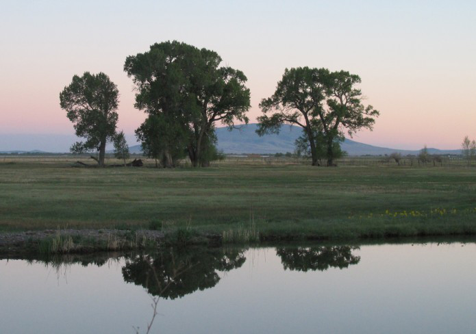

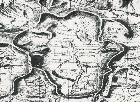


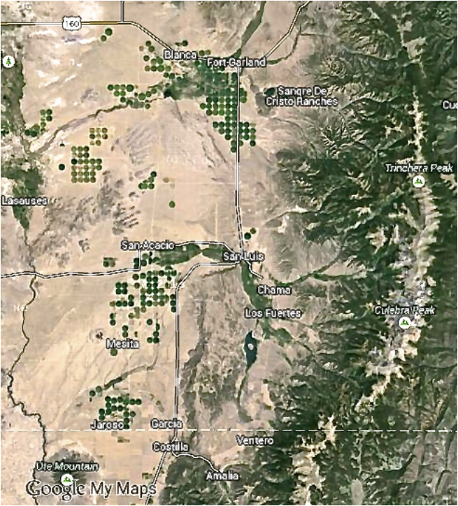

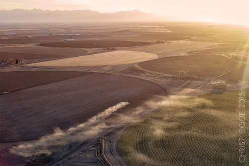


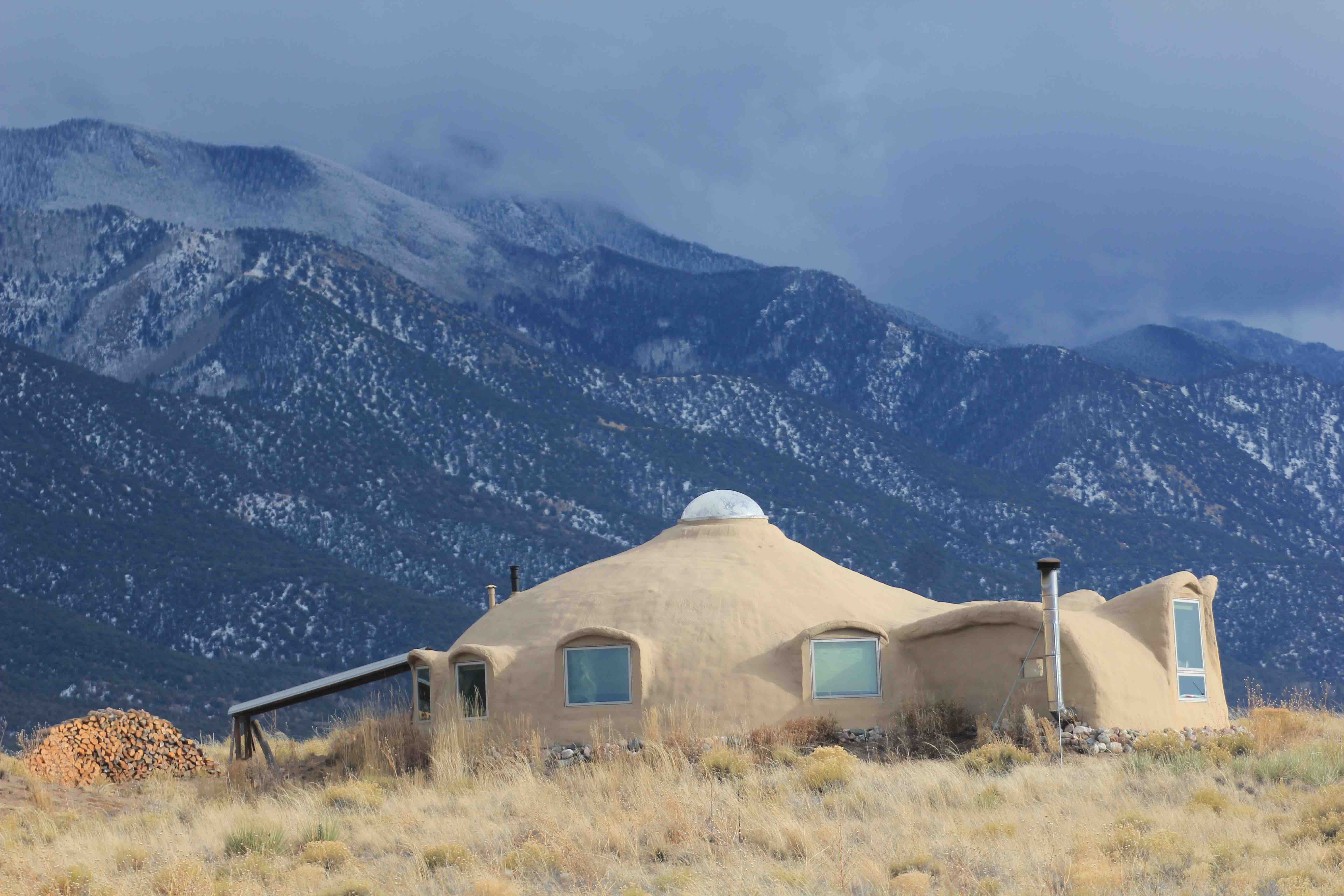


![Rio Grande and Pecos River basins. Map credit: By Kmusser - Own work, Elevation data from SRTM, drainage basin from GTOPO [1], U.S. stream from the National Atlas [2], all other features from Vector Map., CC BY-SA 3.0, https://commons.wikimedia.org/w/index.php?curid=11218868](https://i0.wp.com/coyotegulch.blog/wp-content/uploads/2013/04/pecosriverriograndewatershedswiki.jpg?w=332&h=391&ssl=1 "pecosriverriograndewatershedswiki")