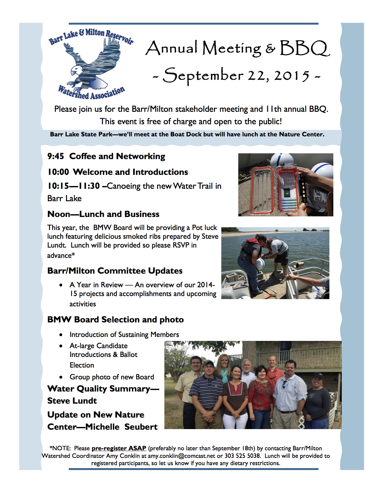
Pitkin County and the city of Aspen will roll out preliminary floodplain maps to the public at an open house next week.
The new maps, also known as flood insurance rate maps, had not been updated since 1987. The latest effort was the result of an extensive, multiyear study of the Roaring Fork watershed, and surrounding creeks and drainages, according to a Pitkin County press release.
“Floodplains change over time, and with that the risk of flooding can change for people who own property in floodplains,” said Lance Clarke, the county’s assistant director of community development.
The unveiling of the maps is scheduled for Tuesday, Sept. 29, from 5 to 7 p.m. in the Plaza 1 meeting room, 530 East Main St. in Aspen.
At the public event, participants will be able to see their properties online using GIS technology with a floodplain map overlay. Property owners will have the opportunity to review the maps with advice and counseling by FEMA, Colorado Water Conservancy officials and flood insurance experts.
The new maps are preliminary, and FEMA has not yet adopted them. Officials want local residents and business owners to review the drafts to identify any concerns or questions.
Experts will be available to explain what should be done if properties are located in a floodplain and what property owners can do to protect their home or business from the consequences of a flood.
“This is a rare opportunity for local property owners to meet one-on-one with FEMA officials and insurance experts to find out how these new maps may affect their property,” Clarke said.
In 2009, officials with the Federal Emergency Management Agency recommended the new study to the city and county. FEMA contributed 75 percent of the $517,220 price tag. The remainder of the cost was funded by grants from Pitkin County Healthy Rivers, the city of Aspen, Pitkin County Open Space and Trails, the Colorado Water Conservation Board and an in-kind contribution from the Pitkin County GIS Department.
The 2015 Alpine Bank Colorado River Cleanup presented by the Middle Colorado Watershed Council is happening on Saturday, September 26th at Grand River Park in New Castle, Colorado. Come join us to help restore this beatiful 6-mile strech of river between South Canyon and New Castle. The Day will begin with registration at 8:30am at Grand River Park, then volunteers will venture out to remove trash and debris from the banks and river channel. The day will conclude with a barbeque lunch at the park in New Castle. Pre-registration is required.
WHEN
Saturday, September 26, 2015 from 8:30 AM to 1:00 PM (MDT) WHERE
Grand River Park – Park Drive New Castle, CO 81647
A legislative committee Tuesday approved drafting a bill that would legalize rain barrels. Colorado is the only state where they are illegal.
The Water Resources Review Committee won’t officially vote on whether to introduce the measure as a committee until October. If the committee approves the bill, then it would be introduced at the start of the next session in January. There’s also the option for a lawmaker to carry the measure separate from the committee, or run a completely separate bill.
While the legislation signals that the issue is far from dried-up, certain caveats in the measure could cause an outcry. For one, the bill would require users to register their barrels with the state. Another provision would require water providers to replace water taken from rooftops.
Rain-barrel supporters worry that the current proposal is burdensome to water providers, and that would result in failing to approve barrel collection. They point out that rain barrels help with conservation, and that 97 percent of water falling on residential property never ends up in a river or stream.
But it may be their best shot after a similar effort drowned during the previous legislative session. That legislation was stalled in committee after concerns from Sen. Jerry Sonnenberg, R-Sterling, over water rights. Had the bill received a floor vote, it likely would have passed thanks to support from Republican Sen. Ellen Roberts of Durango.
Just when it looked like the bill had a chance to receive a late floor vote in the Senate, sponsors and legislative leaders agreed to let the bill die so that discussions could continue for future compromise legislation. Enter Sonnenberg’s current proposal.
“This is more about process,” Sonnenberg said Tuesday during the committee hearing. “This is more about honoring the prior appropriations system and saying, ‘If we’re going to have rain barrels, the right thing to do is to figure out how we replace that water.’”[…]
Under Sonnenberg’s proposal, Coloradans would be allowed to use up to two containers with a maximum capacity of 55 gallons each. A consumer’s residence would need to contain four or fewer residential units.
Rain-barrel supporters say legislation should make it easy.
“Numerous studies have consistently shown that rain barrels have no impact on downstream users,” said Pete Maysmith, executive director of Conservation Colorado. “Any proposals to put additional red tape and bureaucracy on a rain-barrel program disregard these studies and will only serve to dissuade and burden Coloradans.”
From the Big Thompson Watershed Forum via the Estes Park Trail-Gazette:
The Big Thompson Watershed Forum (The Forum) will have its 14th Watershed Meeting, “FROM FLOOD TO FUTURE ~ RISING FROM MUD AND ASHES” on Thursday, September 24, 2015.
The Big Thompson River watershed, an area encompassing over 900 square miles, provides drinking water to numerous cities in northern Colorado including Berthoud, Estes Park, Fort Collins, Fort Morgan, Greeley, Loveland and Milliken. The Big Thompson River watershed is vital to more than 800,000 people, as it carries water from the Colorado-Big Thompson Project (C-BT) to be used for residential, commercial, agricultural, ranching, recreation, and wildlife habitat purposes.
We will welcome several great speakers and professionals with on-the-ground experience, research, and tales from the 2013 Big Thompson River flood. We will also be presenting the findings and results from our major water quality report and answering the question…. “is our water getting better or is it getting worse?” The assessment and presentation will discuss the findings from 15 years of data from the Forum’s most recent water quality analysis of the Big Thompson River and its major tributaries, and pre and post-flood water quality monitoring results.
Panels & Topics for 2015…
Your River & Who Runs It ~ Functionality & Monitoring in the C-BT System
Big Thompson Watershed Forum, Northern Water, U.S. Bureau of Reclamation
The 2013 Flood ~ Impacts on Operations & Infrastructure
City of Loveland, Northern Water, Larimer County
From Flood to Future ~ Rising from Mud and Ashes
AloTerra Restoration, Big Thompson Conservation District, City of Loveland, Colorado Parks & Wildlife, Colorado Water Conservation Board, U.S. Forest Service, U.S. Geological Survey
2015 State of the Watershed Water Quality Report
Big Thompson Watershed Forum, Hydros Consulting
The watershed meeting will be held at the Fireside Café, Group Publishing Building, Loveland, CO from 8:00 a.m. to 4:00 p.m. The cost is $50 per person and includes a continental breakfast, snacks, drinks, and Italian theme buffet lunch. Cash or check at the door please. Seating is limited. For additional details and to register, please contact Zack Shelley at 970-613-6163 or zshelley@btwatershed.org.
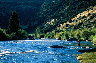
Fly fishing below Olympus Dam (Colorado-Big Thompson Project) September 17, 2015 via the Bureau of Reclamation
If you’re tired of hearing, “They are trying to regulate every puddle,” from the usual suspects and would like an in-depth look and thoughtful analysis for the issues around the EPA’s new Waters of the US rule click here and register for the Colorado Water Congress’ workshop tomorrow.
FromNational Geographic (Sandra Postel and Todd Reeve):
A groundbreaking 2013 Colorado law provides new flexibility that allows water rights owners to allocate water to a river during times of critical low flow.
In the Colorado River headwaters, just outside of Rocky Mountain National Park, Willow Creek is providing a test case for the new law.
There, Witt Caruthers, a ranch owner with rights to divert a portion of Willow Creek’s water, decided to develop a plan allowing him to leave water in the creek for up to five years during a 10-year period—without the threat of the “use it or lose it” provision.
The water for Caruthers’ ranch, which is delivered through two irrigation ditches not far from where Willow Creek meets the Colorado River, fills stock tanks for cattle and irrigates 70 acres (28.3 hectares) of pasture. Typically, the diversions begin in May and continue through late summer. By that time, rivers and streams that rely on snow melt are running low – and after diverters take their share of water, many streams are at risk of running completely dry. Such was the case with Willow Creek.
For Caruthers the conservation project offered a chance to do something positive for Willow Creek and to set a precedent for other rivers in the drought-stricken West.
“Colorado’s water system created an incentive to use our water even in times when it’s not absolutely necessary,” Caruthers told the Denver Post. “When you’re under that pressure to use it or lose it, you’re almost forced to abuse it. That’s to the detriment of all.”
Caruthers and his partners worked with the Denver-based Colorado Water Trust (CWT) to design the project. It essentially involves curtailing diversions from Willow Creek when flows drop dangerously low. Because there are no other diverters immediately downstream, the enhanced flows will benefit not only the lower half mile of Willow Creek, but also some 4.3 miles of the upper Colorado –including populations of brook and brown trout.
Although the project restores only a small volume of water to the stream, that additional flow at crucial times of the year can help keep Willow Creek connected to the Colorado River, enhance water quality, and sustain fish and other aquatic organisms.
This past June, the chief engineer of the Colorado River District approved the CWT-Caruthers conservation program.
The Willow Creek project also sets a precedent that could be a game-changer for other Colorado rivers, as well as for farmers and ranchers that have the ability to use less water and share any surplus with a river. For those who desire to balance economic productivity with recreation interests, fish and wildlife needs, and community benefits, this new law offers a positive step forward.
The beauty of the new law, says Amy Beatie, CWT’s Executive Director, “is that it allows for a very simple, low-risk and flexible way for a water user to experiment with leaving water in a river.”
“It is one of the most straightforward programs the state has ever created to allow flexibility in water use,” Beatie continued, “and it has potential to benefit entire water user communities that are interested in collaborating to keep water in the river.
This 2013 Colorado law provides added flexibility and longer-term benefits for rivers than a 2003 state law that was designed to ensure that rivers aren’t denied water when they need it most.
The 2003 law was first tested during the drought of 2012 on the Yampa River, another upper Colorado tributary and the heartbeat of the popular tourist town of Steamboat Springs. That law allows farmers, ranchers and water districts to temporarily lease water to rivers and streams in times of need.
The following year, CWT and partners replicated that leasing approach on several other rivers, including the Fraser, another headwater tributary. The Fraser suffers not only from low flows during droughts, but also from trans-continental tunnel systems that divert its water to the Denver area.
Colorado’s 2013 law also gives water-rights protection to participants in the Colorado River System Conservation Program, an $11 million pilot initiative of the US Bureau of Reclamation and the water agencies supplying the four largest cities drawing upon the Colorado River – Denver, Los Angeles, Las Vegas and Phoenix. Some $2.75 million will be spent in the upper Colorado River Basin.
Although a small step for the restoration of the state’s rivers, Colorado’s new law breaks important new ground. And it may just inspire other western states to add flexibility to their systems of water rights so that more rivers can keep flowing.
Sandra Postel is director of the Global Water Policy Project and Freshwater Fellow of the National Geographic Society. Todd Reeve is CEO of the Bonneville Environmental Foundation. They are co-creators of Change the Course.
Change the Course, a partnership of National Geographic, Bonneville Environmental Foundation and Participant Media, provided funding to support the flow restoration projects in the Willow Creek, Fraser and Yampa Rivers.
Here’s a report from Marianne Goodland writing for The Colorado Statesman. Click through and read the whole article. Here’s an excerpt:
It’s [The need for more storage] a message the interim Water Resources Review Committee heard and acknowledged during the hearings, held Monday in Greeley and Tuesday in Aurora.
Representatives of the Denver South Platte River area basin roundtables hammered on that desire, as did members of the public who spoke to the committee.
The hearings solicited public input on the statewide water plan, now in its second draft. A final version is expected to be delivered to Gov. John Hickenlooper by Dec. 10…
Much of the water shortage anticipated in the next three decades is likely to occur in the South Platte region, said Joe Frank, chair of the South Platte roundtable. He told the committee his roundtable needs a better understanding of those numbers and how much of the 400,000 acre-feet applies to the gap.
Most of the South Platte gap will come from municipal and industrial needs, Frank said, and there’s also a gap for the agricultural sector, which dominates the eastern part of the state. Frank wound up on the hot seat with several West Slope lawmakers when he said his roundtable wants to preserve its “rights” to Colorado River water. It’s a sore subject for West Slope residents who fear the East Slope will seek more water from the Colorado River, which advocates claim is already over-appropriated. In response to several questions from state Sen. Ellen Roberts, R-Durango and state Rep. Don Coram, R-Montrose, Frank said he didn’t believe taking more Colorado River water would dry up West Slope agriculture, and that he didn’t anticipate this would have to happen “tomorrow.”
But storage is the major need for the South Platte and Denver Metro area, Frank told the committee. The basin already has a 300,000 acre-foot shortage for agriculture, reflected by wells that have been shut down all over the area. Without new storage, half the farmland that relies on irrigation could dry up. More than half of the identified projects in the South Platte/Denver basin plan are for storage, he noted.
Coram also pointed out that 1 million acre-feet went out of state this spring to Nebraska, an amount that exceeded the legal contracts between Colorado and Nebraska. Everyone wants to keep that water, Frank replied, but they have no way to store it.
Storage needs to become a much higher priority in the statewide plan, said state Rep. J. Paul Brown, R-Ignacio, who isn’t on the committee but attended many of the hearings.
But storage has always been a controversial topic in Colorado. Several storage projects have been killed because of opposition from environmental groups, including the Two Forks Dam, proposed in the late 1980s for the South Platte near Deckers. Environmental groups also are fighting a storage project on the Cache La Poudre River near Fort Collins — the Northern Integrated Supply Project, or NISP — which would put two reservoirs on the river.
“We need to get past the controversy,” Frank said.
A $6.4 million project to blend water in a 21.5-mile pipeline in the South Metro area won state approval this week.
The Colorado Water Conservation Board approved a $905,000 grant toward the project which connects Aurora’s $800 million Prairie Waters Project with a $120 million pipeline that serves 14 water providers who are members of the South Metro Water Authority.
The Water Infrastructure and Supply Efficiency partnership, which includes Denver Water, Aurora and South Metro members, says the new connection paves the way for recovering up to 10,000 acre-feet (325.8 million gallons) of water annually. The project does this by providing Prairie Waters flows balance water quality from Denver Aquifer wells and other sources.
Prairie Waters captures sewered flows downstream and treats the water for reuse at a plant near Aurora reservoir. The East Cherry Creek Village pipeline can redistribute the water among other users.
At a July meeting of the Arkansas Basin Roundtable, South Metro Executive Director Eric Hecox claimed it would relieve pressure on taking water from farms, including those in the Arkansas River basin.
Three conservancy districts which have agreements with Aurora — the Lower Arkansas, Upper Arkansas and Southeastern — were skeptical that Aurora might use the WISE arrangement to manipulate storage levels in order to trigger more withdrawals from the Arkansas River basin.
Aurora provided assurances that would not happen, gaining approval from the roundtable in August.
“What’s significant is that six other roundtables joined to fund this project,” said Alan Hamel, who represents the Arkansas River basin on the CWCB.
Roundtables have funds in basin accounts, and contributed $105,000 to the grant, of which the Arkansas Basin chipped in $10,000. A statewide fund provided the remaining $800,000.
Even so, “it’s absurd to think the supply of water is going to keep people from wanting to be here,” [Landon Hoover] said. “Oh, sure, at some point, if the traffic is so bad, people wouldn’t want to live here anymore — or if the cost of living gets so expensive. But both of those have to get so extremely bad before it would inhibit growth.
“Just making water too expensive? That’s not a strategy for dealing with growth. People still want to live in Boulder even though housing costs are through the roof.”
Northern Water spokesman Brian Werner said developers are “going to find the water. It’s doubled in price but still cheap. People will still want to live in Northern Colorado. It’s the economic driver of willing buyer, willing seller.”[…]
“Seven of the 10 fastest-growing cities in Colorado are in Northern’s boundaries,” [Brian Werner] said. “We can’t ignore it.”[…]
The cities of Fort Collins and Greeley and the Environmental Protection Agency have issued reports critical of the Supplemental Draft Environmental Impact Statement issued by the Corps in June, citing incomplete or even flawed data on issues including water quality and temperature. Moreover, Greeley officials have said reduced flows in the Poudre would force that city to spend more on water treatment.
“It would be a large one-time capital expenditure — we can only estimate tens of millions, plus additional ongoing maintenance and operations costs,” said Eric Reckentine, Greeley’s deputy director of water resources. “If you’re reducing flows in the river, you’re decreasing water quality. Less water in the river, but the same sediment load. Sediment and nutrient load increases, which decreases water quality.”
For Northern Water officials, however, the litany of complaints are just part of the process that will shape the Corps’ final environmental impact statement, expected by early next year.
“It’s always been our understanding that the Corps basically planned the process in this way — data from Phase 1 to be used in Phase 2,” Wilkinson said. “It will be developed and analyzed prior to the FEIS.”[…]
“We’re going to talk to Fort Collins and say, ‘Let us understand your concerns.’” — [Eric Wilkinson]
“There appears to be a difference in analysis between Corps consultants and Fort Collins’ and Greeley’s consultants,” Wilkinson said, “but obviously, that’s what the public comment period is for. There’s going to be a technical analysis. That’s part of the NEPA (National Environmental Policy Act of 1970) process — to sift through those facts.”[…]
When Waskom talks to water-utility managers, he said, “they tell me they have buyers coming to them on a regular basis, willing to sell water.”[…]
“The NISP project is to divert water from the Poudre into Glade. Some of that is our water,” he said. “So in order to make that up to us, they’ll have to draw water out of the South Platte into Galeton. In order to make the exchange, we still need to irrigate. There has to be ag use here.”[…]
Waskom outlined some possible alternatives to buy-and-dry, including “forbearance” agreements and fallowing arrangements.
“A farmer agrees not to plant a crop, and the water they’d use to irrigate they’d transfer to another use on a short-term basis,” he said. “Water law allows that to happen three years out of 10. It’s a business deal. The farmer plays golf and gets a check from the city. The limitation is that a farmer can’t walk away from his markets and labor and expect they’ll be there next year.
“My institute has been very involved in doing research around those agreements,” Waskom said. “We believe there is potential there. That said, municipal water managers want to own their portfolios. They would rather lease to ag than have ag lease to them.
“Our current water court structure makes it difficult and expensive. Is it a pathway for the future? Yeah. Does it abrogate the need for Glade now? Probably not.”
The reason, Waskom said, is drought.
“Water resource managers are always planning for drought,” he said. “Drought is what keeps them awake at night. It looks like we’re building more than what we need, but there will be drought in the future. We just don’t know when.
“The one thing the climatologists tell me they’re pretty certain about — temperature increases. We have frequent drought anyway on the Front Range, but hotter droughts are always more serious than cooler droughts. With the wildfires in 2012, cities had their water resources compromised.
“We don’t know what precipitation is going to do, but climatological records already show increasing temperatures in Colorado. That’s a trend we’re going to stay on, and that concerns water managers.”
Explaining climate change can get political, Waskom said. “We’ve been talking to extension agents, and there’s lots of resistance based on values.[…]
Another idea the institute is studying is underground water storage.
“In this area, we get three feet of evaporation off the top per year” from an impoundment such as Horsetooth or Carter Lake southwest of Loveland, Waskom said. “Storing water underground in aquifers tends to be nonevaporative. It is feasible, but there’s scientific debate about it, and policy limitations too. Could underground storage decrease the need for NISP? There’s scientific debate about that. Because of the unknowns in the science and the energy costs of recovering that water, though, it wasn’t deemed a viable alternative to Glade Reservoir. Could it be in the future? I think so.”[…]
“I doubt most developers know enough about NISP to judge whether the tactical implementation of it is good or bad,” [Landon Hoover] said. “But developers see that there needs to be a solution for water storage in Northern Colorado if people want affordable housing, places where teachers, firefighters, middle-income families can live, $300,000, $400,000 houses.
“There’s really a limited supply of water, and we’re nearing the end of that supply. Unless demand shuts off, there’s no relief for prices. The issue isn’t whether we have enough water rights, the issue is we don’t have enough storage. By having storage, it will at least temper water prices. I don’t know if it’ll ever drastically lower them.”
The bottom line, Waskom said, is that “we’re going to need reservoirs, infrastructure, conservation, underground storage, ag deals, all of the above, to keep Colorado’s economy strong and vibrant into the future.”
Map of the Northern Integrated Supply Project via Northern Water
Colorado abandoned mines FromThe Denver Post (Bruce Finley):
Ninety miles west of Denver, 347 gallons a minute of acidic heavy metals leak into a tributary of the South Platte River every day from the defunct London Mine. Not even the bugs that fish eat have survived in South Mosquito Creek west of Alma, let alone the trout local leaders hope to restore for the South Park recreational economy.
The London Mine is one of many that leach toxic materials into Denver’s watershed. Municipal water treatment plants keep contaminants from flowing out taps in homes; ecosystems, however, continue to be poisoned.
For years, state agencies and contractors worked on a cleanup at the London Mine, including installation of a water treatment plant.
But the resurgent discharge into Denver’s watershed shows how difficult cleanup of old mines can be.
“You’re never going to walk away from these things,” said Bruce Stover, director of Colorado’s inactive mine reclamation program. “Things happen inside mines that are unpredictable. Wood can rot. There’s rock stress. Old mines are constantly changing. Gravity rules.
“You cannot just cork these up so it all goes away. That’s not going to happen.”[…]
On Tuesday, state lawmakers at a legislative committee hearing began investigating the broader problem. Colorado health and natural resources officials told them it is so complex that state agencies have yet to prepare a full inventory and assess which mines are most prone to the kind of blowout that occurred Aug. 5 at the Gold King Mine above Silverton…
Other mines in the metro Denver watershed where state records show continuing contamination of streams and rivers include:
• The Perigo Gold Mine near Nederland discharges toxic liquid at a rate of 174 gallons per minute into Gamble Gulch, which flows into South Boulder Creek above Gross Reservoir, according to a March 2015 assessment by the Colorado Division of Reclamation, Mining and Safety.
In 1993, the Colorado Geological Survey conducted a study of inactive mines on U.S. Forest Service land west of Boulder and ranked cleanup at the Perigo Mine the top environmental priority. In May, backed-up water behind a collapsed portal surged out, spewing several thousand gallons of carrot-orange acid metal-laced water. State records show another blowout in 2011.
• At the Waldorf Mine west of metro Denver, a blowout in 2013 triggered a cascade of hundreds of gallons of orange liquid waste into Clear Creek. State officials said elevated levels of zinc and lead have leaked from this mine for years, about 70 gallons per minute, and records show cleanup is not completed. A mine opening “continually drains and intermittently discharges large surges of contaminated water that erode the mine waste pile.”
• At Geneva Mine above Georgetown, a “belch” in 2013 sent a surge of metals-laced drainage that turned Geneva Creek yellow.
• At the Puzzle Mine above Breckenridge, EPA and state officials have known since 2006 about draining water, at least 50 gallons a minute, laced with zinc and cadmium at levels several times higher than the state standard, records show. A few years ago, Breckenridge residents watched the Blue River turn orange after ice melted inside the mine and pooled contaminants gushed through town toward Dillon Reservoir…
Colorado Sen. Michael Bennet has supported action to encourage cleanups by shielding companies and conservation groups from liability, but he has not committed to help create a national cleanup fund drawn from mining industry royalties. Heinrich said he’ll press Bennet, D-Colo., and Republican Sen. Cory Gardner for support.
Bennet’s staffers say the senator is supporting efforts to reform the mining law, including charging mining companies royalties to create a cleanup fund and he is “working with” Heinrich and New Mexico Sen. Tom Udall.
Environmental groups contend that, beyond liability reform, better funding is essential to deal with the West’s estimated 500,000 inactive mines, which have tainted 40 percent of watersheds at a time when residents increasingly seek more water.
“The federal and state governments should wake up and fix the problem before more spills occur,” said Alan Septoff of Earthworks, a Washington D.C.-based advocacy group. “This matters because the mines drain acid into water that we use for drinking and that drives economies, like the economy in La Plata County.”
Colorado officials said they do as much as they can with limited legal power and resources.
“We know where the draining mines are, but a statewide prioritization has not been done. That’s something we’re talking about now,” Stover said.
Nor does the state keep a list of mine site owners. Most owners are not “viable” as sources of funding for cleanups, state natural resources spokesman Todd Hartman said. Only the EPA can determine whether “potentially responsible parties” may exist and are viable, he said.
Meanwhile, three or four inactive mines blow out each year, spewing backed-up metals-laced waste into waterways. That’s in addition to trickles and seeps from scores of inactive mines that, by state and federal estimates, inject the equivalent of a Gold King disaster every two days.
From the Montrose Daily Press (Katharhynn Heidelberg):
Montrose County on Thursday nabbed a significant award from the Colorado Water Conservation Board, which unanimously approved a combined total of $300,000.
The money from the state’s Water Supply Reserve Account will be used to help fund a feasibility study of up to four possible reservoir sites on the West End. The county will spend $966,000 on the study, which was included in its annual budget.
The conservation board, as part of its Montrose meeting, awarded approval of the funds on the condition that some of the money be spent to assess the effect each proposed site will have on recreational uses, especially rafting, on the San Miguel River.
The county is glad to comply with the condition, and would have noted that on its application had the form allowed for it, Marc Catlin, Montrose County’s water rights manager, told the board.
“If there’s going to be a future on the West End, those people are going to need water,” Catlin said.
The county needs to determine where and how reservoirs would be built to impound the water it secured under a 2012 water rights decree.
“It’s the result of two and a half years of hard work and paying attention to detail, wanting to do the right thing,” Montrose County Commissioner Ron Henderson said later on Thursday.
“It’s finally starting to pay off. It’s just a really nice thing for the West End of Montrose County, actually, the whole county, but most especially the West End.”
Montrose County in a controversial move previously filed for water rights on a 17.4 stretch of the San Miguel. Under settlements reached, the county agreed to a volumetric use limitation of 3,200 acre-feet. An acre-foot is roughly the amount of water it would take to cover a football field at a depth of 1 foot.
Conditions of the water right decree include a means of capturing and impounding the water. The county, which is considering four possible sites for a reservoir, needs to know the best place to site it and therefore applied for funding to offset feasibility study costs.
It sought $50,000 from the Southwest Water Board and $250,000 from statewide accounts, both to be approved by the conservation board.
April Montgomery, a conservation board member representing the San Juan and San Miguel basins, on Thursday commended the county and Catlin for having been proactive.
“I think it’s setting an example,” she said, referring to the county’s feasibility study. The county showed forethought in looking at multiple uses, Montgomery said.
Fellow member Patricia Wells, representing the City and County of Denver, called Montrose County’s approach commendable.
“It’s simply a very good approach,” she said.
“Storage is part of the answer for the future,” Catlin later told the Daily Press. “The state’s moving toward multiple use. I think this is the first project that is investigating multi-use at the feasibility stage.
“It’s a good thing for the community.”
Ouray County also won funding, $50,000, from the board. The money will help fund the upper Uncompahgre Basin water supply protection and enhancement project.
A call on water in 2012 served as a wakeup call, Ouray County Attorney Marti Whitmore told the board. That dry year brought to the forefront the need to plan for accommodating needs, while also sustaining agriculture and tourism, industries that are part of Ouray County’s economic backbone, she indicated.
Whitmore said she anticipates that Ouray’s study will show a need for additional water storage.
The board awarded 15 Water Supply Reserve Account grants Thursday.
“We passed all the grant applications. There was about $5.5 million, total, in grant applications we approved,” said James Eklund, Colorado Water Conservation Board director.
The San Miguel River near its headwaters in Telluride, Colorado. @bberwyn photo.
The Hanging Flume back in the day
Hanging Flume
Aerial view of the San Miguel River. Photo credit: The Montrose Daily Press
Here’s the release from Governor Hickenlooper’s office:
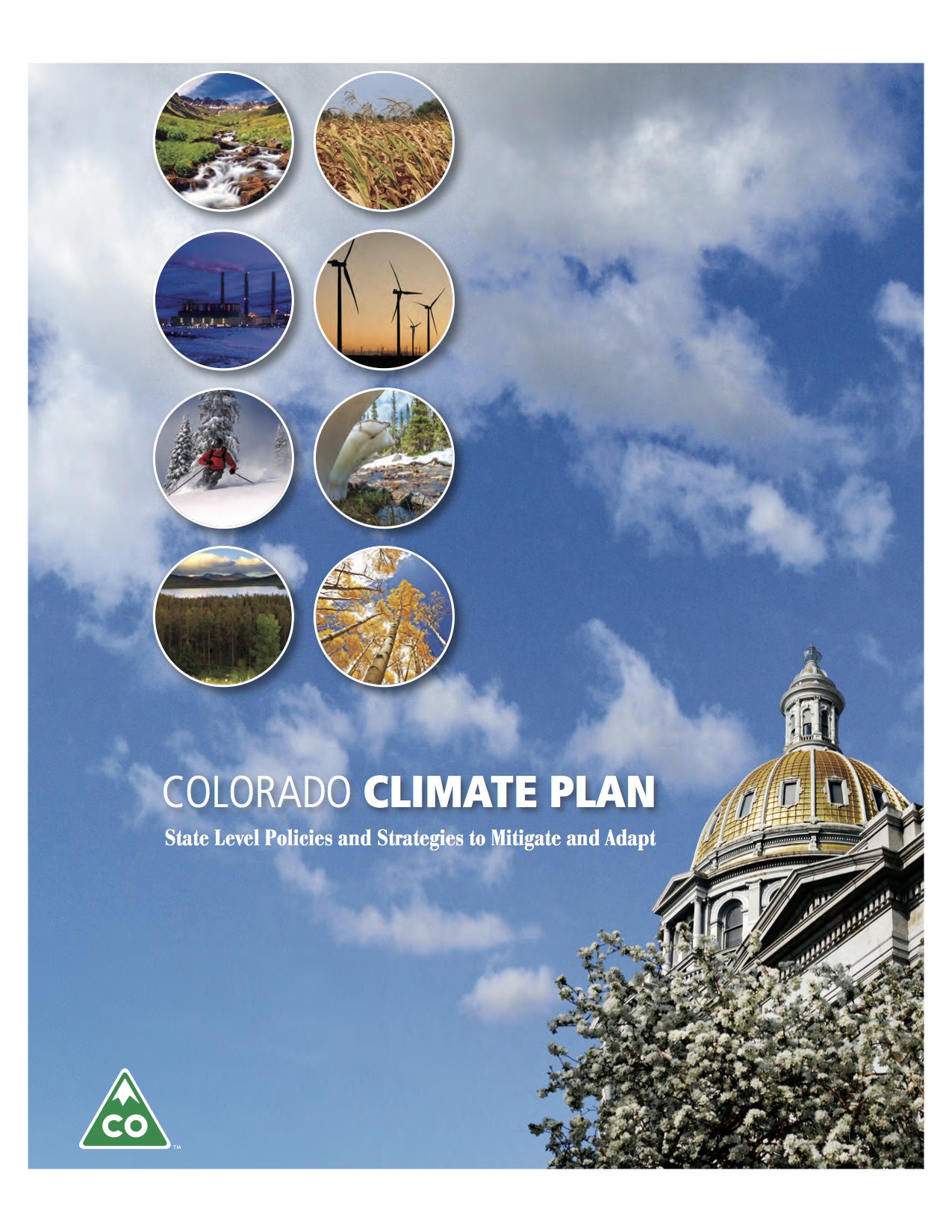
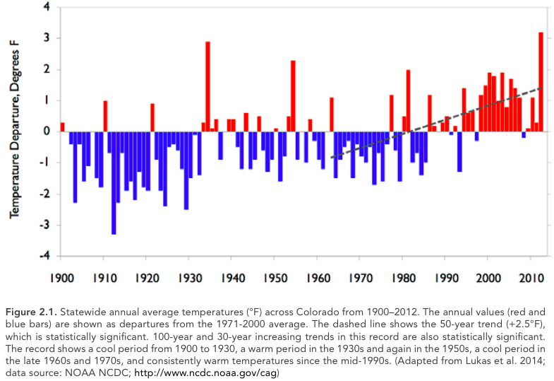
Gov. John Hickenlooper, business and industry leaders and department directors today released the Colorado Climate Plan, a statewide strategy of policy recommendations and actions to mitigate greenhouse gas emissions and to increase Colorado’s level of preparedness.
“Colorado is facing a potential increase in both the number and severity of extreme weather events,” said Hickenlooper. “We’ve seen what Mother Nature can do, and additional risks present a considerable set of challenges for the state, our residents, and our way of life. This comprehensive plan puts forth our commitment from the state and sets the groundwork for the collaboration needed to make sure Colorado is prepared.”
Colorado has warmed substantially in the last 30 years and even more in the last 50 years, with projected temperatures rising an additional 2.5 degrees by 2050, as reported by Climate Change in Colorado: A Synthesis to Support Water Resources Management and Adaptation. Rising temperatures pose many challenges to Colorado’s environment, health, economy and infrastructure. In response to these risks, the state developed a plan for mitigating and adapting to a broad range of possible impacts from multiple sectors.
The Colorado Climate Plan focuses on seven main sectors including water, public health, energy, transportation, agriculture, tourism and recreation, and ecosystems. The plan also includes a chapter highlighting ways local governments and businesses are playing a significant role.
Some of the plan’s key recommendations include:
Water: Promote and encourage drought preparedness through comprehensive drought planning mitigation implementation; incorporate climate variability and change into Colorado’s Water Plan.
Public Health: Coordinate with the Colorado Department of Public Health and Environment, Public Utilities Commission, the Colorado Energy Office, and additional stakeholders to develop and implement a Colorado-specific plan to substantially reduce carbon dioxide emissions from fossil fuel fired EGUs, in accordance with the EPA’s Clean Power Plan; continue to assess potential correlations between vector-borne diseases and climate factors.
Energy: Assure the timely and complete attainment of the state’s RES 2020 goals; assist all utilities (investor-owned, municipal, and cooperative) in identifying and implementing best practices for integrating cost-effective renewable resources, both utility-scale and distributed; increase access to capital for commercial, residential, agricultural, and industrial customers seeking to improve the energy performance of their facilities.
Transportation: Promote and encourage fuel-efficient vehicle technologies and programs to reduce vehicle emissions; provide guidance to local governments on land use planning strategies to promote efficient use of public resources and reduce GHG emissions through compact, transit-oriented development that utilizes smart growth practices and complete streets.
Agriculture: Partner with research institutions and federal agencies to support producer’s efforts to mitigate and adapt to climate change through improved irrigation and efficiency and enhanced tillage practices.
Moving forward, the Colorado Climate Plan will serve as a roadmap for state agencies to confront some of the worst effects of climate change and identify priority actions. The state will work to ensure the plan complements other relevant efforts, including the Climate Change in Colorado Report, and the Colorado Climate Change Vulnerability Study.
Dr. Larry Wolk, executive director and chief medical officer of the Colorado Department of Public Health and Environment, said, “The Climate Plan helps develop our strategies for protecting public health as our climate changes. It also demonstrates our commitment to reducing greenhouse gas emissions through EPA’s Clean Power Plan and Colorado’s own initiatives.”
“This plan outlines many steps state agencies can take – and are taking – to both reduce the emissions that affect our climate and prepare for the potential impacts that temperature and weather changes may have on our economy and lifestyle in Colorado,” said Mike King, executive director of the Department of Natural Resources.
Contributing agencies include the Colorado Department of Natural Resources, the Colorado Department of Public Health and Environment, the Colorado Energy Office, the Colorado Department of Transportation, the Colorado Department of Agriculture, the Office of Economic Development and International Trade, Colorado Tourism Office and the Department of Local Affairs, along with input from key stakeholders.
“This plan highlights the results to date of Colorado’s leadership in innovative energy production and efficient energy consumption,” said Jeffrey Ackermann, director of the Colorado Energy Office. “Our continued progress is reinforced by forward-thinking policies like the renewable energy standard, strong public-private partnerships and creative strategies to foster new market development.”
Public and private sector organizations also contributed to the plan including Apt Environmental, Colorado Municipal League, Colorado Solar Energy Industries Association, Colorado State University/ Colorado Water Institute, Denver Water, Fort Collins Sustainability Group, Rocky Mountain Climate Organization, Rocky Mountain Institute, The Nature Conservancy, Western Water Assessment/ CIRES/ University of Colorado, Southwest Energy Efficiency Project, Xcel Energy and 360 Colorado.
The plan, developed to meet the requirements of HB 13-1293, lays out many of the ways the state is working to find solutions. Each state agency that helped develop the plan will hold public engagement sessions specific to their agency throughout the coming year.
Documents released this week highlight a bidding process that began a little over two weeks after last month’s spill. The request is for a subcontractor to begin work in anticipation of a treatment facility. Water would be piped from the Gold King Mine near Silverton to Red and Bonita Mine and the “future site” of a water-treatment plant in Gladstone.
The EPA tasked Environmental Restoration, LLC with the Request for Proposal. The contractor was performing reclamation with the EPA on Aug. 5 when an excavation error by the team at Gold King caused an estimated 3 million gallons of orange mining sludge to pour into the Animas River. Initial tests showed spikes in heavy metals.
Experts agree that the best solution is a treatment facility, though such a plant would be costly. The EPA offered no cost estimates for such a facility, nor would it say where the funding would come from. A reclamation expert with the Colorado School of Mines told The Durango Herald a temporary treatment plant would cost around $3 million…
“The issuance of a work order doesn’t mean that there has been a final decision to build a wastewater treatment plant. Agency staff initiated the RFP process immediately after the spill so that the procurement process would be well underway if that decision were to be made,” said EPA spokeswoman Christie St. Clair…
“The agency is conducting an analysis to determine if a temporary treatment plant provides a measurable benefit to water quality downstream in the Animas River,” St. Clair said. “The agency is closely coordinating with officials in Colorado, New Mexico, Utah, Southern Ute tribe, Mountain Ute tribe and Navajo Nation to develop a comprehensive, long-term plan for the Gold King Mine site.”[…]
“The system must be able to be operated all year at elevations between 11,400 feet and 10,500 feet. Extreme cold and heavy snow are to be expected and planned for. The system must be self-contained as there are no amenities on site,” the RFP says.
Meanwhile, the EPA on Thursday released a long-term monitoring plan to evaluate water conditions after the spill. Tests have continued to show that water quality has returned to “pre-event” conditions, though the Animas has long been plagued by inactive-mine leakage.
“This monitoring plan represents the next phase of this important work and reflects our commitment to continue working closely with state, local and tribal officials to evaluate the potential impacts of the spill,” EPA Administrator Gina McCarthy said in a statement.
The long-term plan calls for sampling for water and sediment quality, biological impacts and fish tissue under a variety of flow conditions at 23 sites in Cement Creek, the Animas and San Juan rivers and the upper section of Lake Powell within Colorado, Southern Ute Reservation, New Mexico, Ute Mountain Ute Reservation, the Navajo Nation and Utah.
Stakeholders, including state, local and tribal officials, have until Oct. 8 to comment on the monitoring proposal.
The goal is to begin long-term monitoring in the fall. Data would be collected for one year and reviewed to determine if additional steps are needed.
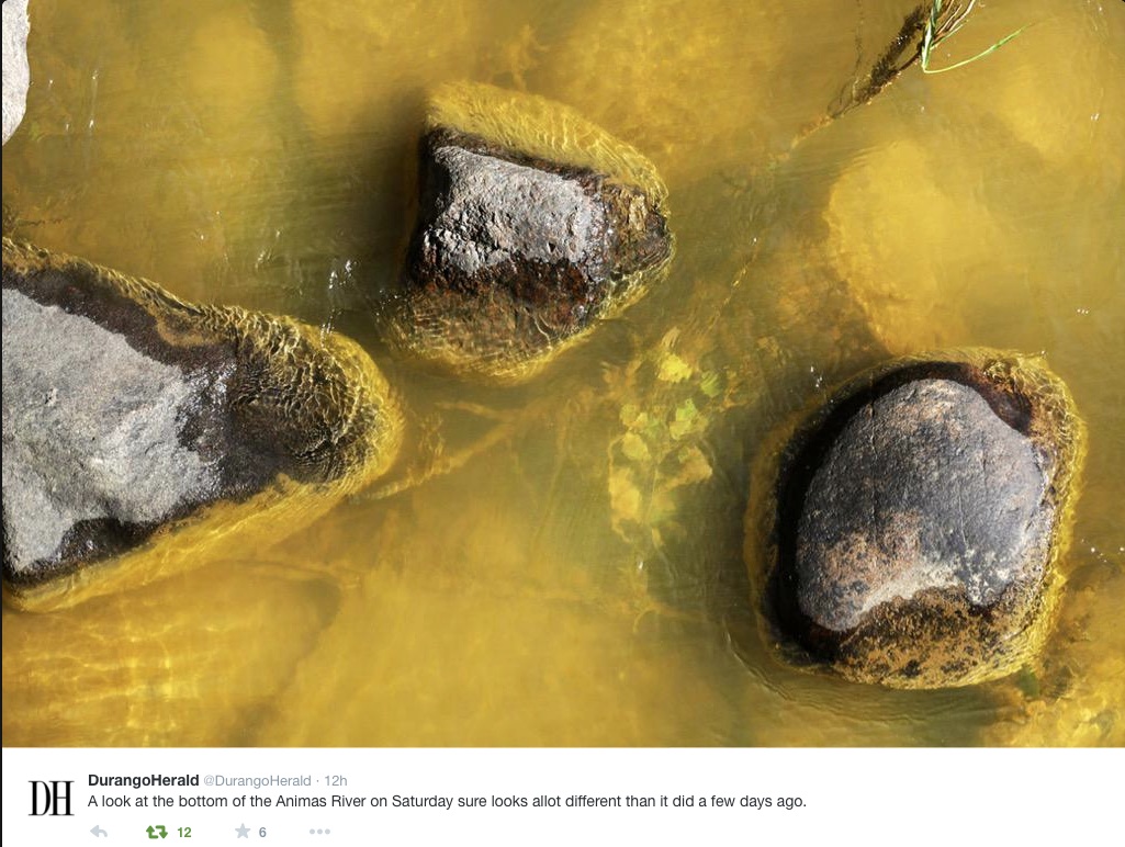
Bottom of Animas River at Durango August 8, 2015 via Twitter and The Durango Herald
From the Associated Press (Matthew Brown) via the Farmington Daily-Times:
U.S. Environmental Protection Agency officials refused for weeks to share water-quality data with their state counterparts following a blowout of toxic wastewater from a Colorado mine that fouled rivers across the Southwest, New Mexico’s top environmental regulator testified Thursday.
The move by federal agencies aimed to downplay the severity of the spill, hobbling the state’s response to the high levels of arsenic, lead and other contaminants involved in the spill, New Mexico Secretary of Environment Ryan Flynn said.
His criticisms, aired before a U.S. House committee investigating the Aug. 5 accident, offered more fodder for congressional Republicans eager to find fault with a federal agency they perceive as having an anti-business agenda…
EPA spokeswoman Laura Allen said water-quality test results were made public on the agency’s website as soon as they were validated. The EPA has closely coordinated with state officials and American Indians from the Navajo Nation, Southern Ute and Ute Mountain Ute tribes to keep them apprised of the test results, Allen said.
But Flynn said the EPA’s warning about the pollution came belatedly, and it was followed by incomplete testing data presented in a way that minimized the presence of contaminants above drinking-water standards. He called it a “PR stunt” by the EPA…
Flynn said he remained concerned about contaminated sediments harming the environment, and a long-term monitoring plan offered by the agency is inadequate. That echoed concerns raised by Navajo President Russell Begaye, who questioned the EPA’s role overseeing the response to a spill that it caused.
Thursday’s hearing before the House committees on Natural Resources and Oversight and Government Reform was the fourth this month examining the spill. Republican lawmakers have used the events to bash the EPA for its handling of issues ranging from climate change to the protection of streams.
Democrats have sought to put the focus on the mining industry and ongoing pollution from tens of thousands of abandoned mines across the country…
The Colorado spill came from a cluster of century-old mines in the San Juan mountains that together discharge an estimated 330 million gallons of toxic wastewater annually, EPA Administrator Gina McCarthy testified. That’s over 100 times more pollution than the Gold King spill.
“We were trying to get a handle on a situation that was growing increasingly dangerous,” McCarthy said. “This is not the EPA’s … finest hour. But I am here to tell you that we are taking responsibility.”
She added that mining companies contribute “close to zero” money to help clean up such sites, under an 1872 mining law that the administration of President Barack Obama has proposed to change…
McCarthy responded that she did not believe the law had been broken, but a review of the accident needs to be completed before a final determination. An Interior Department investigation of the spill is due in late October. The EPA Inspector General’s office is conducting a separate review.
The 3-million-gallon blowout of mine waste last month didn’t cause a massive die-off of trout in the Animas River, but wildlife officials are still concerned about the steady decline of fish populations over the past decade.
In August and early September, Colorado Parks and Wildlife crews conducted a survey of trout numbers in sections of the Animas near Durango and Silverton.
“We did it last year, and normally we skip a year,” Parks and Wildlife spokesman Joe Lewandowski said at the time. “But because of the spill, our biologists decided it’d be a good time to do it again, and see what’s going on.”
A prepared statement from the Parks and Wildlife on Tuesday said the survey did not show effects on fish from the mine spill, but the results did provide a “mixed picture” for trout.
In Durango, officials saw an increase in the overall biomass of fish, but aquatic biologist Jim White said that’s because Parks and Wildlife stocks about 40,000 fingerling trout every year.
Two segments – from the La Plata County Fairgrounds to the Ninth Street Bridge, and from Cundiff Park to the High Bridge – met the “Gold Medal” water status for biomass, a standard of 60 pounds of fish per surface area.
But overall, the river did not meet the Gold Medal status.
Fish greater than 14 inches improved slightly from 2014 – from nine to 11 fish per acre – but the Gold Medal standard is 12 fish longer than 14 inches or more per acre.
Parks and Wildlife officials said the number of large fish remains low, and trout have shown little signs of natural reproduction, issues that wildlife experts have been combating for almost 10 years.
The Southeastern Colorado Water Conservancy District tackled the question Thursday by approving additional allocations requested by cities and farms in the Arkansas Valley.
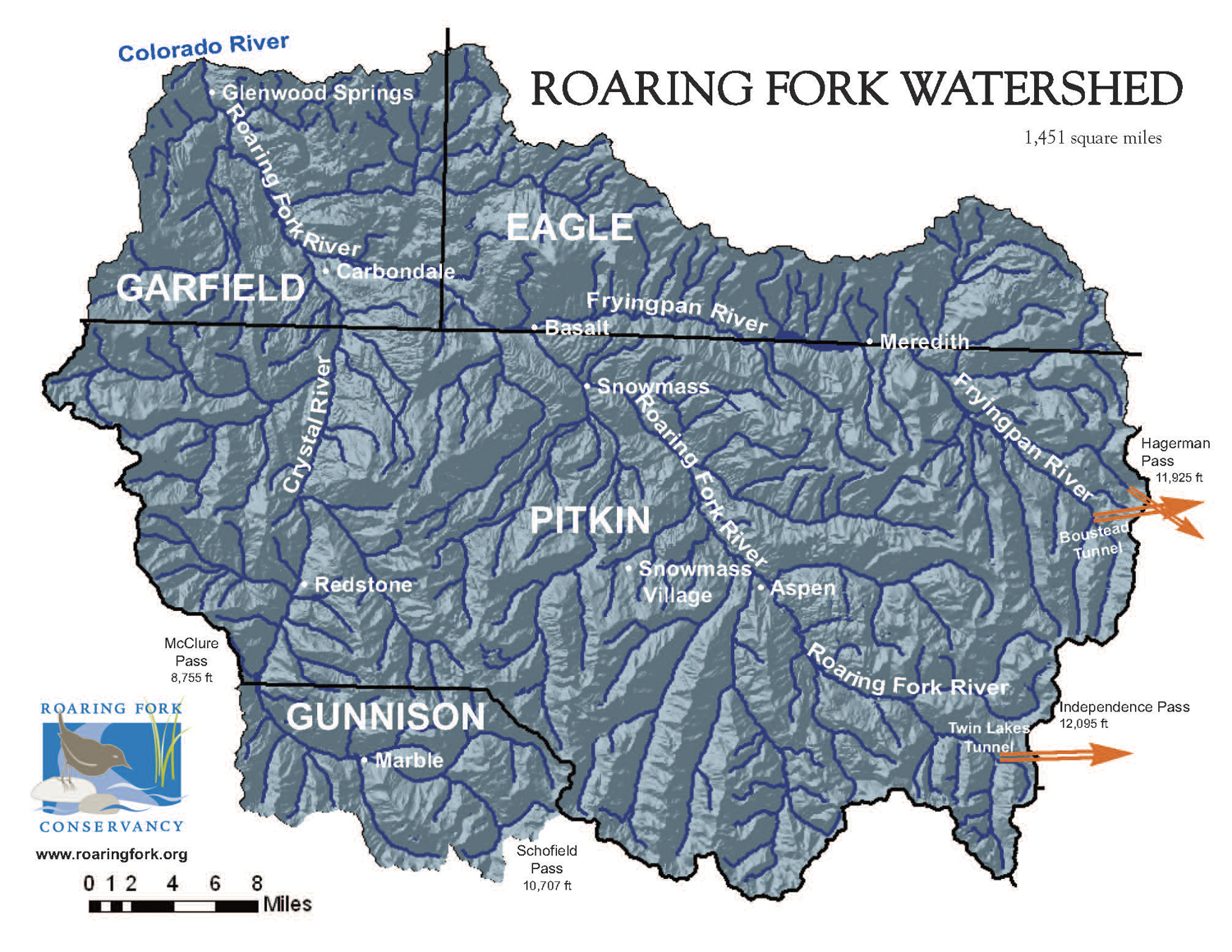
But more than half of additional water brought in by the Fryingpan-Arkansas Project will be carried over to next year and added to next year’s allocations.
In May, the district allocated about 46,000 acre-feet (15 billion gallons), with about one-third going to cities and two-thirds to farms. But continued wet conditions added another 22,500 acre-feet to the amount available for allocation.
A total of 72,000 acrefeet were imported, but some of it goes for other obligations or to account for losses.
Wet conditions and the way water has to be delivered or accounted for cut down on demand for the additional water, Executive Director Jim Broderick explained.
Most cities had plenty of water in storage and not many places to store additional water.
“A lot of people were at their limit and not making request,” Broderick said. “It’s been a wet year and there is no place to put the water. Everything got full.”
The big exception was the Pueblo Board of Water Works, which did not take any water from the first allocation. Pueblo Water took 6,500 acre-feet. All told, cities added 8,200 acre-feet to their supplies.
The large canal companies downstream did not jump at all of the additional water either, because there was no way to store it for when it would be needed. About 2,600 acre-feet were allocated during the second round.
That still leaves about 11,700 acre-feet that was brought over from the Fryingpan River basin through the Boustead Tunnel into Turquoise Lake for later distribution in the Arkansas River basin.
“It will be applied to the first allocation next year,” Broderick said. “My guess is that a lot of the water is going to be available to agriculture.”
That could create a problem even with average moisture next spring, raising the possibility that water stored in excess capacity, or if-and-when accounts, could spill.
About 55,000 acre-feet of if-and-when water is stored in Lake Pueblo now, about one-quarter of the water in the reservoir.
Some winter water could also spill, if the amount exceeds 70,000 acre-feet. About 24,000 acre-feet are now in storage. However, winter water could be stored downstream as well.
Turquoise and Twin Lakes are nearly storing at capacity. Lake Pueblo is at 80 percent of capacity, but 145 percent of average for this time of year, according to Roy Vaughan, manager of the Fry-Ark Project for the Bureau of Reclamation.
If water conditions are typical, 26,000 acre-feet could spill next spring, but it is too soon to make an accurate prediction, Vaughan said. But he said most forecasts are calling for at least 100 percent of snowpack.
“Part of the question is are we bringing water in and using it that year, or are we storing it?” Broderick said. “For the past few years, we have been using other water and storing (Fry-Ark) water.”
Fryingpan-Arkansas Project via the Southeastern Colorado Water Conservancy District
“If you have a rain barrel, that’s less that’s going to run into the street,” said Senator Jerry Sonnenberg (R-Sterling).
And he believes, less water for farmers and ranchers – which is why Sonneberg opposed the rain barrel bill when it last came up and made sure it was defeated. He’s now floating a new measure that would allow rain barrels, if people register them. Then it would be up to water providers to determine how to replace the lost water.
“We’re going to bring a bill that does it right and honors the prior appropriation system and Colorado water law,” said Sonnenberg. “We need a simple and fair process on how that water should be replaced.”
But during a recent hearing at the state capitol, academic water experts from Colorado State University testified that there would be no need for a bill like Sonnenberg’s.
“This water doesn’t run off any way, and we capture a little of it and we put it on our gardens or we put it on our roses or something,” said Dr. Larry Roesner, a civil and environmental engineering professor at CSU.
“It would take a lot of water before it made a significant impact,” said Roesner.
Two other CSU experts, along with Roesner, testified before the Water Resources Review committee, which is meeting in the interim to discuss water policy.
“When you have scientists come in and give you the facts I think it’s important to incorporate that into your thought process,” said Senator Ellen Roberts (R-Durango).
As the chair of the committee, Roberts was frustrated when the previous rain barrel bill didn’t pass. She wanted to come back to the topic in between sessions – especially since next session will be during an election year.
“I’m struggling myself to explain to people on the street why this is so controversial. In my district in southwest Colorado, those who want to use rain barrels, use rain barrels today, and a lot of people across party lines were appalled that the legislature was struggling so much with this,” said Roberts.
For Drew Beckwith with Western Resource Advocates the measure is mostly about educating the public about water. He said too many people fail to understand where their water comes from, and he said water providers in other states where it is legal say rain barrels help connect people to water policy.
Synopsis: There is an approximately 95% chance that El Niño will continue through Northern Hemisphere winter 2015-16, gradually weakening through spring 2016.
During August, sea surface temperature (SST) anomalies were near or greater than +2.0°C across the eastern half of the tropical Pacific. SST anomalies increased in the Niño-3.4 and Niño 3- regions, were approximately unchanged in the Niño-4 region, and decreased in the Niño-1+2 region. Large positive subsurface temperature anomalies persisted in the central and east-central equatorial Pacific during the month, with the largest departures exceeding 6°C. The atmosphere remained coupled to the anomalous oceanic warmth, with significant low-level westerly wind anomalies and upper-level easterly wind anomalies persisting from the western to east-central tropical Pacific. Also, the traditional and equatorial Southern Oscillation Index (SOI) were again negative, consistent with enhanced convection over the central and eastern equatorial Pacific and suppressed convection over Indonesia. Collectively, these atmospheric and oceanic anomalies reflect a strong El Niño.
All models surveyed predict El Niño to continue into the Northern Hemisphere spring 2016, and all multi-model averages predict a peak in late fall/early winter (3-month values of the Niño-3.4 index of +1.5°C or greater. The forecaster consensus unanimously favors a strong El Niño, with peak 3- month SST departures in the Nino 3.4 region near or exceeding +2.0°C. Overall, there is an approximately 95% chance that El Niño will continue through Northern Hemisphere winter 2015-16, gradually weakening through spring 2016 (click CPC/IRI consensus forecast for the chance of each outcome for each 3-month period).
Across the contiguous United States, temperature and precipitation impacts associated with El Niño are expected to remain minimal during the early Northern Hemisphere fall and increase into the late fall and winter (the 3-month seasonal outlook will be updated on Thursday September 17th). El Niño will likely contribute to a below normal Atlantic hurricane season, and to above-normal hurricane seasons in both the central and eastern Pacific hurricane basins.
Click here to read the newsletter. Here’s an excerpt:
UPPER COLORADO FORUM OCT 28-29
A draft program and registration/ sponsorship links are now up for the Upper Colorado River Basin Water Forum: Managing for Extremes. The forum will be at CMU in Grand Junction on October 28-29. Full details here.
Click here to read the summary for August 2015. Here’s an excerpt:
Global average temperature record high for August, June–August, and January–August;
Separately, global oceans and global land were both highest on record for these periods of time
The globally averaged temperature over land and ocean surfaces for August 2015 was the warmest August on record, 1.58°F (0.88°C) warmer than the 20th century average, and surpassing the previous record set in 2014 by 0.16°F (0.09°C). August 2015 tied with January 2007 as the third warmest monthly highest departure from average for any month since record keeping began in 1880. The combined global average land and ocean surface temperature for January–August was also record warm.
Global highlights: August 2015
The August average temperature across global land and ocean surfaces was 1.58°F (0.88°C) above the 20th century average—the warmest August on record, surpassing the previous record by +0.16°F (+0.09°C). This was the sixth month in 2015 that has broken its monthly temperature record (February, March, May, June, July, and August).
The August globally-averaged land surface temperature was 2.05°F (1.14°C) above the 20th century average. This was the highest for August in the 1880–2015 record, besting the previous record set in 1998 by +0.23°F (+0.13°C). Record warmth was observed across much of South America and parts of Africa, the Middle East, Europe, and Asia.
The August globally-averaged sea surface temperature was 1.40°F (0.78°C) above the 20th century average. This was the highest temperature for any month in the 1880–2015 record, surpassing the previous record set in July 2015 2014 by +0.07°F (+0.04°C). Large portions of the seven seas (where temperature records are available) recorded much-warmer-than-average temperatures, with some locations across all oceans experiencing record warmth.
El Niño conditions were present across the tropical Pacific Ocean during August 2015. According to analysis by the NOAA’s Climate Prediction Center, there is a greater than 90 percent chance that El Niño will continue through Northern Hemisphere winter 2015/16.
The average Arctic sea ice extent for August 2015 was 620,000 square miles (22.3 percent) below the 1981–2010 average. This was the fourth smallest August extent since records began in 1979, according to analysis by the National Snow and Ice Data Center using data from NOAA and NASA.
Antarctic sea ice extent during August 2015 was 30,000 square miles (0.5 percent) below the 1981–2010 average. This marks a shift from recent years when Antarctic sea ice extent was record and near-record large. This is the first month since November 2011 that the Antarctic sea ice extent was below average.
Since the early 2000’s, use of Colorado River Basin water has exceeded the amount of rain and snow that’s fallen into the basin — hence the famous bathtub rings at Lakes Powell and Mead, as their water levels dip ever lower.
The 2012 Colorado River Basin Supply and Demand Study led by the US Bureau of Reclamation indicated that the situation could get even worse in the future. The study compared the median of water supply projections (lower, taking into account climate change) against the median of demand projections (trending higher, if no action were taken to change how water is managed) to show an imbalance of 3.2 million acre feet/year by 2060.
Does this mean that we’re running out of water and destined for societal collapse, as imagined in The Water Knife, a new novel from Paonia-based writer Paolo Bacigalupi?
Not necessarily, according to longtime water journalist John Fleck, who is currently writing a book on the Colorado River called Beyond the Water Wars. Speaking at a September 10 seminar in Grand Junction organized by the Colorado River District, Fleck presented an updated version of the supply/ demand graph from that 2012 study, which shows that in recent years the supply and demand lines have come much closer together.
On the one hand, we’ve had a few decent water years, which have nudged the supply line up a little. On the other, the line showing actual water use has trended downward since right about the time the two lines crossed. Fleck argued that the forces bending down the demand curve include cooperation, in contradiction to the old saw that “whisky is for drinking, and water is for fighting.”
Fleck pointed to conservation and fallowing agreements between southern California farmers and cities as an example of how water scarcity can actually be a catalyst for collaboration. In addition, the agreement between water users and stakeholders in Mexico and the US to bring water back to the Colorado River Delta showed that the environment, as well as people, can benefit from efforts to make the Colorado River system work better for all parties.
Fleck also noted that in recent decades, there has been a “decoupling” of water use from economic activity. While in past decades, the two rose together, that’s no longer the case. Water use trends have sharply diverged from population and economic growth trends in Albuquerque, Las Vegas, and Southern California, and Arizona’s water use actually peaked in 1980 despite continued growth since then. Likewise, Imperial Valley farm sales have also gone up in recent years, while water use declined.
Despite these encouraging developments, the water use line on the graph is still higher than the supply line, and Lake Mead hit a historic low point this summer. The demand curve will have to continue going down to get the system back in balance and avoid letting the reservoirs get to truly critical levels.
Other speakers at the seminar discussed some of the measures that are underway to further control demand. These include additional work on fallowing, deficit irrigation and efficiencies in agriculture, as well as changes in homeowners’ notions about what kind of landscaping they need. Additional water re-use and de-salting were mentioned on the supply augmentation side.
Speaker Ken Nowak of the Bureau of Reclamation spoke of “silver buckshot” rather than a silver bullet in describing the multi-pronged effort to align supply and demand.
Speaker Pat Mulroy, former head of the Southern Nevada Water Authority, encouraged us all to think of ourselves as citizens of the great, interconnected system of communities that rely on the Colorado River, and to do what we can to protect that system rather than each of our more narrow interests. She argued that we have the opportunity to do that now, but if we wait until the system is truly in crisis, what we’ll get is irrationality and chaos.
To learn more about the seminar, go to http://www.coloradoriverdistrict.org/district-business/annual-seminar/ This is part of a series of articles coordinated by the Water Center at Colorado Mesa University in cooperation with the Colorado and Gunnison Basin Roundtables to raise awareness about water needs, uses and policies in our region. To learn more about the basin roundtables and statewide water planning, and to let the roundtables know what you think, go to http://www.coloradomesa.edu/WaterCenter. You can also find the Water Center at http://www.Facebook.com/WaterCenter.CMU orhttp://www.Twitter.com/WaterCenterCMU.
From Western Resource Advocates (Rob Harris/Joan Clayburgh):
Yesterday afternoon the Colorado Water Conservation Board rendered a unanimous decision to seek a water right on the Dolores River to protect fish and wildlife, securing up to 900 cfs of water during spring peak flows, as well as essential winter base flows, on one reach in western Colorado’s Red Rock Country. This will help prevent three native fish in the Dolores River from becoming threatened or endangered species. The reach slated for the largest instream flow protection on the river to date is near the Unaweep-Tabeguache Scenic and Historic Byway between Gateway and Uravan Colorado…
The Board heard testimony opposing this water right that asked for water for unspecified future urban or agricultural water demands. The Board determined these requests for withholding water from this instream flow water right were speculative and unfounded. Now the Board will approach the state water court to secure the water right and it appears at this time that it should be a straightforward process.
Precipitation outlook for October through December 2015 via the Climate Prediction CenterTemperature outlook for October through December 2015 via the Climate Prediction Center
Click here to go to the Climate Prediction Center website.
Click here to go to the US Drought Monitor website. Here’s an excerpt:
Summary
At the beginning of the period, a slow moving cold front draped itself across the CONUS from the Great Lakes stretching down into the Southern Plains. Along its boundary were scattered showers and thundershowers. As the front stalled out, another stronger cold front ushered in cool dry air, providing the first taste of autumn across areas of the eastern half of the US. Oppressive heat continued into the first half of the period in the Northwest where the average temperatures were 10-20 degrees F above normal. Cooler temperatures moved in during the latter half of the week. In the West and Southwest, scattered showers and thunderstorms kicked off with the arrival of an upper-level disturbance…
High Plains
Conditions as a whole were drier and warmer than average across the region. The exceptions occurred in the southeastern part of the region where average temperatures were dampened by above normal precipitation. In excess of four inches fell in northwest North Dakota which is about 700 percent of normal for the 7-day period. This resulted in the removal of D0 for that area. Abnormally dry conditions resulted in an introduction of D0 in southeast North Dakota, stretching into Minnesota and South Dakota…
West
Average temperatures were 4 to 8 degrees above average across the region. Precipitation amounts reached 800 percent of normal in southern California and 200% in southeastern Oregon, southern Idaho, southwestern Nevada and southern Utah. Precipitation was non-existent elsewhere. For the region as a whole, no changes were made in this week’s Drought Monitor…
Looking Ahead
For the immediate period, precipitation remains light for much of the CONUS. Several smaller systems track from the Northwest through the High Plains and exits out into Canada just north of the Great Lakes. For the next 6-10 day period, chances of above average temperatures are likely for the majority of the CONUS. The greatest chances are in the High Plains and down into the Great Basin and Southern California. Chances are likely that a small portion of the Northwest will experience below normal temperatures as well as Alaska. Chances of below normal precipitation are likely for the Midwest, Great Lakes and Northeast regions. The probability of precipitation increases to the northwest and southwest.
Colorado Springs Mayor John Suthers made a strong statement for stormwater funding in his state of the city speech Wednesday.
In doing so, he prominently highlighted the reason it is needed is to reduce the harmful impact to Pueblo from increased flows on Fountain Creek caused by growth in Colorado Springs. Spring rains caused millions of dollars in damage in both counties this spring.
“As recently as the late 1960s, our neighbor to the south, Pueblo, was larger than Colorado Springs. Since then Colorado Springs has grown to be about four times the size of Pueblo and that means considerably more impervious surfaces contributing to stormwater flow into Fountain Creek, with impacts on Pueblo,” Suthers said.
The mayor carefully reviewed the history of the stormwater enterprise approved by Colorado Springs City Council in 2005. It generated about $15 million per year until 2009, when council abolished the fee on a 5-4 vote in an interpretation of a public vote.
In the meantime, Colorado Springs negotiated a 1041 permit with PuebloCounty for the Southern Delivery System that included reliance on the stormwater enterprise.
“Pueblo contends that in issuing the permit they were relying on the fact Colorado Springs would continue funding a stormwater enterprise and is considering a lawsuit to revoke or amend the permit,” Suthers said. “I and members of the City Council, which also serves as the utility board, have been negotiating with Pueblo in an attempt to resolve the matter.”
Pueblo County has hired Wright Water Engineers to document the relationship of higher impact flows on Fountain Creek and growth in Colorado Springs.
“We would like to avoid litigation that would delay SDS from going online in 2016,” Suthers said.
Suthers and council are proposing a plan to provide $19 million annually for at least 10 years, and highlighted specific budget areas where the money would come from. He also referred to last year’s vote where Colorado Springs and El Paso County voters narrowly rejected a regional drainage authority.
“While Pikes Peak area voters declined to pass a stormwater proposal in November 2014, this is a complex problem that is not going away and needs to be addressed,” Suthers said. “And I emphasize that this is a public safety issue for the citizens of Colorado Springs as well as those of Pueblo.”
A workshop next month will look at repelling invaders from area waterways.
Specifically, tamarisk, Russian olives, elms and other introduced plants to riparian areas that detract from natural vegetation and habitat.
The seventh annual Arkansas River Watershed Invasive Plant Partnership Workshop will be held Oct. 5-6 at the Pueblo Convention Center, 320 Central Main St. Activities begin at 9:30 a.m. Oct. 5. A $20 fee covers lunch on both days, snacks and a field trip.
Topics in the classroom will include setting goals for restoration, case studies on restoration, seeding, weed management and two field site visits to view recent restoration work. The field trip will feature equipment demonstration and a discussion on how to use native materials for revegetation.
The Environmental Protection Agency began soliciting bids for a temporary water treatment plant roughly two weeks after the Gold King Mine blew out in early August, documents released Tuesday show.
The agency required the plant be fully operational within three weeks of the contract being awarded, according to an Aug. 21 request for proposal from EPA contractor Environmental Restoration LLC.
“This is an emergency response action,” the proposal request said.
The EPA released roughly 150 pages of new documents linked to the Gold King spill’s aftermath on Tuesday, as well as eight videos of workers explaining what led up to the 3 million-gallon wastewater spill.
The EPA told The Denver Post on Tuesday that it has still not decided if it will build a water treatment plant below the Gold King, where the agency accidentally triggered the spill Aug. 5. Nancy Grantham, an EPA spokeswoman, said the agency has received six bids and is evaluating each one.
“The treatment plant is a contingency option,” Grantham said. “The agency continues to evaluate data to determine the impacts of the Gold King Mine on water quality currently and going into the winter months.”
Grantham said the Gold King “is one of many mines contributing to poor water quality in the Animas” and treating its waste “may or may not have a measurable impact downstream going forward. ”
The EPA estimates it will cost $3 million to implement and run for a year a treatment apparatus if one is erected. The EPA says the system will be temporary.
“The system must be able to be operated all year at an elevation of approximately 10,500 (feet),” the proposal request from Environmental Restoration said. “Extreme cold and heavy snow are to be expected and planned for. The system must be self-contained as there are no amenities on site.”
The EPA tasked Environmental Restoration with finding a subcontractor to construct the plant.
The request says the EPA hopes the plant will render mine discharge “neutral” through the removal of dissolved and total solids and metals. Once the plant is operational, the request says, the current onsite treatment — five settling ponds, will be suspended.
Experts say that while a treatment plant at the mine would be expensive and difficult to maintain, it would be the best option.
“That’s definitely the trade-off,” said Mary Boardman, a Colorado Division of Public Health and Environment project manager. “It is expensive to run, but it’s also the most effective (option).”
The mine continues to leach about 550 gallons of wastewater per minute.
FromThe Grand Junction Daily Sentinel (Gary Harmon):
[Scott McInnis] joined with commissioners Rose Pugliese and John Justman in approving a resolution of support for a provision of the proposed Colorado water plan calling for all affected counties to participate in proposals to send water to the Front Range.
The resolution was approved in time to meet a Thursday deadline to comment on the statewide plan, which is to be complete in December.
Several provisions in the resolution mirror others adopted by West Slope counties such as Routt, Ouray and Garfield, in calling for support of the framework for consideration of transmountain diversions.
Among those provisions is one warning that “it would be unrealistic to look for any significant new supplies of water for the East Slope from the Colorado River as a primary source. Any further depletion of water from the Colorado River increases the risk of a compact curtailment.”
Diversions of water in Colorado could be reduced or prohibited at the demand of downstream states should they not get their allotted water supplies from the river under a 1922 compact governing the operation of the river.
The East Slope, which diverts as much as 600,000 acre-feet of water per year from the West Slope, should share in any reduction of diversions, West Slope officials and water managers have said…
Steve Acquafresca, a former Mesa County commissioner and fruitgrower in Grand Junction, urged the commission to support the resolution saying the West Slope should take advantage of the willingness of the East Slope to agree to the provisions protecting the West Slope.
Colorado transmountain diversions via the State Engineer’s office
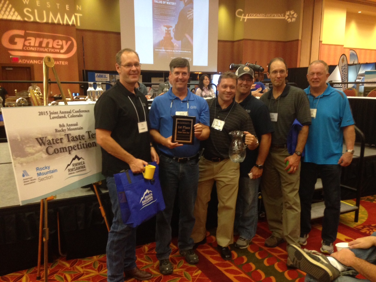
Taste test Winner.Castle Rock.September 14, 2015 Rocky Mountain Section AWWA
Congratulations to the water treatment personnel at the City of Castle Rock. From email from the Rocky Mountain Section of the AWWA (Greg Baker):
Who has the tastiest water in the Rocky Mountains? According to the judges at a taste test at the 2015 Rocky Mountain Section of the American Water Works (RMSAWWA) annual conference in Loveland, Colorado, Castle Rock Water has the best water in the region. Nine municipalities from a three state region competed for the title of best drinking water based on taste, odor and appearance. The winner of this competition will represent the RMSAWWA at the national “Best of the Best” taste test at the AWWA Conference in Chicago next June.
The winners of today’s competition were Castle Rock Water taking first place, East Cherry Creek Valley Water and Sanitation District in second, with Denver Water and Aurora Water tying for third place.
Judging this event were Cory Reppenhagen, with 7News in Denver, Erin O’Toole, reporter with KUNC Radio in Ft. Collins, Colorado, Pinar Omur-Ozbeck with Colorado State University, David Dani with the Colorado Department of Public Health and Environment, and John Donahue from North Park Public Water District in Machesny, Illinois.
The RMSAWWA is the regional section for the AWWA, which is the largest non-profit, science-based organization for drinking water professionals in the world. The RMSAWWA covers Wyoming, Colorado and New Mexico and has over 2,400 members, representing water utilities, engineering consultants and water treatment specialty firms.
Moon set over the Tenmile Range via The Summit County Citizens Voice Click here to read the latest newsletter. Here’s an excerpt:
Full Moon Tour under September’s Harvest Moon Moon
Come enjoy an evening with CDLT under September’s Full Harvest Moon. September’s moon is also the largest supermoon of the year and even graces us with a total lunar eclipse.
Date: Sunday, September 27, 2015
Time: 6p.m.-8p.m.
Place: Cobb & Ebert Placer
Price: $10 Suggested Donation
Naturalists: Rachel Winkler, and Kim Dufty
Register: Call (970) 453-3875, or email info@cdlt.org
Directions to Cobb & Ebert Placer:
From County Road 450 or Wellington Road proceed east to French Gulch Road. Continue east for about 4 miles to the parking area with USFS Trailhead signs.
Trail Info:
This is an easy to moderate hike. Families are welcome, although it is not necessarily recommended for children under 10. Sorry, no dogs on this outing please.
What to Bring and Additional Info:
-Please bring water, snacks, hiking shoes, layers of clothes, walking poles (if you want)
-Dress warmly. Temperatures will drop as the night progresses.
-If we cancel due to weather, we will try to let everyone know by noon that day.
For more information contact Rachel at info@cdlt.org, or (970) 453-3875
A “get well soon” balloon floats in the contaminated waters of the Animas River flowing through Durango on Monday afternoon August 10, 2015 — photo The Durango Herald, Shane Benjamin
Here’s the release from Colorado Parks and Wildlife:
Colorado Parks and Wildlife recently completed a survey of trout populations in the Animas River through Durango and near Silverton. The results provide a mixed picture for trout.
Colorado Parks and Wildlife conducted a survey last year as part of the normal every-other-year cycle. But because of the Silverton mine waste spill in August, CPW aquatic biologists decided to perform a survey again this year. The survey in Durango was conducted Aug. 27-30; the survey in Silverton was done Sept. 8-10.
Neither survey showed any acute effects on fish from the mine spill.
To do the survey, biologists use a technique called electro-fishing to deliver a mild shock to the water which temporarily stuns the fish. They are then scooped up, measured, weighed and identified for species type.
In Durango, the survey was conducted in two segments: from behind the La Plata County Fairgrounds to the 9th Street Bridge; and in the section from Cundiff Park to the high bridge.
Compared to last year, the overall biomass — a measurement of the total weight of fish per surface acre — increased in both sections of the river. Much of the increase, however, can be attributed to routine stocking by CPW — about 40,000 fingerling trout per year, explained Jim White, aquatic biologist for the agency in Durango.
In the section above 9th Street, biomass — weight of all trout combined per surface acre — increased from 27 pounds in 2014 to 66 pounds this year. In the lower reach, overall biomass increased from 75 pounds to 110 pounds. Both sections meet the biomass standard of 60 pounds of fish per-surface-acre set for Gold Medal water status.
But the number of large fish in the river remains low. The number of fish greater than 14 inches improved slightly from last year, from nine to 11 fish per acre. There must be at least 12 fish or more per acre longer than 14 inches for the river to achieve Gold Medal status.
White is most concerned about the lack of trout in the 7-to-12 inch size in the river. Those are the fish that are two- or three-years-old that should eventually grow to reach 14 inches in a couple more years.
“We’ve been seeing these gaps in age class for the last six years,” White said. “We’d like to see more of the young fish we stock recruit into the overall population.”
The survey also found little evidence of any natural reproduction by trout. The number of fry – very young trout – found in the river has been in decline since the late 1990s.
White explained that the Animas River in Durango is negatively affected by several factors: the flow of tainted water from area mines; and run-off from hillsides, golf courses, lawns, city streets and parking lots that add sediment, contaminants and nutrients to the water. Also, in the last decade there has been less water in the river due to declining snow fall. With less water there is less habitat available and the increase in water temperature is detrimental to trout.
In the river near Silverton, only a few fish were found in the canyon below the confluence of Cement Creek to Elk Park. CPW surveys show that the decline in the number of fish in that section of the river occurred between 2005 and 2010. A few miles east of Silverton above Howardsville, small brook trout were found in the river as they have for many years.
“The bottom line is that trout need cold, clean water,” White said.
Legislators from across the state agreed the Colorado Water Plan is dependent on all parts of the state working together, but Weld County residents had a few concerns with the proposed plan.
Weld residents and representatives raised concerns of prior appropriation, which includes property and water rights, and of the need to add water storage to the South Platte Basin.
State senators and representatives who are part of the water resources review committee gathered Monday evening at Island Grove to discuss the state water plan and hear public comment on it.
“We are a state that needs to work together,” Rep. J. Paul Brown said.
Weld is in the South Platte Basin, which includes much of northern and eastern Colorado as well as the Denver metro area. The area is expected to grow by 2.5 million people by 2050, pushing water demand higher than supply.
Joe Frank, chairman of the South Platte Basin Roundtable, agreed with the need to work together, saying, “We need the Western Slope, (and) they need us. We’re all one state. The problem is here, but ultimately it is a statewide problem.”
But Frank also recognized the importance of the South Platte Basin in the water plan.
Frank outlined the South Platte Basin Implementation Plan, which included four overarching themes. The themes considered were a good Colorado plan needs a good South Platte plan; solutions must be pragmatic, balanced and consistent with Colorado law and property rights; the South Platte River Basin will continue its leadership role in efficient use and management of water; and a balanced program is needed to plan and preserve Colorado river basin options.
Many in Weld see a need to extend the state’s storage, while others think conservation is the answer to future water issues.
Frank said the South Platte Roundtable Basin strongly believes storage needs to be a high priority in the water plan.
“We really strongly advocate for the development of additional above-ground storage,” he said. “That’s one thing that we really highlight in every section.”
Additional storage was a hot topic.
Weld County Commissioner Sean Conway said he has been involved in the process of writing the water plan and it’s been extremely grueling but healthy.
“Although we have differences and we will continue to have differences, the process has been a very collaborative one,” Conway said.
He said at the first meeting he attended about the water plan, someone said something that has stuck with him since.
“The days of folks simply folding our arms and saying ‘no’ are over,” Conway quoted.
He said the goal now is to find a water plan to benefit everyone and to benefit future Coloradans.
“I’m here to encourage water storage,” Conway said.
He said thousands of acres of land have dried up over the years, and it’s been devastating to agriculture in Weld County and eastern Colorado.
But Conway is worried that conservation is not enough to rectify these situations.
“Conservation should be a big part of this,” he said, “but the bottom line is, folks, we can’t conserve ourselves out of this.
Conservation is a very important part of this, but water storage is too.”
Jim Hall, representing Northern Water and the South Platte and Metro Roundtable Basins, said development of a water plan is an incredible undertaking. He encouraged legislators to recognize the wisdom of locals.
“While the plan currently points out that there has been a lack of additional storage over the last few years,” it needs to address it more immediately.
“It needs to include more storage now,” Hall said.
A local resident, Peter Bridgeman, said he was at the meeting out of concern for the future of his grandchildren.
“Water conservation will not solve our impending water crisis,” he said. “Our demands are much larger than our supply.”
Most importantly, those in attendance agreed that everyone needs to work together for solutions to the ever-present problems of water.
“We all drink it, we all use it,” said Bruce Johnson, a resident with 12,000 acres of irrigated land in Weld. “We need to be thinking about that for our offspring and the people who are coming down the pipeline.”
While it is not likely all the projects will make the city’s 2016 budget, Utilities Director Steve Salka on Tuesday made a strong case for many of the maintenance projects to the Durango City Council.
The intakes on both the Florida and the Animas rivers, a foundation piece of the system need to be upgraded. Some of the intakes on the Florida are almost 100 years old.
On the Animas River the city needs to install improvements to ensure enough water flows to the intake.
This intake is located near the Durango Whitewater Park, and the park has exacerbated a problem with the way the water flows through the channel. Right now, not enough water is flowing over the intake, Salka said.
The construction fix for the problem is estimated to cost about $250,000, and the Durango Parks and Recreation Department may contribute $100,000 to the project, he said.
This will help make sure the department is ready to rely more heavily on the Animas River during maintenance on Lemon Reservoir, which stores Florida River water. Work will be ongoing at the reservoir from August of 2016 through 2017, he said.
This likely won’t be the only construction in the Animas next year because the Utilities Department is also planning to replace four of the pipelines that cross beneath the river. These pipes are about 50 years old.
Many of the other projects Salka has planned focus on stainability at water-treatment plant and in other parts of the system.
Some of these projects include better insulation and variable-frequency drive pumps to reduce their demand for electricity.
He would also like to install larger compressors that would help eliminate the need for them to turn on and off constantly; this would address noise complaints from the Hillcrest neighborhood.
Eventually, Salka plans to install a solar garden that would fund the entire plant. But before the solar panels can be installed the La Plata Electric Association must install new equipment, and this project is not currently slated to happen in 2016…
The department will continue replacing water meters again the year by installing 300 new ones.
City crews have replaced 600 meters over the last two years, and it’s had a positive effect on the system.
“My revenue starts going up; we get more water accountability,” Salka said.
In dealing with the sewage system, Salka proposed $1.8 million in upgrades that will needed no matter what decision is made on the wastewater-treatment plant.
Councilors are debating whether to move the plant or renovate it at its current location in Santa Rita Park.
Upper South Platte Basin FromThe Colorado Springs Gazette (Ryan Maye Handy):
In a small plane soaring thousands of feet above the expanse of South Park, Jara Johnson surveyed one of the richest landscapes in the state, an area home to endangered wildlife, water, natural gas and uranium.
Although South Park has long been prized as the home of South Platte River and for its native elk herds, its energy prospects are what has put it on the radar of the Bureau of Land Management. The federal agency has begun putting together a master leasing plan for South Park to evaluate the risks of drilling for oil and natural gas in what Johnson considers one of the state’s unparalleled playgrounds.
But for those who make their living off the wildlife and water in South Park, the area’s potential for energy development poses a serious economic threat, said David Leinweber, who owns the Angler’s Covey in Colorado Springs.
Leinweber’s business has one of the largest guiding permits for the South Platte and habitually fishes the “Dream Stream,” a state-designated Gold Medal fishery at the southern edge of the BLM’s proposed leasing site. Leinweber foresees disaster if oil and gas development were to harm the river and its tributaries.
“In South Park our big concern is not very much different from what just happened on the Animas (River),” said Leinweber, referring to the acid-mine drainage that polluted the southwestern Colorado river last month. “It’s the what-if story.”
For Johnson, the director of operations for the environmental nonprofit Coalition for the Upper South Platte, there is much more at stake than South Park’s rich fishing economy.
Last week, Johnson served as guide for a National Wildlife Federation-organized flight tour over South Park to highlight the area’s mix of crucial water resources and wildlife habitats.
To the uneducated eye, South Park is a treeless expanse that stretches between the Front Range to the east and the Mosquito Range to the northwest. But Johnson sees the 980-square-mile area as a complex ecosystem with rare high-elevation wetlands, agricultural fields and winter refuges for elk and pronghorn. The South Platte meanders through the heart of the park – so named because white settlers thought it was like a natural game preserve – and delivers most of the water for the Denver metro area.
While less than an hour by plane from southeast Denver, South Park might as well be an exotic high-mountain paradise for animals, microbes and plants.
“There are plants in the Mosquito Range that are found nowhere else in the world,” Johnson said.
South Park’s uniqueness comes in part from its geology – a mixture of ancient volcanoes, glaciers and lakes, which make the area precious to the Front Range for its connection to water. Denver, Aurora and Centennial get water from South Park’s rivers, streams and reservoirs. While Colorado Springs gets its water from the Homestake system west of Leadville, two pipelines shuttle water east through the park, right through the BLM’s proposed leasing site.
With 28 abandoned wells and no active permits for the area, South Park has seen minimal drilling, said BLM spokeswoman Vanessa Lacayo. Areas around Lake George are “prime for uranium development,” although none has happened, Johnson said.
Nonetheless, potential for oil and gas development has raised the alarm in Park County, which gets most of its water from aquifers beneath South Park. While locals are anxious to see how leasing will play out, they are getting what many consider an unprecedented opportunity to plan with the BLM.
In years past, master leasing plans were done once energy companies expressed interest in drilling on BLM lands. But in 2010, inspired by the risks and interest in South Park, the BLM reformed the process, Lacayo said.
“The concept of the leasing reform (is) it doesn’t wait for someone to submit an expression of interest,” she said.
Instead, the BLM triggered the process without active interest in energy development in South Park. And the BLM is seeking the input of people like Leinweber.
“I think that when we initiated the master leasing plans, it was to provide the public with more opportunities to take a closer look at oil and gas leasing,” Lacayo said.
Before 2010, the first time locals learned of plans to drill on BLM lands was when mineral rights were sold, Lacayo said. Now, residents and others impacted will know about the area’s potential for oil and gas development long before leases are made available. The BLM has placed a moratorium on energy development around the state until several leasing plans are completed, Lacayo said.
Lacking funds, the agency has relied on CUSP to jump-start conversations about the impacts of oil and gas development. The nonprofit received a grant from the Keystone Policy Center to host three public meetings from October to February to give Park County officials, residents and business owners a chance to express concerns.
In a report submitted in March, CUSP found that South Park’s cattle owners welcome oil and gas development, while others want limited or strict restrictions.
Park County residents are afraid oil and gas wells will pollute their vulnerable aquifers. Various wildlife groups proposed that drilling be prohibited in known wildlife areas, such as portions of the James Mark Jones State Wildlife Area. Water providers, such as Denver Water and Colorado Springs Utilities, lobbied for mandatory setbacks for oil and gas development from water sources.
The BLM will take all the input into consideration for an environmental review, which will be released for another round of public comment after a draft is done, Lacayo said.
Although research has begun, the BLM is possibly years from opening the leasing process in South Park. The area’s leasing plan is but a sliver of the BLM’s Eastern Colorado Resource Management Plan, which will take years and millions of dollars to complete.
South Park, meanwhile, will continue to be the recreational and wildlife mecca it has always been. But even if it doesn’t become the home to Colorado’s next natural gas boom, Leinweber believes that even the smallest amount of drilling could have devastating impact on the area if it goes wrong.
“What people don’t often recognize with some of the oil and gas things is that it often isn’t the big company that goes in and does the exploration,” he said.
“It’s these small guys that don’t really have the backing of something. If they were to make a mistake, it can be pretty impactful for a long time. My concern is containing any byproducts that come out of the these (drilling) processes that could jeopardize our industry as a business.”
Evans Colorado September 2013 via TheDenverChannel.com
FromThe Denver Post via the Loveland Reporter-Herald (Joey Bunch/John Aguilar):
As Colorado hits the two-year mark since a historic deluge swelled rivers and creeks to overflowing, killing 10 and causing nearly $4 billion in damage across 24 counties, frustration is a theme for a surprisingly large group of folks still dealing with the storm’s aftermath. Hundreds of mobile home park residents in Evans, a city of 20,000 south of Greeley, are unable to return to communities that have been effectively scraped off the map.
The major access road into Glen Haven is still being put back together, causing repeated daily hour-long delays that result in unending headaches for locals and drive away tourist traffic headed to or from nearby Estes Park.
Only three of 17 homes in James town destroyed by a manic James Creek have been completely rebuilt, and a part of the population has relocated or hasn’t yet moved back to the tiny mountain town.
And then there are the dozens of Lyons residents, locked in a seemingly endless bureaucratic arm-wrestling match with town officials over attempts to get permits to rebuild their homes.
They confronted town leaders at a public meeting earlier this month demanding a more streamlined process for evaluating and approving their engineering and hydrology plans so they can move forward.
“We’ve spent a lot of money on this project, and we haven’t laid a shovel in the ground,” said Kitty Wang, who with her husband has lived in Lyons for 13 years and still awaits a floodplain development permit for a new house. “It’s a nightmare we keep trying to wake up from.”[…]
Molly Urbina, the state’s chief recovery officer, acknowledged that despite the billions spent to make repairs and provide compensation to victims of Colorado’s most costly natural disaster, problems remain.
The state, she said, has not forgotten about those still suffering.
“When we talk about disasters, we talk about a marathon, not a sprint,” Urbina said. “We continue to coordinate with local communities to assess and evaluate needs and priorities and to advocate for additional resources.”
Some of those resources have come from groups like Foothills United Way in Boulder County, which has raised $4.9 million in donations and spent about $363,000 for mental health services. The charity still sits on nearly $2 million to help cover the costs of at least 333 open cases in Colorado’s hardest-hit county…
Urbina said estimating costs for a disaster the size of the 2013 floods, which destroyed 1,852 homes and 203 businesses and created more than 18,000 evacuees over a five-day period starting Sept. 10, 2013, is a “complex, long-term process.”
“We understood that this would evolve as recovery priorities and projects became more clear,” she said.
The dynamic nature of the floods’ impact has played out in dramatic fashion since the one-year anniversary, with the cost of rebuilding in Colorado swelling by a third to nearly $4 billion.
The $1 billion spike, Urbina said, reflects the fact that initial cost estimates done in the months following the flood were rough. In the past year, more detailed estimates of what it would cost to fully repair and restore roads and watersheds in the state were made.
Specifically, watershed recovery master plans performed over the last year revealed that the true cost of improving flood-impacted watersheds would amount to some $600 million.
Last February, Gov. John Hickenlooper announced $56.9 million will come from a federal program to help restore stream corridors and prevent future flooding.
The remainder of the increased cost estimate since last year — around $400 million — came about as the result of detailed design and engineering work, which more clearly outlined the cost of building roadways that can better withstand future flooding, Urbina said.
Work will begin soon to redesign U.S. 36 from Estes Park to Lyons at an estimated cost of $50 million.
Also, individuals and local governments have found damage they initially didn’t know about or thought private insurance would cover, according to the Colorado Resiliency and Recovery Office…
A new normal is also being pieced together in Evans, where the Eastwood Village and Bella Vista mobile home parks were turned from once-vibrant low-income neighborhoods to empty, weed-choked lots by the floods. It’s not certain what will happen to the two properties, though Bella Vista’s owner is working with the city to re-establish itself at the same spot on 37th Street.
Here’s a look at several survivors from Isa Jones and Pam Mellskog writing for the Longmont Times-Call via the Loveland Reporter-Herald.
Meanwhile the Big Dam repairs are nearly complete. Here’s a report from Saja Hindi writing for the Loveland Reporter-Herald. Here’s an excerpt:
Crews are putting the finishing touches on repairs to the Nelson Big Dam and expect to have them completed in the next few weeks.
The masonry arch dam, built in 1895, is located west of Loveland’s water treatment plant, and was significantly damaged in the September 2013 flood.
The dam diverts raw water to the city’s water treatment plant, provides drinking water for the Johnstown water treatment plant, and irrigates about 20,000 acres of farmland in Larimer and Weld counties.
The Consolidated Home Supply Ditch and Reservoir Co. owns the 60-foot-plus dam, which didn’t suffer major damages in the 1976 flood, but the 2013 waters left a lot of damage.
The dam is also identified as a Colorado Historic Civil Engineering Landmark, so crews had to make sure not to change the historic aspects of the dam substantially. That included using stones from the same quarry as the original stones.
Crews are working on Phase II of repairs now, according to Home Supply board member Gary Gerrard, which encompass the pointing or refacing of the dam (grouting stones on the face of the dam), a need caused by years of erosion. Once that’s completed, he said, crews will close the gate.
The dam was operational April 1, 2014, in time for the spring runoff, and repairs continued while it was in use, aside from taking a break in the winter months…
Some of the repairs after the flood damaged the dam, Gerrard said, included restoring the crest elevation, mitigating future flood effects by strengthening the dam with concrete abutments and installing a new spillway that configures water to go around instead of on top and updating to 21st century technology such as an automatic gate that fluctuates with river flow.
Because the flood damaged the dam’s main gate, the company was also able to replace other gates not damaged by the flood that were almost unusable and rusting because they were first put in 1915.
Funding for the repairs came from the city of Loveland, the Home Supply board, the Colorado Water Conservation board and the Federal Emergency Management Agency. The city committed to paying 50 percent of the costs not covered by federal and state grants. The conservation board committed to covering uncovered costs through long-term low-interest loans.
The total cost of repairs, Gerrard said, is about $3 million. Of that, $2.2 million is expected to be covered by federal aid.
Gerrard said the entities were able to keep costs low through “the methods of construction and the ability we had to be able to make decisions in the field, and the cooperation we had from all the entities to react to the things we found out in the field.”
Because officials could make decisions quickly, there weren’t a lot of construction holdups, he said.
“That’s the main thing to reach out for help. They (Larimer County Long Term Recovery Group) connect you with the people you need (Loveland Housing, in particular). We had volunteers from Lyons, Minnesota, Wisconsin, Florida,” said Aleta.
Today, the Hammond’s have a little less privacy. The flood took out about half the trees and bushes along this road. And what was a pasture with a barn now looks like an outcropping of rocks.
That creek that once rushed with danger is nearly dry, but the family’s gratitude is overflowing.
People lost their homes, a few lost their lives. So we were very, very fortunate,” said Aleta…
The state repositioned U.S. 36 and Little Thompson River to prevent a tragedy like this from ever happening again.
The Hammonds say they still have work to do on their property, like foundation work, and cleaning off grit inside tools and motorcycles.
From the Loveland Reporter-Herald (Jessica Benes):
Where the Little Thompson River used to be 70 feet wide in places, it was blasted to 300 yards, according to Gordon Gilstrap of the Little Thompson Watershed Restoration Coalition.
The September 2013 flood devastated areas along Front Range rivers and streams, and while not nearly as many houses were lost on the Little Thompson River, landowners still are recovering from the deluge that destroyed vegetation, wildlife habitat and landscapes.
Some landowners along the Little Thompson call it “the forgotten river.”
“It’s been an interesting journey,” said Gilstrap, who helped set up the Little Thompson Watershed Restoration Coalition after the flood. “The Little Thompson has been an unknown river because no county or state roads run along it for any distance. It is all privately owned.”
Deirdre Daly, president of the coalition, said that because the river isn’t in a town or county that is leading the charge for river repair, the restoration has been almost entirely driven by the people who live on it…
The Little Thompson headwaters come in from several areas but are mostly above Big Elk Meadows below Estes Park, separate from the Big Thompson.
“It was a small working river,” Gilstrap said. “It provides drinking water to Big Elk Meadows and Pinewood Springs, irrigation to a lot of farmland. It has always been a small, quiet little river.”
The water pushed woody debris down the river, knocking out everything for hundreds of feet on both sides of the river.
Gilstrap said the land along the river was heavily wooded, with a lot of wildlife habitat, especially in the Big Elk Meadows, Pinewood Springs and Blue Mountain areas. Much of that habitat area was lost.
The number of homes lost in the flood was small — two to four — but there was a lot of other damage such as water in basements, homes partially damaged and agricultural fields that were made useless with sediment and garbage debris accumulation.
“A lot of agricultural equipment was lost, and the irrigation ditches took a real hit,” Gilstrap said. “An interesting fact most people don’t know is the Little Thompson was the river that shut down every county bridge between Big Elk Meadows and Milliken — seven public bridges and many other private bridges — so it cut off Northern Colorado from southern Colorado.”[…]
Watershed coalition
Gilstrap helped found the Little Thompson coalition in December 2013, starting with nothing. The group had no money and no knowledge of how to run a coalition.
“Thanks to an amazing group of volunteers that stepped forward to be a part of it, we established the Little Thompson coalition as one of the most effective coalitions in Colorado,” Gilstrap said.
With grant funding, the coalition oversaw the successful completion of a master plan for the watershed, started having meetings, published an active website and Facebook page and coordinated volunteer projects.
“We secured over $1.2 million in government and private-sector grants with a potential of $3 plus million to come,” he said.
The coalition also was able to hire a full-time watershed coordinator, Keith Stagg, and assistant coordinator. Erin Cooper, this summer to oversee grant raising and volunteers, which meant the hard workers such as Gilstrap who had volunteered so much of their time were able to step back.
“We all learned together (at the beginning),” Gilstrap said. “We even learned to say ‘fluvial geomorphic transition’ and other big words like that.”
He said there were two reasons for their success: the volunteers who stepped forward to be on committees while also working day jobs, and support from the state and counties involved.
“Everyone worked together, and that spirit is ongoing more than ever. The volunteers came in from everywhere and did the dirtiest, grungiest work imaginable and were happy as can be if you gave them water and cookies,” he said.
Work still to be done
One of the big problems the river still faces is sediment.
Gilstrap said the Big Thompson River has a rock base, while the Little Thompson has more of a soil base.
When the flood swept down the river from just below Estes Park, sediment traveled down, blocking irrigation canals and changing the bed of the river.
One of the private bridges in Berthoud — called the Green Monster bridge by locals — used to have a space large enough to walk under, and now a person can barely crawled under because of all the new sediment. Julie Moon used to walk her horse beneath the bridge.
“That all plugs up irrigation ditches, rechannels the river,” Gilstrap said. “It’s a long-term fight to understand what will happen with the sediment, how to fight it, how to do restoration so we don’t aggravate the problem.”
He said there is still a lot of farmland with sediment covering valuable cropland.
Natural Resources Conservation Service representatives walked the river and filled out disaster survey reports to define the work to be done. The restoration work will carry on for the next five or more years, he said. The river is also being analyzed for flood and fire resiliency, to be more resilient the next time a flood passes through.
“We’re trying to think during restoration how we can bounce back from them more quickly and not put people in as much peril,” Gilstrap said.
Stagg said the silver lining of the flood is that people are aware of the need for resiliency.
“Everyone wants to see the system put together,” he said.
Gilstrap said wildlife is coming back, and the coalition is looking at revegetation options to establish more wildlife habitat. They plan to use willow cuttings and other “ecotypical” seeds from Daly’s property and neighbors’ to vegetate other areas along the river with native plants.
Finding funding
Major sources of grants for restoration work has come from the U.S. Department of Housing and Urban Development, and from the Emergency Watershed Protection Program through USDA.
Gilstrap said a new round of grant funding from several sources will deliver possibly $47 million across Colorado, and he believes the Little Thompson might see $2 million to $3 million of that. Stagg and Cooper were hired through funding jointly from the state Department of Local Affairs and the Colorado Water Conservation Board.
“We’re one of (several) watersheds that received funding for professional staff,” Stagg said.
Each year, the coalition will receive grants and work on different pieces of the restoration project for many years to come.
“We will get a couple projects done in each round. Each year we will go find another source of money, and do a little bit of project as the years go on,” Daly said.
The Little Thompson even has a “Little Thompson Watershed” sign posted near the headwaters.
“We’ve never had that before,” Daly said. “Before, the river was there and hidden by trees and no one knew what river it was.”
Click here to read the newsletter. Here’s an excerpt:
Animas spill may stimulate watershed solutions
On August 5, about 3 million gallons of contaminated water burst out of an abandoned mine above Silverton and sent a plume of cloudy, orange water down Cement Creek to the Animas River, through the heart of Durango, and on into the San Juan River in New Mexico, the Navajo Nation and Utah. Downstream: Lake Powell.
The plume of acidic orange water, containing arsenic, lead and other toxic heavy metals, had built up as a result of historic mining activity dating back to the 1870s… The massive plume was set loose by workers for the U.S. Environmental Protection Agency attempting to assess and remediate the source of an ongoing trickle of pollution from the Gold King mine…
In assessing how this catastrophe fits into the overall regional water picture, it is instructive to zoom out geographically and look back in time. The 3 million gallons of contaminated water from the spill translate to a little over 9 acre-feet of water. This quantity is dwarfed by the approximately 13 million acre-feet currently in Lake Powell, despite the fact that it is only 54 percent full…
Hannah Holm is the coordinator for the Water Center at Colorado Mesa University. Holm is a friend of the Watershed Council and wrote this article for our monthly Vail Daily column, The Current. Click here to read on.
In Colorado, where settlement depended on water availability, a ditch often is the oldest structure in a community.
Nowhere is that more true than on the St. Charles Mesa. Located just southeast of Pueblo, the area has been home to generations of farm families. It’s known locally for its produce at farmers markets or roadside stands. Everything from cabbages to pumpkins is marketed nationally. As the Colorado State Fair rolls around each year, Pueblo has its share of youth animal exhibitors and farm products entered into contests.
But for all that to happen, a ditch had to be dug.
The Bessemer Ditch stretches more than 40 miles through the city of Pueblo, the steel mill to the east and onto some of the best farmland in the region. Its name, taken from the steelmaking process, is a key to its origins.
It began more as a real estate project than a demand to work the land. The ditch was first known as the Big Ditch in South Pueblo in 1874. It was dug by the Central Colorado Improvement Co., a real estate company formed by William Jackson Palmer to assist the Denver & Rio Grande railroad. While there was no steel mill in that early time, the ditch was meant to open up the land south of Pueblo to small family farms.
It diverted water west of Pueblo from the Arkansas River and was described by The Pueblo Chieftain as a booming area that supported the opening of coal mines to the west in Canon City.
When the Central Colorado Co. merged with other companies to form Colorado Coal & Iron, the forerunner of CF& I, most of the ownership of the ditch came with it. CC& I sought to expand the ditch in the 1880s to bring water to large tracts of land on the St. Charles Mesa. The ditch would run through Pueblo, across the St. Charles River by flume and empty into the Huerfano River.
By 1889, the Bessemer Ditch had incorporated and was selling shares of stock.
“The turning of the water into the Bessemer Ditch is something that Pueblo ought to have celebrated this week with a grand demonstration,” The Chieftain opined in 1890. “It is one of the best things the city and county ever witnessed.”
Glory was short-lived. The ditch company defaulted on an interest payment and was sold at a trustee’s sale in 1894. Soon after, the Bessemer Irrigating Ditch Co. was formed, and remains the operator. It is today a mutual association of landowners.
Initially, a reservoir was built in the Vineland area, but it leaked too much because local soils would not hold water.
Bessemer Ditch survived the flood of 1921. Some structures had to be rebuilt, but the biggest casualties were the company’s records, lost when its offices in Downtown Pueblo flooded.
It also made it through the Great Depression. Even though shut-off notices were mailed to 45 percent of the shareholders, local banks continued to loan money to the company.
In recent decades, the nature of the ditch has continued to change.
Subdivisions of some property and commercial operations on the Mesa have created the need for drinking water delivery, and the St. Charles Mesa Water District has acquired about 10 percent of Bessemer Ditch shares since 1964.
When Pueblo Dam came online in 1975, it included an outlet for the Bessemer Ditch.
Bessemer Ditch, which had supported the Fryingpan-Arkansas Project that built Pueblo Dam, sued the Bureau of Reclamation over clear water. Lacking silt, the water seeped more quickly through the ditch, flooding basements in Pueblo, creating a potential liability.
Although the ditch company lost the lawsuit, a federal project helped seal the 5 miles of ditch through Pueblo by spraying it with gunite.
Beginning in the 1980s, there were attempts by speculators to buy Bessemer Ditch shares to meet the need for additional water supplies in growing cities. Those mainly failed because the asking price was too low.
But in 2009, in response to offers from El Paso County communities, the Pueblo Board of Water Works successfully purchased about 28 percent of the shares for a little more than $10,000 per share. Pueblo Water in 2007 had made a lower offer that failed to attract enough interest.
Part of the deal is that most of the water would be leased back to farmers for about 20 years and that any leasing of water outside the ditch would give priority to Pueblo County.
So, the Big Ditch has come full circle, providing a foundation first for the growth of Pueblo, a century of primarily agricultural activity and now a support system for the county’s growth — all the while continuing to produce world-class green chiles.
Greg Hobbs sent along these photos from his son Dan’s farm off the Bessemer Ditch in the Arkansas Valley:
Mcphee Reservoir From the Dolores Water Conservancy District via The Cortez Journal:
The Dolores Water Conservancy District board of directors is asking voters to set a permanent mill levy for the district.
Ballot question 4A will appear on the November general election ballot, and would authorize DWCD to fix its operating mill levy at the current 0.483 mills and retain any additional income it receives. DWCD operates McPhee Reservoir and the Dolores Project.
“We think of this as purely a housekeeping measure, but it requires voter approval because it deals with our mill levy rate,” said Bruce Smart, president of the Conservancy District Board.
“We’re spending more of our resources, and tapping reserve funds, to protect our water rights and meet legal and regulatory challenges while dealing with the challenges created by drought.”
The district is also responding to threats to McPhee Reservoir such as preventing an invasion of destructive mussels.
“The bottom line is we have a duty to protect the water, McPhee Reservoir and project facilities for our children and grandchildren,” Smart said.
DWCD manages the water assets of the Dolores Project covering a 440-square-mile area of farms and towns, including the Ute Mountain Ute tribe. Water stored in McPhee Reservoir is relied on for drinking water by the communities of Cortez, Dove Creek, and Towaoc. And the Montezuma Valley Irrigation District stores water in McPhee that is delivered to 1,000 shareholders.
“Water from the Dolores Project is the lifeblood of our local economy – including agricultural and commercial businesses, and the residential growth of our communities,” said District Manager Mike Preston. “In our 28 years of managing the Dolores Project, we’ve seen an increasing need to protect existing water rights and water supplies while making long term investments to keep Dolores Project facilities in good condition. Addressing these needs has become increasingly critical and costly.”
Question 4A will be included in the general election ballot mailed to registered voters in Montezuma and Dolores counties by October 19, 2015.
The district has a long-term contract with the Bureau of Reclamation to operate and maintain the Dolores Project which moves an average of 240,000 acre feet of water per year through the reservoir. The Project facilities include McPhee Dam and Reservoir, the Dolores Tunnel, the Towaoc Highline Canal, the Dove Creek Canal, two hydropower plants, seven pumping plants and the control systems to run them all remotely. Directors on the seven-member board are appointed by the district judge.