
From the Loveland Connection (Molly Armbrister):
Temperatures around Estes Park are expected to rise into the mid-80s today and the upper-70s through the rest of this week, melting the mountain snowpack. There also is a slight chance of thunderstorms that could include heavy rain every day this week. The town on Saturday and Sunday placed sand bags in several spots along the Big Thompson. Much of Northern Colorado remains in a flood warning because of heavy mountain runoff. The flood advisory took effect at 2 p.m. Sunday and will remain in effect until 11:15 p.m. Tuesday.
From The Denver Post (Tom McGhee/Joey Bunch):
The meltoff caused flooding in several parts of the state Sunday, including shutting down Colorado Highway 82, which connects Twin Lakes to Aspen over Independence Pass…
Rivers are raging in many of the area’s most popular recreational spots, include the [Eagle] River below Gypsum, which set a record for streamflow Sunday at 5,750 cubic feet per second, according to the U.S. Geological Survey. The former record was 4,960 cfs, and the 63-year mean flow for the river on June 6 is 2,410 cfs. The Arkansas River at Nathrop also set a new high: 4,150 cfs, shattering the old record of 3,.220 cfs set in 1997. The 39-year mean is 1,830 cfs. Many rivers are running way above normal because of the high heat and fast melting. The Big Thompson and Fall rivers both were close to overflowing their banks this weekend…
The NWS in Grand Junction has issued flood warnings due to melting snow in Eagle County until 8 p.m. Monday. There was minor flooding in and around Vail on Saturday night but the waters receded this morning. Flooding was also reported along the Eagle River near Minturn and near Gypsum, according to the NWS…
The Boulder County Sheriff’s Office closed Boulder Creek to all watercraft from Barker Dam east of Nederland to the Weld County line, north or Erie. The ban includes rafts and inner tubes; kayaks and white-water canoes are exempt by law. In announcing the closure, the sheriff noted that Boulder Creek is flowing at 857 cfs, when a normal flow is between 100 and 300 cfs.
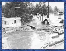
From 9News.com (Anastasiya Bolton):
The Big Thompson is a couple of feet higher than usual. The water is running very fast and has flooded a small portion of the post office parking lot in town.
Here’s some video from the Estes Park News.
From the Vail Daily:
The National Weather Service has issued a flood warning for Eagle County until 8 p.m. today, and area creeks and rivers are at or nearing flood levels. Several areas of the county experienced minor flooding early Sunday. All community members are advised to stay away from waterways; banks are unstable and can collapse without notice. Rafting, kayaking, fishing and other water activities are highly discouraged due to the amount of debris in the rivers. River levels typically peak daily between 2 and 4 a.m.
From KKTV.com (Rick Montanez):
Some of the rapids seen on the Arkansas River are not named, because river guides in the area have never seen them before. “We’ve got debris coming down, entire trees coming down, waves where there were never waves,” said Michelle Fletcher, a river guide for Canyon Marine. “It’s just phenomenal.”
From the Fort Collins Coloradoan:
The Cache la Poudre River is expected to rise to more than 6 feet tonight, with minor flooding possible in LaPorte, according to the National Weather Service. Minor overbank flow from the Poudre has been reported in rural areas between Fort Collins and Greeley. Minor high water issues due to high flows are also being reported along St. Vrain Creek tributaries upstream of Lyons in Boulder County. The flood advisory took effect at 2 p.m. today and is set to expire at 11:15 p.m. Tuesday. It covers Larimer County, Boulder County and west-central Weld County.
From the Fort Collins Coloradoan:
The advisory is in effect until 1:15 p.m. Tuesday for west-central Weld County, Boulder and Larimer counties. Rivers and creeks remaining in the advisory include he Cache la Poudre and Big Thompson rivers and their tributaries in Larimer County; St. Vrain and Boulder creeks and their tributaries in Boulder County; and the Cache la Poudre River in rural areas of Weld County between Fort Collins and Greeley.
From the Dolores Star via the Cortez Journal (Shannon Livick):
[McPhee Reservoir] is full at 6,924 feet, and on Wednesday the elevation was 6,924.08. “We are trying to stay right at 6,924,” said Mike Preston, manager of the Dolores Water Conservancy District. Since the lake is currently full, the release on the Lower Dolores is basically the Upper Dolores River’s inflow, minus the irrigation demand. On Wednesday, the release on the Lower Dolores was 805 cubic feet per second and the Upper Dolores was running at 1,720 cfs. But the release on the Lower Dolores likely will begin to get smaller as the Upper Dolores trends down and irrigation demands increase, Preston said. The Upper Dolores through the town reached a high point on Saturday at 3,510 cfs.
From the Sky-Hi Daily News:
The Sky-Hi News is receiving widespread reports of flooding along the Fraser River this morning, from above and in Winter Park to Granby.