Energy policy — hydroelectric: Aspen plans to draw down Thomas Reservoir this summer for construction of new outlet and penstock

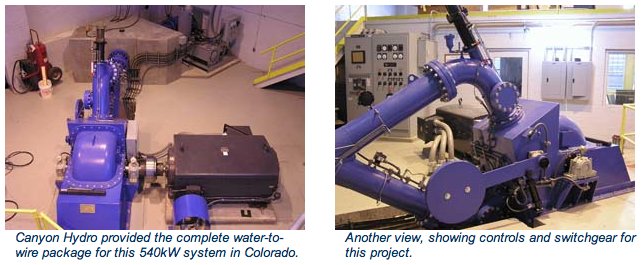
A picture named canyonhydrosmallhydroelectricplantbouldercanyon.jpg

From the Aspen Daily News (Curtis Wackerle):

Beginning in July, the city will empty the reservoir, which stores water for the municipal water treatment plant on Doolittle Drive. It will remain dry for about three months, said Dave Hornbacher, the city’s deputy director of utilities and environmental initiatives…

Most of the $2.3 million 42-inch pipeline, running from the reservoir to the site of the proposed plant, was constructed last summer and fall. Crews still need to install the final 200 feet of pipe leading up to the earthen dam. They will then bore through the dam, build an intake structure and hook up the pipe. The state of Colorado’s Division of Water Resources granted a permit for the work this spring. That permit also requires the city to upgrade a spillway on the east side of the reservoir, so there will be even more capacity to release water form the reservoir in case levels rise too high.

The pipeline is a crucial part of the city’s proposed hydroelectric plant. Voters in 2007 approved $5.5 million in bonds — with a maximum repayment of $10.7 million — to build the plant, which would be located under the Castle Creek Bridge. The pipeline would feed up to 52 cubic feet per second (cfs) of water into a turbine, generating up to 8 percent of the municipal utility’s electricity needs.

More hydroelectric coverage here and here.

Dolores River watershed: Montezuma Valley Irrigation shareholders decline the opportunity to lease water for lower Dolores River conservation efforts

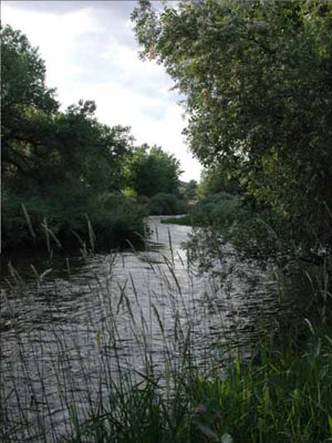
A picture named doloresrivercanyon.jpg

From the Cortez Journal (Reid Wright):

Stockholders turned out in droves, lining up out the door of the Lewis-Arriola Community Center. A total of 19,566 votes were cast, with 6,052, or 31 percent, votes for the proposed agreement and 13,514, or 69 percent, votes against…

MVI General Manager Don Magnuson told the stockholders before the vote the money could be used to encase MVI canals in pipe – thus reducing the amount of water lost to leaks. Prime candidates were the Garnett Ridge, Goodland Lateral, Big Corkscew, Lower Corkscrew and Lower Arickaree canals. A previous irrigation pipe project saves an estimated 1,500 acre-feet in water annually, Magnuson said. “We’ve got a lot of canals out there that need major work,” he said.

Magnuson told shareholders the impact on their water claims could range from no impact – since shareholders often do not use their entire allocation in a year – to two acre-inches per share annually, even in a time of drought. But after the drought of 2002, which left reservoir levels precariously low, MVIC shareholders – comprising mostly farmers and ranchers – expressed a reluctance to part with their water during a May 5 meeting. They also feared any revenues gained from the agreement would be lost to bureaucracy or loan debt.

The company holds senior water rights in McPhee, Narraguinnep and Groundhog reservoirs, and manages irrigation water for much of Montezuma and Dolores counties.

More Dolores River watershed coverage here.

Runoff/snowpack news: Many eyes are on the Yampa River

A picture named sandbag.jpg

From Steamboat Today (Matt Stensland):

He has been looking at river water depth information available on the National Weather Service in Grand Junction website. On Tuesday, the site showed that the Yampa River was running at about 4.75 feet through Steamboat Springs. The forecast calls for it to remain at that level or lower through Sunday…

Flood stage for the Yampa is 7.5 feet. The moderate flood stage is 8.5 feet, and the major stage is 9.5 feet. The Elk River has gotten above 7 feet but has not yet reached the first flood stage of 7.5 feet. Like the Yampa, the Elk is expected to remain at its current level of 6.6 feet or lower through Sunday…

Earlier this month, the Tower measuring site at 10,500 feet on the summit of Buffalo Pass hit an all-time record, not just for that location but for Colorado. The snowpack held the equivalent of 72.6 inches of water, and that number has grown. But has it peaked? There was 74.2 inches of water measured at the site Saturday and Sunday. On Tuesday, it was measured at 73.9 inches.

Meanwhile Denver Water has started releasing from Dillon Reservoir in anticipation of the runoff. Here’s a report from Bob Berwyn writing for the Summit County Citizens Voice. From the article:

As of May 20, the reservoir was at an elevation 8997.73 feet, about 20 feet below full and one of the lowest levels on record for this date. In On this date in 1995, after another big winter, the reservoir was about two feet lower, at 8995.26 feet. Despite the precautionary drawdown that year, Summit County still experienced some significant flooding around Father’s Day, when Valley Brook Road, in Breckenridge, washed out, and high water inundated some basements and septic systems in the Blue River area, south of Breckenridge.

No surprise, some of the lowest reservoir levels recorded have come after big droughts. In March of 2003, the water level was all the way down to 8960.86 feet, about 57 feet below full pool. And the lowest reading Steger found in his records was on April 29, 1978, when the reservoir dropped all the way to 8,952.73 feet after the 1976-’77 drought that spurred Colorado ski resorts to ramp up snowmaking.

As of May 19, the snowpack in the Blue River Basin was at an extraordinary 221 percent of average. Assistant county manager Thad Noll said local officials are prepping for high water and keeping an eye on some of the usual creekside spots, including neighborhoods alongside North Tenmile Creek in Frisco, and especially the Upper Blue.

Energy policy — nuclear: Senator Bennet urges caution in developing uranium resources at the proposed Piñon Ridge Mill

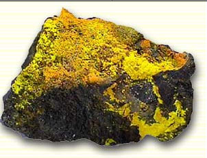
A picture named uranium.jpg

From The Telluride Daily Planet (Matthew Beaudin):

“I support careful EPA oversight of the entire permitting process and any subsequent operation of this mill,” [Senator Bennet’s] letter to Jim Martin, the EPA’s regional administrator, reads. “Any and all EPA analysis needs to ensure a safe, environmentally responsible and balanced approach to the potential development of this natural resource.”

“It’s a voice that equals hundreds or thousands of smaller voices,” said San Miguel County Commissioner Joan May. “They’ll listen when he speaks.”

Earlier this winter, the CDPHE issued a radioactive materials license, effectively permitting the project, to be built 60 miles west of Telluride just outside of Paradox, Colo.

More nuclear coverage here and here.

Storage update: The Southeastern Colorado Water Conservancy District allocation to agriculture is 60,000 acre-feet

A picture named puebloreservoir.jpg

From The Pueblo Chieftain (Chris Woodka):

The Southeastern Colorado Water Conservancy District allocated nearly 60,000 acre-feet of water to agriculture at its meeting Thursday. The water will supplement flows on 150,000 acres of farmland and could save crops later in the season. Much of the Lower Arkansas Valley remains in a drought that began 9 months ago. The board also allocated almost 18,000 acre-feet of agricultural return flows, which mostly will be used for well augmentation. The water comes with a caution: The snowpack may melt too fast to capture the anticipated water. So, only 80 percent will be allocated, with the rest arriving in midsummer, when the picture becomes clearer…

With municipal water storage accounts near the brim, however, the cities have asked for only about 60 percent of the water they could have. The Pueblo Board of Water Works did not take a Fry-Ark allocation this year, and is actually leasing some of the water it has to farmers. Colorado Springs also is passing on some of the water it could claim. Even in the Lower Arkansas Valley, one of the driest parts of the state, municipal and domestic water providers only requested about two-thirds of the water to which they are entitled.

More Southeastern Colorado Water Conservancy District coverage here.

Runoff news: People with structures and operations in the Cache la Poudre floodplain need to start preparing for possible snowmelt flooding

A picture named cachelapoudre.jpg

From the Fort Collins Coloradoan (Bobby Magill):

The snow keeps on falling in the mountains of Larimer County, and the snow is not forecast to begin melting significantly for at least a week. “When it does start melting, the probability is really high that it’s going to melt really fast,” Fassnacht said, adding that the Poudre River is likely to peak at a level as high or higher than ever seen before.

The Poudre’s historic peak flow through Fort Collins for the last 35 years occurred April 30, 1999, when the river was measured at 10.46 feet with a streamflow of 7,710 cubic feet per second, or cfs, according to U.S. Geological Survey data. The 2010 runoff came close when the Poudre crested at 9.27 feet and 4,570 cfs…

Flood stage at the mouth of Poudre Canyon is 7.5 feet or about 5,000 cfs. Through Fort Collins, flood stage is 12 feet or 10,500 cfs. Streamflows greater than 9,000 cfs have occurred only five times in Fort Collins’ history, according to city data. The greatest streamflow ever recorded on the Poudre came in 1904, when a rainstorm caused the river to surge to about 25,000 cfs, killing one person. Fassnacht said this year’s runoff could bring a streamflow double the size of last year’s highest-in-a-decade flows on the Poudre.

Precipitation news: Denver is above average for the year

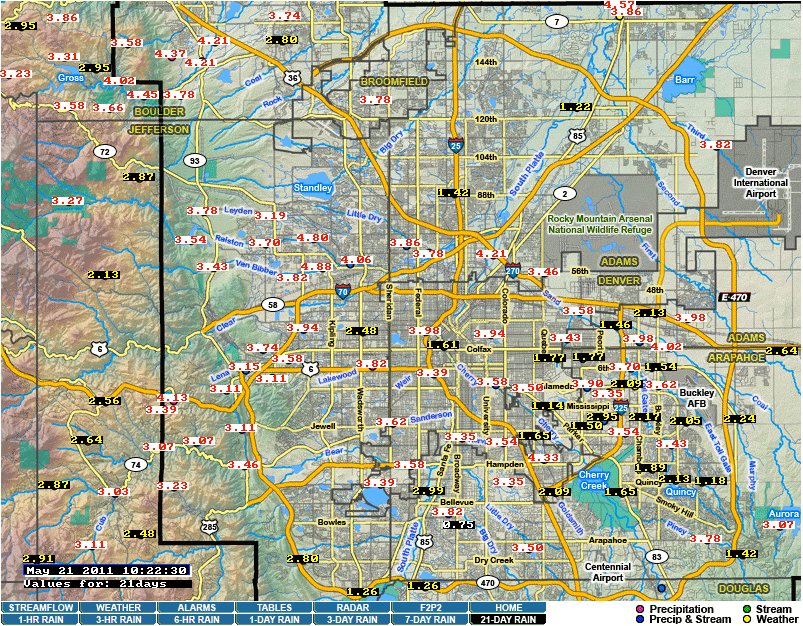
A picture named denver21dayrainfallurbandrainage05212011

Click on the thumbnail graphic to the right for a look at the 21 day rainfall for Denver from the Urban Drainage and Flood Control District. Here’s a report from Jordan Steffen writing for The Denver Post. From the article:

Since May 1, the metro area has received 3.75 inches of precipitation — 2.24 inches more than normal for this point in the month and 0.48 inches above the normal amount for the year to date, according to the National Weather Service…

So far this month, Colorado Springs has received 0.53 inches of rain, putting the area 2.66 inches below the normal average for this time of year, said Byron Louis of the National Weather Service. Fire dangers in the southern and eastern parts of the state will likely remain high until July, when monsoon rains start to fall, Segin said. Drought conditions, especially in southern Colorado, are creating major problems for ranchers and farmers, said Jim Miller, deputy commissioner for the Colorado Department of Agriculture. The drought has caused a hay shortage and a severe lack of forage on the plains, which leads to grasshoppers competing with livestock for precious food.

Whitewater news: Big year forecast for the Colorado River and the Green River

A picture named ohbejoyfulslatecreek.jpg

From BigTravelNews.info:

This spring / summer promises to be one of the top 10 best high water years on record for the Colorado River System in Utah and Arizona, reports Brian Merrill, CEO of Western River Expeditions http://www.westernriver.com/ that 50 years ago helped pioneer the sport of river rafting on white waters of the West.

“It’s possibly the best water year ever on Utah’s Green River in our half century of river running,” Merrill said. He noted that for raft enthusiasts and whitewater adrenaline junkies “2011 is THE year to book a river trip through Westwater or Cataract Canyons of the Colorado River or Gray and Desolation Canyons on the Green.” Also, the Bureau of Reclamation is releasing extra flow from Glen Canyon Dam which means higher water through the Grand Canyon this year. (The water release strategy is an effort to increase the level of Lake Mead.)

Merrill anticipated that high water would continue through late July this year; ordinarily it tapers off at the end of June. The public may monitor Colorado and Green River drainages on a daily basis by going to: http://www.cbrfc.noaa.gov/rec/rec.php.

More whitewater coverage here.

Colorado River Cooperative Agreement: The Moffat Collection System Project will divert an additional 15% of Upper Colorado River flows

A picture named coloradorivergranby.jpg

Update: I incorrectly attributed the article. Mr. Neubecker is not representing Trout Unlimited’s views in the article but those of his organization, the Western Rivers Institute. Thanks to a Coyote Gulch reader for pointing this out.

Western River’s Institute’s Trout Unlimited’s Ken Neubecker has penned a guest column running in the Vail Daily about the things the Colorado River didn’t get from the Colorado River Cooperative Agreement. Here’s an excerpt:

If anyone is a loser in this, it is the river itself. Although the agreement claims to have provisions that will help the rivers, that’s not as accurate as it could be. Yes, lots of money, cooperation and a small amount of water for environmental “enhancement” are provided. But far more water will still be taken from the river than is left to flow in its starved channel. The agreement does not address or acknowledge that more than 60 percent of the Fraser and upper Colorado are already being diverted to the Front Range. The Moffat Expansion will take an additional 15 percent or more on top of that. With that much of the native flows removed, making about 1 percent available for “environmental enhancement,” as this agreement does, won’t go far to help the river, much less improve it.

The agreement does not deal with the impacts from the Moffat and Windy Gap expansion. Future diversions by Denver Water and others are not ruled out. Even with cooperation, the upper Colorado and Fraser could still be drained of their last drop.

Neither this agreement nor the potential mitigations proposed to the Division of Wildlife deal with the damage already done from more than a hundred years of diversions. Yet everyone pats themselves on the back for a job well done and goes back to work, never really admitting what has been lost.

Here’s another guest column written by John Berggren running in The Denver Post. From the article:

In an era of constrained water supplies threatened further by climate change, the precedent should not be building more diversions or pipelines. It should be water governance that recognizes no more new water is available and limitless supply is a thing of the past. This is not an argument for limiting growth. In fact, some cities in the Southwest have shown the ability to reduce overall water consumption while adding population. It can be done. Instead, this is an argument that conservation, smart planning, and cooperation needs to be the first thought in water management, not diversions and pipelines. The Colorado River Cooperative Agreement is a step in this direction. The agreement includes increased conservation and reuse by Denver Water; water planning that includes environmental needs in a long- term, statewide framework; and collaboration with entities on both sides of the divide.

More Colorado River basin coverage here.

Animas River watershed: American Tunnel mitigation is raising groundwater levels in nearby mines, superfund designation on the horizon?

A picture named americantunnelterryportalmindatorg.jpg

From The Durango Herald (Dale Rodebaugh):

“We wanted to bring people up to date on the quality of water in the Animas and why it’s getting worse,” Peter Butler said Friday. “But any decisions are quite a ways off.” Butler is a member of the Animas River Stakeholders Group and chairman of the Colorado Water Quality Control Commission. He lives in La Plata County.

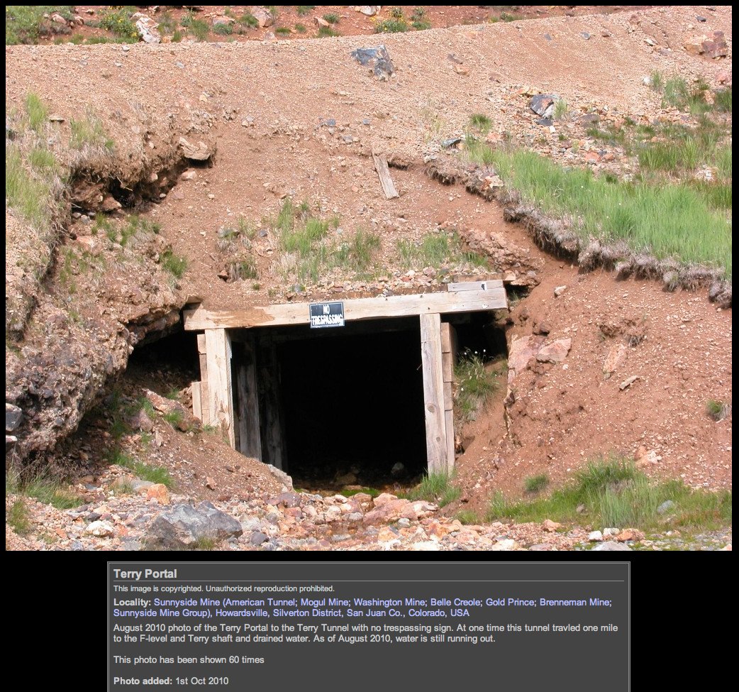
When Sunnyside Mining Co. ended operations in Silverton in 1991, it negotiated a court decree to plug mine outlet tunnels, including the main access, the American Tunnel, with bulkheads. But the bulkheads raised the subterranean water level tremendously, increasing pressure that created drainage in nearby mines that had been mostly dry. Since 2004, when treatment of mine drainage ceased at the American Tunnel, discharge has increased to a total of 700 gallons a minute from other mines in the Gladstone area. The American Tunnel still discharges 100 gallons a minute.

More Animas River watershed coverage here.

Southern Delivery System update: Construction starting in earnest this summer

A picture named sdspreferredalternative.jpg

From The Denver Post (Bruce Finley):

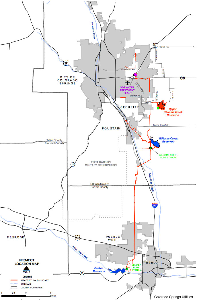
Construction crews this week began work on the $2.3 billion Southern Delivery System. It is designed to pump water uphill and north from Pueblo Reservoir — through a 62-mile pipeline — to sustain Colorado Springs, which owns the rights to the river water, and other growing Front Range cities. The cities embarked on this project because water supplies have emerged as a constraint on population growth.

CH2MHill project engineers and construction chiefs at Pueblo Reservoir this week re-channelled the river below the 240-foot-high dam using sandbags. They’re adjusting dam valves to dry an area so that digging crews can start laying the pipeline without relying on expensive underwater divers. Three 15,000-horsepower pumps are to propel the water through a pressurized 66-inch-diameter steel pipeline. Moving water to the planned end points — two 30,000 acre-foot reservoirs to be built east of Colorado Springs — requires an elevation gain of 1,600 feet…

The Pueblo Reservoir, built in 1975, holds 357,000 acre-feet of water, and the diversion is expected to lower the average water level by about six feet…

Meanwhile, the $50 million for cleaning and restoration of Fountain Creek could enable new recreation, reservoirs and fishing, [Pueblo County Commissioner John Cordova said. “We could have trout,” he said…

Environmental groups “are generally satisfied,” as long as Colorado Springs live up to its commitments to ensure appropriate water levels in the Arkansas River above and below the reservoir, Trout Unlimited water project director Drew Peternell said.
Huge amounts of energy required to pump water uphill, however, looms as “a greenhouse gas issue,” Peternell said. “We’d encourage them to consider renewable sources” of electricity, he said.

More Southern Delivery System coverage here and here.

Colorado Division of Water Resources: Division 1 Well Measurement Rules Public Meetings May 24 and May 25

A picture named southplattealluvialaquifer.jpg

From email from the DWR (Jonathan Hernandez):

DWR will be hosting three informal public meetings to solicit feedback from our Well Measurement Rules (April 4, 2011 draft). They are being scheduled as follows:

Ft. Morgan – May 24th, 6pm
Morgan County Rural Electric Association Meeting Room
20169 U.S. Hwy 34
Fort Morgan, CO

Sterling – May 25th, 6pm
Sterling Public Library, Community Room
425 North 5th Street
Sterling, CO

Greeley – TBD

More groundwater coverage here.

The American Council for an Energy-Efficient Economy and the Alliance for Water Efficiency release ‘A Blueprint for Action and Policy Agenda’

A picture named pipeline.jpg

Here’s the release:

A panel of national experts on energy and water efficiency has developed a blueprint for realizing the substantial economic and environmental benefits to the nation from a combined approach towards more efficient water and energy systems. These experts were jointly convened by the American Council for an Energy-Efficient Economy (ACEEE) and the Alliance for Water Efficiency (AWE), leading national research institutes focused respectively on energy and water efficiency, to address opportunities that could result from exploring the connections between energy and water. The outcome of this joint process, A Blueprint for Action and Policy Agenda, was released today.

“With the publication of this blueprint, the water and energy efficiency communities are committing to work together to achieve the substantial economic and environmental benefits that can result from increased efficiency,” said Steven Nadel, Executive Director of ACEEE.

As much as a fifth of the nation’s electricity goes toward sourcing, moving, treating, heating, collecting, retreating, and disposing of potable water. Estimates from the U.S. Geological Survey suggest as much as 50% of the nation’s water goes toward producing thermoelectric electricity. The blueprint outlines eight action steps that could lead to future economic opportunities and environmental benefits through using energy and water more efficiently. Some of the action steps include: collaborative programs and research, replicating best practices, improving revenue and pricing structures, codes and standards, and education of multiple audiences. The blueprint strives to learn from the experiences of both the energy and water communities, building on existing policies, programs, and relationships. The blueprint also contains a policy agenda describing the opportunities available for policymakers at every level of government.

“In simple terms, every drop of water saved, saves energy, and every kilowatt of electricity saved, saves water,” said Mary Ann Dickinson, President and CEO of AWE. “The nexus between energy and water has not received the national research and policy attention that it deserves. With this blueprint, we have brought together voices from both the energy and the water communities to outline what now needs to be done.”

Future combined efforts will focus on research, policy, codes and standards, and programs that realize the efficiency benefits of looking at water and energy efficiency holistically. The blueprint lays out paths for progress in each of those areas, providing a concrete challenge to funders, researchers, and program implementers to take the steps necessary to realize the opportunities from collaboration. The joint policy agenda identifies ways the energy and water communities plan to work together as they approach policymakers.

The blueprint and policy agenda resulted from a joint ACEEE-AWE day-long workshop that brought together over fifty thought-leaders from across the energy and water efficiency communities. This document summarizes the ideas generated and priorities identified through the workshop process.

To see the blueprint, click here.

More Energy policy coverage here.

Drought update: Drought worsens in southeastern Colorado

A picture named usdroughtmonitor05172011

From NewsFirst5.com (Craig Elliot):

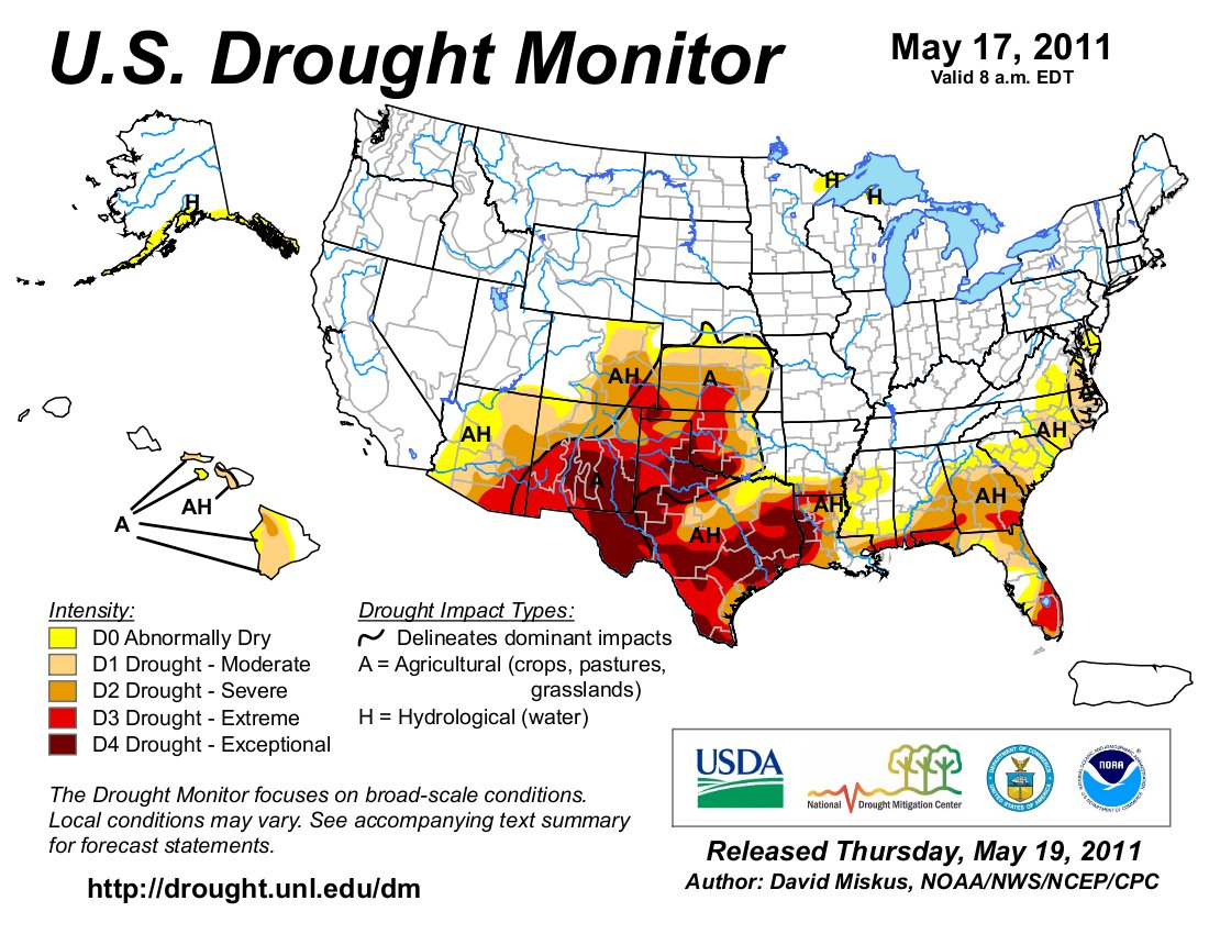
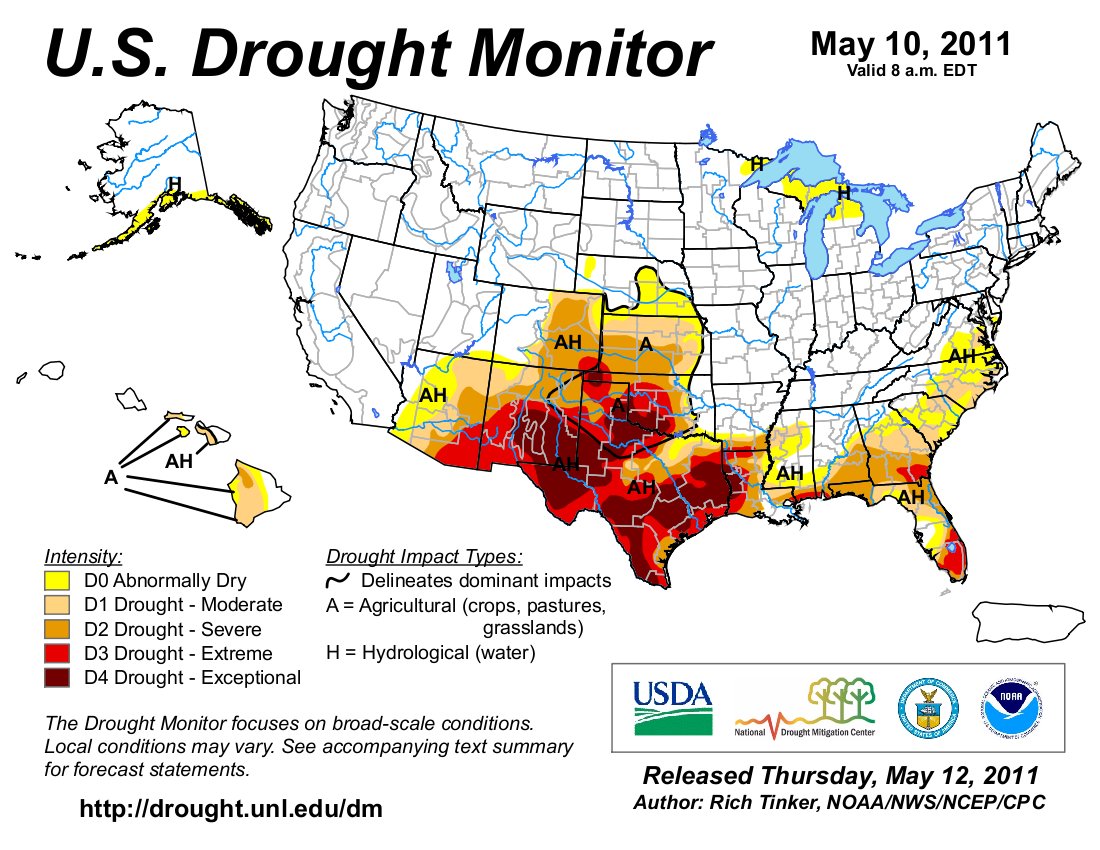
In a new report released earlier this week in the U.S. Drought Monitor, shows that drought conditions across the plains of Colorado continue to worsen. According to the report drought conditions are extreme in Baca County, eastern Crowley, Otero and Las Animas Counties, almost all of Bent and Prowers Counties. The report also notes that conditions in far southeastern Baca County are now ‘exceptional’! To see the report go to: Drought Report.

CWCB: The board approves loans for two La Plata County water districts’ cooperative projects

A picture named lakenighthorsesummer2010

From The Durango Herald (Dale Rodebaugh):

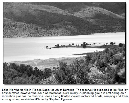
Lake Durango, which acquired a long-troubled water company with a similar name two years ago, needs more water. La Plata West has a share of Lake Nighthorse water but no way to treat it and – as yet – no way to deliver it. Now with the grant-loan approved Wednesday by the state water board, [Lake Durango Water Authority] can build a pipeline from Lake Nighthorse to its treatment plant. It will get some of the potable water, with the rest reserved for La Plata West when it builds a delivery system. [La Plata West Water Authority] also no longer needs to find $4 million to build its own treatment plant.

More CWCB coverage here.

Northern Integrated Supply Project: Supporters of the project rally in Loveland

A picture named nisppreferredalternative.jpg

From the Fort Collins Coloradoan (Bobby Magill):

Northern Water holds a rally for NISP once each year to keep the support for the project high among business leaders, local governments and the agricultural community…

As the list of NISP supporters continues to grow, political momentum has reached a tipping point, Weld County Commissioner Sean Conway said. “We started to achieve critical mass two years ago,” he said, adding that most people in Weld County are tired of seeing farmland dried up so water can go to Thornton and other growing suburban cities and towns…

“This is a shovel-ready project,” U.S. Rep. Cory Gardner said. “We could actually start creating jobs today.” Gardner said NISP will create many jobs and spark millions of dollars of investments in the local economy. “Our state’s businesses depend on a brighter water future,” he said. “Our state’s agricultural economy faces the threat of the buy up and dry up of 60,000 acres of some of the most productive agricultural land in this nation. Our economy, our businesses are linked to water.”[…]

Save the Poudre Director Gary Wockner said after the rally that the group has published an alternative to NISP that proposes to provide water for growing cities while protecting the Poudre River. “It has two main components,” Wockner said. “One is a very strong focus on water conservation and the second is a new partnership with farmers that focuses on rotational fallowing and water-sharing programs.”

More coverage from Tom Hacker writing for the Loveland Reporter-Herald. From the article:

The rally organized by the Northern Colorado Water Conservancy District promoted the Northern Integrated Supply Project, a controversial water storage project. Backers say it is needed to shore up a regional water supply that demand will outstrip in the next decade, and that failure to build it would doom agriculture. Critics say it would threaten the free-flowing Cache la Poudre River, degrading water quality and harming wildlife habitat. But the water-storage faithful ruled on Thursday at “Water, Jobs and the Economy,” a business rally to boost support for NISP…

Featured speaker Rep. Cory Gardner, R-Colo., said that by 2020, water demand in the region will require another project the size of the Colorado-Big Thompson Project, the region’s largest, which began delivering water in the late 1950s. “It’s time we stop talking and start working,” Gardner said. “Let’s get it done.”[…]

On hand were the future owners of NISP — 15 municipalities and water districts that have stakes of varying sizes in the project.

Their upfront costs already have been substantial, with more than $10 million spent on studies since the project was proposed, most of them required to satisfy state and federal regulatory agencies that have criticized the project, Wilkinson said…

While many of the rally participants urged united — and bipartisan — support for the project, some noted that most elected officials who favor the project are Republicans, and most who oppose it are Democrats. “One of the worst things that could happen would be for this project to be about R’s, D’s and other labels,” said Eric Doering, mayor of NISP participant Frederick.

More coverage from Monte Whaley writing for The Denver Post. From the article:

“We don’t get a thank-you card from Kansas or Nebraska when our water leaves the state,” said state Rep. Jerry Sonnenberg, R-Sterling. The project calls for the Cache La Poudre River to be diverted during high-flow periods to fill two reservoirs, Glade northwest of Fort Collins and Galeton east of Ault. The project is estimated to cost about $490 million. NISP is backed by 15 water suppliers and 14 chambers of commerce. They say NISP is needed to bridge an advancing water-supply gap of between 190,000 and 630,000 acre-feet statewide by 2050…

Several major farm organizations also support NISP. They contend that without NISP, more than 60,000 acres of Colorado farmland could dry up because cities will likely buy up agricultural water rights…

NISP is still being studied by the Army Corps of Engineers, which might issue a supplemental draft environmental-impact study by the end of the year.

More coverage from Bill Jackson writing for The Greeley Tribune. From the article:

[U.S. Rep. Cory Gardner] was one of more than a dozen speakers who addressed the crowd, estimated at about 300 attendees. He said Colorado jobs, its economy and future depends on the state’s ability to “store and deliver clean, affordable water.” He cited the vision of such water pioneers as W.D. Farr of Greeley and Wayne Aspinall, who represented Colorado’s 4th District in the U.S. House from 1947-73. “They captured the usefulness of our natural resources beyond imagination,” he said, noting the present generation is benefiting from their vision. He said the present generation must do the same for future generations, and he quoted Colorado poet laureate Thomas Hornsby Ferril who described Colorado as “a land written in water.”[…]

The Weld commissioners closed the meeting with a chant of “Conserve water, build NISP.”

Severance Mayor Don Brookshire was joined at the meeting by his 3-year-old daughter, Savannah. “This is why we are here today. Savannah is what this is all about,” Commissioner Sean Conway said.

More coverage from NorthernColorado5.com. From the article:

More than 200 supporters rallied today for the development of the Northern Integrated Supply Project which would store water in both the Glade and Galeton reservoirs. Participants and business leaders say that this project is critical to the future of the region.

More coverage from the Northern Colorado Business Report:

“It’s incumbent on each one of us here to get out and make NISP a reality,” said Eric Doering, mayor of Frederick, one of 15 cities, towns and water-related entities that have signed up to receive water from the project. NISP includes Glade Reservoir in Larimer County and Galeton Reservoir in Weld County. “It’s going to benefit all of our communities to grow jobs and maintain our ag resources for our farmlands,” Doering said.

More coverage from Catherine Tsai writing for The Associated Press. From the article:

A selection of mayors, state lawmakers and U.S. Rep. Cory Gardner, R-Colo., told supporters at The Ranch in Loveland that the project would help the region’s economy and shield farmers’ irrigation supplies as demand for drinking water grows, especially during droughts.

The event had been billed as a barbecue, but it was raining, chilly and gray outside. “People in the water community look outside and say this is beautiful weather,” said Eric Wilkinson general manager of the Northern Colorado Water Conservancy District…

The city of Fort Collins is among those that have expressed concerns with the project over the years, and the group Save the Poudre: Poudre Waterkeeper contends it would drain too much of the river. It proposes an alternative that relies heavily on water conservation and a proposal to pay farmers to fallow land on a rotating basis when needed and lease their water to cities.

More Northern Integrated Supply Project coverage here and here.

Southern Delivery System: Construction to take off in earnest over the summer

A picture named sdspreferredalternative.jpg

From The Pueblo Chieftain (Chris Woodka):

Engineers and crews have already begun staging work at the Pueblo Dam where a new North Outlet Works will be constructed. Underground pipeline will be placed beginning in June through the first 9 miles through Pueblo West. And some work has already begun on laying finished pipeline under Marksheffel Road in El Paso County…

“In terms of land acquisition, we are halfway there, mostly in Pueblo County,” SDS Project Director John Fredell told the Southeastern Colorado Water Conservancy District board Thursday…

“It will be a boost to the regional economy, with $80 million-$100 million in construction costs this year, much of that in El Paso, Pueblo and Fremont counties,” Fredell said. “Over the life of the project, there will be $150 million in labor earnings alone.” There are expected to be an average of 380 jobs per year until SDS is completed in 2016, with a peak of 700 SDS jobs in 2014. The peak construction period will be in 2013-15, when the El Paso County treatment plant and three pumping stations will be constructed…

Reed Dils, a Buena Vista director, said the Pueblo route is preferable to an early proposal to build a dam near Buena Vista. The idea for an Elephant Rock Reservoir was kicked out in the early 1990s, as Colorado Springs was formulating plans for SDS, and protest signs remain in the area. “Thank you for the wisdom in not selecting Elephant Rock,” Dils told Fredell. “By not building in Chaffee County, you preserved the recreational economy in Chaffee and Fremont counties.”

More Southern Delivery System coverage here and here.

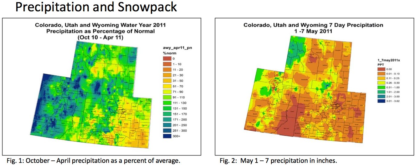
NIDIS Weekly Climate, Water and Drought Assessment Summary of the Upper Colorado River Basin

A picture named wateryear2011precipitationupprecoloradoriverbasinoct2april.jpg

Here are last week’s notes from the Colorado Climate Center. Here’s an excerpt:

For the current water year, most of the Upper Colorado River Basin (UCRB) has received near or above average precipitation. The Four Corners region and valley areas have been the driest, seeing around 50 – 90% of average precipitation. Some of the higher elevations of Utah and Wyoming were around 300% of average at the end of April. The San Luis Valley and the southeastern plains of Colorado have been very dry, receiving less than 50% of average precipitation for the water year in many areas.

Pipeline from the Mississippi River to Colorado?

Mississippi River Basin

From The Pueblo Chieftain (Chris Woodka):

Hausler’s idea is to bring water from the Mississippi just below its confluence with the Ohio River across Missouri and Kansas into Colorado. The 800-mile system of pipelines, ditches and reservoirs would cost an estimated $23 billion and could provide 1 million acre-feet of water a year to Colorado. That’s just a little less than the total amount used by cities and more than enough to meet the projected municipal gap for the next 50 years.

He’s presented the idea to the Arkansas Basin Roundtable, state officials (including former Gov. Bill Ritter) and anyone else who will listen. And there’s the problem. They just listen. And maybe snicker a little. “The project is pretty dead right now,” said Hausler, a Gunnison rancher and mining engineer, in a telephone interview Monday. “I’ve gotten tired of beating my head against the wall. I think it’s silly and short-sighted, certainly parochial. Nobody in this state is really looking forward.” Hausler said the cost of construction and operation of a Mississippi River pipeline would be in line with the cost per acre-foot of proposed projects from the Colorado River…

The Mississippi River passes more than 240 million acre-feet annually at the proposed point of diversion, 30 miles south of Cairo, Ill. During the current flooding, more than 4 million acre-feet per day are flowing at that spot…

Hausler insisted the Mississippi River pipeline is a true regional solution that would not dry up any farmland or put any further stress on the Colorado River. “We need to ignore the arbitrary state lines drawn on a map in 1860s Washington and come up with a regional solution to water needs that will benefit the entire West including several Plains states,” Hausler said.

More pipeline from the Mississippi River coverage here.

Runoff news: The Yampa River is running at 10,400 cfs near Craig

A picture named yampariverbasin.jpg

From the Craig Daily Press (Andy Bockelman):

As of Tuesday afternoon, the outposts for the Yampa River in Moffat County gave readings of 10,400 cubic feet per second near Craig, 11,900 cubic feet per second near Maybell and 16,900 cubic feet per second near Deerlodge.

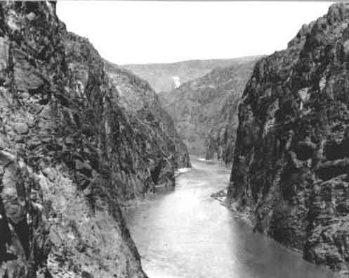
Aspinall Unit update: 2,600 cfs in the Black Canyon and Gunnison Gorge

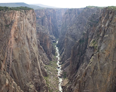
A picture named blackcanyoninnercanyonnps.jpg

From email from Reclamation (Dan Crabtree):

Cool weather continues to postpone the 2011 runoff making it difficult to plan a peak operation for the Aspinall Unit. The May mid-month forecast calls for an April through July runoff of 945,000 ac-ft. with almost 1/2 (470kaf) of that forecast to occur in June. Because of the cooler weather, releases from Crystal Dam are being held at 3,500 cfs resulting in a flow in the Black Canyon and Gunnison Gorge of about 2,600 cfs. The National Weather Service 6 – 10 day weather forecast calls for equal chances of average temperatures. Consequently at this time, Reclamation is not planning any increases in release through the Memorial Day weekend. We will continue to evaluate the weather and runoff forecasts to determine the most effective timing of a peak operation designed to operate the Aspinall Unit in order to allow the Black Canyon Water Right one day peak target to be met and maximize downstream environmental benefits. This is now likely to occur sometime in early June. Please remember that changes in hydrologic conditions may require modification of these operations. (Which is to say, that as soon as we send out a notice like this, the weather changes and we have to do something different. But we wanted you all to know what we are thinking at this time anyhow).

More Aspinall Unit coverage here.

Colorado-Big Thompson Project update: 900 cfs in and out of Willow Creek Reservoir

A picture named willowcreekreservoir.jpg

From email from Reclamation (Kara Lamb):

As you have most likely noticed, releases from Willow Creek Dam have varied over the past two weeks and will continue to do so well into June. We are currently passing the inflow native to the reservoir on through the dam. This means that Northern Water is often up at the dam, adjusting the gate so the outflow matches the inflow. In the past two weeks, we have seen inflows (and as a result, outflows) get as high as 900 cfs. Today and likely over the next few days, releases will continue to be around 900 cfs. It is difficult to project what releases will be outside of a few days because of the weather forecast. It is supposed to cool off, but also rain. We will have to wait and see what that means for inflows at Willow Creek.

At Granby, we continue to release about 430 cfs.

More Colorado-Big Thompson project coverage here.

Northeastern Junior College’s Children’s Water Festival: Education is the mission

A picture named studentslesherjhsamples.jpg

From the Sterling Journal-Advocate (Callie Jones):

“We have a real big desire at the Lower South Platte (Water Conservancy District) to educate the community, and we like to start with the younger kids, about the importance of water,” said Rick Fleharty, district technician for LSPWCD, about the purpose of the Water Festival. He said they want to educate the students about the importance of water for farming and conservation for the environment. “We just have a great desire to make sure people understand how precious water is, particularly here on the plains where we don’t have an abundance of it,” Fleharty said.

More education coverage here.

Water year 2011: Possible flooding from the monster snowpack, drought over the southeastern plains and San Luis Valley

A picture named usdroughtmonitor05102011

From The Pueblo Chieftain (Chris Woodka):

State agencies have recommended to Gov. John Hickenlooper the activation of an agricultural impact task force in response to a drought that continues in 60 percent of the state. “It’s very weird to have this level of concerns about flooding and drought in the same year,” said Veva DeHeza, a Colorado Water Conservation Board staffer who co-chairs the state water availability task force…

Baca County is moving into the highest level of drought, while most of the Eastern Plains south of Interstate 70 are listed in extreme drought, according to the U.S. Drought Monitor. Precipitation is only 20-70 percent of average for the year in that area, and many places have not seen appreciable rain since last summer. Baca, Cheyenne, Kiowa and Kit Carson counties have been declared disaster areas by the U.S. Department of Agriculture. Along with Bent, Las Animas and Prowers counties, they also meet triggers for federal livestock assistance.

A picture named snowpackcolorado05182011

From The Aspen Times (Scott Condon):

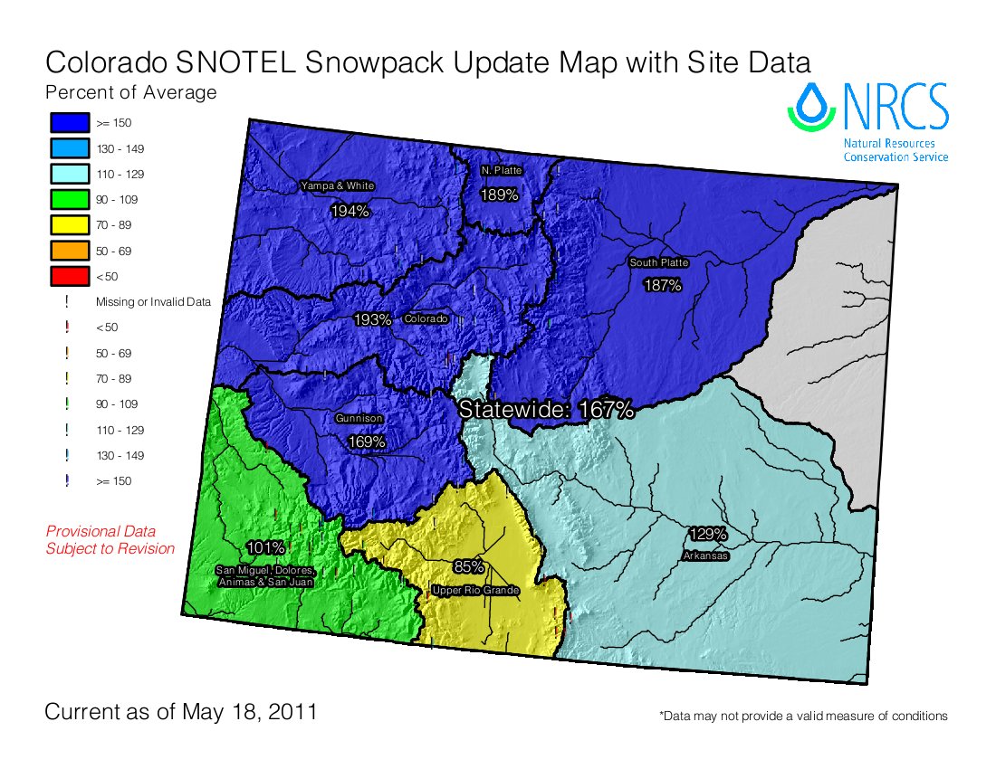
Water experts at a State of the River meeting Wednesday night in El Jebel said that the Roaring Fork, Crystal, Fryingpan and Colorado rivers all have the potential to peak at higher than average levels because the snowpack is at 200 percent of average in parts of the Roaring Fork basin. However, only minor flooding is anticipated in areas like low-lying areas along the Crystal River, said Don Meyer, senior water resources engineer with the Colorado River District. But all speakers had a caveat in their comments. Tim Miller of the U.S. Bureau of Reclamation said that computer models on streamflows assume average weather conditions during the melting period. If the temperatures spike for a considerable time, throw the models out the window, he said…

[Tim Miller of the U.S. Bureau of Reclamation] said the snowpack levels at three automated Snotel sites in the upper Fryingpan River Valley are the highest on record for mid-May. The bureau has reacted accordingly with the water level in Ruedi Reservoir…/p>

The bureau has been maintaining water releases of 360 cubic feet per second (cfs) from Ruedi into the lower Fryingpan River and will do so for the foreseeable future, Miller said. The agency projects that the reservoir will fill to a level to put the boat ramps into service by mid-June and fill to capacity by early July. Releases should be kept below 800 cfs, he said. Minor flooding can occur when releases exceed that level.

The bureau also anticipates significantly higher-than-average water diversions from the Fryingpan-Arkansas Project this year. A system of diversion structures and tunnels sends water from a multitude of creeks in the upper Fryingpan River basin east to the Front Range. The annual average diversion is 54,000 acre feet. This year, it is expected to be 94,000 acre feet, Miller said.

Lake Powell, the popular reservoir in Utah, will also benefit from the central Rocky Mountain’s bounty of snow. Current models indicate its water level will rise 44 feet, or 5 million acre feet, by July, Meyer said.

From KJCT8.com (Don Coleman):

No businesses or homes have been hit yet, but many with the county worry that that will not last. All it would take is a few hot days in the mountains to raise the Colorado River to flood level. “Emergency management is checking the river daily,” Tanny McGinnis with the Garfield County Sheriff’s Office explained…

“Really, the bigger issue isn’t so much what’s happening in Garfield County, but it’s what’s happening in Eagle County [with] the snow-pack.” Because of the high country’s deep snow-pack this year, the Colorado River is pushing thousands of cubic feet of water per second (CPS) more than it was this time last year. Authorities tell us that in Glenwood Canyon it was measured at 11,000 CPS on Wednesday compared to 7,500 CPS last year. With snow still waiting to be melted up in the mountains, that number will only increase.

From the Associated Press (Brian Skoloff) via the Anchorage Daily News:

“At this point, everybody is just sitting back chewing fingernails and waiting because the longer it stays cold and wet, the worse it’s going to get,” said Randy Julander, a supervisor with the U.S. Department of Agriculture’s Natural Resources Conservation Service. Julander said in a typical year the weather warms gradually, allowing snow in the mountains to melt slowly and ease into rivers and streams over time. That’s not the case this year.

“June is right around the corner and sooner or later, it’s going to warm up,” he said, noting that instead of gradually warming over eight to ten weeks, the West will likely see a rapid rise in temperatures heading into summer, a worst case scenario.

“And it’s not just Utah, Colorado and Wyoming. It’s basically all of the western states except Arizona and New Mexico,” Julander said. “We’re waiting for the chute to open and the bull to come out bucking, but he ain’t moving, yet.”[…]

The record snowpack levels are almost too deep to measure in some parts of northern Colorado and have officials concerned about major flooding across the state’s northern corners and down the eastern plains…

He said the last time the West saw such unusual prolonged cold weather with steady rain and snow was in 1983 when massive flooding across the region caused substantial damage. “That’s when we had terrible flooding in Utah and across the West. The Colorado River went absolutely wild for about a month,” Julander said. “The amount of water up there in the mountains is phenomenal and it’s going to melt sooner or later. You’re looking at an event that certainly only happens maybe once every 20, 30, even 50 years.”

Meanwhile, here are the presentations from last week’s Joint Water Availability and Flood Task Forces meeting from the Colorado Water Conservation Board.

More CWCB coverage here.

Arkansas Valley Super Ditch: Pilot program between the Pikes Peak Water Authority and the Caitlin Ditch planned for 2012

A picture named arkbasinditchsystem.jpg

From The Pueblo Chieftain (Chris Woodka):

A transfer of up to 500 acre-feet of water to the Pikes Peak Regional Water Authority is planned in 2012 from the Catlin Canal to demonstrate how future Super Ditch deals could work, said John Schweizer, president of both the Super Ditch and the Catlin Canal. “The Super Ditch board agreed that we should limit the scope to one ditch, because of the complexity,” Schweizer said Wednesday…

During the transfer, the number of acres equivalent to the consumptive use of the contract would have to be dried up. No water rights owners would be forced to participate. Accounting for the transfer would be handled through a state administrative plan. The Super Ditch has filed an exchange plan in Division 2 Water Court, but does not yet have a decree. No change of use application has yet been filed…

Water would be delivered to Lake Pueblo, where the city of Fountain can either use it directly through the Fountain Valley Conduit or store it…

So far, the results at controlled test plots at the Rocky Ford Agriculture Research Center show that land that has been fallowed one, two or three years still can produce more than 200 bushels of corn per acre after it is brought back into production. In terms of annual return, corn netted between $120-$640 per acre, after costs of production were factored in. Corn prices were significantly higher in 2010 than when the study began in 2007 — the price increased to $4.89/bushel from $3.29/bushel. The cost of leaving ground fallow was $100-$200 per acre, which would have to be factored as an expense into a lease agreement.

More Arkansas Valley Super Ditch coverage here and here.

Coyote Gulch outage: Pushing a deadline — see ya Thursday

A picture named coyotegulchandedquillen10022010

I’m on deadline at Colorado Central Magazine. I’ll see ya on Thursday.

Wiggins: Industrial Facilities, Inc. hired to perform levee recertification work

A picture named leveetypesusace.jpg

From The Fort Morgan Times (Dan Barker):

FEMA is asking that all levees be recertified in the wake of the disaster which happened in New Orleans with Hurricane Katrina, and this is the next step for Wiggins…

Holbrook said that certifying the levee will mean doing spot checking of the structure, but one of the first steps is to meet with FEMA representatives to determine exactly how they want it done.

More Wiggins coverage here.

Fort Morgan: Stormwater issues meeting May 25

A picture named stormwateroutlet.jpg

From The Fort Morgan Times:

The city will hold a neighborhood meeting next week to tell residents about some of the findings and possible alternatives for the Northwest Quadrant storm drainage problems. The meeting will be held at 5:30 p.m. Wednesday, May 25, at the Fort Morgan School District Support Center, 715 W. Platte Ave. City officials and representatives from the engineering firm Short Elliott Hendrickson will be there to share the findings of the detailed study and analyses, as well as possible/feasible options in moving forward.

More Morgan County coverage here.

Northern Integrated Supply Project: The Colorado Association of Commerce and Industry backs Northern Water’s proposed project

A picture named nisppreferredalternative.jpg

Here’s the release from Northern Water (Brian Werner):

The Colorado Association of Commerce and Industry (CACI), the state chamber of commerce, today announced its endorsement of the Northern Integrated Supply Project (NISP) as an essential project for the economy of the Northern Front Range. CACI President Chuck Berry said that the CACI Executive Committee agreed to support the building of NISP at its April meeting.

“An adequate, reliable supply of water is essential for economic development and quality of life of residents of Northern Colorado,” Berry said, adding that NISP will be a major economic development opportunity for Northern Colorado and will result in more than $450 million in construction projects.

NISP will provide 40,000 acre feet of water annually to 15 municipalities and water districts representing more than 200,000 residents in Northern Colorado.

The CACI endorsement comes as NISP business supporters, chamber of commerce members and public officials gather May 19 to show their support for the project. The Water, Jobs and the Economy rally will be from 11:00 a.m. to 1:30 p.m. at the Larimer County Fairgrounds and Events Complex at The Ranch in Loveland.

CACI joins Club 20, the Western Slope’s leading business advocacy organization in endorsing NISP. Club 20 endorsed NISP in September 2010. More than 15 area and statewide business organizations have now endorsed NISP as critical for the Northern Colorado economy, including the following:

Berthoud Area Chamber of Commerce
Carbon Valley Chamber of Commerce
Club 20
Colorado Association of Commerce & Industry
Evans Chamber of Commerce
Fort Collins Board of Realtors
Fort Lupton Chamber of Commerce
Greeley Chamber of Commerce
Lafayette Chamber of Commerce

Longmont Chamber of Commerce
Mead Area Chamber of Commerce
Progressive 15
United Power
Upstate Colorado
Weld Community Development Group
Weld County Builders Association
Windsor Chamber of Commerce

CACI was created in the mid-1960s when Colorado’s business leaders merged the Colorado Chamber of Commerce with the Colorado Manufacturing Association. About 435 companies, local chambers of commerce, trade associations and local economic development organizations belong to CACI. CACI’s mission is to champion a healthy business environment. To achieve this mission, CACI has key four objectives: (1) maintain and improve the cost of doing business; (2) advocate a pro-business state government; (3) increase the quantity of educated, skilled workers; and (4) strengthen Colorado’s critical infrastructure (roads, water, telecommunications and energy).

More Northern Integrated Supply Project coverage here and here.

Rafters gearing up for what could be an ‘epic’ rafting season

A picture named raftingarkriver.jpg

From the Aspen Daily News (Dorothy M. Atkins):

The cold temperatures and large amounts of precipitation that have been plaguing Aspenites through the off-season have assured many rafters that the Roaring Fork River will have plenty of snowpack to pull from to maintain river flow well into the summer…

The Fork is fueled by snowmelt from snowpack located up Independence Pass. The gauging station located on Independence Pass is reporting 21.6 inches, — 159 percent of average snowpack — according to the Roaring Fork Conservancy…

This year with more snowpack and colder temperatures, the hope is that the Fork will remain navigable through August…

“I hate to say I have any expectations, because who knows what will happen,” said raft guide Casey Vandenbroek. “I would be so stoked to be on Slaughterhouse until mid August, and I feel like we have enough snow if we just get a nice steady melt.”

A nice steady melt is what everyone is hoping for this year.

From The Greeley Tribune (Dan England):

This season, boaters expect water levels may even surpass that 1983 record of just under 6,000 cubic feet per second. Those are water levels that bring elation from experienced boaters, concern from law enforcement and rescue personnel and a mix of the two from rafting companies…

The only thing for certain is the water should be higher than it’s been in years, and it will probably be a few weeks before boaters really see it. Even if it does warm up in a hurry, said Bell, a kayaker and atmospheric scientist, it takes a while to start the melt with such a deep snowpack, which could mean a peak later in June.

More whitewater coverage here.

Steamboat Springs: Flooding in 1984 and a look ahead for 2011

A picture named cherrycreekflood08031933castlewooddamfailure.jpg

From Steamboat Today (Tom Ross):

Winter 1983-84 was the season of 40 consecutive days and nights of heavy snow, and the ski season ended with 447.5 inches of the white stuff. And like it has in spring 2011, the snow kept on coming into May. All heck broke loose in the third week in May when the temperatures jumped into the 80s and a summer shower fell on top of the rotten snowpack. Butcherknife Creek flooded backyards in Old Town, and city officials were constantly checking the old Ninth Street footbridge over the Yampa River. On about May 24, the water was within inches of the old bridge, and the river peaked the next day at 5,670 cubic feet per second…

I’m not predicting a 30-foot wall of water this runoff season, but it might be wise to take some precautions. Personally, I’m keeping my irrigation boots and my chest waders in the back of the vehicle for the rest of spring. Jay Wetzler, owner and operator of the Steamboat Hotel on the city’s south side, bought flood insurance last month to protect his property from the possibility that either Walton Creek or the Yampa River might show up this month for a repeat performance. “It was expensive, but we’ve seen so much development in the floodplain, there’s no way to tell what’s going to happen,” he said.

South Platte Roundtable: Final Upper Mountain Counties needs assessment report released

A picture named uppersouthplattebasin.jpg

Here’s the link to the report.

More IBCC — basin roundtables coverage here.

Energy policy — oil and gas: The Niobrara oil shale play in eastern Colorado dominates the latest issue of ‘Rock Talk’ from the Colorado Geological Survey

A picture named niobrarashale.jpg

Here’s the link to the current issue. Here’s a preview:

The Niobrara Formation, one such organic-rich shale, is a particularly hot target here in Colorado. While a large volume of natural gas (>700 billion cubic feet by one estimate) has already been produced, it is now Niobrara oil that is the focus of everyone’s attention. Often mentioned for comparison purposes are the Bakken Formation of North Dakota or the Eagle Ford Shale of Texas. But, as producers are just beginning to ramp up drilling and production, the question of how much oil is really available for exploitation over the long term remains to be answered.

One of the first Niobrara horizontal wells, known as the Jake well, was drilled by EOG Resources in October 2009 and produced 50,000 barrels of oil in its first 90 days. After a year, it is still produc- ing more than 2,500 barrels of oil per month. This is significant given that the average oil well in the U.S. generates just 300 barrels of oil per month. Another well, the Gemini well drilled by Noble Energy in early 2010, produced over 32,000 barrels of oil in 6 months. These early results are certainly promising, but for each of the more prolific wells, there are others that show little or no produc- tion. How quickly the flow of oil declines is very important for looking towards future potential of the resource as a whole.

More oil and gas coverage here and here.

Energy policy — nuclear: Moab tailings move slowing down as federal funds dry up

A picture named moabtailingscleanupsite.jpg

From the Salt Lake Tribune (Judy Fahys):

In two years, the Department of Energy has hauled away nearly 4 million tons of uranium tailings, which for decades had been leaching into the adjacent Colorado River. The work is about two years ahead of schedule, and makes DOE project manager Don Metzler burst with pride. “Look!” he exclaimed, gazing over the deep gouge excavators have carved into the 130-acre pile. “This pile is disappearing.”

Now, with another 12 million tons still to go, the American Recovery and Reinvestment Act money that has fueled the accelerated cleanup is about to run out. Progress is expected to slow to a comparative crawl as the Energy Department slashes the cleanup team by two-thirds next month.

Instead of 320 people on the job, there will be funding enough for around 100 under the DOE’s projected budget for cleaning up the old uranium mill started by Charlie Steen and later taken on by the bankrupt Atlas Corp.

More Nuclear coveragehere and here.

Greeley: New raw water line from Bellvue, currently under construction, to cost $180 million

A picture named pipeline.jpg

From the Greeley Gazette (Jack Minor):

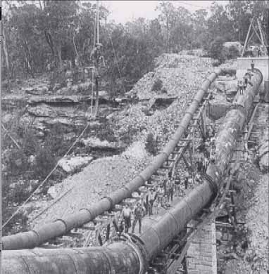
Currently the city is building a new 30 mile, 60 inch pipeline from Bellvue. The project began in 2004 and is expected to be completed in 2013. The new pipeline will transmit water rights currently owned by the city and future water purchases.

Monson said the last expansion of the Bellvue pipeline was in the 1950’s and since then Greeley’s population has increased four fold. Current census figures show the current population at almost 93,000 an increase of 20 percent from the 2000 census.

The project will spend $84 million on pipeline construction and $96 million for water acquisition. [Jon Monson, Greeley water and sewer director] said even after spending the $180 million, the project will still not meet the needs for the projected 40 year growth. The city will still need to build additional water storage such as expanding the Milton Seaman reservoir.

More infrastructure coverage here.

Telluride: The Idarado Mining Company is recalling water rights that it gave the town in 1992

A picture named bridalveilfallstelluride.jpg

From The Telluride Daily Planet (Matthew Beaudin):

The company said in a press release that it would use the water to generate power at the Bridal Veil Power Station, a turn of the 20th century hydroelectric powerplant that looms at the end of the box canyon. “In 1992, we conditionally deeded our water rights to Telluride because we were not using them at the time, reserving the right to recall them for Idarado’s future needs,” said David Baker, president of Idarado, in a release. “We are now exercising our right to recall these water rights to support electrical power generation and for other possible uses in the future.”[…]

The Bridal Veil Power Station is an uncommon confluence in the channels of groundbreaking utility and improbable beauty. It is one of the oldest operating AC generators in the country (behind the Ames hydroelectric station, just up the highway) and still surges power into the local grid, but it is also a building of a certain esteem, standing sentry to the valley from its perch atop the state’s tallest waterfall.

More San Miguel River watershed coverage here.

Arkansas Valley Super Ditch: ‘Corn-Fallow’ workshop May 18 to discuss rotational fallowing

A picture named arkbasinditchsystem.jpg

From the La Junta Tribune Democrat:

Corn-Fallow Workshop … Wednesday beginning at 1 p.m. in the meeting room at the Colorado State University Extension Building, 411 North 10th in Rocky Ford…

Speakers will include John Schweizer, president of the Super Ditch, talking about why the Super Ditch was formed, who is involved and where the Super Ditch is today. Jim Valliant, research scientist, CSU Arkansas Valley Research Center, will present results of a 4-year study of fallowing land for 1, 2 or 3 years and then planting corn as compared to continuous corn. Jeff Tranel, CSU Extension ag and business management economist, will discuss costs and returns based on the results of the 4-year study and ideas for leasing amounts. This study was funded by the Lower Arkansas Valley Water Conservancy District.

Dr. Perry Cabot, CSU water resources specialist, will report on results of two demonstration projects on Corn-Fallow funded by the Colorado Water Conservation Board.

More coverage from Chris Woodka writing for The Pueblo Chieftain. From the article:

One of the problems could be bringing ground back into production after leaving it fallow for as long as three years. Lease agreements could be reached in some cases after farm ground was prepared in the fall. Jim Valliant, a CSU Extension researcher, and Jeff Tranel, a CSU extension economist, will share the results of studies at the Rocky Ford Agriculture Research Center that show the effects of fallowing land for one, two or three years and the costs of bringing the land back into production. This study was funded by the Lower Arkansas Valley Water Conservancy District.

John Schweizer, president of the Super Ditch, will talk about how it was formed, who is involved and where things now stand with the company.

More Arkansas Valley Super Ditch coverage here and here.

Energy policy — hydroelectric: $50,000 allocated from Pitkin County’s Healthy Rivers and Streams Fund to fund development of a diversion protocol for the proposed Castle Creek hydroelectric plant

A picture named peltonwheel.jpg

From The Aspen Times:

The result will be something that can be applied to other transbasin diversions, according to John Ely, county attorney. The city’s project, which would divert water from Maroon Creek that would not be returned, constitutes a transbasin transfer of water, he said…

The information will be useful when additional diversions are proposed in the headwaters of Pitkin County, predicted Commissioner Rachel Richards. And, she said, the city contributes to the tax revenue that supports the Healthy Rivers and Streams fund.

More hydroelectric coverage here and here.

Colorado Water Trust’s 3rd Annual ‘River Bank’ event June 7

A picture named hiawathalake.jpg

Here’s the announcement from the Colorado Water Trust.

2011 Sustaining Colorado Watersheds Conference: ‘The First Drop Lands Here’ October 4-6

A picture named fens.jpg

Here’s the conference page link from the Colorado Watershed Assembly.

Climate change: Modeling El Niño events using the tree ring record

A picture named elninolanina.jpg

Here’s a look at some research from the University of Hawaii, from Bob Berwyn writing for the Summit County Citizens Voice. Click through and read the whole thing. Here’s an excerpt:

An international team of climate scientists used tree-ring records from North America, particularly from the US Southwest, to give a continuous representation of the intensity of El Niño events over the past 1,100 years, developing a model that can be used to improve El Niño prediction in climate models. The study was spearheaded by Jinbao Li, of the International Pacific Research Center at University of Hawai’i at Manoa. It was published in the May 6 issue of Nature Climate Change.

Energy policy — geothermal: Pagosa Springs is moving slowly on geothermal research

A picture named geothermalenergy.jpg

From the Pagosa Sun (Jim McQuiggin):

Later in the meeting, the council was asked to “bless” a decision by the Pagosa Springs Community Development Corporation to spend $2,000 to fund a work plan that would satisfy council’s concerns regarding details of the study.

In late February, county commissioner and CDC board member Michael Whiting proposed reallocating $30,000 of CDC money to fund the research. Although the Archuleta Board of County Commissioners voted unanimously to reallocate their $15,000 portion of CDC funding to pay for research, council has twice rejected reallocating its $15,000 of CDC funding.

Council members opposed to allocating CDC funds for the research have cited discomfort with inadequacies and unanswered questions in the proposed work plan outlining the study.

More geothermal coverage here and here.

Gunnison River basin: 10 segments in Delta County deemed not suitable for Wild and Scenic designation by the Lower Gunnison Stakeholders Group

A picture named lakeforkgunnisonriver

From the Delta County Independent (Hank Lohmeyer):

The Lower Gunnison Stakeholders Group found a wide range of criteria on which to base its “non-suitable” recommendations. Existing water rights, private property rights, and production agriculture were important. In several cases, streams’ “outstandingly remarkable values” were found already protected by current management regimens. Streams within the NCA and Wilderness especially were found to benefit from the management regimens on their surrounding public lands. Members of the Stakeholders Group felt that official Wild and Scenic designation on some segments would only attract more visitors to them and damage their special characteristics. “The outstanding remarkable values that BLM has identified for these streams and stream corridors are, in many cases, the result of the management practices of local ranchers and, more recently, the BLM’s management practices,” the group found.

The Stakeholders Group did find some conditions in the stream segment corridors it studied to be less than ideal, and they made recommendations for improvement. For example, protection of historical and cultural sites in the corridors should be site-specific. Signage, fencing, and use of volunteer “stewards” to monitor the sites’ conditions were recommended. Other sensitive cultural sites should not be identified publicly to protect their pristine condition…

The 10 stream segments included stretches on the Gunnison River, Rose Creek, Big and Little Dominguez Creeks, Cottonwood Creek, and Escalante Creek.

More Wild and Scenic coverage here. More Gunnison River basin coverage here.

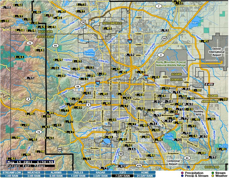
Precipitation news: Denver Metro area rainfall totals are greater than two inches over the last week

A picture named sevendayrainfall05152011

It is still raining a bit this morning at Gulch Manor. Click on the thumbnail graphic for the impressive 7-day rainfall map from the Urban Drainage & Flood Control District. The gauge near here (Hidden Lake) reads 2.24 inches for the week.

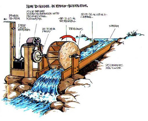
Energy policy — hydroelectric: DARCA is holding a small hydro workshop June 15

A picture named microhydroelectricplant.jpg

From email from the Ditch and Reservoir Alliance (John McKenzie):

The 2011 Colorado Small Hydro Workshop will take place on Wednesday, June 15, 2011 at Lindsay Auditorium at the University of Denver.

The Workshop will include panels on small hydro in Colorado, new low-head technologies to agricultural applications, methods of financing hydro projects in Colorado, innovative utility policies to support small hydro, a review of Colorado’s FERC permitting pilot program, as well as a recent projects roundtable. The luncheon keynote address will be provided by TJ Deora, Director of the Colorado Governor’s Energy Office.

The workshop is being held in conjunction with the National Hydropower Association’s Regional Meeting, which is taking place at the same location the previous day, Tuesday, June 14th.

Both events are free and registration is open to any interested members of the public. Registration is available on-line at http://hydro.org/news-and-media/events/details/nha-southwest-regional-meeting-2/

More hydroelectric coverage here and here.

Northern Integrated Supply Project: Business rally May 19 in Loveland

A picture named nisppreferredalternative.jpg

Here’s the release from Northern Water (Brian Werner):

Colorado business leaders, chamber members, residents and public officials will gather May 19 to show their support for the Northern Integrated Supply Project. The Business Rally for NISP will be from 11 a.m. to 1:30 p.m. at the Larimer County Fairgrounds and Events Complex at The Ranch in Loveland.

U.S. Rep. Cory Gardner will be the keynote speaker at the event. The program will also include business owners, mayors from participating NISP communities, county commissioners, state legislators and Don Marostica, the former director of the Colorado Office of Economic Development and International Trade.

The rally, which is open to the public, will include a barbecue luncheon and an opportunity to discuss the proposed water storage project with participants and staff.

“Water is and will continue to be vital in promoting the economy and jobs for Northern Colorado residents, and NISP is a critical piece of that,” said Kathy Peterson, Chairwoman of the NISP Participants Committee. “As the permitting process continues, we are grateful for the increasing support and endorsements from businesses and economic development groups.”

NISP participants are 15 local and regional water districts and municipalities in Northern Colorado who are dedicated to providing current and future generations with sustainable and environmentally sound water supplies. Northern Water is coordinating the NISP on participants’ behalf…

Additional information about NISP can be found at gladereservoir.org.

More coverage from Bobby Magill writing for the Fort Collins Coloradoan. From the article:

Werner said the rally will tie NISP to the creation of jobs and the expansion of the local economy. “If we’re going to expand our economy, we have to have some water for it,” he said. The rally will be a chance for business owners who support the project but aren’t familiar with its details to learn more about it, he said.

More Northern Integrated Supply Project coverage here and here.

Energy policy — oil and gas: The state’s worst cases of groundwater pollution would not have been prevented by disclosure of compounds used in hydraulic fracturing

A picture named marcellushydraulicfracturing.jpg

From the Colorado Independent (David O. Williams):

“Has the action of injecting at high pressure these fluids into the hydrocarbon formation, do we have evidence that that has contaminated groundwater? No, we don’t,” said David Neslin, executive director of the Colorado Oil and Gas Conservation Commission, which regulates natural gas drilling for the state…

“The main question that I contemplate is why the focus on disclosure?” said Tisha Schuller, executive director of the Colorado Oil and Gas Association (COGA). “Disclosure doesn’t actually prevent groundwater contamination.” Schuller also echoed Neslin’s sentiments in an article posted on the COGA website: “The two most important areas to prevent environmental effects are spills and proper well construction. Both of these areas are regulated by state law.”

More oil and gas coverage here and here.

Lake Mead news: The Bureau of Reclamation expects the lake to rise 32 feet this season

A picture named coloradoriverhooverdam.jpg

From KMTV.com:

The U.S. Bureau of Reclamation issued new projections Wednesday saying the reservoir behind Hoover Dam should swell by almost 12.5 million acre-feet by October. That’s up 1 million acre-feet from projections a month ago for Las Vegas’ main source of drinking water.

Click through to the article for their photo of Lake Mead.

More Colorado River basin coverage here.

Colorado Ag Water Alliance: Governor Hickenlooper touts the importance of agriculture to Colorado’s economy

A picture named irrigation.jpg

From The Pueblo Chieftain (Chris Woodka):

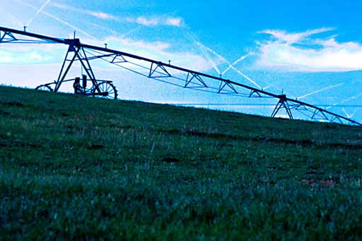
“My job is to see that we hold water up front and center to those in urban areas, so they realize how dependent we are on agriculture and the rural areas,” Hickenlooper told the Colorado Ag Water Alliance Friday. The alliance, which represents major statewide agricultural groups, in March asked Hickenlooper to increase planning, funding and permitting of water projects; continue funding for research of alternative transfer methods that don’t dry up farmland; add a representative from the Republican River basin to the Interbasin Compact Committee; and place more emphasis on the sustainable use of groundwater. In response, Hickenlooper brought the state’s top water officials to the alliance meeting Friday and pledged to do all he could to expedite water projects. He also supports ongoing state efforts to find new ways to share water…

For the last two years, Colorado agriculture revenues have been $7 billion, while the industry employs 110,000 people. But the benefits go beyond that in protecting rural economies and enhancing the environment, Hickenlooper said…

The governor said his arm-twisting skills may not be sufficient to convince cities to accept alternative ag transfer proposals rather than secure their own supplies, but said everyone in the state needs to work together to find mutually acceptable projects…

Hickenlooper said he is trying to find common ground with the governors of Nebraska and Kansas to see how water can be used cooperatively among the states within the boundaries of interstate compacts that place limits on what can be done. He also encouraged state agencies to work with federal regulators — the Environmental Protection Agency, Army Corps of Engineers, Interior and Agriculture — to remove red tape that can hold up projects for years.

More coverage from Chris Woodka writing for The Pueblo Chieftain. From the article:

As DNR director, [Jim Martin current Region 8 director for the EPA] asked Jennifer Gimbel, executive director of the Colorado Water Conservation Board, to testify in Congress about the state’s preference to store more water in Chatfield Reservoir rather than accept the no-action alternative: drying up more agricultural land to satisfy urban demand. “The federal regulatory agencies have stopped saying ‘no,’ and are now saying ‘no, because,’ ” Gimbel said. “We are making progress (toward) ‘yes, if. . .’ ’’

Gimbel said the federal agencies say they do not want to influence state water rights, but that by blocking storage of more water in existing reservoirs like Chatfield in order to protect wetlands, the agencies are unwittingly setting the stage for more ag dry-up.

Meanwhile, Colorado State University has named a new head of Department of Agricultural and Resource Economics. Here’s the release from CSU (Jim Beers):

Gregory Perry, an expert in agricultural finance and taxation who has extensively studied water-management issues, will join Colorado State University July 15 as new head of the Department of Agricultural and Resource Economics.
Perry, a professor at Oregon State University at Corvallis, served for about three years as an interim department head there. His additional leadership posts at OSU focused on programs for graduate and undergraduate students, and he also started an international studies program in Chile.

“Dr. Perry has outstanding leadership experience and a highly recognized reputation in teaching and research that fits very well within the mission of our college at CSU,” said Craig Beyrouty, dean of the College of Agricultural Sciences. “He is an important addition to our leadership team as the College of Agricultural Sciences addresses complex, local and global issues in agriculture and resource economics. We are delighted that Dr. Perry will be part of our College and serve in this very important role.”

Beyrouty noted that Perry’s research into water issues – especially his study of the interface between water management and agricultural finance – fits well with a key focus area for the College of Agricultural Sciences.

Perry will replace Stephen Davies as leader of the Department of Agricultural and Resource Economics, a department with about 20 faculty members and about 325 undergraduate and graduate students.

Davies, department chair for six years, will return to a full-time focus on teaching and research. Davies teaches classes including agricultural marketing and international agricultural trade.

His ongoing “Future of Colorado Agriculture” project gathers critical information from agricultural stakeholders and provides these insights along with economic analysis to statewide policymakers. Davies also leads water-modeling research in Colorado and internationally.

Perry, who was awarded a Fulbright fellowship to teach in Chile, said he hopes to continue advancing CSU’s Department of Agricultural and Resource Economics to benefit students and the agricultural industry.

“Economics is the driving force in a lot of ways that agricultural activities occur in the state, determining what commodities are grown, when and how,” Perry said. “Economics becomes the prism through which all agribusiness production decisions are seen.”

He added: “Fundamentally, our job is to educate – to discover new knowledge and to disseminate that knowledge. So if we can do our jobs well, people involved in agriculture have the best economic science available to them to make the best decisions for their own well-being and for improved well-being in the state, nation and even the world.”

In Colorado alone, the agricultural industry annually generates $20 billion in economic activity, according to the state Department of Agriculture.

“This impact points to the importance of understanding agribusiness, finance and economics in food production,” Beyrouty said. “We also seek to understand and teach students about the intersection of agricultural economics with environmental issues, land and water management.”

Perry said he hopes to lead the Department of Agricultural and Resource Economics in efforts including recruitment and ultimate career placement for talented graduate students, a focus on improving the quality of undergraduate instruction and student learning, support for young faculty members, creation of an endowed chair to advance high-impact research and teaching, and creation of endowed scholarships to support undergraduate education.

Perry earned his bachelor’s and master’s degrees at Utah State University and his doctorate in agricultural economics at Texas A&M University.

And here’s the Final Report – Alternative Agricultural Water Transfer Methods Grant Program from the Colorado Water Conservation Board. Here’s the summary:

Alternative Agricultural Water Transfer Methods Grant Program Summary

As Colorado’s population continues to grow in the coming decades, it is likely that increased transfers of agricultural water rights will occur in order to satisfy increased municipal and industrial (M&I) water demands. The Colorado Water Conservation Board (CWCB), Interbasin Compact Committee (IBCC), and the Colorado Water Congress have indicated their support of alternatives to traditional transfers resulting in permanent dry‐up in order to minimize the negative socioeconomic impacts to rural communities that so often result from such transfers.

One of the outcomes of the Statewide Water Supply Initiative (SWSI) 2 study was the recognition that the State of Colorado might be able to provide incentives for M&I providers to consider alternative methods for their water supply options. In response, the Legislature passed Senate Bill 07‐122, which authorized the CWCB to develop a grant program to facilitate the development and implementation of alternative agricultural water transfer methods (ATMs).

Since its inception in 2007, the CWCB’s Alternative Agricultural Water Transfer Methods Grant Program has awarded $1.5 million to various water providers, ditch companies, and university groups for the funding of six unique projects; five of which have been underway during 2009– 2010. As illustrated in SWSI 2, rotational fallowing, Interruptible Service Agreements (ISAs), water banks, purchase and leasebacks, deficit irrigation, and changing crop type are the kinds of options that are available as alternatives to permanent agricultural transfers.

With the exception of purchase and leasebacks and some limited occurrences of short‐term leasing, these ATMs are just beginning to be explored as viable options for meeting M&I water demands in Colorado. While promising, there are technical, legal and institutional, financial, and other issues associated with ATMs. Through the ATM Grant Program, CWCB and others are currently exploring ways to address these issues utilizing incentives to gain greater awareness, interest, and participation from agricultural water users and municipalities with alternative agricultural water transfers.

The objectives of this memorandum are to further the understanding of the feasibility of implementing ATMs in Colorado by:

1. Providing an overview of ATM concepts;

2. Providing a summary of the ATM projects funded by grants awarded by CWCB;

3. Providing an overview of the current state of agricultural transfers in the South Platte Basin and the Arkansas Basin and assessing the viability of future transfers in various regions of those basins; and

4. Identifying and summarizing barriers to successful implementation of ATMs and summarizing the ways in which grant‐funded ATM projects have made progress toward finding solutions to the identified barriers to implementation.

More Colorado water coverage here.

Not every Montezuma Valley Irrigation shareholder is on board with the proposed lease for instream flows below McPhee Reservoir

A picture named roundtailchub.jpg

From the Cortez Journal (Reid Wright):

MVI shareholder Drew Gordanier said Monday he thinks it is unfortunate that the proposal has created “animosity among friends” within the organization. Gordanier said he personally would support the lease if it were for local agriculture instead of environmental groups. He said he does blame the MVI board for its efforts to seek additional income. “I have nothing against them. I just think they should seek other revenue sources,” he said.

Meanwhile, the water conservation board is silent on how it and supporting organizations would fund the proposed $500,000 annual lease. Linda Bassi, chief of stream and lake operations for the organization, said more details will be released if the project moves forward…

In addition, he worries that if the water is leased to environmental groups, they might be able to seize control of the water permanently. “My biggest concern is them leasing the water to the environmental groups,” Gordanier said. “If you lease that water, they can prove that you can live without it.”

MVI officials approached their shareholders Thursday with a proposal to lease some of their water to a group of organizations for wildlife and environmental efforts on the Lower Dolores River. At the time, [MVI General Manager Don Magnuson] said the need for water on the Lower Dolores River is well documented and he believes MVI has enough water to provide for the need. Under the proposal, which is still under negotiation, MVI would lease a maximum of 6,000 acre-feet of water a year to organizations spearheaded by the Colorado Water Conservation Board. The water would be used during three years of need sometime in the next decade. The water conservation board would be able to use the water for a maximum of 120 days during the irrigation season – which usually goes from May 15 to Oct. 15…

Although the price is still under negotiation, MVI is currently asking $500,000 per year, or $1.5 million for the three years of water. MVI hopes to use the money for capital improvement projects, such as putting ditches into pipe, which reduce the amount of water lost to leaks. A recent irrigation pipe project saves an estimated 1,500 acre-feet in water annually, Magnuson said.

But after the drought of 2002, which left reservoir levels precariously low, MVI shareholders – comprising mostly farmers and ranchers – expressed a reluctance to part with their water during Thursday’s meeting. They also feared any revenues gained from the agreement would be lost to bureaucracy or loan debt.

Water would come from Groundhog Reservoir, and would be released through the Upper Dolores River and McPhee Reservoir into the Lower Dolores River.

More Dolores River watershed coverage here.