Denver: Sanitary sewer and stormwater rates go up

A picture named sewerusa.jpg

From The Denver Post (Caitlin Gibbons):

The rate hike, effective July 1, reflects the pass-through cost of the Metro Wastewater Reclamation District facility being built near Brighton and the cost of maintaining city sewer lines…

Mix said this is the city’s first sewer-rate hike since 1995. But it won’t be the last: Sewer rates will increase by 15 percent in 2012 and by 10 percent in 2013, and each year thereafter based on the Consumer Price Index. About 59 percent of the average Denver sewer bill is paid to Metro. The rest is used to maintain the sewer system for collecting and transporting waste from homes and businesses to Metro for processing.

Metro’s bill to Denver increased by about 34 percent, utility spokesman Steve Frank said. The city will pay Metro about $45 million this year. Frank said Denver’s bill went up “because of the amount of water and how heavily polluted the water is.”[…]

Denver Wastewater — managed by the city’s Public Works department — is increasing storm-drainage rates by 20 percent.

More infrastructure coverage here.

Aspinall Unit update: Reclamation is bumping releases from Crystal Reservoir to avoid a possible Blue Mesa spill

A picture named aspinallunitdescription.jpg

From email from Reclamation (Dan Crabtree):

We continued to be blessed with higher than expected inflows due to late season snowmelt, and now, early season monsoonal moisture. Blue Mesa Reservoir has been rising about 0.7 feet per day and is now at an elevation of 7517.3 feet. Bountiful inflows are expected over the next few days and if releases are not increased there is a definite possibility that Blue Mesa Reservoir could spill. In order to avoid this undesirable event, releases from Crystal Dam will be increased by a total of 800 cfs over the next 3 days. Flows in the Gunnison River through the Black Canyon are expected to increase from a gage reading of 1750 cfs to around 2550 cfs by Wednesday, July 13th. Release changes will be done in 200 cfs increments, well below the recommended maximum ramp-up rate of 500 cfs per day, in order to preserve the safety of any potential visitors to the canyon and to provide a smooth flow increase that all fish can enjoy. We are quite fortunate that river flows in this range (>2000 cfs) will actually provide nearly ideal conditions for this year’s late rainbow trout emergence by providing increased fry habitat as the river level exceeds bankfull within the canyon. This should be of great benefit to all recreational users of the canyon – maybe not immediately, but certainly for the future.

More Aspinall Unit coverage here.

Creede: Willow Creek floodplain restoration planning meetings to start this fall

A picture named commodorewasterockcreede.jpg

From The Pueblo Chieftain (Matt Hildner):

Strewn with waste rock and mine tailings and largely bereft of vegetation, the 1 1/2-mile stretch that sits astride Colorado 149 is due for a face-lift. The project will take on a number of goals, including the transformation of the creek from a braided channel that races to the Rio Grande to park, recreational and open space for the town’s roughly 300 residents.

But what residents hope to see from the 151 acres in the flood plain recently annexed by the town will be determined, in part, by what they call for during planning meetings that could come as soon as this fall. “The fall planning will be one of the next big hurdles,” said Eric Grossman, a town trustee, who sits on the four-member board of the non-profit that will direct the flood plain’s cleanup…

Grossman said initial ideas have ranged far and wide, including a community garden, open space, a miniature golf course and trails for pedestrians and ATV users…

With public input this fall, the nonprofit also is going to try to nail down the design features for Willow Creek’s new alignment. The stream has run down the flood plain in a braided channel since at least 1939, according to aerial photos that were analyzed in a 2007 study of the flood plain by the Natural Resources Conservation Service. The braided structure, in combination with water and soil contamination from nearly a century of mining in the area, has led to poor ecosystem function.

An important solution for water contamination will come when the U.S. Environmental Protection Agency settles on a cleanup remedy for the Nelson Tunnel, which is the watershed’s largest contributor of pollutants such as cadmium, zinc and lead. Agency officials said last month they are conducting a pair of studies that will help determine the cleanup measure for the tunnel. The tunnel, which sits upstream from the flood plain in the historic mining district, was declared an EPA Superfund site in 2008.

More Nelson Tunnel/Commordore Waste Rock superfund site coverage here and here.

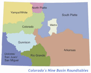
IBCC: Basin roundtables are being asked to create a mix of solutions or a ‘portfolio’ for meeting Colorado’s 2050 M&I water needs, using the board’s portfolio tool

A picture named ibccroundtable.jpg

Here’s the announcement from the Interbasin Compact Committee (Eric Hecox):

Congratulations on your hard work over the past few months. On May 26nd Director Stulp sent out a memo called the Colorado Water for the 21st Century Roadmap outlining the path forward for this process. The Roadmap listed short-term, mid-term, and long-term objectives. The first item under short-term objectives encouraged the Basin Roundtables to complete their basin-wide water supply needs assessments (needs assessments) in the form of the SWSI Basin Reports by the end of June. These Basin Reports are wrapping up and the needs assessments are essentially complete. While the needs assessments are living documents and can always be supplemented, we now are entering a new and exciting phase of our work together.

This phase involves the development of portfolios. As articulated in the Colorado Water for the 21st Century Roadmap the objective is:

· To ensure grassroots input in developing statewide solutions, each roundtable will be asked to develop one or more statewide portfolios using the portfolio tool. This should include at least one mid demand / mid supply portfolio, but some roundtables may choose to develop portfolios for other scenarios as well. CWCB will provide technical assistance in this effort, and IBCC members from one or more basins may go to other basins to support portfolio development.

Over the next six months the Basin Roundtables will be involved in this activity. We will be working with the roundtable Chairs on the logistics of developing portfolios, but an integral part of this effort will be the Portfolio Tool developed by CWCB. We will work with each Basin Roundtable over the next few months to understand and use the Portfolio Tool. However, for those who want to start learning about the tool, you can download the Portfolio Tool and documentation of how the tool works at: http://cwcb.state.co.us/technical-resources/portfolio-tool/Pages/main.aspx

While the tool is essentially finalized, we are still working on one final trade-off. If we can work out the technical details and incorporate it into the tool, we will send out the link to the updated tool.

To remind everyone, the Portfolio Tool allows the user to create a mix of solutions or a “portfolio” for meeting Colorado’s 2050 M&I water needs. The tool also has a variety of trade-offs including the cost of the portfolio, the number of irrigated acres that would be dried up, impact to west slope nonconsumptive needs, etc. These trade-offs will help inform what portfolio each roundtable feels meets their needs as well as the needs of other basins. The tool is also full of new detail, ranging from being able to specify identified projects and processes success rates to seeing portfolios for each individual basin.

I encourage you to spend some time with the Portfolio Tool and look forward to working with you over the next six months to develop portfolios for meeting our state’s long-term water supply needs.

Note: The tool was created with Microsoft Excel and therefore requires a computer running Windows. It seems to work on my Macintosh using Open Office but I’ll have to check it out more closely. It’s a shame that the state of Colorado does not have a commitment to cross-platform solutions.

More coverage from Chris Woodka writing for The Pueblo Chieftain. From the article:

Meant to address the “gap” first identified in the 2004 Statewide Water Supply Initiative, the tool applies hypothetical values for ongoing and proposed projects, conservation and transfers to meeting water supply shortfalls…

IBCC director John Stulp sees value in exposing more people throughout the state to the portfolio tool. “It’s just that, a tool. It gives the roundtables the opportunity to make assumptions,” Stulp said. “If you have a project you’re interested in, you can calculate the yield for the new supply and assign a certain amount for that.”

The important thing is to determine how the remainder of the water needed could be obtained. “I think as people use it, it will send a message that if you do one thing over here, something else has to happen over there,” Stulp said. “It will get people to understand how doing something has consequences.”

The tool can take storage into account by assigning values to identified or proposed projects, Stulp said…

The tool also would show how much of the gap an attainable level of conservation could fill, a position environmental groups favor over building new water projects. It also could identify what sort of impact land-fallowing lease programs like Super Ditch could have versus the permanent sale of agricultural water, Stulp said.

Here’s a nice table of the current supply gaps by basin from The Pueblo Chieftain (Chris Woodka):

While the Statewide Water Supply Initiative identified municipal needs in 2004, roundtables have spent the past six years refining their needs assessments, and determined the gap in supplies could be as much as 800,000 acre-feet annually by 2050. Some highlights from reports to the Interbasin Compact Committee last month:

– Arkansas River basin: A gap of 36,000 to 110,000 acre-feet per year (af/y), driven by El Paso County growth, is foreseen by the year 2050. The roundtable’s priority is to maintain agriculture while meeting all needs.

– South Platte River basin: Including the Denver metro area, the gap could be 99,000 to 360,000 af/y by 2050. More than half of the need will be in the metro area, and many projects are in competition with each other.

– Rio Grande basin: The Rio Grande basin is showing a gap of 180,000 af/y by 2050, with 160,000 af/y needed to maintain current levels of irrigated agriculture. About 80,000 acres of farm land will have to be taken out of production to avoid further depletion of groundwater in the arid basin.

– Colorado River basin: The Colorado River basin will need an additional 65,000 to 110,000 af/y, and could have a gap of 22,000 to 48,000 af/y by 2050. Oil shale could increase the demand for water.

– Yampa-White basin: There is the potential to increase irrigated agriculture in the state’s northeast corner, but oil shale development could tie up 120,000 af/y, depending on the level of commercial development.

More IBCC — basin roundtables coverage here.

NIDIS Weekly Climate, Water and Drought Assessment Summary of the Upper Colorado River Basin

A picture named wyutcoprecipitationjune2011

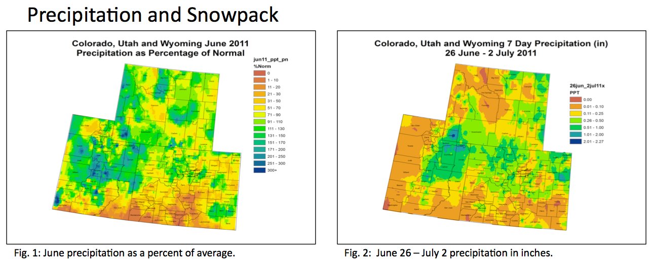
Here are this week’s notes from the Colorado Climate Center. Here’s an excerpt:

For
 the 
month 
of 
June,
 much
 of
 the
 northern 
portions 
of 
the 
Upper 
Colorado
 River
 Basin
 (UCRB)
 received
 between 
100%
 to
 200% 
of
 their
 average
 precipitation. 

The
 Four 
Corners 
was
the 
driest 
region 
of 
the
 basin
 for 
the 
month, 
receiving 
less
 than
 30% 
of 
average.

 The 
San
 Luis
 Valley
 was 
also 
very
 dry
 for
 the 
month,
 only 
seeing 
about 
10%
 of 
its
 average
 precipitation. 

Much 
of
eastern
 Colorado
 received 
between 
50% 
and
 100% 
of 
average 
precipitation 
for
 the 
month,
 with 
parts 
of 
southeastern
 CO
 seeing
 over 
100%
 of 
average 
from
 just 
a
 couple
 of
 storms.

Last 
week, 
the 
heaviest 
amounts
 of 
precipitation 
fell 
over 
northeast
 Utah
 and 
southwest 
Wyoming
 with
 amounts
 totalling 
between 
half
 an 
inch
 to 
over 
2 
inches 
in
 some
 spots
. 

The 
mountains
 of
 northern 
CO
 and
 northeast 
CO 
received 
between
 a
 quarter 
inch
 to
 an 
inch 
of 
moisture
 for 
the 
week. The 
drought 
stricken
 areas 
in
 the 
southern 
portion 
of
 the
 UCRB 
and
 in
 southern
 CO
 remained
 dry,
 seeing
 less 
than
 a 
tenth
 of 
an
 inch
 over 
the 
week.


Fryingpan-Arkansas Project update: 950 cfs in the Fryingpan River below Ruedi Dam

A picture named ruedidam.jpg

From email from Reclamation (Kara Lamb):

It’s been an interesting week with the snow melt and then the rain. Releases out of Ruedi Dam have been around 850 cfs for the past week. However, rain the last few days has been significant– Ruedi received about a half an inch in precipitation just today. With inflows peaking last night around 1272 cfs, we’re anticipating that not only will Ruedi reach its full capacity late this evening, but it will start to push a little over the spillway. This will probably happen after midnight, maybe around 1 or 2 in the morning. Later Sunday morning around 6 a.m., we will increase releases from the dam another 50 cfs. This, with the contributions of the Rocky Fork still running around 46 cfs, will put flows in the Fryingpan around 950 cfs. We’re still planning on being at the Basalt Town Hall this Wednesday night, July 13, for our annual Ruedi operations meeting at 7 p.m.

More Fryingpan-Arkansas Project coverage here.

Energy policy — hydroelectric: Aspen’s water rights for their proposed project are in question

A picture named aspen.jpg

From Aspen Journalism via the Aspen Daily News (Brent Gardner-Smith):

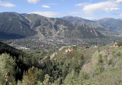
“The city of Aspen water department does not have the water rights for a hydro plant on Castle Creek, period,” Dick Butera told Aspen City Council at a June 27 meeting. Butera owns a large home overlooking Castle Creek just below the city’s diversion dam on the stream. He told the council that he and a group of other local landowners are willing to sue the city to prevent the hydro project from going forward.

Butera made his comments at a meeting when council approved increasing the spending authority for the hydro plant and an associated pipeline from $7.3 million to $8 million, and transferring $2.8 million from the water fund to the renewable energy fund to cover the cost. “Two of the leading water attorneys in the state of Colorado have both said to our committee that we have a 90 percent chance of winning the case to prove that the water department does not even have the water rights,” Butera said.

But Aspen’s water attorney maintains that the municipal government’s water rights remain in good standing and the city has never intended to abandon its option to use the water for hydropower. “The city has decreed absolute water rights,” said Cynthia Covell, an attorney with Alperstein and Covell in Denver. “They are decreed for power purposes and they have never been found to be abandoned in any court proceeding. I think that the city can do the project that it wants to do with the water rights it has.”[…]

Sarah Klahn, an attorney hired by Pitkin County to independently review the city’s hydro project, said last week that even if an abandonment lawsuit was successful, the city could still likely obtain new water rights for the new hydro plant. “I know that it is possible to still get a new appropriation, especially on a non-consumptive use,” said Klahn, who is with White & Jankowski in Denver…

Covell, the city’s water attorney, has a different take on the matter. “The fact that the city stopped generating electricity at that time does not mean they abandoned the right to do so,” Covell said. “The city has not intended to abandon. And intent is a piece of abandonment. We think we can defend an abandonment case.” Still, city officials are aware there is a danger of losing all or some of their water rights by not exercising them.

More hydroelectric coverage here and here.

Windy Gap Firming Project/Moffat Collection System Project update: Denver and Northern plan to fully mitigate project impacts

A picture named windygapmoffatfirmingboulderviewpoint.jpg

From the Boulder Daily Camera (Laura Snider):

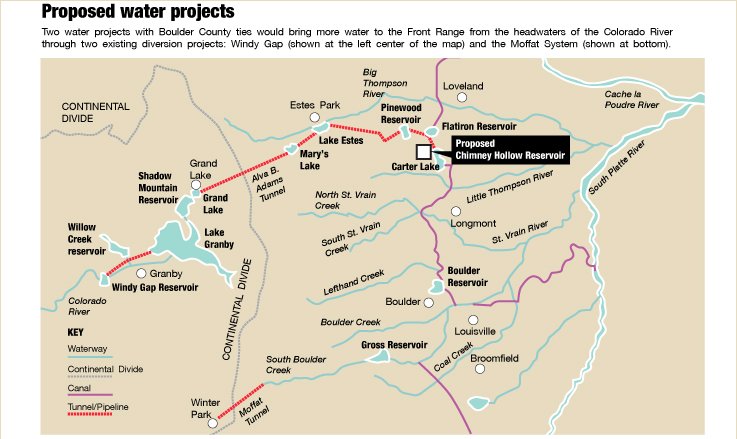
The developers of the two water projects, Denver Water and Northern Water, say they plan to not only offset any future environmental problems created by their new projects in the upper Colorado River basin, but to also work together to voluntarily “enhance” the existing habitat in the area. “By fully mitigating our impacts, we keep (the basin) the same,” said Denver Water’s Travis Bray. “Through enhancement and through our cooperative efforts we’re making it better.”

But [Kirk Klancke], who works as a water manager in Grand County, and some Colorado environmental groups contend that more aggressive mitigation and rehabilitation plans are needed to save what’s left of the Colorado River. “Both of these (water utilities) wrote an environmental statement that said there would be no impacts,” said Klancke, who also serves as the president of the Colorado River Headwaters Chapter of Trout Unlimited. “But the third-grade class at Fraser Elementary can tell you what happens when you take 80 percent of a river.”[…]

Because Windy Gap’s water rights are relatively junior, the project only can divert water during wet years. But in wet years, Lake Granby — a critical storage reservoir for the Colorado-Big Thompson system — is often full, leaving no room for the Windy Gap water to travel to the Front Range. This makes the water supplied by Windy Gap to its original participants extremely unreliable…

If approved, the firming project calls for building a new reservoir west of Carter Lake in Larimer County. The Chimney Hollow Reservoir would be able to store 90,000 acre-feet of water, giving the Windy Gap water that can be drawn in wet years a place to go…

In Boulder County, Denver Water plans to offset the impacts of flooding hundreds of acres of land to expand Gross Reservoir by replanting woody riparian vegetation and by buying credits from buying credits from an approved “wetlands mitigation bank” to offset the two acres of wetland that will be inundated…

But what both water providers are most proud of is their cooperatively created “enhancement plan,” which they say will go beyond mitigating the impacts of the new project and actually improve the current conditions in the upper Colorado River basin. The idea is to restore the section of the Colorado River that lies downstream of both the Windy Gap and Moffat projects where the populations of giant stoneflies and sculpins, both of which are food for trout, have declined over the years. Together, Denver Water and Northern Water have agreed to spend $4.5 million on the restoration effort and put another $1.5 million into a reserve fund that can be used to tweak elements of the restoration project that aren’t working as designed. “This is not what we think is required by the state. We are not required to go back and make changes based on the impacts of past projects,” said Dana Strongin, spokeswoman for Northern Water. “This is a benefit — it’s something extra. We don’t have to do this, but we wanted to…

Mely Whiting, senior attorney with Trout Unlimited’s Colorado Water Project, said the plans don’t adequately address stream temperature problems and flushing flows. When the mountain snowpack begins to melt in the late spring and early summer, the influx of water “flushes” the rivers, scraping sediment off the streambed and, in some years, overflowing the banks and recharging adjacent wetlands. Because both of the new projects plan to draw water during the periods of high runoff, Whiting said the rivers are being robbed of the critical flush. When flows stay low throughout the summer, the sediment builds up on the bottom of the rivers and destroys the habitat used by aquatic insects. The low flows also increase the danger that stream temperatures will climb higher earlier in the summer…

The solution proposed by Trout Unlimited is to essentially reconstruct the habitat of the Fraser and the upper Colorado River to create narrower channels that would allow the remaining water to run deeper, faster and cooler…

Trout Unlimited commissioned a study to see how much it would cost to do the work that it believes needs to be done on the Fraser and upper Colorado rivers. According to the study, $3 million to $5 million more needs to be budgeted in the mitigation plan to adequately rehabilitate the Fraser and about $5 million more is needed for the upper Colorado River. Western Resource Advocates then analyzed how much an additional $5 million each from Denver Water and Northern Water would cost their customers. The result is that Denver Water customers would have to pay an additional $0.53 a year for 30 years and Northern Water customers would have to pay an additional $1.60 a year for 30 years. “Is protecting a river worth a dollar a year?” Beckwith asked. “It’s not a lot of money. People lose that much money in the couch.”

But Denver Water’s Travis Bray said it’s not fair to expect his utility and Northern Water to shoulder the entire burden of rebuilding the upper Colorado River basin, which has been degraded over the decades due to multiple projects. “In a perfect world, Denver Water and Northern Water would have unlimited funding and we could just make the whole Fraser River a gold medal (trout) river,” he said…

The final environmental impact statements for both projects are expected to be released late this year or next year. When each statement is released, the public will have the opportunity to give public comment before a final decision is made about whether to give the projects final approval.

More coverage from Laura Snider writing for the Boulder Daily Camera. From the article:

If a Denver Water plan to nearly triple the size of Gross Reservoir gets the final OK, hundreds of acres of shoreline, tributaries, wetlands and vegetated slopes in southwest Boulder County would be underwater. The construction necessary to raise the dam more than 100 feet also would require trucks laden with sand to make 44 round trips up to the reservoir each day during peak construction from sand quarries near Longmont. Denver Water estimates that it will take five years to complete the project. These impacts have raised concerns with the Boulder County commissioners as well as reservoir neighbors…

Earlier this year, Denver Water also released its proposal for how the utility plans to mitigate fish and wildlife impacts for the project. The plan, which was approved in June by the Colorado Wildlife Commission, calls for mitigating the loss of about two acres of wetlands by buying credits from an approved “wetlands mitigation bank.” Denver Water also plans to replant native woody riparian vegetation along the edge of the newly enlarged reservoir to replace the four acres of riparian habitat that would be flooded if the expansion goes forward. Since the reservoir is largely fed from water traveling through the Moffat Tunnel from the Western Slope and emptying into South Boulder Creek, Denver Water would also monitor the effects of a greater volume of water on stream bank stability. The Boulder County commissioners have said that they do not believe Denver Water’s mitigation plan adequately addresses the impacts of the reservoir expansion.

More Moffat Collection System Project coverage here and here.

More Windy Gap Firming Project coverage here and here.

Flaming Gorge pipeline update: Pikes Peak Water Authority to sponsor $190,000 study of the two alternatives on the table

A picture named flaminggorgepipelinemillion.jpg

From The Pueblo Chieftain (Chris Woodka):

The Pikes Peak Regional Water Authority will sponsor a $190,000 grant request to the Colorado Water Conservation Board to form a task force that water leaders from around the state decided was needed at a meeting in Silverthorne [ed. June 29]. The task force would be made up of members of the state’s nine basin roundtables, along with environmental and recreation interests. It also could include some of the state’s top water officials, and could have 20 to 23 members. The plan, however, still requires buy-in from the roundtables, which were formed by the Legislature in 2005 to sort out state water issues. The needs assessment committee of the Arkansas Basin Roundtable met Thursday and agreed to move the Flaming Gorge task force proposal to the full roundtable at its Aug. 10 meeting. All of the money would come from the water supply reserve account, a program funded by mineral severance taxes. The Arkansas Basin Roundtable would use $10,000 from its basin fund, along with $30,000 from the Metro roundtable. The rest of the grant would come through a statewide account.

“As a state, we need to move forward and identify new projects that bring water into the state,” said Alan Hamel, who represents the Arkansas River basin on the CWCB.

He also is a member of the roundtable’s needs assessment committee. “In order to protect agriculture, we’ve got to be able to move state projects forward,” he said…

The Pikes Peak group, which is managed by Gary Barber, chairman of the Arkansas Basin Roundtable, has an interest in new supply. Like the area served by the South Metro Water Supply Authority, the Pikes Peak region is largely dependent on the Denver Basin Aquifers, a groundwater formation that is being depleted…

The facilitators chosen for the project are Michael Hughes of the Keystone Center and Heather Bergman of Peak Facilitation. Bergman, while working for Keystone, facilitated the Fountain Creek Vision Task Force, which led to the formation of the Fountain Creek Watershed Flood Control and Greenway District by the Legislature in 2009…

“The task force will ask if (Flaming Gorge) is doable and determine how it fits in with the state water supply,” [Jim Broderick, another member of the needs assessment committee] said.

More Flaming Gorge Task Force coverage here.

The Orchard City Irrigation District sets a 100% quota for the diversion season

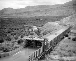
A picture named orchardmesa1911

From the Delta County Independent (Hank Lohmeyer):

With Alfalfa Run and Dry Creek having gone on call two days earlier, the board of the Orchard City Irrigation District at a special meeting last Thursday set a 100 percent appropriation for district water users this year. The district last set a 100 percent appropriation for irrigators in the district two years ago…

OCID explains a 100 percent appropriation in terms of providing one cubic foot per second of irrigation water for each irrigated acre within the district. “There is plenty of water this year,” agreed board president Jeff Wick after hearing a report from the water commissioner’s office.

More Colorado River basin coverage here.

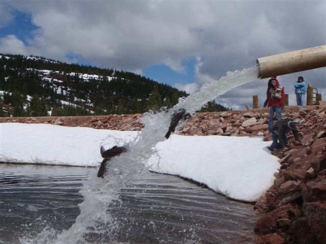
Cool photo of the week: Rainbows splashing into the Black Lakes during an Eagle River Water and Sanitation District stocking operation

A picture named rainbowssplashingintoblacklake.png

Click on the thumbnail graphic to the right for a photo of the stocking operation from Diane Johnson at the district. Here’s the release. Here’s an excerpt:

On July 6, the District coordinated the second stocking of 2,500 pounds of 10-16 inch long rainbow trout into the two Black Lakes, located adjacent to Interstate 70 near the Vail Pass exit. The first 2,500 pounds of trout were stocked on June 21. The fishery supplying the trout says the 5,000 pounds equates to about 2,000 fish.

The trout are raised by a Boulder based fishery that is licensed and health inspected by the Colorado Department of Agriculture and the Colorado Division of Wildlife (DOW). The DOW annually tests the fishery’s trout to assure each lot is healthy and free of disease.

The District stocks the lakes annually with “catchable rainbow trout” under the terms of a 1986 agreement with the Colorado Department of Natural Resources. The two cold water reservoirs are operated as part of the water supply system developed by the District, which serves the Town of Vail and by contract, the communities of EagleVail through Cordillera.

At various times of the year, the District releases water from the two lakes which flows down Black Gore Creek and into Gore Creek, which runs throughout the Town of Vail. The released water augments Gore Creek streamflows and can be used per District water rights. The Colorado DOW partners with the District to operate Black Lake 2 in support of fishing, wildlife habitat, and recreation.

More Gore Creek watershed coverage here and here.

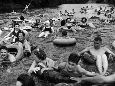
Runoff news: Tubing still restricted on Routt County streams

A picture named innertubingnz.jpg

From Steamboat Today (Matt Stensland):

The partial-use restriction forbids using “single-chambered, air-inflated devices such as the inner tubes and air mattresses typically found on the Yampa River during tubing season. Officials say they are looking out for the safety of would-be tubers as well as the emergency responders or bystanders who might attempt a rescue should tubers get in trouble…

The U.S. Geological Survey reported the Yampa downtown was running at 2,650 cubic feet per second Tuesday afternoon. That is significantly higher than the 559 cfs July 5 average. Commercial tube operators oftentimes are accommodating hundreds of tubers a day by now, but Backdoor Sports owner Peter Van De Carr said the river has to drop to 700 cubic feet per second before he can start inflating tubes. Even at that level, tubing is limited to adults, and they are required to wear a life jacket.

From Steamboat Today (Tom Ross):

Records kept by the U.S. Geological Survey show that Wednesday morning’s flow of 2,630 cubic feet per second at Fifth Street eclipsed the old record for July 6 of 2,430 cfs set in 1957. A significant portion of that flow was attributable to Fish Creek, which was flowing at 695 cfs Wednesday morning. Fish Creek, which enters the Yampa upstream from Fifth Street, was flowing at 1,400 cfs as recently as July 3, or three times the median flow of the Yampa on that date. The Elk River near its confluence with the Yampa west of Steamboat was also flowing at a record level of 3,660 cfs Wednesday. The previous record on the Elk was even older — a flow of 2,990 recorded in 1917…

Winter’s last bastion in Colorado is plainly Buffalo Pass, northeast of Steamboat Springs on the Continental Divide, where the snow remains almost 5 feet deep.

The Natural Resources Conversation Service’s remote sensing instruments showed a measurement of 59 inches of snow containing 29.9 inches of water Wednesday morning. And U.S. Forest Service personnel who visited and photographed a weather station maintained by Steamboat weather observer Art Judson on Tuesday supported that data. They measured two snow stakes not far from the NRCS Tower site that showed 66 inches and 50 inches of snow, respectively.

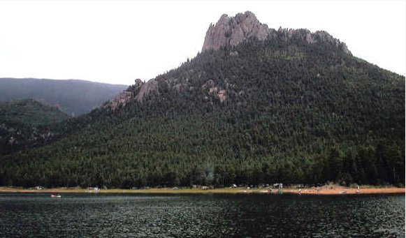
Wellington Lake open to the public for camping

A picture named wellingtonlake.jpg

From The Fairplay Flume (Mike Potter):

Wellington Lake will reopen to the public on July 1 following an agreement between Jefferson County and the Wellington Reservoir Co., the entity that owns the popular recreation spot east of downtown Bailey. The agreement was reached just before a trial scheduled for June 23. The trial was to deal with an alleged violation of Jefferson County’s zoning provisions by Wellington Reservoir Co…

John Akolt, the attorney for the Wellington Reservoir Co. board, said the agreement calls for 75 campsites to be made available to the public for day and overnight use. That’s a decrease from the roughly 100 to 150 campsites previously used. The lake will be a rustic campground area, he said, with no store, and no amenities. Prior to the closing in June 2009, the lake had a general store that was open to campers. That store would not be reopened under the agreement with Jefferson County. “It’s straight camping and all the things that are associated with camping,” he said.

More South Platte River basin coverage here.

Energy policy — nuclear: Powertech Uranium Corp fails to reach agreement on two parcels for their Centennial Project

A picture named uraniuminsitu.jpg

Here’s the release from Powertech Uranium Corp:

POWERTECH URANIUM CORP. (“Powertech” or the “Company”) announces the termination of an option agreement dated June 30, 2009 (the “Agreement”) with Howard and Donna Diehl and M.J. Diehl & Sons, Inc. (the “Optionors”) pursuant to which the Company was granted an option to acquire certain properties, together with associated mineral rights, related to the Company’s Centennial Project. The Company has determined not to exercise the option, which required the payment of US$6.16 million, and has been unable to renegotiate the terms of the Agreement on terms deemed favourable to both the Company and the Optionors. It remains the objective of both the Company and the Optionors to continue to explore a relationship or transaction to work together to develop the uranium resources held by the Optionors. As a result of the termination of the Agreement, the reported indicated and inferred resources at the Company’s Centennial Project will be reduced by approximately 1.1 million pounds.

The Company also announces the termination of an option agreement with Thomas Varra and Dianne Varra (collectively “Varra”) pursuant to which the Company was granted an option to purchase certain properties related to the Company’s Centennial Project from Varra. These properties contain no uranium resources and were determined to not be necessary for the development of the Centennial Project.

From the Fort Collins Coloradoan (Bobby Magill):

The British Columbia-based company announced Tuesday it has terminated an option agreement struck two years ago to purchase more than 3,500 acres of land from Howard and Donna Diehl of Carr and Thomas and Dianna Varra of Nunn. The land is in Weld County about 15 miles northeast of Fort Collins. “The company has determined not to exercise the option, which required the payment of $6.16 million, and has been unable to renegotiate the terms of the agreement on terms deemed favorable to both the company and the optioners (landowners),” the company announced in a statement…

“I’d rather not comment,” Powertech USA President Richard Clement said Wednesday, citing disapproval with previous Coloradoan news coverage about the Centennial Project…

The future of Powertech’s controversial aquifer pump test, which would help the company determine the viability of its proposed in situ leach uranium mining technique, is uncertain because the land on which the test is scheduled to be conducted is owned by the Diehls…

Powertech’s option agreement with the Diehls and the Varras included the 3,585 acres of land and the associated water and mineral interests, all of which would have cost Powertech $11.45 million. In June 2009, Powertech paid $197,000 for the exclusive rights to the property, and paid an additional $1.53 million in July 2009, with another $375,000 payment made last year, according to the Canadian securities filing.

More coverage from Joey Bunch writing for The Denver Post. From the article:

The change takes about 3,585 acres out of the original 9,615-acre Centennial Project near the town of Nunn. The change would reduce the expected haul of 12.7 million pounds of uranium by 1.1 million pounds. The Varra property didn’t have any uranium on it, and the Diehl property was stuck on a price of $6.16 million. Clement said negotiations could resume later, as the project advances, the economy improves and issues are resolved from the Japanese nuclear disaster.

Clement said the company has been focused on permitting and other issues at a site near Edgemont, S.D., which Clement hopes to have worked out by the end of 2012. “And then we’ll really focus on Colorado after that,” he said.

More Powertech coverage here and here.

Trinidad: The State Engineer orders the town to drop the level their water supply reservoir impounded by the North Lake Dam

A picture named spanishpeaks.jpg

From The Pueblo Chieftain (Chris Woodka):

The dam elevation must be lowered by 5 feet this year, under an order from State Engineer Dick Wolfe. There have been long-standing concerns about the dam, located about 30 miles west of Trinidad…

Trinidad already has spent $847,000 to design and build a new concrete outlet works and drain, but engineers estimate another $1.8 million is needed to reinforce the dam and rebuild the spillway. The reservoir must be emptied slowly to avoid triggering a historical slide area along Colorado 12 if the reservoir is emptied too quickly. Still, there’s little comfort for Trinidad, since further restrictions may be needed. “One reason we want to get this done this fall is that the elevation could be lowered even more,” [Utility Superintendent James Fernandez] said. “We’ve got to get this done or we’re out of business. We have a small back-up supply, but are seriously threatened.”

More Arkansas River basin coverage here.

The North American Monsoon is upon us

A picture named urbandrainage6hourprecip07072011

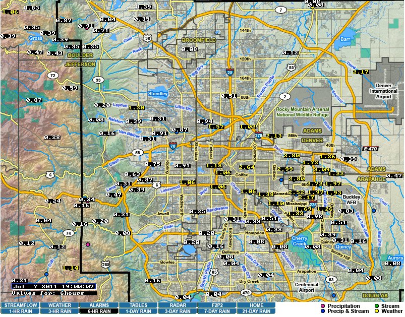
The North American Monsoon left many soaking wet today. I rode my bike home by the station reading 1.57 inches at Little Dry Creek. What a soaking. Clear Creek was up significantly. Click on the thumbnail graphic to the right for a screenshot of the 6-Hour map from the Urban Drainage and Flood Control District.

More coverage from the Associated Press via The Washington Post. From the article:

A fast moving storm has dumped heavy rain in the Denver area, causing minor street flooding and trapping some people in their cars in high water.

Energy policy — nuclear: Piñon Ridge construction on hold until the Sheep Mountain Alliance lawsuit is resolved

A picture named doloresrivercanyon.jpg

From The Durango Herald (Joe Hanel):

In late May, Denver District Judge Brian Whitney ruled for the environmental group Sheep Mountain Alliance, saying its lawsuit against the state health department could proceed. The alliance is challenging the state’s issuance of a radioactive materials permit to Energy Fuels. Jennifer Thurston of Sheep Mountain Alliance said the judge’s decision was a big victory. “It was really the first independent review looking at the basic issues in the case,” Thurston said. “He said that there are real issues at stake, and real damages can occur. That was a very important validation for us.”[…]

Energy Fuels is drawing up construction plans, but it will not start building the mill until the legal case is finished, said Curtis Moore, director of communications and legal affairs for Energy Fuels.

More nuclear coverage here and here.

Durango: Hermosa Creek cutthroat restoration open house July 13

A picture named hermosapark.jpg

From the Pagosa Daily Post:

The project will be explained to the public at an open house from 4-8pm, July 13, at the Durango Recreation Center’s Windom Room.

What: Open house to explain Colorado River cutthroat trout restoration on Hermosa Creek
When: 4-8 p.m., July 13
Where: Durango Recreation Center, Windom Room
Information: Jim White, (970)375-6712; j.white@state.co.us.

“Upper Hermosa Creek offers an excellent location for a native trout recovery project,” said Jim White, aquatic biologist for the Division in Durango. “The area is a big, complex network of tributaries and a main stem river with excellent water quality and trout habitat. The limestone geology is favorable for trout and the area is easily accessible to field crews and anglers.”

Wildlife biologists identified the Hermosa Creek area as a prime spot for restoration about 20 years ago. In 1992, a similar project restored native cutthroats on four miles of the creek’s upper East Fork.

More restoration coverage here.

Colorado River basin: Demand continues to push the limits of available water in the basin, conservation education seems to be helping

A picture named hooverdamspilling.jpg

From The Durango Telegraph (Will Sands):

Last month, the Bureau of Reclamation released an interim report titled “Colorado River Basin Water Supply and Demand Study.” While the report acknowledges a “high degree of uncertainty” regarding future water supplies, the view through the crystal ball is not looking good. Based on continued climate change, the authors predict an increase in the frequency and severity of droughts in the West. Add increases in population into the mix, and the study predicts decreases in the natural flow of the Colorado River of approximately 9 percent over the next 50 years…

Closer to home, the Colorado Water Conservation Board has drawn similar conclusions. According to its Statewide Water Supply Initiative, a report released early this year, Colorado is marching on the path to water shortages. The SWSI finds that if water use follows current trends, large supplies of water will have to be shifted away from Colorado agriculture in order to satisfy municipal needs. The result will be significant loss of farmlands, economic damage to the state’s agricultural regions and potential environmental harm. If Colorado’s appetite for water does not change, anywhere from 500,000 to 700,000 acres of irrigated farmland will have to be dried up by 2050.

However, the outlook on this liquid predicament may actually be half-full. A think-tank with offices in Colorado and California has unearthed hopeful findings. According to the Pacific Institute, Western water users are beginning to curb their appetites. The group has found that per-capita usage of Colorado River Basin water has dropped all over the region. Although there are now 10 million more people living in the West than in 1990, the Pacific Institute has documented substantial water-efficiency gains made during the same period.

“Demands for water from the Colorado River basin now exceed supply,” said Michael Cohen, author of the report. “This supply/demand imbalance would be much worse if municipal water agencies across the seven basin states had not decoupled water deliveries from population growth.”

Municipal water deliveries from the Colorado River Basin have increased by more than 600,000 acre-feet since 1990. However, that increase represents a rate that is actually much slower than population growth, according to Cohen. Between 1990 and 2008, per capita water delivery rates declined by a dramatic 38 percent in Albuquerque, 30 percent in Phoenix, and 24 percent right here in Durango.

Aspinall Unit update: Blue Mesa is filling quicker than expected, streamflow was 4,600 cfs into the reservoir yesterday

A picture named curecantibluemesa.jpg

From email from Reclamation (Dan Crabtree):

The runoff just keeps coming! This year’s runoff has been exceptionally difficult to predict in the Gunnison Basin. For example, a week ago, the Colorado Basin River Forecast Center’s model predicted inflows to Blue Mesa for July 6th of about 3,200 cfs and declining. Actual inflow today is about 4,600 cfs which is obviously causing Blue Mesa Reservoir to fill quicker than expected.

To compensate, releases from Crystal Dam will be increased by 550 cfs over the next few days. No single change is planned to exceed 200 cfs. In addition, the Uncompahgre Valley Water Users have again reduced their Gunnison Tunnel Diversions by 100 cfs due to increased flows on the Uncompahgre River which are meeting their needs. As a result of these changes, the Gunnison River gage located below the East Portal of the Gunnison Tunnel will read about 1,700 cfs by mid-morning on July 9th ; up from this morning’s flow of 1,080 cfs. Additional changes may be necessary next week as conditions are reassessed.

More Aspinall Unit coverage here.

Green Mountain Reservoir operations: 2,800 cfs in the Blue River below the dam

A picture named coloradobigthompsonmap.jpg

From email from Reclamation (Sterling Rech):

The inflow to Green Mountain Reservoir remains elevated, Dillon Reservoir’s release rate is being increased, and rain continues to be in the forecast. In order to slow the rate at which the reservoir is filling, the Green Mountain Reservoir release will be increased by 300 cfs today. This release rate increase will be accomplished in two steps of approximately 150 cfs each. Because the powerplant is currently running at maximum capacity, these release rate increases will be accomplished by raising the spillway gates. With the current release rate being approximately 2,500 cfs, these release rate increases will result in a flow rate of approximately 2,800 cfs at the Blue River gage below the dam by this afternoon.

Green Mountain Reservoir

Wednesday, July 6, 2011, 1300 hours – Increase the reservoir release from 2,500 cfs to 2,650 cfs (accomplished by raising all three spillway gates).

Wednesday, July 6, 2011, 1500 hours – Increase the reservoir release from 2,650 cfs to 2,800 cfs (accomplished by raising all three spillway gates).

Maintain the 2,800 cfs reservoir release until further notice.

More Colorado-Big Thompson Project coverage here.

Colorado River basin: Salazar Launches Development of a Long-Term Plan for Managing Glen Canyon Dam and Water Flows through the Grand Canyon

A picture named glencanyondamconst.jpg

Here’s the release from the U.S. Department of Interior (Kate Kelly/Barry Wirth/Maureen Oltrogge):

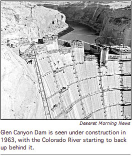
Secretary of the Interior Ken Salazar today announced that the Bureau of Reclamation and the National Park Service are starting the development of a Long-Term Experimental and Management Plan (LTEMP) for Glen Canyon Dam on the Colorado River.
The public process being launched today will be the first comprehensive review of Glen Canyon Dam operations in fifteen years, and will ensure that flow regimes on the Colorado River meet the goals of supplying water for communities, agriculture and industry, and protecting the resources of the Grand Canyon, while providing clean hydropower.

“The Colorado River is the lifeblood of communities across the West, and its water is vital to the health of our lands and wildlife, to powering our communities, to feeding our families, and to the ecosystem of one of our national treasures,” said Secretary of the Interior Ken Salazar. “We need to make use of the latest science to develop and implement a structured, long-term management plan for the Glen Canyon Dam that adheres to the Law of the River, respects the interests of the tribal nations, and sustains the health of the Grand Canyon and the communities that depend on its water, consistent with the Grand Canyon Protection Act.”

The LTEMP, which will be developed based on public input and the latest science, will guide the development of future experimental and management actions as part of the ongoing Glen Canyon Dam Adaptive Management Program (AMP.) The LTEMP will consider potential future modifications to Glen Canyon Dam operations and other resource management and protection action. It will also determine if a Recovery Implementation Program under the Endangered Species Act will be undertaken for endangered fish species below the dam.

Secretary Salazar noted that considerable scientific information has been developed since the Adaptive Management Program first began in 1996. All scientific studies and experimentation – particularly the new information developed since the AMP – will be considered in preparing the environmental impact statement (EIS) for the LTEMP.

Reclamation and the National Park Service will co-lead the LTEMP EIS. Reclamation has primary responsibility for operation of Glen Canyon Dam and the National Park Service has primary responsibility for Grand Canyon National Park and Glen Canyon National Recreation Area.

“We need to balance a very complex set of interests, but it is essential that we do so in order to protect both the unparalleled resources of one of our country’s world heritage sites and the benefits provided by the Colorado River which provides essential water and power to the American Southwest,” said Interior’s Assistant Secretary for Water and Science, Anne Castle, who chairs the Glen Canyon Dam Adaptive Management Work Group. “We will build upon the good science and experimentation that has been ongoing through the Adaptive Management Program and put together a plan that incorporates that knowledge, but leaves flexibility for future adaptation.”

“The LTEMP will incorporate the results of ongoing environmental analyses that establish a protocol for high flow releases from Glen Canyon Dam and investigate alternative methods of non-native fish control,” added Interior’s Acting Assistant Secretary for Fish and Wildlife and Parks Rachel Jacobson. “The partnership between Reclamation and the National Park Service is essential as we evaluate the science gathered over the past fifteen years and develop a plan for the future operation of Glen Canyon Dam.”

Federal, state and Tribal governmental agencies will have the opportunity to become cooperating agencies in the EIS. Public meetings will be held later in the year to solicit comments on the scope of the LTEMP EIS and the issues and alternatives that should be analyzed. That information will be added to input received from the Adaptive Management Work Group. The meeting schedule and the period for receiving written comments will be announced at a later time.

Additional information, including a full copy of the Notice of Intent published today in the Federal Register, can be viewed here. The notice includes background information on Glen Canyon Dam, a summary of activities since 1996, the Grand Canyon Protection Act, and the “Purpose and Need for Action” for the upcoming EIS.

More Colorado River basin coverage here.

Runoff news: Lake Powell is rising a foot a day

A picture named northslopepikespeak.jpg

From the Deseret News (Joi O’Donoghugh):

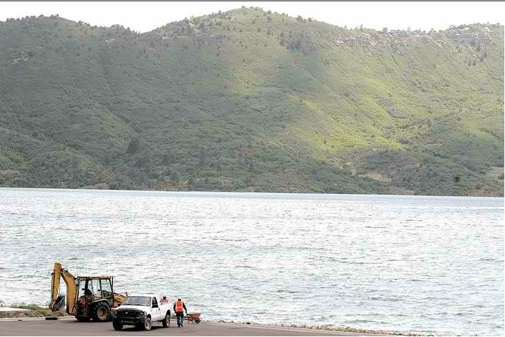
The water is rising at Lake Powell about a foot a day and by mid-August it is expected to reach an elevation of 3,665 feet — a level not seen since 2001. As of Wednesday, the measurements of flows from rivers that feed into Lake Powell show them at nearly 257 percent of average and half the snowpack is left to melt, according to the Bureau of Reclamation…

Overall, the 2011 water year has bumped storage at Lake Powell by nearly 2.2 million acre feet of water and rivers that feed into it are still running high. Measurements at the San Rafael River near Green River, for example, show it flowing at 1,430 cubic feet per second, when the average on July 6 typically is 194 cubic feet per second. That drastic difference puts it at a little more than 742 percent of average.

From the Colorado Springs Independent (Pam Zubeck):

If you drive up Pikes Peak Highway and circle the lakes, the dramatic drop in the water level is unmistakable. On the east end of South Catamount Reservoir, the lake bed is bone-dry for hundreds of yards in the same spot where a friend of mine and a buddy of his caught 136 fish on three outings in the first half of June. It’s the lowest my friend has seen South Catamount in at least a decade…

The entire Springs water system, which spans the Western Slope to Pueblo Reservoir and includes Pikes Peak reservoirs, currently is 76 percent filled. While that’s lower than last year’s levels, and also lower than normal levels, the relative shortfall stems from cool May temperatures that delayed runoff, Utilities spokeswoman Patrice Quintero says. That is expected to change soon with the snowmelt…

South Catamount Reservoir, a Great Depression project along with Crystal Reservoir further east, contains only 45 percent of its 848-million-gallon capacity, while nearby North Catamount, added in 1960, stands at 70 percent of its 3.9-billion-gallon capacity, says Abby Ortega, Utilities’ water resources planning supervisor. Both are fed by Pikes Peak runoff and via a pipeline from the Blue River System, near Hoosier Pass. So when Pikes Peak got only half the snow it normally does, the reservoirs took one hit. But the bigger one came from maintenance on Montgomery Dam on Hoosier Pass, which has required draining that reservoir. Ortega says the project is to be completed in September, and the Catamount reservoirs will fill as usual next May and June. In any event, the Catamounts are nowhere near their historic low of 21 percent capacity, which came in December 2002, amid a drought. There’s actually at least one more reason the lakes are lower than normal: lack of rain. Ortega says the city has received only slightly more than 3 inches this year, 30 percent of normal. In fact, the National Oceanic and Atmospheric Administration’s Drought Monitor describes portions of the Front Range, including Colorado Springs, as in a severe to extreme drought.

Drought news: DeWeese-Dye ditch on sections

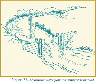
A picture named measuringwithweir.jpg

From the Cañon City Daily Record (Cari Canterbury):

Because of a shortage of water in Lake DeWeese, the DeWeese-Dye Ditch and Reservoir Company board has restricted water usage, beginning Monday. Secretary Dorothy Ormsby said Division 1 will receive water Mondays, Division 2 on Tuesdays, and Division 3 on Wednesdays. Unless there is significant rainfall this summer, the restrictions are expected to remain in place until mid-September.

Energy policy — nuclear: Cotter receives CDPHE permission to use impoundment pond at the Lincoln Park/Cotter Mill superfund site

A picture named lincolnparksuperfund.jpg

From the Cañon City Daily Record (Rachel Alexander):

“Everything you want to throw away is required by the Atomic Energy Control Act to go into the impoundments,” Cotter’s vice president of milling John Hamrick said. Hamrick said CDPHE has approved a method of solidifying the material using an oil-dry product that “looks like kitty litter”. He said the company put the solidified material into water to prove it would not dissolve…

[Steve Tarlton, radiation control project manager for the Colorado Department of Public Health and Environment] said the company is “de-watering” the impoundment, and eventually, there will be no water to leak if one exists. “Then, it will be capped so no liquid can get in,” Tarlton said. He also said the leaking materials are not leaving the site. There is a series of groundwater dams and barriers that stop groundwater from leaving the facility, and any water that reaches them is pumped back into ponds to be evaporated. Cotter estimates the old mill buildings will be completing down and disposed of in the inpoundment by fall.

More nuclear coverage here and here.

Colorado River basin: The Grand County Water Information Network is recruiting volunteer monitors

A picture named pullingwatersample.jpg

From the Grand County Water Information Network website:

The Grand County Water Information Network needs volunteers this summer to monitor lake clarity on Grand Lake and Shadow Mountain Reservoir. The Three Lakes Clarity Monitoring Program is part of a multi-year project designed to develop lake-clarity standards at the headwaters of the Colorado River. Monitoring takes less than an hour per week of your time and is your chance to help ensure that our lakes remain clear and healthy. With your invaluable help, we can develop a more accurate and comprehensive understanding of our lake. For more information, please contact Ben Carver or stop by our office at 610 Center Ave in Grand Lake. Read on to learn more about our monitoring programs, or here to find out about other volunteer opportunities.

More Colorado River basin coverage here.

Water treatment: H2O Innovation wins two contracts for membrane filtration systems in Colorado

A picture named membranetrain.jpg

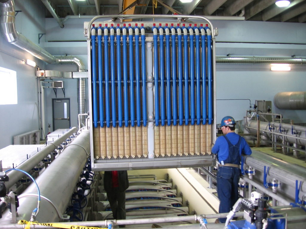
Here’s the release from H2 Innovation. Here’s an excerpt:

The Company will also deliver a brine minimization system for the East Cherry Creek Valley Water & Sanitation District’s Northern Water Supply Project in Colorado. This system will enhance permeate recovery from the District’s low-pressure reverse-osmosis drinking water production system, presently being assembled by H2O Innovation. The City of Sterling, Colorado, has also selected H2O Innovation to supply a nanofiltration membrane system that will produce softened water.

More water treatment coverage here.

Republican River basin: Stan Murphy retires from the Republican River Water Conservancy District, Debra Daniel will take over

A picture named republicanriversouthfork.jpg

From The Yuma Pioneer (Tony Rayl):

Debra Daniel, from Burlington, was recently hired from a field of 43 applicants to replace Stan Murphy as the General Manager for the Republican River Water Conservation District (RRWCD)…

Daniel has an agricultural background which includes four years as the executive administrator of the Irrigation Research Foundation in Yuma, and five years as the district manager for the Plains and East Cheyenne Ground Water Management Districts in Kit Carson and Cheyenne counties.

From The Holyoke Enterprise:

During his [6.5 years] with the district, Murphy and his staff implemented various federal well retirement programs to convert irrigated land to dryland and permanently retire the wells to assist the State of Colorado to get into compliance. More than 30,000 irrigated acres have been enrolled in these programs to reduce consumptive use and increase stream flow for future compact benefit.

Another project that Murphy has worked on is the $71 million Compact Compliance Pipeline to deliver ground water from a network of wells northeast of Wray to the North Fork tributary of the Republican River near the Colorado/Nebraska state line to help satisfy compact requirements. A general contractor for that pipeline project will be designated at the RRWCD Board meeting on July 14 in Holyoke, with plans to deliver water from that pipeline in fall 2012.

More Republican River basin coverage here and here.

Conservation: Pueblo water use is still well below levels prior to the 2002 drought

A picture named watersprinkler.jpg

From The Pueblo Chieftain (Chris Woodka):

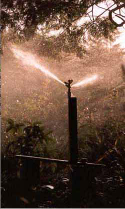
In the past, water usage for Pueblo routinely spiked above 50 million gallons per day without rain when temperatures approached the 100-degree mark. So far this year, that’s only happened twice — last Thursday and Saturday. Since the historic drought of 2002, Pueblo has not come close to its historic peak day of 63 million gallons. “What we’re tracking is close to 2006,” said Seth Clayton, finance division manager for the Pueblo Board of Water Works…

“There has been a drop of 16-17 percent since the drought and that doesn’t appear to be changing, even with as dry as it’s been,” Clayton said. The drop is partly because of a change in watering practices and increased use of Xeriscape techniques, particularly in newer homes, Clayton said. The increased use of water should help the water board meet its projected revenues of $20.5 million, about two-thirds of annual water revenue for the board. The estimate was based on 8 billion gallons of use, a drop from 2010. Right now, Pueblo is on track to use 8.5 billion gallons, but that could change with more rain.

More conservation coverage here.

Animas-La Plata Project: Reclamation wraps up Lake Nighthorse first fill

A picture named lakenighthorseafterfirstfill.png

From The Durango Herald (Dale Rodebaugh):

The Bureau of Reclamation has pronounced the reservoir full at 123,541 acre-feet. The reservoir is a key component in the Animas-La Plata Project, which Congress authorized 43 years ago.

More Animas-La Plata Project coverage here.

Custer County: Committee recommends against signing up for Upper Arkansas Valley Water Conservancy District augmentation plan

A picture named wetmountainvalley.jpg

From the Wet Mountain Tribune (Nora Drenner):

The ad hoc committee determined there is no immediate need for any new water augmentation in the county. The committee used U.S Census Bureau statistics to determine there would be no need for any new water augmentation plan within the next ten years. The projected growth the unincorporated portion of the county for the next ten years, said the committee, is 63-to 99 new households, which is less than two percent a year.

Also, said committee members, the trend for those newcomers is to buy existing homes instead of vacant land, according to recent Custer County Sales Transaction History statistics.

In conclusion, the ad hoc committee said they would be making recommendations to the county commissioners:

–The county continue to work with the Upper Arkansas Water Conservancy District to address potential water needs and to insure county conditions are included in any new augmentation plan being considered.
–The commissioners become more informed and proactive in regards to local water issues.
–The commissioners convene the ad hoc committee as needed to re-evaluate the situation.
–The commissioners continue to support the current U.S. Geological Survey organization’s survey of some 60 wells in the county.

Those recommendations will be presented during the commissioners meeting slated for…Thursday, June 30.

More Custer County coverage here.

Fort Morgan: City council will likely form committee to explore funding for stormwater projects

A picture named detentionpond.jpg

From The Fort Morgan Times (Jenni Grubbs):

At their regular meeting next week, Fort Morgan City Council members likely will establish an ad hoc committee to study and put together some sort of financing mechanism for city voters to consider for dealing with financing stormwater infrastructure. That was what came out of the discussion the council members had Tuesday night about how to pay for needed stormwater system upgrades, as well as system maintenance. Several months ago, the members of the Fort Morgan City Council listed the stormwater system improvements as a major need for the city at their brainstorming session. Studies are currently underway by outside design contractors for the northwest and south quadrants of the city, and public meetings have been held to discuss the findings and possible plans. Those studies have made it clear to council that millions of dollars would be needed for long-term infrastructure upgrades that would alleviate all storm-related flooding in the city…

Current estimates have the total cost of infrastructure projects at around $50 million. The very preliminary cost estimates Curtis has received from the contractor for the big version of the possible northwest quadrant project was $3 million to $6 million. Figures weren`t known on a possible south quadrant project…

They settled on the idea of creating an ad hoc committee that likely will include council members and citizens to study the issue in-depth and create a plan of action, possibly including a ballot issue or ballot issues for a 2012 general election. The issue of creating a study committee will likely be on the agenda next week as a regular item.

More stormwater coverage here and here.

Energy policy — nuclear: Energy Fuels plans to spend $1 million over the next 18 months in preparation to process uranium at the proposed Piñon Ridge Mill

A picture named pinonridgesite.jpg

From The Durango Telegraph (Will Sands):

The Toronto-based uranium and vanadium mining company received approval from Colorado regulators for Piñon Ridge in January. The company plans to site the mill in the middle of Western Colorado’s uranium belt on 1,000 acres of privately owned land not far from the Dolores River. The facility would be the nation’s first uranium mill in a quarter century and located close to the only other operating mill in the country, the White Mesa Mill in Blanding.

However, Piñon Ridge faces its share of opposition. The Telluride-based Sheep Mountain Alliance has filed a lawsuit that could derail the facility. The suit contends that Colorado regulators violated the Atomic Energy Act by not allowing the public to ask technical questions about the project and is being heard in Denver District Court. In addition, SMA and Colorado Citizens Against Toxic Waste, a citizens group in Cañon City, have asked the EPA to withhold its approval of the mill’s construction plan until Clean Air Act regulations can be brought up to speed. The 1989 Clean Air Act allows radioactive uranium tailings to be dumped without protections or emissions limits.

“We cannot afford the dangers of uranium milling and mining of the past to be repeated again on the Western Slope,” said Hilary White, executive director of Sheep Mountain Alliance.

However, Energy Fuels is confident that Piñon Ridge will become a reality after the company prevails in court. The company closed on an $11.5 million loan in March, has plans to break ground on the mill in the near term and is actively acquiring mines and unearthing ore not far from Paradox Valley…

Energy Fuels already owns two mines with vast uranium and vanadium resources – the Whirlwind and Energy Queen mines, just across the Colorado border in Utah. The company now plans to purchase abandoned uranium mines in the vicinity of Paradox Valley, bring them into compliance and use them to feed Piñon Ridge…

Energy Fuels plans to begin construction on the facility in 2012 and have the mill operational early in 2013.

More nuclear coverage here and here.

Colorado River basin: Mitigating further declines to the riparian and stream environment from transmountain diversions in the upper river watersheds

A picture named eisenhowerfishing.jpg

A while back Trout Unlimited signaled pretty strongly that the Moffat Collection System Project and the Windy Gap Firming Project were in for a fight, even as Denver Water and Northern Water were making efforts to appease west slope concerns with increased diversions from the upper Colorado and Fraser rivers. Despite the historic agreement between Denver Water and west slope water wonks and the recently announced Colorado Division of Wildlife approval for mitigation there may be a long battle ahead for the two Front Range providers to move more water through the Adams and Moffat tunnels.

Here’s a guest commentary about new proposed diversions from Drew Peternell running in The Denver Post. Here’s an excerpt:

Earlier this month, Denver Water and the Northern District presented to the Colorado Wildlife Commission plans to mitigate the impacts of their projects. While the plans do include some meaningful provisions, they do not go far enough.

First, under the proposed mitigation, Denver can divert from the Fraser River even when diversions violate stream temperature standards designed to prevent fish mortality.

Second, the increased diversions could eliminate the spring high-water flows necessary to flush stream channels of sediment, which is choking many stretches of the river to death.

Third, the mitigation plans do not include a bypass of Windy Gap Reservoir, a measure that would reduce rainbow trout whirling disease and significantly improve conditions in the Colorado River downstream of the reservoir.

And fourth, while the mitigation plans include some funding for habitat projects to adapt the streams to the new, lower flow reality, the dollar figures fall short of what is needed by nearly $10 million, according to estimates by independent restoration contractors.

Yes, protecting the health of the upper Colorado River basin from the impacts of the proposed water diversions requires money. And $10 million may sound like a lot. But for Denver Water customers, it would be less than $1 a year per household, according to an analysis by Western Resource Advocates.

Denver Water and the Northern District won’t have to pay a nickel for the water they propose to take from the upper Colorado River basin, and they refuse to pony up the money needed to offset the impacts of their diversions, arguing that their customers won’t tolerate the rate increase.

Is saving our state’s namesake river worth a buck a year to you?

More Colorado River basin coverage here.

Colorado River Basin: Secretary Salazar honored for his work divvying up the river and leaving some water for the fish as well

A picture named coloradoriverbasin.jpg

From the Summit County Citizens Voice (Bob Berwyn):

…the American Whitewater and the Colorado River Outfitters Association presented Salazar with an engraved paddle at a private ceremony in Washington, D.C. last week. The following message was engraved on the paddle: “Thanks for navigating the process of balancing the needs of fish, wildlife and people.”

“We need to find a way to balance the little water we have to meet the needs of people, recreation and the fish that depend on the river,” said Dave Costlow, with the Colorado River Outfitters Association. “It’s all about finding the right balance and as the Secretary says, choosing ‘consensus over controversy.’”

More Colorado River basin coverage here.

Wastewater: Garney will build the new Metropolitan Wastewater Reclamation District treatment plant near Brighton

A picture named wastewatertreatmentprocess.jpg

From Utility Infrastructure Management:

Garney is teamed with CH2M Hill as the design-builder for the 24 mgd Northern Treatment Plant, which will be part of the Metro District’s service to about 1.7 million people. Existing facilities are expected to soon reach capacity, according to Metro District Manager Catherine R. Gerali, but the new facility in the in the northern metropolitan Denver region will be one of the most advanced in the western United States. The plant is expected to be fully operational by December of 2015.

In Colorado Springs, Garney will construct approximately 6.4 miles of 66-inch steel pipeline, a portion of the Southern Delivery System (SDS) Raw Water Transmission Pipeline. Once completed, the SDS will bring water from the Arkansas River to Colorado Springs, Fountain, Security and Pueblo West, ensuring uninterrupted water for homes and businesses, even as other aging pipelines require repair. Water delivery from SDS is expected to begin in 2016.

More infrastructure coverage here.

Restoration: Grand Canyon controlled floods effects are short-lived, the river requires constant attention

A picture named glencanyondam030508

From the Arizona Republic via Arizona Central:

One of the lessons of the first three floods was that the effects are short-lived. The river requires constant attention, with more-frequent floods and monitoring, said Martha Hahn, chief of science and resource management at Grand Canyon National Park. “It’s not the high flows themselves; it’s what you do in between that’s important to the resources,” she said. Scientists need to watch what happens along the beaches, in the habitats and to the native species, such as the endangered humpback chub. Using an adaptive management, or “learning by doing” approach, researchers can react to the effects of each flood. Scientists have learned that the 2008 flood helped the survival of non-native rainbow trout, a predator of young humpback chub. The amount of sand brought in by tributaries is also critical, researchers found. The high flows not only leave sand along some stretches of the riverbank, they can wash it away along others. If there is too little sand and sediment to begin with, the benefits could be eroded away.

The experimental floods have caused problems for power companies that buy and distribute electricity generated by Glen Canyon Dam. A limited amount of water can be released each year from the dam, based on agreements among the seven states that rely on the Colorado River. When higher volumes are released all at once, less water is available for power production at other times of the year, resulting in lost revenue. The Western Area Power Administration, which markets and delivers electricity from Glen Canyon, estimated that changes in operations at the dam since the experiments began have cost power companies and customers about $50 million a year.

Click through for the cool photo of Grand Falls in the canyon of the Little Colorado River.

Southern Delivery System update: Colorado Springs Utilities is taking the first group of easement holdout Pueblo West property owners to court

A picture named sdspreferredalternative.jpg

From The Pueblo Chieftain (Chris Woodka):

“As a real estate broker, I can see they’re misleading the public on what they’re doing, and I don’t have a problem saying that,” said [Pueblo home builder and real estate broker ] Branson Haney, who owns two undeveloped lots along the SDS route. “The threat of eminent domain has always been on the table, and they have never entered negotiations.”

Colorado Springs Utilities took the first group of holdouts in Pueblo West to court last week. The easements are needed for a 10-foot deep trench through Pueblo West along the route of a 66-inch diameter pipe that will be buried and carry water from Pueblo Dam to El Paso County as part of the SDS project…

In most cases, the amount of compensation has been the issue, although a few involve sorting out liens against the properties…

After his court hearing Tuesday, Haney wrote a letter to Pueblo County commissioners saying Colorado Springs has violated a section of the 1041 agreement in the Pueblo West land negotiations. Specifically, one of the conditions states that there will be “no out-of-pocket expense” to landowners…

Haney said he supports SDS because he believes it has benefits for Pueblo West and Pueblo, but is dissatisfied with how property owners have been treated.

More Southern Delivery System coverage here and here.

Runoff news: Flood advisories in effect for the Elk, Big Thompson, Colorado and Cache la Poudre rivers

A picture named flooddss07022011

From the Associated Press via the Columbus Republic:

The weather service says melting snow and recent rainfalls have caused high water levels along the Elk River, which will remain at or above stage through Friday. Flood advisories have been issued for the Big Thompson River above Lake Estes, the Colorado River near Kremmling, the Cache La Poudre (kash-luh-POO’-der) River and the Eagle River.

Native trout restoration project on Hermosa Creek

A picture named cutthroattrouthistoricranges.jpg

Here’s the release from the Colorado Division of Wildlife:

A major initiative by the Colorado Division of Wildlife to restore the native Colorado River cutthroat trout to the San Juan mountains will begin this summer in the upper Hermosa Creek drainage about 35 miles north of Durango.

The three-year project is a cooperative effort of the Division of Wildlife and the U.S. Forest Service, and part of a larger multi-state and agency effort to restore Colorado River cutthroat trout to more of its historic range.

Colorado River cutthroat are native to the Colorado River Basin.

The project will be explained to the public at an open house from 4-8 p.m., July 13, at the Durango Recreation Center’s Windom Room.

“Upper Hermosa Creek offers an excellent location for a native trout recovery project,” said Jim White, aquatic biologist for the Division in Durango. “The area is a big, complex network of tributaries and a main stem river with excellent water quality and trout habitat. The limestone geology is favorable for trout and the area is easily accessible to field crews and anglers.”

Wildlife biologists identified the Hermosa Creek area as a prime spot for restoration about 20 years ago. In 1992, a similar project restored native cutthroats on four miles of the creek’s upper East Fork.

This summer’s project will begin the process to reclaim about nine miles of Hermosa Creek at its headwaters. This phase is expected to take two years to complete, White said. The next phase will connect the main stem of Upper Hermosa Creek to the East Fork of Hermosa Creek. All in all, the full project is expected to last three to five years. When completed, Colorado River cutthroat trout will inhabit more than 20 miles of the Hermosa Creek drainage

Colorado River cutthroat trout currently occupy only a small portion of their historic range. Over-harvest, decline in water quality and the introduction of non-native trout starting in the 1850s nearly wiped out the native fish. Fortunately, Division biologists found remnant populations in Colorado, established brood stocks, and the species is now sustained through habitat protection, hatcheries, and stocking. The goal of the Division’s native trout program is to create sustainable wild populations of cutthroat trout to provide for the long-term survival of the species.

The Colorado River cutthroat trout is listed as a state species of concern; environmental groups have petitioned for it to be listed under the federal Endangered Species Act. The Division hopes that successful restoration programs will eliminate any need to consider listing the fish.

Eliminating non-native fish from Upper Hermosa Creek is the first step of the process. The Forest Service constructed a waterfall barrier on the creek near Hotel Draw last summer that will prevent non-native fish from swimming upstream into the newly reclaimed habitat. In early August, water above the barrier will be treated with Rotenone, a chemical derived from a tropical plant root which is also commonly used as an organic insecticide for roses. Rotenone, an EPA-registered pesticide, will kill the existing fish, mostly brook trout. The chemical is fast-acting, only affects aquatic species, leaves no residue and degrades quickly. Rotenone has been used for decades in fisheries management throughout North America and poses no threat to human health.

Before the treatment, the Division of Wildlife will capture some of the fish in the creek and move them to spots below the treatment area.

Because upper Hermosa Creek comprises a complex system, the water will be treated again in the summer of 2012 to assure that non-native fish are no longer present. This section of the creek will be restocked with native cutthroats in late summer 2012.

The project will result in a temporary loss of fishing opportunity. Plenty of places to fish, however, are available below the barrier and in other nearby waters.

In the third year of the project, another barrier will be built at the confluence of Hermosa Creek and East Hermosa Creek to allow for chemical treatment on the final section. Two years of treatment also will be required for this reach. Restocking with native trout is expected to occur there in late summer of 2014.

Another restoration project is planned for the Woods Lake area in San Miguel County on the north slope of the San Juan mountains this summer

Both areas will accommodate large numbers of fish. These “metapopulations” provide defense against disease outbreaks and other threats, such as wild fires, that can quickly wipe out small populations.

“While we truly regret the inconvenience to anglers, we want to remind folks that these measures are necessary to maintain Colorado’s native trout,” White said. “There are many miles of streams in this area to fish including the East Fork of Hermosa Creek and below Hotel Draw. And in a couple of years, people will be able to fish for native cutthroats in all these creeks.”

For more information, contact White at j.white@state.co.us, or (970)375-6712.

To learn more about fisheries management in Colorado, see: http://wildlife.state.co.us/Fishing.

What: Open house to explain Colorado River cutthroat trout restoration on Hermosa Creek
When: 4-8 p.m., July 13
Where: Durango Recreation Center, Windom Room
Information: Jim White, (970)375-6712; j.white@state.co.us


More Hermosa Creek coverage here.

Colorado State Parks turns up only two boats with invasive mussels attached out of 50,000 inspected so far this season
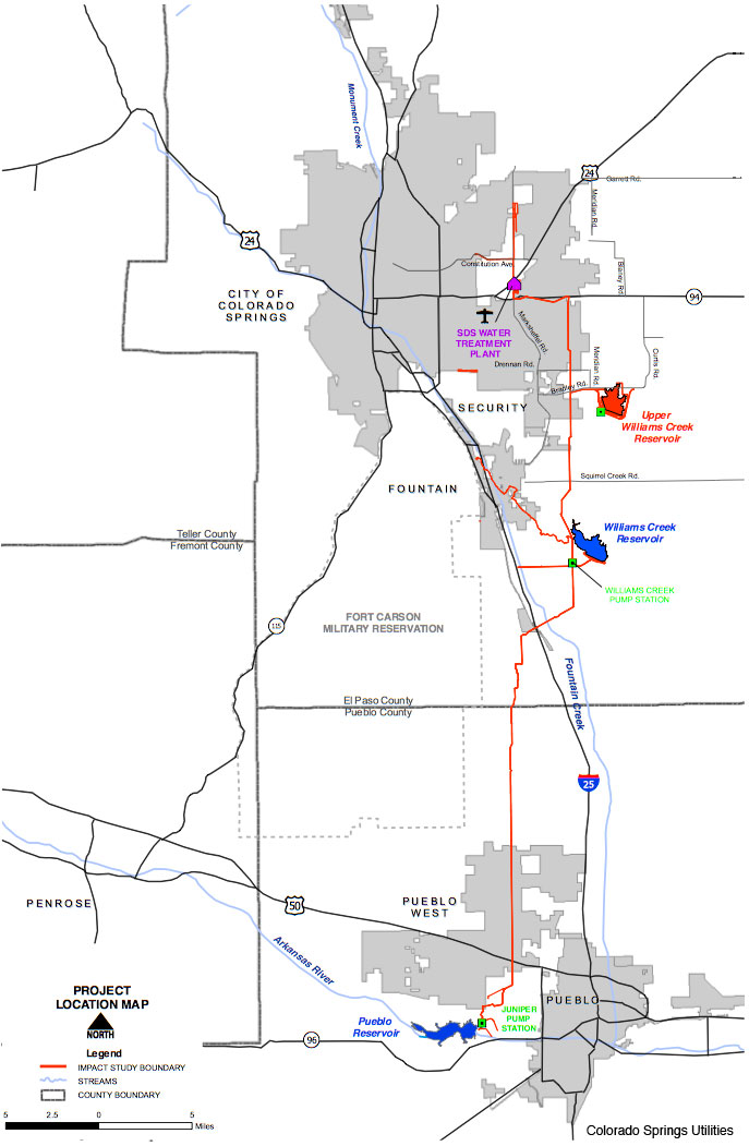
A picture named zebramusselinfestation.jpg

From The Pueblo Chieftain (Chris Woodka):

“Educating boaters about the risks of (invasive species) and how to check your boat has been a high priority for several years and it’s paying off,” [Gene Seagle, aquatic nuisance species coordinator for Colorado State Parks] said. “Most boaters arrive at the reservoirs in state parks already knowledgeable about ANS and how to check your boat.”[…]

The two out-of-state boats with adult quagga mussels attached were found at Crawford Lake State Park in May and Jackson Lake State Park in June…

Evidence of zebra mussels — in the form of larvae called veligers — was first found in Lake Pueblo in late 2007. In the next year, zebra and quagga veligers were found at other sites. No new water samplings have shown evidence of the clamlike creatures which can overpopulate lakes and clog water pipelines.

More invasive species coverage here and here.

Drought news: Beulah residents under watering restrictions

A picture named usdroughtmonitor06282011

From The Pueblo Chieftain (John Norton):

Both the Pine Drive Water District and the Beulah Water Works District put on restrictions this week to conserve dwindling supplies of water in their storage tanks. Customers of the two systems will be limited to in-house water use. Gary Kyte, chairman of the Pine Drive operation, said that in 2002, the district had to impose even stricter rules that limited even in-house water use, but the situation has not gotten that bad yet…

Bill Hower, chairman of the Water Works District, said that the restriction is a precaution. The system, which serves 165 taps, gets its water from Middle Creek and water is still running. “We still have good water at the head gate,” he said. “But it’s an unknown factor how long that’s going to last.”

Flaming Gorge Task Force: There are a lot of questions around Colorado’s role in building the project

A picture named flaminggorgepipelinemillion.jpg

From The Pueblo Chieftain (Chris Woodka):

On a 14-member committee that this week recommended forming a task force to look at a potential statewide project — a 570-mile pipeline from Flaming Gorge Reservoir in Wyoming to Colorado’s Front Range — half were members of the Interbasin Compact Committee. Still, the group favored a bottom-up approach to look at the problem, rather than a top-down method — acknowledging that a familiar cast of characters might ultimately be named to the task force…

The Arkansas Basin Roundtable became alarmed in 2009 when Eric Kuhn, general manager of the Colorado River District, pointed out that if things got tough, energy companies have better water rights than the Fryingpan-Arkansas Project and other transmountain diversions, Barber explained. That paints a big target on irrigated agriculture in the Arkansas Valley, [Gary Barber, chairman of the Arkansas Basin Roundtable] said…

In the last decade or so, Aurora completed its purchase of nearly all of the Rocky Ford Ditch, speculators bought one-fourth of the Fort Lyon Canal, the Pueblo Board of Water Works bought one-fourth of the Bessemer Ditch and Woodmoor Water and Sanitation is attempting to take water from several agricultural enterprises. “Our agriculture is on the chopping block,” Barber said. “It’s too easy to dry up the valley’s agriculture than to look at projects like (Flaming Gorge).”

Western Slope interests still are trying to steer the Front Range away from any trans-Continental Divide project, even if the water comes from Wyoming. Kai Turner, a Rio Blanco County Commissioner, reminded the group that Western Slope participants on a task force in no way meant an endorsement of the Flaming Gorge plan. “It feels like this is premature and there’s a big push to steamroll us,” Turner said. Later in the meeting, Turner asked the group to consider looking at a bigger project that would bring water into the state from the east, presumably a pipeline from the Missouri River or Mississippi River — far more expensive and politically complicated options that have yet to gain traction. “Any transmountain diversion is a short-term solution to a long-range problem,” Turner said. “We need a federal project that solves all the problems.”[…]

Aurora Water Director Mark Pifher, another familiar face at state water meetings and an IBCC member, summed up the process of forming a task force as another unavoidable battle in the water wars. “I’m not sure we’ll avoid people coming to this table without some baggage,” Pifher said.

More Flaming Gorge pipeline coverage from Chris Woodka writing for The Pueblo Chieftain. From the article:

Million is taking a new tack with the project, looking to permit it under the Federal Energy Regulatory Commission rather than the U.S. Army Corps of Engineers. The Corps process originally was to take 33 months, but that stretched into more than five years after a scoping process. Million estimates about $5 million has been spent on studies of the project so far, and $8 million to $12 million more could be needed to complete the Corps study of what would be a multibillion-dollar project…

There are still legal water rights issues, environmental objections and worries that other state allocations under the 1922 Colorado River Compact would be affected. Million’s position is complicated because a Colorado-Wyoming Coalition of water users also is studying its own version of a Flaming Gorge pipeline. The coalition is working the Bureau of Reclamation, which has recently modeled climate change in the Colorado River basin, to see how a pipeline would affect water levels in Flaming Gorge Reservoir…

“I have high hopes for a Flaming Gorge task force,” Million said. “We’ll share information. We’ve tried to look at everything we could over the last five years.”

More Flaming Gorge Task Force coverage here.