Sportsman for Responsible Energy Development is calling for federal hydraulic fracturing disclosure rules

gelledhyrdraulicfracturingfluid.jpg

From the Associated Press via The Columbus Republic:

Sportsmen for Responsible Energy Development is calling on the Bureau of Land Management to make sure water, fish and wildlife are protected when oil and gas wells are developed on public lands. The proposed federal rules would require public disclosure of the chemicals in fracking fluids used in drilling.

Here’s the link to the report, Hunting and Fishing Imperiled.

More oil and gas coverage here and here.

On Thursday CDPHE is hosting the first public meeting for decommissioning the Cotter Mill near Cañon City

cottermillcontaminationconcerndenverpost10232011

From The Pueblo Chieftain (Tracy Harmon):

The meeting, to be hosted by the Colorado Department of Public Health and Environment, is scheduled from 6 to 8 p.m. at Garden Park High School, 201 N. Sixth St. The meeting will focus on the conceptual design for a new evaporation pond, on-site soil excavation, soil remediation criteria and groundwater characterization…

Cotter officials indicate in their report that preliminary assessment of radiological soil cleanup criteria designed to meet the higher standards could mean the potential of cleanup of vast amounts of uneven soils, environmental degradation across much of Cotter property, negative environmental impacts to adjacent lands, increased risks to public health and excessive cost. In relation to the groundwater characterization, Cotter proposes to use 10 water monitoring wells, one of which is at the neighboring Shadow Hills Golf Course, to test contamination levels.

The reports to be focused on at the meeting can be downloaded at www.cdphe.state.co.us/hm/cotter/index.htm or at the Royal Gorge Regional Museum and History Center, 612 Royal Gorge Blvd. which is open from 10 a.m. to 4 p.m. Wednesday through Saturday.

For those who cannot attend the meeting, written public comments will be accepted through Feb. 17 and can be mailed to Steve Tarlton, CDPHE, 4300 Cherry Creek Drive South, Denver, CO 80246 or emailed to steve.tarlton@state.co.us.

More Lincoln Park/Cotter Mill superfund site coverage here and here.

Colorado Water 2012: The water footprint of a cup of coffee is 35-55 gallons

coloradowater2012

From The Pueblo Chieftain (David Hartkop):

Did you know, for instance, that one cup of coffee actually requires between 35-55 gallons of water to produce? So says National Geographic and a carefully compiled study by the United Nations Educational, Scientific and Cultural Organization (UNESCO)…

For it to make sense, one must track that cup of coffee all the way back to the wilds of a coffee plantation in Guatemala. Coffee is grown on trees and picked as plump red cherries. This requires varying levels of irrigation, depending on the local rainfall. Irrigating a plantation is no small business, especially considering that each coffee tree only produces one pound of coffee per year. The cherries are then picked and the seeds (what we call coffee “beans”) are extracted by pulping the fruit.

The coffee beans are then washed in clean water to remove the pulpy remnants. Washing, again, is no small process. It may take several hundred gallons to flush the pulp away from a mere 100 pounds of beans. The washed beans are then spread out to dry. When we receive coffee beans, they are dry green pellets. As dry as they may seem, each green coffee bean contains a further volume of hidden water. One hundred pounds of green coffee becomes only 88 pounds once roasted. The 12 percent loss in weight is actually due to water released as steam from the beans during the roasting process.

More Colorado Water 2012 coverage here.

2012 Colorado legislation: Graywater bill dies in committee

graywatersystem.jpg

From the Northern Colorado Business Report:

Lawmakers in the State, Veterans and Military Affairs Committee voted 5-4 to quash the measure late Wednesday, according to a statement from state House Democrats. Introduced by Rep. Randy Fischer, D-Fort Collins, the bill aimed to create a legal definition of graywater, which comes from showers and sinks.

Graywater can be used for toilet flushing, outdoor irrigation and other purposes. Currently classified as wastewater that cannot be legally reused in Colorado, graywater is used in homes and businesses in other Western states, according to House Democrats.

The bill would have ordered the state Water Quality Control Commission to enact public health guidelines that promote its use.

More 2012 Colorado legislation coverage here.

Downstream Neighbor 2012 Symposium: Maude Barlow keynote now online at Vimeo

coloradowater2012

Here’s the link to the video of Maude Barlow’s keynote presentation from the Downstream Neighbor 2012 Symposium.

More Colorado Water 2012 coverage here.

Colorado State University Professor Named the 2011 Aldo Leopold Memorial Award Winner

aldoleopold.jpg

Here’s the release from Colorado State University (Kimberly Sorensen):

The Wildlife Society’s highest honor, the Aldo Leopold Memorial Award, has been awarded to Kenneth P. Burnham, professor emeritus from the Department of Fish, Wildlife, and Conservation Biology at Colorado State University. The award recognizes individuals who have made significant contributions to wildlife conservation.

CSU’s Department of Fish, Wildlife, and Conservation Biology (FWCB) has the distinction of now having four faculty honored with this award. The others are:

1973 Gustav A. Swanson, Professor Emeritus (deceased)
2000 Gary C. White, Professor Emeritus
2004 David R. Anderson, Professor Emeritus

Burnham and Anderson were also U.S. Geological Survey scientists in the Colorado Cooperative Fish and Wildlife Research Unit, a unit within FWCB. All have been recognized with numerous awards for their scientific and academic accomplishments, and they continue to actively enrich the profession and Department of Fish, Wildlife, and Conservation Biology.

Burnham began his career as a statistician for the U.S. Fish and Wildlife Service, and later as an area statistician for the USDA Agricultural Research Service in the southeast United States.

Burnham’s early research produced a wide variety of statistical methods used by ecologists around the world. These methods had a profound impact on the science behind numerous monitoring programs, including the northern spotted owl, endangered desert tortoise, endangered fish on the Colorado River, salmon passage through hydro dams on the Columbia River, and assistance in planning and conducting the 2000 U.S. Census.

Starting in 1988, and for the next 21 years, Burnham held the position of assistant unit leader for the Colorado Cooperative Fish and Wildlife Research Unit at CSU. His work led to effective insights into a broad range of biological systems in many places throughout the world.

Over his 40-year career, he has nearly 200 scientific publications, and these works have been cited more than 17,000 times by wildlife professionals, ecologists, and statisticians around the world.

Ultimately, his scientific contributions have had an enormous impact on a wide range of management and research programs in numerous countries across the globe.

Aldo Leopold is considered the “father” of wildlife science and is one of the great conservationists from the first half of the 20th century.

Following Leopold’s death in 1948, the Wildlife Society annually awards an individual the Aldo Leopold Memorial Award in his honor. The Wildlife Society, founded in 1937, is a professional, international, non-profit scientific and educational association dedicated to excellence in wildlife stewardship through science and education.

More endangered/threatened species coverage here.

CWQCC: Proposed nutrient standards have southwestern municipalities worried about costs for implementation

bluegreenalgaebloom.jpg

From The Durango Herald (Dale Rodebaugh):

A Durango attorney involved in the process says region-specific nutrients standard makes more sense than the blanket regulations for nitrogen and phosphorus that are being proposed for Colorado. If a one-size-fits-all standard is adopted it won’t improve water quality in the Animas River but will cost Durango $19.7 million in capital costs alone, Jeff Kane, of Maynes, Bradford, Shipps & Sheftel said.

Cortez would face a $3.1 million bill, Kane told the Southwestern Water Conservation District board on Wednesday. Bayfield would be looking at $2.4 million in upgrades while it would cost the Pagosa Springs Water and Sanitation District $14.6 million and the town of Telluride, $7.4 million…

Communities that treat wastewater in lagoons don’t fall under the new regulations. Among them are Silverton, Mancos, Hermosa, Durango West and Edgemont Ranch Metropolitan District…

At the March meeting, commissioners will address two issues – Regulation 31 that sets limits of 0.11 parts per million for phosphorus and 1.25 ppm for nitrogen – in cold-water streams and Regulation 85 that mandates new nutrient removal technology…

The heaviest nutrient loads are found in the Platte, Arkansas and Poudre rivers downstream from large Front Range urban areas, Kane said. Agricultural operations produce very little contamination, he said…

Gunderson said 135 of the 391 waste dischargers in the state account for 95 percent of effluent. One discharger, Metro Wastewater Reclamation District in Denver, alone accounts for one-third of the 95 percent, he said.

More wastewater coverage here.

Water 2012 Book Club: ‘The Colorado River Flowing Through Conflict’ discussion online now at Your Colorado Water Blog

thecoloradoriverflowingthroughconflictcoverpetermcbridejonathanwaterman.jpg

Here’s the link to Ted Kowalski’s (CWCB) comments about the book. Be sure to get in on the discussion by clicking on the the comments section below the post.

The Colorado Water 2012 Book Club page also has three sneak peeks at unpublished books that are part of the book club selections.

More Colorado Water 2012 coverage here.

Longmont: Open house today to discuss the city’s options with respect to oil and gas exploration and production regulations

prideoftherockiesmilllongmontmuseum.jpg

From the Longmont Times-Call (Scott Rochat):

On Monday afternoon, city officials will hold an open house to discuss options for regulating the oil and gas industry, including the controversial practice of “fracking” or hydraulic fracturing, a drilling method which reaches deep deposits by creating minute fractures in the rock. After the open house, Longmont’s water board, parks board and Board of Environmental Affairs will meet jointly to give their advice. But there’s one tricky area. The regulations all those groups are advising on still don’t completely exist. A first draft of the new regulations won’t be done until at least Feb. 10, as Longmont’s staff feels its way past Colorado Supreme Court decisions, possible legislative action, and the limits set by the Colorado Oil and Gas Conservation Commission, the state’s regulating authority…

The open house will run from 4:30 p.m. to 6:30 p.m. Monday in the lobby of the City Council chambers, 350 Kimbark St. The joint board meeting, held in the council chambers, will start at 7 p.m.

More oil and gas coverage here and here.

Runoff news: Below average streamflow is the current forecast for the Uncompahgre River

uncompahgrewatershed.jpg

From the Montrose Daily Press (Elaine Hale Jones):

…as far as predicting the weather, statistics gathered in January and February typically tell the story for the remainder of the year. “So far, things look dry for the future,” said Dan Crabtree, water management group chief for the Bureau of Reclamation in Grand Junction. “We’re right on the cusp of being below average in precipitation.”

The Uncompahgre Valley is part of the Gunnison River Basin, which encompasses 8,000 square miles and extends from the Continental Divide to Grand Junction, where it joins the Colorado River. The major water development feature in the basin is the Aspinall Unit of the Colorado River Storage Project (the Blue Mesa, Crystal and Morrow Point reservoirs). Other water-development projects in the area include the Dallas Creek Project (Ridgway Dam and Reservoir), Silver Jack Reservoir and Taylor Park Reservoir, all administered by the federal Bureau of Reclamation.

The Northwest Colorado Council of Governments has released a report about the importance of water to Colorado’s headwaters counties

coloradotransmountaindiversionscu.jpg

From The Aspen Times (Scott Condon):

Pitkin County provides an estimated annual average of nearly 99,000 acre-feet via transmountain diversions to the Eastern Slope, according to the study, “Water and Its Relationship to the Economies of the Headwater Counties.” To put that amount into perspective, Ruedi Reservoir holds slightly more than 100,000 acre-feet. Among the headwater counties along the spine of Colorado’s Rocky Mountains, only Grand County loses more than Pitkin County through diversions. It supplies 307,500 acre-feet annually. Summit and Eagle counties are well behind Pitkin County in water diverted to the Eastern Slope. Gunnison and Routt counties are virtually untapped.

The mountain counties don’t want to suffer environmental or economic consequences from future diversions. An association that lobbies on their behalf, the Northwest Colorado Council of Governments, commissioned the study to show how vital adequate water supplies are not only to the mountain communities but also to the entire state…

The study isn’t intended to pit the mountain headwater counties against the Eastern Plains, said author Jean Townsend of the Denver firm Coley/Forest Inc. The headwater counties are simply saying, “There’s an economic impact to us, too,” she said. Pitkin County and the other headwater areas depend on streamflows for fishing, camping and boating activities. Townsend also noted that Aspen has a worldwide appeal. Its economy is built partially on real estate sales and service to second-homeowners. About 47 percent of homes in Pitkin County are owned by out-of-state residents…

A second message is that Colorado’s economy as a whole is dependent on a healthy mountain environment. The mountains not only draw people to the state and support a strong tourism industry, they also make Denver and the rest of the Front Range more attractive for businesses.

More transmountain/transbasin diversions coverage here.

Profile: Vena Pointer — Colorado’s first female water lawyer

Vena Pointer, Colorado’s first female water attorney via The Pueblo Chieftain.

At the Colorado Water Congress annual convention a couple of weeks ago Tom Cech spoke about Vena Pointer. Here’s a profile of Pointer from Chris Woodka writing for The Pueblo Chieftain. Click through and read the whole article. Here’s an excerpt:

Vena Pointer was the state’s first female water lawyer, an original member of the Colorado Water Conservation Board and Pueblo’s only woman lawyer when she retired in 1960. She died at a Pueblo nursing home on Dec. 6, 1971, at the age of 91. Her accomplishments recently were recalled by Tom Cech, who is director of the water center at Metro State College of Denver and who has co-authored a history of the CWCB with former CWCB director Bill McDonald. They spoke at the Colorado Water Congress convention last month.

Miss Pointer — she never married — was born in Republic County, Kan., in 1880, and after graduating from high school attended Kansas Wesleyan College business school. She became a stenographer and moved to La Junta in 1911, working for lawyer George Wallis.

She passed the Colorado Bar examination in 1926, and was the last person in Colorado admitted to the bar under “clerkship” — reading the law under a lawyer’s supervision, rather than attending law school. She read the law for seven years in preparation. She was a law partner with Fred Sabin, and they moved their law offices to Pueblo in 1927. When Sabin died in 1931, she became affiliated with A.W. McHendrie, a Pueblo lawyer who also was an authority on water law.

Miss Pointer was secretary of the Arkansas Valley Ditch Association 1919-1959, and was Pueblo County public administrator from 1944-46. In 1933, she was appointed to the Caddoa Commission by Gov. Edwin C. Johnson, and served for more than 20 years on the board of directors. The commission lobbied for and oversaw the construction of what is now John Martin Reservoir.

More water law coverage here.

Snowpack news: Middle Park — about 75% of average, statewide — 71%

snowpackcolorado02022012

From the Sky-Hi Daily News (Tonya Bina):

“I do recommend a snow dance,” said Mark Volt of the USDA Natural Resources Conservation Service in Kremmling. In this year’s first measurement of high-elevation snowpack on Feb. 1, the high country above Middle Park has about 75 percent of the 30-year average snowpack. Although this measurement is slightly better than the rest of the state, “the longer we go, the more storms it will take to make it up to normal,” Volt said…

The snow density is averaging 22 percent, meaning for every foot of snow contains about 2.6 inches of water…

So far, no low-snowpack records have been set this season in Colorado, he said.

Here’s a list of snowfall totals from the big storm last week, from The Denver Post.

Action 22 Summit: Governor Hickenlooper — ‘I’m very concerned about the risk of climate change’

dailykosscreenshotwhatclimatechangelookslike.jpg

From The Pueblo Chieftain (Patrick Malone):

The governor backed Interbasin Compact Commission recommendations for water conservation that some have challenged as over-reaching, and he said climate change can’t be ignored. “I’m not going to go out and say the sky is falling and that climate change is happening, but I’m very concerned about the risk of climate change,” he said. “That many smart people are that worried, that I’d be a fool not to be concerned.”

While Colorado can’t control the climate, it can control its water consumption, Hickenlooper said. A shift in that direction, such as the IBCC recommendations, would be beneficial, he said. “We need to get rid of the bluegrass in people’s backyards and be a lot more efficient in how we have toilets that flush,” Hickenlooper said.

More conservation coverage here.

Rocky Ford: The Farm/Ranch/Water symposium drew a diverse crowd

arkansasriverbasin.jpg

From the La Junta Tribune-Democrat (Bette McFarren):

Of special interest to Lower Arkansas Valley fruit and vegetable producers was the presentation by Tracy Vanderpool, the section chief of fruit and vegetable inspection for the Colorado Department of Agriculture. The incidence of food contamination is not actually higher, said Vanderpool, but is more noticeable because of the ease of communication through not only conventional media but also social networking. Also, as the percentage of the population in the elderly range increases, weaker immune systems react more drastically.

“Many producers do not schedule audits in a timely manner, and it is a pleasure to talk with people who do,” said Vanderpool. The valley farmers have a good history of safe produce and safe growing practices. “You’re already doing it [using safe growing methods]; you will only have to document what you are already doing.”[…]

Heath Kuntz reported on progress of the pilot project for the Super Ditch, which is currently under way on the Catlin Canal. The Super Ditch is a process by which a measured amount of water is sold to a municipality, but the farmer retains his water rights and fallows only a quarter of his land at time, returning that land to production on a rotational basis. Kuntz was a leader in developing the engineering plan known as Rule 10, which not only helps producers who have adopted more efficient irrigating practices such as sprinklers be in compliance with state law, but also enables the Super Ditch to measure the water for the project. Many of the concepts for the successful operation of the Super Ditch concept are now in a physical trial mode.

More Arkansas River basin coverage here.

2012 Colorado legislation: Two bills have been introduced that would add regulations to hydraulic fracturing operations, another on the way

denverbasincrosssectionniobrara.jpg

From Bloomberg (Jennifer Oldham):

Proposed drilling on a former bombing range that contains unexploded munitions and a landfill prompted Colorado lawmakers this week to introduce a bill that would require rules for fracking near toxic-waste sites. “This is quite immediately a public health and safety issue,” said State Senator Morgan Carroll, a Democrat who co-sponsored the measure [Senate Bill 12-107: Protect Water Oil Gas Operations Fracking]. “The room for error here is limited.”[…]

In January, the Colorado State Land Board signed a tentative $137 million agreement with ConocoPhillips to lease oil and gas resources underneath 21,048 acres on the bombing range, said Davy Kong, a ConocoPhillips (COP) spokeswoman…

Carroll’s bill would require Colorado’s Oil and Gas Conservation Commission to establish rules for hydraulic fracturing near radioactive materials and Superfund sites. Carroll’s measure would also require oil companies to document the quantity of water needed to horizontally drill a well and to test the quality of water wells within a half mile of a rig before and after drilling.

It joins a second bill introduced in the Colorado House that would require the conservation commission to adopt rules mandating that oil wells that are hydraulically fractured be set back at least 1,000 feet from a school or residence.

A third bill that would clarify existing law with regard to how cities and counties can regulate fracking is expected to be introduced in the Colorado House sometime this month, Chris Kennedy, chief of staff for State Representative Matt Jones, a Democrat, said in an interview.

More oil and gas coverage here and here.

Basin Roundtable Project Exploration Committee: Flaming Gorge — summary of January 12 meeting

flaminggorgepipelineearthjustice.jpg

Here’s the link to the summary document from the meeting. My thanks to facilitator Heather Bergman for forwarding it in email. Here’s a tidbit:

During the December Committee meeting, the Committee agreed to reach out to various stakeholder organizations in an effort to fill the open seats for agriculture, environmental, and recreational representatives. As directed by the Committee, Heather contacted the Colorado Agricultural Water Alliance (CAWA) and invited them a) to determine if there is a need for additional agricultural representation on the Committee and, if so, b) to nominate individuals to fill up to two allotted seats. In response, CAWA identified Gene Manuello to fill one seat and is working to find another available representative to fill the second.

On behalf of the Committee, Heather sent out letters to the environmental and recreational groups identified in the December meeting inviting each group to nominate up to two representatives to serve on the Committee. A conference call was held on January 6th for each stakeholder group to discuss and develop their representative nominations. The environmental conference call was attended by seven people. Several environmental stakeholder groups invited to participate in the nomination conversation declined for various reasons. The recreation conversation also had limited participation. However, from these conversations, it was determined that Chuck Wanner will fill the West Slope environmental seats with the hope that (if still willing and available) Bob Streeter will fill the Front Range environmental seat. Reed Dils and Ken Neubecker will fill the Front Range and West Slope recreational seats respectively. These representatives (as well as others engaged in the nomination conversations) wanted to stress that while they are filling specifically identified seats as Committee members, they do not represent the views of the environmental or recreational “communities” at large; they are serving as individuals on the Committee in order to represent overarching environmental and recreational interests.

More Flaming Gorge Task Force coverage here.

BLM Issues Draft Programmatic EIS for Oil Shale and Tar Sands; Preferred Alternative Identifies Research and Development as Appropriate First Step on Public Lands

oilshaledepositsutwyco.jpg

Here’s the release from the U.S. Bureau of Land Management (Megan Crandall):

The Bureau of Land Management (BLM) has published the Notice of Availability (NOA) of the Draft Programmatic Environmental Impact Statement (PEIS) and Possible Land Use Amendments for Allocation of Oil Shale and Tar Sands Resources on Lands Administered by the BLM in Colorado, Utah and Wyoming. The publication opens a 90-day public review and comment period.

The Draft PEIS analyzes several alternatives for land allocation and resource management. Under the BLM’s Preferred Alternative identified in the Draft PEIS, the BLM would continue to support the research and development of hydrocarbon deposits in an environmentally responsible way that protects scarce water supplies in the arid West.

If the BLM decides to adopt the Preferred Alternative, 461,965 acres would be available for research and development of oil shale, a kerogen-rich rock (35,308 acres in Colorado; 252,181 acres in Utah; and 174,476 acres in Wyoming). In addition, 91,045 acres in eastern Utah would be available for activities related to tar sands, a type of hydrocarbon-wet sedimentary deposit.

“The preferred alternative continues our commitment to encouraging research, development, and demonstration projects so that companies can develop technologies that can lead to economic and commercial viability,” said BLM Director Bob Abbey. “Because there are still many unanswered questions about the technology, water use, and impacts of potential commercial-scale oil shale development, we are proposing a prudent and orderly approach that could facilitate significant improvements to technology needed for commercial-scale activity. If oil shale is to be viable on a commercial scale, we must take a common-sense approach that encourages research and development first.”

To date, technological and economic conditions have not combined to support a sustained commercial oil shale industry in the United States, and there is currently no commercial development of oil shale in the areas under review in the draft PEIS. Lands that would be open to oil shale development under the Preferred Alternative would be available for Research, Development, and Demonstration (RD&D) leases. The BLM could issue a commercial lease after a lessee satisfies the conditions of its RD&D lease and meets all federal regulations for conversion to a commercial lease.

Additionally, following the recommendations of the Government Accountability Office – which determined that several fundamental questions about oil shale technologies remain unanswered, including critical questions about water demands – the United States Geological Survey (USGS) is undertaking an analysis of baseline water resources conditions to improve the understanding of groundwater and surface water systems that could be affected by commercial-scale oil shale development.

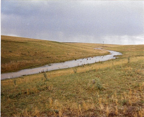
Oil shale is a term used to describe a wide range of fine-grained, sedimentary rocks that contain solid bituminous materials called kerogen. It should not be confused with “shale oil,” which is not addressed by the draft PEIS. Kerogen, which is organic matter derived mainly from aquatic organisms, releases petroleum-like liquids when subjected to extremely high temperatures – more than 750 degrees. Developers have been trying to produce oil from this rock in an economically-viable way for more than a century. The majority of U.S. oil shale (and the world’s largest oil shale deposit) is found in the Green River Formation in Colorado, Utah, and Wyoming.

Tar sands are sedimentary rocks containing a heavy hydrocarbon compound called bitumen. They can be mined and processed to extract the oil-rich bitumen, which is then refined into oil. However, unlike the oil sands deposits in Canada, oil is not currently produced from tar sands on a significant commercial level in the United States. Additionally, the U.S. tar sands are hydrocarbon wet, whereas the Canadian oil sands are water wet. This difference means that U.S. tar sands will require different processing techniques.

Any new land allocation decisions made on the basis of the Final PEIS would replace the land allocation decisions made in 2008 that proposed making up to 2 million acres of public lands available for commercial oil shale leasing in Utah, Colorado, and Wyoming and 431,000 acres available for tar sands leasing in Utah. Some Western communities argued that the 2008 PEIS and Record of Decision would have prematurely allowed commercial leasing without technologies having been proven viable and without a clear understanding of impacts on scarce Western water supplies. In response to those concerns and in settlement of litigation, the agency agreed to reconsider the 2008 land allocation decisions.

A 90-day public review and comment period began on February 3, 2012 and is scheduled to end on May 4, 2012.

Public meetings on the Draft PEIS will also be held in Rifle, CO; Rock Springs, WY; Salt Lake City; and Vernal, UT. The public will be notified of the dates and times of these meetings at least 15 days in advance via local media and the project website.

Written comments on the Draft PEIS may be submitted by any of the following methods:

Website – Using the online comment form available on the project Website:

http://ostseis.anl.gov. (This is the preferred method of commenting.)

Mail – Addressed to:

Oil Shale and Tar Sands Resources Draft Programmatic EIS
Argonne National Laboratory
9700 South Cass Avenue—EVS/240
Argonne, IL 60439.

Before including your address, telephone number, e-mail address, or other personal identifying information in your comment, you should be aware that your entire comment–including your personal identifying information–may be made publicly available at any time. While you can ask us in your comment to withhold your personal identifying information from public review, we cannot guarantee that we will be able to do so.

To read the BLM’s Federal Register Notice of Availability click here.

To read the Draft PEIS click here.

More coverage from Catharine Tsai writing for The Associated Press via The Casper Tribune. From the article:

A new draft environmental impact statement released Friday says the preferred plan now is to make 35,308 acres in Colorado, 252,181 acres in Utah, and 174,476 acres in Wyoming available for research. Also, 91,045 acres in eastern Utah would be available for activities related to tar sands. The public has until May 4 to comment on the proposal. The Bureau of Land Management estimates the Green River Formation in Colorado, Utah and Wyoming has about 1.2 to 1.8 trillion barrels of oil resources, but not all may be recoverable…

Following recommendations from the GAO, the U.S. Geological Survey is analyzing baseline water conditions so it can better understand how commercial-scale oil shale development could affect groundwater and surface water systems.

More coverage from Bruce Finley writing for The Denver Post. From the article:

Energy industry leaders said they are anxious to review details of the “draft programmatic environmental impact statement.”

“Any plan that delays development is not conducive to producing the energy that American consumers demand,” American Petroleum Institute spokesman Reid Porter said. “Testing is extremely important. But also there has to be certainty, an operating environment that’s conducive to investment.”

Rio Blanco County Commissioner Ken Parsons said he would prefer to see a plan that moves toward commercial development. “Some of it has to do with jobs, and there’s the energy independence question.”[…]

…Colorado Department of Natural Resources director Mike King backed the deliberative approach. “We need to be thorough and have a full understanding of potential impacts to the environment and our communities before we take steps toward large-scale leasing or development of oil shale.”

A coalition of farmers, ranchers, sportsmen and city officials and others has supported a rollback of the Bush administration’s 2008 push for opening public lands to tap oil shale. “We’re really concerned about the impacts on water. We cannot gamble away our water on oil shale speculation,” said Bill Midcap, director of renewable energy development for the Rocky Mountain Farmer’s Union. “We cannot risk our farm economy.”

More coverage from the Summit County Citizens Voice. From the article:

The BLM released a draft environmental impact statement outlining how the agency will review and potentially revise land use plans in various jurisdictions in the region.
The BLM announcement garnered a favorable reaction from many quarters.

“Having worked for the BLM and Department of the Interior for many years, I know well the challenge of land management,” said Vern Lovejoy, a former outdoor recreation planner with the BLM in Wyoming. “Oil shale can be developed in many places, but we need to make sure we understand the potential impacts on a site-by-site basis before we enter into leases that will forever change the environment. There has to be more of an analysis than ‘out of sight, out of mind.’”

“Hunting and fishing are huge economic drivers in the West – with an economic impact of $1.5 billion in Colorado alone,” said John Ellenberger is the retired big game manager for the Colorado Division of Wildlife. “We cannot afford to risk those jobs and the critical big game habitat deer and elk need to survive. But moving forward with oil shale development prematurely puts at risk this world-class wildlife and the jobs and hunting heritage that healthy natural resources provide to our state.”

“While I have long felt there is potential for oil shale development, it is critical that a number of unanswered questions be resolved before commercial-scale leasing takes place,” Sen. Mark Udall, D-Colorado, said in a prepared statement. “Fully understanding the demands of oil shale development on Colorado’s water and local communities is essential to ensuring responsible development.”

More coverage from Troy Hooper writing for the Colorado Independent. From the article:

“While I have long felt there is potential for oil shale development, it is critical that a number of unanswered questions be resolved before commercial-scale leasing takes place,” Sen. Mark Udall, D-Colorado, said in a prepared statement. “Fully understanding the demands of oil shale development on Colorado’s water and local communities is essential to ensuring responsible development.”

Last year, the BLM announced it would reconsider the Bush-era land leasing plan as part of a settlement of a lawsuit by environmental groups in 2009 that challenged the 2008 action.

“For the sportsmen, farmers, ranchers and communities on the Western Slope that depend on clean air and clean water, making sure development is done right the first time is vital to their way of life,” said Udall, noting that the BLM will be accepting public comment on its plan for the next 90 days.

Sen. Michael Bennet, D-Colorado, issued a statement reminding residents of “Black Sunday,” May 2, 1982, when Exxon’s massive Colony oil shale project went bust on the state’s Western Slope. “In Colorado, we have seen what can happen when we rush into oil shale development,” Bennet said. “We need to be certain we can do this in an environmentally sound, socially responsible and economically viable way– particularly with regard to water, which is critical to farmers, ranchers and the economies of western communities. Secretary Salazar’s announcement marks a balanced and prudent next step in our efforts to ensure that any commercial oil shale development is done in a thoughtful manner. An emphasis on continued research is entirely appropriate in advance of crafting any commercial development guidelines that continue to protect our natural resources and provide a fair return to American taxpayers in the process.”

More oil shale coverage here and here.

2012 Colorado November election: The Colorado Water Congress is working to keep ‘Public Trust Initiatives’ off the ballot

roadteasttolaplatas032004

From the Associated Press via The Columbus Republic:

Denver-area resident Phillip Doe has proposed amending the state constitution to highlight a clause that says streams are the property of the public — and making the public ownership legally superior to longstanding water rights.

A related proposal would spell out in the constitution that water rights can be constricted to prohibit uses that would harm the public’s ownership in the water…

The Colorado Water Congress is going through the Colorado Supreme Court to try to keep the measures off the ballot.

Here’s the CWC’s summary of the initiatives and the sponsor responses to CWC staff questions.

Mr. Doe was at the Downstream Neighbor 2012 Symposium last week and said that they had a huge task ahead of them in collecting enough signatures. He asked the attendees for help. I gave him my business card with the hopes that he would contact me so that I can sit down with him with a few questions. So far I haven’t heard from him. Mr. Doe?

More coverage from Catharine Tsai writing for the Associated Press via CBS4Denver.com. From the article:

Denver-area resident Phillip Doe has proposed amending the constitution to highlight the clause saying streams are public property – and making the public ownership legally superior to longstanding water rights, contracts or property law. A related proposal would spell out in the constitution that water rights can be constricted to prohibit uses that would harm the public’s ownership in the water, and water that goes back into rivers would have to be returned unimpaired.

“It reaffirms and reasserts that the public of Colorado owns the water, and the state has an obligation to protect the public’s interests,” said attorney Richard Hamilton, who is working with Doe…

Efforts are under way to keep Doe’s proposals from making the ballot. The Colorado Water Congress, which includes water users and state agencies, is asking the Colorado Supreme Court to decide whether each proposal properly asks voters to consider only one issue.

Doe said if voters approve the proposals, farmers may not be able to exercise their water rights on rivers during droughts, for example, if that would dry up a river. He also said the proposals could prevent water from being used for hydraulic fracturing, though he said that wasn’t his intent in promoting the proposals.

Doe said he’s been disappointed with Front Range water providers’ plans to tap the Fraser and Cache la Poudre rivers to serve growing cities. Strengthening public’s ownership in state waters would prevent rivers from being polluted or depleted, he said.

“We’re down to our last drop of water. It’s time the public starts asserting its right to that which it owns,” Doe said…

“It’s too extreme, it’s too reckless,” Western Resource Advocates spokesman Jason Bane said of Doe’s proposals. “At the same time, we understand why this is coming up.”

More 2012 Colorado November election coverage here.

Protect the Flows hopes to galvanize business interests the are dependent on wet water in the Colorado River

coloradoriverbasin.jpg

From the Summit Daily News (Janice Kurbjun):

[Zeke Hersh], the owner of Frisco’s Blue River Anglers joined a contingent of six who voiced the message of Protect the Flows, a brand-new, grassroots organization dedicated to raising awareness of water supply and related jobs in the Colorado River system — from the headwaters to the delta. The group represented river-related business interests from Colorado, Utah, Arizona, New Mexico and Nevada, Hersh said, adding that the group isn’t just gaining traction by sitting with legislators and leaders in the nation’s environmental governance. It’s also building a broader base, growing from 170 companies to 370 companies involved in the effort from its start in summer 2011 to today.

The goal in going to D.C. was to urge the Department of the Interior and legislators to consider plans that will employ smart, common-sense strategies to keep the Colorado River flowing when they finalize the Bureau of Reclamation’s Colorado River Basin Supply & Demand Study this summer.

Now that the “Options and Strategies Phase” of the Colorado River Supply and Demand Study is closed, submitted proposals will be considered and evaluated through June 2012. Upon completion, the study will define current and future imbalances in water supply and demand in the Colorado River Basin over the next 50 years, and will provide adaptation and mitigation strategies to resolve those imbalances…

As an angler, a guide, and a mountain biker who likes to cruise Moab, Utah and cool off afterwards in the lazy Colorado River that flows through town, Hersh said he can help provide valuable, first-hand insight into the river’s impact throughout the West. It goes far beyond drinking water needs and agricultural impact, he said. The message of Protect the Flows is that more than 800,000 jobs in the West (107,000 and more than $10 billion into the Colorado’s economy alone) come directly from the river, and those people must be considered when the fate of the water supply is considered…

While in DC, the business leaders asked the Department of Interior to implement a plan that will improve urban conservation, improve agricultural efficiency and provide options for existing water storage that will allow for keeping more water in the river. The coalition touts these measures as a way to balance supply and demand to continue to serve the 36 million who rely on the waterway for drinking water and protect the 800,000 river-related tourism and recreation jobs across the seven Colorado River Basin states.

“Department of Interior’s keen leadership is the key to ensuring that the Colorado River Basin Study results in solutions that will benefit all parties,” said Sarah Sidwell, sales director for Tag-A-Long Expeditions in Moab, Utah and member of the Moab Area Chamber of Commerce…

In D.C., they presented some viable ideas for handling the plethora of water issues facing the West, including the extremely difficult task of reworking the complicated water law. Water banks are first on the list, Hersh said. Initiated in Arizona, it allows those holding water rights to override the “use it or lose it” rule of thumb in years of excess flows. These folks can use what they need, and bank the rest for credit later. In the meantime, someone else can buy or borrow the water…

“Jobs are very important right now. We do not want to lose one job,” Hersh said … as we decide how to manage the water in the Colorado River and its tributaries.

More Colorado River basin coverage here.

Chris Treese (Colorado River District): ‘We’re very concerned about any large project of any kind for Eastern or Western Colorado’

uppercoloradoriverbasinstatesultimatum09011925denverpost.jpg

Mr. Treese was speaking at the Southern Colorado Water Forum this week. Here’s a report from Chris Woodka writing for The Pueblo Chieftain. From the article:

“We’re very concerned about any large project of any kind for Eastern or Western Colorado,” Chris Treese, external affairs manager for the Colorado River Conservation District, told the Southern Colorado Water Forum earlier this week…

Colorado’s weather has been, and will continue to be, unpredictable, however. Water availability is dependent on snowpack, and some climate projections claim there will be less snow in the mountains in the next century. But while warmer temperatures appear to be certain, the jury’s still out on the effect on precipitation levels. “It could be more or it could be less,” Treese said. “One thing is certain: The growing season will be longer, driving up demand.”

At one point, Treese portrayed the Colorado River district as a David facing two Goliaths: demand from Colorado’s Front Range for more water and demand from downstream states in the Colorado River Compact…

If one hiked along the western side of the Continental Divide in North-Central Colorado, only three streams that are not part of a diversion project would be crossed, Treese said…

Last year, several counties and water districts announced the Colorado River Cooperative Agreement with Denver Water that set out certain payments and water deliveries that will allow Denver to divert and store more water in Gross Reservoir, located in Boulder County. Such cooperative deals make sense and show that the Western Slope does not deserve its “Not One Drop” reputation, Treese said.

More Colorado River basin coverage here.

The Logan County Water Conservancy District is working on flood control along Pawnee Creek

pawneecreek.jpg

From the Sterling Journal-Advoacate (Judy Debus):

The LCWCD was established in 2002 by District Court decree to address the issue and develop projects to reduce the potential for damaging floods. It has since focused its efforts on the Pawnee Creek, which represents one of the greatest threats for future flooding damage. It is funded by mill levy and other board members in addition to Bournia are Shane Miller and Richard Walker, board president. Board members are appointed by the court for a three-year term. This year, the .83 mil levy will provide revenue of $212,732 paid by county landowners, according to the county finance department. The board is not connected with Logan County government.

The Pawnee Creek has seen major floods occur about every 30 years and the 1997 flood caused approximately $20 million in damage to roads, railroads and agricultural property, not to mention in the towns of Sterling and Atwood.

More stormwater coverage here.

Patent issued to Anticline Disposal LLC for the treatment of produced water from oil and gas exploration and production

anaerobicdigester.jpg

From Water World:

According to the abstract released by the U.S. Patent & Trademark Office: “Systems and methods have been developed for reclaiming water contaminated with the expected range of contaminants typically associated with produced water, including water contaminated with slick water, methanol and boron. The system includes anaerobically digesting the contaminated water, followed by aerating the water to enhance biological digestion. After aeration, the water is separated using a flotation operation that effectively removes the spent friction reducing agents and allows the treated water to be reclaimed and reused as fracturing water, even though it retains levels of contaminants, including boron and methanol, that would prevent its discharge to the environment under existing standards. The treated water may further be treated by removing the methanol via biological digestion in a bioreactor, separating a majority of the contaminants from the water by reverse osmosis and removing the boron that passes through the reverse osmosis system with a boron-removing ion exchange resin.”

Here’s the link to the Anticline Disposal LLC website.

More oil and gas coverage here and here.

A beautiful snow

snowflakesbentley.jpg

We’re in the middle of a beautiful snow here at Gulch Manor. I measured 8 inches of accumulation in my backyard.

Protect the Flows goes to Washington: Zeke Hersh — ‘We’re definitely pushing towards the common-sense goals and solutions’

continentalcongress.jpg

From the Public News Service (Kathleen Ryan):

Coloradans were on Capitol Hill this week, offering options on how the government can preserve and protect the Colorado River’s water resources for future generations – and preserve Colorado businesses as well…

The Department of the Interior is in the final stages of developing a plan to preserve the Colorado for future generations.

Zeke Hersh, who leads angling trips along the river for Blue River Anglers in Frisco, headed to Washington this week with the group “Protect the Flows.” “We’re definitely pushing towards the common-sense goals and solutions, such as improving urban conservation and agricultural efficiency.”

“Potentially, rivers can dry up as they go down into an arid environment, which the Colorado does. But when it dries up at the headwaters and at the delta, that’s a pretty striking picture.”

The Department of the Interior just completed its public input period and began considering options for the Colorado this week. A final study is to be published in July. More information is on the Interior Department’s Lower Colorado River website, usbr.gov.

More Colorado River basin coverage here.

Rocky Mountain National Park: Lily Lake Dam in need of repairs

lilylakermnp.jpg

Here’s the release from Rocky Mountain National Park (Kyle Patterson):

The Lily Lake Dam, located in Rocky Mountain National Park, has been rated a high-hazard dam by the U.S. Bureau of Reclamation. Failure of the dam is not imminent, and park staff are evaluating long term solutions; considering two options to reduce the risk, either repairing or removing the dam. Until a long term solution is implemented, the dam will be regularly inspected and monitored, and a pump has been purchased to lower the lake level in the event of a significant weather event.

The Lily Lake Dam is situated at the headwaters of Fish Creek, which flows into Lake Estes in Estes Park. Fish Creek is about 5 miles in length and the elevation difference between Lily Lake and Lake Estes is about 1,500 feet. If the dam were to fail, the ensuing floodwaters could result in the loss of life and property along Fish Creek. Repairs are needed to the dam to reduce the hazard, or the dam could be removed and the area restored to natural conditions.

Lily Lake, located along Highway 7, has become a popular recreational area in Rocky Mountain National Park. The lake sits in a beautiful mountain setting, surrounded by an accessible trail. The lake is a popular fishing spot and is stocked with greenback cutthroat trout, a federally listed threatened species.

Park staff are seeking the public’s input on two long term alternatives. Both repairing and removing the dam would involve several steps. The estimated cost of repairing the dam is approximately $1.4 million, with additional annual costs to maintain and monitor the dam. The estimated cost of removing the dam would be approximately $150,000. If the dam is removed, the resulting lake would be about 14 acres in surface area and would contain about 39 acre feet of water. If the dam remains in place, the lake would be about 17 acres in surface area and contain about 75 acre feet of water.

To learn more about Lily Lake, the dam and possible consequences for both actions, please go to: www.nps.gov/romo/parkmgmt/lily_lake_dam.htm

If you have Internet access, the preferred method for submitting comments is to use the National Park Service Planning, Environment and Public Comment (PEPC) website: http://parkplanning.nps.gov/romo.

From this site, select the Lily Lake Dam Project. Your comments can be submitted online.

You can also submit your comments in the following ways:

By email:e-mail us

By Mail: Superintendent, Rocky Mountain National Park, Estes Park, Colorado 80517

By Fax: (970) 586 -1397

By Express Delivery: Superintendent, Rocky Mountain National Park, 1000 Highway 36, Estes Park, Colorado 80517

Hand Delivery: Rocky Mountain National Park Headquarters, 1000 Highway 36, Estes Park, Colorado or to Kawuneeche Visitor Center, Rocky Mountain National Park, 16018 Highway 34, Grand Lake, Colorado

Some possible questions to consider when conveying your comments:

1. Which alternative do you favor? Repair the dam or remove it?

2. Why did you choose the alternative that you favor?

3. What are the reasons why you did not choose the other alternative?

4. Do you have any concerns about the alternative you favor?

5. Have we overlooked something important that we should be aware of?

6. Are there any other ideas or observations you would like to share about this project?

If you do not have internet access and would like a copy of the detailed information that is posted on the park’s website, please call the park’s Information Office at (970) 586-1206. Please note that comments should be received in writing by close of business on February 29, 2012.

More coverage from the Associated Press via The Denver Post. From the article:

Park engineers say failure of the dam is not imminent, but a long-term solution is needed. Options include repairing or removing the dam. In the meantime, the dam will be regularly inspected. The dam is located at the headwaters of Fish Creek, which flows into Lake Estes in Estes Park.

More infrastructure coverage here.

David Neslin is leaving the Colorado Oil and Gas Conservation Commission for private practice

derrick.jpg

Here’s the release from the Colorado Department of Natural Resources (David Neslin/Todd Hartman):

David Neslin will be resigning from his post as Director of the Colorado Oil and Gas Conservation Commission to return to the practice of law effective in February. Neslin was appointed director of the COGCC in November of 2007.

Under Neslin’s tenure, the COGCC comprehensively updated the state’s oil and gas regulations to strengthen environmental protections during a significant increase in energy development. Neslin also oversaw changes within the agency that resulted in more efficient permit reviews and other process improvements assisting industry and the public.

Neslin worked closely with environmental groups and industry to develop the country’s strongest chemical disclosure law for hydraulic fracturing and he continues to work productively with several local governments on regulatory issues as the potential for energy development grows along the Front Range. Neslin frequently speaks before the public on oil and gas issues, and has testified on regulatory issues before Congress.

“Leading this agency through a time of dynamic change in energy development in Colorado has been a challenging, exciting and rewarding experience,” Neslin said. “I look forward to continuing the work of building collaborative, productive solutions to energy and natural resources issues in a new forum.”

“David’s many talents have been a great asset for our state,” said Gov. John Hickenlooper. “He earnestly, ably and consistently brought varied interests together to do what’s best for the environment, for business and for Colorado. We thank him for his service and wish him luck in his new job.”

“David Neslin presided over a transformative change in oil and gas regulation in Colorado,” said Department of Natural Resources executive director Mike King. “He has left the state in a strong position to address the industry’s increasing investment in Colorado, while ensuring that those operators working here are held to the highest standards for protection of the public and our environment.

“He deftly managed the COGCC through the most challenging period in agency history, and conducted his work with grace, poise and the highest order of professionalism.” King added. “We will miss him, and extend our gratitude for his public service.”

Neslin will be joining the Denver law firm of Davis Graham & Stubbs with a focus on public lands and energy on March 1. Prior to joining Colorado state government in 2007, Neslin was a partner in the Denver law office of Arnold & Porter, where he also focused on lands and natural resource matters.

From The Grand Junction Daily Sentinel (Dennis Webb):

Neslin on March 1 will join Davis Graham & Stubbs LLP in Denver, where he will deal with oil and gas and public lands matters.

Neslin became the state commission’s acting director in 2007, and was named director in 2009. He oversaw the controversial 2008 overhaul of the state’s oil and gas rules, aimed at better balancing development with protection of the environment and public health. Critics blamed those rules for a subsequent decline in drilling in the state, but Neslin cited falling natural gas prices and noted that Colorado remained among the most active states for oil and gas development in the Rocky Mountain region.

In December, he helped negotiate a compromise rule requiring public disclosure of the contents of hydraulic fracturing fluids, while providing for trade secret protections. It’s considered the most far-reaching fracturing disclosure requirement of any state.

More coverage from Cathy Proctor writing for the Denver Business Journal. From the article:

Shortly after Neslin was appointed acting director of COGCC in November 2007, he oversaw the massive, acrimonious rewrite of Colorado’s oil and gas regulations, which dictate industry operations in the state. The new rules were implemented in April 2009, when Neslin was appointed permanent director of COGCC.

During his tenure, Colorado’s oil and gas industry shrank as wholesale natural gas prices dropped. But Neslin also saw the industry grow again, as a new oil discovery in northern Weld County has evolved into Colorado’s fledgling Niobrara oil field, which some oil and ggas companies say could produce more than 1 billion barrels of oil.

More oil and gas coverage here and here.

Colorado Water 2012: Prior appropriation doctrine primer

coloradowater2012

Here’s the fifth article in their Water 2012 series from the Valley Courier:

By The staff of the Colorado Division of Water Resources, Division 3 Office:

For more than 130 years, Colorado has used a system of water allocation known as the Prior Appropriation Doctrine. Under this doctrine, the first appropriator of water has a senior right to the water available and that right must be satisfied before any subsequent rights junior to that right can receive water. Simply put, the Prior Appropriation Doctrine is “First in Time, First in Right.”

The doctrine evolved from practices used to settle disputes in the mining industry. The gold rush to Colorado in the late 1850’s brought experienced miners who allocated water based upon the same theory as land ownership, the first to occupy the land staked their “claim” to it and those following had no right to it. This system was eventually applied to water ownership disputes.

The San Luis Valley has the honor of being home to the oldest ditch in Colorado, the San Luis Peoples Ditch, which draws water from Culebra Creek. Use of this ditch was initiated in 1852 and diversion of water from other area streams soon followed. Appropriations were made from the San Antonio and Conejos Rivers in 1855. In 1860, the Fred Etter Ditch diverted water from Ute Creek for use at the local U.S. Army fort, in what later became Fort Garland. Diversions for irrigation use from the Rio Grande and Saguache Creek both began in 1866. Most other creeks in the San Luis Valley saw diversions for irrigation before Colorado became a state in 1876.

By the beginning of the 1890’s, many stream systems were over appropriated. Ditch companies were actively constructing reservoirs to store winter and spring runoff. In addition, new sources of water were being pursued, which included transmountain diversions and ground water. Changes of water rights, exchanges, transfer of water rights and “loan statutes” were issues that had to be addressed by the Office of the State Engineer by the turn of the century.

Some areas of the state have rivers, creeks, and aquifers where new appropriations can still be made. However, the surface and groundwater sources in the San Luis Valley have already been allocated to existing water rights and Compact requirements. Appropriations from the aquifers of the San Luis Valley for new high capacity (>50 gpm) wells were discontinued in the 1970’s and early 1980’s.

Colorado holds the unique distinction of being the first state to provide for the distribution of water by public officials. In 1879, the legislature created a part of the present administrative system. It provided for the division of the state into ten water districts, nine of these in the South Platte valley and one in the Arkansas drainage.

In 1881, the Colorado legislature established the Office of the State Irrigation Engineer, referred to today as the State Engineer’s Office, also known as the Colorado Division of Water Resources. The agency’s primary responsibility is the administration of the Prior Appropriation Doctrine by maintaining a list of water rights on each stream in order of priority. The priority of each water right was determined by the district courts based upon the date the structure for the water right was constructed and the water placed to beneficial use.

In 1887, the state created a Superintendent of Irrigation, who is known today as the Division Engineer, to supervise water commissioners within each division. The seven water divisions are geographically located to encompass the major river drainages in the state: the South Platte, the Arkansas, the Rio Grande, the Gunnison, the Colorado, the North Platte/Yampa, and the San Juan/Dolores.

The San Luis Valley is within Water Division 3 which covers approximately 8,000 square miles. The Water Division 3 office is located in Alamosa, with satellite offices in Saguache, Monte Vista, and Antonito. Approximately 600,000 acres of irrigated land are located in Water Division 3.

The Rio Grande is the principal river in the division; and the Conejos River is its largest tributary. The headwaters of the Rio Grande are on the Continental Divide west of Creede and the river runs generally eastward to Alamosa where it turns south, eventually crossing the state line into New Mexico. The equitable apportionment of water in the Rio Grande and its tributaries between the states of Colorado, New Mexico, and Texas is the purpose of an interstate Compact, ratified by Congress in 1939. The Rio Grande Compact will be detailed in a future article.

More Colorado Water 2012 coverage here.

Snowpack news: San Miguel/Dolores/San Juan basin are at approximately 73% of average

snowpackcolorado02012012

From the Loveland Reporter-Herald (Pamela Dickman):

So far this year, water managers do not like what they see — less snow and less water in that snow. Colorado is sitting at 72 percent of its 30-year average, while the Colorado River Basin on the Western Slope is at 71 percent of average and the South Platte Basin, which includes the Big Thompson River, is 78 percent of average. The numbers have drawn a comparison to the 2002 drought.

The data are similar, but each year is different, and a possible storm expected to deliver several inches of snow in Estes Park and Loveland and maybe even more in the national park later today could be just what the water doctors ordered. “It’s a potential game-changer,” said [Dana Strongin, spokeswoman for Northern Water]. “But we can’t rely on that. We are really far behind this year.”[…]

With equipment that has been fine tuned but is essentially the same since it was invented in the 1930s, [Todd Boldt and John Fusaro] make sure to get a clean sample of snow in a hollow aluminum pole in set locations. The numbers on the pole — and from a manual scale — seem like another language to the untrained eye or ear, but with those figures and a few punches of the calculator, Fusaro and Boldt are able to know how much water is in an inch of snow. On Monday, they found an average snow depth of 18 inches with 80 percent snow water equivalent compared to last year and 125 percent compared to the 30 year average at Deer Ridge (9,000 feet). Although there was 22 inches of snow at Hidden Valley (9,480 feet), the water equivalent was 74 percent compared to last year and 91 percent of average. Numbers were much lower at the automated sites in the national park — 71 percent of average at Willow Park (10,700 feet) and 86 percent at Bear Lake (9,500 feet)…

“The importance of this information is not only for farmers and agriculture, but for cities and electrical generation on hydroelectric plants,” said Boldt. “Everyone’s interested in snowpack information.”

Steve Gibson named to lead the Colorado Water Congress during 2012

stevegibson.jpg

From the Valley Courier (Ruth Heide):

[Gibson] said he plans to continue his predecessor’s goal of inviting young professionals and those who have not yet been a part of the congress to join the broad and diverse water group…

“One of my goals this year is to continue that effort and try to bring it down especially to smaller rural communities,” Gibson said on Tuesday. “We need to bring young people in, on the local level, because that institutional knowledge is going to go away.”

Gibson also wants to increase membership in the Colorado Water Congress. “I am a firm believer in the benefits that the congress brings to the broader water community in Colorado,” he said.

He described the Colorado Water Congress as a quasi trade organization but added it is more than that because it includes professionals in the water community such as attorneys, consultants, engineers and representatives of water conservancies, conservation districts, ditch companies, irrigation companies and mining companies…

Before going to work for the conservancy district Gibson directed the local Nature Conservancy after moving to the San Luis Valley in 1999. His earlier career had been in the mining industry in the western part of the U.S. Originally from England and a graduate of the University of London, Gibson came to the U.S. for graduate school and remained. Although water was never on his radar screen back then, it has become a prominent part of his life now. “I have been learning about water and still know very little when you look at the big scheme of things.”

More coverage from Chris Woodka writing for The Pueblo Chieftain. From the article:

Gibson has represented the Rio Grande basin in the Colorado Water Congress for years, and says the group and the conservancy district strive for common goals. He is also a member of the Rio Grande Basin Roundtable, which has worked to iron out differences in local water issues…

Gibson came to the San Luis Valley in 1999 with the Nature Conservancy, joining the conservancy district in 2002. Prior to that, he worked for 30 years in the mining industry in Northwestern Colorado. A native of England, he was educated at the Royal School of Mines in London.

Also at the 54th annual CWC convention, the San Luis Valley Irrigation District, Southeastern Colorado Water Conservancy District, Parker Water and Sanitation, Northern Water, Colorado River Conservation District and the Colorado Water Conservation Board were honored as water organizations of the year.

Southern Colorado Water Forum recap: Steve Vandiver — ‘We’ve issued too many well permits, and now we’re trying to unscramble the egg’

slvdischargerecharge.jpg

From The Pueblo Chieftain (Chris Woodka):

“We’ve issued too many well permits, and now we’re trying to unscramble the egg,” Steve Vandiver, manager of the Rio Grande Conservation District, told the Southern Colorado Water Forum Tuesday. More than 6,000 high-volume irrigation wells have been drilled in the Rio Grande basin in the rich farmlands around Alamosa, Center and Monte Vista over the past 50 years. “These wells have had an impact that was not recognized by anyone when they were drilled,” Vandiver said.

Part of the problem is that one-third of the water in the San Luis Valley has to be sent to New Mexico, in an arid region that gets only about 7 inches of precipitation annually. Since the 1940s, wells have improved and expanded agriculture in the Rio Grande basin.

The greater harm is to senior surface irrigation rights, which date back to the 1850s in the Rio Grande basin. The valley is economically dependent on agriculture, and the farmers themselves have taken up a solution which they hope to implement before the state imposes rules, Vandiver said. “Six subdistricts are being created as a market-driven approach,” Vandiver said.

More San Luis Valley groundwater coverage here and here.

Chief District Judge Dennis Maes receives a lifetime achievement award from the Colorado Hispanic Bar Association

judgedennismaes.jpg

From The Pueblo Chieftain (Jeff Tucker):

Chief District Judge Dennis Maes was honored last week by the Colorado Hispanic Bar Association with a lifetime achievement award…

“Through- out his career, Judge Maes has served the Latino community,” the release said. “Even as a young teacher, Judge Maes was teaching in a predominantly Latino community in Southern Colorado. He later served this same community through his work with Pueblo Legal Services and as a public defender.”

Action 22 Summit recap: Governor Hickenlooper, ‘[agriculture] — It’s part of the muscle of the state’

irrigatedagriculture.jpg

Here’s a report from Chris Woodka writing for The Pueblo Chieftain. From the article:

The governor told Action 22 that less-populated parts of the state have worked their way into his heart and are always on his mind, even when he is half a world away…

The governor spotlighted Southern Colorado’s agricultural heritage and economy as a bright spot, even during the sluggish global financial situation of the past few years. “It’s part of the muscle of the state,” he said, stressing the importance of a long-term plan to meet the state’s water needs if it is to provide what urban hubs require and keep agriculture viable. “I think we’re within a few years — three, four, five years — of having a plan that will define a water future for 50 years,” Hickenlooper said.

Snowpack news: Arkansas Basin is at approximately 85% of average — best in the state

snowpackcolorado01312012

Big storms in December along the Colorado/New Mexico border boosted snowpack in the southern part of the Arkansas Basin so even after 17 months of drought the basin is out in front of the rest of the state. The Rio Grande basin is not far behind which is good news since parts of the area were in extreme drought conditions during water year 2011. Statewide snowpack is sitting at 72%. The Colorado River basin — source for much of the water for the Metro Denver area is only at 71%. Thankfully there is a storm moving into Colorado today and tomorrow.

Here’s a report from Chris Woodka writing for The Pueblo Chieftain. From the article:

Colorado snowpack was listed at 73 percent Monday, and the Arkansas River basin was in the best shape at 81 percent of average. The Arkansas River basin is in its 17th month of severe drought, however, with little new snow in the mountains and precious little moisture on the plains. Flow conditions on the Arkansas River are below normal for the first time in more than a year, while precipitation in January was practically nonexistent. Pueblo recorded just 0.03 inches of precipitation, far below the 0.29 inches recorded last year and the average of 0.33 inches.

In the Colorado River basin, which Arkansas Valley users rely on for supplemental water imported via tunnels and ditches, the picture is even bleaker. The U.S. Drought Monitor now lists Western Colorado as abnormally dry, verging on a moderate drought. Snowfall moisture is at 72 percent, with moisture content in the mountains at 4-10 inches. At this time last year, many areas were beginning to build near-record snowpack. “March and April are coming, when we get most of the snow,” said Linda Hopkins, of the Pueblo office of the Bureau of Reclamation, which operates the Fryingpan-Arkansas Project.

The Northwest Colorado Council of Governments has released a report about the importance of water to Colorado’s headwaters counties

headwaterscountiesnwccog.jpg

From the Sky-Hi Daily News (Tonya Bina):

The Front Range benefits from spending associated with the fishing industry, for example, by as much as 57 percent, even though fishing takes place largely in the streams, rivers, lakes and reservoirs of the headwater counties.

The economic impact of fishing in the Colorado River Drainage headwaters counties — Routt, Grand, Eagle, Pitkin and Gunnison counties — equates to about 14 percent of the overall fishing expenditures. The remainder is attributed to other parts of Colorado.

And it’s important to note, the sport of fishing like other river recreation that attracts tourism to the state has minimal consumptive water use (water taken from rivers and never returned), the study emphasizes.

Snow-making for skiing, for example, has about 20 percent consumptive water use; transmountain water diversions are 100 percent consumptive.

“Colorado is continuing to look to the headwaters for growth; our message is you cannot dry up your headwater counties,” said Grand County Commissioner James Newberry, who is the chair of the Northwest Colorado Council of Governments Water Quality and Quantity Committee and the vice chair of the Colorado River Water Conservation District.

More transmountain/transbasin diversions coverage here.

Action 22 Southern Colorado Water Summit recap: Walking the tightrope between watering a growing population, saving agriculture and preserving the environment

farviewreservoir.jpg

From The Pueblo Chieftain (Chris Woodka):

“I’ve often wondered what the Anasazi thought when they packed up and left,” John Stulp, water policy adviser for Gov. John Hickenlooper, said Tuesday. “If I could back and tell the chief that Colorado would have a population of 5 million people in 2012 that would double in 50 years, what would he think? Yet today, we have the same water resources as Mother Nature chooses to drop on us.” Stulp was addressing the Southern Colorado Water Summit, hosted by Action 22 at Colorado State University-Pueblo. About 85 people from across Southern Colorado attended.

The Interbasin Compact Committee, which Stulp chairs, is looking at ways to avoid sacrificing agriculture for urban growth, while preserving the environment. At the same time the climate could become warmer, and possibly drier.

When asked whether people in the future might just move to where water was more plentiful, like the Anasazi, Stulp said such a migration would be unlikely. “I think there is enough water if we’re smart about it,” Stulp said. “It’s interesting that as a society, we’ve been able to use the existing supply.”

More IBCC — basin roundtables coverage here.

Brian Werner: ‘Tell me when the next big drought comes, and you’re going to see people screaming about storage’

nisp2

From the Fort Collins Coloradoan (Bobby Magill):

“Tell me when the next big drought comes, and you’re going to see people screaming about storage,” said Brian Werner, spokesman for the Northern Colorado Water Conservancy District in Berthoud. “Their willingness (to consider building new reservoirs) ebbs and flows based on when your last drought was.”

The uncertainty about the mountain snowpack, which fluctuates every year, is the primary argument for building new reservoirs in the West, said Reagan Waskom, director of the Colorado Water Institute at Colorado State University. “The amazing thing is, it comes down to three or four big storms every year, whether they get them, or they bypass us,” he said…

One of five major proposed water storage projects in Larimer County that are in various stages of planning, [Northern Integrated Supply Project] calls for storing about 170,000 acre-feet of Poudre River water in the proposed Glade Reservoir north of Ted’s Place. A final decision could come sometime in 2013 or 2014…

The other four proposed projects include expansions to Fort Collins’ Halligan Reservoir and Greeley’s Seaman Reservoir, the Chimney Hollow Reservoir west of Carter Lake and the more uncertain Cactus Hill Reservoir proposed for a site on the Weld County line between Wellington and Nunn. If those projects are built, Waskom said, it’s hard to conceive of other such large projects being built in Northern Colorado regardless of the need because there are few other places to build them, at least in Larimer County. “Unless we can get Aaron Million’s project or a West Slope diversion built, we don’t have any more water left,” he said…

“All the easy projects have been built,” [Waskom] said. “Now we’re dealing with the hard projects. What comes after the projects, that’s the question, right? Where’s the water and reservoir sites, and where’s the political will to build projects?”

More infrastructure coverage here.