Fountain Creek: Working out the kinks — The Pueblo Chieftain

Fountain Creek Watershed

From The Pueblo Chieftain (Chris Woodka):

Fountain Creek for years ate away at its banks about 15 miles north of Pueblo on a site that never fully recovered from decades of raging floods.

“There were 15-foot drop-offs,” explained Mark Pifher, a consultant with Colorado Springs Utilities who coordinates Southern Delivery System permits. “That railroad bridge acted as a dam every time there was a flood.”

Utilities restored the 28-acre site on its Clear Springs Ranch property as one of the conditions of Pueblo County’s 1041 permit for SDS.

Tied into a trail system that could one day connect Pueblo with Colorado Springs, the site features an interpretive sign that explains the ecosystems of Fountain Creek. The project also created about 6 acres of wetlands designed to absorb some of the punch from future floods.

“In the 2013 floods, we lost a couple of acres of land here,” Pifher said. “Now, Fountain Creek has a more meandering bank. It’s cut down on the constant destruction we saw before construction and improved the habitat for numerous species.”

More than 27,000 rocks 2 feet or larger in diameter were installed under the wetlands, with a foundation of 6,500 larger than 3 feet in diameter. That prevents the bed of the creek from being chewed out by floodwaters.

“Most of the investment we made, you can’t see,” Pifher said. “In August, it held up well to a flow of about 8,400 cubic feet per second. It worked like it was supposed to.”

Keyway structures — basically ridges of rock — were added to guide the creek within its channels. The area is designed to hold up to a 15,000 cfs flood.

Crews hand-planted more than 50,000 plugs of plant species, 144,000 willow stakes and 5,000 cottonwood or ash poles on the grounds to help dampen storm effects.

The project was included in Pueblo County’s 1041 permit both to improve one of the worst sections on Fountain Creek and to demonstrate methods that might be used elsewhere.

It’s not the type of flood control structure that would protect Pueblo from a monster flood such as the one in 1965, but it does prevent smaller floods from causing even bigger problems downstream if left unchecked.

At a cost of more than $4 million, it’s not the type of project that could be easily replicated by other landowners along the creek, Pifher acknowledged. But it does provide an example of what can be done.

Utilities is committed to providing broader flood protection as well, Pifher said.

Another condition requires $50 million to be paid by Colorado Springs to the Fountain Creek Watershed Flood Control and Greenway District when SDS comes online. That money would help build the more significant flood-control structures that protect Pueblo. For that to occur, questions concerning whether holding back water could occur without injuring water rights have to be answered.

“We want to make that happen, and CSU is providing technical assistance to the district,” Pifher said.

More Fountain Creek coverage here and here.

Arkansas Valley Super Ditch update: 500 af to Fountain, Security and Fowler

Straight line diagram of the Lower Arkansas Valley ditches via Headwaters

From The Pueblo Chieftain (Chris Woodka):

The Arkansas Valley Super Ditch is hoping the third time will be a charm. The group is preparing a proposal to lease up to 500 acre-feet of water (162 million gallons) from the Catlin Canal to Fountain, Security and Fowler under 2013 state legislation, HB1248. Fowler would get about half of the water.

The legislation allows pilot programs that demonstrate the effectiveness of temporary transfers of water by drying up irrigated fields.

The application for the program was accepted by the Colorado Water Conservation Board in September, but the proposal was altered to include Fountain and Security, which had expressed interest in leasing water in 2012, when the Super Ditch program was aborted due to drought.

The 2012 lease failed partly because of a late start and numerous conditions that would have been imposed under a substitute water supply plan.

In 2013, the Super Ditch planned to lease water to Fowler, but the deal fell through when farmers backed out.

A little more than 1,100 acres of Catlin land could be dried up on a rotating basis over 10 years. No parcel could be dried up for more than three of those years.

Water attorney Peter Nichols said he is optimistic that the program can be completed this year if the CWCB approves it at its January meeting.

“This meets the goal of leasing water within the Arkansas River basin,” Nichols said.

More Arkansas Valley Super Ditch coverage here and here.

Farming the Ogallala — Radio Colorado College #RepublicanRiver

From KRCC (Shelley Schlendler):

Ever since the Ice Ages, the Ogallala’s been slowly accumulating water. Modern farmers, though, pump so much water that this “timeless” aquifer is starting to run out. Someday up ahead, Northeast Colorado may have to curtail some crops, and some farm towns might become ghost towns.

Towns are few and far between vast expanses of short grass prairie in Northeastern Colorado. This semi-arid desert gets on average only 17 inches of precipitation every year.

But near the farming community of Wray, there’s a feedlot that depends on plenty of water. A few miles further away are mounds of freshly dug up potatoes and conveyor belts that hoist the spuds into trucks.

Around another bend, dinosaur-sized pivots watch over cornfields. Next spring, those giant sprinklers will spray enough water to grow row after row of leafy green stalks.

“Yuma County is one of the top two counties in the state, and sometimes ranked in the top 10 in the nation, for corn production,” says Deb Daniel, General Manager for the Republican River Conservation District.

This river basin springs from streams that bubble up from the Ogallala aquifer then flow east, starting in Northeastern Colorado around Sterling and Wray, and also around Burlington, near the Kansas border.

Daniel says the aquifer is how farmers in this area get their water.

“We don’t benefit from the snowmelt and the runoff that a lot of the South Platte and the Colorado River benefit from,” says Daniel. “All of our water here is stored underground and very very little of it is recharged.”

This region’s aqueous gold is the Ogallala Aquifer. Stretching from South Dakota down to Texas, the Ogallala is one of the world’s largest underground reservoirs. Think of it as an enormous bowl that’s hundreds of feet under ground, filled with sand, gravel and water that’s been drip-dropping in for thousands of years.

Daniel says she thinks of it as water within a sponge. “And we have all of these straws poked into this sponge from all of these irrigation wells, municipal wells, commercial wells for feedlots and hog confinement, so all of these straws are poked down into this sponge of water.”

Those “straws,” slurping the ancient Ogallala, add up to an enormous gulp. Colorado’s Deputy State Water Engineer Mike Sullivan says that if you think of how much snowmelt it takes to supply Denver, Boulder, Greeley, Fort Collins—the northern Front Range cities—that’s also how much farmers pump from the Ogallala in the Republican River Conservation District.

“They’re both withdrawing or diverting about 700,000 acre feet of water in an average year,” says Sullivan.

But there’s a big difference between snowmelt and the slow-to-recharge Ogallala. “One’s a renewable supply, and the other is a static supply that is being consumed,” adds Sullivan.

Legal battles over just who gets to “use up” the Ogallala have led the state to monitor pumping rates. A well house near a center pivot houses pipes, a pump, and a fist-sized dial, called a flow meter.

“Each year,” says Deb Daniel, “all the growers have to send in an annual water use report.”

According to water engineer Mike Sullivan, the goal is to get more stewardship tied to water use.

“You got a tremendous economy out there, and we don’t want to see that basically dry up and blow away.”

In shallower areas, the Ogallala already is drying up – in Southern Kansas, Texas, and in a small town near I-70, called Stratton, Colorado, where Tim Pautler lives and farms. Pautler is secretary of the board for the Republic River Conservation District.

“My domestic well, 50 years ago, probably had 50 to 60 to 70 feet of water,” says Pautler. “I’m down to 17. You go west of here, you can find farmsteads that are actually out of water.”

Pautler wants to save enough of his local part of the Ogallala so that maybe his grandkids can farm around Stratton someday. To keep this in mind, he shares what an old-timer told him about how to fill a glass of water:

“He says, before we had running water in the house, you had to go outside and hand pump your water, and the glass was right there,” Paulter says. “You didn’t rinse your glass. You just filled your glass. And you didn’t put anymore in the glass than what you could consume, because you didn’t want to throw it away. Things are going to go full circle. At some point we’re going to be going, gosh I wish I just had some of the water that I wasted in the last 50 years.”

Pautler has retired irrigation wells in exchange for government conservation money. His family is now growing drought tolerant wheat and dryland corn.

Mike Sullivan says that if flow meter monitoring leads to more water conservation, the Ogallala might change from an aquifer that’s drying up to one that can last.

Connecting the Drops is a collaboration between Rocky Mountain Community Radio Stations and the Colorado Foundation for Water Education. Find out more about water in the state at http://YourWaterColorado.org.

More Republican River Basin coverage here.

Secretary Jewell, Gov. Hickenlooper, Colorado Congressional Delegation Announce Landmark Settlement for Colorado’s Roan Plateau


From the High Country News (Sarah Gilman):

on Friday, November 21, U.S. Interior Secretary Sally Jewell took the podium at the state capital building to announce that the parties involved had reached a landmark settlement that seems to make everyone happy. Under its terms, 16 of the 18 leases issued on the top of the plateau will be canceled, effectively protecting about 90 percent of its 38,000 acres of federal land — and the bulk of the plateau’s sensitive resources — from future energy development. One lease will also be canceled at the plateau’s base. Companies will be able to persist with plans for the remaining 16,000 acres of leases there, albeit with provisions prohibiting surface disturbance on about half the area to protect wildlife. Bill Barrett Corp., which holds the cancelled leases, will receive a $47.6 million refund.

“We are grateful for the efforts of the BLM and the support of our elected officials and our host community to see this agreement realized,” Scot Woodall, CEO of Bill Barrett Corporation, said in a statement. “The settlement ends a long period of uncertainty that has limited our ability to invest in development and to bring the Roan’s natural gas to market.”

Environmentalists, meanwhile, are lauding the agreement as a model that could be exported to other high conflict public lands, demonstrating the kind of effective compromise that could have staved off a lawsuit in the first place. The preemptive approach has been increasingly in vogue in recent years. The Southern Utah Wilderness Alliance, for example, has struck compromise deals in northeastern Utah with Bill Barrett and another company called Anadarko, protecting wilderness-quality lands from development while allowing drilling to go forward unchallenged in other spots – an approach to avoiding future litigation that SUWA staffers say was enabled by its successful record of past litigation. The group has also been actively engaged in an effort led by Utah Rep. Rob Bishop to execute a similar compromise on a much broader swath of contentious public lands in the state.

But just as that issue has yet to be settled, the Roan conflagration could flare up yet again. While the BLM has agreed to analyze the settlement as one if its possible approaches to managing the area, that doesn’t mean the agency has to select it. And if it doesn’t, any of the litigants could pile back on. Still, EarthJustice attorney Mike Freeman is optimistic. “Given the broad support from both industry and conservationists, I have hope that the BLM will adopt it,” Freeman told me shortly after the settlement was announced. Now six years into representing environmental interests in the case, Freeman’s not sure what he’ll be tackling next. “I don’t doubt something will come along that demands our attention,” he says with a chuckle. “But I’m going to have a beer tonight first.” No word on whether he plans to do so in a hot shower.

Here’s the release from Governor Hickenloopers office:

Secretary of the Interior Sally Jewell today joined Governor John Hickenlooper and U.S. Senator Michael Bennet to announce a landmark settlement agreement that will help protect the Roan Plateau near Rifle, Colorado, while also encouraging natural gas development. The settlement helps protect wildlife and supports opportunities for outdoor recreation and energy development, all of which play an important role in Colorado’s economy.

Local county commissioners and representatives of the conservation and energy communities were also in attendance for today’s announcement.

The settlement agreement, reached with conservation groups and oil and gas leaseholders, cancels 17 of the 19 leases issued on the plateau in 2008 and refunds approximately $47.6 million in bonus bids and annual rental payments to the Bill Barrett Corporation. The remaining two leases on top of the plateau and 12 leases located at the base of the plateau will remain in place.

“This is great news for the State of Colorado and for the local community who has worked hard to strike a balance between protecting open space and energy development,” said Secretary Jewell. “The Roan Plateau is an extraordinary place, and this settlement is a model for what can be accomplished when we all come to the table and work to find solutions.”

“We are thrilled to see resolution for this decade-long controversy over one of Colorado’s most special places,” said Hickenlooper. “This settlement will protect the valuable fish and wildlife resources atop the Roan Plateau, while clearing the way for orderly development to take place elsewhere in the planning area. We applaud the parties for setting aside their differences and charting a productive path forward. It really is the Colorado way.”

“Coloradans understand that we have a special responsibility to protect places like the Roan Plateau for today’s recreationists, outdoorsmen and hunters and future generations. I am proud the U.S. Department of the Interior heeded my call — and that of a growing bipartisan coalition — to support an end to the longtime dispute over the future of the Roan Plateau,” said U.S. Senator Mark Udall. “This collaborative settlement is a Colorado-based solution. I have fought for a balanced solution to the Roan Plateau since my time in the U.S. House of Representatives, and this agreement underscores how Coloradans truly are rugged collaborators.”

“Our local communities and the leaseholders have worked out this compromise. They’ve agreed to it because it balances a variety of needs and interests by allowing for some development while also establishing crucial environmental and wildlife safeguards,” said U.S. Senator Michael Bennet. “Secretary Jewell has recognized the significance of this locally-led agreement, and we’re thankful she has signed off on the settlement.”

“This agreement is the result of a diverse group of stakeholders joining together to find a solution to the long-running dispute that has prevented responsible energy production from moving forward on the Roan Plateau,” said Congressman Scott Tipton. “We worked to ensure that protections are in place to hold local communities harmless for any royalties that may need to be paid back. As a result, impacted communities including Garfield and Mesa Counties voiced their support and helped push the agreement across the finish line.”

The Roan Plateau is considered one of Colorado’s most ecologically diverse landscapes. It is a popular destination for hunting, fishing, and backcountry recreation. The dramatic topography of the plateau hosts an array of game and sensitive species. The landscape is known for its spectacular cliffs, waterfalls, and box canyons.

“After many years of discord and disagreement, this settlement represents a path forward for the people of Colorado, for the oil and gas industry, and for those that seek to protect critical wildlife habitat,” said BLM Director Neil Kornze. “A broad coalition of local, state, industry and conservation leaders came together to make this possible.”

In August 2008, BLM Colorado hosted a lease sale that included parcels located on the Roan Plateau based on a Record of Decision that was later challenged in U.S. District Court. In January 2013, the BLM announced it would prepare a Supplemental Environmental Impact Statement (SEIS) for the Roan Plateau to address deficient environmental analysis in the 2008 decision. As part of this settlement agreement, the BLM has agreed to consider a “Settlement Alternative” to the ongoing SEIS that would make the lands covered by the canceled leases closed to new leasing while keeping open for exploration and development the lands covered by the retained leases.

“We are grateful for the efforts of the BLM and the support of our elected officials and our host community to see this agreement realized,” said Scot Woodall, CEO of Bill Barrett Corporation. “The settlement ends a long period of uncertainty that has limited our ability to invest in development and to bring the Roan’s natural gas to market. We look forward to working with BLM as they complete the analysis necessary to start drilling.”

“Conservationists, hunters, anglers and wildlife advocates welcome this settlement and the opportunity it provides to conserve an area rich in wildlife and unparalleled scenic vistas,” said Pete Maysmith, Executive Director, Conservation Colorado. “The Roan Plateau’s lush valleys and pristine waterways are important to herds of mule deer, elk and genetically pure Colorado River cut throat trout, significantly enhancing the regions outdoor recreational economy. This settlement helps us achieve the goal of preserving important natural areas like the Roan Plateau in Colorado while oil and gas development continues in Colorado and across the West.”

The settlement agreement was approved by the U.S. Department of Justice and can be found on the BLM website at: http://www.blm.gov/co.

From The Grand Junction Daily Sentinel (Dennis Webb):

Seventeen of 19 oil and gas leases owned by Bill Barrett Corp. on top of the Roan Plateau will be canceled and the company will be reimbursed about $47.6 million for the costs of acquiring and making annual rental payments on the canceled leases under a lawsuit settlement announced today.

The Bureau of Land Management also has agreed to pay $400,000 to settle all claims to attorney fees, expenses and costs by the conservation groups that brought the lawsuit.

Those are among the terms of a deal to resolve a lawsuit challenging the BLM’s management plan leading to the leasing of some 55,000 acres on and around the Roan Plateau west of Rifle in 2008.

Another notable part of the deal is that it doesn’t guarantee that the acreage where the leases were canceled will be off-limits to leasing in the future. Rather, the BLM simply has agreed to consider the settlement agreement as one alternative in an ongoing supplemental environmental impact statement re-evaluating its prior Roan Plateau plan due to a 2012 court ruling in the lawsuit. If the BLM chooses to lease the 17 canceled parcels, the conservation groups could sue again or otherwise challenge the decision.

The BLM has agreed to do its best to complete its new planning effort within two years.

Interior Secretary Sally Jewell, Gov. John Hickenlooper and other officials were scheduled to announce the Roan settlement in a 1 p.m. press conference in Denver today.

“This is great news for the state of Colorado and for the local community who has worked hard to strike a balance between protecting open space and energy development,” Jewell said in an Interior Department news release. “The Roan Plateau is an extraordinary place, and this settlement is a model for what can be accomplished when we all come to the table and work to find solutions.”

Hickenlooper said in the same release, “We are thrilled to see resolution for this decade-long controversy over one of Colorado’s most special places. This settlement will protect the valuable fish and wildlife resources atop the Roan Plateau, while clearing the way for orderly development to take place elsewhere in the planning area. We applaud the parties for setting aside their differences and charting a productive path forward. It really is the Colorado way.”

The Roan Plateau rises from the Colorado River Valley to some 9,000 feet in elevation and is noted for its biodiversity. It provides important habitat to deer and elk, is home to rare plants and provides important habitat for native Colorado River cutthroat trout, which now occupies less than a tenth of its historic range. The settlement cancels all the leases in the Trapper and Northwater Creek watersheds, which conservationists say holds the best cutthroat trout habitat on the Roan.

Bill Barrett Corp. once had projected drilling more than 3,000 wells on its Roan leases.

“This settlement helps us achieve the goal of preserving important natural areas like the Roan Plateau in Colorado while oil and gas development continues in Colorado and across the West,” Pete Maysmith, executive director, of Conservation Colorado, said in today’s joint news release.

Said Scot Woodall, chief executive officer of Bill Barrett Corp., “The settlement ends a long period of uncertainty that has limited our ability to invest in development and to bring the Roan’s natural gas to market. We look forward to working with BLM as they complete the analysis necessary to start drilling.”

The settlement contains restrictions on how Bill Barrett Corp. can develop its two remaining Roan Plateau leases, including limiting it to seven well pad locations altogether on the leases.

Twelve other Roan Plateau leases issued under the 2008 lease sale would remain in place under the settlement agreement. Those are owned by WPX Energy, Oxy USA and Ursa Resources. But the agreement requires that before drilling on those leases, the companies submit proposed master development plans, and include within them conditions to minimize impacts on wildlife and other resources, identified through consultation with the BLM and Colorado Parks and Wildlife.

The federal government shares about half of its oil and gas lease revenues with the state of Colorado, which will be responsible for reimbursing its portion of the revenues Bill Barrett Corp. will be receiving under the deal. That could occur by the federal government withholding future distributions to the state. Hickenlooper has promised to support state legislation that would ensure refunding the canceled leases has no financial impacts on local governments, with which the state shares federal lease revenues.

The state and local governments expect revenues associated with developing the remaining Roan Plateau leases will more than offset the costs of canceling the 17 leases.

The plateau-top leases initially were acquired by Vantage Energy for $57.6 million. In 2009, Bill Barrett Corp. obtained a 90 percent interest in those lease under a $60 million deal.

Altogether, the 2008 Roan lease sale netted $114 million, which for the BLM at that time was the largest ever in total dollars in the continental United States.

In 2012, U.S. District Court Judge Marcia Krieger ruled that the BLM failed to adequately consider keeping drilling off the plateau top by requiring use of directional drilling from surrounding lands, and failed to sufficiently consider air quality issues.

From the Glenwood Springs Post Independent (John Stroud):

The landmark deal protects most of the public lands on top of Roan from drilling, at least for the foreseeable future, while allowing development to continue on other leases in the area, including those at the base of the Roan.

The settlement was announced Friday afternoon at a joint press conference at the state Capitol called by Gov. John Hickenlooper and U.S. Interior Secretary Sally Jewell.

“This is great news for the state of Colorado and for the local community, who have worked hard to strike a balance between protecting open space and energy development,” Jewell said in a formal news release.

“The Roan Plateau is an extraordinary place, and this settlement is a model for what can be accomplished when we all come to the table and work to find solutions,” she said.

Hickenlooper reacted to the formal release of the settlement by the Bureau of Land Management, Bill Barrett Corp. and a coalition of environmental groups, saying, “We are thrilled to see resolution for this decade-long controversy over one of Colorado’s most special places.

“This settlement will protect the valuable fish and wildlife resources atop the Roan Plateau, while clearing the way for orderly development to take place elsewhere in the planning area,” the governor said.

More oil and gas coverage here.

Castle Rock is looking at ag water in Weld County

Flood irrigation -- photo via the CSU Water Center
Flood irrigation — photo via the CSU Water Center

From The Greeley Tribune (Kayla Young):

…the town of Castle Rock has begun making plans for two southern Weld County farm properties in an $81 million pipeline project that would connect the Box Elder Creek Basin to the town’s faucets by 2030. Still in its early stages, the project already is stirring debate in Weld County over the drying up of productive agricultural lands.

According to preliminary planning documents, Castle Rock would divert 2,500 acre feet of water annually from the South Platte tributary’s aquifer, supplying up to 10,000 homes a year.

While the transfer is just a drop in the bucket for the metro-area’s total needs, the pipeline plan represents the growing pressure on Weld County to provide water for burgeoning communities upstream. Castle Rock, for instance, sits atop the non-renewable Denver Basin Aquifer and faces the difficult task of securing water supplies that do not exist on its home turf.

With calls from the Western Slope declaring “no more water across the Divide,” Weld County could play an important role in providing those supplies, said Jim Witwer, a water attorney who represents clients in Northern Colorado.

“It probably seems innocuous when it happens little by little and under the radar,” Witwer said. “But if you get out a map and start to show which entities are acquiring water where and draw arrows, it would start to look a little like a WWII battlefield map of Europe. People are swooping in all over Weld County with cash jingling in their pockets.”

For many farmers, water rights serve as their retirement plan, creating pressure to sell assets to the highest bidder. In many cases, Weld County communities and individual farmers have not had the available funds to compete, said Brian Werner, communications director for Northern Water…

Former Weld County Commissioner Bill Jerke projected that 20 to 30 years from now, “the vast majority of water that had been used, owned and put to beneficial use in Weld County may not be owned and put to beneficial use in Weld County any more.”

The potential impacts on Weld water users range from environmental to financial.

“That’s a major concern for our economy, as well as for land use. Water adds value to property, adds value to our quality of life and adds income to farmers and ranchers,” Jerke said.
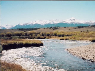
Box Elder Creek

For the town of Castle Rock, resources from the South Platte, and tributaries such as Box Elder Creek, will play an important role in achieving 75 percent renewable water supplies by 2030.

Castle Rock water broker Walraven Ketellapper of Stillwater Resources identified the Box Elder Creek property, as well as an accompanying farm off of U.S. 34 near Riverside Reservoir. This second property, commonly referred to as the Rothe Recharge, would fulfill the city’s legal obligation to offset its footprint. The groundwater from this property naturally flows back into the South Platte, serving as “recharge” credit and replenishing water levels in the river.

While the Box Elder Creek property remains under option for Castle Rock, the recharge property has already been purchased by the city for the sum of $5.2 million from Union Colony Agriculture, LLC, an affiliate of San Diego-based company Summit Global Management.

Castle Rock Utilities Director Mark Marlowe said the city had yet to evaluate the environmental impact of the pipeline project, pending the final decision on how the properties will be managed. While much of the initial engineering plans have been outlined, the water purchased by Castle Rock will need to pass through the state court for final approval.

“An important thing to remember with this project is that it is very preliminary. We don’t know yet how we’ll get it to Castle Rock and we certainly don’t want to adversely impact the people of Weld County,” Marlowe said.

The effect of developing well fields to pump groundwater out of he Box Elder Creek Basin has provoked concern among some Colorado water developers.

Randy Ray, executive director of Central Colorado Water Conservancy District, based in Greeley, questioned the logic behind replenishing water downstream, rather than at the source of pumping. He said the current option could potentially dry up the basin.

“The right location would be directly on the creek. Replace it where you pump it,” Ray said. “Rothe would go to the South Platte downstream of the confluence of the South Platte and Box Elder Creek, not a long way downstream, but still downstream. They would not be able to replace water where it had been pumped, unless they piped it.”

Ray expressed concern that recharge downstream would diminish the Box Elder Creek area’s groundwater resources and leave users of shallow, alluvial wells without access to water.

“They would mine the aquifer down and create a situation where current water users wouldn’t have any water to pump,” he said. “It’s more of a closed type of basin and if you pump it out and don’t replace it, you’re just mining it down.”

Werner expressed concern over such “buy and dry” strategies that reduce available resources for future generations.

“Anytime you are looking at your base supply leaving the region, you are looking at fewer opportunities for those communities that are growing. That’s one of the concerns. The biggest problem is that when you start doing that — and water runs uphill to money — growing cities will find the water,” Werner said.

Castle Rock’s most recent analysis on the project indicated no intention to relocate the recharge point.

“Our consultants feel there is significant risk to the project if the town is required to replace depletions by delivering augmentation water to Box Elder Creek,” the city’s 2012 Legacy Water Projects report said.

An alternative option would be a 25-mile pipeline connecting the creek to the South Platte River. With an estimated $30 million price tag for such an addition, the town declined the option.

A separate Stillwater project on Box Elder Creek in Arapahoe County provoked similar debate about drying up ag land, particularly among local cattle ranchers. They feared the plan to pump 500 acre feet from the basin would dry wells and pools used by livestock, according to local media reports. The proposal would have pumped one-fifth of the quantity under consideration by the Castle Rock plan.

Ketellapper said that although the concepts for the two Box Elder Creek augmentation projects coincide in many regards, the Weld project is entirely separate. He did not acknowledge the same environmental concerns as those expressed in Arapahoe County but did say the Weld property would likely be converted to dryland agriculture.

“It will be 10 or 15 years before the water is going to be needed in Castle Rock. In the short term, that water would continue to be used in Weld County. In the long term, that farm would be repurposed into dryland agriculture or grazing from irrigated agriculture,” he said.

For future water sales, Werner proposed Weld County consider forming a fund to allow quicker action and improve competitiveness when water rights come up on the market.

“We’ve talked for a while about creating a water bank in Northern Colorado so that the farmers who are going to sell for whatever reason have somewhere to go. We’ve talked about the idea but have never come up with a way to fund it,” he said. “You need a chunk of money in order to pay these people. Instead of selling to East Cherry Creek Valley, or whoever it is, we could keep it here.”

Werner said that although the idea of creating a water bank is generally well-received, the difficult task would be to secure funding, possibly through a tax measure…

Speculation concerns

The $5.2 million Rothe property, located off of U.S. 34 near the Riverside Reservoir in eastern Weld County, came to the town of Castle Rock through Union Colony Agriculture, LLC, an affiliate of San Diego-based Summit Global Management. The hydro-commerce company has been active on the Colorado water market since 2008, sparking concern of water speculation due to its ambitious plans to purchase and resell water rights at a premium price.

Union Colony Agriculture managers Eric Vanderhye and John McIntyre declined to comment on the Castle Rock project or provide any details on the company’s management or business plans.

United Water and Sanitation District President Bob Lembke collaborated with the company during its early efforts to build a portfolio of water properties in Colorado through Summit Water Development Group (SWDG) and its subsidiaries. Lembke shares ownership with his partners at Summit of another Colorado company, Gilcrest Reservoir, LLC. He is currently in the process of buying out Summit’s holding in the company to move forward with reservoir development plans.

Lembke said Summit has failed to find the success it had hoped for in Colorado and is currently liquidating its assets.

“Some years ago Summit came into town. They were talking to a number of folks in the water sector and they had, what was at the time, a great idea to add some capital to water. At that time, they purchased a piece of my water portfolio,” Lembke said. “I think they’ve decided they don’t have the ability to meet the goals they articulated six or seven years ago and I believe they are liquidating most of their Colorado assets.”

Among the properties purchased by Summit under Lembke’s guidance was the Rothe property. Other assets recently sold by Union Colony Agriculture include approximately 50 to 100 acre feet of water transferred to the city of Greeley. The sale must still go through the state’s water court.

In February 2012, Northern Water rejected a transfer request made by another Summit Global Management company, also managed in part by Vanderhye, called Longview Agriculture. Northern Water became concerned that the company’s plan would artificially inflate prices for Colorado-Big Thompson project water and harm the district.

The company’s intention to later resell the shares provoked concern at Northern Water that Summit meant to trade water as one might trade stocks in a company.

In 2012, Longview Agriculture was also rejected by the Central Colorado Water Conservancy District in the purchase of Fulton Ditch shares.

More South Platte River Basin coverage here.

We called this new channel the San Powell, combining the name of the river and the lake — @JonatWaterman

A high desert thunderstorm lights up the sky behind Glen Canyon Dam -- Photo USBR
A high desert thunderstorm lights up the sky behind Glen Canyon Dam — Photo USBR

Here’s an in-depth look at the current state of Lake Powell, through the eyes of Jonathan Waterman writing for National Geographic. Click through to read the article, watch his short film history of the Colorado River and the photos. Here’s an excerpt:

In early September, at the abandoned Piute Farms marina on a remote edge of southern Utah’s Navajo reservation, we watched a ten-foot (three-meter) waterfall plunging off what used to be the end of the San Juan River.

Until 1990, this point marked the smooth confluence of the river with Lake Powell, one of the largest reservoirs in the U.S. But the lake has shrunk so much due to the recent drought that this waterfall has emerged, with sandy water as thick as a milkshake.

My partner DeEdda McLean and I had come to this area west of Mexican Hat, Utah, to kayak across Lake Powell, a reservoir formed by the confluence of the San Juan and the Colorado Rivers and the holding power of Glen Canyon Dam, which lies just over the border in Arizona. Yet in place of a majestic reservoir, we saw only the thin ribbon of a reemergent river channel, which had been inundated for most of the past three decades by the lake. We called this new channel the San Powell, combining the name of the river and the lake.

More Colorado River Basin coverage here and here.

Water reuse: “It’s not a question of ‘Can we do it?’ We can do it” — John Rehring #COWaterPlan

Reverse Osmosis Water Plant

From The Denver Post (Bruce Finley):

Colorado water providers facing a shortfall…are turning to a long-ignored resource: wastewater.

They’re calculating that, if even the worst sewage could be cleaned to the point it is safe to drink — filtered through super-fine membranes or constructed wetlands, treated with chemicals, zapped with ultraviolet rays — then the state’s dwindling aquifers and rivers could be saved.

Colorado officials at work on the first statewide water plan to sustain population and industrial growth recognize reuse as an option.

“We need to go as far and as fast as we can on water-reuse projects,” Colorado Water Conservation Board director James Eklund said.

But there’s no statewide strategy to do this.

Other drought-prone states, led by Texas, are moving ahead on wastewater conversion to augment drinking-water supplies.

Several obstacles remain: huge costs of cleaning, legal obligations in Colorado to deliver water downstream, disposal of contaminants purged from wastewater, and safety.

Local water plans recently submitted by leaders in five of Colorado’s eight river basins all call for reuse, along with conservation and possibly capturing more snowmelt, to address the projected 2050 shortfall.

Front Range utilities will “push the practical limit” in reusing water, according to the plan for the South Platte River Basin, which includes metro Denver. The Arkansas River Basin plan relies on reuse “to the maximum potential.”

Western Slope authorities in the Gunnison, Yampa and Colorado river basins contend Front Range residents must reuse all available wastewater as a precondition before state officials consider new trans-mountain projects.

The emerging Colorado Water Plan, to be unveiled Dec. 10, remains a general guide, lacking details such as how much water is available. Nor does this 358-page draft plan specify how much of Colorado’s shortfall can be met by reuse.

Water industry leaders urge an aggressive approach. Colorado officials should determine how much water legally can be reused and analyze how this could boost supplies, WateReuse Association director Melissa Meeker said in a letter to the CWCB. Colorado’s strategy “should be crafted to encourage innovation and creativity in planning reuse projects.”

Cleaning up wastewater to the point it can be reused as drinking water long has been technically feasible. Water already is recycled widely in the sense that cities discharge effluent into rivers that becomes the water supply for downriver communities.

Cleaning systems

In 1968, utility operators in Windhoek, Namibia, a desert nation in Africa, began cleaning wastewater and pumping it into a drinking-water system serving 250,000 people.

Denver Water engineers in the 1980s pioneered a multiple-filter cleaning system at a federally funded demonstration plant. From 1985 to 1991, Denver Water used wastewater to produce 1 million gallons a day of drinking water, which proved to be as clean as drinking water delivered today.

Delegations of engineers from Europe and the Soviet Union visited.

“There was a sense we were ahead,” said Myron Nealey, a Denver Water engineer who worked on the project.

But utility leaders scrapped it, partly out of fear that customers would object to drinking water that a few hours earlier might have been flushed from a toilet. They also were struggling to dispose of thousands of gallons a day of purged contaminants — a super-concentrated salty mix that must be injected into deep wells or buried in landfills. [ed. emphasis mine]

So Denver Water has focused instead on recycling wastewater solely for irrigation, power-plant cooling towers and other nonpotable use. An expanding citywide network of separate pipelines distributes this treated wastewater — 30 million gallons a day.

“Reuse is definitely a way to maximize the use of the water we have,” said Jim Lochhead, manager of Denver Water and former natural resources director for the state.

“We’re in the exploration stage of trying to analyze what are the options for various types of reuse,” Lochhead said. “What’s the most effective? What’s the least costly? What’s the most secure?”

Meanwhile, drought and population growth in Texas have spurred construction of water-cleaning plants at Wichita Falls and Big Spring. Engineers have installed water-quality monitoring and testing systems sensitive enough to track the widening array of pathogens, suspended particles and hard-to-remove speciality chemicals found in wastewater.

A Texas state water plan calls for increasing reuse of wastewater eightfold by 2060. The New Mexico town of Cloudcroft is shifting to reuse as a solution to water scarcity. And California cities hurt by and vulnerable to drought, including San Diego, are considering wastewater conversion for drinking water.

Costs can be huge, depending on the level of treatment. Water industry leaders estimate fully converted wastewater costs at least $10,000 per acre-foot (325,851 gallons).

By comparison, increased conservation, or using less water, is seen as the cheapest path to making more water available to prevent shortages. The most costly solution is building new dams, reservoirs and pipelines that siphon more water from rivers.

Colorado also faces legal constraints. The first-come-first-serve system of allocating water rights obligates residents who rely on diverted water from rivers to return that water, partially cleaned, to the rivers to satisfy rights of downriver residents and farmers.

However, much of the Colorado River Basin water diverted through trans-mountain pipelines has been deemed available for reuse. Western Resource Advocates experts estimate more than 280,000 acre-feet may be available. In addition, water pumped from underground aquifers — the savings account that south Denver suburbs have been tapping for decades — is available for reuse.

Indirect reuse

While nobody in Colorado has embarked on direct reuse of treated wastewater, Aurora and other cities have begun a form of indirect reuse that involves filtering partially treated wastewater through river banks. This water then is treated again at Aurora’s state-of-the-art plant. Cleaned wastewater then is blended with water from rivers to augment municipal supplies.

The most delicate challenge has been dealing with safety — making sure engineered water-cleaning systems are good enough to replace nature’s slow-but-sure settling and filtration.

While industry marketers focus on semantics to try to make people feel more comfortable — rejecting phrases such as “toilet to tap” to describe reuse — engineers are honing the systems.

They envision early-detection and shut-off mechanisms that quickly could stop contaminants left in water from reaching people. They aim for filtration and other advanced treatment sufficient to remove the multiplying new contaminants found in urban wastewater. Cleaning water increasingly entails removal of plastic beads used in personal-care products; mutating viruses; resistent bacteria; synthetic chemicals such as herbicides; ibuprofen; birth control; anti-depressants; and caffeine.

“That’s the whole job of treatment and monitoring, to remove pathogens and other contaminants to where it is safe to drink,” said John Rehring of Carollo Engineers, a Denver-based expert on water reuse.

“It’s not a question of ‘Can we do it?’ We can do it,” he said. “And because of growing affordability and public acceptance, we’re starting to see it implemented.”

Fountain Creek: “Our infrastructure is not just behind, it is decaying” — Merv Bennet

From The Pueblo Chieftain (Chris Woodka):

Colorado Springs is facing a lawsuit over the failure of voters to approve a drainage district in the Nov. 4 election. The Lower Arkansas Valley Water Conservancy District board voted to give Colorado Springs notice that it would file a federal lawsuit over violations of its stormwater permit under the Clean Water Act. The lawsuit could be filed in 60 days, although the district is willing to discuss “effective remedies” during that time.

The board also voted to ask Pueblo County commissioners to investigate whether Colorado Springs has violated its 1041 permit for the Southern Delivery System because it has not adequately funded stormwater protection for Fountain Creek.

“We’re frustrated about to our limit,” Lower Ark Chairman Lynden Gill told Colorado Springs Councilman Merv Bennett, utility board chairman, who spent an hour explaining how Colorado Springs intends to deal with the stormwater question after the failure of a regional drainage district in the election.

“We’re not going to give up. We’ll keep moving forward,” Bennett told the board.

Bennett argued that Colorado Springs is in compliance with the 1041 permit, but is obligated to fund stormwater as well. He was optimistic that voters eventually would approve a drainage district, acknowledging that a two-year effort with the support of political and business leaders had not been enough to convince voters this year.

He received a chilly reception.

“We had a meeting two years ago, and other than the dates, nothing has changed,” said Melissa Esquibel, a Lower Ark board member from Pueblo.

Esquibel asked Bennett if the city still has a $535 million backlog of projects without a stable source of funding. The total for El Paso County is $700 million.

Bennett said that $140 million-$160 million of that total is critical, but noted that the regional approach, which would have generated $40 million annually to deal with that. Other measures, including the Drainage Criteria Manual, have been taken as well, and the city is in compliance with its 1041 permit, he said.

Bennett pleaded for more time and cooperation.

“I don’t see us working together,” said Lower Ark General Manager Jay Winner. He said talks between the district and Colorado Springs on water issues ended shortly after SDS permits were issued.

“If there have been sins of the past, I’d like to correct them,” Bennett said. “Our infrastructure is not just behind, it is decaying.”

That failed to sway the Lower Ark board, which had been teeing up the lawsuit for nearly two years. The board did not revive an earlier approach to sue the Bureau of Reclamation for failure to enforce its permit, opting instead to go after Colorado Springs directly.

“This was the more productive approach,” said Peter Nichols, Lower Ark’s water attorney.

The notice to sue cites Colorado Springs’ reduction in stormwater funding, deterioration of infrastructure, failure to control structures, failure to reduce discharge of pollutants and failure to prevent discharges that could affect public health as bases for the lawsuit.

From The Colorado Springs Gazette (Monica Mendoza):

Colorado Springs City Councilman Merv Bennett threw himself on the mercy of the Lower Arkansas water board Wednesday asking for more time for the city to develop a permanent stormwater funding plan.

Colorado Springs has had plenty of time, said Melissa Esquibel, a board member of the Lower Arkansas Valley Water Conservancy District. It’s time to sue, she said.

The board voted unanimously to put Colorado Springs on notice for a lawsuit over its lack of a stormwater funding program.

Colorado Springs is violating its Municipal Stormwater National Pollutant Discharge Elimination System Permit, “as a result of its failure to provide adequate funding to support stormwater, to properly maintain its stormwater facilities and to reduce the discharge of pollutants from the MS4 (permit) to the maximum extent practicable,” says the Wednesday letter sent to Mayor Steve Bach, City Council President Keith King and City Attorney Wynetta Massey.

The violations adversely affect human health and the environment and are resulting in worsening water quality on Fountain Creek, the letter says.

“What it boils down to is we are frustrated,” said Lynden Gill, water district board chairman. “It’s about to our limit.”

The water district board, which includes Pueblo, Otero, Crowley, Bent and Prowers counties, had contemplated litigation two years ago. But Colorado Springs elected officials promised to find a permanent source of funding, instead of annually piecing together money from the general fund and federal grants, which are not guaranteed, to pay for flood control projects, said Jay Winner, the water district’s general manager.

The lawsuit talk was tabled, he said.

Folks in the Arkansas Valley were hopeful that El Paso County, Colorado Springs, Manitou Springs, Fountain and Green Mountain Falls voters would approve a 
20-year plan to fund a stormwater program. But the ballot measure, which included the creation of a governmental entity and the collection of a fee from all property owners, was defeated 53 percent to 46.7 percent this month.

Massey said through a city spokeswoman that she did not have time to review the letter of intent to file suit, which arrived late Wednesday afternoon.

King dismissed the threat of litigation and said it would be difficult to distinguish if pollutants in Fountain Creek originated from Colorado Springs or from Pueblo.

“I don’t think they have grounds,” King said.

Colorado Springs earmarked $18 million for stormwater projects in 2013 and $26 million in 2014, Bennett said. The bulk of that money is federal grants. For example, in the proposed 2015 budget, the city expects to spend $38 million on stormwater projects. Of that, $5 million is from the general fund. The rest is money carried over from the previous year and $18 million in grants.

Arkansas Valley water board members were not impressed with the numbers.

“A couple of years ago we had a meeting in Pueblo, and other than the date, nothing has changed,” Esquibel said. “I don’t see significant action.”

The issue with the Arkansas Valley water district is different from one raised by Pueblo County commissioners, who said Colorado Springs Utilities promised to make flood control improvements on Fountain Creek as part of an agreement to pump water out of the Pueblo Reservoir to Colorado Springs in the 
$1 billion water pipeline project called Southern Delivery System. When the permits for SDS were inked, Colorado Springs had a stormwater fee in place and a list of projects designed to head off floodwaters going south. But the fee ended in 2009 and left Pueblo officials wondering if the promised flood control projects would be built.

Bennett told the water board that Utilities has committed to spending $131 million to mitigate flooding and improve water quality on Fountain Creek, including $50 million scheduled to be paid to the Fountain Creek District to mitigate the impacts of SDS to Fountain Creek in Pueblo County.

“We are taking responsibility for improvements on Fountain Creek,” Bennett told the board.

He fears that litigation would hold up work on the SDS project and the $50 million payment to Fountain Creek District, he said.

Esquibel said the Arkansas Valley water board won’t be held hostage by the threat of holding up the $50 million payment. Instead, the board voted unanimously to urge Pueblo County commissioners to review its permits with Colorado Springs Utilities related to water flow in Fountain Creek and take its own legal action.

The letter of intent to sue puts Colorado Springs on notice of a possible lawsuit, said Peter Nichols, the attorney for the Arkansas Valley water board. The board has 120 days to decide if it wants to go forward with the suit.

“Maybe a notice of intent to sue will wake up the people in Colorado Springs,” board member Wayne Whittaker said.

From The Pueblo Chieftain (Chris Woodka):

Pueblo County commissioners are mulling their response to Colorado Springs in light of the Nov. 4 rejection of a regional drainage authority by El Paso County voters.

“What we’re doing is looking at all the legal options, including the 1041 permit,” said Terry Hart, chairman of the commission. “Our best approach is using the leadership of all the governments in Pueblo County to do the right thing. We want to do this as professionally and swiftly as possible.”

On Wednesday, the Lower Arkansas Valley Water Conservancy District board voted to sue Colorado Springs for violation of the federal Clean Water Act.

The board also voted to ask Pueblo County commissioners to look at whether Colorado Springs violated the conditions of its 1041 permit for Southern Delivery System. Among those conditions are adherence to a Bureau of Reclamation contract which was negotiated on the premise that a stormwater control authority and fee were in place. The stormwater authority would address flooding issues on Fountain Creek caused by development in Colorado Springs, which has an estimated $535 million in backlogged projects.

Colorado Springs City Council eliminated the authority in late 2009, based on its interpretation of a public vote, and in 2012 helped create a task force to look at a regional stormwater authority.

Voters in El Paso County rejected that by a 53-47 percent margin.

Last week, District Attorney Jeff Chostner, a former Pueblo County commissioner, threw his weight behind the county effort. Both Hart and Jay Winner, general manager of the Lower Ark district, say they would like Pueblo City Council to get involved as well.

Commissioners on Monday discussed options with their attorneys in executive session. In addition to the 1041 permit, the county is looking at the Clean Water Act, the Reclamation contract and the legal rights of downstream vs. upstream water users.

“We hunkered down with our lawyers to look at what options we have going forward,” Hart said.

Average October temperatures worldwide highest recorded since 1880 — @DroughtGov

The latest winter outlook is hot off the presses from the Climate Prediction Center

From Climate.gov:

After a memorably cold winter in the central and eastern United States last year, and some very cold weather this month, folks are likely wondering if this cold weather is a harbinger of things to come. The simple answer is “not necessarily,” as the persistence of weather and climate from one winter to the next or even one month to the next is usually fairly low (Livezey and Barnston 1988; Barnston and Livezey 1989; Van den Dool 1994). While “persistence”—the prediction that recent conditions will continue—is a simple forecast to make, it rarely proves to be as accurate as forecasts made using dynamical models or more advanced statistical methods.

So does that mean this won’t be a cold winter in the central and eastern part of the nation? Again the answer is “not necessarily.” According to the NOAA Climate Prediction Center (CPC) mid-November outlook, odds favor below-normal temperatures in certain parts of the country, and many of those areas do turn out to be in the south-central and southeastern United States, as we will discuss shortly.

Furthermore, and perhaps more importantly, even in regions where above-normal temperatures are favored, a colder-than-normal winter is still a possibility. Remember, CPC’s outlooks describe probabilities, which means—as we’ve explained in earlier blog posts—that even when one outcome is more likely than another, there is still always a chance that a less favored outcome will occur.

The El Niño-Southern Oscillation (ENSO) provides strong clues as to what we can expect during winter across much of the United States. Of course, this only applies when El Niño or La Niña are present, and as we approach winter, we find ourselves still waiting and wondering if El Niño is going to begin or not. However, despite the reluctance of El Niño to show itself so far this year, CPC forecasters have considered potential impacts from El Niño and have slightly tilted the outlook (particularly the precipitation outlook) in that direction.

And if El Niño remains a no-show this year, what will this mean for the forecast? Actually, as you might expect, not much, because the forecasters understand the fact that El Niño has a 58% of developing, which also means that there’s a 42% chance that it won’t. To see how information about El Niño gets incorporated into the forecast, let’s take a look at the precipitation outlook. (El Niño often has a more robust influence on precipitation than on temperature.)

The winter precipitation outlook favors wetter-than-normal conditions across the southern tier of the nation extending northward along the East Coast, as well as in southern Alaska, and drier-than-normal conditions in central Alaska, parts of the Pacific Northwest and around the Great Lakes and Ohio Valley. This pattern is quite consistent with the average precipitation patterns seen during previous El Nino winters.

However, you’ll note that the largest probabilities on this outlook are all less than 50%. This means that while above-normal precipitation across the South is the most likely out of the 3 possibilities (below normal, near normal, or above normal), it’s more likely that we’ll see precipitation that is “not above-normal.” That is, the combined chance that the outcome will fall in one of the other two categories (near normal or below normal) is higher.

It’s like spinning a climate roulette wheel. While the “above” area is the biggest piece of the pie, the near-normal and even below-normal areas are not insignificant and could occur. These are very modest probabilities for an El Niño winter and reflect the reality that El Niño is not a sure bet for this winter. And even if it does develop, it’s likely to be a weak event, resulting in weak impacts.

For example, in contrast to this year’s ENSO situation, precipitation probabilities in Texas and Florida during the 2009-10 winter outlook exceeded 50% for above-normal rainfall, and they exceeded 70% during the peak of the 1997/98 event. In both cases, the most likely or favored result occurred, as wetter-than-average winters prevailed. This year our confidence level is not so high, but we still think the probability for above normal is higher than it would be purely due to chance, which would be 33.33%.

The temperature outlook favors a warmer-than-normal winter over Alaska, the Western United States, and northern New England, while below-normal temperatures are favored across much of the south-central (2) and southeastern parts of the nation. Probabilities of above-normal temperature exceed 50% along the West Coast, so this region has a significantly reduced chance (just 15%, according to the pie chart) of seeing a colder-than-normal winter.

Also note that both maps include areas where neither above- nor below-normal conditions is favored. Those areas are shown in white, which represents “equal chances,” and it means that the odds for above, near, or below-normal are all the same (33.33%). This doesn’t mean that temperature or precipitation is expected to be normal this winter in those regions (the probability for that is also 33.33%), but rather that there’s no tilt in the odds toward any of the three categories. Thinking back to the roulette wheel, the areas of each region would be the same, so the likelihood of any of the three categories occurring is also the same.

Making seasonal forecasts is a very challenging endeavor. Seasonal climate models are not as skillful as weather models, and phenomenon like El Niño or La Niña only provide some hints as to what might occur during an upcoming season. CPC issues probabilistic seasonal forecasts so users can take risk and opportunities into account when making climate-sensitive decisions.

However, keep in mind that these outlooks will primarily benefit those who play the long game. The maps show only the most likely outcome where there is greater confidence, but not the only possible outcome. For example, while the outlook favors above-normal temperatures in northern New England, it wouldn’t be shocking for temperatures this winter to be near-normal or even colder-than-normal. I just wouldn’t bet on it.

Drought news: No changes in Four Corners #drought depiction

Click here to go to the US Drought Monitor website. Here’s an excerpt:

Summary

Bitter cold along with some snow settled over the central U.S., affording little — if any — drought relief. Farther east, soaking rainfall eased drought conditions in the Southeast, while highly variable rainfall in the Mid-Atlantic and Northeast mostly prevented expansion of abnormal dryness. Out west, most of the region’s core drought areas remained dry, though locally heavy rain and mountain snow were observed in parts of the Northwest. A shallow to moderate snow cover encompassed more than 50 percent of the contiguous U.S. at the end of the period, establishing a new benchmark for the date…

Central Plains

Despite a mostly dry week, the drought depiction over the central Plains remained unchanged due to bitter cold. A historically cold air mass settled over the region, with temperatures averaging 20°F or more below normal. Long-term drought remained entrenched over the central High Plains, where precipitation dating back 36 months has tallied 60 to 75 percent of normal…

Southern Plains and Texas

Bitter cold — albeit dry — weather resulted in no change to the drought depiction except along the Texas Gulf Coast. Temperatures averaged 15 to 25°F below normal for the week, with some shallow snow noted over northern portions of the region at the end of the monitoring period. Despite the frigid, mostly dry conditions, some Abnormal Dryness (D0) was reduced along the southeastern coast of Texas where rainfall totaled locally more than 2 inches. Short-term drought remained most intense (Exceptional Drought – D4) along the Texas-Oklahoma border west of Wichita Falls, where 90-day precipitation has totaled less than 50 percent of normal. In contrast, many of the long-term drought areas (“L” designation) from Texas into Colorado have received above-normal precipitation over the past 90 days, but are still wrestling with the impacts of longer-term deficits (60-80 percent of normal over the past three years)…

Western U.S.

Variable conditions in the north contrasted with ongoing drought elsewhere. In addition, Santa Ana winds developed in California, exacerbating drought and enhancing the risk for wildfires. The current Water Year has been largely a disappointment in central and southern portions of the region, but has gotten off to a good start in the Northwest.

In northern portions of the region, a steady plume of Pacific moisture helped produce 1 to more than 4 inches (liquid equivalent) of precipitation in the Cascade Range, providing localized relief from Abnormal Dryness (D0) to Severe Drought (D2) in southwestern Oregon. Despite the beneficial moisture, the drought areas of southwestern Oregon are still contending with the impacts of last season’s poor end to the Water Year; 12-month precipitation averaged 60 to 85 percent of normal in the state’s remaining drought areas despite this week’s higher totals. In contrast to the localized Northwestern improvements, D0 was increased northward in Idaho and far northwestern Montana, where 60-day precipitation has tallied locally less than 60 percent of normal

Farther south, the 2014-15 Water Year has afforded little — if any — drought relief to California. Despite some light to moderate precipitation (0.2 to 1 inch, liquid equivalent) during the period across central and northern California, the totals still fell short of normal and did nothing to offset the impacts of the ongoing three-year drought. The current Water Year (which began October 1) has gotten off to an abysmal start; rainfall to-date (since October 1) has totaled 10 to 35 percent of normal in the Exceptional Drought (D4) areas around San Francisco, and locally less than 20 percent of normal in the D4 around Los Angeles. Likewise, the dry, mostly mild start to the winter has left snowpacks in the Sierra Nevada well short of normal. The dryness has been exacerbated by Santa Ana winds, which gusted over 40 m.p.h. in southern California.

In the Great Basin and Four Corners, there were no changes to this week’s drought depiction despite the very poor start to the current Water Year, particularly in western portions of the region. The season’s poor initial prospects are reflected by season-to-date (since October 1) precipitation, which has totaled locally less than 10 percent of normal in the Great Basin and western portions of the central and southern Rockies, with most areas reporting less than 30 percent of normal. Changes to the drought depiction across much of the west are typically slow to occur during the early part of winter, as the development of the Water Year will be crucial to the region’s drought relief (or development) prospects…

Looking Ahead

Milder weather will gradually develop over much of the nation, with precipitation chances greatest east of the Plains and in the Northwest. Following bitter cold early in the period, intensifying southerly flow will allow above-normal temperatures to develop across much of the nation. The moist, warm flow from the Gulf will set the stage for locally heavy rain from the southeastern plains and Mississippi Valley to the Appalachians. Meanwhile, an additional influx of Pacific moisture will produce locally heavy rain and mountain snow in the Northwest, with some moisture expected to spread into the northwestern quarter of California. However, the southern Rockies will remain mostly dry. The NWS 6-10 day outlook for November 25 – 29 calls for below-normal temperatures across much of the U.S., with warmer-than-normal weather confined to New England and west of the Rockies. Meanwhile, below-normal precipitation from California to the central and southern Plains and Delta will contrast with wetter-than-normal conditions along the East Coast and across the nation’s northern tier.

Denver Water presented with two conservation awards #ColoradoRiver

New GAO report shows we must act now to address the growing economic costs of climate change in Colorado — @SenBennetCO

Powerful new film “Warm Springs” tells story of boating on the Yampa River

CWCB Board approves draft #COWaterPlan: “Now there is a product for Colorado to talk about” — James Eklund

Summary of Observed Wet & Dry Surface Water Hydrology via SCW

From The Mountain Town News (Allen Best):

Russ George spoke with the pride of a new father, and in a sense he was. The Colorado Water Conservation Board, of which George is a member, had just heard comments on the statewide water plan.

Several speakers called for improvements. Conservation goals could be more ambitious. The effect of transmountain diversions on Colorado’s ability to comply with the Colorado River Compact could be spelled out better. Assessments of streams need to be planned to serve as baselines.

But most speakers stressed that by and large they were happy with the document, at least in its draft form, that was assembled in response to Gov. John Hickenlooper’s executive order of May 2013.

Board members themselves had relatively few comments. George, a former state legislator and state department head, then spoke. “What we have in front of us today is exactly what was conceived in 2003,” he said.

Colorado was trying to catch it breath after the severe drought of 2002 that had at least one municipal water manager wondering about the need to start rationing water for indoor use. A giant up-slope storm in March 2003 took the edge off Front Range communities. But snowpack in the Colorado River Basin, the source of 80 percent of Colorado’s water, weren’t much better for the next couple of years.

Basin roundtable boundaries

In September 2004, at a conference in Grand Junction, George laid out a vision of roundtables representing major river basin of the state, to begin dialogue about the state’s water future. A former water lawyer from the Western Slope, he was then the director of the Department of Natural Resources. In his remarks in Berthoud, he did not attempt to take personal credit for the idea.

In 2005, the Legislature approved the idea in H.B. 1177. And, as George recalled in his comments on Wednesday, basin roundtables have been meeting every since, sometimes several times a month. The state has been knitted together in ways it had not been, he said, and the dialogue has yielded the plan.

“We have done what we were asked to do,” he said, and moments later moved to accept the draft plan, with the intention of submitting it to Hickenlooper by Dec. 10, the governor’s deadline. The CWCB, Colorado’s leading water policy-making board, approved the motion without dissent or further comment.

coloradotransmountaindiversions

Have water arguments ended in Colorado? Hardly. The issue of new transmountain diversions remains volatile.

“Western Colorado has no more water to give,” declared Mike Samson, a Garfield County commissioner. Additional diversions will mean “the quality of life will suffer greatly,” he added.

Hayfield message to President Obama 2011 via Protect the Flows

Information in state planning about effects on recreation and the environment “needs to catch up” with other parts of the planning process, said Kathy Chandler-Henry, an Eagle County commissioner.

Drew Beckwith, with Western Resource Advocates, cautiously criticized the draft plan as having conservation goals that really reflect nothing more than gains already being made.

He did, however, concede the possibility of “small” additional transmountain diversions but rejected any possibility of “large” transmountain diversions.

And what is small and large, he was asked.

“Small” would be 20,000 acre-feet of annual diversions, but 75,000 acre-feet would definitely be large—perhaps scooping up the last of Colorado’s allocation of the Colorado River, he responded.

The issue of new transmountain diversions has been sensitive. For many months, Eastern Slope representatives at the Interbasin Compact Committee, a kind of supergroup of the various basin roundtables, insisted upon calling transmountain diversions ”new supply.”

At another meeting of the IBCC in February, there was a comical moment when an understanding of Colorado’s limits on water was acknowledged. One member urged secrecy for the time being, so as not to upset the grassroots constituents who apparently want to believe in endless additional amounts of water.

And, of course, the discussions have become an alphabet soup. One easy example: TMD. (Transmountain diversions).

Assuming that Hickenlooper stays the course with his directive, it’s now up to the staff of the Colorado Water Conservation Board to fill in the gaps in this alphabet soup and polish what it already has. The talking is far from over. Hickenlooper’s deadline for the final production is December 2015.

From The Durango Herald (Peter Marcus):

After hearing an overview of the comprehensive plan that took a year-and-a-half to craft, the board voted unanimously to send it to the governor, sparking applause from an attentive audience. One board staff member cried upon its passage, highlighting the long, tedious journey of the plan.

Hickenlooper ordered the plan in May 2013; a final plan must be completed by Dec. 10, 2015.

Board members are careful to point out that the roadmap is a “living document” that can be changed over the years.

“We will take the direction that (the governor) has given … to you all and make sure we are all on the same page and moving forward together onward into 2015,” said James Eklund, director of the Colorado Water Conservation Board.

The municipal water supply gap is growing in Colorado, with shortfalls expected by 2050. The result could be agricultural dry-up and fish and wildlife extinction, not to mention increased demands and pressure on municipalities.

The Water Plan aims to provide a roadmap for the future while protecting private ownership of water rights. Colorado uses a so-called “prior appropriation” system. In this system, rights are granted to the first person to take water from a river or aquifer, despite residential proximity.

But the plan must navigate a maze of state, local and federal laws, as well as balance the needs of agricultural-heavy rural Colorado with the rapidly expanding urban-centered Front Range.

There has long been resistance from rural Colorado to transmountain water diversions for Front Range communities. Some municipalities end up purchasing water rights from farmers when there is no diversion, leaving ag land dry.

“We have no more water to give,” Mike Samson, a Garfield County commissioner, told the board during public testimony.

The Water Plan task is monumental. It will end in the first such comprehensive plan for Colorado.

“This is an unprecedented effort,” said April Montgomery, a member of the Water Conservation Board representing the San Miguel, Dolores, Animas and San Juan rivers in Southwest Colorado. “This is the first time we’ve had a grass-roots basin implementation plan.”

Included in the water plan are proposals from eight separate water basins, including a roadmap provided by the Southwest Basin Roundtable.

The basin is more complicated than other basins in the state, flowing through two Native American reservations, the Ute Mountain Ute Reservation and the Southern Ute Indian Reservation. Also the basin includes a series of nine sub-basins, eight of which flow out of state.

Other complications include agreements with the federal government, which owns large swaths of land in the region.

Montgomery said the Water Plan offers Southwest Colorado an opportunity to come together and develop a unified plan moving forward.

The goals of the Southwest include pursuing projects that meet the municipal water gap; providing safe drinking water; prioritizing conservation; and promoting water reuse strategies.

“It’s not a mandate,” Montgomery said. “It just gives us direction.”

Russ George, a member of the water board representing the Colorado River Mainstem, said many thought drafting a plan would be impossible.

“It’s been just an absolutely impossible task, but typical of this outfit, … we did it anyhow,” George said. “There’s no magic here, no promise around the corner, it’s all choice.”

From Aspen Journalism (Brent Gardner-Smith) via The Aspen Times:

The Colorado Water Conservation Board approved a draft Colorado water plan Wednesday and, after minor revisions, will send it to Gov. John Hickenlooper by Dec. 10.

“Now there is a product for Colorado to talk about, where we got it right, where we didn’t get it right,” said James Eklund, the director of the Water Conservation Board, which is a state agency charged with drought planning, water-supply planning and water-project financing.

The Water Conservation Board members present at the meeting in Berthoud, south of Fort Collins, unanimously approved the draft plan after offering limited comments to Eklund as he gave a light overview of the 11 chapters in the plan.

“I think the plan strikes a pretty good balance between the various interests,” said board member Patricia Wells, who is the general counsel for Denver Water. “You’ve walked a very fine line. There are clearly disagreements around the state as to what we should be doing or what other people should be doing.”

The board also took brief comments from members of the public, including Mike Sampson, a Garfield County commissioner who also was representing the Associated Governments of Northwestern Colorado, including Garfield, Routt, Moffat, Rio Blanco and Mesa counties.

“The Western Slope in Colorado has no more water to give,” Sampson said, reading from a letter sent to the Water Conservation Board. “We strongly urge you to oppose any transmountain diversion that will take more water from the Western Slope of Colorado as you develop the Colorado water plan.”

After his presentation, Drew Beckwith, the water policy manager for Western Resource Advocates, was asked a pointed question by Water Conservation Board member John McClow, who represents the Gunnison River Basin.

“Of the last four presenters, we’ve heard the cry to have no more transbasin diversions, but three of you said no more large transbasin diversions,” McClow said. “So what’s large, and why is that a qualifier? You said no more large transbasin diversions. Is a small one OK?”

Beckwith replied that Western Resouce Advocates has previously said relatively small-scale transbasin projects, from 20,000- to 40,000-acre-foot projects, might be acceptable.

“From our perspective, large-scale is 70,000 acre-feet and up,” Beckwith said.

Russell George, who represents the Colorado River Basin on the Water Conservation Board and is the architect of the basin roundtable process, made the motion to approve the draft Colorado water plan, noting that it was a historic day.

He said that when the Colorado Constitution was written in 1876, the framers knew Colorado was a state with “not enough water.”

George said many people, including those serving on the nine basin roundtables, have put a lot of time into the water plan, whether it has been by going to meetings or talking in coffee shops or on the phone.

“You know it, you can feel it, all across the state,” George said, “and they have tried to find today’s answer to this old question and have really helped move the marker forward.”

The draft chapters of the Colorado Water Plan are online at http://www.coloradowaterplan.org.

Aspen Journalism and The Aspen Times are collaborating on coverage of rivers and water. More at http://www.aspenjournalism.org.

More Colorado Water Plan coverage here.

San Juan Basin: “Compliance with [federal salinity discharge standards] is impossible” — Ron Rosen

Wastewater Treatment Process

From the Farmington Daily Times (Dan Schwartz):

A city contractor says Farmington is seeking an exemption from a federal law regulating San Juan River salinity levels.

Compliance with the law — which the city is violating — is impossible, said Ron Rosen, project director for CH2M Hill, an agency contracted to operate the city’s water and sewage treatment plants.

“We’ve been really aggressive. We’ve done everything (the Environmental Protection Agency has) told us to do,” Rosen said.

The main cause of the pollution, he said, is domestic water softeners. They discharge salt into the city’s sewer system, which the Wastewater Treatment Plant then discharges into the San Juan River.

The city is currently testing whether softening water at its treatment plants could reduce its drinking water’s hardness, allowing residents to shut off their water softeners.

In 2005, the EPA began regulating the levels of salt that industries and cities discharge into the Colorado River Basin. The largest river in the basin, the Colorado River, winds about 1,400 miles from the Rocky Mountains to the Gulf of California. The San Juan River is one of its major tributaries.

The regulations date back to the 1944 Mexican Water Treaty and were amended many times before they became law in 1974, when Congress enacted the Colorado River Basin Salinity Control Act.

Now, for Farmington to consistently comply with the law, it would have to spend $60 million to $70 million — an engineering firm’s estimate — and the city can’t afford to do that, Rosen said. The EPA could fine the city $27,500 a day for the violation, but it hasn’t yet, he said.

More San Juan Basin coverage here.

Nebraska, Kansas, Colorado reach key agreement on #RepublicanRiver — Omaha World-Herald

Republican River Basin by District

From the Omaha World-Herald (Joe Duggan):

Nebraska, Kansas and Colorado have reached another key agreement on management of the Republican River for irrigation in 2015. Representatives from all three states, who serve on the Republican River Compact Administration, signed a resolution Wednesday that they said will benefit water users throughout the river basin, according to a press release.

The agreement credits Nebraska for augmentation water delivered to Harlan County Lake before June 1, 2015. Two projects, operated by several natural resources districts in Nebraska, pipe groundwater to the lake to be used for surface irrigation. Water delivered by the projects is for exclusive use by Kansas irrigators.

Wednesday’s agreement follows two related resolutions signed by compact members last month. Representatives from the states say the agreements demonstrate “a new spirit of cooperation” after years of legal battles between Nebraska and Kansas.

In October, the U.S. Supreme Court heard arguments on a special master’s recommendation on penalties for Nebraska’s overuse of compact water in 2005 and 2006. A final decision by the court is expected by the end of June.

More Republican River Basin coverage here.

Weekly Climate, Water and Drought Assessment of the Upper #ColoradoRiver Basin

Upper Colorado River Basin  month to date precipitation November 1 thru 16, 2014 via the Colorado Climate Center
Upper Colorado River Basin month to date precipitation November 1 thru 16, 2014 via the Colorado Climate Center

Click here to read the current assessment. Click here to go to the NIDIS website hosted by the Colorado Climate Center.

Snowpack news: Last week’s storms boost snowpack, Arkansas Basin = 99% of avg., best in state

Click on a thumbnail graphic to view a gallery of snowpack data from the Natural Resources Conservation Service.

From the Vail Daily:

Snow water equivalent

What does 1 inch of water look like in real snow?

“There are lots of rules of thumb people swear by,” said Diane Johnson of the Eagle River Water & Sanitation District. “Mostly you’ll hear 10 inches or 12 inches of snow to 1 inch of snow water equivalent, but it’s always a matter of how much water content is in the snow. Super light, fluffy powder takes a lot of snow depth to equal 1 inch of water.”

Here’s how local snowpack is doing compared to the 30-year SWE average:

Vail Mountain: 44 percent of average

Copper Mountain: 90 percent of average

Fremont Pass: 116 percent of average

From The Aspen Times via the Glenwood Springs Post Independent:

Just when most people were starting to sweat about the lack of snow, the facet turned on. It snowed enough that Aspen Mountain will open five days ahead of schedule. The storm lasting from Thursday through Saturday dumped 21 to 28 inches on the slopes, according to Aspen Skiing Co. spokesman Jeff Hanle. As a result, Aspen Mountain will open early for the second straight season and third time in the last five years. (It opened a day early in 2010 after a huge snowstorm followed dry conditions.)

The snowpack at Independence Pass went from 42 percent of average on Nov. 13 to 84 percent of average yesterday, according to the Natural Resources Conservation Service’s weather station east of Aspen.

From The Pueblo Chieftain (Chris Woodka):

Navigating slick streets over the weekend and watching green lawns re-emerge from a white blanket, many people might have thought the early winter weather of late unusual. It’s not. This is when it is supposed to snow.

“Considering the deficit we had coming into last week, it seemed like a lot, but we’re really right back at normal,” said Charles Kuster, who’s been watching the weather around his Leadville home for the past 30 years. “I’m looking for more snow at the end of this week.”

The polar front that moved into Colorado one week ago left anywhere from 6 inches to a foot of snow in most places in the Arkansas River basin, while a second storm moved through late Saturday and early Sunday with almost as much, according to the Community Collaborative Rain Hail & Snow Network.

In Leadville, where the Arkansas River headwaters begin, 27 inches has fallen since the beginning of the month, Kuster said. That’s more than twice the average for November, but September and October were far below normal.

Conditions are similar throughout the valley, and most water indicators for the Arkansas Valley are right where they’re supposed to be at this time of year.

Arkansas River levels below Pueblo Dam dropped Saturday as winter water storage began, but are right on historic averages.

Snowpack at Snotel sites maintained by the Natural Resources Conservation Service are at 114 percent of median, which is better than the rest of the state. Those readings won’t mean much until next spring.

Precipitation levels for Pueblo were at 11.57 inches Monday, just 0.41 inches below normal.

Quagga mussels seem to have made it downstream of Glen Canyon Dam — John Fleck #ColoradoRiver

The tar sands reserves contain 2x amount of carbon emitted by entire global oil industry—in all of human history — Colorado Independent

Water Values Podcast: @NACWA’s Ken Kirk talking about the past, present and future of clean water

The latest monthly briefing from the Western Water Assessment is hot off the presses

Westwide SNOTEL snow water equivalent as a percent of normal via the NRCS

Click here to go to the Intermountain West Climate Dashboard from the Western Water Assessment. Here’s an excerpt:

Highlights

  • October was much drier than average over most of the region. The first half of November has been more mixed for precipitation, with the Colorado and Wyoming mountains faring the best, and much of Utah remaining on the dry side.
  • After a very slow start to the season, the region’s snowpack has improved markedly since November 1, but is still below normal in most basins.
  • An El Niño event is still likely to occur by spring, but the latest forecasts have again backed off slightly on the odds.
  • Upper Ark district board meeting recap

    Graphic via the Upper Arkansas Water Conservancy District
    Graphic via the Upper Arkansas Water Conservancy District

    From The Mountain Mail (Joe Stone):

    The Upper Arkansas Water Conservancy District board of directors met Thursday in Salida despite wintry road conditions preventing several directors and others from attending the meeting in person. Directors unable to make the drive attended via teleconference, and Cañon City Director of Public Works Bob Hartzman’s report on the Royal Gorge Area Erosion Control Project will be rescheduled.

    Board members unanimously approved the 2015 budget as presented by Rich Young of Stotler and Young accounting firm. Young noted that tax revenue projections for the district decreased because of reduced property valuations.

    During the budget hearing, Director Jeff Ollinger, Buena Vista, questioned the degree of separation between the conservancy district budget and the Water Activity Enterprise budget. He wondered if an increase in enterprise revenue could translate into a reduction in the district’s mill levy.

    District Manager Terry Scanga responded, saying the taxes collected through the mill levy are specifically for the protection of water rights within conservancy district boundaries. Revenue generated through the mill levy, Scanga said, pays for legal fees, court filings and other costs necessary to ensure residents’ water rights are protected. While the conservancy district operates as a governmental entity to protect regional water rights, Scanga said the Water Activity Enterprise operates as a business that uses revenue generated primarily by providing augmentation water to clients. Scanga said those revenues are necessary for the enterprise to acquire additional water sources to meet growing demand.

    In other business Upper Ark district directors:

  • Voted to oppose District 2 Water Court case 2014CW3049, filed by Fremont Paving & Redi-Mix Inc., to change the use of an agricultural water right on the Plum Creek Ditch to augmentation.
  • Learned from Scanga that the state engineer is working to develop new rules that would allow new wells to be developed without a full augmentation plan, similar to wells drilled prior to 1985.
  • Learned from consultant Ken Baker that Senate Bill 14-23, which Gov. John Hickenlooper vetoed this year, will be reintroduced during the next legislative session.
  • Learned from Baker that a bill to provide for management of “invasive phreatophytes” will also be introduced in the legislative session. Phreatophytes are deep-rooted plants that draw water directly from the water table.
  • Learned that Cañon City officials had contacted the Upper Ark district to inquire about purchasing augmentation water.
  • Learned from attorney Kendall Burgemeister that the district’s stipulation in Water Court case 11CW61 has been approved.
  • Adjourned to executive session “to provide direction to staff and receive legal advice for potential purchase of property and water rights.”
  • More Upper Arkansas River Water Conservancy District coverage here.

    Quenching Our Future: Southwest water issues are complex and critical — The El Paso Times #RioGrande #ColoradoRiver

    From the El Paso Times (Marty Schladen):

    Rio Grande and Pecos River basins
    Rio Grande and Pecos River basins

    Last year, when my boss, Bob Moore, mentioned a project about water, I thought the outlines were clear: We live in the desert. There’s not much water. We waste too much. Instead of managing the Rio Grande Basin as a whole, Texas and New Mexico usually just sue each other.

    Each of those is true, but they don’t begin to describe the profound importance of this particular molecule or the size of the challenges it places before us. Thanks to some special good luck, I’ve been able to spend the past few months getting to know just how much I don’t know about them.

    Las Vegas circa 1915
    Las Vegas circa 1915

    Bob connected with Keith Hammonds at the Solutions Journalism Network and secured a grant that will enable us to study the issue long-term and help grope for ways to solve it. It enabled me to travel to a conference of water managers in Las Vegas, where I got to hear some really smart people discuss ways they’re working to ensure taps never run dry in some of the largest, driest metropolitan areas of the country.

    But it was on side trips that the long-term difficulty of water management were manifest. I drove to the North Rim of the Grand Canyon, where the Colorado River gashed through 2 billion years worth of rock and 6,000 feet of geologic time.

    Drought affected Lake Mead via the Mountain Town News
    Drought affected Lake Mead via the Mountain Town News

    When I drove to Hoover Dam, I saw another view of the Colorado.

    Look over the concave side, and you see how humans have harnessed a mighty Western river to generate thousands of megawatts of electricity.

    Look over the convex side and into Lake Mead, and you see nature not bending so easily. There’s a giant, white “bathtub ring” where the people of Las Vegas, Phoenix and Los Angeles — as well as California’s Imperial Valley — are draining the vast reservoir faster than the Colorado is willing to fill it.

    Elephant Butte Reservoir back in the day nearly full
    Elephant Butte Reservoir back in the day nearly full

    The Rio Grande on which we depend is in even worse shape. Less than 10 percent full, its main reservoir at Elephant Butte is unable to provide its customers with anything like their full annual allotment.

    Scientists tell me population growth is driving thirst while the weather is reverting to drier historic patterns. Climate change, they say, will only make things worse.

    I’ve read that we’re in a trap of our own making. We’ve dammed Western rivers, encouraged growth and sought outcomes that ran not only against nature, but also common sense. In “Cadillac Desert,” Marc Reisner writes how in the 1960s, the Bureau of Reclamation spent billions building dams and flooding important natural habitat so it could open western lands so farmers could grow crops the government was paying other farmers not to grow back east, where rain fell reliably.

    The Southwest is old and it’s seen painful versions of this tale before.

    Farview Reservoir Mesa Verde NP
    Farview Reservoir Mesa Verde NP

    Great Indian cultures thrived for centuries, only to disappear when the weather changed or their irrigation practices ruined the soil.

    We’ve made lots of mistakes when it comes to water, but one of the most profound lessons I’ve learned is that this is a story without many villains.

    Who can blame farmers, businessmen or the politicians who represent them for wanting the prosperity reliable water promises? Decades on, though, our prosperity jeopardizes that reliability.

    murraydarlingbasinaustralia

    As part of this project, we got to travel to arid Australia, where the government has a similar history of ill-advised, well-intentioned water projects. A recent, devastating drought terrified the faraway nation and forced it to undertake sweeping reforms that many believe are working.

    I don’t know enough to say whether any are applicable here. But I’m pretty sure we need to start planning a new water framework — now.

    Marty Schladen is the El Paso Times’ Austin bureau reporter.

    More Colorado River Basin coverage here More Rio Grande River Basin coverage here.

    Basalt filmmaker McBride wins award at Banff Mountain Film Festival — The Aspen Times

    From The Aspen Times (Scott Condon):

    Basalt filmmaker and photographer Pete McBride received the Best Short Film Award at the Banff Mountain Film Festival in Banff, Alberta, on Sunday for “Delta Dawn.”

    His 16-minute film documented the temporary rejuvenation of the Colorado River in the Mexican delta in March and April. The U.S. and Mexican governments, as well as conservation groups in both countries, negotiated a release of water that allowed the Colorado to reach the Sea of Cortez for the first time since 1998. The river usually dries up at the border near Yuma, Arizona.

    The Colorado River is near and dear to McBride’s heart. His 2011 film “Chasing Water” followed the Colorado from the headwaters in the Rocky Mountains to the dry delta. Stunning still photos and video from that film drove home the point that “the Colorado is one of the hardest-working rivers in the world.” It nourishes industrial agriculture, feeds desert golf courses and provides drinking water to millions of people. But “Chasing Water” also raised plenty of questions about the ecological damage humankind was causing by draining the river.

    In contrast, “Delta Dawn” celebrates what happened when the river “kissed the sea,” McBride said.

    “It shows we can have environmental successes,” he said.

    He and his fellow river rats made their way down the last 90 miles of the river after a dam at the U.S.-Mexico border was opened. They traveled most of the way by paddleboard and documented how the water interacted with the dry environment and nearby inhabitants.

    McBride captured footage of amazed scientists scooping up wet sand that was teeming with tiny crustaceans that were waiting for the river’s return for 16 years. Mexican residents rejoiced in the return, as well, with children playing in the water, equestrians riding their horses through it and families throwing fiestas on the riverbank.

    “It’s restoring spirit and connection to the river,” McBride said…

    Minute 319 signing
    Minute 319 signing

    McBride wanted to send a message with “Delta Dawn” that the restoration effort is worthwhile.

    “If we put our minds to it, we can save rivers,” he said. “We can save a lot of things.”

    More Minute 319 coverage here.

    Berthoud: CWCB Board poised to approve draft #COWaterPlan #ColoradoRiver

    From Aspen Journalism (Brent Gardner-Smith) via The Aspen Times:

    A nearly final draft of the Colorado Water Plan, which cites demand for new water projects, is on the agenda Wednesday for approval by the Colorado Water Conservation Board at a meeting in Berthoud.

    In May of 2013, Gov. Hickenlooper called for a draft statewide water supply plan to be his desk by Dec. 10, which is three weeks from Wednesday.

    “The state faces the possibility of a significant water supply shortfall within the next few decades even with aggressive conservation and new water projects,” the draft plan states.

    However, the 358-page draft plan does not include a list of specific water projects the state sees as necessary to meet a projected water supply gap in the year 2050. [ed. emphasis mine]

    Instead, for project specifics it points to eight “basin implementation plans,” or BIPs, developed in the last year by members of the Conservation Board’s nine regional river basin roundtables and written with the help of professional water planners.

    But the BIPs from each of the roundtables are not expected until April, as the roundtables are still fine-tuning their initial drafts, which were submitted to the Conservation Board staff in July with over 400 projects listed between them.

    “In 2015, CWCB will review the BIPs to develop a list of priority projects,” the state plan says. “The criteria for a priority project include funding, if it is multiple-purpose, if it has multiple partners, or if it has shared uses.”

    Meanwhile, the basin implementation plan submitted jointly by the South Platte and Metro river basin roundtables has put forward the clearest call for new water storage and diversion projects.

    “A good Colorado plan needs a good South Platte plan,” is one key point cited in the draft South Platte/Metro basin plan.

    In the short term, the South Platte plan calls for projects already in the works, such as the Windy Gap Firming Project, the Moffat Collection System Project, and the Eagle River MOU project, to be swiftly completed. Together, those three projects would add 58,000 acre-feet of water to the 400,000 acre-feet that already flows from the headwaters of the Colorado River to the South Platte River basin.

    The South Platte/Metro basin plan also calls for a conceptual review of a 400-mile pipeline to move 150,000 acre-feet of water a year from Flaming Gorge Reservoir on the Green River for use on the Front Range.

    Other conceptual projects mentioned in the plan include a 250-mile pipeline to move water from the Yampa River near Maybell, and an 81-mile pipeline to move water from Blue Mesa Reservoir on the Gunnison River to the east.

    “A point has been reached in our state’s development where a state water project needs to be considered in order to minimize impacts of buy and dry,” the South Platte plan states. “This is the essential trade-off that Colorado’s Water Plan must recognize and address.” [ed. emphasis mine]

    “Buy and dry,” or “agricultural transfer,” is when municipal water suppliers buy irrigated land – from willing sellers – so the irrigation water can be used for municipal purposes.

    “The South Platte and Metro roundtables seek to develop solutions to use new Colorado River supply and agricultural transfer in a coordinated manner to reduce recreational, environmental and social impacts to equitably spread project benefits and impacts between the East and West slopes,” the South Platte/Metro plan states. “The roundtables are proposing the building of projects that develop dual sources of supply – from new Colorado River supply and agricultural transfers – rather than focusing on either as a single source.”

    On Oct. 10, the Colorado River District sent comments to the Conservation Board about the forthcoming draft of the state water plan, voicing its concerns about using West Slope water to slow up the pace of dry-up of Front Range fields.

    “It is clear from reviewing all of the draft BIPs that, at this stage, while they share many common goals, there are vital components that simply cannot be reconciled,’ the district told the Conservation Board. “The issue of a new transmountain diversion is of course paramount among those differences. [ed. emphasis mine]

    “If a new transmountain diversion results in overdevelopment under the (Colorado River Compact), West Slope agriculture will be at risk of buy and dry,” the district said. “Thus, in attempting to solve one problem on the East Slope, the potential exists to create the same problem on the West Slope.”

    The Conservation Board will get more feedback on its draft plan on Wednesday afternoon, when it is set to hear eight public presentations. The state agency has already received 13,000 comments to date on the draft water plan, which is online at http://www.coloradowaterplan.com.

    Aspen Journalism is an independent, nonprofit news organization collaborating with The Aspen Times on coverage of rivers and water. More at http://www.aspenjournalism.org.

    More Colorado Water Plan coverage here.

    Land trust closer to purchasing 1,000 acres in Ark River Valley — The Mountain Mail

    Arkansas River near Leadville
    Arkansas River near Leadville

    From The Mountain Mail (J.D. Thomas):

    The Land Trust of the Upper Arkansas is closer to its goal of purchasing 1,000 acres scattered throughout the valley, thanks to its fifth annual fundraising event. The land trust raised a net total of $16,990 Friday at Salida SteamPlant.

    Andrew Mackie, executive director, said 120 tickets were sold for the event, with tickets ranging in price from $35 for land trust members to $45 for nonmembers.

    “The event is open to anyone who wants to come out and support what we do,” Mackie said. “We are limited to the amount of people who can attend because of the size of the venue.”

    Of the $16,990 raised, $6,230 went to the $10,000 goal for the land trust to purchase 1,000 acres scattered throughout the Arkansas Valley, said Mackie. “We did pretty solid,” he said. “Over the next few weeks we will be seeking to reach our goal.”

    Mackie said he couldn’t be specific as to the locations of the various properties because he wanted to protect the confidentiality of the landowners and is still negotiating the deals.

    Mackie said the fundraiser typically raises between $8,000 and $10,000.

    The event included a light dinner provided by Kalamatapit Catering, a cash bar, silent auction and a program, “Rivers Are More Than Water: Linking Land and Water in Colorado’s Water Plan.”

    Items such as alcohol, guided trips and outdoor gear were included in the silent auction.

    The program was presented by Ken Neubecker, associate director for the Colorado River Basin Program with American Rivers. Neubecker said he hoped his informative talk would advance the discussion of Colorado’s Water Plan.

    Mackie said people who wish to find out more about the organization and to donate to Land Trust of the Upper Arkansas can visit http://ltua.org or call 539-7700.

    More conservation easement coverage here and here.

    The Fall 2014 issue of Headwaters magazine is hot off the presses from the Colorado Foundation for Water Education

    Headwaters magazine Fall 2014 cover
    Headwaters magazine Fall 2014 cover

    Click here to go to the Colorado Foundation for Water Education website to read the issue. Well researched articles by great writers.

    While you’re there join the crew to support water education.

    Water Values Podcast: United Water’s Bob Iacullo takes a deep dive on P3s — David McGimpsey

    Colorado’s Ag head is hanging his hat — The Durango Herald

    From The Durango Herald:

    Colorado Agriculture Commissioner John Salazar is retiring at the end of the year to get back to what he knows best.

    The San Luis Valley resident and sixth-generation farmer and rancher pointed to several achievements while serving as the state’s chief of agriculture since 2011, including consolidating the department’s divisions.

    He also highlighted double-agriculture exports from Colorado producers over 2009 levels.

    “I am so looking forward to being close to my family and working on what I consider the most honorable profession – farming and ranching,” Salazar said in a news release. “Thank you to the people of Colorado for giving me the great opportunity to serve you.”

    Before serving as commissioner of agriculture, Salazar served three terms representing Colorado’s 3rd Congressional District and was a member of the House Agriculture Committee. Before his time in Congress, Salazar served in the Colorado Legislature for two years.

    Gov. John Hickenlooper applauded Salazar for his years of service.

    “For the last 12 years, Colorado has benefited from the generous, noble and extraordinary service of John Salazar,” Hickenlooper said. “We are honored and privileged to have had him join our first term. His commitment and dedication to the farmers, ranchers and producers across the state is unparalleled and his successes will continue to benefit the agriculture community and all of Colorado for years to come.”

    The governor’s office is in the process of finding a replacement.

    He was raised on a San Luis Valley farm, where he and his five siblings shared a bedroom and had no electricity or running water.

    He climbed his way out, going on to a long list of successes, including playing a key role in passing the historic federal Farm Bill of 2008.

    Salazar never lost his love of farming and ranching. He works on the family farm where the Salazar family has farmed and ranched for generations.

    “I want to thank Governor Hickenlooper for entrusting me to lead the Colorado Department of Agriculture where our accomplishments have been many,” he said.

    Fountain Creek: “If the mayor would have gotten behind this, it would have passed” — Jeff Chostner

    Fountain Creek Watershed
    Fountain Creek Watershed

    From The Pueblo Chieftain (Chris Woodka):

    Funding for flood control projects on Fountain Creek that protect Pueblo has been jeopardized by last week’s rejection of a drainage district in El Paso County.

    That’s the opinion of District Attorney Jeff Chostner, who worked diligently to advance funding opportunity for the Fountain Creek Watershed Flood Control and Greenway District while he was a Pueblo County commissioner.

    “I had talked about the best way to get flood control passed would be to have a vote of the entire district (Pueblo and El Paso counties),” said Chostner. “Combined with Pueblo County, there would have been enough support.”

    The Fountain Creek District is authorized by state law to collect up to a 5-mill tax, and the district’s board was seriously discussing how and when to approach voters. The district also had looked at forming a subdistrict within just the Fountain Creek watershed and charging a fee.

    In June 2012, the Waldo Canyon Fire destroyed more than 18,000 acres and 347 homes. It also left behind ground baked hard as concrete, worsening the potential for floods.

    That shifted the focus of public officials, who had already formed a stormwater task force, to looking at flood control projects to protect Colorado Springs and away from the obligation to protect Pueblo from increased development on Fountain Creek, Chostner said.

    “As a former county commissioner, I’m disappointed that the stormwater measure did not pass. We counted on the goodwill of voters, and it failed,” Chostner said.

    “I am looking to see if there’s a way the district attorney’s office can work with the Pueblo County commissioners and their attorneys.”

    It would not be the first time the DA has gotten involved. Chostner’s predecessor, Bill Thiebaut, challenged Colorado Springs in federal and district courts on the issues of sanitary sewer spills and water quality. Chostner inherited and pursued the water quality case.

    “I kept trying to expand it to Pueblo County,” Chostner said of his last year on the Fountain Creek board, where he served as chairman.

    The downside of trying to sell the vote in Pueblo County would have been the perception that Pueblo would be paying to fix Fountain Creek problems mainly caused by rampant growth in El Paso County.

    “I don’t blame El Paso County for concentrating on Waldo Canyon.

    They chose to look inward, and this should have been a two-county vote,” Chostner. “I think people would understand these are problems we all share.”

    Chostner puts a lot of the blame on Colorado Springs Mayor Steve Bach, who campaigned against the drainage district. Bach acknowledges Colorado Springs needs to do something about stormwater, but has tried to bundle it with other capital needs. Bach also wants Colorado Springs to take care of its own needs, rather than join in the regional effort promoted by the stormwater task force.

    That grates at Chostner, who as a commissioner told the Colorado Springs City Council it had a “legal and moral obligation” to fund stormwater.

    Bach was sitting just a few feet away and kept silent at that meeting.

    “If the mayor would have gotten behind this, it would have passed,” Chostner said. “Now, Colorado Springs is the only major Front Range community without a source for stormwater funding. There’s no political courage in El Paso County.”

    So when would be the best time for another vote?

    “It should be at the earliest feasible time,” Chostner said.

    More stormwater coverage here.

    State water planning is ‘evolutionary’ — The Grand Junction Daily Sentinel #COWaterPlan

    Colorado Water Plan website screen shot November 1, 2013
    Colorado Water Plan website screen shot November 1, 2013

    From The Grand Junction Daily Sentinel (Dennis Webb):

    Colorado’s anticipated completion of a water plan in 2015 might be viewed as a starting point rather than an end point for its state water planning process. That’s one takeaway lesson that might be learned from similar efforts in nearby states, judging from presentations Wednesday at this week’s Upper Colorado River Basin Water Forum, hosted at Colorado Mesa University by CMU’s Water Center.

    Representatives from New Mexico, Wyoming and Utah all described how existing plans in those states have been updated over time — in Wyoming’s case, every 10 years, to incorporate new data.

    “It’s sort of an evolutionary process and never stays the same,” said Jodie Pavlica, an engineer with the Wyoming Water Development Office.

    In Wyoming, basins currently are revising their plans in preparation for revision of the statewide framework.

    “We’re always adding things to our plans. We don’t want them to become stagnant,” Pavlica said.

    Colorado is one of the last states in the West to develop a state water plan, something designed to project future needs and how they can be addressed. New Mexico first completed a state plan in 2003, following completion of regional plans within the state, said Amy Haas, acting director of the New Mexico Interstate Stream Commission. The impetus for the plans was New Mexico’s battle with El Paso, Texas, over attempts to export New Mexico water, and a Supreme Court determination in a Nebraska case that exports can’t be banned outright but some restraints are appropriate if the state that’s home to the water shows a need for it.

    Last year a comprehensive review found that New Mexico’s state plan and regional ones needed full-scale revisions, something now being undertaken.

    “They are in dire need of updates,” Haas said.

    Todd Adams, deputy director of the Utah Division of Water Resources, said the first Utah state plan he can find was published in 1990, but the state has been doing such planning since the 1960s. Its most recent plan was completed in 2001, and is being updated now, including to address issues such as climate change and tar sands and oil shale development.

    James Eklund, director of the Colorado Water Conservation Board, said in an interview that New Mexico’s experience shows that Colorado will want to keep its plan from becoming stale and revise it regularly enough to avoid the need for massive overhauls.

    “If the hydrology changes vastly or your population estimate changes up or down vastly then you have to recalculate the whole thing, figure out if you can get there from here” in terms of fulfilling anticipated water demand, he said.

    More Colorado Water Plan coverage here.

    Ute Water rates to rise on January 1

    Bicycling the Colorado National Monument, Grand Valley in the distance via Colorado.com
    Bicycling the Colorado National Monument, Grand Valley in the distance via Colorado.com

    From The Grand Junction Daily Sentinel:

    Rates are going up for Ute Water customers next year, for the fourth time in as many years at the utility, who announced they are adding $1 to customers’ minimum charge on bills to be delivered after Jan. 1.

    The change brings the minimum charge for as many as 3,000 gallons from $19 to $20 and is intended to cover current operational costs and preparing for future demands.

    Residential tap fees also will increase, from $6,700 to $6,800.

    Rates have been on the rise at Ute since a study in 2011 showed the need to prepare for growth on the system with capital projects.

    “As the Grand Valley continues to grow, even though there are four domestic water providers here, Ute Water is going to see that growth,” said Joe Burtard, external affairs manager with the Ute Water Conservancy District.

    “The $20 (minimum charge) is where we should have been over the past five years,” Burtard said. “So our board has been slowly working toward that $20 minimum, mostly to align us with the cost of operating.”

    Burtard said there are no rate changes planned for customers on Ute’s tiered system, unlike last year when those rates increased as well.

    He also noted that Ute Water last year purchased a large share of Ruedi Reservoir near Aspen, paying cash out of reserves for the additional water to meet future demand.

    “That will ultimately save out customers money in the long run,” Burtard said, instead of utilizing long-term bonding for financing and then paying interest on those funds.

    Ute Water serves more than 80,000 customers in the Grand Valley. The 2011 raw water study that guides the utility today projects that by 2045, Ute Water will serve a population of 197,000 consumers.

    More infrastructure coverage here.

    Western Slope appeals ruling
 on water usage — Grand Junction Daily Sentinel

    From The Grand Junction Daily Sentinel (Gary Harmon):

    Aurora should be penalized for storing and using West Slope water without having the appropriate water rights, several West Slope water agencies contend in a case before the Colorado Supreme Court.

    The West Slope agencies, including the Grand Valley Water Users’ Association, Orchard Mesa Irrigation District and Ute Water Conservancy District, appealed a ruling in which a Pueblo water court upheld the transmountain diversion of 2,416 acre feet of water from the headwaters of the Fryingpan River to Aurora via an irrigation diversion.

    The Western Slope agencies don’t object to the diversion per se, but contend that Aurora should not benefit from using what was billed as irrigation water by using the water for municipal purposes.

    The distinction is important because water that diverted across the Continental Divide is considered to be a 100-percent consumptive use. That’s because there is no return flow back to the West Slope.

    Aurora sought a change of use for the water in 2009, but had been diverting it since 1987. The irrigation decree also didn’t allow storage of the water.

    West Slope agencies said Aurora’s years of municipal use that were inconsistent with the irrigation decree should be included as zeroes in the calculation of the average historical consumptive use. That would reduce the amount of water that Aurora could divert through the Busk-Ivanhoe system, which has a 1928 water right for irrigation in the lower Arkansas River valley.

    The Grand Valley water agencies are appealing the ruling from the water court in Pueblo that upheld Aurora’s storage of the water in East Slope reservoirs, and others, including the Colorado River Water Conservation District, also are asking the Supreme Court to reconsider the way the court calculated the amount of water that could be diverted for Aurora’s municipal use.

    “We are not opposing the change, just the calculation,” river district spokesman Chris Treese said. “We feel that if the court ignores this sort of negligence of the change-of-use laws, that it would encourage similar extra-legal uses of water whether it involves transmountain water or in-basin uses.”

    A hearing has yet to be scheduled in the case.

    More water law coverage here.

    Snowpack news: Snowpack still running below average in most basins, despite the recent storm

    https://twitter.com/martyconiglio/status/534312689351147521

    Snowpack news: Westwide % of normal map

    Westwide SNOTEL current snowwater equivalent (SWE) percent of normal November 16, 2014
    Westwide SNOTEL current snowwater equivalent (SWE) percent of normal November 16, 2014

    Colorado’s snowpack took a turn for the good with this week’s storms.

    Aspinall Unit operations update: Blue Mesa icing target elevation = 7490 feet

    Blue Mesa Reservoir
    Blue Mesa Reservoir

    From email from Reclamation (Erik Knight):

    Releases from Crystal Dam will be increased from 350 cfs to 650 cfs on Monday, November 17th starting at 8:00 AM. The Uncompahgre Valley Water Users Association will begin diversions of 100 cfs to the Gunnison Tunnel Monday morning in order to refill Fairview Reservoir for municipal storage. The reservoir filling is anticipated to be complete by Tuesday, November 18th, after which diversions to the Gunnison Tunnel will end. Flows in the lower Gunnison River continue to be above the baseflow target of 1050 cfs, and are expected to stay above the baseflow target for the foreseeable future.

    Pursuant to the Aspinall Unit Operations Record of Decision (ROD), the baseflow target in the lower Gunnison River, as measured at the Whitewater gage, is 1050 cfs for September through December.

    Currently, flows in the Gunnison River through the Black Canyon are around 350 cfs. After this release change, flows in the Gunnison River through the Black Canyon will be around 550 cfs, until the Gunnison Tunnel diversion ends, at which time the Gunnison River flows will increase to 650 cfs. This release rate will continue in order to assist meeting the end of December icing target of elevation 7490 feet in Blue Mesa Reservoir. Current flow information is obtained from provisional data that may undergo revision subsequent to review.

    More Aspinall Unit coverage here.

    How important is #groundwater to US agriculture?

    “In what may become a Christmas miracle, Congress is poised to actually pass a land protection measure” — Bob Berwyn

    From the Summit County Citizens Voice (Bob Berwyn):

    In what may become a Christmas miracle, Congress is poised to actually pass a land protection measure before the end of the session. Lawmakers this week said they reached a compromise on a bill to protect the Hermosa Creek watershed near Durango.

    From The Grand Junction Daily Sentinel (Dennis Webb):

    Colorado elected officials are hoping that in an era of gridlock in Washington, a lame-duck Congress can actually get some legislation passed — and even rarer yet, a bill designating new wilderness.

    A bill to protect the Hermosa Creek watershed in the San Juan National Forest north of Durango cleared the Senate Energy and Natural Resources Committee with bipartisan support Thursday after an agreement on new language was brokered between southwest Colorado communities, U.S. Rep. Scott Tipton, R-Colo., and U.S. Sens. Michael Bennet and Mark Udall, D-Colo.

    The measure would designate 70,650 acres as the Hermosa Creek Special Management Area and about 38,000 acres of the watershed as wilderness. It also takes action to preserve historic snowmobiling use in the Molas Pass area.

    While it has yet to clear the full House or Senate, its backers are hopeful.

    “We’re pushing to try to get it through this year,” said Tipton spokesman Josh Green. “We are optimistic because this bill does reflect pretty diverse local interests.”

    Tipton and Bennet have been carrying companion House and Senate bills. Udall, who is about to leave the Senate after losing to U.S. Rep. Cory Gardner in this month’s election, is a bill cosponsor and a member of the committee that acted Thursday, and he spoke on behalf of it before voting for it.

    Tipton said in a news release, “As we worked through the legislative process some of the language in the initial draft of the Hermosa Creek Watershed Protection Act needed to be clarified to ensure that the community’s goals would be carried out, without the risk of misinterpretation by federal agencies once the bill became law. We are now able to move forward a version of the bill that has the best chance of advancing through both the House and Senate thanks to the hard work and willingness of local stakeholders to come together and compromise.”

    The measure would divide a wilderness study area at Molas Pass roughly in half, creating a recreation area that continues to allow the snowmobiling that has long occurred there, while keeping the rest as a wilderness study area. Green said one of the revisions to the legislation clarifies that snowmobiling access will continue in the newly created recreation area and not be subject to the future whims of management agencies.

    Bennet spokesman Philip Clelland said the measure may be included in a package of bills for Congress to act on before the year’s end.

    Few wilderness measures have passed in recent years, but Clelland said Bennet thinks the measure has a good chance.

    “The updated bill and (Thursday’s) vote are solid bipartisan breakthroughs that give the bill momentum. Sometimes, the biggest action on lands bills can happen during lame-duck sessions,” Clelland said.

    More Hermosa Creek coverage and here.

    Watershed movie screening December 4 #ColoradoRiver

    “[Colorado] seasonal snowfall totals are slightly below normal” — US #Drought Monitor

    Click here to go to the US Drought Monitor website. Here’s an excerpt:

    Summary

    Three low-pressure systems impacted the contiguous 48 states this week. The first system wrapped up over the Great Lakes before moving toward the Canadian Maritime Provinces and pushing a cold front off the east coast. Significant rains (0.5 to 3.9 inches) fell along the southern end of the front over Texas. During the weekend, an Alberta clipper type low-pressure system moved across the Great Lakes but triggered little precipitation. Earlier this week, significant snows fell across the northern tier of the contiguous 48 states as cooler air funneled in across the Great Plains…

    Pacific Northwest

    Light to moderate precipitation fell across Washington, northern Idaho, and Montana. The precipitation totals (0.5 to 2.2 inches) across northern Idaho prompted the removal of some D0. In Washington, the heaviest precipitation fell outside of areas designated as dry or in drought, but some precipitation fell across central Washington prompting a small trimming of D0…

    Southern and Central Plains

    Widespread rains fell across the area from Texas to Tennessee. The heaviest rains fell across the drought stricken regions of Texas, with rainfall totals exceeding 6 inches. The rains prompted anywhere from a full 1-category improvement to minor reductions in drought but not as much improvement as might be implied from the notable rainfall totals. The restrained approach in the improvement was due to the drought being primarily long-term, defined by flows in large rivers and storage in major reservoirs, both of which showed little change with the recent rains. Dry conditions continue across southeast Texas, with D0 expanding slightly.

    Slightly farther north in Oklahoma, severe drought (D2) and moderate drought (D1) were trimmed along the Red River. No change was made to the drought depiction across Kansas. The latest drought report from the state of Kansas shows mostly below normal rains for the year (January 1 – October 31), but a more mixed signal during the past 30 and 60 days. Persistence was also the case for Colorado. The seasonal snowfall totals are slightly below normal, so this region will be monitored during the coming weeks…

    Southwest and Great Basin

    No changes were made to the drought depiction across New Mexico, Nevada, Utah, or Arizona…

    Looking Ahead

    During November 13-18, wet weather is forecast for the eastern third of the Nation and from Oregon and Northern California to the Central Rockies. Rainfall totals are likely to exceed 4.0 inches across Oregon, with lesser amounts elsewhere. Gulf moisture is likely to support rainfall of up to 2.4 inches from southeast Texas to Alabama. Lake enhanced precipitation is also likely downwind of the Great Lakes as northwesterly flow is expected to persist for a few days during the early portion of next week. Cold and dry conditions are likely across the Great Plains.

    For the ensuing 5-day period, November 18-22, odds favor below normal temperatures east of the Continental Divide, with above normal temperatures west of the Continental Divide. Above median precipitation is favored from California to western Montana, and across the southeast from Louisiana to the Carolinas. Below median precipitation is likely from the southern High Plains to the Upper Midwest and across the Mid-Atlantic and New England coast. Most of Alaska is likely to receive below median precipitation, except for the south central coast and the Alaskan Peninsula.

    Westwide SNOTEL Current Snow Water Equivalent (SWE) % of Normal
    Westwide SNOTEL Current Snow Water Equivalent (SWE) % of Normal

    Panel passes Hermosa Creek bill — The Durango Herald

    From The Durango Herald (Iulia Gheorghiu):

    The Senate Committee on Energy and Natural Resources approved the Hermosa Creek Watershed Protection Act with language that more faithfully follows the original language in the bill developed by community stakeholders.

    The Senate amendment clarified language in the House version that Rep. Scott Tipton, R-Cortez, reintroduced in late September. The measure will grant a special protective status for more than 100,000 acres.

    The bill passed without opposition in the committee, along with 11 other bills, and now goes to the full Senate.

    According to Sen. Mark Udall, changes included in the amendment represent the work and support of Southwest Colorado, including environmental groups, local leaders and motorized recreational sports interest groups.

    “This is a truly homegrown Colorado bill,” Udall said during the hearing, “It enjoys wide and bipartisan support, and I look forward to it becoming law.”

    Sens. Michael Bennet and Udall co-sponsored the bill and made it a priority this term.

    “All of the key community stakeholders were involved in the bill that passed today, including local governments, snowmobilers, wilderness enthusiasts, and property owners,” Bennet’s depute press secretary, Philip Clelland, wrote in an email.

    The House version included amended language that supported snowmobilers and the use of motorized vehicles. Those changes alarmed environmental groups.

    Before the hearing, the Senate’s bill was made available to community stakeholders. Local sponsors recognized efforts Tipton made to redress their complaints by working with Bennet…

    The Senate version more closely aligns with language created by the Hermosa Creek Workgroup, a group of community stakeholders who worked to forge a bill diverse users could support.

    Jimbo Buickerood, public lands coordinator at with the San Juan Citizens Alliance, is optimistic the bill can pass quickly.

    “There were numerous land bills passed forward today,” Buickerood said. “We’re just trusting that there’s enough support to move it forward in this session.”

    From the San Juan Citizens Alliance (Jimbo Buickerood):

    A long step was made today down the trail towards enhanced protections for the Hermosa Creek watershed with the Senate Committee on Energy and Natural Resources unanimously voting to move forward the Hermosa Creek Watershed Protection Act. The La Plata and San Juan county community members who created and supported the legislation deserve hearty congratulations for their tireless and ongoing commitment to protect the Hermosa Creek watershed and should celebrate today’s positive action.

    During the hearing, Senator Mark Udall spoke eloquently of both the community consensus that generated the momentum to protect the area as well as the inherent beauty and wildness of the Hermosa Creek watershed. Senator Udall was a co-sponsor of the Act that Senator Bennet introduced in the Senate and Representative Tipton sponsored in the House. Hopefully the full Congress will approve the Act in the next few weeks and move it to the President’s desk, however, we know that those couple next steps can only be enjoyed when they are completed.

    While the Hermosa legislation was dealt of a disfiguring blow from the House Natural Resources Committee in September, the legislation passed today in the Senate closely resembles the bill that was originally introduced by Senator Bennet. The recent outpouring of public sentiment to “bring back the community consensus” that was crafted over several years was heeded by our Congressional delegation and through hard work and a lot of give-and-take the Hermosa Creek Workgroup’s intentions were resuscitated.

    Perhaps the only element of the ‘Hermosa story’ that surpasses the diversity and wonder of the Hermosa Creek watershed is the reality that the legislation has only moved forward this far due to a diverse and somewhat uncommon set of neighbors and allies that banding together in allegiance to protect a watershed honored by all. Certainly the significant size of the Hermosa gives space for a diversity of wild inhabitants and human users, however, it still holds true that a mutual respect for all points-of-view caught the eye of our Congressional delegation that in turn carried forward the effort.

    In a time when discourse is rampant and the inability to look ahead towards protecting the ecological health of our planet seems to be waning, the Hermosa legislation strides forward as an example of community collaboration. And we’re guessing that the elk, lynx, bears, cutthroats and other species of the Hermosa are pleased to know that good things can happen when Homo sapiens work together.

    More Hermosa Creek coverage here and here.

    NM Interstate Stream Commission staff recommends #GilaRiver water diversion project — John Fleck #ColoradoRiver

    Last 3 years in the Western US have been the hottest AND driest since systematic records began in 1895 — Peter Gleick #ColoradoRiver

    Graphic via USA Today
    Graphic via USA Today

    Opinion: Just call John Hickenlooper the Silver Fox — High Country News #COWaterPlan

    Governor Hickenlooper, John Salazar and John Stulp at the 2012 Drought Conference
    Governor Hickenlooper, John Salazar and John Stulp at the 2012 Drought Conference

    From the High Country News (Forrest Whitman):

    John Hickenlooper, the recently re-elected (by a whisker) governor of Colorado, should be called the new “silver fox” for his work on water sharing, in memory of Delphus Carpenter, who earned that title back in 1922. That year, Carpenter cajoled seven Western states into signing the historic agreement that divvied up the Colorado River.

    Delph Carpenter
    Delph Carpenter

    Hickenlooper was certainly wily as a fox when he brokered a difficult deal this summer between the oil and gas industry and Colorado Democratic Rep. Jared Polis. Hickenlooper got Polis to back down from his campaign to put anti-fracking legislation on the ballot, and created a bipartisan commission to work out tougher fracking rules. Hickenlooper avoided a messy political battle while also spurring a fracking pact and developing a first-ever statewide water plan. It was the kind of thing Delphus Carpenter might have done.

    Hickenlooper did something revolutionary when he signed a water plan for the entire state, and now, what he calls regional round tables are working hard to find ways to turn the plan into action. Early results show that some water providers east of the Rockies might agree to stop their destructive “buy up and dry up” programs on the state’s Western Slope. At the same time, stakeholders are working on water-conservation ideas, since we’re expecting a shortfall of a half-million acre-feet within the next decade.

    This is not just a Colorado plan, because it offers relief to hard-pressed states downstream. That’s important, of course, because water in much of the West begins in Colorado. If we can put more water into rivers that feed into the Colorado River, neighbors as far away as the Sea of Cortez will benefit. It will certainly help states like California, now ravaged by terrible drought.

    Upper Basin States vs. Lower Basin circa 1925 via CSU Water Resources Archives
    Upper Basin States vs. Lower Basin circa 1925 via CSU Water Resources Archives

    When Delphus Carpenter, the first “silver fox of the Rockies,” got seven states to agree on how to share a river, he put a stop to legal water battles that were just beginning to get bitter and expensive. The compact wasn’t perfect, organized as it was during some of the wettest years in recent history. And increasing drought continues to dim and challenge its assumptions. Changing realities over time will also affect the new Colorado water plan, as well as the oil and gas pact.

    Meanwhile, stakeholders have been asked to do something that is not in their natures. The oil and gas industry is seriously looking at ways to interfere less with local communities, which means that it’s talking beyond the mineral rights to which it’s entitled. The same is true with the water plan. Instead of trying to divert existing water for more supply in their own basin, the assembled landowners, water utilities and others are talking about ways to deal with shortages. They’re talking about how much water they can save and how to help the whole state have water. Interstate water compacts are at the table as well, because these obligations don’t go away.

    Hickenlooper is responding to many obvious factors, such as the big drought of 2004-’05, and especially to the frightening predictions that Colorado, like the rest of the West, is soon going to be at “peak water” yield. Peak yield will happen when the water resource is giving us absolutely everything it can give. Hickenlooper’s also responding to the political facts about oil and gas development. Fracking may not be popular, but it’s also a $30 billion industry.

    I’ve never served on an oil and gas commission, but I have served on one of those water roundtables. I’ve seen how hard it is to look beyond the immediate water needs of “our” basin. It’s also tough to preach moderation and quality of life to oil and gas drillers. How did this new “silver fox” do it?

    Hickenlooper played what baseball managers call “little ball.” He didn’t hit for the fences, but made one little move at a time. He apparently aimed to be successful with just one person at a time. He is inclusive, he listens, and he’s persuasive: I still have the little silver water pin he once gave me.

    Delphus Carpenter did the same thing. He urged representatives from the seven states that rely on the Colorado River to come together at Bishop’s Lodge near Santa Fe 92 years ago. The basic compact they signed back then still holds. Years ago, Carpenter gave all the credit for the deal to President Herbert Hoover. Hickenlooper does much the same thing with his “aw shucks, it wasn’t me” attitude. If that doesn’t sound like a Silver Fox, I don’t know what does.

    More 2014 Colorado November election coverage here.

    Major class of fracking chemicals no more toxic than common household substances — University of Colorado

    Gelled hydraulic fracturing fluid via the Denver Business Journal
    Gelled hydraulic fracturing fluid via the Denver Business Journal

    Here’s the release from the University of Colorado at Boulder:

    The “surfactant” chemicals found in samples of fracking fluid collected in five states were no more toxic than substances commonly found in homes, according to a first-of-its-kind analysis by researchers at the University of Colorado Boulder.

    Fracking fluid is largely comprised of water and sand, but oil and gas companies also add a variety of other chemicals, including anti-bacterial agents, corrosion inhibitors and surfactants. Surfactants reduce the surface tension between water and oil, allowing for more oil to be extracted from porous rock underground.

    In a new study published in the journal Analytical Chemistry, the research team identified the surfactants found in fracking fluid samples from Colorado, Louisiana, Nevada, Pennsylvania and Texas. The results showed that the chemicals found in the fluid samples were also commonly found in everyday products, from toothpaste to laxatives to detergent to ice cream.

    “This is the first published paper that identifies some of the organic fracking chemicals going down the well that companies use,” said Michael Thurman, lead author of the paper and a co-founder of the Laboratory for Environmental Mass Spectrometry in CU-Boulder’s College of Engineering and Applied Science. “We found chemicals in the samples we were running that most of us are putting down our drains at home.”

    Imma Ferrer, chief scientist at the mass spectrometry laboratory and co-author of the paper said, “Our unique instrumentation with accurate mass and intimate knowledge of ion chemistry was used to identify these chemicals.” The mass spectrometry laboratory is sponsored by Agilent Technologies, Inc., which provides state-of-the art instrumentation and support.

    The fluid samples analyzed for the study were provided through partnerships with Colorado State University and colleagues at CU-Boulder.

    Hydraulic fracturing, or “fracking,” is a technique used to increase the amount of oil and gas that can be extracted from the ground by forcing fluid down the well. Fracking has allowed for an explosion of oil and gas operations across the country. In the U.S. the number of natural gas wells has increased by 200,000 in the last two decades, according to the U.S. Energy Information Administration.

    Among the concerns raised by the fracking boom is that the chemicals used in the fracking fluid might contaminate ground and surface water supplies. But determining the risk of contamination—or proving that any contamination has occurred in the past—has been difficult because oil and gas companies have been reluctant to share exactly what’s in their proprietary fluid mixtures, citing stiff competition within the industry.

    Recent state and federal regulations require companies to disclose what is being used in their fracking fluids, but the resulting lists typically use broad chemical categories to describe the actual ingredients.

    The results of the new study are important not only because they give a picture of the possible toxicity of the fluid but because a detailed list of the ingredients can be used as a “fingerprint” to trace whether suspected contamination of water supplies actually originated from a fracking operation.

    The authors caution that their results may not be applicable to all wells. Individual well operators use unique fracking fluid mixtures that may be modified depending on the underlying geology. Ferrer and Thurman are now working to analyze more water samples collected from other wells as part of a larger study at CU-Boulder exploring the impacts of natural gas development.

    Thurman notes that there are other concerns about fracking—including air pollution, the antimicrobial biocides used in fracking fluids, wastewater disposal triggering earthquakes and the large amount of water used—that are important to investigate and ameliorate. But water pollution from surfactants in fracking fluid may not be as big a concern as previously thought.

    “What we have learned in this piece of work is that the really toxic surfactants aren’t being used in the wells we have tested,” he said. [ed. emphasis mine]

    The study was funded in part by The Borch-Hoppess Fund for Environmental Contaminant Research and the National Science Foundation.