#CleanWaterRules: Environment Colorado urges interested parties to comment

Blue-Green algae bloom

From Environment Colorado (Russell Bassett):

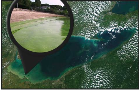
Last year at this time, the toxic algae bloom in Lake Erie caused nearly half a million people in and around Toledo, Ohio, to be without safe drinking water. Clean water from our taps is something that many of us take for granted, but if we don’t protect our water sources — like the residents of Toledo discovered — we won’t be able to take it for granted anymore.

Last year’s bloom was not a new occurrence in Lake Erie, and wasn’t even as bad as 2011’s record-breaking bloom, but it’s the first time on record the lake’s algae caused a Do-Not-Drink-the-Water advisory on that scale.

And the outlook for this year doesn’t look good either, as scientists from the National Oceanic at Atmospheric Administration predict this summer’s bloom “will be among the most severe in recent years.” And on Tuesday, Toledo’s mayor announced that microcystin was detected in Lake Erie near the city’s drinking water intake.

Microcystins are a type of toxin commonly found in algae blooms that can cause nausea, diarrhea, and vomiting, as well as liver damage in rare cases. Along with warming temperatures attributed to climate change that exacerbate the problem, algae blooms are often caused by the chemical process known as eutophication, or the oversupply of nutrients.

Lake Erie algae bloom via NOAA

The record-breaking bloom of 2011 in Lake Erie was the impetus for a detailed report that includes strategies on how to keep it from happening again, focusing on reducing nutrient pollution in the form of phosphorus into the lake. A task force also found that Lake Erie received the most phosphorus of any of the Great Lakes – nearly 50 percent of the total for all of the lakes, with two-thirds of that phosphorus from farm land.

The two reports also note that algal blooms were a massive problem in Lake Erie in the 60s and 70s, but were curtailed by reducing and regulating phosphorous use. That seemed to basically fix the problem with an occasional flair-up into the 80s and early 90s, only to reappear this decade worse than ever.

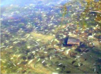
1985 fish kill in Lake Erie via Environment Colorado

Toxic algae blooms are not an isolated problem to Ohio. Whether its blue-green algae in Lake Erie or the recent phenomenon of golden algae blooms in Texas, algal blooms should be a concern for everyone that cares about clean water. Along with concerns over drinking water contamination, harmful algal blooms can also create “dead zones” that kill aquatic life, raise treatment costs for drinking water, and hurt businesses and jobs that depend on clean water.

It doesn’t take a scientist to realize that algal blooms can be tough on fishing and tourism. No one wants to swim, fish, or otherwise recreate in potentially toxic water that looks like pea soup, or around a bunch of rotting fish carcasses.

Ultimately though, the threat to clean drinking water is the primary concern, and increased incidents of blooms contaminating drinking water prompted the Environmental Protection Agency in May to issue “health advisories to protect Americans from algal toxins in drinking water.”

The EPA estimates that between 30 and 48 million people use drinking water from lakes and reservoirs that may be vulnerable to algae toxin contamination. “Nutrient pollution and harmful algal blooms are among America’s most serious and growing environmental challenges,” said EPA Administrator Gina McCarthy.

So how do we address this problem?

Clearly, we need stronger laws to crack down on pollution runoff from factory farms, and we also need to curb the carbon pollution that’s causing climate change. The new Clean Water Rule is also a large part of the solution, as it restores protections to wetlands that help filter runoff pollutants from rivers and streams before they get to our drinking water sources, like Lake Erie.

The Clean Water Rule is under heavy attack in Congress. If you haven’t yet voiced your support for this common-sense, science-based plan to protect our drinking water, please do so today. Algae blooms can have a silver lining if we are willing to take the actions needed to keep them from getting worse. In many cases, we know what those solutions are, we just need the will to enact them.

The Arkansas River Basin Water Forum is offering two scholarships

Arkansas River Basin via The Encyclopedia of Earth

Here’s the announcement from the ARBWF:

Arkansas River Basin Water Forum to Give Away Two Scholarships

The Arkansas River Basin Water Forum (ARBWF) is excited to relaunch our scholarship program and would like your help in distributing the application to graduate students (or others as you see fit). The application materials can be found on the main page of the ARBWF website.

The scholarship application package will be due September 1st, 2015.
In general, the applicant must demonstrate how their work may potentially have a positive impact on a water issue facing the Arkansas River basin. However, the students work does not need to be taking place within the basin, but simply must demonstrate its application to an Arkansas basin issue.

Please contact Blake Osborn at (719) 545-1845 with any questions. Completed application materials can be sent to 830 N. Main St. Suite 200 Pueblo, CO 81003 or emailed to blake.osborn@colostate.edu.

Colorado College announces the 2015-2016 “State of the Rockies” speakers series

stateoftherockiesprojectscreenshot20152015
The series for this season looks great and they are screening “The Great Divide” in November. I’ve attended many of the events over the past few years and I’ve learned a lot from the speakers — highly recommended.

Click here for all the inside skinny for this season. Click here to go to the State of the Rockies home page to learn more about this important work.

The latest Northern Water “E-Waternews” is hot off the presses

Map of the Colorado-Big Thompson Project via Northern Water

Click here to read the newsletter. Here’s an excerpt:

<blockquoteThe Northern Water Board of Directors set 2016 water assessments during an Aug. 6, 2015 public hearing. Assessments for open-rate irrigation contracts increased from $10.90 per acre-foot unit to $17.60, and assessments for open-rate municipal, industrial and multipurpose contracts increased from $30.50 per acre-foot unit to $35.90.

The Board followed its general rate-setting objectives, which are outlined in its 2014 forward guidance resolution. Among other objectives, the resolution proposed a 2-year step increase in assessments beginning in 2016, and moving irrigation assessments towards a cost-of-service based rate. Both of these objectives are represented in the 2016 assessments.

The Board will consider forward guidance that provides an estimated range for 2017 and 2018 water assessments at its Sept. 3 Planning and Action meeting.

For information on water assessments, please contact Sherri Rasmussen at 970-622-2217.

2016 Colorado legislation: Interim Water Resources Committee update

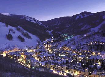
Vail Colorado via Colorado Department of Tourism

From The Pueblo Chieftain (Chris Woodka):

They’re supposed to be part-time legislators, but the Interim Water Resources Review Committee has been spending a lot of time on the road lately.

“We are committed to good water policy,” state Sen. Ellen Roberts, RDurango, and committee chairwoman, told Colorado Water Congress, meeting for its summer convention. “We have a robust statewide presence.”

The committee annually meets throughout the summer and fall months to develop water legislation that should move forward. A supermajority of the 10-member panel is required, but other bills are introduced through other routes, Roberts said.

The committee has given itself extra work this year with listening sessions on the state water plan, and many of those have been conducted. It heard a morning’s worth of testimony this week in Vail.

“There is a huge concern about storage, particularly if we can get to the point where we can finance storage,” Roberts said.

Highlights of the tour included discussion of multipurpose storage in the Arkansas River basin, efficiency in the Rio Grande and an overall desire to streamline regulation.

“One of the things I heard over and over is that there needs to be more collaboration with partners,” said state Rep. Ed Vigil, D-Fort Garland, who is vice chairman of the committee.

Vigil said it is important to promote agriculture and assure water is available for farms.

“There are lots of challenges,” Vigil said. “I’m glad we’re able to get out there and talk to people. When we make laws, we should do no harm.”

Parker opens new water treatment plant

The water treatment process

From the Parker Chronicle (Chris Michlewicz):

Roughly 10 percent of Parker’s water is now going through a state-of-the-art treatment plant near Rueter-Hess Reservoir.

After a few initial hiccups, including the failure of a pump and issues with the feeding of chemicals used to rid the water of impurities, the $50.7 million treatment plant opened in mid-July following three weeks of testing.

Soon after, a handful of Parker Water and Sanitation District officials took their first drink of water processed through the sophisticated system of pumps, pipes and filters.

“We wanted to make sure everything was solid before we sent it out through the system,” said Ron Redd, district manager for Parker Water. “It tasted good!”

Construction began in 2012 on the treatment plant, which has been billed as an integral part of shifting from a reliance on nonrenewable groundwater in aquifers to renewable surface water. It incorporates many of the newest technologies and eventually will be able to process 40 million gallons per day. The first phase of construction spawned a facility that can churn out about 10 million gallons of treated water per day.

The new treatment plant processes 1.5 million gallons of the 12-million-gallon average needed to satisfy daily summertime demands, Redd said…

Four employees are based out of the treatment plant…

Approximately 20 percent of the total construction costs went toward ceramic filters that are more durable than traditional plastic filters and expected to last from 20-25 years.

“What’s different about this plant is it’s a fairly state-of-the-art facility,” Redd said. “It’s gathering a lot of attention from across the country and the world because of the technology we’re using. We’re anticipating lots of phone calls and (requests for) tours.”

Sen. Bennet talks water and mine clean-up in Vail — Aspen Journalism

rifflesaspenjournalismbrentgardnersmith

From Aspen Journalism (Brent Gardner-Smith):

Speaking at the Colorado Water Congress’ summer meeting in Vail on Wednesday, U.S. Senator Michael Bennet said it would take an “all-of-the-above” strategy to meet Colorado’s future water needs.

“The bottom line for me is that we’ve got to look at water a little bit like we look at energy in Colorado,” said Bennet, a Democrat who was elected in 2010. “We need an all-of-the-above strategy that includes storage and conservation and efficiency. The reality is that we will need to make the best use of the water we have for the rest of our lifetimes.”

The need for additional water storage facilities — new dams and reservoirs — is a consistent message heard at the Water Congress meeting and at water-supply planning meetings around the state.

Bennet acknowledged the time and effort that many attendees at the event have spent developing a statewide water plan, which is being prepared by regional “roundtables” and the Colorado Water Conservation Board.

The plan is to be submitted to the governor in December and comments on the second draft are due Sept. 17.

“I know that a lot of you here already have contributed many hours and days, and even years, and even, really, lifetimes to the effort,” Bennet said. “The water community, the environmental groups, utilities, local governments and agricultural users have all been involved in the drafting of that plan.”

He added, “Whatever comes out in the final plan, it’s clear that action will be necessary to address the challenges that Colorado will face in the coming decades.”

In his opening remarks, Bennet was highly critical of the gridlocked nature of the U.S. Congress and said he’s tried very hard not to spend “one second over the last six years contributing to the dysfunction that’s there,” but instead has worked to find “bipartisan solutions to real challenges that we have.”

He spoke of a week-long tour of the wheat fields of eastern Colorado that he took recently with Republican U.S. Senator Cory Gardner of Colorado, and how the two of them also agreed to travel to Durango together in the wake of the Gold King Mine spill that discolored the Animas River on Aug. 5.

“It is fun, people see a Democrat and a Republican working together, and they wish they were seeing that in D.C.” Bennet said.

In response to a question, Bennet said he was exploring a Colorado-only version of “Good Samaritan” legislation, which would shield individuals and organizations that want to work to clean up old hard-rock mines from inheriting the full liability for the mine.

“If we could figure out a way to develop some sort of pilot legislation — we’ve been talking to Congressman Tipton’s office about that — that would allow us to do what needs to be done in our state, that would be a good step forward,” Bennet said, noting there are “thousands” of old mines in Colorado that need to be cleaned up. “Being stuck in this stasis of not being able to address it guarantees exactly what happened the other day, and I don’t think we ought to have our state have to confront something like this again.”

Editor’s note: Aspen Journalism is collaborating with The Aspen Times and the Glenwood Springs Post Independent on the coverage of rivers and water. The Post Independent published this story on Thursday, Aug. 20, 2015.

Colorado Water Congress Annual Summer Conference recap

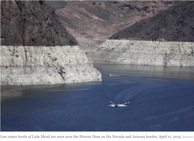
lowlakemead04112015viareuters
From The Pueblo Chieftain (Chris Woodka):

People are “bored and frustrated” by what is going on in Washington, D.C., so U.S. Sen. Michael Bennet was very happy to be in the Colorado mountains Wednesday…

Although there is gridlock in the nation’s Capitol, Bennet has recently toured the state with his Republican counterpart Sen. Cory Gardner. Common ground most often has been found on water issues.

In his opening remarks, he noted that his first legislation was a bill to provide a funding mechanism for the Arkansas Valley Conduit, and among his most recent was creation of the Browns Canyon National Monument.

“We take water seriously in Colorado,” Bennet said. “We know that it is a limited resource that is fundamental to every aspect of our economy and our way of life.”

Bennet hit the key points that are driving Colorado to develop a water plan by December: agriculture, recreation, the environment and continued urban growth.

“Water sustains our agriculture industry.

It sustains the rivers, wildflowers and wildlife that bring in $13.2 billion in outdoor recreation spending every year. Water fuels the existence and growth of businesses throughout the state that have helped us build one of the strongest economies in the country,” Bennet said.

His message on this year’s ample rainfall was mixed.

“We are thankful for the rain we’ve had this year in Colorado. It’s helped our economy and decreased the threat of catastrophic wildfire,” he said. “But we know we are part of a much larger water system. We know that the Colorado River basin as a whole remains in a record drought.”

Lake Powell is just 53 percent full, and inflows will be about 88 percent of normal this year. Lake Mead is only 38 percent full.

“It’s incredible to think that the water level in Lake Mead has dropped by about the height of a 15-story building since 1983 over the surface of the lake. That’s about 18 million acre feet of water, potentially enough for 70 million families for a year,” Bennet said.

Bennet supports working with other states in the Upper Colorado River basin (New Mexico, Utah and Wyoming) as the lower basin states (Arizona, California and Nevada) continue to rely more heavily on the Colorado River.

“We need to stay ahead of this continuing drought,” he said. “Colorado River security is not a west slope issue or an east slope issue — it’s a Colorado issue.”

From The Pueblo Chieftain (Chris Woodka):

Fountain Creek isn’t the only area of the state where storm control and water rights have collided, the Colorado Water Congress learned Wednesday.

But it is unique in being the only area omitted from SB212, state legislation that allowed stormwater to be stored for up to 72 hours or 110 hours in an exceptional storm. That decision was applauded by some, but derided by one water attorney as “Monkey Business.”

As in the Marx Brothers classic movie.

Law-makers have overstepped their responsibility and subjected water law to “death by a thousand small cuts” by passing SB212 and HB1016, said Alan Curtis, a water lawyer with White and Jankowski.

Curtis lampooned the bills, along with failed legislation to allow rain barrels (SB1259) by showing video clips from “Monkey Business” — including Harpo’s antics in the crowded cruise ship cabin, jumping out of line in port and roiling the lemonade by splashing his legs in it. He ended by asking “which Marx Brother are you?” He declared he is Groucho and those who passed the legislation are more like Karl. Curtis’ point was that the new laws that passed, like the rain barrel bill that did not, jump some water rights ahead of others that have been in line for 150 years of water law, amounting to a taking of property rights. They also put the responsibility to prove damage on the party who is injured, which is the opposite of most water law, which requires proof of no injury or mitigation.

Engineer Jim Wulliman and Alan Searcy, of the Colorado Stormwater Council, argued that stormwater retention ponds are useful both to enhance water quality, by settling water, and to restore channel flows to pre-development conditions.

Wulliman detailed how paving urban surfaces sets up a scenario for damage to waterways as more water drains more quickly, causing erosion.

Finally, Steve Vandiver, general manager of the Rio Grande Water Conservation District, said the state Legislature moved too fast to pass the stormwater bill, saying junior water rights holders could be injured.

“I’d just like to slow the process down,” Vandiver said. “The science is not exact.”

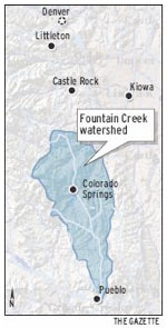
Fountain Creek has been struggling with the stormwater control/water rights issue for years. It was removed from SB212, with the exception of Colorado Springs, which has a stormwater discharge permit.
This year, a preliminary study by the Fountain Creek Watershed Flood Control and Greenway District attempted to quantify the damage at certain flows and suggested ways to mitigate the damage.
Pueblo County has hired Wright Water Engineers to quantify the damage caused by development in Colorado Springs to Fountain Creek.

#ColoradoRiver: Why Denver pays farmers in Yampa Valley not to irrigate this summer — The Mountain Town News

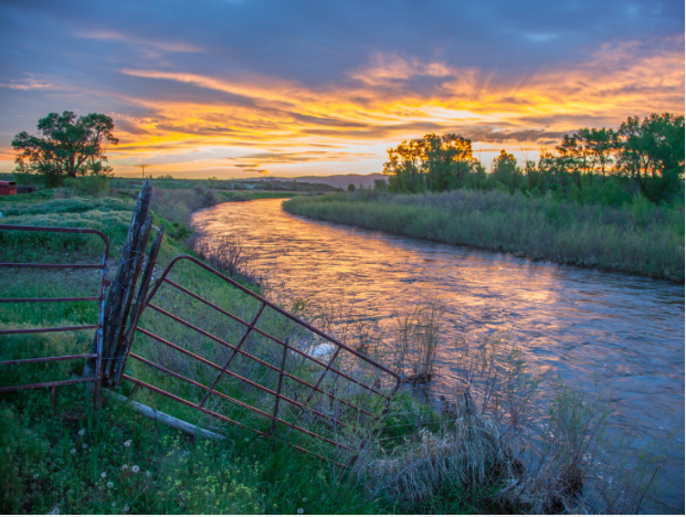
The Yampa River flows through the Carpenter Ranch. Photo courtesy of John Fielder from his new book, “Colorado’s Yampa River: Free Flowing & Wild from the Flat Tops to the Green.” -- via The Mountain Town News
The Yampa River flows through the Carpenter Ranch. Photo courtesy of John Fielder from his new book, “Colorado’s Yampa River: Free Flowing & Wild from the Flat Tops to the Green.” — via The Mountain Town News

From The Mountain Town News (Allen Best):

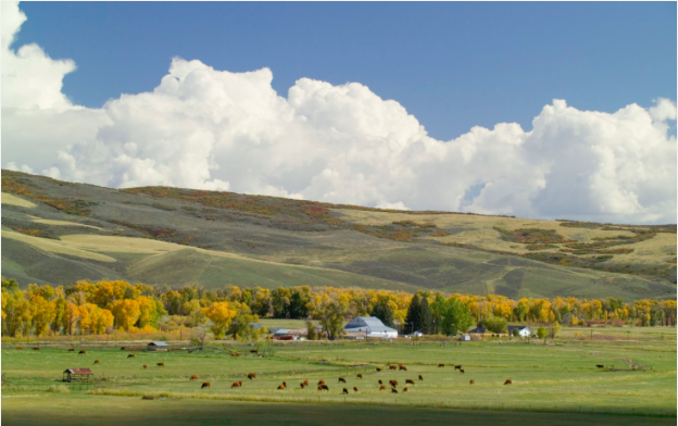
Irrigation season on the Carpenter Ranch normally begins in early May and continues until September. The ranch is located along the Yampa River in northwestern Colorado, about 20 miles west of the ski town of Steamboat Springs. Water from the river is used to grow fields of waist-high timothy, clover, and other types of grasses that, after being cut, provide hay for cattle.

This year, the seasonal cycle was disrupted. Irrigation on four of the fields, totaling 197 acres, was suspended on July 1. Instead, the water has been allowed to flow down the Yampa River 100 miles to Dinosaur National Park. There, it joins the water of the Green River coming down from Wyoming, which in turn joins the Colorado River in Utah. The comingled waters then flow into Lake Powell.

Powell is one of two giant reservoirs on the Colorado River, the other being Lake Mead, near Las Vegas. Together, the two reservoirs can hold 16 times the annual flow of the Colorado River—on average. But the river and its many tributaries have been flowing below average most years since 1999. Even after torrential rains and heavy snows in the Colorado Rockies in May, the inflow into Lake Powell this year is just 88 percent of average. It’s part of a long-term trend of declining reservoir levels in a river basin that provides water for 25 to 34 million people. (Estimates vary).

These reservoir declines have instilled a sense of urgency in Jim Lochhead, chief executive of Denver Water. His agency provides water to 1.3 people in metropolitan Denver, with half the water arriving in the city from the Fraser, Blue, and other tributaries of the Colorado River.

Jim Lochhead -- photo via Westword (Alan Prendergast)
Jim Lochhead — photo via Westword (Alan Prendergast)

“One of the things we have learned in this drought is that it just seems to keep going and going and going,” says Lochhead. “We are really in uncharted territory right now in terms of where the (reservoir) levels are. The levels are the lowest since these dams have been constructed.”

Lake Mead, formed in 1936 as a result of Hoover Dam, is now at 37 percent of capacity. Lake Powell began forming in 1963 as a result of construction of Glen Canyon Dam and is at 54 percent of capacity.

Lochhead and other architects of the Colorado River System Conservation Program want to be ready in case an even more severe drought revisits the Colorado River Basin. Fresh in mind is 2002, when the Colorado River carried only 25 percent of its normal flows, and 2003 wasn’t much better. Should drought of that severity return, Lake Powell could even shrink to something called a dead pool. That’s when there’s too little water to generate electricity. The electricity is distribu ted broadly across the West to towns, cities, and farms. Revenues from sales are used to fund programs designed to protect endangered fish on the Colorado River.

Lake Powell also has another vital function for Colorado and other headwaters states: It is used to me et commitments of water deliveries to the lower basin states of Arizona, Nevada, and California as specified by the Colorado River Water Compact of 1922. Denver’s water rights from the Western Slope of Colorado are mostly junior to the compact. If drought persisted, it’s conceivable that Denver and other water users with more junior rights—including many in the mountain resort community—would have to curtail their diversions in order to comply with the 1922 compact.

Lake Powell, shown here in 2008, serves multiple purposes. Photo/Andrew Pernick, U.S. Bureau of Reclamation -- via The Mountain Town News
Lake Powell, shown here in 2008, serves multiple purposes. Photo/Andrew Pernick, U.S. Bureau of Reclamation — via The Mountain Town News

To forestall this apple cart from being upset, Denver and several major water providers that tap the Colorado River Basin last year joined with the U.S. Bureau of Reclamation to begin exploring how water can temporarily be shifted from traditional uses and allowed to flow downstream. The Carpenter Ranch along the Yampa River is the first pilot project announced in this Colorado River System Conservation Program.

The ranch is owned by The Nature Conservancy, one of several partners from the environmental community working with Denver and other water providers. The non-profit in turn sublets the land to ranchers, says Geoff Blakeslee, the Yampa River project coordinator for the organization. Taking water off the hay meadows reduces harvest and it will also reduce the number of cattle that can graze the meadows in autumn. About 90 percent of agriculture on Colorado’s Western Slope is, like the Carpenter Ranch, used to produce hay.

Joe Brummer, an associate professor of forage science at Colorado State University, has studied effects of water curtailment in small plots at the Carpenter Ranch as well as other farms. Hay production continues if irrigation ceases, but only in small quantities. The second year, after irrigation has resumed, production lags 50 percent, he says. Even in the third year, again after full resumption of irrigation, production at the Carpenter Ranch test site was 8 to 9 percent below average.

This year, the experiment is different: a split season.

Nine other pilot sites have also been identified, five of them in Wyoming and four in Colorado. They are being funded at a total cost of $1 million. A larger program on the Colorado River involving lower-basins states has a cost of $11 million. Other water agencies providing money, in addition to Denver, include those serving metropolitan Las Vegas and Los Angeles, along with the Central Arizona Water Conservation District, and the Bureau of Reclamation.

Taylor Hawes, Colorado River program director for The Nature Conservancy, says the overarching goal of the pilot program is to learn as much as possible about how water can be shared in time of crisis.

“It’s complicated to move water around,” she says. “These are property rights. Many farmers are unsure how it will impact their water rights if they participate in a project like this. So the point of these pilots is to learn as much as we can right now, so that if a crisis does hit, we will have good information so that we can design a program that allows us to share water in a drought.”

How close is crisis? Too close for comfort, she says. “If this were your savings account and it was continuing to drop, you would be concerned,” she says.

Hawes also sees another, even more dramatic analogy. “I think we were on the edge of the cliff, and depending upon whether it’s a good year or bad year, we take a step forward and backward. The California (drought) situation has highlighted impacts that we will have if we don’t have a plan in place.”

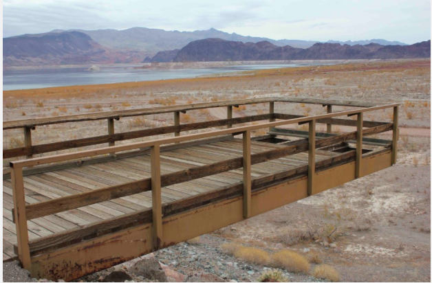
A fishing pier stood distant from the receding waters of Lake Mead in December 2010. Photo/Allen Best - See more at: http://mountaintownnews.net/2015/08/20/letting-water-flow-down-the-yampa-to-lake-powell/#sthash.7tRYDEZj.dpuf
A fishing pier stood distant from the receding waters of Lake Mead in December 2010. Photo/Allen Best – See more at: http://mountaintownnews.net/2015/08/20/letting-water-flow-down-the-yampa-to-lake-powell/#sthash.7tRYDEZj.dpuf

Some say that the Colorado River actually is in worse shape over the long haul than California. New evidence finds that warming temperatures in the Southwest may be causing evaporation and [transpiration] that alone can explain declining reservoir levels.

“The fact that the Colorado River Basin drought is more a product of the heat than any drop in precipitation is a frightening prospect, because that heat is not going to go away,” says Doug Kenney, research associate at the Natural Resources Law Center at the University of Colorado. In fact, because of increased locked into the atmosphere because of accelerating greenhouse gas emissions, all climate models forecast brisk increases of heat in future decades in the basin.

Denver’s Lochhead says the 2002 drought forced the seven states in the Colorado River Basin to consider how to share impacts of drought. Upper Basin states can move water from smaller reservoirs near the headwaters, such as Flaming Gorge in Utah and Navajo in New Mexico, down into Powell. Water can also be allowed to flow downstream through projects such as are being tested at the Carpenter Ranch.

Water providers in the Colorado River program want to work out kinks so that, if crisis occurs, curtailments can be scaled. But many questions remain, such as how to protect water users through the process, to ensure their water rights remain valid. “It’s really the first step,” says Lochhead, and there will be many follow-up questions.

Lochhead is sensitive about how the program is perceived. It is not, he stressed, a grab by cities for agricultural water. The transfers are intended to be temporary and provide compensation to water-right holders. He also points out that it need not be just farms and ranches. One of the pilot programs involves a city on Colorado’s Front Range, he says, but declined to identify the city, because negotiations have not been completed.

“We’re trying to take the perception of winners and losers off the table,” he says. “In this program, everybody wins because the system wins.”

What’s also of note is the extent to which environmental groups have waded into this program. Hawes says The Nature Conservancy wants to work with farmers because, when the river system gets taxed, agriculture and the environment are usually the first to lose. “We need to work to find partnerships,” she says.

Water rights for the Carpenter Ranch date to 1881, the oldest on the Yampa River. Photo/ Mark Godfrey and The Nature Conservancy
Water rights for the Carpenter Ranch date to 1881, the oldest on the Yampa River.
Photo/ Mark Godfrey and The Nature Conservancy

Trout Unlimited has also been a major partner. It has property in the Pinedale-Green River area of Wyoming participating, and the organization has also enlisted a small farm along the Gunnison River near Delta, Colo. Cary Denison, project coordinator for Trout Unlimited in the Gunnison Basin, says the farmer will fallow the land for one year then, in the second year, plant a lower consumption crop. Corn, the current crop, takes two feet per acre. Winter wheat only requires a foot.

“Our role is very limited. I am looking at this is a way of participating in an interesting pilot project that looks at consumptive use of different crops.”

While some farmers already knew about the pilot program, he says, others needed to understand the motivation.

Some ratepayers in Denver also wanted to know why Denver Water would be paying farmers to let water flow downstream toward California. That question gets to the heart of the great complexity of water and the Colorado River Basin, points out Doug Kenney, research associate at the Natural Resources Law Center at the University of Colorado.

Denver itself is outside the basin, of course. Cheyenne, Albuquerque, and Salt Lake City, plus Phoenix and Tucson, Los Angeles, and San Diego are similarly outside the basin—but also depend upon Colorado River water.

For such a relatively small river, it pulls a heavy load.

If you liked this story, please consider donating to Mountain Town News.

#Drought News: Cooler-than-average temperatures over parts of Colorado this past week

Click here to go to the US Drought Monitor website hosted by the Colorado Climate Center. Here’s an excerpt:

Summary

This week a southwesterly flow returned to the Southeast, ushering in a tropical like air mass that produced widespread precipitation across the region. Meanwhile, a strong upper level low developed in the Midwest, producing heavy rains, which prompted flash flood watches. Warm, dry air continued to dominate the West…

Northern Rockies / Plains and Northwest

Above-normal precipitation effected western South Dakota, southeast Montana and northeast Wyoming during the period. Temperatures in those areas were running as much as 6 degrees above normal. As a result of the recent rains, the remaining D0 was removed in Nebraska and South Dakota. Warmer-than-normal temperatures and large precipitation deficits continued to hold their grip on Washington and Oregon this week. D3 conditions were expanded in Washington where hay growers are suffering from millions of dollars in losses due to the ongoing warm, dry conditions. It was also reported that pear and apple trees are stressed along with hops…

Southwest

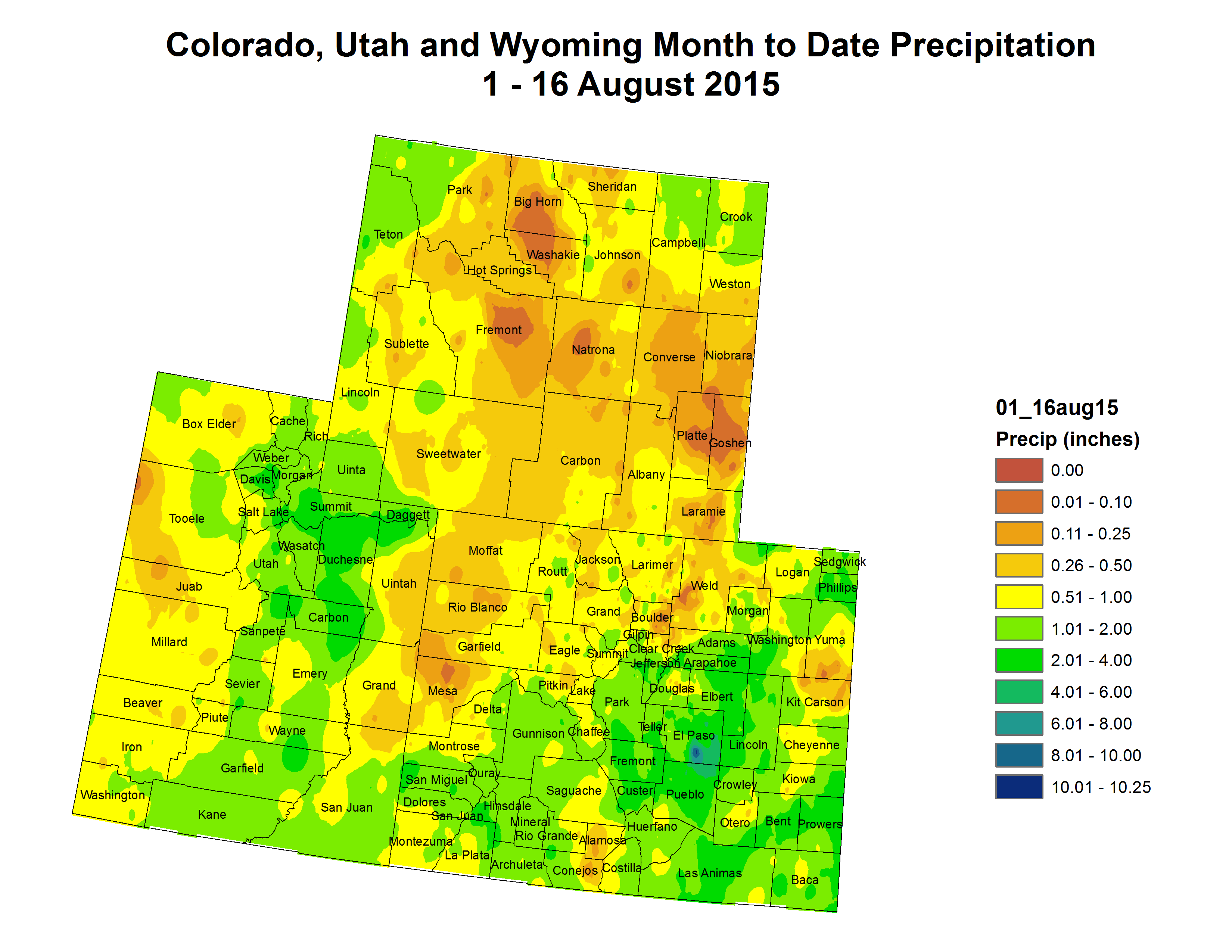
The monsoon season brought some good rains into Arizona prompting drought improvements in southeast Arizona. Cooler-than-average temperatures were seen in portions of Colorado and Utah. It was reported that eastern Colorado had started to dry out, but thanks to the spring moisture and cooler than normal temperatures for much of the summer, evaporative demand has been lower than average. Consequently, the soils have been able to retain the moisture and prevent drought degradation. Temperatures for the period were generally warmer than average across the region. Drought was contracted in southeast Arizona and southwest New Mexico…

West

California continues to deal with its ongoing drought. Water managers and farmers are adapting their practices to help conserve water and reduce economic loss in the state. Temperatures in California were warmer than average in the south, gradually transitioning to cooler than average northwards. The only precipitation that fell during the period was in south and east Nevada…

Looking Ahead

During the next 6-10 days, the probability of cooler than normal temperatures are high in the Ohio and Tennessee River Valley’s extending into the Great Lakes and Midwest. Chances are likely that the rest of the country will experience warmer than normal temperatures, especially in the Northeast, Southeast, and Southwest.

Over the same period, precipitation associated with the large system centered over Wisconsin will move through the Great Lakes area. Further south, the precipitation will slowly move eastward and dissipate as the low pressure moves into Canada. Another, less powerful and dryer system will follow producing the heaviest precipitation in the Midwest. Ridging continues to hold its grip in the West while monsoonal precipitation may bring light drought relief in the Southwest.

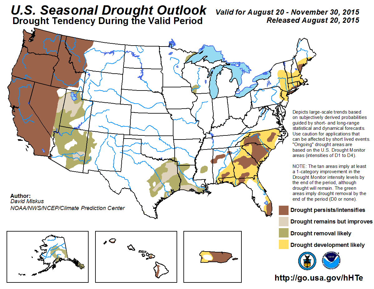
seasonaldroughtoutlook0820thru11302015

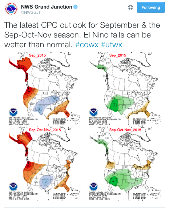
seasonaloutlooknwsgjtcpc08202015

Aspen Times Weekly: Could a mine-waste spill happen here?

Smuggler Mine back in the day via GregRulon.com

From The Aspen Times Weekly (Scott Condon):

Pitkin County has between 600 and 800 mine features, including multiple adits into the same mine, according to an estimate by the Colorado state government. And as Cooper’s experience shows, there are Aspen mines that are filled with water — but just because there’s water, that doesn’t mean it’s contaminated water.

Still, that hefty inventory of adits and shafts makes it reasonable to wonder if something similar to the discharge of 3 million gallons of toxic water from the Gold King Mine near Silverton into the Animas River earlier this month could happen in Aspen (see story, page 33).

State and federal officials as well as miners with street credibility will never say never, but a similar disaster in Pitkin County is unlikely, in large part because of geology, they agreed.

Aspen Mountain’s mines tended to be internally drained to the water table, so “there is generally no significant surface drainage discharges associated with the underground workings,” said Bruce Stover, an official with the Colorado Inactive Mine Reclamation Program. That means there is a “very limited possibility” of underground impoundments of water being formed, he said.

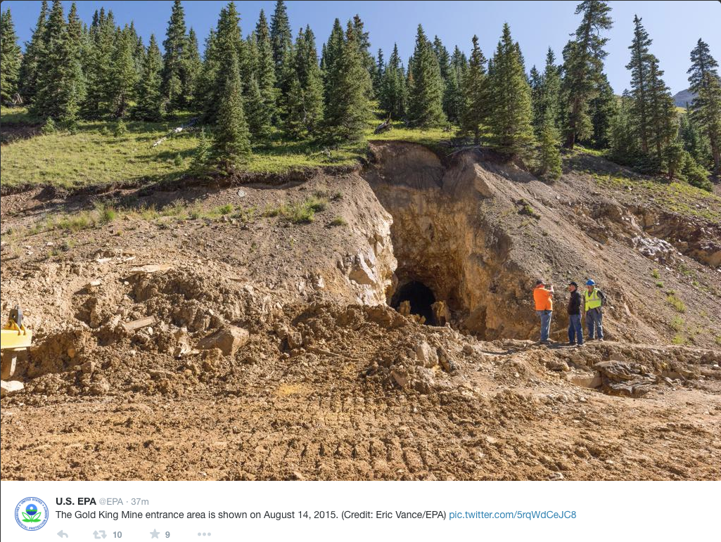
Mines in the San Juan Mountains and other parts of the state have water above the surface. Toxic water was intentionally captured inside the Gold King Mine. It breached when the U.S. Environmental Protection Agency undertook a reclamation effort.

Aspen miners tended to encounter water below the level of the water table and Roaring Fork River, said Jay Parker, a partner in the Compromise Mine on Aspen Mountain and a miner and tour guide at the Smuggler Mine.

The water emerging from Aspen’s mines hasn’t been found to be acidic or laced with heavy metals in any testing to date. In one of Aspen’s few hard-rock mine reclamation projects, water in Castle Creek tested similarly above and below where the Hope Mine discharged, according to Forest Service records.

Parker said water draining from the Compromise Mine on Smuggler Mountain feeds ponds where fish thrive and ducks gather.

Local Mine reclamation aimed at safety

Many of Pitkin County’s mines have collapsed, either naturally or by public agencies for safety reasons.

“Our records show we have safeguarded approximately 90 hazardous, non-coal openings in Pitkin County, many of them on Aspen Mountain,” said Stover. Numerous closures have also been completed on coalmines in the Coal Basin and Thompson Creek areas.

The Forest Service typically performs safety closures on three or four mines per year, according to Greg Rosenmerkel, engineering, minerals and fleet staff officer on the White River National Forest. “There are hundreds of mines across the forest.”

The focus of both the Forest Service and the Inactive Mine Reclamation Program is to prevent people from entering an unsafe situation. Old mining timbers have often rotted, making interior travel perilous. Air deep underground can be toxic without proper ventilation.

“It’s almost an attractive nuisance,” Rosenmerkel said of the old mines.

A recent closure was completed earlier this summer at three mines in the high ground beyond Crystal. The typical closure costs $200,000, though no two projects are the same, he said.

Both the Forest Service and Inactive Mine Reclamation Program are focused on finding mines that pose a physical hazard, such as ones located in a ski area or adjacent to a popular hiking trail, and safe-guarding them.

No toxic water impounded

If Forest Service or Bureau of Land Management officials suspect environmental issues, the state Water Quality Control Division is mobilized to test for acidity or metals. If a problem is found, the Inactive Mine Reclamation Program figures out how to solve the problem. If an environmental problem is suspected with a mine on private lands, the Forest Service might be involved if it affects public lands, Rosenmerkel said.

The Hope Mine in Castle Creek Valley warranted remediation while the Ruby Mine in Lincoln Creek Valley has raised concerns but hasn’t been found in need of monitoring (see related stories), according to officials.

Rosenmerkel said there is no situation in the Aspen-Ranger District where water as toxic as that in the Gold King Mine is being impounded.

The Roaring Fork Conservancy, a Basalt-based nonprofit focused on water quality and quantity issues in the valley, doesn’t specifically test to see how water coming from mines affects rivers and streams in the basin.

“Outside of Ruby, I don’t know if we have a big enough problem or big enough source,” said Rick Lofaro, the conservancy’s executive director.

Sen. Bennet talks water and mine clean-up in Vail – the Glenwood Springs Post Independent

Vail Colorado via Colorado Department of Tourism

From the Glenwood Springs Post Independent (Brent Gardner-Smith):

Speaking at the Colorado Water Congress’ summer meeting in Vail on Wednesday, U.S. Senator Michael Bennet said it would take an “all-of-the-above” strategy to meet Colorado’s future water needs.

“The bottom line for me is that we’ve got to look at water a little bit like we look at energy in Colorado,” said Bennet, a Democrat who was elected in 2010. “We need an all-of-the-above strategy that includes storage and conservation and efficiency. The reality is that we will need to make the best use of the water we have for the rest of our lifetimes.”

The need for additional water storage facilities — new dams and reservoirs — is a consistent message heard at the Water Congress meeting and at water-supply planning meetings around the state.

Bennet acknowledged the time and effort that many attendees at the event have spent developing a statewide water plan, which is being prepared by regional “roundtables” and the Colorado Water Conservation Board.

The plan is to be submitted to the governor in December and comments on the second draft are due Sept. 17.

“I know that a lot of you here already have contributed many hours and days, and even years, and even, really, lifetimes to the effort,” Bennet said. “The water community, the environmental groups, utilities, local governments and agricultural users have all been involved in the drafting of that plan.”

He added, “Whatever comes out in the final plan, it’s clear that action will be necessary to address the challenges that Colorado will face in the coming decades.”

In his opening remarks, Bennet was highly critical of the gridlocked nature of the U.S. Congress and said he’s tried very hard not to spend “one second over the last six years contributing to the dysfunction that’s there,” but instead has worked to find “bipartisan solutions to real challenges that we have.”

He spoke of a week-long tour of the wheat fields of eastern Colorado that he took recently with Republican U.S. Senator Cory Gardner of Colorado, and how the two of them also agreed to travel to Durango together in the wake of the Gold King Mine spill that discolored the Animas River on Aug. 5.

“It is fun, people see a Democrat and a Republican working together, and they wish they were seeing that in D.C.” Bennet said.

In response to a question, Bennet said he was exploring a Colorado-only version of “Good Samaritan” legislation, which would shield individuals and organizations that want to work to clean up old hard-rock mines from inheriting the full liability for the mine.

“If we could figure out a way to develop some sort of pilot legislation — we’ve been talking to Congressman Tipton’s office about that — that would allow us to do what needs to be done in our state, that would be a good step forward,” Bennet said, noting there are “thousands” of old mines in Colorado that need to be cleaned up. “Being stuck in this stasis of not being able to address it guarantees exactly what happened the other day, and I don’t think we ought to have our state have to confront something like this again.”

Aspen Journalism is collaborating with The Aspen Times and the Glenwood Springs Post Independent on the coverage of rivers and water. More at http://www.aspenjournalism.org.

Groundwater rules for the Rio Grande Basin are now in final draft form, next stop water court

San Luis Valley Groundwater

From The Valley Courier (Ruth Heide):

Time’s almost up.

In the works for several years, the groundwater rules for the Rio Grande Basin are now in final draft form and should be filed with the water court within the next month. Last-chance comments on the final draft of the rules are due tomorrow, August 19, with the rules anticipated to be filed with the water court either by the end of this month or next, depending on how many comments come in.

The groundwater rules, which will apply to well owners in the Rio Grande Basin (San Luis Valley), are designed to protect senior surface water rights and Rio Grande Compact obligations in addition to promoting long-term sustainability of the basin’s aquifers.

The rules apply to hundreds of well owners in the Valley including towns and cities. A well solely permitted for in-house use would not need to be regulated under these rules. Primarily these rules will affect those who are using their wells for irrigation of crops, livestock or municipal water supplies, wells required to be metered. Although there’s been a moratorium on new wells for many years, the existing wells have continued to negatively affect senior surface water rights, a problem the well regulations are designed to rectify either en masse through collective water management sub-districts or individually through augmentation plans or substitute water supply plans.

“Essentially, the Confined Aquifer New Use Rules recognize that there is no unappropriated water in the confined aquifer, so that any new withdrawal requires one-for-one replacement,” the proposed rules state.

“The rules are designed to allow withdrawals of groundwater while providing for the identification and replacement of injurious stream depletions and the achievement and maintenance of a sustainable water supply in each aquifer system, while not unreasonably interfering with the state’s ability to fulfill its obligations under the Rio Grande Compact.”

Those themes are stressed throughout the regulatory document: no new withdrawals will be all o w e d w i t h – out the same amount being replaced; injuries to surface r i g h t s m u s t be replaced; and the state’s agreement with downstream states in the Rio Grande Compact must be upheld.

“Nothing in the rules is designed to allow an expanded or unauthorized use of water ,” the rules state.

Colorado Division of Water Resources Division 3 Engineer Craig Cotten told local water leaders last week that State Engineer Dick Wolfe advised legislators serving on the water resources review committee the rules would be completed within the next month.

“We do have the final draft of the rules out for public comment until the 19th,” Cotten said. “We think the rules are basically done, just giving everybody a last chance to make comments. After that we will take those comments and then file in court.”

Deputy State Engineer Mike Sullivan, who previously served as Division 3 engineer, said water court resume timelines start from the end of a month, and folks have 60 days after that to respond to the case in court.

“It doesn’t matter if we filed the rules August 10 or August 31, as the clock starts essentially August 31. Thus I think the earliest we could/ would file would be the end of August or September. It all depends on getting any comments considered and gathering all the pieces into a complete package for the court,” Sullivan stated.

“After all the work from the water user community in helping craft the rules I imagine folks would like to get the next phase rolling as soon as possible.”

The rules will be effective 60 days after publication unless protests are filed in the water court, which would delay the process until the protests were resolved.

An approximately 50-member advisory committee has been working with Wolfe since 2009 to develop groundwater rules for this basin. Advisory committee members included representatives from water conservancy and irrigation districts, water user associations, counties, state and federal agencies, municipalities and attorneys . As a group, the advisory committee concluded its work in May, after meeting 25 times over the last several years. The state sent its final draft out to the advisory committee members for one last look this month.

Once the groundwater rules are in place, well owners in the Valley will have two years to come into compliance with the rules by joining one of several water management sub-districts or filing an individual augmentation plan or substitute water supply plan. The other alternative is to be shut down.

One of the delays in getting the groundwater rules to this stage was the development and refinement of the Rio Grande Decision Support System groundwater model that simulates groundwater flows in this basin and helps determine how much water well users must pay back to make up for the injuries they have caused in the past and are currently causing. That model and subsequent simplified calculations called response functions have been under refinement for several years.

After the first water management sub-district (a subdistrict of the sponsoring Rio Grande Water Conservation District) was formed, subsequent sub-districts throughout the Valley waited for the model and its response functions to be refined to the point that well owners in those sub-districts would know what kind of water debts they were looking at before they formally formed their sub-districts . Many of them have been ready to collect signed petitions from those who will be included in the sub-districts , or have already collected petitions, pending those model runs that would tell them how much they would need to replace to senior surface rights.

Most of the sub-districts are organized by geographical areas of the basin such as Conejos River, San Luis Creek and Saguache Creek, while some are organized by the type of wells they encompass, such as confined aquifer wells.

Only the first sub-district is operating (encompassing wells north of the Rio Grande), but four or five others are in various stages of preparing to file their paperwork and petitions with the water court.

Well irrigators who are part of recognized sub-districts with state-approved water management and replacement plans essentially possess a “get out of jail free card,” but the rules state the sub-districts have to live by their management plans and show some progress over time, or the state will require additional action. Another reason it took longer to finalize the well rules was the lengthy discussions over how to meet the state legislature’s mandate to restore this basin’s confined, or deeper, aquifer to the healthy level it presumably experienced between the years 1978 and 2000, before the devastating drought of the early 2000’s . The draft of the rules, as proposed, allows for fluctuations in the aquifer in the same way the aquifer fluctuated during those years, as long as the average levels are similar to those occurring between 1978 and 2000. Fluctuations will also be permitted in the unconfined , or more shallow, aquifers, which the rules acknowledge are underground water storage reservoirs.

Because artesian pressure data is lacking for the confined aquifer during the period from 1978-2000 , the rules provide for a well network to collect data over the next decade to help estimate artesian pressures in the confined aquifer. Once that data is collected, the state tngineer will define the methods proposed to maintain a sustainable water supply in the confined aquifer system, and if that means a change in the rules, that could trigger another rule making process at that point.

The proposed rules also specify the irrigation season for this basin, presumed to begin April 1 and end on November 1, given some flexibility in climate and other conditions. See http:// water. state.co.us/

Eagle River Cleanup event is Sept. 12

Eagle River Basin
Eagle River Basin

From the Eagle River Watershed Council via the Vail Daily:

As the rivers begin to calm and seasons start to change, the Eagle River Watershed Council is gearing up for its 21st annual Eagle River Cleanup on Sept. 12. The tradition began in 1994 when Trout Unlimited organized the first Eagle River Cleanup. There were two tents and 24 volunteers, half of which were Vail Resorts ski patrollers with radios and trucks. The event culminated with a silent auction, which included a season ski pass and raised a total of $400.

During the past 21 years, the Eagle River Cleanup has grown tremendously and become a fall tradition for many environmentally and community-minded families, groups and companies. This year, over 350 volunteers are expected to help care for and revitalize our local waterways in the cleanup. This popular, county-wide event is organized by the Eagle River Watershed Council, presented by Vail Resorts EpicPromise, sponsored by many local businesses and supported by volunteers from Red Cliff to Dotsero to East Vail.

KEEPING OUR WATERWAYS HEALTHY

From 9 a.m. to noon, teams of volunteers will head for the river banks along the Eagle and Upper Colorado Rivers as well as Gore Creek to pick up trash and show support for the conservation and enhancement of our local watershed. All told, this massive community effort will clean nearly 70 miles of river throughout Eagle County ensuring the health and vitality of our waterways.

Following the cleanup, volunteers and their families are invited to the Broken Arrow at Arrowhead from noon to 2 p.m. for a thank you barbecue provided by Vail Resorts, the Broken Arrow and Arrowhead Alpine Club. The party features music from local favorites the Turntable Revue, beer from Crazy Mountain Brewing Co. and a prize drawing for the entire family.

More volunteers are always needed. Call the Eagle River Watershed Council at 970-827-5406 or email ranney@erwc.org to confirm your usual segment, sign up for a new one or join an existing team. Volunteers meet on the river at assigned locations on the day of the event, so you must pre-register in order to know where you are needed most.

Protect your groundwater day, September 8 #pygwd

protectyourgroundwaterday2015
Click here to go to the website for all the inside skinny. Here’s an excerpt:

Naturally occurring contamination

The chemistry of the groundwater flowing into a well reflects what’s in the environment. If the natural quality of groundwater to be used for human consumption presents a health risk, water treatment will be necessary.

Examples of naturally occurring substances that can present health risk are:

  • Microorganisms (i.e., bacteria, viruses, and parasites; these tend to be more common in shallow groundwater)
  • Radionuclides (i.e., radium, radon, and uranium)
  • Heavy metals (i.e., arsenic, cadmium, chromium, lead, and selenium).
  • Public water systems are required to treat drinking water to federal quality standards. However, it is up to private well owners to make sure their water is safe.
Groundwater movement via the USGS

USGS: Mercury and Selenium are Accumulating in the Colorado River Food Web of the Grand Canyon

From the United States Geological Survey (Heidi Koontz):

Although the Grand Canyon segment of the Colorado River features one of the most remote ecosystems in the United States, it is not immune to exposure from toxic chemicals such as mercury according to newly published research in Environmental Toxicology and Chemistry.

The study, led by the U.S. Geological Survey, found that concentrations of mercury and selenium in Colorado River food webs of the Grand Canyon National Park, regularly exceeded risk thresholds for fish and wildlife. These risk thresholds indicate the concentrations of toxins in food that could be harmful if eaten by fish, wildlife and humans. These findings add to a growing body of research demonstrating that remote ecosystems are vulnerable to long-range transport and bioaccumulation of contaminants.

“Managing exposure risks in the Grand Canyon will be a challenge, because sources and transport mechanisms of mercury and selenium extend far beyond Grand Canyon boundaries,” said Dr. David Walters, USGS research ecologist and lead author of the study.

David Uberuaga, superintendent of Grand Canyon National Park, added, “studies like this continue to educate the public and highlight the threats that face the park and its resources.”

The study examined food webs at six sites along nearly 250 miles of the Colorado River downstream from Glen Canyon Dam within Glen Canyon National Recreation Area and Grand Canyon National Park in the summer of 2008. The researchers found that mercury and selenium concentrations in minnows and invertebrates exceeded dietary fish and wildlife toxicity thresholds.

Although the number of samples was relatively low, mercury levels in rainbow trout, the most common species harvested by anglers in the study area, were below the EPA threshold that would trigger advisories for human consumption.

“The good news is that concentrations of mercury in rainbow trout were very low in the popular Glen Canyon sport fishery, and all of the large rainbow trout analyzed from the Grand Canyon were also well below the risk thresholds for humans,” said Dr. Ted Kennedy, USGS researcher and co-author of the study.

“We also found some surprising patterns of mercury in rainbow trout in the Grand Canyon. Biomagnification usually leads to large fish having higher concentrations of mercury than small fish. But we found the opposite pattern, where small, 3-inch rainbow trout in the Grand Canyon had higher concentrations than the larger rainbow trout that anglers target. This inverted pattern likely has something to do with the novel food web structure that has developed in Grand Canyon.”

Airborne transport and deposition — with much of it coming from outside the country — is most commonly identified as the mechanism for contaminant introduction to remote ecosystems, and this is a potential pathway for mercury entering the Grand Canyon food web. Also, long-range downstream transport from upstream sources can deliver contaminants to river food webs. This is the case for selenium in this study, where irrigation of selenium-rich soils in the upper Colorado River basin contributes much of the selenium that is present in the Colorado River in Grand Canyon.

Exposure to high levels of selenium and mercury has been linked to lower reproductive success, growth, and survival of fish and wildlife. No human consumption advisories are currently in place for fish harvested from the study area. However, to assess potential risks to humans that may consume fish from Grand Canyon or Glen Canyon National Recreation Area, additional studies are planned.

Research partners in this study include the Cary Institute of Ecosystem Studies, Montana State University, and Idaho State University.

mercuryseleniumstudyareagrandcanyon082015usgs

#AnimasRiver: Data from Gold King Mine Response — EPA

Click here to go to the Environmental Protection Agency website for the latest data for the spill.

Cement Creek aerial photo -- Jonathan Thompson via Twitter
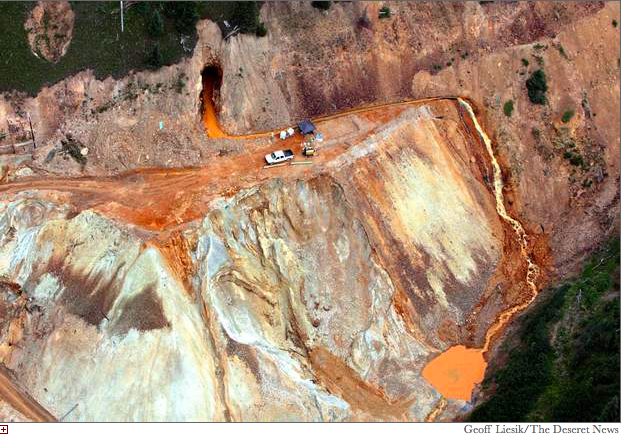
Cement Creek aerial photo — Jonathan Thompson via Twitter

After the Blowout: Silverton Faces Watershed Moment in Wake of [#AnimasRiver] Gold King Spill — The San Juan Independent

This slideshow requires JavaScript.


From The San Juan Independent (Samantha Wright):

Tucked in amongst towering mountains and surrounded by wilderness with no easy way in or out, Silverton is one of the smallest, highest, most rugged and isolated communities in Colorado.

But the three million gallon spill that the Environmental Protection Agency accidentally unleashed from the nearby Gold King Mine into Cement Creek and the Animas River on Aug. 5 thrust the tiny town into the national spotlight, and underscored just how connected – and responsible – Silverton is to downstream communities from Durango to Lake Powell.

The blowout has also driven home how easy it is to misconstrue the complicated forces of man and nature that combined to create it.

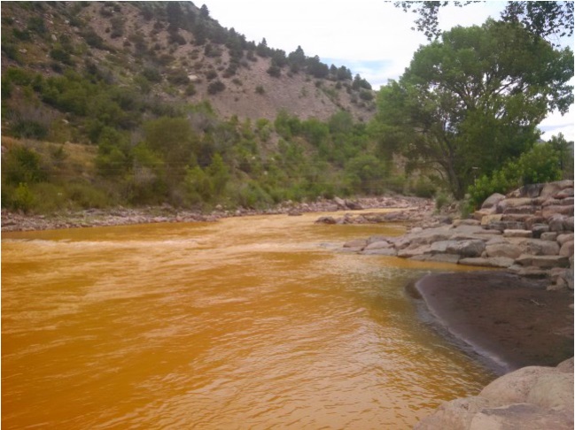
Journalists took their cue from the yellow color of the water in the days following the blowout, describing the plume of polluted mine drainage in apocalyptic terms ranging from “orange acid water” to “a million gallons of filthy yellow mustard” and “a puke-colored plume of mine runoff.” (Conan O’Brien took the prize with his satiric video promoting a kayak ride from hell along a 30-mile stretch of “arsenic-laced, mustard-colored doom juice.”)

Silverton residents have another term for the color Cement Creek turned in the mine blowout’s aftermath: familiar. Every spring, during peak runoff, Cement Creek – and in turn, a portion of the Animas River downstream – run almost that same turbid, nasty hue.

It’s the nature of the place.

From its headwaters in the shadow of the Red Mountains, Cement Creek plummets past a cluster of leaky old mine adits on the slopes of Bonita Peak in the upper reaches of the Cement Creek drainage, passing right beneath the now-infamous Gold King Mine.

The creek then flows through the ghost town of Gladstone in the valley down below, where the two-mile-long American Tunnel used to provide access to the Sunnyside Mine, and where a water treatment plant once treated that mine’s discharge but has since been dismantled.

Finally, about six miles later, it runs straight through Silverton where it meets the Animas River.

While Cement Creek picks up a significant amount of mine drainage along the way (more so in recent years than in the past), its low pH and often rusty tint are also due to the surrounding iron-rich mountains themselves, which are located within the San Juan Triangle – one of the most heavily mineralized and volcanized patches of the earth’s crust. Even EPA officials readily admit the creek will never be able to support fish.

“Cement Creek wasn’t called Clearwater Creek,” pointed out longtime Silverton local Jerry Hoffer, who once worked as an electrician inside the Sunnyside Mine. “It was called Cement Creek for a reason.”

Fellow Silverton resident John Ferguson agrees. “On the positive side, this is really ugly-looking stuff that’s not very dangerous,” said the Telluride native, who has worked as a mining and milling engineer and consultant for most of his life. “I live in an RV park right next to Cement Creek, and I see it every time it rains. You look up, and there’s a reason – Red Mountain.”

It takes a little chemistry lesson to understand why Cement Creek is generally not as scary as it looks.

“There’s bad stuff in it,” Ferguson allowed. “But when you see the red water, that means it’s not so acidic anymore and the iron has precipitated out. And then, as you go a step further, the ferrous hydroxide precipitate forms a gelatinous flock, like a slime, that latches onto other stuff and drops other metals out of the water too.”

By the time the water hits the Animas River Canyon south of Silverton, it’s running over limestone which buffers the pH of the water, precipitating out metal oxides all the way along. “The further downstream you go, the less total dissolved metal you have,” Ferguson said.

In theory, then, the river has the ability to heal itself of the acidic and metal-laden conditions of its most troublesome tributary. Over the past 10 years, however, the growing volume of mine runoff flowing into the river from the upper Cement Creek drainage has overwhelmed this ability, alarming the EPA and other local stakeholders who are concerned about water quality in the basin, and triggering intensive monitoring.

When the Gold King Mine released its load on Aug. 5, the condition of the Animas River got more attention than it has probably ever had since 1978, when the Sunnyside Mine breached the floor of Lake Emma high above Silverton, sending an estimated 500 million gallons of water and sludge blasting through the mine, out the American Tunnel and into downstream waters.

“Not Worth Panicking Over…”

While the three million gallon Gold King spill is dwarfed in comparison to Lake Emma, EPA test results released last Monday did give cause for concern. The blowout caused a spectacular, if transient, spike in concentration of total and dissolved metals in the Animas River – from arsenic to zinc – in a profile pretty typical of concentrated mine drainage oozing from aging adits across the San Juans.

Downstream communities along the length of the Animas River, and the San Juan River into which it flows, are worried about lasting health effects of the sediment that the surge has left behind.

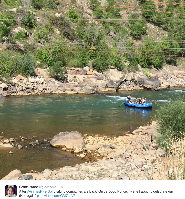
But within a week of the Gold King blowout, the water quality in the Animas River, at least, appeared to be back to pre-event conditions. While in Durango last week, Gov. John Hickenlooper even drank a glass of it to prove that point.

“There’s a silver lining in all this,” he told the Denver Post after the stunt (he had reportedly treated the glass of water with an iodine tablet first to kill bacteria and pathogens). “It doesn’t appear there is going to be lasting environmental damage or significant environmental damage, and what most of us were fearful of didn’t happen.”

A survey of fish in the river looks equally promising, and monitoring conducted by the Silverton-based Mountain Studies Institute shows that the bugs that make their home along the Animas also appear to be doing okay so far.

In short, “Everyone’s panicking over something that’s not worth panicking over,” Hoffer said, voicing the frustration that many people are feeling here in Silverton, now that the national media has shifted its focus from the spectacle of the polluted plume of water to the source of the accident itself – and the agency that triggered it.

Silverton’s legacy of mine pollution is right in the middle of that spotlight. The Associated Press, Denver Post, Los Angeles Times, Fox News and Al Jazeera all paid visits to the town last week, huddling with local officials, interviewing key players in the local mining scene and touring the accident site to gain insight into what caused the spill.

Many of those stories have not painted Silverton and some of its residents in a flattering light.

“We are gently and slowly being crushed by the press, jammed into a corner not of our making,” said David Breed in an online community forum on Saturday as the national media continued to churn out story after story about the spill. “The EPA has ‘taken responsibility’ and yet the narrative that is being played out is that we are greedy, provincial hicks that turned down the help we were offered….”

Meanwhile, there has been a growing clamor from downstream communities and elected officials for the EPA to list Silverton as a Superfund site, so that the agency can clean up the mine pollution in the upper Animas River Basin in a comprehensive manner.

Along with such a listing would probably come a new water treatment plant in Gladstone to treat the polluted mine water seeping out of the upper Cement Creek drainage. That would cost millions to build, and millions more to operate in perpetuity.

Ever since the Sunnyside shut down in 1991, the EPA has expressed a desire to place the Silverton region on the National Priority Listing for hazardous waste cleanup under the Comprehensive Environmental Response, Compensation and Liability Act (CERCLA), commonly known as Superfund.

In 2012, with acid drainage from certain abandoned and inactive mines in the area – including the Gold King – on the rise due to installation of bulkheads during decommissioning of the Sunnyside Mine, the EPA concluded that the cluster of polluting mines in the upper Cement Creek drainage qualified for National Priority Listing, but postponed moving forward with the listing because of local opposition.

In its most recent move, the agency asked the Town of Silverton permission to test the soil around town to determine if the area is contaminated with heavy metals from old smelting operations.

“They have really wanted to create a Superfund site here because of the Gladstone/upper Cement Creek situation, but they had to prove human health problems,” explained Silverton native and retired town treasurer Bev Rich. “That’s when they came in two or three months ago and said, ‘We want to sample your streets and your alleys and your yards and your schools. And everybody’s going ‘What? We thought this was supposed to be at Gladstone.’”

While you would be hard-pressed to find anyone in Silverton who doesn’t want to see the Gladstone mess cleaned up, a strong contingent of locals bristle at the stigma that would come with a Superfund designation, and the death knell it would likely ring for any potential mining comeback in the district. Many prefer a local stakeholder-based approach to cleaning up the mess.

And some question whether the same agency that triggered the Gold King blowout is competent to tackle the much more complicated task of cleaning up the basin as a whole.

Local brain trust eschewed?

Ferguson stood in the streetlamp glow in front of Town Hall after attending a meeting at which EPA officials spoke to the Silverton community last Monday, wondering out loud why the feds hadn’t hired local experts to consult on the Gold King project – and maybe even execute it.

Reports after the accident revealed that the EPA had contracted with Environmental Restoration LLC (a Fenton, Missouri, company) to conduct the remediation work at the idled mine.

“[The EPA] are arrogant jerks, at best,” Ferguson said. “In that room, up there this evening, there were at least five people who had first-hand on-the-ground knowledge of the conditions in the Gold King Mine, including a town trustee. A lot of people here with mega-years of experience knew about the conditions, knew what was there, knew there were some challenges, knew there was really the potential to screw things up – or to do it fairly smoothly, fairly easily and fairly safely.”

Ferguson himself is among those people. He is an active participant of the Animas River Stakeholders Group, an unlikely alliance of mining companies, environmental organizations, land owners, local governmental entities, and state and federal regulatory and land management agencies, focused on mine remediation and water quality issues in the Animas River Basin. All concerned entities are welcome at the monthly Stakeholder meetings – even the EPA has a seat at the table.

ARSG coalesced in 1994, just after the Sunnyside Mine shut down, to fend off the specter of a Superfund designation in the Upper Animas River Basin, and to come up with a process for determining attainable water quality standards in the basin. The group has directly sponsored close to 20 mine remediation projects in the upper Animas River watershed and was indirectly involved in 40 more, considerably improving the water quality in several tributaries to the Animas River – including Mineral and Cement creeks.

In recent years, the Stakeholders’ primary focus has been on what to do about the declining water quality in the upper Cement Creek drainage. The havoc it is wreaking in the Animas River downstream of Silverton has undone much of the progress the group made in its first decade of existence.

Seven years ago, in the midst of this escalating water quality crisis, Ferguson says he participated in a joint effort between Colorado Goldfields (a local now-defunct mining company with which he is associated) and the Colorado Division of Reclamation, Mining and Safety to look into stabilizing the Gold King portal and treating its drainage, to prevent what they foresaw as a looming blowout.

The plan, as he described it, would have involved pumping some concrete grout into the talus that had collapsed over a secondary adit, drilling into the Gold King mine pool and inserting a pipe to drain it into a settling pond. In the end, Ferguson said, the plan was nixed because mine owner Todd Hennis did not have the required water discharge permit.

At the time there was only about 10 gallons per minute of water leaking out of the mine.

“Historically we knew the flow had been greater, because there is a picture at the Brown Bear Cafe, of the No. 7 Level of the Gold King Mine back in the historic days before the American Tunnel,” Ferguson said.

The photo, hanging to the right of the juke box over a table along the west wall, shows water streaming down the mine dump in front of the old Gold King boarding house. Its likely source is the Bonita Fault, a water-rich fissure that slices through Bonita Peak, intersecting both the Gold King’s #7 Level and the American Tunnel which bores into the mountain over a thousand feet below.

The American Tunnel was initially driven to intersect the Gold King vein at depth, to provide creek-level haulage and, as Ferguson tells it, to dewater the upper Gold King workings. Years later, the tunnel was lengthened an additional mile in a different direction to provide access to the Sunnyside Gold Mine workings. No direct manmade connection between the American Tunnel and Gold King mine’s upper workings was ever made.

Three massive bulkheads, or concrete plugs, were installed inside the vast underground workings of the Sunnyside starting in 1996, five years after it shut down. This work was part of an agreement with the State of Colorado that released the mine operator from environmental liability and allowed it to stop actively treating the water that still poured from the American Tunnel.

The bulkheads were intended to prevent water from draining out of the mine portal. The first one worked well, but when the other two were added downstream in the American Tunnel six years later to contain acidic flows from a fractured zone, the bulkheads collectively ended up functioning more as a bathtub plug, says ARSG co-coordinator Peter Butler.

They caused the groundwater table to rise again, making its way back up through old mine workings, faults and cracks inside the mountain, dramatically increasing acid mine drainage from the historic and abandoned Red and Bonita, Mogul, and Gold King mines.

Collectively, these leaky adits have created one of the largest untreated mine drainages in Colorado – a festering, acidic sore oozing heavy metals in solution, including zinc, cadmium, copper, manganese, iron, aluminum and a little lead.

Thus, Ferguson was not surprised that the EPA encountered so much pent-up water shortly after crews started digging away at the unconsolidated material that blocked the Gold King portal last week. They should have approached the job with more caution, and expertise, he said.

“You can’t fix stupid,” Ferguson shook his head. “It was an unfortunate incident. It’s a really good thing that nobody got hurt. Actually, it’s a wonder. Those guys up there would have been first in line.”

A Bit of a Mystery…

The last time the Gold King Mine made headlines may have been when Donnie Goode died there in the 1980s. He was working for a company that was doing some exploration work inside the mine, which had been inactive since the 1920s, and was bent over looking for copper nuggets on the floor of the tunnel when a big slab fell off the wall and broke his neck.

“It was a really strange accident,” said San Juan County Commissioner Scott Fetchenheir, a local mining historian and geologist who knew Goode. “He was just in the wrong place, at the wrong time.”

As Fetchenheir recalls, the underground workings of the Gold King Mine were “pretty altered – a lot of clays, a lot of pyrite.”

When the portal of the Gold King’s No. 7 Level tunnel caved in about 15 years ago, an impoundment pool began to form inside the mine. The sulfide-rich pyrite in there, when exposed to the water, reacted to form sulfuric acid. And the more acidic the water became, the more harmful metals and metalloids it leached out of the surrounding rock. It was, in other words, the recipe for acid mine drainage.

In the beginning, just a little bit of tainted water trickled out of the Gold King’s caved-in portal. But not long after the last two Sunnyside bulkheads were installed, the adit started gushing up to 200 gallons per minute of mine water with a pH level of around 3 (more acidic than orange juice, but less so than Coke or Pepsi) into Cement Creek, and won the distinction of becoming one of the two biggest contributors of heavy metal loads in the Animas Basin.

The hydrology of the upper Cement Creek drainage has changed in recent years. The Gold King outflow has tapered off significantly, while that of the nearby Red and Bonita (the other top polluter in the basin) has simultaneously increased, leading the EPA and other ARSG stakeholders to speculate as to what was going on.

The water from the two portals has totally different chemical signatures, and the mines are not known to be connected by any manmade structure – either to each other, or to the American Tunnel and Sunnyside workings.

It was a bit of a mystery, and one that the EPA and ARSG wanted to solve sooner rather than later, as the water quality of the Animas River downstream of its confluence with Cement Creek became more and more degraded.

Last year, the EPA developed a plan to install a new bulkhead in the Red and Bonita Mine. Simultaneously, the feds would open up the No. 7 Level of the Gold King Mine to drain and treat its mine pool, and explore its underground workings to learn more about the mine’s hydrology, perhaps coming up with a way to staunch its flow.

The $1.5 million project was designated as a Superfund removal action – a short-term, in-and-out project of defined scope with a specific, achievable outcome, as opposed to the remedial program more commonly associated with CERCLA, which is intended to manage longterm, more complex, and less certain cleanup options.

The EPA and the Silverton community have always had a strained relationship. But in the case of the Gold King/ Red and Bonita project, “The EPA was actually doing something that we wanted done – which was to find out where that water was coming from, and to see what we could do to get it shut off,” said Steve Fearn, a longtime Silverton mining engineer and ARSG member who owned the Gold King Mine before Todd Hennis.

The purpose of the project was “to see if there are alternatives that make sense,” Fearn explained. “We [ARSG] had encouraged them to do it. It was part of the consensus.”

If it works, Fearn said, it would be a preferable alternative to installing a new water treatment plant in Gladstone.

Things Go to Hell…

The plan for the Gold King portal, as EPA Region 8 Office Assistant Regional Administrator Martin Hestmark explained to subdued Silverton community members last Monday night, was to try and get a “stinger pipe” into the adit behind the cave-in so that they could pump the mine pool out in a controlled fashion and then treat the discharge.

“We knew there was a mine pool back there, but did not know how much,” Hestmark admitted. The EPA’s estimates for the volume of water, he said, were based on what they knew of the existing mine workings associated with the Gold King Mine.

But the complex hydrology of the tangle of old mine workings, faults and cracks within the towering Bonita Peak is not well understood – by the EPA or anyone else.

As Hestmark put it, “Things happen underground, voids can be created, and mine volume can be a lot larger than we estimated.”

In an effort to get better access to improve its ability to place the stinger pipe into the mine plug, the crew was using a backhoe to pull material down from on top of the adit to the front of the adit, and then pushing that material out onto the mine dump.

Things went south in a hurry when clear water starting to seep through, “quite a bit above the adit,” Hestmark said. Not knowing what was going on, the crew backed its equipment away. Then the discharge started to turn red, and it started to show pressure.

And then, it started to blow.

“It basically blew out the unconsolidated material that was holding all that water back – timbers, lagging, rock falling off the ceiling, and all that stuff,” Hestmark said. On its violent rush toward Cement Creek, the blowout took a significant portion of the mine dump below the portal down the mountain with it, overwhelming the treatment ponds below.

Based on his 28 years of experience and what he knew of the mine workings, EPA mine site coordinator Hayes Griswold initially estimated that it looked like a “million gallon spill.” A U.S. Geological Survey gauging station on Cement Creek later revealed that the volume of the spill was actually north of three million gallons – about three times as much as could be contained in the Ouray Hot Springs Pool.

The Gold King blowout had little direct impact on Silverton residents, other than to wash out a few county roads, and to leave more than the usual amount of orange iron oxide stain on the banks of the creek as it churned through town.

But as the slug of mine discharge made its way into the Animas River, the impact on communities downstream was more severe.

The river was closed to kayakers, rafters and swimmers for nine days, finally reopening on the following Friday afternoon. Irrigators and well water users along the river had to cut off their water supply. Durango residents were asked to conserve water as the city stopped pumping out of the Animas to prevent the tainted discharge from getting sucked into the city reservoir.

By Friday, the plume of polluted water had made its way across the New Mexico state line and flowed into the San Juan River. Farmington city officials followed Durango’s lead, shutting down all water supply intake pumps to avoid contamination and advising citizens to stay out of the river until the discoloration had passed.

On Saturday, Navajo Nation police and tribal officials went up and down the San Juan River shore, warning community members of contaminated water from the Gold King Mine.

States of emergency were declared in riparian communities in southern Colorado, New Mexico and Utah as a result of the contamination, and the EPA switched off water intakes from Durango to Lake Powell.

In a statement after the incident that was published in local papers, Nancy Agro, an attorney for San Juan Corp., (Hennis’s company which owns the Gold King), blamed the EPA for the accident:

“The U.S. Environmental Protection Agency, operating under an access agreement obtained from the owner of the Gold King Mine, had begun an investigation regarding the source of contaminated water at the Gold King Mine last year. Upon suspending work last year, the USEPA backfilled the portal to the mine. On August 5th, 2015, while the USEPA was removing the backfill from the portal to the Gold King Mine to continue its investigation this year, the plug blew out releasing contaminated water behind the backfill into the Animas River.”

The San Juan Independent asked the EPA to clarify the scope and timeline of work it was conducting at the mine, and whether local experts were consulted on the project, but has not yet received a response.

Meanwhile, Hennis has also said in several interviews that the backed-up wastewater inside the Sunnyside Mine is to blame for last Wednesday’s blowout. Sunnyside Gold Corp. is owned now by Kinross, a Canadian mining behemoth with capitalization estimated at US$3.7 billion, and holdings across several continents. (In June, Kinross was ranked the top mining company on the list of Top 50 Most Socially Responsible Companies in Canada developed by Maclean’s magazine.)

“It is our belief that, when Sunnyside put bulkheads inside the Sunnyside Mine, they redistributed the flow of wastewater out of other mine portals,” Hennis told the Denver Post last week. “It is a bad flow, very high in the nasty minerals, very acidic.”

‘Environmental Pollution Agency’…

The Red and Bonita Mine, whose voluminous mine discharge now accounts for 18 percent of the zinc load in the Animas River below Silverton, has for years been the poster child for Good Samaritan legislation – an issue that has been eclipsed in recent days by the Gold King Mine blowout and its aftermath.

But the river that turned orange may turn out to be the ultimate poster child for the need to find some way to remediate the thousands of abandoned mines that are draining into watersheds across the West.

The EPA, meanwhile, has suffered its own blowout of sorts over the past two weeks, squirming under the exquisite irony of having created its own environmental mess – even as it was trying to fix one – leading some to dub it the “Environmental Pollution Agency.”

At a public meeting in Durango five days after the blow-out, 500 residents showed up with a tar and feathering mentality against EPA officials. Russell Begaye, president of the Navajo Nation, announced the same day that he plans to file a lawsuit against the EPA as a result of damages to the nation’s water supply.

In Silverton, too, locals have asked some tough questions. At a county commissioner meeting last week, Fetchenheir grilled EPA officials about the accident, wondering (among other things) why they had not used their Iridium phone at the Red and Bonita work site to alert authorities in Silverton about the wall of water that was heading their way.

“There was definitely a communication problem up there,” Fetchenheir said. “I don’t think they were very well prepared.”

The national fixation over the Gold King accident has even spilled into presidential politics. Mark Rubio and Donald Trump both issued statements last week lambasting the EPA for its incompetence.

“There are some really interesting dynamics unfolding,” said Anthony Edwards, a local judge and attorney who is serving as the public information officer for Silverton’s incident management team. Edwards has observed a growing tendency from the Durango community in recent days to blame Silverton for the spill because of its refusal to accept Superfund status – a mindset that was on display at last Sunday’s public meeting in Durango.

The Durango Herald reported La Plata County Commissioner Gwen Lachelt and Mayor Brookie as stating they were “intent on seeing the EPA come up with a longterm plan that will protect Durango and other communities downstream from San Juan County’s abandoned mines,” which “place the Animas River and Durango in ongoing danger.”

At this meeting, EPA officials confirmed that they are seriously considering declaring parts of Silverton a Superfund site. (The agency at large has also announced in the blowout’s aftermath that it is halting all EPA field work at mines across the nation for reevaluation.)

A recent Facebook post that has since been taken down from the Silverton Community Issues forum gave a glimpse into the looming cultural divide between Silverton and its downstream neighbors:

“SELFISH BUNCH OF MONEYGRUBBERS-CLEAN UP YOUR POLLUTED NIEGHBORHOOD AND STOP CRYING LIKE THE BUNCH OF CHAINSMOKING OLD DRUNKS WITH CRUMBS IN YOUR BEIRDS WHEN THE WORD SUPERFUND COMES UP. SUPERFUND SUPERFUND SUPERFUND TO CLEAN UP WHAT YOUR OLD TIMEY ASSES WONT. THANKS FOR THE DUMP MINERS. ONE FINGER SALUTE RIGHT BACK AT YOU ALL. SHAME ON YOU” (sic).

The tide of local sentiment in Silverton may be turning – Mark Esper, the editor of the Silverton Standard, editorialized last week about the wisdom of embracing Superfund. His words reflect the belief of a growing number of people here – especially in the aftermath of the Gold King spill.

On Monday, Silverton resident Melanie Bergolc was soliciting community members to sign a letter she had drafted to send to local, regional and statewide newspapers, expressing this as-yet unsung view:

“We are some of the Silverton residents that stand with the views and comments of our newspaper editor Mark Esper in supporting cleaning up our waters and past mining areas by using EPA’s CERCLA (Superfund) or another entity at the federal, regional, or state level that has the funding and resources to do so….We would like our town and county to do the best job they can in researching and talking to all parties involved that can help solve our past mining environmental issues and to finally put into action a major cleanup instead of patchwork throughout the last couple of decades.”

But some locals, especially those with strong ties to their community’s mining roots, aren’t likely to sign on.

As Ferguson put it, “Ronald Reagan had it right when he said, ‘The scariest 10 words in the English language are ‘I am from the government and I am here to help.’”

#COWaterPlan: “There are, however, few mandates” — The Pueblo Chieftain

Colorado Water Plan website screen shot November 1, 2013

From The Pueblo Chieftain (Chris Woodka):

Once the state water plan is delivered to Gov. John Hickenlooper, no one from the Arkansas Basin Roundtable will be ready to say “mission accomplished.”

On [August 12], the roundtable contemplated its future in light of the expected wrap-up of the water plan in December.

Public comments, which already number in the thousands, are due by Sept. 17.

The state Legislature’s interim Water Resources Review Committee heard another round of comments from the Arkansas Valley [August 11] in Salida.

And staffers from the Colorado Water Conservation Board, which is preparing the plan, gave roundtable members a few tips on finding the highlights among the verbiage of the 500-page document.

The plan generally promotes multipurpose projects with multiple funding partners and broad agreement about mitigation. It favors continuation of realistic conservation strategies. It addresses statewide concerns about municipal supply, agricultural needs, recreation uses and environmental preservation.

Its critical action plan, Chapter 10, outlines in broad strokes how projects will be prioritized, funded and possibly streamlined in the future. During the process, hundreds of projects bobbed up during dozens of meetings.

There are, however, few mandates. Words like “seek, create and encourage” are used, rather than “shall, will or must.”

“Chapter 10 is the guts of the state water plan,” Jeris Danielson said, summing up a similar presentation to the Interbasin Compact Committee a few weeks ago.

The IBCC, formed at the same time as the roundtables 10 years ago, had some angst about its future mission, but realized it will be needed to follow through on plans now in the works, Danielson said.

Jay Winner, the roundtable’s other IBCC member, said the plan is unfinished business, noting that roundtables throughout the state continue to vacillate on a framework for future transbasin transfers.

“If we don’t have a transmountain diversion, we don’t have a plan,” Winner said.

Alan Hamel, who represents the basin on the CWCB, said the roundtables will continue to have a role in the future, implementing basin plans that also were created in the two-year process to create a state water plan.

Jim Broderick, roundtable chairman, told members, who come from all parts of the sprawling Arkansas River basin, that it will be up to them in the future to see that basin plans are moved forward.

“Is this the last opportunity for comment?” Broderick asked Jacob Bornstein, a CWCB staffer.

“This is the last round of comment on the plan itself,” Bornstein replied. “But it is a living document that can change.”

“There’s a heavy mistrust of government” — State Senator Larry Crowder

Fountain Creek Watershed

From The Pueblo Chieftain (Chris Woodka):

A state lawmaker who voiced support for a dam on Fountain Creek after this spring’s flooding says downstream opposition has changed his course.

“A dam on Fountain Creek was, still is, a good idea. But when I went down there to talk to people about it, there was opposition from three counties and several groups of farmers,” state Sen. Larry Crowder, R-Alamosa, said. “There’s a heavy mistrust of government.”

Crowder made waves in July when he voiced support for a flood-control dam on Fountain Creek in light of the constant erosion caused by heavy flooding in May and June.

On paper, having three dams in the Lower Arkansas Valley — Pueblo, John Martin and Fountain Creek — could allow for better water management to supply water to farmers, Crowder said Tuesday.

“I still believe having three dams would have extended water rights,” he said.

But commissioners in Otero, Prowers and Kiowa counties have voiced opposition, saying a dam on Fountain Creek would harm junior water rights.

Preliminary results from a study by the Fountain Creek Watershed Flood Control and Greenway District earlier this year show that damage would be relatively small and that slowing down water could actually prolong the time some junior rights are in priority.

“The way I see it, we are always playing defense,” Crowder said. “I thought a dam would be a good way to play But after several meetings and letters of opposition to a dam, Crowder said he is no longer interested in pushing for state support of a Fountain Creek dam. He was also dissuaded from supporting it by comments last week that made at a joint meeting of Pueblo and Colorado Springs city councils.

“It’s a quandary for me, but I have to go with what people in my district want,” Crowder said. “I can’t fight everybody.”

Weekly Climate, Water and Drought Assessment of the Upper #ColoradoRiver Basin

Upper Colorado River Basin precipitation August 1 -- 25, 2015
Upper Colorado River Basin precipitation August 1 — 25, 2015

Click here to read the current assessment. Click here to go to the NIDIS website hosted by the Colorado Climate Center.

The Lower Colorado: no shortage for now, but that pesky structural deficit’s still there — John Fleck

Colorado River Basin including Mexico, USBR May 2015

From InkStain (John Fleck):

Lake Mead is forecast to end calendar year 2015 with a surface elevation of 1,082.33 feet above sea level, according to new numbers released yesterday by the U.S. Bureau of Reclamation. The current forecast for the end of 2016 is 1,079.57. The good news is that both of those numbers are greater than 1,075, which means the odds are against there being a “shortage” declared this year or next (when Mead hits 1,075 on some future January 1, rules kick in that reduce Arizona, Nevada, and Mexico allocations – repeat after me “this is not a crisis” – more here).

The bad news is that 1,079.57 is lower than 1,082.33, which means that even in these sorta good times, hydrologically speaking, Lake Mead keeps dropping. By “good times”, I mean that a big boost of precipitation in recent months in the Upper Colorado River Basin means that Lake Powell, the big reservoir at the upstream end of the Grand Canyon, is actually inching up right now. It’s forecast to end this year nearly five feet above last year’s levels, with the chance it could go up again next year. The good hydrology means that, under the river’s operating rules, Lake Powell will release “bonus” water this year and next. Under the rules, the Upper Basin is sorta legally required to release 8.23 million acre feet from Lake Powell down through the Grand Canyon to Lake Mead. This year and next, the current forecast calls for 9 million acre feet.

On this day in 1920, the 19th Amendment to the U.S. Constitution was ratified, granting women the right to vote

Screen Shot 2015-08-18 at 12.51.58 PM

Water Values podcast: Should We Have a Federal Water Policy?

Screen Shot 2015-08-18 at 12.28.17 PM

Click here to listen to the podcast from David McGimpsey.

Constant cleanup key to preserving river — the Vail Daily

Eagle Mine
Eagle Mine

From the Vail Daily (Scott N. Miller):

For longtime valley residents, the recent mine waste spill into the Animas River near Durango prompted memories of the winter of 1989-90, when the Eagle River through Minturn ran a dull, depressing orange. Its clarity today is thanks to constant work.

The Eagle Mine — located in a tight valley between Minturn and Red Cliff — closed in 1984. After the mine closed, countless gallons of water flooded the mine works and, five years later, into the river, turning the stream orange. Locals were aghast, of course.

When the river ran orange, the U.S. Environmental Protection Agency had already added the mine to its list of Superfund sites for closely monitored cleanup, but the extent of the problem was still being determined.

CLEANUP CONTINUES

While the river today looks normal — with the exception of some of the orange-tinged boulders in the river — the cleanup continues and will into the foreseeable future.

The “responsible party” for the mine cleanup is CBS, which acquired the mine when it bought Viacom, the previous responsible party. The mine ended up in the hands of those media companies via previous acquisitions and mergers. Today, CBS still pays for much of the work, and will essentially forever. The state and federal governments are also involved.

Because water continues to seep into the mine works — a vast underground network of caverns and tunnels — contaminated water is piped out of the mine and treated at a site at Maloit Park in Minturn. About 250 gallons of water per minute comes out of the mine and is pumped into a facility that allows heavy metals to settle out. About 250 pounds of metallic sludge per day comes out of the water.

Eagle River Basin
Eagle River Basin

PROGRESS

The Eagle River Watershed Council was created out of that environmental disaster. The group, which today looks at the entire length of the river, remains intimately involved in the continuing work at the mine.

“There’s been a lot of progress,” council director Holly Loff said. “But there could always be more.”

The biggest issue today is the age of the equipment, particularly the pipelines carrying contaminated water to the treatment plant. That pipeline, which is above ground in a harsh winter environment, sprung a handful of notable leaks a few years ago. One, in 2009, turned the river orange again for a brief period. Another, bigger spill in 2012 put 428,000 gallons of contaminated water into the river, turning it green.

When word came about those spills, the Eagle River Water & Sanitation District shut off the intake to its Avon water treatment plant.

The district’s Todd Fessenden, who is in charge of drinking water treatment and supplies, said the Avon plant was built to accommodate and treat the metals in the river, but not in the concentrations seen when there’s a spill. That’s why the intakes were shut down.

MONITORING THE MINE

Given the complexity of the mine’s treatment system, Loff said it’s important to have more and better monitoring on the pipeline and pumps, since humans can’t have their eyes on the system all the time.

“They’re moving toward real-time remote monitoring,” Loff said.

Eagle River Water & Sanitation District community affairs director Diane Johnson said the district uses remote monitors at many of its facilities, and they work well. One monitor, in a remote area without cell phone service, is linked to a satellite.

At the moment, though, sometimes the district gets some notifications the old-fashioned way — someone in town will notice something about the river and make a call.

Utes bless the Animas River — The Durango Herald

“Water is life; water is sacred,” said Southern Ute Sun Dance Chief Kenny Frost, who led a ceremony to heal the Animas River on Sunday at sunrise at Santa Rita Park in Durango

From The Durango Herald (Mary Shinn):

As the Animas River reflected the golden Sunday sunrise, Kenny Frost and Lyndreth Wall, prayed that the waterway would heal from recent heavy-metal pollution.

“Water is life; water is sacred,” said Frost, a Southern Ute Sun Dance Chief.

A heron soared over the river, as Frost and Wall, a Ute Mountain Ute, sang and prayed in Ute for the river.

About 20 people from all over the region came to be a part of the blessing at Santa Rita Park. At the same time, groups in other parts of the United States, Great Britain, Australia, Germany and Canada also prayed for the health of local and global waterways.

Frost hopes the blessing of the river can lead to an annual Indigenous Water Prayer Day, which would be held on the third Sunday of August. Internationally, it would draw attention to rivers and other waterways at risk from pollution. Locally, it would be a reminder of how the river ran orange this month and the potential for it to happen again.

“The danger is still there,” he said…

“We’re not going to blame anyone because we want to keep everything positive,” Frost said.

However, he did express skepticism about the safety of the river water, noting ongoing health advisories. Everyone is still advised to wash with soap and water after coming in contact with discolored river sediment.

He also highlighted the hardship that the pollution caused for those in New Mexico and on the Navajo Nation, where communities temporarily lost their water source for crops and livestock after the spill…

After songs and prayer, Frost closed the ceremony by inviting everyone to bless the river by pouring in bottles of pure water and sprinkling handfuls of crushed corn over it.

The Colorado Department of Agriculture has $3 million over 3 years to fund small hydropower projects

Micro-hydroelectric plant

From KCNF (Laura Palmisano):

Sam Anderson, an energy specialist with the department, explains how the program works.

“This entails converting existing irrigated lands to pressurized irrigation such as a center pivot,” Anderson says. “It would include installing hydropower equipment to power that equipment or provide electricity to the grid that would offset their energy costs for their agricultural operations.”

He says right now there’s $100,000 available for two projects, but more funding will be offered in the future.

“Our program has a budget of $3 million over the next four years,” Anderson says. “And, we plan to do 30 of these projects. So on average there will be about $80,000 per project available to the farmers for technical assistance and financial assistance.”

He says the goal of the program is to help farmers use water more efficiently and reduce their energy costs.

Earlier this year, the state received $1.8 million from the U.S. Department of Agriculture’s Natural Resources Conservation Service for the initiative.

Anderson says people interested in applying should contact their local NRCS office.

The deadline for applications for the first round of funding is Aug. 17th.

Some Larimer County post-September 2013 flood permanent road repairs still 2-2.5 years out

Plume of subtropical moisture streaming into Colorado September 2013 via Weather5280

From the Fort Collins Coloradoan (Nick Coltrain):

Nearly two years after the September 2013 floods, permanent repairs are still ongoing — and in some cases just starting — on mountain roads scoured by roiling waters.

Gov. John Hickenlooper famously promised to reopen highways washed away within three months of the floods, a promise kept by the Colorado Department of Transportation. Hundreds of millions of dollars, most coming from the federal government, have poured into the mountain roads west of Fort Collins since then, making construction cones seem like permanent fixtures to those venturing above the foothills.

On Tuesday, another section of road was added to the to-do list of Northern Colorado road crews when the Larimer County Commission voted to repave an 800-foot stretch of road in Drake to grant more permanent access to a CDOT repair shop. It’s part of more than a dozen sites being handled by a contractor at a cost of about $700,000 — a drop in the bucket of $120 million in road repairs being overseen by Larimer County.

The county is on the hook for $10 million of those costs, with the majority covered by various federal agencies. The state is matching the county’s contribution.

“Everyone has access, so now it’s all about bringing those roads back up to pre-flood conditions, or close to it,” Assistant County Engineer Rusty McDaniel said.

McDaniel expects the permanent rebuild process, which will leave roads suitable for long-term use, to last about another two or two-and-a-half years — a similar timeline to when CDOT hopes to repair state highways that wind west of the Front Range. It’s a timeline CDOT more than defends; spokesman Jared Fiel highlighted it as ambitious.

Most projects like rebuilding U.S. Highway 34, which cuts from Loveland to Estes Park, would operate on a seven-to-10 year timeline, Fiel said.

“Obviously, you’re looking at a state highway going through a canyon where you have environmental concerns, concerns for both natural resources as well as wildlife in the area and all those things, plus you’re trying to get traffic up and down,” Fiel said.”So the whole process is actually quite daunting.”[…]

Fiel expects the permanent rebuild process to start at the end of this year, with off-road work being done in the eastern entrance to the canyon, where sheer rock walls loom over the road. That should have “very, very minimal impact” on travelers, Fiel said. More apparent — and potentially painful, to motorists at least — work could start once the winter weather clears in spring of next year.

#AnimasRiver spill: only the latest in 150 years of pollution

Animas River through Durango August 9, 2015 photo credit Grace Hood

From The High Country News (Jonathan Thompson):

When the Tang-orange plume of acidic water and heavy metal-laden slime blasted out of a mine in southwest Colorado’s San Juan Mountains on Aug. 5, tore through Cement Creek in Silverton, ran into the Animas River and, finally, the San Juan River some 100 miles downstream, it may have seemed like a pristine mountain stream was forever sullied.

That’s not really the case. The Animas River, as clear and clean as it may have looked just prior to the spill, lost its pristine status many years ago, soon after Anglo settlers converged on the region in the 1870s and started tearing up its mountains in search of gold and silver. Since then, the Animas and the San Juan, into which it runs, have been repeatedly battered and abused by the humans who rely on them.

The mining industry was probably the most persistent abuser of the watershed. First, there were the tailings dumped in the river, then the billions of gallons of acid mine drainage that have poured from mine adits into streams and, ultimately, into the Animas over the decades. Even after it left the region, the industry continues its abuse: Before the Gold King mine blew 3 million gallons of orange spooge into the watershed this month, it had been discharging similarly tainted water at a rate of 50 to 250 gallons per minute, or more than 100 million gallons per year, into Cement Creek.

But hardrock mining is only one of the watershed’s abusers. The Animas runs right through one of the nation’s most prolific natural gas fields, and coalbed methane wells are common on its shores. The San Juan’s muddy waters flow between two gargantuan coal-fired power plants before passing through uranium mining country and the Aneth oil field. As Dan Olson, director of the conservationist group San Juan Citizens Alliance, told journalists as they flew over the river a few days after the spill: “This is an industrialized landscape.”

It’s not just industry, either. This landscape has also been farmed, grazed and urbanized. More and more people move here every year and put more demands on the rivers, and more stuff into them. In fact, nutrient loading and bacteria levels are so high on the Animas and San Juan in northwestern New Mexico, that Dave Tomko, with the San Juan Watershed Group, was downright blasé about the orange plume moving towards his community. He figured that naturally high pH levels in the San Juan, along with extra releases from Navajo Reservoir upstream, would buffer the impacts of the acidic plume. Tomko’s major concern was for crops that would go thirsty as irrigation intakes were shut down. As far as the plume’s toxic impact, though, he said: “We’ve got bigger issues than this.”

From The Durango Herald (Peter Marcus):

Both state and federal health officials say Animas water quality has returned to pre-event conditions after an estimated 3 million gallons of mining wastewater poured into the river after an error by an Environmental Protection Agency-contracted crew on Aug. 5. The latest water-quality data released Tuesday and Wednesday show heavy-metal and pH concentrations have returned to levels similar to before the incident.

But outstanding questions remain about the nature of sediment in the river. While water quality may have returned to normal, sediment at the bottom and along the river could still contain unhealthy levels of heavy metals, including lead, arsenic, cadmium and aluminum.

“We are waiting for the results,” EPA spokesman Richard Mylott said Thursday of the sediment sampling. “When the data are available, they will be analyzed, and an assessment of longer-term risks will be made.”

State health officials are awaiting similar sediment test results.

Sampling results from the EPA released Thursday show high levels of toxic heavy metals in river water hours after last week’s spill.

The test results show water samples taken from the Animas River in the hours after the spill contained lead levels more than 200 times the acute exposure limit for aquatic life and more than 3,500 times the limit for human ingestion.

The agency stressed that contamination levels peaked after the spill but have since fallen as the pollution moved downstream and the toxic metals settled to the bottom.

The company that the EPA contracted to do the work at Gold King Mine is Environmental Restoration L.L.C., based in St. Louis, Missouri. The company declined comment. In a news release, it said it is the prime contractor for EPA’s Region 8. It acknowledged it was on site when the incident took place.

“ER honors our contractual confidentiality obligations to all of our clients, and cannot provide any additional information,” the press release said.

From The Denver Post (Jesse Paul):

The Environmental Protection Agency said Friday night it will implement a commercial water treatment system at the Gold King Mine in the wake of a spill of 3 million gallons of wastewater this month that left the agency facing immense criticism.

Many conservationists and those angered by the spill have called for some kind of water treatment in the Upper Animas Mining District, where the disaster began. Officials did not say when the system would be in place.

Leeching contaminants from several area mines have long polluted Cement Creek above Silverton and are blamed for sullying the Animas River downstream.

The district has been identified as one of the most polluted former mining areas in Colorado.

“Planning is in place for a treatment solution that includes piping discharge to a lower mine site with a better location for water treatment to continue into the fall,” the EPA said in a statement to The Denver Post. “Longer-term treatment needs and options are being evaluated.”

#AnimasRiver: “These sites are just sitting there waiting to fail, and [will] fail sooner or later” — Ron Cohen

Gold King mine entrance August 14, 2015 via the Environmental Protection Agency

From The Christian Science Monitor (Brad Knickerbocker):

The US Environmental Protection Agency says it’s now safe for recreational boaters to use the Animas River following a mine waste spill in Colorado that befouled the river with toxic metals and turned it a mustard yellow.

But the long-term effects of the spill at the Gold King mine are unknown, and the episode points to a much larger environmental problem – many thousands of such mines across the West, many of them abandoned and with piles of potentially polluting materials left behind after the ground had been scraped and scoured and blown up in the search for gold, silver, and other valuable minerals.

The problem has its historical roots in the General Mining Law signed by President Ulysses S. Grant in 1872 and still in effect.

Critics say the law made it too easy for individuals and corporations to obtain the rights (and sometimes the title) to areas claimed for mining on public land, demanded no royalties on the profits from such mining (which are required of other extractive industries, including coal, oil, and natural gas), and made no provision for cleaning up mine waste.

The industry – which has grown from individuals with a pick ax and a dusty mule to large corporations with massive earth moving equipment – denies this, noting modernized means and methods of extracting valuable minerals from the land, most of it in the American West…

The Associated Press reports two major examples:

California’s 150-year-old Iron Mountain mine discharged six tons of toxic sludge a day before a clean-up by the EPA, which declared it a Superfund site in 1983, 20 years after it shut down. The sludge caused massive fish kills in the Sacramento River system, which supplies a fifth of the state’s water, more than 30 times. Authorities now spend $5 million a year to remove poisons, and expect to keep at it forever.

At Montana’s Berkeley Pit, meanwhile, an acid lake created when Atlantic Richfield Co. turned off the pumps at its copper mine in 1982 grows by millions of gallons every day. The EPA made it a Superfund site, too, planning to keep acid spills from Butte Valley waterways. Meanwhile, the notorious pit grows in infamy: In 1995, an entire flock of migrating snow geese perished after setting down in the water.

“The 1872 Law’s legacy includes 550,000 abandoned and inactive mines; 10,000 miles of degraded rivers and streams; hundreds of polluted lakes and reservoirs; and, more than 50 Superfund sites,” reports the Center for Environmental Equity. Mining activity has contaminated the headwaters of more than 40 percent of watersheds in the West, according to the EPA.

Earthworks, another nonprofit environmental organization, estimates that it will cost taxpayers between $32-72 billion to clean up these mines. A congressional report based on EPA figures put the total cleanup costs for such hardrock mines at $20-54 billion.

“Westerners should stand up and take notice: Our communities are at risk,” Earthworks policy director Lauren Pagel wrote in a CNN opinion column. “This is not our first mining disaster and it won’t be the last. Until we tackle the root cause of mining pollution and modernize the 1872 mining law, we are gambling away our most precious resource, water.”

In 2007, the US House of Representatives passed the Hardrock Mining and Reclamation Act, which prevented companies from gaining full title to land on which they had established mining claims, set new environmental rules, and established an 8 percent royalty on the gross incomes from mining. The bill died in the US Senate.

Critics of the 1872 mine law are trying again. In February, Rep. Raúl M. Grijalva of Arizona, senior Democrat on the House Natural Resources Committee, introduced the Hardrock Mining Reform and Reclamation Act of 2015.

The bill would: establish an 8 percent royalty on new mines and a 4 percent royalty on existing mines; use those royalties and money raised by newly established pollution fees to clean up abandoned hardrock mine lands; end the patenting system that allows companies to purchase public land containing minerals for as little as $2.50 per acre; establish strong reclamation standards and bonding requirements aimed at companies that cease work at a particular mine or go bankrupt; protect wilderness study areas, roadless areas, and wild and scenic rivers from mining; and allow state, local, and tribal governments to petition federal authorities to withdraw certain areas from mining in order to protect drinking water, wildlife habitat, cultural and historic resources, or other important values.

To date, the bill has 26 cosponsors – all Democrats.

Even if such legislation were to pass – likely an even longer shot in the Republican-controlled Senate, where Democratic leader Harry Reid of Nevada is the son of a hardrock miner – it would still leave those many thousands of old mines leaking toxic waste, threatening wildlife, water quality, and local economies.

“You can expect such failures like the one we had at Gold King,” Ron Cohen, a civil and environmental engineering professor at the Colorado School of Mines, told The Wall Street Journal. “These sites are just sitting there waiting to fail, and most of them are going to fail sooner or later.”

Gold King mine spill Animas River August 2015 photo — Nancy Fisher via The Colorado Independent

From Conservation Colorado (Micha Rosenoer) via The Colorado Independent:

The recent disaster on the Animas River is news to no one at this point. Headlines across Colorado and national outlets have spread this recent development far and wide. The Animas turned orange, and that’s a big problem. That’s true — an abandoned mine leaking toxic chemicals into one of Southwest Colorado’s primary rivers, which sustains countless residents’ livelihoods, is a tremendous problem.

This is a tragedy. There’s no doubt about that. We’re all angry and profoundly saddened to see the lifeblood of Southwest Colorado spoiled. And the question on most of our minds is how on earth was this allowed to happen?

So what actually happened?

The Environmental Protection Agency was trying to clean up the Gold King Mine when a plug failed, which sent 3 million gallons of yellow toxic sludge into the Animas. Efforts at Gold King are one of many projects the EPA is undertaking to clean up the thousands of abandoned old mines that remain from Colorado’s mining legacy.

Yep, that’s right — there are thousands of mines like Gold King across our state, and many are like ticking time bombs. As anyone who has lived in Southwest Colorado for longer than a few years will tell you, the region is no stranger to mining-related catastrophes. This time around, the EPA’s hand happened to be on the shovel, but disasters like this one demonstrate the need to recognize our history of reckless exploitation.

What can we do to confront that history?

Quite a bit, actually. Here are some ways we can prevent future disasters, and how you can get involved:

  • Support efforts of local science-based groups conducting independent monitoring in conjunction with the EPA
  • Contact your elected representative and engage in public comment opportunities like town hall meetings and opportunities to speak with elected officials
  • Back legislation like the Good Samaritan bill that makes it easier for the community to help clean up abandoned mines
  • Get involved with current and future BLM planning processes. Many of these plans invite public input on where and how industry should be allowed to mine and drill within our communities. Strong standards and limitations for industry could prevent accidents like this one decades down the road.

Why do we have to deal with such rampant pollution?

It’s because, in the late 19th century, westward expansion was largely about mining. People broke their backs to glean their wealth out of the ground in the form of gold, silver or other metals. And they found that wealth in mineral-rich Southwest Colorado, which led to an explosion in mines in the area.

Here’s the big problem. Many of these mines were established far before environmental protections were even a part of our country’s vocabulary. But they continued to provide welcome financial support to the area, so the mining industry continued until the 1990s. After they ceased to be financially viable, those mines largely closed.

Cleaning up their toxic sludge has fallen to the EPA, which leads us to our current situation.

Looking ahead

At this point, it is absolutely imperative that we work together to find solutions. The legacy of mining in the Southwest and across Colorado is a massive problem, but it’s a solvable one. We need to ensure that mining companies are held accountable for the messes they make. They’ve been allowed to pass the buck for far, far too long.

One silver lining in this disaster is that it has brought worldwide attention to the sorry state of our mining legacy here in Colorado and the thousands of mines that pose similar unacceptable risks to our water, recreation and wildlife.

While the spill is awful, the Animas River has struggled with water quality for decades thanks to runoff from mines like Gold King, across the watershed.

It’s unfortunate that the river turning such an alarming shade was required to increase our sense of urgency on this issue, because conditions have been deplorable for a long time.

Whenever it rains reasonably hard in Southwest Colorado, zinc and cadmium levels go up 100 percent on the Animas River. This is not a hazard that we should be comfortable with in Colorado.

While it’s a shame that it took an incident of this magnitude to generate the appropriate alarm and urgency, perhaps we will see some real improvements as a result.

The best result from this disaster would be if Coloradans mobilized political will to take decisive action to clean the mines around Silverton and develop longterm solutions for the hundreds of miles of Colorado rivers currently impacted by mine drainage.

Returning to the status quo of ignoring pre-spill contamination levels is not good enough for Silverton or the future of Colorado’s rivers.

Bonita Mine acid mine drainage

From The Denver Post (Bruce Finley):

These old mines have leaked so much for so long, thousands of gallons a minute, that state agencies don’t track the combined toxic flow. But by the estimates at sites where the Environmental Protection Agency has stepped in, the overall discharge equals at least one Gold King disaster every two days — spreading cadmium, copper, lead, arsenic, manganese, zinc and other contaminants.

Bandera Mine wastewater flows into a creek that feeds the Animas River. State mining regulators often don’t discover old mine discharges until health
Bandera Mine wastewater flows into a creek that feeds the Animas River. State mining regulators often don’t discover old mine discharges until health responders are called to test water after residents report bright colors or dead fish. (Brent Lewis, The Denver Post)
“We’re not OK with any of this. We’re not OK with contaminated water running into waterways,” said Ginny Brannon, director of reclamation, mining and safety for the state.

“It is beyond our control. We inherited what we inherited. We took that, all those sites, and every year we steadily move forward with the goal of cleaning it up. We do as much as we can every year. We would love to do more. If we had the money.”

The EPA has calculated that 40 percent of river headwaters in the West are impaired by acid mine drainage. In Colorado, state health officials Thursday determined that discharges from the 230 old mines have contaminated 1,645 miles of rivers and streams.

But there is no state or federal program for systematically inspecting those mines, tucked away in high mountains, the hangover from mining booms and busts that made Colorado a state.

Colorado mining regulators say that’s because culprits at most sites have vanished.

The waterways contaminated by old mines — concentrated around historic mining hubs Silverton, Leadville, Lake City, Salida, Montezuma, Central City and Ouray — include segments of the Arkansas, Animas, Eagle, Big Thompson, Gunnison, South Platte and Uncompahgre rivers.

First impacts of water contaminated with heavy metals generally show up as dead fish or aquatic life, with drinking water supplies threatened. Later damage, depending on exposure, include human health harm and higher costs of cleaning up water at municipal treatment plants. Fully restoring poisoned fisheries after past disasters in Colorado has taken decades.

State mining regulators often don’t discover the old mine discharges until state health responders are called to test water after residents report bright colors or dead fish.

While state mining officials have visited all 230 sites, Bruce Stover, director of abandoned mine lands reclamation, emphasized limits on what Colorado can do to launch cleanups. Liability risks and weak laws are to blame, he said.

“These are inactive sites that do not have a permit. There are no inspections on them whatsoever. They are just out there in the woods,” he said.

Short of EPA takeover for federally run cleanups, which include installation of continual water-treatment systems, state officials said the best Colorado can do is to try to move forward on a few cooperative projects each year.

They have to rely on funds funneled from outside federal and private sources. Unlike coal mining and extraction of oil and gas, hard-rocking mining in the West, under the 1872 mining law that still governs, companies are not required to pay royalties or other fees that could help deal with festering abandoned mines.

Last year, state mining officials spent $1.5 million on six mine cleanup projects, which includes tailings removal, riverside restoration and plugging leaks, down from $4.5 million in 2013 — reflecting what federal agencies, such as the Bureau of Land Management and the Forest Service, have been able to contribute.

State mining officials spent $12.3 million on mine-reclamation work between 2009 and 2014.

Stover noted that most of the 230 old mines still leaking, while they cause harm, probably would not individually meet EPA criteria for launching a Superfund cleanup.

When Colorado has to go it alone, officials typically face legal and technical controversy. State mining engineers have favored installation of bulkhead plugs inside mines — a way to stop toxic discharge.

But that approach appears questionable after the Aug. 5 Gold King blowout, triggered by an EPA crew. Bulkheads backed up water inside Gold King and nearby mines, possibly priming them for blowouts.

Gold King owner Todd Hennis last week said the spread of backed-up water in the nearby Sunnyside Mine was a factor in the blowout.

EPA records on the adjacent Red and Bonita Mine show that state-backed installation of bulkheads in the Sunnyside Mine led to loaded-up wastewater in the Mogul, Red and Bonita, and Gold King mines, worsening contamination of Animas headwaters.

The Animas River Stakeholders Group is calling for installation of a water-treatment plant on Cement Creek, the hardest-hit Animas tributary — at an estimated cost of $5 million to $20 million, plus $1.2 million a year to run the plant.

“The ultimate goal should be to change the 1872 mining law,” said Bill Dvorak of the National Wildlife Federation. “It should be changed to say those who caused the problem should have to deal with it and not walk away from it and leave it to the taxpayer.”

Colorado Mining Association president Stuart Sanderson said Colorado and federal agencies could benefit from industry expertise in cleaning up old mines.

“The industry is and has been willing to contribute more resources and expertise to clean up historic mines that are not subject to modern reclamation standards,” Sanderson said. But first, he said, Congress must take action — to shield companies that get involved, he said.

“We need good Samaritan legislation and some assurance our liability is not unlimited.”

Meanwhile, the discharge from the 230 mines continues.

Colorado officials blame a complex mix of factors for why this problem has festered for more than five decades.

They cite a general lack of political will, leading to poor funding. The entire $8 million budget for Colorado’s 65-employee mining division, which focuses mostly on active mining, is less than the amount needed for a single major cleanup.

At the federal level, a U.S. Geological Survey abandoned-mines program was canceled in 2008 amid budget cuts.

State officials also point to the difficulty of cleanup, which means mobilizing work teams at sites above timberline where rock, debris and collapsed timbers block tunnels.

And they lament a legal liability nightmare. Under federal law, anybody who embarks on mine cleanup and who, no matter how well-intentioned, makes the problem worse, can face federal prosecution for tens of millions of dollars for environmental damages.

Conservation groups such as the National Wildlife Federation and Trout Unlimited, despite significant funding from hunters and anglers, say this cripples their ability to get involved.

“We need some national policy change for groups like ours to be able to get out there and work on old mines,” said Steve Krandall, Trout Unlimited’s Durango-based director of conservation in the western United States. “There could be a much more robust public-private partnership around this issue.”

Colorado does its best with limited resources, Krandall said.

“But this is such a large and pervasive issue. The EPA can only get to and remediate so many mines,” he said. “The potential for this kind of accident certainly exists around the West. … Why do we accept it?”

Former Sen. Mark Udall repeatedly pushed for good Samaritan laws in Congress. Those efforts failed.

Gov. John Hickenlooper said a blowout like the one at Gold King must never happen again. Colorado officials again are calling on Congress to act.

“We’d love to see a good Samaritan law that allows third parties to go in and help work on these sites without liability,” Brannon said. “Maybe there’s enough attention now that perhaps, finally, we can get that through Congress. If we had good Samaritan laws, we could do more good cleanups.”

Below Gold King, as Cement Creek flows into the Animas, heavy-metal contamination got so bad that, a couple of years ago, the EPA conducted a test. Biologists were worried that birds eating aquatic insects could be exposed to high zinc, cadmium, lead, copper and manganese. Fish had long since died.

An EPA team collected water a mile down from where Cement Creek meets the Animas and, in a lab, dropped in a batch of young trout. They left them for 96 hours, according to an EPA document. All the fish died.

That helped spur the recent EPA intervention at Gold King and other mines near Silverton, leading to this month’s spill.

Even late last week, with a 100-mile mustard-hued plume barely cleared, state and local officials largely agreed that a greater EPA role in the future is probably essential to deal with those 230 leaking mines.

“You’re going to have some people say: ‘Hey, the EPA, look at how incompetent they are.’ But others will see this is part of a longer-term problem,” said Peter Butler, a coordinator of the Animas stakeholders group and a former director of Colorado’s Water Quality Control Commission. “Mistakes happened. We need to have this agency come in and provide more resources.

“There’s just a shortage of state resources.”

From The National Geographic (Sandra Postel):

…the stage was set by decades of neglect and the near-absence of any requirements that mining companies take responsibility for preventing harm to people and aquatic life after they close their mines. Some 500,000 abandoned mines, most un-reclaimed, now dot the nation’s landscape.

And as we’ve learned from the Gold Kind tragedy, we all live downstream…

Virtually the entire stretch of the San Juan from Farmington to Lake Powell is designated endangered species habitat for two of the four endangered native fish species in the Colorado Basin, the Razorback Sucker (Xyrauchen Texanus) and the Colorado Pikeminnow (Ptychocheilus Lucius)…

On Thursday, August 13, eight days after the toxic release, environmental officials in Utah said that while the plume is no longer visible, hydrology and water-speed calculations suggest that the contaminated waters had reached Lake Powell, some 300 miles downstream from the Gold King Mine.

The full ramifications of the spill will obviously take time to uncover and assess. EPA’s early testing of the Animas turned up high levels of arsenic, copper, lead, molybdenum and other contaminants. Levels of lead exceeded federal standards for human drinking water by some 3,800 times.

Although EPA says water quality returned to pre-spill levels once the plume passed through the area, testing and cleanup of riverbed contamination and related impacts are yet to come.

It will take many years and millions of dollars to remediate Gold King Mine and the tragedy it unleashed.

Meanwhile, it is critical to take action now to prevent other spills from happening. As I write, thousands of abandoned mines are leaking acid drainage into streams, just as Gold King had been doing before last week’s spill.

It’s long past time to stop pushing mine pollution off on future generations. The 1872 Mining Law, signed by Ulysses S. Grant, is one of the most antiquated and environmentally destructive laws on the books. It requires no royalty payments from mining companies, minimal protective actions while the mine is operating, and virtually no cleanup and restoration after a mine is closed.

Its principal legacy, the New York Times wrote this week, “is a battered landscape of abandoned mines and poisoned streams.”

EPA estimates it would cost $20-54 billion to clean up the abandoned mines (not counting coal mines) nationwide.

A good place to start would be to make mining companies pay to mitigate the hazards left from past operations, as well as to strengthen regulations on new mines to avoid the creation of new threats.

Until the mining laws are reformed and the abandoned mines get cleaned up, more disasters like Gold King are bound to happen.

And we all live downstream.

Wastewater continued to stream out of the Gold King Mine on Tuesday near Silverton, several days after a rush of 3 million gallons of it flooded Cement Creek and the Animas River. At the top of the photo is the mine’s opening, where an Environmental Protection Agency cleanup team was working with heavy machinery Aug. 5 and hit an earthen wall that had millions of gallons of water built up behind it

From The Durango Herald (Chase Olivarius-Mcallister):

Three million gallons of sludge rushed out of Gold King Mine last week, flooding the Animas River with higher levels of metals than usual, causing economic and environmental damage in three states. Yet in the wake of the disaster, many Silvertonians are redoubling their resistance to a Superfund listing the Environmental Protection Agency has long argued is necessary to deal with the town’s network of draining mines.

Resident John Ferguson harbors a deep mistrust of the EPA – the government department that is responsible for accidentally triggering the massive spill – and questions the agency’s ability to fix leaky mines without causing greater harm.

“The institutional arrogance of the EPA is so great; it’s their way or the highway,” Ferguson said Thursday, eight days after the mine spill. “It was appalling stupidity that this incident happened. … Who’s going to protect us from the protectors?”

Tim Hewett said the “pro-Superfund forces are very vocal right now,” but the majority of the town’s residents still oppose any such listing on the National Priorities List, fearing the designation will ruin the town’s reputation, strangle credit and blight the local economy.

“I’m afraid of the EPA. They’re too powerful,” Hewett said. “There’s suspicion on my part that now the EPA is sitting judge and jury to decide the outcome of a fate that is a result of their negligence.”

But to the thousands of people living downstream of Silverton, the problem isn’t so much the EPA as it is Silverton residents’ decades-long refusal to accept that their mines require federal intervention.

River advocate Dave Wuchert of Dolores said Silverton “had to know those mines would fill up (with water). I don’t blame the EPA.”

Wuchert said it is obvious that Gold King Mine’s owner, San Juan Corp., and Kinross Gold, which owns the last company to do major mining in Silverton, Sunnyside Gold, are liable for the environmental disaster, and the public should hold them most accountable.

Even before the Aug. 5 Gold King disaster, which polluted more than 100 miles of rivers in three states, U.S. Geological Survey scientists described the metals flowing out of Silverton’s network of defunct mines into the Animas as the worst untreated mine damage in Colorado. The metal pollution in Cement Creek is so bad that it is choking off the Upper Animas River’s ecosystem.

Since the spill, Silverton, a remote tourist hamlet high in the San Juan Mountains, has been in full-blown crisis. DeAnne Gallegos, director of the Silverton Area Chamber of Commerce, ruefully said that the financial pain caused by families canceling trips in light of the pollution had been offset by the influx of media and EPA employees.

“The hotels are full,” she said Thursday.

With merely 500 residents in town this August, Gallegos said that to combat the bad international publicity and the media circus that descended last week on Silverton, the town and county governments drafted Silverton’s lone county judge, Anthony Edwards, to act as the town’s spokesman to the wider world. But explaining Silverton’s continuing resistance to Superfund looked difficult even for Edwards, who said Thursday he wasn’t aware of any current discussion between the town trustees or the county commissioners and the EPA about Superfund.

“There’s a fair group of people in the community who worry that if we were to be designated a Superfund area, it would impact the tourist economy here and result in a lack of lending for homes and businesses,” Edwards said.

Asked how the stigma of a Superfund designation could possibly injure Silverton more than the stigma attached to being the tiny town that for decades defied the EPA’s pleading only to bestow millions of gallons of heavily polluted mine wastewater on downstream communities through Colorado, New Mexico and Utah, Edwards said, “I don’t know how to answer that.”

“I know some people are pointing the finger at the town of Silverton and San Juan County, but that’s not necessarily fair,” he said, saying the town and county had been working with the EPA on Animas River cleanup through the Animas River Stakeholders Group for decades. The stakeholders group is an organization dedicated to improving water quality in the river.

The EPA first tried to make parts of Silverton a Superfund site in 1994 and place its draining mines on the National Priorities List, which would allow the agency to treat the mine waste as it saw fit while also holding mining companies financially responsible…

But to people living outside Silverton who have been involved in the Animas River cleanup for decades, Silverton’s anti-Superfund logic is torturous, and residents’ attempts to blame the Gold King spill on the EPA rather than on mining companies is willfully incorrect.

Robert Robinson, who used to represent the Bureau of Land Management in the stakeholder’s group, said if Silverton had only embraced a Superfund designation 20 years ago, the mines poisoning the Animas would have been cleaned up by now.

“If the EPA, BLM and (Colorado Department of Health and Public Environment) had gone after Kinross back in the day, Kinross would now be in the process of cleaning it up. But the EPA, in an attempt to be good guys and sensitive to the citizens of San Juan County, didn’t. Now the cleanup is going to be at taxpayers’ expense. Downstream people are outraged – and I agree with that camp.”

San Juan Corp. President Todd Hennis told The New York Times on Monday that Kinross is at fault for the spill. Kevin Roach, Sunnyside reclamation director, said in an email to The Associated Press on Tuesday that it had no role in the Gold King accident.

The toll that Silverton’s draining mines has taken on the Animas River’s ecosystem has grown more deadly in recent years, killing off three out of the four trout species that lived in the Upper Animas River below Silverton between 2005 and 2010 and slashing its insect population.

Robinson said most of the watersheds in Colorado have fish in them, including downstream from Superfund sites Summitville and Leadville. But there are no fish downstream from Silverton, he said.

San Juan County Historical Society Chairwoman Bev Rich said residents’ intransigent opposition to Superfund partially stems from locals’ deep allegiance to the industry that built the town.

“There’s a lot of people who blame the demise of mining here on the EPA and mining regulations that have increased over the last century,” Rich said.

But, she added, in the wake of the Gold King spill, some locals’ antipathy to Superfund and the EPA, far from diminishing, had grown increasingly virulent.

“Now there’s a conspiracy theory going on,” she said.

On Greene Street, two of its local adherents who refused to be named, posited that the EPA deliberately triggered the Gold King disaster in order to finagle Superfunding Silverton; their smoking gun evidence was a letter to the editor of the Silverton Standard & Miner published one week before the spill in which the author, a Farmington geologist, predicted such a scheme unfolding.

The Standard’s editor, Mark Esper, said Silvertonians’ Superfund conspiracy theory had spilled into the wider world. Esper was forced to leave his office last week because the cacophony of phone calls from media and bloggers about the letter to the editor was preventing him from getting any work done.

That day, after years of editorializing about his hesitancy to favor a Superfund designation, Esper published an editorial in Thursday’s Standard full-throatedly backing it: “Suspicions of the EPA run deep in this community. But until I see a more viable alternative for dealing with this huge problem, this community in my view must endorse Superfund,” he wrote.

Intellectually and ethically, it’s the right position, he told The Durango Herald.

“But I might lose readers,” he said.

Gold King catastrophe: Could that happen here? — Crested Butte News

From The Crested Butte News (Adam Broderick):

After the “catastrophe” last week near Silverton, Colo., when roughly three million gallons of toxic water ran into the Animas River, the question arose whether something similar could happen here in the Upper East River Valley. According to local environmental leaders, the answer is, possibly.

While Environmental Protection Agency (EPA) officials working on the old Standard Mine this summer say such an event isn’t likely, Alli Melton of High Country Conservation Advocates (HCCA) says there is no guarantee that Coal Creek is completely safe from acid mine drainage…

Regional project manager for the EPA on the Standard Mine Project Christina Progess said that the EPA is very concerned about what’s happened at the Gold King Mine and that the management team at the Standard Mine on Mt. Emmons near Crested Butte has plans in place to help reduce the likelihood of a similar event happening there…

On a local level, Alli Melton of High Country Conservation Advocates (HCCA) told the Crested Butte News this accident demonstrates how challenging it is to clean
up the legacy of acid mine drainage.

“Importantly, it’s not the EPA’s fault alone. Many are just as responsible,” Melton said of the Animas spill. “What we do or fail to do affects millions of people and animals and hundreds of local communities, not just ourselves.

“Over the years, we’ve seen how complicated these efforts often are when working in headwaters, involving complex hydrology between mine workings, ground water, and surface water, as well as seeps and springs, among other things,” Melton continued. “Most unfortunately, it’s the communities and taxpayers that are stuck with the legacy of contamination long after the mining has died out and still in 2015 with no silver bullet to remedy the contamination.”

Melton said although Crested Butte also has a legacy of acid mine drainage, here much of it is being treated by a water treatment plant operated and owned by U.S. Energy. However, no bond has been imposed on the plant, which would be a problem should U.S. Energy ever put operations on hold.

According to Melton, “Without a bond, we have no guarantee that the plant will continue to run without interruption, even though we rely on its continued operation to prevent Coal Creek from having acid mine drainage discharged directly into it.”

Steve Glazer, president of the Coal Creek Watershed Coalition board of directors, noted that in the Gold King Mine, the bulkhead, or dam, had built up mine drainage pressure and failed, releasing the contaminated water.

Glazer said, ‘“In the Standard Mine, there is only juvenile water [current year’s snowmelt] that is contaminated in Level 2 before being discharged at Level 1. The bulkhead planned for installation in Level 1 will have a valve in it and its purpose is only intended to level out the seasonal hydraulic variations and not to build up storage with only minimal pressure behind it.”

Glazer wrote in an email that the water treatment plant (WTP) has a retention pond that can hold one to two days of draining water storage, plus an emergency retention pond that can hold multiple days of discharge. He said if the WTP were to stop operating, after the emergency storage capacity was exceeded, untreated acid mine drainage would contaminate Coal Creek, the Slate River and the East River below their confluences.

“The dilution from the Taylor might be enough to prevent toxic levels in Gunnison (or not). This would have to occur before EPA would step in and take over the WTP. In an emergency, the Town could extend its intake upstream to avoid receiving any contaminated surface overflow,” Glazer wrote.

At the request of the Red Lady Coalition and HCCA, the Crested Butte Town Council agreed at a meeting in late July to go on record that the town needs protection and state and federal agencies will be asked to impose a bond on the plant. A letter is being drafted and an update could be presented at next week’s council meeting.

Progess addressed several differences between the Gold King Mine and the Standard Mine in an email to the News. She said there is a much better understanding of the water levels inside the Standard Mine than at the Gold King Mine because the management team has been inside the Standard Mine and boreholes from the surface have been drilled into the old mine workings so the presence of contaminated water levels and any buildup in pressure can be measured.

Progess noted that the workings within the Standard Mine are not completely full of water.

“We are driving a new tunnel to intercept existing workings behind collapses within the lowest level of the mine,” Progess wrote, pointing out that work at the Standard Mine is proceeding cautiously to ensure contaminated water is contained.

Progess wrote, “We have precautions in place such as containment ponds to trap sediment and water as it flows from the workings, and will be treating this water as it comes out prior to discharging it to Elk Creek. We also have a communication plan set up with the Crested Butte water treatment plant whereby we will notify them if a major release of contaminated water were to occur as a result of our work at Standard. This will allow them to switch to an alternate drinking water source if necessary.”

Carol Worrall, director of public health in Gunnison County, said after seeing what happened to the Animas she also wondered if something similar could happen here. She believes there is a certain amount of “we have the purest water” mentality here in Crested Butte, but we might not be aware of particular metals. She guessed that nearly 70 percent of people in Gunnison County rely on private wells and most people, when testing their wells, test for bacteria. But for cases like these, water needs to be tested for heavy metals, which aren’t as easily detected.

“The responsibility for the private wells lies on the property owners,” Worrall said. “People tend to have their wells tested when they’re initially getting permits, but then go about their lives and don’t do further testing. Most people, when testing their wells, test for bacteria. But when you’re looking at mining, you’re looking at heavy metals.”

Worrall said when she read about the Animas spill, she thought the visuals were pretty shocking and had hopes that maybe the spill would help influence people here to test their own well water. She thinks it would be best for people to test their well water now and then, and if there were some later disturbance, conduct follow-up testing.

According to the Colorado Department of Public Health website, there is no generic water test for everything, so each contaminant must be evaluated individually. However, if you’re buying or building a house and need to have a well tested, a standard test is available and testing supplies are free of charge. Call (303) 692-3048 for more information and to order water tests.

Colorado abandoned mines

Colorado Water Trust (@COWaterTrust) comes to the aid of the Yampa River once again — Steamboat Today

stagecoachreservoir1

From Steamboat Today:

Water Trust Staff Attorney Zach Smith said Upper Yampa began releasing 12 cubic feet per second from Stagecoach Reservoir on Monday, with the goal of boosting flows in the river up to the decreed instream flow amount of 72.5 cfs. The U.S. Geological Survey reflected that flows had quickly reached that level on Monday before declining slightly on Tuesday.

Smith reported Tuesday that the Lake Catamount Metropolitan District had agreed to pass flows below the Catamount Dam downstream from Stagecoach.

This summer’s water release comes later in the summer than it did in 2012 and 2013, when below average winter snowpack and early spring runoff left the river flowing below historic averages in early July. The hay harvest has been early in 2015 — months earlier, in some cases — than it was in 2014.

This summer’s purchase of 1,185 acre-feet of water is in contrast to 2012, when 4,000 acres was purchased from Stagecoach, translating into about 26 cfs for much of the summer.

The winter of 2014-15 was another low snow year, but above average rainfall has kept the upper Yampa Valley lush and the river at healthy flows through the end of July.

As recently as Aug. 4, the Yampa was flowing above median for the date at 180 cfs, but fell to 110 cfs on Aug. 9. It bumped slightly upward in downtown Steamboat on Tuesday.

The city of Steamboat Springs, Colorado Parks and Wildlife, Tri-State Transmission and Generation and Catamount Development and the Catamount Metropolitan District also played a role in the latest conservation water release.

The Colorado Water Trust is a private, nonprofit organization that facilitates voluntary, market-based water rights transactions to restore and protect streamflows in Colorado to sustain healthy aquatic ecosystems. It also works on physical solutions and provides technical assistance on other projects.

The #AnimasRiver raft business is back in business

raftinganimasriver08152015gracehoodtwitter

Fountain Creek: “The annual maintenance of the levee [in Pueblo] has been neglected” — Ken Wright

Fountain Creek
Fountain Creek

From The Pueblo Chieftain (Chris Woodka):

It’s like adding insult to injury.

As if flooding on Fountain Creek weren’t bad enough, mountains of sand are stacking up north of Pueblo waiting to descend on the channel through the city.

Dealing with it will take cooperation from the north and decades to correct.

“It’s like a big anaconda eating an animal and moving it down,” said Ian Paton, part of the Wright Engineering team hired by Pueblo County commissioners to analyze the problem. Commissioners heard a status report on what will be an ongoing study on Friday.

The problem may be bigger than previously thought, Paton explained.

The net gain of sediment in Fountain Creek works out to about 370,000 tons a year between Fountain and Pueblo, causing the river to shift its flow in the channel as the increasing amount of material obstructs its path. It keeps piling up year after year as it eats away 20-foot cliffs.

And, it has become worse since 1980, when Colorado Springs started booming in population and major infusions of water from outside sources — Homestake, Blue River and the Fountain Valley Conduit — began putting more water into Fountain Creek.

Southern Delivery System, a 66-inch diameter pipeline from Pueblo Dam to Colorado Springs, could increase Fountain Creek flows 60-100 percent, while depleting the Arkansas River through Pueblo. Water quality will become an increasing concern as more sediment is churned up.

“Population is the driving factor,” said Andrew Earles, Wright’s top water resources engineer. “To have growth, you need water, and since the 1970s, you’ve been putting more and more water into Fountain Creek.”

Additional water has allowed more growth, and increased base flow threefold.

But the growth also has increased impervious surfaces — roofs, parking lots and streets — by 10 percent of the total watershed area upstream of Security, and caused base flows, high flows (the kind seen this spring) and big floods to become more intense at all times.

The Waldo Canyon and Black Forest fires of 2012 and 2013 have caused storms to generate up to 100 times the damage that would have occurred prior to Colorado Springs’ growth surge, Earles explained.

“We can’t turn back the clock. We can’t put it back to the way it was in the 1950s and ’60s,” Earles said. “We can put it in better shape for the future.”

A big part of that will be developing ways to deal with increased flows into Fountain Creek at the source.

That would include detention of floods, bank stabilization and control of tributaries in ways that reduce damage on the main stream.

Wright Engineers evaluated Colorado Springs and El Paso County estimates of 454 flood control projects that could cost $723 million to complete for their benefit to Pueblo County. About two-fifths of the projects totaling $537 million would reduce destruction to Pueblo.

Colorado Springs officials are proposing $19 million annually to bring stormwater control back to the level it was before its City Council abolished the stormwater enterprise in 2009.

“So far we agree with their list,” said engineer Wayne Lorenz.

Lorenz said a dam between Fountain and Pueblo is “worthy of consideration,” but cautioned that such a oneshot solution could fail.

“A dam is more of a treatment for a symptom rather than a cause,” Lorenz said. “We can’t put all our eggs in one basket with a dam because it might not happen.”

Commissioners are also concerned that projects be maintained.

In Pueblo, the Fountain Creek levees are in need of repair in order to provide the same protection they were designed to give 25 years ago.

“The levee is badly silted and vegetated, and it would take $2 (million)-$ 5 million to bring it back to standards,” said Ken Wright, head of the engineering firm.

“The annual maintenance of the levee has been neglected.”

The fear is new projects on Fountain Creek could sink in the same boat.

“We need to make sure we’re not just building projects, but have the money to maintain them,” said Pueblo County Commissioner Terry Hart.

Survey of #AnimasRiver fish looks promising — The Durango Herald

Tubing the Animas River via  Flipkey.com
Tubing the Animas River via Flipkey.com

From The Durango Herald (Mary Shinn):

After The Denver Post published a picture of a dead fish and Parks and Wildlife staff found a dead sucker and brown trout in the water at Santa Rita Park staff members decided to do a sweep of the river to check on wildlife out of “an abundance of caution,” said Joe Lewandowski, a spokesman for the agency.

They did not find anything concerning Thursday, to Lewandowski’s knowledge.

So far, aquatic wildlife seems to have survived the initial plume of pollution.

The agency placed 108 fingerlings in the Animas River on Aug. 5 and they all survived except for one, which did not die from the pollution.

Another Parks and Wildlife fish survey is planned for the week of Aug. 22.

But measuring the long-term effects of the Gold King Mine accident could be difficult because heavy metals from the Silverton mines have been flowing into the river for years, he said.

The real culprit in the #AnimasRiver spill — CNN

Colorado abandoned mines via The Denver Post

From CNN (Lauren Pagel):

If there is anything I have learned from the past 15 years of working on this issue, it’s that absent strong regulations and better-designed mines, mining companies will continue to pollute with impunity.

Earthworks estimates that there are over 500,000 abandoned and inactive hardrock mines strewn across the country, with a hefty price tag attached to their clean up — $50 billion, according to an EPA estimate.

Western communities face significant burdens associated with these old mines — ranging from a disaster from a failed cleanup like the one that occurred last week, to more persistent water pollution issues, and the ever-present danger of improperly secured underground mines that pose a serious threat to public safety. At least 40% of the streams feeding the headwaters of Western watersheds are polluted from mining. That’s because many mines — like Gold King — have significant acid mine drainage problems, which can persist for thousands of years if left untreated.

Unfortunately, in the 25 years since Earthworks first published our report on the legacy of abandoned mines, not much has changed. The reason for the lack of action is the antiquated law, 143 years old and counting, that still governs hardrock mining on public lands throughout the West.

President Ulysses S. Grant signed the 1872 Mining Law to help settle the West. And even though the West has surely been settled, this law is still on the books — unchanged. It allows corporations, foreign and domestic, to take public minerals, owned by us, the taxpayers, for free. It contains no environmental provisions, requires no cleanup after mining is over, and unlike the law governing coal mining, does not require hardrock mining companies to pay a fee to clean up the legacy of pollution.

This archaic law is why funds to clean up mines like Gold King remain limited, despite the magnitude of the problem, putting safe drinking water and our healthy environment at risk. A steady stream of long-term funding for hardrock mine cleanup, similar to the coal industry’s abandoned mine fee, is essential to dealing with the scope of the problems we face from mine pollution.

“It may take some of us my age dying off before we finally catch on that we can figure this out” — Mary Lou Smith

longspeak

From KUNC (Maeve Conran):

Weld County is the epicenter of urban growth and changing land use in Colorado. One of the fastest growing counties in the nation, its population grew by 40 percent since 2000 and it’s projected to double in the next 25 years. At the same time, 75 percent of its 2.5 million acres is devoted to agriculture as Colorado’s leading producer of sugar beet, grain, and beef cattle.

The dichotomy of urban growth and increasingly valuable agricultural land and water, has led many farmers in Weld to sell both resources. Kent Peppler, president of the Rocky Mountain Farmers Union, said he’s seen this happen time after time.

“Money rules and some of this water is awfully valuable,” he said.

Weld County is working hard to preserve its agricultural roots. Its county code has a specific Right to Farm Statement. Farmers, water managers, land planners and policy makers are looking for alternatives to the traditional buy and dry process, where cities buy ag water rights shifting them to municipal use. Some cities are buying land and water then leasing them back to farmers. Some say that just delays the inevitable.

“That land can stay in production for a certain number of years, but eventually, the City of Greeley for instance, will need that water,” said MaryLou Smith of The Colorado Water Institute at Colorado State University in Fort Collins. “That’s when the land will be dried up.”

The Colorado Water Institute has been working with the Keystone Institute to get land planners and water managers together and throughout Colorado some solutions are emerging. In the Arkansas Valley some farmers practice rotational fallowing, so they can lease, but not sell, water not being used. But a bill that would have allowed other types of temporary transfers of irrigation water failed in the state Legislature. Smith said solutions to water problems can look good on paper, but it’s hard to get everyone on the same page.

“The devil is in the details,” she points out. “So even those who are trying to develop ag and urban water sharing don’t necessarily agree on the way to do it.”

Smith sees solutions to our water problems coming with the next generation in agriculture who are moving away from the win-lose paradigm so prevalent in water discussions.

“It may take a new generation. It may take some of us my age dying off before we finally catch on that we can figure this out and we can incorporate all of these values. I really believe it.”

#AnimasRiver is getting back to normal, Cement Creek is a long-term problem with no solution

Animas River at Durango photo -- Steve Lewis via Twitter
Animas River at Durango photo — Steve Lewis via Twitter

From the Farmington Daily Times (Steve Garrison):

While experts continue to monitor conditions on the Animas River after a spill last week at the Gold King Mine in Colorado, federal officials are beginning to discuss solutions to the decades-old problem of pollution in the Upper Animas Mining District.

On Wednesday, a bipartisan coalition of U.S. lawmakers from Colorado and New Mexico called on President Barack Obama to consider devoting federal funds to building a water treatment plant on the Upper Animas River.

U.S. Environmental Protection Agency Administrator Gina McCarthy told The Daily Times Wednesday the EPA needed to take a “long-term view” of the crisis.

She pointed out the EPA has long sought a Superfund designation for the Upper Animas River watershed, but has been rebuked by locals and former mine operators.

Though the Upper Animas Mining District is not a Superfund site, it’s long been the focus of remediation efforts by local, state and federal entities.

The EPA was in the process of plugging the Red & Bonita Mine when the Gold King Mine was inadvertently breached by an EPA team on Aug. 5.

The agency installed a concrete bulkhead at the Red & Bonita Mine, located upstream of the Gold King Mine, due to the threat the mine posed to human health and the environment, according to federal records.

The EPA determined in March 2013 the century-old mine was discharging approximately 300 gallons per minute of acidic water containing high concentrations of aluminum, cadmium, iron, lead, manganese and zinc, the records state.

Mark Williams, a specialist in mountain hydrology and acid mine drainage at the University of Colorado Boulder, explained Wednesday in an interview that water trapped within mines such as the Red & Bonita becomes acidic by interacting with exposed sulfide, or fool’s gold. That acidic water then leeches metals from rock in the mine and that heavy-metal laden wastewater leaks into local rivers, Williams said.

Though acid drainage occurs naturally in some environments, its exacerbated by mining, which exposes the sulfide to oxygen.

Williams said he toured the Upper Animas Mining District with EPA officials in the early 2010s to discuss site remediation.

He said the EPA and its local partner, the Animas River Shareholders Group, has taken a “mine-by-mine” approach to remediation, which has made progress difficult.

Williams and other experts have said the plugging of the Sunnyside Mine in the late 1990s and early 2000s likely caused water to escape through fractures from the Sunnyside Mine into surrounding mines, including Gold King, Red & Bonita and Mogul.

The former operator of the Sunnyside Mine, Sunnyside Gold Corp., disputes that assertion, but the EPA notes in its regional risk assessment report that water discharge from the Gold King, Red & Bonita and Mogul mines increased dramatically in 2003, shortly after Sunnyside Gold Corp. finished plugging Sunnyside Mine…

Williams was skeptical that a water treatment plant would provide a long-term solution.

“Understanding the hydrology of these complicated systems is expensive, but in the long run, it’s the only method that is viable,” Williams said. “We can’t treat water forever.”

A water treatment plant operated by Sunnyside Gold Corp. was used to filter water in the Upper Animas River for years before it was shutdown in 2003 after the company prevailed in a lengthy legal battle.

Williams said any solution would take years to implement, partly because winter weather limits the work season in Silverton to the summer months…

Marcie Bidwell, executive director of Mountain Studies Institute, a nonprofit environmental research organization, agreed that solutions are limited.

“One answer is to treat everything,” she said. “Another solution is to reduce what we treat by holding it in the mine.”

Simon said the lack of new solutions means he is in no hurry to embrace a Superfund designation in the Upper Animas Mining District.

“We don’t have a viable approach either way,” he said. “I think we should be finishing the characterization work and further exploration of innovative ways of treatment.”

From The Denver Post (Bruce Finley and Jesse Paul):

Orange wastewater cascaded from the Gold King Mine on Thursday as heavy machinery echoed, digging a new waste pond.

Workers tossed chemicals into four existing ponds lined with plastic while Environmental Protection Agency responders walked around the cleanup site, now complete with portable toilets, a command post and pickup trucks moving in and out.

The EPA has yet to release its work order detailing precautions the crew was to take before the Aug. 5 spill. But other documents reviewed by The Denver Post show the EPA was acting on a growing awareness that state-backed work done from 1998 to 2002 on mines around Gold King had led to worsening contamination of Animas River headwaters.

The EPA was acting at Gold King after what, in an October document, the agency deemed a “time critical” effort to try to contain the increased toxic leakage — with elevated cadmium at 35 parts per billion, lead at 60 ppb and zinc at 16,000 ppb — from the nearby Red and Bonita Mine.

The state-backed work included plugging old mines with bulkheads, which state officials had allowed in a legal consent agreement with the owners of the Sunnyside Mine. The Sunnyside was one of Colorado’s largest underground mines before it closed in 1991.

Before it was plugged, flows from the Sunnyside were reported to be approximately 1,700 gallons per minute. That wastewater had backed up into other mines, causing worse toxic discharges. According to an EPA document, water quality in the Animas River had “degraded progressively since that time.”

EPA supervisor Hays Griswold, at the scene of the blowout Aug. 5, provided some details of what happened when his crew triggered a 3 million-gallon deluge of acidic wastewater laced with heavy metals.

The plan they had “couldn’t have worked,” Griswold said in a Denver Post interview. “Nobody expected (the acid water backed up in the mine) to be that high.”[…]

Griswold said the crew was working at Gold King after looking at other nearby mines, to understand how to drain Gold King using a pipe. The mine’s opening was blocked by loose dirt and rock.

It was unclear whether a drainage pipe already was in place.

San Juan Corp. president Todd Hennis, who bought the Gold King in 2005 and said he has looked at but never touched the portal of the mine, was aware of EPA intervention at the site.

Hennis said EPA crews began work last year on Gold King for fear it was filling up with acidic wastewater and had covered the main portal (elevation 11,458 feet) with dirt.

“Last year, they piled a large amount of dirt on the portal to prevent a blowout during the winter,” Hennis said, “figuring they would come back (in 2015) and re-open it.”

EPA-run crews had begun to install waste ponds at the nearby Red and Bonita Mine to try to trap toxic contaminants before they reached Cement Creek, where fish have disappeared.

Griswold said his crew’s main intention last week was to work on the Red and Bonita Mine and that they had just gone to investigate the Gold King.

They started to dig away the dirt at the Gold King portal, where, Griswold said, weak rock around the portal had been collapsing.

“We were just investigating where we could put the pipe. We’d been digging out the debris, clearing the area out,” he said, noting they were using a backhoe.

“We had found the hard rock I wanted to find overhead,” he said. They stopped for a moment, shortly before 10:30 a.m.

“And all of a sudden, there was a little spurt from the top.”

And then the mine blew.

“All that was holding it back was the dirt. The dirt just wasn’t going to hold,” Griswold said.

When a Durango resident last week asked for the work order, EPA chiefs acknowledged it was not accessible and said they would make it available. The Denver Post has been asking repeatedly for the work order. But despite promises, the EPA has not released it.

Colorado’s director of abandoned mines reclamation work, Bruce Stover, said he was not at Gold King at the time of the blowout but recently looked at mines in the area in a technical support role to the EPA…

Griswold said Thursday the cleanup crews need to work quickly before winter, when avalanches, freezing temperatures and an eventual spring snowmelt could complicate their work.