
Click on a thumbnail graphic below to view a gallery of snowpack data from the NRCS.


From The Denver Post (Jesse Paul):
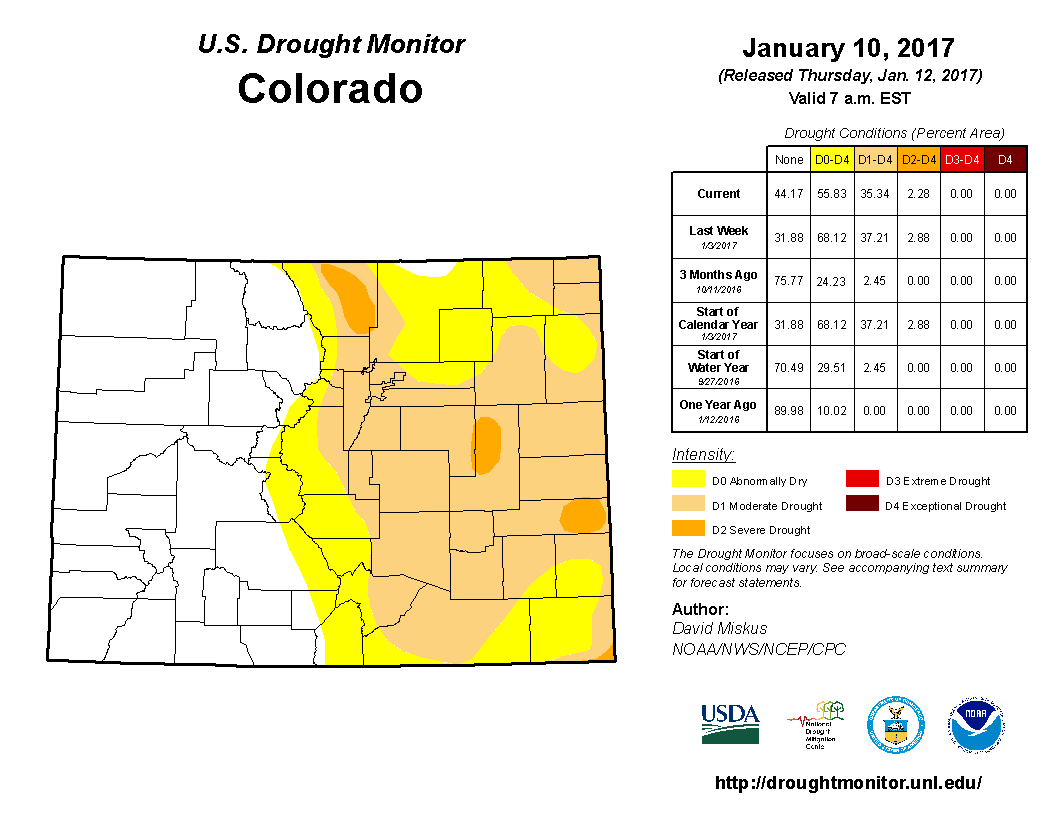
The U.S. Drought Monitor, in a report Thursday, showed the level of abnormal dryness and moderate drought decreasing in an area that spans the Front Range to the Kansas border. Still, more than half of Colorado remains classified as unusually dry, some 35 percent in moderate drought and about 2 percent — in Larimer County and the Eastern Plains — in severe drought.
The monitor’s report, however, only takes into account data through Wednesday, leaving the growing amount of high country precipitation since then out of the mix.
“Major drought improvements were made not only to California but at many areas of the West, including parts of Nevada, Utah, Oregon, Idaho, Montana, Wyoming, and Colorado,” the report said. “The decent snowpack should greatly contribute to a good spring snow melt runoff and recharge if conditions are maintained.”
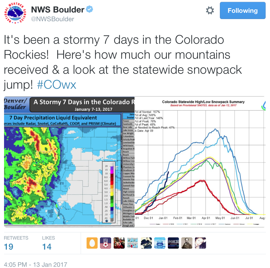
The Natural Resources Conservation Service reports as of Wednesday that Colorado’s statewide snowpack level is 157 percent of the normal and at 148 percent as compared to last year. The snowpack so far this year is far above what it has been measured at on the same date dating back to 2014.
Officials say the snow that has hit Colorado this week stems from the Atmospheric River — also known as the Pineapple Express — which carries moisture across the West from the Pacific Ocean.
“This is a really unusual event,” Ethan Greene, director of the Colorado Avalanche Information Center, said earlier this week. “It has to do with the amount of snow and the water content of that snow and how it’s come in. We’re seeing areas like Wolf Creek Pass and Vail Pass that are getting 5 inches or 8 inches of water. That’s just a huge amount of weight that’s going onto our snowpack.”
From the Fort Collins Coloradoan (Jacy Marmaduke):
Just as hope waned, the high-pressure ridge began to break down, allowing the jet stream to meander into Colorado’s mountains and fill them to and in some place over the brim with snow. Several snowstorms have dropped 5 to 8 feet of snow since mid-November. And it’s been good, wet snow, too, which is even better for spring runoff.
South Platte Basin snowpack sat at 158 percent of normal Thursday morning. Statewide, we’re at 155 percent. The statewide rate of snowpack accumulation between Nov. 17 to Jan. 1 was the fastest Colorado has seen in 32 years, according to the Natural Resources Conservation Service.
