Thieves target homeowners by posing as utility workers; follow these tips to make sure you don’t get ripped off. The post How to spot a fake water worker… 6 more words
Learn about the partnerships that provide water to 700,000 people outside of the Mile High City. The post Denver’s tap transcends city limits appeared first on News on TAP.
The Rock & Roll Hall of Fame inductee updated classic sounds for a broader pop audience, making polished songs with sonic depth.
Ric Ocasek, the songwriter, rhythm guitarist and lead singer for the Cars, was found dead on Sunday afternoon at his townhouse in Manhattan, according to the New York Police Department. No cause of death was available on Sunday night.
It is unclear what age Mr. Ocasek (pronounced oh-CASS-ek) was. According to some public records and previous articles, he was 70, other reporting suggests that he may have been 75.
From 1978 to 1988, Ocasek and the Cars merged a vision of romance, danger and nocturnal intrigue and the concision of new wave with the sonic depth and ingenuity of radio-friendly rock. The Cars managed to please both punk-rock fans and a far broader pop audience, reaching into rock history while devising fresh, lush extensions of it.
The Cars grew out of a friendship forged in the late 1960s in Ohio between Mr. Ocasek — born Richard Theodore Otcasek — and Benjamin Orr, who died in 2000. They worked together in multiple bands before moving to Boston and forming the Cars in the late 1970s with Elliot Easton on guitar, Greg Hawkes on keyboards and David Robinson on drums. It was the beginning of the punk era, but the Cars made their first albums with Queen’s producer, Roy Thomas Baker, creating songs that were terse and moody but impeccably polished.
In the Cars, Mr. Ocasek’s lead vocals mixed a gawky, yelping deadpan with hints of suppressed emotion, while his songs drew hooks from basic three-chord rockabilly and punk, from surf-rock, from emerging synth-pop, from echoes of the Beatles and glam-rock and from hints of the 1970s art-rock avant-garde. The five albums the Cars released from 1978 to 1984 each sold a million copies in the United States alone, with ubiquitous radio singles like “Just What I Needed” in 1978, “Shake It Up” in 1981, “You Might Think” in 1984 and “Drive” in 1984. Although Mr. Ocasek wrote them, “Just What I Needed” and “Drive” had lead vocals by Mr. Orr…
Mr. Ocasek’s songs were invariably terse and catchy, spiked with Mr. Easton’s twangy guitar lines and Mr. Hawkes’s pithy keyboard hooks. But they were also elaborately filled out by multitracked instruments and vocals. Lyrics that might initially seem like pop love songs were, more often, calmly ambivalent.
Photo by Reid Neureiter via Colorado State University
Here’s the release from Colorado State University (Catie Boehmer):
Colorado State University’s Salazar Center for North American Conservation is hosting the inaugural International Symposium on Conservation Impact, featuring former U.S. Interior Secretary Ken Salazar, Colorado Gov. Jared Polis, CSU System Chancellor Tony Frank, and a broad range of conservation experts from Canada to Mexico.
The symposium is set for Tuesday, Sept. 24, the first day of the 2019 Biennial of the Americas Festival, at the McNichols Civic Center Building in downtown Denver. It will convene thought leaders in conservation policy, practice, and research around the theme of landscape connectivity across the continent and will establish a forum to track, incent, recognize, and reward progress on conservation challenges in North America.
The Center also will announce a significant competitive prize for conservation impact at the symposium.
“In the face of global warming, the alarming disappearance of biodiversity and healthy connected ecosystems, and a growing world population that now exceeds 7.5 billion people, the Center looks to invest in cutting-edge ideas and world-class conservation leaders to pioneer projects that address these increasingly urgent challenges. These approaches are needed today more than ever,” said Beth Conover, director of CSU’s Salazar Center for North American Conservation.
Beth Conover, director of CSU’s Salazar Center for North American Conservation and former U.S. Secretary of the Interior Ken Salazar.
Symposium focus
With its continent-wide focus on landscape conservation and connections across borders, the symposium will bring together a range of stakeholders from the United States, Canada, and Mexico to build bridges between academic research, on-the-ground practice, and policy in the conservation space.
Recognizing that conservation efforts must also engage the interests of a broad and inclusive set of constituencies in order to be successful, the Center aims to bring more and new voices into the conversation, including many of whom have previously been unheard or excluded.
The Salazar Center’s efforts are bolstered by its home within CSU. A land-grant institution, CSU is a respected leader in environmental and conservation research and is recognized for its preeminent conservation programs and interdisciplinary strength.
The Salazar Center has seeded partnerships with a robust community of faculty and staff who are working on conservation-related issues, and this network continues to grow. The Center will ultimately be headquartered at CSU’s complex at the National Western Center, an unprecedented space for researchers and stakeholders from various backgrounds and from around the world to collaborate on issues at the intersection of water, food, sustainability, and human and animal health.
Speakers and tickets
Keynote speakers and panelists at the symposium will include: former U.S. Interior Secretary (and Center namesake) Ken Salazar, Colorado Gov. Jared Polis, Denver Mayor Michael Hancock, CSU System Chancellor Tony Frank, CSU President Joyce McConnell, Gary Tabor (Center for Large Landscape Conservation), Cristina Mormorunni (Wildlife Conservation Society), Mark Anderson (The Nature Conservancy), Ruth Musgrave (National Council of Environmental Legislators), Loren Bird Rattler (Blackfeet Nation), Exequiel Ezcurra (University of California Institute for Mexico and the United States), Eli Enns (Iisaak Olam Foundation), and Leigh Whelpton (Conservation Finance Network), with additional speakers to be announced soon.
The symposium and incentive prize are made possible with support from the Trinchera Blanca Foundation, an affiliate of The Moore Charitable Foundation, founded by Louis Bacon; CSU; the Biennial of the Americas; the Center for Large Landscape Conservation; the Bohemian Foundation; the Kendeda Fund; Denver Parks and Recreation; New Belgium Brewing; and a number of generous individual donors.
Pat Edelmann. Photo credit: Southeastern Colorado Water Conservancy District
Here’s the release from the Southeastern Colorado Water Conservancy District (Chris Woodka):
Pat Edelmann, who spent his career exploring water issues in the Arkansas River basin, has rejoined the Southeastern Colorado Water Conservancy District board.
Edelmann, 64, was appointed to the board this month to represent El Paso County. He lives in Colorado Springs. Edelmann served on the board as a Pueblo County representative from 2014-17. He replaces Gibson Hazard, who retired from the board in April.
“I resigned because I had moved, so I am happy to be serving again,” Edelmann said.
Edelmann retired from the U.S. Geological Survey after 37 years in 2011. He served 32 years in the Pueblo USGS office. During that time, he spearheaded numerous water quality studies dealing with the Arkansas River, Fountain Creek and other tributaries to the river during a time when water quality emerged as a central issue for water development in the basin.
The Southeastern District includes parts of nine counties, and administers the Fryingpan-Arkansas Project in partnership with the U.S. Bureau of Reclamation. There are 15 directors on the board who are appointed by District Court judges in Pueblo and within their specific geographic areas.
Loveland, Aspen and Keystone were among the ski resorts to see a dusting of snow Thursday.
It won’t exactly go down as a powder day, but the first snow of the fall season fell on some of Colorado’s highest terrain overnight Wednesday into Thursday.
Keystone Resort, Winter Park and Aspen were among the ski resorts that woke up to a little wintry dusting on Thursday morning…
No significant accumulations were measured in Colorado, and most of the snow melted off later on Thursday.
That said, Trail Ridge and Old River Fall roads in Rocky Mountain National Park closed Wednesday night into Thursday morning due to the snow. They both reopened on Thursday morning.
Lake Fork Creek below Sugarloaf dam near Leadville. Photo credit: Katie Walton Day/USGS
From the US Forest Service via The Leadville Herald:
A popular dispersed-camping area located west of Leadville on Lake Fork Creek downstream of Turquoise Lake and County Road 4 will benefit from a major restoration project developed by the USDA Forest Service, Lake County, and Colorado Parks and Wildlife.
The project, which was to start on Sept. 3 and finish in about eight weeks, will improve the overall aquatic habitat in Lake Fork Creek.
The restoration work entails strategically placing large boulders, whole trees, and smaller rocks and logs in a manner that mimics natural features of a stream. Banks and areas where excessive erosion has occurred will be stabilized and planted with native willows, grasses, and sedges. When complete, the project should reduce erosion and sediment that clouds the water and create more deep pools where fish feed and overwinter.
Moving the boulders and whole trees in this spot requires heavy machinery. For this reason, the area will be closed to all public use during implementation. Camping and entering the area will be prohibited from Sept. 3 through Nov. 1. Campers should consider using the eastern side of Forest Road 113 (closer to County Road 4) during this timeframe.
“This project should have a direct and positive impact on the stream’s hydrology, fish habitat, and bank stabilization, and we expect it will restore a more natural-appearing setting for recreationists visiting the area,” said Erich Roeber, district ranger.
Janelle Valladares, San Isabel National Forest fish biologist added, “By improving the habitat, we expect to see more and bigger fish in the stream in the next couple of years.”
The full text of the closure order and a map can be found at the Leadville Ranger District Office, the Forest & Grassland Supervisor’s Office (Pueblo), and on their websites.
As one heads north on Colorado 91 over Fremont Pass, just past Climax Mine, a flat and barren expanse is seen to the west of the highway. Once an active tailings-storage facility, signs of life are now emerging above the reclaimed field’s hardened dirt.
Climax is in the process of transforming the westernmost corner of the Robinson Tailings Storage Facility, also known as Lake Irwin, into a wetland. The site will offset wetland habitat lost in Climax’s McNulty Gulch expansion project, an enlargement of the mine’s overburden stockpile facility visible just across the highway to the east.
McNulty Gulch is home to several wetland habitats, including seeps, springs and plant families like sedges, willows and rushes that will all be disturbed in the coming years as the mine expands.
Climax will soon need additional storage space for unmineralized overburden material, and was required to apply for a U.S. Army Corps of Engineers Section 404 permit before enlarging the stockpile’s footprint. The permit, which was conditionally approved, requires Climax to replicate McNulty Gulch’s wetlands at a two-to-one replacement ratio.
Since 2017, Climax has worked to bring nine acres of wetland to life at Lake Irwin. This is the first phase of the 36-acre project.
Before planting could occur, the site needed grading and an engineered water-delivery system.
The acreage was excavated to remove historic tailings, which were transported north to the Mayflower Tailings Storage Facility. The area was then graded for drainage and covered with topsoil where needed. A network of culverts was also engineered to catch and direct the snowmelt that flows down Sheep Mountain each spring, runoff that has flooded the site in past years.
In 2018 and 2019, Climax focused on planting.
Cuttings were collected from willows already accustomed to extreme temperatures and strong winds at McNulty Gulch and the headwaters of the Arkansas River, and planted at Lake Irwin. After growing from seed at AlpineEco Nursery in Buena Vista, herbaceous plants like beaked sedge, tufted hairgrass and mountain rush were also transplanted on the site.
To date, over 40,000 herbaceous plants and willows have been planted at Lake Irwin. Thousands more plants will be added to the wetland in the coming years as phase two (18 acres) and phase three (nine acres) of the project unfold. The project’s phases will be monitored by the Army Corps of Engineers.
In 2014, Climax completed a similar mitigation project after disrupting a wetland during the construction of the mine’s new water treatment plant. The constructed wetland is now a healthy riparian habitat, a small fenced-in plot brimming with tall green grasses between the water plant and Tenmile Creek.
Climax currently holds a silver tier certification from the Wildlife Habitat Council for site-wide biodiversity and conservation initiatives.
“Ideally, we’d like Lake Irwin to look like this in five years,” Climax’s Chief Environmental Scientist Diana Kelts said of the wetland near the water plant. “But on a larger scale.”
Climax Mine tailings ponds Google Maps screenshot.
Colorado National Monument from the River Front Trail near Fruita.
Here’s a guest column from Erica Hernandez that is running in Westword:
I have been in Colorado for twelve years, the longest I have lived in any single place, and it’s hard to leave. I climb, ski, bike around Denver and hike with friends. Living here has taught me how important access to the outdoors is. It’s molded who I am, my lifestyle and my priorities, and I know I am not alone. Whether we want to ski, climb or hike, Colorado’s vast state and national parks have something for all of us.
As a local leader involved with Latino Outdoors, a group that aims to connect Latino communities to the outdoors, I am passionate about getting Latino youth and families outside to learn all that Denver’s neighboring lands can offer. Education and being outside are powerful tools for young minds. As a child, whenever my cousins and I would get together, we’d use our wonder and curiosity to fuel adventures.
It is important we continue to have parks and green spaces, in the city and in the mountains, and it is up to us to educate young minds about the importance of the outdoors, because they will be in charge of conserving these lands for future generations.
Outdoors lovers contribute so much to our economy, our congressional representatives must also put Colorado’s public lands first. Annually, more than 2.2 million people come to hunt, fish, watch wildlife and explore our parks, contributing $3 billion to the state economy, and the outdoors industry counts some 229,000 employees. We need our elected officials in Washington to advocate for programs that support this. This is why we need our leaders to support the permanent funding of the Land and Water Conservation Fund (LWCF).
Since 1964, LWCF has doled out $271.8 million to Colorado alone. More than 900 parks and projects in our state have been supported through LWCF, including local parks like Aztlan, Berkely, Montbello, Barnum and Sloan’s Lake, and national treasures like the White River National Forest, Great Sand Dunes National Park, the Colorado National Monument, El Dorado State Park and Black Canyon of the Gunnison. Nationally, more than 42,000 parks and projects have benefited from LWCF.
Somehow, this has all been achieved even though the program has only ever been fully funded twice in its 54 years of service. While the amount LWCF receives is capped at $900 million a year and it doesn’t cost taxpayers a penny (it’s funded through offshore oil and gas drilling royalties), Congress is responsible for allocating the funds each year. Consequently, it’s becomes easy for funds to be siphoned off to other causes.
Earlier this year, Congress voted to permanently reauthorize LWCF to avoid the program from being held hostage by politics. It’s now time that Congress does the same for its funding. This is why we need our senators and representatives to continue their support for LWCF and make sure it’s permanently funded.
Our public lands are a tremendous asset to Colorado. They are critical to our economy, recreational enjoyment, way of life and happiness. LWCF is an essential tool to making sure these public lands are protected for future generations.
Erica Hernandez is a microbiologist, a climbing-gym instructor, an entrepreneur, an outdoor volunteer and granddaughter of Mexican immigrants.
Marine stratocumulus clouds from the Pacific Ocean stream atop Chile’s Atacama Desert. Marine stratocumulus cover vast swaths of the tropical and subtropical oceans, where they reflect large amounts of sunlight and provide an overall cooling effect on climate. New global climate models are showing the potential for more global warming than long thought, perhaps due to a reduction in low-level clouds such as marine stratocumulus. Image credit: NCAR/UCAR Image and Multimedia Gallery.
Our planet’s climate may be more sensitive to increases in greenhouse gas than we realized, according to a new generation of global climate models being used for the next major assessment from the Intergovernmental Panel on Climate Change (IPCC). The findings—which run counter to a 40-year consensus—are a troubling sign that future warming and related impacts could be even worse than expected.
One of the new models, the second version of the Community Earth System Model (CESM2) from the National Center for Atmospheric Research (NCAR), saw a 35% increase in its equilibrium climate sensitivity (ECS), the rise in global temperature one might expect as the atmosphere adjusts to an instantaneous doubling of atmospheric carbon dioxide. Instead of the model’s previous ECS of 4°C (7.2°F), the CESM2 now shows an ECS of 5.3°C (9.5°F).
“It is imperative that the community work in a multi-model context to understand how plausible such a high ECS is,” said NCAR’s Andrew Gettelman and coauthors in a paper published last month in Geophysical Research Letters. They added: “What scares us is not that the CESM2 ECS is wrong…but that it might be right.”
At least eight of the global-scale models used by IPCC are showing upward trends in climate sensitivity, according to climate researcher Joëlle Gergis, an IPCC lead author and a scientific advisor to Australia’s Climate Council. Gergis wrote about the disconcerting trends in an August column for the Australian website The Monthly.
Researchers are now evaluating the models to see whether the higher ECS values are model artifacts or correctly depict a more dire prognosis.
“The model runs aren’t all available yet, but when many of the most advanced models in the world are independently reproducing the same disturbing results, it’s hard not to worry,” said Gergis.
A wet 2019 delayed construction work throughout Nebraska, including a Platte River Recovery Implementation Program water project southwest of Elm Creek.
At Tuesday’s PRRIP Governance Committee meeting in Kearney, program civil engineer Kevin Werbylo said the completion date for the project on the south side of the Platte River was moved from May 1 to Aug. 1 to Oct. 15.
“Given the conditions the contractor had to deal with, they did a nice job and the engineers did a nice job,” Werbylo said.
The project fits program goals to reduce depletions to Central Platte target flows and to protect, restore or maintain land used as habitat by threatened and endangered species — least terns, piping plovers and whooping cranes.
The basinwide plan allows entities in Nebraska, Colorado and Wyoming with federal licenses, permits and/or funding to comply with the Endangered Species Act. The U.S. Department of Interior is the other major participant.
The Elm Creek project will help meet an immediate goal to reduce by 120,000 acre-feet the annual depletions to target river flows set by the U.S. Fish and Wildlife Service for the protected species. Water held in shallow detention cells on the broad-scale site will seep into the groundwater that eventually reaches the adjacent Platte River.
Platte water will be diverted into Central Nebraska Public Power and Irrigation District’s Phelps Canal at times when flows exceed targets. According to PRRIP 1995-2017 data, that most commonly occurs in December and January.
A new pipeline built as part of the project links the canal to the 416-acre site where earthen berms up to 6 feet tall create eight shallow cells to temporarily hold water at depths of 12 inches or less.
Werbylo said the project budget is $4.3 million and there is $480,000 left to pay.
Dirt work needs to settle and vegetation is being established, he said, so it will be late spring to mid-summer 2020 before any water deliveries are made to the broad-scale project site.
PRRIP Executive Director Jason Farnsworth told the Hub that even if the original construction schedule had allowed the project’s use this fall, there would have been no diversions because of already high groundwater.
Here’s the release from the Center for Biological Diversity (Steve Bloch, Landon Newell, Diana Dascalu-Joffe):
Conservation groups sued the Trump administration today for failing to consider the climate pollution from 130 oil and gas leases spanning 175,500 acres of public lands in Utah.
Today’s complaint, filed in U.S. District Court in Salt Lake City, says the Bureau of Land Management violated the National Environmental Policy Act by approving five lease sales from 2014 to 2018 without accounting for the climate pollution that would result from oil and gas development. It asks the court to invalidate all five approvals and their 130 leases.
The lawsuit comes as climate scientists urge drastic cuts to greenhouse gas pollution over the coming decade. New oil and gas leases, whose production can last decades, commit public lands to more pollution. Nearly a quarter of all U.S. greenhouse gas pollution results from fossil fuel development on public lands.
“The climate crisis is being exacerbated by the BLM’s reckless and uninformed oil and gas leasing and development on public lands,” said Landon Newell, staff attorney with the Southern Utah Wilderness Alliance. “The development of these leases will push us closer to the point of no return on climate, while sacrificing some of the most wild, scenic and culturally significant public lands in America.”
Most of the challenged leases resulted from the Trump administration’s “energy dominance” agenda. In addition to slashing environmental reviews to hasten oil and gas leasing, the administration has attacked federal development and reliance on climate science in agency decisions and reports.
“Each new oil and gas lease commits us to more greenhouse gas pollution that our planet can’t afford,” said Diana Dascalu-Joffe, an attorney at the Center for Biological Diversity. “There are already more fossil fuels under development in the world than can be safely burned. New leases dangerously disregard urgent climate warnings from scientists. These leases were irresponsible and illegal, and we’re hopeful that a court will agree.”
The leases also threaten public lands and endangered species, including the Colorado pikeminnow and razorback sucker. Fracking sucks up enormous amounts of water and threatens to pollute the Colorado River and tributaries where the fish live.
“Several accidents involving water pollution have already happened on the Green River and its tributaries,” said John Weisheit, a professional river guide in eastern Utah and a representative of Living Rivers and Colorado Riverkeeper. “Combined with diminished flow volumes for these rivers, the multimillion-dollar investment already made to ensure a successful endangered fish program must not be further compromised.”
Background
Federal fossil fuel production causes about a quarter of all U.S. greenhouse gas emissions. Peer-reviewed science estimates that a federal fossil fuel leasing ban would reduce CO2 emissions by 280 million tons per year, ranking it among the most ambitious federal climate policy proposals in recent years.
Federal fossil fuels that have not yet been leased to the industry contain up to 450 billion tons of potential climate pollution. Those already leased contain up to 43 billion tons.
Existing laws provide executive authority to stop federal leasing on public lands and oceans. Hundreds of organizations have petitioned the federal government to end new onshore and offshore federal fossil fuel leasing.
Map of challenged oil and gas leases. Credit: Southern Utah Wilderness Alliance/Esri ArcMap 10.6.1.9270
Here’s a guest column from Tom Buschatzke and Ted Cooke that’s running in Arizona Central:
The Drought Contingency Plan is working, but it’s just the beginning. Here’s how we move forward.
It didn’t take long for the completion of the Drought Contingency Plan to create value to Arizona and the Colorado River Basin. Its focus on stabilizing Lake Mead and creating incentives to “bank” water in the reservoir already are paying dividends.
We can say with confidence that DCP is already a success.
DCP is providing a safe harbor while we work on important issues leading up to 2026, when the existing guidelines for the operation of the Colorado River system expire.
We now have an opportunity to build on the successful Arizona process that led to the DCP signing. Arizona is Stronger Together. And that will serve us well as we work toward the next step – maintaining a stable, healthy Colorado River system as we face a hotter and drier future.
Lake Mead is 22 feet higher than expected
A year ago, many of us were immersed in the details of Arizona’s Drought Contingency Implementation Plan, which benefited from the cooperative spirit of its participants, including elected leaders and representatives from every sector of the state’s water-using community.
In 2020 and likely 2021, we will be operating under DCP’s Tier Zero, a reduction of 192,000 acre-feet to Arizona. The estimated impact of contributing this water is more than $40 million, but the investment is worth it to protect the Colorado River system.
DCP’s incentives allow for greater storage in Lake Mead this year. That, coupled with a lot of snow from the Rocky Mountains and additional tributary flow, increased storage in Lake Mead by more than 22 feet from what was initially projected.
An excellent winter snowpack in the Rockies helped Lake Mead a lot. But here is the kicker: Almost half of that 22-foot rise in Lake Mead was due to storage and contributions to system conservation.
And conservation and storing water in the reservoir is a trend that will continue. Arizonans are doing our share, with more than 20 water users, agencies and the state having signed agreements to contribute to implementing the DCP.
But DCP won’t hold us forever
The term used for the coming negotiations on the system’s new guidelines is “reconsultation” of the “Colorado River Interim Guidelines for Lower Basin Shortages and the Coordinated Operations for Lake Powell and Lake Mead.”
The emphasis is on “interim.” The 2007 guidelines expire in 2026. So, when people ask “What’s next?” for Colorado River management, that’s it: The difficult challenge of assessing the effectiveness of the current guidelines, with the DCP overlay, and exploring new approaches for the next iteration of the guidelines.
As we learned on Jan. 31 when the state Legislature passed and Gov. Doug Ducey signed Arizona’s DCP, we achieved success because we worked together. We intend to bring the steering committee process back to life, reviving that spirit of cooperation that so infused negotiations.
To that end, we are embarking on a listening and data-collecting effort. It is our plan to meet first with the elected leaders who contributed so much time and effort to the successful steering committee process. Then we plan to sit down with other delegates, including those representing Arizona tribes, cities, agriculture, mining, development and the nonprofi community.
Our goal: To develop a shared vision
Our new goal? Gather our stakeholders’ thoughts and develop a shared vision as we plan for Arizona’s Colorado River water supply.
This will ensure Arizona is a strong voice among the Colorado River Basin states and the federal government as we hammer out the next set of agreements for managing the Colorado River Basin beyond 2026.
That is our “next step.” It’s a big one and we must be prepared. And we will be, because Arizona truly is Stronger Together.
Tom Buschatzke is director of the Arizona Department of Water Resources. Ted Cooke is general manager of the Central Arizona Project. Together, they co-chaired the steering committee that helped finalize the state’s Drought Contingency Plan signed May 20. Reach them at tbuschatzke@azwater.gov and tcooke@cap-az.com.
The Pawnee Buttes Seeds grass tour met Aug. 15-16 at the Lonesome Pines Land and Cattle Company in Grover, Colo., an area firmly in grazing country. The program concentrated on what rancher Jim Sturrock has deemed the five dimensions of ranching: landscape, time, animals, forage resources and the unexpected…
Soil health, mycorrhizal fungi, the geology of the land, CO2, photosynthetic cycles, weed identification and control, and biodiversity were all on the slate. The group traveled to neighboring properties to study control methods with varying degrees of success including winter grazing and differently timed applications of herbicide. Plant encroachment discussed included Fringed Sage, Juniper, Cheat Grass, cacti, skunk bush and toad flax. The group was able to study land management in action, see the effects of grazing cycles, and soil health in action.
“When external factors act upon an ecosystem, the living relationship between all things in that environment are at risk of changing,” he said. “A change or reduction in biodiversity can have negative impacts on plants and animals, both wild and domesticated, which depend on that habitat.”
Overgrazing can cause forage to die off and be displaced by competing shrubs and ungrazed grasses at a lower nutritional value. These encroaching plants, he said, often use more water, impacting the local watershed as well as impacting soil fertility and erosion rates.
The 2015 rule expanded the types of waterways that can receive federal protection under the Clean Water Act. Now, WOTUS will go back to it’s form before 2015. A member of the local Sierra Club disagrees with the decision. “Would allow people to pollute much more easily, there’s no longer a permit requirement, and because of that they can carry on activities without the government oversight,” said Jim Lockhart, the Conservation Chair of the Pikes Peak Group of the Sierra Club.
Lockhart said the 2015 rule defined what waterways should be protected more specifically, and now he’s interested to see what the new definition will be. “Rescinded the rule and promised new definitions, they could have waited and created the new definitions and then let the public see them and then let the public decide,” said Lockhart.
EPA Administrator Andrew Wheeler said the new definition will come in December, and would mean farmers, landowners, and businesses will spend less time and money determining whether they need a federal permit.
Arizona Rivers Map via Geology.com.
FromThe Cronkite News (Kailey Broussard) via KOAA.com:
…while some welcomed the end of the “Waters of the United States” rule, environmental groups warned that the change would mean virtually no environmental protection for the nation’s waterways – particularly in the West.
“We know where we are going, and that is going to be a world where wetlands, especially in the arid West, get almost no protection,” said Brett Hartl, government affairs director for the Tucson-based Center for Biological Diversity.
A 2018 report by the center estimated that more than 3,000 U.S. watersheds would lose Clean Water Act protections under the replacement plan proposed by the Trump administration. That, in turn, could accelerate the extinction of more than 75 endangered species, the report said.
Critics of the Obama-era rule – known as WOTUS – disagree, saying the full range of federal pollution regulations does more than enough to protect waterways…
In the meantime, federal officials are developing and presenting a new plan. That process has garnered more than 621,000 comments on the federal regulations website…
…Sandy Bahr, president of the Sierra Club’s Grand Canyon chapter, said the EPA is “not being honest” about the change’s impact. WOTUS protected arterial waterways, she said, by protecting the less-obvious waters.
“If you take a very narrow view of that and say, ‘Oh, only waters that are navigable,’ then you’re not even going to be protecting those navigable waters,” she said.
Bahr and others have pointed to the San Pedro River, a ribbon-like stream that meanders some 140 miles through southern Arizona and part of Mexico. The stream’s limited navigability means it most likely would not receive protection under the repeal.
“You can talk about these things in the abstract, but when you look at what is happening on the ground already, we’re struggling to protect rivers like the San Pedro River, which is so important ecologically and economically,” Bahr said. “Something like this rollback makes it so much more difficult to do.”
Hartl said that, except for the Colorado River, the change would mean most of Arizona would not be protected. A map included with the center’s study showed much of the Southwest losing Clean Water Act protection without WOTUS…
Meanwhile, Bahr is certain the proposed rule will be challenged.
“We need to have the most stringent requirements possible to protect what we have left because we have lost so much,” she said.
Approximately half of Colorado is now considered to be abnormally dry by the United States Drought Monitor, based on Thursday’s update. Nearly 7% of the state is officially in a drought…
Not surprisingly, the part of Colorado that is officially considered to be in a drought is the southwest corner (the tan shading in the map above). An extremely dry monsoon season is largely to blame for the drought in southwest Colorado and throughout much of the desert Southwest. Southern and western Colorado receive much of their summer precipitation from the monsoon…
While Denver experienced a roughly average summer’s worth of rainfall, August finished considerably drier than average. That said, the Front Range’s immediate drought concerns are fairly insignificant, for now.
While Colorado enjoyed an unprecedented eight weeks completely free from drought and abnormally dry conditions, hot and dry late summer weather is quickly reversing the drought map as changes that began in August continue.
Abnormally dry areas expanded in northwest Colorado last week and grew further into west central counties in the latest report from the National Drought Mitigation Center. Southeast Colorado also saw an increase in abnormally dry conditions, particularly for Las Animas and Otero counties, along with smaller portions of Bent and Crowley counties…
All of Montezuma, La Plata, San Juan and Dolores counties are in moderate drought. Western Archuleta and Hinsdale, southern Ouray and Montrose counties, and eastern San Miguel County were also touched by the expansion of moderate conditions.
Severe drought remains just outside Colorado’s southwest border in New Mexico.
Today, Governor Jared Polis announced that Colorado will work to establish additional Colorado State Parks. The first State Park under consideration includes the iconic 9,633-foot Fishers Peak, which is the highest peak in the United States east of Interstate 25. A diverse partnership, including the City of Trinidad, The Trust for Public Land, The Nature Conservancy, Colorado Parks and Wildlife, and Great Outdoors Colorado, is coordinating to develop the new State Park.
“Opening this treasured and iconic area to the public as a new State Park not only provides a new recreational opportunity for hiking, camping, and fun, but also helps grow our economy in southern Colorado, supports our thriving outdoor recreation industry, and ensures the land and wildlife habitat will be protected for generations to come,” said Governor Polis. “This announcement has something for everyone in our State to be excited about. Colorado has so much to offer, and as Governor I am focused on ensuring we improve access to our great outdoors and create real opportunities for job growth in rural Colorado.”
“Thank you to The Nature Conservancy, The Trust for Public Land, Mayor Rico, the City of Trinidad, Las Animas County commissioners, community members, legislators, stakeholders, and everyone who is working to make this potential State Park a reality,” Gov Polis added.
“What an exciting day for the Department of Natural Resources and Colorado Parks and Wildlife, the people of Trinidad, and all Coloradans. It’s not every day we are able to collaborate in such a way to expand our State Park system. This incredible property, highlighted by the iconic Fishers Peak, will be a gift come true for Coloradans who love hiking, hunting, wildlife watching or just being in Colorado’s great outdoors,” said Dan Gibbs, Executive Director, Colorado Department of Natural Resources. “Thanks to the Governor and all the partners who have been critical in working to make this partnership a reality. We look forward to opening up Fishers Peak for Coloradans to enjoy for generations to come.”
“Coloradans are fortunate that the City of Trinidad, The Nature Conservancy, The Trust for Public Land and so many others recognized the Crazy French Ranch property for the jewel that is,” said Lottery Director Tom Seaver.
“This soon-to-be state park is the result of six years of effort from these partners working together. We could not be prouder that more than $14 million in Lottery proceeds went to fund the project,” said Lu Cordova Executive Director of the Department of Revenue.
“Colorado Parks and Wildlife is very excited to be a part of this partnership working toward an incredible investment in the State Park system,” said Dan Prenzlow, Director of Colorado Parks and Wildlife. “As Colorado’s primary State agency focused on protecting and caring for our most valued and valuable resources, a property like this would allow us to further balance conservation of our wildlife and habitat with recreational needs, both synonymous with our State. These resources form the very fabric of our State and define who we are.”
“This project is a dream come true for the citizens of Trinidad and surrounding area residents,” said Trinidad Mayor Phil Rico. “We are excited to be the home of Colorado’s next State Park and are thrilled for what this will mean for our local economy and the residents of our community who want to see this landscape protected while also being able to experience its wonder.”
“Outdoor recreation is an economic engine and this new State Park will help boost the quality of life in Southern Colorado. Our region has so much to offer and this is great news for hikers, hunters and anyone who wants to enjoy our amazing outdoors and public lands,” said Rep. Daneya Esgar, D-Pueblo.
“Southern Colorado has such beauty to offer, and I am glad to see that Fishers Peak will be designated as Colorado’s newest State Park,” said Senate President Leroy Garcia, D-Pueblo. This designation will help grow our economy and allow Coloradans from all over to enjoy the many acres of cherished public lands, from the iconic 9,600-foot-high peak to forests, grasslands, and wetlands. I am excited to see Fishers Peak join Lake Pueblo as tourist destinations for all to enjoy.”
The Nature Conservancy and The Trust for Public Land currently own the Fishers Peak property and plan to transfer the property to public ownership in coordination with Trinidad, Great Outdoors Colorado, and Colorado Parks and Wildlife. The partners plan to develop the property to provide sustainable recreational access, protect wildlife habitat, and create a publicly-owned State Park that will serve as an economic engine for Trinidad and southern Colorado.
The 30-square-mile property connects Colorado’s eastern grasslands to the western mountains, and serves as a wildlife corridor. Providing habitat for large native species like elk, mule deer, white-tailed deer, mountain lion, and black bear, the property helps maintain important connections between their populations in the mountains and those in the prairies.
Today’s action serves as a starting point for planning the State Park, with the goal of providing a meaningful level of public access to the property by 2021. Colorado Parks and Wildlife will continue to work with partners and local communities to finalize the transaction and establish the property as our next State Park.
Photos, B-roll of the site and Gov. Polis video announcement can be found here.
On Thursday, Gov. Jared Polis announced a new state park that should give Trinidad residents much easier access to their iconic peak. If all goes according to plan, the park may also help the city shake its image as a sleepy former coal-mining town to become the state’s newest outdoor mecca…
The park, which has yet to be officially named, will cover 30-square miles of volcanic cliffs, streams, grasslands and wetlands. Because the area is adjacent to other wildlife areas, it will result in 55.5 miles of contiguous preserved land, providing habitat for elk, mule deer and black bears.
Once complete, the area will be Colorado’s 42nd state park and its second-largest. Trails through the area will also create a much more direct connection between downtown Trinidad and Fishers Peak.
Plans for the park came together last December. That’s when the Trust for Public Lands and The Nature Conservancy in Colorado announced they had reached a deal to purchase the 30-square mile Crazy French Ranch…
The conservation groups provided the money needed to secure the $25.4 million sale. Great Outdoors Colorado, which is largely funded by the Colorado Lottery, put up another $7.5 million. Colorado Parks and Wildlife agreed to kick in another $7 million.
Jim Petterson, Colorado director for the Trust For Public Land, said the new park shows how the state, local governments and conservation groups can effectively work together to protect public lands…
The Trust for Public Land and the Nature Conservancy now plan to begin to transfer the property to public ownership. The goal is to develop a “meaningful level” of public access no later than January 1, 2021. Polis added he’d like to see basic improvements to the property by the fall of 2020.
A wetland area along Homestake Creek. Photo credit: Brent Gardner-Smith/Aspen Journalism
FromThe Grand Junction Daily Sentinel (Dennis Webb):
Another Obama administration environmental rule is now history, as the Environmental Protection Agency on Thurday finalized its repeal of a 2015 rule expanding waterway and wetlands protections.
The 2015 “Waters of the United States” rule had support from environmentalists but faced criticism from agricultural and other interests…
Its action restores regulations that were in place prior to the 2015 rule, ending inconsistent regulations in different states as a result of various court actions on that rule. EPA Administrator Andrew Wheeler said in a news release that the action Thursday “fulfills a key promise of President Trump” and sets the stage for a second EPA action, a new waters of the U.S definition “that will provide greater regulatory certainty for farmers, landowners, home builders, and developers nationwide.”
[…]
…the conservation group Western Resource Advocates said the EPA actions will significantly weaken protections for thousands of miles of waterways and millions of acres of wetlands across the West. It said the EPA’s efforts aim to remove protections for rivers and streams that flow intermittently after rain or snow, and its proposed new definition threatens Western water supplies.
It says the EPA estimates that in Colorado and Utah alone, more than 5 million people receive drinking water from public systems relying at least in part on intermittent, ephemeral or headwater streams.
“This assault on the Clean Water Act makes it more important than ever for local lawmakers and water leaders to enact state-level policies that protect our rivers and our communities,” Robert Harris, a senior staff attorney for the group, said in a statement.
Unsettled weather brought widespread light precipitation to much of the High Plains, especially Montana and the Dakotas, while monsoonal moisture produced scattered showers in Colorado, western Nebraska, and parts of Kansas and Wyoming. With much of the region drought-free, the rains fell on top soils with adequate to surplus moisture. The few areas with D0 or D1 did receive precipitation, and some improvements were made. In northwestern Montana, 2-3 inches of rain in the Mission Mountains and widespread 1-2 inches across Lake and Flathead counties have produced near record maximum stream flows for this time of year. With 60- and 90-day totals now at normal or surplus, D0 was removed, and D1 shrunk to just include Lincoln County where weekly amounts were somewhat lower, and short-term deficits still remained. In North Dakota, another week of rain (0.5-1.5 inches) continued to reduce short and medium-term deficiencies, with D1 removed and the D0 shrunk to better fit dwindling 60-day deficits. In central Colorado, 1-2 inches of rain south of Denver eliminated short-term deficiencies, thus D0 was erased. Farther to the southwest and southeast, however, dry and warm weather increased 90-day deficiencies as the southwest monsoon has been weak and spotty, generating SPIs less than -1.5 on a 30-, 60-, and 90-day time scales. The wet winter and spring is fast becoming a faded memory as the summer heat and dryness continued to assert itself with impacts. Accordingly, D0 expanded into Gunnison, Pitkin, and Saguache counties in the southwest, while D0 increased in Las Animas and Otero counties in the southeast. D1 also slightly crept northward in southwestern Colorado…
While precipitation returned to the Pacific Northwest and conditions improved, the Southwest continued to have a disappointing summer monsoon as only scattered light showers fell across central New Mexico and central Colorado. Rains also fell on most of Idaho and western Wyoming as cold fronts squeezed out moisture from the Pacific Ocean and the southwest monsoon. With June-August completed, the precipitation rankings for the Four Corner States were a disappointment. According to NCEI, Arizona had the driest (1) JJA on record, followed by Utah (8), New Mexico (10), and Nevada (12), with records going back to 1895. Combined with much above normal JJA temperatures (New Mexico 6th and Arizona 12th warmest), the beneficial impacts from a snowy winter and cool and wet spring have faded, and have been replaced by summer’s heat, dryness, and negative impacts. The SPEI, which combines precipitation and temperature effects, was the lowest on record for Arizona in August, July-August, and June-August. With this sudden downturn during the past 3 months, impacts have rapidly surfaced, and as a result, a widespread, 1-category deterioration was made to most of Arizona (D1 and D2 expansion) and bordering areas (e.g. southern Utah, southwest Colorado, and western New Mexico). Southeastern New Mexico has also been dry at 60-days, thus D1 expanded there from west Texas. USDA/NASS pasture and range conditions rated poor or very poor have risen to 41% in Arizona and 46% in New Mexico. In sharp contrast, welcome beneficial rains fell across the Northwest, signaling an uptick in precipitation in the region during the past 30-60 days. With locally heavy amounts (2-4 inches) in western Oregon and Washington and USGS stream flows responding, D2 was reduced in the Olympic Peninsula and northern Cascades of Washington; D1 shrunk in northwestern Oregon, southwestern and northeastern Washington and around the Puget Sound; and D0 removed in west-central Oregon. Hopefully the increase in precipitation normally seen during the late summer and fall months will continue to ease the drought…
Mostly dry and warm weather enveloped much of the South, contributing to a rapid decline in short-term moisture conditions across most of Texas, southwest and southeast Oklahoma, southwest Arkansas, and northwest Louisiana. Even a few pockets of D0 were introduced in formerly wet central and northeastern sections of Tennessee. The few exceptions to this were outer bands of rain across southern Texas from Tropical Storm Fernand (which made landfall in northeastern Mexico), some light monsoonal showers in southwestern Texas and the northern Texas and Oklahoma Panhandles, and Day7 thundershowers in northern Louisiana and central Arkansas. A general 1-category improvement was made across southern Texas in response to 1-3 inches (locally 5 inches) of rain, while some slight improvements were made around the Midland area, Trans Pecos region, and in extreme northern Louisiana. In contrast, September’s climatologically higher rainfall totals for Texas and Oklahoma make degradation faster, and temperatures have remained high. Where little or no rain fell, a 0.5-1 category downgrade was made, especially in central Texas, but also in southwest and southeast Oklahoma, and bordering sections of Arkansas and Louisiana. According to USDA, percentages for both topsoil and subsoil moisture for Texas stood at 85 and 79%, respectively, as of Sep. 8, while topsoil moisture grew increasingly short to very short in Arkansas (67%), Louisiana (60%), Mississippi (66%), and Tennessee (52%). Even with the USDA topsoil moisture figure, Mississippi remained D0-D4 free as the entire state still had 60-day precipitation surpluses. Texas pasture and range conditions have been affected by the warmth and dryness, with 48% rated poor or very poor according to the Sep. 8 USDA/NASS report…
Looking Ahead
Fortunately for the Southeast, Category 5 Hurricane Dorian stalled just east of central Florida, slowly weakened, and gradually turned northward, finally accelerating northeastward into Nova Scotia and Newfoundland. Its only U.S. landfall was at Cape Hatteras. Unfortunately, it stalled over the northern Bahamas for 1-2 days, devastating the islands of Great Abaco and Grand Nassau. Rainfall from Dorian was limited to coastal sections of eastern Florida, the Carolinas, Delmarva Peninsula, Cape Cod, and extreme eastern Maine. Between 5-10 inches of rain, locally to 15 inches, fell along coastal northeastern South Carolina and eastern North Carolina, although the totals sharply dropped off to the west. A second tropical system, Tropical Storm Fernand, made landfall in northeastern Mexico, but its outer bands of rain brought welcome rains to southern Texas. Frequent cold fronts raced across the northern tier of States, dropping light to moderate precipitation on the Northwest, northern Rockies and Plains, Midwest, upper Great Lakes region, and northern New England. Monsoonal moisture produced light showers in western Texas, central New Mexico, Colorado, and into Wyoming and Idaho. Dry weather prevailed in western sections of the Southwest, south-central Plains, lower Mississippi Valley, and across much of the Southeast, eastern Ohio Valley, and mid-Atlantic. Temperatures averaged above-normal across the West, southern two-thirds of the Plains, and across the Southeast, with subnormal readings confined to the northern Plains, upper Midwest, Great lakes region, and Northeast.
During the next 5 days (September 12-16, 2019), the possible development of a tropical system in the western Caribbean and eastern Gulf of Mexico brings enhanced rainfall to the central and eastern Gulf and southern Atlantic Coasts. Elsewhere, the Pacific Northwest should see continued precipitation (0.5-2 inches), while more systems bring rainfall (1-3 inches) to the northern Plains, upper Midwest, and Great Lakes region. Some monsoonal showers should develop in New Mexico and west Texas, with this moisture merging with a cold front that should produce thunderstorms across the south-central Plains. Little or no rain is expected in California, Nevada, most of Arizona, southern Utah, from northeastern Texas eastward to South Carolina, and along coastal New England. Most of the lower 48 States should record above-normal temperatures.
The CPC 6-10 day outlook (September 17-21, 2019) favors above-normal precipitation chances for most of the contiguous U.S. and Alaska, with below-normal odds limited to States along the Northeast Coast. Temperatures are likely to be subnormal from the Rockies westward, while above-normal readings are expected east of the Rockies, especially in the northeastern quarter of the Nation.
Colorado one week change map ending September 10, 2019.
From the Center of Southwest Studies at Fort Lewis College:
John Wesley Powell: Scientist, Poet and Botched Politician
presenter Gregory Hobbs, Senior Water Judge, Colorado Courts
Event date: 9/20/2019 5:30 PM – 7:00 PM
On the 150th Anniversary of John Wesley Powell’s first Colorado River Run, retired Justice Gregory Hobbs of the Colorado Supreme Court will revisit Powell’s journeys into the Colorado River Plateau and his genius as a first-hand leading spokesperson of the western experience.
Friday, September 20th – 5:30 p.m. – Fort Lewis College Ballroom – Free.
Lake Nighthorse and Durango March 2016 photo via Greg Hobbs.
From the Union of Concerned Scientists blog (Jose Pablo Ortiz Partida):
The World Resources Institute (WRI) updated its Global Water Risk Atlas revealing that 17 countries–home of a quarter of the world’s population–will face “extremely high” water stress within 20 years. Water stress is defined as the ratio between water withdrawals (i.e., domestic, agricultural, and industrial water uses) and available renewable water supplies. Risk categories of ‘high’ and ‘extremely high’ water stress are reached when yearly withdrawals exceed 40 percent and 80 percent of available renewable water supplies, respectively.
Some readers may remember last year when Cape Town was approaching ‘day zero’, the day when municipal water supplies were going dry. Depending on where you live, some might have wondered “how long until that happens to us?”
In the US we are not facing ‘day zero’ right now but there are people suffering from the lack of clean water. In Flint, Michigan, and Newark, New Jersey water is contaminated with lead and other toxins; in California, about one million people face water stress from groundwater depletion or pollution from nitrates, pesticides, and arsenic.
Within the U.S., 13 percent of the country’s area currently experiences ‘high’ water stress, and 7 percent faces ‘extremely high’ water stress; business as usual projections for 2040 estimate a change to 10 percent and 24 percent for these categories, respectively. Water stress conditions currently experienced only in certain areas of the California Central Valley could dramatically expand to other states by 2040, including New Mexico, Colorado, Wyoming, Utah, Kansas, and Nebraska.
Presently, three (Los Angeles, Phoenix, and San Diego) of the top ten most populous cities in the US–home to about 7 million people–are within ‘extremely high’ water stress regions. About 80 percent of the water used in Los Angeles comes from other areas, including the Colorado River and Northern California. Twenty years from now, another four cities (New York, Chicago, San Antonio, and San Jose) may experience such conditions. The last three in the top ten (Houston, Philadelphia, and Dallas) are projected to fall in the ‘high’ water stress category.
Baseline water stress and projected water stress following a business as usual scenario to 2040 in the United States. Data source: https://www.wri.org/aqueduct and the Union of Concerned Scientists
Water crisis and climate
Water crisis usually means the demand for drinking water outstrips supply. But I believe a water crisis can go beyond lack of water. A water crisis can mean being flooded by too much water, or having enough water without the minimum quality needed to use it. A water crisis may also be the lack of water management or even transboundary cooperation. According to the World Health Organization, about three in 10 people in the world lack access to clean water at home when needed.
While tremendous work has been done to reduce this number over the past decades, this means that 2 billion people still lack access to clean water at home. These water crises have resulted in a lack of sanitation and water-borne diseases, food insecurity, conflict, financial instabilities, infrastructure damage, and biodiversity loss. Most of these consequences are getting worse due to climate change.
Climate change is significantly transforming the water cycle. Higher temperatures are increasing evapotranspiration from vegetation, land, surface water, and oceans. A warmer atmosphere is holding more water. As air holds more water, more precipitation is leading to increased flooding. A warmer climate also translates to having more precipitation in the form of rain and less as snow. Snow represents natural water storage, valuable for later irrigation seasons. At the same time, areas like the Southwest of the United States will experience less precipitation because of climate change, leading to longer and more severe drought periods.
In addition, rain seasons will become shorter, creating more days when irrigation is needed and therefore increasing water demands. Warmer water in streams and rivers has an impact on metabolism, life cycle, and behavior of aquatic species. These cumulative impacts on water resources make water availability harder to predict and manage. This is intensifying problems for areas that are already experiencing such impacts and extending water stress into new places that will need to learn and adapt.
Drought impacted corn. Water stress can lead to insufficient water supply for cities, agriculture, and vegetation. Dry vegetation may facilitate the propagation and increase the risk of wildfires.
What can we do about it?
While not every element of a water crisis is related to climate, some of them are, and others have been exacerbated by it. Therefore, one way to reduce future water impacts is to reduce climate change impacts.
The leading cause of climate change is heat-trapping gases that mainly result from the burning of fossil fuels from our energy and transportation sectors. Emissions are also an animal agriculture, waste management, and industry by-product. Systemic actions to reduce heat-trapping gas emissions are our best chance to reduce climate change impacts, including the increasingly serious water crisis.
Our energy supply and transportation systems must come from renewable energy sources; we need to reduce food waste, switch towards a more plant-based diet and protect our forests. And we also need to increase education and promote reproductive health and reproductive rights. These actions must consider the needs of the most vulnerable communities, as the effects of climate change disproportionately affect them.
At a high level, adaptation strategies must include planning responses to water demands increases, overhauling some of the current water policies, and investing in research and modeling of climate risk. Also important is providing water education and training to farmers and the general public, and increasing financial instruments that allow for maintenance and re-operation of infrastructure and adoption of new technologies. Considering these strategies to develop specific actions at local, regional, and state levels would ultimately improve adaptive capacity.
The good news is that we know what it takes for communities to adapt to the impacts of climate change on their water resources. At a local level, a community with high adaptive capacity would be a community that understands how their future volume and timing of water availability may evolve. Such information may, for example, inform the type of crop most suited to the climate. The community would also be able to take strategic actions to deal with wet years (e.g., groundwater recharge), and dry years (e.g., right ratio of perennial and seasonal crops) and to make sure their infrastructure and operations are appropriate for such flexibility. Water conservation would be part of the education system and the culture of the community. Financial mechanisms would incentivize the adoption of water-efficient technologies, and fund water-related monitoring and research. Disadvantaged populations would be at the decision-making table and their interest would be equitably considered and addressed.
Reaching such adaptive capacity may take some time and won’t be easy, but ultimately will reduce the vulnerability of communities and increase their resilience as climate change puts water resources under increasing pressure.
As an increasing number of communities across the country continue to grapple with contamination of per- and polyfluoroalkyl substances (PFAS) in drinking water sources, U.S. Senator Tom Carper (D-Del.), top Democrat on the Environment and Public Works Committee (EPW), reacted to a breakthrough moment in this afternoon’s U.S. House of Representatives Committee on Oversight on Government Reform (OGR) Subcommittee on Environment hearing, in which two major chemical manufacturers announced their support for policies that would clarify polluter liabilities and clean up contaminated sites.
Just one day after members from the U.S. House of Representatives and U.S. Senate returned to Washington this week to negotiate PFAS provisions to be included in theNational Defense Authorization Act for Fiscal Year 2020 (NDAA) – and, just days after the Office of Management and Budget (OMB) warned Congressional leaders about the president’s “strong” opposition to those provisions – today, chemical manufacturers DuPont de Nemours, Inc. and The Chemours Company announced their support for policies that are currently being negotiated for inclusion in NDAA. The companies signaled their support for setting a national drinking water standard, enhancing public awareness of chemical releases and designating legacy PFAS as “hazardous substances” under the Superfund law to ensure contaminated sites are cleaned up.
“This is a breakthrough moment on PFAS solutions. It should send a clear message to the president and any member of Congress who might still have some misplaced concerns about potential regulatory burdens associated with PFAS solutions, including declaring some PFAS chemicals as hazardous substances under the Superfund law,” Senator Carper said. “Some of the companies that would be regulated under these policies have now publicly declared their support for them – that’s consequential, and I commend them for their constructive engagement on the legislation being considered by Congress.”
[…]
The measures supported by these two companies include measures added to the Senate version of the NDAA by Senators Carper, Shelley Moore Capito (R-W.V.) and EPW Chairman John Barrasso (R-Wyo.), including requirements that EPA set a national primary drinking water standard for some legacy PFAS chemicals and require PFAS manufacturers to report environmental releases of PFAS as part of Toxic Release Inventory releases.
In today’s hearing, the companies also declared their support for designating some legacy PFAS as hazardous substancesunder the Superfund law. Senator Carper’s bill, the PFAS Action Act of 2019, would mandate EPA within one year of enactment declare per- and polyfluoroalkyl substances (PFAS) as hazardous substances eligible for cleanup funds under the EPA Superfund law, and also enable a requirement that polluters undertake or pay for remediation. The legislation currently has 43 cosponsors and its companion bill in the U.S. House of Representatives, authored by Rep. Debbie Dingell (D-Mich.), was approved unanimously by the House as part of the House NDAA in July.
Here’s the release from the AWWA — Rocky Mountain Section:
The water has been tasted, the water has been tested and the winner of the “Best of the Rocky Mountain Section” water taste test has been announced! City of Fort Collins took first place with a panel of veteran judges and media reporters evaluating water appearance, quality, order, and taste, of course. Competition was stiffer this year with 15 municipalities, from Wyoming, Colorado and New Mexico, competing for the title of the best drinking water in the mountain west during the 2019 annual conference of the Rocky Mountain Section of the American Water Works (RMSAWWA) in Keystone, Colorado. You can learn more about the winner, City of Fort Collins Utility, by visiting http://www.fcgov.com. Second place was awarded to Aurora Water, Colorado with the City of Cheyenne Board of Public Utilities, Wyoming coming in third.
City of Fort Collins will now go on to represent the mountain west in the national “Best of the Best” water taste test at the American Water Work Association’s Annual Conference and Exposition (ACE20) in Orlando, Florida, June 14-17, 2020. Over 11,000 water professionals across the country will gather at ACE20 where the best-tasting tap water in North American will be declared.
The RMSAWWA is the regional section for the AWWA, which is the largest non-profit, science-based organization in the world for drinking water professionals. The RMSAWWA covers Wyoming, Colorado and New Mexico and has over 2,400 members, representing water utilities, engineering consultants and water treatment specialty firms.
A Congressional PFAS Task Force and other members of Congress signed a letter on September 3 asking congressional leadership finalizing the National Defense Authorization Act of 2019 to keep the House of Representative and Senate provisions addressing per- and polyfluoroalkyl substances (PFAS) contamination and cleanup. In total, a bipartisan group of 162 members of the House of Representatives signed the letter.
As members of Congress return from the August recess, differences between the House and Senate versions of the National Defense Authorization Act, the defense spending authorization bill, will be negotiated this month.
Circle of Blue reports the White House issued a veto threat in July against the House bill, which designates PFAS as hazardous substances under federal law and requires the military to discontinue the use of fluorine firefighting foams by 2025.
Despite some differences, both bills set a timetable for the U.S. Environmental Protection Agency to establish a national drinking water standard for perfluorooctanoic acid (PFOA) and perfluorooctane sulfonate (PFOS).
The September 3 letter notes that among the Senate and House provisions included in the Authorization Act are items relating to groundwater that would:
Require groundwater and drinking water quality monitoring for PFAS
Require reporting of industrial discharges of PFAS
Accelerate PFAS cleanups at military facilities through the use of cooperative agreements
Designate PFAS as “hazardous substances” under the Comprehensive Environmental Response, Compensation, and Liability Act, also known as the Superfund law
Require permits for PFAS discharges under the Clean Water Act
Require the EPA to set a sufficiently protective drinking water standard for PFAS compounds
Require the Department of Defense to treat and clean PFAS-contaminated water used for agricultural purposes.
La Tuna fire September 2017 photo credit StrangeSounds.com
Click here for all the inside skinny from the USDA:
The Wildfire and Hurricane Indemnity Program Plus (WHIP+) will provide disaster payments to producers to offset losses from hurricanes, wildfires, and other natural disasters. WHIP+ is specifically targeted to losses of crops, trees, bushes, and vines that occurred in the 2018 and 2019 calendar years.
WHIP+ builds upon the 2017 Wildfire and Hurricane Indemnity Program (2017 WHIP) to include new programs for both milk losses due to adverse weather conditions and losses to on-farm stored commodities.
Enrollment for WHIP+ will begin on September 11, 2019.
Here’s the release from the Bureau of Reclamation (Peter Soeth):
The Bureau of Reclamation announced it has selected Joyce Harris as the senior advisor for information assurance, industrial control systems. Harris will serve as the lead on intergovernmental initiatives and requirements associated with cybersecurity of facilities and systems related to hydropower delivery.
“Attacks against critical infrastructure systems are on the rise, increasing the risks to Reclamation’s water and power systems throughout the West,” said Director of Information Resources Karla Smiley. “Joyce has the necessary experience and background to lead this new office dedicated to protecting these critical networks.”
Harris is currently Reclamation’s chief information security officer where she leads Reclamation’s information technology and industrial control system cybersecurity program including personnel, budget, policy enforcement, incident response and security awareness. She also leads a staff of highly technical cybersecurity specialists.
After several years in the private sector, she began her federal career with the Bureau of Land Management in 2007 as an information technology security specialist before joining Reclamation in 2010 to perform a similar role and serve as the North American Electric Reliability Council Critical Infrastructure Program compliance manager. In this position, she led internal security assessments, advised senior management on security issues, performed incident response activities, and led external audit activities.
Harris graduated from Metropolitan State University of Denver [Go Roadrunners!], Summa Cum Laude, with a Bachelor of Arts in Computer Information Systems/Political Science/Public Administration.
This map shows the snowpack depth of Castle and Maroon valleys in spring 2019. The map was created with information from NASA’s Airborne Snow Observatory, which will help water managers make more accurate streamflow predictions. Jeffrey Deems/ASO, National Snow and Ice Data Center
As a changing climate renders streamflow predictions less accurate, water managers are turning to new technologies for a clearer picture of what’s happening in their basin’s snowpack.
Graphic via the Juan Chacon Free Software and Education Project here.
The city of Aspen last spring became the latest water provider in western Colorado to use remote-sensing lasers from airplanes to map the snowpack in the surrounding watershed. On April 7 and June 10, planes equipped with LiDAR, which stands for light detection and ranging, flew over the mountains surrounding Castle and Maroon creeks, measuring the depth of the snow and how much water it contained.
The snow from Castle and Maroon valleys eventually becomes Aspen’s municipal water supply as it trickles downstream. Knowing how much snow is left and where that snow is located can help Aspen’s water managers better plan for spring runoff.
“The information (that the flights) were able to share with us shows us so much information about where the snow collects and some of the runoff patterns,” said Margaret Medellin, the manager of Aspen’s Utilities Portfolio. “It’s a more sophisticated way of looking at the water content in our snow.”
The flights were conducted by NASA’s Airborne Snow Observatory, or ASO, an initiative co-founded by Jeffrey Deems, a research scientist at the National Snow and Ice Data Center at the University of Colorado where the data will be archived and distributed. Last month in Steamboat Springs, Deems gave a presentation on mapping mountain snowpack at Colorado Water Congress.
“It removes a good portion of the uncertainty,” Deems said in a separate interview. “The better we can manage the system, the more everybody benefits and is less in conflict.”
Streamflow forecasts — used by irrigators, water managers, federal and state agencies, and other entities — are based primarily on data collected from snow-telemetry, or SNOTEL, sites. These automated, remote sensors collect weather and snowpack information in Colorado’s mountainous watersheds.
But SNOTEL sites provide just a snapshot, often not telling the whole story, which leads to inaccurate streamflow forecasts.
When conditions at SNOTEL sites start to creep outside of “normal” historic data due to climate-warming effects — early-spring melting, dust on snow, warm winter temperatures, fires and beetle-kill — the forecasting models can begin to lose accuracy. By mapping an entire watershed, ASO flights paint a more complete picture of the state of the snow.
“As the past becomes less of a good guide to the future, we really need to know in greater precision and accuracy what the current state of the snowpack is,” Deems said. “The folks who are making the decisions on how to manage our water infrastructure — whether that’s a ditch, a dam or a headgate — they need the best forecast possible so they can make the correct decision at the right time.”
This map shows the snowpack depth of the Maroon Bells in spring 2019. The map was created with information from NASA’s Airborne Snow Observatory, which will help water managers make more accurate streamflow predictions. Jeffrey Deems/ASO, National Snow and Ice Data Center
Avalanches and hydrology
The LiDAR mapping also has the potential to help water managers better understand extreme weather events such as the historic avalanche activity this past March. One of Deem’s LiDAR mapping photos showed mountain tops that were scoured and devoid of snow, and valleys and avalanche paths that contained deep piles — the result of huge avalanches. An unanswered question is whether this snow melted out sooner (because it slid to a lower elevation) or later (because avalanche debris is denser and more compact).
“It may actually have delayed melt into the runoff season,” Deems said. “It’s not something we can say definitively what the effect is, but for the first time, the data set may actually allow us to test that and get a better handle on how hydrology and avalanches interact.”
Denver Water, which provides water to 1.4 million people on the Front Range, last spring used ASO flights to see how much snow remained in the mountains surrounding Dillion Reservoir, its largest storage pool. Data from a June 24 flight showed that although the SNOTEL sites at about 11,000 feet were melted out, there was still 114,000 acre-feet of water in the snowpack above. Denver Water increased its outflows from Dillon Reservoir to make room for the coming snowmelt.
“That ended up being about half our seasonal runoff,” said Nathan Elder, Denver Water’s manager of water supply. “(ASO) is the next thing in snow measurement. We haven’t had an advancement like this since the late ’70s, when they started putting in SNOTEL sites.”
A flight from NASA’s Airborne Snow Observatory gathers data about the snowpack above the reservoir on a June 24 flight. Information gathered from the flight helped Denver Water manage reservoir operations. Photo courtesy of Quantum Spatial
Costly technology
While innovative and useful, the technology is expensive. Over the past three years, the Colorado Water Conservation Board has spent $1.9 million on the Watershed Forecasting Partnership Program, with nearly $519,000 spent on ASO flights, according to Chris Arend, communications director for the Department of Natural Resources. The Castle and Maroon creek watersheds were mapped as an offshoot of a multiyear program in the Upper Gunnison River Basin.
A good approach, Deems said, would be for multiple local agencies to pitch in and share the cost, since each flight on the specially equipped plane can cost tens of thousands of dollars. For a small municipality such as Aspen, it’s just not worth it.
“It’s really hard to fund or justify funding big efforts like that,” Medellin said. “We are really excited about the data, but we have to think: Is this something we can really afford in this community? Right now, it seems like the benefit wouldn’t justify the costs.”
Editor’s note: Aspen Journalism collaborates with The Aspen Times on coverage of water and rivers. For more, go to aspenjournalism.com.
Note: Coyote Gulch caught up with Jeffrey Deems at the conference to ask him about measuring density or snow water equivalent. He told me that they get it from SNOTELs and that the technology will not replace them. In fact, he said that we need many more installed in the snow courses.
SNOTEL Site via the Natural Resources Conservation Service
The new Four Corners Water Resource Center at Fort Lewis College aims to help educate professionals and bring the community together to make good water management decisions, Director Gigi Richard said.
“(Water) is a problem that is not going to go away as the population grows, as the climate warms, as we place greater demands on our existing systems and our infrastructure ages,” she said.
Richard co-founded the water center at Colorado Mesa University and is launching a similar center at FLC that will focus on the Dolores and San Juan river watersheds.
“We have called it the Four Corners Water Center because we don’t want to stop at the state line; the rivers don’t stop at the state line,” she said.
The center expects to educate students, convene community discussions and create an online data hub collected on the Dolores and San Juan river watersheds, she said.
Richard hopes to help highlight FLC water research and connect students with water-related classes, projects, research opportunities, internships and careers, she said. Fifteen FLC faculty are involved in water-focused research…
Richard also plans to assess the college’s water-related courses over the next year and determine how the school could expand its water-related curriculum. The school could offer minors, majors or certificates related to water studies…
The center also plans to create an online hub for data on the San Juan and Dolores river watersheds, such as native fish, sediment and channel morphology. She would like some of the data to be made into graphs that could be accessible to decision-makers, she said.
The center also hopes to convene forums that could promote education and discussion, Richard said.
For example, on Sept. 13, the center will host a forum called “Burned, Buried and Flooded: Water Resources Excitement in Southwest Colorado.” Panelists will discuss water topics including how the 416 Fire may affect the watershed, reservoirs and avalanches.
The center expects to work with many of the groups already working on water issues in the region such as Mountain Studies Institute and the Water Information Program.
Grand opening of the Gunnison Tunnel in Colorado 1909. Photo credit USBR.
From email from Reclamation (Erik Knight):
Releases from the Aspinall Unit will be increased by 100 cfs, today, September 9th. Reservoir contents at Morrow Pt and Crystal have sufficiently recovered to allow for higher releases. Flows in the lower Gunnison River are currently above the baseflow target of 1050 cfs. River flows are expected to stay above the baseflow target for the foreseeable future.
Pursuant to the Aspinall Unit Operations Record of Decision (ROD), the baseflow target in the lower Gunnison River, as measured at the Whitewater gage, is 1050 cfs for September through December.
Currently, diversions into the Gunnison Tunnel are 1030 cfs and flows in the Gunnison River through the Black Canyon are around 500 cfs. After this release change Gunnison Tunnel diversions will still be 1030 cfs and flows in the Gunnison River through the Black Canyon will be around 600 cfs. Current flow information is obtained from provisional data that may undergo revision subsequent to review.
Survey work begins for the Navajo-Gallup Water Supply Project on the Navajo Nation. Photo credit: U.S. Bureau of Reclamation via The High Country News
Here’s the release from the Bureau of Reclamation (Justyn Liff, Marc Milller):
The Bureau of Reclamation invites members of the press and public to a meeting to continue negotiations with the Navajo Tribal Utility Authority. The purpose of these negotiations is to agree to terms for an operations, maintenance and replacement contract for the federally-owned Cutter Lateral features of the Navajo-Gallup Water Supply Project, located near Bloomfield, New Mexico.
This operations, maintenance and replacement contract for Cutter Lateral will facilitate water delivery to the Navajo and Jicarilla Apache Nations. The negotiations and subsequent contract provide the legal mechanism for delivery of the Navajo Nation’s Settlement Water in the state of New Mexico. WHAT: Public meeting to negotiate the Cutter Lateral operations, maintenance and replacement contract.
WHEN: Friday, September 13, 2019, at 9:00 a.m. at 1:00 p.m.
WHERE: Navajo Tribal Utility Authority, Walter F. Wolf Conference Room 2nd Floor GM Suite, Indian Navajo Route 12, Fort Defiance, AZ 86504
WHY: The contract to be negotiated will provide terms and conditions for the operation, maintenance and replacement of specific project features. All negotiations are open to the public as observers and the public will have the opportunity to ask questions and offer comments pertaining to the contract during a thirty-minute comment period following the negotiation session.
The proposed contract and other pertinent documents will be available at the negotiation meeting. They can also be obtained on our website at: http://www.usbr.gov/uc/wcao/index.html, under Current Focus or by contacting Marc Miller at 185 Suttle Street, Suite 2, Durango, Colorado, 81303, 970-385-6541, mbmiller@usbr.gov.
Members of Governor Gordon’s Big Game Migration Corridor Advisory Group issued a range of recommendations to the Governor. Among them is a call for the Governor to issue an Executive Order (EO) to create a state-directed program that would codify policies that balance conservation with multiple-use opportunities.
“I want to thank members of the advisory committee for their efforts,” Governor Gordon said. “They accepted the challenge of working collaboratively to identify potential solutions that would both conserve our wildlife and support our economy through multiple uses of public lands. This is what we do in Wyoming. I look forward to reviewing the recommendations and receiving feedback about them.”
The core aim of the recommendations is to have all types of development outside of corridors as a first priority. Inside corridors, the goal is to ensure the continued functionality and health of the corridors as well as the big game herds that use them.
The advisory group also recommended the EO include:
Changes to the process for officially designating a corridor
The development of local working groups for designated corridors
Direction to actively engage landowners prior to designation
A law change that would require commercial-electrical generation solar and wind power projects be reviewed by the Industrial Siting Council to ensure they do not impact the functionality of corridors.
The group included representatives from the oil and gas, mining and agriculture sectors, as well as conservation, recreation and sportsmen groups, and a county commissioner.
Denver Water embarks on major upgrades to the Roberts Tunnel hydroelectric plant. The post Famed tunnel under Continental Divide brings water — and the juice… 6 more words
Senior water and climate research scientist at Colorado State University and one of the authors of the National Climate Assessment. Photo credit: Colorado State University Water Institute
Colorado State University research scientist Brad Udall will discuss the future of the Colorado River in a changing climate from 6-7:30 p.m. Wednesday, Sept. 18, at the Frisco Adventure Park Day Lodge, 621 Recreation Way.
This event is free and is hosted by the High Country Conservation Center. There will be snacks, nonalcoholic beverages and a cash bar.
Warmer temperatures and higher nutrient levels in the water have led to more blue-green algae blooms, which are harmful to humans and potentially deadly to pets, said Erik Rodriguez a Health, Safety and Environmental specialist with the city. The daily temperature record in Colorado Springs has already been broken five times this year.
While the city struggles to find a fix, other Colorado towns have used environmentally-friendly machinery that helps aerate the water. Better circulation gives algae less chance to accumulate.
In the Green Ridge Glade Reservoir in Loveland, sit five SolarBee units — solar powered machines that float in the middle of the lake. They keep the water in the reservoir moving, disrupting the stagnant environment that blue-green algae likes, said SolarBee regional manager Dave Summerfield. Each unit costs about $40,000.
Since the units were installed two years ago, the 150-acre drinking water reservoir has been free of algae.
In the past, the popular method among water treatment agencies was to dump algicides such as copper sulfate into the water. But the solution wasn’t sustainable, said Summerfield.
The bacteria would slowly adapt to the sulfate, forcing maintenance to use more and more of it, racking up costs and dangerous toxin levels…
Rodriguez pointed out that several Colorado Springs lakes already have aeration features in them. Monument Valley Park ponds have a few aerators — devices that create small air bubbles to push the water around. Mary Kyer Park has a fountain in the middle that helps with circulation, he said.
Cyanobacteria, which causes the blue-green algae, thrives off nutrients in the water, specifically nitrogen and phosphorous. Nitrogen and phosphorous get into water in runoff from agriculture, fossil fuels, fertilizers, yard and pet waste, even soaps and detergents. The city’s recent warm weather and heavy thunderstorms haven’t helped, Rodriguez said.
FromThe Longmont Times-Call (John Spina) via The Colorado Daily:
“We haven’t fluoridated for about a month,” said Bob Allen, the city’s director of operations public works and natural resources. “The water supply does have fluoride in it from natural sources, but it’s not fluoridated to the recommended 0.7mg/L level since we ran out.”
Without any added fluoride, Longmont naturally has a 0.2mg/L of fluoride in its water supply.
The effectiveness of adding a chemical like flouride to water systems has recently come under some scrutiny due to a higher use of fluoride by way of oral health products like toothpaste and mouth wash. The Center for Disease Control and Prevention even reduced the recommended level of fluoridation from 1.2 to 0.7mg/L in 2013, but that hasn’t swayed the Longmont City Council to change its policy.
“The benefits outweigh the negatives,” Mayor Brian Bagley said. “So there have been no discussions to stop fluoridation.”
Currently, the city pays roughly $40,000 a year for the chemicals as well as the labor to apply it to the water system.
Jim Kaufman, the city’s water treatment operations manager, said there is a steady supply of fluoride coming out of China, but in the past he has questioned its quality and is awaiting test results from Denver Water before he uses it in Longmont’s system.
The Colorado River originates in Rocky Mountain Natonal Park and soon descends into the bucolic loveliness of Middle Park. Photo/Allen Best
From the Hutchins Water Center (Hannah Holm) via The Grand Junction Daily Sentinel:
In late August, I had the good fortune to float down the Colorado River from Silt to Rifle on a bright, sunny day, with cottonwoods just starting to think about turning their leaves to gold. Our guides had never floated this section of river before — there are no big thrills in these river miles. It was beautiful, though. We saw a lot of ospreys and herons, and the traffic on nearby I-70 was unseen and almost inaudible.
Our boats were filled with experts on how the management of land and water affects the flows in the river, the vegetation on the banks, and the living environment for fish and the bugs they eat. One of my companions pointed out places where the cottonwoods were all mature, because the river hadn’t reached that part of the floodplain recently enough for new cottonwood seedlings to sprout. Others discussed a new fish passage around a diversion dam on a tributary stream that had opened up several miles of habitat for trout. We contemplated how algae levels on the river’s bed might be related to nutrients released from an upstream wastewater treatment plant, and observed places where logs placed in the bank had shifted erosion from one place to another, changing the course of the river.
These features of the environment, along with many others, determine what kind of experience people can have on the river, whether they are fishing, boating, or just watching the water flow by. Other factors beyond immediate, local control also affect people’s ability to enjoy the river and its tributaries, both for recreation and the practical work of growing crops and bringing water to household faucets. These include cycles of drought and flood and a worrying long-term decline in streamflows brought about by warming temperatures.
Policy decisions about how to continue to share a shrinking river between seven U.S. states and two countries also matter. If irrigators get paid to spread less water on their land, which is one conservation measure that state leaders are studying, the resulting reductions in seepage to groundwater could affect their neighbors’ wells and the amount of water that trickles back into streams in late summer and fall. And what will the cows eat if less hay is produced locally? But things could be worse if water users face legal requirements to cut back, which may happen if Colorado and the other upstream states fail to meet downstream obligations.
The Middle Colorado Watershed Council, which organized the Silt-to-Rifle float, is wrestling with all of these issues as they work in coordination with the Bookcliff, Mount Sopris and Southside Conservation Districts to develop an Integrated Water Management Plan. They are bringing together irrigators, local government officials, business people and scientists to learn more about connections and trade-offs between different local water uses, stream health and large-scale trends and policy decisions. The goal is to find opportunities to protect and enhance stream health and all the ways people enjoy water in communities from Glenwood Springs to DeBeque. Similar efforts, also known as Stream Management Plans, are underway in other parts of the state, including the Yampa Valley, the Eagle Valley, and the area around Gunnison and Crested Butte.
This kind of work, daunting in its complexity, is important for helping communities chart their own water futures in challenging times. You can learn more about the Middle Colorado plan at https://www.midcowatershed.org/iwmp, and you can learn how other Colorado communities are approaching the challenge at https://coloradosmp.org/.
Hannah Holm coordinates the Hutchins Water Center at Colorado Mesa University, which promotes research, education and dialogue to address the water issues facing the Upper Colorado River Basin. She is also on the steering committee for the Middle Colorado Integrated Water Management Plan. Support for Hutchins Water Center articles is provided by a grant from the Walton Family Foundation. You can learn more about the center at http://www.coloradomesa.edu/water-center.
FromColorado Public Radio (Michael Elizabeth Sakas):
Colorado was the last Western state to legalize greywater usage in 2013. Officials say that by 2050, our water supply could fall short for over one million people. Climate change makes the future of Colorado water even more uncertain.
Colorado’s Water Plan wants to close the gap and recognizes greywater as one tool to help make that happen. However, not a single state-approved greywater system has been built since it was legalized. Only Denver, Castle Rock and Pitkin County have adopted the code, known as Regulation 86, that regulates how greywater gets done in the state.
Avery Ellis isn’t happy about that. He was closely involved when the Colorado Department of Public Health and Environment set the rules.
“It takes a little civil disobedience and a little public support to push these laws into local adoption,” the greywater installer said.
In his yard in Longmont, there are young trees and shrubs that are watered through one of his greywater systems.
Longmont isn’t Denver or Castle Rock and it’s nowhere near Pitkin County. In addition to his water saving rebellion, Ellis teaches and helps others how to go greywater without a permit. Because so far, even in the places where it’s been adopted, no one has even applied for a greywater permit.
Not a single one.
In Colorado, only two types of greywater systems are legal. This first one is called “laundry to landscape.” The second is more complicated and costly. Wastewater from a shower or sink is collected in a storage tank and is used for the landscape or to flush toilets. There’s internal plumbing and the water needs to be filtered and treated and can’t be stored for more than 48 hours…
There’s been some interest in these water saving systems in Pitkin County, which adopted greywater in 2018, but environmental health manager Kurt Dahl thinks that “due to the complication of the regulation they didn’t see the benefit.”
[…]
The city of Castle Rock is the newest to adopt the state’s greywater rules, but only for new construction. Retrofitting an old home or building isn’t allowed. Mark Marlowe, the director of Castle Rock Water, cites cost as the contributing factor behind that decision…
That doesn’t mean it won’t ever happen, Marlowe said, but they don’t have the resources to allow just anyone to put in a greywater system.
And that’s why some cities and counties have chosen not to take on greywater at all. Douglas County said it would be too complicated and costly for the county to oversee. They also point to the potential for public health risks.
Boulder won’t either, at least right now. Joe Taddeucci, the city water resources manager, said they first need to study if adopting greywater is worth it. One major concern are water rights. Does the city have the OK to use greywater on lawns, instead of sending it back to the river for the next user downstream? How much water would actually be conserved? And what would it take to regulate this?
…One of the only examples of a large-scale greywater system in the state is a dorm at the University of Colorado Boulder. Williams Village North was built with plumbing that collects wastewater from showers and sinks to flush toilets. Since the city of Boulder hasn’t adopted greywater, the system operates under a research exemption.
“Testing for chlorine levels, alkaline levels. And greywater systems of this size and magnitude are still fairly new technology, and we do want to make sure that we understand it better before we implement in a new building.”
At peak use, when students are in school and the dorm is full, the system uses about 2,000 gallons of greywater a day to flush toilets. It’s an example of where some of the biggest year-round savings can happen.
Sybil Sharvelle, an associate engineering professor at Colorado State University in Fort Collins, has been involved in greywater research for nearly 20 years. She also advised the state on the rules and is disappointed to see all the growth and construction over the past 10 years has failed to include greywater.
In addition to bringing in revenue, an expansion of the current project would provide more tribal members with training and jobs in renewables. Photo credit: Avery White via High Country News
In the southwest corner of Colorado, the sun beats down on the Ute Mountain Ute Reservation. High desert runs to the horizon in every direction, broken only by imposing mesas and Sleeping Ute Mountain. Just under 2,000 people live on the 580,000-acre-reservation, which sprawls across Colorado, New Mexico and Utah. But as temperatures rise with climate change, utility bills rise with them, and the Ute Mountain Ute tribe has begun transitioning to 100% renewable power — a movement towards energy sovereignty they have been forging for almost a decade.
Nations, states and communities around the world are establishing rapid decarbonization goals, including Colorado, which declared a target of 90% carbon-free energy by 2050. With increased pressure for immediate, large-scale changes to energy infrastructure, international policies for expanding renewables have played a critical role in increasing solar technology’s accessibility and efficiency. By combining this evolving technology with local knowledge, the Ute Mountain Ute Tribe is generating energy solutions rooted in its community.
“Our tribe likes to think outside of the box and take risks, and we believe in renewable energy,” said Tribal Community Services Director Bernadette Cuthair. In its first major stride towards net carbon zero, the tribe is building a large-scale solar array through a partnership with GRID Alternatives Colorado, an organization that helps low-income and underserved communities access renewable energy technology and job training. The $2 million project includes 3,500 solar panels that will offset at least 10% of the reservation’s overall energy usage, eliminating about 1,515 tons of greenhouse gas emissions by year one.
The tribe is considering building a large-scale renewable energy business to serve national markets, increase tribal revenue, and provide more training and jobs. “The solar array we’re building now is a 1-megawatt project, but we’re looking into what we could do with 200 or 300 megawatts next,” said Cuthair. “This is just the beginning for us as far as renewables.”
It’s estimated that in just six hours, the world’s deserts receive more energy from the sun than the entire human race consumes in a year. That presents infinite possibilities for areas like the Ute Mountain Ute Reservation. “One thing the tribe has a lot of is land,” said Scott Clow, the tribe’s environmental programs director. “When you look across all of that acreage, there are many locations well suited for solar projects — mainly flat land, and land that doesn’t have a lot of limitations of conflicting use.”
The National Renewable Energy Laboratory estimates tribal land in the Lower 48 states has the capacity to supply 17.6 terawatt-hours (TWh) of solar power, which is more than four times the total electric energy generated by the U.S in 2018. Through renewables, the Ute Mountain Ute and a growing number of tribes are empowering their communities and land — and helping the nation as a whole transition towards a more sustainable energy infrastructure.
“It’s a very exciting time for the tribe, because we’re headed in a different direction as far as sustainability and self-reliance,” said Cuthair. “This is a step towards energy independence for us, and it feels like we’re part of a movement. This is what we want our legacy to be.”
Avery White is a multimedia storyteller and journalist based in Brooklyn, New York. She covers resistance movements around climate change, social justice and immigration. Follow her on Instagram at @averyleighwhite. Email High Country News at editor@hcn.org.
The coal-fired Tri-State Generation and Transmission plant in Craig provides much of the power used in Western Colorado, including in Aspen and Pitkin County. Will Toor, executive director of the Colorado Energy Office has a plan to move the state’s electric grid to 100 percent renewable energy by 2040. Photo credit: Brent Gardner-Smith/Aspen Journalism
The 2019 legislative session in Colorado included a major focus on climate policy, and Gov. Jared Polis has a plan to move the state’s electric grid to 100 percent renewable energy by 2040.
Will Toor, executive director of the Colorado Energy Office, [was] in Aspen on [September 4, 2019] to discuss that plan and how states can address climate change.
“One of the things that in many ways was really interesting was how non-controversial most of these bills were,” Toor said. “Compared to prior years where any one of these bills might have been a gigantic fight, most of them went through without large battles over them.”
Toor said a few bills, including SB 236, which re-wrote how the state public utilities commission will work with utilities, and HB 1261, which sets goals for reducing pollution, have the potential to make a major impact on Colorado’s footprint.
“Together, I think that these will be really transformative and move the state forward toward using low-cost renewable energy that I think will both save consumers money and dramatically clean up our electricity supply,” Toor said.
Though Toor said the climate-related bills were mostly non-controversial, he acknowledged that there will be some economic challenges in parts of the state that relied heavily on coal.
“There’s going to be a lot of work required, I think, to help with economic development in those regions, as the world changes,” he said.
But those changes are due primarily to market demands, Toor said, not state legislation.
Will Toor, executive director of the Colorado Energy Office via State of Colorado.
Colorado’s Air Quality Control Commission recently followed California’s lead in adopting zero emission vehicle standards, and the governor’s office is working to expand the number of electric vehicle (EV) charging stations across the state and the I-70 corridor. Toor said this decision is likely to mean more models of electric vehicles will become available in the state.
Such work to electrify transportation could be valuable in reducing emissions as Colorado’s outdoor recreation continues to grow. He said the state is “looking at opportunities for getting EV charging infrastructure at state parks, at ski areas.”
And he said, as the outdoor industry partners with car companies at major events, “it would be great to see more of those be electric vehicles that they’re highlighting when they’re working with various sponsors.”
Toor said the three top contributors to greenhouse gas emissions are electricity generation, transportation and buildings. As electricity gets cleaner, he said the focus will shift to transportation and buildings.
“Just as with transportation, we do believe that, in addition to increased energy efficiency, electrification of buildings is going to be very important,” Toor said.
His office just kicked off a study to try to quantify what it would look like to move toward replacing natural gas with electricity in buildings around the state, and to understand what policies might support that.
Toor speaks about these policies and how local communities and states can tackle climate change tonight at 6 p.m. at the Limelight in Aspen as part of the Aspen U speaker series.
Editor’s note: Aspen Journalism is collaborating with Aspen Public Radio on coverage of of the environment.
Coyote Gulch’s Leaf charging at the City of Thornton’s Infrastructure Maintenance Center August 31, 2019. Charging infrastructure partially paid for with a grant from the Colorado Energy Office.
Denver, Colorado Springs, Pueblo, Alamosa and Grand Junction all had temperatures above average for July and August, according to the National Weather Service…
Scott Stearns with the Weather Service in Grand Junction said the city had 28 days during the month with temperatures at or above 90 degrees. On average, Grand Junction usually only has about 16 days with those hot temperatures.
“Rarely do we hit that average here in Western Colorado. Usually, we’ve got a good monsoon, a lot of moisture coming up and we’re below 90 during the month of August most of the time,” Stearns said. “We keep hitting those high temperatures well through August.”
Stearns said temperatures in Grand Junction were 5.4 degrees above the normal high at 95.1 degrees. In 2018, the normal high was 92.6 degrees with 24 days at or above 90 degrees.
In Denver, the average high for August was 90.6 degrees, said Frank Cooper with the weather service in Boulder. The average monthly temperature is 73.5 degrees.
“August was the warmest month,” he said. “We were still getting some of those wet thunderstorms through like the first or second week, which is around that monsoon period. But we started to dry out fairly well toward the latter part of the month and we stayed kinda dry.”
[…]
Cooper said Denver didn’t reach 90 degrees until June 26, which is unusual.
“We kept our snowpack through the month and normally if it warms up really fast, we deal with a lot of runoff issues and we really didn’t deal with that because it stayed cool through the first part of the summer,” he said. “We really didn’t have like a really solid monsoon season. We did get periods where we got heavy rainfall from mid-July to mid-August, but generally, it was rather it was dry.”
[…]
Peter Goble, a service climatologist and drought specialist with Colorado’s Climate Center, said the combination of above-average moisture, few 90-degree days across the urban corridor in June and a great snowpack helped keep water supplies high and fire season less active.
Aspen just experienced its sixth-driest August in the past 68 years, according to weather data collected by the water plant.
Just 0.82 inches of precipitation fell at the water plant for the month. That was less than half of the August average of 1.78 inches. The water plant has kept records since 1951.
The record low for precipitation in August was 0.58 inches in 1996. Other years that were drier than this year for the month were 1978, 1985, 1988 and 2004…
For the year-to-date, Aspen Water Plant has received 20.52 inches of precipitation. The average through August is 15.07 inches. A second weather station at the Aspen-Pitkin County Airport, which is at a lower elevation than the water plant, recorded 11.95 inches of precipitation through August compared to a year-to-date average of 11.46 inches.
Meanwhile, long-range forecasts are starting to roll in for the winter. The National Oceanic and Atmospheric Administration’s forecast for December through February indicated a strong probability of higher than average temperatures for that three-month period in all of Colorado. NOAA forecasted an “equal chance” of Colorado’s precipitation being above average, below average and average for the three-month period.
Arkansas River Basin — Graphic via the Colorado Geological Survey
FromThe Canon City Daily Record (Carie Canterbury):
The significant damage caused by the July 24, 2018 flooding in western Fremont County has been cleaned up and mitigation work has been done in case such an event ever happens again.
The force of the water from Butter Creek and Dinkle Ditch/Cottonwood Creek met during the heavy rainstorm, blowing out a stream channel and forcing its way through structures. Debris, trees and rocks washed through the Gillespie family’s hayfield, cutting a gulley and leaving behind a huge mess.
Crews this year cleaned the gulley and reshaped, lined and stabilized the channel.
“The water that overflows out of Little Cottonwood – if we do get a significant flow – it should come out, go right down this channel and safely make its way down to Big Cottonwood Creek,” said Greg Langer, the district conservationist with Natural Resources Conservation Service…
About $1.5 million was spent on restoration and mitigation between the two properties, Commissioner Dwayne McFall said.
Natural Resources Conservation Service funded the design of the stream bank stabilization project, which was designed for a 10-year flood event.
The Natural Resources Conservation Service Emergency Watershed Protection recovery project in the Big Cottonwood area in Coaldale officially started in early Spring and was completed in July. It required a number of agencies, property owners and experts working together to get the job done.
The project was sponsored by Fremont County with matching funds in the amount of $453,850 from the Colorado Department of Homeland Security and Emergency Management as a grant match.
The Arkansas River Watershed Collaborative and the Upper Arkansas River Conservancy District also garnered a grant for more than $250,000 from the Colorado Water Conservation Board for the cleanup effort. Additionally, Chelesy Nutter, the executive director of the Arkansas River Watershed Collaboration, partnered with the Colorado Workforce Center who provided labor to remove 120 cubic yards of debris and cut fallen trees.
Luke Javernick of River Science did all of the hydrology work and brought Canon City High School students to do water quality testing. They will continue monitoring for three years, Nutter said. The Forest Service, Bureau of Land Management and Trout Unlimited also will be working to explore longterm recovery. Fremont County provided in-kind services with staff time…
Fremont County Manager Sunny Bryant said the last time there was a flood, not only were the properties damaged, but U.S. 50 was threatened and County Road 39 nearly was washed out.
With bipartisan support, the bill soon made it through the full House and Senate; Governor Jared Polis signed it at the end of May. Now voters will have the final say on Proposition DD in November — not because the legislature thinks that the people should have the right to decide whether sports betting is allowed in Colorado, but because the Taxpayer Bill of Rights, the 1992 voter-approved constitutional amendment known as TABOR, requires that any proposed new taxes be authorized by the people, and there will be a tax on these bets.
In this case, though, the tax won’t be paid by all the people of Colorado. Instead, it will come from a 10 percent tax on the revenues generated by sports bettors at casinos and through mobile-app companies authorized to allow such bets. But the vast majority of the tax money collected will go to the state’s water plan.
If DD passes, that plan will be one of the big winners in the push for legalized sports betting…
“You can’t send a measure to voters that is just a blank check to government,” says Brian Jackson of the Environmental Defense Fund. “It has got to go somewhere.”
In August 2018, Jackson met with Garnett at a cafe near the Capitol, where he made his pitch that most of the tax money should be allocated to the state’s water plan, which had gone largely unfunded since it was completed by the Colorado Water Conservation Board and approved by Governor John Hickenlooper in November 2015.
“Garnett was looking for something that had bipartisan support, something that had statewide appeal, something that needed money. And we fit all those,” Jackson recalls.
Early in Hickenlooper’s tenure, his administration had recognized that if the state didn’t change its approach to water, it would be looking at a shortage in the future; the Colorado Water Plan was created to ensure that the state would have water for decades to come. It focuses on river health, drinking water, agriculture and recreation, and is designed to both keep up with Colorado’s population boom and balance the needs of the more heavily populated Front Range and Western Slope.
The plan also created a mechanism for funding water projects. For example, if municipalities along the Front Range are considering a water-reuse project, they can apply for funding from the Colorado Water Conservation Board, explains Jackson: “The more water you reuse, the less you pull from the Western Slope or from other river sources. But it costs money. This is the type of activity that could benefit from dedicated resources.”
The kind of dedicated resources that would come from a sports-betting tax.
While the state has put some money into the plan, Jackson estimates that it would need something in the range of $100 million a year to make a true, long-lasting impact. Right now, he says, “it changes year to year. In the last four years, it’s been as low as $5 million and as high as $15 million.” He thinks that sports betting could pour another $5 million to $15 million into the plan every year to start, and maybe more once the market matures.
Garnett recognized that water was a concern for both sides of the legislature, and making the Colorado Water Plan the beneficiary of much of the sports-betting tax could be a winning proposition for Democrats and Republicans alike.
“We actually know where the revenue is going,” points out Representative Patrick Neville, a Republican who sponsored the bill with Garnett. “This can’t be a honey pot for politicians to steal money from.”
The bill’s sponsors cautioned lawmakers that sports betting wouldn’t be the entire solution for the state’s water woes, but every drop helps.
“It’s not sufficient to satisfy all of the water demand and projects across the state,” says Gaspar Perricone, a lobbyist for Freestone Strategies who worked on the bill. “It’s a good down payment.”
Students in Sam Ng’s Field Observation of Severe Weather class hit the road every spring to observe storm structures, like this mesocyclone in Imperial, Nebraska. Photo by Sam Ng via Metropolitan State University of Denver
While the contiguous U.S. was breaking records with its wettest first eight months of the year, it also roasted through a warmer-than-average summer, with Alaska sweating through its second-hottest summer on record.
Here are more highlights from NOAA’s latest monthly U.S. climate report:
Climate by the numbers
August 2019
The average temperature for August across the contiguous U.S. was 73.9 degrees F (1.8 degrees above the 20th-century average), which ties with 1955 for the 13th warmest August on record. After being scorched in July, Alaska had an average temperature that ranked August in the upper third of the historical record. Near- and below-average temperatures were present across much of the central and northern Plains as well as across the Great Lakes.
The average precipitation for August in the contiguous U.S. was 2.74 inches (0.12 inch above average), which puts the month in the middle third of the 125-year record. Wetter-than-normal conditions were found from the northern Plains to the Gulf Coast. Nebraska and Kansas both had their wettest August on record.
Year to date | Meteorological summer
The average U.S. temperature for the year to date (January through August) was 54.3 degrees F, 0.4 degrees above the 20th-century average, ranking in the middle third of the January–August record.
The contiguous U.S. had its wettest January-to-August on record. Above- to much-above-average precipitation stretched from coast-to-coast, with average rainfall for the contiguous U.S. of 24.59, which is 3.88 inches above average.
For meteorological summer (June 1 through August 31), the average temperature for the contiguous U.S. was 72.4 degrees F, which is 1.0 degree above the average. Summer 2019 also ranked in the upper third of the historical temperature record.
During the meteorological summer, precipitation was 8.83 inches—0.51 inch above average—which ranks in the upper third of the record.
More notable climate events
The wet streak continues: Average precipitation across the contiguous U.S. for the 12-month period September 2018–August 2019 was 37.55 inches, 7.61 inches above average. This ranks as the fourth wettest among all 12-month periods on record.
Alaska’s hot, dry summer: Anchorage, King Salmon and Talkeetna had their hottest and driest summer on record.
Sizzling Southwest: Arizona, New Mexico and Texas each had their second-warmest August on record, while Utah had its fourth warmest. Much of the Southwest had record and near-record hot daytime high temperatures in August.
This seminar will cover all aspects of the law related to water rights and ditch rights as applied in Colorado. Subject matter includes the appropriation, perfection, use, limitations, attributes, abandonment and enforcement of various types of water rights. Additional subject matter will include special rules for groundwater, public rights in appropriated water, interstate compacts and more.
Don’t miss this rare and unique opportunity with Aaron Clay in Durango! From his 26 years as a water referee at the Colorado Water Court, Clay brings his wealth of knowledge that earned him a reputation as one of the top experts in water law to this eight hour “Water in a Nutshell” course.
Registration fee is $125.00, which includes lunch and materials. Pre-registration is required!
Aaron Clay – Bio
Aaron Clay was raised in Hotchkiss, Colo. He graduated from the University of Colorado in 1975 (Boettcher Scholar, BA in Physics/Education) and the University of Colorado School of Law in 1979 (Order of the Coif.) He practiced law in Delta from 1980 to 2018. His practice was a general practice, with emphasis on real estate, water, business planning, and estate planning. He was the Water Referee for Colorado Water Court, Division 4 (Gunnison, Uncompahgre, and San Miguel River Basins) from 1982 to 2008.
Among his clients were Tri-County Water Conservancy District, Grand Mesa Water Conservancy District, North Fork Water Conservancy District, Grand Mesa Water Users Association, and numerous other ditch companies and water users.
Aaron has taught a course titled Water Law in a Nutshell for several years, for realtors, closers, attorneys, and others.
Lake Nighthorse and Durango March 2016 photo via Greg Hobbs.
From the Republican River Water Conservation District (Deb Daniel) via The Julesberg Advocate:
At the beginning of the Republican River Water Conservation District (RRWCD) Board meeting last week, the Board welcomed 2 new Board members. Rod Lenz, RRWCD Board President, swore in Brooke Campbell, from Cheyenne Wells, who will be representing the East Cheyenne Ground Water Management District and Jim Hadachek, also from Cheyenne Wells, who will be representing Cheyenne County on the RRWCD Board.
On August 2, 2019, House Bill 19-1029 went into effect. The bill modified the boundary of the Republican River Water Conservation District (RRWCD) to include the southern portion of Kit Carson County and an area in the northern portion of Cheyenne County. All counties and groundwater management districts in the RRWCD are represented on the Board of Directors
The change in the boundary brought approximately 332 wells and the associated irrigated acreage into the RRWCD. The annual diversions from these wells has always been included in the groundwater model which tracks the use of water within each state, from which the depletions to the river are calculated, but because they were not been included in the RRWCD boundary, they have not paid the Water Use Fee as have the well owners that are located in the current RRWCD boundary.
For 2019, the RRWCD Board voted to charge a pro-rated rate of $6.00 per irrigated acre to the wells in this area instead of the $14.50 that is assessed on irrigated acres in the RRWCD. All irrigated acres will have the same assessment in 2020.
Effective immediately, the Board approved allowing all acres in the RRWCD be eligible for the EQIP program, which is administered through the NRCS. Anyone interested in more information on the EQIP program should contact your local NRCS office.
Former Senator Greg Brophy gave a presentation on House Bill 19-1327, which is now Proposition DD, to put sports betting on the ballot. The goal of this legislation is to provide a stable funding source to implement the Colorado Water Plan.
The RRWCD approved conservation grant applications from Marks Butte, Frenchman, Sandhills and Central Yuma Groundwater Management Districts (Big 4 GWMDS). The Big 4 GWMDs requested that the grant funds be forwarded to the Colorado Master Irrigator program.
The Board also approved the conservation grant application by W-Y GWMD, requesting funds that will assist in covering costs for implementing conservation efforts in their district.
The RRWCD endorsed an agreement for well owners in the northern portion of the district who have augmentation plans to the Lower South Platte Water Conservancy District or to Sedgwick Water District.
Well owners located in the South Fork Focus Zone who enter into a new CREP contract are now eligible for an additional one-time payment of $200 per irrigated acre retired. The two million dollars of funding for the supplemental contract is provided by the State of Colorado.
If you have any questions or concerns, please feel free to contact Deb Daniel, RRWCD General Manager (970)332-3552.
Chris Woodka is with the Southeastern Colorado Water Conservancy District. He said part of the reason we’re seeing more water systems violate water standards is that federal and state standards have changed. They are now accounting for even more minute quantities of contaminants.
He said water from wells can be especially affected because, “shallow wells in the alluvial aquifer are high in organic contaminants, nitrate and selenium.”
“Deeper wells often have elevated levels of radioactive materials,” he said. “And nearly all of the communities east of Pueblo take water from wells.”
Some communities have responded by using water filters. Las Animas and La Junta have both installed large reverse osmosis membrane systems to remove contaminants from the water supply. Woodka said that has improved the taste and appearance.
But, he said, even after filtration, radium and uranium can still remain in the water at low levels.
And then there’s the cost.
“Those communities still face tremendous expense in disposing of the waste from the treatment processes,” Woodka said, “which can only be reduced by adding more clean water.” And extra water, let alone clean water, is hard to come by in a drought-prone state like Colorado. But there is one possible solution that’s been in the works for decades.
It’s called the Arkansas Valley Conduit.
Arkansas Valley Conduit Comanche North route via Reclamation
The U.S. Bureau of Reclamation describes the conduit as a “bulk water supply pipeline designed to meet existing and future municipal and industrial water demands in the Lower Arkansas River Basin.”
It would include about 230 miles of buried pipeline, a water treatment facility, and water storage tanks. Water would be routed to six counties – Pueblo, Otero, Crowley, Bent, Kiowa and Prowers – and would serve an estimated 50,000 people.
The project was first approved in 1962. Some work was completed in the early 1980’s, but the actual conduit has yet to come to completion. Woodka said that’s mainly because of cost.
“[These] communities could never afford to build [the conduit] themselves.” Woodka explained.
Congress passed a law in 2009 that reduced the amount of money local governments would have to pitch in for the project. Woodka said that finally made the construction of the conduit feasible.
But it’s still a $500 million project.
“The main problem that we’ve run into,” said Woodka, ”has been getting adequate federal appropriations to start building it. He said they are working on ways to lower the overall costs of the project.”
Woodka said lawmakers at the state and national level have been “extremely active” in promoting this project on both sides of the political spectrum…
[Republican State Senator Larry Crowder] said the key now is for residents to get involved.
“We’re getting the cities involved, we’re getting the people in the cities involved to send letters to Senator Gardner, Senator Bennet and Congressmen Buck and Tipton,” he said, “to make sure that they are aware of how the people feel about it.”
Frank Kugel. Photo credit: Upper Gunnison River Conservancy District
Kugel was the General Manager of the Upper Gunnison River Water Conservancy District for almost 13 years, and is a registered Professional Engineer with a Civil Engineering degree from the University of Colorado – Denver. Frank was involved in construction engineering in the Denver area before joining the Colorado Division of Water Resources as a Dam Safety Engineer. He served in the Denver and Durango offices of DWR before moving to Montrose where he ultimately became Division 4 Engineer for the Gunnison, San Miguel and lower Dolores Basins. Frank joined the UGRWCD upon leaving DWR in 2006. He was a member of the Gunnison Basin Roundtable since its inception and chair of its Basin Implementation Planning Subcommittee.
WIP had a brief chat with Frank to give you a bit more information. Here are a few questions and answers from our conversation.
WIP: What experience and knowledge do you bring to the District?
Frank: I have been the General Manager of the Upper Gunnison River Water Conservancy District for the past 13 years. During that time I worked on local and statewide water issues and reported to an 11-member board. Prior to that, I was Division Engineer for Water Division 4, encompassing the Gunnison, San Miguel and lower Dolores River basins. As Division Engineer, I frequently attended SWCD board meetings and the SW seminar. Before that, I lived in Durango for 11 years while inspecting dams for the Colorado Division of Water Resources.
WIP: As the new Executive Director of SWCD, what is your vision for the district?
Frank: My vision as Executive Director is to build upon the many successes accomplished by the Southwestern Water Conservation District. I intend to work closely with the board of directors in developing policies that will help guide the district. Instream flows and drought contingency planning are two of the areas that could benefit from policy guidance.
WIP: What are some of your top priorities with/or within the district?
Frank: A top priority for me is to reach out to the local communities. I plan to attend a county commissioner meeting in each of the nine counties within my first year at the district. Working on Colorado River issues will also be a high priority.
WIP: What do you foresee being challenges?
Frank: Facing a future with reduced water supplies due to climate change, coupled with increasing population, is a challenge for all of Colorado. The Southwest District can play a lead role in educating our constituents about this pending gap between water supply and demand and how the District can mitigate its impact.
We welcome Frank Kugel to SWCD and wish him all the best in his new position!
Southwestern Water Conservation District Area Map. Credit: SWCD


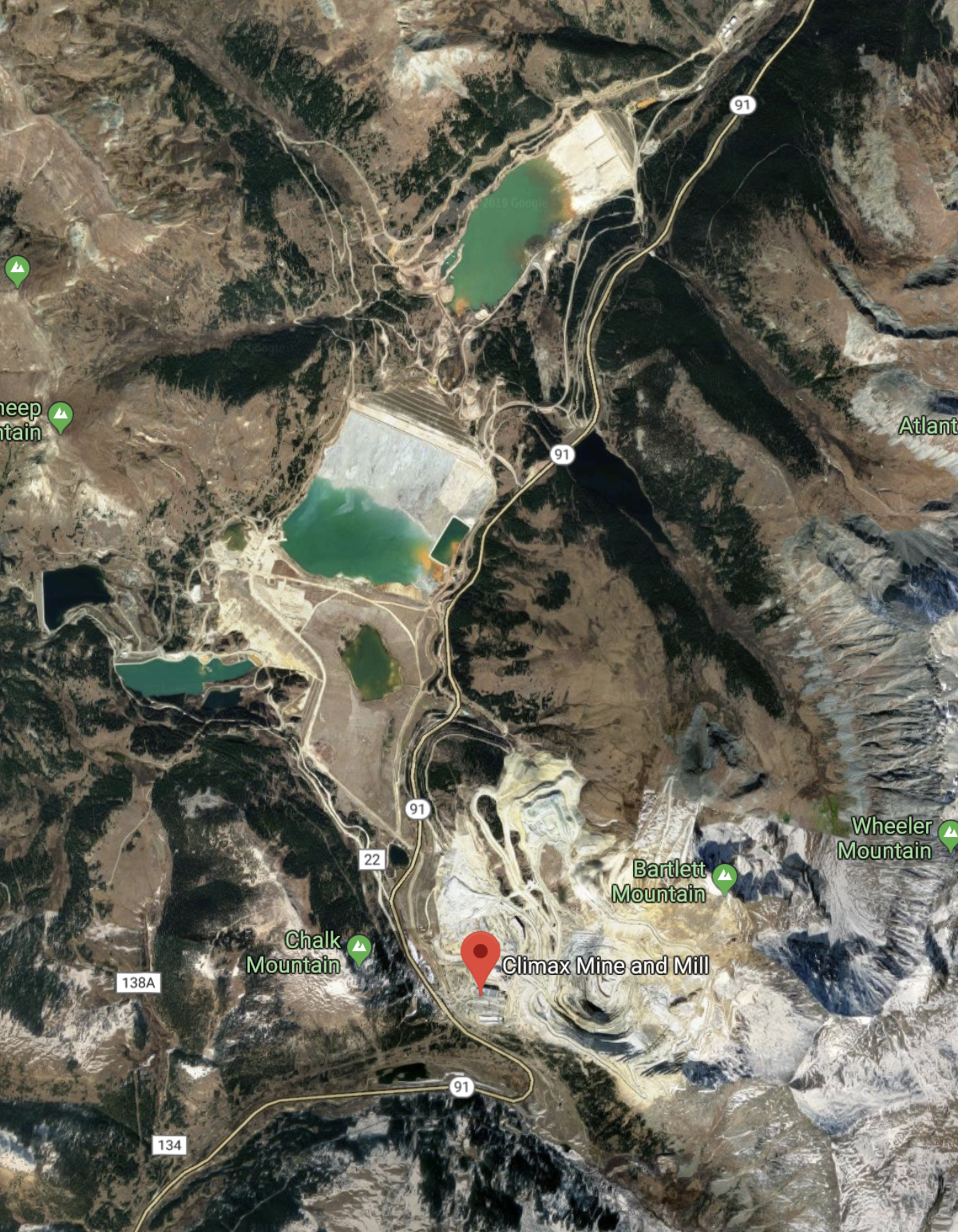
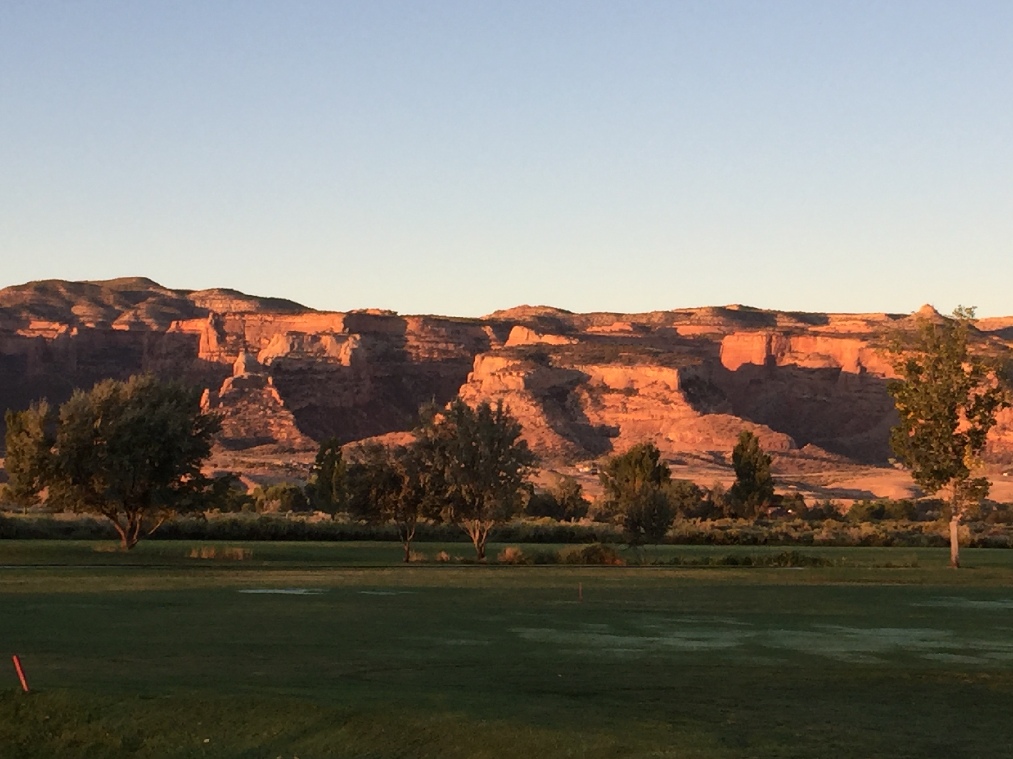
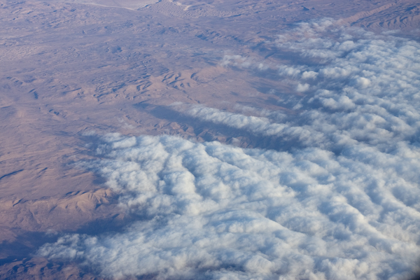
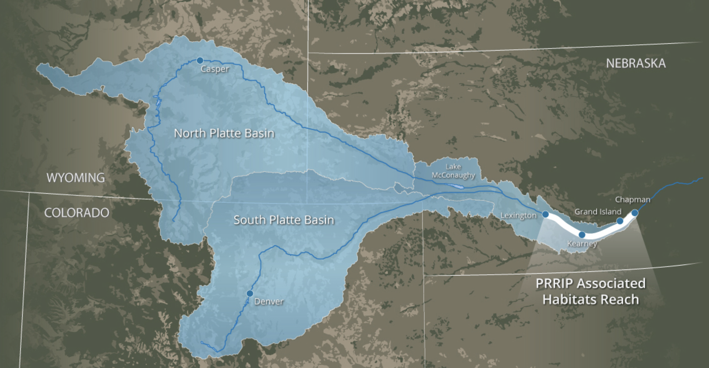

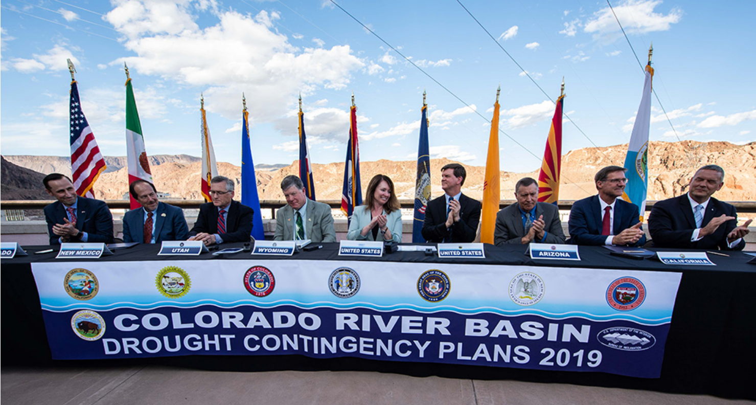
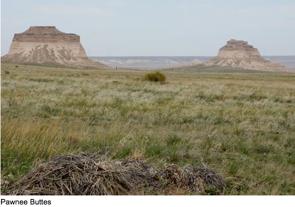


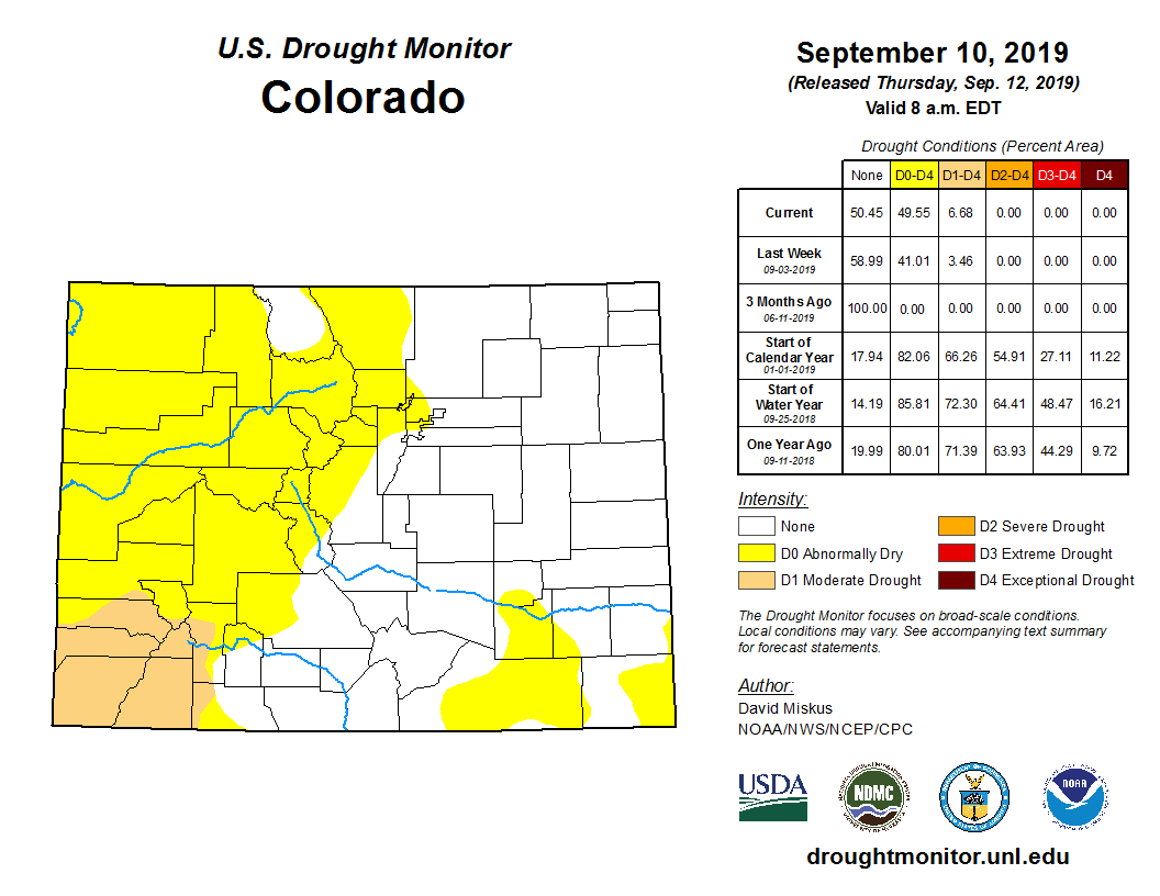

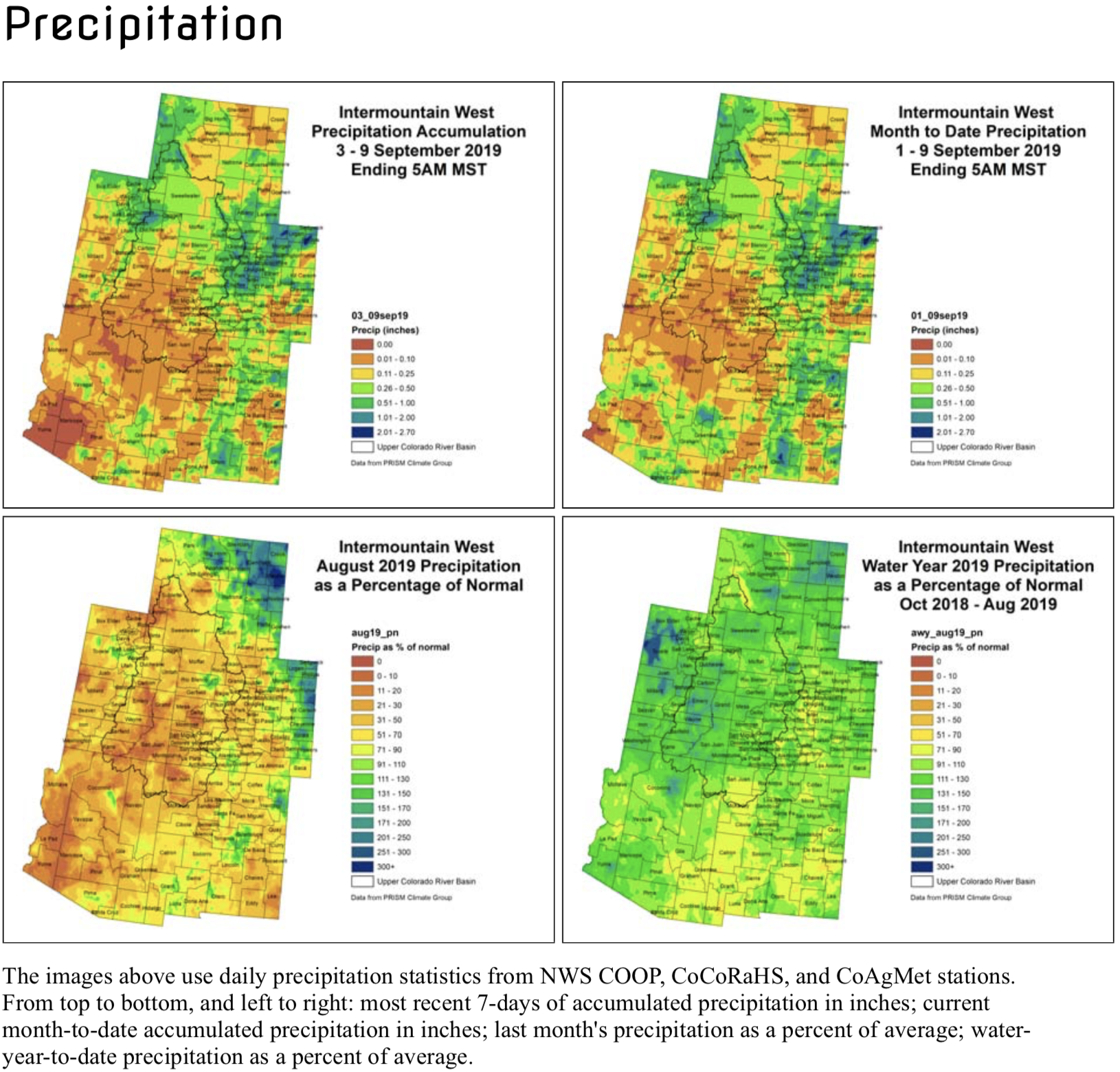


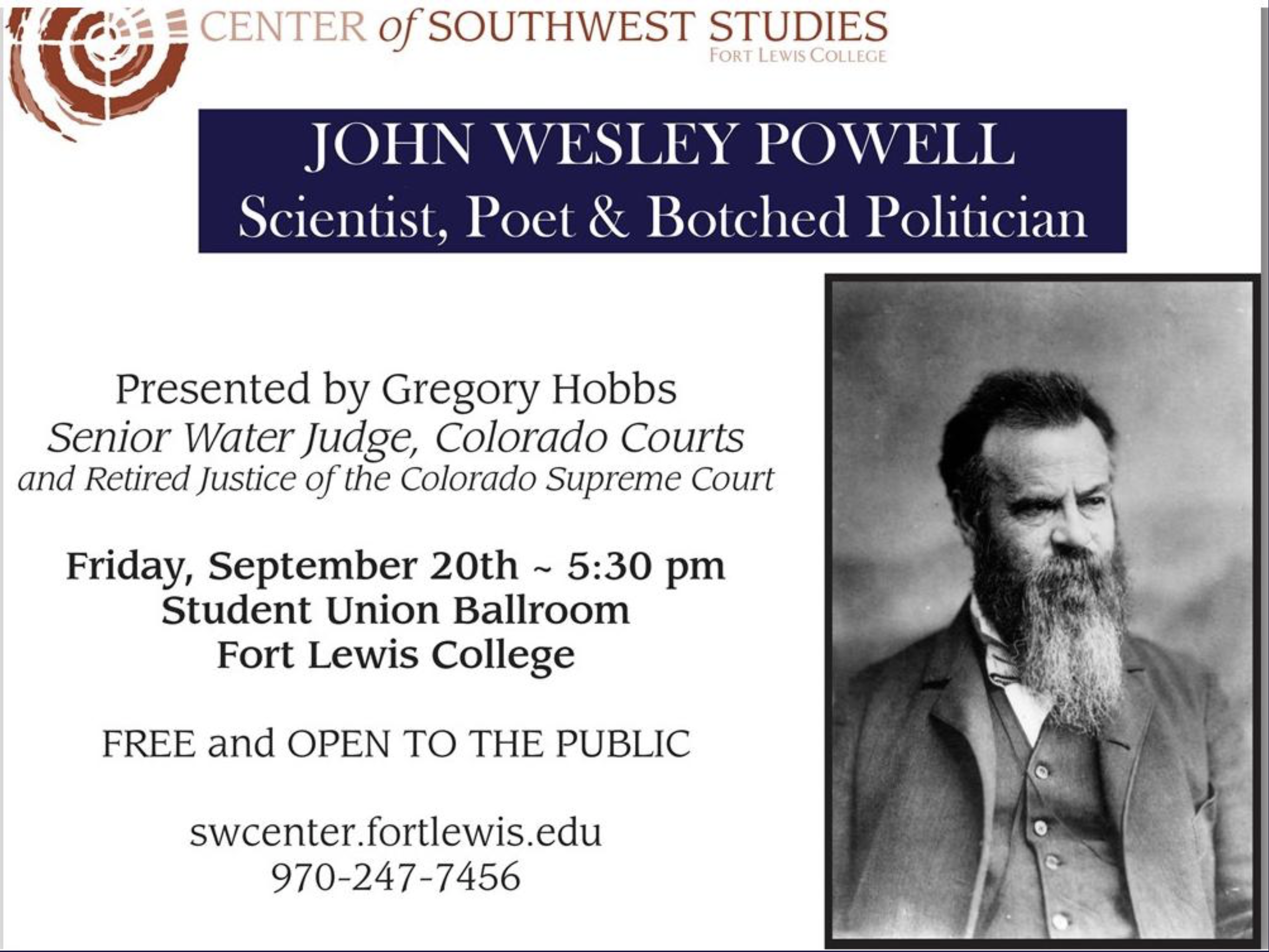


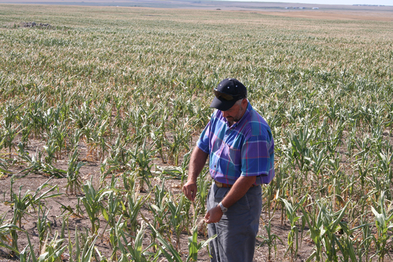
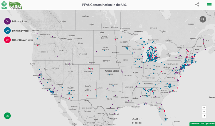

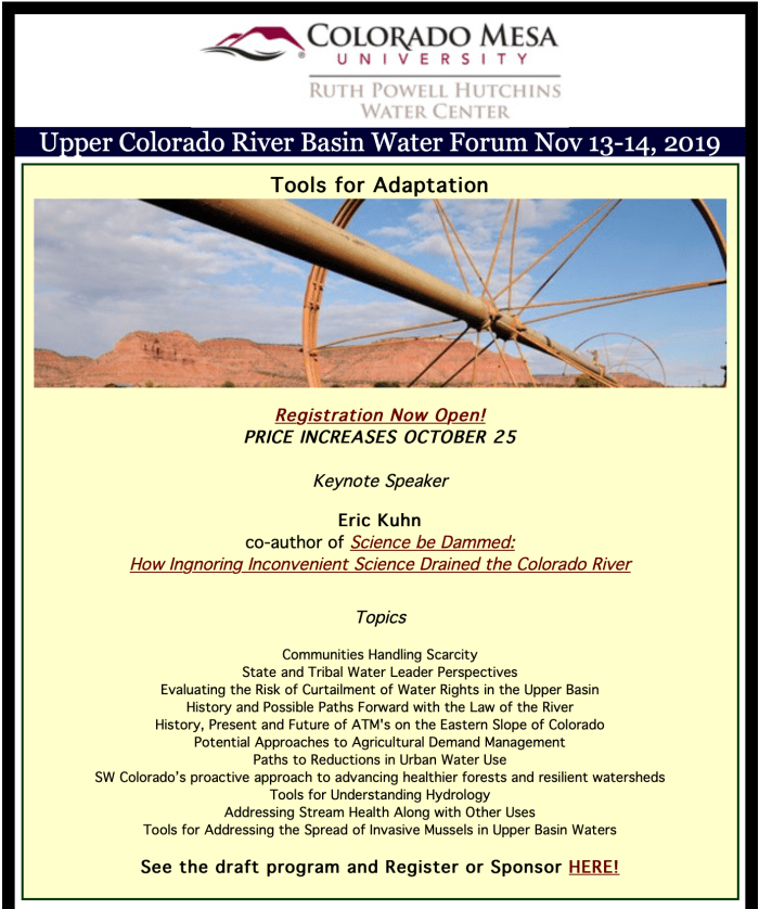


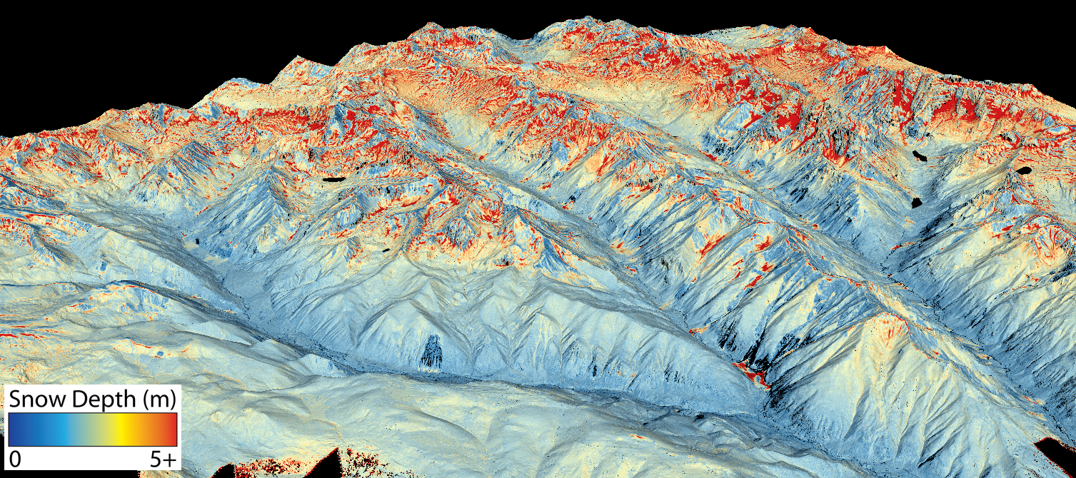
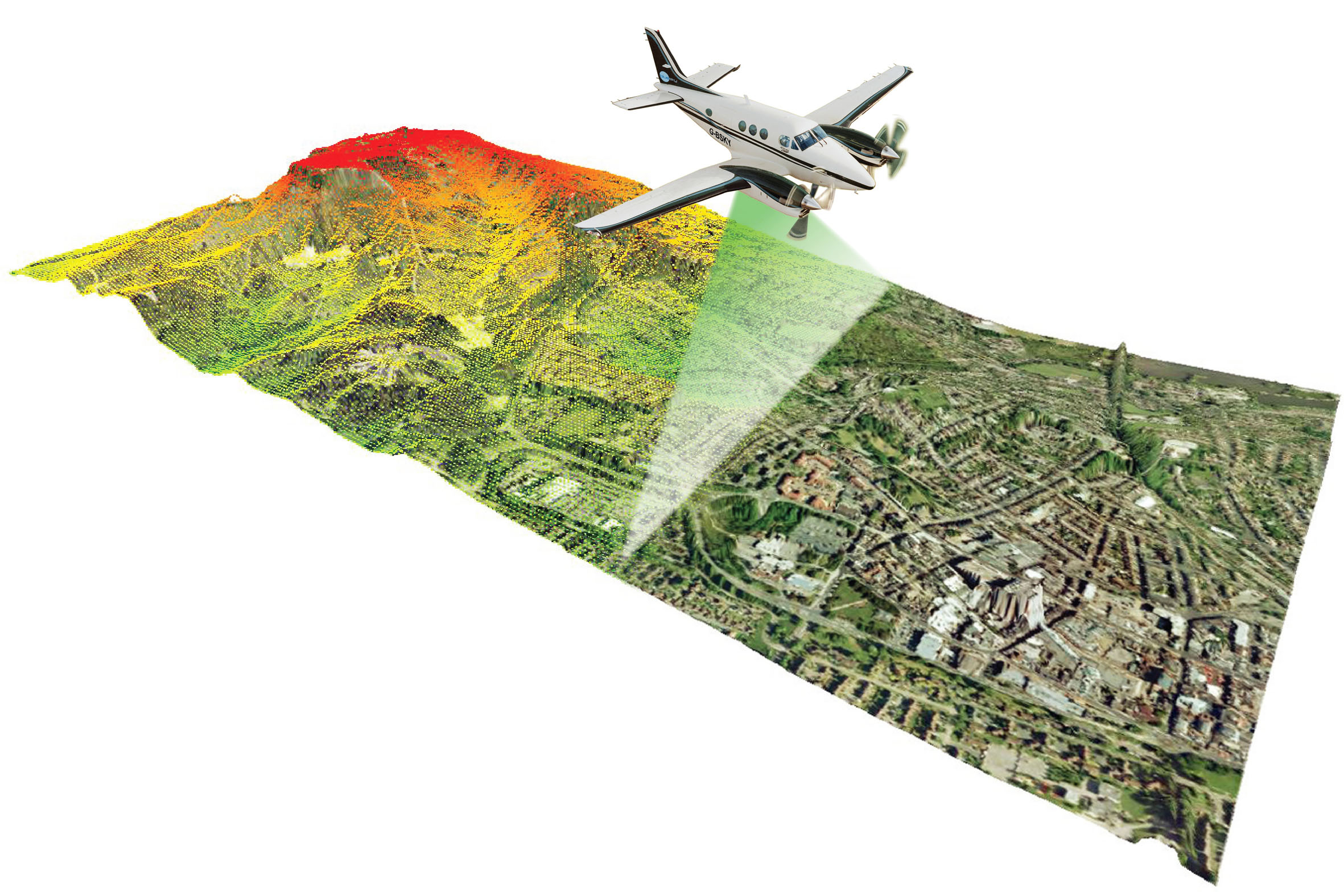


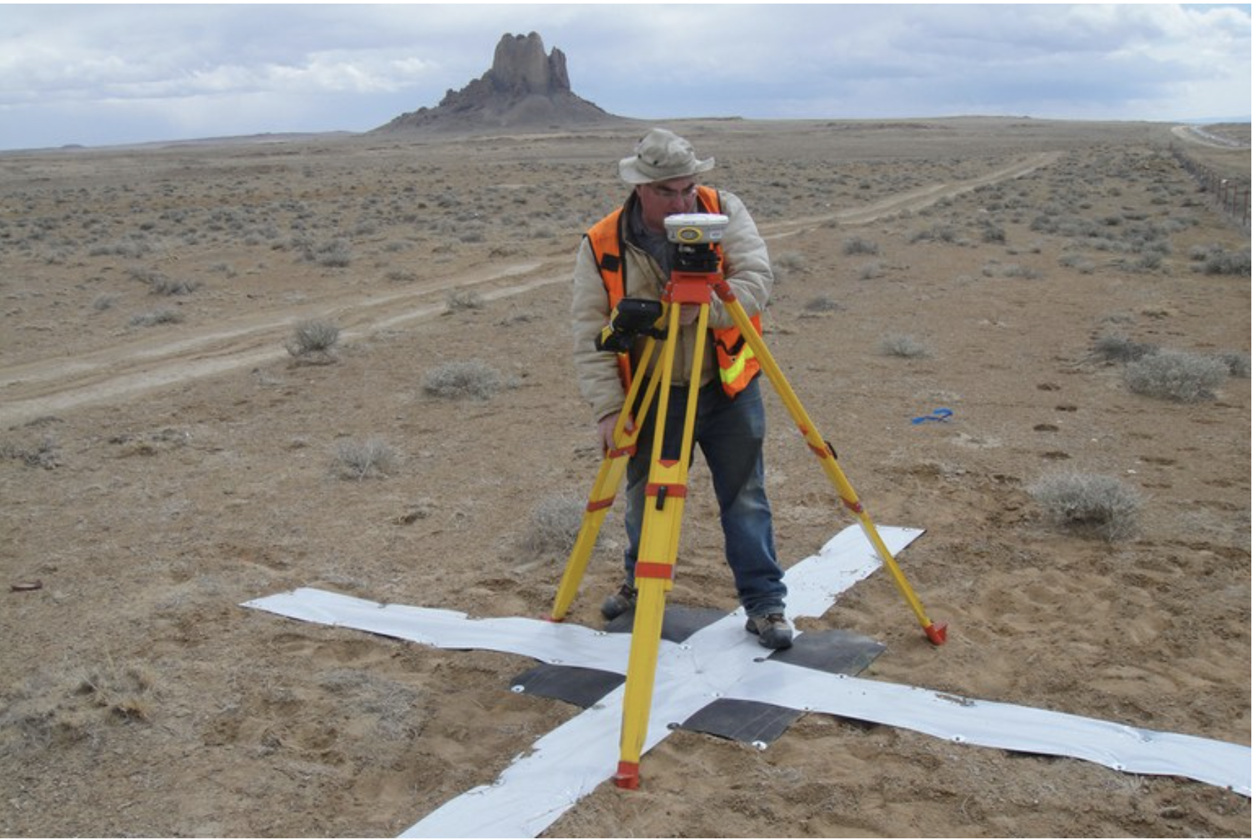

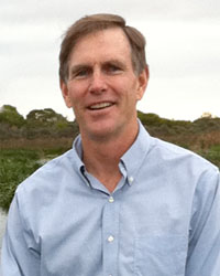
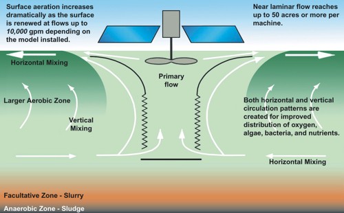

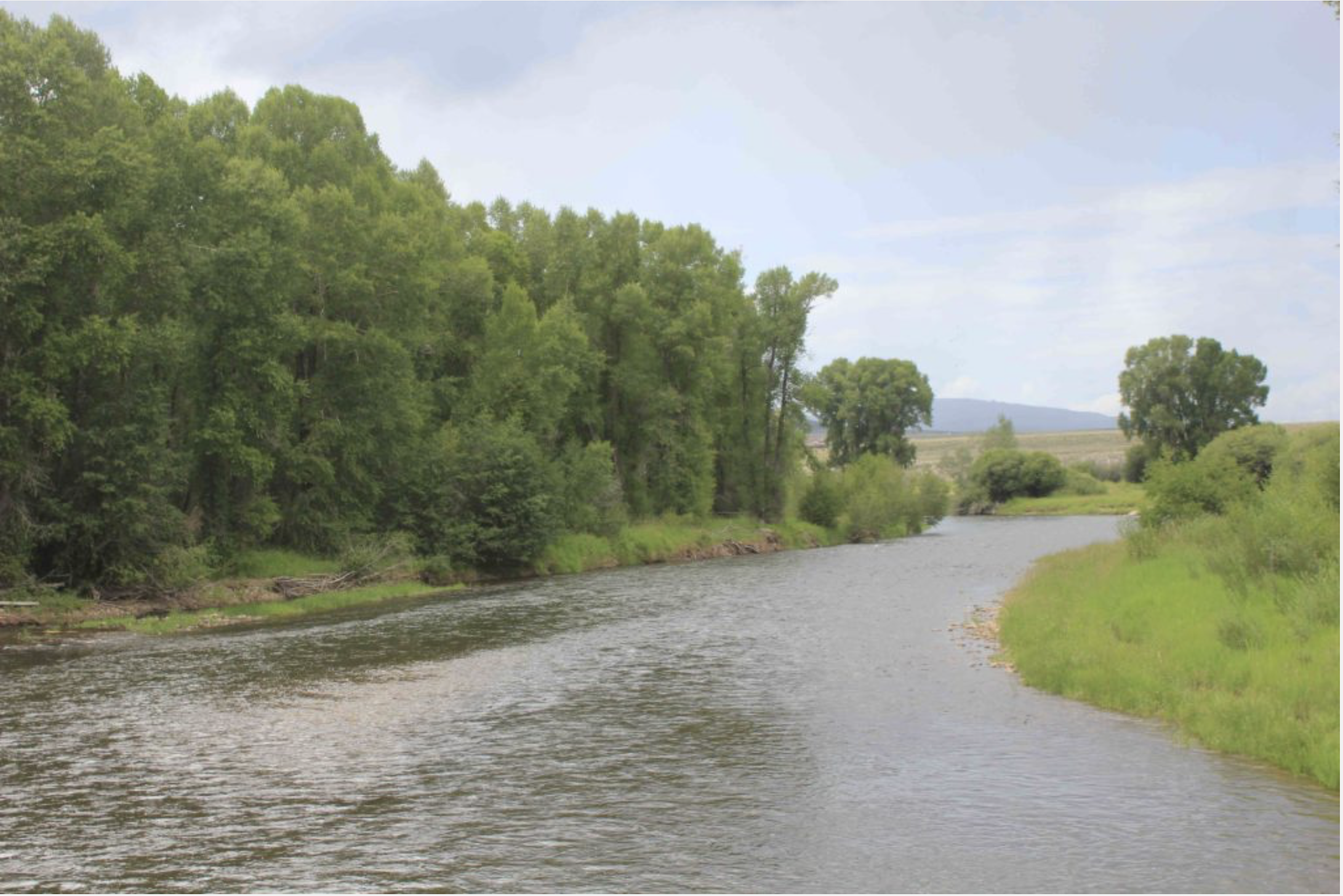


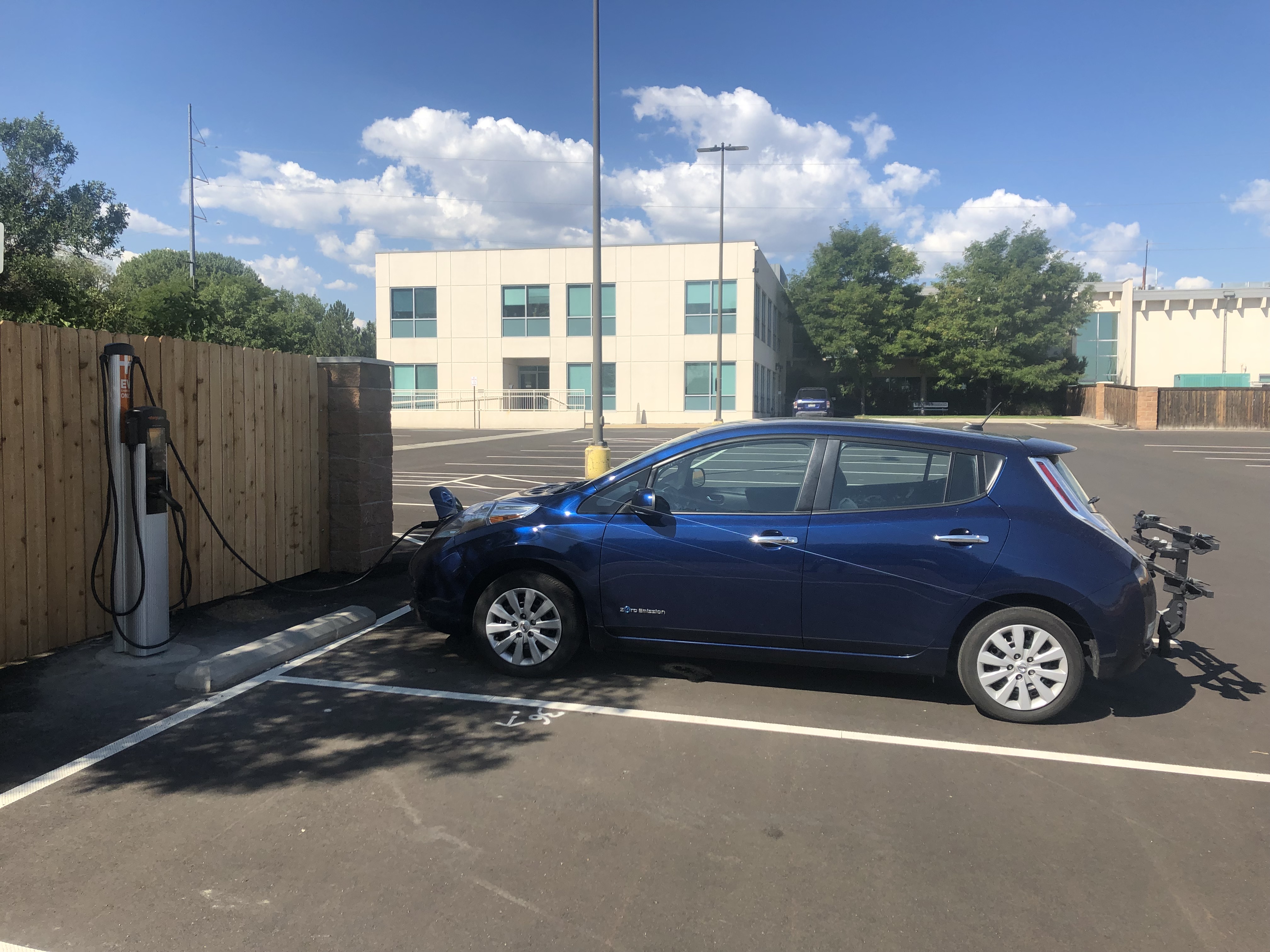
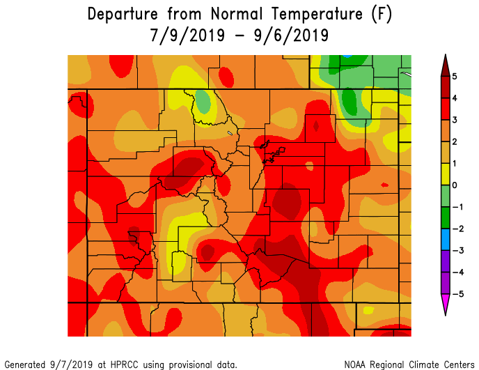


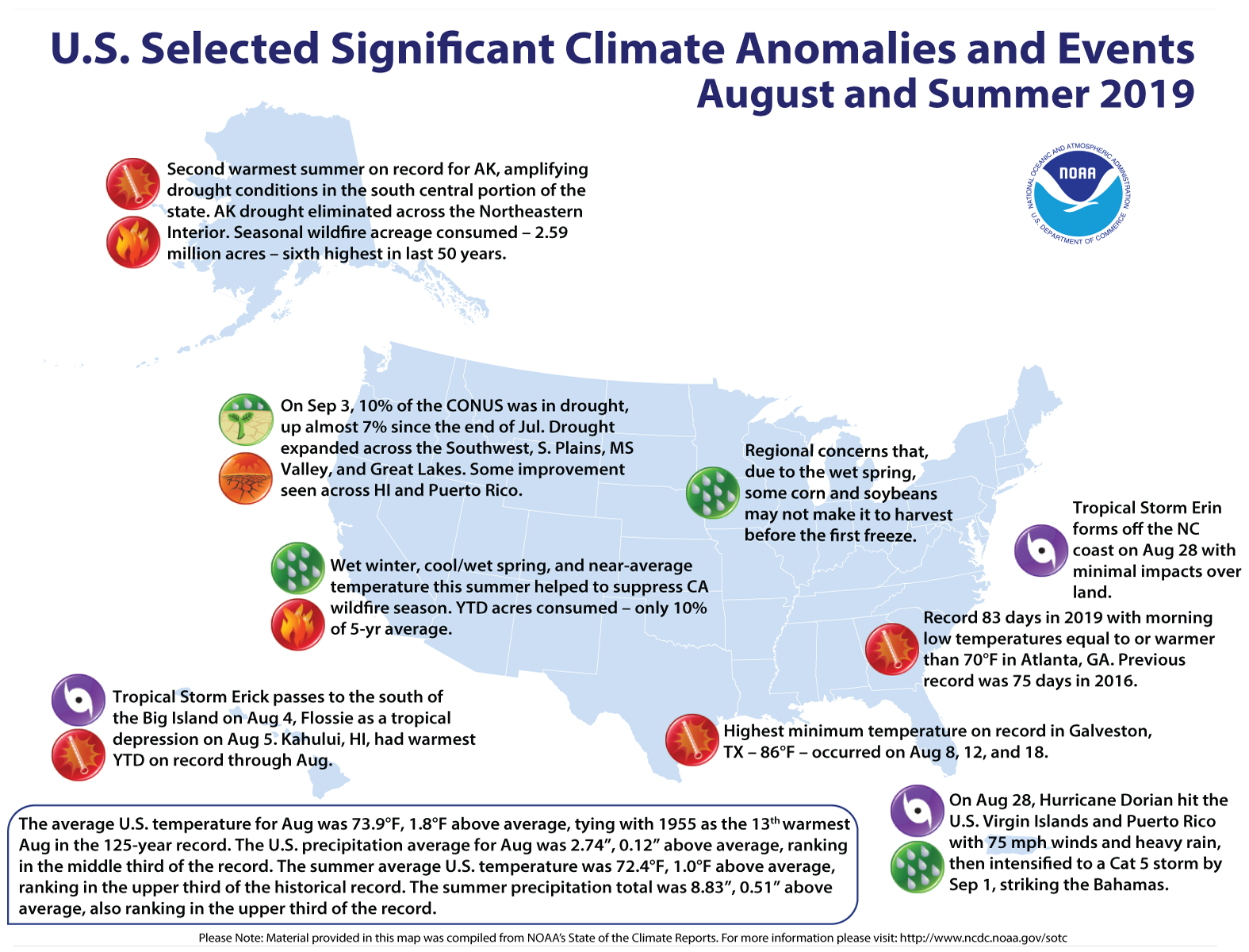

