@USBR selects 63 projects to receive $4.1 million to improve water efficiency and reliability

Dragon Line irrigation system. Photo credit: AgriExpo.com.

Here’s the release from the Bureau of Reclamation (Peter Soeth):

The Bureau of Reclamation has selected 63 projects to receive a total of $4.1 million for small-scale water efficiency grants. The grants will help the water entities use water more efficiently and improve water supply reliability in the western United States.

“This WaterSMART program improves water conservation and reliability for communities throughout the West,” said Reclamation Commissioner Brenda Burman. “This cost-shared funding is providing an opportunity for these water providers and tribes to invest in using their water more efficiently.”

Projects in Arizona, California, Colorado, Idaho, Kansas, Montana, Nebraska, New Mexico, Oklahoma, Oregon, Texas, Utah and Washington will receive funding. For example,

  • The Central Colorado Water Conservancy District in Greeley, Colorado, will receive $75,000 to install supervisory control and data acquisition devices on 120 irrigation wells in northeast Colorado.
  • The Pueblo of Zia in northern New Mexico will receive $70,320 to install 40 radio-read water meters at currently unmetered homes to access accurate water usage data.
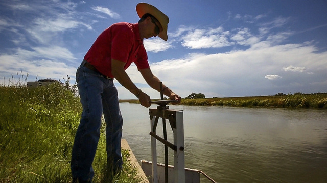
  • The Quincy-Columbia Basin Irrigation District in Quincy, Washington, will receive $23,130 to upgrade a turnout gate to an automated gate that will enable automatic adjustments to flows for more reliable water deliveries to farms.
  • Under this funding opportunity, applicants can request up to $75,000 in Reclamation funding and must contribute a non-federal cost-share of at least 50% of total project costs. Learn more at https://www.usbr.gov/watersmart/swep/.

    Small-Scale Water Efficiency Projects are part of the WaterSMART Program. Through WaterSMART, Reclamation works cooperatively with states, tribes, and local entities as they plan and implement actions to increase water supply reliability through investments to modernize existing infrastructure and attention to local water conflicts. Visit http://www.usbr.gov/watersmart to learn more.

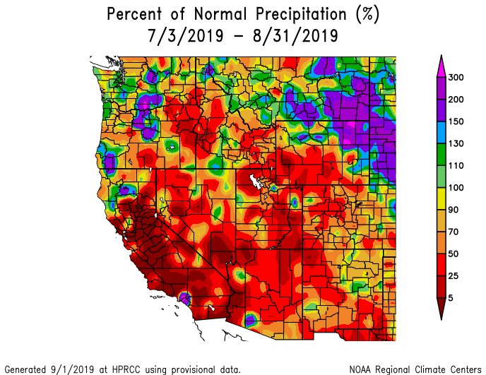
    #Drought news: In #CO and #Wy (and much of the SW) the #monsoon has been rather disappointing. 2- and 3-month SPIs are negative (dry), and precipitation shortages are common

    Click on a thumbnail graphic below to view a gallery of drought data from the US Drought Monitor.

    Click here to go to the US Drought Monitor website. Here’s an excerpt for the areas around and including Colorado:

    This Week’s Drought Summary

    The highlight of the week was intense and destructive Hurricane Dorian, with sustained winds of 185 mph and a central pressure as low as 911 mbs. Fortunately for the U.S. (as of Sep. 4), Dorian never made landfall along the Southeastern coast; however, while a Category 5 hurricane, it stalled over the northern Bahamas, devastating the islands of Great Abaco and Grand Bahama. For the most part, Florida dodged a Dorian disaster as the hurricane remained stalled over the northern Bahamas, slowly weakened, and finally drifted northward by the period’s end. Some rain bands from Dorian dropped 1-4 inches along Florida’s east coast. Puerto Rico also missed a direct hit from Dorian as it was strengthening into a hurricane to its east, although scattered convection did bring the island some welcome rain. Elsewhere, a series of cold fronts dropped southeastward out of Canada, bringing subnormal temperatures to most of the Nation east of the Rockies, and helping to prevent Hurricane Dorian from tracking westward and making landfall in Florida. The fronts brought light to moderate rain to the northern Plains, upper Midwest, Great Lakes region, and Northeast, while clusters of storms dumped occasionally moderate to heavy (2-6 inches) rains on parts of the south-central Great Plains, lower Missouri Valley, and Southeast. The Southwest monsoon made a partial comeback, bringing light showers to portions of southern Arizona, most of New Mexico, and southwestern Texas, but overall has been a disappointment. The Far West, with high pressure in control, was mostly dry and warm. Light to moderate showers fell along southern coastal Alaska, but it was not enough for any improvement. Meanwhile, increased rainfall across southern sections of the Big Island aided vegetative growth and diminished deficits, thus improvement was shown…

    High Plains

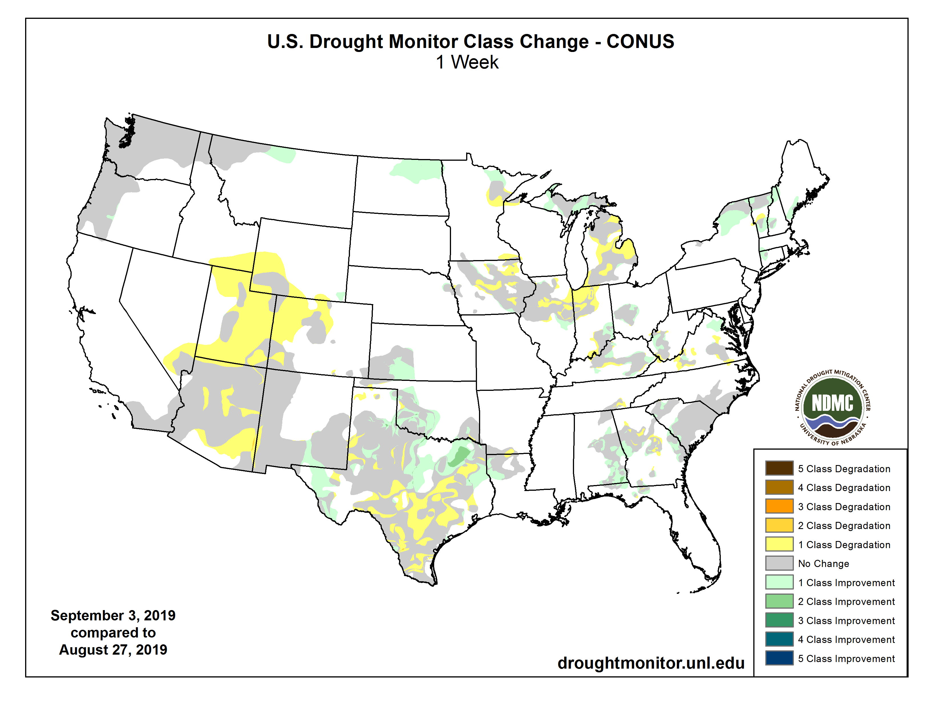
    Most of the High Plains experienced relatively dry and cool weather, but fortunately the few areas with dryness or drought (northern North Dakota and southwestern Kansas) received well-placed light to moderate rains. In North Dakota, a thunderstorm complex moved across the northern and eastern portions of the state on Day7, dropping 1-3 inches of rain over the D0-D2 area and effectively reducing dryness and drought by 1-category. 60- and 90-day precipitation anomalies were now close to zero, with only longer-term (6-months) deficits still lingering. In southwestern Kansas, 1-2.5 inches of rain fell across the eastern half of the D0-D1 areas, greatly reducing its coverage. In north-central Montana, although precipitation was light (<0.25ā€) this week, the past several weeks brought light to moderate amounts, and after reassessing conditions at 60- and 90-days, D0 was removed as most indices were normal or moist. In Colorado and Wyoming (and much of the Southwest), after a wet and cold winter and spring, the summer monsoon has been rather disappointing. 2- and 3-month SPIs are negative (dry), and precipitation shortages are common. With this week’s unseasonable warmth, D0(Abnormally Dry) was added across a large portion of the Southwest (see below) to depict the poor summer rains…

    West

    In the Southwest, the gradual winding down of the southwest monsoon usually occurs in late September. So far, the 2019 southwest monsoon has been mostly disappointing, with parts of Arizona and the Four Corners region experiencing their driest summer on record mostly due to the notable lack of monsoon rainfall. Hot and dry weather occurred this week, although some rains (0.5-2 inches) fell on southeastern Arizona and most of New Mexico. Across most of the region, SPIs are less than -1 at the 30-, 60-, and 90-day time scales. While the longer-term SPIs show better numbers, the short-term stresses are outweighing the long-term values. Evaporative demand has been greater than normal, and even though water supplies are still in good shape, reservoir levels are dropping quicker than usual for this time of year, and stream flows have declined. Therefore, with August SPEIs less than -1.5, 3-month (JJA) precipitation in the lower tenth percentile, little or no rain this week, and 1-week EDDI at D2 or worse, a large area of D0 was added to reflect this short-term dryness. In southwest Colorado and southeast Utah, D1 was added to depict areas that have reported record low JJA rainfall. In Arizona, D0 was expanded across southeastern sections while D1 slightly increased in central areas in response to low SPIs and increased 90-day deficits. For example, Flagstaff, AZ has only received 1.15ā€ of rain since June 15 (driest on record) when 6.10ā€ should have fallen by now, and several nearby stations (Prescott, Heber, Payson, Winslow) have also measured near-record low monsoon totals…

    South

    While northeastern, southwestern, and southeastern Texas, most of Oklahoma, and northwestern Louisiana received widespread light to moderate rains (1 to 3 inches, locally to 6 inches), little or no rain fell on the Oklahoma Panhandle, southern and central Texas, northeastern Louisiana, and most of Arkansas, Mississippi, and Tennessee. Accordingly, a 1-category short-term deterioration was made in southern and central Texas, but improvement occurred in portions of central Oklahoma and northeastern Texas, including a 2-category improvement (D1 to nothing) where 3-6 inches of rain fell in the latter area. 7-day averaged USGS stream flows dipped below the tenth percentile (much below normal) in south-central Texas where D2 and D3 expanded. Although it was dry in Arkansas, Mississippi, and Tennessee, prior surplus rainfall has left the soil moisture in good shape for now. An exception was in extreme southeastern Tennessee where D0 and D1 increased…

    Looking Ahead

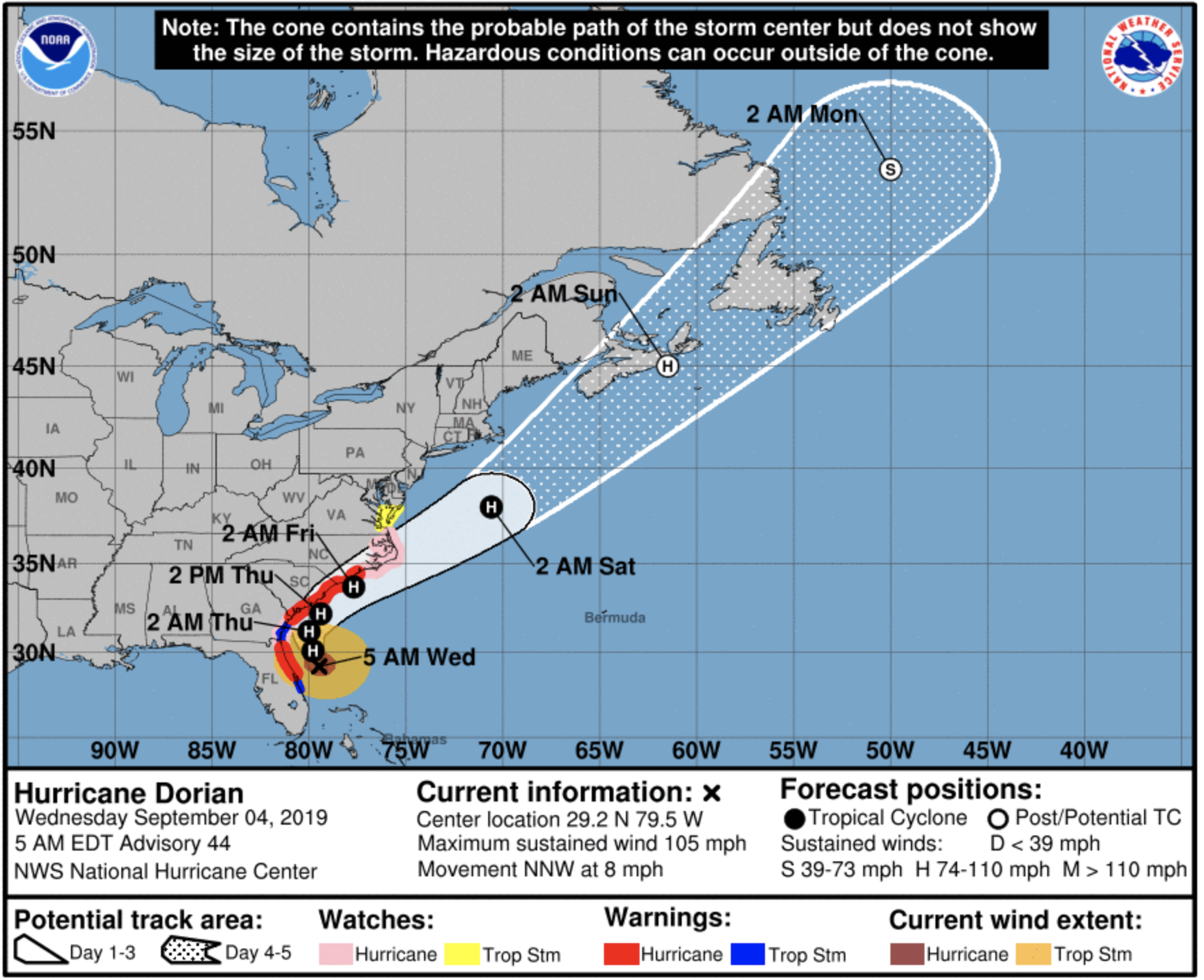
    During the next 5 days (September 5-9, 2019), Hurricane Dorian will turn north, then northeastward and make a close pass (or landfall) along the Carolina coasts before accelerating quickly off the Northeast coast and into the northern Atlantic Ocean. Heavy rains, gusty winds, and high waves will pound the Carolina coasts, possibly dropping up to 15 inches of rain on coastal sections of South and North Carolina. Elsewhere, an active Southwest monsoon should drop scattered showers across the Four Corners region, while an active northern jet stream should bring light to moderate precipitation to the Pacific Northwest, northern Rockies and Plains, western Corn Belt, and upper Midwest. Little or no rain is expected in California and southern Nevada, the southern half of the Plains, lower Mississippi, Tennessee, and eastern Ohio Valleys, eastern Great Lakes region, and central Appalachians. Temperatures should average above-normal across the southern two-thirds of the Nation and Northwest, and subnormal from the northern Plains eastward to the Northeast.

    The CPC 6-10 day outlook (September 10-14, 2019) favors above-normal odds for precipitation in the Southwest, across the northern third of the U.S., and most of Alaska, with diminished rain chances in the Southeast. Above-normal temperatures are expected east of the Rockies, except for subnormal readings favored in New England. West of the Rockies, below normal temperatures are likely in the Intermountain West. Alaska should continue to experience above-normal temperatures.
    US Drought Monitor one week change map ending September 3, 2019.

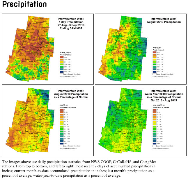
    @ColoradoClimate: Weekly #Climate, Water and #Drought Assessment of the Intermountain West

    Click here to read the current assessment. Click here to go to the NIDIS website hosted by the Colorado Climate Center.

    Seven. Freaking. Hours: CNN bodyslammed America with climate coverage last night. Here’s what happened — Heated #ActOnClimate

    Click here to read the inaugural issue of Emily Atkin’s new newsletter, Heated. Here’s an excerpt:

    If you’ve followed my work at all for the last six years, you know that I frequently complain about the lack of climate coverage on major television news networks.

    So it’d be natural to assume I’d be happy today, the morning after CNN’s epic 7-hour Climate Crisis Town Hall, during which reporters and citizens probed the top 10 Democratic presidential candidates about the potential collapse of human civilization.

    Well guess what.

    I’m not happy.

    I’m…

    HEATED! AWWWW YEAAAH THAT’S RIGHT!!! WELCOME TO THE FIRST ISSUE!! *airhorn sounds* (I am so sorry).

    Welcome to HEATED, a newsletter for people who are pissed off about the climate crisis. This is a special pre-launch issue for all you wonderful nerds who signed up early. I can hardly believe it, but there are more than 8,000 of us already! Who says people don’t care about climate change??

    Daily, Monday through Thursday coverage begins officially on September 9th. If you like it, please forward it a friend—it would mean the world to me…

    Now let’s get to it!

    It was not so bad, actually.

    Maybe this is because I’m a cynical jerk, but I really thought CNN would mess this up.

    I’m old enough to remember when the network’s president Jeff Zucker said he intentionally avoided climate coverage because of the public’s ā€œlack of interestā€ in the subject. And when CNN did cover climate change, it invited deniers on so often that Media Matters deemed the network a ā€œnational platform for false balanceā€ on climate. Two years later, Media Matters also reported that CNN aired advertisements for the fossil fuel industry five times more often than climate-related news. And in 2018, there was one week where three separate CNN guests claimed that climate change was a vast conspiracy to enrich climate scientists.

    So I was shocked at how productive Wednesday night’s town hall was. The moderator’s questions, for the most part, were tough and in line with the science. The outside questioners the network brought in were youthful, diverse and engaging. Both moderators and candidates called out the fossil fuel industry repeatedly for delaying climate action and spreading misinformation.

    And most importantly…

    It was a climate accountability bonanza.

    On Wednesday night, every single Democratic presidential candidate was asked at least one question that attempted to hold them accountable for controversial decisions they’ve made, or questionable positions they’ve taken regarding the most existential threat of our time.

    Click through and sign up for the newsletter.

    @OmahaUSACE: Public meeting scheduled for flood risk management study in Longmont, Colorado, September 18, 2019

    Click to view the August 18, 2019 slides from the USACE.

    Here’s the release from the U.S. Army Corps of Engineers — Omaha District:

    The U.S. Army Corps of Engineers, in cooperation with the City of Longmont, Colorado will hold a flood risk management study open house Sept. 18, from 4:00 to 6:30 p.m. at the Longmont Museum, 400 Quail Road.

    There will be a brief, formal presentation at 4:30 p.m. on information contained in the recently released draft feasibility study report, followed by an open house.

    The draft report provides information on the need for the project, current conditions of the project area, identification of opportunities to reduce flood risk, development of various alternatives to reduce flood impacts to life safety and property along St. Vrain Creek, and selection of the proposed plan.

    The recommended plan includes a levee on the south side of the Izaak Walton Pond Nature Area, channel widening and benching to contain the 1% Annual Chance Exceedance (ACE) event, replacement of the Boston Avenue Bridge, and a grade control downstream of Sunset Street Bridge.

    The draft feasibility report may be downloaded at https://www.nwo.usace.army.mil/Missions/Civil-Works/Planning/Planning-Projects/LongmontCO/.

    Email your comments on the report to cenwo-planning@usace.army.mil or mail to: U.S. Army Corps of Engineers, Omaha District, CENWO-PMA-A, ATTN: Tim Goode, 1616 Capitol Avenue, Omaha, NE 68102-4901. Comments must be postmarked or received by Oct. 4, 2019.

    This flood risk management study builds on Resilient St. Vrain, Longmont’s extensive, multi-year undertaking to fully restore the St. Vrain Greenway and increase resiliency of the St. Vrain Creek channel to reduce future flood risk to the community. The Resilient St. Vrain project was developed by the City of Longmont in response to the catastrophic flooding in September 2013.

    Contact
    USACE Omaha District Public Affairs
    402-995-2418
    omaha.usace-pa@usace.army.mil
    1616 Capitol Ave. Omaha, Neb. 68102

    #ColoradoRiver District Annual Seminar, September 18, 2019, “Uncertainty, you can count on it” #COriver #aridification

    Click here to register.

    System Conservation Pilot, water markets, and demand management #ColoradoRiver #COriver #aridification

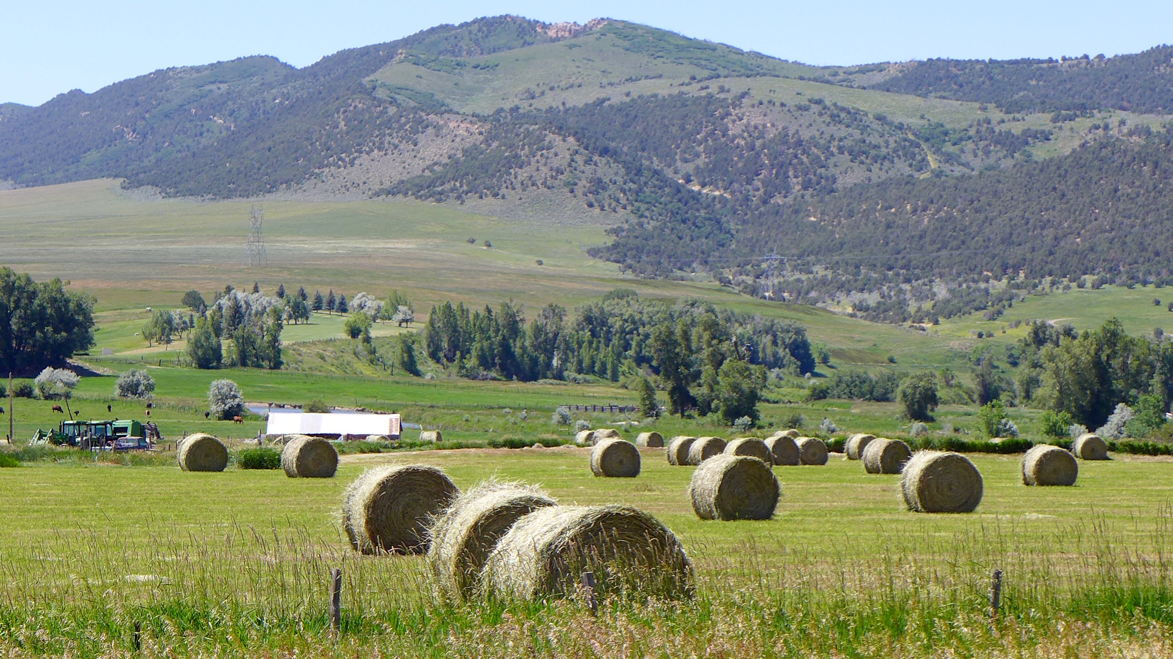
    Hay fields under Meeker Ditch 2. Photo credit: Brent Gardner-Smith/Aspen Journalism

    From Time (Lucas Isakowitz):

    …scarcity is the mother of invention, and western states are coming up with innovative ways to save water. One was a pilot program which ran from 2015 to 2018 and paid farmers—including [Paul] Kehmeier—about $200 for every acre-foot of water that they had the right to but did not use…

    Over the course of four years, the pilot program sponsored 64 projects, conserving an estimated 46,000 acre-feet of water. There was so much interest in some districts that participants had to be selected via a lottery system. Participating farmers closed off some of their irrigation canals, allowing water that would normally go to their fields to flow downstream; at the same time, water administrative agencies and environmental groups like The Nature Conservancy and Trout Unlimited helped monitor flow rates.

    The pilot cost about $8.5 million, with funding coming almost entirely from the major municipalities that rely on the Colorado River, including Denver, Las Vegas and Los Angeles. Now the states in the upper Colorado River basin are exploring how to scale it up. Colorado has formed a series of working groups, set to meet for the first time in September, which will tackle questions like who will foot the bill for a large-scale program (which could run in the hundreds of millions of dollars), how to ensure participating farmers are legally allowed to lease out their water rights, and what sort of mechanisms can safeguard conserved water as it makes its way to reservoirs…

    Not everyone is thrilled about the possibility of a water market in the upper Colorado River. ā€œLet’s be honest about what it is that we’re doing here: paying farmers not to farm, and drying up land to buy water,ā€ says David Harold, a sweet-corn farmer from Olathe, Colorado, who participated in the pilot program for one year. ā€œThis is ā€˜buy-and-dry’ with another name,ā€ he says, referring to the practice of cities buying land purely for the water rights tied to them, leaving rural communities parched and jobless…

    Harold isn’t the only skeptic. ā€œEvery single person I interviewed mentioned ā€˜buy-and-dry,ā€™ā€ says Kelsea MacIlroy, a PhD student at Colorado State University who interviewed 34 irrigators and water experts in western Colorado to understand local perceptions of a demand management program, which is a technical name for a water market where farmers can lease out their water. ā€œPeople said ā€˜maybe it’s not exactly the same thing, but we’re afraid that demand management could lead to ā€˜buy and dry.’’’

    […]

    Some, like Harold, see a water market as putting their counties on the road towards becoming another Crowley. But others view a demand management program as a way to avoid the fate of Crowley County. As the pressure mounts along the Colorado River, something’s got to give, and a water market—in which farmers choose to lease their water out for a set period, regaining it again when the program times out—is a more palatable option than selling their water entitlements outright. ā€œDemand management is different than ā€˜buy and dry’ because it leaves the water in the hands of the farmer,ā€ says Kehmeier…

    For a demand management program to significantly reduce water security risks along the Colorado River, it will need to attract a lot of farmers and funding. Policymakers are envisioning a scaled-up version of the pilot that could lease out as much as half a million acre-feet of water by 2026, costing around $100 million. But even that won’t keep the Colorado River from over allocation. That’s why, MacIlroy says, some of the irrigators she spoke with felt demand management ā€œwas a Band-Aid and that there’s no point in continuing that conversation unless there are efforts being made to address the larger issues in the Colorado River.ā€

    How Has #ClimateChange Affected Hurricane #Dorian? — The New York Times #ActOnClimate

    Screen shot of Dorian Cone of Uncertainty September 4, 2019 4:00 AM EDT via the National Hurricane Center

    Here’s an in-depth report about Climate Change effects on hurricane Dorian from John Schwartz writing for The New York Times. Click through and read the whole article. Here’s an excerpt:

    Tropical storms draw their energy from ocean heat — and more than 90 percent of the heat trapped by greenhouse gas emissions is being stored in the ocean. Storms that survive the cradle of formation can intensify quickly and become immensely powerful.

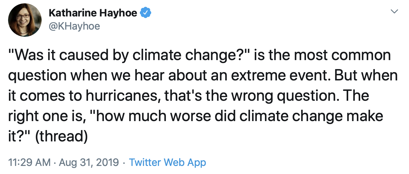
    While it’s common to hear the question, ā€œWas it caused by climate change?ā€ scientists argue that this is an unhelpful way to look at the issue. As Katharine Hayhoe (@khayhoe), a climate scientist at Texas Tech University, put it recently on Twitter, ā€œthat’s the wrong question. The right one is, ā€˜how much worse did climate change make it?ā€™ā€

    Now, as that same storm slowly moves away from the Bahamas — which experienced a nightmare scenario of a Category 5 storm stalling over it for 24 hours — it begins its slow roll toward the East Coast of the United States.

    A number of recent storms have stopped in one place for extended periods of time, including Harvey, which sat over Houston for days in 2017 and caused unprecedented flooding.

    Recent research suggests that climate change has made stalled Atlantic storms more common since the mid-20th century, and that they are more dangerous because they stay in one place for a longer period of time, potentially concentrating their destruction.

    Jennifer Francis, a scientist with the Woods Hole Research Center, said, ā€œThis is yet another example of the kind of slow-moving tropical systems that we expect to see more often as a response to climate change. Upper-level steering winds are slowing over the continents during summer, so stalling weather systems are more likely.ā€

    Hurricanes are steered in part by high-atmosphere winds not directly related to the storm. Dorian slowed to a crawl — about one mile an hour — because the tropical winds that were pushing it westward over the Bahamas weakened, said Joel Cline, a meteorologist with the National Oceanic and Atmospheric Administration in Silver Spring, Md.

    Climate change is making hurricanes more destructive in many ways.

    Andrew Dessler, a climate scientist at Texas A&M University, said that some of the links between hurricanes and climate change are still being worked out. But, he said, some attributes of storms, particularly the increasing amount of rainfall associated with many of them, has reached a very strong consensus.

    A similarly solid consensus has developed about storms getting stronger. There is somewhat less consensus, he said, around the idea that storms are likelier to stall.

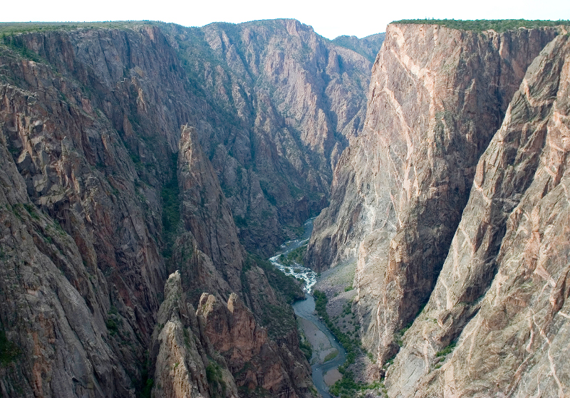
    Aspinall Unit Operations update: Streamflow in the Black Canyon ~515 cfs

    From email from the Bureau of Reclamation (Ryan Christianson):

    Releases from the Aspinall Unit will be decreased by 100 cfs at approximately 10am on Tuesday, September 3rd. Pursuant to the Aspinall Unit Operations Record of Decision (ROD), the baseflow target in the lower Gunnison River, as measured at the Whitewater gage, is 1050 cfs for September. This release decrease will allow for the recovery of storage in Crystal Reservoir that was utilized in response to upstream facility outages.

    Currently, diversions into the Gunnison Tunnel are approximately 1200 cfs and flows in the Gunnison River through the Black Canyon are around 615 cfs. After this release change, the Gunnison Tunnel diversions will remain near 1200 cfs and flows in the Gunnison River through the Black Canyon will be around 515 cfs. Current flow information is obtained from provisional data that may undergo revision subsequent to review.

    Looking downstream from Chasm View, Painted Wall on right. Photo credit: NPS\Lisa Lynch

    Monsoonal rains blocked in Southwest #Colorado — The Cortez Journal

    From The Cortez Journal (Jim Mimiaga):

    Monsoonal rains did not materialize much this summer in the Four Corners, and the El NiƱo weather phenomenon that favors a wetter than normal winter is also over.

    ā€œA more persistent high-pressure ridge than expected over the Four Corners is blocking the southerly monsoonal flows,ā€ said Jim Andrus, a Cortez weather observer for the National Weather Service. ā€œThe dry spell will continue into next week.ā€

    July and August were both below normal for precipitation for Cortez, he said.

    July saw just .45 inches of rain, or 35 percent of the normal average of 1.28 inches. So far, August has seen just .57 inches of rain, or 39 percent of the normal 1.48 inches.

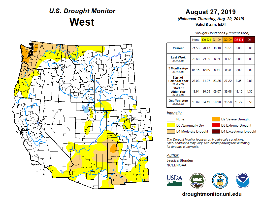
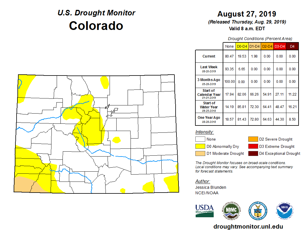
    The lack of moisture has put southwest Colorado into the ā€œabnormally dryā€ category on the U.S. Drought Monitor, the least severe of five drought levels.

    West Drought Monitor August 27, 2019.

    Year-to-date precipitation in Cortez is at 11.2 inches, or 144 percent of average, thanks to the above-average snowfall in late winter. But the high percentage continues to drop as the dry spell continues.

    There is still a chance the Four Corners could get a shot of late season monsoon rains, Andrus said, if the high pressure ridge shifts to the east.

    The September forecast hints at a chance for slightly above-average precipitation, said Jeff Colton, a meteorologist with the National Weather Services, as the early winter northwesterly storms drop our way.

    Meanwhile, the National Oceanic and Atmospheric Administration announced last week that the El NiƱo weather pattern — a warming of the equatorial Pacific Ocean that contributed to the extra snowy Southwest winter — has ended.

    It’s in a neutral pattern that is neither El NiƱo, or its opposite, La NiƱa, which is characterized by cooler Pacific temperatures with an atmospheric tendency to push winter storms toward the Northwest.

    According to NOAA’s Climate Prediction Center, there is a 55 percent chance the neutral pattern will continue through the winter, a 30 percent chance El NiƱo will return, and a 15 percent chance La NiƱa will form.

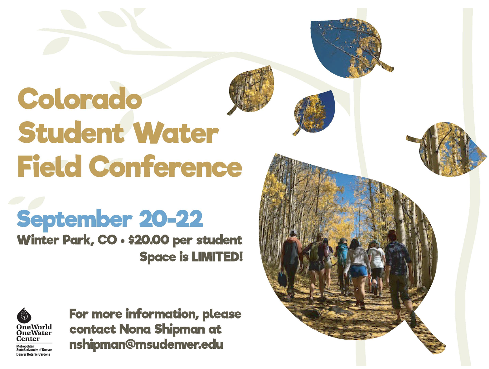
    One World One Water Center: #Colorado Student Water Field Conference, September 20-22, 2019 @OWOW_MSUDenver

    Big Thompson Watershed Coalition fundraiser, September 22, 2019

    Big Thompson River near RMNP

    From The Loveland Reporter-Herald (Pamela Johnson):

    Coalition shifting focus to the future

    Since the 2013 floods, the Big Thompson Watershed coalition has been leveraging grant money to rebuild and improve the river corridor, making it healthier and more resilient.

    Now, the nonprofit is shifting its focus to resiliency for the future, to improvements that will prepare the community for future flood and fire impacts and to ensure long-term river health.

    As part of that effort, the coalition is reaching out into the community to make new connections, holding a fundraiser with a goal of $50,000 and has a community bio-blitz planned…

    Fundraiser

    The Big Thompson Watershed Coalition is a nonprofit that has been operating for five years on grant money and disaster-recovery funds available after the 2013 floods. Two full-time employees handle all the community outreach, grant searches and more behind the scenes for the grant-funded projects.

    To help keep a staff of two going into the future and to meet the organization’s operations needs, the coalition has a fundraiser planned for Sunday, Sept. 22, at Sweetheart Winery.

    The event, which costs $60 per ticket, will feature dinner, a live cellist, fly-fishing demonstrators, tours of an adjacent watershed project, an art auction and time to soak up the river…

    The theme centers on ā€œinspirations and aspirationsā€ of the river, and the event gives people a first-hand look at one of the completed river projects. Speakers also will talk about watershed issues…

    Tickets are available by making a donation online at bigthompson.co/donate or by contacting courtney.gutman@bigthompson.co…

    New connections

    A major project for the watershed forum in the coming year is to create a plan for the Big Thompson River for 15 miles through Loveland with a $180,000 grant from the Colorado Water Conservation Board. The coalition will lead a team looking at river health as well as the community’s needs and wants surrounding both recreation as well as responsible development along Colo. 402.

    The coalition has launched an advisory committee that includes Loveland and Larimer County officials and likely will include ditch companies as well as members of the coalition board. They plan to reach out into the community for input on needs and desires and to consider a balance between those and river health.

    The goal is to create a clear understanding of the river corridor and its many demands and to end with a prioritized list of specific projects that are feasible, could be funded with grants and achieve that balance, Gutman explained…

    Community bio-blitz

    The coalition is looking for 10 to 30 community members to participate in a bio-blitz, which is where groups fan out over different sections of the river at the same time and collect data on water quality, plants and bugs. The idea is to have a ā€œflash understandingā€ of the ecosystem that morning, Sept. 28.

    The Big Thompson Watershed Coalition will not be only agency participating. In fact, volunteers will be collecting data over three different watersheds in the region and then meet in Lyons to share ideas and to have a celebration.

    The hope is that those residents, once taught to collect data, would be willing to volunteer with another piece of the coalition’s long-term goal — monitoring the success of completed projects…

    Volunteers can sign up at bigthompson.co or by emailing courtney.gutman@bigthompson.co…

    Big Thompson Watershed Coalition

    Fundraiser: 4 p.m. Sunday, Sept. 22, at Sweetheart Winery, including music, art auction, tours of a project site, speakers, dinner and drinks. $60 per ticket, available by making a donation online at bigthompson.co/donate or by contacting courtney.gutman@bigthompson.co

    Bio-blitz: 9 a.m. Saturday, Sept. 28, different locations on the Big Thompson River. Volunteers can sign up at bigthompson.co or by emailing courtney.gutman@bigthompson.co

    #Climate#hange: Ireland plans to plant 440m trees by 2040 — The Irish Times #ActOnClimate

    From The Irish Times (Brian Hutton):

    Farm land to be used for some of the 8,000 hectares of new forestry every year

    Twenty-two million trees are to be planted every year in Ireland over the next two decades as part of a plan to tackle climate change, the Government has said.

    While the Government’s climate action plan, published in June, proposed 8,000 hectares – or 19,768 acres – of new forestry every year in a bid to capture carbon emissions, it did not specify the number of trees involved.

    In its latest calculations, it suggests this will involve 2,500 conifers or 3,300 broad-leaf trees for every hectare planted.

    The target is for 70 per cent conifers and 30 per cent broad leaves.

    ā€œThe climate action plan commits to delivering an expansion of forestry planting and soil management to ensure that carbon abatement from land-use is delivered over the period 2021 to 2030 and in the years beyond,ā€ a Department of Communications Climate Action and Environment spokeswoman said.

    ā€œThe plan sets out key actions to be taken by the Department of Agriculture.

    ā€œThe target for new forestation is approximately 22 million trees per year. Over the next 20 years, the target is to plant 440 million.ā€

    The ambitious plan would mean a significant shift in the use of farming land in Ireland.

    The climate action report acknowledges a lack of enthusiasm among the farming community for forestry.

    A key part of the plan will be to persuade farmers to designate some of their holdings for tree-planting in the future.
    Government-organised town-hall-style meetings are being held throughout the country to encourage communities to support the targets.

    Also proposed under the plan, is a massive increase of electric vehicles (EVs), up by an average of 100,000 annually over the next decade, to reach almost one million EVs by 2030.

    Some 50,000 homes will need to undergo deep retrofits each year to meet the the plan’s targets.

    The latest newsletter from the Central #Colorado Water Conservancy District is hot off the presses @CentralCOWater

    Click here to read the newsletter. Here’s an excerpt:

    CCWCD Fall Bus Tour

    WE are offering a FREE bus tour on Friday, November 8, 2019 to anyone interested in learning more about the districts operations. The tour will begin at Island Grove Regional Park’s east parking lot and will return around 4:00 pm. We will visit the completed Geisert Reservoir, Pioneer Reservoir, Northern Water’s Galeton Reservoir, and our new Walker Project site near Wiggins. Breakfast snacks and lunch will be provided. Dress appropriately for the weather!

    Click here to register…

    Photo by Havey Productions via TheDenverChannel.com

    @CWCB_DNR Water Availability Task Force: Central #Colorado creeping back into #drought — @colo_politics

    From ColoradoPolitics.com (Marianne Goodland) via The Colorado Springs Gazette:

    The Colorado Water Availability Task Force, which meets monthly, took a look this week at reservoir levels, precipitation and the all-important drought forecast.

    Last week, the U.S. Drought Monitor reported low-level drought in a sliver of southeastern Colorado, the northwestern corner of the state, and a bigger chunk of southwestern Colorado.

    Reservoirs in southeastern and south-central Colorado were draining quickly because of dry conditions.

    Average capacity for the seven reservoirs in the upper Rio Grande basin, which serves the San Luis Valley, was down to 40%.

    The basin’s largest reservoir, Sanchez, near the town of San Luis, is well below 25% of capacity.

    In the Lower Arkansas basin, reservoirs also have been drained; John Martin, where the 115 temperature was reported and the area’s largest reservoir, was just above 20% of capacity. Pueblo Reservoir was just above 60% of capacity.

    This week, the central mountains were added to the list of areas headed back into drought, and the southwestern region went from the lowest-level drought to a slightly worse condition.

    Colorado Drought Monitor August 27, 2019.

    Russ Schumacher of the Colorado Climate Center at Colorado State University reported that precipitation in July was below normal for much of the state, save the Front Range, northeastern Colorado and small pockets around the state.

    The typical monsoons expected in July and August have been something of a letdown except for some ā€œvery rainy spots on the plains,ā€ the report said.

    For August, however, temperatures are creeping up above normal for much of the Front Range, all the way to the New Mexico state line. Pueblo County has seen the brunt of that a heat, with a six-day run in August when the temperature exceeded 99 degrees every day.

    The Climate Center is investigating a temperature of 115 degrees, recorded at John Martin Reservoir in Bent County. If it bears out, it would be the highest recorded temperature in state history. It could take a month to verify the reading, the center’s Noah Newman said.

    The late start to summer is taking a toll on crops.

    ā€œSome agricultural producers are reporting that corn is behind schedule due to a late start to the season. They are optimistic that frost will not occur before the crops reach maturity,ā€ the water task force reported…

    There’s good news amid the dry summer: Most state reservoirs remain at or near capacity thanks to a heavy winter snowpack.

    Don’t lose sight of what is happening across the western U.S. and particularly in the Colorado River Basin.

    West Drought Monitor August 27, 2019.

    After nearly 30 years with the River District, Chris Treese set to retire on September 13, 2019 #ColoradoRiver #COriver

    From The Glenwood Springs Post Independent (Thomas Phippen):

    After 28 years with the River District, Treese is set to retire Sept. 13.

    ā€œTime really does fly, and the issues persist,ā€ Treese said in an interview at his Glenwood Springs office, located across the street from Two Rivers Park, right beside the river that provides water to states in the Western U.S. and Mexico.

    For the last third of the River District’s 82-year history, Treese has been the organization’s external affairs director, managing communication of the district’s mission to the public; to other nongovernmental organizations; and to local, state and the U.S. government.

    And during that timeframe, change has been a consistent.

    Water demands — and the way water is conserved — has changed somewhat.

    As the Western Slope has grown, the meaning of conservation evolved, placing more value on environmental priorities and recreational use of the rivers. Conservation has come to mean something different and the advent of climate change has forced the River District to think in different ways.

    ā€œThe conservation in our title, historically, meant building a dam to conserve spring runoff for later use, year-round allocation,ā€ Treese said. ā€œWe have grown as the term has grown.ā€

    […]

    Treese joined the River District as director of external affairs in 1991. He started as a one-man external affairs department, and now has four people working with him.

    The River District is funded by a relatively small property tax, and is tasked with ensuring that water is conserved and managed to accommodate the many uses — from agriculture and oil extraction to providing cities with water and making sure there’s enough water in the river for recreation and the people downstream.

    During the past 20 years, growing populations, shifting priorities and increased demand for water has needed many creative solutions, some of which Treese has been a part.

    For example, Treese remembers the development of instream flow policies, which started out as a creative solution and is now precedent across the western states.

    The instream flow doctrine is not a particularly recognized term but it was critical during the creation of the Dominguez Canyon Wilderness area around 2009.

    ā€œOne of the core values in the West is protecting and maintaining the states water rights,ā€ Treese said.

    But with the creation of a wilderness area, the federal government naturally exerts control over the water. The Dominguez area, however, was downstream from non-wilderness streams, setting up a struggle between holders of water rights and the feds.

    ā€œWe came up with an approach to the federal interest in water that implicitly relies on Colorado’s instream flow law,ā€ Treese said.

    WATER SCARCITY AND CLIMATE CHANGE

    Treese has two degrees in economics, a bachelor’s from Colorado College and a masters from Denver University. He likes to joke his degrees ā€œare largely irrelevant to my current field.ā€

    But economics at its most fundamental level studies the allocation of scarce resources, and in the West, water qualifies — especially in a warming and unpredictable climate. Water consumption plus the demand for water in the rivers for fishing and recreation have placed strains on the system.

    On top of that, ā€œYou have a supply that by almost all scientific accounts is diminishing,ā€ Treese said. ā€œThe last two decades certainly point to it.ā€

    ā€œWe have grown in the west where demand exceeds supply,ā€ Treese said.

    Still, it’s critical to plan for the uncertainty.

    ā€œClimate change is in every conversation,ā€ Treese said. ā€œIt’s part of every future forecast. It’s a large part of what we’re doing now.ā€

    […]

    Gov. Jared Polis appointed Treese this year to the Water and Power Development Authority, which implements federal funds for water treatment systems. Treese serves on the Water Education Colorado Foundation, and Garfield County asked him to facilitate a water forum for local governments and utilities. He also will stay on the Club 20 board for Garfield County, and on Glenwood Springs’ streams and rivers committee.

    Treese’s experience in the world of water issues taught him a helpful lesson that could be expanded to a number of occupations.

    ā€œThere is no guidebook, no textbook, there is no lesson plan,ā€ he said. ā€œIt’s getting out there, finding good people and working with them.ā€

    Click here and here to view posts from Coyote Gulch that mention Chris. [ed. I misspelled his name many times over the years]

    Chris Treese, Katie Melander, Coyote Gulch, Colorado Water Congress, January 2014