Campus outbreaks of #COVID19 were almost guaranteed — The Conversation #coronavirus


Parents help students move out of Bragaw Hall at North Carolina State University on Aug. 27, 2020 in Raleigh, N.C., after COVID cases continued to rise on campus.
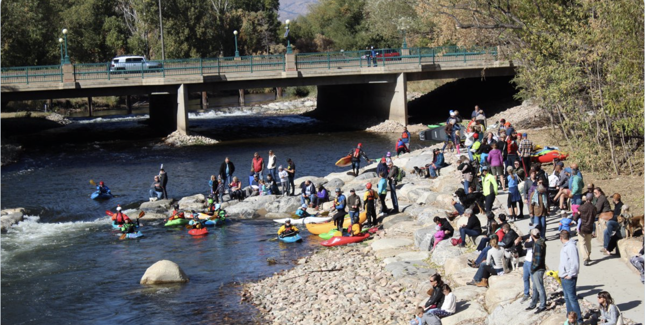
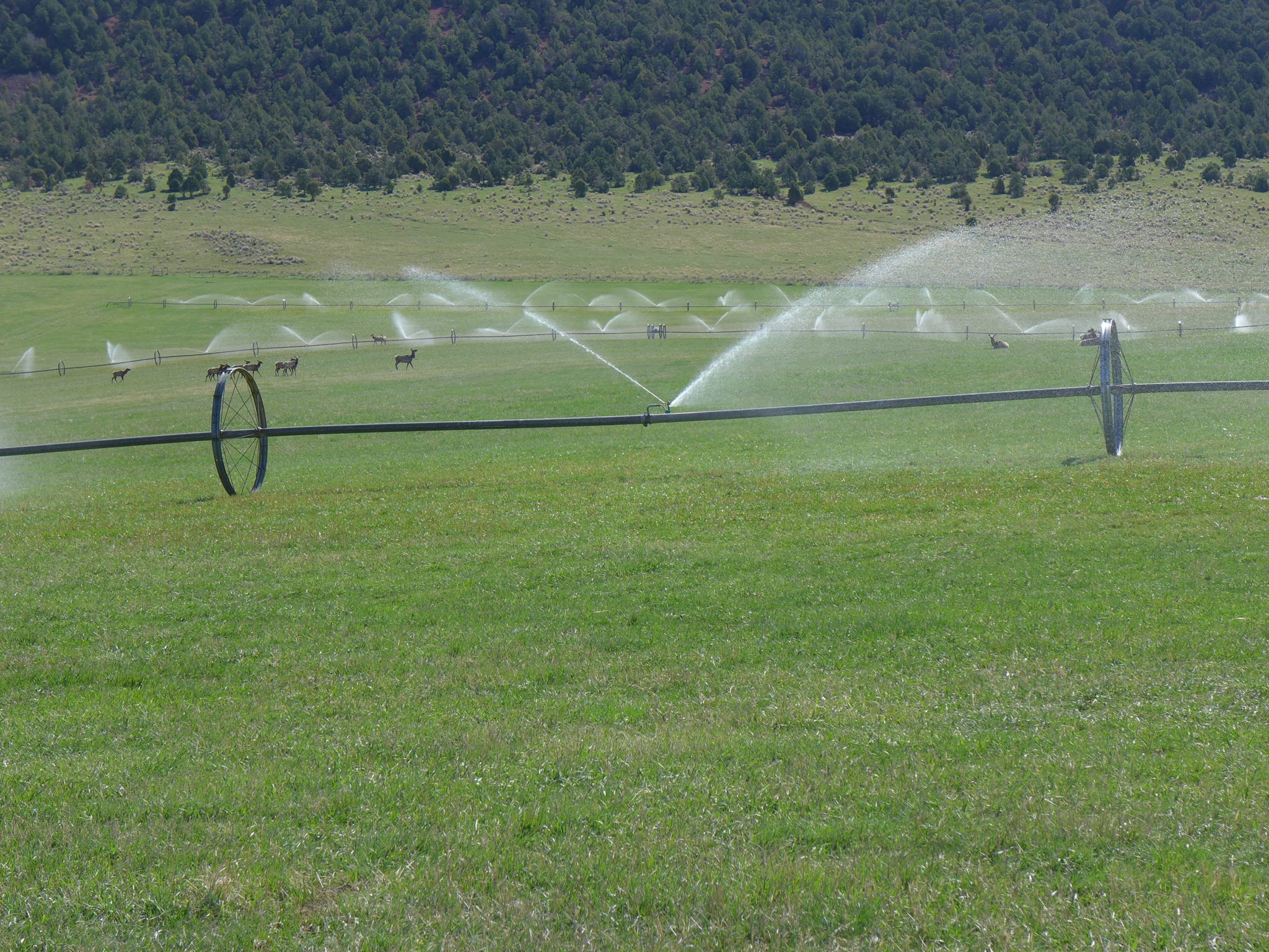
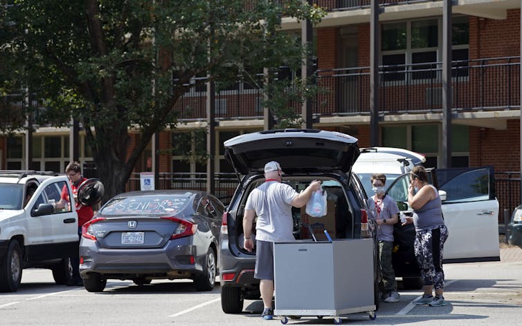
Gerry Broome/AP Photo

Ryan Malosh, University of Michigan and Nina Masters, University of Michigan Medical School

Scientists have learned a few things over the past six months as the COVID-19 pandemic has continued. We’ve learned that the virus that causes COVID-19 transmits particularly well when a group of people are together in a small, poorly ventilated area. We’ve learned that young people are just as susceptible as older people to infection. We’ve learned that if there is widespread community transmission, the virus will find its way to the very places we don’t want it go.

So, it’s not surprising to us, researchers who study diseases that can be prevented by vaccines, that with schools and colleges reopening, the virus is spreading.

These are places designed around the idea of bringing lots of people to one place. Many of them bring people together from all over the world. They are perfect places for disease to spread.
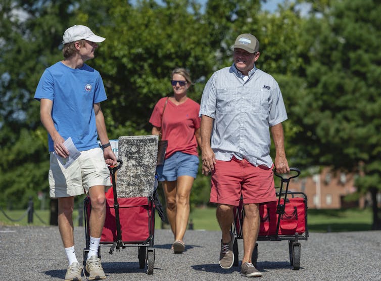
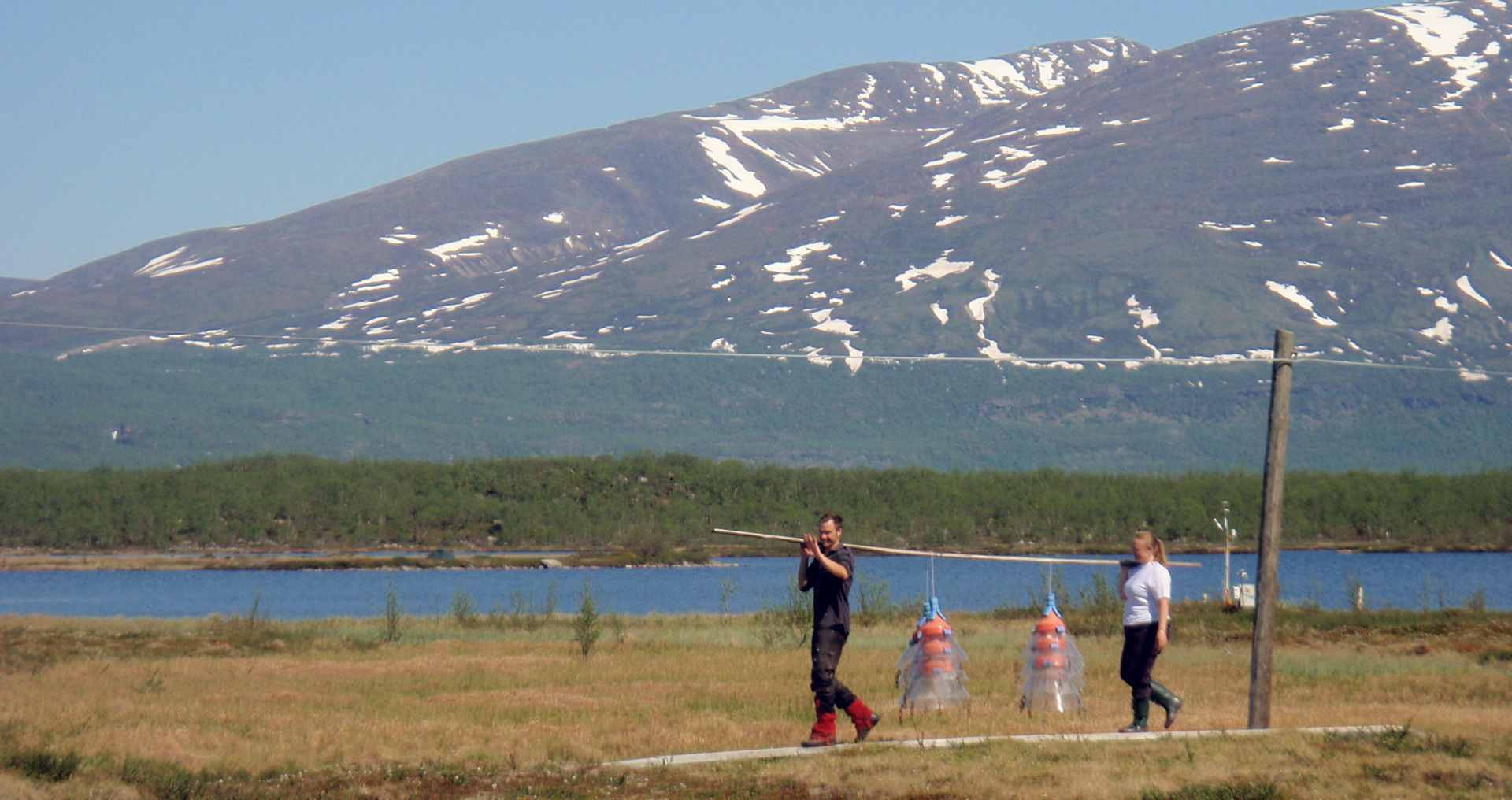
A freshman male walks with his parents toward his dorm.
A student arrives with his parents at the University of Alabama on Saturday, Aug. 15, 2020, in Tuscaloosa, Ala.
Vasha Hunt/AP Photo

How we got here

Back in March, colleges and universities closed down like everything else except essential businesses. They sent students home. There was a rough transition to online instruction. Students weren’t happy, faculty weren’t happy. And so, they started to come up with plans on how to reopen for in-person instruction for the fall semester.

Many places installed plexi-glass barriers in classrooms, considered mask mandates and worked out physical distancing in lecture halls. Most people realized that professors who taught large classes should plan for remote learning.

University administrators and public health experts started making these plans in the spring. Back then, we scientists and public health researchers all operated under the assumption that community spread would be under some sort of control by fall. We all thought that the country would increase testing capacity, and we have. Then, once new cases dropped to a low level, we could institute contact tracing, the way other countries had.

But that part hasn’t happened. And so now these same colleges and universities are facing huge increases in cases, including at the University of North Carolina, Notre Dame and the University of Alabama. Many universities that have opted to return to in-person classes are also having a surge in cases. These outbreaks will inevitably spread to the wider communities in which the campuses are located.

It seems that for many of these institutions, the priority was on financial concerns, which involved a return to a normal fall semester to the greatest extent possible. They then developed plans that they thought would make this possible. Faculty at many institutions and at least one ethics committee have argued that the priority should have been the safety of students, faculty and the surrounding communities.

While schools across the country have different priorities, enrollments, campus size, and student demographics, many schools share one thing in common: making no real contingency plans around reopening amid COVID-19, other than going remote if governors mandated it.

The schools that did spend the summer figuring out how to deliver high quality education remotely, or how to safely provide housing and access to services for the most vulnerable students, are less likely to have their fall semester disrupted. However, the College Crisis Initiative’s data dashboard found that only 7% of 1,442 four-year schools surveyed were planning on a fully online fall semester.

A female student walks in front of a sign at the University of Miami in Coral Gables, Fla.
A pedestrian walks past a sign on campus at the University of Miami in Coral Gables, Fla.
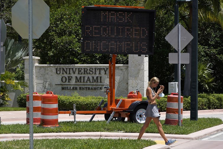
Wilfredo Lee/AP Photo

The challenge ahead

And so, the inevitable has come to pass. Now, many college campuses will struggle to control their outbreaks, because there are a lot of unique challenges inherent to COVID-19 in this population.

Colleges are not nursing homes or prisons. Some are trying to limit contact with the broader community.

But in general, students are not kept under lock and key. They have visitors from other schools. They go back and forth to their parents’ homes. And, yes, they go to parties. To us, blaming students for wanting a normal-ish college experience when the schools themselves have set the tone for trying hard to return to normal isn’t fair.

It’s also true that not all of the contact students have is as irresponsible as some have suggested. Many students hold jobs in the communities that surround the school. And most of these jobs aren’t typically the work-from-home type of job. In our undergraduate careers we both worked at jobs that had high contact rates with the community. And often, when your job is waiting tables at a local pizza place or manning a library desk, most of your colleagues are students as well. All of these factors will make contact tracing very hard.

Public health experts also expect a relatively high proportion of college-aged students to be either completely asymptomatic or to only have very mild symptoms. Without universal testing, these students won’t know they’re sick. They may not isolate if they have mild symptoms. But they will still be able to spread the virus to others. Symptom and temperature screenings may not recognize these individuals as those who need to stay away from campus buildings.

A different kind of campus test

Which brings us to testing. Some places are doing universal testing of students, multiple times per week. But, given the state of testing in the U.S., that is not a realistic possibility for most schools.

Let’s look at our university as an example. The University of Michigan has an undergraduate population of 30,000 students. Let’s assume that two-thirds of them came back to campus. That means 40,000 tests per week just for University of Michigan undergraduate students. Right now the entire state of Michigan is doing a little more than 200,000 diagnostic tests per week. Some schools have developed their own tests to handle this huge increase in capacity. But many university labs are involved in testing for large health systems and the rest of the state too. In these places it becomes very difficult for 1 in 5 tests available in an entire state to be dedicated to the students at a single university.

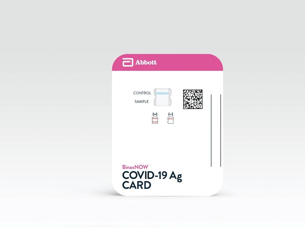
A scale-up of rapid, at-home antigen tests could be one approach to make testing on this scale feasible. These types of tests have the advantage of detecting highly infectious individuals – making them a good screening tool – but many are not approved by the Food and Drug Administration because they aren’t as sensitive as the standard PCR-based diagnostic test.

[The Conversation’s science, health and technology editors pick their favorite stories. Weekly on Wednesdays.]

If transmission on campus continues to happen mostly outside of the classroom, simply going remote will not solve the problem. Keeping students on campus will be risky. Many students will be attempting to navigate social distancing guidelines without a traditional social support network.

As much as possible, we believe students need to be able to safely return to their homes. But this can’t be done haphazardly. Bringing them to campus was a predictable risk – so is sending them home. As colleges inevitably move back to online instruction, plans must be put in place to minimize the risk of seeding epidemics. Dismissing all students, some of whom are infectious, back to their home communities risks spreading the virus further across the country, a bad outcome for all.

The unique epidemiology of COVID-19 in young adults, along with the contact patterns on college campuses and the inability to effectively screen through symptom reports or diagnostic testing, have left college campuses with few options for safely operating with in-person classes. We know that few wanted an all-remote fall semester, but it’s becoming clear that was probably our best bet.The Conversation

Ryan Malosh, Assistant Research Scientist, University of Michigan and Nina Masters, Doctoral candidate, epidemiology, University of Michigan Medical School

This article is republished from The Conversation under a Creative Commons license. Read the original article.

91% of #Colorado in severe or extreme #drought with little hope for improvements — The Kiowa County Press

From The Kiowa County Press (Chris Sorensen):

One week after a pocket of exceptional drought emerged in Colorado, 91 percent of the state is in severe or extreme conditions according to the latest report from the National Drought Mitigation Center.

This week’s conditions are a slight improvement for part of the state as portions of Custer, Fremont, Teller and El Paso counties shifted from severe to moderate drought.

Colorado Drought Monitor September 1, 2020.

In eastern Kit Carson County, an abnormally dry area that developed following a series of storms earlier in the summer returned to moderate drought. Burlington, the largest community in the county, saw an August average maximum temperature of 93 degrees – seven degrees higher than normal. At the same time the city saw less than half its usual rainfall for August. Just 1.15 inches of rain was recorded, compared to the average of 2.41 inches.

Burlington also set a record high of 100 degrees August 24.

While much of the remainder of the state is unchanged from the previous week’s report, severe drought did expand slightly in eastern Cheyenne County.

Hot, dry conditions have contributed to four costly fires in northern and western Colorado. At least $83 million has been spent to battle the blazes.

The outlook for September remains grim. Drought is expected to persist through the month, and the remaining abnormally dry areas in Weld and Yuma counties are expected to develop at least moderate drought over the coming month.

September 2020 US Drought Monitor outlook via the Climate Predication Center.

Temperatures across the western half of Colorado are expected to remain above normal for the month, while the eastern plains have equal chances of above, below or normal temperatures. Across the nation, temperatures are predicted to remain above normal through November.

September 2020 temperature outlook via the Climate Prediction Center.
September 2020 precipitation outlook via the Climate Prediction Center.

Overall, abnormally dry conditions fell from two percent last week to one percent in the state. Areas of moderate drought increased from five percent to seven, while severe conditions dropped to 55 from 57 percent. Extreme drought was unchanged at 36 percent. Numbers do not total 100 percent due to rounding.

While Colorado does have a pocket of exceptional drought that developed in central Kiowa County last week, it represents just 0.38 percent of the state.

@USDA designates 6 #Wyoming counties as primary natural disaster areas — the Fence Post #drought

From the USDA via the Fence Post:

Agriculture Secretary Sonny Perdue designated six Wyoming counties as primary natural disaster areas.

Producers in Big Horn, Hot Springs, Johnson, Natrona, Sheridan and Washakie counties who suffered losses due to recent drought may be eligible for U.S. Department of Agriculture Farm Service Agency emergency loans.

This natural disaster designation allows FSA to extend much-needed emergency credit to producers recovering from natural disasters. Emergency loans can be used to meet various recovery needs including the replacement of essential items such as equipment or livestock, reorganization of a farming operation or the refinance of certain debts.

Producers in the contiguous Wyoming counties of Campbell, Carbon, Converse, Fremont and Park along with Big Horn, Carbon, and Powder River counties in Montana, are also eligible to apply for emergency loans.

The deadline to apply for these emergency loans is April 26, 2021.

FSA will review the loans based on the extent of losses, security available and repayment ability.

FSA has a variety of additional programs to help farmers recover from the impacts of this disaster. FSA programs that do not require a disaster declaration include: Emergency Assistance for Livestock, Honeybees and Farm-Raised Fish Program; Emergency Conservation Program; Livestock Forage Disaster Program; Livestock Indemnity Program; Operating and Farm Ownership Loans; and the Tree Assistance Program.

Farmers may contact their local USDA service center for further information on eligibility requirements and application procedures for these and other programs. Additional information is also available online at http://farmers.gov/recover.

Wyoming rivers map via Geology.com

Aspinall Unit Operations update: Turning down to 450 CFS in Black Canyon September 3, 2020 #ColoradoRiver #COriver #aridification

Black Canyon via the National Park Service

From email from Reclamation (Erik Knight):

Releases from the Aspinall Unit will be decreased from 1500 cfs to 1450 cfs on Thursday, September 3rd. Releases are being adjusted to bring flows closer to the baseflow target in the lower Gunnison River. The actual April-July runoff volume for Blue Mesa Reservoir came in at 57% of average.

Flows in the lower Gunnison River are currently above the baseflow target of 890 cfs. River flows are expected to stay at levels above the baseflow target after the release decrease has arrived at the Whitewater gage.

Pursuant to the Aspinall Unit Operations Record of Decision (ROD), the baseflow target in the lower Gunnison River, as measured at the Whitewater gage, is 890 cfs for September.

Currently, Gunnison Tunnel diversions are 1050 cfs and flows in the Gunnison River through the Black Canyon are around 500 cfs. After this release change Gunnison Tunnel diversions will still be around 1050 cfs and flows in the Gunnison River through the Black Canyon will be around 450 cfs. Current flow information is obtained from provisional data that may undergo revision subsequent to review.

Larimer County Commissioners approve permit for Glade Reservoir, #NISP — @Northern_Water

U.S. Highway 287 runs through the future site of Glade Reservoir. The Larimer county Board of County Commissioners approved the 1041 Land Use Permit for NISP on Wednesday night. Photo credit: Northern Water

Here’s the release from Northern Water:

The Northern Integrated Supply Project achieved another important milestone on Wednesday, with the Larimer County Board of County Commissioners approving the 1041 Land Use Permit application on a 2-1 vote.

The permit will allow the construction of Glade Reservoir, its recreation components and the pipelines to convey water from the reservoir to participants throughout Northern Colorado.

Central to the permit is the framework for the development of Glade Reservoir as a future recreation area to be managed by Larimer County. Glade Reservoir, just north of Ted’s Place on U.S. Highway 287, will join Horsetooth Reservoir, Carter Lake, Flatiron Reservoir, Pinewood Reservoir and the future Chimney Hollow Reservoir as a site for water recreation, fishing, hiking and more.

The participants of NISP have agreed to spend more than $16 million to develop the recreation site, and they have purchased the former KOA campground nearby to create camping opportunities.

Another part of the permit dictates the route and procedures for the placement of pipelines to deliver high-quality drinking water to communities in Northern Colorado. It reiterates the commitment of NISP to convey roughly one-third of its water deliveries via the Poudre River through downtown Fort Collins, increasing the overall number of days available for recreation at the new Fort Collins Whitewater Park.

NISP has now received its permit from Larimer County for land use and from the State of Colorado for Water Quality and for Fish and Wildlife Mitigation and Enhancement. This fall, NISP anticipates receiving a Record of Decision from the U.S. Army Corps of Engineers. Next year, NISP anticipates working with the City of Fort Collins to coordinate on a route for a pipeline to pick up the Glade Reservoir water that has been conveyed through Fort Collins via the Poudre River.

NISP is being built to address future water needs for 15 municipalities and water districts, including the Fort Collins-Loveland Water District, the Town of Windsor and others throughout the region. Northern Water is coordinating the effort through the NISP Water Activity Enterprise.

To learn more, go to http://gladereservoir.org.

Poudre River whitewater park. Photo credit: Rocky Mountain Collegian

From KUNC (Luke Runyon):

The vote came after lengthy hearings before the county board and the county’s planning commission. The majority of speakers at those meetings spoke about concerns over the project’s effects on the Poudre River, its main water source. The project would divert water from the river during its peak flows due to its relatively junior water rights.

Nearby residents in the Bonner Peak and Eagle Lake neighborhoods also voiced concerns about pipeline routes disrupting quiet, rural neighborhoods, and diminishing property values. Northern Water, the agency pushing for NISP’s construction, hasn’t ruled out using eminent domain to build those pipelines, if necessary…

In comments explaining his vote against the permit, Kefalas noted scientific papers show a warming trend across much of Colorado, with consequences for rivers fed by snowmelt, like the Poudre.

“Based on the modeling that has been done with the Upper Colorado River basin, I think there are serious implications to the Poudre River flow and how that affects the Glade Reservoir,” Kefalas said.

Kefalas said he was also uncomfortable with the project’s tradeoff in advocating for flatwater recreation on a reservoir a 20-minute drive outside of Fort Collins, instead of seeing high spring flows through the city as a recreational amenity…

In voting to approve, commissioner Johnson said a rejection of the permit would be an example of parochial self-interest. While much of NISP’s water would be used in communities outside of Larimer County, Johnson said Colorado is full of examples of projects where water is stored and transported from one region to another…

Commissioner Donnelly hewed closely to the county’s 1041 evaluation criteria, which assess projects based on how they fit into the county’s master plan and affect its residents. NISP’s proponents were able to satisfy all of the county’s criteria, Donnelly said…

The project is still awaiting a record of decision from the Army Corps of Engineers before it can move forward into construction.

Old canal in Winter Park goes under cover — News on TAP

Denver Water buries section of a 1930s waterway to improve safety, reliability and efficiency. The post Old canal in Winter Park goes under cover appeared first on News on TAP.

via Old canal in Winter Park goes under cover — News on TAP

@EPA announces #Colorado-based office dedicated to cleaning up abandoned mines — The Colorado Sun

Prior to mining, snowmelt and rain seep into natural cracks and fractures, eventually emerging as a freshwater spring (usually). Graphic credit: Jonathan Thompson

From The Colorado Sun (Lucy Haggard):

The Office of Mountains, Deserts and Plains will take charge of remediating abandoned mine lands, including the Gold King Mine in southwest Colorado

The Environmental Protection Agency is creating a new office in Lakewood that will focus on cleaning up abandoned hardrock mining sites west of the Mississippi River, including the Bonita Peak Mining District where the Gold King Mine disaster originated in 2015.

The “Bonita Peak Mining District” superfund site. Map via the Environmental Protection Agency

The Office of Mountains, Deserts and Plains will be located in the EPA’s regional office at the Denver Federal Center, the agency announced during a news conference at the Western Museum of Mining and Industry in Colorado Springs on Wednesday. EPA’s National Mining Team Leader Shahid Mahmud will be the acting director, and the team will have nine full-time staff positions.

The office, which will use existing agency funds, will primarily focus on remediation work at Superfund sites and other abandoned mining locations, which release millions of gallons of pollution into streams each year. Remediation efforts will include cleaning up sites and the surrounding environment, and in some cases rebuilding the mine for operations.

There are more than 63 Superfund Mining and Mineral Processing Sites west of the Mississippi River, including nine in Colorado. In Colorado alone, there are roughly 23,000 abandoned mines.

Colorado abandoned mines

Many historic mining sites don’t have an owner or operator to facilitate cleanup operations themselves, placing it in the EPA’s hands…

The new office will also help speed up project timelines, including to clean up hundreds of abandoned uranium mines on the Navajo Nation.

An agreement finalized in February designated funding and resources to clean up 24 of the highest priority mines, five years after the federal government and tribe first reached a settlement on the mines…

Another goal of the office is to make it easier for so-called “good Samaritan” cleanup operations, such as those facilitated by Trout Unlimited or The Nature Conservancy. Current law says that if a group wants to contribute to cleanup efforts, they could be responsible for finishing the job, whether they’re capable of doing so or not. While the law is what it is, Benevento said, the new office will do what it can to make collaborative cleanup efforts “as unbureaucratic as possible.”

Bonita Mine acid mine drainage. Photo via the Animas River Stakeholders Group.

Larimer County commissioners approve 1041 permit for #NISP by 2-1 vote — The Loveland Reporter-Herald

Cache la Poudre River watershed via the NRCS

From The Loveland Reporter-Herald (Max Levy):

Larimer County’s Board of County Commissioners voted 2-1 to approve a 1041 permit for the Northern Integrated Supply Project on Wednesday, with John Kefalas casting the lone “no” vote.

Explaining his dissent, the District 1 commissioner said he felt the 12 land use criteria used by the board fell short and failed to create a “level playing field,” although he acknowledged the board’s efforts to allow public comment virtually…

He discussed the projected impacts of climate change on the upper Colorado River Basin, and echoed the concerns of many commenters regarding the reduction in flow that the Poudre River could see from the creation of the Glade Reservoir.

He pointed out that Fort Collins, which is bisected by the river, has concerns about the flows in the Cache la Poudre.

“I acknowledge that Northern (Water) has done their utmost to look at mitigation and other impacts on the Poudre River ecology, riparian areas and natural areas,” he said. “There still remains the fact that the city of Fort Collins has concerns about the potential impact on the Poudre River.”

Commissioners Tom Donnelly and Steve Johnson each walked through the land use criteria and how the project satisfied them…

The vote on the permit came after an extensive public hearing — one session saw representatives of the Northern Water Conservancy District advocate for the project, two sessions invited public comment, and Northern Water representatives answered questions during a fourth session.

While a large part of the presentation Wednesday was taken up by the commissioners explaining each of their votes, the commissioners also heard from Northern Water representatives who asked for adjustments to some of the conditions placed on the proposal.

The commissioners agreed to include a suggestion by Northern Water that, if the alignment of a related pipeline had to be adjusted by more than 100 feet without a landowner’s consent, that section of the pipeline would again have to be reviewed.

They also agreed to include restrictions proposed by Northern Water on construction activities in the Eagle Lake area.

Here’s a photo gallery from the hearing via The Fort Collins Coloradoan.

Drought news: Little or no precipitation fell on most of the central and southern Plains, and from the central Rockies to the Pacific Coast in the past week

Click on a thumbnail graphic below to view a gallery of drought data from the US Drought Monitor.

Click here to go to the US Drought Monitor website. Here’s an excerpt:

This Week’s Drought Summary

The big weather news this past week surrounded the rain and wind from Hurricane Laura as it pushed through the lower Mississippi Valley, then northeastward south of the Ohio River to the central Appalachians. Southwestern Louisiana was most severely impacted. Winds gusted to 135 mph in Lake Charles, LA before the anemometer failed. Rains totaled 5 inches to locally over a foot along central and western Louisiana, adjacent Texas, much of Arkansas, and southeastern Oklahoma for the 7-days ending Tuesday morning. Other areas accumulating more than 4 inches included parts of Alabama and Mississippi (especially in the northern reaches) and scattered sections of the central Appalachians and eastern Ohio Valley, central Wisconsin, the western Florida Peninsula, and part of interior North Carolina. In contrast, little or no precipitation fell on most of the Carolinas and eastern Georgia, the upper Midwest, most of the central and southern Plains, and from the central Rockies to the Pacific Coast…

High Plains

Between 0.5 and 2.0 inches of rain fell on parts of the Dakotas, much of Minnesota, and central to southwestern sections of Kansas. Several tenths of an inch at best fell elsewhere. As a result, some improvement was noted in parts of eastern South Dakota and west-central Kansas, but dryness and drought persisted or intensified elsewhere. Deterioration was most widespread from central and southern Wyoming eastward through Nebraska as the effects of several weeks to a few months of drier and warmer than normal conditions are taking their toll. As a result, most of Colorado and the central and eastern parts of Wyoming are enduring severe to extreme drought, along with the Nebraska Panhandle and parts of southwestern Kansas and the eastern half of Nebraska…

West

Little or no rain was observed region-wide this past week. This is a relatively dry time of year in many areas, especially in California, but a weak monsoon season and periods of excessive heat have led to widespread severe to extreme drought in a large area covering northern and eastern New Mexico and most of Arizona, Utah, Nevada, northern California, Oregon, and central Washington. Only eastern and western Washington, central Idaho and the Panhandle, central and west-central Montana, southwestern California, and part of central New Mexico are free of dryness and drought as of this writing. Wildfires continued to scorch parts of the region, although fires spread more slowly recently in northern California than during the prior few weeks…

South

Thanks in large part to Hurricane Laura, only patchy D0 conditions exist from central Oklahoma and eastern Texas eastward despite temperatures averaging 3 to 7 degrees above normal this past month. In contrast, serious drought is plaguing western Oklahoma and the central and western portions of Texas, with small areas of exceptional drought (D4) just south of the Texas Panhandle and over the interior Big Bend region. Precipitation shortfalls of 4 to 6 inches for the past 60 days – and 6 to 8 inches for June-August — cover parts of the Big Bend. Two- to five-inch deficits for the past 60 days were measured in the rest of central and western Texas, while June-August totals 4 to 6 inches less than normal affect most of central Texas and parts of western Oklahoma…

Looking Ahead

During the next 5 days (September 3-7), WPC’s QPF forecasts little or no precipitation (and thus persisting or intensifying drought) to the north and west of Texas. Similarly, light precipitation at best is expected across the interior Southeast and much of the northern Ohio Valley. Moderate precipitation (several tenths to 1.5 inches) should fall on the Great Lakes, upper Midwest, the Northeast, and most of Florida. Heavy precipitation is expected over a large swath across central and northeastern Texas, where totals from 1.5 to locally over 4 inches are expected. Robust precipitation is also forecast in a band stretching from Arkansas to West Virginia, where many areas should record 1.5 to 2.5 inches. Meanwhile, well-above-normal temperatures are expected from the High Plains to the Pacific Coast. High temperatures should average more than 12 degrees above normal from the Rockies to near the Pacific Coast, exceeding 18 degrees above normal in the Great Basin. Farther east, conditions will be less remarkable. Nighttime lows will be a few degrees above normal across the East, Southeast, and South-Central regions, and near normal in the Great Plains and upper Midwest. During the day, temperatures should top out a few degrees below normal on average in the northern Plains, and closer to normal in other parts of the eastern half of the contiguous states.

The Climate Prediction Center’s 6-10 day outlook (September 8-12) favors above-normal rainfall in the central and southern Plains and from the Mississippi Valley eastward. The odds also tilt toward surplus precipitation in most of Alaska, outside the Panhandle. In contrast, subnormal precipitation is expected in the northern Plains, the southern High Plains, the Rockies, and the Pacific Northwest. At the same time, below-normal temperatures are heavily favored in the Plains and surrounding areas, and odds tilt toward cooler than normal weather from the Rockies to the Appalachians. From the Appalachians eastward and from the Intermountain West to the Pacific Coast, warmer than normal weather is expected. Across Alaska, the northern tier should average cooler than normal while above-normal temperatures are favored along the southern tier.

Here’s the one week change map ending September 1, 2020.

US Drought Monitor one week change map ending September 1, 2020.

Just for grins here’s a gallery early September US Drought Monitor maps for the last several years.

This slideshow requires JavaScript.

Will the new 15-minute #COVID19 test solve US testing problems? — The Conversation #coronavirus


Easy, fast coronavirus testing is critical to controlling the virus.
AP Photo/Elaine Thompson

Zoë McLaren, University of Maryland, Baltimore County

On Aug. 26, the Food and Drug Administration granted an Emergency Use Authorization to a new rapid antigen test for COVID-19 called the BinaxNOW test.

I study public health policy to combat infectious disease epidemics. Testing is one of the most powerful tools available to fight the spread of COVID-19. The new test is inexpensive, rapid and easy to use. It will massively scale up access to testing, but hurdles remain in achieving widespread, frequent COVID-19 testing.

A digital results page for the BinaxNOW test.
The Abbott BinaxNOW rapid antigen test claims to give results in 15 minutes.
Abbott

What type of test is BinaxNOW?

The credit-card-sized test is an antigen test that detects a specific viral protein from SARS-CoV-2. It costs US$5 and doesn’t require a lab or a machine for processing.

Performing the test is simple. A health care worker or technician would use a swab to collect a sample from less than 1 inch inside the nostril. They would then combine the sample with a few drops of chemicals inside the test card. Within 15 minutes, the test strip would show a positive or negative result. The test is also paired with an app that produces a digital code that can be scanned to show proof of a recent negative COVID-19 test.

A sign showing the FDA logo with the FDA headquarters in the background.
The FDA granted emergency use authorization for the test, but only for use on patients with symptoms of COVID-19.
AP Photo/Andrew Harnik, File

What does the Emergency Use Authorization allow for?

The BinaxNOW test is currently only authorized for patients who have had COVID-19 symptoms for seven days or less, which is when virus levels in the body are likely to be high. It must be prescribed by a physician and performed by a trained technician or other health care worker.

The PCR test for COVID-19 is currently widely used and considered the gold standard, but requires patient samples to be sent to a lab and can take days to provide results. The new antigen test is designed to be a cheap and quick alternative to PCR testing for diagnostic purposes in a medical setting. It would add critical capacity to an overstretched testing system.

The emergency use authorization provides preliminary authorization for doctors to prescribe the antigen test while the full FDA approval process is ongoing. The authorization could be revoked if the test is not as accurate or reliable as expected.

[Get the best of The Conversation, every weekend. Sign up for our weekly newsletter.]

How accurate is this test?

Abbott, the health technology company that produces the test, reports that when patients had symptoms the test was in agreement with PCR testing for 97.1% for COVID-19 positive cases and 98.5% for COVID-19 negative cases. This is high enough for diagnostic settings where accuracy is critical.

However, the true accuracy could be lower because the performance testing group was only 102 people and the accuracy hasn’t been validated by the FDA as part of the full approval process. There will inevitably be some false negatives and false positives with the BinaxNOW test since accuracy isn’t 100%, but the FDA will monitor the data to make sure the test meets the reported accuracy.

People waiting in a line of cars with health care workers standing under pop-up shade structures.
Long lines and slow turnaround times have limited access to testing, but the new Abbott test should be far easier and faster.
AP Photo/Nati Harnik

Can this test be used for widespread screening?

The BinaxNOW test is cheap, rapid, able to be mass-produced and easy to use outside a lab. This makes it a promising candidate for widespread screening. However, the test is currently only authorized for people with COVID-19 symptoms.

This is an obstacle because an estimated 40% of all COVID-19 cases are asymptomatic and these people likely don’t know that they’re contagious. To maximize the effectiveness of any COVID-19 screening program, it is important to test people whether they have symptoms or not.

Health care providers are able to prescribe the BinaxNOW test for asymptomatic patients for off-label use, but health officials don’t yet know how accurate the test is when performed on asymptomatic people.

Is this test a game-changer?

The massive expansion of testing access made possible by the BinaxNOW test will almost surely outweigh the downsides of a small number of inaccurate results. Abbott plans to manufacture 50 million tests per month starting in October. This will quickly exceed the 76 million COVID-19 tests the U.S. has performed over the last six months.

Widespread, frequent testing is effective at slowing the spread of the coronavirus. The new testing capacity made possible by the authorization of this rapid antigen test represents a major advance in bringing the pandemic under control.The Conversation

Zoë McLaren, Associate Professor of Public Policy, University of Maryland, Baltimore County

This article is republished from The Conversation under a Creative Commons license. Read the original article.

Navajo Dam operations update

Upper Colorado River Endangered Fish Recovery Program

From email from Reclamation (Susan Novak Behery):

In response to a warmer and dryer forecast weather pattern, Bureau of Reclamation has scheduled an increase in the release from Navajo Dam from 850 cubic feet per second (cfs) to 950 cfs on Thursday, September 3rd, starting at 4:00 AM. Releases are made for the authorized purposes of the Navajo Unit, and to attempt to maintain a target base flow through the endangered fish critical habitat reach of the San Juan River (Farmington to Lake Powell).

The San Juan River Basin Recovery Implementation Program has recommended flows in the critical habitat reach as close to 500 cfs as possible for the summer of 2020. This is within their normal recommended range of 500 to 1,000 cfs. This target base flow is calculated as the weekly average of gaged flows throughout the critical habitat area from Farmington to Lake Powell.

Proposed Water Project Tests If Northern #Colorado’s ‘Working River’ Can Handle Another Job — KUNC #NISP

Poudre River whitewater park. Photo credit: Rocky Mountain Collegian

From KUNC (Luke Runyon):

The Cache la Poudre River in Northern Colorado is often referred to as a “working river.” It provides drinking water for cities and irrigation water for farms. During the summer months it’s popular with kayakers, tubers and anglers. It’s home to fish, birds and other wildlife.

But a reservoir proposal facing a key vote from Larimer County commissioners would give it one more big task, and the panel is hearing from community members who think it can handle the work, and those who don’t.

The Northern Integrated Supply Project (NISP) — with its two new reservoirs, and network of pipelines across a broad sweep of Northern Colorado — is seeking a 1041 permit to begin construction of the infrastructure project that would use water from the Poudre and South Platte rivers to satisfy the needs of 15 fast-growing Front Range municipalities and water providers.

The agency pushing for NISP, Northern Water, says it has made significant changes to the planned project in order to help the already overtaxed Poudre River, while opponents say it will only hurt, not help…

But with the ribbon cutting less than a year ago, [Evan] Stafford said NISP presents an upstream threat. The project’s biggest reservoir, Glade, would be miles from the park, but it would be felt by kayakers and tubers alike. NISP would pull water out of the river at the same time whitewater paddlers flock to it.

“It’s already pretty affected, but NISP would really increase that effect to almost there being no flooding or a natural kind of rise in the river due to the snow melt,” Stafford said.

That’s important, not just for kayakers, but for the river’s ecological health too. High spring flows flush sediment downstream and are critical for fish and bird habitat…

But that characterization of NISP’s potential impact is unfair, says Northern Water’s general manager Brad Wind.

“At the end of the day to fill a reservoir you’ve got to extract some water from the river,” Wind said.

Aerial view of the roposed Glade Reservoir site — photo via Northern Water

Because the project relies on relatively junior water rights, Wind says they would have to wait until the highest flows to divert water into the reservoir. Those flows come during the spring runoff. But, he said, once full, the reservoir would release water at other times of year when the Poudre is struggling because of demands from farmers…

NISP has committed to releasing so-called base flows through Fort Collins in certain times of the year to aid fish populations and fill-in dry up points that show up when demand from farmers spikes during the summer months. But it could be awhile before those releases take place. By Northern Water’s projections, construction on Glade’s dam and reservoir might take until 2027 to finish. Filling the reservoir could take up to a decade if the Poudre’s flows are reduced due to drought…

NISP is nearing the end of a more than 15-year permitting process. The latest stretch of public meetings has taken place almost entirely during the pandemic. NISP boasts a laundry list of endorsements from former governors, local business groups, farm groups, even two of three Larimer County commissioners. There’s been a renewed call from the project’s opponents for commissioners Steve Johnson and Tom Donnelly to recuse themselves from deliberations, though both continue to participate in hearings.

Fort Collins, the biggest city along the river’s course, recently voted to oppose the project, making it one of the first governmental bodies to do so…

Fort Collins city council’s opposition is more of a symbolic gesture, given that much of the project’s infrastructure falls outside city limits. The vote from Larimer County commissioners on the 1041 permit has real potential to either slow down the project’s momentum, or ease its way into being fully permitted. It still needs a record of decision from the Army Corps of Engineers, which could come as early as this fall.

All three Larimer County commissioners declined interview requests due to it being a pending land use issue.

How chemicals like #PFAS can increase your risk of severe #COVID19 — The Conversation #coronavirus


The same chronic illnesses associated with exposure to endocrine-disrupting compounds also increase risk of developing severe COVID-19.
Engin Akyurt and Kai Dahms/Unsplash

Kathryn Crawford, Middlebury

Nearly a year before the novel coronavirus emerged, Dr. Leonardo Trasande published “Sicker, Fatter, Poorer,” a book about connections between environmental pollutants and many of the most common chronic illnesses. The book describes decades of scientific research showing how endocrine-disrupting chemicals, present in our daily lives and now found in nearly all people, interfere with natural hormones in our bodies. The title sums up the consequences: Chemicals in the environment are making people sicker, fatter and poorer.

As we learn more about the novel coronavirus and COVID-19, research is revealing ugly realities about social and environmental effects on health – including how the same chronic illnesses associated with exposure to endocrine-disrupting compounds also increase your risk of developing severe COVID-19.

In the U.S. and abroad, the chronic disease epidemic that was already underway at the start of 2020 meant the population entered into the coronavirus pandemic in a state of reduced health. Evidence is now emerging for the role that environmental quality plays in people’s susceptibility to COVID-19 and their risk of dying from it.

Why endocrine disruptors are a problem

Endocrine-disrupting compounds, or EDCs, are a broad group of chemicals that can interfere with natural hormones in people’s bodies in ways that harm human health. They include perfluoroalkyl and polyfluoroalkyl substances, better known as PFAS, flame retardants, plasticizers, pesticides, antimicrobial products and fragrances, among others.

These chemicals are pervasive in modern life. They are found in a wide range of consumer goods, food packaging, personal care products, cosmetics, industrial processes and agricultural settings. EDCs then make their way into our air, water, soil and food.

How PFAS chemicals get into the environment.

Pennsylvania Department of Environmental Protection

Research has shown that people who are exposed to EDCs are more likely than others to develop metabolic disorders, such as obesity, Type 2 diabetes and high cholesterol, and they tend to have poorer cardiovascular health.

EDCs can also interfere with normal immune system function, which plays a critical role in fighting off infection. Poor immune function also contributes to pulmonary problems such as asthma and chronic obstructive pulmonary disease; autoimmune diseases like rheumatoid arthritis and Crohn’s disease; and metabolic disorders. Many EDCs are also associated with different cancers.

EDCs can mimic human hormones

EDCs affect human health by mimicking our natural hormones.

Hormones are chemical signals that our cells use to communicate with one another. You might be familiar with reproductive hormones – testosterone and estrogen – which help distinguish male and female physiology and reproduction. Yet, hormones are responsible for maintaining virtually all essential bodily functions, including metabolism and healthy blood pressure, blood sugar and inflammation.

The chemical shape or structure of EDCs resembles hormones in ways that cause the body to misinterpret an EDC for a natural signal from a hormone.

A comparison of structures of a hormone and an endocrine disruptor.
A comparison of the structures of estradiol (left), a female sex hormone, and BPA (right), an endocrine disruptor found in plastics often used in containers for storing food and beverages.
Wikimedia

Because the human body is very sensitive to hormones, only small amounts of hormones are required to convey their intended signal. Therefore, very small exposures to EDCs can have dramatic, adverse affects on people’s health.

[The Conversation’s newsletter explains what’s going on with the coronavirus pandemic. Subscribe now.]

Environmental quality and COVID-19

Researchers are only just beginning to paint a picture about how environmental quality contributes to COVID-19 susceptibility, and there is much we still don’t know. However, scientists suspect that EDCs can play a role based on clear scientific evidence that EDCs increase people’s risk of developing chronic disease that put people at greater risk from COVID-19.

Public health organizations such as the U.S. Centers for Disease Control and Prevention and the World Heath Organization officially recognize underlying health conditions – including obesity, diabetes, hypertension, cardiovascular disease, immunosuppression, chronic respiratory disease and cancer – as risk factors for critical illness and mortality from COVID-19.

Scientific evidence shows that EDC exposure increases people’s risk of developing all of these conditions. Scientists are thinking about these connections, and research efforts are underway to answer more questions about how EDCs may be influencing the pandemic.

Air pollution and other environmental risks

In addition to EDCs, other environmental conditions are also likely playing a role in the COVID-19 pandemic. For example, multiple studies have reported increased risk of COVID-19 illness and deaths. The findings are consistent with those reported in China following the SARS outbreak in 2002-2003.

Recent evidence also shows that COVID-19 infection can lead to lingering health conditions, including heart damage. Environmental conditions such as heat waves are particularly dangerous for individuals with heart disease or heart damage. In places like California that are currently experiencing wildfires and heat waves, we can clearly see how multiple environmental conditions can combine to further increase risk of deaths associated with COVID-19.

In the U.S., regulations such as the Clean Water Act and Clean Air Act have improved environmental quality and human health since the 1970s. However, the Trump administration has been trying to weaken them.

In the past three and a half years, about 35 environmental rules and regulations pertaining to air quality or toxic substances like EDCs were either rolled back or are in the process of being removed, despite unambiguous evidence showing how poor environmental quality harms human health. Allowing more pollution threatens to exacerbate the trend toward a sicker, fatter and poorer America at a time when people’s overall health is necessary for our collective resilience to COVID-19 and future global health challenges.The Conversation

Kathryn Crawford, Assistant Professor of Environmental Health, Middlebury

This article is republished from The Conversation under a Creative Commons license. Read the original article.

Explaining blue-green algae — @COParksWildlife

Cherry Creek Reservoir photo of algae that tested positive for toxins
Taken July 14, 2020. Credit: Colorado Department of Public Health & Environment

From Colorado Parks & Wildlife:

An informational video from CPW’s water quality section on blue-green algae. Toxic algae blooms are seen across the United States and have become more prevalent over the past decade. Colorado Parks and Wildlife started monitoring for toxic algae blooms starting in 2015.

Opinion: Farmers and ranchers lead the way on conserving the #ColoradoRiver — Steamboat Pilot & Today #COriver #aridification

This field near Carbondale is irrigated with water that eventually flows into the Colorado River. The state has wrapped up the first year of an investigation into a program that could pay irrigators to reduce their consumptive use in order to send water downstream to a savings account in Lake Powell. Photo credit: Heather Sackett/Aspen Journalism

Here’s a guest column from Paul Bruchez that’s running in the Steamboat Pilot & Today:

Disruptions to our daily lives have a way of making us appreciate things that we might normally take for granted. In the midst of a global pandemic, access to clean water and healthy food seems more vital than ever. This extraordinary situation motivates us all to take a step back to examine what we can do to ensure the long term security of our most precious natural resources.

This is particularly true when you consider one of our most important sources of water: the Colorado River. The Colorado River is an environmental wonder, home to countless plant and animal species that define our region.

We could all rally to conserve the natural beauty of the basin in its own right. But this hard-working river serves as an economic engine for our communities up and down the basin. The river is particularly vital to sustaining farms and ranches across Colorado and therefore to our collective food supplies.

Its waters irrigate nearly 6 million acres of farmland that sustain a $5 billion agricultural industry. On Colorado’s Western Slope, the river’s tributaries help support extensive ranch and farm operations which produce food for our state, our country and the world, underpinning the strong rural heritage and working landscape that is such an integral part of our state’s identity.

Unfortunately, some recent discussions have set up a false choice between healthy rivers and a strong agricultural economy, and we both reject that premise. The future of the Colorado River lies not in pitting the health of rivers against Colorado’s agricultural heritage, but rather in exploring creative demand management programs that can benefit both.

There’s no doubt that the river is grappling with dramatic threats in the form of climate change and an emerging megadrought. In the face of these challenges, there have been many discussions about the role farmers and ranchers can and should play in effectively managing and conserving finite water supplies and how public policy can help the agriculture community meet these challenges, in concert with conservation by cities, industries and individuals across the state.

The good news is that Colorado’s food producers have already been helping to drive the solutions. By voluntarily participating in on-the-ground, data-driven studies, Colorado’s agricultural community is playing an integral role in understanding water consumption and flexible water management options.

As critical sources of food for the West and pillars of rural economies, these largely family-owned and operated farms and ranches understand their important role in this fight for a sustainable future. Tackling our water issues won’t be simple, but we can work together to ensure the long-term future of the Colorado River — and in turn the communities, economies and ecosystems that rely on it.

This starts with empowering ourselves with the science we need to make informed decisions, because better data means better insights into the problems as well as the solutions. That’s why farmers and ranchers have stepped up and participated in programs like the Colorado Water Conservation Board’s Alternative Agriculture (Water) Transfer Mechanisms (ATM) program, working together to study the efficacy of new irrigation techniques in conserving our water.

If we are committed to the survival of agriculture in Colorado, we must adapt our system of management in ways that serve the future of agriculture in balance with other demands on that water. By helping researchers study everything from how to stabilize riverbanks to the effects of irrigation at different altitudes, Colorado’s food producers are at the forefront of the water conservation movement.

However, we must do more than talk about the problems and possible solutions to the water problems facing Colorado. For the last year, the Colorado Water Conservation Board has supported working groups to talk about the problems and the feasibility of more flexible water management tools for the Colorado River Basin. As the board reviews the findings of their eight working groups, we encourage their endorsement and support for additional demonstration projects.

Because when it comes to safeguarding the Colorado River, we must take proactive, “learn by doing” approaches as we interrogate possible solutions and plan for the future.

Colorado’s food producers intimately understand this. We know that in order to thrive you need to learn how to adapt, a skill that farmers and ranchers have long cultivated. It is incumbent upon all of us to help chart a path forward that is productive, profitable and sustainable for all of us. We hope that you’ll join us in the conversation.

Paul Bruchez is a fifth-generation rancher who lives near Kremmling. Ted Kowalski is the senior program officer for the Walton Family Foundation’s Colorado River Initiative.

Team to Innovate New Ways to Predict #Drought — CIRES

Here’s the release from CIRES:

NOAA-funded CU Boulder project seeks alternatives to snow-based drought forecasting in a changing climate

Drought has become increasingly difficult to predict in a warming world, as snowpack—which typically provides early warning for drought—diminishes. So NOAA is funding a new CU Boulder-led project that will develop new techniques for drought prediction that do not rely purely on snow-based methods, harnessing alternative techniques to improve scientists’ ability to predict and respond to drought.

“In our changing climate, snow is projected to no longer hold the predictive power it has today, but yet we still heavily rely on snow information to predict drought,” said Ben Livneh, lead investigator on the new project, CIRES Fellow and Assistant Professor of Civil, Environmental and Architectural Engineering at CU Boulder. “We need to develop new techniques to advance our ability to predict drought in the future.”

Normally, water from abundant melting snowpack flows predictably into mountain streams, and eventually on to lakes and reservoirs. But as Earth’s temperatures climb and snowpack dwindles, the relationship between snow and streamflow shifts. Sparse snowpack meltwater has to travel a farther distance before reaching streams, and an unpredictable volume of water can be lost due to evaporation. So Livneh and his team plan to explore other methods of drought prediction, including water models, soil moisture, precipitation and more.

The new project is funded with $500,000 from the NOAA Research MAPP program for three years of work. A key innovation will be the use of Machine Learning tools to find ways to improve current and future drought prediction. The team will collect direct input from regional stakeholders to help shape the modeling and Machine Learning work and assess the feasibility of alternative strategies.

The findings will be presented at an interactive workshop to ensure findings are most relevant to decision makers. “We hope this work overcomes the challenges researchers have been faced with in a reduced-snow world,” said Livneh. “By innovating better drought prediction strategies we can better inform water management and planning for the western United States.”

The project’s co-investigators include Joseph Kasprzyk, also an Associate Professor of Civil, Environmental and Architectural Engineering at CU Boulder, and Benet Duncan, Managing Director of CIRES’ Western Water Assessment.

The Blue River travels north-northwest through Dillon Reservoir to its confluence with the Colorado River near Kremmling. Each spring Denver Water performs a delicate balancing act to accommodate flows from snowpack runoff. Photo credit: Denver Water via Aspen Journalism

Meeting the Financial Challenges of Improved Water Management in the West: Session One: Expanding the Toolbox of Water Financing Options, Sept. 15, 2020 — Getches-Wilkinson Center

Flaming Gorge Reservoir July 2020. Photo credit: Utah DWR

Register here

From email from the Getches-Wilkinson Center:

Improving the performance of water systems in western basins such as the Colorado River can entail a variety of expensive changes to infrastructure, policy, and management. Throughout much of the 20th century water development era, federal appropriations were sufficient to cover major investments. Today however, other sources of governmental and non-governmental funds and funding mechanisms are essential to improving water management and system performance. Determining the “how” and “who” of water financing raises several thorny questions about what approaches are most efficient, practicable, and equitable. In this webinar series, we will explore issues such as the rise of creative funding mechanisms, the role of private investments and water markets, leveraging the resources of the business community, and the linkages between healthy landscapes, climate adaptation, and improved water management resiliency.

Gone are the days when funding western water needs was merely a task of gaining Congressional authorization and appropriations for new dams and reservoirs. Today, federal funds are limited, and much of what needs to happen does not involve new infrastructure. A vast toolbox of potential funding strategies are, at least theoretically, available, although many options are unproven. Many such strategies are under consideration in Colorado for implementing the State Water Plan.

#RioGrande State of the Basin: The current water situation? Dry! — The Crestone Eagle

The northern end of Colorado’s San Luis Valley has a raw, lonely beauty that rivals almost any place in the North American West. Photo/Allen Best

From The Rio Grande Water Conservation District (Lisa Cyriacks) via The Crestone Eagle:

In the San Luis Valley: water is and will always be a critical issue. While demands on our scarce water supply grow, there are many community-based efforts working to restore a better water balance and plan for our future.

In the case of groundwater, the amount of water withdrawn by legally permitted wells exceeds the amount of water refilling the aquifers.

At a recent symposium hosted by Adams State University’s Salazar Center, local water leaders presented information on key aspects of current water conditions and challenges.

Salazar Center Director, Rio de la Vista, “With this year’s water shortage, the time is now to raise our level of knowledge on the critical water issues here. We aim to engage more people in community-based efforts for a sustainable water future and we need everyone’s help to make that possible!”

Local water users and State officials recognized something needed to be done in response to a severe drought that started about 20 years ago and reached its peak in 2002. They banded together to form local groundwater sub-districts to balance water use and supply. Their goal is to make groundwater use sustainable and protect senior surface water right holders from water shortages due to groundwater pumping.

Despite efforts to meet a court-mandated goal to replenish the shallow aquifer to pre-2000 levels by 2030, significant progress was curtailed by another serious drought beginning in 2018.

Agriculture is the economic engine in the San Luis Valley. None of the region’s current crops could be grown if growers depended only on the 7.5 inches of annual precipitation that hits the valley floor. The valley is one of the world’s largest high-altitude deserts. Water users draw from the valley rivers and streams to irrigate their crops but the peak flows that are common in May and June dry up by July and August. Given the lack of water storage in the region, growers rely on groundwater to finish watering their crops.

The latest attempt to export water from the valley to the Front Range is led by Renewable Water Resources (RWR), based in the city of Centennial near Denver. This scheme is undermining local farmers’ efforts to address water shortages and could set a dangerous precedent of water export.

There is zero unappropriated water in the Rio Grande Basin. This means all surface water and groundwater is currently used by existing water users, leaving no water available for transport outside the valley.

RWR aims to pump 22,000 acre-feet of water and pipe it over Poncha Pass to the Front Range. Local water leaders believe that if the pipeline is built, the RWR project will be just the start and lead to further attempts to export water.

The proposal is opposed by the Rio Grande Water Conservation District, San Luis Valley Water Conservancy District, Conejos Water Conservancy District, the Rio Grande Basin Roundtable as well as the City of Alamosa, Town of Del Norte, City of Monte Vista, Town of Saguache; joined by environmental groups, local businesses, and many farmers and ranchers.

There is widespread opposition in the valley to the RWR export scheme. Locals are concerned that RWR’s plan could turn Saguache County into another Crowley County, an area east of Pueblo that has been devastated economically by the sale of its water. See https://bit.ly/2CORMbB.

The San Luis Valley is a beloved place for many Colorado residents and travelers from across the country and around the world. With the Great Sand Dunes National Park and Preserve, three extraordinary National Wildlife Refuges, the Rio Grande Natural Area, the Rio Grande National Forest and many other public lands, the valley’s water sustains wildlife for viewing, hunting and fishing, and many forms of recreation. Sandhill crane migration attracts many visitors to the valley. Water export threatens the valley’s economy, which is dependent on agriculture.

Valley water leaders urge residents to take action by seeking out the facts about valley water resources and advocating for the truth about RWR’s export plans and the valley’s water supplies and hydrology.

Please see http://www.rgwcd.org for information about current aquifer levels and the subdistricts’ efforts to manage our groundwater.

@ColoradoStateU joins global team to study ecosystem, #climatechange interactions in thawing #permafrost #ActOnClimate #KeepItInTheGround

A footbridge has broken due to permafrost thaw at the study site in Sweden. Photo by Patrick Crill via Colorado State University

Here’s the release from Colorado State University (Jeff Dodge):

Colorado State University is one of 14 universities from around the globe that have collectively been awarded $12.5 million by the National Science Foundation to launch a new Biology Integration Institute called EMERGE. It will focus on better understanding ecosystem and climate interactions — such as the thawing of the Arctic permafrost — and how they can alter everything from the landscape to greenhouse gases.

EMERGE, which stands for “EMergent Ecosystem Response to ChanGE,” is a five-year project that will concentrate on discovering how the processes that sustain life and enable biological innovation operate and interact — from molecules and cells to species and ecosystems — under dynamically changing conditions. The end result will be a new “genes-to-ecosystems-to-genes” framework to create models that could help predict ecosystem response to change.

The research will be done in Stordalen Mire, a long-studied peatland in northern Sweden where permafrost thaw drives changes in the landscape, plants and microbes. The institute, launching in September, will also have a strong training, education and outreach component and will involve biologists at the postdoctoral, graduate and undergraduate levels.

Scientists at the long-studied peatland Stordalen Mire. Photo by Patrick Crill via Colorado State University

The project will be led by Ohio State University researchers and consist of a team of 33 scientists representing 15 specialties. The partnership brings together expertise inside and outside of biology, such as ecology and evolution, organismal biology, team science, and modeling and computational science.

CSU role

Jeni Cross, Associate Professor of Sociology, Colorado State University, February 6, 2019

Jeni Cross, a professor in CSU’s Department of Sociology, and Kelly Wrighton, an associate professor in the Department of Soil and Crop Sciences, are co-principal investigators on the project. Cross and her colleagues in the Institute for Research in the Social Sciences will provide facilitation and team science training for the large team, helping the various scientists from different fields communicate and work together effectively.

Wrighton is a soil microbiologist who will study the microbes at the site during summer, specifically examining the methane they emit when the permafrost thaws and provides the microbes with the carbon and water they need to thrive.

“When microbes get carbon and water, you’re basically opening up the donut store,” Wrighton said with a laugh.

“It’s like a giant feeding frenzy,” Cross added, explaining that the more the permafrost warms, the more the atmosphere warms due to the microbes’ emissions. “Climate change is accelerating faster than what we had modeled 10 years ago.”

While Wrighton will be looking at the small-scale processes that contribute greenhouse gases to global warming, other scientists who look at climate change at a larger scale will be examining the big-picture effects of Wrighton’s work. The goal is to identify key predictors of methane and other greenhouse gases to create models that can be applied to other areas of the globe.

Kelly Wrighton via Colorado State University

“I think it’s going to be a really neat melding of the disciplines,” said Wrighton, who came to CSU from Ohio State in 2018 and has worked with some of the researchers there. “I was really excited to be invited to be on this team; this is the ‘who’s who’ of scientific research on permafrost. Everyone coming to the table is really looking forward to having this conversation.”

‘Pressing societal need’

Other team members agreed that the team will be doing important work.

“Being able to predict how ecosystems respond to climate change is a pressing societal need,” said Ruth Varner, professor of biogeochemistry at the University of New Hampshire and co-director for EMERGE. “We have assembled a large interdisciplinary team to tackle the complex research questions that face our world today, like whether thawing permafrost could increase emissions of the greenhouse gas methane and actually further accelerate climate change.”

“Ecosystems respond to changing conditions, like a new agricultural practice or changing rainfall patterns, in a way that is greater than the sum of the responses of individual parts,” added Virginia Rich, associate professor of microbiology at Ohio State and co-director for EMERGE. “To address this challenge head on, our team will pull cutting-edge ideas and methods from across biology and beyond into a unified vision for seeing what each discipline, alone, cannot — piecing back together the forest from the trees, if you will. It is incredibly exciting.”

In addition to CSU, UNH and Ohio State, participating universities include the University of Arizona, Florida State University, Case Western Reserve University, University of California at Berkeley, Rochester Institute of Technology, Lawrence Berkeley National Laboratory, Joint Genome Institute, all in the United States; Lund University, Umeå University and Stockholm University, all in Sweden; and Queensland University of Technology in Australia.

The Department of Sociology is in CSU’s College of Liberal Arts. The Department of Soil and Crop Sciences is part of CSU’s College of Agricultural Sciences.

A Critical Fight for the Rights of Nature — The Revelator

Los Cedros, the iconic cloud forest reserve in Ecuador’s Western Andes, which is under concession for copper and gold mining to Canadian company Cornerstone and Australian BHP. Photo credit: The Rainforest Project

From The Revelator (Daniel Hudon):

Ecuador’s Los Cedros Reserve, one of Earth’s most biodiverse habitats, could be wiped out by mining. A court case could save it — and set a precedent for the planet.

Should nature have rights? That question is being put to the test right now in Ecuador.

In 2008 the South American country made history when its new constitution declared that nature had “the right to integral respect for its existence and for the maintenance and regeneration of its life cycles, structure, functions and evolutionary processes.” It was an unprecedented commitment, the first of its kind, to preserving biodiversity for future generations of Ecuadorians.

The constitutional change did not automatically protect nature, but it gave citizens what the Global Alliance for the Rights of Nature describes as “the legal authority to enforce these rights on behalf of ecosystems. The ecosystem itself can be named as the defendant.”

Rio Los Cedros. Photo by Michael Wherley. Used with permission via The Revelator

The country could soon make history again when its Constitutional Court hears a case that seeks to apply these rights of nature to a protected forest, known as Bosque Protector Reserva Los Cedros, against large-scale copper and gold mining.

The threat stems from a 2017 change in government policy that allowed mining concessions on 6 million acres of lands, including at least 68% of Los Cedros — part of a hasty attempt to boost the mining sector and compensate for declining oil revenues. Experts say that policy appears to be unconstitutional, which has led to the present showdown.

“Mining in protected forests is a violation of Articles 57, 71 and 398 of the constitution: the collective rights of Indigenous peoples, the Rights of Nature, and the right of communities to prior consultation before environmental changes, respectively,” says ecologist Bitty Roy of the University of Oregon, who has conducted research at Los Cedros since 2008.

A Vital Reserve

Los Cedros is a remote, pristine, 17,000-acre cloud forest in northwest Ecuador and one of the most biodiverse places on the planet.

Conservation biologist Mika Peck, of the University of Sussex, describes Los Cedros as “a biodiversity hotspot within a hotspot — and of global importance in terms of conserving our natural history.”

He adds, “the reserve and all it maintains is priceless.”

The reserve has been protected since 1988 due primarily to the work of manager Josef DeCoux and Australia’s Rainforest Information Center.

DeCoux tells me he was one of the “hippies” who moved from the United States to Ecuador in the 1980s to help “save the rainforest.”

He chose well. Not only does Los Cedros protect at least 250 species from extinction, it safeguards four watersheds. That means the court case is not just about preserving a biodiversity jewel; it’s about guaranteeing a livable environment to local people as well as protecting the forest’s own right to remain undisturbed.

A recent letter from 23 international scientists, including Roy and Peck, argued that “the value of this intact watershed is far greater than that of any possible mineral wealth that lies beneath it.”

Banded Ground-cuckoo, Neomorphus radiolosus. Endangered bird. Lowland tropical and sub-tropical forest on West slope of Andes (Choco ENdemic)

The remoteness of the reserve was one of the things that pulled me to it a few years ago.

Inaccessible by road, the final ascent up to Los Cedros is a nerve-wracking, two-hour mule ride on a muddy track with sheer drop-offs and awe-inspiring views. Once there you’re immersed in a biological paradise. You can walk among the shaggy, epiphyte-laden trees dripping from the frequent rain showers brought by the low-creeping clouds; listen to the cacophony of some of the 358 bird species that greet the dawn; seek out the six species of cats, including pumas and endangered jaguars; get to know some of the 970 species of moths; or look for 186 species of orchids, one-third of which are endangered. They include several species of Dracula orchids, named for their blood-red petals and haunting faces.

A Dracula orchid (Dracula Polyphemus) observed in Los Cedros. Photo: Nicola Peel via iNaturalist (CC BY-NC 4.0)

Each day I explored the reserve’s trails — kept short to minimize disturbance to the ecosystem — its uniqueness became more evident. Nearly two dozen species of frogs, almost all endangered — including a species of rainfrog able to change its skin texture and a glass frog known for its transparent abdomen — occupy streams so clean you can drink directly from them. During my visit DeCoux told me he was particularly proud of that pristine resource.

The reserve is also home to the endangered spectacled Andean bear and three species of monkeys, also endangered.

On a morning hike with one of the guides employed by the reserve, I saw a troop of one of those species, the critically endangered brown-headed spider monkey, one of the rarest primates in the world, with a population of about 250 individuals. As most of the troop moved on, one monkey hung back to grab and eat some fruit. Although we watched from 30 yards away, it soon started hooting at us and shaking a branch to scare us off.

A clear message that we’d encroached on its personal space.

A critically endangered brown-haired spider monkey (Ateles fusciceps ssp. fusciceps) observed in Los Cedros. Photo: Bitty Roy. Used with permission via The Revelator.

The Mining Threat Looms

Yet in an encroachment of national and potentially devastating proportions, in 2017 the government put more than two-thirds of Los Cedros under a mining concession to the Canadian mining company Cornerstone Capital Resources, in conjunction with ENAMI, the state’s mining company.

Mining concessions in and around Los Cedros Reserve. Image credit: Rainforest Action Group

More than seven million acres across Ecuador are now under concessions. Additional concessions cover major portions of Indigenous territory, which threatens not only the people’s livelihoods but their lives. The permits, the majority of which are in the highly biodiverse Andean cloud forests, were issued without consulting the affected communities.

A year ago DeCoux’s legal team succeeded in getting a provincial court to revoke Cornerstone’s mining permit because of the lack of consultation. But that hasn’t stopped the company from continuing to operate, according to Elisa Levy of the mining oversight collective OMASNE (Observatorio Minero, Ambiental y Social del Norte del Ecuador).

“They have built roads to the edge of the reserve,” she says, “and broken new trails in Los Cedros” — actions that compromise the integrity of the presently intact ecosystem.

ENAMI appealed the provincial court’s decision, and in May the Constitutional Court decided to hear the case under rights of nature, probably by the end of the year.

The latest development was “very good news indeed,” DeCoux wrote in a blog post. Without rights people perceive forests, rivers and oceans as objects to be used; but with rights they become subjects to be valued on their own terms.

The case matters not just for Los Cedros — it could set precedent for the entire country.

Two of the Constitutional Court judges, Ramiro Avila and Daniela Salazar Marin, issued a written statement on May 18 that acknowledges the biodiversity of Los Cedros and explicitly mentions that it is the home of the critically endangered brown-headed spider monkey and the endangered spectacled Andean bear. They further argue that the case will allow the court to rule on the “content” of the rights of nature, and to “develop parameters to set the limits of protected forests and the scope of responsibility for the state to monitor and follow up on mining concessions.” (Translated from Spanish.)

The Call to Protect

Habitat loss, now exacerbated by climate change, is the leading cause of extinction around the world. With the high number of endemic species in Los Cedros, and their small range, allowing mining exploration to continue will undoubtedly result in extinctions. In a research paper published in 2018 in the journal Tropical Conservation Science, Roy and others argue that permanently protecting Los Cedros, the last uncut forest in western Ecuador, is necessary to ensure lower-altitude flora and fauna can migrate freely to the higher altitudes found to the north, where Los Cedros borders the enormous 450,000-acre Cotacachi-Cayapas Ecological Reserve.

Peck echoes that conclusion. “The move to rule in favor of Bosques Protectores such as Los Cedros is vital to ensure protection of vital natural habitats, and the species they maintain, in a world that is going to undergo major climatic shifts,” he says. “Natural habitat is key to maintaining ecosystem services that buffer these changes and allow species to migrate and survive.”

An emerald glass frog (Espadarana prosoblepon) observed in Los Cedros. Photo: Niocola Peel via iNaturalist (CC BY-NC 4.0)

Those species remain ever-present in my mind.

The sound I most remember from Los Cedros is the eerie call of the pastures frog: a high, slow electronic bleating that reverberated back and forth over the ridge — as if to warn that all this could be lost. Reserves like Los Cedros make up one-third of the protected lands in Ecuador, so a ruling in favor of rights of nature here would be a bold move that would protect other forests from mining and ultimately allow the establishment of new conservation corridors.

If ever there was a time for bold moves that will surely make history, it is now.

Peck calls a ruling in favor of the Bosques Protectores “the only rational response in the face of climate change and biodiversity loss.”

Levy is encouraged that the case will be heard under rights of nature, but remains cautious. “We don’t want to be too optimistic,” she says. “We know what’s at stake.”

For more on Los Cedros and the threat of mining in Ecuador, watch this video from the Rainforest Action Group:

Keeping a close eye on the wildfires of 2020 — News on TAP

Learn about the connection between fires in the mountains and the Front Range water supply. The post Keeping a close eye on the wildfires of 2020 appeared first on News on TAP.

via Keeping a close eye on the wildfires of 2020 — News on TAP

What drought conditions statewide mean for Denver’s water supply — News on TAP

Summer 2020 marked by forest fires, lots of 90-degree days and thirsty lawns. The post What drought conditions statewide mean for Denver’s water supply appeared first on News on TAP.

via What drought conditions statewide mean for Denver’s water supply — News on TAP

Denver Water’s newest treatment plant rising from the ground — News on TAP

When finished in 2024, the new plant will be able to treat up to 75 million gallons of water per day. The post Denver Water’s newest treatment plant rising from the ground appeared first on News on TAP.

via Denver Water’s newest treatment plant rising from the ground — News on TAP

Saving our reservoirs from invading ‘cling-ons’ — News on TAP

Vigilant inspections keep destructive mussels from causing millions in damage to Denver’s water infrastructure. The post Saving our reservoirs from invading ‘cling-ons’ appeared first on News on TAP.

via Saving our reservoirs from invading ‘cling-ons’ — News on TAP

Denver Water’s orchestra: System maintenance means creative conducting — News on TAP

Roberts Tunnel closure creates ripple effects, requires significant planning across a sprawling collection, storage and treatment system. The post Denver Water’s orchestra: System maintenance means creative conducting appeared first on News on TAP.

via Denver Water’s orchestra: System maintenance means creative conducting — News on TAP