Click the link to read the article on The Denver Post website (Elise Schmelzer). Here’s an excerpt:
December 11, 2025
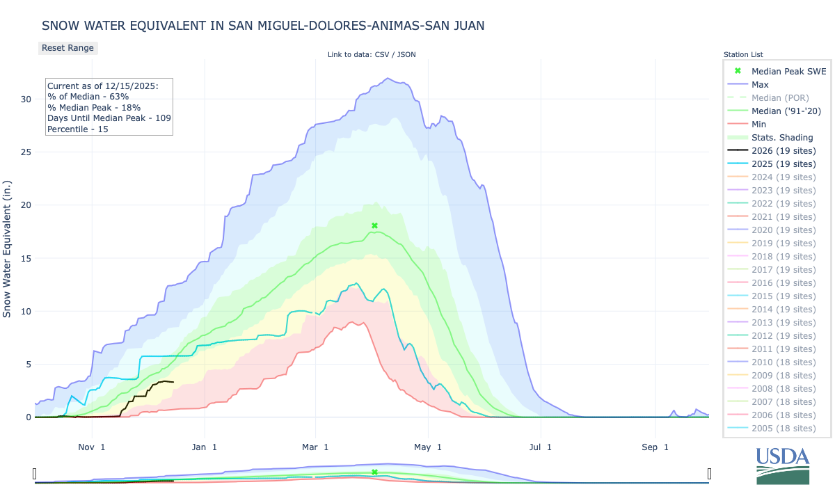
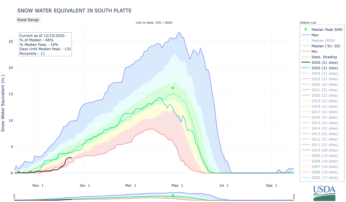
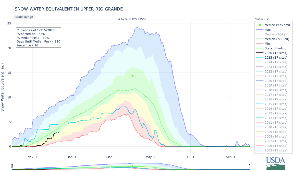
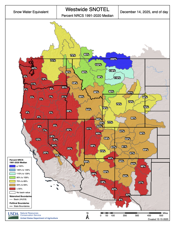
Following an abnormally warm and dry year, Colorado’s snow season is off to an abnormally warm and dry start — and not much is expected to change in the near future. Colorado’s statewide snowpack on [December 12, 2025] sat at 70% of the median recorded between 1991 and 2020, according to data collected by the U.S. Department of Agriculture’s National Water and Climate Center. Storms in the first week of December boosted the amount of snow in the mountains from near-record lows, helping struggling ski resorts, but forecasts with little chance of flurries in the near future could counteract those gains.

“It’s early, but man, we could use some snow soon,” said Zach Hiris, a meteorologist with the National Weather Service in Boulder.
The dryness is distributed relatively evenly across the state. The Upper Arkansas River Basin’s snowpack level is the strongest in the state, at 77% of median, and the Colorado River Headwaters area is the driest, at 61% of median.

The rest of the Intermountain West is not faring much better, according to a report released this week by the Cooperative Institute for Research in Environmental Sciences at the University of Colorado Boulder. All of Colorado and nearly the entire Western U.S. experienced temperatures several degrees above normal in October and November, according to the Western Water Assessment. Colorado’s Western Slope measured temperatures more than 6 degrees above normal in November. November was the third-warmest November on record, dating back to 1895, according to a report released Thursday by the Colorado Climate Center. Sections of the Western Slope experienced their warmest fall on record.