Douglas County Commissioners should not move forward with Renewable Water Resources’ (RWR) request to utilize American Rescue Plan Act (ARPA) stimulus funds to export water from the northern San Luis Valley (SLV). The RWR proposal would significantly impact the economy, environment, and culture of the San Luis Valley, a unique region home to Great Sand Dunes National Park and Preserve and three national wildlife refuges, which collectively attract more than 600,000 visitors annually to the SLV. The SLV cities, farmers, and residents universally oppose the RWR proposal. The project would result in the “buy and dry” of agriculture, which has led to the devastation of other rural communities in Colorado.
As conservation organizations, we represent thousands of hunters and anglers in Colorado. Healthy wildlife habitats are necessary to sustain wildlife populations, and wetlands, riparian corridors, and mesic areas are critical in our arid state. The proposed RWR project would impact fish and wildlife habitats on multiple fronts. Groundwater and surface water resources in the SLV are connected, with aquifers sustaining streamflow, which supports habitat for cold-water fisheries. Therefore, removing water from the aquifers could negatively affect aquatic ecosystems important to the region. For example, the proposed wellfields of 22 to 25 groundwater pumping wells for the RWR project would neighbor the Baca National Wildlife Refuge, potentially impacting the wetland and aquatic ecosystems that support breeding and feeding grounds of migratory birds and waterfowl. Baca is also home to the state’s most viable population of Rio Grande Chub, a state species of concern. Other potentially affected species include the Rio Grande Cutthroat Trout and Gunnison Sage Grouse. The RWR proposal would also require the dry-up of 20,000 irrigated acres in the valley. Impacts to irrigated agriculture in the SLV resulting from the RWR project would also negatively affect fish and wildlife since most of the SLV’s wetlands occur on private property and are sustained through irrigation and water delivery.
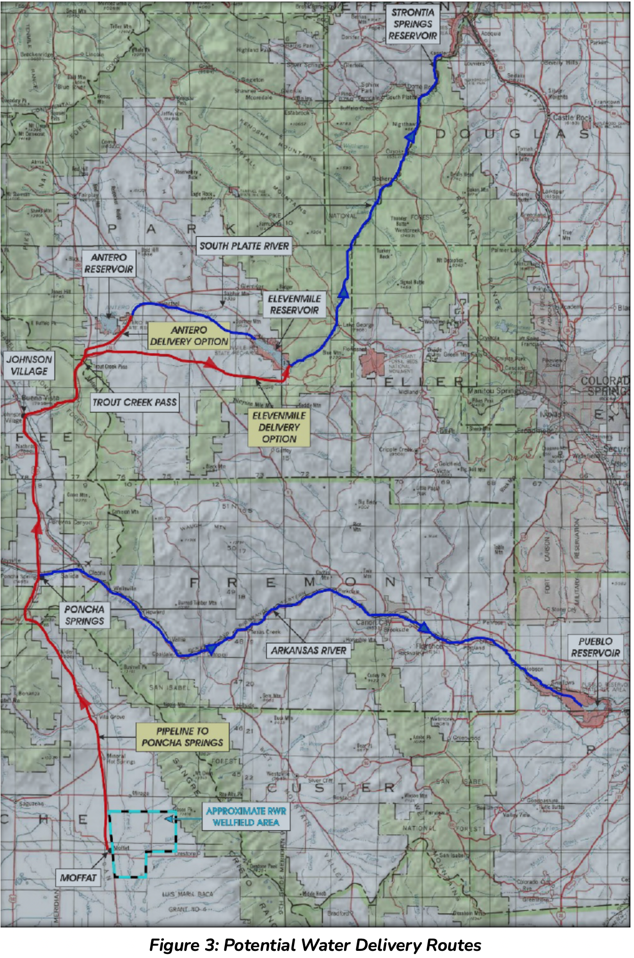
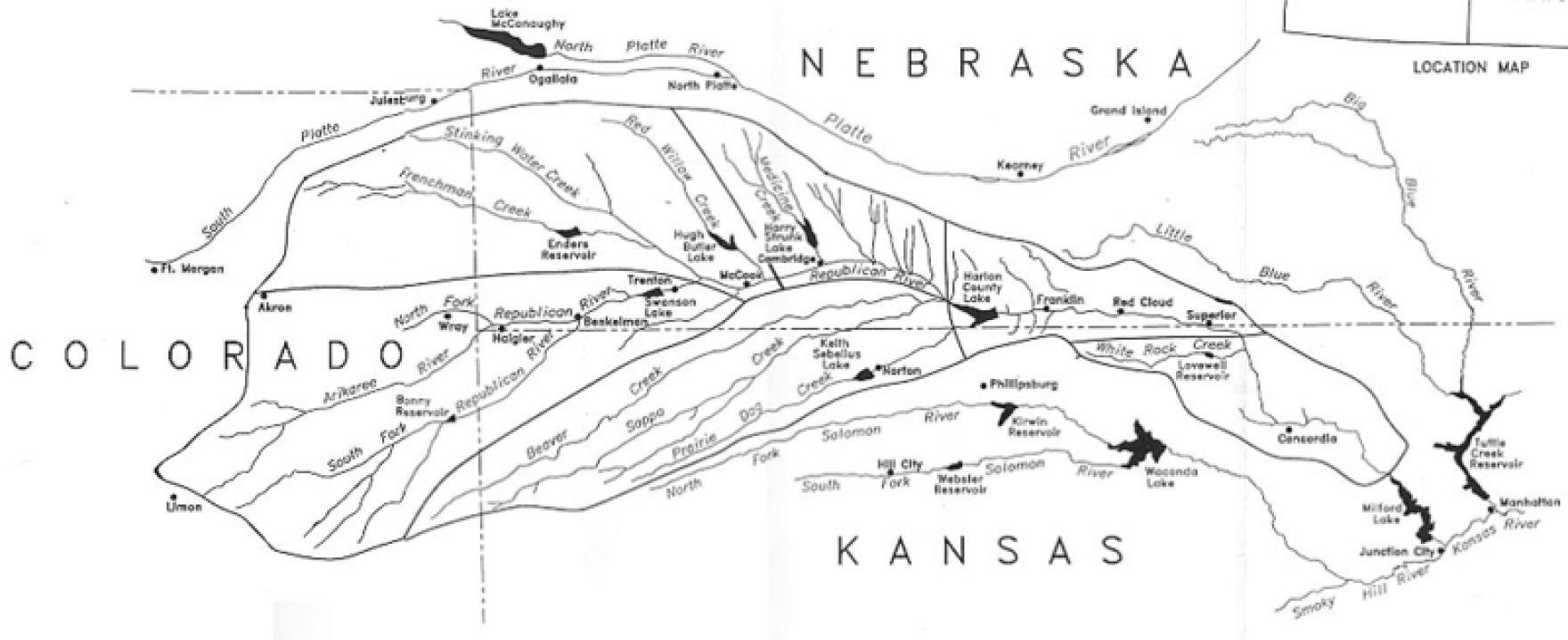
Potential Water Delivery Routes. Since this water will be exported from the San Luis Valley, the water will be fully reusable. In addition to being a renewable water supply, this is an important component of the RWR water supply and delivery plan. Reuse allows first-use water to be used to extinction, which means that this water, after first use, can be reused multiple times. Graphic credit: Renewable Water Resources
The RWR plan runs contrary to the Colorado Water Plan. The plan, which guides state water planning and policy, establishes a conceptual framework for guiding negotiations around new transbasin diversion projects, including developing adequate measures to reduce socio-economic and environmental impacts on the basin of origin, which the RWR fails to accomplish meaningfully. The Colorado Water Plan also strongly condemns the practice of “buy and dry,” which has led to significant socio-economic and environmental impacts in rural communities and instead supports alternative approaches such as investments in conservation and smart land-use planning.
More cost-effective strategies exist, including investments in water conservation and water recycling/reuse. And there is no surplus water in the SLV to export. The SLV aquifers are over-appropriated and climatic trends point to less available water. Therefore, the RWR proposal presents a likely expensive, unpopular, and risky approach to meeting the growing water needs of Douglas County.
Denver Basin Aquifer System graphic credit USGS.
Our organizations recognize that Douglas County is growing and reliant on an unsustainable groundwater resource. We encourage Douglas County to use the federal funds to make needed investments to address water supply needs in a way that prioritizes local water supplies, promotes conservation, and creates jobs for the community rather than siphoning these funds to a speculative and costly water export proposal that will have significant impacts on rural Coloradans and the unique environment of the San Luis Valley.
Theodore Roosevelt Conservation Partnership
Trout Unlimited
National Wild Turkey Federation
Colorado Backcountry Hunters and Anglers
Colorado Wildlife Federation
Alexander Funk is the director of water resources and senior counsel at the Theodore Roosevelt Conservation Partnership.
Satellite photo of the Great Salt Lake from August 2018 after years of drought, reaching near-record lows. The difference in colors between the northern and southern portions of the lake is the result of a railroad causeway. The image was acquired by the MSI sensor on the Sentinel-2B satellite. By Copernicus Sentinel-2, ESA – https://scihub.copernicus.eu/dhus/#/home, CC BY-SA 3.0 igo, https://commons.wikimedia.org/w/index.php?curid=77990895
Click the link to read the article on The Deseret News website (Amy Joi O’Donoghue). Here’s an excerpt:
A committee of Utah lawmakers on Friday unanimously approved a measure that would infuse $40 million worth of solutions into helping the ailing Great Salt Lake.
HB410, sponsored by House Speaker Brad Wilson, R-Kaysville, facilitates a process that ultimately awards the money to an eligible conservation organization tasked with improving flows to the lake, boosting the health of its watershed and raising money through public and private partnerships. Wilson’s district covers half of the Great Salt Lake and Antelope Island…
Under the measure, eligible applicants would be required to have knowledge and experience of the Great Salt Lake and its watershed and wetlands, experience with Utah water laws and a history and ability to attract funding for land and water conservation projects.
Wilson’s bill also emphasizes a need for upstream conservation work to improve the health of the lake.
The successful applicant would establish the trust as a private nonprofit organization or as an agreement between two or more conservation organizations. Applicants have to apply within 60 days of the law taking effect, and by 90 days, the Utah Division of Forestry, Fire and State Lands, in coordination with the Utah Division of Water Quality will rank them and make a selection.
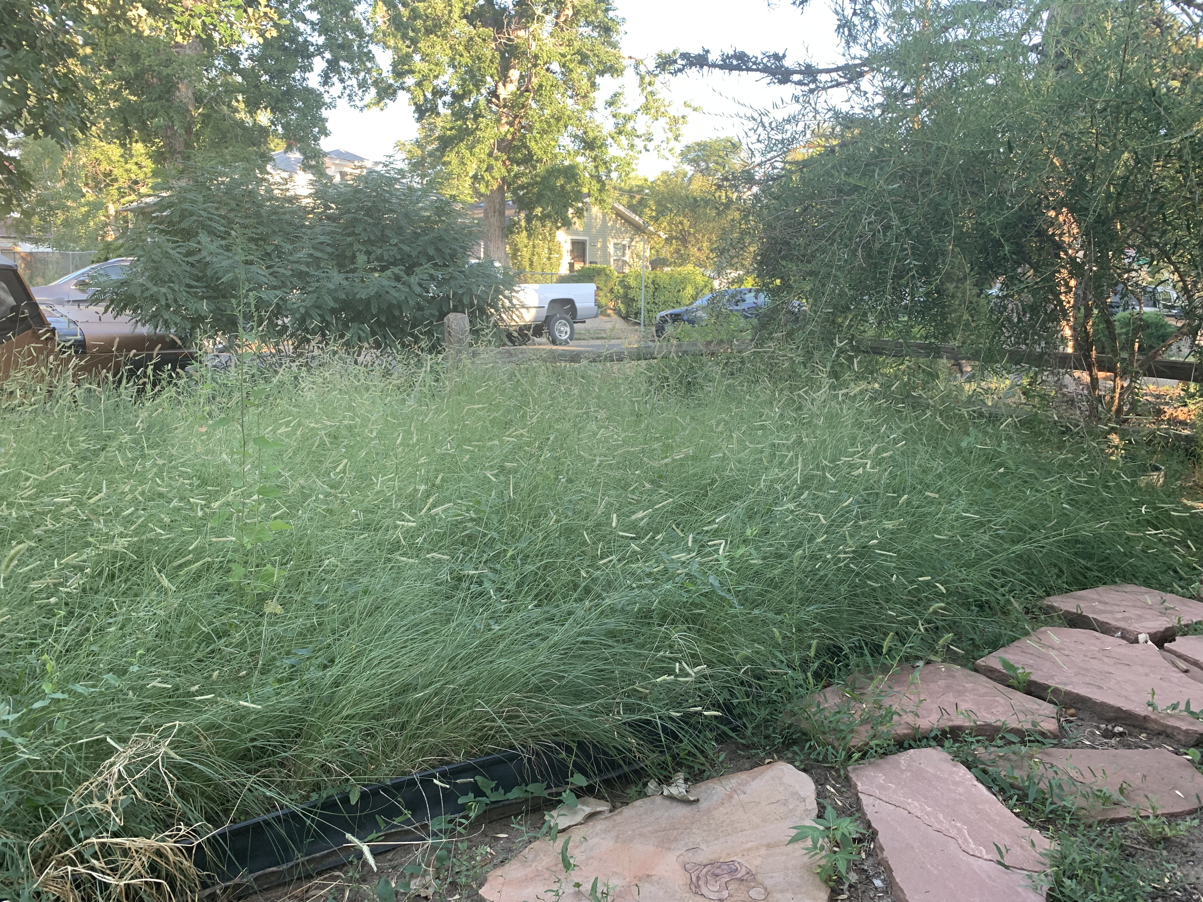
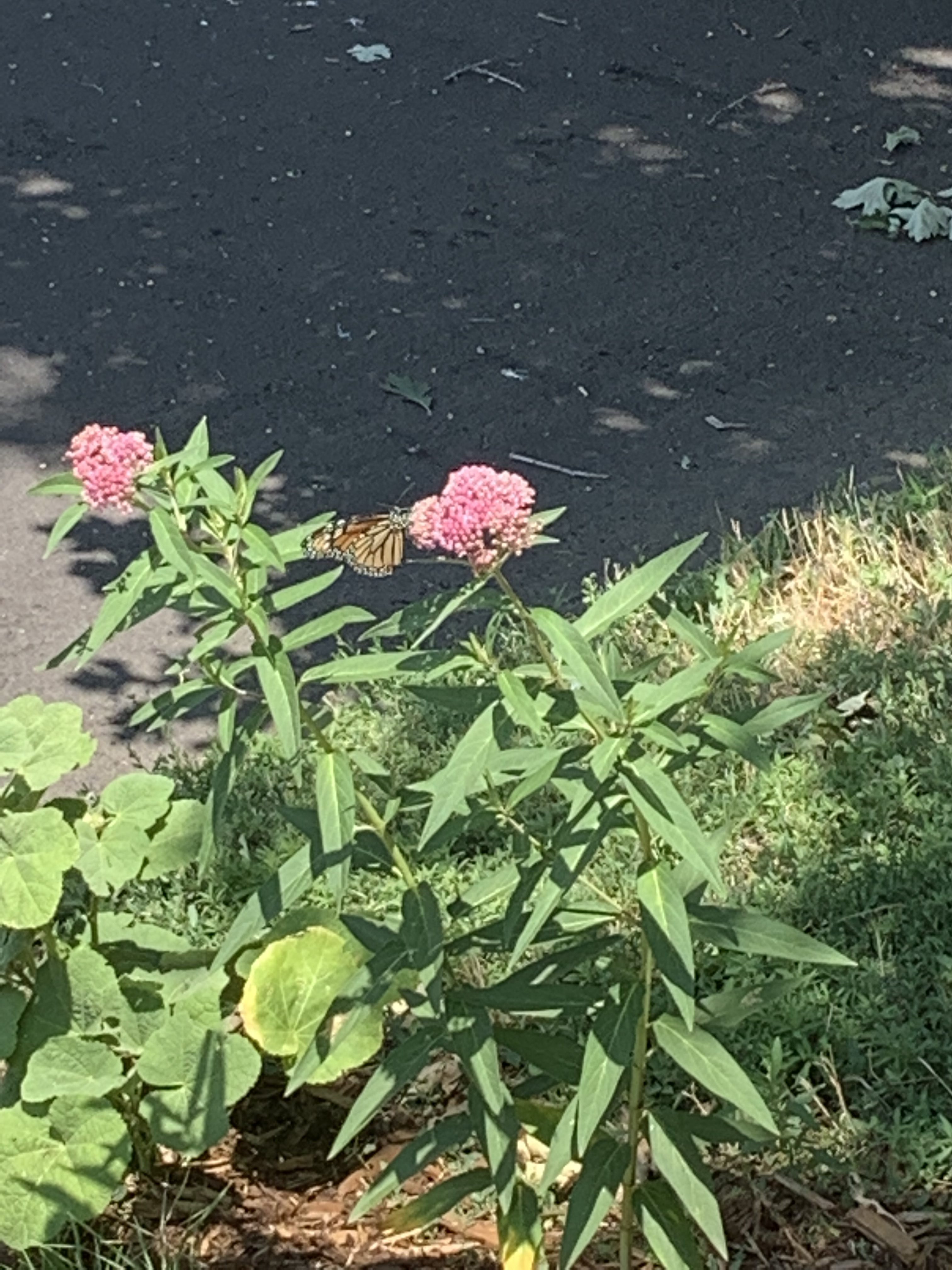
Mrs. Gulch’s Blue gramma “Eyelash” patch August 28, 2021.
Click the link to read the article from Denver Water:
Arapahoe County is embarking on a water conservation project this winter at its Administration Building in Littleton to improve the county’s water efficiency.
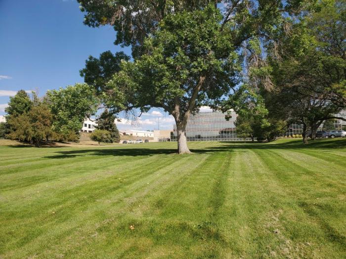
The project will transform a 3-acre field of Kentucky bluegrass into a native, prairie grass field capable of surviving on the water Mother Nature provides in the semi-arid climate of Colorado’s eastern plains. The change will save the county 1.5 million gallons of water each year.
A 3-acre expanse of Kentucky bluegrass on the west side of the Arapahoe County Administration Building in Littleton will be converted into a field of prairie grass in 2022. Photo credit: Arapahoe County.
As the need to address the climate crisis grows ever more urgent, land conservationists are taking meaningful action to reduce carbon in the atmosphere and protect natural systems from the unavoidable impacts of a warming planet.
Our new Policy Focus Report documents how land trusts and conservancies are developing and implementing creative, nature-based strategies to address climate change around the globe, from the Great Plains of the United States to the high-altitude wetlands of Ecuador.
In this report, we document a dozen case examples that demonstrate how conservation organizations can help to mitigate and adapt to a changing climate.
Click the link to read the article on American Rivers (Fay Hartman):
Across the southwest, water is an essential, often scarce resource that communities rely on for their ways of life. In south-central Colorado, the Rio Grande, its tributaries and the water flowing underground supports communities across the San Luis Valley, an 8,000 square-mile high elevation desert that sees less than seven inches of precipitation per year. Water ties generations of people and communities together across the Valley. Married by shared ethics of caring for land and water, everyone across the San Luis Valley depends deeply on the Rio Grande – for their livelihoods, the rich diversity of wildlife and outdoor activities, and a deep connection to the rich history of people who have come before them.
Rio Grande River, CO | Photo By Sinjin Eberle
To help tell the story of the San Luis Valley, the interdependent nature of the people, the river and water flowing below their feet and the threats facing the Valley’s way of life, American Rivers developed Groundswell on the Rio Grande, an interactive ESRI Story Map that illustrates the connection between people, communities and water.
In developing the Story Map, we had the pleasure of engaging with a wide cross-section of people that rely on and appreciate the Valley’s waters for different reasons. Whether we talked to a rancher, small business owner, recreation advocate, retired bus driver, brewer or water manager, it was clear how important the Valley, and the Valley’s water is to them. Water undeniably touches everyone in the Valley, but it is the threats to the rivers and aquifers that bring communities together to fight for their water.
San Luis People’s Ditch March 17, 2018. Photo credit: Greg Hobbs
This time of winter, as temperatures dip below freezing, minds can wander to white sand beaches and blue ocean waters, or summer plans for warmer days on mountain rivers and lakes. Two local fishing outfitters are offering a way to escape to those destinations through movies and a party, with all proceeds headed toward projects that benefit the Uncompahgre River.
RIGS Fly Shop (https://fishrigs.com/) in Ridgway and Telluride Angler (https://tellurideangler.com/) are celebrating all things fly fishing with an array of short films from destinations around the world, all while raising awareness and funds to support projects on the Uncompahgre River Watershed. Ticket sales for “A Benefit for the Uncompahgre River – 2022 Fly Fishing Film Tour” at the Ouray County 4H Events Center in Ridgway on Saturday, March 19 will fund sustainable recreation efforts of the nonprofit Uncompahgre Watershed Partnership (UWP).
“This benefit will be critical to funding sustainable recreation planning and projects along the Uncompahgre River. Donations and support from the local community are key for UWP to become successful with obtaining grant funding,” said UWP Sustainable Recreation Coordinator Dan Chehayl.
Sponsors are providing prizes, such as a Yeti cooler with custom art and fishing gear, to win in a variety of ways at the event. Ouray Brewery is donating beer, which will be sold to raise more funds for watershed projects. Food will also be available.
“The film festival is going to be a fun event this year. We’ll have some great films to watch and beer from Ouray Brewery. I’m really excited about an auction item we have up for grabs: a white Yeti Tundra 45 adorned with Em Yardley’s custom artwork!” added Chehayl.
The 16th annual Fly Fishing Film Tour upholds the national event’s tradition of firing up outdoor adventurers for the season ahead. The 2022 film lineup features locations including Costa Rica, Maryland, Belize, Louisiana, Alabama, Australia, Colombia, Colombia, and beyond. Audiences can view the incredible energy of a cicada hatch in action, follow a legendary spear fisherman across the endless atolls of Belize, watch as a mother passes her passion for fishing down to the next generation, and explore the history of one of the most legendary tarpon fisheries in the world at Casa Mar.
In addition to local sponsors, RIGS Fly Shop and Telluride Angler, the film tour’s national sponsors are Costa, Yeti, Simms Fishing, Trout Unlimited, Scientific Anglers, Ross and Abel Reels, Nokian Tyres, Adipose Boatworks and Oskar Blues Brewing. The local beer sponsor is Ouray Brewery.
Fresh Tracks prairie landscape in southeast Colorado. Photo credit: Colorado Open Lands
From email from Colorado Open Lands:
Colorado Open Lands is excited to once again partner with the Southern Plains Land Trust (SPLT) to add additional protections on the shortgrass prairie of southeast Colorado! SPLT’s mission is to preserve these lands for the native species – both plant and animal – that thrive on them. The Fresh Tracks easement combines several parcels owned by SPLT into one 2,559-acre addition to their wildlife preserve holdings. It also represents COL’s first easement in Baca County, bringing our total counties served to 50 out of 64!
Fresh Tracks is home to species great and small, including mountain lion, mule deer, pronghorn, Colorado Species of Special Concern ferruginous hawk and swift fox, and Colorado Threatened Species burrowing owl, as well as the rare Colorado green gentian plant.
Click the link to read an article from KRDO (Spencer Soicher):
House Bill 22-1151 is described as a way to “incentivize water-wise landscapes” by “creating a state program to finance the voluntary replacement of irrigated turf.
The bill also said it would reduce the sale of agricultural water rights in response to increased demand for municipal water use.
If passed, people across the state would receive a dollar for every square foot of non-natives grass they get rid of.
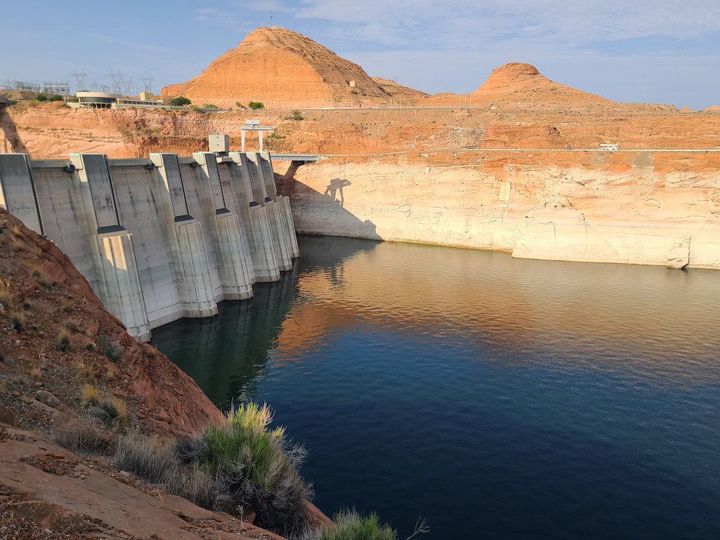
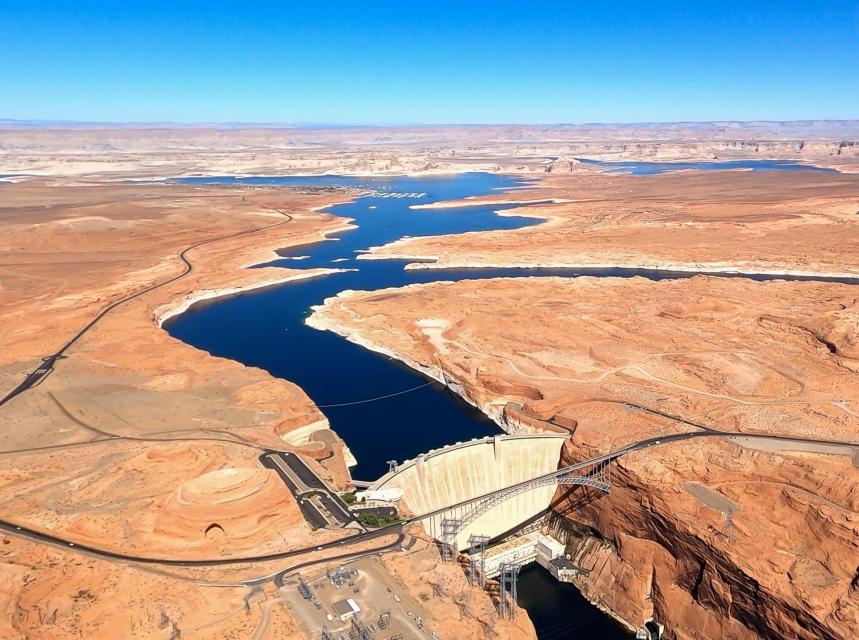
Glen Canyon Dam August 2021. The white on the sandstone reflects where the water level once was. Dropping levels at Lake Powell are forcing a reduction in outflows from the Glen Canyon Dam. Photo credit: USBR
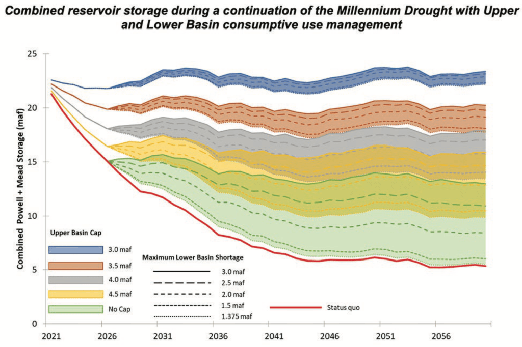
As the crisis on the Colorado River continues, the U.S. Bureau of Reclamation and the four Upper Basin states—Colorado, New Mexico, Utah and Wyoming—have drawn up a proposed framework called the Upper Basin Drought Response Operations Plan. The framework would be used by water managers to create plans each year, as necessary, to maintain Lake Powell water levels.
The effort to keep Lake Powell healthy is critical to ensuring hydropower production from its turbines is maintained and to protect the Upper Basin states from violating their legal obligation to send Colorado River water to Arizona, California and Nevada, the Lower Basin states.
Whether the new plan will be activated this year is uncertain. During a webinar about the working draft on Jan. 28, Rod Smith, an attorney with the U.S. Department of Interior, described this year’s early winter weather as a yo-yo. “December was excellent,” he said, “but January was kind of blah.”
Lake Powell’s water levels were successfully stabilized last year after a series of major emergency water releases from reservoirs in Utah and Colorado. Lower Basin states also cut water use.
Graphic credit: Chas Chamberlin
Modeling last year had found a nearly 90% probability that Powell levels in 2022 would fall below the elevation of 3,525, triggering more emergency releases. But as of Feb. 3, water levels in Powell were almost 6 feet above that elevation.
Much can change between now and April, when Reclamation and the states hope to complete the framework.
Last year’s disastrous runoff — the snowpack was roughly 85% of average but the runoff was 32% of average — surprised everyone, and ultimately forced the emergency releases from Blue Mesa and Flaming Gorge, two of three federal dams operated by the agency upstream of Powell. Reclamation also operates Navajo, the reservoir located primarily in New Mexico, whose waters can also be used to boost levels in Powell, subject to other limitations.
The proposed framework identifies how much water from the three reservoirs is available for release to prop up levels in Powell, but only after operations at Powell itself have been managed to best maintain levels of 3,525 feet or above. To slow the decline, Reclamation is holding back 350,000 acre-feet of water in Powell that it would normally release during January-April.
The agency plans this year to release 7.48 million acre-feet from Powell to flow down the Grand Canyon to Lake Mead.
Smith emphasized that the releases from Blue Mesa and other Upper Basin reservoirs will be subordinate to the many preexisting governance mechanisms on the Colorado River, including treaties, compacts, statutes, reserve rights, contracts, records of decision and so forth. “All that stays,” said Smith.
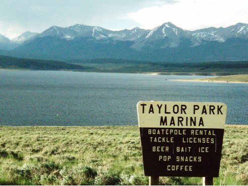
Taylor Park Reservoir
This can get complicated. For example, some water from Taylor Park Reservoir, near Crested Butte, can be stored in Blue Mesa but is really meant for farmers and other users in the Montrose-Olathe area. That water is off-limits in this planning.
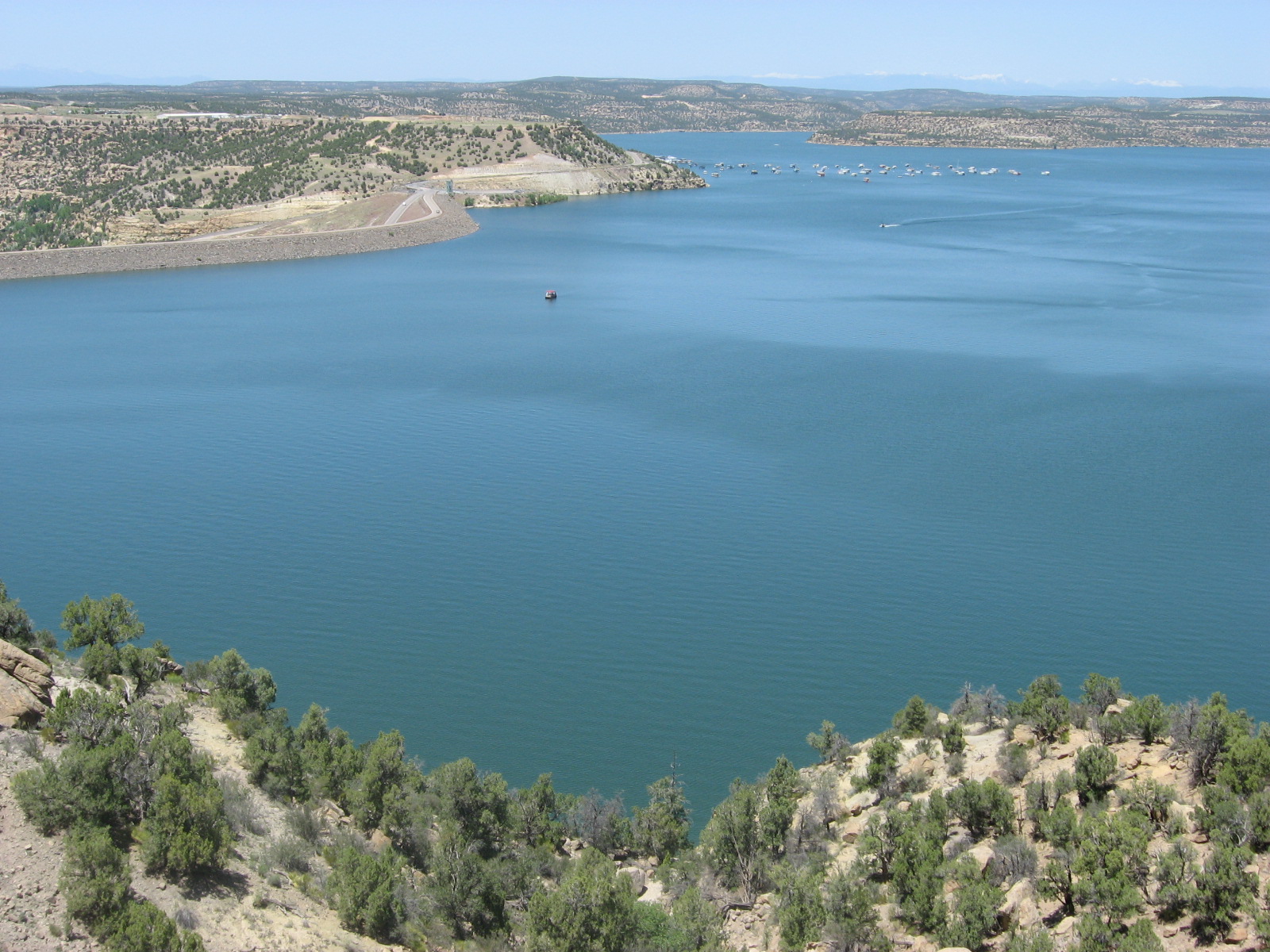
Navajo Reservoir, New Mexico, back in the day.. View looking north toward marina. The Navajo Dam can be seen on the left of the image. By Timthefinn at English Wikipedia – Transferred from en.wikipedia to Commons., Public Domain, https://commons.wikimedia.org/w/index.php?curid=4040102
Navajo Reservoir releases can get even more complicated. Water was initially identified last summer for release from the reservoir to help replenish Powell, but then delayed. Reasons were identified, including temperatures of the San Juan River downstream in Utah. But feathers were ruffled, as was revealed during the Colorado River Water Users Association meeting, held in Las Vegas in December. Tribes were consulted only belatedly.
Now, the draft framework language specifies the need for consultation with tribes. Water in Navajo Reservoir is owned by both the Jicarilla Apache and Navajo. To be considered are diversions to farmers but also to Gallup. “Getting this right, particularly in the operational phase, will be critical,” said Smith.
How might this affect ditch systems in Colorado? “There will be timing issues of when the extra water comes down, but in terms of whether there are any direct impacts to a ditch authority operating under its own decree, there should not be,” said Michelle Garrison, senior water resource specialist with the Colorado Water Conservation Board, during the webinar. “We don’t expect any disruption to other water users because of this.”
[…]
“You can help make the best of a bad situation by having any drought operation releases benefit other things on the river, including benefits to threatened and endangered fish species while potentially producing more hydropower revenue [used in part to support endangered fish recovery programs],” said Bart Miller, water program manager for Western Resource Advocates.
But Miller and others also note that Reclamation’s draft framework represents a short-term solution to a festering long-term problem.
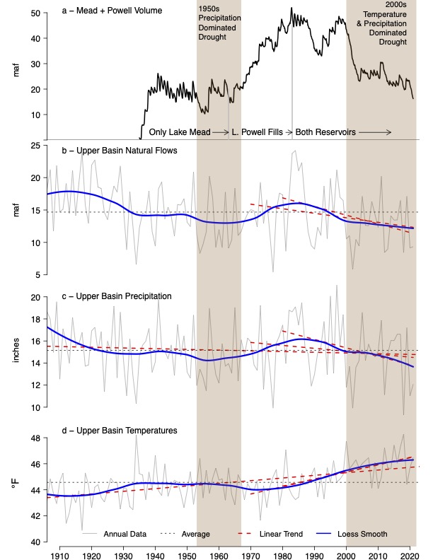
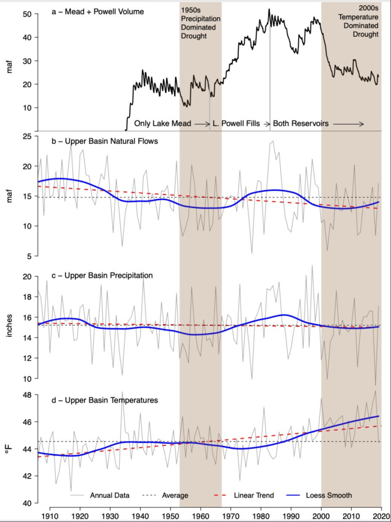
Brad Udall: Here’s the latest version of my 4-Panel plot thru Water Year (Oct-Sep) of 2021 of the Colorado River big reservoirs, natural flows, precipitation, and temperature. Data (PRISM) goes back or 1906 (or 1935 for reservoirs.) This updates previous work with @GreatLakesPeck.
The word drought is found everywhere in the planning documents. Colorado State University climate scientist Brad Udall insists that another word, aridification, better describes the hydrology that has left the Colorado River with nearly 20% less water in the 21st century as compared to the 20th century. Trying to reconcile 21st century hydrology with 20th century infrastructure and governance is like walking on a rail that gets ever more narrow.
“I think it’s totally appropriate to use this tool but not as a substitute for dealing with the overall imbalance between supply and demand,” says Anne Castle, a senior fellow at the Getches-Wilkinson Center for Natural Resources, Energy and the Environment at the University of Colorado Law School.
Long-time Colorado journalist Allen Best publishes Big Pivots, an e-magazine that covers energy and other transitions in Colorado. He can be reached at allen@bigpivots.com and allen.best@comcast.net.
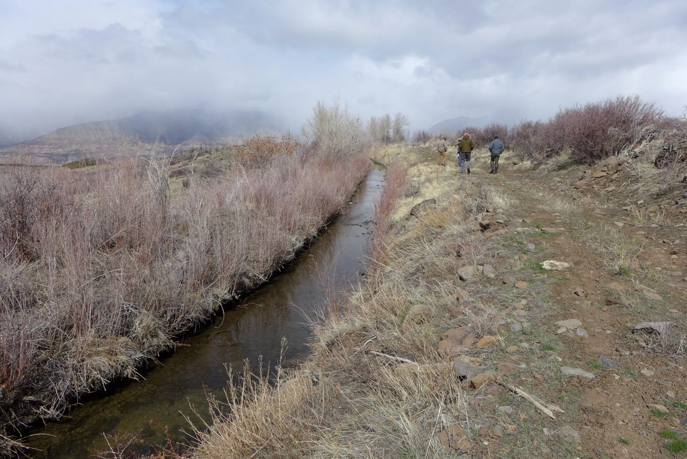
The Morrisania Mesa Ditch runs through agricultural land south of Battlement Mesa. The ditch was part of a ditch inventory in western Colorado paid for, in part, with state grant money. CREDIT: HEATHER SACKETT/ASPEN JOURNALISM
Inventories of irrigation ditches across the Western Slope have become common in recent years and water managers say they have merit.
But there is no requirement that the individual studies — which look at things such as efficiency and opportunities for repairs and upgrades — be made public, even though they are often paid for with public money. This doesn’t sit well with some who say the public has a right to know exactly how taxpayer dollars are being spent and how one of the West’s most precious and dwindling resources is being used.
“(Agriculture) is where 80% to 90% of the water gets used, and if we were more efficient, we could leave more water in the river — that’s the bottom line,” said Ken Ransford, recreation representative to the Colorado Basin Roundtable and who also acts as Aspen Journalism’s legal adviser. “If you can’t see how 80% to 90% of the water is being used, then you will never be able to say whether you’re using water efficiently or not.”
Ditch-inventory projects have the support of many water-user groups and, in recent years, have been done in several Western Slope river basins and sub-basins: the Yampa, the Eagle and the Colorado. Agricultural groups say they are necessary to assess the needs of irrigators and connect them with resources should they want to improve and upgrade their infrastructure. Environmental organizations say they have value because the more improvements there are to irrigation efficiency, the more water that can be left in the stream to the benefit of the ecosystem.
In some ways, the issue boils down to whether one sees water as a private property right or a public resource. In Colorado, it’s both. The right to use water is treated as a private property right. People can buy and sell water rights as part of a real estate transaction and change what the water is allowed to be used for, as long as a water court approves. And to maintain a water right’s value, the water must be put to use.
But the right to use water isn’t the same as owning the resource itself, which belongs to the people of Colorado. Ransford said there’s an obligation for water users to use it responsibly and efficiently.
“To say nobody has a right to see how it’s being used when it’s a public resource, there’s a conflict there,” he said. “We all own the water. It’s a public good.”
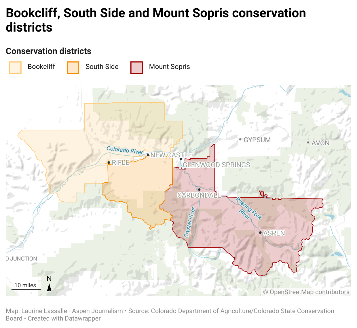
The Bookcliff, South Side and Mount Sopris conservation districts, took part in a project to inventory some of the ditches in their boundaries. Because they are not available to the public, it’s unclear exactly which ditches were included. CREDIT: LAURINE LASSALLE/ASPEN JOURNALISM
Middle Colorado ditch inventories
In 2018, the Colorado Basin Roundtable recommended approval of a $100,000 funding request from the Book Cliff, Southside and Mount Sopris conservation districts for an agricultural water plan for Garfield County. It was part of a larger stream-management plan, undertaken by the Middle Colorado Watershed Council. The 2015 Colorado Water Plan calls for developing stream-management plans on 80% of rivers in the state.
The funding for the agricultural portion — part of an overall $330,000 budget for the plan — was approved by the Colorado Water Conservation Board, the state entity charged with protecting and developing Colorado’s water.
As part of the agricultural water plan, the conservation districts hired Rifle-based Colorado River Engineering to conduct ditch inventories, which provide water rights owners with an overall assessment of their diversion infrastructure, measuring devices and conveyance channel. The study focused on ditches that have old and large water rights — prior to the 1922 Colorado River Compact — and carry more than 10 cubic feet of water per second. The goal is for owners to use the inventory as a tool to prioritize projects on the ditches and aid in securing funding for future ditch improvement projects.
In October, the conservation districts submitted to the CWCB a final report, which includes a broad overview of the project. The 59 individual inventories completed were not included in the information submitted to the state, although each water rights owner got a copy of their own inventory. It is not clear which ditches across the three conservation districts were inventoried as part of the project.
Aspen Journalism began making inquiries about seeing the completed inventories in March, and the conservation districts made one inventory available: the study of the Schatz Ditch on Dry Hollow Creek near Silt, which irrigates 69 acres of grass pasture. The ditch has two water rights, which date to 1965, and are decreed for 2.5 cfs each.
The 44-page inventory includes information about the water rights associated with the ditch, publicly available diversion records from the state Division of Water Resources database, and many pages of historic decrees and documents associated with the ditch. It does not include names of ditch owners, water rights owners or water users.
It lists main concerns as a lack of current diversion records after 2001, overgrowth of vegetation and unstable soils near the end of the ditch. Potential treatment includes removing overgrowth, routine maintenance, lining or piping the ditch, and self-reporting diversions to the Division 5 Water Resources office.
The inventories are a good way to maintain institutional knowledge and keep track of historic ditch information when there is a change in ownership, said Emily Schwaller, manager of the conservation districts. She said the districts made the Schatz inventory available because the owner or owners gave permission for the information to be public, but she declined to disclose who the owners are.
“Our hope is that these binders are living documents that get updated and maintained by the ditch companies and owners,” Schwaller said in an email. “These inventories give the (ditch owners) a baseline of the condition of the ditch and are a start of the background of the ditch that will be used by future generations and ditch owners.”
The Schatz Ditch irrigates nearly 70 acres of land south of Silt, according to a ditch inventory by Colorado River Engineering. The ditch is one of 59 inventoried in the Middle Colorado region of western Colorado. CREDIT: HEATHER SACKETT/ASPEN JOURNALISM
CORA request denied
But neither the CWCB nor the Colorado Basin Roundtable has a policy that allows the public to have access to the inventories, even when public money is used to fund their creation.
In May, Aspen Journalism submitted a Colorado Open Records Act request to see the rest of the 59 inventories. The conservation districts denied the request, saying a federal law supersedes the state’s sunshine laws. Because the conservation districts partnered with the National Resources Conservation Service on the inventories and a federal law protects personal and geospatial information of property owners who work with NRCS, the districts said they would have to review what information could be released and redact any private information.
CORA lets the public inspect records of state and local government entities — unless inspection is prohibited by a state law or a federal statute or regulation. The 2008 Farm Bill may prohibit the release of information regarding agriculture practices.
“It’s not clear what information in the ditch inventories can and cannot be provided to the public under the 2008 Farm Bill,” said Jeff Roberts, executive director of the Colorado Freedom of Information Coalition, a nonprofit group that works to ensure the transparency of state and local governments by promoting freedom of the press and open access to government records. “The conservation districts should explain this in more detail, and the best way to do that is with an example ditch inventory and a log that describes why each redaction is required by federal law.”
After working with the boards to get a cost estimate for redacting, Schwaller on Dec. 13 provided a cost estimate of nearly $2,200 for redacting the engineering reports and almost $16,400 for the engineering reports and records. Aspen Journalism has asked Schwaller for a cost estimate for redacting the Schatz Ditch inventory to see an example of what information would be left after redacting and whether it would be worth it to pay for the rest of the documents with redactions. Schwaller had not replied to multiple requests as of press time.
Sara Leonard, director of CWCB marketing and communications, said that it would be inappropriate for the state to ask for a ditch owner’s personal information and that the state and roundtables support property rights and landowner privacy.
“The state’s role here is to provide funding and help identify the best projects, as supported by the basin roundtables,” Leonard said in an email. “We look for collective results and analysis of individual data to show the success of a project, but we don’t require individual data points as they are not needed by the state (in this case, individual ditch inventories).”
Dylan Roberts, who represents Eagle and Routt counties in the Colorado legislature and sits on the Water Resources Review Committee, said it sounds like the inventories have incredible merit and could be useful. If the state has decided to put money behind them, then the public should have access to them, he said.
“As a matter of principle, if public money is being used, there absolutely should be some level of transparency and public access to any data or information that is generated from these surveys,” he said.
An irrigation expert with NRCS talks with water users about the irrigation infrastructure on the Morrisania Mesa Ditch. Conservancy districts hope ditch inventories, which have become increasingly common in recent years, will result in improvement projects for irrigation infrastructure. CREDIT: HEATHER SACKETT/ASPEN JOURNALISM
Summary outlines ditch problems
According to the final report from the three Colorado conservation districts submitted to the CWCB in October, 59 ditches were inventoried on the section of the Colorado River and tributaries from Glenwood Canyon to De Beque. The individual inventories include a summary of the water rights, diversion records, irrigated acreage, a list of concerns, potential treatments and funding opportunities to address those concerns. This information is withheld from public view.
The report listed main areas of concern, including erosion prevention; seepage; aging infrastructure; routine maintenance; diversion/lateral structural improvements; phreatophytes, which are sometimes-invasive, water-sucking vegetation with deep roots; and bank stabilization.
According to a report produced last year as part of the Middle Colorado Integrated Water Plan on agricultural water use, engineers recommended phreatophyte removal for 71% of the inventoried structures; piping or lining ditches for 55% of them; and bank stabilization for 51%. Improvements to measuring devices were recommended for 35% of the ditches inventoried.
Though broad generalizations, these findings in the summary report and the Middle Colorado plan hint at widespread issues with the region’s irrigation ditches, headgates and canals.
“We have a huge issue with aging infrastructure here on the Western Slope,” said Jason Turner, chair of the Colorado Basin Roundtable and senior counsel with the Colorado River Water Conservation District. “There are billions of dollars’ worth of projects in the Colorado basin alone, and I bet that doesn’t even scratch the surface.”
Privacy maintained
These types of inventories have a history of being shielded from public view, even though they are paid for with state grant money.
In 2016, the Eagle County Conservation District conducted what it called an irrigation-asset inventory of 25 ditches within the district’s boundaries. It was funded with a $54,000 grant from the CWCB. Although a summary report of the findings was made public, the 25 individual binders with information specific to each ditch went to the ditch owners and were not, despite a request from Aspen Journalism under CORA. The summary said irrigators in the district were dealing with problems such as rusted, leaking and clogged culverts, unstable headgates, sinkholes and erosion.
Proponents say the promise of privacy is often key to getting irrigators to participate in these studies. Maintaining privacy is important for irrigators because they may not want to invite what they feel is unfair scrutiny — and, perhaps, criticism — of their operations.
“I think the only way these guys are going to participate in these kinds of things is if they feel like their information is not going to be shared everywhere,” Turner said. “They recognize that they own and use the lion’s share of water in Colorado, and it just seems like they feel heavily scrutinized for what they feel is their best ranching practices for their piece of property.”
The report from the inventories in the Book Cliff, Southside and Mount Sopris conservation districts said this culture of privacy is a challenge. Earning the trust of water rights owners so that they would give their permission to do the ditch inventories took additional time and was a larger factor than originally anticipated.
“Another noteworthy obstacle was obtaining permission from water and landowners to walk the ditch and develop the inventories,” the report reads. “This ranged from not having up-to-date records of owners, neighbor conflict and a general distrust in allowing outside eyes on the properties.”
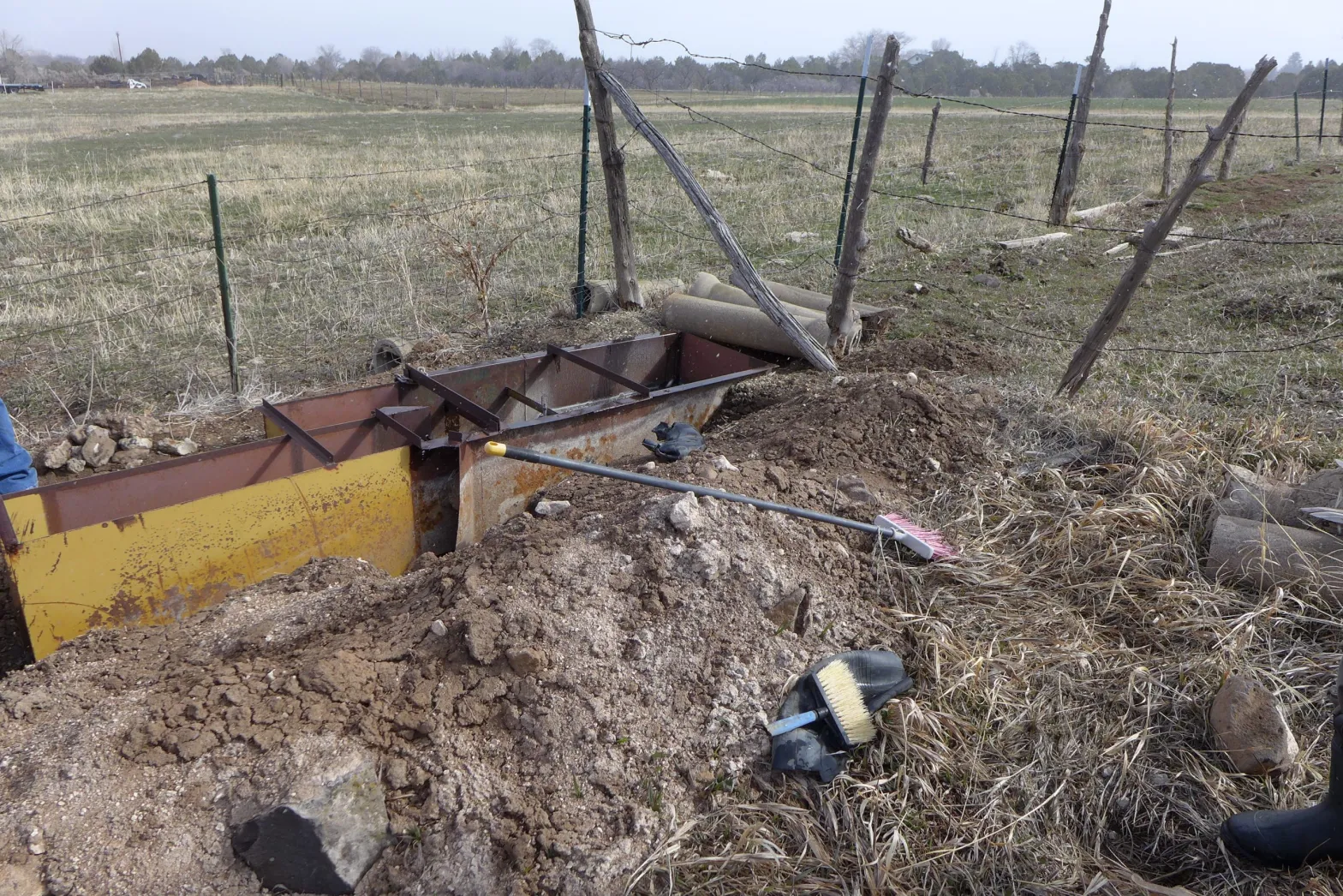
This Parshall flume measuring device is being installed on a ditch on Morrisania Mesa. Ditch inventories, funded in part with state grant money, are becoming popular in western Colorado. CREDIT: HEATHER SACKETT/ASPEN JOURNALISM
Yampa River assessments
On the Yampa River, environmental organizations have acknowledged the potentially problematic lack of transparency that comes from paying for private inventories with taxpayer money and have taken steps to skirt the issue by directly funding the studies themselves. Trout Unlimited and The Nature Conservancy paid nearly $68,000 to do an assessment of diversion infrastructure on the Yampa with the goal of identifying places for multibenefit projects.
“We were aware of the Eagle River situation, but there are a bunch of reasons (that environmental groups) took the lead on the assessment,” said Brian Hodge, northwest Colorado director for Trout Unlimited and the environmental representative to the Yampa/White/Green Basin Roundtable.
Of 45 irrigation structure owners who participated in the study, 36 opted to make those reports public. The other nine chose to keep their reports confidential, citing disagreement with the structure assessment or discomfort with the process. A few structure owners did not respond to outreach after their report was delivered.
In a final report, produced by Wilson Water Group and JUB Engineering, the structures were scored based on the opportunities for improvements for four categories: current use, fish passage, recreational boating and river health. Each category had a maximum score of 5 for a total possible structure score of 20. The higher the score, the greater the opportunity for a multibenefit improvement project. The Lower Yampa reach of the river had the most room for improvement overall, with a total score of nearly 8.
Dry Hollow Creek winds its way through fields near Silt. The Schatz Ditch pulls water from Dry Hollow Creek. CREDIT: HEATHER SACKETT/ASPEN JOURNALISM
Improvement projects not publicly tracked
It is also not always clear whether these studies actually result in improvements to irrigation infrastructure, which is listed as an end goal. In some cases, neither the conservation districts nor the funding organizations keep track of how many subsequent projects come about as a direct result of the inventories.
And unless the ditch owner comes back to a granting organization, such as the roundtable, with a request for funding, there is no way to know whether ditch owners actually use the inventories to improve their operations, especially if they pay for upgrades out of their own pocket.
Turner said the roundtable would have no way of knowing unless an irrigator referenced the inventory in a subsequent grant application.
Leonard, the CWCB spokesperson, said she is not aware of anyone tracking projects that come out of the inventories.
“Again, potential projects that will likely come out of the inventory assessment will hopefully lead to multipurpose/multibenefit projects that can be supported by CWCB funding, but we don’t mandate projects as a result of investigations we fund,” she said in an email.
The report from the Book Cliff, Southside and Mount Sopris conservation districts said ditches with completed inventories have applied for funding from several different sources: the Colorado River Water Conservation District, the state of Colorado, National Resources Conservation Service, and the conservation districts’ cost-share program. Water rights owners have also hired engineering firms to complete the recommendations in the inventories and used the inventories while requesting letters of support from county commissioners, according to the districts. But conservation district representatives did not have a count of exactly how many projects have come about as a direct result of the inventories.
Eagle County Conservation District also does not have a count of projects that resulted from their 2016 inventories, but there is at least one. The Highland Meadow Estates at Castle Peak Ranch Homeowners Association in Eagle County received $25,000 in state money to improve the Olesen Ditch by installing a pipeline.
Mount Sopris Conservation District board member Cassie Cerise owns a ranch outside of Carbondale. She did not participate in the ditch inventory project, but she thinks the inventories were useful for ditch owners and she expects resulting projects to trickle out over the next few years.
“First, the issues can be identified, and second, they can find out about all the different programs that are offered as far as cost share and all the things that could help implement a fix,” she said.
The Schatz Ditch irrigates nearly 70 acres of land south of Silt, according to a ditch inventory by Colorado River Engineering. The ditch is one of 59 inventoried in the Middle Colorado region of western Colorado. CREDIT: HEATHER SACKETT/ASPEN JOURNALISM
Privacy was a roundtable topic
The issue of privacy for landowners when it comes to these ditch inventories was a topic of discussion at the Colorado Basin Roundtable meeting in October. Some said the public may be critical of how ditches are operated.
“There may be reasons why a landowner may not want the public looking at a ditch on their property,” said Carlyle Currier, a rancher in Molina who is president of the Colorado Farm Bureau and has a seat on the roundtable. “It certainly opens the door to some mischief.”
Ransford, the recreation representative to the Colorado Basin Roundtable, said that since water is a public good, there should be a public means of funding irrigation-improvement projects.
“I’ve long thought what we should do is pass a special-district kind of a tax to pay to modernize irrigation structures,” he said. “I don’t think the irrigators should have to do it. It’s expensive. But if we had a public source of funds dedicated to this, to me, that is the bigger picture.”
Some say the end justifies the means. Richard Van Gytenbeek is the environmental representative to the Colorado Basin Roundtable. In his work as Colorado River basin outreach coordinator for Trout Unlimited, one of his goals is to work on collaborative efforts with the agricultural community to keep more water in rivers. He said if the inventories can help do that by facilitating irrigation-efficiency projects, then he doesn’t have a problem with the information remaining private. Trout Unlimited often works with irrigators on projects that benefit the landowner as well as fish and stream health.
“I’ve seen some ditches that are just horrendous, and if we were able to get in there and fix them, people wouldn’t have to take out nearly as much water,” he said. “We are trying to think of ways to have (water) never leave the channel in the first place. Getting people to collaborate and cooperate, it’s the linchpin.”
Aspen Journalism collaborates with The Aspen Times on coverage of water and rivers. This story ran in the Feb. 6 edition of The Aspen Times and the Feb. 7 edition of the Vail Daily.
Sharing water with farmers in our native Arkansas River Basin is one of the ways we are meeting our water needs for the future. This innovative program provides water for Colorado Springs customers while protecting rural communities and the agricultural economy in our region.
Agricultural water sharing is an Alternative Transfer Mechansim, or ATM, and it’s one way we are diversifying our water supply portfolio. Our sustainable water plan – the Integrated Water Resource Plan (IWRP) – outlines our future needs over a 50-years planning horizon, including the need to add 15,000-25,000 acre-feet of water supply through agricultural water sharing and other ATMs.
In the past, water transfers between agriculture and municipalities primarily involved purchasing farms and transferring the associated water rights to the city. Today, balancing municipal needs with farmers’ needs involves a partnership to share the water. These partnerships range from storage cooperation to the development of perpetual 3-in-10-year lease/fallowing programs. Sometimes water becomes available when the farmer transitions to more efficient irrigation methods and needs less water to produce the same amount of crops. The farmer’s productivity per acre is preserved, while the city receives the unused water.
In essence, water sharing agreements help us and farmers manage water supplies while keeping water in agriculture and sustaining economic growth in the Arkansas Basin region.
We continue to build on the successes of our first water sharing agreements, started in 2015. In 2018. we established the Lower Arkansas Water Management Association (LAWMA) project, which provides water for Colorado Springs municipal use in five of every 10 years, while farmers in the Las Animas and Lamar areas take additional water during the other five years. We also supported LAWMA’s development of storage to help them manage the program and their supplies.
It emphasizes collaboration rather than competition for water. Both partners benefit.
It provides multiple ways to create stability for municipal supplies and agriculture.
It reduces large scale transfers and permanent removal of water from agriculture.
When working with an augmentation entity, water sharing supports the use of more efficient irrgation technology resulting in more efficient use of water.
Flood irrigation in the Arkansas Valley via Greg Hobbs
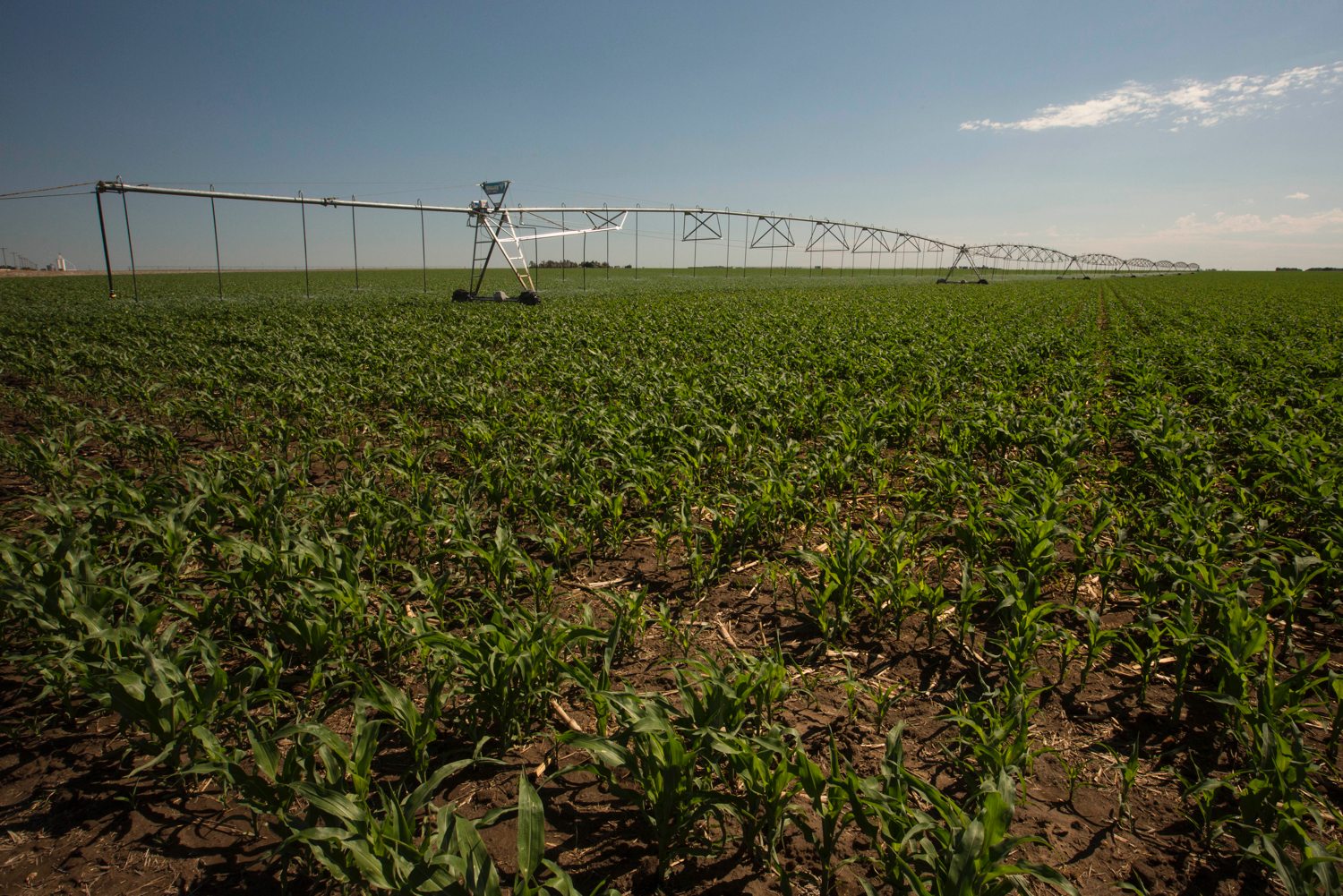
Two Bent County farmers will shift away from flood irrigation to more efficient agricultural sprinklers that circle around a center pivot. Colorado Springs will acquire the rights to use the water saved by this change…
The total cost for this acquisition is about $2 million. Additionally, the farmers will rotationally fallow their fields three years out of every ten and Colorado Springs Utilities will lease that water.
In all, it’s a small amount of water, but Benyamin said it’s the first of a series of similar deals the utility is working on as it diversifies its water supply portfolio.
Growing Front Range municipalities have, in the past, purchased water rights using what’s known as “buy and dry,” meaning that land in rural areas was often left barren and unfarmable.
Councilmember Wayne Williams, who chairs the utilities board, said that “buy and dry” has far-reaching negative effects on rural communities that results in a declining population in Colorado’s Eastern Plains…
Colorado Springs City Council approved the agreement [February 1, 2022]. Next, the city will complete the purchase and submit the permanent water transfer request to the state.
That process can take years to go through water court, but Colorado Springs Utilities staff said there’s an administrative approval process to allow the water to be immediately available for municipal use.
State officials on [January 26, 2022] announced an education campaign aimed at water conservation that emphasizes the role of individual consumers in their everyday, in-home water use.
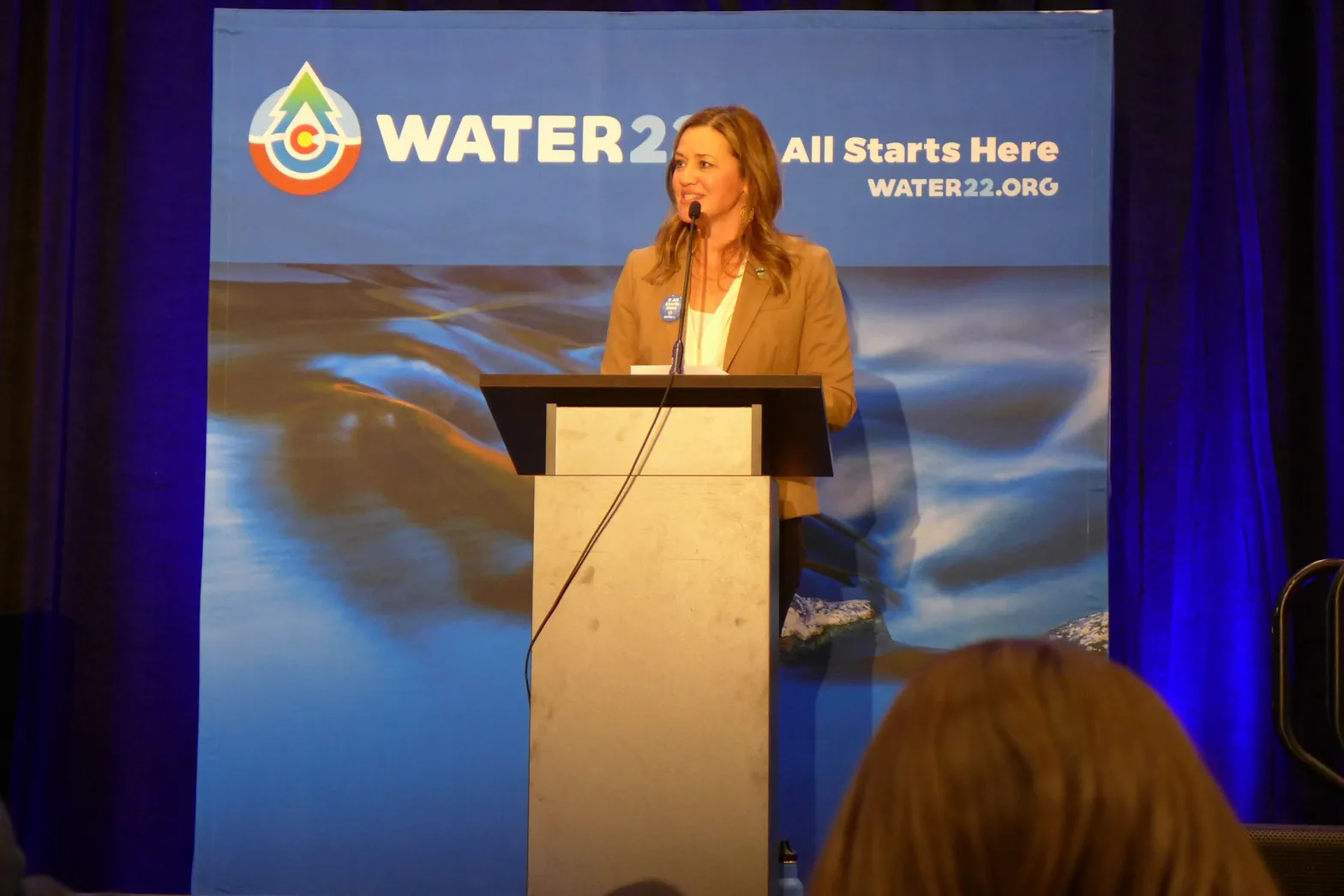
At the bi-annual meeting of the Colorado Water Congress, Governor Jared Polis unveiled the Water ’22 campaign, a year-long, statewide initiative that aims to educate Coloradans about one of the state’s most important resources. The program encourages conservation in the face of climate change-fueled drought by asking people to take a pledge to conserve water and protect water quality in their daily lives by taking part in 22 small actions.
Polis proclaimed 2022 the “Year of Water” in Colorado, marking the 100th anniversary of the Colorado River Compact and an upcoming update to the state’s 2015 Water Plan.
“We have a shared responsibility to steward this incredible natural resource and make sure it’s there for our people, our places, our ecosystems, our industries that need it to thrive because it all starts here in Colorado with us,” he said.
Water ’22, which is being spearheaded by Water Education Colorado, lays out 22 simple things individuals can do to save 22 gallons of water a day. They include things like turning off the water while brushing your teeth, fixing leaky fixtures, watering outdoor lawns and landscaping at dawn or dusk and using phosphorus-free fertilizer. The initiative is an effort at education and engagement and is not designed to result in measurable water savings or improvements to water quality.
The campaign focuses on the voluntary actions of individual municipal water customers instead of policy changes to conserve water. And although the agriculture industry represents 86% of the state’s water use, according to numbers provided by Water Education Colorado, Water ’22 does not include ways for agriculture to conserve water.
“The main thrust of the campaign is targeting consumers at the domestic-use level,” said Jayla Poppleton, executive director of Water Education Colorado. “Our message to Coloradans is that they have a role to play. It’s up to all of us to do our part.”
According to its website, Water Education Colorado is a nonprofit organization charged with ensuring a sustainable water future by educating and engaging citizens around water. It also publishes the Fresh Water News website…
Jayla Poppleton, executive director of Water Education Colorado speaks at Colorado Water Congress at the announcement of the state’s new campaign Water ’22. The initiative is focused on individual actions and is not designed to result in measurable water savings. CREDIT: HEATHER SACKETT/ASPEN JOURNALISM
Sponsors and supporters
Water ’22 promotional materials highlight the connection between climate change, drought, wildfires and water shortages.
“The Water ’22 campaign was created to educate Coloradans about how the state’s water is one of its most important resources and to encourage conservation and protection in order to mitigate the impacts of climate change, which has led to persistent drought conditions,” reads a press release.
There is no doubt climate change is robbing the Colorado River of water and driving shortages.
Brad Udall: Here’s the latest version of my 4-Panel plot thru Water Year (Oct-Sep) of 2021 of the Colorado River big reservoirs, natural flows, precipitation, and temperature. Data (PRISM) goes back or 1906 (or 1935 for reservoirs.) This updates previous work with @GreatLakesPeck.
Scientists Brad Udall and Jonathan Overpeck showed in a 2017 paper that rising temperatures are responsible for roughly one-third of declining flows. Hot temperatures and dry soils have contributed to record-low spring runoff in recent years and the basin’s two largest reservoirs — lakes Powell and Mead — stand at less than one-third full, their lowest levels ever. In 2021, federal officials declared the first-ever shortage in the lower basin and began emergency releases from upper basin reservoirs to prop up Lake Powell and maintain the ability to make hydroelectric power…
…presenting sponsors who have contributed $10,000 to the campaign include Molson Coors Beverage Company and Boulder-based cannabis edibles company Wana Brands. It is also being funded with $35,000 of state grant money from the Colorado Water Conservation Board…
Several environmental organizations prominent in the water sector are also participating in Water ’22. Water for Colorado, which represents a coalition of groups, including The Nature Conservancy, Western Resource Advocates, Audubon Rockies and American Rivers, is supporting it as well.
Water for Colorado Communications Coordinator Ayla Besemer said things in the Colorado River basin are dire and it’s important for Coloradans to know where their water comes from and do all they can to conserve on a personal level.
“Between the destructive wildfires, the first-ever basin shortage declaration, emergency reservoir releases, and ongoing megadrought, the need to support Colorado’s fragile water resources is so urgent as to rise above one, specific donor,” she said, referring to funding from Chevron. “We trust this campaign will have a positive effect on water and Coloradans’ understanding of the current situation, aiding in collaborative efforts to confront climate change.”
Aspen Journalism covers water and rivers in collaboration with The Aspen Times. This story appeared in the Jan. 28 edition of The Aspen Times and the Craig Press, and the Jan. 29 edition of the Vail Daily and Sky-Hi News.
Some of the snowmelt flowing in the Blue River as it joins the Colorado River near Kremmling, Colo., will reach the Lower Basin states. Dec. 3, 2019. Credit: Mitch Tobin, the Water Desk
Fifteen years ago, deeply worried that a continued drought on the Colorado River would cause a crisis sooner rather than later, the seven U.S. states that share the river’s flows made a historic agreement to jointly manage reservoirs and share shortages that might arise.
The agreement, known in shorthand as the 2007 interim guidelines, is set to be renegotiated beginning this year, ahead of its expiration in 2026.
Another critical set of agreements, known as the 2019 drought contingency plans, are also being re-examined this year as the crisis on the river deepens.
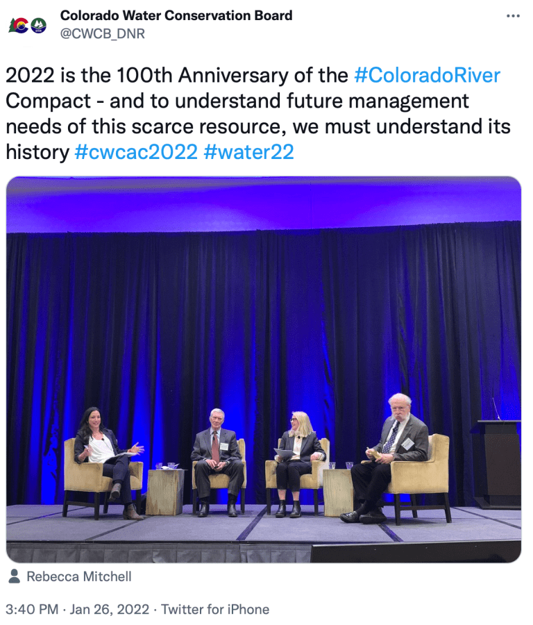
“We’re about to engage in some very difficult discussions,” said Rebecca Mitchell, director of the Colorado Water Conservation Board and the state’s representative on the Upper Colorado River Commission.
Mitchell’s comments came Jan. 26 at the annual convention of the Colorado Water Congress, which represents hundreds of Colorado water users and utilities, in Aurora.
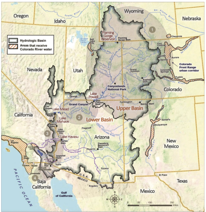
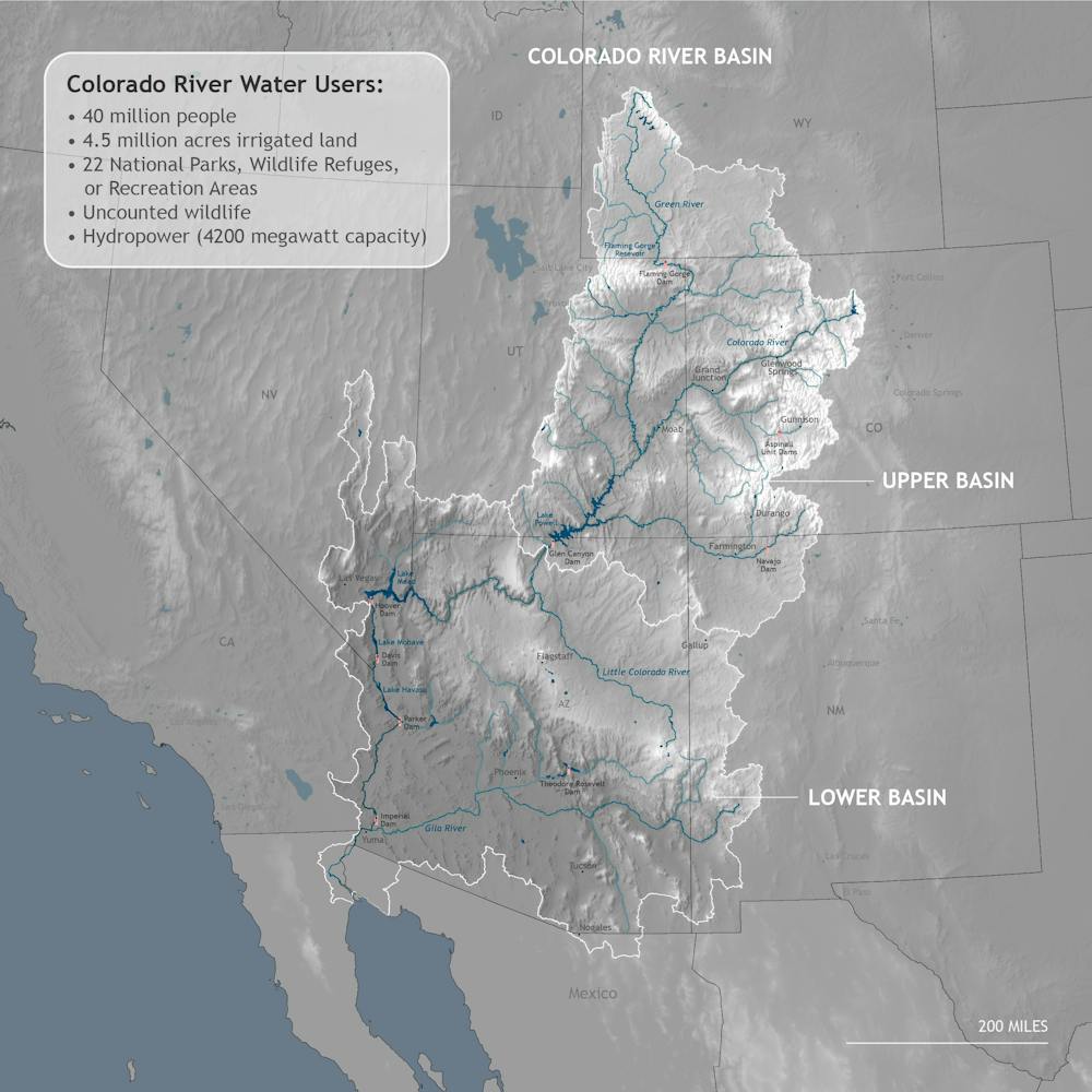
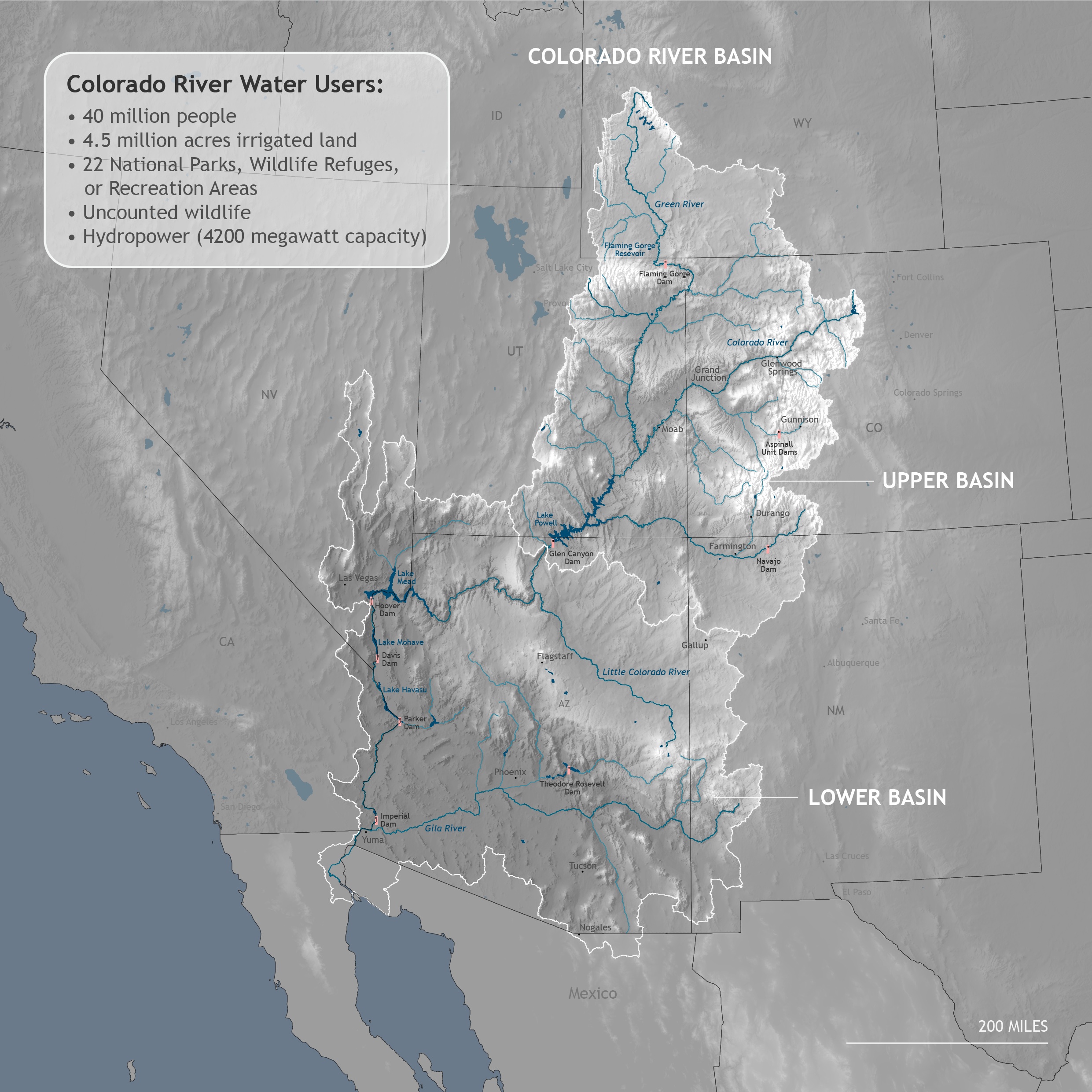
The Colorado River Basin includes the Upper Basin states of Colorado, New Mexico, Utah and Wyoming, and the Lower Basin states of Arizona, California and Nevada. It also includes 30 tribal nations and Mexico.
“One of the keys to our success is going to be that we are in line with the other basin states and the U.S. Department of the Interior, but that we are also working with other sovereigns and stakeholders to find solutions,” Mitchell said.
Mitchell and others credit the two agreements with keeping the system operational for much of the past 15 years.
“They were successful in that they slowed down the decline of the reservoirs and bought some time to see if hydrology improved,” she said. “News flash: It did not.”
Climate change, the 20-year megadrought affecting the basin, and population growth have super-charged the crisis, causing the river’s flows to decline faster than anyone anticipated, and lakes Mead and Powell to record their lowest levels since they were built, respectively, in the 1930s and 1960s.
The river system has deteriorated so quickly that last July the U.S. Bureau of Reclamation moved, within a matter of days, to begin emergency releases of water from Utah’s Flaming Gorge, Colorado’s Blue Mesa, and New Mexico’s Navajo reservoirs.
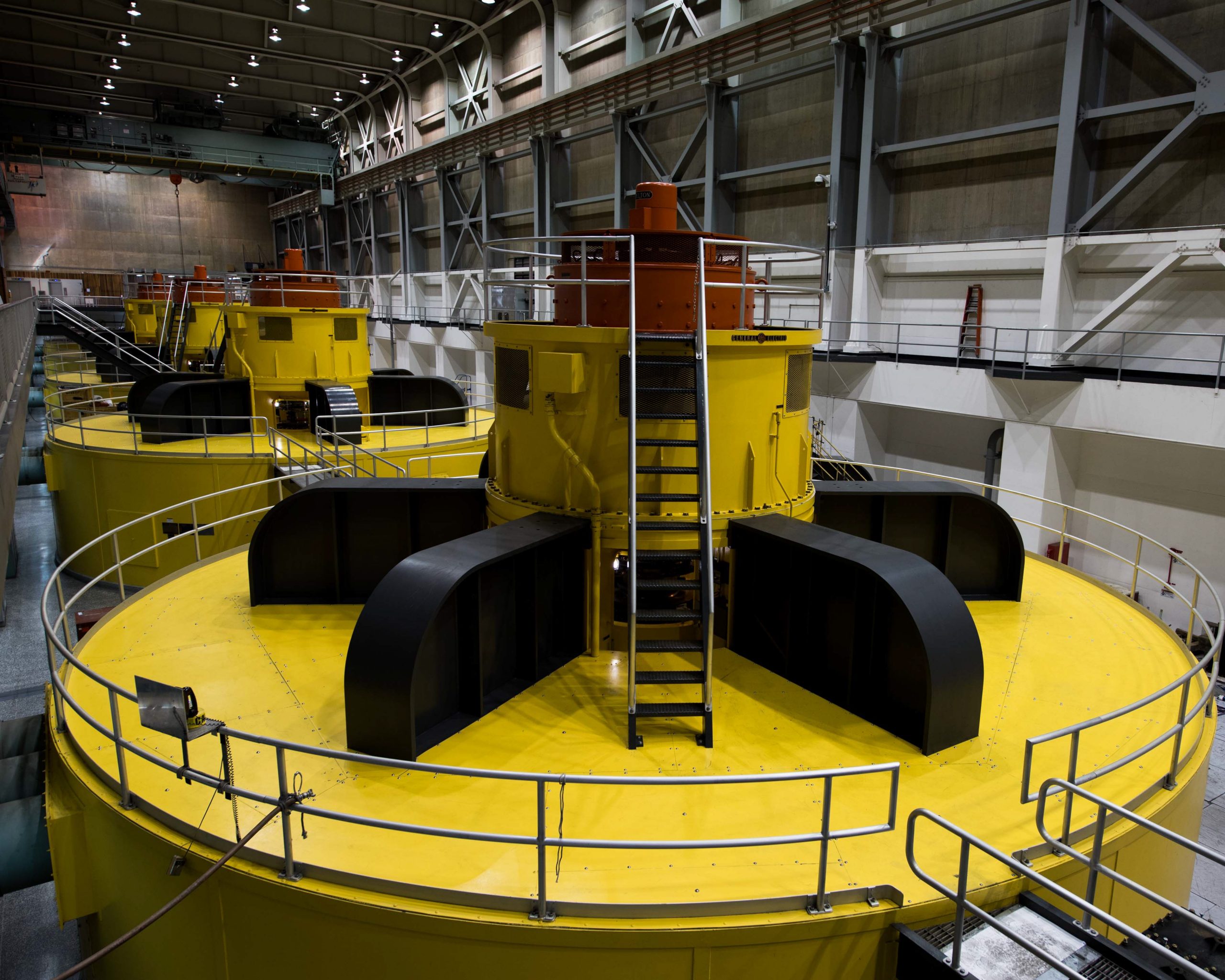
These turbines at Lake Powell’s Glen Canyon Dam are at risk of becoming inoperable should levels at Powell fall below what’s known as minimum power pool due to declining flows in the Colorado River. Photo courtesy U.S. Bureau of Reclamation.
The goal was to protect Lake Powell’s ability to produce hydropower, a green source of electricity that supplies more than 50 cities and electric companies in Colorado alone.
In addition, Lower Basin states have committed to reducing outflows from Lake Mead, a move that reduces some of the pressure on Lake Powell to the north. But few believe these actions will be enough to protect the river system as the weather forecast continues to deteriorate.
The majority of the mountain snows that feed the Colorado River fall in the Upper Basin. Although recent conditions have improved slightly, with snowpack reaching average or above average levels in the western half of Colorado, climate scientists say the runoff forecast is not matching up and attribute lower forecasts to the impact of badly depleted soil moisture caused by prolonged drought.
That has left Upper Basin state water officials wondering how much more water they will have to sacrifice to protect Lake Powell.
“The Secretary of Interior took action to release 150,000 acre-feet of water from Upper Basin reservoirs to protect Lake Powell levels. 36,000 acre-feet of that came from Blue Mesa. It left that unit at 27% full. We saw the harm that caused,” Mitchell said. “It’s difficult to think how much more we can provide.”
Lain Leoniak, an attorney and negotiator from the Colorado Attorney General’s office, said officials are hopeful that the new interim guidelines will contain a road map that hinges less on operating rules and more on weather forecasts.
Brad Udall: Here’s the latest version of my 4-Panel plot thru Water Year (Oct-Sep) of 2021 of the Colorado River big reservoirs, natural flows, precipitation, and temperature. Data (PRISM) goes back or 1906 (or 1935 for reservoirs.) This updates previous work with @GreatLakesPeck.
“We’re going to have to find a way to be responsive to extreme variability in hydrology,” Leoniak said. “We need flexibility built into any post-2026 guidelines, but we don’t want to be engaging in renegotiations every two to three years. That doesn’t work either.”
As teams from across the basin prepare to begin negotiating, Mitchell said Colorado and other Upper Basin states would push to ensure that no one state has to take on more of the burden than another, that all states, and such sovereign nations as the tribal nations and Mexico, as well as other parties, such as environmental groups, would be full participants in the negotiations.
Mitchell also said her negotiating team would push to ensure the Upper Basin states weren’t forced to give up more water than the downstream users on the system.
Under the terms of the 1922 Colorado River Compact, the Upper Basin and Lower Basin states are each entitled to 7.5 million acre-feet of water annually. But any excess water received, or left unused, in the Upper Basin flows to the Lower Basin because much of it cannot be stored here. That situation has given Lower Basin states access to surplus water over the years that they have become reliant on, a fact that Mitchell and others say has to change if the river is going to be brought into balance in this drier world.
“The compact’s intention was that we all had that equal footing. The fact that there have been states that have been able to overuse while we are using less than our apportionment … we don’t want them to get used to that overuse. We have to be focused on making sure that they adjust to what is available to them,” Mitchell said.
As the 1922 compact approaches its 100th anniversary in November, Mitchell said she was hopeful that agreements will be reached in the coming months that will help balance the river and allow it to function well for the next century.
“Hopefully people will be sitting here in 100 years saying [of the negotiators], ‘They did a good job.’”
Jerd Smith is editor of Fresh Water News. She can be reached at 720-398-6474, via email at jerd@wateredco.org or @jerd_smith.
Federal forest management dates back to 1876 when Congress created the office of Special Agent in the U.S. Department of Agriculture to assess the quality and conditions of forests in the United States. In 1881 the Department expanded the office into the Division of Forestry. A decade later Congress passed the Forest Reserve Act of 1891 authorizing the President to designate public lands in the West into what were then called “forest reserves.” Responsibility for these reserves fell under the Department of the Interior until 1905 when President Theodore Roosevelt transferred their care to the Department of Agriculture’s new U.S. Forest Service. Gifford Pinchot led this new agency as its first Chief, charged with caring for the newly renamed national forests.
New Colorado Springs homes could be surrounded by far more native grasses and flowers like penstemons and coneflowers, rather than endless seas of Kentucky bluegrass, to help preserve water.
The proposed Colorado Springs zoning code could limit the amount of grass irrigated with sprinklers around new homes to 25% of the yard, excluding areas where plants can’t grow, such as a driveway, patio or deck. The code would also encourage drought resistant and native plants. The limits on lawns would not apply to existing homes.
Putting in native plants rather than lawns would not only help conserve water but also help support native insects and birds, said Judith Rice-Jones, co-manager of the Mid Shooks Run Community Garden and a local conservation advocate…
As the U.S. urbanizes and new neighborhoods spring up with nonnative grass planted around every home it cuts into habitat and many species have to look elsewhere for food, she said. Lawns are the No. 1 irrigated crop in the country, according to NASA. In 2005, three times as many acres were dedicated to lawns compared to corn.
Instead of trying to replicate what grows easily in the Midwest, the new standards could better fit what grows naturally in town, Rice-Jones said…
Moving away from water-hungry grass is also key for the community as hundreds of thousands of new people move to the area and Colorado Springs Utilities seeks to bring in additional water from other basins to serve them. The city is already heavily dependent on outside watersheds, with up to 70% of the city’s water coming from the Colorado River basin. The river has been hit hard by drought in recent years with Lake Powell, a major reservoir for the western U.S., hitting a record low.
About 40% of total water use in Colorado Springs is used for outdoor irrigation, depending on weather. In the summer months, irrigation can make up about 60% of consumption, said Scott Winter, project manager for Utilities Water Resources and Demand Management.
The proposed landscaping rules that encourage native, drought tolerant plants are expected to be a “significant component” of future water conservation efforts, in part because the city has so much land yet to be developed, he said. For example, the 21,000-acre Banning Lewis Ranch on the city’s eastern edge that accounts for one-third of the community is largely undeveloped.
From email from the High Line Canal Conservancy (Suzanna Fry Jones):
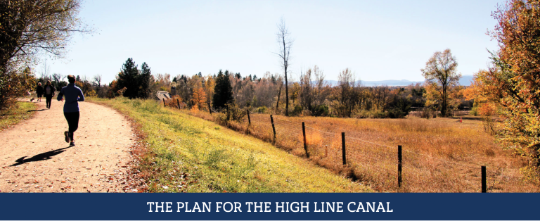
The Canal Collaborative officially launches to formalize the new governance model, making permanent the powerful public-private partnership between 13 regional partners, including the High Line Canal Conservancy and Denver Water
Denver, CO (January 26, 2022) – The High Line Canal Conservancy today announces the public-private partnership known as the Canal Collaborative that formalizes a new partnership between 13 regional entities to preserve, protect and enhance the 71-mile High Line Canal. This powerful collaborative brings partners together in a collective impact model – working together to support the Canal’s transition from a part of Denver Water’s historic irrigation system to its new role as a 71-mile linear park and emerging stormwater management system. The newly formed Canal Collaborative formalizes roles and responsibilities for the long-term management, funding and governance of the Canal
“This Partnership was built on the premise that together we can do more for the Canal than any one entity can do alone. The deep respect for varied local perspectives, combined with the power of the community’s vision and commitment has been a winning strategy that has resulted in a common vision and new governance structure to ensure the Canal is cared for as a vital backbone of our region’s open space system for generations to come,” said Harriet Crittenden LaMair, High Line Canal Conservancy Executive Director.
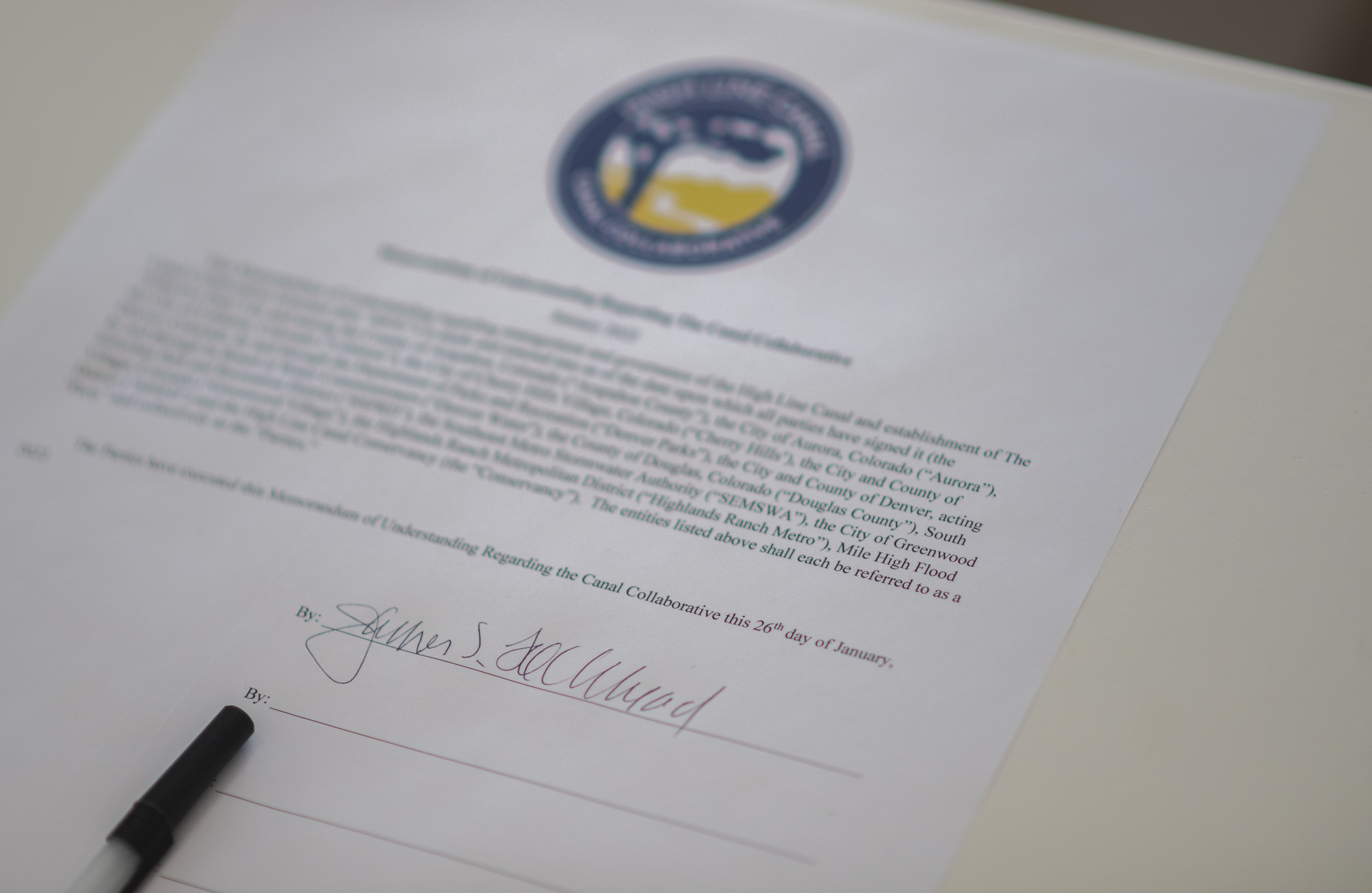
To formalize the launch of the Canal Collaborative, key leaders from across the region, joined together to witness Jim Lochhead, CEO and Manager of Denver Water, owner of the Canal, sign the long-awaited Memorandum of Understanding at the first annual State of the Canal. To a virtual audience of nearly 100, key leaders presented on Canal preservation and enhancement progress achieved to date and what’s to come in the next phase of improvements and implementation of The Plan for the High Line Canal (The Plan), including $130M dedicated for improvements over the next 15 years.
“Denver Water had a century old canal that had outlived its usefulness” said Jim Lochhead, Denver Water CEO. “We wanted to transform the canal into a recreational and environmental crown jewel for the region. And with the help of a dozen partners who shared the vision, we have come together to realize that vision through the Canal Collaborative.”
This model of regional collaboration started to take shape in 2010 when, for the first time in the 140-year history of the Canal, governments, agencies and a nonprofit partner from across the region stepped forward, committing to deep collaboration that resulted in a powerful regional community driven vision plan, a framework plan and new governance structure to guide the future of our regional legacy. These successful collaborations culminated in agreements to create the Canal Collaborative, memorializing collaboration in a collective impact model for long-term sustainability ensuring The Plan becomes a reality for the people of the region to enjoy for generations to come.
“Arapahoe County has committed tremendous resources to the Canal since 2010. We’re thrilled that this new entity will bring together the various jurisdictions so we can hear from each partner and the public about the best ways to preserve and protect the High Line Canal for the future,” said Arapahoe County Commissioner Nancy Sharpe.
Over the next 15 years, the collaborative will work together to implement over $130 million of trail improvements, including improved access and safety, enhanced environmental health for the region and improved quality of experience.
Canal leaders (left to right): Chief Executive Officer Jim Lochhead, Denver Water; Board Chair Paula Herzmark, High Line Canal Conservancy; Executive Director Harriet Crittenden LaMair, High Line Canal Conservancy; Commissioner Nancy Sharpe, Arapahoe County; Open Spaces Director Shannon Carter, Arapahoe County; Chief Operations and Maintenance Officer Tom Roode, Denver Water; Council Member Kendra Black, City and County of Denver; and Deputy Executive Director of Parks & Recreation Scott Gilmore, City and County of Denver. Photos by Evan Semón Photography 720-620-6767CEO Jim Lochhead of Denver Water signing the Memorandum of Understanding to officially launch the Canal Collaborative. Photos by Evan Semón Photography 720-620-6767Canal Collaborative Memorandum of Understanding. Photos by Evan Semón Photography 720-620-6767
Vail has begun methodically removing grass from its parks from areas that serve little purpose, partly with the goal of saving water. Buffehr Creek Park after xeriscaping. Photo: Town of Vail
Todd Oppenheimer has had a 33-year career in Vail, where he serves as the landscape architect and capital projects manager. Even 20 years ago, he was designing parks with turf. Now, he’s tearing it out.
“Maybe I’m making up for past sins here,” he said in a telephone interview after the town council approved his plans for partially de-turfing—it’s not a word yet, but maybe it will be someday—the second park in the municipality. The master list calls for removing what Oppenheimer calls “non-functional bluegrass” in eight parks.
The council OK’d ripping out 53% of the turf in the more south-facing and difficult-to-irrigate part of a small park called Ellefson.
Oppenheimer claims to have coined the saying that if the only person who walks on the grass is the person pushing a lawnmower, the grass shouldn’t be there. With that adage in mind, the town three years ago replaced 25% of the grass at the Buffehr Creek Park with less water-intensive plants. Included was the strip of grass between the sidewalk and the streets.
Vail has begun methodically removing grass from its parks from areas that serve little purpose, partly with the goal of saving water. Buffehr Creek Park before xeriscaping. Photo: Town of Vail
None of this is necessarily new. Denver Water decades ago created the word “xeriscape” to push the idea of vegetation appropriate to a semi-arid environment.
Xeriscaping has yet to become a mainstream thought in landscape architecture, but it’s gaining ground, says Oppenheimer.
“People are almost forced to,” he says, “because of climate change.”
If nestled in a valley at the headwaters of a Colorado River tributary, Vail has begun to see the effects of a warming climate. Dry years have been occurring more often, the temperatures have been rising. Oppenheimer says he sees no need to choose plants for warmer climates—yet. He does see an obligation to reduce water use appropriate to a drying climate.
About 95% of water used in homes and other buildings returns to streams after wastewater treatment. But of irrigation water, he says, only 25% does.
Oppenheimer insists he can only do his part as the landscape architect for one town, but in citing new policies in Las Vegas in a recent presentation to the Vail Town Council, he’s obviously aware of a much larger story in the Colorado River Basin.
Las Vegas has been ripping out turf for well more than a decade and has recently ratcheted up incentives even more. It has used both carrots and sticks. The Southern Nevada Water Authority estimates that unused grass in Las Vegas and its suburbs soaks up about 10% of Nevada’s entire allocation of water from the Colorado River—the main source of Southern Nevada’s drinking water.
A Nevada law prohibits Colorado River water from watering nonfunctional turf by 2027.
Tightening in Vegas continues in other ways. At the Colorado River Water Users Association conference in mid-December, Colby Pellegrino, deputy general manager for resources at Southern Nevada, described new proposals to trim water use at existing golf courses and ban water for new courses. Swimming pools will be cropped in size. Attention is being focused on the water use of evaporative cooling.
At a time when water in the Southwest is becoming increasingly scarce, more than 20 streams in the region are being proposed for protective safeguards in an attempt to preserve the waterways for years to come.
For the past two decades, a prolonged drought driven by climate change has snowpack levels in the Southwest on a continual downward trend. Obviously, that’s not good – less snow means less runoff for rivers and streams, and less water available for use.
As a result, a few years ago, a coalition of environmental groups started a process to locate and identify streams in the high country of Southwest Colorado that would qualify as Outstanding Waters (OW). The designation protects defined reaches of rivers, streams and lakes that have exceptional water quality.
The thinking, environmental groups say, is saving these pristine high-alpine streams in the face of climate change and worsening drought will ensure the long-term protection of tributaries that are vital for the region’s most important rivers, such as the Animas, Dolores, Gunnison, San Juan and San Miguel – which all feed into the Colorado River…
Really special rivers
The Outstanding Waters designation was established as part of the Clean Water Act of 1972. For streams to qualify, they must meet a set of criteria based on water quality and national resource values. And, the streams also must serve as critical habitat for aquatic life and have a component of recreational value, such as fishing or river running. Once designated, the water quality in those streams must be maintained and protected from any future development or use.
The Clean Water Act, however, left it up to states to create a process and specific criteria for streams to qualify as OW. In Colorado, that job falls to the Colorado Department of Public Health and Environment. “We protect every stream in Colorado, but this is the highest level of protection,” Blake Beyea, a water standards unit manager with CDPHE, said. “And it needs to be supported by water quality data, as well as evidence it’s an outstanding resource that requires protections.”
While the designation is somewhat seldom used, as of February 2020, Colorado had an estimated 78 stream segments and bodies of water, covering 5,869 river miles, classified as OWs, mostly located within wilderness areas and national parks. The environmental groups’ proposal – which includes SJCA, Trout Unlimited, American Waters and Pew Charitable Trust, among others – would be unique in terms of the amount of streams proposed and the fact the waterways are located outside wilderness areas, mostly on Forest Service lands…
Setting a standard
Back in 2019, the environmental groups started conversations on what streams might qualify as OWs. They looked at maps for high-altitude waterways that showed the potential for pristine water quality and impeccable habitat for aquatic life, while also escaping historical impacts from uses like mining and development over the years.
In all, nearly 30 streams emerged as potential OW candidates. Then, the next step was to prove it with on-the-ground water testing, an effort led by the Durango-based Mountain Studies Institute. That process lasted two years, with samples taken four times a year from each stream. In the end, the environmental groups ultimately proposed 26 stream segments (five in the Animas; nine in Dolores; seven in Gunnison; three in San Juan; and two in San Miguel).
An OW designation does not affect water rights and would not prohibit future development in these watersheds, Gaztambide said. It would, however, establish a baseline of water quality that cannot be impacted or degraded in the face of that development. And in some circumstances, it’s not just development; the waterways are also protected from things like an increase in recreation, which can result in elevated levels of E. coli.
Essentially, uses and development can change on the landscape; the existing, high-level water quality standards cannot…
Unintended consequences
Gaztambide and the environmental groups are optimistic all the streams they’ve proposed will attain the OW designation. And indeed, there doesn’t seem to be much pushback from other water users in the region, such as agriculture and water districts.
Steve Wolff, manager of the Southwestern Water Conservation District, which represents nine counties in Southwest Colorado, said it’s unlikely the district’s board will take a stance either way for the OW designation. To date, the board has just monitored and asked questions about any possible unintended consequences the listing may have.
One potential concern, Wolff said, is what outside impacts and degradation, like rising water temperatures driven by climate change, would have on the designation and the requirement to maintain those standards. “If that happens, what does that mean from a regulatory aspect?” Wolff said. “We really don’t know yet.”
Since most of the streams are located on Forest Service lands, another question has been raised on the impacts to grazing and logging. A Forest Service representative said Tuesday “we don’t have information to share about the designation at this time” and did not provide comment for this story. Gaztambide, however, said an OW designation does not impact uses like grazing.
A critical time
Peter Butler, who serves as a consultant for SWCD and has worked on water quality issues in the region for years, said he wasn’t aware of too many issues with the OW designation in Colorado over the years. In 2009, Hermosa Creek, for instance, was designated as the first OW outside of a wilderness area or national park, and the situation hasn’t run into any problems or controversy…
To nominate nearly 30 streams in one proposal is a big project, Butler said. But OW, though rarely used, is a way to protect precious water resources at a critical time, in a way that’s more regulatory and doesn’t have to go through a political process. In June, CDPHE’s nine-person Water Quality Control Commission is expected to vote on the proposal…
Gaztambide said the designation will also protect these vital tributaries, which provide a boost of clean water to major rivers should a large event, like the Gold King Mine spill or mudslides from the 416 Fire, seriously impact water quality and threaten drinking water for downstream towns.
Douglas County Commissioners hold work session as they decide on $20 million investment
DOUGLAS County Commissioners were told [January 18, 2022] that there is ample water in the San Luis Valley that can be exported to the Front Range and were shown a preliminary wellfield design for the northern end of the Valley.
Bruce Lytle, engineer for Renewable Water Resources’s proposal to move 20,000-acre feet of water a year to Douglas County, walked the three Douglas County commissioners through the Valley’s complex two-aquifer system and left them with the idea that there is water available for exportation.
“It doesn’t sound like there’s any controversy about the water being there. The water is there,” said Commissioner George Teal.
“I would agree with that,” said Lytle.
While Teal demonstrated interest in Douglas County partnering with Renewable Water Resources, Commissioner Lora Thomas voiced opposition to exporting water from the San Luis Valley. (You can read her letter to The Citizen explaining her position HERE.) That would leave Commissioner Abe Laydon as the deciding vote on whether Douglas County spends $20 million of its federal American Rescue Plan Act money, or COVID relief funds, to push the project forward into state water court.
Laydon said he’s planning to visit the San Luis Valley, including possibly having a community forum in mid-March at Adams State, to hear from Valley residents. RWR is dangling a $50 million community fund as part of its plan, and said it would also make a “$68 million investment to pay local San Luis Valley farmers and ranchers who voluntarily wish to retire their water rights above the market rate,” said spokesperson Monica McCafferty.
Colorado State Deputy Engineer Mike Sullivan offered the Douglas County Commissioners a starkly different picture of the Valley’s water situation.
“There’s no extra water,” Sullivan said, explaining that the groundwater supply is over-appropriated and actual Upper Rio Grande Basin streamflows in decline.
State Engineer Kevin Rein told AlamosaCitizen.com in an earlier story that RWR has misrepresented Douglas County’s reliance on the “Denver Aquifer” and a “proposed rule change” from the state engineer that RWR said would drastically affect Douglas County’s reliance on the Denver Basin.
“The cumulative effect of RWR’s statements is an inaccurate portrayal of the State Engineer’s actions and the facts,” said Rein.
San Luis Valley Groundwater
While Douglas County Commissioners were going through the RWR proposal in Castle Rock, the Rio Grande Water Conservation District Board of Directors was also in session. Board members heard little encouraging news about the Valley’s aquifers heading into the 2022 irrigation season:
The unconfined aquifer is at its lowest point since January 2013, with concerns that it hasn’t recharged as it typically does when there is little irrigation happening in the Valley.
Producers in Subdistrict 5 of the conservation district will likely face another irrigation season where groundwater wells are shut down.
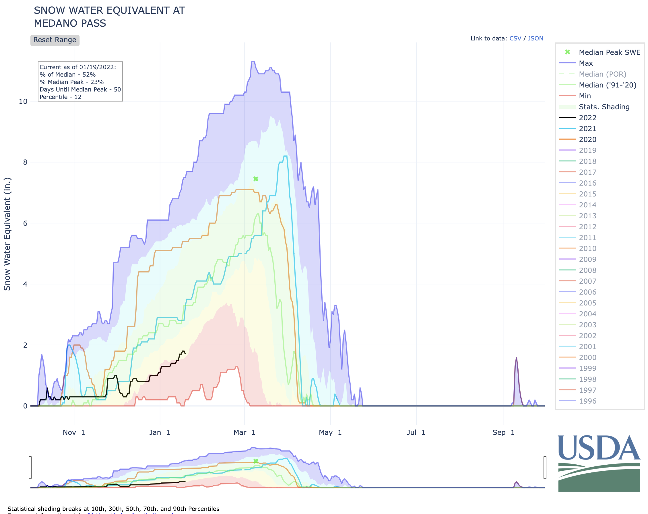
The Great Sand Dunes National Park experienced its fourth hottest year on record and the SNOTEL station that measures the runoff expected from Medano Creek is at 50 percent of normal for the season.
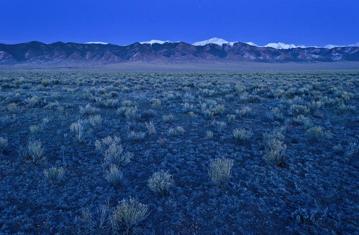
RWR’s proposal neighbors the Great Sand Dunes on the northeastern end of the Valley. Lytle, the engineer for RWR, said they expect to have 22 to 25 groundwater wells pumping, with the well depth at 2,000 feet and wells spaced a mile apart.
The San Luis Creek runs through the middle of the wellfield and Rio Alto Creek through the southwestern side. “The orientation of the project is designed to take advantage of the rim recharge coming off Sangre de Cristos,” said Lytle.
Convinced that there is water available for Douglas County, commissioners Teal and Lytle played out the scenario.
“And so it would be the water court process that determines ‘Is that water available for us?’” said Teal.
“You have to follow the rules. To me, if we follow the rules, then you can get a decree augmentation plan,” said Lytle. “Now, there’s always issues. I’ve been in water court enough to know that nothing is a slam dunk in water court.
“But obviously your best chance of success is if there’s a set of rules, and you follow those rules, then it makes it more difficult for issues to be raised relative to injury.”
RENEWABLE Water Resources has made an “inaccurate portrayal of the State Engineer’s actions and the facts” in its pitch to Douglas County to partner in exporting water from the San Luis Valley, State Engineer Kevin Rein said.
Rein, in an email response to a series of questions from AlamosaCitizen.com, said RWR misrepresents Douglas County’s reliance on the “Denver Aquifer” and how a “proposed rule change” from the state engineer would drastically affect Douglas County’s relationship with the aquifer.
“The cumulative effect of RWR’s statements is an inaccurate portrayal of the State Engineer’s actions and the facts,” Rein said.
Kevin Rein, Colorado state water engineer, explains why Colorado needs stepped-up measuring of water diversions in the North Park and other rivers in Northwest Colorado while Erin Light, Division 6 engineer, looks on during a meeting in Walden on Oct. 22. Credit: Allen Best
Rein said his office has not taken a position on the RWR proposal because the project, led by former Colorado Gov. Bill Owens, has not been formally submitted for regulatory review to the State Engineer’s Office. RWR is courting Douglas County as an investor in its efforts to export water from the San Luis Valley to Colorado’s Front Range. To move the project to formal review both by Rein’s office and state Division 3 Water Court, RWR needs to identify an end user for its effort to export water from the Valley.
The project has created an uproar, with city officials from Monte Vista the latest to blast it as a “scheme to transport our valuable water resources out of the San Luis Valley.”
“The idea that there is an abundance of water for Douglas County suburbia to continue to sprawl at the San Luis Valley’s expense is shameless,” Monte Vista officials said in a letter to AlamosaCitizen.com. The full letter is here.
Denver Basin Aquifer System graphic credit USGS.
In its pitch, Renewable Water Resources said Douglas County is overly dependent on the Denver Aquifer as its main water supply, and remaining dependent on it threatens the Denver suburb’s property values, economic growth and quality of life.
“Additionally, a proposed rule change could drastically impact Douglas County’s relationship with the Denver Aquifer,” RWR states in its pitch to Douglas County for money. “Colorado’s State Water Engineer recently urged Denver Metro water providers, including those located in Douglas County, to seek renewable sources of water other than the Denver Aquifer. This new guidance will limit the use of the Denver Aquifer and essentially maintain the Aquifer as a ‘preserve.’”
Rein, when asked about the accuracy of RWR’s statements, said, “First, as a matter of hydrogeology, there is one hydrogeologic feature known by scientists and water users as the ‘Denver Basin.’ It stretches from approximately Greeley to Colorado Springs and from the foothills to Limon. Within the Denver Basin is a layering of discrete aquifers that for administration purposes are treated as separate sources. Those aquifers, from the top layer to the bottom layer are: the Dawson Aquifer, the Upper Dawson Aquifer, the Lower Dawson Aquifer, the Denver Aquifer, the Arapahoe Aquifer, the Upper Arapahoe Aquifer, the Lower Arapahoe Aquifer, and the Laramie-Fox Hills Aquifer.
“This information is relevant because the (RWR) report states that ‘Douglas County is currently overly dependent on the Denver Aquifer as its principal water supply…’ However, I know that Douglas County municipal water suppliers and private well owners rely on nearly all of the aquifers I’ve listed, from the Dawson to the Laramie-Fox Hills. Their reliance is not on only the Denver Aquifer.
“Second, the (RWR) Report states, ‘Additionally, a proposed rule change could drastically impact Douglas County’s relationship with the Denver Aquifer.’
“The Report does not cite the claimed ‘rule change.’ For your information, the Division of Water Resources recently proposed amended Statewide Nontributary Ground Water Rules, which rules we regard as consistent with the General Assembly’s statutorily-described allocation of nontributary ground water (see SB73-213; section 37-90-137(4), C.R.S.). To my knowledge, neither RWR nor those Douglas County entities have shown evidence that the State Engineer has ever shown a different application of the General Assembly’s intended allocation. Therefore, I find no support for RWR’s claim that ‘a proposed rule change could drastically impact Douglas County’s relationship with the Denver Aquifer.’ As the State Engineer I believe that RWR should account for this claim since it appears to have no basis.
“In summary, there has been no rule change. If RWR believes the State Engineer’s long-standing application of state statute ‘drastically impacts’ Douglas County, they should also be aware that the State Engineer has not changed its application of the statute in the last 48 years. I am not aware of any evidence to the contrary.”
Renewable Water Resources said it relied on information from a January 2021 environmental law and policy alert on a call for public comment around the proposed amended statewide nontributary groundwater rules.
“Many conversations have and are taking place as to why Front Range cities and towns are going to need to depend less on the Denver Aquifer. And, why water providers in the Front Range are scrambling to find non-Denver aquifer sources,” said spokesperson Monica McCafferty. “This is a known fact in the Front Range and likely to be discussed more in the Douglas County public hearings.”
Rein had a third rebuttal to RWR when the group said in the proposal to Douglas County that Rein had recently urged Denver Metro water providers “to seek renewable sources of water other than the Denver Aquifer,” and called it “new guidance” from the State Engineer.
“I see no basis for this claim,” Rein told Alamosa Citizen. “Since 1996, the State Engineer’s Office has included notes on our correspondence to Douglas County regarding subdivision water supplies that remind the county of the non-renewable nature of the Denver Basin as a water supply. We include the same information on Denver Basin well permits that we issue. We provide this information as a courtesy since we are an agency that knows the science and administrative aspects of the Denver Basin.
“The next statement in the report states that ‘(f)or Douglas County, this ruling is an imminent and practical challenge and catalyst for necessary change.’ The basis of this statement is confusing since there has been no ‘ruling.’ The non-renewable nature of the Denver Basin is the result of hydrogeologic events that occurred millions of years ago. Allocation directives that were put in statute in 1973 reflect that nature of the Denver Basin. Nothing that the State Engineer has done has made the challenge any more ‘imminent.’
“Each of these items may seem small,” Rein said, “but the cumulative effect of RWR’s statements is an inaccurate portrayal of the State Engineer’s actions and the facts.
“I have only commented on the aspects of the letter that portray the State Engineer and our actions in a way that I believe is inaccurate. I will not comment on RWR’s opinions or judgments of Douglas County’s ongoing efforts.”
RWR also misrepresents a Dec. 2018 letter from Rein to the Rio Grande Water Conservation District, Rein said. At that time, Rein had sent correspondence to General Manager Cleave Simpson on the amended Plan of Water Management for Subdistrict 1, and the legal authority he has to curtail groundwater diversions from Subdistrict 1 wells if the conservation district isn’t making progress toward restoring the unconfined aquifer to a sustainable level as ordered by the state water court.
RWR said in its proposal to Douglas County that Rein would shut down wells in the subdistrict for a minimum of three years, boosting its project since its efforts do not rely on the unconfined aquifer.
“Regarding RWR’s reference to my December 2018 letter, if the State Engineer is put in a position of curtailing wells, it would not be ‘…so the objective of the Subdistrict 1 groundwater management plan can be achieved…’ as I read in the proposal. Rather, it would be the result of a regulatory decision that would be necessary due to the fact that the Subdistrict’s Annual Replacement Plan does not meet the objectives of the Rules and the Groundwater Management Plan. This is stated in the December 2018 letter. My letter did not address the amount of time the wells would be curtailed and I don’t know the basis of RWR’s claim that the wells would be curtailed for a minimum of three years.
“As I noted earlier, for RWR’s concept to operate, among other things, they would need to demonstrate through a detailed court approved plan that they would have no impact on the basin as a whole. That is yet to be seen.”
Threatened and endangered native fish of the Colorado River need access to the most basic of resources for recovery — adequate natural streamflow, according to new research. (Photo courtesy Nate Cathcart)
Rivers need water — a fact that may seem ridiculously obvious, but in times of increasing water development, drought and climate change, the quantity of natural streamflow that remains in river channels is coming into question, especially in the Colorado River basin. Newly published research from Utah State University poses a tough question in these days of falling reservoir levels and high-stakes urban development: whether the continued development of rivers for water supply can be balanced with fish conservation.
Historically, the Colorado River basin has been highly dynamic with a wide range of streamflow, river temperatures and large sediment loads. Native fish evolved through periods of wet and dry cycles. But water-supply development has depleted the flow of many rivers in the Upper and Lower Colorado River basins, and today’s river habitats are increasingly decoupled from the natural cycle of spring snowmelt, monsoon-season floods and intervening low flows in favor of development and for stocking nonnative sports fish.
The health and recovery of native fish species now depends largely on the public’s willingness to protect rivers that retain some semblance of a natural flow regime as freshwater conservation areas, say authors Casey Pennock, Phaedra Budy, Wally Macfarlane and Jack Schmidt of the Watershed Sciences Department in the S. J. and Jessie E. Quinney College of Natural Resources and colleagues.
“Most people who study or manage fishes know that complex habitat required by native fish is created and maintained by adequate river flows, or a natural flow regime,” said Budy. “Nonetheless, society continues to manage our desert rivers as if we think that fish don’t need water. If we continue down this path, we will watch native fishes, some of which are found nowhere else on Earth, blink off the planet.”
Graphic via Holly McClelland/High Country News.
Dams have changed the natural flow in many rivers in the Colorado River basin, but a more pressing problem is the depletion of flow such that little water remains in the channel. At a regional scale, water in the Colorado River basin is completely consumed and no water reaches the Gulf of California in most years. Even in the Upper Colorado River basin, some streams, such as the Duchesne, Price and San Rafael Rivers are nearly completely depleted of natural flow. If there is not enough flow in the river, other conservation efforts for native fish don’t really matter, say the authors.
Endangered fish recovery programs are designed not to interfere with existing or proposed future water development. The task of recovering endangered native fish populations may be an impossible goal wherever natural streamflow is declining due to a warming climate and wherever consumptive water uses are increasing, according to the authors. Despite decadeslong efforts by state, federal, tribal and private organizations, some native fish can’t maintain self-sustaining populations in the Colorado River basin today, and some species would be extinct without federal stocking programs.
“Managing for the minimum amount of water necessary to sustain native fish during dry spells is a common approach, but there are not many places where this strategy is sufficient to recover and protect native fish. We think conservation of natural flows is critical for long-term conservation of fish,” Pennock said. “In some rivers there have been attempts to recreate the benefits of natural flow with managed releases from large dams to reduce the negative downstream impacts of water development. These kinds of actions can have some localized benefit, but they are not likely to help native fish long-term or large-scale.”
Schmidt, who also directs Utah State’s Center for Colorado River Studies, stressed the importance of action.
“This study reminds us that increasing consumptive water use in an era of declining natural streamflow inevitably jeopardizes one of the Colorado River’s most distinctive attributes — its endemic native fishery,” Schmidt said. “If we care about protecting natural river ecosystems, then we as a society are going to have to care about leaving significant amounts of water in our rivers.”
If you look at a map of southeastern Yuma County, Colorado, you’ll find a bumpy blue line labeled “South Fork Republican River.” But, for the majority of the year, this channel contains little to no visible water flow.
“So, the thing is, if we were to go upstream four or five miles, there’s flow,” Deb Daniel said while driving along a dusty road, adjacent to the riverbed in what used to be known as Bonny Lake State Park. She points to a stretch of riverbed covered with invasive Russian Olive trees. “There’s so much trees grown up in that area, and it’s so filled in with silt, that (the South Fork) completely disappears.”
The Republican River basin sustained Daniel’s family’s farm when she was growing up. In 2017, the six Colorado counties relying most on this river’s basin brought almost $2 billion in agriculture sales — just under a third of the state’s total $7.5 billion production value.
“There is such joy when I see water flowing,” Daniel said. For the last 20 years, she’s watched over the river as its conservation district manager. “And on the North Fork, it flows year-round.”
The Republican River basin. The North Fork, South Fork and Arikaree all flow through Yuma County before crossing state lines. Credit: USBR/DOI
That’s up in Northern Yuma county. These two forks (and the also-barely-flowing Arikaree River in central Yuma County) are tributaries that start in different parts of northeast Colorado and combine in Nebraska to feed the main body of the river…
Water still flows for most of the Republican’s 453-mile stretch. But the North Fork is going down…
‘A losing battle’
With North Fork flows decreasing and the South Fork and Arikaree barely running, the ecosystem suffers, Colorado risks major legal trouble with Kansas and Nebraska and people who farm these plains stand to lose their livelihoods.
Center pivot sprinklers in the Arikaree River basin to irrigate corn. Each sprinkler is supplied by deep wells drilled into the High Plains (Ogallala) aquifer.
The Republican River’s water levels drop partially because water in the ground surrounding it and beneath it is being used up, mostly to irrigate farms. And, in turn, part of the reason that groundwater isn’t as replenished is because of the river’s limited water.
It’s a dynamic [Joyce] Kettelson has long been aware of, weighing the water longevity for the community against her family’s economic security…
Severe drought conditions plagued portions of Yuma County for the majority of the last two years. Parts of the county have experienced moderate drought during almost half of the last two decades.
According to the U.S. Drought Monitor, severe drought conditions often reduce river flows and harm farming operations. Yuma is the only county that all three main tributaries of the Republican River run through…
Running out of options
Most of the irrigation shuttering has to happen near the South Fork in Yuma and Kit Carson counties. Despite the river conservation district and federal government offering to pay farmers who participate, just a third of the 10,000-acre goal has been met as of Jan. 6, 2022.
A booming market for irrigated crops, like corn and wheat, over the last two years made it hard to convince farmers to exchange those profits for the irrigation-shutoff payments.
Last month, the river conservation district board voted to more than double yearly water use fees so that they could also significantly increase the amount they offer to farmers who stop irrigating around the South Fork. Several board members of the groundwater districts Midcap manages also sit on the river district board and helped make that decision.
So now, someone farming 100 acres would have to pay $45,000 to irrigate for 15 years instead of the $21,750 they paid before the fee increase. If that farmer’s land is within a mile of the South Fork and they enter the program to totally retire the land for 15 years, they would now get paid more than $67,000 instead of $52,875.
“They’ve known that they’ve needed to retire them for eight to 10 years,” Midcap said. “But the actual process of getting the fee increased has taken at least nine months.”
Part of the reason for the hold-up, several local officials told KUNC, is that the conservation board members are often farmers and ranchers themselves. So they struggle to make decisions that could hurt them and their neighbors financially…
[Note] Midcap later made a point to say that he has hope because the county can sustain itself on the remaining groundwater for at least another century…
Midcap is confident that enough irrigated acres will be shut down to keep the state in compliance with the 2024 deadline. But there’s a second deadline: another 15,000 acres must shut down by 2029. He’s less confident about that…
“But we’re between a rock and a sword. There is no other option,” said Deb Daniel, Republican River Water Conservation District manager. “If we don’t get this done, the state of Kansas could virtually force our state engineer to shut off irrigated ag in northeast Colorado, and we can’t let that happen.”
Interest in irrigation-shutoff programs has already sharply increased since the district increased the payments it offers, she added…
The actions needed to fulfill the compact, protect the river and keep the agricultural economic backbone of these communities strong can intersect, she said, but often end up at odds. There are a lot of hard decisions to be made…
She’s inspired by the producers changing their crops to ones that use less water, and by those finding ways to farm without irrigation at all. She’s helping the conservation district, county government and Colorado Parks And Wildlife working on a $40 million plan to get water flowing through the South Fork around Bonny Reservoir again.
But, Daniel admits, the river will likely never return to its former glory. At this point, it’s all just mitigating losses.
The country’s second largest potato producing region, is in its 18th year of drought in 2020. The San Luis Valley in Colorado is known for its agriculture yet only has 6-7 inches of rainfall per year. San Luis Valley via National Geographic
RWR’s proposal to Douglas County is, for an initial payment of $20 million, to build a pipeline that would bring 22,000 acre-feet of water from the San Luis Valley aquifer to the Front Range. If Douglas County agrees, the $20 million would come from ARPS stimulus money.
Struggling with water scarcity, changing climate, and aquifer depletion, San Luis Valley residents object to the proposal. A formidable group has organized around the belief that there is no water available to move outside the San Luis Valley.
Protect Our Water–San Luis Valley lists as members: 15 local water districts and entities; 22 cities and towns; 22 conservation and environmental groups; and two farm groups. On its website local governments in opposition to RWR’s proposal include the Rio Grande Water Conservation District and the Towns of Crestone and Saguache.
Despite their marketing assertions, RWR’s plan to export water from the San Luis Valley was not devised by locals nor will it benefit the entire valley.
RWR needs to find a customer like Douglas County to move its proposal forward. The plan relies on drawing water from the Upper Rio Grande Basin and exporting it to the Front Range. Without an identified end user for the exportation and sale of the water, RWR can’t file its plan in Colorado Water Court.
While the project has been in the works for some time, many questions remain unanswered.
RWR does not own municipal water rights, and RWR would need to buy wells and well rights before filing in court to convert irrigation water rights to municipal water rights.
Until recently, RWR executives asserted specifics about project locations, timetables, or costs were uncertain because they are focused on winning valley support and filing a legal case in Colorado’s water court, which could take three to five years to process. That case would help determine whether the San Luis Valley has enough water for RWR to legally export without hurting existing users.
In general, the proposal before Douglas County Commissioners reveals that RWR would build a wellfield northeast of Moffat. A pipeline would carry water north along state Highway 17, more than 1,000 feet up and over Poncha Pass to two access points along the South Platte River Basin, one at Antero Reservoir and another Elevenmile Reservoir, both in Park County.
In addition, a $50 million “community fund” would be developed under the RWR proposal to assist local communities with schools, broadband or food banks, senior services or job training. A separate pool of money, about $68 million, would pay farmers and ranchers who agree to sell their water rights, known in agriculture circles as “buy and dry.”
Those dollars will come from long-time private investors, according to Sean Duffy, a spokesman for RWR.
An agreement using stimulus money would give Douglas County access to needed water at less than half the typical rate of $40,000 to $50,000 per acre-foot, said RWR spokesman Sean Duffy…
Duffy also pointed out that both the water and economic status quo in the valley are not currently sustainable. Critics say the RWR project will only make the situation worse, while supporters argue it offers a more sustainable solution to the state’s water woes.
The San Luis Valley is described as one of the most arid regions in Colorado, receiving less than 9 inches of precipitation annually. In recent years snowfall on the Sangre de Cristos has been perceptibly less, resulting in reduced stream flows and reduced recharge of the two aquifers below the valley floor.
The shallow unconfined aquifer has been tapped with wells for crop irrigation for several generations and is over-appropriated. Below lies the confined aquifer which Renewable Water Resources believes holds a billion-acre foot of water.
That one-billion-acre foot estimate is highly disputed by local water managers, farmers and ranchers.
San Luis Valley Groundwater
Since 2012 many farms and ranches in the valley have already made self-imposed cuts in irrigation to try and prevent further depletion of the shallow aquifer. A number of subdistricts have been formed as local farmers’ only way of buying more time to solve depletions to the aquifer in their own way. Each subdistrict has until 2031 to replenish water to a predetermined level. Failure to meet those targets could result in the State Engineer’s office shutting down wells until the aquifer reaches that target through unimpeded recharge with no groundwater pumping.
RWR’s proposal is offering very similar benefits to those proposed by Stockman’s Water in 1998, a project that ultimately failed.
Stockman’s Water proposed to export at least 100,000 acrefeet annually, mitigating any water losses by offering, in exchange, 25,000 to 50,000 acre-feet of senior water rights.
Gary Boyce, the manager/ owner of Stockman’s Water, also promised a $3 million trust fund to be administered by Saguache County, and environmental benefits—more riparian and wetland habitat. Renewable Water Resources offers the potential opportunity to add over 3,000 acres to the Baca Wildlife Refuge located off of County Road T.
Cleave Simpson has met with the Douglas County Commissioners. Using federal American Rescue Plan Act funds for the RWR proposal is a twist he didn’t see coming.
“I think it’s unconscionable to use those federal dollars to diminish one community in support of another community,” he said. In addition to representing the San Luis Valley in the Colorado Senate, Simpson is the general manager of the Rio Grande Water Conservation District, which is leading the opposition to the RWR plan.
Simpson reminds us that there is a long history of legal fights over water export claims in the San Luis Valley. The Rio Grande Water Conservancy District already had money set aside to challenge the RWR proposal after the court awarded valley residents legal fees from a previous failed export case involving a developer in the 1970s, called American Water Development Incorporated.
The U.S. Bureau of Reclamation announced Friday that it plans to adjust management protocols for the Colorado River in early 2022 to reduce monthly releases from Lake Powell in an effort to keep the reservoir from dropping further below 2021’s historic lows.
As of Thursday, the nation’s second-largest reservoir — part of a Colorado River system that provides drinking water to approximately 40 million people throughout the West — sat at an elevation of 3,536 feet. That’s 27% of the reservoir’s capacity, 164 feet below full and just 11 feet above the bureau’s target elevation of 3,525 feet, designed to give a 35-foot buffer before “dead pool.” Below 3,490 feet of elevation, Lake Powell dips into a zone where the generation of hydropower by water flowing through the Glen Canyon Dam becomes unreliable.
According to a bureau news release, the modified delivery schedule will not alter the total amount of water let through Glen Canyon Dam over the course of the year but will hold back a cumulative 350,000 acre-feet between January and April to help Lake Powell recover from lows that left many boat ramps unusable at the popular recreation site last summer.
Despite a wet October giving water managers hope that the region might make some progress towards recovery amidst a 22-year drought, this past November was the second-driest on record and inflows came up 1.5 million acre-feet short of the Bureau’s projections from the previous month. When adjusted December projections anticipated Lake Powell dropping below 3,525 feet as soon as this February, the agency convened partners from the basin states, Tribes, federal agencies, non-governmental organizations and water managers to devise a new management scheme…
Scientists, however, are not sure spring runoff will materialize. In the 22nd year of regional drought, the term “aridification” is gaining traction as the better way to describe what might be a long-term drying of the American West, influenced by climate change.
“We need to be extra vigilant and careful, because we do not know what lies ahead,” said Jack Schmidt, director of Utah State University’s Center for Colorado River Studies in response to Friday’s announcement. “Looking into the future, none of us can know precisely what’s going to happen this year. We have had times when we’ve looked great at the end of February, and then had an exceptionally dry March and the snowpack evaporated.”
Schmidt was the senior author of a white paper published by a group of hydrologists last February that analyzed the future of Colorado River flows under various climate change and use scenarios. Their findings predicted that, given drying trends and a growing western population, projected basin-wide rates of water consumption could result in Lake Mead or Lake Powell running dry as soon as 2050, halting hydropower operations and negatively impacting the Grand Canyon ecosystem.
[…]
Figure ES-3. End-of-year combined Lake Powell + Lake Mead storage using hydrologic conditions sampled from the Millennium Drought (2000-2018) demonstrates the effects of a range of Upper Basin demand ‘caps’ along with a range of Lower Basin maximum shortages triggered when the combined storage falls below 15 maf. The status quo uses the 2007 UCRC Upper Basin schedule and elevation-based shortage triggers. Credit: The Center for Colorado River Studies
Wayne Pullan, regional director of the bureau’s Upper Colorado Basin, agreed [January 7, 2022] that there is uncertainty in the system…
In response to this, the agency plans to continue to monitor the basin’s hydrology and may make further adjustments to protect Lake Powell’s elevation. These could include sending additional water downstream to the reservoir from Colorado River Storage Project units at Flaming Gorge, Blue Mesa and Navajo reservoirs. Bureau officials will also continue to work with Upper Basin states on a Drought Response Operations Plan, due out in April 2022.
Schmidt, meanwhile, sees three shades of a silver lining to Friday’s doomsday-seeming announcement from the Bureau.
First, his team in February concluded that estimates of future consumptive use calculated by the Upper Colorado River Commission may be overinflated, giving the seven states that rely on this supply some additional wiggle room. If the western states learn to better live within their water means, their populations can grow without tanking the Colorado River system, they argue.
The second point, towards this end and also outlined in the February white paper, is that opportunities to stretch the supply further by improving water conservation efforts still abound. This is an argument often made by environmental groups critical of per capita water use rates in Utah’s Washington County which, by many measures, far exceed those in other similar desert communities…
Schmidt’s third note of positivity in reaction to Friday’s announcement from the Bureau is that the modified release schedule for Lake Powell actually better mirrors the natural flows of the Colorado River. Ecologists are often critical of the impact dams have on riparian environments. If we’re dealing with a situation of diminished overall flows, Schmidt says, it makes sense for artificial releases to be especially reduced in winter months when the river is lowest in its natural state.
Here’s the release from Colorado Parks & Wildlife (Jason Clay):
Colorado Parks and Wildlife is seeking applications for wetland and riparian restoration, enhancement and creation projects to support its Wetlands Program Strategic Plan.
Swim class on the San Juan River. Photo: Brent Gardner-Smith/Aspen Journalism
CPW will award up to approximately $1.25 million in funds from Great Outdoors Colorado (GOCO) and Colorado Waterfowl Stamps to projects in Colorado that support the Wetlands Program Strategic Plan’s two main goals:
Improve the distribution and abundance of ducks, and opportunities for public waterfowl hunting. Applications supporting this goal should seek to improve fall/winter habitat on property open for public hunting (or refuge areas within properties open for public hunting) or improve breeding habitat in important production areas (including North Park and the San Luis Valley in Colorado, and other areas contributing ducks to the fall flight in Colorado).
Cinnamon Teal by NPS Patrick Myers.
Improve the status of declining or at-risk species. Applications supporting this goal should seek to clearly address habitat needs of these species. See species list on the Wetlands Priority Species page.
The application deadline is Wednesday, Jan. 26. The Wetlands Funding Request for Applications (RFA) is available on our website, which can be accessed by clicking here.
American beaver, he was happily sitting back and munching on something. and munching, and munching. By Steve from washington, dc, usa – American Beaver, CC BY-SA 2.0, https://commons.wikimedia.org/w/index.php?curid=3963858
A new Tier 1 priority species this year is beavers. Beavers are a keystone species and ecosystem engineer that create and maintain healthy wetland and riparian habitats. Many mountain ponds, willow thickets and meadows are the works of beavers over time. These habitats aid in controlling floods, providing refugia during wildfires, improving water quality and preventing soil erosion.
Tier 1 species are the highest priority for project funding.
The Colorado Wetlands for Wildlife Program is a voluntary, collaborative and incentive-based program to restore, enhance and create wetlands and riparian areas in Colorado. Funds are allocated annually to the program and projects are recommended for funding by a CPW committee with final approval by the Director.
“Wetlands are so important,” said CPW Wetlands Program Coordinator Brian Sullivan. “They comprise less than two percent of Colorado’s landscape, but provide benefits to over 75 percent of the species in the state, including waterfowl and several declining species. Since the beginning of major settlement activities, Colorado has lost half of its wetlands.”
Since its inception in 1997, the Colorado Wetlands Program and its partners has preserved, restored, enhanced or created more than 220,000 acres of wetlands and adjacent habitat and more than 200 miles of streams. The partnership is responsible for more than $40 million in total funding devoted to wetland and riparian preservation in Colorado.
A South Platte River Water Update will be held in Brush on Wednesday [January 12, 2022]. The half-day program includes updates on the Master Irrigator Program, the Northern Integrated Supply Project, salinity in the South Platte and the Platte Valley Water Partnership project.
The update will be held at the Riverview Event Center, 19201 County Road 24, near Brush. It will begin at 8:50 a.m. and run until noon. Lunch will be served.
The Colorado Master Irrigator program offers farmers and farm managers advanced training on conservation- and efficiency-oriented irrigation management practices and tools. The program is the product of efforts led by several producers, district management representatives, and others interested in conserving groundwater in eastern Colorado. The program is modeled on the award-winning Master Irrigator program created and run since 2016 by the North Plains Groundwater Conservation District in the Texas panhandle.
Greg Peterson of the Colorado Ag Water Alliance and Roxy McCormick, Master Irrigator in the Republican River Basin, will present the information.
[Brad] Wind, general manager of the Northern Colorado Water Conservancy District, will provide an update on NISP. Construction has been under way for several month on the project, which will provide about 40,000 acre-feet of new, reliable water supply. The project consists of two reservoirs, Glade and Galeton, a forebay reservoir, three pump plants, pipelines to deliver water for exchange with two irrigation companies and for delivery to participants, and improvements to an existing canal to divert water off the Poudre River near the canyon mouth.
Grady O’Brien, CEO of Neirbo Hydrology, will present information on salinity in the lower reaches of the South Platte River. Salinity has been a growing problem as urban development and agricultural irrigation have added to the river’s saltiness. The water doesn’t taste salty – it contains only 0.12 percent salts compared with ocean water’s 3.5 percent – but the increasing salinity does have a negative impact on the soil. Salt in the soil suppresses the level of potassium, which is necessary for plants to take up nitrogen and create new plant material.
Old-fashioned flood irrigation used to leach the salts out of the soil, but more efficient irrigation methods don’t put enough water on the ground to do that. And, while the amount of salt in the river at Sterling seems miniscule, it is nearly twice the amount in the Denver area, just above Broomfield, and more than six time the salinity of the river above Denver.
Joe Frank, general manager of the Lower South Platte Water Conservancy District, will talk about the Platte Valley Water Partnership. It is a joint water supply project by the LSPWCD and the Parker Water and Sanitation District to use a new water right that the two entities are developing along the South Platte River near Sterling.
The project will use new and existing infrastructure to store and transport water for agricultural use in northeastern Colorado and municipal use along the Front Range. The partnership involves the phased development of the water right. The early phases would involve a pipeline from Prewitt Reservoir in Logan and Washington counties to Parker Reservoir, which supplies the City of Parker. Later developments would see a 4,000-acre-foot reservoir near Iliff on land owned by Parker, and a 72,000-acre-foot reservoir near Fremont Butte north of Akron. A pipeline, pump stations, and treatment facility will also be built as part of the project.
Anyone wanting to attend the update presentations can register by contacting Madeline Hagan, morganconservationdistrict@gmail.com (970) 427-3362 or Amber Beeson, centennialcd1@gmail.com (970) 571-5296.
Here’s the release from Colorado Parks & Wildlife (Travis Duncan):
Colorado Parks and Wildlife is celebrating its 125th anniversary in 2022 by telling the agency’s long history of wildlife conservation and outdoor recreation in a series of stories, videos, podcasts and community events over the coming 12 months.
Historical Photo: Colorado Game and Fish Department – Fish Planting Car No. 1
“This 125th anniversary is an opportunity to shine a spotlight on Colorado Parks and Wildlife’s mission of perpetuating the wildlife resources of the state and providing quality parks,” CPW Director Dan Prenzlow said. “Through a year of celebrating our past, present and future, we’ll show our dedication to educating and inspiring future generations to become stewards of our natural resources.”
The past
Using Colorado Outdoors Online, the CPW website, social media channels and traditional outlets, CPW will publish a series of stories describing the history of the past 125 years of state park and wildlife conservation in Colorado. We’ll highlight stories such as:
In the Gunnison River gorge, CPW Aquatic Biologist Eric Gardunio, holds a whirling-disease resistant rainbow trout. CPW is stocking fish resistant to the disease throughout the state. Photo credit: Colorado Parks and Wildlife
CPW’s terrestrial and aquatic biologists and researchers whose groundbreaking work has led the fight against chronic wasting disease in moose, elk and deer, combatted whirling disease in fish, expanded our understanding of the genetics of various species and helped the agency become a leader in balancing the carrying capacity of habitat with the various wildlife species competing on the landscape.
Greenback cutthroat trout photo credit: Colorado Parks and Wildlife.
CPW’s dedicated staff has helped restore the endangered black-footed ferret, bald eagles, lynx, Peregrine falcons, the Preble’s meadow jumping mouse, greenback cutthroat trout, boreal toads, Gunnison’s sage grouse, moose, Rio Grande and Colorado river cutthroat trout, and many other critical fish and wildlife species.
Came across an 1898 story in the St. Louis Post Dispatch about a 26-year-old woman, Annie Metcalf, a Missouri native, serving as a game warden in Colorado. She was the first woman to hold the title in Colorado and reportedly only the second nationwide. Credit: Colorado Parks & Wildlife
A profile of Annie Metcalf, Colorado’s first woman game warden. She was appointed a deputy game warden in 1898 in Routt County. She wasn’t afraid of mountain lions but she dreaded cows!
The story of her modern successors, starting with Susan Smith, the first woman appointed a District Wildlife Manager in Vail in February 1975.
A view of the boat ramp at Horseshoe Lake, Lathrop State Park, in Huerfano County, Colorado. The Spanish Peaks are in the background. By Jeffrey Beall – Own work, CC BY 4.0, https://commons.wikimedia.org/w/index.php?curid=61707075
The evolution of roadside parks and state recreation areas into our first state park, Lathrop near Walsenburg, on June 9, 1961, and our current roster of 43 state parks that offer world class outdoor recreation.
The present
CPW will be hosting events and receptions at state parks and offices around Colorado this year. Sign up for CPW’s eNewsletters and keep your eye on your inbox for events near you.
The future
CPW will soon be opening our 43rd state park at Sweetwater Lake, crafting a management plan for the restoration of gray wolves and introducing a Keep Colorado Wild Pass in 2023 that can be purchased during the Colorado vehicle registration or renewal process.
Photo credit: Colorado Parks & Wildlife
Photo credit: Colorado Parks & Wildlife
Stocking Greenback cutthroat trout September 22, 2021. Photos credit: Colorado Parks & Wildlife
A Colorado Parks and Wildlife officer heads out on patrol at Chatfield Reservoir. A $171 million redesign at the popular lake is now complete, providing more water storage for Front Range cities and farmers. Last week the Colorado Water Conservation Board approved a settlement that will pave the way for an environmental water plan to help offset the impacts of the new storage. Credit: Jerd Smith
Watson Lake fish ladder. Photo credit: Colorado Parks & Wildlife
Green Mountain Reservoir. Photo credit: Colorado Parks & Wildlife
The future site of Steamboat Lake is shown here in 1949. The barn pictured was owned by the Wheeler family, one of several families who ranched the land before it was bought by brothers John and Stanton Fetcher. John Fetcher proposed the construction of Steamboat Lake, which was built in 1967 and funded by the operators of Hayden power station and the Colorado Division of Parks and Outdoor Recreation. Photo via Bill Fetcher and Aspen Journalism
A busy highway can be a barrier for wildlife movement. This artist’s rendering shows an elk using the overpass to be built over U.S. 160 near Chimney Rock National Monument. The project will also include an underpass, since studies indicate that various species of wildlife prefer either above ground or underground routes to cross highways. Graphic credit: Colorado Parks & Wildlife
Image of wolf from a game camera, taken Oct 15, 2020, in Moffat County. Photo courtesy: Defenders of Wildlife via Colorado Parks and Wildlife
Connor Bevel, an Aquatic technician with Colorado Parks and Wildlife, holds one the 450 adult Colorado River Cutthroat trout released into the Hermosa Creek drainage October 9, 2020. Photo credit: Joe Lewandowski/Colorado Parks & Wildlife via The Durango Herald
The view from Music Pass in the Sand Creek drainage, where a multi-agency effort is unfolding to restore the Rio Grande cutthroat trout. (Provided by Colorado Parks and Wildlife)
Photo credit: Colorado Parks & Wildlife
A bear injured in a forest fire in June near Durango was released back into the wild on Monday. Images below show the bears feet when it was found and with bandages applied at CPW’s Frisco Creek facility. Photo credit: Colorado Parks and Wildlife
Cache la Poudre tributaries cutthroat stocking event August 2020. Photo credit: Jason Clay via Colorado Parks and Wildlife
Covid-Mask-wearing Black Bear. Credit: Colorado Parks & Wildlife
In-stream habitat improvements for brown trout on this section of the Conejos River in the San Luis Valley will occur thanks to this year’s Fishing is Fun grants. This is one of eight projects providing funds to improve angling opportunities in Colorado. Photo via Colorado Parks and Wildlife
Cherry Creek State Park. Vic Schendel Spring Summer 2017 via Colorado Parks & Wildlife
Full and permanent funding of the LWCF supports Colorado Parks and Wildlife’s mission to conserve wildlife and enhance outdoor recreational opportunities. Photo credit: Colorado Parks & Wildlife
A view of Fishers Peak from the property that will become Colorado’s next state park. Senate Bill 3 provides $1 million toward the park’s continuing development. Photo credit: Colorado Parks & Wildlife
Image from Grand County on June 6, 2020 provided courtesy of Jessica Freeman via Colorado Parks and Wildlife.
The sandhill cranes are back in the San Luis Valley (2020) on their spring migration. Photo credit: Colorado Parks & Wildlife
Mature Boreal toad. Photo credit: Colorado Parks & Wildlife.
Photo credit: Colorado Parks and Wildlife
Carrie Tucker, a CPW aquatic biologist, addresses about 40 volunteers who came to Cottonwood Creek to hike bags of rare Hayden Creek cutthroat trout to their new home. Josh Nehring, CPW senior aquatic biologist, reaches into a bag of rare Hayden Creek cutthroat trout as news media and volunteers watch to see him return the fish to the wild whitewater of Cottonwood Creek. All photos courtesy of Colorado Parks and Wildlife / Bill Vogrin
Justin Krall, a District Wildlife Manager for Colorado Parks and Wildlife based in Westcliffe, sits on his mule Speedy as Jenny follows carrying saddle tanks with about 2,000 rare Hayden Creek cutthroat trout. Photo credit: Colorado Parks and Wildlife / Bill Vogrin
Colorado Parks and Wildlife fish count Animas River August 2018: Photo credit: Joe Lewandnowski
ANS mitigation Navajo Lake June 6, 2018. Photo credit: Colorado Parks and Wildlife
Lake Avery. Photo credit: Colorado Parks and Wildlife
Great blue heron, Jackson Lake. Photo credit: Colorado Parks and Wildlife, December 2017.
Colorado Parks and Wildlife staffers prepare native Colorado River cutthroat trout for stocking north of Durango on July 27, 2017.
Roxborough State Park photo via Colorado Parks and Wildlife
Woods Lake photo credit Colorado Parks and Wildlife.
Sweetwater Lake, Garfield County, Colorado. Photo credit: Todd Winslow Pierce with permission
FromColorado Public Radio (Michael Elizabeth Sakas):
Farmers and ranchers in two different river basins in Colorado are facing rapidly approaching deadlines to reduce their water use. The reductions are necessary to maintain interstate river agreements preserve underground water supplies.
The state wants to pay farmers and ranchers to stop irrigating some of their acreages to help keep more water in the ground. Gov. Jared Polis’ budget proposal for next year includes $15 million of COVID relief funds to fund such a program.
These river basins have their own legal arrangements and are managed by different rules. State agriculture commissioner Kate Greenberg said the solution for both areas is fewer irrigated acres.
Greenberg said the northeastern region needs to stop irrigating 10,000 acres by the end of 2024 and a total of 25,000 acres by the end of 2029 to stay in compliance with the agreement. So far, only 3,000 acres have been retired, she said.
Farmers and ranchers in the San Luis Valley in southern Colorado also need to stop irrigating to preserve that region’s aquifer, said Kevin Rein is the director of the Colorado Division of Water Resources…
For both river basins, taking no action to reduce agricultural water use would mean “dire” consequences, said Kelly Romero-Heany, the assistant director for water at the Colorado Department of Natural Resources. In the San Luis Valley, thousands of well users could face water cuts if the river basins don’t meet their goals. Those cuts could include local water utilities.
Greenberg, the state agriculture commissioner, supports the funding outlined in Polis’s budget. But she doesn’t want the water cuts to hurt agricultural production.
Greenberg says some of that funding could also be used to teach, train and equip farmers and ranchers to use drought-resistant crops and other techniques to farm and raise livestock with less water.
An ‘ambassador’ for the larger conservation mission AVLT’s protection of historic ranch anchors a unique habitat, speaks to future open space needs. Photo credit: Aspen Journalism
The next decade is seen as perhaps the most critical yet to determine how much of the remaining unprotected lands in the Roaring Fork watershed will be preserved to support biodiversity, open space and public access, in the face of increasing pressure from climate change and development.
At 141 acres, the acquisition in August of Coffman Ranch, located east of Carbondale off County Road 100, stands out for the kind of preservation effort that the environmental community hopes to see going forward, exemplary as it is of remaining intact lands and critical conservation values.
The property, sold at a discount by longtime ranchers Rex and JoAnn Coffman to Aspen Valley Land Trust for $6.5 million, has been a working ranch for more than 100 years. Although about 80 acres of the property consists of irrigated meadows used in the spring and fall to raise cattle by local rancher Bill Fales, much of the rest of the site is more wild in character, with 35 acres of wetlands. It includes three-quarters of a mile of Roaring Fork River frontage along what AVLT Philanthropy Director Jeff Davlyn described as the most uninterrupted, biodiverse riparian corridor between the river’s confluence with the Colorado and Aspen’s North Star Nature Preserve.
An ecological inventory conducted on AVLT’s behalf lays out a total of five vegetative communities and two wetland types identified on the ranch property, supporting a wide array of plant, animal and fish species. While evidence of the impact of grazing is evident, the riparian habitat is still found to be in “excellent condition,” according to a draft of the study.
“The uniqueness of the property is the spatial distribution and mosaic of productive habitat types based upon vegetation communities and the extensive edge habitat they create,” says an ecological assessment from Carbondale-based firm DHM. “The combination of riparian forests, shrublands, grasslands/pasture and wetlands provides a surprisingly high richness of wildlife (particularly avian species) for the size of the property.”
AVLT — which remains in the midst of a yearslong fundraising campaign to secure a total of $14 million to cover the purchase price and development of a management plan, as well as to fund ongoing improvements and operations — sees Coffman Ranch as an “ambassador” for a larger conservation and public-engagement mission, according to Suzanne Stephens, director of the nonprofit.
“It’s manifest of where we are needing and wanting to go. It’s a big step,” she said of the acquisition of the site, which is located roughly 1.5 miles east of downtown Carbondale and can be accessed via the Rio Grande Trail.
The irrigated pasture of Coffman Ranch, shown here in August, has extensive and senior water rights. That’s one of the reasons Pitkin County helped fund the purchase with $2 million in open space funds. CREDIT: CURTIS WACKERLE/ASPEN JOURNALISM
Bringing the public over the fence
Although habitat protection, open space and continued agricultural production are the key values driving the acquisition, public access for limited managed recreation and educational use are also important components.
How these values and uses play out will be subject to the prescriptions of the management plan, a process expected to take at least until mid-2023. A conservation easement held by Pitkin County guarantees some form of recreation access no later than 2025. While there is currently no public access to the site pending the development of the management plan, AVLT staff is arranging tours for those interested in taking a look. Land-trust officials have discussed the potential of establishing a recreational trail that could be open for hiking and nordic skiing, accessing the river and other portions of the property, but subject to seasonal closures. It is also expected that the parcel will be used as an outdoor classroom serving 26 schools located within 15 miles of Coffman Ranch.
The nonprofit conservation coalition Keep It Colorado has received $250,000 in funding to support the development of its Statewide Private Lands Conservation Plan. Investments include $175,000 from Great Outdoors Colorado (GOCO)’s Resilient Communities Program – which funds one-time, immediate needs or opportunities that have emerged in direct response to the COVID-19 pandemic – and $75,000 from the Colorado Water Conservation Board (CWCB)’s Water Plan Grant program.
The Statewide Private Lands Conservation Plan is a collaborative plan that Keep It Colorado is developing with the input of land trusts and partners to create a unified vision for the future of private lands conservation in Colorado. It will provide a set of concrete objectives and strategies, with aims to identify urgent areas for protection and create a roadmap for on-the-ground conservation the private lands conservation community wants to achieve in the next 10 years.
Because 60 percent of lands in Colorado are privately owned, they account for a significant portion of the state that needs protection and are a primary focus of Keep It Colorado’s coalition work. Prioritizing the conservation interests and needs of private landowners, including the protection of working lands, wildlife habitat and iconic viewsheds, Keep It Colorado’s plan will be a coordinated effort to ensure that those lands feature prominently in a broader statewide conservation framework. For example, there are growing calls to meet 30×30 (a goal to conserve 30 percent of lands and waters by 2030), and many organizations are creating or updating plans around water, wildlife and recreation. These include the Colorado Water Conservation Board’s Colorado Water Plan, and Colorado Parks and Wildlife’s comprehensive statewide recreation and conservation plan.
Keep It Colorado conceived of the plan in 2019 when it recognized a gap in statewide planning around the protection of private lands. “There is a long history of strong private lands conservation across the state. But those efforts are often fragmented and not based on a set of common strategies that prioritize the protection and connectivity of private lands at a statewide level,” said Melissa Daruna, executive director of Keep It Colorado. “This generous funding demonstrates GOCO’s and CWCB’s commitment to increasing the scale and pace of conservation and protecting a substantial percentage of Colorado’s natural resources in a coordinated and thoughtful way.”
“GOCO couldn’t be more eager to learn the results of this planning process,” said GOCO Executive Director Chris Castilian. “Each year GOCO has the privilege to invest a portion of Colorado Lottery proceeds in land protection work, and our funding strategy supports projects by our trusted partners in the conservation space across Colorado communities. We’re grateful to Keep It Colorado for taking the leading role in this important effort to elevate statewide priorities that will guide us all in achieving the greatest outcomes.”
The Nature Conservancy is a key partner and will provide data and the science through its Resilient and Connected Networks (RCN) tool. RCN will identify and prioritize the landscapes and the number of acres critical to conserve at both the state and local community levels, with goals to ensure connectivity of large natural areas; promote health and survival of wildlife and fish; and enable Colorado communities to prepare for and adapt to change. RCN will also be a tool to encourage collaborative projects.
GOCO’s and CWCB’s funding will be applied toward development of the plan; training and implementation of The Nature Conservancy’s RCN tool; diverse stakeholder engagement across Colorado; public relations and a plan release; and facilitation of activities. Keep It Colorado seeks additional funds for implementation of projects.
Keep It Colorado received additional GOCO Resilient Communities Program funding for a transaction cost assistance program…Several Keep It Colorado coalition members also received Resilient Communities Program funding for a variety of open space initiatives, including Aspen Valley Land Trust, Central Colorado Conservancy, Colorado West Land Trust, La Plata Open Space Conservancy, Montezuma Land Conservancy, Trust for Public Land, City of Boulder, City of Loveland and Eagle County. A complete list of awarded projects is available on GOCO’s website.
Pond on the Garcia Ranch via Rio Grande Headwaters Land Trust
About Keep It Colorado
Keep It Colorado serves as a unified voice for conservation organizations focused on private lands conservation, and does so by bringing together land trusts, public agencies and conservation champions around a vision to create a Colorado where people, lands, waters and wildlife thrive. Keep It Colorado advocates for sound public policy; provides connection and collaboration opportunities for conservation partners; offers a forum to address emerging conservation issues and opportunities; pursues sustainable funding and programmatic tools and solutions; and works to advance a culture of conservation in Colorado. Learn more at http://www.keepitco.org.
Utah has some of the highest per-capita water use and is the fastest-growing state. Yet a powerful group that steers Utah’s water policy keeps pushing for costly infrastructure over meaningful conservation efforts.
With rising temperatures and two decades of drought depleting the Colorado River, some Southwestern states are spending hundreds of millions of dollars to pay homeowners to tear out their lawns and farmers to fallow their fields.
But Utah, the fastest-growing and second-driest state in the nation, is pursuing a different strategy.
Steered by the state’s largest water districts, with the help of their legislative allies, Utah has prioritized the pursuit of new pipelines over large-scale conservation programs. These districts — the public entities that supply water wholesale to cities and towns — have used their influence to secure funding for the costly infrastructure projects, and they have done this while opposing or slowing efforts to mandate conservation, according to a ProPublica review of the districts’ internal communications and every water-related bill filed in the Utah Legislature over the past decade.
In 2017, for example, the water districts opposed legislation intended to more accurately convey to consumers the true cost of water on their utility bills by capping how much of the cost could be covered by property taxes. A similar measure in 2019 passed only after being stripped of limits on water districts’ ability to collect property taxes.
Then, beginning in 2018, the districts and their allies raised concerns about a series of bills to mandate meters for water used on lawns and gardens. Again, the proposals were significantly scaled back.
And in 2020, when a lawmaker wanted to require utilities to find leaks in their systems as a means of conservation, a lobbyist for the districts rewrote the bill, removing the mandates.
Lake Powell Pipeline map via the Washington County Water Conservancy District, October 25, 2020.
Meanwhile, the districts have secured the Legislature’s support for new water development projects that would cost billions of dollars, such as for a pipeline to carry Colorado River water to southwestern Utah and for dams along the Bear River in northern Utah. Without these projects, they say, the state could run short of water within a few decades.
This approach is having an impact beyond Utah’s borders. Other states that have taken sometimes painful steps to cut back on what they draw from the over-allocated Colorado River have criticized Utah for failing to do the same. Utah’s political leaders, though, remain hellbent on securing what they believe is their full share of the river that supports 40 million people, as Arizona, California and Nevada have already.
Agriculture consumes a majority of the water used in the West. But Utah farmers have been forced to take less than they have in the past, turning the spotlight to cities and towns where most water is used on landscaping. Yet in a state with suburbs full of lush lawns and tree-lined streets more reminiscent of the Midwest than the Southwest, conservation mandates are politically unpopular.
“Water politics waste more water than anything else in Utah,” said a broker who buys and sells water in the state and who asked not to be named for fear of retaliation from the districts.
Critics call the districts’ prediction that Utah will run out of water without new infrastructure a myth. The state would have the water it needs to continue growing, they say, if it aggressively pursued conservation.
ProPublica found some projections by the state and districts rely on faulty data and questionable cost estimates. A legislative audit uncovered a rash of errors in data on water demand and supply, the very numbers used to justify new infrastructure. And while a district representative told legislators that new projects such as pipelines would be a cheaper source of water for Utahns, their own numbers show conservation has provided water at a fraction of the cost of those projects…
Uniting as Prepare60
The influential group that controls Utah water policy is largely unknown to the public, but they’re well known to policymakers. At its core are Utah’s four largest water districts, which work alongside a loose coalition of politicians and interest groups representing cities and rural water users.
Map credit: Open Street Maps via ProPublica
The water broker calls the group Utah’s “water OPEC.” A former state senator who clashed with the group over legislation considers them “smug kingdom builders.” But to most people familiar with their power and ploys, they’re the “water buffaloes.”
The four largest water districts see themselves on the front lines of a battle to defend Utah’s water rights from neighboring states and prevent shortages as the state grows. These districts — which serve about 90% of Utahns and bring in about a half-billion dollars of revenue annually — secure water at its source and transport it across the state to cities and towns, which in turn sell it to Utahns.
The state’s population is projected to more than double between 2010 and 2060, so the four districts, three of which sell to the cities along the Wasatch Front, teamed up to develop and lobby for a plan to keep pace with that growth. This has given them an organized bloc to push for their ideas. Nodding to the 2060 population projection, they dubbed themselves Prepare60.
The group, commonly referred to as Prep 60, has three stated goals: conservation, defending water rights and developing new water. But they don’t give equal attention or funding to each.
When it comes to conservation, the Prep 60 districts implement measures long common elsewhere in the West. These include, among others, a “Flip Your Strip” program that pays homeowners to rip out curbside grass; rebates for efficient irrigation and low-flow toilets; lining canals to reduce water lost to seepage; demonstration gardens to showcase water-saving landscaping; and financial support for such outreach efforts as television ads in which Utah Gov. Spencer Cox pleads with residents to voluntarily “slow the flow.”
The Washington County Water Conservancy District, a member of Prep 60, is also working with St. George and other southern Utah cities on their first-ever municipal ordinances limiting the size of lawns. California first instituted rules on water-efficient landscaping in 1993, and they’ve become stricter in the years since.
Other Colorado River Basin states say Utah’s investments in conservation are insignificant compared to steps they have taken in the face of climate change. In blistering comments about the Lake Powell Pipeline — which would draw water from a shrinking reservoir along the Arizona-Utah border and send it to Washington County in Utah’s southwest corner — Nevada water officials took aim at Utah water policy…
There’s a similar gap in other conservation spending. Arizona, Nevada and California recently committed $100 million to reduce water use in the next two years alone. Of that, $20 million will come from the largest water district in Nevada, a state about the same size as Utah. The Central Utah district spends several hundred thousand dollars of its own money every year on “water conservation activity” and “water efficient landscaping.” When it does fund conservation, it typically relies on federal dollars, spending $141 million in federal funding between 1995 and 2019. Utah’s Washington County Water Conservancy District spent 445% more on the yet-to-be-started Lake Powell Pipeline than it spent on “conservation” and “public education” combined, according to its three most recent audited financial statements. The district said those years were outliers because the pipeline’s environmental impact was being analyzed.
Meanwhile, the Prep 60 water districts have spent generously on lobbying at the Utah Capitol.
The districts’ most influential surrogate is Fred Finlinson, a Republican who spent 20 years in the state Senate before leaving to lobby his former colleagues. After switching jobs, he married Christine Fox, a Republican who had spent 11 years in the Legislature before joining her new husband to work on water policy and lobbying. The Prep 60 districts have paid their firm, Finlinson & Finlinson, more than $5.3 million since 2014. (The districts said some of that money went to “specialized consulting services” that didn’t involve lobbying.)
In addition to helping found the firm that lobbies on behalf of the four Prep 60 districts, Christine Finlinson collects a paycheck as an assistant general manager of the Central Utah Water Conservancy District. Activists and a member of the district’s board have alleged that this is a conflict of interest because her district sends lobbying business to Finlinson & Finlinson.
Over the summer, the Utah Rivers Council, an environmental group, asked the state attorney general and the U.S. Department of the Interior’s Office of Inspector General to investigate the district’s role in the arrangement and its history of using the firm to lobby against conservation bills. “We are concerned that the personal financial needs or professional whims of the senior staff of the CUWCD have been placed ahead of the needs of Utahns in providing an affordable water supply,” the council’s letter to the state attorney general said…
Challenging Road for Conservation
When lawmakers file conservation bills, they quickly learn who controls the process.
As she campaigned for office in 2018, Harrison, the Democratic lawmaker, repeatedly heard water mentioned as a top issue for voters. So, after she won, she filed a bill to compel water districts to study how to reduce per-capita use.
Harrison’s bill would have set a conservation target based on Denver’s per-capita water use but without mandated cutbacks to reach her goal. She wanted the bill to start a discussion and believed her idea would fly through the Legislature. But there was immediate opposition.
In emails with the water districts’ general managers, Fred Finlinson noted Harrison’s bill had not been “vetted to my knowledge before any members of the water community.” He claimed it would require studies costing millions of dollars, even though Harrison’s bill would have merged its goals with already mandated conservation plans. The water districts’ general managers said they wanted to wait for the completion of a state goal-setting process, which eventually published weaker conservation targets than Harrison had proposed.
The emails also revealed a cozy relationship between Prep 60 and state regulators. The deputy director of the Utah Division of Water Resources at the time, Todd Adams, worked directly with Finlinson to write amendments that weakened Harrison’s conservation targets. He sent the lobbyist a marked-up copy of the bill with a note reading, “Give it a read and let me know what you think and where I screwed up.”
Adams wrote in an email to ProPublica that the agency is open to working with anyone on legislation, including “Legislators, water conservancy districts, cities, water entities, NGO’s and lobbyists.”
Finlinson forwarded the annotated legislation to the Prep 60 leadership. The districts could “let everybody know who is going to destroy their communities,” he wrote, referring to Harrison. “If she isn’t willing to go with this proposals, her bill will likely remain in the House Natural Resource committee for the rest of the session,” he added.
The bill was shelved.
Harrison said, “I learned really quickly as a freshman lawmaker that when you try to address water legislation, you’re quick to get burned.”
[…]
The outcome for Harrison’s bill was typical for Finlinson, the Prep 60 general managers and their “trusted friends,” as the lobbyist called their legislative allies. As the 2020 legislative session ended, Finlinson noted in an email to his clients that of the 53 bills he was interested in — a majority dealing with water — 52 had gone the way he wanted. The only bill that had Finlinson’s approval but failed to advance ended up signed by the governor a year later…
Among the legislation Finlinson helped shape were bills proposed by state Sen. Jacob Anderegg, a Republican. Tens of thousands of Utah property owners only pay a connection fee for unlimited use of untreated water outdoors, leading to excessive watering of landscaping. Known as secondary water, it typically comes from lakes and rivers and could otherwise be treated and used elsewhere. Anderegg saw potential savings by requiring meters for secondary water.
In 2018, Anderegg filed a bill in the Senate to require secondary water meters on most connections statewide and co-sponsored a House bill to include secondary metering in conservation plans. Both bills died.
The Prep 60 general managers acknowledge secondary meters encourage conservation. Data from the Weber Basin Water Conservancy District — a northern Utah Prep 60 member that spent more than $16 million installing meters — shows residents reduced outdoor water consumption by 23% simply because they could see how much water they used. No rate increase was necessary…
However, when Anderegg tried again, Finlinson, in emails to the Prep 60 general managers, worried that if lawmakers put money toward secondary metering, there would be less funding for water infrastructure such as dams.
Asked if the group decides what water legislation lives or dies, Anderegg answered bluntly: “Yes. Absolutely.”
Even when Finlinson and the large water districts don’t stand in the way of conservation measures, other lobbying groups, politicians and rural districts often oppose them. In the case of Anderegg’s bills, small districts and cities also balked at the cost of the meters.
“They all work together on water,” Anderegg said of Utah’s water districts, large and small. “They all shoot an email out to everybody in their group, and then all those people go talk to their elected officials, and then their elected officials don’t want to get sideways from their water buffaloes and come up here and say, ‘I’ve got serious issues with your bill, Sen. Anderegg.’”
Anderegg eventually passed two bills. His intent was to mandate secondary water meters on all buildings statewide, but he was forced to remove that requirement. As enacted, one bill requires meters on new construction, while the other exempts certain jurisdictions from the rule. Finlinson bragged about the outcome, telling his clients that secondary metering passed “in its substituted splendor.”
[…]
Even with Prep 60’s influence, it’s difficult to persuade lawmakers to mandate large-scale conservation, so they must rely on voluntary measures, said Shawcroft, who is the Central Utah district’s general manager and has a non-voting seat on the Legislature’s water committee. “Because our Legislature thinks ‘mandate’ is a word of the dark side, we try to focus on things that make sense and are doable. To the degree we can, we will attempt to influence conservation bills that make sense, that are frankly doable and passable.”
The aversion to conservation mandates has led lawmakers to discuss solutions to the drought that included prayer and a national pipeline network to transport water from Eastern states to the West. Any less ambitious solution would be “nonsense,” said Republican state Sen. David Hinkins, the co-chair of the Legislature’s water committee.
Support for Pipelines and Other Projects
The new [Washington County Water Conservancy District] general manager, Renstrom, is tasked with keeping the water flowing. According to the district and the state, that requires pursuing perhaps the most controversial water project in the nation, the Lake Powell Pipeline.
Renstrom has heard the criticism of southern Utah’s conservation efforts. According to the district, water use in Washington County has over the past two decades dropped from 439 gallons per person per day to 271 gallons. But conservation won’t be enough to keep the area growing, he said, especially as a changing climate threatens the area’s main source of water, the Virgin River: “If I have a biblical drought, the Virgin River’s toast.”
Brad Udall: Here’s the latest version of my 4-Panel plot thru Water Year (Oct-Sep) of 2021 of the Colorado River big reservoirs, natural flows, precipitation, and temperature. Data (PRISM) goes back or 1906 (or 1935 for reservoirs.) This updates previous work with @GreatLakesPeck.
The Colorado River is also suffering. Flows in recent years are down 19% compared to the average during the 20th century, according to research from Brad Udall, a water and climate scientist at Colorado State University. If individual states move forward with new projects to draw from the river while their neighbors are cutting back, it could upend the agreement that allocates the river’s water. “The last 20 years should be an enormous wake-up call that we need to rethink water planning in the West,” he said…
Over immense opposition from inside and outside Utah, Renstrom and state leaders are pushing the 140-mile pipeline to take up to about 85,000 acre-feet of water annually from Lake Powell. In the Legislature, resolutions and legislation supporting the Lake Powell Pipeline and the Bear River Development Project, which would send water from the Utah-Wyoming-Idaho border to Utah’s population center on the Wasatch Front, have had an easier path than bills calling for conservation…
Since 2015, lawmakers have approved bills to pay for this infrastructure. One created a restricted account to fund the Bear River and Lake Powell Pipeline projects and replace some federal water infrastructure. The account was seeded with $5 million from the state’s general fund. Another bill allocated to it one-sixteenth of a percent of all state sales tax revenue. The account has since accumulated more than $95 million.
Safeguarding that money is a priority for Finlinson and Prep 60.
Critics say the districts are blindly pursuing new water infrastructure. Initial projections showed water from the Bear River project would be needed by 2015, but the Weber Basin district now says it won’t be needed until at least 2060. Environmentalists argue this shows the project wasn’t necessary in the first place and the money would be better spent on aggressive conservation efforts.
Tage Flint, the Weber Basin district’s general manager, said he’s proud of the project’s delayed timeline because it shows “we’ve done much better in water conservation from our current sources and stretched them further.”
Plans Based on Faulty Data
As Utah amasses a war chest to tap more water from the Colorado and Bear rivers, data used to justify the projects doesn’t pencil out.
Responding to concerns about the accuracy of projections on how much water the state will need, Utah’s Office of the Legislative Auditor General investigated, casting doubt on the claim that the state will run out of water without new sources. “It is widely recognized that there are fundamental problems with the way the state’s water use data is gathered and submitted by local water providers,” the auditor general’s 2015 report stated.
The audit found some Utah cities reported different water use numbers to the state than they reported internally. One city’s officially reported “water use for 2012 was the water use of another city with an identical name in the state of New York,” the audit said. The audit also found cities and water districts had rapidly added to their supply from local sources, such as converted agricultural water, but the state’s projections showed an inexplicable slowing in the growth of supply if projects like the Lake Powell Pipeline weren’t built.
The state agencies charged with protecting and developing Utah’s water — the Division of Water Rights, the Division of Water Resources and the Division of Drinking Water — acknowledged flaws in their data.
But the state’s political establishment and Prep 60 water districts continue to cite that data to prove that Utah is on the verge of a shortage. They say their internal numbers are sound and that state water accounting has improved, pointing to a 2017 legislative audit that found the state had begun cleaning up its numbers.
The state justified the need for the Lake Powell Pipeline to federal officials using projections that show residents in Washington County will reduce per-capita water use from 302 gallons a day to 240 gallons by 2045, a level of consumption that’s still higher than most of the country. Their projections continue for another 30 years, to 2075, but show no further decline in use. They also show leaks and other water losses consuming 15.4% of the district’s water, higher than the estimated loss of a typical Utah municipality, while projecting the losses won’t decline before 2075. The water district said they are making progress addressing water loss and that number would be updated.
Their cost estimates for water infrastructure also appear to be based on questionable figures, according to Zach Frankel, founder of the Utah Rivers Council and longtime critic of the Prep 60 districts, who hired a researcher to vet the numbers.
In 2013, the Division of Water Resources published a draft list of $19.8 billion worth of water projects needed to keep pace with growth. The following year, Prep 60 released a similar analysis with a $32.7 billion price tag. Last year, Prep 60 updated its estimates to $47.7 billion for projects, maintenance and conservation, some of it paid by businesses and homeowners…
He noted that the state’s estimate includes such odd items as $3 billion for a water district’s “master plan” that won’t be needed until 2100 and nearly $1 billion for projects that the group’s research suggests already have funding.
Shawcroft defended Prep 60’s higher estimates, saying the group’s methodology, which was reviewed by an engineering trade group, was more detailed than the state’s and accounted for inflation and the need to replace infrastructure every 50 years.
Despite uncertainty about the cost, Prep 60 contends spending billions of dollars for new water infrastructure is cheaper than conservation and the only way to have adequate water. Conservationists say Prep 60 is wrong on both points.
Studies have found it cheaper to invest in conservation and purchase water from local sources, when those options are available. Estimates for the Lake Powell and Bear River projects range from more than $1 billion to more than $2 billion each. The Central Utah Water Conservancy District analyzed the average cost for its past conservation projects, and tapping new Bear River water could be up to eight times more expensive than conserving an equal amount of water and new Colorado River water could be 14 times more expensive, ProPublica found…
The broker pointed to state data that shows Utah lost 200,000 acres of farmland during the most recent five-year reporting period, much of it converted to residential development, which uses less water than farming. “More farm water comes out of production than the cities can absorb annually,” the broker said. “There is a glut of water.”
Bart Forsyth, the general manager of the Jordan Valley Water Conservancy District, a Prep 60 member, said it’s not always cost effective to buy and treat water from farms that have ceased production.
Growth and cost aren’t the only considerations. The Bear River Development Project, because it would divert more water from the Great Salt Lake, must also account for its impact on the lake, which is already at a record low. If the project causes the lake’s water level to fall even further, more of the lake bed will dry out, creating airborne dust laden with toxic metals from industry and fertilizer runoff near a metro area already plagued by poor air quality.
Again, proponents of this pipeline support their argument with suspect data.
The state asserts the project will only lower the lake 8.5 inches. But environmentalists like Frankel believe it will drop several feet, pointing to historical studies of the relationship between the Bear River and the lake level.
The state supports its position with a white paper authored by a Utah State University professor who compiled research on the Great Salt Lake. To answer how much the Bear River project would lower the lake level, he turned to a Division of Water Resources employee who had done modeling on the lake. Instead of citing a peer-reviewed study to support the 8.5-inch figure, the white paper points to their “personal communication.” The professor acknowledged to ProPublica that the number should be treated with skepticism until the state’s model is published and reviewed. Still, the number has been accepted as gospel at the Utah Capitol, with lawmakers and state reports citing it.
Future Priorities
It has likewise become widely accepted at the Utah Capitol that conservation alone will never satisfy the state’s demand for water.
During a legislative meeting in September, Brian Steed, executive director of the Utah Department of Natural Resources, addressed the Legislature’s leadership, who were seated around an ornate, U-shaped wooden table in the Capitol. He was there to discuss $100 million in federal COVID-19 relief money the state had set aside for water issues. Steed told lawmakers he wanted half of it spent on secondary water metering. Utah has 260,000 secondary connections, 85% of which are unmetered, and installing meters would bring massive water savings, he told them.
“This sets aside the need for additional buildout of water infrastructure,” Steed said, “and as we grow and have additional pressure, that additional conservation is really what’s going to have to take place in order for us to grow like we’d like to.”
Legislative leaders on both sides of the aisle responded favorably. (They have since approved Steed’s proposal, and the governor suggested spending an additional $200 million of federal money on secondary meters.) It appeared the worsening drought and availability of federal funds had refocused the state on conservation.
But as Steed stepped into the corridor outside the hearing room, a lobbyist approached. Instead of spending all that money on secondary water meters, the man asked, couldn’t Steed carve out a few million dollars for a reservoir?
As the sun slipped behind the canyon wall last Friday, I lingered at the bottom of a concrete boat ramp just outside Page, Arizona. I was there to study the disappearing Lake Powell.
We expect the sun to vanish. Not so the giant reservoirs of the Colorado River Basin. We are perplexed.
Earlier in the afternoon I had walked along and above Glen Canyon Dam. The dam was completed in 1963, its primary job being to store water at the direction of Colorado and the three other states in the upper Colorado River Basin. It took 20 years to fill and then stayed full, more or less, through the 20th century.
One year, 1983, it got too full. The winter had been snowy, but not incredibly so. Then came March — and April, May and even early June, sunshine scarce and the snow unrelenting. Vail and other ski areas that had closed reopened.
During the 1983 Colorado River flood, described by some as an example of a “black swan” event, sheets of plywood (visible just above the steel barrier) were installed to prevent Glen Canyon Dam from overflowing. Source: Bureau of Reclamation
The U.S. Bureau of Reclamation, operator of the dam, was caught by surprise. It should have released more water from Powell to roar down the Grand Canyon and into Lake Mead, the reservoir created by Hoover Dam, just outside of Las Vegas. As the snowmelt from Colorado surged through Utah, a catastrophe loomed. Plywood planks were erected along the rim of Glen Canyon Dam, to hold the water back. The dam survived, just barely.
US Drought Monitor August 6, 2002
Then came the 21st century. The winter and spring of 2002 were sobering, the Colorado River carrying less than a quarter of what was assumed to be average when these and the other dams of the 20th century were built and the compacts and other legal architecture that underpinned them were struck.
Other years since 2002 have been better, but the trend line is clear and troubling. Some call this a long-term drought, but that word implies a temporary condition. Others, with compelling scientific studies to cite, see a climate rapidly changing because of human-caused atmospheric pollution. Aridification, they say, describes what we have been seeing — and there’s no end in sight.
This shift underway was illustrated by 2020. The winter snows were productive in Aspen, Vail and Steamboat Springs, average or above, but the flow into Powell was worse than disappointing, less than 30% of average. You don’t replenish reservoirs when most of the melting snow disappears into the warming air or the drying soil.
Powell, the reservoir behind Glen Canyon Dam, was about 28% full when these photos were taken on December 17, 2021. Photo/Allen Best
Reservoir levels have dropped and then dropped more. Mead, the reservoir outside Las Vegas and the largest in the Colorado River Basin, was 36% full when I visited last week. The Powell I saw a day later was 28% full.
The boat ramp along the shores of Lake Powell told the story of decline far better than the semi-abstraction of water levels at Glen Canyon Dam. We had driven past the marina, with the stored houseboats, and then down the concrete ramp sloping toward the reservoir below. The ramp was about a football field in length and tilted at the angle of a beginners’ ski slope. At the bottom were barriers, then broken ground. Far below was the water.
A few days prior, water leaders from the seven basin states had met in Las Vegas for the annual Colorado River Water Users Association. They represented roughly 40 million people, most of whom live in cities outside the basin, including Denver, Los Angeles and Albuquerque. Also represented were the farmers on both sides of the Continental Divide in Colorado but also the Mojave Desert of Arizona and California. The latter deliver 80% of the nation’s vegetables during winter.
Water leaders recognize the need for changes. Much has already occurred. Enough? Those who have urged accelerated action have been proven right so far, and in the conference hallways of Las Vegas last week I saw their heads shake. The pace has quickened, they said, but not enough.
Still, there was a remarkable shift from the last in-person conference in 2019. At that conference, officials from the Trump administration spent an hour on the dais congratulating themselves and each other about a minor milepost of achievement. Adoption of a drought contingency plan.
This year, Maria Camille Calimlim Touton, the new Bureau of Reclamation commissioner, stressed the need to think hard beyond the next few years and a new agreement among the basin states scheduled to take effect in 2026.
In the past two years, Lake Powell’s surface elevation has declined 60 feet. Glass half fully or half empty? At this point, it’s far closer to empty. Then again, maybe it’ll snow until June next year.
Tanya Trujillo, Assistant Interior Secretary for Water and Science (Source: U.S. Department of the Interior)
From the Water Education Foundation (Douglas Beeman):
Western Water Q&A: Tanya Trujillo brings two decades of experience on Colorado River issues as she takes on the challenges of a river basin stressed by climate change
For more than 20 years, Tanya Trujillo has been immersed in the many challenges of the Colorado River, the drought-stressed lifeline for 40 million people from Denver to Los Angeles and the source of irrigation water for more than 5 million acres of winter lettuce, supermarket melons and other crops.
Trujillo has experience working in both the Upper and Lower Basins of the Colorado River, basins that split the river’s water evenly but are sometimes at odds with each other. She was a lawyer for the state of New Mexico, one of four states in the Upper Colorado River Basin, when key operating guidelines for sharing shortages on the river were negotiated in 2007. She later worked as executive director for the Colorado River Board of California, exposing her to the different perspectives and challenges facing California and the other states in the river’s Lower Basin.
Now, she’ll have a chance to draw upon those different perspectives as Assistant Secretary of the Interior for Water and Science, where she oversees the U.S. Geological Survey and – more important for the Colorado River and federal water projects in California – the Bureau of Reclamation.
Lake Powell, a key reservoir on the Colorado River, has seen water levels drop precipitously as a result of two decades of drought. (Source: The Water Desk and Lighthawk Conservation Flying)
Trujillo has ample challenges ahead of her. For two decades, drought – fueled in no small part by climate change – has gripped the Colorado River Basin, starving the huge reservoirs of Lake Powell and Lake Mead of runoff. Drought plans in place since 2019 failed to stop the decline of these critical reservoirs. New operating guidelines for the river are now being discussed and the Basin’s 30 tribes, which have substantial rights to the river’s waters, want to make sure they get a seat at the negotiating table.
The Department of Interior faces still other water challenges: For example, in southeastern desert of California, the ecologically troubled Salton Sea has nearly upended past Colorado River negotiations involving drought contingency planning.
Trujillo talked with Western Water news about how her experience on the Colorado River will play into her new job, the impacts from the drought and how the river’s history of innovation should help.
WESTERN WATER: You’ve worked on Colorado River issues for years, both in the Upper Basin (as a member of New Mexico’s Interstate Stream Commission) and Lower Basin (as executive director of the Colorado River Board of California). How is that informing your work now on Colorado River Basin issues?
TRUJILLO: I’m very appreciative of having had several different positions that have allowed me to work on Colorado River issues from different perspectives. As the general counsel of the New Mexico Interstate Stream Commission, we were finalizing the 2007 Interim Guideline process [for the Colorado River] and I very much had an Upper Basin hat on at that time. That was also right in the middle of our work in New Mexico on negotiating the Indian water rights settlements with the Navajo Nation. Both the Guidelines and the Navajo settlement work really expanded the notion of flexibility in the Basin with respect to the existing statutes and the existing regulations.
I had a Lower Basin perspective when I was working for the state of California on Colorado River issues with the Colorado River Board of California although I was working with a lot of the same people and there were a lot of familiar legal and operational questions. But for the other half of the job, I was brand new to California and was having to learn the whole Lower Basin perspective from scratch.… It was great just to learn the perspective of the Lower Basin and because there are quite a few challenges just within the Lower Basin that are independent of what’s going on in the Upper Basin.
WW:It’s pretty clear the Colorado River Basin is in trouble – too little snowpack and runoff, too little water left in Lakes Powell and Mead. Are we headed toward a Compact call? Or are there still enough opportunities to protect Powell and Mead and meet obligations to the Lower Basin and Mexico without draining upstream reservoirs?
More than two decades of drought in the Colorado River Basin have left Lake Mead, the nation’s largest reservoir, at just 34 percent of capacity. (Source: U.S. Bureau of Reclamation)
TRUJILLO: I think in some respects it’s the wrong way to think about this question…. A better approach is to focus on the strategies the Upper Basin develop to continue to protect the water resources and communities and economies that rely on that water. There’s a lot to build off of.
Going back to the ‘07 guidelines, we were thinking about building off of the existing regulations that described the operating criteria. We were thinking about how to protect those resources in the Upper Basin, even when there is a drought, even when there is less water that’s naturally occurring in the system on a continual basis.
But that translates into concerns about how to protect the system in the context of the lower reservoir levels, including the impact on hydropower generation. Each of the Upper Basin states is carefully watching that not only from a power supply perspective, but because if there’s less [hydropower] production, there’s less funding coming in and the funding supports programs that are very important and beneficial to the Upper Basin, like the salinity control program and the [endangered] species recovery programs in the San Juan Basin and the Colorado Basin.
So I know those are concerns that the states have, to protect the elevations at Lake Powell. And another important concern that we specifically agree on is the need to be very careful with respect to the infrastructure and the structural integrity of the [Glen Canyon] dam itself. We may have to operate the facilities at levels that we haven’t experienced before. So we have no operational experience with how the turbines are going to function – and not only the turbines but also how the structures are going to function if we have to use the jet tubes if the turbines are not available.
WW: So there’s concern about how the structures function in terms of getting water from one side of the dam to the other? Or in terms of the physical structure itself?
TRUJILLO: I’m a lawyer and not going to be opining on the actual engineering situation. But we have lots of people who are working in the Upper Basin and Denver Technical Center who are dam safety engineers and they have not had experience in working at this facility under those low water levels. And so that’s where there’s uncertainty. We don’t know how the structures will function under those conditions and that means that people are concerned about that uncertainty because that’s such a critical piece of the infrastructure. [That is] additional motivation among the Upper Basin states for trying to think proactively about how to make sure that the supply and the flows that extend down to Glen Canyon Dam can be maintained.
WW: Given how drought and climate change have left far less water in the Colorado River than the 1922 Compact assumes, is it time to rethink that Compact? Or do you think the Compact and the rest of the Law of the River has the flexibility to accommodate the current realities? And how?
TRUJILLO: I might take the liberty of quarreling a bit with the context of the question because I think the focus should be a forward-looking focus as opposed to rethinking the situation that existed 100 years ago. Even just looking at the past 20 years, we’ve been able to be very innovative and very focused on continued efforts to improve the [weather] prediction capabilities and continued efforts to make sure we have additional flexibility, additional tools, and additional conservation options that can help us work at a multi-faceted level. There are multiple layers of innovations and flexibilities that we have been able to successfully pull together, and my expectation and hope is that will be the same kind of approach that we will continue to work through.
WW: In July, you toured portions of western Colorado to discuss drought and water challenges across the Upper Colorado River Basin. What did you hear? What did you tell them?
TRUJILLO: That was a great trip. The basis of that trip was a listening session that was co-hosted with the governor of Colorado and our Interior Secretary, Deb Haaland. It was an opportunity to hear updates and perspectives from a wide variety of water users in Colorado…. I personally was able to visit quite a few communities in the West Slope, starting in Grand Junction, and see some of the innovative agreements that are coming together in that area with respect to some upgraded hydropower facilities. So it’s great to have the aging infrastructure issues being addressed in that area.
Tanya Trujillo, assistant secretary of the Interior, speaks speaks during a stop while on a tour of Colorado this summer with Interior Secretary Deb Haaland (second from left). (Source: U.S. Department of the Interior)
There is obviously a lot of strong, productive agricultural communities that are clearly watching with respect to any drought developments. I was also able to visit the Colorado River District board meeting and heard a discussion about the different perspectives relating to support for additional infrastructure and funding different infrastructure projects. There was a USGS proposal that was being approved by the River District, and they were able to really showcase the tremendous contribution that USGS is able to provide to some of their cooperative investigations. I also met with representatives from Northern Water and the Arkansas Valley Conduit Project, so it was a great opportunity to get an overview of the many important projects that are underway in Colorado.
WW: Did they tell you anything that surprised you?
TRUJILLO: No, I don’t think so. I have a pretty good base of background with some of the challenges that exist in that area. Maybe one way to sum up that that week of visits is that the broad variety of examples there in Colorado can be replicated in other states as well. It was great to just see a diversity of projects that are that are in place there. I would go back there in a second. It was the first trip for me in my tenure as assistant secretary and it was very informative.
WW: As you know, the Salton Sea has been a festering environmental problem for years, and it threatened to upend California’s participation in the 2019 Lower Basin Drought Contingency Plan when Imperial Irrigation District insisted that the sea’s ills needed to be addressed as part of the DCP. What can — or should — Interior and the Bureau of Reclamation do to help find a sustainable solution for the Salton Sea?
TRUJILLO: The Salton Sea has had a long history over the past century and is a dynamic and changing terminal lake. For decades there has been a recognition that the changing conditions at the Salton Sea needed to be addressed. The Bureau of Reclamation, other entities within the Department of the Interior and other federal agencies have been involved in the Salton Sea for many decades.
The receding Salton Sea exposes large swaths of playa that generate harmful dust emissions. (Source: Department of Water Resources)
There are various types of federal lands surrounding the Salton Sea, the Sonny Bono National Wildlife Refuge provides a sanctuary and breeding ground for migrating birds, and Reclamation plays an important role as a partner with respect to ongoing habitat and air quality projects in support of the state of California’s Salton Sea Management Program and the Dust Suppression Action Plan. Reclamation also works in partnership with Imperial Irrigation District to implement the Salton Sea Air Quality dust control plan. Since 2016, for example, Reclamation has provided approximately $14 million for Salton Sea projects, technical assistance and program management. Reclamation and its federal partners participate in a number of state-led committees and processes, providing technical expertise on activities related to the long-term restoration of the sea.
Lake Powell is seen in a November 2019 aerial photo from the nonprofit EcoFlight. Keeping enough water in the reservoir to support downstream users in Arizona, Nevada and California is complicated by climate change, as well as projections that the upper basin states of Colorado, Utah, Wyoming and New Mexico will use as much as 40% more water than current demand. A recent white paper from a lineup of river experts calls those use projections into question. CREDIT: ECOFLIGHT
As the climate change-fueled Colorado River crisis worsens, hundreds of water leaders from each of the seven basin states will gather in Las Vegas next week for the annual Colorado River Water Users Association Conference.
The backdrop to many of policymakers’ discussions is sure to be one of the most important legal documents governing how the river’s waters are shared: the 1922 Colorado River Compact, which divvied up flows between the upper basin and lower basin. But this agreement is a relic of the 20th century. Those flows — totaling 15 million acre-feet, with 7.5 million for each basin — no longer exist, if they ever existed in the first place. The river was overallocated to begin with, and hotter and drier conditions mean flows will continue to dwindle.
These realities have some experts talking about how best to continue dividing the waters within the confines of the century-old agreement while tweaking it to adapt to 21st century conditions. Many water managers agree that renegotiating the compact is not realistic because it would require the agreement of too many competing interests as well as congressional approval. But it also may not be necessary.
“I think we can come to agreement around an appropriate response to these reduced supplies without going through the brain damage of renegotiating the compact,” said Anne Castle, a senior fellow at the University of Colorado’s Getches-Wilkinson Center, who will be moderating a panel at CRWUA.
Eric Kuhn is one of the thinkers proposing that basin states adopt something called a nonstationary set of compact guidelines. Kuhn is an author and former director of the Glenwood-Springs-based Colorado River Water Conservation District. He says that instead of allocating 7.5 million acre-feet annually each to the upper basin (Colorado, Wyoming, Utah and New Mexico) and lower basin (California, Nevada and Arizona), the river should simply be split down the middle: Each basin gets half of the river’s flows, however much that may be.
“A set of guidelines that are based on a stationary set of rules for a nonstationary river is not going to lead to success,” Kuhn said. “We have to consider adopting a more flexible system that is tied to how much water there is in the upper basin.”
Kuhn laid out the concept at a presentation at the Colorado Mesa University Upper Colorado River Basin Forum last month. He also pointed out that requiring the upper basin, where most of the river’s flows originate as snowpack, to contribute the same fixed amount each year despite declining flows means that the upper basin is unfairly bearing the brunt of climate change. Under the compact, the upper basin is required to deliver the lower basin’s 7.5-million-acre-foot share or risk mandatory cutbacks.
“In the upper basin for a decade, we have been talking about the upper basin squeeze,” Kuhn said. “It’s when the flow goes down, but you have fixed commitments. That was somewhat theoretical until a few years ago.”
So far, it’s unclear whether Kuhn’s idea is one that is being seriously considered by water managers. But it has been gaining traction among academic circles, especially in the past few years as river flows have declined at unprecedented speed. This year’s upper-basin flows into the river’s second-largest reservoir, Lake Powell, ranked second worst, at 31% of average, despite a near-normal snowpack.
Brad Udall: Here’s the latest version of my 4-Panel plot thru Water Year (Oct-Sep) of 2021 of the Colorado River big reservoirs, natural flows, precipitation, and temperature. Data (PRISM) goes back or 1906 (or 1935 for reservoirs.) This updates previous work with @GreatLakesPeck.
Climate scientist Brad Udall has found that flows at Lee Ferry — the dividing line between the upper and lower basins and where upper-basin deliveries are measured — have been about 20% less over the past 22 years than in the 20th century. A river system that once produced 15 million acre-feet has now dwindled to just 12.4 million.
Tying the upper basin’s delivery obligations to the variable river hydrology instead of a fixed number would be a way of solving the “significant math problem” where usage exceeds supplies, according to Castle. The concept could be adaptable to changing conditions year over year, she said.
“It could be in effect while supplies continue at the level we have been experiencing and wouldn’t continue if supplies go up in the future,” she said. “So there could be a return to previous delivery levels if there’s sufficient inflow in the river to support that. I don’t think it has to be thought of as a permanent change, but a mechanism that is triggered by some measurement of low levels of supplies.”
This map shows the Colorado River Basin and surrounding areas that use Colorado River Water, with four regions delineated, based on the degree to which flow is regulated and the channel physically manipulated. The dividing line for the upper and lower basin is Lee Ferry near Glen Canyon Dam. CREDIT: CENTER FOR COLORADO RIVER STUDIES Quenching Thirst in the Colorado River Basin cover. Click the image to read the report.
Law of the river should bend, not break
Karen Kwon and Jennifer Gimbel of the Water Center at Colorado State University last month released a paper called “Quenching Thirst in the Colorado River Basin.” The paper is devoted to understanding the historic issues that have shaped water use in the basin so that “the historical doctrines can bend to the needs of the present and future without eroding a foundation upon which we all stand.”
“There is a valid reason for asking that question of why something that was written in 1922 … why don’t we just redo it?” Kwon said. “But entire economies and societies have been built off the understandings and infrastructure that exists.”
Kwon, who is also moderating a panel discussion at CRWUA, hopes the paper will provide historic background and context for future negotiations and discussions about interim operating guidelines for reservoirs Powell and Mead. Achieving flexibility and parity between basins while staying within the framework of the compact should be the goal, she said.
Lake Powell’s Glen Canyon Dam. ALIK GRIFFIN VIA FLICKR
Who gives?
But getting both the upper and lower basins to agree to flexible allocations based on annual river flows means they each must give up something — a tricky and as-yet-unlikely prospect. The framers of the compact reserved 7.5 million acre-feet for the upper basin because it wasn’t developing as quickly as the lower basin. If states relied solely on the system of prior appropriation where older water rights get first use of the river, thirsty and fast-growing California could have used up the water decades ago, leaving none for the slow-growing upper basin.
The upper basin currently uses about 4.4 million acre-feet per year. The lower basin uses close to its full 7.5 million acre-feet.
“One of the reasons we need to stay within that framework is because that is what protects us in the upper basin,” Gimbel said. “The only way to protect us getting our fair share of the river was to allow us to develop over time.”
But upper-basin water managers are also reluctant to admit that their states probably won’t grow to use their full amount and jealously guard their apportionment. A February white paper by the Center for Colorado River Studies says these unrealistic future water-use projections by the upper basin make it hard to plan for a water-short future. Still, despite shortages, recently completed Basin Implementation Plans for each of Colorado’s river basins lay out a wish list for millions of dollars’ worth of future water-development projects.
“Bringing new water development into the equation makes the problem worse for everybody, and I don’t see how that can be part of an equitable solution,” Castle said.
Upper-basin water managers argue that their states have been taking shortages for years: When flows are low, they are forced to use less and can’t just draw down an upstream reservoir as can the lower basin with Lake Mead.
Lower-basin water managers may not want to allow a more flexible delivery obligation for the upper basin because it would probably mean that in dry years they would get less than the full 7.5 million acre-feet promised under the current interpretation of the compact.
A fountain outside of Ceasars Place in 2019, the morning of a regional water conference that’s held every year in Las Vegas. This year’s gathering of hundreds of water managers and experts is Dec. 14-16. CREDIT: BRENT GARDNER-SMITH/ASPEN JOURNALISM
Complicated politics
The politics are really complicated, said Kathryn Sorenson, director of research at the Kyl Center for Water Policy at Arizona State University and former director of Phoenix Water Services. People tend to get very excited about new technologies that could increase supplies — for example, desalination plants on the California coast — but balk at further cuts to water use.
“It’s easier to put those ideas forward than to put forward ideas about using less,” Sorenson said. “So that gives you some idea of what a lower-basin perspective might be.”
Both the upper basin and the lower basin have valid points, Kwon said. Sticking to what was promised to them under the compact, which has governed river operations for a century, makes sense. But navigating a water-short future will require moving beyond who is right and who is wrong. Anything else is just rearranging deck chairs on the Titanic, Kwon said.
“All of those statements are accurate, but we need to rise above it,” Kwon said. “I hope that we can find a way to have a discussion that protects people’s interests without just outright staking positions, but recognizes and honors interests so we can move the boat instead of just moving the deck chairs.”
Aspen Journalism covers water and rivers in collaboration with The Aspen Times. This story ran in the Dec. 11 edition of The Aspen Times.
Members of the Colorado River Commission, in Santa Fe in 1922, after signing the Colorado River Compact. From left, W. S. Norviel (Arizona), Delph E. Carpenter (Colorado), Herbert Hoover (Secretary of Commerce and Chairman of Commission), R. E. Caldwell (Utah), Clarence C. Stetson (Executive Secretary of Commission), Stephen B. Davis, Jr. (New Mexico), Frank C. Emerson (Wyoming), W. F. McClure (California), and James G. Scrugham (Nevada) CREDIT: COLORADO STATE UNIVERSITY WATER RESOURCES ARCHIVE via Aspen Journalism
Brad Udall: Here’s the latest version of my 4-Panel plot thru Water Year (Oct-Sep) of 2021 of the Colorado River big reservoirs, natural flows, precipitation, and temperature. Data (PRISM) goes back or 1906 (or 1935 for reservoirs.) This updates previous work with @GreatLakesPeck.
The river that supplies water to about 40 million people is getting worryingly dry. Since the federal government officially declared a water shortage this summer, the Colorado River has been thrust into national headlines, and so have the scientists and decision makers who track and shape its future.
Next week, hundreds of them will gather under one roof for the first time since the shortage was declared. The Colorado River Water Users Association has met annually for 76 years now, but this year’s iteration in Las Vegas will be under a new magnifying glass.
“This used to be more regional,” said John Entsminger, general manager of the Southern Nevada Water Authority. “Maybe occasionally a national story. But we saw people discussing the Colorado River as a case study in Glasgow. So there certainly is a lot more attention being paid to it.”
Entsminger was alluding to a United Nations climate conference held in Scotland earlier this year. Beyond the increased media attention — Entsminger said he’s done “dozens and dozens of interviews” with news outlets from all over the world — conditions in the river basin are deteriorating more quickly than water managers had hoped, providing an inescapably urgent backdrop to discussions…
Las Vegas circa 1915
The meeting in Las Vegas brings together a wide array of groups who stake a claim to portions of the river’s water — which feeds homes, businesses and farms from Wyoming to Mexico, including seven states and 30 federally-recognized native tribes.
Those groups are under increasing pressure to negotiate agreements that will allow the region to move forward while drawing from a shrinking water supply.
This summer’s shortage declaration was triggered by dropping levels in Lake Mead, but comes as the result of more than two decades of drought. Scientists say unprecedented heat, driven by human-caused greenhouse gas emissions, is causing a chain of effects that includes less snow, shorter winters, drier soil and parched rivers and streams.
At the same time, those who manage the region’s water are having to allocate that smaller supply in the face of growing demand. Cities from Denver to Phoenix to San Diego, including many with steadily growing populations, depend on water from the river. Agriculture uses about 80% of the river’s water, and has increasingly come into the crosshairs of public scrutiny.
Balancing the interests of different stakeholders is tricky, Entsminger said, but cited a number of occasions since the turn of the millennium in which tense negotiations have eventually found collaborative conclusions.
“Every one of those agreements was always on the brink of collapse because of adversarial animosity,” he said, “Right up until we all figured out that the only path to success was to work together.”
A panel of officials from the lower basin states at the Colorado River Water Users Association in Las Vegas, on Dec. 13, 2018. From left, Thomas Buschatzke, director of the Arizona Department of Water Resources; Ted Cooke, General Manager, Central Arizona Project; Peter Nelson, chairman, Colorado River Board of California; and John Entsminger, General Manager, Southern Nevada Water Authority.
Looming over this conference will be the yet-undecided guidelines for managing the river after 2026, when the current rules expire. Those current rules, the 2007 Colorado River Interim Guidelines, were the first of their kind to address a future of water shortages in the basin.
While the exact terms of the 2026 guidelines are still being hashed out, the gravity of the diminishing supply is forcing some existential questions about water use. As states prepare their own strategies for negotiating with the rest of the basin, they’re balancing internal needs.
“All of the different interests across Colorado,” said Becky Mitchell, director of the Colorado Water Conservation Board, “whether that’s tribal interests, whether that’s environmental interests, whether that’s agricultural interests, recreational interests, rural economy issues. Things like that are all coming into play right now.”
Mitchell said her agency’s priority is to emphasize the effects of drought on states in the upper basin, arguing that they are more at the whims of drought and climate change. Low snowpack and other hydrological factors can leave rivers and streams dry, straining water managers’ ability to meet their required allocations.
Lower basin states, meanwhile, depend on water released from reservoirs. The upper basin is required to deliver a certain amount of water to Lake Mead each year, functionally assuring a steadier supply for those who draw from it.
“We’re feeling it every day,” Mitchell said. “But really making sure that people understand what is happening and what has been happening for the last 20 years in the upper basin, that’s going to be one of our priorities.”
Mitchell agreed that collaboration will be forged out of necessity.
“We have no choice but to get there,” Mitchell said. “It may be an ugly road. It may be bumpy. There may be some issues along the way, but that is the only option at this point.”
In the lower basin, some states are discussing a plan to leave more water in Lake Mead in 2022 and 2023. The deal involves water management agencies from Nevada, Arizona and California as well as the Department of the Interior, and would put 500,000 acre-feet of water in the reservoir each year. An acre-foot is the amount of water needed to fill one acre of land to a height of one foot. One acre-foot generally provides enough water for one to two households for a year.
The so-called “500+” plan would see all of those users drawing less from the Colorado River’s supply and is seen as a contingency effort to stop Lake Mead from dropping further to critically low levels…
“I do think there’s some substantive agreements that will come out of CRWUA,” [John Entsminger] said, “but it’s also a chance for the river community as a whole to come together, assess where we are at this point and figure out a plan for moving forward.”
Follow the goings on at CRWUA on their Twitter feed: @CRWUA_water.
Colorado River Basin Plumbing. Credit: Lester Doré/Mary Moran via Dustin Mulvaney and Twitter
Monarch butterfly on milkweed in Mrs. Gulch’s landscape July 17, 2021.
FromNational Public Radio (Michael Levitt and Christopher Intagliata):
Every year, monarch butterflies from all over the western U.S. migrate to coastal California, to escape the harsh winter weather. In the 1980s and ’90s, more than a million made the trip each year.
Those numbers have plummeted by more than 99% in recent years.
“The last few years we’ve had less than 30,000 butterflies,” biologist Emma Pelton said. “Last year, we actually dropped below 2,000 butterflies. So really an order of magnitude change in a short time period.”
Pelton works with the Xerces Society for Invertebrate Conservation and says pesticides and habitat loss play a role in that decline.
But this year, the numbers are starting to pick up. Biologists and volunteers across California have already counted more than 100,000 monarchs.
Richard Rachman is the coordinator for the Xerces Society’s annual Thanksgiving monarch count in Los Angeles County, and has been buoyed by the numbers.
Managing water collected from the mountain snow’s spring runoff has plenty of challenges — and will become more complex in the future due to climate change.
“As water planners, we prefer to see predictable weather patterns,” said Nathan Elder, water supply manager at Denver Water. “Unfortunately, every year is different and with climate change we’re seeing more variability and that makes it tougher to manage our water supply.”
That challenge may be most acute during runoff season, that critical — and brief — window of time when snow melts, flows into streams and fills reservoirs. Climate change may lead to changes in runoff timing that, in turn, require more nimble reservoir operations.
What’s happening?
Since the 1960s, average temperatures in Colorado have increased 2.5 degrees, according to the Colorado Water Conservation Board. That change is manifesting in significant ways.
“We’re seeing more swings between wet and dry years, more variation in year-to-year stream runoff and earlier runoff,” said Laurna Kaatz, climate program manager at Denver Water. “We’re also expecting to see more extreme weather events like extreme heat and enhanced drought, but we could also see more intense rainstorms and flooding especially if heavy rain falls on top of a lot of snow.”
Timing is everything
The timing of the snow runoff in Summit County, which is home to Dillon Reservoir, provides an example of how climate change impacts not only water collection but also recreation and flooding.
Rapid snowmelts caused by rain falling on snow could lead to a greater risk of flooding below Dillon Dam.
During a gradual runoff, Denver Water can take steps to minimize the risk of flooding below the dam, however, if there are more instances of warm weather combined with rain falling on snow, large amounts of water can fill Dillon quickly and send water through the dam’s overflow spillway. This scenario can lead to high water levels on the Blue River through Silverthorne.
“We do our best to minimize high flows out of our reservoirs, but if there is a fast runoff, we can only do so much and there’s a greater chance for flooding downstream if there’s a major rain-on-snow event,” Elder said.
Changes in runoff and precipitation also impact when Dillon Reservoir fills — or doesn’t fill — which plays a role in boating season and water levels for the Dillon and Frisco marinas.
The timing of the runoff also impacts Denver Water’s ability to make the most of its water rights.
“Later runoff allows us to use our water rights to match higher customer demand during the summer watering season,” Elder said. “Early runoff means we have to let some water go downstream before we can put it to use on the Front Range. This also impacts how much water we can store for times of drought.”
When Dillon Reservoir is full, water flows down its overflow spillway into the Blue River. Photo credit: Denver Water.
Extreme weather events
Colorado has seen several big swings in weather over the last 20 years, suggesting the kind of uncertainty that may be more pronounced as climate change intensifies and the resulting complexity in managing the snow runoff.
Most recently, the winter of 2017-2018 was exceptionally dry across the state but was followed by above average snow in 2018-2019.
The years 2012 through mid-2013 were another period of drought, followed by record flooding in September 2013. Two wet years followed in 2014 and 2015.
The dramatic weather turnaround in 2002 and 2003 is another example of how extreme weather impacts Denver Water’s water supply and planning.
Those years marked a major period of drought. In 2003, Denver Water was preparing to have water restrictions and Dillon Reservoir was more than half empty and critically low. But in March 2003, the Front Range and central mountains got hit with a major snowstorm that filled Denver Water’s reservoirs.
“A drought could last one year or several and then be followed by big snow years,” Elder said.
“We could get most of our water for the year from one or two big storms, so we have to be prepared for these situations.”
Swings in weather patterns and extreme events could have Denver Water planning for drought conditions with watering restrictions for customers and end up with a surplus of water after a big storm.
Cheesman Reservoir during the 2002 drought. Photo credit: Denver Water.
Planning for climate uncertainty
Denver Water has relied primarily on historical weather patterns and data to plan for how much water it will collect from mountain streams. Now the utility is incorporating climate change into its long-range preparation through scenario planning.
“One component of scenario planning involves creating a variety of potential climate scenarios instead of simply assuming patterns will stay the same over the next 50 to 100 years,” said Jeff Bandy, a water resource manager at Denver Water. “This approach helps us plan for potential changes in climate and evaluate our system’s reliability.”
Denver Water takes data from global climate models and uses the information to create various outcomes on streamflow and precipitation in its water collection system.
The planning team develops scenarios that include variables such as warmer temperatures, more precipitation and shifts in timing of precipitation, all of which result in changes to volume and timing of runoff in Denver Water’s watersheds.
“We evaluate the scenarios and determine if future infrastructure projects or operational changes are needed,” Bandy said.
Denver Water collects water from 4,000 square miles in Colorado’s central mountains and foothills. With such a large area, getting accurate and timely information about weather and streamflow conditions is critical to water supply management.
“We use a lot of different data sources to manage and forecast water supply and a lot of these data sources are based off historical climate data,” Elder said. “With a changing climate, the current data sources are no longer as reliable as they used to be. This makes it more difficult to manage our reservoirs.”
In preparation for more weather extremes and variability, Denver Water has begun investing in new technology to get a more accurate picture of the snowpack above Dillon.
Looking to the south from a plane above Dillon Reservoir in June 2019, during an Airborne Snow Observatory flight to gather data on the snowpack above the reservoir for Denver Water. Photo credit: Quantum Spatial.
“In April 2019 we used NASA’s Airborne Snow Observatory, which uses a plane, to measure snowpack over the mountains in our watershed,” Elder said. “The more we know about the snow, water content and runoff, the better decisions we can make when it comes to managing our water supply for our customers and the communities where our reservoirs are located.”
Nathan Elder, Denver Water’s manager of water supply, tracks a variety of factors to keep tabs on the snowpack and water supply. Photo credit: Denver Water.
What can customers do?
The best way communities can be prepared for the impacts of climate change is to use water wisely.
“Our water supply is vulnerable to climate and our customers play a major role in how we manage our system,” Elder said. “That’s why we always ask our customers to be efficient with their water all year long and even in wet years.”
Water is a limited resource in Colorado so climate change will impact communities on both sides of the Continental Divide.
“Climate change means water change and that’s important to us all,” Kaatz said. “So, it’s our goal at Denver Water to make sure we’re thinking about it and actively preparing for the changes we’re going to experience.”
Brad Udall: Here’s the latest version of my 4-Panel plot thru Water Year (Oct-Sep) of 2021 of the Colorado River big reservoirs, natural flows, precipitation, and temperature. Data (PRISM) goes back or 1906 (or 1935 for reservoirs.) This updates previous work with @GreatLakesPeck.
Two and a half years after signing a deal aimed at averting a damaging crisis along the Colorado River, water officials from California, Arizona and Nevada are discussing plans to take even less water from the shrinking river and leave it in Lake Mead in an effort to prevent the reservoir from falling to dangerously low levels.
Representatives of water agencies from the three states said they are firming up the details of a deal that would leave an additional 500,000 acre-feet of water in the reservoir next year, and the same amount again in 2023 — about double the quantity of water used annually by Las Vegas and the rest of southern Nevada.
For California, the deal would mean participating in water reductions prior to Lake Mead reaching levels that would otherwise trigger mandatory cuts.
The talks took on urgency this summer after federal projections showed growing risks of Lake Mead falling to critically low levels, despite plans for mandatory cutbacks throughout the Southwest that the states agreed to in 2019.
With the reservoir in a first-ever shortage and those cuts still insufficient, water management officials settled on a goal of together leaving half a million acre-feet of additional water in the reservoir instead of sending it flowing to farms, cities and tribal lands. The stored water would be roughly as much as 1.5 million average single-family households use in a year.
“We’ve got to stabilize the lake with this plan,” said Tom Buschatzke, director of the Arizona Department of Water Resources. He said representatives of California, Arizona and Nevada developed the framework of the deal within about two months after they saw projections showing growing risks of Lake Mead dropping to lows that would trigger much larger water reductions in all three states.
“I think coming together in that short a period of time is indicative of urgency we’re feeling to do more,” Buschatzke said. “If the lake keeps falling, cuts are going to be deeper and deeper and deeper. So I think it’s indicative of the risks.”
The deal would nearly double the reductions in planned water deliveries next year among the three states beyond those already planned under the 2019 agreement, called the Drought Contingency Plan. This new proposal, dubbed the 500+ Plan, would partially involve securing money to pay some water users to voluntarily relinquish water.
The water would come from various sources, including farmers who would be paid for leaving portions of their land dry, tribes that would contribute water supplies, and water agencies that would leave some water in Lake Mead instead of taking it out as planned.
Negotiations on the details are continuing, and officials from California and Arizona said they hope to have the overarching agreement ready to be signed next month at [the Colorado River Water Users Association] conference in Las Vegas.
Arizona has pledged $40 million toward the deal. Board members of the Southern Nevada Water Authority are scheduled to consider approving up to $20 million in contributions this week.
The board of the Metropolitan Water District of Southern California is scheduled to consider the proposed agreement next month…
If the details of the proposal come together as planned, 500,000 acre-feet of water over two years would translate into water levels about 16 feet higher in Lake Mead…
For now, the talks have focused on lining up funds and water for two years. But Buschatzke said it’s intended to be a five-year plan, lasting until the current agreement expires at the end of 2026, by which time the states will need to have negotiated new rules for dealing with shortages.
If the winter were to bring heavy snow to the Rocky Mountains, it could still help ease the shortages. But the region’s water managers said they’ve decided to plan for more of the dismal runoff they’ve seen in the watershed during the past two years of extreme heat and parched conditions.
Bill Hasencamp, MWD’s manager of Colorado River resources, said if such extreme dryness persists for another year or two, then Mead could end up at such low levels that cuts would become “unmanageable.”
[…]
When Buschatzke testified in a congressional hearing on the Colorado River last month, he noted that snowpack in the Colorado River Basin peaked at 89% of average this year, but runoff in the watershed was only 33% of average.
“This phenomenon is likely the result of the hotter and drier conditions caused by climate change,” Buschatzke said in his written testimony. “This trend is one that water managers must take into account as we plan for the future of the Colorado River.”
[…]
Since 2000, the Colorado River has been ravaged by a series of mostly dry years, which have been compounded by the heating of the planet with the burning of fossil fuels. In that time, the flow of the Colorado River has declined nearly 20% below the 20th century average.
Scientists have estimated that about half the decrease in runoff in the watershed since 2000 has been caused by unprecedented warming. And this heat-driven aridification is projected to significantly worsen as temperatures continue to climb.
Brad Udall, a water and climate scientist at Colorado State University, recently likened the planned water reductions under the existing deal to a parachute — one that is too small and being opened too close to the ground…
Given the alarming declines in the river’s reservoirs, the flaw with the parachute analogy is that the end of the story would put the parachutist safely on the ground, Udall said.
“We’re landing on the edge of a cliff, if you will. And there’s still further to fall. We need another parachute here,” Udall said.
Hopefully that next parachute will be ready well before 2027, he said, when the existing rules expire, and the Southwest needs to have long-term plans in place for adapting to a hotter, drier watershed and a river that yields less water.
Lake Mead behind Hoover Dam. Lake Mead last month [May 2021] fell to its lowest level since the Hoover Dam was built in 1936. The shoreline has dropped 45 meters since the reservoir was last full in 2000. Photo by Ken Neubecker via American Rivers
Already, there is not enough water flowing through the Colorado River to meet all of the demands on the watershed, which spans seven U.S. states and crosses into Mexico. And as the climate changes, scientists warn that those who depend on the watershed should plan to receive even less water each year…
Already, the Lower Colorado River Basin states that rely on Lake Mead — Arizona, California and Nevada — have been meeting to discuss and find funding for a program that would keep more water in the reservoir in an attempt to stave off further shortages and cuts. That plan would keep about 500,000 acre-feet in the reservoir next year and in 2023…
The states came together to develop the plan as part of a consultation clause in an existing 2019 agreement, known as the Drought Contingency Plan. That plan builds off of a set of operating guidelines for the river, approved in 2007 and set to expire in 2026. At the same time that water officials from the seven Colorado River states tackle near-term issues, they are all positioning to negotiate a new set of guidelines.
The Colorado River is governed by a series of overlapping laws, contracts, compacts and agreements, including the guidelines. Working within these structures, the states face a major challenge — to reduce use on the river and prepare for the worst-case scenario of a future with far less water to go around. Next month, water officials from across the basin are set to meet in Las Vegas to discuss that challenge and other issues facing the river.
John Entsminger, the general manager of the Southern Nevada Water Authority, said he is “cautiously optimistic” that the states will be able to find a way to lower use “because of the structures we’ve already put in place.” He noted that if Lake Mead were to hit 1025 feet above sea level, current agreements would already trigger cuts of about 1.3 million acre-feet of water.
The Nevada Independent spoke to Entsminger about the negotiations and how dry of a future Colorado River water officials should plan for. Our conversation has been edited for clarity and length.
What do you see as the greatest challenge facing the Colorado River moving forward?
I hate to be obvious, but the biggest challenge for the river is we have a lot less water than people have legal entitlements.
How does that play into discussions around management as they’re evolving right now?
It makes the interstate and international discussions much more difficult, because really what you’re ultimately doing is negotiating to divide up a far smaller pie than what was believed to be the case in the 20th century.
Brad Udall: Here’s the latest version of my 4-Panel plot thru Water Year (Oct-Sep) of 2021 of the Colorado River big reservoirs, natural flows, precipitation, and temperature. Data (PRISM) goes back or 1906 (or 1935 for reservoirs.) This updates previous work with @GreatLakesPeck.
You mentioned not that long ago, testifying in Congress, that “the river community is far from a consensus about how dry of a future to plan for.” What are some of the differing opinions right now? And where are people on establishing that baseline of what the future looks like for the river?
I was on a panel at the University of Colorado Law School within the last six weeks or so. And a couple people on the panel were asked that question of how dry a future should we be planning for, and I said I thought an 11 million acre-feet annual flow of the river is probably a good place to start based upon what I’ve heard from folks like Jonathan Overpeck and Brad Udall and other smart climate scientists.
But there were some folks on that panel that threw out a number of 13 to 14 million acre-feet, which, frankly, is quite a bit more water than the average of the last 20 years. So I think just from that exchange, you can see that there isn’t currently a consensus on what sort of worst-case scenario should we be planning for, as we negotiate operating guidelines for post-2026.
Let’s take that number, 11 million acre-feet. What would it mean in terms of water use to get to that number?
As a basin (seven states plus the country of Mexico), we’re currently using about 14 [million acre-feet]. So it would mean finding a way to cut current uses by three million acre-feet and not add any new uses, at least without retiring a commensurate amount of existing uses.
Knowing how hard it is to reduce use, that sounds like a very big challenge. Do you think that’s an achievable goal?
That’s the amount of water that Mother Nature gives us. We don’t really have a choice whether or not to achieve it. You have to find a way to live within the amount of water that nature actually gives you.
Signing ceremony for the Colorado River upper and lower basin Drought Contingency Plans. Back Row Left to Right: James Eklund (CO), John D’Antonio (NM), Pat Tyrell (WY), Eric Melis (UT), Tom Buschatzke (AZ), Peter Nelson (CA), John Entsminger (NV), Front Row: Brenda Burman (US), and from DOI – Assistant Secretary of Water and Science Tim Petty. Photo credit: Colorado River Water Users Association
The Colorado River is a vital lifeline for the arid U.S. Southwest. It supplies water to seven states, Mexico, 29 Indian reservations and millions of acres of irrigated farmland. The river and its tributaries support 16 million jobs and provide drinking water to Denver, Salt Lake City, Albuquerque, Las Vegas, Los Angeles, San Diego, Phoenix and Tucson – in all, 40 million people.
These rivers also course through several of the world’s most iconic national parks, including the Grand Canyon in Arizona and Canyonlands in Utah. Today millions of people visit the Colorado River Basin to fish, boat and explore.
Southwestern states, tribes and Mexico share the Colorado’s water under the century-old 1922 Colorado Compact and updates to it. But today, because of climate change and rapid development, there is an enormous gap between the amount of water the compact allocates to parties and the amount that is actually in the river. With users facing unprecedented water shortages, the compact is hopelessly inadequate to deal with current and future realities.
I have studied water resource development for 35 years and written extensively about Native American waterrights and the future of America’s rivers. As I see it, the compact rests on three fundamental errors that now plague efforts to develop a new vision for the region. I believe the most productive way forward is for states and tribes to negotiate a new agreement that reflects 21st-century realities.
The Colorado River and its tributaries drain parts of seven Western states and 29 Indian reservations. Climate.gov
Flawed data and allocations
The compact commissioners made two fatal blunders when they allocated water in 1922. First, they appraised the river’s volume based on inaccurate data that wildly overestimated it. Actual annual historic flows were far below what was needed to satisfy the dictates of the compact.
There is evidence that the commissioners did this purposefully: Reaching an agreement was easier if there was more water to go around. This strategy guaranteed that the compact would allocate more water than was actually in the river, a situation now referred to as the “structural deficit.”
Second, the compact allocated water in fixed amounts rather than percentages of the river’s actual flow. That approach would be viable if river flow were constant and the agreement were based on sound science. But the Colorado’s flow is highly variable.
The compact divided the river artificially into an Upper Basin (Wyoming, Colorado, Utah and New Mexico) and a Lower Basin (Arizona, Nevada and California), and allocated 7.5 million acre-feet of water to each basin. An acre-foot is enough water to cover an acre of land to a depth of one foot, or about 325,000 gallons.
In 1944, a treaty allocated an additional 1.5 million acre-feet to Mexico, for a total of 16.5 million acre-feet. However, actual flow has typically been below that amount. River volume at the time of the compact was about 18 million acre-feet per year, but the 20th-century average was closer to 14.8 million acre-feet. And then things got much worse.
Drought and climate change have pushed the Colorado River to a crisis point.
In the past 20 years, climate change has further reduced the Colorado’s volume. A “megadrought,” now in its 21st year, has reduced flows by nearly 20%, and studies predict that it will fall 20% to 35% or more by midcentury. In late August 2021, Lake Mead, the nation’s largest reservoir, was just 35% full. Lake Powell, the second-largest U.S. reservoir, was less than 30% full.
That month, the Bureau of Reclamation declared an official shortage, which will force Arizona, Nevada and Mexico to make significant cuts in water use. In short, the original fixed allocations are no longer anchored in reality.
In my view, a much better approach would be to allocate water among the states and tribes in percentages, based on a five-year rolling average that would change as the river’s flow changes. Without such a shift, the compact will merely perpetuate a hydrological fallacy that leads water users to claim water that does not exist.
No Native participation
Beyond these errors, the compact also rests on a fundamental injustice. The 30 tribal nations in the Colorado River Basin are the river’s original users, and their reservations encompass huge swaths of land. But they were completely left out of the 1922 allocations.
Tribes have gone to court to claim a share of the Colorado’s water and have won significant victories, beginning with the landmark 1963 Arizona v. California ruling, in which the U.S. Supreme Court recognized water rights for five Indian reservations in the Colorado River Basin. The tribes continued to press their claims through numerous negotiated settlements, starting in 1978 and continuing to this day. They now have rights to over 2 million acre-feet of water in the Lower Basin and 1.1 million acre-feet in the Upper Basin. And 12 tribes have unresolved claims that could total up to 405,000 acre-feet.
Currently, however, tribes are not drawing all of their water because they don’t have the pipelines and other infrastructure that they need to divert and use it. This allows non-Indian communities downstream to use the surplus water, without payment in most cases. I believe a new compact should include tribes as equal partners with states and give them meaningful and significant roles in all future negotiations and policymaking in the basin.
[More than 140,000 readers get one of The Conversation’s informative newsletters.Join the list today.]
I see these discussions as an excellent opportunity to discard the compact’s unworkable provisions and negotiate a new agreement that responds to the unprecedented challenges now affecting the Southwest. As I see it, an agreement negotiated by and for white men, based on egregiously erroneous data, in an age when people drove Model T cars cannot possibly serve as the foundation for a dramatically different future.
In my view, the 1922 compact is now an albatross that can only inhibit innovation. Eliminating fixed rights to water that doesn’t actually exist could spur members to negotiate a new, science-based agreement that is fairer, more inclusive and more efficient and sustainable.
City Council calls for local control rules in big land projects could delay approval of Northern Water’s Northern Integrated Supply Project by a year.
Fort Collins has placed new barriers in front of Northern Water’s $1.1 billion plan to build a dam and pipeline network along the Cache la Poudre River, further slowing a decades-long project backed by 15 growing Front Range communities and water districts.
City government put a hold on the kind of pipeline and infrastructure work Northern Water needs for its Northern Integrated Supply Project, saying Fort Collins will pause for a year to write new regulations under state “1041” permitting laws that encourage local control of big land use projects. Fort Collins’ planning commission had rejected a NISP pipeline proposal through city open space last summer, but Northern Water’s board overrode the decision, as is allowed by state law.
Northern Water says it has already complied with local approval protocols, including receiving 1041 approval from surrounding Larimer County, and will study its options if Fort Collins tries to force NISP through a newly created layer of planning.
“We think that we’ve completed” the city’s Site Plan Advisory Review process, which was the standard before Fort Collins started talking about creating 1041 rules, Northern Water spokesman Jeff Stahla said. “We’re really going to take a close look at exactly what was passed by the city council.”
Placing a hold on new projects and asking staff to create a 1041 process for the first time was not meant to target Northern Water specifically, though it will likely delay their Fort Collins projects, city council member Kelly Ohlson acknowledged. A new group of city council members taking office after spring elections learned Fort Collins could use the state’s 1041 law to influence projects rather than just react to them, Ohlson said…
Mayor Jeni Arndt said the new tier of local regulations should not make a big difference in Northern Water’s decadeslong pursuit of final project approvals. Northern Water wants to build two big reservoirs northwest and east of Fort Collins, and connect them to the Poudre and the South Platte River through a series of pipelines and ditches.
Arndt said city leaders have narrowed down their interests in creating a 1041 review process to two areas for now: water projects and development that impacts natural areas.
“I don’t feel like that’s an evil volley against them,” Arndt said. “It’s not tit for tat. We have some legitimate concerns about our natural areas and parks.”
Conservation groups that have battled NISP and its complex water engineering for years are happy to see a new bump in the road for Northern Water, which says it expects to receive a final federal-level permit from the U.S. Army Corps of Engineers any month now. Opponents have filed suits and protested local government approvals since portions of NISP were first conceived in the 1980s. In July, they focused on the Fort Collins planning body’s decision whether to approve project pipelines buried in city park land and right of way…
A delay from Fort Collins to pursue more local control rules follows Northern Water’s success in September getting Larimer County approval for another key element of the project: moving U.S. 287 east over a ridge, north of Ted’s Place, to create the dam basin where Glade Reservoir will store Cache la Poudre water.
Northern Integrated Supply Project (NISP) map July 27, 2016 via Northern Water.
Overall, the northern supply project will build Glade and another new reservoir northeast of Greeley, Galeton, that will store South Platte River water. Some of the new supply will be delivered in the Cache la Poudre channel, while other transfers will be made by a series of pipelines and ditches.
Northern Water says the project will bring much-needed supply to 80,000 more residents in more than a dozen growing communities that have signed up for the water. The water agency says storing Cache la Poudre water in Glade during higher runoff allows them to supply a steady stream for wildlife and recreation through Fort Collins at times when the river otherwise runs nearly dry.
Opponents say NISP takes water from wildlife and scenic rivers, and encourages sprawling growth in communities that could do more to conserve water.
Cumulative precipitation (brown line) and average temperature (red line) for all 20-month, January–August periods since 1895. The current drought coincided with record-low precipitation and near-record high temperatures. NOAA Climate.gov, adapted from original by the NOAA Drought Task Force. Photo of low water levels in Lake Powell on August 13, 2017, by Flickr user Edwin van Buuringen, used under a Creative Commons license.
In the mid-2000s, seven states, the federal government and Mexico negotiated critical rules for the Colorado River that established how to divvy up its water in a severe drought like it is now facing.
Thirty Native American tribes — with rights to roughly a quarter of all the water in the river — were shut out of those talks.
Tribes want to make sure that doesn’t happen again. The effort offers new challenges for the seven Colorado River basin states and the Biden administration, which has repeatedly pledged to be more inclusive in regulatory efforts that affect Native Americans.
“It is fair to say that tribes were not involved in the negotiation of the 2007 guidelines,” said Anne Castle, a former Interior assistant secretary for water and science during the Obama administration. “Tribes will have a seat at the table this time in the negotiation of the next set of rules. The question is what does that look like? And that hasn’t been worked out yet.”
The 2007 guidelines expire in 2026 and determine how shortages are allocated across the basin. The Colorado River, which serves 40 million Americans, is currently in the grips of a more than 20-year “megadrought,” and federal officials declared a shortage for the first time in August, which means Arizona, Nevada and Mexico will see cuts to their deliveries next year…
The river’s declining flows due to climate change and drought have put a premium on tribal water.
Negotiations over new operating guidelines are just now getting underway. There is widespread agreement that they will be tougher than the last round because the basin will be grappling with a river that is drying up. Simply put, there is less water to go around.
From the 2018 Tribal Water Study, this graphic shows the location of the 29 federally-recognized tribes in the Colorado River Basin. Map credit: USBR
Tribes have rights to at least 3.2 million acre-feet of river water and, by some estimates, 1 million to 1.5 million acre-feet of it is currently unused. An acre-foot is roughly 326,000 gallons, about as much as a Los Angeles family of four uses in a year.
That’s led to a rush to build out capacity for tribes to meaningfully contribute to the negotiations.
Unused tribal water could provide an important buffer for cities like Phoenix, for example, if agreements are penned to fairly compensate the tribes.
There is also a push for more widespread recognition that tribes may have better ideas for how to use the river.
“You have a group of at least 30 tribal sovereigns in the Colorado River basin who have lived sustainability there for thousands of years,” Daryl Vigil, water administrator for the Jicarilla Apache Nation, said at recent conference hosted by the Getches-Wilkinson Center for Natural Resources, Energy and the Environment at the University of Colorado.
“We are having these conversations about sustainability and resiliency, why aren’t we talking to those people who are still here who have been resilient and have lived sustainably?” Vigil said.
Changes in landscaping regulations for new Colorado Springs developments are on the horizon, the latest effort to curtail the use of water-thirsty lawns as drought continues to grip the West and pressure the Colorado River, the source of up to 70 percent of the city’s water supply.
The rules would reduce the amount of turf a residential lot would be allowed to have to minimize use of the city’s water supply on landscaping.
Part of Retool COS, a revamp of all city regulations governing development, the turf restrictions could be adopted as early as next May.
But those rules won’t affect existing sprawling lawns and high water-using plants. Officials hope the use of tiered water rates and education will encourage property owners to reduce demand, which already has happened.
As the consequences of severe drought become more apparent, Colorado Springs residents should recognize the condition of the state’s rivers has a direct impact on them, says Colorado Springs Utilities spokesperson Natalie Eckhart…
West Drought Monitor map October 26, 2021.
Drought in the West has spanned 20 years, and on Oct. 18, the Bureau of Reclamation released its Two-year Probabilistic Projections that updated modeling for inflows at Lake Powell and Lake Mead, fed by the Colorado River, showing the reservoirs are at risk of reaching critically low levels…
The Bureau of Reclamation study removed the wet period of the 1980s from the calculations and “further underscores the possible dire drought conditions that the [Colorado] Basin may experience in the next two years and the need for immediate action to bolster resiliences going forward,” the Water for Colorado Coalition said in a release. The coalition is made up of nine organizations — including The Nature Conservancy, Conservation Colorado, Trout Unlimited and Western Resource Advocates — that work to ensure the state’s rivers support those who depend on them.
The study and projections illustrate “the grim state of hydrology in the Basin and offers an impetus for urgent collaborative action,” the coalition said.
“The Colorado River is in trouble, and under the status quo there is uncertainty as to how the River system will continue to support thriving economies, communities, and river systems within the state, let alone the 40 million people, trillion dollar economic market, diverse cultures, and myriad fish and wildlife habitats that rely on it.”
The coalition urged water users to incorporate all the tools available to “increase preparedness and resilience to climate change,” including voluntary conservation efforts, forest management and restorative agricultural practices to boost soil health and reduce loss of water…
For Colorado Springs Utilities, the need to monitor and conserve water is a pragmatic one, not being located on a river system but rather relying heavily on transmountain supplies, most notably from the Colorado River.
About 50 percent of the city’s water supply comes from the Colorado River Basin. That portion rises to 70 percent with reuse, a method that allows for additional use of previously used water. For example, once water is used for domestic purposes, it’s treated and reused in the city’s non-potable system.
“We take the risks very seriously and employ a number of mitigation strategies,” Colorado Springs Utilities Board Chair Wayne Williams says via email.
Among those:
• Diversifying Colorado River sources by acquiring and developing rights from various other sources, including share agreements with lower Arkansas River Valley agricultural users.
• Expanding the current infrastructure to allow for more storage. Utilities has spent millions of dollars in recent years repairing and upgrading dams at its reservoirs for maximum storage potential. It secured the equivalent of a third of the city’s supply by inking a storage contract at Pueblo Reservoir and building the Southern Delivery System pipeline to Colorado Springs, which became operational in 2016. It’s also in the planning and research stage of building a new reservoir in the White River National Forest in Eagle County to perfect water rights owned by the city and Aurora since the 1950s.
• Reducing per capita water consumption through efficiency and conservation measures. Data show the average use per person in Colorado Springs dropped from 139 gallons per day in 2000 to 82 gallons per day this year, Springs Utilities spokesperson Jennifer Kemp says. Moreover, of that 139 gallons some 20 years ago, 60 percent went for outdoor use, while outdoor use today comprises only 41 percent of total usage per person.
• Exploring more uses for the city’s non-potable water supply.
• Researching the feasibility of incorporating recycled water into the domestic supply.
Now, the city’s Retool COS land use code proposes to incorporate “recognized water conservation principles” into development requirements to conserve water.
The proposal calls for reducing consumption through use of xeriscape concepts and “standards for the selection, installation, and maintenance of organic soil amendments and plant materials, and the conservation of indigenous plant[s].”
Those steps will, in turn, reduce mowing and fertilization requirements of limited turf areas, preserve species habitat, and curtail air, water and noise pollution, Retool COS says.
Specifically, the proposed code change would apply to all single-family and two-, three- and four-family residential projects by limiting turfgrass to no more than 25 percent of the portion of the lot not covered by a primary or accessory structure or a driveway, patio, deck or walkway.
Also, no contiguous area of less than 100 square feet could be planted with high-water-use turfgrass or other landscaping with spray irrigation. This provision’s intent is to minimize pockets of high water turf outside of the “tree lawn” — that space between a detached sidewalk and street curb, Planning Supervisor Morgan Hester says in an email…
Past efforts have included education about plants and their individual watering needs, and tiered rate structures that increase the per-unit cost of water based on levels of usage. Simply put, the more water you use, the higher the price, or the less water you use, the lower your bill will be.
Few in the American West have been spared the effects of the region’s long-standing drought, but on the frontlines of the sere conditions are those who work most closely with the land — farmers, ranchers and other agricultural producers. San Miguel County created a program, Payment for Ecosystem Services (PES) that compensates landowners for implementing practices in “drought resilience and other soil health improvement projects,” according to the county’s Parks and Open Spaces page n the county website. The Board of County Commissioners (BOCC) got an update from the department’s director, Janet Kask, and contractor Chris Hazen, on their efforts to enlist landowners in the forward-thinking program.
The county was awarded a grant from the Colorado Water Conservation Board to enhance the PES program, Kask explained…
The pilot program is seeking six partners and is currently in earnest talks with several interested landowners. Hazen, an independent contractor with The Terra Firm, is spearheading the administration of the CWCB grant in order to “continue with our soil health initiative,” Kask said…
While talks with landowners are ongoing, Kask and Hazen reported there have been delays.
“We’re disappointed that we haven’t had the landowner commitments that we initially set out to have,” Kask told the commissioners Wednesday. “We were looking at a total of six this year, but just based on active conversations Chris has had with certain landowners, some of them are on hold and hesitant to join and we do have somebody who’s almost ready to go, but waiting for their USDA number. There are some criteria that the landowners need to meet and adhere to on our end.”
Norwood farmers Tony and Barclay Daranyi of Indian Ridge Farm are closest to qualifying as of Wednesday. Other participants close to being green-lighted are the owners of Laid Back Ranch and of Lizard Head Wilderness Ranch, Hazen said…
Some of the practices the county is looking for in property being proposed for participation includes cover crops, intensive till to no-till or strip till, improved fertilizer management, conservation cover /cropland conversion, forage and biomass planting/convert cropland to grass/legume/biomass, convert cropland to permanent grass/legume cover, windbreaks, nutrient management, and other practices as called out by the Natural Resource Conservation Service…
Some hiccups in meeting the goal of six participants include delays in submitting a USDA number, mapping challenges, the pandemic and other delays.
The CWCB grant totals $34,646, with the county matching at $34,646 for a total of $69,293.
For more information, contact Hazen at The Terra Firm 970-708-1221, with questions or to schedule a meeting to identify partnership opportunities.
FromThe Grand Junction Daily Sentinel (Dennis Webb):
A rapids-loving, odd-looking native fish found locally in the Colorado River is now officially considered to be at a reduced risk of extinction.
The U.S. Fish and Wildlife Service on Friday said it has reclassified the humpback chub from endangered to threatened under the Endangered Species Act, thanks to significant progress made by conservation and recovery efforts of federal agencies, states, tribal entities and private partners.
“It’s a major milestone that we feel very proud of,” Kevin McAbee, acting director of the Upper Colorado River Endangered Fish Recovery Program, told The Daily Sentinel. “We believe that it demonstrates the collaborative conservation efforts that we’ve been undertaking with our partners over the last three-decades-plus are working. It’s really something that we’ve been working towards for many years and we’re just very excited about it.”
[…]
Feeding on insects, crustaceans and plants, the humpback chub can live 20 to 40 years, grow up to 19 inches long and produce up to 2,500 eggs per year. A warm-water species, it is uniquely adapted to live in the turbulent whitewater found in rivers’ rocky canyon areas, according to the Fish and Wildlife Service. Its namesake, fleshy lump behind its head evolved to make it harder to be eaten by predators, and large, curved fins let it stay in place in swift currents.
These traits have helped it survive in the Black Rocks area of the river in western Mesa County and in Westwater Canyon just across the Utah border, where the Fish and Wildlife Service says the most recent estimates indicate there are populations of 430 and 3,300 adults, respectively. The Westwater Canyon population has been growing and the Black Rocks numbers are stable, but a large number of juveniles may boost the Black Rocks population in the future.
Other stable populations exist at the Desolation/Gray canyons area on the Green River in Utah and Cataract Canyon on the Colorado River in Utah. The Grand Canyon is home to the largest number of fish, including an estimated 12,000 in a core area in the Little Colorado River and the Colorado River around their confluence…
Globally, the fish exists only in that handful of core population areas. Another population in Dinosaur National Monument appears to have died out. McAbee said the Westwater and Black Rocks populations combined are the largest population upstream of Lake Powell, making them the home of the largest combined population in the world of humpback chub outside of the Grand Canyon, and an important core population just downstream of Grand Junction…
Two multi-stakeholder efforts, the Upper Colorado River program and Glen Canyon Dam Adaptive Management Program, have worked to try to help recover the species. In the Upper Colorado River, these efforts have included protecting river flows; managing and removing predatory, nonnative fish; and installing and operating fish passage structures where dams otherwise can impede fish travel.
Water-release measures involving upstream reservoirs have helped manage river flows to benefit the fish despite drought conditions that largely have prevailed over the last two decades. The Fish and Wildlife Service concluded that current river flows and temperatures are largely adequate despite climate change, so it doesn’t put the fish at immediate risk of extinction, which would mean it’s endangered. But the agency found that uncertainty about the possible severity of future water-supply declines poses a threat to the fish in the future, so it is likely to become endangered in the foreseeable future — the criteria for determining that it is threatened…
Another uncertainty surrounds the future of conservation efforts in the Upper Colorado River Basin because the recovery program there currently is scheduled to expire in 2023…
“However, commitment to continue the decades-long partnership is strong, as demonstrated by ongoing efforts to extend the partnership beyond 2023,” the Fish and Wildlife Service says in its final rule on the fish’s downlisting…
A further challenge for the program that the Fish and Wildlife Service is monitoring is the status of its funding.
Federal hydropower revenue that has helped support the program is threatened because falling reservoir levels are jeopardizing hydropower generation.
New State Park Builds on Polis Administration’s Historic Levels of Direct Investment in Our Outdoors & Lands
Today Governor Jared Polis announced a partnership among Colorado Parks and Wildlife, the U.S. Forest Service (White River National Forest), and Eagle Valley Land Trust (EVLT) to create Colorado’s 43rd State Park at Sweetwater Lake. The partners are now working to develop a long-term management plan to improve recreational facilities and maintain the unique character of the area. This is the second State Park created under the Polis administration, with Fishers Peak in Trinidad officially opening almost a year ago.
“Sweetwater Lake is simply gorgeous, and has great potential for even more recreational opportunities like a campground,” said Governor Polis. “This is the first of its kind partnership in Colorado to create a state park on U.S. Forest Service land, and we look forward to working with our partners and Coloradans with the ultimate goal of adding Sweetwater Lake to Colorado’s world-class state park system for fun, conservation, education, and to support job growth for the region.”
Jacque Buchanan, Deputy Regional Forester, U.S. Forest Service, Jessica Foulis, Executive Director, Eagle Valley Land Trust, Dan Gibbs, Executive Director, Colorado Department of Natural Resources, Jeannie McQueeney, Eagle County Commissioner, and Representatives Dylan Roberts & Perry Will spoke at the event.
The White River National Forest acquired the 488-acre Sweetwater Ranch in Garfield County on August 31, 2021, through a federal Land and Water Conservation Fund (LWCF) purchase. The area had been identified among the top 10 priority LWCF purchases nationwide to increase public recreation opportunities as well as to protect the area’s important wildlife habitat, cultural and scenic values. This LWCF purchase followed the acquisition of the property in 2020 by The Conservation Fund, which was made possible by a loan from Great Outdoors Colorado and local fundraising efforts such as the “Save the Lake” Campaign organized by EVLT.
“Sweetwater Lake has tremendous ecological and cultural values and outstanding opportunities for recreation. This partnership allows the White River National Forest to incorporate the local expertise of the Eagle Valley Land Trust and the recreation management and wildlife expertise of Colorado Parks and Wildlife to best serve visitors to the area,” said Rocky Mountain Regional Forester Frank Beum.
The acquisition of the 488-acre Sweetwater ranch property significantly increases the existing public access to the lake. However, very little infrastructure is currently in place to facilitate public recreation. Improved facilities, including a new boat launch, will be available to the public by June 1st, 2022. Additional buildout will follow the completion of a long-term plan, in consultation with the public, for expanding and managing the recreational opportunities at Sweetwater Lake while preserving the unique, relatively undeveloped nature of the property.
“Sweetwater Lake is a hidden gem, both as a destination and gateway to the Flat Top Wilderness. The partnership formed to protect and manage this unique landscape is an extension of the state and federal commitment to shared stewardship, which the Governor and U.S.D.A. initiated in 2019,” said Dan Gibbs, Executive Director, Colorado Department of Natural Resources.”
This summer, Governor Polis was proud to sign several pieces of legislation that provide more opportunities for Coloradans to go out and recreate, as well as key measures to protect the state’s outdoor beauty, and provide sustainable funding for the outdoors. The Keep Colorado Wild Pass bill, signed by Governor Polis in June, creates an optional low-cost state park and public lands pass, cutting the current cost by half or more by 2023. The new pass will make outdoor recreation opportunities more accessible while increasing the state’s ability to conserve, plan and invest in our public lands for the long term. Governor Polis also signed into law the Outdoor Equity Grant Program in June, which will increase access and opportunities for underserved youth and their families to enjoy Colorado’s outdoors.
“Colorado Parks and Wildlife is excited to modernize facilities, and provide updated and sustainable recreational services through this partnership. Our main priority is to conserve the unique character of the area while improving access to this incredible property,” said CPW Director Dan Prenzlow.
“The conservation of Sweetwater Lake is the realization of a community vision decades in the making. EVLT is looking forward to closely coordinating with the Forest Service and Colorado Parks and Wildlife as we move forward with plans for Sweetwater Lake,” said Jessica Foulis, Executive Director, Eagle Valley Land Trust.
Colorado is home to more than 22 million acres of public lands, ranging from wetlands to forests, canyon landscapes to mountain lakes. Governor Polis is a strong supporter of Colorado’s outdoors and has fulfilled his pledge to double the amount of publicly accessible land trust enrolled in the Public Access Program.
Here are photos of the lake. View the press conference here.
The White River National Forest took ownership of the oasis adjacent to the Flat Tops Wilderness this summer after securing $8.5 million from the Land and Water Conservation Fund. Two years ago, The Conservation Fund and the Eagle Valley Land Trust joined to buy the property from a Denver investment group, with a plan to transfer it over to the national forest.
The White River is the eighth owner of the parcel in the last few decades. The remote acreage has been eyed by wealthy investors for development of golf courses, a private community of luxury homes and even a water bottling plant.
Adrienne Brink first visited Sweetwater Lake as a 19-year-old in 1969 on a backcountry horseback trip. She returned a few years later with her husband and bought the horse packing outfitter. They bought the Sweetwater Resort — some cabins, a restaurant, a boat launch and a campground, in the mid 1980s. They’ve been running trips — with a permit from the White River National Forest — and hosting visitors ever since. In that time, she’s seen six owners come and go, not counting the two conservation groups or the Forest Service.
Those investors had big dreams. She’s got maps they sketched of golf courses in meadows where she grazes her horses. The water-bottling planners — “really nice guys,” she said — left her unable to irrigate those meadows as they studied flows from the spring where they hoped to collect water to sell under the name “Vaspen.”
But none of the big dreamers ever made any progress. They never invested in the property. They never even put a shovel to dirt…
Colorado and the Forest Service created a “shared stewardship” agreement in 2019, with a memorandum of understanding that provided the framework for the state and Forest Service to work with local communities, tribal partners and a host of other agencies “to work collaboratively to accomplish mutual goals, further common interests and effectively respond to the challenges facing the communities, landscapes, natural resources and cultural resources of the state.”
That program has led the state and Forest Service to map wildfire hazards and possible mitigation strategies. And now it’s led to a new state park. Dan Gibbs, the director of Colorado’s Department of Natural Resources, said he’s working with the Bureau of Land Management on a similar shared stewardship agreement…
The new park — which has not been officially named but Gibbs said would likely include a nod to the White River National Forest — is a blueprint for state and federal cooperation in expanding Colorado’s state parks. The effort to protect Sweetwater Lake included the towns of Gypsum and Eagle, Eagle and Garfield counties and local residents who led the “Save the Lake” effort to raise local dollars for the transfer to public ownership. The Conservation Fund has given the Eagle Valley Land Trust more than $1 million for the Sweetwater Lake Stewardship & Equity Fund, which will help fund improvement and improve access for underprivileged communities…
The Conservation Fund was first to galvanize the movement to protect Sweetwater Lake after an investment group that took control of the property from the stalled water-bottlers listed the property in 2017 for $9.3 million. The group joined with the Eagle Valley Land Trust and Great Outdoors Colorado and then gathered support from diverse boards of county commissioners, town councils and local residents in addition to state and federal land managers in the effort to protect Sweetwater Lake from yet another developer with big plans.
“It just came so close to being lost to development and being a private high-end resort community,” Spring said. “We were hopeful we would get to his point.”
States in the Colorado River Basin are adjusting to the reality that their rights outstrip the available water by nearly one-third, state and tribal leaders told a congressional panel Friday.
The situation is likely only to worsen as the climate changes, leaving states and tribes in competition for their most vital resource.
Representatives from the seven Western states — Arizona, Colorado, Nevada, New Mexico, California, Utah and Wyoming — that depend on the river for drinking water and irrigation said at a U.S. House Natural Resources subcommittee hearing that they are preparing for a future where the river and their entitlements do not match.
GET THE MORNING HEADLINES DELIVERED TO YOUR INBOX
State officials and lawmakers emphasized how serious the situation was, but offered few solutions during Friday’s hearing — the first of two the panel plans to hold on the drought in the Colorado Basin — beyond general appeals to conservation and collaboration.
States and tribes in the basin are legally entitled to 15 million acre-feet of water per year, with another 1.5 million going to Mexico, but only about 12.4 million has flowed in an average year over the last two decades.
The deficit is the result of a years-long drought that was tied to climate change, U.S. Rep. Jared Huffman, a California Democrat who chairs the House Subcommittee on Water, Oceans and Wildlife, and others said.
“After more than two decades of drought with no end in sight, it’s clear — to most of us at least — that climate change is fundamentally altering the Colorado River,” Huffman said. “It’s decreasing the amount of water available from this key river.”
Ranking Republican Cliff Bentz, of Oregon, said the shortage in the Colorado River Basin could soon be the reality elsewhere.
“This situation the Colorado’s facing is so reflective of what we’re going to be seeing all over the West,” Bentz said, adding that whatever solution was reached could be “a template of some sort.”
Arizona Democrat Raul Grijalva, chairman of the full Natural Resources Committee, called for “a comprehensive initiative” to plan for lower water levels in the basin.
States preach cooperation
Representatives from the states testified about the challenges the shortfall created, and how they were preparing for a more dire future, though they offered few specific solutions.
“Drought and climate change are presenting challenges that are likely to increase over time,” Tom Buschatzke, the director of Arizona’s Department of Water Resources, said.
Buschatzke said the choice was either to cut each state’s water allocation or to conserve use. Arizona was focused on conservation, he said. Partnerships with tribes, neighboring states and other entities would help, he added.
John Entsminger, the general manager of the Southern Nevada Water Authority, said collaborative, regional projects like a water recycling partnership between his agency and one in Southern California, would be needed to deal with the lower water flows.
“We have a simple but difficult decision to make,” he said. “Do we double down on the promises of the last century and fight over water that simply isn’t there, or do we roll up our sleeves and deal with the climate realities of this century?”
Rebecca Mitchell, director of the Colorado Water Conservation Board, said water shortages were forcing “heart-breaking” decisions for the state’s farmers, ranchers and tribal communities.
Some residents had decided to sell multi-generational family farms, she said.
“These decisions have significant psychological, sociological and economic impacts to the communities,” she said.
John D’Antonio, the state engineer for New Mexico, said the partnership between states, tribes and the Mexican government had worked for nearly a century and called for that to continue, even as water levels drop.
“Any future decision-making process should consider science, legal and policy aspects concurrently,” he said. “I am confident that all seven Basin states will strive to employ a fact-based approach that considers that holistic vision.”
Bentz said the ideas of collaboration and conservation sounded good, but raised doubt about what those ideas could do on their own.
Saying he could pose the same question to anyone who had testified, he asked Mitchell how much water conservation measures could save in her state.
Colorado’s water conservation plan could conserve 400,000 acre-feet, Mitchell said, though she said that included areas outside the Colorado River Basin.
Tribal rights
Amelia Flores, chairwoman of the Colorado River Indian Tribes, told the panel that her government lacked full rights to its share of the water. More than 70 miles of the river runs through the tribes’ lands in Arizona and California.
While the tribes are allowed to divert water for their own purposes, they may not lease it to other communities, a right other tribes enjoy, Flores said. A bill to allow the Colorado River Indian Tribes the same right would help their neighbors, she’s said.
“Without the right to lease our water, we can do little to directly assist communities in Arizona,” she said. “We are simply requesting the right to decide for ourselves how best to use our water.”
SUPPORT NEWS YOU TRUST.
Colorado Newsline is part of States Newsroom, a network of news bureaus supported by grants and a coalition of donors as a 501c(3) public charity. Colorado Newsline maintains editorial independence. Contact Editor Quentin Young for questions: info@coloradonewsline.com. Follow Colorado Newsline on Facebook and Twitter.
Many Indian reservations are located in or near contentious river basins where demand for water outstrips supply. Map courtesy of the Bureau of Reclamation.
The West’s dire drought issues took a national stage on Friday, as a roster of prominent Western water experts from the region testified in front of the U.S. Congress.
Water decision-makers representing seven states and two tribes within the Colorado River basin spoke about drought in a virtual hearing held by the Committee on Natural Resources’ subcommittee on water, oceans and wildlife.
This week’s hearing, and a similar set of testimonies in front of the U.S. Senate last week, comes at a time of crisis for water in the West. More than two decades of drought are straining the region’s supplies, and forecasts predict a hotter, drier future due to climate change. Declining levels in Lake Mead, the nation’s largest reservoir, have forced mandatory cutbacks for some users and projections indicate that more will be necessary in the next few years…
As leaders are faced with the challenge of allocating the steadily shrinking resource, many called for collaboration and additional funding for new and improved infrastructure. Some flatly said the only viable path forward includes major reductions in usage…
Becky Mitchell, director of the Colorado Water Conservation Board, touched on the sprawling effects of a drought currently touching 90% of the state, including shortages threatening the livelihoods of farmers, and increasingly frequent and devastating wildfires. She also highlighted the heavy impacts the drought had on the Ute Mountain Ute tribe, where an agriculture-dependent economy has been challenged by shortages.
Tribal leaders advocated for greater acknowledgement and respect for tribal sovereignty. Darryl Vigil, water administrator of the Jicarilla Apache Nation, urged the federal government to formalize a process for tribal participation in water negotiations.
“We have experience and knowledge developed over many hundreds of years of sustainable and adaptive living,” Vigil said. “We understand the importance of honoring the very things that keep us alive, that feed us and quench our thirst.”
He explained that tribes have senior water rights to at least 25% of the current natural flow of the Colorado River, and said they have historically been “excluded from decision-making or consulted” only after decisions have been made.
“It is my sincere hope that the attention and action of this committee represents the beginning of a new chapter in the management of the Colorado River,” Vigil said. “A chapter in which tribes are treated with the same dignity, respect and responsibility as the other sovereigns in the basin.”
Amelia Flores, chairwoman of the Colorado Indian River Tribes, emphasized the need for new water infrastructure that would allow tribes to use it more efficiently. That group is Arizona’s largest single user of water from the Colorado river – but is unable to use its full allocation. Flores highlighted proposed legislation that would allow the tribes to lease water to other users.
Projection of Lake Mead end-of-December reservoir elevations. The colored region, or cloud, for the hydrology scenario represents the minimum, 10th percentile, 90th percentile, and maximum of the projected reservoir elevations. Solid lines represent historical elevations (black), and median projected elevations for the scenario (yellow). Dashed gray lines represent important elevations for operations, and the vertical line marks the adoption of the 2019 Drought Contingency Plans. Graphic credit: Bureau of Reclamation
Brad Udall: Here’s the latest version of my 4-Panel plot thru Water Year (Oct-Sep) of 2019 of the #coriver big reservoirs, natural flows, precipitation, and temperature. Data goes back or 1906 (or 1935 for reservoirs.) This updates previous work with @GreatLakesPeck
The Colorado River Basin encompasses seven U.S. states and supplies water to 40 million people. Over the past two decades, the basin has experienced record-setting heat and some of the driest years ever recorded, which have combined to sap the river of water at unprecedented rates. The largest reservoirs on the river have dropped to alarmingly low levels in recent months, forcing Western water managers to rethink how they operate in the face of scarcity.
Last month, federal officials sounded the alarm by declaring the first-ever water shortage in the basin. The U.S. Bureau of Reclamation cited “historic drought,” climate change, and low levels of runoff from the Rocky Mountains as reasons for the continued decline of Lake Mead…
Lake Mead low elevation. Photo credit: Department of Interior via ensia
With every foot that Lake Mead falls, the basin comes closer to triggering substantial cutbacks for certain water users along the river. The first round of reductions, which will take effect next year, will primarily impact farmers in central Arizona. But if lake levels continue to decline, future cutbacks could impact the 30 Native American tribes with lands in the basin…
Many Indian reservations are located in or near contentious river basins where demand for water outstrips supply. Map courtesy of the Bureau of Reclamation.
Indigenous nations have recognized rights to more than one-fifth of the basin’s annual supply — more than a trillion gallons, or nearly enough to cover an area the size of Connecticut in a foot of water. That allocation is likely to increase in the future, because 12 of the tribes in the Colorado River Basin are still engaged in the decades-long process of resolving their water rights claims, according to the Water & Tribes Initiative, a coalition of tribal representatives, water rights attorneys and academics.
Tribal water rights differ from state-based rights in several ways. Unlike a state or irrigation district, a tribe’s right to water dates back at least as early as the creation of its reservation. Despite having federally reserved water rights, tribal claims were largely ignored until the 1960s, when the U.S. Supreme Court adopted standards allowing tribes to have their rights quantified, a form of legal recognition that identifies the amount of water to which users hold rights.
But even for tribes that have resolved their rights, some face significant barriers to fully using their water, including a lack of necessary infrastructure, funding challenges, and limited legal options to put their water to use outside their reservations through leases or other arrangements.
If a tribe does not (or cannot) use all the water it is entitled to, it doesn’t go unused; thirsty cities and agricultural fields downstream from reservations siphon off the surplus, but with no compensation for the tribe…
Tribes with substantial diversion rights may remain unscathed by the initial reductions, with some even in the position to contribute water back into the system. But other tribes are less fortunate; in addition to unrecognized water rights, deteriorating infrastructure, and water insecurity issues, some tribes could face cutbacks to their water supply as early as 2023.
Whether a tribe is flush with mainstream flows or struggling to access clean drinking water, every tribe in the basin must navigate the complicated legal landscape that governs water rights on the Colorado.
Much of the water that flows through the Colorado River starts as snowpack in the southern Rockies. The snowmelt produced in spring then flows into tributaries in states like Utah, Wyoming, and Colorado. These states are part of the Upper Colorado River Basin: The lands fed by waters of the Colorado River system were divided into an upper basin and a lower basin during the negotiations for the 1922 Colorado River Compact. The so-called “law of the river” is an amalgamation of interstate compacts, statutes, regulations, court decisions, an international treaty, and the seminal 1964 U.S. Supreme Court decree in Arizona v. California, which enabled several tribes to quantify their rights.
In Utah, one of those tributaries — the Green River — flows through the lands of the Ute Indian Tribe, which had a portion of its water rights quantified in the 1920s but is still litigating unresolved claims. Because the Ute tribe has not fully resolved nor developed those rights, much of the tribe’s water goes unused and flows toward Lake Powell, the second-largest reservoir on the Colorado River.
Lake Powell Pipeline map via the Washington County Water Conservancy District, October 25, 2020.
Despite the declining water levels at the lake, the state of Utah is forging ahead with a proposed $2 billion pipeline that would pump water from Lake Powell to largely non-Native communities near St. George — 140 miles away, in southwestern Utah. Critics blasted the proposal, citing the state’s failure to recognize the tribe’s water entitlements, its refusal to conduct meaningful tribal consultation and, more generally, its antiquated approach to water development in the Western U.S.
The Ute Indian Tribe has a pending lawsuit challenging the project, arguing that the pipeline would obstruct the tribe’s efforts to fully develop its water rights. (The Ute Indian Tribe declined a request to be interviewed for this article, citing the ongoing litigation.)
[…]
Battling for water rights is more than just a struggle for adequate water resources; it’s a fight for better health.
Tribes with unresolved water rights must undertake a convoluted settlement process to have their share of the river quantified. And while every tribe is legally entitled to enough water to satisfy their on-reservation needs, having unquantified rights poses additional challenges for those tribes, according to Bidtah Becker, an associate attorney with the Navajo Tribal Utility Authority.
The Navajo Nation has extensive water rights in both the upper and lower basins, but the tribe’s claims in the state of Arizona remain unquantified. Proposed settlements negotiated by the tribe a decade ago never materialized. In the coming years, court proceedings are scheduled to resolve the water rights of the Navajo, as well as the neighboring Hopi Tribe.
Becker said tribes without recognized water rights often face challenges in securing funding for water infrastructure projects, especially in areas where substantial water pipelines and other facilities would be required. The lack of adequate water infrastructure has long plagued the Navajo Nation, where residents are 67 times more likely than other Americans to live without access to running water…
Installing pipe along the Navajo-Gallup Water Supply Project. Photo credit: USBR
As tribes with unresolved rights fight to settle their claims, the basin-wide shortage is forcing all stakeholders on the river to find ways to conserve water. That scarcity is likely to make striking a deal even more challenging than it has been in the past…
[Pam] Adams is one of the chief liaisons between the tribes and Reclamation, an agency under the Department of the Interior. Acknowledging the persistent challenges faced by tribes seeking settlements in the past, Adams said resolving all outstanding tribal claims is a priority among the department’s leaders, including Interior Secretary Deb Haaland, who is a member of the Laguna Pueblo. Clarifying the rights of each tribe also gives greater certainty to other stakeholders in the basin, Adams said, adding, “It’s best for everyone to get them settled and this administration is certainly very supportive of that.”
The Bureau of Reclamation is currently building a 300-mile-long pipeline that will supply water from the San Juan River to portions of the Navajo Nation and Jicarilla Apache Nation. Becker said projects like the Navajo-Gallup Water Supply Project are significant steps, but that more needs to be done to address the lack of water security in Native American communities…
Screen shot from episode of “Tom Talks” April 2020.
Members of the Gila River Indian Community, or GRIC, irrigate thousands of acres south of Phoenix. With a population of more than 13,000 living on the reservation, the tribe traces its roots to ancient cultures that built expansive networks of irrigation canals to support large villages along the waterway. These days, the farmlands are fed by a new stream. The Central Arizona Project, or CAP, completed in the 1990s, is a 330-mile-long canal that conveys Colorado River water from Lake Havasu, on the California border, to central and southern Arizona…
Because the CAP has some of the lowest-priority rights on the river, the canal is subject to the first round of reductions next year. The basin-wide Drought Contingency Plan established a three-tiered system for imposing reductions in the lower basin based on the level of Lake Mead. Under a Tier 1 shortage (which is triggered when the elevation of Lake Mead falls below 1,075 feet), CAP water supplies will be cut by 30 percent — reductions that will primarily impact farmers in places like Pinal County.
The five tribes that draw from the CAP have some of the highest-priority rights on the canal, which largely buffers them from the initial round of cutbacks. If Lake Mead were to fall below 1,025 feet in elevation, the lower basin would enter a Tier 3 shortage, at which point Arizona’s diversion rights would be reduced by roughly 45 percent compared to the canal’s current supply…
Even if continued declines were to trigger a Tier 3 shortage — the direst scenario envisioned in the 2019 Drought Contingency Plan — water deliveries to the Gila River Indian Community would be largely the same, according to Jason Hauter, a tribal member who represents the GRIC as an attorney…
But a Tier 3 shortage is far from the worst-case scenario, because declining streamflows could push the level of Lake Mead below the 1,025-foot mark — a situation left unaddressed by the Drought Contingency Plan. While the chances of Lake Mead reaching critically low levels seemed remote when planning efforts began, projections released by Reclamation last month indicate there is a 66 percent chance the reservoir falls below 1,025 feet by 2025.
Falling below that level would trigger additional cutbacks, which would likely include curtailing tribal water deliveries from the CAP. And, because tribes on the CAP are allowed to lease their water rights directly to municipalities, future reductions to tribal water could also impact the water-supply holdings of cities and towns throughout central Arizona.
If Lake Mead were to fall below 900 feet, it would elicit the disaster scenario known as “dead pool,” in which water would no longer flow through Hoover Dam, cutting off the lower basin and shutting down a hydroelectric plant that provides electricity for millions of people in the Southwest.
Stephen Roe Lewis, governor of the Gila River Indian Community, said via email that the tribe is committed to working with other stakeholders in the basin to avoid that fate.
But, as hydrological conditions in the basin continue to worsen, deeper cuts seem inevitable…
Wheat fields along the Colorado River at the Colorado River Indian Tribes Reservation. Wheat, alfalfa and melons are among the most important crops here. By Maunus at English Wikipedia, CC BY-SA 3.0, https://commons.wikimedia.org/w/index.php?curid=47854613
For thousands of years before the first concrete dams were built on the Colorado, the Mojave people — or AhaMacav, which means “people of the river” — maintained large settlements on either side of the surging stream. In 1865, the U.S. government lumped members of the Mojave and Chemehuevi tribes together to form the Colorado River Indian Tribes, or CRIT, which later came to include Navajo and Hopi families.
The CRIT’s water rights were quantified as part of Arizona v. California, the series of U.S. Supreme Court cases beginning in the 1930s that dealt with water disputes between the two states. Along with confirming the rights of the five mainstream tribes in the lower basin, the case also established the standard of determining tribal entitlements based on a tribe’s “practicably irrigable acreage.”
The tribe’s history of agriculture, including an 80,000-acre irrigation project built by the Bureau of Indian Affairs, enabled the CRIT to secure annual diversion rights of more than 700,000 acre-feet, the largest entitlement of any tribe in the basin. Although the CRIT uses a large portion of its water for farming and agriculture, much of its entitlements in both Arizona and California go unused — a fortunate fact for farmers in central Arizona.
The tribe has employed a number of creative approaches to generate revenue using its reserved water rights, including discontinuing certain existing water uses on tribal land, and using the water that is conserved to prop up levels in Lake Mead.
The tribe has agreed to fallow a portion of its historically irrigated farmland over the next three years, conserving a total of 150,000 acre-feet of water that will be left in Lake Mead. For its help in minimizing cutbacks for lower-priority users — such as agriculture served by the CAP — the tribe is receiving $38 million, mostly from the state of Arizona.
Margaret Vick, an attorney for the CRIT, said that although the tribe is well-positioned to contribute conservation water, its ability to benefit from other types of off-reservation uses are limited. Unlike tribes with water settlements, she said, the CRIT’s decreed water rights generally prohibit the tribe from directly leasing its water to off-reservation users. The tribe proposed federal legislation last year that would allow it to market some of its Arizona allocation, but the bill hasn’t been introduced in Congress, Vick said.
From the 2018 Tribal Water Study, this graphic shows the location of the 29 federally-recognized tribes in the Colorado River Basin. Map credit: USBR
Although the CRIT’s water rights are quantified and it has enough water to contribute to Mead, the tribe has historically suffered from a lack of funding for necessary infrastructure — something that is often negotiated as part of a water settlement, Vick said. According to the Tribal Water Study, parts of the federal irrigation project were built in the late 1800s, and suffer from “design limitations and simple aging problems,” such as unlined canals and deteriorating gates.
Weiner, the attorney for the Quechan tribe, said that while each tribe is in a different situation, they generally agree on the need for more flexibility in the legal framework that governs the river…
Despite the challenges facing tribes in the basin, tribal leaders and water managers see opportunities for solutions that would help alleviate some of the water-supply pressures on non-Native stakeholders while enabling the tribes to benefit from their water. And, regardless of the water management decisions that are made going forward, the tribes want a seat at the table.
Tribal leaders often lament the lack of tribal consultation that occurs when federal or state governments make decisions that impact tribal resources. Secretary Haaland has emphasized the importance of tribal engagement during her time leading the Interior Department, but the level of tribal involvement in the basin’s next round of drought planning remains to be seen.
Noting the importance of cooperation between basin stakeholders, Becker, the attorney for the Navajo Tribal Utility Authority, said the ongoing shortage should also serve as a reminder that water is not simply a commodity, but a vital substance on which our survival depends.
OCTOBER 1 is a date virtually every farmer in the San Luis Valley’s ag-rich Subdistrict 1 has circled on their calendar. It’s when farm managers across Special Improvement District No. 1 of the Rio Grande Water Conservation District will go to their center pivot sprinkler and read their flow meter, and then record that number with the subdistrict’s program manager, Marisa Fricke.
The reading will tell the farm operator how many acre-feet of water they’ve used this irrigation season, and the total of all the meter readings that Fricke records will determine the next steps in the urgent efforts to replenish the shallowest aquifer in the Valley, the unconfined aquifer of Subdistrict 1.
“It’s the ‘hold your breath’ couple of months,” said Fricke, as she navigates her SUV through the subdistrict on a recent fall morning and gives lessons on the state of the Rio Grande. “Everything is riding on it.”
The number she’s looking for is 240,000-acre-feet of water or less. Remember that figure.
The last days of the potato harvest. Photo credit: The Alamaosa Citizen
The Valley’s Most Lucrative Corridor
Subdistrict 1 came into being in 2006 to “take action to help restore a balance between available water supplies and current levels of water use.” Remember, the unconfined aquifer had lost an estimated 1 million acre-feet of water to the changing climate from 2002 to 2004, and now efforts to replenish it have become vital to the Valley’s way of life, its $340 million annual ag economy, its growing tourist economy, and the quality of life, particularly in Alamosa, Saguache and Rio Grande counties where the boundaries of Subdistrict 1 largely lie.
Rio Grande River Basin via the Colorado Geologic Survey
It’s the biggest land subdivision in the San Luis Valley, with 3,000 water wells. When you think about Subdistrict 1, think of Coors and barley. Think about the Valley as the fifth-largest producer of potatoes in America. Think about lucrative ag contracts with Walmart and Safeway. Collectively the cash crops in the subdistrict are valued at approximately $400 million, said Fricke. Think about the farming communities of Center and Sargent and Mosca. Think about the Gator Farm, and the hot springs at the Sand Dunes Swimming Pool in Hooper. All of these attributes of the Valley reside in the Rio Grande Water Conservation District’s Subdistrict 1, and collectively they show what a devastating blow it would be to the Valley if the state of Colorado were to ever shut down wells in the subdistrict.
The state hinted at such a drastic step as recently as 2018 and 2019, when State Engineer Kevin Rein sounded the alarms about the importance of reducing groundwater withdrawals during a drought season and concerns about bringing the aquifer to sustainable levels by 2031. That’s what’s been agreed upon and what a state court-approved water plan calls for.
Subdistrict 1 program manager Marisa Fricke looks at a water meter. Photo credit: The Alamosa Citizen
ENTER Marisa Fricke. After she receives the October flow meter readings from approximately 310 farms in Subdistrict 1, she will analyze the figures and draft a report to the State Engineer and Colorado Water Resources Division on the status of the unconfined aquifer. Her report will tell the state the total amount of groundwater pumped out and the amount of surface water diverted and re-charged through ponds and irrigation ditches.
She’ll get around 1,800 meter readings in October, and she’ll then calculate how much groundwater was pumped, minus the amount of surface water that was diverted in. The net balance will reveal the amount of water that was truly over pumped from the aquifer.
She will also convey that it’s been yet another dry year in 2021 for the San Luis Valley, compounding an even drier 2020. Without consistent snowpack and summer monsoon seasons, the surest way the unconfined aquifer gets restored is through voluntary conservation efforts put in place by the Rio Grande Water Conservation District. Those efforts include:
A Conservation Reserve Enhancement Program (CREP) that pays producers to not use their well for 15 years.
Paying farmers not to plant a field.
Purchasing acres of farmland and retiring the water wells on that land.
Creating water credits so farmers who return more water to the aquifer than they took out can sell credits to other farmers who need more water for their fields.
All of these items will show up in Fricke’s report. “We are trying everything,” she said.
The odd thing is the unconfined aquifer, because of its unique hydrology and recharge decree, adds little injury to the Rio Grande Basin itself. The change in climate, though, means the aquifer struggles to restore itself naturally and farmers then must shoulder more of the burden.
“In my lifetime, I’ve seen the climate changes,” said Fricke, an Alamosa High and Adams State graduate. She was raised in Alamosa county, knows farming, understands the agricultural life of the San Luis Valley, and worries about what’s to come.
“Everyone is very concerned,” she said.
Nine years left to 2031
The subdistrict basically has nine years left to recover 864,000 acre-feet of water, maybe. If Rein determines that it has become evident that the goal to return the unconfined aquifer to a sustainable level by 2031 can’t be met, then the state could take action sooner.
Now you understand the importance of October 1. In 2020, 247,000 acre-feet of water was pulled out of the aquifer. While this year hasn’t been as dry, 2021 certainly has not been a good year for precipitation in the San Luis Valley, and the forecast for October, November and December shows a probability of more of the same – dry and little moisture, which likely translates into an earlier spring runoff in 2022 if snow arrives late in the winter.
This is how the changing climate affects the situation, and why the conservation efforts in Subdistrict 1 are critical to the Valley’s ag and farming industry. The Rio Grande Water Conservation District has purchased another 11 wells this year in an effort to retire groundwater and will offer the same program again in 2022.
Fricke will litter her report to the state with these types of facts to show all the work being done to preserve the aquifer. She describes the next few months as “the worst stress ever.” But then she smiles and flexes her determination to prove to the state that the water plan is working.
Asked what would be a good figure for 2021, she paused, gave it some thought, and said 240,000 acre-feet or less would signal some relief.
Asked when she’ll know, she turned and said, “December we’ll know the numbers.”