Castle Rock Water recognized as industry leader for the second year in a row

Castle Rock and Pikes Peak. Photo credit VisitCastleRock.org

Here’s the release from Castle Rock:

Whether it’s paving the way with a long-term water plan, rising to the challenge of having the best tasting water in Colorado, or setting an example for conservation – Castle Rock Water is a leader in the water industry. For the second year in a row, the department is being recognized for its efforts.

The Colorado Department of Public Health and Environment awarded Castle Rock Water the Gold Award in the Pursing Excellence Program for the department’s push to go above and beyond regulatory compliance. In 2015, Castle Rock Water was the first water provider in Colorado to receive the Gold Tier.

The award noted the Town’s steps to be a leader in the industry and share best practices with other organizations. The department was also recognized for its operational procedures for source water protection measures, treatment goals and distribution components.

Additionally, the department was recognized for four other actions:

  • Large meter audit – this audit examined the 5 percent of customers that make up 30 percent of consumption
  • Lateral arm well placement – this plan involves the innovative use of horizontal arms for vertical well production; horizontal arms doubles the production of vertical wells
  • Valve and hydrant maintenance program – with this program in place, repair and emergency budgets are easier to estimate; additionally, customers are better informed of outages
  • Chemical optimization – continually analyzing the chemical solutions used for water treatment to ensure the highest quality water and lowest treatment costs
  • “Castle Rock Water’s faithful commitment to the environment extends to our staff, our customers and to the community in which we operate,” said Castle Rock Water Director Mark Marlowe. “We take our motto, be water wise, to heart, and are committed to being a leader among the water industry.”

    To find out more about everything happening with Castle Rock Water, head to http://CRgov.com/water, or check out the new conservation website http://CRconserve.com.

    Aspen City Council reviews report about using network of tunnels and adits as storage

    Smuggler Mine back in the day via GregRulon.com

    From The Aspen Daily News (Curtis Wackerle):

    Building concrete bulkheads in 130-year-old mine tunnels and stopes that connect Aspen and Smuggler mountains underneath town could form storage vaults capable of holding between 1,000 and 2,000 acre feet of water, according to a report from Deere and Ault Consultants of Longmont, presented in a work session to Aspen City Council last week.

    The report listed pros and cons of using underground mines, which are an alternative approach to water storage the city is investigating as it looks for options other than 150-plus-foot tall dams creating reservoirs on upper Castle and Maroon creeks. Council also heard a presentation on Monday from Deere and Ault about a preliminary review of “in situ” storage — meaning in lined storage vaults underground where water mixes with gravel and is then covered. The golf course was identified as a site that could lend itself to such a reservoir, the consultants told council.

    Deere and Ault’s review of underground mine storage, resulting in a 20-page report, found that the pros of using Aspen’s underground mines for storage — such as proximity to water rights and infrastructure, usefulness as drought hedging and good baseline water quality — to be outweighed by the potential cons.

    “Maintaining dominion and control” of stored underground water is first among those concerns, according to consultants. Even with a complex system of bulkheads at virtually every level in the mines, “water could still potentially leak out through the natural faults, shear zones and fracture zones,” the report says.

    Constructing the vaults would be hazardous, since water that collects naturally in the tunnels would have to be pumped out. When water is pumped out of old mines, “that’s when collapses occur,” Victor deWolfe, with Deere and Ault, told the council.

    Raising the water table — hard to avoid with underground storage — also carries risk. It could create more surface landslides and exacerbates flooding issues. And while water occurring in the limestone layers has tested for good quality overall, raising it and lowering it above the water table could “exacerbate metal leeching and acidification.” That contaminated water could then leak into neighboring freshwater streams.

    The city would also have to build an expensive pumping and pipeline system to connect the vaults to the water treatment plant near the hospital. New treatment techniques and infrastructure may also be needed to deal with alternative water storage method.

    “We noted that there is no real precedence in Colorado for storing raw water in underground hard rock mines for municipal use,” the report says.

    The consultants did envision a possible system, however, where water from the Salvation Ditch is used to fill the Molly Gibson Shaft. Or, bulkheads could be installed to raise water levels beneath Aspen Mountain, and the city could tap water flows coming out of the Durant Tunnel at the base of the mountain, where it owns a 3 cubic feet per second water right.

    Aspen’s complex geology is well understood, the consultants note, and their study drew on maps showing the many rock layers and mine tunnels. The pond at the current Glory Hole Park, off Ute Avenue, formed in the mining era when alluvial soils were swallowed by a sinkhole, taking a locomotive and two boxcars with it.

    Council members thanked the consultants for the report — the study, which included site visits, cost the city $15,000 — but showed little appetitive for pursuing the issue further. Councilman Bert Myrin said it’s crucial for the city to determine how much water it needs to store before it can make sense of options.

    Deere and Ault will continue looking into the “in-situ” reservoir concept, which also could yield 1,000 or more acre feet of storage.

    San Luis Valley aquifer system primer

    San Luis Valley via National Geographic

    From the Rio Grande Basin Roundtable (Helen Smith) via The Valley Courier:

    Water is the glue that holds the San Luis Valley together. It is vital to the people, the economy, lifestyle and even the physical landscape of the Valley itself.

    There are two aquifers that lie beneath the Valley floor. One is the confined aquifer that is trapped below a series of clay lenses deep beneath the Valley floor. The other is the unconfined aquifer that is generally found within the first 100 feet of the surface. Without the water from these aquifers, the San Luis Valley would very likely not be the agricultural workhorse that we know today.

    There are also unique geological structures such as Rio Grande Rift that contributes to when and where water travels throughout the Valley subsurface. Aquifers are key, particularly the unconfined. The water of the unconfined aquifer functions very much like surface water. The recharge of this important commodity comes from the mountains and the snow that brings down their runoff. The unconfined aquifer supplies 85 percent of agricultural well water. The largest concentration of these wells lies within Sub-district #1.

    The confined aquifer lies beneath the unconfined aquifer. There are clay layers that separate the aquifers. Historic Alamosa Lake is likely responsible for the formation of these layers. The water that lies beneath the surface is heavily relied upon by the agricultural community. There are also differences in how each of the aquifers react. In addition, any well in the San Luis Valley inevitably impacts the river flow at some point.

    As a Valley native from Saguache, Allen Davey of Davis Engineering Services has studied the San Luis Valley aquifer system extensively. He also has a great deal of background on the Valley’s water issues. Davey points out that the aquifers and well levels have been monitored since 1970, when accurate measurements were first available. Since that time, there have been notable trends in the increase and decrease of the aquifer and well levels. The water table itself has seen a significant and steady decline partly due to the sheer number of wells that have been drilled. More water has been taken than replaced. The worst decrease was the extreme drought that began in 2002. Historically speaking, demand has simply outweighed supply. Because of these factors, there are now big implications for the future.

    Davey also explained that the aquifers are situated very much like a bowl of water. This means that there is pressure that pushes the water upward from beneath the clay and downward pressure from the surface. The result is wells in the confined aquifer have high amounts of pressure, the result of which is artesian flow. Both confined and unconfined wells are heavily relied upon especially for agriculture irrigation. This has resulted in a widening gap between the aquifer waters and the surface.

    Because this gap between the water and the surface has increased, it is now not impossible that there is potential for the Valley floor to begin sinking if the aquifer is not replenished. Rebuilding the aquifer system has now become even more necessary than many once thought. It has now become imperative that this issue be addressed. It is also critical that the recharge process is working properly.

    The effort to replace the depletions and rebuild the aquifer is another piece to this puzzle. This is where sub-districts, the Rio Grande Water Conservation District and the pending well rules and regulations for Division 3 come in. The pending regulations for Division 3 require well users to replace their depletions. There is also a slow gain in the northern portions of the aquifer system being seen though studies and reports that Davis Engineering Services provides to the Rio Grande Water Conservation District. Because the well owners of Sub-district #1 have been replacing their depletions, Davey believes that the aquifer is headed in the right direction because of monitoring and reduced pumping. Replacing depletions will only help agriculture as well as Colorado’s obligation to the Rio Grande Compact.

    The well rules for Division 3 and the replacement efforts are still a work in progress. However, it would appear that these measures are producing some results. The trial to finalize the rules for Division 3 is set for January of 2018. If and when these rules are approved, a great deal of change will arrive. Arguably, it is necessary change.

    The future remains to be seen. There is certainly a great deal of importance in this matter when considering the agriculture, the people and the future of the San Luis Valley. This is a unique situation that will require a unique solution.

    Helen Smith is the Outreach Specialist for the Rio Grande Basin Roundtable.

    The Rio Grande Basin Roundtable meets the second Tuesday of every month. Meetings are located at the San Luis Valley Water Conservancy District office at 623 4th St. Alamosa. For more information visit http://www.RGBRT.org.

    @USGS Monthly Groundwater News and Highlights: May 1, 2017

    Click here to read the news. Here’s an excerpt:

    A new USGS assessment suggests that brackish groundwater could help stretch limited freshwater supplies. The amount of fresh or potable groundwater in storage has declined for many areas in the United States and has led to concerns about the future availability of water for drinking-water, agricultural, industrial, and environmental needs. Use of brackish groundwater could supplement or, in some places, replace the use of freshwater sources and enhance our Nation’s water security.

    2017 #coleg: Gov. Hickenlooper signs SB17-036 (Appellate Process Concerning Groundwater Decisions)

    Groundwater movement via the USGS

    From Colorado Corn Growers via The High Plains/Midwest Ag Journal:

    Colorado Gov. John Hickenlooper signed into law Senate Bill 17-036—a piece of legislation that was supported by the Colorado Corn Growers Association and is what some in the industry describe as one of the most significant pieces of water-related legislation in recent years. Colorado Corn Executive Coordinator Ann Cross was on hand in Denver for the signing of the bill.

    This legislation will prevent evidence being changed during the appeal of a water right-change case in a designated groundwater basin, thus protecting farmers and ranchers from incurring unnecessary costs when protecting the value of their water right. The bill’s sponsors were Sens. Jeni Arndt, Don Coram and Ray Scott.

    Colorado Farm Bureau President Don Shawcroft said in a statement that “the signing of SB17-036 into law will ensure a fair and equitable appeals process for water right owners within designated groundwater basins, while reducing potential costs and maintaining the integrity of the Groundwater Management Act.

    “The appeals process within Colorado’s designated groundwater basins will now be treated equitably, providing fair and equal access to district court appeals, and ensures that the appeals process is treated in a similar manner to all other state appellate processes,” Shawcroft added.

    Pueblo County Planning and Development Board okays gravel pit near Bessemer Ditch

    From The Pueblo Chieftain (Anthony A. Mestas):

    [A] contentious battle over a proposed gravel pit at Badger Hills between Avondale Boulevard and 40th Lane came to an end with a granted permit from the Pueblo County Planning and Development Board.

    If appealed, the decision would go to the Pueblo County commissioners.

    The company has been granted a special-use permit for a 1,500-acre mineral and natural resource extraction and mining operation.

    Those in opposition of the proposal have complained about the amount of truckloads that would travel along 36th Lane to U.S. 50 in front of Vineland Elementary School and Vineland Middle School.

    The opponents said they do intend to appeal the decision. They have 10 days to do so.

    Earlier, there even was contention on the vote. The permit passed 5-1. Donald Thorne voted no. Then he resigned from the commission. He said he was not happy with some of the decisions the planning commission has made recently.

    Fremont Paving has an existing gravel pit on 36th Lane. If the commissioners allow the permit, a private road would connect the existing gravel pit to the new operation. The haul route from there would continue on 36th Lane.

    John Paul Ary, of Fremont Paving, said his company is limited to 70 trucks a day from the new site to the existing one. Those in opposition said there would be 200 plus trucks a day when added to the truckloads already coming from the older operation.

    Those in opposition also have said the operation would cause environmental concerns in the area and thick dust.

    #AnimasRiver: @EPA is recommending a scaled-back approach for Bonita Peak superfund due to funding uncertainty

    On April 7, 2016, the Environmental Protection Agency proposed adding the “Bonita Peak Mining District” to the National Priorities List, making it eligible for Superfund. Forty-eight mine portals and tailings piles are “under consideration” to be included. The Gold King Mine will almost certainly be on the final list, as will the nearby American Tunnel. The Mayflower Mill #4 tailings repository, just outside Silverton, is another likely candidate, given that it appears to be leaching large quantities of metals into the Animas River. What Superfund will entail for the area beyond that, and when the actual cleanup will begin, remains unclear.
    Eric Baker

    From The Denver Post (Bruce Finley):

    EPA crews in southwestern Colorado swiftly stopped an acidic, 15 gallons-a-minute flow from the defunct Brooklyn Mine, drainage that for decades has injected heavy arsenic, cadmium, lead, manganese and zinc into Animas River headwaters. That’s a tiny portion of the overall 3,750 gallons-a-minute contaminating the Animas, but is typical of the trickling from thousands of mines that slowly kills Western streams — even as clean water increasingly is coveted.

    “It took half a day. All we did was redirect the adit flow so that it didn’t cross waste rock,” EPA Superfund project manager Rebecca Thomas said…

    …EPA cleanup specialists face the practical reality that the nation’s ailing Superfund program for rectifying environmental disasters may not be able to deliver. Federal cleanups of toxic mining Superfund sites typically take decades due to bureaucracy and scarce funds.

    EPA officials have proposed 40 “early-response” fixes spanning 20 of the mine sites in the mountains above Silverton. If locals approve — public meetings are scheduled next week — EPA crews would embark on these small-scale projects to create ponds that slow drainage so that contaminants drop out, to reroute snow and rain run-off away from waste rock, and to remove tailings that slump into streams and ooze poison.

    The investigation and planning for a full Superfund cleanup still would continue, once EPA chiefs and Congress allocate funds. But the overall cleanup here at 46 sites across the newly designated, 60-square-mile Bonita Peak Mining District Superfund site is complicated and costly. It requires mapping a vast underground maze of drilled tunnels and natural fissures, inserting concrete plugs and installing water-cleaning systems. EPA crews also would have to dispose of thousands of cubic yards of metals-laced sludge each year, spreading it in waste pits or possibly injecting it into super-deep bore holes to serve as a buffer and hold acidic mining wastewater inside dormant mine tunnels…

    Less money for EPA could reduce Colorado Department of Public Health and Environment testing of water quality in streams and slow completion of a toxic mines inventory to guide cleanups at thousands of the worst leaking mines, Green said. Next year, Conservation Colorado will push state-level legislation to require mining companies to post sufficient bond money to guarantee proper postmining restoration.

    In Washington, D.C., Earthworks advocates lamented that legislation Sens. Michael Bennet and Cory Gardner mulled to promote cleanups has fizzled…

    Beyond the quick fixes, EPA and southwestern Colorado officials also are working to create a scientific research center in Silverton that they envision as a hub for hydrology research to improve water quality at mining sites…

    Next week, EPA officials plan to hold public meetings with residents in Silverton, Durango and Farmington, N.M., for discussion of both the quick fixes and long-term cleanup.

    “Funding is a question,” said Thomas, the EPA project manager. “We certainly will be requesting money this year. We will start the work as soon as the funding is available — no earlier than probably the fourth quarter this year.”

    Yet tangible progress can be made sooner, she said.

    “I’m very optimistic. This is a high-visibility project. The work that we do in this district could be used as a template for hundreds, if not thousands, of abandoned mines across the Rocky Mountain West. There’s a lot of energy here at the EPA, and also at the U.S. Bureau of Land Management and the U.S. Forest Service, to make sure we do the right thing and see some improvement in environmental quality. I’m more optimistic than trepidacious for sure,” Thomas said.

    2017 #coleg: SB17-036 (Appellate Process Concerning Groundwater Decisions) now #Colorado law

    Groundwater movement via the USGS

    From The Grand Junction Daily Sentinel (Charles Ashby):

    Gov. John Hickenlooper signed several bills into law Tuesday, including one that GOP Sens. Ray Scott and Don Coram have been working on for a few years now.

    That measure, SB36, is designed to make it harder for land developers to drag farmers and ranchers through years of court proceedings over groundwater rights disputes.

    Under current law, such disputes are handled by the Colorado Groundwater Commission, but appeals to district court can include new evidence not seen by the commission.

    The bill gives district judges more discretion to decide what new evidence can be heard in those appeals.

    Some opposition to the bill fell away when it was amended to include language that allowed new evidence to be included in an appeal if that evidence was wrongly excluded or could not “in good faith” be presented to the commission.

    Scott of Grand Junction and Coram of Montrose said they don’t buy opponents’ contention that the definition of “in good faith” is so broad that it opens the door to any evidence being presented, as is the case now.

    “It’s held to a higher legal standard,” Coram said.

    “The rules of evidence are very tough,” Scott added. “If they can prove evidence was stuffed in a box somewhere in the basement for the last 50 years and was just found or something like that, it’s still a high bar to reach.”

    The two lawmakers said the bill fixes a long-standing problem for poorer ranchers and farmers who found themselves spending more time in court battling well-heeled developers over those water rights.

    The Colorado Farm Bureau said the bill will help ensure a fairer and more equitable appeals process.

    Public information meeting for Lincoln Park/Cotter Mill superfund site, April 20, 2017

    Lincoln Park/Cotter Mill Site via The Denver Post

    From The Colorado Springs Gazette (Liz Forster):

    Cañon City community members will meet again with Cotter Corp. on Thursday to hear about the former uranium mining company’s pilot groundwater cleanup project.

    Cotter hopes the project will reduce uranium and molybdenum contaminates to safe levels, but so far, community members have had mixed feelings about the effectiveness of the program.

    Doni Angell, a member of the Lincoln Park Community Advisory Group that hosts the meetings and frequently comments on Cotter projects, said the proposed project, known as the Organic Bioreactor Work Plan, will only create a more concentrated toxic environment…

    The project proposes an organic method using wet hardwood mulch to remove contaminates from the groundwater, rather than synthetic chemicals that most uranium mills use. The mulch, Cotter believes, would remove oxygen from water flow areas, causing the uranium to separate from the water. Because the water is migrating down slope through the mulch, Cotter anticipates successful contamination reduction using the natural aquifer as opposed to a mechanically propelled system.

    “This is the simpler solution based on our tests, and sometimes the simple solution is the better solution,” Cotter project manager Steve Cohen said, adding that capital costs for this type of project are much lower than synthetic chemical-based ones.

    Community Advisory Group member Carol Dunn said she does not know enough about the details of the project to make an assessment.

    She said her hope going into Thursday relies on the relationship the community has developed with Cotter – a unique aspect of the Cotter/Lincoln Park site in relation to other Superfund sites where the responsible party is usually no longer present…

    The project is in the informal public comment period, which was extended by the Colorado Department of Public Health and Environment from April 21 to May 7 last week after a request from the Community Advisory Group. The EPA and CDPHE – which oversees activities at the site because of its designation as a Superfund site in 1984 – are reviewing the details of the project and will provide comments following the May 7 comment deadline.

    At that time, the agencies will also evaluate comments received from other agencies and the public, include the Community Advisory Group…

    The original groundwater contamination in the Lincoln Park community was caused by the discharging of the uranium tailings into unlined tailing ponds. The ponds were closed in the early 1980s when the EPA listed the area as a Superfund site, and the waste was excavated and put into new lined ponds. The new ponds cut off most of the groundwater contamination, and, since then, the EPA has since declared the contaminated ground water status as “under control.”

    The EPA is currently administering its 5-year review of the site to ensure that the site decision remedies are continuing to protect human health and the surrounding environment. The Community Advisory Group also has contributed to that project, providing the EPA with people to interview in the community about the impacts, or lack thereof, of the remaining contamination.

    (The Community Advisory Group meeting will take place on Thursday at 6 p.m. in the Abbots Room at the Abbey Events Complex, 2951 East U.S. Highway 50. The meeting is open to the public.)

    Ursa Resources Battlement Mesa injection well gets GarCo commissioners approval for zoning change

    Parachute/Battlement Mesa area via the Town of Parachute.

    From The Grand Junction Daily Sentinel (Dennis Webb):

    A split Garfield County Commission on Monday approved a zoning change needed for Ursa Resources to continue pursuing a controversial wastewater injection well proposal in the residential community of Battlement Mesa.

    But while Commissioner Mike Samson was part of the 2-1 vote approving the change, he said he has a lot of questions when it comes to injection wells and will be seeking a better understanding of the proposal from Ursa when it comes back to ask the county for a special-use permit for the well. It will need to get that permit under the new zoning…

    Ursa currently has county and state approvals for two well pads in Battlement Mesa, and has said that if it gets the injection well pad approval, that could help eliminate the need for another pad by the community’s golf course and cut its overall planned number of pads in Battlement Mesa from five to four.

    But some activists and Battlement Mesa residents fear that groundwater and surface water contamination, induced earthquakes and other impacts could result from an injection well, jeopardizing nearby residents…

    Commissioner Tom Jankovsky voted against the zoning change. He said he’s been a fairly strong supporter of oil and gas development in the county, and the county’s decision to let Ursa drill in Battlement Mesa reflected the fact that mineral rights are a property right…

    He said while he’s relatively comfortable with injection wells, Ursa’s proposed well is something that residents have sought relief from, and that’s a request he feels he can honor.

    Commissioner John Martin said he doesn’t like injection wells because he thinks water brought up from underground during oil and gas production should be able to be filtered and put to agricultural and other surface uses, but the industry is only allowed to recycle it for oil and gas uses. If leftover water is not disposed of in injection wells it is sent to evaporation ponds, a form of disposal that raises health concerns, he noted.

    Both he and Samson reiterated that the commissioners’ vote Monday doesn’t authorize Ursa’s operation of an injection well, but just lets the company proceed with seeking the permit to do so.

    But their vote frustrated some residents, including Betsy Leonard, who said afterward that Martin and particularly Samson showed “no backbone” on the issue…

    Resident Carol Fallon said she thinks the injection well is just designed to save Ursa money by avoiding truck hauling costs…

    Matt Honeycutt, Ursa’s operating superintendent, said he’s happy Ursa will get the chance to move forward and show why it believes its plan is a good one. He said he expects the company will apply for the special-use permit within the next month or so.

    He also responded to an argument from some residents that Ursa should be recycling the produced water in its operations rather than disposing of it. He said it does use its produced water from wells in its hydraulic fracturing operations, but has to have a place to dispose of the water that wells continue to produce after the fracking is done.

    Ursa’s injection well also would require approval by the Colorado Oil and Gas Conservation Commission. It also has yet to receive county or state approval for the pad where the well would be located.

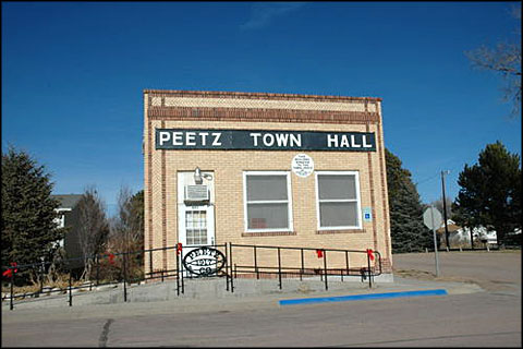
    The Peetz Town Board is backing test wells to determine extent of sewage lagoon leakage

    Peetz Town Hall via Archair Explorer.

    From The Sterling Journal-Advocate (Jeff Rice):

    Like many small towns across Colorado, Peetz has been told by the Colorado Department of Public Health and Environment that their sewage lagoons are leaking contaminants into the groundwater and must be replaced or remediated. The decision is based on a calculation of how much wastewater flows into the lagoons, how much evaporation takes place on a monthly basis, and how much water is left in the lagoons. It’s clear from that calculation that more water is flowing in than is evaporating, so the water can only be leaking out the bottom.

    The trustees don’t argue that their sewage lagoons are seeping water into the ground underneath them, but they want proof that it’s actually doing harm. They reason that, being more than 150 feet above groundwater, the seepage is cleaned adequately in the earth, sand, and gravel that it percolates through.

    It’s not just a stubborn streak in small town folk that’s driving their argument. Although Peetz doesn’t yet have any real numbers on the cost of new lagoons, they know that Fleming has priced theirs at more than $2.5 million. With diminishing assistance from state and federal agencies to pay for that kind of project, Fleming officials already know they’ll have to at least double sewer rates for a population that is largely on fixed income.

    @USGS Assessment of Brackish Water Could Help Nation Stretch Limited Freshwater Supplies

    Here’s the release from the USGS:

    A new nationwide assessment by the U.S. Geological Survey suggests that the nation’s brackish groundwater could help stretch limited freshwater supplies.

    This study, the first of its kind in more than 50 years, found that the amount of brackish groundwater underlying the country is more than 800 times the amount currently used each year. With issues like drought, groundwater depletion, dwindling freshwater supplies, and demand for groundwater expected to continue to rise, understanding brackish groundwater supplies can help determine whether they can supplement or replace taxed freshwater sources in water-stressed areas.

    “This assessment lays the foundation for building a deeper understanding of brackish groundwater resources and how they might be used to better ensure our water security,” said Jennifer Stanton, a USGS hydrologist and lead author of this assessment.

    In general, brackish groundwater is groundwater that has a dissolved-solids content greater than freshwater but less than seawater. It is defined for this assessment as having a dissolved-solids concentration ranging from 1,000 to 10,000 milligrams per liter.

    This new assessment was authorized by the 2009 SECURE Water Act and builds on a 1965 study which, for more than five decades, has served as the primary source of information on the national distribution of brackish groundwater. By incorporating data from more than 380,000 sites, compared to about 1,000 for the 1965 study, the 2017 assessment provides more comprehensive, nationwide data on the quantity and quality of brackish groundwater across the country. This includes information like chemical composition of the water and well yields, which are necessary for understanding the potential — at the National and regional scales — for expanding brackish groundwater development and for informing decision and policy makers.

    All water naturally contains dissolved solids that, if present in sufficient concentration, can make the water brackish, or slightly salty. Sources of these dissolved solids can include ancient seawater, coastal seawater, dissolution of naturally occurring minerals, leaching from saline soils, road salt, brine from oil and gas wells, or other human activities.

    The assessment provides data for states and other public agencies interested in using brackish groundwater. It also supports the efforts of the U.S. Bureau of Reclamation to promote sustainable water treatment for brackish aquifers. “The use of brackish groundwater to augment water supply in the West has been analyzed as a potential adaptation strategy in a number of studies under Reclamation’s Basin Studies Program,” said Katharine Dahm, an engineer with the U.S. Bureau of Reclamation.

    Advances in desalination technology and increases in demand for uses that don’t need high-quality water, like mining, oil and gas development, and thermoelectric power generation, have led states like Texas and California to turn to brackish groundwater as an alternative to freshwater.

    Data from the study released today indicate that brackish groundwater is present at some depth within 3,000 feet below ground beneath parts of every state except New Hampshire and Rhode Island. Using available data, a conservative estimate for the volume of brackish groundwater underlying the country is more than 35 times the amount of fresh groundwater currently used each year. Consequently, it is reasonable to consider brackish groundwater a substantial water resource available for use by the nation.

    In some parts of the country, freshwater has become more limited and brackish groundwater use has been increasing. This graph shows the number of municipal desalination facilities through 2010. The blue line shows the number of facilities that are processing brackish water (mostly groundwater) and the red line shows the number of facilities that process seawater. Growth in brackish groundwater facilities is likely due to the fact that brackish water is cheaper to process than seawater and not limited to coastal areas. In 2010, there were 649 active desalination plants in the United States with a capacity to treat 402 million gallons per day. (Shea, 2010) (Public domain.)

    Despite the availability of this new information, there’s still more to uncover on sustainable development of brackish groundwater. For many locations, data haven’t been collected for depths greater than 500 feet. “Until recently, brackish groundwater has mostly been overlooked. It was difficult to find data for depths greater than 500 feet below ground in many parts of the country,” said Stanton. “More work is needed to fully understand the resource. Although this assessment can’t answer all of the questions related to sustainable use, it represents a starting point for identifying the gaps in our knowledge and for directing research to locations where further study would be most beneficial.”

    2017 Arkansas River Basin Water Forum: “Meet the Gap”

    Here’s the release from ARBWF:

    Retiring state engineer reveals all at Arkansas River Basin Water Forum

    Those mystified about what the expression “use it or lose it” means to water rights will have the opportunity to hear Colorado’s State Engineer Dick Wolfe explain the myth and reality of the concept on April 26.

    Wolfe, 55, is retiring from the position he has held for 10 years in June. But he agreed to explain how water rights can and cannot be abandoned at this year’s Arkansas River Basin Water Forum, April 26-27 at Hotel Elegante, 2886 S. Circle Drive, Colorado Springs.

    “We started looking at what ‘use it or lose it’ really meant two years ago,” Wolfe said. “We wanted to sort out the issues for our stakeholders.”

    What resulted was a special report from the Colorado Water Institute co-authored by Reagan Waskom, director of the CWI; Deputy State Engineer Kevin Rein; Wolfe; and consultant MaryLou Smith.

    The report is written more like a conversation than an operating manual, and delves into the mistaken notion that every drop of irrigation water must be applied, or the owner of the water right will risk abandonment.

    In practice, the owner of a water right must show the intention to abandon the water right for abandonment. However, the way in which water has been used affects the yield of a water right in change of use cases, according to the report.

    The concept is important as the state moves into new concepts such as irrigation water conservation, rotational fallowing, and in-stream water rights donations.

    Wolfe also plans to touch on his impending retirement, which he half-jokingly predicted when he told Gov. Bill Ritter in 2007 that he’d “like to have the job for 10 years and then retire.”

    During his watch, there were major changes in administration of state water law in the Arkansas River basin.

    The biggest change was the implementation of Surface Irrigation Improvement Rules, which were adopted to prevent expansion of water use by more efficient irrigation means such as sprinklers or drip tape. Wolfe addressed concerns by hosting months of meetings with irrigators and conservancy districts prior to filing an application in water court.

    “The most unexpected thing was that we were able to address the concerns of 22 objectors without going to trial,” Wolfe said.

    Another unexpected development was the rise of basin roundtables, which added new layers of review to already complicated water decisions.

    Finally, filed under “unfinished business” is how water rights are administered for marijuana cultivation.

    “That’s a statewide issue, but a lot of the activity seems to be centered in the Arkansas basin,” Wolfe said.

    Registrations and information about this year’s forum are available at http://www.ARBWF.org or contact, Jean Van-Pelt, 719-251-2845, ARBWF1994@gmail.com

    #AnimasRiver: Losses from #GoldKingMine spill revised downward

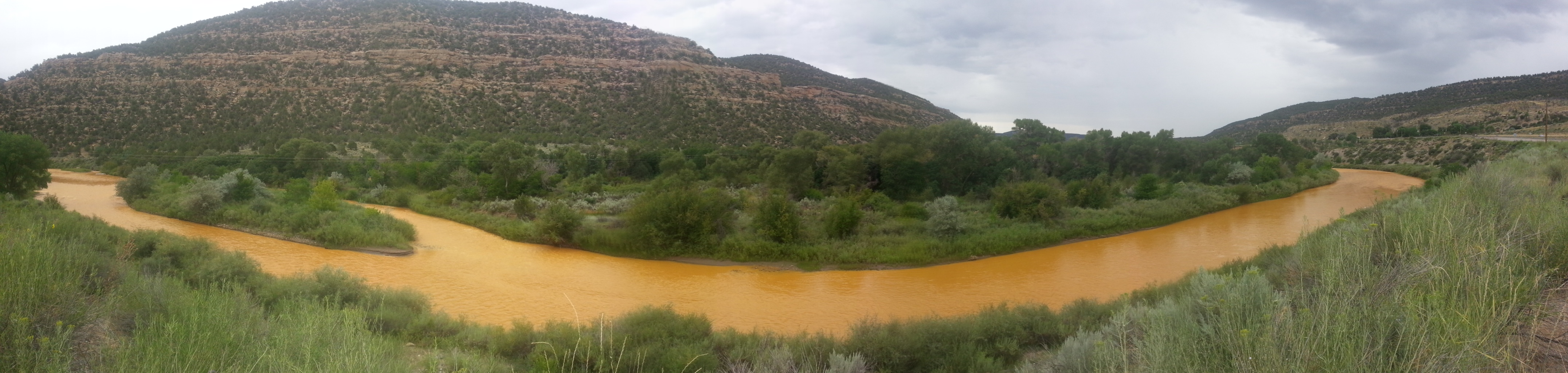
    The orange plume flows through the Animas across the Colorado/New Mexico state line the afternoon of Aug. 7, 2015. (Photo by Melissa May, San Juan Soil and Conservation District)

    From the Associated Press (Dan Elliott) via The Aurora Sentinel:

    The total now appears to be about $420 million. A single law firm that originally filed claims totaling $900 million for a handful of New Mexico property owners told the AP it had lowered their claims to $120 million

    Farmers, business owners, residents and others initially said they suffered a staggering $1.2 billion in lost income, property damage and personal injuries from the 2015 spill at the Gold King Mine, which tainted rivers in Colorado, New Mexico and Utah.

    But the total now appears to be about $420 million. A single law firm that originally filed claims totaling $900 million for a handful of New Mexico property owners told the AP it had lowered their claims to $120 million.

    It’s still uncertain whether the White House and Congress — both now controlled by the GOP — are willing to pay for any of the economic losses, even though Republicans were among the most vocal in demanding the EPA make good on the harm.

    Under former President Barack Obama, a Democrat, the EPA said it was prohibited by law from doing so.

    Now that they’re in charge, Republicans have vowed to slash spending on the environment, leaving the prospects for compensation in doubt…

    The EPA said it received 73 claims for economic damage or personal injuries. The AP obtained copies of the claims through an open records request, although many details were redacted.

    The Albuquerque, New Mexico, law firm Will Ferguson & Associates filed claims totaling $900 million for about a dozen residents of Aztec, a town of about 6,100 on the Animas River in northwestern New Mexico. The residents say the contaminated water damaged their wells, soil and plumbing and caused health problems including chronic intestinal pain, rashes and memory loss.

    Will Ferguson, the firm’s managing partner, said the $900 million represented an opening position, and the attorneys never expected to recover that much.

    Kedar Bhasker, another lawyer with the firm, said the claims were refiled in December. Bhasker called the lower amount “more reasonable.”

    In January, the EPA was still using the $1.2 billion total for all the claims, which didn’t reflect the law firm’s revisions. EPA officials didn’t immediately provide an explanation in response to emails seeking comment.

    The other claims ranged from river guides asking for a few hundred dollars in lost wages to the Navajo Nation seeking $162 million for environmental and health monitoring, among other things. The state of New Mexico asked for $130 million in lost taxes and other revenue. The state and tribe also are suing the EPA separately in federal court.

    Ten tourist-dependent businesses filed claims, saying they lost money when travelers stayed away. Farmers and ranchers said crops died because the river couldn’t be used to irrigate and that they had extra expenses from hauling untainted water to livestock.

    Some property owners said the value of their land plummeted because of the stigma attached to the spill…

    The agency noted it had already spent more than $31.3 million on the spill, including remediation work, water testing and payments to state, local and tribal agencies for their emergency response to the disaster.

    But lawmakers were infuriated — especially Republicans, some of whom portrayed the spill as a glaring example of EPA mismanagement. They have pressed the new EPA chief, Scott Pruitt, to reconsider the decision not to pay damages.

    At his confirmation hearings, Pruitt promised to review it. The EPA didn’t immediately respond to emails and a phone call seeking comment on whether he had done so.

    Republican Sen. Cory Gardner of Colorado said he believes Pruitt “will make good on his promise to work with me and my colleagues in resolving the outstanding issues that remain from the Obama administration’s EPA.”

    Colorado Democrats introduced a measure in Congress in 2015, shortly after the spill, intended to allow federal compensation for economic damages, but the bill died.

    Now, Congress appears to be waiting on President Donald Trump’s administration to make its intentions known.

    “We don’t know what to expect from this administration in regard to that,” said Liz Payne, a spokeswoman for Republican Rep. Scott Tipton of Colorado, whose district was hurt by the spill.

    “It’s still a waiting game for us at this point,” she said.

    2017 #coleg: SB17-036, on to conference committee

    Groundwater movement via the USGS

    From The Grand Junction Daily Sentinel (Charles Ashby):

    Sens. Ray Scott and Don Coram wanted to simply accept a change to their groundwater appeals bill Wednesday, but the rest of the Senate wouldn’t let them.

    The two Republicans from Grand Junction and Montrose, respectively, told the Senate that a change the House made to their measure, SB36, was a minor one.

    But Sen. Jerry Sonnenberg, R-Sterling, and others in the Colorado Senate said it weakened it too much.

    The bill was designed to prevent moneyed interests, such as developers, from retrying groundwater rights cases that have been determined by the Colorado Groundwater Commission.

    Under current law, appeals from that commission to district courts can include evidence not presented to the commission, essentially retrying the cases.

    The House altered it to allow that to happen only if the district judge determines that evidence was wrongly excluded or new evidence was discovered.

    “What this (bill) now does is, it takes and allows any evidence that may not have been discovered,” Sonnenberg said. “(But) no discovery can fall under that category and can be used in an appeal, essentially creating a scenario where (water) speculators can then lawyer up, engineer up, as we were trying to address in this bill.”

    On a 24-10 vote, the Senate rejected Coram’s and Scott’s request to accept the change, forcing them to send the bill to a special conference committee made up of three senators and three legislators from the House to work out that issue.

    2017 #coleg: SB17-036 — Appellate Process Concerning Groundwater Decisions clears State House

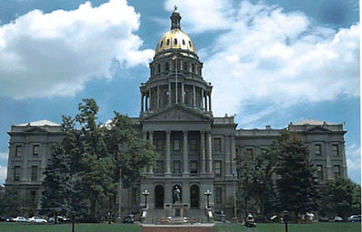
    Colorado Capitol building

    From The Grand Junction Daily Sentinel (Charles Ashby):

    House Bill 1151, introduced by Reps. Yeulin Willett, R-Grand Junction, and Chris Hansen, D-Denver, removes electric bicycles from the motor vehicle definition as long as they don’t go too fast.

    Under the bill, the bicycles are considered electrical only when the rider is pedaling and its motor ceases when the bike reaches speeds of 20 to 28 mph depending on which of three classes the bicycles fall under.

    The measure cleared the House 52-13 in late February. When the Senate took up the bill earlier this month, it made one change, which Hansen and Willett made fun of when the House gave its final approval on Monday…

    The measure bars anyone under the age of 16 from riding a class 3 electric bike except as a passenger, and then they must wear a helmet…

    The House gave final approval to a bill Monday that would prevent parties that appeal to district court water rights decisions made by the Colorado Ground Water Commission from introducing new evidence in the court.

    The measure, SB36, tries to address an issue that its sponsors — Sens. Ray Scott, R-Grand Junction, and Don Coram, R-Montrose — said was an unfair one. Currently, parties that appeal such water decisions by the commission could present new evidence not heard by the commission.

    The two lawmakers said that was unfair to ranchers and farmers who couldn’t afford to retry whole cases.

    Scott and Coram tried to get the bill through last year’s Legislature, but failed because of heavy lobbying, much of which came from former Gov. Bill Owens, who at the time was working with a land and water development company.

    Cotter Mill spill

    Lincoln/Cotter Mill Park superfund site

    From The Pueblo Chieftain:

    Colorado Department of Public Health officials on Friday received a report of a spill that occurred at the Cotter Crop. Uranium Mill south of here.

    Steve Cohen, Cotter manager, reported the spill occurred just before 8:30 a.m. as Cotter workers were trying to drain a section of pipes that connect the new and the old pipeline. A new pipeline is being installed to prevent contaminated water escaping the site.

    About 5,200 gallons of water was spilled, all of which was contained within the trench and Cotter workers were able to recover most of the spilled water using a water truck, said Warren Smith, health department spokesman.

    From Canon City Daily Record (Kara Mason):

    It’s unclear how much “slightly contaminated” water seeped into the ground or will evaporate, but Steve Cohen, Cotter’s plant manager estimates around 3,000 to 4,000 gallons were picked up with the truck.

    The spill happened when Cotter workers were attempting to drain a section of pipe where the old pipe and the new replaced pipe connect. A brittle or cracked valve is to blame, Cohen said. “Basically when the workers touched the valve it blew.”

    The valve will be replaced, Cohen added.

    The water was contained in the trench where pipeline construction has been ongoing for the last couple of weeks. Now, the water will return to the impoundment pond on Cotter property.

    Cotter is replacing the pipeline after several leaks the last couple of years. Last August, Cotter reported a 7,000-gallon leak, which occurred over the course of 48 hours. That leak was the result of a hairline fracture in the pipleline — which is now being replaced on site.

    Despite the most recent spill, Cohen said the pipeline replacement is still on track to finish the final week of March.

    Cotter is required by Colorado law to report spills to the Colorado Department of Public Health and Environment, which posts the information on its website. CDPHE is expecting a report on the spill next week.

    2017 #coleg: SB17-036 stalls in House Committee

    George Washington addresses the Continental Congress via Son of the South

    From The Grand Junction Daily Sentinel (Charles Ashby):

    SB36, that cleared the Colorado Senate unanimously, got a bit bogged down in the House Judiciary Committee because of lengthy discussions about what it would do.

    Under the bill, introduced by GOP Sens. Ray Scott of Grand Junction and Don Coram of Montrose, appeals of groundwater rights decisions by the Colorado Ground Water Commission shouldn’t include new evidence, just like in any normal court appeal.

    Scott, and the House sponsors of his bill, Reps. Jenni Arndt, D-Fort Collins, and Jon Becker, R-Fort Morgan, say the current practice that does allow that isn’t fair.

    The lawmakers say most disputes pit farmers and ranchers against water developers who are trying to sell water rights for municipal use, something that can be highly profitable.

    Those developers often will drag farmers into court, retrying the case at the appellate level using evidence not considered before the commission the first time, supporters of the bill said.

    “It is a matter of being out monied,” said Dan Farmer, a member of the commission and a Colorado Springs rancher. “When we win, we don’t win because we’re short $60,000 (in attorneys’ fees). It’s just not possible to continue to operate a farming operation and try to protect your water rights.”

    Opponents of the bill say there is nothing wrong with how cases are tried, saying only a few end up being appealed.

    Denver water attorney Sheela Stack, who routinely represents municipalities in water disputes, said it isn’t just the farmers and ranchers who see high litigation costs.

    “It goes both ways,” she said. “It’s not just a municipality coming into a groundwater district. We are not trying to bleed the farmers dry. All we are doing, what anybody is trying to do is do the maximum utilization of water.”

    The commission is the only state agency that has quasi-judicial powers that current law, established about 40 years ago, allows appeals to include new evidence. Disputes are first reviewed by administrative law judges in the State Engineer’s office, an agency under the Colorado Division of Water Resources, and then decided by the commission.

    2017 #coleg: SB17-036, “Appellate Process Concerning Groundwater Decisions” to die in the House?

    Groundwater movement via the USGS

    Here’s a guest column from Don Coram that’s running in The Durango Herald:

    In my last column, I mentioned that Senate Bill 36, “Appellate Process Concerning Groundwater Decisions,” had recently passed the Senate 35-0. This exact bill passed the House last year with 60 votes, only to die in the Senate. Powerful men and big money did not offer any opposition in the House last year, but put a full-court press on Senate leadership to kill the bill.

    This year is exactly the opposite. Water investors and municipalities have once again rallied their expensive lobby corps to pressure legislators. What amazes me is that people who voted for the bill last year, at least twice and some cases three times, are now suddenly opposed. Unconfirmed reports have told me that Northern Water in Weld County is the driving force behind the opposition.

    As someone from rural Colorado, who understands the issues of rural Colorado, I am amazed that legislators who portrays themselves to be pro agriculture — as men standing up for the little guy, the second or third generation farmer or rancher who is just trying to survive and hopes that the next generation can pay off the mortgage — can be in opposition to this bill.

    What has happened is investors buy ground water and then go to the Ground Water Commission and file for a change of use in hopes of exporting the water from the ground water basin and sell it to the municipalities. If the investors lose in the appeal process they claim new evidence. The farmer must hire a lawyer and water engineer to defend his water once again at thousands of dollars. One family has spent around $900,000 on attorneys fees. The fastest way to break a farmer is through litigation.

    It is disappointing to me that a legislator can turn 180 degrees from one year to the next. The exact same bill should be treated the same. If you liked the bill last year, you should like it this year. Likewise, if you opposed it last year, I would expect the same this year.

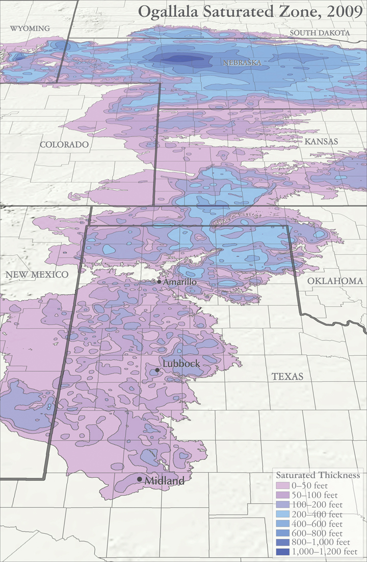
    Ogallala Aquifer — different water law by state

    Map sources:
    Houston, Natalie. 2011. Hydrogeologist, Texas Water Science Center, U.S. Geological Survey. Personal communication, October 2011.
    Houston, Natalie, Amanda Garcia, and Eric Strom. 2003. Selected Hydrogeologic Datasets for the Ogallala Aquifer, Texas. Open File Report 2003-296. August 2003.

    From High Plains Public Radio (Susan Stover):

    Texas manages groundwater with the Rule of Capture. The groundwater belongs to the landowner without a defined limit. It’s sometimes known as the Law of the Biggest Pump.

    Colorado and Kansas water law is based on prior appropriation, known as First in Time, First in Right. A water right owner can pump their permitted amount if it doesn’t impair a more senior right – a water right that was established earlier in time. When there isn’t enough water to meet all needs, the owners of senior water rights have priority. The priority system works well for streams. When stream flow is low, it is generally clear which upstream, junior users must be cut off to protect the more senior water rights.

    For groundwater, it is more complex to identify which water wells are impairing a more senior water well. Groundwater often provides a baseflow to streams; when heavy groundwater pumping lowers the water table so there is no longer a connection to the stream and stream flow declines, is that impairment?

    Colorado state law dealt with such concerns by defining “designated groundwater basins,” those in which groundwater contributes little to stream flow. The Ogallala aquifer lies in designated groundwater basins. This allows more groundwater to be pumped, which lowers the water table, but with less risk of impairing surface water rights.

    In Kansas, action is taken when a junior water right well’s pumping directly impairs a senior water right well, whether it uses groundwater or surface water. However, no action is taken if problems are due to regional groundwater declines. Like Colorado, Kansas allows the decline of the Ogallala aquifer to get the economic benefit from the water.

    Management of the Ogallala aquifer is a balance between protecting existing water right holders and conserving water for the future. Attitudes change over time on what is a proper balance. Much water law encouraged development of the aquifer and protects current users. Is that balance shifting more toward conserving and extending this resource further into the future?

    Across party lines, Western governors see a partner in Pruitt — @COindependent

    Colorado abandoned mines

    From The High Country News (Elizabeth Shogren) via The Colorado Independent:

    Just a few days in office, the new administrator of the Environmental Protection Agency hosted an early Sunday morning breakfast for 11 Western governors. Scott Pruitt told them face-to-face what he’s said repeatedly since he was nominated: Under his leadership, the EPA will defer to states much more than it has in the recent past.

    Pruitt made a similar vow to profoundly transform the agency the day before at the Conservative Political Action Conference (CPAC). “We’re going to once again pay attention to the states across this country,” Pruitt told a gathering of Republicans. “The future ain’t what it used to be at the EPA.”

    This message resonated with the Western governors, regardless of their political affiliations, according to several members of the governors’ staffs. Alaska Gov. Bill Walker, a Republican-turned-Independent whose state is 66 percent federal land, was “encouraged by (Pruitt’s) emphasis on state’s rights,” Grace Jang, Walker’s communications director, says.

    The Western governors’ unanimity is striking in an era of intense partisanship and reflects the commitment they have to work together through the Western Governors’ Association. The breakfast was an annual event of that group, a rare hub of bipartisanship and consensus building in a polarized nation. The governors are in the midst of a major effort to transform the relationship between the federal and state governments to give them more input into federal regulations.

    “The Republican governors were on the same page with their Democratic colleagues in telling Pruitt, we want it to be a partnership,” says John Swartout, senior policy advisor to Colorado Governor John Hickenlooper, a Democrat. “We haven’t been happy that the EPA hasn’t always treated us as a full partner. We can make progress together.”

    As they ate scrambled eggs, bacon, fried potatoes and donuts at a square table in EPA’s Washington, DC, headquarters, the governors one-by-one told Pruitt their priorities. Over the course of two hours, many mentioned their desire to have more sway over federal environmental regulations.

    Western governors have collaborated for about 100 years. Their desire to present a unified voice to Washington is driven in part because of the vast amount of federal land in the West, which means decisions made in Washington have acute impacts on their states’ economies. “It’s largely a function of being so distant from Washington and needing to amplify their distant voices,” said Jim Ogsbury, executive director of the group.

    In the Western Governors’ Association, the governors focus on shared objectives and pass joint resolutions. In December, for instance, they passed a resolution calling for a greater role in crafting federal regulations and in other decisions by the federal government. Other resolutions present their consensus positions on a wide range of issues, including endangered species, wildfire fire management, invasive species and abandoned mine cleanups.

    Western governors from both parties felt the Obama administration’s EPA failed to adequately consult the states as it crafted some important environmental regulations, such as the 2015 Clean Water Rule. (That rule was temporarily blocked in 2015, pending resolution of a court challenge brought by industry groups and 31 states.) “Had the EPA worked with us on the rule upfront it could have been a better rule,” Swartout says. EPA did address some comments the governors made about how the proposed rule impinged on state authority over water management, but not all of them.

    Just this week, President Donald Trump signed an executive order to launch a rollback of that rule and, until it’s rewritten, limit federal oversight to waterways that are navigable, leaving the rest to the states. Pruitt announced that he would rescind the Obama rule and write a new one that “restores the states’ important role in the regulation of water.”

    “We believe (Pruitt’s EPA) will partner with states in a way that’s meaningful; in a way that quite frankly the previous administration did not,” says Nephi Cole, Wyoming Gov. Matt Mead’s policy advisor policy.

    Many scholars caution that undoing that rule will be particularly detrimental in the arid West, where so many small streams and those that run only intermittently are crucially important for wildlife and water quality and quantity. States tend to be more responsive to local industries, because of the benefits they bring to the economy like jobs and tax revenue.

    But Cole argues that it’s a “false narrative” to suggest that giving states more control equates to allowing more pollution and less environmental protection. In another resolution adopted in December, Western governors assert that they want to be the ones to decide how to balance the needs of industry in their states and the requirements of the Clean Water Act.

    During the two-hour breakfast, Pruitt spent most of the time listening to governors. (Most years, the secretaries of Interior, Agriculture, Energy and other cabinet members important to Western states attend the breakfast, but as of Sunday, Pruitt was the only one of those who had been confirmed by the Senate.) Colorado Gov. John Hickenlooper urged Pruitt to personally engage in the Gold King Mine controversy. A 2015 blowout at the mine unleashed a surge of acid mine drainage down the Animas River. Pruitt committed to visiting Colorado and meeting with local and state officials, Swartout says.
    A big priority for some governors is that the EPA continues to negotiate settlements with companies responsible for creating toxic waste sites covered under Superfund.

    Oregon Gov. Kate Brown, a Democrat, urged Pruitt to move forward with the plan to clean up the Portland Harbor, a Superfund site, so the city can revitalize the waterfront and create jobs. She also stressed her state’s continued commitment to fighting climate change, according to her press secretary, Bryan Hockaday.

    Montana Gov. Steve Bullock, who heads the Western Governors’ Association, wants Pruitt to keep the pressure on to finally reach a settlement on the Superfund sites in and around Butte, Montana, where historic copper mining and smelting left behind the nation’s largest toxic waste site, according to his press secretary, Marissa Perry. After many years, negotiations between the EPA and Atlantic Richfield Corporation, owned by BP, have picked up steam. Bullock wants to make sure the momentum isn’t lost.

    While the Western governors break out of the hyper-partisanship that’s plagued other branches of government and see some opportunity to work with Pruitt, potential major budget cuts to the EPA may give Pruitt a lot less leeway to respond to state needs.

    This week, the White House sent agencies an outline of the president’s draft budget that reportedly would gut the EPA’s $8 billion budget, cutting by 30 percent the grants it sends to the states to implement air, water and toxic waste regulations. Pruitt told E&E News that he’s asking the White House to retain more funding for the states to improve air quality, clean up Superfund sites and improve aging water and wastewater infrastructure. Programs slated for zero funding include grants to clean up abandoned industrial sites and funding to bring safe drinking water and sewer systems to Native villages in Alaska, according to the Washington Post. More details on the budget are expected later this month. It’s not clear if the White House can win approval for its vision of a much smaller EPA.

    The proof of whether the governors and Pruitt will be able to work together will emerge in coming months, as the Trump administration pursues its agenda and rolls back existing rules. “We’re trying to work with him. We need to work with the federal government,” Swartout says. “It’s too early to know. We have to see how it all plays out. It’s just speculation at this point.”

    Correspondent Elizabeth Shogren writes HCN’s DC Dispatches from Washington. This story originally appeared in High Country News on March 3, 2017.

    #Colorado Springs councillors OK @CSUtilities water sales to Security

    Widefield aquifer via the Colorado Water Institute.
    Widefield aquifer via the Colorado Water Institute.

    From KKTV.com:

    On Tuesday afternoon, Colorado Springs City Council voted to help their neighbors deal with [pollution of the Widefield Aquifer]. They voted unanimously on the agenda item that will allow Colorado Springs Utilities to sell their water to Security Water District. The resolution goes into effect immediately.

    It’s a short term deal – just up to three years as of now, but Springs Utilities says the have more than enough resources to help.

    @EPA Waters of the US rule on the chopping block

    From The Conversation (Reagan Waskom, David J. Cooper);

    President Trump is expected to issue an executive order directing federal agencies to revise the Clean Water Rule, a major regulation published by the Environmental Protection Agency and the Army Corps of Engineers in 2015. The rule’s purpose is to clarify which water bodies and wetlands are federally protected under the Clean Water Act.

    EPA Administrator Scott Pruitt led a multi-state lawsuit against the rule as Oklahoma attorney general, and has called it “the greatest blow to private property rights the modern era has seen.”

    At the Colorado Water Institute at Colorado State University, we work in partnership with the farm and ranch community to find solutions to difficult western water problems. Farmers and ranchers often express frustration with one-size-fits-all worker protection, food safety, animal welfare, immigration, endangered species and environmental regulations. So we understand their concern that this rule may further constrain agricultural activities on their land.

    In particular, they fear the Clean Water Rule could expand federal regulations that impact their private property rights. However, regulatory agencies and the regulated community need to know the limits of the Clean Water Act’s reach so they can take appropriate measures to protect water resources. If the rule is scrapped, we still will need to know which water bodies require protection under the law.

    Which waters?

    The Clean Water Act of 1972 protects the “waters of the United States” from unpermitted discharges that may harm water quality for humans and aquatic life. However, it leaves it up to EPA and the Army Corps of Engineers to define which waters the law covers.

    Agencies and the courts agree that this term includes “navigable waters,” such as rivers and lakes. It also covers waterways connected to them, such as marshes and wetlands. The central question is how closely connected a water body must be to navigable waters to fall under federal jurisdiction.

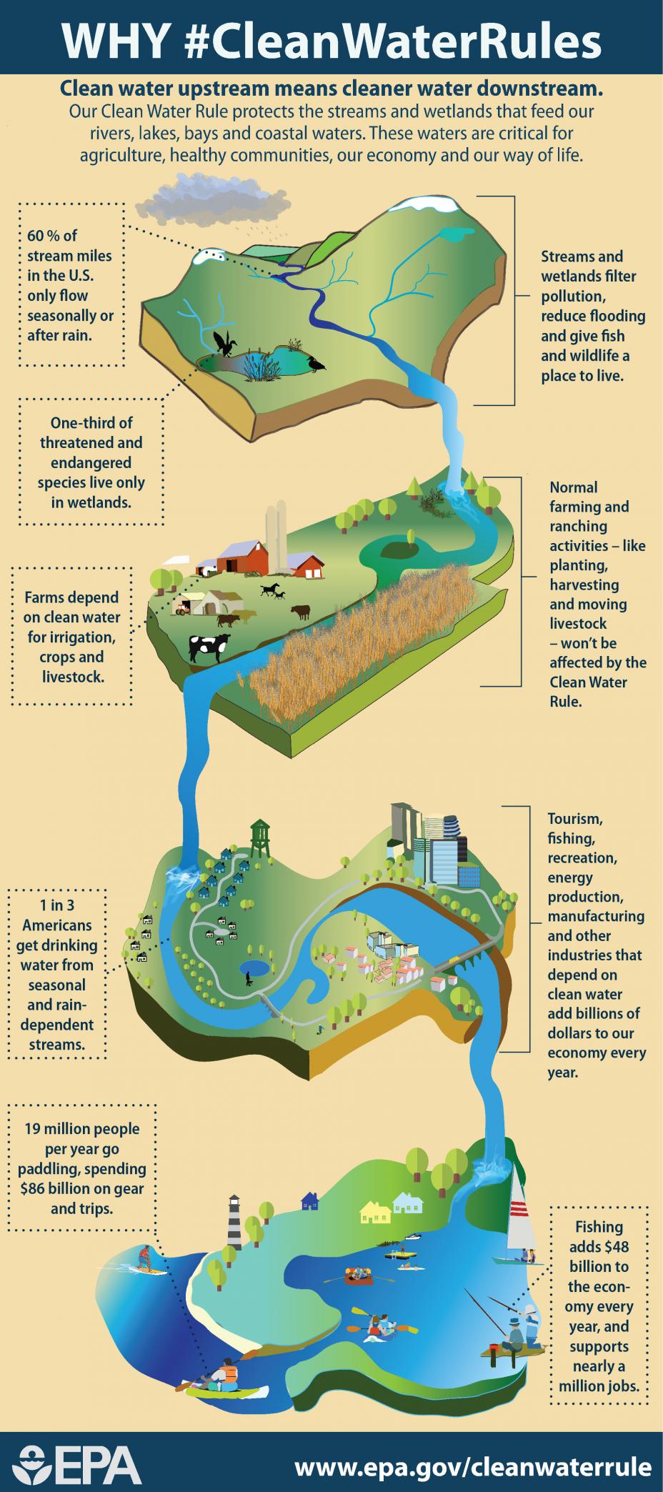
    Our Clean Water Rule protects the streams and wetlands that feed our rivers, lakes, bays, and coastal waters. These waters are critical for agriculture, healthy communities, our economy, and our way of life. Graphic via @EPA.
    Our Clean Water Rule protects the streams and wetlands that feed our rivers, lakes, bays, and coastal waters. These waters are critical for agriculture, healthy communities, our economy, and our way of life. Graphic via @EPA.

    In 2001 and 2006, the Supreme Court handed down rulings that narrowed the definition of protected waters, but used confusing language. These opinions created regulatory uncertainty for farmers, ranchers and developers.

    The Supreme Court wrote in the 2006 case, Rapanos v. United States, that if a water body had a “significant nexus” to a federally protected waterway – for example, if a wetland was some distance from a navigable stream but produced a relatively permanent flow to the stream – then it was connected and fell under federal jurisdiction. But it failed to clearly define the significant nexus test for other situations.

    The Clean Water Rule seeks to clarify which types of waters are 1) protected categorically, 2) protected on a case-by-case basis or 3) not covered. Here are some of the key categories:

  • Tributaries formerly were evaluated case by case. Now they are automatically covered if they have features of flowing water – a bed, a bank and a high water mark. Other types, such as open waters without beds and banks, will be evaluated case by case.
  • “Adjacent waters,” such as wetlands and ponds that are near covered waters, are protected if they lie within physical and measurable boundaries set out in the rule.
  • “Isolated waters” are not connected to navigable waters but still can be ecologically important. The rule identifies specific types that are protected, such as prairie potholes and California vernal pools.
  • Vernal pools form in winter and spring and support many types of animals and plants. Photo credit BLM.
    Vernal pools form in winter and spring and support many types of animals and plants. Photo credit BLM.

    EPA estimated that the final Clean Water Rule expanded the types of water subject to Clean Water Act jurisdiction by about 3 percent, or 1,500 acres nationwide. Opponents clearly think it could be much broader – and until they see the rule implemented on the landscape, their fears may have some basis in fact.

    Protecting drainage ditches?

    Industry and agriculture groups believe the new rule defines tributaries more broadly. They see this change as unnecessary overreach that makes it difficult to know what is regulated on their lands.

    Western farms are laced with canals that provide critical irrigation water during the growing season. These canals and ditches divert water from streams and return the excess through a downstream return loop, which is fed by gravity. Because they are open and unlined, they also serve as water sources for wildlife, ecosystems and underground aquifers. And because they are connected to other water bodies, farmers fear they could be subject to federal regulation.

    The only way to surface-irrigate in western valleys without affecting local water systems would be to lay thousands of miles of pressurized pipes, like those that carry water in cities. This approach would be impractical in many situations and incredibly expensive.

    More generally, farmers and ranchers want to be able to make decisions about managing their land and water resources without ambiguity or time-consuming and expensive red tape. In spite of EPA assurances, they worry the Clean Water Rule could include agricultural ditches, canals and drainages in the definition of “tributary.”

    Irrigation ditch and sprinkler, Silver Creek, Idaho.  Sam Beebe/Flickr, CC BY
    Irrigation ditch and sprinkler, Silver Creek, Idaho. Sam Beebe/Flickr, CC BY

    They fear EPA will use vague language in the rule to expand its power to regulate these features and change the way they are currently operated. They also fear becoming targets for citizen-initiated lawsuits, which are allowed under the Clean Water Act. Moreover, they are skeptical the outcomes will significantly benefit the environment.

    Former EPA Administrator Gina McCarthy argued that the rule would not unduly burden farmers. “We will protect clean water without getting in the way of farming and ranching,” McCarthy told the National Farmers Union in 2015. “Normal agriculture practices like plowing, planting, and harvesting a field have always been exempt from Clean Water Act regulation; this rule won’t change that at all.”

    All waters eventually connect

    Farmers and ranchers are independent by nature and believe they know what is best for the stewardship of their own land. They tend to be regulation-averse and believe voluntary approaches to water quality provide the flexibility needed to account for site-specific variations across the landscape. However, science shows that relatively minor effects at the edge of one field can aggregate across a watershed in cumulative impacts that are significant and sometimes serious.

    From an ecological perspective, scientists have long understood that surface water bodies and tributary groundwater within a watershed are connected over time. Even if it takes years, water will move across and through the landscape. Determining which tributaries have a “significant nexus” to traditional navigable waters depends on how you define “significant.”

    Even small wetlands and intermittent ponds provide ecosystem services that benefit the larger watershed. Wetlands and small water bodies that are geographically isolated from the floodplain may still impact navigable waters as either groundwater flows or surface runoff during heavy or prolonged precipitation events.

    In that sense, all water runs downhill to the stream eventually. As a dozen prominent wetland scientists wrote last month in an amicus brief to the Sixth U.S. Circuit Court of Appeals, which is reviewing the Clean Water Rule, “the best available science overwhelmingly demonstrates that the waters [protected] categorically in the Clean Water Rule have significant chemical, physical, and biological connections to primary waters.”

    Scientists and ecologists agree interpreting the degree and frequency of this kind of connectivity requires site-by-site analysis. We now understand more clearly how isolated water bodies function on the landscape as part of a larger complex, and our knowledge can help clarify how directly water bodies are connected. But deciding where to draw the bright line of regulatory certainty may lie beyond the realm of science.

    If the Trump administration withdraws or weakens the Clean Water Rule, it is likely to leave regulators interpreting case by case whether tributaries and adjacent waters are covered, as they have been doing since 2006, and land and water owners guessing about what they can do with their resources. So in the end, repealing the rule won’t answer the underlying question: how far upstream federal protection extends.

    #AnimasRiver: @EPA — Cement Creek, #GoldKingMine, summer project plan

    From The Durango Herald (Jonathan Romeo):

    At the Animas River Stakeholders Group meeting in Silverton on Thursday, Superfund site project manager Rebecca Thomas told the 20 or so attendees the EPA has laid out a work plan for the summer.

    Thomas said much of the work will be a continuation of last year’s activities, including collecting data and water samples, as well as looking at flow control structures at the Gold King Mine, the site of the EPA-triggered mine spill in August 2015.

    The EPA also will install a pressure gauge system to monitor the bulkhead at the Mogul Mine, adjacent to the Gold King, which are both significant contributors of heavy metals into Cement Creek, a tributary of the Animas River.

    The EPA wants to install a ground monitoring well between the inner and outermost bulkheads at the American Tunnel, the drain for the Sunnyside Mine workings. It’s suspected the American Tunnel’s water level has reached capacity and could be responsible for increased discharges out of adjacent mines, such as the Gold King.

    Thomas said crews will compile more data for the possible closure of the bulkhead at the Red & Bonita Mine, another contributor into Cement Creek. Specifically, EPA wants to better understand the water hydrology of the mine workings.

    As for the EPA’s interim water-treatment plant at Gladstone that treats discharges out of the Gold King Mine, Thomas said the agency is looking at about six sites to store the mine waste.

    “This is increasingly more important for us as we start to run out of room for sludge management (at Gladstone),” Thomas said.

    She said there may be more than one location for the mine waste, and that the agency hopes to have that finalized by May.

    Thomas added that the EPA is planning a few quick-action remediation projects at sites within the Superfund listing where there is an immediate benefit to the environment, water quality and managing adit discharges.

    She said 27 of the 48 sites qualify for early-action remediation, which could include fixing mine waste ponds, remediating waste rock dumps or redirecting clean surface water away from known polluted areas.

    “There’s no way we’re going to get all the work done, but the hope is to get some of the work done,” Thomas said.

    The Bureau of Land Management, Colorado Department of Public Health and Environment and the U.S. Forest Service – all working on the Superfund site – also listed a few projects they have planned for this year.

    Most notably, the BLM has permission to undergo a pilot project with Texas-based Green Age Technologies to test a new treatment on mine wastewater that many in the stakeholders group have said holds promise for low-cost water treatment.

    The BLM and Green Age will spend 21 days treating discharges out of the American Tunnel and Gold King Mine with a technology known as cavitation, which separates metal ions from water.

    The EPA had promised the town of Silverton before the community supported Superfund designation that the agency would embrace new technologies for mine-waste treatment.

    Alamosa councillors cap groundwater compliance right aquisition

    Artesian well Dutton Ranch, Alamosa 1909 via the Crestone Eagle
    Artesian well Dutton Ranch, Alamosa 1909 via the Crestone Eagle

    From The Valley Courier (Ruth Heide):

    The city has already bought some water rights to begin this compliance process.

    Alamosa City Attorney Erich Schwiesow told the council Wednesday night that staff has estimated it could take $3.5 million to comply with the rules…

    The ordinance provides an outside limit to the terms of the financing of $3.7 million principal, $5.6 million total payment, and maximum annual payment of $375,000.

    The $5.6 million is based on 5 percent interest over a 15-year repayment period.

    Schwiesow said this ordi-ALAMOSA city council this week set boundaries on how much it will spend on its efforts to comply with new water rules from the state.

    The council approved on first reading and scheduled for a March 1st public hearing an ordinance setting $3.7 million as the upper limit of what the city will finance to pay for water rights and associated expenses to bring the city into compliance with new groundwater rules.

    Under the new rules, well owners (including municipalities ) must make up for their negative effects to surface water rights as well as providing means to replenish the San Luis Valley’s aquifer to more sustainable levels. nance for financing for the water project including the acquisition of water rights. It does not mean the city will be spending that much, but it means the city will not spend more than that, he explained.

    The city will be working with UMB Bank to set up the financing . Alamosa Councilman Charles Griego said he hoped local banks would be involved. City Manager Heather Brooks said UMB Bank would shop around for the best rates, and Schwiesow added that the city council would ultimately approve whatever bank UMB Bank brought back to the council for financing. UMB Bank essentially serves as a broker for the city, he explained. In another water related matter of a different nature, the council on Wednesday approved its first budget amendment for the year in part to cover the costs of replacing failing equipment in the city’s wastewater treatment facility. The city will transfer $250,000 from the Enterprise Debt Fund to the water treatment department to replace ultraviolet equipment that is part of the last disinfection phase at the wastewater plant…

    Alamosa Public Works Director Pat Steenburg added that when the plant was constructed 19 years ago, it had two UV systems. One of those quit working five or six years ago and the other is “on its last leg.” There are no parts even available for it now, he added.

    The total transfer from the Enterprise Debt Fund was for $383,000, which included the $250,000 for the UV equipment as well as water department operations including $33,000 to add a technician to backfill existing staff.

    The budget amendment also includes interdepartmental transfers to cover the cost of a drone purchase for the city, which all departments from IT to fire will be able to utilize.

    @csindependent: A toxic water supply has left beloved Venetucci Farm in limbo

    Widefield aquifer via the Colorado Water Institute.
    Widefield aquifer via the Colorado Water Institute.

    From the Colorado Springs Independent (Nat Stein):

    To say that the 2016 season didn’t go well for Venetucci Farm is an understatement.

    It was historically bad, but not for lack of rain or a pest infestation or anything that farmers are accustomed to dealing with. First, toxic chemicals discovered in the farm’s water supply in May prompted the suspension of produce sales mid-season. Then, at season’s end, a brutal hail storm wiped out the remaining solace of Venetucci’s fans — its hallmark pumpkin crop.

    News isn’t improving. In a normal year, planting would be coming up in late March, but operations on the farm are currently stalled. This could be the first season in over a century that area consumers go without fresh, local food from the region’s oldest working farm.

    Uncertainty reigns. Nobody knows the full consequences of irrigating crops with water containing perfluorinated chemicals (PFCs) at levels above what the Environmental Protection Agency considers safe for drinking. And then there’s the question of who will own and run Venetucci Farm, which was entrusted to the Pikes Peak Community Foundation in 2006 by Bambina “Bambi” Venetucci after the 2004 death of her husband, local farmer Dominico “Nick” Venetucci.

    Bambi passed away in 2015 with the desire and belief that the family’s land would carry on in perpetuity as a working farm that welcomes schoolchildren to come pick pumpkins, free of charge, every fall. (Their generosity remains legendary — there’s a statue of Nick next to the Pioneers Museum and a depiction of him gifting a pumpkin on the label of Bristol Brewing Company’s highly popular annual Venetucci Pumpkin Ale.)

    But, even before the water crisis arose, PPCF, under new leadership, had begun reevaluating all of its legacy assets, including Venetucci Farm. Over the past few months, an advisory committee has been meeting to vet visions for a post-PPCF Venetucci, with a recommendation expected in early March. The board will take it from there — without any chance for public input.

    Whatever the foundation decides to do with the farm, recently installed CEO Gary Butterworth is unequivocal that the legacy of Nick and Bambi Venetucci will carry on. But no matter who stewards it into the future, their legacy may already be tainted by decades of chemical build-up in the aquifer beneath the farm.

    Indeed, none of this sits well with longtime consumers like across-the-street neighbor Brittany McCollough. She’s less worried about what’s in the water — “everything’s poison these days,” she notes dryly — and more worried that those who actually eat Venetucci-grown food no longer have a seat at the table.

    “It seems like the ‘community’ part has been taken out of ‘community foundation,'” she says, telling the Independent that “[consumers] have been left in the dark even though we’re impacted the most.” A teacher during the school year, McCollough helps run Venetucci’s farm stand over the summers, distributing weekly boxes of produce to community-supported agriculture (CSA) members in exchange for her own share. She’s been getting fresh vegetables for herself and her young son this way for about seven years. For her, all the extraneous factors affecting the farm are beside the point. “There are so many choices to make in the world and knowing the people who grow my food, right across the street in my own watershed — that’s really important to me,” she says.

    From the Colorado Springs Independent (Nat Stein):

    Scientists from the Colorado School of Mines in Golden, the University of Colorado at Colorado Springs and Axys, a private lab in Canada, all came to the farm to investigate. They took water, soil, plant and meat samples to test for PFC content. It took months for results to come back, and even then, their data took the form of raw numbers — not risk assessment, which is what the farm really needed.

    For an official interpretation of the results, Venetucci counted on the Colorado Department of Health and Environment (CDPHE). Chief Epidemiologist Dr. Mike Van Dyke was willing to oblige, since he had received multiple inquiries from citizens who wanted to know whether food grown with PFC-contaminated water was safe. There just wasn’t much research out there.

    “If it were something like lead, that’s more common and actually regulated, there’d be a framework out there,” he tells the Indy. “But basically what we did was the School of Mines had done some research on uptake of PFCs by fruits and vegetables. So they’ve developed models saying, ‘If you have x amount in soil and x amount in water, you’re likely to end up with x amount in the vegetables.”

    So he and his team looked at the data those other labs had previously collected, picking out the highest concentrations to use in their analysis.

    “We used maximums, not averages, to kind of get a worst case scenario,” Van Dyke says. “The idea was to get a conservative estimate at first, then become more lenient over time if we get additional data that warrants it.”

    For the other variables, the team borrowed federal standards: EPA’s drinking water advisory for the acceptable limit of PFCs and USDA’s recommendations for daily food consumption. (That’s three vegetable servings and two fruit servings for children, and one more of each for adults. A serving equates to 100 grams of vegetables and 150 grams of fruit.)

    Given all that, CDPHE found that eating the federally-recommended amount of Venetucci’s produce, even with the highest possible uptake levels, likely won’t expose you to dangerous levels of PFCs. And in reality, let’s admit it, most people get their produce from different sources and don’t eat enough of it.

    Rio Grande: Special master’s report, “indicates Texas has a strong case against the Land of Enchantment” — Laura Paskus

    Elephant Butte Reservoir back in the day nearly full
    Elephant Butte Reservoir back in the day nearly full

    From NMPoliticalReport (Laura Paskus):

    When the special master’s 351-page final report arrived this week, it didn’t vary much from the draft this summer, in which Gregory Grimsal delivered some grim messages to New Mexico.

    The exhaustively-researched report details the history of water agreements and disputes along the lower Rio Grande and indicates Texas has a strong case against the Land of Enchantment.

    Anticipating that the case would be moving forward, earlier this year New Mexico Attorney General Hector Balderas announced a new joint defense strategy with the state’s two water agencies, the Office of the State Engineer and the Interstate Stream Commission.

    The Attorney General’s office was unable to accommodate an interview this week about the new strategy, but office spokesman James Hallinan issued an email statement to NM Political Report.

    “Attorney General Balderas is committed to seeking the best result for New Mexico in the decades-long water litigation he inherited from his predecessors, and will work with the joint defense team he formed with New Mexico’s Lower Rio Grande water users and the Office of the State Engineer throughout the legal process,” Hallinan said. “Attorney General Balderas knows that water is the lifeblood of New Mexico’s unique economy and culture, and now that the court has ruled on the preliminary filings, he can push forward his targeted, technical, data-driven strategy towards the most favorable resolution for New Mexico.”

    NM Political Report repeatedly requested to speak with someone from the Office of the State Engineer, which is responsible for groundwater permits, or the Interstate Stream Commission, the agency authorized under state law to negotiate compact disputes.

    None of those phone calls or emails were returned.

    According to Balderas’ office, the three state agencies will work together and also enter into joint defense agreements with New Mexico State University, PNM, the New Mexico Pecan Growers Association, Southern Rio Grande Diversified Crop Farmers Association, the City of Las Cruces and Camino Real Regional Utility Authority.

    One entity from the state absent from the list is the Elephant Butte Irrigation District, which sits below the dam in New Mexico, but in the legal world of western water, is considered a part of Texas.

    ‘No man’s land”

    In southern New Mexico today, the Elephant Butte Irrigation District delivers water to about 60,000 acres of fields of crops like pecans, chile and onions.

    The district covers more than 90,000 acres, but due to a lingering drought, some of those lands are fallow.

    “These are family farms, people who are good stewards of the land,” EBID manager Gary Esslinger told NM Political Report. “It’s a different type of atmosphere here compared with large corporate farms in California that are owned by a bank or an insurance company.”

    The irrigation district is different in other ways, too.

    To know why, it takes understanding the 1938 Rio Grande Compact and how it divvies up the river’s water among Colorado, New Mexico and Texas.

    Annually, New Mexico’s fair share from Colorado is based on streamgage measurements near the state line.

    Sending Texas its water is trickier. That’s because New Mexico delivers that water to a reservoir 90 miles north of the state line.

    Built by the U.S. Bureau of Reclamation over 100 years ago, Elephant Butte Dam holds back water for what’s called the Rio Grande Project—water the federal government must deliver to farmers in New Mexico and Texas, downstream cities, and Mexico.

    Battlement Mesa: Ursa Resources backs off injection well application

    Parachute/Battlement Mesa area via the Town of Parachute.
    Parachute/Battlement Mesa area via the Town of Parachute.

    From The Grand Junction Daily Sentinel (Dennis Webb):

    Ursa Resources and the developer of Battlement Mesa have dropped a zoning change proposal necessary for Ursa to pursue…operating a wastewater injection well near the community’s water intake on the Colorado River.

    Battlement Mesa Co. is cutting by about half the size of a proposed zone district that would allow injection wells as a special use. The move eliminates the northern portion of what had been a 37-acre proposed district. That northern portion included a well-pad location where Ursa has approvals to drill for natural gas and had hoped to operate the injection well.

    The revised zone district proposal still would encompass another location to the southwest where Ursa has begun the process of seeking approvals for an oil and gas pad that also could hold an injection well if local and state approvals are obtained.

    The Garfield County Planning Commission was to have considered the original zone district proposal Wednesday night, but instead agreed to consider the revised application March 8.

    Ursa had encountered considerable opposition to its original planned location for the injection well, which would have been about 600 feet from the water intake.

    The Colorado Department of Public Health and Environment had objected to that location because of concerns that leaks from the well and associated storage tanks could threaten the water supply. That agency’s opposition was a primary factor in Garfield County planning staff also recommending that the Planning Commission and county commissioners reject the zoning change.

    On Tuesday, Kent Kuster, an environmental specialist for CDPHE, wrote to the county that in a recent meeting with Ursa representatives his agency was made aware of an alternative injection well location to the west of Ursa’s originally envisioned site. Kuster wrote that the potential location would “reduce the associated risk to the public water supply,” is more protective of that supply and may warrant further local discussion.

    Battlement Mesa is an unincorporated community of several thousand people. Dave Devanney of Battlement Concerned Citizens said the group’s members don’t want an injection well anywhere within Battlement Mesa. But the group had been particularly alarmed by the idea of an injection well in the vicinity of the water intake.

    In a news release Wednesday, Devanney called the change in Ursa’s plans a victory for residents.

    “It was clear that public opinion was against the idea of creating an injection well zone in our community, especially one so close to our drinking water supply,” Devanney said. “Although we may see this proposal resurface in another form, tonight residents of Battlement Mesa can take comfort knowing their water is safe — for now.”

    […]

    Matt Honeycutt, Ursa’s operations superintendent, declined to say much Wednesday night about the revision in the injection well plans.

    “Ultimately it’s to make a better project,” he said.

    Don Simpson, Ursa’s vice president of business development, said earlier Wednesday, “We think we’ve come up with a better plan. We’re always looking at different locations, better locations.”

    Eric Schmela, president of Battlement Mesa Co., which as the landowner is the applicant for the zoning change, said a number of considerations played into its decision to revise its proposal, from public input, to its own research and additional due diligence.

    One member of the Planning Commission, Greg McKennis, sought unsuccessfully Wednesday night to postpone further consideration of the zoning application for 60 to 90 days to give Battlement Mesa residents a chance to fully learn what’s now being proposed and be able to better comment on it.

    “This is a big change and we have no idea what those impacts will be,” he said. “… It’s vital that that community … has more than a couple weeks to do what they need to do to review this,” he said.

    However, the applicants had a right to request another hearing sooner unless they waived it, which they weren’t willing to do.

    “This timing becomes critical down the road to remove trucks off the road for our development plan,” Honeycutt told the commission.

    Ursa says having an injection well will eliminate the need to truck away wastewater from drilling. It currently has approvals to drill more than 50 wells from two pads in Battlement Mesa and now is seeking approvals for three more well pads there.

    From The Glenwood Springs Post-Independent (Alex Zorn):

    Battlement Mesa Partners, requesting the zoning change for Ursa Resources’ natural gas operations, asked commissioners before a packed hearing room for time to amend the proposal…

    The hearing was moved to the March 8 Planning Commission meeting. The Planning Commission staff last week recommended rejecting the proposal in large part because it is close to the community’s water intake.

    “I think it would be in the board’s best interest to allow for a continuance so that we can make changes to our application,” said Eric Schmela, president of Battlement Mesa Co. “A continuance would allow us to bring you more complete information on the request.”

    Among the biggest changes would be to change the size of the area requested for rezoning to allow wells to dispose of wastewater from the fracking process. Drilling within the Planned Unit Development already has been approved by Garfield County and the state.

    According to Schmela, the revised application will reduce the area of the project by nearly half. The previous proposal sought to rezone 37 acres along the north end of the community by the Colorado River. An updated application will reduce that area by 50 percent, stated Schmela.

    Not only will the new application reduce the size of the injection zone, but it will also move the well away from the Colorado River and water treatment intake.

    Garfield County planning staff urge commissioners to reject Battlement Mesa injection well

    Parachute/Battlement Mesa area via the Town of Parachute.
    Parachute/Battlement Mesa area via the Town of Parachute.

    From the Glenwood Springs Post-Independent (Alex Zorn):

    The well location, the staff said, “will have unreasonable adverse effect on the surrounding area, including the safety of the Battlement Mesa Metro District public water supply intake,” which is roughly 600 feet from the area proposed for rezoning.

    The well is on the agenda for Wednesday’s Planning Commission meeting, to decide whether to create a new zone district that would allow injection wells in Battlement Mesa under a special use permit.

    The zone would be called the “Public Service, Recreation and Injection Well” zone and would set aside 37 acres along the north end of the community by the Colorado River.

    Since Ursa Resources owns the mineral rights beneath Battlement Mesa, the company won approval last year from state regulators to develop 53 natural gas wells within the residential boundaries of Battlement Mesa. Injection wells, though, used to dispose of wastewater from the drilling process, are currently not permitted within Battlement Mesa.

    The proposal for changes to the unincorporated area’s zoning map has seen strong opposition from community activist groups throughout Garfield County.

    “We’re ecstatic about the staff rejecting the injection well permit application, but we know the members of the Planning Commission and the county commissioners are the real deciders, “ said Leslie Robinson, president of the Grand Valley Citizens Alliance. “The Planning Commission and county commissioners have their own agenda when it comes to oil and gas, so I don’t know how they will lean.”

    Robinson said that she remains apprehensive heading into the vote because the county commissioners have consistently voted to approve oil and gas activities over citizen concerns.

    “We just don’t know if staff arguments will be strong enough to persuade the Planning Commission, but it was definitely a pleasant surprise,” she added.

    The staff report cites comments from the Colorado Department of Public Health and Environment last February as evidence.

    “The proposed location is not well located and safe as reflected in referral comments from the Colorado Department of Public Health and Environment (CDPHE) identifying risks to the Battlement Mesa Metro District public water supply intake,” the staff report states.

    The letter has been consistently referenced by opposition of the injection well as the bid has progressed.

    “The department believes it creates a significant contamination risk to the public water supply for Battlement Mesa,” the letter said. “The department believes Class II injection wells should not be located in urban mitigation areas.”

    Asked about the letter last month, Ursa Vice President of Business Development Don Simpson said he didn’t believe it held much weight because of all the changes the company has made to the proposed well since then. Asked about it again Monday in light of the staff recommendation, Simpson said he believed changes to the proposed pad sufficiently mitigated risk.

    “We’re a little surprised [by the staff comments] and intend to have more discussion on our plan, and we’ll see what happens,” he said.

    “We’re always looking to improve our project if we can,” he said. “We’re going to talk it out on Wednesday and see if we can come up with a solution.”

    The report, which was released late last week by the Garfield County Community Development Department staff, identifies many concerns with the proposed injection well that have been laid out by opposition within Garfield County.

    “I wasn’t really surprised by the staff’s decision,” said Dave Devanney of Battlement Concerned Citizens. “In a lot of ways it’s a common sense decision because you just don’t put waste removal within a community.

    “I’m just happy that they have taken this position and hope it will be taken into consideration by the county commissioners,” he added. “I’ve been doing this enough that I never get too confident.”

    From The Grand Junction Daily Sentinel (Dennis Webb):

    Ursa Resources has begun the process for seeking approvals to drill 74 oil and gas wells from three pads in a second phase of drilling in the community of Battlement Mesa, while also hitting new resistance to its hopes of operating a wastewater injection well from a previously approved pad near the Colorado River.

    Garfield County commissioners on Monday agreed to invoke its rights under new state rules to consult with Ursa about locations and measures to reduce impacts associated with the three additional pads.

    Ursa previously received approval to drill more than 50 wells from two pads in the unincorporated community of several thousand people, but hasn’t yet begun drilling. It’s also hoping to operate the injection well on one of those two pads. But the Colorado Department of Public Health and Environment, and now Garfield County’s planning staff, have recommended against approval of a zoning change proposal by Battlement Mesa’s developer to allow injection wells on 37 acres, which would take in an approved Ursa pad and a proposed one.

    A county planning staff document says Battlement Mesa’s public water intake from the Colorado is 600 feet west of the area proposed for rezoning.

    Injection wells also would require approval by the Colorado Oil and Gas Conservation Commission. A CDPHE official recently reiterated to the county its past recommendation against approving an injection well from the approved Ursa pad near the intake because of the threat the well and associated storage tanks would pose to it.

    Garfield County’s planning staff pointed to the CDPHE’s concern in urging the county planning commission to recommend to Garfield commissioners that they deny the injection well zoning.

    “The proposal will affect in a substantially adverse manner the public interest by creating a risk to the Battlement Mesa Metro District public water supply intake,” the planning staff said in their recommendation.

    The planning commission will consider the zoning change Wednesday night.

    In a letter to the county, the metro district referenced the CDPHE recommendation that alternative locations for an injection well be analyzed, and said it hadn’t had the chance to conduct an expert evaluation of the potential impacts of an injection well close to the intake.

    The county’s oil and gas liaison, Kirby Wynn, recommended that the planning commission give strong consideration to health department comments, and Garfield County Environmental Health also pointed to the potential risks to the water supply and potential benefits of other sites farther away.

    Dave Devanney, with Battlement Concerned Citizens, appreciates the position taken by the county planning staff and others. While activists in the community oppose oil and gas development in Battlement Mesa more generally, Devanney said that the idea of pumping wastewater underground near the river and intake “is kind of a line in the sand that they just can’t tolerate.”

    Park County to install additional monitoring well at old landfill

    Graphic via GeologicResourcs.com
    Graphic via GeologicResourcs.com

    From the Fairplay Flume (Lynda James):

    The Colorado Department of Public Health and the Environment required additional monitoring activities after 1,4 dioxane was found in a monitoring well…

    According to County Administration Officer Tom Eisenman, CDPHE is requiring one more groundwater monitoring well in addition to the four currently on site.

    A revised monitoring plan is due to CDPHE by the end of March.

    Neighboring residents were notified last December by BLM that dioxane was found in one monitoring well.

    The BLM stated in a memo to the county that CDPHE said the level found at the landfill was too low to cause health problems.

    Eisenman said the surrounding groundwater wells on 12 private properties were tested.

    One tested positive for dioxane, so a second sample was pulled as well as on an adjacent property’s well. Those results haven’t been received.

    Eisenman said the county is providing water to the residents whose well was positive and currently working on a cost analysis of various options to provide a permanent solution for these residents’ well, at the county’s cost.
    Landfill history

    According to BLM, the landfill was operated from 1967 to Oct. 1993.

    According to CDPHE, the closure plan met state requirements at the time it was approved. Since then state regulations have changed.

    Waste was deposited into unlined trenches that were about 20 feet deep and regularly burned, according to Doty and Associates, the county’s consultant for the landfill post-closure requirements.

    Located in Golden, Doty is an environmental, groundwater and waste management engineering firm.

    Eisenman told The Flume that two groundwater monitoring wells were installed in 1991, both several hundred feet from the landfill trenches. They are LF-1 and LF-2 on the adjacent map.

    The following history was taken from a 2014 Doty report.

    A compliance advisory from CDPHE in 2004, stated the county needed to report groundwater monitoring. In 2006, one sample was tested and contained several volatile organic compounds.

    Another advisory sent in 2007, stating groundwater monitoring needed to be implemented and based on the 2006 sampling, explosive gases needed to be identified.

    When the state didn’t receive a response from the county, CDPHE conducted a site visit in 2013 and sent a third memo in 2014.

    That led to digging excavation test pits both in the landfill and adjacent to it in 2015.

    Because gas measurements at the pits showed the landfill is still generating gases, the state is now requiring the installation of gas probes.

    The state also required more groundwater monitoring wells in the 2014 memo and implementation of a groundwater monitoring plan.

    Doty developed a monitoring plan and two additional wells, LF-3 and LF-4R, were installed by BLM in early 2016.

    All four wells were sampled three times in 2016, starting with the second quarter of the year and dioxane was detected in LF-2 and LF-3 in the fourth quarter, according to documentation from CDPHE.

    The Flume’s request for copies of the landfill laboratory results was denied by the county.

    Eisenman said the county is financially responsible for installing the gas probes and another groundwater monitoring well plus any remediation that is necessary.

    According to an online article by Geosyntec Consultants, a world-wide company with two Colorado offices, dioxane removal is very complex and most treatments don’t remove it.

    The article stated the process used at one site in Colorado is an advanced oxidation process.

    “It has the capability to reduce the dioxane concentration to non-detect levels under the right conditions, but this is likely not achievable for many groundwater matrices,” the article stated.

    Advanced oxidation process can include processes using ozone, hydrogen peroxide and/or ultraviolet light to break dioxin into other benign substances.

    Research is ongoing regarding the best way to remove dioxane.

    The good news

    According to the Doty report, the geology in the area indicates that the groundwater found in the monitoring wells are in moraine deposits that were left after glaciers retreated.

    These deposits have varying sizes of boulders, cobbles, gravel, sand and silt, usually without any cementing as found in other formations such as sandstone, shale or limestone.

    Water can travel through moraine deposits easily.

    The report states that the groundwater appears to be a perched aquifer underlain with a reddish clay, probably from a weathered Minturn formation which is a red siltstone.

    The clay keeps the groundwater from moving downward, confining it to the depths of the moraine deposits. In the area, the moraine deposits range from 80 to 134 feet.

    Aquifers below that may not be contaminated.

    Eisenman said the monitoring wells are about 150 feet deep and most private wells in the area use an aquifer at around 250 feet.

    The following two sections were obtained the Environmental Protection Agency and National Library of Medicine websites.

    What is dioxane?

    Dioxane is a synthetic heterocyclic organic compound. This means it is a manmade chemical that contains carbon, hydrogen and oxygen molecules that are connected in a circular pattern.

    Dioxane is classified as an ether. It is a colorless liquid with a faint sweet odor. It is flammable; it mixes with and migrates quickly through groundwater.

    Dioxane can degrade in the atmosphere into other harmless substances through photosynthesis. But that takes several days.

    Health effects of a short term, high dose exposure include nausea, drowsiness, headache, and irritation of the eyes, nose and throat.

    Chronic exposure can cause dermatitis and damage to the liver and kidneys. It is considered a possible carcinogen.

    The BLM press release stated that according to CDPHE, the amount found in the Park County landfill monitoring well was not high enough to cause health hazards.

    Currently, there is no EPA drinking water standard for dioxane. In 2012, EPA established a lifetime health advisory of 0.2 milligrams per liter in drinking water.

    Colorado has adopted an interim groundwater quality cleanup standard of .35 micrograms per liter…

    Dioxane uses

    Dioxane is used as a solvent in paint and varnish removers, a corrosion inhibitor in chlorinated solvents, a purifying agent in the manufacture of pharmaceuticals and is a by-product in the manufacture of polyethylene terephthalate plastic.

    It is used as a wetting and dispersing agent in the textile industry.

    Traces may exist in food supplements and food containing residues from packaging adhesives or on food crops treated with certain pesticides.

    Dioxane can be an impurity in antifreeze and aircraft deicing fluids and in some consumer products, such as deodorants, shampoos and cosmetics.

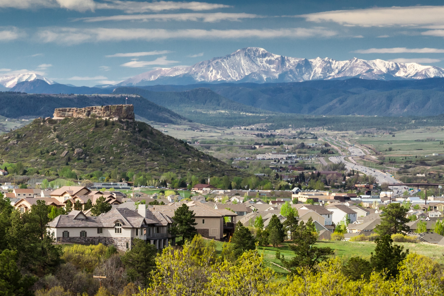
    2017 #coleg: Rep. Jeni Arndt is proposing a framework for ASR projects

    Colorado Capitol building
    Colorado Capitol building

    From the Fort Collins Coloradan (Nick Caltrain):

    “It’s another storage vehicle,” state Rep. Jeni Arndt, D-Fort Collins, said. “It’s logical, it’s practical. It should be part of our future water plan.”

    To that extent, Arndt introduced a bill in the Legislature requiring the state engineer to create rules for artificially recharging these [aquifers]…

    The proposal doesn’t jump-start the development of aquifer recharging programs, but it would create the framework for such programs at a state level. Arndt and others said the key is putting in guards against contaminating an aquifer and avoiding entanglements with the water rights of individuals and neighboring states.

    It’s not as revolutionary an idea as some may think. Denver Water is working on a pilot program for aquifer storage and recovery and Arizona uses aquifer recharging to prevent undue evaporation in desert climates.

    “It’s not really debatable if (aquifer recharging) is proven or not. It is,” said Joe Meigs, a senior project manager with Lytle Water Solutions. “It would be really good if people embraced that and then people tried to move forward with an (aquifer recharge) program to buffer their water supplies.”

    Typical use of these programs works like this, he said: Some years have a lot of surface water, such as when high snow totals melt and flow down the Rockies and inundate normal needs. When that happens, some of the overflow is diverted back into the aquifers — after a making sure its clean, of course — where it can be pumped out during low-flow periods…

    Brian Werner, spokesperson for Northern Water, said recharging aquifers along the north Front Range wouldn’t be a panacea for Northern Colorado’s future water needs. Northern Water looked at the hydrology of the area and concluded that above-ground storage remains the “biggest bang for your buck.” Northern Water is proposing the controversial Northern Integrated Supply Project, which would include construction of the Glade and Galeton reservoirs in Northern Colorado.

    Ogallala Aquifer: “We’re burning up our savings account” — Jay Garetson

    Map sources: Houston, Natalie. 2011. Hydrogeologist, Texas Water Science Center, U.S. Geological Survey. Personal communication, October 2011. Houston, Natalie, Amanda Garcia, and Eric Strom. 2003. Selected Hydrogeologic Datasets for the Ogallala Aquifer, Texas. Open File Report 2003-296. August 2003.
    Map sources:
    Houston, Natalie. 2011. Hydrogeologist, Texas Water Science Center, U.S. Geological Survey. Personal communication, October 2011.
    Houston, Natalie, Amanda Garcia, and Eric Strom. 2003. Selected Hydrogeologic Datasets for the Ogallala Aquifer, Texas. Open File Report 2003-296. August 2003.

    From the Las Vegas Daily Sun (Ian James):

    By permanently barring the use of two wells in an area where farmers rely on the Ogallala Aquifer to grow corn, the judge concluded the Garetson family’s senior water right had been “impaired” by their neighbor – a company that holds a junior water right.

    “What made this case so important is the precedent that is now set,” said Jay Garetson, who filed the lawsuit in 2012 together with his brother Jarvis. The Garetsons have said they sued not only to defend their livelihood but also to press the state to enforce its water laws, and to call attention to the urgent need for action to preserve the aquifer.

    “Our goal was to force this to the forefront,” Garetson said in an interview on Wednesday. “The best-case scenario would be it forces people to recognize that the status quo is no longer an option.”

    Kansas’ “first-in-time, first-in-right” water rights system gives priority to those who have been using their wells the longest. And farmers are actually using much less water than they would be permitted under the system of appropriated groundwater rights established decades ago.

    But with aquifers levels dropping and a limited supply left that can be economically extracted for farming, the Garetsons and others argue that the state and water districts should step in to establish limits on pumping…

    Garetson said the decision should help bring order to a chaotic situation, and he hopes the case will be a catalyst for management of groundwater. He said he thinks the local groundwater district should establish a water budget and institute a sort of “cap-and-trade” system, in which water use would be scaled back based on established rights and could be sold between farmers, thereby allowing the market to sort out the scarcity problem.

    He thinks such a system could serve as a model across the Ogallala Aquifer and in other areas of the country where aquifers are declining due to excessive pumping.

    Garetson has seen some wells go dry on his farm, where he and his brother grow corn and sorghum. And he acknowledges his own pumping contributes to what is effectively the “mining” of groundwater.

    He wants state officials and the region’s water managers to establish limits to move “in the direction of sustainability” – even though that’s a high bar to reach given the area’s limited water supplies and slow rate of aquifer recharge.

    Garetson said he hopes the court decision will help Kansas farmers move away from the pattern of unchecked pumping that is draining the aquifer. Under the status quo, he said, “we’re actually just borrowing from the future. We’re burning up our savings account.”

    USAF to step up RE: Widefield Aquifer pollution

    Photo via USAF Air Combat Command
    Photo via USAF Air Combat Command

    From The Colorado Springs Gazette (Matt Steiner):

    While Col. Doug Schiess, commander of the 21st Space Wing at Peterson Air Force Base, wouldn’t elaborate on details of the five-year plan, he said information about an internal Air Force report would be released in late June or early July.

    The Air Force used firefighting foam at the base for decades that contained perfluorinated compounds. High quantities of the chemical in drinking water from the Widefield Aquifer triggered an EPA advisory last spring.

    A Gazette investigation in October revealed that the service kept the foam in use despite Defense Department studies over the years that showed it was harmful to laboratory animals.

    Commissioners Longinos Gonzalez and Mark Waller pressed Schiess to reveal how much the mitigation work would cost and who would pay the bill if more contamination was found after the five-year time frame.

    “That will be done at a much higher level in the Air Force,” Schiess said, when asked if the reclamation funds were readily available now. “They know that that is a big bill and they have put some money aside. That is being budgeted, but I don’t have details.”

    […]

    Schiess said the five-year plan will ensure that the ground near Peterson and at the Colorado Springs Airport is free of perflourinated compounds. When ingested, the chemicals can remain in the body for decades. The colonel said natural, untainted runoff will eventually dilute the watershed and bring it up to Environmental Protection Agency standards for safe water…

    Perfluorinated chemicals have been used in nonstick pans, in stain-resistant treatments for carpet and even in fast-food containers for decades.

    Air Force studies done as early as 1979 revealed that the perfluorinated chemical in its firefighting foam caused liver damage, cellular damage and low birth weight to laboratory animals. It has also been tagged as a potential carcinogen.

    Last year, EPA lowered its health advisory levels for perfluorinated compounds to 70 parts per trillion, changing the status of some wells that had been previously deemed safe.

    On Thursday, Schiess said that the internal draft report about the contamination in southern El Paso County will likely be completed by the contractor in March. The Air Force will send its final report to the EPA in late April. And that information will be ready for public consumption in June or July, he said.

    Schiess also brought the commissioners up to date on interim efforts to treat drinking water using filters for homes and businesses.

    He said the Air Force had contacted about two dozen residents who had been using bottled water in their homes. According to the colonel, six homeowners declined offers to install reverse osmosis filtration systems, and four have had those measures implemented.

    Schiess said the Fountain Valley Shopping Center is still using bottled water and others, such as Venetucci Farm and the Norad View Mobile Home Park are using granular activated carbon filters.

    Battlement Mesa: Boring for water pipeline encounters high groundwater flows

    Parachute/Battlement Mesa area via the Town of Parachute.
    Parachute/Battlement Mesa area via the Town of Parachute.

    From The Grand Junction Daily Sentinal (Dennis Webb):

    Summit Midstream ran into the problem Jan. 18 after it had nearly completed horizontally drilling a pilot bore for a water pipeline that will connect two Ursa well pads in Battlement Mesa, an unincorporated residential community of several thousand residents. A contractor for Summit struck a spring about 55 feet underground and water began gushing at estimated rates of as much as 294,000 gallons a day.

    The incident initially forced the company to operate trucks 24 hours a day and to do work on a Sunday as it hauled off the water. That prompted several residents affected by the traffic to file complaints with the Colorado Oil and Gas Conservation Commission and Garfield County. A county approval condition for the pipeline project generally limits construction operations to 7 a.m. to 7 p.m., Mondays through Saturdays. But it allows for Sunday work if field conditions or inclement weather make it necessary.

    On Jan. 25, Summit obtained a permit from the state Water Quality Control Division to discharge water from the flow into the Colorado River so it didn’t have to keep trucking away the water.

    Leonard Mallett, Summit’s chief operations officer, said Tuesday that the flow from the spring has diminished quite a bit. He said the company hoped to pull pipe through the hole on Wednesday, and then inject a slurry grout around the pipe in the week, which should provide a seal and end the groundwater flow.

    The water pipeline will allow for movement of hydraulic fracturing fluid and wastewater associated with gas development. Summit also will be installing a parallel natural gas pipeline about 50 feet from the water line. Mallett said it will be routed along a different angle and depth to avoid the spring…

    He said the groundwater is being routed into a kind of ditch or waterway on private land to reach the river, and is staying within the banks.

    Summit officials said in a written statement to the Daily Sentinel that Summit kept water from reaching the river or any other waters of the state prior to receiving the discharge permit. It says it pursued the permit after testing showed only groundwater was involved.

    Lillian Gonzalez, a permit manager for the Water Quality Control Division, said it’s possible to run into groundwater during excavation for any kind of construction project, and to need to remove the water. Options can range from letting it evaporate in a lined pond, to hauling it to a facility that can handle it, to getting a permit to discharge into the waters of the state.

    She said the Summit Midstream permit was issued under an assumption that the groundwater isn’t contaminated. That’s based on the fact that there’s no known nearby groundwater contamination in the area.

    However, Summit is required to test the water for acidity, oil and grease, and total dissolved and suspended solids, and must limit the discharge to 400 gallons per minute, or 576,000 gallons a day.

    Gonzalez said typically the biggest concern with such permits is making sure the suspended solids limit is met because of the loose dirt associated with excavation work. A company may have to filter the water before discharging it, she said…

    Toxic chemicals tainting Colorado groundwater also found in fast-food packaging

    Graphic vis the National Institutes of Health
    Graphic vis the National Institutes of Health

    From The Denver Post (Bruce Finley):

    The Environmental Working Group study, peer-reviewed and published Wednesday in the journal Environmental Science and Technology Letters, found the perfluorinated chemicals (PFCs) in grease-resistant wrappers -– including pizza box liners, sandwich and pastry packaging — from chains including Starbucks, Jimmy Johns, Taco Time, Chipotle and Quiznos. The chemicals can leach into food, potentially reaching consumers, the study authors said, urging companies to find safe alternative packaging.

    Scientists from California and the Environmental Protection Agency collaborated in the research with final testing done at an EPA lab.

    “We don’t have definitive answers for how much harm these chemicals are causing, but there are many reasons to be concerned,” EWG chemist Dave Andrews said.

    “These fast food companies need to look at their supply chains. They need to evaluate alternatives and move away from this concerning class of chemicals because of the potential for human health impact and the fact that the chemicals do not break down in the environment,” Andrews said.

    Morgan Conservation District’s 62nd Annual Meeting, February 9th, 2017

    View of runoff, also called nonpoint source pollution, from a farm field in Iowa during a rain storm. Topsoil as well as farm fertilizers and other potential pollutants run off unprotected farm fields when heavy rains occur. (Credit: Lynn Betts/U.S. Department of Agriculture, Natural Resources Conservation Service/Wikimedia Commons)
    View of runoff, also called nonpoint source pollution, from a farm field in Iowa during a rain storm. Topsoil as well as farm fertilizers and other potential pollutants run off unprotected farm fields when heavy rains occur. (Credit: Lynn Betts/U.S. Department of Agriculture, Natural Resources Conservation Service/Wikimedia Commons)

    From the Morgan Conservation District via The Fort Morgan Times (Angela Werner):

    Morgan Conservation District’s 62nd annual meeting will be held on February 9th.

    It will be held at the Fort Morgan Home Plate Restaurant, 19873 U.S. Hwy. 34. Breakfast will be at 8 a.m. and the meeting will start at 9 a.m. The cost of the meeting will be $25 in advance, and that will cover the annual meeting, annual membership in Morgan Conservation District, and free breakfast that morning.

    If you do not RSVP in advance, and show up on the day of the meeting, please be advised that the cost will be the same, however breakfast will not be free, due to our needing to order the food in advance. Our keynote speakers, Bill Hammerich and Andrew Neuhart.

    Bill Hammerich has served as the CEO of Colorado Livestock Association (CLA) for the past fourteen years. He grew up on a cattle and farming operation in Western Colorado and he attended CSU where he graduated with a degree in Agricultural Economics. Following graduation, he began working with Monfort of Colorado, then Farr Feeders and was with the Sparks Companies before joining CLA in 2002.
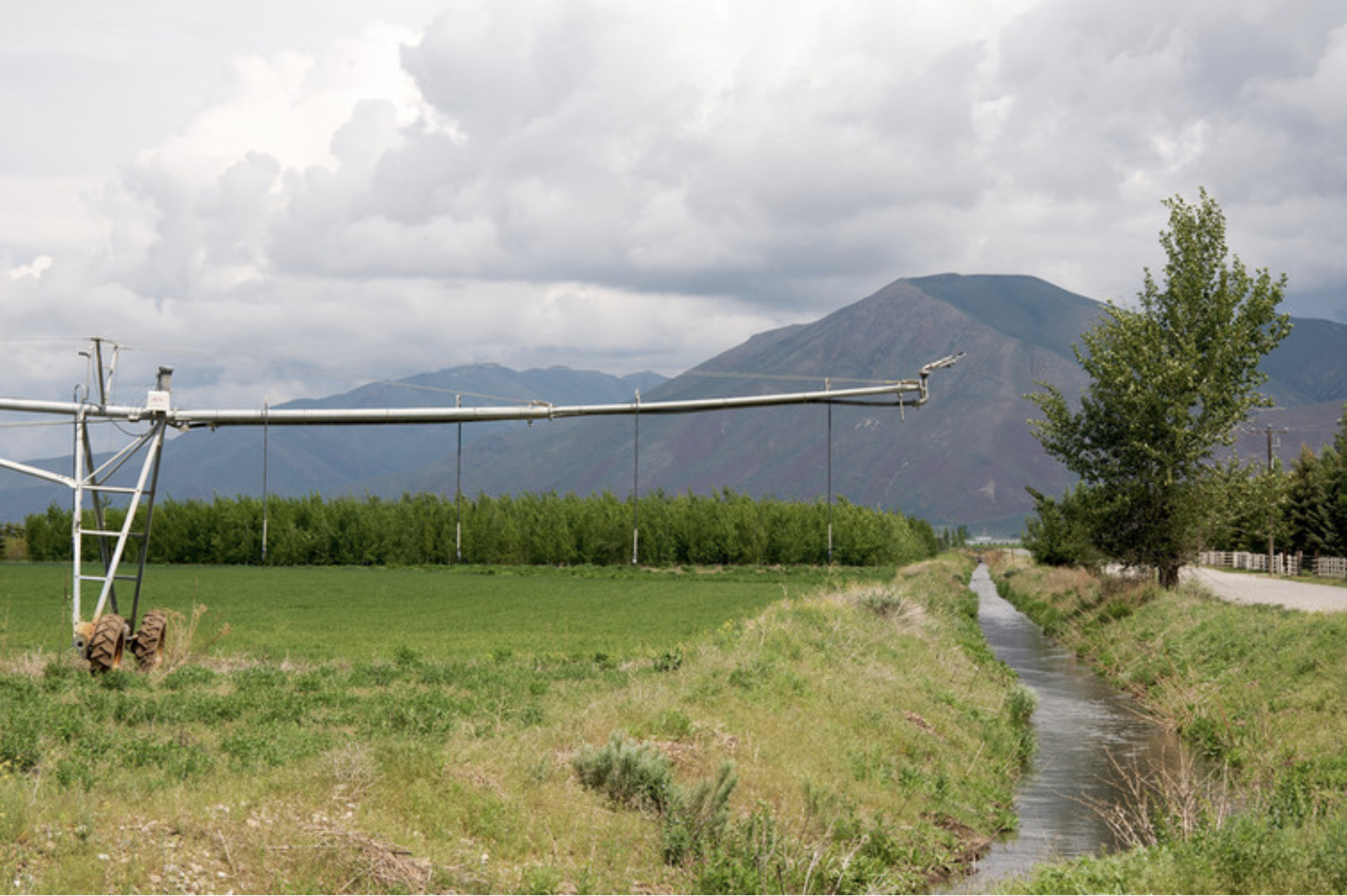
    His time spent in the cattle feeding industry provided him not only with an understanding of how to feed cattle, but also the importance of protecting and sustaining the environment in which one operates.

    Bill and his wife Sabrina live in Severance, Colorado and have two grown children, Justin and Jessica, and four grandsons.

    Andrew Neuhart completed both a B.S. in Natural Resource Management and an M.S. in Watershed Science at CSU. After spending two years assisting in precision farming studies in the San Luis Valley for the USDA Soil, Plant and Nutrient Research team, Andrew went to work for the State of Colorado’s Water Quality Control Division. For 9 years with the WQCD, Andrew led a Permitting Unit for discharge permits under the Clean Water Act, for both industrial and domestic wastewater treatment facilities. Working for Brown and Caldwell over the last 4 years, Andrew assists clients with regulatory issues under the Clean Water Act, and has been working with the Ag Task Force, part of the Colorado Monitoring Framework, to get the word out regarding nutrient regulations and their impacts to agricultural operations.

    Mr. Hammerich and Mr. Neuhart will be speaking about Regulation 85.

    Regulation 85 establishes requirements for organizations holding a NPDES permit and with the potential to discharge either nitrogen or phosphorus to begin planning for nutrient treatment based on treatment technology and monitoring both effluents and streams for nitrogen and phosphorus.

    The data from these efforts is designed to better characterize nutrient sources, characterize nutrient conditions and effects around the state and to help inform future regulatory decisions regarding nutrients. Please come to the meeting and learn more from our very knowledgeable keynote speakers!

    Please RSVP as soon as possible to Angela at morganconservationdistrict@gmail.com or call 970-427-3362. Space is limited.

    Battlement Mesa: Folks are fighting injection well application

    Parachute/Battlement Mesa area via the Town of Parachute.
    Parachute/Battlement Mesa area via the Town of Parachute.

    From Aspen Public Radio (Elizabeth Stewart-Severy):

    Earlier this month, the contractor Battlement Mesa Partners asked Garfield County to allow zoning for an injection well in a residential neighborhood. Injection wells are used for disposal of wastewater generated from fracking.

    Three citizens groups in the area are concerned about protecting the health of the water supply. The Colorado Oil and Gas Commission approved permits for two well pads in the Battlement Mesa neighborhood last fall, but those permits do not include injection wells.

    Garfield County is accepting public comment through Thursday, Jan. 26. Comments can be sent to Glen Hartmann at the Garfield County Community Development Department at ghartmann@garfield-county.com. The issue will be heard by the Garfield Planning and Zoning Commission on Feb. 8 at 6 p.m.

    Burlington: Republican River rule making hearing February 9, 2017

    Downtown Burlington (2014) via Wikipedia.
    Downtown Burlington (2014) via Wikipedia.

    From the Colorado Division of Water Resources:

    The State Engineer has initiated the process to develop rules and regulations for water diversion, use, and administration for compact purposes within the Republican River Compact Groundwater Model Domain as approved by the U.S. Supreme Court in Kansas v. Nebraska & Colorado, Number 126, Original. The rulemaking will consider the requirement to offset impacts in excess of Colorado’s apportionment under the Republican River Compact as determined under the Final Settlement Stipulation, and work to ensure that all users of waters accounted for in Colorado’s Republican River Compact Accounting have a stake in ensuring ongoing compact compliance.

    As part of this rulemaking process, the State Engineer has formed a Special Advisory Committee to seek advice and recommendations on the rules and regulations under consideration. This committee, comprised of volunteers representing users and interests throughout the Republican River Basin, will be asked to attend monthly meetings in the basin hosted by the State Engineer, and will work with the State Engineer, in an advisory capacity, on draft rules and regulations. These meetings will be open to the public and will include presentations related to the rulemaking followed by general discussion and work/review of draft rules.

    The next meeting is scheduled to occur on February 9th, 2017 (10:00 AM – 3:00 PM) in the Recreation Room at the Burlington Community and Education Center (340 S. 14th St, Burlington, CO).

    Additional information regarding this rulemaking, including draft rules, can be found on this page as it becomes available. If you are a water user or represent a water user in the basin and you would like to join the Special Advisory Committee, or you would like to be added to a distribution list for future information about this rulemaking, please contact Chris Grimes at 303-866-3581 ext. 8253 or chris.grimes@state.co.us.

    This rulemaking is not to be confused with the Rules and Regulations Governing the Measurement of Ground Water Diversions Affecting the Republican River Compact, Within Water Division No. 1, as adopted by the State Engineer on September 16, 2015; a rule set that focuses on measurement devices (meters) and annual reporting requirements. These rules can be found here.

    #AnimasRiver: @EPA — Implementation of the #GoldKingMine After-Action Review

    A “get well soon” balloon floats in the contaminated waters of the Animas River flowing through Durango on Monday afternoon August 10, 2015 -- photo The Durango Herald, Shane Benjamin
    A “get well soon” balloon floats in the contaminated waters of the Animas River flowing through Durango on Monday afternoon August 10, 2015 — photo The Durango Herald, Shane Benjamin

    Click here to read the report. Here’s an excerpt:

    In November 2015, the U.S. Environmental Protection Agency’s Chief of Staff, Matt Fritz, established an agency team to conduct an After-Action Review of EPA’s response to the Gold King Mine (GKM) release that occurred on August 5, 2015. The team, comprised of employees from across the agency, interviewed over a hundred people and reviewed a large volume of documents to identify lessons learned and develop recommendations for the Administrator’s consideration. Among the documents reviewed were after-action reports from previous emergency responses, which showed that some of the issues identified at Gold King Mine were not new. On December 21, 2015, the After-Action Review Team submitted its report detailing ten specific recommendations to improve how the agency responds to emergency incidents and to ensure a highly effective EPA Emergency Response Program that can adapt quickly to dynamic, unpredictable situations. These recommendations, shown in Appendix A, were:

  • Recommendation 1: Establish a National Incident Management Assistance Team (IMAT) at EPA.
  • Recommendation 2: Institute Senior Official training plan.
  • Recommendation 3: Institute ICS key leadership training plan.
  • Recommendation 4: Establish an agency data and information management team.
  • Recommendation 5: Improve data and information posting and communications.
  • Recommendation 6: Establish Communications Strike Teams and broaden data training for PIOs and public affairs staff.
  • Recommendation 7: Invest in data resources and clarify roles/responsibilities.
  • Recommendation 8: Build capacity for rapid data collection, interpretation, and dissemination.
  • Recommendation 9: Align public affairs resources and update communications procedures.
  • Recommendation 10: Improve notification procedures, plans, and equipment.
  • From The Durango Herald (Mary Shinn):

    The EPA outlined its efforts in a report posted on its website late Friday afternoon called “In the Rearview Mirror: Implementation of the Gold King Mine After-Action Review.”

    The EPA’s chief of staff announced the changes in February 2016, after the agency took responsibility for the release of metal-laden water from the Gold King Mine on Aug. 5, 2015.

    The changes were based on a December 2015 after-action report that made 10 recommendations focused on improving its emergency response and communications that the EPA has worked on, the review stated. The original after-action report did not seem to have been posted on the EPA’s website when it was finished. EPA officials did not immediately respond to request for comment on the review Saturday.

    The review recommended the agency continue funding emergency management training and positions created as a result of the changes. But it did not list specific budget expenses.

    A national emergency response team was trained by December 2016 and it will be deployed to mine spills or releases that the EPA has caused or is directly involved in, or when an event involves multiple EPA regions.

    “Quick and effective response to incidents reduces the risk to public safety, environmental damage and potential legal liability,” the report said.

    To improve communications, the EPA plans to develop three teams of six that will assist with breaking down complex and technical information. When a team is deployed, they will not communicate with the public but will work behind the scenes.

    Assistant County Manager Joanne Spina could not comment on the report, but she acknowledged that there were challenges with EPA communications after the Gold King Mine spill.

    “We tried to work through those as situations arose,” she said.

    During emergencies, the EPA also plans work with federal, state, local, tribal, trust territory and other partners on development and release of all materials.

    Effectively communicating data with the public was another focus of the EPA, and it calls for eliminating the time lag between the EPA receiving data and communicating it to the public.

    Residents and local officials were frustrated with the slow pace of metals sampling and interpretation of the data.

    This data was needed to determine whether the river could be reopened and used for drinking, agriculture and recreation.

    Distrust of the EPA’s data led some residents of the Navajo Nation to keep their irrigation ditches closed, causing lost crops, because they didn’t want to risk using the contaminated water.

    The Office of Emergency Management has hired a coordinator to help the EPA with data, and the review solicits funding for training and workshops.

    Agency workers also updated their contact lists for tribal governments and plan to update those lists annually.

    The agency also updated training for senior leadership on what their role is during an emergency. Satellite communications systems were also upgraded for those working in the field.

    After the spill, the EPA team was trapped without cellphone service or a satellite phone and this delayed communications with the state by almost two hours.

    Ebbing Away: Latest land “subsidence” monitoring report finds lower ground levels and fissures in some regions of Arizona

    EPA delays in-situ uranium rule

    uraniuminsitu

    From the Associated Press (Mead Gruver) via The Colorado Springs Gazette:

    Federal officials withdrew a proposed requirement for companies to clean up groundwater at uranium mines across the U.S. and will reconsider a rule that congressional Republicans criticized as too harsh on industry.

    The plan that the U.S. Environmental Protection Agency put on hold Wednesday involves in-situ mining, in which water containing chemicals is used to dissolve uranium out of underground sandstone deposits. Water laden with uranium, a toxic element used for nuclear power and weapons, is then pumped to the surface. No digging or tunneling takes place.

    The metal occurs in the rock naturally but the process contaminates groundwater with uranium in concentrations much higher than natural levels. Mining companies take several measures to prevent tainted water from seeping out of the immediate mining area.

    Even so, underground leaks sometimes occur, though most of the mines are not near population centers. No in-situ uranium mine has contaminated a source of drinking water, the industry and its supporters assert.

    Along with setting new cleanup standards, the rule would have required companies to monitor their former mines potentially for decades. The requirement was set for implementation but now will be opened up for a six-month public comment period, with several changes.

    Those include allowing the Nuclear Regulatory Commission or states to determine certain cleanup standards on a site-specific basis. The EPA decided to resubmit the rule and seek additional public input after reviewing earlier comments, agency spokeswoman Monica Lee said.

    Wyoming’s Republican U.S. senators, John Barrasso and Mike Enzi, praised the EPA’s decision to reconsider, saying the rule was unnecessarily burdensome for the uranium industry.

    Wyoming has five active in-situ uranium mines and is the top uranium-producing state. Other mines are active in Nebraska and Texas.

    “In-situ uranium recovery has been used in the United States for decades, providing valuable jobs to Wyoming and clean energy to the nation,” Enzi said in a news release. “I rarely say this about the EPA, but the agency made the right decision.”

    Environmentalists and others say uranium-mining companies have yet to show they can fully clean up groundwater at a former in-situ mine. Clean groundwater should not be taken for granted, they say, especially in the arid and increasingly populated U.S. West.

    “We are, of course, disappointed that this final rule didn’t make it to a final stage,” said Shannon Anderson with the Powder River Basin Resource Council. “It was designed to address a very real and pressing problem regarding water protection at uranium mines.”

    The EPA rule is scheduled for further consideration in President-elect Donald Trump’s administration.

    In-situ uranium mining surged on record prices that preceded the 2011 Japanese tsunami and Fukushima nuclear disaster. Prices lately have sunk to decade lows, prompting layoffs.

    The Water Information Program January Newsletter is hot off the presses

    South Fork Mineral Creek, Silverton photo via hhengineering.com
    South Fork Mineral Creek, Silverton photo via hhengineering.com

    Click here to read the newsletter. Here’s an excerpt:

    Aquatic Life Discovered on Mineral Creek Above Silverton

    Recent studies by Mountain Studies Institute and the USGS on Upper Mineral Creek have found an improving macroinvertebrate population and a naturally reproducing brook trout population. For the past 20 years, this stretch was devoid of aquatic life. The Animas River Stakeholder Group has conducted a dozen mining remediation projects above that reach on Mineral Creek, which has dramatically improved water quality. ARSG will request that the Colorado Water Quality Control Commission make an aquatic life designation under the Clean Water Act for that segment of Mineral Creek. Congratulations to ARSG and its many partners for this water quality remediation success!

    #AnimasRiver: Public comments favor continued Cement Creek water treatment operations

    The EPA's wastewater treatment plant near Silverton, Colorado, on Thursday, Oct. 16, 2015 -- photo via Grace Hood Colorado Public Radio
    The EPA’s wastewater treatment plant near Silverton, Colorado, on Thursday, Oct. 16, 2015 — photo via Grace Hood Colorado Public Radio

    From The Durango Herald (Jonathan Romeo):

    Continued operations of the temporary water treatment plant north of Silverton received near unanimous support during a 30-day public comment period.

    From Nov. 14 to Dec. 14, the Environmental Protection Agency accepted public comments on whether to continue operations at the plant that handles acidic discharges from the Gold King Mine.

    The EPA previously announced it preferred that option while it continues to evaluate long-term options for the recently declared Bonita Peak Mining District Superfund site, which would address issues at 48 mining-related sites around Silverton.

    The public comment period was part of a formal process to move the plant from “emergency removal action” funding to a “non-time critical removal action” funding, which is part of the Superfund process.

    The agency received 12 submissions, mostly from government entities affected by the Aug. 5, 2015, Gold King Mine blowout, with only one resident weighing in.

    The government entities in favor of continued operations included the Colorado Department of Public Health and Environment; the Colorado Attorney General’s Office; La Plata County; San Juan County; the town of Silverton; the Utah Department of Environmental Quality, and Congressman Scott Tipton.

    Trout Unlimited, an environmental group, and Duranglers Flies and Supplies also voiced support for keeping the plant running.

    While all the above-mentioned entities voiced support for continued operations, some suggested the EPA start treating discharges from adjacent mines, namely the Red & Bonita and Mogul mines, as well as the American Tunnel.

    Others wrote that the EPA should secure a place to store the lime-heavy metal sludge byproduct of the treatment plant before committing to continued operation. The EPA has said it is searching for a long-term dump site…

    A representative from Silverton Mountain Ski Area, which is about a mile and a half downstream from the water treatment plant, raised concerns about the treatment plant’s impact on ski operations.

    The ski mountain’s chief operating officer, Tim Petrick, asked the EPA to consider installing better equipment for improved communications in the remote area, as well as perform dust suppression on County Road 110.

    And a Castle Rock-based company called Jalema Technologies Ltd. that deals with mine wastewater treatment said the EPA could cut costs of operations “if a more studied plant design was implemented at the site.” The company then argued it had the technology to “produce higher quality discharge water for a cost similar to that shown for” the temporary plant, and offered its services.

    One resident voiced support for the continuance of the plant, though the name was redacted.

    Rebecca Thomas, EPA’s project manager for the Superfund site, said the agency will consider the comments and then make a decision through an “action memo.”

    She expected the final decision to be issued in January.

    Photo via the @USGS Twitter feed
    Photo via the @USGS Twitter feed

    @NatGeo: As Groundwater Dwindles, a Global Food Shock Looms

    The High Plains Aquifer provides 30 percent of the water used in the nation's irrigated agriculture. The aquifer runs under South Dakota, Wyoming, Nebraska, Colorado, Kansas, Oklahoma, New Mexico and Texas.
    The High Plains Aquifer provides 30 percent of the water used in the nation’s irrigated agriculture. The aquifer runs under South Dakota, Wyoming, Nebraska, Colorado, Kansas, Oklahoma, New Mexico and Texas.

    From National Geographic (Cheryl Katz):

    By mid-century, says a new study, some of the biggest grain-producing regions could run dry.

    Rising temperatures and growing demands for thirsty grains like rice and wheat could drain much of the world’s groundwater in the next few decades, new research warns.

    Nearly half of our food comes from the warm, dry parts of the planet, where excessive groundwater pumping to irrigate crops is rapidly shrinking the porous underground reservoirs called aquifers. Vast swaths of India, Pakistan, southern Europe, and the western United States could face depleted aquifers by midcentury, a recent study finds — taking a bite out of the food supply and leaving as many as 1.8 billion people without access to this crucial source of fresh water.

    To forecast when and where specific aquifers around the globe might be drained to the point that they’re unusable, Inge de Graaf, a hydrologist at the Colorado School of Mines in Golden, Colorado, developed a new model simulating regional groundwater dynamics and withdrawals from 1960 to 2100. She found that California’s agricultural powerhouses — the Central Valley, Tulare Basin and southern San Joaquin Valley, which produce a plentiful portion of the nation’s food — could run out of accessible groundwater as early as the 2030s. India’s Upper Ganges Basin and southern Spain and Italy could be used up between 2040 and 2060. And the southern part of the Ogallala aquifer under Kansas, Oklahoma, Texas, and New Mexico could be depleted between 2050 and 2070.

    “The areas that will run into trouble the soonest are areas where we have a lot of demand and not enough surface water available,” says de Graaf, who presented her results last week at the American Geophysical Union conference in San Francisco.

    Farming has mushroomed across arid regions like these in the past half-century. With scarce rains and few rivers and lakes, they depend on water pumped up from underground. Since 1960, excessive pumping has already used up enough groundwater worldwide to nearly fill Lake Michigan, estimates de Graaf, who projects that with climate change and population growth, future groundwater use will soar. She considers an aquifer depleted when its water level falls below a depth of around 300 feet, at which point it becomes too expensive for most users to pump up.

    Shrinking groundwater supplies will dent the world’s food supply, says de Graaf’s co-author Marc Bierkens, a hydrologist at Utrecht University in the Netherlands. Bierkens points out that 40 percent of global food production now relies on irrigation with groundwater. If the amount of available groundwater were cut in half, for example, he estimates that farm output would drop by roughly 6 percent—reflecting the portion that’s absolutely dependent on unsustainable groundwater use.

    “It’s not that the whole population will starve,” says Bierkens, “but it will have an impact on the food chain and food prices.”

    USGS: Groundwater-flow model of the northern High Plains aquifer in Colorado, Kansas, Nebraska, South Dakota, and Wyoming

    Ogallalahighplainsaquifercsu

    Here’s the abstract from the USGS (Steven M. Peterson, Amanda T. Flynn, and Jonathan P. Traylor):

    The High Plains aquifer is a nationally important water resource underlying about 175,000 square miles in parts of eight states: Colorado, Kansas, Oklahoma, Nebraska, New Mexico, South Dakota, Texas, and Wyoming. Droughts across much of the Northern High Plains from 2001 to 2007 have combined with recent (2004) legislative mandates to elevate concerns regarding future availability of groundwater and the need for additional information to support science-based water-resource management. To address these needs, the U.S. Geological Survey began the High Plains Groundwater Availability Study to provide a tool for water-resource managers and other stakeholders to assess the status and availability of groundwater resources.

    A transient groundwater-flow model was constructed using the U.S. Geological Survey modular three-dimensional finite-difference groundwater-flow model with Newton-Rhapson solver (MODFLOW–NWT). The model uses an orthogonal grid of 565 rows and 795 columns, and each grid cell measures 3,281 feet per side, with one variably thick vertical layer, simulated as unconfined. Groundwater flow was simulated for two distinct periods: (1) the period before substantial groundwater withdrawals, or before about 1940, and (2) the period of increasing groundwater withdrawals from May 1940 through April 2009. A soil-water-balance model was used to estimate recharge from precipitation and groundwater withdrawals for irrigation. The soil-water-balance model uses spatially distributed soil and landscape properties with daily weather data and estimated historical land-cover maps to calculate spatial and temporal variations in potential recharge. Mean annual recharge estimated for 1940–49, early in the history of groundwater development, and 2000–2009, late in the history of groundwater development, was 3.3 and 3.5 inches per year, respectively.

    Primary model calibration was completed using statistical techniques through parameter estimation using the parameter estimation suite of software with Tikhonov regularization. Calibration targets for the groundwater model included 343,067 groundwater levels measured in wells and 10,820 estimated monthly stream base flows at streamgages. A total of 1,312 parameters were adjusted during calibration to improve the match between calibration targets and simulated equivalents. Comparison of calibration targets to simulated equivalents indicated that, at the regional scale, the model correctly reproduced groundwater levels and stream base flows for 1940–2009. This comparison indicates that the model can be used to examine the likely response of the aquifer system to potential future stresses.

    Mean calibrated recharge for 1940–49 and 2000–2009 was smaller than that estimated with the soil-water-balance model. This indicated that although the general spatial patterns of recharge estimated with the soil-water-balance model were approximately correct at the regional scale of the Northern High Plains aquifer, the soil-water-balance model had overestimated recharge, and adjustments were needed to decrease recharge to improve the match of the groundwater model to calibration targets. The largest components of the simulated groundwater budgets were recharge from precipitation, recharge from canal seepage, outflows to evapotranspiration, and outflows to stream base flow. Simulated outflows to irrigation wells increased from 7 percent of total outflows in 1940–49 to 38 percent of 1970–79 total outflows and 49 percent of 2000–2009 total outflows.

    #coleg: @CWCB_DNR hopes to score $25 million for watershed plans @COWaterPlan

    Yampa River
    Yampa River

    From The Denver Post (Bruce Finley):

    A Colorado Water Conservation Board proposal, sent to state lawmakers last week, recommends the stream-saving action to meet state environmental and economic goals. It remains unclear who would enforce the community watershed plans.

    But there’s little doubt streams statewide are strained by thirsts of a growing population expected to double by 2060, according to state officials. And a Denver Post look at the latest water quality data found that 12,975 miles of streams across Colorado (14 percent of all stream miles) are classified as “impaired” with pollutants exceeding limits set by state regulators.

    Creating local watershed plans to save streams is essential, said James Eklund, the CWCB director and architect of the year-old Colorado Water Plan. Eklund pointed to low-snow winters and drought in California’s Sierra Nevada, where 2015 snowpack at 5 percent of average forced a declaration of a state of emergency requiring 25 cuts in urban water use.

    “When our Colorado mountain snowpack drops below 60 percent of average, we get nervous. If it happens in the Sierras, it can happen in the Rockies,” he said. “We need to protect certain streams before a crisis. We have got to get on this quickly.”

    No single agency oversees waterway health. State natural resources officials monitor flow levels in streams and rivers. They run a program aimed at ensuring sufficient “in-stream flow” so that, even during drought, streams don’t die.

    Meanwhile, the Colorado Department of Public Health and Environment sets standards on maximum levels of pollutants that people and companies are allowed to discharge into waterways. In 2015, only 51.6 percent total stream and river miles in Colorado met quality standards, and 30.1 percent of lake surface acres met standards, according to a CDPHE planning document.

    “If stream flows are low, there is less dilution in the stream to handle the addition of pollutants through permitted discharges,” CDPHE water quality director Pat Pfaltzgraff said in responses sent by agency spokesman Mark Salley.

    Yet CDPHE officials do not make recommendations to natural resources officials about water flows necessary to improve stream health.

    The health department has made separate “watershed plans.” CDPHE officials “are considering broadening the division’s watershed plans to include ecosystem health that might be more consistent with stream management plans.”

    Pfaltzgraff declined to discuss stream health…

    CWCB chairman Russ George supported the push to create local watershed plans, to include detailed maps covering every stream.

    “Every stream and tributary needs to be inventoried. … It should have been done a long time ago,” George said in an interview last week.

    “We have kind of hit the population and demand place where we have to do it. We didn’t have to do it for the first part of history because the population was small and there wasn’t the impact of all the issues we are getting into now,” he said.

    The CWCB voted unanimously last month to ask lawmakers to approve $5 million a year for up to five years to launch local stream planning.

    Basin roundtable boundaries
    Basin roundtable boundaries

    The plans are to be developed within the eight river basin “roundtable” forums that Colorado has relied on for addressing water challenges. These groups draw in residents with interests in stream health who helped hash out the Colorado Water Plan, which was finalized last year and calls for statewide cuts in per person water use by about 1 percent a year.

    Conditions along Colorado streams vary, said Bart Miller, healthy rivers program director for Boulder-based Western Resource Advocates. “There are plenty of streams that have problems.”

    While state natural resources officials run the program aimed at keeping at least some water in heavily tapped streams, survival in a competitive environment is complex. Leaving water in streams for environmental purposes often depends on timing, when the mountain snowpack that serves as a time-release water tower for the West melts, the amount of snowpack, and needs of cities, pastures and farms.

    Collaborative local forums to find flexibility to revive streams “is a great approach.” However, state officials eventually may have to play a central role converting plans into action, Miller said.

    “The state should help both in funding the planning but also in implementing the plans,” he said. “We have a lot of work to do. This matters because this is about ‘the Colorado brand.’ Everyone depends on healthy rivers.”

    The roundtable forums in communities draw in diverse stakeholders from cattlemen to anglers.

    Irrigators and other water users west of Aspen already have created a “stream management plan,” for the Crystal River, seen as a model local effort. Their planning included an assessment of watershed health that found significant degradation above the confluence with the Roaring Fork River. They set a goal of reducing the estimated 433 cubic feet per second of water diverted from the river by adding 10 to 25 cfs during dry times. They’re developing “nondiversion agreements” that would pay irrigators to reduce water use when possible without hurting agriculture, combined with improving ditches and installation of sprinkler systems designed to apply water to crops more efficiently.

    Enforcement of plans hasn’t been decided. “We’d like to see more enforcement” of measures to improve stream health, Rocky Mountain Sierra Club director Jim Alexee said. “We definitely think there’s room to do more. We also want to be respectful of the governor’s watershed process.”

    Colorado has no history of relying on a central agency to enforce water and land use, CWCB chairman George pointed out.

    “When you have a system designed to have everybody at the table, what you’re doing is recognizing there is a finite resource that is shared by everybody. And impacts are shared by everybody statewide. In order to keep from having some force dominate in ways that would not account for all statewide impacts, you need to diffuse the conversation into all areas. That is what roundtables do,” he said.

    “When you do that, you’re going to get a better statewide result over time. … It is a process that is designed to get as many interests into the decision-making as you can. … It gets harder, of course, as the supply-demand makes pinches. For the rest of our lives, it is going to be that way.”

    @USGS: Assessment of Moderate- and High-Temperature Geothermal Resources of the United States

    Map showing the location of identified moderate-temperature and high-temperature geothermal systems in the United States. Each system is represented by a black dot. Credit USGS.
    Map showing the location of identified moderate-temperature and high-temperature geothermal systems in the United States. Each system is represented by a black dot. Credit USGS.

    Here’s the release from the USGS:

    Scientists with the U.S. Geological Survey (USGS) recently completed an assessment of our Nation’s geothermal resources. Geothermal power plants are currently operating in six states: Alaska, California, Hawaii, Idaho, Nevada, and Utah. The assessment indicates that the electric power generation potential from identified geothermal systems is 9,057 Megawatts-electric (MWe), distributed over 13 states. The mean estimated power production potential from undiscovered geothermal resources is 30,033 MWe. Additionally, another estimated 517,800 MWe could be generated through implementation of technology for creating geothermal reservoirs in regions characterized by high temperature, but low permeability, rock formations.

    CDPHE: Water Quality Information Bulletin

    Click here to read the bulletin. There will be an informational briefing concerning Clear Creek at the December 12, 2016 meeting.

    Clear Creek, Standley Lake watersheds including the Standley Lake Canal Zone via the Clear Creek Watershed Foundation.
    Clear Creek, Standley Lake watersheds including the Standley Lake Canal Zone via the Clear Creek Watershed Foundation.

    UAWCD files objection in Coaldale water case — The Mountain Mail

    Graphic via the Upper Arkansas Water Conservancy District
    Graphic via the Upper Arkansas Water Conservancy District

    From The Mountain Mail (Joe Stone):

    The Upper Arkansas Water Conservancy District board of directors voted at its recent meeting to file an objection to the Security Water District’s court application for a change of water rights on Hayden Creek in Coaldale (Division 2, case 2016CW3055).

    In discussing whether or not to get involved in the case, Upper Ark directors mentioned unresolved issues with Hill Ranch near Nathrop after the Pueblo West Metropolitan District purchased the ranch, changed the water right and dried up the land.

    The directors’ discussion highlighted three main concerns:

  • Ensuring that the amount of water claimed by Security is not excessive.
  • Ensuring that Security administers the amount and timing of return flows so that other water rights are not injured by the change of use.
  • Ensuring that the dried-up ranch land is properly revegetated.
  • Security acquired the 1894 agricultural water rights when it purchased a Coaldale ranch that, according to the filing, historically used the water to irrigate 195 acres.

    The filing cites Security’s own study of consumptive water use on the ranch from 1912 through 2006 in asserting that historical water use “resulted in net stream depletions (consumptive use credits) of approximately 236 annual acre-feet.”

    Security seeks to change the Hayden Creek water rights from an agricultural use in Coaldale to a municipal use in Security, allowing the water to flow into Pueblo Reservoir before diverting the proposed 236 acre-feet per year through the Fountain Valley Conduit.

    The Security filing indicates that the water right may be used for continued irrigation on the ranch “to the extent not limited by municipal use of the depletion credits and dry-up requirements.”

    In the filing Security commits to constructing a Coaldale augmentation station to measure and administer the Hayden Creek water rights. The filing also indicates Security “may construct a groundwater recharge facility” that “may be used for recharge to the aquifer and later delivery of accretion credits back to the Arkansas River” (i.e., return flows).

    This would help prevent injury to other water rights holders because the return flows would be delivered to the river in the same location as the historical return flows created by irrigating the ranch.

    But the filing also indicates that Security may “replace return flow obligations to the Arkansas River” by means of “releases from Pueblo Reservoir,” which could injure other water rights between Coaldale and Pueblo Reservoir.

    Since Security owns the Hayden Creek water rights, the Upper Ark district’s filing won’t prevent the change of use, but as an objector, the conservancy district will receive future filings in the case and will have the opportunity to negotiate stipulations to address concerns.

    San Luis Valley: New groundwater sub-district forms

    Artesian well Dutton Ranch, Alamosa 1909 via the Crestone Eagle
    Artesian well Dutton Ranch, Alamosa 1909 via the Crestone Eagle

    From The Valley Courier (Ruth Heide):

    Southern San Luis Valley water users took charge of their future on Tuesday as they became the third group to form a water management sub-district of the Rio Grande Water Conservation District.

    The sponsoring district board unanimously accepted petitions for its latest subdistrict , which encompasses 141 wells covering 170 parcels of land in Conejos County.

    The sub-districts are designed to provide an alternative to individual well regulation by grouping wells in geographic or hydrological areas of the San Luis Valley (Rio Grande Basin), which as a group replaces its injurious depletions to surface water rights. Sub-districts are also beginning to repair long-term depletions to the Valley’s aquifer system caused by well pumping.

    Sub-district participants pay fees, which are used to buy water and/or provide incentives to reduce pumping. In the sub-district presented on Tuesday, participants will be assessed fees per well and per acre foot of water.

    Rio Grande Water Conservation District (RGWCD) Program Manager Amber Pacheco presented to the sponsoring district board on Tuesday petitions representing 141 of a potential 198 wells in Sub-district #3. Nathan Coombs and LeRoy Salazar, who were part of the group that formed the subdistrict , were also present for the petition presentation to the RGWCD board.

    Pacheco told the board staff and working group members had been working on this third sub-district for many months. Once they had information from the groundwater model, which determines depletions, the group was able to move forward.

    Pacheco said the group was very successful in persuading well owners to join the sub-district , which is an “opt-in” sub-district . People had to choose to join. The first sub-district , on the other hand, was drawn up to cover a specific geographical area in the Valley’s closed basin region, and the work group then had to gather petitions from at least 51 percent of the landowners and 51 percent of the land.

    Pacheco said efforts were made to contact every well owner in the Conejos subdistrict to give them the opportunity to join the subdistrict . Only one well owner, whose address was in Florida, did not respond at all, and another did not want to be involved. Both of those wells had not been used in a while.

    Four other well owners opted out, not because they were against the sub-district but because they had other plans for their properties, and 21 wells belonging to governments such as towns or school districts indicated they would like to contract with the sub-district but could not participate directly, Pacheco explained.

    She added a number of well owners decided to move their wells to exempt status so they would not fall under the groundwater rule process, for example downgrading them to stock or domestic wells, and a couple of well owners planned to seek abandonment of their wells.

    All of the irrigation wells in the third sub-district are included, however, Pacheco said.

    After receiving the petitions , RGWCD staff verified ownership and legal descriptions before presenting them to the board.

    “It’s a massive undertaking ,” said RGWCD General Manager Cleave Simpson who commended the staff who completed that process. He also commended the residents who have been working on this for some time.

    “The people have been great to work with,” Pacheco added.

    RGWCD Attorney David Robbins said the process now is to file the petitions with the district court in Conejos County (because that is where the land lies in this subdistrict ) and seek the court’s approval for the sub-district’s formation. The court must hold a hearing no less than 60 days and no more than 90 days after receiving the petitions , he added. Individuals with questions or challenges against the sub-district formation may express those to the court.

    “With our participation basically 100 percent, we would hope we wouldn’t see much of a protest to the formation of the sub-district ,” Pacheco said.

    If there are no challenges, the court will enter an order forming the sub-district , and a board of managers can then be appointed and a plan of management prepared, Robbins explained.

    That plan will be submitted to the state engineer’s officer for approval.

    The first sub-district , which is one of the largest and most complicated, has been in operation for a few years now, and the second sub-district in the alluvium of the Rio Grande was officially formed in March of this year and is currently working on its plan of water management.

    Pacheco said progress is also being made in sub-districts in the San Luis Creek, Saguache and Alamosa/La Jara areas. She said the goal is to have the remainder of the sub-districts in front of the court by early next year.

    RGWCD staff has been meeting with entities such as the towns of La Jara and Saguache and the East Alamosa Water & Sanitation District to discuss their options for contracting with sub-districts . Discussions are also occurring with federal agencies.