Click the link to read the article on the Aspen Journalism website (Laurine Lassalle):
March 13, 2026
Temperature and precipitation data in the Roaring Fork Valley shows that most of this winter has experienced above-average temperatures with below-average precipitation, making this season one of the hottest and driest on record.
“We notice [the lack of snow] because [it’s visible], but we keep on having these crazy-warm years, and at the end of the day, that’s what’s going to be the driver of change,” said Adam McCurdy, forest and climate director at Aspen Center for Environmental Studies (ACES). He predicts that big snow years will return, but that the long-term warming trend will continue in a way that’s “going to move spring runoff, it’s going to change water availability even if we, say, keep the same snowpack.”
According to NOAA’s Climate at a Glance tool, Pitkin County experienced its second warmest and 10th driest winter on record, with data going back as far as 1895, as average daily temperatures from November through February reached 26.9 degrees this winter, or four degrees above normal, behind the winter of 1906-07’s record high of 27.5 degrees. The county received 6.9 inches of precipitation, including rain and snow, behind 1903-04’s 3.55 inches, 1980-81’s 5.16 inches and 1976-77’s 5.21 inches.

February average temperatures at the Aspen-Pitkin County Airport reached a record high this year, at 31.6 degrees Fahrenheit, which is about six degrees above normal, according to data from the local National Oceanic and Atmospheric Administration (NOAA) station, which began collecting climate data in 1998.
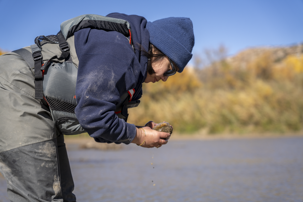
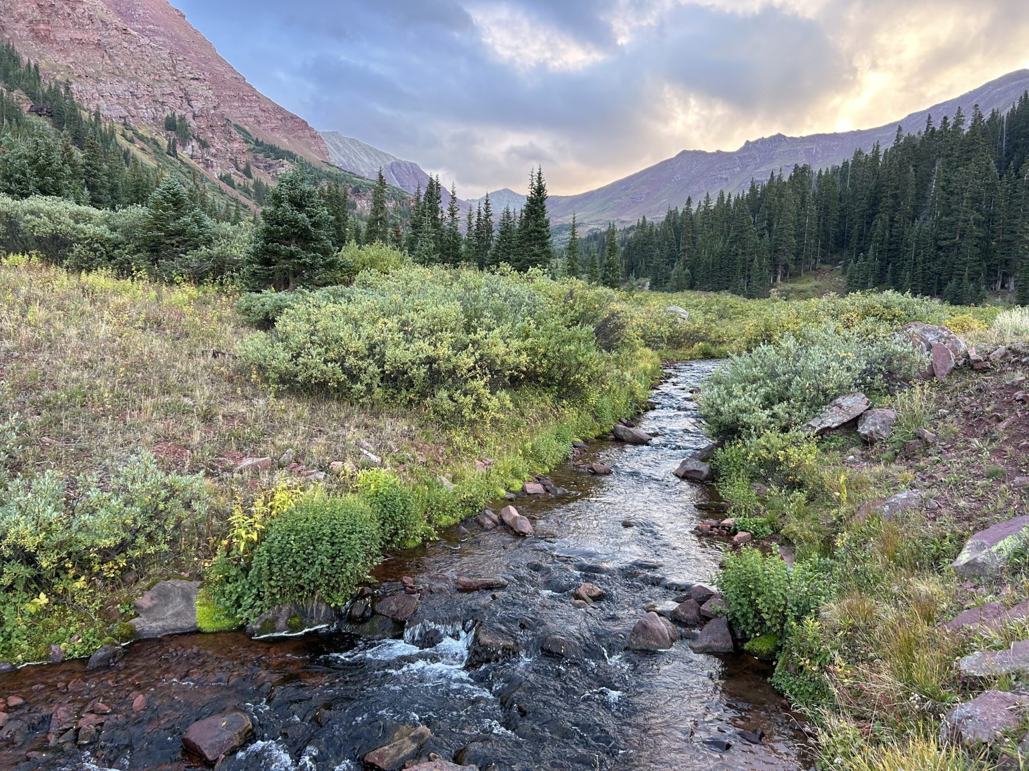
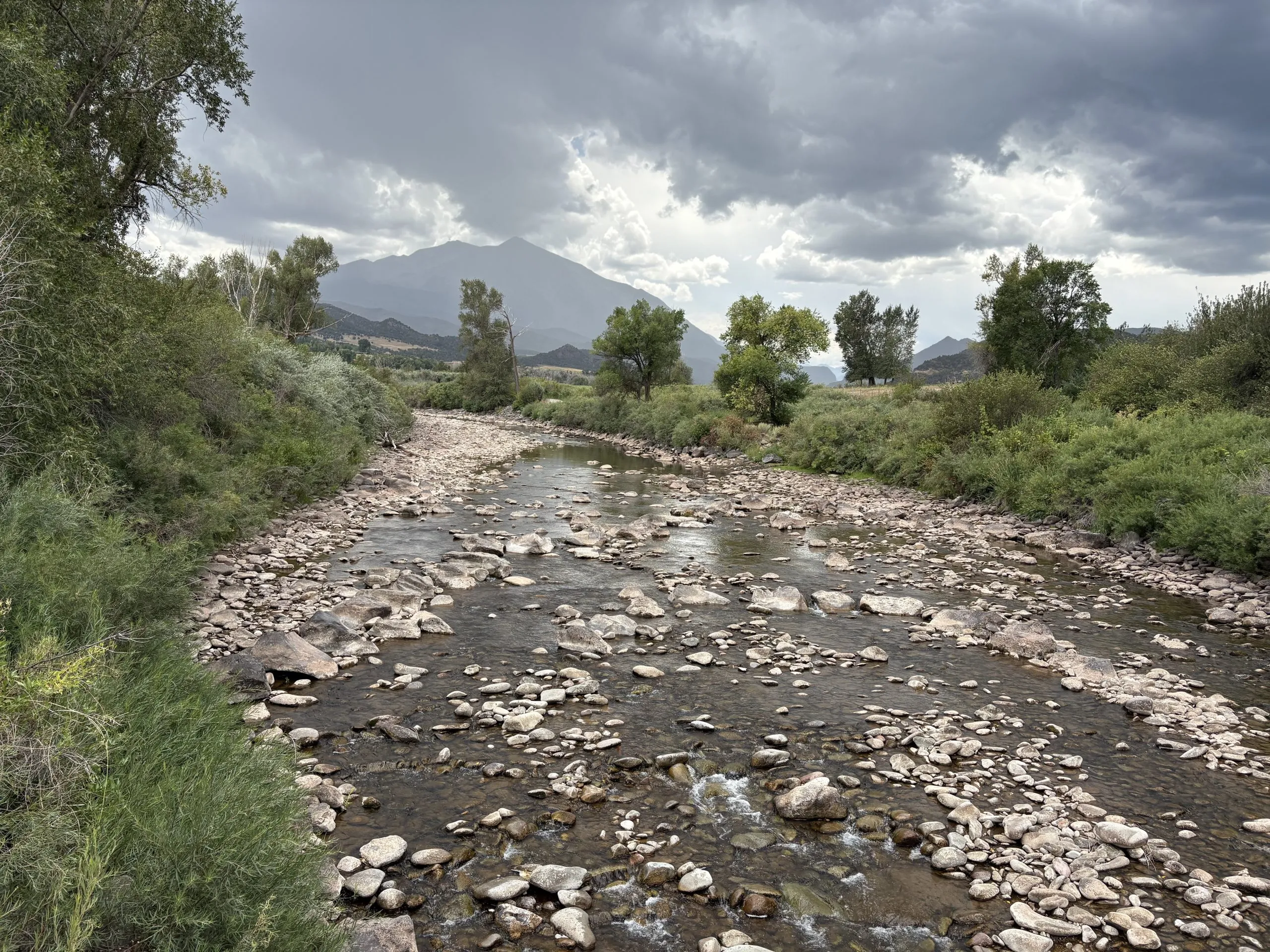
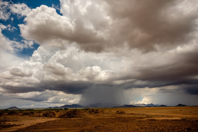
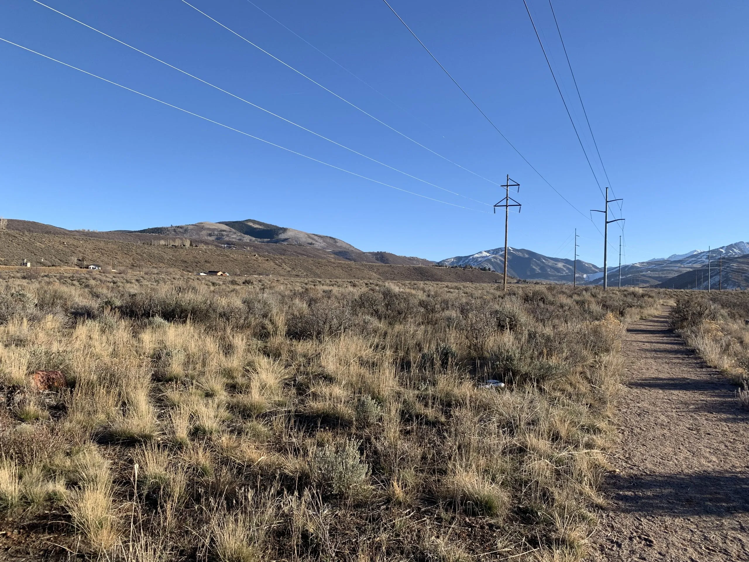
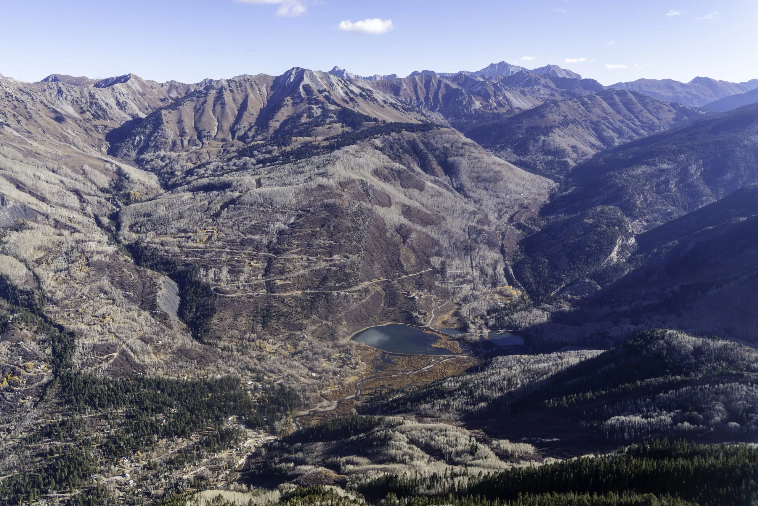
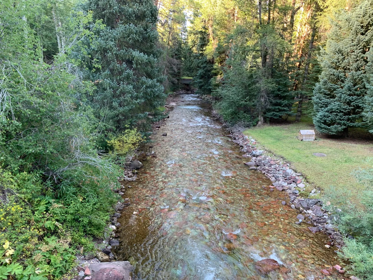
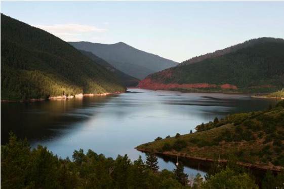
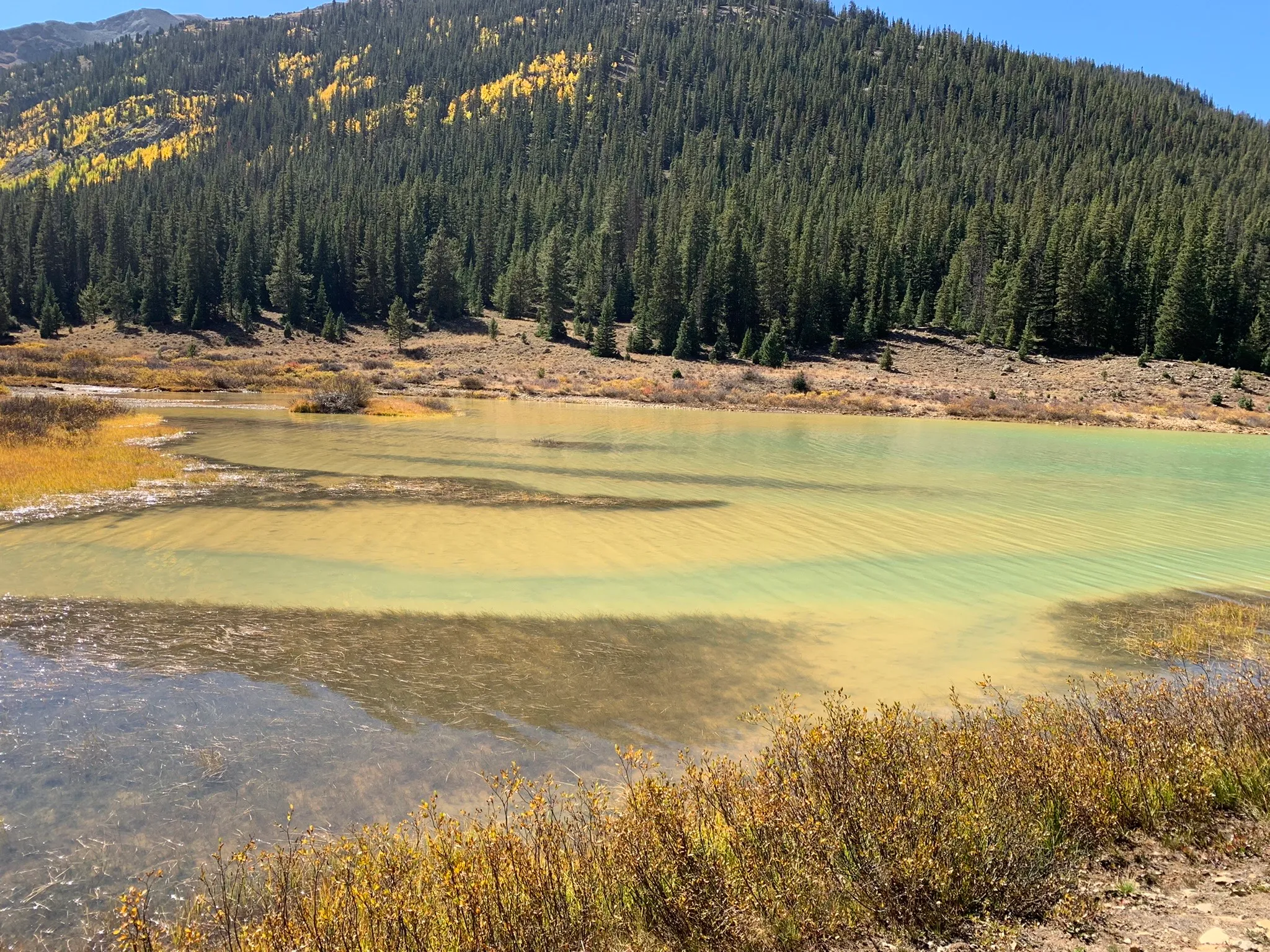
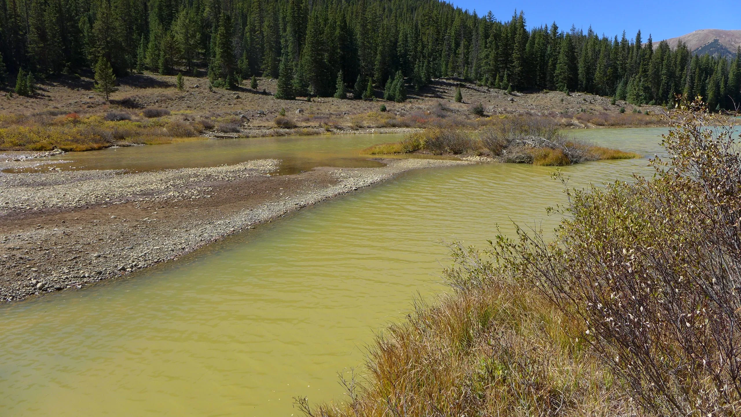
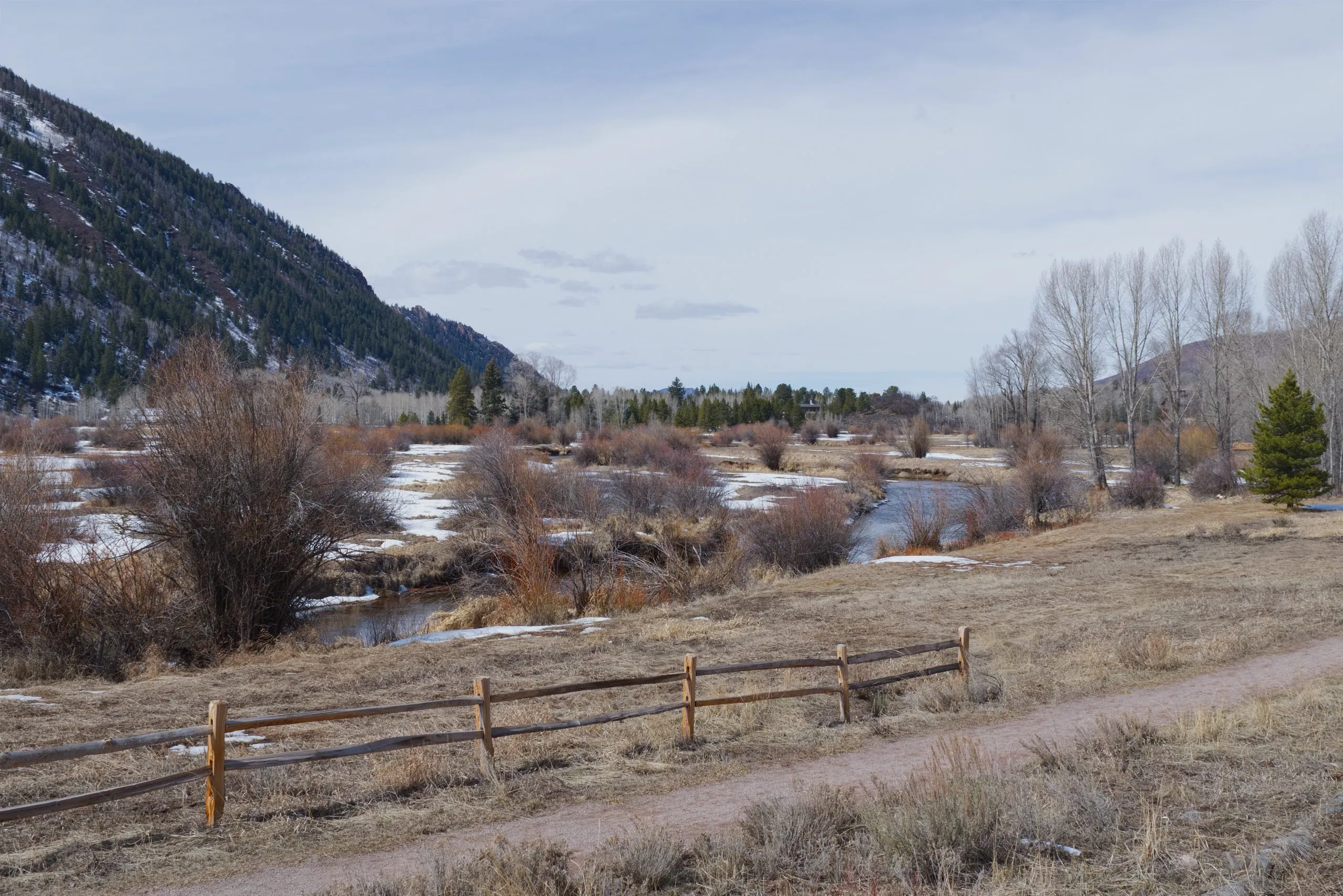
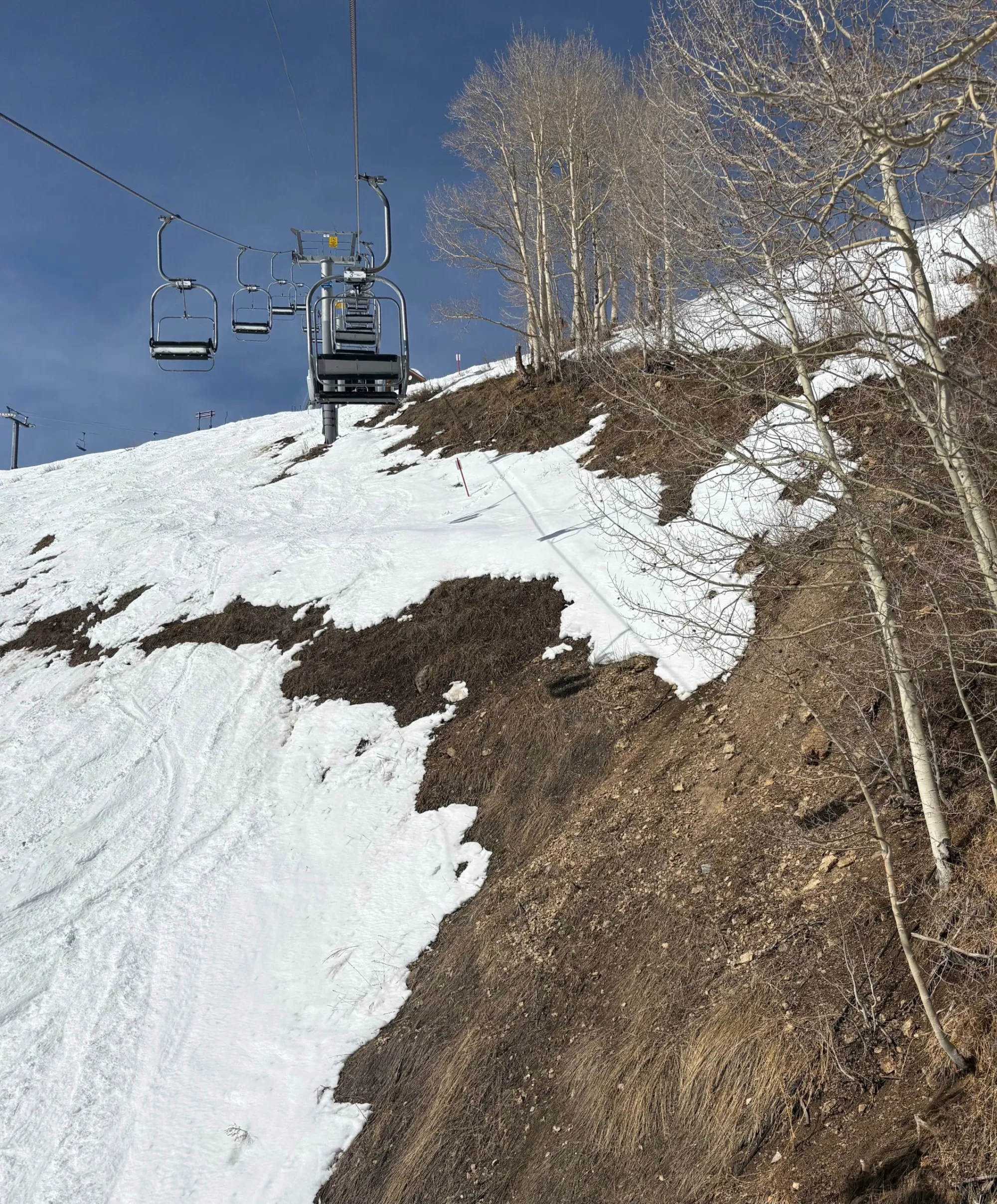
Although this winter’s lack of snow is striking, with measured levels reaching record lows, rising temperatures might be cause of greater concern as part of a larger trend, impacting spring runoff and local forests. Experts hope that precipitation this spring and summer can still bring the necessary moisture to mitigate current drought conditions.
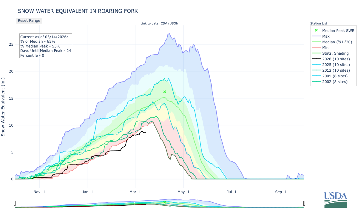
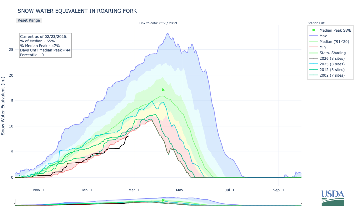
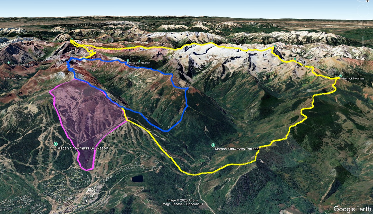
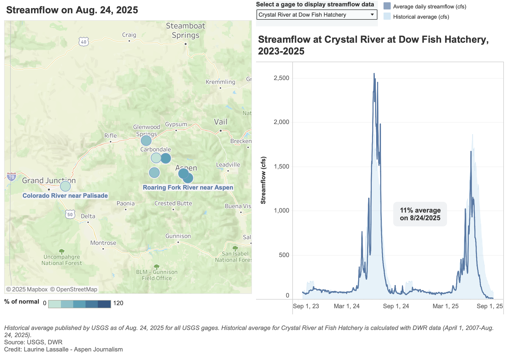
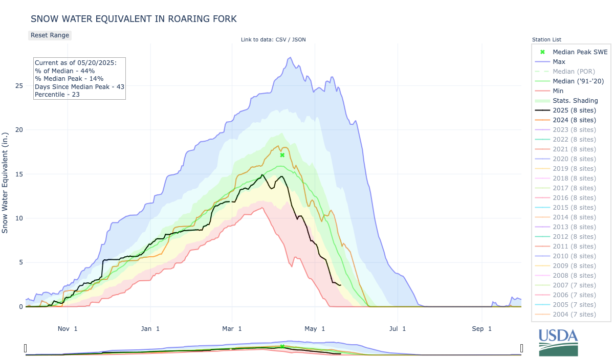
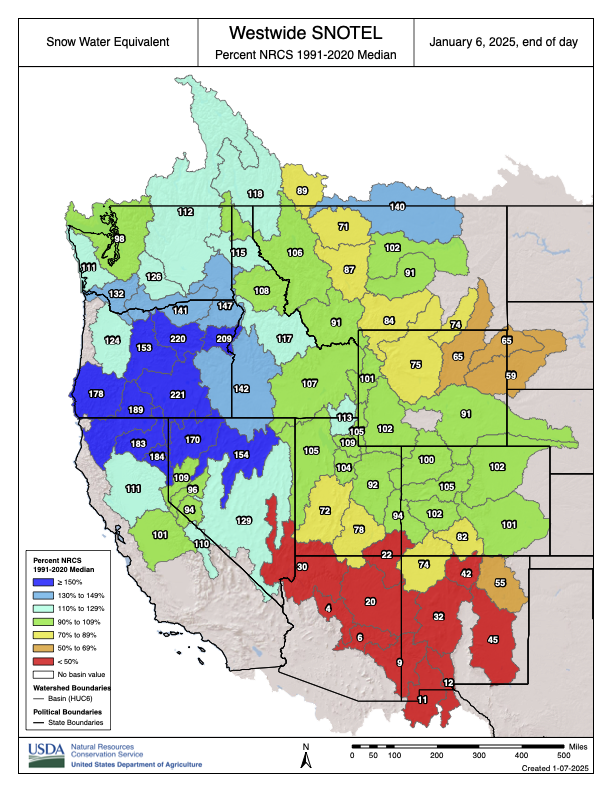
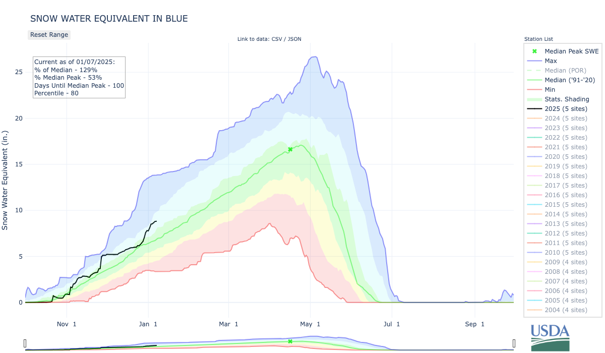
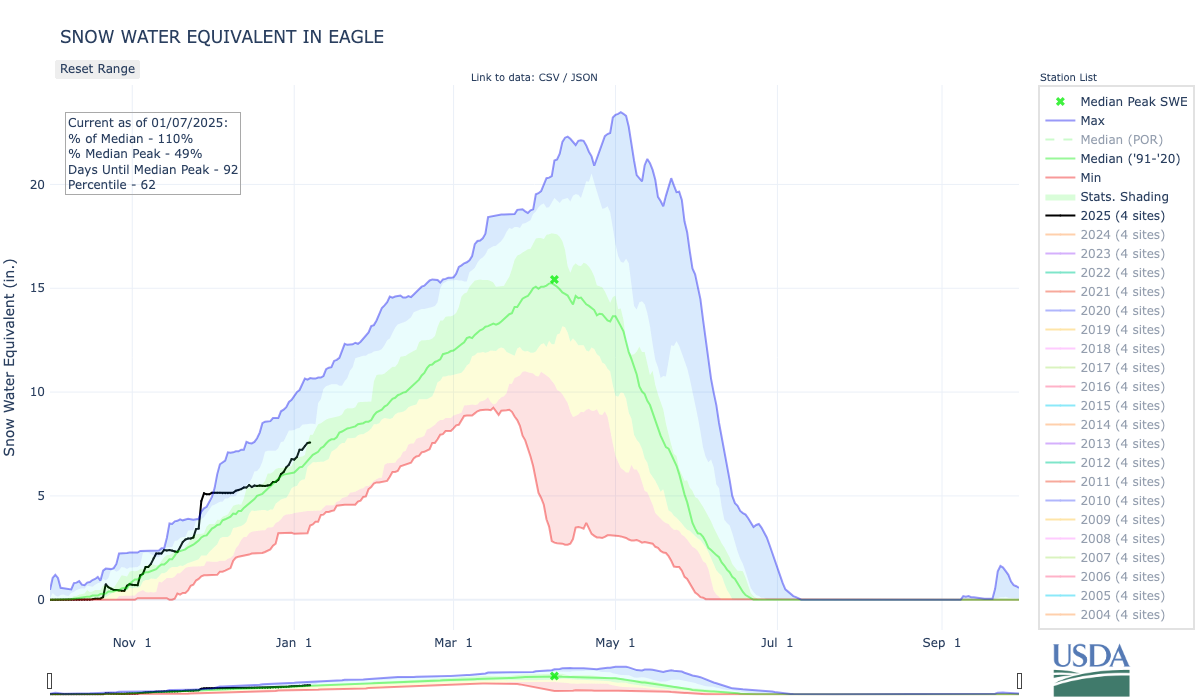
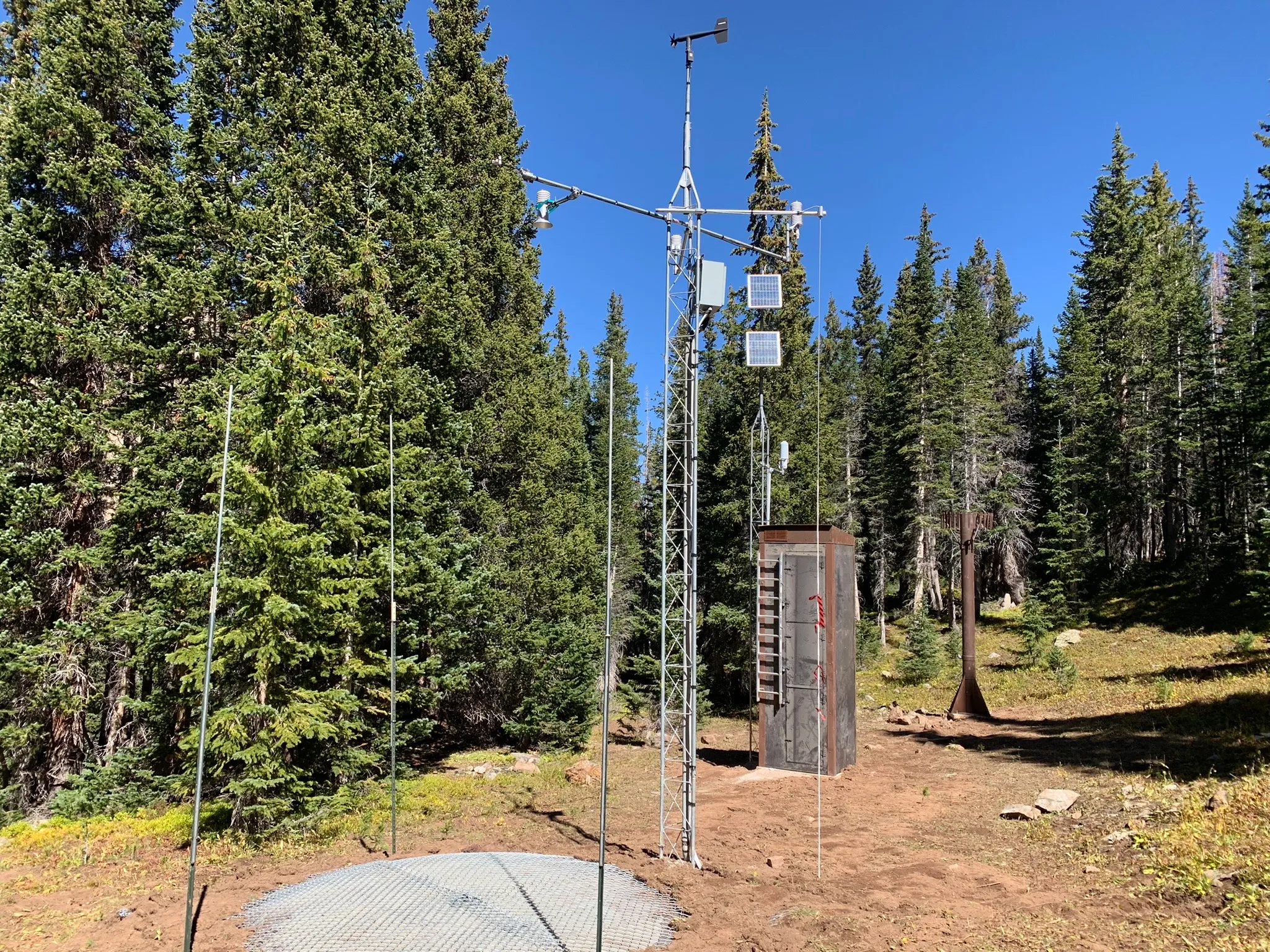
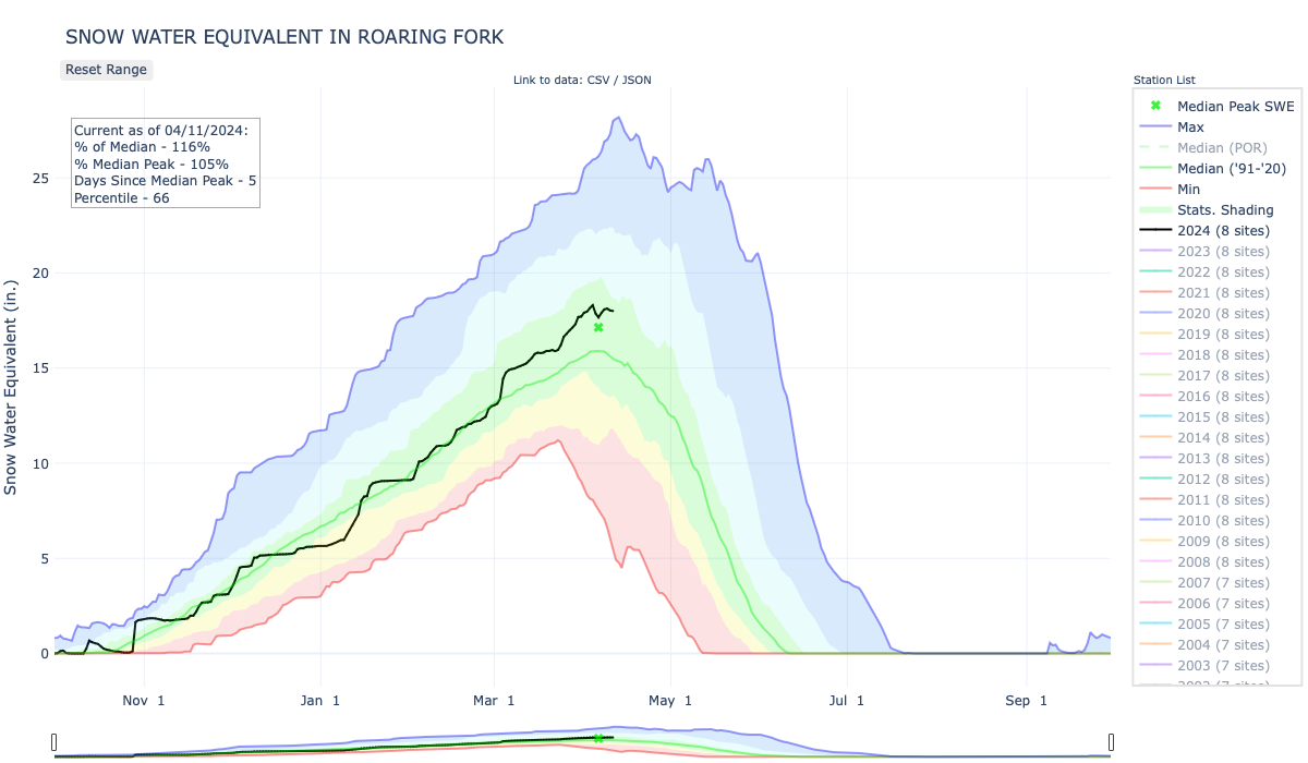
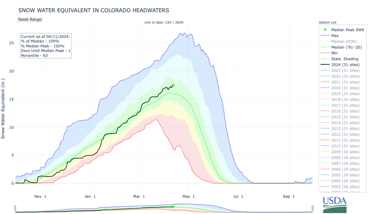
Snowpack in the Roaring Fork Valley basin is at 65% of normal as of March 13, according to SNOTEL, which is the U.S. Department of Agriculture’s automated mountain weather network, and Aspen Journalism’s snowpack dashboard. It’s the lowest level recorded since the modern snowpack telemetric system started collecting data in 1981. At Independence Pass, snowpack reached 56% of normal on March 13, but state climatologist Russ Schumacher told Summit Daily on March 4 that monthly hand measurements, which go back nearly a century, show that this year’s snowpack at Independence Pass was among the lowest 3% of the 88 years on record.
According to a climate sensor located at the city of Aspen’s water department in the Castle Creek Valley, where snowfall, temperature and precipitation data has been tracked since 1934, a total of 71.5 inches of snow fell from November through February, making this winter the driest in the past 30 years and the 12th driest on record, behind the winter of 1976-77, which received 47.5 inches of snow from November through February, and the 1980-81 season, when city records recorded 40.9 inches of snow. It’s worth noting that the station at the city’s water plant has moved locations over the years and changed its equipment in the 1980s, so comparisons using data collected before those changes may be skewed.
A total of 6 inches of precipitation, including rain and snow, fell on the Roaring Fork Valley between November and February, according to Gridded Surface Meteorological (or gridMET) data that goes back to 1979. That’s below last year’s 8.5 inches and represents 55% of the 30-year average, making the 2025-26 winter season the second driest, after 1980-81. Although precipitation has been below average, McCurdy said wide variations in rain and snow totals year over year are expected. “While this is an exceptionally dry winter precipitationwise, it’s not outside of the range of historic variability,” McCurdy said. “What we’re seeing temperaturewise is … certainly where we’re heading and we’ve seen it again and again. So I think that’s not just one data point, it’s another data point in a long-term trend.”

Above-average temperatures are becoming more common
NOAA’s 2018 modeling trend shows that average daily temperatures from November through February in Pitkin County have increased by 0.3 degrees every 10 years, mostly driven by rising low temperatures that have gone up by 0.5 degrees every decade. According to the 2024 Colorado Climate Change Report from the Colorado Climate Center, annual average temperatures across the state warmed by 2.3 degrees from 1980 to 2022 and are expected to keep rising due to climate change. By 2050, statewide annual temperatures are projected to increase by 2.5 to 5.5 degrees compared with 1971-2000, and between 1 degree and 4 degrees compared with 2022, under a medium-low emissions scenario.

“Colorado has warmed at a faster rate than the global average and is expected to continue to warm,” Peter Goble, assistant state climatologist at Colorado State University’s Colorado Climate Center, told Aspen Journalism. “Having said that, not every winter going forward is going to be as warm as this winter. And, in fact, I think this winter was so unusual that I think this winter will be considered a much-warmer-than-normal winter for some time to come.”
The NOAA sensor at ASE recorded 94 days with above-average minimum temperatures out of the 120 days from November to February, and 89 days with above-average maximum temperatures, for a total of 81 days with both above-average minimum and maximum temperatures. In other words, about three-fourths of the days were warmer than normal. In comparison, November 2024-February 2025 had 54 days with above-normal temperatures.
Looking at the Roaring Fork Valley as a whole, gridMET data shows that this winter counted 92 days with above-average daily temperatures, above 2005’s 85 days. The GridMET dataset from scientists at the University of California Merced combines data from weather stations in a given area and uses modeling to generate surface climate datasets instead of relying on one specific weather station.
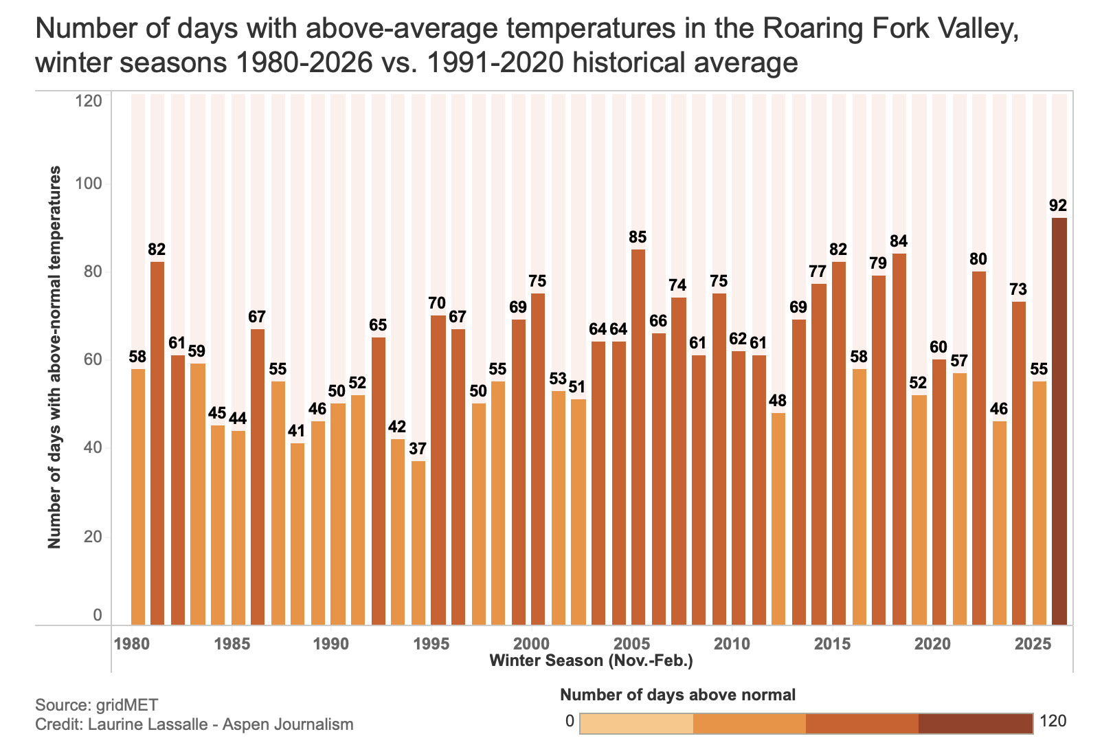
The data also shows that warm winters have become more frequent since the mid-1990s. According to gridMET data, which goes back to 1979, winters in the dataset in prior years with the highest number of days with above-average temperatures include 2018 and 1981, but 1981 was followed by a decade of mostly cooler temperatures and above-average precipitation. “On the other hand, 2018 and 2026 are both part of consistently hotter-than-average winters and, more recently, drier starts to the season,” according to ACES.

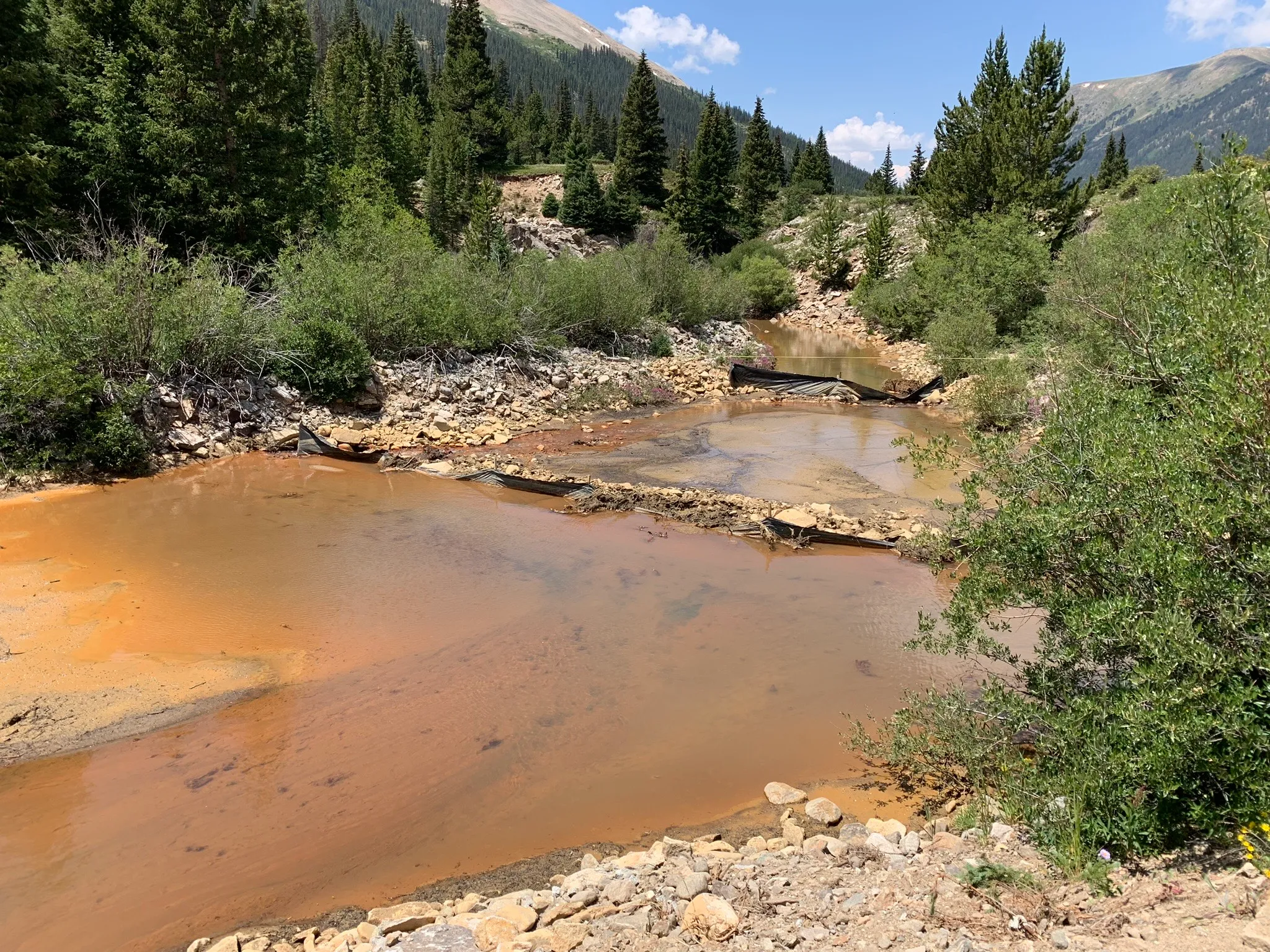
Although the entire state of Colorado is experiencing drought conditions, the upper Roaring Fork Valley has been experiencing “exceptional” drought conditions since Dec. 23, according to the U.S. Drought Monitor, with about 28% of Pitkin County and 19% of Eagle County experiencing such conditions as of March 10. (“Exceptional” is the most severe level.) The Roaring Fork watershed is one of the only two places throughout the entire West to experience this level of drought.
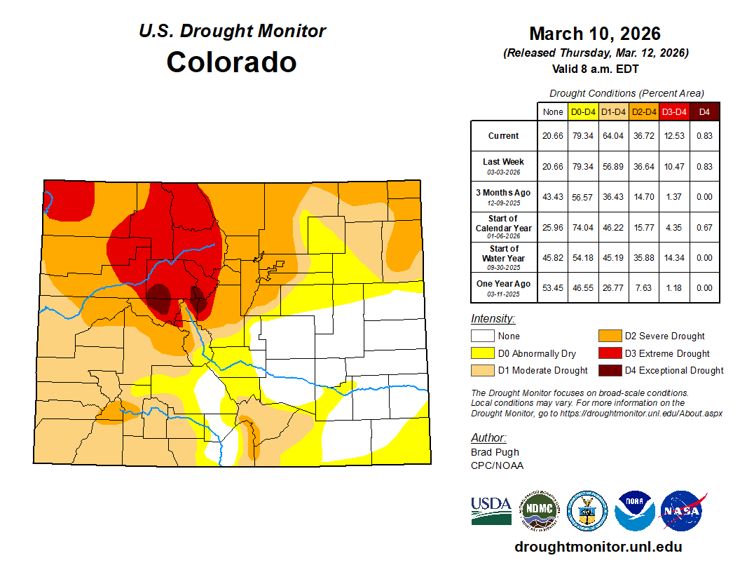
“One of the main reasons that, when you look at the U.S. Drought Monitor, the Roaring Fork Valley stands out is because of the mix of both short- and long-term drought conditions in place,” Goble said, adding that the Roaring Fork Valley was very hot and dry last summer, while other areas around the Colorado Rockies received some decent moisture. “The Roaring Fork Valley was already en route [to drought] going into this winter season,” he said.
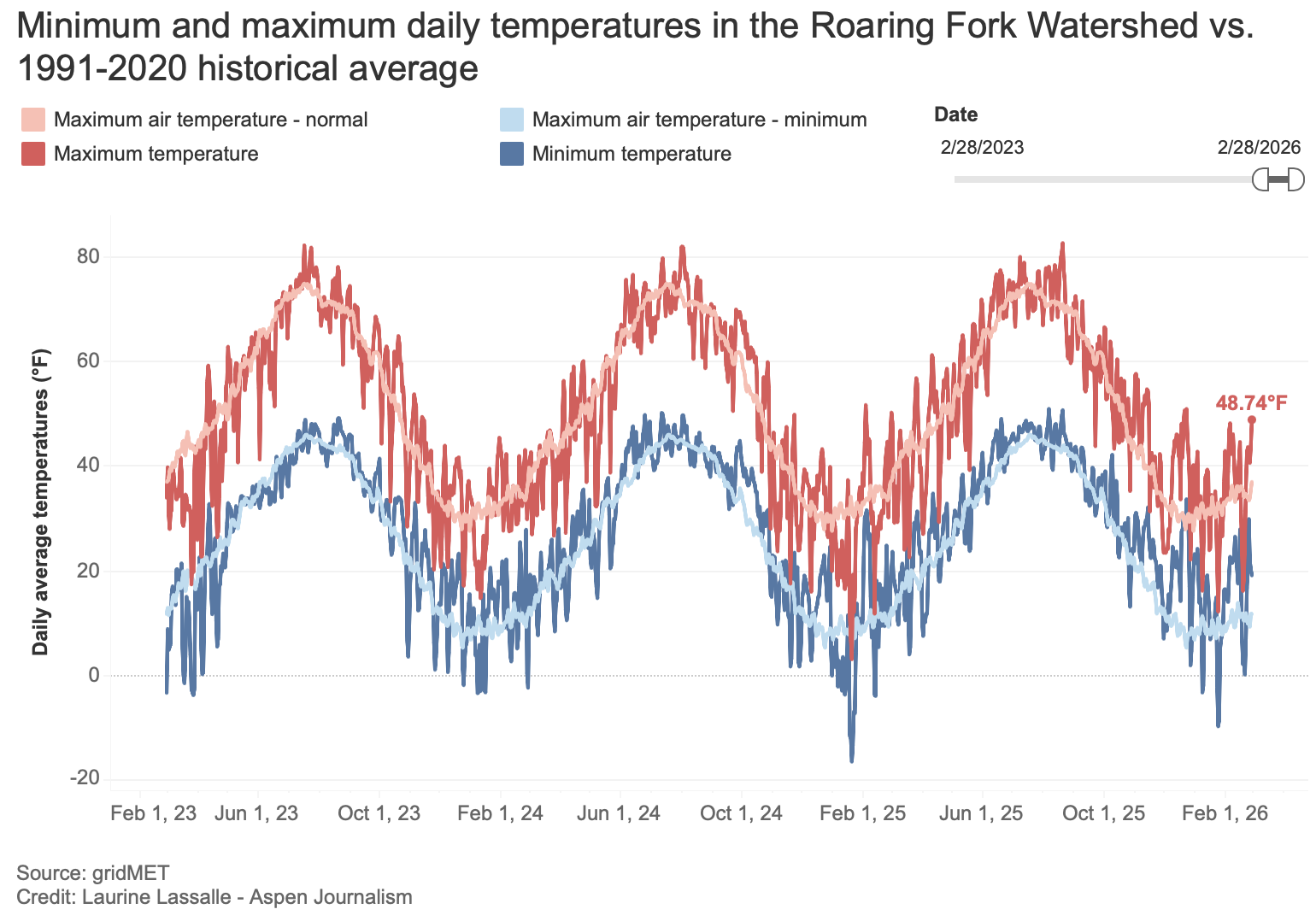
Average daily temperatures, or the average of high and low temperatures, in the Roaring Fork River watershed have been 5 degrees above 1991-2020 historical average this winter (November-February), surpassing the previous record year of 1981, when temperatures were 4 degrees above normal. For February, average temperatures for the Roaring Fork Valley were the fourth highest on record, at 27.6 degrees.

Maximum and minimum temperatures are getting closer
On average, maximum and minimum temperatures recorded at ASE have both been approximately 6 degrees higher than normal in February. From November through February, maximum and minimum temperatures have also been roughly 6 degrees above normal. Last winter, maximum and minimum temperatures were, on average, 1 degree below normal.

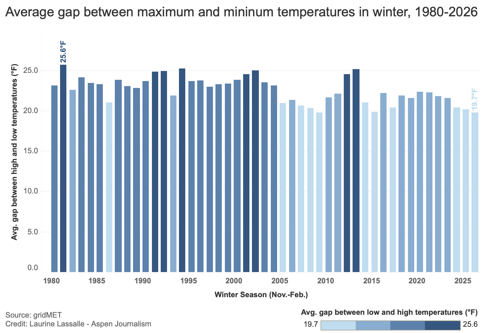
GridMET data shows that, on average, maximum and minimum temperatures are getting closer, a trend that has been particularly noticeable in the past five to six years. The gap for November through February reached an average of 19.7 degrees for the Roaring Fork Valley, the lowest reading on record.
Rising low temperatures can affect the ability to make snow at ski resorts, as reported byAspen Journalism in 2019 and The Sopris Sun in January, while the need to rely on snowmaking to compensate for the lack of snow increases.
McCurdy explained that snowpack maintains and accumulates “cold content” during the winter and that low nighttime temperatures allow this thermal buffer to form and keep snowpack colder longer, preventing it from melting too fast.
“Before the snow starts to rapidly melt, the snowpack needs to become isothermic; in other words, the entire [snowpack] column is about 0 degrees Celsius [32 degrees Fahrenheit] and ready to melt,” he said. “Because of the warm winter [and the rising low temperatures], the snowpack is entering spring closer to isothermic, which could result in a pretty rapid melt-off.”
Historically, the gap between high and low temperatures averages 22.6 degrees. According to NOAA, 25.5 degrees separate high temperatures from low temperatures at ASE for this winter, lower than last year’s 26 degrees but higher than the nearly 25 degrees recorded in the winters of 2023-24 and 2022-23.
Possible impacts
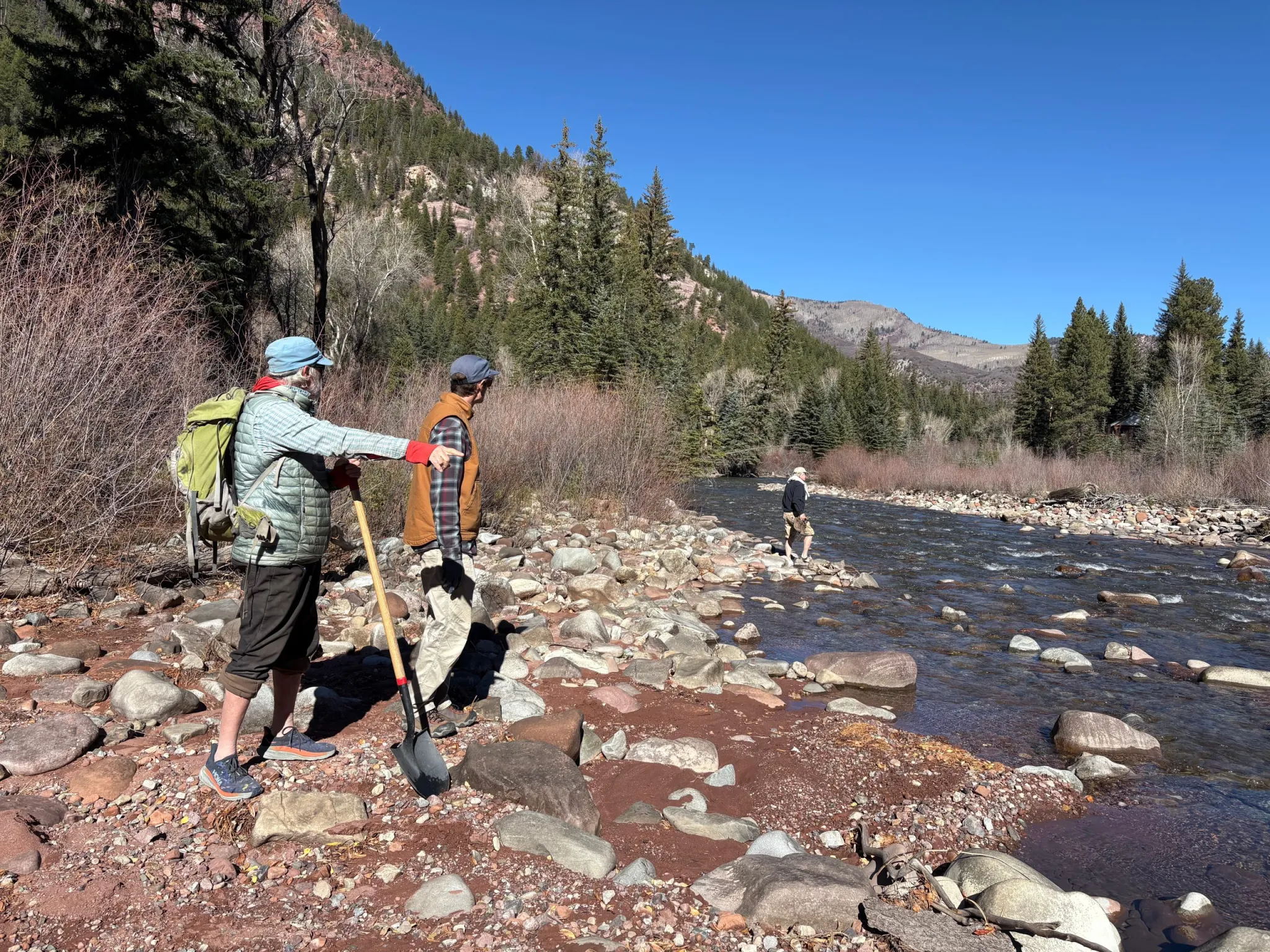
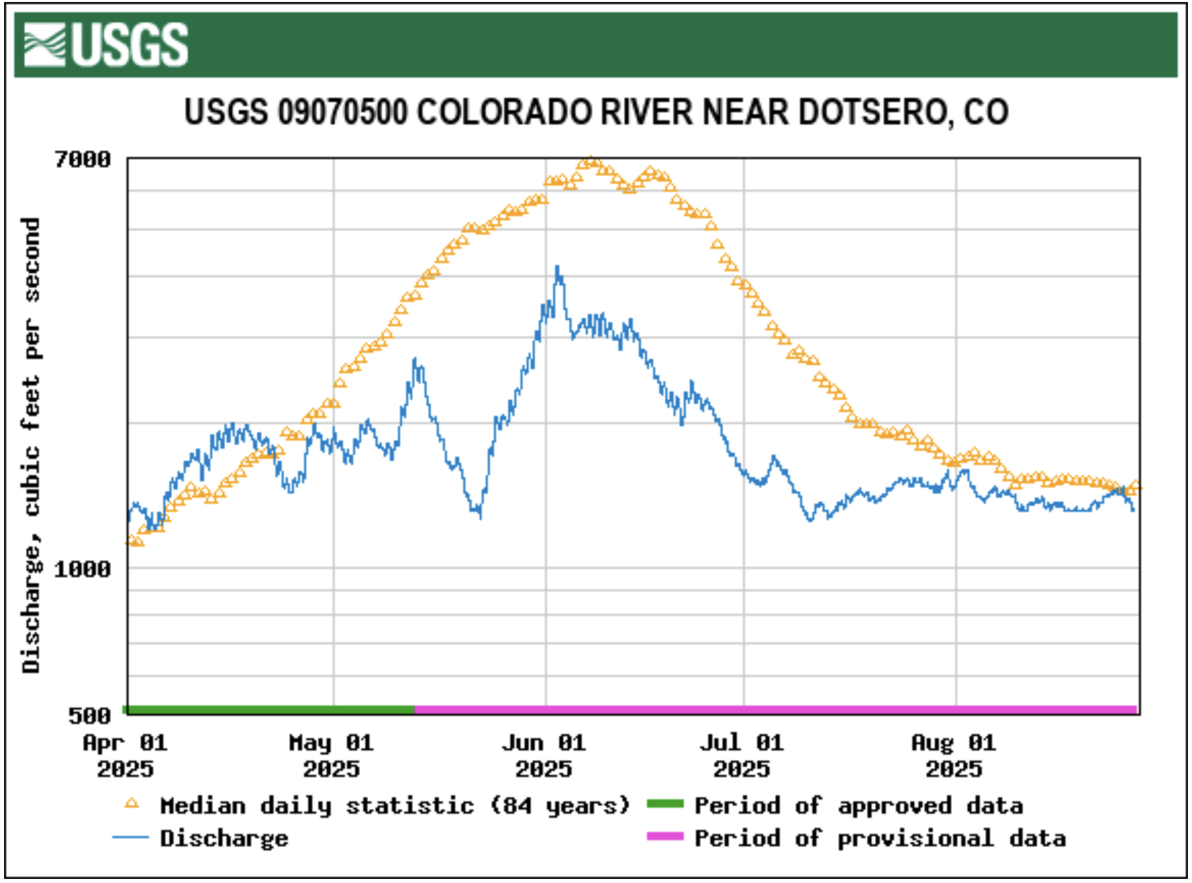
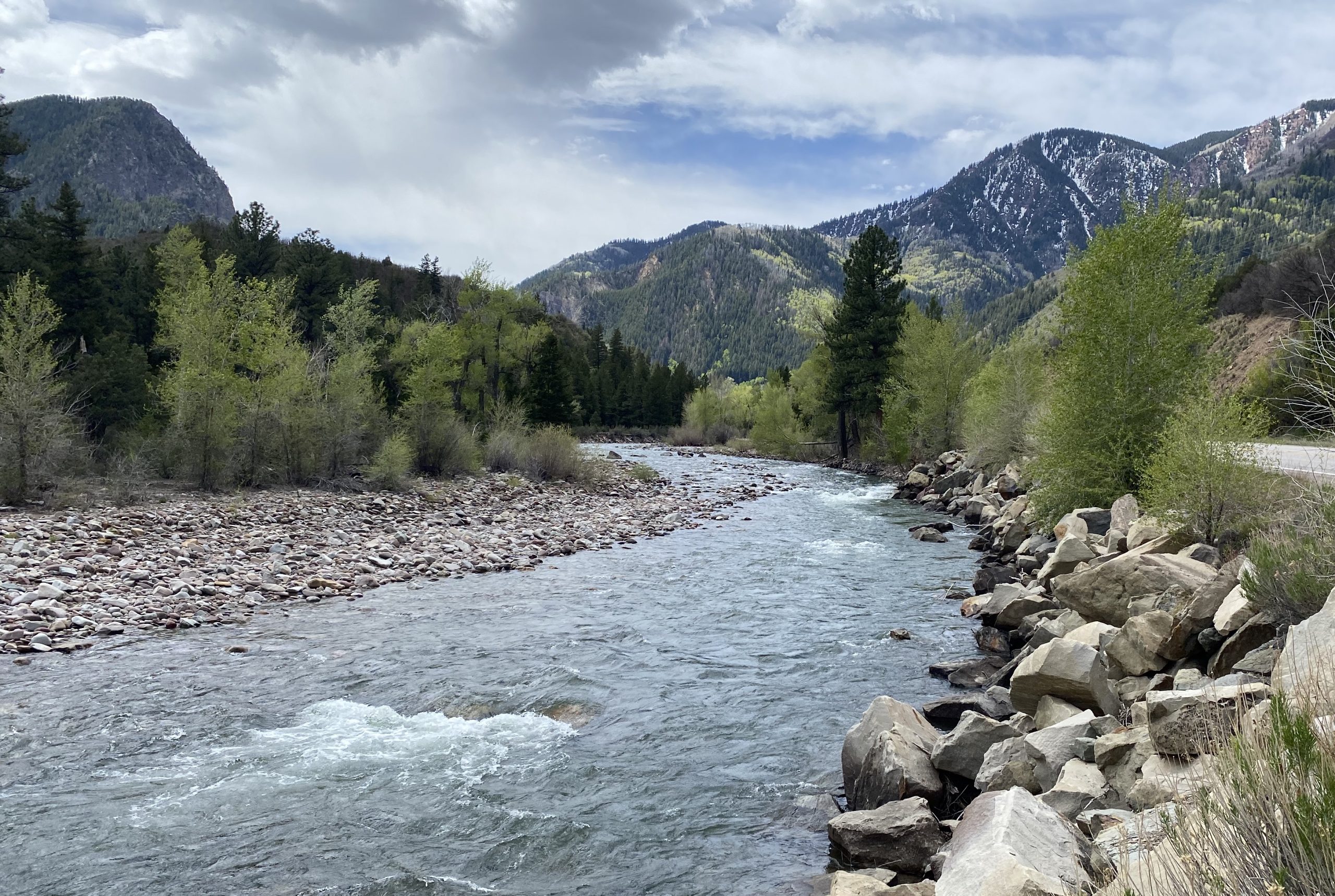
“The real impact of this warm, dry weather will be seen in the spring runoff,” McCurdy said, adding that a much-lower-than-average peak runoff is to be expected.
He said most trees are dormant during the winter until spring runoff, when they pull up a lot of water to use for the rest of the summer, but if their water supply is low, they’re not going to be able to grow as much or be able to produce resins and chemical defenses to fend off things such as bark beetles and other invasive insects.
“Trees have a long hydrologic memory,” he said. “One year isn’t as impactful to them as some other species where they’ll build up water. They have deep roots. They can pull up groundwater, but by the same token, multiple years of drought is a hard hole for them to get out of.”
McCurdy said the aspen population, for example, has declined and dry winters tend to negatively affect them. “Assuming we don’t get more precipitation, we could lose more aspens.”
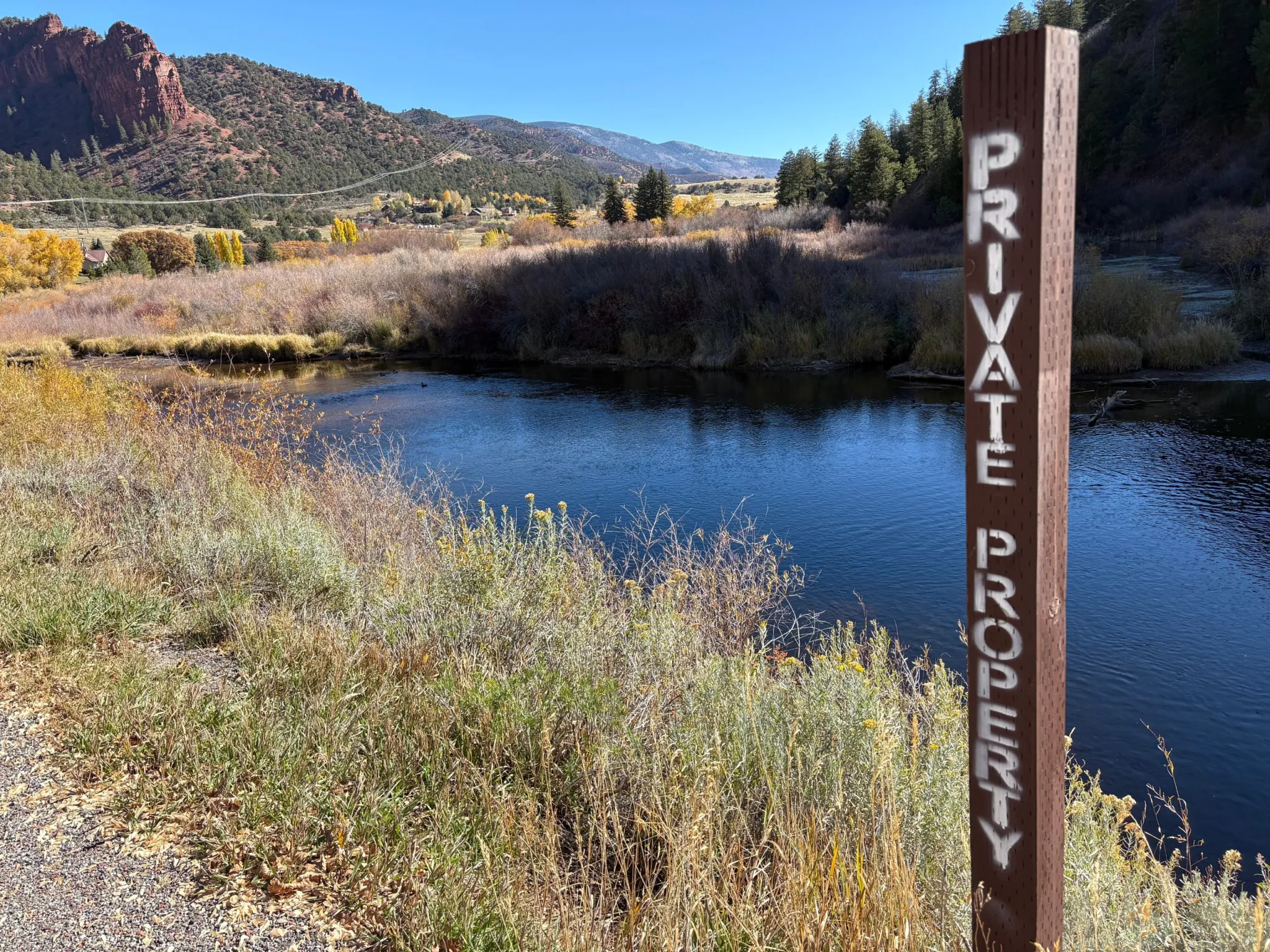
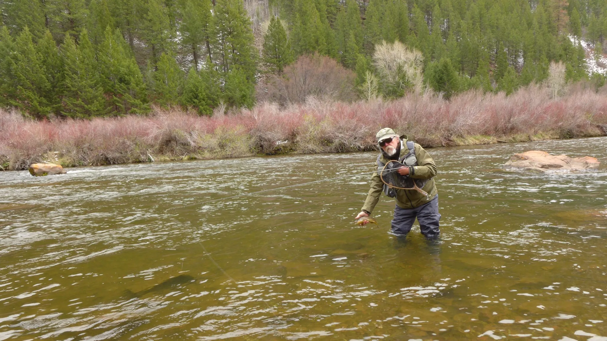
Goble said the lack of snow will probably lead to below-normal water supplies and impact river recreation, and it could lead to higher fire danger. Major factors that contribute to a large wildfire season in Colorado are low snowpack, early snowmelt and a hot summer. As of early March, snowpack is certainly low and early spring runoff is expected, but the severity of summer conditions is still uncertain.
“Just because things have been dry recently doesn’t mean that we’ll continue to be dry in summer,” Goble said. “Large wildfires are not a guarantee yet at this point, but I do think that with the very low snowpack numbers that we have in place now, it’s a higher probability than a normal year.”
Although a change in the weather that would bring precipitation levels closer to average would not be unprecedented, it is also statistically unlikely.
“In our 47-year record, there is only a single year that had enough precipitation to dig us out of the hole we’re currently in. In 1995, from this point in February until the end of May, there were 22 inches of precipitation; that’s about double the average precipitation that normally falls over that period,” according to an ACES blog post. “Based on a model of total precipitation for this period, we have a roughly 1% chance of ending the year with a normal amount of precipitation.”
Goble agrees that the chances to get back to normal snowpack this year are slim. “We just don’t have enough winter left to make up the deficits that are already in place. It would take a record kind of mid-to-late March through April in order to get us back up to normal,” he said. “But that doesn’t mean that spring and summer precipitation isn’t important. If we have a wet spring or and we have a wet or cooler-than-normal summer, those types of things could mitigate some of the drought impact that we might otherwise see this summer.”