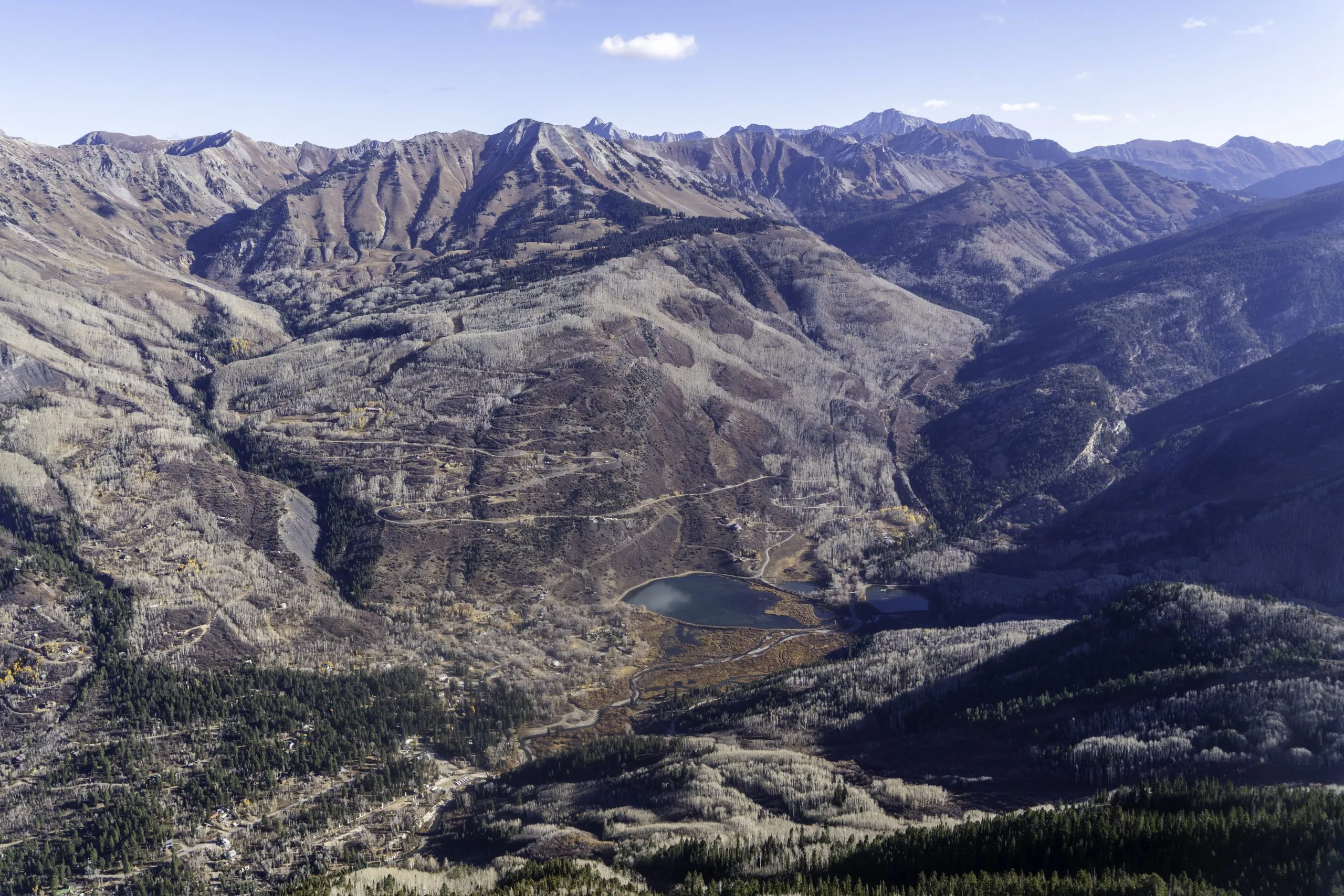
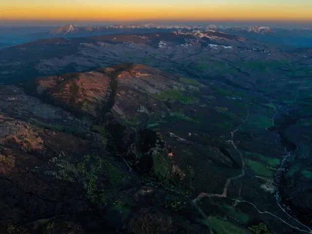
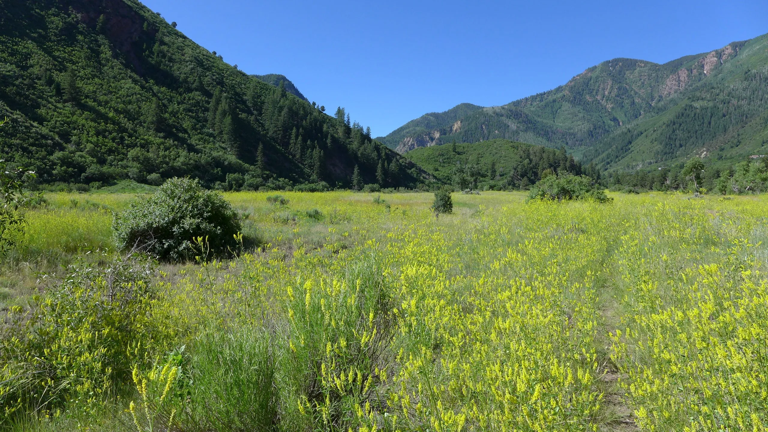
Beaver Lake and the Crystal River in Marble seen from the air. Three subcommittees are continuing to work on exploring protections for the river. Credit: EcoFlight
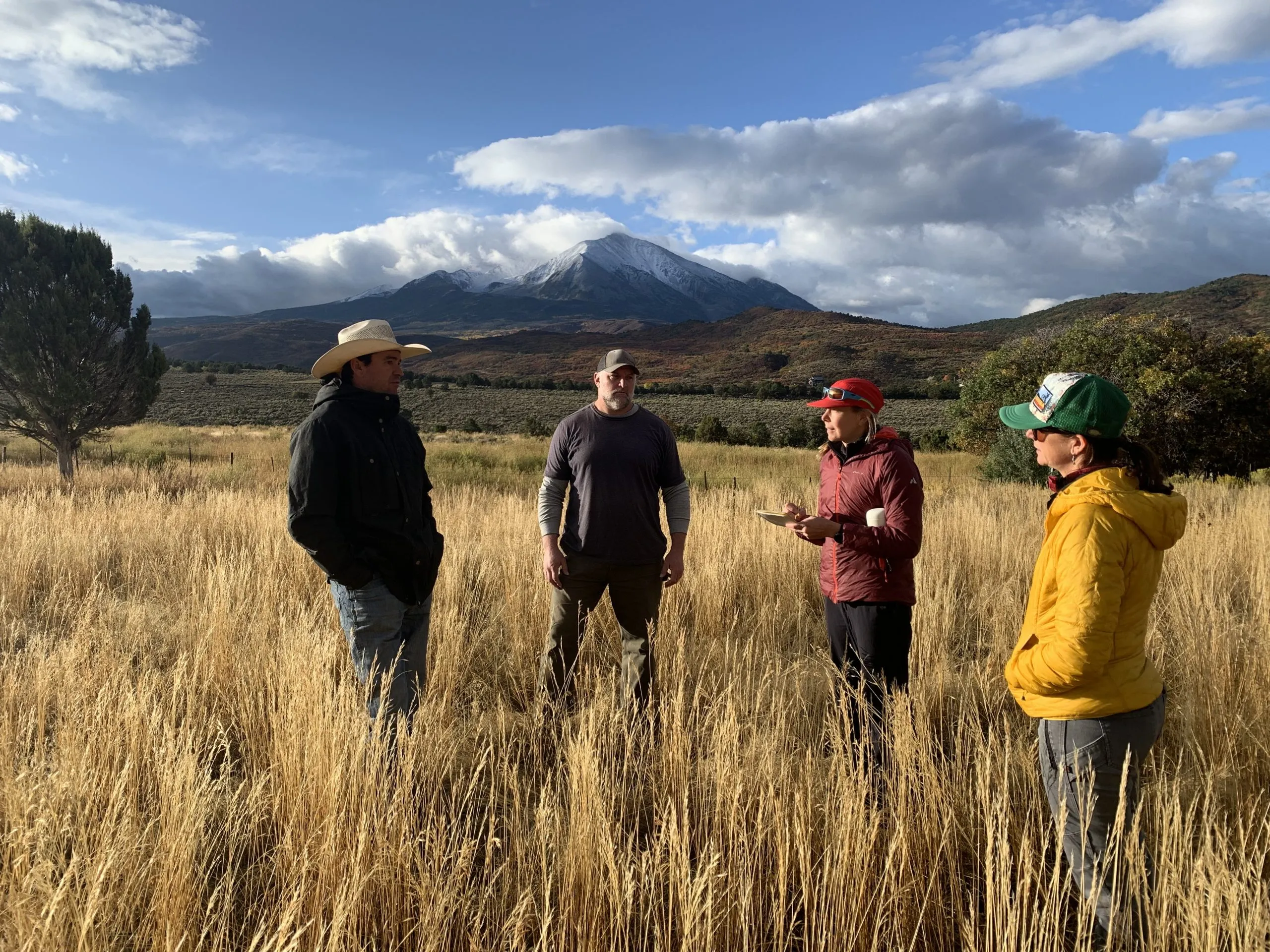
Three subcommittees exploring ways to protect the Crystal River met in Marble on Monday to share their status and findings after six months of work.
The Crystal River Collaborative Steering Committee split into three subcommittees in March, each focused on evaluating a different method of river protection: a peaking instream flow; an intergovernmental agreement; and a federal Wild & Scenic designation.
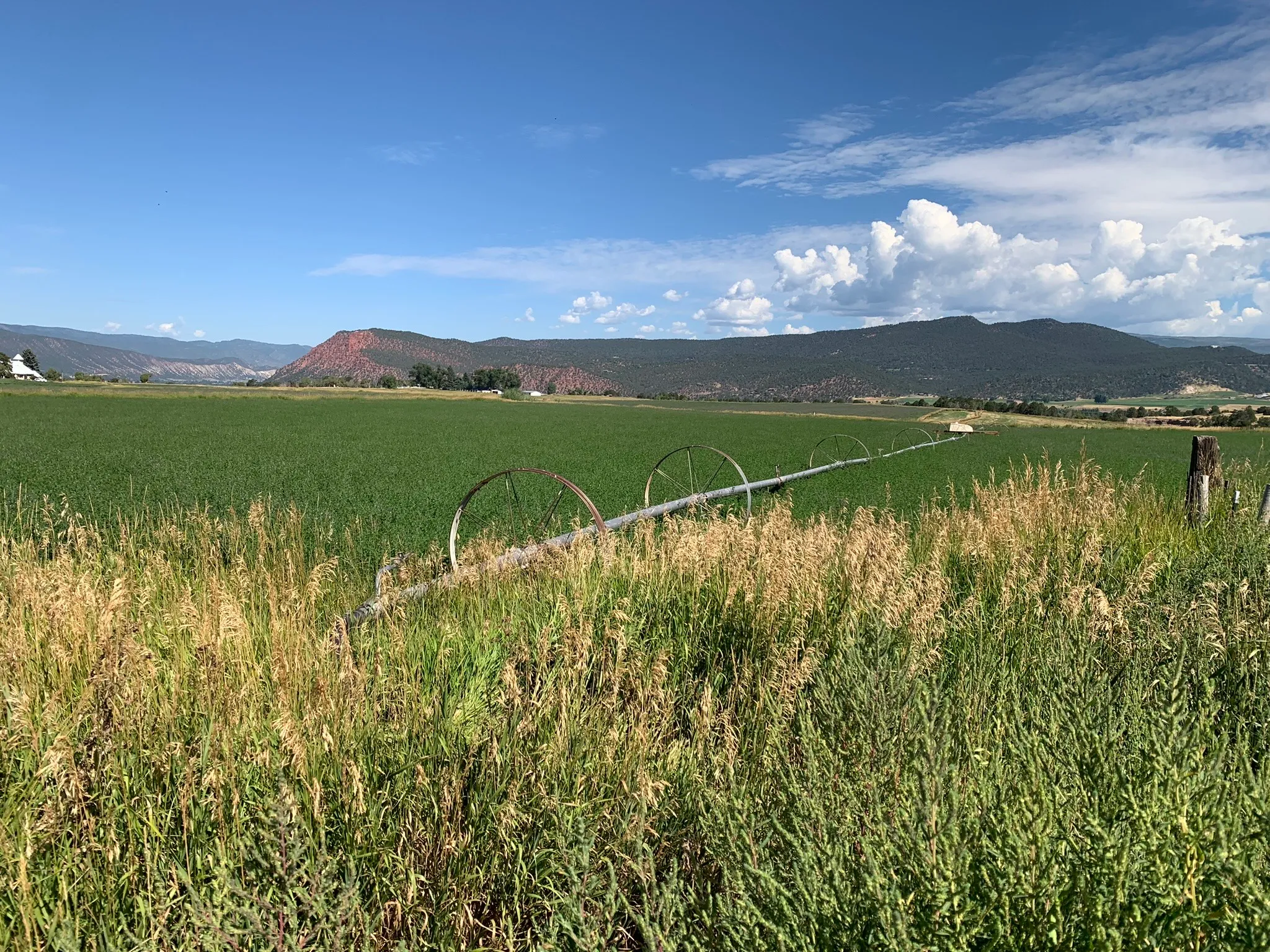
Some Crystal Valley residents, along with Pitkin County, have pushed for a Wild & Scenic designation for years as the best way to prevent future dams and diversions. Others, wary of any federal involvement, have balked at the idea, instead proposing different types of protections. But nearly everyone involved agrees that some type of protection is necessary to ensure that one of Colorado’s last free-flowing rivers stays that way.
A peaking instream-flow water right could protect about 25,000 acre-feet of river flows during peak runoff so that that water could not be claimed by a new transbasin diversion or dam project. Committee member Andrew Steininger said the group has hired environmental consultant Brad Johnson to study the issue and write a report on the feasibility of a peaking instream-flow water right on the Crystal. The water right is designed to protect special riparian ecosystems, including plants that need annual floodwaters to survive, and it’s not clear how it would be adapted to the Crystal.
“We are anxiously awaiting Brad’s work, and I think that will really help inform what an avenue might look like,” Steininger said.
Gunnison County Commissioner Liz Smith gave an update on the intergovernmental agreement committee, or IGA. An IGA would include representatives from Gunnison County, Pitkin County, Marble, Colorado River Water Conservation District and West Divide Water Conservancy District. The IGA would have two main goals: Signatories would agree to not support any new reservoir or impoundment of water on the main stem of the Crystal and would agree to oppose in water court any water rights application that would remove water from the Crystal River basin.
Steering committee members agreed that Smith will work on a draft IGA with the local governments, which will be reviewed by the steering committee before the governments sign it.
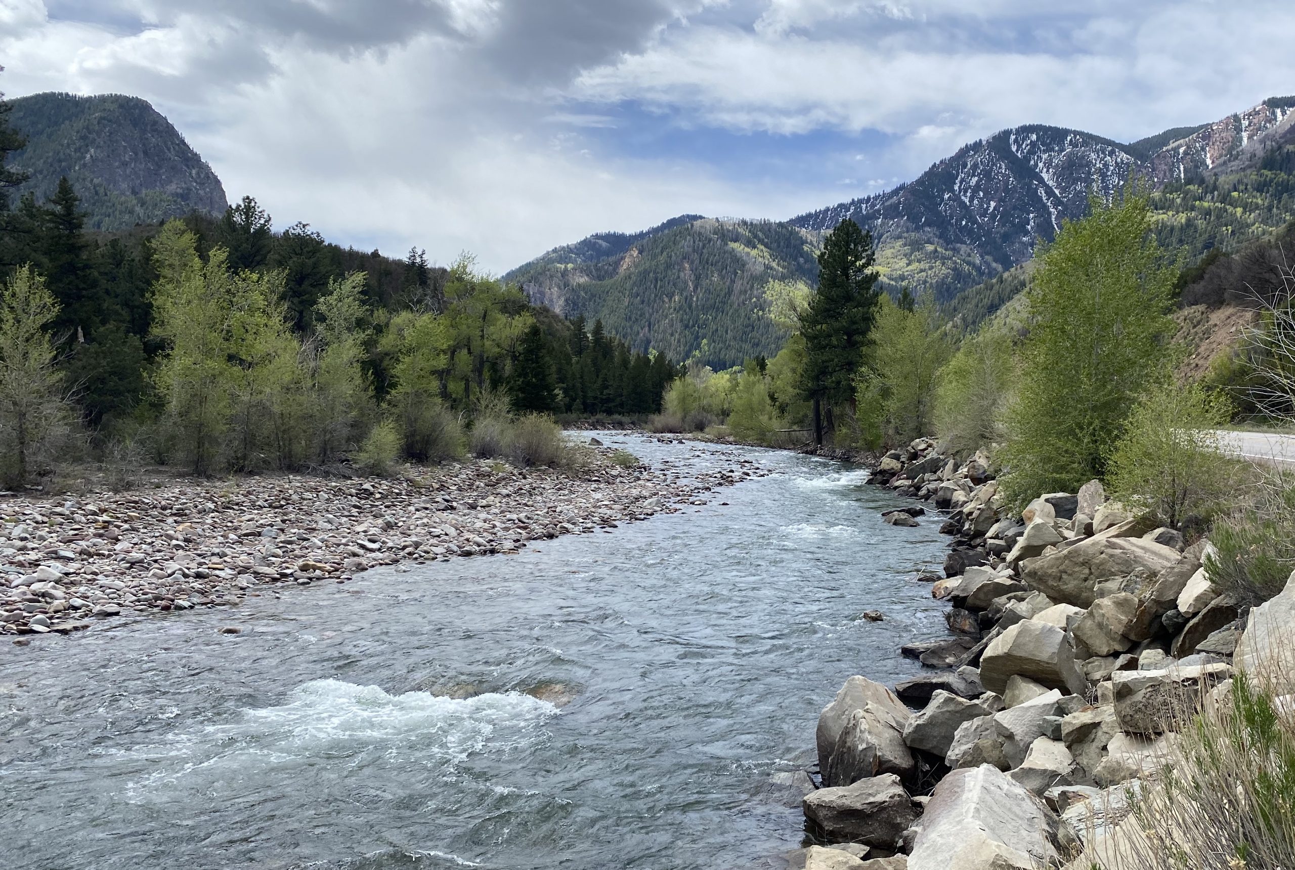
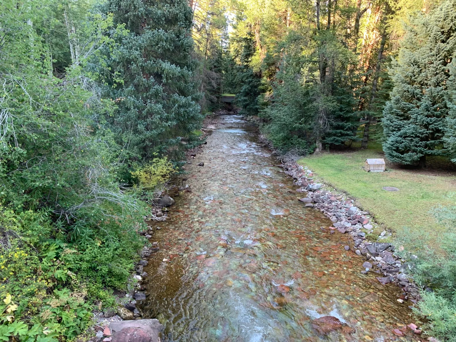
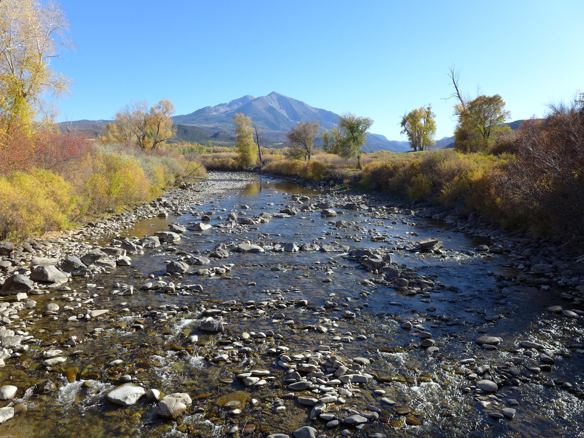
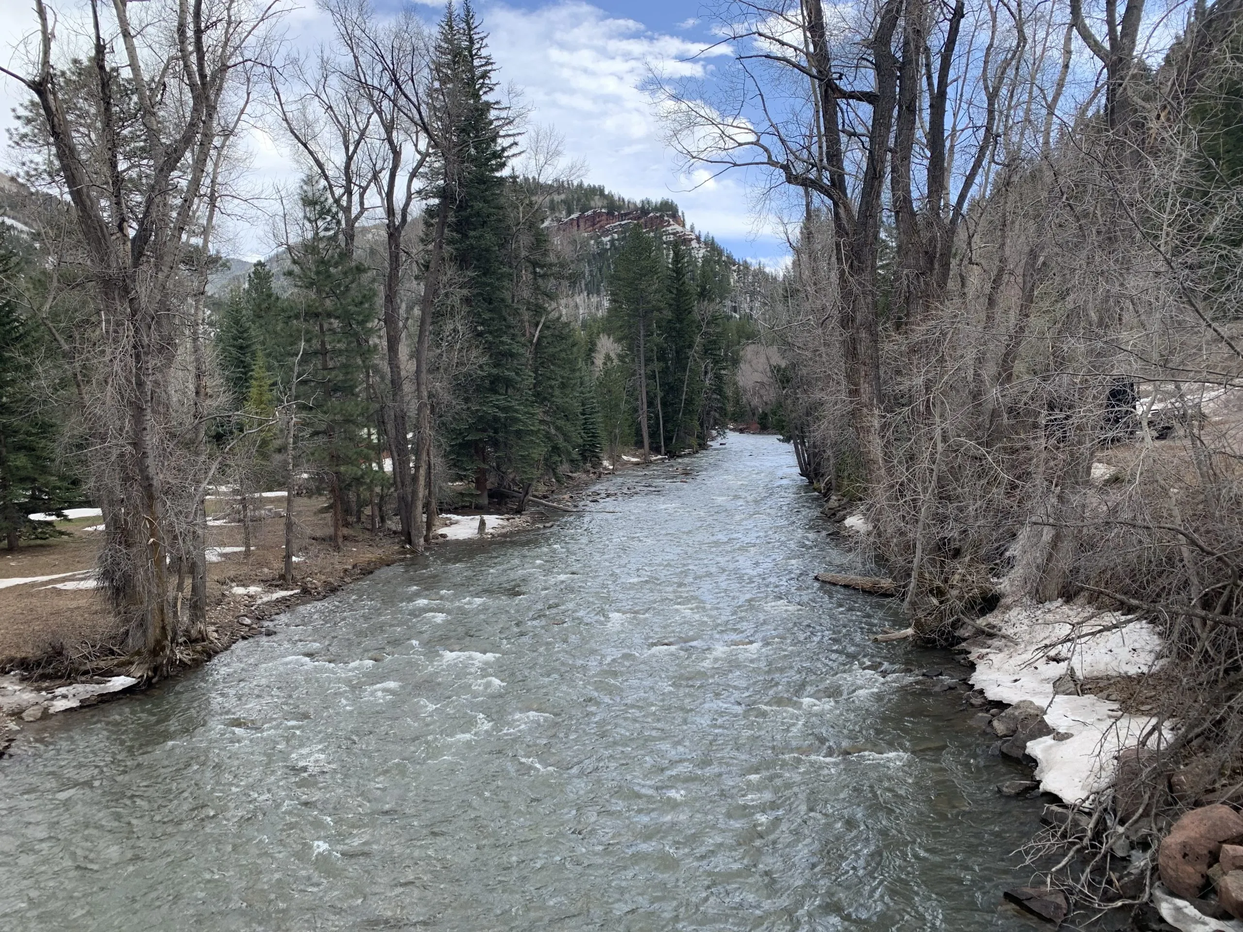
The view looking upstream on the Crystal River below Avalanche Creek. Pitkin County and others wants to designate this section of the Crystal as Wild & Scenic. CREDIT: CURTIS WACKERLE/ASPEN JOURNALISM
Wild & Scenic
Members of the subcommittee dedicated to exploring a Wild & Scenic designation said the process is a lot more complicated than they initially thought it would be. The group provided 13 pages of information with many links to additional resources. Every white paper that the group reads and every expert that they talk to generates new questions, said committee member Hattie Johnson.
“One takeaway from this process is that we don’t have a draft to share, we don’t have a formal recommendation,” said committee member Lea Linse. “There is a lot more to this act than a lot of us starting this process realized.”
The U.S. Forest Service first determined in the 1980s that the Crystal River was eligible for designation under the Wild & Scenic Rivers Act, which seeks to preserve rivers with outstandingly remarkable scenic, recreational, geologic, fish and wildlife, historic and cultural values in a free-flowing condition. There are three categories under a designation: wild, which are sections that are inaccessible by trail, with shorelines that are primitive; scenic, with shorelines that are largely undeveloped, but are accessible by roads in some places; and recreational, which are readily accessible by road or railroad and have development along the shoreline.
The Crystal could include all three types of designation: wild in the upper reaches of the river’s wilderness headwaters, scenic in the middle stretches and recreational from the town of Marble to the Sweet Jessup canal headgate.
Each river with a Wild & Scenic designation has unique legislation written for it that can be customized to address local stakeholders’ values and concerns.
The teeth of the designation comes from an outright prohibition on federal funding or licensing of any new Federal Energy Regulatory Commission-permitted dam, on the mainstem of the river or its tributaries. A designation would also require review of federally assisted water resource projects.
According to section 7 of the Wild & Scenic Rivers Act, a project requires review when it meets both of the following criteria: it is proposed in the bed or banks of a designated river and it is proposed by a federal agency or it requires some type of federal assistance such as a permit, license, grant or loan. Projects on the bed or banks of a tributary of a designated river stretch also trigger a review when they are proposed by a federal agency or if they require some type of federal assistance such as a permit, license, grant or loan; and are likely to affect a designated river.
Subcommittee members said better understanding how that would play out in the Crystal River basin will require more work.
“The process where the broad and easy questions to answer have been covered, and now we are starting to get into tricky territory where additional facilitated conversations would be important to this group,” said committee member and Pitkin County Commissioner Kelly McNicholas-Kury. “Section 7 is always the sticking point. It’s always the area of the law where the negotiation and the learning and the clear understanding needs to be very intentional.”
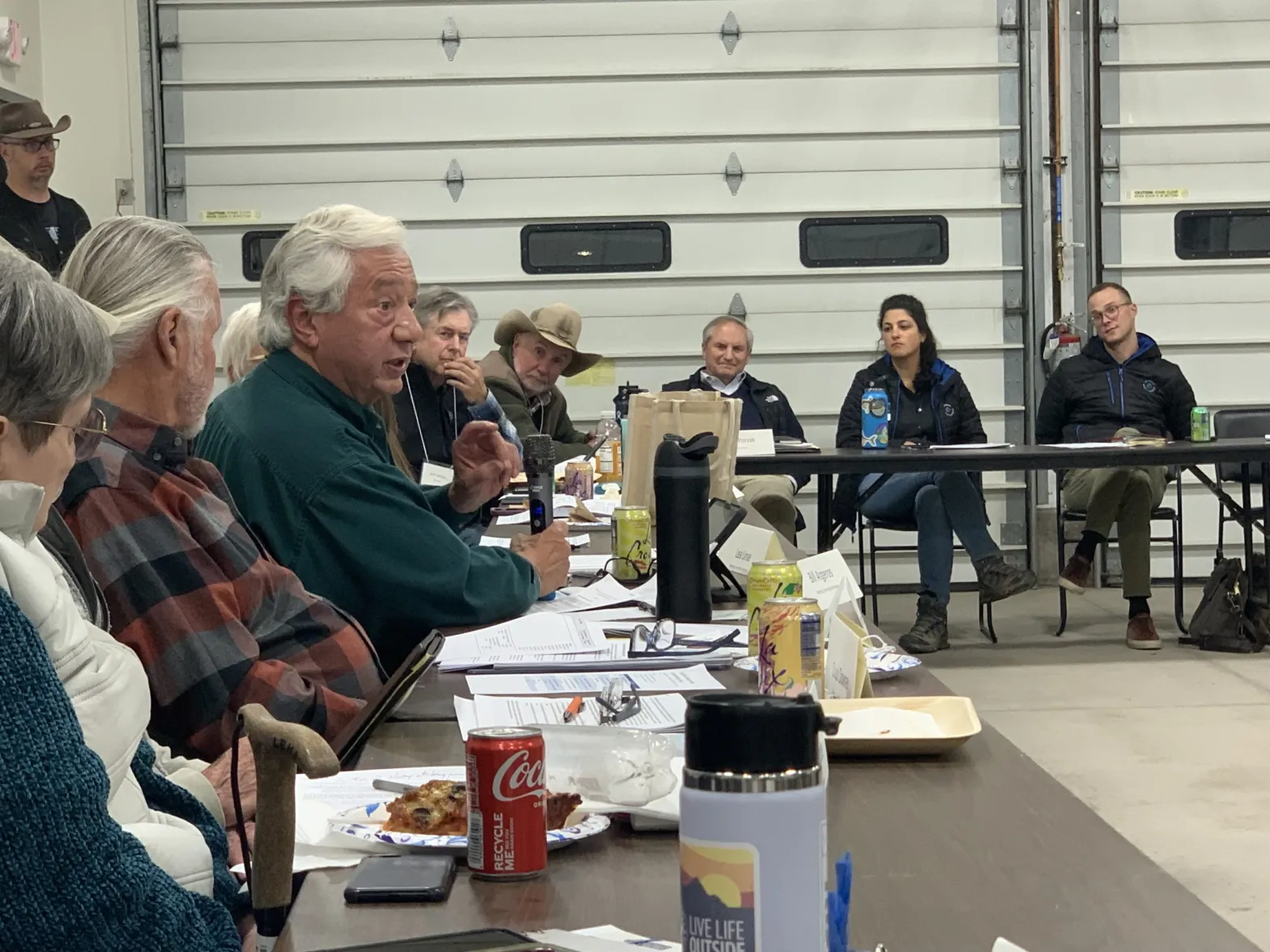
Crystal River Valley resident and Wild & Scenic proponent Bill Argeros speaks at a steering committee meeting Monday at the Marble firehouse. Argeros said it’s time for the subcommittee to start drafting a proposal for legislation. Credit: HEATHER SACKETT/Aspen Journalism
There was some disagreement among the group about how fast they should move forward with a draft proposal for Wild & Scenic legislation. Crystal Valley resident Bill Argeros, who favors Wild & Scenic, said the committee’s task was very clear. The group’s charter says they are charged with creating a draft Wild & Scenic legislative proposal and map that protects the community-held values on the Crystal River, while addressing local concerns.
“Draft a proposal — that’s what we need to do, and I think that’s what everybody here is waiting for,” he said. “We need to work on that really hard and as quickly as we can.”
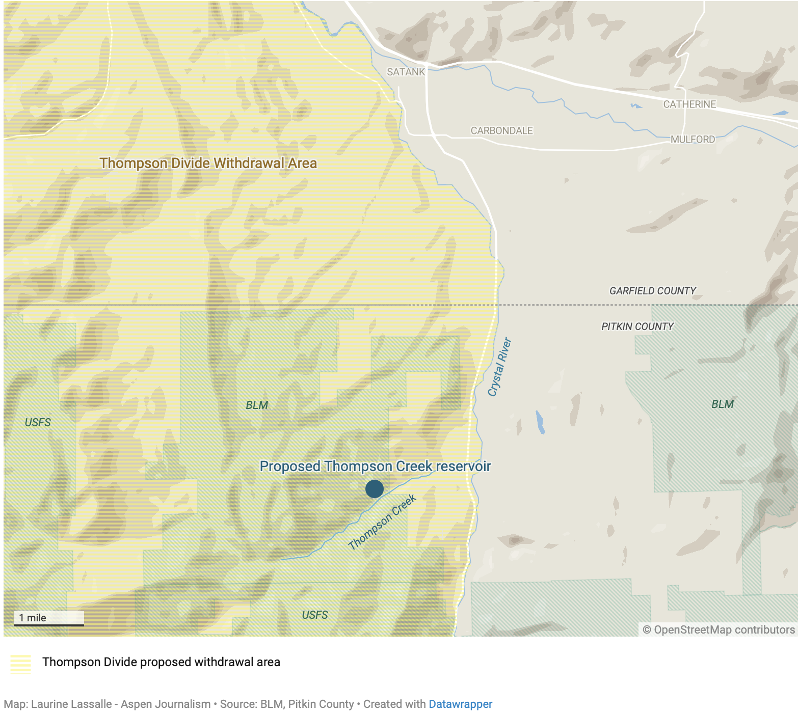
But others cautioned that pushing too fast would be a mistake and that there’s still a lot to learn. Carbondale rancher Bill Fales is familiar with these sometimes-messy community processes; he helped advocate to protect public land from new oil and gas leases in the Thompson Divide. Earlier this year, the Biden administration announced the 20-year withdrawal of nearly 222,000 acres from oil and gas development. The effort eventually paid off, but it took decades of work by ranchers and environmentalists.
“Look at Thompson Divide,” Fales said. “Eight months is premature. Don’t expect to do something this consequential in one year.”
All three subcommittees will continue working, and another meeting of the larger steering committee is scheduled for April.
Full parking lots, like those at the base of Smuggler Mountain on a recent fall morning, can contribute to a sense of crowding on the trail, according to researchers with Utah State University who are conducting recreational surveys for the Roaring Fork Outdoor Coalition. The coalition is working to develop plans that strike a balance between recreation and conservation at a regional level. Credit: Elizabeth Stewart-Severy/Aspen Journalism
There’s a certain whiplash that accompanies conversations about trails, crowding and conservation in the Roaring Fork Valley.
Sure, the parking lots are full, but does that mean that trails are crowded? Maybe your answer depends on how recently you tried to hike or bike somewhere else, east of the Continental Divide or farther west, or how long ago your core memories of that particular trail were imprinted.
More broadly, are we making the right recreational choices at the right time of year to protect wildlife and the landscapes that draw so many people to the Roaring Fork Valley?
The 3-year-old Roaring Fork Outdoor Coalition, headed up by Pitkin County Open Space and Trails, is looking for expert and community involvement to help answer those questions and establish a plan for natural resource conservation and recreation in the Roaring Fork Valley.
The coalition, which includes representatives from six local governments, two federal land management agencies and Colorado Parks and Wildlife, has entered the third and final phase of a five-year process with a $125,000 grant from the state. Representatives from Pitkin and Eagle counties, the cities of Aspen and Glenwood Springs, and the towns of Basalt and Snowmass Village are working with the state wildlife agency, the Bureau of Land Management and the U.S. Forest Service to identify regional priorities and possible projects, and map out a guide for future decisions involving recreation and conservation.
The coalition will also include a community advisory group and is asking for participation from experts and stakeholders, including conservation-focused organizations such as Wilderness Workshop and American Rivers, local fire and ambulance districts, recreation heavy-hitters such as Aspen Skiing Co., outfitters and guides, and more.
Some of these groups have given feedback on the first two phases of the project, which included listening sessions, gathering data and building a framework for the coalition’s work. In the final phase, land managers aim to create a plan that helps anticipate current and future trends while exploring the best strategies to harmonize recreation and conservation.
Although there are many documents that guide recreation and conservation decisions around the valley, “We haven’t worked at the valleywide scale before,” said Carly O’Connell, senior planner and landscape architect for Pitkin County Open Space and Trails. Even when trails cross several jurisdictions, such as the Rio Grande Trail, recreation and conservation management “happens ad hoc, as needed, and there’s not a ton of coordination.”
O’Connell said the regional effort is not meant to replace any existing plans.
“We want this to be a strategic and higher level vision for the planning of recreation and conservation in the valley,” she said.
Colorado Gov. Jared Polis signed an executive order in 2020 that called for the creation of regional planning groups such as the Roaring Fork Outdoor Coalition and for funding to support those efforts.
“The state is looking for actions and priority projects to fund that have widespread support,” O’Connell said, so part of the coalition’s goal is to identify those projects in this area.
Winter is a critical time for elk and deer, since food is scarce and the animals are more sensitive to disturbance from recreation. Research from the Colorado Natural Heritage Program identified the best habitat quality for elk and deer in the winter; the data will help inform conservation and recreation decisions as the Roaring Fork Outdoor Coalition works on a regional plan. Credit: Courtesy CNHP and Watershed Biodiversity Initiative
Watershed biodiversity report informs conservation values and needs
Recreation and conservation are both at the heart of Roaring Fork Valley community values, and are simultaneously in tension and deeply reliant on each other.
“The region’s growing popularity threatens to overwhelm the very attributes that make it special,” the Roaring Fork Outdoor Coalition’s March 2024 vision framework notes. “The surrounding White River National Forest is the most heavily used National Forest with more than 18 million annual visitors. Land managers in various agencies and organizations are at capacity responding to growing recreational pressure at portals within their respective jurisdictions.”
It is less clear if the lands and trails themselves are at or near capacity. Two recent studies have worked to unpack the realities involving both recreation and conservation in the area, and the coalition will work to bring the studies together to inform future planning.
Beginning in 2018, the Watershed Biodiversity Initiative set out to identify and map the biodiversity and habitat quality for both wide-ranging, large animals such as deer and elk and rare species in the Roaring Fork Valley. The local nonprofit hired scientists with Colorado State University’s Colorado Natural Heritage Program (CNHP) to produce the Roaring Fork Watershed Biodiversity and Connectivity Study, which includes detailed mapping and ranking of habitat by conservation and restoration value.
“What we saw is that the overall conservation health or conservation index for the Roaring Fork Valley is really quite healthy. It really has a lot of conservation value,” said Renee Rondeau, conservation planner and ecologist at CNHP and a lead scientist on the report. Rondeau will serve as a biodiversity expert for the Roaring Fork Outdoor Coalition.
There are areas that are heavily impacted by development, particularly along Highway 82 and Highway 133.
“Those highways have a huge impact on large wildlife, especially deer and elk,” Rondeau said. “As density goes up, it impacts biodiversity. As our footprint increases, it impacts biodiversity.”
Researchers at the Colorado Natural Heritage Program studied the habitat quality and conservation values across the Roaring Fork watershed to identify the areas that are most critical for conservation and those with potential for restoration to protect local biodiversity. Red and orange areas on the map show spots – many along highways 82 and 133 – where restoration work could improve habitat connectivity for elk and deer. Credit: Courtesy CNHP and Watershed Biodiversity
As both Colorado’s population and the popularity of recreation grow, Rondeau expects to see human impact on biodiversity and habitat increase as well. A main concern is conserving low-elevation lands where deer and elk spend winters, a critical time for the animals’ health.
“How can we make sure that people have a place to live and thrive and enjoy life, but also protect all those things that people came here for?” Rondeau said. “Biodiversity is at the forefront.”
Certainly, recreation is not the only stressor for biodiversity and wildlife, and the impact that recreation has is both species- and timing-specific. For example, recreation during summer months in many popular areas does not impact elk and deer, but recreation can be highly disruptive in the spring months during calving season or in the winter when the animals are trying to conserve energy.
The biodiversity and connectivity report gives a general overview of the conservation values across the watershed, and its advanced mapping tools also can provide highly specific details about when and why some areas are critical to protect.
“I’m going to help [the Roaring Fork Outdoor Coalition] make sure that people know how to unpack this and use it wisely,” Rondeau said.
Rondeau anticipates helping the coalition identify a series of questions that will guide decision-making and plans for conservation and recreation, something like a dichotomous key for planning. And she will be an advocate for conservation as a top priority, because once land is used for other purposes, it’s very difficult to go back.
“Restoration is super, super expensive,” Rondeau said. “Conserving the land, if it’s in good shape, is the cheapest thing you could possibly do.”
Rondeau also sees the value in recreation, alongside measures to protect the best remaining lands for biodiversity and habitat.
“Recreation is super important for lots of reasons, from economics to our well-being, our joy, our children. We can’t say no to recreation,” Rondeau said. “Most conservation biologists understand that there are some compromises that we have to make, even for the benefit of some animals. The more people who get out and observe them, the more likely they are to want to protect them.”
Responses from surveys at trailheads show that trail users, including hikers and mountain bikers, do not feel that local trails are too crowded. The Roaring Fork Outdoor Coalition will use data from the surveys and a biodiversity report to generate a regional plan for recreation and conservation. Credit: Elizabeth Stewart-Severy/Aspen Journalism
Trailhead surveys show limited concerns about crowding, even at recreational hotspots
A series of surveys paid for by the coalition and begun in 2022 and are ongoing look closely at the motivations and experiences of people recreating in the Roaring Fork Valley. The coalition will use the survey responses alongside the biodiversity report and mapping data, working to bring the reports together for the first time. O’Connell said such an inquiry will help answer key questions for the coalition.
“Are these portals for recreation in the right spot? Are we managing for the right experiences in the right places?” she asked. “Are there places that are seeing high levels of use that maybe shouldn’t be? And are there places in the valley that could accommodate higher levels of use where we could be prioritizing recreation?”
Recreation experts from Utah State University conducted a series of surveys at 14 trailheads in the Roaring Fork Valley that they labeled as primitive, semiprimitive, concentrated, or urban-proximate and developed. At each location, the researchers looked to understand the visitors’ demographics, motivations and perceptions of crowding, as well as the use patterns of each spot.
Christopher Monz, who is with Utah State’s Recreation Ecology Lab, headed up the research and will serve as a recreation expert for the Roaring Fork Outdoor Coalition. He said the information is meant to provide a baseline from the perspective of visitors to local trails, but it is not meant to dictate what management should be.
Instead, it reveals what drives people to visit certain trails and what their experiences are like once there.
The report reveals some commonalities in why people visit certain areas, including a desire for exercise and fitness at trails such as the Ute Trail in Aspen and Arbaney Kittle near Basalt, and more focus on nature and tranquility at more remote trailheads such as Capitol Creek and Snowmass Creek.
“Visitors come to those locations with very different motivations,” Monz said. “We need to know that to be able to provide a fulfilling experience.”
With more people than ever recreating in Colorado, crowding has been a concern.
Monz’s team asked visitors to rate statements such as “trailhead parking is adequate” and “other people affected my recreation experience” on a scale of 1-5. Monz notes that visitor demographics – their age, where they live, how long they’ve been recreating in a particular location – all affect perceptions of crowding. Most of the 1,212 surveys indicated that people do not feel that local trails are very crowded.
“In a very broad brush, we’re not seeing strong signals from this group that crowding is at some sort of critical level,” Monz said.
Asked to rate if other people affect their recreational experiences, survey respondents had a mean score that fell near 2 on the scale – “somewhat disagree” – across primitive, semiprimitive and concentrated sites. At urban-proximate trails such as the Ute Trail and Smuggler, the mean was closer to 2.5 – between “somewhat disagree” and “neither agree nor disagree.”
Asked if parking is adequate, the same respondents had a mean score between 3.4 and 4.2 – between “neither agree nor disagree” and “somewhat agree.”
“If you can obtain a parking spot at your desired destination with relative ease, there’s a perception that it’s not very crowded,” Monz said. “If you can’t, then there’s this sense that it is highly crowded, regardless of the experience you have when you get out on the trail.”
Survey respondents reported using different trails, visiting trails during less busy times of the day or year and avoiding places with difficult parking; Monz and his team call such adjustments “coping behavior” that shows adjustment to growing crowds.
Surveys given at trailheads such as this are inherently limited — not only because people don’t want to spend much time filling out a survey, but also because they do not reach the very people who feel most impacted by crowds. Those who opt out of hiking the Ute because it’s too crowded will not be filling out a survey at the base of the trail.
“Everybody wants to turn the clock back 30 years or 40 years, but that’s not the reality. What we can do is try to manage the current conditions with the best information possible,” Monz said. “We have some responsibility to the contemporary visitor.”
The Utah State team also collected vehicle traffic data from 50 trailheads, including more remote locations, around the Roaring Fork Valley this year, and O’Connell said she expects an analysis of that data early next year.
O’Connell said the coalition is also planning to conduct both a statistically valid and an online opt-in survey about recreational use that will target more households in the Roaring Fork Valley.
Aspen Journalism is supported by a grant from Pitkin County’s Healthy Community Fund. Aspen Journalism is solely responsible for its editorial content.
This photo shows the Thompson Creek drainage on the right as it flows into the Crystal River just south of Carbondale. A company with oil shale interests has voluntarily abandoned its conditional water rights for a reservoir on Thompson Creek. CREDIT: ECOFLIGHT
The Colorado Water Quality Control Commission on Aug. 21 unanimously designated roughly 385 miles of waterways across 15 rivers and streams in the upper and lower Colorado, Eagle, Yampa, and Roaring Fork River basins as Outstanding Waters. The Outstanding Waters designations are authorized by the Colorado Water Quality Control Act and the Clean Water Act…
“An Outstanding Waters designation is a protection that can be given to reaches of streams that offer water quality protection. It is the highest level of water quality protection that can be given by the state of Colorado,” Anderson said. “With the protection, future projects that may happen along these reaches have to ensure that the water quality will not be diminished.”
This designation can protect creeks and rivers from future developments and pollution. He noted that all existing industries, ranches, homes, and utilities along these sections of designations will be grandfathered in…For creeks, streams, and rivers to receive this designation, the water quality must already be of a high standard. Eleven respective criteria points must be met as it relates to water quality before this designation can be obtained.
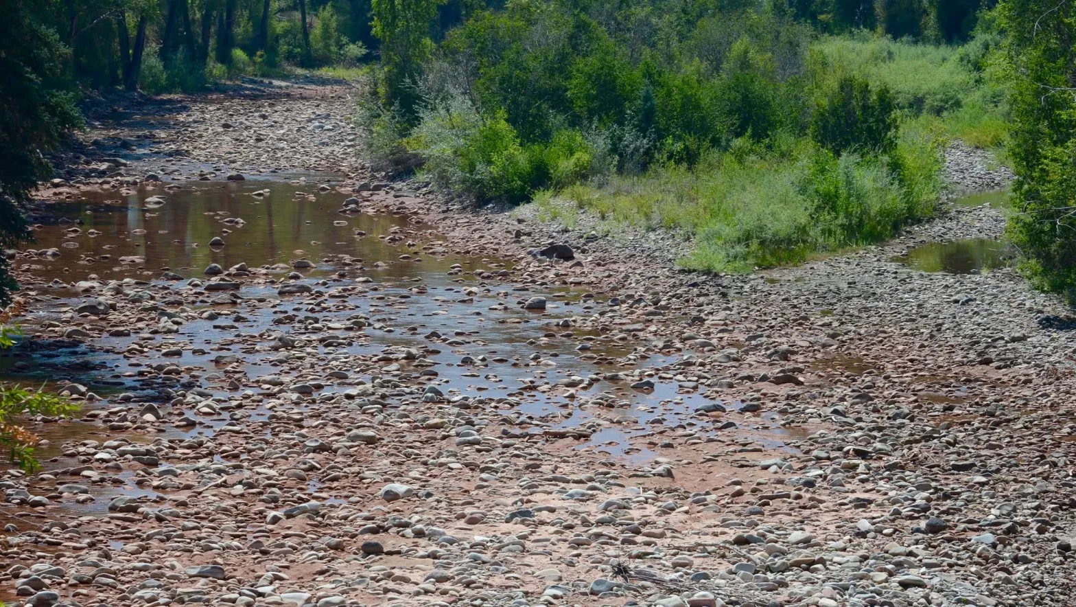
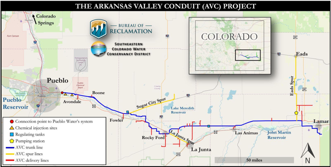
Arkansas Valley water districts and Aurora plan to open talks as soon as December aimed at providing aid to the region to offset the impact of a controversial, large-scale water purchase by Aurora that will periodically dry up thousands of acres of farmland.
The talks are likely to include renegotiating a hard-fought, 21-year-old agreement among water providers, Aurora, Pueblo, Colorado Springs and the U.S. Bureau of Reclamation, and others.
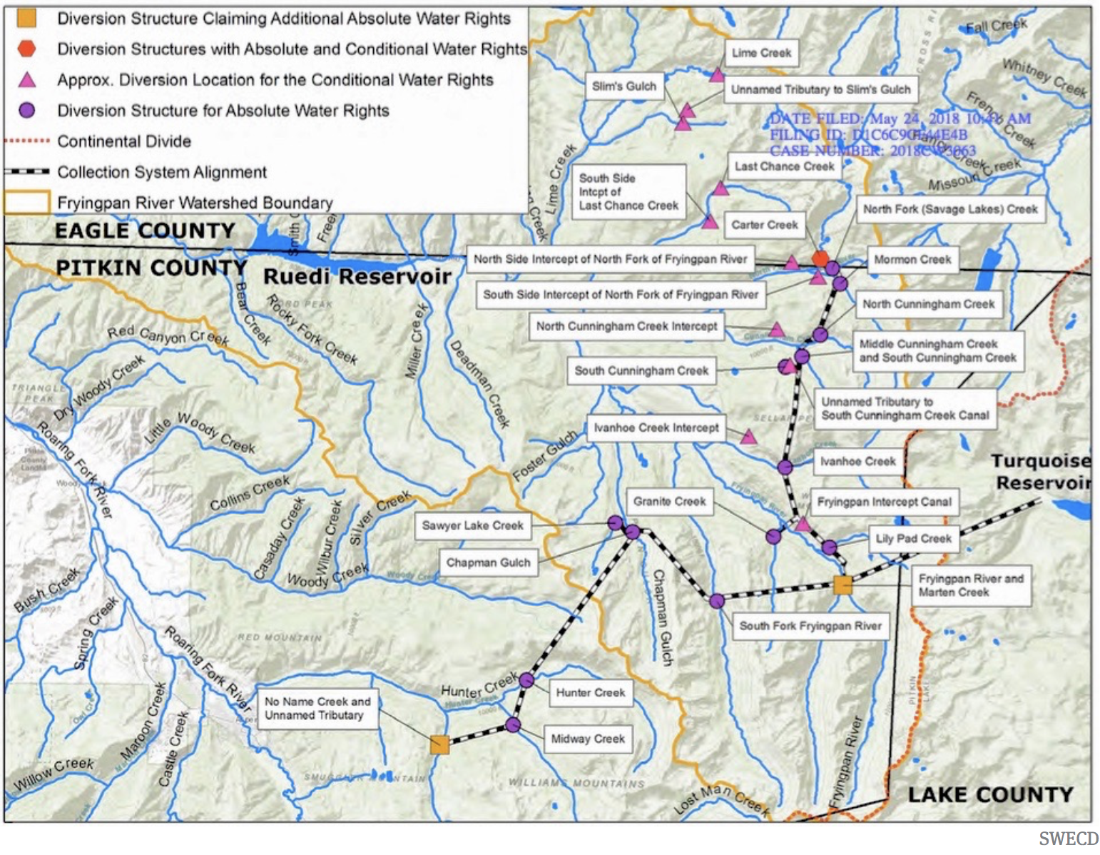
A map filed as part of Southeastern’s diligence application that shows the extent of the Fry-Ark Project. On its southern end, it diverts water from creeks near Aspen. The conditional rights within the Holy Cross Wilderness are on its northern end.
The agreement is not set to expire until 2047, but Bill Long, president of the Southeastern Water Conservancy District, which manages the Fryingpan-Arkansas Project for the Bureau of Reclamation, said the districts and Aurora have agreed to reopen the pact early to find ways to compensate the valley for the new loss of farm water.
“We hope that this issue can be resolved in a way that’s beneficial to both parties,” Long said. “What that looks like at this point I am not sure. We strongly believe the agreement has been violated and appropriate mitigation, or them not taking the water out of the valley, needs to occur. In our minds, there is no gray area.”
Aurora declined an interview request, but spokesman Gregory Baker acknowledged via email that Aurora has agreed to the talks, though a firm date has not been set.
Baker also confirmed that the water rights have been placed in a special account and won’t be used for two years while negotiations are underway.
The original 2003 agreement helped settle a number of lawsuits and disputes with Aurora after it asked to use the federally owned Fryingpan-Arkansas Project and Pueblo Reservoir. The deal gave Aurora the right to use the federal system for moving farm water it owned at the time in exchange for $25 million in cash payments over the 40-year life of the deal, among other provisions. The contract with the federal government was finalized in 2007.
Catlin Ditch water serving the Arkansas Valley an Otero County Farm to be purchased by Aurora Water. The purchase allows for periodic water draws from the Arkansas River basin for Aurora, a unique water transfer proposal in Colorado, officials say. PHOTO COURTESY OF AURORA WATER
Southeastern’s board quickly voted unanimously in April to oppose the purchase, and others, such as Colorado Springs and the Lower Arkansas Valley Water Conservancy District in Rocky Ford, followed suit.
Jack Goble, general manager of the Lower Arkansas Valley district, said the planned talks should pave the way for ensuring the valley’s farmers and ranchers are better protected against urban water harvesting.
“This is a big deal,” Goble said.
Aurora facing growth pressures
While Lower Arkansas officials argue that the 2003 agreement prohibits future water exports by Aurora, city officials have said previously that the purchase does not violate the pact, in part, because it involves leasing the water temporarily, rather than permanently removing it from the valley.
Fast-growing Aurora, Colorado’s third largest city, has had a controversial role in the history of agricultural water in the Arkansas Valley. In the 1970s and 1980s, it purchased water in several counties, drying up the farms the water once irrigated, and moving it up to delivery and storage systems in the metro area.
The Fryingpan-Arkansas project was built in the 1950s to gather water from the Western Slope and the headwaters of the Arkansas River and deliver it to the cities and farms of the Arkansas Valley. Local residents, via property taxes, have repaid the federal government for most of the construction costs and continue to pay the maintenance and operation costs of the massive project, according to Southeastern’s Long.
Aurora isn’t the only city that has moved to tie up agricultural water in the Lower Arkansas Valley. Recently, Colorado Springs inked a deal with Bent County and Pueblo Water has purchased water in the historic Bessemer Ditch just east of Pueblo.
At the same time, irrigated farm and ranch lands, the backbone of the state’s $47 billion agricultural economy, have been disappearing across the state. A new analysis by Fresh Water News and The Colorado Sun shows that 32% of irrigated ag lands have been lost to drought and urban development, and to other states to satisfy legal obligations to deliver water.
Long said the pending talks are “a recognition by Aurora that when making deals to acquire ag water, they need to be responsible and make sure there are benefits for all the parties. When we get to the table they may play hard ball, but I truly do think they want to fix this issue. That is in the best interest of all of the parties.”
More by Jerd Smith. Jerd Smith is editor of Fresh Water News. She can be reached at 720-398-6474, via email at jerd@wateredco.org or @jerd_smith.
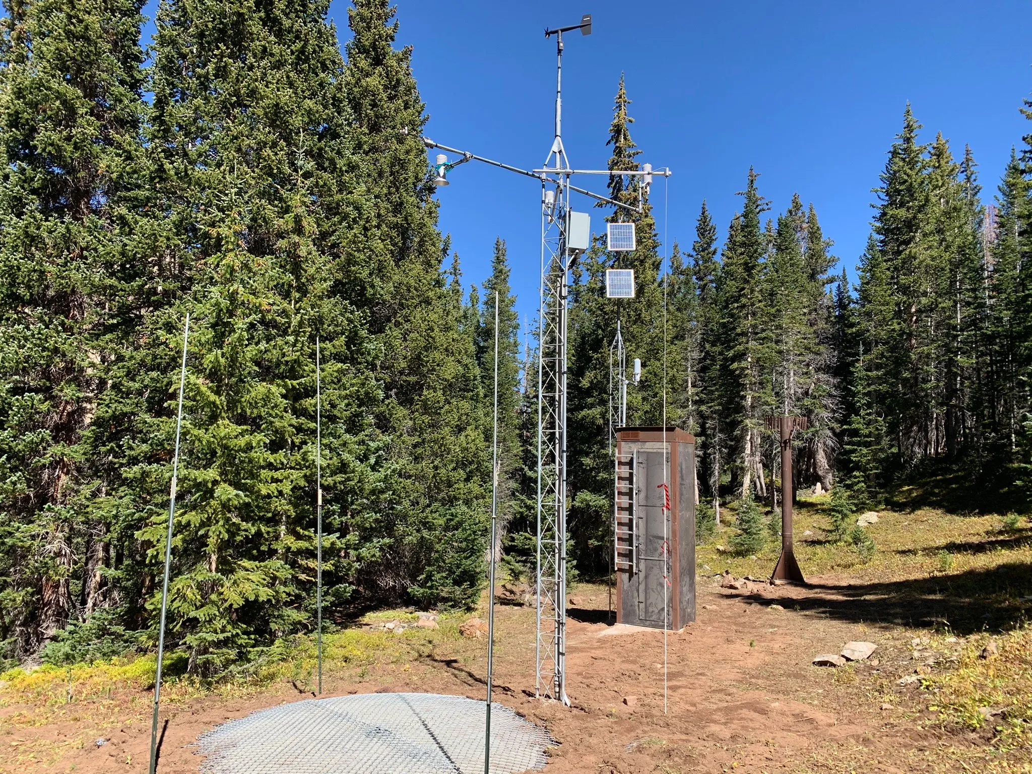
This new SNOTEL site near the headwaters of Castle Creek measures snowpack, temperature, soil moisture and other weather data. The city of Aspen will use the data to better understand its water supply. Credit: Heather Sackett/Aspen Journalism
Water managers at the city of Aspen have a new tool to help them better understand and plan for the city’s water supply.
Last week, after four years of planning and permitting, crews from the National Resources Conservation Service installed a new snow telemetry (SNOTEL) site in the headwaters of Castle Creek. Named Castle Peak, the new SNOTEL site is one of the highest in the state at 11,500 feet.
The SNOTEL network is a collection of over 900 automated remote sensing sites in high-elevation, mountainous watersheds across the West. The stations collect data about snowpack depth and water content, air temperature, wind, solar radiation, humidity, precipitation and soil moisture.
This publicly available data provides a real-time snapshot of conditions in Colorado’s high country. It can help avalanche forecast centers know how much new snow is in the backcountry after a storm; soil moisture data can help wildland firefighters know when forests are dangerously dry.
Perhaps most importantly, SNOTEL data helps scientists understand climate change impacts to water supply and predict how much water will be available come spring.
“In the western United States, about 80% of the annual water used in many basins comes from mountain snow,” said Brian Domonkos, NRCS Colorado snow survey supervisor. “That means it’s a resource we can monitor and get an idea of how much water we have in the snowpack and anticipate how much will be melting in the spring for use throughout the summer.”
The city of Aspen staff requested the site just below treeline off of Pearl Pass Road because the city gets the majority of its water from Castle Creek. NRCS agreed it would be a good spot to enhance their network of SNOTEL sites. Aspen paid the $45,000 cost of setting up the site, while NRCS will be responsible for maintaining it going forward.
“Most folks are pretty psyched that we have another piece of data and something that will be more representative of the basin than what we’ve had in the past,” said Steve Hunter, utilities resource manager with the city of Aspen.
Castle Creek flows downstream from the bridge on Midnight Mine Road, just above the city of Aspen’s diversion. Aspen is hoping to get a stream gauge on this stretch of river to better understand its water supply. Credit: Heather Sackett/Aspen Journalism
Site fills a data gap
Aspen water managers previously have used SNOTEL sites on Independence Pass, Schofield Pass, North Lost Trail, Upper Taylor in the Gunnison River basin and sites in the Fryingpan River basin to estimate how much water was in the Castle Creek drainage.
“There was really this big hole, a missing gap in this area,” Hunter said.
In many cases, SNOTEL data can help officials manage their reservoirs, releasing more water to make room for a big spring runoff or holding more back in years with a sparse snowpack. Aspen does not have a big storage bucket; the Leonard Thomas Reservoir it uses to store municipal water only holds about 10 acre-feet. Hunter said Aspen will use the SNOTEL data to make decisions about water conservation and when to enact outdoor watering restrictions.
“It gives us a way to quickly adapt, depending on what we’re seeing up there as far as snowpack,” he said. “I think that’s going to be super helpful.”
Aspen received several letters of support for the project when it was applying for a grant from the U.S. Bureau of Reclamation in 2020, including from Pitkin County, Colorado Water Conservation Board, Roaring Fork Conservancy and Aspen Global Change Institute. While the grant wasn’t funded, it demonstrated strong support for the new SNOTEL site.
“Since all data from these proposed stations will be public, these monitoring sites would benefit both the city of Aspen and other mountain towns and municipalities seeking to better understand potential climate change impacts on water supplies,” reads the letter from AGCI.
The Castle Peak SNOTEL is just one piece of Aspen’s effort to better understand its water supply availability. It’s 2020 Municipal Drought Mitigation and Response Plan says the city would benefit from a stream gauge on Castle Creek above its diversion point to improve monitoring and make drought declaration decisions. The city is still working on the Castle Creek stream gauge.
Along with other governments across the state, Aspen has also funded Airborne Snow Observatories, a company that measures snowpack from the air using LiDAR, a laser technology that can sense snowpack depth across a wide area. Aspen contributed $50,000 to ASO flights in the Roaring Fork watershed this year.
Real-time data from the new SNOTEL site can be found on the NRCS website. The site does not yet have “percent of normal” values since this is its first year of operation.
Pitkin County’s Healthy Rivers Board voted unanimously to approve a $28,000 grant request from the Roaring Fork Valley Wildfire Collaborative to fund a project that will produce a wildfire action plan for the valley’s watershed. The project will identify high-risk areas and potential post-fire hazards in the Roaring Fork Valley’s water systems to create an action plan in the event of a wildfire. Several town and city water sources come from single streams. In the event of a wildfire, ash could contaminate stream water, degrading the quality of the water system, and potentially making it undrinkable, said Roaring Fork Valley Wildfire Collaborative Executive Director Angie Davlyn during her Thursday presentation to the board in Basalt…
While the Roaring Fork Valley is at significant risk for wildfires, a state evaluation also noted the high susceptibility of the Roaring Fork Watershed’s water infrastructure in the event of a wildfire. This leaves residents, property, and natural resources vulnerable to this disaster but also to other post-wildfire hazards, like flooding and mudslides, Davlyn said…Davlyn also said that the region has been pro-active in performing wildfire mitigation tasks, but there is a lack of a data-driven approach to identify the most critical threats and most opportune areas for a wildfire…To bridge this gap, the Wildfire Collaborative applied for funding from several sources, including Pitkin County. Last week, Wildfire Collaborative signed a contract with the Colorado Water Conservation Board for $224,000 and more than $150,000 in technical assistance for this project, which Davlyn said is the first of its kind in this area. These funds, however, require a 25% match before work can begin. The Wildfire Collaborative will provide half of the match through staff time, but the organization needs Pitkin County’s $28,000 to complete the match. Fire Adapted Colorado also awarded $5,000, the town of Carbondale awarded $3,000, Roaring Fork Conservancy awarded $500, Holy Cross Energy awarded $3,000, and other municipalities, counties, and the Colorado River District awarded $5,000. These funds, along with Colorado Water Conservation Board’s $374,000 and Pitkin County’s $28,000, totals $446,500.
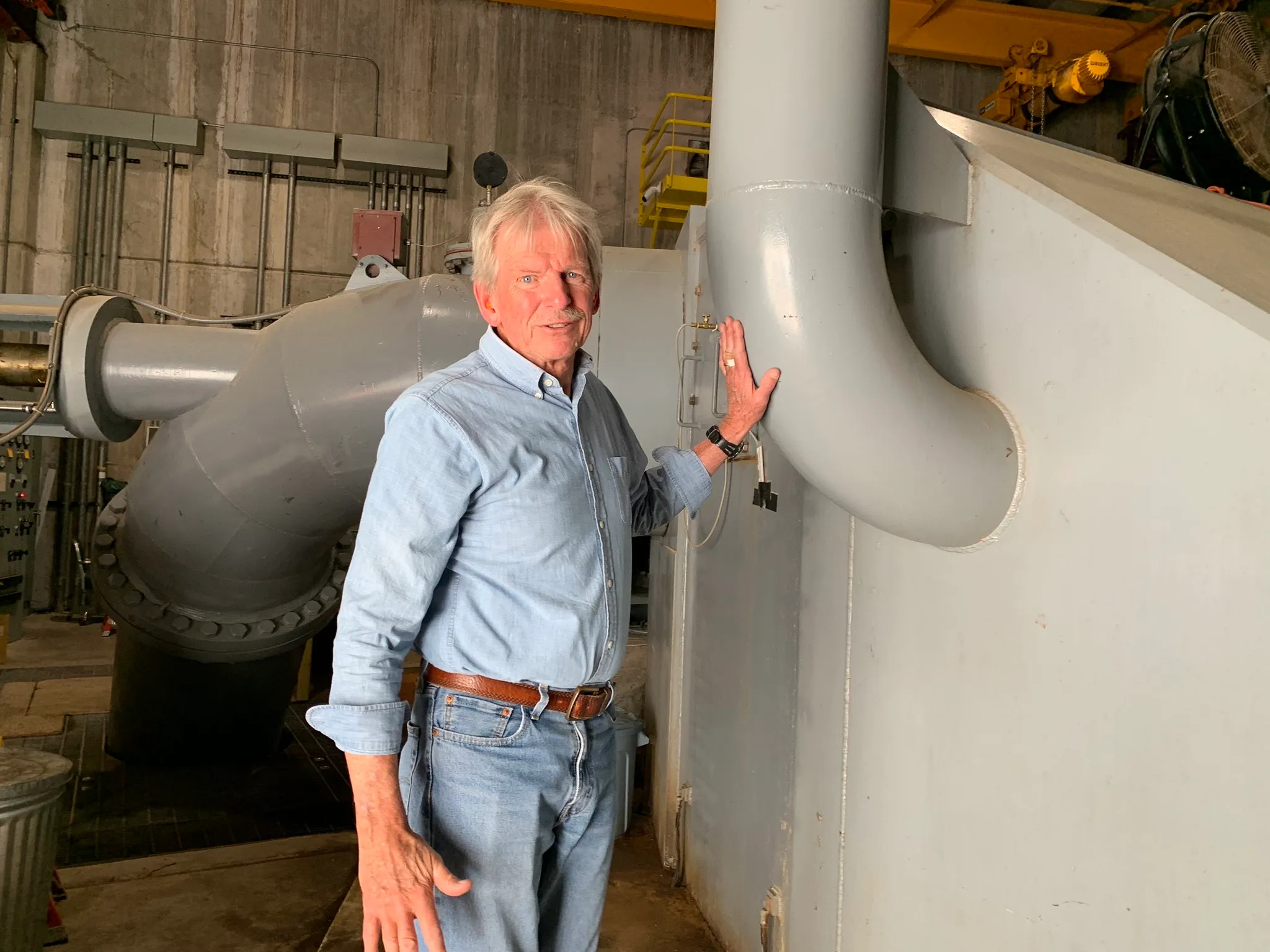
Utilities Engineer for the City of Aspen Phil Overeynder at the hydroelectric plant at Ruedi Reservoir. Releases from the reservoir in recent years have been too high in the summer and too low in the winter for Aspen to make hydropower efficiently. Credit: Heather Sackett/Aspen Journalism
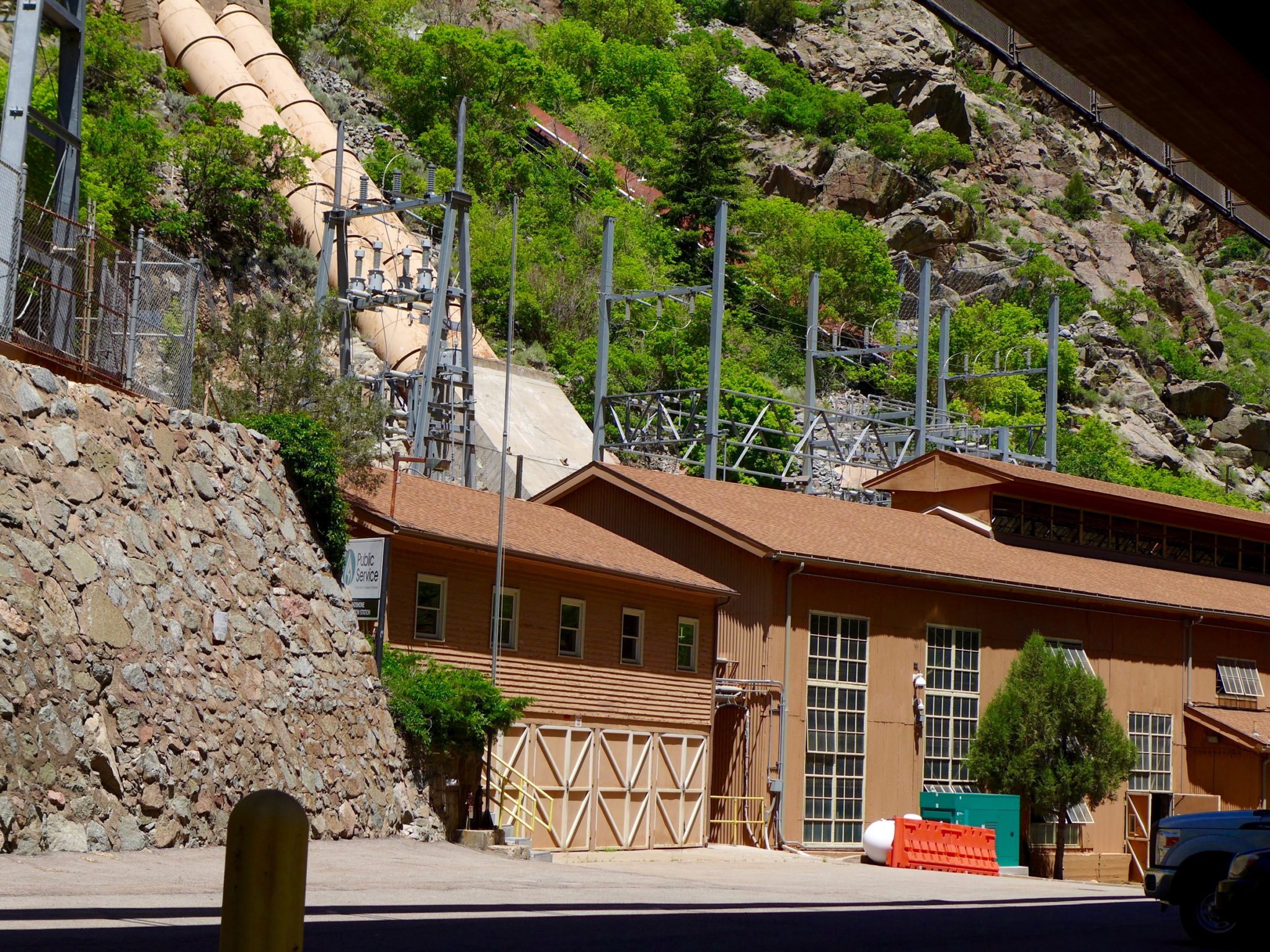
The city of Aspen wants to add a second turbine and generator unit to its hydroelectric plant at the base of Ruedi Dam, which officials say will allow for more power generation during times of high and low flows.
Officials say an additional turbine, which is estimated to cost about $4.6 million, will restore the plant’s power production capacity to its originally intended 5 megawatts and allow the city to maintain its renewable energy goals. Since 2012, increased releases from Ruedi to benefit downstream endangered fish have meant that late summer and early fall flows are too high for the existing turbine to operate efficiently.
Adding another turbine requires amending Aspen’s license for the Ruedi facility with the Federal Energy Regulatory Commission. According to the city’s draft FERC application for an amendment posted on the Aspen Community Voice website, which officials say they plan on filing by the end of the month, the timing and amount of water released from Ruedi Reservoir has changed since the hydro project began operating in 1986. Power production has diminished in recent years to just 68% of what was originally intended.
Hydroelectric Dam
“After 40 years of reservoir and hydroelectric operations, it is now clear that achieving power output (maximum capacity and energy values) that approximates the original level authorized under the license will require additional generation equipment,” the application reads.
The City of Aspen has a hydroelectric power plant at the base of Ruedi Reservoir, which helps them meet renewable energy goals. Aspen officials want to add a second turbine to make power more efficiently. Credit: Heather Sackett/Aspen Journalism
The facility is most efficient at flows between 100 and 225 cfs. But summer and fall flows are often higher than this range and winter flows often lower. Aspen has no control over how much water is released from the reservoir, which is managed by the U.S. Bureau of Reclamation.
According to the city’s application, gross energy production has declined from an average of 18.5 million kilowatt hours annually from 1986 to 2004 to 15 million kWh over the last decade.
“The equipment is kind of mismatched for what’s going on with those releases,” said Phil Overeynder, utilities engineer for the city of Aspen. “So we’re losing all of that energy above 225 cfs. If we have an additional turbine, we’ll be able to hit the sweet spot for the releases and generate the full amount of energy when it’s available.”
Also, an error in the design of the powerplant introduces air into the water column, reducing the efficiency of the turbine. Because of this flawed design, the hydro plant can’t efficiently make power above about 225 cfs. The city looked at options to fix this problem, Overeynder said, including raising the floor of the building, but the least expensive solution is adding another turbine.
A new turbine would be rated for 1.2 megawatts of production and the original turbine would be downgraded to a 3.8 megawatt capacity, for a total of 5 megawatts — the same as the plant’s current rating, but split between two turbines. During periods of higher releases, about 230 cfs would be routed through the existing turbine and 70 cfs would be routed through the new turbine for about 92% efficiency.
The project would also upgrade the hydro plant so it can be operated remotely, and would let the city continue making hydropower with one turbine if the other one is down for maintenance. The total project cost including the new turbine would be around $8.6 million, according to Overeynder.
“The proposed second turbine at Ruedi, together with other planned actions, will enable Aspen to restore the balanced power supply, which will maintain grid reliability and resiliency while continuing to provide 100% renewable energy,” the application reads.
Ruedi Reservoir on the Fryingpan River is operated by the U.S. Bureau of Reclamation. Releases for the Colorado River Endangered Fish Recovery Program have boosted late summer and fall river flows in recent years. Credit: Heather Sackett/Aspen Journalism
Fish flow
Releases out of Ruedi have changed since the hydro plant began operating, with the reservoir now one of the most important sources of water for the Colorado River Endangered Fish Recovery Program. The program, designed to get water into a chronically de-watered section of the Colorado River near Grand Junction known as the 15-mile reach, has about 15,000 acre-feet of water available most years in Ruedi. Entities that own water in Ruedi such as Garfield County, Caerus Energy, Grand Junction area water provider Ute Water and the Colorado River Water Conservation District have also in recent years leased their water to the recovery program to boost flows beyond the dedicated 15,000 acre-foot pool.
All of the recovery program’s releases are made in July through October, when streamflows naturally are reduced, but irrigation demands in the Grand Valley leave diminished river levels for endangered fish. According to numbers provided by recovery program staff, the Ruedi fish water releases increased from an average of 18,586 acre-feet in the time period from 1998 to 2012, to 20,460 acre-feet in the time period of 2013-2023.
“Ruedi is an essential piece of our ability to manage water for the endangered fish,” said Juile Stahli, director of the Upper Colorado Endangered Fish Recovery Program. “Ruedi has become really critical in helping us affect the ecology downstream.”
According to Tim Miller, a hydrologist with the U.S. Bureau of Reclamation who manages Ruedi, the current reservoir release pattern — higher flows in the late summer and lower flows in the winter — began after 2012 when the water in the reservoir was fully contracted. The owners of this contracted water (like those mentioned above) release it when they need it, and many lease it to the recovery program. Because more contract water is released from Ruedi, Miller said he has to make up that loss to the reservoir by releasing less water over the winter, resulting in low winter flows.
“I can tell you with absolute certainty that since Ruedi has been fully contracted we have released more water for fish augmentation than we did since the program started,” Miller said. “Because we’ve released more contract water, given an average fill, it’s going to take more water to fill the reservoir the next year. So my releases during the winter were lower to recover that.”
According to data from USBR, the average flow out of the reservoir from July to October before the endangered fish recovery program started from 1980 to 1997 was 180 cfs. The average release after the program began in 1998 has been 204 cfs. The number of days releases have exceeded 225 cfs has also been trending upward since the recovery program began.
Aspen’s 100% renewable energy goals
Aspen first achieved its goal of 100% renewable energy in 2015, when a project that retrofit the Ridgway Reservoir dam in the Uncompahgre River basin to generate hydroelectric power came online. The city of Aspen was integral in launching the project, funding a feasibility study in the early 2000s and signing a 10-year contract in 2012 to purchase about 10 million kwh a year from Ridgway once it became available. Ridgway now accounts for about one-seventh of Aspen’s total power portfolio, according to Overeynder. In an effort to continue meeting its 100% renewable goal, the city is also looking to continue and potentially expand its hydroelectric power generation capacity on Maroon Creek.
Aspen has begun the process of relicensing the project with FERC, which is smaller than the Ruedi project and has a capacity of 450 kilowatts. Aspen is also proposing to add additional units on Maroon Creek for a total of 500 kw.
Hydropower, including energy Aspen buys from projects at Ridgway Reservoir and Western Area Power Administration, is supposed to make up about 45% of the city’s energy portfolio. But that percentage has dropped with the declining power production at Ruedi in recent years. The city also buys wind and solar power to achieve 100% renewable energy.
“If we do this (project at Ruedi) plus what we did already at Ridgway and are proposing to do at Maroon Creek, we will get back up to that 45%,” said Justin Forman, Aspen’s Utilities Director. “For us, every megawatt counts and if it’s something local like this, we’re super proud of it and it certainly fits into the values that we have.”
The FERC relicensing process will take several years, with sign-offs also needed from the Colorado Department of Public Health and Environment, the U.S. Army Corps of Engineers and Pitkin County. Overeynder expects the new turbine to be operating sometime in 2027.
The city of Aspen supports Aspen Journalism with a community nonprofit grant. Aspen Journalism is solely responsible for its editorial content.
Beavers have constructed a network of dams and lodges on this Woody Creek property. Pitkin County is betting big on beavers, funding projects that may eventually reintroduce the animals to suitable habitat on public lands. CREDIT: HEATHER SACKETT/ASPEN JOURNALISM
Hunter and Woody Creeks and Avalanche and Thompson creeks in the Crystal River Basin are now designated Outstanding Waters by the Water Quality Control Commission. The Colorado Water Quality Control Commission on Aug. 21 unanimously designated roughly 385 miles of waterways across 15 rivers and streams in the upper and lower Colorado, Eagle, Yampa, and Roaring Fork River basins as Outstanding Waters. The Outstanding Waters designations are authorized by the Colorado Water Quality Control Act and the Clean Water Act…
“An Outstanding Waters designation is a protection that can be given to reaches of streams that offer water quality protection. It is the highest level of water quality protection that can be given by the state of Colorado,” [Mathew] Anderson said. “With the protection, future projects that may happen along these reaches have to ensure that the water quality will not be diminished.”
[…]
This designation can protect creeks and rivers from future developments and pollution. He noted that all existing industries, ranches, homes, and utilities along these sections of designations will be grandfathered in…He said that obtaining this designation took a coalition between different watershed groups that ranged from the Yampa to Eagle rivers…or creeks, streams, and rivers to receive this designation, the water quality must already be of a high standard. Eleven respective criteria points must be met as it relates to water quality before this designation can be obtained.
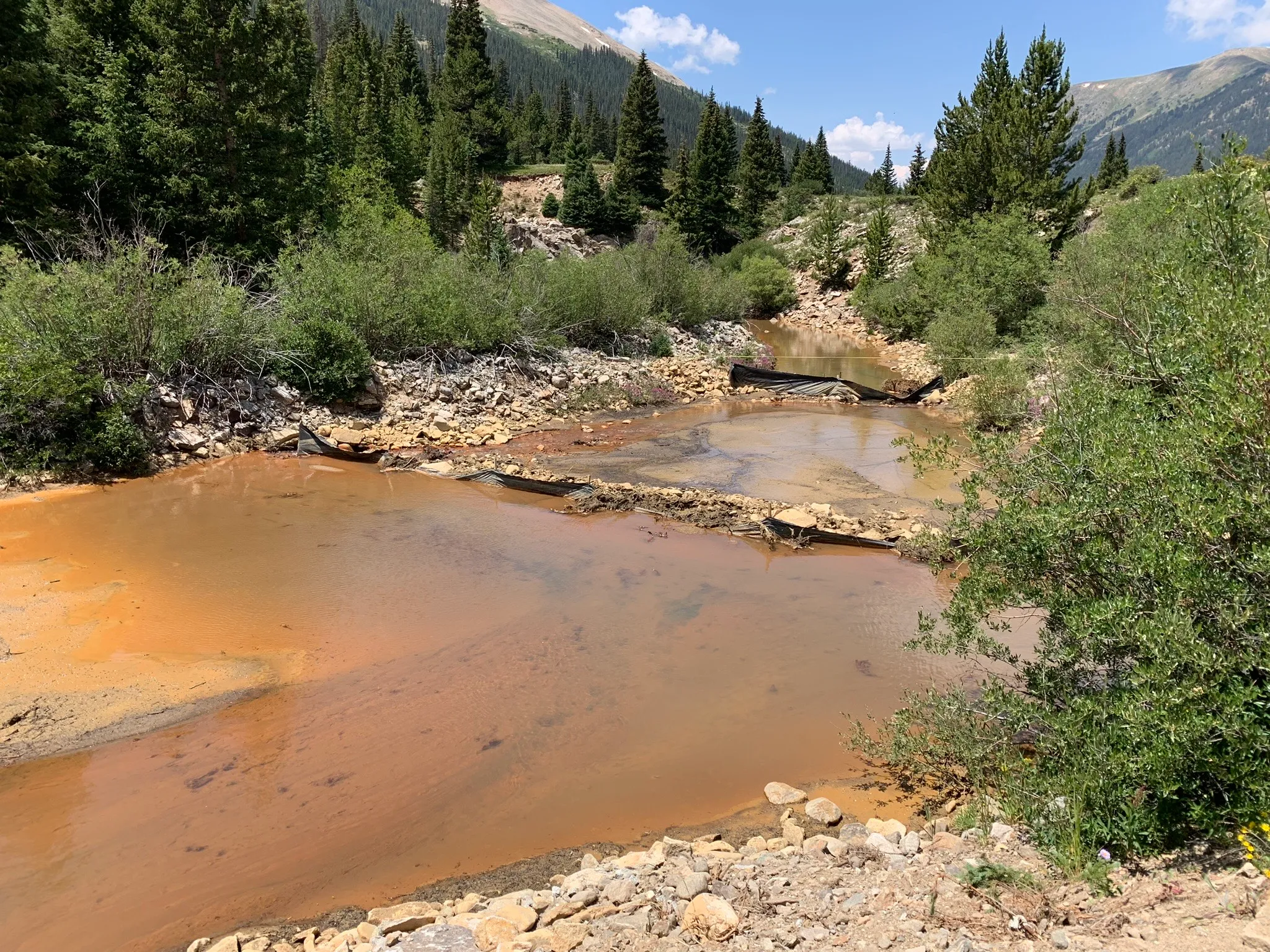
These sediment traps of hay bales and tarps, seen on July 21, were placed in Lincoln Creek below Grizzly Reservoir. Pitkin County officials say that a July 16 release from Grizzly Reservoir that turned Lincoln Creek and the Roaring Fork River orange had minimal biological effects on fish and other aquatic life. Credit: Heather Sackett/Aspen Journalism
Pitkin County officials say that a July release from Grizzly Reservoir that turned Lincoln Creek and the Roaring Fork River orange had minimal biological effects on fish and other aquatic life.
Water quality testing results from the day of the sediment release, July 16, show high levels of iron and aluminum, but they do not show levels of copper high enough to be toxic to fish.
Members of the Lincoln Creek workgroup, which is comprised of officials from Pitkin County, Colorado Parks & Wildlife, Colorado Department of Public Health and Environment, Independence Pass Foundation and others, met remotely on Wednesday to debrief the July 16 incident. The water quality samples were collected by staff from the Roaring Fork Conservancy and the results are available on River Watch, a statewide volunteer water quality monitoring program operated by CPW.
The released sediment was in particulate form and less able to be readily taken up by aquatic life, according to a press release from Pitkin County. There were no fish kills reported to CPW and the event is not expected to have a significant long-term impact on aquatic ecosystems.
“Most of this indicates that although visually the impact of the event was, you know, scary to look at, it does seem that at least from a copper and biological perspective that there was less of a copper biological risk to fish,” said Megan McConville, CPW River Watch program manager. “The copper has a more toxic effect on aquatic life than the aluminum or the iron.”
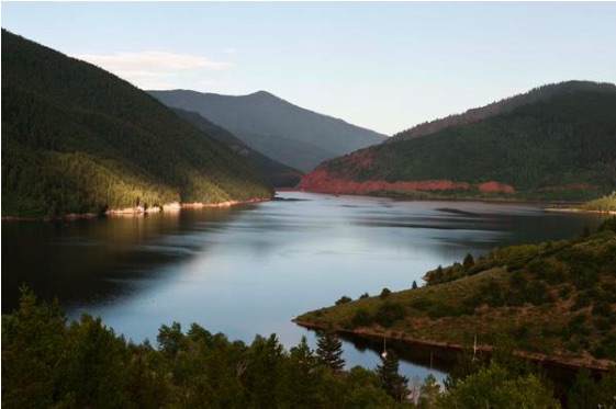
Twin Lakes Reservoir & Canal Co., which operates Grizzly Reservoir, drained the reservoir this summer so it could make repairs to the dam and outlet works. On July 16, a pulse of sediment-laden water from the bottom of the reservoir was released down Lincoln Creek, turning it and the Roaring Fork River orange and alarming Aspen residents and visitors.
A July 1 news release from Pitkin County had warned of the potential for temporary discoloration of the river as the reservoir was drawn down, but the severity of the event shocked many people. The U.S. Army Corps of Engineers is investigating whether the sediment release needed a permit under the Clean Water Act.
Officials say the release is unlikely to pose any ongoing risk to people recreating in local waterways.
Local officials, residents and environmental groups have long been concerned about water quality on Lincoln Creek and the July 16 release came at a time of increased scrutiny. Officials have determined that a “mineralized tributary,” which feeds into Lincoln Creek above the reservoir near the ghost town of Ruby, is the source of the high concentrations of metals downstream. The contamination seems to have been increasing in recent years and may be exacerbated by climate change as temperatures rise.
High levels of aluminum, iron at testing sites
Water quality samples were taken by Roaring Fork Conservancy staff at six locations on Lincoln Creek and the Roaring Fork on three dates: June 4, June 25 and July 16. The locations were the Grizzly Reservoir inlet, below Grizzly Dam, the Lincoln Gulch Campground on the creek just above the confluence with the the Roaring Fork, the Grottos day-use area and Difficult Campground. Control samples were also taken from the Roaring Fork just above the Lincoln Creek confluence. An additional location, below the sediment traps on Lincoln Creek about 50 yards below Grizzly Dam, was tested only on July 16.
That data show sharply increasing concentrations of aluminum and iron on July 16, particularly just below the dam. On June 25, there were 258 micrograms (parts per billion) of aluminum in the water below Grizzly Dam, which is still exceeds the chronic water quality standard for aquatic life (on all but one date and location, the amount of aluminum exceeded either the CPW acute or chronic water quality standards for aquatic life). During the release on July 16, that jumped to 1.7 million micrograms. Testing at the second location below the dam, below the sediment traps placed by Twin Lakes, that number was down to 726,600.
“There was a pretty significant drop from what was coming directly out of the dam,” said Chad Rudow, water quality program manager with the Roaring Fork Conservancy. “It kind of shows the sediment traps were doing their job and helping to sequester some of that stuff.”
By the time the release had made it downstream to the confluence of the Roaring Fork, the total iron levels had decreased by 97%, and total aluminum decreased by 98%.
Because there were additional elements in the water, the aluminum was not as toxic to fish as it could have been, McConville said.
“The more carbon you have in the water, the less toxic it makes the aluminum,” she said. “Because we’ve got bottom lake sediments coming down, they were probably pretty high in carbon. … My guess is that a big slug of carbon came down along with the iron and aluminum and for aluminum in particular, it probably provided some protection for those aquatic organisms.”
The iron levels also exceeded state chronic water quality standards for aquatic life in eight of the 19 sites and days tested, but iron is a 30-day standard and the release was a roughly 36-hour event.
“If that event had gone on for 30 days or a longer duration, then that standard would have been applicable,” McConville said. “But because it was such a short-term event, that sort of clogging, smothering effect that we would expect from that precipitated iron just really didn’t have a chance to occur.”
The reason copper levels below the reservoir were so low is probably because the entirety of Lincoln Creek above the reservoir — the source of copper contamination — is being diverted to the Arkansas River basin through the Twin Lakes Tunnel.
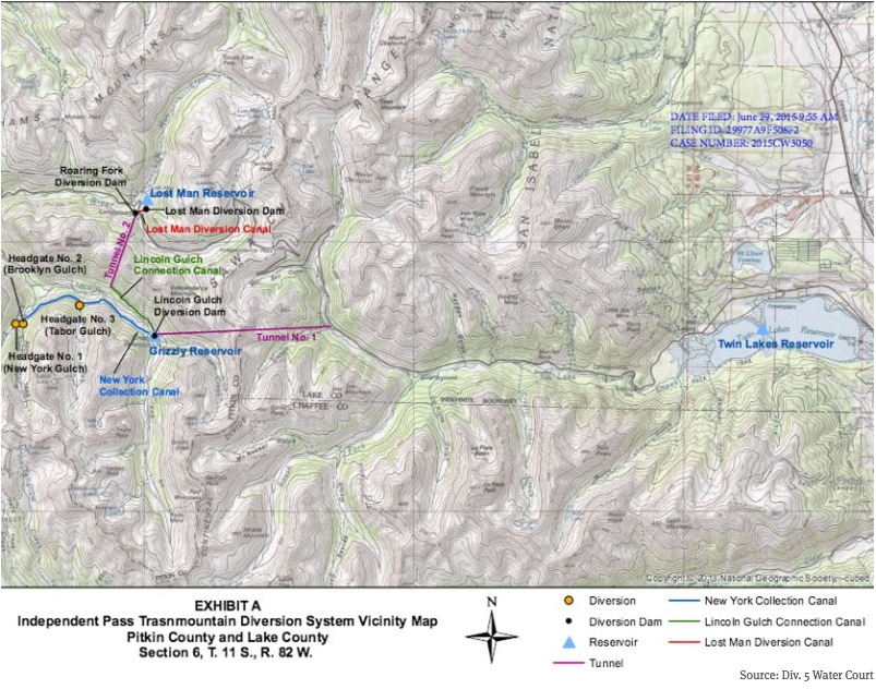
A map of the Independence Pass Transmountain Diversion System, as submitted to Div. 5 Water Court by Twin Lakes Reservoir and Canal Co.
Lincoln Creek and Grizzly Reservoir are part of a highly engineered system that takes about 40% of the water from the headwaters of the Roaring Fork to cities and farms on the east side of the Continental Divide. Water is sent from the reservoir through Twin Lakes Tunnel into Lake Creek, which is then collected in Twin Lakes Reservoir.
Four municipalities own 95% of the shares of water from the Twin Lakes system: Colorado Springs Utilities owns 55%; the Board of Water Works of Pueblo has 23%; Pueblo West Metropolitan District owns 12% and the city of Aurora has 5%.
Officials said at Wednesday’s meeting that this is just the initial attempt at understanding the water quality testing data around one reservoir release event and there is still a lot of data that needs to be analyzed from other testing agencies.
In addition to the Roaring Fork Conservancy, four other entities are conducting water quality sampling this summer: Pitkin County Environmental Health; the U.S. Forest Service; Colorado Parks and Wildlife; and the Institute of Arctic and Alpine Research at the University of Colorado Boulder. The workgroup has hired consultant LRE Water to review the data and an EPA report, make a site visit and comment on the sampling plans of the five different entities.
“The initial plan was to have all of the data come to us at one time, the beginning of next year, but there became this ask for the data around this event; there was a concern around toxicity,” said Kurt Dahl, Pitkin County environmental health director. “There’s still a lot of data that we have out there. … The context of the entire year is going to have to wait until our intended timeframe of early next year to talk about how this looks in comparison to the various other times we’re out there sampling.”
Prior to mining, snowmelt and rain seep into natural cracks and fractures, eventually emerging as a freshwater spring (usually). Graphic credit: Jonathan Thompson
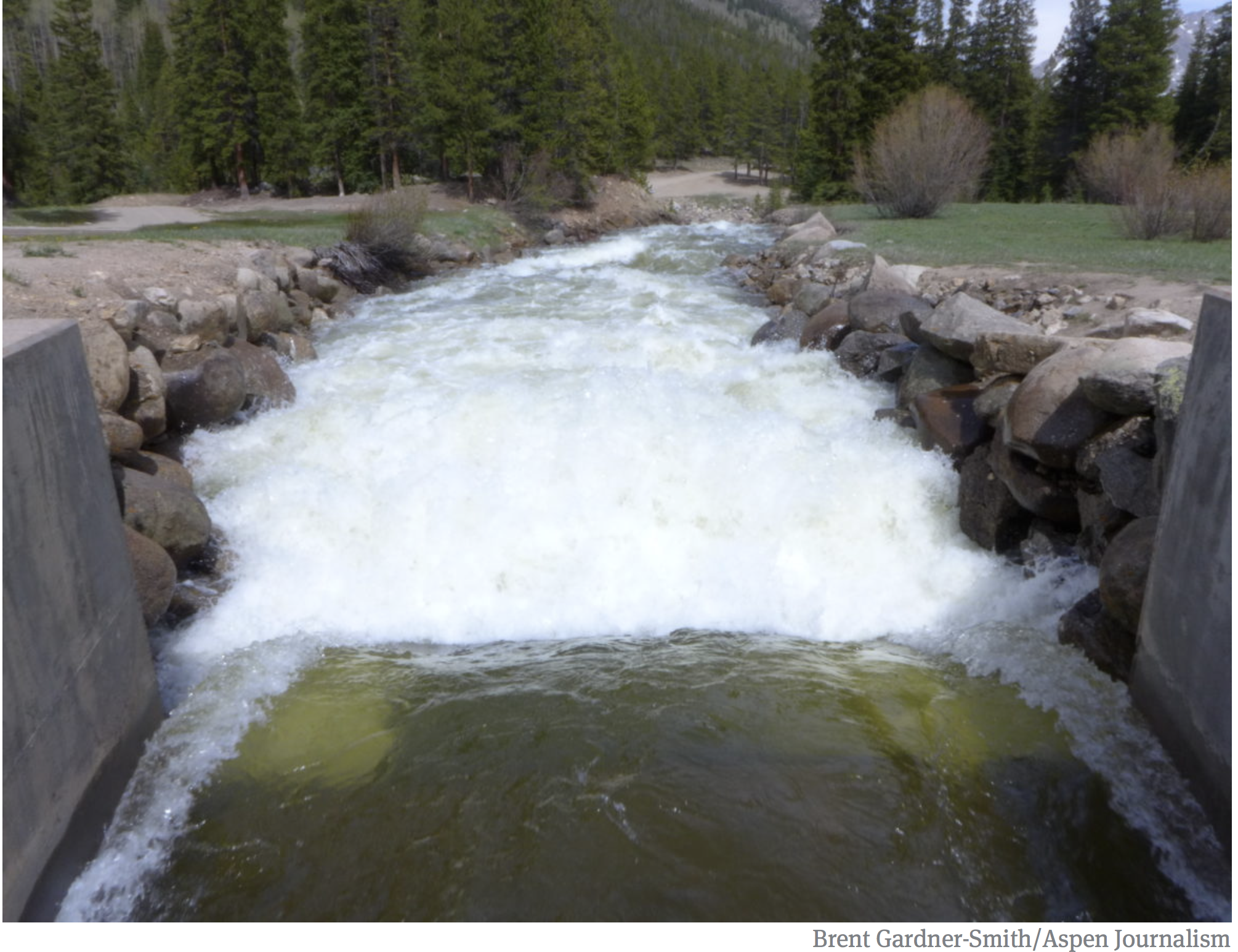
Water from the Roaring Fork River basin heading east out of the end of the Twin Lakes Tunnel (June 2016), which is operated by the Twin Lakes Reservoir and Canal Co., a member of the Front Range Water Council. Photo: Brent Gardner-Smith/Aspen Journalism
Click the link to read the article on the Aspen Daily News website (Austin Corona). Here’s an excerpt:
July 28, 2024
Two prominent water researchers and the state of Colorado disagree on the significance of new water use data published by the federal government in June. The state claims the data confirms its argument that headwaters states use less Colorado River water during dry years. Meanwhile, former Colorado River Water Conservation District general manager Eric Kuhn and Utah State University professor Jack Schmidt say the data paints a more complex picture.
“Reclamation has worked extremely hard to bring the best cutting-edge science they can to a better and more accurate estimate of agricultural water use,” Schmidt said. “It’s just that the relationships that arise from better data are just as murky.”
The June data details the “consumptive” water use by “Upper Basin” states (Colorado, New Mexico, Utah and Wyoming) since 1971. It is meant to quantify all the water those four states have consumed in that period (see footnote * at story’s end). The Bureau of Reclamation, the federal agency that manages most of the large dams on the Colorado River, has updated the data in five-year reports since 1971, but June’s report is different. This time, the bureau collected the data using a new methodology. The results are notable — past data seemed to indicate that Colorado and other Upper Basin states used more Colorado River water during dry years, directly contradicting Colorado’s arguments about its use. According to the state, the new data corrects that inconsistency. This conclusion could be vitally important for Upper Basin states. The relationship between the Upper Basin’s water use and the natural water supply is a central component of its position in interstate negotiations over the river…
Located at the river’s headwaters, Colorado and other Upper Basin states argue that they already take “natural” water cuts in dry years. Without a large upstream reservoir to fall back on, these states say they rely heavily on yearly precipitation for their water supply, meaning drought years are already tough…The argument foundered on the fact that the reclamation bureau’s consumptive use data didn’t support it. In 2022, three notable water researchers — Kuhn, Schmidt and University of New Mexico professor John Fleck — published a blog post laying out the disconnect between the federal government’s numbers and Colorado’s claims. In their piece, the three researchers wrote that while certain parts of the Upper Basin certainly cut their use in dry years, the basin’s overall use did not reflect that anecdotal reality…
*** One way for the Upper Basin states to make their case stronger is to change the way the Bureau of Reclamation accounts for consumptive use in transmountain diversions, or TMDs — the tunnels that carry water from inside the Colorado River Basin to cities and farms outside the basin (there are two that take water out of the Roaring Fork watershed and send it to the Front Range). There is a gray area in which the actual “consumption” takes place for TMDs that have storage reservoirs at their intakes. Colorado and Upper Basin states would like to say consumption occurs when they take water from the river system and put it in the reservoirs while the reclamation bureau currently sees consumption occurring when the water leaves the reservoir and enters the tunnel. Using the Upper Basin states’ preferred method, the basin’s consumptive use changes to 4.5 million acre-feet in wet years, 4.1 in average years and 3.9 in dry years, making a much stronger case for the argument that the basin uses less in dry years.
Sunrise at Ruedi Reservoir October 20, 2015. Photo via USBR.
From email from Reclamation (Anna Perea):
July 24, 2024
The Bureau of Reclamation has scheduled the annual public meeting to discuss the Ruedi Reservoir Water Operations for the 2024 water year. The meeting will be held on Wednesday August 7, 2024, from 6:00 p.m. – 8:00 p.m. at the following location:
Roaring Fork Conservancy River Center 22800 Two Rivers Road Basalt, CO 81621
Topics will include:
Reservoir operations update (Reclamation)
Colorado River 15-Mile Reach endangered fish update (U.S. Fish and Wildlife)
Fryingpan River projects (Roaring Fork Conservancy)
Updates on Ruedi water leases (Colorado Water Conservation Board)
Overview of East Slope Fryingpan-Arkansas Project (Reclamation)
Public question and answer session
For more information, please contact Tim Miller, Hydrologist, Eastern Colorado Area Office, by phone or e-mail: (970) 461-5494, or tmiller@usbr.gov.
Media inquiries or general questions about Reclamation should be directed to Anna Perea, Public Affairs Specialist, at 970-290-1185 or aperea@usbr.gov. If you are deaf, hard of hearing or have a speech disability, please dial 7-1-1 to access telecommunications relay services.
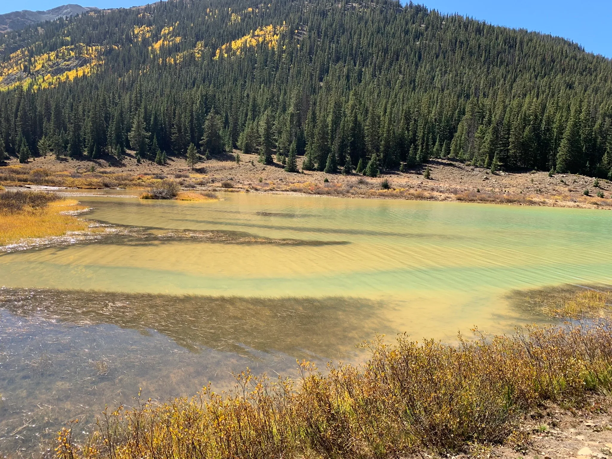
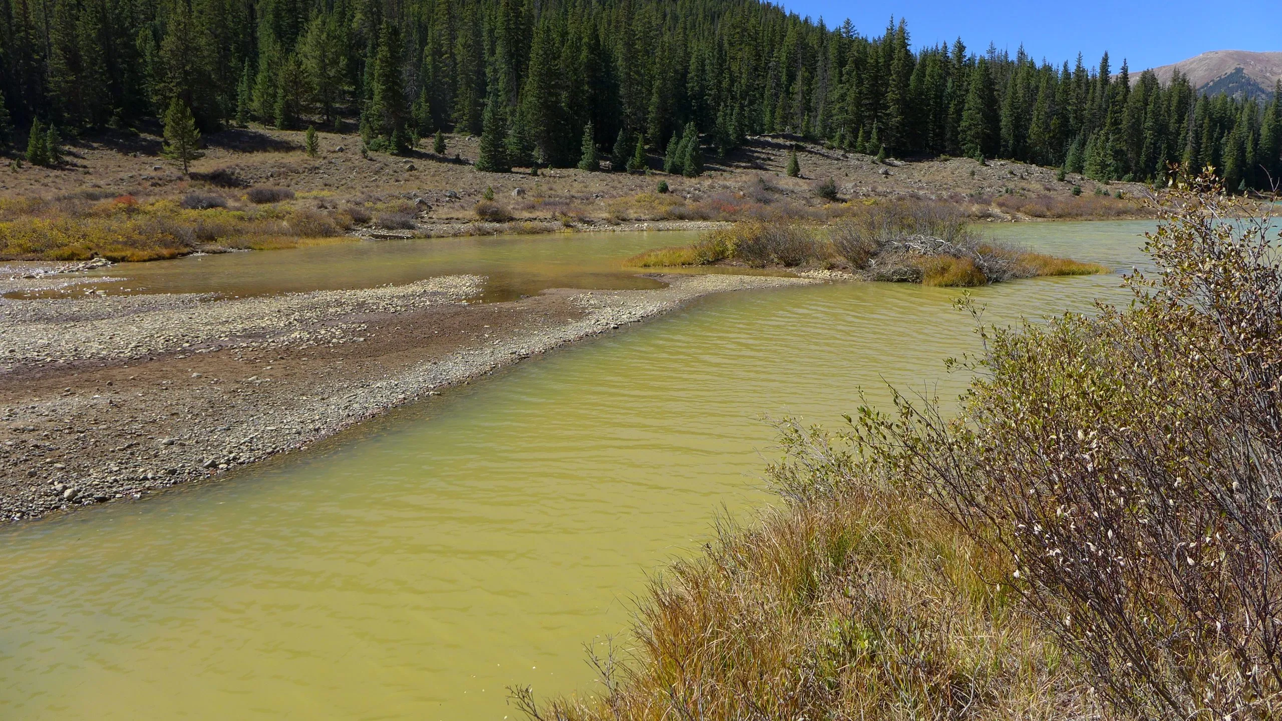
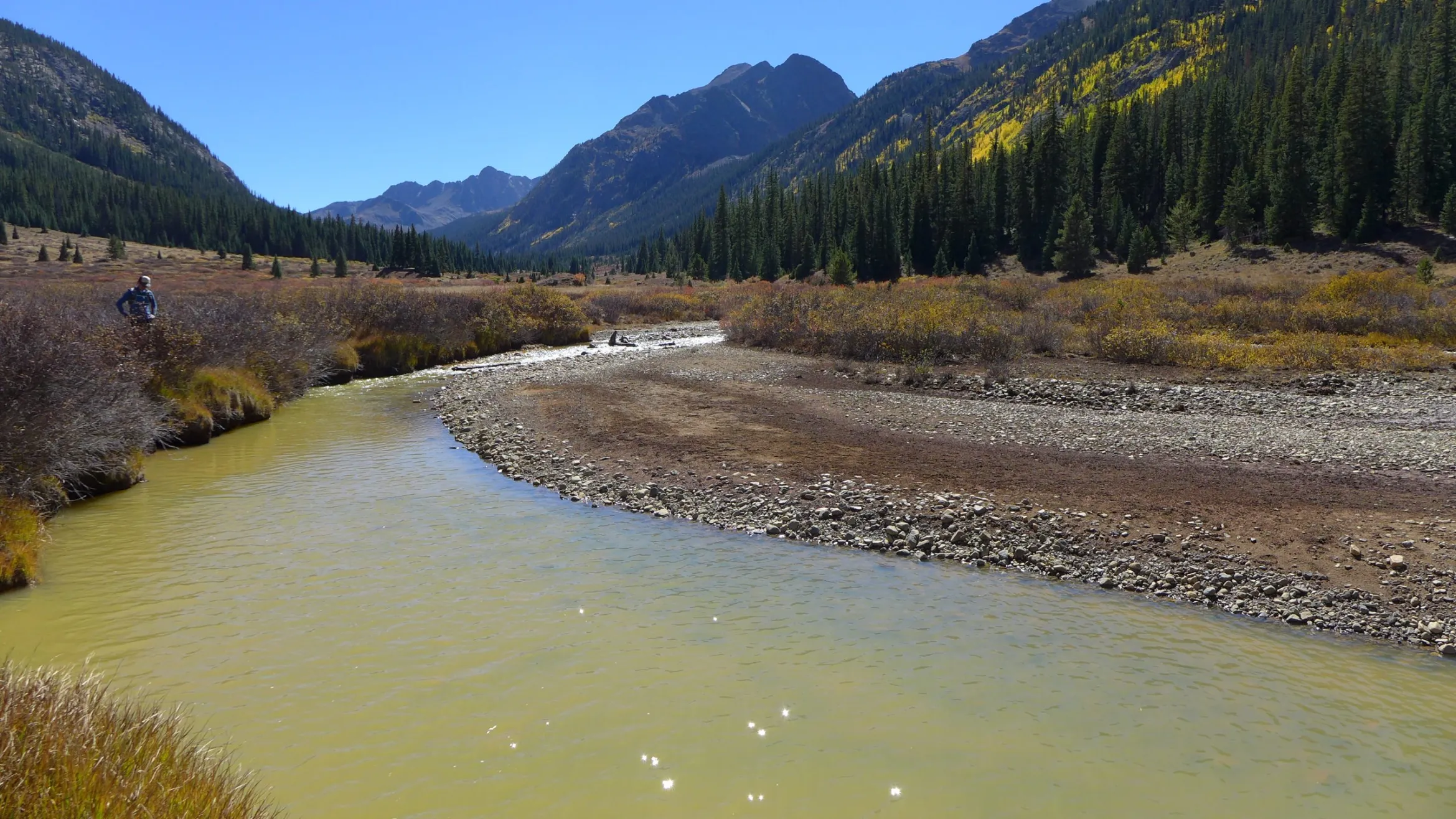
Lincoln Creek was yellow as it flowed into Grizzly Reservoir in September 2022. A report from the Environmental Protection Agency says metals contamination in the creek and reservoir is a result of natural causes, not a nearby mine. CREDIT: HEATHER SACKETT/ASPEN JOURNALISM
Click the link to read the article on the Aspen Daily News website (Austin Corona). Here’s an excerpt:
July 17, 2024
Ongoing construction at the Grizzly Reservoir turned the Roaring Fork River orange as it ran through Aspen on Tuesday. The discoloration had remained in the upper valley as of Tuesday afternoon, with some cloudiness visible as far downstream as Woody Creek. The river appeared clear at Old Snowmass. The city of Aspen said in a Facebook post that its municipal drinking water is safe to drink. Aspen takes its drinking water from Castle and Maroon creeks, not the Roaring Fork. The only drinking water intake located directly on the Roaring Fork is in Glenwood Springs. Nonetheless, county officials have warned recreators to be cautious when playing in the river and avoid ingesting river water. The county also warned against allowing pets in the river. A county alert on Tuesday said the river could appear muddy and discolored over the next few days. Sediment from Grizzly Reservoir likely contains high loads of copper, aluminum, iron and other minerals. The reservoir is located on Lincoln Creek, where the Environmental Protection Agency discovered high metals contamination in 2023 (the contamination was found to be naturally occurring). After leaving Grizzly, the creek flows into the Roaring Fork River roughly 10 miles upstream of Aspen.
Ordway, Colorado-based Twin Lakes Reservoir and Canal Company, which maintains and operates Grizzly, is installing a liner on the reservoir dam this summer. The company is draining the reservoir as part of the project, which has apparently allowed sediment from the bottom of the reservoir to flow downstream in Lincoln Creek…Twin Lakes Reservoir and Canal began draining the reservoir in late June, sending the drainage water through a tunnel under the continental divide. Toward the end of the process, the water level dropped below the tunnel’s intake, causing project managers to send the remaining reservoir contents down Lincoln Creek.
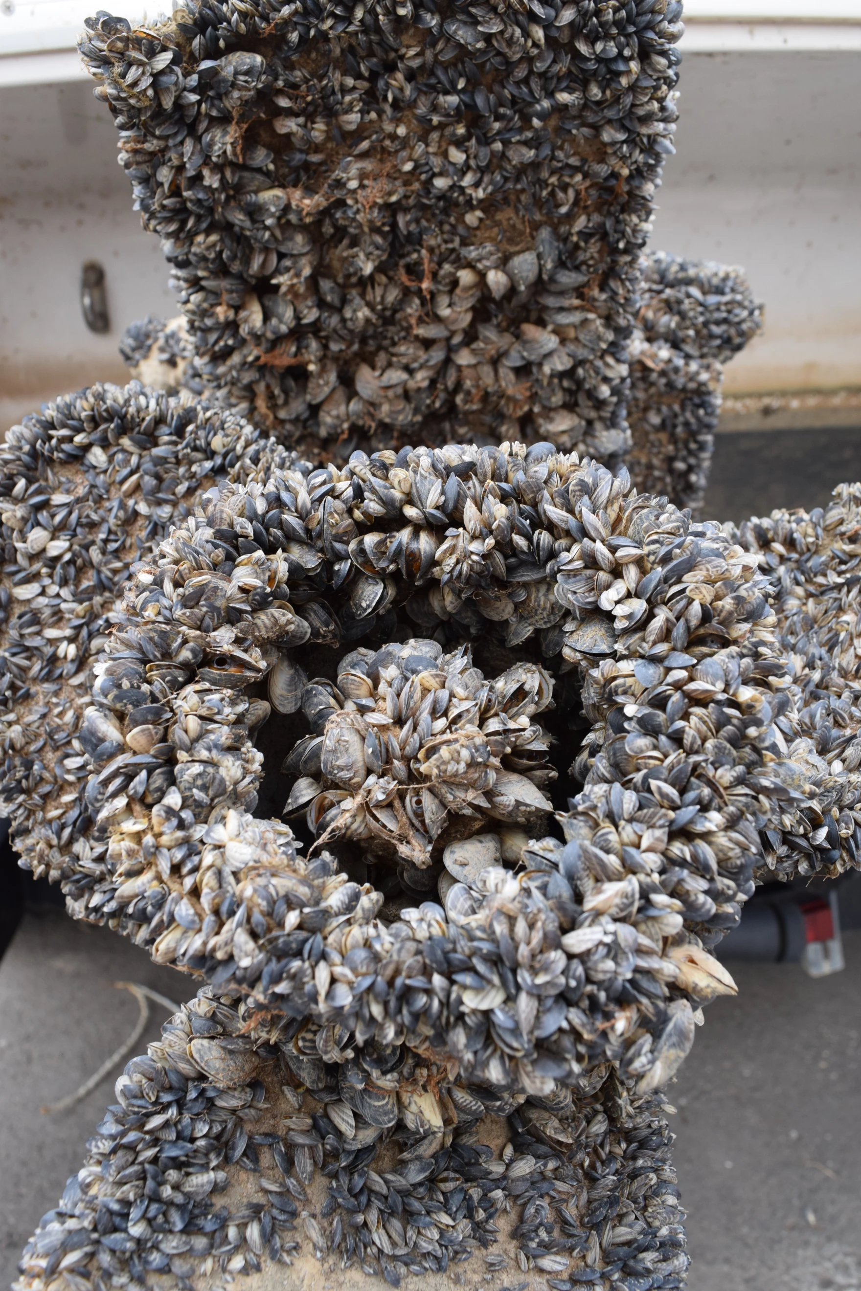
On Wednesday, May 1st, the Ruedi Reservoir boat ramp opened along with motorized watercraft inspection and decontamination for aquatic nuisance species such as the quagga and zebra mussels. On the second day of the season, two boats were found to be infested with mussels as opposed to only three boats for the entirety of the 2023 season. Most of the infected boats are coming from Lake Powell, which is ridden with quagga mussels. Due to the increasing threat they pose, Reudi Reservoir has a mandatory inspection and decontamination protocol in place for entry and departure in compliance with state regulations. The inspection station is operated by CPW from daylight to dark through October.
Lincoln Creek flows into Grizzly Reservoir and is a source of drinking water for Colorado Springs. Experts say mineral concentrations are increasing in streams across Colorado due to climate change. CREDIT: HEATHER SACKETT/ASPEN JOURNALISM
Colorado’s mountains are pockmarked with orange tailings piles, adits, tunnels and rusted tramways, the remnants of a historic mining industry often blamed for fouling the state’s waterways.
But a recent study points the finger at a different culprit as the cause of increasing metals concentrations in Colorado’s high mountain streams: climate change. And these findings have implications for local ecosystems and the water supplies of mountain communities.
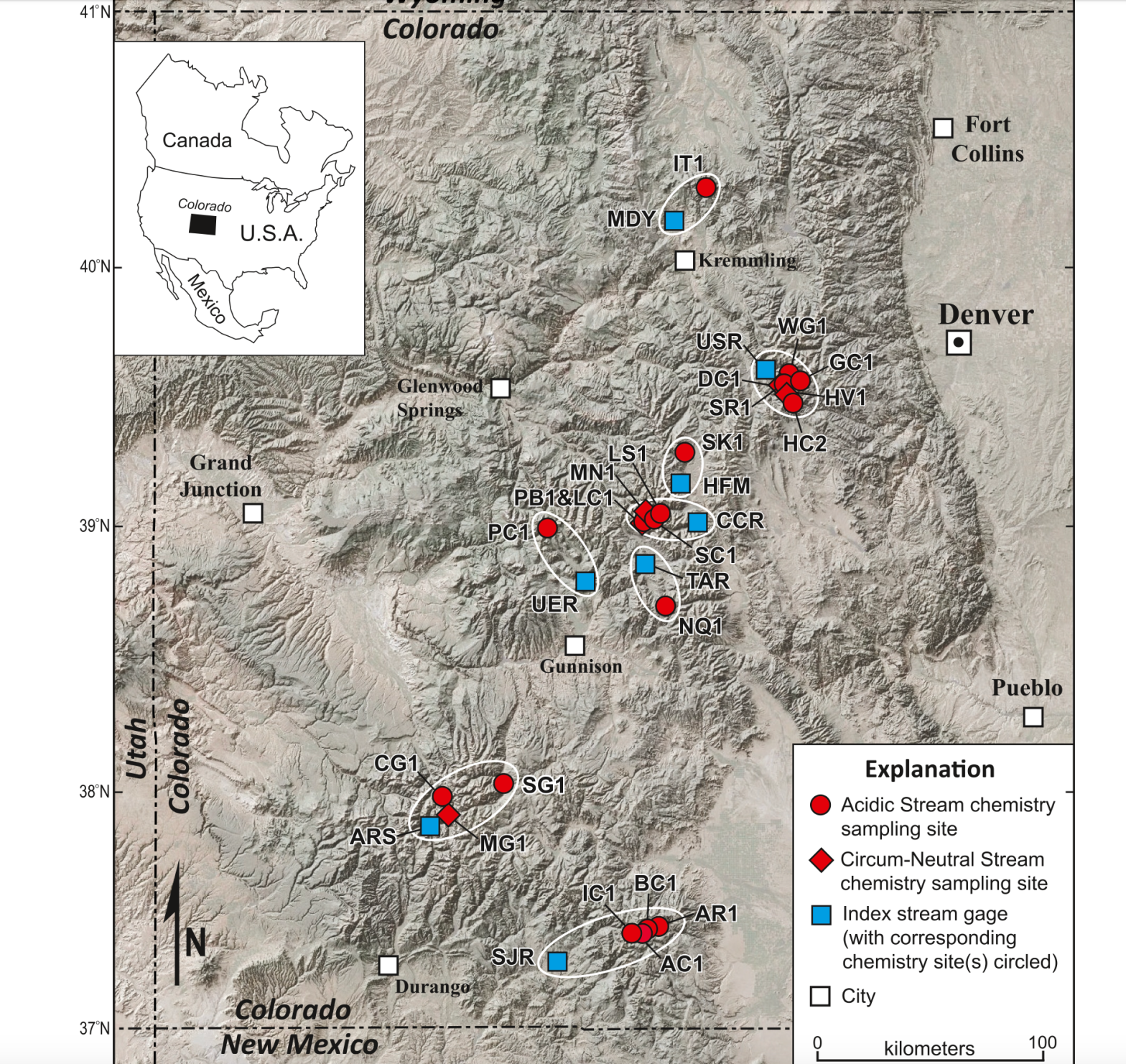
Scientists from the U.S. Geological Survey and the University of Colorado Boulder analyzed water chemistry data over the past 40 years for 22 stream sites throughout Colorado’s mountains. They found that concentrations of zinc and copper have doubled over the past 30 years, with melting of previously frozen ground being a likely major cause.
“These trends are concerning because, even at low concentrations, dissolved metals can negatively affect downstream ecosystem health and the quality of water resources,” reads the paper, which was published in Water Resources Research in late April.
Tanya Petach, a climate scientist at the Aspen Global Change Institute, worked on the study. She said the trend of increasing metals concentrations is relatively steep and widespread across Colorado’s mountains.
“There’s this theory that those increases in metal concentrations in these streams are really driven by a climate change signal,” Petach said. “We are really used to tying increases in metals to mining activities, but in this case, we’re only seeing a climate response.”
The process that causes metals leaching into streams can be both naturally occurring and caused by mining activities. In both cases, sulfide minerals in rock come in contact with oxygen and water, producing sulfuric acid. The acid can then leach the metals out of the rock and into a stream, a process known as acid rock drainage. As temperatures warm, rock that has long been encased in ice becomes exposed to weathering.
“These high-elevation streams, some of them have mean annual air temperatures right around freezing,” Petach said. “So you go from having permafrost to melting that permafrost. Once you lose the ice, you’ve created a phenomenal conduit for new water and oxygen to come into contact with sulfide minerals that have been blocked for centuries, if not millennia.”
Diane McKnight, an environmental engineering professor at CU Boulder’s Institute of Arctic and Alpine Research, has been measuring the pH levels of the upper Snake River in Summit County for decades. On a recent trip with students, a stream that usually had a pH level of about 4 measured 2.75, meaning the acidity had greatly increased.
“I said: Wait, the probe must be wrong, the probe must be broken,” McKnight said. “Guess what, the probe was not broken. … The public should be aware the world is changing and there are surprises.” [ed. emphasis mine]
The study says declining streamflows are also contributing to increasing metals concentrations, but not as much as the increase in acid rock drainage caused by climate change.
This map shows 22 stream sites throughout Colorado’s mountains where scientists from the U.S. Geological Survey and the University of Colorado Boulder analyzed water chemistry data over the past 40 years.
Lincoln Creek similarities
These findings on the Snake River and other sites in Colorado are important for the members of a workgroup trying to figure out how to address increasing metals concentrations in Lincoln Creek above Aspen. Although Lincoln Creek wasn’t one of the sites included in the study, the conditions in Lincoln Creek mirror many of the headwaters study sites.
“Lincoln Creek is very intriguing because it matches a similar pattern,” Petach said. “The Lincoln Creek system seems fairly similar to a lot of these other high-elevation headwaters catchments where this occurs.”
Water quality issues in Lincoln Creek have been a concern for years and have been getting worse. A November report by the U.S. Environmental Protection Agency showed that metals concentrations in Lincoln Creek are high enough to be toxic to fish and aquatic life. The creek above Grizzly Reservoir exceeds state water quality standards for aluminum, cadmium, copper, iron, lead, manganese and zinc, and aluminum and copper concentrations were higher than standards set by the Colorado Department of Public Health and Environment (CDPHE) in multiple locations.
The report found that the vast majority of the contamination was coming from a “mineralized tributary” to Lincoln Creek and not from the nearby Ruby Mine, where prospectors in the early 1900s dug for gold, silver and lead.
A workgroup dedicated to Lincoln Creek and composed of officials from state, local and federal agencies, nonprofit environmental groups and others has been meeting often since the EPA report was released. Since the EPA is authorized to address elevated metals concentrations only from human-caused activities like mining, it’s unclear how the contamination would be cleaned up or what agency is responsible for it.
But the workgroup is making headway on the issue, said member Karin Teague, executive director of the nonprofit environmental group Independence Pass Foundation.
“It could be a model for how a community might respond to contamination in its watershed,” Teague said. “We are really getting our arms around the problem, the extent of it, the nature of it, and then, of course, the million-dollar question being: What, if anything, can be done about it?”
Pitkin County Environmental Health Manager Kurt Dahl and Pitkin County Healthy Rivers Administrator Lisa Tasker gave an update on the group’s progress to county commissioners at a work session Tuesday. There are plans for four different water quality projects this summer: the U.S. Forest Service plans to collect water quantity and flow data; Colorado Parks and Wildlife will monitor metals concentrations in Lincoln Creek and the Roaring Fork River; the Roaring Fork Conservancy will take samples below Grizzly Reservoir to look for impacts related to a Grizzly Dam rehabilitation project; and scientists and students from CU’s INSTAAR program will look for rare earth metals in the water, sediment and bugs of Lincoln Creek. Pitkin County has approved grants for three of the four projects so far.
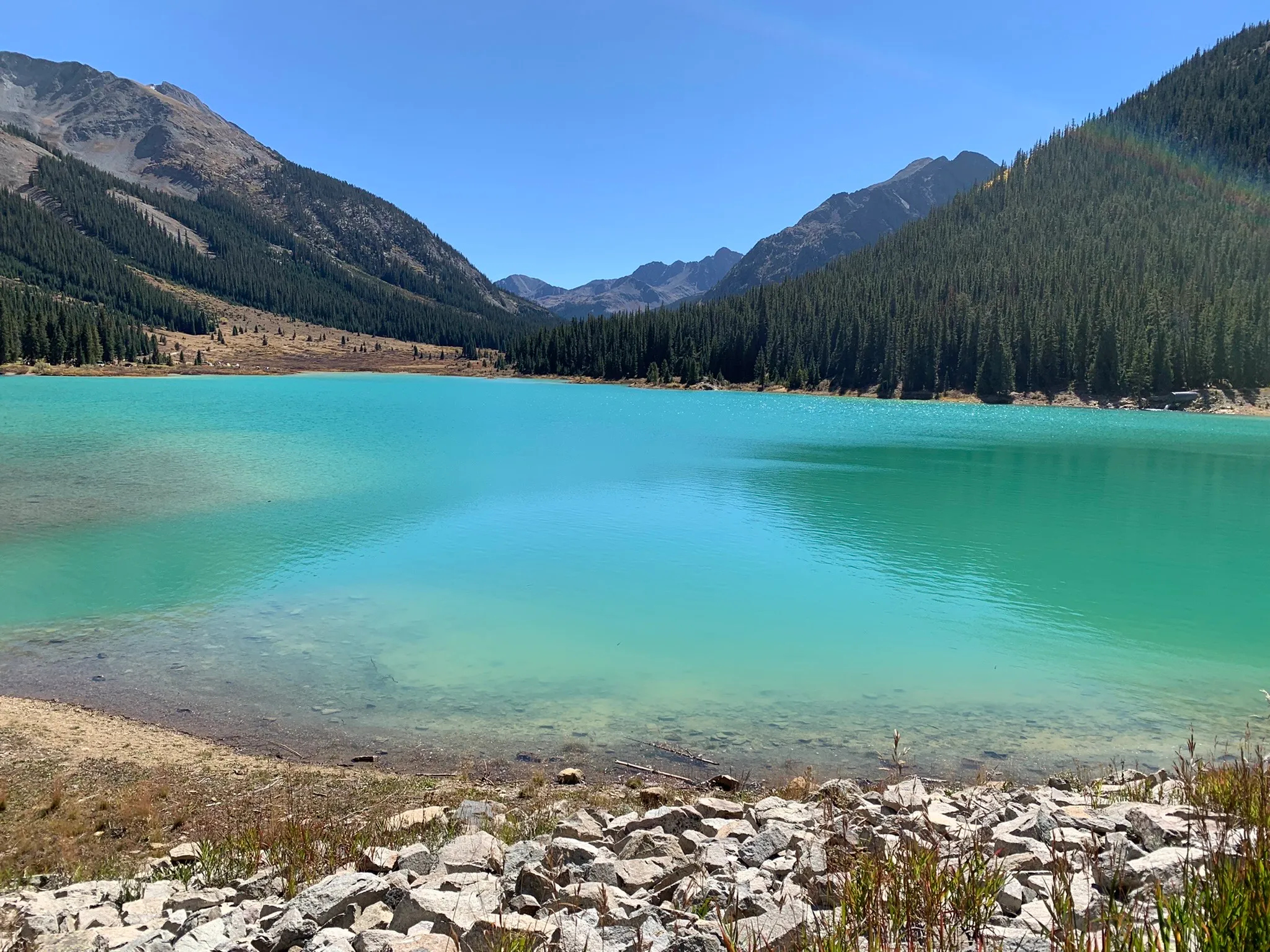
Grizzly Reservoir was a bright shade of turquoise in September 2022. The man-made alpine lake has high concentrations of metals that are toxic to fish, according to a report from the Environmental Protection Agency.
CREDIT: HEATHER SACKETT/ASPEN JOURNALISM
What about the water supply?
Lincoln Creek is one of seven streams in the Roaring Fork basin’s headwaters that feed the Twin Lakes Reservoir and Canal Co.’s Independence Pass transmountain diversion system, which provides drinking water sources for Front Ranges cities, including Colorado Springs, which owns a majority of the system’s water. Grizzly Reservoir, on Lincoln Creek below the contamination source, is used as a collection pool for water collected from the creeks, which is sent through the Twin Lakes Tunnel to the Arkansas River basin and eventually to the Front Range. The Snake River system where McKnight has conducted research flows into Dillon Reservoir, Denver Water’s biggest storage bucket.
A map of the Independence Pass Transmountain Diversion System, as submitted to Div. 5 Water Court by Twin Lakes Reservoir and Canal Co.
The EPA report said that in the case of Lincoln Creek, the dilution, the distance the water travels and the water-treatment process limit the impacts to drinking water. But since the issue is widespread across Colorado’s mountains, communities that get their drinking water from high-elevation streams could be impacted.
“These metal concentrations tend to be diluted when the small tributaries confluence with larger, cleaner streams, so we don’t tend to think of these as being a huge problem for large municipal water supplies,” Petach said. “But the place where it could impact the drinking water supply is in high-elevation mountain communities that are receiving waters from smaller tributaries.”
The city of Aspen gets the majority of its drinking water from Castle Creek, a mountainous tributary of the Roaring Fork River. Aspen’s Utilities Resource Manager Steve Hunter said that source water protection is a key concern for the city.
“After talking with our water treatment staff, they are not seeing a rise in these metals at the treatment plant and all treated water meets or exceeds CDPHE/EPA requirements,” Hunter said in a prepared statement. He added that the city has not done source water sampling for these compounds in either Castle or Maroon Creek watersheds as CDPHE/EPA does not require testing Aspen’s source water for these compounds.
Ruedi Reservoir on the Fryingpan River as seen on March 24. The reservoir is at its lowest level in nearly two decades, but U.S. Bureau of Reclamation officials say if forecasts hold, it should still be able to fill in 2022. CREDIT: HEATHER SACKETT/ASPEN JOURNALISM
Ruedi Reservoir is expected to hit full capacity for only the second time in five years, according to projections shared by reservoir managers. The managers don’t know exactly when the reservoir will hit capacity, though Tim Miller, hydrologist for the Bureau of Reclamation — the federal agency that operates Ruedi Dam — said it will likely stay full through July. Miller said calls for Ruedi water farther down the Colorado River could change that timeline. Ruedi is currently 68.8% full.
Ruedi did not reach its full capacity for three years between 2020 and 2022. Low runoff kept the reservoir from filling in 2020, and then overshoots in inflow projections and dry soils caused the reservoir to miss its capacity again in 2021. Reservoir levels then dropped to a 20-year nadir in March 2022 and never quite reached full capacity during a rebound that summer. Those three years were the only multiyear stretch in which Ruedi failed to fill in the last 10 years. Reservoir levels also fell short in 2018. Ruedi ended its dry streak after a wet winter in 2023, with Miller reporting in August that last year was almost flawless for reservoir operations.
This year, Miller said snowpack and runoff projections look similar to 2023. Water supply forecasts from the National Oceanic and Atmospheric Administration’s Colorado Basin River Forecast Center project a total Fryingpan River April-July runoff volume at Ruedi roughly 10% higher than projections from the same time in 2023 (this year’s May 1 projection is 135,000 acre feet). Miller said the Ruedi may receive even greater flows than expected this year because of operational issues at a connected facility on the eastern slope. Miller said water managers may have to leave more water in the Fryingpan River this year than usual if Turquoise Lake, an eastern slope reservoir that receives Fryingpan water through a tunnel under the continental divide, fills up. Miller said Turquoise’s outflow will be limited this year because both pump/turbine units at the Mount Elbert pumped-storage powerplant, which constitutes one outlet for the reservoir, are not operating this summer.
Ruedi Reservoir is expected to hit full capacity for only the second time in five years, according to projections shared by reservoir managers. The managers don’t know exactly when the reservoir will hit capacity, though Tim Miller, hydrologist for the Bureau of Reclamation — the federal agency that operates Ruedi Dam — said it will likely stay full through July. Miller said calls for Ruedi water farther down the Colorado River could change that timeline. Ruedi is currently 68.8% full.
Ruedi did not reach its full capacity for three years between 2020 and 2022. Low runoff kept the reservoir from filling in 2020, and then overshoots in inflow projections and dry soils caused the reservoir to miss its capacity again in 2021. Reservoir levels then dropped to a 20-year nadir in March 2022 and never quite reached full capacity during a rebound that summer. Those three years were the only multiyear stretch in which Ruedi failed to fill in the last 10 years. Reservoir levels also fell short in 2018.
Ruedi ended its dry streak after a wet winter in 2023, with Miller reporting in August that last year was almost flawless for reservoir operations. This year, Miller said snowpack and runoff projections look similar to 2023. Water supply forecasts from the National Oceanic and Atmospheric Administration’s Colorado Basin River Forecast Center project a total Fryingpan River April-July runoff volume at Ruedi roughly 10% higher than projections from the same time in 2023 (this year’s May 1 projection is 135,000 acre feet).
Miller said the Ruedi may receive even greater flows than expected this year because of operational issues at a connected facility on the eastern slope. Miller said water managers may have to leave more water in the Fryingpan River this year than usual if Turquoise Lake, an eastern slope reservoir that receives Fryingpan water through a tunnel under the continental divide, fills up. Miller said Turquoise’s outflow will be limited this year because both pump/turbine units at the Mount Elbert pumped-storage powerplant, which constitutes one outlet for the reservoir, are not operating this summer.
A report from an airborne survey conducted on April 9 shows that snowpack in the upper reaches of both rivers is warmer and smaller than last year. The survey was conducted by Boulder-based Airborne Snow Observatories, a private company operating through contracts with local governments. The survey area includes the headwaters of the Roaring Fork from the Continental Divide to just above Aspen, as well as the Fryingpan River above Ruedi Reservoir, and the headwaters of Snowmass Creek, Maroon Creek, Castle Creek, Hunter Creek and Woody Creek…
Jeff Deems, a Carbondale resident and chief technical officer for hardware at ASO, said the “cold content” of the snow — a measurement of how much energy is required to melt snow — measured on the day of the survey indicates that much of the watershed’s snowpack is already melting or on the verge of melting. According to a report from ASO’s survey, the amount of snow in the basin below freezing, or “unripe,” is roughly 10 percentage points lower than last year around the same time. It currently stands at about 26% of the overall snowpack. The rest of that snow is right at, or approaching, its melting point.
“I think we’re seeing a fairly warm snowpack this year,” Deems said. “I dug a snow pit on April 9, when the plane was in the air, at 11,000 feet on Richmond Ridge. And most of the snowpack was isothermal — so that is at zero degrees Celsius, at the melting point. There was a very minimal layer in the middle that was a few degrees below freezing.”
The total amount of water in this year’s snowpack is smaller than last year. The snow water equivalent, or SWE, in the survey area this year was about 520,000 acre-feet on April 9, a roughly 12% drop from the same number taken at the same time last year (the 2023 survey occurred April 11-12). Deems said the SWE observed in the April 9 flight indicates that this year’s snowpack is smaller than previously thought. Snow telemetry (SNOTEL) sites around the basin show similar snowpack conditions from last year, while the ASO survey shows a clear drop in SWE. Deems said he thinks the disparity is a result of changing snow distribution patterns, which the SNOTEL sites cannot measure with detail because they are tied to a fixed location.
This map shows the snowpack depth of the Maroon Bells in spring 2019. The map was created with information from NASA’s Airborne Snow Observatory, which will help water managers make more accurate streamflow predictions. Jeffrey Deems/ASO, National Snow and Ice Data Center
The snowpack for the Aspen-area mountains was about 46% below the 30-year median after a dry November and was about 35% below in December, according to Sam Collentine, a Basalt-based chief operating officer and meteorologist for OpenSnow.com. Conditions improved slightly in January when the snowpack ended up 3% above the 30-year median for the month, despite a dry stretch for a good share of the month. Conditions finally flipped in February, when the snowpack was 20% above median, and especially in March, which ended at plus 74%…The season started with a lot of promise with two big snowstorms in October that established an impressive base. But, as is typical for Colorado, conditions dried out in November and into December…
Snowmass collected 94.6 inches of snow in March, or 172% of normal. Aspen Mountain recorded just shy of 86 inches or 175% of normal, according to Aspen Weather…OpenSnow’s Collentine took a look for snowfall at the Aspen-Snowmass ski areas for Oct. 1 into early April and found Aspen Highlands nosed out Snowmass with 312 inches to 310 inches. Highlands finished the season at 105% of the 30-year median while Snowmass was at 101%. Aspen Mountain recorded 257 inches or 107% of median while Buttermilk was at 161 inches and 106%…
As a whole, the Roaring Fork basin’s snowpack was at 115% of median on Tuesday. Collentine noted that conditions around Aspen were similar to those in the Upper Colorado River Basin and the state as a whole. The Upper Colorado Basin, which the Roaring Fork is part of, is at 106% of the 30-year median and the statewide snowpack is at 108%.
The Crystal River flows through the Gunnison County town of Marble, seen here with Beaver Lake. A representative from the Town of Marble is expected to participate in a subcommittee focused on an intergovernmental agreement to protect the river. CREDIT: ECOFLIGHT
After a year’s worth of work and meetings with a facilitator, a group focused on protecting the Crystal River is pursuing three potential ways forward.
The Crystal River Wild & Scenic and Other Alternatives Feasibility Collaborative Steering Committee recommends forming three subcommittees, each focused on continuing to evaluate a different method of river protection.
The first is an intergovernmental subcommittee composed of local governments that would develop an agreement that commits each of them to protecting the mainstem of the river against dams and trans-basin diversions. A “peaking” instream-flow subcommittee would look at protecting river flows during times of peak runoff and against diversions. A third subcommittee would move forward with writing a draft proposal for a federal Wild & Scenic designation that has the flexibility to address local landowner needs and that supporters say is still the strongest option for river protection.
Some Crystal Valley residents, along with Pitkin County, have pushed for a Wild & Scenic designation for years to protect the free-flowing nature of the river. But others, wary of any federal involvement, have balked at the idea, instead proposing different types of protections.
The steering committee was convened last year to explore different options, including Wild & Scenic, for river protections. As part of this work, they also held two community summits, which each drew more than 120 members of the public, as part of a process to get stakeholder input.
Marble resident Wendy Boland will be on the Wild & Scenic subcommittee. She said that the majority of residents are in favor of a federal designation, but that the subcommittee will have to address some people’s lingering concerns about private property and make sure those concerns are respected.
“Wild & Scenic is constantly being called the gold standard of river protection,” Boland said. “And the fact that it can be tailored to meet a local community’s needs and concerns is a big plus. So that’s really the goal of the subcommittee I’m on. We’ve listened to everybody’s concerns; can we draft legislation that would meet all those concerns?”
The Crystal flows from its headwaters in the Maroon Bells-Snowmass Wilderness through the towns of Marble, Redstone and Carbondale before its confluence with the Roaring Fork and is one Colorado’s last undammed major rivers.
The U.S. Forest Service determined in the 1980s that portions of the Crystal River were eligible for designation under the Wild & Scenic River Act, which seeks to preserve, in a free-flowing condition, rivers with outstandingly remarkable scenic, recreational, geologic, fish and wildlife, historic, and cultural values. Wild & Scenic experts say the “teeth” of the designation comes from an outright prohibition on federal funding or licensing of any new Federal Energy Regulatory Commission-permitted dam. A designation would also require review of federally assisted water resource projects.
Any designation would take place upstream from the big agricultural diversions on the lower portion of the river near Carbondale.
Jennifer Back, a retired National Park Service employee and former member of the Interagency Wild and Scenic Rivers Coordinating Council talks with Crystal River valley resident Larry Darien at a community summit on the Crystal River in April 2023. Three subcommittees will move forward with exploring options for protecting the river. CREDIT: HEATHER SACKETT/ASPEN JOURNALISM
‘Peaking’ instream flows
A second subcommittee will look at a tool that could be used to protect peak flows through the Colorado Water Conservation Board’s instream-flow program. The CWCB is the only entity allowed to hold water rights that keep water in rivers and are designed to preserve the natural environment to a reasonable degree. A “peaking” instream-flow water right would keep in the stream all of the water not claimed by someone else (also called “all of the unappropriated flow”) during certain times of the year.
So far, this particular tool is little-used, but there are three recent examples in the Gunnison River basin on Cottonwood Creek, Monitor Creek and Potter Creek. These three water rights were filed for in July and are still making their way through water court. No entities have filed statements of opposition. All three still allow for some amount of future water development.
The way that instream-flow water rights work is that another entity, usually a land use agency such as the U.S. Bureau of Land Management or a wildlife agency such as Colorado Parks and Wildlife will make a recommendation to the CWCB for a particular amount on a particular stream. Roy Smith, a water rights and Wild & Scenic Rivers specialist at the BLM, worked on the recent peaking instream-flow water rights in the Gunnison basin. He said in those cases, a peak instream flow was needed to protect the cottonwood trees because they need high flood waters that slowly recede to germinate seeds.
“Basically, what it means is every drop of water that has not been spoken for by any previously claimed water right is spoken for by this instream flow,” Smith said. “What we decided was let’s propose a water right where when the stream reaches bank full, a water right will be triggered that protects all the flow from that flow rate and above until the flood event is over.”
But the “outstandingly remarkable values” that Wild & Scenic seeks to protect and the special riparian ecosystems that peak instream flows are designed to protect may not align in the case of the Crystal River.
“A lot of the values that the Forest Service identified for potential Wild & Scenic designation are values like recreation and scenic and those are little bit harder to fit into the state’s instream flow program because that focuses on water-dependent ecology like bugs and fish and riparian habitat,” Smith said. “So there’s still a question as to whether those values on the Crystal can fit into this type of approach. The stakeholder group is going to have to figure that out.”
The intergovernmental agreement subcommittee will focus on developing a draft agreement to memorialize a commitment to protecting the Crystal against mainstem dams and trans-basin diversions. It will include representatives from the town of Marble, Gunnison County, Pitkin County and the Colorado River Water Conservation District. The River District is no stranger to water sharing agreements and has helped craft some of the most important ones in Colorado between Front Range and Western Slope water users.
Zane Kessler, the River District director of government relations, was a member of the steering committee and will serve on the intergovernmental agreement subcommittee. He said he was glad the group could find consensus on pursuing the three potential options for river protection.
“I think this should serve as an example of how local, county and regional governments on the Western Slope can work together to represent and protect the water interests of our shared constituents,” he said in a statement. “But the path forward is going to have to include communication and collaboration. It can’t be just one town, or county or district going it alone.”
Each of the three ways forward do not preclude any of the others being considered. The three subcommittees plan to provide monthly updates, and the entire steering committee will continue to meet every six months for the foreseeable future.
“Everybody loves the river, and they want to protect it,” Boland said. “The question is: Which ways can we make that best happen?”
Pitkin County supports Aspen Journalism with a grant from the Healthy Community Fund. Aspen Journalism is solely responsible for its editorial content.
The storms (Feb. 26-27 and Mar. 2-3) were western Colorado’s first major dust event this year. Windstorms carrying dust from the arid Four Corners region commonly hit the Colorado Rockies in spring, depositing dark layers in the local snowpack. The dust often causes snow to melt faster, meaning there is less water available in local rivers and streams by late summer and fall. Rafting companies and recreators have less time to play, and some farmers and ranchers must stop irrigating earlier. Snow researchers say the combined event was relatively large and may have hit the Roaring Fork watershed harder than other areas. The dust has been visible on Aspen ski mountains, including at the bottom of this year’s FIS Alpine World Cup course on Ajax…
Jeff Derry — executive director of the Silverton-based Center for Snow and Avalanche Studies — said the event was widespread, depositing dust in an area spanning from the San Juan Mountains near Telluride to Rabbit Ears Pass near Steamboat Springs. Andrew Temple, a field assistant at CSAS, said McClure Pass south of Carbondale received more dust than any other site he visited for snow observation this week, including Park Cone east of Crested Butte and Spring Creek Pass south of Lake City…
In April, a dust storm arrived just as local snowpack was hitting its peak, meaning it remained high in the snow layers and affected almost the entire runoff process. Even with last year’s wet, cloudy spring conditions, Deems estimates the dust cut a month off the spring runoff season.
South Platte River at Goodrich, Colorado, Sunday, November 15, 2020. Photo credit: Allen Best
From email from the Colorado Water Conservation Board (Katie Weeman):
March 13, 2024 (Denver, CO) – The Colorado Water Conservation Board (CWCB) approved 52 Water Plan Grant applications today, which will distribute $17.4 million to fund critical projects to manage and conserve water, improve agriculture, spark collaborative partnerships, and much more. This funding cycle, CWCB received a record 70 applications requesting $25.6 million—$8.2 million more than is currently available.
“Water is on the top of many Coloradans’ minds. And the projects this program funds are critical to meet and mitigate our state’s most critical water challenges,” said Lauren Ris, CWCB Director. “We received significantly more applications than we had funding for this cycle of Water Plan Grants, showing just how much demand there is for this important funding, and how critical it is that we continue to fuel this effort.”
Every year, the Water Plan Grant Program provides millions of dollars of funding for projects in five key categories: Water Storage & Supply, Conservation & Land Use, Engagement & Innovation, Agricultural Projects, and Watershed Health & Recreation. Water Plan Grants support the Colorado Water Plan, and funded projects are wide-ranging and impactful to the state, focusing on enhancing water infrastructure, restoring ecosystems, supporting education and community collaboration, boosting water conservation and efficiency, guiding resilient land use planning, and more.
During this fiscal year, the CWCB awarded 83 grants totaling $25.2 million. CWCB’s Water Plan Grants run on two application cycles: the December application deadline receives final Board approval during the March Board Meeting, and the July deadline receives votes in September. On March 13, 2024, the Board voted to approve December’s 34-project cohort.
This cycle’s project applications are diverse in scope and location. A few examples include:
South Platte River Basin Salinity Study (Agricultural, $464,361): Colorado State University will conduct a comprehensive study on salinization across seven regions in the South Platte River Basin, to understand the severity and variability of salinity in water and land resources.
Denver One Water Plan Implementation Phase 2 (Conservation & Land Use, $200,000): Mile High Flood District will continue Phase 2 of Denver’s One Water Plan, which promotes coordination and collaboration among various city departments, organizations, and agencies in charge of managing all aspects of the urban water cycle.
Watershed PenPal Program (Engagement & Innovation, $136,947): Roaring Fork Conservancy will connect communities across the Roaring Fork Valley and Front Range, fostering understanding of water challenges through discussion, letter writing, and shared experiences.
Park Creek Reservoir Expansion (Water Storage & Supply, $1,750,000): The North Poudre Irrigation Company will expand the Park Creek Reservoir, increasing water storage capacity by 3,010 acre-feet to benefit agricultural use and water management.
South Boulder Creek Watershed Restoration Phase 3 (Watershed Health & Recreation, $1,000,000): Colorado Trout Unlimited will build upon previous phases of this project to support final design and permitting for multiple in-stream diversion structures in South Boulder Creek in Boulder, Colorado.
Looking forward, the CWCB hopes to continue and advance the Water Plan Grant program for decades to come. Projects funded and supported through this program address water-related challenges by harnessing the latest research, tapping into community engagement, and developing innovative solutions that allow water partners, agencies, and Coloradans to work together.
The Crystal River flows past a stream gauge at the fish hatchery just south of Carbondale. This location has nearly dried up in late summer in recent years due to drought, climate change and senior water users’ upstream diversions. CREDIT: HEATHER SACKETT/ASPEN JOURNALISM
In 2012, one of the driest years in Colorado in recent memory, the Crystal River practically dried up.
Ken Neubecker, a now-retired Colorado projects director at environmental group American Rivers and former member of the Pitkin County Healthy Rivers board, recalls the stream conditions.
“I took a photo on the Thompson Road bridge, and it was running about 1 cubic foot per second, if that,” he said. “It was mostly dry rocks with some puddles in between.” (One cfs, which is equivalent to the amount of water to fill one basketball, is a common way to measure the flow of water.)
These extremely low-water conditions returned in the drought years of 2018, 2020 and 2021, with river flows near the fish hatchery just south of Carbondale hovering around 8 to 10 cfs — not enough to support aquatic life and nowhere near the 100 cfs that the state of Colorado says is the minimum needed to maintain a healthy stream.
Beginning high in the Elk Mountains, the Crystal River flows 40 miles through a canyon under the flanks of Mount Sopris and winds past the towns of Marble, Redstone and Carbondale before joining with the Roaring Fork River, a major tributary to the Colorado River. Along the way, its waters turn mesa hayfields, acres of alfalfa, and town parks and lawns a verdant green.
A historic drought driven by climate change and temperatures that creep ever higher are partly to blame. But the factors that lead to a dry river bed are many and include unique geology, ill-defined legal concepts, misunderstandings about the value of water, inefficient irrigation systems and vague state guidelines regarding waste that seem to be enforced only under specific circumstances.
These barriers to conservation are widespread across western Colorado. The Crystal River is one place where these complex issues converge, resulting in a chronic dry-up of stream sections in late summer most years. To Neubecker, the cause is water users taking more than they need and not leaving enough for downstream users — especially when the “user” is the river ecosystem itself.
“It just dries up a stretch of river and disconnects the upper part of the river from the lower part,” he said. “You have to be a good neighbor, and that concept has been totally thrown by the wayside.”
The Crystal is not unique. Rivers throughout the West face increasing pressure from chronic overuse, warming temperatures and prolonged dry spells. Persistent dry-ups that span weeks or months are a familiar feature of many so-called “working rivers” that supply water to the West’s sprawling farmlands and growing cities.
As scarcity has gripped the states that make up the headwaters of the Colorado River, a new level of scrutiny has fallen on water uses once considered insignificant, even small hayfields or grassy front yards. Communities throughout the West are now under pressure to justify their use of any amount, and make a case for continuing to do things the way they’ve always been done.
To better understand these issues plaguing the Crystal, Aspen Journalism examined the river’s biggest users to create the most complete picture possible of how water is used, why dry conditions persist and what can be done about it. We created a detailed analysis using publicly available information; state-of-the-art, satellite-based measurements; interviews with experts; and, where possible, site visits and ditch tours.
Understanding exactly how the West’s water is used — and perhaps where opportunities for efficiency improvements exist — will only become more crucial in a hotter, drier future with increasing scarcity across the Colorado River basin.
Crystal River Ditches. Credit: Laurine Lassalle/Aspen Journalism
Low ditch efficiencies
According to Aspen Journalism’s analysis, some of the Crystal’s biggest diverters have very low ditch efficiencies, meaning that the crops they grow are using just a small fraction of what they take from the river.
The low efficiencies pose the question: Does the small amount of water that is actually used by the crops justify the large amounts diverted from the Crystal, to the detriment of its ecosystem?
Of the 42 active ditches on the Crystal according to the Colorado Division of Water Resources (DWR) database, Aspen Journalism examined the top eight: those with the biggest and oldest water rights, the majority of which date to the 1880s. The analysis compared how much they were taking out of the stream based on diversion records maintained by DWR and how much water was absorbed by crops. Known as evapotranspiration, this is tracked by satellites through a publicly available platform called OpenET. Evapotranspiration is a measure of the amount of water used by crops, also called consumptive use.
Aspen Journalism’s analysis shows that Crystal River ditches that irrigate primarily agricultural land — the East Mesa, Lowline and Ella — have an average efficiency of between about 12% and 14%. That means the crops that are irrigated by these ditches use 12% to 14% of the water the ditch diverts. An outlier is the Sweet Jessup Canal, which irrigates Crystal River Ranch and whose crops use nearly 30% of the water it diverts, according to our analysis. Much of this ditch is lined or piped, making it more efficient.
For ditches that are used primarily for outdoor watering of residential lawns, gardens, ballfields and parks — ditches such as the Carbondale Ditch, the Weaver & Leonhardy, Bowles & Holland, and the Rockford, the latter of which also irrigates some agricultural land — our analysis showed lower efficiencies, ranging from less than 1% to about 9%. However, that analysis likely represents an undercount of the amount of water consumed on smaller parcels.
OpenET is becoming a widely used tool by water managers, including by the Upper Colorado River Commission, to calculate the water savings on individual fields that participate in its 2023 and 2024 System Conservation Program. Still, this technology has limitations. For example, the satellites work best on parcels that are at least .22 acres, so consumptive use tied to many residential lawns and gardens that are irrigated with water from these ditches is probably not included in these calculations. There is also no way to account for the amount of water a crop uses that comes from precipitation. Including that figure would result in lower ditch-efficiency percentages. For a complete explanation of how Aspen Journalism got these numbers, including all the caveats and limitations of the data, see our methodology breakdown.
The two ditches owned and operated by the town of Carbondale — the Carbondale Ditch and the Weaver Ditch — appear to be using a particularly small percentage of the overall water they take from the river. These ditches weave through the front yards, parks and alleyways of Carbondale, contributing to the charming, small-town feel and adding a riparian ribbon of green to an arid landscape. In general, these ditches that are used by residents to water their lawns and gardens have less-consumptive use than ditches that are all or nearly all agricultural use. However, since the OpenET does not pick up small lawns and gardens, it’s hard to know exactly how much water is being consumed from these ditches.
Kevin Schorzman, public works director for the town of Carbondale, said the town does not track ditch efficiencies, consumptive use or the number of homes that use ditch water for their lawns. He said the town has undertaken several projects over the past few years that should lead to improved efficiency in the ditch system, including lining portions of the Carbondale and Weaver ditches with concrete as well as piping sections of both ditches.
Officials have pointed to a river restoration project, which includes headgate modernization and automation on the Weaver Ditch as having benefits for the environment. But Schorzman said the project may or may not impact diversions from the river.
Colorado Division of Water Resources Division 5 and District 38. Credit: Laurine Lassalle/Aspen Journalism
Inefficiencies widespread
James Heath, DWR engineer for Division 5, agreed that Aspen Journalism’s ditch-efficiency numbers, while low, looked pretty reasonable. Additionally, a 2015 consumptive-use analysis of the Colorado River basin by Wilson Water Group put the overall system efficiency for the area that includes the Crystal’s watershed at 10%, which is in line with Aspen Journalism’s findings.
Very low ditch efficiencies seem to be common throughout Division 5, which contains the headwaters of the Colorado River. The 2015 Wilson Water Group study showed efficiencies in sub-basins ranged from 10% to 31%. Two other mountainous headwaters — the Blue River and Eagle River basins — had efficiencies of 14% and 16%, respectively.
Eric Kuhn, a Colorado River expert, author and former general manager of the Glenwood Springs-based Colorado River Water Conservation District, said the Crystal’s ditch efficiencies are in line with other places in western Colorado. He said irrigators in some basins are diverting 10 to 12 acre-feet for every acre-foot that their crops end up using.
“Those are the numbers we kind of got used to when people looked into them in detail,” Kuhn said.
It is common knowledge that ditches must take more water than only what is needed by crops, as pointed out by Joe White, director of finance at Colorado Rocky Mountain School. The private boarding school is the largest shareholder on the Rockford Ditch, which diverts from the Crystal.
“I don’t think that should surprise anyone,” White said. “Diversions are never going to equal consumptive use. Everyone knows it takes more diversion than consumptive use to deliver water to where it needs to be applied.”
White said Aspen Journalism’s numbers sound too low, but he did not provide his own consumptive-use numbers for the Rockford Ditch. White added that the Rockford needs to be kept full so that the lawn-watering irrigation pumps in the nearby neighborhood of Satank function properly.
“It’s challenging to regulate it as efficiently as we would like to,” he said.
Because the Crystal is not the only overtaxed stream in Colorado dealing with these issues, cities across the state are attempting to deal with water scarcity. That can be through strict conservation measures and, in particular, wringing water from nonfunctional, ornamental grass by banning its planting and incentivizing its removal.
But so far, widespread mandatory conservation measures — cracking down on waste and implementing efficiency standards — have not been aimed at agriculture, which is by far the biggest water-use sector and potentially has some of the lowest-hanging fruit to find water savings through irrigation improvements.
This parcel of land on Prince Creek Road is owned by Bailey Family Investment Company and is watered with Crystal River water via the Ella Ditch. The sprinkler gun system was installed in recent years. CREDIT: HEATHER SACKETT/ASPEN JOURNALISM
Reasons for low efficiencies
There could be several reasons why ditch efficiencies on the Crystal are low. The most basic is that flood irrigation is less efficient than sprinklers. About 58% of agricultural lands on the top eight ditches are flood irrigated, according to data from the state DWR. Many ditches were also built in the late 19th century and are not lined or piped, meaning that some of the diverted water is lost to leakage.
Some of the diverted water is lost to thin, rocky soils that water percolates through quickly. Irrigators often need to divert extra water, known as “push water,” to ensure that there’s enough pressure to get the water all the way to land at the end of the ditch, which is sometimes miles from the point of diversion. These transit losses are not considered part of consumptive use and are not measured by OpenET.
There is some evidence that soils in the area are especially rocky — the Crystal River was originally named Rock Creek — which may be contributing to low efficiency, allowing water to seep through the bottom and sides of ditches before reaching a farm field.
Heath, the division engineer, also found evidence of this from drill logs for water wells in the area.
“They are running into some pretty coarse materials at shallow depths that would cause a lot more ditch loss, a lot more deep percolation, which would increase the losses and cause the overall system efficiencies to go down,” Heath said. “So, I think it’s pretty reasonable, the numbers you’re coming up with.”
Much of the diverted water that the crops don’t use eventually seeps back to the river over days, weeks or months, a phenomenon known as “return flows.” If the Crystal River Valley’s geology really is as porous as evidence suggests, return flows probably make it back to the river quickly, without much being stored for late-season returns.
The problem with return flows is that they do not go back into the river at the same spot they are taken out and have a delayed return, contributing to seasonal dry-ups. And after percolating through the soil, return flows can be warm and laden with salt and other contaminants, impacting the river’s overall quality and the fish that depend on cold, clean water.
The Weaver Ditch, maintained by the Town of Carbondale, runs through downtown, turning parks and lawns green. A headgate modernization project may not result in less water diverted from the river, according to town officials. CREDIT: HEATHER SACKETT/ASPEN JOURNALISM
Is water being wasted?
Carbondale’s Schorzman said the town is adhering to state guidelines on waste and operating the ditch systems in a manner that is reasonably efficient. But pinpointing who might be wasting water in Colorado is difficult.
According to state guidelines on waste from 2017, which recently retired Colorado state engineer Kevin Rein said are still in effect, “a person shall not run through his or her ditch any greater quantity of water than is absolutely necessary for irrigation, domestic, and stock purposes to prevent the wasting and useless discharge and running away of water.”
The guidelines define waste as “diverting water when not needed for beneficial use, or running more water than is reasonably needed for application to beneficial use.” Beneficial use is defined as “the use of that amount of water that is reasonable and appropriate under reasonably efficient practices to accomplish without waste the purpose for which the appropriation is lawfully made.”
But “reasonably efficient” is not clearly defined. And how much more water ditches should take than what’s needed by crops is also unclear. Determining whether an irrigation practice is reasonable or wasteful is subjective.
Much like the famous Supreme Court test for obscenity, Rein said water commissioners have a good idea of what waste is when they see it. DWR has not done an efficiency analysis on the Crystal ditches, and Rein said he cannot identify a threshold for “reasonable” because every system is different.
“I don’t know whether it was intentional or not, but it’s important to our administration that it allows for judgment and for evaluation of myriad factors,” Rein said, referring to the subjective nature of the criteria.
The Rockford Ditch has the oldest water rights on the Crystal River. It irrigates some agricultural land as well as the lawns and gardens of the Colorado Rocky Mountain School and the Satank neighborhood of Carbondale. CREDIT: HEATHER SACKETT/ASPEN JOURNALISM
Divert it or lose it?
Another potential explanation for the low use numbers could be that some irrigators are overdiverting based on a misunderstanding of Colorado water law. The true value of a water right is tied to its historical consumptive use, which is how much water the crops use. However, there is an entrenched, incorrect belief that by maximizing the amount of water taken from a stream, one can increase the future value of a water right or protect it from abandonment. Many interpret Colorado’s famous “use it or lose it” doctrine as “divert it or lose it.”
“The reality of that is sometimes it can feel like you have something on paper and giving up something you have on paper feels like you’re losing something,” said Assistant Pitkin County Attorney Laura Makar.
According to a 2016 special report by DWR officials and experts at the Colorado Water Center at Colorado State University, “use it or lose it” is commonly seen as a barrier to implementing water-conservation measures and efficiency improvements.
Users are told to divert their whole amount, “in order to preserve the water right; that is, protect it from abandonment and/or lead to the maximum value of the water right in a water right change proceeding,” the report reads. “This conclusion is based on a misapplication of the law.”
In reality, there are two requirements for abandonment: A water right must sit dormant and unused for 10 years, and the owner must intend to abandon it. For the past 20 years, DWR has had a policy of not placing water rights that date to before the 1922 Colorado River Compact on the abandonment list, which is compiled every 10 years. This means pre-compact water rights (like many of those in the Crystal analysis) have an additional layer of protection from abandonment, even if they meet the two requirements.
Neubecker said taking more water than you can use violates one of the most sacred concepts at the heart of Colorado water law: the duty of water. The duty of water is the amount needed to grow a crop — not the maximum allowed by a decree — and varies depending on crop type and location.
“Technically, it is against the law to take more water than you actually need regardless of what your decree says,” Neubecker said. “It’s just that neither the lawyers nor the state engineer’s office are going to enforce it.”
The Bowles & Holland Ditch, named after two of Carbondale’s earliest white European settlers, used to grow crops like potatoes. Now it mostly irrigates the lawns and golf course of River Valley Ranch. CREDIT: HEATHER SACKETT/ASPEN JOURNALISM
Low efficiencies not a problem for state officials
DWR officials don’t have a problem with inefficient ditches as long as irrigators are not wasting water. Rein said that low efficiency doesn’t mean irrigation is being done improperly.
“I’m not aware that we have evidence of waste occurring on those systems,” Rein said.
There was, however, at least one documented instance of alleged water waste that occurred on the Crystal in recent years. In 2018, former water Commissioner Jake DeWolfe restricted how much water was flowing into the Lowine Ditch for taking more than it could put to beneficial use. Attorneys for one ditch user, Tom Bailey, complained in a letter to DWR, saying that the commissioner’s determination of waste was “ambiguous and erroneous,” and that the guidelines for waste are unlawful, claims that reflect the subjective nature of defining waste. DeWolfe declined to speak with Aspen Journalism for this story.
One of the ways water commissioners determine if waste is occurring is by looking at what is known as the “tail water,” which is where, after irrigating land, the ditch returns the water to the river. In 2018, DeWolfe said the large amount of tail water from the Lowline was an indication of waste.
The situation on the Crystal in 2018 is indicative of how state officials manage the river. The system is complaint-driven, meaning water commissioners will usually focus their efforts on streams where a water user has placed a call or where they have heard complaints of waste from water users. If a river is not on call, if no one is reporting their neighbors for taking too much or if there are no obvious indicators such as flooding, water commissioners probably won’t scrutinize ditches for waste. In most cases, tail water is not measured.
According to Heath, since 2018, no complaints about waste in the Crystal River basin have been received and waste has not been observed by water commissioners. Therefore, curtailment of structures within the Crystal River basin for waste issues has not occurred since 2018.
Heath said that as long as irrigators aren’t taking extra water to expand their historical irrigated acreage, his office doesn’t have an issue with low ditch efficiencies.
“As long as they continue to operate as they have historically operated, I don’t see that there is a problem with the diversions they are making,” he said. “They are operating their ditches and irrigating as they always have, and it just yields a low system efficiency.”
This section of the Lower Crystal River dried up during the late summer of 2012, a drought year. The dry stretches occurred again in 2018, 2020 and 2021, with the river hovering at around just 8 cfs. CREDIT: KEN NEUBECKER
When the river is harmed
In Colorado, inefficient or wasteful practices are only considered such if they deprive another senior user of water.
But what if the other water user being harmed is the river ecosystem itself? There are few ways to ensure that enough water stays in the river for the fish, plants and animals that depend on it.
The stretch of the Crystal River just south of Carbondale near the Colorado Parks and Wildlife fish hatchery has a tendency to dry up during the late irrigation season. The problem is worse in dry years, and the tool meant to address it is limited in what it can accomplish.
The Colorado Water Conservation Board holds instream flow water rights on the Crystal River, which are intended to preserve the natural environment to a reasonable degree. They date to 1975 and are some of the oldest instream flow rights in the state. Although the Crystal River was here long before any humans inhabited the valley, under the cornerstone of Colorado water law known as prior appropriation — where the oldest rights, which almost always belong to agriculture and cities, get first use of the river — the instream flow rights that protect the river itself might as well have been born yesterday.
The instream flow right is 100 cfs on the stretch of river between Avalanche Creek and its confluence with the Roaring Fork, but it is rarely met from August to October. The reason?
“It’s the senior uses in the area,” said Rob Viehl, chief of the Colorado Water Conservation Board’s stream and lake protection section. “There are a lot of large senior irrigation ditches right above the fish hatchery gauge that divert a lot of water. They are in priority, and they are legally senior to the instream flow.”
The dry stretch is immediately downstream from the diversion for the Carbondale Ditch, which can pull 42 cfs from the river.
“Carbondale definitely needs to do some ditch-efficiency work,” Neubecker said. “The town of Carbondale is the single-biggest water rights holder on the Crystal.”
Cold Mountain Rancher Bill Fales turns the headgate of the Lowline Ditch. Fales is participating in a non-diversion agreement with the Colorado Water Trust to keep more water in the Crystal River. CREDIT: HEATHER SACKETT/ASPEN JOURNALISM
Possible solutions
Much of western Colorado’s irrigation infrastructure is stuck in the 19th century. Upgrading ditches and headgates — and, in turn, making them more efficient — can be costly.
Matt Rice, southwest regional director for environmental group American Rivers, said Aspen Journalism’s analysis points to the need to upgrade that infrastructure. And with billions of dollars in federal funding available, now is a good time for these types of projects, he said.
“If you need that much nonconsumptive push water to get your 11 or 7 or 9%, my sense is that there is a lot of opportunity to do things better,” Rice said. “It seems to me that infrastructure modernization on the Crystal could be a key thing to investigate.”
Colorado River environmental groups — including American Rivers, Trout Unlimited, The Nature Conservancy, Pitkin County Healthy Rivers — have funded and worked on agricultural infrastructure improvement projects that claim to have multiple benefits for agriculture, the environment and recreation. The idea is that if a project makes an irrigation system more efficient, less water will need to be diverted from a river.
But although they may improve riparian habitat or create safer passage for boats, there’s no evidence these projects result in more water left in rivers. Of all the experts Aspen Journalism interviewed for this story, none could point to a ditch infrastructure improvement project that resulted in a measurable decrease in diversions, as reflected in diversion records maintained by DWR. Simply quantifying flow needs specifically for recreation and the environment through stream-management plans has been thwartedin recent years by agricultural interests.
The town of Carbondale and other groups have recently completed a headgate modernization project on the Weaver Ditch, which supporters say will benefit the environment. But Schorzman, Carbondale’s public works director, said in an email that the project “may or may not impact diversion amounts.”
Environmental groups say they must work with — and not against — agriculture since they are the biggest water-user sector and that building relationships is important. In that spirit, Pitkin County Healthy Rivers has earmarked tens of thousands of dollars (the exact amount the project will cost is still unclear) to fund a piping project for the East Mesa Ditch, which had a blowout from sinkholes in September. Healthy Rivers has not secured a commitment from ditch owners that there will be any benefit to river flows from the piping project, even though part of its mission is to maintain and improve the quantity of water in local streams.
“The question is: How can we stay true to our charter of maintaining streamflow while helping somebody divert water from the river?,” Pitkin County Attorney John Ely said at a September Healthy Rivers meeting. “You simply can’t preserve water in the river at all without someone you can work with and someone who holds a relatively senior water right. … You can’t solve the riddle of how to protect streamflow without working with agriculture.”
An often-heard refrain from water users is that if they leave the water in the river, it will just get picked up by the next downstream user, so they may as well divert it. That is true to a degree. But if all the water users on a system were to become more efficient, they might be able to each take less.
And a new state law allows water users to get paid to temporarily lease water to the state’s instream flow program for five out of 10 years. The loaned water is tracked by DWR officials so that it stays in the river through the stretch where it’s needed. So far, the program is little-used — just nine projects so far statewide — and no water users on the Crystal are currently doing this type of instream flow loan.
Crystal River rancher Bill Fales stands at the headgate for the Helms Ditch, with Mount Sopris in the background. As part of an agreement with the Colorado Water Trust, Fales could be paid to reduce his diversions from the ditch when the river is low. CREDIT: HEATHER SACKETT/ASPEN JOURNALISM
Carbondale ranchers Bill Fales and Marj Perry are participating in a slightly different program, a non-diversion agreement with the Colorado Water Trust designed to leave more water in the river. When river flows dwindle to less than 40 cfs, Fales will get paid to reduce his diversions from the Helms Ditch, which could result in an additional 6 cfs in the Crystal.
“Obviously we are like everybody else — we hate to see the river dry,” Fales told Aspen Journalism in 2022.
Colorado’s entrenched water law system protects those European American settlers who first put the water to beneficial use, growing crops and building cities. One hundred and forty years later, that system still reflects the values of the time that the concept of prior appropriation was invented and largely excludes water for the environment, recreation or tribal communities. But as water supplies continue to be squeezed across the Colorado River basin, that may one day change.
“Change is hard,” Makar said. “If we have a system that has been in place and working one way for a long time, it requires new education, new materials. … I think it’s worth it, and I think that the system is eventually going to require it. But that doesn’t mean it’s easy.”
This story was produced in partnership with The Water Desk, an independent initiative of the University of Colorado Boulder’s Center for Environmental Journalism.
Arkansas Valley Conduit map via the Southeastern Colorado Water Conservancy District (Chris Woodka) June 2021.
Click the link to read the release on the Reclamation website (Anna Perea and Darryl Asher):
Feb 29, 2024
LOVELAND, Colo. — The Bureau of Reclamation has awarded a contract for the construction of water treatment and connection facilities for the Arkansas Valley Conduit Project to Thalle Construction for $28,710,676. This contract, partially funded by President Biden’s Bipartisan Infrastructure Law, funds construction of a backflow preventor connecting the main trunkline to Pueblo Water’s system, and a treatment facility to address specific water treatment needs for the Project.
The backflow preventer will be constructed at 36th Lane and U.S. Highway 50, east of Pueblo. The treatment facility will be located along the AVC pipeline route about 4 miles east of 36th Lane. The treatment process will prepare the water for conveyance through the trunkline to Project communities and ensure compatibility of the water with the AVC participants’ water systems.
“We’re extremely pleased to be able to move forward with multiple features of the Arkansas Valley Conduit,” said Jeff Rieker, Eastern Colorado Area Office Manager. “The momentum of making this connection to the eastern end of Pueblo’s water system while downstream pipes are being placed and additional designs are being developed really speaks to the collaborative efforts of all those involved.”
A 2022 three-party contract between Reclamation, Southeastern Colorado Water Conservancy District Board and the Pueblo Board of Water Works (Pueblo Water), eliminates the need for over 24 miles of pipeline by utilizing Pueblo Water’s existing infrastructure. The water will be either Fryingpan-Arkansas Project water or from participants’ water portfolios, not from Pueblo Water’s resources.
“This is another important step forward for the Arkansas Valley Conduit, and vital to begin providing high-quality drinking water to the people of the Lower Arkansas Valley. The Southeastern District has tremendous appreciation for the work that Reclamation and our congressional delegation have done to keep this project moving forward,” said Bill Long, President, Southeastern Colorado Water Conservancy District.
In addition to the contract for these facilities, in January, Reclamation awarded a $4.6 million contract to Central Geotechnical Services, LLC to locate and complete subsurface utility engineering surveys for underground utilities along a 34-mile stretch of the Arkansas Valley Conduit. Colorado legislation, SB 18-167, enacted in 2018, set new standards for entities conducting underground excavation.
Arkansas River Basin via The Encyclopedia of Earth
Grizzly Reservoir was a bright shade of turquoise in September 2022. The man-made alpine lake has high concentrations of metals that are toxic to fish, according to a report from the Environmental Protection Agency.
CREDIT: HEATHER SACKETT/ASPEN JOURNALISM
Presenters at a public meeting Thursday [February 1, 2024] about contamination on Lincoln Creek hosted by agencies that oversee water quality offered a lot of information, but few solutions yet to the problem.
The meeting, held at the Rocky Mountain Institute in Basalt, featured the results of water quality sampling and presentations from a panel of experts from agencies including Environmental Protection Agency, Colorado Parks and Wildlife, U.S. Fish and Wildlife Service, Colorado Department of Public Health and Environment, the U.S. Forest Service, Colorado Division of Reclamation, Mining and Safety, the U.S. Geological Survey, environmental group Trout Unlimited and Pitkin County Environmental Health.
“We have a lot of questions,” said Kurt Dahl, Pitkin County environmental health manager. “Is (the contamination) going to continue to increase? What does it mean for the Roaring Fork? For my office? For human health? … There’s also this question around mitigation. I think we want to get our arms around, is this a possibility? What does this look like? What are the costs? Can we afford it?”
A report released in November by the EPA based on water-quality samples from 2022 found that Lincoln Creek in the four miles between the Ruby Mine and Grizzly Reservoir exceeds state water quality standards for aquatic life for aluminum, cadmium, copper, iron, lead, manganese and zinc. Aluminum and copper concentrations were especially high.
Water quality issues on Lincoln Creek have been a concern for years, with the creek above the reservoir often running a yellowish color, and Grizzly Reservoir often a bright turquoise. In September 2022, Lincoln Creek below the reservoir turned a milky-green color, and white and yellow sediment settled on the streambed, prompting water quality testing in the fall of 2022 and the EPA report. These conditions in 2022 could be seen downstream at the confluence with the Roaring Fork River, sparking concern for local residents and organizations.
And the problem has gotten worse in recent years. The high concentrations of aluminum and copper are toxic to fish, and Lincoln Creek and Grizzly Reservoir experienced a fish die-off in 2021. In fall of 2023, there was a fish kill downstream in the Roaring Fork in the North Star Nature Preserve, which experts say was probably due to a combination of high metals concentrations and too-warm water.
The EPA report also found that the main source of contamination is not drainage from the Ruby Mine, but is naturally occurring from a “mineralized tributary” just downstream from the mine.
During the Q&A portion of the meeting, attendees asked whether the Ruby Mine, where turn-of-the-20th-century prospectors dug for gold and silver, could really be the source of contamination. Mindi May, water quality program director with CPW, said she initially shared the audience’s skepticism that the mine wasn’t the main source of contamination, but after visiting the site she agrees with geologists’ findings that it’s naturally occurring.
“You could just see the water from the mineralized trib just seeping out of the ground,” she said. “So at this point I am convinced … that the mineralized trib and the Ruby are separate and that the mineralized trib is natural and that it really is the problem.”
The fact that the contamination of the creek is naturally occurring creates a question about who’s responsible for cleaning it up. The EPA is authorized to address elevated metals concentrations only from human-caused sources, not contamination from natural sources.
Primarily an ecological problem
Panelists addressed the potential human health impacts from the contaminated water in the creek and at Grizzly Reservoir, a popular spot for summer camping, hiking and fishing. The U.S. Forest Service manages the seven-site Portal Campground near the reservoir.
Mike Carney, a toxicologist with U.S. Fish and Wildlife Service, said his agency is primarily concerned with arsenic and lead, which have health risks but aren’t the main contaminants in Lincoln Creek. He said there’s not much risk associated with someone’s skin coming into contact with the copper and aluminum-laden water. As for drinking the water, backpacking filters are unlikely to filter out all the contamination and gastrointestinal distress could result. But would-be guzzlers of the orange-tinted water would probably be turned off by the taste.
“At those concentrations, that water would likely not be palatable because it would taste very bad,” Carney said. “This is primarily an ecological problem here.”
Carney said they did not find worrisome concentrations of metals accumulating in the tissue of fish sampled from Grizzly Reservoir. CPW restocks the fish every summer so they may not spend enough time living in the reservoir to build up metals concentrations before they die or are caught and eaten by anglers.
Twin Lakes collection system
Lincoln Creek feeds into the Twin Lakes Reservoir and Canal Company’s transmountain diversion system, in which Grizzly Reservoir is used as a collection pool before sending water through the Twin Lakes Tunnel to the Arkansas River basin, where it is used primarily in Front Range cities, including for drinking water. Colorado Springs Utilities owns the majority of the water in the Twin Lakes system.
The November EPA report said the substantial mixing, the distance that the water travels to the Front Range and the water-treatment process limit the impacts to Colorado Springs’ drinking water.
Twin Lakes is planning to drain Grizzly Reservoir this summer so it can do a rehabilitation project, including installing a membrane over the steel face of the dam, replacing the gates that control the flow of water into the Twin Lakes Tunnel and repairing the outlet works that release water down Lincoln Creek.
Repairs to fix damage after a log got caught in the outlet works in 2015 resulted in the release of a slug of contaminated water and sediment from the reservoir that quickly boosted flows in the Roaring Fork near Aspen and turned it yellow, alarming residents. Twin Lakes board president Alan Ward said that wouldn’t happen with this summer’s planned draw-down.
“The company was very embarrassed by that, we do not want that to happen again,” he said. “We talked with our contractor about a drawdown plan and we need to make sure that as we get to those sediments, that we’re moving slowly and have a lot of sediment control in place so that we’re not putting that in the creek.”
Lincoln Creek is one of several drainages that flow into Grizzly Reservoir, a collection pool for Twin Lakes Reservoir and Canal Company. Drainage from defunct upstream mines may be partly responsible for the water’s yellow color. Photo credit: Heather Sackett/Aspen Journalism
Leaching metals and climate change
When water and oxygen come into contact with pyrite-rich rock, it reacts to form sulfuric acid and causes the leaching of metals from the rock. One take-away from Thursday’s presentations is that this type of metals contamination of Colorado waterways is increasing with climate change.
Thomas Chapin, a research chemist with USGS, said drought and climate change have reduced the volume of streamflows, meaning metals concentrations will be higher even if the overall amount of metal leaching stays the same. But melting ice and ground that was once frozen also allow water and oxygen to come into contact with rock that used to be inaccessible to the leaching process.
Prior to mining, snowmelt and rain seep into natural cracks and fractures, eventually emerging as a freshwater spring (usually). Graphic credit: Jonathan Thompson
“The combination of the decrease in flow coming down, so less dilution, and the lowering of the water table and exposing more material to acid rock drainage, it’s a double whammy,” Chapin said.
Pitkin County isn’t the only place in Colorado where increasing metals concentrations is negatively impacting water quality. Chapin said a recent study looking at the Snake River, a tributary of the Blue River in Summit County, found a 100% to 400% increase in the amount of zinc concentrations over 30 years.
“We saw similar data with Lincoln Creek,” he said. “Those September values have gone up quite a bit.”
The recently released Climate Change in Colorado report found that temperatures have warmed more in fall than other seasons.
Dahl wrapped up the meeting, which ran 30 minutes past its scheduled time of 6 to 7:30 p.m., by saying that local water quality experts are talking about next steps and plan to hold another public meeting this spring.
“We recognize that there was a lot of information here without a lot of opportunity to ask questions,” he said. “We’ve already agreed that we need to have another public meeting.”
The Shoshone hydropower plant in Glenwood Canyon has one of the oldest non-consumptive water rights on the main stem of the Colorado River and that right is in the process of being acquired by the Colorado River Water Conservation District. Pitkin County is exploring potential impacts the deal might create for the upper Roaring Fork River. CREDIT: BRENT GARDNER-SMITH/ASPEN JOURNALISM
An historic deal to put a senior water right in the hands of the Colorado River Water Conservation District has been celebrated as a victory for the Western Slope. But Pitkin County officials say there’s a chance it could harm the upper Roaring Fork River.
In December, the Glenwood Springs-based River District signed a deal with Xcel Energy to buy water rights associated with the Shoshone hydropower plant in Glenwood Canyon for $98.5 million. As some of the biggest and oldest non-consumptive water rights on the mainstem of the Colorado River, they ensure water keeps flowing west to the benefit of downstream users because the water runs through Shoshone’s power-generating turbines and then returns to the river.
Pitkin County’s concerns have to do with the complex interaction of the Shoshone water rights with another set of big downstream water rights known as Cameo, which are made up of Grand Valley irrigation water rights. These two senior water rights have the ability to command the flow of the Colorado River and force Front Range cities that send water from the Colorado’s headwaters across the Continental Divide to shut their diversions off.
Under Colorado’s cornerstone of water law, known as prior appropriation, oldest rights get first use of the water. When a senior water right isn’t receiving its full amount, it can place a “call.” When Shoshone, which dates to 1902, places a call, transmountain diverters like Denver Water and Northern Water have to shut off. When Cameo places a call, the Twin Lakes Reservoir and Canal Co., which takes water from the top of the Roaring Fork basin to Colorado Springs, Pueblo and Aurora, has to shut off because its 1930s water rights are junior to Cameo’s 1912 water rights.
About 600 cfs of water from the Roaring Fork River basin flowing out of the east end of the Twin Lakes Independence Pass Tunnel on June 7, 2017. Photo: Brent Gardner-Smith/Aspen Journalism
Pitkin County’s concern is that with Shoshone under new ownership — and the proposed addition of an instream flow use for the water along with hydropower — the call for the water through Glenwood Canyon could be on more often, which might delay or reduce the need for the Cameo call. Aspenites like to see the Cameo call come on because it forces the Twin Lakes diversion to shut off, which means more water flowing down the Roaring Fork, typically during a time of year in late summer and early fall when streamflows are running low and river health is suffering.
“The upper Roaring Fork lives and dies on the Cameo call because that’s what curtails Twin Lakes,” Pitkin County Attorney John Ely, who sits on the River District’s board, said in an interview with Aspen Journalism. “If the Cameo call is changed through administration of the river because there is a change in the flow going to satisfy Shoshone, then that could delay Cameo, which would prolong the operation at Twin Lakes and deplete the upper Fork.”
Pitkin County in November hired Golden-based engineering firm Martin and Wood Water Consultants to do a technical analysis and modeling of the Colorado and Roaring Fork rivers. They bill in monthly installments and have charged Pitkin County $6,600 so far, according to Ely; the firm is expected to produce a report after they finish studying the issue, although Ely did not say when that would be.
Graphic credit: Laurine Lassalle/Aspen Journalism
Health of Roaring Fork dependent on Cameo
The River District has said the goal of owning the Shoshone right is to preserve the status quo and keep water flowing west the same way it always has. Xcel representatives have said they intend to keep operating the plant for hydropower, but the facility is old, frequently offline for repairs and located in a treacherous area of Glenwood Canyon.
Ely isn’t so sure that nothing would change. If the Colorado Water Conservation Board (CWCB) was to place a Shoshone instream flow call, it could alter the way the system has historically operated, he said. The CWCB is the only entity allowed to hold an instream flow water right, which is intended to preserve the natural environment to a reasonable degree.
“If it wasn’t going to change the administration of the river, why would anyone pay $98 million for it? … The potential for injury (to the Roaring Fork) is most definitely there,” he said.
River District General Counsel Peter Fleming said the organization is working with Pitkin County to look into the issue.
“The question has arisen and we’re working in good faith with the county to identify and resolve any concerns,” he said. “We’re going to determine whether there is an actual issue that we can accommodate.”
The Cameo call comes on most years in late summer. But it occurs for more days in dry years than wet ones. According to a database maintained by the Colorado Division of Water Resources, in 2019 and 2023 — both years with above-average snowpack and runoff — the Cameo call was on for 22 and 24 days, respectively. In 2020 and 2021 — two back-to-back below-average years — Cameo called for 88 and 75 days, respectively.
The health of the upper Roaring Fork may be more dependent on the Cameo call in drought years.
Wendy Huber is board chair of Pitkin County Healthy Rivers, a taxpayer-funded organization focused on maintaining and improving water quality and quantity in the Roaring Fork watershed that doles out grants and advises the board of county commissioners. She said Healthy Rivers needs more information from engineers about the impacts from any changes to Shoshone on the Cameo call.
“The Cameo call may allow more water to remain in the Roaring Fork to satisfy the call,” Huber said. “We need to understand the potential impact on quantity of water in our Roaring Fork Valley rivers, especially the Roaring Fork and Crystal rivers.”
Ely said he is optimistic Pitkin County will reach a resolution with the River District, at which point the county would be in a position to support the Shoshone permanency campaign. The River District has committed $20 million from its own pocket, and so far has secured $20 million in funding from the CWCB and $2 million from Grand Valley domestic water provider Ute Water Conservancy District toward purchasing the Shoshone rights. It is in the process of seeking funding from other entities in its 15-county district.
“Water is just simply too scarce a resource to not be mindful that you must protect your interests,” Ely said. “We’re not looking to get in the way of Eagle and Garfield and Mesa counties protecting themselves, but we don’t want to sacrifice our river for them to be able to do so.”
This photo shows the Thompson Creek drainage on the right as it flows into the Crystal River just south of Carbondale. A company with oil shale interests has voluntarily abandoned its conditional water rights for a reservoir on Thompson Creek. CREDIT: ECOFLIGHT
A company with ties to oil shale development in western Colorado has dropped its attempt to maintain water rights for a proposed reservoir on Thompson Creek.
Puckett Land Co. on Jan. 26 filed a motion to dismiss its diligence application for conditional water rights that date to 1966 and are associated with the construction of a 23,983-acre-foot reservoir on Thompson Creek, a tributary of the Crystal River just south of Carbondale. Later that day, a water court judge signed off on the motion, meaning the water rights have now been abandoned.
The Greenwood Village-based company holds interests in 17,500 acres of land in Garfield and Rio Blanco counties, according to its water court filing. Attorney for Puckett Megan Christensen said the decision to voluntarily cancel these water rights was for business purposes. In its November filing, known as a diligence application, Puckett had said that current economic conditions are adverse to oil shale production.
“Puckett has a portfolio of water rights and in looking at them, they made the decision that this one wasn’t worth maintaining anymore, so they decided to just go ahead and dismiss it,” Christensen said in an interview with Aspen Journalism.
The proposed reservoir site had been on BLM land in Pitkin County within the boundaries of an area that the U.S. Forest Service and BLM are proposing to withdraw from eligibility for new oil and gas leases. The proposed Thompson Divide withdrawal area is comprised of 224,713-acres in Garfield, Gunnison and Pitkin counties that generally straddles the ridge of mountains running from south of Glenwood Springs to the northern edge of the West Elk Wilderness, south of McClure Pass.
Carbondale conservation group Wilderness Workshop supports the withdrawal area and celebrated Puckett dropping the water rights as a win for the Crystal River.
“This is great news for the Thompson Divide, the Crystal River, and our local ecosystem and communities,” Will Roush, executive director of Wilderness Workshop, said in a prepared statement. “Puckett’s intention to cancel their conditional water rights demonstrates just how speculative conditional water rights associated with oil shale development are. Other holders of similar rights ought to follow Puckett’s lead.”
Proposed Thompson Creek reservoir
Map: Laurine Lassalle – Aspen JournalismSource: BLM, Pitkin CountyCreated with Datawrapper
Conditional water rights
Puckett is among the companies with an interest in western Colorado oil shale development, who have water rights dating to the 1950s and ‘60s, which were amassed in anticipation of a boom. A report produced by conservation group Western Resource Advocates in 2009 found that there were conditional water rights associated with oil shale development for 27 reservoirs with 736,770 acre-feet of water in the mainstem of the Colorado River basin.
Companies have been able to hang onto these conditional water rights in some cases for over 50 years without using them because Colorado water law allows a would-be water user to reserve their place in the priority system based on when they applied for the right — not when they put water to use — while they work toward developing the water. Under the cornerstone of water law known as prior appropriation, older waters rights get first use of the river.
To maintain a conditional right, an applicant must every six years file what’s known as a diligence application with the water court, proving that they still have a need for the water, that they have taken substantial steps toward putting the water to use and that they “can and will” eventually use the water. They must essentially prove they are not speculating and hoarding water rights they won’t soon use.
But the bar for proving diligence is low. Judges are hesitant to abandon these conditional water rights, even if they have been languishing without being used for decades.
Before Puckett dropped its diligence application, John Cyran, senior staff attorney for Western Resource Advocates’ Healthy Rivers Program, said holding onto conditional rights like these raised speculation concerns.
“The water is being held without a plan to use it, which violates a central tenet in western water law,” Cyran said in an email. “Water shortages are affecting Colorado’s communities, fish and wildlife. We cannot afford to let companies profit off these shortages by holding onto unused conditional water rights.”
Crystal River Ranch was the only entity to file a statement of opposition to Puckett’s application. The deadline to file a statement of opposition is Jan. 31.
Crystal River Ranch also expressed concern that the over-50-year-old water rights had never been used and said that over the five decades Puckett had not shown it would develop them.
“During that period, the applicant has failed to obtain the necessary federal, state and local permits required to develop this reservoir,” the statement of opposition reads. “Therefore, this subject conditional water right must be canceled and abandoned.”
The Thompson Creek water rights had been part of a proposed “integrated system” that includes conditional water rights for two proposed small reservoirs, and a pump and pipeline on Starkey Gulch, a tributary of Parachute Creek. The application did not specifically mention work regarding the Thompson Creek reservoir site in its list of diligence activities and Puckett had said that diligence on any part of the system constitutes diligence with respect to the entire system. It is unclear how the Thompson Creek reservoir would have operated with these other parts of the system, but Christensen alluded to the reservoir being conceived of as additional back-up supply.
Christensen said the water rights applications for the Starkey Gulch components are still going forward because those water rights are closer to Puckett’s landholdings. These diligence applications were filed on Nov. 30 and so far no entities have filed statements of opposition.
Map of oil shale and tar sands in Colorado, Utah and Wyoming — via the BLM
It is a bitterly cold December morning and I am tooling up Boulder Canyon to do some backcountry skiing above Nederland. As I slow down for a hairpin turn, the sun makes its way over the edge of the canyon and I notice some movement in the creek. It’s a little bird known as a Dipper, bobbing up and down on a rock in the creek—and now diving into a pool below a fallen tree. These incredible birds live year-round near flowing streams in the Rocky Mountains and elsewhere in the west. They dive underwater for their food—aquatic insects—and actually have an extra eyelid so they can see while they’re underwater! Dipper populations on a stream mean it has excellent water quality and low silt load—both characteristics of Boulder Creek in Boulder Canyon above the City of Boulder.
Excellent water quality for Dippers and other species that live in or around aquatic ecosystem starts—of course—with water in the stream. In Colorado, water use is controlled under the state’s “prior appropriation system”, which forms the legal framework for water distribution in the state. You may have heard the phrase “first in time is first in right” which simply means the more “senior” rights to use a quantity of water are associated with the earliest uses. In many parts of the state (for example the Cache La Poudre River near Fort Collins or the Rio Grande and its tributaries near Alamosa), many irrigation water rights pre-date statehood. And, while the act of putting water to use forms the basis of a water right, that right is only enforceable if confirmed by a district court or, since 1969, Colorado’s water courts.
The habitat of the American Dipper (Cinclus americana) is usually clear, rushing, boulder-strewn, mountain streams, within tall conifer forests. Photo via http://birdingisfun.com
In many, if not most streams in the state, the amount of water decreed far exceeds available water supplies. Such streams are “over-appropriated”, meaning that only in a very wet year will many of the more recent (“junior”) water rights get to divert water. In fact, Boulder Creek is over-appropriated at locations downstream of the City of Boulder. The Dippers are still safe in the canyon, where there are few actual diversions of water for consumptive use.
“Over-appropriated” as a concept gets a bad rap. At the time of European settlement, those turning the prairie and mountain valleys into farms and cities were focused on building new homes in an unfamiliar place. Whether we agree with these decisions today, at the time, claiming every drop of available water was an obvious start to settling in a place as arid as Colorado. But Colorado’s prior appropriation system also has flexibility that allows volumes of water to be assigned to “instream flow” uses—providing a means to leave water in the stream to benefit aquatic ecosystems, including our friend the Dipper.
The Colorado Water Trust is on the forefront of creative and thoughtful efforts to use flexibility in state water law to put water back into streams. The Trust works to identify both streams in need of additional flows and water rights owners who want to re-imagine the use of their consumptive water rights to improve stream health in their own neighborhood. Broadly, these tools fall into two categories: leases or loans, which are used by the Trust and water right owners who want to maintain ownership of their water rights; and purchase of water rights from owners who are interested in selling to the Colorado Water Trust.
An image of the Crystal River Valley from an EcoFlight mission in August 2022. The view is downvalley, toward Mount Sopris. A group is exploring a federal designation of wild and scenic for the Crystal River in Gunnison and Pitkin counties. Courtesy of Ecoflight
On the Crystal River, a tributary of the Colorado River, the Water Trust and Cold Mountain Ranch, a water user diverting from a critical reach of the Crystal River, entered into an agreement that compensates the Ranch for coordinating diversions in a manner that enhances stream flows. The result is two-fold: the Ranch coordinates its diversions during certain types of water years to benefit the stream flow, but maintains ownership of its valuable, senior irrigation rights for use when water is more plentiful; and the stream benefits in years in which the river reach would otherwise be dry.
The Trust has also, from time to time, purchased portions of water rights, including an interest in the McKinley Ditch which diverts from the Little Cimarron River near Gunnison. Historically, three miles of the Little Cimarron River near Gunnison ran dry during late summer, due to upstream water diversions. Working with the Trust’s frequent partner, the Colorado Water Conservation Board, the Trust obtained a change decree from the Division 4 Water Court. The change decree authorizes the Trust’s water, which would otherwise be limited to irrigation uses, to be left in the stream for the benefit of the aquatic ecosystem.
Sarah Klahn, Board Member, Colorado Water Trust, Shareholder, Somach Simmons & Dunn. Credit: Colorado Water Trust
The Dippers in Boulder Canyon are in good shape, given the water quality and flow regime in Boulder Creek below Barker Dam; any resident Dippers in the Cimarron or Crystal watersheds in the vicinity of the Water Trust’s projects are in better shape than they were before the Trust’s projects were initiated. And for other streams in Colorado that may experience extreme low flows (or dry up completely) during certain types of water years, the Water Trust is actively looking for opportunities to partner with senior water right owners and use available tools provided by the prior appropriation system to enhance stream flows and enhance and protect aquatic ecosystems.
Sarah Klahn is a member of the Water Trust Board of Directors and a shareholder in Somach Simmons & Dunn. Sarah represents farmers and ranchers, as well as institutional clients, on water rights matters in four western states.
A frozen Thompson Creek near its confluence with the Crystal River just south of Carbondale. A company with an interest in oil shale development in western Colorado is seeking to maintain conditional water rights for a proposed reservoir on Thompson Creek. CREDIT: HEATHER SACKETT/ASPEN JOURNALISM
Puckett Land Co.’s 23,893 acre-foot proposal dates to 1966, part of “integrated system” involving lands in Garfield and Rio Blanco counties
A company with an interest in oil shale development in western Colorado is seeking to maintain its water rights associated with a proposed reservoir on Thompson Creek that would be located within an area proposed for oil and gas lease withdrawal.
Puckett Land Co. is seeking to hold on to conditional water rights that date to 1966 for a 23,893-acre foot reservoir on Thompson Creek, a tributary of the Crystal River just south of Carbondale. It would be nearly one-fourth the size of Ruedi Reservoir, which, when full, holds just over 100,000 acre-feet. The reservoir site is located on Bureau of Land Management land in Pitkin County.
According to water court documents filed in November, Puckett says the water is needed for the “commercial development of Puckett’s oil, gas, coalbed methane and/or oil shale minerals.” The water is decreed for industrial, domestic, recreational, irrigation, power, mining and all other purposes related to shale oil production, including the maintenance of a camp and community.
Puckett Land Co., based in Greenwood Village, Colorado, holds interests in 17,500 acres of land in Garfield and Rio Blanco counties, according to the application. The Thompson Creek water rights are described as being part of an integrated system that includes conditional rights for two small reservoirs, and a pump and pipeline on Starkey Gulch, a tributary of Parachute Creek. Those Parachute Creek basin reservoirs have not been constructed.
Attorney for Puckett Land Co. Peter D. Nichols said that it would be inappropriate to respond to questions from Aspen Journalism while the application is pending in water court.
The proposed reservoir site is within the boundaries of an area that the U.S. Forest Service and BLM are proposing to withdraw from eligibility for new oil and gas leases. The proposed Thompson Divide withdrawal area is comprised of 224,713-acres in Garfield, Gunnison and Pitkin counties that generally straddles the ridge of mountains running from south of Glenwood Springs to the northern edge of the West Elk Wilderness, south of McClure Pass.
Carbondale-based conservation group Wilderness Workshop supports the withdrawal, and executive director Will Roush said a reservoir on Thompson Creek is highly problematic for many reasons, including its many harmful effects on the ecosystem.
“The local community has been working for over a decade to protect Thompson Creek and the surrounding lands; damming the creek runs counter to these efforts and deeply held community values,” Roush said in a statement. “Furthermore, the intended use of this water would be to enable oil shale and other fossil fuel production. Given our water and climate crises, utilizing precious West Slope water to increase climate pollution is simply unacceptable.”
The proposed reservoir site is just upstream from Sunfire Ranch, which is near the confluence of Thompson Creek and the Crystal River. In 2020, Pitkin County spent $10 million to put a conservation easement on the property, meaning that most of the 1,240-acre property is protected from development. Pitkin County also has its own taxpayer-funded board, Healthy Rivers, that funds programs and grant requests that focus on improving water quality and quantity.
Pitkin County Attorney John Ely said he is evaluating Puckett’s application and deciding whether the county wants to weigh in. Interested parties have until Jan. 31 to file statements of opposition in water court. As of Friday, no such statements had been filed.
Proposed Thompson Creek reservoir
Conditional water rights
The reason Puckett has been able to hold on to water rights that are nearly 60 years old without putting them to beneficial use lies in a quirk of Colorado water law that at least one scholar says needs to be reformed. Conditional water rights allow a would-be water user to reserve their place in the priority system based on when they applied for the right — not when they put water to use — while they work toward developing the water. Under the cornerstone of water law known as prior appropriation, older waters rights get first use of the river.
To maintain a conditional right, an applicant must every six years file what’s known as a diligence application with the water court, proving that they still have a need for the water, that they have taken substantial steps toward putting the water to use and that they “can and will” eventually use the water. They must essentially prove they are not speculating and hoarding water rights they won’t soon use.
But the bar for proving diligence is low. Judges are hesitant to abandon these conditional water rights, even if they have been languishing without being used for decades. Andrew Teegarden, a water fellow at the Getches-Wilkinson Center for Natural Resources, Energy and the Environment at the University of Colorado School of Law, argues this is partly because in Colorado water is treated as a property right.
“Some of the standards I think are a little lackadaisical merely because they don’t require the holders to spell out and specify all of the diligence activities that an individual took,” Teegarden said. “Most of the diligence applications that you’ll see are not filled with tons and tons of information; it’s more general statements about things like maintenance and building infrastructure. … It seems like we could require a little bit more specificity out of some of these holders.”
In Puckett’s diligence filing, the company says that in the past six years, it has spent nearly $100,000 on maintaining, repairing and upgrading its infrastructure and overall water system on its properties in the Colorado River basin; spent more than $80,000 on operational activities such as road maintenance and erosion control; spent more than $16,000 on professional services, including survey and title work; and has spent more than $80,000 on legal services to protect and develop its water rights.
The application does not specifically mention work regarding the Thompson Creek reservoir site in its list of diligence activities and says that diligence on any part of the system constitutes diligence with respect to the entire system. It is not clear how the Thompson Creek reservoir would operate with other parts of the system.
Puckett also said in its application that current economic conditions are adverse to oil shale production, but that that should not be sufficient on its own to deny its diligence claim.
Diligence filings are common and often fly under the radar. In 2017, the last time Puckett filed a diligence application for the Thompson Creek reservoir, no parties filed statements of opposition in the case. In the diligence filing prior to that, in 2010, only one party — the owners of the Crystal River Ranch — came forward as opposers. In that case, Puckett agreed to abandon conditional rights for a pipeline that would have diverted water from a point below the proposed dam.
An aerial view of the Thompson Divide area, looking south along West Divide Creek, with the Bull Mountain pipeline running roughly parallel, to the left, of the creek bottom. Mount Sopris, at upper left, and Chair Mountain, upper right, frame the background. CREDIT: DAN BAYER / ECOFLIGHT
Oil shale and water use
In 2009, conservation group Western Resource Advocates produced a report called “Water on the Rocks” about oil shale water rights in western Colorado. According to the report, in anticipation of a boom, in the 1950s and ‘60s, companies with an interest in western Colorado oil shale amassed an enormous portfolio of water rights because extracting the oil from shale, a type of sedimentary rock, requires huge amounts of water. The report found that there were conditional water rights associated with oil shale development for 27 reservoirs with 736,770 acre-feet of water in the mainstem of the Colorado River basin.
If these conditional water rights were to be developed, the impacts could be felt by other water users throughout the basin. When the holders of conditional rights with older priority dates finally begin diverting water they have not used in decades, they may force junior rights holders to stop using water, something Teegarden calls “line-jumping.” The sheer volume of water tied to oil shale development, if ever used, could upend the whole system.
“As soon as some of these conditional rights begin coming online, they’re going to curtail these users that have been receiving that water in some cases for decades,” Teegarden said. “We have these users who have been making productive use of the state’s water for all this time and have been following all of the requirements of the law, but now they are the ones that might be punished for their use of the water.”
In a draft paper on the unintended consequences of conditional water rights in Colorado, Teegarden advocates for reforms to the anti-speculation and due-diligence standards. He says if users fail to put water to beneficial use within the typical 10-year abandonment period, the conditional water rights should be abandoned. With the help of the legislature, water courts could also implement a strict time limit for putting conditional rights to beneficial use and stop allowing them to exist indefinitely. For example, extensions through diligence filings could stop being granted after 50 years.
“I think that we really need to be serious about looking into and reforming these conditional rights before the time comes where we see some of these impacts to other water users across the state,” Teegarden said. “Because if we wait until that point, we won’t be able to guarantee a water-secure future, especially with the volumes of water that are associated with these conditional rights.”
Map of oil shale and tar sands in Colorado, Utah and Wyoming — via the BLM
For the Roaring Fork Basin overall, the snowpack soared from just 85% of average on Thursday morning to 102% on Monday morning, according to the NRCS. The Fryingpan Valley was the biggest gainer from the storms. The Chapman Tunnel Snotel site is at 107% of median. The Ivanhoe site is at 128%, Kiln is at 105% and Nast Lake is boasting a snowpack at 145% of median. Meanwhile the Independence Pass Snotel site remains well below the rest of the basin. Independence was at only 67% of median as of Thursday morning. That improved to 80% by Monday morning with more snow falling. Nevertheless, that’s the lowest reading in the region. In the Crystal River drainage, McClure Pass was at 82% of median as of Monday morning. The North Lost Trail Snotel site outside of Marble was at 117%. The Schofield site, which typically has one of the highest snowpacks in the region, was at 90% Monday.
…when it finally freezes, [Ruedi Reservoir’s] surface becomes an ephemeral world all to itself. Al Beyer, an Old Snowmass-based architect who has been skating Ruedi’s winter surface since the 1990s, sees the ice as dynamic and complicated. Beyer said a person can even notice the ice forming its own kind of tectonic plates, which press and warp one another in a slow drama.
“It has tension and compression to it,” Beyer said.
The lake chatters, whistles and peals as vibrations run for miles across the lake. The sound of the ice is almost entirely unique — something between the sound of wind against high-tension bridge cables and a whale’s song.
“The whole thing starts moving and creaking with these really crazy sounds when you’re out on it. It’s a sound show,” Beyer said.
An image of the Crystal River Valley from an EcoFlight mission in August 2022. The view is downvalley, toward Mount Sopris. A group is exploring a federal designation of wild and scenic for the Crystal River in Gunnison and Pitkin counties.
Courtesy of Ecoflight
In Colorado, there are several ways to protect rivers, which vary depending on the goals.
To maintain water quality, the Colorado Department of Public Health and Environment offers an Outstanding Waters designation. If boosting the flows for boating is the goal, municipalities can get a Recreational In-Channel Diversion (RICD) water right. And to protect the environment, the state water board acquires instream-flow water rights, designed to maintain minimum flows.
But if the goal is preventing dams and transbasin diversions, and guaranteeing a free-flowing river, experts say a federal Wild & Scenic designation is the gold standard. That was the message from some presenters at a community summit on the Crystal River on Thursday at Roaring Fork High School in Carbondale.
“It’s the strongest, most robust form of river protection,” said Jennifer Back, a retired employee of the National Park Service and former member of the Interagency Wild & Scenic Rivers Coordinating Council. “If you like what’s out there right now, Wild & Scenic River designation does a really good job of protecting what’s there.”
Back was one of eight presenters at Thursday’s [October 26, 2023] open house, organized by a steering committee that is exploring the feasibility of Wild & Scenic designation and other management and protection alternatives. The committee is chaired by representatives from the town of Marble, Gunnison County, Pitkin County and the Colorado River Water Conservation District.
The meeting, which drew about 130 people, was the second community summit of a public stakeholder process aimed at evaluating local interest in pursuing protections for the Crystal River, which flows about 40 miles from its headwaters, in the Maroon Bells-Snowmass Wilderness, and through the towns of Marble, Redstone and Carbondale before its confluence with the Roaring Fork River.
Some residents of the Crystal Valley, along with Pitkin County, have long been proponents of a Wild & Scenic designation. But others, wary of any federal involvement, have balked at the idea.
Manette Anderson, one of just a handful of residents of Crystal, a tiny historic hamlet named for the river, is a member of the steering committee. She said she’s still learning and that it’s too early in the process for her to yet be in favor of, or dismiss, any of the options.
“Going into all this, I thought Wild & Scenic would probably not be an option I would be interested in, generally speaking, because of anecdotal concerns that other people in other areas of the country have had with Wild & Scenic experiences,” she said. “But I’m open to learning about it.”
The U.S. Forest Service determined in the 1980s that portions of the Crystal River were eligible for designation under the Wild & Scenic River Act, which seeks to preserve in a free-flowing condition, rivers with outstandingly remarkable scenic, recreational, geologic, fish and wildlife, historic and cultural values.
There are three categories under a designation: wild, which describes sections inaccessible except by trail, with shorelines that are primitive; scenic, which describes shorelines largely undeveloped but accessible by roads in some places; and recreational, which describe places readily accessible by road or railroad and that have development along the shoreline.
The initial Forest Service proposal for the Crystal included all three designations: wild in the upper reaches of the river’s wilderness headwaters; scenic in the middle stretches; and recreational from Marble to the Sweet Jessup canal headgate. Each river with a Wild & Scenic designation has unique legislation written for it that can be customized to address local stakeholders’ values and concerns.
Any designation would take place upstream from the big agricultural diversions on the lower portion of the river near Carbondale.
According to Back, the management framework for a Wild & Scenic River can be as unique as the river itself, and involve cooperative agreements between federal, state and local agencies. The “teeth” of the designation, she said, comes from an outright prohibition on federal funding or licensing of any new Federal Energy Regulatory Commission (FERC)-permitted dam. A designation would also require review of federally assisted water resource projects.
“What we mean by that is a project that basically is in the waterway below the ordinary high-water mark,” she said. “It could be a bridge; it could be a road; it could be power lines. It’s not an outright prohibition, but they do have to be reviewed before the project goes forward.”
Back said there are 228 rivers in the country with a Wild & Scenic designation. Many of them are in Alaska and the Pacific Northwest. But with water managers historically unwilling to tie up potential future water development, Colorado has just 76 miles of one river — the Cache la Poudre — designated as Wild & Scenic.
Jennifer Back, a retired National Park Service employee and former member of the Interagency Wild and Scenic Rivers Coordinating Council talks with Crystal River valley resident Larry Darien at Thursday’s community summit on the Crystal River. Darien, who is on the steering committee exploring management options, has said he is in favor of protecting the Crystal but not in the form of a federal Wild & Scenic designation.
Protection options
In addition to Outstanding Waters, instream-flow water rights and RICDs, other potential river protections detailed at Thursday’s meeting include creating a National Conservation Area or Special Management Area (environmentalists are pursuing this on the Dolores River after determining that Wild & Scenic isn’t politically feasible there); 1041 regulations, which allow counties to maintain control over certain development; and local options such as riparian restoration projects and leasing agreements where water users can loan some of their water for the benefit of the environment.
Another option would be to create a management plan that doesn’t carry the same restrictions as Wild & Scenic but is still aimed at protecting ORVs, much like a stakeholder group on the upper Colorado River completed in 2020. This alternative management plan took more than 12 years to come to fruition, and participation of the stakeholders is voluntary.
Pitkin County Commissioner Kelly McNicholas-Kury, a member of the steering committee, said she continues to think that a Wild & Scenic designation is the best option for river protection that meets the criteria laid out by the stakeholder process: prevention of dams and out-of-basin diversions; sustainable recreation and tourism; support of local agriculture, water rights and property rights; limiting future development; and maintaining a healthy river corridor.
After Thursday’s presentations, attendees were asked to fill out a survey that ranked how well each option met these criteria.
A Wild & Scenic designation would not preclude any of the other protection options; multiple approaches could take place at the same time.
“Wild & Scenic would never get in the way of (Outstanding Waters), but Outstanding Waters is not going to give us what a Wild & Scenic River designation might,” McNicholas-Kury said.
According to McNicholas-Kury, the steering committee is striving for consensus among its members before it makes a recommendation to the public about a path forward for Crystal River protections. But if consensus cannot be reached, they can go to a super-majority vote that would require agreement of at least 75% of committee members.
“Folks have really come in with a desire to learn and a desire to keep an open mind,” she said. “I think there is a ton of consensus around wanting to protect the river, so I’m hopeful that we’ll get there.”
Lincoln Creek was yellow as it flowed into Grizzly Reservoir in September 2022. A report from the Environmental Protection Agency says metals contamination in the creek and reservoir is a result of natural causes, not a nearby mine. CREDIT: HEATHER SACKETT/ASPEN JOURNALISM
The results of water quality testing on Lincoln Creek show that the waterway is toxic to fish and that metals concentrations have been increasing in recent years. But because the main source of the contamination is a nearby tributary — and not a mine — it is unclear who should take responsibility for cleaning it up.
A report released this week by the Environmental Protection Agency shows that Lincoln Creek in the four miles between the Ruby Mine and Grizzly Reservoir exceeds state water quality standards for aquatic life for aluminum, cadmium, copper, iron, lead, manganese and zinc. Aluminum and copper concentrations were higher than standards set by the Colorado Department of Public Health and Environment in multiple locations: in Lincoln Creek downstream of Ruby Mine, in Grizzly Reservoir and in Lincoln Creek downstream of the reservoir.
“The high concentrations of these metals are toxic to aquatic life and make Lincoln Creek uninhabitable for fish,” the report says.
The report is based on water quality sampling data from 2022.
Karin Teague, executive director of the Independence Pass Foundation, said she is glad the report is finally out so that the community can talk about what to do about the contamination. The foundation’s mission is to restore and protect the ecological integrity of the pass corridor.
“We have a dead creek on our hands,” Teague said. “It’s a hard thing to see, and it’s a disaster for the living things that used to call the creek home. It’s bad for the wildlife and has human health implications.”
But those human health implications remain unclear.
In addition to exceeding standards for aquatic life, the report says cadmium, copper, iron and nickel were present in concentrations exceeding the state standards for domestic water supply.
Lincoln Creek feeds into the Twin Lakes Reservoir and Canal Company’s transmountain diversion system, in which Grizzly Reservoir is used as a collection pond before sending water through the Twin Lakes Tunnel to the Front Range, where it is used primarily in Front Range cities, including for drinking water. Colorado Springs Utilities owns the majority of the water in the Twin Lakes system.
The report says there is a slight potential that the metals are contaminating drinking water, but the substantial mixing, the distance that the water travels and the filtration limit these impacts. Lincoln Creek is a tributary of the Roaring Fork River, but Aspen’s domestic water supply is not affected; the city’s drinking water comes primarily from Castle Creek.
Colorado Parks and Wildlife stocks Grizzly Reservoir with fish each year, making it a popular and scenic spot for summer alpine fishing and camping. There have been fish die-offs in the reservoir in recent years, including 2021. But CPW aquatic biologist Kendall Bakich said that since Grizzly Reservoir is diluted with water from several surrounding cleaner drainages, fish can still survive there and CPW plans to continue stocking.
CPW stocks the reservoir with “catchable trout,” meaning anglers can take them out and eat them. Since the trout have been raised in hatcheries with clean water and food, and have probably lived in the reservoir for only a short time (most trout that aren’t caught by anglers during the summer don’t survive the harsh winter in Grizzly), Bakich said they are not likely to pose a risk to human health. But CPW tested the tissue anyway of some of the few fish that made it through the winter since they would have the most exposure to the toxic metals.
“We haven’t gotten the results back on those tissue samples,” Bakich said. “At this point, what we know about copper and how it resides in a fish’s body, it resides in the organs and people don’t eat the organs. If you are harvesting fish in the summer, they have just been put in there.”
Grizzly Reservoir was a bright shade of turquoise in September 2022. The man-made alpine lake has high concentrations of metals that are toxic to fish, according to a report from the Environmental Protection Agency.
CREDIT: HEATHER SACKETT/ASPEN JOURNALISM
Natural source of contamination
The report points to natural sources as the culprit for creek contamination, referring to a “mineralized tributary.” The mineralized tributary in question is a drainage in a steep slope above Ruby Mine, which flows into Lincoln Creek just below the discharge from the Ruby Mine portal. Prospectors dug for gold, silver, lead and copper at now-defunct Ruby Mine in the early 1900s.
The report says that the mine discharge and the mineralized tributary have very different water chemistry and that the contamination has been traced back to the tributary, not the mine. The report estimates that the mineralized tributary contributes 98.5% of the copper contamination to Lincoln Creek.
“While historical mining does appear to play a role in some of the impacts to Lincoln Creek, all of the data and observations point to natural sources as the major component of metals loading into Lincoln Creek,” the report reads. “Therefore, cleanup or removal activities associated with Ruby Mine would have minimal benefits to improve the overall quality of Lincoln Creek.”
The EPA is authorized to address elevated metals concentrations only from human-caused sources, not contamination from natural sources.
Yellow and white sediment settled on the streambed of Lincoln Creek in September 2022, prompting concerns from residents and local organizations, and water quality testing. A report from the EPA found that the creek has metals concentrations that are toxic to fish.
CREDIT: HEATHER SACKETT/ASPEN JOURNALISM
Climate change a cause?
Water quality issues on Lincoln Creek have been a concern for years, with the creek above the reservoir often running a yellowish color, and Grizzly Reservoir often a bright turquoise. In September 2022, Lincoln Creek below the reservoir turned a milky-green color, and white and yellow sediment settled on the streambed, prompting water quality testing in the fall of 2022 and the EPA report. These conditions in 2022 could be seen downstream at the confluence with the Roaring Fork River, sparking concern for local residents and organizations.
Although water quality issues on Lincoln Creek are not new, according to the report, the metals concentrations — especially copper — have increased over the past 20 years. And climate change may be to blame.
“While the exact cause for observed trends is not known, it is suspected that climate change may be altering hydrologic cycles and thawing once-frozen rock deep in the mountain,” the report reads. “These processes could expose more metals-bearing rock to oxygen, thereby increasing potential to generate acidic drainage and dissolution of metals.”
Now that the findings have been released, the next step is figuring out what to do about the contamination and which agencies should be involved. Pitkin County Environmental Health Manager Kurt Dahl said a meeting has been scheduled for Thursday with representatives from Pitkin County, CDPHE, the U.S. Forest Service, CPW, the Roaring Fork Conservancy, EPA, and the Colorado Division of Reclamation, Mining and Safety.
“Being a natural source, (EPA) is not going to deal with it,” Dahl said. “Is there another agency that will deal with it? The question of what are the next steps is one of the more important pieces to answer.”
Teague hopes to learn more about the potential health risks of the contamination and that the community can figure out a solution to clean it up.
“This is a community that cares a lot about its backyard, the health of its wild places,” she said. “If we can talk about building $50 million trails, maybe we can talk about millions of dollars to bring a creek back to life.”
Aspen Journalism is a nonprofit, investigative news organization covering water, environment, social justice and more. Visit http://aspenjournalism.org.
Pitkin County supports Aspen Journalism with a grant from the Healthy Community Fund. Aspen Journalism is solely responsible for its editorial content.
From left, Turnabout Ranch owner Brendan Doran, ranch hand Eric Tarala, engineer with Lotic Hydrological Jessica Mason and Roaring Fork Conservancy ecologist Andrea Tupy talk about the project site at the ranch. The ranch is one of four test sites that will receive soil treatments like aeration and biochar. CREDIT: HEATHER SACKETT/ASPEN JOURNALISM
Local ranchers are hoping a soil health experiment will reveal clues about how they can better manage their land under dry conditions as the Colorado River basin continues to struggle under the effects of climate change and historic drought.
Four sites are participating in the project, which is being administered by the Roaring Fork Conservancy. Each of the participating grass and alfalfa fields will have six test plots: Two are controls that get no special soil treatments; two will be mechanically aerated, which involves perforating the soil with small holes so that plant roots can better receive water and nutrients; and two will receive aeration plus a layer of carbon-rich organic matter known as biochar.
Then, one plot from each treatment category will receive a normal amount of irrigation water and the other three will be watered only in the beginning of the irrigation season to mimic drought conditions.
The goal is to see if the soil treatments can maintain crop yield even when fields receive less water. Scientists and engineers from the conservancy and Carbondale-based engineering firm Lotic Hydrological took grass and soil baseline samples this season and will do so again next season after the treatments and compare them. If the soil treatment techniques work and are able to be scaled up, they could be part of the solution for drought-stressed crops and ranchers throughout the state.
Carbondale’s Turnabout Ranch, which gets its water from Prince Creek via the Mount Sopris Ditch, is participating in the project. Owner Brendan Doran, a ski pro at Aspen Skiing Co., says that bad snowpack conditions carry over from the winter.
“Being in skiing in the wintertime and having hard snow years, we have the same thing in agriculture,” he said. “And there’s a way to prepare ourselves for it. … Moving forward, we can have a better idea of how to manage things and keep the yield the same.”
Mike Spayd — another skier-turned-first-generation-rancher who works at Aspen Highlands — is participating in the project on ground he leases near his home in Missouri Heights. Junior water rights from the Spring Park Reservoir and Mountain Meadow Ditch irrigate the 90 acres of grass and alfalfa that gets a single cutting a year.
“We are dependent on a good runoff every year to fill that water right, and drought resiliency is an important part of farming no matter what your water rights are,” Spayd said. “Being able to make the most out of any water we have and develop drought resiliency is pretty important to me.”
Doran and Spayd use sprinkler systems to irrigate and say they want to improve the soil health of their land. The other two projects are on a Pitkin County-owned, 36-acre parcel in Emma known as the Shippee Open Space and a ranch near Basalt.
Mike Spayd points out the soil health project area on ground he leases in Missouri Heights. The project is aimed at exploring ways ranchers can maintain crop yields with less water.
CREDIT: HEATHER SACKETT/ASPEN JOURNALISM
More state funding scales up program
Conservancy staff are overseeing the project, which is one of 31 drought-resiliency projects across the state under the umbrella of the Colorado Ag Water Alliance (CAWA) and partially funded with a grant from the Colorado Water Conservation Board (CWCB). In addition to soil health, other projects around the state focus on growing more drought-resistant forage crops, irrigation efficiency and livestock.
The CWCB granted $183,700 in funding for the initial statewide program in 2022. The Pitkin County soil treatments project received $18,862, plus additional funding from The Nature Conservancy and Atlantic Aviation. The state grant money is funneled through CAWA to the conservancy and other local entities around the state that carry out the projects.
The Roaring Fork Conservancy is a Basalt-based nonprofit that focuses on watershed science and education programs, policy, stream management and restoration. Heather Lewin, conservancy director of watershed science and policy, said water is inextricably tied to agriculture — and that’s why the conservancy decided to do this project.
“We think agriculture brings value to our community,” she said. “There’s local food production, economic value, open space, wildlife passage, migration corridors, stewardship. … As you look at the future with less water available, are there ways for a water organization like ours to partner with people on the ground to see if agriculture can stay productive and continue to provide the benefits to the community.”
CAWA is expanding the drought-resiliency projects for next year and is accepting applications for the 2024 season. In September, the CWCB awarded nearly $1 million in funding to scale up the program. CAWA Executive Director Greg Peterson said next year’s program funding is also coming from Front Range water providers Denver Water, Aurora Water, Northern Water, Colorado Springs Utilities and the Walton Family Foundation.
The program is intended for projects that are small, innovative and unproven. Projects that can be scaled up and could have relevant findings for a lot of agricultural producers will be given top priority, Peterson said.
“There’s a lot of need to experiment and try out new ideas,” Peterson said. “You have to be able to make sure it’s not as risky financially for a farmer or rancher to try one of these projects.”
Doran and his wife, Sarah Willeman Doran, bought the Turnabout Ranch (formerly the Tybar Ranch) in 2021. The land needs a lot of love, he said, after years of drought and cattle grazing. His family’s vision for the 450 acres doesn’t include herds of cows, but they do plan on an equestrian facility for healing work with horses, in addition to growing hay.
“Once we get the test results back, we will be able to take the fields and make them more productive, more sustainable,” Doran said. “I think we’re just excited to participate and keep evolving the way that our environment is evolving.”
This alfalfa field is irrigated with water from the Crystal River via the East Mesa Ditch. Sinkholes have caused the ditch to collapse, cutting water to about one-third of the acres irrigated with ditch water. CREDIT: HEATHER SACKETT/ASPEN JOURNALISM
A Carbondale ditch company is looking for sources of funding after 30-foot-deep sinkholes caused the ditch to collapse in early September, cutting off water to downstream irrigators.
The East Mesa Ditch pulls water from the Crystal River mostly to irrigate about 740 acres of hay and alfalfa south of Carbondale. The ditch operator, East Mesa Water Co., received approval Sept. 20 for an emergency loan up to $418,140 from the Colorado Water Conservation Board to pipe the ditch and relocate it away from the area prone to sinkholes. The piped section will include a siphon and be about 1,500 feet long.
According to the CWCB memo, about 34% of the acres irrigated by the East Mesa Ditch are currently without water. The ditch is able to pull 41.8 cubic feet per second from the Crystal River using two water rights, the oldest of which dates to 1902.
East Mesa Water Co.’s secretary and treasurer, Richard McIntyre, said at the Pitkin County Healthy Rivers board meeting in September that the company would like to repair the ditch as soon as possible — definitely before next irrigation season — but first, they have to do a geophysical investigation so that they can avoid more sinkhole issues in the future. The ditch company, which has 12 shareholders, also plans to ask for grant money from the Colorado River Water Conservation District’s Community Funding Partnership as well as the Healthy Rivers program.
McIntyre and water company president Tim Nieslanik gave a presentation during the Healthy Rivers board meeting, held Sept. 21, but declined to speak further with Aspen Journalism. They have not yet asked Healthy Rivers for a specific amount of money.
“That is really going to depend on what the geophysicist discovers in this mesa and where the stable ground is,” McIntyre said. “You guys know water is kind of the lifeline for the ranchers here. Without it, we’re washed up, so to speak.”
Some Pitkin County Healthy Rivers board members see the East Mesa Ditch repair project as not only an opportunity to help local agricultural producers but a chance to potentially benefit the Crystal River.
“We are excited about opportunities where we can both help out the ranchers and farmers that are being hurt by this damage to the canal but also set ourselves up for a partnership in the future where we can look at opportunities for water savings that can potentially be returned to the environment or ways to manage the ditch in a way that benefits the Crystal River more so than it has in its current state,” Healthy Rivers board vice chair Kirstin Neff said.
On the Western Slope, agriculture efficiency infrastructure projects — such as upgrading headgates and diversion structures, lining and piping ditches, and replacing flood-irrigated meadows with sprinkler systems — are often funded with grants from public entities and environmental organizations. Pitkin County Healthy Rivers also helped to fund repairs to the East Mesa Ditch in 2016.
The idea is that when irrigators have more-efficient systems, they don’t need to take as much water from the river, leaving more for the benefit of the environment and recreation. But whether these agricultural efficiency projects actually result in more water in the river is unclear. Some say it’s likely that if irrigators can more easily access their full water right, they will use more — unless they are paid not to do so.
At the Sept. 21 meeting, Neff asked how the project would support Healthy Rivers’ mission, which is to improve the water quality and quantity in the Roaring Fork River watershed.
Nieslanik responded that the East Mesa Water Company is interested in leasing some of their water for the benefit of the environment. An example of this is a program that allows irrigators to temporarily loan water to the state’s instream flow program. Colorado water law was tweaked in 2020 to make it more attractive to water-rights holders and effective as a conservation tool, and ranchers in the Gunnison River basin are leasing their water through this program.
“We’d actually like to lease water to help pay back these loans,” Nieslanik said. “We have water at certain periods of time in the year after second cutting. … We would like to consider the ways that our additional water could be a monetary source for us, as well as maybe a safety net for municipalities.”
Representatives of the East Mesa Water Co. have said in the past they would be open to leaving water in the river. Also, they have let other water users borrow some of the ditch’s flow in the past. During an August 2018 first-ever call on the Crystal River, the East Mesa Ditch loaned 1 cfs to the town of Carbondale under an emergency substitute water supply plan.
“We bailed them out. They kindly sent us a check six months later for $10,000,” Nieslanik said. “We would love to do something the same way with you guys if you can help us fund this somehow.”
Nieslanik added that the company would like to get more irrigators to use sprinkler systems, which are more efficient than flood irrigation.
Finding creative arrangements with irrigators to boost streamflows on the Crystal during dry periods has long been a desire of some Healthy Rivers board members. So far, there has been just one such nondiversion agreement between rancher Bill Fales and the Colorado Water Trust that aims to leave more water in the Crystal River that he would usually divert using the Helms Ditch late in the irrigation season of dry years.
At the Sept. 21 meeting, Pitkin County Attorney John Ely voiced his approval for the county’s funding the East Mesa Ditch piping project. With agricultural water users laying claim to 86% of the water used in Colorado, many water managers who are focused on the environment agree that working with them instead of against them is the best way forward.
“The question is: How can we stay true to our charter of maintaining streamflow while helping somebody divert water from the river?,” Ely said. “You simply can’t preserve water in the river at all without someone you can work with and someone who holds a relatively senior water right. … You can’t solve the riddle of how to protect streamflow without working with agriculture.”
Arkansas Valley Conduit map via the Southeastern Colorado Water Conservancy District (Chris Woodka) June 2021.
Click the link to read the article on the Reclamation website (Anna Perea and Darryl Asher):
President Biden’s Bipartisan Infrastructure Law supporting major water infrastructure project to provide clean, reliable drinking water to 39 communities in southeastern Colorado
Sep 15, 2023
LOVELAND, Colo. – The Bureau of Reclamation has awarded a contract for the second segment of trunkline of the Arkansas Valley Conduit to Pate Construction Co., Inc. for $27,216,950.00. This contract, partially funded by President Biden’s Bipartisan Infrastructure Law, funds construction of Boone Reach 2, which includes a 5.4 mile stretch of water pipeline and 7.4 miles of fiber conduit. Construction will follow Colorado State Highway 96 from North Avondale to Boone, Colorado.
President Biden’s Investing in America agenda represents the largest investment in climate resilience in the nation’s history and is providing much-needed resources to enhance Western communities’ resilience to drought and climate change. Through the Bipartisan Infrastructure Law, Reclamation is investing a total of $8.3 billion over five years for water infrastructure projects, including water purification and reuse, water storage and conveyance, desalination and dam safety. An overall $160 million has been allocated so far from the Law to complete the Arkansas Valley Conduit project.
This is a major infrastructure project that, upon completion, will provide reliable municipal and industrial water to 39 communities in southeastern Colorado. The pipeline will bring water from Pueblo Reservoir to Bent, Crowley, Kiowa, Otero, Prowers, and Pueblo counties. It is projected to serve up to 50,000 people in the future; equivalent to 7,500 acre-feet of water per year.
“We’re looking forward to this next project milestone,” said Jeff Rieker, Eastern Colorado area manager. “Today’s contract award allows the project to maintain the momentum we’ve built over the past year and helps us achieve the ultimate goal of bringing clean and reliable water supplies to the people of southeastern Colorado.”
“The Arkansas Valley Conduit is vitally important to the people of the Lower Arkansas Valley, so it is very rewarding to see the Bureau of Reclamation moving ahead,” said Bill Long, president of the Southeastern Colorado Water Conservancy District, local sponsors of the Arkansas Valley Conduit. “The Southeastern District also is working to complete this project as quickly as possible to provide a better quality of water for the people of the valley.”
Work on the first segment of trunk line began in spring of 2023 with completion anticipated in 2024. Reclamation expects work on the second segment, Boone Reach 2, to begin in late 2023 with completion slated for late summer 2025.
As the Arkansas Valley Conduit project moves forward, under existing agreements, Reclamation plans to construct the trunkline, water tanks, and related components, while the Southeastern Colorado Water Conservancy District coordinates with communities to fund and build the project’s water delivery pipelines. Eventually, the Arkansas Valley Conduit will connect 39 water systems along the 103-mile route to Lamar, Colorado.
The project will use Pueblo Water’s existing infrastructure to treat and deliver Arkansas Valley Conduit water from Pueblo Reservoir to a connection point east of the city of Pueblo along U.S. Highway 50. The project will use water from either the Fryingpan-Arkansas Project or from a participant’s water portfolio, but not from Pueblo Water’s resources.
Congress authorized Arkansas Valley Conduit in the original Fryingpan-Arkansas Project legislation in 1962 (Public Law 87-590). This project does not increase Fryingpan-Arkansas Project water diversions from the western slope of Colorado; rather, it is intended to improve drinking water quality.
Currently, many people in the areas that will be served by the Arkansas Valley Conduit rely on groundwater supplies that contain naturally occurring radionuclides, such as radium and uranium, or use shallow wells that contain harmful microorganisms and pollutants. Alternatives for these communities consist of expensive options such as reverse-osmosis, ion exchange, filtration, and bottled water.
If you have questions or need more information, please contact Anna Perea, public affairs specialist at the Bureau of Reclamation’s Eastern Colorado Area Office, at (970) 290-1185 or aperea@usbr.gov. If you are deaf, hard of hearing or have a speech disability, please dial 7-1-1 to access telecommunications relay services.
Pueblo Dam. Photo courtesy of Colorado Parks and Wildlife
Beavers have constructed a network of dams and lodges on this Woody Creek property. Pitkin County is betting big on beavers, funding projects that may eventually reintroduce the animals to suitable habitat on public lands. CREDIT: HEATHER SACKETT/ASPEN JOURNALISM
During the summer of 2020, Woody Creek landowner Jennifer Craig noticed that beavers had taken up residence on her property, building a dam across the channel and creating a pool.
The network of dams, pools and lodges has continued to grow over the past few seasons, creating a lush, muddy wetland thick with willows. And despite what Craig characterized as complaints about flooded land from downstream neighbors and calls for her to clear out the beaver handiwork she says the beavers are beneficial because they keep water on the landscape.
“As an upstream landowner, the best thing I can do is nothing,” she said. “Flooding from a beaver dam is natural, but people don’t like the chaos. Beavers provide habitat for so many other creatures, and they are keeping water in that whole corridor down there.”
Pitkin County is hoping that other landowners see things the way Craig does as it makes beavers a top priority, funding measures that may eventually restore North America’s largest rodent to areas it once lived in the Roaring Fork watershed.
Prized among early trappers for their fur that made fashionable hats, beavers were also seen as a nuisance to farmers and ranchers — perspectives used to justify killing them. But there has been a growing recognition over the past few years that beavers play a crucial role in the health of ecosystems. By building dams that pool water, the engineers of the forest can transform channelized streams into sprawling, soggy floodplains that recharge groundwater, create habitat for other species, improve water quality, and create areas resistant to wildfires and climate change.
The growing popularity of the animal caught the attention of Healthy Rivers board members, a group whose mission includes improving water quality and quantity. They are hoping to teach landowners how to coexist peacefully with beavers, correct beaver misconceptions and maybe even reintroduce them onto carefully chosen areas of the watershed. The Pitkin County Healthy Rivers board has spent just over $70,000 to date, with another $50,000 planned toward bringing back beavers, according to Healthy Rivers staff.
“They are so important for our environment and, in particular, our water environments,” said Wendy Huber, chair of the Healthy Rivers board. “How do we shift people’s perception of them from being destructive rodents to being our partners in protecting the environment?”
Woody Creek landowner Jennifer Craig points out the network of beaver dams, ponds and lodges on her property. She first noticed the animals had moved in during the summer of 2020 and the beaver dam complex has been growing each season. CREDIT: HEATHER SACKETT/ASPEN JOURNALISM
Forest Service inventory
Healthy Rivers has, so far, come up with two ways to do that.
One is a public-awareness campaign called Bring Back Beavers that features cute yet edgy beaver characters and catchphrases (“It’s About Dam Time,” for example), with plans to put the slogans on T-shirts and stickers. A new website presents beaver facts (their teeth never stop growing) and busts beaver myths (they don’t eat fish).
The other part of the strategy is to fund a program with the U.S. Forest Service for a beaver survey that aims to document more than 200 randomly selected riparian sites on public land in the headwaters over two years to find where beavers are thriving and identify locations where they could be successfully relocated in the future. Healthy Rivers has spent $50,000 on the project, which paid for two Forest Service technicians to carry out the work and has earmarked another $50,000 for next season.
Clay Ramey, a fisheries biologist with White River National Forest, is leading the effort, along with two technicians in the field, Samantha Alford and Stephanie Lewis, who are spending the summer chasing beavers. Ramey said that for a watershed-scale project such as this, it is important to analyze data collected from around the entire region, not just in places where beavers live.
“Beavers come and go, so measuring known sites is not helpful,” he said. “We are in the habitat business, so we want to know the big-picture questions like where do we have beavers, where do we not have beavers and what is the habitat like at the places where we do have beavers and what is the habitat like at the places where we do not have beavers.”
To that end, Alford and Lewis have been heading into sometimes-remote sites on streams throughout the watershed — North Thompson Creek, Fryingpan River, Conundrum Creek, Hunter Creek, Snowmass Creek and others — to measure the width of waterways, the slope of streams, the types of vegetation present and any signs of beaver activity, past or present, such as dams, lodges or chewed sticks.
Beavers generally like slow-moving streams that are not too steep and have plenty of nearby willows, aspens, cottonwoods and alders, which they can use for food and building materials.
“We know slope is relevant to where a beaver can prosper,” Ramey said. “Aspen, cottonwood, alder — a site that has none of those is not a place a beaver is going to do well because it doesn’t have any food.”
Ramey hopes the information collected by the inventory project will be incorporated into revisions for the updated forest-management plan, which is in progress.
Samantha Alford, right, and Stephanie Lewis, technicians with the U.S. Forest Service, measure the slope and width of Conundrum Creek. Pitkin County has spent $50,000 on this summer’s beaver habitat survey and has earmarked another $50,000 for next season.
CREDIT: HEATHER SACKETT/ASPEN JOURNALISM
Beaver relocation
Tom Cardamone, executive director of the Watershed Biodiversity Initiative and former longtime director of the Aspen Center for Environmental Studies, is one of several beaver boosters who have been quietly meeting over the past few months, plotting how to communicate with the public about beaver restoration.
With permission from Colorado Parks & Wildlife, Cardamone has relocated nuisance beavers on Nicholson Creek, which is a tributary of Capitol Creek, but he realized that a more formal protocol will be needed if rehoming them becomes more frequent. An eventual outcome of Pitkin County’s campaign may be relocating troublemaking beavers on private land to sites identified by the Forest Service survey as prime habitat on public land.
“You need to catch a whole group and move them to get them to stick,” Cardamone said. “It takes a few days to catch them and you have to hold them someplace that’s protected and secure, so no predators. You have to clean them and make sure they are healthy and then move them all as a group. That’s a bit of a lift.”
But there may be a looming legal question about new ponds created by relocated beavers. This year, Colorado lawmakers rejected a version of a bill that would have made it easier for environmental groups to do stream-restoration projects that mimic beaver activities because of potential unknown impacts to downstream water rights holders. Engineers from the Division of Water Resources last year told groups proposing projects on Eagle County Open Space that would have included beaver dam analogues that they must get an augmentation plan — which are costly, require the work of attorneys and engineers, and involve a lengthy water court process — to replace the water lost to evaporation by the creation of small ponds.
Could the same thing happen if the ponds were created by actual beavers on Forest Service land?
“We have not seen any indication that there’s a substantial legal concern,” said Pitkin County Assistant Attorney Laura Makar.
That’s good news for Huber, who has such an affection for the creatures that she once tried but failed to carry a favorite stick she found on a Montana fishing trip — its ends chewed and denuded of bark by beaver incisors — through airport security.
“Let’s bring them back,” she said. “They were here first. It’s a no-brainer.”
Aspen Journalism is a nonprofit, investigative news organization covering water, environment, social justice and more. Visit http://aspenjournalism.org. Aspen Journalism is supported by a grant from the Pitkin County Healthy Community Fund. Jennifer Craig is the daughter of Carol Craig, a long-time Aspen Journalism supporter.
American beaver, he was happily sitting back and munching on something. and munching, and munching. By Steve from washington, dc, usa – American Beaver, CC BY-SA 2.0, https://commons.wikimedia.org/w/index.php?curid=3963858
The U.S. Forest Service-owned parcel known as Janeway is adjacent to the Crystal River. A potential nature-based aquifer recharge project could reconnect the historic floodplain to the river and retime spring flows as part of a water supply replacement plan. CREDIT: HEATHER SACKETT/ASPEN JOURNALISM
Two studies have shown that a large meadow on the east side of the Crystal River known as Janeway shows promise as a potential site for a water-replacement project. But at least one Pitkin County official is questioning the need for a basin-wide water replacement plan at all.
Engineers say the 50-acre, 1,000-foot-wide historic floodplain just downstream of the Crystal’s confluence with Avalanche Creek could work as a location for a project to help junior water users solve shortages in dry years. One study looked at inundating that floodplain with water from the Crystal River during spring runoff, which would percolate through layers of earth and be stored as groundwater before seeping back to the river days, weeks or even months later.
This type of nature-based aquifer recharge project that retimes water from spring runoff could also have added benefits for the riparian ecosystem by reconnecting the floodplain to the river, which has been channelized by decades of development in the Crystal River Valley including the construction of Highway 133 and the railroad before that. The historic Janeway townsite is marked by the ruins of a log structure and old railroad grade, but the U.S. Forest Service parcel is now dominated by native grass, potato cactus, mountain mahogany, sagebrush and juniper.
“I think the Janeway is of particular interest given its location,” said Fay Hartman, southwest regional program conservation director with environmental group American Rivers, who worked on the nature-based solutions study. “It’s a pretty good-sized floodplain, which is obviously important. In the initial analysis it seems like it’s the best fit.”
Janeway was also one of the sites considered by Colorado River Engineering, which is the engineering firm that conducted an analysis for the West Divide Water Conservancy District and the Colorado River Water Conservation District of potential water-supply replacement options. This draft study considered more traditional water-replacement methods that are not natural-process based. If the nature-based concept does not move forward at Janeway, West Divide may explore the construction of a recharge pond at the same location.
“It is a similar concept with a more simplified approach,” the study reads. “It would not provide the riparian floodplain benefits that the nature-based solutions project does, but would have reduced costs for construction, operation and maintenance.”
The Crystal River flowing in late June just downstream of Janeway. Studies have identified the historic floodplain as a potential site for aquifer recharge as part of a valley-wide augmentation plan.
CREDIT: HEATHER SACKETT/ASPEN JOURNALISM
Historic call spurs studies
The two studies aimed at finding replacement water came at the direction nearly five years ago of engineers from Division 5 of Colorado’s Division of Water Resources. During the hot, dry summer of 2018, the Ella Ditch, which pulls water from the Crystal River and irrigates hayfields south of Carbondale, placed a call on the river for the first time. That means the Ella Ditch wasn’t getting the full amount to which it is entitled and upstream junior water users had to stop taking water so that the Ella could get its full amount.
The Ella Ditch, which irrigates agricultural land south of Carbondale, placed a call on the Crystal River for the first time ever in 2018. Photo credit: Brent Gardner-Smith/Aspen Journalism
The Ella Ditch has water rights that date to 1902, and any water rights younger than that — including those held by the town of Carbondale, the Marble Water Company and several residential subdivisions along the Crystal River — were subject to being shut off under a strict administration of the river by DWR. Under Colorado’s system of water law known as prior appropriation, those with the oldest water rights have first use of the river.
Most junior water rights holders have what’s known as an augmentation plan, which allows them to continue using water during a call by releasing water from a backup source, such as a nearby reservoir. The problem is that some of the in-home water users on the Crystal don’t have an augmentation plan.
The goal of the two studies, which were largely funded by grants from the state of Colorado and the River District, was to find potential sources of augmentation water. The initial study by Colorado River Engineering looked at traditional sources of replacement water like off-channel storage ponds.
A second study by American Rivers and others looked at nature-based solutions like aquifer recharge. That study looked at four potential project sites — Thompson Creek Open Space, Avalanche Creek confluence, Coal Creek and Janeway — with the Janeway site being the most promising. To address environmental concerns from Pitkin County and others, the River District has promised that any storage constructed as part of an augmentation plan will not happen on the main stem of the Crystal River.
Finding potential augmentation supply sites in the Crystal River Valley has been difficult, said Brendon Langenhuizen, director of technical advocacy at the River District.
“It’s a really tight basin. It’s really narrow with lots of steep tributaries, which means there’s not a lot of off-channel reservoir sites,” he said. “There’s not a lot of valley bottom where we could develop something.”
Source: Crystal River Augmentation Plan Feasibility Study. Credit: Laurine Lassalle – Aspen Journalism
Amount of water needed
Although Janeway is the most promising area for a nature-based solution and the one overlapping potential project site of the two studies, it still has drawbacks. The aquifer recharge project with additional environmental benefits is estimated to cost $1.5 million. The project could include a 765-foot excavated channel at the south end of the floodplain so it could be hydrologically connected to the river. Small porous wood structures across the floodplain would aid in ponding and water retention and revegetation efforts could include willows, cottonwoods and wetland sedges.
But this project wouldn’t meet all of the augmentation needs. And there are also still unanswered questions about the retiming of flows: The lagged natural return flows may not align with when water is needed. According to the Colorado River Engineering study modeling, the Janeway project site could provide up to 60 acre-feet of lagged return flows to the river over the course of the summer, with the most occurring in June. But the highest water demands are in July and the most likely months for a call are July, August and September, so the Janeway site is estimated to only provide 10 to 20 acre-feet toward solving a shortage.
Engineers are applying to the U.S. Forest Service for permits to install measurement devices known as piezometers to gather more information about the groundwater on the site.
“We have a request in to run some localized tests on the aquifer to see how fast water could move back to the Crystal River,” Langenhuizen said. “What we are looking for is some delay. Our peak demands are in July and if we could get two to three months delay that would be really helpful.”
According to the study, the total replacement water needed is 105 acre-feet. An acre-foot is the amount of water needed to cover an acre of land to a depth of one foot and could supply one to two families a year. July’s potential requirement is 34 acre-feet.
Other sources of augmentation water could be up to 38 acre-feet from Beaver Lake, which is located in Marble and managed by Colorado Parks and Wildlife; 10-15 acre-feet from Upper Basin Pond, a small, off-channel pond on private land upstream of Marble; and about 10 acre-feet from Rapid Creek Pond, a small off-channel parcel on private land downstream of Marble.
Other sites like the Orlosky Reservoirs in Marble, upper Coal Creek and lower Avalanche Creek were deemed not workable for a variety of reasons. The study also says that irrigators were approached about an agreement where they could temporarily cease irrigation to make water available to other users, but there was limited interest.
All four identified supplies would need to be built at their maximum capacities to meet a potential 20% future increase in demand of 11 acre-feet, according to the study.
This illustration from the study from Colorado River Engineering shows four potential sources of augmentation water and their general location in the Crystal River basin. The Janeway site would involve an aquifer recharge project that supplies 10 to 20 acre-feet of replacement water during the time it’s needed most.
Pitkin County concerns
Assistant Pitkin County Attorney Laura Makar is skeptical that an expensive, complicated augmentation plan for junior water users on the Crystal is necessary.
“We are talking about such a small amount of water that is needed so it still seems to me there is a pretty substantial flaw in not looking to see if there is any use of water on the Crystal that shouldn’t be occurring or isn’t occurring legally right now,” Makar said.
Like most places on the Western Slope, agriculture is king on the Crystal, with ranches on the lower reaches using far more water to grow hay and alfalfa than what’s needed to keep residential taps flowing.
Making sure all water users on the Crystal are held to the same standard should be the first step toward finding water to meet demands, Makar said.
“Why would we not want to look at low-hanging fruit that might be politically difficult but is actually engineering-wise and physically easy?” Makar said. “Instead we are looking at very difficult physical engineering solutions because we aren’t looking at what exists in the system.”
According to Division 5 Engineer James Heath, the wells for indoor water use that triggered the augmentation plan studies use less than 1% of the water used by agriculture on the Crystal. He said he has never shut off wells for in-home domestic use due to them using water out of priority, and probably would not in the future. His office has said it will not shut off indoor use as long as water users are working toward finding a solution, although outdoor watering of lawns, gardens and landscaping may be curtailed.
“Generally, what we try to do is limit the outdoor use and allow for indoor use to continue,” he said. “We can get the biggest bang for the buck by curtailing the outdoor use, which is where most of the consumption happens.”
The Crystal River at the fish hatchery just south of Carbondale was running at about 10 cubic feet per second on Oct. 13, 2020, much lower than the state’s instream flow standard of 60 cfs. Rivers in the Roaring Fork watershed have seen below-average streamflows in water year 2020, which ended Oct. 1, despite a slightly above-average snowpack. Dry soil conditions threaten to bring a similar scenario in water year 2021. Photo credit: Heather Sackett/Aspen Journalism
Heath said in general agricultural water users are not wasting water on the Crystal. The problem, he said, is that there is sometimes not enough water in the river to meet demands, especially in late summer of dry years. He said during the summers of 2020, 2021 and 2022, some irrigators were not getting their full share and could have placed a call, but chose not to.
But waste has occurred at least once in recent years. In 2018 — the same year as the first-ever call on the Crystal — a water commissioner from the Division of Water Resources turned down the headgate of the Lowline Ditch for what he said was waste, based on state guidelines.
During the 2018 call, the East Mesa Ditch loaned 1 cubic foot per second of water to the town of Carbondale — under an emergency substitute water-supply plan that allowed a temporary change in water use from agriculture to municipal — so it could continue to legally supply about 50 homes on the Nettle Creek pipeline with water. Makar said there’s no legal reason water users couldn’t craft a similar more permanent agreement, which could be activated if a call ever comes on again.
“It certainly has been done and done successfully,” she said.
At the confluence of the Roaring Fork and the Colorado River in Glenwood Springs, it’s clear that a big, snowy winter has turned into a big spring and summer for local streamflows, too. On June 23, the water was 50 percent higher than it was at the same time last year, flowing twice as fast, according to a sensor monitored by the U.S. Geological Survey. Provisional data shows the water was colder, too, by a few degrees Celsius. That’s all good news for the fish that call these waters home — at least for now.
“My impression is that it’s a good year in a bad pattern,” said Clay Ramey, a fisheries biologist with the White River National Forest, in an interview in the U.S. Forest Service office in Aspen…
…streamflows in the Upper Basin were nearly 20% lower than the last century’s average, the worst 15-year drought on record. Researchers from the Colorado River Research Group in Boulder estimate that between one-sixth and half of that loss was due to warmer temperatures — nearly one degree Celsius hotter than averages in the 20th century. Their study reported that those higher temperatures were tied to human-caused climate change and increased greenhouse gas emissions, and that “future climate change impacts on the Colorado River will be greater than currently assumed.”
Data from the Western Water Assessment through the University of Colorado Boulder shows similar patterns on the Roaring Fork River. Since the year 2000, streamflows have been 13% lower on average than the 20th century — even though the amount of rain or snow falling didn’t change that much. Wildlife managers have seen the impacts firsthand, throughout an interconnected river system. In 2019, Ramey was counting cutthroat trout in West Divide Creek, which flows into the Colorado River near Silt. In a 100-meter stretch of stream, where fish-counters used to find 30 to 40 adult fish, Ramey said they found just one during that count. Another coldwater species, the mountain whitefish, is struggling too. They’re native to other Northwest Colorado rivers and were introduced to the Roaring Fork in the 1940s. And their populations here have plummeted in the past 15 years or so, which researchers attribute to warmer temperatures in the Roaring Fork River, along with increased sediment flushes from monsoon rain events. One of those researchers is Kendall Bakich, an aquatic biologist for Colorado Parks and Wildlife.
About 600 cfs of water from the Roaring Fork River basin flowing out of the east end of the Twin Lakes Independence Pass Tunnel on June 7, 2017. Photo credit: Aspen Journalism/Brent Gardner-Smith
The upper Roaring Fork River will likely see its highest flows of the season beginning early next week as the transbasin diversion from its headwaters to the other side of the Continental Divide is shut off.
Twin Lakes Reservoir and Canal Co. is expecting to stop diverting from the headwaters of the Roaring Fork, which will result in an additional 350 to 450 cubic feet per second flow downstream through Aspen. Local officials say that amount of water is welcome, doesn’t pose flooding concerns and is a chance to see what natural spring runoff would look like without a transmountain diversion.
“The river is flowing really low right now, particularly for this time of year,” said April Long, an engineer and stormwater manager at the city of Aspen. “We welcome the additional flow and do not believe we have any concern for flooding at this point.”
According to the stream gauge just above Aspen at Stillwater, the Roaring Fork was flowing at 257 cfs on Wednesday — about 62% of average — and the Twin Lakes diversion was taking 344 cfs through the tunnel on Wednesday and up to 437 cfs on Thursday. That means the river could be flowing as high as nearly 700 cfs at Stillwater by early next week. That’s still well below the “action stage” for flooding of 1,048 cfs, as defined by the Colorado Basin River Forecast Center.
Interim General Manager of the Twin Lakes Reservoir and Canal Co. Matt Heimerich said the company’s space in Twin Lakes Reservoir is nearing capacity and the Colorado Canal that brings water to farmers in Crowley County is also full. When those two things happen, Twin Lakes is required to shut off the Independence Pass diversion.
“It’s a little bit of a moving target,” Heimerich said. “It’s dependent on the two conditions and they have to happen in a simultaneous fashion.”
Heimerich said they are projecting to reach the storage condition on Monday, June 19, which means they will start to ramp down diversions on Sunday, June 18. Diversions will resume once water levels drop in the Arkansas River basin and the Colorado Canal can no longer be filled with water on the east side of the divide.
Transmountain Diversion system
The Independence Pass Transmountain Diversion System, operated by Twin Lakes Reservoir and Canal Co., collects runoff from 45 square miles of high alpine terrain, including the New York, Brooklyn, Tabor, Lincoln, Grizzly and Lost Man creek drainages, dumping those flows into Grizzly Reservoir, which can hold 570 acre-feet of water.
From there the water runs through the 4-mile-long Twin Lakes Tunnel under the Continental Divide and into Lake Creek, a tributary of the Arkansas River. Twelve miles later the water arrives at the Twin Lakes Reservoir where it is stored before being sent down the Arkansas River, eventually reaching Front Range cities and Eastern Plains farms with the help of a network of pipelines, pumps and canals.
Four municipalities own 95% of the shares of Twin Lakes water: Colorado Springs Utilities owns 55%; the Board of Water Works of Pueblo has 23%; Pueblo West Metropolitan District owns 12% and the City of Aurora has 5%. It’s Colorado Springs’ largest source of Western Slope water and represents about 21% of the utility’s total water supply.
Twin Lakes collection system
Because of cool temperatures and cloudy skies, this year’s runoff has been slow and steady so far.
“That’s definitely what we’ve been seeing: a fairly long, extended period of high flows versus a single, well-defined peak,” said Cody Moser, a senior hydrologist with CBRFC.
Prior to the added flows, the Fork near Aspen peaked on May 30 at 417 cfs.
Christina Medved, director of community outreach at the Basalt-based Roaring Fork Conservancy, said the additional flow is great news for the river ecosystem. The group has a planned educational float next week through the North Star Nature Preserve upstream of Aspen, which will look more like the true wetland that it is because of the extra water. Water managers and river lovers in the Roaring Fork Valley like when the Twin Lakes diversion pauses — which often happens in late summer when senior water users in the Grand Valley place the Cameo call, shutting off upstream junior users — because it means more water flowing through local communities.
“What could be exciting is for people to go look at the river,” Medved said. “This is as close as we get to seeing it as if there wasn’t a transbasin diversion.”
Even though officials don’t expect flooding in the Aspen area, they are still urging caution, especially for kids and pets, around high-flowing rivers.
Matthew Anderson, left, a water quality technician with Roaring Fork Conservancy, takes water samples while Chad Rudow, the water quality program manager, records the numbers on Avalanche Creek during the late-May runoff season. RFC is trying to get an Outstanding Waters designation on several local tributaries, which would protect water quality at the time of designation. CREDIT: HEATHER SACKETT/ASPEN JOURNALISM
Environmental groups in western Colorado are working to designate more reaches of high-elevation tributaries as Outstanding Waters, the state health department’s highest water-quality rating.
The Outstanding Waters designation can be awarded to streams with high water quality and exceptional recreational or ecological attributes, and the intent is to protect the water quality from future degradation. The program, established as part of the federal Clean Water Act, is administered through the state’s water quality control commission.
To get the OW designation, a steam’s water quality must meet 12 different standards for pH, dissolved oxygen, nitrate, E. coli and ammonia, and be under a threshold for seven dissolved metals: cadmium, copper, lead, manganese, selenium, silver and zinc. The designation is the highest level of three anti-degradation classifications awarded by the state. The OW designation does not affect current uses on streams; it only protects against activities with new or increased water quality impacts.
The Roaring Fork Conservancy is working to get an OW designation on potential candidate stream reaches in the watershed, including on tributaries and segments of Woody Creek and Hunter Creek, both tributaries of the Roaring Fork River; and on Bulldog Creek, a tributary of Avalanche Creek, and tributaries of Middle Thompson Creek, which all flow into the Crystal River. Chad Rudow, the conservancy’s water quality program manager, is leading the effort to collect baseline water samples on the streams in all four seasons and submit them for testing. Sometimes that requires skiing or snowmobiling into remote areas to access the streams in winter.
“As part of the water quality requirements for an Outstanding Waters designation, you want to establish that the stream has healthy characteristics and healthy water quality throughout all the major flow seasons,” Rudow said. “So we are trying to establish the water quality is consistently high across all the seasonal variation.”
After taking samples last month, staff whisked them to the lab at the Snowmass Water and Sanitation District, which tests for E. coli, and packed in ice other samples bound for a lab in Durango.
“So far, our results that have been coming back are high quality, and pollutants are coming back in really low quantities, which is what we are looking for,” Rudow said.
Roaring Fork Conservancy staff will do seven rounds of sampling over two years. So far, they have done four rounds in all four seasons, with three rounds to go. In addition to the water sampling, the potential candidate stream reaches go through a rule-making process with three public hearings — the first of which occurred in November — before CDPHE makes a final decision about whether to add them to the Outstanding Waters list.
The effort at designating more streams as Outstanding Waters is happening across the state. In the southwest corner, environmental group American Rivers and others worked to get more than 20 segments of streams designated. The Eagle River Watershed Coalition is working to get Big Alkali Creek, East Brush Creek and West Brush Creek on the list. And in the northwest part of the state, the nonprofit group Friends of the Yampa is working on getting 14 tributaries designated.
“It is a really fulfilling and rewarding thing I feel proud we are a part of,” said Lindsey Marlow, executive director of Friends of the Yampa. “When we were asked to identify which would be great, we shot for the sky and we did 14.”
According to Aimee Konowal, watershed section manager for CDPHE’s water quality control division, there are 88 stream segments and water bodies with an OW designation in Colorado; 57 are streams, which represent 7,600 miles of waterways.
Spring runoff boosted flows on a segment of Avalanche Creek during May 2023 where the Roaring Fork Conservancy is working to get an Outstanding Waters designation. The upper reaches of the creek already have the designation, which is awarded by the Colorado Department of Public Health and Environment.
How does OW protect water quality?
There are two main ways an OW designation can keep streams pristine, according to Konowal.
The first is through CDPHE-issued permits for point-source dischargers such as a wastewater treatment plant. If a future-project proponent proposed discharging to a stream with an Outstanding Waters designation, they would have to ensure — by adding conditions to the permit — that the project wouldn’t degrade the water quality. The second is through projects that need a permit from the U.S. Army Corps of Engineers, which also require a water quality certification from CDPHE (excluding smaller projects applying under a general or nationwide Army Corps of Engineers permit).
But it’s unclear what practical effect that the designation has had on streams, because these mechanisms remain untested.
“In my time here, we have not seen one of these larger federal permits impact Outstanding Waters,” Konowal said. “We have not been in that scenario where that has happened.”
There are also no instances of a wastewater treatment plant requiring a state permit discharging into Outstanding Waters, she said.
That is probably because most of the streams both seeking designation and those previously designated are in high-alpine wilderness areas, national parks or national forest land, which means there are already limits on some development that could affect water quality.
“Streams that are generally looked at as potential candidate reaches for Outstanding Waters, they are traditionally in areas that are pretty high up in the watershed,” said Fay Hartman, southwest region conservation director for American Rivers. “I think there usually is not as much development that would go on there.”
American Rivers is helping to lead the effort and outreach for OW designations throughout the state and Hartman said it’s an excellent way to help preserve high-water-quality streams in the future.
Existing activities such as grazing are compatible with the OW designation, since the high level of water quality required would be attained with these uses in place. Grazing is also a nonpoint source of water contamination, which is not subject to any Water Quality Control Commission regulations, Hartman said.
There is an open question of how or if the federal agencies would consider OW when managing their lands, but according to David Boyd, public affairs specialist with the White River National Forest, a state designation would not directly affect the Forest Service’s management of these areas.
One of the major issues affecting streams in western Colorado is the dwindling quantity of water, a problem not addressed by an OW designation. Transmountain diversions that take flows from some Western Slope headwaters to the Front Range, as well as diversions for agriculture and cities, leave less water in rivers for ecosystems and recreation. Drought and increased temperatures from climate change decrease flows even more, driving shortages. An Outstanding Waters designation does nothing to ensure there is enough water in rivers.
“It’s not intended to protect flows, which is what the majority of people in the Western U.S. are most concerned about, especially in the headwaters tributaries,” said Matt Rice, southwest regional director with American Rivers.
Still, Rudow and others say the Outstanding Waters designation on local streams is worthwhile, especially in light of the uncertainties that come with a hotter, drier future. Pitkin County Healthy Rivers board agreed last month to write a letter of support for the effort.
“If we can get these protections applied to these streams, it covers things we don’t even know are on our radar,” he said. “We are looking at the unknown and trying to provide a level of protection for the future and for things we might not even be able to anticipate.”
Streamflows in the Roaring Fork basin are down from last week.
Aspen Journalism is now compiling real time streamflow data. At Stillwater, located upstream of Aspen, the Fork ran at 39.7 cfs on April 24 at 1:30 pm. In terms of trends, the Fork ran at 40.1 cfs or 65.7% of average on April 23 after reaching 65.6 cfs on April 19. That’s down from 55.2 cfs and 117.4% of average, on April 16.
You can find all the featured stations from the dashboard with their real-time streamflow on this webpage.
Credit: Laurine Lassalle/Aspen Journalism
The USGS sensor on the Roaring Fork river below Maroon Creek recorded the Fork running at 138 cfs on April 23, or 98.6% of average. That’s down from 164 cfs on April 16.
At Emma, below the confluence with the dam-controlled Fryingpan, the April 23 streamflow of 364 cfs represented about 78.3% of average. That’s down from 412 cfs, and 101.7% of average, on April 16.
The transbasin diversion that sends Roaring Fork basin headwaters to Front Range cities was flowing at 13.7 cfs on April 23, up from 5.9 cfs on April 16.
Meanwhile, the Crystal River above Avalanche Creek, which is not impacted by dams or transbasin diversions, flowed at 195 cfs, or 70.1% of average, on April 23. Last week, the river ran at 244 cfs, or 123.9% of average.
Spring runoff is just beginning in the Crystal River Valley (April 2023). A group of nearly 140 people gathered in Marble Thursday to voice their values and concerns as part of a stakeholder process aimed at exploring protections for the river. Heather Sackett/Aspen Journalism
Click the link to read the article on the Aspen Journalism website (Heather Sackett):
Keeping the Crystal River free-flowing with no dams and preserving its scenic qualities, ecosystems and water rights for agriculture were values that nearly all the attendees of a Thursday community summit at the Marble Firehouse agreed on. How best to achieve those goals is another matter.
The summit was organized by the Wild & Scenic Feasibility Collaborative, which is made up of representatives from the town of Marble, Gunnison County, Pitkin County, the Colorado River Water Conservation District and American Whitewater, and was facilitated by staffers from Wellstone Collaborative Strategies and P2 Solutions. The meeting drew nearly 140 people — more than double the number expected — and sent organizers scrambling for more chairs.
The summit kicked off a much-anticipated public stakeholder process aimed at evaluating community interest in pursuing protections for the Crystal River, which flows through the towns of Marble and Redstone, as well as Gunnison and Pitkin counties. In small groups, attendees outlined their most important values, long-term aspirations, biggest concerns and criteria for evaluating management options.
A faction of residents and conservationists, including Pitkin County, is pushing for a federal Wild & Scenic designation, which it says would carry the strongest protections for preserving the river in its current state. Pitkin County, through its Healthy Rivers program, has funded a grassroots campaign by Carbondale-based conservation group Wilderness Workshop to drum up support for Wild & Scenic, and has secured a resolution of support for Wild & Scenic from Carbondale Town Council.
But some say that approach is jumping the gun and that the stakeholder process should include other options for protection without the federal government’s oversight.
Representatives from Pitkin County spoke about threats to the Crystal and the need for Wild & Scenic at a Gunnison Board of County Commissioners work session Tuesday.
“One of the concerns we are having is that the only foregone conclusion is that Wild & Scenic is the only tool,” Gunnison County Commissioner Jonathan Houck told them. “It’s going to be tough if people feel like the foregone conclusion is Wild & Scenic.”
Although there may not be imminent, specific threats of dams or diversions on the Crystal, Wild & Scenic proponents say that doesn’t mean there won’t be threats at some point. A hotter, drier future under climate change could push Front Range cities or downstream water users to look to one of the last rivers without a dam or transmountain diversion — a rarity in western Colorado — as a means to quench their thirst.
“Today, there is nobody trying to take water out of the Crystal River basin,” Pitkin County Commissioner Francie Jacober told Gunnison County commissioners at Tuesday’s meeting. “But I don’t have faith the Crystal River or the Roaring Fork or the Gunnison won’t be targeted. I want to do everything we can to protect the Crystal River before the threat is at our doorstep.”
One of the biggest threats of a dam on the Crystal was removed a decade ago when, after a legal battle with Pitkin County, the River District and Rifle-based West Divide Water Conservancy District relinquished water rights tied to a potential reservoir at Placita, just below McClure Pass. In 2012, the River District walked away from rights tied to a second reservoir, Osgood, that would have inundated the town of Redstone.
Pitkin County Healthy Rivers administrator Lisa Tasker, left, and Matt Annabel of Back 40 Stories, write down their most important values about the Crystal River at a community summit in Marble on Thursday. The summit was the kickoff event in a stakeholder process aimed at exploring protections for the river. Heather Sackett/Aspen Journalism
Designation details
The U.S. Forest Service determined in the 1980s that 39 miles of the Crystal River was eligible for designation under the Wild & Scenic River Act, which seeks to preserve rivers with outstandingly remarkable scenic, recreational, geologic, fish and wildlife, historic, and cultural values in a free-flowing condition.
According to the National Wild & Scenic Rivers System Guide for Riverfront Property Owners, one of most important provisions of the act protects rivers “from the harmful effects of project proposals within the river’s bed or banks” and projects that need a federal permit or loan are subject to review under the act.
Any designation would take place upstream of the big agricultural diversions on the lower portion of the river.
There are three categories under a designation: wild, which are sections that are inaccessible except by trail, with shorelines that are primitive; scenic, with shorelines that are largely undeveloped but are accessible by roads in some places; and recreational, which are readily accessible by road or railroad and have development along the shoreline.
The initial Forest Service proposal for the Crystal included all three designations: wild in the upper reaches of the river’s wilderness headwaters; scenic in the middle stretches; and recreational from the town of Marble to the Sweet Jessup canal headgate. Each river with a Wild & Scenic designation has unique legislation written for it that can be customized to address local stakeholders’ values and concerns.
A first attempt at a Wild & Scenic designation around 2012 couldn’t get buy-in from Marble residents or Gunnison County. Suspicions of the federal government still run high for some residents, even as they say they want to see the Crystal protected.
Larry Darien, who owns a ranch on County Road 3, which borders the river, has long been an opponent of Wild & Scenic. But he said he would be in favor of alternate protections. He does not want to see the river dammed or its waters transferred out of the basin and said the summit was a good start at working toward solutions.
“It seems to me like there’s a consensus on what we want and there’s more than one way to get there,” Darien said. “There are other options [besides Wild & Scenic]. I’m not in favor of the federal government helping me with my property.”
Facilitators will bring people together again in September to evaluate what those alternative management options might be. In the meantime, they plan to form a steering committee — on which Darien plans to serve as a representative of private-property owners — to collect input and lead the process.
In addition to county officials and residents, the summit drew people from a wide range of water interests, including influential Boulder water attorney Glenn Porzak; managers from Crystal River Ranch, which has the largest agricultural diversion on the river; representatives of U.S. Sen. John Hickenlooper, a Democrat, and U.S. Rep. Lauren Boebert, a Republican; local business owners; a representative from Colorado Stone Quarries, which operates the Pride of America Mine above Marble; environmentalists; and anglers and kayakers.
Pitkin County Commissioner Kelly McNicholas Kury was pleased with the high turnout.
“[Wild & Scenic] is what we feel like our constituents have wanted for a long time, but we know that we don’t own the solution by ourselves,” she said. “That’s why we have been willing participants in this process to evaluate what’s going to work best for the community. … There feels like a shared love for the river in this room tonight, and I think that is the most important thing to inspire the good conversations ahead.”
Editor’s note: Aspen Journalism is supported in part by a grant from the Pitkin County Healthy Community Fund.
The outflow of the Bousted Tunnel just above Turquoise Reservoir near Leadville. The tunnel moves water from tributaries of the Roaring Fork and Fryingpan rivers under the Continental Divide for use by Front Range cities, and Pitkin County officials have concerns that more water will someday be sent through it.
Major water infrastructure project funded by the Bipartisan Infrastructure Law to provide clean, reliable drinking water to 50,000 Coloradans once completed
PUEBLO, Colo. – The Bureau of Reclamation today broke ground on the Boone Reach trunk line of the Arkansas Valley Conduit (AVC), a major infrastructure project under President Biden’s Investing in America agenda that will bring clean, reliable drinking water to 39 communities in southeastern Colorado.
Deputy Assistant Secretary for Water and Science Gary Gold and Reclamation Commissioner Camille Calimlim Touton joined local and Federal leaders at the groundbreaking ceremony where they highlighted the $60 million investment provided through President Biden’s Bipartisan Infrastructure Law for the project. When completed, the project’s 230 miles of pipeline will deliver as much as 7,500 acre-feet of water annually from Pueblo to Lamar, where water providers in Bent, Crowley, Kiowa, Otero, Prowers and Pueblo counties will serve a projected future population of 50,000.
“The results of the historic investment from the Bipartisan Infrastructure Law are evident here today as we see this project moving forward,” said Deputy Assistant Secretary for Water and Science Gary Gold. “This project will bring a long-term, clean water supply to so many communities in southeastern Colorado.”
“Through the President’s Investing in America agenda, Reclamation is now well positioned to help advance these important water projects that have been paused for decades,” said Bureau of Reclamation Commissioner Camille Calimlim Touton. “Our investment in this project, dedicated by President Kennedy more than 60 years ago, will provide the path forward for safe drinking water to so many residents of this area.”
“This long-awaited project is a vital step forward for the Arkansas Valley and shows what can be accomplished through a strong coalition of federal, state, and local partnerships,” said Jeff Rieker, Eastern Colorado Area Manager.
“Generations of people of the Lower Arkansas Valley have waited for the AVC for more than 60 years, and now with construction starting, we are seeing the realization of that dream,” said Bill Long, President of the Southeastern Colorado Water Conservancy District. “This is the culmination of years of determination on the part of Reclamation, the District and the AVC participants to get this job done.”
“This is a truly monumental achievement and marks the culmination of decades of hard work, dedication, and collaboration by those who have devoted their lives to the business of water,” said Seth Clayton, executive director of Pueblo Water. “Pueblo Water is proud to be an integral participant in this important time in history.”
The Arkansas Valley Conduit was part of the 1962 Fryingpan-Arkansas Project Act, and its construction represents the completion of the project. Once complete the project will replace current groundwater sources contaminated with radionuclides and help communities comply with Environmental Protection Act drinking water regulations. The connection point for AVC is at the east end of Pueblo Water’s system, at 36th Lane and U.S. Highway 50, and follows the Arkansas River corridor from Pueblo to Lamar, with spurs to Eads and Crowley County. Reclamation is building the trunk line, while the Southeastern District will build the spur and delivery lines. Estimated total cost is about $600 million.
The Bipartisan Infrastructure Law allocates $8.3 billion for Bureau of Reclamation water infrastructure projects over five years to advance drought resilience and expand access to clean water for families, farmers, and wildlife. The investment will repair aging water delivery systems, secure dams, and complete rural water projects, and protect aquatic ecosystems. The funding for this project is part of the $1.05 billion in Water Storage, Groundwater Storage and Conveyance Projects provided by the Law.
Michael Bennet, Colorado Senator; Bill Long, Southeastern Colorado Water Conservancy District; Camille Calimlim Touton, Reclamation Commissioner; Rebecca Mitchell, Director Colorado Water Conservation Board stand with pipe for the construction of the Arkansas Valley Conduit. Photo credit: Reclamation
Click the link to read “Arkansas Valley Conduit project breaks ground” on The Pueblo Chieftain website (JamesBartolo/USA Today). Here’s an excerpt:
Advocates of the Arkansas Valley Conduit celebrated the groundbreaking of the conduit’s Boone Reach 1 trunk line, which will connect Pueblo’s water system to Boone, on Friday, April 28, at Martin Marietta Rich Sand & Gravel east of Pueblo. The trunk line is the first 6-mile piece of the conduit’s planned 230mile project stretching from Pueblo to Lamar and Eads. Once completed, the conduit will send up to 7,500 acrefeet of Pueblo Reservoir water to about 50,000 southeastern Colorado residents. WCA Construction LLC., a Towaoc, Colorado-based company owned by the Ute Tribe, was awarded a $42.9 million contract from the U.S. Bureau of Reclamation in September 2022 to complete construction of the Boone Reach 1 trunk line.
Communities benefitting from the conduit include communities in eastern Pueblo, Crowley, Otero, Bent, Kiowa and Prowers counties. Drinking water in many of these communities currently contains contaminants like radionuclides and selenium, according to Bill Long, board president of the Southeastern Colorado Water Conservancy District…
Estimates for the total cost of the project are between $600 and $700 million, Long said. Project leaders hope to receive upward of $500 million more from the federal government. After receiving $60 million from the Bipartisan Infrastructure Package, the Arkansas Valley Conduit continues to be a competitive project in the fight for future federal funding, according to U.S. Bureau of Reclamation Commissioner Camile Touton.
Arkansas Valley Conduit map via the Southeastern Colorado Water Conservancy District (Chris Woodka) June 2021.
Click the link to read the article on the Aspen Daily News website (Scott Condon). Here’s an excerpt:
Snowmass ski area reaped another 36 inches of snow before it closed last weekend, boosting its 2022-23 season total to 409 inches, according to Aspen Skiing Co. Snowmass was at 143% of its season average for October through March, based on records back to the 1994-95 season…The season started with a bang and never let up. There were 35 inches of snow in October, or 137% of the average of 28 inches. The 53 inches in November were 121% of the average of 44 inches…December brought 66 inches of snowfall to Snowmass, or 136% of the average of 49 inches. Another 72 inches of snow fell in January, or 141% of the average of 51 inches. In February there was 60 inches, or 110% of the average of 54 inches. March was the big winner with 87 inches of snowfall, or 151% of the average of 57.5 inches, according to data shared by SkiCo. For those five months, Snowmass collected 372 inches of snow compared to the average of 260.5 inches.
Meanwhile, the snow keeps falling. Aspen Mountain was prepped for closing weekend with 9 inches of fresh snow on Wednesday and Wednesday night. More snow is forecast for the closing weekend.
This season, snowpack peaked on April 7 with 23.2 inches of snow-water equivalent, about five inches above average, according to the USDA. Consistent snowfall throughout the season contributed to the 35% above-average count – the highest snowpack for the second week of April since 2019. Experts said it is still too soon to tell exactly what the snowmelt pattern will look like. Factors like temperature, wind, and dust will play into that rate…
If temperatures continue to rise and wind storms blow away top layers of snow or carry in dirt — the most detrimental to snowpack — rivers could swell and lead to strong flow or even flooding. Or if cold weather like Friday continues, the snowmelt could come at a more even pace all the way into July. Normal peak runoff season in the Roaring Fork watershed is mid-May through mid-June. [Erin] Walter said elevation also plays a huge role in the rate of snowmelt. The highest elevations hold out the longest. Another factor in extending the runoff season is better soil moisture at the beginning of winter than in seasons past.
“This winter, we’re heading in with better soil moisture. And so the hope is that then that water finds its way into the river rather than into the ground,” said Roaring Fork Conservancy water quality technician Matthew Anderson.
An aerial view from the Airborne Snow Observatories’ survey aircraft during mapping of the Roaring Fork Watershed last week. The extensive dust-on-snow coverage is strikingly evident. Photo by Dan Berisford/Airborne Snow Observatories
Click the link to read the article on the Aspen Daily News website (Austin Corona). Here’s an excerpt:
Last week, geospatial technology company Airborne Snow Observatories completed its first survey of the Roaring Fork River Basin. Flying at 25,000 feet, a Beechcraft King Air B200 roved over the headwaters of the Roaring Fork River and its tributaries like a high-altitude lawn mower for a total of six hours. Meanwhile, an onboard LiDar system scanned the mountains below, capturing a three-dimensional image of the landscape, and spectrometers measured light reflecting off the snow’s surface. The data from this survey will provide western Colorado water managers with unprecedented information about spring snowmelt and runoff in the watershed. ASO operated these flights through contracts with eight public entities, including the Colorado River District, the city of Aspen and Pitkin County. After flying the watershed, ASO compared the data they collected with data taken last summer, when the mountains were snow-free. The difference in the two scans represents how much snow is lying on the landscape and provides insight into how much runoff will flow into the Roaring Fork River and its tributaries this spring and summer.
In total, ASO found that there are a little less than 600,000 acre feet of water stored in snowpack within their measurement area. For perspective, that’s three times the amount of Colorado River water used by the state of Nevada last year, according to data from the Bureau of Reclamation. And it doesn’t even include snowpack above the Crystal River, which adds significantly to the Roaring Fork’s total flow. While some of that water will be absorbed into the soil, much of it will ultimately become river water, sustaining riparian habitats and human communities in the valley and beyond. Using data on snow “albedo,” or the light that reflects off the snow’s surface, ASO also examined the impact that dust deposited by high winds have on snowmelt in the basin…
Colorado water managers say ASO’s technology is a major step forward from existing snowpack measurement tools in the Roaring Fork Watershed. First developed as a project under NASA, ASO says the technology is superior to both ground and satellite-based snow measurement methods. Dave Kanzer, Director of Science and Interstate Matters at the Colorado River Water Conservation District, said it wouldn’t be inappropriate to call the tech “revolutionary” for Colorado snowpack measurement.
Note: Local snowpack readings and chart are now using the percent of median instead of percent of average.
Snowpack in the Roaring Fork basin, which is exceeding the basin-wide median seasonal snow-water equivalent peak of 17.1 inches that typically occurs in mid-April, reached an average of 21.9 inches of snow-water equivalent per site on March 26 or 145% of median according to NRCS. Snowpack gained about three inches of SWE since last week on average per site after recent snow storms.
SNOTEL sites that monitor snowfall throughout the winter measured the snowpack at Independence Pass at 106.6% of median on March 26 with a “snow water equivalent” (SWE) of 16.2 inches, up from 15 inches on March 19. Last year on March 26, the SNOTEL station up the pass (located at elevation 10,600 feet) recorded an SWE of 13.2 inches.
The monitoring station at McClure Pass located at elevation 8,770 feet recorded a SWE of 27.5 inches on March 26, or 181% of median. That’s up from a SWE of 24.1 inches on March 19. Snowpack has gained three inches of SWE since March 21. Last year, on March 26, the station measured a snowpack holding 16.6 inches of water.
On the northeast side of the Roaring Fork Basin, snowpack at Ivanhoe, which sits at an elevation of 10,400 feet, reached 16.9 inches of SWE on March 26, or 125.2% of median.
Snowpack at Schofield Pass, which boasts some of the largest SWE accumulations in the basin, reached 46 inches on March 26, which represents 160.8% of median. Snowpack at this site gained six inches of SWE last week, the largest increase of SWE among these five Roaring Fork basin stations over the past week. Schofield Pass sits at an elevation of 10,700 feet between Marble and Crested Butte.
Snowpack at that site has been exceeding its median seasonal peak of 35.1 inches since March 11, which typically doesn’t come until mid April. McClure Pass, which as we reported earlier in March is seeing especially high snowpack readings this winter like other mid elevations stations, topped its median seasonal peak of 16.6 inches on Feb. 14 this year.
Snow water equivalent — the metric used to track snowpack — is the amount of water contained within the snowpack, which will become our future water supply running in local rivers and streams.
Ruedi Reservoir on the Fryingpan River as seen on March 24, 2022 The reservoir was at its lowest level in nearly two decades. Reclamation is confident it will fill in 2023. CREDIT: HEATHER SACKETT/ASPEN JOURNALISM
Click the link to read the article on the Aspen Daily News website (Scott Condon). Here’s an excerpt:
Hydrologist Tim Miller said the current snowpack levels make him confident Ruedi Reservoir can be filled in the first week of July without releasing extraordinary amounts of water…The Colorado Basin River Forecast Center is forecasting runoff into Ruedi at 104% of median. In 2019, when the region was hit with an ongoing storm cycle in March that triggered numerous destructive avalanches, the forecasted runoff volume was 144% of median, he noted.
The Fryingpan Valley snowpack is currently ranging between 120% to 159% of median at three automated stations called Snotel sites operated by the U.S. Natural Resources Conservation Service. Miller said the sites provide a good gauge of snowpack at lower and middle elevation ranges. He checks the Independence Pass Snotel site east of Aspen as well. Although it is out of the Fryingpan River basin, its close proximity provides a good clue about upper elevation snowpack. The cumulative snowpack at Kiln, Ivanhoe and Independence sites is 126% of median, he said. There isn’t a one-to-one relationship between snowpack levels and runoff forecasts, according to Miller. Runoff projections consider factors such as soil moisture levels, which were low coming into this winter because of drought. Drier soils capture some of the water before it reaches rivers and streams…
“We should be able to fill that without a problem,” Miller said. “It generally fills the first week of July, almost always.”
Following last weekend's storm, snowpack in the Roaring Fork basin is averaging 18.5" of SWE, and now exceeds the basin-wide median seasonal SWE peak of 17.1", which typically occurs in mid-April.https://t.co/papx13glUL
The first novel item on the [Carbondale Board of Trustees] agenda was a proposal from the Ruedi Water and Power Authority (RWAPA) for regional baseline watering standards. The proposition was developed through a grant from the WaterNow Alliance and stakeholder meetings with water suppliers in the Valley. RWAPA Executive Director April Long joined via Zoom to explain that the desire for comprehensive and regional education is complicated by disparate restrictions between jurisdictions in the watershed. “The entire point of baseline watering standards is just to give us initial footing … for an education and outreach campaign,” she stated.
An extensive memo provided by Public Works Director Kevin Schorzman explained that the town code currently recognizes few scenarios for restrictions: a water shortage or a water crisis. Conservation restrictions may be enacted during periods of peak demand, from May 15 to Oct. 15.
The proposed Valley-wide standards would make permanent no watering between 9 a.m. and 6 p.m. year-round, with odd addresses and even addresses alternating days and no watering on Mondays — with some exceptions.
Crystal River rancher Bill Fales stands at the headgate for the Helms Ditch, with Mount Sopris in the background. As part of an agreement with the Colorado Water Trust, Fales could be paid to reduce his diversions from the ditch when the river is low. CREDIT: HEATHER SACKETT/ASPEN JOURNALISM
Schorzman’s memo also explained that Carbondale’s system is unique, with treated water as well as an extensive ditch system supplying raw water for irrigation. The memo noted that Carbondale’s indoor water use per capita has trended downward in recent years and approximately 58% of “consumed” domestic water returns to the river as wastewater return flows. Long stated that ditch water should follow the same standards as treated water.