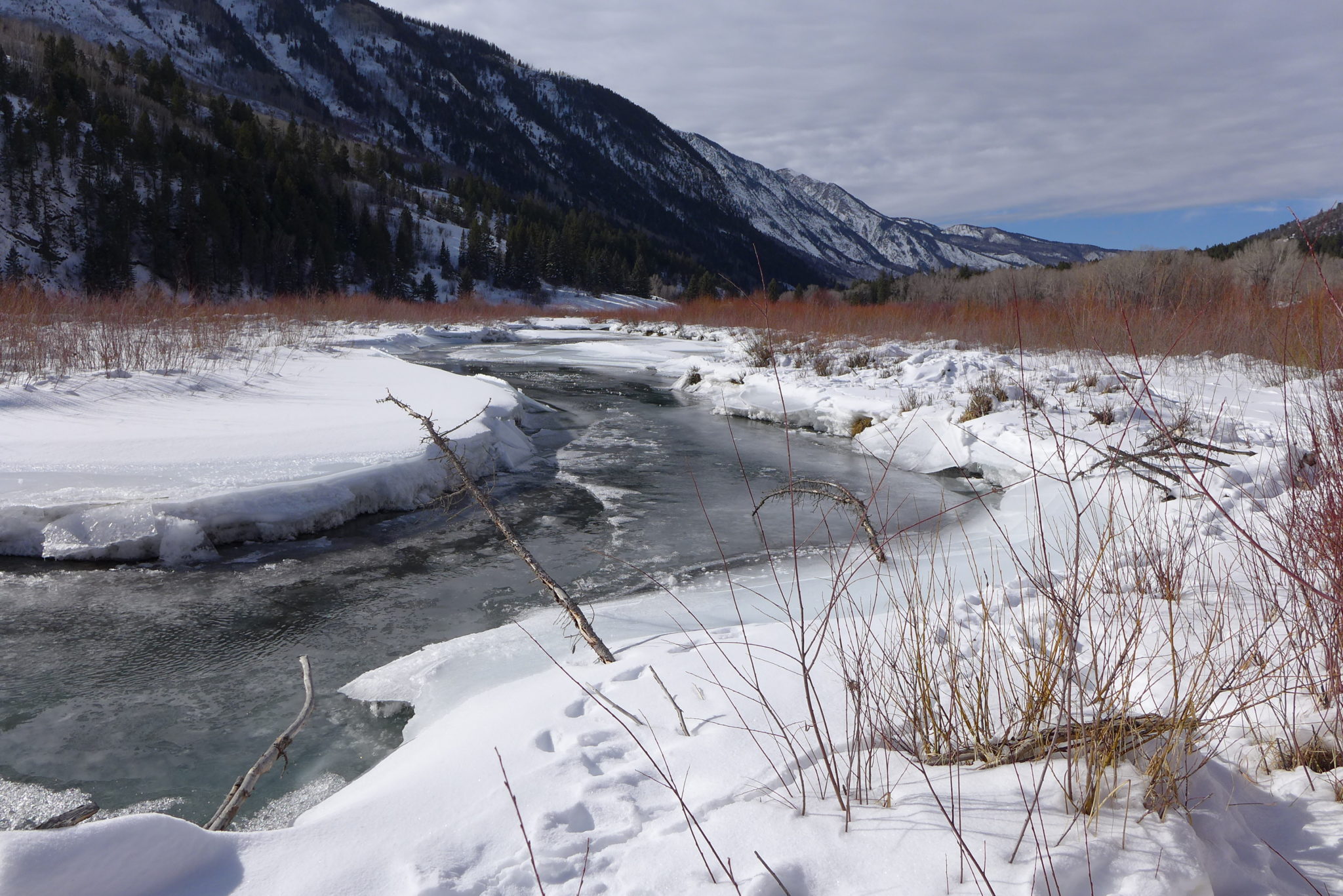
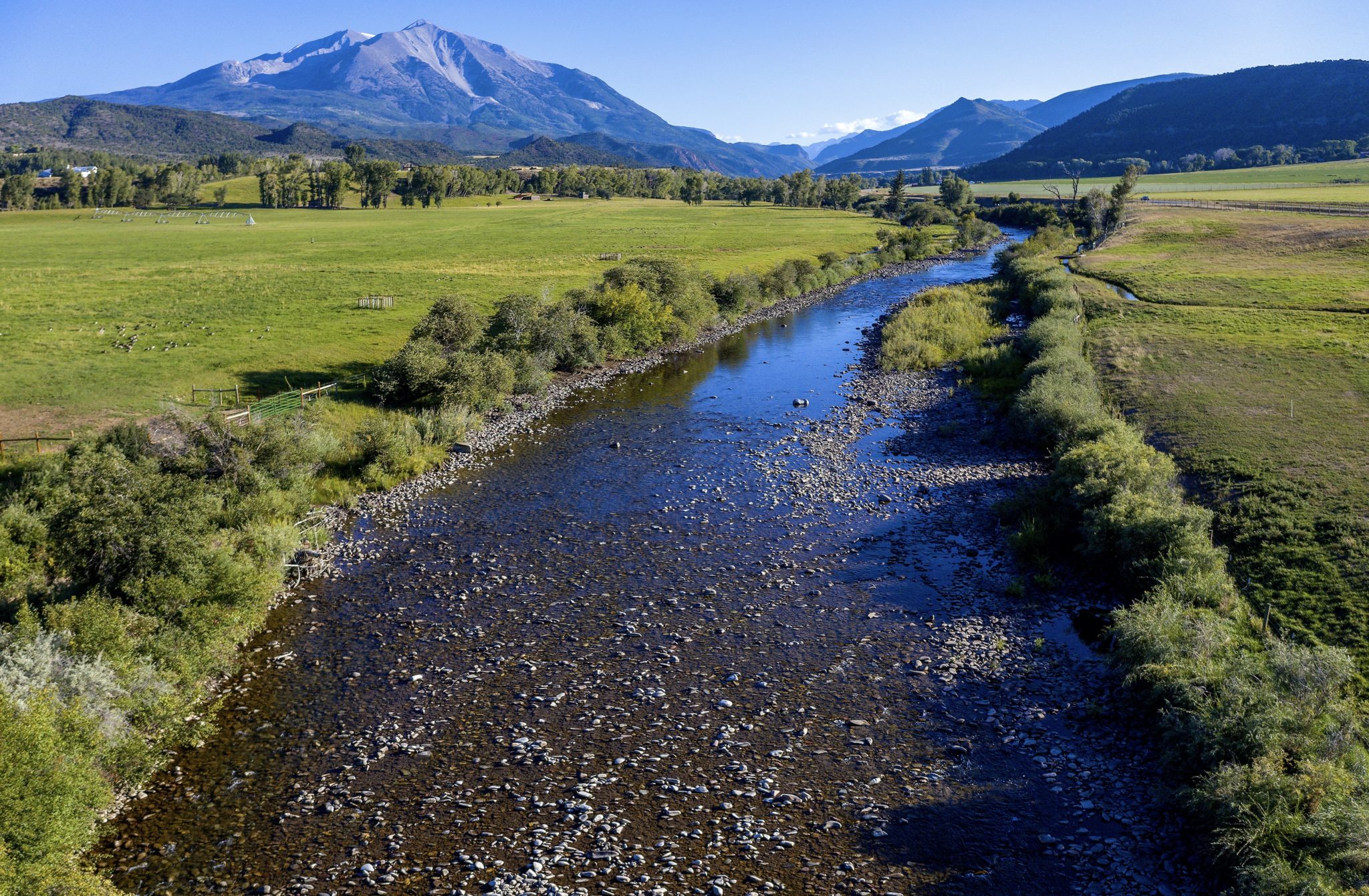
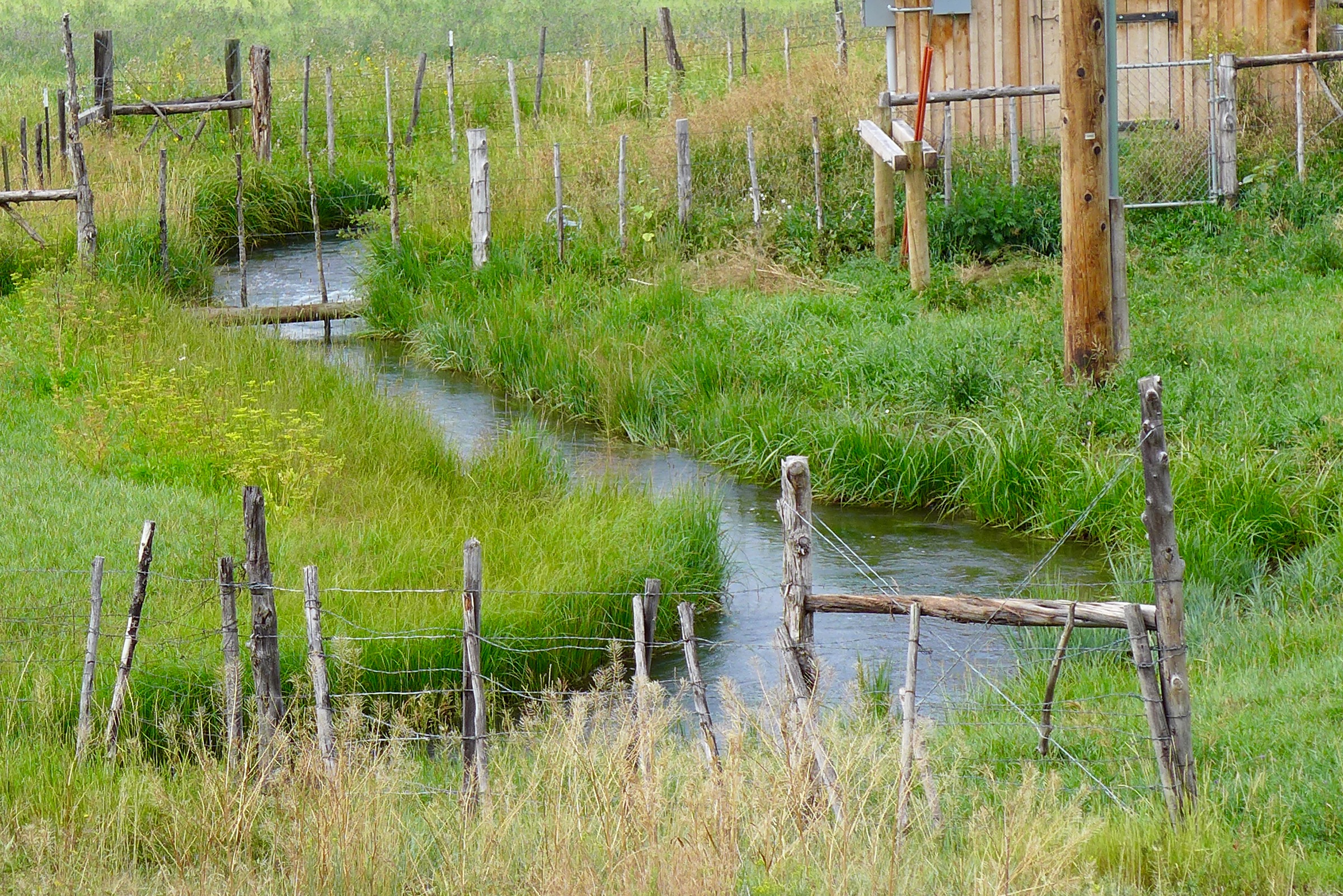
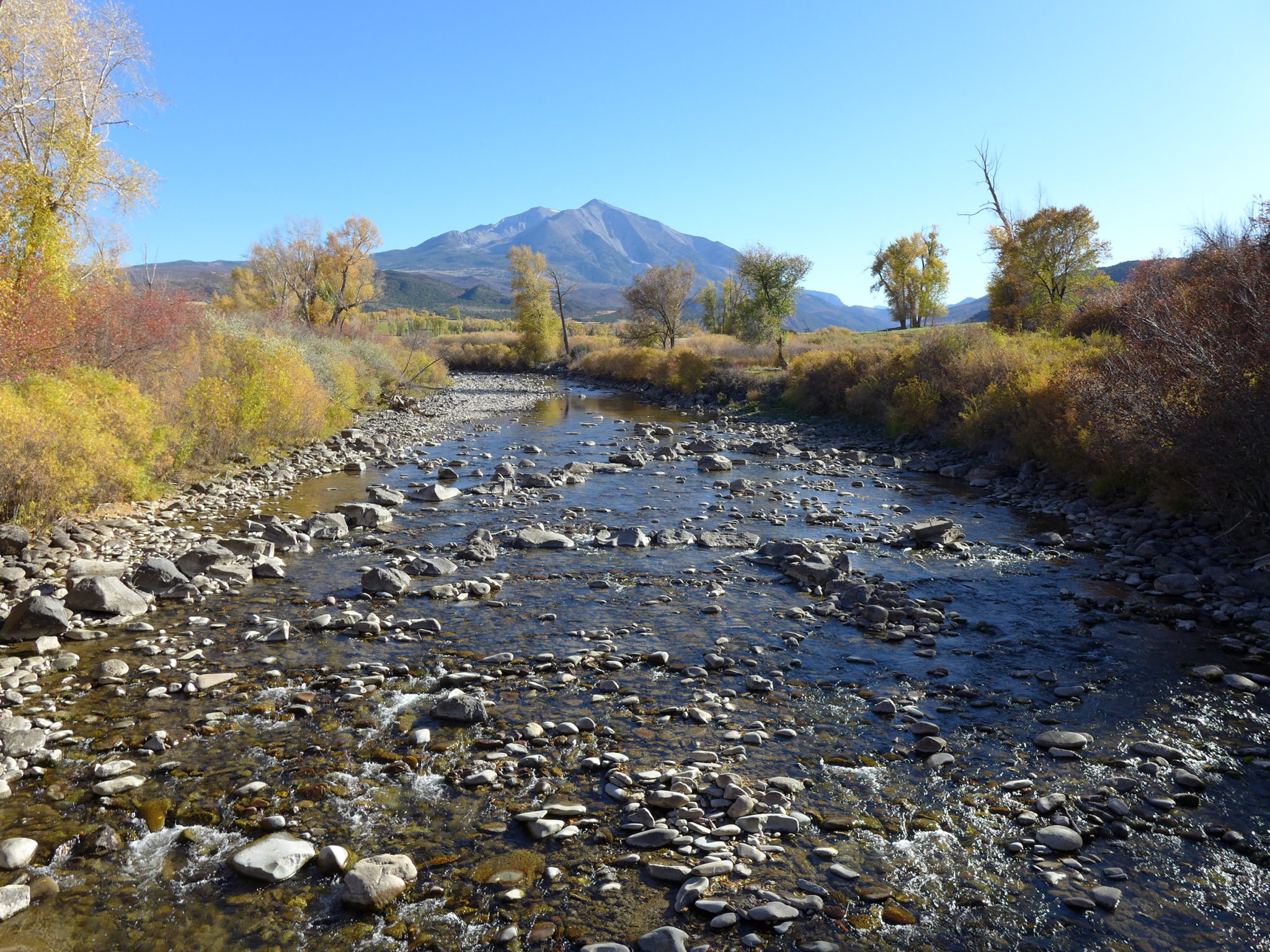
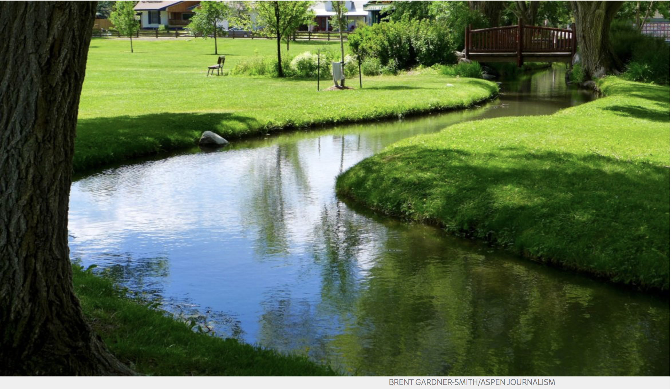
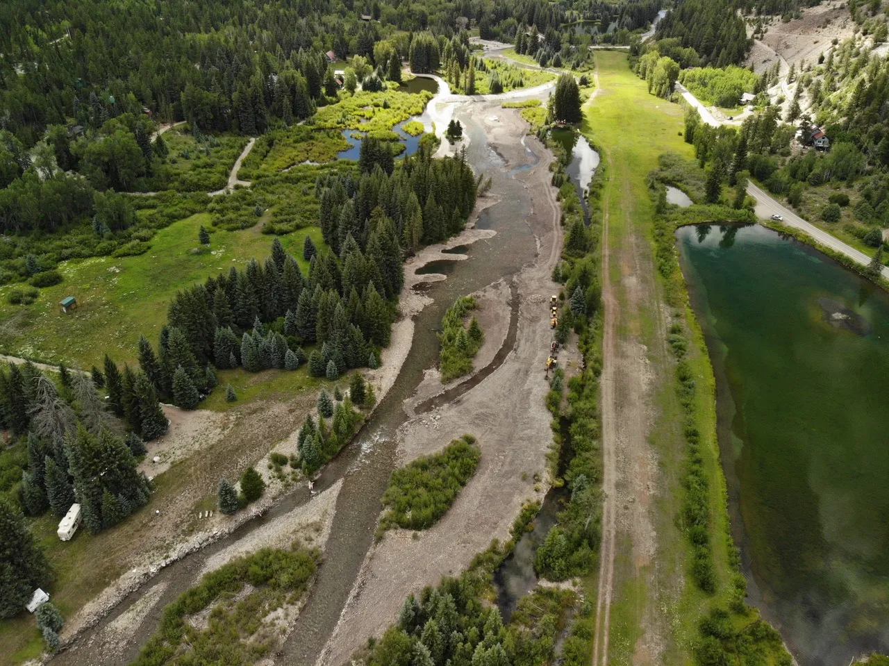
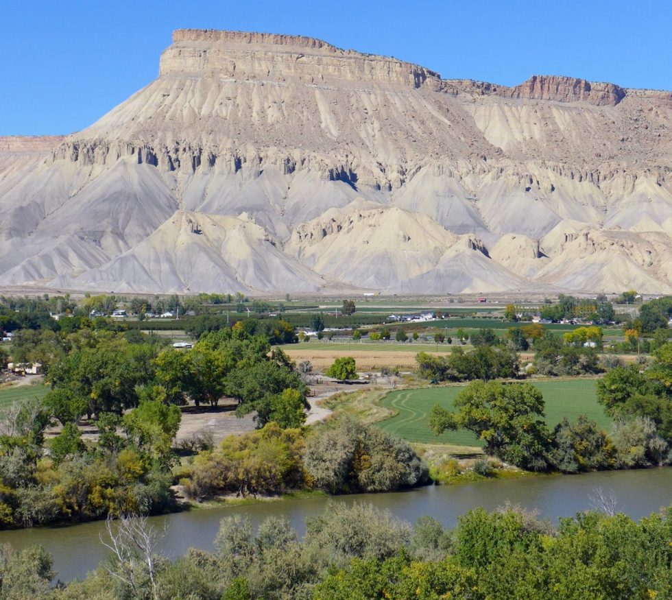
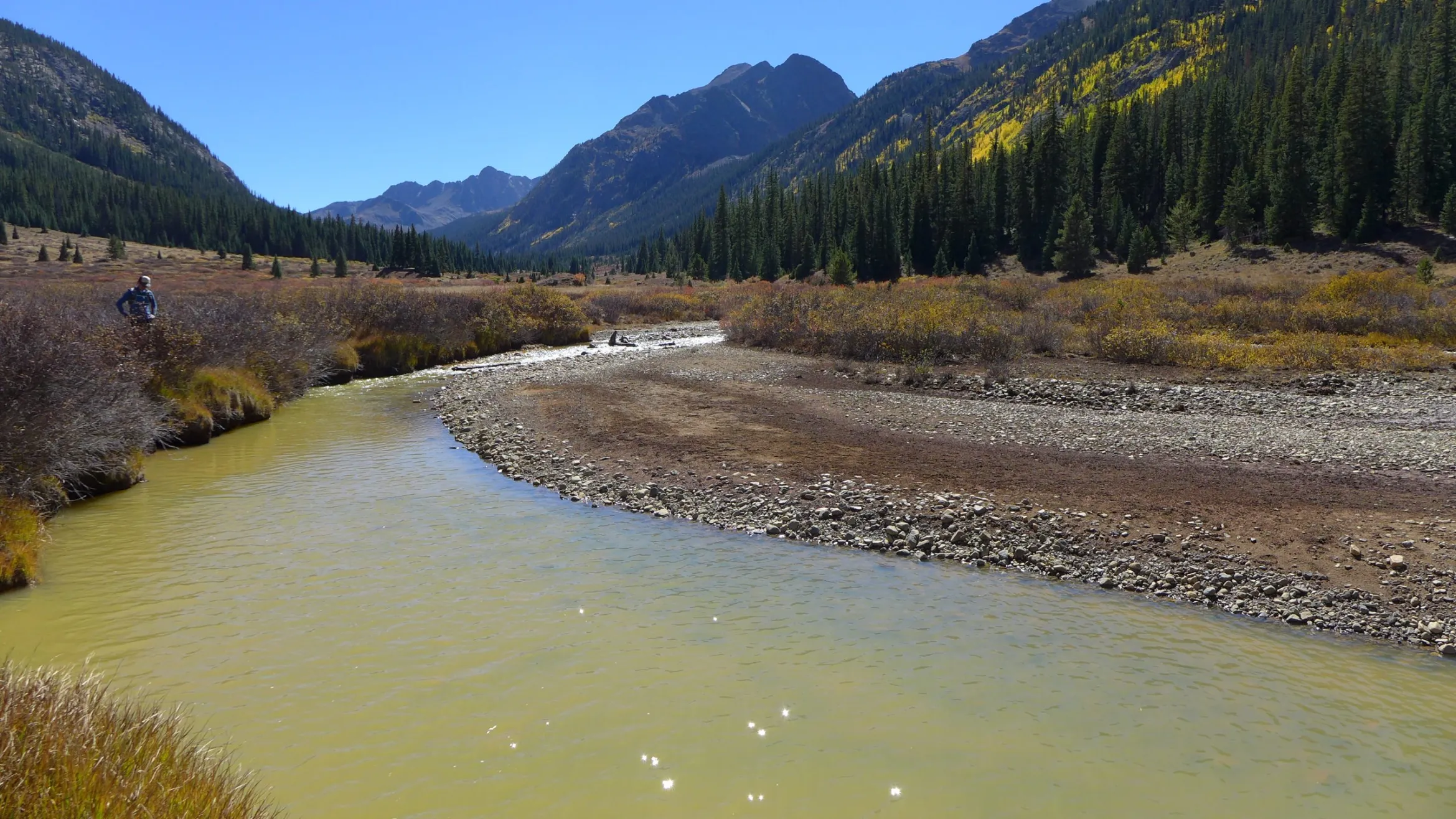
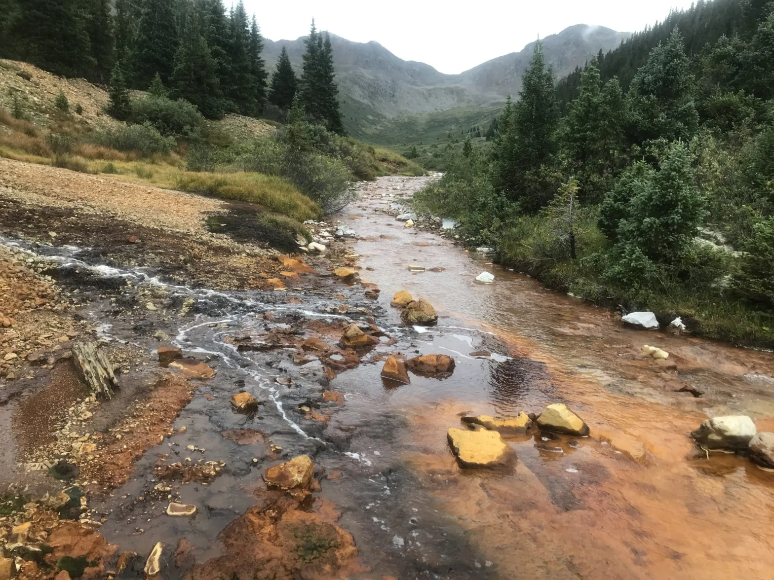
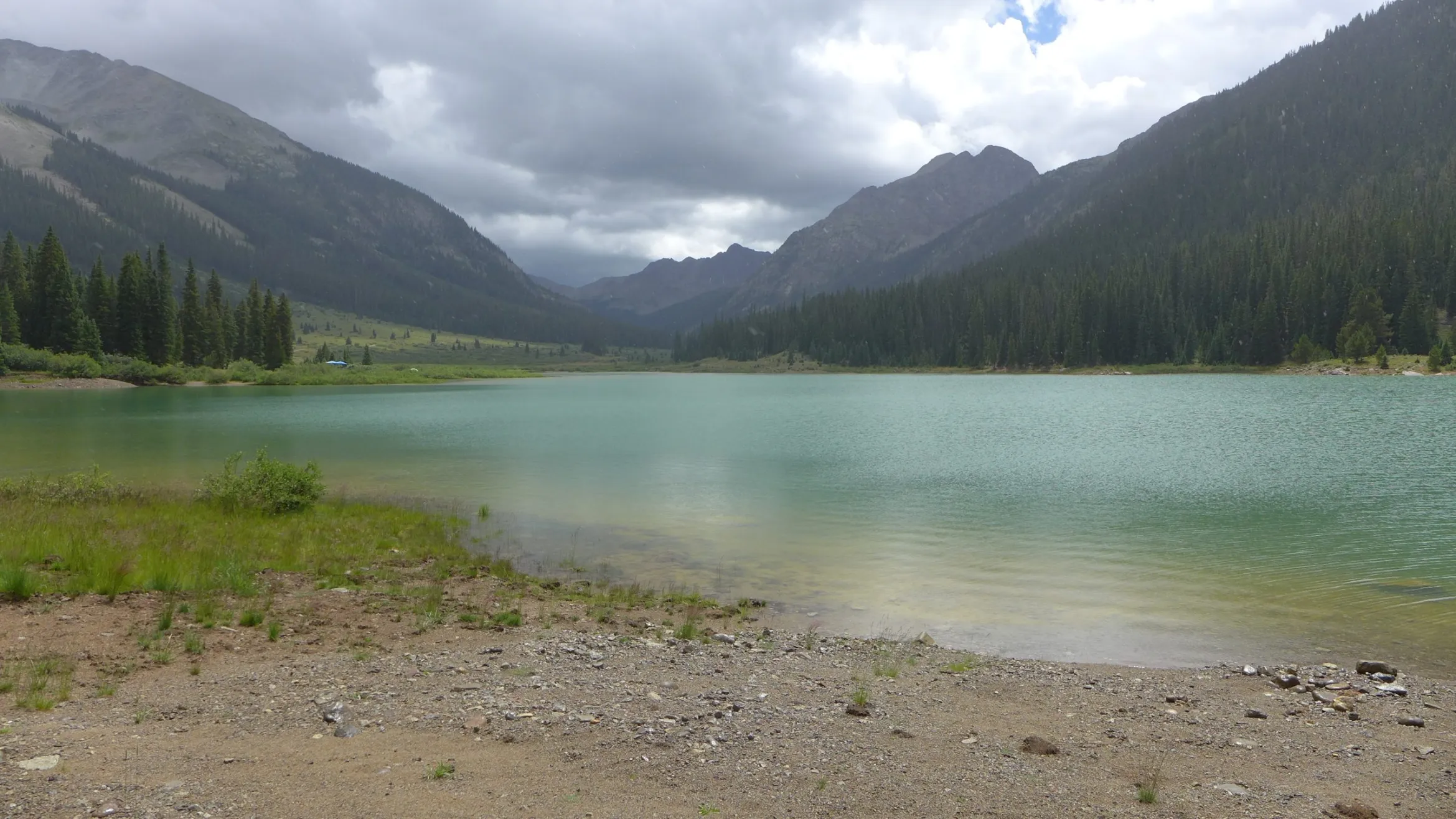
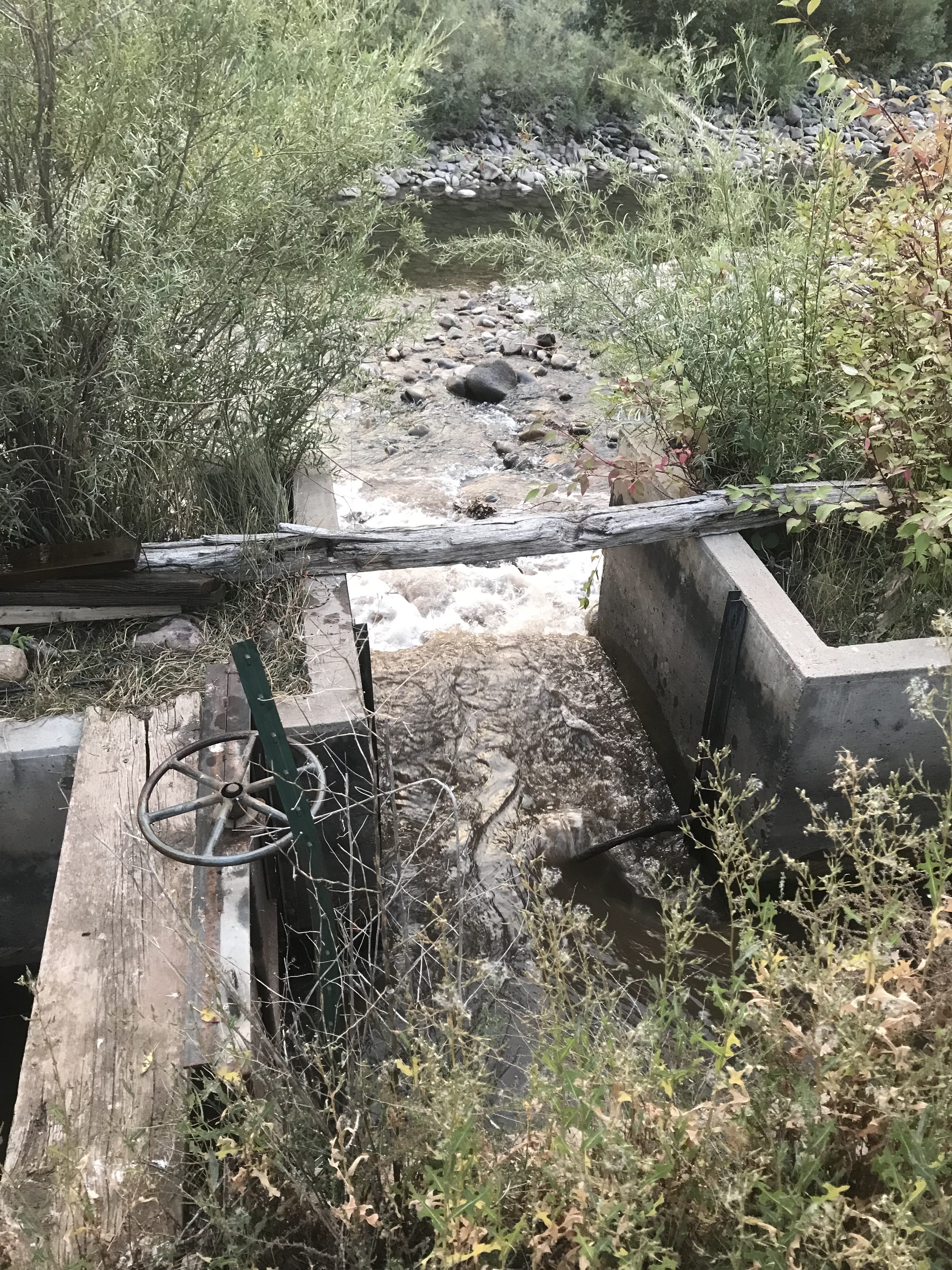
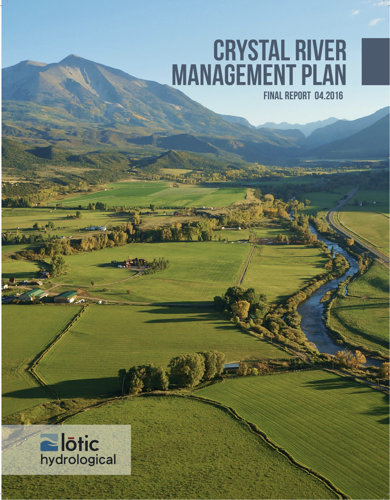
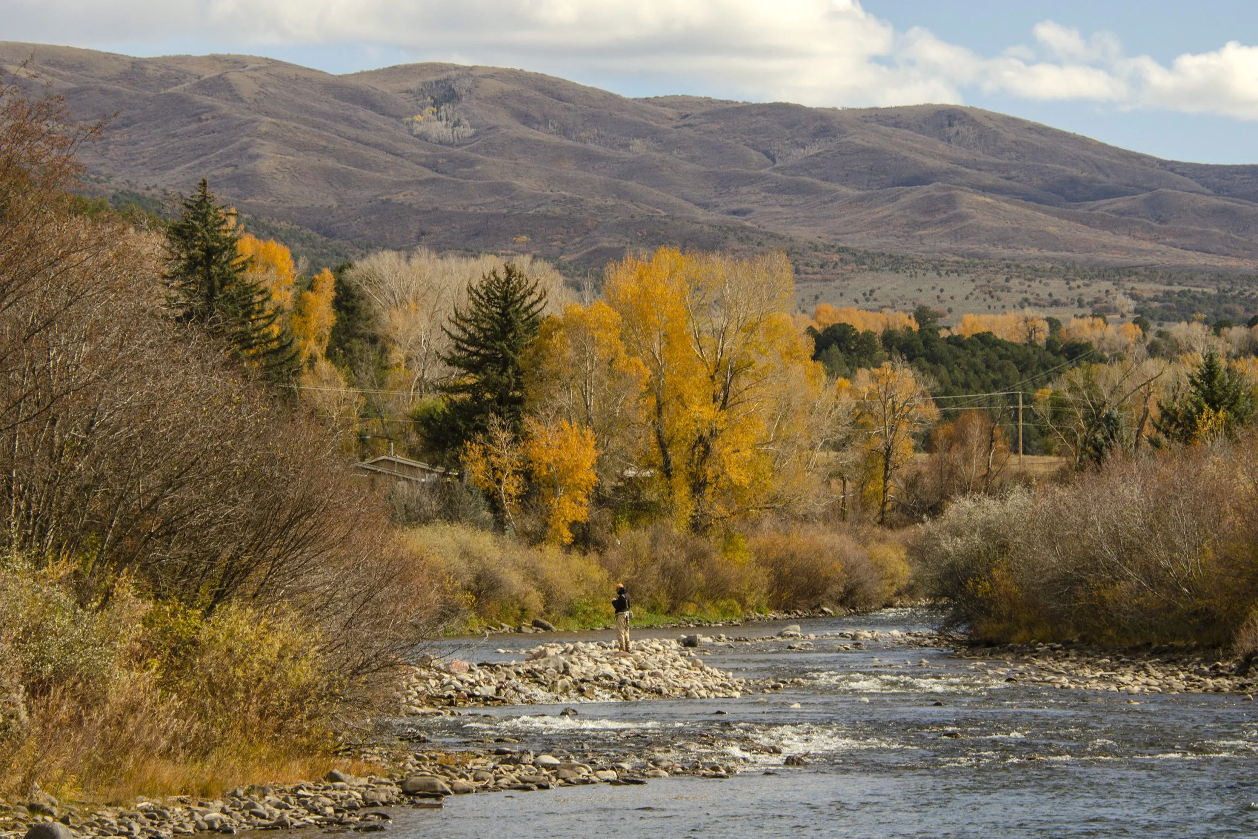
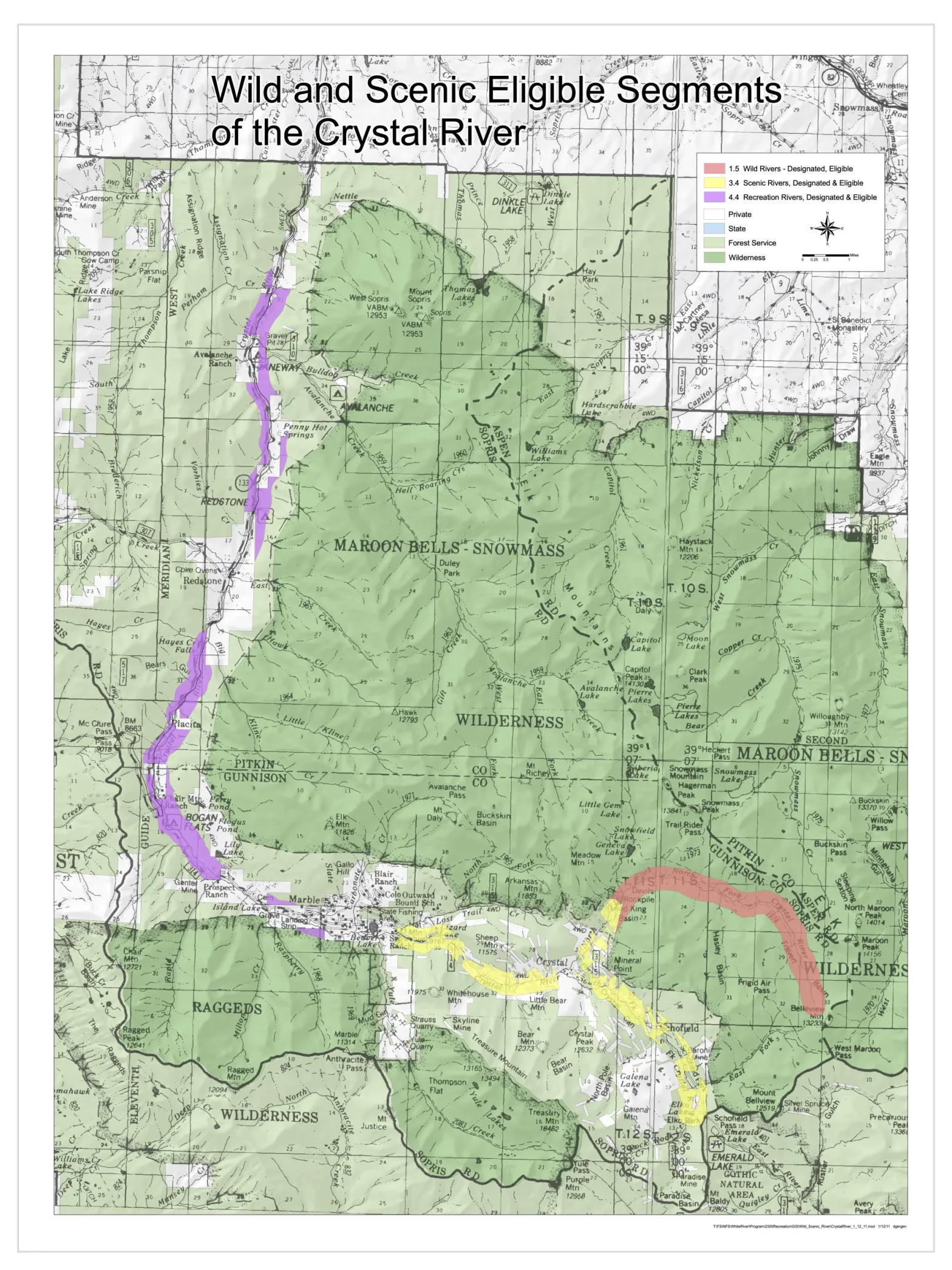
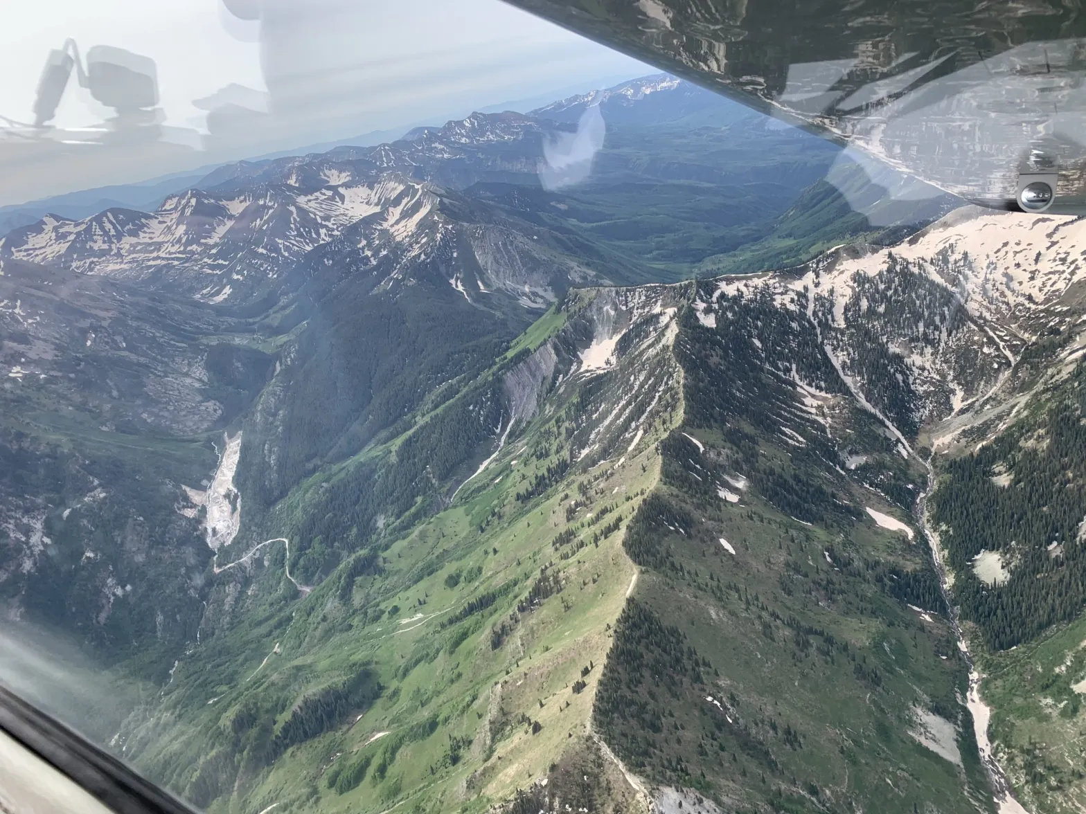
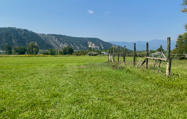
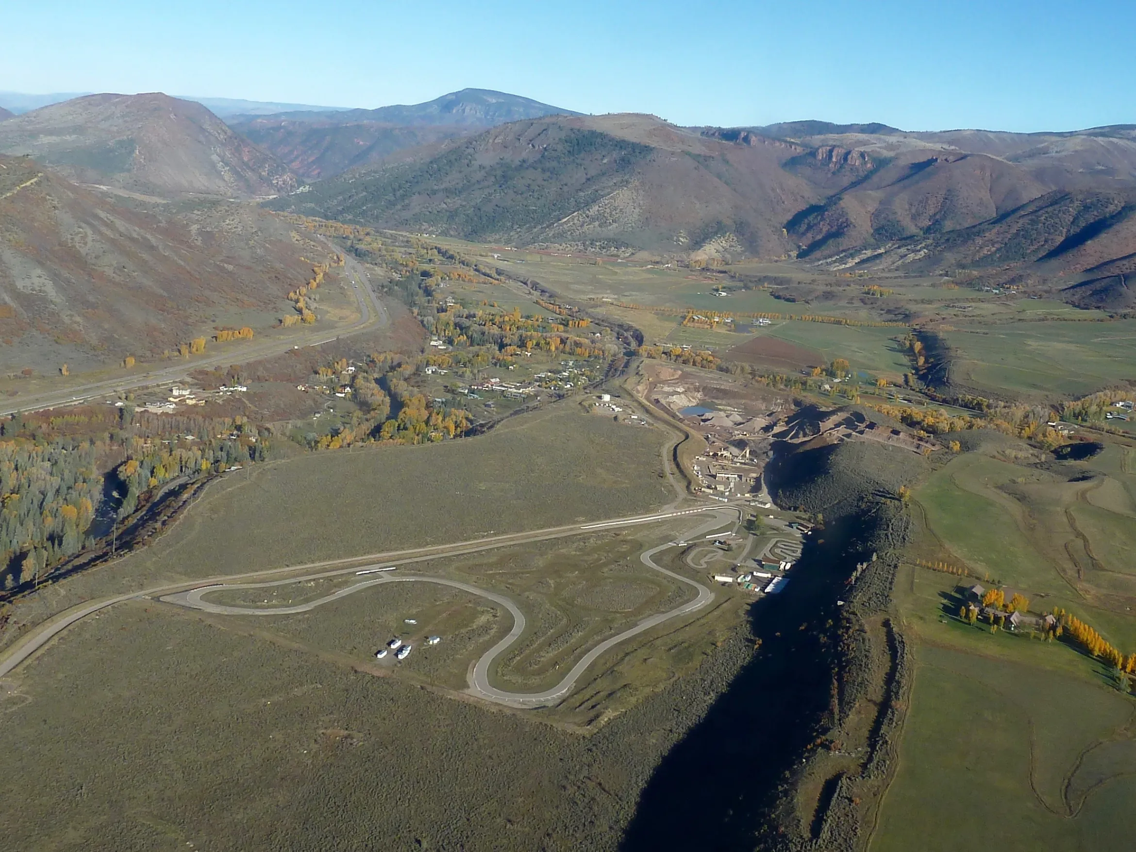
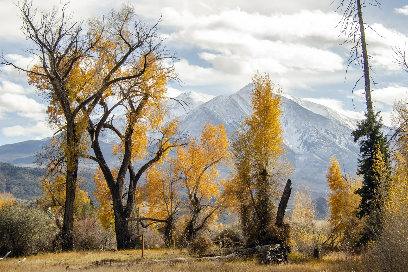
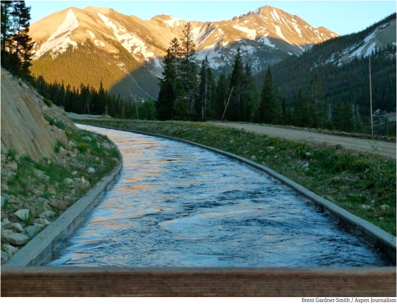
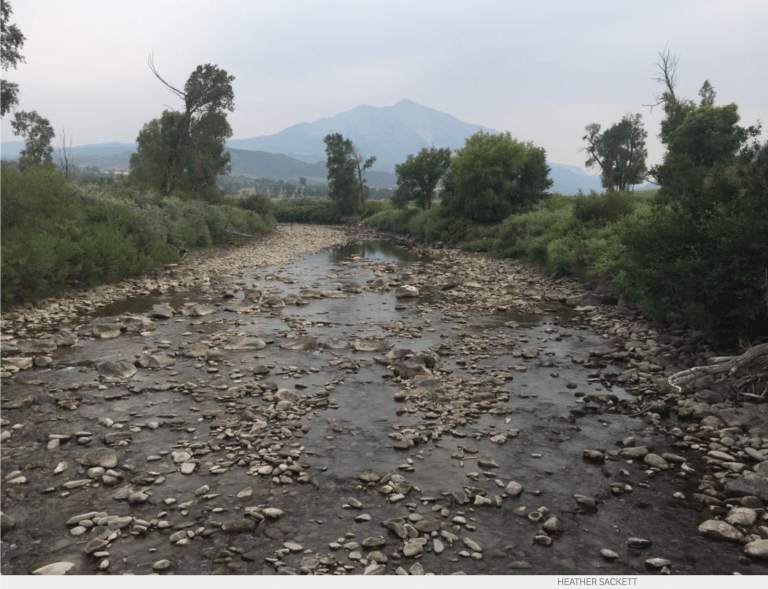
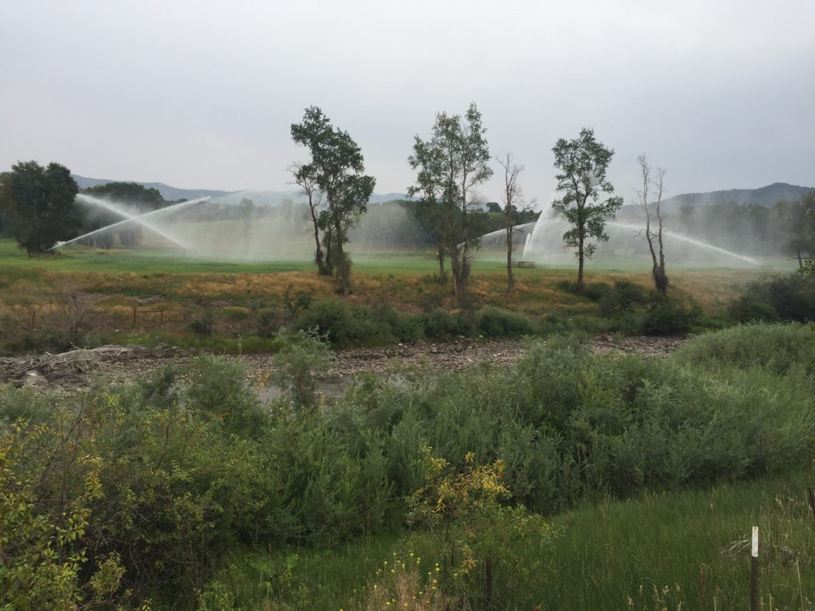
An image of the Crystal River Valley from an EcoFlight mission in August 2022. The view is downvalley, toward Mount Sopris. A group is exploring a federal designation of wild and scenic for the Crystal River in Gunnison and Pitkin counties.
Courtesy of Ecoflight
The effort to explore getting a federal designation of wild and scenic for the Crystal River is about to get turned up a notch. The Wild and Scenic Feasibility Collaborative announced Monday it has selected Wellstone Collaborative Strategies and P2 Solutions to facilitate and lead a community engagement and stakeholder process. American Whitewater, a national nonprofit that advocates for the preservation and protection of whitewater rivers, will support Wellstone in the administration of its outreach efforts…
Denver-based Wellstone Collaborative Strategies and Loveland-based P2 Solutions were selected for their experience and competence in facilitation and community engagement. Both Jacob Bornstein, founder and principal of Wellstone Collaborative Strategies, and Wendy Lowe, owner of P2 Solutions, have demonstrated exceptional facilitation skills and experience shepherding broad community conversations to successful outcomes, according to a statement from the selection committee, according to an announcement. The principals in the businesses have strong backgrounds in natural resource issues and direct knowledge of the Crystal River…
With a goal of identifying long-lasting river protection, the collaborative envisions the creation of a stakeholder group that would engage in fact finding, identification of overlapping interests and concerns, and a robust discussion of shared goals and strategies. The initial phase of the stakeholder process will bring together a representative cross section of interested individuals to provide informed input; examine, explore and investigate river protection; access and rely on experts in river and riparian health; engage experts to provide factual information relevant to protective designations; agree upon rules of engagement; be a process grounded in the highest integrity and inclusiveness; and result in identification of shared principles for protection of the Crystal River.
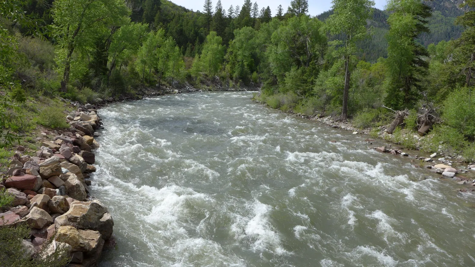
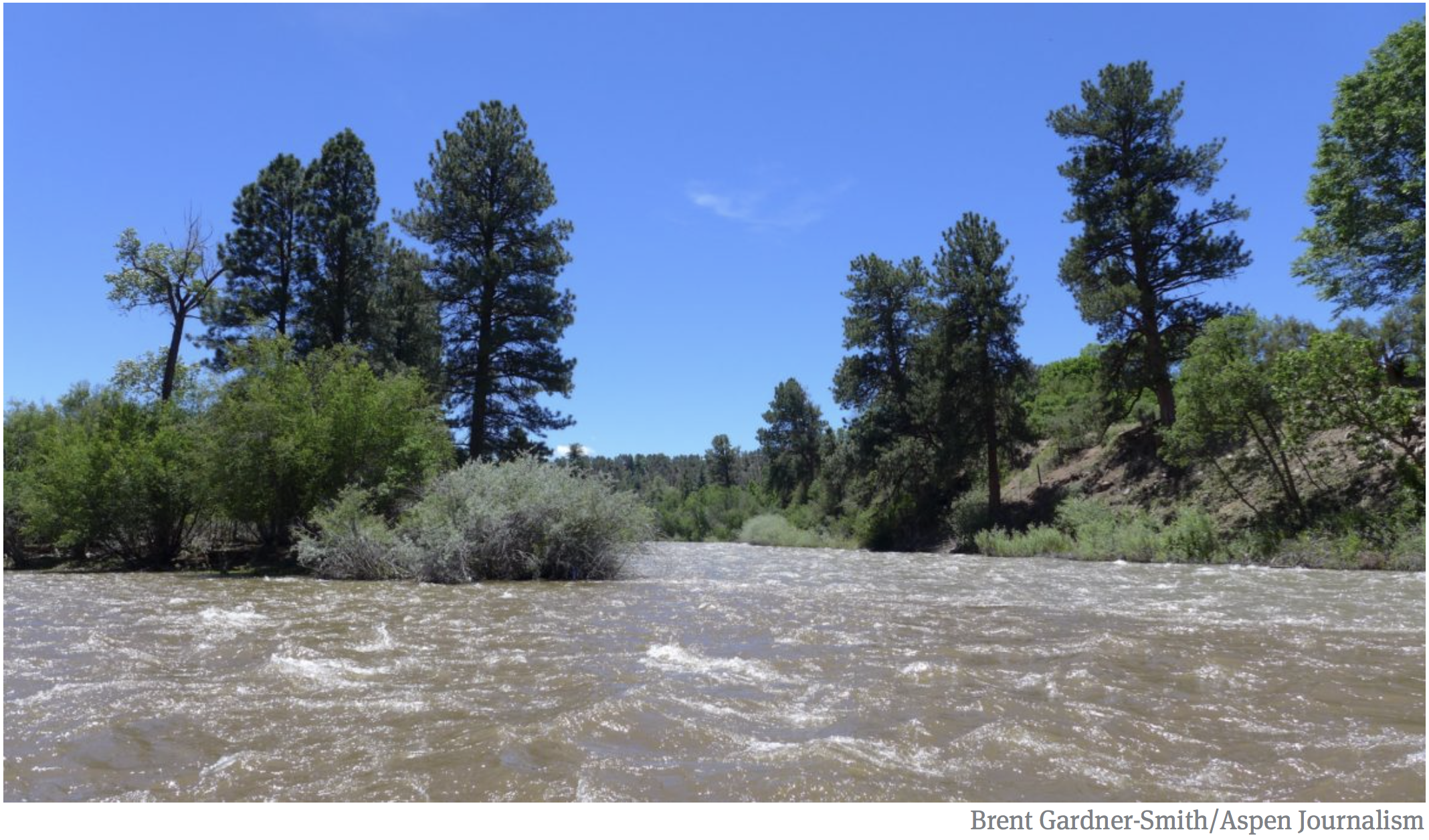
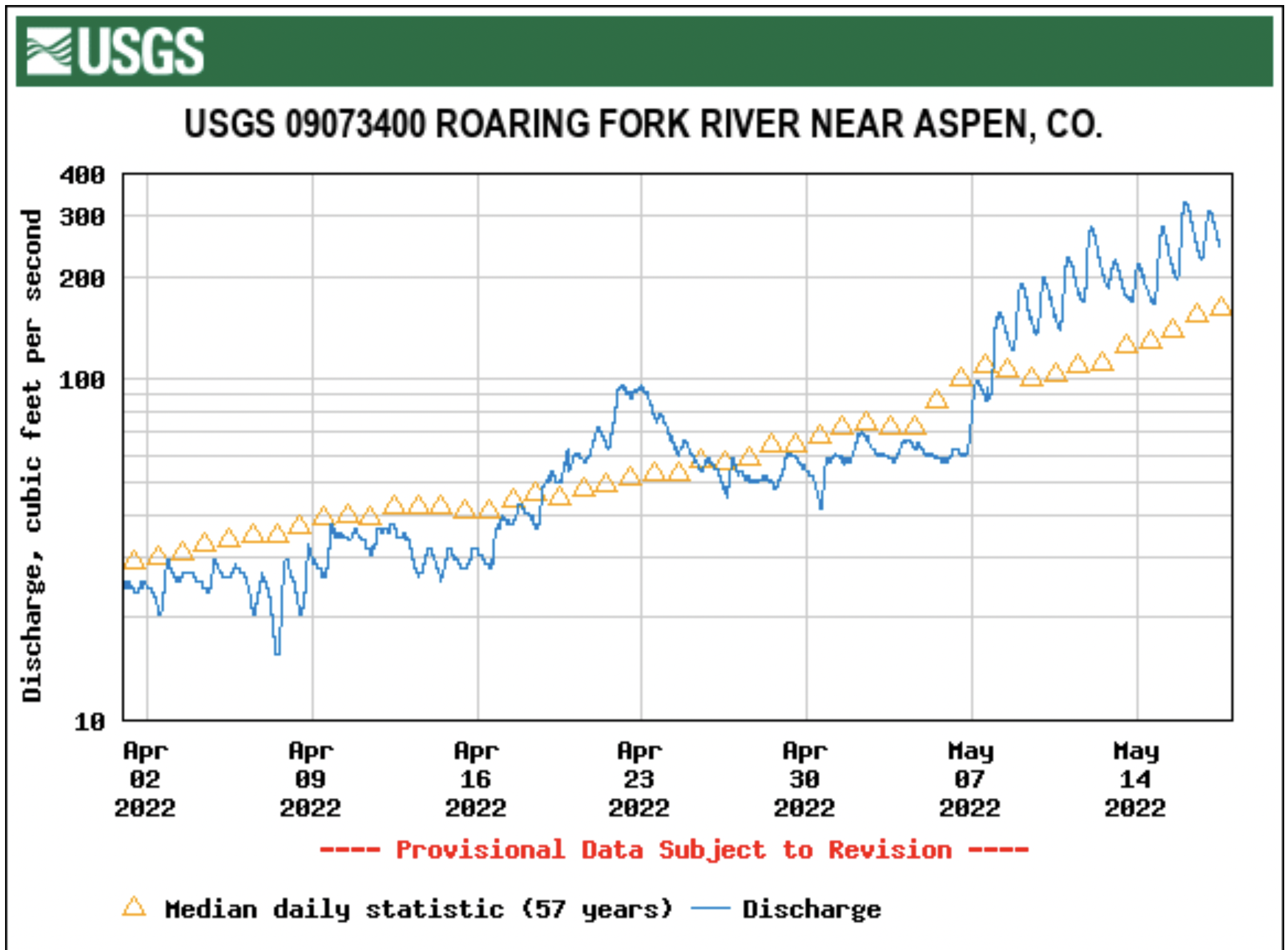
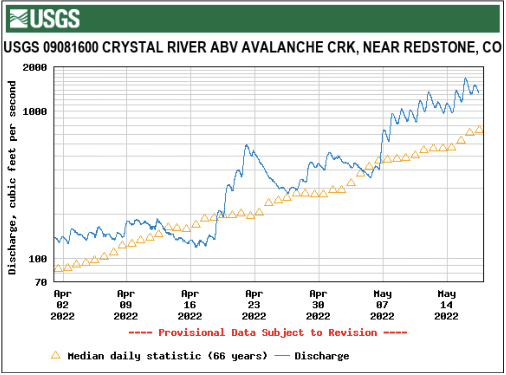
Map of the Roaring Fork River drainage basin in western Colorado, USA. Made using USGS data. By Shannon1 – Own work, CC BY-SA 4.0, https://commons.wikimedia.org/w/index.php?curid=69290878The Crystal River just below Avalanche Creek on June 3. Streamflows near this location peaked on May 19 at 1,840 cfs according to data from the Colorado Basin River Forecast Center. CREDIT: HEATHER SACKETT/ASPEN JOURNALISMProtecting continued public access to these waterfalls along Yule Creek, just over the property line from a parcel set to be donated to a land conservation agency, is an ongoing priority for the CVEPA.
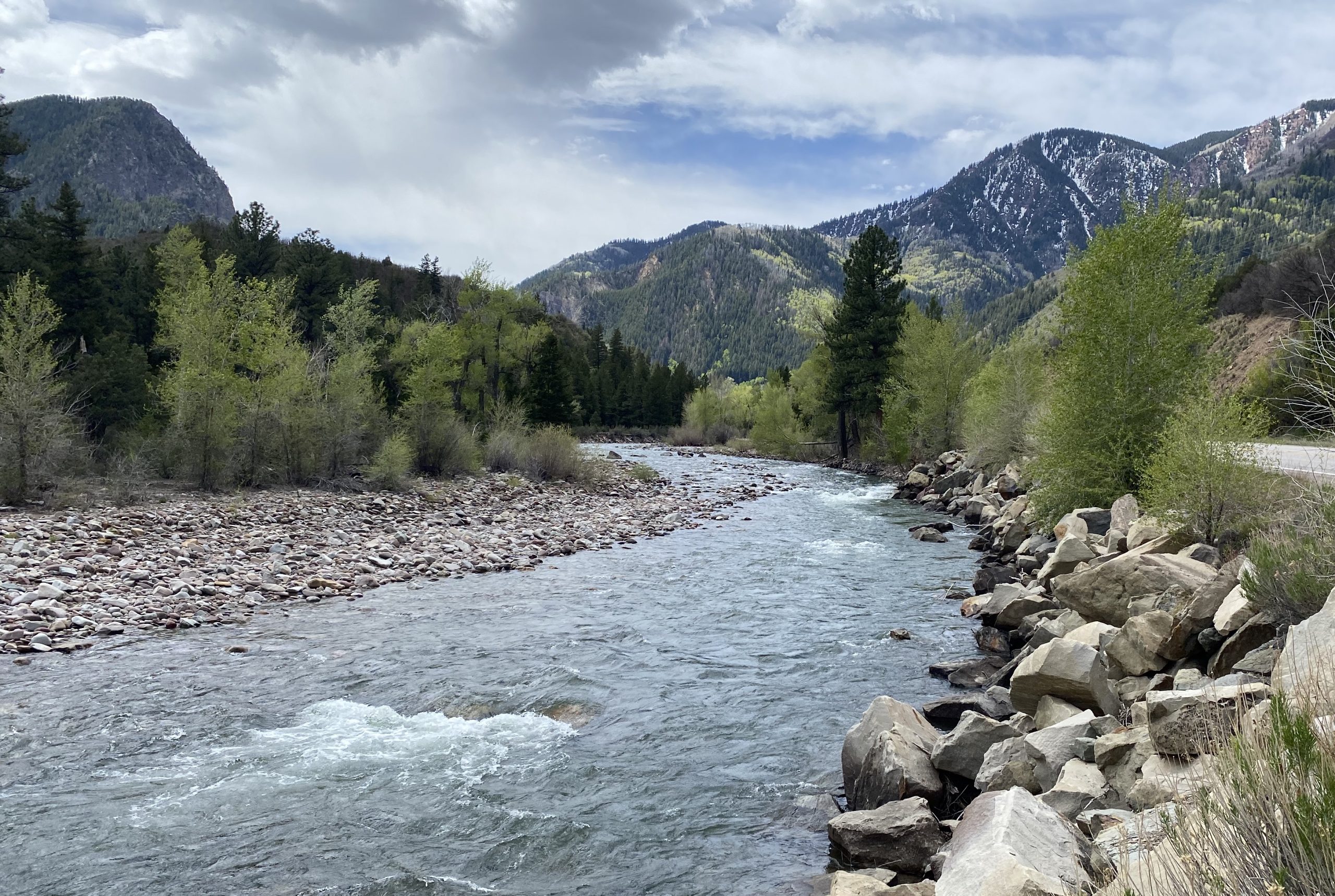
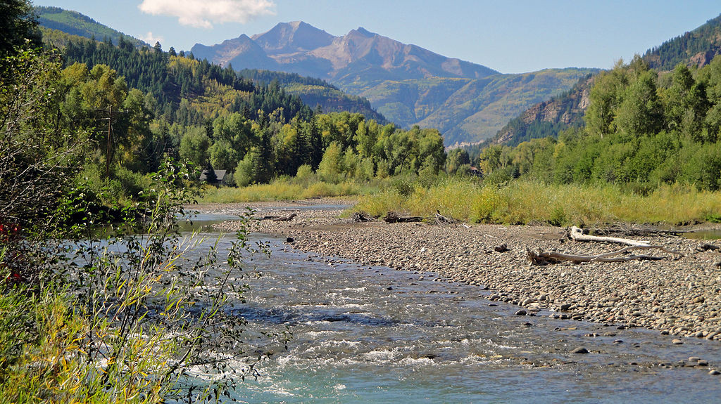
CREDIT: COURTESY PHOTO BY JOHN ARMSTRONGThe view looking upstream on the Crystal River below Avalanche Creek. A Pitkin County group wants to designate this section of the Crystal as Wild & Scenic.
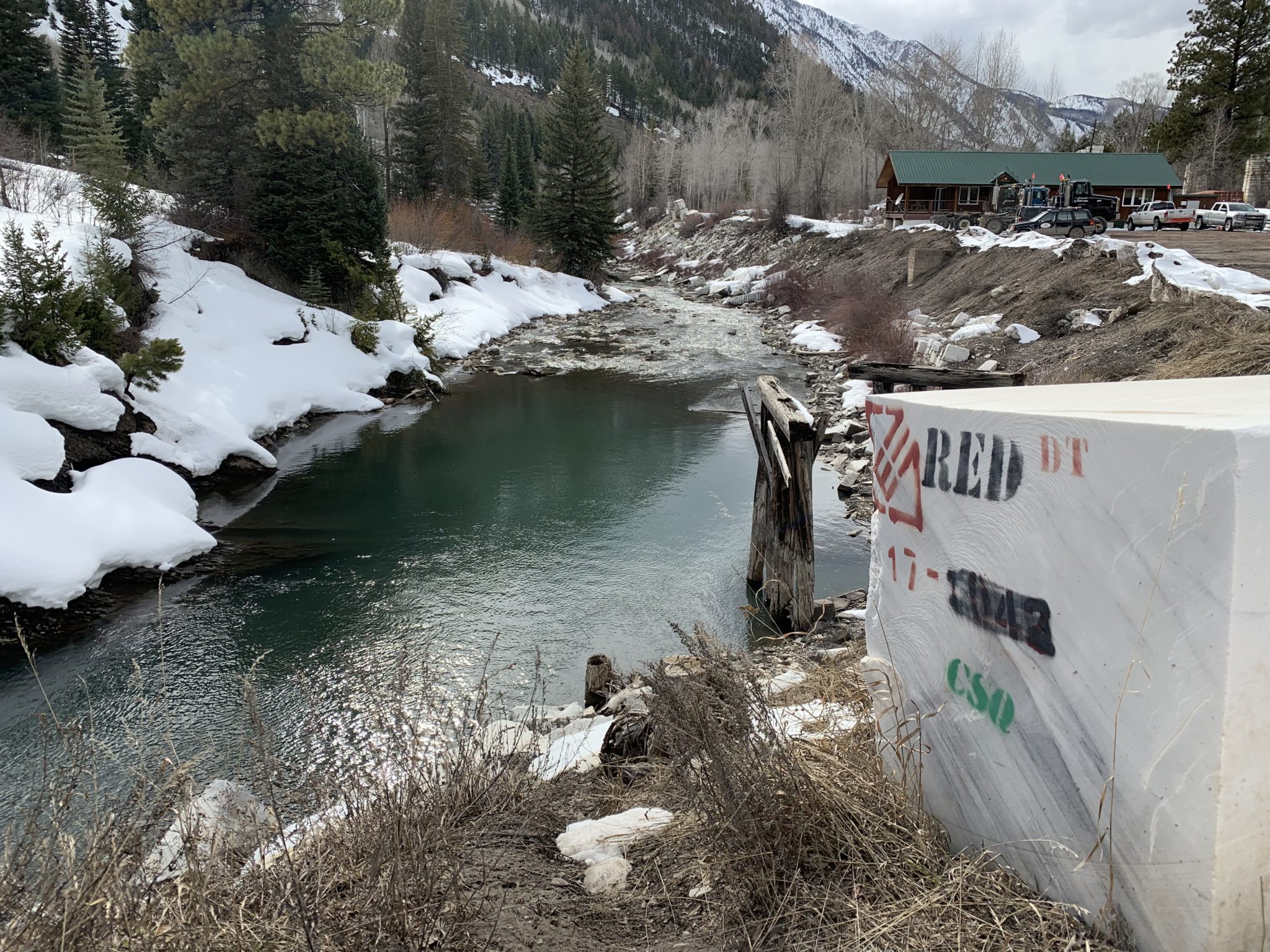
CREDIT: CURTIS WACKERLE/ASPEN JOURNALISMThe Crystal River flows through the town of Marble just after its confluence with Yule Creek. Gunnison County, Pitkin County and local environmental groups want to see a marble mining company mitigate its illegal relocation of a creek by improving downstream riparian habitat. Photo credit: Heather Sackett/Aspen Journalism These marble blocks stamped with quarry owner’s name, Red Graniti, and operator’s initials, CSQ, line the banks of the Crystal River near the company’s load-out area in the town of Marble. The U.S. Army Corps of Engineers is considering whether to issue the operator a retroactive permit to allow it to move a stream. Photo credit: Heather Sackett/Aspen JournalismThe narrows on the Crystal River just below Placita where a dam big enough to store 62,009 acre-feet of water was once planned by the Colorado River District and the West Divide Water Conservancy District. The Pitkin County BOCC passed a resolution opposing the River District’s proposed tax increase. Photo credit: Brent Gardner-Smith/Aspen JournalismLooking upstream toward the confluence of the Roaring Fork River, left, and the Crystal River, right, just below Carbondale. More information about these and other rivers will be made available to the public with the help of a recent $37,000 state grant to the Roaring Fork Conservancy. Photo credit: Brent Gardner-SmithCrystal River near Redstone via Wikipedia CommonsCrystal River via Aspen JournalismCrystal River
Today [January 23, 2023], Colorado U.S. Senators Michael Bennet and John Hickenlooper urged the Bureau of Reclamation (BOR) to consider allocating additional funding from the recent omnibus funding bill for Fiscal Year 2023 (FY23) or the Bipartisan Infrastructure Law (BIL) for the Arkansas Valley Conduit (AVC).
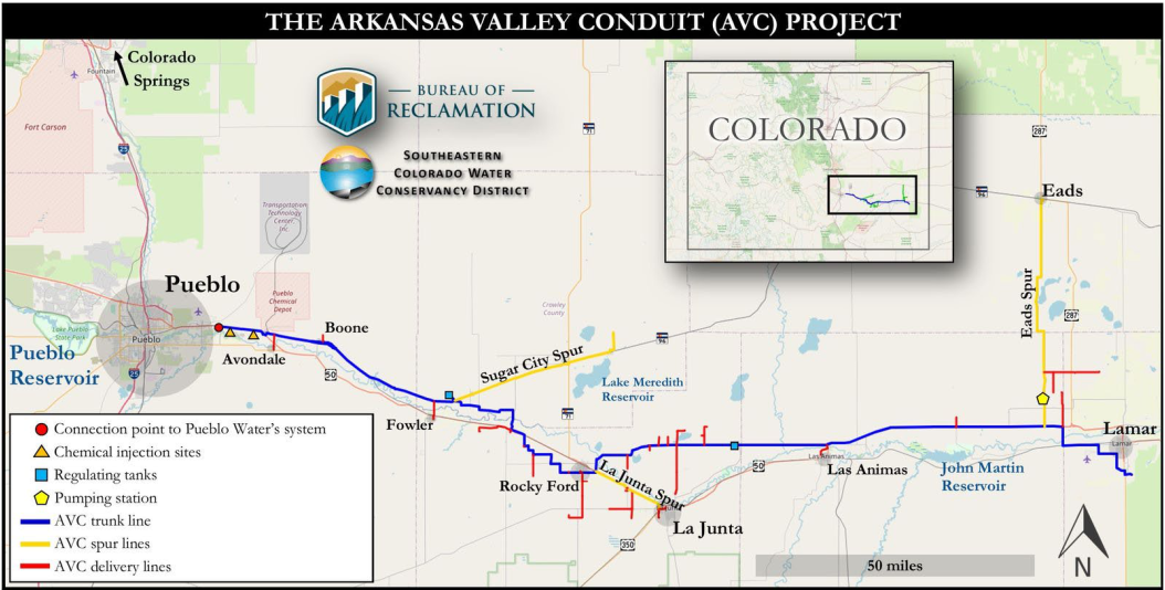
The AVC is a planned 130-mile water-delivery system from the Pueblo Reservoir to communities in Bent, Crowley, Kiowa, Otero, Prowers, and Pueblo counties. The Conduit is the final phase of the Fryingpan-Arkansas Project, which Congress authorized in 1962.
“[T]he Conduit has been one of Colorado’s top priorities for nearly six decades,” wrote the senators. “Continuing to invest in this project will allow the project’s stakeholders to plan for more effective construction and delivery of clean drinking water throughout Southeast Colorado.”
In the letter, the senators highlight the $60 million allocated for the construction of the AVC from the BIL last fall, and ask BOR to allocate additional funds, which could be immediately applied to help advance different components of the AVC.
“For years, this project languished due to insufficient funding and a prohibitive cost-share agreement,” continued the senators. “Congressional appropriations over the past decade coupled with BOR’s recent $60 million award will finally enable the construction of this long-promised project. More investment, from the FY23 omnibus or future BIL awards, would accelerate the construction timeline and improve planning efficiency.”
Bennet and Hickenlooper have consistently advocated for increased funding for the AVC. The FY23 omnibus spending bill, which was signed into law in December, included $10.1 million for the Conduit after Bennet and Hickenlooper urged the Senate Appropriations Committee to continue to fund the project last May. In October, the senators visited Pueblo to celebrate the announcement of $60 million in BIL funds for the Conduit. The senators and U.S. Representative Ken Buck (R-Colo.) urged the OMB and BOR in July to allocate these funds. In March, Bennet and Hickenlooper secured $12 million for the Conduit from the FY22 omnibus bill. Prior to FY22, Bennet helped secure more than $70 million for the AVC. Bennet and Hickenlooper will continue working in Washington to ensure Colorado has the resources needed to complete this vital project for the region.
In 2009, Congress passed legislation Bennet worked on with former U.S. Senator Mark Udall (D-Colo.) to authorize a federal cost share for the construction of the Arkansas Valley Conduit. In 2013, Bennet and his colleagues sent a letter to the BOR to quickly approve the Conduit’s Environmental Impact Study (EIS) in order to expedite the project’s pre-construction process. In 2014, following Bennet and Udall’s efforts to urge the BOR to quickly approve the Conduit’s EIS, the Record of Decision was signed in February. Bennet joined the groundbreaking for the project in October 2020.
The text of the letter is available HERE and below.
Waterfalls along Yule Creek. CREDIT: COURTESY PHOTO BY JOHN ARMSTRONG
Click the link to read the guest column on the Aspen Times website (Stacy Standley). Here’s an excerpt:
Now is the time to take a giant step into the future with revolutionary ideas that transcend the parochial local interests of the Roaring Fork River Valley by recognizing that climate/weather change, along with population growth, has erased the boundaries of the Colorado River Basin…Aspen is now the pivotal headwaters of the Colorado River Basin, which has become a small, compacted irrigation canal instead of a great river system and has shrunk many hundreds of miles into but a few feet…
1. There should be 100% metering and billing of every drop of water: 7% of the Aspen distribution is unmetered and/or unbilled and unmetered, and this should be eliminated.
2. You can not distribute or control what you do not measure: Metering and billing should be by constant recorded, instantaneous, wifi-linked electronic services on all distribution points and reported to every customer and the Water Department on a instantaneous daily basis, with auto shutoffs for an aberration of usage by 1% or more.
3. All wastewater and storm water must be a fully-integrated part of the treated water-supply system by municipal recycling and/or irrigation and municipal water usage.
4. Downstream water flows that exceed minimum stream flow must be acquired and piped back into the upstream Aspen intake.
5. Aspen and Pitkin County must negotiate with Twin Lakes Canal and Reservoir Co. and the Fry-Ark project to create water savings for their service area and water that can be allowed to stay in the Roaring Fork River Valley.
6. Salvation Ditch, Red Mountain Ditch, and all other local irrigation systems should become a part of the Aspen water conservation and re-use ethic.
7. 100% of all leaks and water waste must be ended immediately.
8. Every tree, plant, and natural out-of-house improvement must be identified and the water usage calculated by Lysimeter and/or other instantaneous soil moisture storage measurement system and then a local research and development lab created to test, grow, and install water conserving plants and systems for out-of-house water management and control.
9. All local streets should be coated with bright reflective surfaces to maintain a cooler urban-heat island and, thus, improve out-of-house water usage.
10. Aspen should create its own bottled (no plastic) water supply for individual use from a high-quality spring and distribute at least 2 gallons per person per day inside of the city service area for drinking water usage at cost to increase the Aspen water supply.
11. Aspen should divert into vertically oriented pipeline coils (24 to 48 inch) in all area streams to capture water runoff that exceeds minimum stream flows and keep the vertical-coiled pipelines at or above the city base elevation for instantaneous “pipeline coil reservoir storage.”
12. Every new or remodeled home and business must have installed an on-site water-storage tank for at least three months of driest in-house water usage.
13. Aspen should participate individually and/or with other Colorado River Basin water users in regional ocean, salt flats, and poor quality oil field wastewater/produced water (i.e., Rangely Field and Utah Basin) purification desalination and urban wastewater recycling for earning water-use credits.
14. Aspen should negotiate with Colorado River Basin Native American tribes to create constructive water savings and water-credit system for the benefit of reservation and also Aspen water usage.
15. Aspen should negotiate to replace Colorado River Basin hydroelectric-power generation with renewable energy to earn water storage credits for regional reservoir.
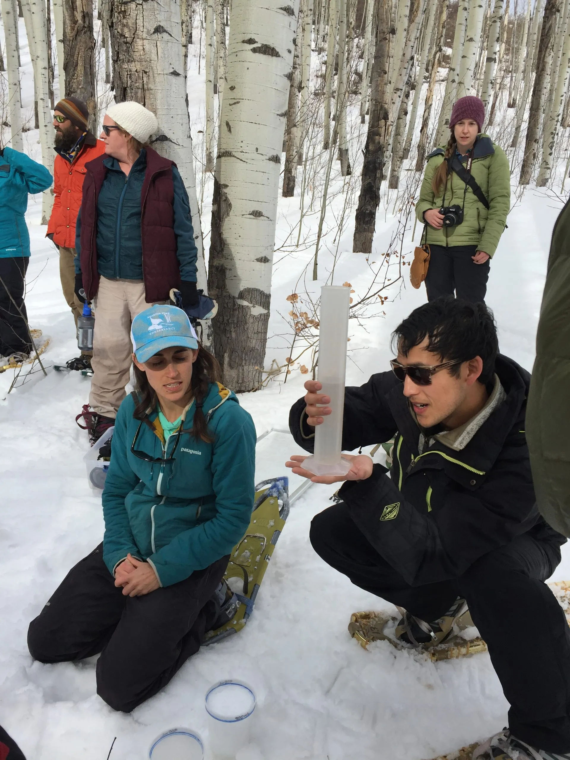
Volunteers learn how to measure how much water is contained in the snowpack, known as snow-water equivalent (SWE) at the SNOTEL site at the top of McClure Pass in March 2018. Water managers are gaining a better understanding that what happens in the weeks after peak snowpack in the spring can have an outsize influence on the year’s water supply. CREDIT: HEATHER SACKETT/ASPEN JOURNALISM
Water managers in the Colorado River basin are gaining a better understanding that what happens in the weeks after peak snowpack — not just how much snow accumulated over the winter — can have an outsize influence on the year’s water supply.
Water year 2021 was historically bad, with an upper basin snowpack that peaked around 90% of average but translated to only 36% of average runoff into Lake Powell, according to the U.S. Bureau of Reclamation. It was the second-worst runoff on record after 2002. One of the culprits was exceptionally thirsty soils from 2020’s hot and dry summer and fall, which soaked up snowmelt before runoff made it to streams. But those dry soils are only part of the story.
A new paper from the Desert Research Institute, a nonprofit science arm of the Nevada university system, found that heat waves in April 2021 drove record snowmelt rates at about 25% of snow-telemetry (SNOTEL) sites looked at across the West. SNOTEL is a network of remote sensing stations throughout the West’s mountainous watersheds that collect weather and snowpack information.
A heat wave that was concentrated over the Rocky Mountains on April 1-7 contributed to record snowmelt at 74 stations, including areas that feed the Colorado River.
A few different agencies release monthly water-supply forecasts for April through July, including the National Resource Conservation Service, the Bureau of Reclamation and the Colorado Basin River Forecast Center. The April forecast is the first prediction of how streamflows will shape up for the year.
But according to the paper, in 2021, “rates of snowmelt throughout April were alarming and quickly worsened summer runoff outlooks which underscores that 1 April may no longer be a reliable benchmark for western water supply.”
The paper did not quantify what exactly the record melt speed meant for water supply, but paper author and associate research professor of climatology Dan McEvoy said it definitely contributed to the poor inflow into the nation’s second-largest reservoir in 2021. It also shows there are many more factors relevant to predicting the water supply than just how much water is in the snowpack, a metric known as snow-water equivalent (SWE), which is measured by SNOTEL sites.
“There was a combination of things that was contributing to this really low runoff in places like the Colorado River basin,” McEvoy said.
Some of these other factors include very little April precipitation and warm nighttime temperatures, which didn’t allow the snowpack to get into the daily freeze-thaw cycle that’s common in the spring. Persistent high pressure kept skies clear and sunny, which meant that more of the snowpack sublimated, evaporating instead of turning into liquid.
“When it’s sunnier and warmer, you can lose some of that water directly to the atmosphere,” McEvoy said. “It doesn’t even get to melt and go into the runoff.”
These rapid melting events could also help set up prime conditions for wildfires, he said, something he wants to continue studying.
“When you have the snow disappear earlier there’s more time with the ground exposed, which contributes to drying out the vegetation in the spring and summer and an earlier onset to wildfire season,” McEvoy said.
After peak snowpack
Climatologists at Colorado State University are working on a similar study that looks at how factors such as precipitation after peak snowpack affect spring runoff. Their findings underscore how important the conditions of the six to eight weeks after peak snowpack are for predicting streamflows.
“One of the things we found that was crystal clear from the study was that one of the major sources of water-supply forecast error is what happens after peak snowpack,” said Peter Bennett Goble, a climatologist at CSU who is working on the study. “Just knowing how much uncertainty is still out there on April 1 or even April 15 probably allows water managers to be a little more cautious, maybe hold a little bit more back, especially if it looks like it’s going to be an early runoff.”
Predicting whether reservoirs will fill — and therefore how much water to release to make room for the inflow — can be tricky. Some municipal water providers use the Colorado Airborne Snow Measurement Program — with its lidar-equipped planes — to more accurately measure snowpack. For example, Denver Water has used CASM to see how much snow is in the headwaters of the Blue River basin, which feeds Dillon Reservoir, its largest storage bucket.
But aside from this technology, which is expensive and not yet available everywhere, water managers rely heavily on data from the SNOTEL sites to make streamflow forecasts. This method has limitations, providing just a snapshot of conditions at one location.
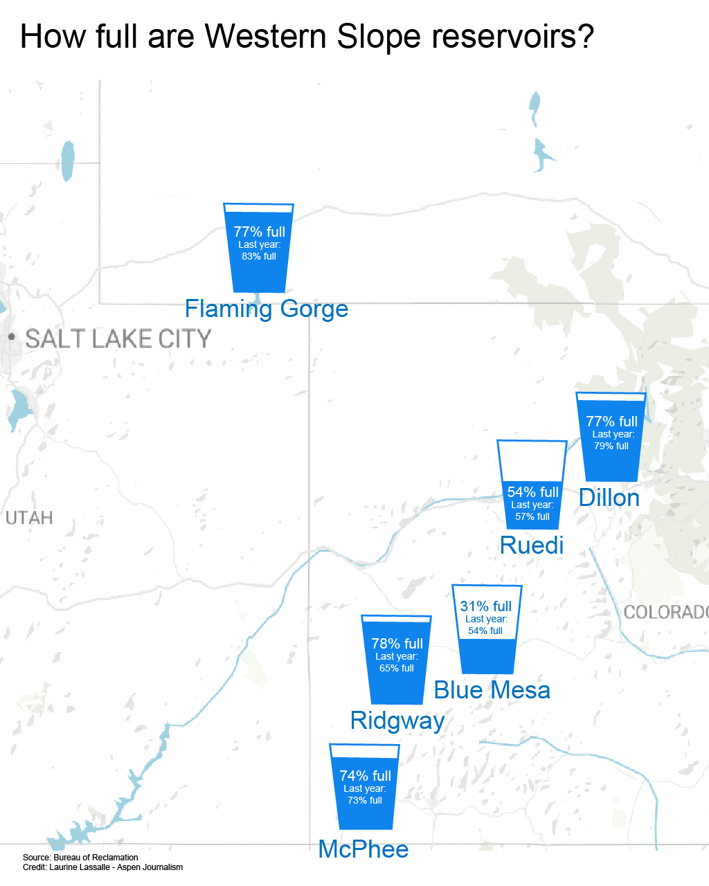
These limitations can be seen in recent years’ forecasts for Ruedi Reservoir, on the Fryingpan River. Initial forecasts in April 2021 projected Ruedi could probably fill to its entire 102,373-acre-foot capacity, but the reservoir ended up only about 80% full that year. In 2020, each of the three main forecasting agencies also overpredicted Ruedi inflow for the months of April, May and June. (An acre-foot covers 1 acre to a depth of 1 foot.)
Tim Miller, a hydrologist with the U.S. Bureau of Reclamation who manages operations at Ruedi, said his models predicted a 2021 Ruedi inflow of 111,000 acre-feet, but only 77,000 acre-feet actually flowed in. That the models are based on historical SNOTEL data from past decades is a drawback as climate change progresses, but it’s the best we have, Miller said.
“It makes the assumption that what we have seen in the past is what we will see in the future, which is a really poor assumption when you’re in the middle of a change in the climate,” Miller said. “We will probably see events like we haven’t seen in the future and we are using what we’ve seen to predict them.”
Dave Kanzer, director of science and interstate matters for the Glenwood Springs-based Colorado River Water Conservation District, said people often look for a single explanation when streamflows don’t match predictions. The River District owns and operates Wolford Mountain Reservoir, near Kremmling, and stores water in Ruedi Reservoir. But there is often a whole host of compounding factors that water managers will have to begin weighing more heavily as the climate warms.
“It’s not just about soil moisture, it’s not just about solar radiation, it’s not just about temperatures, it’s not just about the winds — it’s everything,” Kanzer said. “In some cases, like 2021, you get what some people like to call the perfect storm.”
Aspen Journalism covers water and rivers in collaboration with The Aspen Times.
Colorado Springs with the Front Range in background. Photo credit Wikipedia.
Click the link to read the article on the KOAA website (Bill Folsom), Here’s an excerpt:
The ongoing drought in the west motivated a request from Colorado Springs Utilities for an update to city ordinances on annexing new developments into the city. With five in favor and four against, City Council approved the change saying for any development annexations to be considered, the city’s water supply has to be at 130% of what is needed for existing residents. Mayor John Suthers supported the change saying tough decisions are being forced by the current water crisis along the Colorado River Basin.
“Our citizens are asking a simple question, ‘Can you ensure we’ll have enough water?’ This ordinance acts in the public interest and answers that question loud and clear,” said Suthers…
Many developers from the community spoke against the change saying it will make large developments outside the city almost impossible.
Suthers Tweeted, “If we do nothing to maintain a buffer between our water supply and our water usage, and the city suffers a major curtailment of our Colorado River water, further drought will put us in an untenable situation, and we will be responsible for a failure of public policy.”
Colorado Springs Utilities (CSU) recommended the 130% number following an in-depth review of the organization’s capacity and ability to provide water to the city’s citizens. Utilities maintain that the city’s 30% margin buffer allows CSU to consistently provide water year in and year out.
Aspen Journalism is compiling a data dashboard highlighting metrics of local public interest, updated weekly.
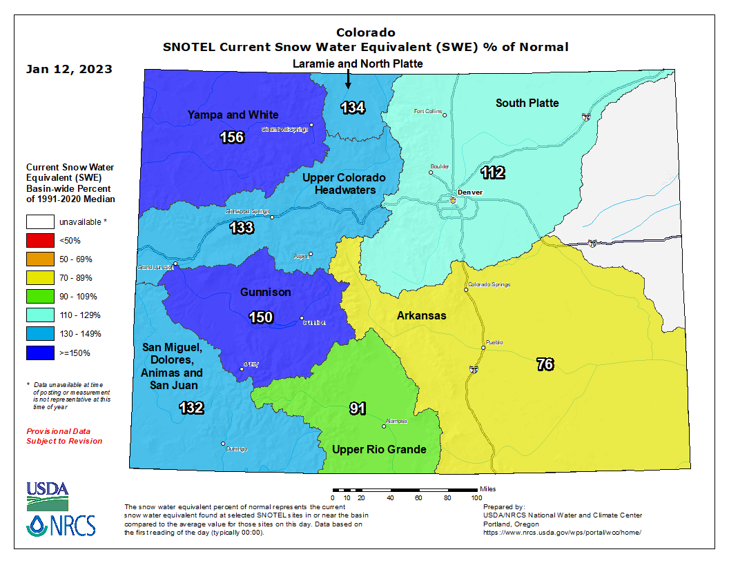
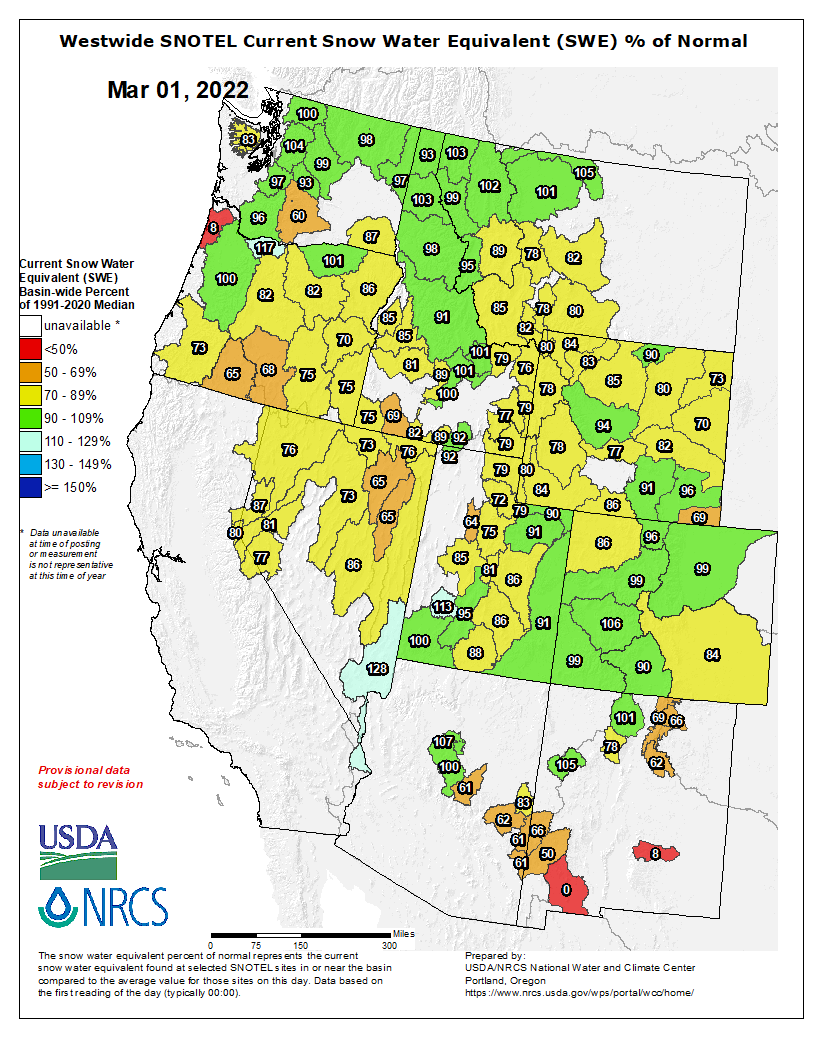
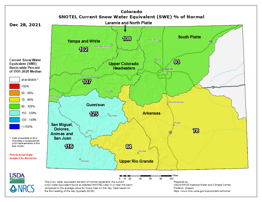
Snowpack at McClure Pass roughly 150% of average
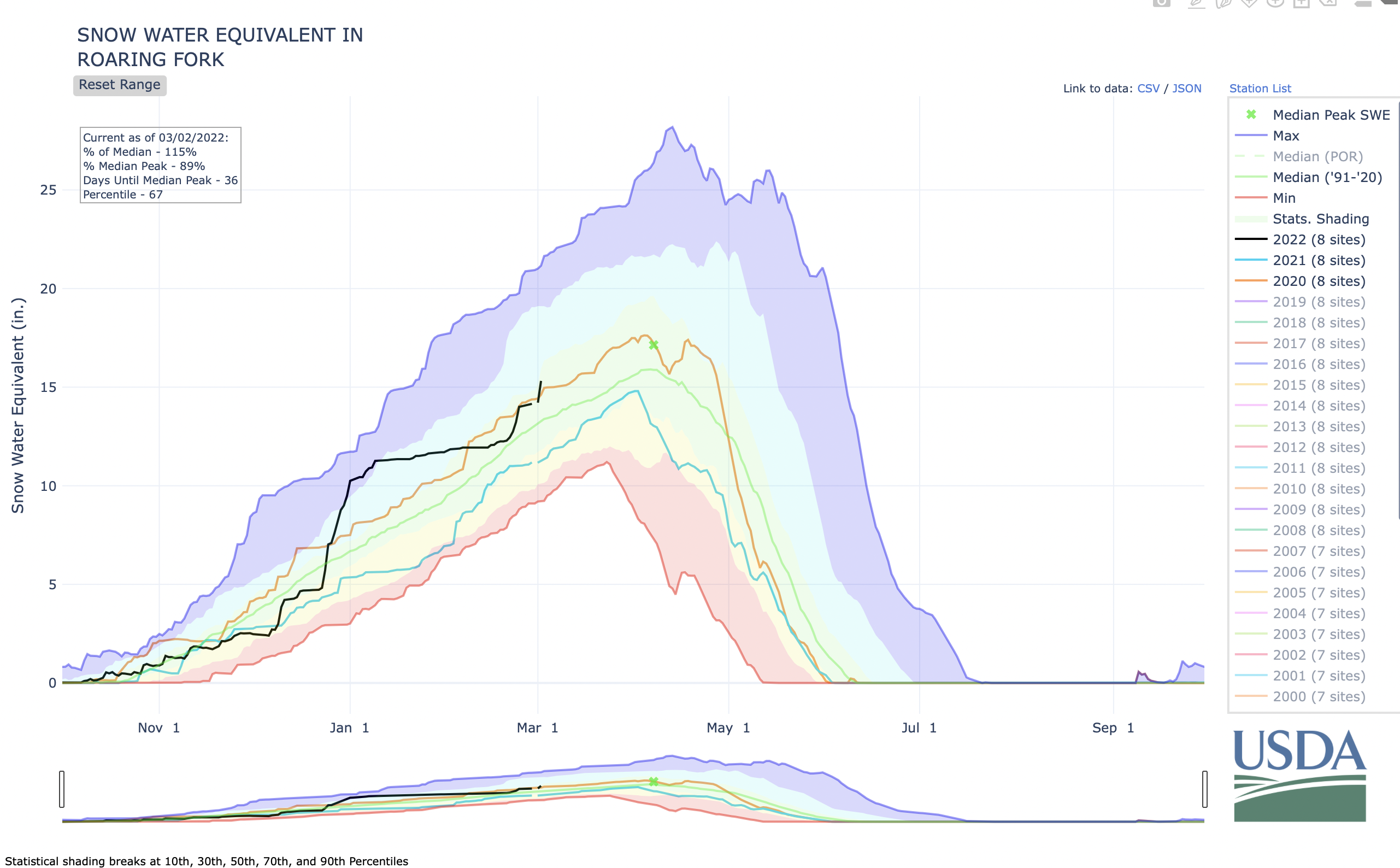
Snowpack in the Roaring Fork basin reached 126% of average for Jan. 8 with 9.7 inches of snow-water equivalent, according to NOAA. Recent snowfall has increased the basin snowpack by 43% in the past two weeks.
SNOTEL sites that monitor snowfall throughout the winter measured the snowpack at Independence Pass at 94.9% of average on Jan. 8, with a “snow water equivalent” (SWE) of 7.4 inches, up from 6.81 inches on Jan. 8. Last year on Jan. 8, the SNOTEL station up the pass (located at elevation 10,600 feet) recorded an SWE of 8.58 inches, or 110% of average.
The monitoring station at McClure Pass located at elevation 9,500 feet recorded a SWE of 11.18 inches on Jan. 8, or 149.1% of average. That’s up from a SWE of 9.09 inches on Jan. 1. Last year, on Jan. 8, the station also measured a snowpack holding 8.39 inches of water.
On the northeast side of the Roaring Fork Basin, snowpack at Ivanhoe, which sits at an elevation of 10,400 feet, reached 8.5 inches on Jan. 8, or 123.2% of average.
Snowpack at Schofield Pass reached 18.11 inches on Jan. 8, which represents 123.2% of average. Schofield Pass sits at an elevation of 10,700 feet between Marble and Crested Butte.
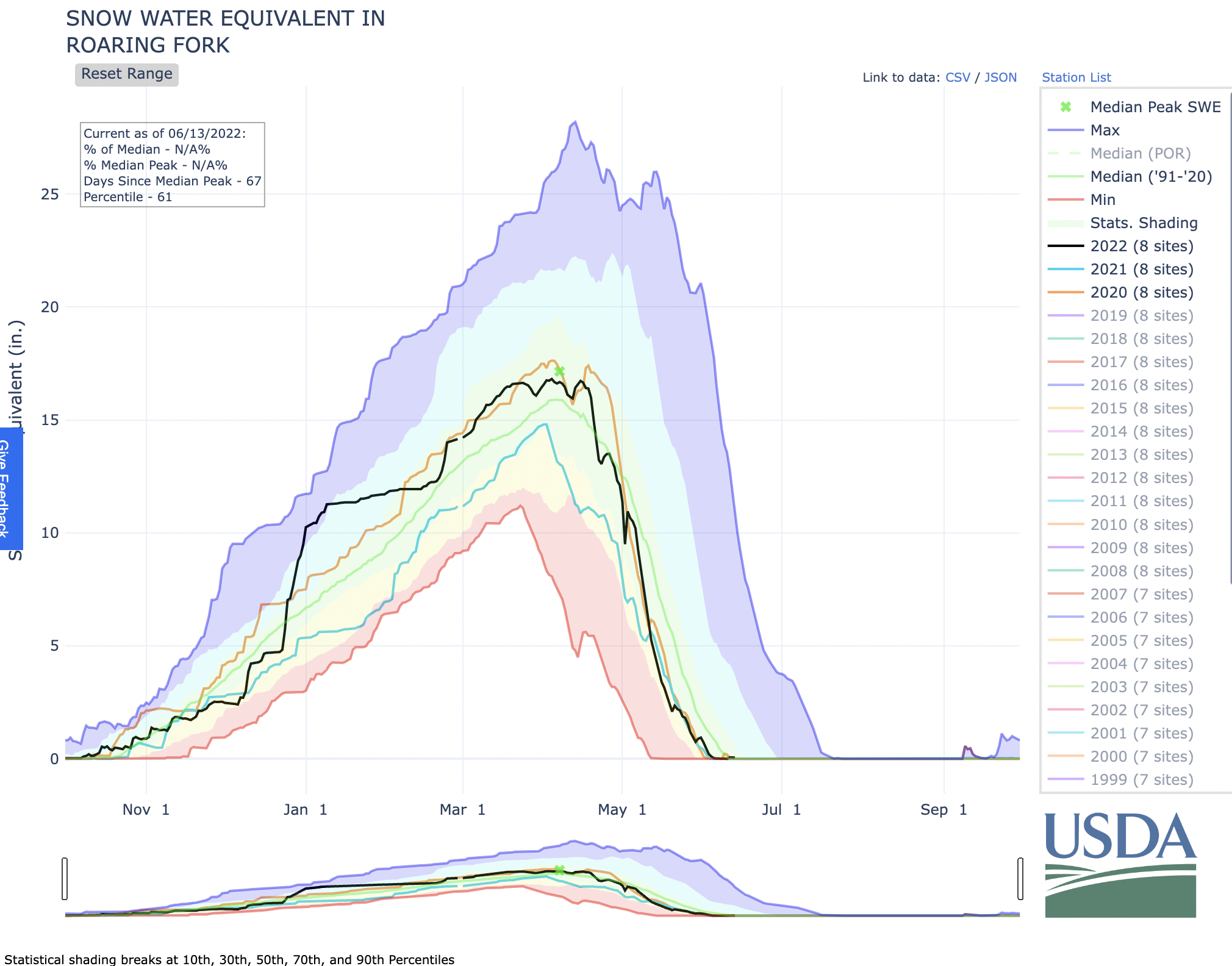
Snow water equivalent — the metric used to track snowpack — is the amount of water contained within the snowpack, which will become our future water supply running in local rivers and streams.
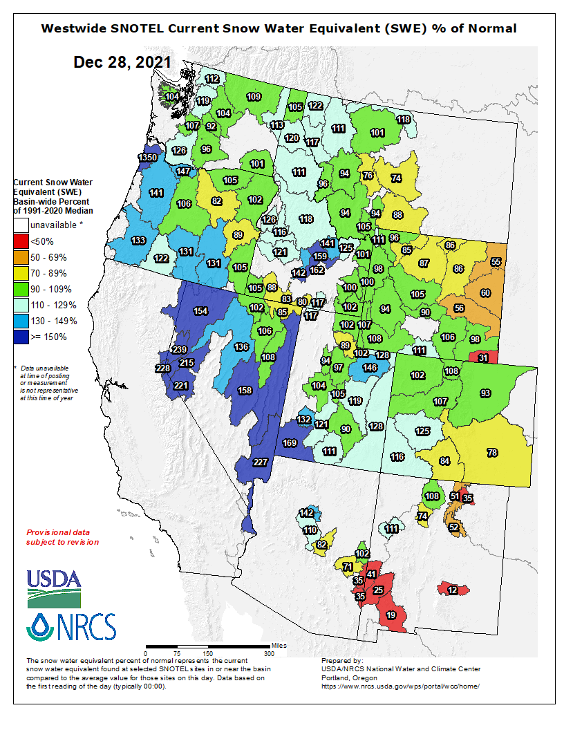
Colorado snowpack basin-filled map January 12, 2023 via the NRCS.
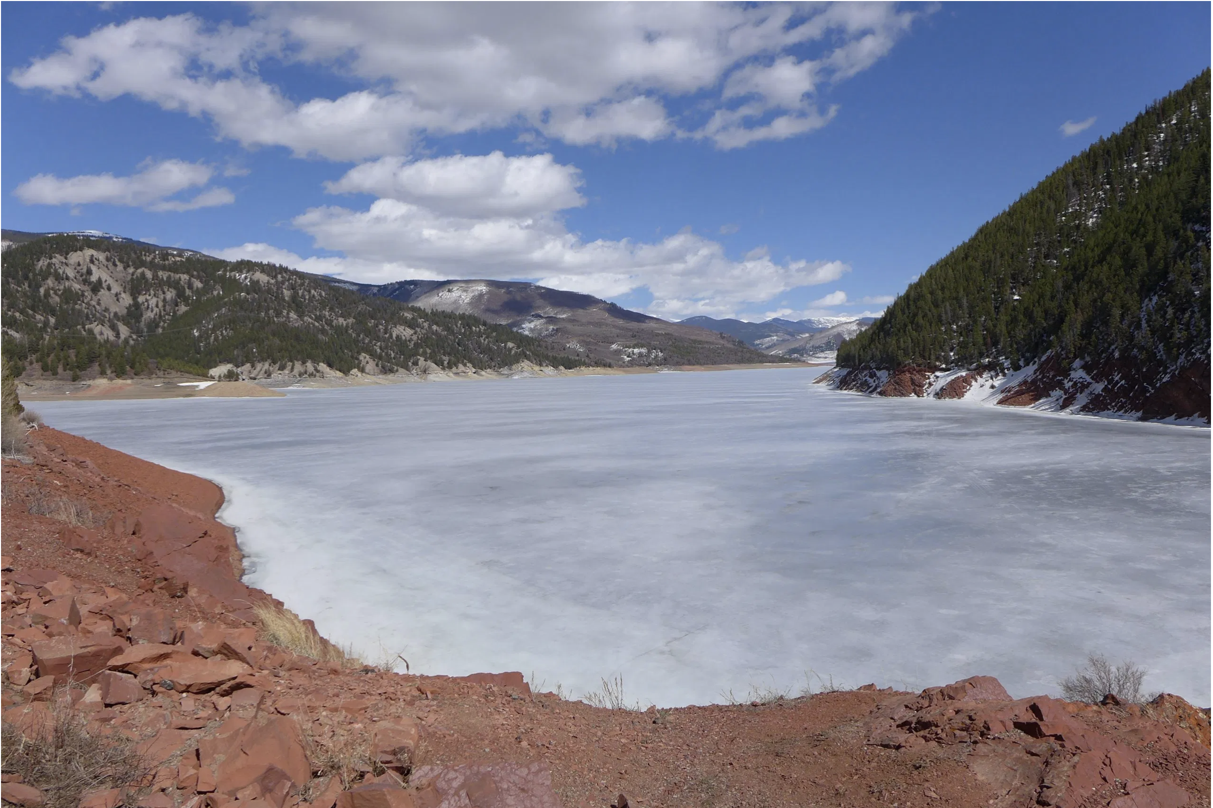
Ruedi Reservoir, near the headwaters of the Fryingpan River, was still frozen in early April 2021. CREDIT: HEATHER SACKETT/ASPEN JOURNALISM
From email from the Colorado Water Trust (Kate Ryan, Rick Lofaro, Brendon Langenhuizen, and Rob Viehl):
Colorado Water Trust and Roaring Fork Conservancy have teamed up with the Colorado River Water Conservation District (Colorado River District) and the Colorado Water Conservation Board to purchase and release water from Ruedi Reservoir to mitigate the impacts of anchor ice on the Fryingpan River. On Friday, December 16, the first release of water from Ruedi Reservoir will begin. The project aims to release 1.26 billion gallons of water (or 3,866 acre-feet) between December 16, 2022, and March 1, 2023, to the Fryingpan River, maintaining flows around 65 cubic-feet-per-second (cfs) in order to diminish ice buildup.
Anchor ice is a natural occurrence, but can have serious consequences on the hydrology of the river and the health of the ecosystem within. When there are low flows in the river during the cold winter months, large amounts of anchor ice can form on the bottom of the river, negatively impacting fish and macroinvertebrate function and diversity. Maintaining minimum winter flows between 60 to 70 cfs increases ecological resilience in the river through mitigating the formation of the anchor ice, and improving recovery from previous anchor ice impacts.
The partners will monitor the flow levels in the Fryingpan River, water temperature, air temperature, and anchor ice presence, from December through March. Anchor ice survey results will be compared to previous two years to continue to observe trends and build a long- term data set. “Roaring Fork Conservancy’s unique anchor ice monitoring program will allow us to objectively document anchor ice over time. This allows us to continue to promote management of Ruedi Reservoir with local benefits in mind” says Rick Lofaro, Executive Director of Roaring Fork Conservancy.
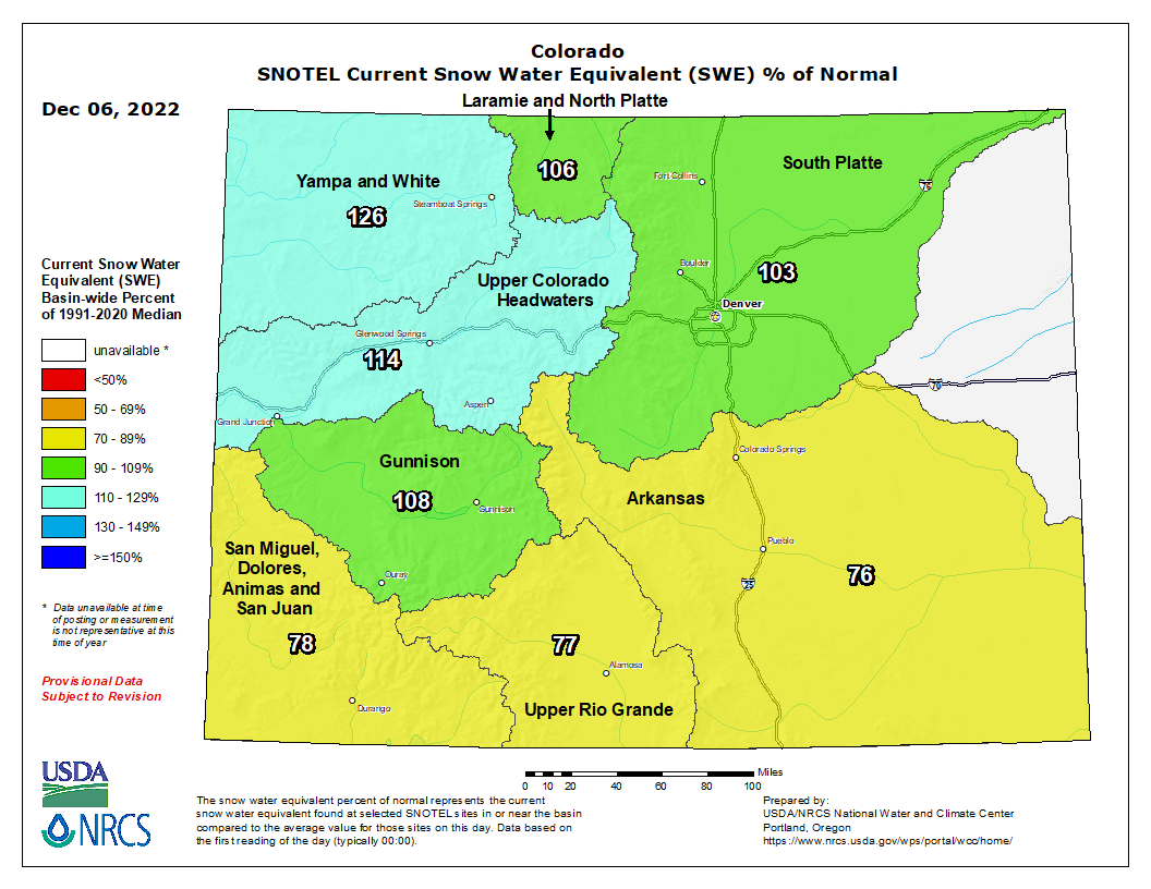
Snowpack in the Roaring Fork basin reached 120.5% of average for Dec. 4 with 4.7 inches of snow-water equivalent, according to NOAA.
SNOTEL sites that monitor snowfall throughout the winter measured the snowpack at Independence Pass at 93.6% of average on Dec. 4, with a “snow water equivalent” (SWE) of 4.21 inches, up from 2.91 inches on Nov. 27. Last year on Dec. 4, the SNOTEL station up the pass (located at elevation 10,600 feet) recorded an SWE of 3.19 inches, or 70.9% of average.
The monitoring station at McClure Pass located at elevation 9,500 feet recorded a SWE of 4.29 inches on Dec. 4, or 130% of average. That’s up from a SWE of 3.5 inches on Nov. 27. Last year, on Dec. 4, the station also measured a snowpack holding 0.39 inches of water.
On the northeast side of the Roaring Fork Basin, snowpack at Ivanhoe, which sits at an elevation of 10,400 feet, reached 4.8 inches on Dec. 4, or 126.1% of average.
Snowpack at Schofield Pass reached 8.31 inches on Dec. 4, which represents 109.3% of average. Schofield Pass sits at an elevation of 10,700 feet between Marble and Crested Butte.
Snow water equivalent — the metric used to track snowpack — is the amount of water contained within the snowpack, which will become our future water supply running in local rivers and streams.
Most streams keep running close to the average
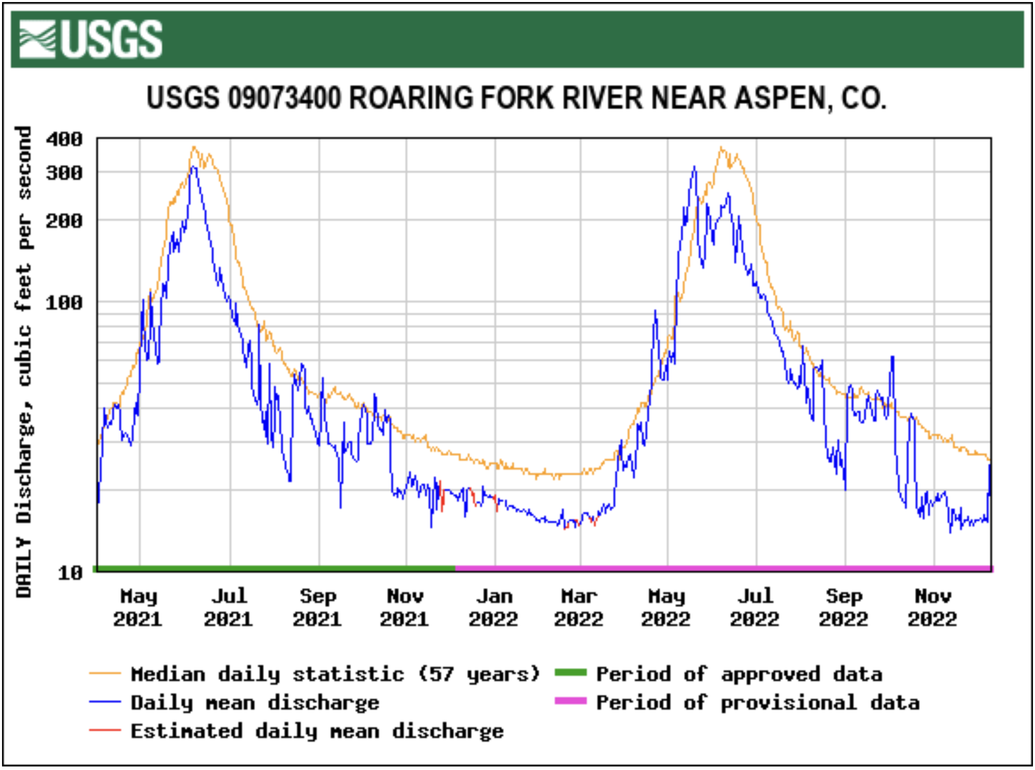
The Roaring Fork River below Maroon Creek flowed at 95 cfs on Dec. 4, or 93.3% of average, according to the USGS gauge. That’s down from Nov. 27, when the river was flowing at 101 cfs, or 103.1% of average.
At Stillwater, located upstream of Aspen, the Fork on Dec. 4 ran at 15.2 cfs or 52.4% of average, down from 15.4 cfs but up from 51.3% of average on Nov. 27.
The upper Fork’s flow is impacted by the Independence Pass transbasin diversion system that sends Roaring Fork headwaters to Front Range cities. Water flowing through the tunnel under the Continental Divide between Grizzly Reservoir on Lincoln Creek and the South Fork of Lake Creek measured 12.2 cfs on Dec. 4.
The Roaring Fork at Emma, below the confluence with the dam-controlled Fryingpan, saw on Dec. 4 streamflow of 263 cfs, or about 96% of average. That’s down from 270 cfs, but up from 94.4% of average, on Nov. 27.
Meanwhile, the Crystal River above Avalanche Creek, which is not impacted by dams or transbasin diversions, flowed at 65 cfs, or 110.7% of average, on Dec. 4. Last week, the river ran at 66 cfs, or 104.6% of average.
Snowpack at Indy Pass has increased by 45% since last week
Snowpack in the Roaring Fork basin reached 120.5% of average for Dec. 4 with 4.7 inches of snow-water equivalent, according to NOAA.
SNOTEL sites that monitor snowfall throughout the winter measured the snowpack at Independence Pass at 93.6% of average on Dec. 4, with a “snow water equivalent” (SWE) of 4.21 inches, up from 2.91 inches on Nov. 27. Last year on Dec. 4, the SNOTEL station up the pass (located at elevation 10,600 feet) recorded an SWE of 3.19 inches, or 70.9% of average.
The monitoring station at McClure Pass located at elevation 9,500 feet recorded a SWE of 4.29 inches on Dec. 4, or 130% of average. That’s up from a SWE of 3.5 inches on Nov. 27. Last year, on Dec. 4, the station also measured a snowpack holding 0.39 inches of water.
On the northeast side of the Roaring Fork Basin, snowpack at Ivanhoe, which sits at an elevation of 10,400 feet, reached 4.8 inches on Dec. 4, or 126.1% of average.
Snowpack at Schofield Pass reached 8.31 inches on Dec. 4, which represents 109.3% of average. Schofield Pass sits at an elevation of 10,700 feet between Marble and Crested Butte.
Snow water equivalent — the metric used to track snowpack — is the amount of water contained within the snowpack, which will become our future water supply running in local rivers and streams…
Most streams keep running close to the average
The Roaring Fork River below Maroon Creek flowed at 95 cfs on Dec. 4, or 93.3% of average, according to the USGS gauge. That’s down from Nov. 27, when the river was flowing at 101 cfs, or 103.1% of average.
At Stillwater, located upstream of Aspen, the Fork on Dec. 4 ran at 15.2 cfs or 52.4% of average, down from 15.4 cfs but up from 51.3% of average on Nov. 27.
The upper Fork’s flow is impacted by the Independence Pass transbasin diversion system that sends Roaring Fork headwaters to Front Range cities. Water flowing through the tunnel under the Continental Divide between Grizzly Reservoir on Lincoln Creek and the South Fork of Lake Creek measured 12.2 cfs on Dec. 4.
The Roaring Fork at Emma, below the confluence with the dam-controlled Fryingpan, saw on Dec. 4 streamflow of 263 cfs, or about 96% of average. That’s down from 270 cfs, but up from 94.4% of average, on Nov. 27.
Meanwhile, the Crystal River above Avalanche Creek, which is not impacted by dams or transbasin diversions, flowed at 65 cfs, or 110.7% of average, on Dec. 4. Last week, the river ran at 66 cfs, or 104.6% of average.
The Crystal River runs low outside of Carbondale on September 1, 2020. With average temperatures warming in summer months by as much as 3.5 degrees since the 1950s in Garfield County, streamflows are trending down as peak runoff comes earlier and more water is sucked up by evaporation and dry soils, stressing available water supplies in late summer and fall. Photo credit: Dan Bayer/Aspen Journalism
A study of a water replacement plan on the Crystal River is looking at nature-based solutions, but experts say some type of storage will also probably need to be built to solve shortages in dry years.
Wendy Ryan, an engineer with Colorado River Engineering who is heading up an analysis of a basin-wide backup water-supply plan, gave a progress update at the Colorado Basin Roundtable meeting this week. The study was funded largely by a state grant and undertaken by the Colorado River Water Conservation District and the West Divide Conservancy District.
“We have a couple landowners near Marble we are working with to see if we can put storage supplies on their properties,” Ryan said in response to a question asking her what solutions she had found. “We don’t have any shovel-ready projects. We did a lot of work upfront, and now it’s simply trying to find what we can build.”
During the hot, dry summer of 2018, the Ella Ditch, which pulls water from the Crystal River and irrigates hayfields south of Carbondale, placed a call for the first time. That means the Ella Ditch wasn’t getting the full amount to which it is entitled and upstream junior water users had to stop taking water so that the Ella could get its full amount.
The Ella Ditch has water rights that date to 1902, and any water rights younger than that — including those held by the town of Carbondale, the Marble Water Company and several residential subdivisions along the Crystal River — were technically supposed to be shut off under a strict administration of the river by the state Division of Water Resources. Under Colorado’s system of water law known as prior appropriation, those with the oldest water rights have first use of the river.
Most junior water rights holders have what’s known as an augmentation plan, which allows them to continue using water during a call by releasing water from a backup source, such as a nearby reservoir. The problem on the Crystal is that several of these residential subdivisions don’t have an augmentation plan.
Engineers from Division 5 of the Colorado Division of Water Resources have said that if water users work together to find solutions and come up with an augmentation plan, they won’t shut off indoor residential water use if the call happens again. Outdoor watering could still be shut off.
The first phase of the study, which River District representatives presented to Pitkin County commissioners in June 2021, was a demand quantification, which put numbers on the amount of water needed at different times of year.
Engineers found 90 structures — many of them wells for in-house water use — that take water from the river system and which would need to be included in the augmentation plan. These structures deliver water to 197 homes; 80 service connections in Marble; about 23 irrigated acres; Beaver Lake and Orlosky Reservoir in Marble; 16,925 square-feet of commercial space; and livestock.
In order for these water users to keep taking water during a downstream call by an irrigator, they would have to replace about 113 acre-feet in the Crystal River per year. (An acre-foot is the amount of water needed to cover an acre of land to a depth of 1 foot and can typically meet the annual needs of one or two families.) The amount of extra flow that would need to be added to the river is small — just .58 cubic feet per second during July, the peak replacement month.
The Ella Ditch, in the Crystal River Valley, placed a call for the first time ever during the drought-stricken summer of 2018. That meant the Town of Carbondale had to borrow water from the East Mesa Ditch under an emergency water supply plan. Photo credit: Brent Gardner-Smith/Aspen Journalism
Wild & Scenic jeopardized?
Ryan and staff from the River District have said they are not considering storage on the mainstem of the Crystal River, which could jeopardize a federal Wild & Scenic designation, a long-sought-after goal of Pitkin County, local environmental groups and some residents. A Wild & Scenic standing would mean no dams or out-of-basin diversions.
“We were never going to consider any mainstem storage on the Crystal River,” Ryan said. “We don’t want to do anything to jeopardize that potential designation on the Crystal, and what we are looking at shouldn’t.”
But Pitkin County Commissioner Kelly McNicholas Kury said it’s hard to see how upstream storage and a Wild & Scenic designation won’t conflict.
“It troubles me to hear the engineers say it’s hard to envision a solution that doesn’t involve storage,” she said. “So that’s just a red flag. It’s always been a red flag for Pitkin County.”
McNicholas Kury and two other roundtable members voted in 2019 against funding the study unless storage was off the table.
The Crystal River at the fish hatchery just south of Carbondale was running at about 10 cubic feet per second on Oct. 13, 2020, much lower than the state’s instream flow standard of 60 cfs. Rivers in the Roaring Fork watershed have seen below-average streamflows in water year 2020, which ended Oct. 1, despite a slightly above-average snowpack. Dry soil conditions threaten to bring a similar scenario in water year 2021. Photo credit: Heather Sackett/Aspen Journalism
Nature-based solutions
A parallel study, undertaken by the River District and environmental-and-recreation advocacy group American Rivers, is looking at nature-based solutions. The idea is that by keeping water on the landscape higher in the basin, it could recharge aquifers and boost river flows in late summer.
“We have been analyzing whether the reconnection of floodplains can assist with aquifer recharge and natural water storage while also improving the resilience of watersheds and potentially contributing to later-season flows,” said Fay Hartman, American Rivers conservation director for the Southwest region.
According to Zane Kessler, the River District’s director of government relations, there are four potential areas for nature-based projects: the Coal Basin area; Avalanche Creek upstream of its confluence with the Crystal; the Janeway area, downstream of the confluence of Avalanche Creek and the Crystal; and the confluence of Thompson Creek and the Crystal. But none of the sites are perfect, Kessler said.
“The River District and American Rivers are partners in this effort investigating whether turning back the clock on past alterations that have degraded the Crystal River can help recapture some of the climate resilience we have lost,” he said. “Improving the storage in floodplains and wetlands I think we see as an innovative and lower-impact approach to meeting late-season water needs than dams or storage in the headwaters.”
Findings and recommendations from the nature-based solutions analysis are expected by the end of the month. But Ryan said some kind of storage is still needed because nature-based solutions will still not be enough to meet the supply-demand gap in dry years, according to her analysis.
“It might meet a portion of our demands, but it’s not going to meet all our demands,” she said.
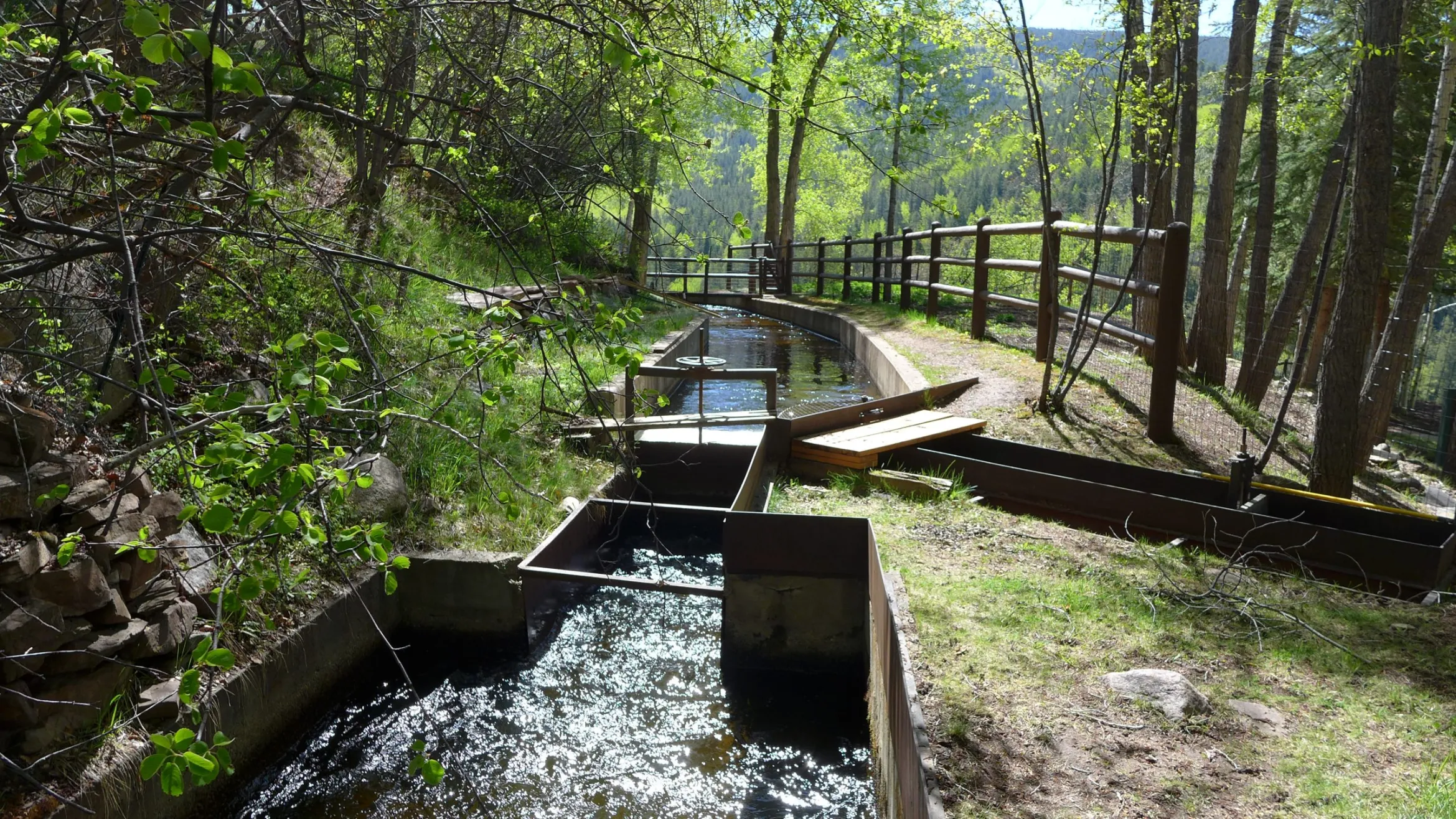
The Weaver Ditch as it winds through Sopris Park in Carbondale. While the ditch is an amenity for the community, the water in the ditch comes directly out of the Crystal River, which is often stressed from lack of water. Some Carbondale residents irrigate their lawns and landscaping with the town’s ditches, like the Weaver Ditch, that flow through town. A new unified outdoor watering standard would not apply to those who use ditch water, but they still are encouraged to comply. CREDIT: HEATHER SACKETT/ASPEN JOURNALISM
In an effort to unify the Roaring Fork watershed, a local agency has developed valley-wide outdoor watering standards that its board members hope will be adopted by municipal water providers.
Last week the Ruedi Water and Power Authority board, which is made up of representatives from local towns and counties, gave its unanimous support to a set of unified permanent watering standards. The standards are focused on time of day and day of week for outdoor watering and would apply to any residential or commercial customer receiving municipal water from the city of Aspen, town of Basalt, town of Carbondale, city of Glenwood Springs, Snowmass Water & Sanitation District and Mid-Valley Metropolitan District.
The proposed schedule would limit outdoor watering to between 6 p.m. and 9 a.m. three days a week. Properties with odd-numbered addresses could irrigate on Wednesdays, Fridays and Sundays; even-numbered properties could water on Tuesdays, Thursdays and Saturdays. No outdoor watering would be allowed on Mondays. Water providers could still enact more stringent restrictions depending on local conditions in their areas; the standards are intended to be a new baseline.
“If we can make this change, the idea that (watering restrictions) change from year to year to year will go away,” said Rachel Richards, Aspen City Council and RWAPA board member. “It’s going to be much easier and less expensive than having to tell people every year what the rules are this summer.”
The new watering standards were developed with the help of a project accelerator grant from WaterNow Alliance, which according to its website is a network of water leaders advancing climate resilient water strategies, and Boulder-based environmental advocacy group Western Resource Advocates. Outdoor watering of lawns and landscaping is often the largest water use category for local water providers; for the city of Aspen, outdoor irrigation represents about 70% of total water use.
The proposed schedule would result in water savings because watering would happen during the coolest periods of the day, peak demands would be reduced and one day a week of no watering would allow storage to be refilled, according to a memo from WaterNow Alliance and WRA.
“The three-day-per-week schedule is relatively easy to communicate to residents and other water users and it can be easily programmed into all types of irrigation controllers,” the memo reads.
The valley-wide watering standards were an outgrowth of the regional water efficiency plan, said RWAPA Executive Director April Long.
“We learned from the providers that were part of that plan that they still really needed some unified messaging about outdoor water use,” Long said. “We realized we don’t even have common ground to tell people exactly what to do because we have so many drought stages, and restrictions implemented in different ways. We actually need some baseline standards so we can provide a common message that’s not confusing for all of our residents.”
There are some exceptions to the standards. Outdoor watering can still occur any time of day with a handheld hose or drip irrigation. And those who irrigate with water from a ditch, like many residents in the town of Carbondale, are not subject to the standards, but are encouraged to comply.
The standards lay out penalties for violation, including a written warning for a first violation, and fines increasing to $500 for a fourth violation. But proponents will focus solely on an education campaign for the first season before issuing warnings or fines.
The next step is for Long to present the watering standards to each of the participating municipalities and get them approved by elected officials.
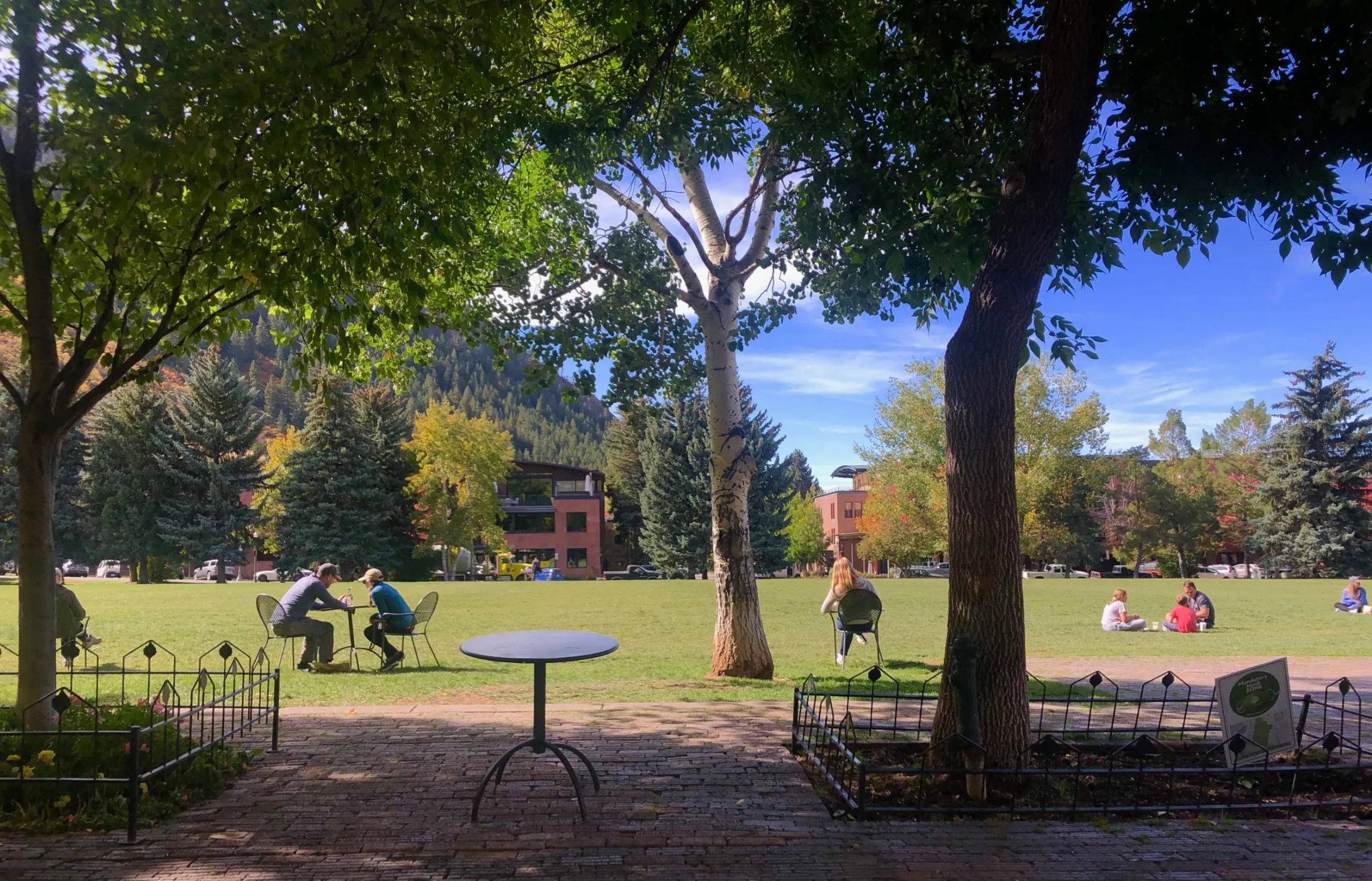
Residents and visitors spend time in Aspen’s Wagner Park on Sept. 28, 2020. Visitation and lodging unit occupancy rates are two variables that influence Aspen’s demand for treated water, 70% of which is used to water outdoor spaces such as parks and gardens, according to city officials. CREDIT: NATALIE KELTNER-MCNEIL / ASPEN JOURNALISM.
Since 2017, the city of Aspen’s water use has remained steady, illustrating the difficulty of reducing consumption through voluntary conservation measures amid continued growth and the effects of climate change.
According to numbers provided by city staff, total metered accounts for water use between 2017 and 2021 hovered between 800 million and 900 million gallons per year coming from the city’s treated-water system. Aspen’s system serves about 3,960 customer connections in the city’s urban-growth boundary.
2019 — a wet year — saw the lowest use in the data set, down to 828,650,350 gallons, or about 2,543 acre-feet. (An acre-foot is the amount of water needed to cover an acre of land to a depth of 1 foot and can typically meet the annual needs of one or two families.)
Despite the COVID-19 pandemic, which closed or limited many businesses, stores, restaurants and government facilities, the year 2020 saw water use rise 7.7% from 2019 to about 2,739 acre-feet. Water use then dropped 4.7% in 2021 to about 2,612 acre-feet.
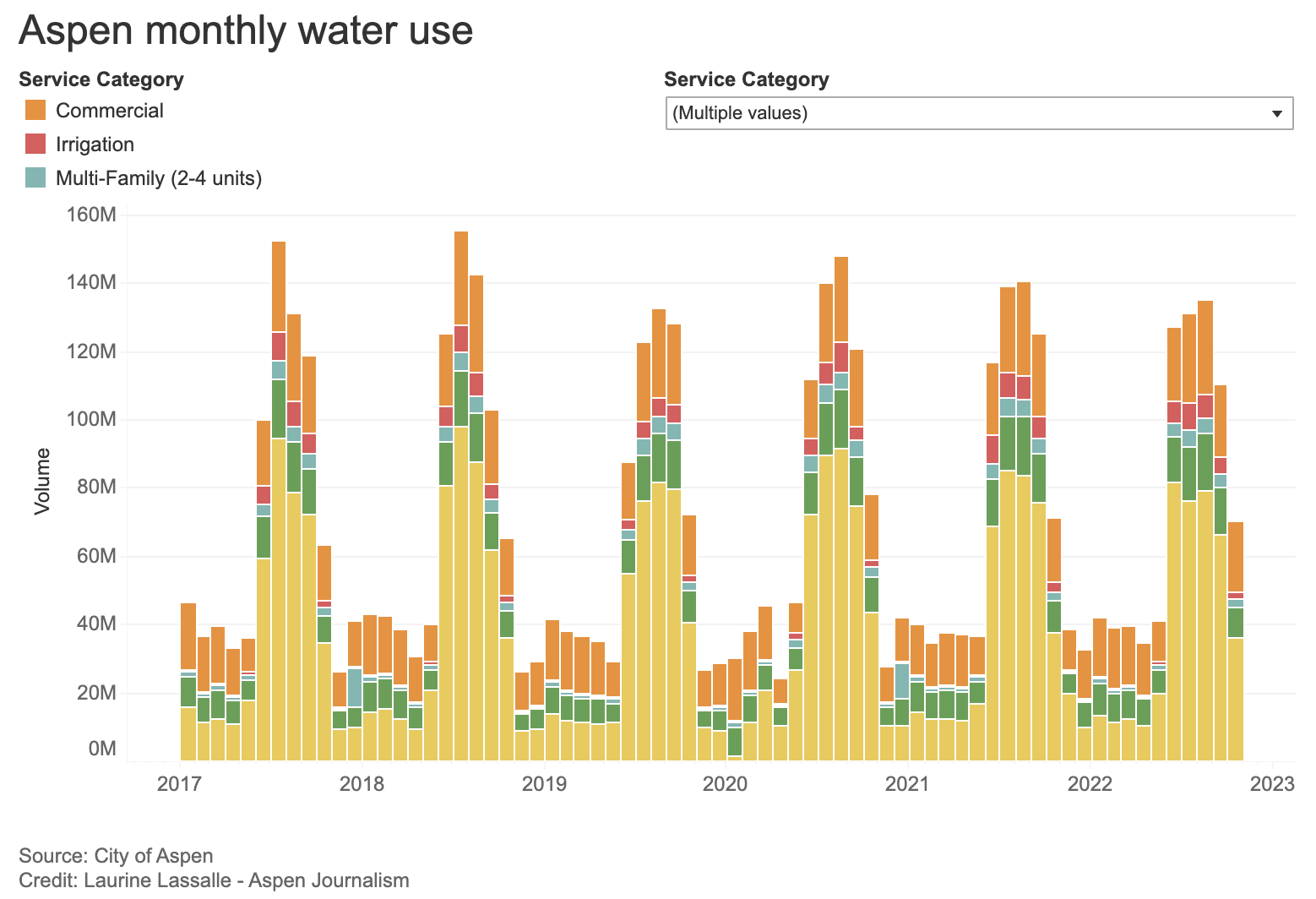
Water use is very seasonal in Aspen as outdoor watering represents about 70% of the city’s total annual water use, according to Tyler Christoff, the city’s director of utilities.
In July and August 2021, residential use was seven times as much as in the offseason month of April. And residential use in the summer months was five times greater than that in January.
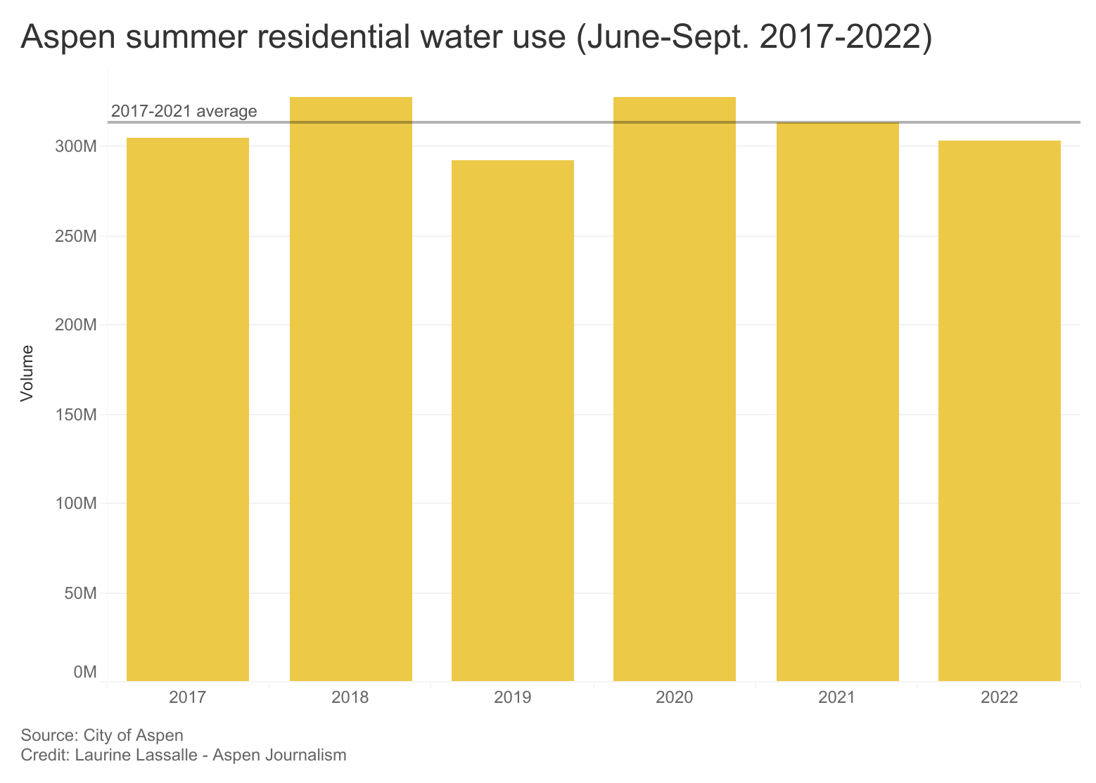
2022’s June-September irrigation season recorded the second-lowest total water use since 2017, with about 1,546 acre-feet, after 2019’s 1,523 acre-feet. Summer residential use dropped by 3.3% from last year.
Each year, about half of Aspen’s treated-water use is residential, which includes both indoor water use and outdoor lawn and landscaping watering, and one-fourth of the total water consumption is commercial. Multifamily units, irrigation and city facilities account for the rest.
Aspen’s water use also tracks closely with local drought conditions, with drier years seeing more water use. For example, water use was down in 2019, when Pitkin County did not experience drought conditions during the irrigation season until September, according to the U.S. Drought Monitor. Water use was up the following year, when Pitkin County experienced increasingly severe drought conditions as the summer went on, reaching extreme drought by mid-August. With more rain over the past two summers, water use was lower than in 2020.
The past several years of steady water use have shown that despite a much-praised water-efficient landscape ordinance designed to limit water use in redevelopment, smart meters, a tiered rate system that charges big water users more and year-round Stage 2 water restrictions, getting some customers to change their behavior, especially when it comes to outdoor watering, is challenging.
“I think (outdoor use) is not as well understood from a conservation perspective,” Christoff said. “It’s not a water use that you are directly interacting with on a daily basis. Most irrigation is automated. It just kind of occurs, and that creates an inherent kind of disconnection.”
But Christoff said the fact that Aspen’s water use has remained mostly flat while the number of taps and fixtures has increased is a win. According to numbers in Aspen’s 2015 Water Efficiency Plan and numbers provided by Christoff, Aspen’s equivalent capacity units (ECUs) have gone from 17,300 in 2014 to 17,853 in 2021, about a 3.2% increase, creating more demand on the system. One ECU is equivalent to a one-bedroom, one-bathroom home with a fully equipped kitchen.
“I really think it’s a positive thing that we have stayed relatively steady despite more fixtures, more use, more visitation, more building, all of those things,” Christoff said. “That’s really a credit to our conservation program and our community understanding that the resource is finite and wise use of it is really important.”
Aspen aims to use enhanced conservation to address some of its projected water shortages in the future. According to Aspen’s Integrated Water Resource Plan, enhanced conservation could be used to decrease indoor water use by 12% and outdoor use by 25% by the end of 2070. But it also said the yield from enhanced conservation is uncertain because it depends on customers’ behavioral changes. Hotter temperatures from climate change are also predicted to increase outdoor watering demand.
Aspen’s IWRP, which was completed last November by consultant Carollo Engineers, lays out Aspen’s projected water shortages for 50 years under future climate change and growth scenarios. Under the worst-case scenario — where climate change increased outdoor watering by 25% and a 1.8% growth rate that pushed Aspen’s total population (including seasonal residents) to almost 68,000 people, with only modest conservation — Aspen’s total water demand could be 9,281 acre-feet by 2070. The worst shortfalls under those conditions could occur in two consecutive dry years and be about 2,300 acre-feet total over the course of both years, according to the IWRP. The report offers six portfolios of water-source combinations to make up the shortfall, including a potential 5,820-acre-foot reservoir that was estimated to cost $400 million in 2021 dollars.
Christoff said that although the 25% figure is aggressive, he believes it’s attainable and pointed to the city’s water-efficient landscaping ordinance as one path to getting there. Aspen’s landscaping standards, enacted in 2017, set an upper limit for water use for any project — including landscaping, grading and construction — that disturbs 1,000 square feet and more than 25% of a property. (The ordinance is also triggered by a redevelopment of 50% or more of an existing structure.) That limit is set at no more than 7.5 gallons per square foot per season. Redevelopment and new development must meet certain criteria for soil, plant material and irrigation systems, and must submit a report from a third-party certified landscape-irrigation auditor.
Christoff said there have been 87 projects permitted so far under the water-efficient landscape ordinance. The city’s goal is to save 37 acre-feet each year with the ordinance by 2050. Christoff said of the 87 projects permitted, only about 10 are complete and have passed final inspection, so he could not put a number on how much water had been saved so far.
“We still need a few more years of projects working through the process to start being able to really quantify these savings,” he said in an email.
Aspen’s 2015 Water Efficiency Plan had a goal of reducing demand in 2035 by almost 600 acre-feet per year relative to what demands were projected to be without implementation of the water-efficiency program. Christoff said city staff feels like they are on track to meet this conservation goal.
“Our Water Efficiency Plan provides an outline and roadmap for these efforts,” he said in an email. “If we are able to successfully follow our plan and continue to see community support, we believe we will hit our targets.”
Some Western Slope cities have focused in recent years on getting a handle on outdoor watering because it is what is known as “consumptive” use. For residents on a municipal water system, with indoor water use such as showering, washing dishes and flushing toilets, the water goes down the drain and to the wastewater-treatment plant, where it’s cleaned and released back to the river. The vast majority of indoor water use is “non-consumptive.”
But with outdoor watering, lawns, shrubs, trees and soil absorb most of the water; it depletes the waterway from which it comes.
Since 2012, the Eagle River Water & Sanitation District, which provides water to the Vail area, has focused its conservation efforts solely on outdoor use.
“We don’t need to worry about indoor water; it goes back to the river,” said Diane Johnson, communications and public affairs manager for the district. “We just need to concentrate on outdoor water use, so that’s what we’ve done. Lawn watering is our first target.”
As climate change increases temperatures and lengthens the growing season, some of the water savings through efficiency and conservation programs may be wiped out. Water use during drought years, such as 2020, remained stubbornly high in Aspen. And a review of Bureau of Reclamation data by Colorado River experts suggests that water use throughout the upper basin is greater in dry years and less in wet years. If the water isn’t falling from the sky, people tend to take more from the rivers.
Residences among largest water users
If Aspen wants to reduce overall water use, it will have to address the largest water users, including residences with lots of outdoor watering.
“Conservation from the highest water users could have the largest impact on overall water use reductions,” the IWRP reads.
According to the IWRP, two single-family residences were in the top 10 individual water users in 2018, alongside Aspen’s biggest hotels, apartment complexes and city facilities. The two residences — which the city does not identify — were the seventh- and eighth-biggest water users, using 6.5 million gallons (nearly 20 acre-feet) and 5.8 million gallons (nearly 18 acre-feet) of water, respectively. The seventh-biggest water user used 1.4 million gallons (about 4.3 acre-feet) per ECU.
According to the IWRP, much of this high water use may be attributed to outdoor use. About 70 of more than 2,500 single-family residential accounts show water use of more than 1 acre-foot per year per ECU.
Christoff said city staff reach out to these large users with the offer of a free irrigation audit to assess their water use. Smart metering that lets staff and residents check their water use in real time also helps people better understand where they may be wasting water or have a problem such as a leak. But reducing use among Aspen’s biggest users, especially single-family homes, has been challenging.
Since 2005, Aspen has had a four-tiered billing structure in which properties that use more water pay a higher rate. But this doesn’t result in a reduction in water use for some customers, particularly those wealthy Aspenites who can afford to pay more.
“There are customers within our service territory where a financial disincentive is not a disincentive to them,” Christoff said. “Some customers, regardless of how high that third and fourth tier rates are, they are still going to use that amount.”
This concept is known as price inelasticity, where demand stays the same, despite fluctuating prices, said Lindsay Rogers, a water policy analyst with Western Resource Advocates who has worked with the city of Aspen on water projects.
“Customers who receive a pricey water bill, it might not motivate them to reduce outdoor water demand,” Rogers said. “That’s a challenge because that’s one of the biggest tools that municipal utilities have to encourage water conservation.”
Participants in a working group who helped shape Aspen’s IWRP said the city may be leaning too much on pricing to drive water conservation and cautioned that it may have a disproportionate impact on lower-income residents, while not creating a sufficient disincentive for other residents to reduce water use. The same group also ranked outdoor watering of lawns and landscaping as among the lowest priorities during a drought.
Aspen’s municipal code allows for fines or a municipal summons for chronic water-wasters who violate water restrictions. Stage 2 water restrictions, which have been in effect since September 2020, include the following: an even/odd day outdoor watering schedule depending on address; no watering between 9 a.m. and 5 p.m. except from a handheld hose or drip irrigation system; no outdoor watering of sidewalks, driveways or patios; and other restrictions.
But, according to Christoff, city staffers have never issued a fine or summons, although they have contacted property owners by email or letter. Aspen prefers education over enforcement, Christoff said.
“We talk to a number of water providers around Colorado, and across the board for the most part, folks either don’t have the staff capacity or inclination to enforce it,” Rogers said. “A lot of people just don’t want to be water cops.”
Other cities have had success
Several municipalities in the Colorado River basin have been able in recent years to decouple water use from population growth. That means that water use decreases even as population increases. The Eagle River Water & Sanitation District and Upper Eagle Regional Water Authority have decreased overall water use by 6% while the number of single-family equivalent units increased by 25% since 2002.
Although water use has seen years of ups and downs, Aspen’s IWRP shows that since 1995, overall demand is generally increasing and is projected to continue increasing.
Some Front Range cities, which take a portion of the water from the Colorado River basin through transmountain diversions, have also seen some success with their conservation programs. Aurora, for example, has seen its population rise by 46% over the past two decades, but the amount of water it has distributed has decreased by 9%, according to numbers provided by the city.
But it hasn’t been easy, according to Aurora Water General Manager Marshall Brown. There is a limit to voluntary measures. Developers didn’t take advantage of a program that offered a credit for tap fees for water-efficient landscaping. And not many customers signed up for a $3,000 turf-replacement rebate.
“Going into this year, we said we’ve really got to ramp this up,” Brown said. “We’ve got to tie economics more directly to what we are doing is one of the lessons we learned. And we’ve got to come up with literally code restrictions because we couldn’t get much progress with voluntary stuff.”
Aurora was among a group of municipalities that signed a memorandum of understanding in August committing to reducing nonfunctional turf grass by 30%. Aurora City Council last month passed an ordinance that prohibits turf for aesthetic purposes in all new development and redevelopment, and in front yards. Turf in backyards is limited to 45% of the space or to 500 square feet, whichever is smaller.
“We know we will see results from that,” Brown said.
This home is part of the City of Aurora’s water-wise landscape rebate program. Aurora City Council last month passed an ordinance that prohibits turf for aesthetic purposes in all new development and redevelopment, and front yards. Photo credit: The City of Aurora
A draconian approach
Las Virgenes Municipal Water District provides water to several exclusive and gated enclaves of Southern California such as Calabasas and Hidden Hills. Like Aspen, the area is home to many wealthy residents who may not be as sensitive to water price hikes. The district made headlines this year when it began installing flow-restrictor devices on the homes of water wasters — those who used 150% or more of their monthly water budget four or more times.
The flow restrictors make it so that if more than one person in the home or more than one appliance is using water at the same time, it will come out as an annoying trickle. But the real goal of the restrictors is to stop the functioning of outdoor irrigation systems, which account for about 70% of residents’ water use, according Michael McNutt, the water district’s public affairs and communications manager.
“It’s a great way to get a wake-up call to those individuals who just consistently abuse how much water they use,” McNutt said. “People have got to get the message. We provide the water and we educate and we provide tools, and if they are not going to control how much water they use, we will do it for them until they get the point.”
Water managers say increasing conservation can be challenging, in part, because residents are resistant to change. Thirsty green lawns have been part of American culture and an aesthetically pleasing symbol of prosperity for a long time. But as climate change and drought continue to rob the West of water, that attitude needs to change, McNutt said.
“The barrier I’m seeing is evolving that mindset into something where I can have climate-appropriate landscaping throughout my property and I’m going to look at that and find that just as aesthetically beautiful as a green lawn,” he said. “Green lawns are going to be a thing of the past.”
Although Christoff said there is currently little appetite among Aspen’s elected officials for more-aggressive monitoring of residents’ water use, tools such as the flow restrictor could be part of the city’s future, especially as climate change pushes water utilities to do more with less.
“I think stuff like that is absolutely on the plate,” he said. “That’s not, as a water manager, where I’m looking to go, but as the resource becomes more in demand or more scarce, those drastic-type measures might come more to the forefront.”
Aspen Journalism is supported by the city of Aspen’s community nonprofit grants program.
Aspen Journalism covers water and rivers in collaboration with The Aspen Times. For more information, go to http://www.aspenjournalism.org.
During the Fourth Quarterly General and Enterprise Meeting of 2022, the Board of Directors approved $195,293 for four new Community Funding Partnership projects. In less than two years of operation, the Community Funding Partnership has supported over 60 projects and awarded over $5.6 million to benefit West Slope water, according to Amy Moyer, Director of Strategic Partnerships.
Two of the most recent board-approved projects represent critical steps forward in accurately forecasting water supplies in the Colorado River Basin.
The Airborne Snow Observatory (ASO) Snow Mapping in the Roaring Fork and Fryingpan Watersheds, and the Roaring Fork Basin – Evaluation of Soil Moisture for Water Planning will increase the precision, reliability, and understanding of snowpack and soil moisture measurements, respectively.
According to the project summary provided by the Aspen Global Change Institute (AGCI) in its application, “In the Colorado River Headwaters Basin in 2021, a March snowpack of around 91% of average translated into only 54% of average streamflow by end of June (data from NRCS), contributing to severe deficits in the water supply and creating challenges for water managers.”
Devices such as SNOTel (snow telemetry) sites have been used for decades to measure snowpack levels. The data gathered from SNOTEL sites combined with 30-year climate averages predict how much water will likely end up in the river after the snow melts. While the sites accurately reflect snow conditions in a localized area, they are limited in scope and struggle to account for variability between drainages within the same river basin. Soil moisture measurement stations are even more sporadic across the River District’s fifteen counties. The data and analyses gathered by ASO and AGCI will create a more comprehensive picture of the overall health of the snowpack and its transition to streamflow by leveraging new technology and real time measurements.
A large part mission of the Colorado River District is to ensure that policymakers and water managers have accurate and up-to-date data and modeling. Over 65% of the Colorado River’s natural flow originates within the District’s fifteen counties making decision-support tools a critical need for water managers across the West.
Funded Projects
Airborne Snow Observatory Snow Mapping in the Roaring Fork and Fryingpan Watersheds – Water Year 2023
Project Applicant: Airborne Snow Observatory, Inc. Approved Amount: $75,000 Location: Eagle, Pitkin Counties
Initially a program within NASA, Airborne Snow Observatory, Inc. (ASO) is a Colorado Public Benefit Corporation that combines state-of-the-art remote sensing tools with snowpack modeling and fast data processing to deliver snow measurements of high accuracy, high resolution, and full-watershed coverage. The proposed project will support ASO snow mapping flights during winter/spring 2023 in the Upper Fryingpan and Roaring Fork watersheds. This project will provide an unparalleled inventory of the mountain snowpack that supplies the majority of runoff in the Roaring Fork River system.
Roaring Fork Basin – Evaluation of Soil Moisture for Water Planning
Project Applicant: Aspen Global Change Institute Approved Amount: $60,293 Location: Garfield, Pitkin Counties
The Aspen Global Change Institute manages the Roaring Fork Observation Network (also known as iRON) to collect and share data on soil moisture, climate, and ecology in the Colorado River headwaters basin. The iRON program centers around data collected by ten stations at different elevations and ecosystem types across the Roaring Fork Watershed. This project responds to a community need to better understand how soil moisture data can be effectively leveraged to better understand the relationship between snowpack, soil moisture, and streamflow in Western Colorado and beyond.
GVIC ML 260 Lateral Piping Project
Project Applicant: Grand Valley Irrigation Company Approved Amount: $40,000 Location: Mesa County
The Grand Valley Irrigation Company owns and operates the ML 260 lateral, which includes a 3,540-foot stretch that remains an open, trapezoidal ditch comprised of aging concrete. The project will pipe the remaining portion of the lateral resulting in a completely enclosed system. Piping will greatly reduce maintenance, such as monthly silt and root removal and concrete work to patch the ditch, while improving flows by eliminating silt deposition. Additionally, piping will prevent approximately 153 tons of salt from entering the Colorado River and reduce seepage losses that are currently estimated at 45 AF per year.
Increased pressure on the Fryingpan River due to growing population, recreation, and climate change has led to the need for strategic management of Ruedi Reservoir to ensure long-term ecological health and viability of the fishery. Maintaining minimum winter flows at 60-70 cfs increases ecological resiliency through mitigating the formation of anchor ice, which can negatively impact macroinvertebrate community function and diversity. Roaring Fork Conservancy, along with Colorado Water Trust, will partner with the Colorado Water Conservation Board and local entities to fund the release of 25 cfs from Ruedi Reservoir to supplement winter flows on the Fryingpan River. The Fryingpan River, a Gold Medal Stream, hosts thousands of anglers a year. Based on a 2015 Economic Impact study, the river accounts for over $3 million in economic output.
An aerial view of Assignation Ridge in the Thompson Divide area of Colorado. (Courtesy of EcoFlight)
Click the link to read the article on the Colorado Newsline website (Sammy Herdman):
On Oct. 12, Coloradans were given a reason to celebrate: President Joe Biden designated the Camp Hale-Continental Divide National Monument in Colorado. That same morning, before Air Force One touched down in Colorado’s Rocky Mountains, the Department of the Interior received a proposal for a 20-year administrative mineral withdrawal for the Thompson Divide area. If approved, the withdrawal would conserve nearly 225,000 acres in Western Colorado for 20 years by prohibiting new mining and oil and gas drilling projects.
Named a “crown jewel” by U.S. Sen. John Hickenlooper of Colorado and “great, wild country” by former President Theodore Roosevelt, the Thompson Divide is more than just wildlife habitat. Anglers come to fish and outdoor enthusiasts come to bike, hike and cross country ski. Each year, Colorado Parks and Wilderness sells 20,000 regional big game licenses to hunters. These visitors stay in hotels and patronize bait shops, grocery stores and restaurants in the nearby towns of Carbondale and Glenwood Springs. Ranchers, some of whom descended from the area’s namesake, Myron Thompson, graze their cattle in the Thompson Divide’s abundant grasses and shrubs, then sell high quality, grass-fed beef throughout the Western Slope and Front Range.
The Thompson Divide is the economic, recreational and ecological soul of the region. Yet, in the 2000s, the Thompson Divide was riddled with new leases for oil and gas extraction. Locals feared a future in which short-term extraction would strip the landscape of large forests, big game and clean streams. One study found that a community near an oil and gas development north of the Thompson Divide had elevated levels of toxic chemicals in the air and benzene (a known carcinogen) leaks in residential water wells.
An enormous amount of effort and infrastructure is required to develop land leased for oil and gas extraction: tearing down forests to build roads, importing heavy machinery and initiating a steady stream of trucks to carry in millions of gallons of water and fracking fluid. All of these activities present an existential threat to the natural characteristics that make the Thompson Divide special.
By 2017, the Thompson Divide was no longer in imminent peril. However, because the Thompson Divide sits atop pockets of natural gas it has retained the attention of oil and gas proponents — including the Colorado Oil and Gas Association — who are resistant to prohibiting drilling there. That’s one of the reasons this region hasn’t received permanent protection.
State leaders, such as Democrats U.S. Sen. Michael Bennet and U.S. Rep. Joe Neguse, have attempted to permanently protect the area by passing the Thompson Divide Withdrawal and Protection Act, which was later incorporated into the Colorado Outdoor Recreation and Economy — or CORE — Act. Unfortunately, the CORE Act has not yet passed, leaving the Thompson Divide vulnerable to future oil and gas extraction.
That is, until the CORE Act’s champions, including Bennet, Hickenlooper, Neguse and Gov. Jared Polis, urged the Biden administration to advance needed protections for some areas included in the bill. The designation of the Camp Hale-Continental Divide National Monument is monumental. The proposed 20-year mineral withdrawal from the Thompson Divide is no less significant.
The proposal doesn’t have the permanence that passing the CORE Act would, but it does offer a temporary solution. Through a public comment period and an upcoming environmental impact analysis, the Biden administration will determine whether the 20-year mineral withdrawal proposal should be accepted. At the end of the day, the future of the Thompson Divide should be determined by local communities that rely on it for their livelihoods — not the bottom line of oil and gas companies.
The outfall of the Bousted Tunnel, which delivers water from the Roaring Fork and Fryingpan rivers to the East Slope.
Click the link to read the article on the Ark Valley Voice website (Jan Wondra). Here’s an excerpt:
The Bureau of Reclamation (BoR) announced on Monday that it will direct $60 million in federal funding from the Infrastructure Investment and Jobs Act (IIJA) towards advancing the construction of the Arkansas Valley Conduit (AVC), a 130-mile pipeline project from Pueblo Reservoir east to Eads, Colorado that will deliver safe, clean drinking water to 50,000 people in 40 communities. The Colorado Water Conservation Board (CWCB) has supported this project with $100 million in grants and loans. The Arkansas Valley Conduit project is the final element of the larger Fryingpan-Arkansas Project, which Congress authorized in 1962. The project has literally been decades in the making.
“The SECWCD is thrilled with the announcement by the Bureau of Reclamation that $60 million from the bipartisan Infrastructure Investment and Jobs Act has been allocated for construction of the Arkansas Valley Conduit. This follows on the heels of the award of the first construction contract for the Boone reach,” said Southeastern Colorado Water Conservancy District Senior Policy and Issues Manager Chris Woodka.
“This commitment from BoR is a clear indication of their intent to move this project forward to completion, and to direct resources to it so that clean drinking water will be delivered sooner than originally planned,” he added. “We thank each and every one of you for your patience, and your ongoing support.”
The 5.5 mile Boustead Tunnel transports water from the Fryingpan River drainage into the Arkansas by way of Turquoise Lake (pictured here).
A nearly $43 million contract was awarded to a Colorado construction company marking the “first giant step” in the Arkansas Valley Conduit project designed to bring clean drinking water to eastern Pueblo County and southeastern Colorado. The federal Bureau of Reclamation awarded the inaugural contract for the conduit to WCA Construction LLC, for $42.9 million to cover construction of the first 6-mile section of the 30-inch trunk line that extends from the eastern end of Pueblo Water’s system toward Boone. Located in Towaoc, the construction company is owned by the Ute Mountain Ute Tribe and as a tribal enterprise the company employs a workforce that is 70% indigenous…
Since 2020 the federal government has appropriated $51 million toward the project, with those funds paying for the trunk line construction. Pueblo County has awarded $1.2 million in American Rescue Plan Act funding to connect the communities of Avondale and Boone to the trunk line, Woodka said. Work under the initial contract will begin in the spring of 2023 and is expected to be completed in 2024. “We are now in the process of designing those connection lines, then we will be putting those lines in. We hope everything is connected to Boone and Avondale by the end of 2024,” [Chris] Woodka said. That will bring water to about 1,600 Avondale residents and 230 Boone residents. Currently, many people in the areas that will be served by the conduit rely on groundwater supplies that may be contaminated by naturally occurring radionuclides, such as radium and uranium, or use shallow wells that contain harmful microorganisms and pollutants.
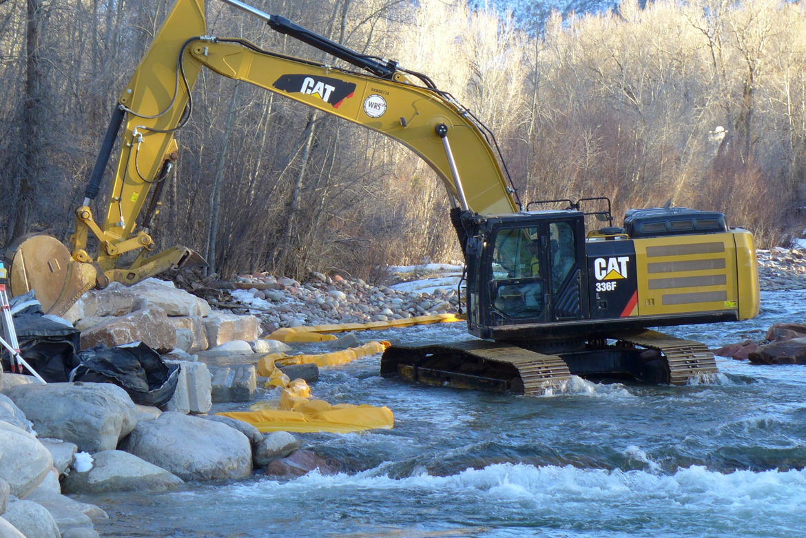
A photo from August 2022 shows the streambank stabilization project area near the Marble airstrip. The Army Corps of Engineers sent a letter of non-compliance to the property manager because they determined the work falls outside of what’s allowed under the project’s permit. CREDIT: COURTESY PHOTO via Aspen Journalism
A streambank stabilization project on the Crystal River just west of Marble is on hold after the U.S. Army Corps of Engineers determined that the work undertaken this past summer fell outside what is allowed by the project’s permit.
The corps sent a letter of noncompliance, dated Sept. 27, to Susan Blue, longtime manager of the Marble airstrip, regarding work on the Crystal River as it runs through the property. Corps staff determined that the activities did not fall within the parameters of the project’s Nationwide Permit 3, which covers maintenance, according to Tucker Feyder, a regulatory project manager for the corps who signed the letter.
“If they were just doing maintenance on that section that was previously authorized, it could have fit a Nationwide Permit 3,” Feyder said. “The current project went a little above and beyond that.”
A Nationwide Permit 3 authorizes streambank restoration work covering up to 450 linear feet, but the current project “appears to extend significantly beyond what was previously authorized,” the letter reads.
Feyder said the noncompliance did not rise to the level of a violation of the Clean Water Act. A Clean Water Act violation would typically occur when a project has no permit at all from the corps, he said.
“They made a good-faith effort to work under a nationwide permit, and unfortunately, it got away from the intent of Permit 3,” Feyder said. “So we are viewing it as a noncompliance at the moment.”
ERO, a natural resources consultant with an office in Hotchkiss, is leading the project for the property owner, Marble Airfield LLC.
Marble Airfield LLC was, until Sept. 8, registered to the same post office box in Bentonville, Ark., as Walton Enterprises LLC. According to its LinkedIn page, “Walton Enterprises is a family-led, private family office supporting the personal, philanthropic and business activity for multiple generations of Sam & Helen Walton’s family.” Sam Walton was the founder of Walmart. (Aspen Journalism’s water desk is supported by a grant from Catena Foundation, a Carbondale-based philanthropic organization tied to Sam R. Walton, a grandson of Sam and Helen Walton’s.) On Sept. 8, the address to which Marble Airfield LLC was registered was changed to a location in Medford, Ore., according to the Colorado secretary of state website.
The letter says Marble Airfield has 30 days to provide a plan on how to bring the project into compliance. There are three options: They can argue that the work does fall under the Nationwide Permit 3 classification; they can apply for a different permit; or they could voluntarily restore the site. In addition, the property owners must provide information on the work that has been completed; information on the work that still needs to be completed; an updated map of the work site; and a description of any proposed mitigation.
This past summer, ERO contractors began work to restore the streambank along the Crystal River near the airstrip, which is about 1 mile long and was installed in the 1950s and ’60s. Annual maintenance of the riverbank has been required to prevent damage to the airstrip, according to ERO.
“Extreme weather events during the 2021 monsoon season and ongoing spring runoff have resulted in extensive erosion of the adjacent (eastern) riverbank and opposite (western) riverbank, causing many large conifer trees to topple into the river, ponding water and pushing river flows toward the airstrip,” ERO president Aleta Powers wrote in a memo to Gunnison County officials on Aug. 26.
This past summer, contractors began the work, which the corps had said in December was covered under the Nationwide Permit 3. But heavy machinery along the river attracted the attention of neighbors who contacted local environmental group Crystal Valley Environmental Protection Association. CVEPA alerted Gunnison County, which issued a stop-work order on Aug. 12.
“We really believed at first report and as the information came in that this far exceeded the Nationwide Permit 3 for bank stabilization,” said CVEPA president John Armstrong. “We are happy the corps is taking action, but we are not necessarily pleased with the consequences.”
A photo from August shows the streambank stabilization project area near the Marble airstrip. The Army Corps of Engineers sent a letter of non-compliance to the property manager because they determined the work falls outside of what’s allowed under the project’s permit. CREDIT: COURTESY PHOTO via Aspen Journalsim
County violation
ERO is also working to resolve violations of the Gunnison County Land Use Resolution that led the county to issue the stop-work order. The county said the project violated its restrictive buffer for protection of water quality and standards for development in sensitive wildlife-habitat areas. The county also said the project needed a floodplain development permit.
In response to the stop-work order, ERO on Aug. 26 submitted a memo and reclamation plan to the county. In the memo, ERO said the project was exempt from county regulations because it had a federal permit from the corps and because there are exemptions from county regulations for projects designed primarily for enhancement, protections, and/or restoration of water body banks or channels.
ERO said the project includes removal of fallen timber caused by bank erosion, reestablishment of the deepest part of the river, revegetation of the bank, and reshaping native river cobble into jetties, all of which they say is exempt from the county’s standards for protecting water quality. ERO also asserted the project is in compliance with the county’s standards for development in sensitive wildlife-habitat areas.
This map shows the streambank stabilization work along the Crystal River near the Marble airstrip. The project managers are working to resolve violations of the Gunnison County land use code.
CREDIT: MAP BY ERO via Aspen Journalism
“ERO is committed to assist Marble Airfield LLC in demonstrating full compliance with the Gunnison County LUR, and to assist Marble Airfield LLC with ensuring the protection and preservation of the natural environment and wildlife,” the memo reads.
Gunnison County has requested additional information from the property owners, including a wetlands delineation and the floodplain-development application.
“We need additional information from the property owners in order to figure out next steps and determine a path towards compliance,” Gunnison County Building and Environmental Health official Crystal Lambert said in an email. “I imagine that this will take a lot more time, at least weeks, if not months.”
To comply with Gunnison County, Powers from ERO said they will submit a floodplain-development permit application and have already submitted a reclamation permit application. She said they will also submit a preconstruction notification for a new permit from the corps per their requirement.
Here’s the release from the Colorado Water Trust (Dana Dallavalle Hatlelid):
Responding to drought and summer long low-flow conditions on the Colorado River, a coalition of groups and funders led by Colorado Water Trust is restoring water to the river. Colorado Water Trust deliveries began 9/25/22 and continue at a 150 cfs (cubic feet per second) rate. That rate will drop to 100 cfs over the weekend and continue through 10/20/22, most likely tapering to 50 cfs on 10/11. Division of Water Resources confirmed they will administer Colorado Water Trust’s water to the 15-Mile Reach based on average monthly flows being below the Upper Colorado Endangered Fish Recovery Program’s 810 cfs target. Total water restored will be 4500 acre-feet (1.46 billion gallons). The hard work and generosity of our partners enabled us to provide the needed water supply just in time to keep the river flowing at healthier levels in designated critical habitat, including the 15-Mile Reach just east of Grand Junction.
Philanthropic and funding partners include Western Colorado Community Foundation, Lyda Hill Philanthropies, Intel Corporation, Bonneville Environmental Foundation, Nite Ize, and the National Fish and Wildlife Foundation.
Fryingpan River downstream of Ruedi Reservoir. Photo credit Greg Hobbs
Colorado Water Trust and the Upper Colorado River Endangered Fish Recovery Program have arranged for a release of water from Ruedi Reservoir to the Fryingpan, Roaring Fork, and Colorado rivers. The water will be designated for improving flow conditions for endangered fish in the 15-Mile Reach. The flows will support four species of endangered and threatened fish, including the Colorado pikeminnow, humpback chub, bonytail, and razorback sucker, as well as indirectly supporting agricultural water deliveries and the regional recreational economy.
“The corporations and individuals that stepped up to allow us to make these large additions to theColorado’s flow are the community-minded heroes of this drought year. In the future, ever more creativeways will have to be found to share the water that Nature gives us, with each other and with Natureitself,” says Andy Schultheiss, Executive Director of Colorado Water Trust. “As we continue to experiencethe impacts of a changing climate, we will have to find ways to adapt to the new paradigm.”
Colorado River in Grand Junction. Photo credit: Allen Best
Between 2019 and 2021, Colorado Water Trust delivered over 6028 acre-feet of water to the Colorado River (nearly 2 billion gallons). In a typical year, Colorado Water Trust works closely with Grand Valley Water Users Association and Orchard Mesa Irrigation District to identify when there is available capacity in the Grand Valley Power Plant for hydropower generation. This year, thanks to partial support from Colorado Water Trust, the Grand Valley Power Plant is undergoing much needed reconstruction. Until the new plant is complete, Colorado Water Trust will designate the water released for endangered fish protection and not hydropower generation at the Power Plant. Colorado Water Trust also works closely with the Upper Colorado River Endangered Fish Recovery Program to determine when the 15-Mile Reach needs supplemental water most to support the fish.
“Orchard Mesa Irrigation District and Grand Valley Water Users Association have been collaborating with the Colorado Water Trust and their contributing partners for the last several years. Our partnership helps those of us in the Grand Valley and 2200 other water diverters maintain the Endangered Species Act compliance. We look forward to our continued collaboration with the Colorado Water Trust,” says Mark Harris of Grand Valley Water Users Association.
“Intel commends the Colorado Water Trust for their important work to support the health of the Colorado River,” says Fawn Bergen, Intel’s Corporate Sustainability Manager. ”Intel’s support for this project brings us closer to our goal of reaching net positive water by 2030, and we are proud to help sustain this vital habitat; a healthy river supports healthy communities.”
“We are extremely grateful to the Colorado Water Trust for providing releases to support endangered fishduring another challenging water year. These releases will improve habitat in the 15-Mile Reach during an especially stressful time of year,” says David Graf, Instream Flow Coordinator for the Upper Colorado River Endangered Fish Recovery Program. “The Recovery Program has shown that collaborative conservation can enhance populations of endangered fish while also meeting water user needs. These efforts by theColorado Water Trust, Orchard Mesa Irrigation District, and Grand Valley Water Users demonstrate thatwith creative thinking and hard work, partnerships can find solutions that support humans and theenvironment.”
The Roaring Fork Conservancy also helps to inform Colorado Water Trust of conditions on the Fryingpan and Roaring Fork Rivers so that releases will complement flows on the stream sections between Ruedi Reservoir and the Colorado River. This year, the water released from Ruedi Reservoir will serve a few purposes before it supports the health of endangered, native fish in the Colorado River in the 15-Mile Reach. The water will bring flows in the Fryingpan River closer to their average, and will cool water temperatures on the Roaring Fork River.
ABOUT COLORADO WATER TRUST: Colorado Water Trust is a statewide nonprofit organization that works collaboratively with partners all across Colorado on restoring flow to Colorado’s rivers in need using solutions that benefit both the people we work with and our rivers. Since 2001, we’ve restored 16.8 billion gallons of water to 588 miles of Colorado’s rivers and streams.
Arkansas Valley Conduit map via the Southeastern Colorado Water Conservancy District (Chris Woodka) June 2021.
From email from Reclamation (Elizabeth Smith):
The Bureau of Reclamation awarded the inaugural contract of the Arkansas Valley Conduit (AVC) to WCA Construction LLC, for $42,988,099.79. This contract funds construction of the first Boone Reach trunk line section, a 6-mile stretch of pipeline that extends from the eastern end of Pueblo Water’s system toward Boone, Colorado.
The AVC project will use Pueblo Water’s existing infrastructure to treat and deliver AVC water from Pueblo Reservoir to a connection point east of the City of Pueblo along U.S. Highway 50. The water will be either Fryingpan-Arkansas Project water or from participants’ water portfolios, not from Pueblo Water’s resources. Work under this contract will begin in spring of 2023. This section is expected to be completed in 2024.
“Now more than ever, people in the Arkansas River Valley understand the immense value of the Fryingpan-Arkansas Project and the Arkansas Valley Conduit,” said Jeff Rieker, Eastern Colorado Area Manager. “We look forward to the day when these residents can open the faucet and know that their drinking water is safe and healthy.” As the AVC project moves forward, under existing agreements, Reclamation will construct the trunkline, a treatment plant and water tanks while the Southeastern Colorado Water Conservancy District will coordinate with communities to fund and build AVC delivery pipelines. Eventually, the AVC will connect 39 water systems along the 130-mile route to Lamar, Colorado.
The AVC is a major infrastructure project that, upon completion, will provide reliable municipal and industrial water to 39 communities in Southeastern Colorado. The pipelines will bring water from Pueblo Reservoir to Bent, Crowley, Kiowa, Otero, Prowers, and Pueblo counties. It is projected to serve up to 50,000 people in the future (equivalent to 7,500 acre-feet per year).
John F. Kennedy at Commemoration of Fryingpan Arkansas Project in Pueblo, circa 1962.
The AVC was authorized in the original Fryingpan-Arkansas Project legislation in 1962 (Public Law 87-590). The AVC would not increase Fry-Ark Project water diversions from the Western Slope of Colorado; rather, it was intended to improve drinking water quality.
Currently, many people in the areas that will be served by the AVC rely on groundwater supplies that may be contaminated by naturally occurring radionuclides, such as radium and uranium, or use shallow wells that contain harmful microorganisms and pollutants. Alternatives for these communities consist of expensive options such as reverse-osmosis, ion exchange, filtration, and bottled water.
This contract continues many years of hard work by Reclamation, Southeastern, Pueblo Water and other project partners to improve the lives of residents and provide opportunities for economic development and job creation.
If you have any questions or need more information, please contact Anna Perea, Public Affairs Specialist at the Bureau of Reclamation’s Eastern Colorado Area Office, at (970) 290-1185 or aperea@usbr.gov. If you are deaf, hard of hearing or have a speech disability, please dial 7-1-1 to access telecommunications relay services.
Lincoln Creek is one of several drainages that flow into Grizzly Reservoir, a collection pool for Twin Lakes Reservoir and Canal Company. Drainage from defunct upstream mines may be partly responsible for the water’s yellow color. Photo credit: Heather Sackett/Aspen Journalism
State, local and federal agencies are working to figure out what is causing changes to the waters and streambed of Lincoln Creek.
In recent days, the water in Lincoln Creek below Grizzly Reservoir has turned a milky green color and a sediment — yellow in some places, white in others — has settled on the streambed. The water flowing into the reservoir from upper Lincoln Creek ran yellow on Saturday.
According to Andrew Wille, a concerned citizen and educator who has done a field study in the area, the discolored stream is not totally unusual.
“I would say (Lincoln Creek above the reservoir) is always like that, but it might be a little worse this year,” said Wille, who is also a member of Pitkin County’s Healthy Rivers board but clarified he was not speaking on the group’s behalf.
What is unusual, Wille said, is that the issue extends below the reservoir to the water flowing down Lincoln Creek to its confluence with the Roaring Fork River.
“I was just kind of concerned and upset it made its way into the Roaring Fork,” he said.
Prior to mining, snowmelt and rain seep into natural cracks and fractures, eventually emerging as a freshwater spring (usually). Graphic credit: Jonathan Thompson
A culprit could be defunct mines in the area, where prospectors mined gold, silver, lead and copper in the early 1900s. It includes the well-known Ruby Mine near the ghost town of the same name.
Bryan Daugherty, an environmental health specialist with Pitkin County, took samples of the water in the creek last week.
“It could be that we have had significant weather up there and it has opened up some of the channels or something that expose more of the mining waste,” Daugherty said. “We just don’t have a great answer as to why it looks different than it has in the past years.”
Officials may have more answers after Tuesday, when a team of water quality experts from different agencies, including the U.S. Environmental Protection Agency, the Roaring Fork Conservancy and others, are scheduled to test the waters of Lincoln Creek. It is part of an ongoing water quality monitoring program.
Water from the Ruby Mine adit — which is the mine’s opening — mixes with water from Lincoln Creek in late August. Defunct mines in the area could be affecting water quality downstream. CREDIT: ANDRE WILLE
Mines could be a cause
Jeff Graves, program director for the Colorado Inactive Mine Reclamation Program, said the Ruby Mine was brought to his attention last year when there was a fish die-off in Grizzly Reservoir. His agency, the Colorado Division of Reclamation, Mining and Safety, joined other agencies in water quality sampling in early summer. Those results are not back yet.
But Graves said the problem may not be caused solely by the Ruby Mine.
“There’s obviously some legacy mining up there; that includes the Ruby Mine,” he said. “But there’s also a significant geologic component unrelated to mining. So there are a couple different things going on that we need that sampling data back to clarify what the actual cause of any potential problems are downstream.”
Graves estimated there are about 400 mines across Colorado that are discharging into waterways and potentially creating a water quality issue downstream. He said there has not been any reclamation done on the Ruby Mine and that it would not have fallen under any regulatory authority at the time it was mined around the turn of the 20th century.
Grizzly Reservoir will be drained next summer for a rehabilitation project on the dam, tunnel gates and outlet works. The reservoir serves as the collection bucket for water from the surrounding drainages before it’s diverted through the Twin Lakes Tunnel to the Front Range. CREDIT: HEATHER SACKETT/ASPEN JOURNALISM
Much of the water collected in Grizzly Reservoir from the high mountain drainage of Lincoln Creek is sent through the Twin Lakes Tunnel under the Continental Divide to be used in Front Range cities. Colorado Springs Utilities owns the majority of the water from the Twin Lakes system, which represents the city’s largest source of West Slope water and about 21% of its total supply.
Twin Lakes Reservoir and Canal Company Manager Bruce Hughes said on Monday that the Twin Lakes system was operating normally, which at this time of year means not diverting to the Front Range and instead letting the water from Grizzly Reservoir flow down Lincoln Creek.
Graves said in general, the environmental concerns associated with mines involve aquatic life like fish and the bugs they eat. The orange color of the water and stained streambed is from iron; the white is from aluminum, he said.
“Generally speaking, there is very little human health concerns associated with the sites,” he said. “Most of the time, it is aquatic life concerns and the specific concern is zinc. Fish are very intolerant to high levels of dissolved zinc in the water.”
As of Saturday [September 24, 2022], there were still plenty of fish swimming in Grizzly Reservoir.
Aspen Journalism covers rivers and water in collaboration with The Aspen Times.This story ran in the Sept. 27 edition of The Aspen Times.
Helms Ditch Headgate. Photo credit: Colorado Water Trust
Here’s the release from the Colorado Water Trust (Alyson Meyer Gould, Bill Fales and Marj Perry):
On the 13th of September, 2022, Cold Mountain Ranch, with compensation from Colorado Water Trust, is boosting streamflows in the Crystal River, which is suffering from low flows during this hot and dry summer. This is the first year of implementation in a second pilot program with Colorado Water Trust and Cold Mountain Ranch to add flow to the River during dry years. The agreement compensates the Cold Mountain Ranch owners, Bill Fales and Marj Perry, for leaving their irrigation water in the Crystal River when it needs it most.
The Crystal River drops out of the Elk Mountains near Marble and flows north to its confluence with the Roaring Fork River in Carbondale. The river supports a number of traditional ranching operations as well as towns, recreationalists, and fish populations. Cold Mountain Ranch relies on the Crystal River to irrigate grass meadows that support its cow-calf operation. Under the agreement, the Water Trust monitors flows in the river. When flows fall to 40 cubic feet per second (cfs) in August and September, the ranch may voluntarily decide to cease diversion from the Crystal River in August through October. Colorado Water Trust determines the amount of water left in the natural stream and then pays the ranch $250 per cfs per day for up to 20 days each year. Once streamflows reach 55 cfs in the River (based on a 3-day rolling average), payments cease, but should flow again drop below 55 cfs, diversions can stop again and compensation resume. The pilot agreement can restore up to 6 cfs in the Crystal River.
In 2018, Colorado Water Trust and Cold Mountain Ranch signed a similar three-year pilot agreement that ended in 2020. Unfortunately, within this initial three-year period, Colorado Water Trust and Cold Mountain Ranch were unable to run the project. In 2018, the Crystal River’s flows were too low to implement the agreement – there was not enough water available to result in significant benefits instream. In 2019, the river was high enough to avoid triggering the agreement during the timeframe of the agreement. Although it flirted with the low flow trigger in the late fall, the timing was out of range for the agreement. And in 2020, because of dry and hot conditions and impacts to their hay crop, Colorado Water Trust’s partners at Cold Mountain Ranch needed to use as much water as possible to maximize their late season production and keep their ranching operation sustainable.
Colorado Water Trust and Cold Mountain Ranch’s initial three-year pilot agreement was the first crack at a highly customized, market-based solution that works for agriculture and rivers on the Crystal River, and offered lessons for the renewal and re-tooling of that initial agreement. In this new contract, the partners tried to account for drier years and changing climatic conditions, as well as the economic needs of the Ranch. The changes include a $5,000 signing bonus to support agricultural operations, additional payment and flexibility for coordination, and extending potential coordination into October.
“Although we certainly wish conditions were wetter, we are excited for a chance to run the program. On one hand it enables an active, family-owned ranching operation to use its water rights portfolio in a new and flexible way. On the other hand, it keeps water in the river when it is most in need. It checks the boxes for the definition of a win-win solution,” Alyson Meyer Gould, Staff Attorney, Colorado Water Trust.
The legal and technical framework created by Colorado Water Trust and informed by local interests and support from Lotic Hydrological, has the potential, if successful, to have far-reaching implications. In the end, it brings environmental benefits to the river without affecting enrolled ranches’ long-term sustainability. Thus, the project will support both people and the environment.
The Water Trust would like to thank Cold Mountain Ranch, Public Counsel of the Rockies, the Roaring Fork Conservancy, Lotic Hydrological, WestWater Research, the Colorado River Water Conservation District, Pitkin County, Colorado Cattlemen’s Agricultural Land Trust, Bonneville Environmental Foundation, the Aspen Skiing Company Environment Foundation, Catena Foundation, and the stakeholders of the Crystal River Management Plan for making this project possible.
Carbondale rancher Bill Fales says that in 47 years of ranching in the Roaring Fork Valley, he’s never sees hay production as dismal as in 2020. “I used to think that one of the advantages of ranching here is we had a really stable climate,” he says. Photo credit: Laurine Lasalle/Aspen Journalism
In July, Cold Mountain Ranch and the Colorado Water Trust penned an agreement they hope will improve the Crystal River’s streamflow in dry years. The contract compensates the Ranch owners, Bill Fales and Marj Perry, for adjusting the timing of their water diversions when late summer flows dip.
The Crystal River has its headwaters in the Maroon Bells-Snowmass Wilderness, but as the river descends through the wide pastures above the Town of Carbondale, more than 30 agricultural diversions, representing around 300 cubic feet per second (cfs) of water rights, pull water from the Crystal and its tributaries to irrigate around 4,800 acres of land. In drought years, which are becoming more frequent, sections of the Crystal River run dry.
Created by Imgur user Fejetlenfej , a geographer and GIS analyst with a ‘lifelong passion for beautiful maps,’ it highlights the massive expanse of river basins across the country – in particular, those which feed the Mississippi River, in pink.
“A river is like a circulatory system,” says Alyson Meyer Gould, staff attorney & policy director for the water trust, “if you have a point where the circulatory system doesn’t work, it can have negative effects both upstream and downstream.”
A 2016 report on the Crystal River found there are specific stretches of the lower Crystal River that are most impaired, primarily after major ditches divert water from the river and before their return flows rejoin the Crystal downstream. This change to the river’s hydrology can impact water temperature, habitat quality and habitat availability, diminishing the ecosystem.
Cold Mountain Ranch is right next to one such beleaguered section of the Crystal River. The property has been in Marj Perry’s family since 1924. A cow-calf operation, the ranch irrigates several hundred acres for pasture and hay, utilizes grazing permits on nearby public lands and leases pasture nearby. In a typical year, Fales flood irrigates from early May through early October, moving water via ditches around his property in a three-week cycle. Fales gets two cuttings of hay, and spring and fall pasture with their water rights.
Under the new six-year agreement with the Colorado Water Trust, when river flows dip to 40 cfs or below, Cold Mountain Ranch will decide whether to enact the diversion coordination agreement. The ranch will be paid a $5,000 signing bonus for entering the updated agreement, an acknowledgment of the time and effort required to negotiate such a contract.
In addition to the bonus, for each cfs per day — up to 20 days total per year in up to five years — that they don’t divert during the contract period, they will be paid $250. The agreement will lift when flows hit 55 cfs. If the ranch is able to enact the agreement for their maximum decreed flow rate for the 100 potential days in the agreement, they could be paid $150,000 over five years.
Says Fales, “It’s the right thing to do. I’m not sure it’s a perfect thing to do, but I try not to let perfect be the enemy of the good. We’ll try it, we’ll see if it works and see what we learn from it.”
This is the second time that Cold Mountain Ranch and the Colorado Water Trust have entered such an agreement. The first ran from 2018 to 2020 but was never implemented. In 2018, flows in the Crystal were so low that “there was not enough water available to result in significant benefits instream,” according to the water trust. In 2019, flows were high enough that the threshold was never met. In 2020, heat and drought meant the ranch couldn’t afford to give up any water and still grow the hay and pasture they needed to feed their cows.
Helms Ditch irrigated acreage. Credit: Colorado Water Trust via Aspen Journalism
The water for this agreement will come from the Helms Ditch, which can divert up to around 6 cfs. In late summer this can be about 30% of the ranch’s available water. About half those rights were adjudicated in 1903 and the other half in 1936, making the diversion significantly more senior than the environmental instream flows on the river, which date to the 1970s. Cold Mountain Ranch uses water from three ditches, but the Helms Ditch is not shared with any neighbors, which makes it an easier candidate for an agreement with the water trust.
Crystal River rancher Bill Fales stands at the headgate for the Helms Ditch, with Mount Sopris in the background. As part of an agreement with the Colorado Water Trust, Fales could be paid to reduce his diversions from the ditch when the river is low. CREDIT: HEATHER SACKETT/ASPEN JOURNALISM
One barrier to in-stream water conservation is the fact that water voluntarily left in the river can simply be diverted by another user downstream. In this case, the agreement is designed to alleviate drought stress on a concise stretch of stream, an area that in the dry year of 2012 was completely dewatered. If the water stays in the river for as little as a mile or two, it can make a big difference. As Heather Tattersall Lewin, director of science and policy at the Roaring Fork Conservancy explains, “As little as 6 cfs can make a difference in temperature resiliency, the existence of a cool pool versus a shallow riffle, or the ability for a fish to move from pool to pool or not.”
This agreement with Cold Mountain Ranch is not the only one of its kind for the Colorado Water Trust. In 2012, when much of the state was in a severe drought, there were insufficient laws in place to protect water users who wanted to conserve. In 2013, the Colorado Legislature passed Senate Bill 13-19, allowing some water users to temporarily reduce their water use without jeopardizing their legal rights. Without that protection, a water user who conserved could legally be considered to be abandoning their valuable rights to water, a rule often referred to as “use it or lose it.”
Willow Creek via the USGS
Senate Bill 13-019 was first used by the Colorado Water Trust and a rancher on Willow Creek in 2016. Willow Creek is a tributary of the Colorado River southwest of Rocky Mountain National Park. The rancher had noticed Willow Creek sometimes ran dry during the late summer months and reached out to the water trust. That agreement has been used to restore flows in 2016, 2021 and 2022. According to the water trust, “The project restores a fairly small amount of water to the stream, but because there are no other diverters immediately downstream, that additional water helps to keep Willow Creek connected to the Colorado River.” This style of agreement has since been drawn up by the water trust for four other projects, including Cold Mountain Ranch.
Climate change is impacting both the supply and timing of flows in streams like the Crystal River. Average peak runoff is moving to earlier in the season, extending the amount of time in late summer when streams run low. Warmer temperatures make the soil thirstier, so more snowmelt gets absorbed by the land instead of turning into runoff, even when snowpacks are typical, increasing the frequency of low-flow years.
“The Colorado Water Trust sees diversion agreements as one of many tools in the toolbox to improve flows in Colorado Rivers in the face of climate change,” says Blake Mamich, water transactions coordinator for the water trust.
For some water users, dry years will make changing their diversions more challenging — many agricultural water users on the Crystal River and its tributaries already experience water shortages in dry years. But, continues Mamich, “these agreements may be advantageous to agricultural producers in sub-optimal production years, as a way to diversify income while supporting the health of the river.”
Agriculture represents the majority of water use in Colorado, so ranchers and farmers will need to be part of any major water conservation strategy. But it’s not as simple as just buying agricultural water rights. Farms and ranches around the state are a significant part of the state’s economy and lifestyle — permanently drying them up can have profound negative effects on local communities.
That’s why the water trust is trying these voluntary and temporary agreements, hoping to find a solution that benefits both the environment and agriculture. But, in the quest to improve flows around the state, the water trust uses many statutory tools to get more water in rivers, including purchasing and leasing water rights, creating agreements around the timing of reservoir releases, and more.
The Crystal River widens and becomes shallower just before it passes under the southern bridge into River Valley Ranch. A group of local organizations is working to restore both the stream and the banks. CREDIT: WILL GRANDBOIS / ASPEN JOURNALISM
For the Crystal River, water from Cold Mountain Ranch is just a start. The Crystal River Management Plan cites a need for 25 cfs during severe drought to meet goals for maintaining the ecosystem. The agreement between the water trust and the ranch will, at most, contribute 6 cfs for just 20 days of the year. To continue to build the river’s resilience in the face of climate change, Mamich says it will likely take a combination of various tools, from new infrastructure to additional diversion agreements with more water rights holders in the watershed.
Olivia Emmer is a freelance journalist based in Carbondale, Colorado. She can be reached at olivia@soprissun.com.
Grizzly Reservoir will be drained next summer for a rehabilitation project on the dam, tunnel gates and outlet works. The reservoir serves as the collection bucket for water from the surrounding drainages before it’s diverted through the Twin Lakes Tunnel to the Front Range. CREDIT: HEATHER SACKETT/ASPEN JOURNALISM
Grizzly Reservoir, the high-mountain lake above Aspen formed by damming Lincoln and Grizzly creeks, will be drained next summer for repairs to the dam, tunnel and outlet works.
After spring runoff next year, Twin Lakes Reservoir and Canal Company will draw down the reservoir so workers can install a membrane over the steel face of the dam, which was constructed in 1932 and is corroded and thinning, according to a May report on the feasibility of the dam rehabilitation.
The report, by RJH Consultants, Inc. of Englewood, included an inspection and evaluation of the infrastructure, and presented different options for rehabilitation. Half the cost of the study — $50,000 — was funded by the Colorado Water Conservation Board.
The project will also replace the gates that control the flow of water into the Twin Lakes Tunnel and repair the outlet works that release water down Lincoln Creek. According to the report, the outlet works have issues with cracks, holes and seepage, and the more-than-80-year-old tunnel gates have problems with leakage, are difficult to operate and require significant maintenance every year.
“The purpose of the rehabilitation of the dam is to address dam safety concerns associated with the corroded and thinning upstream-slope steel facing, uncontrolled seepage, and operational problems with the outlet works,” the report reads.
Twin Lakes officials expect the project to be completed in October 2023. They will also draw down the reservoir this month to weld a small test portion of the dam membrane to see how it fairs through the harsh winter at 10,500 feet. That work is scheduled to begin Aug. 22 and the reservoir will be refilled in October.
“That infrastructure is aging and it’s time to do some rehab work on it,” said Twin Lakes Reservoir and Canal Company Board President Kalsoum Abbasi.
Grizzly Dam is considered a high hazard dam by the Division of Water Resources. That does not mean it’s likely to fail, but it means loss of life would be expected if the dam did fail. The last state inspection in 2021 found the dam satisfactory — the highest rating — and said full storage capacity was safe.
The report estimated a nearly $7 million price tag for the rehabilitation work. Twin Lakes plans to get a CWCB loan for some of the cost and will pay the remainder with money raised from assessments on its water users.
State Highway 133 crosses the Crystal River several times as it flows downstream to its confluence with the Roaring Fork River in Carbondale. Some proponents of a federal Wild & Scenic designation are pushing for a quick timeline while others want a more cautious approach. CREDIT: HEATHER SACKETT/ASPEN JOURNALISM
A campaign to protect one of the last free-flowing rivers in Colorado is moving forward, but some proponents say not enough progress has been made over the past year.
Last spring a handful of advocates led by Pitkin County revived an effort to secure a federal Wild & Scenic designation, which would protect the upper Crystal River from future development, dams and diversions. A year into the effort, some say a planned stakeholder process is moving too slowly, while others say a designation can’t be rushed and must be approached carefully and inclusively.
The different philosophies underscore a rift between those who say a cautious and thorough multi-year approach is what’s needed to ensure success and those who say mounting threats to the river, driven by the climate crisis, demand bold and immediate action.
“That difference of opinion concerns me a great deal,” said Kate Hudson, Crystal River Valley resident and western U.S coordinator for Waterkeeper Alliance. “We are at an existential moment both in terms of water and climate and our congressional balance of power that requires we at least try and do this faster. We should at least try to move this as quickly as possible.”
In 2021 Pitkin County Healthy Rivers granted $35,000 to Carbondale-based environmental conservation group Wilderness Workshop to start up a public outreach and education campaign, with the goal of laying a foundation of grassroots support for the effort. The organization has built a website, held events and collected about 1,000 signatures on a petition supporting the designation. The next step will be working with Pitkin County to hire a facilitator for a formal stakeholder process.
At the June Healthy Rivers board meeting, Wilderness Workshop’s Wild & Scenic campaign manager Michael Gorman gave a presentation about progress so far. Board member Wendy Huber asked about the timeline and whether the process should be moving faster. Gorman said a designation could take several more years.
“I’m feeling a little urgency,” she said. “To sort of dilly dally seems to be losing opportunities.”
Grant Stevens, communications director for Wilderness Workshop, said that while he understands the community’s urgency, it’s important to develop a proposal that Colorado’s congressional representatives can get behind. A designation must be approved by Congress and advocates have been in contact with representatives from Sens. Michael Bennet and John Hickenlooper’s offices.
“We want to make sure we have something that a federal elected official will support, and we need to make sure we go through a community-driven process to get to that point,” Stevens said. “We don’t want to rush that.”
The view looking upstream on the Crystal River below Avalanche Creek. A Pitkin County group wants to designate this section of the Crystal as Wild & Scenic. CREDIT: CURTIS WACKERLE/ASPEN JOURNALISM
Designation details
The U.S. Forest Service first determined in the 1980s that the Crystal River was eligible for designation under the Wild & Scenic River Act, which seeks to preserve rivers with outstandingly remarkable scenic, recreational, geologic, fish and wildlife, historic and cultural values in a free-flowing condition. There are three categories under a designation: wild, which are sections that are inaccessible by trail, with shorelines that are primitive; scenic, with shorelines that are largely undeveloped, but are accessible by roads in some places; and recreational, which are readily accessible by road or railroad and have development along the shoreline.
The potential proposal for the Crystal includes all three types of designation: wild in the upper reaches of the river’s wilderness headwaters, scenic in the middle stretches and recreational from the town of Marble to the Sweet Jessup canal headgate. Each river with a Wild & Scenic designation has unique legislation written for it that can be customized to address local stakeholders’ values and concerns.
Cache la Poudre River from South Trail via Wikimedia Foundation.
Despite its renowned river rafting, fishing and scenic beauty, which contribute to the recreation-based economy of many Western Slope communities, Colorado has just 76 miles of one river — the Cache La Poudre — designated as Wild & Scenic. This underscores the difficulty of trying to preserve free-flowing streams, especially in a water-scarce region where some would like to see rivers remain available for future water development.
This map shows the sections of the Crystal River that could be designated wild, scenic and recreational according to the finding of eligibility by the U.S. Forest Service. CREDIT: COURTESY ROARING FORK CONSERVANCY
Stakeholder participation
Since the Crystal flows through Gunnison County and the town of Marble, advocates say getting those residents and elected representatives on board will be key to moving the effort forward. A first attempt at a Wild & Scenic designation, which sought to prevent the possibility of a future dam and reservoir project, couldn’t get buy-in from some Marble residents or Gunnison County. Advocates shelved the discussion in 2016 with the election of President Donald Trump. This time around, they hope to secure at least the participation if not the support of past opponents.
Marble Town Administrator Ron Leach acknowledged there is still a lot of work to be done as far as gauging public sentiment and building awareness.
Leach has been heavily involved in the town’s multi-year process to address overcrowding on the Lead King loop, a popular off-highway vehicle route near Marble. He said when it comes to these things, slow and methodical is the right strategy and that town officials are totally supportive of the Wild & Scenic stakeholders group, in which he participates as the Marble representative.
“The more process, the better the product,” Leach said. “I’ve learned that the hard way. Take it easy and make sure it’s right.”
Gunnison County Commissioner Roland Mason agreed. He said more conversations need to happen before he could say whether Gunnison County would support a designation.
“I appreciate the fact that they are not trying to rush the timeline,” Mason said. “From my perspective it’s moving at a little bit of a slow pace because of trying to get everyone on board but at the same time, it’s kind of necessary.”
But supporters may never get everyone on board. Larry Darien, who owns a ranch on County Road 3 that borders the river, was one of the early opponents to the designation and still remains opposed to Wild & Scenic because of its potential effect on private property.
While the Wild & Scenic Rivers Act does give the federal government the ability to acquire private land, there are many restrictions on those abilities. Condemnation is a tool that is rarely used, according to a Q&A document compiled by the Interagency Wild and Scenic Rivers Coordinating Council.
“I’m not in favor of a dam on the Crystal River and I’m not in favor of water being taken out and sent someplace else and I’m not in favor of Wild & Scenic designation,” he said. “There are other ways we can manage this besides Wild & Scenic and I think that’s the way we need to go instead of getting the federal government involved.”
The alternate route Darien is referring to is a collaboratively created alternative management plan on the Upper Colorado River, which offers some of the same protections as Wild & Scenic, but still allows for some water development.
Advocates will have to decide whether total consensus is a realistic goal and if they should move forward even though some opposition remains.
he headwaters of the Crystal River include the tributary of Yule Creek, the drainage seen to the left from an Eco-Flight, where Colorado Stone Quarries’ marble quarry is located. Some, including Pitkin County, would like to see the Crystal River designated under the federal Wild & Scenic River Act. CREDIT: HEATHER SACKETT/ASPEN JOURNALISM
Threats to the Crystal?
While there may be a general feeling of worry about drought and falling reservoir levels in the Colorado River basin overall, it’s unclear what — if any — specific, imminent threats there are to the upper Crystal River. In 2012, conservation group American Rivers deemed the Crystal one of the top 10 most endangered rivers. This was spurred by plans, which have since been scrapped, from the Colorado River Water Conservation District and the West Divide Conservation District to preserve water rights tied to reservoirs near Redstone.
Still, in a place where much of the state’s headwaters are taken across the Continental Divide to thirsty Front Range cities, Wild & Scenic proponents say it could happen on the Crystal, even if those threats are currently hypothetical. Many of Colorado’s rivers have been overly tapped, but there’s still water left to develop on the Crystal.
“To me, the greatest threat to the Crystal isn’t so much the storage facility, it’s that there’s still water in the Crystal,” said Pitkin County Attorney John Ely. “The biggest risk to the Crystal is just taking water out of the drainage. That’s why I think the (Wild & Scenic) effort is still worth doing.”
Aspen Journalism covers water and rivers in collaboration with The Aspen Times.
Crystal River rancher Bill Fales stands at the headgate for the Helms Ditch, with Mount Sopris in the background. As part of an agreement with the Colorado Water Trust, Fales could be paid to reduce his diversions from the ditch when the river is low. CREDIT: HEATHER SACKETT/ASPEN JOURNALISM
A Crystal River Valley rancher and a nonprofit organization are teaming up for the second time to try to leave more water in a parched stream.
Cold Mountain Ranch owners Bill Fales and Marj Perry have inked a six-year deal with the Colorado Water Trust to voluntarily retime their irrigation practices to leave water in the Crystal River during the late summer and early fall, when the river often needs it the most. In addition to a $5,000 signing bonus, the ranchers will be paid $250 a day up to 20 days, for each cubic foot per second they don’t divert, for a maximum payment of $30,000.
The water would come from reducing diversions from the Helms Ditch and could result in up to an additional 6 cfs in the river. The agreement would become active in the months of August and September any time streamflows dip below 40 cfs and once becoming active, will extend through October. The agreement will lift if streamflows rise above 55 cfs.
The goal of the program is to use voluntary, market-based approaches to encourage agricultural water users — who often own the biggest and most senior water rights — to put water back into Colorado’s rivers during critical times.
The program has the hallmarks of demand management, a much-discussed concept over the past few years at the state level: it’s temporary, voluntary and compensated. Other pilot programs that focus on agricultural water conservation usually involve full or split-season fallowing of fields, but with this agreement Fales still intends to get his usual two cuttings of hay.
“The idea is to find something that is a flexible way for water rights owners to use their water in years where it makes sense for something different than strictly agricultural practices,” said Alyson Meyer-Gould, director of policy with the Colorado Water Trust. “It’s another way to use their water portfolio.”
Low flows during drought on the Crystal River. Photo credit: Colorado Water Trust
Here’s the release from the Colorado Water Trust and the Cold Mountain Ranch (Alyson Meyer Gould and Bill Fales):
Cold Mountain Ranch and Colorado Water Trust finalized an agreement intended to increase streamflow in the Crystal River in drier years. The six-year agreement will compensate the Cold Mountain Ranch owners, Bill Fales and Marj Perry, for retiming their irrigation practices to leave their irrigation water in the Crystal River when the river needs it most.
The Crystal River, in 2012, was listed as the eighth most endangered river in the country by American Rivers. It is still a struggling river today. Owing to diversions off the river and the impacts of climate change decreasing snowpack, it runs very low or dry in most years. This impacts the fish and wildlife that depend on it. Colorado Water Trust and Cold Mountain Ranch are trying to help. This innovative agreement would provide the ranch the opportunity to add flows to their local river when it needs it most and hopefully contribute to a healthier aquatic and riparian habitat for those that depend on it. Together, we aim to show that agriculture and conservation can go hand in hand.
Cold Mountain Ranch relies on the Crystal River to irrigate pastures and hay fields that support its cow-calf operation. Under the agreement, Colorado Water Trust will monitor flows in the river and if flows fall to 40 cubic feet per second (cfs) in August or September, the ranch may voluntarily decide to shift its irrigation schedule to allow Colorado Water Trust to lease the water for environmental benefit. Colorado Water Trust will monitor and measure the changed practice and pay the ranch a $5,000 bonus for signing the agreement at the outset of the five-year contract and then $250 per cfs per day to encourage that shift. Once streamflows reach 55 cfs, payments would cease. The agreement can restore up to 6 cfs in the Crystal River.
In 2018, Colorado Water Trust and Cold Mountain Ranch signed a similar three-year pilot agreement that ended in 2020. Unfortunately, within this initial three-year period, Colorado Water Trust and Cold Mountain Ranch were unable to run the project. In 2018, the Crystal River’s flows were too low to implement the agreement – there was not enough water available to result in significant benefits instream. In 2019, the river was high enough to avoid triggering the agreement during the timeframe of the agreement. Although it flirted with the low flow trigger in the late fall, the timing was out of range for the agreement. And in 2020, because of dry and hot conditions and impacts to their irrigated crops, Colorado Water Trust’s partners at Cold Mountain Ranch needed to use as much water as possible to maximize their late season production and keep their ranching operation sustainable.
Colorado Water Trust and Cold Mountain Ranch’s initial three-year pilot agreement was the first crack at a highly customized, market-based solution that works for agriculture and rivers on the Crystal River, and offered lessons for the renewal and re-tooling of that initial agreement. In this new six-year contract, the partners tried to account for drier years and changing climatic conditions, as well as the economic needs of the Ranch. The changes include a $5,000 bonus to support agricultural operations, additional payment and flexibility for coordination, and extending potential coordination into October.
One of the most important goals of Colorado Water Trust’s work on the Crystal River was to design a solution that allows water rights owners to maintain healthy agricultural operations – and Colorado Water Trust continues to accomplish that goal.
Our past agreement also shows other ranchers on the Crystal River that when we say our solutions are voluntary and are NOT designed to harm their operations, we mean it. The vision for this project is that other ranchers on the Crystal River will see that Cold Mountain Ranch is fully empowered to make their own decisions in the best interest of their business, and will feel comfortable to sign on to the project as well. The Crystal River needs more water than just that of Cold Mountain Ranch’s and we hope others will get involved to maintain a healthy river.
ABOUT COLORADO WATER TRUST: Colorado Water Trust is a statewide, nonprofit organization that restores water to Colorado’s rivers in need. Colorado Water Trust accomplishes its mission with voluntary, market-based projects.
Click the link to read the article on The Aspen Times website (Carolyn Sackariason). Here’s an excerpt:
For the third year in a row, the city of Aspen will continue to be under stage two water restrictions due to elevated drought conditions in Pitkin County. The U.S. Drought Monitor last month elevated Aspen and Pitkin County from abnormally dry to moderate drought conditions, according to Steve Hunter, the city’s utilities resource manager.
Map credit: The High Plains Regional Climate Center
Not only has the area experienced above-normal temperatures and below normal precipitation, Aspen started this spring with below average soil moisture. What that means is that drier soils will infiltrate snowmelt runoff reducing the amount reaching the streams, according to Hunter…
The city’s drought response committee has recommended in a staff memo to Aspen City Council that the municipality remain in stage two water restrictions, which it has been since the fall of 2020.
The 2021-22 snowpack was average to slightly above average for the Roaring Fork watershed as Western Colorado saw above average temperatures and below average precipitation in April and May, which have accelerated snowmelt, according to Hunter. Stream flows in the Roaring Fork watershed are estimated to be from 45% to 80% of average, and most rivers are predicted to have a smaller and earlier peak than normal.
The Roaring Fork River seen here on May 24 near the Catherine Store Bridge in Carbondale. Downstream at Glenwood Springs, the river peaked for the season on May 20, early and outside the window of what’s considered normal. CREDIT: HEATHER SACKETT/ASPEN JOURNALISM
Rivers in western Colorado have already peaked for the season, creating challenging conditions for reservoir managers and rafting companies.
Fueled by spring windstorms that deposited snow-devouring dust on the mountain snowpack, most streams saw their peak flows between May 19 and 21 for this year, according to data from the Colorado Basin River Forecast Center.
On May 19, the Crystal River near Avalanche Creek hit its high mark for the spring at about 1,870 cubic feet per second. On that day in the southwest part of the state, the San Miguel River at Placerville peaked at 823 cfs; and the Yampa River in Steamboat Springs hit its high mark of 2,915 cfs..
On May 20, the Roaring Fork River just above its confluence with the Colorado River in Glenwood Springs peaked at 4,450 cfs; the Eagle River at Dotsero peaked at about 4,950 cfs.
On May 21, just upstream of major agriculture diversions to the Grand Valley at a location known as Cameo, the Colorado River peaked at about 10,730 cfs. At the Utah state line, streamflows peaked at 16,130 cfs.
The peak streamflow volumes for these locations were within the range of what’s considered normal.
Although there may be a second, smaller peak in coming days as summer temperatures return, forecasters say most of the snow below 11,000 feet has already melted out, meaning not enough is left to fuel a bigger peak than the one that has already happened.
For several locations — the Roaring Fork at Glenwood, the Crystal, the San Miguel and the Colorado at Cameo — the peak came so early that it was outside the window of what’s considered normal. The rest of the locations — the Yampa, the Eagle and the Colorado at the Utah state line — were inside the normal range, although on the earlier side.
These conditions can be partly attributed to dust on snow, which causes the snowpack to melt earlier and faster.
“Dust on snow has played a pretty big role this year,” said Cody Moser, a senior hydrologist with the CBRFC. “It really allows the energy from the sun to get absorbed into the snowpack much more than if you have this white, clean snow surface.”
According to Jeff Derry, executive director of the Silverton-based Center for Snow and Avalanche Studies, a total of 11 dust events occurred in April and May. A total of six or seven occur during a normal year.
This spring has been unusually windy, which has kicked up dust from northern New Mexico and Arizona and deposited it on Colorado’s snow-capped peaks; the San Juans Mountains, in the southwestern part of the state, were the hardest hit. Each year, the center ranks the severity of the dust storms.
“A number of those were really nasty events,” Derry said. “This is the first time since 2013 that we have said it’s a severe dust year.”
The Crystal River just below Avalanche Creek on June 3. Streamflows near this location peaked on May 19 at 1,840 cfs according to data from the Colorado Basin River Forecast Center. CREDIT: HEATHER SACKETT/ASPEN JOURNALISM
Early runoff brings challenges
The early runoff is a challenge for Blazing Adventures, a rafting company based in Aspen and Snowmass that runs trips on the Roaring Fork River. According to owner Vince Nichols, they usually try to run the Roaring Fork through the Fourth of July before heading to other sections of the Arkansas and Colorado rivers that see higher flows later in the summer. This year, it will be closer to mid-June, he said.
“It’s certainly been a strange runoff this year,” Nichols said. “We came out of the ski season with some optimism, but when we mixed in those high winds and dust, it ran off a lot faster than we were anticipating.”
The early runoff could also have implications for reservoir managers, who may have to begin releasing water earlier in the summer to meet downstream calls. A call happens when a senior water right is not receiving its full amount of water and junior upstream water users must cut back in order to send water to the senior user downstream.
This may end up being the situation with Green Mountain Reservoir, which is on the Blue River, is operated by the U.S. Bureau of Reclamation and is affected by the call from the Shoshone hydropower plant in Glenwood Canyon. The call comes on most years in midsummer, but this year, it may be earlier.
“I may have to start making storage releases earlier,” said Victor Lee, an engineer with the Bureau of Reclamation. “That’s pretty typical of dry years, but with this early runoff, the call might come much earlier than what I expected.”
The same may happen at Ruedi Reservoir, on the Fryingpan River. Ruedi is also operated by the Bureau of Reclamation and is affected by the call at Cameo, which comes on most summers.
Although Ruedi had been forecast to fill by the skin of its teeth this year, Bureau of Reclamation hydrologist Tim Miller said he now thinks it will end up 1,000 to 6,000 acre-feet short. He said he will continue releasing the minimum required flow of 110 cfs until downstream calls come on and he has to release more stored water.
“I always like to point out that our snowpack is a natural reservoir and if that reservoir releases its water earlier than what’s normal, you can kind of imagine the disruptions and problems that occur,” Derry said. “It makes reservoir management a little bit more complicated if you have the water coming down earlier than what you expected.”
Aspen Journalism covers water and rivers in collaboration with The Aspen Times. This story ran in the June 4 edition of The Aspen Times.
Following recommendations from the board that considers grant requests to the Pitkin County Healthy Rivers Program, county commissioners recently approved more than $100,000 to assist four local projects.
The projects were outlined in a county staff memorandum prepared for a Pitkin Board of County Commissioners work session last week:
● The Roaring Fork Conservancy in Basalt will receive $33,000 for its New Watershed PenPals Program, curriculum enhancement and creation, teacher training and program delivery at the conservancy’s river center and throughout the Roaring Fork Watershed.
“We are poised to unroll several new education projects, all aimed at broadening our reach. Revitalizing our education curriculum, increase teaching sites and expanding our programs will pump new life into environmental education, inspire educators to develop meaningful student projects, and increase general water fluency and interest across the Roaring Fork Watershed,” a letter from RFC Education Director Megan Dean to the river board says.
● The Red Mountain Ditch Co. will receive $48,000 for one year of a three-year conservation-irrigation initiative to pipe the remaining section of the 12-mile ditch and install technology to enable remote flow monitoring and head-gate control.
● The Ruedi Water and Power Authority will receive $12,750 to revitalize the Roaring Fork Watershed Collaborative, which was established in 2002 to bring counties and municipalities together “to think like a watershed,” the memo says. The collaborative has been dormant over the past few years.
The amount will help facilitate new meetings of the collaborative over the next two years. The funds will help “refresh and renew” the group, providing an opportunity for those interested in water resource and watershed health topics to regularly convene, learn, share, discuss, plan and collaborate on matters that impact water resources, according to the memo.
● Water Education Colorado/Watershed Assembly/Colorado Riparian Association will receive $7,500 to help fund the Sustaining Colorado Watersheds Conference, “the largest, most watershed-focused conference in Colorado,” the memo says. The event will be held on Oct. 11-13 at a resort in Avon.
Pitkin County commissioners’ approval is required on all individual grant requests recommended by the river board that represent an amount greater than $5,000. The river board has the authority to OK requests smaller than $5,000. Two such grants won approval at the board’s April 21 meeting:
● The Middle Colorado Watershed Council will receive $5,000 to support work with rain gauge monitoring and a soil moisture program in Glenwood Canyon to inform emergency notifications for motorists via the National Weather Service and the Colorado Department of Transportation. The project also involves data collection for long-term studies on post-fire mitigation.
“The river board thought this was a worthy collaboration as impacts to Glenwood Canyon affect a large region, with outsized impacts to Roaring Fork Watershed residents,” the memo states.
● Colorado Rocky Mountain School will receive $4,800. In a special meeting on May 5, the river board heard a presentation by ninth graders and their teacher in a request for funds to install four osprey nesting boxes and poles in collaboration with private landowners and the Roaring Fork Audubon Society.
The river board accepts applications in the spring and fall.
This Parshall flume on Red Mountain measures the amount of water diverted by the Red Mountain Ditch. Pitkin County commissioners approved a roughly $48,000 grant to pipe the last 3,600 feet of the ditch in the Starwood neighborhood. CREDIT: HEATHER SACKETT/ASPEN JOURNALISM
The Pitkin County Board of County Commissioners has approved one year of funding toward completing a ditch piping project with the aim of keeping more water in Hunter Creek.
Over the past two decades, the Red Mountain Ditch Company has been working to pipe the entirety of its 12-mile ditch system — a $3.8 million cost so far — paid for by the ditch share owners. But to complete the final 3,600 feet, the ditch company is turning to public sources of money because they say the project will have the public benefit of keeping between 0.5 and 1 additional cubic feet per second of water in Hunter Creek.
The Pitkin County Healthy Rivers board recommended the county grant nearly $48,000 toward the project in April and county commissioners approved the request on Tuesday.
“I think this is the first time when I’ve been on the board that I’ve seen this type of project and I really think it’s valuable,” said commissioner Kelly McNicholas Kury. “It’s a conservation-first type of program and to me this is the way I think the treatment of ditches should head in the future around the Western Slope.”
Red Mountain Ditch, whose horizontal scar across Red Mountain features prominently in the view from across the valley, has senior water rights that date to 1889. It irrigates about 380 acres of grass pasture on Red Mountain and in the exclusive Starwood subdivision with water from Hunter Creek.
A herd of elk feast on a sprinkler-irrigated meadow in the Starwood subdivision. The area is irrigated with water from Hunter Creek via Red Mountain Ditch. CREDIT: HEATHER SACKETT/ASPEN JOURNALISM
More water in Hunter Creek
Jim Auster, who has managed the ditch since 1983, said before the capital improvement project, the high-maintenance, open ditch lost water to seepage and evaporation and had problems with blow outs and beaver activity that caused flooding. Now that the majority of the ditch is piped underground, he said it’s easier to get water during low-flow times of year and the company has reduced the amount it diverts from Hunter Creek by up to 6 cfs.
Auster said before the piping project, the ditch used to divert about 14 cfs on average; now it takes about 8 to 9 cfs. Numbers from the Colorado Division of Water Resources indicate the ditch has in fact diverted less in recent years.
“Technologically, we are progressive,” Auster said. “I don’t know of any other ditch company that is doing 100% piping like we are. It’s certainly the future. Open ditches are obsolete.”
Recent ditch inventories conducted by conservation districts across the Western Slope hint at widespread problems, disrepair and inefficiencies with irrigation infrastructure. Environmental groups often back irrigation efficiency projects because they could result in reducing the amount irrigators need to divert, thereby leaving more water in the river to the benefit of the environment.
But repairs and upgrades are often expensive. And most projects don’t put a number on how much water will be left in the stream. In most cases, paying irrigators for their extra water is the only way to ensure an environmental benefit.
Aaron Derwingson, water projects director for The Nature Conservancy’s Colorado River Program, has worked on efficiency projects with irrigators. He said it can be hard to quantify a project’s environmental benefits and success often depends on the willingness of the irrigators.
“I think the challenge with our team that we run into is we are never going to have enough money to buy the water to really make a difference for a lot of streams and where does that leave us?” Derwingson said. “That’s why some of these efficiency projects can be great because it’s a one-time investment and you get continued benefit.”
sThis is part of the open ditch through properties in the Starwood subdivision that would be piped if Red Mountain Ditch company can secure the funds. Manager Jim Auster said up to an additional 1 cfs could be left in Hunter Creek if the last 3,600 feet of ditch is piped. CREDIT: HEATHER SACKETT/ASPEN JOURNALISM
How to protect the water
McNicholas Kury brought up an unanswered question in Tuesday’s discussion: how to legally protect the water the piping project leaves in Hunter Creek. Under Colorado water law, another water user could pick up that water and put it to beneficial use, canceling out any environmental benefit to the stream. And as stream flows continue to dwindle due to climate change, an environmental benefit may be short-lived, especially if the water is not legally protected.
“I have some concern about the water that is going into Hunter Creek,” McNicholas Kury said. “That is fantastic; I don’t want others to pick it up along the way.”
McNicholas-Kury suggested the Red Mountain Ditch Company look into an agreement with the non-profit Colorado Water Trust, which helps water rights holders lease their water rights for the purpose of boosting environmental streamflows.
In addition to finishing the piping, Auster said $25,000 of the grant money will go toward installing remote monitoring and headgate controls, which will allow him to be more precise and reduce the amount of excess water that is run through the system.
Auster said the total cost of the project for the final 3,600 feet of piping is $680,000, and the ditch company is also applying for grants from the Colorado River Water Conservation District and the National Resources Conservation Service. The ditch company may return to the county in 2023 and 2024 to request additional funding.
Board of County Commissioners Chair Patti Clapper and Vice-Chair Francie Jacober questioned whether the residents of one of Aspen’s wealthiest subdivisions couldn’t pay for their own ditch piping project, but in the end, backed the grant request.
“The best interest of this community is keeping water in our rivers and that is a benefit to everyone,” Clapper said.
Editor’s note: Aspen Journalism is supported by Pitkin County’s Health Community Fund. Aspen Journalism covers water and rivers in collaboration with The Aspen Times. This story ran in the May 28 edition of The Aspen Times.
The USGS gauge on the Roaring Fork River near Aspen at Stillwater, located upstream of town, measured streamflow at 247 cfs on May 15, which is 148.8% of average. That’s up from last week, when the riveu,r was flowing at 144 cfs. On May 15, 2021, the river ran at 92 cfs.
The ACES gauge, located near the Mill Street Bridge in central Aspen, measured the Roaring Fork River flowing at 223.66 on May 15. That’s lower than the Stillwater reading because the Wheeler and Salvation diversion ditches are again operating for the season. It’s also up from 128.6 cfs last week.
The Crystal River above Avalanche Creek, near Redstone, flowed at 1,340 cfs, or about 195.9% of average, on May 15. The warmer temperatures of the past week increased the streamflow of the river as the Crystal jumped from 1,060 cfs on May 13. The Crystal River at the CPW Fish Hatchery bridge ran at 1,650 cfs on May 15, up from 1,300 cfs on May 8.
Snowpack in the Roaring Fork Basin was at 48% of average, according to NOAA on May 15. It’s been below average since April 20, reaching that designation for the first time this season, the Roaring Fork Conservancy wrote on April 21.
Ruedi Reservoir on the Fryingpan River as seen on March 24. The reservoir is at its lowest level in nearly two decades, but U.S. Bureau of Reclamation officials say if forecasts hold, it should still be able to fill in 2022. CREDIT: HEATHER SACKETT/ASPEN JOURNALISM
Ruedi Reservoir is at about its lowest level of the year — and also of the past 19 years — according to numbers from the Bureau of Reclamation.
As of Wednesday, the reservoir on the Fryingpan River contained 54,914 acre-feet of water and was about 54% full. And according to U.S. Bureau of Reclamation data, outflow is currently slightly more than inflow, meaning levels may not have bottomed out yet.
The last time the level was this low was in the drought year of 2003 when Ruedi hit 46,117 acre-feet, according to Timothy Miller, a hydrologist with Reclamation, which operates the reservoir. Many reservoirs across the West are at their lowest levels of the year right before spring runoff starts, and water managers will start to see in the next month what this year will bring and whether it’s enough to fill depleted storage buckets.
Despite the current low levels, Miller said forecasts show Ruedi should be able to fill this year — but just barely. The most recent forecast from the Colorado Basin River Forecast Center shows that spring inflow for Ruedi will be about 96% of average.
“If we continue to get average precipitation, we should be able to fill by the skin of our teeth,” he said. “We won’t have any extra water. It’s going to be a tight fill.”
In 2021, Ruedi, which has a capacity of about 102,000 acre-feet, was only about 80% full after spring runoff.
Ruedi Reservoir was 54% full as of March 24, 2022 — its lowest level in nearly two decades.
“April hole”
Something that may influence if and how Ruedi fills this year is a phenomenon called the “April hole.” Agricultural irrigators downstream in the Grand Valley usually begin filling their ditches around April 1, and if irrigation ramps up faster than the snow melts in the high country, there may not be enough water to meet their demand.
Grand Valley irrigators, with large senior water rights dating to 1912, can command the entire Colorado River and its tributaries in western Colorado by placing a call. This means water users with junior water rights have to stop taking water so that the Grand Valley irrigators can get their entire amount of water to which they are entitled. When these irrigators put a call on the river, known as the “Cameo call,” it can control all junior water rights upstream of their diversion at the roller dam in DeBeque Canyon.
Water travels through a roller dam, generating power, then continues downstream. Roller Dam near Palisade. The Grand Valley Diversion Dam in DeBeque Canyon sends water from the Colorado River into the Grand Valley Project Canal. Rehabilitation of the structure could be one of the projects funded by the River District’s new Partnership Project Funding Program. Photo credit: Hutchinson Water Center
The Cameo call doesn’t come in April of every year, but it did in 2021 and lasted for 16 days — the longest April hole ever. Dry soils and hot temperatures in 2020 and 2021, fueled by climate change and drought, robbed the river of flows and created conditions never before seen by water managers.
“Last year was definitely the extreme,” said James Heath, Division 5 Engineer for the Colorado Division of Water Resources. “We never had a call in April last that long. The prior longest was in 2002, with five days of call.”
Instead of curbing their water use when the Cameo call is on, some water users simply release water from Ruedi that they have bought and store there as part of an augmentation plan. The problem, Heath said, is that many of these water replacement plans counted on a call lasting at most seven days.
“What we are finding is a lot of the plans were originally decreed for a worst-case call scenario of seven days in April,” he said. “Last year, they were diverting out of priority and injuring the downstream water rights.”
Heath said his office is still figuring out how to address these shortfalls and analyze different entities’ augmentation plans. He said Ruedi had to release about 1,300 acre-feet of water last year to satisfy the Cameo call in April.
The dam on a frozen Ruedi Reservoir as seen on March 24. Last year, an “April hole” where downstream irrigations demands outpaced snowmelt resulted in a Cameo call and extra releases from Ruedi. CREDIT: HEATHER SACKETT/ASPEN JOURNALISM
Hydropower production
A consequence of low levels in Ruedi is a reduced capacity to generate power at the hydroelectric plant, which is operated by the city of Aspen. Steve Hunter, utilities resource manager with the city, said the bottom line is this: the less water, the less power that is able to be produced. Hunter said if water levels fall below 7,700 feet elevation, utilities staff may decide to shut the unit off because the water pressure may not be generating much power. Ruedi was at 7,708.7 feet Wednesday. When Ruedi is full, the surface elevation is 7,766 feet above sea level.
When hydropower production decreases, Hunter said Aspen fills its all-renewable portfolio by buying more wind power.
“When hydro goes down, wind picks up the slack,” he said. “We are not in a terrible place right now. We are not Glen Canyon Dam.”
Hunter was referring to water levels in Lake Powell, which last week dipped to their lowest ever, hitting a target elevation of 3,525 feet, just 35 feet above the minimum level needed to generate hydropower at the dam.
“Hydropower across the board in the West is being affected by drought,” Hunter said. “This is crunch time, just watching what happens in the next month as we approach peak snow-water equivalent and see what the snowpack does.”
Aspen Journalism covers water and rivers in collaboration with The Aspen Times. This story ran in the March 25 edition of The Aspen Times.
A herd of elk graze on Crystal River Ranch outside of Carbondale in spring 2020. The ranch is applying for a new stock watering water right. CREDIT: Brent Gardner-Smith/Aspen Journalism.
Click the link to read the newsletter on the Aspen Journalism website (Heather Sackett). Here’s an excerpt:
Crystal River Ranch
Crystal River Ranch, the huge expanse of irrigated land just west of Carbondale owned by Sue Anschutz-Rogers, a member of one of Colorado’s wealthiest families, is applying for another water right. This time, the ranch is asking for 5 cfs of water from the Crystal River for stockwatering. The majority of the 5 cfs would be to keep the water in the ditch ice-free so the cattle can drink from it in the winter. CRR pulls water from the Crystal via the Sweet Jessup Canal, and although it’s the first major agricultural diversion out of the lower Crystal, the land it irrigates is several miles downstream. The Sweet Jessup is also one of the biggest diversions on the Crystal and one of the oldest, with a water right dating to 1905. Its three water rights can pull a combined 74 cfs from the river. The Colorado Water Conservation Board and the city of Aurora have both filed statements of opposition to the application. In 2020, Crystal River Ranch filed to maintain a conditional water right for dams and reservoirs on the property, which a water court later granted.
Click the link to read the article on The Aspen Times website (Scott Condon). Here’s an excerpt:
Two prolific storm cycles this ski season have produced more than one-third of the total snowfall on the ski slopes so far this season, according to Aspen Skiing Co.’s snow reports. A four-day storm during Christmas week and the three-day powder wave last week produced a cumulative 50 inches of snow at Aspen Mountain and 62 inches of snow at Snowmass, the snow reports show.
Since opening day of ski season, Aspen Mountain has received 150 inches of snow, so the two big storms combined for 33% of the total. Snowmass has received 180 inches of snow since opening day, so the one-two punch of the storms accounted for 35% of the total.
In other words, only seven days of the 96 days of the ski season thus far have produced one-third of the snow…
Even with last week’s big storm, the snowpack in the Roaring Fork watershed is still a mixed bag. The snowpack at the headwaters of the Roaring Fork River east of Aspen was only 86% of median as of Monday, according to the U.S. Natural Resources Conservation Service. The Ivanhoe site near the headwaters of the Fryingpan River was at 107% of median. Three sites in the Crystal River basin varied widely, according to NRCS data. McClure Pass was only 91% of median on Monday while North Lost Trail outside of Marble was at 127% and Schofield Pass measured at 128%.
Westwide SNOTEL basin-filled map March 1, 2022 via the NRCS.
Click the link to read “Drought threatens Rio Grande levels, again” from the El Paso Matters website (Danielle Prokop). Here’s an excerpt:
Climate experts and irrigation districts are warning that 2022 is looking dry for the Paso del Norte region. New forecasts released Monday from the National Oceanic and Atmospheric Administration predict hotter temperatures and low chances for moisture in the Southwest, stemming from the cooling of Pacific waters known as the La Niña weather pattern. That pattern usually prevents a wet winter in the Western United States, exacerbating the region’s 20-year megadrought…
While the Colorado snowpack improved with snowstorms in January and February, the Rio Grande basin has only seen about 64% of average precipitation. Climate change has already shrunk what is now considered a “normal” annual snowpack. Decades of rising temperatures and fluctuating precipitation have dried out soils, which both prevents waters from flowing into streams and causes more dust, melting snowpacks at faster rates. Snowpack across most of northern New Mexico is between half to 75% of normal right now — with about two months before April’s expected peak levels for snowmelt.
An excavator works at low water in the Roaring Fork River to modify the structures in the Basalt whitewater park. Photo credit: Brent Gardner-Smith/Aspen Journalism
The town of Basalt has budgeted to spend more than $1.6 million this year to complete a long-awaited park along the Roaring Fork River.
The second phase of Basalt River Park will include construction of a band shell, water-misting and play features, and extensive landscaping and sod. In addition, a new bus station with a bathroom will be constructed on Two Rivers Road at the park’s edge.
The work will require most of the 2022 construction season so the park won’t be fully ready for prime time until possibly late in the year, town manager Ryan Mahoney said. He believes the completed park will be a “crown jewel” for the town since it is so close to downtown…
The park is located at the town’s main intersection at Midland Avenue and Two Rivers Road, and a portion of it extends downstream. A contractor finished phase one this winter, including final grading and constructing a sitting wall from large boulders. About $886,000 was spent on that phase…
Basalt struggled for years with its vision for the property. Two roughly equally sized factions duked it out over how much of the former Pan and Fork Mobile Home Park site should be developed and how much should be open space and a park. Belinski and Light crafted a compromise that included selling additional square footage to the town for parkland.
The Marshall Fire that destroyed more than 1,000 structures in Boulder County Dec. 30 has increased the urgency of completing wildfire mitigation projects in the Aspen area and Pitkin County.
The U.S. Forest Service is working with the governments of Aspen and Pitkin County as well as fire districts and homeowners associations to identify places that are the highest priorities for fuels reduction. The private lands on Red Mountain and public lands surrounding the high-end neighborhood are one of the highest priorities…
Richards said the Marshall Fire that swept through parts of Louisville and Superior show the importance of fire mitigation on private lands as well as national forests…
A working group loosely referred to as the Roaring Fork Fuels Collaborative is looking at numerous wildland fire mitigation projects, including one called Sunnyside, which would treat lands adjacent to Red Mountain subdivision. Between 1,000 and 1,500 acres would be targeted, according to Kevin Warner, Aspen-Sopris District Ranger. It would require mechanical treatment of tree and vegetation removal and prescribed burns in areas away from homes. The earliest that project could advance is probably spring 2024, Warner said.
Cooperation from the homeowners would be essential so that land within the subdivision would be treated as well. Aspen Fire Chief Rick Balentine said his department is working on demonstration projects to show homeowners that easing wildfire risk doesn’t mean ruining their property…
The Forest Service led a project in 2016 to treat lands near Red Mountain in the Hunter Creek Valley. Additional work on up to 1,500 acres in Hunter Creek could be undertaken as soon as this spring, according to Gary Tennenbaum, director of the Pitkin County Open Space and Trails program. He credited the Forest Service for leading the successful 2016 project and not causing alarm in Aspen. He also credited the agency for its willingness to propose working close to Red Mountain…
Warner said five wildland fire mitigation projects throughout the region are being planned. The Forest Service and its partners probably don’t have the resources to pursue them all this year, but priorities will be dictated by factors such as moisture levels this spring and the ability to get a permit from the state over air quality.
The contending projects include 2,000 acres in Collins Creek east of the settlement of Woody Creek, 2,000 acres in Braderich Creek west of Redstone, the 1,500 acres in Hunter Creek in Aspen’s backyard, a project in Cattle Creek north of Basalt Mountain in Eagle County and a project in the Seven Castles area in Fryingpan Valley…
Pitkin County has budgeted $300,000 over three years to assist the Forest Service. The highest priority for the county is “where the forest meets homes,” said county emergency manager Valerie MacDonald. The county has collaborated in recent years on several small projects that reduced fuels on federal lands in the Crystal River Valley that are adjacent to private properties, such as Swiss Village, she said.
A project north of Redstone treated 100 acres. “It gives the historic town of Redstone a fighting chance to evacuate safety,” MacDonald said.
Like other speakers at the meeting, she said getting cooperation from private landowners is the key to building resiliency. Pitkin County is 83% public lands, but much of its private property is in what’s known as the wildland-urban interface…
The local planning comes as the U.S. Forest Service released a major new initiative called “Confronting the Wildfire Crisis.” It will target “firesheds” in the Western U.S. — areas 250,000 acres and larger with a high likelihood that an ignition could expose homes, communities and infrastructure to wildfire.
The initiative will target 20 million acres on national forestlands as well as up to 30 million acres on other federal, state and private lands over the next 10 years. It will also come up with a maintenance plan beyond the next decade.
President Joe Biden’s infrastructure bill earmarked $3 billion for the effort beyond regular funding for wildfire mitigation. The strategy is drawing criticism from some environmental groups.
An ‘ambassador’ for the larger conservation mission AVLT’s protection of historic ranch anchors a unique habitat, speaks to future open space needs. Photo credit: Aspen Journalism
The next decade is seen as perhaps the most critical yet to determine how much of the remaining unprotected lands in the Roaring Fork watershed will be preserved to support biodiversity, open space and public access, in the face of increasing pressure from climate change and development.
At 141 acres, the acquisition in August of Coffman Ranch, located east of Carbondale off County Road 100, stands out for the kind of preservation effort that the environmental community hopes to see going forward, exemplary as it is of remaining intact lands and critical conservation values.
The property, sold at a discount by longtime ranchers Rex and JoAnn Coffman to Aspen Valley Land Trust for $6.5 million, has been a working ranch for more than 100 years. Although about 80 acres of the property consists of irrigated meadows used in the spring and fall to raise cattle by local rancher Bill Fales, much of the rest of the site is more wild in character, with 35 acres of wetlands. It includes three-quarters of a mile of Roaring Fork River frontage along what AVLT Philanthropy Director Jeff Davlyn described as the most uninterrupted, biodiverse riparian corridor between the river’s confluence with the Colorado and Aspen’s North Star Nature Preserve.
An ecological inventory conducted on AVLT’s behalf lays out a total of five vegetative communities and two wetland types identified on the ranch property, supporting a wide array of plant, animal and fish species. While evidence of the impact of grazing is evident, the riparian habitat is still found to be in “excellent condition,” according to a draft of the study.
“The uniqueness of the property is the spatial distribution and mosaic of productive habitat types based upon vegetation communities and the extensive edge habitat they create,” says an ecological assessment from Carbondale-based firm DHM. “The combination of riparian forests, shrublands, grasslands/pasture and wetlands provides a surprisingly high richness of wildlife (particularly avian species) for the size of the property.”
AVLT — which remains in the midst of a yearslong fundraising campaign to secure a total of $14 million to cover the purchase price and development of a management plan, as well as to fund ongoing improvements and operations — sees Coffman Ranch as an “ambassador” for a larger conservation and public-engagement mission, according to Suzanne Stephens, director of the nonprofit.
“It’s manifest of where we are needing and wanting to go. It’s a big step,” she said of the acquisition of the site, which is located roughly 1.5 miles east of downtown Carbondale and can be accessed via the Rio Grande Trail.
The irrigated pasture of Coffman Ranch, shown here in August, has extensive and senior water rights. That’s one of the reasons Pitkin County helped fund the purchase with $2 million in open space funds. CREDIT: CURTIS WACKERLE/ASPEN JOURNALISM
Bringing the public over the fence
Although habitat protection, open space and continued agricultural production are the key values driving the acquisition, public access for limited managed recreation and educational use are also important components.
How these values and uses play out will be subject to the prescriptions of the management plan, a process expected to take at least until mid-2023. A conservation easement held by Pitkin County guarantees some form of recreation access no later than 2025. While there is currently no public access to the site pending the development of the management plan, AVLT staff is arranging tours for those interested in taking a look. Land-trust officials have discussed the potential of establishing a recreational trail that could be open for hiking and nordic skiing, accessing the river and other portions of the property, but subject to seasonal closures. It is also expected that the parcel will be used as an outdoor classroom serving 26 schools located within 15 miles of Coffman Ranch.
SNOTEL sites that monitor snowfall throughout the winter measured the snowpack at Independence Pass at 98.4% of average on Dec. 26, with a “snow water equivalent” (SWE) of 6.5 inches. That’s a significant jump from 4.88 inches of SWE the week prior, which represented 80% of average. The snowpack at Independence Pass sharply increased on Dec. 23, from 4.88 inches of SWE on Dec. 22 to 5.12 on Dec. 23. Last year on Dec. 26, the SNOTEL station up the pass recorded an SWE of 4.88 inches.
Snow water equivalent — the metric used to track snowpack — is the amount of water contained within the snowpack, which will become our future water supply running in local rivers and streams.
The monitoring station at the lower-elevation McClure Pass recorded an SWE of 5.2 inches, or 88.1% of average, on Dec. 26. A week before, the station reported 2.91 inches of water contained in the snowpack, or 57.1% of average. Last year, on that same day, the station measured a snowpack holding 3.31 inches of water, or 56.1% of average.
On the northeast side of the Roaring Fork Basin, snowpack at Ivanhoe contains higher water levels than the 1991-2020 average, with 7.09 inches on Dec. 26, which is 120.1% of the average of 5.9 inches. It’s also up from last year’s 4.8 inches of SWE.
Westwide SNOTEL basin-filled map December 28, 2021 via the NRCS.
An aerial view showing the 63-acre parcel of land, located to the left of the racetrack and gravel pit, purchased by the city of Aspen due to its being a potential site for a new reservoir contemplated as part of an 50-year Integrated Water Resources Plan. A new reservoir in Woody Creek would require an 8-mile pipeline to convey water to the city’s treatment plant. CREDIT: BRENT GARDNER-SMITH/ASPEN JOURNALISM
The city of Aspen’s recently released integrated water resource plan outlines the strategy for an adaptable, phased approach to meet increasing demands and a large pool of “emergency” storage to protect against threats to supplies from Castle and Maroon creeks.
Aspen Utilities Director Tyler Christoff, Utilities Resource Manager Steve Hunter and John Rehring of Carollo Engineers, the Denver-based firm that the city hired to complete the study, presented the IWRP to City Council members at a work session Monday night. The report, which looks 50 years to the future, uses projections about population growth and climate change impacts to determine that the worst shortfalls could occur in two consecutively dry years and be about 2,300 acre-feet total over the course of both years.
To make up for that gap, the report offers six different portfolios of potential new water sources, including storage, nonpotable reuse, groundwater wells, Hunter Creek, enhanced water conservation and drought restrictions. The IWRP says storage is included in five of the six portfolios because no single supply option or combination of supply options can completely mitigate shortages without the use of at least some operational storage.
Two storage pools
The plan proposes two separate storage pools to meet demands under projected conditions in 2070: a 520-acre-foot operational pool and a 5,300-acre-foot emergency-storage pool to provide up to 12 months of water.
Since the report recommends a phased approach with each additional implementation coming after a predetermined trigger is reached, the first phase of operational storage would be for just 130 acre-feet to buffer the seasonal shortage. Streams are highest with runoff in the spring, but demands on Aspen’s water system are highest in late summer, when streamflows are low — and this is the gap operational storage aims to fill.
The construction of the combined 5,820 acre-feet of storage and its associated pipelines and pumps comes with a hefty price tag — it is estimated to cost more than $400 million in 2021 dollars as it is implemented over the coming decades.
Aspen Utilities Resource Manager Steve Hunter stands at the city’s Castle Creek water diversion in this February 2021 file photo. Castle Creek is the source of most of Aspen’s potable water, but the city recently released a report laying out options for increasing its access to water supply from other sources in case something prevented the city from using its diversion infrastructure tapping Castle and Maroon creeks, or flows on those creeks were greatly reduced due to climate change. CREDIT: HEATHER SACKETT/ASPEN JOURNALISM
“We want to make it flexible and adaptable so that we are ready for that worst-case condition,” Rehring told council members. “We implement as needed as we see those conditions unfold over time.”
The report says the emergency-storage pool must be full and ready for use when the need arises — if, for example, an avalanche makes the city’s supplies in Castle and Maroon creeks unusable. “Regardless of siting and co-location, emergency-storage volumes would be filled and maintained at their defined capacity until needed for an emergency,” the IWRP reads.
Storing water specifically until an emergency occurs is not a decreed beneficial use under Colorado water law. But municipal water providers often have a lot of leeway to plan for future needs, which could include storage projects.
Part of the goal of the IWRP is to narrow the city’s options for moving its conditional water rights for reservoirs in Castle and Maroon valleys. After a lengthy court battle, in which 10 entities opposed Aspen’s plans, the city gave up its water rights in those particular locations. One of the places to which the city could move them is a 63-acre plot of land that it bought in Woody Creek in 2018. If the city stores water there, it would have to pump it back uphill to the water-treatment plant via an 8-mile pipeline.
City Council member Ward Hauenstein asked about the timeline for storage and renewing the city’s conditional water rights.
To keep these rights, the city will have to show, through a 2025 filing in water court, that it still intends to use them and that it is making progress on a project.
“Recent history across Colorado shows that it could take decades to implement a storage project, even after sizing and siting analyses are completed,” the report reads. “Therefore, reservoir planning must start immediately.”
Aspen City Council will vote on whether to adopt the IWRP at a later meeting. Mayor Torre thanked the staff, consultants and community members who weighed in on the plan.
“The work you guys are doing on this is some of the most important work Aspen is going to have the benefit of over the coming 10, 20, 30 years,” he said. “Thank you.”
The Crystal River widens and becomes shallower just before it passes under the southern bridge into River Valley Ranch. A group of local organizations is working to restore both the stream and the banks. CREDIT: WILL GRANDBOIS / ASPEN JOURNALISM
The town of Carbondale and the Roaring Fork Conservancy are finalizing funding to restore a half-mile stretch of the Crystal River and 18 acres of riparian habitat — provided they can convince Colorado Parks and Wildlife that it can be done with a light touch.
The location, next to the River Valley Ranch subdivision on the south side of town, is the ideal spot for the effort due to Carbondale’s Riverfront Park on the west side and the headgate for the town-owned Weaver Ditch on the east side, with some associated in-stream impacts.
As spelled out in a Water Plan grant request to the Colorado Water Conservation Board — originally slated for consideration in September but since pushed back to January — improvements will include streambank stabilization and river channel restoration, plant diversification and better access to the park as well as an automated ditch headgate. Efficiency work is ongoing on the ditch itself, but it is not officially part of the project.
The cost of the whole effort was originally estimated at $1,466,478, with roughly half hinging on the Water Plan grant. The multifaceted nature of the project lends itself to a wide array of sources to pay for the rest.
At least eight other agencies have committed funding or are considering grant applications. This includes $100,000 awarded from the Colorado River Water Conservation District in October. Other agencies partnering in the project include the Pitkin County Healthy Rivers Program, Great Outdoors Colorado, Colorado Parks and Wildlife’s Fishing Is Fun Program and the Aspen Valley Land Trust. Carbondale has committed at least $220,000 toward the effort to improve the reach of river described in the Water Plan grant application as “severely to unsustainably degraded.”
The project’s many layers make it a perfect fit for the Roaring Fork Conservancy (RFC), according to Heather Lewin, director of Watershed Science & Policy.
“You’ve got so many different things that we’re interested in doing — a flow issue, a riparian corridor, this older ditch outtake and the potential for efficiencies within the ditch itself,” she said.
Although better access and an outdoor classroom are part of the plan, the majority of the property will remain relatively rustic to provide an authentic outdoor experience and good wildlife habitat. CREDIT: WILL GRANDBOIS / ASPEN JOURNALISM
Colorado Water Trust partnered with the city of Aspen on August 10, 2021 to reduce diversions from the Roaring Fork River at the Wheeler Ditch to help boost river flows. The project added up to three cubic feet per second to the river’s flow, which will help maintain sustainable water levels. A view of the Wheeler Ditch headgate, looking upriver on the Roaring Fork River. Photo credit: Brent Gardner-Smith / Aspen Journalism
A 10-year agreement between the city of Aspen and Colorado Water Trust will help keep the Roaring Fork River flowing at a healthy rate through the remainder of the summer season…
The project is meant to boost river flows and added up to three cubic feet per second of water to the river’s flow, which will help maintain sustainable water levels, according to a press release from Colorado Water Trust…
“The Roaring Fork is bone low,” Aspen’s utility resource manager Steve Hunter said. “I think every little bit helps — every little bit of water that we can leave in the Roaring Fork, anything we can do to help the fish, the wildlife, the recreation, all those things. Three cfs is a very small number, but we’re doing the best we can with what we have.”
The city uses a headgate at the Wheeler Ditch to store water, and on Tuesday, staff members adjusted it to allow one cfs into the ditch so that the rest of the water stays in the river, Hunter said. He added that it’s important for everyone in the Roaring Fork Valley, not only in Aspen, to do their best to conserve water, especially in back-to-back drought years.
“As we adapt to climate change in Colorado, we’re fortunate to have flexible water sharing tools like the one that allows the city to leave a portion of their Wheeler Ditch water right in the Roaring Fork River,” Colorado Water Trust Program Director Mickey O’Hara said in the press release. “These tools allow communities to build flow restoration projects that support the natural environment while boosting flows for the benefit of the local community.”
The boat ramp at Ruedi Reservoir allows motor boats to access the water. The Bureau of Reclamation is projecting that the reservoir will fall to 55,000 acre-feet this winter. CREDIT: HEATHER SACKETT/ASPEN JOURNALISM
Bureau of Reclamation warns of potential impacts to Aspen hydro plant, water contract holders
Water levels at Ruedi Reservoir could fall so low this winter that the city of Aspen could have difficulty making hydro-electric power and those who own water in the reservoir could see shortages.
That’s according to projections by the Bureau of Reclamation, which operates the reservoir near the headwaters of the Fryingpan River. At the annual Ruedi operations meeting on Aug. 5, officials estimated the reservoir will fall to around 55,000 acre-feet this winter, what’s known as carry-over storage. According to Tim Miller, a hydrologist with the Bureau of Reclamation who manages operations at Ruedi, the lowest-ever carry-over storage for the reservoir was just over 47,000 acre-feet in 2002, one of the driest years on record. Last year’s carry-over was about 64,000 acre-feet.
At 55,000 acre-feet, the elevation of the water is about 7,709 feet. That’s about two feet lower than Aspen officials would like.
“We don’t like being below 7,711,” said Robert Covington, water resources/hydroelectric supervisor for the city.
That’s because the hydro plant needs a certain amount of water pressure to operate. The higher the water elevation, the more water pressure there is.
According to Covington, power providers Xcel Energy and Holy Cross Energy sometimes temporarily and quickly shut down the hydro-electric plant when there are problems with transmission lines or they need to do repairs.
“It’s very common for these types of plants to automatically shut down,” Covington said.
The problem is that restarting the plant requires a larger amount of water than the 40 cubic feet per second that is roughly the minimum amount required to operate the plant efficiently.
“It’s very difficult for us to get back online so we end up pushing more water through for a very short period of time,” he said.
If Aspen has to shut down the plant because flows are too low, the city could purchase more wind power to maintain its 100% renewable portfolio.
“When we go lower on hydro, we go with wind, which is generally the most cost-effective,” said Steve Hunter, utilities resource manager with the city.
Anglers dock at Ruedi Reservoir on Aug. 5. Bureau of Reclamation officials project that low carry-over storage combined with another low runoff year could lead to shortages for water contract holders. CREDIT: HEATHER SACKETT/ASPEN JOURNALISM
Shortages to contract holders
Another consequence of low carry-over storage means that Ruedi will start out even lower next spring when the snow begins to melt and the reservoir begins to fill again. That means if there is below-average runoff again, some contract holders who own water in Ruedi could have to take shortages, something that has never happened before, Miller said.
There are 32 entities that have “contract water” in Ruedi, which the bureau releases at their request. This is water that has been sold by the bureau to recover the costs of building and operating the reservoir. The contract pool is separated into two rounds and contract holders will take a previously agreed upon shortage amount depending on which round they are in.
“If we get another similar type of runoff this year, there will be shortages most likely to the contract pool,” Miller said.
The 15-Mile Reach is located near Grand Junction, Colorado
But there are still uncertainties in predicting how low the reservoir will go. The biggest of these is how much water will be released for the benefit of the endangered fish in the 15-mile reach of the Colorado River near Grand Junction.
There is a 10,412 acre-foot pool available for the fish, but in dry years entities that store water in Ruedi will sometimes coordinate to release more fish water in the late summer and fall. This would draw down the reservoir even further. It’s still not clear how much water will be released this fall for the four species of endangered fish.
“The release defines the carry-over,” Miller said.
Despite initial bureau forecasts in April that projected Ruedi could probably fill to its entire 102,373 acre-foot capacity, Ruedi ended up only about 80% full this year. July 11 was the peak fill date at 83,256 acre-feet and an elevation of 7,745 feet.
“It was probably a little over-optimistic,” Miller said of the April forecast. “But at the time our snowpack was average. It was a reasonable forecast given the conditions.”
As climate change worsens the drought in the Western U.S., Ruedi is not the only reservoir to face water levels so low that they threaten the ability to produce hydroelectric power. Last month, the bureau began emergency releases from Upper Basin reservoirs, including Blue Mesa on the Gunnison River, to prop up levels in Lake Powell and preserve the ability to produce hydropower at Glen Canyon Dam.
This story ran in the Aug. 10 edition of The Aspen Times.
High up on Colorado’s Independence Pass, a narrow, winding road weaves through the evergreens and across mountain streams, up and over the Continental Divide at more than 10,000 feet. At one point that road crosses a canal.
It’s easy to miss if you’re not looking for it, but that canal is part of water infrastructure that makes life on Colorado’s Front Range possible.
The state has a geographical mismatch between where water shows up and where much of the population has settled.
“Wherever you are in this state, you’re either at the source of the drinking water supply, you’re in the middle of the drinking water supply, or you’re at the end of the tap,” said Christina Medved, outreach director at Roaring Fork Conservancy. “So on the Western slope, we are at the source of the water.”
About 80% of Colorado’s water falls on the western side of the state. Much of it is high-mountain snow and rain that eventually trickles down into streams and rivers like the ones on Independence Pass.
But about 80% of Colorado’s people live on the east side of the mountains. Because of gravity, that water doesn’t flow to them naturally. Instead, Colorado’s heavily-populated Front Range relies on a massive plumbing system to keep drinking water flowing to its taps.
Colorado transmountain diversions via the State Engineer’s office
For a century and a half, engineers have carved up the mountains with tunnels and canals that pipe water across the state through trans-mountain diversions. Some of that infrastructure is nestled near the high-alpine headwaters of the Roaring Fork River, which eventually flows through Aspen and Glenwood Springs on its way to the Colorado River. Near Lost Man reservoir, a dam and tunnel create a juncture between water that will follow that natural path westward to the Colorado, and water that will be diverted eastward through the mountains and onto cities such as Colorado Springs.
A tunnel through the mountains draws in water that will pass through two reservoirs and the Arkansas River on its way to the southern portion of the Front Range. Water diverted from the Colorado River basin, through trans-mountain diversions, makes up 60 to 70% of the water used by Colorado Springs. Denver, Greeley, Fort Collins and smaller municipalities on the Front Range also rely heavily on Western Slope water.
And these kinds of set ups aren’t confined to Colorado. Similar systems bring water to big cities all across the region. Salt Lake City, Albuquerque and Los Angeles rely on canals and tunnels to ship faraway water into their pipes. New ones are in the works on the Front Range and in southern Utah.
But these systems aren’t without critics.
Water from the Roaring Fork River basin heading east out of the end of the Twin Lakes Tunnel (June 2016), which is operated by the Twin Lakes Reservoir and Canal Co., a member of the Front Range Water Council. Photo: Brent Gardner-Smith/Aspen Journalism
“When you first learn about it, the concept of a trans-mountain diversion is crazy,” said Andy Mueller, general manager of the Colorado River Water Conservation District. “It seems wrong. It seems antithetical to the health of the river. And I have to say all of that’s true.”
His organization was set up in the 1930s to oppose these diversions and ensure that there is enough water for people on the Western side of the state…
The issue is, contemporary environmental values aren’t written into the West’s water law. Instead, water use is defined by regulations written when Colorado first became a state in the 1800s. The rules say that if you have rights to use water, it doesn’t matter if you want to use it hundreds of miles away from its source – even if that requires miles of cross-mountain plumbing to do so.
Colorado Drought Monitor map July 13, 2021.
At this moment, there is less water to pull from in every part of the state. The Front Range escaped from drought after steady spring rains, but those high-mountain areas that usually provide a dependable source of water for all of Colorado are experiencing a different fate. The western slope is deep in the second year of drought conditions, leaving snowpack and river flows lower than they should be.
Mueller thinks that only sharpens the need for the Front Range to curtail its water use. Although they retain the legal right to use a certain amount of water, he’s asking them to use less – which he says will promote the health of rivers and their ecosystems west of the divide.
The ditch that moves water from Lost Man Reservoir to Grizzly Reservoir and then under the Divide to the South Fork of Lake Creek and the Arkansas River.
On the Front Range, those on the receiving end of diversions say they are listening to their western counterparts when they put up distress signals during particularly critical times. They also say deliberate conservation work is paying off in the longer term. Nathan Elder, water supply manager for Denver Water, said over the past two decades, per capita water use in his district is down by 22%.
“Everyone in Colorado needs to decrease their use,” he said…
Amid tension between demands for water on both sides, exacerbated by extreme drought conditions, is the fact that there is not much of an alternative. Colorado’s water system is built to accommodate the fact that the majority of its people and the majority of its water are far from each other. Without fundamental changes to the bedrock of water law, those asking for water will have to work within a system built on trans-mountain diversions…
Some contingency planning – within the reality of a diversion-centric system – is already in place. In Colorado Springs, which receives some of the flow diverted from the top of Independence Pass, re-use practices are helping the city get more mileage out of the water it’s apportioned.
Graphic credit: Water Education Colorado
Abby Ortega, water resources manager for Colorado Springs Utilities, said reused water accounts for 26% of the city’s total portfolio and the city relies heavily on storage to get through dry years like this one.
Brad Udall: Here’s the latest version of my 4-Panel plot thru Water Year (Oct-Sep) of 2019 of the #coriver big reservoirs, natural flows, precipitation, and temperature. Data goes back or 1906 (or 1935 for reservoirs.) This updates previous work with @GreatLakesPeck
But climate change threatens to increase the frequency and intensity of droughts, which has water managers on edge and looking more intently at ways to maximize what’s available.
“Every water planner in the state has some worry with the rapidly declining hydrology on the Colorado river,” Ortega said.
This Parshall flume, which was installed in the Yampa River basin in 2020 and is shown in this August 2020 photo, replaced the old, rusty device in the background. State engineers are developing rules for measuring devices, which would apply to the entire Western Slope. CREDIT: HEATHER SACKETT/ASPEN JOURNALISM
State officials are preparing for a future with less water by developing rules and guidance for water users to measure how much they are taking from streams.
State Engineer with the Colorado Division of Water Resources Kevin Rein is planning a rule-making process on measurement devices that includes stakeholder input. Although state engineers in each water division have the authority to enforce the requirement of measurement devices, Rein said drafting more formal rules through an administrative rule-making process, instead of an ad hoc push like in the Yampa River basin, would affirm that authority. Rules would also include specific technical guidance on the best types of flumes, weirs and meters to use for different types of diversions.
“The idea about rule-making is that we would have consistent guidance across the basin, developed through a formal process,” Rein said. “One thing I’ve found is that when you have stakeholder involvement in the development, then you have stakeholder buy-in during the implementation.”
Sprinklers and a ditch irrigate this section of Crystal River Ranch outside of Carbondale on Wednesday. According to state officials, about 95% of diversions in the Crystal and Roaring Fork River basins already have measuring devices. CREDIT: HEATHER SACKETT/ASPEN JOURNALISM
Yampa/White/Green river basin
Division 6 Engineer Erin Light is still taking a lenient stance with water users in the White and Green river basins while the measurement rules are developed. In fall 2019, Light ordered nearly 500 water users in the Yampa River basin to install measuring devices to record their water use and initially received some push-back from agricultural water users unaccustomed to measuring their diversions.
In March 2020, Light issued notices to water users in the White and Green, but decided to delay sending formal orders after the COVID-19 pandemic disrupted the economy. Orders are still on pause while Rein’s office develops the measurement rules, which would apply across the Western Slope.
“It made more sense to wait for the measurement rules to at least get started, maybe not necessarily get completed, but allow Kevin to get out and start doing the stakeholder meetings and encourage these structures to be installed without orders,” Light said.
Compliance is gradually increasing across the basin, but at a slower pace than Light would like. In January 2020, 49% of diversions in the Yampa River basin did not have a measuring device; as of April 2021, 42% were still without one. White River basin compliance has improved from 83% without a measuring device to 68% over the same time period; water users in the Green have gone from 69% to 49%. As a whole, Division 6 has gone from 55% of diversions without measuring devices to 46%.
“I would have hoped that we would have had more compliance at this point,” Light said. “I look at those numbers and think we still have some work in front of us and how are we going to accomplish our goal, which is to assure that all of these structures that we maintain records on have operable headgates and measuring devices.”
In some basins on the Western Slope, nearly all diversions already have measuring devices. For example, in the Roaring Fork and Crystal river basins, about 95% of the structures have devices, according to Colorado Department of Natural Resources Communications Director Chris Arend. That’s because there has traditionally been more demand and competition for water in these basins, he said.
Scott Hummer, water commissioner for District 58 in the Yampa River basin, checks out a recently installed Parshall flume on an irrigation ditch in this August 2020 photo. Compliance with measuring device requirements has been moving more slowly than state engineers would like. CREDIT: HEATHER SACKETT/ASPEN JOURNALISM
Water shortages drive measurement push
The push for Western Slope diverters to measure their water use comes down to impending water shortages. Division 6, in sparsely populated northwest Colorado, has traditionally enjoyed abundant water and few demands, but as climate change tightens its grip on the West, there is less water to go around. Calls by senior water users have gone from unheard of to increasingly common in just the last few years.
“We definitely have systems on call that have never been on call,” Light said of current conditions in the Yampa.
A call occurs when a senior water rights holder is not getting their full amount they are entitled to. They place a call with state engineers, who shut off more junior water rights users so the senior user can get their full amount. Under Colorado’s prior appropriation system, the oldest water rights have first use of the river.
“If you don’t have a measuring device during a call, we are shutting you off, period,” Light said.
As the threat of a Colorado River Compact call and the possibility of a state demand-management program grow, state officials say the need to measure water use grows, too.
A compact call could occur if the upper-basin states — Colorado, Utah, Wyoming and New Mexico — were not able to deliver the 75 million acre-feet of water over 10 years to the lower basin states — California, Arizona and Nevada — as required by the 1922 compact. Colorado water managers desperately want to avoid this scenario, in part because it could trigger mandatory cutbacks for water users.
If a compact call were to play out, measuring devices would be crucial, because as Rein says, you can’t administer what you can’t measure.
“We need to better measure what has been diverted, so having measurement rules and therefore measuring devices in place will be critical to prepare for and implement compact administration, should it happen,” he said.
The state is also currently exploring a potential demand management program, which would temporarily pay irrigators to not irrigate and leave more water in the river. The goal would be to boost water levels in Lake Powell and avoid a compact call. But in order to participate in the voluntary program, feasibility of which is still being evaluated, irrigators need to first measure their water diversions.
“We would have to know how much they were using in the years before, before we can give them credit for not using it,” Rein said.
Sprinklers irrigate this section of Crystal River Ranch outside of Carbondale on July 14, 2021. State engineers are creating rules that will lay out guidelines for water users to install measurement devices for their diversions from the river. CREDIT: HEATHER SACKETT/ASPEN JOURNALISM
Low interest in grant funding
One of the reasons Light originally paused enforcing the measurement device requirement in the White River basin was to give conservancy districts time to secure grant money to help irrigators pay for the potentially expensive infrastructure. But there was not much interest from water users in getting grant money, according to Callie Hendrickson, executive director of the White River & Douglas Creek Conservation Districts.
“We did not proceed with (securing grants),” she said. “We didn’t hear from very many people that they were seeking funding.”
The story was similar on the Yampa. The Upper Yampa Water Conservancy District had a $200,000 pot of money — half of it state grant money and half from the district — to reimburse water users for installing measuring devices. Irrigators can get 50% of their costs covered, up to $5,000 through the first tier of the grant program. According to Public Information and External Affairs Manager Holly Kirkpatrick, despite a very simple application process, the program has doled out just under $40,000 so far for about 20 projects.
“I had certainly hoped to have more interest in the first year of the program,” she said.
As Rein plans for webinars and meetings with water users later this summer and fall, the situation in the Colorado River basin grows more dire. The Bureau of Reclamation this week began emergency releases from Upper Basin reservoirs to prop up levels in Lake Powell to try to maintain the ability to produce hydroelectric power at Glen Canyon Dam.
“I recognize the value in having measurement rules as soon as possible because, yes, they would be extremely helpful if we need to take measures toward compact administration,” Rein said. “Having more data sooner rather than later is important.”
Aspen Journalism covers waters and rivers in collaboration with The Aspen Times. For more, go to http://www.aspenjournalism.org.
The ongoing drought across much of the West and above-average temperatures have water quality managers like [Chad] Rudow concerned.
“We had a below-average snowpack, and that snow melted off quicker than usual,” Rudow said. “The double whammy that we got is we went into the year with below-average soil moisture levels.”
When the snow did melt, a lot of that moisture went toward replenishing depleted soil and did not make it back into the rivers, necessarily.
Tanner Shelp, an employee at Roaring Fork Anglers, said although trout fishing had been “amazing” so far this summer, he was worried about it being short lived due to warmer water temperatures and the sheer number of people out on the water each day…
Trout can easily die, even if an angler adheres to proper catch-and-release techniques when water temperatures exceed the mid-60s…
Once river temperatures hit the mid- to upper 60s, the brown, rainbow and other species of trout swimming their waters get stressed, Shelp said…
According to data from the United States Geological Survey, the Roaring Fork River’s water temperature ranged between 57 and 61 degrees Fahrenheit [July 1, 2021]. The Roaring Fork Conservancy via its Instagram account warned that Wednesday night, the Roaring Fork River reached 64 degrees, adding “several stretches along the Colorado River (Upper Colorado and Utah border) have already reached 70 degrees.”
The Ella Ditch, in the Crystal River Valley, placed a call for the first time ever during the drought-stricken summer of 2018. That meant the Town of Carbondale had to borrow water from the East Mesa Ditch under an emergency water supply plan. Photo credit: Brent Gardner-Smith/Aspen Journalism
Officials say back-up water supply plan will not affect Wild & Scenic designation
Representatives from the Colorado River Water Conservation District say their efforts to develop a solution to a water shortage on the Crystal River will probably include natural fixes before a dam and reservoir and that the plan should not impact a future Wild & Scenic designation.
Staff from the Glenwood Springs-based Colorado River Water Conservation District presented some preliminary findings of a study of a back-up water supply plan, known as an augmentation plan, to Pitkin County commissioners [June 22, 2021]. They said their preference is to find and develop natural infrastructure like aquifer recharge or wetlands restoration before proposing a dam and reservoir.
Water could be diverted and stored in an underground aquifer during peak flows and then be allowed to slowly seep back into the river when it’s needed. Restoring wetlands can raise the water table throughout the valley floor, creating a sponge that holds water.
River District staff said they would absolutely not consider storage on the main stem of the Crystal — any potential small reservoir would be on a tributary — and that whatever solutions they come up with shouldn’t affect the long-held goal of some residents to get a federal Wild & Scenic designation to protect the free-flowing nature of the river.
River District Director of Government Relations Zane Kessler said the River District is working with environmental groups like American Rivers to find a solution to the shortage.
“We see a real opportunity to do something cool here and think outside the box,” he said. “I don’t know that natural infrastructure could take care of all of it, but we want to prioritize that first and look at opportunities.”
The Crystal River in August 2018 was running at 8 cfs near the state fish hatchery. Colorado River Water Conservation District staff said a study of a back-up water supply will look at natural infrastructure before dams and reservoirs to address a water shortage. CREDIT: HEATHER SACKETT/ASPEN JOURNALISM
Water shortage
The River District, along with Rifle-based West Divide Water Conservancy District, undertook the study, paid for by a state grant, to examine a problem that became evident during the summer of 2018: that in dry years there may not be enough water for both irrigators and residential subdivisions.
“2018 was a wake-up call for water users on the Crystal,” Kessler said.
That August, the Ella Ditch, which irrigates land south of Carbondale, placed a call on the river for the first time ever. That meant that junior water rights holders upstream were supposed to stop taking water so that the Ella Ditch, which has water rights dating to 1902, could receive its full amount. Under Colorado’s prior appropriation system, those with the oldest water rights have first use of the river.
The Colorado Division of Water Resources did not enforce the call by turning off water to homes, but instead told water users they must work together to create a basin-wide augmentation plan.
Most junior water rights holders have augmentation plans, which allows them to continue using water during a call by replacing it with water from another source, like releasing it from a reservoir. The problem on the Crystal is that several residential subdivisions don’t have augmentation plans.
Until water users come up with a permanent solution, DWR has said it may not allow outdoor water use when a senior call is on as a temporary fix. Water managers expect once-rare calls by irrigators to become more frequent as rising temperatures result in less water in streams.
Sprinklers irrigate land on the east side of the Crystal River (in foreground) in August 2018, one of its driest years in recent history. A call by a downstream senior water rights holder during the drought of 2018 illustrated a long-simmering problem: several subdivisions in the Crystal River Valley don’t have back-up water plans. CREDIT: HEATHER SACKETT/ASPEN JOURNALISM
Demand quantification
River District staff presented the first step in the study: a demand quantification or putting numbers on the amount of water needed for different uses throughout the year.
Engineers found 90 structures — many of them wells for in-house water use — that take water from the river system and which would need to be included in the augmentation plan. These 90 structures deliver water to 197 homes, 80 service connections in Marble, nearly 23 irrigated acres, Beaver Lake and Orlosky Reservoir in Marble, 16,925 square-feet of commercial space, plus some water for livestock.
In order for these water users to keep taking water during a downstream call by an irrigator, they would have to replace about 113 acre-feet of water in the Crystal River per year. The amount of extra flow that would need to be added to the river is small — just .58 cubic feet per second during July, the peak replacement month.
Some commissioners asked if simply using less water — instead of creating a new supply of water — especially by irrigators on the lower Crystal, could solve the problem.
“I’d love to see an analysis of the conservation opportunities,” said Commissioner Kelly McNicholas Kury. “What can we do that’s not taking the water out, but preserving it in the stream?”
River District General Manager Andy Mueller acknowledged there may be more “aggressive” irrigators on the Crystal, but that in addition, climate change is decreasing the amount of water available. He said he wants the River District to work more closely with Pitkin County to find conservation opportunities.
“I think those types of opportunities require identifying the potential for them but then developing relationships with the water users,” Mueller said.
Tuesday’s meeting was a chance for board members from both organizations, which have not historically seen eye to eye on water issues, to work together and ask questions. Next steps include public outreach and education, coordinating with water managers and eventually developing a basin-wide augmentation strategy.
“We are going to continue to evaluate alternatives and try to get some additional expertise in the realm of natural infrastructure or aquifer recharge,” Kessler said. “We are going to do our best to make sure that this effort aligns with the Wild & Scenic values that the community supports.”
Aspen Journalism covers water and rivers in collaboration with The Aspen Times. For more go to http://www.aspenjournalism.org.
This view is from the top of John Martin Dam facing west over the body of the reservoir. The content of the reservoir in this picture was approximately 45,000 acre-feet (March 2014). By Jaywm – Own work, CC BY-SA 4.0, https://commons.wikimedia.org/w/index.php?curid=37682336
The Arkansas Valley Conduit promises to bring clean drinking water to more residents of southeast Colorado
n the 1940s, the Arkansas River was dammed south of town to build [John Martin Reservoir], a place locals call the Sapphire on the Plains. The reservoir was tied up in a 40-year battle until Colorado and Kansas came to an agreement, in 2019, to provide an additional water source to help keep the levels high enough for recreation and to support fish.
Forty years may seem like a long time to develop a plan to save fish and improve water levels for a reservoir, but southeastern Colorado is used to long fights when it comes to water…
Arkansas Valley Conduit map via the Southeastern Colorado Water Conservancy District (Chris Woodka) June 2021.
For nearly a century, leaders in southeastern Colorado have worked on plans to bring clean drinking water to the area through the proposed Arkansas Valley Conduit, but progress on the pipeline project stalled after a major push in the 1960s. Pollution, water transfers and years of worsening drought amid a warming climate continue to build stress for water systems in the area. Adding to that, the area continues to see population decline combined with a struggling economy.
The water needed for the conduit will be sourced from melting snowpack in the Mosquito and Sawatch mountain ranges [ed. and Colorado River Basin]. Under the Fryingpan-Arkansas Project Act, passed in the early 1960s, the water has been allocated for usage in the Lower Arkansas Valley. The water will be stored at Pueblo Reservoir and travel through existing infrastructure to east Pueblo near the airport. From there, the conduit will tie into nearly 230 miles of pipeline to feed water to 40 communities in need.
Renewed plans to build a pipeline to deliver clean drinking water to the Lower Arkansas Valley are bringing hope for many people in southeastern Colorado. But in an area that is inextricably linked to its water, the future can seem unclear…
“Deliver on that promise”
“It was nearly 100 years ago, in the 1930s, that the residents of southeast Colorado recognized that the water quality in the lower valley of the Arkansas River was quite poor,” said Bill Long, president of the Southeastern Colorado Water Conservancy District and a former Bent County commissioner.
Water systems in the district, which includes Pueblo, Crowley, Bent, Prowers, Kiowa and Otero counties, have two main issues affecting drinking water.
The first is that a majority of those systems rely on alluvial groundwater, which can have a high level of dissolved solids. This can include selenium, sulfate, manganese and uranium, which are linked to human health concerns.
Second, the remaining systems in the water district rely on the Dakota-Cheyenne bedrock aquifer that can be affected by naturally occurring radionuclides. Radium and other radionuclides in the underlying geologic rock formation can dissolve into the water table and then be present in drinking water wells, also carrying health risks.
John F. Kennedy at Commemoration of Fryingpan Arkansas Project in Pueblo, circa 1962.
In 1962, residents in southeastern Colorado thought President John F. Kennedy was delivering a solution to their drinking water problem during a ceremony in Pueblo. Congress had passed the Fryingpan-Arkansas Project Act, and Kennedy came to Pueblo to authorize the construction of a pipeline to deliver clean drinking water…
Residents of the 1930s began working on ideas to deliver clean drinking water to southeastern Colorado. By the 1950s, they were selling gold frying pans to raise money to send backers to Washington, D.C., to encourage Congress to pass the Fryingpan-Arkansas Project Act. But it wasn’t until 1962 that the pipeline authorization became a reality.
Fast forward 58 years, and two more politicians came to Pueblo to address a crowd about the same pipeline project. This time, on Oct. 3, 2020, it was at the base of Pueblo Dam. Because of funding shortfalls, the Arkansas Valley Conduit was never built after it was authorized in 1962.
The Colorado communities could not afford to cover 100% of the costs, as initially required, so in 2009, the act was amended to include a 65% federal share and a 35% local cost share. Additionally, in 2020, Congress appropriated $28 million more toward the project, according to the water conservancy district.
That October day, Sens. Michael Bennet and Cory Gardner took turns talking about the importance of the project. They told a small crowd that when the pipeline is built, it will provide clean drinking water to 50,000 residents in southeastern Colorado…
The water conservancy district estimates the pipeline project’s cost will range from $546 million to $610 million…
Physical construction of the pipeline won’t start until 2022, according to the water district…
“The solution to pollution Is dilution”
A hand-painted sign with stenciled letters welcomes travelers on Highway 96 into Olney Springs. The highway cuts across four blocks that make up the width of the small town with around 340 residents.
Olney Springs is one of six water systems in Crowley County that plans to have a delivery point, known as a spur, on the Arkansas Valley Conduit. The plans for the pipeline call for two spurs in Pueblo County, three in both Bent and Prowers counties, and one in Kiowa County. Out of the 40 total participants, the remaining 25 are in Otero County…
Located along the Arkansas River about 70 miles east of Pueblo, La Junta is the largest municipality in Otero County. With its population around 7,000 and a Walmart Supercenter, a Holiday Inn Express and Sonic Drive-In, La Junta can feel like a metropolis when compared to Olney Springs.
La Junta is one of two Arkansas Valley Conduit participants, along with Las Animas, that uses reverse osmosis to remove potentially harmful and naturally occurring toxins from the water. Reverse osmosis is a process that uses pressure to push water through a membrane to remove contaminants. According to the Department of the Interior and the Bureau of Reclamation’s Arkansas Valley Conduit Environmental Impact Statement, reverse osmosis can treat source water to meet standards, but the brine from the process “is an environmental concern, and operation costs are high.”
The other participants use conventional methods to treat water. The environmental impact statement said those methods can be as simple as adding chlorine for disinfection and filtration or adding chemicals to remove suspended solids, but that those treatments “…cannot remove salt or radionuclides from water.”
Tom Seaba, director of water and wastewater for La Junta, said out of a total of 24 water districts in Otero County, 19 were in violation with the state due to elevated levels of radionuclide.
Four of the 19 came into compliance with the state’s drinking water standards after La Junta brought them onto its water system. The remaining 15 are still in violation with the state, according to Seaba.
La Junta spent $18.5 million to build a wastewater treatment plant that came online in 2019 to help meet water standards for its community. But the city’s water treatment came with its own issue: selenium.
After La Junta treats its water using reverse osmosis, the water system is left with a concentrate, which is safe drinking water. However, it’s also left with a waste stream high in selenium. “That wastewater has to go somewhere,” Seaba said. It goes to the city’s new wastewater treatment plant…
According to the environmental impact statement, “La Junta’s wastewater discharge makes up about 1.5% of average annual flow in the Arkansas River.” The study goes on to say that during drought or low-flow events, the wastewater discharge can contribute up to half of the streamflow downstream from the gage.
Seaba is looking to the Arkansas Valley Conduit as a possible answer. “The solution to pollution is dilution,” he said. The water from the pipeline will not have a selenium problem, Seaba explained. By blending water from the conduit with the selenium waste from reverse osmosis, La Junta hopes to reduce costs and stay compliant with Environmental Protection Agency standards to discharge into the river.
The environmental review studied a section of the Arkansas River from where Fountain Creek runs into the river east to the Kansas border. The study found that a section of the river was impaired by selenium…
“I sure don’t drink it”
The EPA sets a maximum contaminant level in drinking water at 5 picocuries per liter of air for combined radium and 30 micrograms per liter for combined uranium. If contaminant levels are above those numbers, the water system is in violation of drinking water regulations, which the state enforces.
According to data provided by the Colorado Department of Public Health and Environment, the Patterson Valley Water Company in Otero County, one of the 40 pipeline participants, had the highest result of 31 picocuries per liter for combined radium in 2020. In that same county, Rocky Ford, another pipeline participant, had a high result of 0.2 picocuries per liter for combined radium. According to the state health department, Rocky Ford’s combined radium sample numbers were last recorded in 2013.
Manzanola, also in Otero County and a pipeline participant, topped the list with the highest result of 42 micrograms per liter for combined uranium in 2020. In contrast, 19 other pipeline participants, from across the valley, had results of 0 micrograms per liter for combined uranium, according to the most recent numbers from the state health department.
Levels of the two carcinogens are sporadic throughout the valley. The average of the highest results of all 40 participants in the pipeline for combined radium is roughly 8 picocuries per liter and combined uranium is roughly 5 micrograms per liter. According to Seaba, averaging the members’ highest results might seem unfair to some individual water systems because it brings their numbers up, but what those averages do show is that water in Pueblo Reservoir, which will feed the future conduit, is approximately three times less affected by combined radium and combined uranium than the average of current water used by pipeline participants. In 2020, the highest result of combined radium in the Pueblo Reservoir was 2.52 picocuries per liter, and the highest result of combined uranium was 1.7 micrograms per liter…
“I sure don’t drink it,” said Manny Rodriquez. “I don’t think anybody in town drinks the water.”
Rodriquez, who grew up in and still lives in Rocky Ford, was not sure if the water at his apartment was in violation of the state’s clean drinking water act or not. State data showed at that time his water was not in violation. Colorado is required to notify residents if their water system is in violation of the clean drinking water act…
MaryAnn Nason, a spokesperson for the Colorado Department of Public Health and Environment, used an example to show how violations can add up: “If a public water system has two entry points that fail for both combined radium and gross alpha (measures of radionuclides), and they have those same violations for 10 years each quarter, that is going to appear as 160 violations on the website. But really, it is one naturally occurring situation that exists for a relatively long time,” Nason said.
For some residents like Ruby Lucero, 83, it makes little difference to her if her water is in violation with the state or not. She plans to buy her drinking water no matter what the results say about her tap water…
Straight line diagram of the Lower Arkansas Valley ditches via Headwaters
“The struggling farmer”
In the past decade, Otero County has seen a 2.9% drop in population. Residents have a ballpark difference of $38,000 in the median household income compared to the rest of the state, and the county is not alone. All six counties that are part of current plans for the Arkansas Valley Conduit are seeing economic hard times.
Adding to those factors is drought. Years of drought keep hitting the area’s No. 1 industry: agriculture.
The Rocky Ford Ditch’s water rights date back to 1874, making them some of the most senior water rights in the Arkansas River system. In the early 1980s, Aurora was able to buy a majority of those water rights. Over time, Aurora acquired more shares and has converted them to municipal use…
“We still have a heavy lift before us”
Planned off the main trunk of the Arkansas Valley Conduit, a pump station near Wiley will push water along a spur to support Eads in Kiowa County. Water that ends up in Eads will have traveled the longest distance of the pipeline project. The majority of the pipeline will be gravity-fed, but this section will need to be pumped uphill.
The journey is a good representation of Eads’ battle with water. Not only is clean drinking water needed, but the area is also desperate for relief from years of drought exacerbated by climate change…
Long said that Eads is different from a majority of the other participants in the project because it is not located along the Arkansas River…
The domestic water that will be delivered via the conduit is even more important for a town like Eads, said Long. “It’s very difficult to attract new industry when you have a limited supply of very poor water.”
Long believes the conduit will make a huge difference to support communities in the Lower Arkansas River Valley…
Long has been working on the Arkansas Valley Conduit project for nearly 18 years.
“After such a long fight, to finally be where we are feels good, but honestly I can say it doesn’t feel as good as I thought it would. Only because I know we have so much work still to do, and I know how difficult the past 18 years have been,” Long said. “We still have a heavy lift before us.”
Arkansas River Basin via The Encyclopedia of Earth
A kayaker surfs the Hawaii Five-0 wave on the Roaring Fork River. The wave is an example of the type of naturally occurring river feature that conservation groups want included in the state statute that allows water rights for recreation. CREDIT: HEATHER SACKETT/ASPEN JOURNALISM
Growing importance of outdoor recreation economy driving push
Three conservation groups aiming to keep more water in rivers for recreation are working on a revision to a state law.
American Whitewater, Conservation Colorado and Western Resource Advocates are proposing an amendment to legislation that would allow natural river features such as waves and rapids to get a water right. Under the state’s current statute, in order to get what is known as a recreational in-channel diversion water right, it must be tied to a man-made structure in the river, such as a design feature that creates the waves in many kayak parks.
Pitkin County Healthy Rivers is supportive of amending the existing statute to include natural river features and said so in an April letter to legislators.
“I think it’s kind of ironic that you have to make a man-made engineered structure in a river to make it somehow be of value to have a water right,” said Healthy Rivers board member and boater Andre Wille. “It would be nice to not have to put a structure in the river.”
According to numbers provided by the Department of Water Resources, there are currently 21 recreational in-channel diversion, or RICD, water rights in the state, all of them tied to an artificial structure. In the Colorado River basin, that includes features in Vail, Silverthorne, Aspen and Avon. Glenwood Springs has an approved RICD for a series of waves. Durango, Steamboat Springs, Salida, Buena Vista and Golden also have whitewater features with RICDs.
This type of water right ties an amount of water necessary for a reasonable recreational experience to the man-made river features.
Hattie Johnson, southern Rockies stewardship director of American Whitewater, likens making the acquisition of water rights dependent on the creation of an artificial feature to protecting backcountry skiing by building a ski jump.
“Right now, we can only protect water in the river for recreation if we build a ski jump,” she said. “So, we are looking for a change that protects the resource to provide all the wide-ranging recreational activities that happen on the river.”
This wave, known as Hawaii Five-0, on the Slaughterhouse section of the Roaring Fork River is popular with kayakers. Conservation groups want to amend a state statute to allow naturally occurring river features to get a water right for recreation. CREDIT: HEATHER SACKETT/ASPEN JOURNALISM
Hawaii Five-0 wave
Proponents aim to tie a water right to a specific naturally occurring river feature, instead of a stretch of river — for example, the wave known as Hawaii Five-0 in the lower reaches of the run that begins with Slaughterhouse Falls on the Roaring Fork, instead of the entire 4.5-mile section of rapids. Slaughterhouse is a whitewater reach that begins at Henry Stein Park in Aspen and ends at Wilton Jaffee Park downstream in Woody Creek. It is a popular after-work run with kayakers and commercial rafting companies. Its many fishing holes also attract anglers.
A water right at Hawaii Five-0 could help keep water in the river for most of this section, since it’s located about a half-mile upstream of the take-out at Jaffee Park.
Scotty Gibsone has been running this section of river for 26 years and is on it nearly every day in the summer. His rafting company, Kiwi Adventure Ko, takes paddlers down the Class IV rapids of Slaughterhouse and the Class III Toothache section on the Roaring Fork in Snowmass Canyon. He said the Slaughterhouse season is short; it’s not usually runnable in boats after July 4. He can sometimes eke out a few more weeks using tubes in low water, but he would like to see higher flows overall.
“More water is always going to help, especially for us in the tourism sector,” he said.
A kayaker runs the 6-foot drop of Slaughterhouse Falls on the Roaring Fork River. In recognition of the contribution river recreation makes to Colorado’s economy, conservation groups want to amend a state statute to allow naturally occurring river features to get a water right for recreation. Proponents have discussed the Hawaii Five-0 wave, a few miles downstream from here, as an ideal place for a recreational in-channel diversion, or RICD, water right. CREDIT: HEATHER SACKETT/ASPEN JOURNALISM
Early opposition
Most RICD water rights are held by municipalities — cities, towns and counties — and many have encountered opposition in water court. When Pitkin County began the process of securing an RICD for the two waves in the Basalt park on the Roaring Fork, Southeastern Colorado Water Conservancy District and Twin Lakes Reservoir and Canal Company, two entities that take water from the basin’s headwaters over to the Front Range, opposed the water right.
There will probably be opposition from Front Range water providers to any amended state legislation. That is because an RICD could limit their ability to develop more water from the Western Slope in the future.
American Whitewater has met with representatives from Denver Water, Northern Water and Aurora Water to discuss the legislation.
“We did inform them that we believe there will be significant opposition to the proposal, but Aurora Water would need a draft and go through our process to determine our position,” Greg Baker, manager of public relations for the city of Aurora, said in an email. “There is great potential for unintended consequences from even a modest proposal.”
To appease its opposers, Pitkin County agreed to a “carve out” provision that allowed up to 3,000 acre-feet of new water rights to be developed upstream of the kayak park, without being subject to the county’s new water right. (An acre-foot equals about 326,000 gallons, or enough water to cover an acre 1 foot deep.)
A kayaker runs the 6-foot drop of Slaughterhouse Falls on the Roaring Fork River. Conservation groups want to amend a state statute to allow naturally occurring river features to get a water right for recreation. Proponents have discussed the Hawaii Five-0 wave, located a few miles downstream from here, as an ideal place for recreational in-channel diversion, or RICD, water right. CREDIT: BRENT GARDNER-SMITH/ASPEN JOURNALISM
Growing recreation sector
A growing recognition of the importance of the outdoor recreation economy to the Western Slope is driving proponents’ push for updating the RICD legislation. And as climate change continues to rob western Colorado of streamflows, there is an increasing sense of urgency to protect and maintain water for recreation into the future.
“What we are trying to do is say that recreation is part of this complex system and we need to take that type of use into consideration,” said Josh Kuhn, water advocate for Conservation Colorado. “When we think about the transitioning economy, especially on the Western Slope, we need to have the security that this economic driver is going to be there in the future.”
Proponents say an amended law would also open up the possibility of RICD water rights to river runners in less-wealthy areas. Rearranging a streambed to create an artificial wave can be problematic: It is expensive, it requires disturbing the river ecosystem with heavy equipment, and engineers don’t always get it right the first time. For example, Pitkin County has spent nearly $3.5 million on the Basalt waves. The county had to reengineer the structures twice after complaints from the public that the waves were dangerous and flipped boats.
Supporters plan to meet with stakeholders throughout the summer and fall to further refine their proposed modifications to the legislation. They hope lawmakers will introduce a bill during the 2022 legislative session.
Water rights for natural river features would represent a shift in a state where putting water to “beneficial use” has traditionally meant taking water out of the river for use in agriculture or cities. It could mean that the often-overlooked river-recreation economy gets a bigger seat at the water-policy table.
“Recreation is a huge part of Colorado’s economy, it’s a huge part of our future, and yet it’s barely recognized in Colorado water law — and to the extent it is, it’s limited to a real-small class of recreation that only some towns and places can afford,” said John Cyran, senior staff attorney with Western Resource Advocates. “I think it’s time for Colorado water law to catch up with what’s actually happening on the rivers.”
Aspen Journalism covers water and rivers in collaboration with The Aspen Times. For more, go to aspenjournalism.org.
I spent runoff season this year chasing whitewater along the spine of the Rockies, where the impacts of a long-range megadrought feel increasingly painful and obvious. More than half of the western United States is currently experiencing extreme drought, according to the U.S. Drought Monitor, and it’s rapidly getting worse.
Although the Mountain West’s high-country snowpack—the source of water for a wide swath of land on both sides of the Continental Divide—was around 80 percent of its average this winter, the past 12 months have been among the hottest and driest on record there. As the snow melted, runoff was soaked up by parched soils, which are still dry from last year’s monsoon-free summer and fire-filled fall. When it’s as hot as it has been, every living thing needs more water, so plants sucked in moisture, too. In the same area of the mountains where the snow was 80 percent, river flows dripped out at 30 percent of their average. Ted was right: there’s not much water when there’s this level of aridity.
Paddling, for me, is a benchmark, a tangible way to understand what all those drought maps and numbers mean. And these days, the bottom-scraping springtime runs feel like a creepy indicator of how bad things will be downriver, where those waterways are used to grow food, maintain ecosystems, fight wildfires, and provide drinking water. I paddled Westwater Canyon on the Colorado River in Utah while it was running at one-tenth of its average flow, and I checked in on the dam-released drip formerly known as the Dolores River—a sight that made my stomach drop. On the other side of the Divide, I took a turgid run down Browns Canyon on Colorado’s Arkansas River—the most heavily commercially rafted section of river in the nation—and winced watching the guides trying to keep their clients paddling through the slack water, which was flowing well below the midsummer dam-released minimum of 700 cubic feet per second. It’s the scariest year I’ve ever been a river runner, and I’m not alone in thinking that…
“I’m nervous looking forward. It’s wishful thinking to assume it will get better,” says Eric Kuhn, former general manager of the Colorado River District and coauthor of Science be Dammed. Kuhn has worked in water management for decades and believes the way we’re currently managing rivers isn’t sustainable and hasn’t been for a while. It’s coming to an inflection point where things will really have to change.
The signs (like dry rivers) and symptoms (the wave of early-season fires) are cascading on top of each other. In 2019, I wrote a book called Downriver about water policy with a subtitle that now feels painfully flippant: “Into the future of water in the West.” That was two years ago. Now the future is here—hotter, drier, sooner than predicted, and scarier than imagined.
By June 1, snowpack in the Sierra Nevada was at zero percent of its average, and California’s governor had declared a drought emergency in two-thirds of the state’s counties. After a record-breaking fire year in 2020, wildfire risks were already high, and the state’s agriculture industry, which supplies a huge amount of the country’s veggies, fruits, and nuts, was facing shortages and cutting crops to compensate. In Oregon, fragile, threatened salmon are dying because streams and lakes are drying up. Wide swaths of northern New England and the upper Midwest are abnormally dry. Even Hawaii is at elevated risk for wildfires.
In the Colorado River Basin—a bellwether for dryland watersheds because it’s crucial to millions of people and drying fast—the two big reservoirs in the system, Lake Powell and Lake Mead, are crashing toward their lowest levels ever and approaching elevations that will trigger the first-ever federally mandated usage cutbacks. In other words, states, starting with Arizona, will have to start taking less from reservoirs than they’ve historically been legally promised.
A few glaring reasons indicate why we’re at this tipping point. The first is that we’re not operating within our limits. The Colorado River, for example, has been overallocated since the Colorado River Compact was signed in 1922. The agreement, often referred to as the law of the river, gave the seven states in the basin more water than exists in the river. Brad Udall, senior water and climate-research scientist at Colorado State University, found that we’ve been using 1.2 million acre-feet of water more than the river’s natural flow each year, which is one of the reasons why the reservoirs are plummeting. We’re also continuing to build rampantly in dry places and depleting groundwater as we do.
And we’re ignoring scientific limits and increasing demand while climate change is shrinking our supply even further. “This is the new baseline, and there’s no more water left in the system,” Kuhn says. According to a 2017 report coauthored by Udall, we can attribute at least half of the decline in water supply to greenhouse-gas-related warming. For every one degree Celsius of warming, he expects another 9 percent decline in the Colorado’s flow, and similar patterns are showing up in rivers globally.
We know that the supply is shrinking, and now the huge, complicated challenge is changing the way we operate within those limits. Kuhn believes that Mead and Powell are test cases for whether we can adapt to climate change, and what the realities are of doing that. He points out that we can’t call these climatic conditions a drought anymore, because that implies it will end. Years are variable, and snowpack, rainfall, and temperatures oscillate, but we have to look at the science and assume that the hot, dry trends we’re seeing will continue—and continue to get worse.
And then we have to get realistic about cutbacks. Demands have to shrink along with supply.
Part of that is reliant on state, tribal, and federal water managers, who are responsible for allocation. Right now on the Colorado River, those entities are renegotiating what are called interim guidelines, which outline the water levels that trigger those planned cutbacks and delineate which places have to sacrifice water first. Last year a voluntary set of shortages, called the Drought Contingency Plan, was put in place as a stopgap to keep the river from spiraling into crisis.
As the water managers come up with the next set of guidelines, which are slated to go into place in 2026, they’ll have to be much stricter, while also trying to be equitable. It’s going to be extremely difficult, because these decisions are tangled up in states’ rights, environmental equity, and philosophies about growth. Kuhn says he hopes desperation might drive more concession and collaboration than there’s been before. As those negotiations and cutbacks happen on the Colorado—which brings water to 40 million people in the western U.S.—they can be a template for other rivers and other dry places that are facing similar conditions.
Water volumes along the Colorado River are 55% of average for the amount of volume that would normally be seen from April to July, according to Aldis Strautins, hydrologist for the National Weather Service in Grand Junction.
That’s due to drought conditions that have persisted over the last year.
The Eagle River’s water volume is also at 55% of the average, and the Roaring Fork River is at 51% of the normal average volume, Strautins said…
Paula Stepp, executive director for the Middle Colorado Watershed Council, said the drought will likely impact the Glenwood Springs area in many ways.
Stepp said there are concerns about how the drought and lower water volumes along the Colorado River will impact agriculture, recreation and aquatic habitat.
Water use by agricultural producers is already stressed by the drought, Stepp said…
Stepp said she’s already heard that there’s not a lot of water available and there’s a need to be conservative with water usage.
On the recreational side of things, Stepp said there could be a much shorter rafting season.