We can’t build our way out of this ‘drought’: Some of those on the campaign trail call for more storage, they need to visit #GreenMountainReservoir — Allen Best (BigPivots.com) #BlueRiver #COriver #ColoradoRiver #drought #aridification

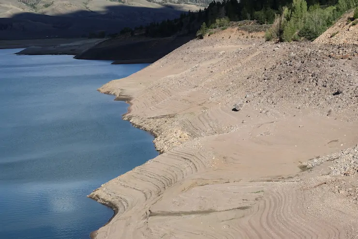
Green Mountain Reservoir August 17, 2026. Photo credit: Allen Best/Big Pivots

Click the link to read the article on the Big Pivots website (Allen Best):

September 7, 2026

No place in Colorado that I have visited offers such blunt testimony to the warming, drying climate than Green Mountain Reservoir. It also poses a question to those politicians whose answer to non-winters and ever-hotter summers is more dams and reservoirs.

The reservoir between Silverthorne and Kremmling was 14% full during Labor Day weekend, according to the U.S. Bureau of Reclamation, the operator. Put another way, it was 86% empty.

That’s worse even than the roughly 78% empty at Lake Powell, the reservoir located roughly 700 river miles downstream from Green Mountain.

Green Mountain was part of Colorado’s mission begun in the 19th century to put water to “beneficial use,” a central axiom of state water law. Pioneer settlers did an admirable job of this, in the beginning using nothing more than horses, oxen and human labor.

In 1902, the federal government became a partner, creating the Bureau of Reclamation. Over the next roughly 90 years, the federal treasury was visited repeatedly to prevent “waste” of any portion of the Colorado River flowing into the Pacific Ocean.

Green Mountain Reservoir, back in the day. Photo credit: Denver Water.

Construction of Green Mountain Dam was part of that work. During the hot, dry 1930s, farmers in the Fort Collins-Longmont-Greeley area wanted to import water from the Colorado River headwaters near Grand Lake. Western Slope irrigators objected. Farms in the Grand Junction area would lose late-season water needed to get their crops and orchards across the finish line.

Green Mountain was the compromise. And it has worked out well. A pool of 66,000 acre-feet of water was reserved for down-stream irrigators in the Grand Junction area. Deliveries in this canal usually continue through October, sometimes later.

This year was different. For the first time in 110-plus years, deliveries ended in late August.

DeBeque Canyon has changed somewhat since this photo of the Roller Dam was taken in 1916. Most notably, now the canyon has an interstate highway. Photo/U.S. Bureau of Reclamation. For a more complete history, see the Palisade Historical Society page.

In April, the Glenwood Springs-based Colorado River Water Conservation District issued a warning. Green Mountain was the lowest it had been since filling during World War II. This jeopardized the late-summer flows to irrigators who took delivery of water from the Government Highline Canal. The canal diverts water from the Colorado River at the Roller Dam, a short distance upstream from Palisade. It then distributes water to farms and orchards for 55 miles, nearly to the Utah border.

Wolford Mountain Reservoir back in the day. An aerial view of Wolford Reservoir, formed by Ritschard Dam.

This year, in a testament to cooperation, the Colorado River District and Colorado Water Conservation Board ponied up more than $1 million to buy use of water. Water was tapped from headwaters reservoirs, most notably Wolford and Williams Fork, near Kremmling, and Ruedi, near Basalt. Others, including Front Range diverters, helped.
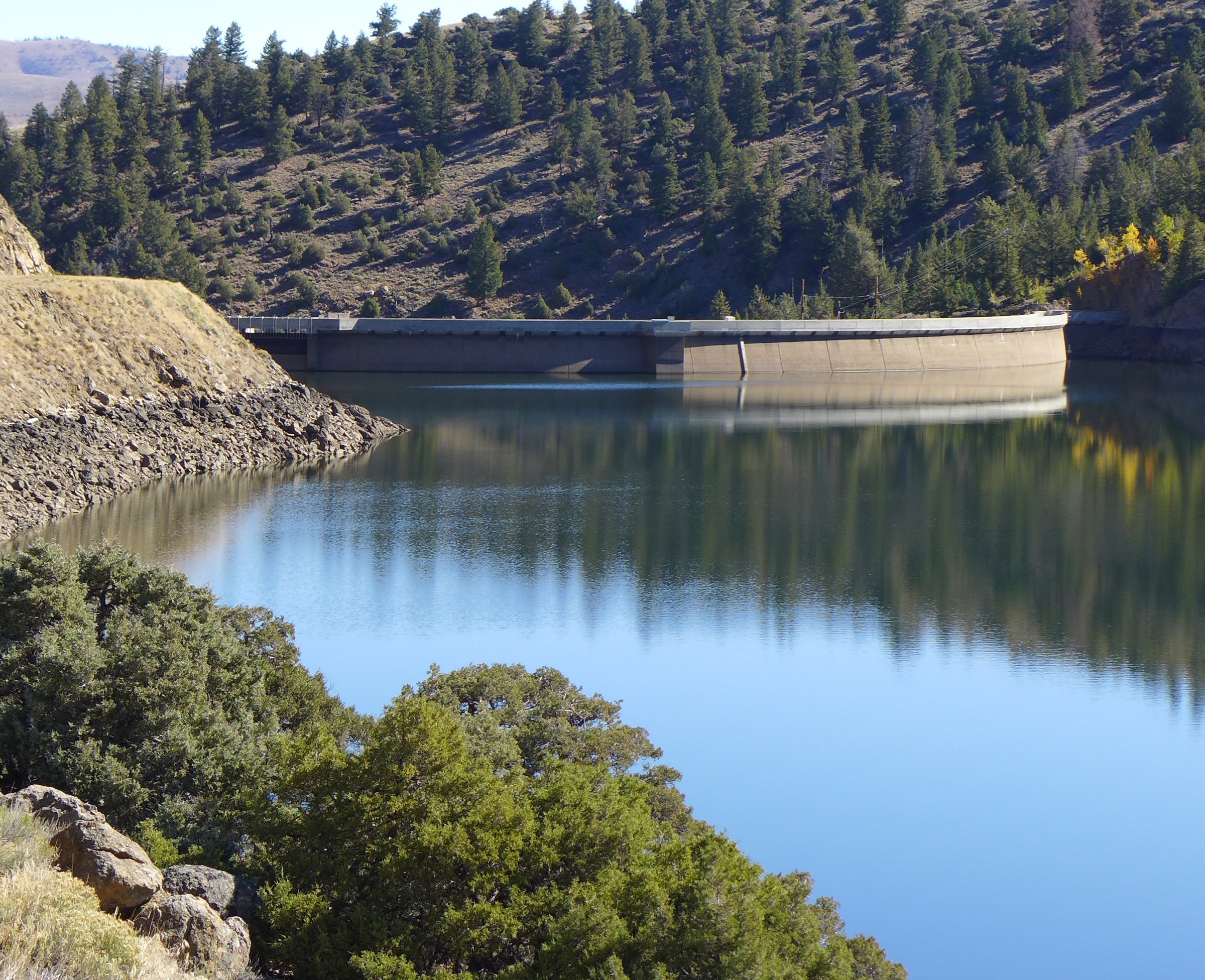
Williams Fork Reservoir back in the day. Photo: Brent Gardner-Smith/Aspen Journalism

Irrigators got only 50% of their normal water. In response, many switched crops to varieties of plants that could survive with less water.

Even so, by late August, the water was running out. The Grand Valley Water Users Association, operator of the canal, stopped deliveries on September 3. Maybe monsoon rains will deliver water to resume operations, but that’s the story for now.

Once again, the idea that we just need to store more is entirely too simplistic. Yes, saving for a rainy day is always good, but this idea that we can build our way to more water defies ample evidence about the warming, drying climate.

We can have droughts, yes. They come and go. But the science clearly shows that these hot, dry years of the 21st century will not be ephemeral. They have been driven by a warming climate caused by accumulating greenhouse gas emissions.

Udall/Overpeck 4-panel Figure Colorado River temperature/precipitation/natural flows with trend. Lake Mead and Lake Powell storage. Updated through Water Year 2025. Note the tiny points on the annual data so that you can flyspeck the individual years. Credit: Brad Udall

In the 20th century, the Colorado River delivered about 15.2 million acre-feet. In this century, the annual flows have declined to 12.2 million acre-feet. Since 2020, average flows have declined even more, to 10 million acre-feet. And this recent span included a very, very big snow year, in 2022-23, a three-wire winter like those of old. But the spring was like those of the 21st century, early and uncommonly warm.

The pitiful storage in Green Mountain, whose shoreline is seen in the above photograph I took on Aug. 17, testifies to this warming, drying climate. So does the canal near Grand Junction where deliveries were cut off last week for the first time in 110 years. And then we have near doubling of 95 degree-plus days in Denver during last 30 years as compared to the three decades before as reported by KUSA.

Might we figure out better infrastructure? Maybe. The idea of storing water underground, as Greeley began doing several years ago, intrigues. It requires more energy but greatly reduces evaporative loss.

The federal government in its documents has excised climate change. So have many politicians in Colorado speaking on the stump, hewing to the recent version of political correctness.

If there are ideas for storing water that don’t assume a return to the climate of the 20th century, I’m all for hearing them. But to think this is just another drought defies tons of evidence.

See also:

“Does 80% of Colorado’s precipitation really fall west of the Continental Divide?” Russ Schumacher, Jan. 17, 2024.

“A first in the 110-year history of this canal,” Big Pivots, Sept. 3, 2026

“Amid the y’alls, two themes at the Colorado Water Congress conference,” Big Pivots, Aug. 31, 2026

“Rare optimism about the Colorado River,” Big Pivots, Aug. 24, 2026

Map of the Colorado River drainage basin, created using USGS data. By Shannon1 Creative Commons Attribution-Share Alike 4.0

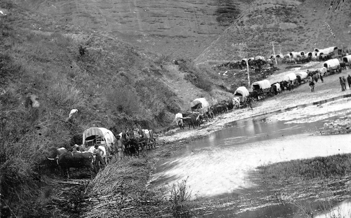
Mormon Pioneers treated water as a Shared Resource

Black and white image of a line of covered wagons pulled by horses alongside a riverbank, with a hilly landscape in the background.
An 1866 party of pioneers in Echo Canyon east of the Salt Lake Valley. Photograph from Newsroom of The Church of Jesus Christ of Latter-Day Saints

by Robert Marcos

The Lifeline of the Wasatch: Pioneer Irrigation in the Great Basin

When the Mormon pioneers arrived in the Salt Lake Valley in July 1847, they encountered a landscape starkly different from the humid climates of Illinois and Missouri. Receiving less than sixteen inches of annual rainfall, the valley was an arid expanse. However, the settlers quickly recognized a crucial geographic asset: the Wasatch Range. Towering over the eastern edge of the valley, these mountains acted as a massive cold-weather reservoir, capturing vast amounts of winter snowfall. As spring and summer temperatures rose, this snowpack melted, sending high-volume runoff down steep canyons into local mountain streams like City Creek, Red Butte Creek, and the Provo River. To survive, the pioneers had to capture and control this mountain runoff for agriculture, effectively executing the first large-scale Anglo-Saxon irrigation system in modern American history. 1

Gravity-Fed Engineering and Infrastructure

The physical redirection of the water relied entirely on gravity. Because the Wasatch Range drops steeply into the low-lying valley, water flowed downward naturally with substantial force. Within hours of their arrival on July 23, 1847, the pioneers built a rudimentary timber and earthen dam across City Creek. This initial barrier pooled the fast-moving runoff, forcing it into a hand-dug ditch that redirected the water onto five acres of dry land, softening the sun-baked earth enough to allow plowing and the planting of potatoes. As the settlement grew, this experimental ditch expanded into a massive, organized network of canals. Main canals tapped into mountain streams right at the canyon mouths where the water exited the Wasatch Range. Using simple tools like shovels, pickaxes, and ox-drawn scrapers, the pioneers dug primary ditches that followed the natural contours of the valley slope, maintaining a gentle decline. From these primary canals, a lattice of secondary and tertiary ditches branched out directly into individual communities and agricultural fields. Inside the towns, irrigation ditches ran down both sides of the wide streets to provide water for residential gardens and orchards. 2

Communal Management and Legal Evolution

The infrastructure required to channel the Wasatch runoff could not have succeeded through individual effort alone; it demanded centralized planning and communal labor. Under the direction of Brigham Young, the territory departed from traditional American riparian water law—which dictated that water belonged exclusively to whoever owned the riverbanks. Instead, the pioneers established a doctrine of communal ownership where water was treated as a public resource. The construction and maintenance of the canal systems were divided among ecclesiastical units known as “wards”. Local bishops doubled as water masters, organizing community members to dig and clear the ditches. Water distribution was tightly regulated through a system of “turns”. Farmers were assigned a specific day and hour to open their wooden headgates, allowing the mountain runoff to flood their fields. This highly disciplined approach to water management proved incredibly scalable. By 1865, less than two decades after their arrival, the settlers had constructed over 1,000 miles of canals across Utah, transforming an unforgiving environment into a highly productive agricultural oasis. 3

The Radical Cooperative Theology of Mormon Water Sharing

The early Mormon approach to water sharing in the Great Basin was not merely a pragmatic response to a dry climate; it was a direct extension of a radical, communal theology. While standard 19th-century American culture championed rugged individualism and private property rights, the Church of Jesus Christ of Latter-day Saints operated under a philosophy of theocratic collectivism. This worldview, deeply rooted in the revelations of founder Joseph Smith and enforced by his successor Brigham Young, reshaped how natural resources were legally, spiritually, and physically distributed. 4

September 11, 2001

Via WallpaperMaven.com

Re-upping this post from 2017.

The morning of 9/11 I was working at the computer. My son barged into the computer room and said, “Papa a plane hit the the World Trade Center building!”

I will always remember the people that died that day.

The best coverage of the event turned out to come from the bloggers. The talking heads on TV kept interviewing the same people and showing the same footage over and over. Meanwhile the bloggers reported what was going on from the point of view of those most affected by the losses of loved ones and what they observed on the street.

From my post on the first anniversary of the event:

The events of that day led me into the world of weblogging. I started reading Dave Winer’s Scripting News regularly. At the time he was pointing to people writing about the tragedy, in real time, in their own voices, and I was stunned by the effectiveness and quality of the reporting and opinion being published. Here’s the 9/11/2001… Scripting News. No one got much work done that day. A couple of TV’s were on in the building but people mostly sat around talking, working through the events, getting comfort from human conversation and interaction.