The Unsolved Mystery of Newlyweds who Vanished on the Colorado River

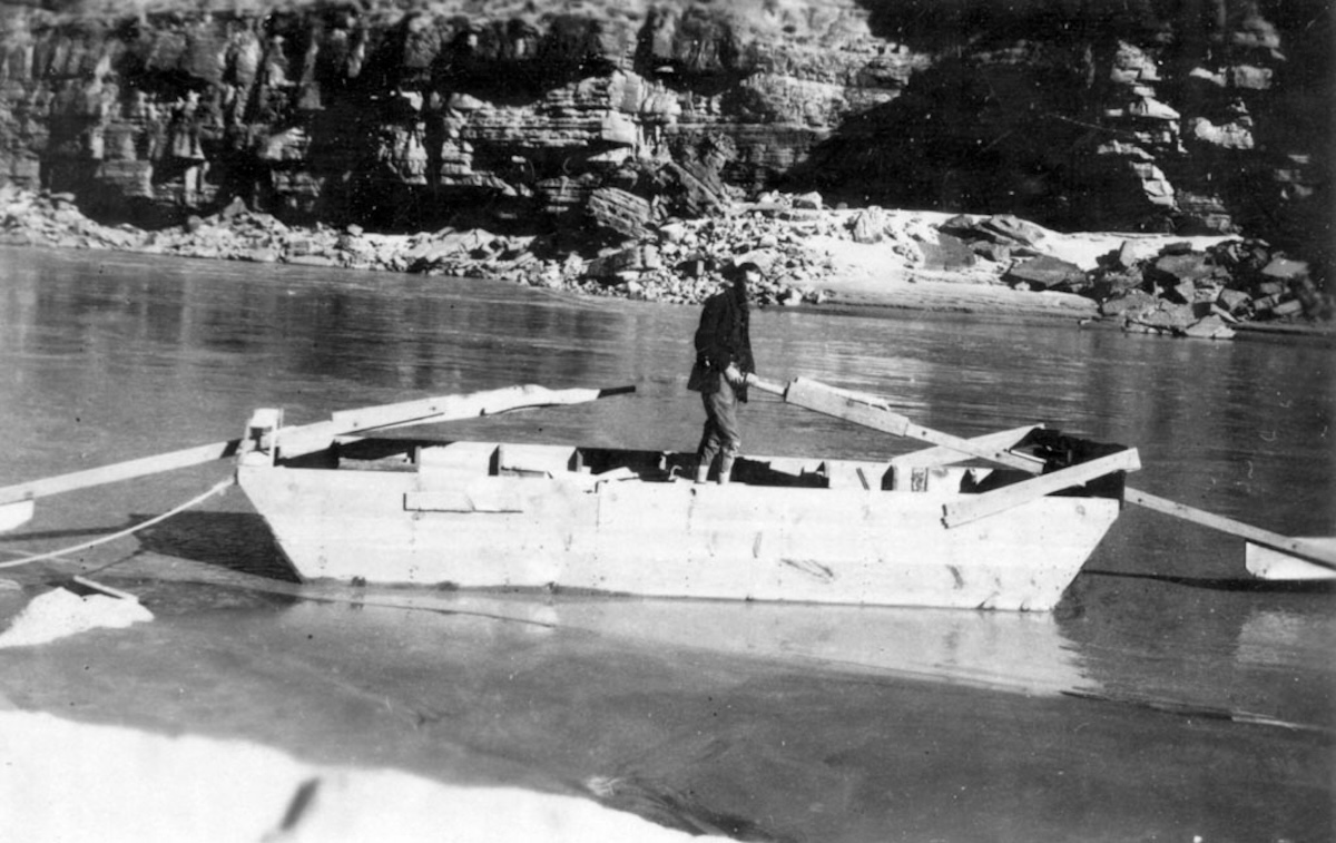
A historical black and white photograph of a man standing in a wooden boat on a river, with rocky cliffs in the background.
The last photograph of Glen Hyde before he and his wife prepared to leave Hermit Camp, on the southern end of Grand Canyon National Park

In 1928 a pair of river runners who were on their honeymoon disappeared after they left the Grand Canyon. A month later a search party found their boat – fully loaded and in perfect condition. The mystery remained unsolved for 50 years, and then a young man found a skeleton with a bullet hole in its head.

by Robert Marcos, photojournalist

For 73 years Emery Kolb and his brother Ellsworth lived and worked at the Grand Canyon, as photographers. The brothers operated Kolb Studio which was located on the South Rim next to the Bright Angel trailhead. During their time there the brothers photographed one and a half million tourists, and were the first to use a movie camera to capture the majesty of the Colorado River as it flowed through the canyon.1

Emery Kolb died on December 11, 1976. In his obituary the New York Times said, “Over the years Kolb had become such an integral part of the Grand Canyon experience that tourists had begun to take pictures of him, instead of him taking pictures of them.”

Two of the people Emery Kolb had photographed 50 years before were newlyweds who’d been married in Twin Falls Idaho. Glen Hyde and Bessie Haley had decided to spend their honeymoon floating down the Colorado River in a boat that Glen Hyde had built specifically for that purpose. The couple began their adventure at Green River Utah and tied their boat up at the Grand Canyon’s Bright Angel Creek on November 15, 1928. They hiked 9 miles up to the South Rim to buy supplies. On their way back they stopped at Kolb Studio and were photographed by Emery Kolb. Kolb and others noticed that Bessie seemed to be completely exhausted and was ready to quit the grueling trip. Kolb urged the couple to wear life jackets, and offered to let them stay for the winter, but Glen refused. At that point the couple had already completed 424 miles of their 750 mile long voyage to Needles California – where Glen’s father was scheduled to meet them.2

A black and white portrait of a man and woman standing together in front of a rocky background. The man is wearing a dark sweater and jeans, holding a hat, while the woman is dressed in a leather jacket with a fur collar, with her hands in her pockets.
Photograph of Glen & Bessie Hyde taken by Emery Kolb on November 16, 1928

Three weeks later Glen’s father arrived in Needles and then waited several days for the couple to arrive. When they didn’t he contacted the police and reported them missing. A massive air and ground search got underway and eight days later an aircraft spotted the couple’s abandoned boat intact and floating upright near river mile 237. However the authorities had great difficulty reaching the boat because it was floating in an extremely remote area surrounded by high cliffs that afforded no access from the land.3
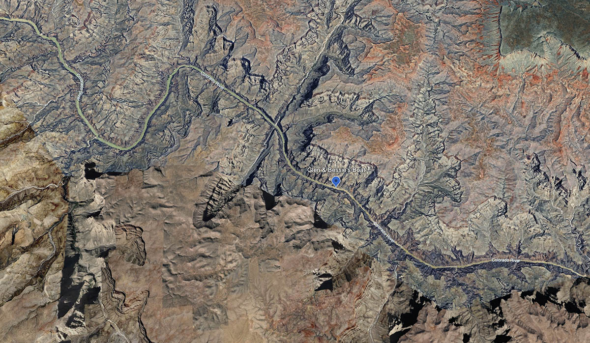
Aerial view of rugged terrain featuring layered rock formations and a winding river, marked with a blue dot indicating 'Glen & Bessie's Boat' location.
Glen & Bessie’s fully loaded boat was found abandoned inside the Hualapai Indian Reservation, at River Mile 237.

To reach the area, Emery Kolb led a search party that included Grand Canyon Chief Ranger James Brooks, and John Hyde, (Glen father), to Peach Springs, Arizona. From there, Emery and Chief Ranger Brooks hiked 22 miles down a sandy wash to reach Diamond Creek, on the Colorado River. Emery’s brother Ellsworth joined the two men the following day. The men worked together to repair an old flat-bottomed boat that had been abandoned in Diamond Creek. When it was repaired the next morning they floated downstream for 14 miles until they reached Glen and Bessie Hyde’s boat, called “Rain-in-the-Face”, which they found upright and fully stocked.4

As Chief Ranger Brooks searched along the riverbank Emery and Ellsworth Kolb examined the contents of the boat. They were looking for anything that would give them an idea of what had happened to the young couple. But they came up with nothing. The boat was not only seaworthy, but it was fully stocked with food, clothing, campling supplies, and personal items including Glen’s wallet, money, and rifle, plus Bessie’s camera and her personal diary. By the end of the day the extensive examination carried out by the three men had found absolutely no evidence of foul play.5
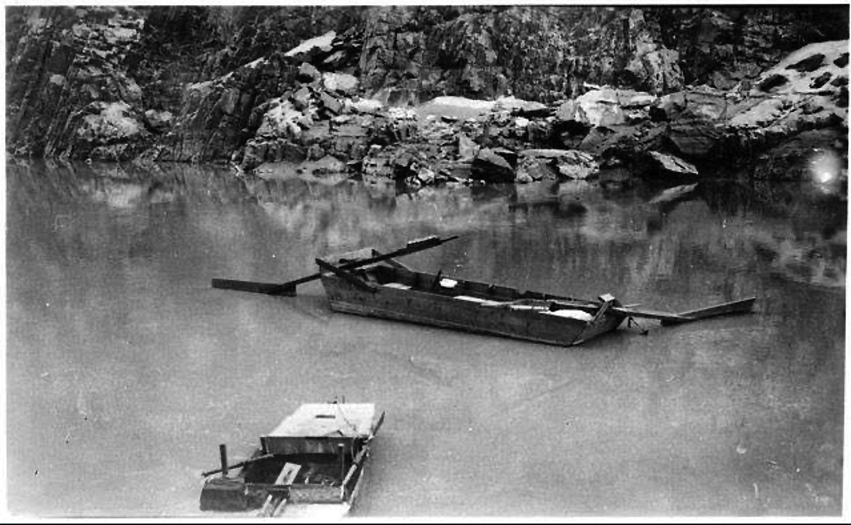
Black and white photo of two small boats floating on a calm body of water, surrounded by rocky cliffs.
Emery Kolb’s photo of Glen & Bessie Hyde’s empty, custom-built, boat floating upright and fully-loaded, at river mile 237.

Conspiracy theories began to circulate

The reason that the Hyde’s boat had stopped at its remote location wasn’t because of damage, or because of an eddy, it was because a rope that had been trailing off its stern got snagged by large rocks under the surface. Therefore when the Kolb brothers had completed their search and had transferred the Hyde’s more valuable possessions onto their own boat, they cut the rope that had – for a month – held the Hyde’s boat in place. Less than ten minutes later the craft floated downstream into a rapid, broke apart, and sank.6

In retrospect there was no reason for the brothers to have cut the boat loose. The boat had proven itself seaworthy and could’ve been put to good use elsewhere, or even returned to its owners if they had shown up later. The brothers had to have considered that possibility unless they knew otherwise. A conspiracy story that had begun to circulate suggested that the brothers had cut the rope in order to eliminate evidence that might’ve connected them to the Hyde’s disappearance.

Adding fuel to the fire

In 1977 – about a year after Emery Kolb’s death, Emery Kolb’s grandson finally began to clean out his grandfather’s boathouse. He was about halfway done when he found a dusty bundle that had been hidden up in the rafters, inside an old canoe. When the young man unwrapped the bundle he found that it contained a human skeleton. The Sheriff was notified and deputies who arrived at the scene found a bullet hole in the skeleton’s skull. The discovery made headlines: which fueled even more speculation that the Kolb brothers had in some way been involved in the young couple’s disappearance.7

Science and Archival photographs clear Emery’s name

The “Kolb Skeleton” as it became known was transferred from the Cococino County Coroner’s Office to a forensic anthropologist at the University of Arizona named Dr. Walter Birkby. The first finding that Dr. Birkby released was that the skeleton belonged to a man, who was 22 years of age or younger. Dr. Birkby also determined that the man had died in 1932 or later, and that the skeleton had belonged to a man who was significantly shorter than Glen Hyde was. 8

In 2006, several hundred historical photographs were donated to the Grand Canyon Museum Collection by the son of a former park ranger. Among these images were several depicting the skeleton of a man that had been found on a ledge under the canyon’s rim near Shoshone Point on June 4, 1933. The man had a single bullet hole above his right temple and was found to have shot himself. The pictures, along with a Superintendent Report from June 1933, were used to determine that the body found in 1933 was the same as the one discovered in 1977. Emery Kolb was a jury representative for the Grand Canyon region in Coconino County for several years, and it is now believed that he may have been asked to hold onto the remains for safekeeping. The remains that are currently identified as the “Kolb Skeleton” continue to be tested at the Ramapo College of New Jersey. 9

Experts, politicians urge collaboration in Western Slope water use: #ColoradoRiver District seminar explores impacts of Colorado’s #drought — #Aspen Daily News #CRD2026 #COriver #aridification

Colorado River running muddy September 18, 2026.

Click the link to read the article on the Aspen Daily News website (Drew Shaw). Here’s an excerpt:

September 19, 2026

Colorado water experts and elected officials urged collaboration across industries, borders and political parties as the Western Slope seeks sustainable water systems that will serve future generations. The year’s unprecedented statewide drought won’t be the last, speakers said throughout Friday during the Colorado River District’s annual water seminar on Friday (September 18, 2026) in Grand Junction. 

“We can’t run from it — we have to learn from it,” said Andy Mueller, the district’s general manager, during the event, which was held at Colorado Mesa University.

Ruedi Reservoir, above Basalt, on the Fryingpan River, April 22, 2026. Photo: Brent Gardner-Smith

Communities and entities made sacrifices to ensure the region’s water needs were met. Reservoirs, such as Ruedi Reservoir east of Basalt, have been drawn down at faster rates than normal, municipalities have led water conservation campaigns and farmers across the valley have needed to settle for significantly smaller crop yields…The river district has for years sought the means to buy from Xcel Energy the Shoshone water rights, the oldest and largest non-consumptive water rights on the Colorado River. In acquiring the rights, the river district would prevent any other potential buyers from diverting the water from Western Slope communities…The agency has raised about $97 million of $99 million for the acquisition, $40 million of which comes from federal funds. Those federal dollars, which were secured by the state’s Democratic senators under the Biden Administration, were frozen in 2025 under the Trump Administration. Earlier this year, U.S. Rep. Jeff Hurd, R-Grand Junction, worked successfully to release the funds.

“That’s the kind of collaboration we need in Congress and in our communities,” Mueller said…

Mueller said the state’s future water security depends on finding sustainable systems to manage the water it has now.

“How can we adapt to uncertainty and rising temperatures and reduced streams?” he asked. “We don’t need to argue about whether or not that’s happening. We need to focus on the future and figure out solutions.”

Map of the Colorado River drainage basin, created using USGS data. By Shannon1 Creative Commons Attribution-Share Alike 4.0

#ColoradoRiver 24 month for mid September – #LakeMead is losing standard turbines around November — Ed Millard #COriver #aridification

‘Just a big rock pile:’ St. Mary’s Glacier has melted — Caitlyn Kim (#Colorado Public Radio) #ClimateChange

‘Just a big rock pile:’ St. Mary’s Glacier has melted http://www.cpr.org/2026/09/18/s…

Caitlyn Kim (@caitlynkim.bsky.social) 2026-09-19T15:53:14.617Z

Newswire — President Trump moves to axe #climate pollution rules: Also — BLM sells 940-acre parcel to Las Vegas for 6,000-house community — Jonathan P. Thompson #ColoradoRiver #COriver #aridification (LandDesk.org)

Click the link to read the article on The Land Desk website (Jonathan P. Thompson):

September 14, 2026

Good morning and welcome to another edition of the Land Desk Newswire. The Trump administration is continuing to convert its fossil fuel fetish into real-world, deeply consequential policy, this time by eliminating greenhouse gas emissions limits for coal- and gas-burning power plants. Meanwhile, the BLM moves forward with selling a sizable chunk of public land to bolster Las Vegas sprawl under a 1998 law.

🐓 REGULATORY CAPTURE CHRONICLES 🦊

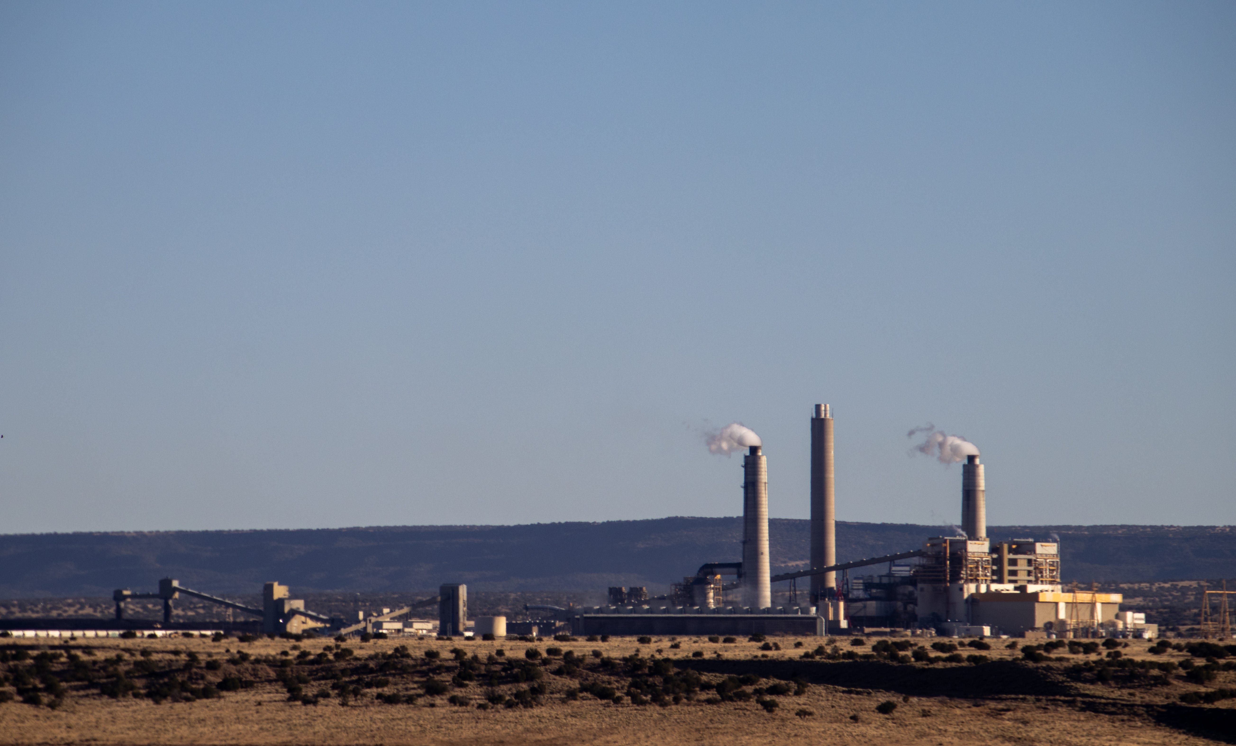
Coronado coal plant in northeastern Arizona. Jonathan P. Thompson photo.
  • The Trump administration moves to axe Obama- and Biden-era regulations limiting fossil fuel power plants’ greenhouse gas emissions, meaning coal and gas plants will be able to spew planet-warming carbon dioxide without restraint. This could extend the lives of some coal plants, and will help clear the way for the fleet of new gas plants being developed to power hyperscale data centers. While the original rules required facilities to reduce carbon emissions, they also would have kept soot and other health-harming pollutants out of the air, preventing an estimated 1,200 premature deaths per year. Earlier this year the administration rolled back stricter limits on mercury emissions from power plants. (New York Times)
🌵 PUBLIC LANDS 🌲
  • The Bureau of Land Management sells 940 acres of public land in southern Nevada to the City of Las Vegas, clearing the way for a 6,000-home master-planned community on the northern fringe of the metro area adjacent to Tule Springs Fossil Bed National Monument. The sale was authorized by the 1998 Southern Nevada Public Land Management Act, which allows for such “disposals” of federal land in a congressionally designated boundary. It merely whetted Gov. Joe Lombardo’s (R) appetite for snatching more public land, however, who said he will work to “unlock more federal land for housing.” It’s not clear whence the water will come for this sprawling new development in one of the nation’s more water-constrained cities; the state faces potential further reductions of Colorado River water under the new federal plan. (news release)
  • A new poll finds that two-thirds of Utah voters support restoring protections to the original, pre-Trump-shrinkage boundaries of Bears Ears and Grand Staircase-Escalante national monuments, and an even larger proportion supports tribal nations having a role in managing ancestral lands. (news release)
🥵 ARIDIFICATION WATCH 🐫
  • Wyoming researchers say warm water and drought-reduced streamflows may be behind a kidney-damaging parasite killing hundreds of whitefish in the Salt River this summer. The tributary of the Snake River has experienced some of its lowest flows on record this summer, and it was already plagued with E coli bacteria as a result of heavy livestock grazing in the watershed. (WyoFile)
⛏️ MINING MONITOR ⛏️
  • The Cibola National Forest launches its environmental review of Energy Fuels’ proposed Roca Honda underground uranium mine on about 370 acres of USFS, state, and private land northeast of Grants, New Mexico, and near the base of Mt. Taylor. Ore would be hauled by truck to the White Mesa Mill in southeastern Utah for processing. Public comments will be accepted here until Oct. 14. (agency news release)
  • IsoEnergy, which owns the Tony M, Dineros, Rim, and Sage Plain uranium mines in southern Utah, agrees to merge with DISA, a startup that looks to use high-pressure slurry ablation technology to pull uranium out of abandoned mine waste piles, to create a “technology-enabled US uranium platform for production, processing, and remediation.” DISA’s attempts to process small waste piles in Western Colorado have yet to come to fruition, and Iso’s bid to reopen the Tony M mine near Ticaboo, Utah, has moved forward only in incremental steps. (World Nuclear News)
  • Union Pacific Railroad begins hauling coal from Powder River Basin mines to the Port of Guaymas in Sonora, Mexico, where it could be shipped to Asia. The new export node allows the industry to get around environmental opposition to coal exports along the West Coast, but its viability depends on demand. (Trains)
🐟 COLORADO RIVER CHRONICLES 💧
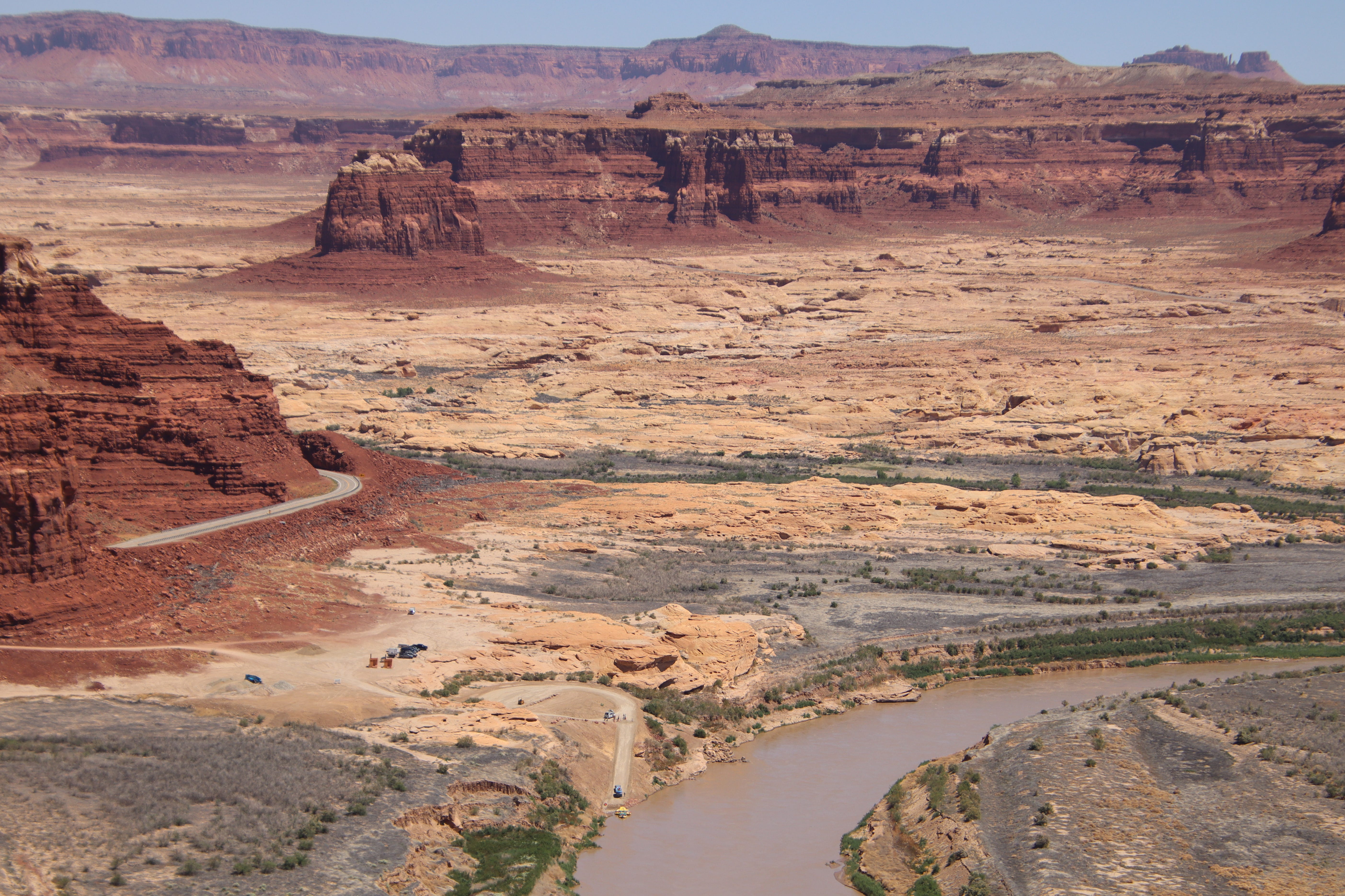
The less-than-ideal North Wash takeout for boaters running the Colorado River though Cataract Canyon. The planned Hite facilities, located to the right of this image just upstream and opposite the Dirty Devil confluence, would replace the North Wash ramp. Jonathan P. Thompson photo.

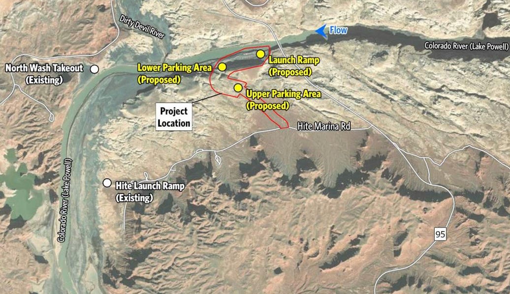
  • Glen Canyon National Recreation Area moves forward with a plan to develop new low-water boat ramps and other facilities at the Hite and Bullfrog districts on Lake Powell, indicating that the National Park Service expects reservoir levels not to rebound. The Bullfrog ramp is planned for the main channel of the reservoir, southeast of the current facilities, and would be usable for boats up to 125 feet long to a low lake level of 3,450 feet. The Hite ramp would be upstream from the current facilities and is primarily designed as a takeout for Cataract Canyon boaters and a safer alternative to the North Wash takeout on the opposite side of the river. (news release)
The planned Bullfrog low-water boat ramp. Source: NPS.
The planned Hite launch/takeout ramp. Source: NPS

Climate change comes for a Lake Powell marina — Jonathan P. Thompson


  • Arizona officials raise concerns about how the Colorado River crisis might affect its booming semiconductor and chip manufacturing industry, in which a single Phoenix-area facility, known as a “fab,” uses some 4.75 million gallons of water per day. (The Verge)
  • The Bureau of Reclamation again increases water releases from Flaming Gorge Reservoir in an effort to buoy water levels at Lake Powell, but Utah officials warn it is not a sustainable solution and could harm recreation on the upstream reservoir. (KSL)
🦫 WILDLIFE WATCH 🦅
  • Colorado Parks and Wildlife has euthanized nearly 300 bears so far this yearfollowing “unprecedented” levels of bear activity in towns across the state, as well as in Wyoming. Bryan Peterson, of Bear Smart Durango, told Cowboy State Daily the conflicts and killings are mostly due to the drought and lack of food sources, but also blamed human carelessness with garbage and food. (Cowboy State DailyWyoFile)
  • Colorado Parks and Wildlife kills an uncollared female yearling wolf from the One Ear Pack in Grand County after the animal evaded non-lethal deterrents to prey on livestock. (news release)
🤖 DATA CENTER DIGEST 👾
  • Bureau of Land Management leadership reportedly orders state directors to identify federal parcels suitable for data center development, indicating that the administration is looking to skirt communities’ opposition to and ban on the facilities by approving them on nearby public lands. (Washington Sun)
  • Corner Venture Capital applies for an air quality permit for a 300-megawatt natural gas-fired plant to power a proposed hyperscale data center in southwestern New Mexico, raising concerns over air pollution and water use. (Silver City Daily Pressnews release)
  • Google’s proposed 2.7-gigawatt, $17 billion Project Tembo data center complex on 700 acres near Cheyenne, Wyoming, clears local regulatory hurdles, but still has a lot of red tape to tangle with before final approval. The firm says the facilities will use less water-intensive closed-loop cooling systems and draw from deep wells, not surface supplies, and that it will be powered with natural gas fuel cells paired with carbon capture. (Wyoming Tribune Eagle)
🔋NOTES FROM THE ENERGY TRANSITION 🔌
  • Array Technologies opens its $50 million, 200,000-square-foot solar component manufacturing facility in Albuquerque, where it employs about 300 people. (KRQE)
  • Black Hills Energy moves forward with its planned 50-megawatt battery energy storage system at its Pueblo Airport Generating Station in Colorado. (Energy Storage News)
🛻 TRANSPORTATION 🚂
  • Denver West Express pitches a “concept” of an electric rail line designed to carry skiers from Denver International Airport to the resort town of Avon in less than two hours. The line would cost an estimated $28 billion to $33 billion to construct, but it might go a long ways to alleviate the I-70 ski season gridlock, which makes for one of the nastiest drives in the state — and where high traffic costs about $2.3 billion annually. (Steamboat Pilot)
📈 DATAVIZ OF THE DAY 📊

The Land Desk recently reported on how solar, wind, and battery storage is pushing coal off the West’s power grid, despite the Trump administration’s hostility toward cleaner energy sources. As of June of this year, the trend appeared to be continuing into the future, as a bulk of the generating capacity in the planning pipeline comes from cleaner sources. Click on the graphics for an interactive view, and specifics on each planned power plant.

South Platte River Basin #climate for the week ending September 21, 2026 #SouthPlatteRiver

Below is the Precipitation Accumulation in South Platte graph from the NRCS for September 21, 2026. This morning precipitation, at the SNOTEL stations, is at 76% of the median (up 2% one week), and 76% of the water year median (up 3% one week). There are 9 days left in the water year.

There is a chance for thunderstorms/showers Tuesday, a chance for showers Wednesday, showers are likely Thursday, with a chance for showers/thunderstorms Friday, Saturday, and Sunday, in the central mountains. There is a chance for showers Tuesday and Wednesday, a chance for showers/thunderstorms Thursday, Friday, Saturday, and Sunday, in the northern mountains. There is a slight chance for thunderstorms Tuesday, a chance for showers Wednesday, Thursday, and Friday, then a slight chance for showers Sunday, down here, about 466 miles from the Montezuma Valley Irrigation Company. From History of the Montezuma Valley Irrigation Company (via ArchaeologyColorado.org):

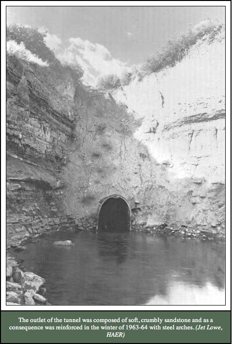
Irrigation in the Southwest began long before Euro-American settlement. The Ancestral Puebloans constructed stone terraces and check dams to capture runoff for crops as early as A.D. 750 in Mesa Verde with habitation extending until the late 1200s (Grace 2016). Later, the Ute, Navajo, Arapaho, and Cheyenne communities employed similar techniques to adapt to the semi-arid environment (Gerhold 1981:2; Grace 2016). These indigenous systems represent the earliest technological responses to water scarcity in the region…The Montezuma Valley’s geography presented a paradox: fertile soils and favorable climate for fruit growing, but insufficient water supply. Early settlers relied on limited natural springs, which constrained growth. Recognizing this challenge, irrigation pioneers initiated ambitious projects to divert water from the Dolores River. The Montezuma Valley Water Supply Company, organized by James W. Hanna in 1885, constructed a 5,400-foot tunnel and the ‘Great Cut’ to channel water into the valley. Completed in 1889, this system marked one of the earliest large-scale, privately funded irrigation projects in the Southwest (Gerhold 1981; Gerhold 1983).

Dolores River watershed

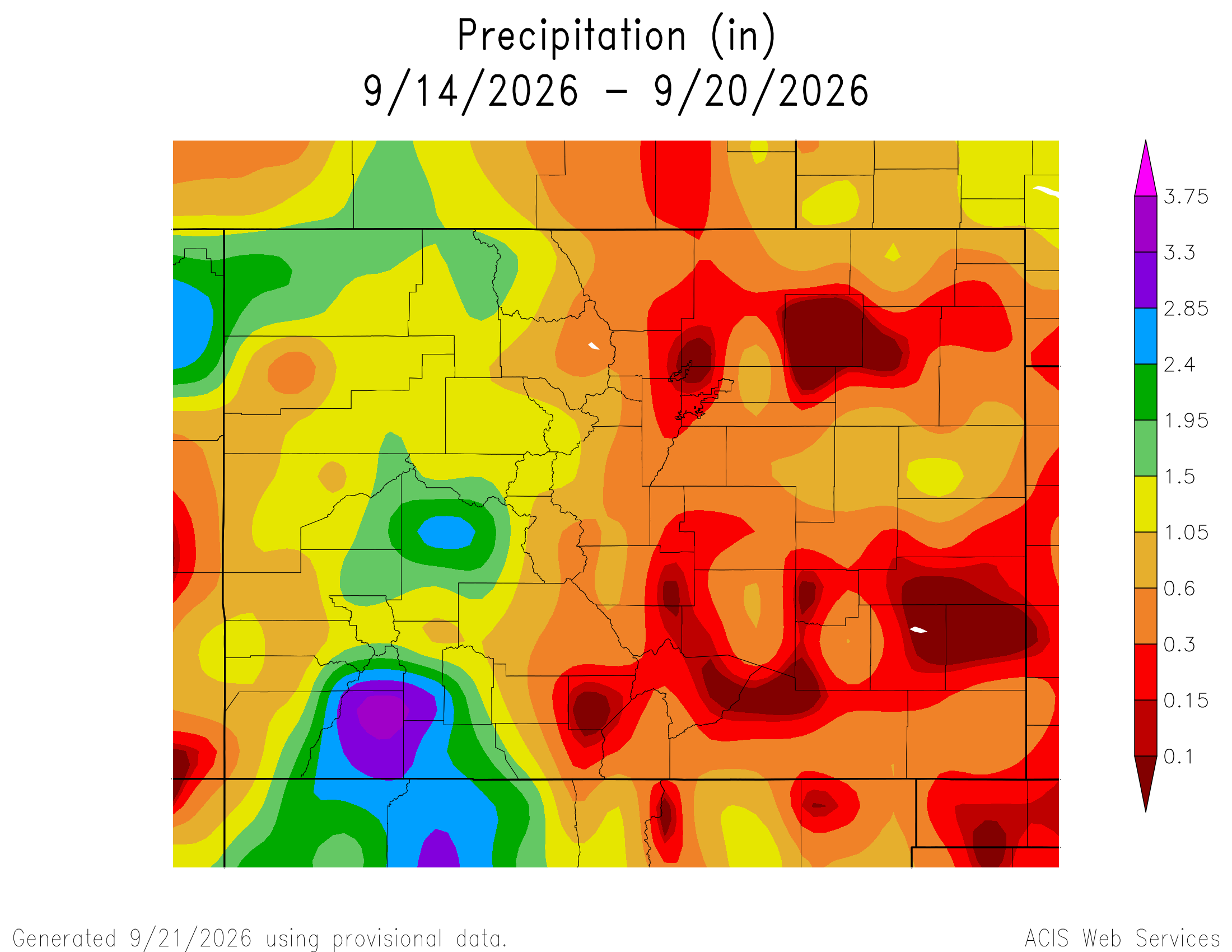
Here’s a look at the Colorado 7-Day precipitation map through September 20, 2026 from the High Plains Regional Climate Center. Precipitation in the South Platte Basin along the Continental Divide of the Americas ranged from 0.60” to 1.05″

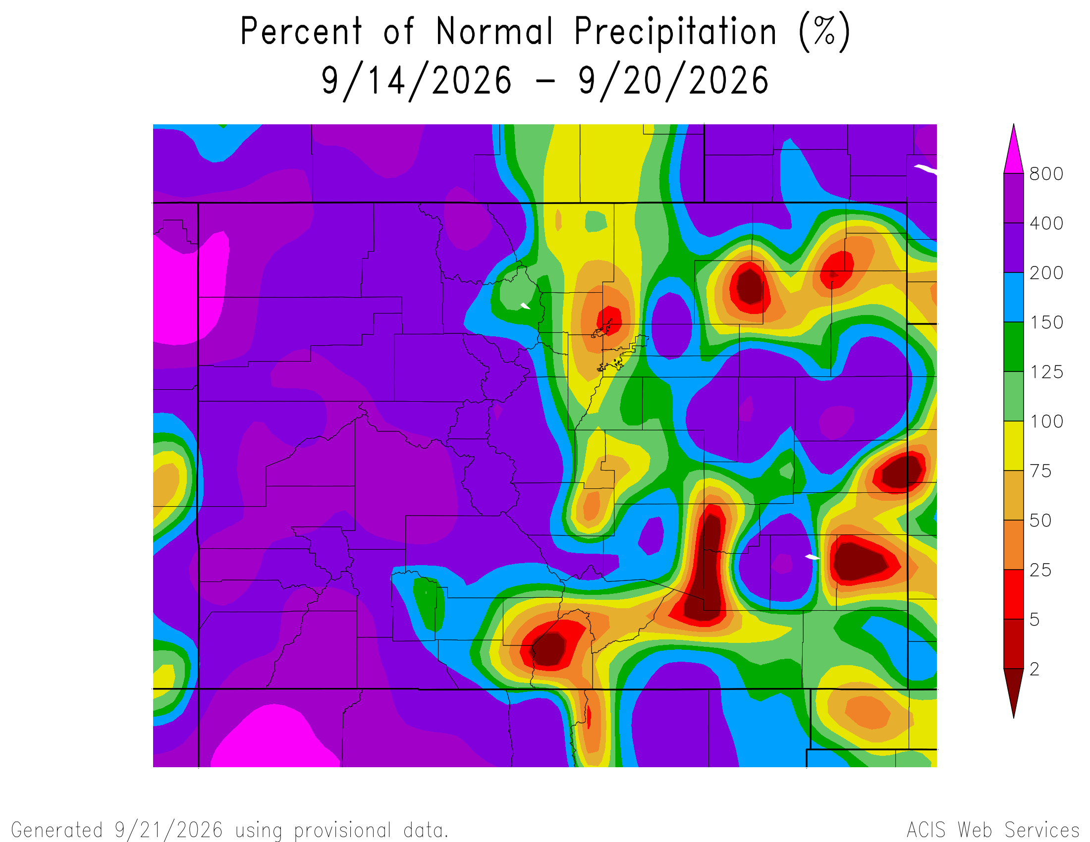
Here’s the Colorado 7-Day percent of normal precipitation map through September 20, 2026 from the High Plains Regional Climate Center. Precipitation in the South Platte River Basin along the Continental Divide of the Americas was 50% to 400% of normal. (Lovely overall!)

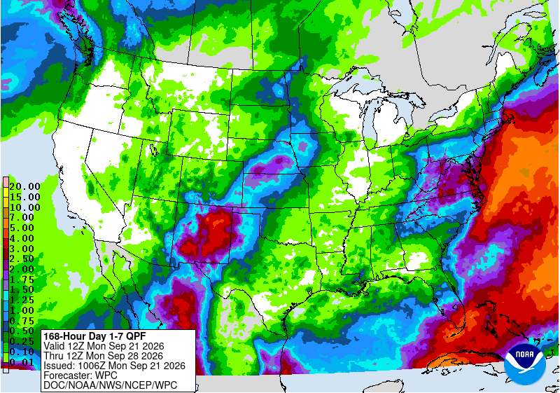
Below is the 7-day Quantitative Precipitation Forecast for the week of September 21, 2026. Precipitation is anticipated for the mountains of the South Platte River Basin and may total up to 0.50″.

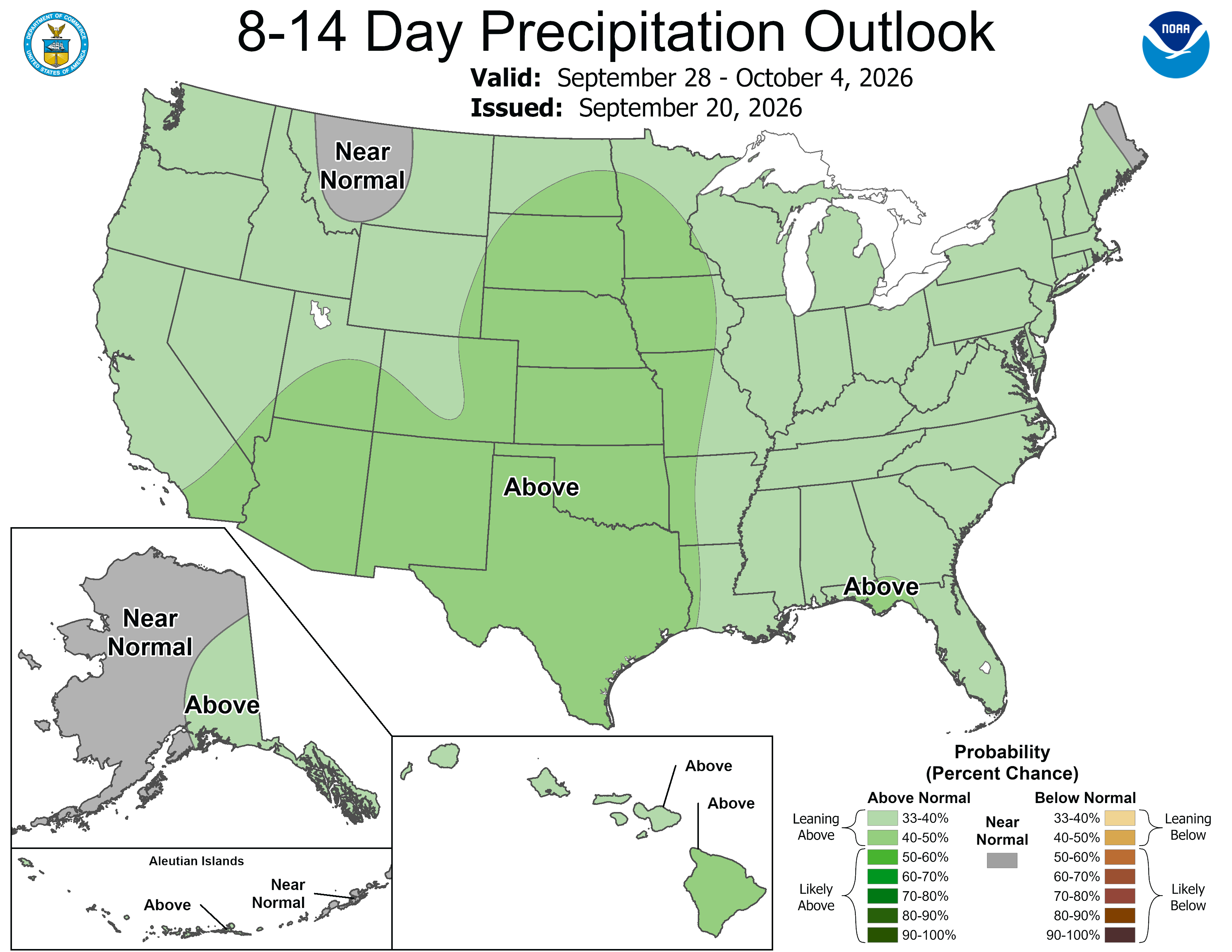
Below are the 8-14 day outlooks from the Climate Prediction Center, issued September 20, 2026, for temperature and precipitation, for the week starting September 21, 2026. The CPC expects above normal temperatures and above normal precipitation for the mountains of the South Platte River Basin.

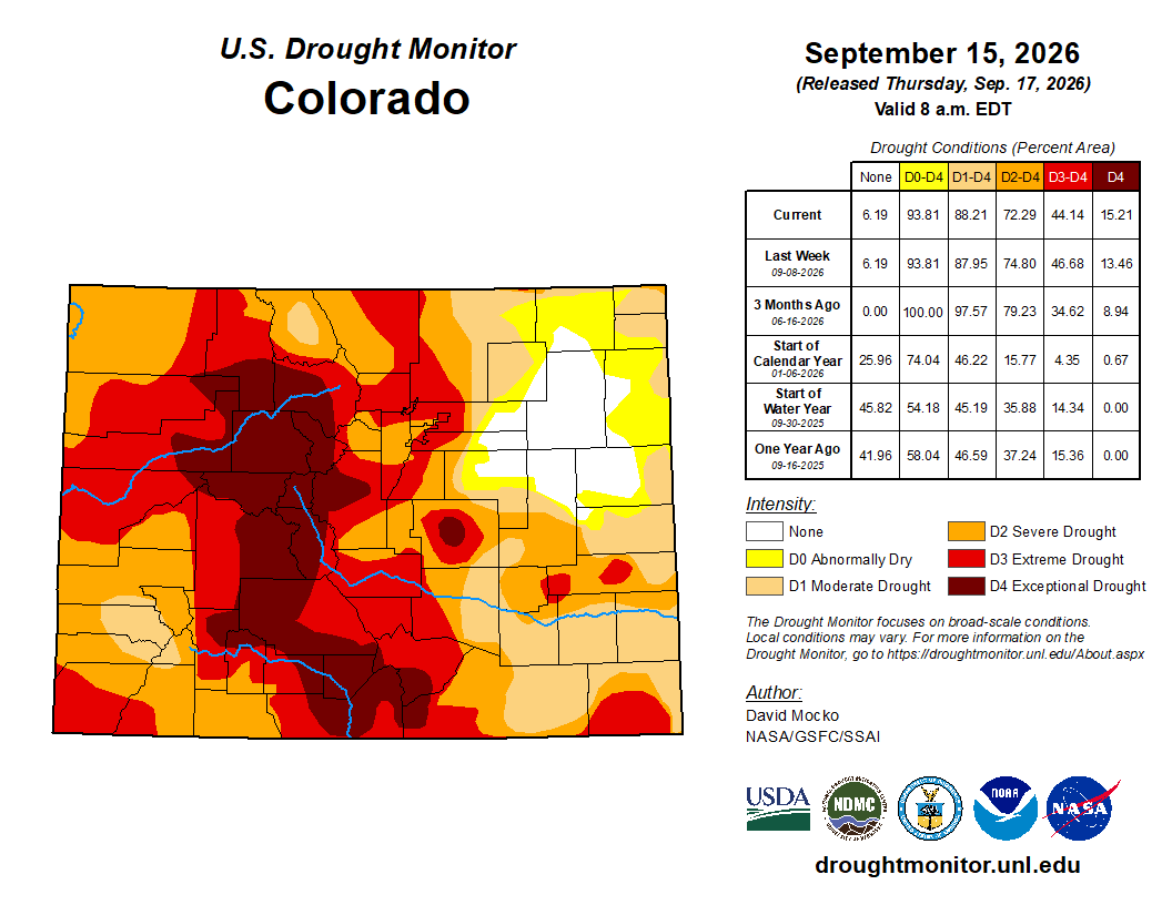
Below is the Colorado Drought Monitor map from September 15, 2026. There were one class improvements in Park County. Drought and abnormal dryness covers 93.81% of Colorado. The South Platte Basin is experiencing Abnormally Dry, Moderate, Severe, Extreme, and Exceptional drought conditions.

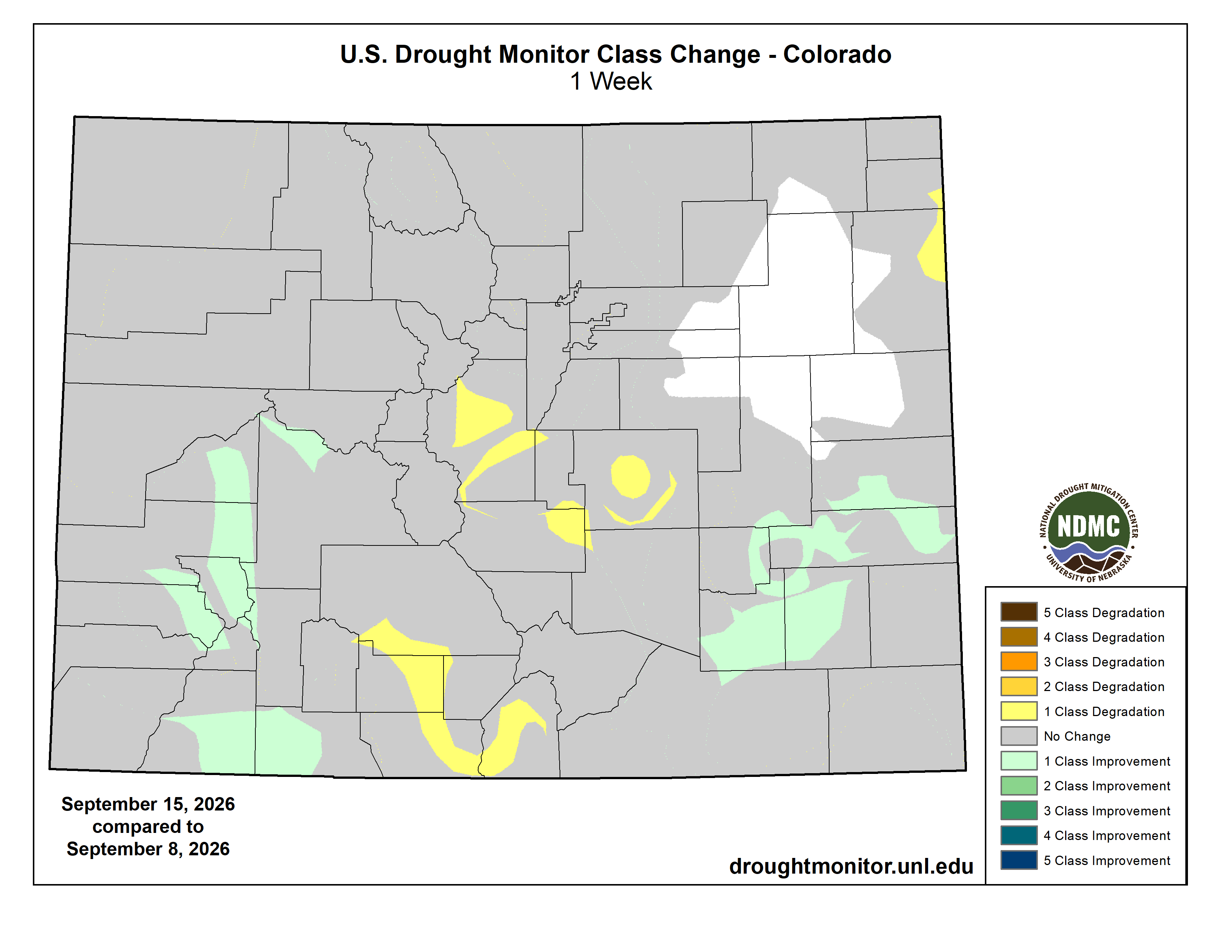
Below is the Colorado Drought Monitor one week change map ending September 15, 2026.

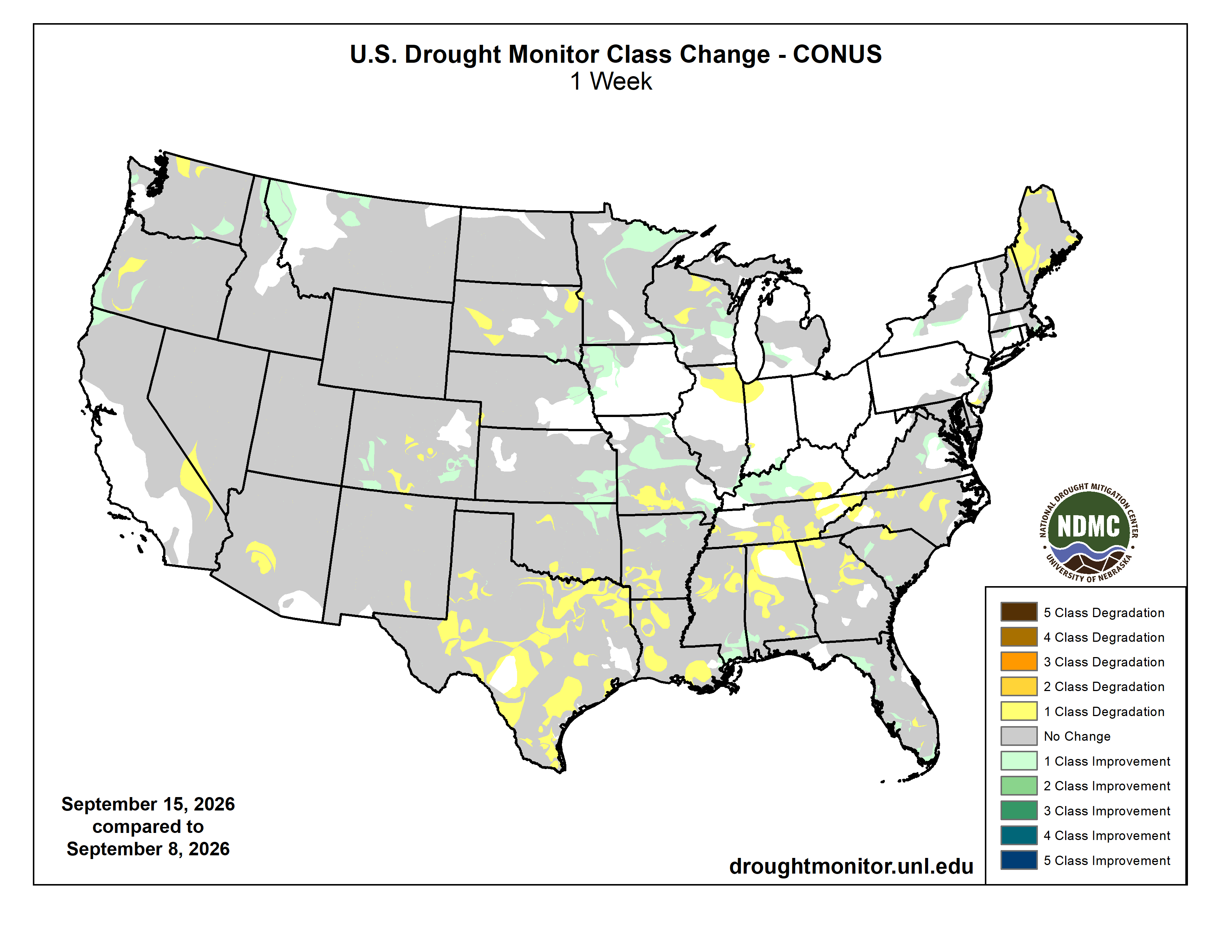
Here’s the US Drought Monitor Map from last week along with the one week U.S. change map.

Finally, Western Water Assessment released their latest Intermountain West Climate Briefing recently. From the briefing:

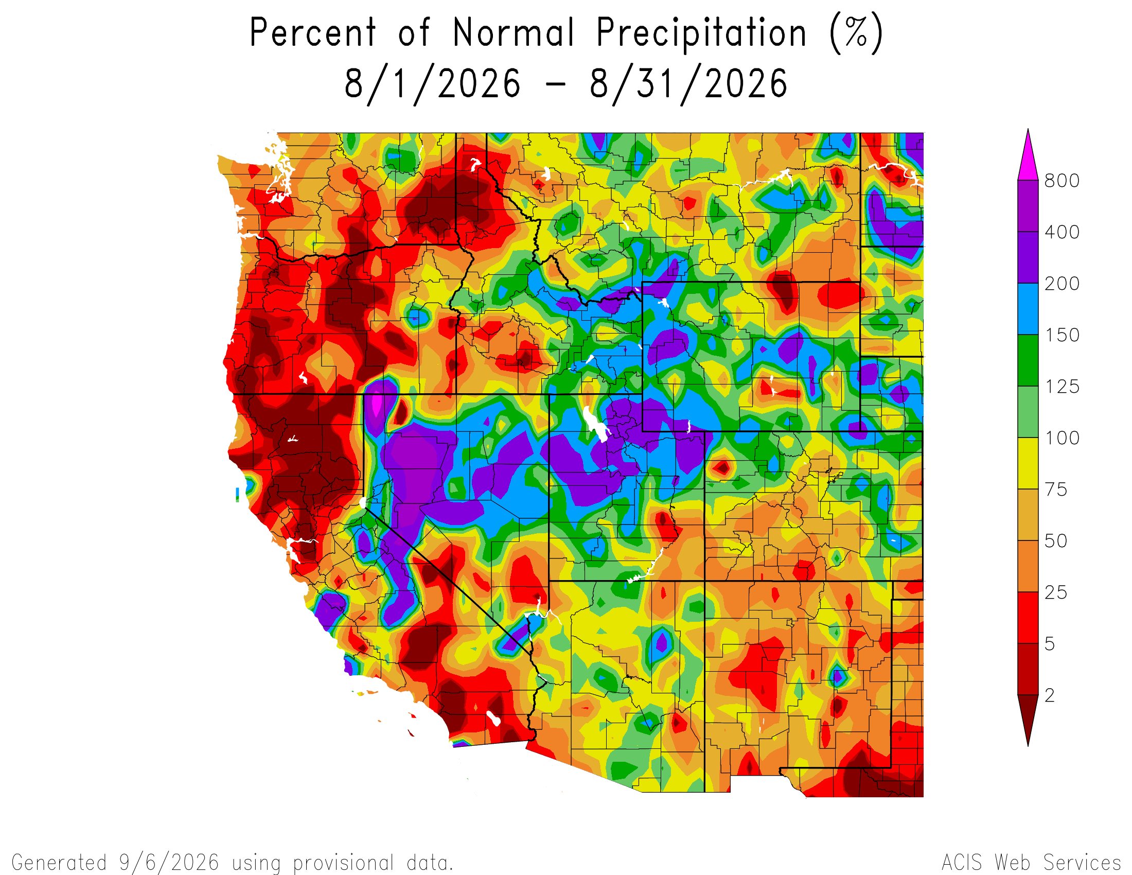
August precipitation varied across the region due to scattered monsoonal thunderstorms. Regional temperatures were above average in August, and Colorado experienced its warmest August on record, while Utah experienced its second warmest on record. Streamflow conditions were below average for most regional rivers, especially in Colorado and Utah, where many streamflow gages observed record-low daily streamflows. Regional drought coverage changed little from the beginning of August to September and is at 96%. El Niño conditions persist, and there is a greater than 90% probability of a very strong El Niño event during fall and winter 2026-27. NOAA seasonal forecasts indicate an increased probability of above average temperatures for the region, and above average precipitation for Colorado, Utah, and southern Wyoming during September–November.