Click the link to read the article on The Land Desk website (Jonathan P. Thompson):
September 21, 2026
⛈️ Wacky Weather Watch⚡️
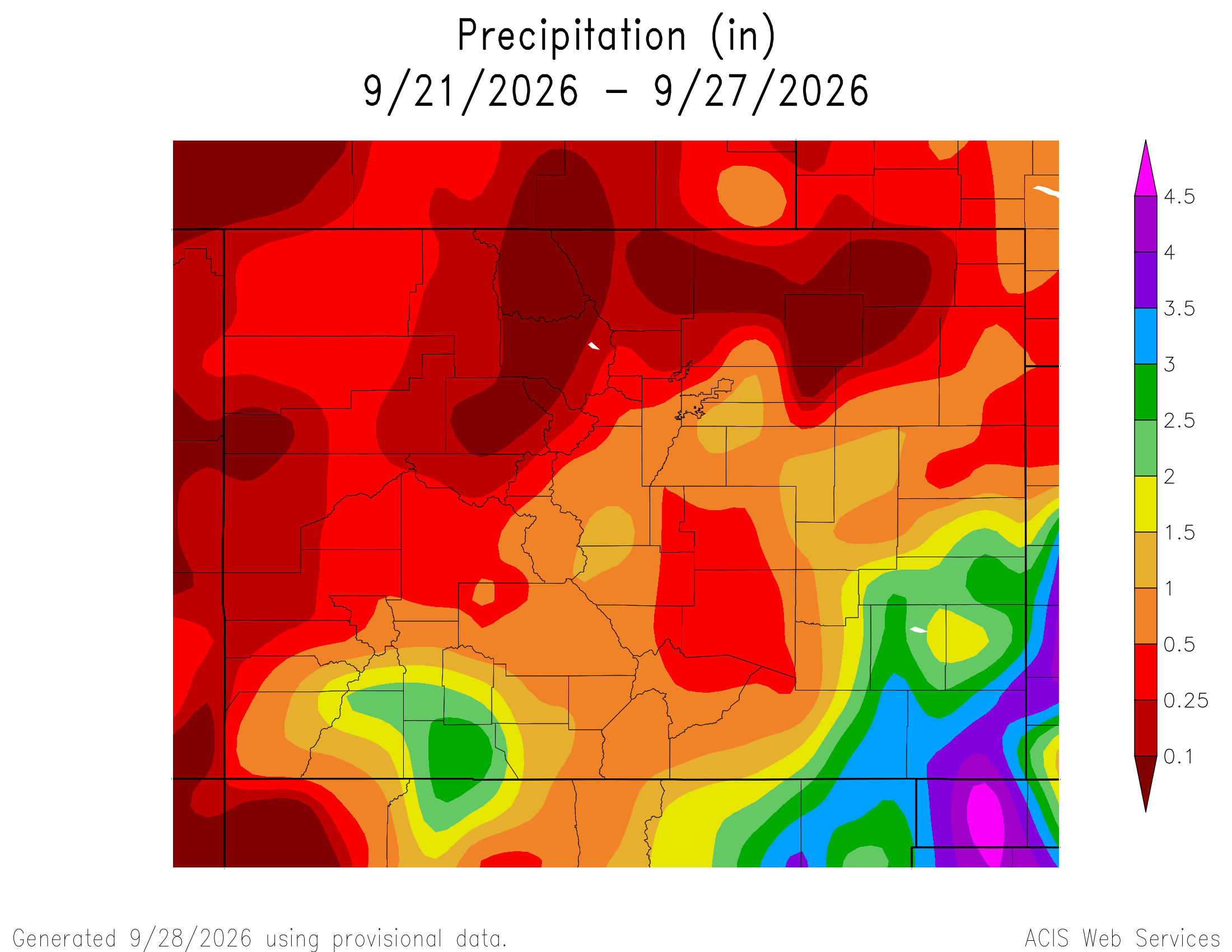
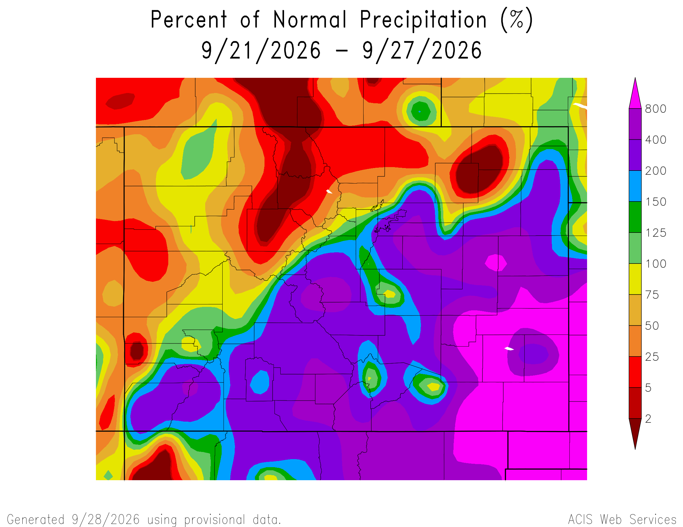
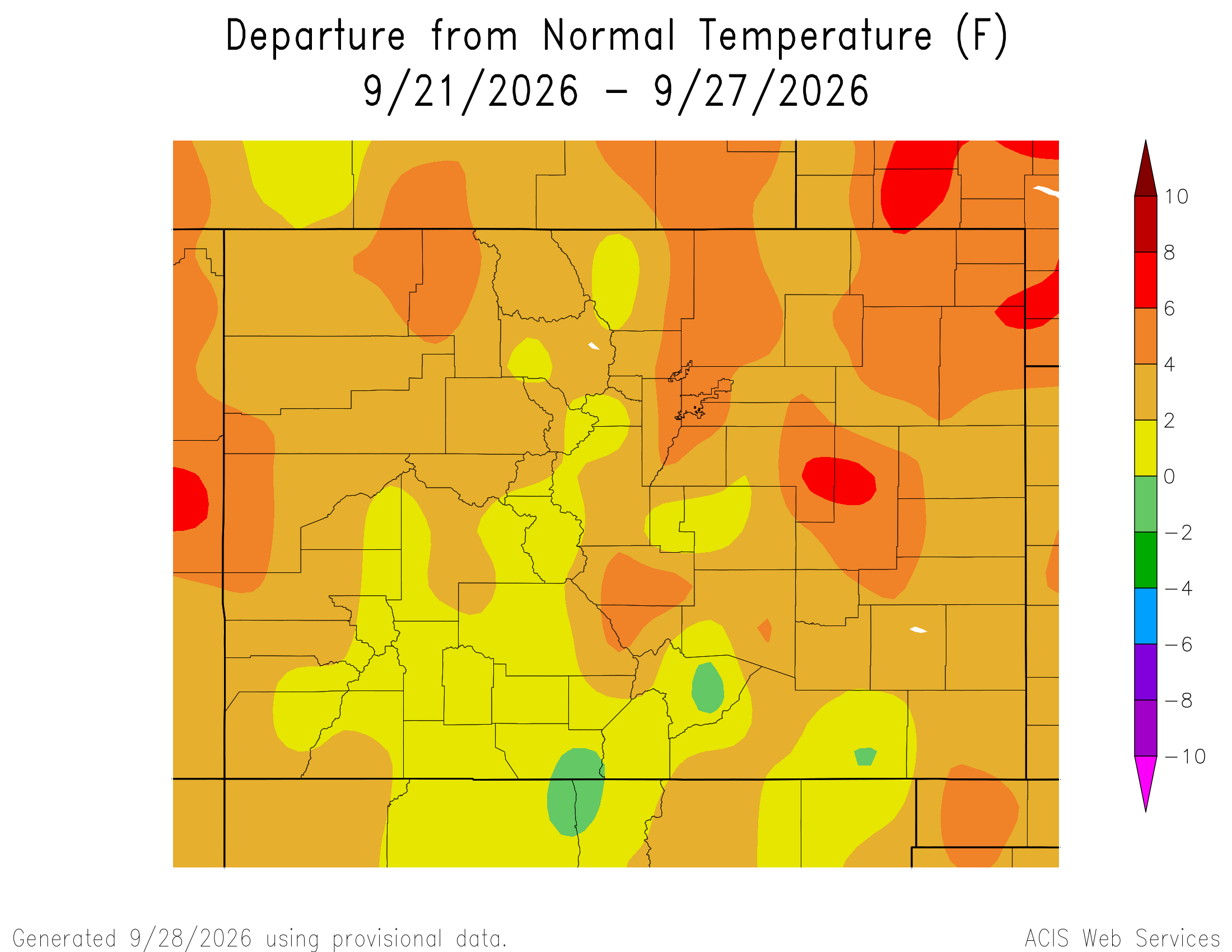
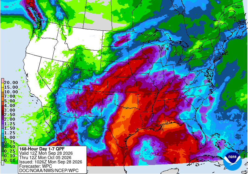
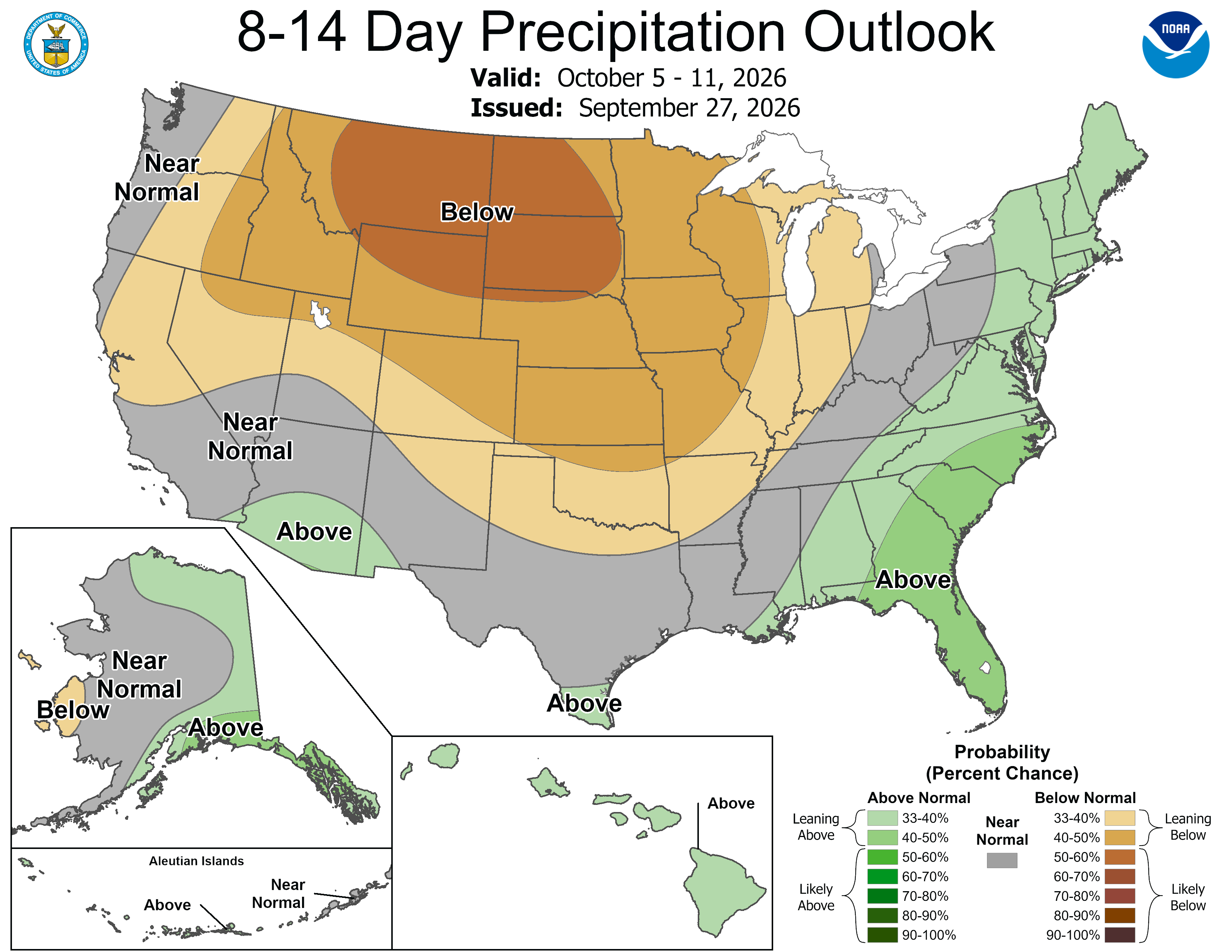
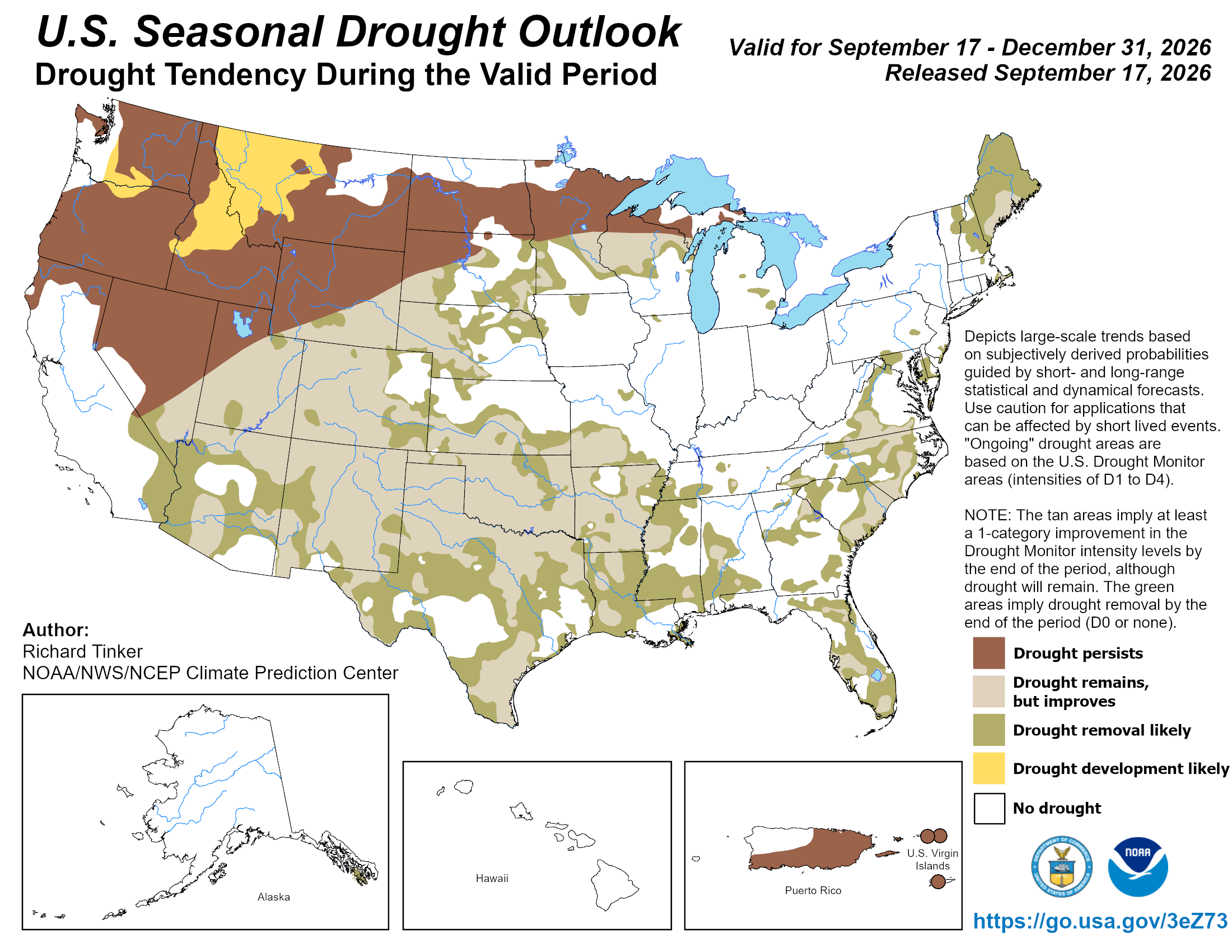
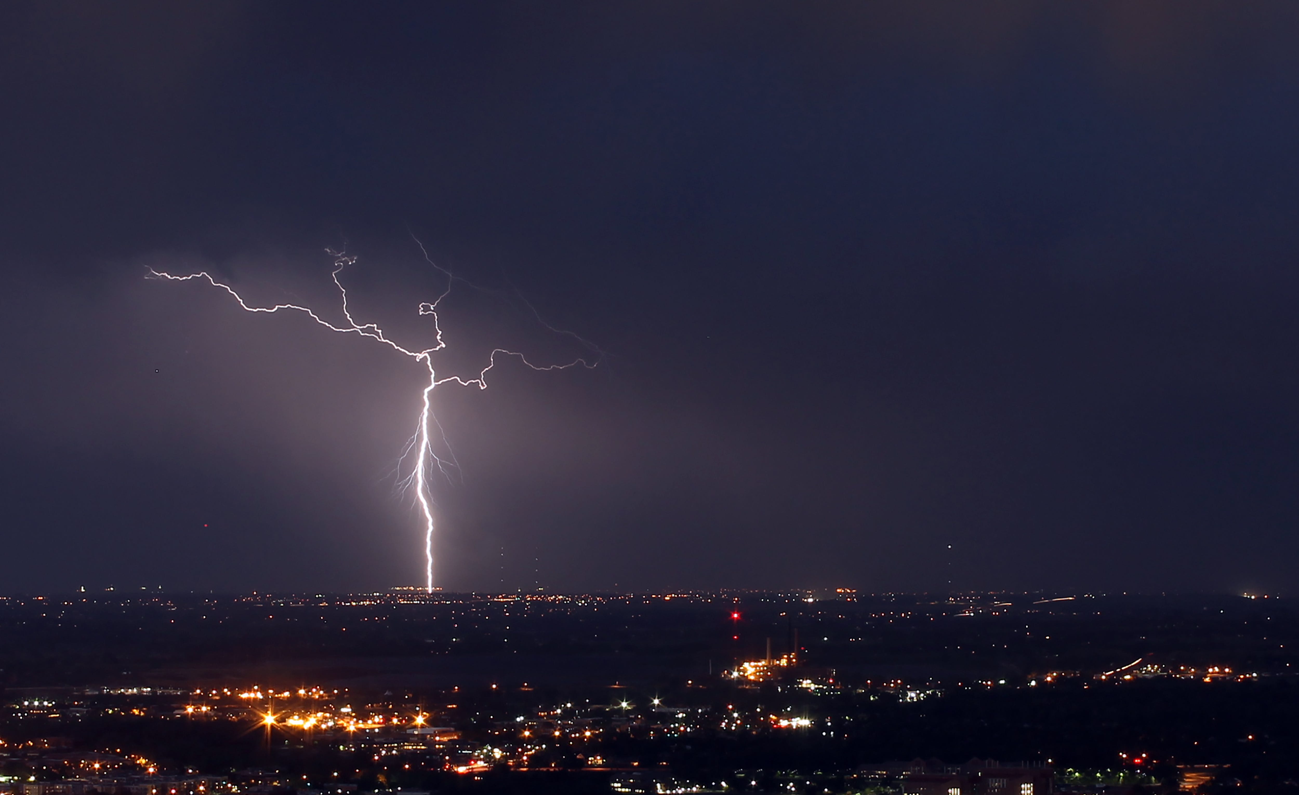
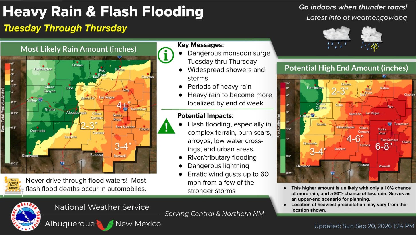
Tropical disturbances have moved into the Four Corners Country in recent days, bringing massive amounts of moisture, raising river levels, and causing flash flooding. The pattern — and high danger of flooding — is expected to continue this week [September 21, 2026], with the highest rainfall forecast for New Mexico.
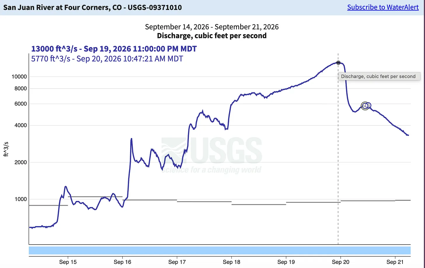
Snow-nerd Andy Gleason reported that, as of Sept. 18, 3.5 inches of rain had already fallen in Silverton during the storm cycle. The National Weather Service also says the percentage of water in the atmosphere, or PWAT, in the area was 300% of normal, higher than they have ever recorded before.
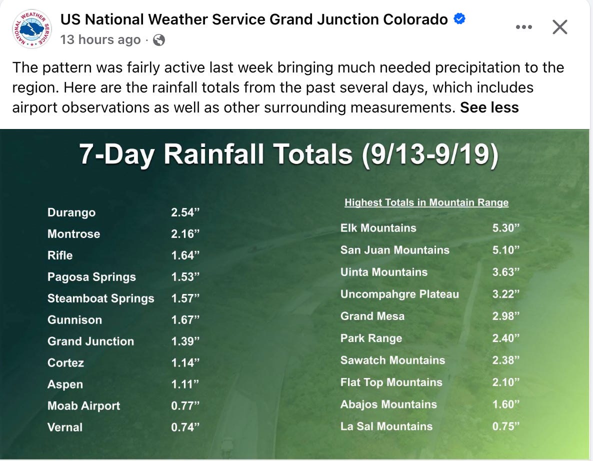
Streamflows across the region shot up once again, with the San Juan River at Four Corners reaching 13,000 cubic feet per second on Sept. 19. That was enough to send it over its banks in some places in and around Shiprock, and Navajo Nation police evacuated residents near the San Juan Bridge, which high waters threatened.
The high flows sent a surge of water into Lake Powell, causing inflows to exceed releases and bringing the reservoir’s surface level up by a few inches. However it remains below
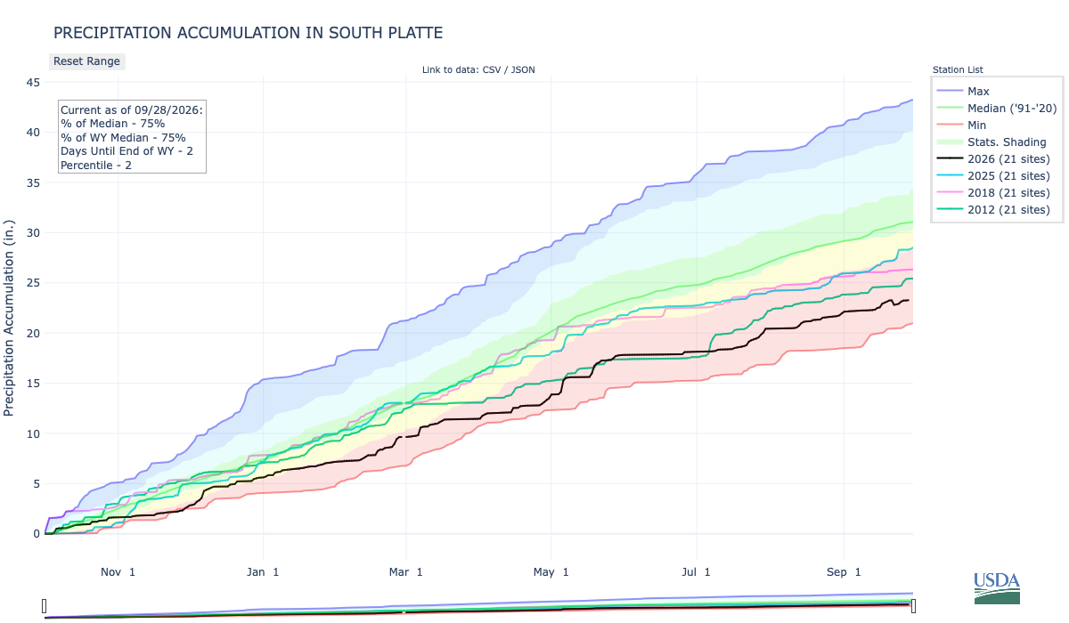
53,517 feet — or a mere seven feet above the level the Bureau of Reclamation plans to “defend.”It’s increasingly likely that this series of September storms will bring total accumulated precipitation in Four Corners watersheds up to or above median levels by the 2026 water year’s end on Sept. 30.
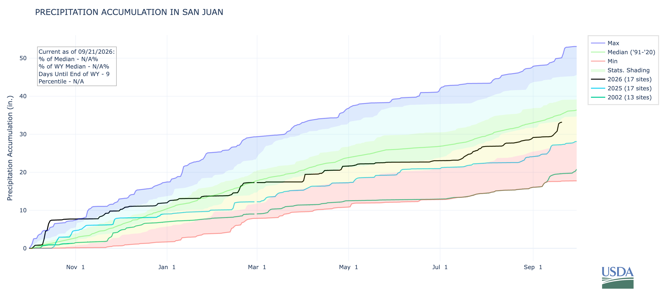
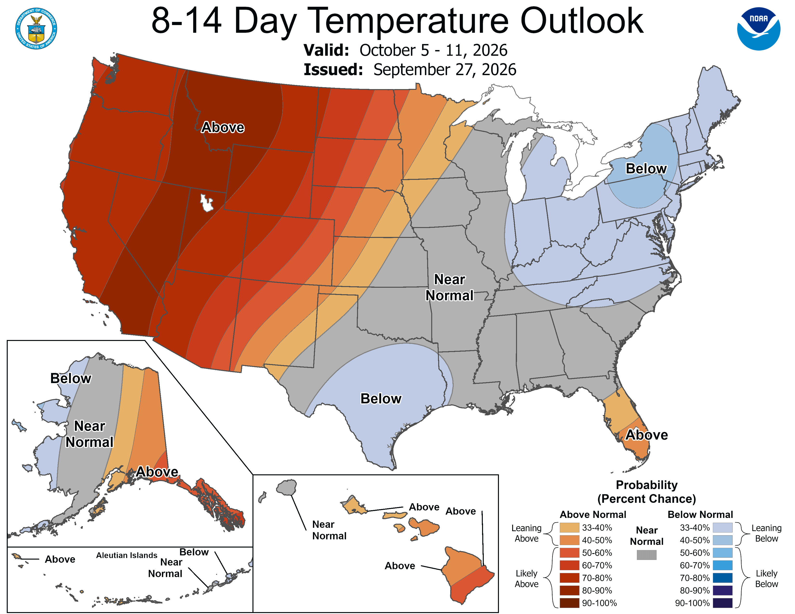
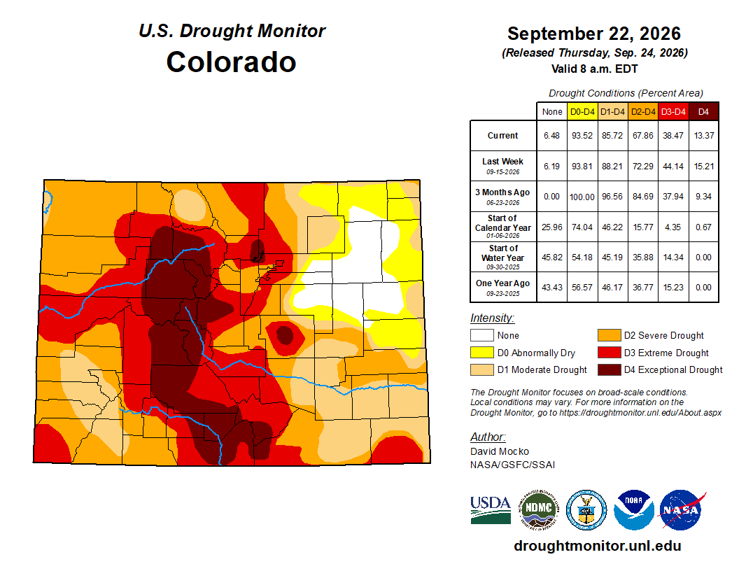
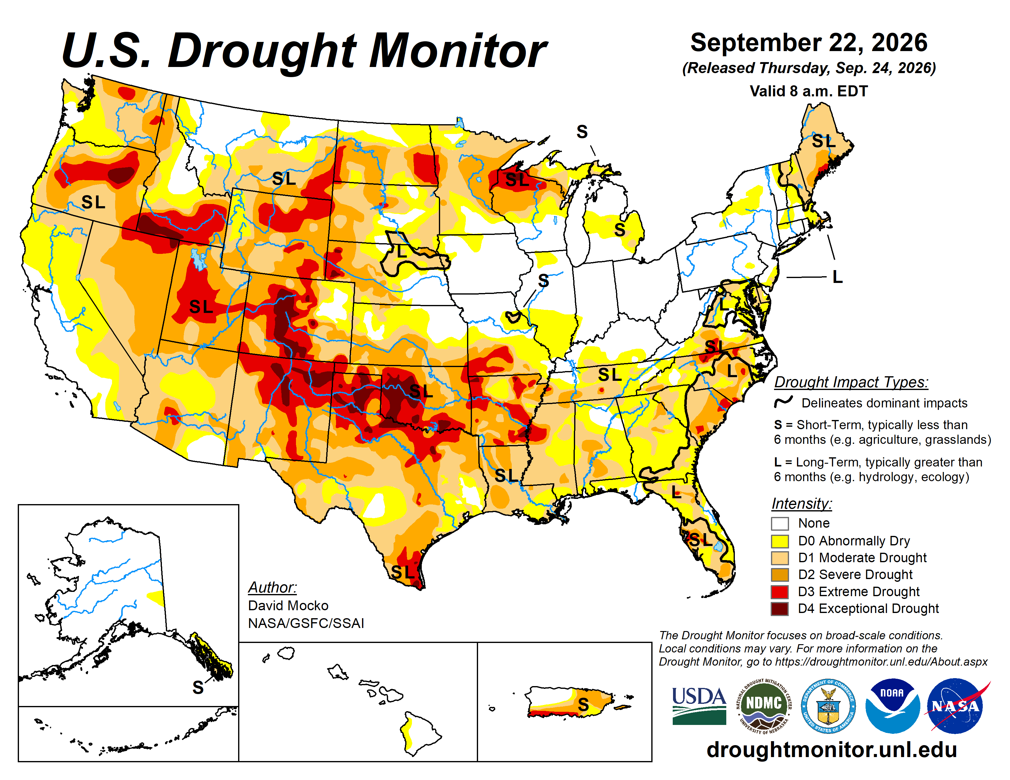
That may seem surprising given how dry last winter was, how severe the drought is in much of the West, and how low streamflows have been all summer. But big storms in the early part of the water year (last October) and now at the end of it have buoyed accumulated precipitation levels, which exceeded those in water year 2025. The problem this year was one of timing, with most of the moisture coming before snow-season, and of warmth: It is shaping up to be the warmest water year on record across most of the West.
🐟 COLORADO RIVER CHRONICLES 💧
- Tech giant Amazon plans to invest $20 million into Colorado River Basin water conservation projects as part of the newly formed Colorado River Basin Collaborative. Amazon’s first two funded projects include a leak-detection and repair effort in Orange County, California; and working with Arable on irrigation efficiency efforts on tribal farmland in Arizona. (Amazon News)
🐓 REGULATORY CAPTURE RECORD 🦊
- Idaho investigators find that a 5,600-acre wildfire in 2024 was initially ignited on Trump appointee Michael Boren’s ranch by Boren’s brother, Steve, who did so without a permit. The fire cost approximately $950,000 to contain. (Public Domain / High Country News)
🌵 PUBLIC LANDS 🌲
- U.S. Sen. Mike Lee (MAGA-Utah) moves to use the Congressional Review Act to revoke the Bears Ears National Monument management plan and block the development of a substantially similar plan in the future. While this would not prevent a future administration from restoring the original national monument boundaries, it would hamper efforts to to create a new management plan for a restored monument and could throw the entire area — even BLM lands removed from the monument — into a sort of regulatory chaos. (news release, Wes Siler’s Newsletter)
- The U.S. Forest Service considers turning over management of the Maroon Bells Scenic Area near Aspen, Colorado, to Pitkin County, saying it can no longer sustain the $300,000 annual loss at the site. The USFS plans to use a categorical exclusion to skirt the environmental review process, raising concerns about setting a dangerous precedent that would allow similar public lands transfers without analysis. (Westwise)
- The Trump administration’s ongoing dismantling of the National Park Service continues, as it funnels funds intended for repairs and maintenance in popular Western parks to President Donald Trump’s vanity projects in Washington, D.C.. (New York Times)

SACRED LANDS
- The Navajo Nation council formally recognizes as a sacred site Tooh Ahidiilíní — the confluence of the Little Colorado River and the Colorado River, the Little Colorado River Gorge, and surrounding areas. The legislation provides additional protection against development such as the now defunct Escalade project or once-proposed pumped hydropower storage projects. (Grand Canyon Trust)
⛏️ Mining Monitor ⛏️
- The Navajo Nation Environmental Protection Agency pushes back on NuFuels’ proposed Crownpoint Uranium Project in-situ-recovery facility, per the Diné Natural Resources Protection Act of 2005, which bans uranium mining and processing on the Navajo Nation. The facility would be located near the site of the 1979 Church Rock uranium tailings spill, the largest release of radioactive materials in U.S. history. (Navajo Times)
- Laramide Resources said it is moving ahead with its proposed La Jara Mesa uranium mining project on the Cibola National Forest west of Mt. Taylor in New Mexico, despite intense opposition and a federal permitting pause. (Santa Fe New Mexican)
🛢️ FOSSIL FUEL FOLLIES 📈
- The Bureau of Land Management considers opening the Ouray National Wildlife Refuge near Vernal, Utah, to oil and gas leasing. If developed, the leases would come with “no surface occupancy” stipulations, meaning directional drilling would occur outside the refuge to reach the federal minerals underneath it. (news release, Times-Independent)
- U.S. Sens. John Hickenlooper and Michael Bennet (D-Colo.) join the Southern Ute Indian Tribe in opposition to the Bureau of Land Management’s plan to auction oil and gas leases within the tribe’s reservation in southwestern Colorado, saying they are in an “environmentally and culturally significant” area. (news release)
- Today (9/21) is the last day to submit comments to the Bureau of Land Management on 43 proposed oil and gas leases on almost 75,000 acres in Utah, including parcels near Hatch Point just outside the pre-shrinkage boundaries of Bears Ears National Monument. (BLM, SUWA)
- The Bureau of Land Management receives no bids for offered oil and gas leases covering 20,600 acres in Nevada, triggering a replacement sale and making the parcels available for noncompetitive bidding. (Taxpayers for Common Sense)
- Wyoming Gov. Mark Gordon lauds Peabody Energy’s pilot shipment of Powder River Basin coal to Vietnam via a newly opened Union Pacific rail line to Mexico export terminals. (Oil City News)
🤖 DATA CENTER DIGEST 👾
- Bureau of Land Management documents show multiple developers are proposing to build data centers on public land in Arizona, Idaho, Nevada, Oregon, Utah, and Wyoming, although most of the projects are still in the conceptual phase and have yet to begin the federal permitting process. (Washington Sun)
- The Hualapai Tribal Council in Arizona passes a resolution opposing “the irresponsible development of hyperscale data centers, saying they pose a “direct and severe threat to the tribe’s sacred water, lands, environment, and way of life.” (KJZZ)
- A new study explores siting data centers on abandoned mine lands and using the acid mine drainage to cool the facilities. (Science Direct)
- New Mexico Democratic gubernatorial candidate Deb Haaland says if elected she would implement a temporary moratorium on new large-scale data centers to allow state lawmakers to develop regulations for the facilities. (Source NM)
- Holy Cross Energy officials say they expect developers to propose data centers in Garfield County, Colorado, within the next five years, adding that the electric cooperative can accommodate the increased demand. (Aspen Daily News)
🔋ENERGY TRANSITION 🔌
- Bannock County, Idaho’s commissioners consider rescinding their 2024 ban on new utility-scale solar and wind energy installations, with supporters saying the projects could provide badly needed economic development and tax revenues. (Canary Media)
- A federal judge rules that the Trump administration illegally terminated the $7 billion Solar for All program aimed at bringing rooftop and community solar to low-income people, and revokes the cancellation. (Associated Press)