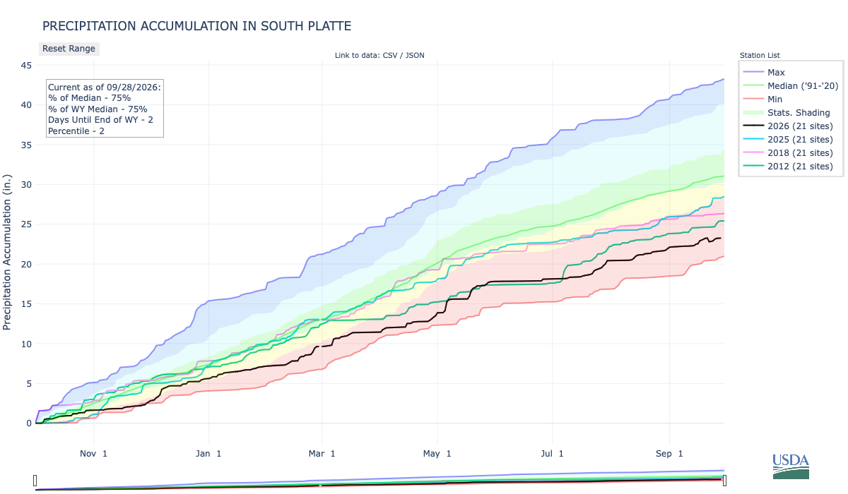
Below is the Precipitation Accumulation in South Platte graph from the NRCS for September 28, 2026. This morning precipitation, at the SNOTEL stations, is at 75% of the median (down 1% one week), and 75% of the water year median (down 1% one week). There are 2 days left in the water year.
Showers are likely today, Tuesday, and Wednesday, with a slight chance for showers Sunday in the central mountains. Showers are likely today and Tuesday, with a chance for showers Wednesday, and a chance for showers Sunday in the northern mountains. Showers are likely today, Tuesday, and Wednesday, with a chance for showers Thursday, down here, about 441 miles from Mesa Verde National Park. From the NPS:
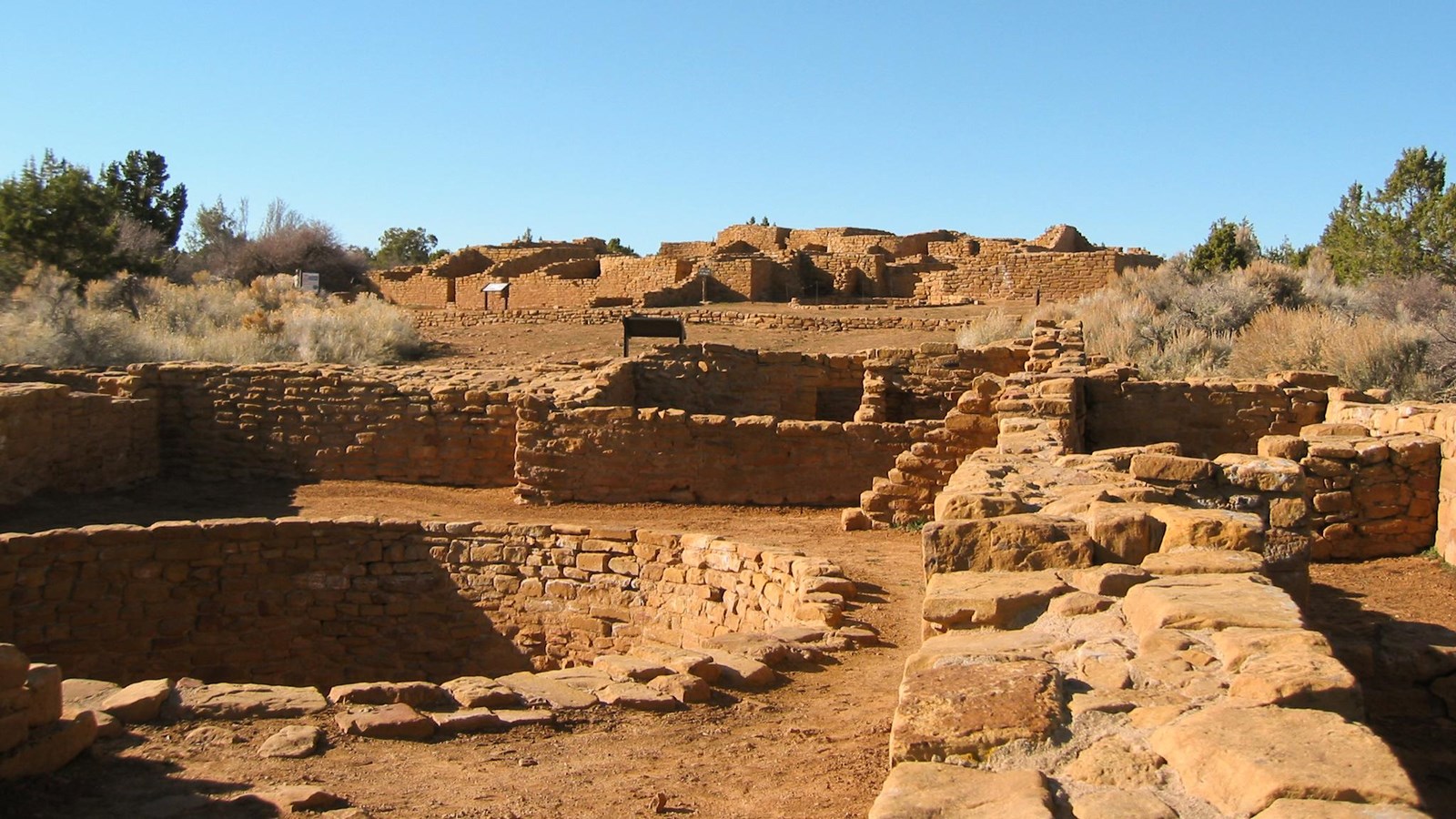
The Far View area was once an extensive farming community and one of the most densely populated regions of the Mesa Verde. This mesa top community includes Far View House, Pipe Shrine House, Coyote Village, Far View Reservoir (currently dry), Megalithic House, and Far View Tower. In ancient times, it was a place of modest homes interspersed with small farm fields. It was a place filled with people, vibrant life, and constant change.
Beginning around 800 CE, Ancestral Pueblo people lived here for several centuries, farming the deep mesa-top soils, building their homes, and raising their families. This was not always a quiet woodland. On a summer day in 1050 this ancient community would have been filled with the smell of juniper smoke and the sounds of everyday life: conversations between people working together, barking dogs, laughing children, ravens calling overhead, and the wind rustling through the shiny corn leaves. In the mid-1100s, there may have been at least 35 occupied villages and surrounding farm and garden plots within a half-square-mile area, including those you can visit today.

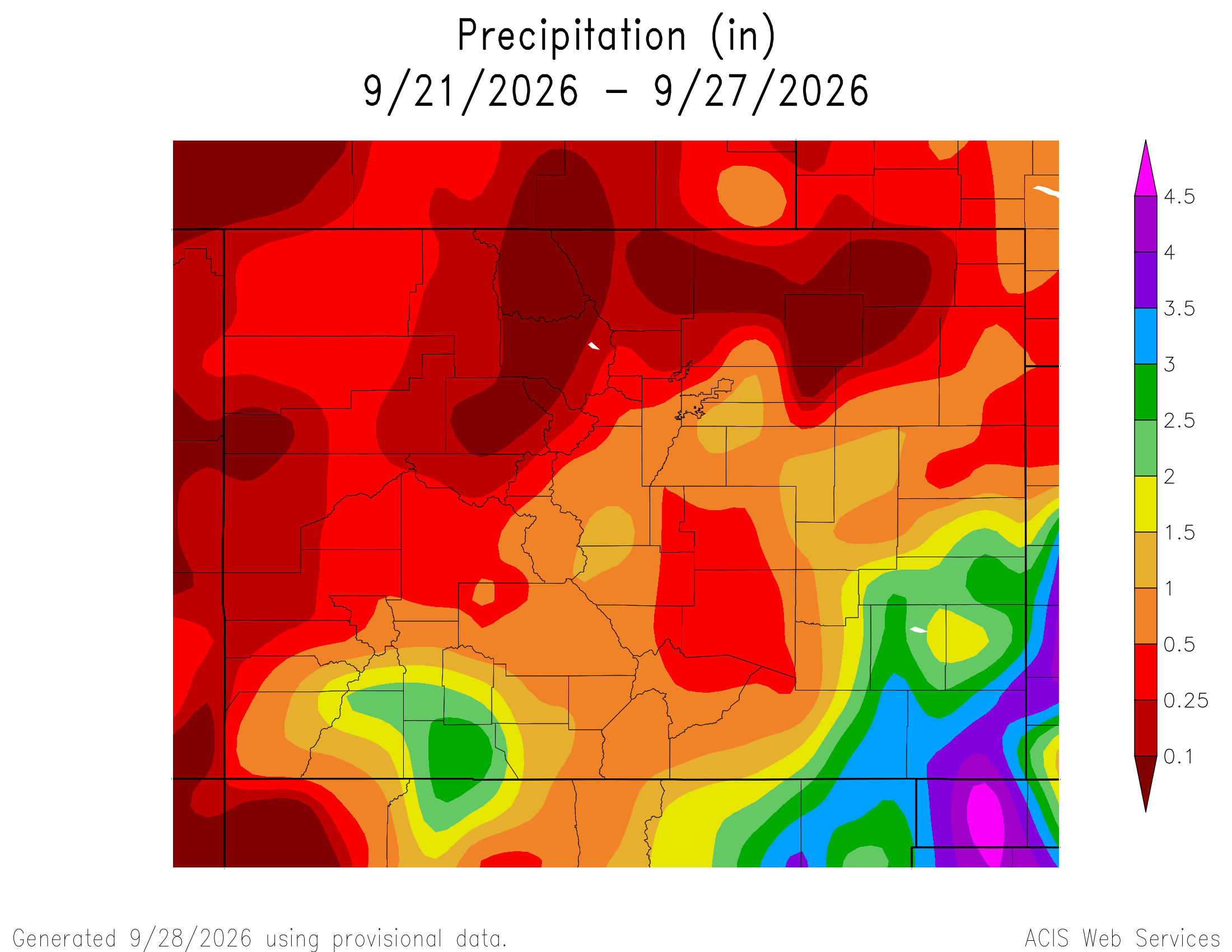
Here’s a look at the Colorado 7-Day precipitation map through September 27, 2026 from the High Plains Regional Climate Center. Precipitation in the South Platte Basin along the Continental Divide of the Americas ranged from 0.00” to 1.50″.
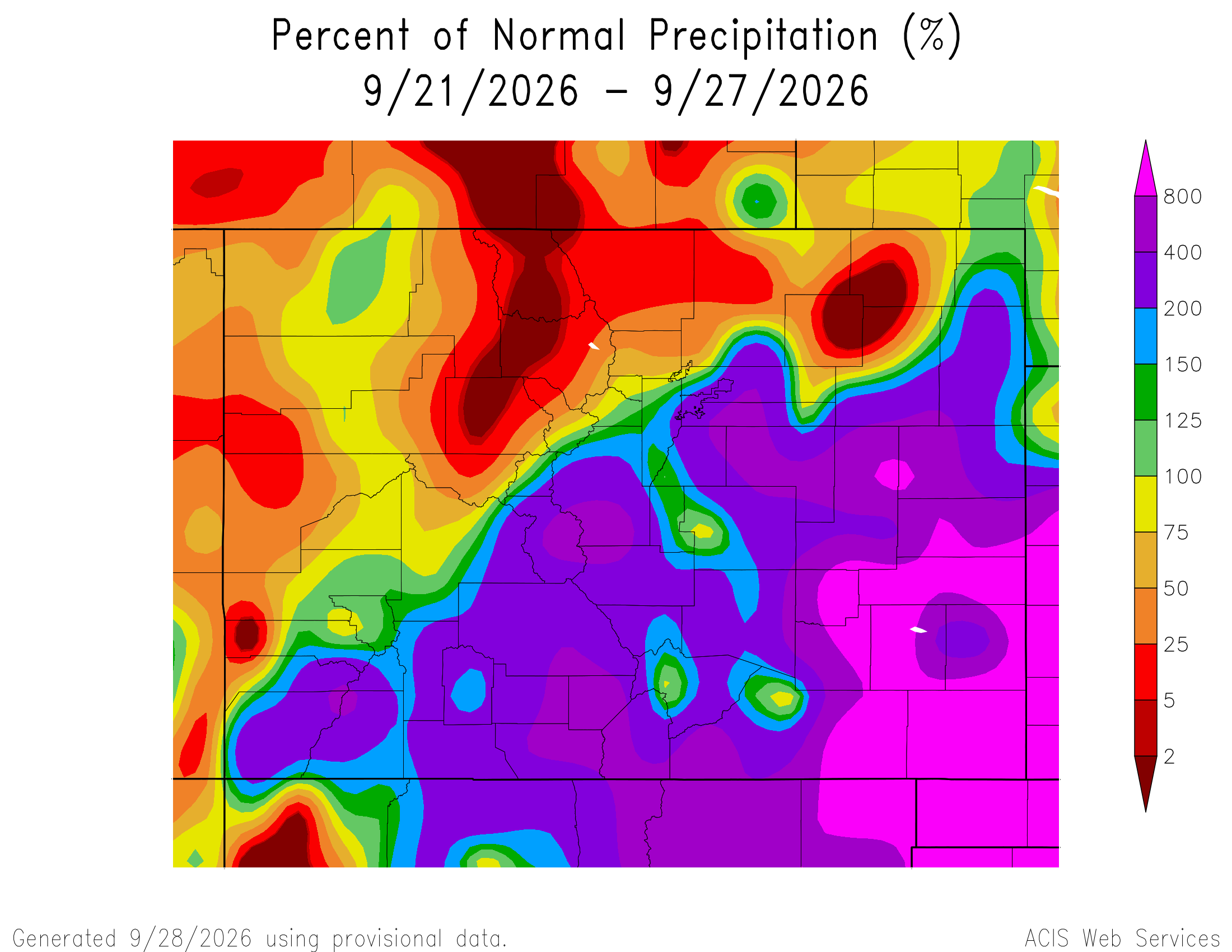
Here’s the Colorado 7-Day percent of normal precipitation map through September 27, 2026 from the High Plains Regional Climate Center. Precipitation in the South Platte River Basin along the Continental Divide of the Americas was 0% to 800% of normal.
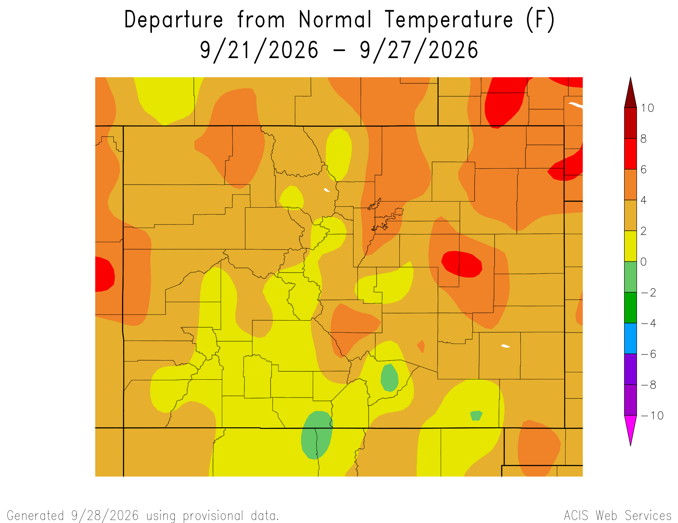
Here’s the most recent 7-Day Departure from Normal Temperature (F) for Colorado through September 27, 2026 from the High Plains Regional Climate Center.
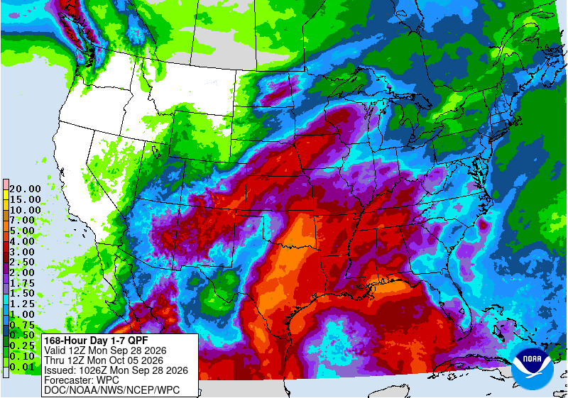
Below is the 7-day Quantitative Precipitation Forecast for the week of September 28, 2026. Precipitation is anticipated for the mountains of the South Platte River Basin and may total up to 1.50″.
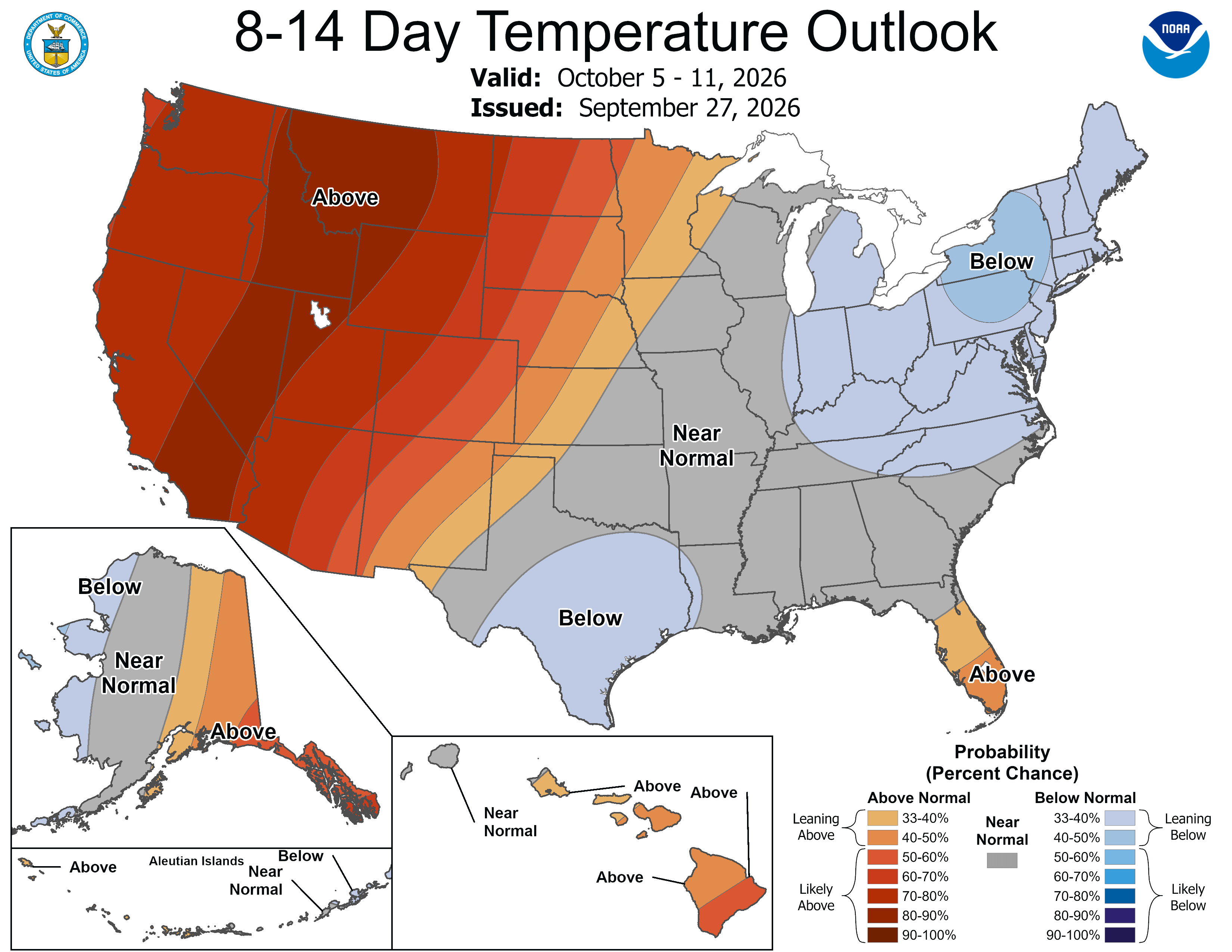
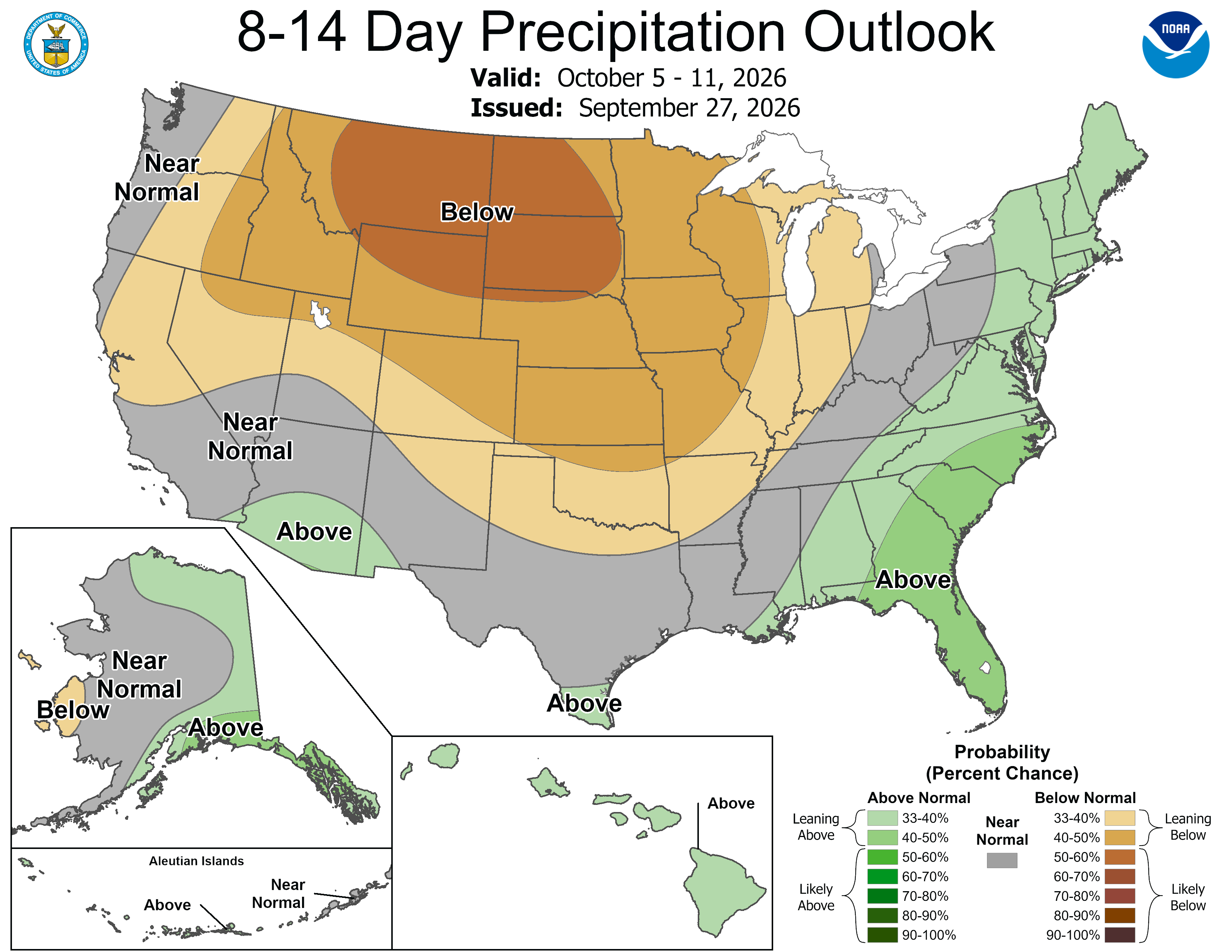
Below are the 8-14 day outlooks from the Climate Prediction Center, issued September 27, 2026, for temperature and precipitation, for the week starting September 28, 2026. The CPC expects above normal temperatures and below normal precipitation for the mountains of the South Platte River Basin.
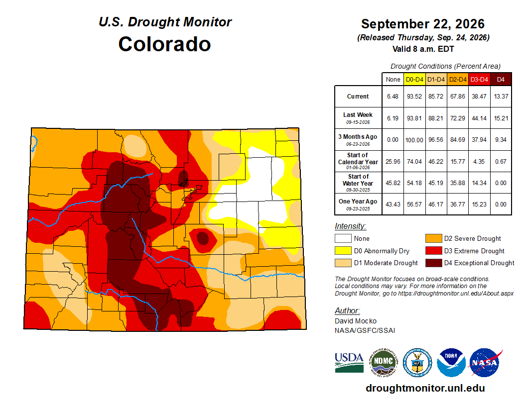
Below is the Colorado Drought Monitor map from September 22, 2026. There were one class improvements in Weld, Logan, Elbert, Arapahoe, and Sedgwick counties. There were one class degradations in Weld, Boulder, Broomfield, and Adams counties. Drought and abnormal dryness covers 93.52% of Colorado. The South Platte Basin is experiencing Abnormally Dry, Moderate, Severe, Extreme, and Exceptional drought conditions.
Below is the Colorado Drought Monitor one week change map ending September 22, 2026.

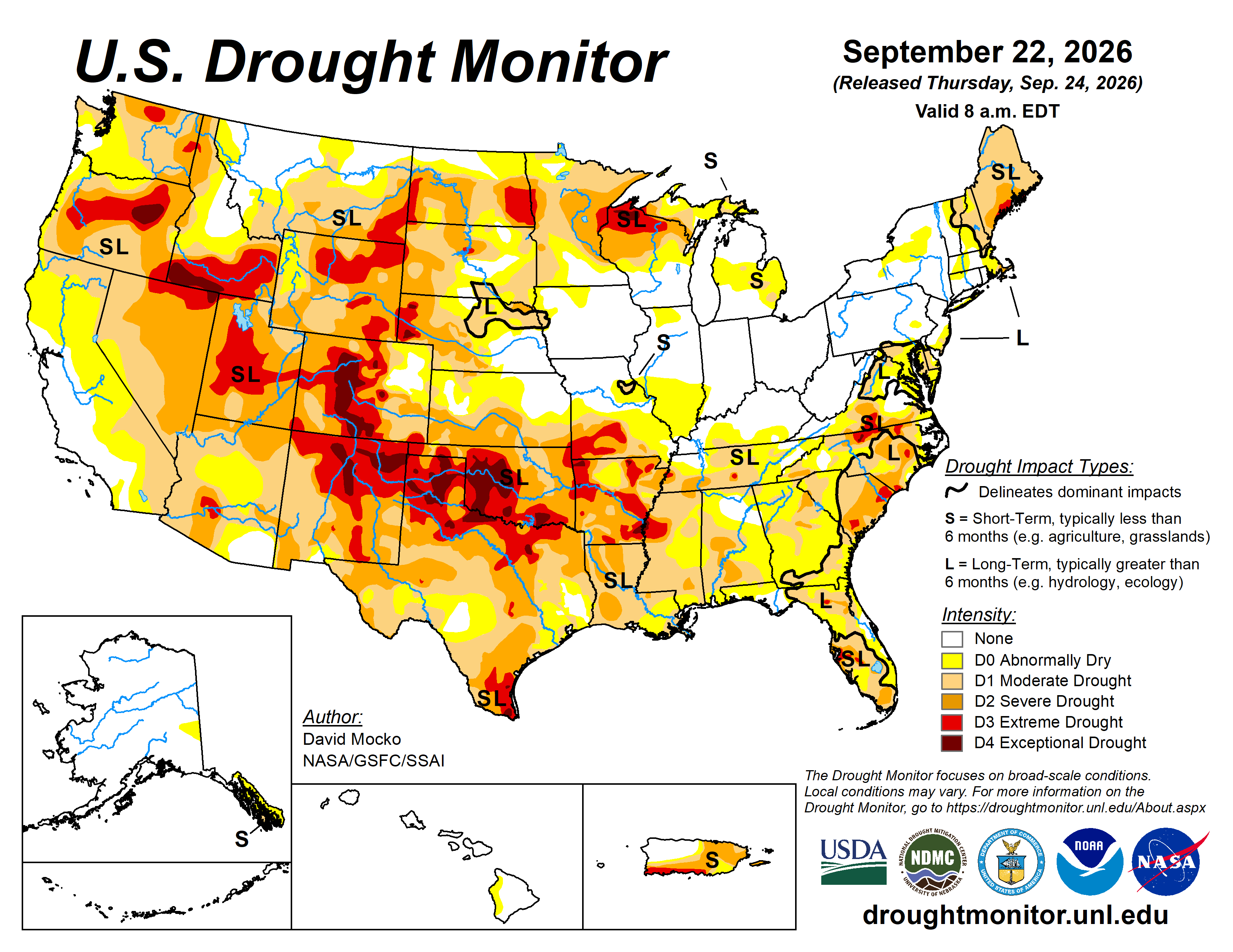
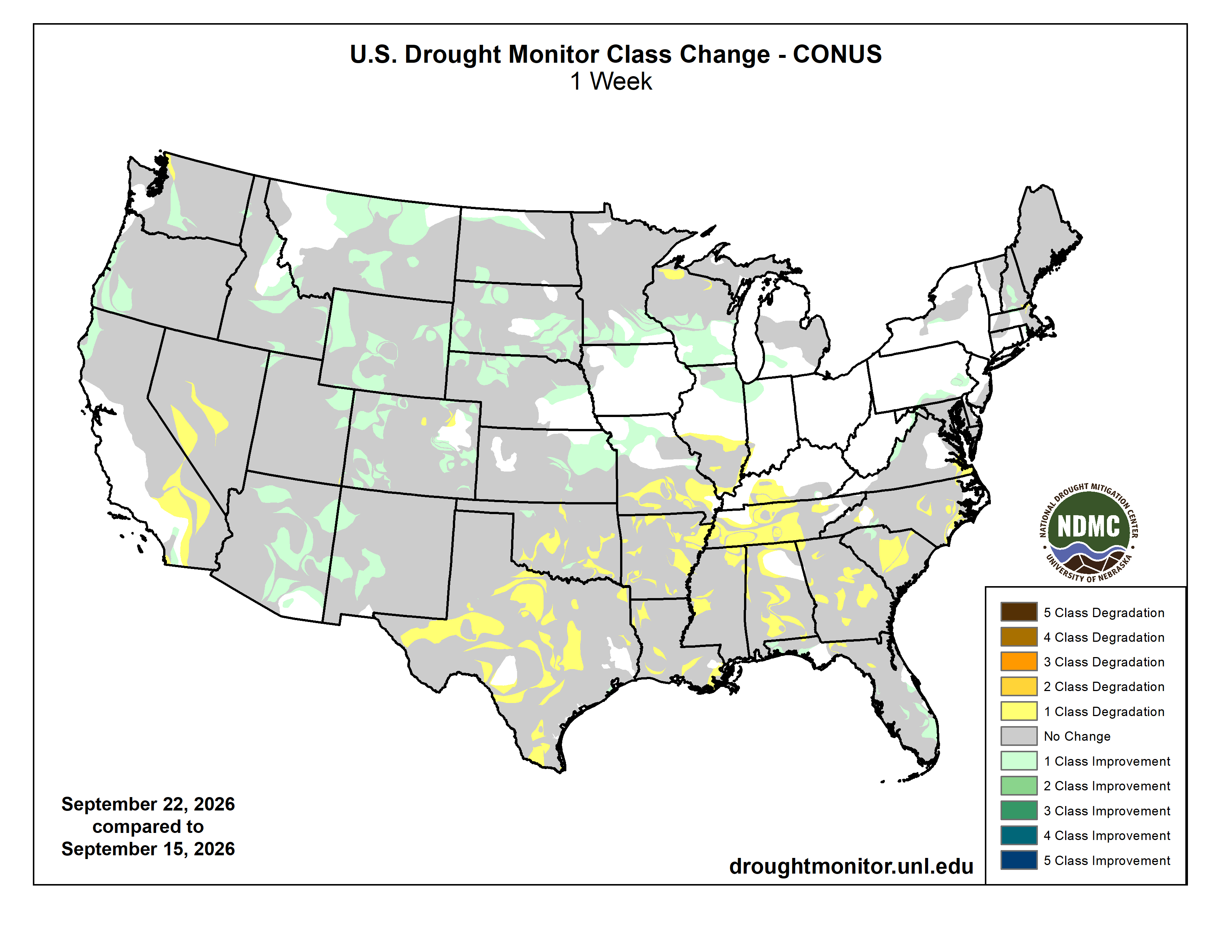
Here’s the US Drought Monitor Map from last week along with the one week U.S. change map.
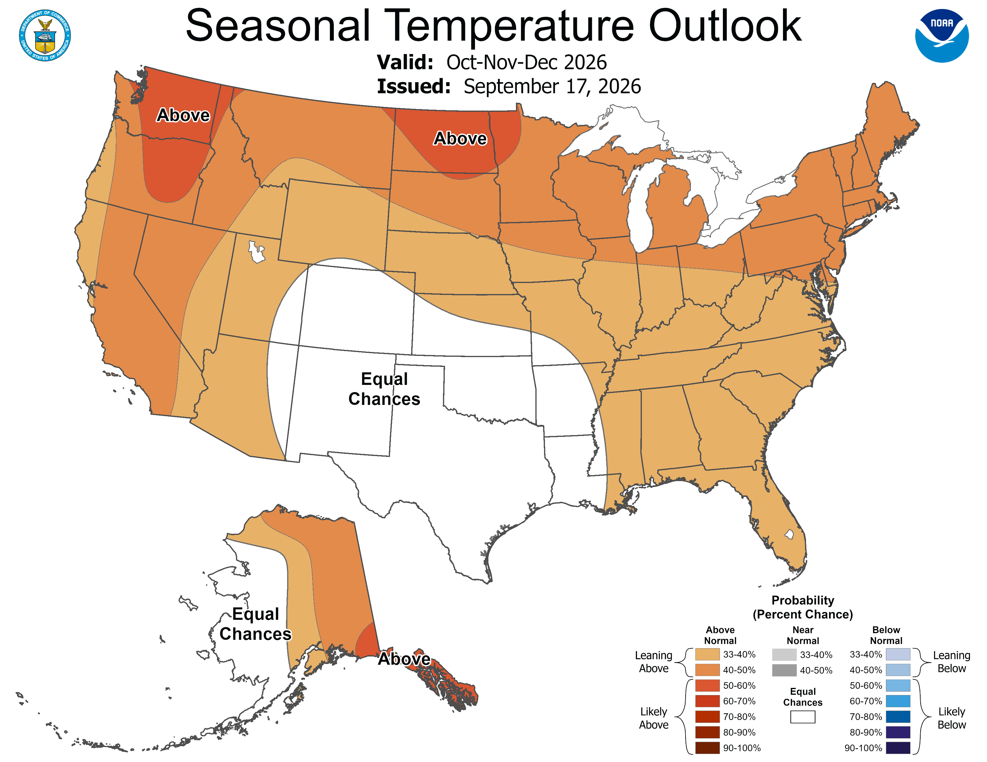
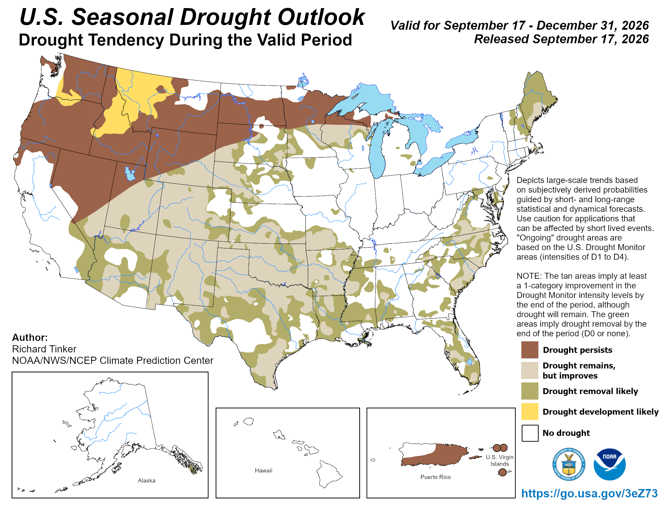
Finally, here are the latest Seasonal Outlooks, through December 31, 2026, from the Climate Prediction Center. The CPC expects near normal temperatures, above normal precipitation, and drought improvement or removal for the South Platte River Basin.