Today, Governor Jared Polis announced that the Colorado Energy Office (CEO), in partnership with Xcel Energy Services, Inc., has been selected to receive a $250 million investment from the U.S. Department of Energy (DOE) to strengthen a key transmission connection between Colorado and Texas, linking the Western and Eastern grids. The project will help Colorado meet growing electricity demand, improve reliability, and expand access to lower-cost power.
“This means lower costs and fewer outages for Coloradans. By strengthening Colorado’s electric grid and expanding our ability to share power with other regions, we can better protect families and businesses during extreme weather and periods of high demand while continuing to save people money. Electric grid improvements are exactly the kind of long-term investment our country should be making to strengthen our economy and save people money,” said Governor Polis.
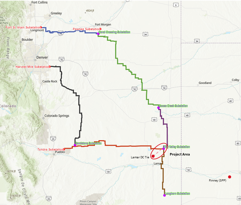
The Colorado side of the connection will move from Lamar to the higher capacity May Valley substation, connecting it directly to the Colorado Power Pathway transmission network. Together, these improvements will help reduce strain on the grid, prevent outages, and give consumers access to more sources of lower-cost electricity by drawing from a larger pool of energy sources. By upgrading existing equipment and power lines instead of building entirely new transmission corridors, the project can also increase capacity while limiting construction costs and land use impacts.
“President Trump’s Department of Energy is making significant investments in energy infrastructure to power America’s future and lower costs for hardworking families and businesses. This $250 million investment will ensure that households in Colorado and across the Western United States have access to secure, abundant, and reliable power, even during severe weather and periods of increased demand. Affordable, reliable energy is the fundamental building block of a thriving economy and vibrant communities, and President Trump and Secretary Wright are committed to securing America’s energy future,” said Tim J. Walsh, Assistant Secretary for Environmental Management at the U.S. Department of Energy.
The nation’s power grid is divided into large regional systems that currently have a limited ability to share electricity between them, making it difficult to manage the demands of multiple energy grids. The Colorado-to-Texas Western-Eastern Intertie Modernization Initiative, or CO2TX, will upgrade an aging connection near Lamar that allows electricity to move between the Western and Eastern grids. Critically, today’s announced federal funding will support the project’s total $1.2 billion cost with the Department of Energy’s $250 million dollar contribution and Xcel Energy Services Inc.’s 80% match, cementing the project’s financing.
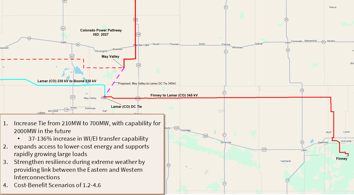
A closer map view of the Colorado to Texas connection project with additional project information reading as follows: Increase tie from 210 MW to 700 MW with capability for 2000 MW in the future; 37 – 136% increase in the Western Interconnection/Eastern Interconnection transfer capability. Expands access to lower-cost energy and supports rapidly growing large loads. Strengthen resilience during extreme weather by providing link between the Eastern and Western Interconnections. Cost benefit scenarios of 1.2 – 4.6.
“Updating and improving our power grid infrastructure is essential to ensure Coloradans have access to reliable, low-cost clean energy throughout the day and year round. Xcel Energy Services Inc’s proposed project will allow optimized use of clean energy resources across a much larger geographical footprint which will save Coloradans money on energy costs. We are grateful to the Department of Energy for investing in Colorado’s grid resilience to benefit our regions for years to come,” said Will Toor, Executive Director of the Colorado Energy Office.
The project will replace older equipment with a modern system that can move electricity more reliably between the two grids. It will also upgrade existing power lines with higher-capacity wires, allowing lines to carry more electricity without building entirely new transmission corridors. Specifically, the project will increase the amount of electricity that can move between the two regional grids from 210 megawatts to 700 megawatts, with the ability to expand to 2,000 megawatts as demand grows.
Upgrading the connection and expanding Colorado’s ability to bring more energy onto the grid will also create new economic opportunities and good-paying jobs. Qualifying construction work on the project will be required to meet federal apprenticeship utilization and prevailing wage standards. This will help to train the next generation of skilled workers and ensures Coloradans building the state’s energy future earn competitive wages.
“Reliability is at the heart of this project and everything we do at Xcel Energy. Modernizing the Lamar Tie will strengthen the connection between the Western and Eastern electric grids, helping us better serve customers during extreme weather, meet growing energy needs and make the most of affordable energy resources across the region. With support from the Department of Energy, this smart, cost-effective investment will strengthen reliability and deliver long-term value for customers and communities today and into the future,” said Robert S. Kenney, President of Xcel Energy–Colorado.
CEO is the prime recipient, with Public Service Company of Colorado and Southwestern Public Service Company, both Xcel Energy Services Inc. subsidiaries, providing the funding match, system planning, design, and implementation. Southwest Power Pool will provide regional coordination and grid expertise.
La Jara Reservoir and its surrounding lands have been used by cattle grazers and outdoorsmen of all sorts — fishermen, hunters, backpackers — for generations. Credit: The Citizen
Anna Vargas noted it first. There was more water in La Jara Reservoir on Saturday than when she had been weeks earlier. That in itself was a blessing.
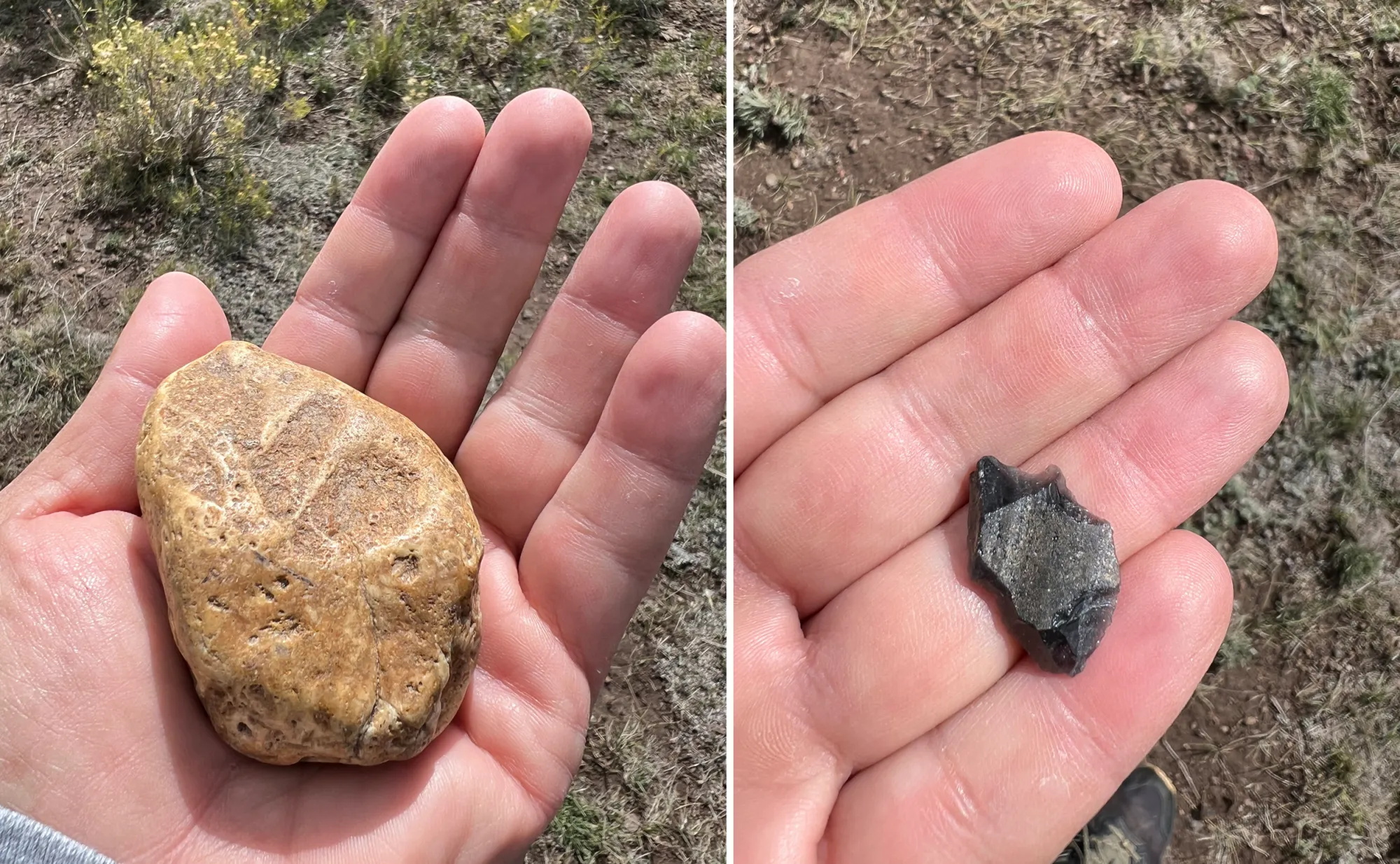
Then there was the discovery of a piece of volcanic glass obsidian by Loretta Mitson that excited the group, along with evidence of a habitation site lord knows how many thousands of years ago just above the thin reservoir.
La Jara Reservoir holds millions of years of archeology, shown by a rock with markings and a piece of volcanic obsidian. Credit: The Citizen
Anna Vargas, left, and Chris Canaly, center left, of the SLV Ecosystem Council. Credit: The Citizen
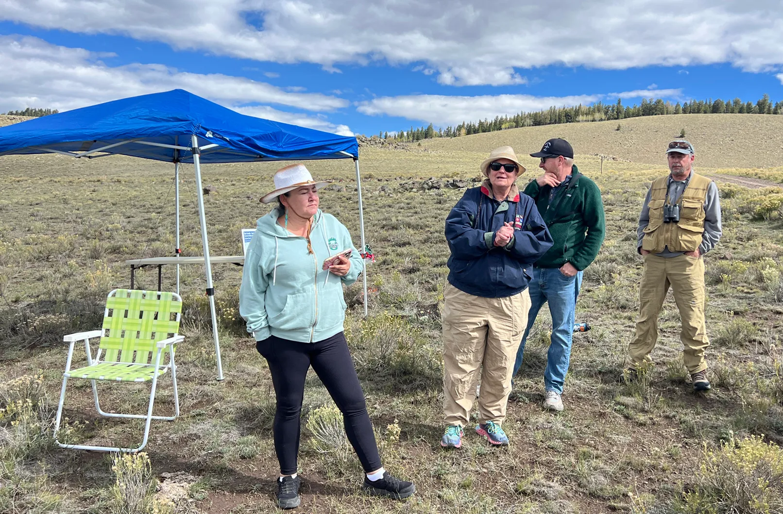
Vargas and Mitson were part of a caravan of conservationists, archeologists and public officials who took a field trip to mark National Public Lands Day in the La Jara Basin.
They had another purpose as well.
Back in November 2025, the Colorado State Land Board voted to transfer ownership of the La Jara Basin property to a trio of public agencies — Colorado Parks & Wildlife, U.S. Forest Service and U.S. Bureau of Land Management — through a $49.5 million transaction funded through federal tax appropriations, state tax dollars and money from agencies like Colorado Great Outdoors.
Vargas and her boss, Chris Canaly, executive director of San Luis Valley Ecosystem Council, organized the outing that brought along Mitson, one of the Valley’s noted historians; Colorado State Sen. Cleave Simpson; Saguache County Commissioner Tom McCracken; and Mick Daniels and Estaban Salazar from San Luis Valley Great Outdoors, among others, to put attention back on the transaction. The expectation is that the thousands of pages of paperwork involved will be signed, money transferred, and the deal finalized by year’s end.
“We are setting the table for what is going to be happening, we hope soon,” said Canaly, promising a grand event for next summer when all the paperwork is complete.
State Land Board office manager Jenny Minich told Alamosa Citizen that a more definitive update on the closure of the transaction should be available in the next couple of months.
“I think it’s going to be quite a wonderful gathering,” said Canaly in anticipation of the finality of the deal and a celebration of the La Jara Basin to come.
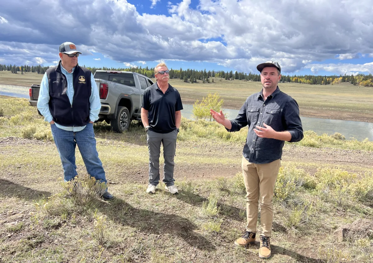
Allen Law of the Western Rivers Conservancy talks about the history of the La Jara Reservoir land. Credit: The Citizen
How the La Jara Basin ended up in the hands of the state of Colorado is unique. Then how the state through its land board eventually came around to transferring ownership to federal partners and Colorado Parks & Wildlife rather than sell the land holdings to a private party is another tale.
“This property is really unique within their ownership because when states would come into being, the federal government would deed them a certain amount of land in every township and they were supposed to use those lands to raise money for schools in the frontier states,” said Allen Law of Western Rivers Conservancy, who joined the public lands day trip.
“And how La Jara came to be is, some of those sections that should have been state sections were already homesteaded or they were on reservation lands or treaty lands or things like that. So those sections weren’t available. The federal government instead gave the state land board a big block of, I think they call them in lieu of lands, and that is what the core of this place, La Jara, is. It was basically like the ‘Oops, we already gave away a bunch of your land. We’ll make it up to you here.’”
Cattle grazers and outdoorsmen of all sorts — fishermen, hunters, backpackers — have used the La Jara Basin for generations. The decision to move the property away from state land holdings was fraught with the idea that the state could sell the property into private hands to achieve the highest sale price.
But behind the scenes was Erin Minks, then-aide to Sen. Michael Bennet in the San Luis Valley. It was Minks who began to inform her colleagues of the importance of maintaining La Jara as public lands and that the senator needed to lead the charge.
What followed was a series of federal appropriations starting with fiscal year 2023 that saw the U.S. Forest Service and Bureau of Land Management squirreling away dollars for the eventual purchase of the lands that surround the reservoir. The federal money, $43.5 million, is coming through the U.S. Department of Interior’s Land and Water Conservation Fund, which is used to “safeguard natural areas, water resources and cultural heritage.”
“We always get the question, ‘What’s going to change up here?’” said Law of Western Rivers. “Everybody’s vision is that what happens up here stays pretty much the same.
“That has always been the goal, is we want the community use to continue. We want the grazing to continue. We want folks to be able to cut wood, hunt, fish, camp, all of those things. So really at the end of the day, if we’re successful, hopefully people won’t notice any change at all and that’s kind of the core of conservation.”
The SLV Ecosystem Council organized an outing with this group to mark National Public Lands Day and to push for the finalization of the La Jara Basin land transfer. Credit: The Citizen
La Jara Reservoir. Credit: The Citizen
Once finalized, the U.S. Forest Service will take over 21,821 acres and BLM will manage 21,704 acres of the La Jara Basin. CPW, in turn, will manage the reservoir area.
Vargas read aloud a land acknowledgement as the group stood in a circle, acutely aware of their surroundings and the meaning of their Saturday journey to La Jara Reservoir.
“On this day, we gratefully acknowledge the Indigenous peoples on whose ancestral homelands we gather,” Vargas read. “We acknowledge that our sustenance and prosperity is derived from the lands of our peoples and ancestors who have been caretakers of the San Luis Valley.”
A bigger celebration to come.
A view across La Jara Reservoir from a hill between the reservoir’s two dams, back in the day. The reservoir is in Conejos County, Colorado. By Jeffrey Beall – Own work, CC BY 4.0, https://commons.wikimedia.org/w/index.php?curid=140180051
On August 29, monsoon storms sat over northern Arizona, pelting the north rim of the Grand Canyon. The rain unleashed flash floods that picked up momentum in the burn scar from the 2025 Dragon Bravo Fire. With burned trees, boulders and unanchored sediment in tow, the water pummeled down Bright Angel Creek, finding the fastest way to the Colorado River below. The floodwaters wiped out bridges, buildings and at least two human lives. It eliminated beaches and built new rapids.
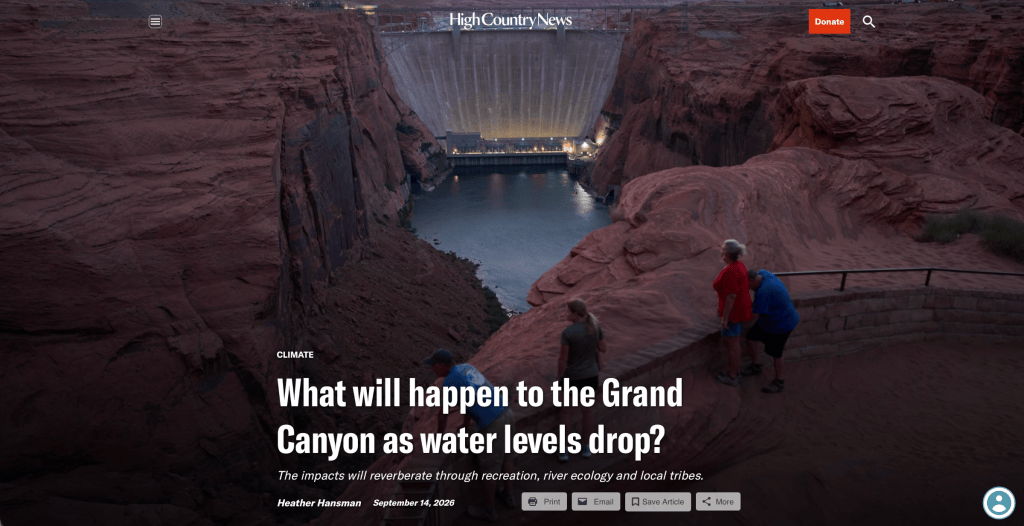
This summer, and for the foreseeable future, the canyon is changing. In addition to increasingly catastrophic seasonal floods, a warming climate means the Grand Canyon will more often have too little water. The Glen Canyon Dam, which is located just above the canyon, is consistently releasing its lowest water levels in decades, and the Colorado River’s flows are projected to drop even lower. This is already impacting recreation, the river’s ecology and local tribes.
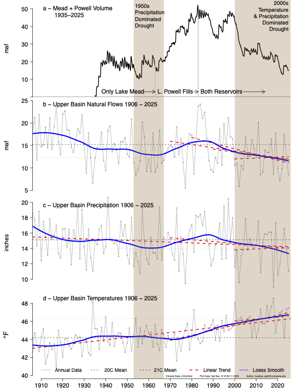
Udall/Overpeck 4-panel Figure Colorado River temperature/precipitation/natural flows with trend. Lake Mead and Lake Powell storage. Updated through Water Year 2025. Note the tiny points on the annual data so that you can flyspeck the individual years. Credit: Brad Udall
The river flowing through the Grand Canyon — arguably the most majestic and most managed in the country — is bookended between two dams that hold back the biggest reservoirs in the United States. Those reservoirs, which provide water for 40 million people in the Southwestern U.S., have been declining for decades thanks to scant snowfall and the rising temperatures tied to climate change.
There is so little water today that the combined water stored in both reservoirs has shrunk to a level not seen since the 1950s, when there was only one reservoir, Lake Mead, and it was only half full, according to Jack Schmidt, the director of Utah State University’s Center for Colorado River Studies.
July inflows into the system this year were 12% of the historical average. And according to a Bureau of Reclamation study released in June, Lake Powell, the reservoir above the Grand Canyon, is projected to drop too low to create hydropower by January 2027, a situation that also threatens the structural integrity of Glen Canyon Dam.
In response, Reclamation has reduced the volume of water it releases from Powell each month: It’s currently releasing 482,000 acre-feet per month and is projected to drop to 401,000 in October. Those shrinking water levels will affect the entire river basin and beyond, but the Grand Canyon itself will feel the changes first.
“The Grand Canyon was used to low flows prior to the dam,” said Jen Pelz, water advocacy director for the Grand Canyon Trust. “But we’ve altered the system so much in the last 60 years by using the dam that we’re not going back to what natural conditions might be if we just drop the water.” The formerly high spring flows and low, warm summer ones are unlikely to return.
No one sees how much things have changed as clearly as the 11 tribes who have called the canyon home forever. “Tribal relationship is a millennium longer than any scientist has been studying the Grand Canyon,” said Kurt Dongoske, the Zuni tribal historic preservation officer and principal investigator for Zuni Cultural Resource Enterprise.
He said the Zuni believe the Grand Canyon is where they emerged into this world, and that there’s a direct spiritual, cultural and geographic connection between the Canyon and the Pueblo of Zuni, where the Zuni River feeds into the Colorado. Dongoske has attended decades of Reclamation meetings and said that historically, the tribe’s perspective about the value of consistent ecosystem management hasn’t been considered. He expects the agency will pay even less attention to the tribe’s views about ecosystem connectivity as water levels drop.
YOU CAN SEE THE CHANGES happening at the smallest scale, in tiny grains of sand: Glen Canyon Dam now blocks more than 90% of the sediment that previously flowed through the Grand Canyon. Pelz said that lack of sediment transport is one of the clearest impacts of low flows because sediment provides the canyon’s structural and ecological foundation, creating sandbars for fish habitat and beaches for rafters. Without sediment, vegetation can’t grow, destabilizing the banks and limiting forage and habitat for the wildlife and insects that are crucial to the food web.
Photo shows Lake Mead with a water elevation of 1078. Credit: USBR
Consistently low sediment-deprived flows erode the canyon little by little, pushing sand downstream into Lake Mead instead of keeping it in the canyon’s ecosystem. To counter that, since the late ’90s, Reclamation has typically released a big pulse of water annually in the spring or fall, known as a “high flow experiment,” to carry sediment into the canyon from upstream. Reclamation neglected to do this in 2025, and even though there was enough sediment to require one in 2026, the agency opted not to because it was deemed politically unpopular.
“If we lose those high flows, we lose all the sediment in the canyon,” Pelz said. “I see that as one of the most significant impacts to the Grand Canyon.”
WHEN THE RESERVOIR LEVEL DROPS and less water comes through the canyon, the water’s temperature changes, too, because it’s being pulled from the sun-warmed top layer of Lake Powell. Temperatures typically range between 45 and 50 degrees Fahrenheit, but as the lake drops, they’re now approaching 60. Schmidt explained that this causes algae blooms in the warm clear water near the dam, something that doesn’t happen when the water is rich with sediment.
Those changes also smother the blue-ribbon trout fishery just below the dam, because the fish can’t handle the heat. This alone has big local economic impacts: Recreation in the area is a $1 billion industry that supports thousands of jobs, from guiding to hospitality to public works.
That warm top layer carries another threat: smallmouth bass. These non-native fish thrive in warm water and are pulled down into the canyon through the dam’s turbines as water levels drop. This changes the ecosystem, especially for threatened native fish like humpback chub, whose young they eat.
Some 85% of the humpback chub in the U.S. live in the Grand Canyon, thanks to a decades-long recovery program that brought them back from endangered status in 2021 and now supports a nursery at the confluence of the Little Colorado River. But that could soon end as smallmouth bass move through the river. “It’s an ecological, biological issue and a cultural one,” Pelz said. “Fish have been there with the tribes for time immemorial. When I think about the Grand Canyon without native fish, it just changes what it is.”
At the same time, revenue from power generation at Glen Canyon Dam supports the native fish recovery program. When power generation drops, so does funding for the fish.
In past years, when temperatures in the river exceeded 60 degrees for three days in a row, Reclamation would release what it calls “cool mix flows,” pulling colder water from lower in the lake’s water column to discourage the smallmouth bass and algae and balance out the ecosystem. Now, with lower water levels, the agency has less flexibility to change how and when it releases water to reflect the canyon’s natural variability, even when long-term science and agreed-upon policy supports doing so.
The Grand Canyon Trust is monitoring a USGS gauge at mile 15 of the Colorado River to track temperature trends. As of September 10, the water there was 69.4 degrees Fahrenheit and had exceeded the temperature threshold at which a dam release with a cool-mix flow would normally be triggered for 87 consecutive days, since the end of June.
Dongoske, who has served as a representative to the Glen Canyon Dam Adaptive Management Program since 1991, said there’s another aspect of river management has been too long ignored: The Zuni not only regard the native fish as kin, they believe that all fish are valuable, and that it’s not the non-natives fault that they ended up in the canyon.
“All life-forms deserve respect and their lives should be cherished, which is completely antithetical to how Reclamation treats non-natives,” he said. “Historically, they have not given Indigenous epistemologies equal consideration with Western science knowledge.”
RECREATION, TOO, IS deeply entangled in the river flows and the ecosystem’s health, said Ben Reeder, a long-time guide for Colorado River and Trail Expeditions. That’s become increasingly clear as the river drops.
Each year, approximately 20,000 people take commercial river trips through the canyon, because it’s the only way to truly see the length and the heart of the Grand Canyon. Those trips can range from three-day motorboat trips to 18-day oar-powered raft trips.
Reeder, who runs 36-foot-long motorboats through the canyon, said that as river levels drop it becomes harder to get through rocky technical rapids like Hance and Horn Creek. “Running low water, especially in a big boat, is what separates decent boatmen from really good boatmen,” Reeder said. “It’s definitely more nerve-wracking.”
He said that guides have had to adjust their routes, timing and scouting, and that some companies have already started running smaller boats to be able to get through the shrinking river channels. So far no one has been hurt, he said, but boats are getting stuck in the rapids.
Reeder, for his part, has changed the type of gear he travels with, bringing a slingshot to help get a rope to shore if his boat gets stuck. “It’s not just about river running, but what happens when things go wrong,” he said.
“The Grand Canyon is a living, breathing thing. When you spend a lot of time down there, you start to understand it,” said Reeder, who is also the Grand Canyon River Guides representative to the Bureau of Reclamation’s Technical Workgroup. He said that guides are looking out for each other as they try to figure it out, but he’s worried about the impacts on the industry.
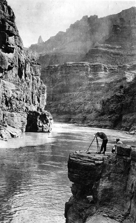
In this photo we have Claude Birdseye (right) – expedition leader and Chief Topographic Engineer of the USGS, and Roland Burchard (left) – expedition topographer. Photo credit: USGS
Trip bookings are reportedly down by about 25%, after a post-COVID high. Reeder is worried about what will happen in the future as the river drops lower, possibly preventing bigger boats from getting through the canyon at all and cutting off the entire motorized sector of the industry.
“The history of Grand Canyon boatmen has always been this resiliency,” he said. “I’m confident we’ll have solutions, but I’m not confident that I’m necessarily going to be able to guide and run boats there the way I am now for the long term. We will have to adapt.”
RIGHT NOW, releases from Lake Powell are fluctuating between 6,000 and 9,200 cubic feet per second, compared to the typical average summer flows of 13,000 cfs, according to Jennifer M. Erickson from the Department of the Interior Public Affairs. Such low flows make it impossible to do cool mix flows or high-flow experiments; the latter requires releasing between 31,500 and 45,000 cfs for one to four days.
Low flows also eliminate options like the steady-state releases called “bug flows,” which the Grand Canyon Trust’s Pelz said aim to keep fluctuations at a minimum to give bugs the chance to hatch, supporting the food web, including bird populations farther downriver.
Dongoske said it’s also important to think about the cascade of impacts outside of the river corridor. “Whatever happens in the Grand Canyon will have impacts on the community of Zuni,” he said. “There’s a continuous spiritual connection.”
On a grand scale, Pelz said, low water levels create a feeling of scarcity that inhibits creativity and flexibility. The recent flash flood also raises questions. “We really need to rethink how we’re going to manage the river or how the infrastructure is going to work,” she said.
This story was produced by High Country News in partnership with The Water Desk, an independent reporting initiative at the University of Colorado Boulder’s Center for Environmental Journalism.
A workgroup, of sorts, on the Colorado River in the Grand Canyon. Photo credit: Brent Gardner-Smith/Aspen Journalism
The Colorado River is on the brink of collapse because of climate change and overuse of water.
Reservoirs supplying water to tens of millions of people in the southwest reached record lows this summer. The nation is racing to refill them with conservation measures so they can still generate hydropower and reliably deliver water to users downstream.
Fish are struggling. Rafters are having trouble navigating low water.
Despite all this, the seven states sharing the water supply remain at a yearslong impasse over how to conserve the river.
“The Colorado River is in as bad a shape as it’s ever been,” said Doug Kenney, chairman of the Colorado River Research Group at CU Boulder’s Getches-Wilkinson Center.
The Interior Department announced Aug. 21 it will significantly cut back the amount of water that will flow to the lower basin states of California, Nevada and Arizona for at least the next two years.
“To the people who really study this river, everything that’s happening this year has been expected for decades,” Kenney said. “This is a classic, slow-moving crisis. I’ve equated it to driving a car off a cliff at 2 miles an hour. You can look out the windshield and see that cliff coming. And we’re now right at the edge.”
Kenney spoke to CU Boulder Today about the latest efforts to conserve the river and what he thinks is coming next.
Are these cuts to the lower basin states enough to save the river?
There’s nothing in this plan that will save the river. It hasn’t made it to the ocean since the 1960s. That’s not going to change. What they’re really trying to accomplish is to prevent the reservoirs from going even lower. They’re trying to avoid further disaster. And the cuts they’re anticipating for the next two years—I don’t think are going to get us there.
If we have a good water year or two with heavy snowpack, we can maybe hold where we’re at. But by the time we get to year three and beyond, those cuts will probably have to be about twice as big as they are now.
Nevada is suing the federal government to stop the cuts. What’s at stake?
One of those stakes could be that the Bureau of Reclamation is told to go back and redo its plan to cut water to the lower basin states. That would be chaotic. The last thing water users want is chaos. They want to know how much water they can expect.
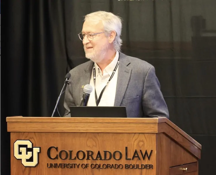
Doug Kenney at the Getches-Wilkinson Center 2026 Conference on the Colorado River June 5, 2026. Photo credit: Allen Best
With lawsuits starting, is there any hope left for states to agree on a plan?
There are two problems on the river. One is stopping the current trajectory of reservoirs dropping. And that’s a heavy lift. But if you manage to do that, then there’s the other problem of rebuilding those reservoirs. Which requires even further conservation and cuts.
We have to rebuild some storage in those reservoirs. At the moment, we’ve decided let’s just deal with what we have to deal with immediately—this short term crisis—and even that’s proving to be a lift that the states can’t do themselves. And the federal government has had to step in.
Their plan doesn’t force water cuts for upper basin states like Colorado. Can we get out of this crisis without mandatory cuts in the upper basin?
The upper basin is tricky here in that it uses significantly less water than it was promised. And people in the upper basin will tell you, this is the deal they made a century ago in the 1922 Colorado River Compact.
So when you talk to the upper basin states about conserving water on any sort of permanent basis, that’s the sticking point that you’re going to get is people saying ‘we were promised this water.’
The scientists will say this is a different river than 100 years ago. So you have that sort of impasse. If the upper basin could just cap what they’re using today, long term, that would be tremendously helpful. And that might very well happen. But I don’t think the upper basin would want to commit to that in any sort of formal way.
Then how do we get out of this crisis?
A truly long-term sustainable solution has to look at the fact that we’re using 75 percent of the water in agriculture. And some of that agriculture I think is going to just have to go away. So the policy decision there is: Which agriculture goes away? And does it just go away through bankruptcies, and let the market do what the market does? Or do we do that in a structured and more humane manner, such as a federal program to buy out large amounts of it?
But when you start talking about retiring a lot of agriculture, that’s not popular. There’s no easy way out of this. [ed. emphasis mine]
Is the fate of the river heading to the US Supreme Court?
I would guess we end up in interstate litigation. I’m not sure of that, but I think the odds of that happening are greater than 50-50 in my mind. But you have to appreciate that no negotiation and no court fight creates water. The weather systems create water. And as long as the earth continues to heat, this basin figures to get drier and drier.
Twenty years from now, we’re gonna look back and say, ‘Oh, those were the days when we got healthy snowpack,’ and ‘Oh boy, we had it good back then.’ That’s the trajectory we’re on in terms of the climate part of this.
Is there anything that gives you hope for the river’s future?
Hope comes from the fact that at some point, Mother Nature imposes cuts. At some point, the water just isn’t there and people have to be creative and do more with less or at least try to do the same with less. And there’s a good track record of doing that.
The southwest is a great example. Las Vegas over the last 30 plus years has been the fastest growing big city in America. And during that period, they slashed their water use dramatically. Other cities have been on the same trajectory: Denver, Los Angeles, San Diego, Phoenix and Tucson have shown that they can use a lot less water. And that’s really encouraging.
It’s tougher to save water in agriculture. But there are some things we can do to adapt. Some of it’s technology. Some of it’s using different systems for irrigating crops. It’s also changing to different crops. There are tools in the toolbox here.
But it’s really hard to get that sort of adaptation going as long as you’re still in the mindset that the other guy is the problem, and what I do is fine. That mindset stops a lot of good innovations from happening.
Native America in the Colorado River Basin. Credit: USBR
There are 30 tribal nations with a stake in this river as well. What can we learn from them?
They say, ‘Why is there a table with seven chairs. Why is it only seven states negotiating? There should be at least 37 chairs.’ They should be involved in this process at every level. And by and large they aren’t.
The Colorado River Indian Tribes have dubbed their portion of the river as basically having personhood status. It is a living independent being. It’s important, I think, to challenge the rest of the users in the basin to think about the obligation we have to the river itself. Because that’s just not a viewpoint that comes up in these negotiations, but it really needs to.
Map of the Colorado River drainage basin, created using USGS data. By Shannon1 Creative Commons Attribution-Share Alike 4.0