Below is the Precipitation Accumulation in South Platte graph from the NRCS for September 21, 2026. This morning precipitation, at the SNOTEL stations, is at 76% of the median (up 2% one week), and 76% of the water year median (up 3% one week). There are 9 days left in the water year.

There is a chance for thunderstorms/showers Tuesday, a chance for showers Wednesday, showers are likely Thursday, with a chance for showers/thunderstorms Friday, Saturday, and Sunday, in the central mountains. There is a chance for showers Tuesday and Wednesday, a chance for showers/thunderstorms Thursday, Friday, Saturday, and Sunday, in the northern mountains. There is a slight chance for thunderstorms Tuesday, a chance for showers Wednesday, Thursday, and Friday, then a slight chance for showers Sunday, down here, about 466 miles from the Montezuma Valley Irrigation Company. From History of the Montezuma Valley Irrigation Company (via ArchaeologyColorado.org):
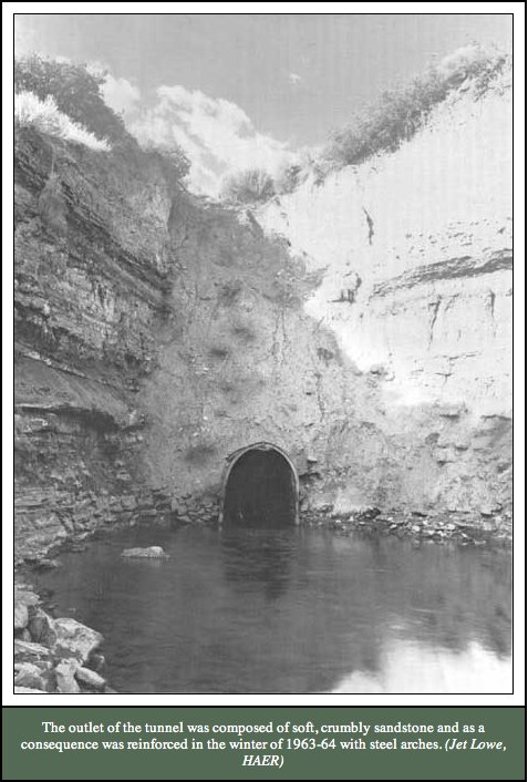
Irrigation in the Southwest began long before Euro-American settlement. The Ancestral Puebloans constructed stone terraces and check dams to capture runoff for crops as early as A.D. 750 in Mesa Verde with habitation extending until the late 1200s (Grace 2016). Later, the Ute, Navajo, Arapaho, and Cheyenne communities employed similar techniques to adapt to the semi-arid environment (Gerhold 1981:2; Grace 2016). These indigenous systems represent the earliest technological responses to water scarcity in the region…The Montezuma Valley’s geography presented a paradox: fertile soils and favorable climate for fruit growing, but insufficient water supply. Early settlers relied on limited natural springs, which constrained growth. Recognizing this challenge, irrigation pioneers initiated ambitious projects to divert water from the Dolores River. The Montezuma Valley Water Supply Company, organized by James W. Hanna in 1885, constructed a 5,400-foot tunnel and the ‘Great Cut’ to channel water into the valley. Completed in 1889, this system marked one of the earliest large-scale, privately funded irrigation projects in the Southwest (Gerhold 1981; Gerhold 1983).

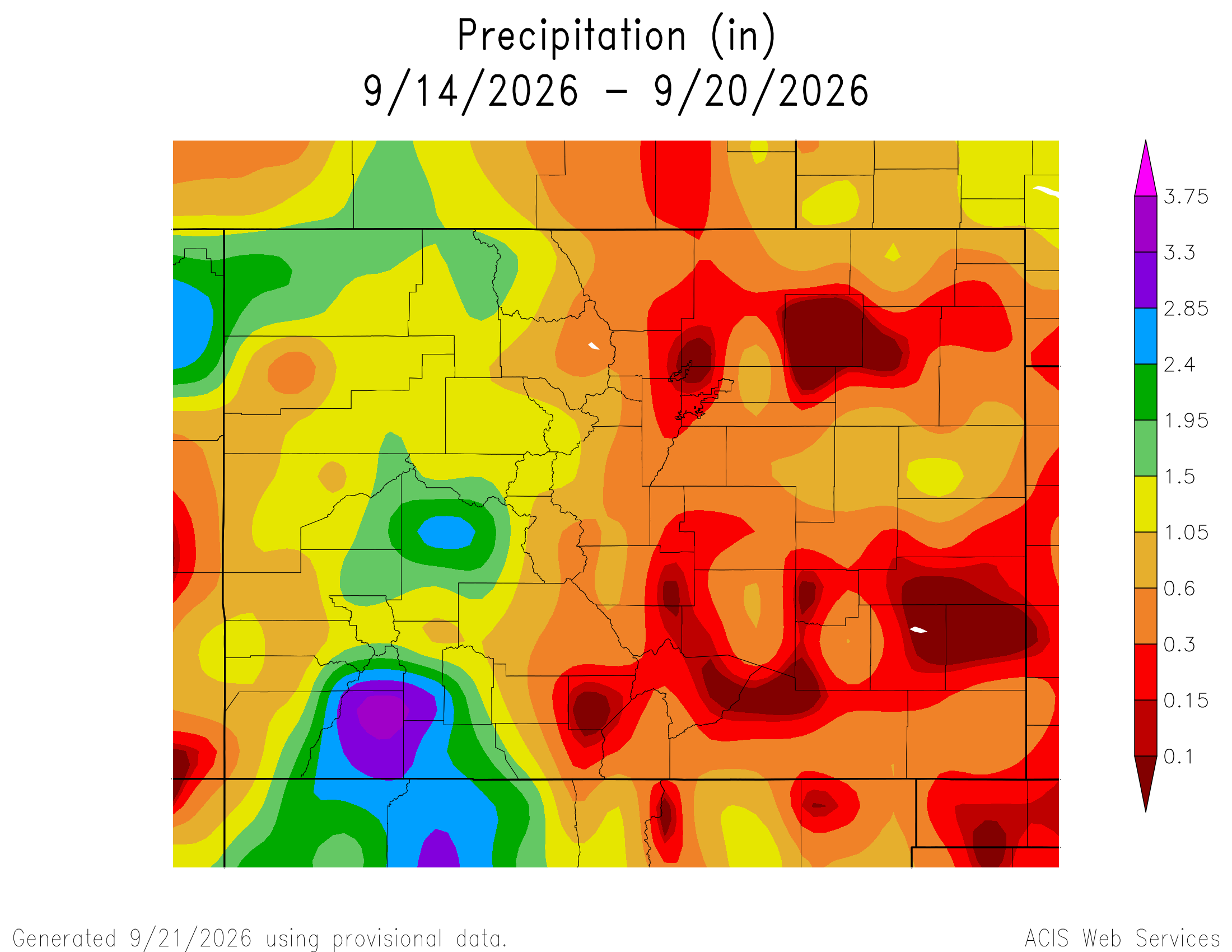
Here’s a look at the Colorado 7-Day precipitation map through September 20, 2026 from the High Plains Regional Climate Center. Precipitation in the South Platte Basin along the Continental Divide of the Americas ranged from 0.60” to 1.05″
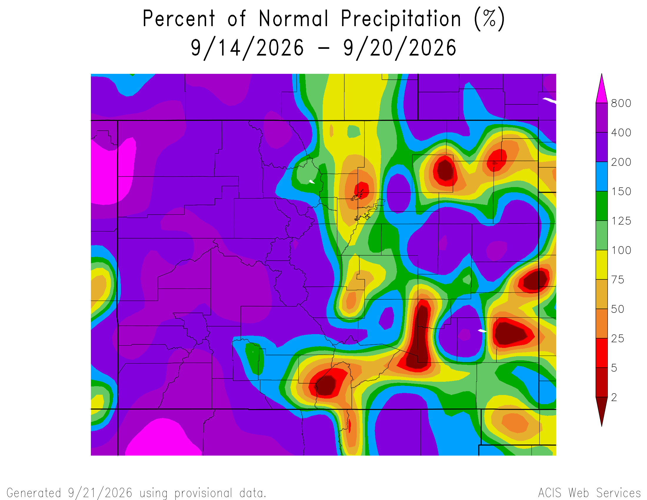
Here’s the Colorado 7-Day percent of normal precipitation map through September 20, 2026 from the High Plains Regional Climate Center. Precipitation in the South Platte River Basin along the Continental Divide of the Americas was 50% to 400% of normal. (Lovely overall!)
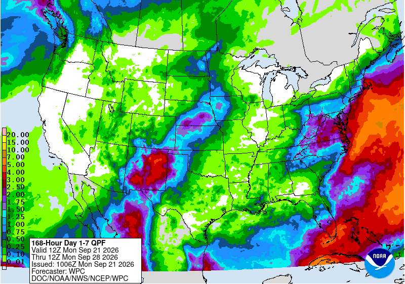
Below is the 7-day Quantitative Precipitation Forecast for the week of September 21, 2026. Precipitation is anticipated for the mountains of the South Platte River Basin and may total up to 0.50″.
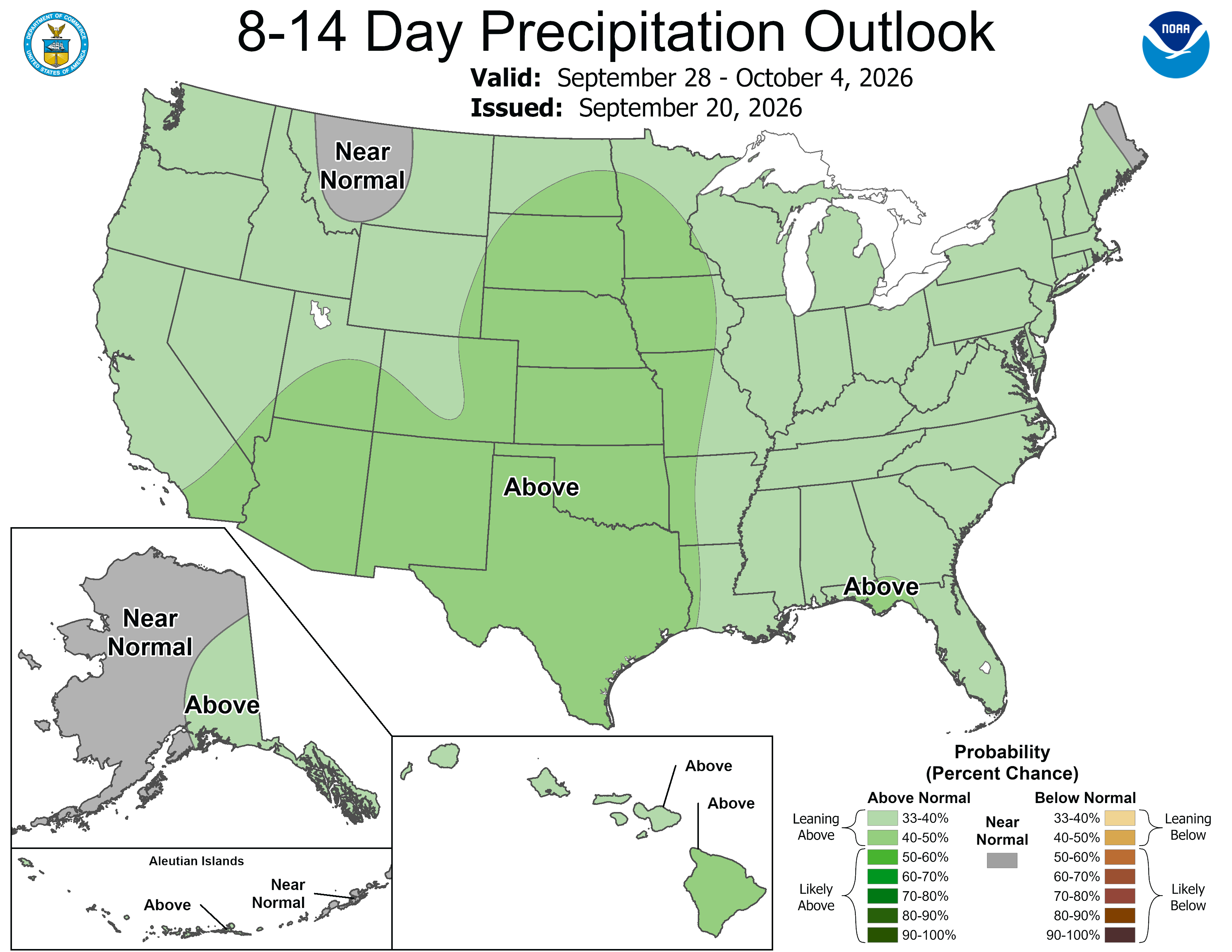
Below are the 8-14 day outlooks from the Climate Prediction Center, issued September 20, 2026, for temperature and precipitation, for the week starting September 21, 2026. The CPC expects above normal temperatures and above normal precipitation for the mountains of the South Platte River Basin.

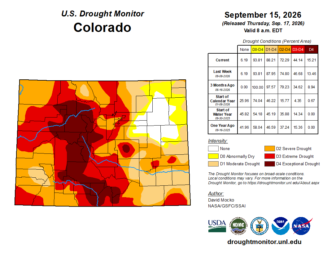
Below is the Colorado Drought Monitor map from September 15, 2026. There were one class improvements in Park County. Drought and abnormal dryness covers 93.81% of Colorado. The South Platte Basin is experiencing Abnormally Dry, Moderate, Severe, Extreme, and Exceptional drought conditions.
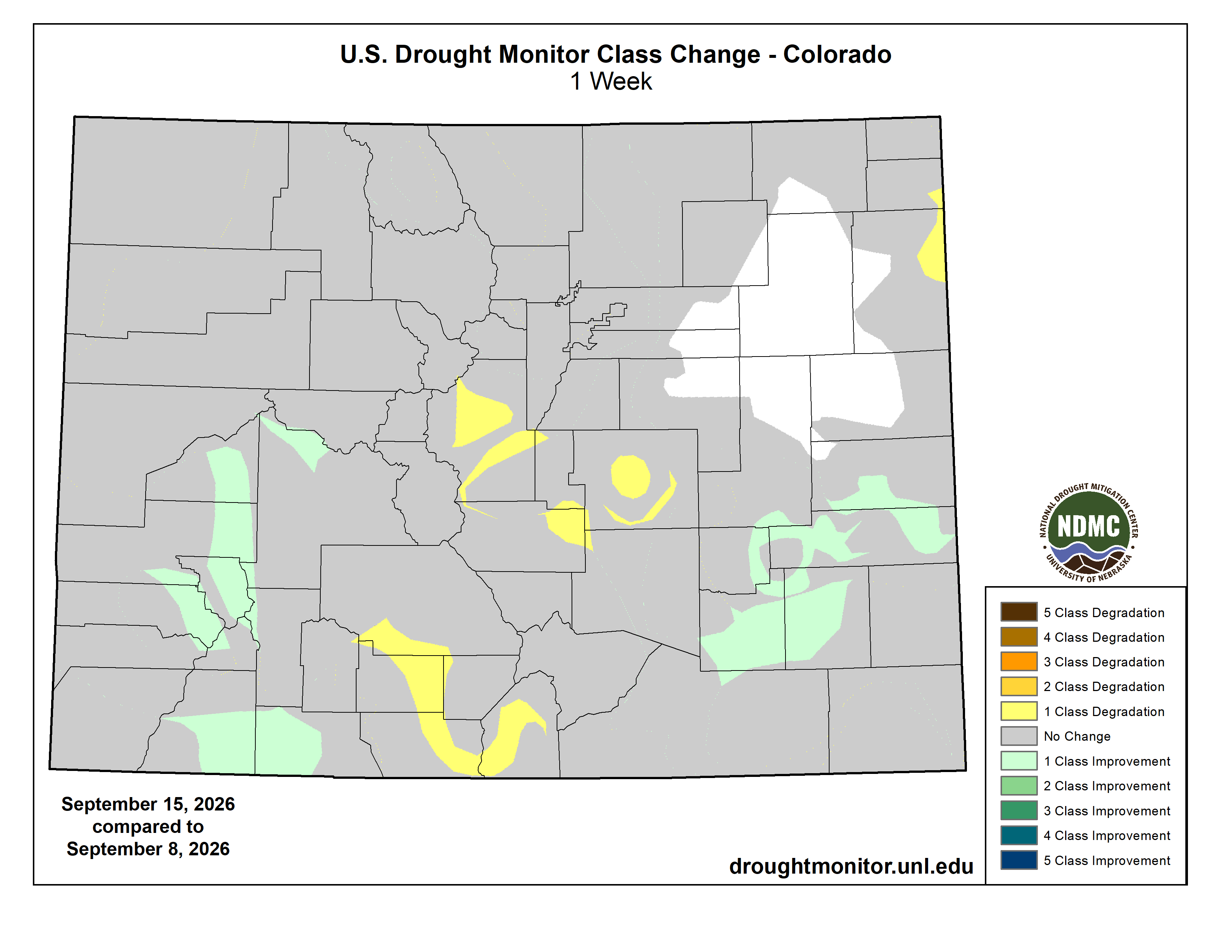
Below is the Colorado Drought Monitor one week change map ending September 15, 2026.
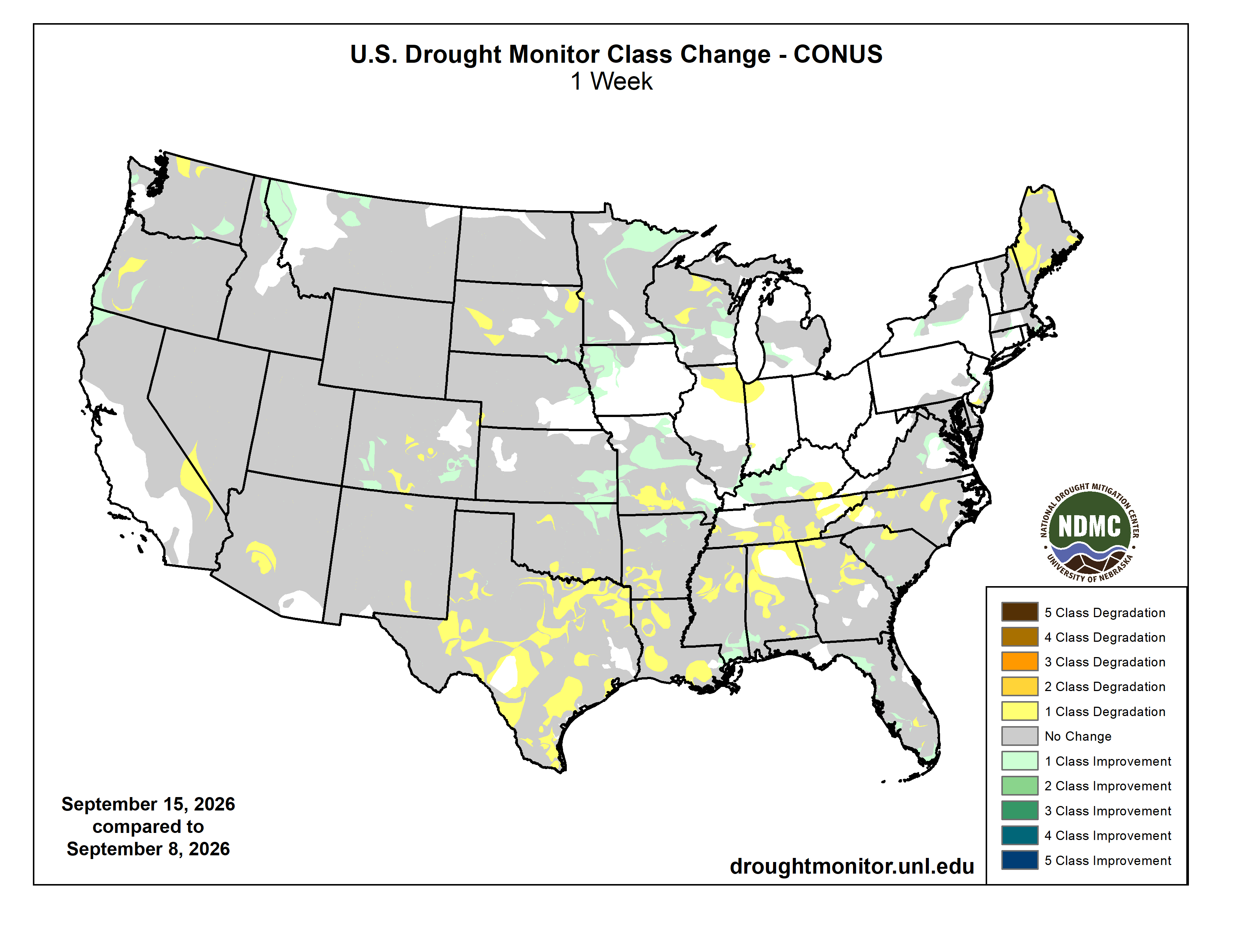
Here’s the US Drought Monitor Map from last week along with the one week U.S. change map.

Finally, Western Water Assessment released their latest Intermountain West Climate Briefing recently. From the briefing:
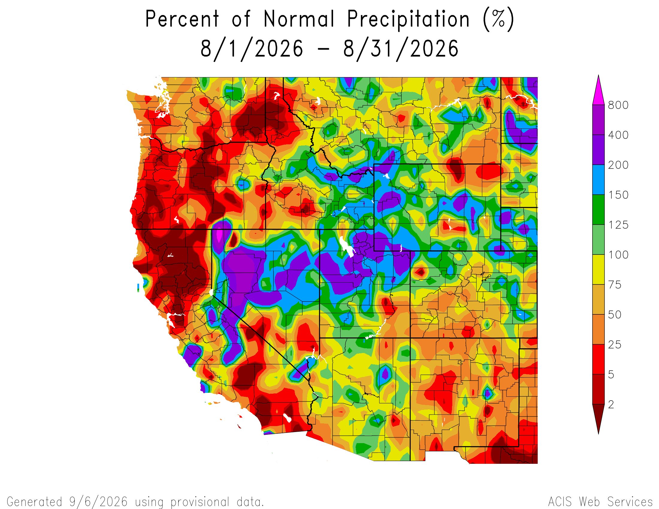
August precipitation varied across the region due to scattered monsoonal thunderstorms. Regional temperatures were above average in August, and Colorado experienced its warmest August on record, while Utah experienced its second warmest on record. Streamflow conditions were below average for most regional rivers, especially in Colorado and Utah, where many streamflow gages observed record-low daily streamflows. Regional drought coverage changed little from the beginning of August to September and is at 96%. El Niño conditions persist, and there is a greater than 90% probability of a very strong El Niño event during fall and winter 2026-27. NOAA seasonal forecasts indicate an increased probability of above average temperatures for the region, and above average precipitation for Colorado, Utah, and southern Wyoming during September–November.