Richard Bates and Alun Hubbard kayak a meltwater stream on Greenland’s Petermann Glacier, towing an ice radar that reveals it’s riddled with fractures. Photo credit: Nick Cobbing.
Catastrophic floods in the Hudson Valley. An unrelenting heat dome over Phoenix. Ocean temperatures hitting 90 degrees Fahrenheit off the coast of Miami. A surprising deluge in Vermont, a rare tornado in Delaware. A decade ago, any one of these events would have been seen as an aberration. This week, they are happening simultaneously as climate change fuels extreme weather, prompting Governor Kathy Hochul of New York, a Democrat, to call it “our new normal.” Over the past month, smoke from Canadian wildfires blanketed major cities around the country, a deadly heat wave hit Texas and Oklahoma and torrential rains flooded parts of Chicago.
“It’s not just a figment of your imagination, and it’s not because everybody now has a smartphone,” said Jeff Berardelli, the chief meteorologist and climate specialist for WFLA News in Tampa. “We’ve seen an increase in extreme weather. This without a doubt is happening.”
[…]
It is likely to get more extreme. This year, a powerful El Niño developing in the Pacific Ocean is poised to unleash additional heat into the atmosphere, fueling yet more severe weather around the globe.
“We are going to see stuff happen this year around Earth that we have not seen in modern history,” Mr. Berardelli said.
And yet even as storms, fires and floods become increasingly frequent, climate change lives on the periphery for most voters. In a nation focused on inflation, political scandals and celebrity feuds, just 8 percent of Americans identified global warming as the most important issue facing the country, according to a recent NPR/PBS NewsHour/Marist poll. As climate disasters become more commonplace, they may be losing their shock value. A 2019 study concluded that people learn to accept extreme weather as normal in as little as two years.
The graph above is from a study released a couple weeks ago, mid-June, on ‘The Colorado River Water Crisis: Its Origin and the Future,’ authored by two elders of Colorado River affairs: Dr. John Schmidt, river scientist at Utah State University, and Eric Kuhn, longtime manager of the Colorado River Water Conservation District.
Click the link to read the article on the InkStain website (John Fleck):
Jack Schmidt, Charles Yackulic, and Eric Kuhn have published an invaluable new overview of how we got into this mess on the Colorado River, and some of the things we need to think about to get out of it.
They’ve pulled together the best available data on supply and water use in the basin, and touch on the major issues that must be addressed going forward.
Some highlights:
21ST CENTURY TRENDS
ON THE SUPPLY-USE IMBALANCE
and
If you are trying to understand the current situation on the Colorado River, there is no better place to start. It’s going into the fall syllabus for our UNM Water Resources course.
Dories at rest on a glorious Grand Canyon eve. Photo by Brian Richter
Click the link to read the article on the Taos News website (Idone Rhodes). Here’s an excerpt:
More than three decades of ongoing work to restore Rio Grande sucker, Rio Grande chub and, most importantly, Rio Grande cutthroat trout — New Mexico’s state fish — to their native environment culminated with a celebration last weekend (July 1) in the Valle Vidal Unit of Carson National Forest, hosted by the New Mexico Department of Game and Fish and the U.S. Forest Service.
Cutthroat trout historic range via Western Trout
Rio Grande Cutthroat Trout are the southernmost subspecies of cutthroat trout and are native to Southern Colorado and New Mexico. Once abundant in these waters, the subspecies’ population has been severely diminished by a variety of factors, including competition or breeding with non-native species, such as brook, brown and rainbow trout, as well as habitat loss. Rio Grande cutthroat and Rainbow spawn at the same time and can interbreed to produce hybrid “cutbow” trout.
The project restored Rio Grande cutthroat trout to 120 miles of their historic range in the Rio Costilla watershed, as well as 16 lakes and one reservoir. Teams worked tirelessly to remove native fish from waterways before treating the waters with the piscicide rotenone to kill off non-native fish.
Since 2002, the Seven Springs Fish Hatchery in Jemez Springs has raised over 72,000 Rio Grande cutthroat trout using pure trout taken from streams and other water sources. These fish are then used to restore wild populations and provide angling opportunities. It’s an ongoing collaboration between the Forest Service, which manages the land, and Game and Fish, which manages the subspecies, explained Carson National Forest Biologist Alyssa Radcliff. Some of the restored waterways are also on private land. As waterways were restored, fish barriers were built to keep non-native species from moving back up stream. In 2016, a permanent barrier was constructed in the Valle Vidal Unit to maintain the restored area.
The initial goal of the project was much smaller, with a focus on specific segments of waterways upstream. Eventually, however,“We’re like, ‘Why don’t we just do the whole basin?” Francisco Cortez, the program manager for fisheries on the Carson, said. Cortez has been working on the project since the early 1990s and watched it grow from habitat and population surveys to the large-scale restoration operation it is today.
A Rio Grande cutthroat trout is pictured in 2014. Photo courtesy of U.S. Fish & Wildlife Service
From the “Monday Briefing” newsletter from the Alamosa Citizen:
The start of an El Niño period was acknowledged in June by the National Oceanic and Atmospheric Administration and the World Meteorological Organization. As it forms in July and August we’ll have a better sense of the impacts to the Valley lands and the Rio Grande Basin. Some global experts are beginning to suggest a moderate to strong El Niño increases the chance that 2024 will be the warmest on record. We’re paying attention to the condition of the Rio Grande Basin and in particular the change in the unconfined aquifer storage after what’s been a strong runoff from the winter snowpacks. It’s a critical indicator on the overall health of the Rio Grande Basin and one that ultimately determines the state of agriculture in the SLV.
San Luis Valley Groundwater
It is irrigators in Subdistrict 1 of the Rio Grande Water Conservation District who shoulder the greatest responsibility for recovering the ailing unconfined aquifer. To that end, the Rio Grande Water Conservation District Board of Managers will hold a public hearing this week on the Subdistrict 1 Fourth Amended Plan of Water Management to manage groundwater pumping in the unconfined aquifer area. It’s been a year or so in development with lots of difficult conversations on how to reduce groundwater irrigation in the Valley’s most lucrative agricultural subdistrict. The state Division of Water Resources has signed off on the plan and now comes the final public comments. The idea of a lawsuit challenging the Fourth Amended Plan of Water Management also hangs out there. The meeting is scheduled for 1 p.m. on Friday, July 14.
The graph above is from a study released a couple weeks ago, mid-June, on ‘The Colorado River Water Crisis: Its Origin and the Future,’ authored by two elders of Colorado River affairs: Dr. John Schmidt, river scientist at Utah State University, and Eric Kuhn, longtime manager of the Colorado River Water Conservation District.
During much of the 21st century, natural runoff in the Colorado River basin has declined, while consumption has remained relatively constant, leading to historically low reservoir storage. Between January 2000 and April 2023, the amount of water stored in Lake Mead and Lake Powell, the two largest reservoirs in the United States, declined by 33.5 million acre feet (41.3 billion cubic meters). As of April 2023, total basin-wide storage was sufficient to support the 21st century average rate of basin-wide consumption for only 15 months. Runoff in spring 2023 is predicted to be large, providing a short-term reprieve. However, it will take four to five additional unusually wet years in succession to refill Lake Powell and Lake Mead if basin-wide water use remains unchanged. Increasing evapotranspiration and dry soils associated with global climate change makes such a scenario unlikely. To stabilize reservoir storage, basin-wide use needs to equal modern runoff. To recover reservoir storage, basin-wide use needs to decline even more. Based on 21st century average runoff, a 13%–20% decline in basin-wide use would allow for stabilization and some reservoir storage recovery. Future policy debate about reservoir operations will inevitably concern whether most, or all, reservoir storage should be in Lake Mead or in Lake Powell. The choice of one or the other will result in significantly different environmental and recreational outcomes for Glen Canyon and the Grand Canyon.
Richard Bates and Alun Hubbard kayak a meltwater stream on Greenland’s Petermann Glacier, towing an ice radar that reveals it’s riddled with fractures. Nick Cobbing.
I’m striding along the steep bank of a raging white-water torrent, and even though the canyon is only about the width of a highway, the river’s flow is greater than that of London’s Thames. The deafening roar and rumble of the cascading water is incredible – a humbling reminder of the raw power of nature.
As I round a corner, I am awestruck at a completely surreal sight: A gaping fissure has opened in the riverbed, and it is swallowing the water in a massive whirlpool, sending up huge spumes of spray. This might sound like a computer-generated scene from a blockbuster action movie – but it’s real.
Alun Hubbard stands beside a moulin forming in a meltwater stream on the Greenland ice sheet. Courtesy of Alun Hubbard
A moulin is forming right in front of me on the Greenland ice sheet. Only this really shouldn’t be happening here – current scientific understanding doesn’t accommodate this reality.
As a glaciologist, I’ve spent 35 years investigating how meltwater affects the flow and stability of glaciers and ice sheets.
When it reaches the bed, the meltwater decants into the ice sheet’s subglacial drainage system – much like an urban stormwater network, though one that is constantly evolving and backing up. It carries the meltwater to the ice margins and ultimately ends up in the ocean, with major consequences for the thermodynamics and flow of the overlying ice sheet.
Scenes like this and new research into the ice sheet’s mechanics are challenging traditional thinking about what happens inside and under ice sheets, where observations are extremely challenging yet have stark implications. They suggest that Earth’s remaining ice sheets in Greenland and Antarctica are far more vulnerable to climate warming than models predict, and that the ice sheets may be destabilizing from inside. https://www.youtube.com/embed/stm1pBp0rfk?wmode=transparent&start=0 NASA’s GRACE satellites capture Greenland’s ice loss from 2002-2021.
This is a tragedy in the making for the half a billion people who populate vulnerable coastal regions, since the Greenland and Antarctic ice sheets are effectively giant frozen freshwater reservoirs locking up in excess of 65 meters (over 200 feet) of equivalent global sea level rise. Since the 1990s their mass loss has been accelerating, becoming both the primary contributor to and the wild card in future sea level rise.
How narrow cracks become gaping maws in ice
Moulins are near-vertical conduits that capture and funnel the meltwater runoff from the ice surface each summer. There are many thousands across Greenland, and they can grow to impressive sizes because of the thickness of the ice coupled with the exceptionally high surface melt rates experienced. These gaping chasms can be as large as tennis courts at the surface, with chambers hidden in the ice beneath that could swallow cathedrals.
But this new moulin I’ve witnessed is really far from any crevasse fields and melt lakes, where current scientific understanding dictates that they should form.
High rates of meltwater discharge combined with a thick and gently sloping ice sheet in Western Greenland gives rise to monster holes like this moulin. Alun Hubbard
In a new paper, Dave Chandler and I demonstrate that ice sheets are littered with millions of tiny hairline cracks that are forced open by the meltwater from the rivers and streams that intercept them.
Because glacier ice is so brittle at the surface, such cracks are ubiquitous across the melt zones of all glaciers, ice sheets and ice shelves. Yet because they are so tiny, they can’t be detected by satellite remote sensing.
Under most conditions, we find that stream-fed hydrofracture like this allows water to penetrate hundreds of meters down before freezing closed, without the crack’s necessarily penetrating to the bed to form a full-fledged moulin. But, even these partial-depth hydrofractures have considerable impact on ice sheet stability.
As the water pours in, it damages the ice sheet structure and releases its latent heat. The ice fabric warms and softens and, hence, flows and melts faster, just like warmed-up candle wax.
Alun Hubbard rappels into a moulin in October 2019, a point in the year when surface melt should have ceased but hadn’t. Lars Ostenfeld / Into the Ice
The stream-driven hydrofractures mechanically damage the ice and transfer heat into the guts of the ice sheet, destabilizing it from the inside. Ultimately, the internal fabric and structural integrity of ice sheets is becoming more vulnerable to climate warming.
The ice sheet is also flowing and calving icebergs much faster. It has lost about 270 billion metric tons of ice per year since 2002: over a centimeter and a half (half an inch) of global sea-level rise. Greenland is now, on average, contributing around 1 millimeter (0.04 inches) to the sea level budget annually.
Understanding the risks ahead is crucial. However, the current generation of ice sheet models used to assess how Greenland and Antarctica will respond to warming in the future don’t account for amplification processes that are being discovered. That means the models’ sea-level rise estimates, used to inform Intergovernmental Panel on Climate Change (IPCC) reports and policymakers worldwide, are conservative and lowballing the rates of global sea rise in a warming world.
Daniela Barbieri and Alun Hubbard explore the contorted englacial plumbing deep inside a Greenland moulin. Lars Ostenfeld / Into the Ice
Our new finding is just the latest. Recent studies have shown that:
Superimposed ice slabs within the snowpack are forming across the accumulation zone, forming an impermeable barrier that depletes meltwater retention and drives extraordinary runoff.
In the last months, other papers also described previously unknown feedback processes underway beneath ice sheets that computer models currently can’t include. Often these processes happen at too fine a scale for models to pick up, or the model’s simplistic physics means the processes themselves can’t be captured.
Two such studies independently identify enhanced submarine melting at the grounding line in Greenland and Antarctica, where large outlet glaciers and ice streams drain into the sea and start to lift off their beds as floating ice shelves. These processes greatly accelerate ice sheet response to climate change and, in the case of Greenland, could potentially double future mass loss and its contribution to rising sea level.
Greenland’s ice loss through meltwater and calving of glaciers has contributed nearly 10 centimeters (4 inches) to global sea-level rise since 1900. The chart shows sea level rise from all sources through 2018. NASA’s Goddard Space Flight Center/PO.DAAC
Current climate models lowball the risks
Along with other applied glaciologists, “structured expert judgment” and a few candid modelers, I contend that the current generation of ice sheet models used to inform the IPCC are not capturing the abrupt changes being observed in Greenland and Antarctica, or the risks that lie ahead.
Ice sheet models don’t include these emerging feedbacks and respond over millennia to strong-warming perturbations, leading to sluggish sea level forecasts that are lulling policymakers into a false sense of security. We’ve come a long way since the first IPCC reports in the early 1990s, which treated polar ice sheets as completely static entities, but we’re still short of capturing reality.
As a committed field scientist, I am keenly aware of how privileged I am to work in these sublime environments, where what I observe inspires and humbles. But it also fills me with foreboding for our low-lying coastal regions and what’s ahead for the 10% or so of the world’s population that lives in them.
Driving back to Colorado State University with a van full of students after a day of working to heal some beat-up land north of Fort Collins, I wondered: Could ecological restoration be a new form of outdoor recreation?
We’d spent the day building a sawbuck fence around a spring. From the spring, gravity would carry the water through a pipe to a stock tank in the middle of the pasture.
On this land protected by a conservation easement, cows would no longer drink, pee and poop while trampling the spring’s vegetation. The spring could recover while the cattle drank clean water elsewhere.
My students had spent the day outdoors in the company of their classmates doing challenging physical work. At the moment, though, the young people were trying not to fall asleep as we neared town.
Yet all day I’d seen the light in their eyes, and I could tell they felt pride in learning and exercising skills they hadn’t had before. They also clearly liked the idea of giving something back to land that would never be developed.
This kind of volunteer work — The Nature Conservancy got us involved — addresses many problems today that we’ve come to call crises: species extinction, climate change, soil loss, and the decline of both water quantity and quality. Fortunately, many nonprofit groups, along with some owners of private lands that are protected by conservation easements, offer people an opportunity to improve damaged lands.
In my home watershed of northern Colorado, we often work with the nonprofit Wildlands Restoration Volunteers, a statewide grassroots group established in 1999. To date, it has completed over 1,000 projects on public lands assisted by more than 40,000 volunteers, who have contributed over $10 million in time and expertise.
Wildlands Restoration Volunteers includes people from both cities and rural areas who agree with what Wendell Berry wrote: “The care of the Earth is our most ancient and most worthy, and after all, our most pleasing responsibility. To cherish what remains of it and to foster its renewal is our only hope.”
At the end of the 20th century, scientists from around the world got together to measure our planet’s health. Shockingly, they reported that three out of every four acres of the Earth’s surface were in a degraded state.
The urgent global need to restore our damaged lands and waters has also caused the United Nations to name this the Decade of Ecosystem Restoration (https://www.decadeonrestoration.org/). It’s clear that we have yet to locate the sweet spot of a sustainable relationship with our world.
For humans to have a future on Earth, we need to reverse the erosion of soils, pollution of air and water, and weakening of the natural ecosystems that support us. Ecological restoration can attack those problems while also playing a critical role in the drawdown of atmospheric carbon dioxide, sending it back into the plants and soils where it belongs.
Although restoration and recreation have much in common, there is a major difference between the two. While outdoor recreation fulfills oneself, ecological restoration gives back to the land. Not that benefiting oneself is bad; one of the reasons we recreate is for the regenerative powers of spending time in nature.
But adding restoration into the domain of outdoor recreation could go a long way to enhance our time outdoors. I’ve found that when a group acts to restore the health of soil, land, plants and animals, the people involved always feel better about themselves.
Richard Knight
As author Robin Wall Kimmerer put it in “Braiding Sweetgrass,” “…as we care for the land, it can once again care for us.” By restoring damaged lands and waters, we still find joy in the outdoors, but we also give back to the home planet that sustains us.
Let’s seek out that work, turning it into something we do outdoors together, restoring lands and water while at the same re-creating ourselves.
Rick Knight is a contributor to Writers on the Range, writersontherange.org, an independent nonprofit dedicated to spurring lively conversation about the West. He is professor emeritus of wildlife conservation at Colorado State University.
Flow levels in the San Juan River continued to drop this week, though they remain above median. The San Juan River in Pagosa Springs was running at 513 cubic feet per second (cfs) at 9 a.m. on July 5, down from a nighttime peak of 565 cfs at 3:15 a.m., according to data from the U.S. Geological Survey (USGS). The median flows for July 5, based on 87 years of data, are 301 cfs, according to the USGS. These flows are down from June 28 when, according to USGS, the river was flowing at 863 cfs at 9 a.m., down from a nighttime peak of 986 cfs at 1:15 a.m. The San Juan River has remained consistently above the median flow for the last 30 days, only briefly dipping below the median on June 4…
Drought Forecast
NIDIS…indicates that, over the next 90 days, most of the county will experience normal conditions with some areas seeing abnormally wet conditions and a small area seeing abnormally dry conditions.
Water Report
Pagosa Area Water and Sanitation District (PAWSD) District Engineer/Manager Justin Ramsey stated that most PAWSD reservoirs, including Lake Pagosa, Lake Forest, Lake Hatcher and Village Lake are full, but Stevens Lake is down about a foot. He added that there has not yet been a call on water in the Fourmile Creek drainage and that water is continuing to flow into Lake Hatcher.
Heavy rainfall continued through June, breaking precipitation records in Colorado and Wyoming and completely removing drought from Colorado. June temperatures were below normal throughout most of the region, particularly in Colorado and Utah. Snowpack has melted out across the region, except for some high-elevation areas not captured by the SNOTEL network. Most streamflow gauges recorded normal to above normal flows throughout the region. Regional drought conditions continued to improve in June. El Niño conditions continued in June and are expected to persist and strengthen through winter.
June precipitation was above to much-above normal for most of the region. 200-400% of normal precipitation occurred in the majority of Wyoming, eastern Colorado, and pockets in southwestern and central Utah, with 400-800% of normal precipitation in Arapahoe and Elbert Counties in Colorado and Park, Hot Springs, and Fremont Counties in Wyoming. Record-wettest conditions occurred throughout much of the Front Range and eastern Colorado, and central and southeastern Wyoming. Areas of below normal precipitation occurred as well, particularly in the Great Salt Lake region, southeastern Utah, and southwestern Colorado.
Regional temperatures were near normal to much-below normal. Temperatures of four to six degrees below normal were scattered throughout Utah and Colorado, with pockets of six to eight degrees below normal in Las Animas County in Colorado and Box Elder and Tooele Counties in Utah. In northeastern Wyoming, slightly above normal June temperatures were observed.
Snowpack has completely melted out at all SNOTEL sites across the region, except for the Gunnison, Colorado Headwaters, White-Yampa, and Escalante Desert-Sevier Lake Basins. As of July 5 and averaged across all the SNOTEL sites in the remaining basins in the region, snow melted out 12 days later in Utah and four days later in Colorado. In Wyoming, snow melted out four days earlier than average. Regionally, snow melted out five days later than average.
Regional streamflows were normal to much-above normal in June, with only a few sites recording below normal streamflows. Notably high streamflows, 96-98th percentile, were observed in the Provo River near Charleston, Utah, and many sites along the Front Range in Colorado, including Cherry Creek in Denver, Cottonwood Creek in Colorado Springs, and Jimmy Camp Creek in Fountain.
Regional drought conditions improved or did not change for all locations. As of June 27, drought covered 6% of the region, down from 14% at the end of May. Above normal precipitation throughout the majority of the region in June significantly improved drought conditions, particularly in Wyoming and Colorado. D2-D4 drought was removed from several counties in Wyoming, particularly Teton, Sublette, and Goshen Counties. On June 20, D1-D4 drought was removed in Colorado and as of June 27, the state continues to be drought-free.
El Niño conditions continued to develop during June and are expected to strengthen into the winter. Pacific Ocean sea-surface temperatures were above normal in June, with anomalies of more than 1 degree Celsius. Mid-June ENSO forecasts indicate at least a 90% probability of El Niño conditions persisting July-November. NOAA monthly forecasts suggest an increased probability of above average July precipitation in eastern Wyoming and eastern Colorado, and below average precipitation in southern Utah. NOAA seasonal forecasts suggest an increased probability of above average precipitation in northern Wyoming and below average precipitation in southern Utah and southwestern Colorado. There is an increased probability of below average temperatures in the majority of Wyoming and northern Colorado during July, and an increased probability of above average seasonal temperatures during July-September throughout most of the region, particularly in Utah.
June significant weather event: Record-breaking rainfall in Colorado. A near-stationary, persistent ridge of high-pressure air east of Colorado, coupled with a continuous low-pressure system to the west and moisture from the Pacific Ocean and Gulf of Mexico, has caused significant precipitation in the state in June. Denver broke June’s record rainfall with 6.10”, significantly surpassing the old record of 4.96” set in 1882. Denver also experienced the 6th wettest month of all time since weather records began in 1872. 11.63” of rainfall was recorded at DIA between May and June, which is 7.53” above the combined average for the two months and around 75% of normal annual precipitation. A daily maximum record of 1.85” of rain fell on June 21, significantly surpassing the old record of 0.85” set in 1947. Over five inches of rain fell in Boulder for the second month in a row, making June the 4th wettest on record since 1897. According to the Colorado Climate Center, June 2023 ranks as the 4th wettest June on record for Colorado (Figure 1), and many pockets of eastern Colorado had the wettest month of all time out of 1,542 months on record (Figure 2).
Yearly surface temperature compared to the 20th-century average from 1880–2022. Blue bars indicate cooler-than-average years; red bars show warmer-than-average years. NOAA Climate.gov graph, based on data from the National Centers for Environmental Information.
We Witness The Two Hottest Days on Earth this Week; Climate Change “Jet-Fueled” by El Niño
This week the planet passed a milestone that environmental experts hoped would never come. We had — officially — the second hottest followed by the hottest average temperatures recorded since humans began to walk the earth. While we living in the Rocky Mountains often boast of our lower temperatures and lower humidity, these averages affect every human being [ed. and all other species] on this [Earth].
On Monday, July 3, the average from thousands of measurement points all around the globe surpassed 62.3 degrees Fahrenheit. On Tuesday, July 4, it rose over 62.9 degrees Fahrenheit (17.18 degrees Celsius).
At the same time, according to the World Meteorological Organization, the oceans of the North Atlantic have risen more than nine degrees in temperature this year. Normally, the planet’s massive oceans act as heat absorbers for the atmosphere and the land masses. Climate experts are warning that the oceans are losing their ability to cool us down…
In the mid-May report by the World Meteorological Organization it projected that average global temperatures are expected to soar to record highs over the next five years; driven not just by climate change, but the El Niño climate pattern. The 1 .5 degrees Celsius of warming has long been considered the magic number we cannot cross without facing some of the most dire consequences of global warming. With the average temperature of the earth warmer this week than it has been in 125,000 years, it remains to be seen if we are ready to heed that warning.
The weather service in Boulder said Thursday it used videos, storm chasers and spotter reports to confirm the number, size and path of the tornadoes. The full report can be found here. One stationary supercell produced the vast majority of the 36 confirmed tornadoes over a four-hour period in roughly the same location, according to Paul Schlatter, weather service meteorologist in Boulder.
Of those 36 tornadoes:
34 occurred in Washington County (Akron is the county seat)
Two occurred in Logan County (Sterling is the county seat)
Two reached EF2 strength, one reached EF1, and the rating of the rest of the tornadoes is unknown. The tornadoes were mostly weak.
Most lasted less than a minute and did little damage as they occurred over open areas.
The supercell produced two sets of double tornadoes, which is rare.
Vestas located a factory to produce wind turbines in Pueblo in 2010 and has added other renewable energy elements even as the coal-burning units have begun to retire. Photo credit: Allen Best
Click the link to read the article on the Big Pivots website (Allen Best):
Every transition produces winners and losers. U.S. fiscal policy shifted in the 1880s and the economy of Aspen cratered for decades. Some silver-mining towns never recovered. In the 1980s, newspapers were plentiful. Ink now stains far fewer printers and editorial wretches. Amazon thrives but Sears and Kmart, no more.\
How will Colorado’s coal-based towns transition as we quell emissions from energy production? Legislation of recent years seeks to deliver what lawmakers call a just transition, meaning that Pueblo, Craig and other coal-based communities will stay on their feet.
The newest round of job-producing investments in emission-free technologies, though, call into question how difficult that will be. Two new factories are to be created in Brighton, on metropolitan Denver’s northeastern fringe. The combined investment of $450 million will deliver more than 1,200 average- to better-paying jobs.
VSK Energy will manufacture solar photovoltaic panels and will employ more than 900 people. It is a direct result of incentives in the federal Inflation Reduction Act of 2022, which seeks to restore U.S. manufacturing of renewable energy components.\
The second factory will produce a new generation of energy-rich lithium-ion batteries. The company, Amprius Technology, says that a new anode, which will use silicon mined in Montana, will double the range of a Tesla, allowing it more than enough capacity to roam Colorado from corner to corner and the ability to juice up to 80% capacity in six minutes. The company also says the new batteries will deliver value to drones and aircraft. Sounds like a game-changer.
Both companies cited proximity to Interstate 76 as a significant consideration in siting their factories. They also have proximity to I-25, I-70 and I-80 plus Denver International Airport. If of not immediate importance, they also have access to transcontinental rail lines.
Availability of a large, skilled workforce was also cited. The battery company also cited the proximity of the Colorado School of Mines and other universities. It will employ a half-dozen Ph.Ds. in the research facility associated with the factory.
Something more intangible was also in play. It was described as a “strong cultural fit” by Ashwini Agarwal, the leader of Vikram Solar, the parent company for the solar manufacturer. Supply chains matter, but Colorado’s initiative in accelerating the energy transition also matters.
Andrew Huie, the vice president of infrastructure for Amprius, said something similar. “Colorado and Gov. Polis are embracing clean energy, and batteries align with Colorado’s clean energy goals,” he told me. “There may be synergies.”
This warehouse ion Brighton, once the distribution center for Sears and Kmart and most recently as a storage location for Costco appliances, is to become home to a lithium-ion battery factory. Rezoning to light industrial will first be necessary. Photo/Allen Best
Other companies are also carving out futures in this new energy economy along the Front Range. The Denver Business Journal recently cited three companies from Denver to Fort Collins that hope to stake a future with new batteries. And Lightning eMotors manufactures electric vehicles in Loveland.
Brighton already has Vestas, which arrived in 2010 to manufacture nacelles, containing the gearboxes and drive trains for wind turbines. Vestas also built a factory in Pueblo, near the Comanche Generating Station.
CS Wind, now the owner of the Pueblo factory, this year began an expansion that will add 850 jobs. It cited Inflation Reduction Act provisions that encourage wind production.
Jeffrey Shaw, president of the Pueblo Economic Development Corporation, said he expects announcement of other renewable-sector projects in the Pueblo area and probably throughout the state during the next 12 to 18 months. “A lot of it has to do with the Inflation Reduction Act,” he said, and in particular the law’s buy-American provision.
Already, Pueblo County has been rapidly adding both solar and storage. But so far, the new tax base for Pueblo won’t balance that from Comanche. Xcel Energy, Comanche’s primary owner, has agreed to pay taxes until 2040.
Western Slope towns dependent on coal extraction and combustion are a harder sell. At Craig, there was hope on becoming a hydrogen hub, but Colorado has pinned its highest hope for federal funding on a project involving Rawhide, the coal but soon to become gas plant near Brush. Nuclear has its fans in Craig and beyond, and the Economist notes that the Biden administration is dangling billions in financial incentives nationally. That same magazine also concludes that unresolved problems cloud the future of this technology.
As for new factories, Craig is 90 miles from the nearest interstate, at the end of a railroad and five hours from DIA. It does have a workforce with skills, but so far, no new applications for those skills.
At Nucla and Naturita, which losy their small coal plant in 2019, the challenge is even greater.
Maybe Craig, Hayden, and the other towns will figure out new careers by working with the state and the utilities. But maybe not.
Lake Nighthorse, near Durango, Colorado on May 26, 2023. Both of Colorado’s tribes, the Southern Ute Indian Tribe and the Ute Mountain Utes have water in Lake Nighthorse they haven’t been able to access. CREDIT: MITCH TOBIN/THE WATER DESK
Federal and state officials have promised more tribal inclusion on the next round of negotiating the operating guidelines for the Colorado River, but what exactly that will look like is still unclear.
On June 16, the Bureau of Reclamation released a notice of intent (NOI), which formally advanced the process for the development of new operating guidelines for the nation’s two largest reservoirs, Lake Powell and Lake Mead. In the document, Reclamation says that during the upcoming guidelines negotiations, it intends to develop an approach that facilitates and enhances tribal engagement and inclusivity. Officials say they will also prioritize regular, meaningful and robust consultation with tribal nations.
“Existing forums and groups will be continued and leveraged, such as the monthly Reclamation-hosted Tribal Information Exchanges,” the NOI reads. “Reclamation is also exploring options for increasing tribal involvement through the potential development of new groups and forums.”
Tribes have historically been largely excluded from policy talks and some have said they only learn about decisions made by the seven states and federal government after the fact.
U.S. Bureau of Reclamation Commissioner Camille Touton previewed the NOI the week before it was released, speaking at a law conference on natural resources at the University of Colorado Boulder.
“We are looking to stand up a forum in which we are engaging with tribal nations,” she said. “There will be a specific framework how we engage with the tribes.”
A Reclamation spokesperson said they don’t have any details to add at this time about what the framework will look like beyond Touton’s comments.
From the 2018 Tribal Water Study, this graphic shows the location of the 29 federally-recognized tribes in the Colorado River Basin. Map credit: USBR
The Colorado River basin’s 30 tribes have rights to use about 25% of the water, a percentage that is slowly increasing as river flows decline overall due to drought and climate change. And most of their rights are senior to nearly all other water users in the basin.
Although they were not included in the Colorado River Compact that divided the river, giving half of the flows to the upper basin and half to the lower basin, the 1908 Winters Doctrine reserved water rights for tribes. The doctrine established tribes’ water rights on the same date the federal government established their reservation, but not the amount of water to which they were entitled.
Tribes have had to quantify and settle their water rights within their states and tribal water comes out of each state’s allocation from the Colorado River. Unlike other water users, tribes don’t have to put the water to beneficial use to hang onto the rights for future development. That means there are unquantified water rights out there on paper that have never been used, although some tribes say they still fully intend to develop their water.
But in an already over-allocated system, any new water project that takes more from the Colorado River could be problematic. Tribes’ unused water has been propping up the system for years, and when finally put to beneficial use, it could exacerbate shortages for other water users.
“Water that is undeveloped tribal water rights is sitting in Powell and being used in some way, shape or form at some point,” said Becky Mitchell, commissioner to the Upper Colorado River Commission. “Somebody else is benefiting from it. Who benefits from continuing the way that we have, that’s the question we need to ask ourselves.”
Lake Nighthorse, near Durango, Colorado on May 26, 2023. Bureau of Reclamation officials have promised more tribal inclusion in the negotiation of the post-2026 reservoir operating guidelines. Mitch Tobin/The Water Desk
CREDIT: MITCH TOBIN/THE WATER DESK
Structural inclusion
The seven basin states — Colorado, Wyoming, Utah, New Mexico, California, Arizona and Nevada — negotiated the current interim guidelines for reservoir operations in 2007, and the guidelines are set to expire at the end of 2026. Developed in response to drought conditions in the first years of the century, the 2007 guidelines set shortage tiers based on reservoir levels and spelled out which states in the lower basin would take shortages and by how much their water deliveries would be cut in dry years.
Every component of the 2007 guidelines — and then some — is up for renegotiation as water managers figure out river management post-2026, said Anne Castle, a federal appointee and chair of the Upper Colorado River Commission. Castle is also on the leadership team for the Colorado River Basin Water & Tribes Initiative.
“There’s also discussion about broadening the scope of what will be considered in this set of guidelines,” she said. “That could include environmental benefit for the river. It could include development of undeveloped tribal rights. It could include a number of things that have not been previously part of the river operations plumbing discussion.”
One thing on which many agree is the need for tribes’ structural inclusion, meaning their seat at the table will be formally guaranteed and won’t be dependent on the promises of individual state or federal officials who could be replaced at the whims of a new administration. Tribal inclusion was a focus of the CU conference and included a panel discussion with representatives of 14 of the 30 tribes from across the basin.
“We really want tribes to be part of the negotiations and the discussions and the development of the post-2026 operational guidelines and we want this to be institutionalized as well,” Lorelei Cloud, vice chair of the Southern Ute Indian Tribe in southwestern Colorado, said as a panelist at the CU conference.
“Having a formal process is what’s needed,” said Cloud, a director on the Colorado Water Conservation Board, representing the San Miguel/Dolores/Animas and San Juan river basins. “It didn’t happen in 1922 or before, so we know it really needs to be in writing as we go forward.”
USBR Commissioner Touton giving a diplomatic speech at Getches-Wilkinson/Water and Tribes Initiative conference, outlining the ongoing federal spending and the upcoming SEIS revisions. One big upshot from her: There’s no reason to believe this winter wasn’t a “one-off.” Photo credit: Kyle Roerink via Twitter
How to do it
Each tribe is a sovereign government with their own unique water issues, which creates challenges when trying to include everyone.
“If you know one tribe, you know one tribe,” said Daryl Vigil, co-director of the Water & Tribes Initiative, water administrator for the Jicarilla Apache Nation and panel moderator at the CU conference. “To think there’s an Indian solution really dishonors that individuality and uniqueness of those tribes.”
In 2020, the Water & Tribes Initiative released a report called “Toward a Sense of the Basin: Designing a Collaborative Process to Develop the Next Set of Guidelines for the Colorado River System.” In it, the report’s writers set out potential options for tribal participation, including a Sovereign Review Team (SRT) and a Tribal Advisory Council (TAC). An SRT would consist of federal, state and tribal representatives; would treat tribes as equal players with the states and federal government; and would be an advisory group and the main forum to receive input from stakeholders and the public. A TAC would include representatives from each of the 30 tribes in the basin.
“One of the real issues is how do you choose tribal representatives that would represent more than their own tribe. That’s very problematic,” Castle said. “But at the same time, it’s recognized that having representatives of seven states and 30 tribes sitting in a room is a logistical problem and difficult to have meaningful discussions with that many people. There are logistical issues that need to be talked about further and worked out.”
Representatives from the upper basin states (Colorado, Wyoming, Utah and New Mexico) and upper basin tribes have been meeting over the past year, usually on tribal territory, partly in an effort to strengthen relationships between water managers. Vigil said that representatives from the group of 14 tribes, known as the basin tribal coalition, have also been meeting over the past year with the seven basin states to talk about collaboration. He said his hope is that tribes will also have to be signatories, along with the seven basin states and the federal government, on governing policy documents — such as the post-2026 guidelines — regarding river operations.
“Tribes understand that this is probably one of the most important components in terms of the forward movement of water policy in the basin: to have structural inclusion in the decision-making process,” he said.
Mitchell said tribal inclusion and engagement is a top priority for her going into the negotiations. Her commitment to the tribes includes communication, consultation and coordination on decision-making, she said.
“I view their involvement as critical and imperative to the success of the post-2026 reservoir operations negotiations,” Mitchell said. “It’s no secret when the compact was signed in 1922, no tribes were involved, consulted or even informed. I cannot alone correct that, but we can do better and we should do better, and we have a responsibility to do better.”
Colorado has two tribal nations, the Southern Ute Indian Tribe and the Ute Mountain Utes. They both settled their water rights with the state in 1986. But that doesn’t mean they can put their water to beneficial use. The Southern Ute Indian Tribe has about 38,000 acre-feet of stored water for municipal and industrial use in Lake Nighthorse, part of the Bureau of Reclamation’s Animas-La Plata project. But because of a lack of infrastructure and high operation and maintenance costs, they haven’t been able to access it.
“In a perfect world, I want to see the federal government fulfill its obligations to the tribal nations,” Mitchell said. “That includes its responsibility to consult with the tribes on a sovereign to sovereign basis and to support the tribes in accessing and utilizing their water resources.”
Our nonprofit, investigative newsroom is a civic benefit If we don’t write these stories, no one will. Ours is the kind of reporting that can make a real difference in our community, and this work is only possible through community support and philanthropic donations. Thanks for being a part of it. Will you donate today?
Native land loss 1776 to 1930. Credit: Alvin Chang/Ranjani Chakraborty
This USGS map shows the number of PFAS detected in tap water samples from select sites across the nation. The findings are based on a USGS study of samples taken between 2016 and 2021 from private and public supplies at 716 locations. The map does not represent the only locations in the U.S. with PFAS. Sources/Usage: Public Domain. Visit Media to see details.
Click the link to read the release on the USGS website:
At least 45% of the nation’s tap water is estimated to have one or more types of the chemicals known as per- and polyfluorinated alkyl substances, or PFAS, according to a new study by the U.S. Geological Survey. There are more than 12,000 types of PFAS, not all of which can be detected with current tests; the USGS study tested for the presence of 32 types.
This USGS research marks the first time anyone has tested for and compared PFAS in tap water from both private and government-regulated public water supplies on a broad scale throughout the country. Those data were used to model and estimate PFAS contamination nationwide. This USGS study can help members of the public to understand their risk of exposure and inform policy and management decisions regarding testing and treatment options for drinking water.
PFAS are a group of synthetic chemicals used in a wide variety of common applications, from the linings of fast-food boxes and non-stick cookware to fire-fighting foams and other purposes. High concentrations of some PFAS may lead to adverse health risks in people, according to the U.S. Environmental Protection Agency. Research is still ongoing to better understand the potential health effects of PFAS exposure over long periods of time. Because they break down very slowly, PFAS are commonly called “forever chemicals.” Their persistence in the environment and prevalence across the country make them a unique water-quality concern.
A USGS scientist wearing black gloves is collecting a sample of tap water from the kitchen sink using small plastic vials to test for PFAS. Sources/Usage: Public Domain. Visit Media to see details.
“USGS scientists tested water collected directly from people’s kitchen sinks across the nation, providing the most comprehensive study to date on PFAS in tap water from both private wells and public supplies,” said USGS research hydrologist Kelly Smalling, the study’s lead author. “The study estimates that at least one type of PFAS – of those that were monitored – could be present in nearly half of the tap water in the U.S. Furthermore, PFAS concentrations were similar between public supplies and private wells.”
The EPA regulates public water supplies, and homeowners are responsible for the maintenance, testing and treatment of private water supplies. Those interested in testing and treating private wells should contact their local and state officials for guidance. Testing is the only way to confirm the presence of these contaminants in wells. For more information about PFAS regulations, visit the EPA’s website on addressing PFAS.
The study tested for 32 individual PFAS compounds using a method developed by the USGS National Water Quality Laboratory. The most frequently detected compounds in this study were PFBS, PFHxS and PFOA. The interim health advisories released by the EPA in 2022 for PFOS and PFOA were exceeded in every sample in which they were detected in this study.
Scientists collected tap water samples from 716 locations representing a range of low, medium and high human-impacted areas. The low category includes protected lands; medium includes residential and rural areas with no known PFAS sources; and high includes urban areas and locations with reported PFAS sources such as industry or waste sites.
Most of the exposure was observed near urban areas and potential PFAS sources. This included the Great Plains, Great Lakes, Eastern Seaboard, and Central/Southern California regions. The study’s results are in line with previous research concluding that people in urban areas have a higher likelihood of PFAS exposure. USGS scientists estimate that the probability of PFAS not being observed in tap water is about 75% in rural areas and around 25% in urban areas.
Click the link to read the article on the Associated Press website (Seth Borenstein and Melina Walling). Here’s an excerpt:
Earth’s average temperature on Wednesday [July 5, 2023] remained at an unofficial record high set the day before, the latest grim milestone in a week that has seen a series of climate-change-driven extremes. The average global temperature was 17.18 Celsius (62.9 degrees Fahrenheit), according to the University of Maine’s Climate Reanalyzer, a tool that uses satellite data and computer simulations to measure the world’s condition. That matched a record set Tuesday, and came after a previous record of 17.01 Celsius (62.6 degrees Fahrenheit) was set Monday.
While the figures are not an official government record, “this is showing us an indication of where we are right now,” said National Oceanic and Atmospheric Administration chief scientist Sarah Kapnick. And NOAA indicated it will take the figures into consideration for its official record calculations. Scientists generally use much longer measurements — months, years, decades — to track the Earth’s warming, but the daily highs are an indication that climate change is reaching uncharted territory…Scientists have warned for months that 2023 could see record heat as human-caused climate change, driven largely by the burning of fossil fuels like coal, natural gas and oil, warmed the atmosphere. They also noted that La Nina, the natural cooling of the ocean that had acted as a counter, was giving way to El Nino, the reverse phenomenon marked by warming oceans.
“A record like this is another piece of evidence for the now massively supported proposition that global warming is pushing us into a hotter future,” said Stanford
Denver City Park sunrise
Click the link to read “Monday may have been Earth’s warmest day on record. Then it got even hotter” on The Los Angeles Times website (Nathan Solis and Hayley Smith). Here’s an excerpt:
The global average daily temperature Monday [July 3, 2023] was 62.6 degrees — the highest since modern record-keeping began more than four decades ago, according to the University of Maine’s Climate Reanalyzer project. The average temperature Tuesday [July 4, 2023] was higher still, 62.9 degrees, data show…The global records likely set Monday and Tuesday are preliminary. Over the next several weeks, researchers will analyze the data to verify the temperatures based on NOAA guidelines…
The European Union’s Copernicus Climate Change Service, which uses a different model for temperature analysis, announced that its preliminary data for Monday were also record-breaking. Although an average of 62.9 degrees doesn’t sound particularly warm, researchers point out some parts of the globe are in the middle of winter. Antarctic sea ice at the end of June was nearly a million square miles below average for this time of year, compared with data from 1981 to 2010, according to a recent NOAA report. That’s almost four times the size of Texas…
[Petteri] Taalas warned that El Niño’s arrival should be a signal to governments around the globe to prepare for extreme weather. El Niño occurs every two to seven years, and can last anywhere from nine months to a year, according to the WMO. The agency recently predicted there is a 98% likelihood that at least one of the next five years — and the five-year period as a whole — will be the warmest on record.
“Early warnings and anticipatory action of extreme weather events associated with this major climate phenomenon are vital to save lives and livelihoods,” Taalas said.
Heavy rains fell this week across parts of the Midwest, Ohio River Valley and Northeast, which led to widespread improvements from southeast Nebraska to central Illinois, southern Indiana, and central and eastern Kentucky. To the south and west, in southern Missouri, the Texas-Louisiana border and other parts of central Texas, drier weather led to worsening precipitation deficits, and significant problems with hay production in parts of southern Missouri. Dry weather in the Upper Midwest led to further degrading conditions in parts of Michigan, Wisconsin and Minnesota. A re-evaluation of conditions in parts of the western Great Plains led to some improvements to long-term dryness and long-term moderate drought in the Texas and Oklahoma Panhandle region, and in western Nebraska and eastern Wyoming, respectively. A mix of degradations and improvements occurred in the Pacific Northwest. No changes were made to the USDM depictions this week outside of the Lower 48…
This week saw widespread improvements across the Great Plains. Much of the Great Plains portion of the region, with the exception of eastern Kansas, northern North Dakota and western Colorado, saw widespread precipitation, some of it heavy. Much of southeast and northwest Nebraska, northeast South Dakota and along the Wyoming-South Dakota border saw rainfall of at least 2 inches over the last week. In western Nebraska, eastern Wyoming and the Dakotas, this led to widespread improvements to the drought depiction in areas where the heaviest rains fell. Nebraska saw the most improvements in the High Plains with continued improvement in the Panhandle, the Sandhills up to the South Dakota border and the southeast near Nebraska City. Meanwhile, conditions continued to worsen in a majority of Kansas, particularly in the east and southeast where mostly dry weather continued. Given continued decreases in soil moisture and groundwater, and growing short- and long-term precipitation deficits, degradations were made from Manhattan to Fort Scott…
Colorado Drought Monitor one week change map ending July 4, 2023.
With the exception of western portions of Washington and Oregon, much of the West region experienced near- or cooler-than-normal temperatures this week. Heavy rains fell in parts of southeast Montana, northwest Wyoming and adjacent portions of central Idaho and southwest Montana. These rains helped to alleviate long-term precipitation deficits and increase streamflows in these areas, leading to a reduction in coverage of ongoing drought and abnormal dryness. Continued above-normal precipitation in parts of central and south-central Oregon has helped to alleviate long-term precipitation deficits and increase soil moisture, leading to localized shrinking of drought coverage. In southeastern and western portions of Washington, and in western Oregon, recent dry weather, low streamflows and increasing evaporative demand led to an expansion of drought and abnormal dryness in parts of these areas…
Much warmer-than-normal temperatures covered the South as it is enveloped in the continuing heat wave, especially eastern Texas and Louisiana where temperatures ranged from 4 to 8 degrees above normal compared to the rest of the region where temperatures were near normal to 4 degrees above normal. There was expansion of abnormal dryness and moderate drought along the western Gulf Coast where temperatures soared and little to no precipitation fell, providing no relief to the low streamflows and dry soil conditions. Tennessee did see the removal of moderate drought conditions along the Tennessee-Kentucky border after heavy rainfall. Conditions were status quo for the rest of the region despite seeing warmer-than-normal temperatures and slightly below-normal precipitation this last week…
Looking Ahead
The National Weather Service Weather Prediction Center forecast (valid July 5–7, 2023) calls for the latest heat wave in the Pacific Northwest to reach its peak intensity on Wednesday, July 5, with temperatures topping the lower 100s in the hottest locations. Excessive heat warnings and heat advisories coincide with many areas designated as abnormally dry or moderate drought. The heat is expected to taper off moving into the weekend. Farther south, hot, dry and windy conditions support an Excessive Heat Warning in southern Arizona and a Critical Fire Risk designation in northern Arizona, which overlaps areas of moderate drought. Showers and thunderstorms are expected to bring periods of heavy to excessive rainfall to drought-affected areas of the Central Plains and Midwest. Scattered thunderstorms are expected to linger across the southern tier of states. As a reminder, weather within this timeframe is after the data cutoff for this week and will be reflected on next week’s map. Heading into the weekend, the extended forecast (valid July 7–11, 2023) calls for hazardous heat across portions of California, the Southwest, the Southern Rockies, the South and the Southeast. This expected multi-day heat wave could worsen existing drought conditions in these regions. Showers and thunderstorms are forecast for portions of the Central Plains, Midwest and South. Whether these rains will be beneficial and help ease drought concerns in these areas remains to be seen. While thunderstorms can produce large amounts of precipitation in a very short time, most of the rain runs off into drainage channels and streams. On the other hand, rain falling as light to moderate showers soaks into the ground, helps to recharge groundwater, sustains vegetation, and begins to chip away at moisture deficits that have built up during drought.
Next week, the Climate Prediction Center’s 6- to 10-day outlook (valid July 12–18, 2023) calls for an increased probability that the observed temperature, averaged over this 7-day period, will be above normal across the Southern Plains, much of the West, the Southeast and the Northeast. South Texas and South Florida have an 80–90% chance that the average temperature will be above normal during this period. In general, the odds of a warmer-than-normal average temperature decrease moving northward. The odds that the observed temperature, averaged over the same 7-day period, will be cooler than normal are highest in the Midwest (33–50%). Below-normal precipitation probabilities are increased across parts of the Southern Plains, Nevada and the Four Corners Region. Utah has a 50–60% chance that the total precipitation over the 7-day period will be below normal. Meanwhile, the Midwest has the highest probability (40-50%) that observed precipitation totals will be above normal. Other areas with an increased probability of above-normal precipitation include parts of the Pacific Northwest, northern Plains, Midwest and Northeast.
US Drought Monitor one week change map ending July 4, 2023.
Just for grins here’s slideshow of US Drought Monitor maps for early July for the past few years.
A few months ago, the Bureau of Land Management quietly proposed a new rule designed to “guide the balanced management of public lands,” putting conservation on a par with other uses, such as grazing, oil and gas drilling and mining. Among other things, it would allow individuals or entities to lease public parcels for conservation purposes, including habitat restoration or invasive species eradication.
To many observers, myself included, the proposal seemed unremarkable, basically a clarification of the multiple-use framework mandated by the 1976 Federal Land Policy and Management Act. Nothing about it was particularly earth-shattering or new. Environmental groups mostly supported it, albeit tepidly, though some thought that the conservation lease idea might do more harm than good. Initially, the response from the extractive industries and their enablers in Washington, D.C., was similarly subdued — with one or two exceptions.
But then, a few weeks after the new rule was unveiled, a backlash erupted for reasons I cannot fathom. It started out when Montana Republican Rep. Matt Rosedale, in a moment of rare candor, admitted that he didn’t think conservation was “supposed to be on equal footing” with extractive uses. Soon, it became a raging rhetorical inferno, with the misinformation conflagration climaxing at a U.S. House Natural Resources Committee sh*%show … er, hearing on June 15. The Republican-led committee — whose motto is “putting conservatives back into conservation” — wanted to discuss a bill that would block a rule aimed at putting conservation back into public-land management.
Republican South Dakota Gov. Kristi Noem was one of the star witnesses, despite the fact that her state contains just .12% of the lands to which the rule would apply. The rule, she said, would be “devastating” for her state, because it would create “a mechanism like a conservation lease that could be bought by third parties, not even necessarily by people in our own country, and give them access and authority over these lands. It’s dangerous.”
Noem did not explain what she meant by third parties — or first or second parties for that matter — nor why that theoretical third party would be any more dangerous than the first two. She is also apparently unaware of the fact that foreign-owned corporations are regularly given access to and authority over the nation’s public lands — including the ability to rip them apart for profit — in the form of the mining claims and coal, oil and natural gas leases that she and other Republicans enthusiastically support.
While Noem may be dismissed as merely ill-informed, the same cannot be said of her co-witness, Wyoming Gov. Mark Gordon, also a Republican. Gordon opened his testimony by declaring that he was a conservationist, which was, at least at some point, perfectly true: He once served as treasurer for the Sierra Club and wrote that oil and gas drilling had turned the once “pleasant little Western town” in which he lived into “the place that stinks on the way to Casper”. (Fun fact: He also served on the board of High Country News in the early 2000s.)
But times — and Gordon — have clearly changed: The governor then went on to deride conservation, claiming that the proposed rule would allow environmentalists to put conservation leases on active grazing allotments and force all the cattle off the land. This is blatantly false, and if Gordon had read the actual text of the rule, he surely would have known it. The draft rule may contain some ambiguity, but it is clear about one thing: It cannot “disturb existing authorizations (or) valid existing rights.” Which is to say: The new rule cannot be used to boot cows, pumpjacks, mines, wind turbines or any other existing uses off public land.
“Everything this administration does is about climate,” Gordon railed, veering away from the topic at hand, complaining that President Biden and company are “holding back the fossil fuel industry” and that “we can’t get a lease out of this administration. We can’t get a permit out of this administration.”
This is also untrue. In fact, on June 28 and 29, oil and gas companies had the opportunity to log into EnergyNet and bid on 116 oil and gas leases covering 127,000 acres of public land in Gordon’s own state, adding to the more than 7.5 million acres of leases already in effect in Wyoming. Meanwhile, the BLM has handed more than 300 drilling permits to operators in Wyoming this year alone, bringing the total of approved and available-to-drill permits in the state to nearly 2,000.
As the hearing dragged on, it became clear that the Republicans either do not understand the proposed rule or — more likely — do not want to understand it, because understanding it would force them to acknowledge that it’s not going to impede fossil fuel development or livestock operations or any other extractive development. And if they were to acknowledge that, they’d have no reason to be outraged and, therefore, no reason to exist. [ed. emphasis mine]
Republican Rep. Lauren Boebert, who represents the HCN HQ’s home district in western Colorado, grilled BLM Deputy Director Nada Wolff Culver about whether the rule would impact existing grazing, impede forest management or “lock up more land.”
“No, it will not,” Culver said, adding that the agency simply was “implementing the Federal Land Management and Policy Act.” Boebert then demanded that Culver put that in writing. Thing is, it already is written in the 22-page proposed rule published in the Federal Register nearly three months ago. Had any of these folks bothered to read it, perhaps all this brouhaha wouldn’t have been necessary.
It went on, and on, and on like this. Rep. Doug LaMalfa, R-Calif., used his time to spread climate-denial pseudoscience on carbon dioxide. Utah’s Rep. John Curtis brought out the old “absentee landlord” trope about Eastern bureaucrats making decisions that affect the West, willfully ignoring the fact that Interior Secretary Deb Haaland is a member of the Pueblo of Laguna and, as she puts it, a 35th generation New Mexican. Immediately thereafter, Rep. Pete Stauber, R-Minn., slammed the proposed BLM rule for all the restrictions it allegedly would bring. His state, Minnesota, has exactly zero acres of BLM land.
Rep. Melanie Stansbury, of New Mexico (13.5 million acres of BLM land), was born in Farmington, where her dad worked in the oil fields and her mom at the San Juan power plant. The Democrat assured her colleagues the rule would not impede fossil fuel development or grazing. “I support this rule (because) it will help us manage our lands in a more balanced way,” she said. “I find it very upsetting when I see the resources of this body of Congress … being used to put forward narratives and misinformation that … is intended to scare the American people. Much of what I’ve heard here today is just not true.”
The Interior Department has extended the public comment period on the rule until July 5. So you’ve still got a few days to weigh in.
In related news:
There are conflicting views regarding how the proposed Public Lands Rule would affect renewable energy development.
The Los Angeles Times’ Sammy Roth reported that some wind and solar industry officials worry the rule could give environmentalists and local BLM officials more tools to block future utility-scale solar or wind development. They point specifically to a provision that would extend rangeland health standards to all public lands and to another that would make it easier for agency offices to establish areas of critical environmental concern, or ACECs.
But Wolff Culver told Roth that neither provision is likely to hamper renewable energy projects. ACECs are already widely used by the agency; the new rule would merely consolidate, clarify and codify the procedure for establishing them. As for the rangeland health standards? The agency has never done a decent job of enforcing these standards for livestock operators, so why would it suddenly start using them to block solar projects?
The Center for American Progress said the new rule would actually encourage clean energy development. The proposed conservation leases, Drew McConville wrote, provide a potential framework for developers to do “compensatory mitigation,” or offset the impacts of a solar or wind facility by doing restoration work on another parcel of public land.
Meanwhile, the Biden administration is pulling out all the stops to facilitate clean energy development in other ways:
Haaland traveled to Rawlins, Wyoming, last week to help celebrate the groundbreaking of the TransWest Express transmission project. The high-voltage line will carry wind power from the massive Chokecherry and Sierra Madre wind projects outside Rawlins westward to the California grid. Permitting for the project took 15 years.
The BLM proposed yet another rule, this one aiming to promote utility-scale solar and wind development on public land by reducing rents and fees significantly and streamlining right-of-way permitting.
In May, the Biden administration announced that it would expedite the review of the proposed revival and expansion of the Hermosa manganese and zinc mine in southern Arizona. The Australian owner of the mine said it is needed to meet growing demand for electric vehicle battery materials.
But one place will remain off-limits to “green metal” mining: An ancient dry lakebed in Nevada. The Associated Press reported that mining companies had targeted the site for its abundant lithium, which is used in batteries for EVs, energy storage and other applications. But it turns out the site is even more valuable to NASA, and for a very different purpose: satellite calibration. And so the BLM withdrew the 36-square-mile site from mineral exploration. The agency has not extended the same courtesy to the tribal nations seeking to block the Thacker Pass lithium mine from destroying a sacred site.
City Council kills rail-safety ordinance ahead of Uinta Basin Railway’s potential quadrupling of hazmat traffic
As trains heading east from the Moffat Tunnel take one last sharp turn along a ridge near Eldorado Canyon State Park in Boulder County, the scenery changes abruptly.
After traveling hundreds of miles east through narrow river gorges and rugged alpine forests, the Union Pacific’s Central Corridor through Colorado emerges at last onto a high ridgeline offering dramatic views of the Denver metro area and the vast, empty Eastern Plains stretching out into the distance.
Over the next 10 miles, the railroad drops roughly 1,000 feet in elevation, meaning this section of track approaches a 2% grade, near the practical limit for major freight lines. To accomplish the steep descent, trains complete a looping series of turns at a landmark known as Big Ten Curve, where a line of disused cement-filled rail cars buried to one side of the track serves as a windbreak, placed there in the 1960s after repeated derailments caused by high winds blowing across the foothills.
With one final turn, trains leave the mountains behind for good, passing just south of the site of the former Rocky Flats nuclear weapons plant and bearing down directly into the heart of Colorado’s largest population center.
Within just a few years, this could be the route traveled daily by as many as five fully-loaded, two-mile-long crude oil trains from the Uinta Basin in eastern Utah. The additional traffic from the proposed Uinta Basin Railway, backed by a public-private partnership and granted key approvals by President Joe Biden’s administration, could quadruple the amount of hazardous materials transported by rail through Denver, city officials estimate.
This week, three Denver-area members of Congress — U.S. Reps. Diana DeGette, Jason Crow and Brittany Pettersen, all Democrats — joined a chorus of Colorado elected officials who have come out in opposition to the railway project. Echoing objections made by U.S. Sen. Michael Bennet of Colorado and Rep. Joe Neguse of Lafayette, the lawmakers faulted the federal approval process for neglecting to fully evaluate the impact the railway could have on Colorado.
“We believe transporting crude oil along the Colorado River is a risk we cannot afford to take,” they wrote in a letter to U.S. Transportation Secretary Pete Buttigieg. “Were a train to derail, it would be frontline communities who bear the brunt of the damage, in the air they breathe and the water they drink.”
Buttigieg and the U.S. Department of Transportation could soon face a decision on whether to approve the Uinta Basin Railway’s application for $2 billion in tax-exempt private activity bonds. The Seven County Infrastructure Coalition, the group of Utah county governments that has led the project’s planning and permitting, said earlier this year that it would seek the bonds, which would save the railway tens of millions of dollars annually in financing costs.
Federal regulators estimated in a “downline analysis” that the increased traffic from the Uinta Basin Railway could cause roughly one train accident a year between Kyune, Utah and Denver. Accidents severe enough to cause a spill of up to 30,000 gallons of crude oil, they predicted, would occur roughly once every five years.
With the prospect of the railway’s construction looming, environmental advocates and communities along the downline route fear that those risks could be compounded by inaction at every level of government.
In the wake of a February derailment and chemical fire in East Palestine, Ohio, and other recent train accidents — including a bridge collapse that caused a hazmat spill into the Yellowstone River in Montana last week — a bipartisan group of lawmakers in Washington has taken up rail safety legislation, which is currently pending on the Senate floor. Prospects for the bill’s passage by the Republican-controlled House, however, are uncertain, and sponsors have already pared back some of its key provisions.
In Colorado, Gov. Jared Polis has largely remained on the sidelines of the Uinta Basin Railway issue, though a spokesperson said he opposes the project’s application for the tax-exempt bonds. State agencies like the Colorado Department of Transportation and the Public Utilities Commission have limited authority over the rail industry, though some General Assembly lawmakers want to see the state take a more active role.
The Union Pacific railroad descends into the Denver metro area via the Big Ten Curve near Leyden, where a line of disused, cement-filled rail cars serves as a buffer against high winds. (Chase Woodruff/Colorado Newsline)
And at the local level, rail safety advocates were left bitterly disappointed this week when a majority of Denver City Council members voted to kill a proposed ordinance that would have more strictly regulated land use around freight rail corridors. The measure’s sponsor, longtime City Council Member-at-Large Debbie Ortega, accused outgoing Mayor Michael Hancock’s administration of a “strategic effort to completely undermine” a years-long process to develop the policy.
In the Denver metro area, the railway’s potential risks were underlined by an oil-train derailment earlier this month at the Suncor Energy refinery in Commerce City. A spokesperson for BNSF said that 16 of the 17 derailed tank cars were empty and “no hazardous materials were involved.”
“This is another reminder that derailments are far too common,” Bennet wrote on Twitter. “Had the train cars been full, this would have been a catastrophe. That’s why I’m pushing to stop Uinta (Basin) Railway oil trains from moving through our state.”
A ‘carbon bomb’
In the early summer, the broad, grassy slopes of the foothills beneath Coal Creek Canyon, green and full of blooming wildflowers, appear pristine and unspoiled — but looks can be deceiving.
To the north, the site of the Rocky Flats Plant, which manufactured plutonium pits for nuclear weapons until it was shut down in 1992, has been converted into a wildlife refuge, but longstanding fears about radioactive contamination persist. To the south, a landfill and a natural-gas-fired power plant operate next to residential developments built on the site of the former coal company town of Leyden.
Railroad tycoon David Moffat bought the Leyden Coal Mine in 1902, using it to supply coal both to his Denver, Northwestern & Pacific Railway over the mountains, better known as the Moffat Road, and to the Denver Tramway Company, which he owned jointly with other city grandees. Not unusually for the time, the Leyden mine experienced its share of deadly disasters, and workers there in 1908 likened it to a “penal colony.”
Denver Tramway ended its streetcar service in 1950, replacing its fleet with buses, and the Leyden mine was shuttered a year later. With the rise of the interstate highway system after World War II, “interurban” rail service was quickly disappearing in Colorado and across the country.
“It was a sad occasion to those who preferred the relatively smooth ride in an interurban car to the more confined jerkey ride in a bus with its accompanying exhaust fumes,” lamented the Colorado Transcript when the last passenger car left Golden for Denver on July 2, 1950.
A trolley car on Washington Avenue in Golden in June 1941. The “Interurban” lines operated by the Denver Tramway Company and other railroads fell out of favor in the mid-20th century as suburbs and the interstate highway system were developed. (Denver Public Library Special Collections, X-10126)
“It’s a natural progression that railroads fall out of favor, particularly for passengers,” said Paul Hammond, director of the Colorado Railroad Museum. “And of course, the growth of the interstate highway network creates an avenue for trucks to get around in ways that they had never been able to before.”
The car-centric, oil-dependent consumer economy that fueled U.S. growth in the postwar years had profound consequences, beginning with the supply shocks and geopolitical crises of the 1970s, and continuing in the boom-and-bust disruptions that impacted the Western Slope and Denver’s oil industry in the 1980s. But most profound of all is the impact the country’s dependency on oil has had on the Earth’s climate, with tailpipe emissions from cars, trucks and other forms of transportation now ranked as the leading source of U.S. greenhouse gas emissions.
Updated Colorado River 4-Panel plot thru Water Year 2022 showing reservoirs, flows, temperatures and precipitation. All trends are in the wrong direction. Since original 2017 plot, conditions have deteriorated significantly. Brad Udall via Twitter: https://twitter.com/bradudall/status/1593316262041436160
Climate change has hit particularly hard in the American West, where a relatively wet winter and spring haven’t changed long-term projections for aridification that will continue to stress water supplies and increase wildfire risk in the decades to come.
“We’re seeing with each day the climate emergency unfolding all around us,” said Deeda Seed, senior Utah campaigner for the Center for Biological Diversity, which has sued to block the railway project.
A train of tanker cars travels the tracks along the Colorado River near Cameo on May 16, 2023. (Chase Woodruff/Colorado Newsline)
After a two-year environmental review process, the federal Surface Transportation Board voted 4-1 in December 2021 to approve the Uinta Basin Railway. The lone vote against the project’s approval was the board’s chairman, Martin Oberman, who wrote a blistering dissent faulting the STB’s decision for neglecting to consider “the harm caused to the environment by downstream combustion of increased oil production enabled by the Line’s construction.”
Oberman further called into question what global efforts to transition to clean energy meant for the railway’s financial viability, raising the possibility “that it would be the public — and not private investors — who would bear the cost of constructing an ultimately unprofitable rail project.”
Such concerns have led major players in Utah’s oil industry to attempt a rebrand of their signature product. Compared to other kinds of crude oil, more of the Uinta Basin’s “waxy” crude — named for its high degree of paraffin, or wax — can be used for lubricants and in other industrial applications.
Jim Finley, CEO of Finley Resources, the Uinta Basin’s largest oil producer, estimates that as much as 25% to 30% of its waxy crude can be put to “non-combustible” uses, compared to less than 10% for a typical crude.
“We have taken the word ‘crude oil’ out of our vocabulary,” Finley told board members of the Seven County Infrastructure Coalition in an October 2021 meeting. “We drill for wax, we produce wax, we ship wax on rail, and we support the wax railroad.”
That sales pitch isn’t winning over the railway’s environmentalist critics. The project’s own backers estimated that it could increase total production in the basin by 350,000 barrels of oil per day, an output that could add up to over a billion barrels over the course of a few decades, even if only 70% of its oil is combusted. The result would be a significantly greater emissions impact than even Biden’s approval earlier this year of the Willow Project in Alaska, denounced by critics like former Vice President Al Gore as “recklessly irresponsible” and “a recipe for climate chaos.”
“It’s just enormous,” said Kate Christensen, an activist with Stop the Uinta Basin Railway, a coalition of Utah and Colorado environmental groups. “The amount of oil they’re going to frack out of this basin if they can build this railway will be catastrophic. It’s absolutely a carbon bomb ready to go off.”
Colorado’s railroading future
For a two-mile stretch east of Olde Town Arvada, the Union Pacific’s Central Corridor runs in parallel with light-rail passenger trains on the Regional Transportation District’s G Line, opened in 2019 after years of delays.
The G Line was one of six new passenger lines envisioned by the RTD FasTracks program passed by area voters in 2004, but challenges have mounted for the transit agency in recent years. A persistent operator shortage has lowered service reliability and forestalled expansion plans. Ridership still hasn’t fully rebounded from a pandemic-era collapse, and the expiration of federal aid programs has clouded the agency’s financial future.
Climate activists and supporters of multimodal transportation have called on local and state officials to do more to pull RTD out of its tailspin, and to further expand transit options that reduce car dependency. It’s a vision that, in large part, centers on a modern-day revival of the regional and interurban passenger lines that connected Colorado communities to one another in the late 19th and early 20th centuries.
Plans for intercity passenger rail service throughout the Interstate 25 corridor took a major step forward in 2021, when Colorado lawmakers established the Front Range Passenger Rail District with a mandate to make the long-planned line from Pueblo as far north as Cheyenne, Wyoming, a reality. Other plans for short-line service have been put forward in mountain areas, including even more ambitious proposals like a new train corridor along Interstate 70 west of Denver, studied by the Colorado Department of Transportation in 2014.
An RTD light-rail train travels south along Santa Fe Drive in Denver on June 29, 2023. (Chase Woodruff/Colorado Newsline)
Such plans could come with high price tags. But Hammond notes that no mode of transportation can exist without public subsidies, and how to allocate that funding is a “policy choice.”
“Who makes money off of the interstate highways?” Hammond said. “Airports are put together usually by counties. If the airlines had to finance every airport that they landed at, it would be a very different cost proposition.”
Freight rail, too, has a part to play in a clean-energy future, rail workers and environmental advocates say. So-called intermodal shipping, which involves moving containers of goods on flatbed freight cars over long distances before loading them onto shorter-range trucks, can be a more efficient and climate-friendly form of transport — especially if emerging technologies like battery-powered locomotives continue to mature.
“I don’t know that an electric semi is ever going to be able to haul a heavy load over Vail Pass,” said Carl Smith, the Colorado legislative director for the International Association of Sheet Metal, Air, Rail and Transportation Workers, or SMART. “But I know a freight train full of containers can get it to Grand Junction, can get it to Glenwood Springs, and then that electric truck only has to go 50 miles or less, with a much smaller load.”
But if new investments in intermodal shipping and revived passenger service make up one possible future for Colorado’s aging rail infrastructure and its dwindling rail workforce, the Uinta Basin Railway represents an entirely different vision. In effect, it would replace declining coal-train traffic on Colorado railroads with high volumes of another heavy-industrial commodity, in one of the largest sustained efforts to transport crude oil by rail ever undertaken in the U.S.
Freight trains sit idle in rail yards in Grand Junction on May 16, 2023. (Chase Woodruff/Colorado Newsline)
The railway’s projected traffic impacts — as many as five full oil trains eastbound through Denver each day, with five empty ones returning — have drawn widespread concerns that Uinta Basin trains would exceed the capacity of the Union Pacific’s Central Corridor through the Moffat Tunnel.
That would raise the possibility of the reopening of the defunct Tennessee Pass line between Leadville and Cañon City, which has been out of service since 1997. The segment’s steep grades, dismal safety record and deteriorated condition make it even more of a concern for many Coloradans than the Moffat Tunnel route. Rio Grande Pacific, the short-line railroad operator that plans to build the Uinta Basin Railway in partnership with the SCIC, is also involved with a proposal to restore tourism-focused passenger trains on Tennessee Pass, though it has assured officials in nearby communities that it doesn’t plan to transport oil on the route.
In an emailed statement, Union Pacific said it has “no plans of reopening the Tennessee Pass.”
“In the recent past, train traffic on the Utah to Denver corridor was nearly three times what it is today, in large part, because of a decline in coal trains,” the company said. “This line has the capacity to handle additional trains.”
But without additional specificity, or binding actions like the line’s formal abandonment, communities worried about the reopening of Tennessee Pass say these assurances don’t mean much.
“What they say, they may think now, but money is typically what drives decisions, no matter what anybody thinks right now,” said Matt Scherr, a commissioner in Eagle County, which has sued to overturn the Uinta Basin Railway’s approval. “We just don’t have any confidence that that’s a guarantee.”
Rail safety ordinance defeated
More than 300 miles after entering Colorado through the remote wilderness of Ruby Canyon, eastbound trains approach a point known historically as Utah Junction, in a dense industrial zone near the intersection of Interstates 70 and 25.
Beneath the dull roar of the highway viaducts to the south and east, Union Pacific and BNSF, the two companies that control virtually all of the state’s major rail routes, share the sprawling North Yard facility, which straddles the border between the City and County of Denver and unincorporated Adams County.
Denver would be the most populous city that many Uinta Basin oil trains would pass through en route to refineries in Louisiana or Oklahoma. But outside a dedicated community of climate and environmental activists, opposition to the Uinta Basin Railway in the Mile High City has been relatively muted.
“I wish that Denver was more activated about this, because our air quality is so bad,” Christensen said. “You don’t hear anything from Denver like you do the mountain communities.”
Tank cars are pictured near the Suncor Energy oil refinery in Commerce City on June 16, 2023. (Chase Woodruff/Colorado Newsline)
The lack of public outcry in Denver is in part, environmental-justice activists say, a function of which communities would be most affected by increased rail traffic.
Predominantly low-income and Latino neighborhoods on the city’s north side have long been in closest proximity to the rail yards and industrial spurs used heavily by Union Pacific and BNSF freight trains. A 2022 report by advocacy group GreenLatinos cited longstanding concerns like pollution from idling diesel locomotives, dust from coal trains and pedestrian safety risks, and it faulted the rail industry for a lack of publicly available freight-traffic data.
“Derailments happen on the mainline. They happen in Globeville. We’ve seen it,” said Ean Thomas Tafoya, GreenLatinos’ Colorado state director.
“We have legitimate alternatives to moving these goods,” he added. “We’re exporting oil for these multinational companies to pay out their dividends, and in the end, we take the harm.”
City officials have estimated that the Uinta Basin Railway could quadruple the amount of hazardous materials that travel daily through Denver within the next few years.
That looming increase, along with heightened fears following the East Palestine derailment and other recent train accidents, added new urgency to a decade-long push by Ortega, the City Council member, to more strictly regulate land use around railroad rights-of-way. Ortega’s proposed ordinance would have implemented a 100-foot setback between new buildings and railroad tracks, unless mitigation measures were implemented.
Ortega’s ordinance drew opposition from Hancock’s administration and real-estate development interests. In a letter to City Council, Rhys Duggan, the developer behind billionaire Stan Kroenke’s River Mile project in downtown Denver, faulted the proposed ordinance for seeking to “address a safety issue that seems to rank well behind other more pressing public safety concerns in the city, such as homelessness, addiction (and) violent crime.”
In a 7-5 vote on Monday, Denver City Council killed the measure.
“It’s not good policy,” Council member Amanda Sandoval said of Ortega’s ordinance prior to Monday’s vote. “I cannot be in favor of something where four major departments come out (against) it.”
In place of additional rail safety rules, emergency-management officials from Hancock’s administration told Council members they plan to request funding in next year’s budget to develop a mass evacuation plan for the city.
Mayoral candidate, Debbie Ortega, speaksDenver City Council member Debbie Ortega, then a mayoral candidate, speaks during a debate at Regis University in Denver, Feb. 9, 2023. (Kevin Mohatt for Colorado Newsline) during a debate at Regis University in Denver, CO, February 9, 2023. Kevin Mohatt for Colorado Newsline
Ortega, who will soon leave office after serving on City Council in two separate stints for a total of 28 years, said the measure’s defeat after a years-long process to study the issue and develop recommendations was unlike anything she’d experienced in her time in office.
“To just have this letter that basically is sandbagging this whole process that we’ve been engaged in collectively, without any additional recommendations of how we can do this differently, it just befuddles me,” Ortega said. “I don’t know what really is behind the opposition.”
“I’m going to be going away, but this problem is not,” she added. “You have seen more and more of these derailments happening … and if we have the Uinta Basin shipments coming through here, that quadruples the amount of petroleum products that will come through our city on a daily basis.”
Across Civic Center Park, state lawmakers on the Transportation Legislation Review Committee plan to discuss rail safety in hearings this summer, the committee’s chair, Democratic state Rep. Meg Froelich of Greenwood Village, said earlier this month.
Smith said the SMART union wants to see lawmakers pass additional rail safety laws, including limits on train length and mandating the installation of railway sensors, like so-called hot-box detectors, which can warn operators before high temperatures from wheel friction cause equipment to fail.
Some opponents of the Uinta Basin Railway have been frustrated by a lack of state-level action on the issue. To date, while nearly every Democratic member of Colorado’s congressional delegation, along with Attorney General Phil Weiser, has lodged protests with federal officials over the railway, Polis hasn’t publicly been a part of any such effort.
Colorado Gov. Jared Polis speaks at an event on climate and transportation policy at Denver’s Union Station on Sept. 1, 2021. (Chase Woodruff/Colorado Newsline)
“We haven’t heard boo from Polis,” Christensen said. “He’s letting these small mountain communities take on the oil and gas industry on their own, and doesn’t seem to have their back.”
In an email, Polis spokesperson Katherine Jones said the governor “supports the state actively evaluating potential impacts to state equities through the opportunities that exist, and has made clear to agencies that they should make these evaluations and weigh in where appropriate.” She indicated that Polis opposes the issuance of federal private activity bonds to support the railway.
“We do not want funding being diverted from the state’s key transportation needs for projects that could have damaging impacts to our rail infrastructure, adjacent road infrastructure like I-70 or the state’s key recreation and outdoor resources,” Jones wrote.
Up and down the line
Before oil trains from the Uinta Basin reach Denver, they’ll have to travel 300 miles through western and central Colorado. Before that, they’ll have to travel more than 150 miles on the existing Union Pacific tracks in Utah. And before that, they’ll have to traverse 88 miles of remote desert and pine forest on the Uinta Basin Railway itself.
Although concerns about the railway have been most acutely felt in Colorado, opponents say the oil trains will pose risks along all 500 of those miles, all the way up the line to the Ashley National Forest and the Duchesne River watershed.
“This is 88 miles of new rail construction, and just that alone would create tremendous environmental harm — everything from negatively impacting water quality to destroying sage grouse habitat,” said Seed. “But then when you add into the mix the climate impacts of this, it gets even worse.”
The Price River near Kyune, Utah, where the proposed Uinta Basin Railway would meet the existing Union Pacific line, is pictured from an Amtrak passenger train on June 5, 2023. (Chase Woodruff/Colorado Newsline)
After passing through Denver, most of the Uinta Basin oil trains would then head for refineries in Texas and Louisiana, federal regulators estimated, with a smaller percentage bound for Oklahoma. Using industry routing models, the STB’s downline analysis determined that most of the trains would travel north or northeast out of Denver, while a smaller amount of traffic would be routed south along the I-25 corridor, or east along I-70.
At a time when scientists have issued increasingly urgent warnings about the need to rapidly and dramatically lower greenhouse gas emissions, the Uinta Basin’s increased production could raise total annual U.S. emissions by nearly 1%, regulators estimated.
“Is the Line worth all of this given the activity it is intended to support?” Oberman, the STB’s chair, wrote in his 2021 dissent against the railway’s approval. “Without evidence that there is some particularized need for oil from the Basin, in the face of overwhelming evidence to the contrary, and given the irrefutable fact that this oil’s use will contribute to the global warming crisis, I cannot say that it is.”
The railway’s proponents, led by the Seven County Infrastructure Coalition, are adamant that the increased rail traffic will pose no undue risks to Colorado and other states on the downline route, writing in an op-ed earlier this month that though they “understand that project opponents feel the need to be heard,” the Uinta Basin’s toxic waxy crude “does not present an environmental concern if there were a derailment.”
“These things and far more are already going through their backyard every day,” Keith Heaton, the SCIC’s executive director, said in an interview. “The waxy crude, and the way we’re intending to do it, is probably one of the least of their worries in life … The logistics of all of this make it relatively speaking pretty safe and harmless.”
Train tracks along the Colorado River north of Gypsum in Eagle County are pictured on June 12, 2023. (Chase Woodruff/Colorado Newsline)
SCIC representatives said at the coalition’s June meeting that they plan to submit an application for the tax-exempt private activity bonds “in the near future,” setting up a potentially pivotal decision for Buttigieg and the DOT.
“We’re hopeful that the Biden administration will say no, because this sort of thing is so entirely contrary to their stated policies about addressing the climate crisis,” Seed said.
Members of Colorado’s congressional delegation wrote in a letter to Buttigieg this year that there is “no precedent” for the approval of private activity bonds to finance industrial fossil-fuel infrastructure, and opponents say that the railway’s decision to apply for them is a sign that the project is already on shaky financial ground.
“This is such a sketchy project. It’s highly speculative,” Seed said. “It seems like they’re having trouble raising the money.”
Led by Bennet and Neguse, Colorado officials have asked at least four different federal agencies to intervene to halt or re-analyze the project. Although the U.S. Forest Service last year said it would issue a key permit for a railroad right-of-way through a protected area, it has not yet issued a so-called record of decision under the National Environmental Policy Act, meaning that it could still choose to deny the permit.
A road crosses the tracks of the Union Pacific railroad near Tolland, three miles east of the Moffat Tunnel in Gilpin County. (Chase Woodruff/Colorado Newsline)
Meanwhile, the lawsuit filed by Eagle County, the Center for Biological Diversity and other environmental groups is pending, after oral arguments were heard in May by the U.S. Court of Appeals in Washington, D.C. If the court finds fault with the STB’s decision, it could choose to overturn the decision entirely, though it’s more likely, several plaintiffs said, that it would remand the case back to the agency with instructions to more closely scrutinize downline impacts and potential mitigation measures.
For many people in Colorado, however, the risks of the Uinta Basin Railway will likely always be too great to shoulder, the worst-case scenarios too numerous to count. If the railway is built, Colorado communities could face decades of anxiety about the potentially catastrophic consequences it could one day bring to their doorsteps — a truck crash in Palisade, a fire in Dotsero, a spill in Fraser, an explosion in Globeville. History and the STB’s accident analysis leave no doubt: As the years pass, the likelihood that disaster will strike at some point, somewhere down the line, grows closer to a statistical certainty.
“What we’ve seen with all of these disasters is lots of assurances from both (industries) and the railroads themselves saying that things are safe. They’re clearly not — at least not to the extent that I think the public expects,” Scherr, the Eagle County commissioner, said. “There is an accepted rate of incident, because they have those formulas, and they expect them.”
“When we’ve seen all these disasters, the public is clearly not in agreement with what may be an acceptable level of risk,” he continued. “When you increase volume, you will increase incidents. And what those incidents look like are varied, including derailments, which in this case risks dumping that freight into the water supply for 40 million people downstream.”
At 88 miles long, with a projected capacity of up to 350,000 barrels per day, eastern Utah’s Uinta Basin Railway would rank among the most ambitious efforts to haul crude oil by rail ever undertaken in the United States.
But it’s not the largest ever considered.
That label belongs to a proposed 580-mile, dual-track railroad to the northern coast of Alaska studied by the U.S. Department of Transportation in the early 1970s. The route would have hauled as much as 2 million barrels per day from the oil fields of Prudhoe Bay, but in the end it was ditched in favor of what was deemed a safer and more efficient method of transport: the Trans-Alaska Pipeline, which instead pumped the oil 800 miles to the port of Valdez, where it could be loaded into tanker ships.
It was a solution that came with its own set of risks, and in the years leading up to the pipeline’s completion, the federal government and the consortium of oil companies that built it made a series of assurances about the safeguards that would be in place. Experienced harbor pilots would guide vessels through the length of Prince William Sound. An upgraded navigation system would further reduce the chances of a ship veering off course. Tankers would be double-hulled to lower the risks of spills, and robust contingency plans would spell out effective containment measures in the event that disaster did strike.
In short, facing widespread environmental concerns, the backers of the project promised that everything would be fine. For nearly 12 years, it was.
A 1972 federal government study evaluated options for transporting crude oil from Alaska’s Prudhoe Bay. The Trans-Alaska Pipeline, which shipped oil to the port of Valdez in Prince William Sound, was selected over other options that included a 580-mile railroad extension from Fairbanks. (U.S. Department of the Interior)
Gradually, however, many of the promised safety measures went unfulfilled, ebbed away or fell victim to cost-cutting. Pilotage requirements were eased at oil companies’ request. The region’s navigation system was downgraded to save money. The Coast Guard dropped its double-hull mandate in the face of industry opposition, and contingency plans were drawn up based on unrealistic assumptions.
As the risks mounted, and minor incidents and near-misses added up, environmental advocates issued increasingly urgent warnings about the tanker traffic in Prince William Sound. Long before a tanker named the Exxon Valdez left the port late on March 23, 1989, locals knew “the Big One” was coming. On the very night that the tanker departed, in fact, marine biologist Riki Ott spoke at a public meeting of concerned Valdez residents to warn officials of the potential consequences.
“When, not if, ‘the Big One’ does occur, and much or all of the income from a fishing season is lost, compensation for processors, support industries and local communities will be difficult if not impossible to obtain,” Ott said in remarks made just hours before the Exxon Valdez ran aground in the early-morning darkness on March 24.
Of the dozens of Colorado communities lying along the “downline” route of the Uinta Basin Railway’s oil trains, fears of a potential “Big One” may be highest in Grand County, where the Colorado River and several of its fragile tributaries flow through the high alpine meadows of Middle Park. Just like Ott and other concerned Alaskans in the 1980s, residents here speak about what happens when, not if, a train derails. They’ve grown especially apprehensive following a derailment and chemical spill involving a Norfolk Southern train in East Palestine, Ohio, in February.
“The chances of derailment in Colorado along these windy canyons goes way up,” said Kirk Klancke, president of the Colorado River Headwaters Chapter of conservation group Trout Unlimited. “East Palestine, Ohio, didn’t give us any confidence, either.”
An oil spill here, not far from where the Colorado River’s headwaters flow from the western side of the Continental Divide in Rocky Mountain National Park, could immediately threaten water supplies in towns that rely on it as their one and only source. Farther along, where the railroad finally parts ways with the Colorado and turns south to follow the Fraser River’s course instead, a spill could pollute water on both sides of the divide, since much of the Fraser’s water is diverted through several tunnels under the mountains to thirsty cities on the populous Front Range.
“Damaging the environment for a long period of time — I think that would have an impact all the way down, since we’re the headwaters,” Klancke said. “Especially considering how hard it is to clean this up.”
In East Palestine and other towns nearby, residents are bracing themselves for regulatory and court proceedings that could take years to unfold, amid lingering uncertainty about exposure levels and the long-term health risks posed by hazards like the toxic vinyl chloride that was burned in the aftermath of the derailment.
An aerial view of the aftermath of the train derailment and chemical fire in East Palestine, Ohio, in February 2023. (National Transportation Safety Board)
Hilary Flint, a resident of nearby Enon Valley, Pennsylvania, said she and many others have experienced health symptoms like rashes, burning eyes and respiratory issues in the months following the accident. A cancer survivor, Flint said she plans to move out of her fourth-generation family home and relocate out of state after testing showed elevated levels of vinyl chloride and ethylhexyl acrylate, another hazardous chemical that was spilled as a result of the crash.
Along with other members of a group called the Unity Council for the East Palestine Train Derailment Community, Flint is organizing residents to make demands of Norfolk Southern and advocate for regulations to limit the risk of similar incidents occurring in the future.
“For the people that are in a town with train tracks going right through, now is the time to check and see: What training is your fire department doing?” she said. “What type of emergency response plan exists?”
“What happened in East Palestine can happen anywhere,” Flint added. “If we’re not holding these large companies accountable, this is going to keep happening in small communities, and everyone needs to be prepared for what that could look like.”
Magnified risks
After completing the last of the sharp curves that snake through Byers Canyon, eastbound trains on the Union Pacific railroad emerge directly into the town of Hot Sulphur Springs, passing between the Colorado River and the resort that has drawn visitors here for more than 150 years.
Soon, as many as five fully loaded, two-mile long crude oil trains per day could pass just a hundred feet from the naturally heated pools of mineral spring water at the Hot Sulphur Springs Resort and Spa. As they pass through town, trains block the only entrance to the resort, a dirt road that intersects with the tracks at a so-called grade crossing — one of many such crossings across rural Colorado that lack the gate arms and warning lights that are required in more highly-trafficked areas.
“There are locations all over the state that don’t have the emergency arms over the railroad tracks,” Craig Hurst, manager of the Colorado Department of Transportation’s Freight Mobility and Safety Branch, said in an interview.
“You still see far too many rail and truck events, where the truck is centered on a rail line, and a locomotive, obviously, couldn’t stop that quickly,” Hurst said. “You can’t see very far in some of these locations — you can do everything right and still be in a bad spot.”
Though they’re one of the most common causes of train accidents, collisions with cars and trucks at grade crossings are just one of many reasons trains in Colorado derail. More than 480 accidents on “mainline” rail segments across the state have been reported to the Federal Railroad Administration since 2000, with causes ranging from broken or worn-out tracks and defective equipment to rockslides, heavy snowfall and other “extreme environmental conditions,” including floods and high winds.
Railroad tracks along the Colorado River in Byers Canyon on June 11, 2023. (Chase Woodruff/Colorado Newsline)
Though railroads are tight-lipped about the freight that travels on their rails, estimates from federal regulators and summary data released by local officials suggest the Uinta Basin Railway could more than quadruple the amount of freight rail traffic through central Colorado, and dramatically increase the percentage of that traffic that is made up of hazardous materials.
“When you are significantly increasing rail traffic in one area, then whatever risks there may be — and there are always risks — those simply are magnified,” Eagle County Commissioner Matt Scherr said in an interview. Eagle County has joined five environmental groups in suing to overturn the railway’s approval.
In its environmental review of the project, the federal Surface Transportation Board analyzed “downline” impacts like the increased risk of train accidents in Colorado, including a spill of up to 30,000 gallons of crude oil roughly once every five years.
But the STB’s analysis stopped there. It didn’t examine in detail the risks that such a spill could pose to communities and ecosystems in the downline area — an omission that Eagle County’s lawsuit called “arbitrary and capricious.”
With the STB’s approval and the granting by the U.S. Forest Service of a 12-mile right-of-way permit through a protected area in Utah’s Ashley National Forest, President Joe Biden’s administration is poised to greenlight the Uinta Basin Railway over objections from Colorado officials. The project still needs to secure billions of dollars in financing before construction can begin; backers have announced plans to seek tax-exempt Private Activity Bonds that must be approved by the U.S. Department of Transportation, drawing further protests from the railway’s opponents.
From left, Glenwood Springs Mayor Jonathan Godes, state Sen. Dylan Roberts, U.S. Rep. Joe Neguse, U.S. Sen. Michael Bennet and Colorado House Speaker Julie McCluskie participate in a press conference near Interstate 70 at the confluence of Grizzly Creek and the Colorado River to voice opposition to the Uinta Basin Railway project, April 7, 2023. (Chase Woodruff/Colorado Newsline)
Even without the increased oil-train traffic, Middle Park is a region where water supplies are under threat.
In Hot Sulphur Springs, where 100% of the town’s water comes from the Colorado River, residents this spring were under the latest in a series of water conservation orders that the Public Works Department has implemented since the 2020 East Troublesome Fire. Spring runoff flowing over ash and silt in the fire’s burn scar has increased the turbidity of the water that Hot Sulphur Springs draws from the river, slowing down the rate at which it can treat drinking water.
Like most crude oils, the waxy crude produced in the Uinta Basin is a toxic cocktail of hydrocarbons and other chemicals, from heavy metals to volatile organic compounds like benzene.
When 60,000 gallons of oil were spilled into Canada’s North Saskatchewan River by a leaky pipeline in 2016, three cities that drew drinking water from the river were forced to shut down their intakes for nearly two months while authorities evaluated health risks and treatment options. A temporary 18-mile pipeline was laid to provide potable water to residents in the meantime. Similar precautions were being taken this week by communities who rely on the Yellowstone River in Montana, where a bridge collapse caused a hazmat spill from a train operated by Montana Rail Link.
The cost to clean up the Saskatchewan spill — a release of about two tanker cars’ worth of oil — totaled at least $107 million.
“If you lose your water supply,” Klancke said, “it’s going to cost these towns a lot of money to get it back.”
‘An absolute disaster’
Heading east into Granby, trains on the Union Pacific’s Central Corridor travel along the southern edge of the Windy Gap Reservoir, a potent symbol of Grand County’s vulnerable water supplies and the risks that its rivers face in a hotter, drier climate.
Disasters like the East Troublesome Fire — an unprecedented fast-moving blaze that scorched more than 150,000 acres in the headwaters region over a two-day period in late October — have laid bare the stakes of climate change. But even before the worsening risks of drought and aridification are taken into account, Grand County’s rivers and streams rank as some of the most endangered waterways in the country.
“We only have 40% of our native flows, because 60% gets diverted to Front Range cities,” Klancke said. For years, his Trout Unlimited chapter has lobbied for projects to restore the health of riparian ecosystems in the region, like a $27 million diversion channel that will allow fish to bypass the Windy Gap dam.
Located at the confluence of the Colorado and Fraser rivers, the Windy Gap Reservoir collects tens of thousands of acre-feet of water per year, which is pumped six miles north to Lake Granby and then under the Continental Divide to the watershed of the Big Thompson River. It’s part of an extensive system of reservoirs and conduits that make up the Colorado-Big Thompson Project, which supplies drinking and irrigation water to 1 million people in 33 Front Range municipalities.
It’s only one of several “transbasin” diversion projects that impact watersheds in Grand County. And the reduced flows that result from the diversions are a big reason why residents and county officials are especially worried about the consequences of an oil spill here.
“They say the solution to pollution is dilution — if you’re able to get more water to come through, eventually it will clean out,” said Rich Cimino, a Grand County commissioner. “But our rivers are shrunk. We’re spending millions of dollars over decades to narrow and deepen and shade our streams. A lot of repair work has to happen so that these streams can be healthy again, with less water.”
“If there was some kind of a spill, these little streams would just be obliterated,” Cimino added. “It would be an absolute disaster, even worse than if we didn’t have the water diversions.”
Residents here accept the inevitability of the transbasin diversions; 80% of Colorado’s precipitation falls on the western side of the Continental Divide, but 90% of its population lives on the eastern side. But the arrangement means that much of the responsibility for mitigating risks to Front Range water supplies falls on a county with only a fraction of the Interstate 25 corridor’s population and financial resources.
Granby, two miles east of the Windy Gap dam, is the largest of Grand County’s municipalities, with a whopping 2,079 residents.
“Small counties like us — we ourselves aren’t capable of cleaning up (an oil spill),” said Klancke. “Yet we’re going to be the first responders.”
Evacuees leave Granby as the East Troublesome Fire burns in the distance, Oct. 22, 2020. (Chase Woodruff/Colorado Newsline)
Grand County is hardly a hotbed of tree-hugging, anti-fossil-fuel sentiment. It’s a world away from the liberal jet-set enclaves of Vail and Aspen, and all three members of its Board of County Commissioners are Republicans.
But after hearing from concerned residents and groups like Trout Unlimited, commissioners wrote in a February letter to Colorado Gov. Jared Polis that the county would be “formally opposing” the Uinta Basin Railway unless a series of safeguards were put in place. The requested contingency measures included an emergency response plan approved by state wildlife officials and the hiring of an experienced cleanup contractor on retainer.
“Grand County is very concerned with the capacity and response times of the specialized emergency services capable of containing a crude oil spill,” commissioners wrote. “Should a spill occur in Grand County, it will have reverberating impacts across the entire state of Colorado.”
Anne Junod, a researcher with the Urban Institute who has studied the risks and community perceptions of oil trains, said in an interview that her research shows a unique set of concerns on the part of residents who live along rail corridors outside of major metropolitan areas.
“What you see is, the emergency and first responders tend to be a lot more volunteer-based — they just have fewer resources, less emergency responder capacity, smaller tax bases to invest in those types of things than your larger metros,” she said.
In recent decades, most major train disasters have occurred in rural areas like East Palestine, where, compared to densely-populated cities, there are far more miles of track and fewer people and resources to properly inspect and maintain them.
“It really is just a numbers game — there’s over 140,000 miles of track in the U.S., and well over 100,000 of those are going through rural and tribal areas,” Junod said.
“You have these larger inspection regions, where for the most part it’s impossible to adequately spend the time you need to make sure that tracks and infrastructure are adequate quality,” she added. “What we’ve been seeing over the last 15 to 20 years — a lot of the catastrophic derailments we’ve seen, (National Transportation Safety Board) findings have shown that oftentimes, it’s due to inspection issues that just weren’t caught.”
So far, Grand County hasn’t received any of the assurances it asked for. Though its opposition to the railway came too late for it to join other Colorado city and county governments in supporting Eagle County’s lawsuit in an amicus brief earlier this year, Cimino, for his part, wishes the county had understood the risks sooner.
“I’m confident we would have (joined), if we had known everything at the right time,” he said. “Just up and down, it’s only negatives to us, no positives to us.”
Long-term fallout
In the winter, trains bound for Denver climb a tree-lined ridge a few miles south of the town of Fraser, then emerge into a clearing where they can find themselves in a race with skiers just a hundred feet to their right, making their way down a beginner’s slope that runs in parallel with the railroad to the base of the Winter Park Resort.
It’s the only ski resort in America served directly by passenger rail — not an insignificant selling point, at a time of widespread angst about wintertime traffic congestion on the Interstate 70 corridor. Like so many other parts of Colorado’s railroading legacy, the “Ski Train” was pioneered by the Denver & Rio Grande Railway in 1940, Winter Park’s first year in operation, and although the service has lapsed several times since then, Amtrak has run its weekend Winter Park Express line during the ski season since 2017.
Grand County’s population can double during the busiest periods of the winter and summer tourist seasons, leaving it heavily dependent on the economic activity generated by skiing, rafting, fishing and other outdoor activities.
The Winter Park Resort is the only ski area in the U.S. directly served by passenger rail. (Chase Woodruff/Colorado Newsline)
Colorado has over 9,000 miles of fishable trout streams, but only 325 of them are deemed “Gold Medal” waters, a certification from Colorado Parks and Wildlife that a river segment can consistently produce quality stock. Forty of those miles lie within Grand County. Advocates like Klancke are proud of the hard-won designation for such a vulnerable area — and fearful that all of that progress could be suddenly undone by an oil spill.
“It means a lot of dollars on a state level. For us, it’s in the tens of millions, just in our small community,” Klancke said. “It’s a huge part of our economy, so that would be the main loss from a financial point.”
Such concerns are why, in addition to contingency plans and response equipment, Grand County asked for funds to be placed in an escrow account to cover the costs of a potential oil spill caused by a Uinta Basin train. The county’s request didn’t specify an amount, but noted that the cleanup of a 2010 oil spill in the Kalamazoo River ran to $1.2 billion.
“A bond in place to guarantee payment for loss, rather than years of being in court — in a small county, these are the ways we have to think,” Klancke said. “We don’t have the money to incur the loss of funds for a long period of time.”
It’s a lesson that opponents of the Uinta Basin Railway are drawing from countless oil spills and other disasters over the decades, from the Exxon Valdez to East Palestine. Often, the immediate ecological damage and emergency response only represent the start of a disaster that can take years to fully unfold.
In Grand County and elsewhere, the deepest fears about the railway concern the unknown — the uncertain future that would await communities along the Colorado River in the event of a catastrophe that, in the words of 10 local governments in their March legal brief supporting Eagle County’s lawsuit, “could ruin this unique region for decades.”
Anglers fish on the Colorado River near an idle Union Pacific freight train in western Grand County on June 12, 2023. (Chase Woodruff/Colorado Newsline)
For coastal communities in Alaska, some of the most devastating effects of the Exxon Valdez spill were those that accumulated gradually in the years afterwards, as the long-term harm to fisheries became clear, a court battle over damages dragged on for almost two decades, and individuals and families suffered from what psychologists call collective or disaster trauma.
Nearly five months after the East Palestine derailment, residents are steeling themselves for what could prove to be a similar experience in the months and years ahead. As is often the case, divisions within the community are forming as environmental mitigation, legal proceedings and public-relations efforts by Norfolk Southern get underway.
“A lot of the communities are split — half of the people are sick, they’re pissed off, they’re trying to fight,” Flint said. “The other half are really just kind of acting like nothing’s wrong. They’re like, ‘Well, the EPA has told us everything’s fine. Norfolk Southern is giving us a $25 million park now. That’s great.’”
Community members have asked Ohio state officials and Norfolk Southern to fund independent environmental monitoring and health testing for impacted residents, as well as to cover temporary relocation and cleanup costs for those who may be at risk of continued exposure.
“We’re almost at five months, and there are people that have never gotten to leave their home, and never had their homes professionally cleaned, that have just been exposed continually, and that’s unacceptable,” Flint said. “There’s so much incomplete information going around that it’s made it very difficult for people to understand what we’re really dealing with.”
Junod noted widespread concerns about railroad liability insurance following a 2013 explosion caused by an oil-train derailment in Lac-Mégantic, Canada. Insurers at the time offered liability coverage of up to $1.5 billion for the largest rail operators; Norfolk Southern has said it’s insured for losses of up to $1.1 billion in the wake of the East Palestine accident. But even in rural areas, damages can far exceed those amounts.
“East Palestine is the most recent, it is not unique. Most of these are happening in towns about that size or even smaller,” Junod said. “We have a market failure that cannot cover, I’m not even going to say a worst-case scenario, (just) a bad-case scenario. It just will not address the magnitude of the potential impact — economic loss, and then, of course, human loss.”
The ‘short line to Zion’
Eastbound trains approach the curve at the base of Winter Park slowly. Past the bunny slopes and the resort’s bare-bones Amtrak stop, they cross a short bridge over the Fraser River and an access road.
Then they disappear into darkness.
Railroad tycoon David Moffat didn’t live to see the completion — or even the beginning — of the 6.2-mile tunnel under the Continental Divide that bears his name. He died nearly penniless in New York in 1911, having exhausted his fortune trying and failing to end a half-century of frustration by building a direct transcontinental route over the Rocky Mountains west of Denver.
Incorporated in 1902, the Denver, Northwestern & Pacific Railway, better known as the “Moffat Road,” was the final attempt to realize what had become a lifelong fixation for Moffat, who had previously surveyed potential routes across the Divide as president of the Denver & Rio Grande in the 1880s.
In 1902, railroad tycoon David Moffat promised to end decades of frustration in Denver and build a direct route to Salt Lake City over the Rocky Mountains, but like others before it, the effort ended in failure. (Colorado State Library)
The Moffat Road achieved a partial victory in 1904, when it built what was to be a temporary line across Rollins Pass, at an elevation of nearly 12,000 feet. But tracks were subsequently laid only as far as the Yampa River Valley, never reaching Salt Lake City to complete the “short line to Zion” that Moffat had promised, and the high costs of building and maintaining the railroad in the near-constant blizzard conditions atop the mountains bankrupted the company before work on a long-planned tunnel could begin.
It took more than a decade of effort following Moffat’s death, and a large public subsidy raised by a new tax district, for crews to finally start digging. The Moffat Tunnel’s construction was among the largest and most dangerous infrastructure projects in Colorado history, costing an estimated $410 million in 2022 dollars and resulting in the deaths of 28 workers. Today, the tunnel is still owned by the state, and rented out to Union Pacific on a 99-year lease that expires in 2025.
Alongside the main tunnel, a service shaft used by workers during construction today serves a different purpose: transporting up to 100,000 acre-feet of water annually from the Colorado River Basin to the Front Range to be used by the Denver Water system.
Moffat Water Tunnel
On the Western Slope, it takes eastbound trains more than 150 miles to gradually climb from 5,200 feet in elevation near Rifle to the west entrance of the Moffat Tunnel at 9,200 feet. But after exiting the tunnel on the other side of the Divide, trains reverse that gain in a 4,000-foot descent that takes fewer than 50 miles as they charge down the steep eastern face of the Front Range into Denver.
The East Portal of the Moffat Tunnel near Tolland is pictured on June 26, 2023. (Chase Woodruff/Colorado Newsline)
Much of that descent comes in the narrow gorges of the South Boulder Creek watershed, alongside flows that in large part are diverted into the creek by the Moffat service tunnel.
“Gross Reservoir is mostly Fraser River water, with some South Boulder Creek water,” Klancke said. “So a spill there — Denver could lose a large percentage of their water supply to the north end.”
Denver Water, which serves more than 1.5 million people in the city and surrounding suburbs, oversees a large system with three water treatment plants and reservoirs in multiple watersheds, giving it “some flexibility to pull water from different sources” in the event of a major spill, a spokesperson wrote in an email. But Jim Lochhead, the utility’s CEO, wrote to U.S. Transportation Secretary Pete Buttigieg earlier this year about mitigating the risks posed by the Uinta Basin Railway.
“We joined nearby counties, organizations, elected officials and coalitions to request that more be done to protect Colorado’s water if the project is approved, including analysis of rail safety practices, an assessment of the health of railroad infrastructure through this corridor, and assistance to local authorities in preparing for — and responding to — a spill, including response plans for each county,” said Denver Water’s Jimmy Luthye.
Klancke and others in Trout Unlimited’s Headwaters chapter like to say they’re “not a fishing club,” but an environmental organization “with members who like to fish.” In such a fragile environment, near the very source of a river that so many people across Colorado and the West depend on, that attitude is born out of necessity. From Grand County, it’s not possible to travel any further upstream; damage done here, whether by a catastrophic oil spill or the mounting drought and wildfire risks posed by climate change, could very well be permanent.
“Our chapter, we live at ground zero,” Klancke said. “And we feel if we can’t save these rivers, then all the rest of the rivers in Colorado on the Western Slope are lost, too.”
Beneath the limestone cliffs, the trunk of a lone, dead lodgepole pine stuck straight up from the brush along the riverbank, looming over a remote stretch of the Colorado River in northern Eagle County.
Inside the train cars passing by on the opposite side of the river, a voice came over the loudspeaker, pointing out to passengers the dark shape perched inside the nest atop the barren tree.
“The two bald eagles are gone, but that’s one of the younger ones that hatched this year,” the Amtrak conductor said. “They won’t get their crown of white feathers on top of their head until they’re almost a year and a half old — they look like giant crows, really, the younger ones. Maybe we’ll see mom and dad fishing down here in a little while.”
Colorado River along the Colorado River Road from CO-131 to Dotsero May 21, 2023.
No part of the 51-hour journey between Chicago and Oakland is more vital to the appeal of Amtrak’s California Zephyr than the 100-mile segment between stops in Glenwood Springs and Granby. Few passengers opt for the Zephyr because it’s an efficient mode of cross-country travel; they’re in it for the scenery, and the high country of the central Rocky Mountains provides that in abundance.
The Dotsero Cutoff, as this part of the Union Pacific’s Central Corridor is known, became in 1934 the last major segment of the current route to be completed. It ended a 75-year struggle by Colorado leaders to establish a relatively direct east-to-west rail route over the Rockies to Utah, finally eliminating the southward detour to Pueblo and the Royal Gorge that had added nearly 200 miles to the journey between Denver and Salt Lake City.
With Union Pacific’s closure of the Tennessee Pass line to the southeast in 1997, the Dotsero Cutoff became the only way to travel from the Western Slope to the Front Range by rail. It’s the route that as many as five fully loaded, two-mile-long crude oil trains from Utah’s Uinta Basin could soon take on their way to refineries in Texas and Louisiana, drastically increasing the flow of hazardous materials on some of the most rugged stretches of railroad track in the country.
The project, backed by a partnership between seven Utah county governments and private industry, has received several key approvals from the Biden administration, despite mounting protests from Colorado officials. The railway’s backers have signaled they will soon apply for $2 billion in tax-exempt Private Activity Bonds that must be approved by the U.S. Department of Transportation.
By the time eastbound trains pass through Glenwood Springs, they’ve already gained nearly 2,000 feet in elevation since crossing the Colorado-Utah border, and they will gain roughly 3,000 more as they continue their charge upwards through the Colorado River Valley, nearly as far as the river’s headwaters in Rocky Mountain National Park.
After turning to the northeast at Dotsero, leaving Interstate 70 behind, the Central Corridor mainline winds through narrow gorges and sensitive wetlands along little-traveled dirt roads, and even into remote corners of wilderness where there are no roads at all. Amtrak conductors, pulling double duty as tour guides, tell passengers of the only two ways to pass through a four-mile stretch of Gore Canyon southwest of Kremmling: in comfort on the California Zephyr, or over the dangerous Class V rapids on the Colorado River below.
This was the region where the historic Denver & Rio Grande Railway, which ruled Colorado’s railroads for over a century before being acquired by the Union Pacific in 1996, earned its boastful motto of “Through the Rockies, Not Around Them.” And it’s where many Coloradans fear the Uinta Basin Railway’s crude oil trains would be most likely to cause an accident.
Passengers on Amtrak’s California Zephyr sit in the sightseer lounge on June 5, 2023. (Chase Woodruff/Colorado Newsline)
A derailment or spill in this region could be disastrous for communities and ecosystems along the river, the railway’s opponents say, especially in an era of worsening impacts from climate change. The grandeur of these mountain vistas goes hand in hand with their vulnerability, and many of them are more at-risk than ever — even before a daily deluge of crude oil trains is added to the mix.
“With the great beauty and awe of these sheer cliffs, they tend to crumble,” said Jonathan Godes, a City Council member and former mayor of Glenwood Springs. “It’s a very fragile place, as we’ve seen over just the last several years.”
‘Incredibly problematic’
General Motors executive Cyrus Osborn was traveling through Glenwood Canyon on a new diesel locomotive his company had built for the Denver & Rio Grande Railway on July 4, 1944, when the idea came to him: a passenger car with a domed roof that would allow tourists traveling the Rockies by rail to take in the sights.
The first California Zephyr train rolled through the canyon five years later with five gleaming steel Vista-Dome cars in tow, inaugurating a railroading tradition that lives on today in the domed sightseer lounges still offered on the modern-day Zephyr and six other Amtrak passenger lines. So instantly iconic were the Vista-Domes that in 1950 the Denver & Rio Grande erected a monument in Glenwood Canyon commemorating the site where Osborn had his vision, and for decades a scale replica of the silver sightseeing coach sat atop a stone arch by the Colorado River near Grizzly Creek.
But today the monument sits among the other relics in the yard at the Colorado Railroad Museum in Golden. It was evicted in the late 1980s, when crews building the final section of I-70, after decades of planning and design, finally entered the canyon.
Inspired by the scenery in Glenwood Canyon, Cyrus Osborn’s Vista-Dome inaugurated a railroad craze for sightseeing lounges, like the one pictured at left at a 1956 promotional event in Denver. A monument, top right, marking the spot of Osborn’s inspiration stood in Glenwood Canyon for a decade but was evicted ahead of Interstate 70 construction in the late 1980s and is now housed at the Colorado Railroad Museum in Golden, bottom right. (Denver Public Library Special Collections, Z-6019 & OP-11050, Chase Woodruff/Colorado Newsline)
Opened to traffic in 1992, the 12.5 miles of tunnels, bridges, viaducts and retaining walls between Dotsero and Glenwood Springs were some of the last of the more than 40,000 miles of interstate envisioned by the Federal-Aid Highway Act of 1956, and, at $40 million per mile, some of the most expensive.
Nationally, the project marked “the completion of the original U.S. interstate highway system,” federal officials declared. In western Colorado, it symbolized the final victory of cars and trucks over the iron horses that had first steamed into the Colorado River Valley a century earlier.
For the 2,000-foot rock walls of Glenwood Canyon, though, a century passes in the blink of an eye. The Colorado River has been carving through them, inch by inch, for over three million years — a process that neither the railroad nor the interstate could ever hope to stop.
Rockfalls and washouts have long wreaked havoc on any form of transportation attempted through the canyon. The dirt paths and two-lane state roads that preceded the interstate’s construction were some of Colorado’s most dangerous. Since 1976, at least 21 train accidents reported to the Federal Railroad Administration have occurred within the canyon’s boundaries.
Traffic flows along Interstate 70 through the burn scar of the Grizzly Creek Fire in Glenwood Canyon east of Glenwood Springs on June 9, 2023. (William Woody for Colorado Newsline)
Rocks on the track were to blame for the derailment of a California Zephyr train in Glenwood Canyon in 1968, and a “heavy build-up of snow on the track” caused an Amtrak derailment on Christmas 1988. A train hauling 14,000 tons of coal derailed near Grizzly Creek due to broken spikes in 2004. The partial collapse of a tunnel wall just east of Glenwood Springs caused another Union Pacific freight train to derail in May 2017.
But a new era of Glenwood Canyon dangers began with back-to-back disasters in 2020 and 2021. First, the Grizzly Creek Fire scorched more than 32,000 acres in and around the canyon during what became by far Colorado’s worst wildfire season on record. A year later, heavy rainfall triggered mudslides in the fire’s burn scar, sending heavy debris flows plummeting down its cliffs and into the river below and closing I-70 and the railroad for weeks.
Cleanup and repair costs after the 2021 mudslides ran into the tens of millions of dollars, and Gov. Jared Polis’ administration has asked the federal government for a total of up to $116 million for projects that would mitigate the risks of similar damage in the future.
For many people in Colorado, the Grizzly Creek Fire and its aftermath became a potent symbol of the dangers and disruptions the state faces as climate change worsens. Now, for many of those Coloradans, the fragile Glenwood Canyon epitomizes the additional risks posed by the Uinta Basin Railway — which would not only increase heavy freight traffic and hazardous-materials shipments through the canyon but also help fuel the very climate crisis that’s putting it under stress in the first place.
Muddy tracks and equipment are pictured from the rear of an Amtrak train traveling through Glenwood Canyon on June 5, 2023. (Chase Woodruff/Colorado Newsline)
“It’s incredibly problematic, running 10 miles’ worth of toxic waxy crude through some of the most sensitive and fragile and dangerous territory, possibly in the country,” said Godes.
In some places, the debris flows in August 2021 buried the Union Pacific tracks under several feet of mud. Less severe flows and washouts have continued to impact rail operations through the canyon, including on two separate occasions last month.
“Fortunately, there wasn’t a train going through, but it completely buried that line,” Eagle County Commissioner Matt Scherr said of the 2021 mudslides. “And at this point, if you up the volume of rail traffic to the extent they’re talking about, it’s just a much higher likelihood that any landslide that does happen is going to hit a train.”
A washout covered railroad tracks near Glenwood Springs under a layer of mud on May 2, 2023. (City of Glenwood Springs)
“We are aware of the hazards of mudslides in Colorado, which impacts both rail and highways, and we are working closely with the Colorado Department of Transportation to mitigate risks,” a Union Pacific spokesperson wrote in an email.
In April, some of Colorado’s top elected officials chose a spot beside the river in Glenwood Canyon for a press conference in which they denounced the railway project in some of their strongest language yet. Standing beside an oil drum representing one of the roughly 315,000 barrels of crude that could pass through the canyon daily, Democratic U.S. Sen Michael Bennet said approval of the project “would be a black mark on the president’s environmental record.”
“This train has no business bringing this oil from Utah through Colorado, period,” Bennet said. “Anybody who has spent any serious time in this canyon understands what the risks really are — what these mudslides really look like, what these fires really look like.”
‘Elevated risk factors’
There were no mudslides or blizzards in Glenwood Canyon on the night of Jan. 15, 1909 — just a busy railroad, two train crews speeding towards their destinations, and a system that lacked standardized safety measures and regulations.
The 1909 train wreck near Dotsero was one of the deadliest accidents in Colorado railroad history. (Colorado State Library)
By the time the crew of the westbound Denver & Rio Grande passenger train came around the bend near Spruce Creek and saw the oncoming freight train, it was too late. The passenger train’s engineer had misjudged the time by 10 minutes, and the two trains collided head-on in a fiery crash.
The Dotsero train wreck, which killed 21 people, injured more than 30 others and made headlines all around the country, remains one of the deadliest rail accidents in state history. It was one of a series of disasters in Colorado and across the country that added up to a crisis of railroad safety around the turn of the 20th century, as traffic on the rails continued to rise in the absence of accurate timekeeping, reliable equipment and adequate signaling systems.
Public outcry over such wrecks helped lead to the establishment of the Colorado State Railroad Commission in 1907. In its second biennial report to the state Legislature, issued in the wake of the Dotsero wreck, the commission decried “the appalling loss of life and property in collisions” plaguing the state. The mounting death toll was, the commission wrote in a special safety report that year, “due, in part, to the heavy volume of business being done by the roads of this state, and the further fact that many of our mountain roads have long, heavy grades, and not infrequently the air pumps or brakes, for some unaccountable reason, fail to respond at the critical period.”
Overcoming legal challenges brought by railroad companies against its constitutionality, the Railroad Commission led the charge to improve train safety in Colorado. Its work proved successful and popular enough that in 1914 the Legislature expanded the body and renamed it the Public Utilities Commission, granting it the authority to regulate the electric, gas, water and streetcar industries the way it had the railroads.
Technology and regulation have steadily improved rail safety over time, and the American Association of Railroads, an industry lobby group, calls this the safest period in the history of railroading. Industry groups are especially keen to point out data showing that transporting hazardous materials by rail is significantly safer than doing it by truck.
But a recent rise in longer, heavier trains in accordance with an industry practice known as “precision scheduled railroading” has prompted new safety concerns, and critics fault the rail industry for dragging its feet on implementing measures like modern braking systems and higher standards for tank cars. U.S. Transportation Secretary Pete Buttigieg, in a letter to Norfolk Southern following the February train derailment and chemical fire in East Palestine, Ohio, urged an end to “vigorous resistance by your industry to increased safety measures.”
Among the rail industry’s critics, the East Palestine incident and other subsequent derailments have raised fears that the bill could be coming due on decades of corporate consolidation and investor pressure on railroads to cut costs and maximize profits. Such fears were also prevalent a decade ago, when a major increase in the amount of crude oil being shipped by rail resulted in dozens of reported derailments, spills, fires and explosions, leading environmental activists to launch campaigns nationwide against what they labeled “bomb trains.”
Oil-by-rail shipments peaked at an average of over 1 million barrels per day in 2014, according to the U.S. Energy Information Administration, a surge that experts say was never likely to be permanent. A 2014 congressional report explained that the increase occurred after “rapid expansion of oil production … strained the capacity of existing pipelines,” and accurately predicted that the crude shipments by rail would ebb as the “pipeline bottleneck” was eased. By last year, those shipments had fallen to an average of about 268,000 barrels per day.
That makes the Uinta Basin Railway different than many other oil-by-rail projects in the recent past, since there’s no prospect of a conventional oil pipeline replacing it. For however long into the future drillers in eastern Utah are producing large volumes of waxy crude oil, federal regulators expect the railway would direct the vast majority of it through Colorado. At an estimated capacity of up to 315,000 barrels per day — more than was shipped by rail across the entire country in 2022, including imports from Canada — the project would make the Union Pacific route between the Kyune, Utah and Denver the nation’s new oil-by-rail superhighway.
Oil-by-rail shipments from Rocky Mountain states
In a “downline analysis,” the federal Surface Transportation Board predicted that Uinta Basin oil trains could, on average, cause a rail accident between Kyune and Denver once every 13 months. Accidents severe enough to cause a spill of up to 30,000 gallons of crude oil, regulators predict, will occur roughly once every five years.
But a coalition of 10 Colorado city and county governments argued in a legal brief earlier this year that those projections understate the true risk level. They cited federal data and an analysis by the Pipeline and Hazardous Materials Safety Administration that found that trains hauling crude oil tankers are “heavier in total, more challenging to control… (and) more prone to derailments when put in emergency braking.”
“The Board neither disclosed nor analyzed these elevated risk factors, relying instead on apples-to-oranges national averages that are inapplicable to these longer, heavier trains,” wrote the governments in a brief in support of a lawsuit filed by Eagle County and five environmental groups against the STB over its approval of the railway.
From left, Glenwood Springs Mayor Jonathan Godes, state Sen. Dylan Roberts, U.S. Rep. Joe Neguse, U.S. Sen. Michael Bennet and Colorado House Speaker Julie McCluskie participate in a press conference near Interstate 70 at the confluence of Grizzly Creek and the Colorado River to voice opposition to the Uinta Basin Railway project, April 7, 2023. (Chase Woodruff/Colorado Newsline)
Though Bennet and others in Colorado’s congressional delegation have called on the Biden administration to halt the project, some railway opponents want state-level officials to take a more active role in opposing it. So far, opposition from Gov. Jared Polis’ administration has been muted, though the governor, through a spokesperson, has expressed “concerns” about the project.
The state’s Public Utilities Commission may have been established as a railroad watchdog, but today the industry makes up only a small part of its regulatory portfolio. Following federal legislation that abolished the Interstate Commerce Commission in 1995, “the PUC doesn’t have as much authority as it did previously,” an agency spokesperson wrote in an email. The agency denied repeated interview requests with state rail safety officials, citing a lack of “media training” among staff.
In the mid-2010s, state and local opposition in the Pacific Northwest successfully blocked a series of proposals that would have dramatically increased oil-by-rail shipments to West Coast refineries. The largest of those projects, a proposed rail terminal in Vancouver, Washington, would have generated roughly the same amount of oil-train traffic as the Uinta Basin Railway, but it was abandoned in 2018.
“We fortunately were able to defeat those, because the environmental and human health risks are just too great,” said Kristen Boyles, a Seattle-based attorney with environmental group Earthjustice who worked to defeat the projects. “Which is why it’s so frustrating to have had that history, and to have had that public outcry about the danger these oil trains pose, and have that sort of die down a little bit — and then, nope, it pops up again with the train in Utah.”
‘Undesired emergency’
As trains bound for Denver approach Gore Canyon from the southwest, Amtrak conductors point out another favorite landmark: the wreckage of several cars strewn about the steep rocky slope across the river. They tumbled hundreds of feet down from the cliffside road overhead decades ago, and recovery of them is too dangerous.
Around the next bend, the wreckage disappears, and so does the road. For the next four miles, the Union Pacific railroad travels along the river alone.
On a snowy night in November 2014, a westbound Union Pacific freight train had made it roughly halfway through this remote stretch when it “had rocks fall into train,” according to the brief accident report filed later. Though only one car in the half-empty train jumped the tracks, the derailment and track damage closed the route for days.
It was the sixth train accident in Gore Canyon in the previous 16 years, according to safety records from the Federal Railroad Administration. The lead locomotive hauling a 99-car eastbound train derailed in November 1998 due to a “rock slide in face of train.” Another rock slide near one of the canyon’s tunnels derailed nine cars in 2005. The accident report filed after a six-car March 2000 derailment there simply states that the train “went into undesired emergency.”
Railroad tracks through Gore Canyon southwest of Kremmling on June 12, 2023. (Chase Woodruff/Colorado Newsline)
Perhaps more than any other scenario, opponents of the Uinta Basin Railway are haunted by the thought of what could happen if an oil-train accident occurs in one of these remote mountain canyons.
“These are very difficult places to access quickly, which makes cleaning up a spill more dangerous,” said Kirk Klancke, president of the Colorado River Headwaters Chapter of anglers’ conservation group Trout Unlimited. “The biggest threat in a spill in any of these canyons besides access is going to be the fact that it’s not just oil, which has a lot of cleanup procedures, it’s waxy crude.”
The Uinta Basin’s oil is known as “waxy” crude because of its high degree of paraffin wax, which gives it the consistency of shoe polish at room temperature. It comes out of the ground at higher temperatures and is typically stored in heated tanks before being transported.
In recent months, the railway’s proponents have accused critics of spreading “misinformation” about spill risks, claiming that the waxy crude would be transported “as a solid, not a liquid,” lowering the likelihood that large volumes could be spilled in the event of a derailment.
But in an interview, Keith Heaton, director of the Seven County Infrastructure Coalition, the public entity that has led the Uinta Basin Railway’s development to date, acknowledged that the project can’t guarantee that will always be the case.
“I don’t know that I’m guaranteeing anything,” Heaton said. “Our responsibility has been the planning and the permitting … I am not the expert on railroads, or petroleum, or any of those things.”
A coal train travels along the Colorado River north of Gypsum in Eagle County on June 12, 2023. (Chase Woodruff/Colorado Newsline)
Relatively small amounts of the Uinta Basin’s waxy crude are currently being transported by tanker trucks to one of several rail terminals along the existing Union Pacific railroad in central Utah, then shipped by rail out of state. These shipments began in 2013 using “coil-heated and insulated tank cars,” according to the Utah Geological Survey. More recently, other Uinta Basin producers have shipped waxy crude in non-heated tank cars, allowing their contents to gradually solidify in transit before being reheated at their destination.
If the railway is built, whether or not Uinta Basin tank cars are heated and insulated will be up to the producers, rail operators and refineries that purchase the oil. No law or regulation would tie their hands, and the railway project’s 3,600-page environmental impact statement doesn’t address the issue at all.
“The economics of what happens with this after that is really up to the private side of the entity, and there’s a number of different entities involved in all of this, as there is with any industry or business,” Heaton said. “But yeah, we don’t have anything that addresses that in any way, shape or form.”
Even in cases where the oil is being shipped in non-insulated tank cars, outdoor temperatures will be a major factor. Heaton said that according to the SCIC’s industry partners, the waxy crude loaded into a tank car can — “depending on ambient temperatures” — cool to below its 110-degree melting point in about five hours.
Communities along the downline route have sought more clarity from railway proponents on a number of issues relating to the waxy crude’s transport, especially when it comes to how long it would take the 30,000 gallons of oil in each tank car to cool to a solid in the summertime heat.
“For us to feel some sort of assurance, just on that specific point … there ought to be scientific data and understanding of what that is,” Scherr said. “And that is only one of all the environmental risks that we’re concerned about.”
In the absence of any detailed answers, railway opponents are deeply skeptical of claims that the oil would quickly solidify.
“It’s a very convenient thing for them to say it’s going to be solid, but that’s not what the facts show,” said Deeda Seed, the Center for Biological Diversity’s senior Utah campaigner.
“It is going to remain liquid for some period of time, it’s not clear when or if it even becomes fully solid again,” she added. “It could very well be the case that this stuff is very liquid all the way through the Colorado River Corridor.”
Scary stuff’
After passing through the town of Kremmling and tiny, unincorporated Parshall, eastbound trains enter Byers Canyon in the Hot Sulphur State Wildlife Area, described by conservationists with the Colorado Birding Trail as prime nesting habitat for Swainson’s thrush, Wilson’s warbler, and the red-naped sapsucker.
Though no official statistics are kept, railroad enthusiasts identify Byers Canyon as the site of one of the sharpest “mainline” railroad curves in the country.
Like most other high-country canyons, it’s also been the site of multiple train wrecks, including a 22-car derailment in 1982 deemed to have been caused by excessive speeds of nearly 60 miles per hour. Klancke, who’s lived in Grand County for 52 years, remembers the aftermath.
“I saw train cars down a 200-foot embankment into the river,” he said. Two other train accidents have occurred in Byers Canyon since then, including a four-car derailment in 2005 caused by rockfall on the track.
Railroad tracks along the Colorado River in Byers Canyon on June 11, 2023. (Chase Woodruff/Colorado Newsline)
In addition to predicting a spill of up to 30,000 gallons once every five years, the STB’s environmental impact statement evaluated other scenarios, including fires and explosions, that are less likely but still a potential risk.
“If the force of the accident were sufficient to ignite the crude oil, a fire could result that could remain confined to a single car or could surround other cars and cause them to rupture,” regulators said. “A fire that surrounds other cars could, in turn, cause a larger fire.”
Even if the waxy crude had solidified in transit, opponents note, a fire that ruptured one or more tank cars would heat it back up to a liquid state. If spilled and dispersed into the river, it would cool to a solid again — but the railway’s backers and their environmentalist foes have stark disagreements over what the cleanup process would look like from there.
In an op-ed earlier this month in the Deseret News, Heaton and Mark Michel of Drexel Hamilton Infrastructure Partners, the project’s private-equity developer, wrote flatly that waxy crude “does not present an environmental concern if there were a derailment.” In interviews, Heaton has repeatedly likened a spill of waxy crude to a spill of candles.
“It is like if you dropped a box of birthday candles in the kitchen sink,” he told Deseret News. “You just pick them up.”
Ted Zukoski, an attorney with the Center for Biological Diversity, ridiculed that comparison.
“It’s just like picking up candles, if candles had warning labels on them that say they may cause organ failure and cancer, like the hazardous materials sheets for the two types of waxy crude they have in the Basin do,” Zukoski said. “It’s scary stuff.”
Left: Waxy crude oil spilled into Utah’s Price River after a tanker truck crash in July 2018. Right: Waxy crude spilled into Provo Canyon in November 2015. (Utah Department of Environmental Quality, U.S. Environmental Protection Agency)
To date, reported spills of Utah’s waxy crude have largely been limited to tanker-truck crashes that released relatively small amounts of oil. But even those incidents complicate railway proponents’ characterization of the oil as easy to clean up.
In 2018, a truck hauling heated waxy crude from the Uinta Basin overturned on a bridge over the Price River near Carbonville, Utah, spilling roughly 4,000 gallons. Although fewer than 1,000 gallons were estimated to have spilled into the river itself, the crude oil “formed quarter-size to fist-sized waxy globules scattered along (a) three-mile stretch of river from the crash site,” Utah’s Department of Environmental Quality reported. A series of flash floods in the days after the crash knocked out containment booms and sent the oil even farther downstream, with “significant contamination” ending five miles from the crash, the DEQ said.
A train accident on the Colorado River could spill far more oil — a single rail tank car has a capacity of 30,000 gallons — into a river that runs much higher and faster. Data from the U.S. Geological Survey shows that flash flooding in the week after the 2018 truck crash pushed the Price River’s flow to a high of 82.8 cubic feet per second. The median flow rate of the Colorado River near Gore Canyon is more than 20 times higher; at the east end of Glenwood Canyon, the median rate is nearly 75 times higher.
“Even if (the waxy crude) is some form of a solid, the river doesn’t care,” said Godes. “The river — it breaks granite boulders apart. It’s going to be able to break this down, break it apart and threaten the water supply for 40 million Americans.”
Anglers float down Glenwood Canyon near Grizzly Creek on April 7, 2023. (Chase Woodruff/Colorado Newsline)
Exactly what impacts a major spill of hydrocarbons could have on the Colorado River is a question of vital importance to many of the communities that rely on it — but it’s another issue that the Surface Transportation Board’s environmental impact statement didn’t address at all.
In their downline analysis, STB regulators focused narrowly on the increased traffic and accident rates on the existing Union Pacific route. The majority of the potential environmental impacts their report examined — including water contamination, wildfire ignition, habitat degradation and much more — were only assessed along the 88 miles of new railroad proposed in Utah, excluding the hundreds of miles of existing track in Colorado that the vast majority of the oil-train traffic would travel.
That lack of analysis lies at the heart of the lawsuit that Eagle County filed against the STB last year, arguing that the board’s approval of the railway in December 2021 violated federal laws like the National Environmental Policy Act.
“The Board arbitrarily omitted the Union Pacific Line from its analysis of the Railway’s impacts to water resources, biological resources, historic and cultural resources, and land use and recreation,” the county’s attorneys wrote in a brief earlier this year. “It failed to provide any reasonable basis for analyzing the Railway’s operations on the proposed line but not on the Union Pacific Line.”
In their environmental review, STB regulators wrote dryly that oil-train accidents “could result in several different outcomes and associated consequences, depending on the force of the collision or derailment, the location of the accident, and the number of train cars involved.” Minor accidents, they said, would be much more likely than major catastrophes.
In the event of a disaster, however unlikely, the report offers little analysis of what might happen next — an omission that has left communities along the downline route scrambling to study past oil spills, assess the potential threat to water quality, develop emergency-response plans and seek assurances that cleanup and recovery costs would be covered. For towns and businesses that are dependent on healthy river ecosystems, such questions, though barely a footnote in the STB’s analysis, could be existential.
“How can you calculate truly the potential damages that could occur if you have a multi-car derailment in Glenwood Canyon?” asked Godes. “That would not only possibly devastate Glenwood’s economy for several years, and compromising drinking (water) and recreation facilities up and down the river — and that’s just in the immediate area, let alone the downstream impact to Grand Junction, and the Ute Water (Conservancy) District, and Moab, and even farther down.”
DE BEQUE, Colo. — As they head east out of the bottomlands of the Grand Valley, trains on the Union Pacific’s Central Corridor continue to follow the Colorado River in reverse, climbing gradually into Garfield County, where the rocky cliffs and sagebrush-spotted scrubland of the high desert begin to give way to the gentler slopes and lush alpine forests of the Rocky Mountains.
The railroad and Interstate 70 run in parallel through this narrow stretch of the Colorado River Valley for 60 miles, rarely separated by more than 100 yards as they pass industrial lots lined with frac tanks and truck-mounted drill rigs, and narrow strips of Bureau of Land Management acreage where sheep graze beside natural gas compressors and flare stacks.
The communities that the Central Corridor passes through between the Grand Valley and Glenwood Canyon have long been shaped by the boom-and-bust cycles of fossil fuel extraction, their economic fortunes rising and falling along with the viability of the energy sources buried underneath them — first coal, then oil, and now natural gas, extracted from a subterranean formation known as the Piceance Basin.
“We’re an oil and gas county,” Garfield County Commissioner Tom Jankovsky said in an interview. “We have some of the largest natural gas reserves in the United States, and we do a lot of work to protect those revenues.”
U.S. Rep. Lauren Boebert, the far-right congresswoman who has made “drill, baby, drill” a signature agenda item alongside her denial of the 2020 election and Christian fundamentalism, calls Garfield County home, having run her gun-themed Shooters Grill restaurant in Rifle for almost a decade before bursting onto the political scene with a shock victory in the 3rd District Republican primary in 2020.
The Piceance gas boom, which peaked a decade ago, swelled county property-tax revenues and provided many families like the Boeberts with high-paying jobs. But a confluence of factors, topped by a global decline in natural gas prices, has gradually soured the basin’s outlook. Corporate oil giants like ExxonMobil and Occidental have largely divested from their holdings here, and Garfield County’s total gas production last year was only slightly more than half of 2013 levels.
It’s a lesson that’s been learned over the decades in the Piceance Basin: to sit atop vast reserves of valuable natural resources often isn’t enough on its own to bring a town or a region prosperity, especially in the wide-open spaces of the West. Whether it’s a lack of infrastructure, technological limitations, the pressures of global commodity markets or simply bad geological luck, obstacles to resource extraction have a way of cropping up.
And it’s a lesson that drillers and county governments in eastern Utah’s Uinta Basin, a hundred miles west, have learned, too.
Although the two basins form a nearly continuous 200-mile-wide belt of underground hydrocarbon reservoirs straddling the Colorado-Utah border, producing oil and gas from many of the same layers of prehistoric rock, the Piceance and the Uinta have little to do with each other on the surface. Travel between them is possible only by circuitous highway routes that skirt north or south around the rugged Roan Plateau.
A flare stack burns at a natural gas facility in Garfield County on May 16, 2023. (Chase Woodruff/Colorado Newsline)
Soon, though, that could change in a big way. The 88-mile Uinta Basin Railway, proposed by a partnership between industry and Utah county governments, would establish a direct rail connection between the basin and Garfield County for the first time in nearly a century.
The result would be one of the largest sustained efforts to transport crude oil by rail ever undertaken in the U.S., sending hundreds of fully loaded tanker cars daily along the banks of the Colorado River through Garfield County — and many residents here aren’t happy about it.
“Nobody wants it,” Caitlin Carey, a Town Council member in New Castle, said in an interview. “It’s not a sound decision environmentally, it’s not a sound decision as far as safety is concerned in our small towns, and it’s not bringing any revenue to the area. So economically, environmentally and safety-wise, it doesn’t make any sense for it to come through this area.”
Map of oil shale and tar sands in Colorado, Utah and Wyoming — via the BLM
The rock that burns
Seven miles past the Garfield County line, eastbound trains on the Central Corridor route roll through Parachute, population 1,390. It’s the county’s smallest incorporated town, paling in comparison even to Battlement Mesa, an unincorporated retirement community on the other side of the Colorado River.
Together, they make a pair of quiet rural villages that have spread out over the ridges of the river valley — but within the lifetimes of many of their residents, officials at the highest levels of corporate America and Colorado state government planned for this to be the center of a new metropolis.
The same geological formations that produce natural gas in Garfield County and waxy crude oil in the Uinta Basin hold a much larger deposit of another hydrocarbon resource: oil shale. When subjected to subterranean heat and pressure over millions of years, the components of oil shale break down to form oil and gas, but it can also be mined and, with some difficulty, processed to produce synthetic fuels. Parts of Colorado, Utah and Wyoming sit atop by far the largest oil shale deposit in the world; the amount of synthetic oil that could be produced from this deposit alone, according to some estimates, is more than double the entirety of the world’s conventional crude oil resources.
Parachute was the epicenter of the most ambitious attempt to unlock the potential of “the rock that burns,” launched by Exxon in 1980, after a decade of sky-high oil prices had spurred a nationwide search for alternative energy sources.
An oil shale mine, left, in Garfield County is pictured in the 1970s. “The rock that burns” can be processed into synthetic fuel, but development of oil-shale resources is cost-effective only when the price of conventional crude oil is very high. (U.S. Department of Energy)
The multibillion-dollar Colony Project envisioned massive oil shale strip mines across Garfield and Rio Blanco counties and synthetic fuel plants that would produce a staggering 15 million barrels per day. Exxon began developing Battlement Mesa to house the project’s workforce as job-seekers flocked to the Western Slope from all around the country. Local governments prepared for more than 200,000 new residents to move into the narrow valley between Parachute and New Castle by 2010; Exxon’s own projections suggested it would be as many as 1.5 million people.
It was the most feverish energy boom in Colorado history, and it wasn’t long before things went bust. Within two years, oil prices began to fall again, and interest in the development of costly new synthetic fuels evaporated. Exxon abruptly pulled the plug on the Colony Project on May 2, 1982, known locally as “Black Sunday.” Thousands lost their jobs overnight, property values plummeted and hundreds of businesses went under in a crash that left its mark on Garfield County for decades.
“It’s a blow for the state and also a blow for the country, which needs alternate energy resources,” then-Gov. Dick Lamm, a cantankerous environmentalist who had nonetheless welcomed Exxon’s investment in Colorado, told The Denver Post shortly after Black Sunday. “This is part of the boom-and-bust cycle the West has been experiencing throughout its history.”
Utah has seen its own share of abortive attempts to mine oil shale, but lately, drilling interests in the Uinta Basin have set their sights on an ambitious effort to overcome a longstanding obstacle to development of the region’s conventional crude oil resources.
Although vast reserves were discovered there in 1948, the high degree of paraffin, or wax, in the Uinta Basin’s crude oil has kept a hard ceiling on its output. Though not as complicated as squeezing synthetic fuels out of oil shale, processing waxy crude comes with a unique set of challenges; because it congeals into a solid at room temperature, conventional pipelines aren’t an option, and it must be heated to be loaded in and out of tanker trucks and rail cars, or blended into thinner crudes in small enough proportions that it won’t cause a blockage.
Members of the Seven County Infrastructure Coalition, a Utah public entity comprising governments in and around the Uinta Basin, conduct their monthly public meeting in Orangeville, Utah, on June 8, 2023. (Screenshot via Zoom)
The Seven County Infrastructure Coalition, a public body made up of the Uinta Basin’s local governments, has worked with industry groups for years to study potential solutions, including a costly insulated pipeline that would be able to transport the waxy crude at high temperatures, or a “cracking” process that would partially refine and liquify it within the basin.
“There’s only those two-lane highways. How do you get bulk commodities out? You can’t do it very effectively, you can’t do it very safely,” Keith Heaton, the SCIC’s executive director, said at the group’s monthly meeting in June. “Not to criticize the way it’s been done, but you need transportation.”
In 2019, the SCIC settled on an answer: a new railway that would connect the basin to the national rail network, allowing its waxy crude to be shipped to refineries out of state. The SCIC’s effort, in partnership with private equity firm Drexel Hamilton and the short-line railroad company Rio Grande Pacific, revived a state-led railway plan that was dropped in 2014 over concerns about high costs.
The railway’s proponents point to extensive research showing that railroads are a safer mode of transport for hazardous materials than trucks. Tanker trucks hauling waxy crude out of the Uinta Basin have been involvedinrepeatedaccidentsandspills since production began to rise in the region a decade ago.
A train of tanker cars travels the tracks along the Colorado River near Cameo on May 16, 2023. (Chase Woodruff/Colorado Newsline)
During a two-year-long environmental review process, the Uinta Basin Railway’s backers told federal regulators that its construction could nearly quintuple the basin’s daily oil production to over 440,000 barrels per day — an output that would put the Uinta Basin on par with northeast Colorado’s Denver-Julesburg Basin, currently the largest oilfield in the Mountain West.
They estimated that 90% of the additional output — potentially over 400 tanker cars full of heated waxy crude per day — would be shipped by train on the Union Pacific’s eastbound route through western and central Colorado, before taking one of several routes out of the Denver metro area to refineries in Texas, Oklahoma or Louisiana.
In December 2021, the federal Surface Transportation Board voted 4-1 to approve the new railway. Conservation groups and Colorado’s Eagle County have sued the STB over the decision, calling the board’s environmental review “fatally flawed,” and state leaders have asked at least four different federal agencies to bring a halt the project. But so far, President Joe Biden’s administration has shown no signs of hitting the brakes.
The railway partnership’s announcement earlier this year that it would seek $2 billion in tax-exempt Private Activity Bonds, which must be approved by the U.S. Department of Transportation, opened a new front in Colorado leaders’ battle to stop the project. The Center for Biological Diversity, one of the groups suing to overturn the STB’s approval, estimates that the bonds’ lower financing costs would amount to an $80 million annual federal subsidy to the interests behind the railway.
U.S. Sen. John Hickenlooper, a Democrat and former petroleum geologist, has long been an ally of Colorado oil and gas producers, embittering many in his own party who accused him of siding with the industry throughout his time as governor, which overlapped with unprecedented boom times for drillers in the Piceance and Denver-Julesburg basins. Though he’s hardly been an outspoken opponent of the project itself, Hickenlooper in March joined other Colorado Democrats in objecting to the railway’s plans to seek financing through PABs.
“While we support boosting domestic energy production for the benefit of American consumers and our allies abroad, private-sector investments should be based on consumer demand where they pertain to mature technologies with existing, robust markets,” Hickenlooper and his colleagues wrote in a letter to Transportation Secretary Pete Buttigieg. “There is no precedent for using PABs to fund a rail project solely to transport crude oil.”
A scenic trip to a refinery in Louisiana’
The signs for Rulison, seven miles east of Parachute, direct passersby to a sparse patchwork of small farms and pastures at the foot of the Grand Mesa to the south.
It was at a spot hidden high on one of these hills where, in August 1969, men in hard hats carefully lowered a long, thin canister down a hole drilled a mile and a half deep into the Earth, penetrating a thick underground rock layer that kept a large reserve of natural gas trapped further below.
A few weeks later, crews triggered the device inside the canister: a 40-kiloton nuclear bomb.
The blast from “Project Rulison” toppled chimneys and cracked foundations in Rifle and Parachute, and shook the ground as far away as Golden. It was one of the few instances ever in which the federal government, in partnership with the oil and gas industry, tried fracking with nukes. The method was soon abandoned, because — surprise, surprise — the gas produced as a result of the explosions proved too radioactive to be marketable.
These days, the thing most likely to rattle windows in the Colorado River Valley is freight traffic on the railroad, which passes directly through almost all of Garfield County’s towns — small communities of a few thousand people each, where tracks were laid almost a century and a half ago, along main streets and town squares. In many places, trains pass just yards away from homes and businesses, often at high speeds.
Even when the fracking isn’t being done with nuclear bombs, the fossil fuel economy brings with it benefits and risks — and rarely, if ever, are they evenly distributed. In the case of the Uinta Basin oil trains, many of the risks of increased production would be shouldered by communities in this valley, while almost all of the benefits would accrue to producers, mineral owners and county governments a hundred miles away in Utah.
“This train is not bringing anything to this area,” Carey said. “It’s not taking crude from Garfield County, or Mesa County, or Moffat County. It’s taking Utah crude on a scenic trip to a refinery in Louisiana.”
Gas wells operate in Garfield County near Interstate 70 and Parachute, June 9, 2023. (William Woody for Colorado Newsline)
But the oil and gas industry wields power here, and the jobs and flush bank accounts that the gas boom provided remain an important part of the county’s economy and self-image. And in a country where local politics have become increasingly nationalized, small-town safety concerns aren’t the only thing being debated.
Though Boebert has been an outspoken critic of the Biden administration over the February chemical spill caused by a train derailment in East Palestine, Ohio, she has remained silent on a proposal that could drastically increase the amount of hazardous materials shipped by rail through the heart of her district. A Boebert spokesperson declined to comment on the record regarding her position on the Uinta Basin Railway.
“We’ve had citizens’ comments and so forth, but we haven’t spent time on it, and I don’t think it’s our business to spend time on it,” Jankovsky said. “It seems like people are making a big deal out of something that’s not such a big deal.”
In March, Garfield’s Board of County Commissioners brushed aside concerns about the oil trains. Commissioner Mike Samson faulted local opponents for “fear-mongering” and railed against what he called the “disaster” of the Biden administration’s energy policy. The response stunned New Castle residents and officials who’d come to the commission with their concerns.
“We have the most residents in close proximity to the rail line,” Carey said.
“The problem isn’t oil and gas altogether,” she added. “The problem is that this is a high-speed train coming through with a payload that is toxic in some situations, and deadly in others. That shouldn’t be something that is politicized.”
Awaiting the ‘iron horse’
Though its gold-rush days are the stuff of legend, it was the silver boom that followed that did more to make Colorado what it is today.
During the 1880s, settlements promising the next silver bonanza sprang up all over the mountains, especially after the Ute people were dispossessed of their lands on the Western Slope. With each new boomtown — Leadville, Aspen, Silverton, Ouray, Creede — Colorado railroad companies raced to be the first to connect them with the outside world. Backed by enterprising local mine owners or Eastern financiers, competing railroads warred over trackage rights and frantically added new branches and spurs to their “mainline” systems, grading out the canyon trails and mountain passes that would become permanent features of the state’s transportation infrastructure.
After completing its narrow-gauge line through Grand Junction to Salt Lake City in 1883, the Denver & Rio Grande Railway Company battled the newly founded Colorado Midland Railway to build the first route into the Roaring Fork Valley’s booming Aspen mining district. While the Midland struggled with a more direct route over the mountains from Leadville, the Denver & Rio Grande turned north, laying the first-ever tracks along the old burro trails of the central Colorado River Valley, then turned south again at Glenwood Springs to follow the course of the Roaring Fork.
When the Denver & Rio Grande reached Aspen three months ahead of its rival, the official celebrations lasted a week. Six hundred rail workers were treated to a giant barbecue, and the first train to arrive, on Nov. 1, 1887, carried Gov. Alva Adams and U.S. Sen. Henry Teller as passengers, among other dignitaries.
Residents of Aspen pose with the first Denver & Rio Grande train to arrive in the silver-mining boomtown in 1887. (Denver Public Library Special Collections, Z-5481)
“Our mines have been practically idle, waiting the coming of the iron horse,” Aspen Mayor Herbert Harding said in a welcoming address. “We are now entering upon an era of prosperity that will be unprecedented in our history.” (In fact, within six years the silver boom would be over for good, brought to an end by the Panic of 1893 and repeal of federal silver-coinage policies.)
But the railroads were more than just highways for heavy industry, and even for towns that weren’t founded on mining, the arrival of the iron horse was a signal event. A month before tracklayers from the Denver & Rio Grande reached Aspen, their arrival in the resort community of Glenwood Springs was greeted with fireworks, a parade and a lavish banquet at the Hotel Glenwood. It was the same a few years later in New Castle, Rifle and other small settlements in the Colorado River Valley, as a subsidiary of the Denver & Rio Grande laid track to connect its Aspen Branch to Grand Junction, completing the right-of-way that trains still travel today between the state line and the east end of Glenwood Canyon.
Even in the golden age of railroading, passenger service was a loss leader for most railroad companies, subsidized by the more lucrative business of hauling freight, said Paul Hammond, director of the Colorado Railroad Museum in Golden.
“By the late 19th century, freight traffic is what’s making the money,” Hammond said. “Passenger travel is something that is offered as a public good, and as a marketing awareness tool.”
But especially in parts of western Colorado where road and highway networks were slow to develop, railroads became a vital service connecting towns across rugged terrain, and stayed that way for generations.
In 1914, trains on the Denver & Rio Grande made 16 stops between Grand Junction and Glenwood Springs. From Main Street in New Castle, a passenger could step onto a train and step off a short while later onto the Main Street of every town that still exists in the valley today, and many that don’t: Akin, Morris, Lacy, Ives, Chacra. For most of the first half of the 20th century, there were two local Denver & Rio Grande passenger trains each way daily.
“You could go down (to Glenwood Springs) in the morning and come back in the evening,” an old-timer told journalist Conrad Schrader in 1996. The Denver & Rio Grande’s long-haul California Zephyr began operations in 1949, and continued as the country’s last independent intercity passenger line until 1983.
A California Zephyr passenger train operated by the Denver & Rio Grande railroad is pictured in Mesa County in March 1949. (Denver Public Library Special Collections, Z-6354)
After merging with the Southern Pacific Railroad in the 1980s, the Denver & Rio Grande was acquired by the Union Pacific in 1996. But affection for the “Action Road” lives on at the Colorado Railroad Museum, which houses some of its iconic locomotives and rolling stock, and in a dedicated community of local “railfans” who help keep its history alive.
Carl Smith, a third-generation railroader whose father and grandfather worked on the Denver & Rio Grande, is no railfan — “I like trains on payday,” he said — but he’s seen first-hand the effects of rail industry consolidation in Colorado.
“The local supervisors, managers, officials, they had connections to the community,” said Smith, the Colorado legislative director for the International Association of Sheet Metal, Air, Rail and Transportation Workers, or SMART. “Now it’s just turned into this large beast, and nobody even knows who the person to call is in case of emergency.”
Boebert country
In Rifle, 15 miles east on the interstate from Parachute, more than 200 businesses went under in the 18 months after Exxon pulled the plug on the Colony Project. By the time the Piceance Basin’s gas boom began to revive the region’s economy in the mid-2000s, the politics of oil and gas had been irrevocably changed.
In 1988, NASA physicist James Hansen testified to Congress that a growing body of evidence corroborated what some scientists had theorized as early as the 19th century: The Earth’s climate was being dangerously warmed by human activity, mostly through the combustion of fossil fuels. By 2007, the fourth in a series of exhaustive scientific reports commissioned by a United Nations panel called the evidence for global warming “unequivocal” and human activity the “very likely” cause.
A generation earlier, it hadn’t been inconceivable for Lamm and others in America’s nascent environmentalist movement to offer qualified support for Exxon’s oil-shale gambit and its promise of a more efficient, more abundant source of energy for the nation. But the planetary scale of the threat posed by climate change, and the urgency of the need to reduce greenhouse gas emissions, has made a transition away from fossil fuels the top priority for environmental activists around the world.
The Colorado River flows along Interstate 70 near Rifle, June 9, 2023. (William Woody for Colorado Newsline)
In Colorado, alarm over climate change has grown over the course of a two-decade “megadrought” more severe than any dry spell the Southwest has experienced in at least 1,200 years, putting stress on water supplies and greatly increasing wildfire risk. All of the 20 largest wildfires in Colorado history have occurred since 2001, and the three largest on record burned a combined 540,000 acres during a long, destructive fire season across the state in 2020.
At the same time, oil and gas production exploded in Colorado thanks to advances in drilling technology; statewide crude oil production increased tenfold between 2000 and 2019, while natural gas output more than doubled. Throughout the 2010s, state officials struggled to keep the peace between outraged anti-fracking activists and the industry’s emboldened political allies. Though Gov. Jared Polis expressed hopes for an end to “the oil and gas wars” when he signed a law strengthening health and safety protections in 2019, tensions between activists and drillers remain high.
Few politicians have championed Colorado’s oil and gas industry more aggressively than Boebert, a far-right activist who unseated former U.S. Rep. Scott Tipton with an upset victory in the 3rd District Republican primary in 2020.
Boebert herself once worked for a pipeline company, and her husband, Jayson, from whom she recently filed for divorce, is a 20-year veteran of Garfield County’s natural gas industry. He collected nearly $1 million in consulting fees from gas driller Terra Energy Partners in 2019 and 2020. Boebert’s former restaurant, the gun-themed Shooters Grill, opened in downtown Rifle in 2013, on the same block where so many businesses had closed their doors in Black Sunday’s wake — a symbol of both the town’s economic recovery and its increasingly conservative political bent.
U.S. Rep. Lauren Boebert of Silt speaks Sept. 10, 2022, during the Club 20 Western Colorado Candidate Debates at Colorado Mesa University in Grand Junction. Boebert debated her opponent Adam Frisch, a Western Slope Democrat. (William Woody for Colorado Newsline)
In Congress, Boebert has been one of the Biden administration’s most outspoken critics on energy policy. The first bill she introduced in the House of Representatives sought to force the country’s withdrawal from the Paris Agreement on climate change, and she made headlines last year when she attended the State of the Union wearing a shawl emblazoned with the words “Drill Baby Drill.”
“These radicals have no regard for jobs, our economy or responsible energy production and will mount a full-court press to force their socialist agenda down our throats,” she wrote shortly after Biden’s election. That’s an attitude shared by many residents and local officials in oil- and gas-producing regions in Colorado and Utah, even if it’s not always expressed in such confrontational terms.
“Eastern Utah has always relied on the energy sector as the pillar of our economy, and it’s been very good to us,” Heaton, the director of the SCIC, said in June. “(That’s) being taken away. We all know that — and it’s not a market decision, it’s not a decision we’re making. They’re being dictated by government policy at a higher level.”
Boebert has been especially critical of environmental activists’ successful efforts to block the Jordan Cove Energy Project, a proposal to build a 234-mile natural-gas pipeline and export terminal in Coos Bay, Oregon. The project was championed by Piceance Basin gas drillers who sought to open up new markets for their product overseas, but it was denied key permits by Oregon state officials who cited concerns over its climate and water-quality impacts.
Despite her record of opposition to environmental and safety regulations, however, Boebert has joined other Republicans in harshly criticizing the Biden administration over railroad accidents like the February derailment of a Norfolk Southern train carrying hazardous materials in East Palestine. In April, Boebert wrote that Buttigieg “can’t seem to fix the near-constant train derailments in our country,” and praised former Fox News host Tucker Carlson for covering the incident after “the mainstream media has given up discussing” it.
Along with other right-wing commentators, Carlson spoke of the East Palestine derailment in dark, conspiracist terms, accusing Biden of intentionally neglecting an area in rural Ohio that is “overwhelmingly white and politically conservative.” The Anti-Defamation League also said in the wake of the derailment that white-supremacist groups were “co-opting the tragedy … to advance their claims that the political system is in place to disadvantage and overlook white people.”
U.S. Rep. Lauren Boebert of Silt has lodged repeated criticisms of President Joe Biden’s administration over rail safety in the wake of a derailment in East Palestine, Ohio, but has remained silent about a project that could result in a tenfold increase in hazardous materials traveling by rail through the heart of her district.
But even amid her persistent criticism of Biden over East Palestine, and even as other members of Colorado’s congressional delegation have lodged repeated protests with the Biden administration over the Uinta Basin Railway, Boebert has declined to comment publicly on the project to date.
An estimated 550 million gallons of various hazardous materials were shipped by rail through Mesa County, directly to Garfield County’s southwest, in 2021, according to officials there. Based on that figure, the crude oil shipped through Colorado from the Uinta Basin Railway would cause as much as a tenfold increase in the volume of hazardous materials traveling through Boebert’s district.
Local officials in Garfield County say they’ve reached out to Boebert’s office to no avail. Some say the congresswoman’s silence is as much as they can realistically hope for.
“If a position of neutrality, or no position, is the best we’re going to get, I don’t know that that’s a poor outcome,” said Jonathan Godes, a City Council member and former mayor of Glenwood Springs.
‘God and the railroad’
Today, the only time many people in Garfield County think about the railroad is when something goes terribly wrong.
One such day came in November in New Castle, 14 miles east of Rifle, when 47-year-old Lisa Detweiler was struck and killed by a passing freight train near a grade crossing at Kamm Avenue, just south of Main Street. Detweiler was a longtime employee of the Garfield County library system, and her loss was deeply felt in this town of just under 5,000 residents.
“She was my son’s favorite librarian. A lot of the kids had a hard time with it,” said Carey, the New Castle council member. “It was devastating for our town, it was devastating for our library community. It has been an eye-opener.”
Union Pacific referred questions about the incident to the New Castle Police Department. But a spokesperson for that department said the investigation into Detweiler’s death was handled by Union Pacific Police Department, a private law-enforcement agency that “has primary jurisdiction over crimes committed against the railroad,” according to Union Pacific’s website. Union Pacific did not respond to follow-up questions about their investigation.
Even if not a single drop of Uinta Basin oil ever spills in Colorado, such a large increase in freight traffic — as many as five fully loaded eastbound trains per day, with five empty trains returning — worries residents in towns like New Castle, where trains pass at high speeds just a few yards from a playground, an elementary school and the backyards of dozens of homes.
Railroad tracks run through downtown New Castle in Garfield County, June 9, 2023. (William Woody for Colorado Newsline)
With support from the Garfield County commissioners, New Castle has petitioned Union Pacific to require lower train speeds through town. But communities here have grown accustomed to making such requests of the Omaha-based corporate giant, only to be ignored or dismissed.
In response to an inquiry about the speed-reduction request, a Union Pacific spokesperson wrote simply, “We abide by the Federal Railroad Administration’s speed limits.”
“What’s the difference between God and the railroad?” Godes asked. “God might answer your prayers.”
As recently as 1980, the Denver & Rio Grande was one of 40 so-called Class I railroads operating in the U.S., but a wave of deregulation and consolidation has reduced that number to just seven. Just two companies, Union Pacific and BNSF, control virtually all major freight routes west of the Mississippi River, and many towns along those routes say community relations have deteriorated as railroads face investor pressure to cut costs and maximize profits.
“When we have some kind of project, whether it be a stormwater project or something that possibly could impact their operations, it is incredibly time-consuming and difficult to even get somebody to respond to you,” Godes said.
“They are so insular, because of the legal protections that we have granted them over the centuries, that they just don’t have to care about anything,” he added. “And so they don’t.”
Amtrak, which took over the operation of the California Zephyr passenger line in 1983, still serves Glenwood Springs’ historic train station once each way daily — its only stop between Grand Junction and Granby. Beginning in 2021, the Rocky Mountaineer, a Vancouver-based luxury passenger line operating a scenic three-day rail trip between Denver and Moab, also makes several stops in Glenwood Springs each week.
But for most towns in the Colorado River Valley, the railroad tracks that once did so much to connect communities to each other, and to the outside world, are now little more than a nuisance at best, and a deadly hazard at worst.
“They’re not stopping in New Castle. We don’t have a depot anymore. Silt doesn’t have one, Rifle doesn’t have one,” said Carey. “If (the railroad) was moving people, if it was creating opportunity for transit in the area, that would be a really different conversation.”
Left: The train station in New Castle is pictured in 1906. Right: A tank car sits on the tracks near downtown New Castle on May 16, 2023. (Denver Public Library Special Collections, X-12501, Chase Woodruff/Colorado Newsline)
State Sen. Perry Will, a New Castle Republican, is among the only GOP elected officials at the state level to voice opposition to the Uinta Basin Railway, joining other Western Slope lawmakers in writing to federal officials in March to express their “grave” concerns. Will did not respond to requests for comment for this story.
“We strongly urge you and your partners in the federal government to conduct a more thorough risk analysis in light of recent events and our pressing concerns regarding water supply and wildfire,” the lawmakers wrote to Buttigieg and Agriculture Secretary Tom Vilsack. “While we understand and support the desire to increase domestic energy supply, the potential negative impacts of this project far outweigh any economic benefit.”
New Castle, like so many other Western Slope communities, started as a boomtown. The soft bituminous coal mined from the mountainsides nearby was prized as a fuel for silver smelters — and steam locomotives.
But it’s a town that knows better than most the long-term risks of such frenzied heavy-industrial activity. A series of fires and explosions rocked New Castle’s coal mining industry in the 1890s, and more than a dozen underground fires in the area have been smoldering for over a century now. Investigators said that one such blaze caused the 2002 Coal Seam Fire that destroyed 30 homes in New Castle, and flare-ups from others still occasionally send columns of smoke into the skies overhead.
Five miles due south of the point where Interstate 70 crosses the Colorado-Utah border, a maze of slickrock washes and desert bunchgrass descends into a broad canyon carved out of the sandstone by the Colorado River.
Here, on the high northern banks of a river that supplies water to 40 million people across the Southwest, there is no photogenic sign bidding visitors “Welcome to Colorful Colorado.” Campers and mountain bikers can crisscross the border without ever realizing it. Most of the interstate traffic consists of a steady flow of rafters and kayakers floating into Utah through Ruby Canyon, a 25-mile segment of the Colorado River treasured by local guides for its family-friendly flatwater conditions and the billion-year-old rock layers it shares with some of the most scenic stretches of the Grand Canyon, 400 miles downriver.
On a clear, hot morning in mid-May, the only sounds that could be heard in this remote place were the faint rush of a river surging with spring snowmelt, a chorus of birds singing in the sagebrush and juniper trees, and the occasional shout of rafters on the river below.
Then a low rumbling began.
For a minute or so, the noise grew louder and louder, amplified almost to a roar by the canyon walls overhead. Many of the daytrippers paddling leisurely at the waterline probably hadn’t yet noticed the train tracks winding along the elevated riverbank — but now the powerful diesel engines of the Union Pacific locomotive brought it charging around a bend, hauling a mile-long train of fully loaded coal cars behind it.
These tracks have run through Ruby Canyon for well over a century, but traffic has lessened over time. These days, fewer than one train per day on average departs Colorado’s largest remaining coal mine, the West Elk Mine in Gunnison County, bound for points west. They’re joined by irregular assorted freight traffic, also averaging roughly one train per day, and Amtrak’s California Zephyr passenger line, which offers service once daily in either direction on its route between San Francisco and Chicago.
Soon, however, freight traffic on this railroad could be more than quadrupled, federal regulators estimate, by the construction of a new railway extension in a remote area of eastern Utah, about 100 miles northwest of this spot along the border. Nearly all of the increase would be made up of what alarmed environmentalists have taken to calling “bomb trains” full of combustible fossil fuels.
The 88-mile Uinta Basin Railway would connect Utah’s largest oil field to the national rail network, allowing drillers there to dramatically ramp up production and transport up to 300,000 barrels of oil per day to refineries in Texas and Louisiana. Five hundred tankers full of heated waxy crude oil could depart the Uinta Basin daily, and while they could take several possible paths to the Gulf Coast, all eastbound routes run directly through Ruby Canyon, central Colorado and the Denver metro area.
The railway project, years in the planning and backed by a public-private partnership between Utah county governments and industry, needs billions of dollars in financing before it can become a reality. But it has already secured key permits from President Joe Biden’s administration and has signaled it will soon apply for special tax-exempt infrastructure bonds that must be approved by the Department of Transportation.
The Uinta Basin Railway would be the largest new railroad project built from scratch in the United States since the 1970s. If it’s built, it will be built not to move people — as many passenger-rail advocates renewed their hopes for in the wake of an Amtrak-loving Democrat’s election to the White House in 2020 — but to feed the beast of the global fossil fuel economy, the dominant contributor to human-caused climate change.
Greenlighting the railroad would be the latest — and perhaps the largest — in series of energy-development moves by Biden’s administration that run counter to its stated climate goals.
As an 88-mile new right-of-way purpose-built to haul Uinta Basin crude, the project would rank among the most ambitious sustained efforts to transport oil by rail ever undertaken in the U.S. It could singlehandedly more than double the average of around 268,000 barrels per day that were shipped by rail across the entire country last year and increase crude oil shipments originating in a five-state Rocky Mountain region by nearly 1,500%, according to the U.S. Energy Information Administration.
The increased production in the Uinta Basin would result in as much as 53 million additional tons of greenhouse gas emissions annually — the equivalent of opening more than 14 new coal-fired power plants, and double the projected climate impact of the highly controversial Willow Project in Alaska.
“At some point, one would hope that the Biden administration would live up to its soaring rhetoric about what to do about climate change,” said Ted Zukoski, a senior attorney with the Center for Biological Diversity. “Because this really just makes a mockery of those commitments.”
The partnership behind the railway says it “brings hope and promise to rural, eastern Utah, its counties and the citizens in neighboring states,” arguing that rail shipment of hazardous materials is “nothing new” and pointing to data showing that trains are a safer mode of transport than trucks. Backers have also downplayed climate concerns, suggesting that compared to other types of crude oil, more of the Uinta Basin’s waxy crude would be used for lubricants and other industrial applications, rather than as fuel.
But the project has drawn opposition from across the political spectrum in Colorado, including from Republican state lawmakers and county commissioners. Democratic U.S. Sen. Michael Bennet, a moderate who has supported drilling on public lands and export infrastructure for Colorado’s natural gas industry, said earlier this year that the project’s approval “would be a black mark on the president’s environmental record.”
With the exception of a small portion that could be routed to the Pacific Northwest or the Midwest, federal regulators predict that nearly all of the increased production would be bound for refineries along the Gulf Coast, including a region in Louisiana known as Cancer Alley, where residents are exposed to drastically elevated health risks from the air pollution emitted by more than 200 refineries and petrochemical plants along the Mississippi River. Once the oil is refined into gasoline, diesel or other fuels, it could be shipped all over the world, and after being combusted its carbon molecules will drift high into the atmosphere, helping to trap the sun’s heat and cause global temperatures to rise.
But long before all that, the Uinta Basin’s oil will have to make the 300-mile journey through some of the most densely populated and environmentally fragile places in Colorado.
‘When, not if’
Within just a few short years, the Uinta Basin Railway’s construction could result in as many as five fully loaded, two-mile-long oil trains crossing into Colorado through the remote Ruby Canyon every day. Here, on the first leg of their journey through the Centennial State, hugging the north bank of the Colorado River, they will be surrounded on all sides by more than 200,000 acres of protected public lands, including the Black Ridge Canyons Wilderness just across the river, where not even mountain bikes are allowed.
But Ruby Canyon, cherished though it is, hardly tops the list of places that Coloradans living along the oil trains’ path are most concerned about.
Bicycling the Colorado National Monument, Grand Valley in the distance via Colorado.com
From there, the trains will travel the length of the Grand Valley, one of the state’s leading agricultural centers, along an exposed road in the heart of Palisade orchard country, where a rail car recently caught fire. They will wind through the narrow Glenwood Canyon, scarred in recent years by devastating wildfires and mudslides, where conditions bedeviled structural engineers for so long that a 12-mile section of I-70 built into its cliffs became in 1992 the last and most expensive segment of the federal highway system to be completed.
The Colorado River flows through Ruby and Horsethief canyons area near Mack, June 9, 2023. (William Woody for Colorado Newsline)
On their eastbound route to Denver over the Rocky Mountains, the oil trains will pass through 16 different Colorado municipalities, 25 water districts and four national forests. They will gain and drop thousands of feet in elevation and spend mile after mile of their journey in areas not accessible by any road. They will travel along hundred-foot cliff edges, around one of the tightest mainline railroad curves in the country, beside two of its most endangered rivers, through a six-mile tunnel under the Continental Divide, and down a watershed that collects into a vital reservoir for the 1.5 million customers of the Denver Water system.
“It threatens water supplies and the environment, should it spill,” said Kirk Klancke, president of the Colorado River Headwaters chapter of Trout Unlimited, an anglers’ conservation group. “We have more of an attitude of when it spills, not if it spills.”
That attitude is backed up by data from federal regulators, who estimated in a “downline analysis” that Uinta Basin oil trains could, on average, cause a rail accident between Kyune, Utah, and Denver once every 13 months. Accidents severe enough to cause a spill of up to 30,000 gallons of crude oil, regulators predict, will occur roughly once every five years.
The Seven County Infrastructure Coalition, a public body made up of Utah county governments, first sought approval for the railway’s construction in 2019. The Uinta Basin Railway is a “preliminary public-private partnership” between the SCIC, Drexel Hamilton Infrastructure Partners and the Rio Grande Pacific Corporation, a small private rail operator based in Texas. The partnership has said it’s “committed to minimizing and mitigating environmental impacts where possible,” and will comply with “all federal, state, and local environmental regulations.”
The Surface Transportation Board voted 4-1 in December 2021 to approve the project, after the agency’s Office of Environmental Analysis wrote that it “does not expect that downline impacts would be significant.”
But Colorado’s Eagle County has joined environmental groups in suing to overturn the STB’s decision, which it says was based on a faulty and incomplete environmental review. In a legal brief supporting the suit, attorneys representing a group of 10 Colorado city and county governments called the federal government’s analysis “fatally flawed” and argued that its predicted accident rates — alarming as they already are to many communities along the route — understate the true risk level.
Rafters float down the Colorado River in Ruby Canyon, alongside the tracks of the Union Pacific railroad, near the Colorado-Utah border on May 15, 2023. (Chase Woodruff/Colorado Newsline)
“The release of highly flammable crude oil could ruin this unique region for decades,” the governments wrote. “The Board neither analyzed the profound economic harm these accidents will induce, nor considered (or adopted) any mitigation measures to lessen these calamitous impacts in the I-70 corridor.”
Separately from Eagle County’s lawsuit, Colorado communities dependent on outdoor-recreation industries have lobbied for contingency measures, including emergency response equipment that would be stored locally and an escrow account to cover potential cleanup costs, but so far they’ve received no such assurances.
“You need to have some (resources) in Eagle County, some in Grand County, some in Mesa County, and just do what you can to have a rapid response readily available, because the sooner you can get to spills the better,” Rich Cimino, a Grand County commissioner, said in an interview. “But the reality is, you’re just not going to get there fast enough, and then it’s going to be years of cleanup, and who knows what damage could be done to recreation.”
“If I could go back in history,” Cimino added, “I’d be happy if the train never came through here at all.”
Conquering the mountains
More than just passing through some of Colorado’s most treasured landscapes, the twists and turns on the 300-mile route from Ruby Canyon to Denver retrace more than a century and a half of the Centennial State’s rich railroading history — a history that begins with bitter disappointment.
dAn article in the Rocky Mountain News on Nov. 24, 1859, predicts the coming of the transcontinental railroad to Denver and west over the Rockies. In fact, it would be more than 70 years until such a route was completed. (Colorado State Library)
Denver’s early pioneers had taken it for granted that the nation’s first transcontinental railroad would run directly through the city and the gold fields that surrounded it. “Already this middle point on the route is fixed, almost as indissolubly as is the Eastern or Western terminus,” declared William Byers’ Rocky Mountain News just a few months after Denver’s founding in 1859. But the engineers of the Union Pacific Railroad Company concluded by 1866 that a route over the Rockies west of Denver would be cost-prohibitive.
Instead, when the famous golden spike was driven home at Promontory Point three years later, it completed a route that passed 100 miles to Denver’s north through Cheyenne, Wyoming, and didn’t enter Colorado at all except for a brief zigzag into tiny Julesburg, in the far northwest corner of the soon-to-be state.
It would be more than 70 years before Byers’ vision of a direct line between Denver and Salt Lake City through the Rockies was fully realized and trains first traveled the route that Uinta Basin oil tankers could take in the near future through central Colorado. Much of that track would be laid down not by the Union Pacific or its top rivals but by a scrappy independent operator called the Denver & Rio Grande Railway Company, which over more than a century in business earned a variety of affectionate nicknames, from the “Baby Road” to the “Action Road” to the “Rebel of the Rockies,” or simply the Rio Grande.
Founded in 1870, the Denver & Rio Grande initially expanded south to Pueblo and New Mexico and then into the booming silver-mining region of the San Juan Mountains. Rather than the standard gauge of 4 feet, 8 1/2 inches between rails, the Denver & Rio Grande initially built out its system using a 3-foot narrow gauge.
“Right about the time we’re getting to where we can settle on a standard gauge for railroading, the narrow-gauge movement comes along and confuses things,” said Paul Hammond, director of the Colorado Railroad Museum in Golden. “The Denver & Rio Grande saw this as a way to conquer the mountains, using a new technology that at the time it was believed would be much cheaper to build, and cheaper to maintain.”
A narrow-gauge locomotive of the Denver & Rio Grande Western Railway pictured in 1889. (Denver Public Library Special Collections, Z-202)
When the 1881 expulsion of the Ute people from their lands in western Colorado abruptly opened up the possibility of a new route to Salt Lake City, the Denver & Rio Grande jumped at the chance — and found a willing partner in the town of Grand Junction, settled at the confluence of the Colorado and Gunnison rivers, within weeks of the Utes’ forced removal.
From the beginning, the Denver & Rio Grande and Grand Junction understood their value to one another. The railroad’s officers bought half of the stock in the Grand Junction Town Company, and with it half of its land and half of the seats in city government. “The Denver & Rio Grande Railway Company own a half interest in the town site of this place,” crowed the Grand Junction News to prospective residents in 1882. “It is a question of business with them to make this an important town.”
Grand Junction found itself enjoying the kind of “favor and influence” that the Union Pacific had withheld from Denver 15 years earlier. Overnight, the new settlement became a rowdy boomtown as workers arrived to lay track west into Utah. A roundhouse, repair pits, machine shops and smithies to service locomotives and rail cars became some of the town’s first major buildings. With the Utes expelled and forced onto small reservations to the south and west, the Grand Valley became the last of Colorado’s present-day population centers to be settled by white people, who rushed in to claim vast tracts of its fertile, low-lying farmland.
By the end of the decade, the U.S. Census Bureau would declare the American frontier closed. The days of the Wild West were over, and now its fast-growing towns, with the help of the railroads, dreamed of the industrial and agricultural empires they could build in its place. When the Rio Grande’s line to Salt Lake was completed in 1883, the Denver Tribune predicted that the Grand Valley, “capable of astonishing production” of “every variety of fruit and cereal,” was poised to become the breadbasket of the American West.
“The advantages of the country have caused several railroad corporations to look on it with covetous eyes,” wrote the Tribune. “But the Denver & Rio Grande, with its customary enterprise, has made it its own.”
Rules of the road
The track that runs through Ruby Canyon rejoins I-70 near the tiny, unincorporated towns of Mack and Loma, at the westernmost edge of the crescent-shaped Grand Valley. Out here on the edge of the desert, agriculture consists mostly of alfalfa fields and small sheep and cattle operations.
Just ahead of the I-70 Loma exit, tractor trailers hauling freight into Colorado from Utah hit their brakes and turn onto an off-ramp. “All vehicles with livestock must exit,” says one sign. “Weigh and Check Station – Next Right,” says another.
Even trucks that don’t stop here, at one of Colorado’s 10 official ports of entry, pass under an electronic sensor that records their information and checks it against a database to ensure that they have one of several required state-issued permits. Trucking companies that haul large amounts of freight along the I-70 corridor are required to register with the Colorado Department of Transportation, and trucks hauling hazardous materials like crude oil are subject to further scrutiny.
“My permitting system talks to the port of entry’s business system,” said Craig Hurst, manager of the Colorado Department of Transportation’s Freight Mobility and Safety Branch. “So when that truck is coming in, say they’re coming into that Loma port … there’s a couple different technology pieces that do electronic screening.”
The Colorado River flows through the Grand Valley near Loma on June 9, 2023. The railroad is visible running across the middle of the frame. (William Woody for Colorado Newsline)
In addition to aiding enforcement by the Colorado State Patrol’s motor-carrier and hazmat divisions, the data that the state collects at ports of entry allows Hurst’s branch to make informed decisions about a wide range of traffic safety measures, from approved hazmat routes, weight restrictions, vertical clearances and where to spend infrastructure dollars.
That stands in stark contrast to freight shipped by rail. Federal laws preempt states’ authority to regulate most aspects of rail transport, and Hurst said that while the state sometimes gets glimpses at “after-the-fact” data voluntarily provided by railroad companies, it’s mostly in the dark about what goods are crossing into Colorado on the tracks just a mile to the north of the Loma weigh station.
“I wouldn’t say trucking data is amazing, but it’s far better than freight rail data, because we can dive down a little deeper on commodities and things like that,” Hurst said. “From a regulatory standpoint, anything that’s being moved on rail, because it’s interstate, that’s all done by the (Federal Railroad Administration).”
Over the centuries, the scope of federal railroad regulation has ebbed and flowed in response to economic and political pressures. In the rail barons’ Gilded Age heyday, regulations were few and monopolistic practices were rampant. Much of Colorado’s enthusiasm for the Denver & Rio Grande’s route through Grand Junction to Salt Lake City stemmed from the hope that it would restore a measure of competition and bring down extortionate transcontinental shipping rates.
“Railroads charged what they charged, and weren’t always the best corporate citizens,” said Hammond.
Amid mounting public outrage, especially in the West, a series of trust-busting federal laws passed beginning in 1887 created the Interstate Commerce Commission — “the first regulatory commission in U.S. history,” according to the National Archives — granting it broad powers to rein in the railroads’ monopoly powers and eventually to regulate the trucking and utility industries, too. The ICC established the nation’s common-carrier system and enacted regulations to ensure “just and reasonable” shipping rates, helping small- and mid-sized railroads like the Denver & Rio Grande survive all across the country.
Using aggressive marketing campaigns with slogans like “Through the Rockies, Not Around Them,” the Denver & Rio Grande thrived in the 20th century, pioneering the long-haul California Zephyr passenger line, the Ski Train to Winter Park and a “fast freight” philosophy that used shorter trains and multiple locomotives to move swiftly across Colorado’s alpine terrain.
“They knew that they had mountains to conquer, and what they had to do was offer fast, efficient service to compete with the Union Pacific,” Hammond said. “Getting tonnage up and over those mountains is no small thing.”
A Denver & Rio Grande diesel locomotive hauls freight in Colorado in this undated photo from the 1960s. The railway thrived in the 20th century as it pursued a “fast freight” philosophy in competition with the Union Pacific. (Denver Public Library Special Collections, OP-10869)
Carl Smith is a third-generation railroader and the Colorado legislative director for the International Association of Sheet Metal, Air, Rail and Transportation Workers, or SMART, which represents about 650 rail workers across the state. After growing up in Pueblo, Smith followed in his father’s and grandfather’s footsteps and went to work on the Denver & Rio Grande system in the 1980s, around the time that the company acquired the Southern Pacific Railroad and assumed the better-known railroad’s brand.
Back then, railroad jobs didn’t just pay well — they were plentiful, too.
“It was a good blue-collar job that had a pension, that had health care, that had benefits,” Smith said. “Forty years ago, when there were still cabooses, there was an engineer, and he had an apprentice engineer called a fireman, and there was a conductor, and a rear brakeman in the caboose, and a head brakeman in the locomotive.”
But the railroad business was changing fast. Technological advances meant more automation and fewer workers needed to operate trains. Efforts to deregulate the transportation industry under President Ronald Reagan dramatically weakened the ICC’s authority. And a wave of consolidation put much of the nation’s rail network in the hands of a few small conglomerates, as the number of so-called Class I railroads in the U.S. was reduced from 40 in 1980 to seven today. A new class of private-equity investors — including Colorado oil billionaire Phil Anschutz, who bought the Denver & Rio Grande in the early 1980s — saw in railroads the same financial opportunity that their industrialist predecessors had seen a century earlier.
In 1995, the ICC was abolished. A year later, Anschutz sold the Denver & Rio Grande system to its old foe, the Union Pacific — one of many acquisitions that has made the famed transcontinental pioneer the country’s most powerful corporate railroad giant.
The Colorado River flows through Grand Junction CO, Friday, June 9, 2023. (William Woody)
Today, the Denver & Rio Grande’s Denver-to-Salt Lake stretch makes up the eastern half of the Union Pacific’s “Central Corridor” line. If the Uinta Basin Railway is built, it will connect with the Central Corridor near Kyune, and oil trains heading to the Gulf Coast will travel on Union Pacific tracks at least as far as Denver; from there, they could continue on the Union Pacific system or onto lines operated by its top competitor, BNSF.
With almost every mile of railroad track in Colorado controlled by just two corporate behemoths, the power of state-level authorities like CDOT and the Public Utilities Commission to effectively regulate rail operations has been greatly diminished. Still, safety advocates and rail workers’ unions have called on states to reassert their authority where no federal preemptions exist — especially in the wake of a headline-grabbing derailment and chemical spill in East Palestine, Ohio, earlier this year.
In the months following the disaster, Ohio lawmakers passed a rail safety law that included a two-person crew minimum for all freight trains traveling through the state, a measure long championed by rail workers’ unions who fear that further automation will impact jobs and operational safety. Colorado Democrats enacted such a law after taking full control of the General Assembly in 2019, over opposition from Republicans and the railroad lobby.
“The railroads generally are opposed to any type of regulation which requires them to spend money and make less of a profit,” Smith said. “We’re seeing lots of talk after the big accident in Ohio, how they’re sorry. ‘Oh, boo-hoo — but we don’t need any more regulation.’”
‘We want to do it safely’
More than 140 years after its founding, Grand Junction today is hardly the railroad town it once was.
Its small Amtrak station shares an outbuilding with a diner and a construction firm on the far southwest edge of downtown, separated from the busy Main Street by an expanse of parking lots and four lanes of high-speed traffic. Next door, the historic Grand Junction Union Depot, built in 1906, lies empty and in disrepair, though a restoration effort is underway.
Though it was once a major crew-change point for trains hauling coal and other freight along the busy Denver & Rio Grande, the decline in coal shipments, especially, has steadily pushed the number of rail workers in Grand Junction even lower.
“It’s actually one of our smallest locals now,” Smith said.
Unlike in many smaller communities along the Central Corridor, the Union Pacific’s tracks here don’t run directly through the busiest parts of town, veering instead into an industrial zone and freight depots to the south — out of sight and out of mind for a city that has mostly sprawled to the north and east, with the exception of regular train horn blasts heard in the distance. Jason Nguyen, a Grand Junction City Council member, said local public awareness about the potential Uinta Basin oil trains is low.
“I haven’t honestly heard much from the community about it,” Nguyen said. “It certainly hasn’t come up in council.”
Left: The Grand Junction Union Depot in an undated 1920s photograph by George Beam. Right: Today, the Union Depot lies empty and in disrepair, though a restoration project is in the works. (Denver Public Library Special Collections, Chase Woodruff/Colorado Newsline)
Determining exactly how much the Uinta Basin Railway would increase rail traffic through the Grand Valley and other “downline” communities in Colorado is made difficult by a lack of solid public data. But summaries shared with local governments suggest that the project would result in a dramatic surge in tanker-car traffic on the Western Slope. Andy Martsolf, director of the Emergency Services Division of the Mesa County Sheriff’s Office, told Newsline in an email that a “commodity flow study” showed that 550 million gallons of hazardous materials were shipped by rail within the county in 2021.
“Commodity flow studies are classified as sensitive security information as well as trade secrets by the rail industry,” he wrote, explaining that no further information could be released.
The 550 million gallon total represents an average of about 50 fully loaded, 30,000-gallon tanker cars passing through Mesa County daily. Crude oil traffic from the Uinta Basin Railway could result in as much as a tenfold increase in that figure, pushing the average to around 500 tanker cars per day.
The SMART union, representing workers eager to see traffic on the rails rebound, supports the Uinta Basin Railway project — with a big caveat.
“We want to move these Uinta oil trains, but we want to do it safely,” Smith said.
SMART members were one of four rail workers’ unions who voted to reject a contract with the railroads last year over a lack of paid sick leave and other concerns, raising the possibility of a strike before Biden and bipartisan majorities in Congress forced the ratification of the deal, which eight other rail unions had approved.
The tense negotiations, which came just weeks before the East Palestine derailment, exposed a widening rift between unions and railroad management over working conditions in the industry. Under pressure from investors, rail conglomerates have increasingly adopted a suite of shipping practices that are lumped together under the buzzword “precision scheduled railroading,” or PSR.
“Precision scheduled railroading is a Wall Street scheme, a hedge fund scheme, to basically make railroads do more with less,” said Smith.
On its website, Union Pacific describes PSR as a model “intended to benefit customers by providing consistent, reliable, predictable service.” In practice, Smith said, it means larger numbers of cars on fewer trains, and fewer crews to work them. Once again, railroads are tight-lipped and solid public data is sparse, but one federal report found that average train length had grown by as much 25%, to roughly a mile and a half, over the decade prior to 2017.
In addition to being harder to slow down, these longer, heavier trains make it more difficult for crews to handle any problems that arise. Smith said that with train lengths often exceeding two miles, the handheld radios that crew members use can’t reliably communicate between the front of the train and the back. Increasingly, trains are too long to use existing “sidings,” the short parallel sections of track that enable two-way traffic on largely single-track routes, leading to a widely reported rise in idle trains blocking traffic at crossings for hours on end in small towns across the country.
Left: Denver & Rio Grande Railway workers demonstrate outside the U.S. Post Office on Stout Street in Denver in an undated photo from the 1910s. Right: An advertising truck in downtown Denver displays messages protesting Union Pacific’s safety practices in April 2023, in the wake of the derailment of a Norfolk Southern train in East Palestine, Ohio, earlier this year. (Denver Public Library Special Collections, Z-5413, Courtesy SMART-TD Local 202)
With the right regulations in place, rail workers are confident that they can do their part to safely transport Uinta Basin oil without accidents. Trains already haul limited amounts of oil and other hazardous materials to and from destinations in the Grand Valley, including a small Suncor Energy oil terminal there, and crews are vigilant about ensuring that there “will never be an issue in the Colorado River,” Smith said.
“We continually talk about making sure, if you get one of the oil trains out of Grand Junction, you’re sure that the air tests have been done properly, any sign of brake malfunction, car malfunction, any type of incident — right away, stop and inspect,” he added. “We’re preaching that to our members on a regular basis, because that’s how important those jobs are to us, until we transition to whatever the new economy looks like for railroad workers.”
In an email, Union Pacific spokesperson Robynn Tysver wrote: “Union Pacific shares the same goals as our customers and the communities we serve — to deliver every tank car safely. We are required by federal law to transport hazardous commodities that Americans use daily, including crude oil, fertilizer and chlorine, and 99.9% of the hazardous material shipped by rail reaches its destination safely.”
Left: Firefighting crews put out a rail car fire on the Union Pacific tracks near Palisade on the night of May 2, 2023. Right: The scorched car and the wooden rail ties it was carrying lie upturned near the tracks on May 16, 2023. (Palisade Fire Department, Chase Woodruff/Colorado Newsline)
Environmental activists began labeling crude oil trains “bomb trains” in the wake of a series of fires and explosions involving petroleum products in the early 2010s. The worst occurred in 2013 in Quebec, Canada, when a train hauling light crude from North Dakota’s Bakken oil field derailed in the small town of Lac-Mégantic, resulting in an explosion that killed 47 people. Other explosions and major fires involving oil trains have occurred in Oregon, North Dakota, Alabama, West Virginia and elsewhere in Canada.
The Uinta Basin’s waxy crude is less volatile than other kinds of crude oil, making it less likely to cause an explosion, federal regulators wrote in an analysis. But even in minor rail accidents, they concluded, “there is a chance of ignition,” and in general, “accidents involving a loaded oil train could result in several different outcomes and associated consequences, depending on the force of the collision or derailment, the location of the accident, and the number of train cars involved.”
“Union Pacific has a robust emergency management plan in place that is activated in the event of an emergency,” Tysver said. “We also have Hazardous Materials Management teams placed regionally throughout our network to prevent, prepare, and respond to emergency events.”
As trains head east out of Palisade, the railroad again rejoins both I-70 and the Colorado River to wind through the rugged De Beque Canyon.
e Colorado River flows along Interstate 70 through De Beque Canyon outside Palisade, June 9, 2023. (William Woody for Colorado Newsline)
Railroad tracks run along the Colorado River as it flows along Interstate 70 through De Beque Canyon outside Palisade, June 9, 2023. (William Woody for Colorado Newsline)
At this point, eastbound trains have traveled fewer than 50 miles into Colorado. The river and the railroad will continue to follow each other up the Western Slope of the Rocky Mountains for roughly another 150 miles, intertwined almost as far as the river’s headwaters, high up on the Continental Divide in Rocky Mountain National Park.
Fruit growers and oenophiles in Palisade could soon watch hundreds of oil tankers disappear daily around the bend into De Beque Canyon. But many will fear that one day, the oil in one or more of those cars could spill somewhere upriver and come right back — potentially into the canyon’s Cameo Diversion Dam, the main source of irrigation water in Palisade and most of the rest of Mesa County.
“There’s a lot of concern around the river, especially after East Palestine,” said Kate Christensen, a volunteer with Stop the Uinta Basin Railway, a coalition of Utah and Colorado environmental groups. “The Colorado River has obviously had just a ton of issues with quantity, and this could devastate its quality.”
Christensen repeated what has become a familiar refrain among activists seeking to block the project.
“It’s not if a train derails — it’s just when, and how often,” she said.“If we have multiple trains going through each day, it’s not like this is going to end up well.”
West snowpack basin-filled map April 16, 2023 via the NRCS.
Click the link to read the article on the KUNC website (Alex Hager). Here’s an excerpt:
A stretch of unusually wet months has erased drought across much of the Southwest. A briefing by climate experts spelled out how a snowy winter and rainy spring brought relief to a particularly parched region.
West Drought Monitor map June 28, 2022.
Even in places where drought conditions persist, they are less severe than a year ago. Last June, 72% of the Southwest was under “extreme drought” or “exceptional drought,” the two most severe categories. Now, 0% of the region is experiencing those high levels of drought, with the majority of drought-stricken areas classified under the least severe category…
The snowy winter was a boon to the Colorado River, which gets nearly two-thirds of its water from the state of Colorado. The remainder mostly comes from high-elevation parts of Utah and Wyoming. The snowy boost bought water managers enough time to agree on a temporary water conservation deal that should last for the next three years.
Click the link to read the summary on the CWCB website:
Observed temperature Over the water year to date, conditions have been generally cooler than normal, with each month within the water year registering cooler than average temperatures. May took a different course and was actually warmer than average for the first time in the water year. May 2023 registered as the 16th warmest in the 129-year record. June temperatures to date have returned to more of a cool trend, ranging from 1-6 degrees cooler than average. This has been driven mainly by cooler than average daily high temperatures.
Observed precipitation and drought conditions In May, the Front Range and eastern half of the state experienced much wetter conditions than normal. The cities of Castle Rock and Aurora received up to 10 inches of precipitation in the month of May alone. On the west slope, Garfield and Rio Blanco counties registered 2023 as the wettest water year to date on record. Although the 30-day Standardized Precipitation Index (SPI) shows slightly dry conditions in the northeastern part of the state, it generally reflects wet conditions across the state. SPI is an important drought indicator, and the values that Colorado is now seeing are within the normal to wet ranges – not indicative of a drought pattern across most of the state. In fact, 93% of the state is not in any dry category at all according to the U.S. Drought Monitor. This is the lowest drought coverage Colorado has experienced since 2019, following three continuous years with D3-D4 drought. Consequently, the Colorado Water Conservation Board is moving to deactivate the Drought Task Force and the Impact Task Forces that were activated in 2020.
Observed & Forecasted streamflows
Streamflow and runoff has been very high throughout May, nearly twice the normal volumes in much of Western Colorado. Water year to date precipitation is 114% percent of the median with considerable discrepancies across the continental divide. Western slope basins reached up to 132% of normal with some eastern slope basins trending closer to 100% of normal. The Colorado River basin streamflow forecast has dipped below normal, but the remaining basins are forecasting above normal streamflows currently.
Snowpack and reservoir storage
At the peak in April, Colorado approached the 95th percentile for snowpack, despite drier conditions in some parts of the state, including the South Platte headwaters and Arkansas basin. While snowpack remains at higher elevations, the majority of SNOTEL sites in Colorado have melted out at this point. Reservoir storage is near normal and has shown significant improvement from May to June. Total statewide reservoir storage has recovered significantly, and all major basins are now holding near to well above normal reservoir storage volumes.
Seasonal outlook
The seasonal outlook for Colorado includes potential for above average temperatures statewide and a weaker monsoon in the southwestern part of the state. Ocean and atmosphere indicators are currently exhibiting El Niño conditions and this pattern is expected to continue. For Colorado, this could result in wet anomalies in the Denver Metro area extending up into the northeast plains. There is an increased risk of wet extremes across most of Colorado, so flooding will remain a concern this summer, particularly over burn scars.
The June 15th forecast for the April – July unregulated inflow volume to Blue Mesa Reservoir is 845,000 acre-feet. This is 133% of the 30 year average. Blue Mesa Reservoir current content is 760,000 acre-feet which is 92% of full. Current elevation is 7512 ft. Maximum content at Blue Mesa Reservoir is 828,00 acre-feet at an elevation of 7519.4 ft.
The ramp down from the peak release this week has begun. Releases from the Aspinall Unit will be decreasing over the weekend and next week until returning to full powerplant capacity at Crystal Dam. The full schedule of releases from Crystal Dam with estimated Gunnison River flows is shown in the table below, with the gray areas already complete and the yellow areas future projections. River flow projections are estimated daily averages and actual flows during the day may be slightly different on either side of these projections.
The Thunder Wolf Energy Center east of Pueblo, near Avondale, has 100 megawatts of battery storage. Credit: Big Pivots
Click the link to read the article on the Big Pivots website (Allen Best):
Colorado now has its largest battery ever and its second-largest solar installation.
The Thunder Wolf Energy Center east of Pueblo, near Avondale, has 100 megawatts of battery storage, surpassing the 5 megawatts at the Spring Valley Campus above Glenwood Springs that formally began use in November 2022.
It also has 248 megawatts of solar energy, making it the second biggest solar installation in Colorado. Still largest is the Bighorn Solar project, which comes in at 300 megawatts. It is located on land adjacent to Comanche Generating Station in Pueblo that is owned by Rocky Mountain Steel.
This project is located on Colorado State Land Board property, which will get revenue from lease payments. NextEra Energy Resources is the developer and sells the power to Xcel via a power-purchase agreement.
Neptune, another solar project in Pueblo County, also went on line on June 16, adding 250 megawatts of capacity. The remaining capacity in that project of 75 megawatts is to go on line July 31.
Much more of both solar and storage can be expected as Xcel completes its plans that were triggered by its electric resource planning process in 2016. That plan approved by the Colorado Public Utilities Commission ultimately calls for 275 megawatts of battery storage in Pueblo and Adam counties.
Behind that there will be more yet. The plan approved by PUC commissioners in 2022 calls for 400 megawatts of battery storage to go along with 1,600 megawatts of solar and 2,300 megawatts of wind energy.
Allen Best is a Colorado-based journalist who publishes an e-magazine called Big Pivots. Reach him at allen.best@comcast.net or 720.415.9308.
Aurora water supply and collection system. Credit: Aurora Water
Click the link to read the article on the Aurora Sentinel website (Max Levy). Here’s an excerpt:
Aurora lawmakers on Wednesday voted to scale down restrictions on residents watering their lawns in response to rebounding water levels at the city’s reservoirs. The council voted in February to limit residents to two days of lawn watering per week rather than three, reflecting the fact that the city had less than 30 months’ worth of water stored between its reservoirs and the snowpack at the time. But with the ample rain that has fallen since then, and the decision of residents not to irrigate outdoor landscaping, Aurora Water on Wednesday asked the council’s permission to ease the restrictions…
Brown said the city’s reservoirs were about 85% full as of Wednesday. Though opponents of the restrictions questioned whether the policy had any impact, Brown said the actions of Aurora Water customers meant outdoor water use had been below average and said the majority of single-family homes complied with the rules…
Mayor Mike Coffman also brought up how nearly half of the city’s water goes to outdoor irrigation, and the city doesn’t get that water back. He argued that man-made climate change was a reality and that the city needed to deal with the related problem of water scarcity by conserving. The council voted unanimously to roll back the enhanced restrictions on lawn watering to allow watering as often as three times per week. Residents will still be limited to watering outside the hours of 10 a.m. to 6 p.m. until Sept. 30.
The graph above is from a study released a couple weeks ago, mid-June, on ‘The Colorado River Water Crisis: Its Origin and the Future,’ authored by two elders of Colorado River affairs: Dr. John Schmidt, river scientist at Utah State University, and Eric Kuhn, longtime manager of the Colorado River Water Conservation District, now retired; both are deeply immersed in the river’s issues, and committed to working through the current crisis to a more reality-based future for the river and those who use its waters. A third author is Charles Yackulic, a noted scientist with the U.S. Geological Survey, but not so well known in Colorado River matters. When Jack Schmidt and Eric Kuhn speak about the river, everyone listens – especially when they speak together.
This graph alone explains a lot of the pain and anxiety we’ve been experiencing, and anticipating experiencing, in the Colorado River region – the natural basin plus technological out-of-basin extensions. (Sometimes the anticipation of pain can be more painful than the actual eventuality – try to think ‘dead pool’ without a serious twitch.)
The black line meandering through the graph is a smoothing curve tracing the general up-or-down-and-how-far of the erratic annual flows of the river (the little black dots peppered all over the graph). But the genius of their analysis is in the three horizontal lines. They’ve divided the 117 years for which we have some semblance of measures for Colorado River’s flows into three fairly distinct periods: The Early 20th-Century Pluvial (two-bit word for ‘really wet period’) when the river averaged almost 18 million acre-feet a year (maf/yr) for a quarter-century; then the six-decade Mid to Late Century period when the river averaged 14.3 maf/yr; and then what they’ve chosen to call the Millennium Drought in which the river has only averaged flows of 12.5 maf/yr. (I would just call it ‘The Anthropocene.’)
Eugene Clyde LaRue measuring the flow in Nankoweap Creek, 1923. Photo credit: USGS
In terms of flow, that might be three different rivers. The large-scale management of the Colorado River began with the Colorado River Compact in 1922, created just past the peak of the Early 20th-century Pluvial; it was written for the ‘first river,’ as it was then. It’s true there were scientists like E.C. ReRue saying that tree rings indicated that the pluvial period was highly unusual, and 12-13 maf might be a better average flow when the river had a lot of pooled up storage and irrigation water spread out to dry under the desert sun…. But try telling that dour perception to a bunch of engineers and city-builders in the Early Anthropocene, sitting with their new-fangled bulldozers idling on the banks of a wild river running 18 maf a year….
As the river slipped into the severe drought of the 1930s, and the rest of the 20th century where the average flow was less than the 15 maf that had been divided in the Compact, to say nothing of the 1.5 maf for Mexico, it still seemed possible, with the addition of new elements in what became known as ‘The Law of the River,’ to continue governing that ‘second river’ more or less by the Compact. But it was an increasingly shaky situation, saved mostly by the fact that the Upper Basin states were using quite a bit less than their 7.5 maf/yr, and the water they weren’t using was pooled up in not one but two huge reservoirs that were occasionally both full.
But when the Millennial Drought struck just after the turn of the century, the ‘third river’ was born, its flows 40 percent lower than those of the ‘first river,’ things began to fall apart….
It’s interesting that the publication of this study more or less coincided with news releases about the official beginning of meetings to work out a new management regime for the Colorado River, to be in place by the end of 2026. There is nothing mystical or even historical about the choice of 2026 for this; the date stems from the fact that, early in what Schmidt, Kuhn and Yockulic call the ‘Millennial Drought,’ the managers of the Colorado River storage and delivery systems realized they were in trouble. After a really bad water year in 2002, followed by half a decade of mediocre-to-pretty-bad water years, storage in the River’s two big ‘fail safe’ reservoirs had dropped from near-full in 2001 to half-full. So the managers gathered in 2006 to work on new river management stratagems – beginning by creating ‘Colorado River Interim Guidelines for Lower Basin Shortages and the Coordinated Operations for Lake Powell and Lake Mead’; the ‘interim’ for the Interim Guidelines would be two decades, to 2026, at which time they planned, or at least hoped, to have a new river management plan.
Management for all three of the rivers portrayed on the graph has been done under the auspices of ‘The Law of the River,’ the bag of compacts, treaties, laws, court decisions, state resolutions, federal regulations and other elements, that have accumulated over the past century around the original 1922 Colorado River Compact, to clarify, interpret, legislate, and otherwise support the Compact. The ‘Interim Guidelines’ went into the bag with the rest of the Law of the River – as did a set of Drought Contingency Plans (Upper and Lower Basins) in 2019.
But now – practically on the eve of 2026 – storage has continued to drop so alarmingly in the Mead and Powell Reservoirs, despite cuts in consumptive use under the Interim Guidelines, that last summer the Bureau of Reclamation and Interior Department issued a semi-panicky mandate that, to fend off the possibility of going to dead pool in the big reservoirs, it would be necessary to cut consumptive uses much more – by 2-4 maf/yr, a huge cut.
This has engendered several plans, the most popular of which would produce a reduction of three maf over three years – only half of the Bureau’s minimum request – and would require the federal government to pay $1.2 billion to get it done. This plan will probably be accepted, however, even though it too may prove insufficient to get us on to 2026, partly because any of the other plans would probably end up in court for the next decade, and partly because we just had a big fat pluvialish year of snow in the mountains that will give a stay to the increasingly scary decline in the big reservoirs.
This new agreement to reduce use will go in the bag along with the rest of the Law of the River. The question then becomes – what will happen in 2026? Will we just be adding another set of patches, bandaids and crutches to the Law of the River bag, to keep the 1922 Colorado River Compact propped up and somewhat afloat?
Crested Butte
When I think of the Colorado River Compact today, I think of the 1950 Chevy I bought for $50 in 1970-something from an old guy in Crested Butte. After driving it for a couple years, it started running worse than usual, so I took it to the garage to see what the mechanic recommended.
‘Well,’ he said, ‘if it was mine, I’d jack up the radiator cap and put a better car under it.’
That wasn’t exactly what I wanted to hear. And there are still a lot of people who think the Colorado River Compact is still just fine, with a little help from the Law of the River bag of tricks. People who say it would be impossible to replace the Compact, and don’t want to hear of it.
But look at the graph. The Colorado River Compact was written for a river that for a quarter century was running an average of 17.9 maf. Now it is a considerably different river. There is one sentence in the Colorado River Compact we ought to revisit – its first sentence:
“The major purposes of this compact are to provide for the equitable division and apportionment of the use of the waters of the Colorado River System; to establish the relative importance of different beneficial uses of water, to promote interstate comity; to remove causes of present and future controversies; and to secure the expeditious agricultural and industrial development of the Colorado River Basin, the storage of its waters, and the protection of life and property from floods.“
Wouldn’t it be nice to have a Compact for managing the river we have now that did all of those things? The 1922 Compact really only fulfilled the fourth objective; it sufficed to ‘secure the expeditious agricultural and industrial development of the Colorado River Basin,’ so long as Congress was willing to ignore that there was ‘interstate comity’ with only six of the seven states, and there were plenty of ‘present and future controversies’ lurking in the wings.
The commissioners had also failed in their original intentions for ‘providing for the equitable division and apportionment of the use of the waters’. What they had wanted to do was to effect a seven-way division of the river so that each state would know that, when it was ready to go into super-growth mode like California already was, there would be water for them to develop. Essentially, they wanted to abrogate the appropriation doctrine at the interstate level, so that one state (California) could not preclude development in the other states.
They spent most of their first week of compact commission meetings trying to work out that seven-state division, but they were all so full of their own big dreams that it would have required a couple ‘first rivers’ to fulfill their hopes. The two-basin division of the river they eventually settled on sufficed to get the Boulder Canyon Project underway, but was not what they had hoped to do. It did give the Upper Basin states a temporary sense of relief, until the drought of the 1930s made them realize the implications of the ‘shall not cause the flow to be depleted below’ clause, which afforded plenty of potential future controversies; the Lower Basin states, meanwhile, found immediate cause for controversy, with Arizona soon suing California.
All of this makes me think it may be time to, as it were, jack up the first sentence of the existing Compact, and create a new Compact to put under it, one that actually accomplishes the three worthy stated objectives that remain unfulfilled.
Also in the news last week was the announcement that The Supremes, our jolly kick-ass band of judicial activists, have delivered another kick to some of the First People in the Colorado River basin. We’ll begin to delve into that in the next post here….
Field workers harvesting strawberries. Photo credit: Public Policy Institute of California
Click the link to read the article on the Grist website:
An estimated 2.4 million people work on farms in the United States. Though their work is critical to agriculture and the economy alike, pesticide exposure continues to be a major occupational risk—and the effects ripple out into society and the food we eat.
Pesticides can easily drift onto farmworkers—and the schools and neighborhoods near fields. Current pesticide regulations aren’t consistently enforced, and vulnerable workers aren’t always able to seek help when there are violations.
Exposures may continue around the clock, especially on farms where workers and their families live, says Olivia Guarna, lead author of a recent report, “Exposed and at Risk: Opportunities to Strengthen Enforcement of Pesticide Regulations for Farmworker Safety,” by the Center for Agriculture and Food Systems at Vermont Law and Graduate School, in partnership with the nonprofit advocacy group Farmworker Justice. This is one of a series of reports addressing needed policy reforms and federal oversight of programs impacting farmworkers.
Alongside faculty and staff in the Center for Agriculture and Food Systems, Guarna, a honors summer intern with a background in environmental issues, spent 10 weeks interviewing attorneys, officials, administrators, legal advisors, and farmworker advocates, researching how pesticide use is regulated and enforced in Washington, California, Illinois, and Florida. What Guarna didn’t expect was just how complicated the regulatory scheme is. The federal Environmental Protection Agency technically has oversight over pesticide use, yet in practice receives little data from states, whose enforcement is spotty at best. “There are a lot more protections on paper than I think are actually being implemented to protect farmworkers,” she says.
One of the biggest issues, according to Laurie Beyranevand, Director of the Center for Agriculture and Food Systems and one of the authors of the report, is that unlike other environmental laws administered by the EPA, the agency doesn’t adequately gather data from the states, making enforcement of existing standards more difficult.
In Florida, the report found, inspections are virtually never a surprise. “Farmworkers report that when inspectors come to the farms, growers know they are coming, and they get to prepare,” says Mayra Reiter, project director of occupational safety and health for Farmworker Justice. “Inspectors don’t get to see what goes on day-to-day in those workplaces.”
Washington is considered one of the more progressive states in terms of farmworker protections. Yet between 2015 and 2019, Guarna discovered the average violation rate there was 418%, meaning that multiple violations were found on every inspection performed.
In California, when violations are found, fines are often not levied, the report concluded. Even when penalties are issued, they’re often for amounts like $250 — token fines that growers consider to be part of the cost of doing business. Only a single case reported in California between 2019 and 2021 involved a grower being fined the more significant sum of $12,000.
Still, California is one of the few states that makes information readily available to the public about what chemicals are being applied where. Elsewhere, it’s virtually unknown. Washington, Florida, and Illinois do not require pesticide use reporting at all.
“You have the farmworkers being directly exposed, and there’s so little transparency on what’s in our food,” Guarna says. “It’s not just farmworkers who are affected — drift is a big problem when it’s close to schools and neighborhoods. There’s just so little we know. A lot of the health effects happen years down the road.
In some instances, toxic exposure has become quickly and tragically evident when babies are born with birth defects. Within a span of seven weeks in 2004 and 2005, for example, three pregnant farmworkers who worked for the same tomato grower, Ag-Mart, in North Carolina and Florida, gave birth to babies with serious birth defects, like being born without arms or legs. Florida’s Department of Agriculture and Consumer Services issued two complaints against Ag-Mart in 2005, alleging 88 separate violations of pesticide use laws altogether. Ultimately, 75 of those violations were dismissed. Ag-Mart was fined a total of $11,400.
Yet thousands of poisonings continue to happen each year, Farmworker Justice says. In August 2019, for example, a field of farmworkers in central Illinois was sprayed with pesticides when the plane of a neighboring pesticide applicator flew directly overhead, the report noted. Several workers turned up at local emergency rooms with symptoms of chemical exposure.
Despite these incidents, Illinois does not mandate that medical providers report suspected cases of exposure. Only because a medical provider at the hospital personally knew someone in the local public health department—who in turn contacted connections at the Illinois Migrant Council and Legal Aid Chicago—did the exposure result in legal action.
Workers often live on the farms where they work, exposing them to chemicals virtually round-the-clock, Reiter adds. “We know from farmworker testimonies that when they return to their homes, they can smell the pesticides, and it lingers for days after they return,” she says.
Vulnerable legal status can make it difficult for farmworkers to report exposures. Millions of farmworkers hail from Mexico, Guatemala, and elsewhere in Central America, according to Farmworker Justice, although significant numbers also come from countries like Jamaica and South Africa. An estimated half of farmworkers in the U.S. are undocumented.
Millions of others come on H2-A guest-worker visas that allow them to come to the country for seasonal jobs of up to 10 months. These temporary visas are tied to specific employers, so workers fear being deported or otherwise retaliated against if they raise complaints about safety violations.
“Because [workers] are looked at as expendable, they’re regularly exposed to neurotoxic pesticides that can be carried into their home settings,” says agricultural policy expert Robert Martin, who recently retired from John Hopkins Center for a Livable Future. “They’re largely immigrants, and they don’t have a lot of legal protections. The advocates they do have, like Farmworker Justice, are terrific, but they’re really taken advantage of by the system because of their legal status.”
Inherent conflicts of interest also present legal loopholes. The state agencies charged with enforcing federal and state pesticide safety laws, like state Departments of Agriculture, are often the same agencies that promote the economic interests of the ag industry. And farmworkers know it. “That sort of cultural conflict is a big issue,” Guarna says. “Farmworkers have become deeply skeptical of departments of agriculture, and skeptical that they have farmworkers’ interests at heart. They fear their complaints are going to fall on deaf ears.”
While the EPA is legally required to maintain oversight over state agencies, in practice, they only require states to report about federally funded work—and the vast majority of state programs are funded by state budgets. Mandatory and universal standards for inspections and responses to violations would help tremendously, the report concludes. “One of our recommendations is that there should be whole-of-program reporting where states, tribes, and territories have to report all their activities,” Guarna says. “There are some very discrete fixes that can be made that would have a huge impact, so I am hopeful about that.”
Among the report’s 17 policy recommendations is to ensure that enforcement of pesticide safety gets delegated to an agency that is specifically tasked with protecting the health of workers. This could include transferring enforcement to state departments of labor or health, or even creating a new authority specifically dedicated to pesticide regulation.
“Exposed and At Risk” follows a previous report from the Center for Agriculture and Food Systems that focused on the two major threats facing farmworkers—heat stress and pesticide exposure. It focused on opportunities for states to take action to better protect farmworkers, and was written in collaboration with the Johns Hopkins Center for a Livable Future. That collaboration also led to a third report, called “Essential and in Crisis: A Review of the Public Health Threats Facing Farmworkers in the U.S.,” which recently explored the public health and environmental impacts of industrial agriculture. Martin, who co-authored these findings, explains that the concentrated power and wealth of large agribusiness companies has consequences for both worker safety and the environment.
Following corporate consolidation since the 1980s, “there are fewer meat, seed, pesticide companies, and their combined economic power really keeps the status quo in place,” Martin says. ”There are some pretty direct public health threats of these operations.”
As “Exposed and at Risk,” notes, the regulatory system should be structured in a way that works to protect farmworkers. But currently, federal regulators lack sufficient data to even identify the tremendous gaps in enforcement. Requiring states to develop comprehensive reporting systems would be a small step toward protecting the foundation of American agriculture.
Vermont Law and Graduate School, a private, independent institution, is home to a Law School that offers both residential and online hybrid JD programs and a Graduate School that offers master’s degrees and certificates in multiple disciplines, including programs offered by the School for the Environment, the Center for Justice Reform, and other graduate-level programs emphasizing the intersection of environmental justice, social justice and public policy. Both the Law and Graduate Schools strongly feature experiential clinical and field work learning. For more information, visit vermontlaw.edu, Facebook, Twitter and Instagram.
Rafters lift their paddles in the air as they make their way through a series of rapids on the Blue River as the Gore Range rises above the scene. This year is the first weeks-long opportunity to raft down the Blue River since 2019.
Performance Tours Rafting/Courtesy photo
The 23-mile-long pipe that siphons water from Dillon Reservoir to the Front Range has run dry thanks to decreased water demand from the metropolitan areas near Denver.
This has allowed Summit County to keep more than 6,000 acre-feet of water in Dillon Reservoir, and officials with Denver Water, which controls the flows out of the reservoir, say it will help support more recreation on the Lower Blue River.
The outflow to the Blue River currently hovers around 1,050 cubic feet per second. That rate is around 175% of the historic outflow for the last week of June. Last year, outflow was at 56 cubic feet per second, which sits at the historic minimum.
For comparison purposes, a basketball is about one cubic foot. So to put the current flows into perspective, people can imagine 1,050 basketballs flowing past them every second.
Over the next week, the spillway should release flows between 900-1,200 cubic feet per second, and Denver Water forecasts don’t call for the flows dropping below 500 cubic feet per second until mid-July.
As of Monday, June 26, all 10 of Denver Water’s major reservoirs were full, causing free river conditions on the South Platte River.
Multiple swift-water deaths have caused public safety groups to urge caution while recreating on and near rivers. Officials advise folks to never use plastic tubes or vessels that aren’t commercial-grade rafts, and only experienced rafters should attempt to navigate High Country rivers due to their increased flows, natural obstacles and terrain traps.
Denver Water’s collection system via the USACE EIS
Widespread changes were made across the country, with many degradations and improvements occurring. In the eastern U.S., mostly widespread improvements occurred following widespread heavy rains, though parts of New Jersey and Long Island that missed out on these rains saw conditions worsen. The Midwest and east-central Great Plains saw mostly worsening conditions and widespread crop stress and low streamflows after another week of mostly dry weather. A mix of improvements and degradations occurred in Texas, where recent precipitation amounts have varied widely. The northern Great Plains received widespread heavy rainfall this week, leading to large-scale improvements to ongoing drought and abnormal dryness. In the Pacific Northwest, a few areas saw above-normal precipitation and improving conditions, but larger parts of the region saw increasing evaporative demand, continued dry weather and lowering streamflows, leading to worsening conditions…
This week’s weather varied substantially across the High Plains region. Much of the Great Plains portion of the region, with the exception of eastern Nebraska and eastern Kansas, saw widespread precipitation, some of it heavy. Much of northwest Nebraska, eastern Wyoming, northeast Colorado, South Dakota and the southern half of North Dakota saw rainfall of at least 2 inches over the last week. In western Nebraska, eastern Wyoming and the Dakotas, this led to widespread improvements to the drought depiction in areas where the heaviest rains fell. Isolated heavy rains in central and western Kansas also led to localized improvements to ongoing drought areas. Meanwhile, conditions continued to worsen in southeast Nebraska, northeast Kansas and the Kansas City area, where mostly dry weather continued. Given continued decreases in soil moisture and groundwater, and growing short- and long-term precipitation deficits, exceptional drought was introduced in parts of the Omaha metropolitan area. North of Lincoln, Nebraska, hay production was reported to be about a third of normal for this time of year. Stress to other vegetation, including trees, also continued in southeast Nebraska this week…
Colorado Drought Monitor one week change map ending June 27, 2023.
With the exception of western portions of Washington and Oregon, much of the West region experienced near- or cooler-than-normal temperatures this week. Heavy rains fell in parts of southeast Montana, northwest Wyoming and adjacent portions of central Idaho and southwest Montana. These rains helped to alleviate long-term precipitation deficits and increase streamflows in these areas, leading to a reduction in coverage of ongoing drought and abnormal dryness. Adjacent to improvements in the Texas Panhandle, recent precipitation in northeast New Mexico has also helped to improve conditions there. Continued above-normal precipitation in parts of central and south-central Oregon has helped to alleviate long-term precipitation deficits and increase soil moisture, leading to localized shrinking of drought coverage. In southeastern and western portions of Washington, and in western Oregon, recent dry weather, low streamflows and increasing evaporative demand led to an expansion of drought and abnormal dryness in parts of these areas…
Much warmer than normal temperatures covered the western half of the region, especially across southwest Texas, where temperatures were at least 9 degrees above normal in many locations. Farther east, temperatures were near normal or cooler than normal, with readings coming in from 3 to 6 degrees below normal in eastern Tennessee. Recent rains in central Louisiana led to a shifting of a small area of moderate drought as short-term precipitation deficits shifted to the northeast. Short-term moderate drought developed in parts of northeast Arkansas and eastern Oklahoma, where short-term precipitation deficits grew and streamflow decreased. In north-central, central and southeast Texas, soil moisture and streamflow decreased amid growing precipitation deficits, leading to localized worsening in drought conditions or introduction of abnormal dryness. Farther west in Texas, a combination of precipitation this week and a re-evaluation of precipitation from recent weeks led to more improvements in the Texas Panhandle and in adjacent western Oklahoma, as well as improvements in a severe drought area south of Lubbock…
Looking Ahead
Through the evening of Monday, July 3, the National Weather Service Weather Prediction Center is forecasting widespread rain, locally heavy, to fall from southeast Wyoming and northeast Colorado eastward across Nebraska and northern Kansas, southern Iowa and northern Missouri, and farther east into the Midwest and Ohio River Valley. Rainfall amounts in central Illinois may exceed 3 inches locally. Widespread moderate and locally heavy rainfall amounts are forecast in parts of the Appalachian Mountains as well. Locally heavy rains are forecast in southern Florida during this period as well. West of the Continental Divide, mostly dry weather is expected.
Looking ahead to the period from July 4-8, the National Weather Service Climate Prediction Center forecast favors above-normal precipitation across much of the contiguous U.S., especially from eastern Idaho through Nebraska and northern Kansas. Below-normal precipitation is favored in Arizona and in western Washington and northwest Oregon. Below- or near-normal temperatures are favored in the northwestern Great Plains, while above-normal temperatures are likely in the south-central U.S., south Florida and the eastern Great Lakes, with warmer-than-normal temperatures slightly favored across much of the eastern and southern U.S., excluding southern California and the southern Appalachians. Warmer-than-normal temperatures are also strongly favored in the Pacific Northwest. Wetter-than-normal weather is favored across Alaska, except for the Panhandle, where below-normal rainfall is slightly favored. Warmer-than-normal temperatures are slightly favored in the north slope and Arctic Coast regions of Alaska, and in the far southeastern Alaska Panhandle. Cooler-than-normal conditions are favored across roughly the southwestern half of Alaska.
US Drought Monitor one week change map ending June 27, 2023.
Our decisions about the health and functioning of our streams and rivers reflect our priorities and values and influence all areas of life for people, birds, and nature. This legislative session, SB23-270, Projects To Restore Natural Stream Systems, was passed by the Senate, then the House, and then signed into law on June 5, 2023, by Governor Polis. SB23-270 is a solid win for Colorado’s streams and a good first-step opportunity to steward our rivers back into health. The bill was led by the Department of Natural Resources staff and sponsored by Senators Dylan Roberts and Cleave Simpson, along with Representatives Karen McCormick and Marc Catlin.
Through numerous meetings, outreach events, and late-night (or early morning?) committee hearings, SB23-270 moved through substantial changes from when it was first introduced. Audubon Rockies, Colorado Healthy Headwater Working Group, and Water for Colorado partners worked with agencies, lawmakers, water conservation districts, and other partners for the best possible outcome for healthy, functioning, and resilient river systems for people and birds—the natural water systems that we all depend upon.
Why the Need for Stream Restoration Legislation in 2023?
The need for stream restoration clarity around water rights administration is mainly three-fold.
First, existing Colorado water administration creates substantial regional variability, uncertainty, and even barriers to restoring the valuable natural processes of stream corridors. Legal clarity for stream restoration can reduce barriers for these important projects to get off the ground.
Second, the majority of our stream corridors have been degraded by more than two centuries of hydrologic modification, agricultural land use practices, roads and development, channelization, mining, and climate-driven disasters. The good news is that case studies of Colorado and other Western states’ stream restoration projects have proven successful in improving human and environmental health and reducing vulnerability to fire, flood, and drought. Thus, it was critical to provide clarity on how stream restoration could be done without needing to obtain a water right. The uncertainty around water rights was causing many projects to be put on hold.
Third, the timing of the currently available once-in-a-lifetime opportunity to receive funding from federal programs for stream and watershed restoration is critical so that we can have healthy streams and rivers for decades into the future.
The Evolution of the Bill
The bill moved through significant water community dialogue, education, and input throughout the arc of the legislative session. Significant amendments during the Senate Agriculture and Natural Resources Committee hearing resulted in unanimous support and forward movement through the General Assembly for the final version that passed.
The original bill draft was based on the science of utilizing the “historic footprint”* for where stream restoration could take place without enforcement actions. The historical footprint is how stream restoration has operated in Colorado for more than 30 years. However, that was not a concept that many legislators and water stakeholders were familiar with, so the language evolved to things they were familiar with.
The final bill defines a set of minor stream restoration activities that are not subject to water rights administration. These include stabilizing the banks or substrate of a natural stream with bioengineered or natural materials, installing porous structures in ephemeral or intermittent streams to stop degradation from erosional gullies and headcuts, and installing structures in stream systems to help recover from and mitigate the tremendous impacts that occur to water supplies from wildfires and floods. The language in SB23-270 provides clarity for project proponents and the water rights community. It also provides protections for completed stream restoration projects and those that have secured permits before August 1, 2023.
While this bill is an important step forward in facilitating stream restoration activities that improve the health and resilience of our streams and landscapes, Audubon and our partners will continue to work with stakeholders and regulators to clarify a path forward for stream restoration projects that do not fit within the minor stream activity categories.
Senator Roberts remarked at the SB23-270 bill signing on June 5th, 2023, “This bill is taking away the red tape that has gotten in the way of some of these projects and costs barriers that have gotten in the way of these projects. We can do this type of work in so many parts of our state. That’s so important right now, as we know as we try to do everything we can to conserve and protect our water. This bill started off with a very contentious idea. We made some amendments that made it a little less contentious. We know we will continue to work on this issue as it goes forward. But we are making major progress here today.”
What’s Next?
In the coming months, the Colorado Department of Natural Resources will work closely with the Division of Water Resources to interpret the language signed into law. Following this, Audubon and the Healthy Headwaters Working group will facilitate outreach and training events on SB23-270 for stream restoration practitioners and interested organizations. And most importantly, we will continue to educate decision-makers on the evolving state of river restoration science and the benefits of healthy functioning floodplains and river corridors for birds and people.
Thank You!
Thank you for your interest and engagement during the 2023 Colorado legislative session on stream restoration! More than 300 people attended the live Audubon-Colorado Department of Natural Resources stream restoration webinars, part 1 and part 2. And 1,266 Audubon members sent supportive comments to legislators. Canyon Wrens, Yellow Warblers, and Belted Kingfishers depend on you to support our healthy rivers, wetlands, and watersheds for all of us. Audubon will continue working with agencies, lawmakers, and partners to prioritize water security for people, birds, and the healthy freshwater ecosystems we all depend upon.
*Historic footprint references the historic riverine footprint encompassing the stream channel, associated riparian zones, and floodplain.
Click the link to read the article on the Big Pivots website (Allen Best):
Becky Mitchell has first-ever assignment to represent Colorado full time in body of upper-basin states
In an indication of what is at stake, Colorado has made Becky Mitchell the state’s first full-time commissioner on the Upper Colorado River Commission.
In prior years, the position had been a part-time position. Mitchell has held the position for the last four years and has directed the Colorado Water Conservation Board for six years.
“The next few years are going to be incredibly intense as we shift the way that the seven basin states cooperate and operate Lakes Powell and Mead,” said Mitchell. “This expanded role will allow me to fully focus on Colorado’s needs at such a critical time and actually work toward long-term sustainable solutions to managing the Colorado River.”
“Climate change coupled with Lower Basin overuse have changed the dynamic on the Colorado River, and we have no choice but to do things differently than we have before,” she said in a statement issued by the Colorado Department of Natural Resources.
Colorado legislators in their 2023-24 budget appropriated funding for an upgraded position supported by an interdisciplinary team within the Department of Natural Resources and support from the Colorado Attorney General’s Office.
The Upper Colorado River Commission, or UCRC, was established by the 1948 Upper Colorado River Basin Compact. It is the body through which Colorado and three other Upper Basin states coordinate on Colorado River matters.
Mitchell has carved a reputation as an individual who speaks her mind vigorously. That vigor was on clear display at a conference sponsored by her agency on June 1 in Denver. “When we talk about security and certainty, the way that water is being used in the lower basin is damaging all of our security and certainty, not just their own,” she said.
A week later, at the Getches-Wilkinson Center conference about the Colorado River in Boulder, Mitchell was somewhat more restrained in her criticism of the lower-basin states, whose representatives were at the same table. But she verged on emotional in describing the bum deal that she believes that some of the 30 tribes in the Colorado River Basin have received in struggling to get their water rights recognized. She spoke for the need for a pivotal shove. “I want everyone to move as quickly as I want to move, and sometimes that’s difficult,” she said.
South of Hesperus August 2019 Sleeping Ute Mountain in the distance. Photo credit: Allen Best/The Mountain Town News
She mentioned the tribes again in the prepared statement: “This role will also allow me the time to get out on the ground more—to hear from folks from all areas across the state, to listen to the needs of all water partners,” she said. “This includes tribal communities and leaders, as it’s critical to include these voices in the Colorado River conversation.”
“The Colorado River provides water for 40 million people and 30 Tribes spread over 7 states and 2 countries, so there’s a lot at stake,” Mitchell said. “We have the tools to solve this, we just need the collective resolve and determination to implement them in a thoughtful, collaborative way.” Mitchell rose up through the ranks at the the CWCB, where she spent 14 years. She is generally credited with overseeing both the first draft of the Colorado Water Plan and its revision completed earlier this year.
The CWCB represents each major water basin in the state and other state agencies in a joint effort to use water wisely and protect Colorado’s water for future generations. The CWCB was created in 1937 and is governed by a 15-member board.
The agency’s responsibilities include protecting Colorado’s streams and lakes, flood mitigation, watershed protection, stream restoration, drought planning, water supply planning, and water project financing. The CWCB also works to protect the state’s water apportionments in collaboration with other western states and federal agencies.
Allen Best is a Colorado-based journalist who publishes an e-magazine called Big Pivots. Reach him at allen.best@comcast.net or 720.415.9308.
Mallory Boro and Keegan Epping comb through the fine net for any silvery minnows left in the drying ponds of the Rio Grande at San Acacia. Fish litter the riverbed, inhabiting increasingly smaller ponds where the river breaks. (Photo by Diana Cervantes for Source NM)
Click the link to read the article on the Source NM website (Danielle Prokop):
SOCORRO COUNTY, N.M. — Four people walk the streambed, combing the pools in Socorro County’s San Acacia Reach. Two wade thigh-deep in the bank crook, a seine net strung between them, and tug it through the water. Another calls out temperatures and measures the pool. The fourth jots it down in a notebook.
At the edge of the pool, the net is suddenly boiling with violent wriggling and thrashing. Mallory Boro from the U.S. Fish and Wildlife Service gently grasps a small fish with one deft flick of a hand. An endangered silvery minnow.
The minnow is placed in a five-gallon bucket and then moved to an oxygenated rescue tank on the back of an all-terrain vehicle. Then, onward to the next pool to do it all again. There are miles of riverbed left to go.
This is a fish rescue on the Rio Grande. And the people doing it know it’s not enough.
“This is like slapping a Band-Aid on a severed limb,” said Thomas Archdeacon, who has led the silvery minnow recovery project for the U.S. Fish and Wildlife Service in Albuquerque, N.M., for the past decade.
Four team members, left, at the U.S. Fish and Wildlife service pull on their shoes before a fish rescue. Mallory Boro, Lyle Thomas, Keegan Epping and Thomas Archdeacon often work extended hours in the heat to comb through more than 18 miles of riverbed that can dry nearly overnight. Archdeacon, right, has led the silvery minnow program at U.S. Fish and Wildlife for the past decade. (Photo by Diana Cervantes for Source NM)
These rescues require a lot of work, but even so, the fish are often in poor health from being in shallow, hot pools with little oxygen. Or they are sickened by other dead and rotting fish left behind when the water recedes.
“The ones that we rescue don’t survive very well. We’re getting between a 5% and 15% survival rate, which is bad,” he said. “Healthy fish have an 80% to 100% survival rate.”
Archdeacon drops his posture, taking a moment to rest against the ATV. He is an earnest speaker, lent gravitas by the touch of gray in his red hair. He has been studying and publishing research about the fish for nearly 15 years — most of his career.
Between 18 and 20 miles of the river dried in the San Acacia Reach overnight in mid-June, pushing the fish rescue crew to work punishing hours. The pools were smaller and drying faster than usual for June.
A vehicle in the dry riverbed of the Rio Grande. The San Acacia Reach is a stretch of the Rio Grande that has dried nearly every year for the past 25 years. (Photo by Diana Cervantes for Source NM)
More effort has to go to restoring the habitat that fish could survive in, and securing water in the river, he said.
“Eventually, we’re trying to take the emphasis off of the fish rescue, because it’s not effective conservation,” he said, running a hand across his face as the day creeps above 90 degrees.
Spawning between dams
The silvery minnow is not a charismatic species. The nondescript fish is green to yellow on top, a cream underbelly usually no more than 4 inches long, with small eyes and a small mouth. It’s short-lived, estimated to survive just over one year or up to two years in the wild, and four years in captivity.
Shoals of minnows used to swim nearly 3,000 miles of the Rio Grande’s length from the Gulf of Mexico to Española, N.M., and along much of the Pecos River.
They are unique in one aspect: Unlike most freshwater fish, the silvery minnow directly spawns into the water in the spring, and then the fertilized eggs slip downstream. This technique, called pelagic broadcasting, is much more common for marine creatures. The silvery minnow is the last of five species that spawn this way living in the Rio Grande. One is extinct entirely. The others survive in different rivers, but no longer in the Rio Grande.
The U.S. Fish and Wildlife Service team pulls seine nets through almost any pool left in the drying riverbed. The rescuers check each pool for silvery minnow. They throw back the other species of fish. The pools are often hot and poorly oxygenated. (Photo by Diana Cervantes for Source NM)
In earlier times, shallow wetlands emerged at the river’s bend. In slow eddies and silty bottoms, the silvery minnow was prolific. The species follows the river’s rhythms, waiting to spawn when the spike of snowmelt pulses.
But federal and local irrigation projects straightened the river, making it deeper and faster. They removed the bump of snowmelt, storing it in reservoirs for crops. The construction of Elephant Butte and other dams prevented fish from moving upstream. Eggs and larvae drift downstream to face predators or cold water in Elephant Butte. The river carries others into irrigation ditches or dry streambeds, where fish may hatch, but there is little chance for returning to the river to spawn.
In 1994, after years of steep declines, the silvery minnow was listed as endangered at the federal level.
Now, the fish are primarily found in a stretch of river between Cochiti Dam and Elephant Butte — if there’s enough river to support silvery minnow.
“If some catastrophic event occurs, they’re a lot more vulnerable because it’s more likely to affect all of them,” Archdeacon said.
Silvery minnow are primarily found in a stretch of the Rio Grande between Cochiti Dam and Elephant Butte — if there’s enough river to support the fish. “If some catastrophic event occurs, they’re a lot more vulnerable because it’s more likely to affect all of them,” said Thomas Archdeacon, left. (Photo by Diana Cervantes for Source NM)
For 25 years, the San Acacia Reach has dried nearly every summer when farmers divert water for crops, according to documentation held by the Rio Grande Compact Commission.
Archdeacon said he doesn’t have any answers as to why the silvery minnow population has better reproduction and recruitment chances in the reach, compared with upstream in Albuquerque, where the river has only dried once in the last 40 years — in the summer of 2022.
“My guess is that the eggs float downstream, and the channel is wider — more sand bed — and shallower, which is just better for reproduction,” he said.
Drought complicates recovery efforts on all sides. In a good year like 2017, the fish population boomed into the millions. But only a tiny number lasts long enough to continue the next generation. And in lousy years, which are more frequent, that dwindling number of spawners only shrinks. In 2018 and again in 2022, the river dried before the fish could spawn.
Even when thousands of fish spawn simultaneously, only a few successfully carry on to the next generations.
Some of the pools range in depth from a few feet to a few inches. Under the June sun, they rapidly shrink. Archdeacon noted that the pools were appearing earlier each year, and the river is drying faster. (Photo by Diana Cervantes for Source NM)
Federal agencies partnered with hatcheries and the ABQ BioPark to breed other silvery minnows, in the tens of thousands to hundreds of thousands, both for release into the wild and as a bank against inbreeding when wild populations crash.
“Genetically speaking, it’s keeping them from going down a hole they can’t dig themselves out of,” Archdeacon said.
But dumping hatchery fish into the Rio Grande is not a silver bullet. Recovery means a wild, sustainable population, which Archdeacon added would require “serious large-scale habitat restoration” and sufficient water flows to spawn.
If 1 million to 2 million fish were upstream and successfully spawning each spring, he estimated, then fish rescue may be worth it.
But that’s not the reality.
In 2022, early drying wiped out egg collection efforts. With the 2020 and 2021 generations reaching the end of their lifespan, the 2023 generation will be vital for keeping the hatchery populations alive.
“But there’s also nothing that prevents this from happening again,” Archdeacon said.
Lyle Thomas places a silvery minnow found in a pool into an oxygenated holding tank on the back of the carts. The fish are transported to better environments, but their survival rate is low, since the fish are often unhealthy from being in the pools. (Photo by Diana Cervantes for Source NM)
Dry beds
Nothing dies quietly in the riverbed. Dozens of blue catfish, golden green smallmouth buffalo and red shiners grow brown as they writhe in the silt, seeking a pool. Some red remains as their gill slits flare, and they twist and slam their bodies into the mud.
Their moments of frantic slapping stretch into long, excruciating minutes. It takes nearly an hour before some of the larger fish heave their last breath.
When the pools are large enough, maybe between ankle- and knee-deep, the team can throw the fish back in to survive in shrinking pools. But when the pools shrink to just the barest puddle, it means throwing the fish that aren’t silvery minnows out into the mud.
The U.S. Fish and Wildlife team measures the temperatures of each pond, noting what kind of conditions the rescued fish are coming from. At right, Mallory Boro discards a fish from the net, when the pool is too small to return it, searching for silvery minnow. (Photos by Diana Cervantes for Source NM)
Archdeacon cradles a native smallmouth buffalo. “If the river wasn’t dry, nothing would eat them,” he said, putting it onto the ground. “I’d guess this one is about 10-years-old.”
The minnow, unlike the other fish trapped in the pools, is on the federal list of endangered species — that’s why there’s a team to save them.
Human choice is central to what’s happening here, Archdeacon said, just as people make decisions to use water elsewhere, and this dry bed is a consequence.
“You’re choosing people over fish,” he said. “You cannot paint this into a rosy picture. If you’ve been out here, it’s not good.”
Some of the fish rescuers said they’ve become somewhat desensitized to the mass death of other fish. They have a job to do.
Still, it doesn’t really get easy, either.
“I think about this 365 days a year,” Archdeacon said. “I can’t sleep at night. It’s pretty bad.”
From left, a gizzard shad in the streambed. At right, fish species of all kinds turn muddy and brown from struggling to find water in the San Acacia reach, dying by the hundreds. (Photos by Diana Cervantes for Source NM)
Driving out of the sand bed of San Acacia, away from fish gasping in the riverbed, irrigation canals criss-cross under roadways, full and glistening in the sun. Fields of green alfalfa zip by, watered by pivot sprinklers.
Little fish, big controversy
The silvery minnow has been central to a slew of lawsuits against the federal government, at district and appellate levels.
Out of a case brought jointly by New Mexico, irrigation districts and conservation groups, a 10th Circuit Appeals ruling in 1999 found that top U.S. Fish and Wildlife officials at the time had not followed procedures in securing habitat for the fish. Three years later, the same court found the agency was dragging its feet in providing needed documentation, writing: “These delays and irrational decisions come at the expense of the silvery minnow, officially endangered for nearly eight years.”
More years of litigation resulted in a 2020 federal appeals court decision upholding a lower court’s determination that the U.S. Army Corps of Engineers was not allowed to provide additional water for endangered species and was not required to consult with the U.S. Fish and Wildlife Service to change its practices.
In 2021, WildEarth Guardians — a western conservation nonprofit headquartered in Santa Fe — filed a notice of intent to sue the U.S. government over a 10-year plan between agencies to ensure they wouldn’t harm endangered species.
That plan, set up just a few years before the lawsuit, was the result of a consultation on a series of reclamation projects and water operations in habitats for the silvery minnow, Southwestern willow flycatcher and yellow-billed cuckoo — all species with federal protections in the Middle Rio Grande.
Keegan Epping checks a seine net for any live silvery minnows from a pull. (Photo by Diana Cervantes for Source NM)
The nonprofit wrote a letter addressed to federal agencies and New Mexico state department leaders, announcing their intention to sue:
“We hope that this warning (both the legal notice and the dire conditions on the river) will provide water managers, and quite frankly all people, an incentive to rethink water management as it has existed this past century and chart a new course for this dying river,” the letter said. “The Rio Grande is too valuable to lose.”
After talks and negotiations, further legal action is being taken.
In late November 2022, WildEarth Guardians filed a lawsuit in federal District Court, alleging that the U.S. Fish and Wildlife Service and Bureau of Reclamation violated the Endangered Species Act with the 10-year plan.
U.S. Fish and Wildlife found that the bureau did not jeopardize any endangered species in its 2016 plan. WildEarth Guardians alleges that the decision was “arbitrary,” relies on “vague, uncertain and unenforceable” conservation measures, and failed to consider climate change’s impact.
The current plan wouldn’t meaningfully recover species, the nonprofit said.
WildEarth Guardians asked the court to toss out the 10-year plan and require the agencies to reexamine projects and operations on the Rio Grande.
When the water dries fish gasp for hours in the streambed until they die.(Photo by Diana Cervantes for Source NM)
The silvery minnow’s population is worse off than when it was listed three decades ago, said Daniel Timmons, the river programs director and Rio Grande waterkeeper for WildEarth Guardians.
“Actually limiting the amount of water that’s being taken out of the river in order to make sure there’s enough water left for fish is an action that the federal government has continued to refuse to do,” Timmons said.
Federal management of dams, diversions and depletions is the primary threat that removes water from the river ecosystem, he said.
“It’s not just about the silvery minnow. It’s about the river as a whole,” Timmons said. “That’s the piece that the federal government to date has really failed to grasp, is the importance of the species as an indicator of an entire river system in crisis and collapse.”
Silvery minnows are placed in an oxygenated tank for transport upstream. Fish who are rescued from pools have a much lower survival rate that fish pulled from running water. Archdeacon estimated there’s only a 5% to 10% survival rate for rescued fish. (Photo by Diana Cervantes for Source NM)
The team can identify if the silvery minnow came from a hatchery fish by color-coded tattoos. (Photo by Diana Cervantes for Source NM)Shoals of silvery minnows used to swim nearly 3,000 miles of the Rio Grande’s length from the Gulf of Mexico to Española, N.M., and along much of the Pecos River. (Photo by Diana Cervantes for Source NM)When rescuers find a silvery minnow, they note its origin (if it’s wild or from a hatchery), and what condition the pool was in. (Photo by Diana Cervantes for Source NM)
Crisis on the Rio Grande is a multi-part series that travels along the river from Colorado through New Mexico and into Texas.
Students from Palisade High School transfer baby razorback suckers from a tank into the Colorado River. The students raised the endangered fish in a hatchery as part of the Upper Colorado River Endangered Fish Recovery Program. CREDIT: HEATHER SACKETT/ASPEN JOURNALISM
In May, students from Palisade High School gathered on the bank of the Colorado River to kiss goodbye to 250 juvenile, endangered razorback suckers and release them into the muddy, fast-moving spring runoff, marking the 50th anniversary of the federal Endangered Species Act (ESA).
For the past three years, PHS student scientists have been raising the fish in a hatchery, feeding and weighing them, testing the water, cleaning their tanks and inserting a transponder tag so that biologists can track their movement once released each season as part of the Upper Colorado River Endangered Fish Recovery Program.
Razorback suckers, which can live to more than 40 years old and grow to 3 feet, are one of four prehistoric fish species that live only in the Colorado River basin and whose numbers declined with the acceleration of water development projects such as dams and diversions. In 1991, the species was listed as endangered under the ESA, and it has become something of a success story for the recovery program. The populations have recovered enough in the Colorado River that the program is pulling back on stocking and the U.S. Fish & Wildlife Service has proposed downlisting the species to threatened, a lesser category.
“In the last couple of years, we’ve gotten confirmation that at least two of the fish showed up on a spawning bar, completing the life cycle,” said Julie Stahli, director of the recovery program. “It’s a great sign.”
Because of rebounding populations, one of the razorback sucker’s fellow endangered species, the humpback chub, was downlisted to threatened in 2021. The other two endangered fish — the Colorado pikeminnow and bonytail — are not recovering as well as the razorback sucker and humpback chub.
But, despite the successes and the coordinated efforts of federal and state agencies, upstream water users and environmental organizations, meeting minimum flow requirements in a chronically dry section of fish habitat remains a challenge, and stressors such as climate change, drought and nonnative predators are creating new hurdles for helping the fish recover.
Although the fish are arguably the earliest water users on the river, under Colorado’s system of water law, water for the environment typically has some of the most junior rights. Those who use water by taking it out of the river — farmers, cities, industry — usually have senior rights, giving them first use of the water and not always leaving enough for the fish. To remedy this, one of the main goals of the recovery program and its partners is to get more water into a chronically dry section of river in the Grand Valley where the fish live, known as the 15-mile reach.
The recovery program works to reestablish healthy populations of four species of fish that are listed under the ESA by adding water to the river, restoring habitat, growing hatchery fish and controlling nonnative predator fish. It was created in 1988 to protect the fish while still allowing water development, two seemingly opposed goals.
“Shutting down water development in the West to save an endangered species was a no-go for everyone,” Stahli said. “They came up with what was then a very strange plan to use the water and recover the endangered fish at the same time. There are pathways for both.”
Students from Palisade High School kissed good-bye to hatchery-raised juvenile razorback suckers before releasing them into the Colorado River last month (May 2023). The fish are listed as endangered under the Endangered Species Act, but populations have recovered enough that U.S. Fish and Wildlife Service has proposed to downlist them to threatened.
CREDIT: HEATHER SACKETT/ASPEN JOURNALISM
15-mile reach
The 15 miles of the Colorado River between large Grand Valley agricultural diversions and where the Gunnison River adds its flow to the Colorado is critical habitat. It also tends to not have enough water to support healthy populations, especially during irrigation season in dry years. Water diversions to the Grand Valley to grow crops, including famous Palisade peaches, can combined take up to 1,950 cubic feet per second from the river — collectively, the biggest agricultural diversion from the Colorado River on the Western Slope.
A 2022 memorandum that reviewed what is known as a Programmatic Biological Opinion, originally issued by the USFWS in 1999, found that during the irrigation season of dry years, flows did not meet the minimum monthly recommendation of 810 cfs 39% of the time. Peak spring flows of more than 12,900 cfs, which are needed for healthy habitat and fish spawning, are also not met 31% of the time in dry years, despite a voluntary program where upstream reservoir operators can send extra water down to the 15-mile reach at the same time to boost the natural peak.
The inability to hit target flow recommendations has led the recovery program to begin the process of reevaluating whether the monthly 810 cfs benchmark was a realistic goal to begin with.
“The recovery program has determined that the service’s spring and summer base flow recommendations in dry years are unrealistic and appear to have been unrealistic through the entire period of record,” reads the review memo. “The recovery program should work closely with the service to determine if there is utility in revising the 15-mile reach flow recommendations to more closely align with what we know about Colorado River hydrology and which studies would be needed to support such revisions.”
This map shows the 15-mile reach of the Colorado River near Grand Junction, home to four species of endangered fish. Map credit: CWCB
This reassessment, which is scheduled to be completed by 2028, will look broadly at flow recommendations and the best ways to set them, according to Stahli. For example, a daily minimum flow recommendation may make more sense than a monthly average.
“It’s really an examination of how we are doing within the river basin and whether the 15-mile reach is still serving the ecological function we think it is,” she said.
One of the main actions of the recovery program has been working to add water to this reach. It has been the focus for the program’s environmental conservation partners such as The Nature Conservancy and Western Resource Advocates.
“Our approach is we have always very heavily emphasized the flow piece of it,” said Bart Miller, healthy rivers director at WRA. “In the last 23 years, there has been a lot of dry years. … It’s clear that in the system as a whole, there’s been less water.”
To combat these declining flows from drought and climate change, several entities offer up water they store in upstream reservoirs and release it for the benefit of the fish. For example, for the past few years, the Colorado Water Conservation Board has leased water owned by the Colorado River Water Conservation District, Garfield County and Ute Water Conservancy District in Ruedi Reservoir and sent it downstream to boost flows for the fish during dry periods.
Historically, 43% of the Upper Colorado and San Juan recovery programs’ funding, which was $8 million and $3.46 million, respectively, in 2022, has been spent on flow management and protection, according to the program’s 2023 report to Congress. Since 1998, dedicated pools in reservoirs for the fish and other sources have provided more than 1.7 million acre-feet to supplement flows in the 15-mile reach.
The recovery program helps fish in other ways, too, such as funding fish passages that help them move past dams; hatchery breeding and stocking; screens that prevent them from swimming into irrigation canals; and habitat restoration.
Nonnative predators that eat endangered fish and compete for habitat have increased since the fish were listed and are now the biggest threat to the recovery of the species, according to the PBO review memo. Smallmouth bass, northern pike and walleye are the biggest problems.
“I believe if we didn’t have nonnative fish, these (endangered) fish would be fine,” Stahli said.
Historically, the program has spent 6% of its funding on management of nonnative species. But in fiscal years 2023-24, the program expects to spend 20% of its funding on getting rid of nonnative fish. Stahli said the recovery program catches 2 million to 3 million nonnatives a year.
“What keeps me up at night is nonnative fish,” Miller said. “They have the numbers throughout the basin and have really exploded over the last decade.”
These baby razorback suckers were raised in a hatchery by students from Palisade High School. Students released the endangered fish to the Colorado River last month (May 2023).
CREDIT: HEATHER SACKETT/ASPEN JOURNALISM
Coordinated operations
One of the advantages of such a highly engineered and manipulated river system is that it creates opportunities for water users to coordinate their operations to the advantage of the endangered fish.
Green Mountain Dam. Photo credit: USBR
The first example of this is the Historic Users Pool, a 66,000-acre-foot pool of water in Green Mountain Reservoir, which is on the Blue River in Summit County. This water is earmarked for beneficiaries on the Western Slope, including the Grand Valley irrigators. But in some years, not all the water is needed and any surplus can be made available for endangered fish.
The details of the timing and volume of water to be released are hashed out on conference calls that can include more than 40 participants.
“In most years, the HUP surplus becomes the largest single source of flow augmentation for the 15-mile reach,” said Victor Lee, an engineer with the U.S. Bureau of Reclamation who coordinates the HUP conference calls.
The second example is Coordinated Reservoir Operations (CROS), where upstream reservoir operators can voluntarily send a pulse of water that arrives at the 15-mile reach at the same time and enhances the peak flow of the year. Retiming excess flows in this way creates a flushing flow that clears out excess sediment built up on fish-spawning grounds over the previous year. CROS is managed by the CWCB.
“Each reservoir operator decides for themselves whether or not they will participate in CROS for that year,” said Michelle Garrison, a water resources specialist with CWCB. “The fundamental idea behind CROS is to retime what you were going to bypass anyway. If the reservoir operators don’t think they have excess inflow, they will not participate.”
CROS is more likely to occur in wetter-than-average years, but not extremely wet years, Garrison said. In 11 of the past 30 years, peak flows were supplemented with CROS releases. CROS did not happen this year because the prolonged high runoff from a big snowpack was enough of a benefit.
Despite its ongoing challenges, the recovery program proves that entities with different missions can come together for the good of four species of vulnerable wildlife. The fish, although they are the charismatic megafauna of the Colorado River ecosystem and are important in their own right, are also a proxy for river health. If humans can successfully aid in their recovery, it says something about our values, Miller said.
“Do we care that the rivers still flow in the month of August? And if we do, then these fish are the canary-in-the-coal-mine example,” Miller said. “They are the first species that are feeling the brunt of climate change and river management and diversions and everything humans have imposed on the river in the last century and a half. It’s a tribute to us that we can get together on a big geographic scale and put our energy behind trying to keep all the pieces of our larger Colorado River community in place.”
The Silver City Hotshots conduct firing operations along Highway 518 west of Holman, New Mexico, on May 9, 2022, during the Hermits Peak Fire. The fire became New Mexico’s largest wildfire in state history in May 2022, scorching more than 315,000 acres. (Inciweb)
In California, State Farm and Allstaterecently stopped selling new home insurance policies after years of catastrophic wildfires. In Louisiana, at least seven insurance companies have failed since Hurricane Ida. And in Florida, most big insurance companies have already pulled out of the storm-battered state.
In these disaster-prone states, the climate crisis is fueling an insurance crisis, leaving homeowners struggling to find affordable coverage. Yet policymakers have few easy fixes at their fingertips.
“None of the solutions here are easy,” said Benjamin Keys, a professor of real estate and finance at the University of Pennsylvania’s Wharton School who has studied the effects of climate-change-fueled disasters on insurance markets.
A new federal report, released today by the Treasury Department’s Federal Insurance Office, reinforces this conclusion. While it offers 20 recommendations for state insurance regulators, it acknowledges that the Biden administration has limited authority to compel these changes, a Treasury official said on a call with reporters yesterday. If you’re a homeowner in California, Florida or another disaster-prone state, you may be wondering: What can policymakers do to make it easier — and cheaper — for folks to get insurance?
The Rio Grande Water Conservation District is moving forward on two major fronts: It’s ready to open the application window for Upper Rio Grande irrigators to apply for some of the $30 million set aside under state legislation, SB 22-028, to permanently retire irrigated acres in the San Luis Valley. The money sits in the Groundwater Compact Compliance and Sustainability Fund, and Valley farmers can submit applications beginning Thursday to access it. The RGWCD is also moving to implement its Fourth Amended Plan of Water Management for its Subdistrict 1. The board of the Rio Grande Water Conservation District is accepting public comments on the amended plan, with a public hearing slated for July 14. Both the Groundwater Compact Compliance Fund and the Fourth Amended Plan of Water Management are key to the Valley’s efforts to restore and bring sustainability to the Rio Grande Basin.
Potential Water Delivery Routes. Since this water will be exported from the San Luis Valley, the water will be fully reusable. In addition to being a renewable water supply, this is an important component of the RWR water supply and delivery plan. Reuse allows first-use water to be used to extinction, which means that this water, after first use, can be reused multiple times. Graphic credit: Renewable Water Resources
2. Douglas County plans for water commission
Up north, Douglas County commissioners this week will continue their discussions around establishing a Douglas County Water Commission to assist in the broader effort to bring more water into the sprawling Front Range county. Douglas County has been reaching out to water providers and residents to pitch the idea and plans this week to continue those conversations around initially establishing a Technical Advisory Committee. In the background of it all is Douglas County’s interest in Renewable Water Resources and the Rio Grande Basin as a source of water. We’ll keep tracking to see where it all goes.
Graphic credit: Alamosa Citizen
3. The Valley’s water checkmate
The various county commissions in the San Luis Valley have been working to put in place their own checkmate when it comes to pumping water out of the Upper Rio Grande Basin like the RWR proposal to Douglas County. We first told you about it back in January, and now Alamosa County last week adopted the “Intergovernmental Agreement to Protect Water Resources” and the Valley’s other county and municipal governments are expected to become signatories to the agreement as well. The agreement establishes the San Luis Valley Joint Planning Area to protect surface water and groundwater resources. The essence of the agreement is that anyone looking to transfer water out of the San Luis Valley would have to apply for a 1041 permit from each of the county and municipal governments and get sign off from all local governments to move a project forward. “This might be our best opportunity to stop water exportation,” Saguache County Commissioner Tom McCracken, who chairs the San Luis Valley Regional Council of Governments board, said at the time of our first article. “I’m feeling really excited about it.”
Rio Grande and Pecos River basins. Map credit: By Kmusser – Own work, Elevation data from SRTM, drainage basin from GTOPO [1], U.S. stream from the National Atlas [2], all other features from Vector Map., CC BY-SA 3.0, https://commons.wikimedia.org/w/index.php?curid=11218868
Writing for the majority, Justice Brett Kavanaugh said the U.S. treaty with the Navajo Nation “said nothing about the affirmative duty for the United States to secure water.”
“Rather, Congress and the President may enact — and often have enacted — laws to assist the citizens of the western United States, including the Navajos, with their water needs,” he wrote.
Kavanaugh was joined in the majority by Chief Justice John Roberts and Associate Justices Clarence Thomas, Samuel Alito and Amy Coney Barrett. Dissenting were Justices Neil Gorsuch, Sonia Sotomayor, Elena Kagan and Ketanji Brown Jackson…
Navajo Nation President Buu Nygren and Speaker Crystalyne Curley expressed their disappointment in the decision.
“Today’s ruling is disappointing and I am encouraged that the ruling was 5-4,” said Nygren. “It is reassuring that four justices understood our case and our arguments.”
He said Navajo Nation lawyers will continue to analyze the opinion, and he remains undeterred in obtaining quantified water rights for the Navajo Nation in Arizona. He also said the Navajo Nation established a water rights negotiation team earlier this year and are working very hard to settle the tribe’s water rights in Arizona.
Flow levels in the San Juan River have dropped over the last several weeks, though they remain above median and drought conditions are not forecast for the near future. The San Juan River in Pagosa Springs was running at 1,170 cubic feet per second (cfs) at 11 a.m. on June 21, down from a nighttime peak of 1,380 cfs at 1 a.m., according to data from the U.S. Geological Survey (USGS).
Navajo Mountain March 2023. Jonathan P. Thompson photo.
Click the link to read the release on the Navajo Nation website (Donovan Quintero, Mihio Manus):
NAVAJO NATION STATEMENT ON THE SUPREME COURT OF THE UNITED STATES’ OPINION OF ARIZONA, ET AL. V. NAVAJO NATION .indd
WINDOW ROCK — Navajo Nation President Buu Nygren and Speaker of the 25th Navajo Na- tion Council Crystalyne Curley expressed their disappointment in today’s Arizona ET AL v. Na- vajo Nation ET AL 5-4 decision.
“Today’s ruling is disappointing and I am encouraged that the ruling was 5-4. It is reassuring that four justices understood our case and our arguments. As our lawyers continue to analyze the opinion and determine what it means for this particular lawsuit, I remain undeterred in ob- taining quantified water rights for the Navajo Nation in Arizona. The Navajo Nation established a water rights negotiation team earlier this year and we are working very hard to settle our water rights in Arizona. My job as the President of the Navajo Nation is to represent and protect the Navajo people, our land, and our future,” said President Nygren. “The only way to do that is with secure, quantified water rights to the Lower Basin of the Colorado River. I am confident that we will be able to achieve a settlement promptly and ensure the health and safety of my people. And in addition, the health and productivity of the entire Colorado River Basin, which serves up to thirty tribes and tens of millions of people who have come to rely on the Colorado River.”
Speaker Curley also expressed her disappointment and said the Navajo Nation has always fought to protect the rights of the Navajo people. “Our leaders long ago fought for our right to our precious homeland between our Sacred Mountains and that included the water right, the right to life. Through the sacrifices and prayers of our ancestors, we secured the right to have access to water based on our treaties. Our leaders negotiated the terms of our treaties in good faith with the federal government. Today’s ruling will not deter the Navajo Nation from secur- ing the water that our ancestors sacrificed and fought for — our right to life and the livelihood of future generations,” said Speaker Curley.
The Supreme Court’s ruling in Arizona v. Navajo Nation highlights the broader challenges faced by Indigenous communities across the country in securing their rights to vital natural resources. As climate change and increasing resource demands put additional stress on water supplies, the Navajo Nation’s battle for water rights serves as a critical reminder of the impor- tance of protecting access to this essential resource for all communities.
Blue Mesa Reservoir is the largest storage facility in Colorado in the Upper Colorado River system. Prolonged drought and downriver demand is shrinking the reservoir. Credit: Tom Wood, Water Desk
Thanks to heavy winter snows and a rainy spring, Colorado’s system of water reservoirs hit 100% of normal this month, the fullest they’ve been in three years, according to the Natural Resources Conservation Service (NRCS).
Last year at this time, reservoirs were just 80% of normal.
“This is great news for reservoir storage,” said Karl Wetlaufer, assistant snow survey supervisor at the NRCS in Lakewood. Wetlaufer’s comments came Tuesday at a meeting of the state’s Water Availability Task Force, a multi-agency group that tracks snow and water supplies statewide and also monitors conditions for drought and flooding.
That “normal” statistic doesn’t mean full, but it does mean that the reservoirs have returned to health. At this time of year, that means the statewide system, which includes dozens of individual reservoirs, is 75% full, according to the NRCS.
Terrace Reservoir on the Alamosa River is spilling for the first time in many years, June 2023. Photo credit: Alamosa Citizen
The Rio Grande Basin, which has struggled with below-average mountain snows and dwindling storage for years, has seen its reservoirs surge back to life this year, with stored supplies measuring 124% of normal. Last year its reservoirs stood at just 83% of normal.
In fact, in 2022 all the reservoirs across the state’s major basins were low, with the South Platte River Basin coming closest to health, registering 98% of normal.
“It’s really encouraging to see almost all of our major (river) basins increase, so significantly,” Wetlaufer said.
Colorado is home to the headwaters of the seven-state Colorado River system and the vast majority of the drought-ridden region’s water supplies originate here. Thanks to the heavy winter snows and healthy runoff, Lake Powell and Lake Mead, the two largest reservoirs in the nation, are gaining as well.
“I usually feel like a broken record talking about drought,” said Assistant State Climatologist Becky Bolinger, who is a member of the task force. “But now I get to talk about a bunch of water.”
And all that water has largely pulled Colorado out of drought, with just a few small areas of the state, including parts of Summit County, as well as northeastern and southeastern Colorado, registering as abnormally dry, the least intense level of drought, according to the U.S. Drought Monitor.
Bolinger said the weather pattern known as El Niño has established itself and is likely to remain in place until next spring. During El Niño periods, usually lasting months though sometimes years, the Pacific Ocean’s surface temperatures are warmer than normal. Warm waters cause a shift in the Pacific jet stream, causing areas in the northern U.S. to become drier and warmer than usual, and the gulf and southeast to experience wetter conditions than usual.
For the past three years, La Niña has dominated Colorado’s weather cycle, bringing much drier conditions to Colorado’s southwestern region and heavy snows to its northern mountains.
That is likely to change this year as the El Niño pattern takes hold.
“Generally [El Niño] is good for our state, because it means more precipitation,” Bolinger said, but in the coming weeks, much warmer temperatures are predicted to arrive and the summer monsoon season is likely to weaken.
“Remember, we live in Colorado, it will dry out again,” Bolinger said. “We aren’t going to stay in this wet pattern forever. Enjoy it while it lasts.”
Jerd Smith is editor of Fresh Water News. She can be reached at 720-398-6474, via email at jerd@wateredco.org or @jerd_smith.
The San Juan River, below Navajo Reservoir. Photo: Brent Gardner-Smith/Aspen Journalism
From email from Reclamation (Susan Novak Behery):
The Bureau of Reclamation is continuing the ramp-down from the 2023 Spring Peak Release. The current release is 1,200 cfs. The next release changes are shown in the table below.
Date
Day
Time
Release (cfs)
6/23/2023
Fri
4:00 AM
900
6/24/2023
Sat
4:00 AM
700
6/25/2023
Sun
no change
700
6/26/2023
Mon
4:00 AM
500
6/27/2023
Tue
no change
500
Areas in the immediate vicinity of the river channel may continue to be unstable and dangerous. Please use extra caution near the river channel and protect or remove any valuable property in these areas.
Following ramp-down, summer releases will be made for the authorized purposes of the Navajo Unit, and to attempt to maintain a target base flow through the endangered fish critical habitat reach of the San Juan River (Farmington to Lake Powell). The San Juan River Basin Recovery Implementation Program recommends a target base flow of between 500 cfs and 1,000 cfs through the critical habitat area. The target base flow is calculated as the weekly average of gaged flows throughout the critical habitat area from Farmington to Lake Powell.
For more information, please see the following resources below:
Bureau of Reclamation:
• Susan Behery, Hydrologic Engineer, Reclamation WCAO (sbehery@usbr.gov or 970-385-6560).
The U.S. Supreme Court said the United States is not required “to take affirmative steps to secure water for the Tribe” because the Navajo Treaty of 1868 does not state that in a 5-4 vote in Arizona v. Navajo Nation.
The case was the third and final federal Indian law case this term.
Thursday’s decision reverses a ruling by the U.S. Court of Appeals for the 9th Circuit that the Navajo Nation. The tribe cannot proceed with a claim against the Department of the Interior to “develop a plan to meet the Navajo Nation’s water needs and manage the mainstream of the Colorado River in the Lower Basin.”
The court also ruled that the tribe cannot present a cognizable claim of breach of trust.
Justice Brett Kavanaugh wrote the opinion and was joined by Chief Justice John Roberts and Justices Clarence Thomas, Samuel Alito and Amy Coney Barrett.
“And it is not the Judiciary’s role to rewrite and update this 155-year-old treaty,” Kavanaugh wrote. “Rather, Congress and the President may enact—and often have enacted—laws to assist the citizens of the western United States, including the Navajos, with their water needs.
Kavanaugh went on to write that the United States has no similar duty with respect to land on the reservation and it would be “anomalous to conclude that the United States must take affirmative steps to secure water.”
“For example, under the treaty, the United States has no duty to farm the land, mine the minerals, or harvest the timber on the reservation—or, for that matter, to build roads and bridges on the reservation,” Kavanaugh writes. “Just as there is no such duty with respect to the land, there likewise is no such duty with respect to the water.”
The Navajo Nation argued that securing water rights to the Colorado River for the tribe fell under the federal government’s trust obligations that were being unfulfilled.
Critics immediately react to the decision saying it is a virtual theft of water from the Navajo Nation.
As he has done in the past, Justice Neil Gorsuch laid out the history of the tribe and the surrounding circumstances that led to this point in his dissenting opinion. He writes that it is known that the United States holds some of the tribe’s water rights in trust and the government owes the Navajo Nation “a duty to manage the water it holds for the Tribe in a legally responsible manner.”
In his concluding paragraphs, Gorsuch writes that the tribe has tried nearly everything and poses the question, “Where do the Navajo go from here?”
“The Navajo have waited patiently for someone, anyone, to help them, only to be told (repeatedly) that they have been standing in the wrong line and must try another. To this day, the United States has never denied that the Navajo may have water rights in the mainstream of the Colorado River (and perhaps elsewhere) that it holds in trust for the Tribe,” Gorsuch writes. “Instead, the government’s constant refrain is that the Navajo can have all they ask for; they just need to go somewhere else and do something else first.”
The court ruled in mid-June on the other two federal Indian law cases. The high court affirmed the Indian Child Welfare Act in a major win that was celebrated across Indian Country. The same day the ICWA opinion was released, the court also ruled on Lac du Flambeau Band of Lake Superior Chippewa Indians v. Coughlin.
In that ruling, the court stated that tribes cannot use sovereign immunity in Bankruptcy Court.
The court still has a number of cases to rule on before taking a summer break. The justices will return for the next term starting in October.
The opinion on Arizona v. Navajo Nation can be read here.
Potential Water Delivery Routes. Since this water will be exported from the San Luis Valley, the water will be fully reusable. In addition to being a renewable water supply, this is an important component of the RWR water supply and delivery plan. Reuse allows first-use water to be used to extinction, which means that this water, after first use, can be reused multiple times. Graphic credit: Renewable Water Resources
Click the link to read the article on The Buzz website (Floyd Ciruli):
Whether it’s Colorado River water to the Platte for the Front Range or the San Luis Valley aquifer to the Denver suburbs, the quest to move water from the source to the population in Colorado never ends.
Jerd Smith in Fresh Water News (6-7-23) describes the latest effort.
“Real estate developers interested in exporting water they own from San Luis Valley to fast-growing, water-short Douglas County have contributed thousands of dollars to candidates for the Parker Water & Sanitation District board, one of the largest water providers in the county.
“Such large contributions are unusual in low-profile water district board elections, where candidates often provide their own funding for their campaigns of a few hundred dollars, rather than thousands, according to Redd, Manager of Parker Water. “That’s a lot of money for a water board race,” Redd said.”
Renewable Water Resources, the investor group, continues to search for a local government to help on costs, but I said:
“Floyd Ciruli, a pollster and veteran observer of Colorado politics who has done extensive work in the past for Douglas County water providers, said the RWR initiative faces an uphill battle.
“‘They have resistance at both ends.’ Ciruli said, referring to opposition in the San Luis Valley and in the metro area. ‘It’s interesting that [RWR] is contributing to these boards. It’s a real long shot.'”
Colorado Water Conservation Board Executive Director and commissioner to the Upper Colorado River Commission Becky Mitchell, center, speaks on a panel with representatives of each of the seven basin states at the annual Colorado River Water Users Association conference in Las Vegas Thursday, December 15, 2023. The UCRC released additional details of a water conservation program this week. CREDIT: HEATHER SACKETT/ASPEN JOURNALISM
Denver – The Colorado Department of Natural Resources announced today that Rebecca Mitchell will become the State of Colorado’s first full time Commissioner to the Upper Colorado River Commission. Mitchell will now navigate the deep challenges of the Colorado River in this upgraded position, supported by an interdisciplinary team within the Department of Natural Resources and support from the Colorado Attorney General’s Office. The team, established with funding in the FY 2023-24 budget passed by the General Assembly and signed by Governor Polis, will greatly enhance the state’s position in Colorado River interstate issues and upcoming negotiations on the operations of Lake Mead and Lake Powell.
“The next few years are going to be incredibly intense as we shift the way that the seven basin states cooperate and operate Lakes Powell and Mead,” said Becky Mitchell, the State of Colorado’s Commissioner to the Upper Colorado River Commission. “This expanded role will allow me to fully focus on Colorado’s needs at such a critical time and actually work towards long term sustainable solutions to managing the Colorado River. Climate change coupled with Lower Basin overuse have changed the dynamic on the Colorado River and we have no choice but to do things differently than we have before.”
Mitchell has served as the Director of the CWCB for six years and, for the last four, has been serving a dual role after accepting the Governor-appointed position of Colorado River Commissioner in 2019. This is the first time Colorado has had a full-time, state-employed Upper Colorado River Commissioner.
“Water is essential to our economy, impacts housing, and plays a pivotal role in our thriving outdoor recreation and agriculture industries. Rebecca’s leadership and experience have already improved management and negotiations on the Colorado River and we look forward to her continued efforts to protect our waterways and defend our water rights,” said Governor Polis.
Mitchell serves as Colorado’s representative to the Upper Colorado River Commission (UCRC). The UCRC is an interstate water administrative agency established by the 1948 Upper Colorado River Basin Compact. The UCRC is the body through which the four Upper Division States coordinate on Colorado River matters.
“It’s been a pleasure to have worked with Becky for the last four years in her role as Colorado Water Conservation Board Director, ” said Dan Gibbs, Executive Director, Colorado Department of Natural Resources. “Becky rose through the ranks of the Department of Natural Resources and has changed the culture and statewide leadership on water issues at CWCB. Now, Becky can bring her expertise and passion as our State’s full time Commissioner with a well-supported team of interdisciplinary state staff from CWCB, our Executive Director’s Office, the Division of Water Resources, Attorney General’s Office and others to ensure her success.”
“This role will also allow me the time to get out on the ground more—to hear from folks from all areas across the state, to listen to the needs of all water partners,” said Mitchell. “This includes Tribal communities and leaders, as it’s critical to include these voices in the Colorado River conversation.”
“The Colorado River provides water for 40 million people and 30 Tribes spread over 7 states and 2 countries, so there’s a lot at stake,” Mitchell said. “We have the tools to solve this, we just need the collective resolve and determination to implement them in a thoughtful, collaborative way.”
Much of the lower 48 states experienced near to below normal temperatures this week, with the exception of parts of the northern Great Plains, Upper Midwest, southern Texas, and parts of the Lower Mississippi Valley. Large portions of southern Texas experienced excessive heat this week, with daytime high temperatures averaging well above 100°F for several locations. A mean frontal boundary draped across much of the lower 48 states resulted in periods of heavy rainfall across portions of the western Great Plains and Intermountain West, leading to improvements to drought conditions across much of the western half of the lower 48 states. The only exception was in the northern Cascades in Washington, where below-normal precipitation led to worsening drought conditions. Heavy rain also fell across parts of the Southeast, with many locations across the Deep South receiving in excess of 5 inches of rainfall, leading to improvements to abnormally dry and moderate drought conditions from central Mississippi southeastward to Florida. Toward the end of the weekend, a slow-moving storm system traversing eastward across the Middle Mississippi and Ohio Valleys resulted in additional periods of heavy rainfall across portions of the eastern U.S. However, much of the Mississippi and Ohio Valleys and the Northeast experienced a mix of worsening and improving drought conditions based on antecedent dryness and where the heaviest rain fell, respectively. Another round of deterioration was warranted again this week across much of the Midwest and eastern Great Plains, where below average precipitation continued to add to precipitation deficits that go back several months…
Much of the Northern Plains received below average rainfall this week, adding to short-term precipitation deficits. In conjunction with the below average weekly rainfall, above normal temperatures and high winds (typical for this region) only acted to exacerbate worsening drought conditions by increasing evaporation from soils and vegetation. As a result, widespread degradation of abnormal dryness (D0) and drought was warranted this week across the Dakotas. Degradation was also warranted farther southward, extending across the eastern Great Plains all the way to Kansas, despite more seasonal daytime high temperatures this week. Conversely, across western portions of the High Plains region, another round of improvements is warranted, as yet another week of above normal rainfall (with many areas receiving upwards of 2 inches of rainfall, with locally higher amounts) was observed across many areas, leading to improvements to long-term drought conditions…
Colorado Drought Monitor one week change map ending June 20, 2023.
Another week of above normal rainfall across many areas of the Intermountain West resulted in widespread, yet targeted improvements to long-term drought conditions, assisted by near and below normal average high temperatures for the week. The only area that experienced worsening drought conditions was across parts of the northern Cascades in Washington, where year-to-date precipitation deficits have continued to climb (in excess of 12 inch deficits), and this is following a predominantly below average 2022-2023 winter rainy season. Soil moisture, groundwater levels, and stream flows continue to decline…
Several rounds of heavy rainfall associated with clusters of thunderstorms traversed portions of the Southern region from Oklahoma to Mississippi, leading to targeted improvements to abnormal dryness (D0) and drought conditions. Additional improvements to the drought depiction are also warranted across portions of the Texas Panhandle, where drought indicators have continued to improve due to well above average (in some cases record) rainfall over the past 60 days. Conversely, targeted degradations are warranted across parts of the Lower Mississippi and Tennessee Valleys, where short-term dryness continues to increase. Excessive heat, especially during the latter portions of the week, helped to exacerbate dryness across portions of southern Louisiana and coastal areas of eastern Texas, where 30-day rainfall deficits continue to increase…
Looking Ahead
According to the Weather Prediction Center (WPC), over the next 6 days (June 22 – 27) above normal temperatures are forecast to dissipate and become more seasonal across the Great Lakes and Middle and Upper Mississippi Valley, and become confined to the south-central U.S. Parts of the Southern Plains could see record heat this week, as temperatures are likely to soar well above 100°F for many locations, with the potential for some locations to exceed 110°F. Much of the remainder of the lower 48 states is likely to experience seasonal to below normal temperatures. WPC predicts above normal precipitation across portions of the Central and Northern Plains and Upper Midwest, with the potential for several areas to receive in excess of 3 inches of rainfall. Above normal rainfall is also expected across much of the Eastern U.S., associated with a lingering storm system helping to usher in moisture from the western Atlantic.
During the next 6 to 10 days (June 27 – July 1), the Climate Prediction Center (CPC) favors near to below normal temperatures across much of California and the central Great Basin. Near to below normal temperatures are also predicted across much of the northern tier states from the Northern Plains to the Great Lakes, and southeastward into the Mid-Atlantic. Above normal temperatures are favored in the Pacific Northwest and New England. Above normal temperatures are strongly favored across the south-central U.S., with the potential for record heat across portions of the Southern Plains and Lower Mississippi Valley. Near and above normal precipitation is favored across much of the lower 48 states. However, below normal precipitation is more likely across the Four Corners region, extending eastward into the Southern Plains and Lower Mississippi Valley.
US Drought Monitor one week change map ending June 20, 2023.

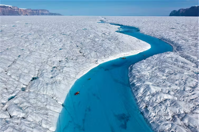
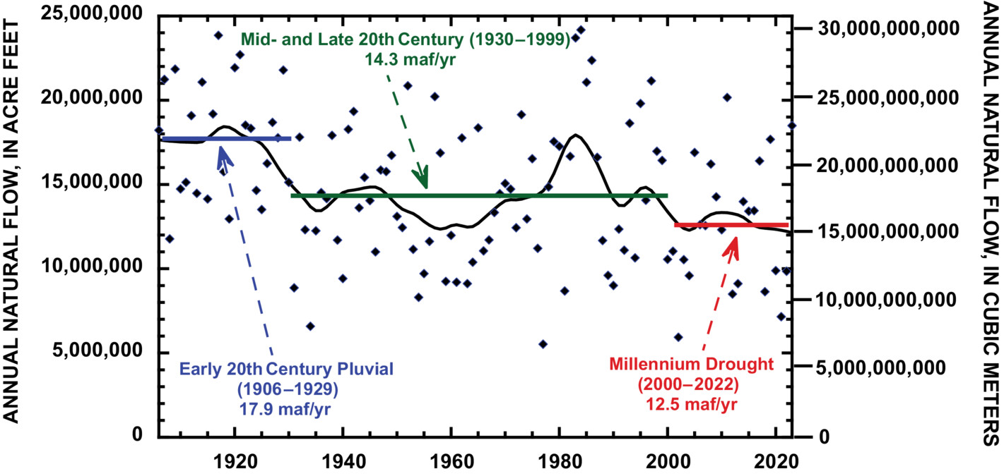
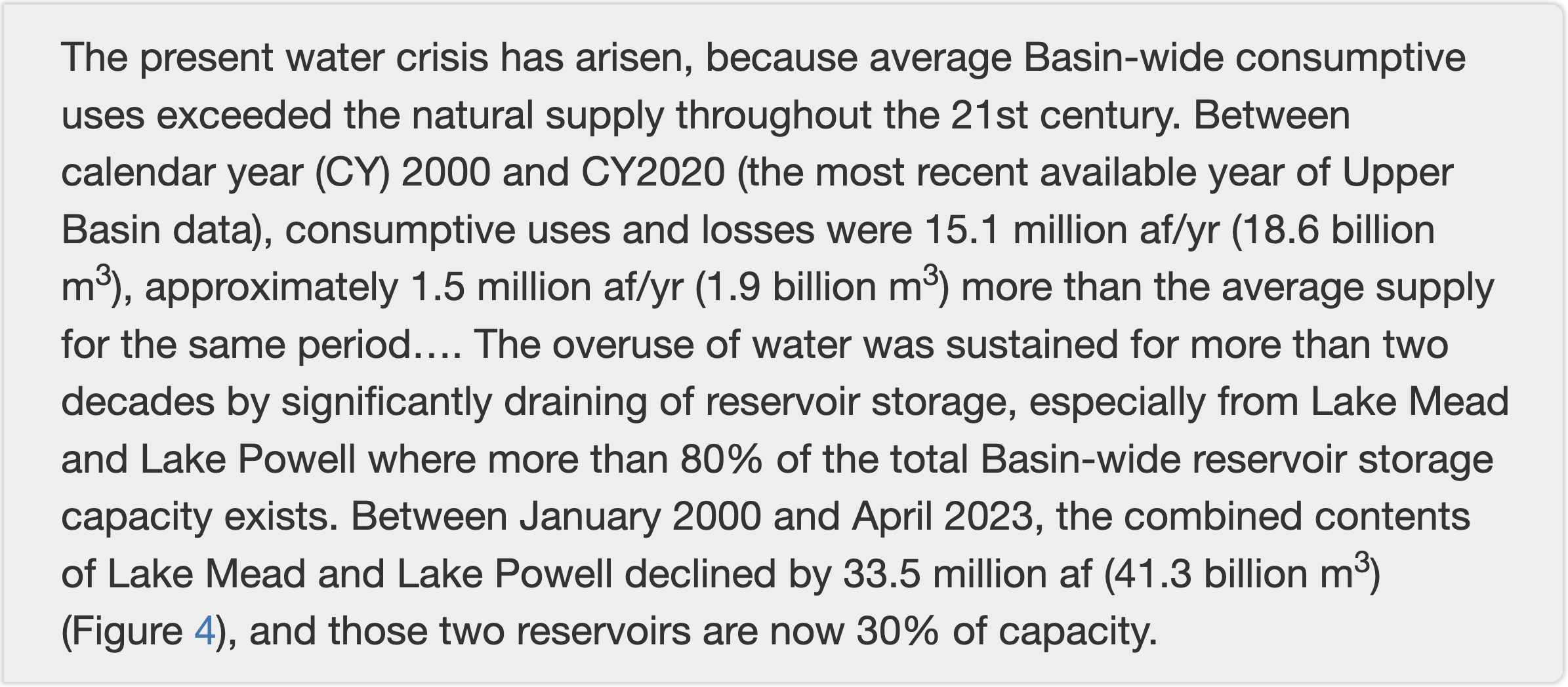
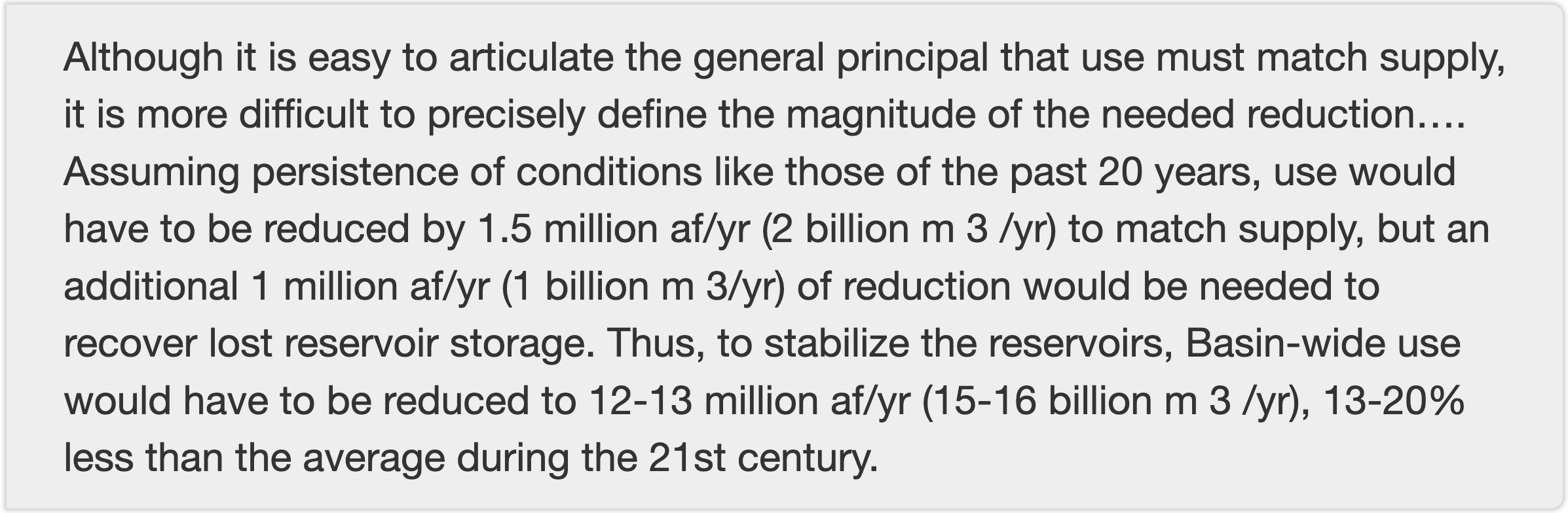
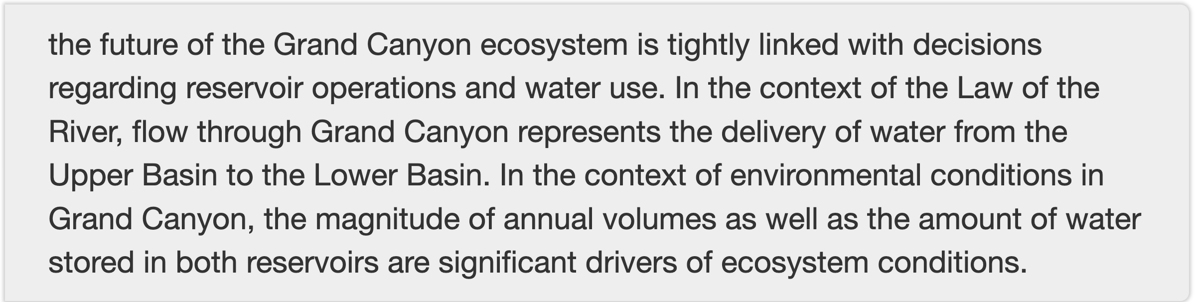
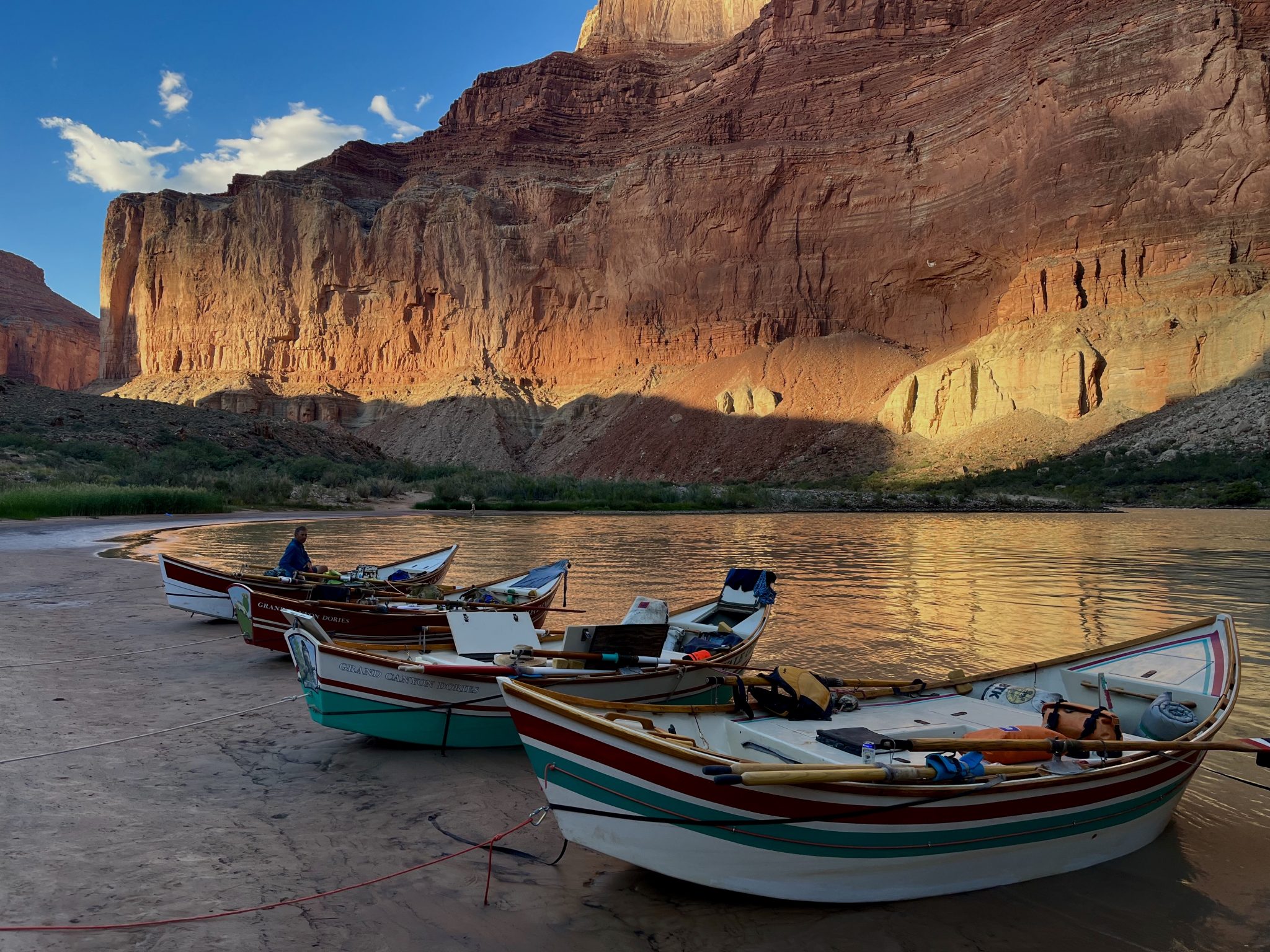

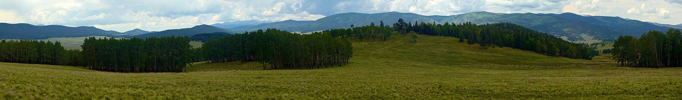


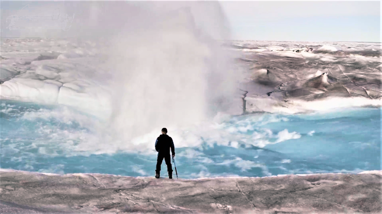
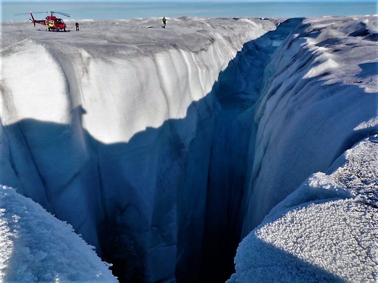
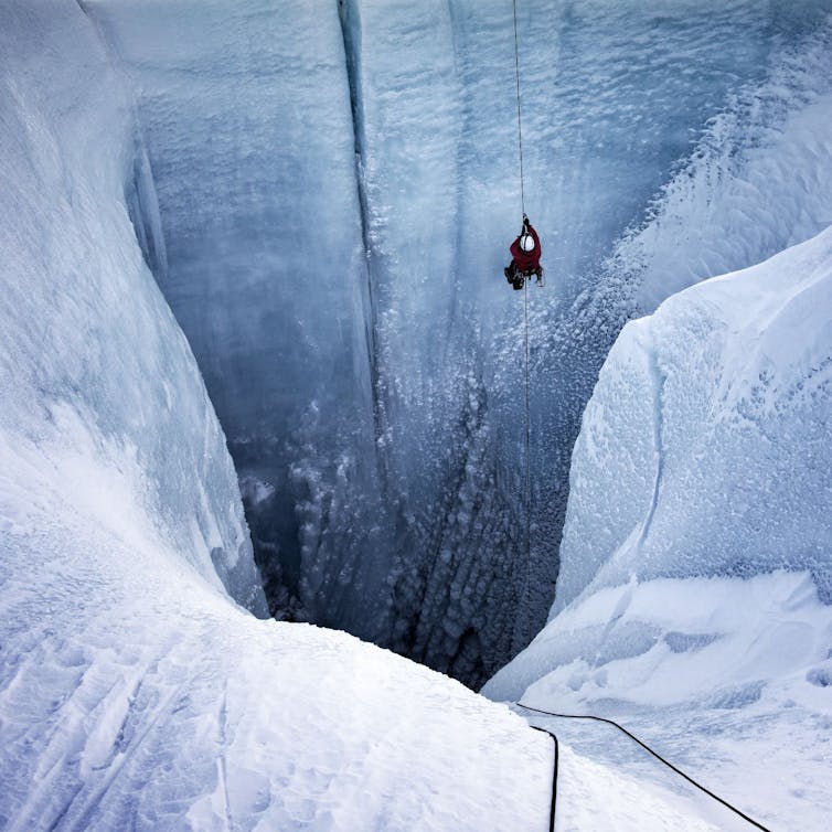
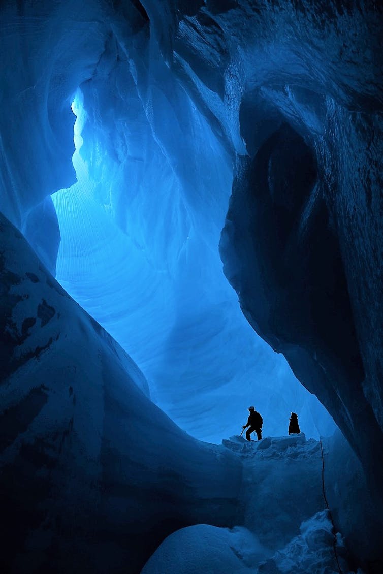
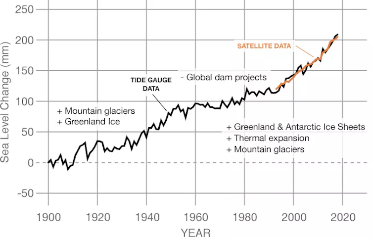


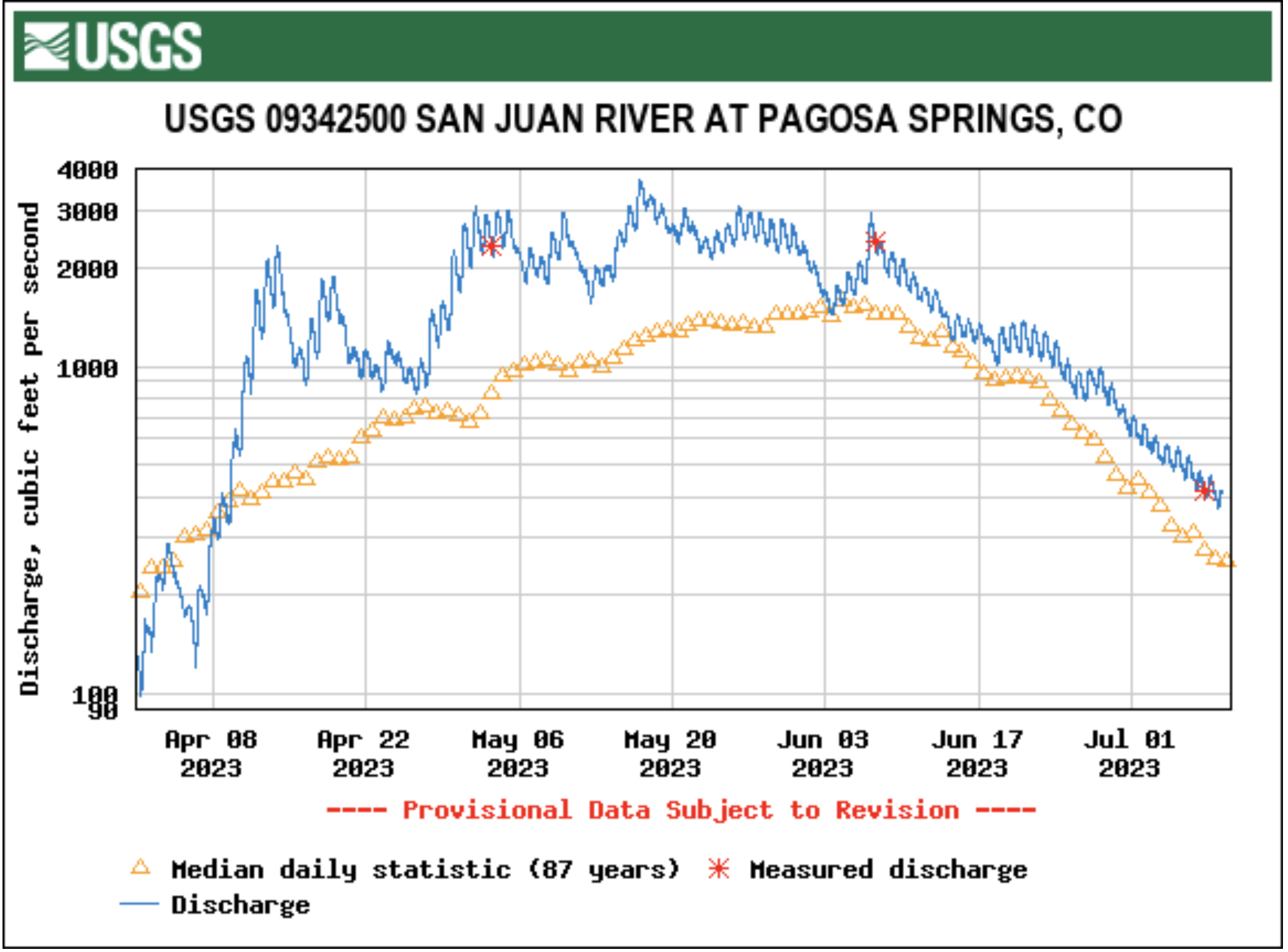


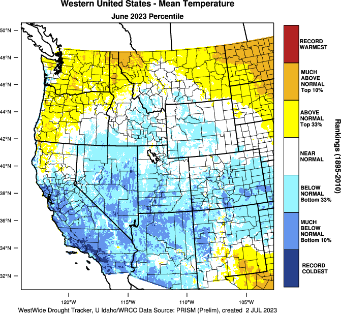
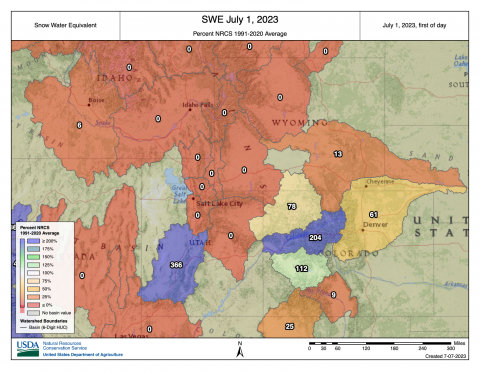
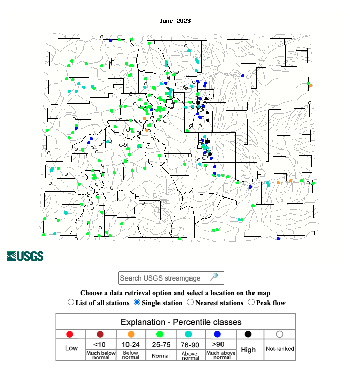

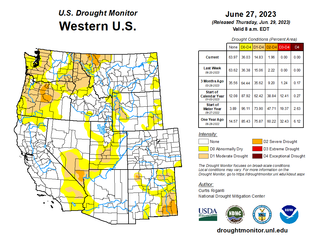


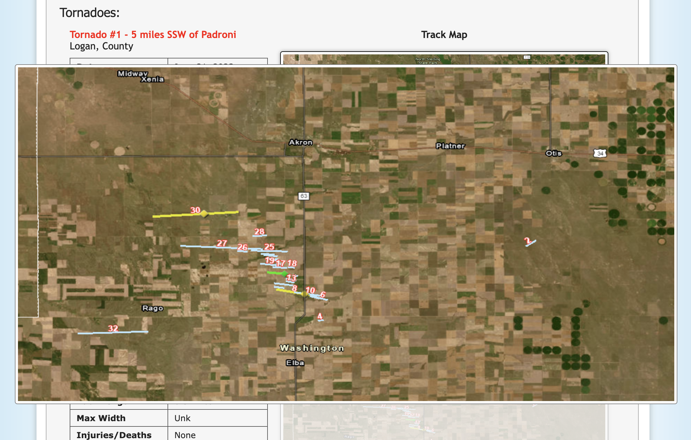
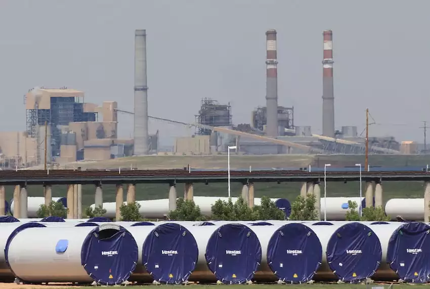


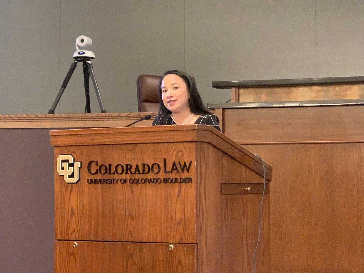


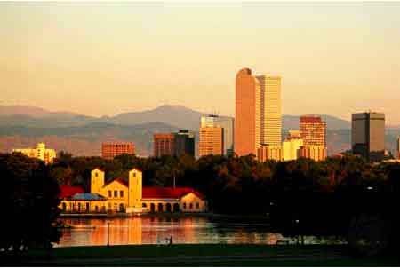
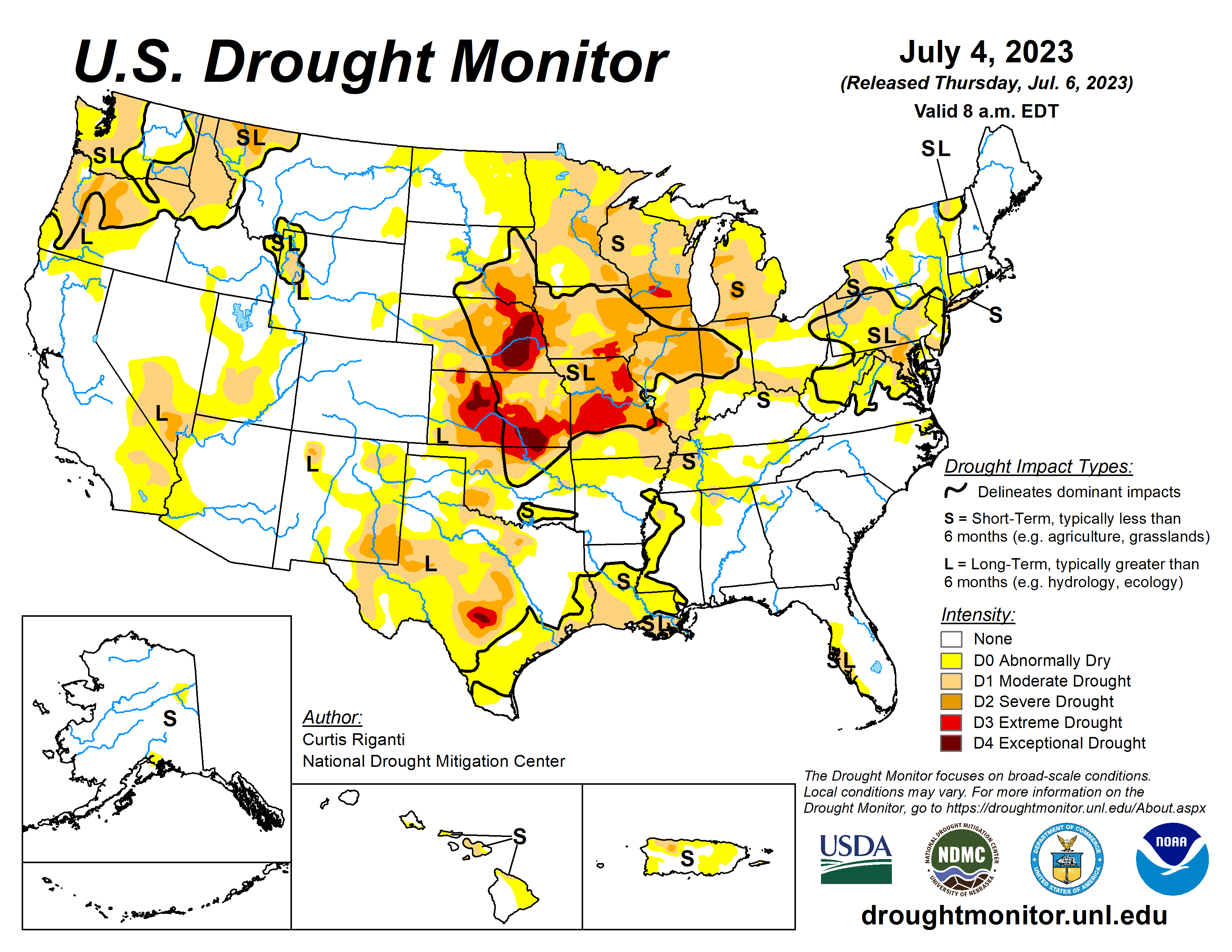
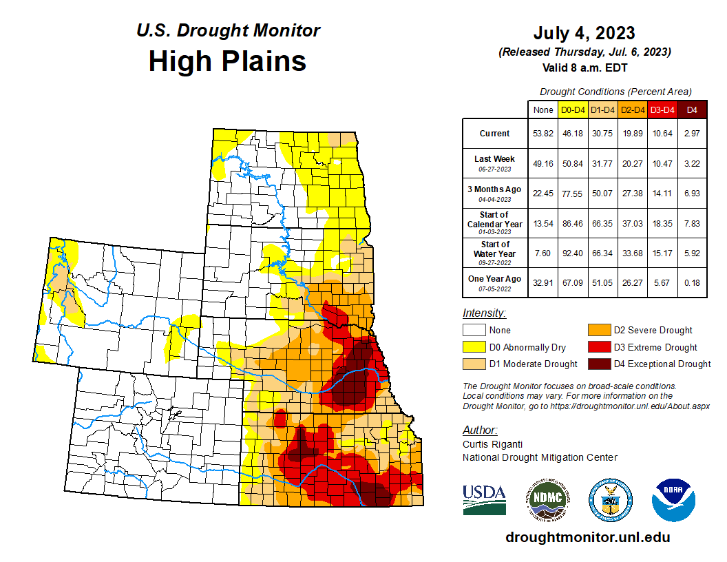
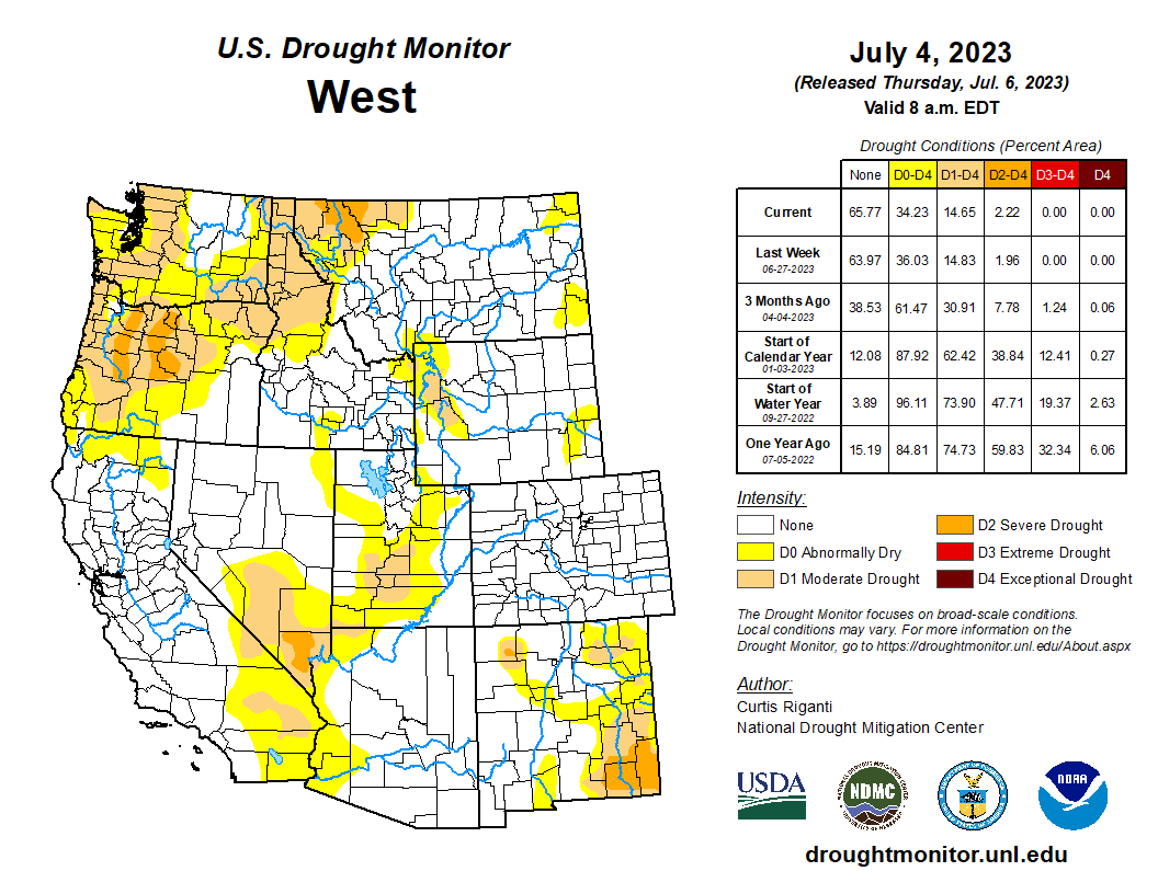
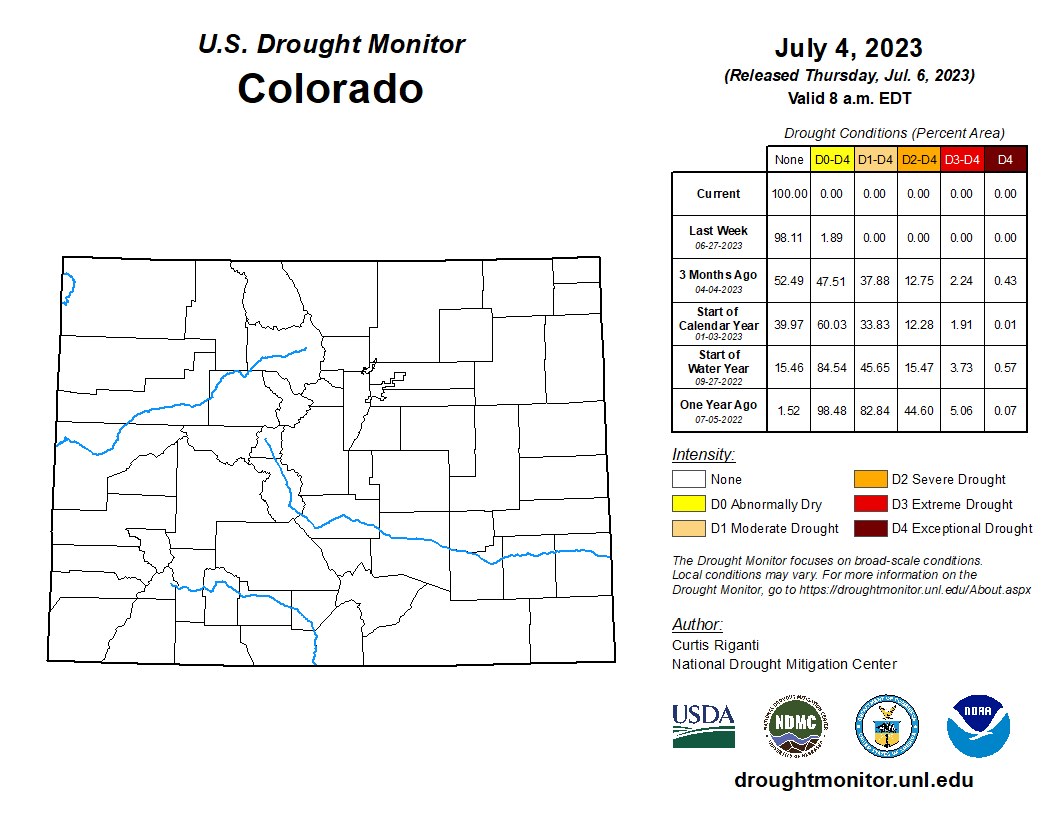
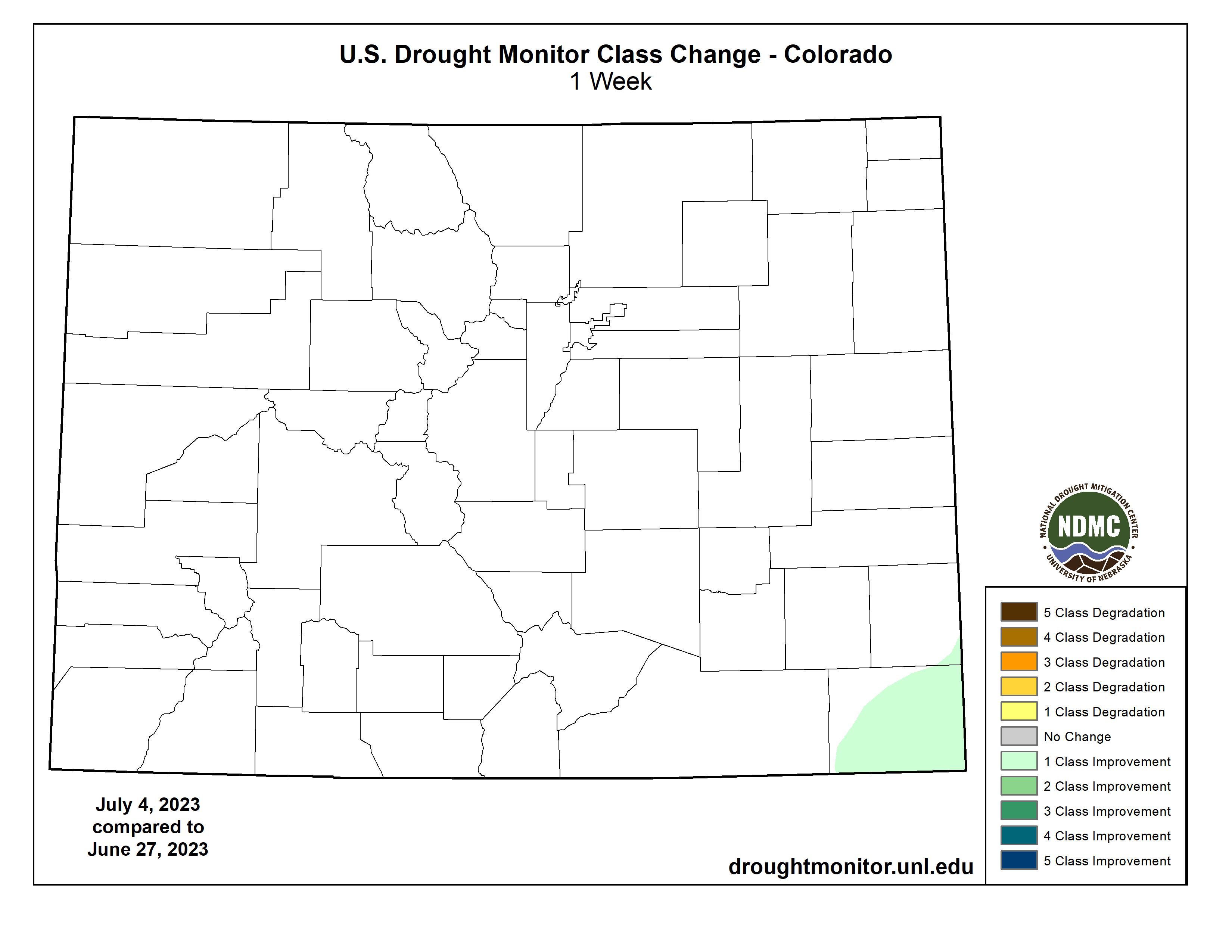
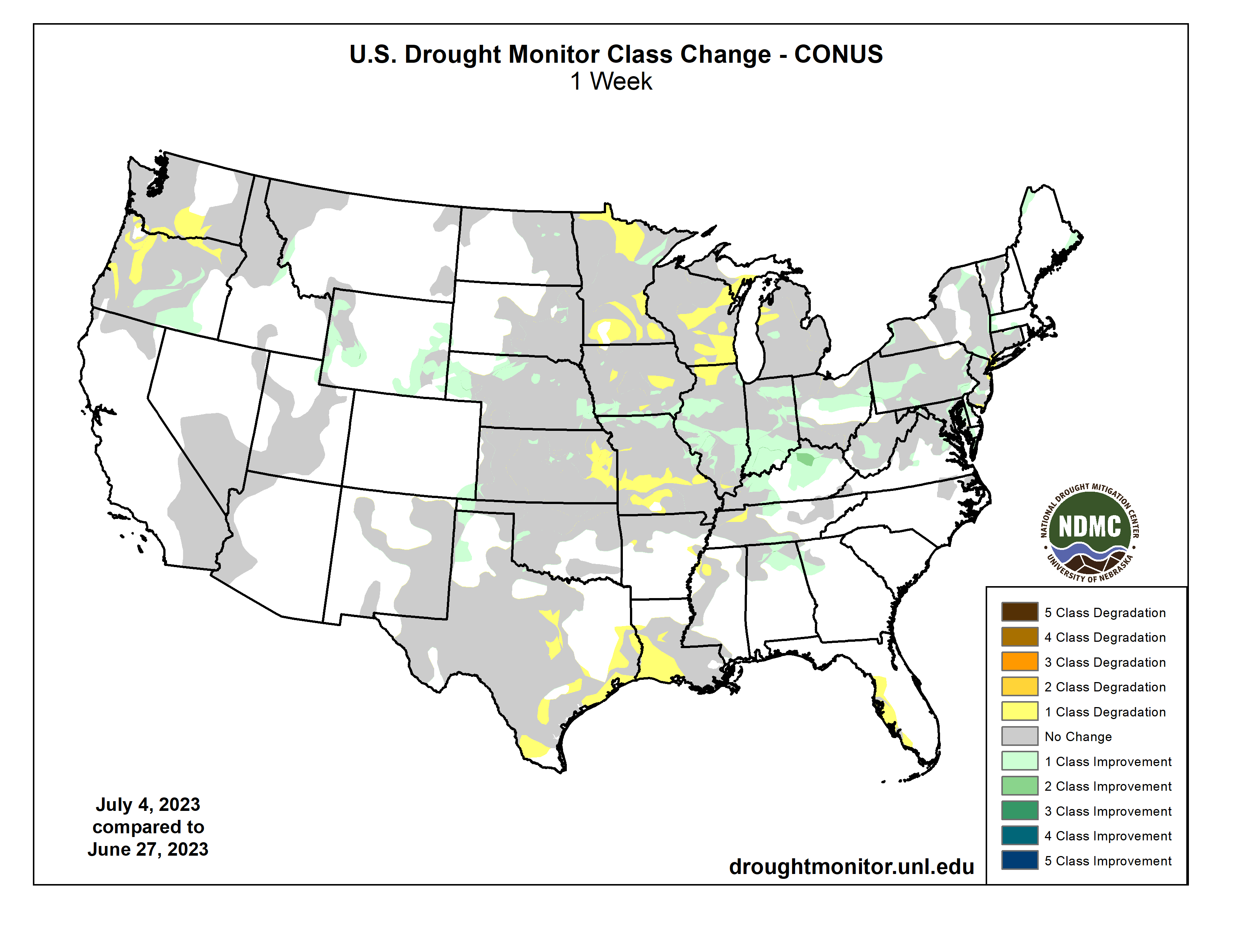

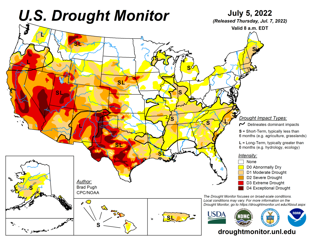
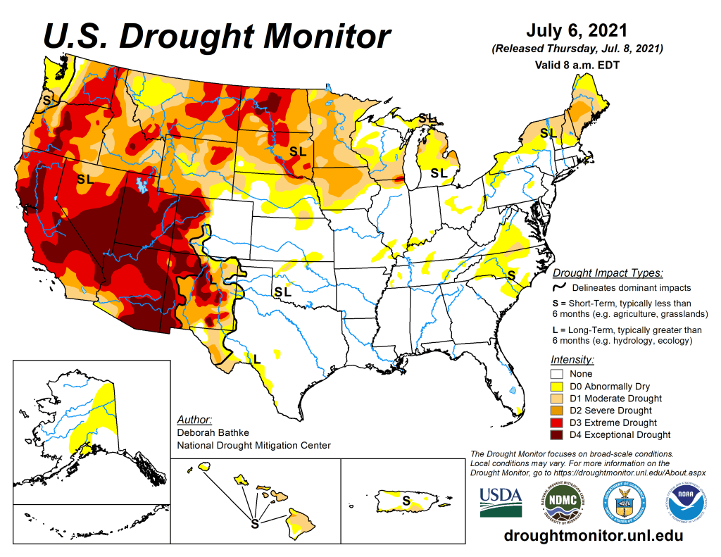
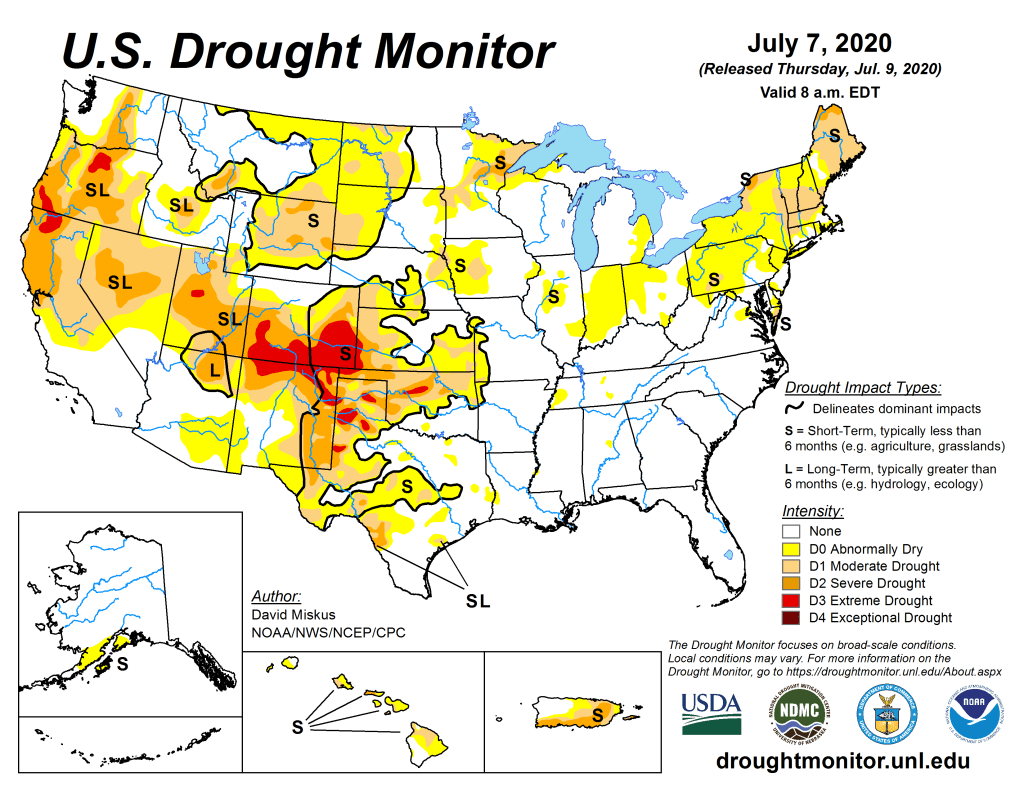
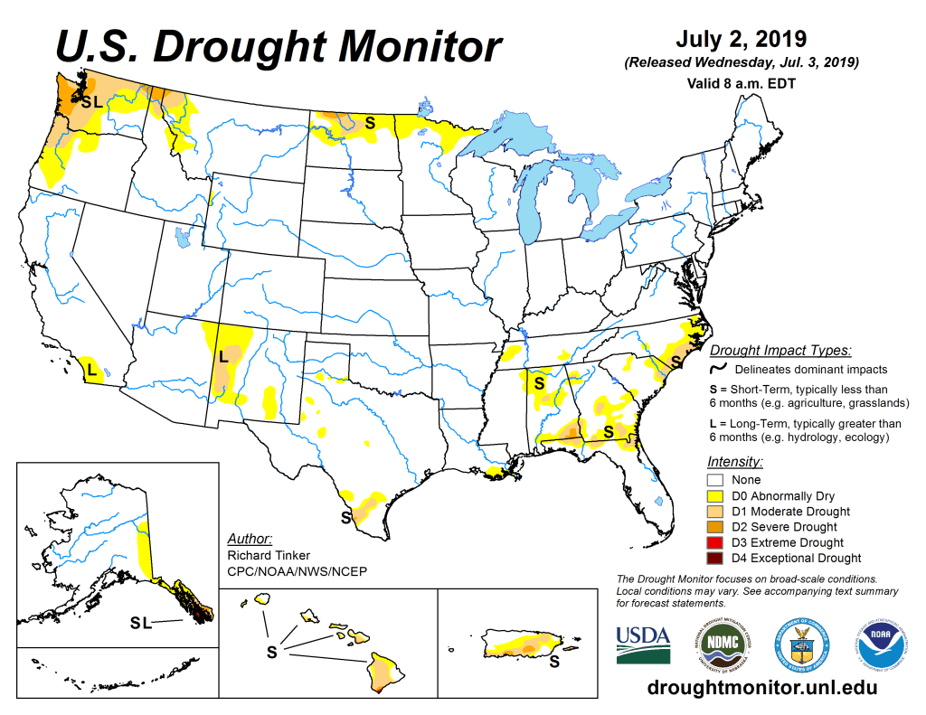
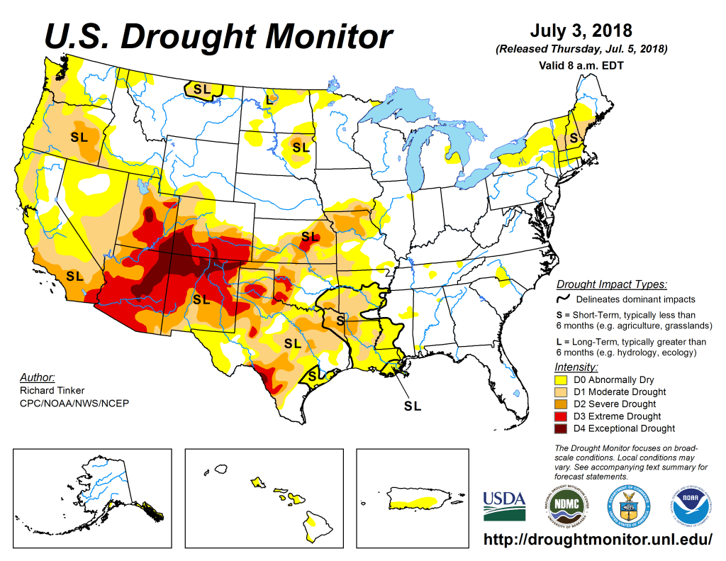

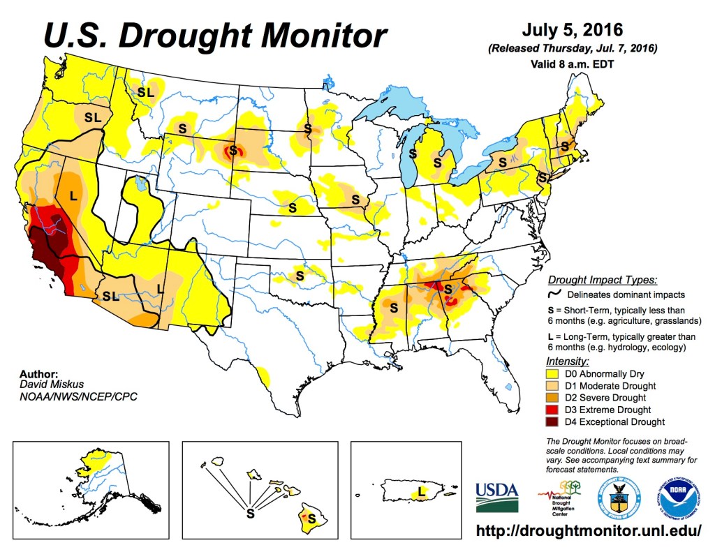
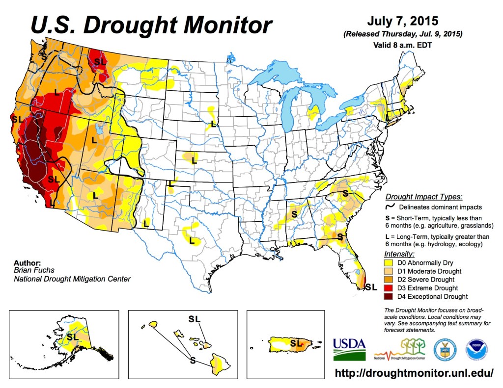
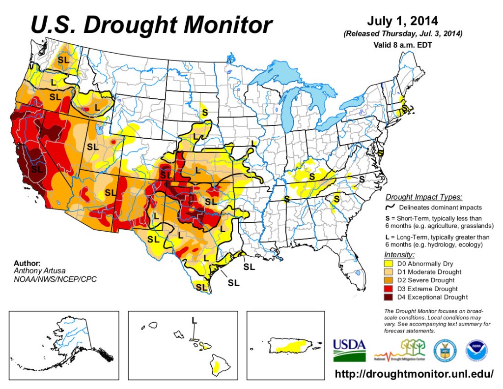
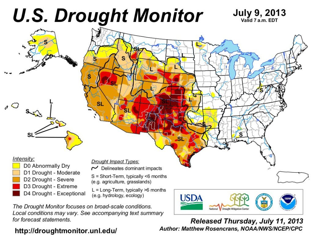
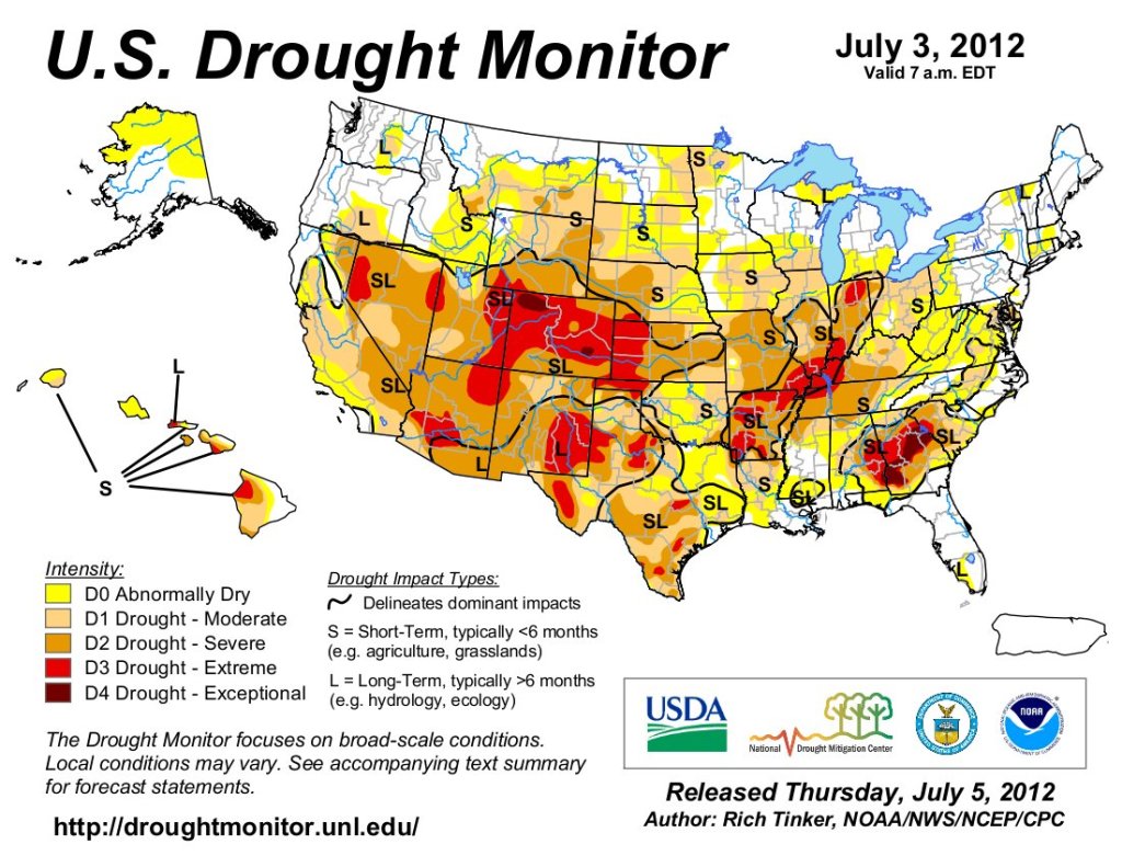
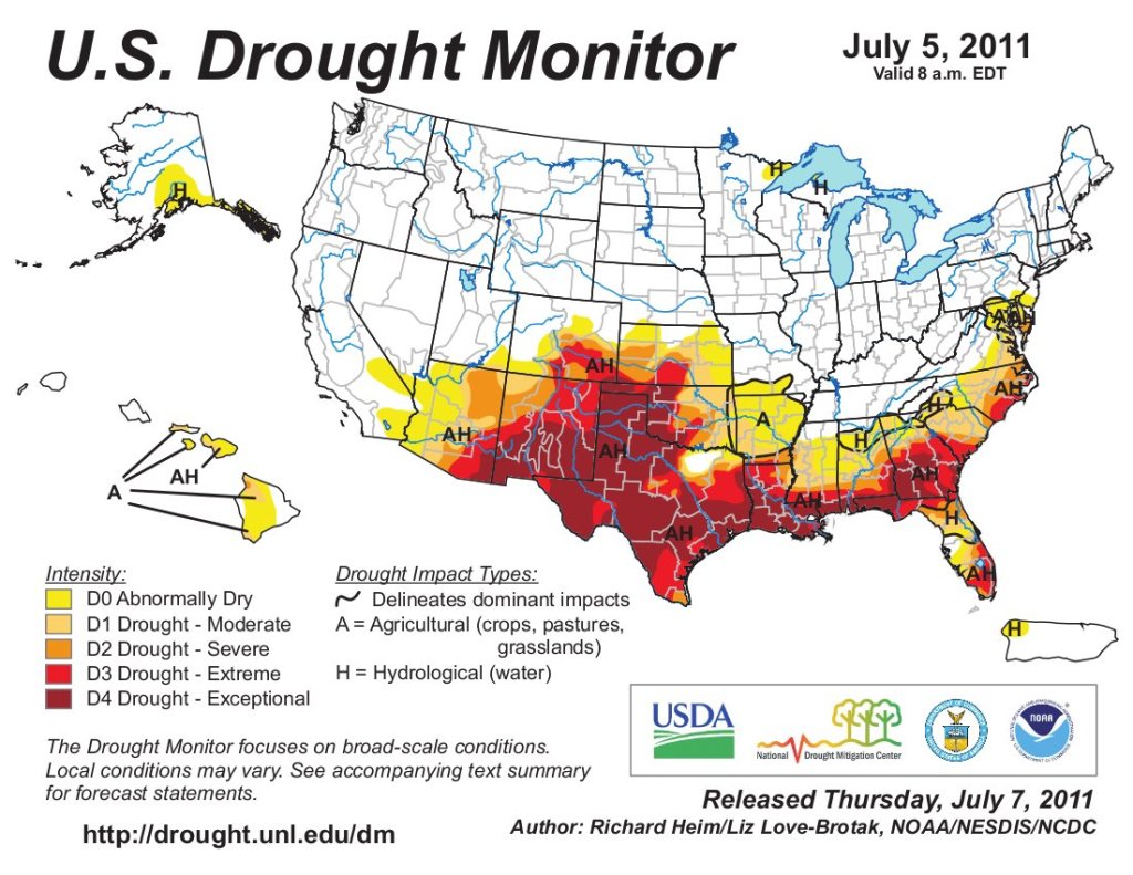


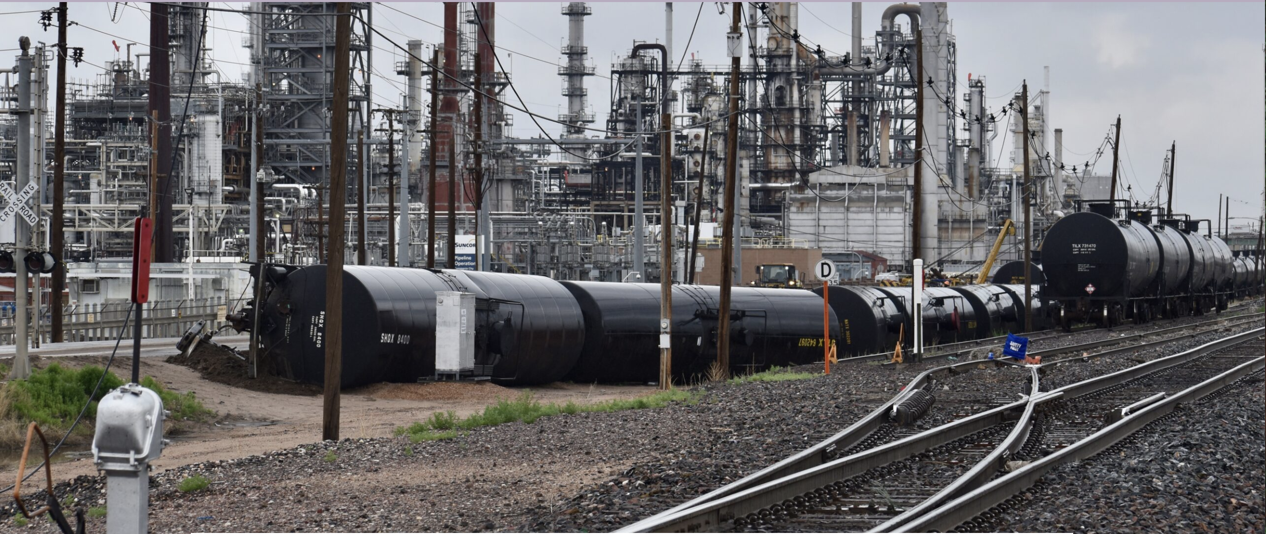
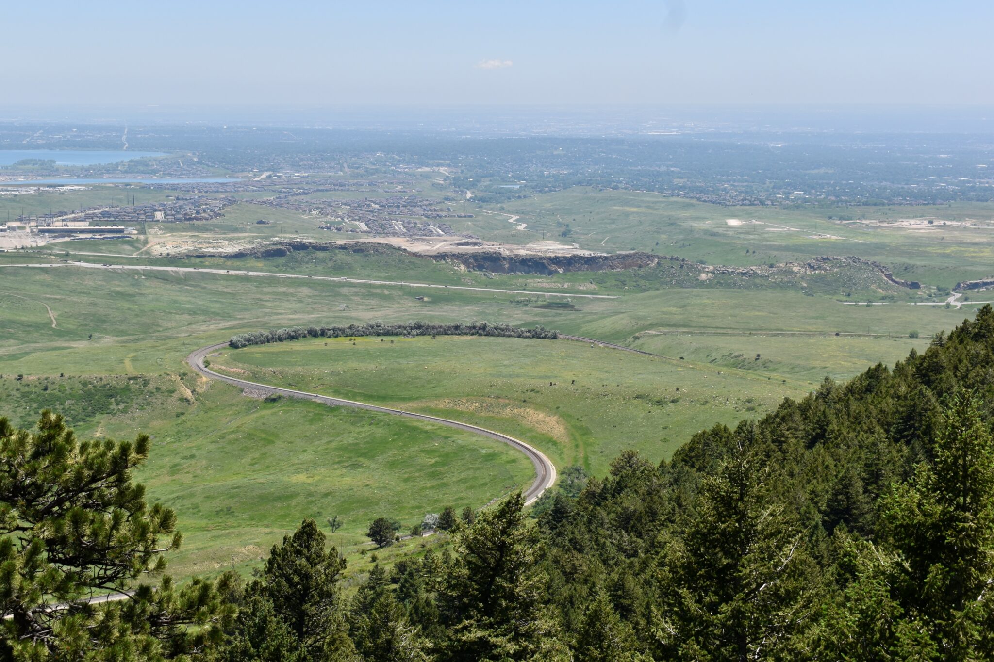
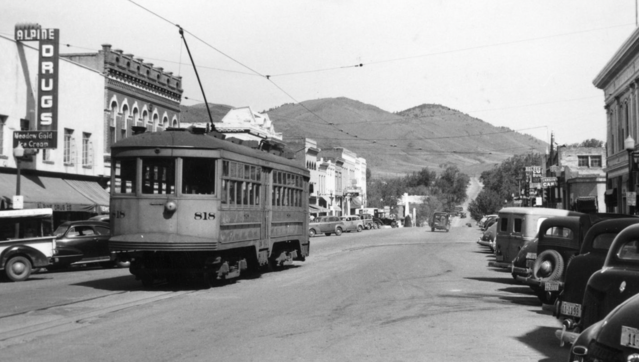

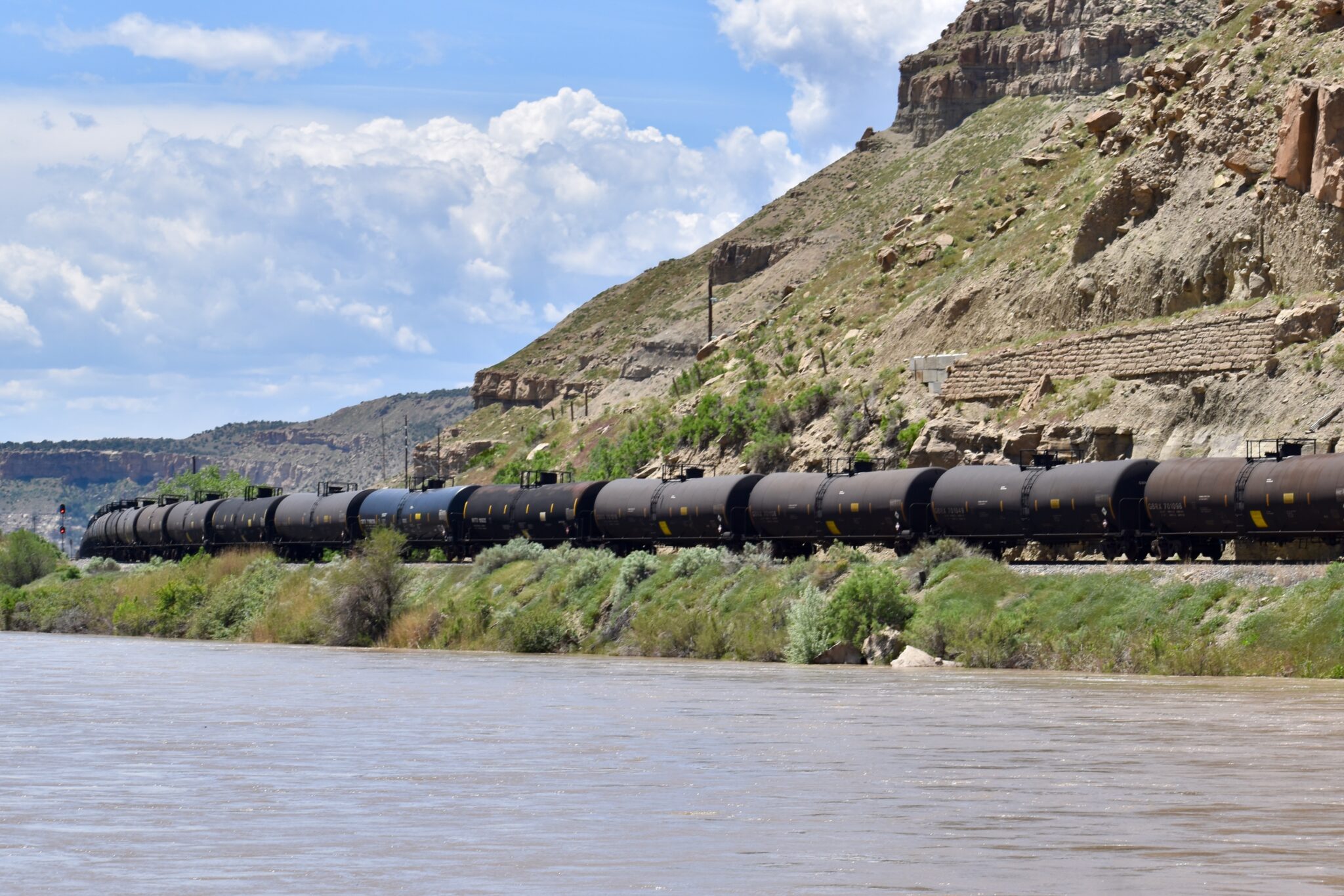
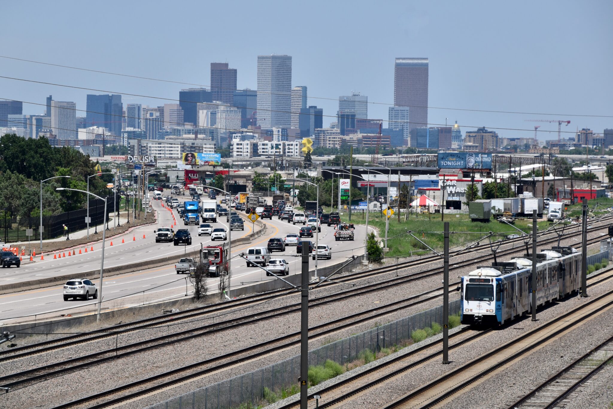
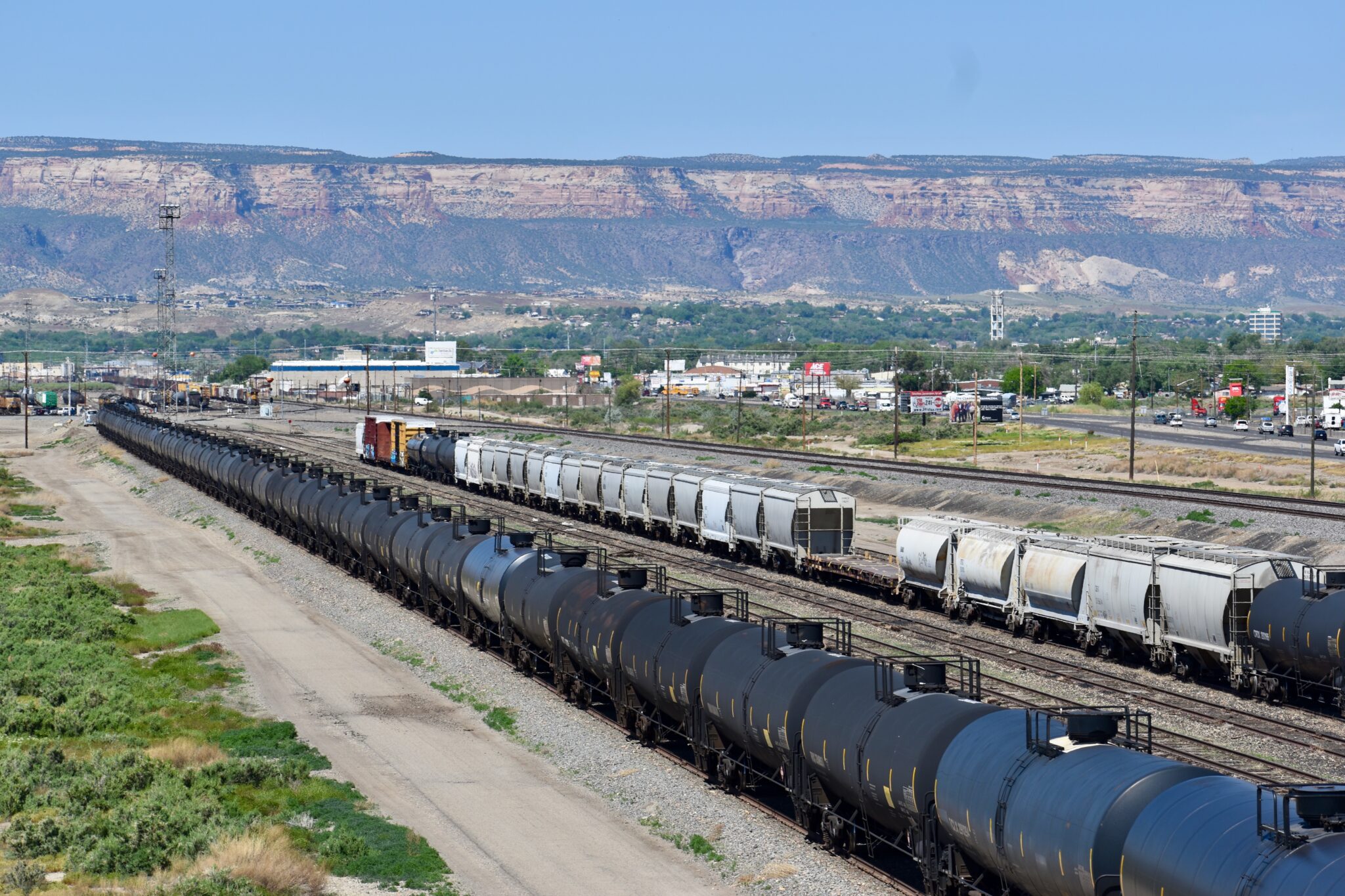
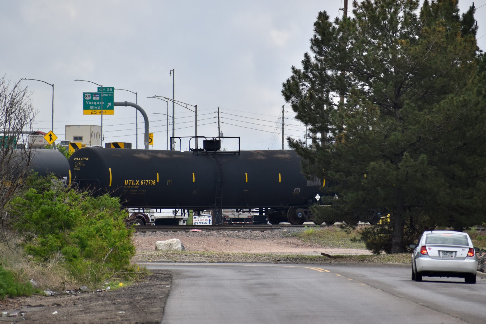
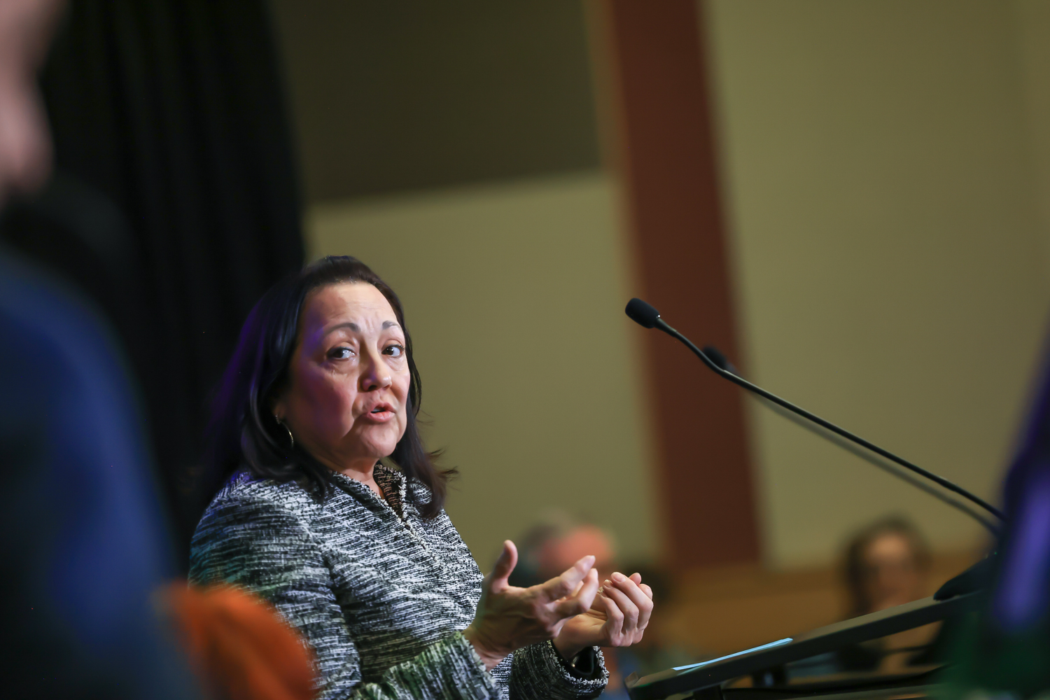
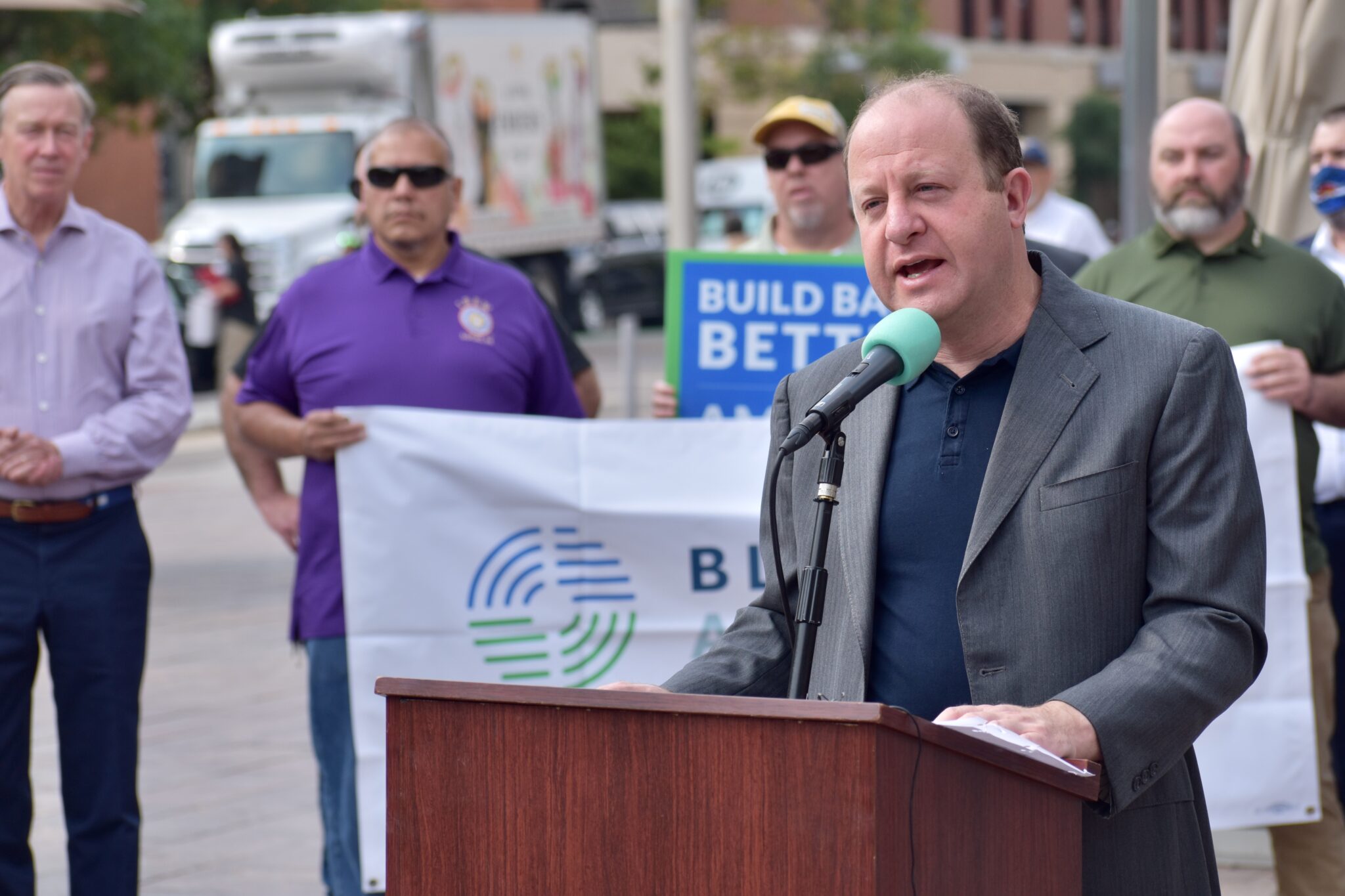
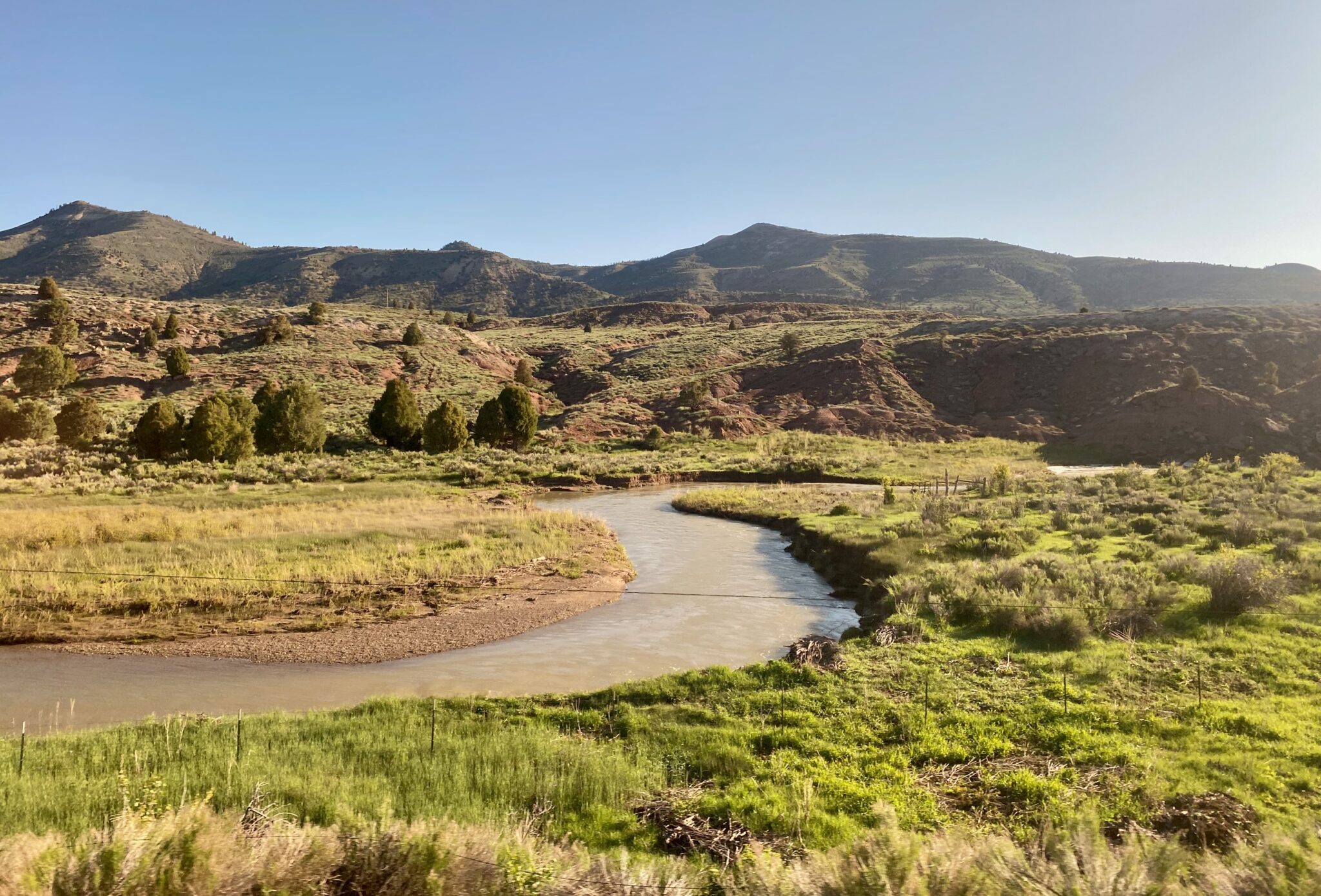
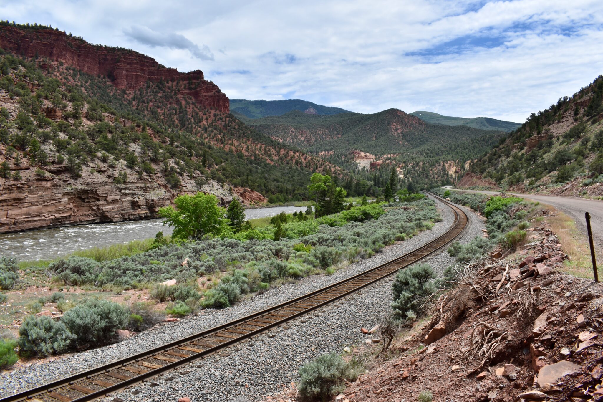
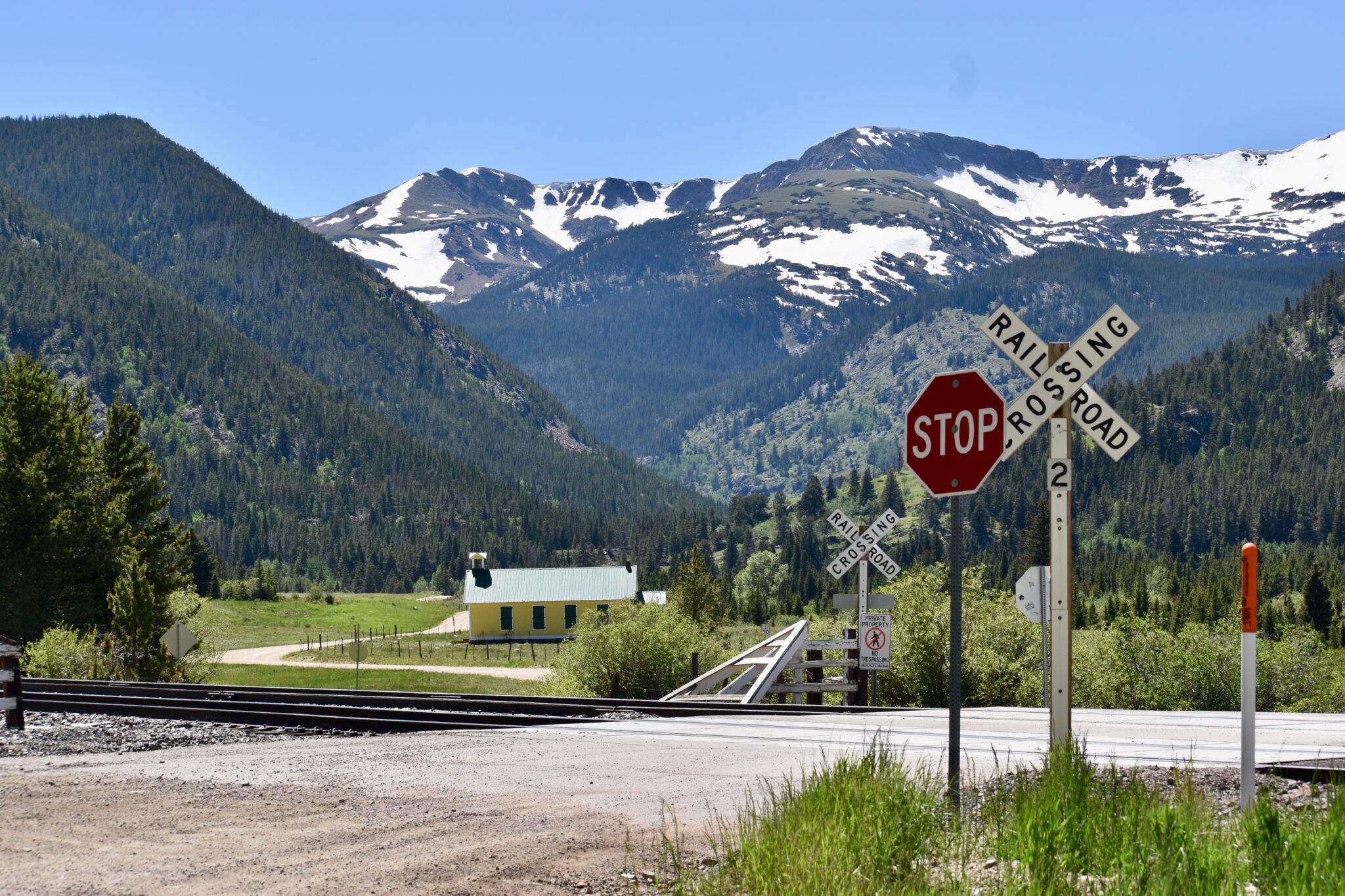

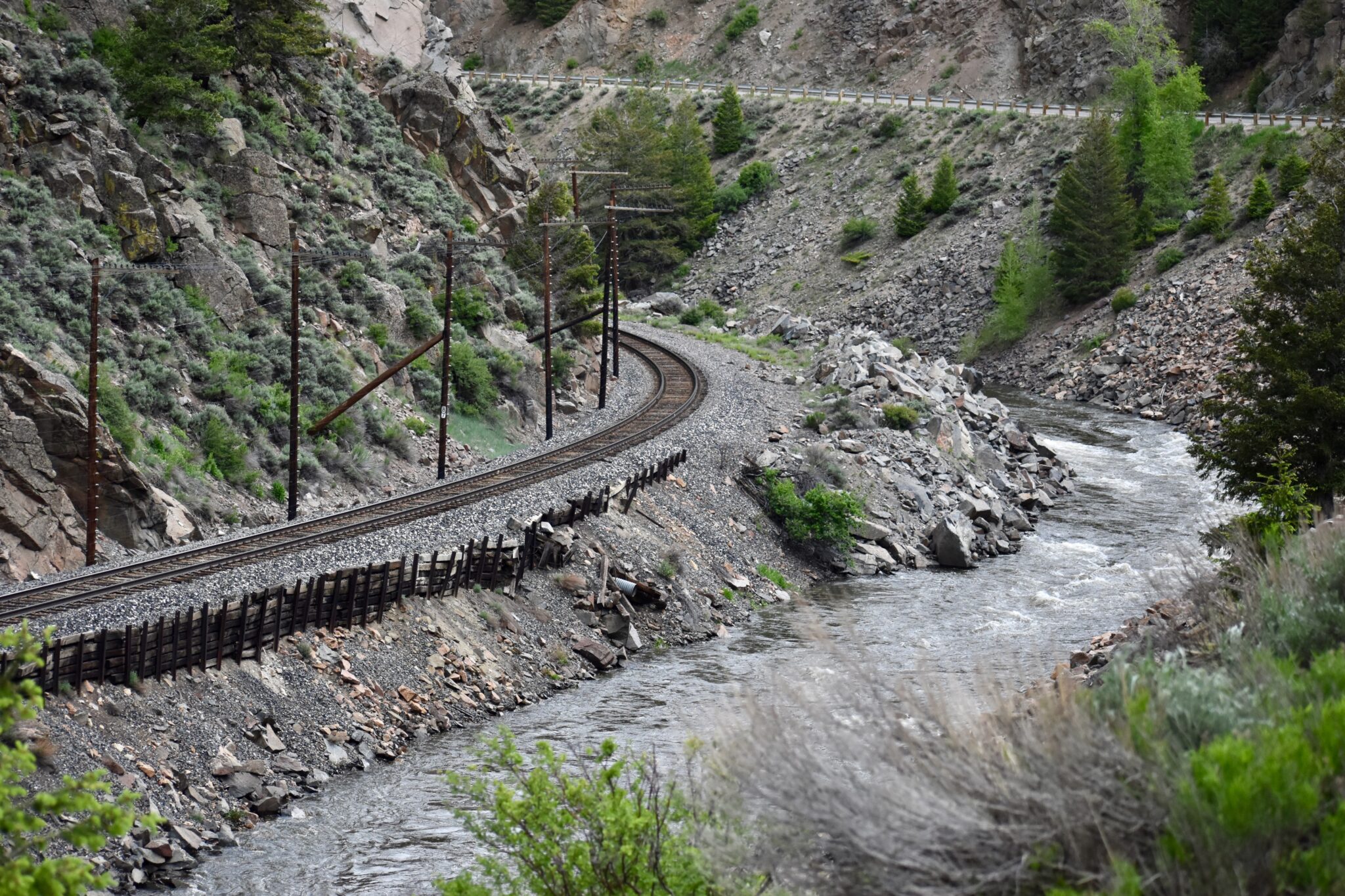
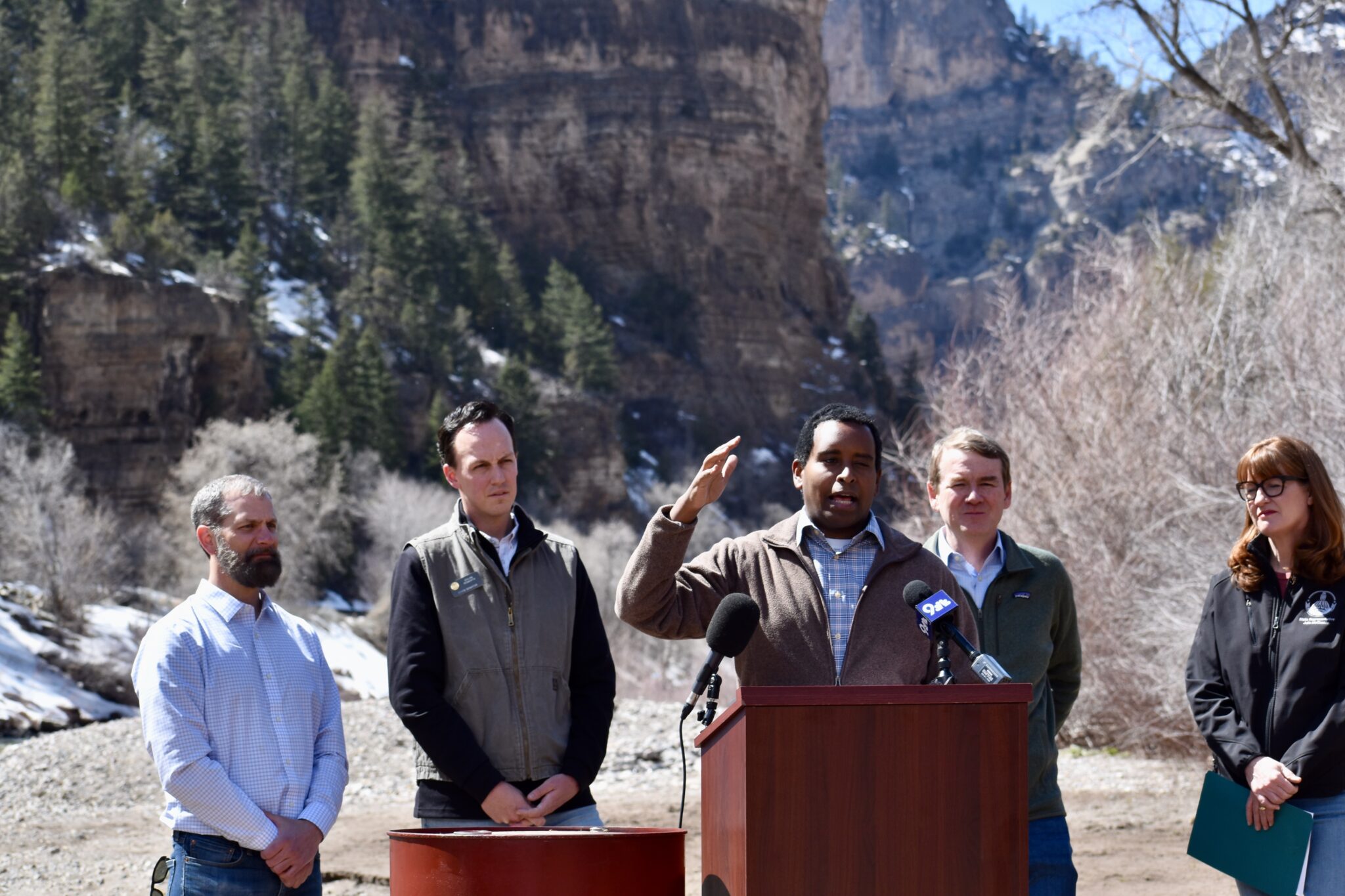
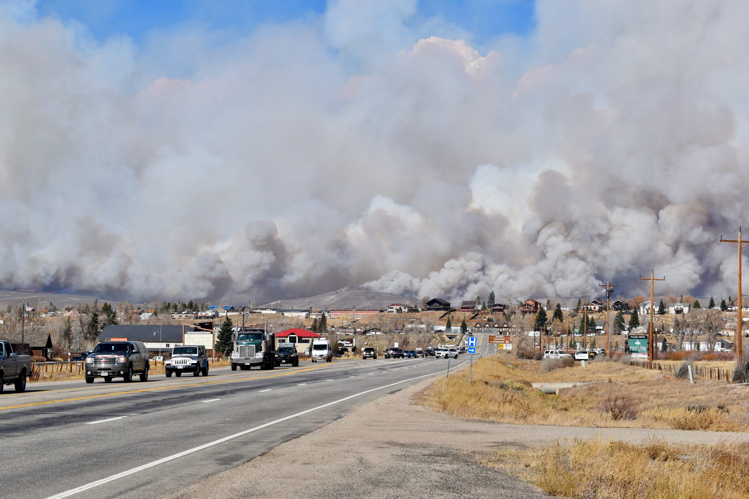
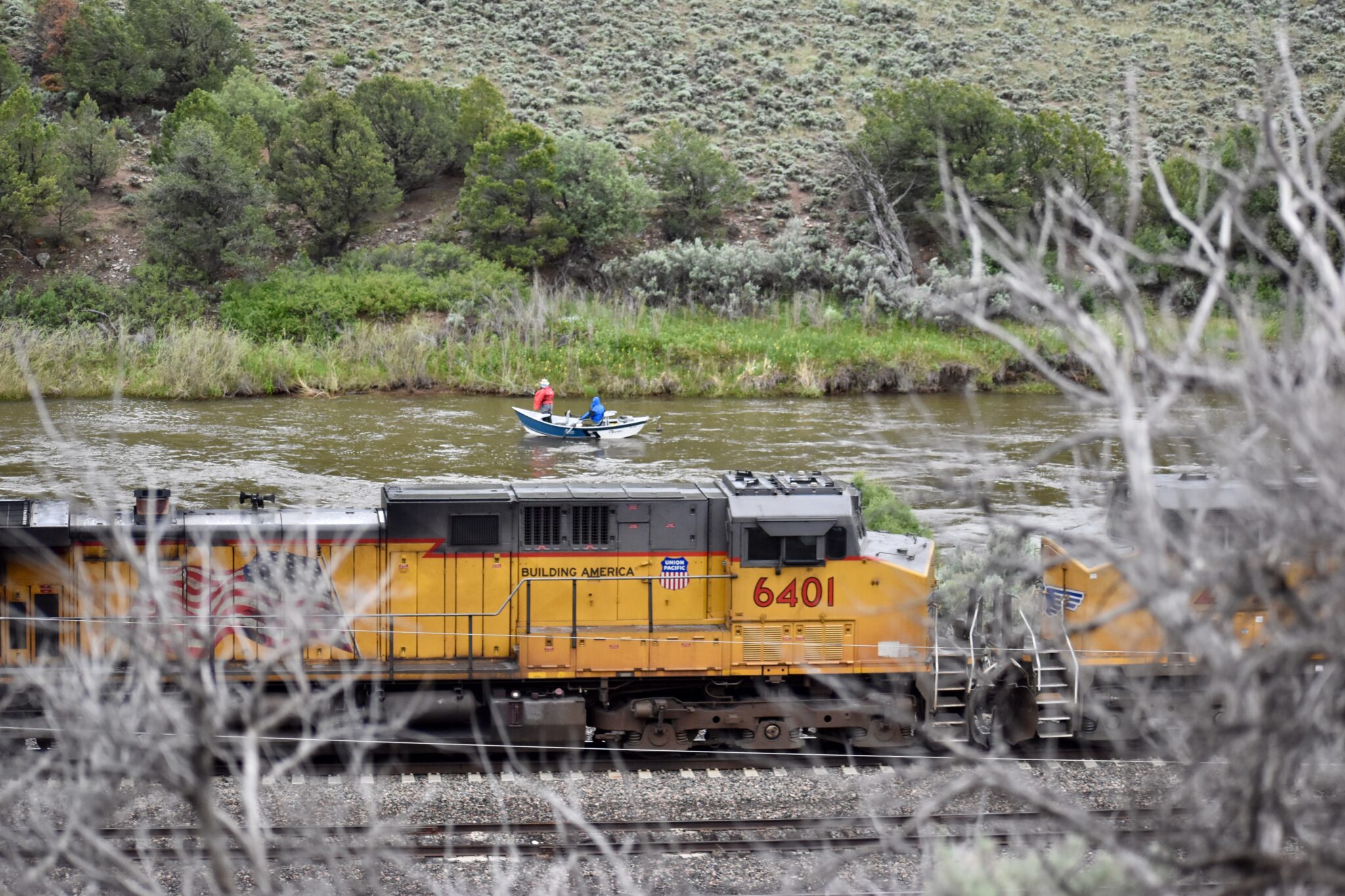
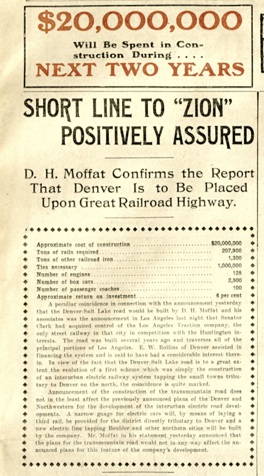

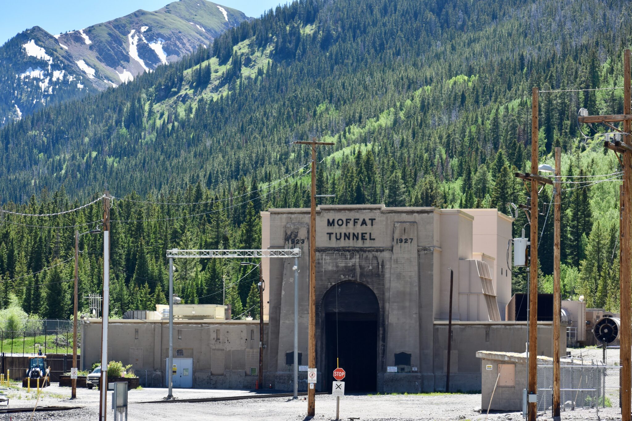
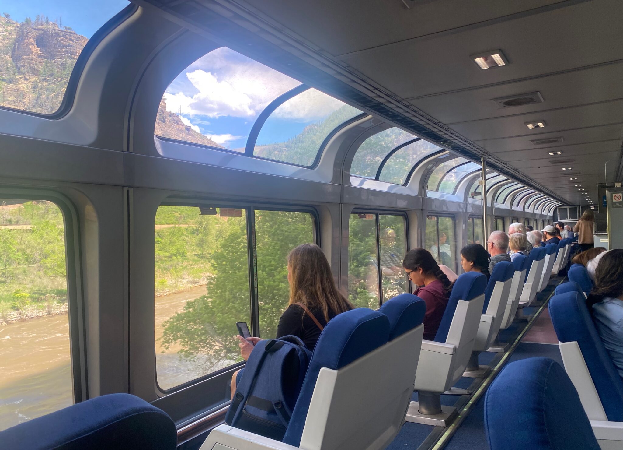
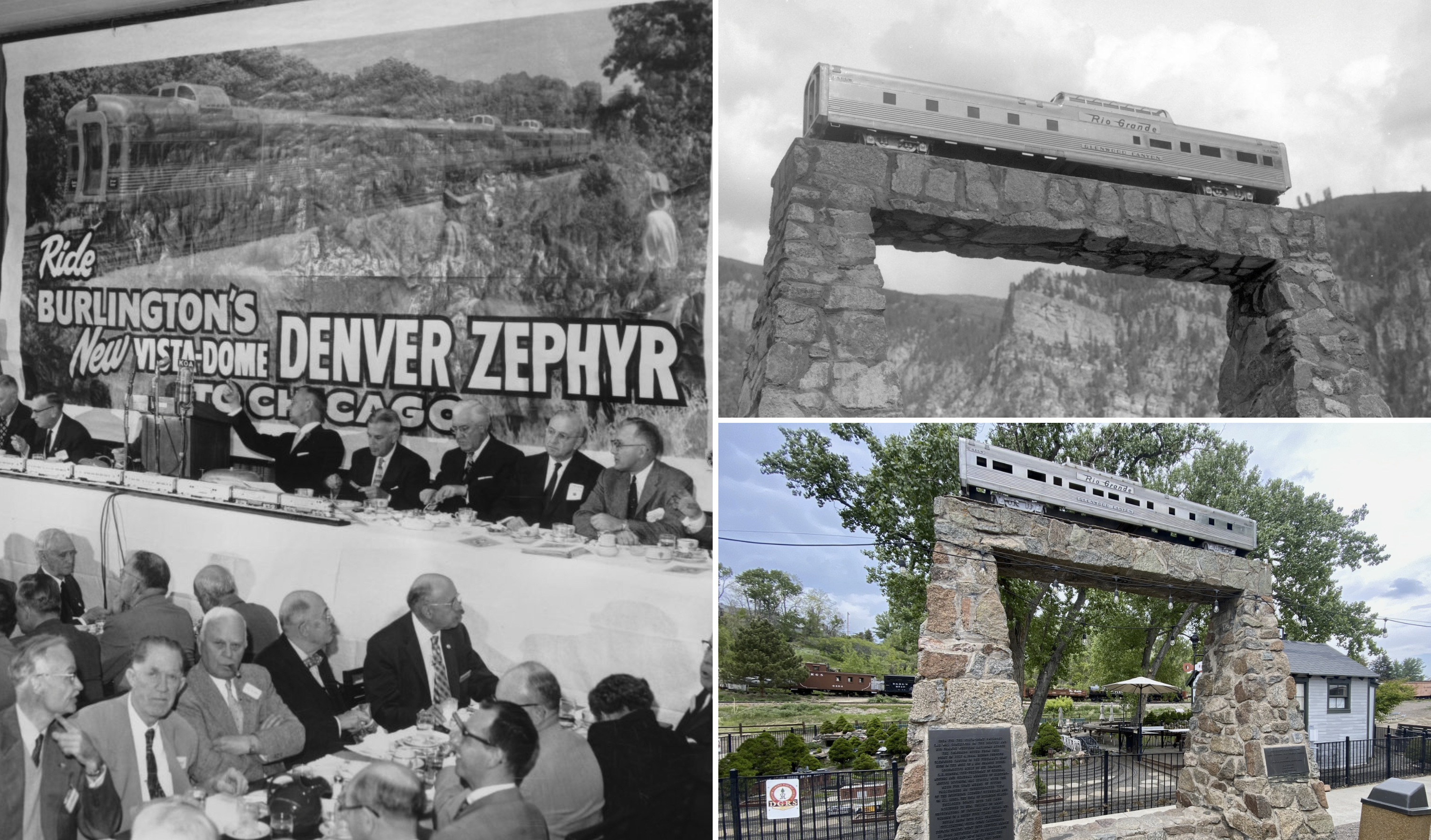
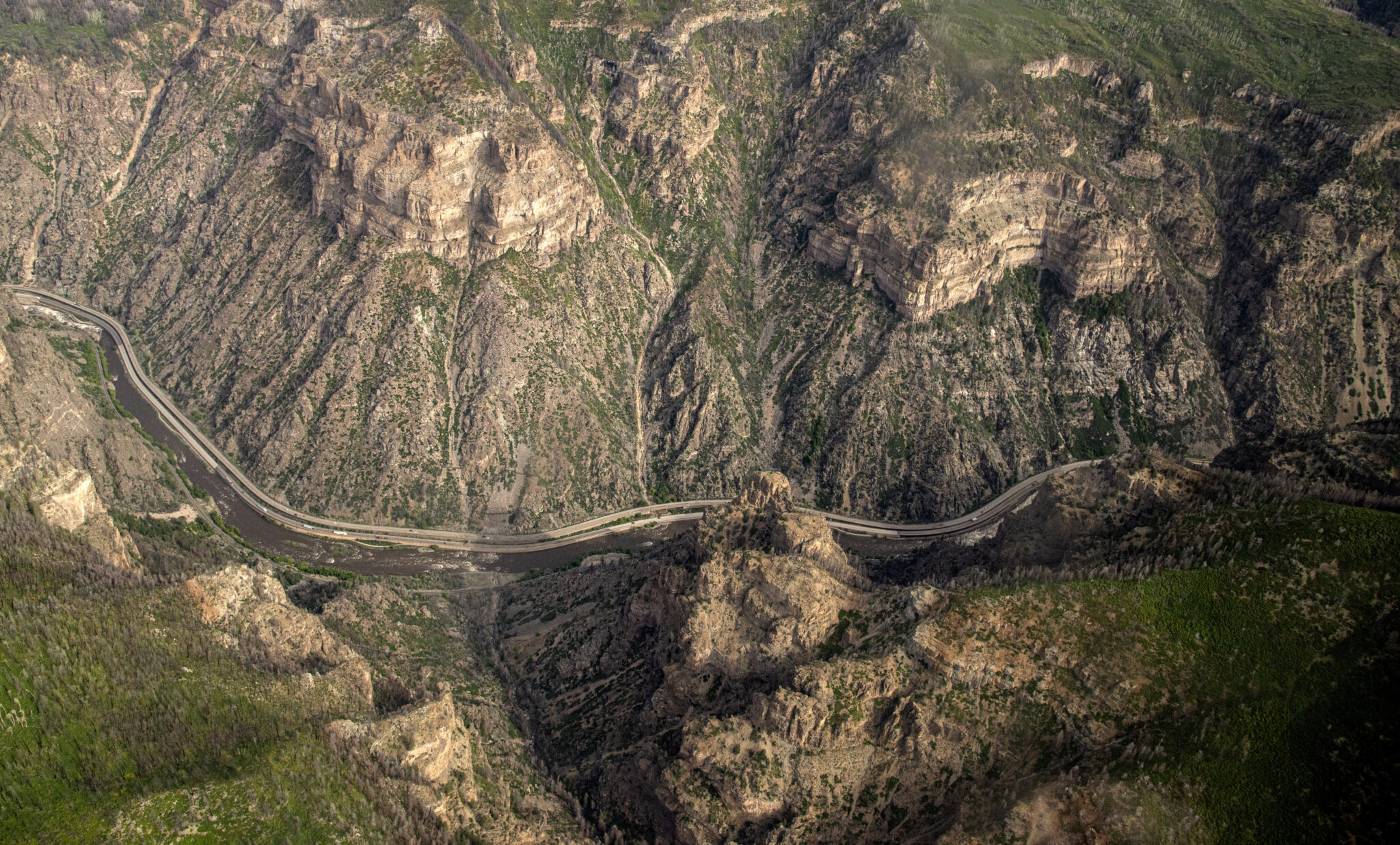
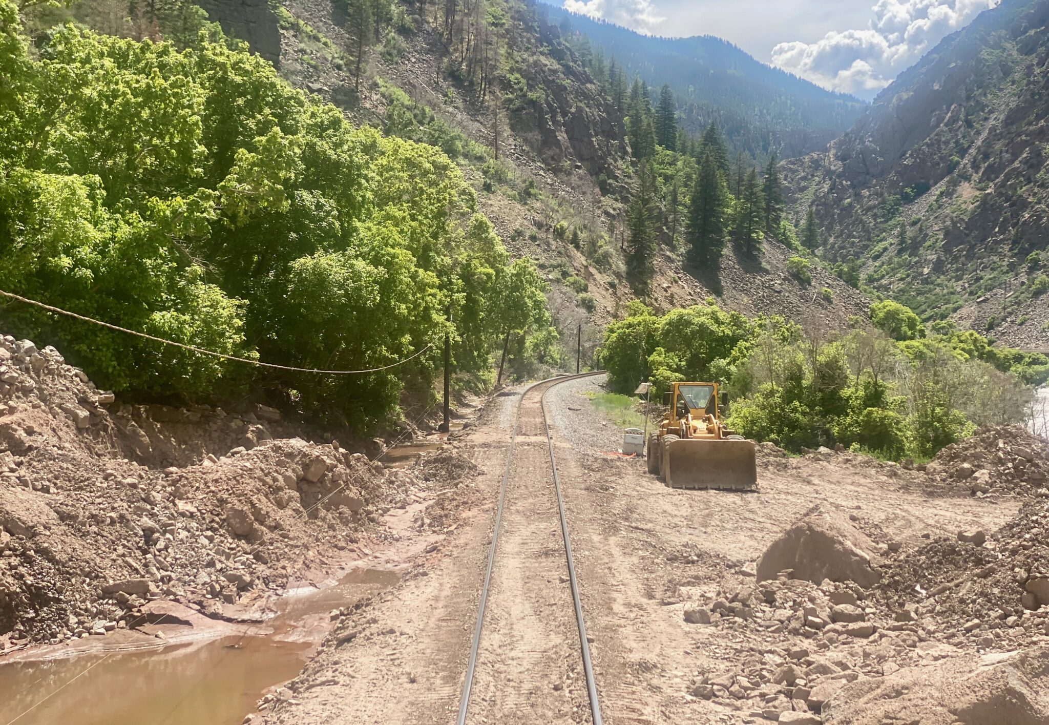
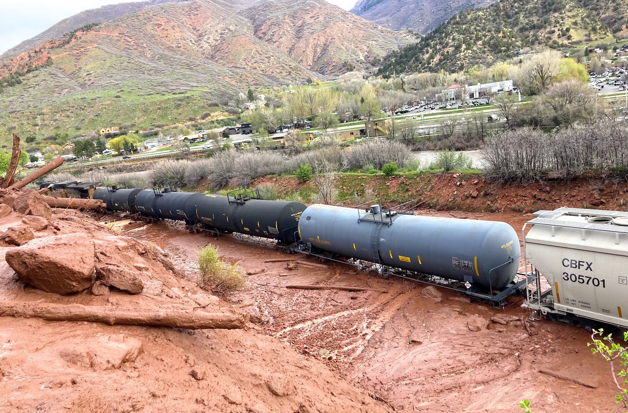
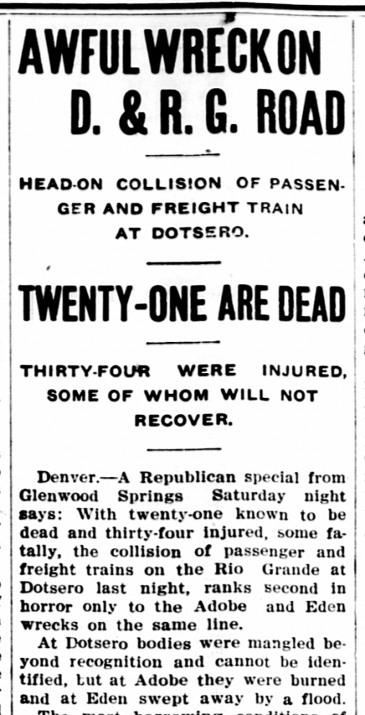
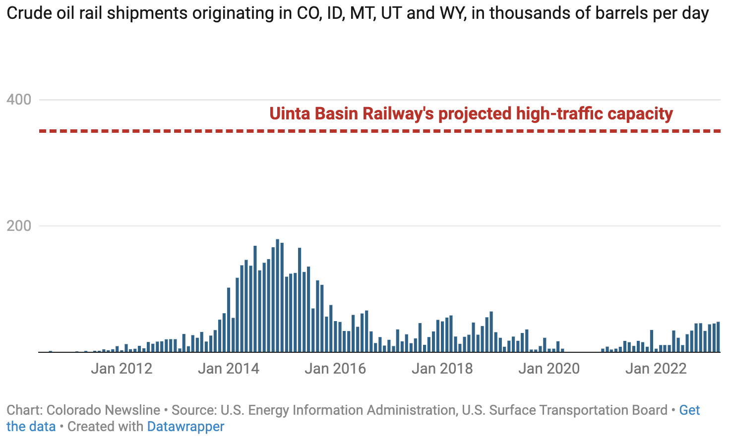
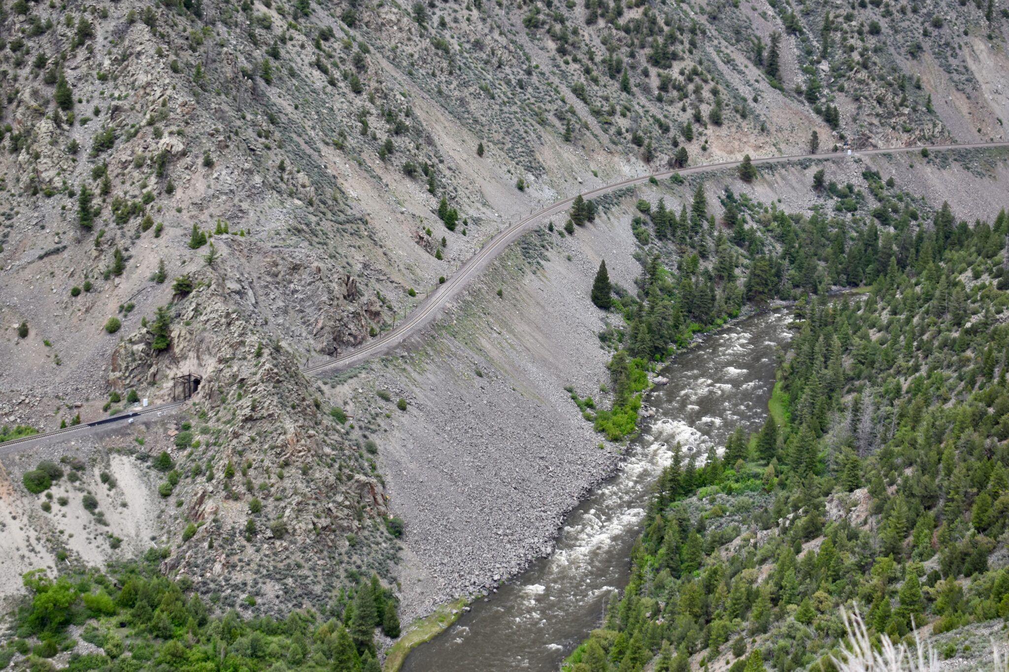

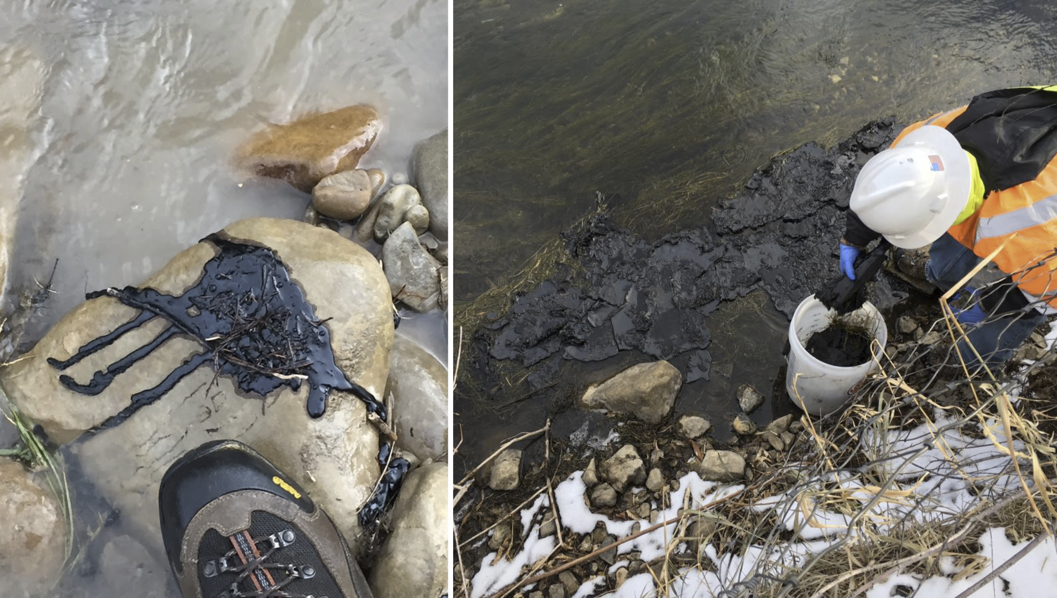

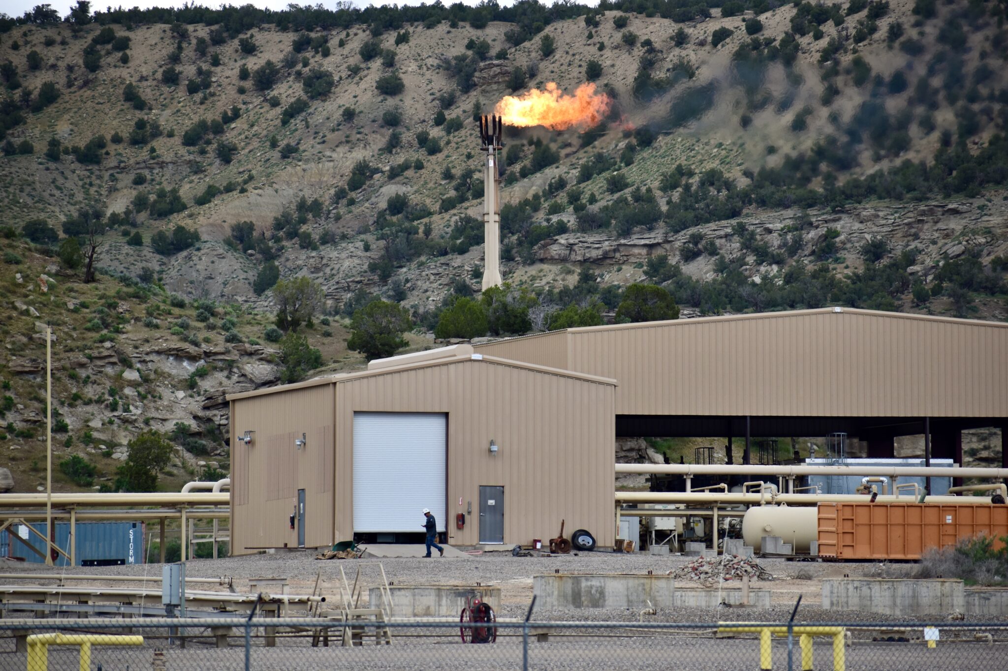

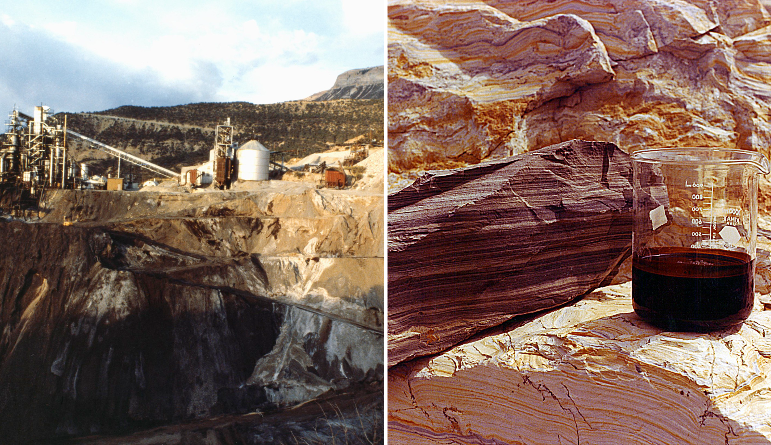
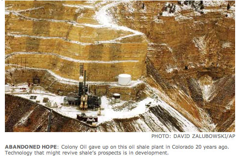
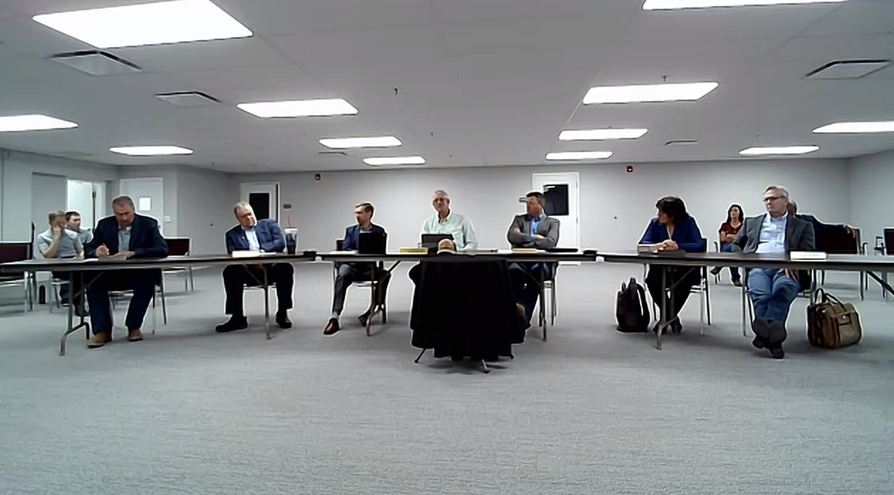

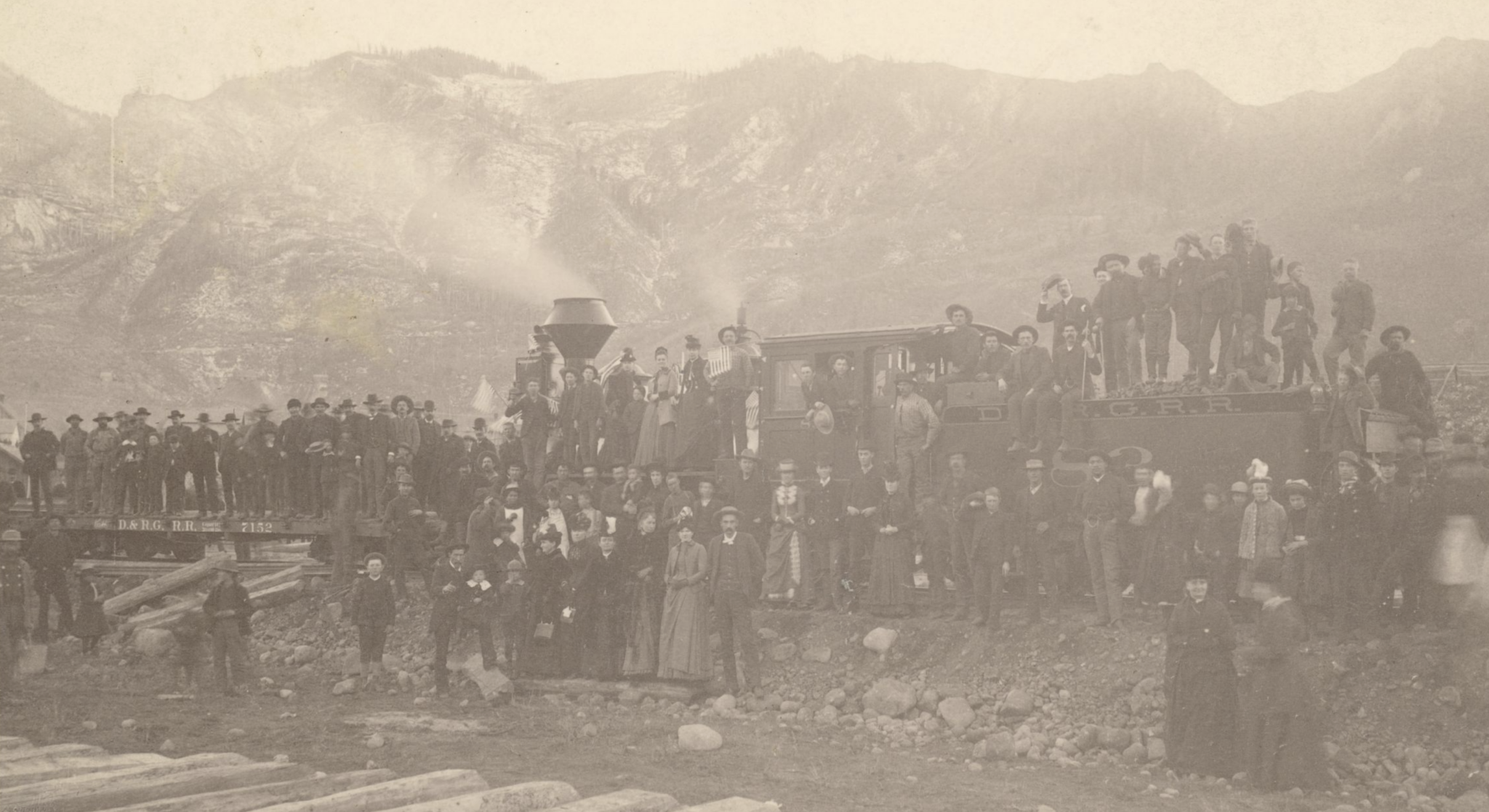
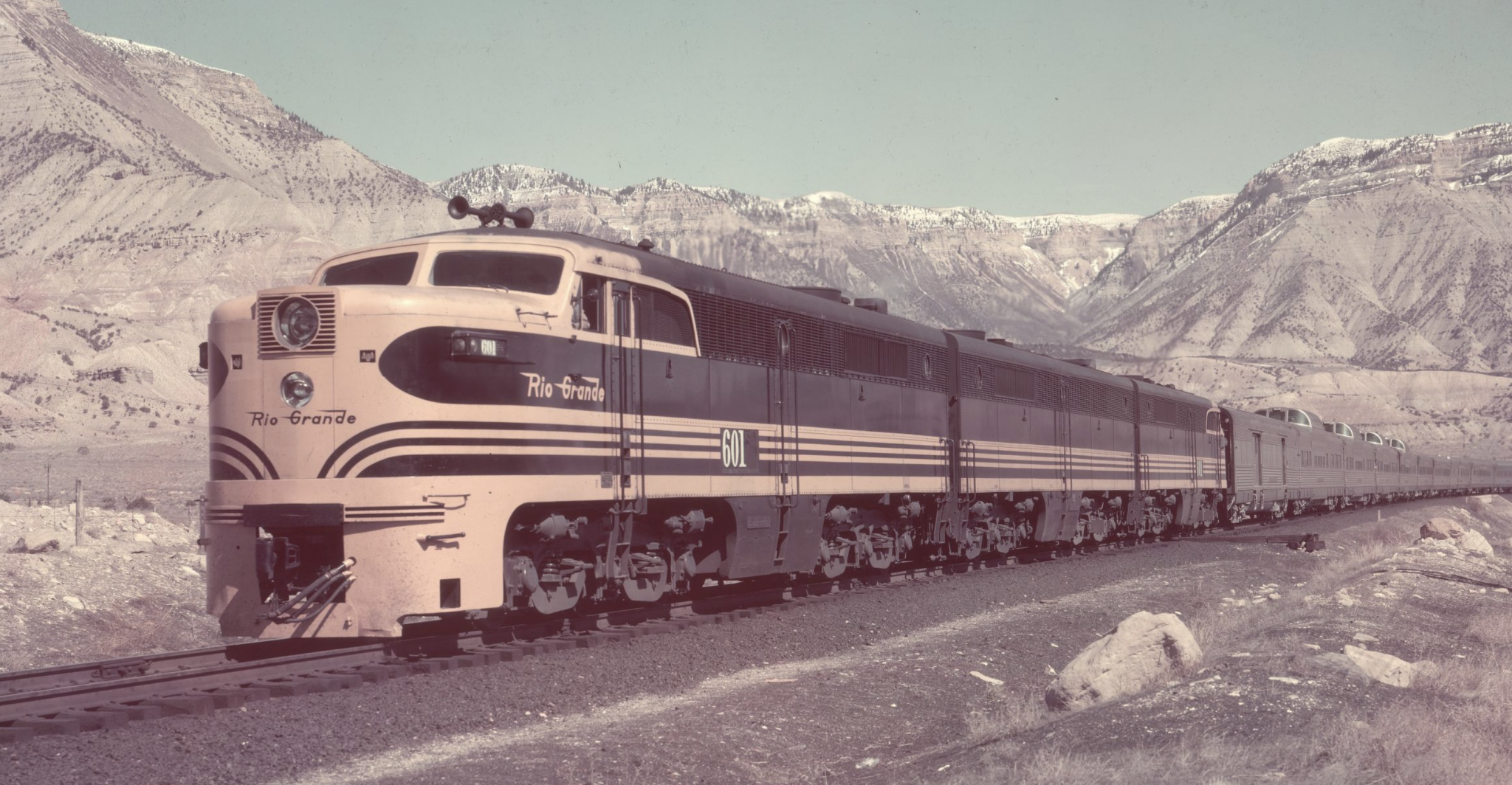
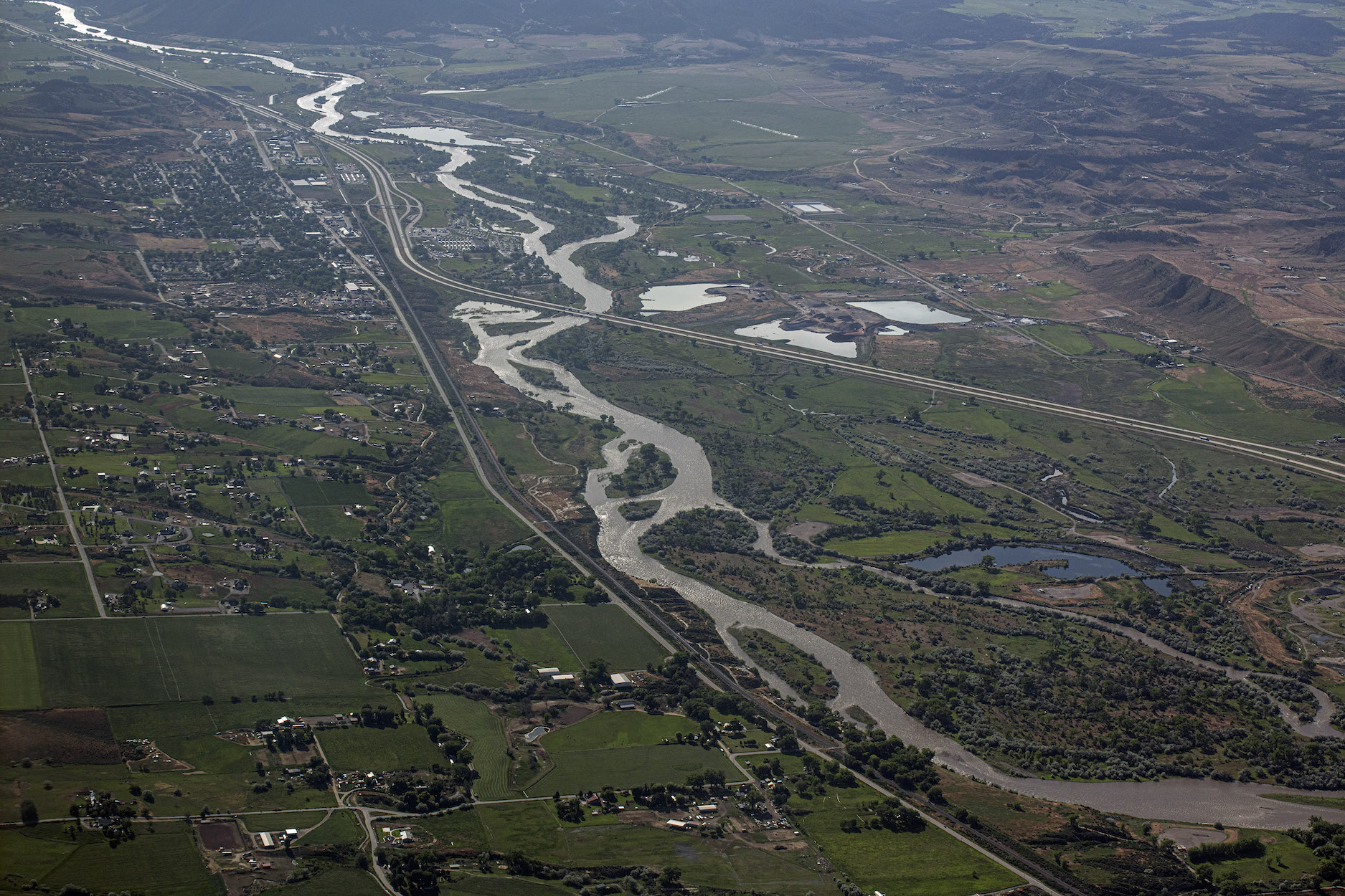

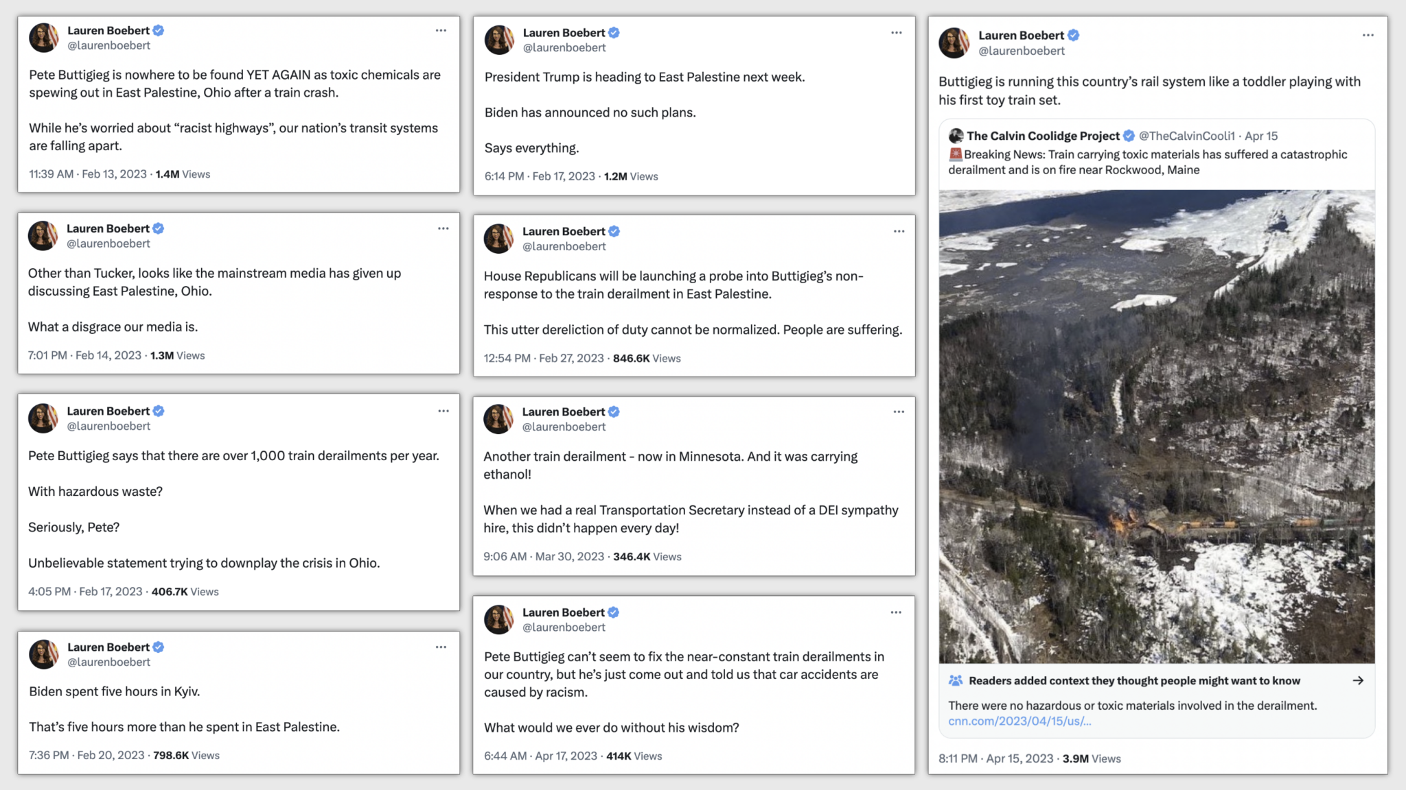
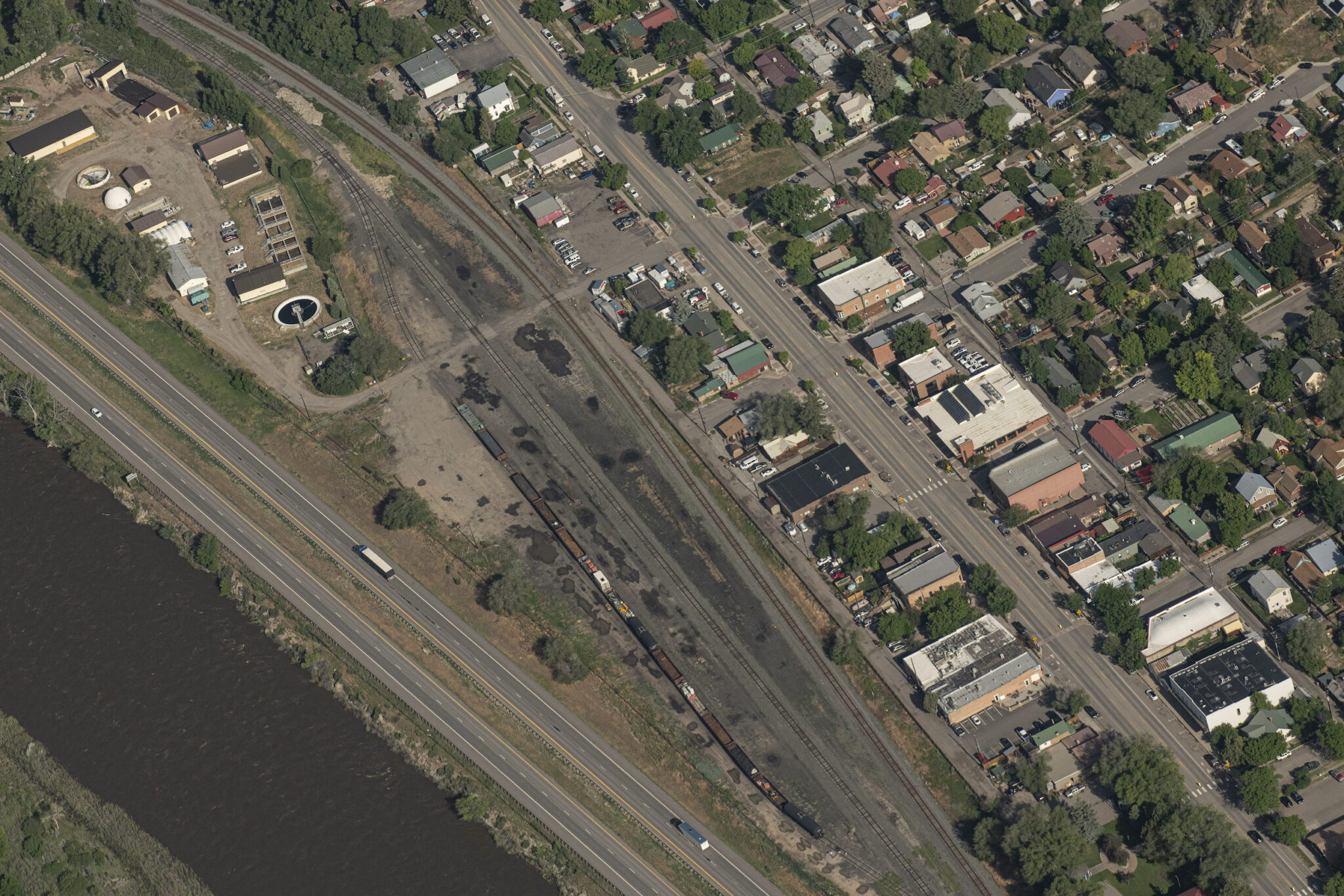
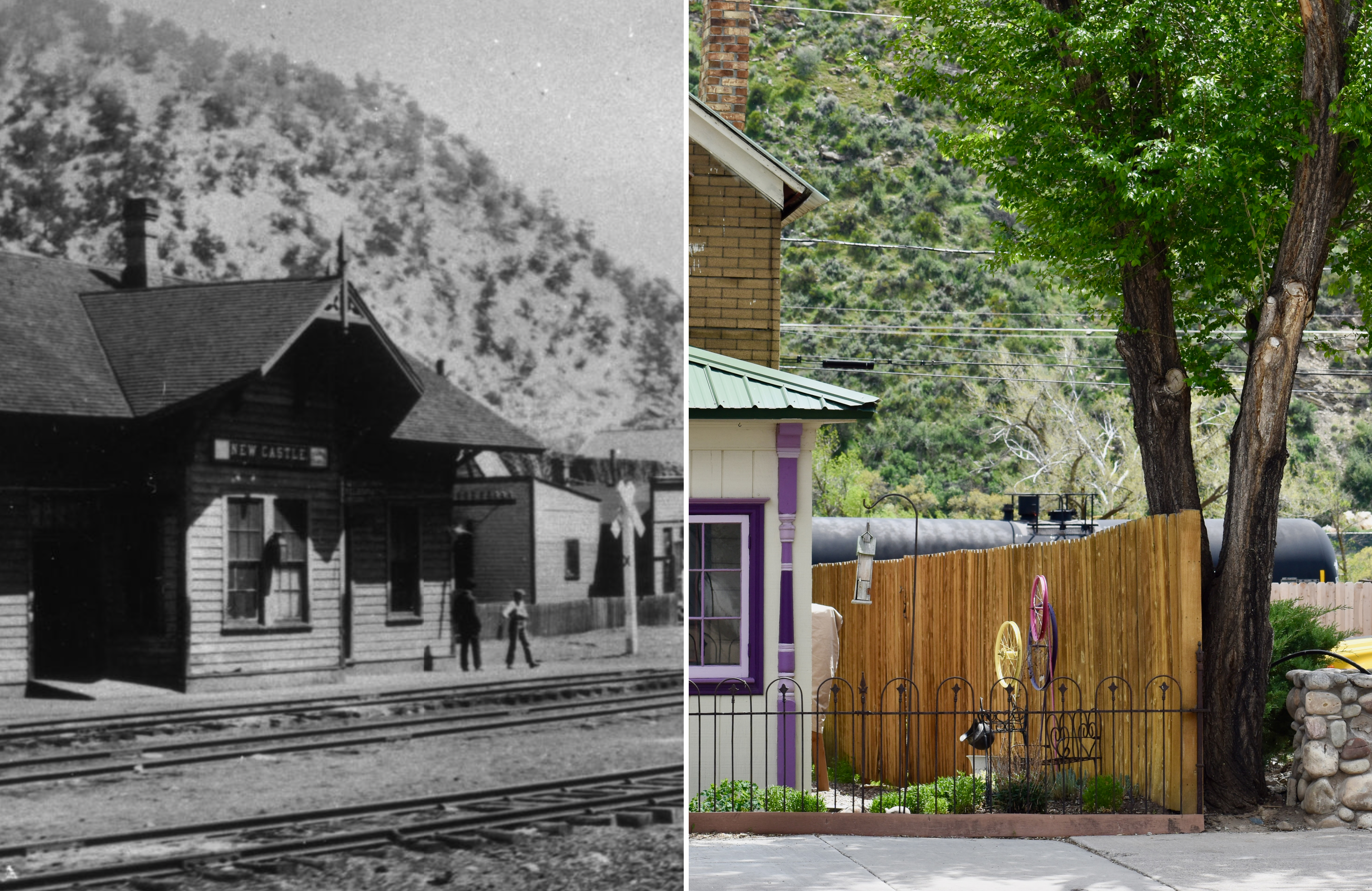

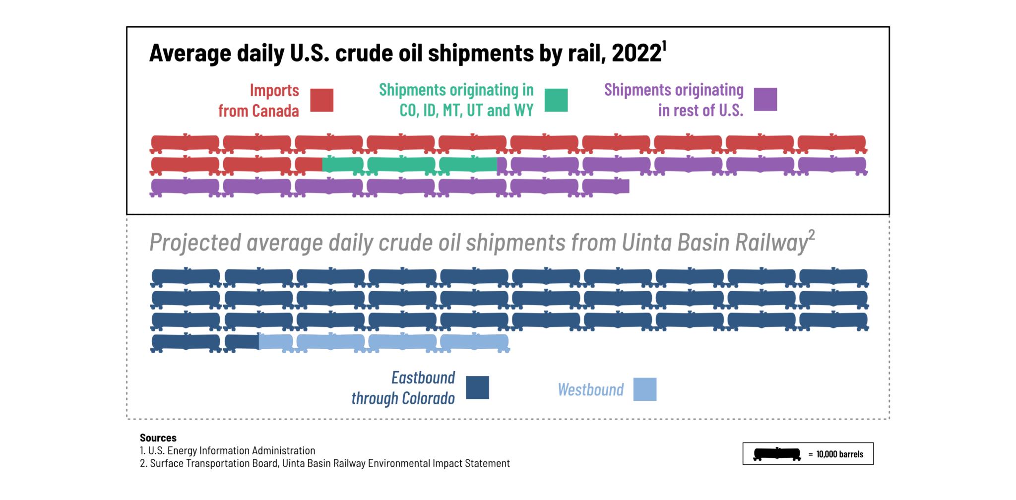

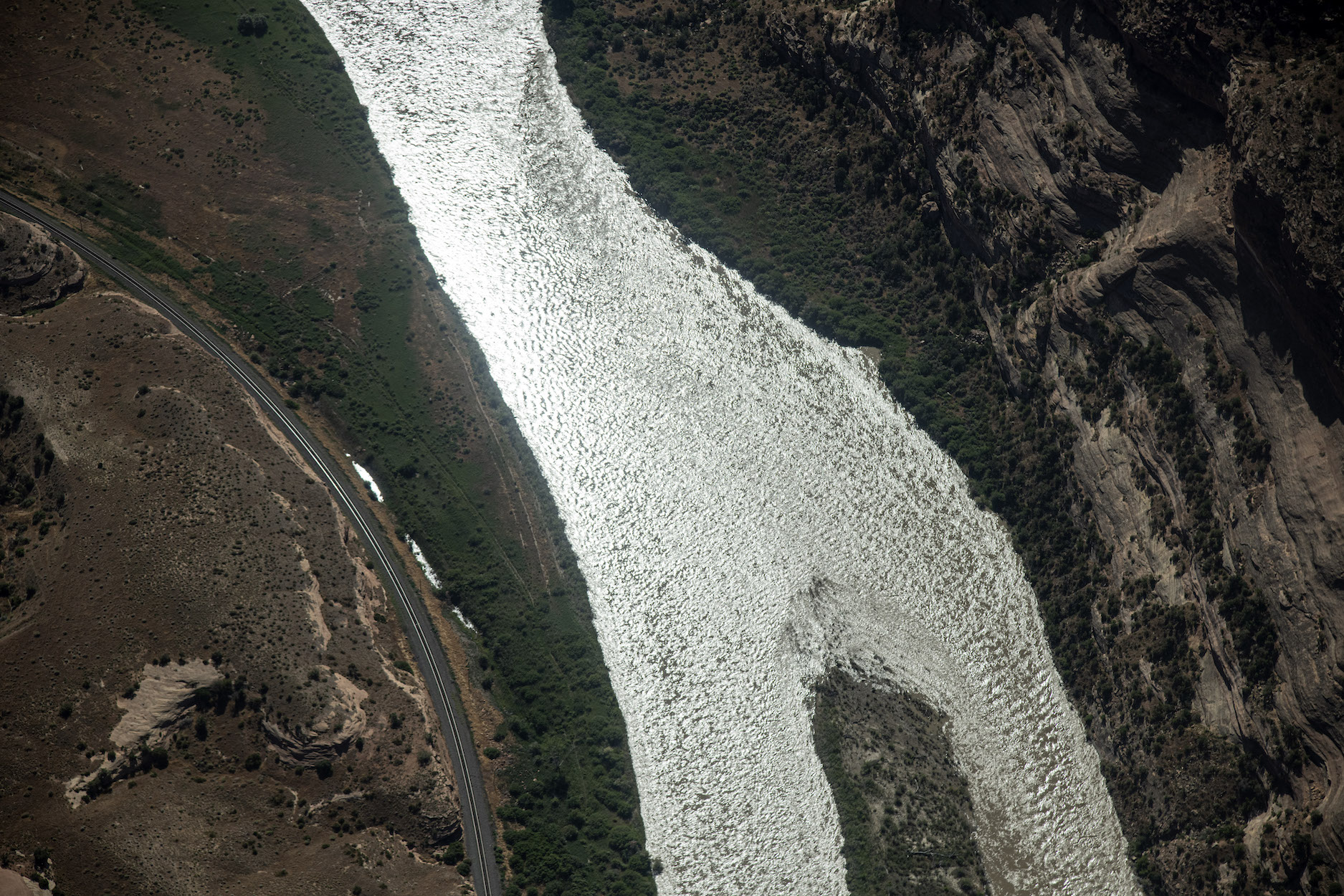
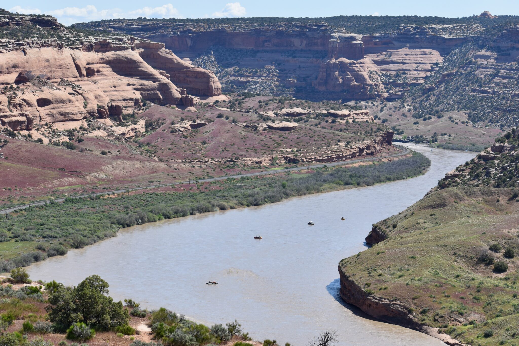
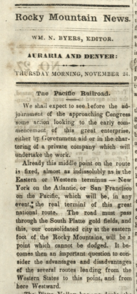
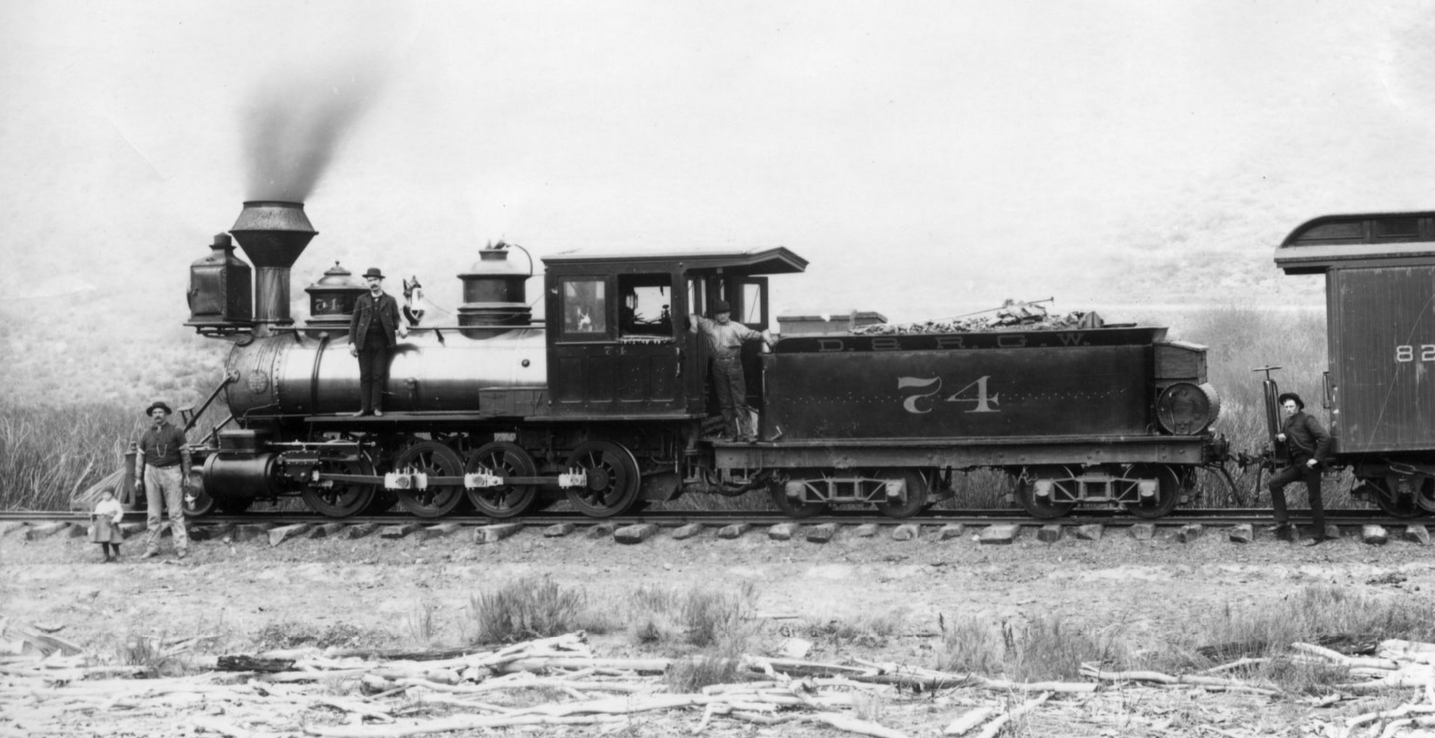

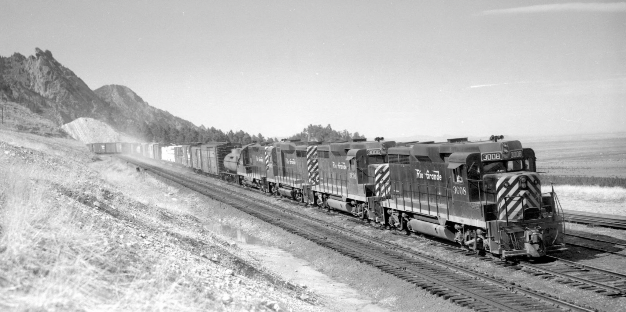
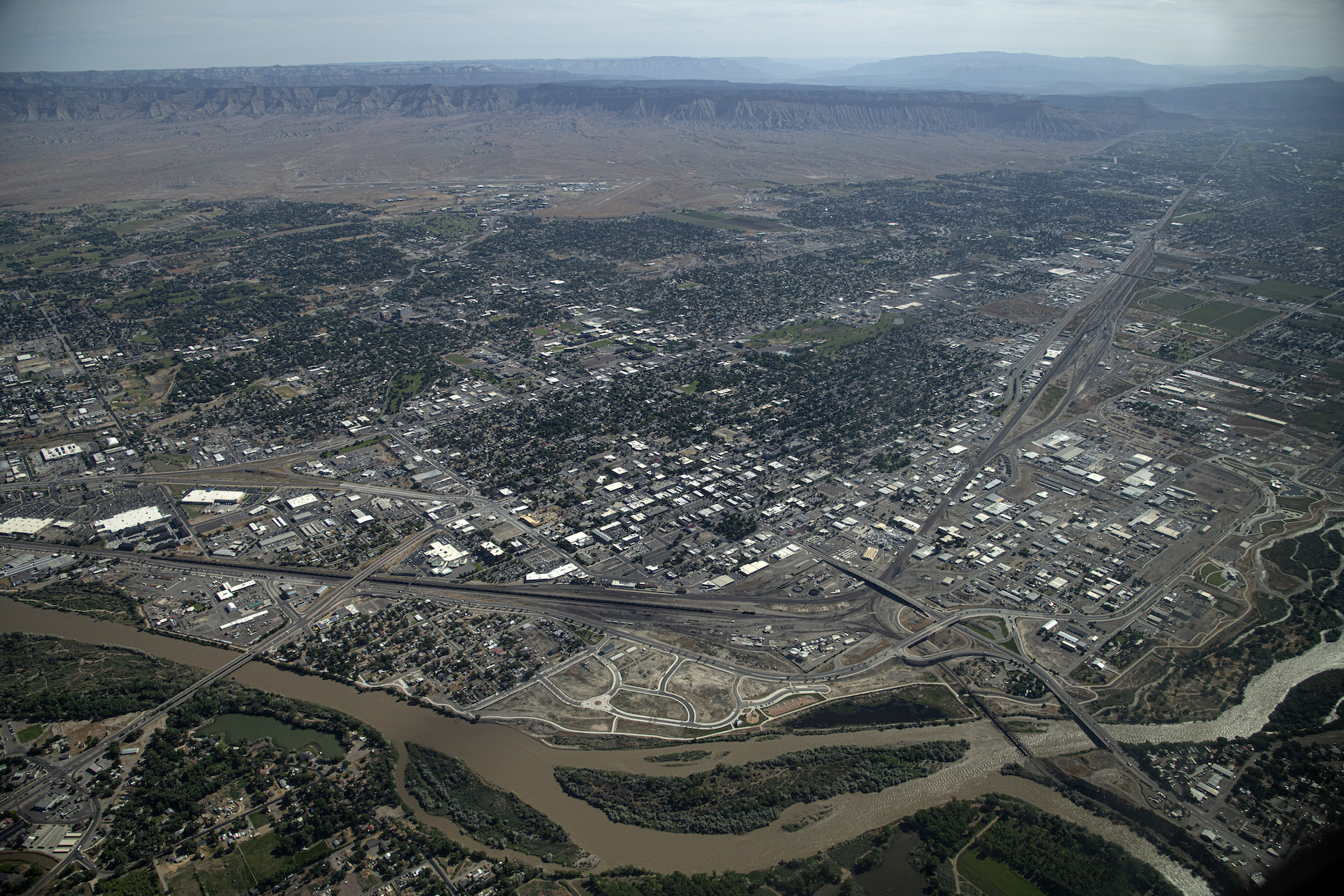

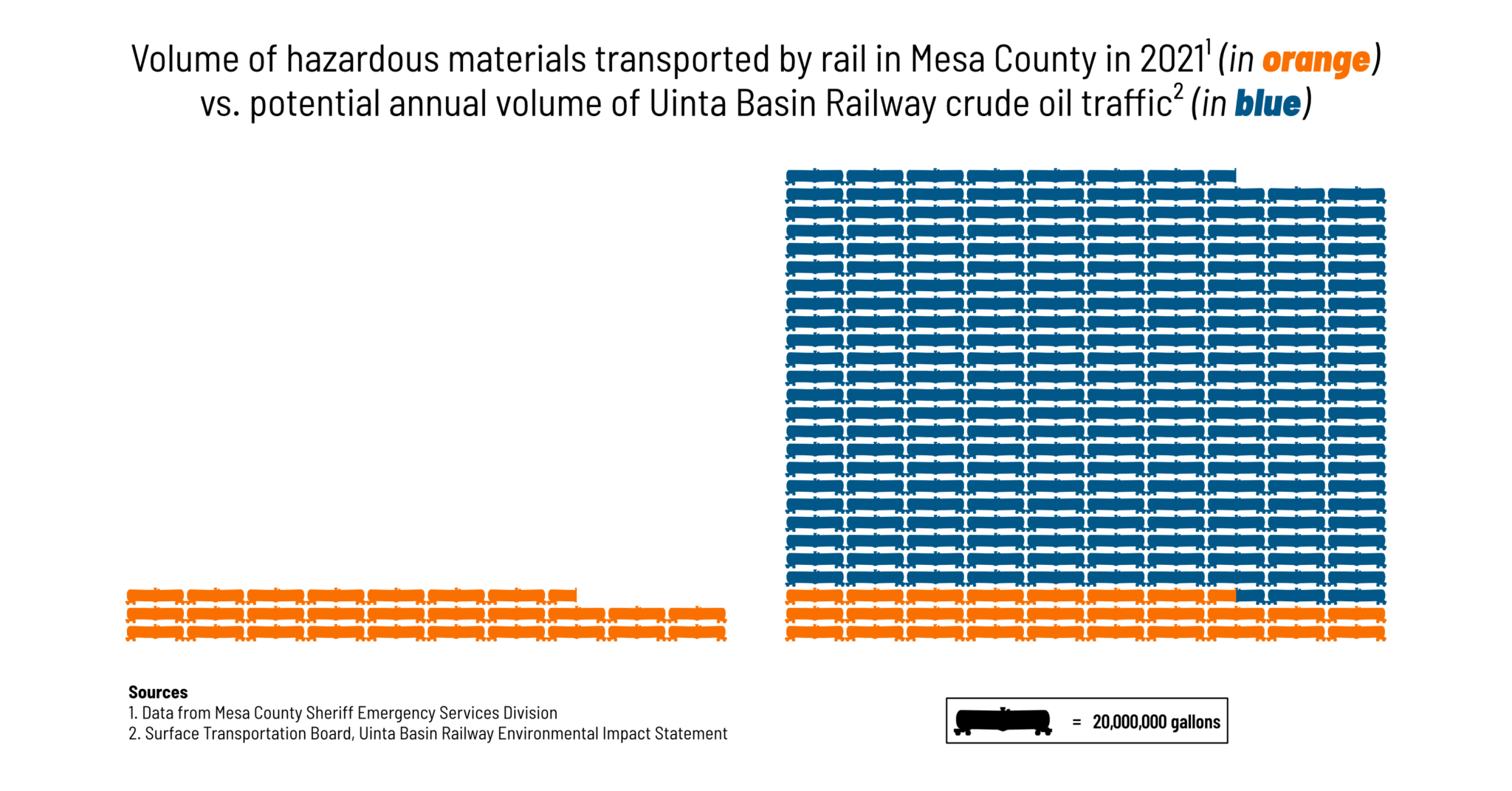
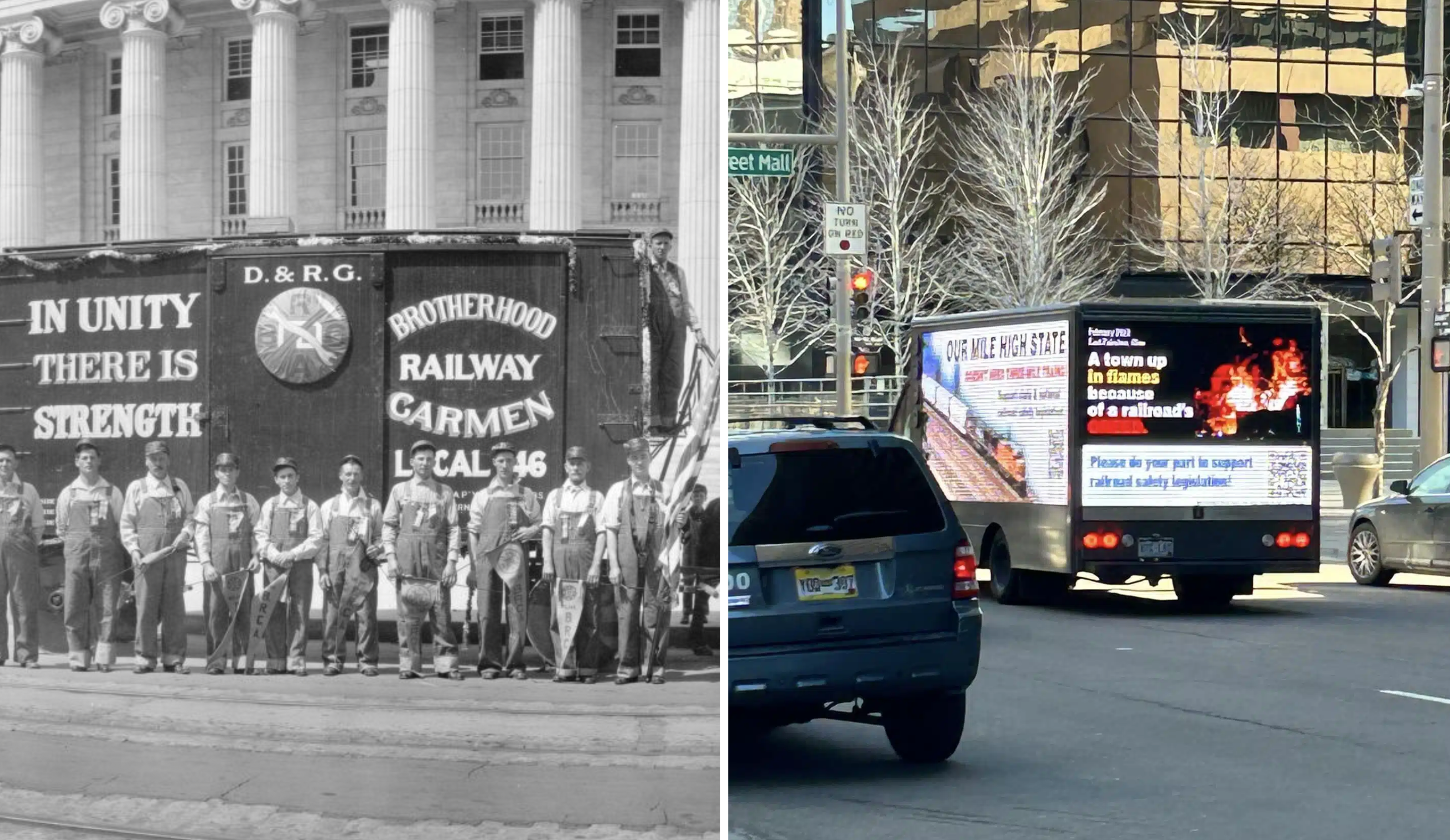

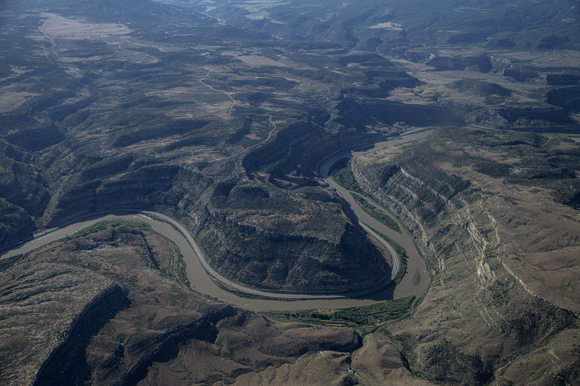
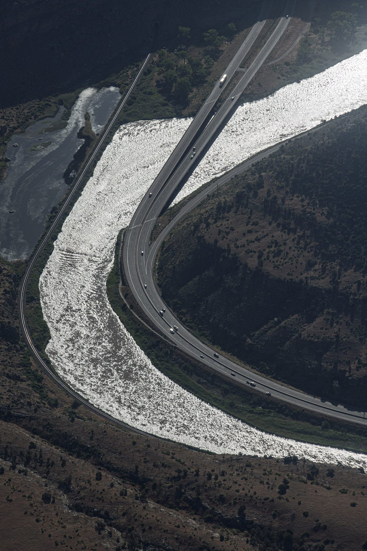
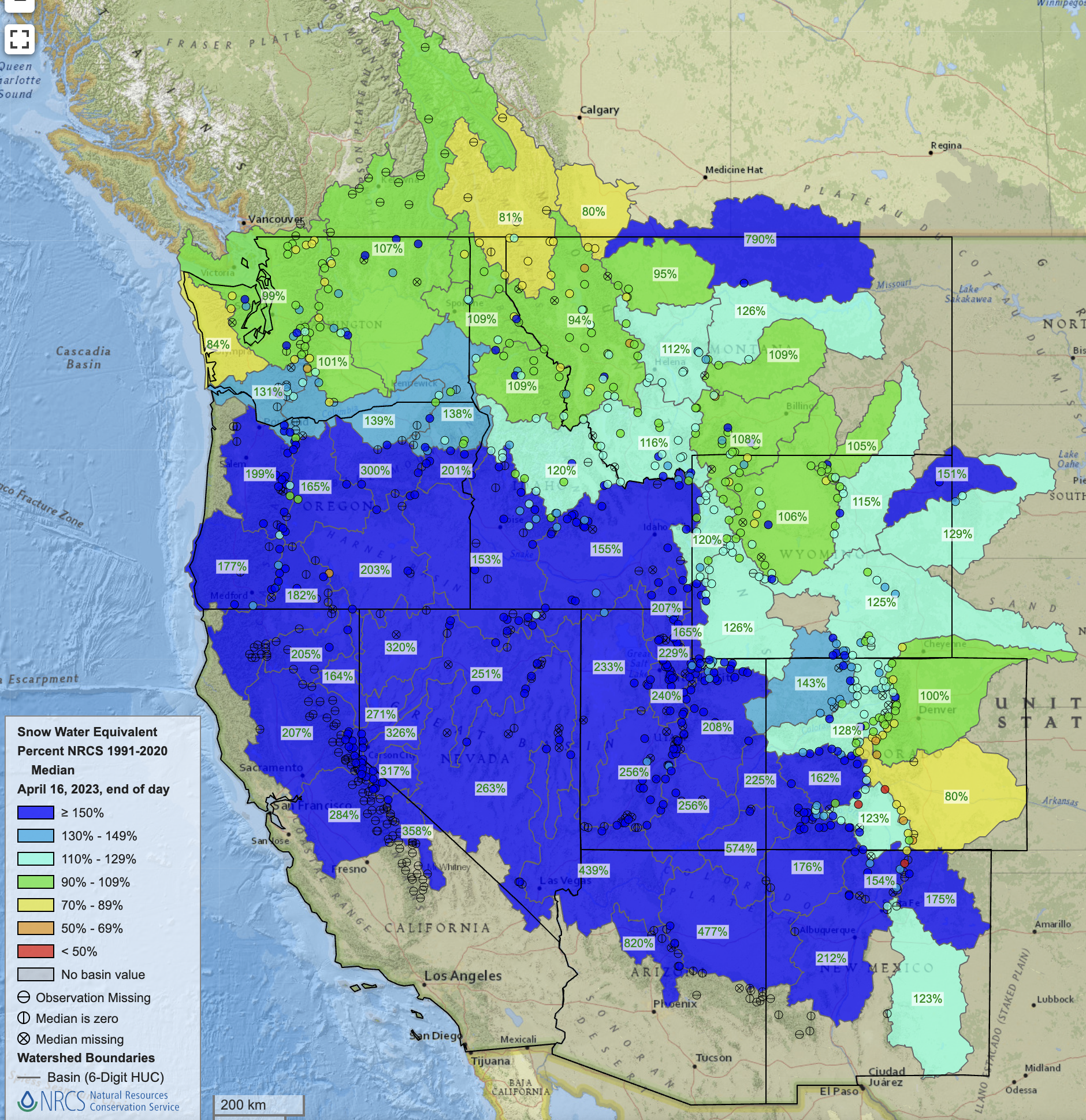
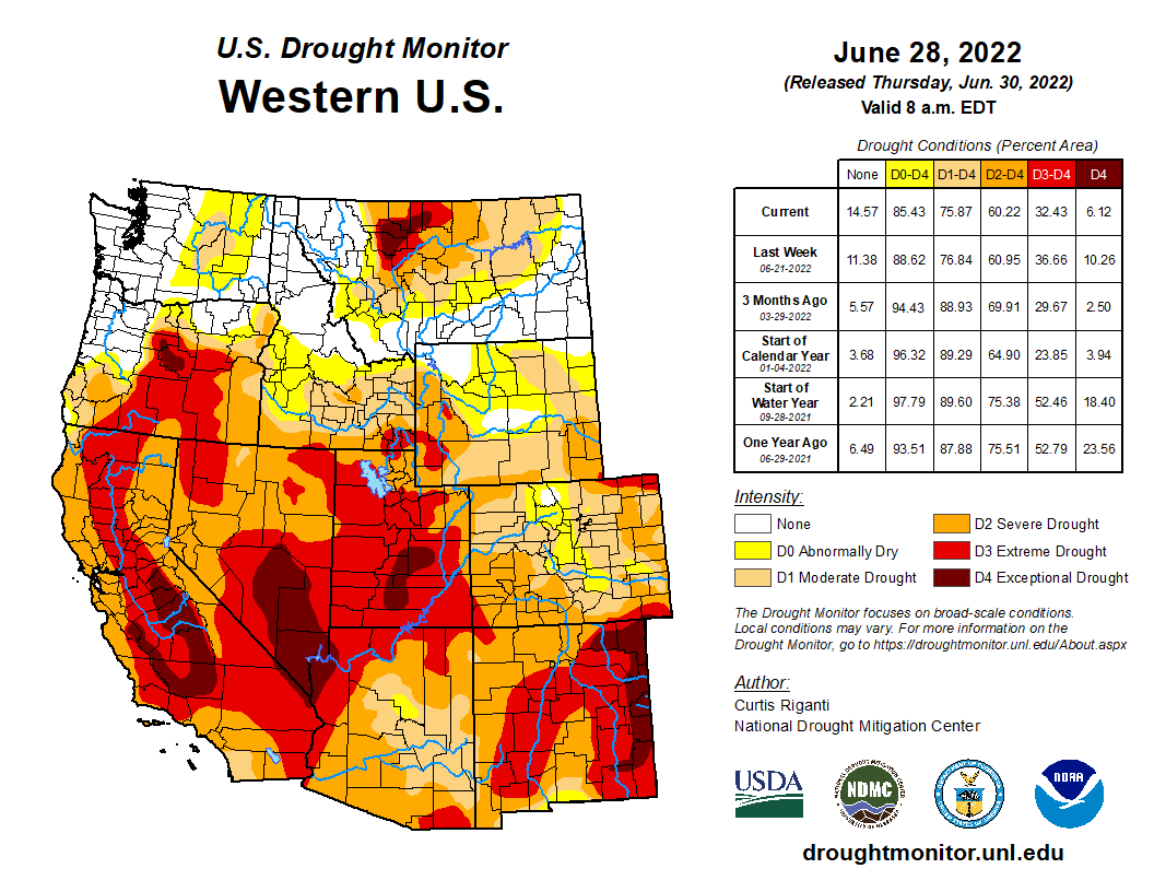
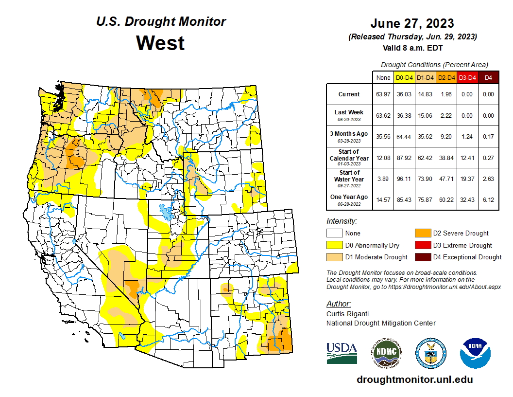
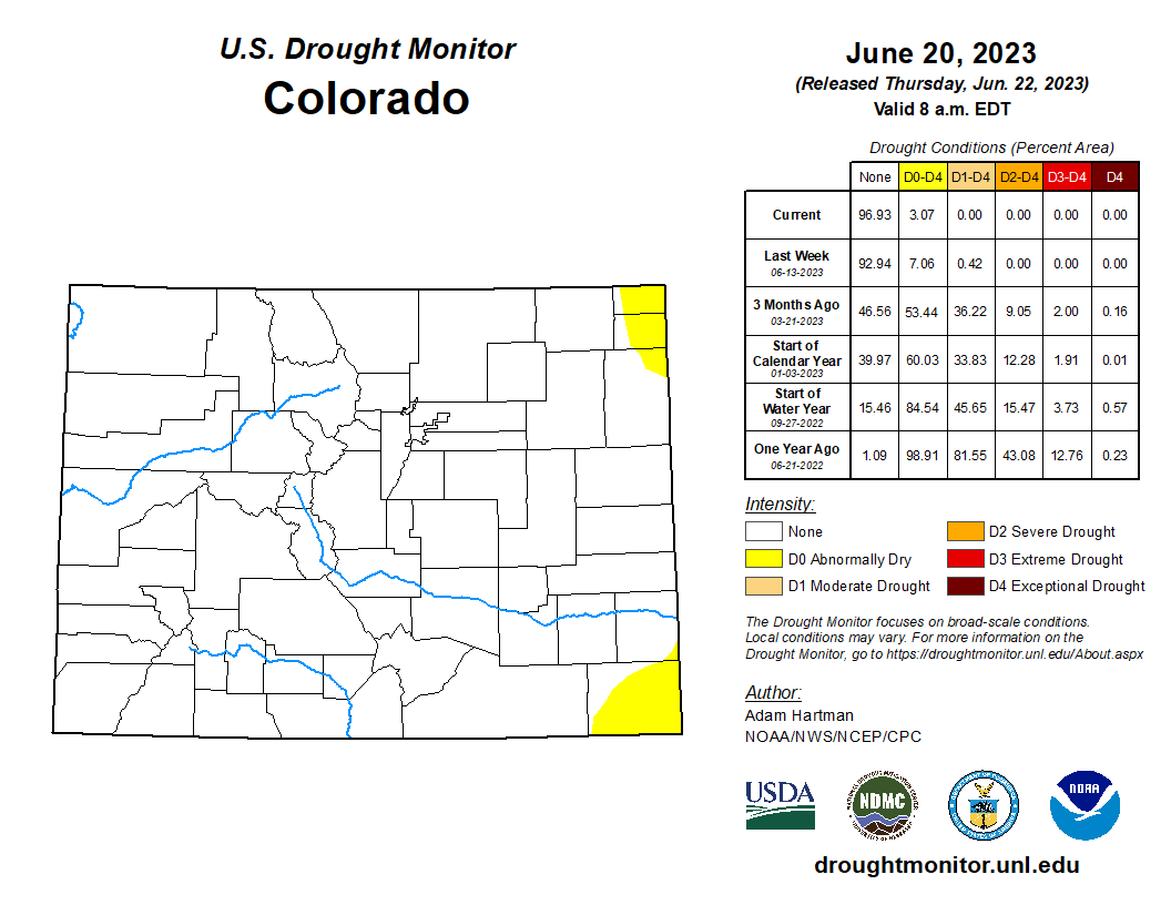
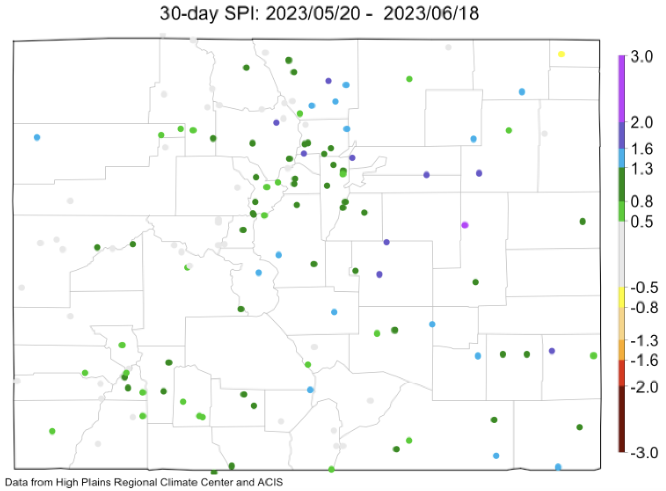
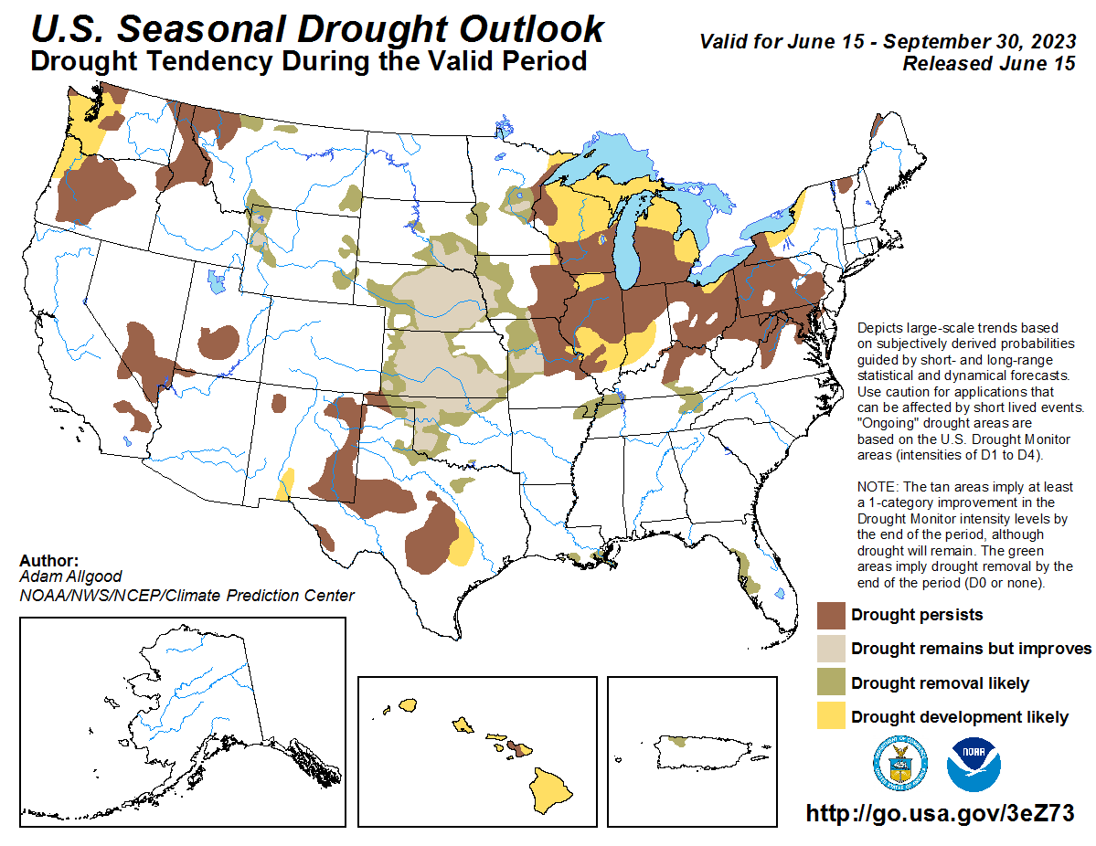

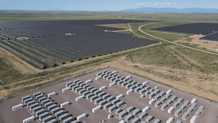


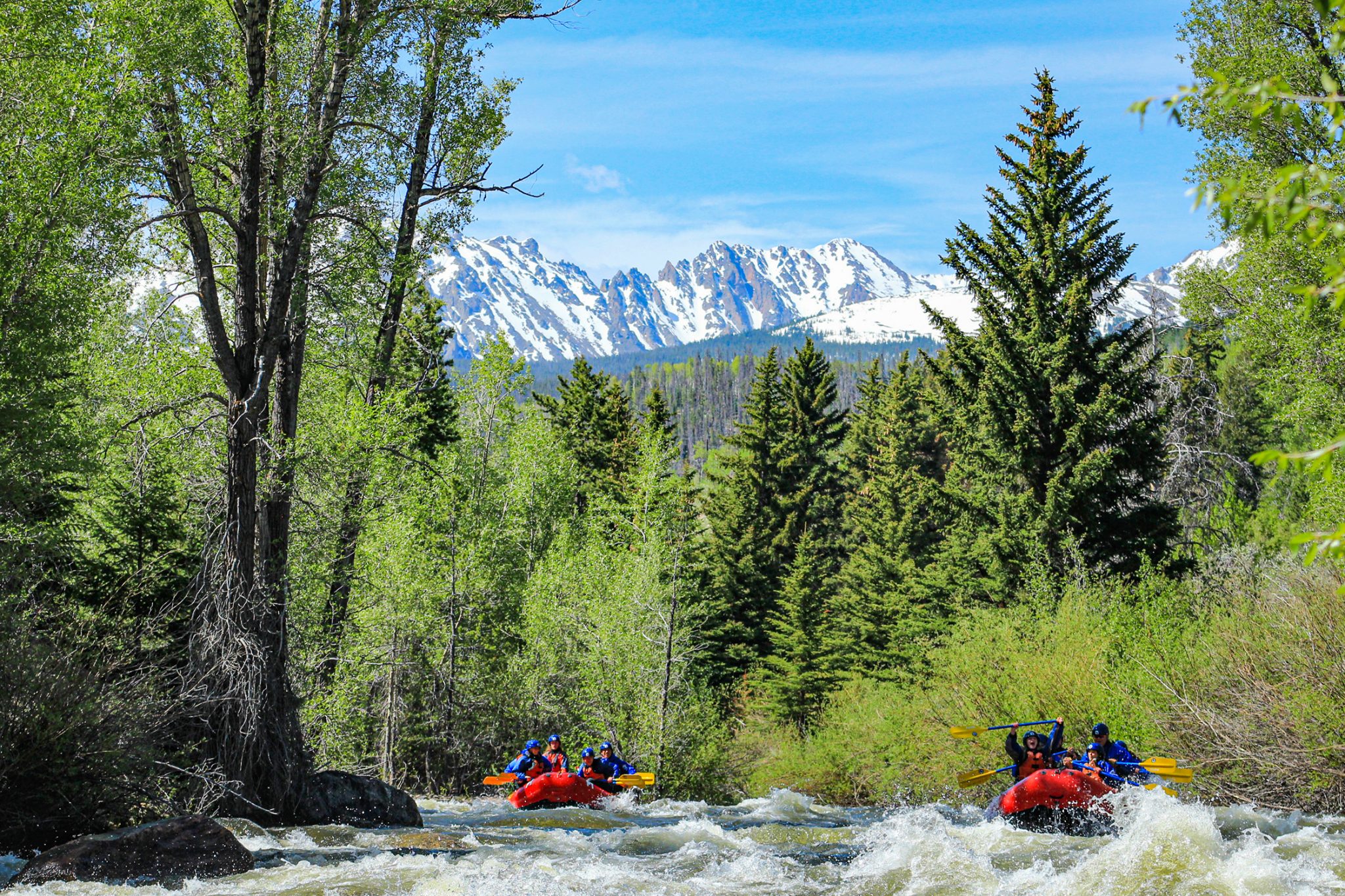


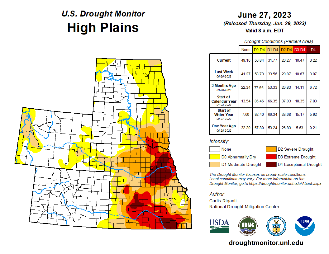
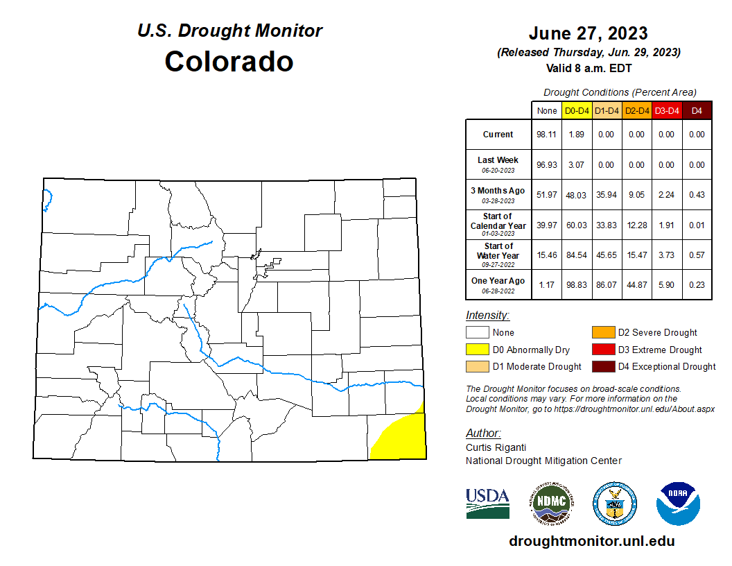
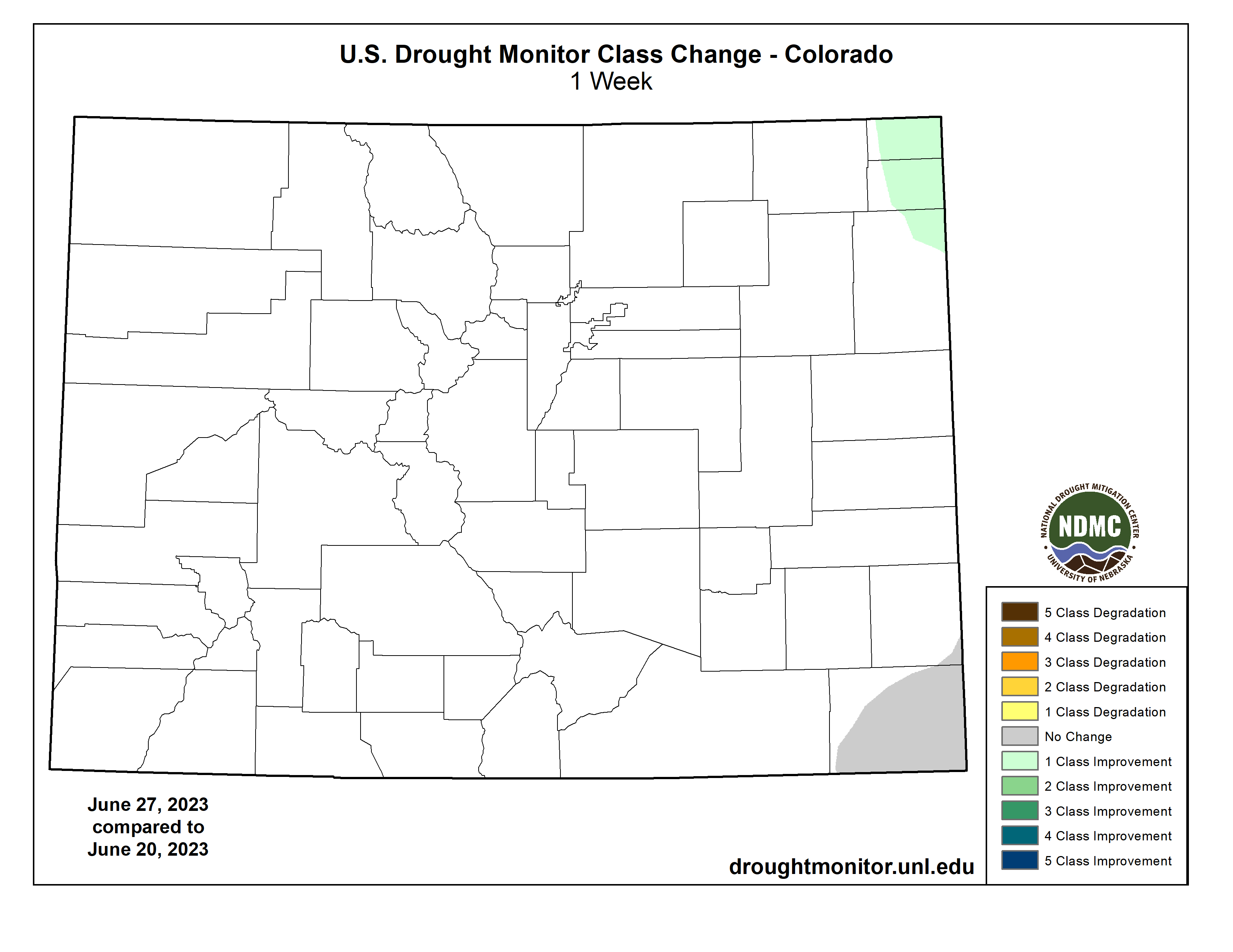
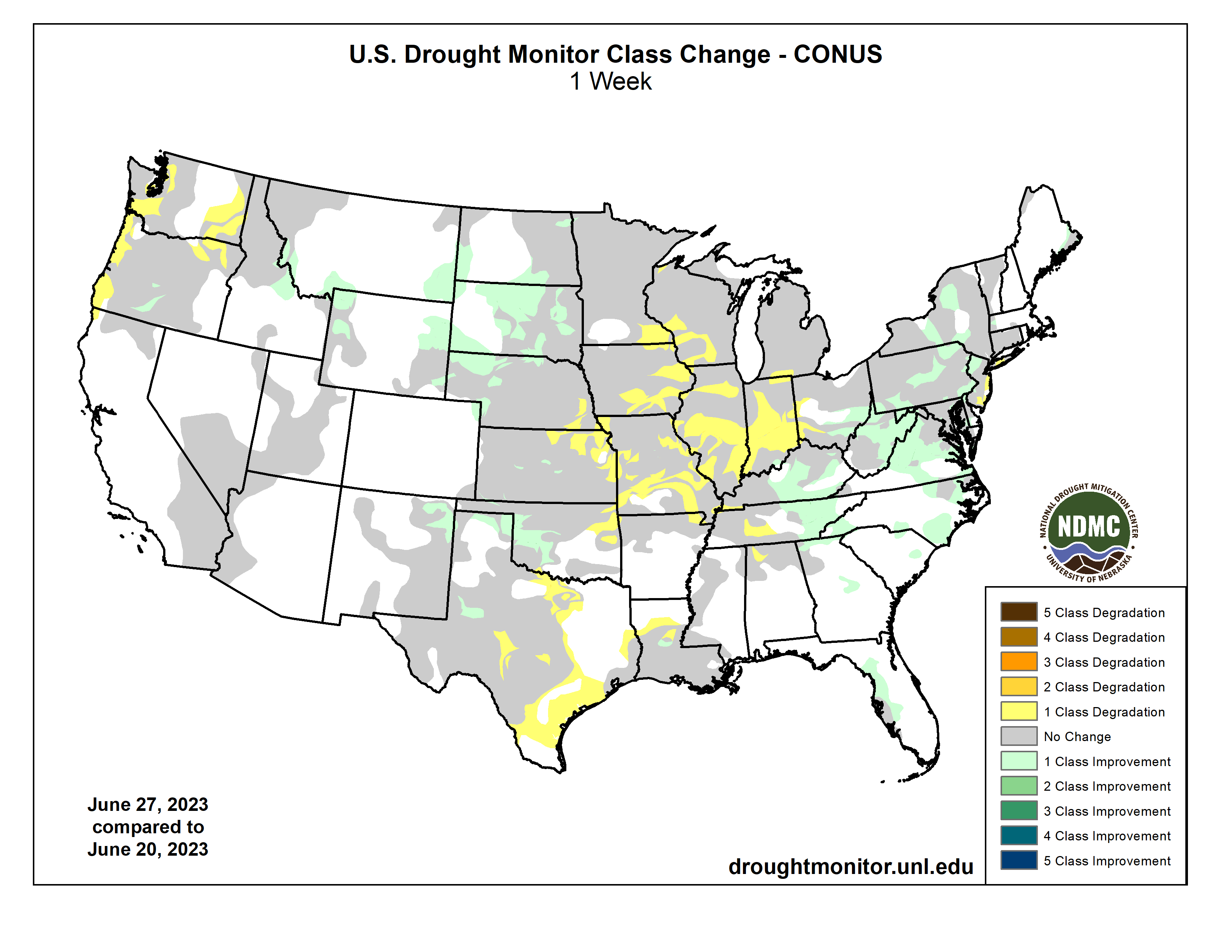


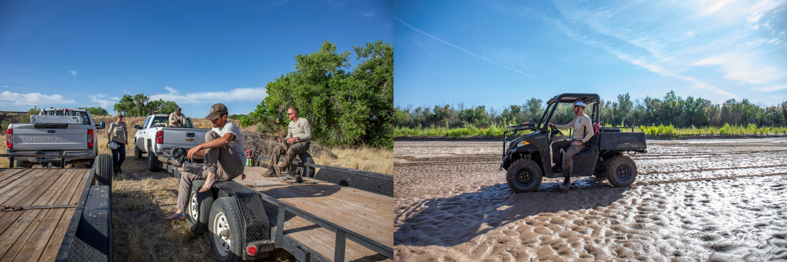

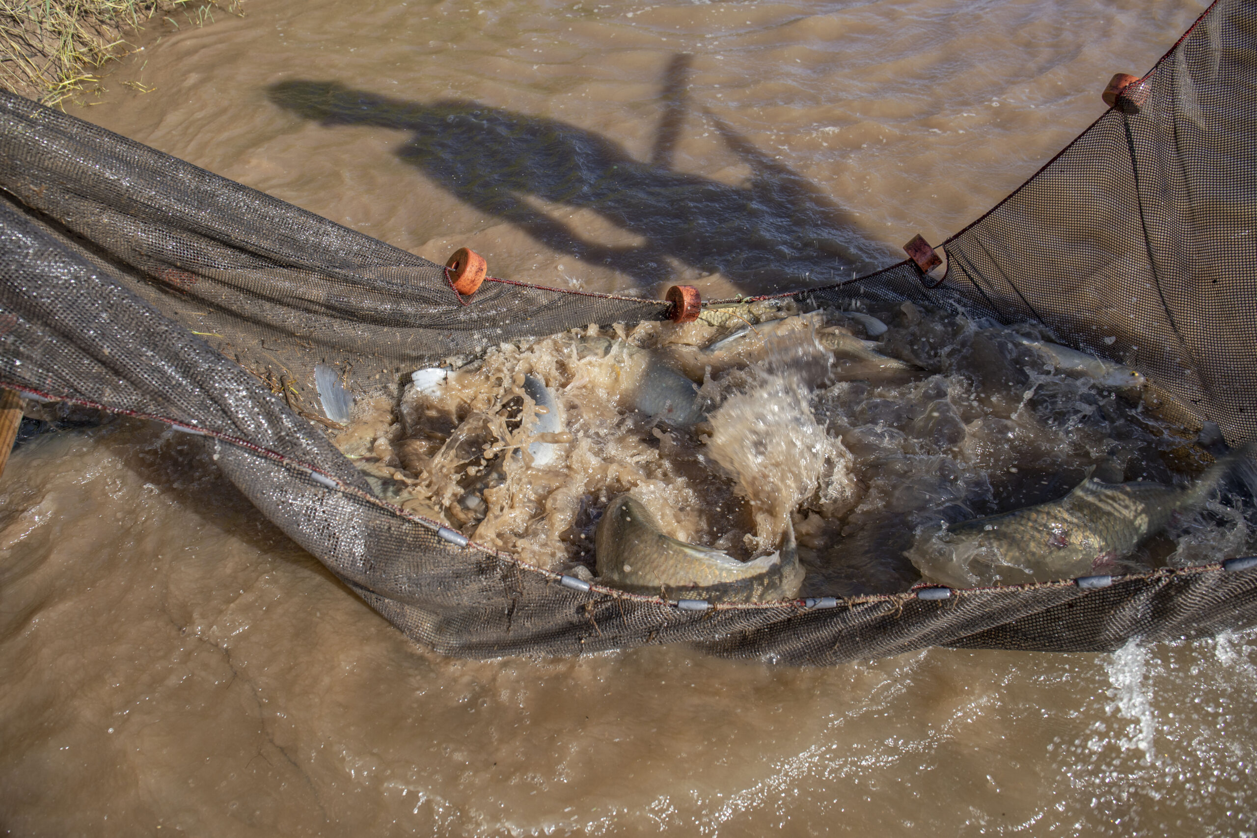
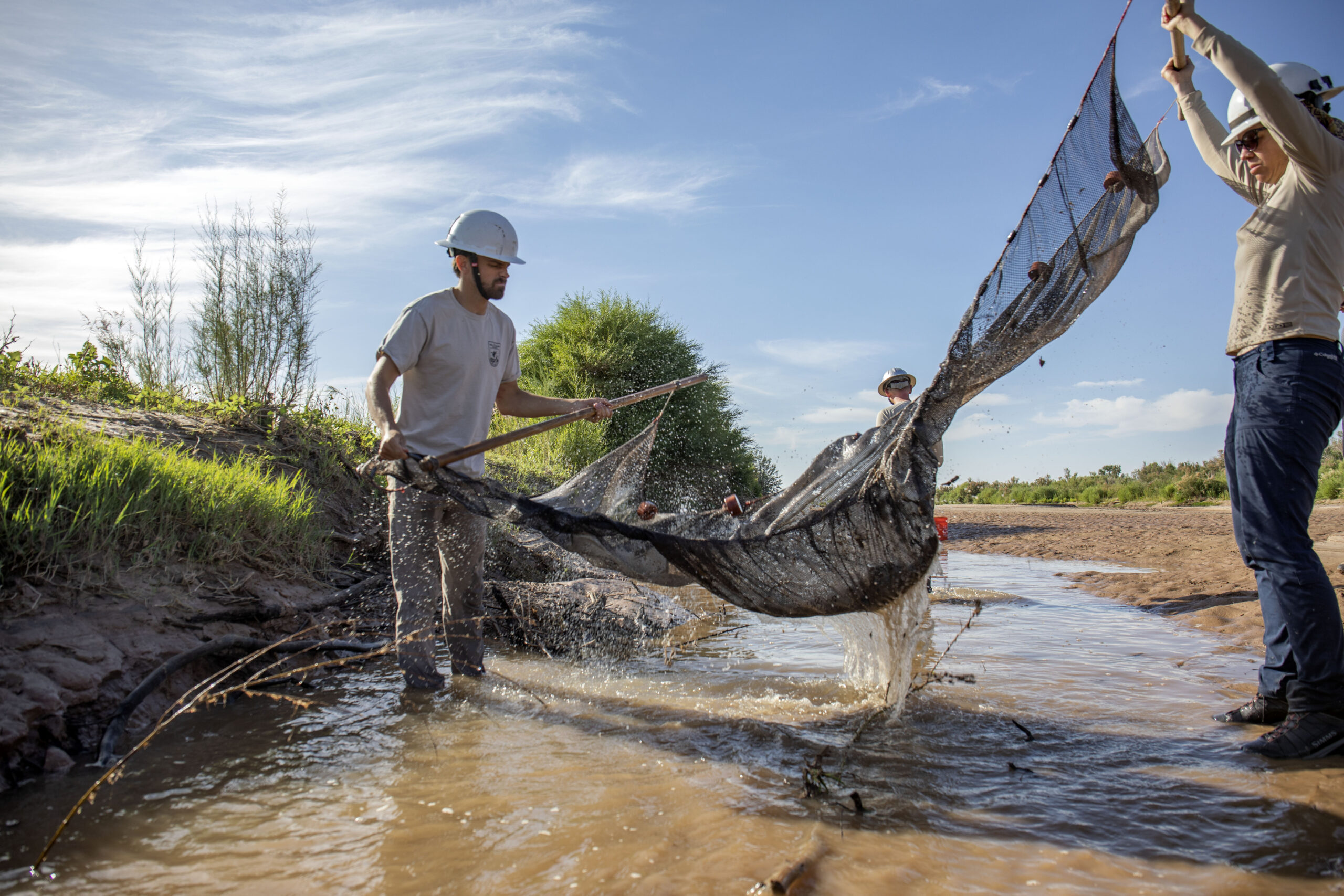


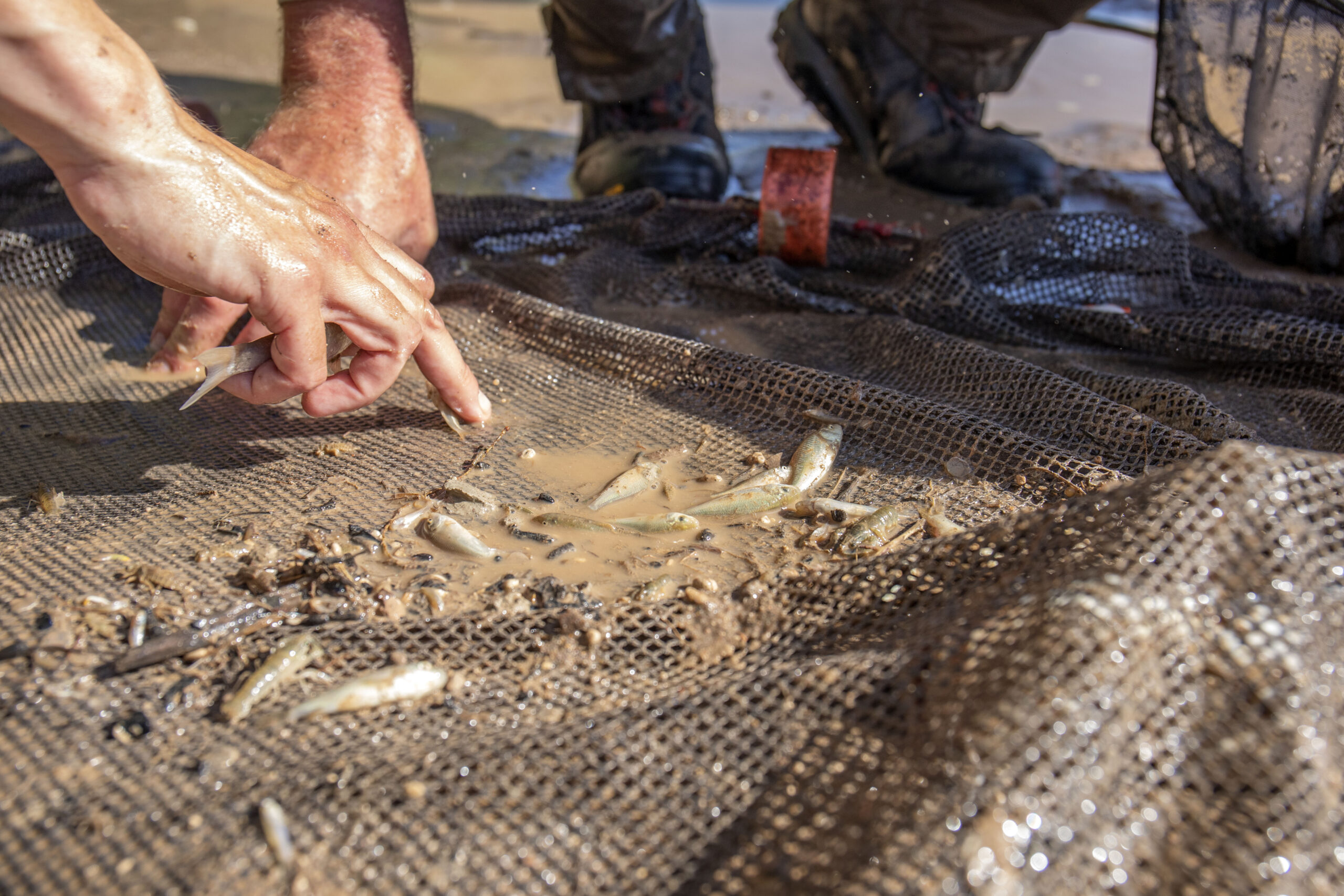
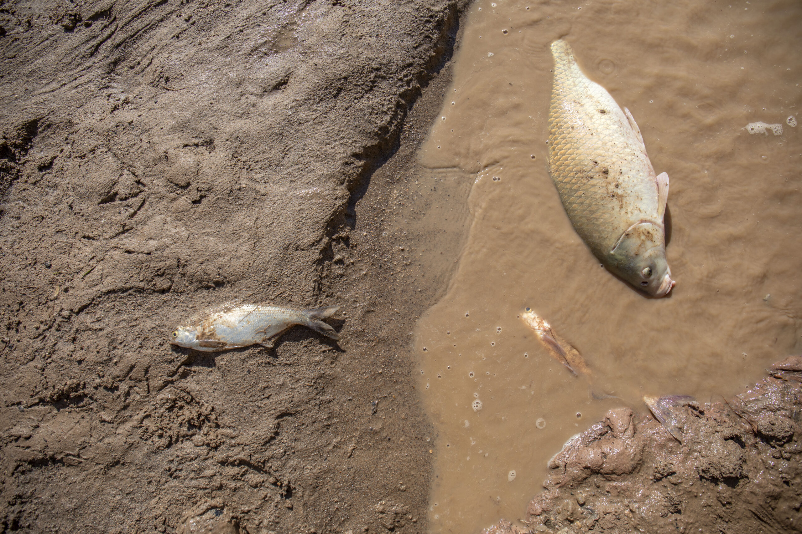

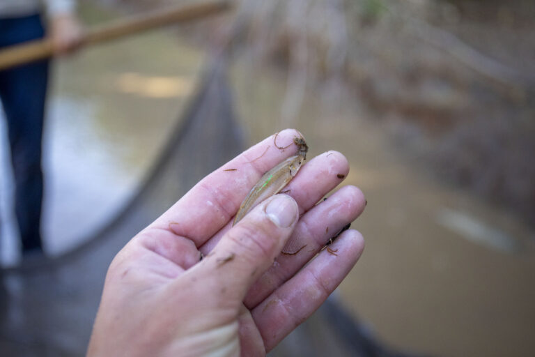

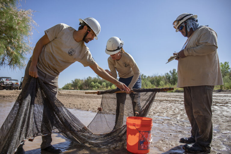

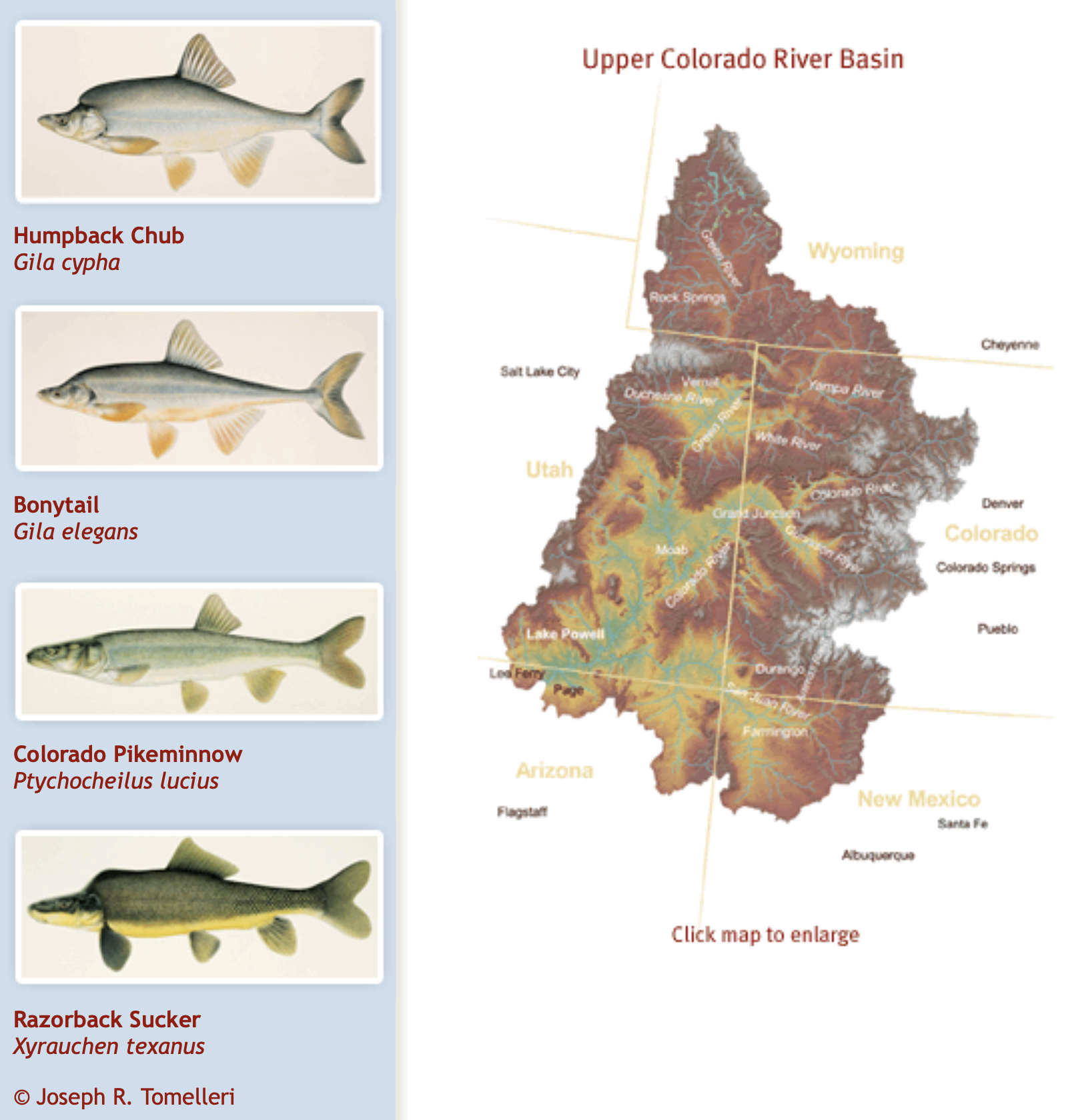
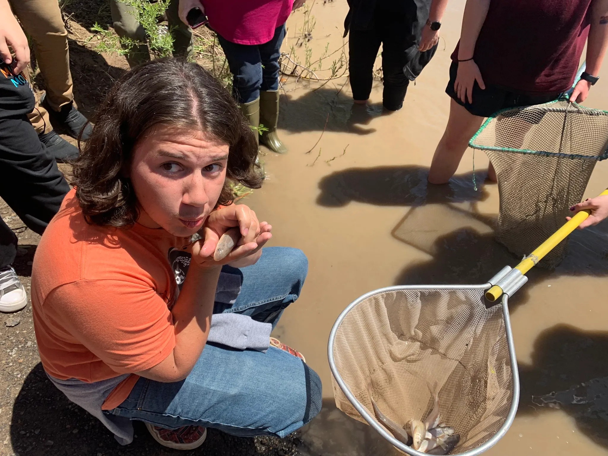

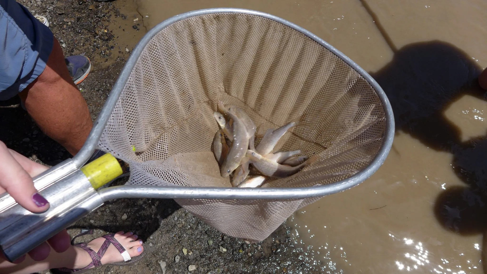
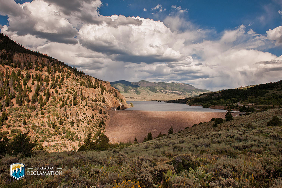
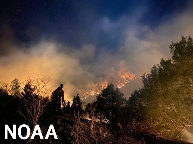


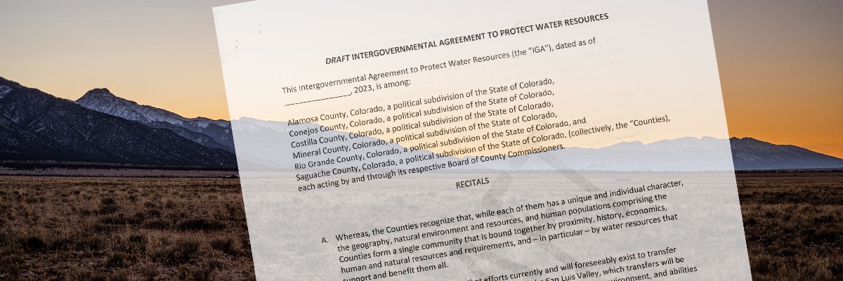

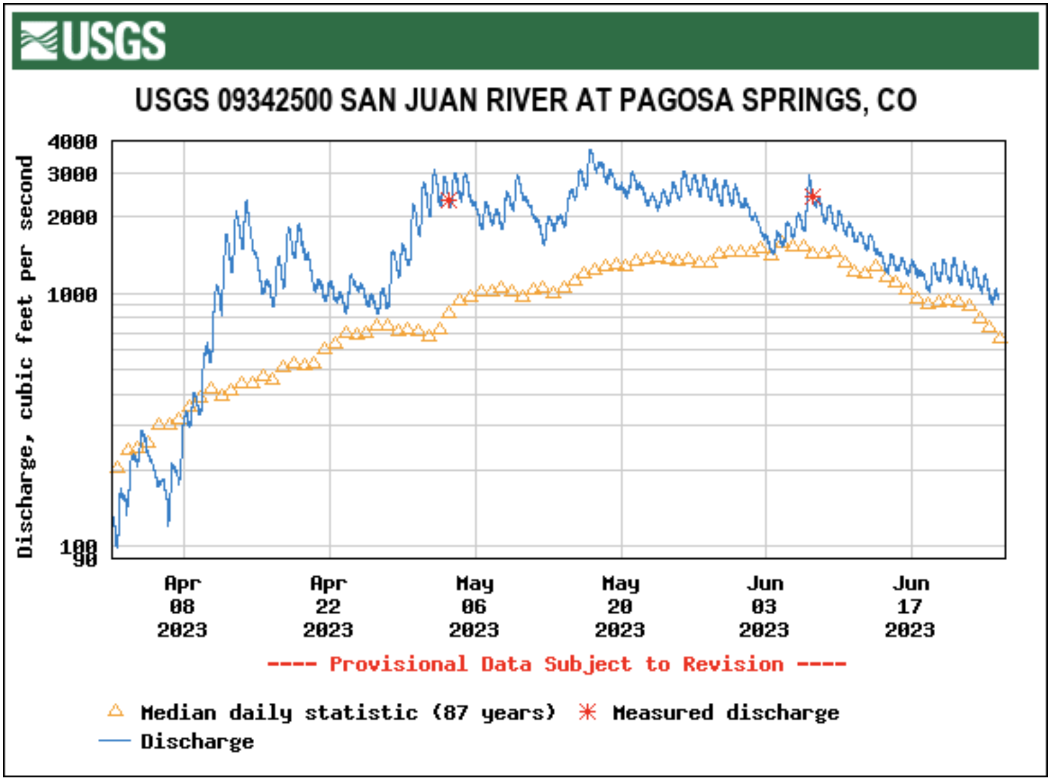
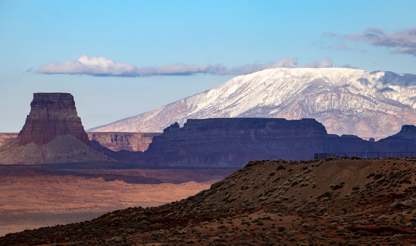
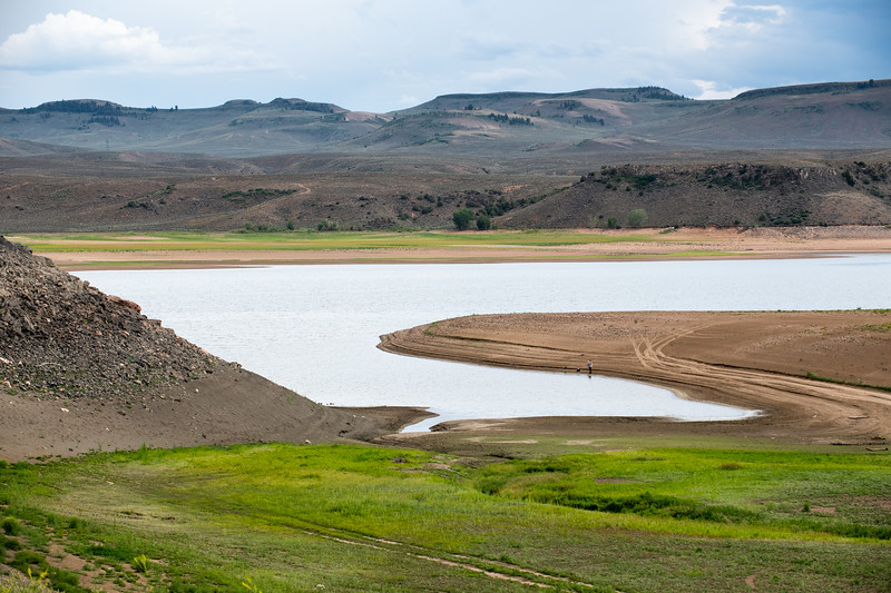
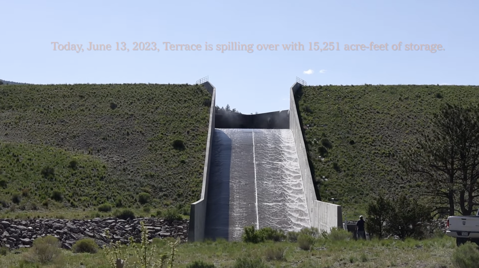
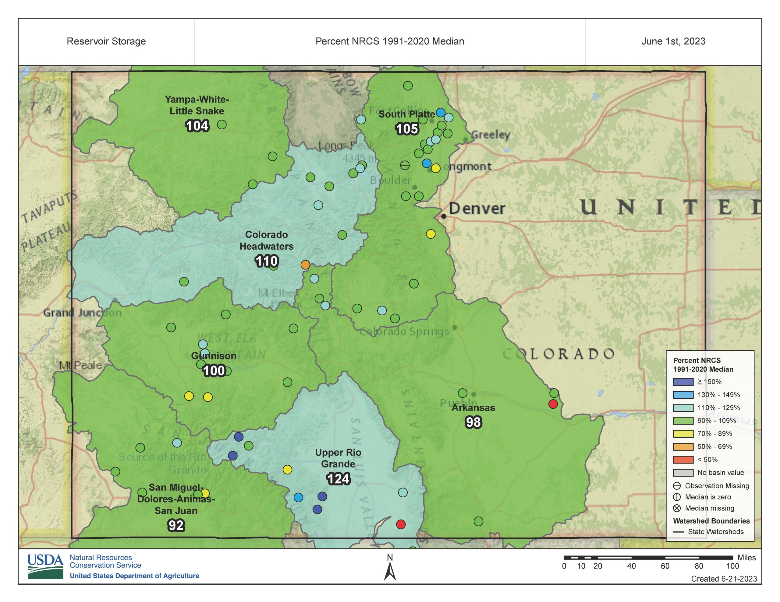


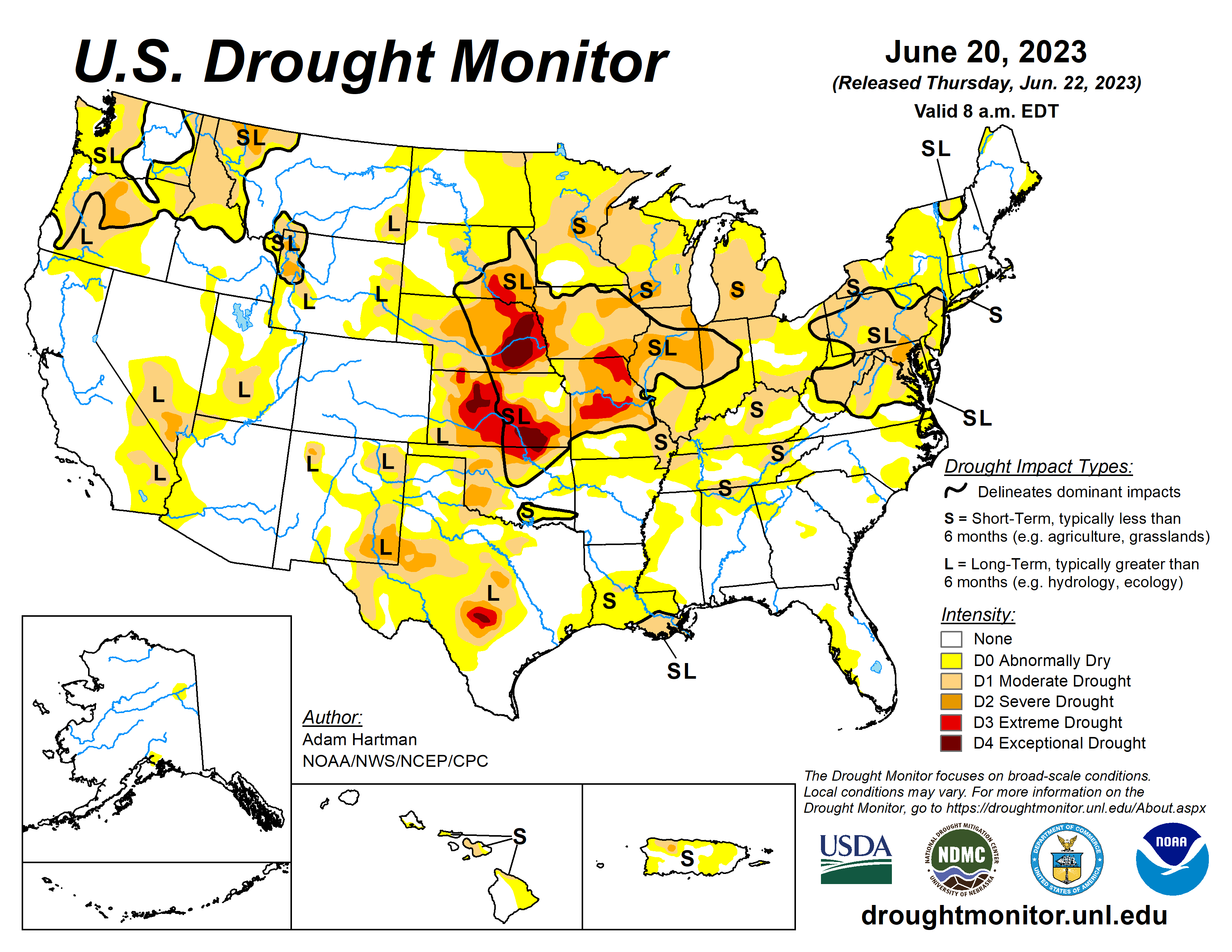
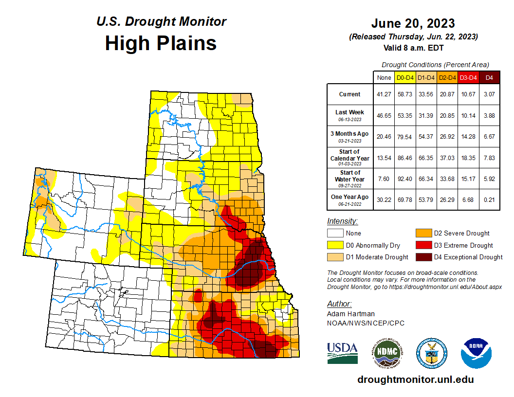
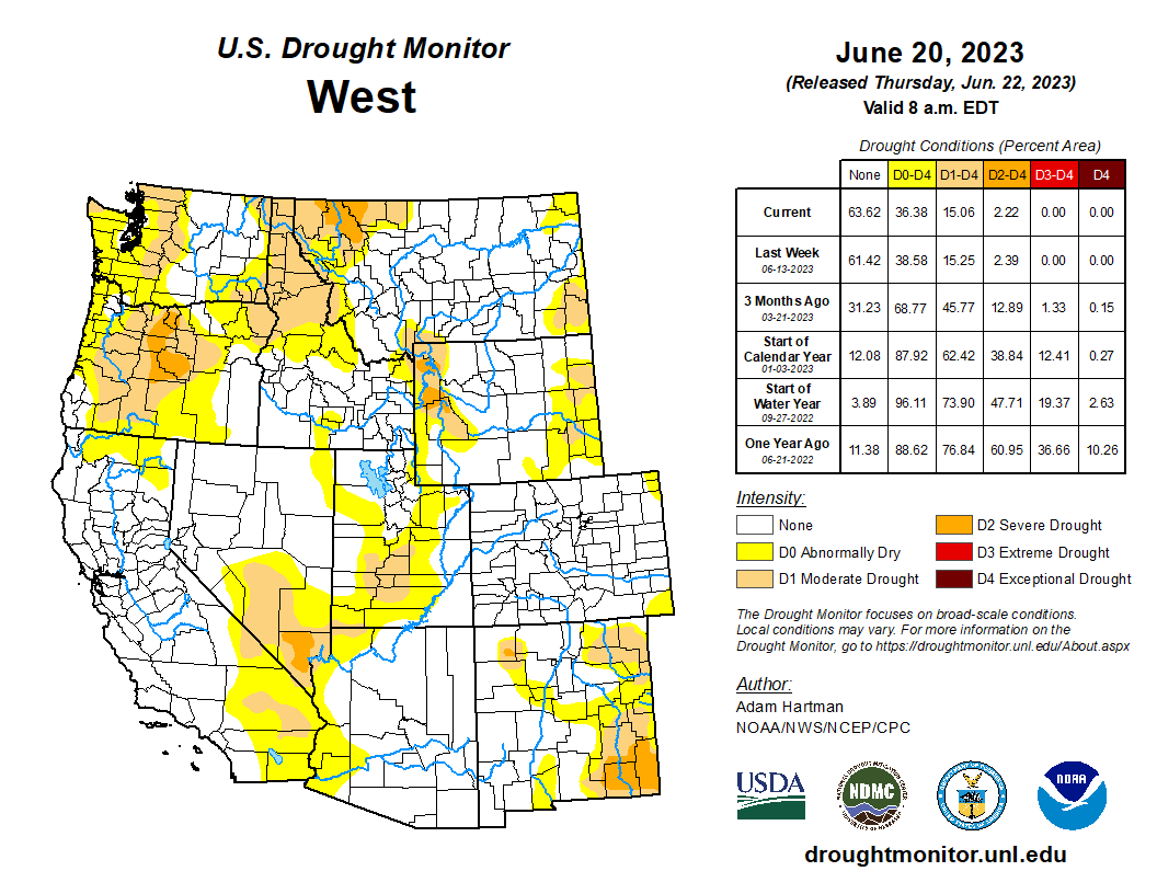
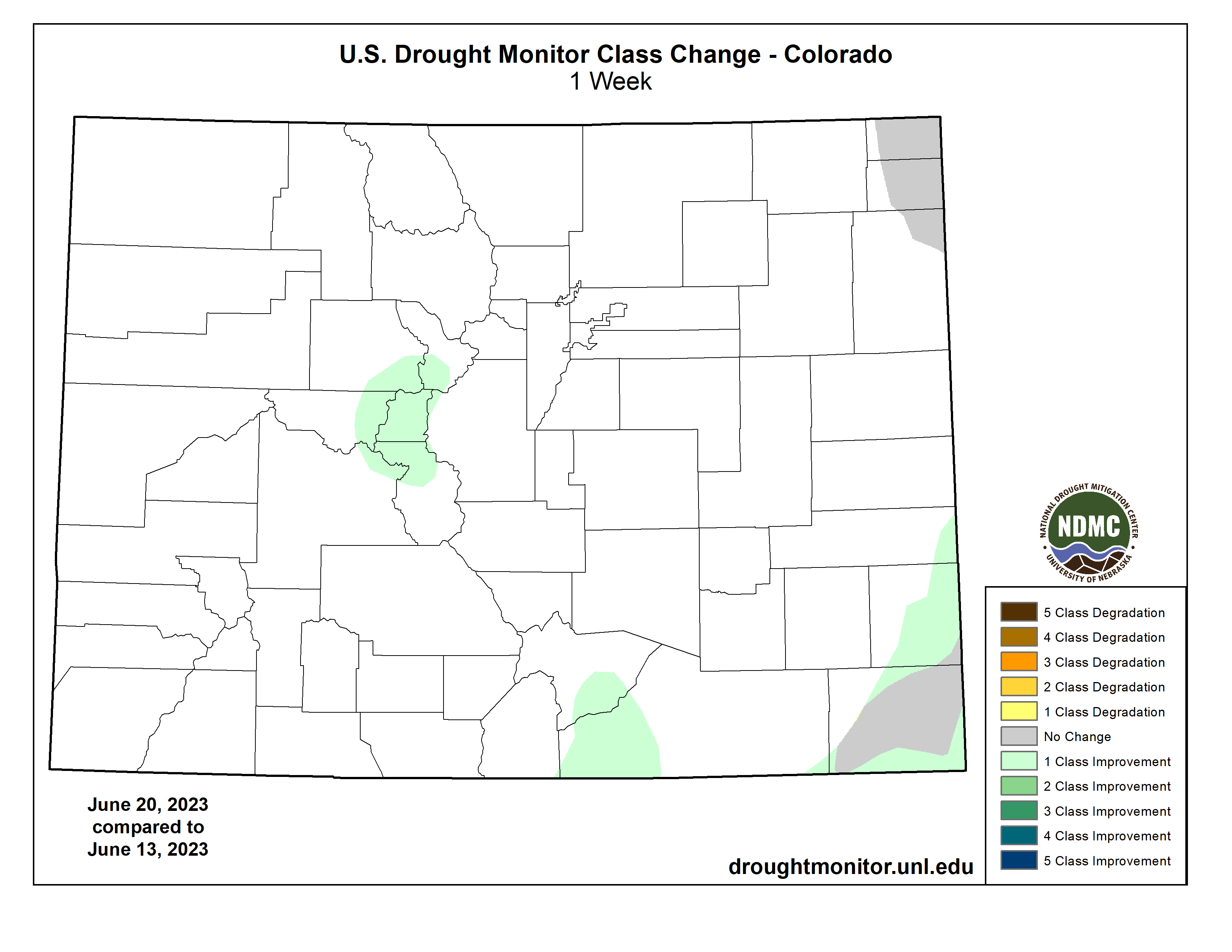
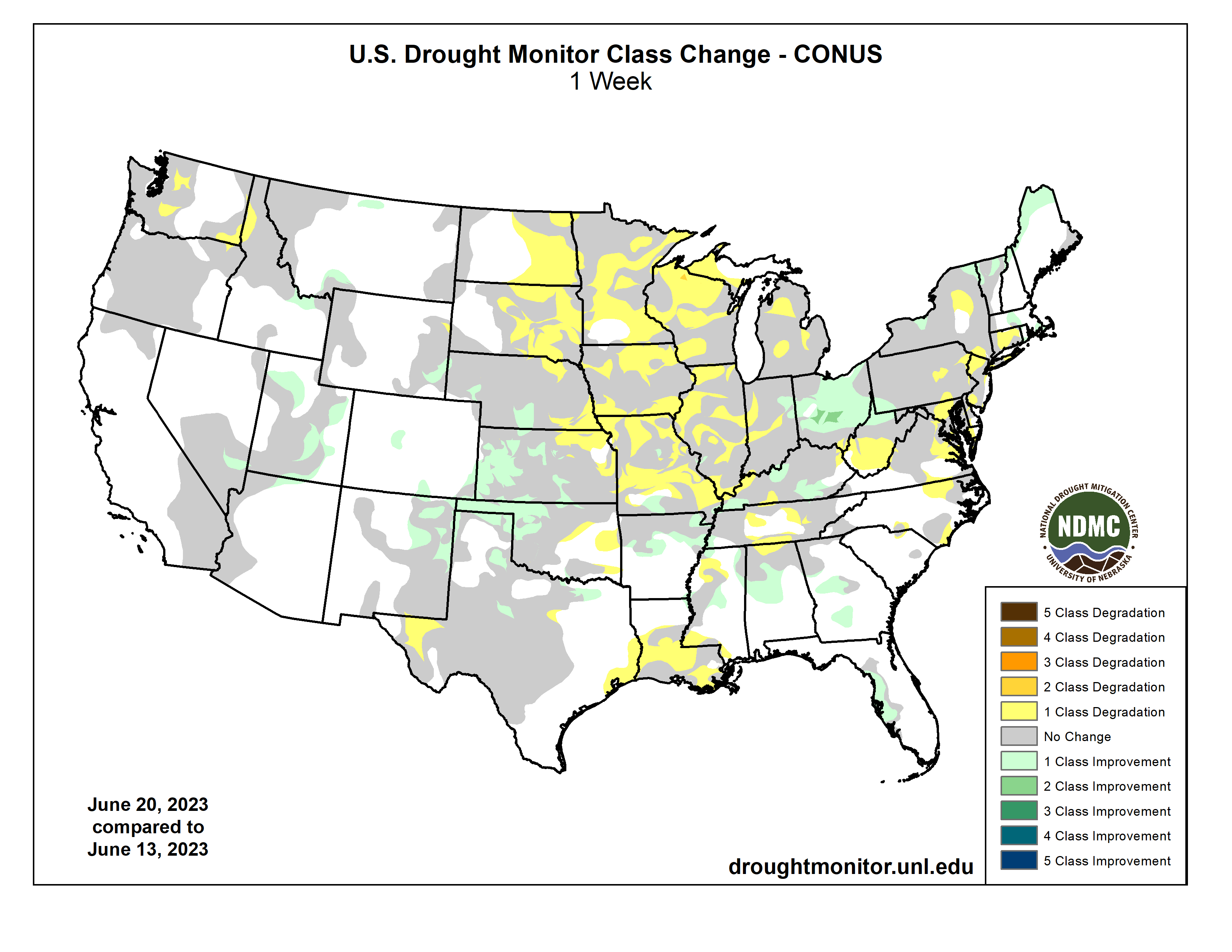
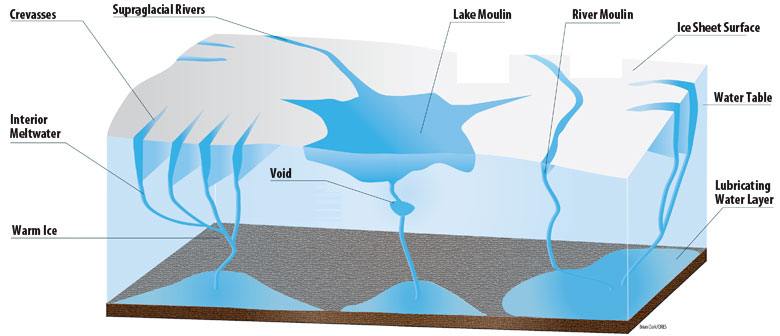