Click the link to read the summary on the CWCB website:
Observed temperature
Over the water year to date, conditions have been generally cooler than normal, with each month within the water year registering cooler than average temperatures. May took a different course and was actually warmer than average for the first time in the water year. May 2023 registered as the 16th
warmest in the 129-year record. June temperatures to date have returned to more of a cool trend, ranging from 1-6 degrees cooler than average. This has been driven mainly by cooler than average daily high temperatures.Observed precipitation and drought conditions
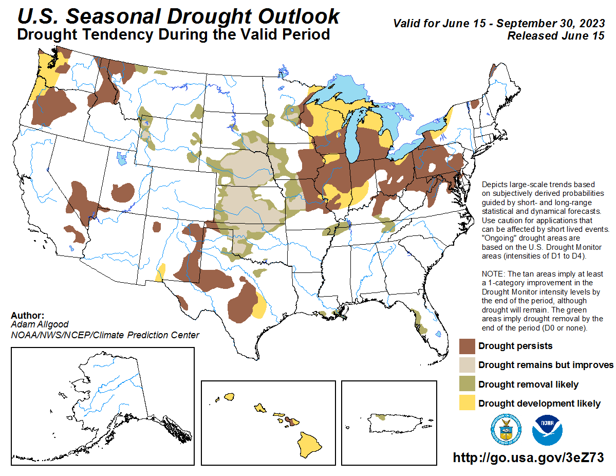
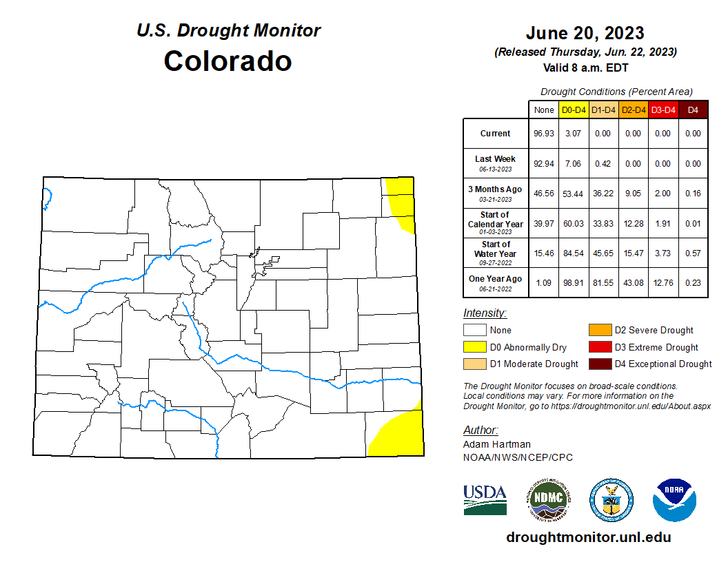
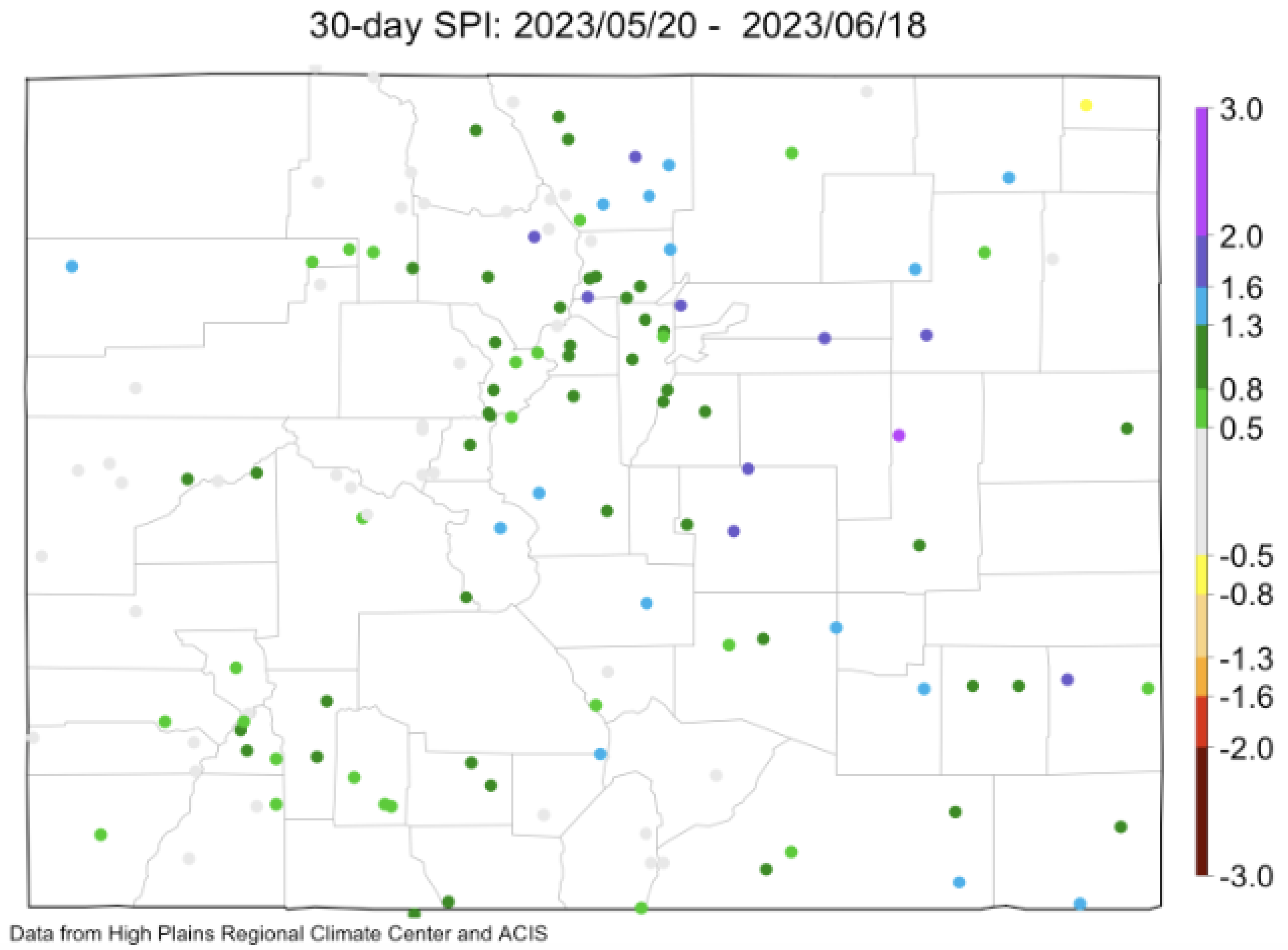
In May, the Front Range and eastern half of the state experienced much wetter conditions than normal. The cities of Castle Rock and Aurora received up to 10 inches of precipitation in the month of May alone. On the west slope, Garfield and Rio Blanco counties registered 2023 as the wettest water year to date on record. Although the 30-day Standardized Precipitation Index (SPI) shows slightly dry conditions in the northeastern part of the state, it generally reflects wet conditions across the state. SPI is an important drought indicator, and the values that Colorado is now seeing are within the normal to wet ranges – not indicative of a drought pattern across most of the state. In fact, 93% of the state is not in any dry category at all according to the U.S. Drought Monitor. This is the lowest drought coverage Colorado has experienced since 2019, following three continuous years with D3-D4 drought. Consequently, the Colorado Water Conservation Board is moving to deactivate the Drought Task Force and the Impact Task Forces that were activated in 2020.
Observed & Forecasted streamflows
Streamflow and runoff has been very high throughout May, nearly twice the normal volumes in much of Western Colorado. Water year to date precipitation is 114% percent of the median with considerable discrepancies across the continental divide. Western slope basins reached up to 132% of normal with some eastern slope basins trending closer to 100% of normal. The Colorado River basin streamflow forecast has dipped below normal, but the remaining basins are forecasting above normal streamflows currently.
Snowpack and reservoir storage
At the peak in April, Colorado approached the 95th percentile for snowpack, despite drier conditions in some parts of the state, including the South Platte headwaters and Arkansas basin. While snowpack remains at higher elevations, the majority of SNOTEL sites in Colorado have melted out at this point. Reservoir storage is near normal and has shown significant improvement from May to June. Total statewide reservoir storage has recovered significantly, and all major basins are now holding near to well above normal reservoir storage volumes.
Seasonal outlook
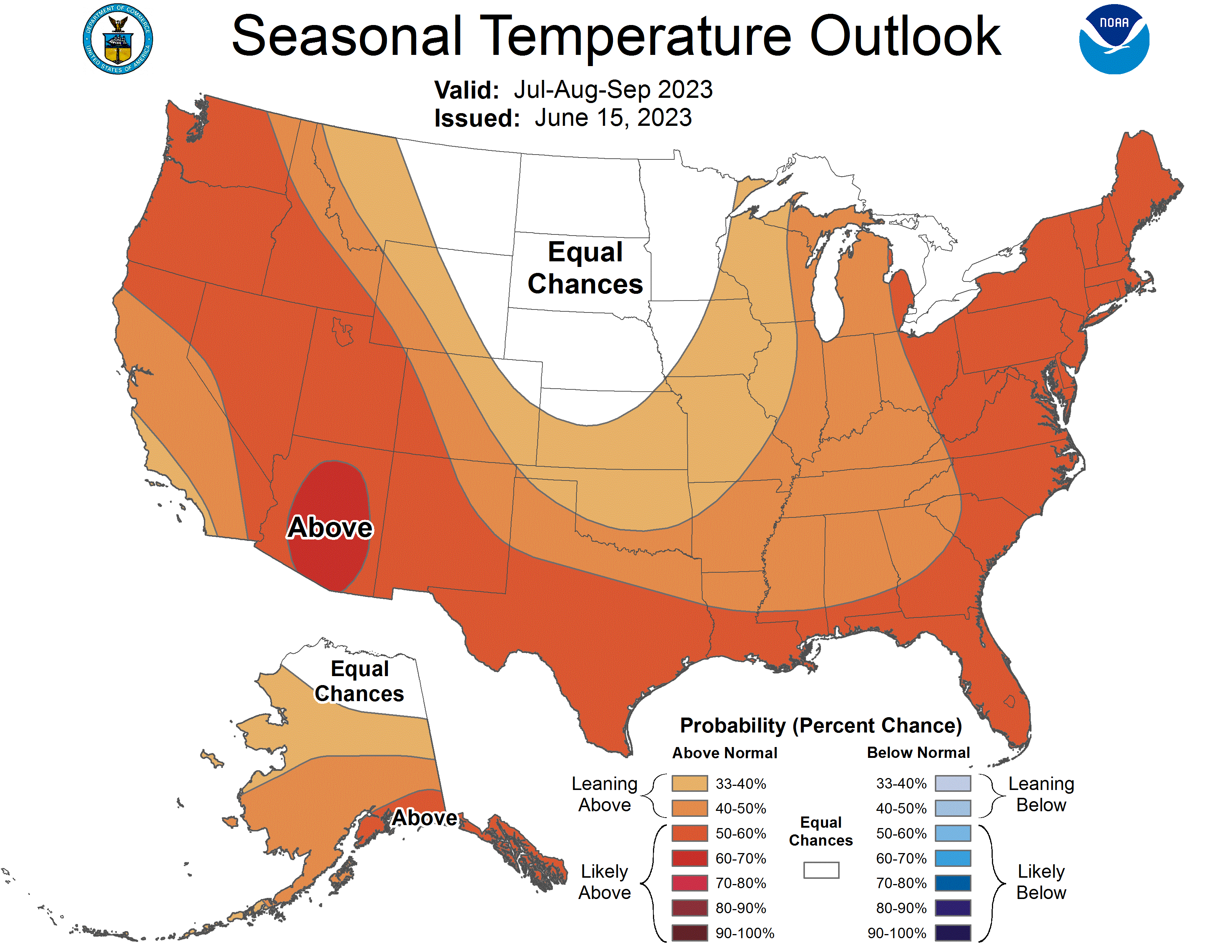
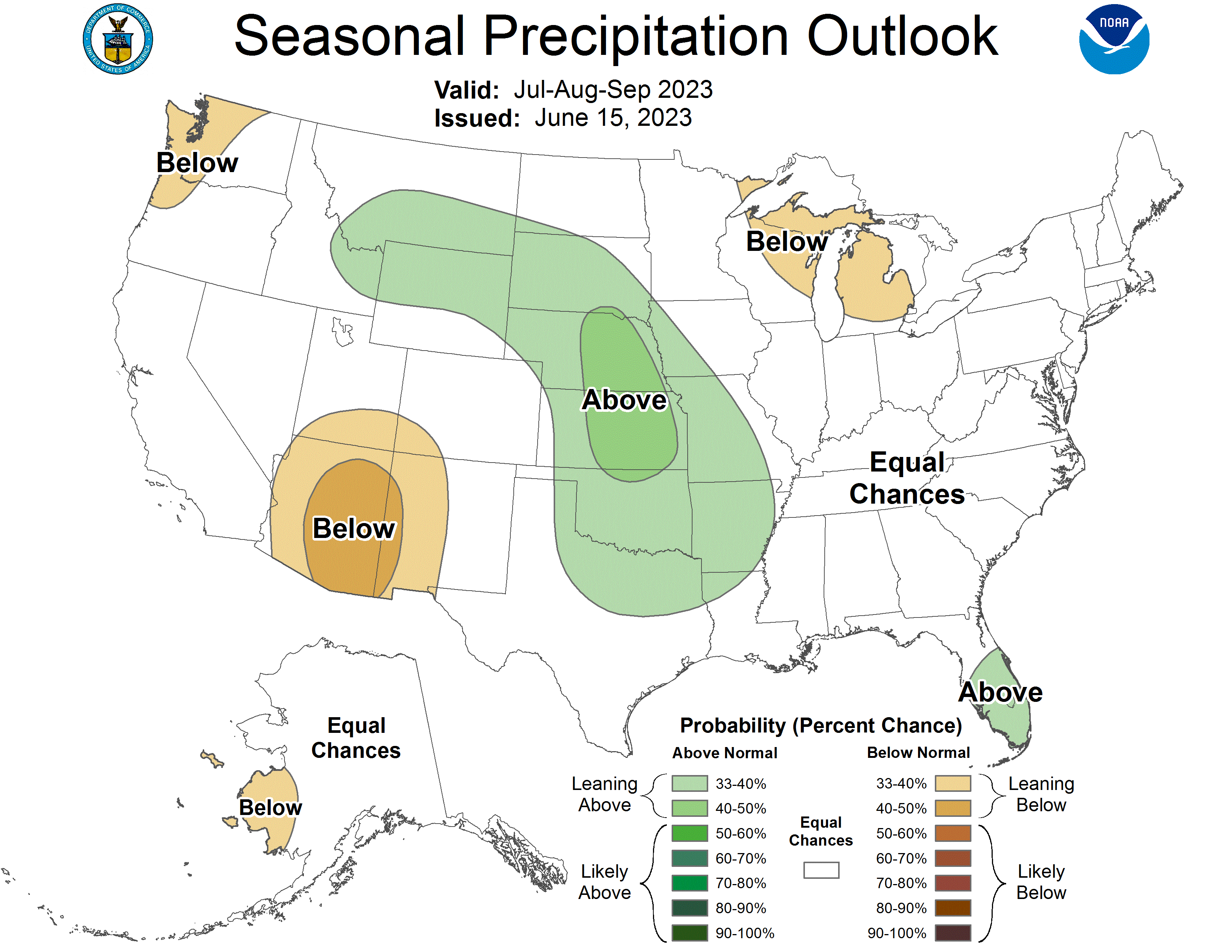
The seasonal outlook for Colorado includes potential for above average temperatures statewide and a weaker monsoon in the southwestern part of the state. Ocean and atmosphere indicators are currently exhibiting El Niño conditions and this pattern is expected to continue. For Colorado, this could result in wet anomalies in the Denver Metro area extending up into the northeast plains. There is an increased risk of wet extremes across most of Colorado, so flooding will remain a concern this summer, particularly over burn scars.