Arkansas Basin Roundtable public outreach meeting recap

A picture named arkansasriverbasin

From The Pueblo Chieftain (Chris Woodka):

The meeting, attended by about 50 people, was the first of three planned this year to share roundtable accomplishments and concerns with the community. Others will be in Salida and La Junta. “We’re not sure what is going to happen, but it’s not going to be like it was,” [Gary Barber, chairman of the roundtable] said.

The roundtable’s essential purpose is to apply the prior appropriation doctrine to a changing set of circumstances that incorporates new needs, such as recreation and the environment, with traditional water uses, such as municipal and agriculture, he explained. Barber used the analogy of a house with one bathroom to illustrate how prior appropriation has changed. It works well if only a couple of people live in the house. When 20 people move in, life gets more complicated. “It’s at the point where we have to do something about it,” Barber said.

Roundtables were created in each of the state’s eight river basins, along with the Denver metro area, in 2005 after top-down approaches were rejected by the state’s voters. Referendum A, which proposed $2 billion for unspecified water projects, was defeated by voters in every county in the state in 2003. Progress has been slow because members were asked to organize themselves. In addition, the ideas from the roundtables have been directed largely at problems within the basins. “We began to hear each others’ stories,” Barber said…

Barber said it is important to develop solutions that are sustainable over time, rather than easy fixes. One model for success during the first five years of the roundtables has been the Fountain Creek Vision Task Force, and that collaborative approach is being applied to other issues, such as the current effort to study whether a task force should look at the Flaming Gorge project to bring water from Wyoming into Colorado’s Front Range, Barber said.

There have been many tangible successes. The roundtable also has been successful in bringing in $4 million for 21 projects — including three pending projects — and another $1 million in emergency funding for the zebra mussel threat in 2008. The group also has completed studies for consumptive needs such as cities, farms and industry, and nonconsumptive needs such as recreation and the environment.

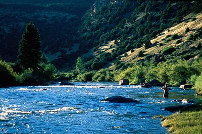
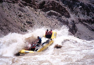
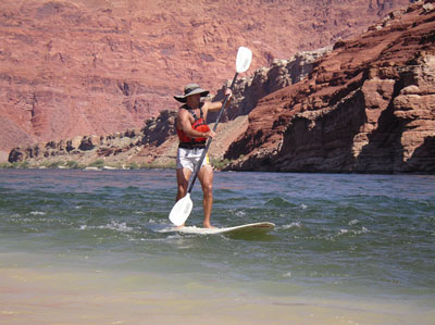
Pat Wells, a Colorado Springs Utilities water resources engineer, worked with Roundtable members to develop the nonconsumptive needs study, which looked at the recreation and environmental values of every watershed in the Arkansas River basin. “From the start, we saw that nonconsumptive needs were important,” Wells said. “There is a lot of interplay between water supply and recreation needs. We really think this contributes to future water supply planning.”

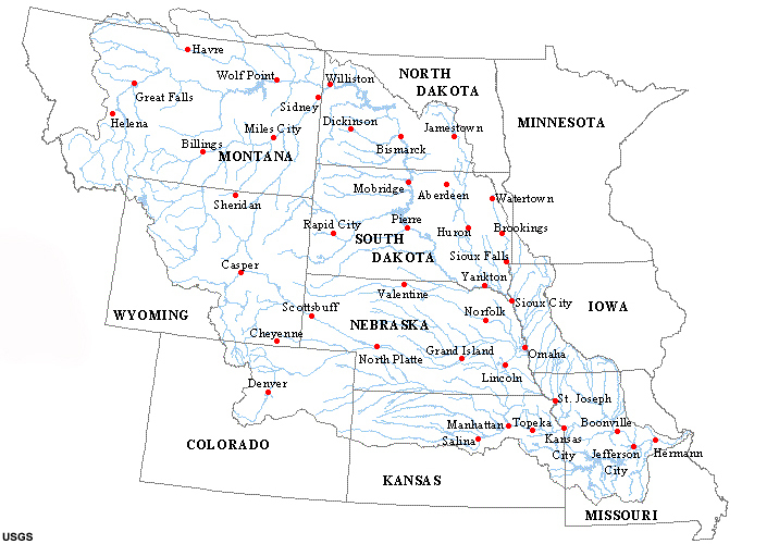
Mike Applegate is a water consultant who developed the consumptive needs report. The 2008 study found that new projects will be needed to supply up to 32,000 acre-feet — possibly enough for more than 100,000 homes — to meet the basin’s needs in the next 40 years. However, the needs continue beyond that into the future as growth occurs, Applegate said. Most of the need, 22,600 acre-feet, is in El Paso County, and some of the needs are shifting. But every amount counts…

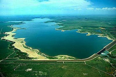
New projects could include the Super Ditch water leasing program and building more storage, he added. “Storage has a bad name, but now people are talking about it. To meet the future needs of our state, we need more buckets,” Applegate said. “The problem is here today. We need to do something about it now.”

More IBCC — basin roundtables coverage here.

Lower Arkansas Valley: Conflict flowing from use of irrigation return flows below John Martin Reservoir

A picture named johnmartinreservoir

From The Pueblo Chieftain (Chris Woodka):

The senior water rights on the Arkansas River in the area date back to the 1880s, with some as far back as the 1870s. The return flows, or seep rights, from major ditches like the Amity Canal were claimed as irrigation rights in the early part of the 20th century. The older the right, the higher the priority. The problem, according to [Water Division 2 Engineer Steve Witte], is that by intercepting the return flows on tributaries to the Arkansas River, downstream water rights could be affected. It could also lead to further disputes with Kansas over the Arkansas River Compact. “All we’re trying to do is improve the administration on the tributaries,” Witte said.

Last year, irrigators who use the seep rights were contacted by the state Division of Water Resources and told their junior water rights had not been regulated, but were going to be in the future. There were two meetings, and Witte made it clear what was needed: measuring devices on tributaries, control devices for diversions and diversion points that matched the legal descriptions of where those points should be. “We are assessing who is in compliance and who is not,” Witte said. “We told all of them we intend to enforce the priority system.”

Late last year, the state issued 28 orders to bring irrigators into compliance, and some court complaints have been filed on those who have not taken any steps toward corrective action. “Some have large amounts of water,” Witte said.

[Dwain Eaton, a Lamar veterinarian who has junior water rights] Eaton is riled by the orders, and says it will cost $5,000-$10,000 per diversion to install the required measuring devices. The orders have the potential to dry up thousands of acres of farm ground, he said. “I feel these rules concerning the measuring devices were made for the ditches and were never intended to be required on individual seep rights,” Eaton wrote in a letter to state legislators, Agriculture Commissioner John Stulp and Gov. Bill Ritter. “It would be hard to put out this unnecessary expense when we can see no value in it, except to satisfy the powers that be. These decisions are being made with very poor economic foresight.” Over the past 40 years, there have been few complaints from senior water rights holders, Eaton said. “I think the reason for the senior ditch not making a request is the amount of water that would be made available would be so small by the time that it made the river that no farmer would even know it was there,” Eaton said. Simply removing the water creates more problems. “There have been no plans made to revegetate these farms after the water has been taken from them, leaving a catastrophic environmental issue — soil erosion,” Eaton said.

More Arkansas Basin coverage here.

Eagle River Valley: The Eagle River Watershed Council and Colorado Trout Unlimited host tour of $4 million river restoration project

A picture named eagleriver

From the Vail Daily via the Cortez Journal (Sarah Mausolf):

The Eagle River Watershed Council and Trout Unlimited invited stakeholders on a rafting trip to tour the length of river where the $4 million restoration project is taking place. About two-thirds of the river restoration project is complete, said Melissa Macdonald, executive director of the watershed council. In 2008, workers added stones along the banks that pinch the water into a narrower, deeper channel. That helps keep fish healthy when the river is low. This stretch of the river gets wide and hot during low flow times, which is bad for fish, Macdonald said…

Last year, workers also added 14,000 trees and shrubs along the banks. This coming fall, the project will focus on adding more stones, called “cobble bars,” along the rivers’ edge and possibly plant 600 willows. A third phase of the project will add portable toilets near the boat launch, trash bins in areas with litter, trails and fishing docks near the Lake Creek apartments. The Eagle River Watershed council is still trying to raise the remaining $500,000 for the restoration. The rest of the money came from a $1.5 million grant from the Natural Resource Damage Fund and donations from the Eagle River Water and Sanitation District and various metropolitan districts. Vail Valley contractor B&B Excavating has been doing the work.

More Eagle River watershed coverage here.

Colorado-Big Thompson Project update

A picture named coloradobigthompsonmap

From email from Reclamation (Kara Lamb):

As runoff continues to come down from the high country, we continue to bypass the inflow through Green Mountain Dam to the Lower Blue River. At noon today, we increased our releases from Green Mountain to the Lower Blue by 200 cfs, putting the river at 800 cfs. Friday morning at 6 a.m. we will increase the releases again by 200 cfs, putting the Lower Blue at 1000 cfs. Saturday morning, we will increase another 200 cfs around 6:00 a.m and Saturday afternoon we will increase one last time by 200 cfs, resulting in a 1400 cfs flow in the Lower Blue by Saturday evening. We anticipate the flows will stay in place up to five days before we begin to scale back down.

These releases are part of the Coordinated Reservoirs Operations program that we, and other reservoir operators, voluntarily participate in during run-off seasons when we have surplus inflow. The surplus inflows are bypassed downstream to the Colorado River, for benefit of the four endangered fish under the Upper Colorado River Endangered Species Recovery Program. The Recovery Program will issue a news release tomorrow further detailing our releases and those of other reservoir operators in the Upper Colorado River Basin.

More Colorado-Big Thompson coverage here and here.

Colorado Springs City Council and Springs’ Issue 300 supporters are arguing about how to draw down the $1.4 million enterprise fund escrow

A picture named pikespeak

From The Colorado Springs Gazette (Eileen Welsome):

Rivera argues that the City Charter, not Issue 300, is the guiding document that determines where CSU’s surpluses go. And the charter states that any surplus from CSU can be appropriated to the city’s general fund. “The charter overrules Issue 300,” Rivera said in an interview Tuesday, adding that payments to the city from other enterprises, such as the airport, are being phased out as required by the new ordinance. The City Council is expected to vote on what to do with Utilities’ $1.4 million later this month.

Issue 300, sponsored by anti-tax advocate Douglas Bruce, instructed the city to phase out payments in lieu of taxes to the city’s general fund from its enterprises over an eight-year period starting in 2010. As a consequence, Utilities was instructed to hold back one-eighth, or nearly $4 million, of the estimated $31.7 million in funds scheduled to flow into the general fund in 2010 and place it in an escrow account. As of the end of April, the money in the escrow account amounted to $1.4 million, said Terri Velasquez, the city’s chief financial officer.

More stormwater coverage here.

American Rivers: Upper Colorado is sixth most endangered river in U.S.

A picture named coloradorivergranby

From The Grand Junction Daily Sentinel (Gary Harmon):

The projects, the Windy Gap Firming Project and the Moffat Tunnel Collection System Project, would increase diversions from the upper Colorado River by at least 48,000 acre-feet a year. The threat to the river’s fishery, boating and water supply to downstream users placed the Upper Colorado River at No. 6 in the 2010 list of the nation’s most-endangered rivers by American Rivers…

“Conversely,” American Rivers said, “if the projects incorporate appropriate river protections, they could herald an era of water-supply planning that better balances water development with the needs of the river.”[…]

The Windy Gap project was supposed to go online a year ago, but it was sent back by the U.S. Environmental Protection Agency for a revised draft environmental-impact statement, said Chris Treese of the Colorado River Water Conservation District. The project calls for the construction of Chimney Hollow Reservoir in Larimer County to be supplied by an annual average of 30,000 acre-feet of water diverted through the existing Windy Gap project. It would supply water to more than a dozen municipalities in northern Colorado.

The Moffat project is designed to divert an annual average of 18,000 acre-feet of water collected on the Fraser River Basin through the Moffat Tunnel to an enlarged Gross Reservoir on the Front Range.

More Colorado River Basin coverage here.

Tamarisk control: Leaf beetle introductions in Southwestern Colorado workshop Saturday, June 19

A picture named tamariskleafbeetle

From The Telluride Watch:

The Colorado Native Plant Society hosts a free seminar and field trip on tamarisk beetle control introductions in Delta County Saturday, June 19, 9 a.m.-12 p.m., with “Beetle Wrangler” Mike Drake, executive director of Painted Sky, discussing the history of tamarisk beetle introductions, how they control tamarisk, the logistical and financial advantages and what has been achieved in Delta County. After a classroom session, the group will tour Confluence Park in Delta to see firsthand results.

Tamarisk or salt cedar is on Colorado Department of Agriculture’s B list of noxious weeds. B list plants need to be controlled to stop their spread. Despite recent U.S. Geological Survey study findings that tamarisk isn’t quite the water hog it was long believed it to be, it still chokes riverbanks, reduces native plants and biodiversity, especially bird species, and tends to take over the landscape. Its presence increases soil salinity, thwarting competition from other plants.

Attendees should wear walking shoes and bring a lunch. You need not be a member of Colorado Native Plant Society to attend, but seminar is limited to 15. Meet at Painted Sky office, in the U.S. Department of Agriculture, 690 Industrial Blvd in Delta. Call or email Gay Austin to register or for more information: austinaceae37@roadrunner.com or 970/641-6264.

More tamarisk control coverage here and here.

Runoff/snowpack news

A picture named raftingarkriver

From the Longmont Times Call (Magdalena Wegrzyn):

This time of year, [St. Vrain River] streamflows are typically at about 400 cubic feet per second, [Ken Huson, the city’s water resources administrator] said. During Memorial Day weekend, they peaked at about 530 cubic feet per second. “The river streamflow this time of year responds pretty directly to the temperature,” he said. “And last week, at the end of the week — Thursday and Friday— we had some warm weather.” And with temperatures expected to be in the 90s at the end of this week, he said is it likely the streamflow will increase again this weekend and into early next week…

Button Rock Dam is holding a full Ralph Price Reservoir in the mountains above Lyons. Huson said the reservoir doesn’t normally fill until the beginning of July. This year, it filled in May, partly because of the longer snow season this year. Longmont gets about two-thirds of its annual water supply from the St. Vrain, which flows into the South Platte River Basin. The water comes from snow runoff from Rocky Mountain National Park’s Indian Peaks Wilderness and Wild Basin areas.

On average, the South Platte River Basin reaches its peak snowpack accumulation on April 23, according to data gathered by the Colorado Natural Resources Conservation Service. This year, that didn’t happen until the middle of May…

“We actually were accumulating snow for three weeks longer than we normally do,” said Chris Pacheco, assistant snow survey supervisor for the Lakewood-based NRCS state office.

From the Fort Collins Coloradoan (Bobby Magill):

The [Poudre] river crested at around 2,500 cubic feet per second and almost 7 feet in height Saturday, the day after Fort Collins broke a heat record of 91 degrees on May 28 and mountain temperatures remained well above freezing all day, according to U.S. Geological Survey river data and the Colorado Climate Center at CSU…

Varra said the Poudre River stream flow this spring has been higher than normal because the Windsor Reservoir and Canal Company did not divert water from the river via the Poudre Valley Canal because its reservoir was full last month.

Higher temperatures in recent weeks melted the snowpack at a higher rate than last year, he said.

On Wednesday, the snowpack was 73 percent of normal in the South Platte River Basin, which includes the Poudre River, down from 110 percent May 25, according to U.S. Natural Resources Conservation Service data.That comes at the end of one of the snowiest seasons – September through May – on record in Larimer County. Fort Collins received 88.7 inches of snow during the snow season at Colorado State University, according to the university’s monthly weather summary issued Wednesday. Last month was the 12th snowiest May on record for Fort Collins, with the 4.1 inches of snowfall May 12 breaking the 1912 record of 1.5 inches for that date.

From the Glenwood Springs Post Independent (Kevin Keller):

The Colorado River below Glenwood Springs is running near 11,900 cubic feet per second, according to the United States Geological Survey’s (USGS) website. The Roaring Fork River at Glenwood Springs is running higher than its average for June 2 — at about 4,400 cubic feet per second, or about 900 cubic feet per second higher than it’s average. Byron Lawrence, Hydrologist at the National Weather Service in Grand Junction, said even though the river is a little high right now, things are about normal after a little less than average snowfall. “We’re not doing too bad,” he said. “The runoff and expected peak is just about what we usually see.”[…]

Lawrence said that the cold spring helped average out the precipitation for the Western Slope, after the snowfall was about 5 percent below average. “The cold spring helped improve conditions,” he said. “It reduced snowmelt early so that in late April and in May we had a fairly decent snowpack.” The average peak date for the Colorado River is June 8, according to the USGS’ website. The forecasted peak this year is right about average, around June 9, Lawrence said. Lawrence added that after the peak, they expect for river levels to be right around average for the rest of the summer season.

From the Aspen Daily News:

…the snowpack in the Roaring Fork River basin [is at] 67 percent of average…And the snowpack is 72 percent of last year’s at this time, according to the Natural Resources Conservation Service’s snow survey office in Lakewood.

The Colorado River basin as a whole has 57 percent of its average snowpack, but 185 percent of last year’s snowpack as of June 1, according to an NRCS press release. That’s a slip from last month when it was 71 percent of average for that time of year, and 76 percent of average on April 1. Things look better at some sites within the Roaring Fork basin. On Independence Pass, for example, the snowpack is 80 percent of last year’s and 78 percent of average. McClure Pass’ snowpack is 90 percent of last year’s, but only 55 percent of average. And on Schofield Pass above Marble, the snowpack is 70 percent of last year and 77 percent of average.

The local snowpack is faring better than in the state as a whole, where snowpack totals have decreased to only 53 percent of average by June 1, according to NRCS. Southern Colorado saw the biggest declines in snowpack percentages in May, despite what looked to be shaping up as an excellent runoff season in midwinter. But with little to no precipitation since early April, it’s a below average runoff season in the Animas, Dolores and San Miguel rivers. Cooler weather and wetter conditions characterized the northern mountains in the late spring, and accumulations continued until mid-May. Maximum snowpack accumulation was nearly three weeks later than normal in some northern basins, and improved the runoff outlook from where it was in midwinter.

From The Greeley Tribune (Bill Jackson):

Statewide snowpack totals decreased to only 53 percent of average on June 1, yet remain well above last year’s readings for June 1. The good news: all that melting snow has pushed many of the state’s reservoirs to well above average…Water coming down the Poudre River has flooded parts of the Poudre Trail between Greeley and Windsor, but no major flooding problems have been reported.

Missouri River Basin: U.S. Army Corps of Engineers mainstem management public hearing recap

A picture named missouririverbasin

From the Associated Press via the KansasCity.com

More than a dozen people testified during a public hearing in Jefferson City hosted by the U.S. Army Corps of Engineers, which is responsible for managing the 2,000-mile-long river. Congress has authorized a five-year, $25 million study to determine if changes are needed to the management strategy outlined in a 1944 law.

Residents said the river was vital to Missouri’s economy, from providing drinking water to helping cool power plants, and flood control must be a priority. Some feared that the recreation interests of states upstream could take precedence and curtail barge traffic along the river. “The upper-states will never stop until they do away with navigation,” said Dan Kuenzel, 45, who raises hogs and grows corn and soybeans on river bottom land in Washington, Mo.

The Missouri River begins in Montana and flows into the Mississippi River just north of St. Louis. Upper basin states generally want water levels to rise or remain stable to help with fish reproduction and to keep reservoirs created by dams full for summer recreation. Lower basin states, including Missouri, want reliable flood control and a steady water flow for barges and drinking water or commercial water uses.

Many people at the hearing questioned why the Corps was studying river management priorities, citing another study completed in 2004. The current study focuses on a federal law approved in 1944 that makes the Corps responsible for managing the river for flood control, navigation, hydropower, irrigation, water supply, recreation, water quality, and fish and wildlife.

More Missouri River Basin coverage here.

Runoff news: Green Mountain Reservoir operations update

A picture named greenmountainreservoir

From email from Reclamation (Kara Lamb):

We are starting to see some spring run off come down from the mountains. As a result, yesterday and today we are bumping up releases at Green Mountain Reservoir to the Lower Blue. Yesterday afternoon, we bumped up releases to 500 cfs. This morning, we bumped releases up again to 600 cfs.

More Colorado-Big Thompson coverage here and here.

American Rivers: Upper Colorado is sixth most endangered river

A picture named coloradoriverbasincgs

From the Colorado Independent (David O. Williams):

The scenic Upper Colorado River between its headwaters in Rocky Mountain National Park and its confluence with the Roaring Fork River has landed the sixth spot on the America’s Most Endangered Rivers list

The national nonprofit group, in concert with other conservation groups such Colorado Trout Unlimited, is calling on the U.S. Army Corps of Engineers and the Bureau of Reclamation to require conservation and efficiency measures in the Final Environmental Impact Statements (FEIS) for both the Moffat Tunnel Collection System Project and the Windy Gap Firming Project. “We can’t continue to take and take water from the Upper Colorado without accounting for the serious impacts to fish and wildlife habitat,” Colorado Trout Unlimited’s Ken Neubecker said in a release. “This is a river on the brink. A vibrant, healthy river system in the Upper Colorado is every bit as important to the future of Colorado as the water it supplies to our farms and cities.”

Recent media coverage has also focused on the growing demands on the Colorado for energy production, including hydroelectric in Glenwood Canyon and oil and gas development further downstream in Garfield and Mesa counties.

The Upper Colorado, though, is a recreational paradise, with world-class whitewater and gold-medal trout fishing. It runs through the heart of the state’s most popular mountain resorts from Grand County to Glenwood Springs, with its tributaries supplying water to ski towns like Breckenridge and Vail. It’s a perennial candidate for federal Wild and Scenic River designation.

More coverage from Tonya Bina writing for the Sky-Hi Daily News. From the article:

“The most endangered river listings get the attention of media and policy-makers,” said Randy Scholfield, spokesperson of Trout Unlimited’s Western Water Project. “It does help to highlight some of the threats facing these rivers and helps them get the grassroots support they need.”

The Upper Colorado considered in the listing flows from about Granby to Dotsero…

The Upper Colorado fit the organization’s criteria for being the subject of major public decisions pending in 2010, specifically the Moffat Firming Project proposed by the Denver Water Board and the Windy Gap Firming Project proposed by the Municipal Subdistrict of the Northern Water Conservancy District. The Upper Colorado, especially the stretch from Granby to Kremmling, can lack healthy peak flows and baseline flows…

Without river protections from cumulative impacts outlined in draft Environmental Impact Statements, advocates fear the river could suffer from further detriment despite on-the-side negotiations for enhancement being conducted by river stakeholders.

“They didn’t consider the accumulative impacts at all like they were supposed to,” Neubecker said of those reports pending Bureau of Reclamation and U.S. Army Corps of Engineers approval. Instead they were saying “that the flows in the river right now are the way they always have been since the beginning of time. We have to be honest with ourselves and everyone on how we use the river.” Neubecker hopes the American Rivers listing can help inform Front Range water users, some of which have little idea “about the connection between what comes out of their faucets and the river resource,” he said.

From 9News.com:

“We really are concerned about destroying the essence of Colorado which includes world-class recreation and beautiful rivers like the Upper Colorado, so we want to make sure there is an appropriate balance struck between the needs of supplying citizens on the Front Range with water and the importance of those benefits of Colorado’s heritage,” [Andrew Fahlund, senior vice president of American Rivers] said…

Currently, meetings between headwater counties and major diverters have the potential to restore river health while also fulfilling domestic and agricultural needs in the state.

From KUNC (Erin O’Toole):

The threat of water diversion from the state’s namesake river has landed the Upper Colorado at number 6 on this year’s list, as compiled by the conservation advocacy group American Rivers. Spokeswoman Amy Kober says they’re primarily concerned about two new proposals – the Windy Gap Firming Project and the Moffat Tunnel Collection System Project. She says both could lower the river flow to the point of threatening its prized trout fisheries “Excessive diversions upset the natural balance of the river, increase water temperatures, and destroy the natural patterns of reproduction for endangered species.”

More Colorado River Basin coverage here.

Runoff news

A picture named cataractcanyon

From The Pueblo Chieftain (Chris Woodka):

Advisories for the roughest reaches of river — Pine Creek, Numbers and Royal Gorge — were in effect Tuesday, and probably will remain for most of the week, as temperatures climb after a brief cool-down today. “Experience tells us that at those levels and above, people should consider not running the river if they don’t have the expertise and skills,” White said. “But the river is not closed.”[…]

Water levels in the Upper Arkansas River were over 3,000 cubic feet per second after Saturday, roughly double the median flow for early June. The snowmelt came later this year than in the past decade, but typical for historical conditions. The Arkansas River swelled to 4,000 cfs at Avondale by Tuesday, again roughly double the median average for the date.

The snowpack for the state is only 57 percent of average, according to the Natural Resources Conservation Service Snotel sites, with the Arkansas Valley at 45 percent. Meanwhile, the Upper Colorado River basin, where the water imported into the Arkansas River Basin through tunnels and ditches originates, is at 59 percent of average. “We’ve brought over about 12,000 acre-feet so far,” said Roy Vaughan, manager of the Fryingpan-Arkansas Project. “It’s coming off hard, the way we don’t like it to. If it comes too fast, we leave some of our yield on the other side.” The project should bring over about 54,000 acre-feet, even though the snow sites show a dwindling snowpack, Vaughan said…

Some localized rainstorms last week also boosted moisture for the Arkansas River basin. In Pueblo, rainfall for the year is almost 6 inches, well above the normal of 4.3 inches

Aspinall Unit update

A picture named gunnisontunnelnps

From email from Reclamation (Dan Crabtree):

The Uncompahgre Valley Water Users will be changing diversions at the Gunnison Tunnel tomorrow morning, June 2nd and Crystal releases will be adjusted accordingly. This operation may cause the Gunnison River to “bounce” slightly. Flows should be stabile again by afternoon at 650 cfs. If you have any questions please contact Dan Crabtree at 970-248-0652.

More Aspinall Unit coverage here.

National Integrated Drought Information System: Upper Colorado Basin Pilot Project’s ‘Summary of Weekly precip and water supply’

A picture named coloradoriverbasin

Henry Reges has graciously allowed me to post his notes from yesterday’s webinar:

Much of the Upper Colorado River Basin received very little moisture last week, with only spotty areas of precipitation in the Yampa-White and Green River basins and northern Utah. For the month of May, the majority of precipitation was focused over the northern region of Colorado and along the Utah-Wyoming border. After a wet start to the water year, the south has quickly begun drying out. Small decreases were seen in the water-year-to-date precipitation percent of averages from last week with the driest areas showing up in northeastern Utah and western Wyoming. Temperatures for the last week were near average to slightly cooler than average for most of the UCRB. However, since the average temperature this time of year is quickly warming up, much of the snowpack is melting and streamflows are again picking up. Less than 30% of the streamgages in the area are reporting below normal (below the 25th percentile) 7-day flows, compared to nearly 50% last week. Much below normal flows are mainly seen in Wyoming, where even though much of the snowpack has melted out, the very low peak snowpack values resulted in only minor increases in streamflow. Minor improvements in northeastern Utah streamflows were primarily the result of drainage from the south slopes of the Uinta mountain range, but are not expected to have any long term impacts, and streamflows will probably deteriorate again in the coming weeks. Reservoir levels continue to rise with the meltoff. Reservoir operators in the Colorado basin have coordinated their releases to match the natural peak flows in order to boost streamflows and mobilize sediment, as there is now extra water and no more concern that the reservoirs will not fill for the high demand season.

The forecast for the region is pretty quiet with some chance of precipitation in the next 1 to 3 days. The next weather system to move through looks to drop most of the moisture over western Wyoming with some chance in the plains of northeastern Colorado. After this, conditions will dry up as the area will be dominated by zonal flow with a building ridge to the west.

After looking at percentile rankings of snotel precipitation across the basin, one of the areas of biggest concern is northeastern Utah, which has been in D0 for quite some time. The percentiles suggest that some of the region could possibly be in D1, though it was recommended to defer to the U.S. Drought Monitor author (and other experts in the region who were not on the call) on any possible changes that should be made to the region. Due to continued poor conditions in the Green River basin (and feedback from local irrigators), Wyoming experts on the call wish to remain status quo for the D2 in the region, with the possibility of adjusting the D1 in extreme southwestern WY to better reflect conditions there, though they also defer to the Drought Monitor author on that particular change. Due to the persistent drying occurring in the four-corners region, the suggestion by the Drought Monitor author to expand and connect the D0 in Arizona, New Mexico, and Colorado, was met with no arguments. The author did suggest though that most of these changes would be focused on NM, so it’s possible that the expansion in southwestern Colorado will not happen for this week’s map.

Meanwhile, American Rivers has designated the Upper Colorado River the sixth-most endangered river in the U.S. Here’s a report from The Denver Post. From the article:

New water-diversion projects could sap the life from the river — threatening fish, boating and long-term water supply for the region, the group said in releasing its annual American’s Most Endangered Rivers report. The river begins in Rocky Mountain National Park and flows southwest toward Utah through a region inhabited by 93,000 full-time residents. “The key to a reliable and predictable water supply is a healthy river,” American Rivers president Rebecca Wodder said.

More Colorado River Basin coverage here.

Estes Park: Grand Ditch Restoration Project public meetings June 1 and June 3

A picture named grandditch

From the Estes Park News:

Rocky Mountain National Park will conduct two public meetings on the Grand Ditch Breach Restoration Project the first week of June, 2010. The first meeting will be held in Grand Lake at the Grand Arts Center, 913 Park Avenue on Tuesday, June 1, from 7:00 p.m. to 9:00 p.m. The second meeting will be held in Fort Collins at the Harmony Library, 4616 South Shields Street on Thursday, June 3, from 7:00 p.m. to 9:00 p.m…

Rocky Mountain National Park is beginning a multi-year process to complete an Environmental Impact Statement (EIS) to guide the restoration of the breach-impacted area. We will be gathering input from park staff, other agencies and the public to develop a set of alternatives for restoration of the breach-impacted area. The purpose of the restoration project will be to restore the hydrological processes, ecological services and wilderness character impacted by the 2003 Grand Ditch Breach.

Alternatives to be considered will likely include a combination of the following: Allowing natural (passive) restoration to occur where appropriate; stabilizing steep, unstable slopes with an engineered solution; removing deposited sediment and redistributing it through the impacted area or elsewhere; removing dead timber from the impacted area and/or using it in the restoration process; regrading and recontouring areas to restore appropriate hydrologic processes; native plant restoration with appropriate, locally gathered plant materials; may require the use of motorized equipment such as chainsaws, heavy lift helicopters, and earthmoving equipment; may require temporary fencing to protect native plant restoration areas.

Major issues to be considered in this restoration planning process include short-and-long-term potential impacts to: wilderness character; geological resources; geological hazards; soundscapes; surface and groundwater hydrology; stream channel, floodplain and wetland morphology and function; water quality; riparian and wetland communities; species of special concern (plants and animals); wildlife habitat; aquatic habitat; visitor experience; long-term resource productivity; archeological and historical sites.

A newsletter has been prepared that details the issues identified to date. Copies of that information may be obtained from Rocky Mountain National Park’s Information Office, 1000 US Highway 36, Estes Park, Colorado 80517-8397, (970) 586-1206. Information will be available for public review online at http://parkplanning.nps.gov/romo.

If you wish to comment on the newsletter or on any other issues associated with the plan, you may submit your comments by any one of several methods. You may mail comments to: Grand Ditch Breach Restoration Plan, Rocky Mountain National Park, 1000 US Highway 36, Estes Park, Colorado 80517-8397. You may also comment via the Internet at http://parkplanning.nps.gov/romo [1]. Finally, you may hand-deliver comments to: Superintendent, Rocky Mountain National Park, 1000 US Highway 36, Estes Park, Colorado 80517-8397.

Comments submitted to the website or by mail are welcome at any time; however, they would be particularly helpful if received by June 16, 2010.

More Grand Ditch coverage here and here.

Energy policy — nuclear: Federal money train for uranium tailings cleanup near Moab is slowing down

A picture named moabcoloradoriverspanishval

From The Grand Junction Daily Sentinel (Gary Harmon):

The U.S. Department of Energy cleanup that is hauling the pile north to Crescent Junction was helped significantly by stimulus money, Don Metzler, director of the project, said at the Grand Junction Area Chamber of Commerce last month. Funding for the project “is not secure at all,” Metzler said. Budget forecasting suggests that 2012 will be a “tough time” for the Energy Department, Metzler said, but spending $90 million a year would make it possible to complete the cleanup by 2019, saving hundreds of millions in life-cycle costs of the $1 billion project. Two trains a day, five days a week, haul tailings from the pile along the Colorado River next to Arches National Park to the 500-acre disposal cell at Crescent Junction. By dint of several breaks, including stimulus funding, the project is operating with about $90 million a year now, but is to fall to the base amount of $30 million a year after 2011. That amount would allow for only one train a day bound for Crescent Junction, which would make the cleanup too slow, Metzler said.

More nuclear coverage here and here.

Vail: Teva Games this weekend

A picture named standuppaddling

From The Denver Post (Scott Willoughby):

Nine years later, the Teva Mountain Games taking place Friday through Sunday are very much on the map as the nation’s premier celebration of adventure sports and lifestyle. Yet, in many ways, they’re still Vail’s river games — and they’re still brand new. “We always want to be cutting edge from the perspective of trying new things, but we’re also one of the biggest events of its kind. So we sort of have a reputation to uphold as being on the forefront of the adventure sports lifestyle,” said Paul Abling of the Vail Valley Foundation, which took ownership of the former grassroots event late in 2008. “If we’re going to do something new at the Teva Mountain Games, we’re going to go big with it.” The latest addition to the crowded TMG program offers an evolutionary twist to the down-river racing of yore, as whitewater stand-up paddle surfing (SUP) makes its competitive debut on snowmelt-swollen Gore Creek on Saturday and Sunday. Two events dubbed “SUP Surf Sprint” and “SUP Surf Cross” will have paddlers racing downriver on surfboards designed to run rapids, even battling head-to-head in the “cross” format. “It’s going to steal the show, for sure,” said local competitor Ken Hoeve of Gypsum.

More whitewater coverage here.

Southern Delivery System: What are the impacts from sharing project facilities with providers that were not included in the Reclamation evaluation?

A picture named sdspreferredalternative

From The Pueblo Chieftain (Chris Woodka):

…at contract negotiations last week, Colorado Springs worked very hard to insert provisions that would allow the use of excess capacity of SDS, partly to help pay for the expense. “We need to be clear that there are plans on the part of several SDS participants to serve others through the project,” Colorado Springs water attorney David Robbins told the Bureau of Reclamation at the negotiations in Pueblo. While Colorado Springs and its SDS partners intend to stay within the limit of taking a maximum of 78 million gallons of water a day from Lake Pueblo into El Paso County, more water could be wheeled through the pipeline than was envisioned in Reclamation’s environmental impact study. Colorado Springs wants to build in the ability to use the project for neighboring communities in El Paso County, asking for changes in Reclamation’s proposed contract to allow for “excess-capacity” users.

That point was raised two years ago by Pueblo County water attorney Ray Petros during the EIS comment period.

Petros pointed out environmental impacts were modeled on moving an average of 52,900 acre-feet of water delivered annually through the pipeline, with a firm yield of 42,400 acre-feet. That is only about 60 percent of the capacity of the pipeline and pumping stations to move 87,000 acre-feet per year. “Any approval should condition the use of the project on the use of only existing water rights without further environmental study and review,” Petros told Reclamation in June 2008. At the time, he also advised against allowing additional users on the pipeline. “The draft EIS does not consider the impacts associated with Colorado Springs supplying raw water or substantial amounts of treated water outside its city boundaries. Such water contracts could increase the amount of water projected to be delivered through the pipeline,” Petros said. “Additional taps to the pipeline could mean unplanned growth and impacts along the pipeline.”

Reclamation responded to Petros’ comments by saying the final EIS would have commitments that require Colorado Springs to stay within the limits modeled. “A commitment not to contract or operate the preferred alternative in a manner that differs substantively from that evaluated in the final EIS, except under emergency conditions, has been included,” Reclamation replied. “Because of this commitment only the water supplies analyzed in this final EIS could be delivered through SDS facilities without NEPA analysis.” Petros brought up the concerns again when Pueblo County’s hearings began for a 1041 permit in December 2008. Throughout the hearings, the concern never went away, and it led to a procedure to deal with new water rights added to SDS or third-party users. Under one condition, Pueblo County can reopen 1041 hearings if new water rights are added. Third-party contracts would require support for the Fountain Creek Watershed Flood Control and Greenway District, a commitment not to serve customers outside the Arkansas River basin, adoption of stormwater controls similar to the now-defunct stormwater enterprise in Colorado Springs, cooperation in the Pueblo flow program, participation in water-quality monitoring and support of studies for a flood control dams on Fountain Creek…

During last week’s negotiations, Reclamation asked Colorado Springs to provide an inventory of the water rights that were used to develop the EIS during discussions about excess capacity. In its statement of purpose and need for SDS, Colorado Springs said it was needed to meet future needs of participants, provide redundant systems and develop existing water rights. Nothing was mentioned about supplying the water needs of neighboring communities in the statement…

“If Colorado Springs Utilities doesn’t become the regional water supplier, someone else will step in and do it,” Tony Elia, chairman of the Utilities Policy Advisory Council, told Colorado Springs City Council last July, on the day it decided to delay SDS completion until 2016. The council pushed back SDS to provide breathing room for ratepayers, who nevertheless will be looking at a doubling in water rates by the time SDS is projected to go online.

More Southern Delivery System coverage here and here.

Runoff news

A picture named gorecreekwinter

From The Denver Post (Scott Willoughby):

The typically tranquil Gore Creek, for example, shot up from a mere 450 cubic feet per second at its primary USGS measuring station Thursday to a whopping 1,300 cfs by midnight the next day. That’s nearly triple the flow coming down a creek that begins and ends above 8,000 feet…

“I’m afraid we may not have reached the high-flow period yet,” USGS Colorado spokeswoman Heidi Koontz told The Denver Post on Sunday. “Typically, the high-flow period comes in the middle of June.”[…]

Kayakers converged along the Arkansas over the weekend as Buena Vista christened a pair of new man-made whitewater waves during the annual CKS Paddlefest. The show then moved to Steamboat Springs for the Paddling Life Pro Invitational on Fish Creek and the Yampa River on Monday. Boaters in both places were greeted by a spike of about 1,000 cfs over the course of just a few days, enough to put most paddlers on red alert. Meanwhile, the reputation of the 3-year-old wave park on the Colorado River at Glenwood Springs continued to swell among river surfers, with as many as 15 board surfers lining up among the throng of kayakers waiting to ride the wave on a sunny Saturday afternoon. Roughly 25 more showed up to compete in the second annual Whitewater Stand Up Paddle Surfing Championships held there Monday. As the calendar reaches river season statewide, organizers of the Teva Mountain Games in Vail, Salida’s annual FIBArk Festival, the Lyons Outdoor Games on the St. Vrain, Animas River Days in Durango and the Gunnison River Festival in between are excited to showcase their local treasures and share them with the world.

From Fox21.com (Rachel Welte):

The National Weather Service in Pueblo said Monday sections of the [Arkansas River] are less than a foot away from flood stage, sitting at 8.6 feet…

“If you can imagine 3,000 basketballs going by any given point in the river at any time, that is about the volume of flow we are running, so that is a lot of water,” Tony Keenan said.

More whitewater coverage here.