2010 Colorado elections

A picture named nisp2

From the Ag Journal:

[Gubernatorial candidate Scott McInnis] underscored his commitment to vital water projects – most notably the Northern Integrated Supply Project (NISP) – that will not only provide much-needed water storage for the northern tier of Colorado, but will be a tool in preserving agricultural land.

More 2010 Colorado Elections coverage here.

Ridgway River Festival June 26

A picture named uncompahgrewatershed

From The Telluride Watch:

Registration for the 2010 River Festival will begin with registration in Rollins Park from 9-11 a.m. A safety briefing will follow at 11:10 a.m. with racing vessels beginning at 11:20 a.m. (LeMans-style start: run to vessels then get in). The hard shell kayaks/biathlon will start at 11:30 a.m., inflatables/biathlon at 11:40 a.m., paddle boards at 11:50 a.m. and the white water rodeo at 1:30 p.m. The popular Junk of the Unc race will begin at 2 p.m. with the awards ceremony following at 3 p.m. Put-ins for all events will be at the foot bridge in Rollins Park. Take-outs for the down river races will be at Ridgway State Park, approximately 3.5 miles downstream of Rollins Park (except for the Junk of the Unc race which takes out at an eddy just south of the railroad bridge).

Registration for each boat is $20, plus $5 for each non-ACA member competing (please bring ACA card). Discounts are available for those who would like to enter multiple events. All participants must have a coast guard–approved life jacket and helmet to participate.

This year, the festival has added two new river events, a stand up paddleboard race and a biathlon…

Also new to this year’s festival is the incorporation of a LeMans-style start to the river races. Rather than sitting in the river suited up and ready to go, competitors will begin in a footrace to the river, carrying their vessels, before launching towards the finish line.

More Uncompahre River watershed coverage here.

Energy policy — hydroelectric: Free micro-hydro workshop in Ouray June 18-20

A picture named microhydroelectricplant

From The Telluride Watch:

The City of Ouray will host a free micro-hydro workshop Friday, June 18 from 1-5 p.m. at Wright Opera House in Ouray. The workshop is part of the Colorado Renewable Energy Society’s annual conference taking place June 18-20. The conference will feature seminars, workshops and tours of local renewable energy facilities…

Topics to be covered at the free workshop will include:

• Current status of micro-hydro in Colorado;

• Federal, state and local incentives available to support micro-hydro construction;

• Case studies of recently built micro-hydro projects in Colorado.

The workshop will include a tour of Ouray micro-hydro installations, including the historic Ouray power plant, one of the nation’s oldest micro-hydro generation plants. The new micro-hydro installation currently being built by the City of Ouray, with grant support from the Colorado Governor’s Energy Office, will also be featured.

Workshop speakers will include the following: Colorado State Senator Bruce Whitehead; Joani Matranga (Colorado Governor’s Energy Office); Jim Heneghan (Delta-Montrose Electric Association); Kurt Johnson (Telluride Energy); Eric Jacobson (Hydrowest); Bob Risch (City of Ouray); Jack Nickerson (City of Cortez): Ruthie Brown (Humphreys Hydro); Trevor LaBorde (Coal Creek Hydro); Beverly Rich (San Juan County Historical Society); and Phil Overeynder (City of Aspen).

More hydroelectric coverage here and here.

Colorado-Big Thompson Project update

A picture named olympusdam

From email from Reclamation (Kara Lamb):

The recent rain is adding inflow to Lake Estes, so we have begun to increase our releases from Olympus Dam to the lower Big Thompson River again. Earlier this morning, June 12, we bumped up releases to around 600 cfs. Around 9 a.m. this morning we went up another 100 cfs to 700 cfs. We will make another increase at 10:00 a.m. to 800 cfs. As the rain continues, additional increases in releases to the Big Thompson Canyon are possible.

More Colorado-Big Thompson coverage here.

Northern Integrated Supply Project: Would Glade have had a flood control effect this year?

A picture named nisppreferredalternative

From The Greeley Tribune:

With NISP online, some of the recent regional flooding concerns would have been alleviated and the floodwaters would have been stored for future use, according to Northern Water. The proposed project includes two reservoirs, the Glade Reservoir off the Poudre River north of Fort Collins and the Galeton Reservoir east of Ault. The two would provide storage for 215,000 acre-feet of water…

Diversions off the Poudre to fill the two reservoirs would mostly be available during high runoff years, according to Carl Brouwer, manager of the proposed project at the district. Galeton would have filled during the past fall and winter and remained full with the huge spring runoff this year, Brouwer said in a news release. “More than 50,000 acre-feet of water from this spring could have been stored in Glade Reservoir were it built, in addition to water during 2009,” Brouwer said.

Glade and Galeton reservoirs are the key components to NISP, which is proposed by 15 northern Front Range cities, towns and water districts. The project is under review by the U.S. Army Corps of Engineers. When full, Glade would store 170,000 acre-feet of water and Galeton would hold 45,000 acre-feet.

“This is one of those years when you wish we had these projects in place so the water could be saved for the citizens of northern Colorado,” Eric Wilkinson said. He is Northern Water’s general manager.

More Northern Integrated Supply Project coverage here and here.

Runoff news: Colorado’s Surface Water Conditions from the CDWR

A picture named denvergage06122010

I’ve been watching the Colorado Division of Water Resources South Platte River at Denver (PLADENCO) station this morning. Clear Creek at Golden is up there as well.

From the Colorado Daily:

High-water advisories and closures on Boulder Creek and the North and South St. Vrain Creeks will remain in effect through the weekend, with cooler temperatures and widespread rain forecast for the area, according to the Boulder County Sheriff’s Office.

From the Telluride Daily Planet (Matthew Beaudin):

Over the weekend here, Ingram Falls thickened as wide as some had seen it run, and water from the high country poured into the San Miguel River. “It’s been crankin,” said Erik Dalton, a boater who owns Jagged Edge. “It’s a conveyor belt all the way to Naturita.”

That conveyor belt peaked at nearly 2,000 cubic feet per second near Placerville toward the end of the weekend — absolutely ripping when contrasted with the fact that just days before it was moving at less than 1,000 cfs. By yesterday afternoon, the flows were down to about 1,150 cfs in Placerville, though they rose toward Uravan as the river collected more of its tributaries. The Dolores River just outside of Dolores was flushing along at 1,520 cfs yesterday afternoon. On Sunday, that river peaked at more than 2,200 cfs, 800 cfs larger than just two days prior.

Boaters have a love/hate relationship with the high runoff; it makes for stellar conditions but the enormous flows mean an abbreviated season. Faster runoffs also spell trouble for the watertables — too much water leaves too fast — and fire season.

From email from the Colorado Water Conservation Board (Kevin Houck):

As many of you are aware, snowmelt flooding has been ongoing throughout Colorado for the past several days in response to warm temperatures and rapid snowmelt. For most areas, but not all, high runoff as a function of elevated temperatures has abated for the time being. However, high base flows still exist in many areas with some streams still reporting at or above flood stage.

A number of reliable collaborators and weather forecasters have indicated that a Pacific storm stalling over portions of the state could produce the next credible flooding threat. For the next two or three days, widespread areas of rainfall should develop in the state, especially in the South Platte River basin and to some extent the Arkansas River basin. Although the intensity of this rain is not anticipated to be heavy over large areas, smaller pockets of high intensity rainfall and severe weather could occur. Although this rainfall may create its own flooding problems, CWCB staff’s primary concern is for widespread, long-duration rainfall to add runoff to the already high streamflows caused by snowmelt. This is a very real possibility this weekend. The National Weather Service has already issued a flood advisory for portions of the South Platte basin as of this morning.

The good news is that temperatures have dropped noticeably, especially into this weekend, so the rate of snowmelt runoff has slowed for now. However, temperatures will be cold enough that additional snowfall could fall in the mountains, especially above 9,500 feet. This could lead to another round of high runoff when temperatures begin to increase again next week.

All persons with interests near rivers that are currently running high should carefully monitor stream levels this weekend. It is possible that stream levels could be higher this weekend than already observed, although this is not a certainty. The rain itself could create localized problems in eastern Colorado as well.

The CWCB creates a daily Flood Threat Bulletin (FTB), issued each morning around 11AM. This bulletin can be accessed at:

http://www.hdrweather.com/operational/cwcb/cwcbinformation.htm

The FTB outlines and graphically displays the anticipated flood threat each day on a county-by-county basis. Long-range outlooks are also issued on Monday and Friday mornings, and it is suggested that interested persons pay close attention to today’s outlook.

It is also suggested that interested persons monitor the advisory and warning products issued by the National Weather Service at:

http://www.weather.gov/

CWCB staff will be monitoring the situation carefully. Please contact Kevin Houck by email at Kevin.houck@state.co.us or by phone at 303-866-3441 to report any known flooding problems or damages.

Pueblo: City Fountain Creek greenway project tour recap

A picture named fountaincreek

From The Pueblo Chieftain (Chris Woodka):

“We want everyone to know what’s happening on Fountain Creek,” Montoya told about 30 people who showed up to see for themselves. “This is not just for the East Side, but for all of Pueblo. . . . You need to get out and see it. Touch it. You have to walk the talk.” What planners have in mind are improvements along the creek from Eighth Street to Fountain Creek’s confluence with the Arkansas River. On Friday, people walked, biked or rode in carts along the trail, getting a glimpse of possibilities and problems that for many have just been spots on a map up until now. “The question we’re trying to answer is ‘What can we do to provide better connectivity?’ ” said Scott Hobson, assistant city manager.

Several projects are in the works along Fountain Creek, including the trail improvements, an urban redevelopment project and a sediment removal demonstration project. There are also some nearly 20-year-old plans to improve Runyon Lake that could be woven into the other projects. A trail through the area could incorporate ideas from each, while building on existing areas along Fountain Creek and adding new features like a skate park, water play parks and fields, Hobson said. “We have to look at what improvements will occur and in what sequence,” Hobson said.

The city task force will attempt to settle on an alternative for the first phase of the project in July, under a Great Outdoors Colorado planning grant. Possibilities include closing some streets, creating new recreation areas or simply building on fixtures already in place like Plaza Verde Park and El Centro del Quinto Sol. There could be a new bike and pedestrian bridge at First Street and even riverfront housing, Hobson said. At one point along the trail, Hobson explained how sediment removed from the river could be used on the banks to provide a more inviting slope as people approach the creek.

More Fountain Creek coverage here and here.

Colorado-Big Thompson Project update

A picture named greenmountainreservoir

From email from Reclamation (Kara Lamb):

We have started to see some of the inflow from snowmelt into Green Mountain slow a little bit. As a result, we are cutting back the releases by 300 cfs. By 11:30 this morning (June 11), there should be about 2100 cfs in the Lower Blue River below Green Mountain.

More Colorado-Big Thompson coverage here.

Aspinall Unit update

A picture named curecantibluemesa

From email from Reclamation (Dan Crabtree):

Side inflows into Morrow Point and Crystal are beginning to subside reducing the potential for a second Crystal spill. In order to make the most efficient use of runoff conditions, releases from Crystal Reservoir were reduced by 50 cfs today, bringing flows in the Black Canyon and Gunnison Gorge back to last week’s level of 650 cfs.

More Aspinall Unit coverage here.

Energy policy — nuclear: The Colorado Department of Public Health and Environment orders Cotter to stop flows from Schwartzwalder

A picture named uranium

From the Associated Press:

The state health department is taking action because Cotter Corp. has been discharging pollution without a permit and uranium levels in the water are significantly exceeding the safety standard, Steve Gunderson, director of the state water quality control division, said Thursday. The agency sent the notice earlier this month. The Colorado Division of Reclamation, Mining and Safety has sent a separate notice to Cotter saying it believes the company is violation of several state laws. Cotter could face fines of up to $10,000 if found in violation. The Denver-based company didn’t immediately return a call seeking comment. Hearings are scheduled July 14 and 15 to consider whether Cotter should face penalties.

Uranium was detected in raw water going to the west-Denver suburb of Arvada, Gunderson said. The city’s water treatment plants can filter out the uranium, but disposing of the contamination could become a problem.

More nuclear coverage here and here.

Lightner Creek sediment source study heads into phase II

A picture named lightnercreekconfluenceanimasriver

From The Durango Herald (Dale Rodebaugh):

The Southwestern Water Conservation District has contributed $3,600 to help fund the second phase of a study to determine the source of periodic sediment in Lightner Creek. Initial results of the study point to the Perins Canyon watershed and a stormwater retention basin as possible sources.

For years, water-protection groups and Trout Unlimited have been concerned about the chalky-colored water that from time to time enters the Animas River from Lightner Creek immediately south of the DoubleTree Hotel. In February 2009, Buck Skillen, a board member of Trout Unlimited, tested water turbidity at the confluence of the waterways. When he poured 60 cubic centimeters of water (the equivalent of two shot glasses or a medical syringe) in a filter, it became clogged by the time 45 centimeters had passed through.

Overall water quality and the effects of sediment on the Animas’ gold-medal trout fishery are the major concerns of the coalition of concerned groups that initiated the study last October.

First-phase work by Mark Oliver of Basin Hydrology established some potential sources of sediment, members of the Southwestern Water Conservation District learned Wednesday from Meghan Maloney, river campaign director at the San Juan Citizens Alliance, and Koren Nydick, executive director of the Mountain Studies Institute. At certain points along the creek Oliver measured the size and movement of the sediment. Oliver found the likeliest sources of Lightner Creek pollution is the Perins Canyon watershed and a stormwater retention basin on Tech Center Drive that gathers sediment. Other potential sources of sediment are along U.S. Highway 160 west…

The second phase of the study aims to determine how much sediment Lightner Creek carries, the sources and why it appears sporadically, Nydick and Maloney said. The coalition, which includes Trout Unlimited, Animas Riverkeepers, San Juan Citizens Alliance, U.S. Forest Service, U.S. Bureau of Land Management, Colorado Division of Wildlife, La Plata County and the Mountain Studies Institute, asked the water district for $3,600 to continue the work for a year beginning Tuesday. The water conservation district contributed $2,600 to the phase 1 work. In June 2011, funding will be available from the Animas Watershed Partnership, which is creating a watershed management plan for the Animas from Bakers Bridge to the confluence with the San Juan River in New Mexico.

More Animas River watershed coverage here.

Runoff news

A picture named fryingpan

From the Glenwood Springs Post Independent (Scott Condon):

Ruedi was considered “full” at about 10 a.m. Thursday and water started going through the spillway about two hours later, said Kara Lamb, public information specialist with the reclamation bureau. But releases from the Ruedi outlet infrastructure and the power plant at the dam were lowered to keep flows at about the same level as before the reservoir filled, she said. About 750 cubic feet per second was being released from Ruedi. Approximately 50 cfs was flowing from Rocky Fork Creek, just below the dam, for a combined flow of 800 cfs. “850 is where people start to get their property wet,” Lamb said.

Emergency response agencies from Basalt, Pitkin and Eagle counties met at 11 a.m. Thursday to consider if any flood preparations were necessary. They held a telephone conference call with Bureau of Reclamation officials and were surprised to learn the releases wouldn’t match inflows. “Full,” it seems, doesn’t really mean “full” at Ruedi. There is a higher capacity for the reservoir — beyond what is considered the operationally full level — that can be used by adjusting releases, Andrew Gilmore, a hydrologist with the reclamation bureau told the Roaring Fork Valley officials. “It sounds like we do have a buffer here,” Kane said after the meeting.

Lamb explained after the meeting that using the spillway and adjusting the other outlets allowed the reclamation bureau to avoid matching the inflow. “We’re able to slow it enough that it’s not a straight trade-off,” she said. Gilmore said high water releases will likely be required into Friday. After that, signs point to a lower level of runoff. Much lower temperatures are expected starting Friday night and through the weekend. In addition, officials said the high temperatures over the last week have melted a significant portion of the snowpack, even at high elevations…

Gilmore said the reclamation bureau wants the flexibility to boost total releases from Ruedi and Rocky Fork to 850 cfs, if local officials thought that could be done without causing flooding damage. Local officials responded that seemed possible, at least during daylight hours, when the Roaring Fork River’s flow has generally been lower than at night. No major releases are expected from reservoirs in the upper Roaring Fork River drainage for the next week. “I have no doubt we could go up to 850 [on the Fryingpan] without much difference,” Kane said after Thursday’s meeting.

From The Grand Junction Daily Sentinel:

“Yes, the rivers are really cooking, they’re really moving and they’re full of water, but they seem to be handling it very well,” said Pat Bingham, a Pitkin County spokeswoman. Bureau of Reclamation spokeswoman Kara Lamb said that while the threat of spilling isn’t over, inflows into the reservoir fell off sharply during the day. However, they tend to rise again following a day of snowmelt, and future inflows will depend on how much snow already has melted, and whether there are more warm temperatures or a lot of rain, she said…

Basalt’s situation was improved Thursday by the fact the Roaring Fork River had begun dropping. Lawrence believes it has passed its peak flow, reducing the chance of it backing up into the Frying Pan at their confluence and causing flooding…

Lawrence said while flows in headwater streams are dropping, it takes a while for that to be reflected downstream. Although he believes the Colorado River at Cameo reached its annual peak Tuesday night, at about 12.22 feet, it was expected to still surpass 12 feet Thursday night. Flood stage there is 12.5 feet.

From the Boulder Daily Camera (Vanessa Miller):

Silver Lake — which sits in Roosevelt National Forest, west of Colo. 72 between Nederland and Ward — is expected to spill over into Boulder Creek on Friday, said sheriff’s Cmdr. Rick Brough. Once that happens, water levels are expected to rise by 80 to 150 cubic feet per second, Brough said. Thursday afternoon, he said, Boulder Creek was running at about 629 cubic feet per second. On Wednesday, the creek was running at about 700 cubic feet per second, which was down from Tuesday when it was at 920 cubic feet per second, Brough said. On Tuesday, because of the high water levels and a bridge collapse up stream at the Red Lion Restaurant, authorities closed bike paths along the creek — from the Red Lion to 30th Street in Boulder — and stationed divers along the fast-moving stream. Normally, Boulder Creek runs at between 100 and 300 cubic feet per second, Brough said.

Roaring Fork River ‘Floating Summit’ recap

A picture named roaringfork

From the Glenwood Springs Post Independent (John Stroud):

About 75 people gathered along the west bank of a runoff-swollen Roaring Fork River in Veltus Park Thursday morning for a “floating summit” sponsored by the Roaring Fork Conservancy. The original idea was to have a flotilla of several rafts from Carbondale to Glenwood, with small group discussions taking place in each raft, followed by a summary discussion at the park. For the past six years, the conservancy sponsored the free float for members of the general public to see the river up close and learn about the issues that impact the waterway. With the high runoff and near-flooding conditions this week, however, it was decided to suspend the float in favor of a morning-long meeting of the minds…

The gathering included representatives from each of the municipalities and counties in the Roaring Fork Valley, as well as water district officials, river outfitters and conservation groups. District 61 State Rep. Kathleen Curry, I-Gunnison, was also on hand to speak to the issue from a statewide perspective. “This is a great way to stimulate local discussion on how best to address issues in the Roaring Fork watershed,” Curry said…

“We need to be proactive as a region to make sure the impacts from water diversions [from the West Slope to the Front Range metro areas] are minimized,” Curry said. One way to do that is to come up with as many ways as possible, and financially feasible, to make use of more water on the Western Slope…

“From a legislative standpoint, we also need to work to make sure that if the state is going to use state tax dollars for water projects that it benefits the entire state, not just part of it,” Curry said.

Local governments would also be prudent to work together to set up legal defense funds in case Western Slope water rights are challenged by Front Range interests. “If they know we are in a position to litigate, they’re more likely to come to the table and negotiate something that works for all interests,” she said.

For the past two years, the Roaring Fork Conservancy and the Ruedi Water and Power Authority have been working to develop the Roaring Fork Watershed Plan. The collaborative effort has brought various government and water management agencies in the valley together to address common water concerns, said Mark Fuller, director of the Ruedi Water and Power Authority. “I’m confident we’re going to have a plan that will help control our own fate when it comes to future water development,” Fuller said.

More Roaring Fork watershed coverage here and here.

Invasive mussel boat inspection update

A picture named zebramusselinfestation

From the Associated Press via The Durango Herald:

In Southwest Colorado, all boats launched from trailers will be inspected at the following reservoirs: Vallecito Reservoir in La Plata County; Navajo Reservoir in Archuleta County; McPhee Reservoir and Jackson Gulch Reservoir at Mancos State Par in Montezuma County; Taylor Reservoir and Blue Mesa Reservoir in Gunnison County and Sanchez Reservoir in Costilla County. Sanchez Reservoir also is closed from 8 p.m. to 6 a.m. Boats can be launched only at the boat ramp. The reservoir will be closed to boating completely for the winter starting in October. Boats must be inspected every time they enter the water. Depending on the reservoir, inspections will be conducted by personnel from the Colorado Division of Wildlife, Colorado State Parks or the National Park Service. The DOW has coordinated inspection training with the other agencies…

Inspection times vary from reservoir to reservoir but generally inspectors will be at boat ramps from 6 a.m. to 8 p.m. every day until October. For a list of all the mandatory inspection sites and schedules in Colorado, or for more information aquatic nuisance species and the boat inspection program, visit http://wildlife.state.co.us/Fishing/MandatoryBoatInspections.htm.

More invasive species coverage here and here.

Animas River Days June 10-13

A picture named animasriver

Here’s the link to the Animas River Days website.

Ruedi Reservoir, Twin Lakes and Green Mountain Reservoir operations update

A picture named twinlakesdiversionsystem

Here’s the release from Reclamation (Kara Lamb):

The Bureau of Reclamation is working with Pitkin County Emergency Management to manage high-water at Ruedi Reservoir, 216-miles west of Denver, after continued high temperatures accelerated snow melt runoff from area mountains.

Reclamation is working to maintain consistent flow-rates at Ruedi Dam by monitoring water over-topping the spillway and adjusting controlled releases. The agency’s goal is to keep releases around 750 cfs into the weekend to reduce the impacts to downstream communities.

“We’re working very closely with our partners and local communities to manage the sheer volume of water from snow melt runoff and precipitation that we’re currently experiencing in Colorado,” said Mike Collins, Reclamation’s Eastern Colorado Area Manager.

Melting snow is causing above-normal inflows to reservoirs and rivers across Colorado, and other Reclamation facilities are experiencing high-water conditions. In particular:

• Twin Lakes, south of Leadville, Colo., is releasing 1400, cfs to Lake Creek which flows into the Arkansas River.
• Green Mountain Reservoir is releasing 2400 cfs to the Lower Blue River, which flows into the Colorado River.

Reclamation is keeping its managing partners and stakeholders informed. To receive additional information, please contact Kara Lamb at (970) 962-4326 or klamb@usbr.gov.

Fryingpan-Arkansas Project update

A picture named fryingpanarkansasproject

From email from Reclamation (Kara Lamb):

Last night’s projection that we would begin utilizing the spillway in mid-morning is being realized. At about 10 a.m., Ruedi Reservoir hit its full elevation. A minimal amount of water is anticipated to flow over the spillway in the coming hours and increase throughout the day. We expect as much as 100 cfs over the spillway by tonight. By utilizing the spillway in conjuction with both the power plant and the dam outlet works, we will be able to maintain a total release of approximately 750 cfs through today, tonight and likely into tomorrow. With the contributions of the Rocky Fork still running at about 50 cfs, the gage on the Fryingpan below Ruedi Dam will read around 800 cfs.

It is probably interesting to note that a week ago at this time, operators of reservoirs along the Colorado River were concerned upper basin reservoirs, including Ruedi, would not fill. This last week of run-off has been a surprise to all watching the gages and keeping an eye on the forecast. What started as a less than average snowpack (only 70%-80% of average across the Colorado River Basin, including the Fryingpan Basin) has now resulted in full and spilling reservoirs.

The upcoming forecast for the weekend currently includes cool temperatures and the possibility of snow in higher elevations. However, if we see a continuation of the heat through today into tomorrow, it is possible our total releases from Ruedi Dam will increase.

More Fryingpan-Arkansas Project coverage here.

Colorado-Big Thompson Project update

A picture named greenmountainreservoir

From email from Reclamation (Kara Lamb):

As high snowmelt inflows continue into Green Mountain Reservoir, we will be sending more of that native flow on through to the Lower Blue. This morning we will bump releases to the Lower Blue River up by 300 cfs. By noon, flows in the Lower Blue should be around 2400 cfs.

From email from Reclamation (Kara Lamb):

As snowmelt inflows into Lake Estes continue to drop off, we continue to curtail our releases through Olympus Dam to the Big Thompson River. This morning, releases to the Big T are around 522 cfs.

More Colorado-Big Thompson coverage here.

Tamarisk control: Tamarisk leaf beetle release in Grand Junction

A picture named tamariskleafbeetle

From The Grand Junction Daily Sentinel:

The city of Grand Junction removed tamarisk and fostered four acres of wetland more than a year ago along the river near Riverside and Redlands parkways. The new wetland area was created after seven-tenths of an acre of wetland was eliminated along Patterson Road between 24 1/2 and 25 1/2 roads during the Ranchmen’s Ditch project. The project involved installing pipes that would guide rain water from storms on the Bookcliffs to the Colorado River without causing flooding along the way. Within months, the tamarisk in the new wetland area was back. The city considered spraying a herbicide to kill the new growth, City Project Engineer Dave Donohue said. “We concluded if we did that, we’d have so much herbicide on new wetlands plants and water, it would be a disaster,” Donohue said.

So, Donohue pursued a different tamarisk-killer: the tamarisk beetle. Palisade Insectary Director Dan Bean released 7,000 tamarisk beetles at the site two weeks ago and another 1,000 Wednesday. Eggs and larvae already are appearing this week, showing the beetles are spreading into their new habitat and leaving offspring behind. The beetles regulate their numbers based on available food, Bean said, so he doesn’t expect them to overpopulate the area. Bean said the beetles aren’t likely to enter homes, and they don’t eat anything but tamarisk.

The insectary is one of a few in the country and the only one in Colorado, Bean said. It’s run by the Colorado Department of Agriculture and was placed in Palisade in the 1940s to provide predatory wasps to eat oriental fruit moths, which were destroying peach crops. The insectary continues to collect insects from inside and sometimes outside the state to help farmers, ranchers and gardeners fight pests across Colorado. The tamarisk beetles released along the Colorado River were collected in De Beque Canyon.

More tamarisk control coverage here and here.

Runoff news

A picture named puebloleveearkansasriver

From The Pueblo Chieftain (Chris Woodka):

The runoff may have reached its peak Wednesday. “I’d be surprised if we went any higher than this, but I don’t think runoff is over by any means,” said Joe Flory, river operations manager for the Colorado Division of Water Resources. The Arkansas River peaked near 6,000 cubic feet per second at Avondale on Wednesday, but was dropping steeply after releases from Pueblo Dam were cut by 1,000 cfs in the morning. The reduction in flows reflects what is happening upstream of Lake Pueblo, rather than restricting dam releases if flows at Avondale top flood levels. Operations at the dam require flood storage if the U.S. Geological Survey gauge at Avondale tops 6,000 cfs…

At Parkdale, west of Canon City, flows dropped to 4,300 cfs Wednesday, following three days above 5,000 cfs. The levels dropped because cooler weather returned to the mountains to slow runoff and because some Eastern Slope storage rights came into priority, Flory said. The Pueblo Board of Water Works, Twin Lakes Reservoir and Canal Co., and cities with water rights in Turquoise Lake were all able to use in-basin storage rights during the peak flows, Flory said…

The ups and downs of the past few weeks, which can create spikes in the graphs tracking flows along the river, are a return to historical trends, where runoff comes in stages over several weeks as temperatures rise and fall. During the drought, snow was there one day and gone the next. Over the past few years, however, the runoff has taken more time, as the forests retained snow under the trees and in shaded valleys. “There’s a lot of snow you can’t see from the road, hidden under the trees,” Flory said.

From the Windsor Beacon (Marcy Miranda):

The Colorado Division of Wildlife Resources’ Web site reported that the Poudre River was running faster than 4,000 cfs (cubic feet per second) at 9:45 a.m. Tuesday and had reached a height of 8.14 feet above its normal running level. The record height for the Poudre River in Fort Collins is 10.5 feet. Flood stage is considered to be 12 feet. Windsor Public Works and Windsor-Severance Fire Protection District officials were closely monitoring two Windsor-area bridges which span the Poudre the Weld County Road 13 (County Line Road) bridge and the 7th Street (Weld County Road 17) bridge.

From the Fort Collins Coloradoan (Bobby Magill):

The river’s high flow early Wednesday morning reached just above 7.25 feet and about 2,900 cubic feet per second, or cfs. The Poudre reached a peak of just above 8 feet and nearly 4,000 cfs on Tuesday morning, according to U.S. Geological Survey data. “I think it’s done,” Poudre River Basin Commissioner George Varra said of the river’s rise. “The only variable is if we get a rainstorm on top of the snow, then we’re going to get another surge down here.”

The weather is shaping up to do just that, said Don Day of DayWeather in Cheyenne. As the National Weather Service issued a tornado watch for northeastern Colorado on Wednesday afternoon, Day’s forecast showed the chance for severe weather and tornadoes was very high in Larimer County and the Eastern Plains. That will likely be followed by heavy rain this weekend. “Rain falling on snow causes a lot of melting,” he said. “We should not consider ourselves out of the woods (for flooding) until Monday or Tuesday.” Steady rain will be widespread across the region on Friday night and Saturday, with another shot of moisture expected on Sunday. Depending on how the weekend storm shapes up, rain in the center of the storm will likely be measured in inches, he said.

From The Greeley Tribune (Mike Peters):

Just when they were hoping the flooding from the Poudre River would ease off, rising water forced the closure of three Greeley streets Wednesday and caused minor flooding at a west Greeley home. The flooding, which stems from the higher-than-normal melting snow runoff that has swelled the Poudre River, caused the closure of 71st Avenue, 83rd Avenue and 95th Avenue, all along the river on the west side of Greeley. In addition, the National Weather Service said water levels in the Poudre rose about 6 inches Tuesday night in the Greeley area, reaching 8.17 feet. Forecasters said they hoped the river would start receding Wednesday night.

Energy policy — nuclear: Governor Ritter inks the deal on HB 10-1348 (Increase Oversight Radioactive Materials)

A picture named cottercontamination

Update: Here’s a report from Rachel Alexander writing for The Cañon City Daily Record. From the article:

[Governor Ritter] signed the bill at the Whitewater & Kayak Recreation Park as the river roared behind him. “You’re going to be impacted by how we approach uranium milling and how we approach uranium permitting,” he said. The bill was sponsored by Sens. Ken Kester, Bob Bacon and Rep. Buffie McFadyen.

The law requires uranium processors to comply with clean-up orders before new applications are processed, strengthen public oversight of bonding requirements; require processors to inform residents about threats to their water if they have registered wells in close proximity to known groundwater contamination; and require processors to amend their operating license before accepting new sources of “alternate feeds.”

“Nobody thinks uranium is an inherently evil thing, it’s just evil if you lose stewardship of it,” Ritter said. “We believed it was the right thing to move this forward.”

Governor Ritter signed the bill that Cotter Corp claims will prevent them from generating the revenue to fund the cleanup of the Lincoln Park/Cotter Mill superfund site near Cañon City. Here’s a report from Bruce Finley writing for The Denver Post. From the article:

“This just gives us a better hold on the milling process,” Ritter said before signing the bill, a bipartisan measure sponsored by Rep. Buffie McFadyen, and Sens. Ken Kester and Bob Bacon.

Greenwood Village based Cotter Corp. operates the mill that became a Superfund cleanup site in 1984. During the statehouse battle over the law, Cotter vice president John Hamrick said the legislation would kill Cotter’s proposed project to refurbish the mill and haul 12.5 million tons of uranium ore from New Mexico for processing. Hamrick on Tuesday declined to comment on the status on any future project. But Hamrick said Cotter is now planning to do research at the mill if the Colorado Department of Public Health and Environment approves.

More coverage from Patrick Malone writing for The Pueblo Chieftain. From the article:

“We should think not about ourselves, but about the generations to come” when it comes to protecting the environment, Ritter said. “It’s incumbent on us to turn this state over to the generation after us and the one that follows in a better way than we found it.”

Under HB1348, Cotter can’t gain permits to expand its operation without first mitigating contamination that already exists. It also must notify residents where groundwater contamination exists of its progress in addressing the problem. The bill also requires Cotter to carry a higher bond that would be sufficient to conduct cleanup efforts. If the mill were to close, the cleanup would be the state’s responsibility, like so many other decommissioned uranium-processing sites throughout the state…

During the past decade, Cotter has been cited about 100 times for environmental violations, but they have been markedly less frequent during the past five years, when a wholesale change of its management team took place. Cotter officials have said the bill hamstrings their intention to take on new materials from Mount Taylor in New Mexico, which would provide the revenue necessary to construct and update an environmentally sound mill.

But residents of Canon City have been fighting for years to get Cotter to clean up the contaminated plumes of groundwater that have been identified. To date, Cotter has chosen to let it dissipate naturally, which could take decades, stretching into centuries.

For the past eight years, Colorado Citizens Against Toxic Waste has pushed for more aggressive measures from Cotter to address the pollution. Tuesday, they saw the fruit of their work. “It’s a culmination of years of paying attention to this site, seeing the problems and looking for solutions,” said Sharyn Cunningham, president of Colorado Citizens Against Toxic Waste. “This bill is the solution to the contamination problems here.”

Here’s the video of the signing from Governor Ritter’s office. Here’s the release (Evan Dreyer/Megan Castle):

Gov. Bill Ritter concluded a two-day, five-city tour of southern Colorado this afternoon, visiting the banks of the Arkansas River near the Royal Gorge to sign legislation that will protect waterways and communities by increasing oversight of uranium mills.

“We all want a safe environment for our families, our children and our communities,” Gov. Ritter said before signing House Bill 1348, a bipartisan measure sponsored by Rep. Buffie McFadyen and Sens. Ken Kester and Bob Bacon. “Future Coloradans will want to raft, kayak and fish this river, just as we’re able to do today. It’s up to us to make sure they get that opportunity. This bill will help make that happen.”

HB 1348 requires operators of uranium mills to comply with all clean-up orders before new state permits for expansion or restructuring of operations are processed. The bill also requires operators to inform residents about threats to their water if residents have wells in close proximity to known groundwater contamination.

“We heard Canon City residents testify that the poison from the uranium processing plant has been tainting groundwater for decades,” Rep. McFadyen said. “This bill simply requires uranium processors to clean up the old mess they’ve already made before accepting new materials that will create new waste. Having polluted groundwater harms the health and the economic development of the area. This bill sets the tone for the nation on what to do with uranium groundwater contamination.”

More 2010 Colorado legislation coverage here.

More nuclear coverage here and here.

Colorado-Big Thompson Project update

A picture named greenmountainreservoir

From email from Reclamation (Kara Lamb):

With the bypass of snowmelt run-off coming down from Dillon Reservoir and the high run-off rates to the tributaries contributing to the Blue River, we are rapidly filling Green Mountain Reservoir. We continue to balance inflow and outflow at Green Mountain. As a result, today, we have bumped up releases twice: at 9 a.m. we bumped up from 1400 cfs to 1750 cfs. At noon, we bumped up to 2100 cfs.

More Colorado-Big Thompson Project coverage here.

Runoff news: Forecast calls for rain Friday or Saturday

A picture named ruedidam

From The Denver Post (Joey Bunch):

Today’s break in the fast, heavy flows is probably a result of Tuesday’s cooler weather, “but it may be short-lived,” said Trest Huse, a hydrologist with the National Weather Service Office in Boulder. Recent temperatures that have been 10 to 15 degrees higher than usual are expected to drop, but an inch of rain is expected east of the Continental Divide, including the Front Range, Friday afternoon to early Saturday.

From the Summit County Citizen’s Voice:

“The inflow to Dillon Reservoir has risen dramatically over the last few days. The average inflow on June 3 was 1,157 cfs, but by June 6 it was up to 2,086 cfs. The current inflow is considerably higher than the forecasted peak, and the flows seem to be rising,” said Bob Steger, manager of raw water supply for Denver Water.

“Dillon Reservoir is currently spilling, and we are concurrently releasing about 300 cfs through the outlet works. The total outflow is currently 1700 cfs and rising. Although we are trying to moderate the outflow by gradually reducing the discharge through the outlet works as the spillage increases, it seems likely that the total outflow will exceed 1,800 cfs, which is the number we attempt to stay below,” Steger added.

Click through and check out the cool photos.

From the Summit County Citizen’s Voice:

“We were able to open the Roberts Tunnel Sunday night because we had a need for water,” said Denver Water’s Bob Steger. As of Tuesday morning, about 350 cfs were flowing through the tunnel, helping to reduce the outflow into the Lower Blue. Steger said he’s not sure how long Denver Water will continue to divert through the Roberts Tunnel. “We only take water when we need it,” he said.

All the major tributaries feeding the Blue surged to near-record levels recently as the snowpack melted all at once. Steger said he suspects a combination of dust on the snow, dead lodgepoles and the first extended warm spell of the spring combined to send the flows spiking to levels far above what was forecast.

From Steamboat Today (Tom Ross):

Joe Sullivan, a supervisory hydrologic technician with the U.S. Geological Survey office in Grand Junction, confirmed Wednesday that the Yampa River likely peaked in Steamboat Springs at 2,920 cubic feet per second at 11:30 p.m. May 30. However, Sullivan held out the possibility that lingering snowpack and a forecast of temperatures in the high 70s and low 80s Friday through Sunday still could push the Yampa to a new 2010 peak.

From Steamboat Today (Zach Fridell):

Hydrologist Bryon Lawrence of the National Weather Service’s Grand Junction forecast office, said the Elk River crested at 7.95 feet at about 2:30 a.m. Tuesday, with a flow of 6,340 cubic feet per second. The river is measured where it crosses Routt County Road 42. The flood stage for the Elk River is 7.5 feet, and water is spilling over the banks onto ranchland in several areas…

The Yampa River, measured at the Fifth Street Bridge, crested at about midnight and surpassed the high water mark measured Sunday, Lawrence said, with an observed peak of 6.72 feet and a flow of 4,317 cfs. The bankfull stage on the Yampa is 6.5 feet, and flood stage is 7.5 feet. Tuesday’s reading is the second time in the past three days the Yampa River has reached a seven-year high.

From the Vail Daily (Lauren Glendenning) via Steamboat Today:

The [Eagle River] crested at 9.3 feet, and had been flowing at 7,240 cubic feet per second, according to a U.S. Geological Survey gauge there. Typical peak flow this time of year is about half that — 3,600 cubic feet per second, Lawrence said. Flood stage is 9 feet. “Unofficially, this is the second highest flow on the Eagle River in Gypsum on record since we’ve had that gauge site there,” he said. Records date back to 1947. The highest the river ever reached was 9.46 feet May 25, 1984, Lawrence said. During that flood, the river’s pace was actually a bit slower than this past flood stage. The river was down to 9.1 feet by Tuesday morning in Gypsum. The Eagle River will be high during the next several days, but it should stay within its banks except in some agricultural areas, Lawrence said.

From the Snowmass Sun

The Roaring Fork River below Aspen was big on Monday. Just how big was anyone’s guess, but it didn’t really matter to those willing to paddle the swollen torrent of chocolate water thundering over Slaughterhouse Falls. The Slaughterhouse gauge indicated that section of the Roaring Fork topped 6,000 cubic feet per second sometime in the wee hours of Monday and was running at 5,700 cfs at about 9:30 a.m. However, the gauge at Emma, below the Roaring Fork’s confluence with the Fryingpan, showed a lower flow, suggesting a malfunction with the Slaughterhouse gauge. Nonetheless, the river wasn’t for the meek. “It’s just crazy raging,” said Jim Ingram, owner of Aspen Whitewater Rafting.

From The Aspen Times (Scott Condon) via the Sky-Hi Daily News:

The National Weather Service issued a flood advisory for the Crystal River above Redstone on Sunday. “Flows on the Crystal River are expected to remain high through Tuesday as warmer-than-normal temperatures result in rapid snow melt,” the weather service statement said. Flood stage on that stretch of river is 5 feet, the advisory said. The river was at 4.3 feet on Sunday evening and was supposed to rise to about 4.9 feet after midnight this morning. The Crystal near Redstone was flowing at 1,680 cubic feet per second (cfs) Sunday evening, according to the U.S. Geological Survey. That was well below the high for the date of 2,550 cfs recorded in 1958, according to the USGS.

The Roaring Fork River was also flowing at a high level Sunday. It was at 3,210 cfs at Emma, a high over the past 12 years, according to the geological survey. The previous high for the date was 2,530 in 2008.

From The Denver Post (Christina Dickinson and Becky Ditchfield):

Flood advisories remain in effect for portions of the Cache La Poudre River in Larimer and Weld Counties, and for the South Platte River in Weld County. Portions of the Big Thompson and Saint Vrain Rivers are also under advisories in Boulder and Larimer Counties.

Arkansas Basin and Gunnison Basin roundtables joint meeting recap

A picture named coloradotransmountaindiversions

From The Pueblo Chieftain (Chris Woodka):

“The Front Range has growing pains, but those who give up water have the pain of amputation,” said George Sibley, a Gunnison writer who for years ran the Western Water Forum at Western State College.
The American West has to change from saying it will provide water for all who come, to making those who move into it realize it is an arid environment, Sibley said.

Colorado is considering contracting with the Bureau of Reclamation for up to 200,000 acre-feet in the Aspinall Unit — Blue Mesa, Crystal and Morrow Point reservoirs west of Gunnison. The state could claim the water under the Colorado River Compact and still meet endangered species fish flows, said Alexandra Davis, director of the Interbasin Compact Committee. But how the Aspinall Unit could be used by Colorado occupied much of the discussion Monday.

“The bottom line is that we don’t want expectations that the water will be there,” said Ken Spann, a director of the Upper Gunnison Water Conservancy District. Spann said there already is a deficit of 100,000 acre-feet for irrigators in the Gunnison River basin, and it cannot afford to give up water to meet Front Range needs…

The groups ultimately wanted to ask the state to investigate whether a “marketable pool” exists in the Aspinall Unit, and other reservoirs, as a first step. Future meetings were scheduled to address the issues broached Monday. “We need to talk about the marketable supply of water sooner rather than later,” said Jay Winner, general manager of the Lower Arkansas Valley Water Conservancy District. “We cannot keep looking at the dry-up of agriculture as the way to supply future water.”

More IBCC — basin roundtables coverage here.

Fryingpan-Arkansas Project update

A picture named ruedidam

Update: From email from Reclamation (Kara Lamb):

I am writing you just before midnight on Wednesday night, June 9. Despite our best efforts to balance inflow and outflow at Ruedi Reservoir, snowmelt inflow to the reservoir has continued very steadily all day and has now been increasing into the night. As a result, Ruedi is almost full. Our numbers indicate that the reservoir will most likely hit its full capacity at mid-morning, sometime between 9 a.m. and noon. When Ruedi hits full, we will begin bypassing the native inflow. We will be using the power plant, the outlet works at the dam, and the spillway. We have continued to work closely with downstream entities, in particular Pitkin County Emergency Management and they are aware of this situation.

I will be sending a follow-up e-mail first thing in the morning. In that notice, I will provide the release amount in cfs. At this point, we are still assessing the situation at the reservoir as inflows continue to increase.

From email from Reclamation (Kara Lamb):

Although inflow to Ruedi has dropped over the course of the night, it is still running above 1000 cfs. As part of our continuing balance of the inflow and outflow at the reservoir, we will be increasing our releases from the dam to the lower Fryingpan this afternoon. Releases will be made in three steps an hour apart, each increasing by 50 cfs.

The gage below the dam includes Rocky Fork Creek–which is running right around 50 cfs, currently. With Rocky Fork, the increases will read as follows at the Ruedi Dam gage:

1:00: 50 cfs increase from 607 to 657.
2:00: 50 cfs increase from 657 to 707.
3:00: 50 cfs increase from 707 to 757.

More Fryingpan-Arkansas Project coverage here.

Colorado-Big Thompson Project update

A picture named olympusdam

From email from Reclamation (Kara Lamb):

As inflows to Lake Estes continue to decline and the reservoir elevation behind Olympus Dam drops slightly, we will curtail releases from Olympus Dam to the lower Big Thompson River. Earlier this morning, we closed four of the five gates at the dam. Our releases to the lower Big Thompson are now about 580 cfs and could drop further.

More Colorado-Big Thompson coverage here.

Colorado Climate Center: Weekly Precip and Water Supply Assessment for June 8

A picture named usdroughtmonitorjune12010

Here are Henry Reges’ notes from yesterday’s webinar (pdf). He has included screen shots of some of the slides.

Runoff news: Arkansas River closure below Pueblo Reservoir

A picture named puebloreservoir

From The Pueblo Chieftain (Chris Woodka):

Colorado State Parks Tuesday closed the Arkansas River below Pueblo Dam to boating and tubing, with the exception of whitewater kayaks or canoes. The ban only affects the river within state park boundaries, roughly the first mile of river below Pueblo Dam. It does not include the Arkansas Headwaters Recreation Area, upstream of Lake Pueblo, which remains open to all rafting or kayaking. There are area advisories, however, to avoid the Royal Gorge, Pine Creek and the Numbers, three areas known to be dangerous at high water…

Flows were running at 5,100 cubic feet per second just below the dam Tuesday, more than twice the normal flow for this time of year. At Moffat Street, midway through Pueblo, flows were 5,900 cfs. There was no indication about at what levels the restriction would be lifted.

From The Pueblo Chieftain (Chris Woodka):

Farmers and rafting operators are mostly smiles with the heavy runoff in the Arkansas River that began this week. Conditions are just about perfect on the Bessemer Ditch, said Joe Mauro, a produce farmer. “Warm weather, lots of water in the ditch and no hail,” Mauro said, when asked what makes for perfection as crops mature…

Further down the valley, at Lamar, farmers have been happy, as warm days have allowed for the first cutting of hay to be put up. But with 90-degree weather over the last 10 days, some other crops are taking a beating. “We need rain in my area,” said Dale Mauch, who farms on the Fort Lyon Canal. “With irrigating water, you can’t hardly keep up. Some of the corn is getting dry. But it’s been great for haying.” Rainfall has been above average for nearly all of the Arkansas River basin, but has slacked off for the past two weeks in the Lamar area…

Meanwhile, in the Upper Arkansas, rafting has become more exciting during the past few days, said Bob Hamel, owner of Arkansas River Tours and chairman of the Colorado River Outfitters Association. “What we have the ability to do is to move along the river as conditions change,” Hamel said. “The most awesome thing about the Arkansas River is that you can have trips at every level.” News reports of flooding are misleading, he said. “It means the river is full,” Hamel said. While the Royal Gorge is under an advisory, which rafting companies observe, there are still plenty of exciting areas of the river, which are safe for guided tours, he said. “The rapids have more definition,” Hamel said. “These are conditions that we have only once in 15 years.”[…]

The river at Parkdale, west of Canon City, continued to run at record levels, above 5,000 cubic feet per second, for the third consecutive day on Tuesday. Near Buena Vista, the river was running at 4,500 cfs. At Avondale, east of Pueblo, the peak flow was measured at 5,610 cfs Tuesday morning. Water was flowing heavily into Turquoise and Twin lakes Tuesday as runoff continued to peak. Space was made in the mountain lakes over the winter to accommodate water imported through tunnels, which are running at full capacity this week. Storage in the Arkansas River basin was at 105 percent of average at the beginning of the month, while snowpack was only 32 percent of average, according to the Natural Resources Conservation Service. The Fryingpan-Arkansas Project has imported 26,700 acre-feet of water so far, and is on course to meet the forecast of 54,200 acre-feet, said Roy Vaughan, project manager.

From The Denver Post (Sarah Horn):

Throughout Tuesday, flood watches or warnings were issued in Boulder, Eagle, Fremont, Pueblo and Weld counties. Just outside Greeley, 71st Avenue between O and Sixth streets was closed because of 3 to 6 inches of standing water from the Cache La Poudre River. Traffic will be detoured around the flooding until the water recedes, said Margie Martinez, an undersheriff for Weld County. The Jefferson County Sheriff’s Office will enforce a ban on belly boats, inner tubes and rafts on areas of Clear Creek starting today at 8 a.m. An area of the Eagle River below Gypsum reached flood stage Tuesday but retreated to just below the 9-foot flood stage by the afternoon. The Elk River near Milner has stayed slightly above its 7 1/2-foot flood stage.

From The Greeley Tribune (Mike Peters):

The Poudre River Trail was underwater Tuesday in some areas of west Greeley, while 71st Avenue was closed just east of the Poudre River Ranch subdivision. Road barricades were set up by Weld County workers early Tuesday, as water from the Poudre River flooded over 71st Avenue. A nearby parking lot for Poudre Trail walkers was closed, under about 3 feet of water…

Further west, high flows on the Poudre River caused some basement flooding at the Poudre Heights subdivision, south of Windsor, where a crew was busy placing sandbags. The intersection of 7th Street and Riverplace Drive was closed because water from the pond that irrigates the subdivision was flowing over the street.

From the Glenwood Springs Post Independent (Janet Urquhart and Scott Condon):

The U.S. Bureau of Reclamation announced it would make additional releases into the lower Fryingpan River from Ruedi Reservoir, east of Basalt, on Tuesday, after bumping up flows by 100 cubic feet per second on Monday. Flows in the river were expected to hit 650 cfs Tuesday, but the bureau re-evaluated its need to move water and said it would hold the release from the reservoir to 600 cfs. That is “great news” because it keeps the Roaring Fork River more manageable as well, [Pat Bingham, a public information officer with an emergency response team comprising officials from Pitkin County, Basalt, Aspen and the Basalt Fire Department] said. With the contribution of flows out of the Rocky Fork, a tributary to the Fryingpan below the dam, the bureau estimated flows of about 640 cfs coming down the Fryingpan. Flows coming into the reservoir were topping 1,060 cfs, the bureau reported, prompting the need to increase its release out of the lake.

The Post Independent has a photo of the Roaring Fork River at Cascade Falls yesterday.

Attorney General Suthers proposes $1.6 million settlement for Lowry Landfill

Lowry Landfill 2008

From the Aurora Sentinel (Brandon Johannson):

According to a statement from Colorado Attorney General John Suthers, the state reached a settlement with the property owner, operator and groups that sent waste to the landfill. Suthers said the settlement means the state and those involved can avoid lengthy and expensive litigation to determine to what extent each group was involved. “This settlement provides an equitable and appropriate solution to address the injuries at the Lowry Landfill Superfund Site,” Suthers said in the statement. “The agreement will allow Colorado to move forward on resource restoration instead of spending years locked in costly litigation.”

The 508-acre site is in unincorporated Arapahoe County near East Hampden Avenue and South Gun Club Road, less than a mile east of E-470. According to Suthers’ office, it was the principal landfill for the Front Range as well as the industrial landfill for many Colorado companies, taking solid and liquid waste from 1965 through 1980 and solid waste from 1980 until 1990.

The settlement, filed in U.S. District Court in Denver, is now open for public comment for the next 30 days.

Under the first settlement, the companies and entities that contributed waste materials to the site will pay the state more than $1.1 million, money that will assist the state in restoring natural resources and compensate for damage to the groundwater at the site, according to Suthers’ statement.

A second settlement, between the state and the City and County of Denver, Waste Management of Colorado and Chemical Waste Management, Inc., will require the parties to pay the state $500,000, the statement said. That money will be used for a loan for low- to middle-income households needing sewer repairs, something the statement said will help improve groundwater quality in the South Platte River watershed.

More Lowry Landfill coverage here.

Colorado-Big Thompson Project update

A picture named coloradobigthompsonmap

From email from Reclamation (Kara Lamb):

We have seen the inflow to Lake Estes continue to drop through the day. As a result, we have reduced our releases from Olympus Dam to the Lower Big Thompson river to 800 cfs. We anticipate maintaining the 800 cfs through the night, although there is a slight possibility that could change.

Aspinall Unit update

A picture named aspinallunit

From email from Reclamation (Dan Crabtree):

Releases from Crystal Reservoir increased by 50 cfs last evening (June 7) due to high side inflows to Morrow Point and Crystal Reservoirs. (The Cimarron River below Silverjack Reservoir was flowing over 1000 cfs.) Flows in the Gunnison Gorge and Black Canyon are currently at 700 cfs and should remain there until further notice.

More Aspinall Unit coverage here.

Runoff news

A picture named southplatteflood

Flash flood warnings are up this afternoon for the northern Front Range foothills, Boulder and the western Denver suburbs until 6:00 p.m.

From the Sky-Hi Daily News (Tonya Bina):

Residents along the Fraser River awoke Monday to the highest water levels seen in roughly two decades, with flooding in some areas within reach of condominium buildings and lodging units…

The National Weather Service out of Denver on Monday issued a “small stream flood advisory” for Eastern Grand County until 11:30 p.m. on Tuesday. The advisory warns individuals with interests along the river to use “extreme caution” due to high river flows making river banks unstable.

“We weren’t expecting this high of a peak,” said Dave Bennett, Water Resources Project Manager for Denver Water. The rapid increase in runoff is happening at a time when reservoirs are already near full from East Slope water supplies and transmountain diversions. Gross Reservoir, the recipient of Fraser River Basin diversions, “should be full today,” Bennett said. Denver water was diverting a small supply of water on Monday, but as soon as Gross filled, the utility would cease its diversions…

That remaining quantity of snow could determine whether Granby Reservoir fills. By Monday, the reservoir was 14 feet from full, officials said.

From the Montrose Daily Press (Katharhynn Heidelberg):

“Now the Uncompahgre (River) is really coming off the San Juans (Mountains) above Ridgway,” said Dan Crabtree, water management group chief for the Bureau of Reclamation. “It’s really starting to run. The Uncompahgre flowing into Ridgway Reservoir is flowing at about 1,200 cubic feet per second (cfs).” Water levels in the Uncompahgre near Olathe fluctuate but have risen dramatically: Late last week, flows climbed from 500 cfs to more than 1,300 cfs, while they soared from 610 cfs Sunday night to above 1,000 cfs Monday morning, Crabtree said. “The Uncompahgre is really cooking right now,” he said…

A crest of 12.4 feet, “just below the 12.5-foot flood stage” is expected on the Colorado near Grand Junction early today, said Byron Lawrence, a hydrologist with the National Weather Service…

Ridgway Reservoir, fed by a now-turgid Uncompahgre River, is full, and its excess water is spilling, said Mike Berry of the Tri-County Water Conservancy District. Releases had been increased from 300 to 900 cfs in order to slow the rate at which the reservoir was filling, but water began spilling Monday morning, Berry said.

From the Glenwood Springs Post Independent (Janey Urquhart):

The Slaughterhouse gauge indicated that section of the Roaring Fork topped 6,000 cubic feet per second sometime in the wee hours of Monday and was running at 5,700 cfs at about 9:30 a.m. However, the gauge at Emma, below the Roaring Fork’s confluence with the Fryingpan, showed a lower flow, suggesting a malfunction with the Slaughterhouse gauge…

Farther down the valley, the Shoshone rapid on the Colorado River in Glenwood Canyon was flowing at 14,200 cfs at noon and the canyon bike path was closed. Flows at the Glenwood Springs whitewater park on the Colorado were hitting 22,500 cfs by late morning. The big water at the park has apparently given some boaters trouble; kayaker Chase Macek at Alpine Quest Sports said he helped out when he saw two private rafts flip at the wave on Sunday…

Even the lower Fryingpan above Basalt, controlled by releases from the Ruedi Reservoir dam, was flowing higher on Monday. The Bureau of Reclamation announced it would bump up flows by 100 cfs in two increments, putting total flows at 248 cfs. On the Pan, it’s anglers who keep an eye on how much water is coursing downstream. Boaters at Ruedi will find the reservoir water level about six feet away from full, according to the BLM…

The rapid melting of the snow has ramifications for more than river runners. It could affect Colorado’s water supply later in the summer, said Mike Gillespie, snow survey supervisor for the National Resources Conservation Service, noting the snow is already gone from a lot of the NRCS snowpack measuring sites. The snowpack was at 30 percent of average for the Upper Colorado River Basin on Monday, but was still up 33 percent, compared to last year, according to Gillespie.

Up in Boulder Canyon they’re trying to keep from losing a bridge to the fast and furious runoff. Here’s a report from 9News.com. From the article:

Authorities brought in an earth mover on Tuesday afternoon to pull out the debris after Boulder Police say the culvert-style bridge in Boulder Canyon was partially washed out overnight and debris built up behind it, plugging the culvert and causing water to back up. After working for nine hours, crews managed to slowly remove the debris and allow a controlled release of water to resume flowing under the bridge. Crews say they are happy with the way the water is flowing and are comfortable with the situation. Commander Rick Brough with the Boulder County Sheriff’s Department says the water has dropped several feet behind the collapsed bridge. The water building behind the bridge forced police and fire crews to scramble to clear people from paths along Boulder Creek because of the possibility of a surge of water. Officials say the bridge, located near the Red Lion Restaurant in the 37400 block of Boulder Canyon Drive, could still give way sending more debris downstream.

From The Aspen Times:

The Bureau of Reclamation announced it would be making additional releases into the lower Fryingpan from Ruedi Reservoir, east of Basalt, on Tuesday, after bumping up flows by 100 cubic feet per second on Monday. Flows in the river were expected to hit 650 cfs Tuesday, but the bureau re-evaluated its need to move water and said it would hold the release from the reservoir to 600 cfs. With the contribution of flows out of Rocky Fork, a tributary to the Fryingpan below the dam, the bureau was estimating flows of about 640 cfs coming down the Fryingpan. Flows coming into the reservoir were topping 1,060 cfs, the bureau reported, prompting the need to increase its release out of the lake. According to Fletcher, the county has been told flows below the dam could increase to 800 cfs in the near future. “It’s going to be interesting,” she said…

Twin Lakes Reservoir on the far side of Independence Pass, southeast of Aspen, is filling rapidly. Diversions from the upper Roaring Fork drainage to that side of the Continental Divide will cease, and water managers expect the Fork to rise by another 600 cfs by Saturday as a result, she said. The Crystal River, south of Carbondale, is also raging, and crews placed sandbags along its shore early Monday in a section between Redstone and the town’s fire station, she said. The snowpack was not expected to produce flooding danger this year, according to Fletcher, but an August-like spike in temperatures last weekend has triggered rapid runoff around the state.

From the Northern Colorado Business Report:

Due to fast mountain snowmelt, the Poudre River is running at its highest flow level since 1999, according to the city of Fort Collins utilities department.

From the Fort Collins Coloradoan (Bobby Magill):

The [Cache la Poudre River] reached a height of 8.14 feet at 8:30 a.m., flowing at 3,950 cubic feet per second, or cfs. The last time the river reached that height was April 30, 1999 when the river hit 10.46 feet with a flow of 7,710 cfs in Fort Collins. Bob Smith, Fort Collins city water planner, said Tuesday the high flows pose little flooding threat to the city. The river banks have plenty of capacity to handle more water, he said, adding that in 1983, the Poudre flowed at 6,700 cfs without incident.

2010 Governor’s race

A picture named coloradocapitolfront

John Hickenlooper was in Fort Morgan drumming up support recently. Here’s a report from John La Porte writing for The Fort Morgan Times. From the article:

Denver used to be a bully on water, holding senior rights, Hickenlooper said, but other areas running out of or low on water adversely affect everyone`s property values: “We`re joined at the hip.” He added, “It`s not Denver`s water. It`s our water. It`s Colorado`s water.” White-water rafting and other water-related recreation, ranching and fresh food from the plains are all part of what makes life in Denver and Colorado attractive, Hickenlooper said. “Denver has a vested interest in the success of the rest of the state,” he declared.

More coverage from the Sterling Journal Advocate (Judy Debus). From the article:

“Metro Denver has to convince the rest of the state that we care about their water and we are not going to ask them for another drop unless we absolutely, absolutely need it,” he said. “As I go around the state, according to people I’ve talked to; I am the first mayor in history of Colorado that has actually cut for that specific reason, to make sure that they have extra water and that we don’t imperil the rural areas.”

More 2010 Colorado elections coverage here.

Attorney General Suthers proposes $1.6 million settlement for Lowry Landfill

A picture named lowrylandfill2008

From The Denver Post (Bruce Finley):

Companies that contributed to pollution at the 508-acre site and now would pay damages to the state, include Molson Coors Brewing Co., ConocoPhillips Co., Gates Corp., Shell Oil Co., Cyprus Amax Minerals Co., Roche Colorado Corp., S.W. Shattuck Chemical Co. and Alumet Partnership. The Metro Wastewater Reclamation District and the cities of Littleton, Englewood and Lakewood also would pay.

State prosecutors focused on lost public use of groundwater. “This settlement provides an equitable and appropriate solution to address the injuries at the Lowry Landfill Superfund Site,” state Attorney General John Suthers said. “The agreement will allow Colorado to move forward on resource restoration instead of spending years locked in costly litigation.”[…]

Denver set up the landfill in 1964 using land in Arapahoe County that had been used as a bombing range and conveyed by the federal government. Companies dumped about 138 million gallons of liquid industrial waste at the site near Gun Club Road and East Hampden Avenue between 1965 and 1980. Then, Waste Management Inc. ran the landfill for garbage disposal until 1990. An Environmental Protection Agency investigation in 1994 established the presence of hazardous substances in the groundwater, surface water and soils. A cleanup that began in the mid-1980s — run by the state with EPA supervision — is still incomplete.

The settlements, proposed in U.S. District Court, depend on comments received over a 30-day period. Under one settlement with Denver, Waste Management and Chemical Waste Management Inc., about $500,000 would be used for loans to low- and middle-income households needing sewer repairs to help improve groundwater…

EPA officials monitor efforts to contain and reduce a toxic plume in shallow groundwater, [EPA spokesman Rich] Mylott said. That water is being treated. State and federal cleanup officials have indicated no significant health risk linked to contamination at the landfill.

More superfund coverage here.

Runoff news: Flood potential watch

A picture named bigthompsonflood073176

From the Fort Collins Coloradoan (Marcy Miranda):

A continuation of warm weather coupled with strong possibilities for thunderstorms during the coming week and the high water level in Northern Colorado rivers mean residents should be wary of the chances for flooding, said Don Day of DayWeather in Cheyenne, Wyo…

Flooding is more likely to occur when extended thunderstorms fall in areas where water levels are high because of melted snowpack, he said. The Poudre’s water flow level is at its highest since 1999, according to a news release issued by the city of Fort Collins…

Water levels [in the Cache la Poudre] this weekend fluctuated between 2,000 and 5,000 cfs, according to data from the U.S. Geological Survey site in Fort Collins. The average water levels for this weekend are slightly below 2,000 cfs, according to data exceeding 100 years. The Big Thompson River was overflowing its banks in some areas of Estes Park on Sunday, causing some minor flooding. The town placed sand bags in several spots along the Big Thompson during the weekend and had sand bags available for residents of the town and Larimer County.

From NBC11News.com (Tim Ciesco):

The Colorado River is expected to crest at 12.4 feet early Tuesday morning. Flood stage is 12.5 feet. Mesa County emergency officials say at levels that high, they do expect to see some minor flooding in low lying areas, but believe it will stay to the eastern part of the county, primarily in uninhabited areas. The last time Mesa County experienced flooding was 2008, when surging river levels forced crews to shut down portions of roads. Although the river is expected to peak at a higher level than it did back then, officials don’t believe road closures will happen this time around. They say in 2008, the Colorado and Gunnison Rivers were both running high — but currently, the Gunnison River is not. River levels are expected to start dropping off Tuesday afternoon, but emergency officials say they’ll be keeping a very close eye on them for the next few days.

From The Denver Post (Kieran Nicholson):

Many of the state’s most popular rivers are running at two to three times their normal flow. Unseasonably warm temperatures are expected to persist this week, according to the National Weather Service.

Since Sunday, 14 homes in East Vail have sustained millions of dollars in flood damage, and the town of Vail estimates its loss to bike paths and other public infrastructure at about $1 million…

Clear Creek is running at about 1,350 cubic feet per second. On Friday, the waterway was flowing at 650 cfs, said Karlyn Tilley, a city and fire department spokeswoman. The Jefferson County Sheriff’s Department will decide this morning whether to close the creek, she said…

Drew Kramer, spokesman for the Colorado River Outfitters Association, said the abnormally fast rivers are a mixed bag for rafting companies. While some people might be frightened away, “adrenaline junkies” are racing to the high country, he said.

From the Glenwood Springs Post Independent (John Gardner):

According to Bryon Lawrence, a hydrologist with the National Oceanic and Atmospheric Administration (NOAA) in Grand Junction, the high water levels and flooding were a surprise with a well-below average snowfall this past winter. “To be totally honest, it was not expected,” Lawrence said of the high water levels. Hydrologists predicted a mediocre runoff season in May, anticipating river flows on the Colorado and Roaring Fork Rivers near Glenwood Springs to be about half of average. The average peak flow for the Colorado River is reportedly about 10,500 cubic feet per second (cfs).

According to the United State Geological Survey (USGS) the Colorado River at Dotsero was running at about 13,900 cfs Monday. The Roaring Fork River at Glenwood Springs was reportedly running at about 9,350 cfs, Monday. And the Colorado, below Glenwood Springs where the Roaring Fork dumps into it, was reportedly running at a whopping 22,600 cfs.

While the predictions of peak runoff occurring between June 3-18 are right on target, predicting the runoff peak level can be a difficult thing to do, Lawrence said. “The peak flow forecast is very weather dependent,” he said. “This year we’ve been talking about not having good snowpack, but in March and April we had several snowstorms that replenished the snowpack levels and below normal temperatures that helped maintain that snowpack.” The temperatures remained relatively low until recently, when temperatures surged near record highs for much of the region, and state. The high temperatures melted the snowpack at a rapid pace, causing the river levels to surge. “The snow that is up there now is really melting very quickly,” Lawrence said.

The National Weather Service issued a flood advisory for parts of the Crystal River, near Redstone, on Sunday. And, while the Eagle River near Gypsum is running at record levels and is classified at “above flood stage”, the Colorado and Roaring Fork Rivers near Glenwood Springs are still being classified as “normal”, despite the higher than average peak flows.

The Colorado River is currently at record levels. According to the USGS, the Colorado River at Glenwood Springs reached a record flow of 22,400 cfs in 1997. The river at Dotsero, above the Glenwood Canyon reached a record flow of 17,100 recorded in 1952. The Roaring Fork River at Glenwood Springs is flowing this year at 9,350 cfs, well above the record levels of 7,140 cfs recorded in 1984…

The USGS measured the Roaring Fork River at a depth of 7.28 feet, Sunday, Lawrence said. The river reaches the flood stage at 9.3 feet, he said. The Colorado is even less likely to flood near Glenwood. The river has a current depth of 10.2 feet, with a flood stage threshold of 16.5 feet.

USGS Water Watch: Colorado streamflow map

A picture named usgsstreamflowcolorado06072010

Click here for the USGS’ Water Watch website showing the map of real-time streamflow compared to historical streamflow. Click on the thumbnail graphic to the right for the Google map for tonight at 9:00 p.m.

Colorado-Big Thompson Project update

A picture named bigthompson

Update: From email from Reclamation (Kara Lamb):

At this time (3 p.m., June 7), we are increasing our releases from the Olympus Dam to the Lower Big Thompson again. We are going up approximately 130 cfs from 921 to 1050 cfs.

The 1050 cfs release is anticipated to remain through the afternoon and night and potentially into tomorrow. However, there remains a possibility that we could bump up releases again tonight, depending on the inflows coming into Lake Estes.

Some might also notice that we have done a gate change. We are now releasing from all five gates instead of just one. This provides some additional operational flexibility for us.

From email from Reclamation (Kara Lamb):

As you have probably already noticed, we are releasing 924 cfs from Olympus Dam to the Lower Big Thompson. We increased our releases late last night/early this morning around 3 a.m. It has been a busy weekend as we are seeing the Big Thompson River hit its annual spring peak from snow melt run-off. The heat we have been receiving melts the snow in the high elevations during the day. Travel times deliver that run-off to the Big Thompson River at night. We will continue the 924 cfs release through the morning, with a possible increase later this afternoon to 980 cfs. It is likely we will see this level of release from Olympus Dam through tonight and into tomorrow. When the snowmelt run-off starts to drop off, we will see our releases drop down as well.

More Colorado-Big Thompson coverage here.

Fryingpan-Arkansas Project update

A picture named ruedidam

Update: From email from Reclamation (Kara Lamb):

We are still anticipating high inflows to Ruedi Reservoir over the next few nights due to melting snow. As a result, we will increase releases from the dam to the Fryingpan River twice tomorrow. Both increases will be in 50 cfs increments. The first increase will be at 6 a.m. tomorrow morning. That will put the river at 292 cfs. The second release increase will be tomorrow afternoon around 5 p.m. It will put the ‘Pan at 342 cfs (assuming the Rocky Fork continues in the upper-40 cfs range).

The Ruedi Weather Station Website is also tracking reservoir elevations: www.usbr.gov/gp/ecao/ruediweatherstation.html

From email from Reclamation (Kara Lamb):

This morning, we will begin increasing our releases from Ruedi to balance the snowmelt run-off coming into Ruedi Reservoir. It is possible we will increase releases again over the next few days. At 9:00 a.m., we will bump releases from the dam to the Fryingpan River up by 50 cfs. We will increase another 50 cfs. at 10:00 a.m. Rocky Fork Creek is currently running at about 54 cfs. This together with our two release increases will put a total of 248 cfs down the Fryingpan River, as measured by the gage below Ruedi Dam. Ruedi Reservoir is currently at a water elevation of 7760–about six vertical feet down from full.

For direct links to additional Ruedi information, please visit our Ruedi Website at www.usbr.gov/gp/ecao/ruedi.html.

To access the daily data from the Ruedi Weather Station, please visit www.usbr.gov/gp/ecao/ruediweatherstation.html.

More Fryingpan-Arkansas coverage here.

Runoff news: Flood warning for areas of northern Colorado

A picture named southplatteflood

From the Loveland Connection (Molly Armbrister):

Temperatures around Estes Park are expected to rise into the mid-80s today and the upper-70s through the rest of this week, melting the mountain snowpack. There also is a slight chance of thunderstorms that could include heavy rain every day this week. The town on Saturday and Sunday placed sand bags in several spots along the Big Thompson. Much of Northern Colorado remains in a flood warning because of heavy mountain runoff. The flood advisory took effect at 2 p.m. Sunday and will remain in effect until 11:15 p.m. Tuesday.

From The Denver Post (Tom McGhee/Joey Bunch):

The meltoff caused flooding in several parts of the state Sunday, including shutting down Colorado Highway 82, which connects Twin Lakes to Aspen over Independence Pass…

Rivers are raging in many of the area’s most popular recreational spots, include the [Eagle] River below Gypsum, which set a record for streamflow Sunday at 5,750 cubic feet per second, according to the U.S. Geological Survey. The former record was 4,960 cfs, and the 63-year mean flow for the river on June 6 is 2,410 cfs. The Arkansas River at Nathrop also set a new high: 4,150 cfs, shattering the old record of 3,.220 cfs set in 1997. The 39-year mean is 1,830 cfs. Many rivers are running way above normal because of the high heat and fast melting. The Big Thompson and Fall rivers both were close to overflowing their banks this weekend…

The NWS in Grand Junction has issued flood warnings due to melting snow in Eagle County until 8 p.m. Monday. There was minor flooding in and around Vail on Saturday night but the waters receded this morning. Flooding was also reported along the Eagle River near Minturn and near Gypsum, according to the NWS…

The Boulder County Sheriff’s Office closed Boulder Creek to all watercraft from Barker Dam east of Nederland to the Weld County line, north or Erie. The ban includes rafts and inner tubes; kayaks and white-water canoes are exempt by law. In announcing the closure, the sheriff noted that Boulder Creek is flowing at 857 cfs, when a normal flow is between 100 and 300 cfs.

From 9News.com (Anastasiya Bolton):

The Big Thompson is a couple of feet higher than usual. The water is running very fast and has flooded a small portion of the post office parking lot in town.

Here’s some video from the Estes Park News.

From the Vail Daily:

The National Weather Service has issued a flood warning for Eagle County until 8 p.m. today, and area creeks and rivers are at or nearing flood levels. Several areas of the county experienced minor flooding early Sunday. All community members are advised to stay away from waterways; banks are unstable and can collapse without notice. Rafting, kayaking, fishing and other water activities are highly discouraged due to the amount of debris in the rivers. River levels typically peak daily between 2 and 4 a.m.

From KKTV.com (Rick Montanez):

Some of the rapids seen on the Arkansas River are not named, because river guides in the area have never seen them before. “We’ve got debris coming down, entire trees coming down, waves where there were never waves,” said Michelle Fletcher, a river guide for Canyon Marine. “It’s just phenomenal.”

From the Fort Collins Coloradoan:

The Cache la Poudre River is expected to rise to more than 6 feet tonight, with minor flooding possible in LaPorte, according to the National Weather Service. Minor overbank flow from the Poudre has been reported in rural areas between Fort Collins and Greeley. Minor high water issues due to high flows are also being reported along St. Vrain Creek tributaries upstream of Lyons in Boulder County. The flood advisory took effect at 2 p.m. today and is set to expire at 11:15 p.m. Tuesday. It covers Larimer County, Boulder County and west-central Weld County.

From the Fort Collins Coloradoan:

The advisory is in effect until 1:15 p.m. Tuesday for west-central Weld County, Boulder and Larimer counties. Rivers and creeks remaining in the advisory include he Cache la Poudre and Big Thompson rivers and their tributaries in Larimer County; St. Vrain and Boulder creeks and their tributaries in Boulder County; and the Cache la Poudre River in rural areas of Weld County between Fort Collins and Greeley.

From the Dolores Star via the Cortez Journal (Shannon Livick):

[McPhee Reservoir] is full at 6,924 feet, and on Wednesday the elevation was 6,924.08. “We are trying to stay right at 6,924,” said Mike Preston, manager of the Dolores Water Conservancy District. Since the lake is currently full, the release on the Lower Dolores is basically the Upper Dolores River’s inflow, minus the irrigation demand. On Wednesday, the release on the Lower Dolores was 805 cubic feet per second and the Upper Dolores was running at 1,720 cfs. But the release on the Lower Dolores likely will begin to get smaller as the Upper Dolores trends down and irrigation demands increase, Preston said. The Upper Dolores through the town reached a high point on Saturday at 3,510 cfs.

From the Sky-Hi Daily News:

The Sky-Hi News is receiving widespread reports of flooding along the Fraser River this morning, from above and in Winter Park to Granby.

How does an earlier runoff impact fish population and health?

A picture named cutthroat

From the Summit County Voice (Bob Berwyn):

…peak runoff is coming as much as two to three weeks earlier than it did as recently as the 1970s — an astounding change in a short time, measured on the scale of Earth history.
The researchers also pinned the timing of snowmelt and runoff to changes in global and regional temperatures, as well as reduced snowfall during the study period. The published their findings in the Journal of Climate last week.

Water managers have already been scrambling to understand how the changes will affect operation of reservoirs and diversions for agricultural and municipal use, but the shift in timing could also have huge impacts on aquatic ecosystems in the southern Rockies and desert Southwest. At issue is the growing gap between spring runoff flows and monsoon rains later in the summer. Fish native to the mountain streams of the region already live in a narrow window of flows and temperatures. If spring streamflows drop earlier in the year, trout and other fish could be exposed to longer dry periods…

“I expect that it will even further limit the amount of habitat,” she said. Hedwall and her colleagues have had to undertake intensive management efforts to maintain populations of some aquatic species.
The changes could also result in fish spawning earlier. Biologists think that fish may be able to adapt to those changes, but the real issue is year-round habitat. With longer, drier summers, it’s likely that many young fish won’t have enough habitat to survive. Water stored in reservoirs could provide a buffer against shrinking aquatic habitat if it’s used for environmental purposes.

More instream flow coverage here.

Runoff/snowpack news: High fast water all over the state

A picture named snowpackcolorado06062010

Make no mistake the snowpack is coming off the mountains in a big rush this weekend. Click on the thumbnail graphic to the right for a current picture. Lots of red all over Colorado.

From the Summit Daily News (Robert Allen):

“Even though things are flowing impressively right now, the overall volume this summer season is still going to be below average,” said Mike Gillespie, snow survey supervisor with the National Resources Conservation Service. The Colorado Basin’s snowpack is 57 percent of average, but reservoir storage levels are averaging 114 percent of normal — which means water supply shortages aren’t expected in the foreseeable future. Snowfall through much of winter was well below normal, but the springtime brought along a few storms that lessened the impact. “It’s not going to be a great year for anyone, but it’s still not a disaster for anyone, either,” Gillespie said.

The Blue River below Dillon Reservoir and the Colorado River near Kremmling are both flowing at more than double the average over the previous 47 years, according to the U.S. Geological Survey at http://waterdata.usgs.gov But while the white stuff is melting early this spring, last year’s larger snowpack flowed out even more quickly; the remaining snowpack by June 1 this year was 185 percent of 2009. The Blue River below Dillon Reservoir is gushing at about 1,410 cubic feet per second. “Last year we saw it as high as 1,850,” Silverthorne public works director Bill Linfield said. “Usually our peak flows in the Lower Blue come in late June, even up to the Fourth of July.”

From the Cañon City Daily Record (Charlotte Burroughs):

[Arkansas River Outfitters owner Tony Keenan] noted the Arkansas River had hit its peak last week at 4,200 cubic feet per second, but recently dropped to 2,500 cfs. “June is the best time for the water level while July and August is the best time for weather,” Keenan said. At the same time, the voluntary management flow program keeps the level at 700 cfs at Wellsville for rafters during July and part of August. Compared to two years ago, “the water is pretty much at typical levels right now once you get the snow melt across the Arkansas River valley,” said National Weather Service metrologist Mike Nosko. “The flood stage is at 9 foot,” Nosko said. “We’re plenty below the flood stage.”

From The Pueblo Chieftain (Tracy Harmon):

The Arkansas River was expected to hit flood stage at midnight and high, fast flows are expected through Tuesday as rapid snowmelt continues across the high country due to record warm temperatures. The National Weather Service in Pueblo issued a flood warning Saturday, predicting the river would crest at 9.2 feet around midnight and remain high through Tuesday before falling below the flood stage of 9 feet in Canon City. The flooding was expected to be minor, as the river has to rise to 11 feet to be considered flowing at a moderate flooding stage…

The river was flowing at 4,060 cubic feet per second at 2 p.m. Saturday at Parkdale, 10 miles west of Canon City, where it had already crested at 4,200 cfs last Sunday. The 4,060 cubic feet per second at Parkdale equates to about an 8.71 foot level in Canon City.

From The Mountain Mail (Audrey Gilpin):

Rob White, Arkansas Headwaters Recreation Area park manager, said the river peaked Sunday – Browns Canyon was running at 3,160 cubic feet per second and the Salida gauge recorded 3,130 cfs. A high water advisory for boaters was in effect for the Numbers and Royal Gorge Tuesday. Wednesday, Browns Canyon was running 2,430 cfs, Royal Gorge was at 3,150 cfs and the Numbers was at 1,900 Wednesday. River levels are coming down.

From the North Forty News (Cherry Sokoloski):

The [North Poudre Irrigation Company] appropriated one acre-foot of early water per share this year, the first time in several years, because of the good supply of water. The total NPIC appropriation this year is six acre-feet, including 2.9 acre-feet of multiple use water, 2.18 acre-feet of ag water and the early water appropriation.

As the area continues to recover from the long drought, soil moisture is finally being replenished. “It’s a lot better than we’ve had for a number of years,” Smith said. Some crops are benefitting from the spring moisture, notably hay and pasture grass. Howard Diehl, whose family has some acreage in dryland crops, said the cool, wet weather has been great for grass. Winter wheat has also benefited, he said…

Stream runoff this spring is predicted to be below normal, according to Brian Werner of Northern Water. Runoff on the Poudre River is projected to be 85 percent of average, with the Big Thompson at 80 percent. The Western Slope, which provides most of the Colorado-Big Thompson storage, is predicted to produce runoff that’s only 75 to 80 percent of average. On the plus side, Werner noted, reservoir storage is very good at present. Local storage is 35 percent above average, and C-BT reservoirs are 15 percent above average. Spring moisture is keeping pressure off the reservoirs, boding well for available water later in the season.

From the Estes Park News:

High water in Estes Park, particularly the Big Thompson River, due to runoff. Public Works and Fire Department are sand bagging near the Post Office to mitigate any higher water.

From the Boulder Daily Camera (Heath Urie):

[Boulder Creek] was flowing Friday at a rate of 120 cubic feet per second. After water begins spilling from Barker Reservoir, creek flows could increase to 320 to 420 cubic feet per second, according to city officials. Flooding is not expected to occur unless a thunderstorm takes place in or around Boulder Canyon, but the increased flow could make swimming and wading dangerous, the city said. Parents are encouraged to keep their children from swimming, wading or playing near the water’s edge.

Vail: Teva Games update

A picture named standuppaddling

Update: They canceled the whitewater events for the Teva Games today — too much runoff — according to a report from the Vail Daily.

From The Denver Post (Scott Willoughby):

The Vail Whitewater Park put the world’s top kayakers to the test as gushing snowmelt from the nearby Gore Mountain Range turned the river a muddy orange and carried trees, root balls and other debris into the competition wave. A low bridge ripped the paddle from one competitor’s hand during practice and others suffered scratches to the face and hands from wood collecting in the eddies. “The conditions were incredibly challenging,” head judge Clay Wright said of the contest. “I’ve never seen Gore Creek this high. I thought we were going to see a mobile home floating through any minute.”

Between dodging debris, Dustin Urban of Buena Vista landed a dizzying array of aerial “loops” and whirling “McNasty’s” to top the men’s competition with 590 points. Second place went to 16-year-old junior freestyle world champion Jason Craig of Reno, 90 points behind, followed by Casper Van Kalmouth of the Netherlands. “It was probably the craziest finals I’ve ever participated in,” Urban said. “Changing water levels are always a factor in kayaking, but not quite to the extreme they were today. The wave was always changing. We were all figuring it out as we went.”

Perennial women’s champion and reigning women’s freestyle world champion Emily Jackson of Tennessee went from last to first in her final ride of the three-women women’s finals, notching 260 points to top Australian Tanya Faux’s 180 points. Paddling for Buena Vista’s Colorado Kayak Supply, Haley Mills finished third with 140…

SUP sprint: Hawaiian 15-year-old Noa Ginella was the top paddle surfer among the races’ 40 starters, riding the rising river down the technical 3.5-mile course in 18 minutes, 15.53 seconds.

Kayak sprint: Mike Dawson of New Zealand blazed the Gore Creek downriver race course in 15:38.34 to win. Faux finished first among the women in 16:23.21, two days after claiming the steep creek title on Class V Homestake Creek.

More coverage from Chris Freud writing for the Vail Daily. From the article:

The traditional judging area on the kayaker’s right was underwater. There were numerous course holds for large logs entering the hole, including a entire tree stump. And softballs hit from Ford Park are probably in Grand Junction by now. “The river was amazingly high,” Teva kayaking queen Emily Jackson said. “I’ve been here — what — six, seven years now, and never have I seen water this insane.”

“My whole plan basically went out the window because it was a new wave,” Buena Vista’s Dustin Urban said. But when all was said in done, you can pump the entire Pacific Ocean into the Gore and it won’t matter. Jackson owns the Gore and got her sixth-straight women’s win with a clutch third and final ride, while Urban won his second men’s crown in three years…

With high water, the freestyle finals became a completely different ball game. With the help of the bladders, the creek was rolling at 1,400 cubic feet per square inch (CFS) at the beginning of the women’s competition. A mere 45 minutes later, it was at 1,580 CFS for the men.

More whitewater coverage here.

Arapahoe County Water and Wastewater Authority plans to show off their shiny new water treatment plant on June 18

A picture named acwwaserviceboundary

From email from the ACWWA:

You are cordially invited to the Joint Water Purification Plant Ribbon Cutting Ceremony, the ceremony will be on June 18th, at 10:00 am. For more information please visit our website, under Meetings & Events.

More water treatment coverage here.

Northern Colorado Water Conservancy District sets 80% quota for Colorado-Big Thompson Project shares

A picture named coloradobigthompsonmap

From the Northern Colorado Business Report (Steve Porter):

The water district felt confident enough in early April to increase a 50 percent initial quota set in October to 80 percent for Colorado-Big Thompson water share owners. A quota of 80 percent means each unit of C-BT water will yield eight-tenths of an acre-foot…

The 80 percent quota will make available a total of 248,000 acre-feet of C-BT water this year to its owners, which include 33 cities and towns, about 120 ditch and reservoir companies and around 1,800 individual allottees, according to Brian Werner, water district spokesman. Werner and [Karen] Rademacher said additional Western Slope snowfall after the 80 percent quota vote by the water district’s board of directors on April 9 has painted a much rosier picture than was foreseen mid-winter. “The numbers are definitely trending up,” Werner said. “We’re going into the (summer) with the highest storage in 10 years, and the soil moisture is way up.”

One example of this year’s heavy late season snow can be seen near Gould just across the Continental Divide in Jackson County. On May 24 the Colorado State Parks department reported that the Ranger Lakes, Bockman and North Michigan Reservoir campgrounds would remain closed through the Memorial Day weekend because of snowy conditions and the Crags Campground will be closed until July 1 because of still-deep snow…

About two-thirds of C-BT water is consumed by agriculture and the remaining third goes to municipal and industrial users. When it comes to ownership, Werner said those ratios are flipped, with cities owning two-thirds of the total 310,000 C-BT units and ag users owning about one-third.

Rademacher said another reason for the region’s water users to celebrate is the fact that most of April and the first part of May were cooler than normal. “It was cold,” she said. “The weather turned cold through much of April and stayed cold through mid-May, so that slowed the runoff.”

More Northern Colorado Water Conservancy District coverage here.

American Rivers: Upper Colorado is sixth most endangered river

A picture named coloradotransmountaindiversions

From the Sky-Hi Daily News (Tonya Bina):

[Grand County’s continued negotiations with Denver Water and the Northern Colorado Conservancy District Grand County Commissioner James Newberry] said, is sizing up better than putting the kibosh on diversion proposals altogether. “Enhancements,” or ways to improve the river, are being worked out with East Slope water providers outside of official National Environmental Policy Act processes. If Denver and Northern were forced not to do the projects at all, “then the enhancements are also gone and then we’re left with the third most endangered river being the Fraser and the sixth most endangered river being the Upper Colorado, with no way to fix them.”

Denver Water disagrees its proposal could amount to “sapping the life from the Upper Colorado,” as stated in an American Rivers June 2 press release about the river rating. “We’re working on enhancing stream flows, providing water for wildlife habitats, and working with diverse stakeholders to arrive at a solution related to the Wild and Scenic Act,” said Stacy Chesney, spokesperson for Denver Water. “From what I’ve read on the American Rivers website, they are about water efficiency and against short-sighted projects. The Moffat Collection System Project is a well thought-out part of Denver Water’s approach to ensuring a reliable water supply for the future. We’re doing it alongside conservation and recycled water, and are working to enhance the environment as well.”

And what is Northern’s take on the American Rivers posting? “We’re not taking exception to it. We certainly understand there are concerns that are being expressed,” said Northern spokesperson Brian Werner. But in trying to obtain permits for firming projects, “We think we’ve put a lot on the table over there,” he added, calling possible soon-to-be East and West Slope water agreements “precedent-setting.” Asked about the attention the American Rivers rating may draw to Northern’s increase-in-diversions request, “We’re trying to educate the public on what the projects are about, so we don’t shy away from that,” Werner said.

More Colorado River Basin coverage here and here.

Runoff news: Upper Colorado River reservoirs releases for the Upper Colorado River Endangered Fish Recovery Program are providing a big bump to runoff

A picture named animasriver

From email from the Colorado Water Conservation Board (Michelle Garrison):

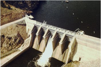
Coordinated releases from a series of Upper Colorado River Basin reservoirs [began Thursday June 3] and are anticipated to carry on through next week as part of the Coordinated Reservoirs Operations Program.

Managers of the reservoirs completed a conference call today, agreeing to voluntarily run the program this year. The program benefits the endangered fish of the Upper Colorado River Basin.

Green Mountain Reservoir, operated by the Bureau of Reclamation, will increase releases by 200 cubic feet per second (cfs) today and tomorrow. Releases will go up another 400 cfs on Saturday before reaching 1400 cfs in late afternoon. Releases from Green Mountain include inflows bypassed by Dillon Reservoir, operated by Denver Water.

Denver Water also operates Williams Fork Reservoir, which will continue to pass its inflows downstream. Outflows from Williams Fork are currently about 600 cfs but may increase over the weekend with increasing inflows.

Wolford Mountain Reservoir, operated by the Colorado River Water Conservation District, is currently passing inflows of approximately 500 cfs. Outflows will be increased to approximately 200 cfs above inflow by Saturday evening. Inflows may increase over the weekend, further increasing the outflows from Wolford Mountain Reservoir.

Increased outflows from the participating reservoirs may continue through Wednesday, June 9th. The Colorado Basin River Forecast Center (CBRFC) has incorporated these planned reservoir operations into their streamflow forecasts…

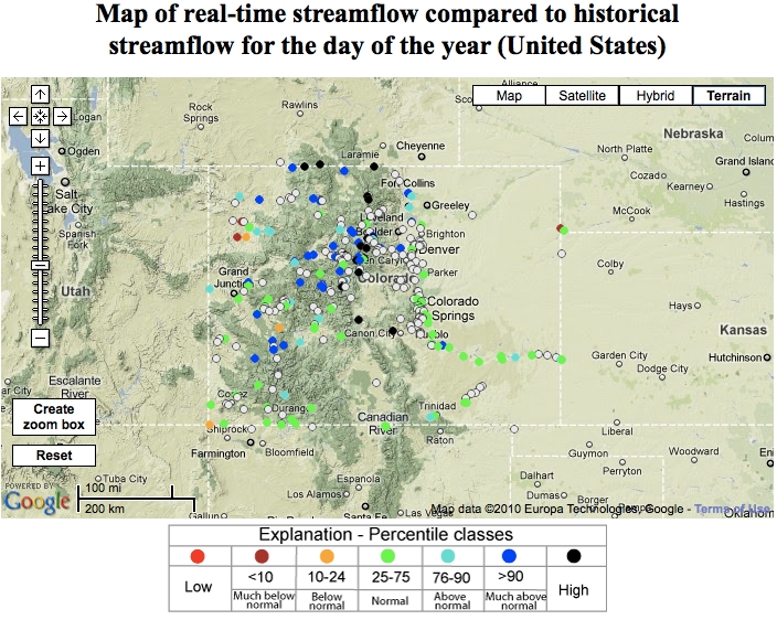
More detailed information about forecasted streamflows in the Colorado River basin are available from the CBRFC website at http://www.cbrfc.noaa.gov. A map-based interface allows viewing of hydrographs detailing recent, current and anticipated flows.

“The releases boosting this year’s Colorado River peak are a tonic that will make the river healthier, and that benefits everyone from water users, to recreation, and all the fish that call the river home,” said Bart Miller, Water Program Director for Western Resource Advocates. “All the parties that have come together to make this happen are to be commended.”

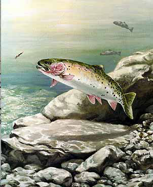
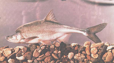
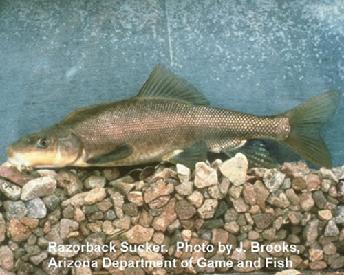
The Coordinated Reservoir Operations program was established in 1995 as part of the Upper Colorado River Endangered Fish Recovery Program. Its purpose is to enhance spring peak flows in a section of the Colorado River upstream of Grand Junction, Colo., determined critical to the survival of four endangered fish species: the humpback chub, razorback sucker, bonytail chub and the Colorado pikeminnow. In years with sufficient snowpack, surplus inflows to the reservoirs can be passed on downstream to benefit these fish.

For more information, contact Kara Lamb, Bureau of Reclamation’s Eastern Colorado Area Office, at (970) 962-4326, klamb@gp.usbr.gov; Jana Mohrman, U.S. Fish & Wildlife Service, at (303) 236-4486, jana_mohrman@usfws.gov or Michelle Garrison, Colorado Water Conservation Board, at (303) 866-3441, ext. 3213, michelle.garrison@state.co.us.

The Upper Colorado River Endangered Fish Recovery Program is a cooperative partnership of local, state and federal agencies, water developers, power customers and environmental groups established in 1988 to recover the endangered fishes while water development proceeds in accordance with federal and state laws and interstate compacts.

From The Durango Herald (Dale Rodebaugh):

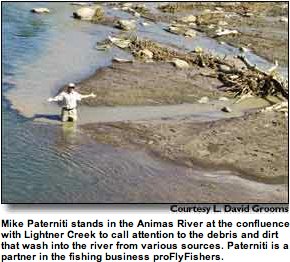
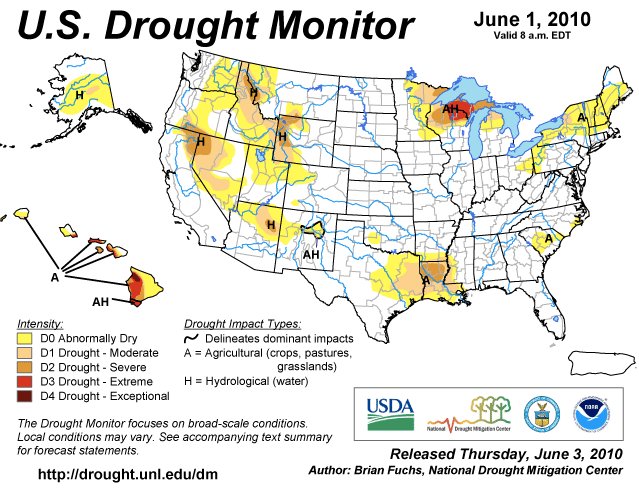
There’s a reason for the cafe au lait color of the roiling Animas River that was moving at 4,600 cubic feet a second at the beginning of the week. Mountain snow is melting like crazy, leaving the snowpack in the Animas, San Juan and Dolores watershed at a paltry 19 percent of the 30-year average. Statewide, as of Tuesday, the snowpack stood at 53 percent of average. The North Platte basin registered the highest percentage, 98, while the Arkansas basin was next to the bottom at 32 percent of average.

This year’s snow reserve in the Animas, San Juan and Dolores watershed is pathetic compared to June 1, 2009, when it was 123 percent of average. “Southern Colorado experienced the greatest decline in snowpack percentage in May, leaving only the higher elevations with any significant snow,” Allen Green with the Natural Resources Conservation Service said in a statement. “A general lack of precipitation since early April has decreased the outlook for runoff in the southwestern corner of the state.”[…]

Runoff filled reservoirs to 110 percent of the June 1 average statewide, compared to 95 percent last year, Green said. In the Animas, Dolores and San Juan watershed reservoir levels were 115 percent of average, compared with 96 percent last year. Hal Pierce, the superintendent at Vallecito Reservoir, said Thursday the scant snowpack won’t affect Vallecito. “I’m within two and one-half feet of filling,” Pierce said. “The water is coming up 6 to 8 inches a day, so we’ll fill or be darn close to it in five or six days.” Reservoir levels in the Gunnison and Colorado basins stood at 114 percent of the June 1 average. Rio Grande basin reservoirs had the lowest levels, 90 percent of average.

From the Montrose Daily Press (Joel Blocker):

The Lake Fork of the Gunnison River rushes toward Blue Mesa Reservoir just south of the Red Bridge campground 17 miles north of Lake City. The Lake Fork is running at 1,060 cubic feet per second, according to the USGS Real-Time Water Data for Colorado. This section is open to boaters from the Red Bridge Campground to the Gateview Campground. It’s the most challenging, thrilling stretch, with technical Class III waters that sometimes approach Class IV during high runoff.

From the Summit Daily News (Bryce Evans):

[Veteran river guide Duke Bradford] said the Blue is currently running well. And, as the river may hit its peak in the coming weeks — possibly even days — now’s the time to go down it. “It’s anyone’s guess how long it’ll last, but we should have at least a couple weeks,” he added about the Blue.

The Arkansas, however, is looking to have a long season, possibly past the end of August, due to high amounts of winter precipitation on Hoosier Pass. Bradford said the “Ark” is commonly consistent for boaters, as it has controlled releases from the reservoir.

Clear Creek, in the stretches near Idaho Springs, is already running well and should continue to do so until early August. “That’s the closest, most consistent whitewater we have,” Bradford said.

And in each of the rivers, Bradford said a boater of every ability can find the stretch that’s right for them.

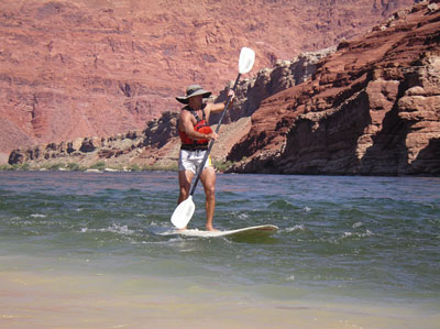
For instance, the Colorado River has arguably the best stretch of class IV and V rapids anywhere in the country in Gore Canyon near Kremmling. There’s a waterfall, long runs, and Bradford said the stretch is strictly for the “active and aggressive” boaters with a whole lot of experience. (Swimming tests — including recovery from under the raft — are required to paddle down the area.) On the other hand, the Colorado also offers some pretty leisurely paced float trips.

From The Grand Junction Daily Sentinel (Dennis Webb):

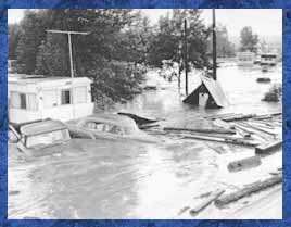
Mesa County officials are warning the public to expect a two-foot surge in water levels on the Colorado River this weekend. Warm temperatures will contribute to the increase, as will a coordinated release of water from reservoirs in the Upper Colorado River Basin to benefit endangered fish. Strong currents, cold water and debris dislodged by heavy flows will increase the danger of river travel, and the county is urging people to use caution on or near the river. The Mesa County Sheriff’s Department recommended that non-experienced boaters stay off the river, and said canoes, inner tubes and inflatable boats with single-chamber flotation should not be used under current conditions. It also said people always should use life vests on the water and refrain from drug and alcohol use on or near rivers…

Peak flows are expected early next week and should be right around average, said Bryon Lawrence, a hydrologist for the National Weather Service in Grand Junction. But average peak runoffs still demand plenty of respect from river visitors in western Colorado. “We always tell people several things this time of year, and one is never underestimate the force of fast-moving water,” Lawrence said. “And the waters are very cold. I think sometimes people underestimate that, too,” he said. The snowmelt-swollen Colorado River has a water temperature of about 50 degrees right now.

The Colorado River usually peaks between May 29 and June 18, so this year’s peak should arrive around the normal time, Lawrence said. Officials are predicting the river at Cameo will peak Monday night or Tuesday morning between 17,100 and 18,900 cubic feet per second. Its depth there could reach 10.5 feet. In years where conditions allow, the U.S. Bureau of Reclamation and other reservoir operators have agreed to joint releases during peak river flows to help flood river shallows upstream of Grand Junction. Those shallows are considered critical spawning habitat for the humpback chub, razorback sucker, bonytail chub and Colorado pikeminnow. Despite below-average snowpack this year, reservoir storage levels remain good, Lawrence said. Also, a cool spring helped preserve what snowpack there was, and spring storms in the central and northern mountains enhanced it, he said.

Flooding isn’t in the forecast, though. The only area of concern is the Elk River near Steamboat Springs, and even there it’s unlikely to flood, although it may fill the riverbank in places, he said.

From NBC11News.com (James Hopkins):

The coordinated reservoir operations program was established in 1985 to enhance spring peak flows in a section of the upper Colorado river that has been deemed critical for the survival of 4 endangered fish species, the Humpback Chub, Razorback Sucker, Bonytail Chub and the Colorado Pikeminnow. “We’re releasing 1400 CFM so we can reach this high peak flow,” says Hock. Reservoirs are able to bypass the flows because of the past few years of “good” snowpack. The higher river flows help get rid of the silt that builds up on the bottom of the river. “The eggs fall into the spaces between the cobble that were once filled with the silt,” says Osmundson. This gives the eggs a better chance of reaching maturity and hatching. It also increases the amount of food for the fish to eat.

It’s not only these endangered fish that benefit from the higher flows. “That also benefits the people who are fishing and rafting on the river as well,” says Hock. The reservoir release is planned to run through Tuesday next week with peak water levels expected to rise about two feet through town. A short inconvenience for some that will hopefully lead to a brighter future for our endangered species. “It’s been shown that years following higher in stream flows we have more years of reproduction of our endangered fish,” says Osmundson.

From The Fairplay Flume (Danny Ramey):

South Platte River between Eleven Mile and Spinney Mountain reservoirs – Flows for the “Dream Stream” have been around 63.6 cubic feet per second lately…

South Platte River near Deckers – The flows on this portion of the river continue to be low, running between 60-70 cfs.

From email from Reclamation (Kara Lamb):

We have the Ruedi Weather Station available on-line! Please visit the Weather Station at www.usbr.gov/gp/ecao/ruediweatherstation.html. It displays current air temperature, wind speeds, humidity and more. Additionally, because it uses the same transmission system as our water gages, the Weather Station Website also displays water level elevation and reservoir content.

Releases from the dam to the Fryingpan are about 90 cfs. We have not made any changes. However, the Rocky Fork is picking up snow melt and flowing pretty well. I believe the gage below the dam is reading about 125 cfs.

Estes Park: Grand Ditch Restoration Project public meeting recap

A picture named grandditch

From the Loveland Reporter-Herald (Jackie Hutchins):

Rocky Mountain National Park officials outlined Thursday night plans they’re considering to repair damage caused when the Grand Ditch, on the park’s northwest side, overtopped its bank on May 30, 2003…

They want to restore stream and groundwater processes, native plant communities, the stability of the hillside below the breach site, wilderness character, wildlife habitat and water quality in the affected area and downstream. Options being considered include allowing natural passive restoration to take place in some spots where appropriate, stabilizing steep, unstable slopes with an engineered solution, removing deposited sediment or redistributing it through the area, removing downed timber or using it in the restoration process, grading and recontouring areas to restore appropriate water flows, and actively restoring native plants where appropriate using locally gathered plants.

Crews might have to use motorized equipment such as chain saws, heavy-lift helicopters and earth-moving equipment — equipment not typically used in a wilderness area. “It is one of the most wild areas of the park,” Grand Ditch Breach Restoration coordinator Paul McLaughlin said. Though it’s not the most popular part of the park for visitors, lynx have been tracked there, and wolverines use the area.

Public comment to solicit ideas for the restoration is being taken through June 16. “Later this fall, we’ll be coming back to you with our alternatives,” McLaughlin said. A draft environmental statement should be released in fall 2011, with the final environmental impact statement done by summer 2012.

More Grand Ditch coverage here and here.

American Rivers: Upper Colorado is sixth most endangered river in U.S.

A picture named fraservalleycollection

From the Fort Collins Coloradoan (Bobby Magill):

American Rivers’ threatened river report mentioned Northern Colorado Water Conservancy District’s Windy Gap Firming Project as one of the Colorado River’s biggest threats. The project would divert more water from the river to be pumped to a new reservoir near Carter Lake in southern Larimer County to provide a reliable water supply for growing Northern Colorado communities. The U.S. Army Corps of Engineers is expected to issue an environmental impact report on the project soon, with a final decision expected by the end of the year.

The report also says another proposed diversion project, the Moffat Collection System Project, will also harm the river.

[Ken Neubecker of Colorado Trout Unlimited] said he’s concerned water diversions from the Colorado River will harm the river’s natural hydrograph, preventing the river’s spring high flow from occurring. “If you don’t have that high flow in the spring, you can’t wash the sediments out, mobilize the bottom of the (river) bed,” something that’s critical for fish and other wildlife in the river, he said.

But Brian Werner, spokesman for Northern Water, said the district is working out a plan to provide enough water in the river for the fish at critical times during each season and ensuring the water temperature is right for the fish to thrive. He said the district has been successfully negotiating with Trout Unlimited and Grand County to ensure their concerns are heard. “We’d like to work it out so the operations (of the diversion projects) are flexible enough so the river doesn’t suffer any more harm,” and Front Range communities can get the water they need, too, Neubecker said.

More Colorado River Basin coverage here.

Republican River Basin: Latest round of arbitration over Colorado’s proposed compliance pipeline ends with mixed bag of winners and losers

A picture named republicanriverbasin

From The Yuma Pioneer (Tony Rayl):

Among [arbitrator Martha Pagel’s] findings was one in regards to Colorado’s motion to have Kansas’ issue pertaining to overuse of the South Fork of the Republican River be dismissed. Pagel denied the motion, keeping the South Fork issue in the arbitration. Kansas has not requested arbitration on the issue, but it is one of the reason’s the state is withholding its approval for the pipeline. Kansas asserts putting water in the North Fork does not make up for the shortage on the South Fork. Pagel ruled that, whether hypothetical or real, “the question of whether overuse in one sub-basin may be addressed by replacing flow in another sub-basin is relevant to a factual determination of what the CCP (Compact Compliance Pipeline) includes.

Colorado did have another motion granted. It is in regards requesting that portions of a statement made by Kansas Chief Engineer David Barfield regarding the pipeline issue be stricken. Colorado argued that Barfield was making future interpretations of the requirements. Pagel noted that the testimony would not make or break the case. However, she ruled that a plain reading of the statement “reveals a conclusion of law regarding the interpretation, of certain sections in the final stipulation settlement. Therefore, she ruled to strike the statement.

Included with the pipeline in the arbitration is a question on crediting brought forth by Nebraska. Kansas filed a motion to entirely strike the issue from the arbitration hearing, but Pagel ruled against the motion. Nebraska is trying to get determined that if a state pays monetary damages for being out of compliance, what year or years in the five-year rolling average would get credited to zero.

And, of course, Kansas had filed a motion that the whole compact compliance pipeline issues should be dismissed in its entirety. Pagel denied the motion. Kansas had argued that the U.S. Supreme Court lacks the jurisdiction to approve the pipeline plan, nor does an arbitractor, because the Republican River Compact Administration (RRCA) did not grant approval. The state argued that since the RRCA declined to approve the plan, as expressly stated in the final settlement as necessary, then it cannot move on to the arbitrator or the Supreme Court. Extensively quoting case law, particularly Texas v. New Mexico, Pagel ruled the issue can move forward. She suggested that, if the states do not want the final settlement to be so broadly construed, they might want to consider modifying the final settlement to narrow the scope of issues subject to arbitration…

The actual arbitration trial is set for July 12-14 in Kansas City, Kansas.

More Republican River Basin coverage here and here.